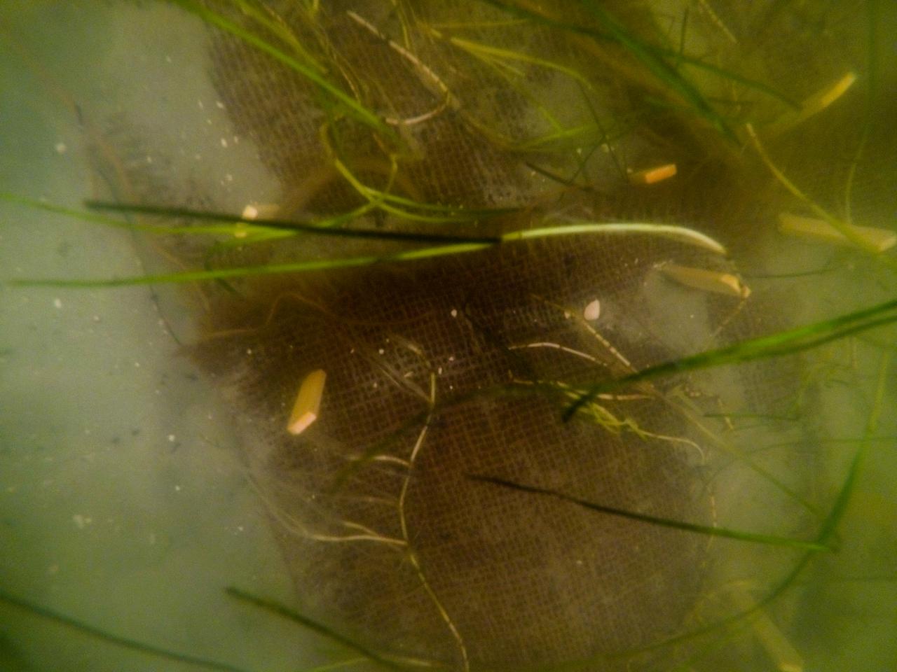
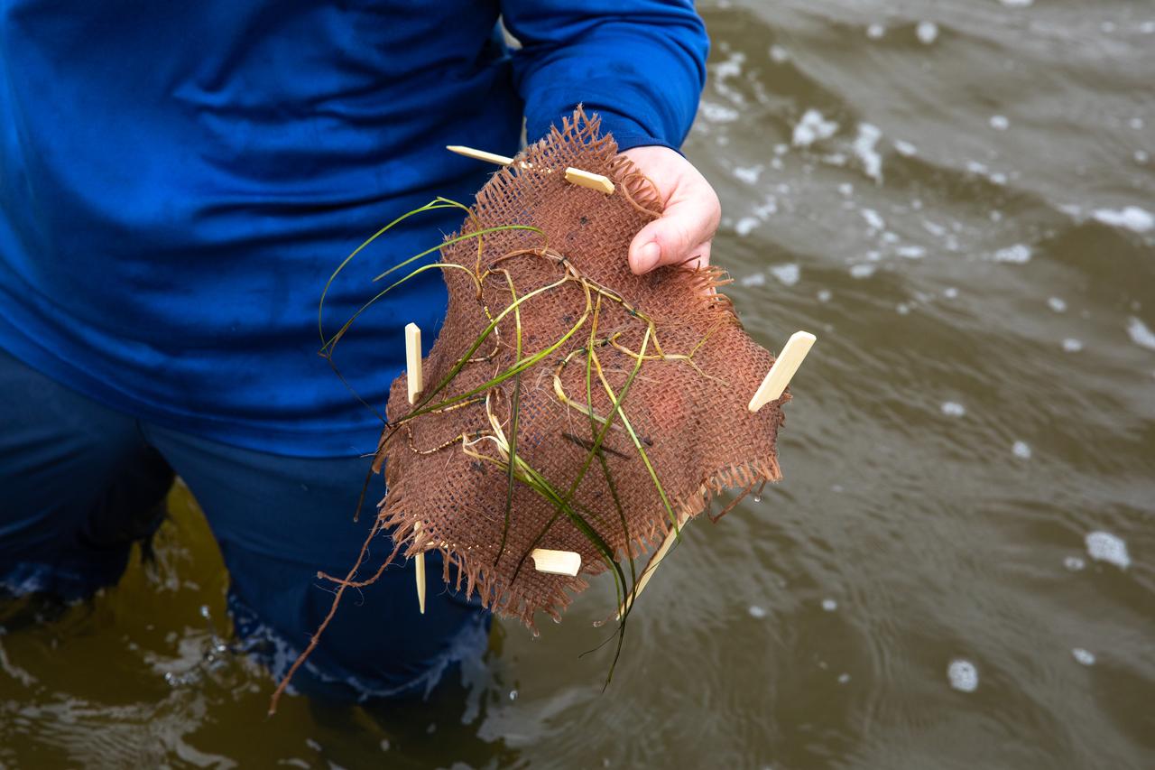
Seen here is a close-up view of newly planted seagrass in the Banana River – one of three bodies of water that make up the Indian River Lagoon (IRL) – at NASA’s Kennedy Space Center in Florida on March 29, 2023. Kennedy’s Environmental Management Branch is working to plant a minimum of 28,000 shoots of seagrass divided into 18 sites across three areas at the Florida spaceport as part of a pilot project for seagrass restoration efforts. Each “plot” of seagrass contains 16 shoots tied to a burlap mesh square with floral ties and has bamboo skewers at each corner that are staked into the sediment. The project, which involves using all biodegradable materials, will look at the feasibility of replanting seagrass in Kennedy waters and, if successful, could lead to the spaceport becoming a donor site where shoots of grass can be broken off and relocated to other areas within Kennedy or along the Indian River Lagoon to promote growth.
Members of the Florida Oceanographic Society plant seagrass in the Banana River – one of three bodies of water that make up the Indian River Lagoon (IRL) – at NASA’s Kennedy Space Center in Florida on March 29, 2023. Kennedy’s Environmental Management Branch is working to plant a minimum of 28,000 shoots of seagrass divided into 18 sites across three areas at the Florida spaceport as part of a pilot project for seagrass restoration efforts. The project will look at the feasibility of replanting seagrass in Kennedy waters and, if successful, could lead to the spaceport becoming a donor site where shoots of grass can be broken off and relocated to other areas within Kennedy or along the IRL to promote growth.

Lorae Simpson, director of research and conservation with the Florida Oceanographic Society, prepares to plant seagrass in the Banana River – one of three bodies of water that make up the Indian River Lagoon (IRL) – at NASA’s Kennedy Space Center in Florida on March 29, 2023. Kennedy’s Environmental Management Branch is working to plant a minimum of 28,000 shoots of seagrass divided into 18 sites across three areas at the Florida spaceport as part of a pilot project for seagrass restoration efforts. Each “plot” of seagrass contains 16 shoots tied to a burlap mesh square with floral ties and has bamboo skewers at each corner that are staked into the sediment. The project, which involves using all biodegradable materials, will look at the feasibility of replanting seagrass in Kennedy waters and, if successful, could lead to the spaceport becoming a donor site where shoots of grass can be broken off and relocated to other areas within Kennedy or along the Indian River Lagoon to promote growth.
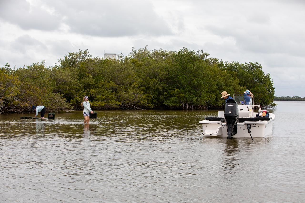
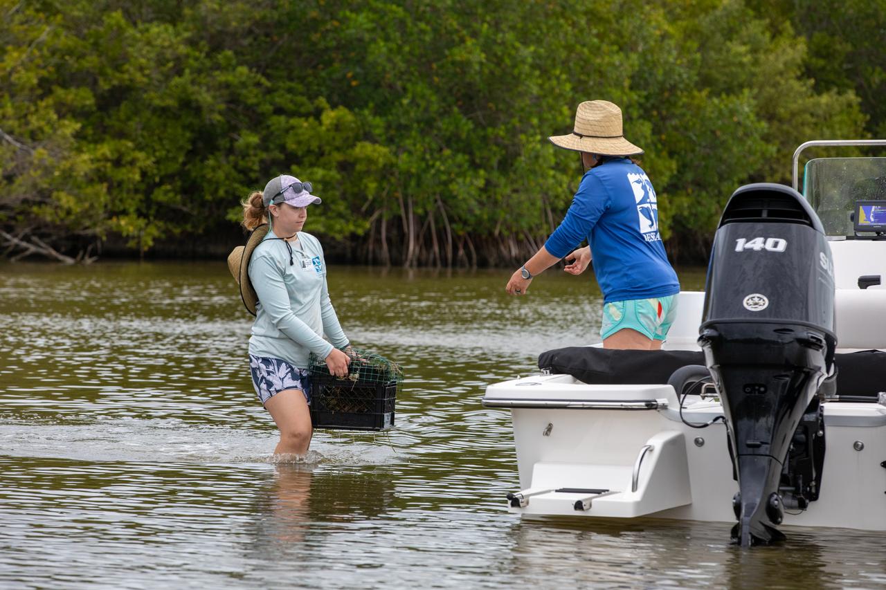
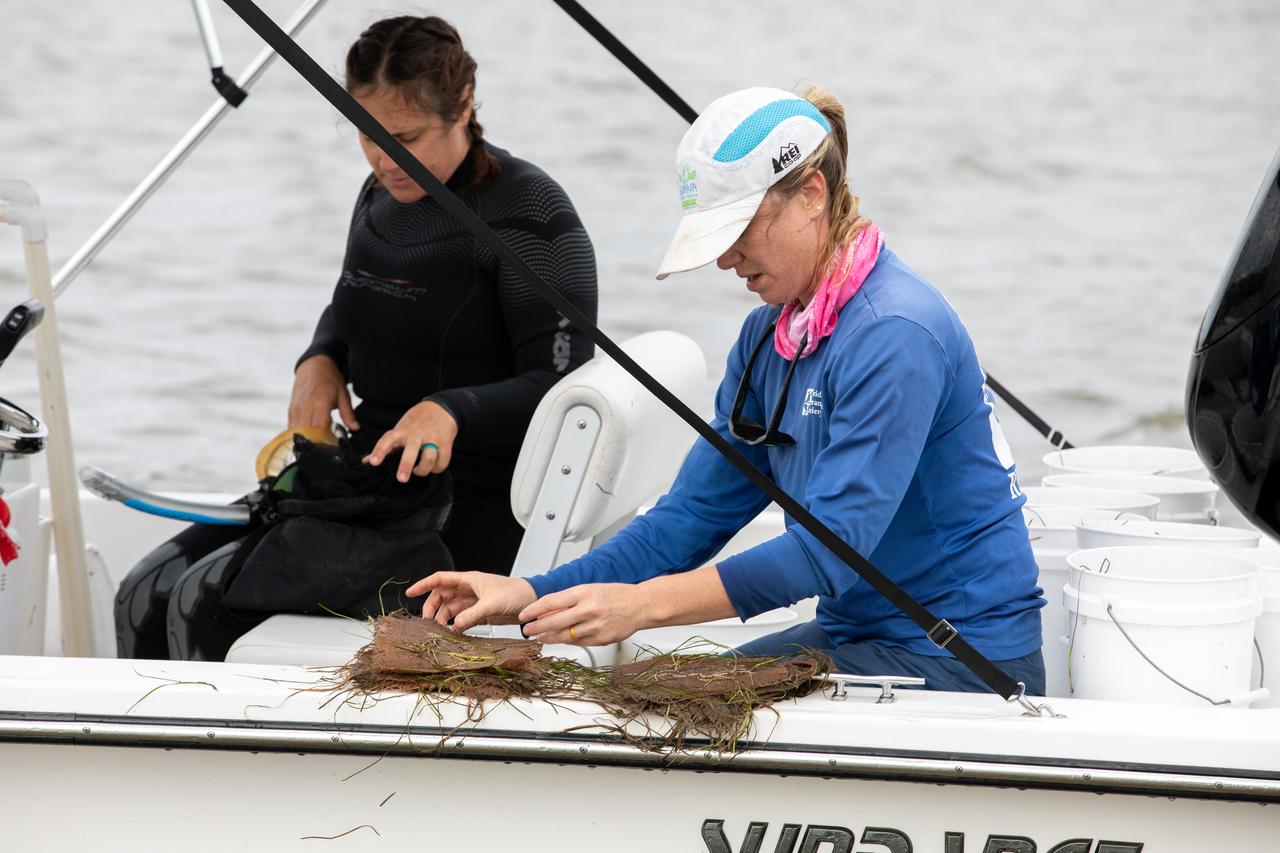
Members of the Florida Oceanographic Society collect mats of seagrass from their storage site at NASA’s Kennedy Space Center in Florida as they prepare to plant them in the Banana River – one of three bodies of water that make up the Indian River Lagoon (IRL) – on March 29, 2023. Kennedy’s Environmental Management Branch is working to plant a minimum of 28,000 shoots of seagrass divided into 18 sites across three areas at the Florida spaceport as part of a pilot project for seagrass restoration efforts. The project will look at the feasibility of replanting seagrass in Kennedy waters and, if successful, could lead to the spaceport becoming a donor site where shoots of grass can be broken off and relocated to other areas within Kennedy or along the IRL to promote growth.

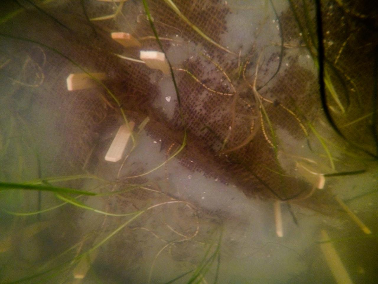
Seen here is a close-up view of one “plot” of seagrass being planted in the Banana River – one of three bodies of water that make up the Indian River Lagoon (IRL) – at NASA’s Kennedy Space Center in Florida on March 29, 2023. Kennedy’s Environmental Management Branch is working to plant a minimum of 28,000 shoots of seagrass divided into 18 sites across three areas at the Florida spaceport as part of a pilot project for seagrass restoration efforts. Each “plot” of seagrass contains 16 shoots tied to a burlap mesh square with floral ties and has bamboo skewers at each corner that are staked into the sediment. The project, which involves using all biodegradable materials, will look at the feasibility of replanting seagrass in Kennedy waters and, if successful, could lead to the spaceport becoming a donor site where shoots of grass can be broken off and relocated to other areas within Kennedy or along the Indian River Lagoon to promote growth.
Members of the Florida Oceanographic Society collect mats of seagrass from their storage site at NASA’s Kennedy Space Center in Florida as they prepare to plant them in the Banana River – one of three bodies of water that make up the Indian River Lagoon (IRL) – on March 29, 2023. Kennedy’s Environmental Management Branch is working to plant a minimum of 28,000 shoots of seagrass divided into 18 sites across three areas at the Florida spaceport as part of a pilot project for seagrass restoration efforts. The project will look at the feasibility of replanting seagrass in Kennedy waters and, if successful, could lead to the spaceport becoming a donor site where shoots of grass can be broken off and relocated to other areas within Kennedy or along the IRL to promote growth.
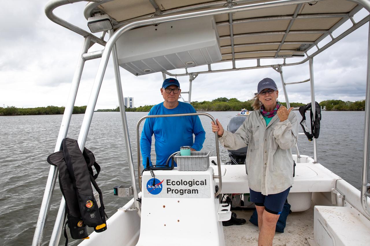
Kennedy Space Center’s Doug Scheidt (left), an ecologist working on NASA’s Environmental and Medical Contract (NEMCON), and Jane Provancha, manager of the ecological group for NEMCON, oversee seagrass restoration efforts at the Florida spaceport on March 29, 2023. Kennedy’s Environmental Management Branch is working to plant a minimum of 28,000 shoots of seagrass divided into 18 sites across three areas at the Florida spaceport as part of a pilot project for seagrass restoration efforts. The project will look at the feasibility of replanting seagrass in Kennedy waters and, if successful, could lead to the spaceport becoming a donor site where shoots of grass can be broken off and relocated to other areas within Kennedy or along the Indian River Lagoon to promote growth.
Seen here is a close-up view of one “plot” of seagrass being planted in the Banana River – one of three bodies of water that make up the Indian River Lagoon (IRL) – at NASA’s Kennedy Space Center in Florida on March 29, 2023. Kennedy’s Environmental Management Branch is working to plant a minimum of 28,000 shoots of seagrass divided into 18 sites across three areas at the Florida spaceport as part of a pilot project for seagrass restoration efforts. Each “plot” of seagrass contains 16 shoots tied to a burlap mesh square with floral ties and has bamboo skewers at each corner that are staked into the sediment. The project, which involves using all biodegradable materials, will look at the feasibility of replanting seagrass in Kennedy waters and, if successful, could lead to the spaceport becoming a donor site where shoots of grass can be broken off and relocated to other areas within Kennedy or along the Indian River Lagoon to promote growth.
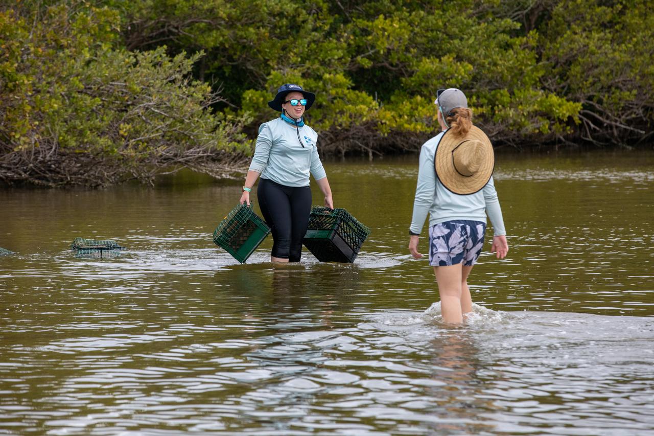
Members of the Florida Oceanographic Society prepare to plant seagrass in the Banana River – one of three bodies of water that make up the Indian River Lagoon (IRL) – at NASA’s Kennedy Space Center in Florida on March 29, 2023. Kennedy’s Environmental Management Branch is working to plant a minimum of 28,000 shoots of seagrass divided into 18 sites across three areas at the Florida spaceport as part of a pilot project for seagrass restoration efforts. The project will look at the feasibility of replanting seagrass in Kennedy waters and, if successful, could lead to the spaceport becoming a donor site where shoots of grass can be broken off and relocated to other areas within Kennedy or along the IRL to promote growth.
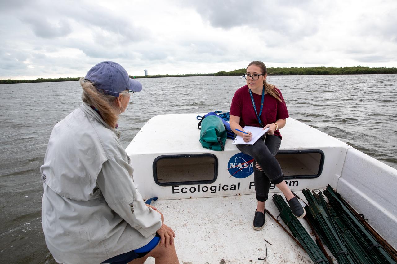
Kennedy Space Center Public Affairs Writer Danielle Sempsrott (right) interviews Jane Provancha, manager of the ecological group for NASA’s Environmental and Medical Contract (NEMCON) at Kennedy, for a web feature highlighting seagrass restoration efforts taking place at the Florida spaceport on March 29, 2023. Kennedy’s Environmental Management Branch is working to plant a minimum of 28,000 shoots of seagrass divided into 18 sites across three areas at the Florida spaceport as part of a pilot project for seagrass restoration efforts. The project will look at the feasibility of replanting seagrass in Kennedy waters and, if successful, could lead to the spaceport becoming a donor site where shoots of grass can be broken off and relocated to other areas within Kennedy or along the Indian River Lagoon to promote growth.
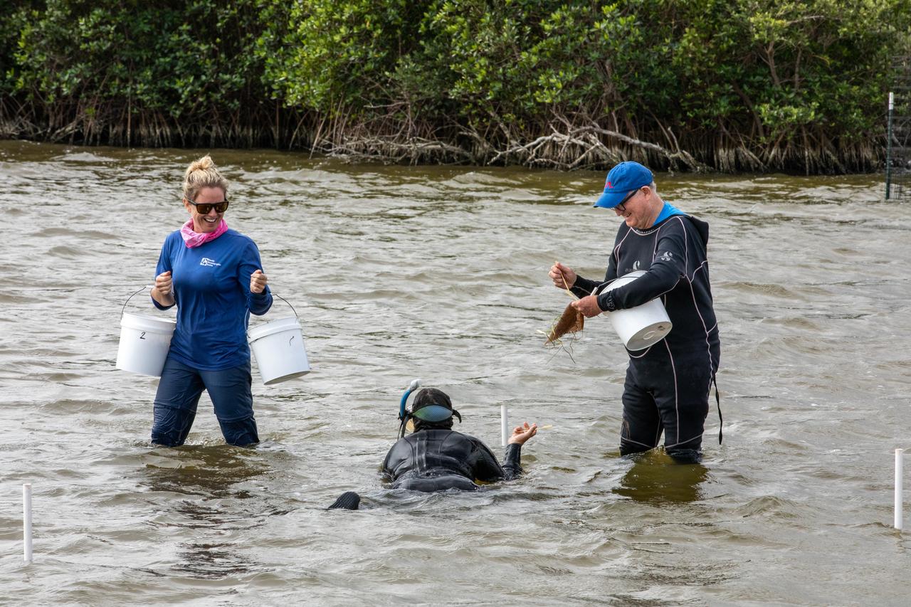
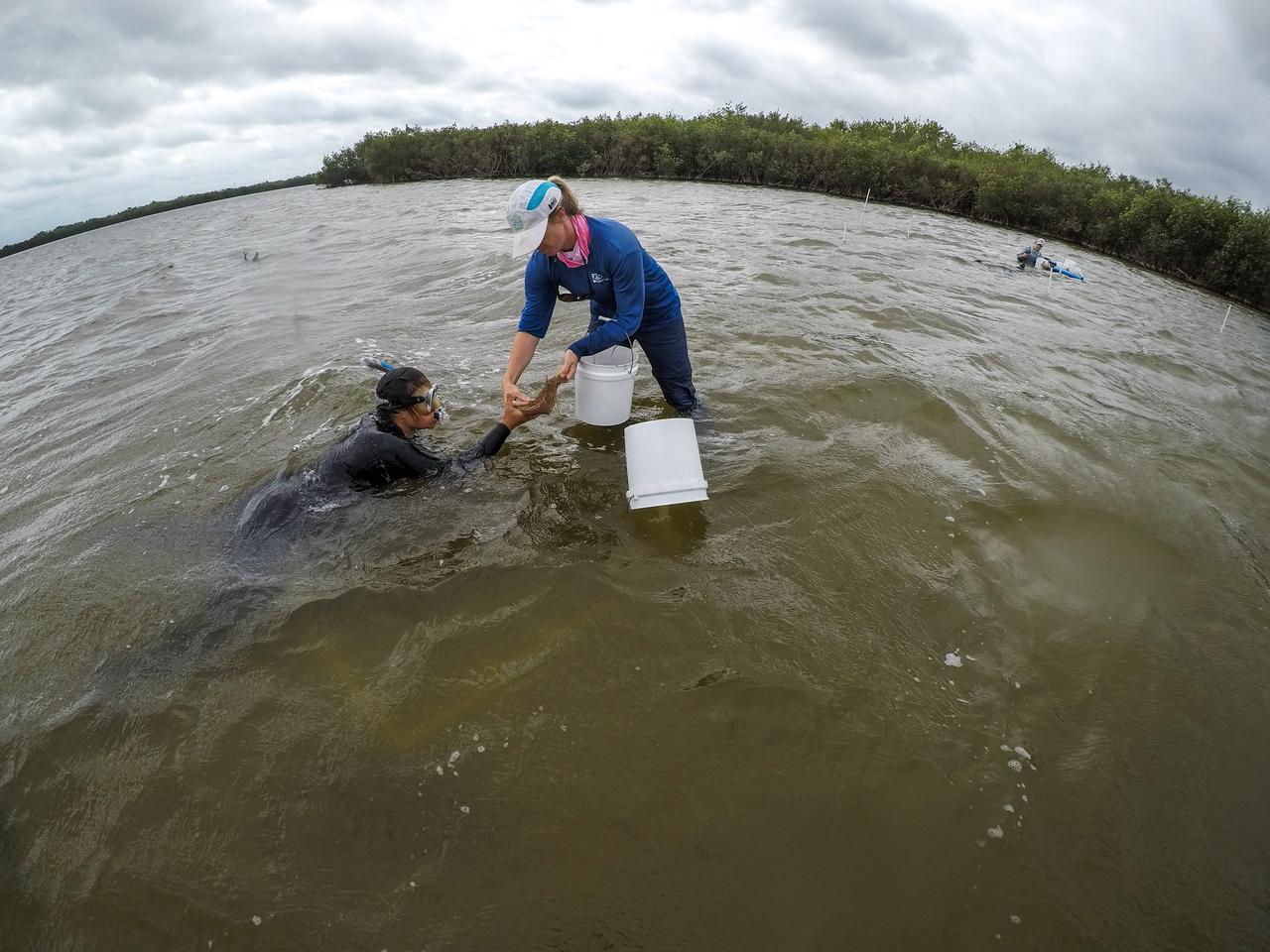
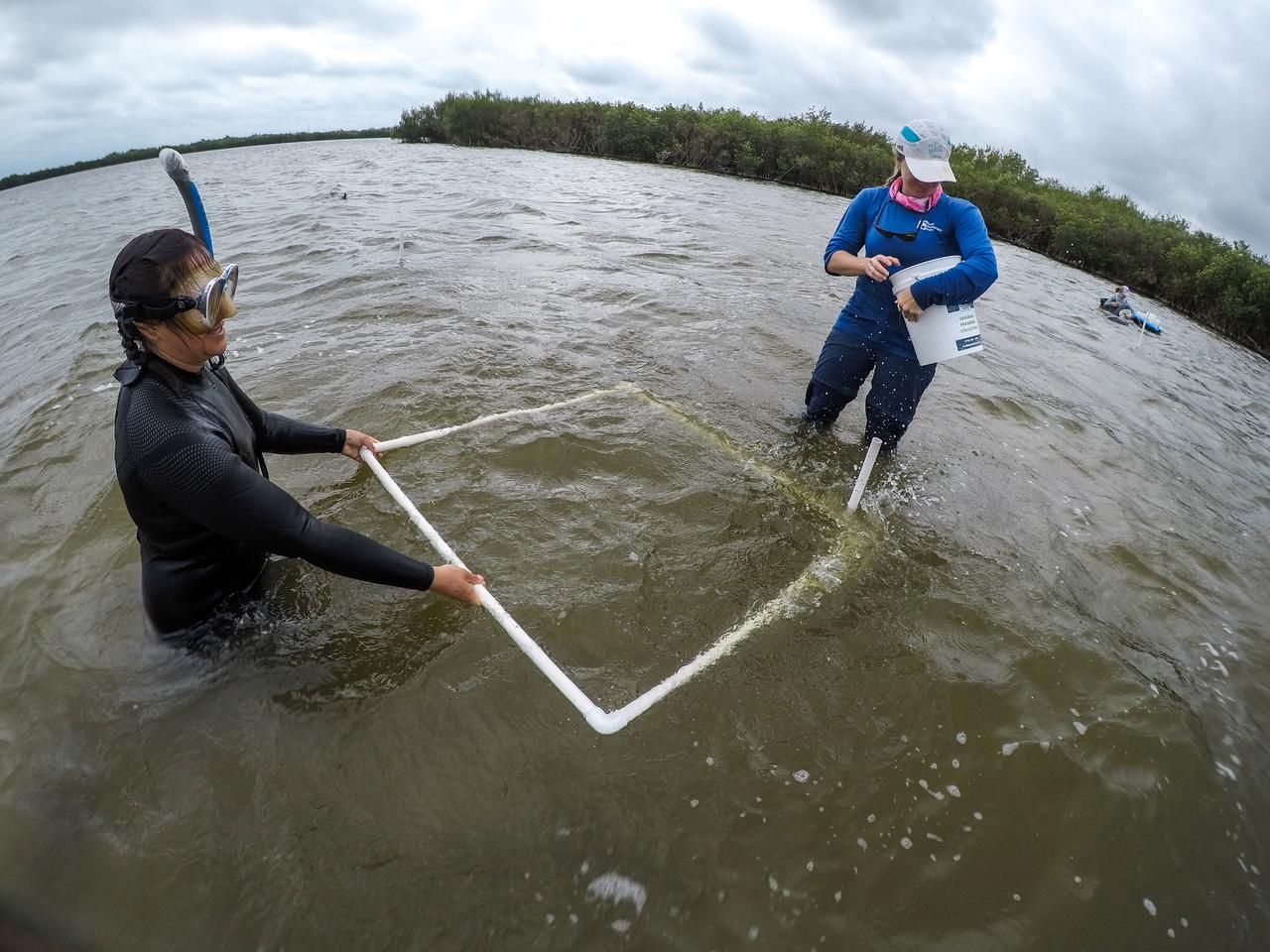
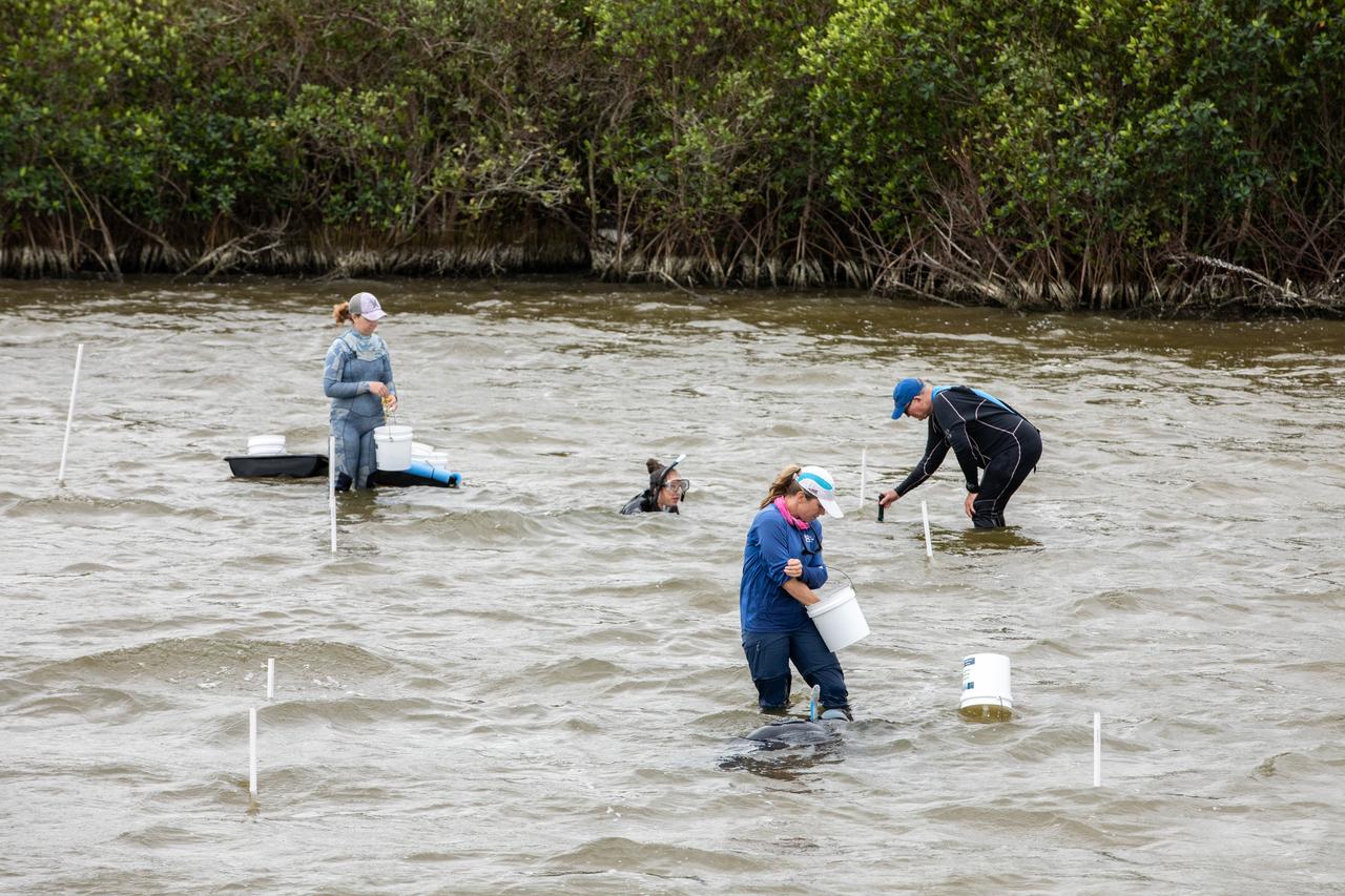
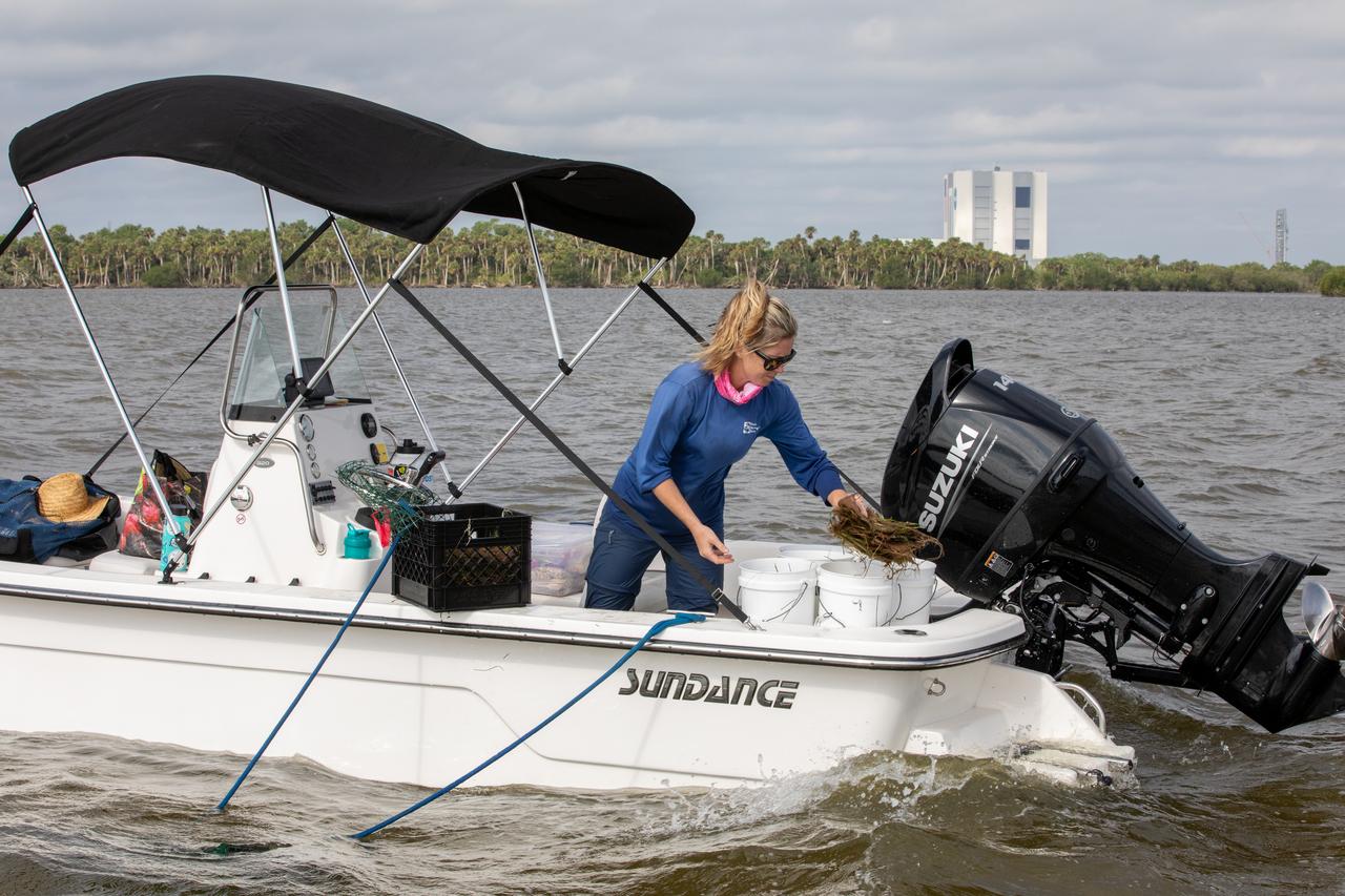
Lorae Simpson (left), director of research and conservation with the Florida Oceanographic Society, and Doug Scheidt (right), an ecologist working on NASA’s Environmental and Medical Contract (NEMCON), begin planting seagrass in the Banana River – one of three bodies of water that make up the Indian River Lagoon (IRL) – at NASA’s Kennedy Space Center in Florida on March 29, 2023. Scheidt is handing each “plot” of seagrass to another Florida Oceanographic Society member in the water, who then uses bamboo skewers to stake each one into the sediment. Kennedy’s Environmental Management Branch is working to plant a minimum of 28,000 shoots of seagrass divided into 18 sites across three areas at the Florida spaceport as part of a pilot project for seagrass restoration efforts. The project will look at the feasibility of replanting seagrass in Kennedy waters and, if successful, could lead to the spaceport becoming a donor site where shoots of grass can be broken off and relocated to other areas within Kennedy or along the IRL to promote growth.
Members of the Florida Oceanographic Society collect mats of seagrass from their storage site at NASA’s Kennedy Space Center in Florida as they prepare to plant them in the Banana River – one of three bodies of water that make up the Indian River Lagoon (IRL) – on March 29, 2023. Kennedy’s Environmental Management Branch is working to plant a minimum of 28,000 shoots of seagrass divided into 18 sites across three areas at the Florida spaceport as part of a pilot project for seagrass restoration efforts. The project will look at the feasibility of replanting seagrass in Kennedy waters and, if successful, could lead to the spaceport becoming a donor site where shoots of grass can be broken off and relocated to other areas within Kennedy or along the IRL to promote growth.
Seen here is a close-up view of newly planted seagrass in the Banana River – one of three bodies of water that make up the Indian River Lagoon (IRL) – at NASA’s Kennedy Space Center in Florida on March 29, 2023. Kennedy’s Environmental Management Branch is working to plant a minimum of 28,000 shoots of seagrass divided into 18 sites across three areas at the Florida spaceport as part of a pilot project for seagrass restoration efforts. Each “plot” of seagrass contains 16 shoots tied to a burlap mesh square with floral ties and has bamboo skewers at each corner that are staked into the sediment. The project, which involves using all biodegradable materials, will look at the feasibility of replanting seagrass in Kennedy waters and, if successful, could lead to the spaceport becoming a donor site where shoots of grass can be broken off and relocated to other areas within Kennedy or along the Indian River Lagoon to promote growth.
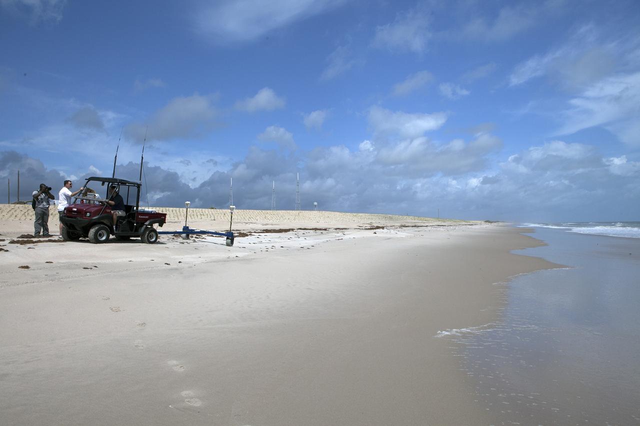
Members of the Florida Oceanographic Society begin planting seagrass in the Banana River – one of three bodies of water that make up the Indian River Lagoon (IRL) – at NASA’s Kennedy Space Center in Florida on March 29, 2023. At the top right is Doug Scheidt, an ecologist working on NASA’s Environmental and Medical Contract at Kennedy. Kennedy’s Environmental Management Branch is working to plant a minimum of 28,000 shoots of seagrass divided into 18 sites across three areas at the Florida spaceport as part of a pilot project for seagrass restoration efforts. The project will look at the feasibility of replanting seagrass in Kennedy waters and, if successful, could lead to the spaceport becoming a donor site where shoots of grass can be broken off and relocated to other areas within Kennedy or along the IRL to promote growth.
Lorae Simpson, director of research and conservation with the Florida Oceanographic Society, gathers “plots” of seagrass as her team prepares to plant them in the Banana River – one of three bodies of water that make up the Indian River Lagoon (IRL) – at NASA’s Kennedy Space Center in Florida on March 29, 2023. Kennedy’s Environmental Management Branch is working to plant a minimum of 28,000 shoots of seagrass divided into 18 sites across three areas at the Florida spaceport as part of a pilot project for seagrass restoration efforts. The project will look at the feasibility of replanting seagrass in Kennedy waters and, if successful, could lead to the spaceport becoming a donor site where shoots of grass can be broken off and relocated to other areas within Kennedy or along the IRL to promote growth.
Lorae Simpson, director of research and conservation with the Florida Oceanographic Society, gathers “plots” of seagrass as her team prepares to plant them in the Banana River – one of three bodies of water that make up the Indian River Lagoon (IRL) – at NASA’s Kennedy Space Center in Florida on March 29, 2023. Kennedy’s Environmental Management Branch is working to plant a minimum of 28,000 shoots of seagrass divided into 18 sites across three areas at the Florida spaceport as part of a pilot project for seagrass restoration efforts. The project will look at the feasibility of replanting seagrass in Kennedy waters and, if successful, could lead to the spaceport becoming a donor site where shoots of grass can be broken off and relocated to other areas within Kennedy or along the IRL to promote growth.
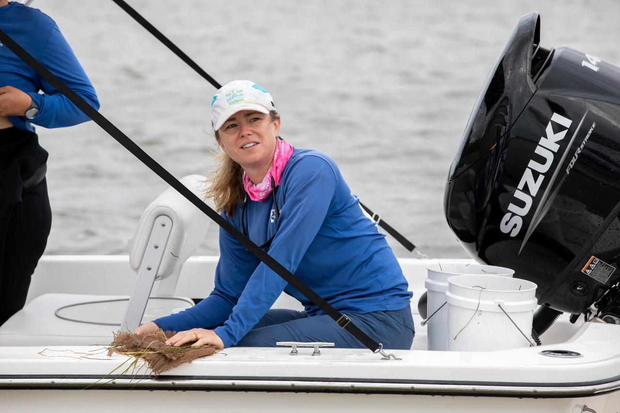
Lorae Simpson, director of research and conservation with the Florida Oceanographic Society, gathers “plots” of seagrass as her team prepares to plant them in the Banana River – one of three bodies of water that make up the Indian River Lagoon (IRL) – at NASA’s Kennedy Space Center in Florida on March 29, 2023. Kennedy’s Environmental Management Branch is working to plant a minimum of 28,000 shoots of seagrass divided into 18 sites across three areas at the Florida spaceport as part of a pilot project for seagrass restoration efforts. The project will look at the feasibility of replanting seagrass in Kennedy waters and, if successful, could lead to the spaceport becoming a donor site where shoots of grass can be broken off and relocated to other areas within Kennedy or along the IRL to promote growth.
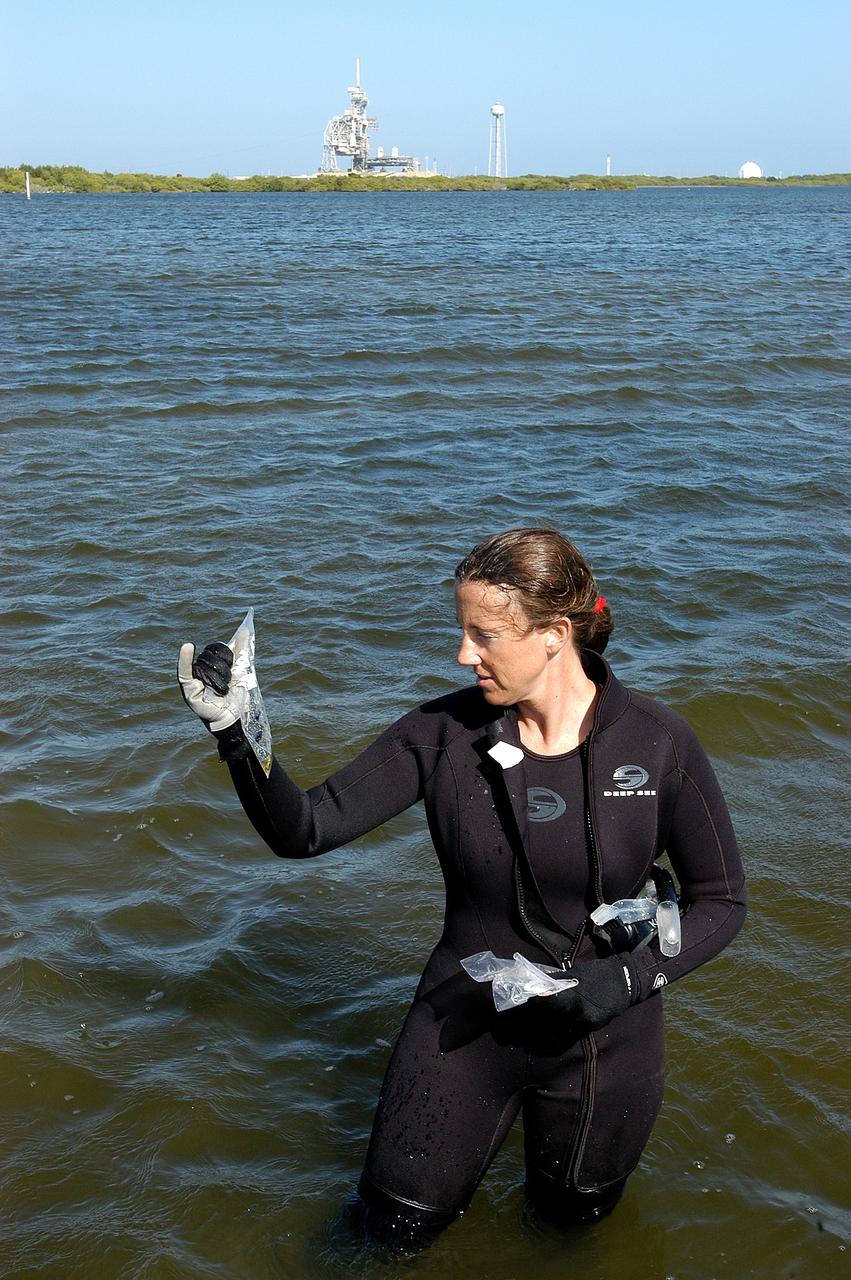
KENNEDY SPACE CENTER, FLA. - Karen Holloway-Adkins, KSC wildlife specialist, holds a sample of the sea grass she collected from the floor of the Banana River. She is studying the life history of sea turtles, especially what they eat, where they lay their eggs and what factors might harm their survival. On the boat trip she is also monitoring the growth of sea grasses and algae and the water quality of estuaries and lagoons used by sea turtles and other aquatic wildlife.
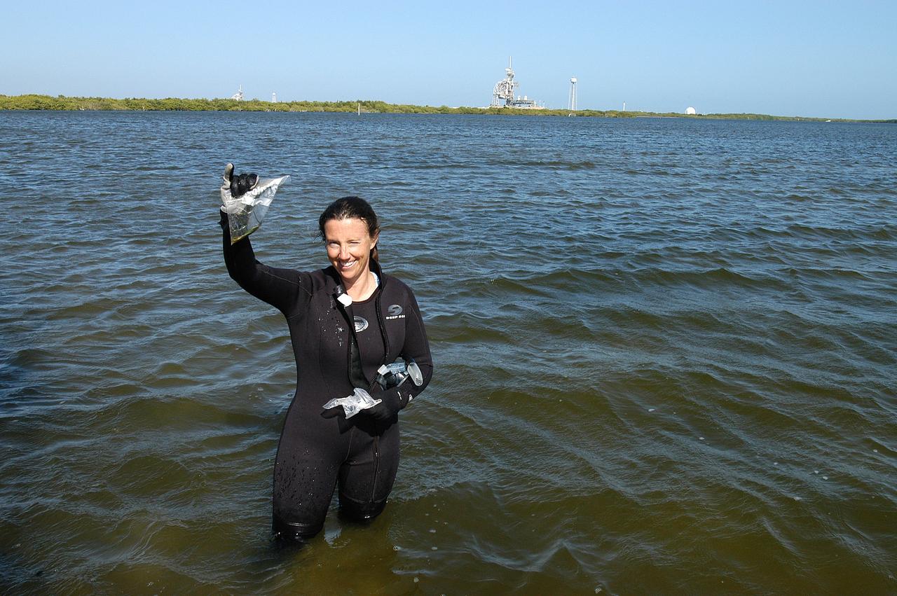
KENNEDY SPACE CENTER, FLA. - Karen Holloway-Adkins, KSC wildlife specialist, shows a sample of the sea grass she collected from the floor of the Banana River. She is studying the life history of sea turtles, especially what they eat, where they lay their eggs and what factors might harm their survival. On the boat trip she is also monitoring the growth of sea grasses and algae and the water quality of estuaries and lagoons used by sea turtles and other aquatic wildlife.
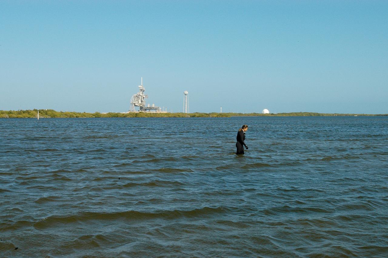
KENNEDY SPACE CENTER, FLA. - Karen Holloway-Adkins, KSC wildlife specialist, searches the Banana River for a grass specimen. In the background is one of the launch pads. The biologist is studying the life history of sea turtles, especially what they eat, where they lay their eggs and what factors might harm their survival. On the boat trip she is also monitoring the growth of sea grasses and algae and the water quality of estuaries and lagoons used by sea turtles and other aquatic wildlife.
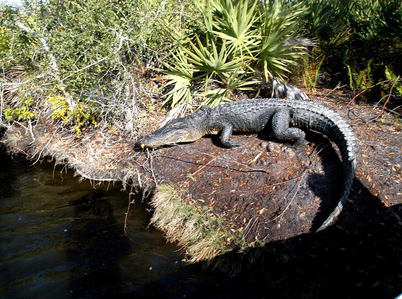
KENNEDY SPACE CENTER, FLA. - As Karen Holloway-Adkins, KSC wildlife specialist, begins a tour of the Banana River, this alligator sunning itself attracts attention. Holloway-Adkins is studying the life history of sea turtles, especially what they eat, where they lay their eggs and what factors might harm their survival. On the boat trip she is also monitoring the growth of sea grasses and algae and the water quality of estuaries and lagoons used by sea turtles and other aquatic wildlife.
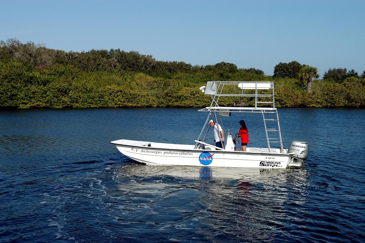
KENNEDY SPACE CENTER, FLA. - Karen Holloway-Adkins, KSC wildlife specialist, at the helm of a boat on the Banana River, heads for a research area. She is studying the life history of sea turtles, especially what they eat, where they lay their eggs and what factors might harm their survival. On the boat trip she is also monitoring the growth of sea grasses and algae and the water quality of estuaries and lagoons used by sea turtles and other aquatic wildlife.
KENNEDY SPACE CENTER, FLA. - Karen Holloway-Adkins, KSC wildlife specialist, takes the helm on the boat as she begins a tour of the Banana River. She is studying the life history of sea turtles, especially what they eat, where they lay their eggs and what factors might harm their survival. On the boat trip she is also monitoring the growth of sea grasses and algae and the water quality of estuaries and lagoons used by sea turtles and other aquatic wildlife.
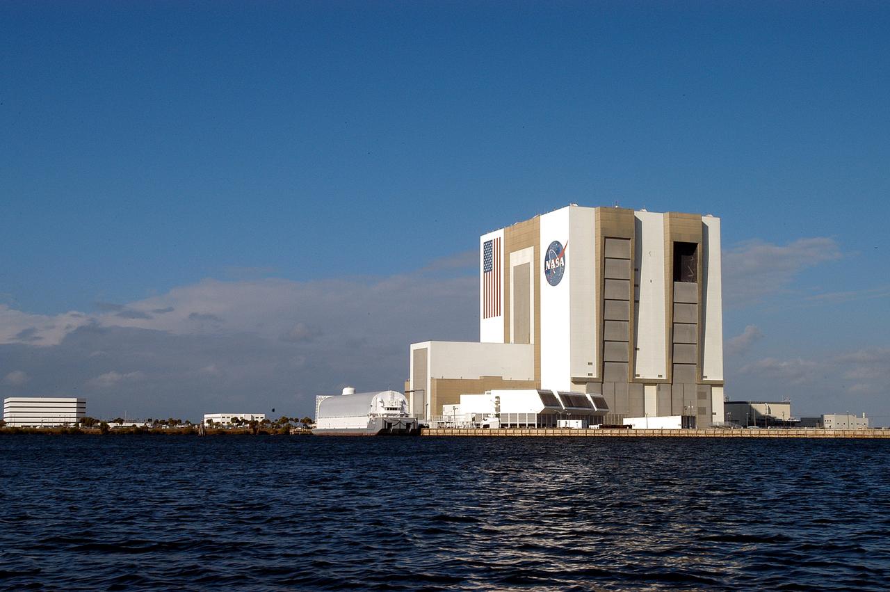
KENNEDY SPACE CENTER, FLA. - From a boat on the Banana River the Vehicle Assembly Building looms over the water. The boat holds Karen Holloway-Adkins, KSC wildlife specialist, who is studying the life history of sea turtles, especially what they eat, where they lay their eggs and what factors might harm their survival. On the boat trip she is also monitoring the growth of sea grasses and algae and the water quality of estuaries and lagoons used by sea turtles and other aquatic wildlife.
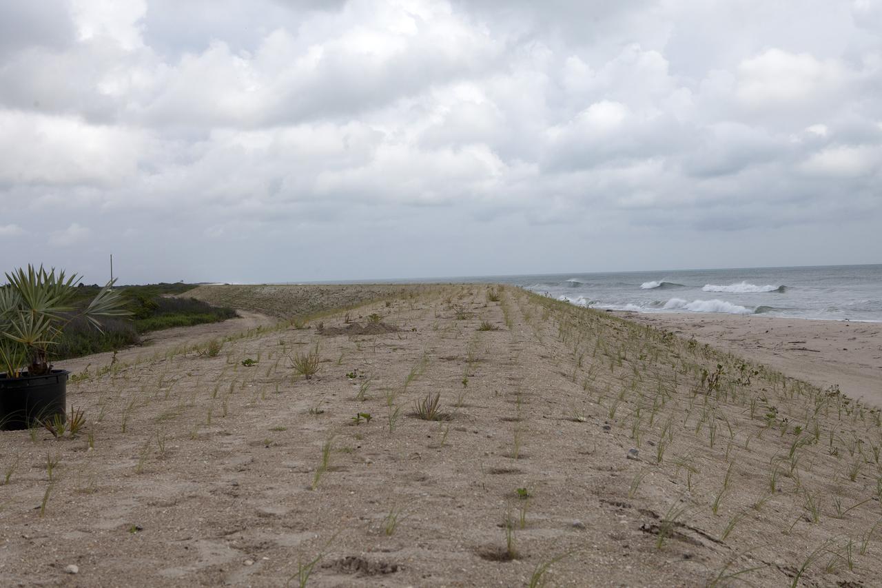
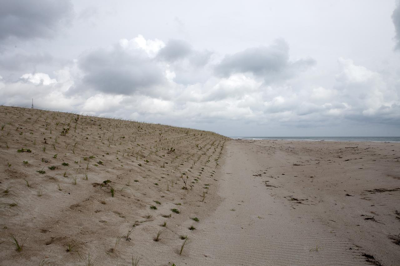
CAPE CANAVERAL, Fla. -- At the Kennedy Space Center in Florida, the sand dunes along a 1.2 mile stretch of shoreline near Launch Pads 39A and B were restored during a six-month effort using 90,000 cubic yards of sand. To help prevent future erosion, 180,000 shrubs, including grasses, sunflowers, vines, sea grapes and palmettos were planted. Constant pounding from tropical storms, such as Hurricane Sandy in October of 2012, other weather systems and higher than usual tides, destroyed sand dunes protecting infrastructure at the spaceport. Photo credit: NASA/Dan Casper

CAPE CANAVERAL, Fla. -- At the Kennedy Space Center in Florida, University of Florida geologists and NASA biologists use an all-terrain vehicle to survey sand dunes that have been restored along a 1.2 mile stretch of shoreline near Launch Pads 39A and B. As part of a six-month effort to help prevent further erosion, 180,000 shrubs, including grasses, sunflowers, vines, sea grapes and palmettos were planted. Constant pounding from tropical storms, such as Hurricane Sandy in October of 2012, other weather systems and higher than usual tides, destroyed sand dunes protecting infrastructure at the spaceport. Photo credit: NASA/Dan Casper
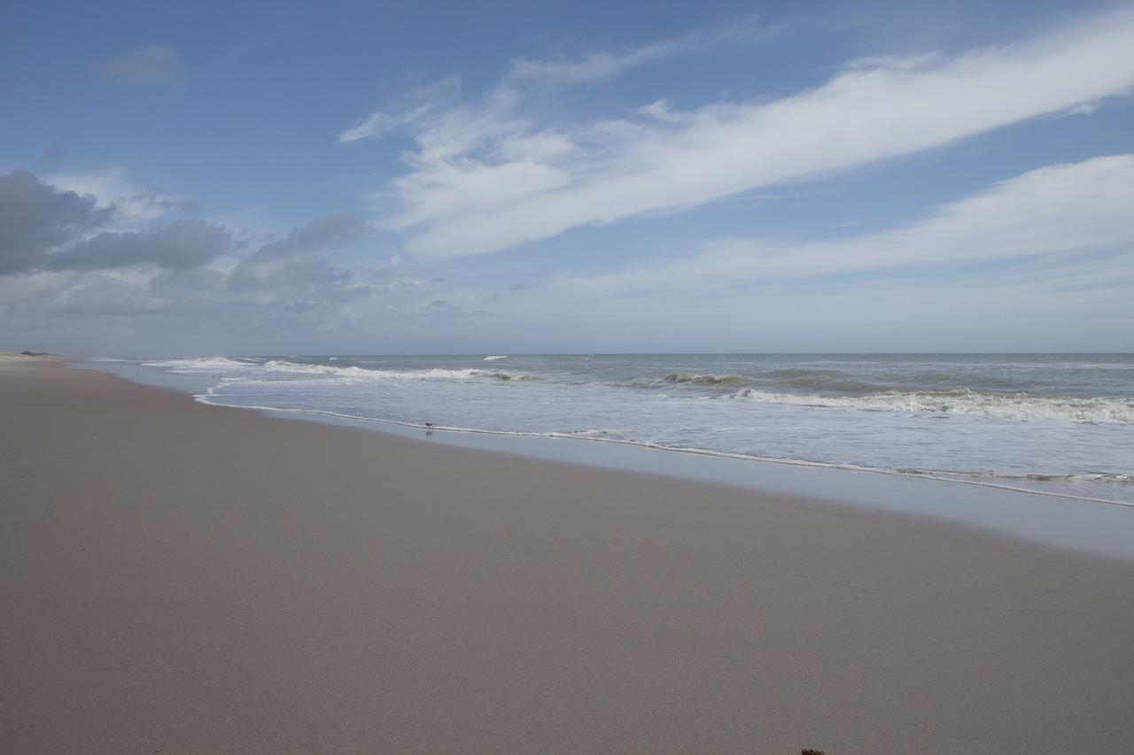
CAPE CANAVERAL, Fla. -- At the Kennedy Space Center in Florida, the Atlantic Ocean surf is seen adjacent to sand dunes restored along a 1.2 mile stretch of shoreline near Launch Pads 39A and B. As part of a six-month effort to help prevent further erosion, 180,000 shrubs, including grasses, sunflowers, vines, sea grapes and palmettos were planted. Constant pounding from tropical storms, such as Hurricane Sandy in October of 2012, other weather systems and higher than usual tides, destroyed sand dunes protecting infrastructure at the spaceport. Photo credit: NASA/Dan Casper
CAPE CANAVERAL, Fla. -- At the Kennedy Space Center in Florida, the sand dunes along a 1.2 mile stretch of shoreline near Launch Pads 39A and B were restored during a six-month effort using 90,000 cubic yards of sand. To help prevent erosion, 180,000 shrubs, including grasses, sunflowers, vines, sea grapes and palmettos were planted. Constant pounding from tropical storms, such as Hurricane Sandy in October of 2012, other weather systems and higher than usual tides, destroyed sand dunes protecting infrastructure at the spaceport. Photo credit: NASA/Dan Casper
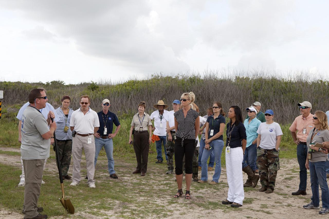
CAPE CANAVERAL, Fla. -- At the Kennedy Space Center in Florida, Don Dankert, a biological scientist in the NASA Environmental Management Branch of Center Operations, far left, speaks to guests during ceremonies to commemorate the completion of a six-month effort to restore 1.2 mile stretch of shoreline near Launch Pads 39A and B. To help prevent erosion, 180,000 shrubs, including grasses, sunflowers, vines, sea grapes and palmettos also were planted on the new dunes. Constant pounding from tropical storms, such as Hurricane Sandy in October of 2012, other weather systems and higher than usual tides, destroyed sand dunes protecting infrastructure at the spaceport. Photo credit: NASA/Dan Casper
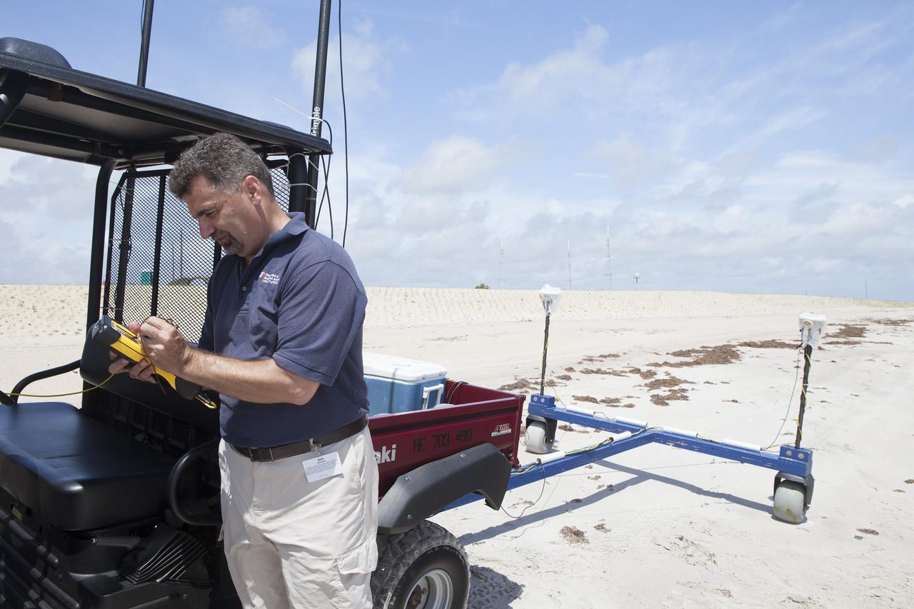
CAPE CANAVERAL, Fla. -- At the Kennedy Space Center in Florida, University of Florida geologists and NASA biologists use an all-terrain vehicle to survey sand dunes that have been restored along a 1.2 mile stretch of shoreline near Launch Pads 39A and B. As part of a six-month effort to help prevent further erosion, 180,000 shrubs, including grasses, sunflowers, vines, sea grapes and palmettos were planted. Constant pounding from tropical storms, such as Hurricane Sandy in October of 2012, other weather systems and higher than usual tides, destroyed sand dunes protecting infrastructure at the spaceport. Photo credit: NASA/Dan Casper

CAPE CANAVERAL, Fla. -- At the Kennedy Space Center in Florida, sand dunes have been restored along a 1.2 mile stretch of shoreline near Launch Pads 39A and B. As part of a six-month effort to help prevent further erosion, 180,000 shrubs, including grasses, sunflowers, vines, sea grapes and palmettos were planted. Constant pounding from tropical storms, such as Hurricane Sandy in October of 2012, other weather systems and higher than usual tides, destroyed sand dunes protecting infrastructure at the spaceport. Photo credit: NASA/Dan Casper
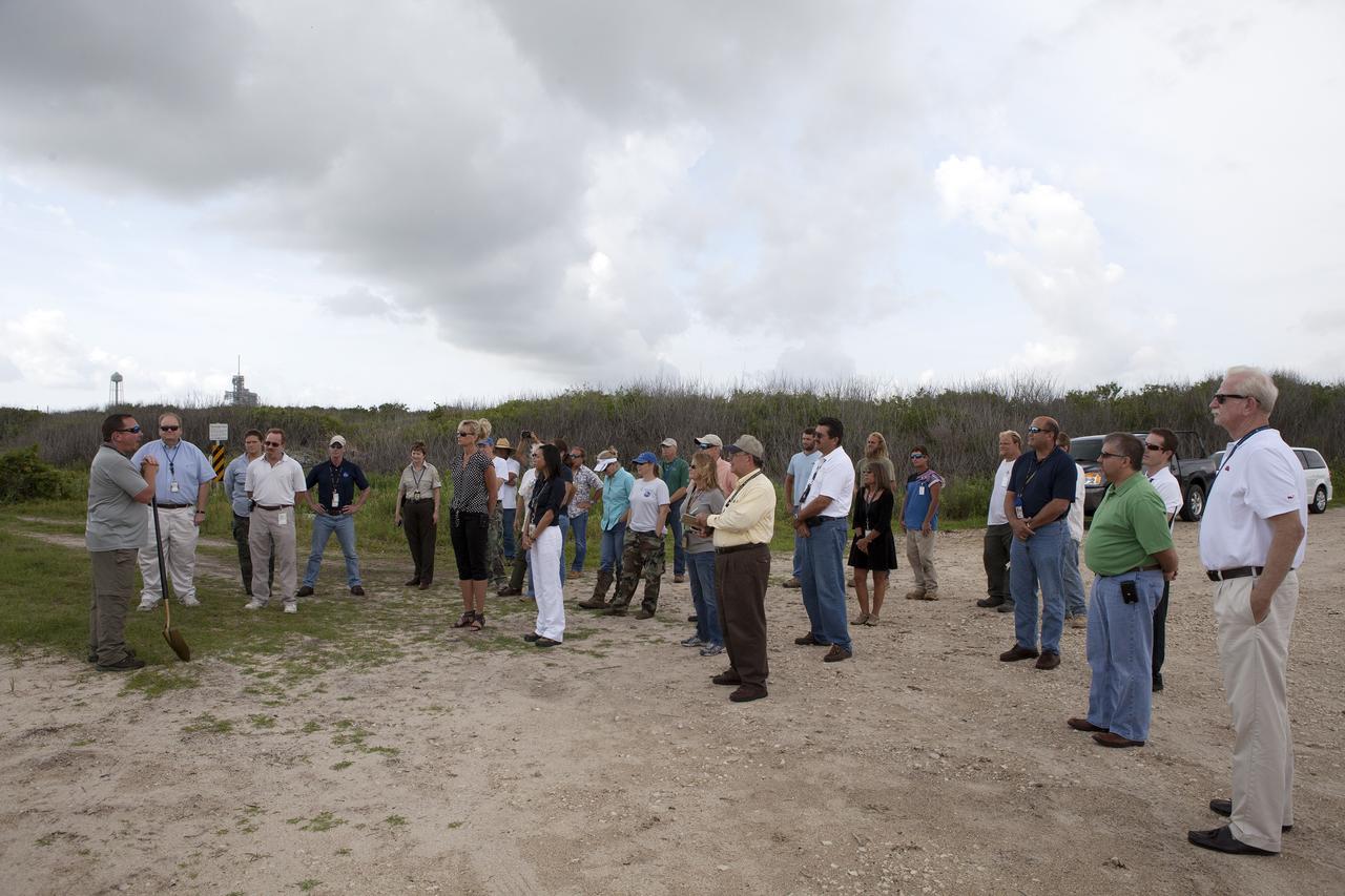
CAPE CANAVERAL, Fla. -- At the Kennedy Space Center in Florida, Don Dankert, a biological scientist in the NASA Environmental Management Branch of Center Operations, far left, speaks to guests during ceremonies to commemorate the completion of a six-month effort to restore 1.2 mile stretch of shoreline near Launch Pads 39A and B. To help prevent erosion, 180,000 shrubs, including grasses, sunflowers, vines, sea grapes and palmettos also were planted on the new dunes. Constant pounding from tropical storms, such as Hurricane Sandy in October of 2012, other weather systems and higher than usual tides, destroyed sand dunes protecting infrastructure at the spaceport. Photo credit: NASA/Dan Casper
CAPE CANAVERAL, Fla. -- At the Kennedy Space Center in Florida, University of Florida geologists and NASA biologists use an all-terrain vehicle to survey sand dunes that have been restored along a 1.2 mile stretch of shoreline near Launch Pads 39A and B. As part of a six-month effort to help prevent further erosion, 180,000 shrubs, including grasses, sunflowers, vines, sea grapes and palmettos were planted. Constant pounding from tropical storms, such as Hurricane Sandy in October of 2012, other weather systems and higher than usual tides, destroyed sand dunes protecting infrastructure at the spaceport. Photo credit: NASA/Dan Casper
STS099-729-086 (11-22 February 2000) ---In this 70mm frame photographed by one of the STS-99 crew members, the city of Miami encroaches the eastern edge of the Everglades in Florida. The Everglades is an International Biosphere Reserve World Heritage Site. This subtropical wilderness encompasses a relatively flat (does not exceed 2.4 meters above sea level) saw-grass marsh region of 10,000 square kilometers (4,000 square miles). The only source of water in the Everglades is from rainfall. The flow of water is detectable in this image, slowly moving from Lake Okeechobee to Florida Bay; the light blue, shallow area (less than 3 meters) between the mainland and the Keys; and the southwestern Florida coast.
CAPE CANAVERAL, Fla. -- At the Kennedy Space Center in Florida, the sand dunes along a 1.2 mile stretch of shoreline near Launch Pads 39A and B were restored during a six-month effort using 90,000 cubic yards of sand. To help prevent erosion, 180,000 shrubs, including grasses, sunflowers, vines, sea grapes and palmettos were planted. Constant pounding from tropical storms, such as Hurricane Sandy in October of 2012, other weather systems and higher than usual tides, destroyed sand dunes protecting infrastructure at the spaceport. Photo credit: NASA/Dan Casper
CAPE CANAVERAL, Fla. -- At the Kennedy Space Center in Florida, sand dunes have been restored along a 1.2 mile stretch of shoreline near Launch Pads 39A and B. As part of a six-month effort to help prevent further erosion, 180,000 shrubs, including grasses, sunflowers, vines, sea grapes and palmettos were planted. Constant pounding from tropical storms, such as Hurricane Sandy in October of 2012, other weather systems and higher than usual tides, destroyed sand dunes protecting infrastructure at the spaceport. Photo credit: NASA/Dan Casper
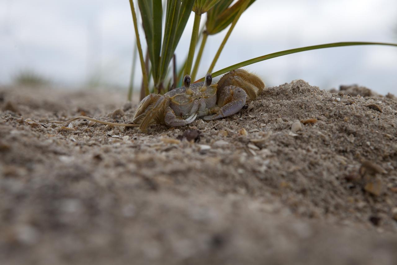
CAPE CANAVERAL, Fla. -- At the Kennedy Space Center in Florida, a small crab sits atop a restored sand dune along a 1.2 mile stretch of shoreline near Launch Pads 39A and B. As part of a six-month effort to help prevent further erosion, 180,000 shrubs, including grasses, sunflowers, vines, sea grapes and palmettos were planted. Constant pounding from tropical storms, such as Hurricane Sandy in October of 2012, other weather systems and higher than usual tides, destroyed sand dunes protecting infrastructure at the spaceport. Photo credit: NASA/Dan Casper
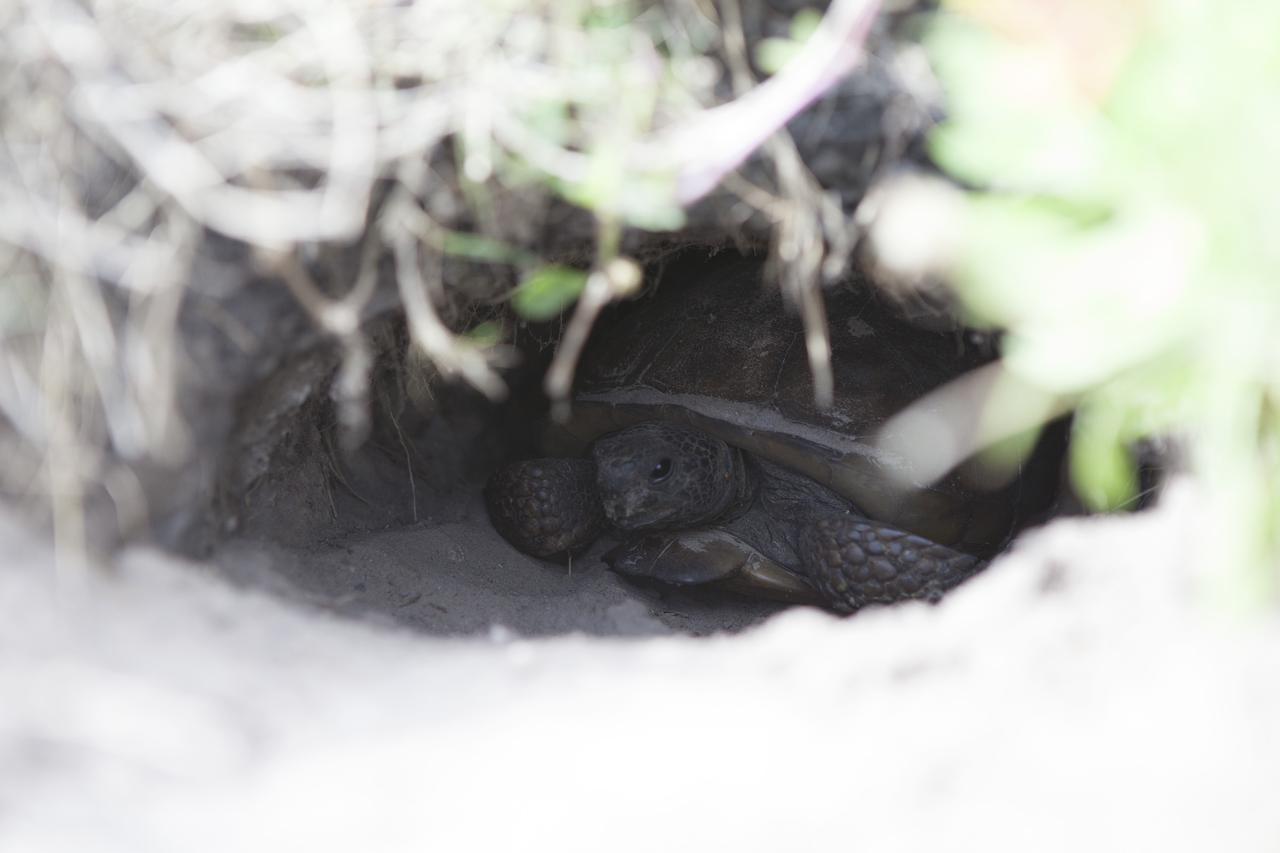
CAPE CANAVERAL, Fla. -- At the Kennedy Space Center in Florida, a turtle has burrowed into a restored sand dune along a 1.2 mile stretch of shoreline near Launch Pads 39A and B. As part of a six-month effort to help prevent further erosion, 180,000 shrubs, including grasses, sunflowers, vines, sea grapes and palmettos were planted. Constant pounding from tropical storms, such as Hurricane Sandy in October of 2012, other weather systems and higher than usual tides, destroyed sand dunes protecting infrastructure at the spaceport. Photo credit: NASA/Dan Casper
STS103-501-152 (19-27 December 1999) --- One of the astronauts aboard the Earth-orbiting Space Shuttle Discovery used a handheld large format camera to photograph this southern Florida scene. The city of Miami encroaches the eastern edge of the Everglades, which constitute an International Biosphere Reserve World Heritage Site. This subtropical wilderness encompasses a relatively flat (does not exceed 2.4 m above sea level) saw-grass marsh region of 10,000 square kilometers (4,000 square miles). According to NASA Earth scientists, the only source of water in the Everglades is from rainfall. The flow of water is detectable in this image, slowly moving from Lake Okeechobee to Florida Bay; the light blue, shallow area between the mainland and the Keys; and the southwestern Florida coast.

CAPE CANAVERAL, Fla. -- At the Kennedy Space Center in Florida, Don Dankert, a biological scientist in the NASA Environmental Management Branch of Center Operations, left, and Burton Summerfield, senior advisor for Institutional Management in the office of the associate director of Kennedy speak to guests during ceremonies to commemorate the completion of a six-month effort to restore 1.2 mile stretch of shoreline near Launch Pads 39A and B. To help prevent erosion, 180,000 shrubs, including grasses, sunflowers, vines, sea grapes and palmettos also were planted on the new dunes. Constant pounding from tropical storms, such as Hurricane Sandy in October of 2012, other weather systems and higher than usual tides, destroyed sand dunes protecting infrastructure at the spaceport. Photo credit: NASA/Dan Casper

ISS029-E-037471 (3 Nov. 2011) --- Egypt?Israel borderlands, northern Sinai Peninsula and northern Negev Desert are featured in this image photographed by an Expedition 29 crew member on the International Space Station. A clearly visible line that marks approximately 50 kilometers of the international border between Egypt and Israel?10-60 kilometers from the Mediterranean Sea to the northwest (not shown)?crosses the center of this photograph from left to right. The reason for the color difference is likely the slightly higher level of grazing by the animal herds of Bedouin herdsmen on the Egyptian side of the border. A major highway also follows the border, making the demarcation more prominent in this recent image taken from the space station. A patch of the Gaza Strip appears under scattered cloud at far right. In the arid to semiarid climate of the region illustrated in the image the natural grass vegetation is sparse at best. Irrigated commercial agriculture in Israel nearest the Mediterranean coast appears as a series of large angular patterns and circular center pivot fields, with darker greens indicating growing crops (right). Smaller plot sizes appear on the Egyptian side of the border at upper right. The image shows how the active sand dunes, which dominate most of the landscape in this view, mark the southern limit of the agriculture.
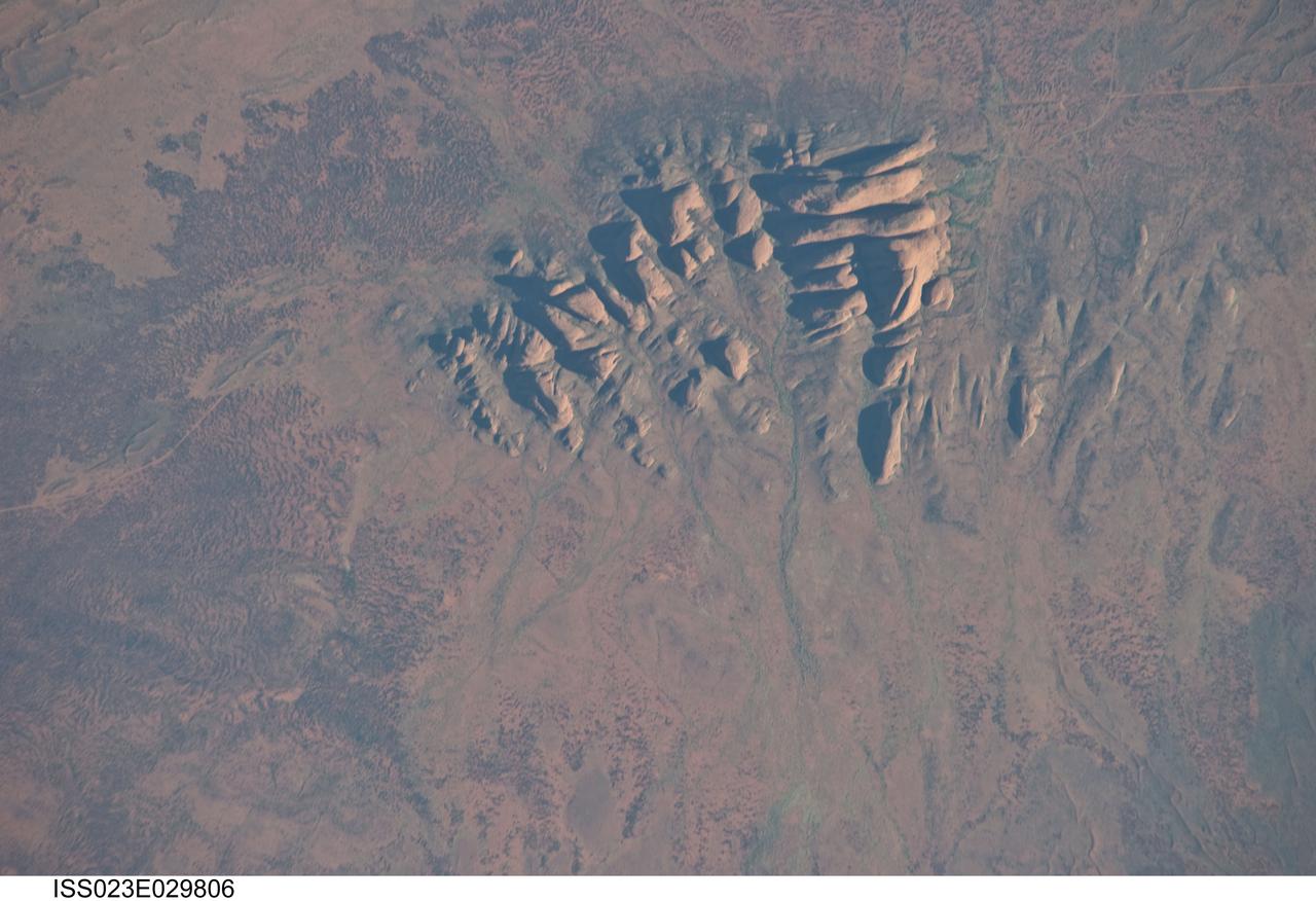
ISS023-E-029806 (30 April 2010) --- Kata Tjuta, Australia is featured in this image photographed by an Expedition 23 crew member on the International Space Station. Located in the Northern Territory of Australia, Uluru – Kata Tjuta National Park hosts some of the world’s most spectacular examples of inselbergs, or isolated mountains. The most famous of these inselbergs is Uluru (also known as Ayers Rock). An equally massive inselberg located approximately 30 kilometers to the northwest is known as Kata Tjuta– like Uluru, this is a sacred site to the native Anangu or Aboriginal people. Explorers named the highest peak Mount Olga, with the entire grouping of rocks informally known as “the Olgas”. Mount Olga has a peak elevation of 1,069 meters above sea level, making it 206 meters higher than Uluru. Kata Tjuta is comprised of gently dipping Mount Currie Conglomerate, a sedimentary rock that includes abundant rounded fragments of other rock types (here, primarily granite with less abundant basalt and rhyolite) in a coarse sandy matrix. Geologists interpret the Mount Currie Conglomerate as a remnant of a large fan of material rapidly eroded from mountains uplifted approximately 550 million years ago. Subsequent burial under younger sediments consolidated the eroded materials to form the conglomerate exposed at the surface today. In this photograph, afternoon sunlight highlights the rounded summits of Kata Tjuta against the surrounding sandy plains. Sand dunes are visible at upper right; while in other areas (image top and image left) sediments washed from the rocks have been anchored by a variety of grasses and bushes adapted to the arid climate. Green vegetation in the ephemeral stream channels that drain Kata Tjuta (bottom center) provides colorful contrast with the red rocks and surrounding soils. Large gaps in the rocks (highlighted by shadows) are thought to be fractures that have been enlarged due to erosion.
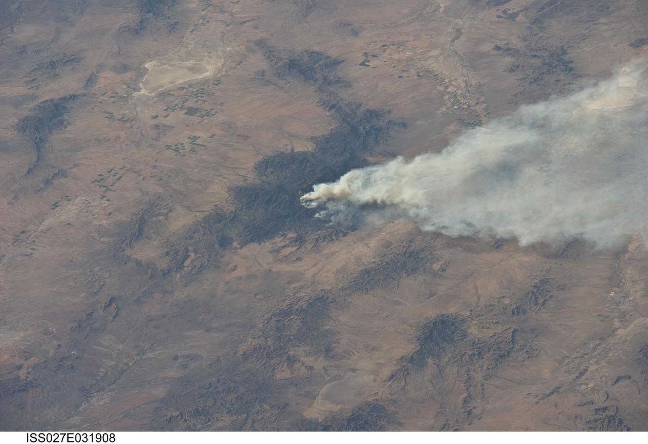
ISS027-E-031908 (15 May 2011) --- The Horseshoe 2 fire is featured in this image photographed by an Expedition 27 crew member on the International Space Station. The Horseshoe 2 fire, located along the southeastern flank of the Chiricahua Mountains in southeastern Arizona, began on May 8, 2011 at approximately 11:00 a.m. The fire is thought to have been started by human activities. This photograph illustrates the area (approximately 8,900 hectares, or 22,110 acres) and position of the fire within the mountains on May 15, 2011, as well as an extensive smoke plume extending to the east-northeast over a distance of at least 60 kilometers (approximately 40 miles). As of May 19, 2011, the fire had burned an area of nearly 14,000 hectares (approximately 34,400 acres) of grasses, shrubs, and trees along the mountain slopes. The Chiricahua Mountains are included within the Chiricahua National Monument located near the borders of Arizona, USA; New Mexico, USA; and Chihuahua, United Mexican States. Elevations in the mountains range from approximately 914 – 3,267 meters (300 – 10,720 feet) above sea level. The higher elevations—known regionally as “sky islands”—allow for biologically diverse plant and animal communities, adapted to cooler and wetter conditions, to survive while surrounded by semi-arid to arid desert conditions at lower elevations. The image highlights this contrast in environments; pine and oak forest contributes to the dark coloration of the upper slopes and peaks of the Chiricahuas at center, while the flat, gray to tan surface of Willcox Playa (an interior-draining basin or dry lake) to the northwest is indicative of the adjacent desert environment.
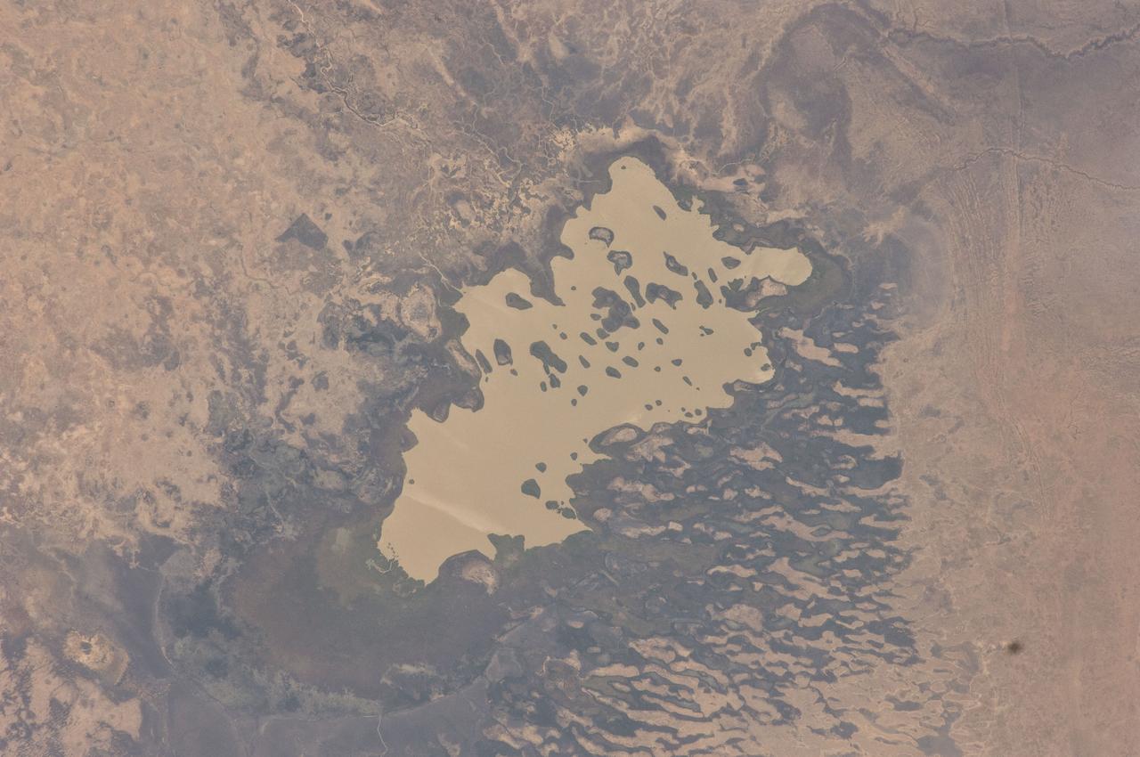
ISS030-E-059398 (19 Jan. 2012) --- Lake Fitri, Chad is featured in this image photographed by an Expedition 30 crew member on the International Space Station. Lake Fitri is an endorheic, or terminal lake in a desert basin in the southern Sahara Desert. Muddy yellow-brown water marks the center of the depression (center), with a ring of dark brown muds and burnt vegetation on the exposed lake floor to the north. The lake shoreline supports a thin line of reed and floating grass vegetation which appears as dark green in the image. Deserts have so little rainfall that many rivers cannot reach the sea, but end at local low points where they form lakes. Here the usually dry Wadi Batha empties into Lake Fitri. Over time, water flow in Wadi Batha has created a large delta, which occupies the entire top left third of the image—a sense of scale is given by the 23–kilometer length of the lake. The lake has been designated under the Ramsar Convention as a wetland of international importance. Other features visible in the image reveal evidence of significant climate change. The dry part of the present lake shows that the lake has been larger in the last several decades. But, as NASA scientists point out, the lake was once many times larger than its present surface area, as shown by numerous sweeping curves of ancient beaches which are now situated many kilometers from the present shoreline, at higher altitudes (upper right). Inland lakes are highly sensitive to the exact equilibrium between the amount of inflow from contributing rivers like Wadi Batha and evaporation. Each beach ridge therefore shows a different lake level and thus a different balance in the lake-river-climate system. A smaller river enters from the south (top right) and cuts through the beach reaches on its way to the lake. The irregular, elongated, tan patches to the west of the lake are linear dunes aligned parallel to the dominant winds which blow from the northeast. The dunes have all formed on the downwind side (southwest) side of the lake since the lake bed and delta provide the sands which have built the dunes. The dunes indicate that during past climatic phases the lake has been almost or completely dry on repeated occasions—often enough for these great dunes, many kilometers long and several meters high, to form even in the lowest parts of the lake. The islands visible in the center of the lake are likewise remnants of dunes. These dunes are smaller than those on the lake margin, presumably because waves from the lake have eroded them. Villages occupy the points of some major dunes, and some islands, where fishermen can gain easy access to the lake.
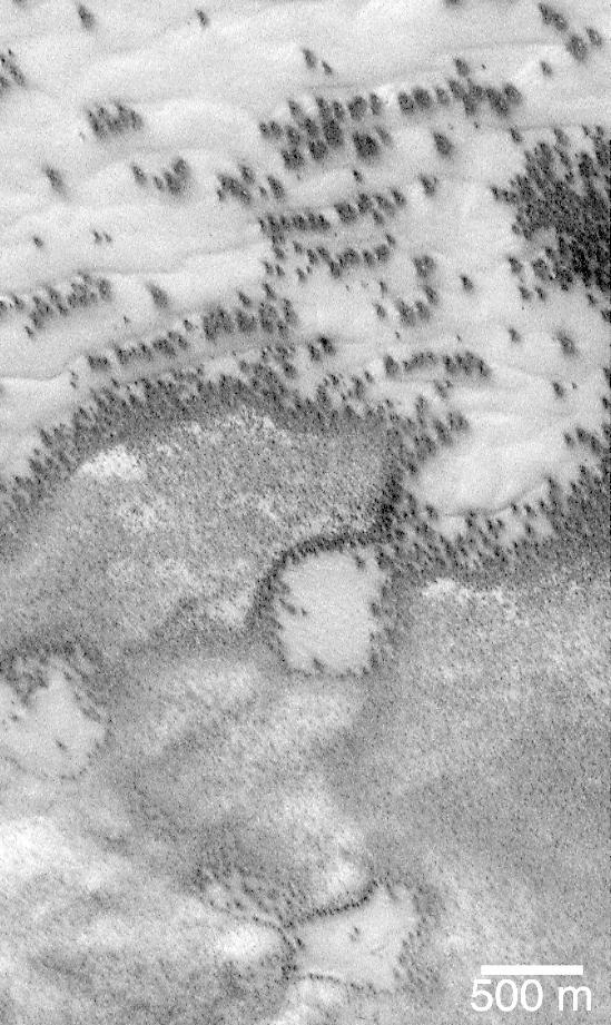
"They look like bushes!" That's what almost everyone says when they see the dark features found in pictures taken of sand dunes in the polar regions as they are beginning to defrost after a long, cold winter. It is hard to escape the fact that, at first glance, these images acquired by the Mars Global Surveyor (MGS) Mars Orbiter Camera (MOC) over both polar regions during the spring and summer seasons, do indeed resemble aerial photographs of sand dune fields on Earth -- complete with vegetation growing on and around them! Of course, this is not what the features are, as we describe below and in related picture captions. Still, don't they look like vegetation to you? Shown here are two views of the same MGS MOC image. On the left is the full scene, on the right is an expanded view of a portion of the scene on the left. The bright, smooth surfaces that are dotted with occasional, nearly triangular dark spots are sand dunes covered by winter frost. The MGS MOC has been used over the past several months (April-August 1999) to monitor dark spots as they form and evolve on polar dune surfaces. The dark spots typically appear first along the lower margins of a dune -- similar to the position of bushes and tufts of grass that occur in and among some sand dunes on Earth. Because the martian air pressure is very low -- 100 times lower than at Sea Level on Earth -- ice on Mars does not melt and become liquid when it warms up. Instead, ice sublimes -- that is, it changes directly from solid to gas, just as "dry ice" does on Earth. As polar dunes emerge from the months-long winter night, and first become exposed to sunlight, the bright winter frost and snow begins to sublime. This process is not uniform everywhere on a dune, but begins in small spots and then over several months it spreads until the entire dune is spotted like a leopard. The early stages of the defrosting process -- as in the picture shown here -- give the impression that something is "growing" on the dunes. The sand underneath the frost is dark, just like basalt beach sand in Hawaii. Once it is exposed to sunlight, the dark sand probably absorbs sunlight and helps speed the defrosting of each sand dune. This picture was taken by MGS MOC on July 21, 1999. The dunes are located in the south polar region and are expected to be completely defrosted by November or December 1999. North is approximately up, and sunlight illuminates the scene from the upper left. The 500 meter scale bar equals 547 yards; the 300 meter scale is also 328 yards. http://photojournal.jpl.nasa.gov/catalog/PIA02300