
NASA's Dryden Flight Research Center marked its 60th anniversary as the aerospace agency's lead center for atmospheric flight research and operations in 2006. In connection with that milestone, hundreds of the center's staff and retirees gathered in nearby Lancaster, Calif., in November 2006 to reflect on the center's challenges and celebrate its accomplishments over its six decades of advancing the state-of-the-art in aerospace technology. The center had its beginning in 1946 when a few engineers from the National Advisory Committee for Aeronautics' Langley Memorial Aeronautical Laboratory were detailed to Muroc Army Air Base (now Edwards Air Force Base) in Southern California's high desert to support the joint Army Air Force / NACA / Bell Aircraft XS-1 research airplane program. Since that inauspicious beginning, the center has been at the forefront of many of the advances in aerospace technology by validating advanced concepts through actual in-flight research and testing. Dryden is uniquely situated to take advantage of the excellent year-round flying weather, remote area, and visibility to test some of the nation�s most exciting aerospace vehicles. Today, NASA Dryden is NASA's premier flight research and test organization, continuing to push the envelope in the validation of high-risk aerospace technology and space exploration concepts, and in conducting airborne environmental and space science missions in the 21st century.

Attendees watch a short video on Explorer 1 during an event celebrating the 60th Anniversary of the Explorer 1 mission and the discovery of Earth's radiation belts, Wednesday, Jan. 31, 2018, at the National Academy of Sciences in Washington. The first U.S. satellite, Explorer 1, was launched from Cape Canaveral on January 31, 1958. The 30-pound satellite would yield a major scientific discovery, the Van Allen radiation belts circling our planet, and begin six decades of groundbreaking space science and human exploration. (NASA/Joel Kowsky)
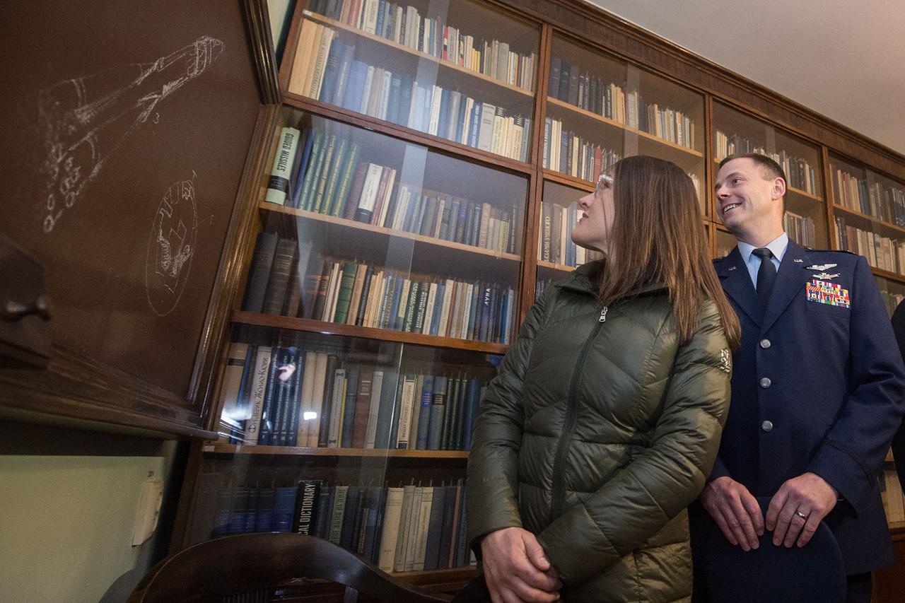
At the Korolev Library in Moscow named after the Russian space designer, Sergei Korolev, NASA’s Expedition 59 astronauts Christina Koch (left) and Nick Hague (right) study a framed drawing of a Soyuz rocket Feb. 21 that Korolev himself drew decades ago. Koch, Hague and Alexey Ovchinin of Roscosmos will launch March 14, U.S. time, on the Soyuz MS-12 spacecraft from the Baikonur Cosmodrome in Kazakhstan for a six-and-a-half month mission on the International Space Station. Andrey Shelepin/Gagarin Cosmonaut Training Center
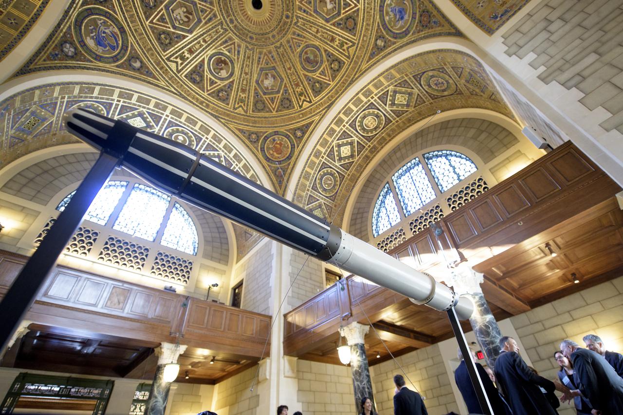
A replica of the Explorer 1 satellite is seen on display during an event celebrating the 60th Anniversary of the Explorer 1 mission and the discovery of Earth's radiation belts, Wednesday, Jan. 31, 2018, at the National Academy of Sciences in Washington. The first U.S. satellite, Explorer 1, was launched from Cape Canaveral on January 31, 1958. The 30-pound satellite would yield a major scientific discovery, the Van Allen radiation belts circling our planet, and begin six decades of groundbreaking space science and human exploration. (NASA/Joel Kowsky)
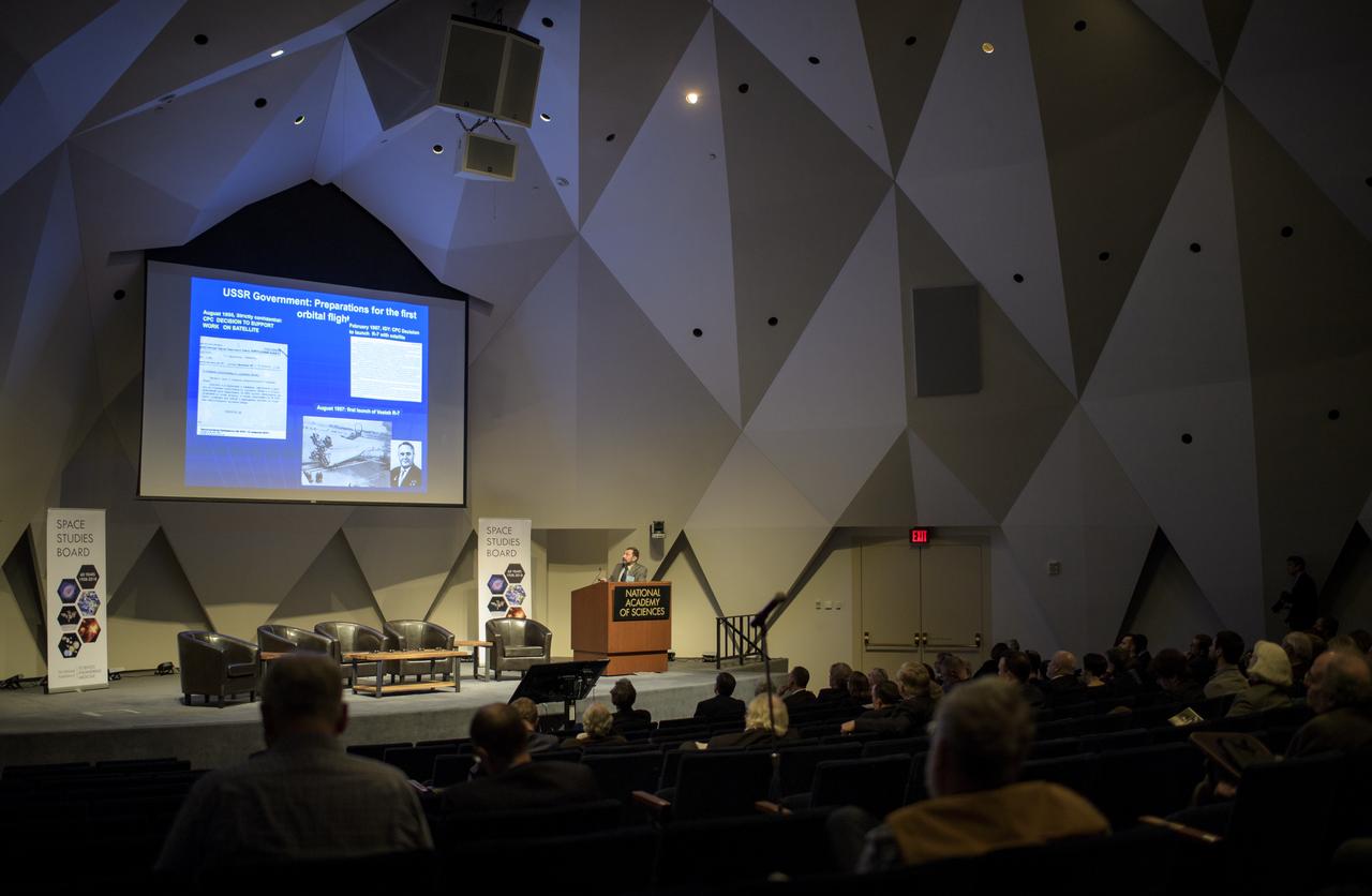
Alexander Moiseev, a research scientist at NASA's Goddard Spaceflight Center, speaks during an event celebrating the 60th Anniversary of the Explorer 1 mission and the discovery of Earth's radiation belts, Wednesday, Jan. 31, 2018, at the National Academy of Sciences in Washington. The first U.S. satellite, Explorer 1, was launched from Cape Canaveral on January 31, 1958. The 30-pound satellite would yield a major scientific discovery, the Van Allen radiation belts circling our planet, and begin six decades of groundbreaking space science and human exploration. (NASA/Joel Kowsky)

STS008-16-454 (30 Aug-5 Sept 1983) --- Following a precedent set early two decades ago during the Gemini program, three members of the STS-8 astronaut crew aboard the Earth-orbiting Space Shuttle Challenger reveal their military backgrounds and loyalties. Astronauts (left to right) Dale A. Gardner, Richard H. Truly and Daniel C. Brandenstein leave no mystery as to their alma mater and gridiron sentimentalities as they display U.S. Navy stickers. The trio was photographed by Astronaut Guion S. Bluford on the flight deck. Truly is crew commander; Brandenstein, pilot; and Gardner and Bluford, along with Dr. William E. Thornton are all mission specialists for this six-day flight.
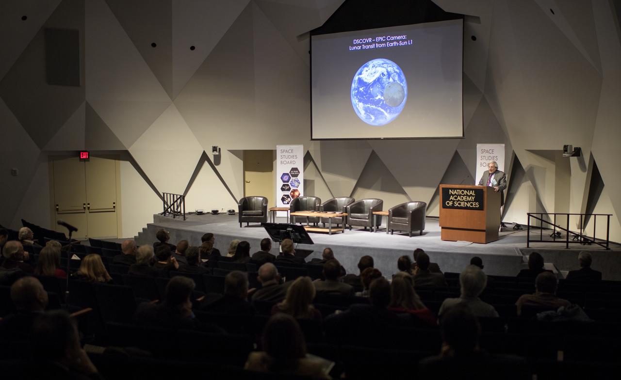
Michael Freilich, Director of the Earth Science Division of NASA's Science Mission Directorate, speaks during an event celebrating the 60th Anniversary of the Explorer 1 mission and the discovery of Earth's radiation belts, Wednesday, Jan. 31, 2018, at the National Academy of Sciences in Washington. The first U.S. satellite, Explorer 1, was launched from Cape Canaveral on January 31, 1958. The 30-pound satellite would yield a major scientific discovery, the Van Allen radiation belts circling our planet, and begin six decades of groundbreaking space science and human exploration. (NASA/Joel Kowsky)

Alexander Moiseev, a research scientist at NASA's Goddard Spaceflight Center, speaks during an event celebrating the 60th Anniversary of the Explorer 1 mission and the discovery of Earth's radiation belts, Wednesday, Jan. 31, 2018, at the National Academy of Sciences in Washington. The first U.S. satellite, Explorer 1, was launched from Cape Canaveral on January 31, 1958. The 30-pound satellite would yield a major scientific discovery, the Van Allen radiation belts circling our planet, and begin six decades of groundbreaking space science and human exploration. (NASA/Joel Kowsky)

Thomas Zurbuchen, Associate Administrator for NASA's Science Mission Directorate, speaks during an event celebrating the 60th Anniversary of the Explorer 1 mission and the discovery of Earth's radiation belts, Wednesday, Jan. 31, 2018, at the National Academy of Sciences in Washington. The first U.S. satellite, Explorer 1, was launched from Cape Canaveral on January 31, 1958. The 30-pound satellite would yield a major scientific discovery, the Van Allen radiation belts circling our planet, and begin six decades of groundbreaking space science and human exploration. (NASA/Joel Kowsky)
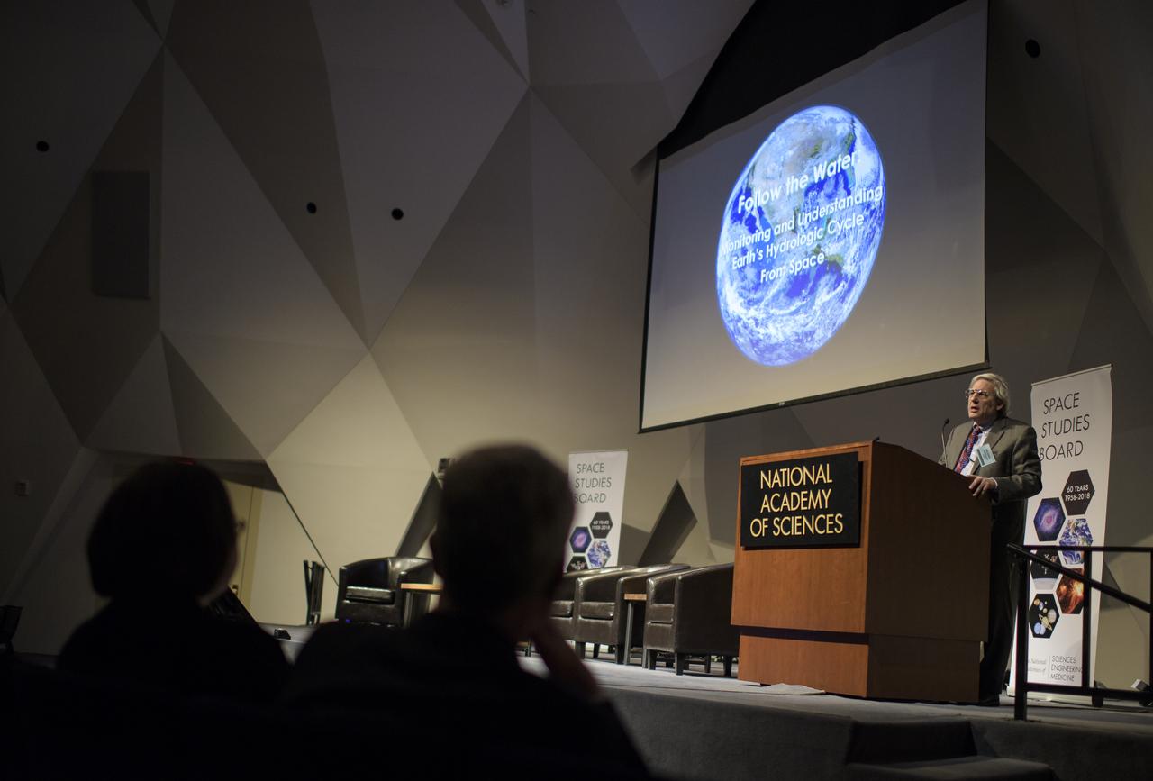
Michael Freilich, Director of the Earth Science Division of NASA's Science Mission Directorate, speaks during an event celebrating the 60th Anniversary of the Explorer 1 mission and the discovery of Earth's radiation belts, Wednesday, Jan. 31, 2018, at the National Academy of Sciences in Washington. The first U.S. satellite, Explorer 1, was launched from Cape Canaveral on January 31, 1958. The 30-pound satellite would yield a major scientific discovery, the Van Allen radiation belts circling our planet, and begin six decades of groundbreaking space science and human exploration. (NASA/Joel Kowsky)
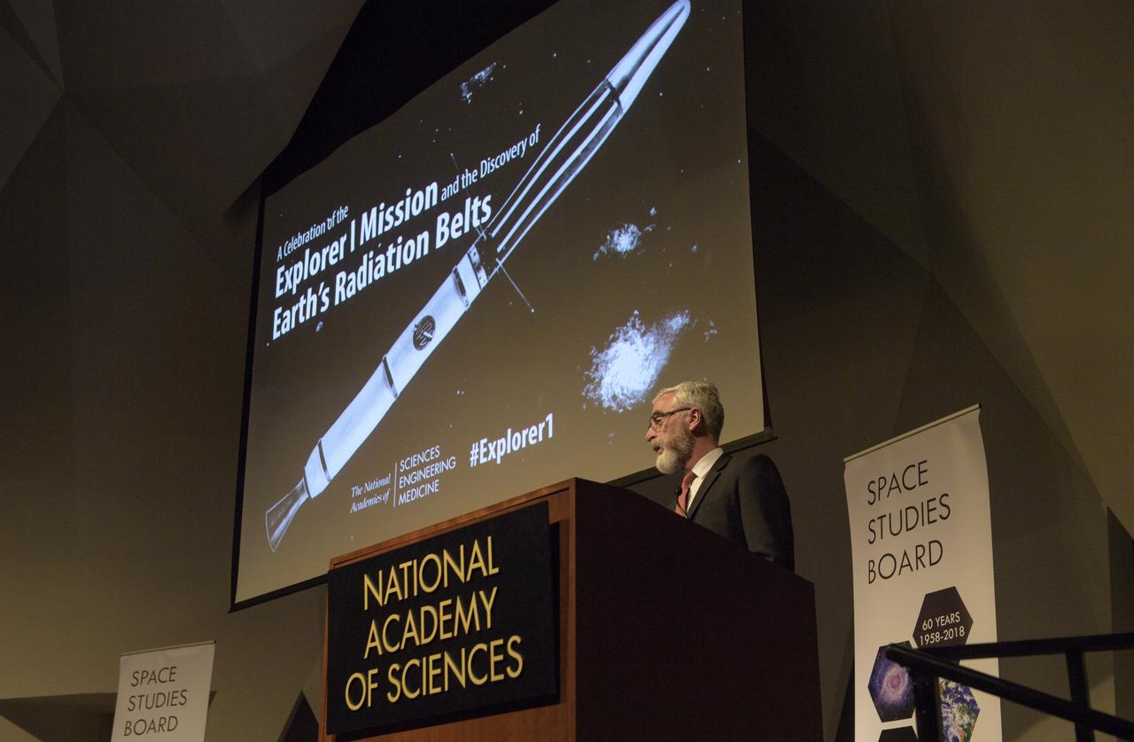
Michael Moloney, Director for Space and Aeronautics at the Space Studies Board and the Aeronautics and Space Engineering Board of the U.S. National Academies of Sciences, Engineering, and Medicine, delivers opening remarks during an event celebrating the 60th Anniversary of the Explorer 1 mission and the discovery of Earth's radiation belts, Wednesday, Jan. 31, 2018, at the National Academy of Sciences in Washington. The first U.S. satellite, Explorer 1, was launched from Cape Canaveral on January 31, 1958. The 30-pound satellite would yield a major scientific discovery, the Van Allen radiation belts circling our planet, and begin six decades of groundbreaking space science and human exploration. (NASA/Joel Kowsky)
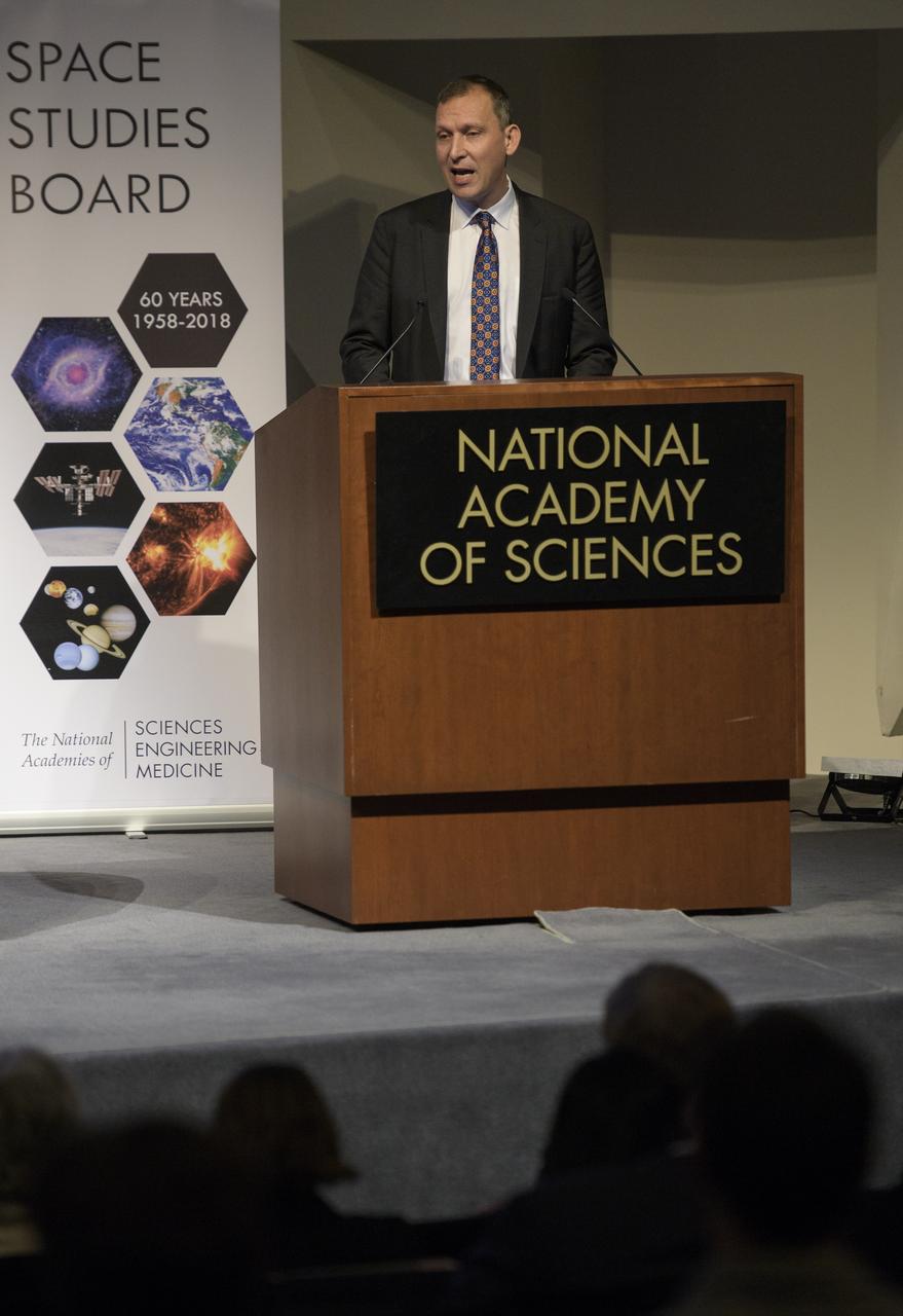
Thomas Zurbuchen, Associate Administrator for NASA's Science Mission Directorate, speaks during an event celebrating the 60th Anniversary of the Explorer 1 mission and the discovery of Earth's radiation belts, Wednesday, Jan. 31, 2018, at the National Academy of Sciences in Washington. The first U.S. satellite, Explorer 1, was launched from Cape Canaveral on January 31, 1958. The 30-pound satellite would yield a major scientific discovery, the Van Allen radiation belts circling our planet, and begin six decades of groundbreaking space science and human exploration. (NASA/Joel Kowsky)
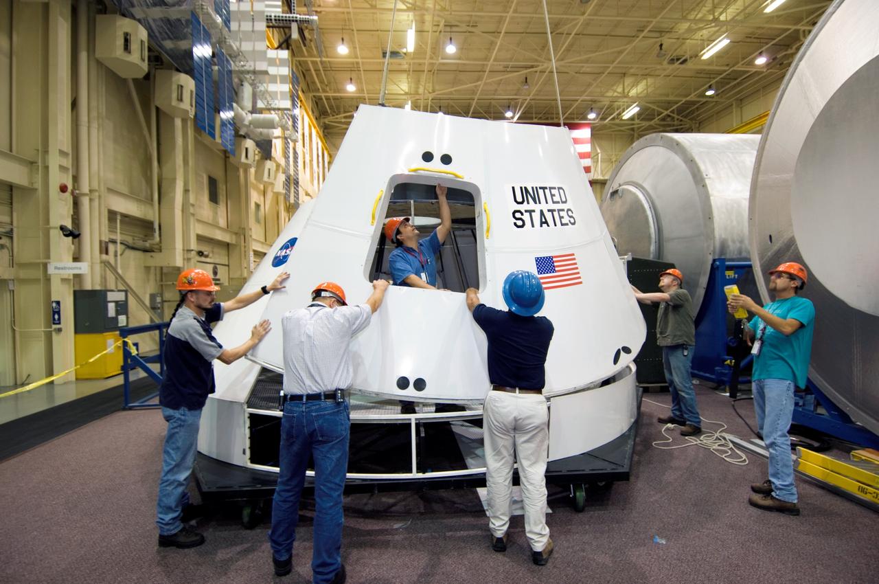
JSC2005-E-42348 (18 October 2005) --- NASA recently started assembling this full-sized mockup of the new Crew Exploration Vehicle's (CEV) cockpit in its Space Vehicle Mockup Facility at the Johnson Space Center. The CEV is the key to making NASA's Vision for Space Exploration a reality. Though the shape is reminiscent of the Apollo command modules of four decades ago, the new capsule will be three times larger and is designed to carry four astronauts to and from the Moon, support up to six crew members on future missions to Mars and deliver crew and supplies to the international space station.
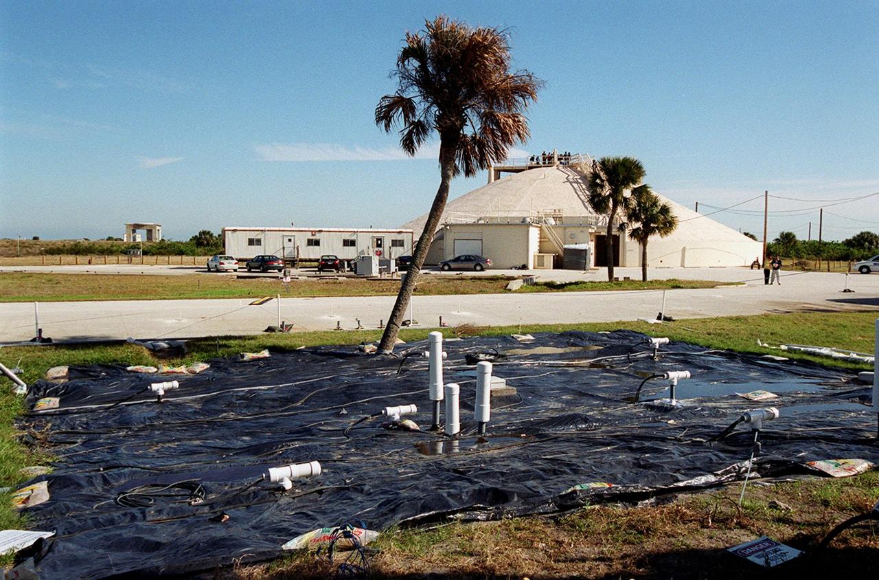
At Launch Complex 34, the Six-Phase Soil Heating site that is involved in a groundwater cleanup project can be seen. The project involves the Department of Defense, Environmental Protection Agency, Department of Energy and NASA. Concentrations of trichloroethylene solvent have been identified in the soil at the complex as a result of cleaning methods for rocket parts during the Apollo Program, which used the complex, in the 60s. The group formed the Interagency NDAPL Consortium (IDC) to study three contamination cleanup technologies: Six-Phase Soil Heating, Steam Injection and In Situ Oxidation with Potassium Permanganate. All three methods may offer a way to remove the contaminants in months instead of decades. In the background is the block house for the complex. KSC hosted a two-day conference that presented information and demonstrations of the three technologies being tested at the site

At Launch Complex 34, the Six-Phase Soil Heating site that is involved in a groundwater cleanup project can be seen. The project involves the Department of Defense, Environmental Protection Agency, Department of Energy and NASA. Concentrations of trichloroethylene solvent have been identified in the soil at the complex as a result of cleaning methods for rocket parts during the Apollo Program, which used the complex, in the 60s. The group formed the Interagency NDAPL Consortium (IDC) to study three contamination cleanup technologies: Six-Phase Soil Heating, Steam Injection and In Situ Oxidation with Potassium Permanganate. All three methods may offer a way to remove the contaminants in months instead of decades. In the background is the block house for the complex. KSC hosted a two-day conference that presented information and demonstrations of the three technologies being tested at the site
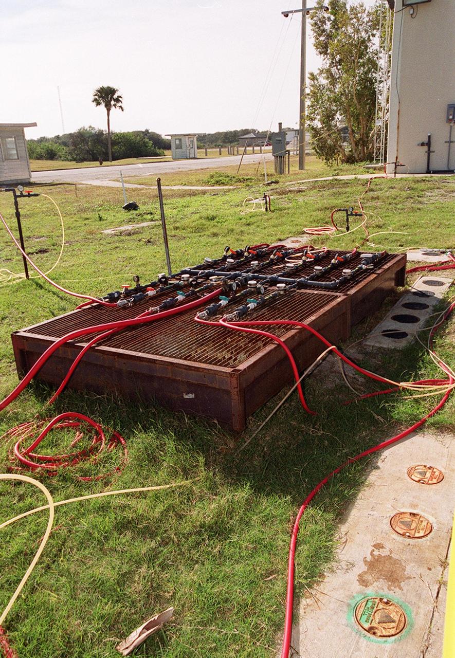
At Launch Complex 34, Cape Canaveral Air Station, several studies are under way for groundwater cleanup of trichloroethylene at the site. Shown here is monitoring equipment for one of the methods, potassium permanganate oxidation. Concentrations of trichloroethylene solvent have been identified in the soil at the complex as a result of cleaning methods for rocket parts during the Apollo Program in the 60s. The environmental research project involves the Department of Defense, Environmental Protection Agency, Department of Energy and NASA, who formed the Interagency NDAPL Consortium (IDC), to study three contamination cleanup technologies: Six Phase Soil Heating, Steam Injection and In Situ Oxidation with Potassium Permanganate. All three methods may offer a way to remove the contaminants in months instead of decades. KSC hosted a two-day conference that presented information and demonstrations of the three technologies for representatives from environmental and federal agencies
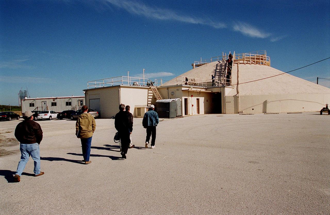
At Launch Complex 34, representatives from environmental and Federal agencies head for the block house during presentations about the environmental research project that involves the Department of Defense, Environmental Protection Agency, Department of Energy and NASA in a groundwater cleanup effort. Concentrations of trichloroethylene solvent have been identified in the soil at the complex as a result of cleaning methods for rocket parts during the Apollo Program, which used the complex, in the 60s. The group formed the Interagency NDAPL Consortium (IDC) to study three contamination cleanup technologies: Six Phase Soil Heating, Steam Injection and In Situ Oxidation with Potassium Permanganate. All three methods may offer a way to remove the contaminants in months instead of decades. KSC hosted a two-day conference that presented information and demonstrations of the three technologies being tested at the site
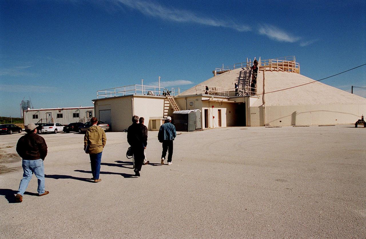
At Launch Complex 34, representatives from environmental and Federal agencies head for the block house during presentations about the environmental research project that involves the Department of Defense, Environmental Protection Agency, Department of Energy and NASA in a groundwater cleanup effort. Concentrations of trichloroethylene solvent have been identified in the soil at the complex as a result of cleaning methods for rocket parts during the Apollo Program, which used the complex, in the 60s. The group formed the Interagency NDAPL Consortium (IDC) to study three contamination cleanup technologies: Six Phase Soil Heating, Steam Injection and In Situ Oxidation with Potassium Permanganate. All three methods may offer a way to remove the contaminants in months instead of decades. KSC hosted a two-day conference that presented information and demonstrations of the three technologies being tested at the site
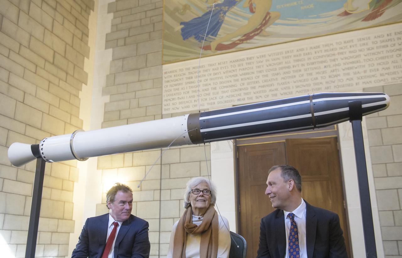
Michael Watkins, Director of NASA's Jet Propulsion Laboratory, left, Susan Finley, who began working at NASA's Jet Propulsion Laboratory in January 1958 as a "human computer", center, and Thomas Zurbuchen, Associate Administrator for NASA's Science Mission Directorate, right, pose for a picture with a replica of the Explorer 1 satellite during an event celebrating the 60th Anniversary of the Explorer 1 mission and the discovery of Earth's radiation belts, Wednesday, Jan. 31, 2018, at the National Academy of Sciences in Washington. The first U.S. satellite, Explorer 1, was launched from Cape Canaveral on January 31, 1958. The 30-pound satellite would yield a major scientific discovery, the Van Allen radiation belts circling our planet, and begin six decades of groundbreaking space science and human exploration. (NASA/Joel Kowsky)
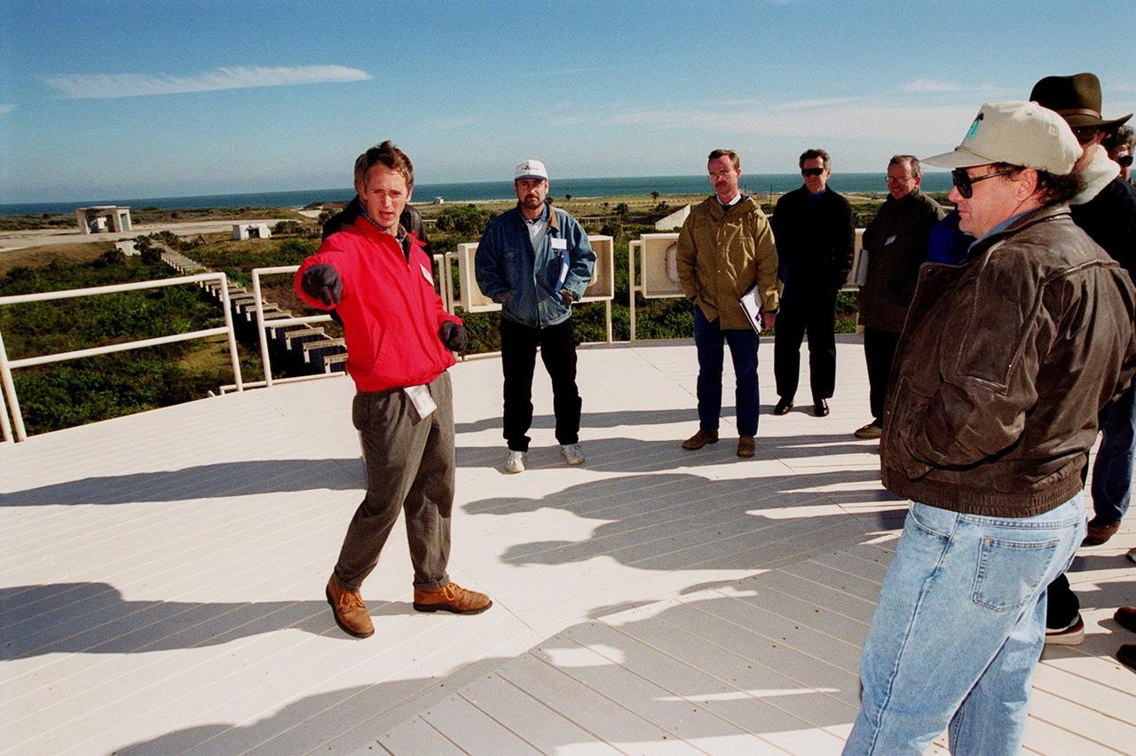
On top of the block house at Launch Complex 34, representatives from environmental and Federal agencies hear from Laymon Gray, with Florida State University, about the environmental research project that involves the Department of Defense, Environmental Protection Agency, Department of Energy and NASA in a groundwater cleanup effort. Concentrations of trichloroethylene solvent have been identified in the soil at the complex as a result of cleaning methods for rocket parts during the Apollo Program, which used the complex, in the 60s. The group formed the Interagency NDAPL Consortium (IDC) to study three contamination cleanup technologies: Six Phase Soil Heating, Steam Injection and In Situ Oxidation with Potassium Permanganate. All three methods may offer a way to remove the contaminants in months instead of decades. In the background (left) can be seen the cement platform and walkway from the block house to the pad. Beyond it is the Atlantic Ocean. KSC hosted a two-day conference that presented information and demonstrations of the three technologies being tested at the site

NASA's 2001 Mars Odyssey orbiter arrived at Mars on Oct. 24, 2001. Over the past two decades, the mission has mapped the composition of the Martian surface, providing a window to the past so scientists could piece together how the planet evolved. It has also served as a vital asset in relaying communications between landers and rovers at the Red Planet and the mission teams back on Earth. Here are some of the highlights of the last 20 years: Mars Odyssey has completed 80,000 orbits. Mars Odyssey has taken more than 1.2 million images. Mars Odyssey has returned 16 terabits of total science data to Earth, including 1 terabit of data relayed from Mars surface missions. Mars Odyssey has provided communications relay for six Mars surface missions: the Phoenix and InSight landers, as well as the Spirit, Opportunity, Curiosity, and Perseverance rovers. https://photojournal.jpl.nasa.gov/catalog/PIA24915
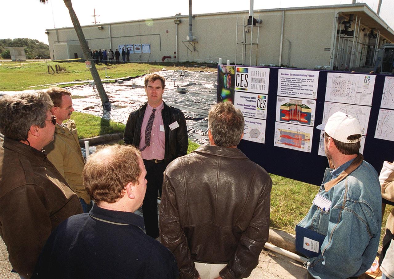
At Launch Complex 34, Greg Beyke, with Current Environmental Solutions, talks to representatives from environmental and federal agencies about the environmental research project that involves the Department of Defense, Environmental Protection Agency, Department of Energy and NASA in a groundwater cleanup effort. Concentrations of trichloroethylene solvent have been identified in the soil at the complex as a result of cleaning methods for rocket parts during the Apollo Program, which used the complex, in the 60s. The group formed the Interagency NDAPL Consortium (IDC) to study three contamination cleanup technologies: Six Phase Soil Heating, Steam Injection and In Situ Oxidation with Potassium Permanganate. All three methods may offer a way to remove the contaminants in months instead of decades. KSC hosted a two-day conference that presented information and demonstrations of the three technologies being tested at the site
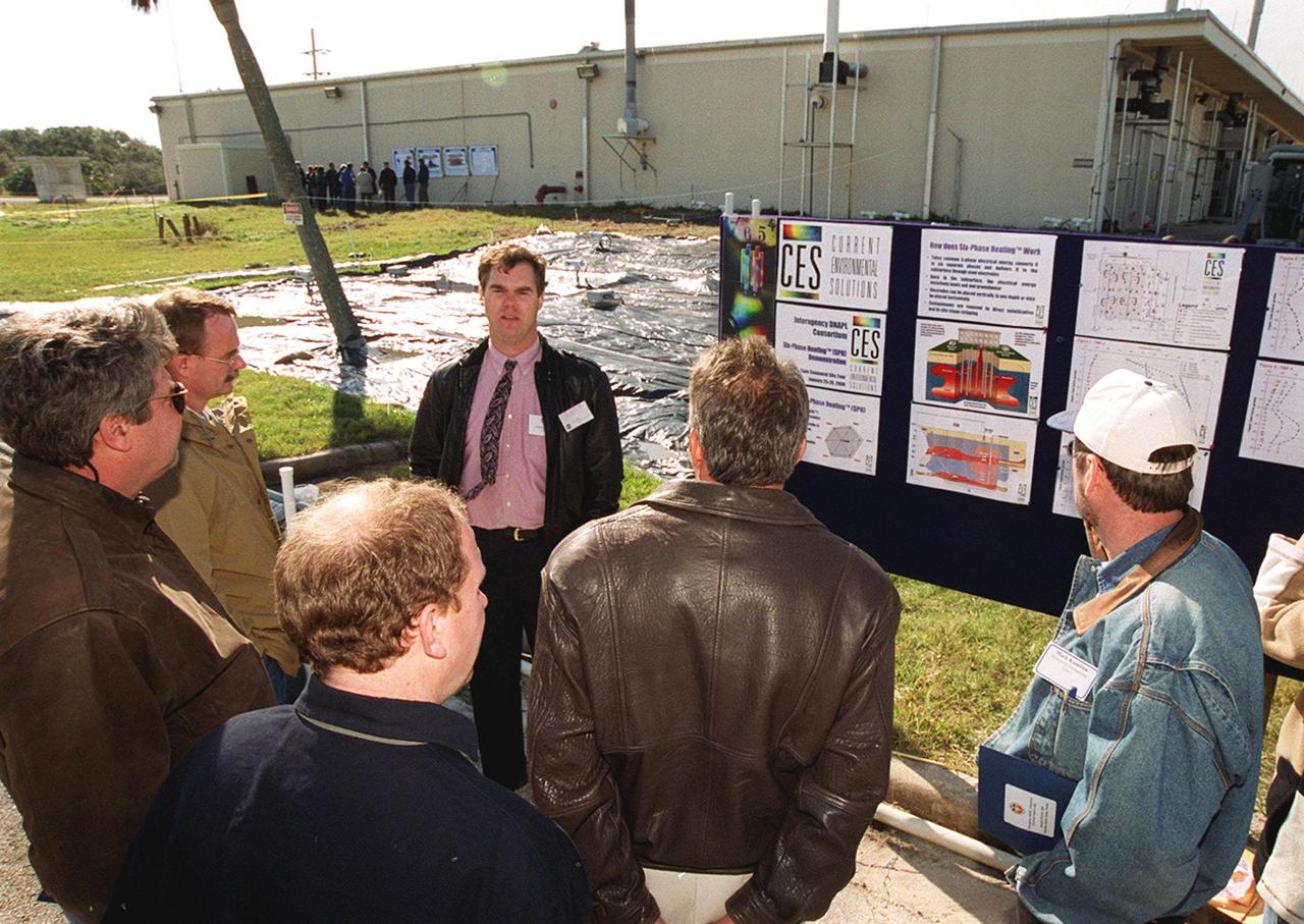
At Launch Complex 34, Greg Beyke, with Current Environmental Solutions, talks to representatives from environmental and federal agencies about the environmental research project that involves the Department of Defense, Environmental Protection Agency, Department of Energy and NASA in a groundwater cleanup effort. Concentrations of trichloroethylene solvent have been identified in the soil at the complex as a result of cleaning methods for rocket parts during the Apollo Program, which used the complex, in the 60s. The group formed the Interagency NDAPL Consortium (IDC) to study three contamination cleanup technologies: Six Phase Soil Heating, Steam Injection and In Situ Oxidation with Potassium Permanganate. All three methods may offer a way to remove the contaminants in months instead of decades. KSC hosted a two-day conference that presented information and demonstrations of the three technologies being tested at the site
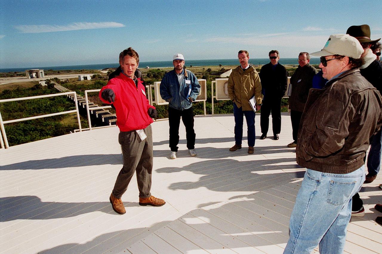
On top of the block house at Launch Complex 34, representatives from environmental and Federal agencies hear from Laymon Gray, with Florida State University, about the environmental research project that involves the Department of Defense, Environmental Protection Agency, Department of Energy and NASA in a groundwater cleanup effort. Concentrations of trichloroethylene solvent have been identified in the soil at the complex as a result of cleaning methods for rocket parts during the Apollo Program, which used the complex, in the 60s. The group formed the Interagency NDAPL Consortium (IDC) to study three contamination cleanup technologies: Six Phase Soil Heating, Steam Injection and In Situ Oxidation with Potassium Permanganate. All three methods may offer a way to remove the contaminants in months instead of decades. In the background (left) can be seen the cement platform and walkway from the block house to the pad. Beyond it is the Atlantic Ocean. KSC hosted a two-day conference that presented information and demonstrations of the three technologies being tested at the site
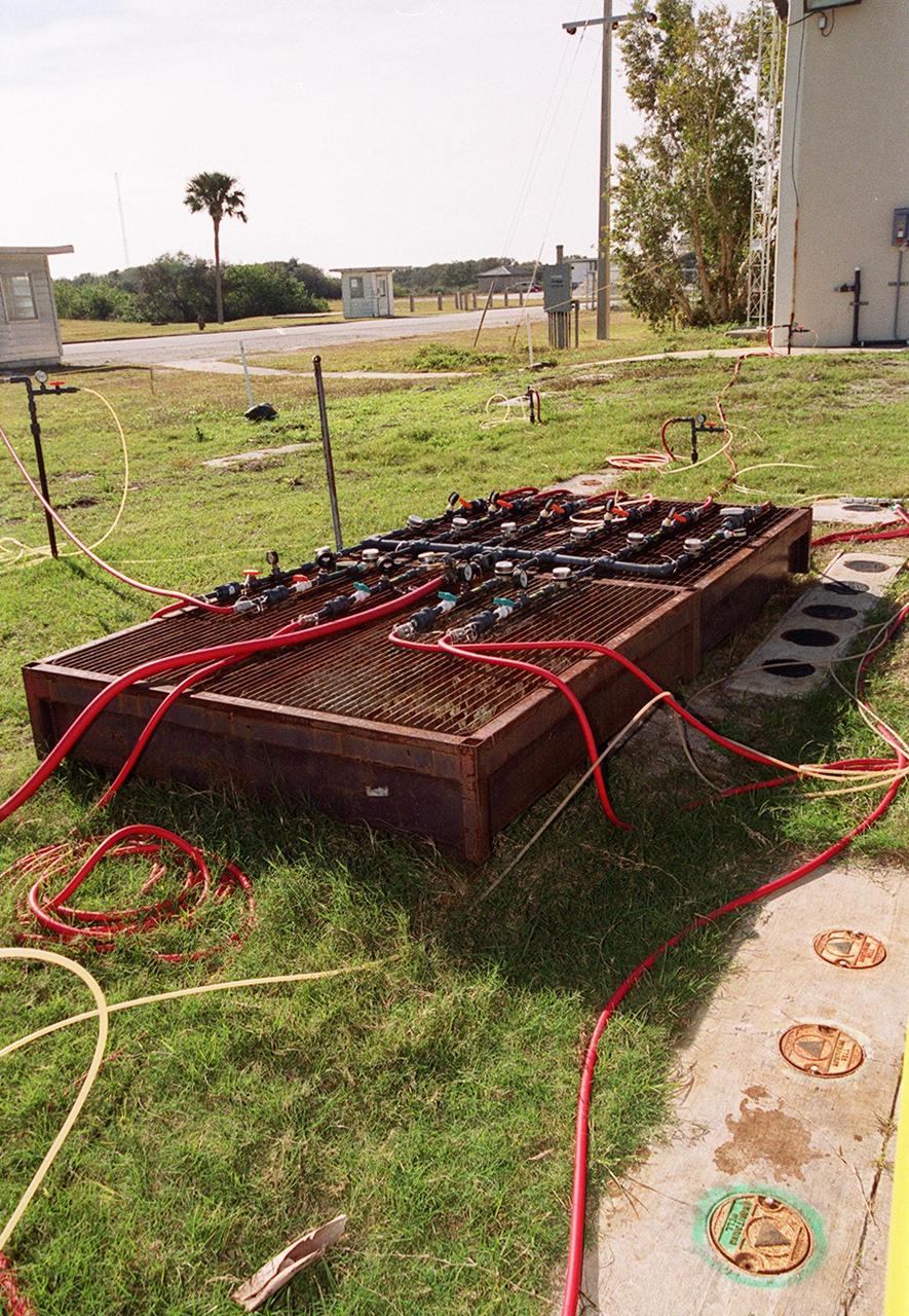
At Launch Complex 34, Cape Canaveral Air Station, several studies are under way for groundwater cleanup of trichloroethylene at the site. Shown here is monitoring equipment for one of the methods, potassium permanganate oxidation. Concentrations of trichloroethylene solvent have been identified in the soil at the complex as a result of cleaning methods for rocket parts during the Apollo Program in the 60s. The environmental research project involves the Department of Defense, Environmental Protection Agency, Department of Energy and NASA, who formed the Interagency NDAPL Consortium (IDC), to study three contamination cleanup technologies: Six Phase Soil Heating, Steam Injection and In Situ Oxidation with Potassium Permanganate. All three methods may offer a way to remove the contaminants in months instead of decades. KSC hosted a two-day conference that presented information and demonstrations of the three technologies for representatives from environmental and federal agencies
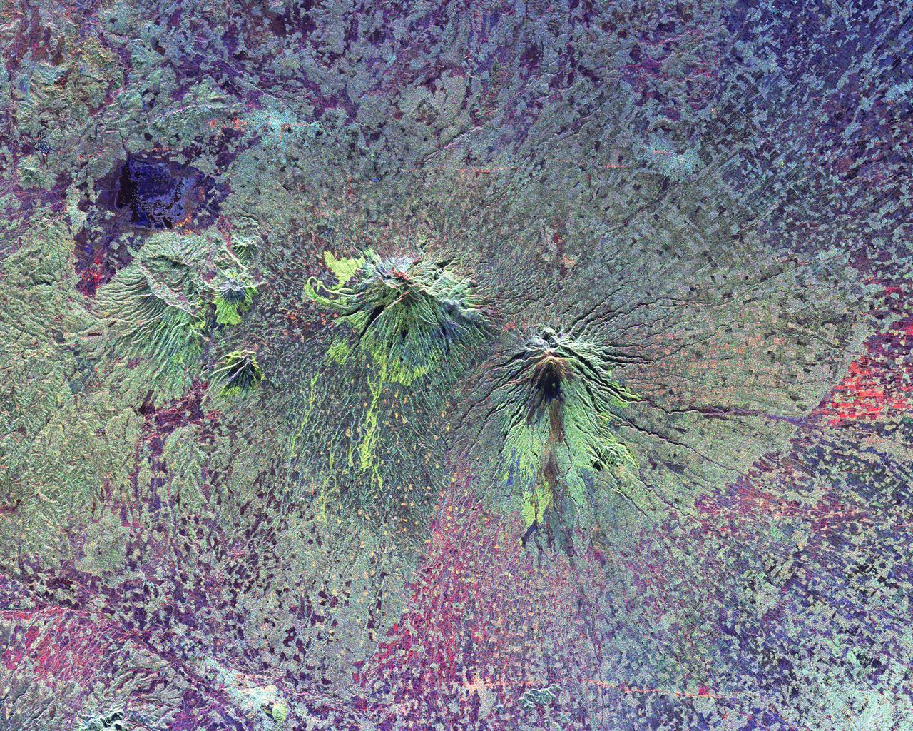
The summits of two large volcanoes in Central Java, Indonesia are shown in the center of this radar image. Lava flows of different ages and surface roughness appear in shades of green and yellow surrounding the summit of Mt. Merbabu (mid-center) and Mt. Merapi (lower center). Mt. Merapi erupted on November 28, 1994 about six weeks after this image was taken. The eruption killed more than 60 people and forced the evacuation of more than 6,000 others. Thousands of other residents were put on alert due to the possibility of volcanic debris mudflows, called lahars, that threatened nearby towns. Mt. Merapi is located approximately 40 kilometers (25 miles) north of Yogyakarta, the capital of Central Java. The older volcano at the top of the image is unnamed. Lake Rawapening is the dark blue feature in the upper right. The light blue area southeast of the lake is the city of Salatiga. Directly south of Salatiga and southeast of Mt. Merapi is the city of Boyolali. Scientists are studying Mt. Merapi as part of the international "Decade Volcanoes" project, because of its recent activity and potential threat to local populations. The radar data are being used to identify and distinguish a variety of volcanic features. http://photojournal.jpl.nasa.gov/catalog/PIA01782
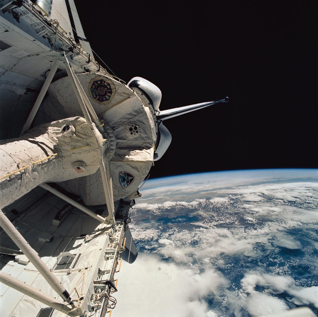
STS058-76-041 (18 Oct-1 Nov 1993) --- Backdropped against the Peru-Bolivia border and part of the Amazon basin, the Spacelab Life Sciences (SLS-2) laboratory module was captured with a 70mm camera, by one of the seven crew members inside the Space Shuttle Columbia's cabin. Part of the tunnel-like passageway is visible in the foreground. Six NASA astronauts and a veterinarian from the private sector spent two weeks devoted to medical research in Earth-orbit. Lake Titicaca, the largest high-altitude lake in the world lies in the Altiplano of Bolivia and Peru. Space Shuttle photography has been used to document fluctuations of several meters of the level of Lake Titicaca during the past decade, as well as to document the eutrophication of the north end of the lake, which is primarily due to increased population in the Peruvian shoreline areas. This view shows the effect of abnormally heavy precipitation of the region for the third successive year. Meteorologists feel this precipitation increase, which may portend another increase of the lake level, is due to the third successive El Nino - Southern Oscillation phenomenon in the 1993 - 94 southern hemisphere summertime. This global phenomenon is now resulting in major weather disturbances in Indonesia, California, Texas and elsewhere.
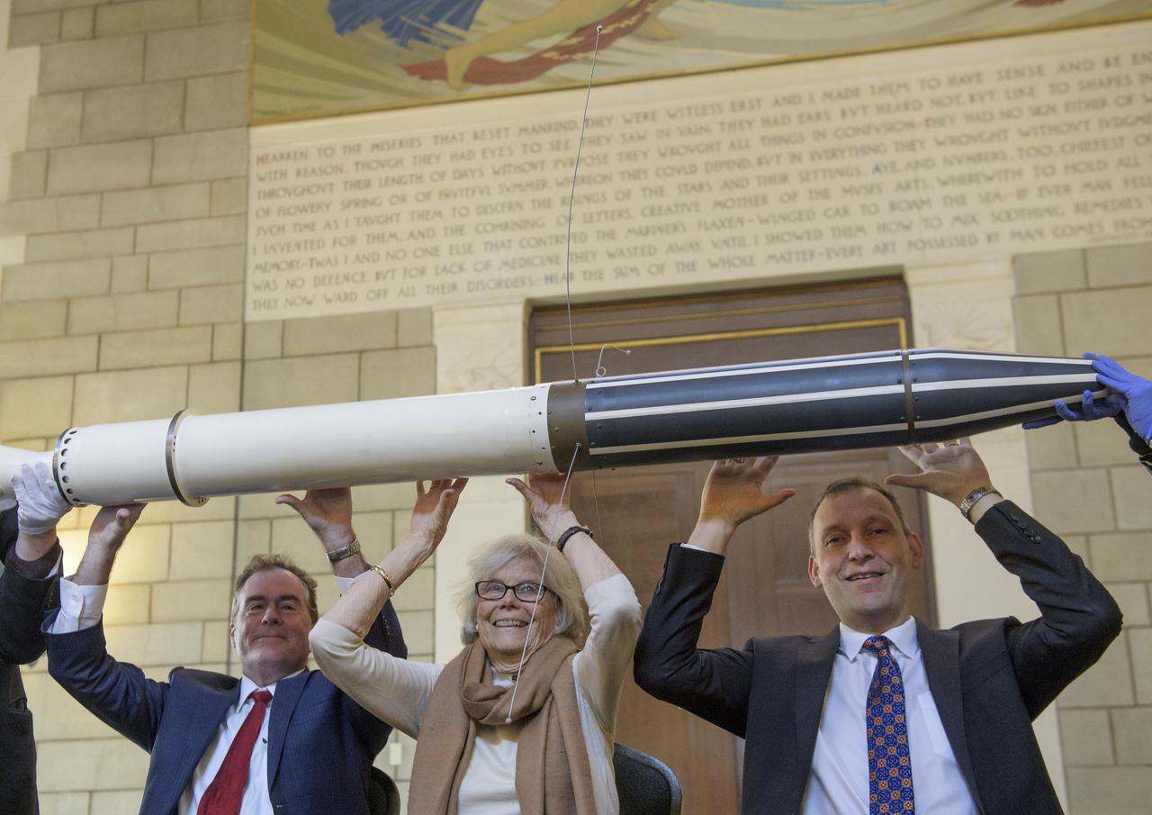
Michael Watkins, Director of NASA's Jet Propulsion Laboratory, left, Susan Finley, who began working at NASA's Jet Propulsion Laboratory in January 1958 as a "human computer", center, and Thomas Zurbuchen, Associate Administrator for NASA's Science Mission Directorate, right, reenact the famous picture of Dr. William H. Pickering, Dr. James A. van Allen, and Dr. Wernher von Braun, hoisting a model of Explorer 1 above their heads at a press conference announcing the satellite's success with a replica of the Explorer 1 satellite during an event celebrating the 60th Anniversary of the Explorer 1 mission and the discovery of Earth's radiation belts, Wednesday, Jan. 31, 2018, at the National Academy of Sciences in Washington. The first U.S. satellite, Explorer 1, was launched from Cape Canaveral on January 31, 1958. The 30-pound satellite would yield a major scientific discovery, the Van Allen radiation belts circling our planet, and begin six decades of groundbreaking space science and human exploration. (NASA/Joel Kowsky)
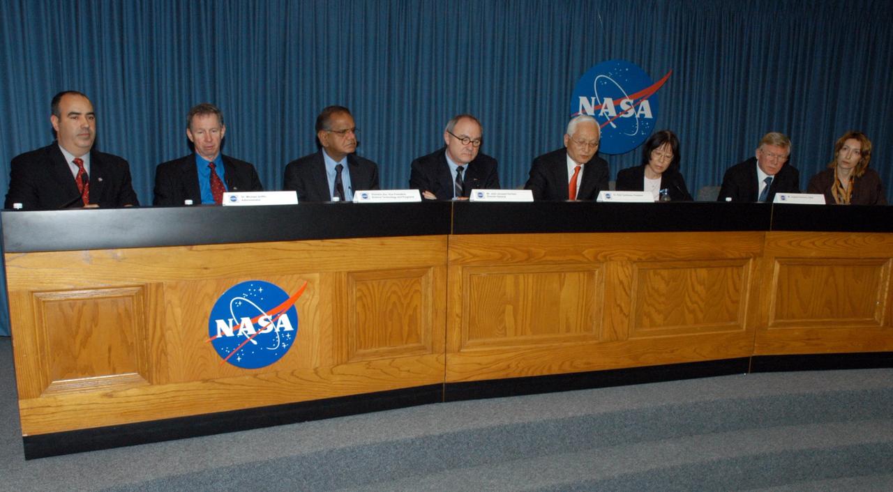
KENNEDY SPACE CENTER, FLA. - Leaders from space agencies around the world participate in a news briefing following the International Space Station Heads of Agency meeting held at Kennedy Space Center. From left are NASA Press Secretary Dean Acosta; NASA Administrator Michael Griffin; Canadian Space Agency Vice-President Space Science, Technology and Programs Virendra Jha; European Space Agency Director-General Jean-Jacques Dordain; Japan Aerospace Exploration Agency President Keiji Tachikawa; Japanese interpreter Masako Kaharia; Russian Federal Space Agency Head Anatolii Perminov; and Russian interpreter Elena Maroko. The purpose of the meeting was to review International Space Station cooperation and endorse a revision to the station configuration and assembly sequence. At the meeting, the partners reaffirmed their agencies' commitment to meet their mutual obligations, to implement six person crew operations in 2009 and an adequate number of shuttle flights to complete the assembly of the space station by the end of the decade. Photo credit: NASA/George Shelton
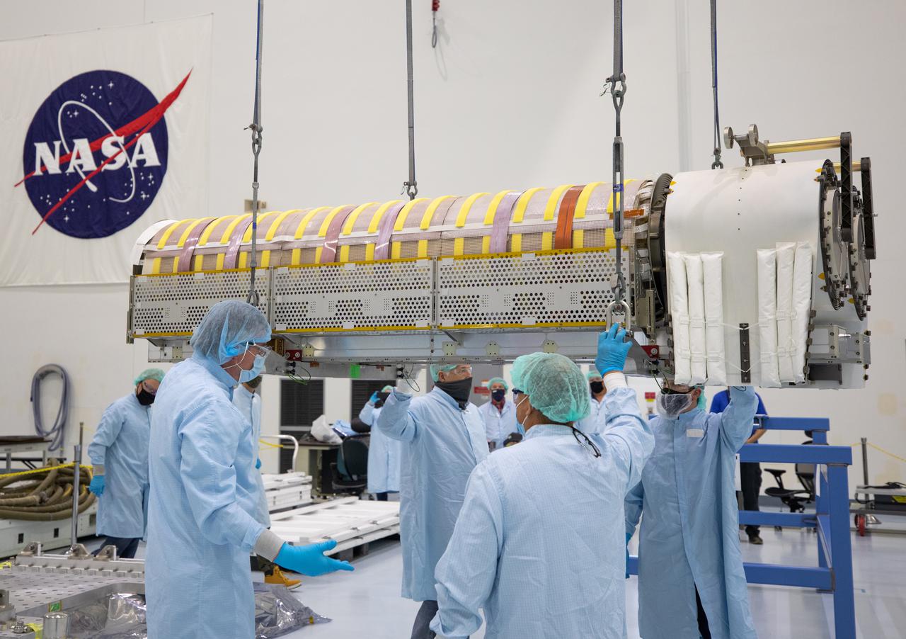
NASA and Boeing workers lift solar arrays into flight support equipment on April 2, 2021, in the Space Station Processing Facility at NASA’s Kennedy Space Center in Florida. The 63- by- 20-foot solar arrays will launch to the International Space Station later this year. They are the first two of six new solar arrays that in total will produce more than 120 kilowatts of electricity from the Sun’s energy, enough to power more than 40 average U.S. homes. Combined with the eight original, larger arrays, this advanced hardware will provide 215 kilowatts of energy, a 20 to 30 percent increase in power, helping maximize the space station’s capabilities for years to come. The arrays will produce electricity to sustain the station’s systems and equipment, plus augment the electricity available to continue a wide variety of public and private experiments and research in the microgravity environment of low-Earth orbit. Most of the station systems, including its batteries, scientific equipment racks, and communications equipment have been upgraded since humans began a continuous presence on the orbiting laboratory in November 2000. For more than two decades, astronauts have lived and worked on this unique orbiting lab, supporting scientific research that has led to numerous discoveries that benefit people on Earth and prepare for future Artemis missions to the Moon and beyond.
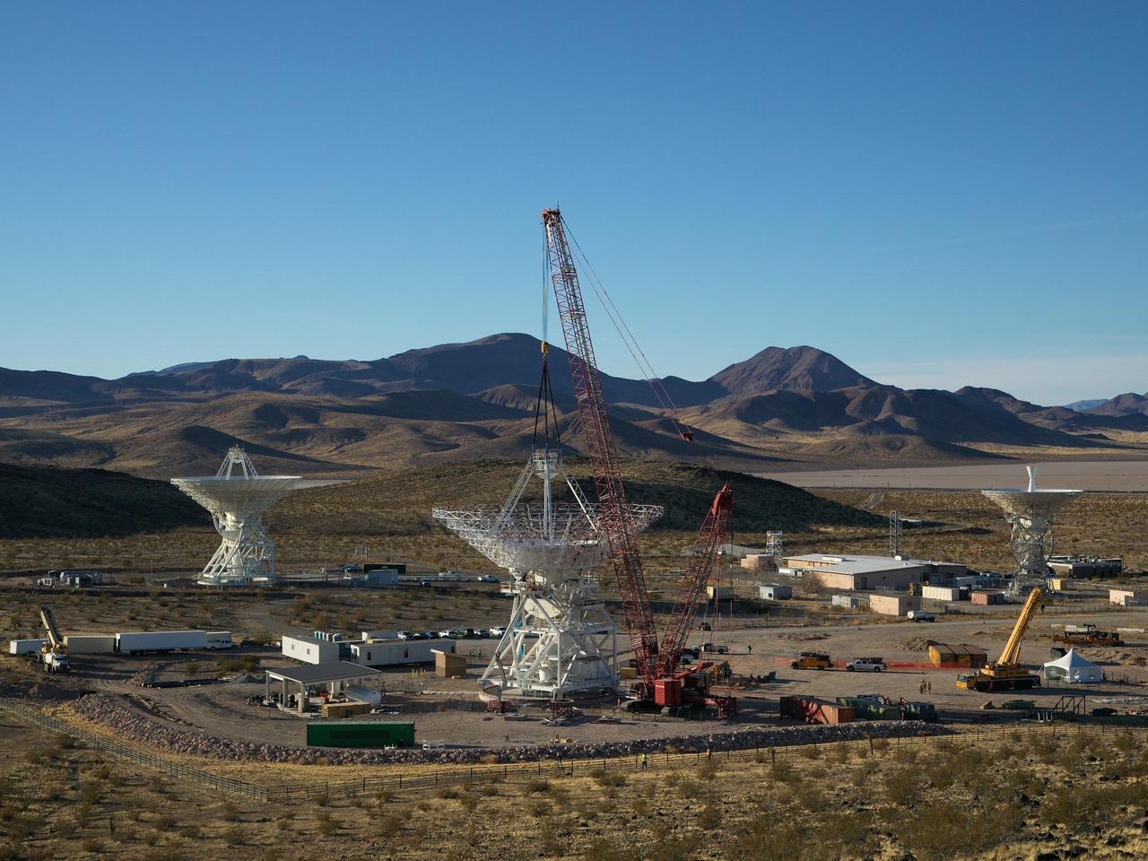
A crane lowers a four-legged support structure called a quadripod onto the steel framework of the Deep Space Station 23 (DSS-23) reflector dish on Dec. 18, 2024. The reflector framework was bolted into place earlier in the day, and the quadripod, which weighs 16 ½ tons, was the last major component to be installed that day. The reflector dish will be fitted with panels to create a curved surface to collect radio frequency signals. The quadripod features a curved subreflector that will direct radio frequency signals from deep space that bounce off the main reflector into the antenna's receiver in its pedestal, where the antenna's receivers are housed. The new 112-foot-wide (34-meter-wide) dish is located at the Deep Space Network's Goldstone Space Communications Complex near Barstow, California. A multi-frequency beam waveguide antenna, DSS-23 will come online in 2026, boosting the DSN's capacity and enhance NASA's deep space communications capabilities for decades to come. It is the fifth of six new beam waveguide antennas to be added to the network, following DSS-53, which was added at the DSN's Madrid complex in 2022. The DSN allows missions to track, send commands to, and receive scientific data from faraway spacecraft. It is managed by NASA's Jet Propulsion Laboratory in Southern California for the agency's Space Communications and Navigation (SCaN) program, which is located at NASA Headquarters within the Space Operations Mission Directorate. https://photojournal.jpl.nasa.gov/catalog/PIA26455
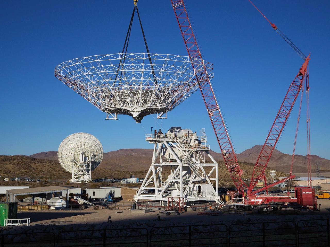
A crane lowers the 112-foot-wide (34-meter-wide) steel framework for the Deep Space Station 23 (DSS-23) reflector dish into position on Dec. 18, 2024, at the Deep Space Network's Goldstone Space Communications Complex near Barstow, California. A multi-frequency beam waveguide antenna, DSS-23 will boost the DSN's capacity and enhance NASA's deep space communications capabilities for decades to come. Once online in 2026, DSS-23 will be the fifth of six new beam waveguide antennas to be added to the network, following DSS-53, which was added at the DSN's Madrid complex in 2022. After the reflector skeleton was bolted into place, engineers placed what's called a quadripod into the center of the structure. A four-legged support structure weighing 16 ½ tons, the quadripod is fitted with a curved subreflector that will direct radio frequency signals from deep space that bounce off the main reflector into the antenna's pedestal where the antenna's receivers are housed. Next steps: to fit panels onto the steel skeleton of the parabolic reflector to create a curved surface to collect radio frequency signals. The DSN allows missions to track, send commands to, and receive scientific data from faraway spacecraft. It is managed by NASA's Jet Propulsion Laboratory in Southern California for the agency's Space Communications and Navigation (SCaN) program, which is located at NASA Headquarters within the Space Operations Mission Directorate. https://photojournal.jpl.nasa.gov/catalog/PIA26454
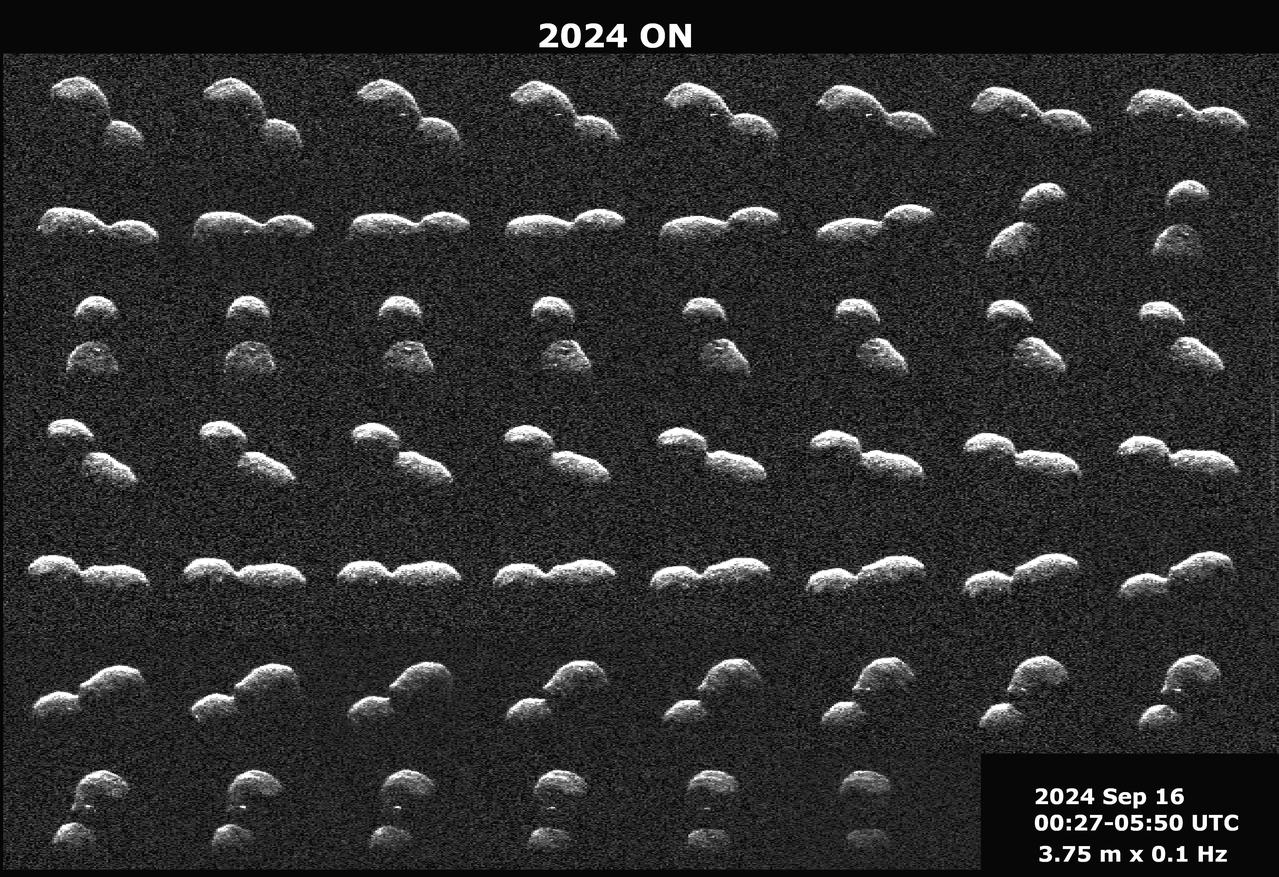
This series of radar images obtained by the Deep Space Network's Goldstone Solar System Radar near Barstow, California, on Sept. 16, 2024, shows the near-Earth asteroid 2024 ON a day before its close approach with our planet. The asteroid passed Earth at a distance of 620,000 miles (1 million kilometers) – about 2.6 times the distance between the Moon and Earth. Discovered by the NASA-funded Asteroid Terrestrial-impact Last Alert System (ATLAS) on Mauna Loa in Hawaii on July 27, the near-Earth asteroid's shape resembles that of a peanut. Like the asteroid 2024 JV33 that made close approach with Earth a month earlier, 2024 ON is likely a contact binary, with two rounded lobes separated by a pronounced neck, one lobe about 50% larger than the other. The radar images determined that it is about 1150 feet (350 meters) long. Features larger than 12.3 feet (3.75 meters) across can be seen on the surface. Bright radar spots on the asteroid's surface likely indicate large boulders. The images show about 90% of one rotation over the course of about six hours. Radar is the principal technique for discovering contact binaries, dozens of which have been imaged by planetary radar. At least 14% of near-Earth asteroids larger than about 200 meters (660 feet) have a contact binary shape. This asteroid is classified as potentially hazardous, but it does not pose a hazard to Earth for the foreseeable future. These Goldstone measurements have allowed scientists to greatly reduce the uncertainties in the asteroid's distance from Earth and in its future motion for many decades. Animation available at https://photojournal.jpl.nasa.gov/catalog/PIA26451

ISS031-E-006398 (30 April 2012) --- Lake Powell and the Rincon in Utah are featured in this image photographed by an Expedition 31 crew member on the International Space Station. This photograph highlights part of Lake Powell; the lake extends across southeastern Utah and northeastern Arizona. Lake Powell started filling in 1963 when the Glen Canyon Dam on the Colorado River in Arizona was completed, and Glen Canyon flooded. The serpentine water surface of the reservoir-highlighted by gray regions of sunglint-follows the incised course of the canyon. Today Lake Powell is part of the Glen Canyon National Recreation Area which extends for more than 186 miles along the shoreline and side canyons. The primary intended use of Lake Powell?s water is support of agricultural production, with a small portion allocated to urban use in Arizona, Nevada, and California. The reservoir did not reach its maximum capacity of 27 million acre-feet until 1980. More recently, extended drought conditions in the southwestern United States over the past decade have resulted in a significant lowering of the Lake water level and emergence of parts of Glen Canyon. Should average precipitation in the Colorado River watershed lessen (as predicted by regional climate change models), that could result in further lowering of the Lake Powell water level and changes to the current water management plans. Fluctuations in water levels and change of river courses are a common occurrence seen in the geologic record of rivers. Looking somewhat like a donut or automobile tire from the vantage point of the space station, the Rincon (center) is an entrenched and abandoned meander, or loop, of the Colorado River, thought to have formed several thousand years ago when the river cut straight across the ends of the loop and shortened its course by six miles. The resulting canyon and 600 ? 750 feet-high central mesa indicate where the river used to flow. The term ?Rincon? also is used by geomorphologists to describe similar ancient river features observed elsewhere. The Goosenecks of the San Juan River are an example of an active entrenched meander.
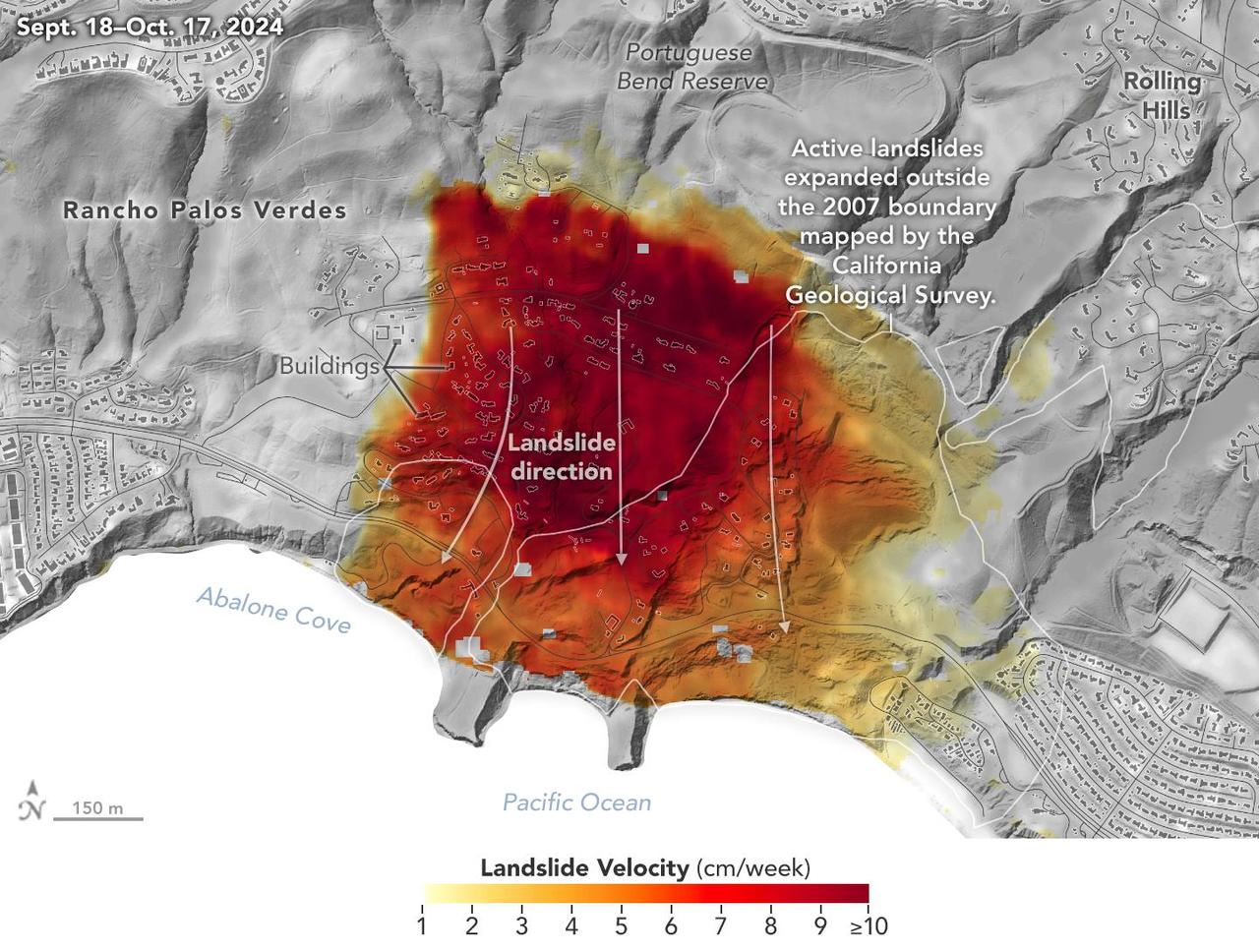
Researchers at NASA's Jet Propulsion Laboratory in Southern California used data from an airborne radar to measure the movement of the slow-moving landslides on the Palos Verdes Peninsula in Los Angeles County. The analysis determined that, during a period of four weeks in the fall of 2024, land in the residential area slid toward the ocean by as much as 4 inches (10 centimeters) per week. Portions of the peninsula, which juts into the Pacific Ocean just south of the city of Los Angeles, is part of an ancient complex of landslides and has been moving for at least the past six decades, affecting hundreds of buildings in local communities. The motion accelerated and the active area expanded following record-breaking rainfall in Southern California in 2023 and another heavy-precipitation winter in 2024. To create this visualization, the Advanced Rapid Imaging and Analysis (ARIA) team used data from four flights of NASA's Uninhabited Aerial Vehicle Synthetic Aperture Radar (UAVSAR) that took place between Sept. 18 and Oct. 17. The UAVSAR instrument was mounted to a Gulfstream III jet flown out of NASA's Armstrong Flight Research Center in Edwards, California, and the four flights were planned to estimate the speed and direction of the landslides in three dimensions. In the image, colors indicate how fast parts of the landslide complex were moving in late September and October, with the darkest reds indicating the highest speeds. The arrows represent the direction of horizontal motion. The white solid lines are the boundaries of active landslide areas as defined in 2007 by the California Geological Survey. The insights from the UAVSAR flights were part of a package of analyses by the ARIA team that also used data from ESA's (the European Space Agency's) Copernicus Sentinel-1A/B satellites. The analyses were provided to California officials to support the state's response to the landslides and made available to the public at NASA's Disaster Mapping Portal. The ARIA mission is a collaboration between JPL and Caltech, which manages JPL for NASA, to leverage radar and optical remote-sensing, GPS, and seismic observations for science as well as to aid in disaster response. The project investigates the processes and impacts of earthquakes, volcanoes, landslides, fires, subsurface fluid movement, and other natural hazards. UAVSAR has flown thousands of radar missions around the world since 2007 studying phenomena such as glaciers and ice sheets, vegetation in ecosystems, and natural hazards like earthquakes, volcanoes, and landslides. https://photojournal.jpl.nasa.gov/catalog/PIA26495
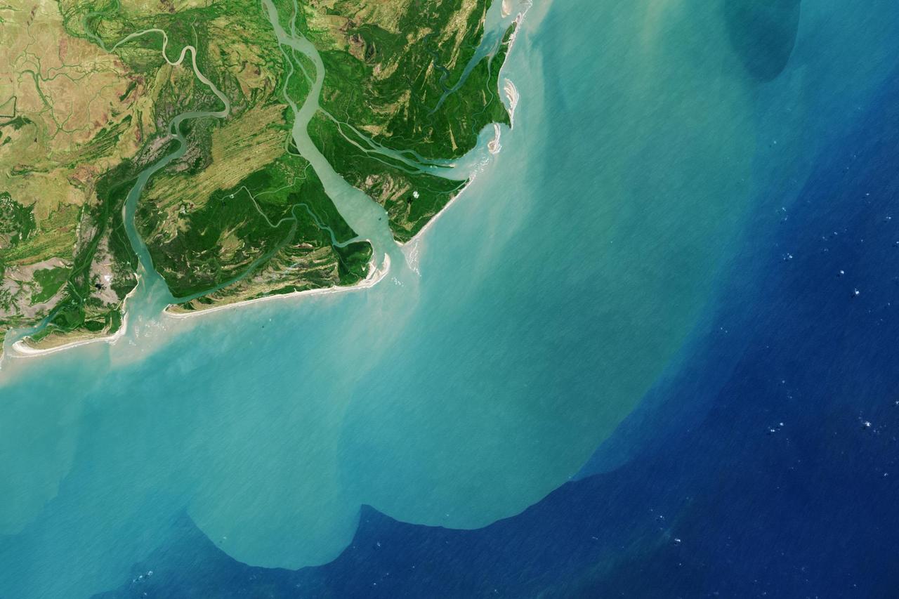
It drains a watershed that spans eight countries and nearly 1.6 million square kilometers 600,000 square miles. The Zambezi also Zambeze is the fourth largest river in Africa, and the largest east-flowing waterway. The Operational Land Imager on the Landsat 8 satellite acquired this natural-color image of the Zambezi Delta on August 29, 2013. Sandbars and barrier spits stretch across the mouths of the delta, and suspended sediment extends tens of kilometers out into the sea. The sandy outflow turns the coastal waters to a milky blue-green compared to the deep blue of open water in the Indian Ocean. The Zambezi Delta includes 230 kilometers of coastline fronting 18,000 square kilometers (7,00 square miles) of swamps, floodplains, and even savannahs (inland). The area has long been prized by subsistence fishermen and farmers, who find fertile ground for crops like sugar and fertile waters for prawns and fish. Two species of endangered cranes and one of the largest concentration of buffalo in Africa -- among many other species of wildlife -- have found a haven in this internationally recognized wetland. However, the past six decades have brought great changes to the Zambezi Delta, which used to pour more water and sediment off of the continent. Hydropower dams upstream-most prominently, the Kariba and the Cahora Bassa-greatly reduce river flows during the wet season; they also trap sediments that would otherwise flow downstream. The result has been less water reaching the delta and the floodplains, which rely on pulses of nutrients and sediments from annual (and mostly benign) natural flooding. The change in the flow of the river affects freshwater availability and quality in the delta. Strong flows push fresh water further out into the sea and naturally keep most of a delta full of fresh (or mostly fresh) water. When that fresh flow eases, the wetlands become drier and more prone to fire. Salt water from the Indian Ocean also can penetrate further into the marsh, upsetting the ecological balance for aquatic plant and animal species. Researchers have found that the freshwater table in the delta has dropped as much as five meters in the 50 years since dams were placed on the river. Less river flow also affects the shape and extent of the delta. Today there is less sediment replenishing the marshes and beaches as they are scoured by ocean waves and tides. "What strikes me in this image is the suspended sediment offshore," said Liviu Giosan, a delta geologist at the Woods Hole Oceanographic Institution. "Sediment appears to be transferred from the delta offshore in plumes that not only originate in active river mouths but also from deactivated former mouths, now tidal channels. This shows the power of tidal scouring contributing to the slow but relentless erosion of the delta." http://photojournal.jpl.nasa.gov/catalog/PIA18155