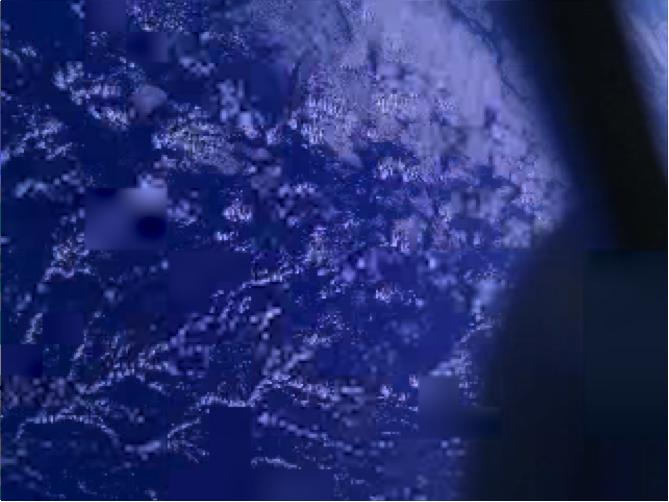
These images of Earth were reconstructed from photos taken by three smartphones in orbit, or "PhoneSats." The trio of PhoneSats launched on April 21, 2013, aboard the Antares rocket from NASA's Wallops Flight Facility and ended a successful mission on April 27. The ultimate goal of the PhoneSat mission was to determine whether a consumer-grade smartphone can be used as the main flight avionics for a satellite in space. During their time in orbit, the three miniature satellites used their smartphone cameras to take pictures of Earth and transmitted these "image-data packets" to multiple ground stations. Every packet held a small piece of the big picture. As the data became available, the PhoneSat Team and multiple amateur radio operators around the world collaborated to piece together photographs from the tiny data packets. Read more: <a href="http://1.usa.gov/ZsWnQG" rel="nofollow">1.usa.gov/ZsWnQG</a> Credit: NASA/Ames <b><a href="http://www.nasa.gov/audience/formedia/features/MP_Photo_Guidelines.html" rel="nofollow">NASA image use policy.</a></b> <b><a href="http://www.nasa.gov/centers/goddard/home/index.html" rel="nofollow">NASA Goddard Space Flight Center</a></b> enables NASA’s mission through four scientific endeavors: Earth Science, Heliophysics, Solar System Exploration, and Astrophysics. Goddard plays a leading role in NASA’s accomplishments by contributing compelling scientific knowledge to advance the Agency’s mission. <b>Follow us on <a href="http://twitter.com/NASA_GoddardPix" rel="nofollow">Twitter</a></b> <b>Like us on <a href="http://www.facebook.com/pages/Greenbelt-MD/NASA-Goddard/395013845897?ref=tsd" rel="nofollow">Facebook</a></b> <b>Find us on <a href="http://instagram.com/nasagoddard?vm=grid" rel="nofollow">Instagram</a></b>
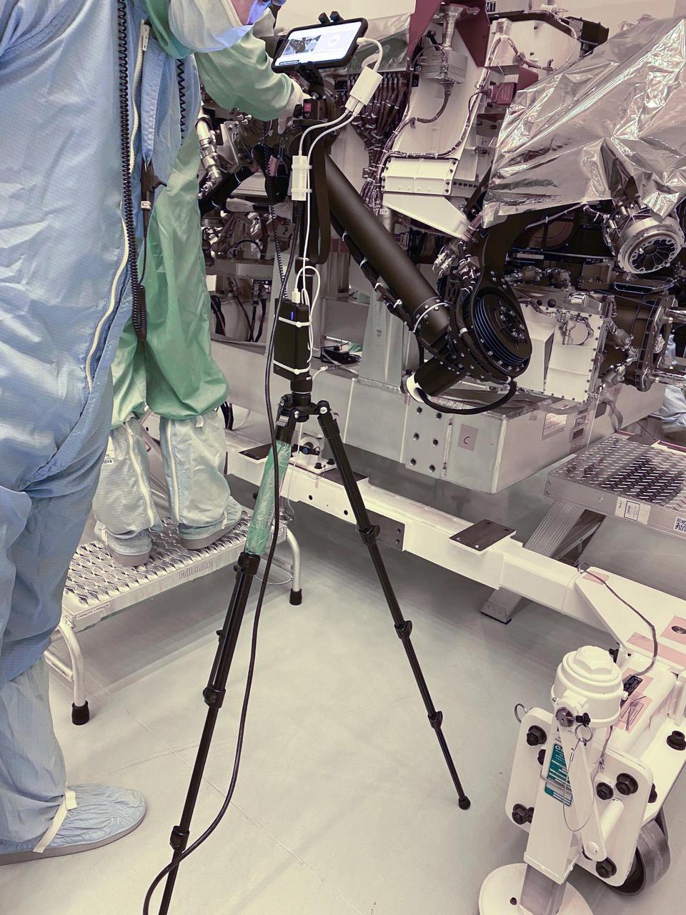
A technician points a smartphone camera at NASA's Perseverance rover during an inspection — called a "walkdown" — at Kennedy Space Center in Florida. The imagery from the phone was seen live by mission engineers watching from their home offices in Southern California. The image was taken on March 31, 2020. https://photojournal.jpl.nasa.gov/catalog/PIA23825
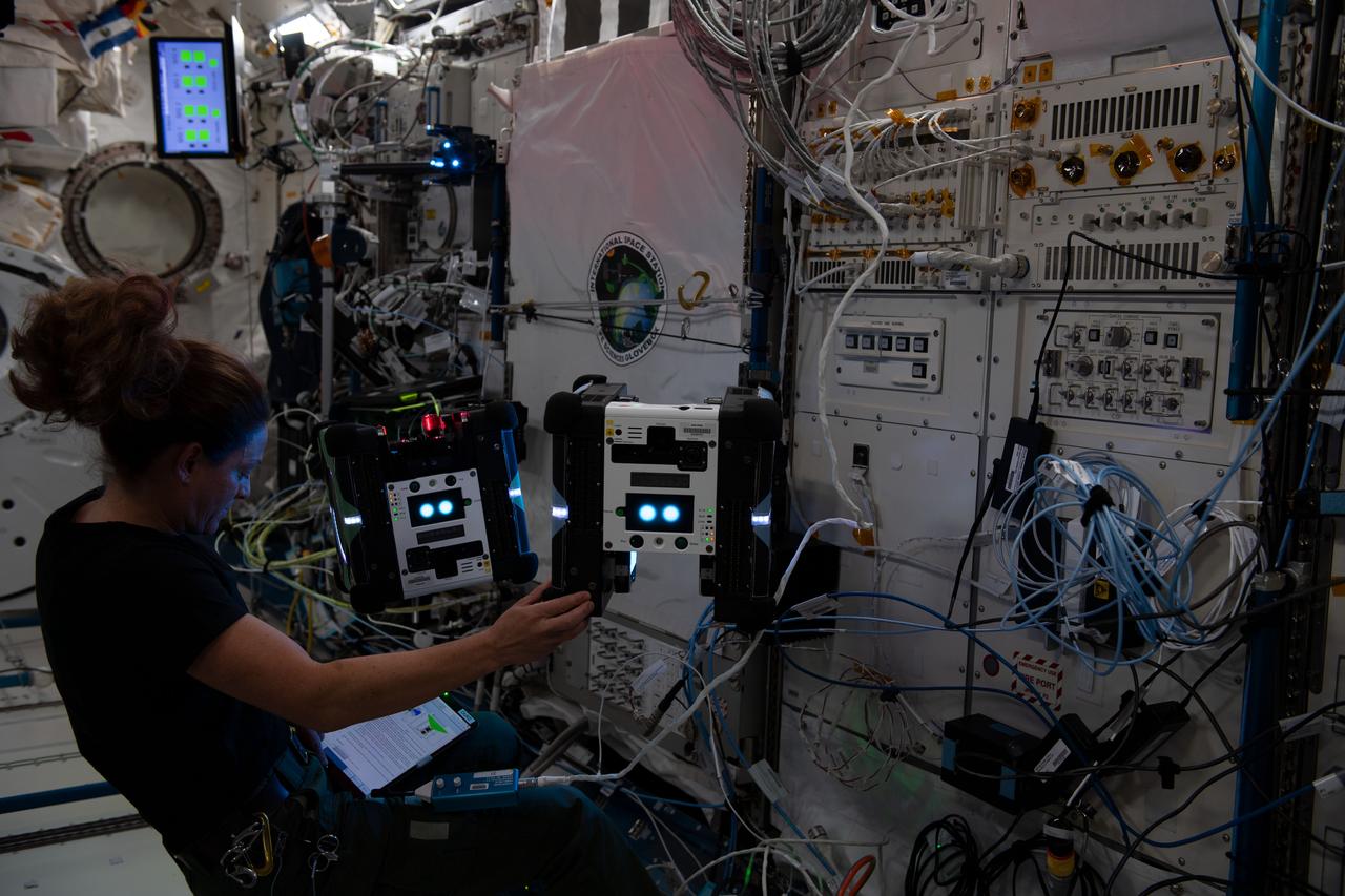
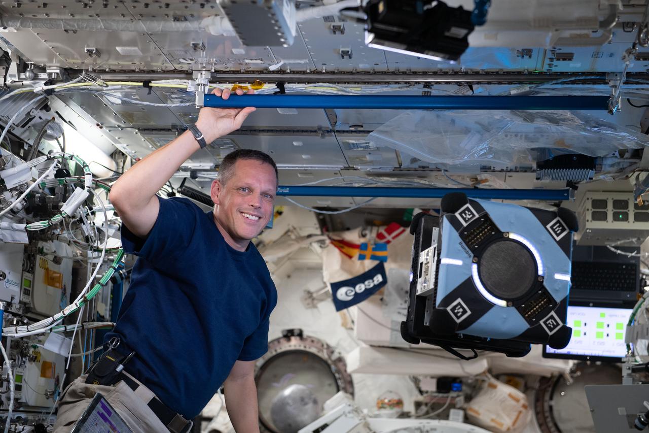
iss068e020703 (Nov. 7, 2022) --- NASA astronaut and Expedition 68 Flight Engineer Nicole Mann works with a pair of free-flying, cube-shaped Astrobee robotic helpers inside the Kibo laboratory module. The toaster-sized, autonomous robots were demonstrating the use of a photogrammetric vision-based technology for guidance, navigation, and control as part of the Smartphone Vision Guidance Sensor experiment.
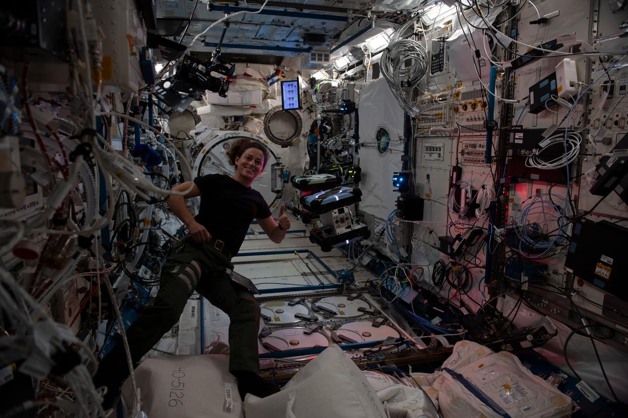
iss068e020734 (Nov. 7, 2022) --- NASA astronaut and Expedition 68 Flight Engineer Nicole Mann poses with a pair of free-flying, cube-shaped Astrobee robotic helpers inside the Kibo laboratory module. The toaster-sized, autonomous robots were demonstrating the use of a photogrammetric vision-based technology for guidance, navigation, and control as part of the Smartphone Vision Guidance Sensor experiment.
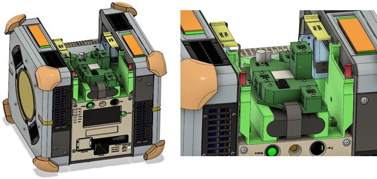
jsc2025e032819 (3/20/2025) --- Integration of Smartphone Video Guidance Sensor (SVGS) beacons and Astrobee using the M561 payload interface. Image courtesy of Hector Gutierrez.
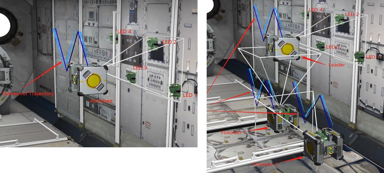
jsc2025e032821 (3/20/2025) --- Smartphone Video Guidance Sensor (SVGS) proximity maneuvers on the International Space Station. Left: navigation based on color-coded targets, Right: formation flight. Image courtesy of Hector Gutierrez.
iss067e149715 (June 24, 2022) --- NASA astronaut and Expedition 67 Flight Engineer Bob Hines monitors an Astrobee robotic free-flyer as it tests its ability to autonomously navigate and maneuver inside the Kibo laboratory module using smartphone technology
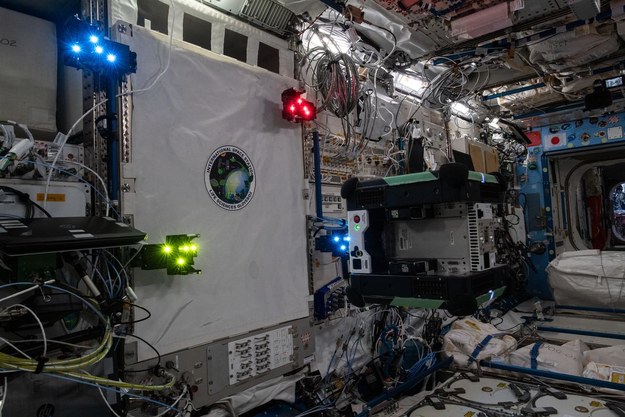
Documentation of a free-flying Astrobee robot (Queen), equipped with an LED Target for the Smartphone Video Guidance Sensor (SVGS) experiment, during SVGS science 3 session. Four SVGS LED Targets are attached to the Life Sciences Glovebox (LSG) rack, JPM1F5 in the Kibo Japanese Experiment Module (JEM).
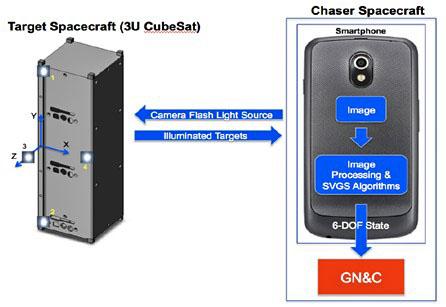
jsc2025e032818 (3/20/2025) --- The operational concept of Smartphone Video Guidance Sensor (SVGS). The target’s six-degrees-of-freedom (6DOF) state can be transmitted from the SVGS device to the spacecraft’s guidance, navigation and control system (GN & C). Image courtesy of Hector Gutierrez.
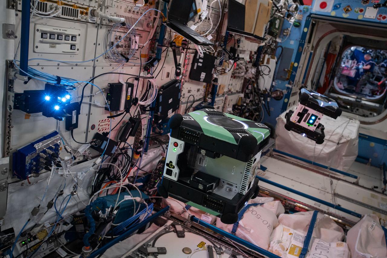
Documentation of two free-flying Astrobee robots (Queen and Bumble), equipped with LED Targets for the Smartphone Video Guidance Sensor (SVGS) experiment, during SVGS science 3 session. An SVGS LED Target is attached to the Life Sciences Glovebox (LSG) rack, JPM1F5 in the Kibo Japanese Experiment Module (JEM).
Boyertown Area High School 12th grade student Ben Maurer uses his smartphone and a photographers lens with a solar filter to make a photograph of the planet Mercury transitting the sun, Monday, May 9, 2016, Boyertown area High School, Boyertown, Pennsylvania. Mercury passes between Earth and the sun only about 13 times a century, with the previous transit taking place in 2006. Photo Credit: (NASA/Bill Ingalls)
12-37-47-2: At the Baikonur Cosmodrome in Kazakhstan, Expedition 40/41 Soyuz Commander Max Suraev of the Russian Federal Space Agency (Roscosmos, left) and NASA Flight Engineer Reid Wiseman (right) look at pictures of their families on a smartphone May 16 prior to a dress rehearsal “fit check” in their Soyuz TMA-13M spacecraft. Suraev, Wiseman and Flight Engineer Alexander Gerst of the European Space Agency will launch from Baikonur on May 29, Kazakh time, in the Soyuz TMA-13M spacecraft for a 5 ½ month mission on the International Space Station. NASA/Victor Zelentsov

Expedition 43 NASA Astronaut Scott Kelly checks his smartphone as he walks from the Zvjozdnyj Hotel to the Cosmonaut Hotel for additional training, Thursday, March 19, 2015 in Baikonur, Kazakhstan. Kelly, and Russian Cosmonauts Gennady Padalka, and Mikhail Kornienko of the Russian Federal Space Agency (Roscosmos) are preparing for launch to the International Space Station in their Soyuz TMA-16M spacecraft from the Baikonur Cosmodrome in Kazakhstan March 28, Kazakh time. As the one-year crew, Kelly and Kornienko will return to Earth on Soyuz TMA-18M in March 2016. Photo Credit: (NASA/Bill Ingalls)
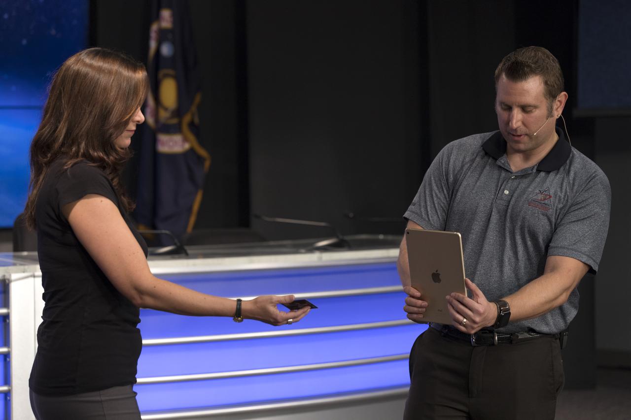
Skip Owen of NASA Launch Services, right, is demonstrating an app that can run on a mobile device such as a smartphone or tablet computer. The app is depicting the launch of the TDRS-M satellite on an Atlas V rocket. The demonstration took place during a briefing focused on preparations to launch NASA's Tracking and Data Relay Satellite, TDRS-M. The latest spacecraft destined for the agency's constellation of communications satellites, TDRS-M will allow nearly continuous contact with orbiting spacecraft ranging from the International Space Station and Hubble Space Telescope to the array of scientific observatories. Liftoff atop a United Launch Alliance Atlas V rocket is scheduled to take place from Space Launch Complex 41 at Cape Canaveral Air Force Station at 8:03 a.m. EDT Aug. 18.
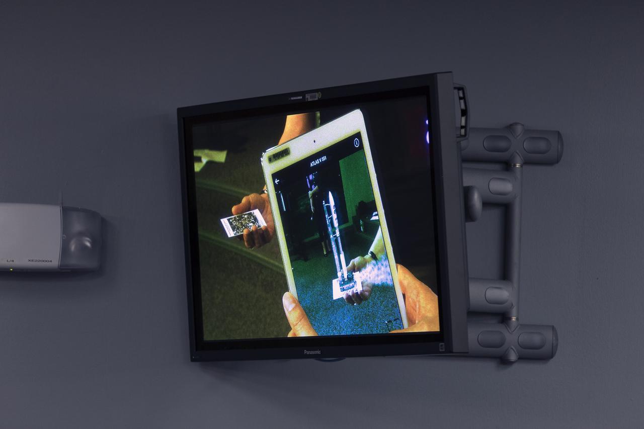
An app is demonstrated that can run on a mobile device such as a smartphone or tablet computer. The app is depicting the launch of the TDRS-M satellite on an Atlas V rocket. The demonstration took place during a briefing focused on preparations to launch NASA's Tracking and Data Relay Satellite, TDRS-M. The latest spacecraft destined for the agency's constellation of communications satellites, TDRS-M will allow nearly continuous contact with orbiting spacecraft ranging from the International Space Station and Hubble Space Telescope to the array of scientific observatories. Liftoff atop a United Launch Alliance Atlas V rocket is scheduled to take place from Space Launch Complex 41 at Cape Canaveral Air Force Station at 8:03 a.m. EDT Aug. 18.
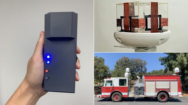
To help locate and track firefighters inside buildings, where other positioning technologies fail, NASA's Jet Propulsion Laboratory and the Department of Homeland Security Science and Technology Directorate (S&T) are developing POINTER. Short for Precision Outdoor and Indoor Navigation and Tracking for Emergency Responders, the system began taking shape in 2014 and is being matured for use by fire departments nationwide. The POINTER system is composed of three parts: a receiver, transmitter, and base station. The receiver (left) has been shrunk from the size of a backpack to the size of a large smartphone, and further development will miniaturize it so it can be easily clipped to a belt buckle. The transmitter (top right) is a system of coils that generate the magnetoquasistatic fields, which — unlike the radio waves used by GPS and radio-frequency identification — are able to pass through construction materials to interact with the receiver, enabling fire crews to track the location and orientation of firefighters. To test the system, transmitters have been attached to an out-of-service firetruck (lower right). Through 2021, POINTER will undergo field tests and a commercial version of POINTER will be made available to fire departments in 2022. https://photojournal.jpl.nasa.gov/catalog/PIA24562
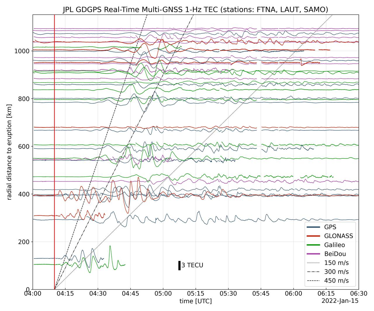
Real-time data collected by the Global Differential Global Positioning System network, operated by NASA's Jet Propulsion Laboratory, shows the atmospheric signature of the Hunga Tonga Hunga Ha'apai volcanic eruption in Tonga on Jan. 15, 2022. The data is a measure of the density of electrons (known as total electron content units, or TECU) in the ionosphere – the outermost layer of the atmosphere, which starts between 50 and 56 miles (80 to 90 kilometers) above Earth's surface. Navigation radio signals, like those received by location sensors on smartphones, are broadcast by global navigation satellite systems (GNSS) and experience delays when passing through the ionosphere. The extent of the delay depends on the density of electrons within the path of the GNSS signal in this atmospheric layer. When an explosive event such as a volcanic eruption or large earthquake injects energy into the atmosphere, the pressure waves from that event change the electron density in the ionosphere. These perturbations show up as tiny changes to the delays that GNSS radio signals usually experience as they pass through the atmosphere. The vertical red line in the data plot indicates the time of the eruption. The horizontal squiggles show electron density profiles picked up in the signals of four GNSS constellations, or groups of satellites: GPS, GLONASS, Galileo, and BeiDou. The slanted dashed and dotted lines indicate the velocity of waves. https://photojournal.jpl.nasa.gov/catalog/PIA24905
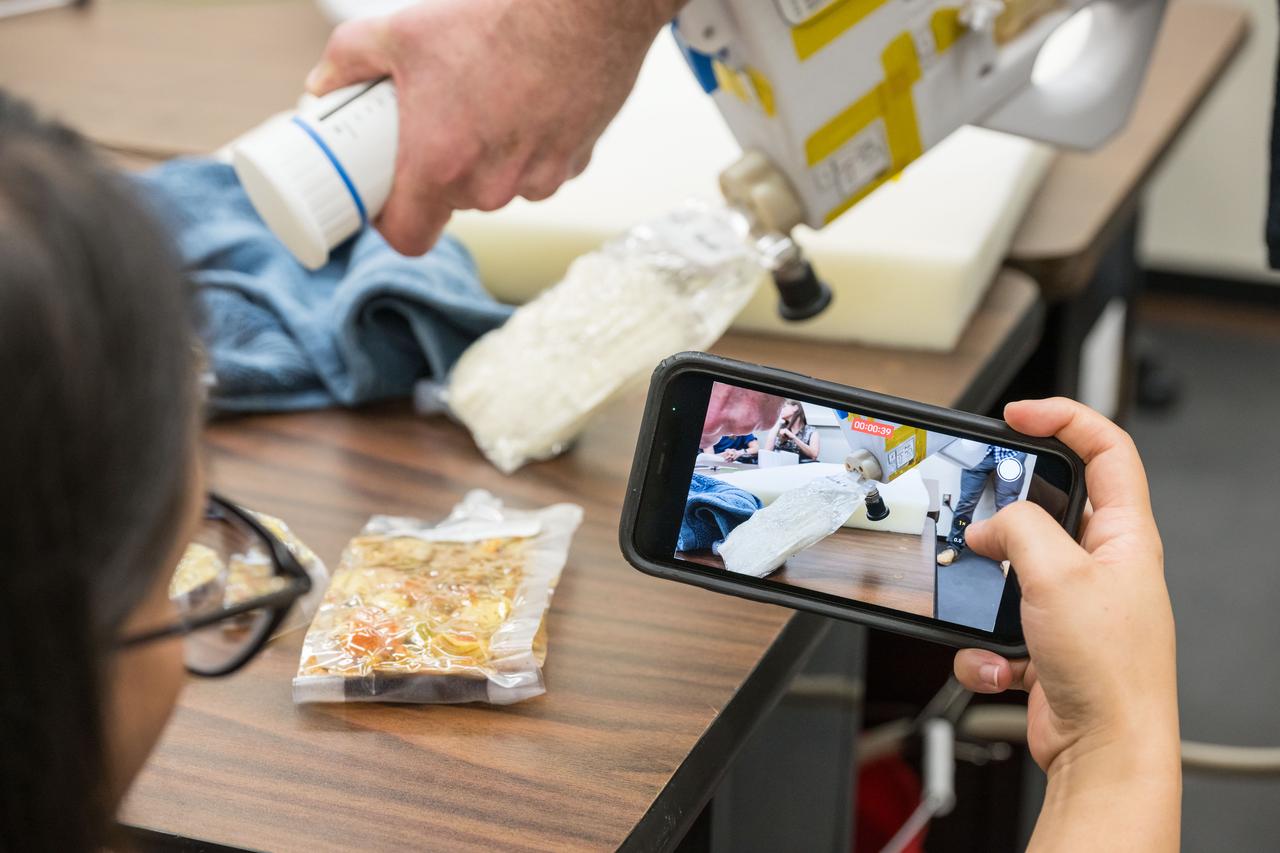
jsc2024e040743 -- A NASA food scientist captures video of the Mini Potable Water Dispenser during testing at Johnson Space Center. Photo Credit: NASA/David DeHoyos
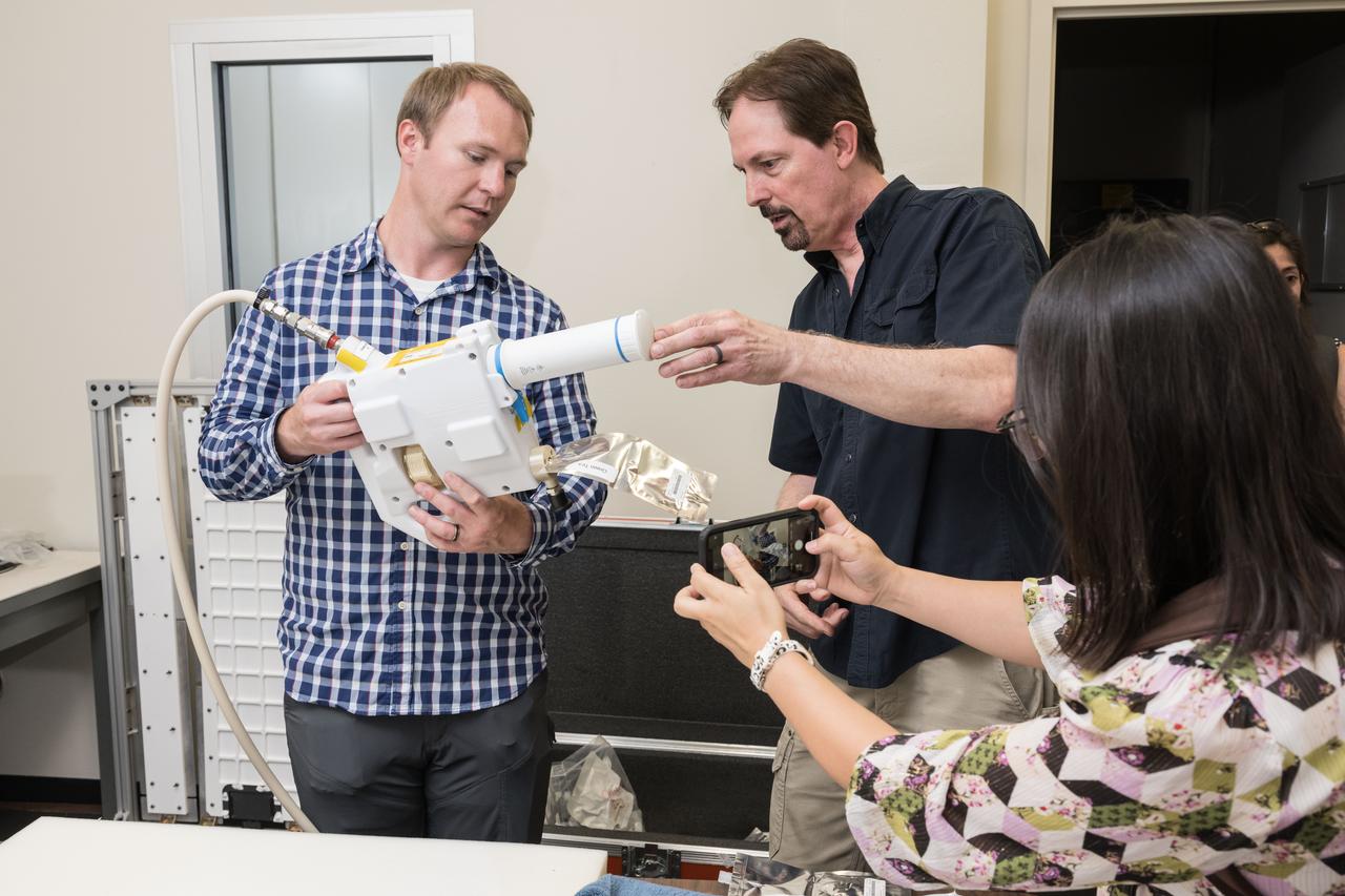
jsc2024e040728 -- Matt Rowell, an engineer from the Marshall Space Flight Center demonstrates the Mini Potable Water Dispenser to NASA food scientists during a testing session. Photo Credit: NASA/David DeHoyos