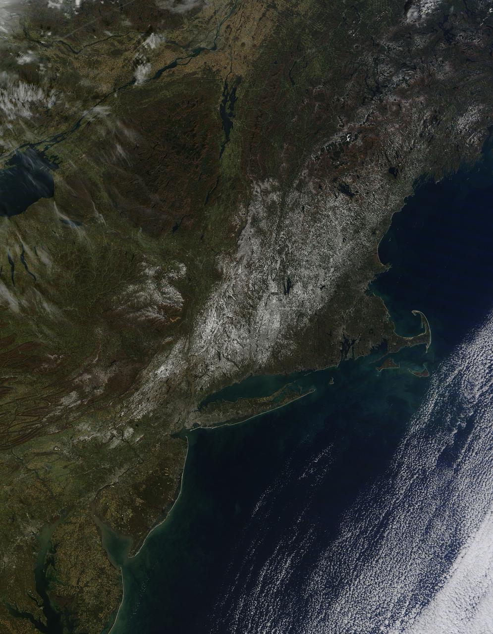
Last weekend's late October snow may have melted in Maryland, Delaware, parts of Pennsylvania and New Jersey, but residents in north central Connecticut are still dealing with the effects of the storm. According to Connecticut Light and Power, 430,868 residents were still without power today, Nov. 3, 2011. For estimated restoration times, visit their website at: <a href="http://www.cl-p.com/stormcenter/estimates/" rel="nofollow">www.cl-p.com/stormcenter/estimates/</a>. A late October snowstorm from a Nor'easter blanketed the eastern U.S. from West Virginia to Maine and broke records the weekend before Halloween Monday. NASA's Aqua satellite flew over the region on October 30 after the snow was ending in New England and captured the ghostly blanket of white. When NASA's Aqua satellite passed over the northeastern U.S. on November 2, 2011 at 2:00 p.m. EDT, the Moderate Resolution Imaging Spectroradiometer (MODIS) instrument captured a detailed image of the remaining snowfall. Snow still covers the ground in western and central Connecticut, southeastern New York, western and central Massachusetts, and parts of Vermont, New Hampshire and Maine. Over the Atlantic, cirrocumulus clouds create a diagonal border. The image was created at NASA's Goddard Space Flight Center in Greenbelt, Md. Image Credit: NASA Goddard MODIS Rapid Response Team; Caption: NASA Goddard, Rob Gutro <b><a href="http://www.nasa.gov/audience/formedia/features/MP_Photo_Guidelines.html" rel="nofollow">NASA image use policy.</a></b> <b><a href="http://www.nasa.gov/centers/goddard/home/index.html" rel="nofollow">NASA Goddard Space Flight Center</a></b> enables NASA’s mission through four scientific endeavors: Earth Science, Heliophysics, Solar System Exploration, and Astrophysics. Goddard plays a leading role in NASA’s accomplishments by contributing compelling scientific knowledge to advance the Agency’s mission. <b>Follow us on <a href="http://twitter.com/NASA_GoddardPix" rel="nofollow">Twitter</a></b> <b>Like us on <a href="http://www.facebook.com/pages/Greenbelt-MD/NASA-Goddard/395013845897?ref=tsd" rel="nofollow">Facebook</a></b> <b>Find us on <a href="http://instagrid.me/nasagoddard/?vm=grid" rel="nofollow">Instagram</a></b>
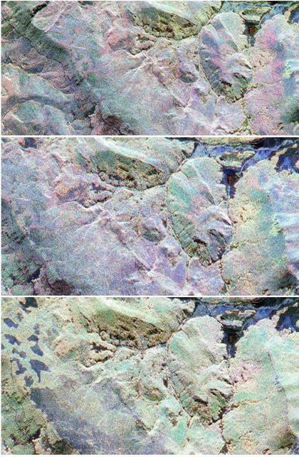
This sequence of three images in northern Colorado, taken by NASA Airborne Synthetic Aperture Radar AIRSAR in 2002, shows Fraser, Colorado, before snowfall, the morning after snow, and after the snow melted.
Observations by NASA Mars Reconnaissance Orbiter have detected carbon-dioxide snow clouds on Mars and evidence of carbon-dioxide snow falling to the surface.
NASA Terra spacecraft captured the snowstorm which swept across the eastern United States on December 4 and 5, 2002, bringing the season first snow to parts of the south and southern Appalachia.
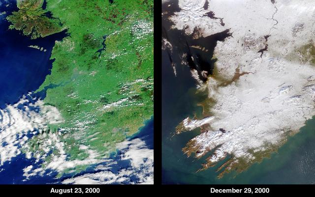
The contrast between summer and winter is apparent in this pair of images of southwestern Ireland acquired by NASA Terra satellite August 23, 2000 left and December 29, 2000 right.
Heavy snowfall on March 12, 2004, across north China Inner Mongolia Autonomous Region, Mongolia and Russia, caused train and highway traffic to stop for several days along the Russia-China border shown here by NASA Terra spacecraft.

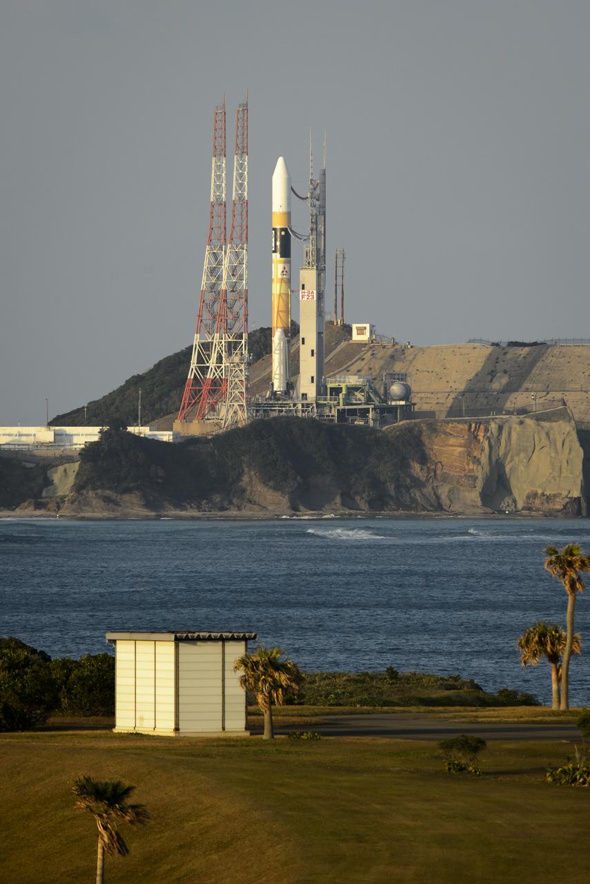
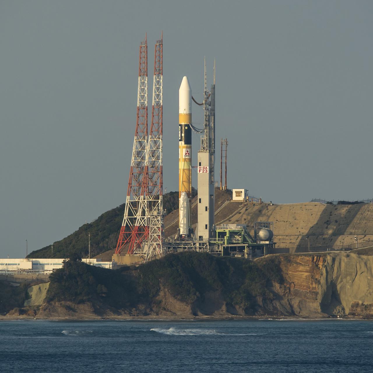
A Japanese H-IIA rocket carrying the NASA-Japan Aerospace Exploration Agency (JAXA), Global Precipitation Measurement (GPM) Core Observatory is seen as it rolls out to launch pad 1 of the Tanegashima Space Center, Thursday, Feb. 27, 2014, Tanegashima, Japan. Once launched, the GPM spacecraft will collect information that unifies data from an international network of existing and future satellites to map global rainfall and snowfall every three hours. Photo Credit: (NASA/Bill Ingalls)

A Japanese H-IIA rocket carrying the NASA-Japan Aerospace Exploration Agency (JAXA), Global Precipitation Measurement (GPM) Core Observatory is seen as it rolls out to launch pad 1 of the Tanegashima Space Center, Thursday, Feb. 27, 2014, Tanegashima, Japan. Once launched, the GPM spacecraft will collect information that unifies data from an international network of existing and future satellites to map global rainfall and snowfall every three hours. Photo Credit: (NASA/Bill Ingalls)
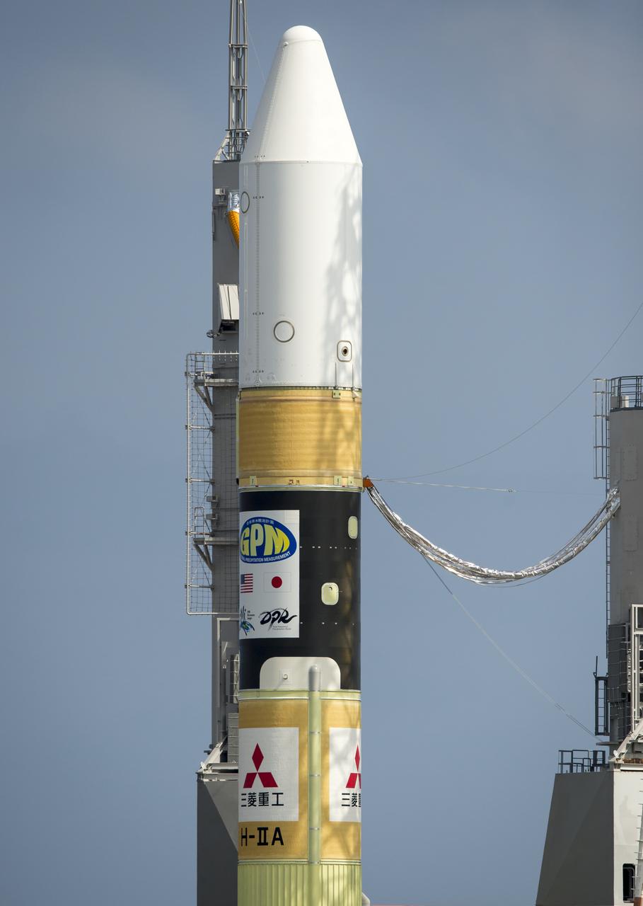
A Japanese H-IIA rocket with the NASA-Japan Aerospace Exploration Agency (JAXA), Global Precipitation Measurement (GPM) Core Observatory onboard is seen on launch pad 1 of the Tanegashima Space Center, Thursday, Feb. 27, 2014, Tanegashima, Japan. Once launched, the GPM spacecraft will collect information that unifies data from an international network of existing and future satellites to map global rainfall and snowfall every three hours. Photo Credit: (NASA/Bill Ingalls)

A Japanese H-IIA rocket carrying the NASA-Japan Aerospace Exploration Agency (JAXA), Global Precipitation Measurement (GPM) Core Observatory is seen as it rolls out to launch pad 1 of the Tanegashima Space Center, Thursday, Feb. 27, 2014, Tanegashima, Japan. Once launched, the GPM spacecraft will collect information that unifies data from an international network of existing and future satellites to map global rainfall and snowfall every three hours. Photo Credit: (NASA/Bill Ingalls)
A Japanese H-IIA rocket carrying the NASA-Japan Aerospace Exploration Agency (JAXA), Global Precipitation Measurement (GPM) Core Observatory is seen as it rolls out to launch pad 1 of the Tanegashima Space Center, Thursday, Feb. 27, 2014, Tanegashima, Japan. Once launched, the GPM spacecraft will collect information that unifies data from an international network of existing and future satellites to map global rainfall and snowfall every three hours. Photo Credit: (NASA/Bill Ingalls)
A Japanese H-IIA rocket carrying the NASA-Japan Aerospace Exploration Agency (JAXA), Global Precipitation Measurement (GPM) Core Observatory is seen as it rolls out to launch pad 1 of the Tanegashima Space Center, Thursday, Feb. 27, 2014, Tanegashima, Japan. Once launched, the GPM spacecraft will collect information that unifies data from an international network of existing and future satellites to map global rainfall and snowfall every three hours. Photo Credit: (NASA/Bill Ingalls)

A Japanese H-IIA rocket with the NASA-Japan Aerospace Exploration Agency (JAXA), Global Precipitation Measurement (GPM) Core Observatory onboard, is seen on launch pad 1 of the Tanegashima Space Center, Friday, Feb. 28, 2014, Tanegashima, Japan. Once launched, the GPM spacecraft will collect information that unifies data from an international network of existing and future satellites to map global rainfall and snowfall every three hours. Photo Credit: (NASA/Bill Ingalls)

Gail Skofronick-Jackson, NASA GPM Project Scientist, talks during a science briefing for the launch of the Global Precipitation Measurement (GPM) Core Observatory aboard an H-IIA rocket, Wednesday, Feb. 26, 2014, Tanegashima Space Center, Japan. Launch is scheduled for early in the morning of Feb. 28 Japan time. Once launched, the GPM spacecraft will collect information that unifies data from an international network of existing and future satellites to map global rainfall and snowfall every three hours. Photo Credit: (NASA/Bill Ingalls)
A Japanese H-IIA rocket carrying the NASA-Japan Aerospace Exploration Agency (JAXA), Global Precipitation Measurement (GPM) Core Observatory is seen as it rolls out to launch pad 1 of the Tanegashima Space Center, Thursday, Feb. 27, 2014, Tanegashima, Japan. Once launched, the GPM spacecraft will collect information that unifies data from an international network of existing and future satellites to map global rainfall and snowfall every three hours. Photo Credit: (NASA/Bill Ingalls)

A Japanese H-IIA rocket carrying the NASA-Japan Aerospace Exploration Agency (JAXA), Global Precipitation Measurement (GPM) Core Observatory is seen as it rolls out to launch pad 1 of the Tanegashima Space Center, Thursday, Feb. 27, 2014, Tanegashima, Japan. Once launched, the GPM spacecraft will collect information that unifies data from an international network of existing and future satellites to map global rainfall and snowfall every three hours. Photo Credit: (NASA/Bill Ingalls)
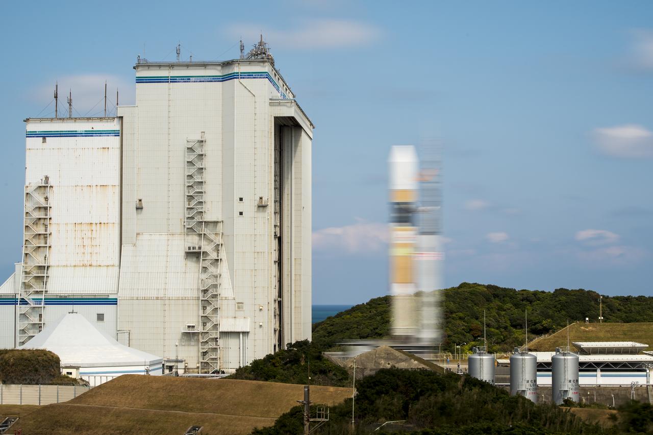
A Japanese H-IIA rocket carrying the NASA-Japan Aerospace Exploration Agency (JAXA), Global Precipitation Measurement (GPM) Core Observatory is seen in this 10 second exposure as it rolls out to launch pad 1 of the Tanegashima Space Center, Thursday, Feb. 27, 2014, Tanegashima, Japan. Once launched, the GPM spacecraft will collect information that unifies data from an international network of existing and future satellites to map global rainfall and snowfall every three hours. Photo Credit: (NASA/Bill Ingalls)
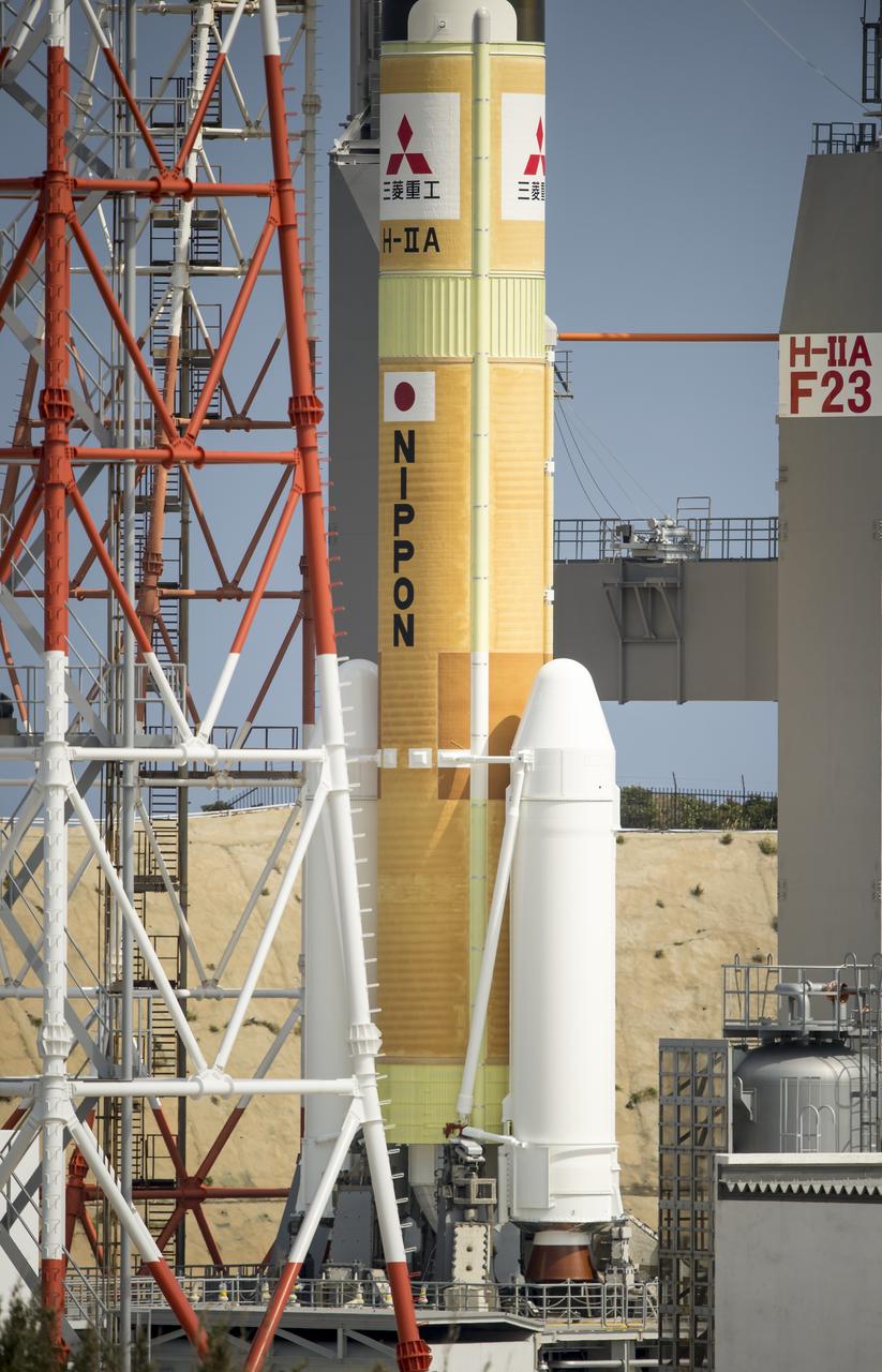
A Japanese H-IIA rocket carrying the NASA-Japan Aerospace Exploration Agency (JAXA), Global Precipitation Measurement (GPM) Core Observatory is seen as it rolls out to launch pad 1 of the Tanegashima Space Center, Thursday, Feb. 27, 2014, Tanegashima, Japan. Once launched, the GPM spacecraft will collect information that unifies data from an international network of existing and future satellites to map global rainfall and snowfall every three hours. Photo Credit: (NASA/Bill Ingalls)

A Japanese H-IIA rocket carrying the NASA-Japan Aerospace Exploration Agency (JAXA), Global Precipitation Measurement (GPM) Core Observatory is seen as it rolls out to launch pad 1 of the Tanegashima Space Center, Thursday, Feb. 27, 2014, Tanegashima, Japan. Once launched, the GPM spacecraft will collect information that unifies data from an international network of existing and future satellites to map global rainfall and snowfall every three hours. Photo Credit: (NASA/Bill Ingalls)
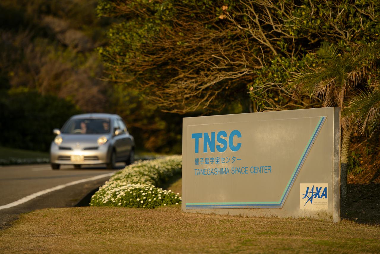
The entrance sign to the Japan Aerospace Exploration Agency’s (JAXA) Tanegashima Space Center (TNSC) is seen a week ahead of the planned launch of an H-IIA rocket carrying the Global Precipitation Measurement (GPM) Core Observatory, Friday, Feb. 21, 2014, Tanegashima Island, Japan. The NASA-JAXA GPM spacecraft will collect information that unifies data from an international network of existing and future satellites to map global rainfall and snowfall every three hours. Photo Credit: (NASA/Bill Ingalls)
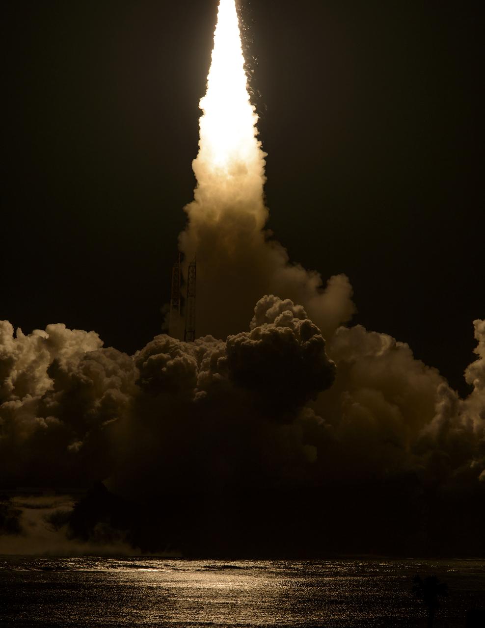
Flames and smoke from a Japanese H-IIA rocket with the NASA-Japan Aerospace Exploration Agency (JAXA), Global Precipitation Measurement (GPM) Core Observatory onboard, are seen during the launch from the Tanegashima Space Center, Friday, Feb. 28, 2014, Tanegashima, Japan. The GPM spacecraft will collect information that unifies data from an international network of existing and future satellites to map global rainfall and snowfall every three hours. Photo Credit: (NASA/Bill Ingalls)
A Japanese H-IIA rocket carrying the NASA-Japan Aerospace Exploration Agency (JAXA), Global Precipitation Measurement (GPM) Core Observatory is seen as it rolls out to launch pad 1 of the Tanegashima Space Center, Thursday, Feb. 27, 2014, Tanegashima, Japan. Once launched, the GPM spacecraft will collect information that unifies data from an international network of existing and future satellites to map global rainfall and snowfall every three hours. Photo Credit: (NASA/Bill Ingalls)

A Japanese H-IIA rocket carrying the NASA-Japan Aerospace Exploration Agency (JAXA), Global Precipitation Measurement (GPM) Core Observatory is seen as it rolls out to launch pad 1 of the Tanegashima Space Center, Thursday, Feb. 27, 2014, Tanegashima, Japan. Once launched, the GPM spacecraft will collect information that unifies data from an international network of existing and future satellites to map global rainfall and snowfall every three hours. Photo Credit: (NASA/Bill Ingalls)
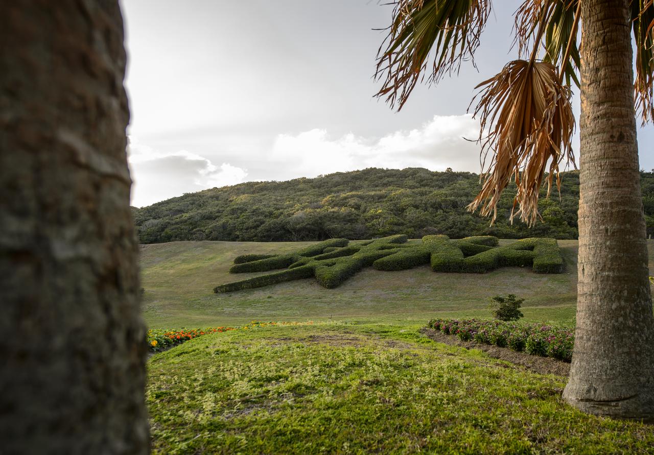
Topiary shaped into the logo of the Japan Aerospace Exploration Agency (JAXA) is seen at the Tanegashima Space Center (TNSC) a week ahead of the planned launch of an H-IIA rocket carrying the Global Precipitation Measurement (GPM) Core Observatory, Friday, Feb. 21, 2014, Tanegashima Island, Japan. The NASA-JAXA GPM spacecraft will collect information that unifies data from an international network of existing and future satellites to map global rainfall and snowfall every three hours. Photo Credit: (NASA/Bill Ingalls)
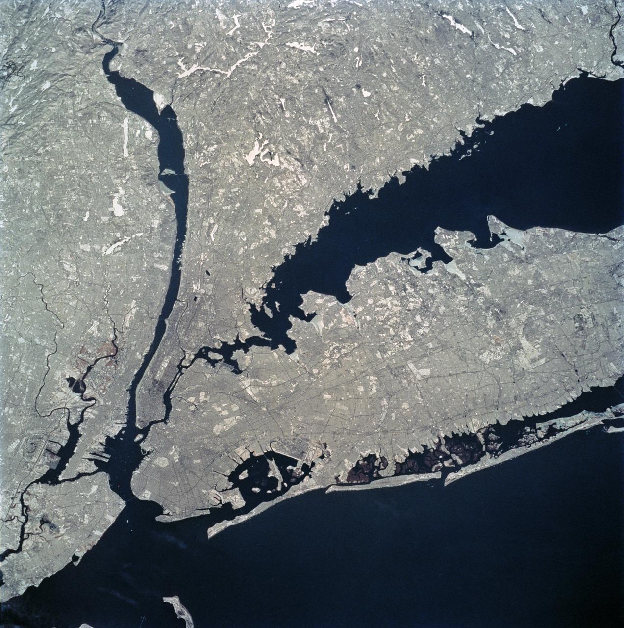
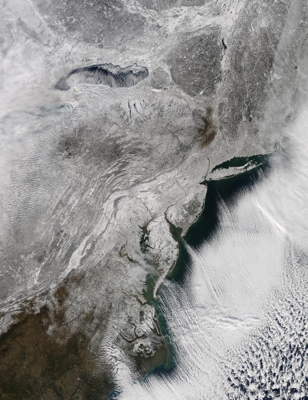
STS062-81-010 (4-18 March 1994) --- The recent heavy snowfalls help to accentuate the major transportation networks, (railroads, highways and airports), throughout the New York City metropolitan area. This particular scene also highlights the land-water boundaries and the lighter open spaces, such as parks, cemeteries and recreational areas. The snows have produced a white blanket effect on these areas. Even some of the snow-covered lakes can be discerned. The boroughs of Staten Island, Brooklyn, Queens, The Bronx and Manhattan are also recognizable on the photograph.
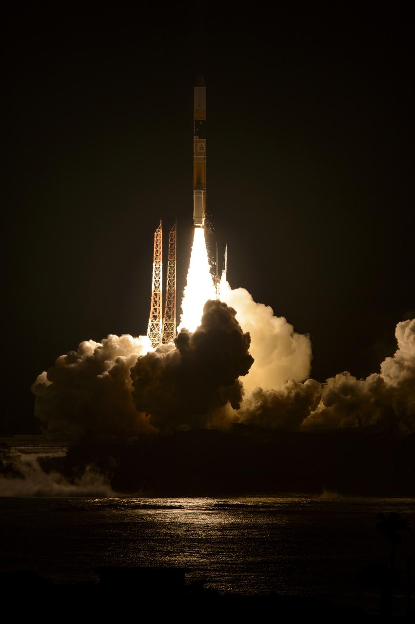
A Japanese H-IIA rocket with the NASA-Japan Aerospace Exploration Agency (JAXA), Global Precipitation Measurement (GPM) Core Observatory onboard, is seen launching from the Tanegashima Space Center, Friday, Feb. 28, 2014, Tanegashima, Japan. The GPM spacecraft will collect information that unifies data from an international network of existing and future satellites to map global rainfall and snowfall every three hours. Photo Credit: (NASA/Bill Ingalls)
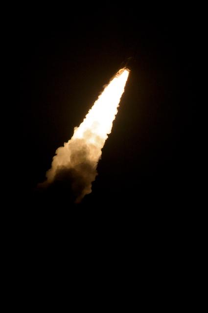
A Japanese H-IIA rocket with the NASA-Japan Aerospace Exploration Agency (JAXA), Global Precipitation Measurement (GPM) Core Observatory onboard, fades into the dark as it launches from the Tanegashima Space Center, Friday, Feb. 28, 2014, Tanegashima, Japan. The GPM spacecraft will collect information that unifies data from an international network of existing and future satellites to map global rainfall and snowfall every three hours. Photo Credit: (NASA/Bill Ingalls)
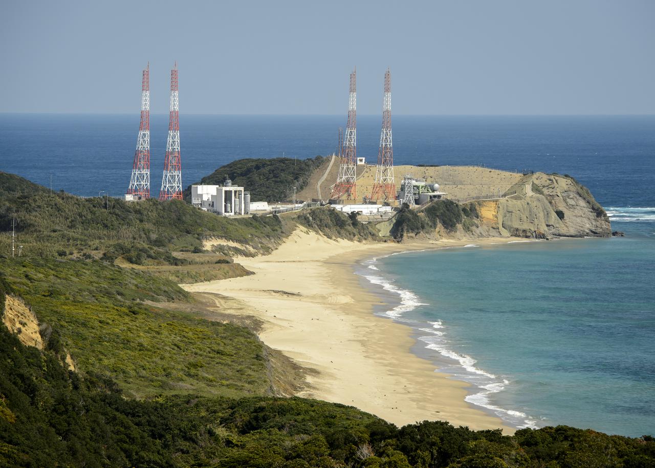
The launch pads at the Japan Aerospace Exploration Agency’s (JAXA) Tanegashima Space Center are seen a week ahead of the planned launch of an H-IIA rocket carrying the Global Precipitation Measurement (GPM) Core Observatory, Friday, Feb. 21, 2014, Tanegashima Island, Japan. The NASA-JAXA GPM spacecraft will collect information that unifies data from an international network of existing and future satellites to map global rainfall and snowfall every three hours. Photo Credit: (NASA/Bill Ingalls)
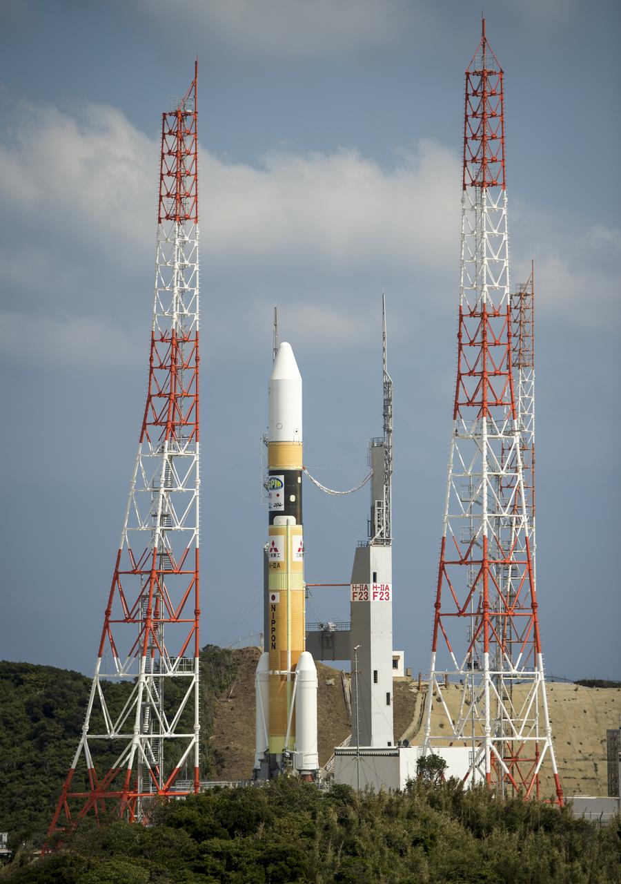
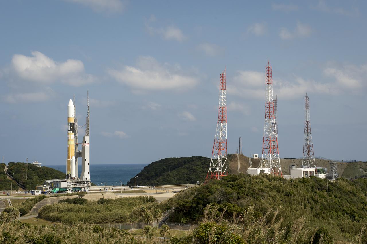
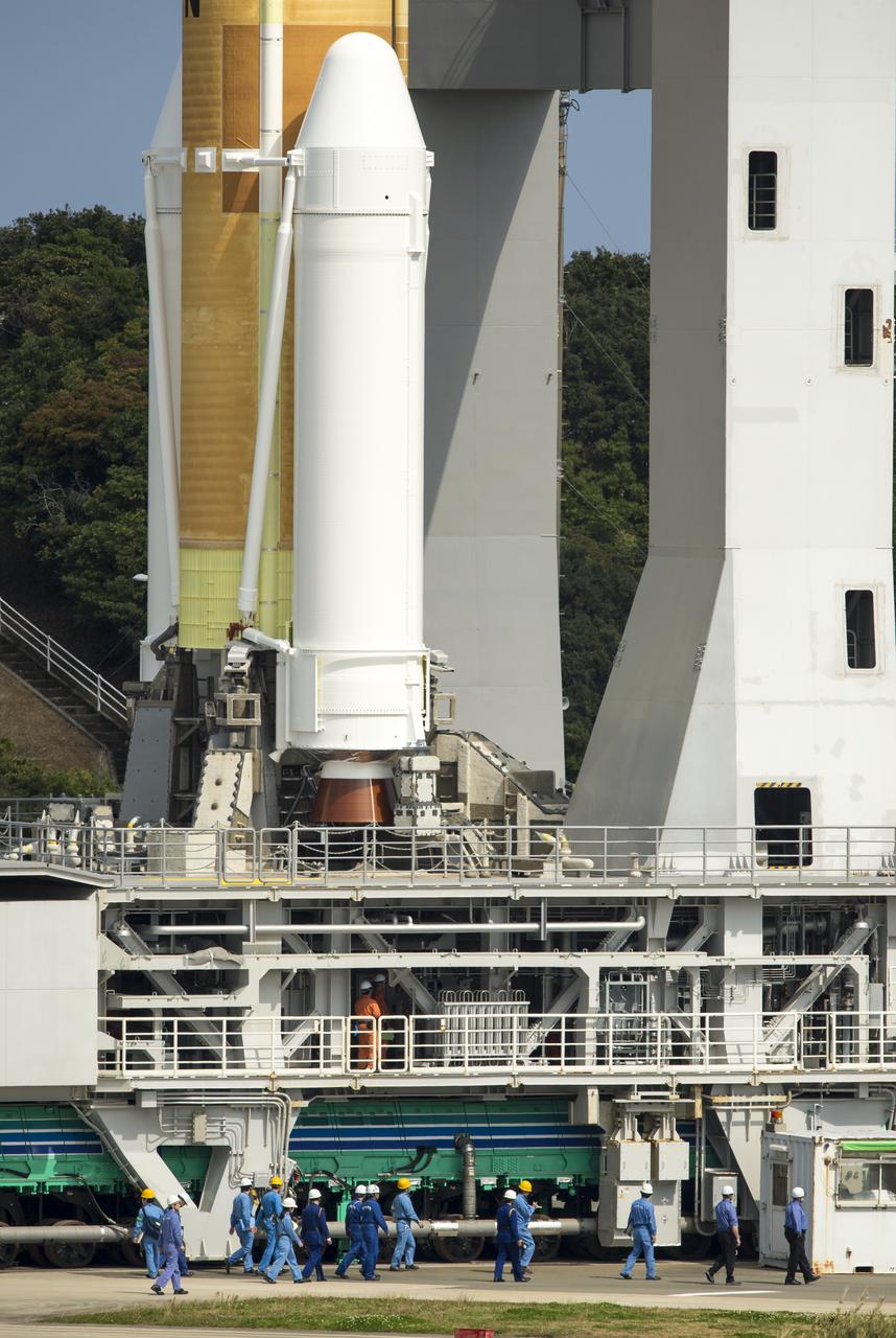
A Japanese H-IIA rocket with the NASA-Japan Aerospace Exploration Agency (JAXA), Global Precipitation Measurement (GPM) Core Observatory onboard is seen on launch pad 1 of the Tanegashima Space Center, Thursday, Feb. 27, 2014, Tanegashima, Japan. Once launched, the GPM spacecraft will collect information that unifies data from an international network of existing and future satellites to map global rainfall and snowfall every three hours. Photo Credit: (NASA/Bill Ingalls)
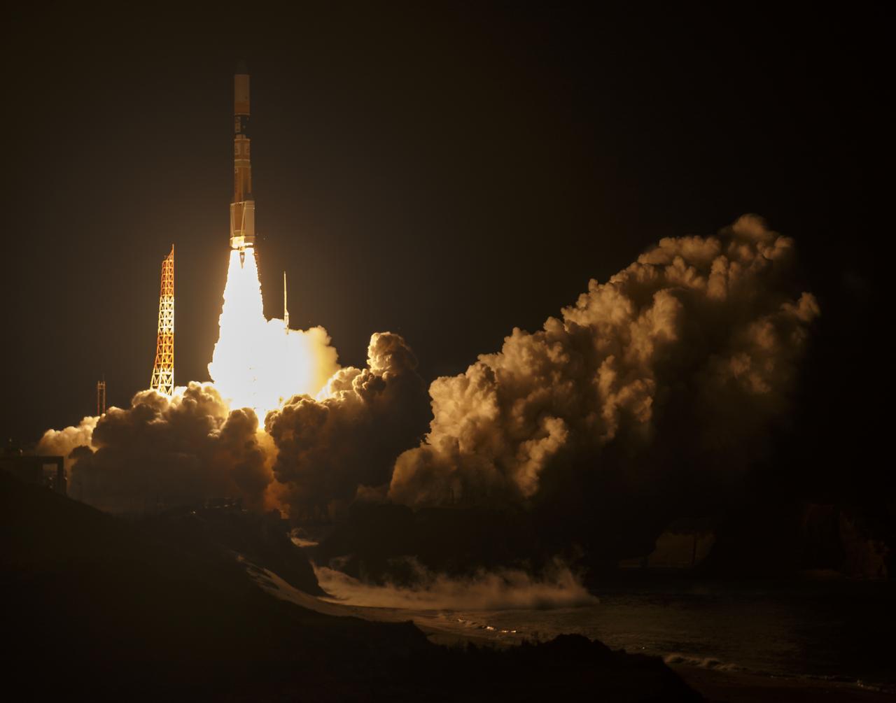
A Japanese H-IIA rocket with the NASA-Japan Aerospace Exploration Agency (JAXA), Global Precipitation Measurement (GPM) Core Observatory onboard, is seen launching from the Tanegashima Space Center, Friday, Feb. 28, 2014, Tanegashima, Japan. The GPM spacecraft will collect information that unifies data from an international network of existing and future satellites to map global rainfall and snowfall every three hours. Photo Credit: (NASA/Bill Ingalls)

The sun sets just outside the Japan Aerospace Exploration Agency’s (JAXA) Tanegashima Space Center (TNSC) a week ahead of the planned launch of an H-IIA rocket carrying the Global Precipitation Measurement (GPM) Core Observatory, Friday, Feb. 21, 2014, Tanegashima Island, Japan. The NASA-JAXA GPM spacecraft will collect information that unifies data from an international network of existing and future satellites to map global rainfall and snowfall every three hours. Photo Credit: (NASA/Bill Ingalls)
A Japanese H-IIA rocket carrying the NASA-Japan Aerospace Exploration Agency (JAXA), Global Precipitation Measurement (GPM) Core Observatory is seen as it rolls out to launch pad 1 of the Tanegashima Space Center, Thursday, Feb. 27, 2014, Tanegashima, Japan. Once launched, the GPM spacecraft will collect information that unifies data from an international network of existing and future satellites to map global rainfall and snowfall every three hours. Photo Credit: (NASA/Bill Ingalls)
A sign guides travelers to the Japan Aerospace Exploration Agency’s (JAXA) Tanegashima Space Center (TNSC), Saturday, Feb. 22, 2014, Tanegashima Island, Japan. A launch of an H-IIA rocket carrying the Global Precipitation Measurement (GPM) Core Observatory is planned for Feb. 28, 2014 from the space center. The NASA-JAXA GPM spacecraft will collect information that unifies data from an international network of existing and future satellites to map global rainfall and snowfall every three hours. Photo Credit: (NASA/Bill Ingalls)
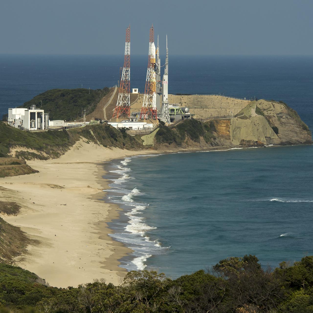
A Japanese H-IIA rocket with the NASA-Japan Aerospace Exploration Agency (JAXA), Global Precipitation Measurement (GPM) Core Observatory onboard is seen on launch pad 1 of the Tanegashima Space Center, Thursday, Feb. 27, 2014, Tanegashima, Japan. Once launched, the GPM spacecraft will collect information that unifies data from an international network of existing and future satellites to map global rainfall and snowfall every three hours. Photo Credit: (NASA/Bill Ingalls)
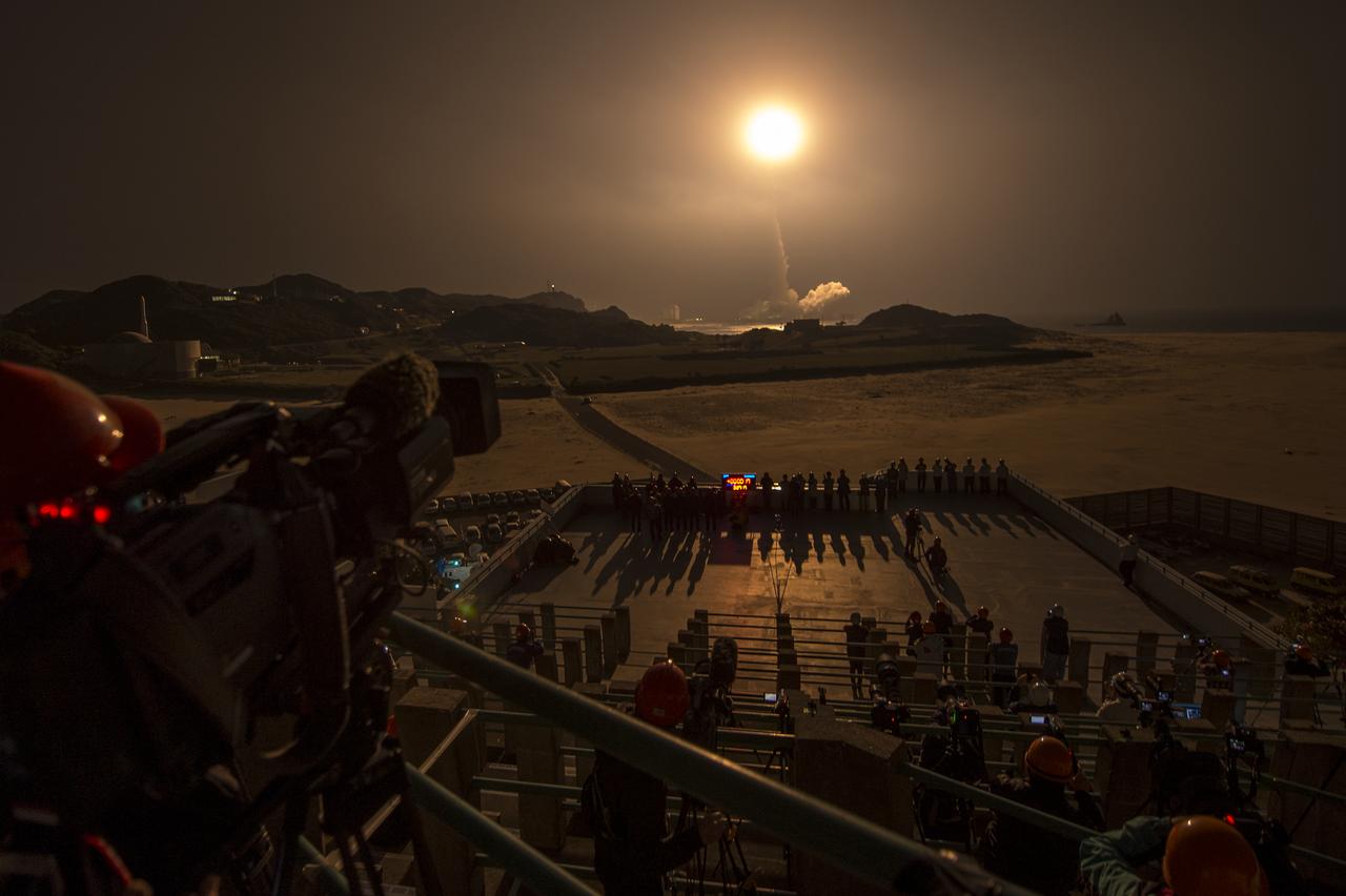
A Japanese H-IIA rocket with the NASA-Japan Aerospace Exploration Agency (JAXA), Global Precipitation Measurement (GPM) Core Observatory onboard, is seen launching from the Tanegashima Space Center, Friday, Feb. 28, 2014, Tanegashima, Japan. The GPM spacecraft will collect information that unifies data from an international network of existing and future satellites to map global rainfall and snowfall every three hours. Photo Credit: (NASA/Bill Ingalls)
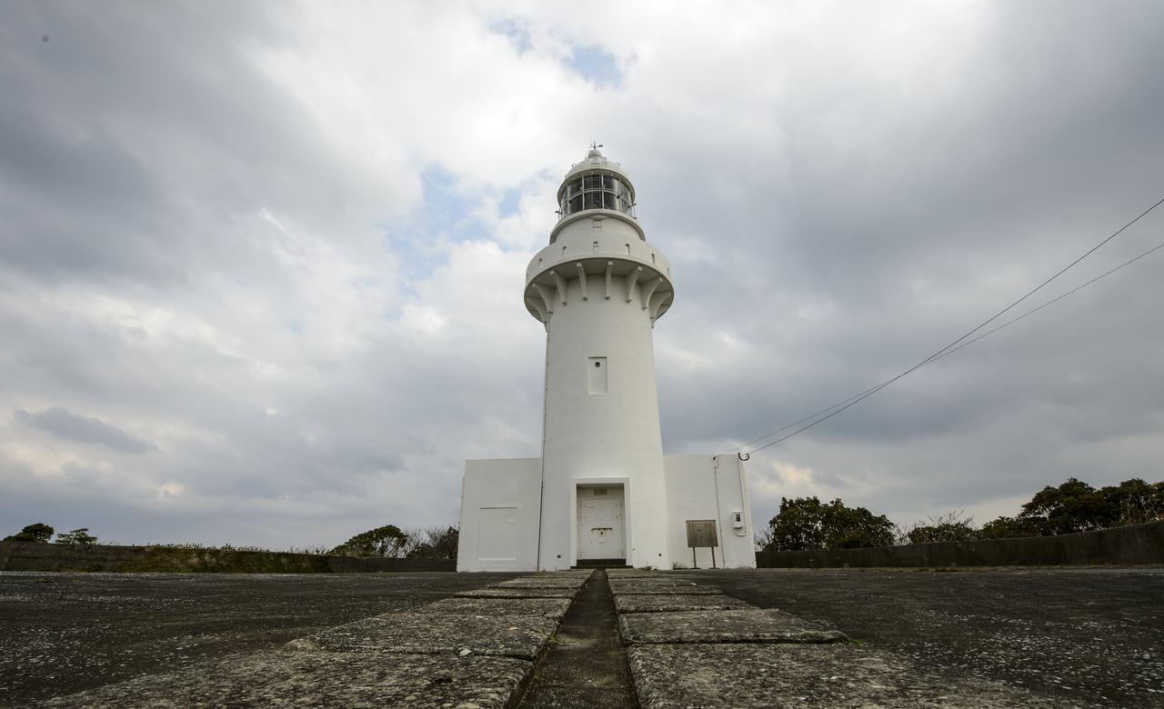
The Tanegashima Space Center (TNSC) lighthouse is seen on Sunday, Feb. 23, 2014, Tanegashima Island, Japan. A Japanese H-IIA rocket carrying the NASA-Japan Aerospace Exploration Agency (JAXA), Global Precipitation Measurement (GPM) Core Observatory is planned for launch from the space center on Feb. 28, 2014. Once launched, the GPM spacecraft will collect information that unifies data from an international network of existing and future satellites to map global rainfall and snowfall every three hours. Photo Credit: (NASA/Bill Ingalls)
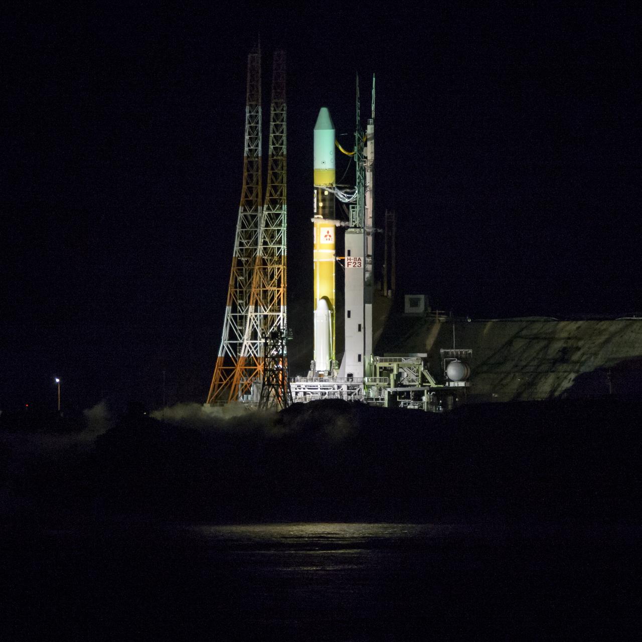
A Japanese H-IIA rocket with the NASA-Japan Aerospace Exploration Agency (JAXA), Global Precipitation Measurement (GPM) Core Observatory onboard, is seen on launch pad 1 of the Tanegashima Space Center, Friday, Feb. 28, 2014, Tanegashima, Japan. Once launched, the GPM spacecraft will collect information that unifies data from an international network of existing and future satellites to map global rainfall and snowfall every three hours. Photo Credit: (NASA/Bill Ingalls)
A Japanese H-IIA rocket with the NASA-Japan Aerospace Exploration Agency (JAXA), Global Precipitation Measurement (GPM) Core Observatory onboard is seen on launch pad 1 of the Tanegashima Space Center, Thursday, Feb. 27, 2014, Tanegashima, Japan. Once launched, the GPM spacecraft will collect information that unifies data from an international network of existing and future satellites to map global rainfall and snowfall every three hours. Photo Credit: (NASA/Bill Ingalls)

A Japanese H-IIA rocket carrying the NASA-Japan Aerospace Exploration Agency (JAXA), Global Precipitation Measurement (GPM) Core Observatory is seen as it rolls out to launch pad 1 of the Tanegashima Space Center, Thursday, Feb. 27, 2014, Tanegashima, Japan. Once launched, the GPM spacecraft will collect information that unifies data from an international network of existing and future satellites to map global rainfall and snowfall every three hours. Photo Credit: (NASA/Bill Ingalls)
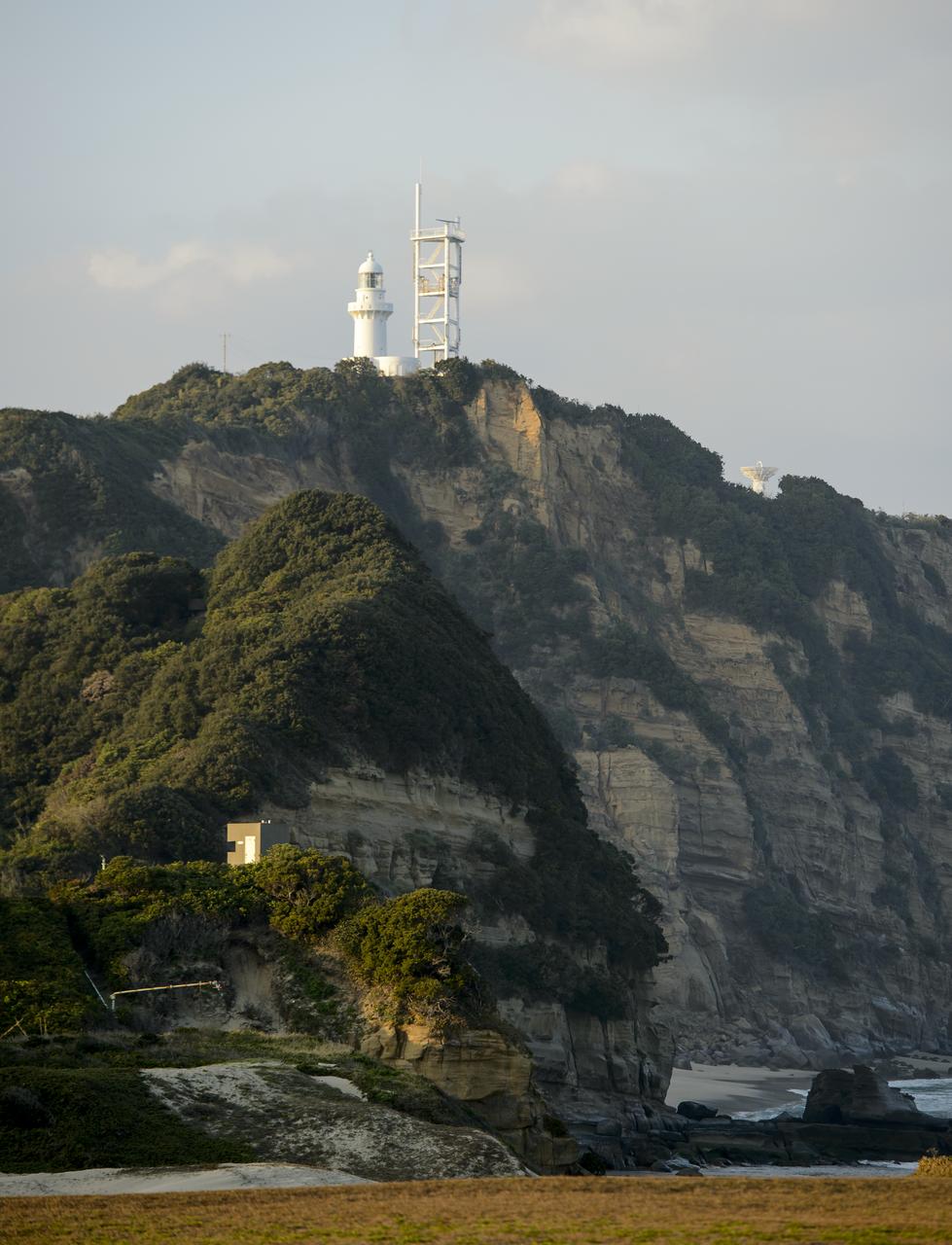
A light house and weather station is seen at the Japan Aerospace Exploration Agency’s (JAXA) Tanegashima Space Center (TNSC) a week ahead of the planned launch of an H-IIA rocket carrying the Global Precipitation Measurement (GPM) Core Observatory, Friday, Feb. 21, 2014, Tanegashima Island, Japan. The NASA-JAXA GPM spacecraft will collect information that unifies data from an international network of existing and future satellites to map global rainfall and snowfall every three hours. Photo Credit: (NASA/Bill Ingalls)
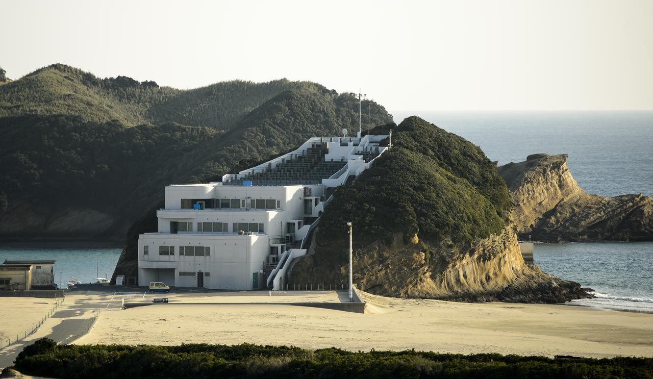
The Takesaki Observation Center is seen at the Japan Aerospace Exploration Agency’s (JAXA) Tanegashima Space Center (TNSC) a week ahead of the planned launch of an H-IIA rocket carrying the Global Precipitation Measurement (GPM) Core Observatory, Friday, Feb. 21, 2014, Tanegashima Island, Japan. The NASA-JAXA GPM spacecraft will collect information that unifies data from an international network of existing and future satellites to map global rainfall and snowfall every three hours. Photo Credit: (NASA/Bill Ingalls)
The storm system that moved through the northeastern U.S. dropped large snowfall totals up to a foot in southern New England to a couple of inches in Virginia. On January 22, 2014, the day after the event, the Moderate Resolution Imaging Spectroradiometer instrument that flies aboard NASA's Aqua satellite captured this image of the snowfall at 18:10 UTC/1:10 p.m. EST. In the image, snowfall covers the ground in all six New England states, New York, Pennsylvania, New Jersey, Delaware, Maryland, West Virginia, Ohio, Virginia, Washington, D.C. and North Carolina. Image Credit: NASA Goddard MODIS Rapid Response Team Text: Rob Gutro, NASA Goddard Space Flight Center <b><a href="http://www.nasa.gov/audience/formedia/features/MP_Photo_Guidelines.html" rel="nofollow">NASA image use policy.</a></b> <b><a href="http://www.nasa.gov/centers/goddard/home/index.html" rel="nofollow">NASA Goddard Space Flight Center</a></b> enables NASA’s mission through four scientific endeavors: Earth Science, Heliophysics, Solar System Exploration, and Astrophysics. Goddard plays a leading role in NASA’s accomplishments by contributing compelling scientific knowledge to advance the Agency’s mission. <b>Follow us on <a href="http://twitter.com/NASAGoddardPix" rel="nofollow">Twitter</a></b> <b>Like us on <a href="http://www.facebook.com/pages/Greenbelt-MD/NASA-Goddard/395013845897?ref=tsd" rel="nofollow">Facebook</a></b> <b>Find us on <a href="http://instagram.com/nasagoddard?vm=grid" rel="nofollow">Instagram</a></b>

ISS034-E-057550 (28 Feb. 2013) --- One of the Expedition 34 crew members aboard the Earth-orbiting International Space Station photographed this image featuring the Southern High Plains of northwestern Texas, directly south of the city of Amarillo (off the image to the north). At first glance the picture appears more like a map than an actual photo. The winter of 2012-2013 has been marked by powerful snowstorms with record-setting snowfall throughout much of the Midwestern United States The snowstorm that passed through this area left a record snowfall of approximately 43 centimeters (17 inches). Snow blankets the city of Canyon, Texas. Urban street grids and stream channels appear etched into the landscape by the snow, a result of both melting and street clearing in the urban regions and of the incised nature of stream channels in the surrounding plains. Agricultural fields are easily identified due to the even snow cover broken only by roadways between the fields. Palo Duro Canyon is largely free of snow along the Prairie Dog Town Fork of the Red River channel and at lower elevations, allowing the red sedimentary rocks of the canyon walls to be visible. Lake Tanglewood, a reservoir to the northeast of Canyon, appears dark due to a lack of ice cover. Another dark region to the northwest of Canyon is a feed yard for cattle; any snowfall in this area has been removed by the actions of the livestock. The image was recorded with a digital camera using a 400 millimeter lens,
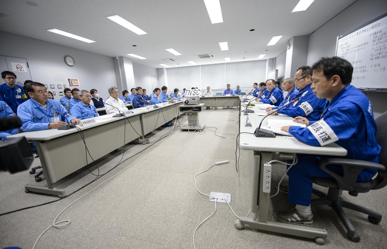
Chief officers from Mitsubishi Heavy Industries, Ltd., the Japan Aerospace Exploration Agency (JAXA) and NASA met on Wednesday, Feb. 26, 2014 in the Range Control Center (RCC) of the Tanegashima Space Center, Japan, to review the readiness of the Global Precipitation Measurement (GPM) Core Observatory for launch. The spacecraft is scheduled to launch aboard an H-IIA rocket early on the morning of Feb. 28 Japan time. Once launched, the GPM spacecraft will collect information that unifies data from an international network of existing and future satellites to map global rainfall and snowfall every three hours. Photo Credit: (NASA/Bill Ingalls)
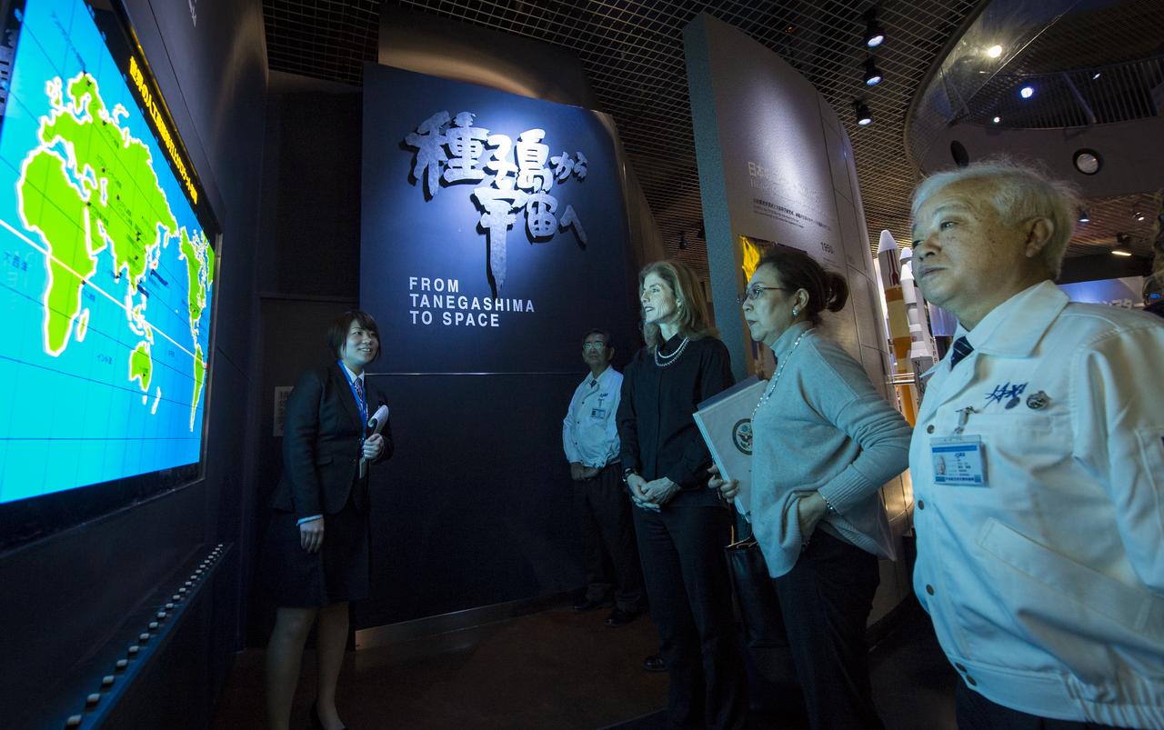
Caroline Bouvier Kennedy, U.S. Ambassador Extraordinary and Plenipotentiary to Japan, center, tours the Tanegashima Space Center, Visitors Center with Japan Aerospace Exploration Agency (JAXA), President, Naoki Okumura, right, on Thursday, Feb. 27, 2014, Tanegashima, Japan. The Ambassador visiting the space center and hopes to witness the planned launch of a Japanese H-IIA rocket carrying the NASA-JAXA, Global Precipitation Measurement (GPM) Core Observatory. Once launched, the GPM spacecraft will collect information that unifies data from an international network of existing and future satellites to map global rainfall and snowfall every three hours. Photo Credit: (NASA/Bill Ingalls)
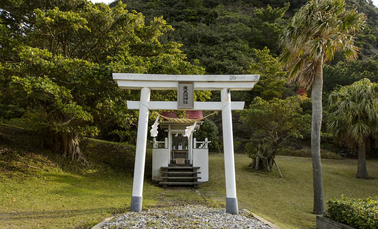
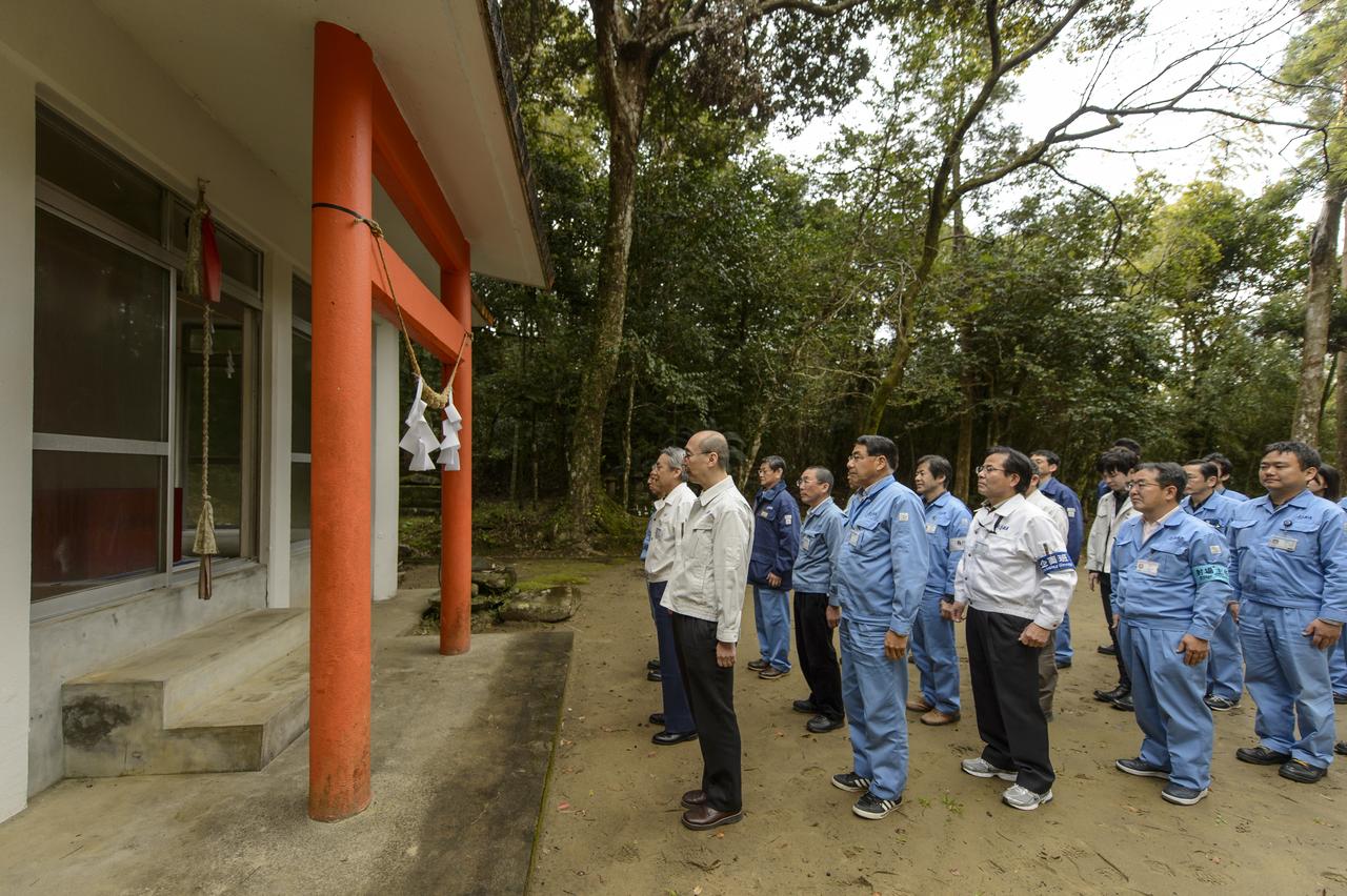
The Ebisu Shrine, the first shrine in a traditional San-ja Mairi, or Three Shrine Pilgrimage, is seen just after members of the Japan Aerospace Exploration Agency (JAXA) team prayed for a successful launch, Tuesday, Feb. 25, 2014, Tanegashima Island, Japan. A Japanese H-IIA rocket carrying the NASA-JAXA, Global Precipitation Measurement (GPM) Core Observatory is planned for launch from the Tanegashima Space Center (TNSC) on Feb. 28, 2014. Once launched, the GPM spacecraft will collect information that unifies data from an international network of existing and future satellites to map global rainfall and snowfall every three hours. Photo Credit: (NASA/Bill Ingalls)
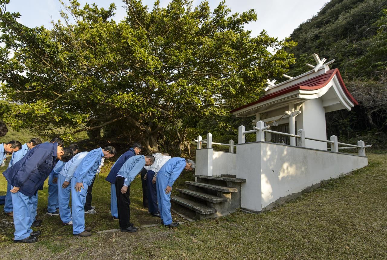
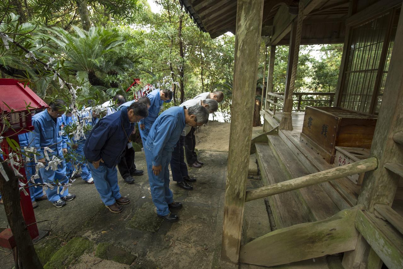
Japan Aerospace Exploration Agency (JAXA) team members bow at the Ebisu Shrine, the first shrine in a traditional San-ja Mairi, or Three Shrine Pilgrimage, where the team prays for a successful launch, Tuesday, Feb. 25, 2014, Tanegashima Island, Japan. A Japanese H-IIA rocket carrying the NASA-JAXA, Global Precipitation Measurement (GPM) Core Observatory is planned for launch from the Tanegashima Space Center (TNSC) on Feb. 28, 2014. Once launched, the GPM spacecraft will collect information that unifies data from an international network of existing and future satellites to map global rainfall and snowfall every three hours. Photo Credit: (NASA/Bill Ingalls)
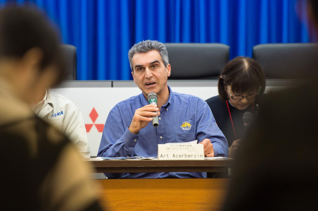
Art Azarbarzin, NASA Global Precipitation Measurement (GPM) project manager talks during a technical briefing for the launch of the Global Precipitation Measurement (GPM) Core Observatory aboard an H-IIA rocket, Wednesday, Feb. 26, 2014, Tanegashima Space Center, Japan. Launch is scheduled for early in the morning of Feb. 28 Japan time. Once launched, the GPM spacecraft will collect information that unifies data from an international network of existing and future satellites to map global rainfall and snowfall every three hours. Photo Credit: (NASA/Bill Ingalls)
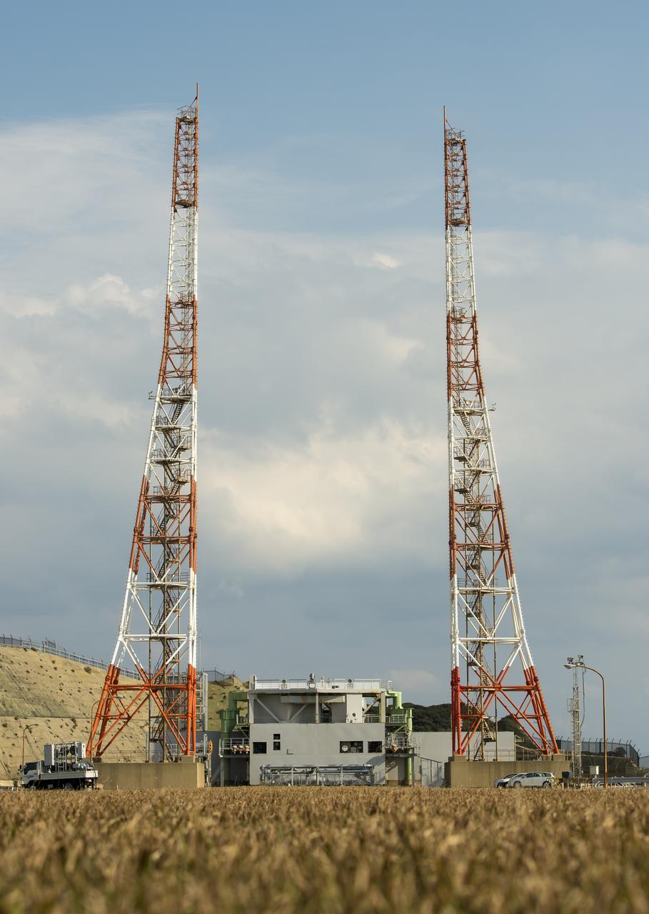
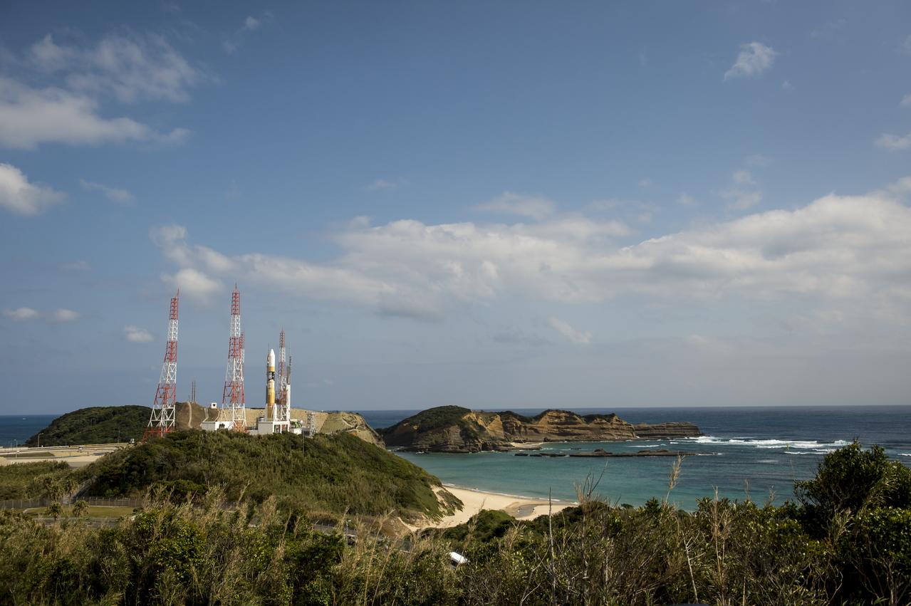
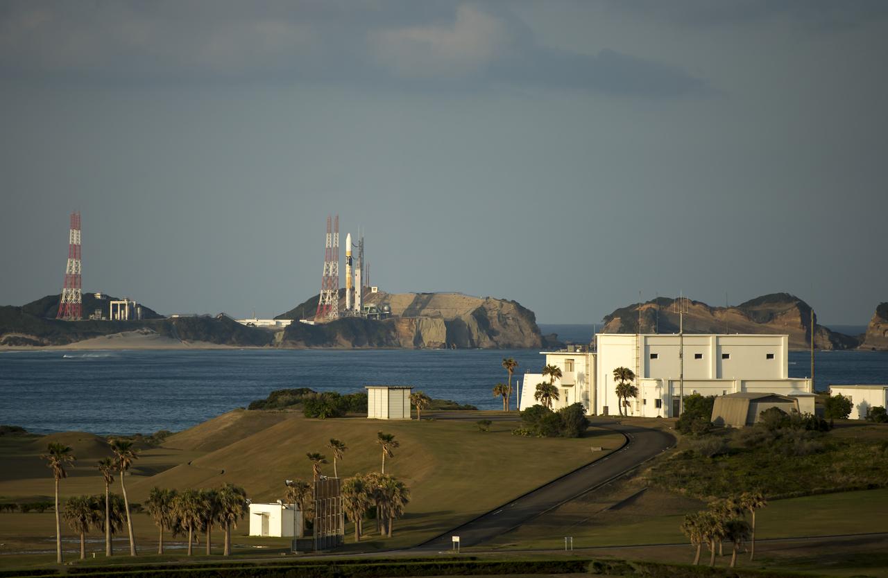
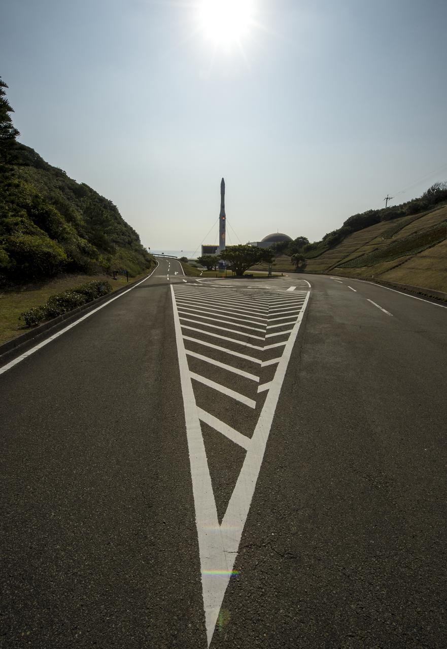
Launch pad 1 is seen at the Tanegashima Space Center (TNSC) on Monday, Feb. 24, 2014 in Tanegashima, Japan. A Japanese H-IIA rocket carrying the NASA-Japan Aerospace Exploration Agency (JAXA), Global Precipitation Measurement (GPM) Core Observatory is planned for launch from pad 1 on Feb. 28, 2014. Once launched, the GPM spacecraft will collect information that unifies data from an international network of existing and future satellites to map global rainfall and snowfall every three hours. Photo Credit: (NASA/Bill Ingalls)

RainCube was deployed into low-Earth orbit from the International Space Station in July, 2018, where it has been measuring rain and snowfall from space. The size of the tiny weather satellite can be seen in comparison to the Space Station. RainCube is a prototype for a possible fleet of small satellites that could one day help monitor severe storms, lead to improving the accuracy of weather forecasts and track climate change over time. A closer look at these images reveals there are two CubeSats very close together -- RainCube is the bottom CubeSat closer to Earth, while the one above it is HaloSat, used to map the distribution of hot gas in the Milky Way. https://photojournal.jpl.nasa.gov/catalog/PIA22653
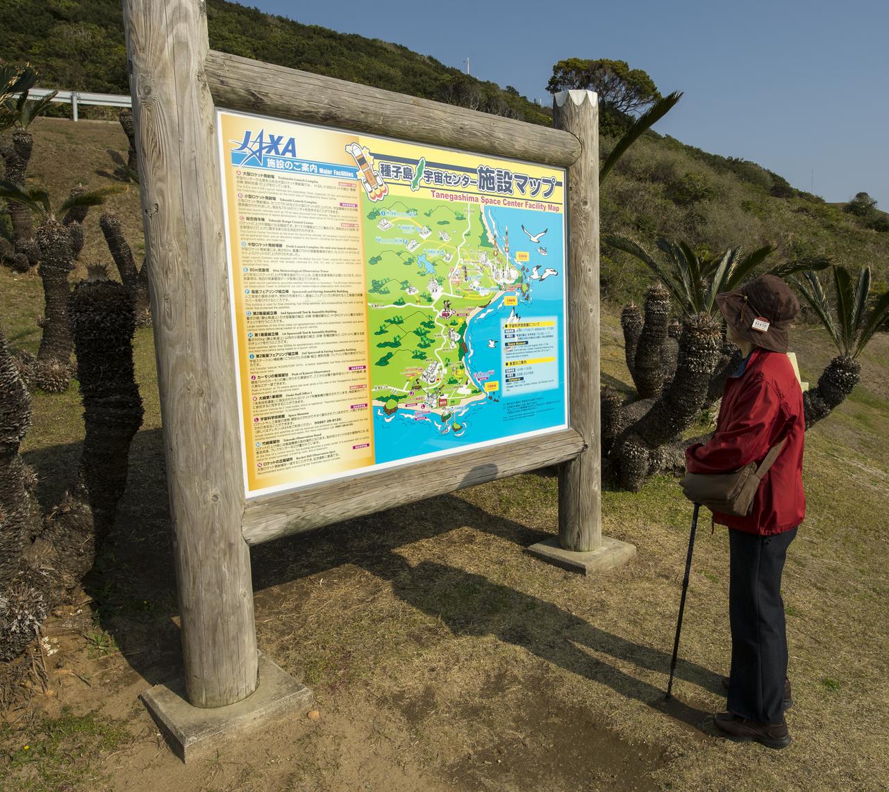
A visitor looks over a Tanegashima Space Center (TNSC) Facility Map, Sunday, Feb. 23, 2014, Tanegashima Island, Japan. A Japanese H-IIA rocket carrying the NASA-Japan Aerospace Exploration Agency's (JAXA), Global Precipitation Measurement (GPM) Core Observatory is planned for launch from the space center on Feb. 28, 2014. Once launched, the GPM spacecraft will collect information that unifies data from an international network of existing and future satellites to map global rainfall and snowfall every three hours. Photo Credit: (NASA/Bill Ingalls)
NASA GPM Test Conductors, Michelle Lacombe, left, and Bill Dehaven participate in an all-day launch simulation for the Global Precipitation Measurement (GPM) Core Observatory at the Spacecraft Test and Assembly Building 2 (STA2), Saturday, Feb. 22, 2014, Tanegashima Space Center (TNSC), Tanegashima Island, Japan. Japan Aerospace Exploration Agency (JAXA) plans to launch an H-IIA rocket carrying the GPM Core Observatory on Feb. 28, 2014. The NASA-JAXA GPM spacecraft will collect information that unifies data from an international network of existing and future satellites to map global rainfall and snowfall every three hours. Photo Credit: (NASA/Bill Ingalls)
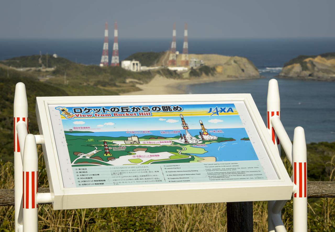
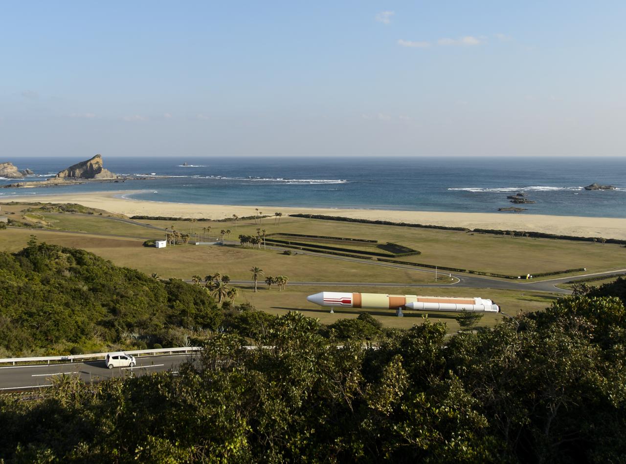
A sign at an overlook, named Rocket Hill, helps viewers identify the various facilities of the Tanegashima Space Center (TNSC), including launch pad 1 that will be used Feb. 28, 2014 for the launch of an H-IIA rocket carrying the Global Precipitation Measurement (GPM) Core Observatory, Friday, Feb. 21, 2014, Tanegashima Island, Japan. The NASA-Japan Aerospace Exploration Agency (JAXA) GPM spacecraft will collect information that unifies data from an international network of existing and future satellites to map global rainfall and snowfall every three hours. Photo Credit: (NASA/Bill Ingalls)
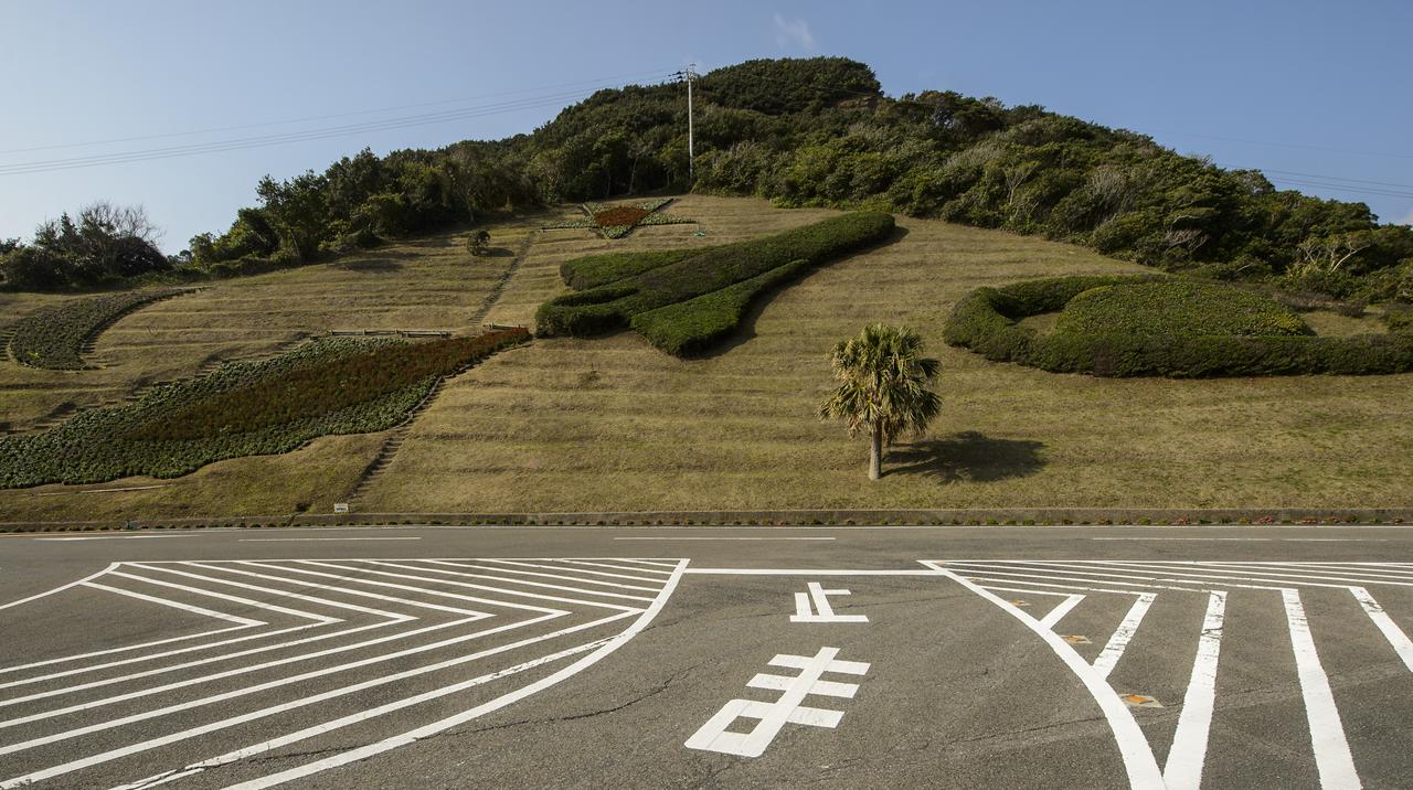
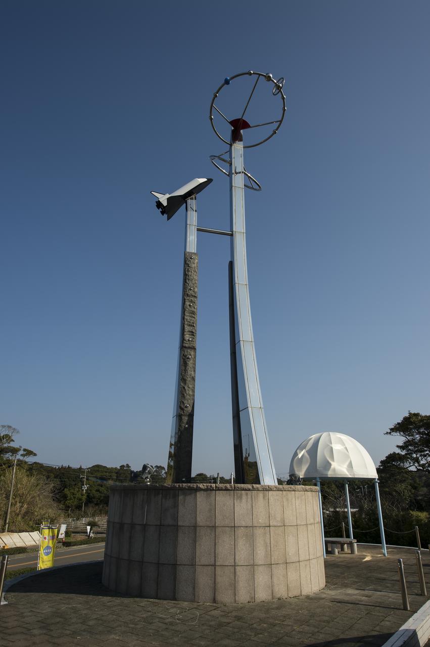
Shrubs and flowers in the shape of a space shuttle, star and planet are seen just outside the visitor's center of the Tanegashima Space Center (TNSC), Sunday, Feb. 23, 2014, Tanegashima Island, Japan. A Japanese H-IIA rocket carrying the NASA-Japan Aerospace Exploration Agency (JAXA), Global Precipitation Measurement (GPM) Core Observatory is planned for launch from the space center on Feb. 28, 2014. Once launched, the GPM spacecraft will collect information that unifies data from an international network of existing and future satellites to map global rainfall and snowfall every three hours. Photo Credit: (NASA/Bill Ingalls)
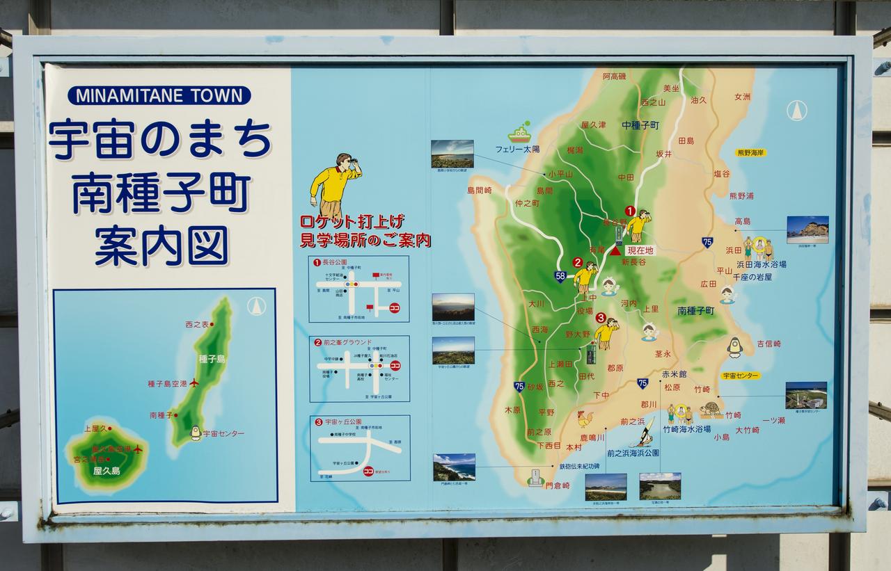
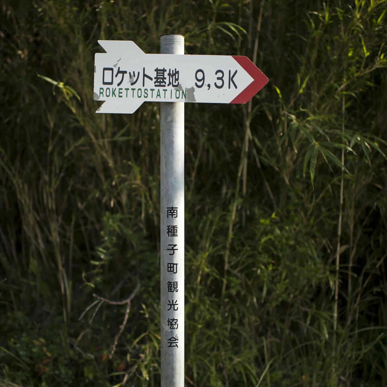
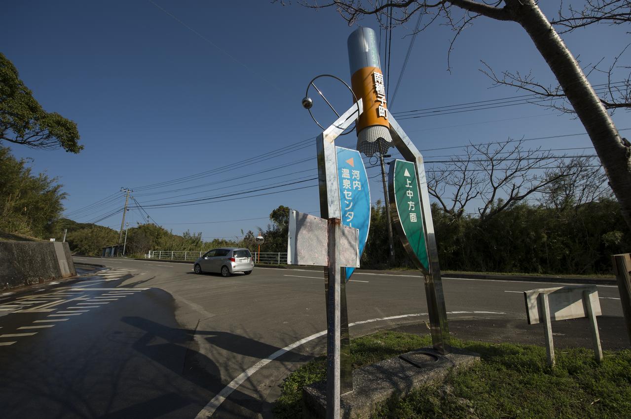
A roadside sign shows visitors of Minamitane Town various locations for activities, including the viewing of rocket launches from the Japan Aerospace Exploration Agency’s (JAXA) Tanegashima Space Center (TNSC), where the launch of an H-IIA rocket carrying the Global Precipitation Measurement (GPM) Core Observatory is scheduled to take place in the next week, Saturday, Feb. 22, 2014, Minamitane Town, Tanegashima Island, Japan. The NASA-JAXA GPM spacecraft will collect information that unifies data from an international network of existing and future satellites to map global rainfall and snowfall every three hours. Launch is planned for Feb. 28, 2014. Photo Credit: (NASA/Bill Ingalls)

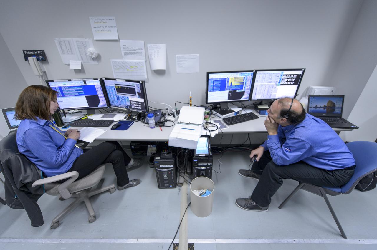
NASA GPM Test Conductors John Pope, and, Michelle Lacombe talk during the all-day launch simulation for the Global Precipitation Measurement (GPM) Core Observatory at the Spacecraft Test and Assembly Building 2 (STA2), Saturday, Feb. 22, 2014, Tanegashima Space Center (TNSC), Tanegashima Island, Japan. Japan Aerospace Exploration Agency (JAXA) plans to launch an H-IIA rocket carrying the GPM Core Observatory on Feb. 28, 2014. The NASA-JAXA GPM spacecraft will collect information that unifies data from an international network of existing and future satellites to map global rainfall and snowfall every three hours. Photo Credit: (NASA/Bill Ingalls)

Japan Aerospace Exploration Agency (JAXA) are seen as they depart the Houman Shrine, the third, and final, shrine in a traditional San-ja Mairi, or Three Shrine Pilgrimage, where the team prays for a successful launch, Tuesday, Feb. 25, 2014, Tanegashima Island, Japan. A Japanese H-IIA rocket carrying the NASA-JAXA, Global Precipitation Measurement (GPM) Core Observatory is planned for launch from the Tanegashima Space Center (TNSC) on Feb. 28, 2014. Once launched, the GPM spacecraft will collect information that unifies data from an international network of existing and future satellites to map global rainfall and snowfall every three hours. Photo Credit: (NASA/Bill Ingalls)
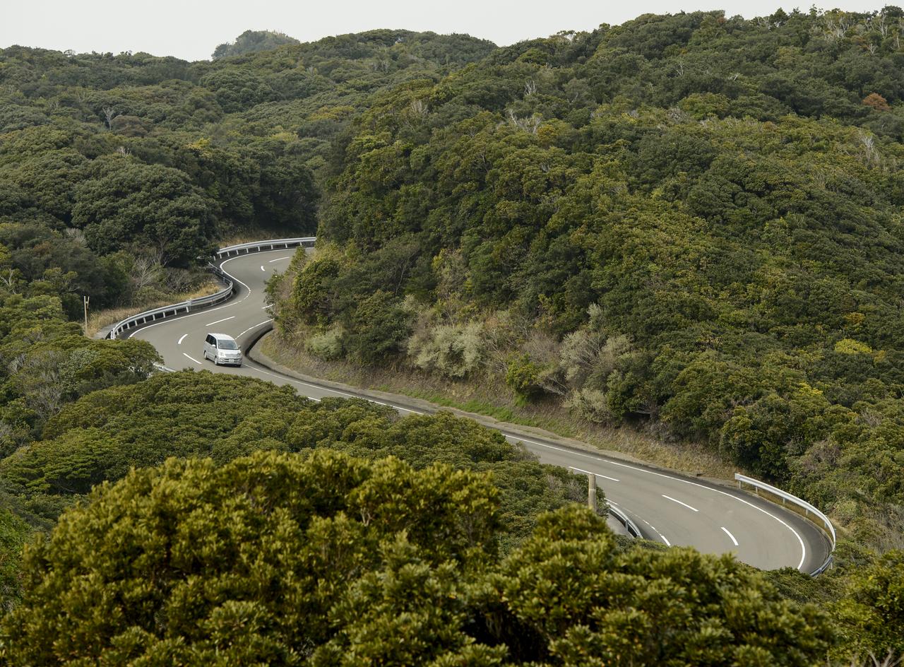
A car drives on the twisty roads that hug the coast line of the Tanegashima Space Center (TNSC) on Sunday, Feb. 23, 2014, Tanegashima Island, Japan. A Japanese H-IIA rocket carrying the NASA-Japan Aerospace Exploration Agency (JAXA), Global Precipitation Measurement (GPM) Core Observatory is planned for launch from the space center on Feb. 28, 2014. Once launched, the GPM spacecraft will collect information that unifies data from an international network of existing and future satellites to map global rainfall and snowfall every three hours. Photo Credit: (NASA/Bill Ingalls)
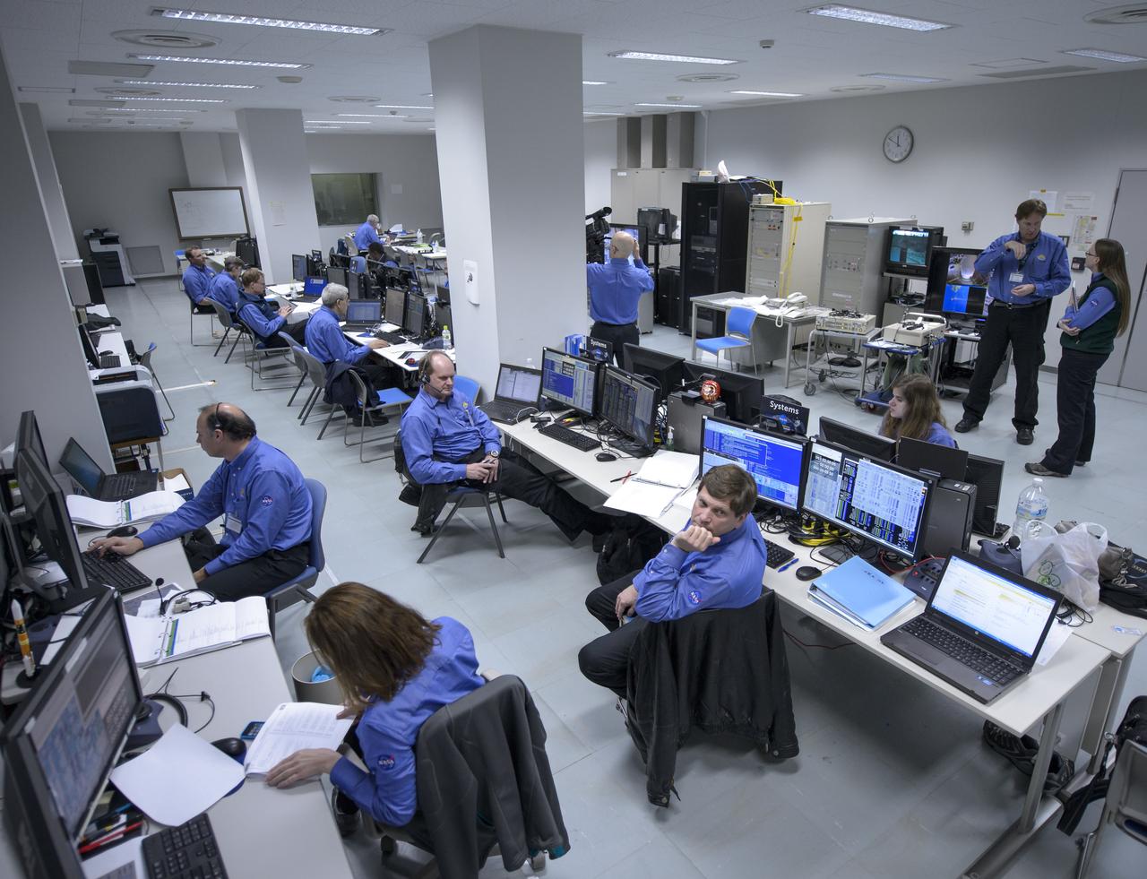
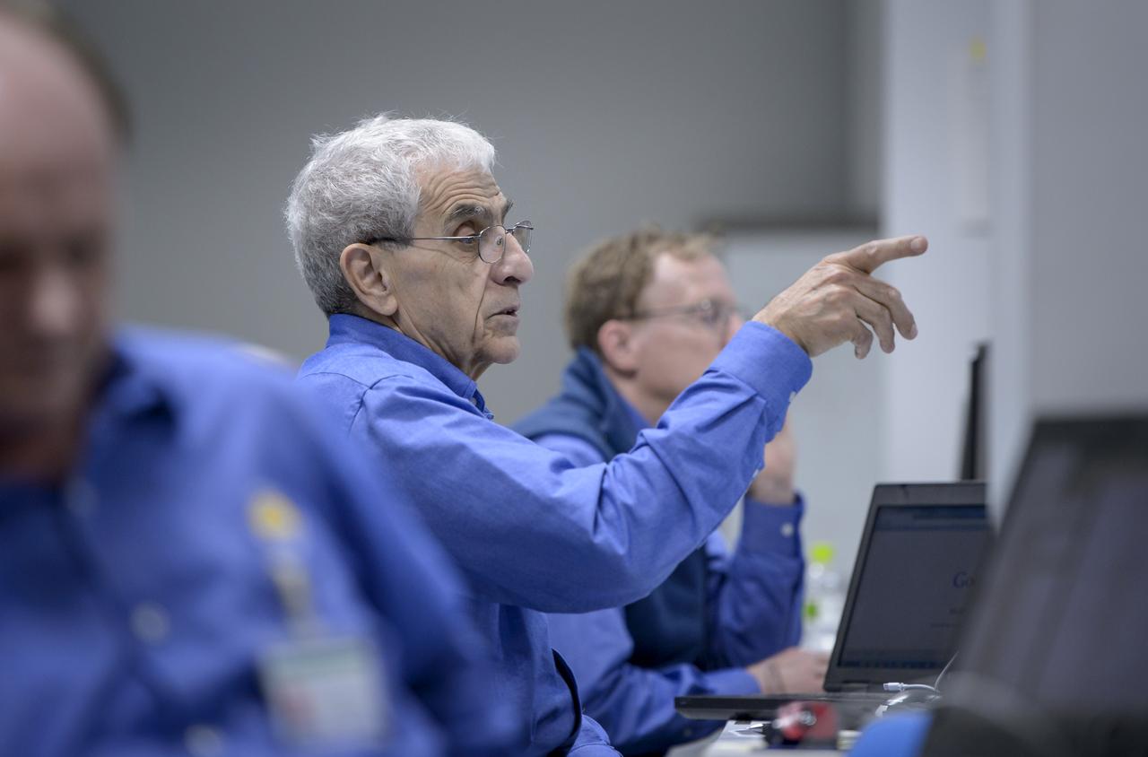
The NASA Global Precipitation Measurement (GPM) Core Observatory team is seen during an all-day launch simulation for GPM at the Spacecraft Test and Assembly Building 2 (STA2), Saturday, Feb. 22, 2014, Tanegashima Space Center (TNSC), Tanegashima Island, Japan. Japan Aerospace Exploration Agency (JAXA) plans to launch an H-IIA rocket carrying the GPM Core Observatory on Feb. 28, 2014. The NASA-JAXA GPM spacecraft will collect information that unifies data from an international network of existing and future satellites to map global rainfall and snowfall every three hours. Photo Credit: (NASA/Bill Ingalls)
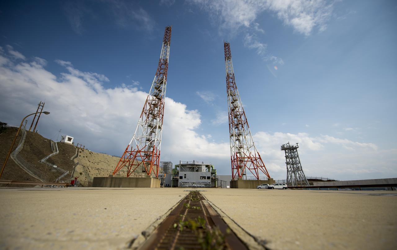
Launch pad 1 is seen at the Tanegashima Space Center (TNSC) on Monday, Feb. 24, 2014 in Tanegashima, Japan. A Japanese H-IIA rocket carrying the NASA-Japan Aerospace Exploration Agency (JAXA), Global Precipitation Measurement (GPM) Core Observatory is planned for launch from pad 1 on Feb. 28, 2014. Once launched, the GPM spacecraft will collect information that unifies data from an international network of existing and future satellites to map global rainfall and snowfall every three hours. Photo Credit: (NASA/Bill Ingalls)
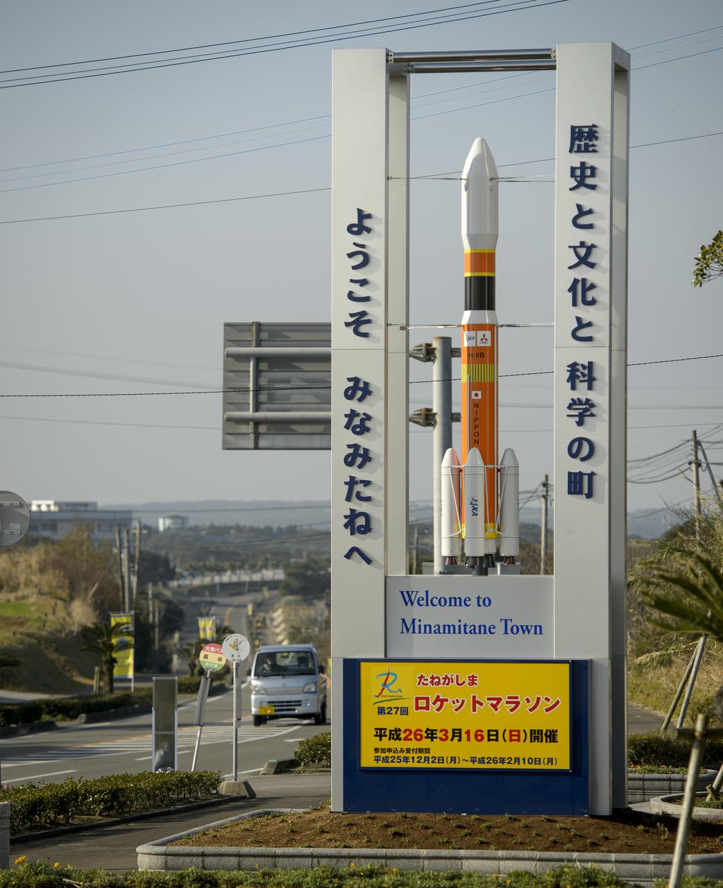
A sign with a model of the Japanese H-IIB rocket welcomes visitors to Minamitane Town, one of only a few small towns located outside of the Japan Aerospace Exploration Agency’s (JAXA) Tanegashima Space Center (TNSC), where the launch of an H-IIA rocket carrying the Global Precipitation Measurement (GPM) Core Observatory will take place in the next week, Saturday, Feb. 22, 2014, Tanegashima Island, Japan. The NASA-Japan Aerospace Exploration Agency (JAXA) GPM spacecraft will collect information that unifies data from an international network of existing and future satellites to map global rainfall and snowfall every three hours. Photo Credit: (NASA/Bill Ingalls)

Roadside flags welcome the NASA team and visitors to Minamitame Town, one of only a few small towns located outside of the Japan Aerospace Exploration Agency’s (JAXA) Tanegashima Space Center (TNSC), where the launch of an H-IIA rocket carrying the Global Precipitation Measurement (GPM) Core Observatory will take place in the next week, Saturday, Feb. 22, 2014, Tanegashima Island, Japan. The NASA-Japan Aerospace Exploration Agency (JAXA) GPM spacecraft will collect information that unifies data from an international network of existing and future satellites to map global rainfall and snowfall every three hours. The launch is planned for Feb. 28, 2014. Photo Credit: (NASA/Bill Ingalls)

Caroline Bouvier Kennedy, U.S. Ambassador Extraordinary and Plenipotentiary to Japan, right, is welcomed by Japan Aerospace Exploration Agency (JAXA), President, Naoki Okumura, at the Tanegashima Space Center Visitors Center on Thursday, Feb. 27, 2014, Tanegashima, Japan. The Ambassador is visiting the space center and hopes to witness the planned launch of a Japanese H-IIA rocket carrying the NASA-JAXA, Global Precipitation Measurement (GPM) Core Observatory. Once launched, the GPM spacecraft will collect information that unifies data from an international network of existing and future satellites to map global rainfall and snowfall every three hours. Photo Credit: (NASA/Bill Ingalls)
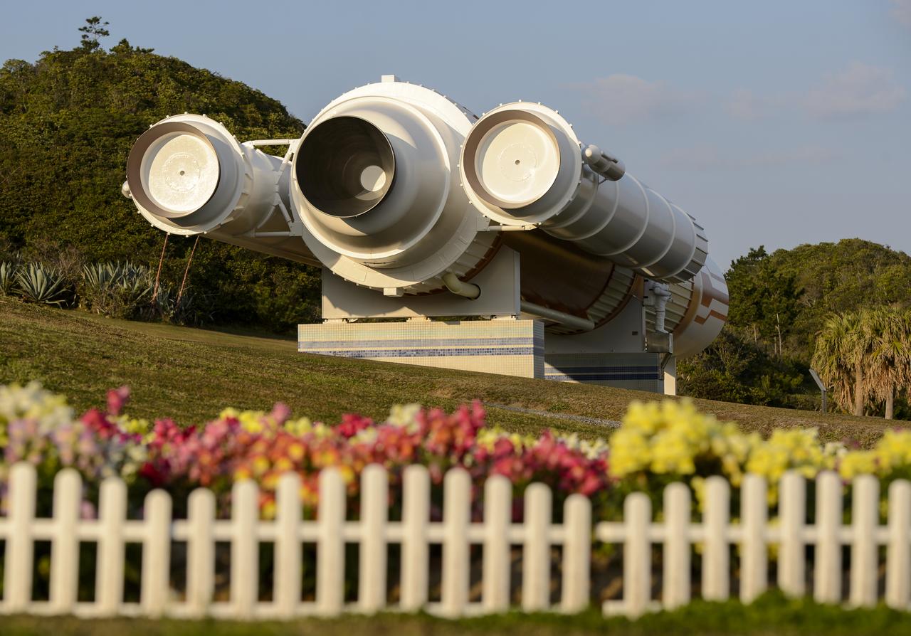
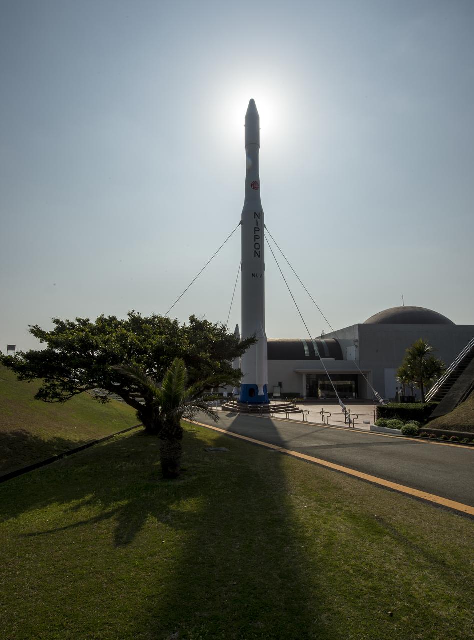
A full size model of an H-II rocket is seen at the Japan Aerospace Exploration Agency’s (JAXA) Tanegashima Space Center (TNSC) visitors center a week ahead of the planned launch of an H-IIA rocket carrying the Global Precipitation Measurement (GPM) Core Observatory, Friday, Feb. 21, 2014, Tanegashima Island, Japan. The NASA-JAXA GPM spacecraft will collect information that unifies data from an international network of existing and future satellites to map global rainfall and snowfall every three hours. Photo Credit: (NASA/Bill Ingalls)
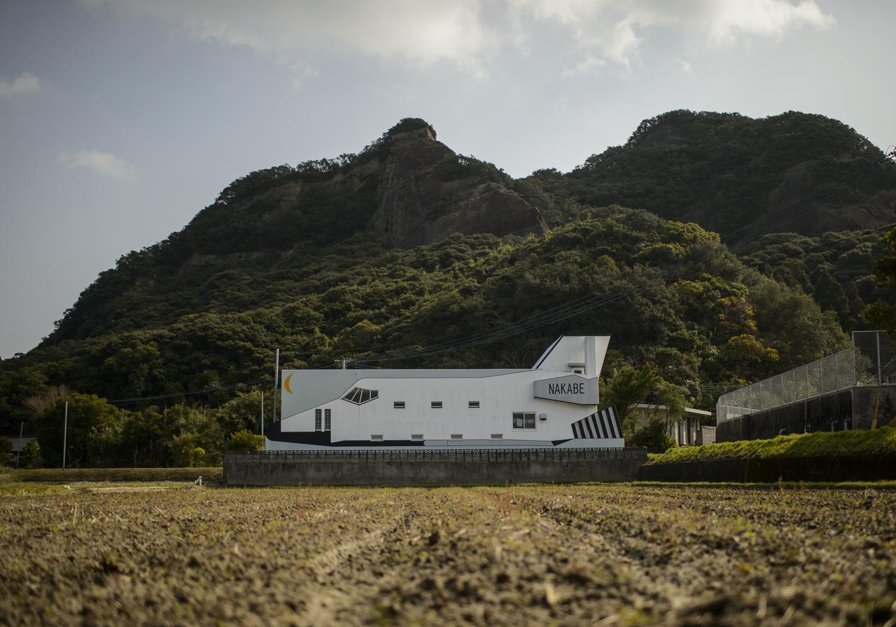
A building designed to look like a space shuttle is seen a few kilometers outside of the Tanegashima Space Center (TNSC), Sunday, Feb. 23, 2014, Tanegashima Island, Japan. A Japanese H-IIA rocket carrying the NASA-Japan Aerospace Exploration Agency (JAXA), Global Precipitation Measurement (GPM) Core Observatory is planned for launch from the space center on Feb. 28, 2014. Once launched, the GPM spacecraft will collect information that unifies data from an international network of existing and future satellites to map global rainfall and snowfall every three hours. Photo Credit: (NASA/Bill Ingalls)

A jogger runs past a sign welcoming NASA and other visitors to Minamitane Town on Sunday, Feb. 23, 2014, Tanegashima Island, Japan. A Japanese H-IIA rocket carrying the NASA-Japan Aerospace Exploration Agency (JAXA), Global Precipitation Measurement (GPM) Core Observatory is planned for launch from the space center on Feb. 28, 2014. Once launched, the GPM spacecraft will collect information that unifies data from an international network of existing and future satellites to map global rainfall and snowfall every three hours. Photo Credit: (NASA/Bill Ingalls)
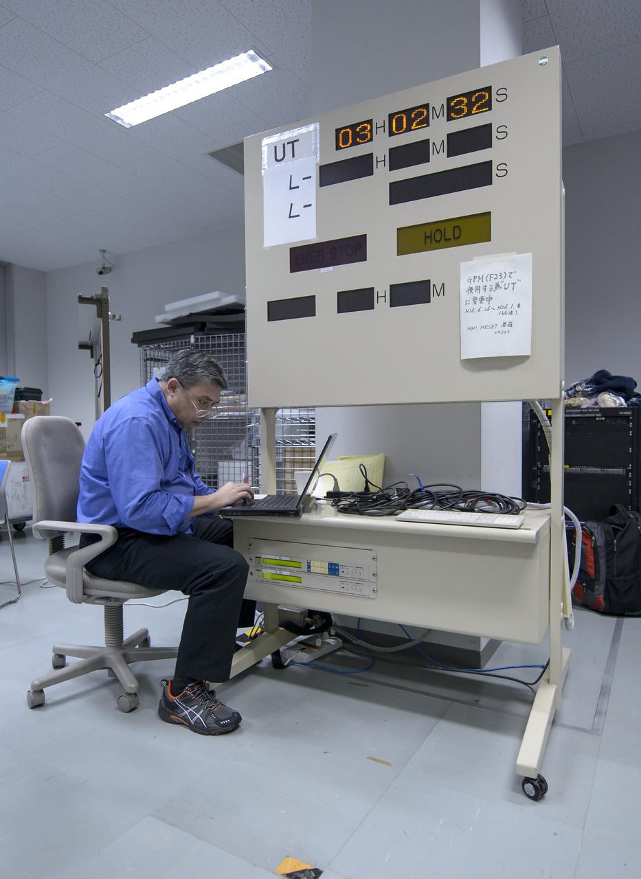
Clyde Woodall, NASA GPM launch services, is seen during the all-day launch simulation for the Global Precipitation Measurement (GPM) Core Observatory at the Spacecraft Test and Assembly Building 2 (STA2), Saturday, Feb. 22, 2014, Tanegashima Space Center (TNSC), Tanegashima Island, Japan. Japan Aerospace Exploration Agency (JAXA) plans to launch an H-IIA rocket carrying the GPM Core Observatory on Feb. 28, 2014. The NASA-JAXA GPM spacecraft will collect information that unifies data from an international network of existing and future satellites to map global rainfall and snowfall every three hours. Photo Credit: (NASA/Bill Ingalls)
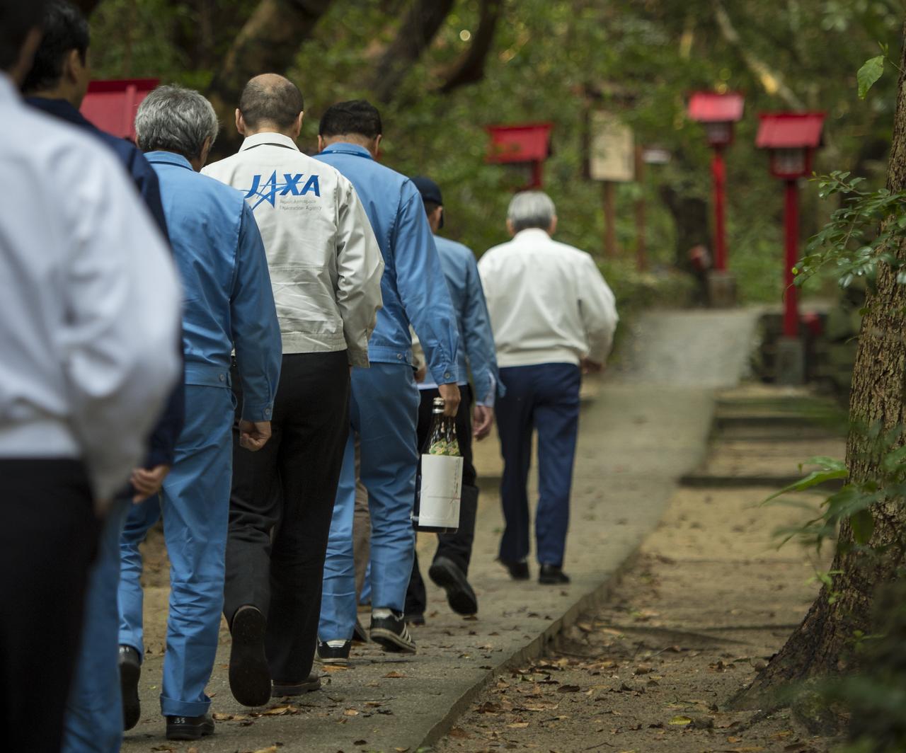
Japan Aerospace Exploration Agency (JAXA) team members walk with their offering of sake to the Houman Shrine, the third, and final, shrine in a traditional San-ja Mairi, or Three Shrine Pilgrimage, where the team prays for a successful launch, Tuesday, Feb. 25, 2014, Tanegashima Island, Japan. A Japanese H-IIA rocket carrying the NASA-JAXA, Global Precipitation Measurement (GPM) Core Observatory is planned for launch from the Tanegashima Space Center (TNSC) on Feb. 28, 2014. Once launched, the GPM spacecraft will collect information that unifies data from an international network of existing and future satellites to map global rainfall and snowfall every three hours. Photo Credit: (NASA/Bill Ingalls)
A rocket is seen at the entrance to the visitor's center of the Tanegashima Space Center (TNSC), Sunday, Feb. 23, 2014, Tanegashima Island, Japan. A Japanese H-IIA rocket carrying the NASA-Japan Aerospace Exploration Agency (JAXA), Global Precipitation Measurement (GPM) Core Observatory is planned for launch from the space center on Feb. 28, 2014. Once launched, the GPM spacecraft will collect information that unifies data from an international network of existing and future satellites to map global rainfall and snowfall every three hours. Photo Credit: (NASA/Bill Ingalls)
Space themed signs are seen along the roads to and from the Japan Aerospace Exploration Agency’s (JAXA) Tanegashima Space Center (TNSC), Saturday, Feb. 22, 2014, Tanegashima Island, Japan. A launch of an H-IIA rocket carrying the Global Precipitation Measurement (GPM) Core Observatory is planned for Feb. 28, 2014 from the space center. The NASA-JAXA GPM spacecraft will collect information that unifies data from an international network of existing and future satellites to map global rainfall and snowfall every three hours. Photo Credit: (NASA/Bill Ingalls)
A rocket is seen at the entrance to the visitor's center of the Tanegashima Space Center (TNSC), Sunday, Feb. 23, 2014, Tanegashima Island, Japan. A Japanese H-IIA rocket carrying the NASA-Japan Aerospace Exploration Agency (JAXA), Global Precipitation Measurement (GPM) Core Observatory is planned for launch from the space center on Feb. 28, 2014. Once launched, the GPM spacecraft will collect information that unifies data from an international network of existing and future satellites to map global rainfall and snowfall every three hours. Photo Credit: (NASA/Bill Ingalls)
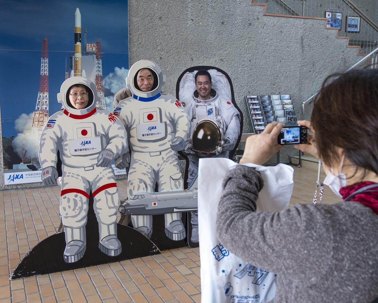
Tourist photograph themselves in astronaut space suites next to a cardboard cutout of Japan Aerospace Exploration Agency (JAXA) Astronaut Akihiko Hoshide at the visitor's center of the Tanegashima Space Center (TNSC), Sunday, Feb. 23, 2014, Tanegashima Island, Japan. A Japanese H-IIA rocket carrying the NASA-Japan Aerospace Exploration Agency (JAXA), Global Precipitation Measurement (GPM) Core Observatory is planned for launch from the space center on Feb. 28, 2014. Once launched, the GPM spacecraft will collect information that unifies data from an international network of existing and future satellites to map global rainfall and snowfall every three hours. Photo Credit: (NASA/Bill Ingalls)
Japan Aerospace Exploration Agency (JAXA) team members pray at the Houman Shrine, the third, and final, shrine in a traditional San-ja Mairi, or Three Shrine Pilgrimage, where the team prays for a successful launch, Tuesday, Feb. 25, 2014, Tanegashima Island, Japan. A Japanese H-IIA rocket carrying the NASA-JAXA, Global Precipitation Measurement (GPM) Core Observatory is planned for launch from the Tanegashima Space Center (TNSC) on Feb. 28, 2014. Once launched, the GPM spacecraft will collect information that unifies data from an international network of existing and future satellites to map global rainfall and snowfall every three hours. Photo Credit: (NASA/Bill Ingalls)
Japan Aerospace Exploration Agency (JAXA) team members stand before at the Kawachi Shrine, the second shrine in a traditional San-ja Mairi, or Three Shrine Pilgrimage, where the team prays for a successful launch, Tuesday, Feb. 25, 2014, Tanegashima Island, Japan. A Japanese H-IIA rocket carrying the NASA-JAXA, Global Precipitation Measurement (GPM) Core Observatory is planned for launch from the Tanegashima Space Center (TNSC) on Feb. 28, 2014. Once launched, the GPM spacecraft will collect information that unifies data from an international network of existing and future satellites to map global rainfall and snowfall every three hours. Photo Credit: (NASA/Bill Ingalls)

A NASA Global Precipitation Measurement (GPM) mission shirt is seen drying in the mid-day sun outside the Sun Pearl Hotel where many of the NASA GPM team are staying, Sunday, Feb. 23, 2014, Tanegashima Island, Japan. A Japanese H-IIA rocket carrying the NASA-Japan Aerospace Exploration Agency (JAXA), Global Precipitation Measurement (GPM) Core Observatory is planned for launch from the space center on Feb. 28, 2014. Once launched, the GPM spacecraft will collect information that unifies data from an international network of existing and future satellites to map global rainfall and snowfall every three hours. Photo Credit: (NASA/Bill Ingalls)
Launch pad 1 is seen at the Tanegashima Space Center (TNSC) on Monday, Feb. 24, 2014 in Tanegashima, Japan. A Japanese H-IIA rocket carrying the NASA-Japan Aerospace Exploration Agency (JAXA), Global Precipitation Measurement (GPM) Core Observatory is planned for launch from pad 1 on Feb. 28, 2014. Once launched, the GPM spacecraft will collect information that unifies data from an international network of existing and future satellites to map global rainfall and snowfall every three hours. Photo Credit: (NASA/Bill Ingalls)

Caroline Kennedy, U.S. Ambassador Extraordinary and Plenipotentiary to Japan, right, is welcomed by Japan Aerospace Exploration Agency (JAXA), President, Naoki Okumura, at the Tanegashima Space Center Visitors Center on Thursday, Feb. 27, 2014, Tanegashima, Japan. The Ambassador is visiting the space center and hopes to witness the planned launch of a Japanese H-IIA rocket carrying the NASA-JAXA, Global Precipitation Measurement (GPM) Core Observatory. Once launched, the GPM spacecraft will collect information that unifies data from an international network of existing and future satellites to map global rainfall and snowfall every three hours. Photo Credit: (NASA/Bill Ingalls)
A small roadside park honoring spaceflight is seen in Minamitane Town, Saturday Feb. 22, 2014, Tanegashima Island, Japan. Minamitane Town is located not far from the Japan Aerospace Exploration Agency’s (JAXA) Tanegashima Space Center (TNSC), where the launch of an H-IIA rocket carrying the Global Precipitation Measurement (GPM) Core Observatory is planned for Feb. 28, 2014. The NASA-JAXA GPM spacecraft will collect information that unifies data from an international network of existing and future satellites to map global rainfall and snowfall every three hours. Photo Credit: (NASA/Bill Ingalls)
Andy Aylward, GPM EGSE, monitors the progress of an all-day launch simulation for the Global Precipitation Measurement (GPM) Core Observatory at the Spacecraft Test and Assembly Building 2 (STA2), Saturday, Feb. 22, 2014, Tanegashima Space Center (TNSC), Tanegashima Island, Japan. Japan Aerospace Exploration Agency (JAXA) plans to launch an H-IIA rocket carrying the GPM Core Observatory on Feb. 28, 2014. The NASA-JAXA GPM spacecraft will collect information that unifies data from an international network of existing and future satellites to map global rainfall and snowfall every three hours. Photo Credit: (NASA/Bill Ingalls)
A full size model of an H-II rocket is seen at the Japan Aerospace Exploration Agency’s (JAXA) Tanegashima Space Center (TNSC) visitors center a week ahead of the planned launch of an H-IIA rocket carrying the Global Precipitation Measurement (GPM) Core Observatory, Friday, Feb. 21, 2014, Tanegashima Island, Japan. The NASA-JAXA GPM spacecraft will collect information that unifies data from an international network of existing and future satellites to map global rainfall and snowfall every three hours. Photo Credit: (NASA/Bill Ingalls)

Caroline Kennedy, U.S. Ambassador Extraordinary and Plenipotentiary to Japan, congratulated both NASA and the Japan Aerospace Exploration Agency (JAXA) Global Precipitation Measurement (GPM) Core Observatory teams and noted it was an example of over 40 years of strong U.S. and Japan relations, Friday Feb. 28, 2014, Tanegashima Space Center (TNSC) Tanegashima, Japan. The Ambassador witnessed the launch of a Japanese H-IIA rocket carrying the NASA-JAXA, GPM Core Observatory. The GPM spacecraft will collect information that unifies data from an international network of existing and future satellites to map global rainfall and snowfall every three hours. Photo Credit: (NASA/Bill Ingalls)

Envelopes with stamps depicting various space missions are shown at the visitor's center of the Tanegashima Space Center (TNSC), Sunday, Feb. 23, 2014, Tanegashima Island, Japan. A Japanese H-IIA rocket carrying the NASA-Japan Aerospace Exploration Agency (JAXA), Global Precipitation Measurement (GPM) Core Observatory is planned for launch from the space center on Feb. 28, 2014. Once launched, the GPM spacecraft will collect information that unifies data from an international network of existing and future satellites to map global rainfall and snowfall every three hours. Photo Credit: (NASA/Bill Ingalls)

Caroline Bouvier Kennedy, U.S. Ambassador Extraordinary and Plenipotentiary to Japan, center, tours the Tanegashima Space Center, Visitors Center with Japan Aerospace Exploration Agency (JAXA), President, Naoki Okumura, right, on Thursday, Feb. 27, 2014, Tanegashima, Japan. The Ambassador visiting the space center and hopes to witness the planned launch of a Japanese H-IIA rocket carrying the NASA-JAXA, Global Precipitation Measurement (GPM) Core Observatory. Once launched, the GPM spacecraft will collect information that unifies data from an international network of existing and future satellites to map global rainfall and snowfall every three hours. Photo Credit: (NASA/Bill Ingalls)
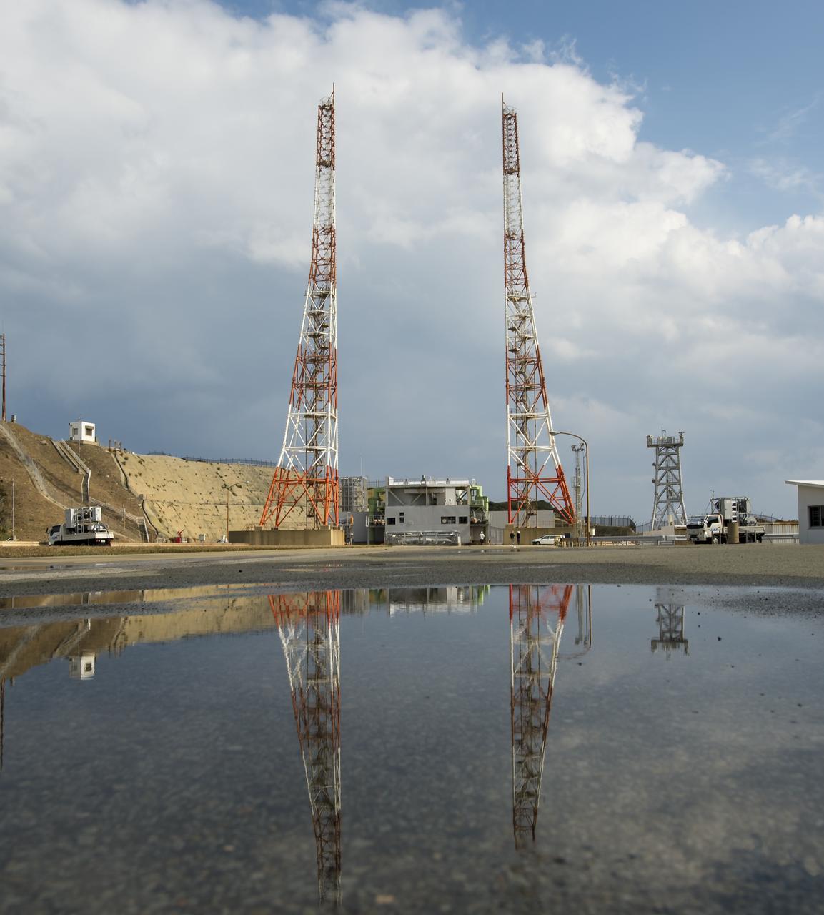
Launch pad 1 is seen at the Tanegashima Space Center (TNSC) on Monday, Feb. 24, 2014 in Tanegashima, Japan. A Japanese H-IIA rocket carrying the NASA-Japan Aerospace Exploration Agency (JAXA), Global Precipitation Measurement (GPM) Core Observatory is planned for launch from pad 1 on Feb. 28, 2014. Once launched, the GPM spacecraft will collect information that unifies data from an international network of existing and future satellites to map global rainfall and snowfall every three hours. Photo Credit: (NASA/Bill Ingalls)
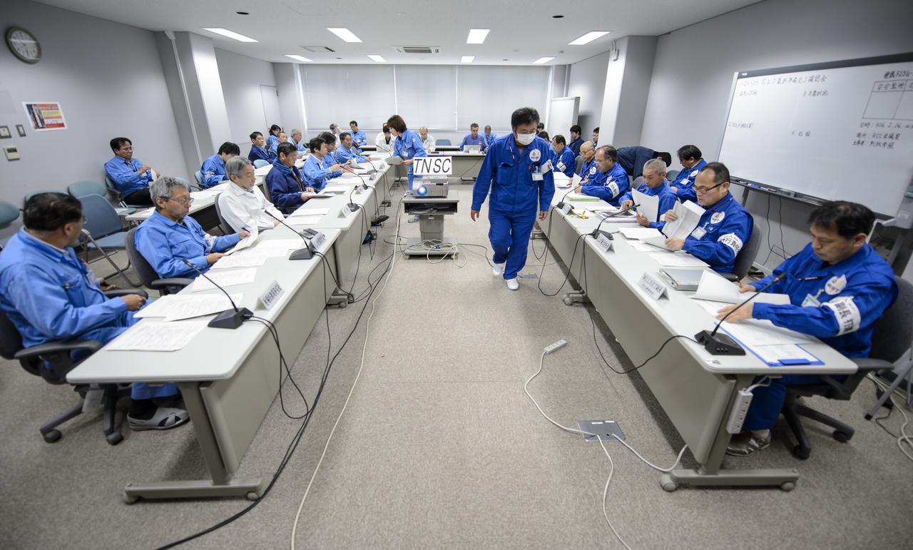
Chief officers from Mitsubishi Heavy Industries, Ltd., the Japan Aerospace Exploration Agency (JAXA) and NASA met on Wednesday, Feb. 26, 2014 in the Range Control Center (RCC) of the Tanegashima Space Center, Japan, to review the readiness of the Global Precipitation Measurement (GPM) Core Observatory for launch. The spacecraft is scheduled to launch aboard an H-IIA rocket early on the morning of Feb. 28 Japan time. Once launched, the GPM spacecraft will collect information that unifies data from an international network of existing and future satellites to map global rainfall and snowfall every three hours. Photo Credit: (NASA/Bill Ingalls)

An offering of sake can be seen at the Ebisu Shrine, the first shrine in a traditional San-ja Mairi, or Three Shrine Pilgrimage, in which members of the Japan Aerospace Exploration Agency (JAXA) team pray for a successful launch, Tuesday, Feb. 25, 2014, Tanegashima Island, Japan. A Japanese H-IIA rocket carrying the NASA-JAXA, Global Precipitation Measurement (GPM) Core Observatory is planned for launch from the Tanegashima Space Center (TNSC) on Feb. 28, 2014. Once launched, the GPM spacecraft will collect information that unifies data from an international network of existing and future satellites to map global rainfall and snowfall every three hours. Photo Credit: (NASA/Bill Ingalls)
A roadside sign announces the upcoming launch of an H-IIA rocket carrying the Global Precipitation Measurement (GPM) Core Observatory, Saturday, Feb. 22, 2014, Minamitane Town, Tanegashima Island, Japan. Once launched from the Japan Aerospace Exploration Agency’s (JAXA) Tanegashima Space Center (TNSC) the NASA-JAXA GPM spacecraft will collect information that unifies data from an international network of existing and future satellites to map global rainfall and snowfall every three hours. The launch is planned for Feb. 28, 2014. Photo Credit: (NASA/Bill Ingalls)
George Dakermanji, NASA GPM Power, monitors the progress of an all-day launch simulation for the Global Precipitation Measurement (GPM) Core Observatory at the Spacecraft Test and Assembly Building 2 (STA2), Saturday, Feb. 22, 2014, Tanegashima Space Center (TNSC), Tanegashima Island, Japan. Japan Aerospace Exploration Agency (JAXA) plans to launch an H-IIA rocket carrying the GPM Core Observatory on Feb. 28, 2014. The NASA-JAXA GPM spacecraft will collect information that unifies data from an international network of existing and future satellites to map global rainfall and snowfall every three hours. Photo Credit: (NASA/Bill Ingalls)
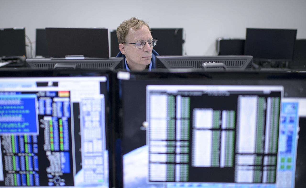
NASA GPM Radio Frequency Engineer David Lassiter monitors the progress of an all-day launch simulation for the Global Precipitation Measurement (GPM) Core Observatory at the Spacecraft Test and Assembly Building 2 (STA2), Saturday, Feb. 22, 2014, Tanegashima Space Center (TNSC), Tanegashima Island, Japan. Japan Aerospace Exploration Agency (JAXA) plans to launch an H-IIA rocket carrying the GPM Core Observatory on Feb. 28, 2014. The NASA-JAXA GPM spacecraft will collect information that unifies data from an international network of existing and future satellites to map global rainfall and snowfall every three hours. Photo Credit: (NASA/Bill Ingalls)
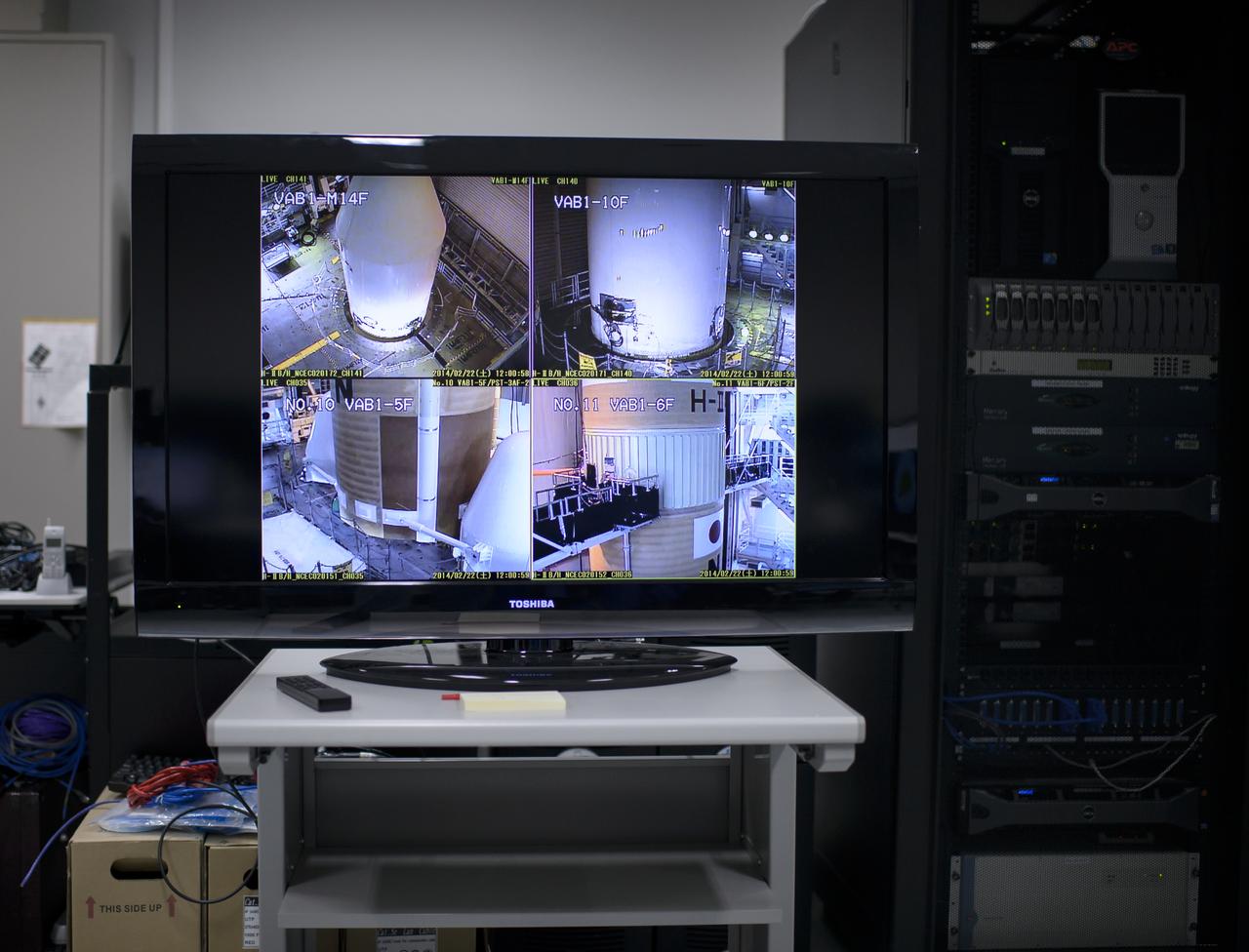
A live television view of the H-IIA rocket, with the Global Precipitation Measurement (GPM) Core Observatory onboard, is seen inside the Spacecraft Test and Assembly Building 2 (STA2) during an all-day launch simulation, Saturday, Feb. 22, 2014, Tanegashima Space Center (TNSC), Tanegashima Island, Japan. Japan Aerospace Exploration Agency (JAXA) plans to launch an H-IIA rocket carrying the GPM Core Observatory on Feb. 28, 2014. The NASA-JAXA GPM spacecraft will collect information that unifies data from an international network of existing and future satellites to map global rainfall and snowfall every three hours. Photo Credit: (NASA/Bill Ingalls)

Masahiro Kojima, GPM Dual-frequency Precipitation Radar project manager, Japan Aerospace Exploration Agency (JAXA), Tsukuba, bows at the Ebisu Shrine, the first shrine in a traditional San-ja Mairi, or Three Shrine Pilgrimage, in which members of the JAXA team pray for a successful launch, Tuesday, Feb. 25, 2014, Tanegashima Island, Japan. A Japanese H-IIA rocket carrying the NASA-JAXA, Global Precipitation Measurement (GPM) Core Observatory is planned for launch from the Tanegashima Space Center (TNSC) on Feb. 28, 2014. Once launched, the GPM spacecraft will collect information that unifies data from an international network of existing and future satellites to map global rainfall and snowfall every three hours. Photo Credit: (NASA/Bill Ingalls)
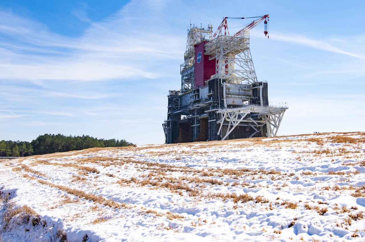
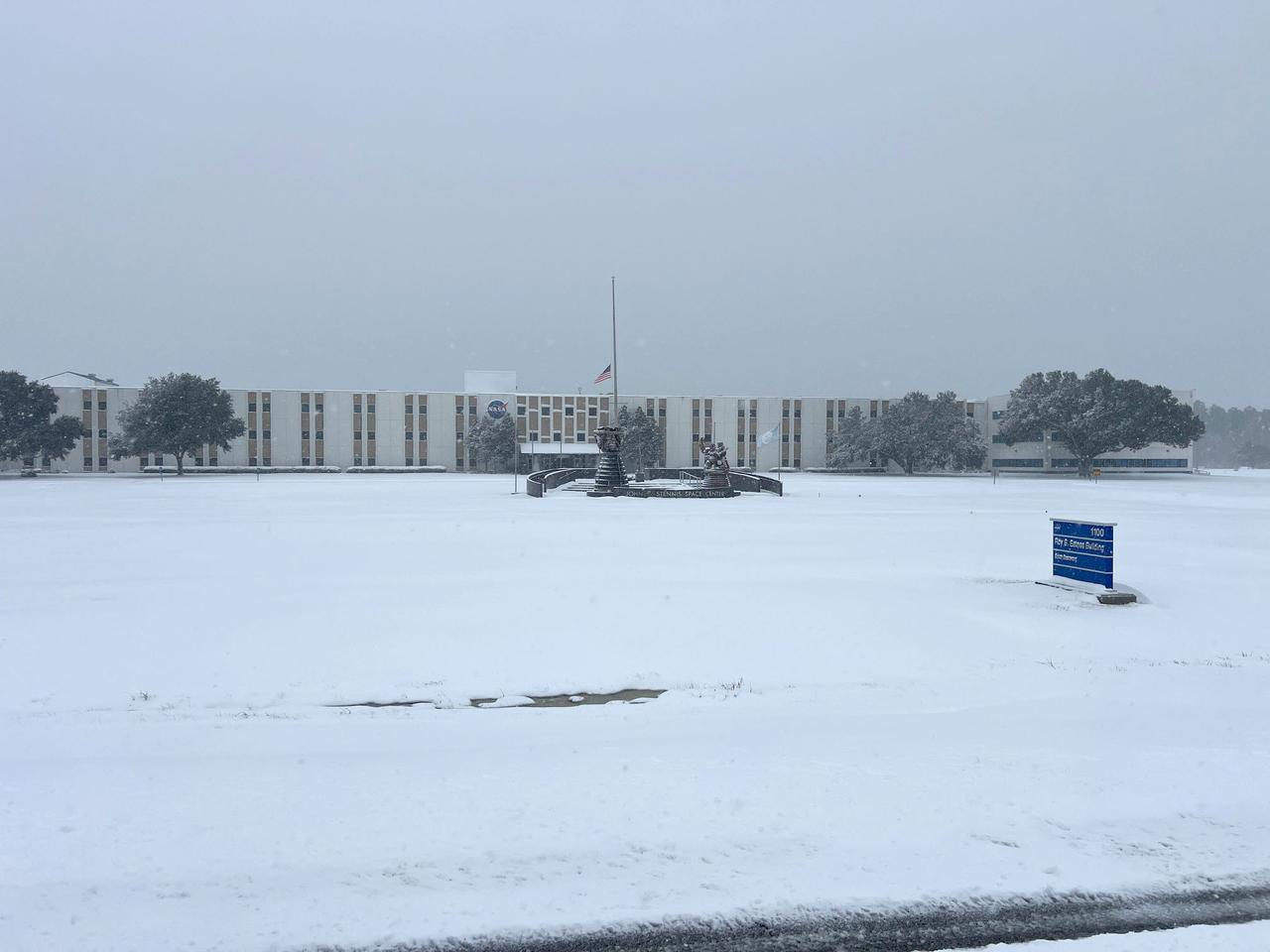
NASA’s Stennis Space Center near Bay St. Louis, Mississippi, is often associated with hot fires coming from the center’s long history of hot fire testing engines and stages that have helped power the nation’s space dreams since the first humans stepped foot on the Moon. However, NASA Stennis turned into a Winter Wonderland Jan. 21 when America’s largest rocket propulsion test site received a historic amount of snow across the unique federal city. Hancock County, where NASA Stennis is located, received five to seven inches of snow, according to the National Weather Service. It marked the most snow the county has received in 61 years. The December 31, 1963, snowfall holds the record at 10 inches of snow for Bay St. Louis, Mississippi.

A daruma doll is seen on the desk of Masahiro Kojima, GPM Dual-frequency Precipitation Radar project manager, Japan Aerospace Exploration Agency (JAXA), at the Tanegashima Space Cener's Range Control Center (RCC), Wednesday, Feb. 26, 2014, Tanegashima, Japan. One eye of the daruma doll is colored in when a goal is set and the second eye is colored in at the completion of the goal. JAXA plans to launch an H-IIA rocket carrying the NASA-JAXA, Global Precipitation Measurement (GPM) Core Observatory from the space center on Feb. 28, 2014. Once launched, the GPM spacecraft will collect information that unifies data from an international network of existing and future satellites to map global rainfall and snowfall every three hours. Photo Credit: (NASA/Bill Ingalls)
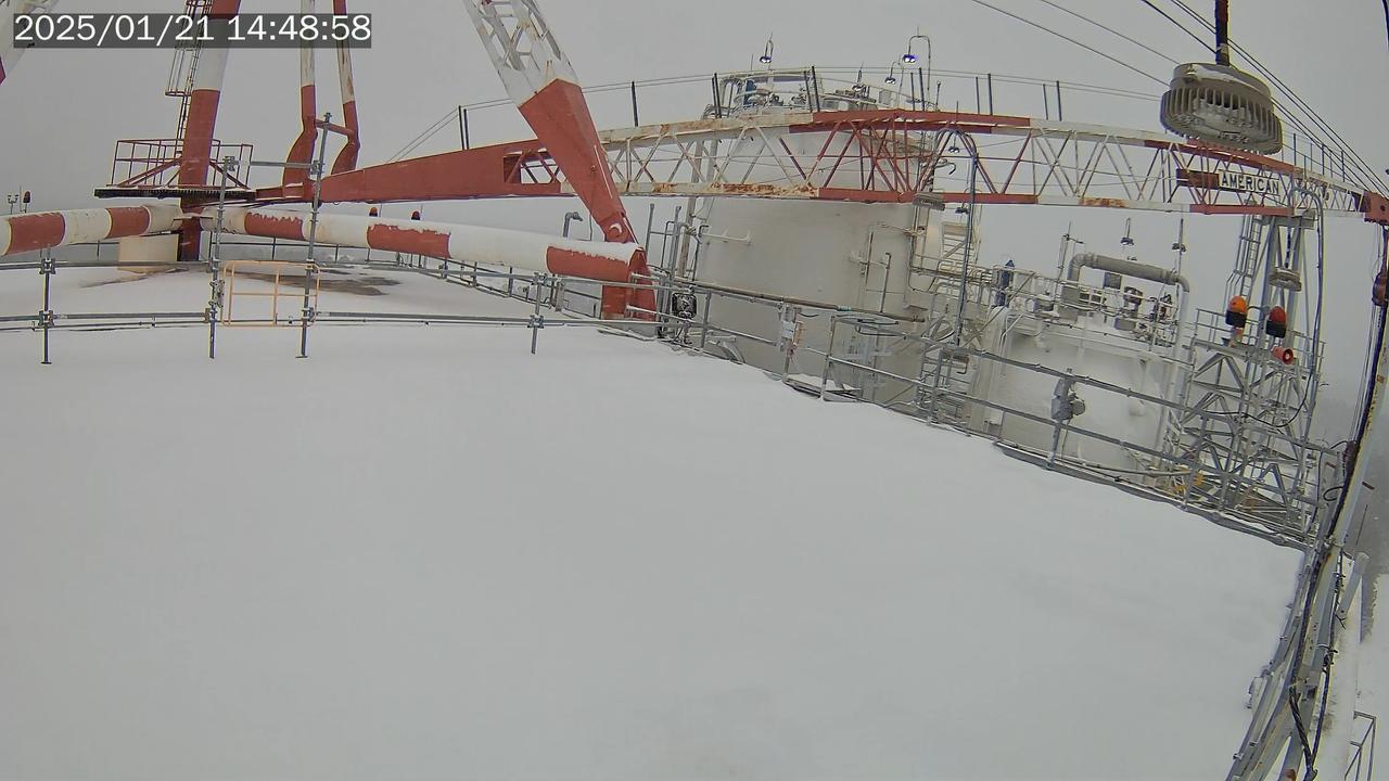
NASA’s Stennis Space Center near Bay St. Louis, Mississippi, is often associated with hot fires coming from the center’s long history of hot fire testing engines and stages that have helped power the nation’s space dreams since the first humans stepped foot on the Moon. However, NASA Stennis turned into a Winter Wonderland Jan. 21 when America’s largest rocket propulsion test site received a historic amount of snow across the unique federal city. Hancock County, where NASA Stennis is located, received five to seven inches of snow, according to the National Weather Service. It marked the most snow the county has received in 61 years. The December 31, 1963, snowfall holds the record at 10 inches of snow for Bay St. Louis, Mississippi.

NASA GPM Systems team member Tim Grunner, left, and NASA GPM Test Conductor John Pope talk during an all-day launch simulation for the Global Precipitation Measurement (GPM) Core Observatory at the Spacecraft Test and Assembly Building 2 (STA2), Saturday, Feb. 22, 2014, Tanegashima Space Center (TNSC), Tanegashima Island, Japan. Japan Aerospace Exploration Agency (JAXA) plans to launch an H-IIA rocket carrying the GPM Core Observatory on Feb. 28, 2014. The NASA-JAXA GPM spacecraft will collect information that unifies data from an international network of existing and future satellites to map global rainfall and snowfall every three hours. Photo Credit: (NASA/Bill Ingalls)
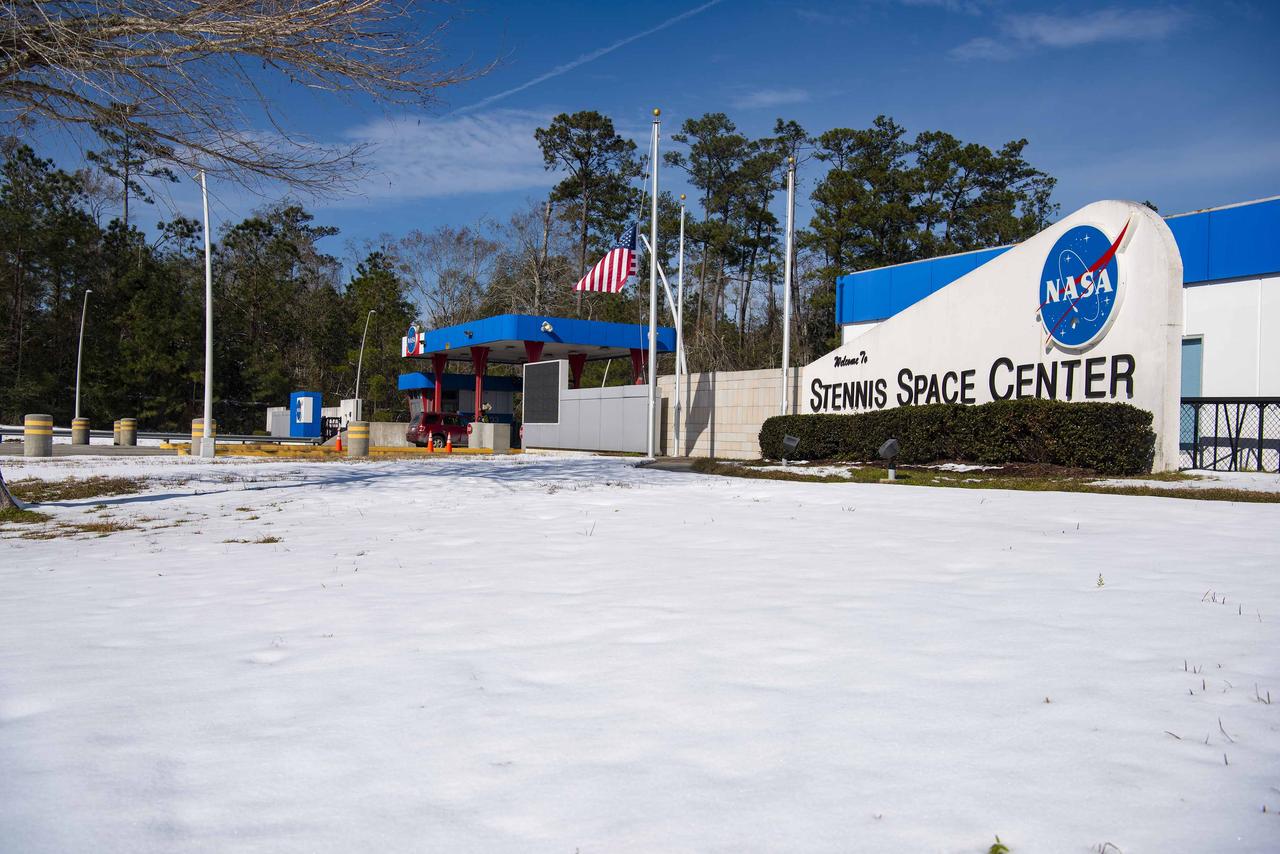
NASA’s Stennis Space Center near Bay St. Louis, Mississippi, is often associated with hot fires coming from the center’s long history of hot fire testing engines and stages that have helped power the nation’s space dreams since the first humans stepped foot on the Moon. However, NASA Stennis turned into a Winter Wonderland Jan. 21 when America’s largest rocket propulsion test site received a historic amount of snow across the unique federal city. Hancock County, where NASA Stennis is located, received five to seven inches of snow, according to the National Weather Service. It marked the most snow the county has received in 61 years. The December 31, 1963, snowfall holds the record at 10 inches of snow for Bay St. Louis, Mississippi.
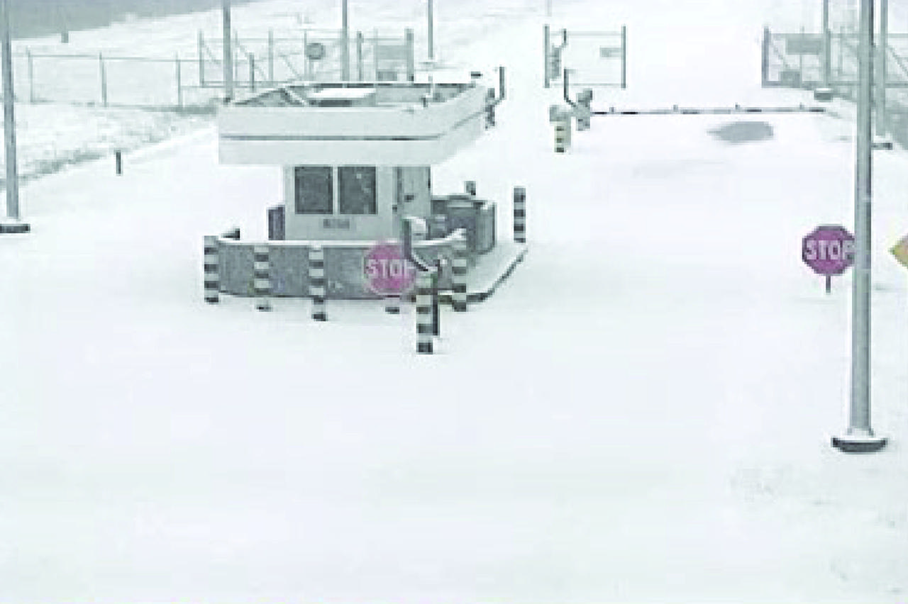
NASA’s Stennis Space Center near Bay St. Louis, Mississippi, is often associated with hot fires coming from the center’s long history of hot fire testing engines and stages that have helped power the nation’s space dreams since the first humans stepped foot on the Moon. However, NASA Stennis turned into a Winter Wonderland Jan. 21 when America’s largest rocket propulsion test site received a historic amount of snow across the unique federal city. Hancock County, where NASA Stennis is located, received five to seven inches of snow, according to the National Weather Service. It marked the most snow the county has received in 61 years. The December 31, 1963, snowfall holds the record at 10 inches of snow for Bay St. Louis, Mississippi.

A daruma doll is seen amongst the NASA GPM Mission launch team in the Spacecraft Test and Assembly Building 2 (STA2) during the all-day launch simulation for the Global Precipitation Measurement (GPM) Core Observatory, Saturday, Feb. 22, 2014, Tanegashima Space Center (TNSC), Tanegashima Island, Japan. One eye of the daruma doll is colored in when a goal is set, in this case a successful launch of GPM, and the second eye is colored in at the completion of the goal. Japan Aerospace Exploration Agency (JAXA) plans to launch an H-IIA rocket carrying the GPM Core Observatory on Feb. 28, 2014. The NASA-JAXA GPM spacecraft will collect information that unifies data from an international network of existing and future satellites to map global rainfall and snowfall every three hours. Photo Credit: (NASA/Bill Ingalls)
NASA GPM Test Conductors, Bill Dehaven, left, and John Pope, standing, and other GPM team members, participate in an all-day launch simulation for the Global Precipitation Measurement (GPM) Core Observatory at the Spacecraft Test and Assembly Building 2 (STA2), Saturday, Feb. 22, 2014, Tanegashima Space Center (TNSC), Tanegashima Island, Japan. Japan Aerospace Exploration Agency (JAXA) plans to launch an H-IIA rocket carrying the GPM Core Observatory on Feb. 28, 2014. The NASA-JAXA GPM spacecraft will collect information that unifies data from an international network of existing and future satellites to map global rainfall and snowfall every three hours. Photo Credit: (NASA/Bill Ingalls)
NASA’s Stennis Space Center near Bay St. Louis, Mississippi, is often associated with hot fires coming from the center’s long history of hot fire testing engines and stages that have helped power the nation’s space dreams since the first humans stepped foot on the Moon. However, NASA Stennis turned into a Winter Wonderland Jan. 21 when America’s largest rocket propulsion test site received a historic amount of snow across the unique federal city. Hancock County, where NASA Stennis is located, received five to seven inches of snow, according to the National Weather Service. It marked the most snow the county has received in 61 years. The December 31, 1963, snowfall holds the record at 10 inches of snow for Bay St. Louis, Mississippi.