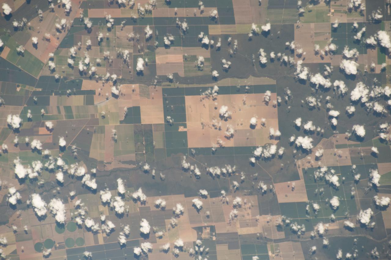
ISS043E227213 (05/20/2015) --- Earth observation of South America from the International Space Station on May 20, 2015. NASA astronaut Terry Virts tweeted this image with the remark of: "Farm fields in central #Brazil #SouthAmerica".
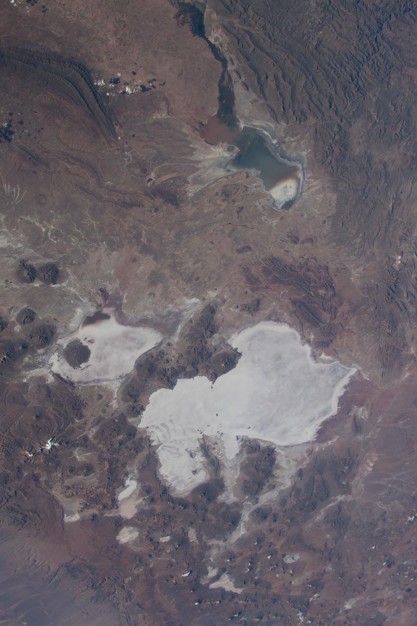
ISS043E184521 (05/10/2015) --- NASA astronaut Terry Virts Expedition 43 Commander on the International Space Station tweeted this Earth observation image of South America with the following comment: "Salar de Uyuni in the #Bolivia desert #SouthAmerica. The world's largest salt flat".
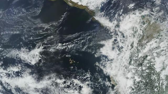
Completed: 07-16-2009 Straddling the equator approximately 1000 kilometers to the west of the South American mainland, the Galapagos Islands lie within the heart of the equatorial current system. Rising from the sea floor, the volcanic islands of the Galapagos are set on top of a large submarine platform. The main portion of the Galapagos platform is relatively flat and less than 1000 meters in depth. The steepest slopes are found along the western and southern flanks of the platform with a gradual slope towards the east. The interactions of the Galapagos and the oceanic currents create vastly different environmental regimes which not only isolates one part of the Archipelago from the other but allows penguins to live along the equator on the western part of the Archipelago and tropical corals around the islands to the north. The islands are relatively new in geologic terms with the youngest islands in the west still exhibiting periodic eruptions from their massive volcanic craters. Please give credit for this item to: NASA/Goddard Space Flight Center, The SeaWiFS Project and GeoEye, Scientific Visualization Studio. NOTE: All SeaWiFS images and data presented on this web site are for research and educational use only. All commercial use of SeaWiFS data must be coordinated with GeoEye (http://www.geoeye.com). To download this video go to: <a href="http://svs.gsfc.nasa.gov/goto?3628" rel="nofollow">svs.gsfc.nasa.gov/goto?3628</a> <b><a href="http://www.nasa.gov/centers/goddard/home/index.html" rel="nofollow">NASA Goddard Space Flight Center</a></b> is home to the nation's largest organization of combined scientists, engineers and technologists that build spacecraft, instruments and new technology to study the Earth, the sun, our solar system, and the universe.
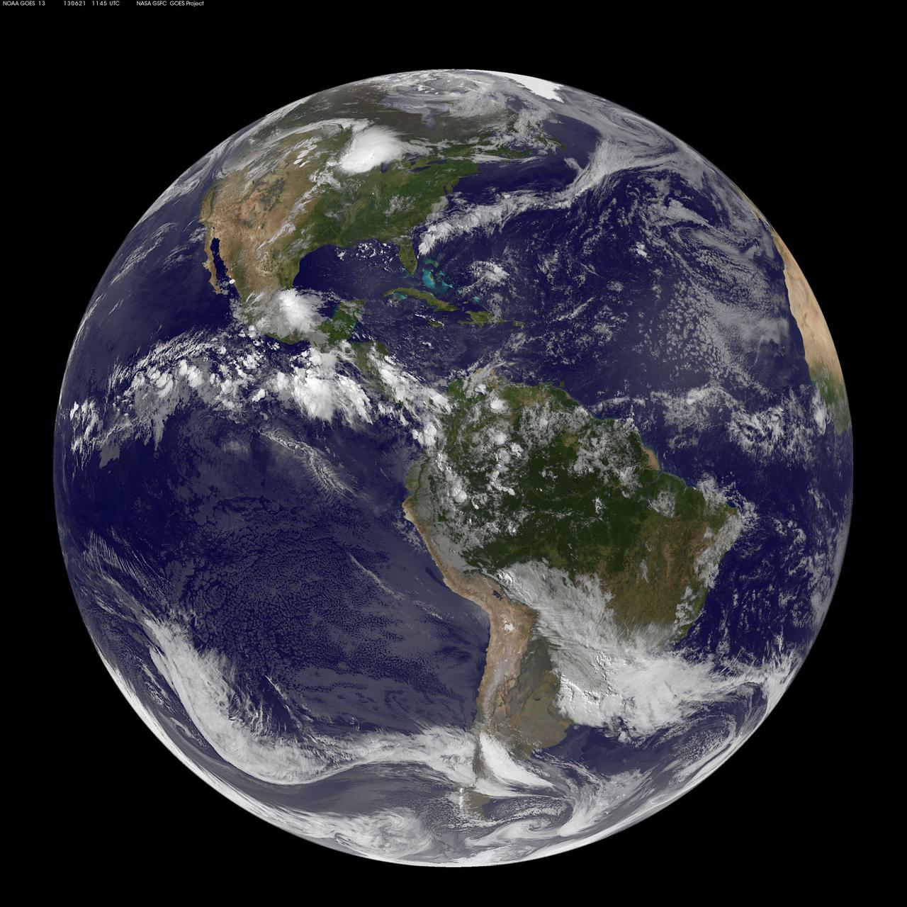
This full-disk image from NOAA’s GOES-13 satellite was captured at 11:45 UTC (7:45 a.m. EDT) and shows the Americas on June 21, 2012. This date marks the start of astronomical summer in the northern hemisphere, making it the longest day of the year! <b><a href="http://www.nasa.gov/audience/formedia/features/MP_Photo_Guidelines.html" rel="nofollow">NASA image use policy.</a></b> <b><a href="http://www.nasa.gov/centers/goddard/home/index.html" rel="nofollow">NASA Goddard Space Flight Center</a></b> enables NASA’s mission through four scientific endeavors: Earth Science, Heliophysics, Solar System Exploration, and Astrophysics. Goddard plays a leading role in NASA’s accomplishments by contributing compelling scientific knowledge to advance the Agency’s mission. <b>Follow us on <a href="http://twitter.com/NASA_GoddardPix" rel="nofollow">Twitter</a></b> <b>Like us on <a href="http://www.facebook.com/pages/Greenbelt-MD/NASA-Goddard/395013845897?ref=tsd" rel="nofollow">Facebook</a></b> <b>Find us on <a href="http://instagram.com/nasagoddard?vm=grid" rel="nofollow">Instagram</a></b>