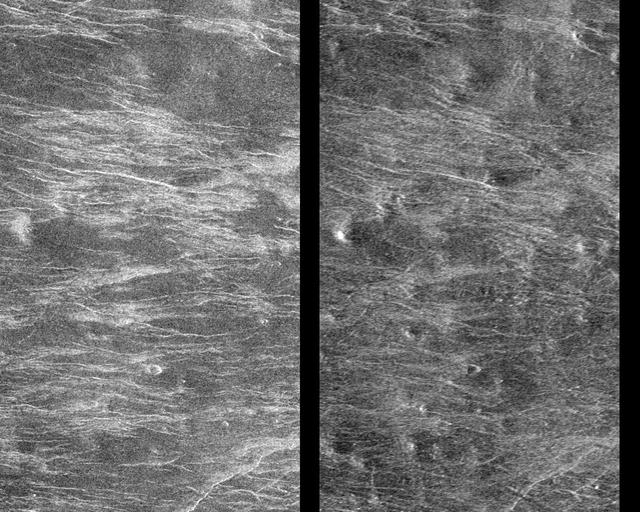
This Magellan image depicts a stereoscopic pair of an area on Venus with small volcanic domes. Stereoscopic images of Venus offer exciting new possibilities for scientific analysis of Venusian landforms. http://photojournal.jpl.nasa.gov/catalog/PIA00251

Topographic detail is seen in a stereoscopic view of this part of Jupiter moon Ganymede. This image is a computer reconstruction from two images taken by NASA Galileo spacecraft in 1996.
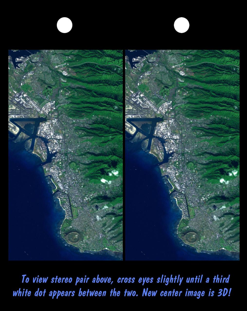
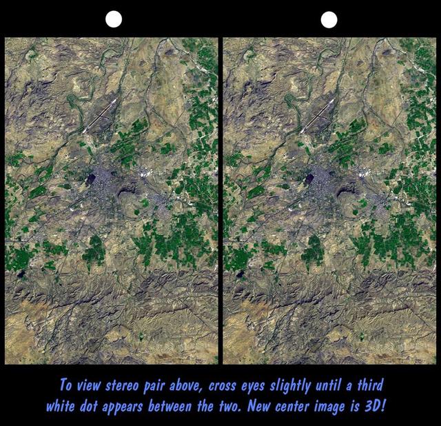
Honolulu, on the island of Oahu, is a large and growing urban area. This stereoscopic image pair, combining a Landsat image with topography measured by NASA Shuttle Radar Topography Mission SRTM, shows how topography controls the urban pattern.

This stereoscopic shaded relief image from NASA Shuttle Radar Topography Mission shows Africa topography. Also shown are Madagascar, the Arabian Peninsula, and other adjacent regions. 3D glasses are necessary to view this image.
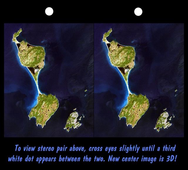
This stereoscopic satellite image showing Miquelon and Saint Pierre Islands, located south of Newfoundland, Canada, was generated by draping NASA Landsat satellite image over a preliminary Shuttle Radar Topography Mission SRTM elevation model.

Topographic detail is seen in this stereoscopic view of the Galileo Regio region of Jupiter moon Ganymede. The picture is a computer reconstruction from two images taken by NASA Galileo during 1996.
This anaglyph, acquired by NASA Phoenix Lander on Jun. 23, 2008, shows a stereoscopic 3D view of the Martian surface near the lander. 3D glasses are necessary to view this image.

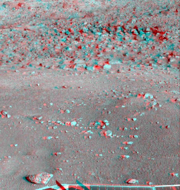
This is a stereoscopic version of NASA Mars Exploration Rover Spirit Lookout panorama, acquired on Feb. 27 to Mar. 2, 2005. The view is from a position known informally as Larry Lookout. 3D glasses are necessary to view this image.
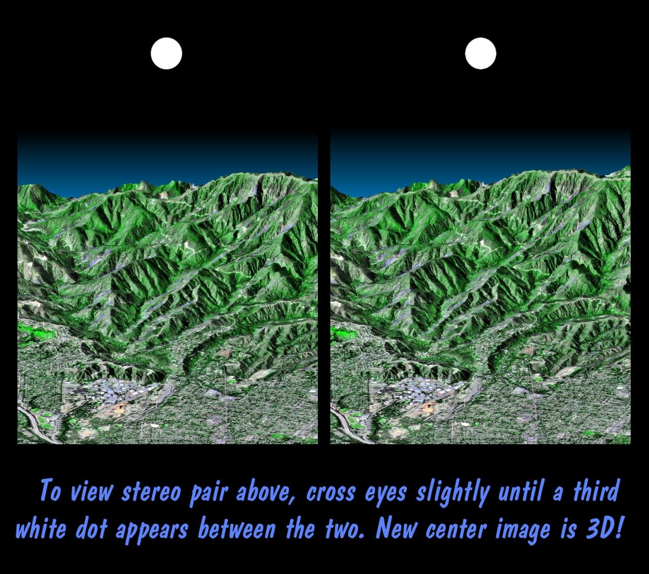
This stereoscopic image pair is a perspective view that shows the western part of the city of Pasadena, California, looking north toward the San Gabriel Mountains. Portions of the cities of Altadena and La Canada Flintridge are also shown.
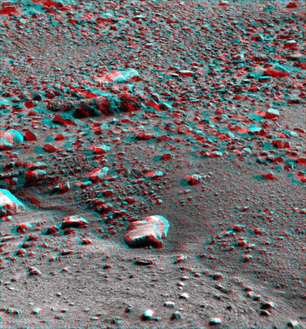
This anaglyph, acquired by NASA Phoenix Lander on Jun. 26, 2008, shows a stereoscopic 3D view of the Martian surface near the lander. 3D glasses are necessary to view this image.
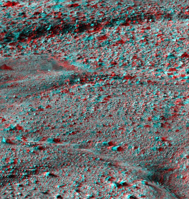
This anaglyph, acquired by NASA Phoenix Lander Surface Stereo Imager on June 8, 2008, shows a stereoscopic 3D view of the Martian surface near the lander. 3D glasses are necessary.
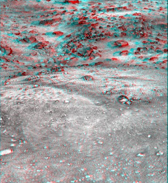
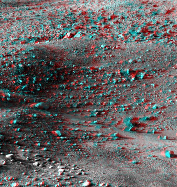
This anaglyph, acquired by NASA Phoenix Lander on Jun. 7, 2008, shows a stereoscopic 3D view of the Martian surface near the lander. 3D glasses are necessary to view this image.
On January 26, 2001, the city of Bhuj suffered the most deadly earthquake in India history. This stereoscopic image was generated from NASA Landsat satellite and data from Shuttle Radar Topography Mission SRTM.
This anaglyph, acquired by NASA Phoenix Lander on Jun. 8, 2008, shows a stereoscopic 3D view of the Martian surface near the lander. 3D glasses are necessary to view this image.
This anaglyph, acquired by NASA Phoenix Lander on Jun. 19, 2008, shows a stereoscopic 3D view of the Martian surface near the lander. 3D glasses are necessary to view this image.
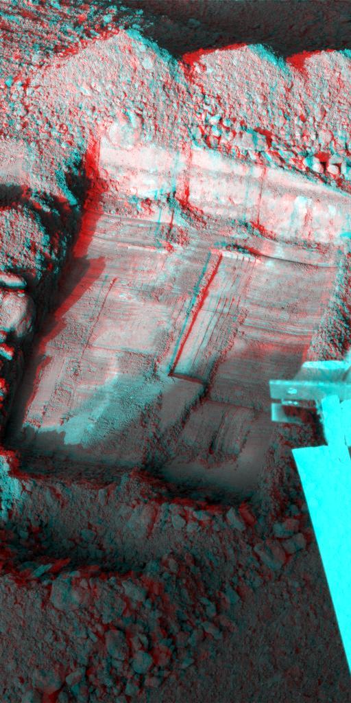
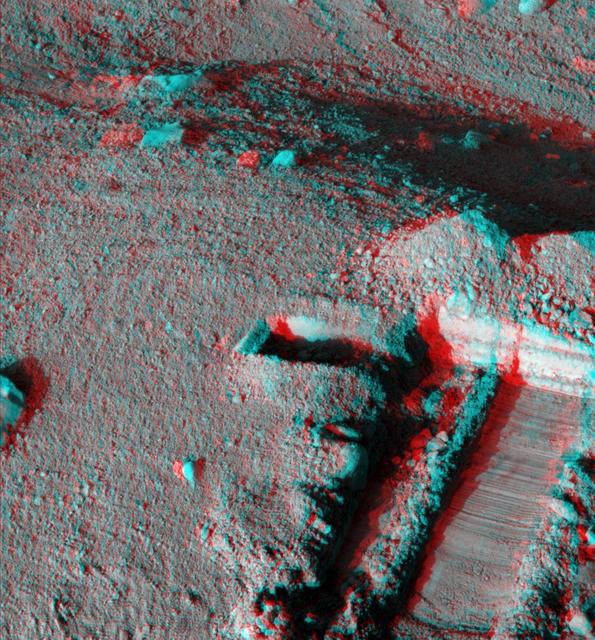
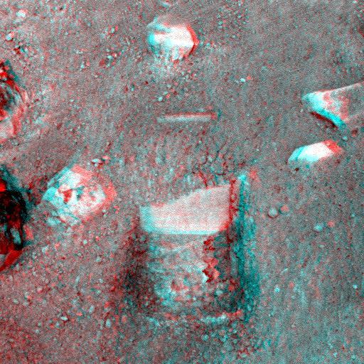
This anaglyph, acquired by NASA Phoenix Lander shows a stereoscopic 3D view of a trench informally called Snow White dug by Phoenix Robotic Arm. 3D glasses are necessary to view this image.
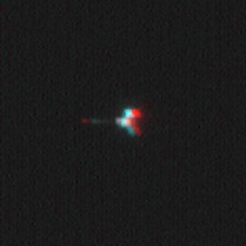
This stereoscopic picture of NASA Mars Odyssey spacecraft was created from two views of that spacecraft taken by the Mars Orbiter Camera on NASA Mars Global Surveyor. 3D glasses are necessary to view this image.
This anaglyph image, acquired by NASA’s Phoenix Lander’s Surface Stereo Imager on June 1, 2008, shows a stereoscopic 3D view of the so-called Knave of Hearts first-dig test area to the north of the lander. 3D glasses are necessary to view this image.

This image, produced from instrument data aboard NASA Space Shuttle Endeavour, is a stereoscopic view of the topography of Port-au-Prince, Haiti where a magnitude 7.0 earthquake occurred on January 12, 2010. You need 3-D glasses to view this image.
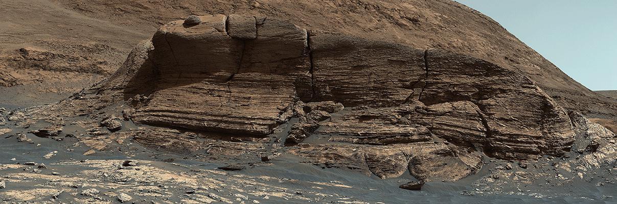
NASA's Curiosity Mars rover used its Mastcam instrument to take the 32 individual images that make up this panorama of the outcrop nicknamed "Mont Mercou." It took a second panorama, rolling sideways 13 feet (4 meters), to create a stereoscopic effect similar to a 3D viewfinder. The effect helps scientists get a better idea of the geometry of Mount Mercou's sedimentary layers, as if they're standing in front of the formation. Both panoramas were taken on March 4, 2021, the 3,049th Martian day, or sol, of the mission, from a distance of about 130 feet (40 meters) from the cliff face, which is about 20 feet (6 meters) tall. They have been white-balanced so that the colors of the rock materials resemble how they would appear under daytime lighting conditions on Earth. Animation available at https://photojournal.jpl.nasa.gov/catalog/PIA24266
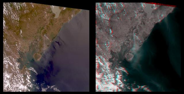
The true-color image at left is a downward-looking (nadir) view of the area around the San Cristobal volcano, which erupted the previous day. This image is oriented with east at the top and north at the left. The right image is a stereo anaglyph of the same area, created from red band multi-angle data taken by the 45.6-degree aftward and 70.5-degree aftward cameras on the Multi-angle Imaging SpectroRadiometer (MISR) instrument on NASA's Terra satellite. View this image through red/blue 3D glasses, with the red filter over the left eye. A plume from San Cristobal (approximately at image center) is much easier to see in the anaglyph, due to 3 effects: the long viewing path through the atmosphere at the oblique angles, the reduced reflection from the underlying water, and the 3D stereoscopic height separation. In this image, the plume floats between the surface and the overlying cumulus clouds. A second plume is also visible in the upper right (southeast of San Cristobal). This very thin plume may originate from the Masaya volcano, which is continually degassing at as low rate. The spatial resolution is 275 meters (300 yards). http://photojournal.jpl.nasa.gov/catalog/PIA02600
Just in time for the U.S. National Park Service's Centennial celebration on Aug. 25, NASA's Multiangle Imaging SpectroRadiometer (MISR) instrument aboard NASA's Terra satellite is releasing four new anaglyphs that showcase 33 of our nation's national parks, monuments, historical sites and recreation areas in glorious 3D. Shown in the annotated image are Sequoia National Park, Kings Canyon National Park, Manzanar National Historic Site, Devils Postpile National Monument, Yosemite National Park, and parts of Death Valley National Park. MISR views Earth with nine cameras pointed at different angles, giving it the unique capability to produce anaglyphs, stereoscopic images that allow the viewer to experience the landscape in three dimensions. The anaglyphs were made by combining data from MISR's vertical-viewing and 46-degree forward-pointing camera. You will need red-blue glasses in order to experience the 3D effect; ensure you place the red lens over your left eye. The images have been rotated so that north is to the left in order to enable 3D viewing because the Terra satellite flies from north to south. All of the images are 235 miles (378 kilometers) from west to east. These data were acquired July 7, 2016, Orbit 88051. http://photojournal.jpl.nasa.gov/catalog/PIA20892
Just in time for the U.S. National Park Service's Centennial celebration on Aug. 25, NASA's Multiangle Imaging SpectroRadiometer (MISR) instrument aboard NASA's Terra satellite is releasing four new anaglyphs that showcase 33 of our nation's national parks, monuments, historical sites and recreation areas in glorious 3D. Shown in the annotated image are Grand Teton National Park, John D. Rockefeller Memorial Parkway, Yellowstone National Park, and parts of Craters of the Moon National Monument. MISR views Earth with nine cameras pointed at different angles, giving it the unique capability to produce anaglyphs, stereoscopic images that allow the viewer to experience the landscape in three dimensions. The anaglyphs were made by combining data from MISR's vertical-viewing and 46-degree forward-pointing camera. You will need red-blue glasses in order to experience the 3D effect; ensure you place the red lens over your left eye. The images have been rotated so that north is to the left in order to enable 3D viewing because the Terra satellite flies from north to south. All of the images are 235 miles (378 kilometers) from west to east. These data were acquired June 25, 2016, Orbit 87876. http://photojournal.jpl.nasa.gov/catalog/PIA20890
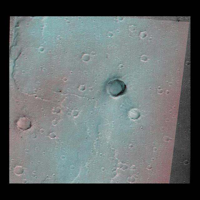
This image of the vicinity of the Viking Lander 1 was captured by NASA Mars Global Surveyor MOC camera. site. 3D glasses are necessary to identify surface detail.
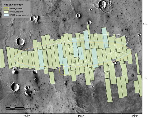
This map shows footprints of images taken from Mars orbit by the High Resolution Imaging Science Experiment (HiRISE) camera as part of advance analysis of the area where NASA's InSight mission will land in 2018. The final planned image of the set is targeted to fill in the yellow-outlined rectangle on March 30, 2017. HiRISE is one of six science instruments on NASA's Mars Reconnaissance Orbiter, which reached Mars in 2006 and surpassed 50,000 orbits on March 27, 2017. The map covers an area about 100 miles (160 kilometers) across. HiRISE has been used since 2006 to inspect dozens of candidate landing sites on Mars, including the sites where the Phoenix and Curiosity missions landed in 2008 and 2012. The site selected for InSight's Nov. 26, 2018, landing is on a flat plain in the Elysium Planitia region of Mars, between 4 and 5 degrees north of the equator. HiRISE images are detailed enough to reveal individual boulders big enough to be a landing hazard. The March 30 observation that completes the planned advance imaging of this landing area brings the number of HiRISE images of the area to 73. Some are pairs covering the same ground. Overlapping observations provide stereoscopic, 3-D information for evaluating characteristics such as slopes. On this map, coverage by stereo pairs is coded in pale blue, compared to the gray-green of single HiRISE image footprints. The ellipses on the map are about 81 miles (130 kilometers) west-to-east by about 17 miles (27 kilometers) north-to-south. InSight has about 99 percent odds of landing within the ellipse for which it is targeted. The three ellipses indicate landing expectations for three of the possible InSight launch dates: white outline for launch at the start of the launch period, on May 5, 2018; blue for launch on May 26, 2018; orange for launch on June 8, 2018. InSight -- an acronym for "Interior Exploration using Seismic Investigations, Geodesy and Heat Transport" -- will study the deep interior of Mars to improve understanding about how rocky planets like Earth formed and evolved. http://photojournal.jpl.nasa.gov/catalog/PIA21489

39,000 acres (60 square miles, or 160 square kilometers). Thousands of residents were evacuated, and the fire claimed the life of one person. The Multi-angle Imaging SpectroRadiometer (MISR) instrument aboard NASA's Terra satellite passed over the region on July 23 around 11:50 a.m. PDT. At left is an image acquired by MISR's 60-degree forward-viewing camera. The oblique view angle makes the smoke more apparent than it would be in a more conventional vertical view. This cropped image is about 185 miles (300 kilometers) wide. Smoke from the Sand Fire is visible on the right-hand side of the image. Stereoscopic analysis of MISR's multiple camera angles is used to compute the height of the smoke plume from the Sand Fire. In the right-hand image, these heights are superimposed on the underlying image. The color scale shows that the plume extends up to about 4 miles (6 kilometers) above its source in Santa Clarita, but rapidly diminishes in height as winds push it to the southwest. The data compare well with a pilot report issued at Los Angeles International Airport on the evening of July 22, which reported smoke at 15,000-18,000 feet altitude (4.5 to 5.5 kilometers). Air quality warnings were issued for the San Fernando Valley and the western portion of Los Angeles due to this low-hanging smoke. However, data from air quality monitoring instruments seem to indicate that the smoke did not actually reach the ground. These data were captured during Terra orbit 88284. http://photojournal.jpl.nasa.gov/catalog/PIA20724
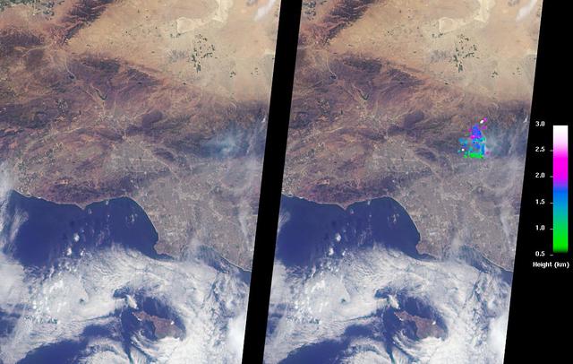
The Los Angeles area is currently suffering the effects of three major wildfires that are blanketing the area with smoke. Over the past few days, Southern California has experienced record-breaking temperatures, topping 110 degrees Fahrenheit in some cities. The heat, in combination with offshore winds, helped to stoke the Sherpa Fire west of Santa Barbara, which has been burning since June 15, 2016. Over the weekend of June 18-19, this fire rapidly expanded in size, forcing freeway closures and evacuations of campgrounds and state beaches. On Monday, June 20, two new fires ignited in the San Gabriel Mountains north of Azusa and Duarte, together dubbed the San Gabriel Complex Fire. They have burned more than 4,900 acres since June 20, sending up plumes of smoke visible to many in the Los Angeles basin and triggering air quality warnings. More than 1,400 personnel have been battling the blazes in the scorching heat, and evacuations were ordered for neighborhoods in the foothills. On June 21, the Multi-angle Imaging SpectroRadiometer (MISR) instrument aboard NASA's Terra satellite captured this view of the San Gabriel Mountains and Los Angeles Basin from its 46-degree forward-viewing camera, which enhances the visibility of the smoke compared to the more conventional nadir (vertical) view. The width of this image is about 75 miles (120 kilometers) across. Smoke from the San Gabriel Complex Fire is visible at the very right of the image. Stereoscopic analysis of MISR's multiple camera angles is used to compute the height of the smoke plume from the San Gabriel Complex Fire. In the right-hand image, these heights are superimposed on the underlying image. The color scale shows that the plume is not much higher than the surrounding mountains. As a result, much of the smoke is confined to the local area. http://photojournal.jpl.nasa.gov/catalog/PIA20718
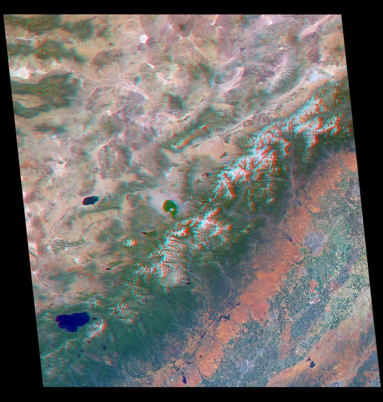
Just in time for the U.S. National Park Service's Centennial celebration on Aug. 25, NASA's Multiangle Imaging SpectroRadiometer (MISR) instrument aboard NASA's Terra satellite is releasing four new anaglyphs that showcase 33 of our nation's national parks, monuments, historical sites and recreation areas in glorious 3D. Shown in the annotated image are Lewis and Clark National Historic Park, Mt. Rainier National Park, Olympic National Park, Ebey's Landing National Historical Reserve, San Juan Island National Historic Park, North Cascades National Park, Lake Chelan National Recreation Area, and Ross Lake National Recreation Area (also Mt. St. Helens National Volcanic Monument, administered by the U.S. Forest Service) MISR views Earth with nine cameras pointed at different angles, giving it the unique capability to produce anaglyphs, stereoscopic images that allow the viewer to experience the landscape in three dimensions. The anaglyphs were made by combining data from MISR's vertical-viewing and 46-degree forward-pointing camera. You will need red-blue glasses in order to experience the 3D effect; ensure you place the red lens over your left eye. The images have been rotated so that north is to the left in order to enable 3D viewing because the Terra satellite flies from north to south. All of the images are 235 miles (378 kilometers) from west to east. These data were acquired May 12, 2012, Orbit 65960. http://photojournal.jpl.nasa.gov/catalog/PIA20891
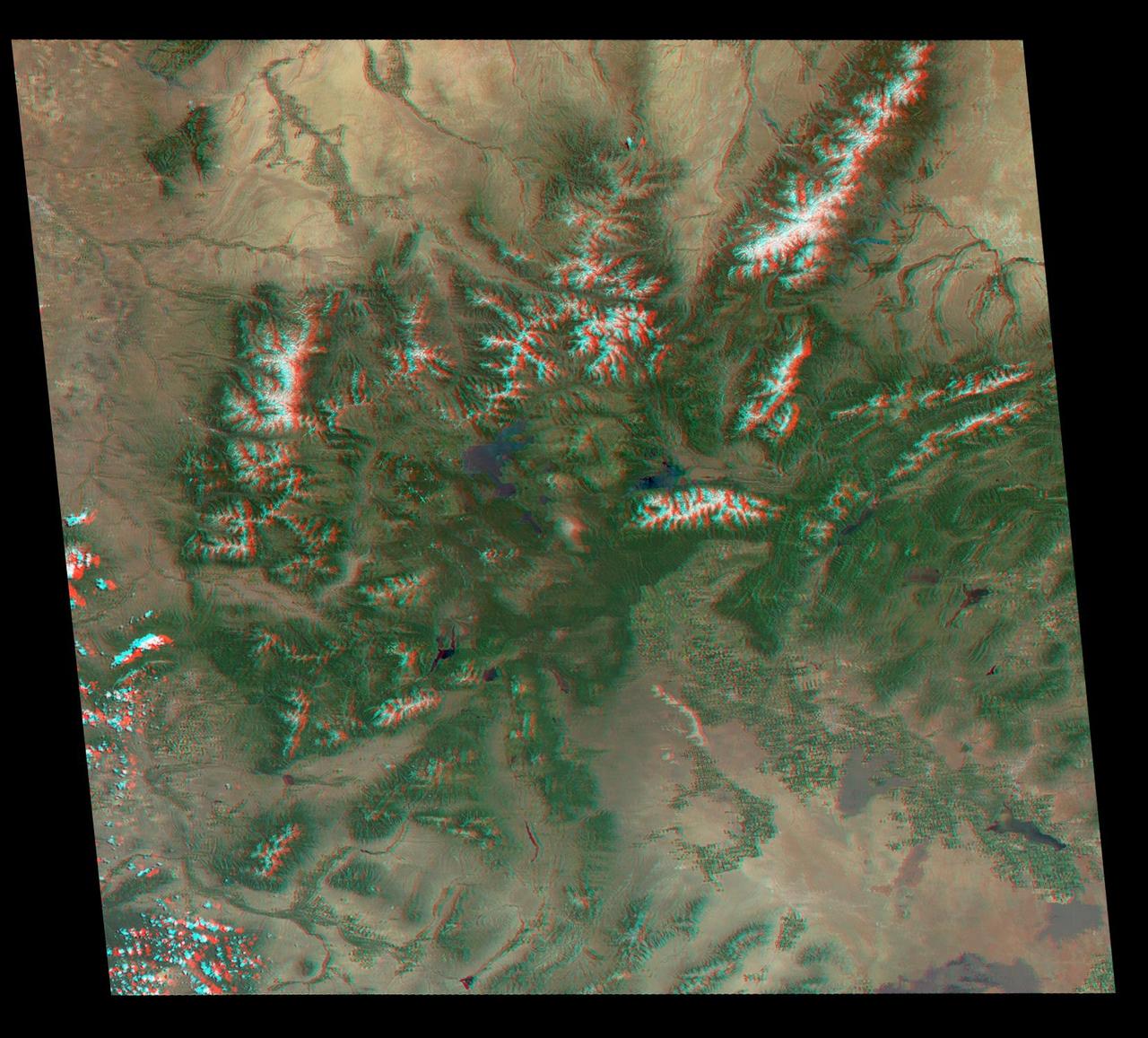
Just in time for the U.S. National Park Service's Centennial celebration on Aug. 25, NASA's Multiangle Imaging SpectroRadiometer (MISR) instrument aboard NASA's Terra satellite is releasing four new anaglyphs that showcase 33 of our nation's national parks, monuments, historical sites and recreation areas in glorious 3D. Shown in the annotated image are Walnut Canyon National Monument, Sunset Crater Volcano National Monument, Wupatki National Monument, Grand Canyon National Park, Pipe Spring National Monument, Zion National Park, Cedar Breaks National Monument, Bryce Canyon National Park, Capitol Reef National Park, Navajo National Monument, Glen Canyon National Recreation Area, Natural Bridges National Monument, Canyonlands National Park, and Arches National Park. MISR views Earth with nine cameras pointed at different angles, giving it the unique capability to produce anaglyphs, stereoscopic images that allow the viewer to experience the landscape in three dimensions. The anaglyphs were made by combining data from MISR's vertical-viewing and 46-degree forward-pointing camera. You will need red-blue glasses in order to experience the 3D effect; ensure you place the red lens over your left eye. The images have been rotated so that north is to the left in order to enable 3D viewing because the Terra satellite flies from north to south. All of the images are 235 miles (378 kilometers) from west to east. These data were acquired June 18, 2016, Orbit 87774. http://photojournal.jpl.nasa.gov/catalog/PIA20889
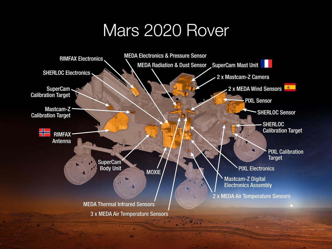
This 2015 diagram shows components of the investigations payload for NASA's Mars 2020 rover mission. Mars 2020 will re-use the basic engineering of NASA's Mars Science Laboratory to send a different rover to Mars, with new objectives and instruments, launching in 2020. The rover will carry seven instruments to conduct its science and exploration technology investigations. They are: Mastcam-Z, an advanced camera system with panoramic and stereoscopic imaging capability and the ability to zoom. The instrument also will determine mineralogy of the Martian surface and assist with rover operations. The principal investigator is James Bell, Arizona State University in Tempe. SuperCam, an instrument that can provide imaging, chemical composition analysis, and mineralogy. The instrument will also be able to detect the presence of organic compounds in rocks and regolith from a distance. The principal investigator is Roger Wiens, Los Alamos National Laboratory, Los Alamos, New Mexico. This instrument also has a significant contribution from the Centre National d'Etudes Spatiales, Institut de Recherche en Astrophysique et Planétologie (CNES/IRAP) France. Planetary Instrument for X-ray Lithochemistry (PIXL), an X-ray fluorescence spectrometer that will also contain an imager with high resolution to determine the fine-scale elemental composition of Martian surface materials. PIXL will provide capabilities that permit more detailed detection and analysis of chemical elements than ever before. The principal investigator is Abigail Allwood, NASA's Jet Propulsion Laboratory, Pasadena, California. Scanning Habitable Environments with Raman & Luminescence for Organics and Chemicals (SHERLOC), a spectrometer that will provide fine-scale imaging and uses an ultraviolet (UV) laser to determine fine-scale mineralogy and detect organic compounds. SHERLOC will be the first UV Raman spectrometer to fly to the surface of Mars and will provide complementary measurements with other instruments in the payload. SHERLOC includes a high-resolution color camera for microscopic imaging of Mars' surface. The principal investigator is Luther Beegle, JPL. The Mars Oxygen ISRU Experiment (MOXIE), an exploration technology investigation that will produce oxygen from Martian atmospheric carbon dioxide. The principal investigator is Michael Hecht, Massachusetts Institute of Technology, Cambridge, Massachusetts. Mars Environmental Dynamics Analyzer (MEDA), a set of sensors that will provide measurements of temperature, wind speed and direction, pressure, relative humidity and dust size and shape. The principal investigator is Jose Rodriguez-Manfredi, Centro de Astrobiologia, Instituto Nacional de Tecnica Aeroespacial, Spain. The Radar Imager for Mars' Subsurface Experiment (RIMFAX), a ground-penetrating radar that will provide centimeter-scale resolution of the geologic structure of the subsurface. The principal investigator is Svein-Erik Hamran, the Norwegian Defence Research Establishment, Norway. http://photojournal.jpl.nasa.gov/catalog/PIA19672

jsc2022e062020 (6/30/2022) --- Space Health will create a digital twin of the astronaut from the data collected by the Bio-Monitor and demonstrate how this could be used for autonomous health monitoring on future space missions. (Image courtesy of CSA)