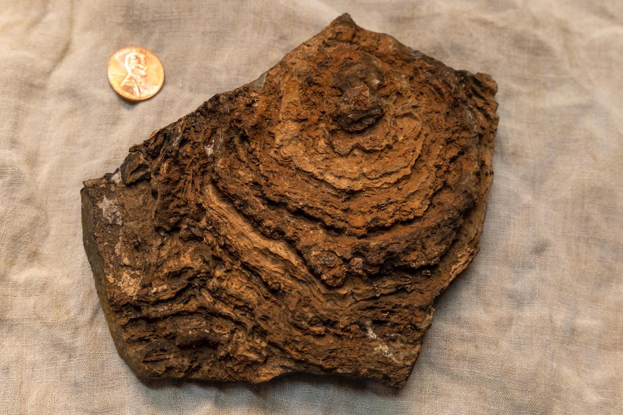
This image shows the finely layered internal structure of a stromatolite sample, with a U.S. penny for scale. This stromatolite formed about 2.7 billion years ago and was collected from an ancient lake environment preserved in the Tumbiana Formation, a succession of clastic and carbonate rocks outcropping along the southern margin of the Pilbara Craton in Western Australia. The view here is top down on what was once a dome that has been eroded flat, revealing the internal layering. Stromatolites form when communities of microorganisms organize into layered "microbial mats" that can trap and bind sediment or stimulate the precipitation of mineral grains from the water around them, both processes generating a kind of "living fossil." However, living stromatolites can rarely be found on Earth today. Stromatolite fossils are the dominant record of life for most of Earth's history prior to the appearance of complex, multicellular organisms. Scientists are seeking something similar to stromatolites in the dry lakebed Perseverance will be exploring on Mars. https://photojournal.jpl.nasa.gov/catalog/PIA24240
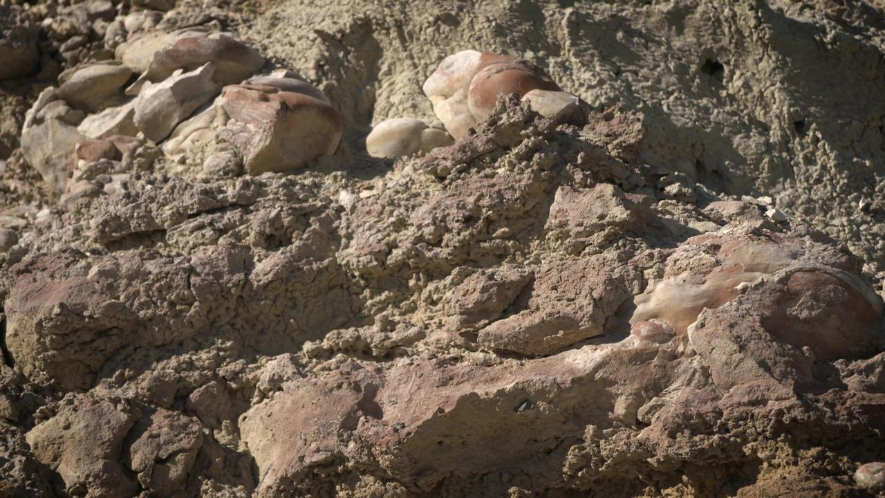
Made from fossilized microbes and sediment, these rounded rocks are stromatolites that were found in a dry lakebed during the field exercise. Scientists hope to find something similar in the dry lakebed Perseverance will be exploring on Mars. https://photojournal.jpl.nasa.gov/catalog/PIA23779
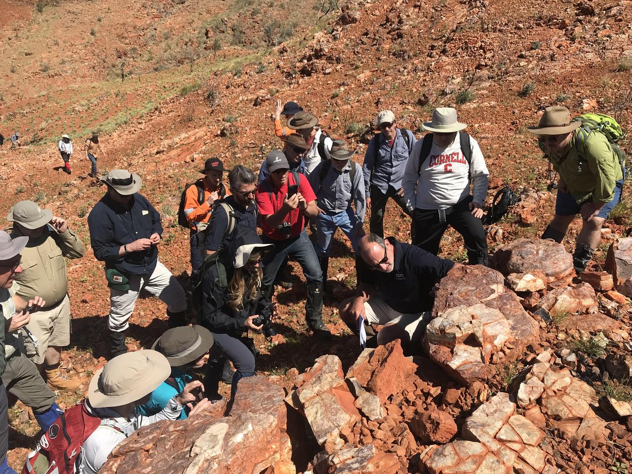
Scientists from NASA's Mars 2020 and ESA's ExoMars projects study stromatolites, the oldest confirmed fossilized lifeforms on Earth, in the Pilbara region of North West Australia. The image was taken on Aug. 19, 2019. https://photojournal.jpl.nasa.gov/catalog/PIA23551
Origin of Life: Stromatolites Microbial Mats and Mat-Layer Extracts
Microbial Mats; n-239 roof, Greenhouse one: stromatolite

Origin of Life: Stromatolites Microbial Mats and Mat-Layer Extracts
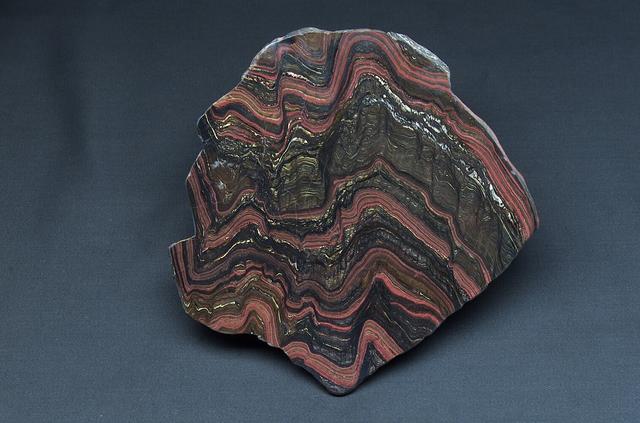
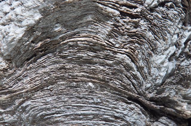
Microbial Mats; n-239 roof, Greenhouse one: Morison stromatolite

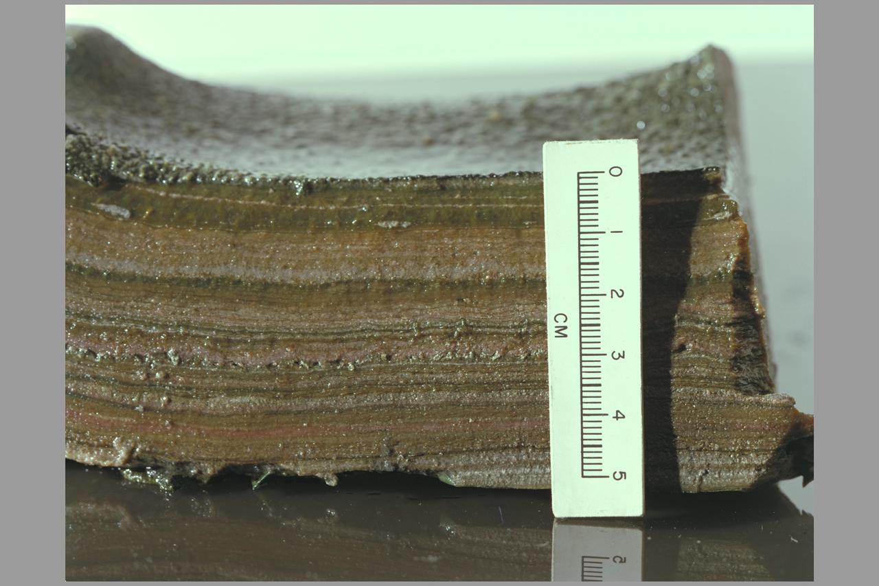
Microbial Mats; n-239 roof, Greenhouse one: close up of section of the Morison stromatolite
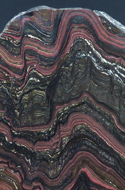
Microbial Mats; n-239 roof, Greenhouse one: close up of section of the Morison stromatolite
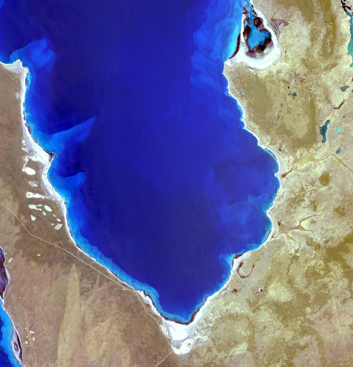
Hamelin Pool Marine Nature Reserve is located in the Shark Bay World Heritage Site in Western Australia. It is one of the very few places in the world where living stromatolites can be found. These are the first living examples of structures built by cyanobacteria. These bacteria are direct descendants of the oldest form of photosynthetic life on earth, dating back 3,500 million years (Wikipedia). The image was acquired December 30, 2010, covers an area of 34 x 46 km, and is located at 26.4 degrees south latitude, 114.1 degrees east longitude. With its 14 spectral bands from the visible to the thermal infrared wavelength region and its high spatial resolution of 15 to 90 meters (about 50 to 300 feet), ASTER images Earth to map and monitor the changing surface of our planet. ASTER is one of five Earth-observing instruments launched Dec. 18, 1999, on Terra. The instrument was built by Japan's Ministry of Economy, Trade and Industry. A joint U.S./Japan science team is responsible for validation and calibration of the instrument and data products. The broad spectral coverage and high spectral resolution of ASTER provides scientists in numerous disciplines with critical information for surface mapping and monitoring of dynamic conditions and temporal change. Example applications are: monitoring glacial advances and retreats; monitoring potentially active volcanoes; identifying crop stress; determining cloud morphology and physical properties; wetlands evaluation; thermal pollution monitoring; coral reef degradation; surface temperature mapping of soils and geology; and measuring surface heat balance. The U.S. science team is located at NASA's Jet Propulsion Laboratory, Pasadena, Calif. The Terra mission is part of NASA's Science Mission Directorate, Washington, D.C. More information about ASTER is available at <a href="http://asterweb.jpl.nasa.gov/" rel="nofollow">asterweb.jpl.nasa.gov/</a>. Credit: NASA/GSFC/METI/ERSDAC/JAROS, and U.S./Japan ASTER Science Team Image Addition Date: 2013-03-15 <b><a href="http://www.nasa.gov/audience/formedia/features/MP_Photo_Guidelines.html" rel="nofollow">NASA image use policy.</a></b> <b><a href="http://www.nasa.gov/centers/goddard/home/index.html" rel="nofollow">NASA Goddard Space Flight Center</a></b> enables NASA’s mission through four scientific endeavors: Earth Science, Heliophysics, Solar System Exploration, and Astrophysics. Goddard plays a leading role in NASA’s accomplishments by contributing compelling scientific knowledge to advance the Agency’s mission. <b>Follow us on <a href="http://twitter.com/NASA_GoddardPix" rel="nofollow">Twitter</a></b> <b>Like us on <a href="http://www.facebook.com/pages/Greenbelt-MD/NASA-Goddard/395013845897?ref=tsd" rel="nofollow">Facebook</a></b> <b>Find us on <a href="http://instagram.com/nasagoddard?vm=grid" rel="nofollow">Instagram</a></b>
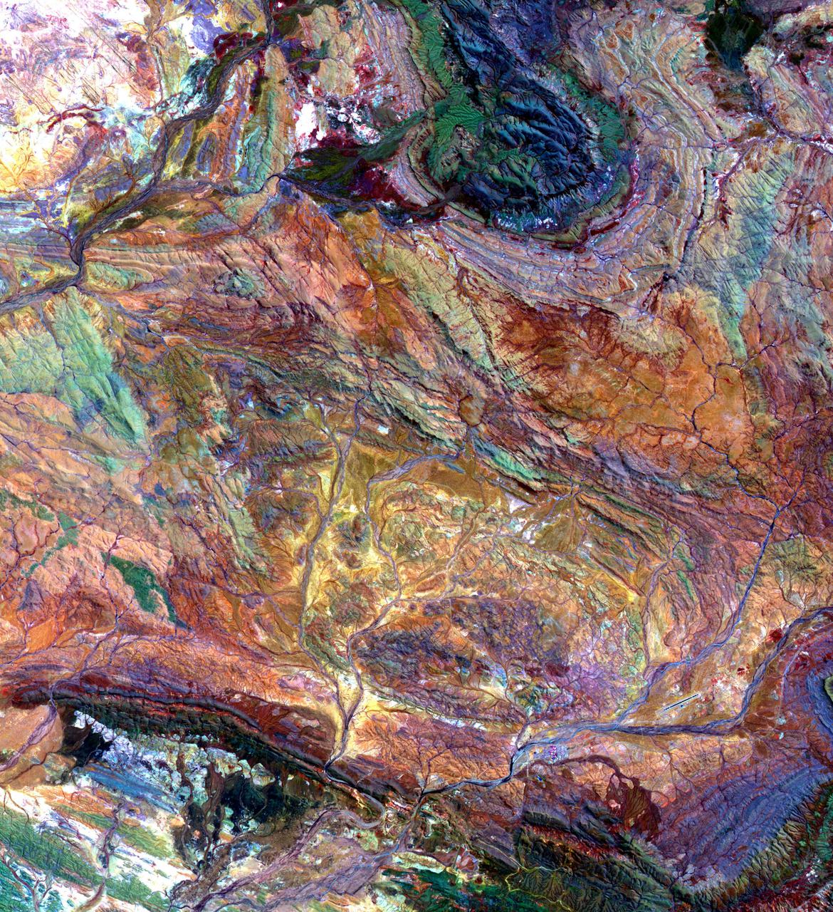
The Pilbara in northwestern Australia exposes some of the oldest rocks on Earth, over 3.6 billion years old. The iron-rich rocks formed before the presence of atmospheric oxygen, and life itself. Found upon these rocks are 3.45 billion-year-old fossil stromatolites, colonies of microbial cyanobacteria. The image is a composite of ASTER bands 4-2-1 displayed in RGB. The image was acquired October 12, 2004, covers an area of 49.1 by 55.2 km, and is located at 22.8 degrees south, 117.6 degrees east. https://photojournal.jpl.nasa.gov/catalog/PIA25122
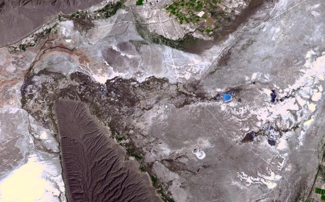
In the northern Mexican state of Cohuilla lies the Cuatro Cienegas Basin. Dotting the landscape are small pools, formed by natural springs, in which are found live stromatolites. These stony layered structures are formed by colonies of cyanobacteria that trap sedimentary grains. Their major presence in the fossil record of several billion years ago is evidence of some of the earliest form of life on Earth. NASA stated that the biological reserve of Cuatro Ciénegas could have strong links to discovering life on Mars, since the adaptability of bioforms in the region was unique in the world. The image was acquired April 1, 2017, covers an area of 14.9 by 23.8 km, and is located at 26.9 degrees north, 102.1 degrees west. With its 14 spectral bands from the visible to the thermal infrared wavelength region and its high spatial resolution of about 50 to 300 feet (15 to 90 meters), ASTER images Earth to map and monitor the changing surface of our planet. ASTER is one of five Earth-observing instruments launched Dec. 18, 1999, on Terra. The instrument was built by Japan's Ministry of Economy, Trade and Industry. A joint U.S./Japan science team is responsible for validation and calibration of the instrument and data products. The broad spectral coverage and high spectral resolution of ASTER provides scientists in numerous disciplines with critical information for surface mapping and monitoring of dynamic conditions and temporal change. Example applications are monitoring glacial advances and retreats; monitoring potentially active volcanoes; identifying crop stress; determining cloud morphology and physical properties; wetlands evaluation; thermal pollution monitoring; coral reef degradation; surface temperature mapping of soils and geology; and measuring surface heat balance. https://photojournal.jpl.nasa.gov/catalog/PIA23535