
A strong late-winter cyclone brought significant snows and blizzard conditions to the upper Great Lakes/northern Plains on 21 February 2014. In the warm sector of the storm, there were numerous reports of tornadoes, large hail, and damaging winds in the eastern US. Suomi NPP viewed the storm multiple times, including just before 1800 UTC on 21 February. Credit: NASA/Goddard/UWM/SSEC/CIMSS/Suomi NPP <b><a href="http://www.nasa.gov/audience/formedia/features/MP_Photo_Guidelines.html" rel="nofollow">NASA image use policy.</a></b> <b><a href="http://www.nasa.gov/centers/goddard/home/index.html" rel="nofollow">NASA Goddard Space Flight Center</a></b> enables NASA’s mission through four scientific endeavors: Earth Science, Heliophysics, Solar System Exploration, and Astrophysics. Goddard plays a leading role in NASA’s accomplishments by contributing compelling scientific knowledge to advance the Agency’s mission. <b>Follow us on <a href="http://twitter.com/NASAGoddardPix" rel="nofollow">Twitter</a></b> <b>Like us on <a href="http://www.facebook.com/pages/Greenbelt-MD/NASA-Goddard/395013845897?ref=tsd" rel="nofollow">Facebook</a></b> <b>Find us on <a href="http://instagram.com/nasagoddard?vm=grid" rel="nofollow">Instagram</a></b>

This composite image of southern Africa and the surrounding oceans was captured by six orbits of the NASA/NOAA Suomi National Polar-orbiting Partnership spacecraft on April 9, 2015, by the Visible Infrared Imaging Radiometer Suite (VIIRS) instrument. Tropical Cyclone Joalane can be seen over the Indian Ocean. Winds, tides and density differences constantly stir the oceans while phytoplankton continually grow and die. Orbiting radiometers such as VIIRS allows scientists to track this variability over time and contribute to better understanding of ocean processes that are beneficial to human survival on Earth. The image was created by the Ocean Biology Processing Group at NASA's Goddard Space Flight Center in Greenbelt, Maryland.

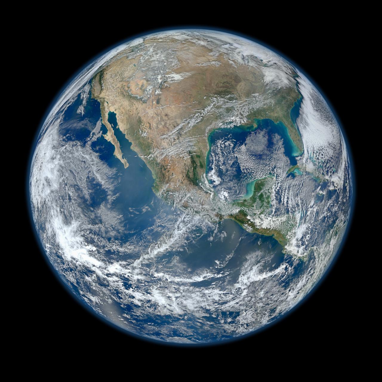
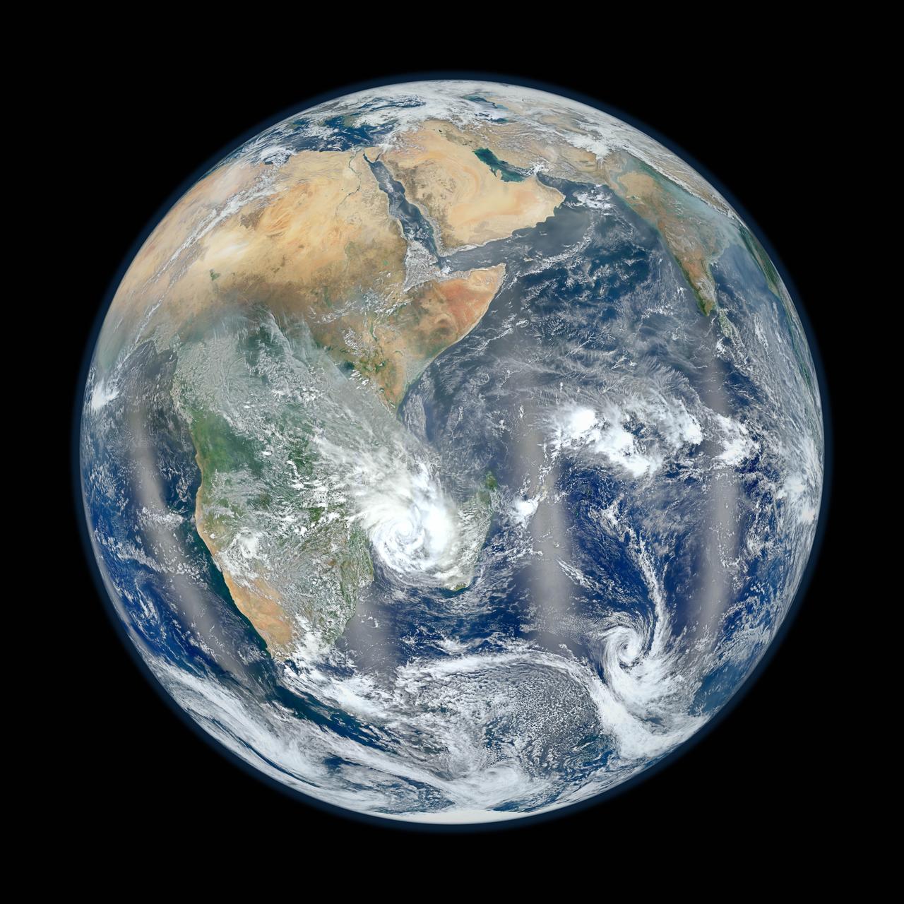
Behold one of the more detailed images of the Earth yet created. This Blue Marble Earth montage shown above -- created from photographs taken by the Visible/Infrared Imager Radiometer Suite (VIIRS) instrument on board the new Suomi NPP satellite -- shows many stunning details of our home planet. The Suomi NPP satellite was launched last October and renamed last week after Verner Suomi, commonly deemed the father of satellite meteorology. The composite was created from the data collected during four orbits of the robotic satellite taken earlier this month and digitally projected onto the globe. Many features of North America and the Western Hemisphere are particularly visible on a high resolution version of the image. http://photojournal.jpl.nasa.gov/catalog/PIA18033
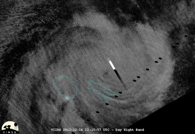
This night-time view of Cyclone Evan was taken from the Visible Infrared Imaging Radiometer Suite (VIIRS) on NASA/NOAA's Suomi National Polar-orbiting Partnership on Dec. 16, 2012. The rectangular bright object in the image is a lightning flash. "Because of the scan time as compared to how quickly lightning flashes, you get a nice streak in the data," said William Straka, of the University of Wisconsin-Madison, who provided this image. On Dec. 17 at 0900 UTC (4 a.m. EST), Cyclone Evan had maximum sustained winds near 115 knots (132 mph/213 kph). Evan was a Category 4 cyclone on the Saffir-Simpson Scale and was battering Fiji. Image Credit: NASA/NOAA/UWM/William Straka Text Credit: NASA Goddard/Rob Gutro <b><a href="http://www.nasa.gov/audience/formedia/features/MP_Photo_Guidelines.html" rel="nofollow">NASA image use policy.</a></b> <b><a href="http://www.nasa.gov/centers/goddard/home/index.html" rel="nofollow">NASA Goddard Space Flight Center</a></b> enables NASA’s mission through four scientific endeavors: Earth Science, Heliophysics, Solar System Exploration, and Astrophysics. Goddard plays a leading role in NASA’s accomplishments by contributing compelling scientific knowledge to advance the Agency’s mission. <b>Follow us on <a href="http://twitter.com/NASA_GoddardPix" rel="nofollow">Twitter</a></b> <b>Like us on <a href="http://www.facebook.com/pages/Greenbelt-MD/NASA-Goddard/395013845897?ref=tsd" rel="nofollow">Facebook</a></b> <b>Find us on <a href="http://instagrid.me/nasagoddard/?vm=grid" rel="nofollow">Instagram</a></b>
This composite image of southern Africa and the surrounding oceans was captured by six orbits of the NASA/NOAA Suomi National Polar-orbiting Partnership spacecraft on April 9, 2015, by the Visible Infrared Imaging Radiometer Suite (VIIRS) instrument. Tropical Cyclone Joalane can be seen over the Indian Ocean. Winds, tides and density differences constantly stir the oceans while phytoplankton continually grow and die. Orbiting radiometers such as VIIRS allows scientists to track this variability over time and contribute to better understanding of ocean processes that are beneficial to human survival on Earth. The image was created by the Ocean Biology Processing Group at NASA's Goddard Space Flight Center in Greenbelt, Maryland. For more information, please visit: <a href="http://oceancolor.gsfc.nasa.gov/" rel="nofollow">oceancolor.gsfc.nasa.gov/</a> and <a href="http://www.nasa.gov/npp" rel="nofollow">www.nasa.gov/npp</a> Image Credit: Ocean Biology Processing Group at NASA's Goddard Space Flight Center <b><a href="http://www.nasa.gov/audience/formedia/features/MP_Photo_Guidelines.html" rel="nofollow">NASA image use policy.</a></b> <b><a href="http://www.nasa.gov/centers/goddard/home/index.html" rel="nofollow">NASA Goddard Space Flight Center</a></b> enables NASA’s mission through four scientific endeavors: Earth Science, Heliophysics, Solar System Exploration, and Astrophysics. Goddard plays a leading role in NASA’s accomplishments by contributing compelling scientific knowledge to advance the Agency’s mission. <b>Follow us on <a href="http://twitter.com/NASAGoddardPix" rel="nofollow">Twitter</a></b> <b>Like us on <a href="http://www.facebook.com/pages/Greenbelt-MD/NASA-Goddard/395013845897?ref=tsd" rel="nofollow">Facebook</a></b> <b>Find us on <a href="http://instagrid.me/nasagoddard/?vm=grid" rel="nofollow">Instagram</a></b>
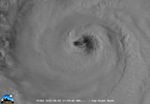
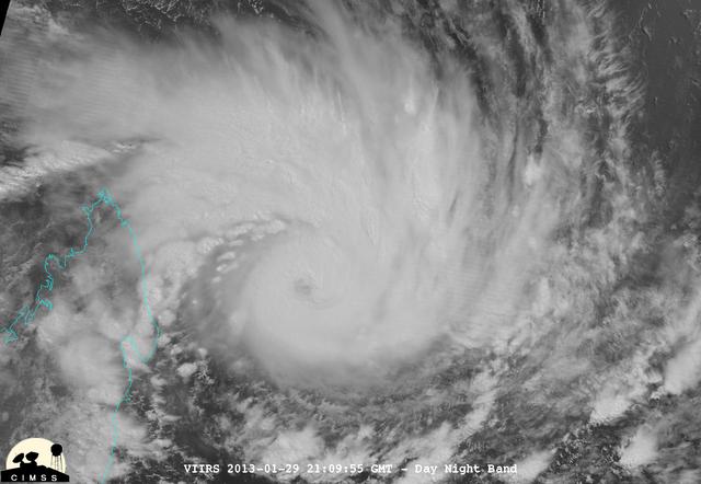
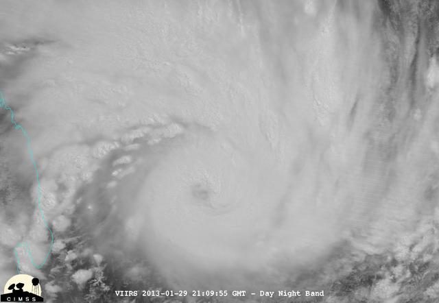
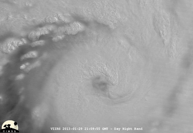
On August 6, 2015, NASA-NOAA's Suomi NPP satellite passed over powerful Typhoon Soudelor when it was headed toward Taiwan. The Visible Infrared Imaging Radiometer Suite (VIIRS) instrument aboard NASA-NOAA's Suomi satellite captured this night-time infrared close-up image of Soudelor's eye. At 1500 UTC (11 a.m. EDT) on August 6, 2015, Typhoon Soudelor had maximum sustained winds near 90 knots (103.6 mph/166.7 kph). It was centered near 21.3 North latitude and 127.5 East longitude, about 324 nautical miles (372.9 miles/600 km) south of Kadena Air Base, Okinawa, Japan. It was moving to the west at 10 knots (11.5 mph/18.5 kph). Credit: UWM/CIMSS/SSEC, William Straka III <b><a href="http://www.nasa.gov/audience/formedia/features/MP_Photo_Guidelines.html" rel="nofollow">NASA image use policy.</a></b> <b><a href="http://www.nasa.gov/centers/goddard/home/index.html" rel="nofollow">NASA Goddard Space Flight Center</a></b> enables NASA’s mission through four scientific endeavors: Earth Science, Heliophysics, Solar System Exploration, and Astrophysics. Goddard plays a leading role in NASA’s accomplishments by contributing compelling scientific knowledge to advance the Agency’s mission. <b>Follow us on <a href="http://twitter.com/NASAGoddardPix" rel="nofollow">Twitter</a></b> <b>Like us on <a href="http://www.facebook.com/pages/Greenbelt-MD/NASA-Goddard/395013845897?ref=tsd" rel="nofollow">Facebook</a></b> <b>Find us on <a href="http://instagrid.me/nasagoddard/?vm=grid" rel="nofollow">Instagram</a></b>

On August 6, 2015, NASA-NOAA's Suomi NPP satellite passed over powerful Typhoon Soudelor when it was headed toward Taiwan. The Visible Infrared Imaging Radiometer Suite (VIIRS) instrument aboard NASA-NOAA's Suomi satellite captured an infrared image of the typhoon. The infrared image that showed there were some thunderstorms within the typhoon with very cold cloud top temperatures, colder than -63F/-53C. Temperatures that cold stretch high into the troposphere and are capable of generating heavy rain. Credit: UWM/CIMSS/SSEC, William Straka III <b><a href="http://www.nasa.gov/audience/formedia/features/MP_Photo_Guidelines.html" rel="nofollow">NASA image use policy.</a></b> <b><a href="http://www.nasa.gov/centers/goddard/home/index.html" rel="nofollow">NASA Goddard Space Flight Center</a></b> enables NASA’s mission through four scientific endeavors: Earth Science, Heliophysics, Solar System Exploration, and Astrophysics. Goddard plays a leading role in NASA’s accomplishments by contributing compelling scientific knowledge to advance the Agency’s mission. <b>Follow us on <a href="http://twitter.com/NASAGoddardPix" rel="nofollow">Twitter</a></b> <b>Like us on <a href="http://www.facebook.com/pages/Greenbelt-MD/NASA-Goddard/395013845897?ref=tsd" rel="nofollow">Facebook</a></b> <b>Find us on <a href="http://instagrid.me/nasagoddard/?vm=grid" rel="nofollow">Instagram</a></b>
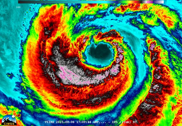
On August 6, 2015, NASA-NOAA's Suomi NPP satellite passed over powerful Typhoon Soudelor when it was headed toward Taiwan. The Visible Infrared Imaging Radiometer Suite (VIIRS) instrument aboard NASA-NOAA's Suomi satellite captured this night-time infrared close-up image of Soudelor's eye. The infrared image that showed there were some thunderstorms within the typhoon with very cold cloud top temperatures, colder than -63F/-53C. Temperatures that cold stretch high into the troposphere and are capable of generating heavy rain. At 1500 UTC (11 a.m. EDT) on August 6, 2015, Typhoon Soudelor had maximum sustained winds near 90 knots (103.6 mph/166.7 kph). It was centered near 21.3 North latitude and 127.5 East longitude, about 324 nautical miles (372.9 miles/600 km) south of Kadena Air Base, Okinawa, Japan. It was moving to the west at 10 knots (11.5 mph/18.5 kph). Credit: UWM/CIMSS/SSEC, William Straka III <b><a href="http://www.nasa.gov/audience/formedia/features/MP_Photo_Guidelines.html" rel="nofollow">NASA image use policy.</a></b> <b><a href="http://www.nasa.gov/centers/goddard/home/index.html" rel="nofollow">NASA Goddard Space Flight Center</a></b> enables NASA’s mission through four scientific endeavors: Earth Science, Heliophysics, Solar System Exploration, and Astrophysics. Goddard plays a leading role in NASA’s accomplishments by contributing compelling scientific knowledge to advance the Agency’s mission. <b>Follow us on <a href="http://twitter.com/NASAGoddardPix" rel="nofollow">Twitter</a></b> <b>Like us on <a href="http://www.facebook.com/pages/Greenbelt-MD/NASA-Goddard/395013845897?ref=tsd" rel="nofollow">Facebook</a></b> <b>Find us on <a href="http://instagrid.me/nasagoddard/?vm=grid" rel="nofollow">Instagram</a></b>
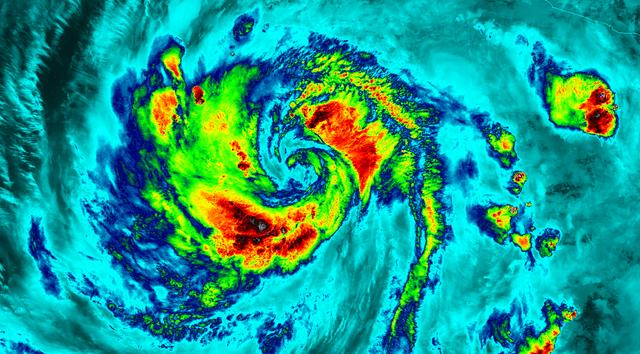
NASA-NOAA's Suomi NPP satellite flew over Hurricane Blanca in the Eastern Pacific Ocean and gathered infrared data on the storm that was false-colored to show locations of the strongest thunderstorms within the storm. The Visible Infrared Imaging Radiometer Suite or VIIRS instrument aboard the satellite gathered infrared data of the storm that was made into an image at the University of Wisconsin-Madison. The image was false-colored to show temperature. Coldest cloud top temperatures indicate higher, stronger, thunderstorms within a tropical cyclone. Those are typically the strongest storms with potential for heavy rainfall. VIIRS is a scanning radiometer that collects visible and infrared imagery and "radiometric" measurements. Basically it means that VIIRS data is used to measure cloud and aerosol properties, ocean color, sea and land surface temperature, ice motion and temperature, fires, and Earth's albedo (reflected light). The VIIRS image from June 5 at 8:11 UTC (4:11 a.m. EDT) showed two areas of coldest cloud top temperatures and strongest storms were west-southwest and east-northeast of the center of Blanca's circulation center. On June 5 at 5 a.m. EDT (0900 UTC) Blanca's maximum sustained winds were near 105 mph (165 kph) with higher gusts. The National Hurricane Center (NHC) forecast expects some strengthening during the next day or so. Weakening is forecast to begin by late Saturday. At that time, NHC placed the center of Hurricane Blanca near latitude 14.3 North, longitude 106.2 West. That puts the center about 350 miles (560 km) south-southwest of Manzanillo, Mexico and about 640 miles (1,030 km) south-southeast of Cabo San Lucas, Mexico. The estimated minimum central pressure is 968 millibars (28.59 inches). Blanca is moving toward the northwest near 10 mph (17 kph). A northwestward to north-northwestward motion at a similar forward speed is expected to continue through Saturday night. Blanca has been stirring up surf along the coast of southwestern Mexico and will reach the Pacific coast of the Baja California peninsula and the southern Gulf of California later today, June 5. These swells are likely to cause life-threatening surf and rip current conditions. On the forecast track, the center of Blanca will approach the southern Baja California peninsula on Sunday. NHC cautions that "Interests in the southern Baja California peninsula should monitor the progress of Blanca. A tropical storm or hurricane watch will likely be required for a portion of Baja California Sur later today." The NHC forecast track shows Blanca making landfall in the southeastern tip of Baja California on Sunday, June 7 and tracking north-northeast along the Baja California peninsula, for several days following. Image credit: Credits: NASA/NOAA/UW-CIMSS <b><a href="http://www.nasa.gov/audience/formedia/features/MP_Photo_Guidelines.html" rel="nofollow">NASA image use policy.</a></b> <b><a href="http://www.nasa.gov/centers/goddard/home/index.html" rel="nofollow">NASA Goddard Space Flight Center</a></b> enables NASA’s mission through four scientific endeavors: Earth Science, Heliophysics, Solar System Exploration, and Astrophysics. Goddard plays a leading role in NASA’s accomplishments by contributing compelling scientific knowledge to advance the Agency’s mission. <b>Follow us on <a href="http://twitter.com/NASAGoddardPix" rel="nofollow">Twitter</a></b> <b>Like us on <a href="http://www.facebook.com/pages/Greenbelt-MD/NASA-Goddard/395013845897?ref=tsd" rel="nofollow">Facebook</a></b> <b>Find us on <a href="http://instagrid.me/nasagoddard/?vm=grid" rel="nofollow">Instagram</a></b>
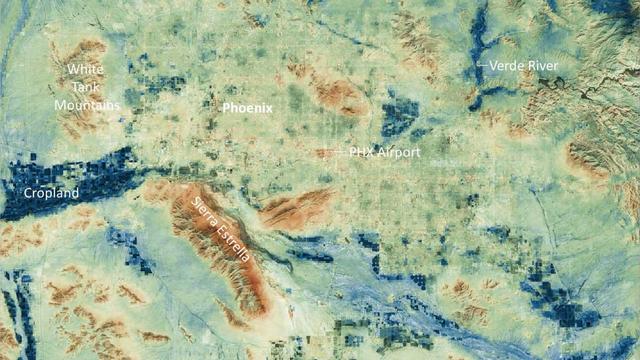
Researchers at NASA's Jet Propulsion Laboratory have created a series of maps showing land-surface temperatures in the Phoenix area in July 2023, when the city experienced a record-breaking run of hot weather. The images reveal the cumulative effect – overnight and across the month – of relentless daytime heating. The data was captured during overnight hours (around 2 a.m.) on several days in July by an instrument called the Visible Infrared Imaging Radiometer Suite (VIIRS) aboard the NOAA-NASA Suomi National Polar-orbiting Partnership (Suomi NPP) satellite managed by the National Oceanic and Atmospheric Administration and NASA. The images show how built surfaces – roads, buildings, airport runways, and the like – retain heat, sometimes hovering around 100 degrees Fahrenheit (38 degrees Celsius) for hours after sunset. From July 1 to July 19, the built surfaces in the maps grew progressively hotter, likely the combined effect of the heat wave intensifying and the cumulative heating of those human-made structures. Due to their high heat capacity, these surfaces didn't fully cool overnight before the onset of the next day's heat. At the center of the images is Phoenix's Sky Harbor International Airport, where VIIRS measured the hottest land-surface temperature within the city. The airport is also where Phoenix takes its official air temperature. By those measurements, the city experienced the hottest month on record in July, including a record 31 consecutive days in which the temperature exceeded 110 degrees Fahrenheit (43.3 degrees Celsius). The previous record was 18 days. Land-surface temperatures in cities are usually warmer than in rural and undeveloped areas because of human activities and the materials used for building. Streets – seen in these maps as a grid pattern – are often the hottest part of the built environment due to dark asphalt paving that absorbs more sunlight than lighter-colored surfaces; asphalt absorbs up to 95% of solar radiation. In the images, the mountains near Phoenix are also notably hot due to their angle to the Sun and greater soil exposure from lack of vegetation. The hot surfaces in and around the city stand in contrast to nearby irrigated surfaces such as agricultural fields, golf courses, and parks, which fell as low as 68 degrees Fahrenheit (18.9 degrees Celsius) during the night. The Verde River and other nearby waterways also were significantly cooler. VIIRS is one of five instruments aboard the NOAA-NASA Suomi NPP satellite. Short for Suomi National Polar-orbiting Partnership, the spacecraft is one of several in the Joint Polar Satellite System. The images were produced from the VNP21IMG Land Surface Temperature product, which is available at NASA's Land, Atmosphere Near-real-time Capability for EOS (LANCE). Animation available at https://photojournal.jpl.nasa.gov/catalog/PIA25868
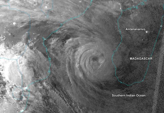
This night-time image revealed Cyclone Haruna's massive eye before it made landfall in southwestern Madagascar. This image was taken from the VIIRS instrument that flies aboard the NASA-NOAA Suomi NPP satellite. The image was taken on Feb. 20 at 2242 UTC (5:42 p.m. EST/U.S.) and shows a clear eye, surrounded by very powerful thunderstorms. The bright lights of the Capital city of Antananarivo are seen in this image. The capital city lies about 300 nautical miles northwest of the storm's center. Haruna's center made landfall near Manombo, Madagascar around 0600 UTC (1 a.m. EST/U.S.) and its eye became cloud-filled quickly. For the entire storm history, visit NASA's Hurricane Page: <a href="http://www.nasa.gov/mission_pages/hurricanes/archives/2013/h2013_Haruna.html" rel="nofollow">www.nasa.gov/mission_pages/hurricanes/archives/2013/h2013...</a> Text: Credit: Univ.of Wisconsin/NASA/NOAA <b><a href="http://www.nasa.gov/audience/formedia/features/MP_Photo_Guidelines.html" rel="nofollow">NASA image use policy.</a></b> <b><a href="http://www.nasa.gov/centers/goddard/home/index.html" rel="nofollow">NASA Goddard Space Flight Center</a></b> enables NASA’s mission through four scientific endeavors: Earth Science, Heliophysics, Solar System Exploration, and Astrophysics. Goddard plays a leading role in NASA’s accomplishments by contributing compelling scientific knowledge to advance the Agency’s mission. <b>Follow us on <a href="http://twitter.com/NASA_GoddardPix" rel="nofollow">Twitter</a></b> <b>Like us on <a href="http://www.facebook.com/pages/Greenbelt-MD/NASA-Goddard/395013845897?ref=tsd" rel="nofollow">Facebook</a></b> <b>Find us on <a href="http://instagram.com/nasagoddard?vm=grid" rel="nofollow">Instagram</a></b>
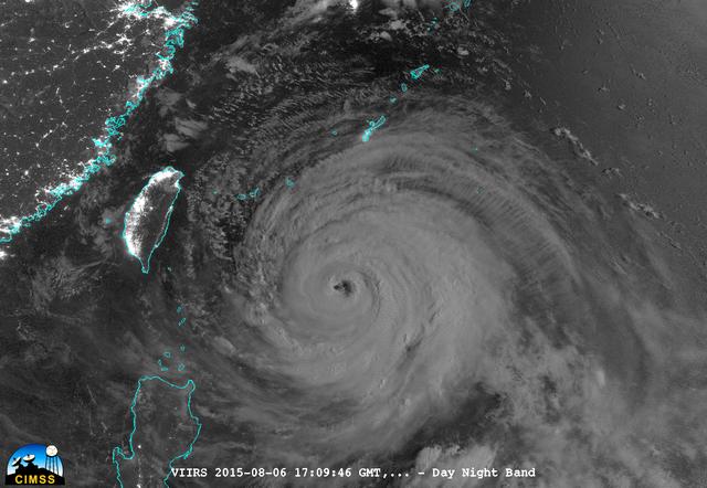
On August 6, 2015, NASA-NOAA's Suomi NPP satellite passed over powerful Typhoon Soudelor at night when it was headed toward Taiwan. The Visible Infrared Imaging Radiometer Suite (VIIRS) instrument aboard NASA-NOAA's Suomi satellite captured this night-time infrared image of the storm. At 1500 UTC (11 a.m. EDT) on August 6, 2015, Typhoon Soudelor had maximum sustained winds near 90 knots (103.6 mph/166.7 kph). It was centered near 21.3 North latitude and 127.5 East longitude, about 324 nautical miles (372.9 miles/600 km) south of Kadena Air Base, Okinawa, Japan. It was moving to the west at 10 knots (11.5 mph/18.5 kph). Taiwan is located west (left) of the powerful typhoon in this image. Credit: UWM/CIMSS/SSEC, William Straka III <b><a href="http://www.nasa.gov/audience/formedia/features/MP_Photo_Guidelines.html" rel="nofollow">NASA image use policy.</a></b> <b><a href="http://www.nasa.gov/centers/goddard/home/index.html" rel="nofollow">NASA Goddard Space Flight Center</a></b> enables NASA’s mission through four scientific endeavors: Earth Science, Heliophysics, Solar System Exploration, and Astrophysics. Goddard plays a leading role in NASA’s accomplishments by contributing compelling scientific knowledge to advance the Agency’s mission. <b>Follow us on <a href="http://twitter.com/NASAGoddardPix" rel="nofollow">Twitter</a></b> <b>Like us on <a href="http://www.facebook.com/pages/Greenbelt-MD/NASA-Goddard/395013845897?ref=tsd" rel="nofollow">Facebook</a></b> <b>Find us on <a href="http://instagrid.me/nasagoddard/?vm=grid" rel="nofollow">Instagram</a></b>
The first tropical cyclone in the Northern Indian Ocean this season has been getting better organized as seen in NASA satellite imagery. Tropical Cyclone Mahasen is projected to track north through the Bay of Bengal and make landfall later this week. On May 13, NASA-NOAA's Suomi NPP satellite captured various night-time and day-time imagery that showed Mesospheric Gravity Waves, lightning, and heavy rainfall in false-colored imagery. For more information and updates on Cyclone Mahasen, visit NASA's Hurricane page at <a href="http://www.nasa.gov/hurricane" rel="nofollow">www.nasa.gov/hurricane</a>. Image Credit: UWM-CIMSS/William Straka III/NASA/NOAA Text Credit: NASA Goddard/Rob Gutro <b><a href="http://www.nasa.gov/audience/formedia/features/MP_Photo_Guidelines.html" rel="nofollow">NASA image use policy.</a></b> <b><a href="http://www.nasa.gov/centers/goddard/home/index.html" rel="nofollow">NASA Goddard Space Flight Center</a></b> enables NASA’s mission through four scientific endeavors: Earth Science, Heliophysics, Solar System Exploration, and Astrophysics. Goddard plays a leading role in NASA’s accomplishments by contributing compelling scientific knowledge to advance the Agency’s mission. <b>Follow us on <a href="http://twitter.com/NASA_GoddardPix" rel="nofollow">Twitter</a></b> <b>Like us on <a href="http://www.facebook.com/pages/Greenbelt-MD/NASA-Goddard/395013845897?ref=tsd" rel="nofollow">Facebook</a></b> <b>Find us on <a href="http://instagram.com/nasagoddard?vm=grid" rel="nofollow">Instagram</a></b>
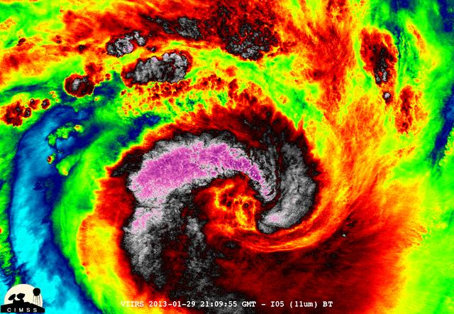
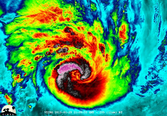
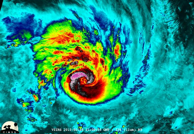
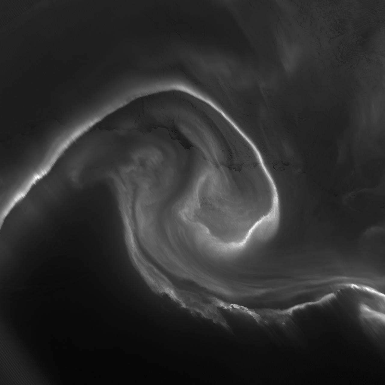
NASA-NOAA's Suomi NPP satellite captured this false-colored night-time image of Cyclone Felleng during the night on Jan. 28, 2013. Felleng is located in the Southern Indian Ocean, and is northwest of Madagascar. The image revealed some pretty cold overshooting tops, topping at ~170K. The image shows some interesting gravity waves propagating out from the storm in both the thermal and visible imagery. For full storm history on NASA's Hurricane Web Page, visit: <a href="http://www.nasa.gov/mission_pages/hurricanes/archives/2013/h2013_Felleng.html" rel="nofollow">www.nasa.gov/mission_pages/hurricanes/archives/2013/h2013...</a> Credit: William Straka, UWM/NASA/NOAA <b><a href="http://www.nasa.gov/audience/formedia/features/MP_Photo_Guidelines.html" rel="nofollow">NASA image use policy.</a></b> <b><a href="http://www.nasa.gov/centers/goddard/home/index.html" rel="nofollow">NASA Goddard Space Flight Center</a></b> enables NASA’s mission through four scientific endeavors: Earth Science, Heliophysics, Solar System Exploration, and Astrophysics. Goddard plays a leading role in NASA’s accomplishments by contributing compelling scientific knowledge to advance the Agency’s mission. <b>Follow us on <a href="http://twitter.com/NASA_GoddardPix" rel="nofollow">Twitter</a></b> <b>Like us on <a href="http://www.facebook.com/pages/Greenbelt-MD/NASA-Goddard/395013845897?ref=tsd" rel="nofollow">Facebook</a></b> <b>Find us on <a href="http://instagram.com/nasagoddard?vm=grid" rel="nofollow">Instagram</a></b>
NASA-NOAA's Suomi NPP satellite captured this false-colored night-time image of Cyclone Felleng during the night on Jan. 28, 2013. Felleng is located in the Southern Indian Ocean, and is northwest of Madagascar. The image revealed some pretty cold overshooting tops, topping at ~170K. The image shows some interesting gravity waves propagating out from the storm in both the thermal and visible imagery. For full storm history on NASA's Hurricane Web Page, visit: <a href="http://www.nasa.gov/mission_pages/hurricanes/archives/2013/h2013_Felleng.html" rel="nofollow">www.nasa.gov/mission_pages/hurricanes/archives/2013/h2013...</a> Credit: William Straka, UWM/NASA/NOAA <b><a href="http://www.nasa.gov/audience/formedia/features/MP_Photo_Guidelines.html" rel="nofollow">NASA image use policy.</a></b> <b><a href="http://www.nasa.gov/centers/goddard/home/index.html" rel="nofollow">NASA Goddard Space Flight Center</a></b> enables NASA’s mission through four scientific endeavors: Earth Science, Heliophysics, Solar System Exploration, and Astrophysics. Goddard plays a leading role in NASA’s accomplishments by contributing compelling scientific knowledge to advance the Agency’s mission. <b>Follow us on <a href="http://twitter.com/NASA_GoddardPix" rel="nofollow">Twitter</a></b> <b>Like us on <a href="http://www.facebook.com/pages/Greenbelt-MD/NASA-Goddard/395013845897?ref=tsd" rel="nofollow">Facebook</a></b> <b>Find us on <a href="http://instagram.com/nasagoddard?vm=grid" rel="nofollow">Instagram</a></b>
NASA-NOAA's Suomi NPP satellite captured this false-colored night-time image of Cyclone Felleng during the night on Jan. 28, 2013. Felleng is located in the Southern Indian Ocean, and is northwest of Madagascar. The image revealed some pretty cold overshooting tops, topping at ~170K. The image shows some interesting gravity waves propagating out from the storm in both the thermal and visible imagery. For full storm history on NASA's Hurricane Web Page, visit: <a href="http://www.nasa.gov/mission_pages/hurricanes/archives/2013/h2013_Felleng.html" rel="nofollow">www.nasa.gov/mission_pages/hurricanes/archives/2013/h2013...</a> Credit: William Straka, UWM/NASA/NOAA <b><a href="http://www.nasa.gov/audience/formedia/features/MP_Photo_Guidelines.html" rel="nofollow">NASA image use policy.</a></b> <b><a href="http://www.nasa.gov/centers/goddard/home/index.html" rel="nofollow">NASA Goddard Space Flight Center</a></b> enables NASA’s mission through four scientific endeavors: Earth Science, Heliophysics, Solar System Exploration, and Astrophysics. Goddard plays a leading role in NASA’s accomplishments by contributing compelling scientific knowledge to advance the Agency’s mission. <b>Follow us on <a href="http://twitter.com/NASA_GoddardPix" rel="nofollow">Twitter</a></b> <b>Like us on <a href="http://www.facebook.com/pages/Greenbelt-MD/NASA-Goddard/395013845897?ref=tsd" rel="nofollow">Facebook</a></b> <b>Find us on <a href="http://instagram.com/nasagoddard?vm=grid" rel="nofollow">Instagram</a></b>
NASA-NOAA's Suomi NPP satellite captured this false-colored night-time image of Cyclone Felleng during the night on Jan. 28, 2013. Felleng is located in the Southern Indian Ocean, and is northwest of Madagascar. The image revealed some pretty cold overshooting tops, topping at ~170K. The image shows some interesting gravity waves propagating out from the storm in both the thermal and visible imagery. For full storm history on NASA's Hurricane Web Page, visit: <a href="http://www.nasa.gov/mission_pages/hurricanes/archives/2013/h2013_Felleng.html" rel="nofollow">www.nasa.gov/mission_pages/hurricanes/archives/2013/h2013...</a> Credit: William Straka, UWM/NASA/NOAA <b><a href="http://www.nasa.gov/audience/formedia/features/MP_Photo_Guidelines.html" rel="nofollow">NASA image use policy.</a></b> <b><a href="http://www.nasa.gov/centers/goddard/home/index.html" rel="nofollow">NASA Goddard Space Flight Center</a></b> enables NASA’s mission through four scientific endeavors: Earth Science, Heliophysics, Solar System Exploration, and Astrophysics. Goddard plays a leading role in NASA’s accomplishments by contributing compelling scientific knowledge to advance the Agency’s mission. <b>Follow us on <a href="http://twitter.com/NASA_GoddardPix" rel="nofollow">Twitter</a></b> <b>Like us on <a href="http://www.facebook.com/pages/Greenbelt-MD/NASA-Goddard/395013845897?ref=tsd" rel="nofollow">Facebook</a></b> <b>Find us on <a href="http://instagram.com/nasagoddard?vm=grid" rel="nofollow">Instagram</a></b>
NASA-NOAA's Suomi NPP satellite captured this false-colored night-time image of Cyclone Felleng during the night on Jan. 28, 2013. Felleng is located in the Southern Indian Ocean, and is northwest of Madagascar. The image revealed some pretty cold overshooting tops, topping at ~170K. The image shows some interesting gravity waves propagating out from the storm in both the thermal and visible imagery. For full storm history on NASA's Hurricane Web Page, visit: <a href="http://www.nasa.gov/mission_pages/hurricanes/archives/2013/h2013_Felleng.html" rel="nofollow">www.nasa.gov/mission_pages/hurricanes/archives/2013/h2013...</a> Credit: William Straka, UWM/NASA/NOAA <b><a href="http://www.nasa.gov/audience/formedia/features/MP_Photo_Guidelines.html" rel="nofollow">NASA image use policy.</a></b> <b><a href="http://www.nasa.gov/centers/goddard/home/index.html" rel="nofollow">NASA Goddard Space Flight Center</a></b> enables NASA’s mission through four scientific endeavors: Earth Science, Heliophysics, Solar System Exploration, and Astrophysics. Goddard plays a leading role in NASA’s accomplishments by contributing compelling scientific knowledge to advance the Agency’s mission. <b>Follow us on <a href="http://twitter.com/NASA_GoddardPix" rel="nofollow">Twitter</a></b> <b>Like us on <a href="http://www.facebook.com/pages/Greenbelt-MD/NASA-Goddard/395013845897?ref=tsd" rel="nofollow">Facebook</a></b> <b>Find us on <a href="http://instagram.com/nasagoddard?vm=grid" rel="nofollow">Instagram</a></b>
NASA-NOAA's Suomi NPP satellite captured this false-colored night-time image of Cyclone Felleng during the night on Jan. 28, 2013. Felleng is located in the Southern Indian Ocean, and is northwest of Madagascar. The image revealed some pretty cold overshooting tops, topping at ~170K. The image shows some interesting gravity waves propagating out from the storm in both the thermal and visible imagery. For full storm history on NASA's Hurricane Web Page, visit: <a href="http://www.nasa.gov/mission_pages/hurricanes/archives/2013/h2013_Felleng.html" rel="nofollow">www.nasa.gov/mission_pages/hurricanes/archives/2013/h2013...</a> Credit: William Straka, UWM/NASA/NOAA <b><a href="http://www.nasa.gov/audience/formedia/features/MP_Photo_Guidelines.html" rel="nofollow">NASA image use policy.</a></b> <b><a href="http://www.nasa.gov/centers/goddard/home/index.html" rel="nofollow">NASA Goddard Space Flight Center</a></b> enables NASA’s mission through four scientific endeavors: Earth Science, Heliophysics, Solar System Exploration, and Astrophysics. Goddard plays a leading role in NASA’s accomplishments by contributing compelling scientific knowledge to advance the Agency’s mission. <b>Follow us on <a href="http://twitter.com/NASA_GoddardPix" rel="nofollow">Twitter</a></b> <b>Like us on <a href="http://www.facebook.com/pages/Greenbelt-MD/NASA-Goddard/395013845897?ref=tsd" rel="nofollow">Facebook</a></b> <b>Find us on <a href="http://instagram.com/nasagoddard?vm=grid" rel="nofollow">Instagram</a></b>
January 25, 2012 <b>*Updated February 2, 2012: According to Flickr, "The western hemisphere Blue Marble 2012 image has rocketed up to over 3.1 million views making it one of the all time most viewed images on the site after only one week."</b> A 'Blue Marble' image of the Earth taken from the VIIRS instrument aboard NASA's most recently launched Earth-observing satellite - Suomi NPP. This composite image uses a number of swaths of the Earth's surface taken on January 4, 2012. The NPP satellite was renamed 'Suomi NPP' on January 24, 2012 to honor the late Verner E. Suomi of the University of Wisconsin. Suomi NPP is NASA's next Earth-observing research satellite. It is the first of a new generation of satellites that will observe many facets of our changing Earth. Suomi NPP is carrying five instruments on board. The biggest and most important instrument is The Visible/Infrared Imager Radiometer Suite or VIIRS. To read more about NASA's Suomi NPP go to: <a href="http://www.nasa.gov/npp" rel="nofollow">www.nasa.gov/npp</a> Credit: NASA/NOAA/GSFC/Suomi NPP/VIIRS/Norman Kuring <b><a href="http://www.nasa.gov/audience/formedia/features/MP_Photo_Guidelines.html" rel="nofollow">NASA image use policy.</a></b> <b><a href="http://www.nasa.gov/centers/goddard/home/index.html" rel="nofollow">NASA Goddard Space Flight Center</a></b> enables NASA’s mission through four scientific endeavors: Earth Science, Heliophysics, Solar System Exploration, and Astrophysics. Goddard plays a leading role in NASA’s accomplishments by contributing compelling scientific knowledge to advance the Agency’s mission. <b>Follow us on <a href="http://twitter.com/NASAGoddardPix" rel="nofollow">Twitter</a></b> <b>Like us on <a href="http://www.facebook.com/pages/Greenbelt-MD/NASA-Goddard/395013845897?ref=tsd" rel="nofollow">Facebook</a></b> <b>Find us on <a href="http://instagrid.me/nasagoddard/?vm=grid" rel="nofollow">Instagram</a></b>
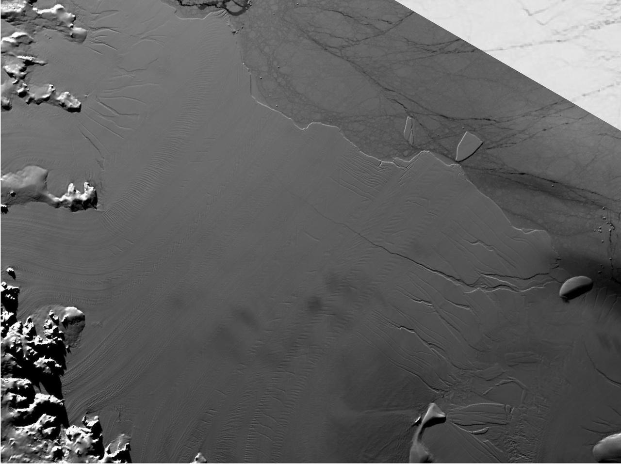
Between July 10 and 12, 2017, the Larsen C Ice Shelf in West Antarctica calved one of the largest icebergs in history (named "A-68"), weighing approximately one trillion tons. The rift in the ice shelf that spawned the iceberg has been present on the shelf since at least the beginning of the Landsat era (approximately the 1970s), but remained relatively dormant until around 2012, when it was observed actively moving through a suture zone in the ice shelf (Jansen et al., 2015). Suture zones are wide bands of ice that extend from glacier grounding lines (the boundary between a floating ice shelf and ice resting on bedrock) to the sea comprised of a frozen mixture of glacial ice and sea water, traditionally considered to be stabilizing features in ice shelves. When the Antarctic entered its annual dark period in late April, scientists knew the rift only had a few more miles to go before it completely calved the large iceberg. However, due to the lack of sunlight during the Antarctic winter, visible imagery is generally not available each year between May and August. This frame is from an animation that shows the ice shelf as imaged by the NASA/NOAA satellite Suomi NPP, which features the VIIRS (Visible Infrared Imaging Radiometer Suite) instrument. VIIRS has a day/night panchromatic band capable of collecting nighttime imagery of Earth with a spatial resolution of 2,460 feet (750 meters). An image from the Moderate Resolution Imaging Spectroradiometer (MODIS) instrument on NASA's Terra satellite shows the last cloud-free, daytime image of the ice shelf on April 6; the MODIS thermal imagery band is shown on April 29. The images from May 9 to July 14 show available cloud-free imagery from Suomi NPP. Luckily, despite several cloudy days leading up to the break, the weather mostly cleared on July 11, allowing scientists to see the newly formed iceberg on July 12. The animation is available at https://photojournal.jpl.nasa.gov/catalog/PIA21785
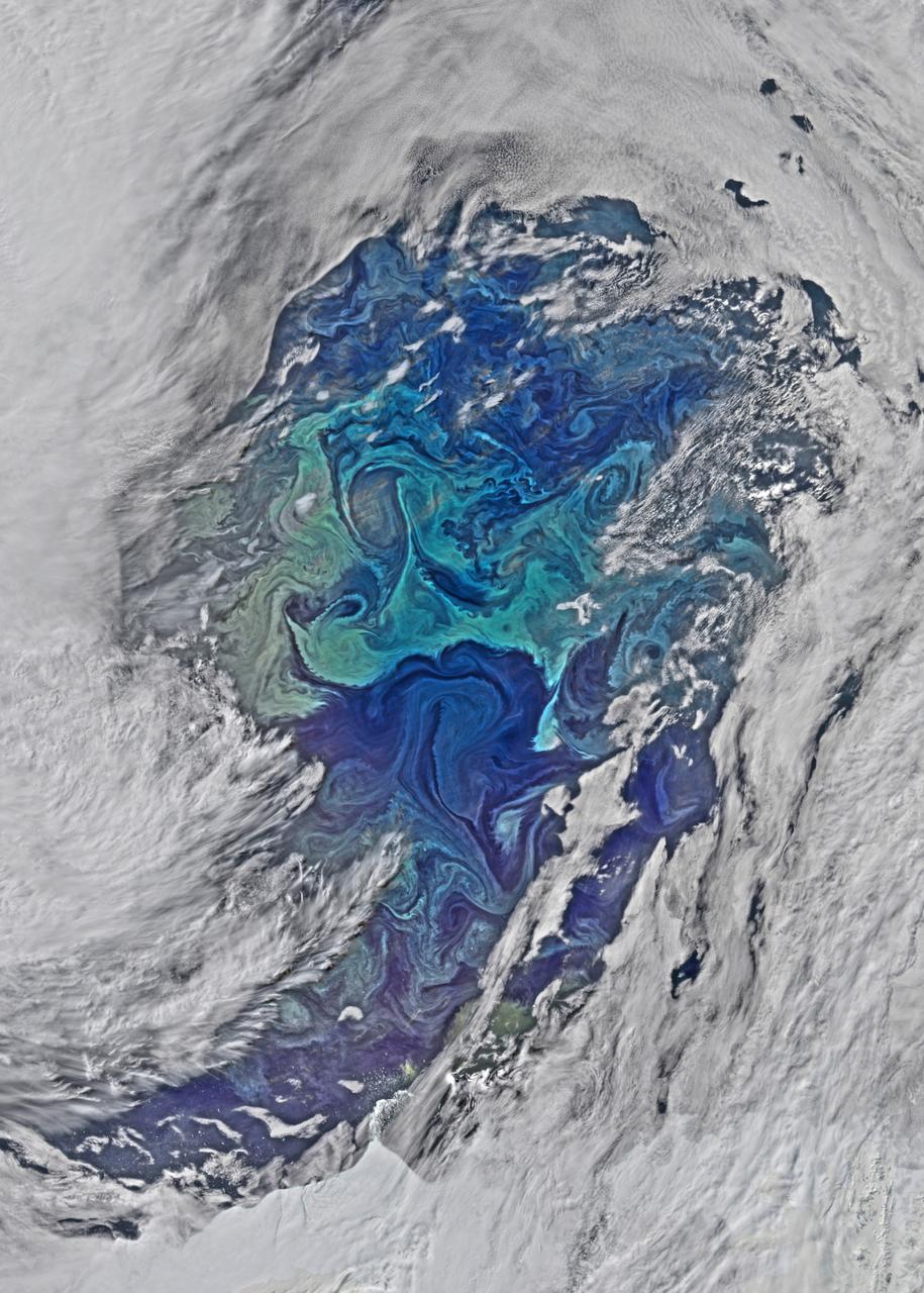
The cloud cover over the Southern Ocean occasionally parts as it did on January 1, 2015 just west of the Drake Passage where the VIIRS instrument on the Suomi NPP satellite glimpsed the above collection of ocean-color delineated eddies which have diameters ranging from a couple of kilometers to a couple of hundred kilometers. Recent studies indicate that eddy activity has been increasing in the Southern Ocean with possible implications for climate change. Credit: NASA's OceanColor/Suomi NPP/VIIRS
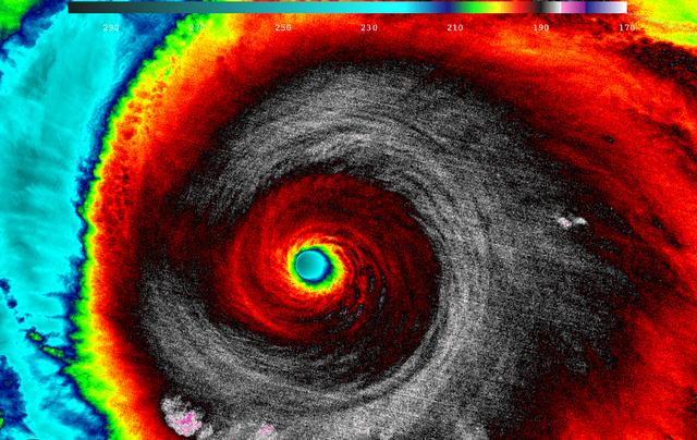
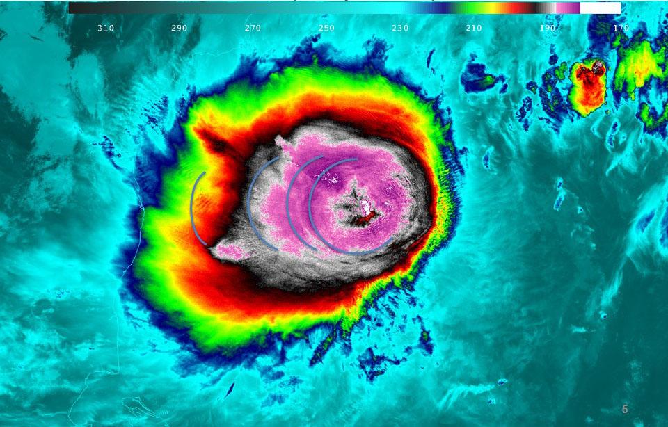
When NASA-NOAA's Suomi NPP satellite passed over Patricia on October 23 at 5:20 a.m. EDT the VIIRS instrument that flies aboard Suomi NPP looked at the storm in infrared light. Cloud top temperatures of thunderstorms around the eyewall were between 180K (-135.7F/ -93.1C) and 190 Kelvin (-117.7F/ -83.1C). Credit: UW/CIMSS/William Straka III Read more: <a href="http://www.nasa.gov/f…/goddard/patricia-eastern-pacific-2015" rel="nofollow">www.nasa.gov/f…/goddard/patricia-eastern-pacific-2015</a>
NASA image acquired October 28, 2012 <b>For the latest info from NASA on Hurricane Sandy go to: <a href="http://1.usa.gov/Ti5SgS" rel="nofollow">1.usa.gov/Ti5SgS</a></b> This image of Hurricane Sandy was acquired by the Visible Infrared Imaging Radiometer Suite (VIIRS) on the Suomi NPP satellite around 2:42 a.m. Eastern Daylight Time (06:42 Universal Time) on October 28, 2012. The storm was captured by a special “day-night band,” which detects light in a range of wavelengths from green to near-infrared and uses filtering techniques to observe dim signals such as auroras, airglow, gas flares, city lights, and reflected moonlight. In this case, the cloud tops were lit by the nearly full Moon (full occurs on October 29). Some city lights in Florida and Georgia are also visible amidst the clouds. The Suomi NPP satellite was launched one year ago today (on October 28, 2011) to extend and enhance long-term records of key environmental data monitored by NASA, the National Oceanic and Atmospheric Administration (NOAA), and the U.S. Department of Defense. NASA Earth Observatory image by Jesse Allen and Robert Simmon, using VIIRS Day-Night Band data from the Suomi National Polar-orbiting Partnership (Suomi NPP). Suomi NPP is the result of a partnership between NASA, the National Oceanic and Atmospheric Administration, and the Department of Defense. Caption by Michael Carlowicz. Instrument: Suomi NPP - VIIRS <b><a href="http://www.nasa.gov/audience/formedia/features/MP_Photo_Guidelines.html" rel="nofollow">NASA image use policy.</a></b> <b><a href="http://www.nasa.gov/centers/goddard/home/index.html" rel="nofollow">NASA Goddard Space Flight Center</a></b> enables NASA’s mission through four scientific endeavors: Earth Science, Heliophysics, Solar System Exploration, and Astrophysics. Goddard plays a leading role in NASA’s accomplishments by contributing compelling scientific knowledge to advance the Agency’s mission. <b>Follow us on <a href="http://twitter.com/NASA_GoddardPix" rel="nofollow">Twitter</a></b> <b>Like us on <a href="http://www.facebook.com/pages/Greenbelt-MD/NASA-Goddard/395013845897?ref=tsd" rel="nofollow">Facebook</a></b> <b>Find us on <a href="http://instagrid.me/nasagoddard/?vm=grid" rel="nofollow">Instagram</a></b>
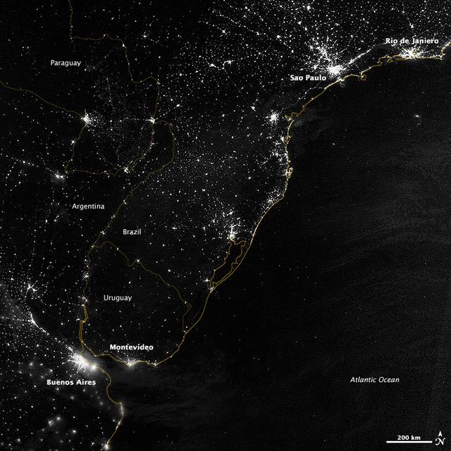
This image of part of the Atlantic coast of South America was acquired by the Suomi NPP satellite on the night of July 20, 2012. The image was made possible by the “day-night band” of the Visible Infrared Imaging Radiometer Suite (VIIRS), which detects light in a range of wavelengths from green to near-infrared and uses filtering techniques to observe dim signals such as city lights, gas flares, auroras, wildfires, and reflected moonlight. “Nothing tells us more about the spread of humans across the Earth than city lights,” says Chris Elvidge, who leads the Earth Observation Group at NOAA’s National Geophysical Data Center. Named for satellite meteorology pioneer Verner Suomi, NPP flies over any given point on Earth's surface twice each day at roughly 1:30 a.m. and p.m. The polar-orbiting satellite flies 824 kilometers (512 miles) above the surface, sending its data once per orbit to a ground station in Svalbard, Norway, and continuously to local direct broadcast users distributed around the world. Suomi NPP is managed by NASA with operational support from NOAA and its Joint Polar Satellite System, which manages the satellite's ground system. NASA Earth Observatory image by Jesse Allen and Robert Simmon, using VIIRS Day-Night Band data from the Suomi National Polar-orbiting Partnership. Suomi NPP is the result of a partnership between NASA, the National Oceanic and Atmospheric Administration, and the Department of Defense. Caption by Mike Carlowicz. Instrument: Suomi NPP - VIIRS Credit: <b><a href="http://www.earthobservatory.nasa.gov/" rel="nofollow"> NASA Earth Observatory</a></b> <b>Click here to view all of the <a href="http://earthobservatory.nasa.gov/Features/NightLights/" rel="nofollow"> Earth at Night 2012 images </a></b> <b>Click here to <a href="http://earthobservatory.nasa.gov/NaturalHazards/view.php?id=79822" rel="nofollow"> read more </a> about this image </b> <b><a href="http://www.nasa.gov/audience/formedia/features/MP_Photo_Guidelines.html" rel="nofollow">NASA image use policy.</a></b> <b><a href="http://www.nasa.gov/centers/goddard/home/index.html" rel="nofollow">NASA Goddard Space Flight Center</a></b> enables NASA’s mission through four scientific endeavors: Earth Science, Heliophysics, Solar System Exploration, and Astrophysics. Goddard plays a leading role in NASA’s accomplishments by contributing compelling scientific knowledge to advance the Agency’s mission. <b>Follow us on <a href="http://twitter.com/NASA_GoddardPix" rel="nofollow">Twitter</a></b> <b>Like us on <a href="http://www.facebook.com/pages/Greenbelt-MD/NASA-Goddard/395013845897?ref=tsd" rel="nofollow">Facebook</a></b> <b>Find us on <a href="http://instagram.com/nasagoddard?vm=grid" rel="nofollow">Instagram</a></b>
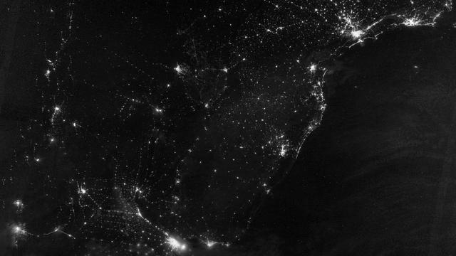
This image of part of the Atlantic coast of South America was acquired by the Suomi NPP satellite on the night of July 20, 2012. The image was made possible by the “day-night band” of the Visible Infrared Imaging Radiometer Suite (VIIRS), which detects light in a range of wavelengths from green to near-infrared and uses filtering techniques to observe dim signals such as city lights, gas flares, auroras, wildfires, and reflected moonlight. “Nothing tells us more about the spread of humans across the Earth than city lights,” says Chris Elvidge, who leads the Earth Observation Group at NOAA’s National Geophysical Data Center. Named for satellite meteorology pioneer Verner Suomi, NPP flies over any given point on Earth's surface twice each day at roughly 1:30 a.m. and p.m. The polar-orbiting satellite flies 824 kilometers (512 miles) above the surface, sending its data once per orbit to a ground station in Svalbard, Norway, and continuously to local direct broadcast users distributed around the world. Suomi NPP is managed by NASA with operational support from NOAA and its Joint Polar Satellite System, which manages the satellite's ground system. NASA Earth Observatory image by Jesse Allen and Robert Simmon, using VIIRS Day-Night Band data from the Suomi National Polar-orbiting Partnership. Suomi NPP is the result of a partnership between NASA, the National Oceanic and Atmospheric Administration, and the Department of Defense. Caption by Mike Carlowicz. Instrument: Suomi NPP - VIIRS Credit: <b><a href="http://www.earthobservatory.nasa.gov/" rel="nofollow"> NASA Earth Observatory</a></b> <b>Click here to view all of the <a href="http://earthobservatory.nasa.gov/Features/NightLights/" rel="nofollow"> Earth at Night 2012 images </a></b> <b>Click here to <a href="http://earthobservatory.nasa.gov/NaturalHazards/view.php?id=79822" rel="nofollow"> read more </a> about this image </b> <b><a href="http://www.nasa.gov/audience/formedia/features/MP_Photo_Guidelines.html" rel="nofollow">NASA image use policy.</a></b> <b><a href="http://www.nasa.gov/centers/goddard/home/index.html" rel="nofollow">NASA Goddard Space Flight Center</a></b> enables NASA’s mission through four scientific endeavors: Earth Science, Heliophysics, Solar System Exploration, and Astrophysics. Goddard plays a leading role in NASA’s accomplishments by contributing compelling scientific knowledge to advance the Agency’s mission. <b>Follow us on <a href="http://twitter.com/NASA_GoddardPix" rel="nofollow">Twitter</a></b> <b>Like us on <a href="http://www.facebook.com/pages/Greenbelt-MD/NASA-Goddard/395013845897?ref=tsd" rel="nofollow">Facebook</a></b> <b>Find us on <a href="http://instagram.com/nasagoddard?vm=grid" rel="nofollow">Instagram</a></b>
The night side of Earth twinkles with light, and the first thing to stand out is the cities. “Nothing tells us more about the spread of humans across the Earth than city lights,” asserts Chris Elvidge, a NOAA scientist who has studied them for 20 years. This new global view and animation of Earth’s city lights is a composite assembled from data acquired by the Suomi National Polar-orbiting Partnership (Suomi NPP) satellite. The data was acquired over nine days in April 2012 and thirteen days in October 2012. It took satellite 312 orbits and 2.5 terabytes of data to get a clear shot of every parcel of Earth’s land surface and islands. This new data was then mapped over existing Blue Marble imagery of Earth to provide a realistic view of the planet. The nighttime view in visible light was made possible by the new “day-night band” of Suomi NPP’s Visible Infrared Imaging Radiometer Suite. VIIRS detects light in a range of wavelengths from green to near-infrared and uses filtering techniques to observe dim signals such as city lights, auroras, wildfires, and reflected moonlight. This low-light sensor can distinguish night lights with ten to hundreds of times better light detection capability than scientists had before. Named for satellite meteorology pioneer Verner Suomi, NPP flies over any given point on Earth&rsquos surface twice each day at roughly 1:30 a.m. and 1:30 p.m. The polar-orbiting satellite flies 824 kilometers (512 miles) above the surface as it circles the planet 14 times a day. Data is sent once per orbit to a ground station in Svalbard, Norway, and continuously to local direct broadcast users around the world. The mission is managed by NASA with operational support from NOAA and its Joint Polar Satellite System, which manages the satellite's ground system. NASA Earth Observatory image and animation by Robert Simmon, using Suomi NPP VIIRS data provided courtesy of Chris Elvidge (NOAA National Geophysical Data Center). Suomi NPP is the result of a partnership between NASA, NOAA, and the Department of Defense. Caption by Mike Carlowicz. Instrument: Suomi NPP - VIIRS Credit: <b><a href="http://www.earthobservatory.nasa.gov/" rel="nofollow"> NASA Earth Observatory</a></b> <b>Click here to view all of the <a href="http://earthobservatory.nasa.gov/Features/NightLights/" rel="nofollow"> Earth at Night 2012 images </a></b> <b>Click here to <a href="http://earthobservatory.nasa.gov/NaturalHazards/view.php?id=79803" rel="nofollow"> read more </a> about this image </b> <b><a href="http://www.nasa.gov/audience/formedia/features/MP_Photo_Guidelines.html" rel="nofollow">NASA image use policy.</a></b> <b><a href="http://www.nasa.gov/centers/goddard/home/index.html" rel="nofollow">NASA Goddard Space Flight Center</a></b> enables NASA’s mission through four scientific endeavors: Earth Science, Heliophysics, Solar System Exploration, and Astrophysics. Goddard plays a leading role in NASA’s accomplishments by contributing compelling scientific knowledge to advance the Agency’s mission. <b>Follow us on <a href="http://twitter.com/NASA_GoddardPix" rel="nofollow">Twitter</a></b> <b>Like us on <a href="http://www.facebook.com/pages/Greenbelt-MD/NASA-Goddard/395013845897?ref=tsd" rel="nofollow">Facebook</a></b> <b>Find us on <a href="http://instagram.com/nasagoddard?vm=grid" rel="nofollow">Instagram</a></b>

NASA image acquired April 18 - October 23, 2012 This new image of the Earth at night is a composite assembled from data acquired by the Suomi National Polar-orbiting Partnership (Suomi NPP) satellite over nine days in April 2012 and thirteen days in October 2012. It took 312 orbits and 2.5 terabytes of data to get a clear shot of every parcel of Earth’s land surface and islands. The nighttime view of Earth in visible light was made possible by the “day-night band” of the Visible Infrared Imaging Radiometer Suite. VIIRS detects light in a range of wavelengths from green to near-infrared and uses filtering techniques to observe dim signals such as gas flares, auroras, wildfires, city lights, and reflected moonlight. In this case, auroras, fires, and other stray light have been removed to emphasize the city lights. Named for satellite meteorology pioneer Verner Suomi, NPP flies over any given point on Earth’s surface twice each day at roughly 1:30 a.m. and 1:30 p.m. The spacecraft flies 824 kilometers (512 miles) above the surface in a polar orbit, circling the planet about 14 times a day. Suomi NPP sends its data once per orbit to a ground station in Svalbard, Norway, and continuously to local direct broadcast users distributed around the world. The mission is managed by NASA with operational support from NOAA and its Joint Polar Satellite System, which manages the satellite's ground system. NASA Earth Observatory image by Robert Simmon, using Suomi NPP VIIRS data provided courtesy of Chris Elvidge (NOAA National Geophysical Data Center). Suomi NPP is the result of a partnership between NASA, NOAA, and the Department of Defense. Caption by Mike Carlowicz. Instrument: Suomi NPP - VIIRS Credit: <b><a href="http://www.earthobservatory.nasa.gov/" rel="nofollow"> NASA Earth Observatory</a></b> <b>Click here to view all of the <a href="http://earthobservatory.nasa.gov/Features/NightLights/" rel="nofollow"> Earth at Night 2012 images </a></b> <b>Click here to <a href="http://earthobservatory.nasa.gov/NaturalHazards/view.php?id=79765" rel="nofollow"> read more </a> about this image </b> <b><a href="http://www.nasa.gov/audience/formedia/features/MP_Photo_Guidelines.html" rel="nofollow">NASA image use policy.</a></b> <b><a href="http://www.nasa.gov/centers/goddard/home/index.html" rel="nofollow">NASA Goddard Space Flight Center</a></b> enables NASA’s mission through four scientific endeavors: Earth Science, Heliophysics, Solar System Exploration, and Astrophysics. Goddard plays a leading role in NASA’s accomplishments by contributing compelling scientific knowledge to advance the Agency’s mission. <b>Follow us on <a href="http://twitter.com/NASA_GoddardPix" rel="nofollow">Twitter</a></b> <b>Like us on <a href="http://www.facebook.com/pages/Greenbelt-MD/NASA-Goddard/395013845897?ref=tsd" rel="nofollow">Facebook</a></b> <b>Find us on <a href="http://instagram.com/nasagoddard?vm=grid" rel="nofollow">Instagram</a></b>

The night side of Earth twinkles with light, and the first thing to stand out is the cities. “Nothing tells us more about the spread of humans across the Earth than city lights,” asserts Chris Elvidge, a NOAA scientist who has studied them for 20 years. This new global view and animation of Earth’s city lights is a composite assembled from data acquired by the Suomi National Polar-orbiting Partnership (Suomi NPP) satellite. The data was acquired over nine days in April 2012 and thirteen days in October 2012. It took satellite 312 orbits and 2.5 terabytes of data to get a clear shot of every parcel of Earth’s land surface and islands. This new data was then mapped over existing Blue Marble imagery of Earth to provide a realistic view of the planet. The nighttime view in visible light was made possible by the new “day-night band” of Suomi NPP’s Visible Infrared Imaging Radiometer Suite. VIIRS detects light in a range of wavelengths from green to near-infrared and uses filtering techniques to observe dim signals such as city lights, auroras, wildfires, and reflected moonlight. This low-light sensor can distinguish night lights with ten to hundreds of times better light detection capability than scientists had before. Named for satellite meteorology pioneer Verner Suomi, NPP flies over any given point on Earth&rsquos surface twice each day at roughly 1:30 a.m. and 1:30 p.m. The polar-orbiting satellite flies 824 kilometers (512 miles) above the surface as it circles the planet 14 times a day. Data is sent once per orbit to a ground station in Svalbard, Norway, and continuously to local direct broadcast users around the world. The mission is managed by NASA with operational support from NOAA and its Joint Polar Satellite System, which manages the satellite's ground system. NASA Earth Observatory image and animation by Robert Simmon, using Suomi NPP VIIRS data provided courtesy of Chris Elvidge (NOAA National Geophysical Data Center). Suomi NPP is the result of a partnership between NASA, NOAA, and the Department of Defense. Caption by Mike Carlowicz. Instrument: Suomi NPP - VIIRS Credit: <b><a href="http://www.earthobservatory.nasa.gov/" rel="nofollow"> NASA Earth Observatory</a></b> <b>Click here to view all of the <a href="http://earthobservatory.nasa.gov/Features/NightLights/" rel="nofollow"> Earth at Night 2012 images </a></b> <b>Click here to <a href="http://earthobservatory.nasa.gov/NaturalHazards/view.php?id=79803" rel="nofollow"> read more </a> about this image </b> <b><a href="http://www.nasa.gov/audience/formedia/features/MP_Photo_Guidelines.html" rel="nofollow">NASA image use policy.</a></b> <b><a href="http://www.nasa.gov/centers/goddard/home/index.html" rel="nofollow">NASA Goddard Space Flight Center</a></b> enables NASA’s mission through four scientific endeavors: Earth Science, Heliophysics, Solar System Exploration, and Astrophysics. Goddard plays a leading role in NASA’s accomplishments by contributing compelling scientific knowledge to advance the Agency’s mission. <b>Follow us on <a href="http://twitter.com/NASA_GoddardPix" rel="nofollow">Twitter</a></b> <b>Like us on <a href="http://www.facebook.com/pages/Greenbelt-MD/NASA-Goddard/395013845897?ref=tsd" rel="nofollow">Facebook</a></b> <b>Find us on <a href="http://instagram.com/nasagoddard?vm=grid" rel="nofollow">Instagram</a></b>
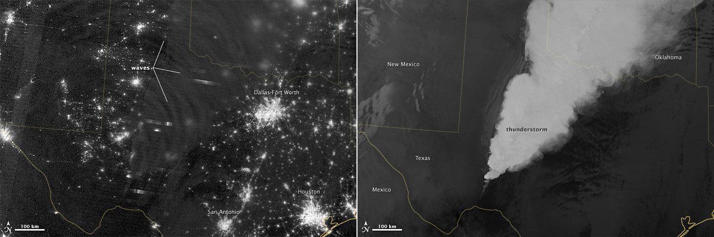
In April 2012, waves in Earth’s “airglow” spread across the nighttime skies of northern Texas like ripples in a pond. In this case, the waves were provoked by a massive thunderstorm. Airglow is a layer of nighttime light emissions caused by chemical reactions high in Earth’s atmosphere. A variety of reactions involving oxygen, sodium, ozone and nitrogen result in the production of a very faint amount of light. In fact, it’s approximately one billion times fainter than sunlight (~10-11 to 10-9 W·cm-2· sr-1). This chemiluminescence is similar to the chemical reactions that light up a glow stick or glow-in-the-dark silly putty. The “day-night band,” of the Visible Infrared Imaging Radiometer Suite (VIIRS) on the Suomi NPP satellite captured these glowing ripples in the night sky on April 15, 2012 (top image). The day-night band detects lights over a range of wavelengths from green to near-infrared and uses highly sensitive electronics to observe low light signals. (The absolute minimum signals detectable are at the levels of nightglow emission.) The lower image shows the thunderstorm as observed by a thermal infrared band on VIIRS. This thermal band, which is sensitive only to heat emissions (cold clouds appear white), is not sensitive to the subtle visible-light wave structures seen by the day-night band. Technically speaking, airglow occurs at all times. During the day it is called “dayglow,” at twilight “twilightglow,” and at night “nightglow.” There are slightly different processes taking place in each case, but in the image above the source of light is nightglow. The strongest nightglow emissions are mostly constrained to a relatively thin layer of atmosphere between 85 and 95 kilometers (53 and 60 miles) above the Earth’s surface. Little emission occurs below this layer since there’s a higher concentration of molecules, allowing for dissipation of chemical energy via collisions rather than light production. Likewise, little emission occurs above that layer because the atmospheric density is so tenuous that there are too few light-emitting reactions to yield an appreciable amount of light. Suomi NPP is in orbit around Earth at 834 kilometers (about 518 miles), well above the nightglow layer. The day-night band imagery therefore contains signals from the direction upward emission of the nightglow layer and the reflection of the downward nightglow emissions by clouds and the Earth’s surface. The presence of these nightglow waves is a graphic visualization of the usually unseen energy transfer processes that occur continuously between the lower and upper atmosphere. While nightglow is a well-known phenomenon, it’s not typically considered by Earth-viewing meteorological sensors. In fact, scientists were surprised at Suomi NPP’s ability to detect it. During the satellite’s check-out procedure, this unanticipated source of visible light was thought to indicate a problem with the sensor until scientists realized that what they were seeing was the faintest of light in the darkness of night. NASA Earth Observatory image by Jesse Allen and Robert Simmon, using VIIRS Day-Night Band data from the Suomi National Polar-orbiting Partnership. Suomi NPP is the result of a partnership between NASA, the National Oceanic and Atmospheric Administration, and the Department of Defense. Caption by Aries Keck and Steve Miller. Instrument: Suomi NPP - VIIRS Credit: <b><a href="http://www.earthobservatory.nasa.gov/" rel="nofollow"> NASA Earth Observatory</a></b> <b>Click here to view all of the <a href="http://earthobservatory.nasa.gov/Features/NightLights/" rel="nofollow"> Earth at Night 2012 images </a></b> <b>Click here to <a href="http://earthobservatory.nasa.gov/NaturalHazards/view.php?id=79817" rel="nofollow"> read more </a> about this image </b> <b><a href="http://www.nasa.gov/audience/formedia/features/MP_Photo_Guidelines.html" rel="nofollow">NASA image use policy.</a></b> <b><a href="http://www.nasa.gov/centers/goddard/home/index.html" rel="nofollow">NASA Goddard Space</a></b>

NASA image acquired April 18 - October 23, 2012 This image of the United States of America at night is a composite assembled from data acquired by the Suomi NPP satellite in April and October 2012. The image was made possible by the new satellite’s “day-night band” of the Visible Infrared Imaging Radiometer Suite (VIIRS), which detects light in a range of wavelengths from green to near-infrared and uses filtering techniques to observe dim signals such as city lights, gas flares, auroras, wildfires, and reflected moonlight. “Nighttime light is the most interesting data that I’ve had a chance to work with,” says Chris Elvidge, who leads the Earth Observation Group at NOAA’s National Geophysical Data Center. “I’m always amazed at what city light images show us about human activity.” His research group has been approached by scientists seeking to model the distribution of carbon dioxide emissions from fossil fuels and to monitor the activity of commercial fishing fleets. Biologists have examined how urban growth has fragmented animal habitat. Elvidge even learned once of a study of dictatorships in various parts of the world and how nighttime lights had a tendency to expand in the dictator’s hometown or province. Named for satellite meteorology pioneer Verner Suomi, NPP flies over any given point on Earth's surface twice each day at roughly 1:30 a.m. and p.m. The polar-orbiting satellite flies 824 kilometers (512 miles) above the surface, sending its data once per orbit to a ground station in Svalbard, Norway, and continuously to local direct broadcast users distributed around the world. Suomi NPP is managed by NASA with operational support from NOAA and its Joint Polar Satellite System, which manages the satellite's ground system. NASA Earth Observatory image by Robert Simmon, using Suomi NPP VIIRS data provided courtesy of Chris Elvidge (NOAA National Geophysical Data Center). Suomi NPP is the result of a partnership between NASA, NOAA, and the Department of Defense. Caption by Mike Carlowicz. Instrument: Suomi NPP - VIIRS Credit: <b><a href="http://www.earthobservatory.nasa.gov/" rel="nofollow"> NASA Earth Observatory</a></b> <b>Click here to view all of the <a href="http://earthobservatory.nasa.gov/Features/NightLights/" rel="nofollow"> Earth at Night 2012 images </a></b> <b>Click here to <a href="http://earthobservatory.nasa.gov/NaturalHazards/view.php?id=79800" rel="nofollow"> read more </a> about this image </b> <b><a href="http://www.nasa.gov/audience/formedia/features/MP_Photo_Guidelines.html" rel="nofollow">NASA image use policy.</a></b> <b><a href="http://www.nasa.gov/centers/goddard/home/index.html" rel="nofollow">NASA Goddard Space Flight Center</a></b> enables NASA’s mission through four scientific endeavors: Earth Science, Heliophysics, Solar System Exploration, and Astrophysics. Goddard plays a leading role in NASA’s accomplishments by contributing compelling scientific knowledge to advance the Agency’s mission. <b>Follow us on <a href="http://twitter.com/NASA_GoddardPix" rel="nofollow">Twitter</a></b> <b>Like us on <a href="http://www.facebook.com/pages/Greenbelt-MD/NASA-Goddard/395013845897?ref=tsd" rel="nofollow">Facebook</a></b> <b>Find us on <a href="http://instagram.com/nasagoddard?vm=grid" rel="nofollow">Instagram</a></b>
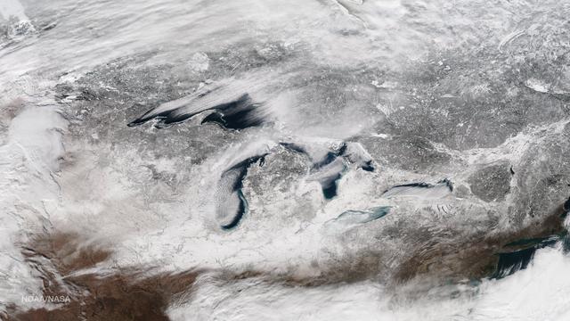
This image taken on January 13, 2015 from the Suomi NPP satellite's VIIRS instrument shows the Great Lakes and surrounding areas. The latest Great Lakes Surface Environmental Analysis (GLSEA) from the NOAA Great Lakes Environmental Research Laboratory shows total ice cover of 29.3% as of January 13th. Credit: NOAA/NASA/NPP Via <b><a href="www.nnvl.noaa.gov/" rel="nofollow"> NOAA Environmental Visualization Laboratory</a></b>
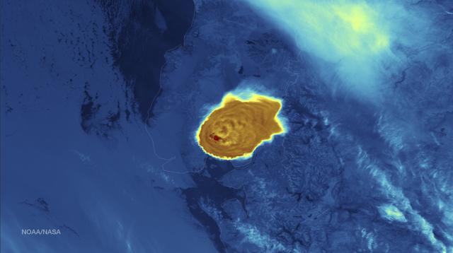
Calbuco Volcano in southern Chile has erupted for the first time since 1972, with the last major eruption occurring in 1961 that sent ash columns 12-15 kilometers high. This image was taken by the Suomi NPP satellite's VIIRS instrument in a high resolution infrared channel around 0515Z on April 23, 2015. Credit: NOAA/NASA/NPP/VIIRS
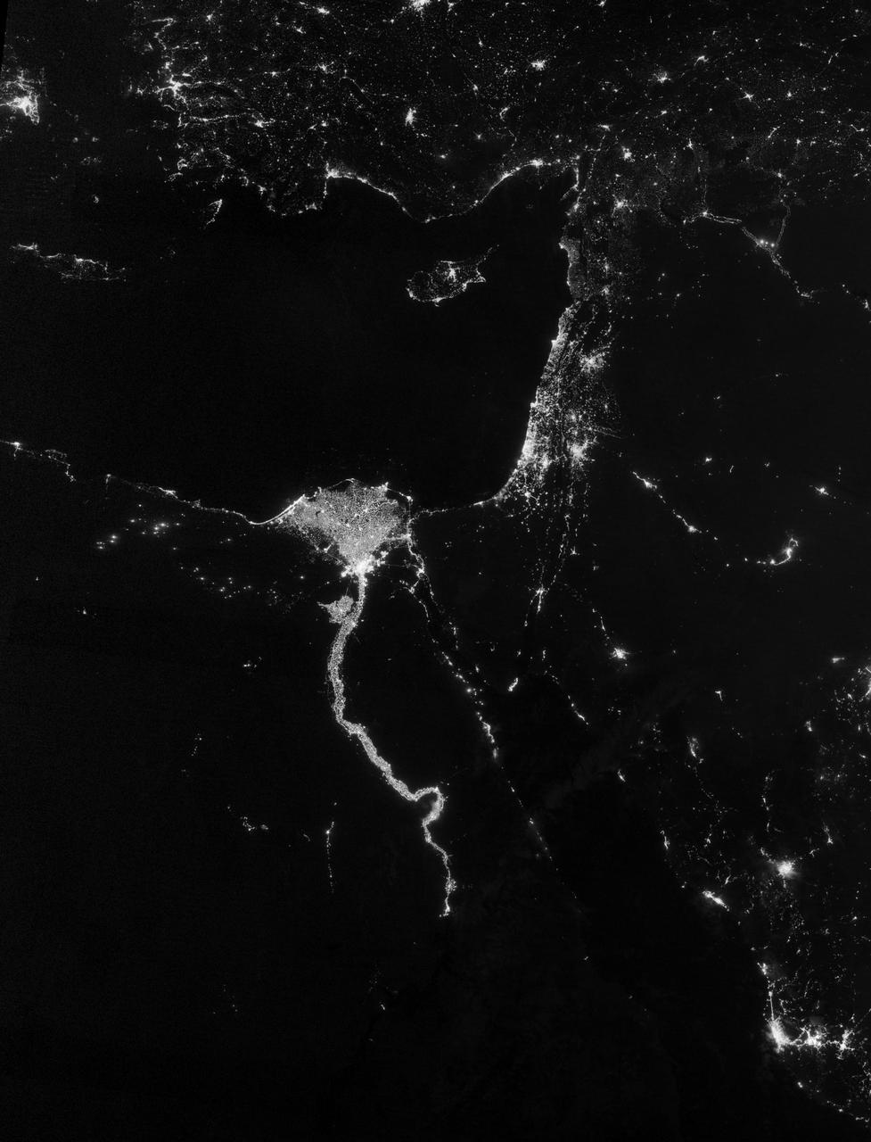
NASA image acquired October 13, 2012 The Nile River Valley and Delta comprise less than 5 percent of Egypt’s land area, but provide a home to roughly 97 percent of the country’s population. Nothing makes the location of human population clearer than the lights illuminating the valley and delta at night. On October 13, 2012, the Visible Infrared Imaging Radiometer Suite (VIIRS) on the Suomi NPP satellite captured this nighttime view of the Nile River Valley and Delta. This image is from the VIIRS “day-night band,” which detects light in a range of wavelengths from green to near-infrared and uses filtering techniques to observe signals such as gas flares, auroras, wildfires, city lights, and reflected moonlight. The city lights resemble a giant calla lily, just one with a kink in its stem near the city of Luxor. Some of the brightest lights occur around Cairo, but lights are abundant along the length of the river. Bright city lights also occur along the Suez Canal and around Tel Aviv. Away from the lights, however, land and water appear uniformly black. This image was acquired near the time of the new Moon, and little moonlight was available to brighten land and water surfaces. NASA Earth Observatory image by Jesse Allen and Robert Simmon, using VIIRS Day-Night Band data from the Suomi National Polar-orbiting Partnership. Suomi NPP is the result of a partnership between NASA, the National Oceanic and Atmospheric Administration, and the Department of Defense. Caption by Michon Scott. Instrument: Suomi NPP - VIIRS Credit: <b><a href="http://www.earthobservatory.nasa.gov/" rel="nofollow"> NASA Earth Observatory</a></b> <b>Click here to view all of the <a href="http://earthobservatory.nasa.gov/Features/NightLights/" rel="nofollow"> Earth at Night 2012 images </a></b> <b>Click here to <a href="http://earthobservatory.nasa.gov/NaturalHazards/view.php?id=79807" rel="nofollow"> read more </a> about this image </b> <b><a href="http://www.nasa.gov/audience/formedia/features/MP_Photo_Guidelines.html" rel="nofollow">NASA image use policy.</a></b> <b><a href="http://www.nasa.gov/centers/goddard/home/index.html" rel="nofollow">NASA Goddard Space Flight Center</a></b> enables NASA’s mission through four scientific endeavors: Earth Science, Heliophysics, Solar System Exploration, and Astrophysics. Goddard plays a leading role in NASA’s accomplishments by contributing compelling scientific knowledge to advance the Agency’s mission. <b>Follow us on <a href="http://twitter.com/NASA_GoddardPix" rel="nofollow">Twitter</a></b> <b>Like us on <a href="http://www.facebook.com/pages/Greenbelt-MD/NASA-Goddard/395013845897?ref=tsd" rel="nofollow">Facebook</a></b> <b>Find us on <a href="http://instagram.com/nasagoddard?vm=grid" rel="nofollow">Instagram</a></b>
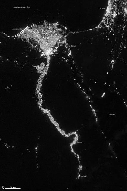
NASA image acquired October 13, 2012 The Nile River Valley and Delta comprise less than 5 percent of Egypt’s land area, but provide a home to roughly 97 percent of the country’s population. Nothing makes the location of human population clearer than the lights illuminating the valley and delta at night. On October 13, 2012, the Visible Infrared Imaging Radiometer Suite (VIIRS) on the Suomi NPP satellite captured this nighttime view of the Nile River Valley and Delta. This image is from the VIIRS “day-night band,” which detects light in a range of wavelengths from green to near-infrared and uses filtering techniques to observe signals such as gas flares, auroras, wildfires, city lights, and reflected moonlight. The city lights resemble a giant calla lily, just one with a kink in its stem near the city of Luxor. Some of the brightest lights occur around Cairo, but lights are abundant along the length of the river. Bright city lights also occur along the Suez Canal and around Tel Aviv. Away from the lights, however, land and water appear uniformly black. This image was acquired near the time of the new Moon, and little moonlight was available to brighten land and water surfaces. NASA Earth Observatory image by Jesse Allen and Robert Simmon, using VIIRS Day-Night Band data from the Suomi National Polar-orbiting Partnership. Suomi NPP is the result of a partnership between NASA, the National Oceanic and Atmospheric Administration, and the Department of Defense. Caption by Michon Scott. Instrument: Suomi NPP - VIIRS Credit: <b><a href="http://www.earthobservatory.nasa.gov/" rel="nofollow"> NASA Earth Observatory</a></b> <b>Click here to view all of the <a href="http://earthobservatory.nasa.gov/Features/NightLights/" rel="nofollow"> Earth at Night 2012 images </a></b> <b>Click here to <a href="http://earthobservatory.nasa.gov/NaturalHazards/view.php?id=79807" rel="nofollow"> read more </a> about this image </b> <b><a href="http://www.nasa.gov/audience/formedia/features/MP_Photo_Guidelines.html" rel="nofollow">NASA image use policy.</a></b> <b><a href="http://www.nasa.gov/centers/goddard/home/index.html" rel="nofollow">NASA Goddard Space Flight Center</a></b> enables NASA’s mission through four scientific endeavors: Earth Science, Heliophysics, Solar System Exploration, and Astrophysics. Goddard plays a leading role in NASA’s accomplishments by contributing compelling scientific knowledge to advance the Agency’s mission. <b>Follow us on <a href="http://twitter.com/NASA_GoddardPix" rel="nofollow">Twitter</a></b> <b>Like us on <a href="http://www.facebook.com/pages/Greenbelt-MD/NASA-Goddard/395013845897?ref=tsd" rel="nofollow">Facebook</a></b> <b>Find us on <a href="http://instagram.com/nasagoddard?vm=grid" rel="nofollow">Instagram</a></b>
NASA acquired July 15, 2012 On July 15, 2012, the Visible Infrared Imaging Radiometer Suite (VIIRS) on the Suomi NPP satellite captured this nighttime view of the aurora australis, or “southern lights,” over Antartica’s Queen Maud Land and the Princess Ragnhild Coast. The image was captured by the VIIRS “day-night band,” which detects light in a range of wavelengths from green to near-infrared and uses filtering techniques to observe signals such as city lights, auroras, wildfires, and reflected moonlight. In the case of the image above, the sensor detected the visible auroral light emissions as energetic particles rained down from Earth’s magnetosphere and into the gases of the upper atmosphere. The slightly jagged appearance of the auroral lines is a function of the rapid dance of the energetic particles at the same time that the satellite is moving and the VIIRS sensor is scanning. The yellow box in the top image depicts the area shown in the lower close-up image. Light from the aurora was bright enough to illuminate the ice edge between the ice shelf and the Southern Ocean. At the time, Antarctica was locked in midwinter darkness and the Moon was a waning crescent that provided little light. NASA Earth Observatory image by Jesse Allen and Robert Simmon, using VIIRS Day-Night Band data from the Suomi National Polar-orbiting Partnership. Suomi NPP is the result of a partnership between NASA, the National Oceanic and Atmospheric Administration, and the Department of Defense. Caption by Mike Carlowicz. Instrument: Suomi NPP - VIIRS Credit: <b><a href="http://www.earthobservatory.nasa.gov/" rel="nofollow"> NASA Earth Observatory</a></b> <b>Click here to view all of the <a href="http://earthobservatory.nasa.gov/Features/NightLights/" rel="nofollow"> Earth at Night 2012 images </a></b> <b>Click here to <a href="http://earthobservatory.nasa.gov/NaturalHazards/view.php?id=79750" rel="nofollow"> read more </a> about this image </b> <b><a href="http://www.nasa.gov/audience/formedia/features/MP_Photo_Guidelines.html" rel="nofollow">NASA image use policy.</a></b> <b><a href="http://www.nasa.gov/centers/goddard/home/index.html" rel="nofollow">NASA Goddard Space Flight Center</a></b> enables NASA’s mission through four scientific endeavors: Earth Science, Heliophysics, Solar System Exploration, and Astrophysics. Goddard plays a leading role in NASA’s accomplishments by contributing compelling scientific knowledge to advance the Agency’s mission. <b>Follow us on <a href="http://twitter.com/NASA_GoddardPix" rel="nofollow">Twitter</a></b> <b>Like us on <a href="http://www.facebook.com/pages/Greenbelt-MD/NASA-Goddard/395013845897?ref=tsd" rel="nofollow">Facebook</a></b> <b>Find us on <a href="http://instagram.com/nasagoddard?vm=grid" rel="nofollow">Instagram</a></b>
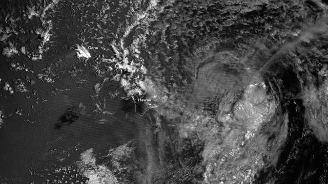
The enhanced capabilities of the Suomi NPP satellite's day-night band are really becoming clear, as was seen this week when Tropical Storm Flossie was heading toward Hawaii. On Monday, July 29th, the lack of organization of the system made it difficult to understand the storm’s central circulation. Infrared data, though able to provide cloud imagery during the night, is best at measuring cloud-top properties. Flossie, however, had a lower-level circulation that was evident in visible imagery earlier in the day. At nighttime that information was lost using traditional satellite technology, such as GOES West. The day-night-band on Suomi NPP provides visible-like information during nighttime hours when only moonlight is available. When Suomi NPP passed over the storm around 1:00am (local), the day-night band imagery allowed forecasters to identify a center of circulation that was more north than previously estimated. Two passes from Suomi NPP (at 11 and 12z, respectively) are shown here. The spiral of the lower level clouds and center of circulation can be seen northwest of Hawaii, whereas the more detailed and higher cloud top areas are due east of the Big Island. Also visible are the nighttime lights of Honolulu on Oahu, along with other cities throughout the island chain. Credit NASA/NOAA An unlabeled version may be downloaded here: <a href="http://1.usa.gov/1bOjhN6" rel="nofollow">1.usa.gov/1bOjhN6</a> <b><a href="http://www.nasa.gov/audience/formedia/features/MP_Photo_Guidelines.html" rel="nofollow">NASA image use policy.</a></b> <b><a href="http://www.nasa.gov/centers/goddard/home/index.html" rel="nofollow">NASA Goddard Space Flight Center</a></b> enables NASA’s mission through four scientific endeavors: Earth Science, Heliophysics, Solar System Exploration, and Astrophysics. Goddard plays a leading role in NASA’s accomplishments by contributing compelling scientific knowledge to advance the Agency’s mission. <b>Follow us on <a href="http://twitter.com/NASA_GoddardPix" rel="nofollow">Twitter</a></b> <b>Like us on <a href="http://www.facebook.com/pages/Greenbelt-MD/NASA-Goddard/395013845897?ref=tsd" rel="nofollow">Facebook</a></b> <b>Find us on <a href="http://instagram.com/nasagoddard?vm=grid" rel="nofollow">Instagram</a></b>
February 2, 2012 <b>Go here to view an image that explains how composite images like these are created: <a href="http://www.flickr.com/photos/gsfc/6803619953">www.flickr.com/photos/gsfc/6803619953</a></b> Responding to public demand, NASA scientists created a companion image to the wildly popular 'Blue Marble' released last week (January 25, 2012). <a href="http://www.flickr.com/photos/gsfc/6760135001">www.flickr.com/photos/gsfc/6760135001</a> The new image is a composite of six separate orbits taken on January 23, 2012 by the Suomi National Polar-orbiting Partnership satellite. Both of these new 'Blue Marble' images are images taken by a new instrument flying aboard Suomi NPP, the Visible Infrared Imaging Radiometer Suite (VIIRS). Compiled by NASA Goddard scientist Norman Kuring, this image has the perspective of a viewer looking down from 7,918 miles (about 12,742 kilometers) above the Earth's surface from a viewpoint of 10 degrees South by 45 degrees East. The four vertical lines of 'haze' visible in this image shows the reflection of sunlight off the ocean, or 'glint,' that VIIRS captured as it orbited the globe. Suomi NPP is the result of a partnership between NASA, NOAA and the Department of Defense. Credit: NASA/NOAA For more information about Suomi NPP go to: <a href="http://www.nasa.gov/npp" rel="nofollow">www.nasa.gov/npp</a> <b><a href="http://www.nasa.gov/audience/formedia/features/MP_Photo_Guidelines.html" rel="nofollow">NASA image use policy.</a></b> <b><a href="http://www.nasa.gov/centers/goddard/home/index.html" rel="nofollow">NASA Goddard Space Flight Center</a></b> enables NASA’s mission through four scientific endeavors: Earth Science, Heliophysics, Solar System Exploration, and Astrophysics. Goddard plays a leading role in NASA’s accomplishments by contributing compelling scientific knowledge to advance the Agency’s mission. <b>Follow us on <a href="http://twitter.com/NASA_GoddardPix" rel="nofollow">Twitter</a></b> <b>Like us on <a href="http://www.facebook.com/pages/Greenbelt-MD/NASA-Goddard/395013845897?ref=tsd" rel="nofollow">Facebook</a></b> <b>Find us on <a href="http://instagrid.me/nasagoddard/?vm=grid" rel="nofollow">Instagram</a></b>
NASA image acquired September 27, 2012 On September 27, 2012, the Visible Infrared Imaging Radiometer Suite (VIIRS) on the Suomi NPP satellite captured this nighttime view of low-lying marine layer clouds along the coast of California. The image was captured by the VIIRS “day-night band,” which detects light in a range of wavelengths from green to near-infrared and uses filtering techniques to observe signals such as gas flares, auroras, wildfires, city lights, and reflected moonlight. An irregularly-shaped patch of high clouds hovers off the coast of California, and moonlight caused the high clouds to cast distinct shadows on the marine layer clouds below. VIIRS acquired the image when the Moon was in its waxing gibbous phase, meaning it was more than half-lit, but less than full. Low clouds pose serious hazards for air and ship traffic, but satellites have had difficulty detecting them in the past. To illustrate this, the second image shows the same scene in thermal infrared, the band that meteorologists generally use to monitor clouds at night. Only high clouds are visible; the low clouds do not show up at all because they are roughly the same temperature as the ground. NASA Earth Observatory image by Jesse Allen and Robert Simmon, using VIIRS Day-Night Band data from the Suomi National Polar-orbiting Partnership. Suomi NPP is the result of a partnership between NASA, the National Oceanic and Atmospheric Administration, and the Department of Defense. Caption by Adam Voiland. Instrument: Suomi NPP - VIIRS Credit: <b><a href="http://www.earthobservatory.nasa.gov/" rel="nofollow"> NASA Earth Observatory</a></b> <b>Click here to view all of the <a href="http://earthobservatory.nasa.gov/Features/NightLights/" rel="nofollow"> Earth at Night 2012 images </a></b> <b>Click here to <a href="http://earthobservatory.nasa.gov/NaturalHazards/view.php?id=79758" rel="nofollow"> read more </a> about this image </b> <b><a href="http://www.nasa.gov/audience/formedia/features/MP_Photo_Guidelines.html" rel="nofollow">NASA image use policy.</a></b> <b><a href="http://www.nasa.gov/centers/goddard/home/index.html" rel="nofollow">NASA Goddard Space Flight Center</a></b> enables NASA’s mission through four scientific endeavors: Earth Science, Heliophysics, Solar System Exploration, and Astrophysics. Goddard plays a leading role in NASA’s accomplishments by contributing compelling scientific knowledge to advance the Agency’s mission. <b>Follow us on <a href="http://twitter.com/NASA_GoddardPix" rel="nofollow">Twitter</a></b> <b>Like us on <a href="http://www.facebook.com/pages/Greenbelt-MD/NASA-Goddard/395013845897?ref=tsd" rel="nofollow">Facebook</a></b> <b>Find us on <a href="http://instagram.com/nasagoddard?vm=grid" rel="nofollow">Instagram</a></b>
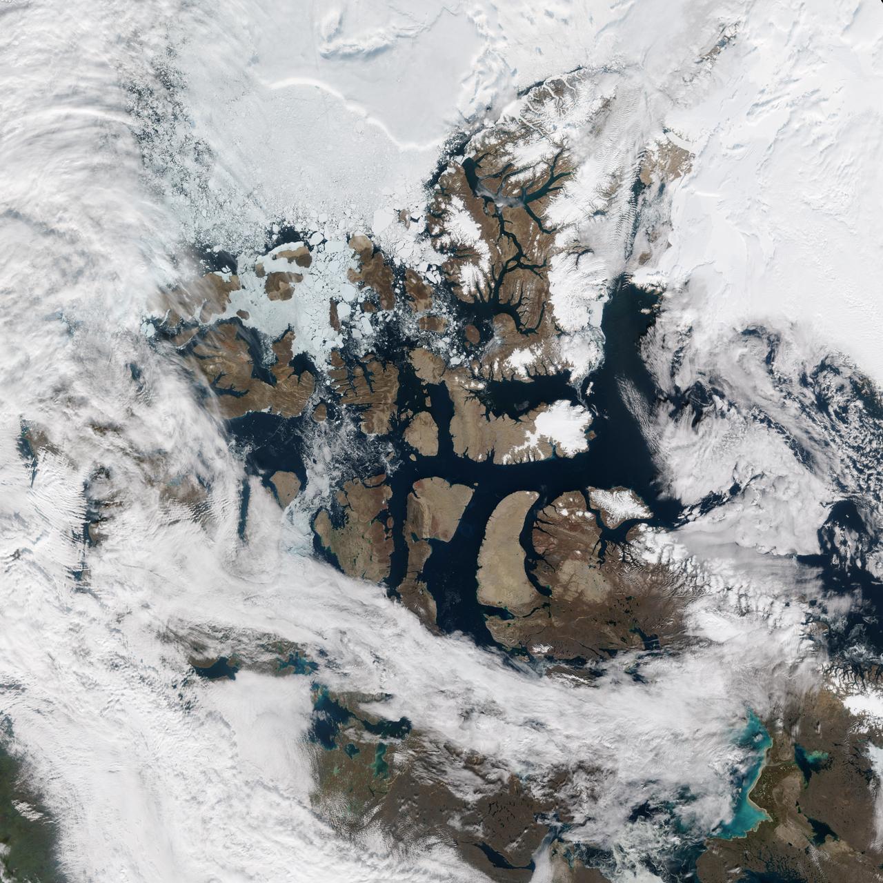
There was a time when the Northwest Passage was a sort of maritime Holy Grail, a route so desired and sought after, but so elusive. For most of the recorded history of North America, the Passage has been nearly impassable and often deadly. But with the modernization of ships and the warming of the Earth, cruising and sailing through the Canadian Archipelago from Baffin Bay to the Beaufort Sea has grown more common and easier. But it’s not necessarily easy. The top image above shows the Northwest Passage as it appeared on August 31, 2015, to the Visible Infrared Imaging Radiometer Suite (VIIRS) on the Suomi-NPP satellite. Read more: <a href="http://earthobservatory.nasa.gov/IOTD/view.php?id=86589" rel="nofollow">earthobservatory.nasa.gov/IOTD/view.php?id=86589</a> NASA Earth Observatory images by Jesse Allen, using VIIRS data from the Suomi National Polar-orbiting Partnership. Suomi NPP is the result of a partnership between NASA, the National Oceanic and Atmospheric Administration, and the Department of Defense. <b><a href="http://www.nasa.gov/audience/formedia/features/MP_Photo_Guidelines.html" rel="nofollow">NASA image use policy.</a></b> <b><a href="http://www.nasa.gov/centers/goddard/home/index.html" rel="nofollow">NASA Goddard Space Flight Center</a></b> enables NASA’s mission through four scientific endeavors: Earth Science, Heliophysics, Solar System Exploration, and Astrophysics. Goddard plays a leading role in NASA’s accomplishments by contributing compelling scientific knowledge to advance the Agency’s mission. <b>Follow us on <a href="http://twitter.com/NASAGoddardPix" rel="nofollow">Twitter</a></b> <b>Like us on <a href="http://www.facebook.com/pages/Greenbelt-MD/NASA-Goddard/395013845897?ref=tsd" rel="nofollow">Facebook</a></b> <b>Find us on <a href="http://instagrid.me/nasagoddard/?vm=grid" rel="nofollow">Instagram</a></b>

The Low-Earth Orbit Flight Test of an Inflatable Decelerator (LOFTID) is lowered onto a work stand inside Building 836 at Vandenberg Space Force Base (VSFB) in California on Aug. 25, 2022. LOFTID is the secondary payload on NASA and the National Oceanic and Atmospheric Administration’s (NOAA) Joint Polar Satellite System-2 (JPSS-2) satellite mission. JPSS-2 is the third satellite in the Joint Polar Satellite System series. It is scheduled to lift off from VSFB on Nov. 1 from Space Launch Complex-3. JPSS-2, which will be renamed NOAA-21 after reaching orbit, will join a constellation of JPSS satellites that orbit from the North to the South pole, circling Earth 14 times a day and providing a full view of the entire globe twice daily. The NOAA/NASA Suomi National Polar-orbiting Partnership (Suomi NPP) satellite, and NOAA-20, previously known as JPSS-1, are both already in orbit. Each satellite carries at least four advanced instruments to measure weather and climate conditions on Earth. LOFTID is dedicated to the memory of Bernard Kutter. LOFTID will demonstrate inflatable heat shield technology that could enable a variety of proposed NASA missions to destinations such as Mars, Venus, and Titan, as well as returning heavier payloads from low-Earth orbit.
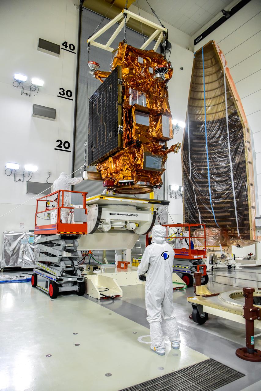
A crane is used to transfer NASA and the National Oceanic and Atmospheric Administration’s (NOAA) Joint Polar Satellite System-2 (JPSS-2) satellite to an Aronson Table for processing inside the Astrotech Space Operations facility at Vandenberg Space Force Base in California on Aug. 22, 2022. JPSS-2 is the third satellite in the Joint Polar Satellite System series. It is scheduled to lift off from VSFB on Nov. 1 from Space Launch Complex-3. JPSS-2, which will be renamed NOAA-21 after reaching orbit, will join a constellation of JPSS satellites that orbit from the North to the South pole, circling Earth 14 times a day and providing a full view of the entire globe twice daily. The NOAA/NASA Suomi National Polar-orbiting Partnership (Suomi NPP) satellite, and NOAA-20, previously known as JPSS-1, are both already in orbit. Each satellite carries at least four advanced instruments to measure weather and climate conditions on Earth. A secondary payload on the mission is the Low-Earth Orbit Flight Test of an Inflatable Decelerator (LOFTID), and is dedicated to the memory of Bernard Kutter. LOFTID will demonstrate inflatable heat shield technology that could enable a variety of proposed NASA missions to destinations such as Mars, Venus, and Titan, as well as returning heavier payloads from low-Earth orbit.
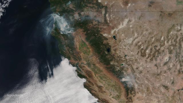
Very hot, dry and unstable conditions in California and across the Pacific Northwest add to the challenges facing firefighters as they battle blazes around the region. Cal Fire is urging Californians to be extremely cautious, especially for the next few days, as the current conditions increase the dangers authorities face. This image was taken by NASA-NOAA's Suomi NPP satellite's VIIRS instrument around 2145 UTC (5:45 p.m. EDT) on August 17, 2015. Northern California is seeing smoke from the River Complex, Route Complex, South Complex, Fork Complex and Mad River Complex fires combine over a large area of the Shasta-Trinity National Forest west of Redding, California, while the Rough Fire in Fresno County is spreading toward the Black Rock Reservoir, causing evacuations and road closures. Fires across the Pacific Northwest aren't limited to California. Please see the Suomi NPP VIIRS composites in NOAA View to see the growth and extent of fires over the past weeks. Credit: NASA/NOAA via <b><a href="www.nnvl.noaa.gov/" rel="nofollow"> NOAA Environmental Visualization Laboratory</a></b>
A close-up view of the United Launch Alliance Atlas V payload fairing containing the National Oceanic and Atmospheric Administration’s (NOAA) Joint Polar Satellite System-2 (JPSS-2) and NASA’s Low-Earth Orbit Flight Test of an Inflatable Decelerator (LOFTID) inside the mobile service tower at Space Launch Complex-3 (SLC-3) at Vandenberg Space Force Base in California on Oct. 28, 2022. NASA and ULA are targeting launch for no earlier than Wednesday, Nov. 9, pending range availability. JPSS-2, which will be renamed NOAA-21 after reaching orbit, will join a constellation of JPSS satellites that orbit from the North to the South pole, circling Earth 14 times a day. The NOAA/NASA Suomi National Polar-orbiting Partnership (Suomi NPP) satellite, and NOAA-20, previously known as JPSS-1, are both already in orbit. Each satellite carries at least four advanced instruments to measure weather and climate conditions on Earth. LOFTID will demonstrate inflatable heat shield technology that could enable a variety of proposed NASA missions to destinations such as Mars, Venus, and Titan, as well as returning heavier payloads from low-Earth orbit.
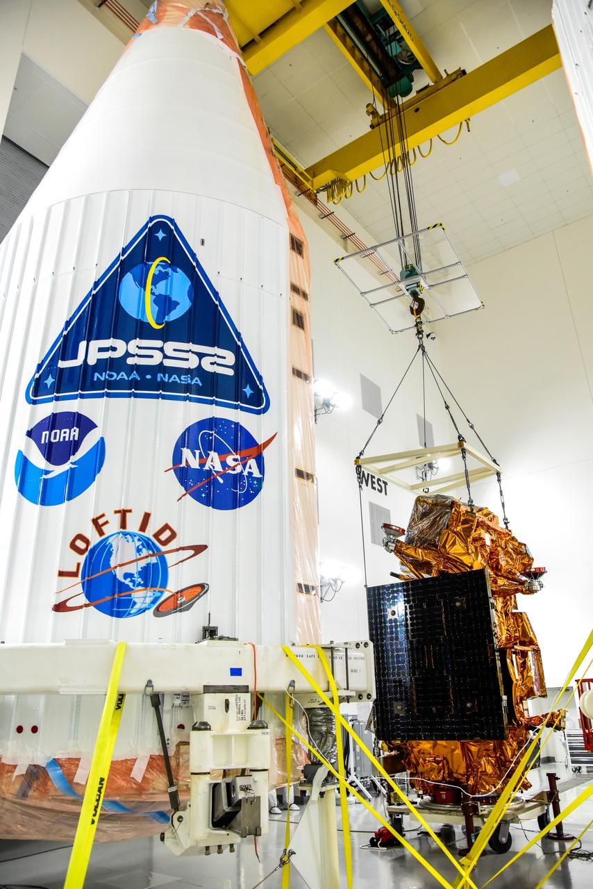
A crane is used to lift NASA and the National Oceanic and Atmospheric Administration’s (NOAA) Joint Polar Satellite System-2 (JPSS-2) satellite for transfer to an Aronson Table for processing inside the Astrotech Space Operations facility at Vandenberg Space Force Base in California on Aug. 22, 2022. JPSS-2 is the third satellite in the Joint Polar Satellite System series. It is scheduled to lift off from VSFB on Nov. 1 from Space Launch Complex-3. JPSS-2, which will be renamed NOAA-21 after reaching orbit, will join a constellation of JPSS satellites that orbit from the North to the South pole, circling Earth 14 times a day and providing a full view of the entire globe twice daily. The NOAA/NASA Suomi National Polar-orbiting Partnership (Suomi NPP) satellite, and NOAA-20, previously known as JPSS-1, are both already in orbit. Each satellite carries at least four advanced instruments to measure weather and climate conditions on Earth. A secondary payload on the mission is the Low-Earth Orbit Flight Test of an Inflatable Decelerator (LOFTID), and is dedicated to the memory of Bernard Kutter. LOFTID will demonstrate inflatable heat shield technology that could enable a variety of proposed NASA missions to destinations such as Mars, Venus, and Titan, as well as returning heavier payloads from low-Earth orbit.
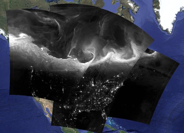
This is a composite image of Suomi NPP VIIRS Day/Night Band images show the bright and complex signature of the aurora borealis across southern Canada and the northern United States during the nighttime hours of September 8, 2015. Credit: NASA/Goddard/Suomi NPP/VIIRS/SSEC-RealEarth <b><a href="http://www.nasa.gov/audience/formedia/features/MP_Photo_Guidelines.html" rel="nofollow">NASA image use policy.</a></b> <b><a href="http://www.nasa.gov/centers/goddard/home/index.html" rel="nofollow">NASA Goddard Space Flight Center</a></b> enables NASA’s mission through four scientific endeavors: Earth Science, Heliophysics, Solar System Exploration, and Astrophysics. Goddard plays a leading role in NASA’s accomplishments by contributing compelling scientific knowledge to advance the Agency’s mission. <b>Follow us on <a href="http://twitter.com/NASAGoddardPix" rel="nofollow">Twitter</a></b> <b>Like us on <a href="http://www.facebook.com/pages/Greenbelt-MD/NASA-Goddard/395013845897?ref=tsd" rel="nofollow">Facebook</a></b> <b>Find us on <a href="http://instagrid.me/nasagoddard/?vm=grid" rel="nofollow">Instagram</a></b>

The United Launch Alliance Atlas V interstage adapter and aft stub adapter are hoisted up at the vertical integration facility at Space Launch Complex-3 at Vandenberg Space Force Base in California on Sept. 29, 2022. The adapter will be moved into the integration facility and secured atop the ULA Atlas V in preparation for the launch of the National Oceanic and Atmospheric Administration’s (NOAA) Joint Polar Satellite System-2 (JPSS-2). JPSS-2 and NASA’s Low-Earth Orbit Flight Test of an Inflatable Decelerator (LOFTID) secondary payload are scheduled to lift off from VSFB on Nov. 1 from SLC-3. JPSS-2, which will be renamed NOAA-21 after reaching orbit, will join a constellation of JPSS satellites that orbit from the North to the South pole, circling Earth 14 times a day and providing a full view of the entire globe twice daily. The NOAA/NASA Suomi National Polar-orbiting Partnership (Suomi NPP) satellite, and NOAA-20, previously known as JPSS-1, are both already in orbit. Each satellite carries at least four advanced instruments to measure weather and climate conditions on Earth. LOFTID is dedicated to the memory of Bernard Kutter. LOFTID will demonstrate inflatable heat shield technology that could enable a variety of proposed NASA missions to destinations such as Mars, Venus, and Titan, as well as returning heavier payloads from low-Earth orbit.
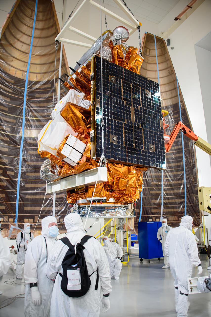
Technicians prepare the National Oceanic and Atmospheric Administration’s (NOAA) Joint Polar Satellite System-2 (JPSS-2) for stacking atop the Low-Earth Orbit Flight Test of an Inflatable Decelerator (LOFTID) payload inside the Astrotech Space Operations facility at Vandenberg Space Force Base (VSFB) in California on Oct. 5, 2022. JPSS-2 is the third satellite in the Joint Polar Satellite System series. It is scheduled to lift off from VSFB on Nov. 1 from Space Launch Complex-3. JPSS-2, which will be renamed NOAA-21 after reaching orbit, will join a constellation of JPSS satellites that orbit from the North to the South pole, circling Earth 14 times a day and providing a full view of the entire globe twice daily. The NOAA/NASA Suomi National Polar-orbiting Partnership (Suomi NPP) satellite, and NOAA-20, previously known as JPSS-1, are both already in orbit. Each satellite carries at least four advanced instruments to measure weather and climate conditions on Earth. LOFTID is a secondary payload on the mission. It is dedicated to the memory of Bernard Kutter. LOFTID will demonstrate inflatable heat shield technology that could enable a variety of proposed NASA missions to destinations such as Mars, Venus, and Titan, as well as returning heavier payloads from low-Earth orbit.
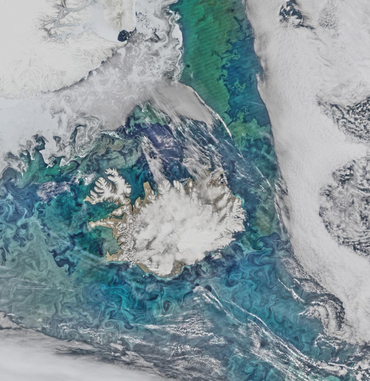
Phytoplankton communities and sea ice limn the turbulent flow field around Iceland in this Suomi-NPP/VIIRS scene collected on June 14, 2015. Credit: NASA/Goddard/Suomi NPP/VIIRS <b><a href="http://www.nasa.gov/audience/formedia/features/MP_Photo_Guidelines.html" rel="nofollow">NASA image use policy.</a></b> <b><a href="http://www.nasa.gov/centers/goddard/home/index.html" rel="nofollow">NASA Goddard Space Flight Center</a></b> enables NASA’s mission through four scientific endeavors: Earth Science, Heliophysics, Solar System Exploration, and Astrophysics. Goddard plays a leading role in NASA’s accomplishments by contributing compelling scientific knowledge to advance the Agency’s mission. <b>Follow us on <a href="http://twitter.com/NASAGoddardPix" rel="nofollow">Twitter</a></b> <b>Like us on <a href="http://www.facebook.com/pages/Greenbelt-MD/NASA-Goddard/395013845897?ref=tsd" rel="nofollow">Facebook</a></b> <b>Find us on <a href="http://instagrid.me/nasagoddard/?vm=grid" rel="nofollow">Instagram</a></b>
The Low-Earth Orbit Flight Test of an Inflatable Decelerator (LOFTID) is lifted for its move to a work stand inside Building 836 at Vandenberg Space Force Base (VSFB) in California on Aug. 25, 2022. LOFTID is the secondary payload on NASA and the National Oceanic and Atmospheric Administration’s (NOAA) Joint Polar Satellite System-2 (JPSS-2) satellite mission. JPSS-2 is the third satellite in the Joint Polar Satellite System series. It is scheduled to lift off from VSFB on Nov. 1 from Space Launch Complex-3. JPSS-2, which will be renamed NOAA-21 after reaching orbit, will join a constellation of JPSS satellites that orbit from the North to the South pole, circling Earth 14 times a day and providing a full view of the entire globe twice daily. The NOAA/NASA Suomi National Polar-orbiting Partnership (Suomi NPP) satellite, and NOAA-20, previously known as JPSS-1, are both already in orbit. Each satellite carries at least four advanced instruments to measure weather and climate conditions on Earth. LOFTID is dedicated to the memory of Bernard Kutter. LOFTID will demonstrate inflatable heat shield technology that could enable a variety of proposed NASA missions to destinations such as Mars, Venus, and Titan, as well as returning heavier payloads from low-Earth orbit.
The United Launch Alliance Atlas V interstage adapter and aft stub adapter are hoisted up at the vertical integration facility at Space Launch Complex-3 at Vandenberg Space Force Base in California on Sept. 29, 2022. The adapter will be moved into the integration facility and secured atop the ULA Atlas V in preparation for the launch of the National Oceanic and Atmospheric Administration’s (NOAA) Joint Polar Satellite System-2 (JPSS-2). JPSS-2 and NASA’s Low-Earth Orbit Flight Test of an Inflatable Decelerator (LOFTID) secondary payload are scheduled to lift off from VSFB on Nov. 1 from SLC-3. JPSS-2, which will be renamed NOAA-21 after reaching orbit, will join a constellation of JPSS satellites that orbit from the North to the South pole, circling Earth 14 times a day and providing a full view of the entire globe twice daily. The NOAA/NASA Suomi National Polar-orbiting Partnership (Suomi NPP) satellite, and NOAA-20, previously known as JPSS-1, are both already in orbit. Each satellite carries at least four advanced instruments to measure weather and climate conditions on Earth. LOFTID is dedicated to the memory of Bernard Kutter. LOFTID will demonstrate inflatable heat shield technology that could enable a variety of proposed NASA missions to destinations such as Mars, Venus, and Titan, as well as returning heavier payloads from low-Earth orbit.
The United Launch Alliance (ULA) Atlas V payload fairing transits from Building 7525 to the Astrotech Processing Facility at Vandenberg Space Force Base (VSFB) in California on Aug. 10, 2022, for NASA and the National Oceanic and Atmospheric Administration’s (NOAA) Joint Polar Satellite System-2 (JPSS-2) satellite mission. JPSS-2 is the third satellite in the Joint Polar Satellite System series. It is scheduled to lift off from VSFB on Nov. 1 from Space Launch Complex-3. JPSS-2, which will be renamed NOAA-21 after reaching orbit, will join a constellation of JPSS satellites that orbit from the North to the South pole, circling Earth 14 times a day and providing a full view of the entire globe twice daily. The NOAA/NASA Suomi National Polar-orbiting Partnership (Suomi NPP) satellite, and NOAA-20, previously known as JPSS-1, are both already in orbit. Each satellite carries at least four advanced instruments to measure weather and climate conditions on Earth. Launching as a secondary payload to JPSS-2 is NASA’s Low-Earth Orbit Flight Test of an Inflatable Decelerator (LOFTID), dedicated to the memory of Bernard Kutter. LOFTID will demonstrate inflatable heat shield technology that could enable a variety of proposed NASA missions to destinations such as Mars, Venus, and Titan, as well as returning heavier payloads from low-Earth orbit.
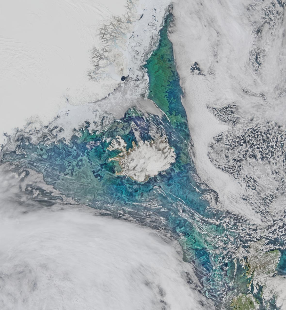
Phytoplankton communities and sea ice limn the turbulent flow field around Iceland in this Suomi-NPP/VIIRS scene collected on June 14, 2015. Credit: NASA/Goddard/Suomi NPP/VIIRS <b><a href="http://www.nasa.gov/audience/formedia/features/MP_Photo_Guidelines.html" rel="nofollow">NASA image use policy.</a></b> <b><a href="http://www.nasa.gov/centers/goddard/home/index.html" rel="nofollow">NASA Goddard Space Flight Center</a></b> enables NASA’s mission through four scientific endeavors: Earth Science, Heliophysics, Solar System Exploration, and Astrophysics. Goddard plays a leading role in NASA’s accomplishments by contributing compelling scientific knowledge to advance the Agency’s mission. <b>Follow us on <a href="http://twitter.com/NASAGoddardPix" rel="nofollow">Twitter</a></b> <b>Like us on <a href="http://www.facebook.com/pages/Greenbelt-MD/NASA-Goddard/395013845897?ref=tsd" rel="nofollow">Facebook</a></b> <b>Find us on <a href="http://instagrid.me/nasagoddard/?vm=grid" rel="nofollow">Instagram</a></b>

Technicians move the National Oceanic and Atmospheric Administration’s (NOAA) Joint Polar Satellite System-2 (JPSS-2), stacked atop NASA’s Low-Earth Orbit Flight Test of an Inflatable Decelerator (LOFTID) secondary payload into the first half of the United Launch Alliance Atlas V payload fairing inside the Astrotech Space Operations facility at Vandenberg Space Force Base (VSFB) in California on Oct. 12, 2022. JPSS-2 is the third satellite in the Joint Polar Satellite System series. It is scheduled to lift off from VSFB on Nov. 1 from Space Launch Complex-3. JPSS-2, which will be renamed NOAA-21 after reaching orbit, will join a constellation of JPSS satellites that orbit from the North to the South pole, circling Earth 14 times a day and providing a full view of the entire globe twice daily. The NOAA/NASA Suomi National Polar-orbiting Partnership (Suomi NPP) satellite, and NOAA-20, previously known as JPSS-1, are both already in orbit. Each satellite carries at least four advanced instruments to measure weather and climate conditions on Earth. LOFTID is dedicated to the memory of Bernard Kutter. LOFTID will demonstrate inflatable heat shield technology that could enable a variety of proposed NASA missions to destinations such as Mars, Venus, and Titan, as well as returning heavier payloads from low-Earth orbit.

The United Launch Alliance (ULA) Atlas V payload fairing is transported from Building 7525 to the Astrotech Processing Facility at Vandenberg Space Force Base (VSFB) in California on Aug. 10, 2022, for NASA and the National Oceanic and Atmospheric Administration’s (NOAA) Joint Polar Satellite System-2 (JPSS-2) satellite mission. JPSS-2 is the third satellite in the Joint Polar Satellite System series. It is scheduled to lift off from VSFB on Nov. 1 from Space Launch Complex-3. JPSS-2, which will be renamed NOAA-21 after reaching orbit, will join a constellation of JPSS satellites that orbit from the North to the South pole, circling Earth 14 times a day and providing a full view of the entire globe twice daily. The NOAA/NASA Suomi National Polar-orbiting Partnership (Suomi NPP) satellite, and NOAA-20, previously known as JPSS-1, are both already in orbit. Each satellite carries at least four advanced instruments to measure weather and climate conditions on Earth. Launching as a secondary payload to JPSS-2 is NASA’s Low-Earth Orbit Flight Test of an Inflatable Decelerator (LOFTID), dedicated to the memory of Bernard Kutter. LOFTID will demonstrate inflatable heat shield technology that could enable a variety of proposed NASA missions to destinations such as Mars, Venus, and Titan, as well as returning heavier payloads from low-Earth orbit.
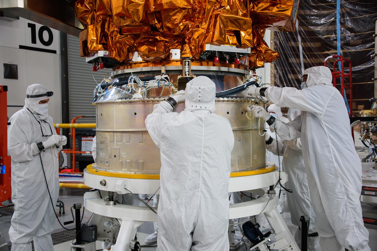
Technicians lower the National Oceanic and Atmospheric Administration’s (NOAA) Joint Polar Satellite System-2 (JPSS-2) onto a payload adapter ring inside the Astrotech Space Operations facility at Vandenberg Space Force Base (VSFB) in California on Oct. 5, 2022. The team stacked JPSS-2 atop the Low-Earth Orbit Flight Test of an Inflatable Decelerator (LOFTID) payload. JPSS-2 is the third satellite in the Joint Polar Satellite System series. It is scheduled to lift off from VSFB on Nov. 1 from Space Launch Complex-3. JPSS-2, which will be renamed NOAA-21 after reaching orbit, will join a constellation of JPSS satellites that orbit from the North to the South pole, circling Earth 14 times a day and providing a full view of the entire globe twice daily. The NOAA/NASA Suomi National Polar-orbiting Partnership (Suomi NPP) satellite, and NOAA-20, previously known as JPSS-1, are both already in orbit. Each satellite carries at least four advanced instruments to measure weather and climate conditions on Earth. LOFTID is a secondary payload on the mission. It is dedicated to the memory of Bernard Kutter. LOFTID will demonstrate inflatable heat shield technology that could enable a variety of proposed NASA missions to destinations such as Mars, Venus, and Titan, as well as returning heavier payloads from low-Earth orbit.
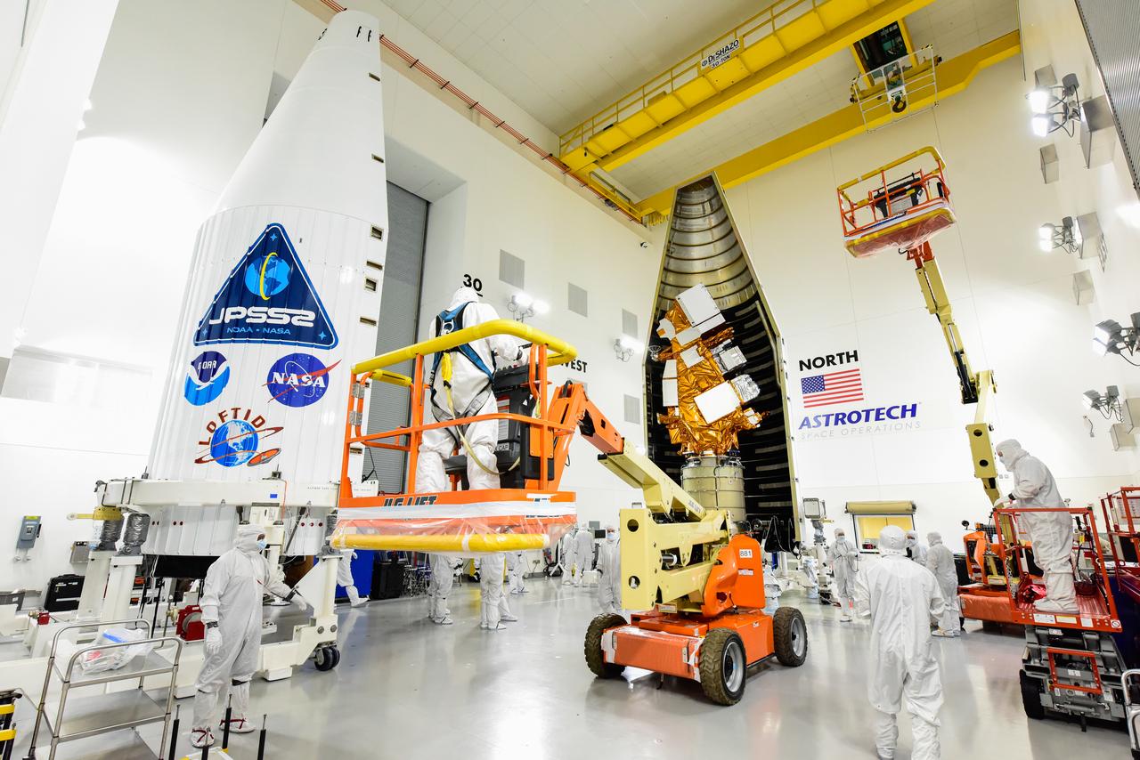
Technicians prepare to move the second half of the United Launch Alliance Atlas V payload fairing around the National Oceanic and Atmospheric Administration’s (NOAA) Joint Polar Satellite System-2 (JPSS-2), stacked atop NASA’s Low-Earth Orbit Flight Test of an Inflatable Decelerator (LOFTID) secondary payload inside the Astrotech Space Operations facility at Vandenberg Space Force Base (VSFB) in California on Oct. 12, 2022. JPSS-2 is the third satellite in the Joint Polar Satellite System series. It is scheduled to lift off from VSFB on Nov. 1 from Space Launch Complex-3. JPSS-2, which will be renamed NOAA-21 after reaching orbit, will join a constellation of JPSS satellites that orbit from the North to the South pole, circling Earth 14 times a day and providing a full view of the entire globe twice daily. The NOAA/NASA Suomi National Polar-orbiting Partnership (Suomi NPP) satellite, and NOAA-20, previously known as JPSS-1, are both already in orbit. Each satellite carries at least four advanced instruments to measure weather and climate conditions on Earth. LOFTID is dedicated to the memory of Bernard Kutter. LOFTID will demonstrate inflatable heat shield technology that could enable a variety of proposed NASA missions to destinations such as Mars, Venus, and Titan, as well as returning heavier payloads from low-Earth orbit.
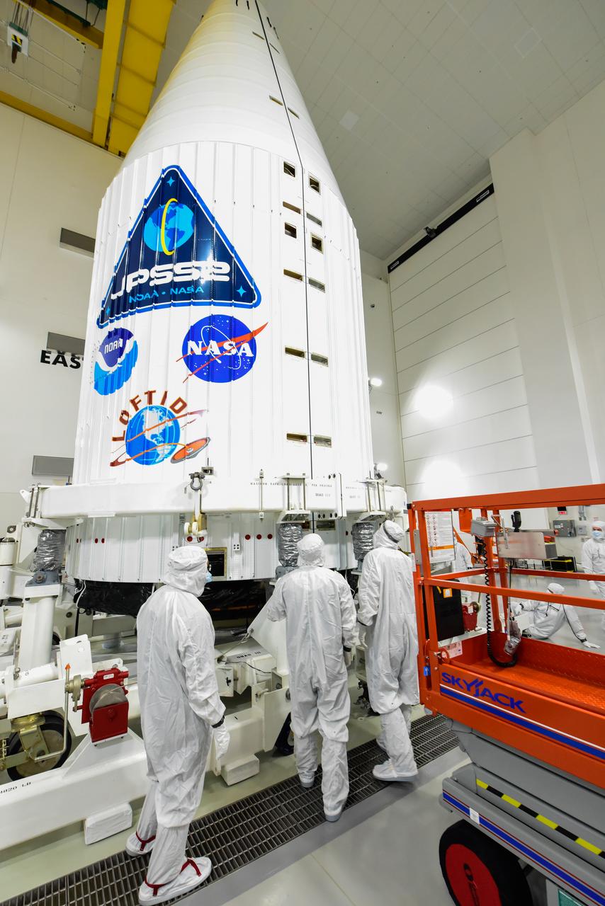
The National Oceanic and Atmospheric Administration’s (NOAA) Joint Polar Satellite System-2 (JPSS-2) is encapsulated in the United Launch Alliance Atlas V payload fairing inside the Astrotech Space Operations facility at Vandenberg Space Force Base (VSFB) in California on Oct. 12, 2022. Inside the fairing, JPSS-2 is stacked atop NASA’s Low-Earth Orbit Flight Test of an Inflatable Decelerator (LOFTID) secondary payload. JPSS-2 is the third satellite in the Joint Polar Satellite System series. It is scheduled to lift off from VSFB on Nov. 1 from Space Launch Complex-3. JPSS-2, which will be renamed NOAA-21 after reaching orbit, will join a constellation of JPSS satellites that orbit from the North to the South pole, circling Earth 14 times a day and providing a full view of the entire globe twice daily. The NOAA/NASA Suomi National Polar-orbiting Partnership (Suomi NPP) satellite, and NOAA-20, previously known as JPSS-1, are both already in orbit. Each satellite carries at least four advanced instruments to measure weather and climate conditions on Earth. LOFTID is dedicated to the memory of Bernard Kutter. LOFTID will demonstrate inflatable heat shield technology that could enable a variety of proposed NASA missions to destinations such as Mars, Venus, and Titan, as well as returning heavier payloads from low-Earth orbit.
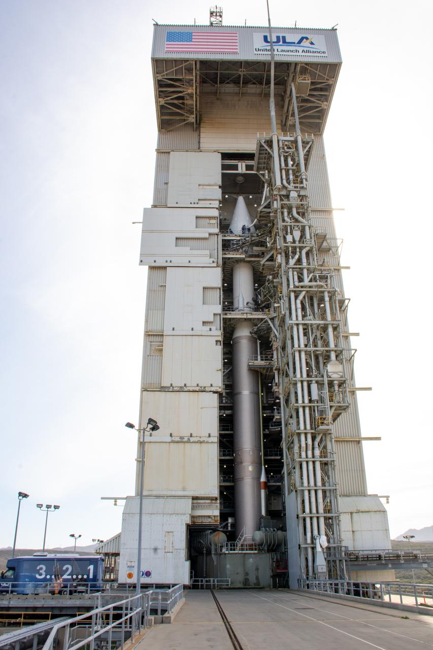
The mobile service tower doors are open at Space Launch Complex-3 (SLC-3) at Vandenberg Space Force Base in California on Oct. 28, 2022, revealing the United Launch Alliance Atlas V rocket with the National Oceanic and Atmospheric Administration’s (NOAA) Joint Polar Satellite System-2 (JPSS-2) and NASA’s Low-Earth Orbit Flight Test of an Inflatable Decelerator (LOFTID) atop. NASA and ULA are targeting launch for no earlier than Wednesday, Nov. 9, pending range availability. JPSS-2, which will be renamed NOAA-21 after reaching orbit, will join a constellation of JPSS satellites that orbit from the North to the South pole, circling Earth 14 times a day. The NOAA/NASA Suomi National Polar-orbiting Partnership (Suomi NPP) satellite, and NOAA-20, previously known as JPSS-1, are both already in orbit. Each satellite carries at least four advanced instruments to measure weather and climate conditions on Earth. LOFTID will demonstrate inflatable heat shield technology that could enable a variety of proposed NASA missions to destinations such as Mars, Venus, and Titan, as well as returning heavier payloads from low-Earth orbit.

The cloud cover over the Southern Ocean occasionally parts as it did on January 1, 2015 just west of the Drake Passage where the VIIRS instrument on the Suomi NPP satellite glimpsed the above collection of ocean-color delineated eddies which have diameters ranging from a couple of kilometers to a couple of hundred kilometers. Recent studies indicate that eddy activity has been increasing in the Southern Ocean with possible implications for climate change. Credit: NASA's OceanColor/Suomi NPP/VIIRS <b><a href="http://www.nasa.gov/audience/formedia/features/MP_Photo_Guidelines.html" rel="nofollow">NASA image use policy.</a></b> <b><a href="http://www.nasa.gov/centers/goddard/home/index.html" rel="nofollow">NASA Goddard Space Flight Center</a></b> enables NASA’s mission through four scientific endeavors: Earth Science, Heliophysics, Solar System Exploration, and Astrophysics. Goddard plays a leading role in NASA’s accomplishments by contributing compelling scientific knowledge to advance the Agency’s mission. <b>Follow us on <a href="http://twitter.com/NASAGoddardPix" rel="nofollow">Twitter</a></b> <b>Like us on <a href="http://www.facebook.com/pages/Greenbelt-MD/NASA-Goddard/395013845897?ref=tsd" rel="nofollow">Facebook</a></b> <b>Find us on <a href="http://instagrid.me/nasagoddard/?vm=grid" rel="nofollow">Instagram</a></b>
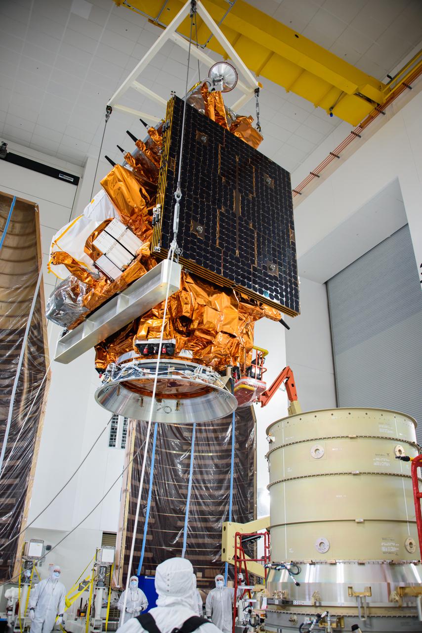
Technicians assist as a crane transfers the National Oceanic and Atmospheric Administration’s (NOAA) Joint Polar Satellite System-2 (JPSS-2) for stacking atop the Low-Earth Orbit Flight Test of an Inflatable Decelerator (LOFTID) payload inside the Astrotech Space Operations facility at Vandenberg Space Force Base (VSFB) in California on Oct. 5, 2022. JPSS-2 is the third satellite in the Joint Polar Satellite System series. It is scheduled to lift off from VSFB on Nov. 1 from Space Launch Complex-3. JPSS-2, which will be renamed NOAA-21 after reaching orbit, will join a constellation of JPSS satellites that orbit from the North to the South pole, circling Earth 14 times a day and providing a full view of the entire globe twice daily. The NOAA/NASA Suomi National Polar-orbiting Partnership (Suomi NPP) satellite, and NOAA-20, previously known as JPSS-1, are both already in orbit. Each satellite carries at least four advanced instruments to measure weather and climate conditions on Earth. LOFTID is a secondary payload on the mission. It is dedicated to the memory of Bernard Kutter. LOFTID will demonstrate inflatable heat shield technology that could enable a variety of proposed NASA missions to destinations such as Mars, Venus, and Titan, as well as returning heavier payloads from low-Earth orbit.
The United Launch Alliance (ULA) Atlas V payload fairing arrives at the Astrotech Processing Facility at Vandenberg Space Force Base (VSFB) in California on Aug. 10, 2022, for NASA and the National Oceanic and Atmospheric Administration’s (NOAA) Joint Polar Satellite System-2 (JPSS-2) satellite mission. JPSS-2 is the third satellite in the Joint Polar Satellite System series. It is scheduled to lift off from VSFB on Nov. 1 from Space Launch Complex-3. JPSS-2, which will be renamed NOAA-21 after reaching orbit, will join a constellation of JPSS satellites that orbit from the North to the South pole, circling Earth 14 times a day and providing a full view of the entire globe twice daily. The NOAA/NASA Suomi National Polar-orbiting Partnership (Suomi NPP) satellite, and NOAA-20, previously known as JPSS-1, are both already in orbit. Each satellite carries at least four advanced instruments to measure weather and climate conditions on Earth. Launching as a secondary payload to JPSS-2 is NASA’s Low-Earth Orbit Flight Test of an Inflatable Decelerator (LOFTID), dedicated to the memory of Bernard Kutter. LOFTID will demonstrate inflatable heat shield technology that could enable a variety of proposed NASA missions to destinations such as Mars, Venus, and Titan, as well as returning heavier payloads from low-Earth orbit.
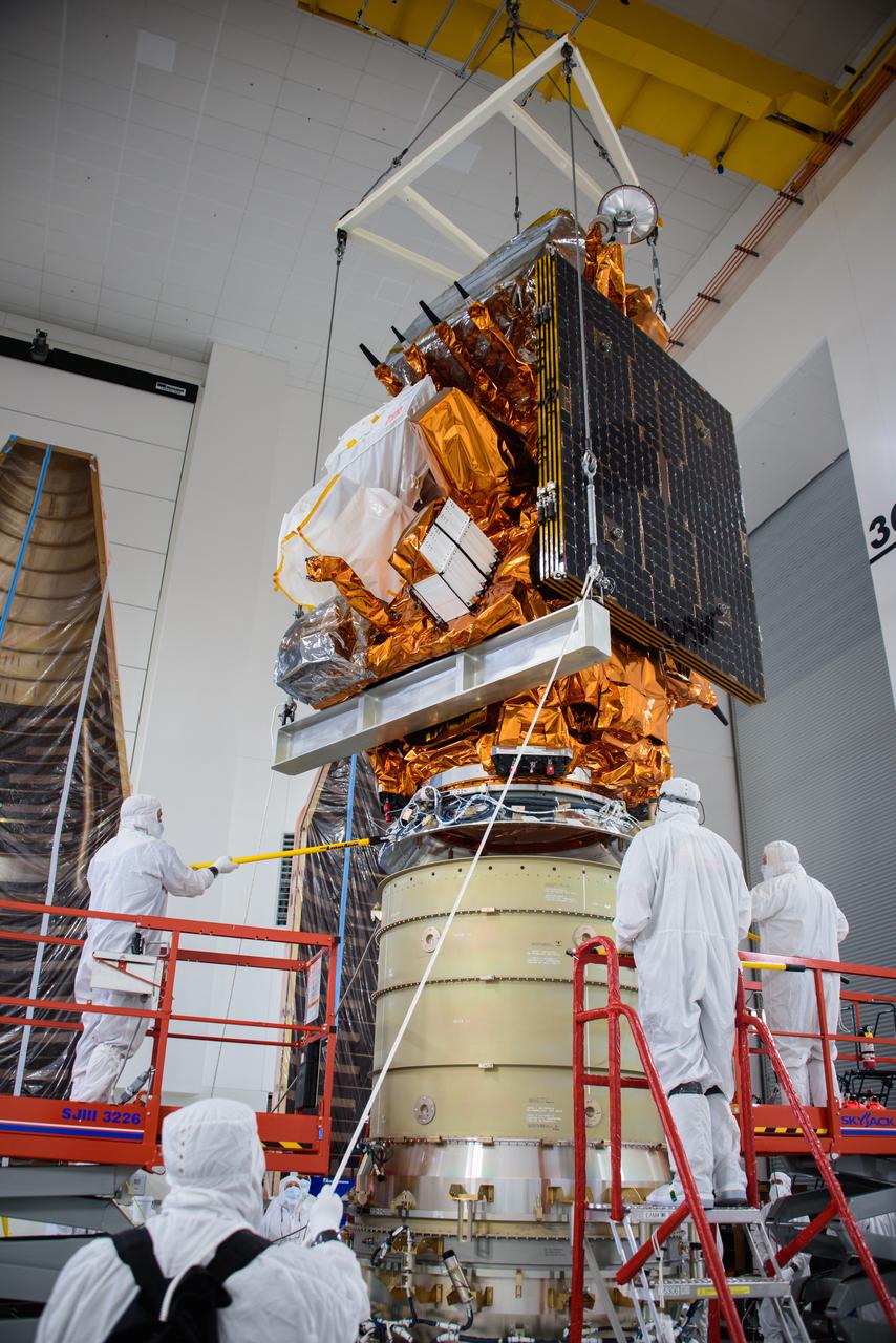
Technicians assist as a crane lowers the National Oceanic and Atmospheric Administration’s (NOAA) Joint Polar Satellite System-2 (JPSS-2) onto the Low-Earth Orbit Flight Test of an Inflatable Decelerator (LOFTID) payload inside the Astrotech Space Operations facility at Vandenberg Space Force Base (VSFB) in California on Oct. 5, 2022. JPSS-2 is the third satellite in the Joint Polar Satellite System series. It is scheduled to lift off from VSFB on Nov. 1 from Space Launch Complex-3. JPSS-2, which will be renamed NOAA-21 after reaching orbit, will join a constellation of JPSS satellites that orbit from the North to the South pole, circling Earth 14 times a day and providing a full view of the entire globe twice daily. The NOAA/NASA Suomi National Polar-orbiting Partnership (Suomi NPP) satellite, and NOAA-20, previously known as JPSS-1, are both already in orbit. Each satellite carries at least four advanced instruments to measure weather and climate conditions on Earth. LOFTID is a secondary payload on the mission. It is dedicated to the memory of Bernard Kutter. LOFTID will demonstrate inflatable heat shield technology that could enable a variety of proposed NASA missions to destinations such as Mars, Venus, and Titan, as well as returning heavier payloads from low-Earth orbit.

Technicians help secure the United Launch Alliance Atlas V interstage adapter and aft stub adapter to the Atlas V rocket inside the vertical integration facility at Space Launch Complex-3 at Vandenberg Space Force Base in California on Sept. 29, 2022. The rocket is being prepared to launch the National Oceanic and Atmospheric Administration’s (NOAA) Joint Polar Satellite System-2 (JPSS-2). JPSS-2 and NASA’s Low-Earth Orbit Flight Test of an Inflatable Decelerator (LOFTID) secondary payload. The launch is scheduled for Nov. 1 from SLC-3. JPSS-2, which will be renamed NOAA-21 after reaching orbit, will join a constellation of JPSS satellites that orbit from the North to the South pole, circling Earth 14 times a day and providing a full view of the entire globe twice daily. The NOAA/NASA Suomi National Polar-orbiting Partnership (Suomi NPP) satellite, and NOAA-20, previously known as JPSS-1, are both already in orbit. Each satellite carries at least four advanced instruments to measure weather and climate conditions on Earth. LOFTID is dedicated to the memory of Bernard Kutter. LOFTID will demonstrate inflatable heat shield technology that could enable a variety of proposed NASA missions to destinations such as Mars, Venus, and Titan, as well as returning heavier payloads from low-Earth orbit.
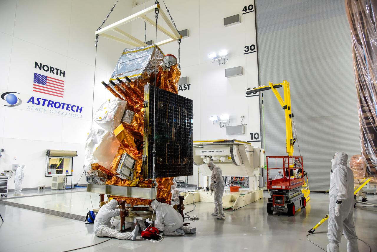
Technicians help secure NASA and the National Oceanic and Atmospheric Administration’s (NOAA) Joint Polar Satellite System-2 (JPSS-2) satellite onto an integration and testing cart inside the Astrotech Space Operations facility at Vandenberg Space Force Base in California on Aug. 22, 2022. JPSS-2 is the third satellite in the Joint Polar Satellite System series. It is scheduled to lift off from VSFB on Nov. 1 from Space Launch Complex-3. JPSS-2, which will be renamed NOAA-21 after reaching orbit, will join a constellation of JPSS satellites that orbit from the North to the South pole, circling Earth 14 times a day and providing a full view of the entire globe twice daily. The NOAA/NASA Suomi National Polar-orbiting Partnership (Suomi NPP) satellite, and NOAA-20, previously known as JPSS-1, are both already in orbit. Each satellite carries at least four advanced instruments to measure weather and climate conditions on Earth. A secondary payload on the mission is the Low-Earth Orbit Flight Test of an Inflatable Decelerator (LOFTID), and is dedicated to the memory of Bernard Kutter. LOFTID will demonstrate inflatable heat shield technology that could enable a variety of proposed NASA missions to destinations such as Mars, Venus, and Titan, as well as returning heavier payloads from low-Earth orbit.
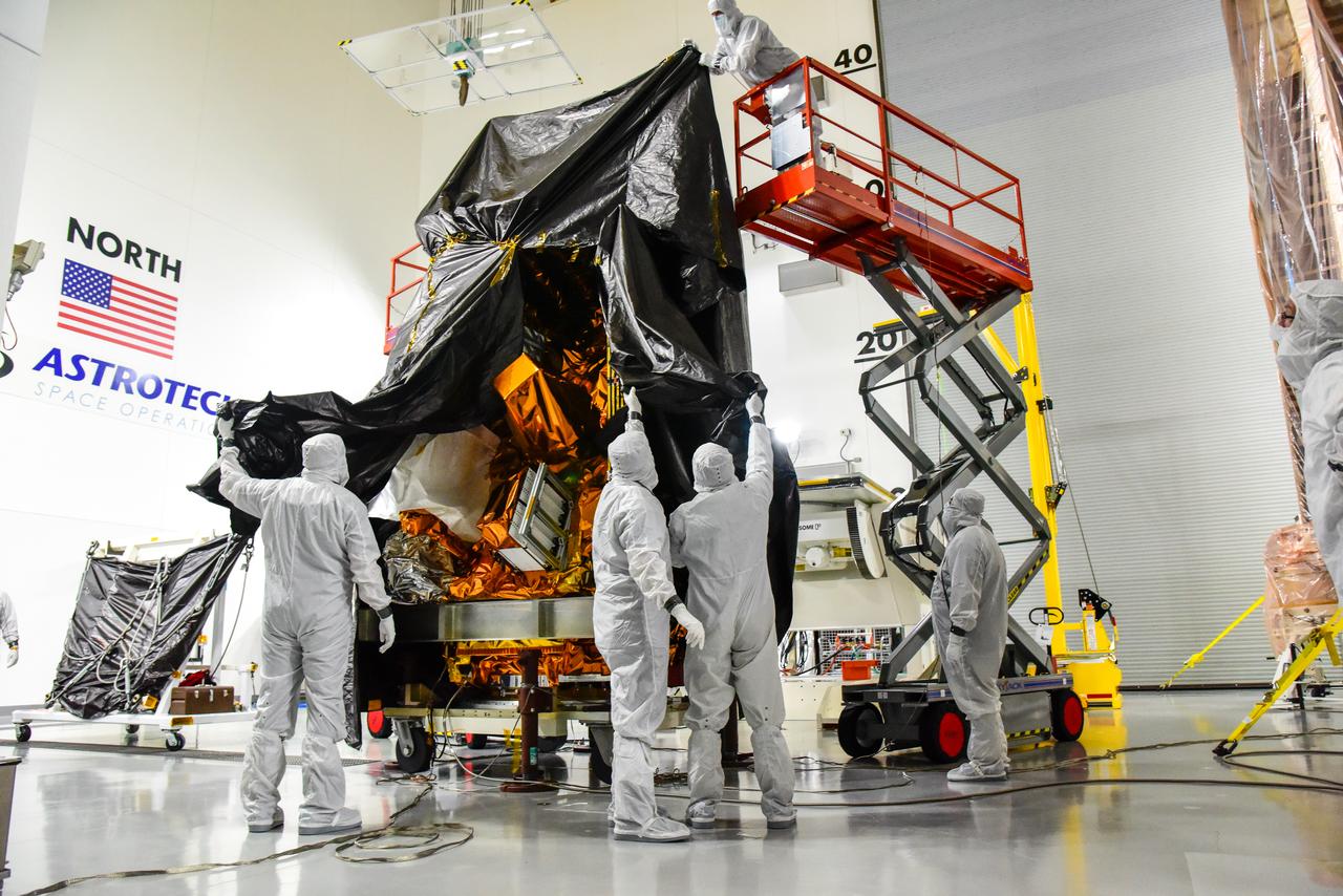
Technicians remove the protective covering from NASA and the National Oceanic and Atmospheric Administration’s (NOAA) Joint Polar Satellite System-2 (JPSS-2) satellite inside the Astrotech Space Operations facility at Vandenberg Space Force Base in California on Aug. 22, 2022. JPSS-2 is the third satellite in the Joint Polar Satellite System series. It is scheduled to lift off from VSFB on Nov. 1 from Space Launch Complex-3. JPSS-2, which will be renamed NOAA-21 after reaching orbit, will join a constellation of JPSS satellites that orbit from the North to the South pole, circling Earth 14 times a day and providing a full view of the entire globe twice daily. The NOAA/NASA Suomi National Polar-orbiting Partnership (Suomi NPP) satellite, and NOAA-20, previously known as JPSS-1, are both already in orbit. Each satellite carries at least four advanced instruments to measure weather and climate conditions on Earth. A secondary payload on the mission is the Low-Earth Orbit Flight Test of an Inflatable Decelerator (LOFTID), and is dedicated to the memory of Bernard Kutter. LOFTID will demonstrate inflatable heat shield technology that could enable a variety of proposed NASA missions to destinations such as Mars, Venus, and Titan, as well as returning heavier payloads from low-Earth orbit.
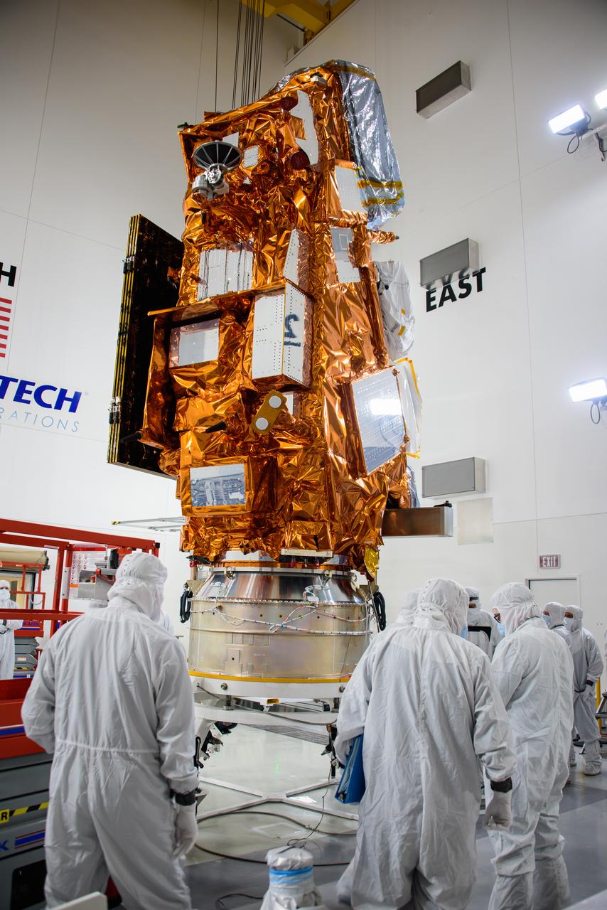
Technicians prepare the National Oceanic and Atmospheric Administration’s (NOAA) Joint Polar Satellite System-2 (JPSS-2) for stacking atop the Low-Earth Orbit Flight Test of an Inflatable Decelerator (LOFTID) payload inside the Astrotech Space Operations facility at Vandenberg Space Force Base (VSFB) in California on Oct. 5, 2022. JPSS-2 is the third satellite in the Joint Polar Satellite System series. It is scheduled to lift off from VSFB on Nov. 1 from Space Launch Complex-3. JPSS-2, which will be renamed NOAA-21 after reaching orbit, will join a constellation of JPSS satellites that orbit from the North to the South pole, circling Earth 14 times a day and providing a full view of the entire globe twice daily. The NOAA/NASA Suomi National Polar-orbiting Partnership (Suomi NPP) satellite, and NOAA-20, previously known as JPSS-1, are both already in orbit. Each satellite carries at least four advanced instruments to measure weather and climate conditions on Earth. LOFTID is a secondary payload on the mission. It is dedicated to the memory of Bernard Kutter. LOFTID will demonstrate inflatable heat shield technology that could enable a variety of proposed NASA missions to destinations such as Mars, Venus, and Titan, as well as returning heavier payloads from low-Earth orbit.
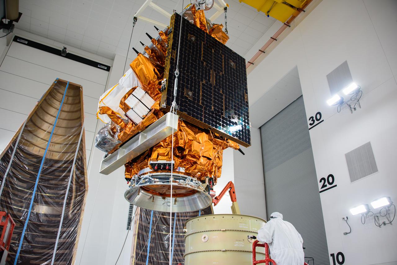
Technicians assist as a crane transfers the National Oceanic and Atmospheric Administration’s (NOAA) Joint Polar Satellite System-2 (JPSS-2) for stacking atop the Low-Earth Orbit Flight Test of an Inflatable Decelerator (LOFTID) payload inside the Astrotech Space Operations facility at Vandenberg Space Force Base (VSFB) in California on Oct. 5, 2022. JPSS-2 is the third satellite in the Joint Polar Satellite System series. It is scheduled to lift off from VSFB on Nov. 1 from Space Launch Complex-3. JPSS-2, which will be renamed NOAA-21 after reaching orbit, will join a constellation of JPSS satellites that orbit from the North to the South pole, circling Earth 14 times a day and providing a full view of the entire globe twice daily. The NOAA/NASA Suomi National Polar-orbiting Partnership (Suomi NPP) satellite, and NOAA-20, previously known as JPSS-1, are both already in orbit. Each satellite carries at least four advanced instruments to measure weather and climate conditions on Earth. LOFTID is a secondary payload on the mission. It is dedicated to the memory of Bernard Kutter. LOFTID will demonstrate inflatable heat shield technology that could enable a variety of proposed NASA missions to destinations such as Mars, Venus, and Titan, as well as returning heavier payloads from low-Earth orbit.
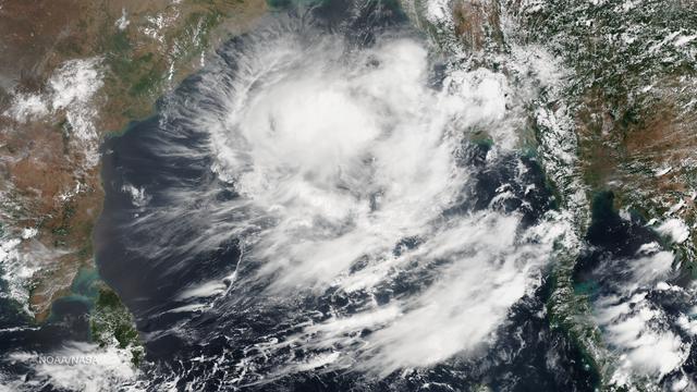
The Joint Typhoon Warning Center states that formation of a significant tropical cyclone is possible in the Bay of Bengal within the next 12 - 24 hours as of 0730Z on May 21, 2014. Along with deep convective banding associated with a consolidating low-level circulation center, warm sea surface temperatures are conducive for further development. This image was taken by the Suomi NPP satellite's VIIRS instrument in two passes, the east pass around 0615Z and the west pass around 0755Z on May 21, 2014. Credit: NASA/NOAA/NPP/VIIRS The Joint Typhoon Warning Center states that formation of a significant tropical cyclone is possible in the Bay of Bengal within the next 12 - 24 hours as of 0730Z on May 21, 2014. Along with deep convective banding associated with a consolidating low-level circulation center, warm sea surface temperatures are conducive for further development. This image was taken by the Suomi NPP satellite's VIIRS instrument in two passes, the east pass around 0615Z and the west pass around 0755Z on May 21, 2014.
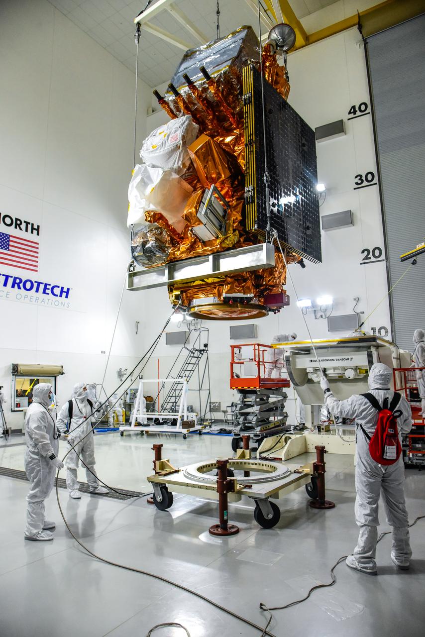
A crane is used to lift NASA and the National Oceanic and Atmospheric Administration’s (NOAA) Joint Polar Satellite System-2 (JPSS-2) satellite for transfer to an Aronson Table for processing inside the Astrotech Space Operations facility at Vandenberg Space Force Base in California on Aug. 22, 2022. JPSS-2 is the third satellite in the Joint Polar Satellite System series. It is scheduled to lift off from VSFB on Nov. 1 from Space Launch Complex-3. JPSS-2, which will be renamed NOAA-21 after reaching orbit, will join a constellation of JPSS satellites that orbit from the North to the South pole, circling Earth 14 times a day and providing a full view of the entire globe twice daily. The NOAA/NASA Suomi National Polar-orbiting Partnership (Suomi NPP) satellite, and NOAA-20, previously known as JPSS-1, are both already in orbit. Each satellite carries at least four advanced instruments to measure weather and climate conditions on Earth. A secondary payload on the mission is the Low-Earth Orbit Flight Test of an Inflatable Decelerator (LOFTID), and is dedicated to the memory of Bernard Kutter. LOFTID will demonstrate inflatable heat shield technology that could enable a variety of proposed NASA missions to destinations such as Mars, Venus, and Titan, as well as returning heavier payloads from low-Earth orbit.
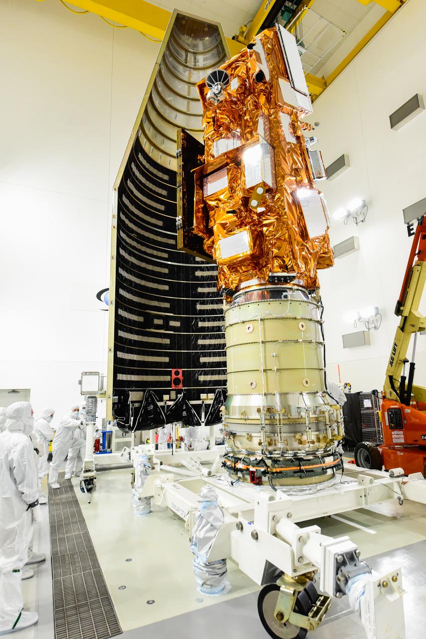
The National Oceanic and Atmospheric Administration’s (NOAA) Joint Polar Satellite System-2 (JPSS-2), stacked atop NASA’s Low-Earth Orbit Flight Test of an Inflatable Decelerator (LOFTID) secondary payload is being prepared for encapsulation in the United Launch Alliance Atlas V payload fairing inside the Astrotech Space Operations facility at Vandenberg Space Force Base (VSFB) in California on Oct. 12, 2022. JPSS-2 is the third satellite in the Joint Polar Satellite System series. It is scheduled to lift off from VSFB on Nov. 1 from Space Launch Complex-3. JPSS-2, which will be renamed NOAA-21 after reaching orbit, will join a constellation of JPSS satellites that orbit from the North to the South pole, circling Earth 14 times a day and providing a full view of the entire globe twice daily. The NOAA/NASA Suomi National Polar-orbiting Partnership (Suomi NPP) satellite, and NOAA-20, previously known as JPSS-1, are both already in orbit. Each satellite carries at least four advanced instruments to measure weather and climate conditions on Earth. LOFTID is dedicated to the memory of Bernard Kutter. LOFTID will demonstrate inflatable heat shield technology that could enable a variety of proposed NASA missions to destinations such as Mars, Venus, and Titan, as well as returning heavier payloads from low-Earth orbit.
Technicians perform work preparing the Low-Earth Orbit Flight Test of an Inflatable Decelerator (LOFTID) for launch on a work stand inside Building 836 at Vandenberg Space Force Base (VSFB) in California on Aug. 25, 2022. LOFTID is the secondary payload on NASA and the National Oceanic and Atmospheric Administration’s (NOAA) Joint Polar Satellite System-2 (JPSS-2) satellite mission. JPSS-2 is the third satellite in the Joint Polar Satellite System series. It is scheduled to lift off from VSFB on Nov. 1 from Space Launch Complex-3. JPSS-2, which will be renamed NOAA-21 after reaching orbit, will join a constellation of JPSS satellites that orbit from the North to the South pole, circling Earth 14 times a day and providing a full view of the entire globe twice daily. The NOAA/NASA Suomi National Polar-orbiting Partnership (Suomi NPP) satellite, and NOAA-20, previously known as JPSS-1, are both already in orbit. Each satellite carries at least four advanced instruments to measure weather and climate conditions on Earth. LOFTID is dedicated to the memory of Bernard Kutter. LOFTID will demonstrate inflatable heat shield technology that could enable a variety of proposed NASA missions to destinations such as Mars, Venus, and Titan, as well as returning heavier payloads from low-Earth orbit.
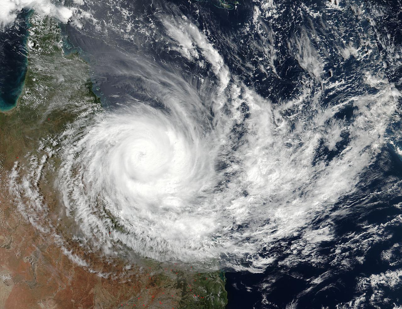
Tropical Cyclone Debbie made landfall in Queensland bringing heavy rainfall, hurricane-force winds, rough seas, and flooding. NASA-NOAA's Suomi NPP satellite provided a visible look at the storm from space while NASA's Aqua satellite analyzed cloud temperatures to determine the location of the strongest storms within. Read more: <a href="https://go.nasa.gov/2o29Sxh" rel="nofollow">go.nasa.gov/2o29Sxh</a> Credit: NASA/NOAA/Suomi NPP <b><a href="http://www.nasa.gov/audience/formedia/features/MP_Photo_Guidelines.html" rel="nofollow">NASA image use policy.</a></b> <b><a href="http://www.nasa.gov/centers/goddard/home/index.html" rel="nofollow">NASA Goddard Space Flight Center</a></b> enables NASA’s mission through four scientific endeavors: Earth Science, Heliophysics, Solar System Exploration, and Astrophysics. Goddard plays a leading role in NASA’s accomplishments by contributing compelling scientific knowledge to advance the Agency’s mission. <b>Follow us on <a href="http://twitter.com/NASAGoddardPix" rel="nofollow">Twitter</a></b> <b>Like us on <a href="http://www.facebook.com/pages/Greenbelt-MD/NASA-Goddard/395013845897?ref=tsd" rel="nofollow">Facebook</a></b> <b>Find us on <a href="http://instagrid.me/nasagoddard/?vm=grid" rel="nofollow">Instagram</a></b>
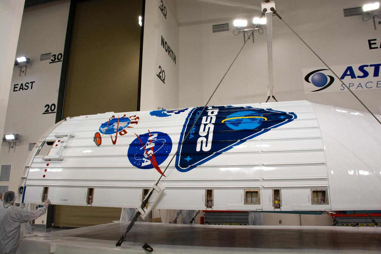
The United Launch Alliance (ULA) Atlas V payload fairing is moved inside the Astrotech Processing Facility at Vandenberg Space Force Base (VSFB) in California on Aug. 10, 2022, for NASA and the National Oceanic and Atmospheric Administration’s (NOAA) Joint Polar Satellite System-2 (JPSS-2) satellite mission. JPSS-2 is the third satellite in the Joint Polar Satellite System series. It is scheduled to lift off from VSFB on Nov. 1 from Space Launch Complex-3. JPSS-2, which will be renamed NOAA-21 after reaching orbit, will join a constellation of JPSS satellites that orbit from the North to the South pole, circling Earth 14 times a day and providing a full view of the entire globe twice daily. The NOAA/NASA Suomi National Polar-orbiting Partnership (Suomi NPP) satellite, and NOAA-20, previously known as JPSS-1, are both already in orbit. Each satellite carries at least four advanced instruments to measure weather and climate conditions on Earth. Launching as a secondary payload to JPSS-2 is NASA’s Low-Earth Orbit Flight Test of an Inflatable Decelerator (LOFTID), dedicated to the memory of Bernard Kutter. LOFTID will demonstrate inflatable heat shield technology that could enable a variety of proposed NASA missions to destinations such as Mars, Venus, and Titan, as well as returning heavier payloads from low-Earth orbit.
The United Launch Alliance (ULA) Atlas V payload fairing is moved inside the Astrotech Processing Facility at Vandenberg Space Force Base (VSFB) in California on Aug. 10, 2022, for NASA and the National Oceanic and Atmospheric Administration’s (NOAA) Joint Polar Satellite System-2 (JPSS-2) satellite mission. JPSS-2 is the third satellite in the Joint Polar Satellite System series. It is scheduled to lift off from VSFB on Nov. 1 from Space Launch Complex-3. JPSS-2, which will be renamed NOAA-21 after reaching orbit, will join a constellation of JPSS satellites that orbit from the North to the South pole, circling Earth 14 times a day and providing a full view of the entire globe twice daily. The NOAA/NASA Suomi National Polar-orbiting Partnership (Suomi NPP) satellite, and NOAA-20, previously known as JPSS-1, are both already in orbit. Each satellite carries at least four advanced instruments to measure weather and climate conditions on Earth. Launching as a secondary payload to JPSS-2 is NASA’s Low-Earth Orbit Flight Test of an Inflatable Decelerator (LOFTID), dedicated to the memory of Bernard Kutter. LOFTID will demonstrate inflatable heat shield technology that could enable a variety of proposed NASA missions to destinations such as Mars, Venus, and Titan, as well as returning heavier payloads from low-Earth orbit.
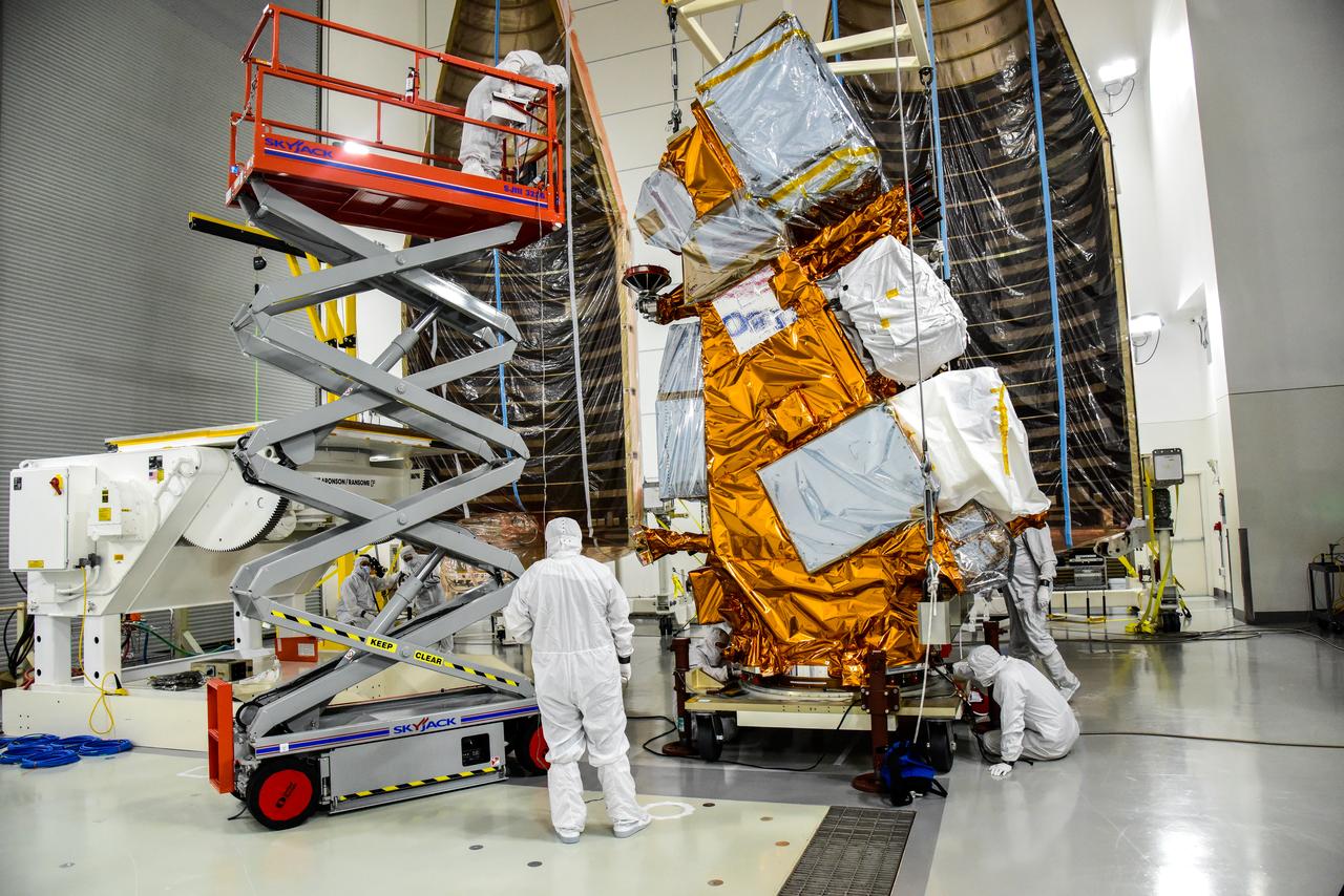
Technicians help transfer NASA and the National Oceanic and Atmospheric Administration’s (NOAA) Joint Polar Satellite System-2 (JPSS-2) satellite onto an integration and testing cart inside the Astrotech Space Operations facility at Vandenberg Space Force Base in California on Aug. 22, 2022. JPSS-2 is the third satellite in the Joint Polar Satellite System series. It is scheduled to lift off from VSFB on Nov. 1 from Space Launch Complex-3. JPSS-2, which will be renamed NOAA-21 after reaching orbit, will join a constellation of JPSS satellites that orbit from the North to the South pole, circling Earth 14 times a day and providing a full view of the entire globe twice daily. The NOAA/NASA Suomi National Polar-orbiting Partnership (Suomi NPP) satellite, and NOAA-20, previously known as JPSS-1, are both already in orbit. Each satellite carries at least four advanced instruments to measure weather and climate conditions on Earth. A secondary payload on the mission is the Low-Earth Orbit Flight Test of an Inflatable Decelerator (LOFTID), and is dedicated to the memory of Bernard Kutter. LOFTID will demonstrate inflatable heat shield technology that could enable a variety of proposed NASA missions to destinations such as Mars, Venus, and Titan, as well as returning heavier payloads from low-Earth orbit.
In this view looking up, the mobile service tower doors are open at Space Launch Complex-3 (SLC-3) at Vandenberg Space Force Base in California on Oct. 28, 2022, revealing the United Launch Alliance Atlas V rocket with the National Oceanic and Atmospheric Administration’s (NOAA) Joint Polar Satellite System-2 (JPSS-2) and NASA’s Low-Earth Orbit Flight Test of an Inflatable Decelerator (LOFTID) atop. NASA and ULA are targeting launch for no earlier than Wednesday, Nov. 9, pending range availability. JPSS-2, which will be renamed NOAA-21 after reaching orbit, will join a constellation of JPSS satellites that orbit from the North to the South pole, circling Earth 14 times a day. The NOAA/NASA Suomi National Polar-orbiting Partnership (Suomi NPP) satellite, and NOAA-20, previously known as JPSS-1, are both already in orbit. Each satellite carries at least four advanced instruments to measure weather and climate conditions on Earth. LOFTID will demonstrate inflatable heat shield technology that could enable a variety of proposed NASA missions to destinations such as Mars, Venus, and Titan, as well as returning heavier payloads from low-Earth orbit.
The United Launch Alliance (ULA) Atlas V payload fairing is transported from Building 7525 to the Astrotech Processing Facility at Vandenberg Space Force Base (VSFB) in California on Aug. 10, 2022, for NASA and the National Oceanic and Atmospheric Administration’s (NOAA) Joint Polar Satellite System-2 (JPSS-2) satellite mission. JPSS-2 is the third satellite in the Joint Polar Satellite System series. It is scheduled to lift off from VSFB on Nov. 1 from Space Launch Complex-3. JPSS-2, which will be renamed NOAA-21 after reaching orbit, will join a constellation of JPSS satellites that orbit from the North to the South pole, circling Earth 14 times a day and providing a full view of the entire globe twice daily. The NOAA/NASA Suomi National Polar-orbiting Partnership (Suomi NPP) satellite, and NOAA-20, previously known as JPSS-1, are both already in orbit. Each satellite carries at least four advanced instruments to measure weather and climate conditions on Earth. Launching as a secondary payload to JPSS-2 is NASA’s Low-Earth Orbit Flight Test of an Inflatable Decelerator (LOFTID), dedicated to the memory of Bernard Kutter. LOFTID will demonstrate inflatable heat shield technology that could enable a variety of proposed NASA missions to destinations such as Mars, Venus, and Titan, as well as returning heavier payloads from low-Earth orbit.
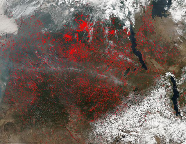
NASA’s Suomi NPP satellite detected thousands of fires burning in central Africa on July 11, 2016. The fires are represented by the multitudes of red dots. Most of the fires burn in grass or cropland. The location, widespread nature, and number of fires suggest that these fires were deliberately set to manage land. Places where traditional plots of open land is not available because the vegetation in the area is dense are the places where "slash and burn" agriculture is practiced most often. These regions include parts of Africa, northern South America, and Southeast Asia, where an abundance of grasslands and rainforests are found. Although most parts of the world outlaw this type of agriculture due to the fact that the smoke from these (or any) fires is a health hazard, the method of agriculture continues because it is the easiest and lowest cost solution to clearing fields for next year's crops. The Suomi NPP satellite is a joint mission between NASA, NOAA and the U.S. Department of Defense. NASA image courtesy Jeff Schmaltz, MODIS Rapid Response Team.
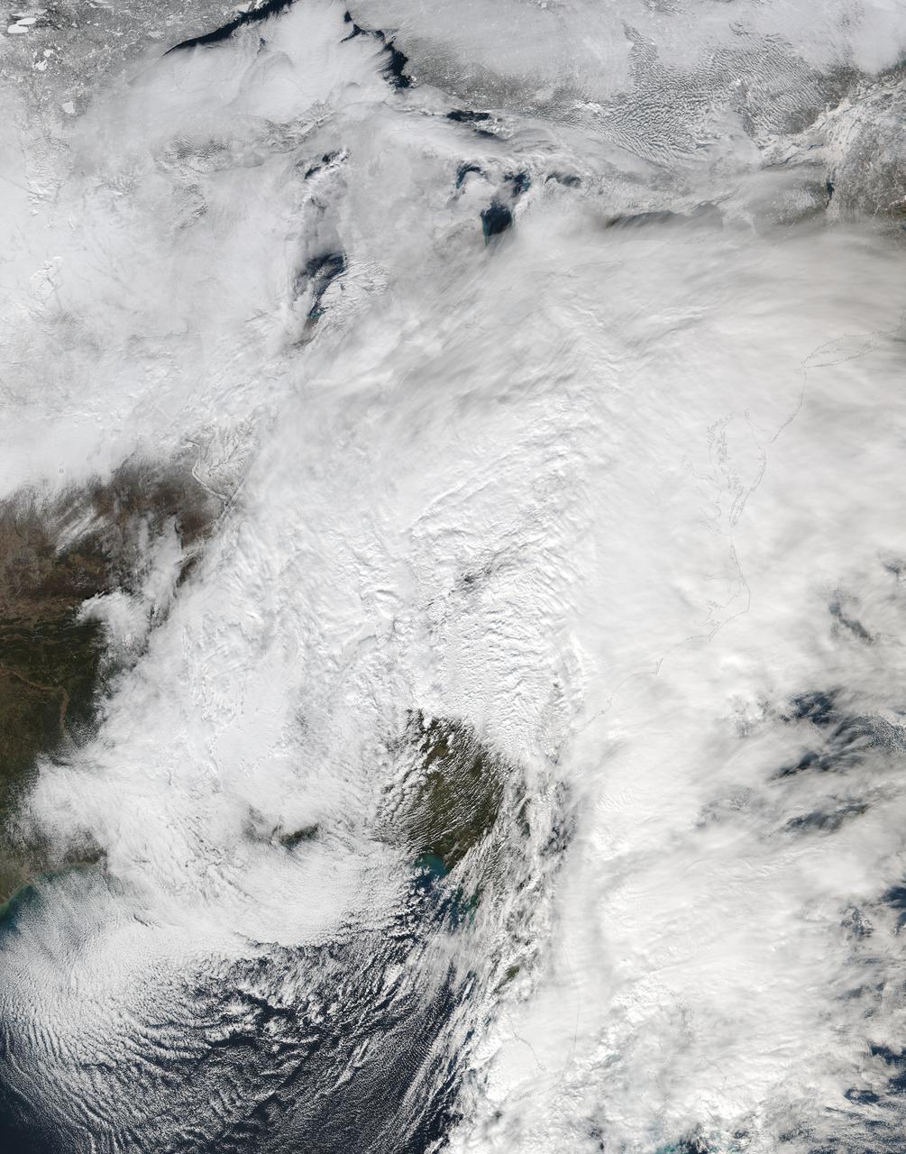
NASA-NOAA's Suomi NPP satellite passed over the large low pressure area on January 22 at 1855 UTC (1:55 p.m. EST) that stretched from New England south to Florida. Credit: Credits: NASA/NOAA/Goddard Rapid Response Team Credit: NASA/Goddard/Suomi NPP/VIIRS <b><a href="http://www.nasa.gov/audience/formedia/features/MP_Photo_Guidelines.html" rel="nofollow">NASA image use policy.</a></b> <b><a href="http://www.nasa.gov/centers/goddard/home/index.html" rel="nofollow">NASA Goddard Space Flight Center</a></b> enables NASA’s mission through four scientific endeavors: Earth Science, Heliophysics, Solar System Exploration, and Astrophysics. Goddard plays a leading role in NASA’s accomplishments by contributing compelling scientific knowledge to advance the Agency’s mission. <b>Follow us on <a href="http://twitter.com/NASAGoddardPix" rel="nofollow">Twitter</a></b> <b>Like us on <a href="http://www.facebook.com/pages/Greenbelt-MD/NASA-Goddard/395013845897?ref=tsd" rel="nofollow">Facebook</a></b> <b>Find us on <a href="http://instagrid.me/nasagoddard/?vm=grid" rel="nofollow">Instagram</a></b>
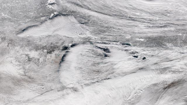
Bands of lake effect snow drift eastward from the western Great Lakes in this true-color image captured by the NOAA/NASA Suomi NPP satellite's Visible Infrared Imaging Radiometer Suite (VIIRS) instrument on January 5, 2017. National Weather Service forecasters expect light to moderate lake effect snow showers to continue throughout the day today and into Saturday (1/7). Lake-effect snow forms when cold air passes over the warmer waters of a lake. This causes some lake water to evaporate into the air and warm it. This warmer, wetter air rises and cools as it moves away from the lake. When it cools, it releases that moisture and, if it’s cold enough, that moisture turns into snow. Although true-color images like this may appear to be photographs of Earth, they aren't. They are created by combining data from the three color channels on the VIIRS instrument sensitive to the red, green and blue (or RGB) wavelengths of light into one composite image. In addition, data from several other channels are often also included to cancel out or correct atmospheric interference that may blur parts of the image. Credit: NOAA/NASA/Suomi NPP via NOAA's Environmental Visualization Laboratory
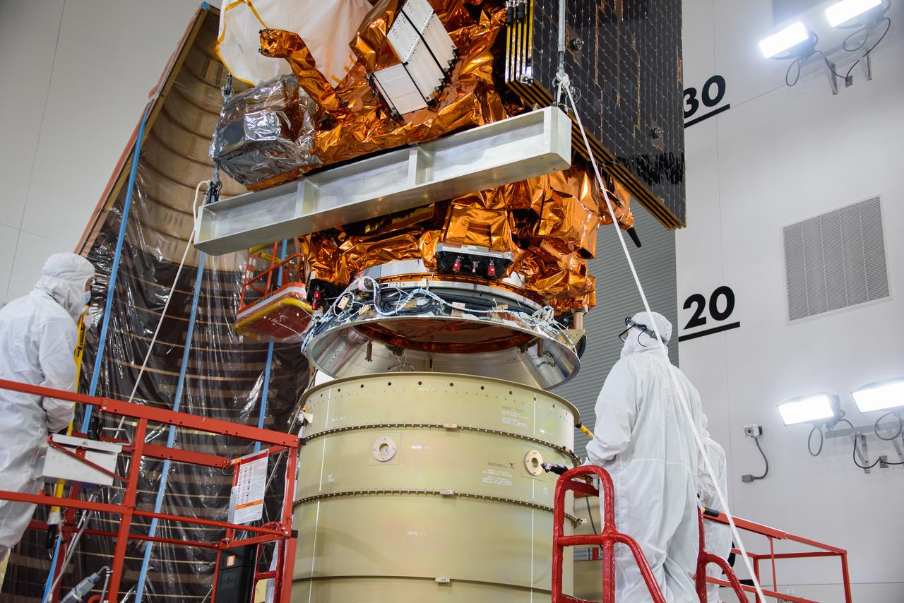
Technicians assist as a crane lowers the National Oceanic and Atmospheric Administration’s (NOAA) Joint Polar Satellite System-2 (JPSS-2) onto the Low-Earth Orbit Flight Test of an Inflatable Decelerator (LOFTID) payload inside the Astrotech Space Operations facility at Vandenberg Space Force Base (VSFB) in California on Oct. 5, 2022. JPSS-2 is the third satellite in the Joint Polar Satellite System series. It is scheduled to lift off from VSFB on Nov. 1 from Space Launch Complex-3. JPSS-2, which will be renamed NOAA-21 after reaching orbit, will join a constellation of JPSS satellites that orbit from the North to the South pole, circling Earth 14 times a day and providing a full view of the entire globe twice daily. The NOAA/NASA Suomi National Polar-orbiting Partnership (Suomi NPP) satellite, and NOAA-20, previously known as JPSS-1, are both already in orbit. Each satellite carries at least four advanced instruments to measure weather and climate conditions on Earth. LOFTID is a secondary payload on the mission. It is dedicated to the memory of Bernard Kutter. LOFTID will demonstrate inflatable heat shield technology that could enable a variety of proposed NASA missions to destinations such as Mars, Venus, and Titan, as well as returning heavier payloads from low-Earth orbit.
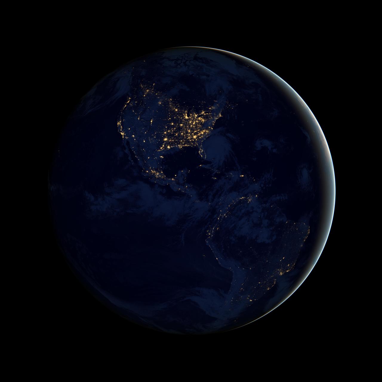
NASA image acquired April 18 - October 23, 2012 This image of North and South America at night is a composite assembled from data acquired by the Suomi NPP satellite in April and October 2012. The new data was mapped over existing Blue Marble imagery of Earth to provide a realistic view of the planet. The nighttime view was made possible by the new satellite’s “day-night band” of the Visible Infrared Imaging Radiometer Suite. VIIRS detects light in a range of wavelengths from green to near-infrared and uses filtering techniques to observe dim signals such as city lights, gas flares, auroras, wildfires, and reflected moonlight. In this case, auroras, fires, and other stray light have been removed to emphasize the city lights. “Artificial lighting is a excellent remote sensing observable and proxy for human activity,” says Chris Elvidge, who leads the Earth Observation Group at NOAA’s National Geophysical Data Center. Social scientists and demographers have used night lights to model the spatial distribution of economic activity, of constructed surfaces, and of populations. Planners and environmental groups have used maps of lights to select sites for astronomical observatories and to monitor human development around parks and wildlife refuges. Electric power companies, emergency managers, and news media turn to night lights to observe blackouts. Named for satellite meteorology pioneer Verner Suomi, NPP flies over any given point on Earth's surface twice each day at roughly 1:30 a.m. and p.m. The polar-orbiting satellite flies 824 kilometers (512 miles) above the surface, sending its data once per orbit to a ground station in Svalbard, Norway, and continuously to local direct broadcast users distributed around the world. The mission is managed by NASA with operational support from NOAA and its Joint Polar Satellite System, which manages the satellite's ground system. NASA Earth Observatory image by Robert Simmon, using Suomi NPP VIIRS data provided courtesy of Chris Elvidge (NOAA National Geophysical Data Center). Suomi NPP is the result of a partnership between NASA, NOAA, and the Department of Defense. Caption by Mike Carlowicz. Instrument: Suomi NPP - VIIRS Credit: <b><a href="http://www.earthobservatory.nasa.gov/" rel="nofollow"> NASA Earth Observatory</a></b> <b>Click here to view all of the <a href="http://earthobservatory.nasa.gov/Features/NightLights/" rel="nofollow"> Earth at Night 2012 images </a></b> <b>Click here to <a href="http://earthobservatory.nasa.gov/NaturalHazards/view.php?id=79787" rel="nofollow"> read more </a> about this image </b> <b><a href="http://www.nasa.gov/audience/formedia/features/MP_Photo_Guidelines.html" rel="nofollow">NASA image use policy.</a></b> <b><a href="http://www.nasa.gov/centers/goddard/home/index.html" rel="nofollow">NASA Goddard Space Flight Center</a></b> enables NASA’s mission through four scientific endeavors: Earth Science, Heliophysics, Solar System Exploration, and Astrophysics. Goddard plays a leading role in NASA’s accomplishments by contributing compelling scientific knowledge to advance the Agency’s mission. <b>Follow us on <a href="http://twitter.com/NASA_GoddardPix" rel="nofollow">Twitter</a></b> <b>Like us on <a href="http://www.facebook.com/pages/Greenbelt-MD/NASA-Goddard/395013845897?ref=tsd" rel="nofollow">Facebook</a></b> <b>Find us on <a href="http://instagram.com/nasagoddard?vm=grid" rel="nofollow">Instagram</a></b>
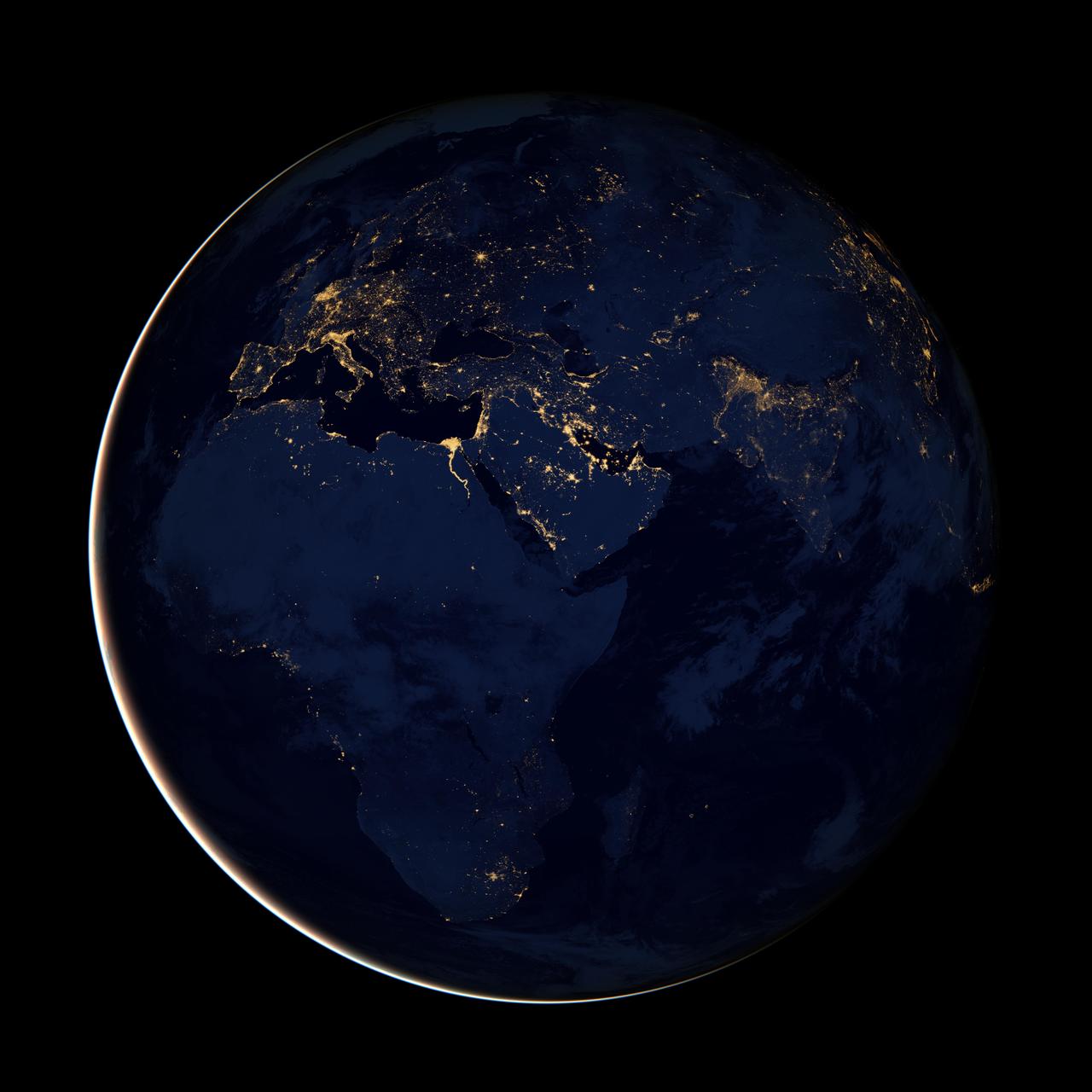
NASA image acquired April 18 - October 23, 2012 This new image of Europe, Africa, and the Middle East at night is a composite assembled from data acquired by the Suomi NPP satellite in April and October 2012. The new data was mapped over existing Blue Marble imagery of Earth to provide a realistic view of the planet. The nighttime view was made possible by the new satellite’s “day-night band” of the Visible Infrared Imaging Radiometer Suite. VIIRS detects light in a range of wavelengths from green to near-infrared and uses filtering techniques to observe dim signals such as gas flares, auroras, wildfires, city lights, and reflected moonlight. In this case, auroras, fires, and other stray light have been removed to emphasize the city lights. “Night time imagery provides an intuitively graspable view of our planet,” says William Stefanov, senior remote sensing scientist for the International Space Station program office. “They provide a fairly straightforward means to map urban versus rural areas, and to show where the major population centers are and where they are not.” Named for satellite meteorology pioneer Verner Suomi, NPP flies over any given point on Earth's surface twice each day at roughly 1:30 a.m. and p.m. The polar-orbiting satellite flies 824 kilometers (512 miles) above the surface, sending its data once per orbit to a ground station in Svalbard, Norway, and continuously to local direct broadcast users distributed around the world. The mission is managed by NASA with operational support from NOAA and its Joint Polar Satellite System, which manages the satellite's ground system. NASA Earth Observatory image by Robert Simmon, using Suomi NPP VIIRS data provided courtesy of Chris Elvidge (NOAA National Geophysical Data Center). Suomi NPP is the result of a partnership between NASA, NOAA, and the Department of Defense. Caption by Mike Carlowicz. Instrument: Suomi NPP - VIIRS Credit: <b><a href="http://www.earthobservatory.nasa.gov/" rel="nofollow"> NASA Earth Observatory</a></b> <b>Click here to view all of the <a href="http://earthobservatory.nasa.gov/Features/NightLights/" rel="nofollow"> Earth at Night 2012 images </a></b> <b>Click here to <a href="http://earthobservatory.nasa.gov/NaturalHazards/view.php?id=79793" rel="nofollow"> read more </a> about this image </b> <b><a href="http://www.nasa.gov/audience/formedia/features/MP_Photo_Guidelines.html" rel="nofollow">NASA image use policy.</a></b> <b><a href="http://www.nasa.gov/centers/goddard/home/index.html" rel="nofollow">NASA Goddard Space Flight Center</a></b> enables NASA’s mission through four scientific endeavors: Earth Science, Heliophysics, Solar System Exploration, and Astrophysics. Goddard plays a leading role in NASA’s accomplishments by contributing compelling scientific knowledge to advance the Agency’s mission. <b>Follow us on <a href="http://twitter.com/NASA_GoddardPix" rel="nofollow">Twitter</a></b> <b>Like us on <a href="http://www.facebook.com/pages/Greenbelt-MD/NASA-Goddard/395013845897?ref=tsd" rel="nofollow">Facebook</a></b> <b>Find us on <a href="http://instagram.com/nasagoddard?vm=grid" rel="nofollow">Instagram</a></b>
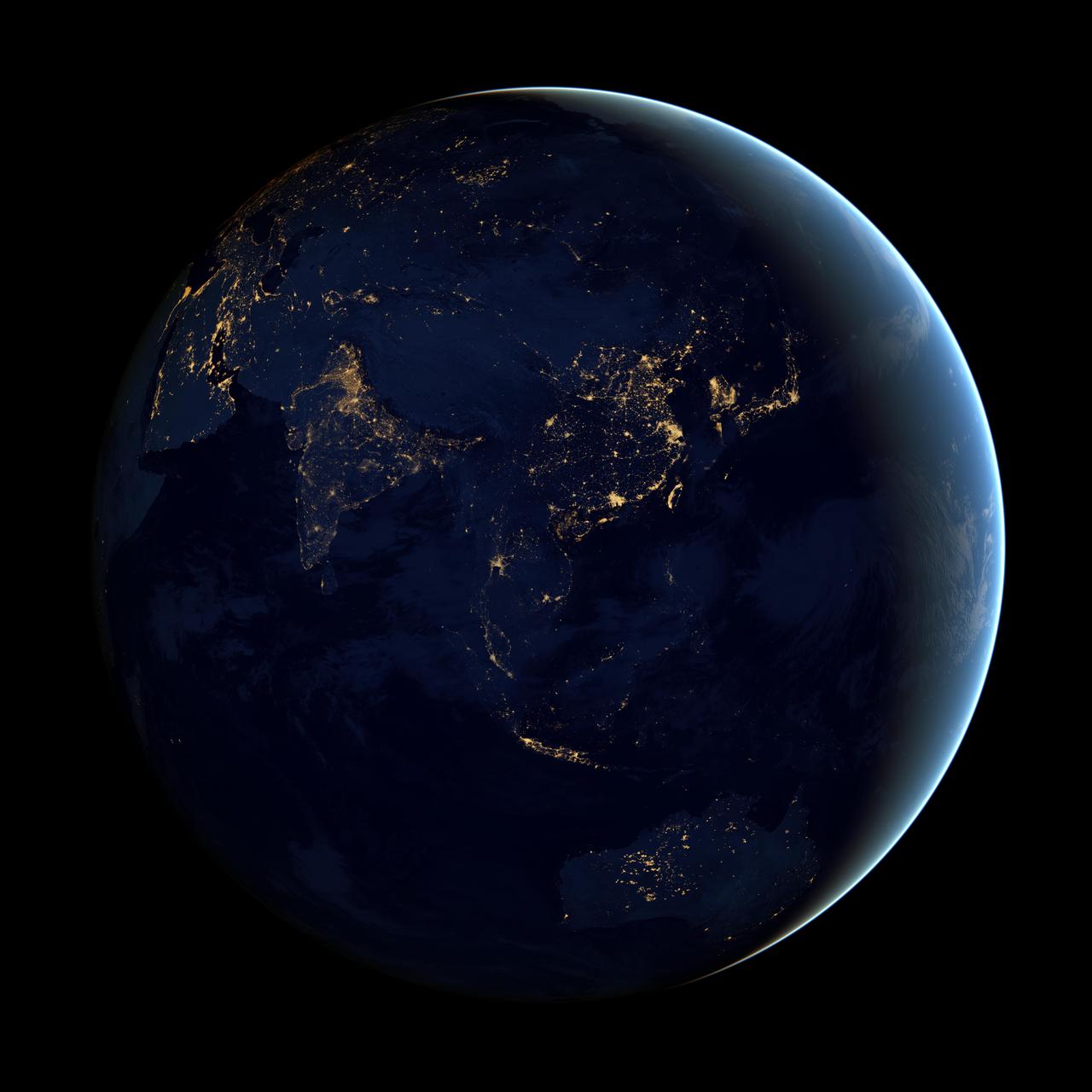
NASA image acquired April 18 - October 23, 2012 This image of Asia and Australia at night is a composite assembled from data acquired by the Suomi NPP satellite in April and October 2012. The new data was mapped over existing Blue Marble imagery of Earth to provide a realistic view of the planet. The nighttime view was made possible by the new satellite’s “day-night band” of the Visible Infrared Imaging Radiometer Suite. VIIRS detects light in a range of wavelengths from green to near-infrared and uses filtering techniques to observe dim signals such as city lights, gas flares, auroras, wildfires, and reflected moonlight. In this case, auroras, fires, and other stray light have been removed to emphasize the city lights. “Night time imagery provides an intuitively graspable view of our planet,” says William Stefanov, a scientist in NASA’s International Space Station program office who has worked with similar images from astronauts. “City lights are an excellent means to track urban and suburban growth, which feeds into planning for energy use and urban hazards, for studying urban heat islands, and for initializing climate models.” Named for satellite meteorology pioneer Verner Suomi, NPP flies over any given point on Earth's surface twice each day at roughly 1:30 a.m. and p.m. The polar-orbiting satellite flies 824 kilometers (512 miles) above the surface, sending its data once per orbit to a ground station in Svalbard, Norway, and continuously to local direct broadcast users distributed around the world. The mission is managed by NASA with operational support from NOAA and its Joint Polar Satellite System, which manages the satellite's ground system. NASA Earth Observatory image by Robert Simmon, using Suomi NPP VIIRS data provided courtesy of Chris Elvidge (NOAA National Geophysical Data Center). Suomi NPP is the result of a partnership between NASA, NOAA, and the Department of Defense. Caption by Mike Carlowicz. Instrument: Suomi NPP - VIIRS Credit: <b><a href="http://www.earthobservatory.nasa.gov/" rel="nofollow"> NASA Earth Observatory</a></b> <b>Click here to view all of the <a href="http://earthobservatory.nasa.gov/Features/NightLights/" rel="nofollow"> Earth at Night 2012 images </a></b> <b>Click here to <a href="http://earthobservatory.nasa.gov/NaturalHazards/view.php?id=79790" rel="nofollow"> read more </a> about this image </b> <b><a href="http://www.nasa.gov/audience/formedia/features/MP_Photo_Guidelines.html" rel="nofollow">NASA image use policy.</a></b> <b><a href="http://www.nasa.gov/centers/goddard/home/index.html" rel="nofollow">NASA Goddard Space Flight Center</a></b> enables NASA’s mission through four scientific endeavors: Earth Science, Heliophysics, Solar System Exploration, and Astrophysics. Goddard plays a leading role in NASA’s accomplishments by contributing compelling scientific knowledge to advance the Agency’s mission. <b>Follow us on <a href="http://twitter.com/NASAGoddardPix" rel="nofollow">Twitter</a></b> <b>Like us on <a href="http://www.facebook.com/pages/Greenbelt-MD/NASA-Goddard/395013845897?ref=tsd" rel="nofollow">Facebook</a></b> <b>Find us on <a href="http://instagram.com/nasagoddard?vm=grid" rel="nofollow">Instagram</a></b>
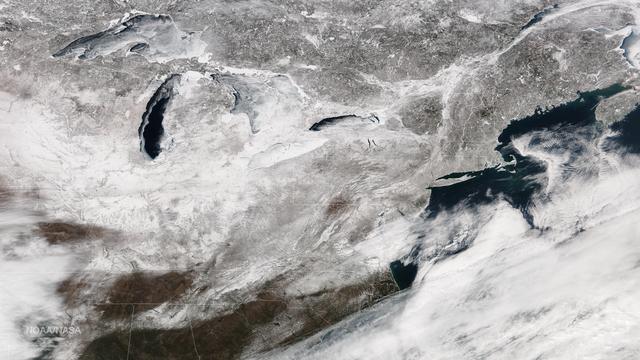
Freezing rain is in the forecast from Texas to the mid-Mississippi Valley and into the Carolinas with temperatures 20-40 degrees below normal across parts of the central and southern U.S. on Friday, extending February's icy grip on the eastern half of the U.S. This image from the Suomi NPP satellite's VIIRS instrument shows the snow cover left by February's series of east coast storms, taken around 1830Z on February 27, 2015. Credit: NASA/NOAA/NPP/VIIRS Via: <b><a href="http://www.earthobservatory.nasa.gov/" rel="nofollow"> NASA Earth Observatory</a></b>
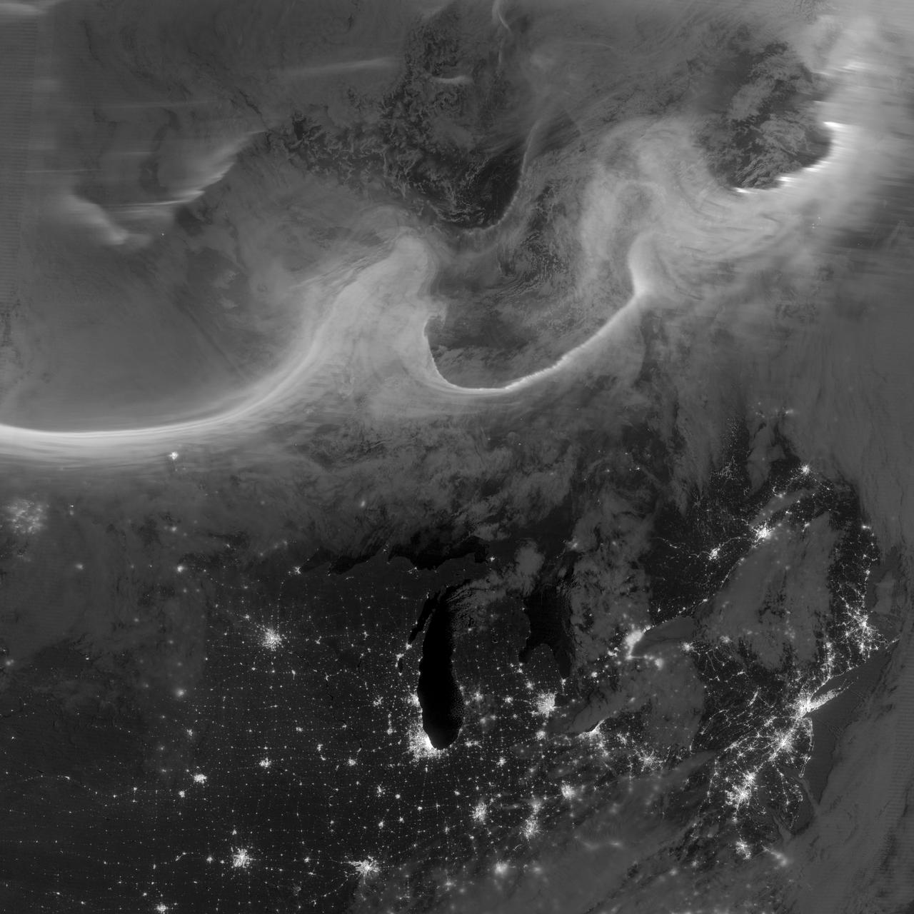
Overnight on October 4-5, 2012, a mass of energetic particles from the atmosphere of the Sun were flung out into space, a phenomenon known as a coronal mass ejection. Three days later, the storm from the Sun stirred up the magnetic field around Earth and produced gorgeous displays of northern lights. NASA satellites track such storms from their origin to their crossing of interplanetary space to their arrival in the atmosphere of Earth. Using the “day-night band” (DNB) of the Visible Infrared Imaging Radiometer Suite (VIIRS), the Suomi National Polar-orbiting Partnership (Suomi NPP) satellite acquired this view of the aurora borealis early on the morning of October 8, 2012. The northern lights stretch across Canada’s Quebec and Ontario provinces in the image, and are part of the auroral oval that expanded to middle latitudes because of a geomagnetic storm. The DNB sensor detects dim light signals such as auroras, airglow, gas flares, city lights, and reflected moonlight. In the case of the image above, the sensor detected the visible light emissions as energetic particles rained down from Earth’s magnetosphere and into the gases of the upper atmosphere. The images are similar to those collected by the Operational Linescan System flown on U.S. Defense Meteorological Satellite Program (DMSP) satellites for the past three decades. “When I first saw images like this as a graduate student, I was immediately struck by the fluid dynamic characteristics of the aurora,” said Tom Moore, a space physicist at NASA's Goddard Space Flight Center. “Viewing the aurora in this way makes it immediately clear that space weather is an interaction of fluids from the Sun with those of the Earth's upper atmosphere. The electrodynamics make for important differences between plasmas and ordinary fluids, but familiar behaviors (for example, waves and vortices) are still very apparent. It makes me wonder at the ability of apparently empty space to behave like a fluid.” Auroras typically occur when solar flares and coronal mass ejections—or even an active solar wind stream—disturb and distort the magnetosphere, the cocoon of space protected by Earth’s magnetic field. The collision of solar particles and pressure into our planet’s magnetosphere accelerates particles trapped in the space around Earth (such as in the radiation belts). Those particles are sent crashing down into Earth’s upper atmosphere—at altitudes of 100 to 400 kilometers (60 to 250 miles)—where they excite oxygen and nitrogen molecules and release photons of light. The results are rays, sheets, and curtains of dancing light in the sky. Auroras are a beautiful expression of the connection between Sun and Earth, but not all of the connections are benign. Auroras are connected to geomagnetic storms, which can distort radio communications (particularly high frequencies), disrupt electric power systems on the ground, and give slight but detectable doses of radiation to flight crews and passengers on high-latitude airplane flights and on spacecraft. The advantage of images like those from VIIRS and DMSP is resolution, according to space physicist Patrick Newell of the Johns Hopkins University Applied Physics Laboratory. “You can see very fine detail in the aurora because of the low altitude and the high resolution of the camera,” he said. Most aurora scientists prefer to use images from missions dedicated to aurora studies (such as Polar, IMAGE, and ground-based imagers), which can offer many more images of a storm (rather than one per orbit) and can allow researchers to calculate the energy moving through the atmosphere. There are no science satellites flying right now that provide such a view, though astronauts regularly photograph and film auroras from the International Space Station. NASA Earth Observatory image by Jesse Allen and Robert Simmon, using VIIRS Day-Night Band data from the Suomi National Polar-orbiting Partnership (Suomi NPP) and the University of Wisconsin's Community Satellite Processing Package. Suomi NPP is the result of a partnership between NASA, the National Oceanic and Atmospheric Administration, and the Department of Defense. Caption by Mike Carlowicz. Instrument: Suomi NPP - VIIRS Credit: <b><a href="http://www.earthobservatory.nasa.gov/" rel="nofollow"> NASA Earth Observatory</a></b> <b><a href="http://www.nasa.gov/audience/formedia/features/MP_Photo_Guidelines.html" rel="nofollow">NASA image use policy.</a></b> <b><a href="http://www.nasa.gov/centers/goddard/home/index.html" rel="nofollow">NASA Goddard Space Flight Center</a></b> enables NASA’s mission through four scientific endeavors: Earth Science, Heliophysics, Solar System Exploration, and Astrophysics. Goddard plays a leading role in NASA’s accomplishments by contributing compelling scientific knowledge to advance the Agency’s mission. <b>Follow us on <a href="http://twitter.com/NASA_GoddardPix" rel="nofollow">Twitter</a></b> <b>Like us on <a href="http://www.facebook.com/pages/Greenbelt-MD/NASA-Goddard/395013845897?ref=tsd" rel="nofollow">Facebook</a></b> <b>Find us on <a href="http://instagrid.me/nasagoddard/?vm=grid" rel="nofollow">Instagram</a></b>
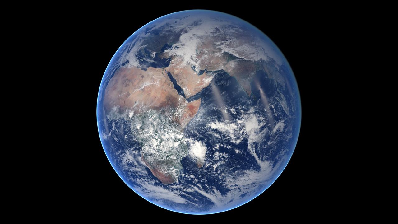
Of all the planets NASA has explored, none have matched the dynamic complexity of our own. Earth is constantly changing, and NASA are working constantly to explore and understand the planet on scales from local to global. Though Earth science has been a key part of NASA’s mission since the agency was founded in 1958, this year has been one of the peaks. Two new Earth-observing satellites have already been launched and put to work: the Global Precipitation Measurement (GPM) and the Orbiting Carbon Observatory 2 (OCO-2). Three more missions are set to take off in the next six months: the wind-measuring ISS-RapidScat, the ISS Cloud-Aerosol Transport System (CATS), and the Soil Moisture Active Passive (SMAP). And research planes have been flying over polar ice, hurricanes, boreal forests, and pollution plumes. All of these new efforts complement an existing fleet of Earth-observing satellites. In visible light and many invisible wavelengths, NASA and its science partners are observing the entire planet every day. The image above was captured on March 30, 2014, by the Visible Infrared Imaging Radiometer Suite (VIIRS) on the Suomi NPP satellite. The composite image of the eastern hemisphere was compiled from eight orbits of the satellite and ten imaging channels, then stitched together to blend the edges of each satellite pass. Read more: <a href="http://earthobservatory.nasa.gov/IOTD/view.php?id=84214&eocn=home&eoci=iotd_title" rel="nofollow">earthobservatory.nasa.gov/IOTD/view.php?id=84214&eocn...</a> NASA Earth Observatory image by Robert Simmon, using Suomi NPP VIIRS imagery from NOAA's Environmental Visualization Laboratory. Suomi NPP is the result of a partnership between NASA, NOAA and the Department of Defense. Caption by Mike Carlowicz. Credit: <b><a href="http://www.earthobservatory.nasa.gov/" rel="nofollow"> NASA Earth Observatory</a></b> <b><a href="http://www.nasa.gov/audience/formedia/features/MP_Photo_Guidelines.html" rel="nofollow">NASA image use policy.</a></b> <b><a href="http://www.nasa.gov/centers/goddard/home/index.html" rel="nofollow">NASA Goddard Space Flight Center</a></b> enables NASA’s mission through four scientific endeavors: Earth Science, Heliophysics, Solar System Exploration, and Astrophysics. Goddard plays a leading role in NASA’s accomplishments by contributing compelling scientific knowledge to advance the Agency’s mission. <b>Follow us on <a href="http://twitter.com/NASAGoddardPix" rel="nofollow">Twitter</a></b> <b>Like us on <a href="http://www.facebook.com/pages/Greenbelt-MD/NASA-Goddard/395013845897?ref=tsd" rel="nofollow">Facebook</a></b> <b>Find us on <a href="http://instagram.com/nasagoddard?vm=grid" rel="nofollow">Instagram</a></b>
On August 29, 2012, the Visible Infrared Imaging Radiometer Suite (VIIRS) on the Suomi NPP satellite captured this nighttime view of wildfires burning in Idaho and Montana. The image was captured by the VIIRS “day-night band,” which detects light in a range of wavelengths from green to near-infrared and uses filtering techniques to observe signals such as gas flares, auroras, wildfires, city lights, and reflected moonlight. When the image was acquired, the moon was in its waxing gibbous phase, meaning it was more than half-lit, but less than full. Numerous hot spots from the Mustang Complex Fire are visible in northern Idaho. A plume of thick, billowing smoke streams west from the brightest fires near the Idaho-Montana border. The Halstead and Trinity Ridge fires are visible to the south. In addition to the fires, city lights from Boise and other smaller cities appear throughout the image. A bank of clouds is located west of the Mustang Complex, over southeastern Washington and northeastern Oregon. The Operational Line System (OLS)—an earlier generation of night-viewing sensors on the U.S. Defense Meteorological Satellite Program (DMSP) satellites—was also capable of detecting fires at night. But the VIIRS “day-night band” is far better than OLS at resolving them. Each pixel of an VIIRS image shows roughly 740 meters (0.46 miles), compared to the 3-kilometer footprint (1.86 miles) on the OLS system. NASA Earth Observatory image by Jesse Allen and Robert Simmon, using VIIRS Day-Night Band data from the Suomi National Polar-orbiting Partnership. Suomi NPP is the result of a partnership between NASA, the National Oceanic and Atmospheric Administration, and the Department of Defense. Caption by Adam Voiland. Instrument: Suomi NPP - VIIRS Credit: <b><a href="http://www.earthobservatory.nasa.gov/" rel="nofollow"> NASA Earth Observatory</a></b> <b>Click here to view all of the <a href="http://earthobservatory.nasa.gov/Features/NightLights/" rel="nofollow"> Earth at Night 2012 images </a></b> <b>Click here to <a href="http://earthobservatory.nasa.gov/NaturalHazards/view.php?id=79754" rel="nofollow"> read more </a> about this image </b> <b><a href="http://www.nasa.gov/audience/formedia/features/MP_Photo_Guidelines.html" rel="nofollow">NASA image use policy.</a></b> <b><a href="http://www.nasa.gov/centers/goddard/home/index.html" rel="nofollow">NASA Goddard Space Flight Center</a></b> enables NASA’s mission through four scientific endeavors: Earth Science, Heliophysics, Solar System Exploration, and Astrophysics. Goddard plays a leading role in NASA’s accomplishments by contributing compelling scientific knowledge to advance the Agency’s mission. <b>Follow us on <a href="http://twitter.com/NASA_GoddardPix" rel="nofollow">Twitter</a></b> <b>Like us on <a href="http://www.facebook.com/pages/Greenbelt-MD/NASA-Goddard/395013845897?ref=tsd" rel="nofollow">Facebook</a></b> <b>Find us on <a href="http://instagram.com/nasagoddard?vm=grid" rel="nofollow">Instagram</a></b>

Using the “day-night band” (DNB) of the Visible Infrared Imaging Radiometer Suite (VIIRS), the Suomi National Polar-orbiting Partnership (Suomi NPP) satellite acquired this view of the aurora borealis on March 18, 2015. The northern lights stretch across Canada’s Quebec, Ontario, Manitoba, Nunavut, and Newfoundland provinces in the image, and are part of the auroral oval that expanded to middle latitudes because of a geomagnetic storm on March 17, 2015. The DNB sensor detects dim light signals such as auroras, airglow, gas flares, city lights, and reflected moonlight. In the case of the image above, the sensor detected the visible light emissions as energetic particles rained down from Earth’s magnetosphere and into the gases of the upper atmosphere. The images are similar to those collected by the Operational Linescan System flown on U.S. Defense Meteorological Satellite Program (DMSP) satellites for the past three decades. Auroras typically occur when solar flares and coronal mass ejections—or even an active solar wind stream—disturb and distort the magnetosphere, the cocoon of space protected by Earth’s magnetic field. The collision of solar particles and pressure into our planet’s magnetosphere accelerates particles trapped in the space around Earth (such as in the radiation belts). Those particles are sent crashing down into Earth’s upper atmosphere—at altitudes of 100 to 400 kilometers (60 to 250 miles)—where they excite oxygen and nitrogen molecules and release photons of light. The results are rays, sheets, and curtains of dancing light in the sky. Read more: <a href="http://earthobservatory.nasa.gov/NaturalHazards/view.php?id=85556&eocn=home&eoci=nh" rel="nofollow">earthobservatory.nasa.gov/NaturalHazards/view.php?id=8555...</a> NASA Earth Observatory image by Jesse Allen, using VIIRS day-night band data from the Suomi National Polar-orbiting Partnership. Suomi NPP is the result of a partnership between NASA, the National Oceanic and Atmospheric Administration, and the Department of Defense. Caption by Mike Carlowicz and Adam Voiland. Credit: <b><a href="http://www.earthobservatory.nasa.gov/" rel="nofollow"> NASA Earth Observatory</a></b> <b><a href="http://www.nasa.gov/audience/formedia/features/MP_Photo_Guidelines.html" rel="nofollow">NASA image use policy.</a></b> <b><a href="http://www.nasa.gov/centers/goddard/home/index.html" rel="nofollow">NASA Goddard Space Flight Center</a></b> enables NASA’s mission through four scientific endeavors: Earth Science, Heliophysics, Solar System Exploration, and Astrophysics. Goddard plays a leading role in NASA’s accomplishments by contributing compelling scientific knowledge to advance the Agency’s mission. <b>Follow us on <a href="http://twitter.com/NASAGoddardPix" rel="nofollow">Twitter</a></b> <b>Like us on <a href="http://www.facebook.com/pages/Greenbelt-MD/NASA-Goddard/395013845897?ref=tsd" rel="nofollow">Facebook</a></b> <b>Find us on <a href="http://instagrid.me/nasagoddard/?vm=grid" rel="nofollow">Instagram</a></b>
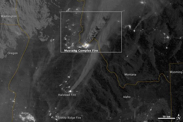
On August 29, 2012, the Visible Infrared Imaging Radiometer Suite (VIIRS) on the Suomi NPP satellite captured this nighttime view of wildfires burning in Idaho and Montana. The image was captured by the VIIRS “day-night band,” which detects light in a range of wavelengths from green to near-infrared and uses filtering techniques to observe signals such as gas flares, auroras, wildfires, city lights, and reflected moonlight. When the image was acquired, the moon was in its waxing gibbous phase, meaning it was more than half-lit, but less than full. Numerous hot spots from the Mustang Complex Fire are visible in northern Idaho. A plume of thick, billowing smoke streams west from the brightest fires near the Idaho-Montana border. The Halstead and Trinity Ridge fires are visible to the south. In addition to the fires, city lights from Boise and other smaller cities appear throughout the image. A bank of clouds is located west of the Mustang Complex, over southeastern Washington and northeastern Oregon. The Operational Line System (OLS)—an earlier generation of night-viewing sensors on the U.S. Defense Meteorological Satellite Program (DMSP) satellites—was also capable of detecting fires at night. But the VIIRS “day-night band” is far better than OLS at resolving them. Each pixel of an VIIRS image shows roughly 740 meters (0.46 miles), compared to the 3-kilometer footprint (1.86 miles) on the OLS system. NASA Earth Observatory image by Jesse Allen and Robert Simmon, using VIIRS Day-Night Band data from the Suomi National Polar-orbiting Partnership. Suomi NPP is the result of a partnership between NASA, the National Oceanic and Atmospheric Administration, and the Department of Defense. Caption by Adam Voiland. Instrument: Suomi NPP - VIIRS Credit: <b><a href="http://www.earthobservatory.nasa.gov/" rel="nofollow"> NASA Earth Observatory</a></b> <b>Click here to view all of the <a href="http://earthobservatory.nasa.gov/Features/NightLights/" rel="nofollow"> Earth at Night 2012 images </a></b> <b>Click here to <a href="http://earthobservatory.nasa.gov/NaturalHazards/view.php?id=79754" rel="nofollow"> read more </a> about this image </b> <b><a href="http://www.nasa.gov/audience/formedia/features/MP_Photo_Guidelines.html" rel="nofollow">NASA image use policy.</a></b> <b><a href="http://www.nasa.gov/centers/goddard/home/index.html" rel="nofollow">NASA Goddard Space Flight Center</a></b> enables NASA’s mission through four scientific endeavors: Earth Science, Heliophysics, Solar System Exploration, and Astrophysics. Goddard plays a leading role in NASA’s accomplishments by contributing compelling scientific knowledge to advance the Agency’s mission. <b>Follow us on <a href="http://twitter.com/NASA_GoddardPix" rel="nofollow">Twitter</a></b> <b>Like us on <a href="http://www.facebook.com/pages/Greenbelt-MD/NASA-Goddard/395013845897?ref=tsd" rel="nofollow">Facebook</a></b> <b>Find us on <a href="http://instagram.com/nasagoddard?vm=grid" rel="nofollow">Instagram</a></b>
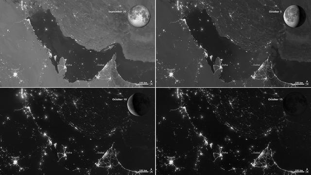
NASA images acquired October 15, 2012 The Visible Infrared Imaging Radiometer Suite (VIIRS) on the Suomi NPP satellite captured these nighttime views of the Persian Gulf region on September 30, October 5, October 10, and October 15, 2012. The images are from the VIIRS “day-night band,” which detects light in a range of wavelengths from green to near-infrared and uses filtering techniques to observe signals such as gas flares, auroras, wildfires, city lights, and reflected moonlight. Each image includes an inset of the Moon in four different phases. September 30 shows the Persian Gulf by the light of the full Moon; October 15 shows the effects of a new Moon. As the amount of moonlight decreases, some land surface features become harder to detect, but the lights from cities and ships become more obvious. Urbanization is most apparent along the northeastern coast of Saudi Arabia, in Qatar, and in the United Arab Emirates (UAE). In Qatar and UAE, major highways can even be discerned by nighttime lights. In eighteenth-century England, a small group of entrepreneurs, inventors and free thinkers—James Watt and Charles Darwin’s grandfathers among them—started a club. They named it the Lunar Society, and the “lunaticks” scheduled their dinner meetings on evenings of the full Moon. The timing wasn’t based on any kind of superstition, it was based on practicality. In the days before electricity, seeing one’s way home after dark was far easier by the light of a full Moon. In the early twenty-first century, electricity has banished the need for such careful scheduling, but the light of the full Moon still makes a difference. NASA Earth Observatory image by Jesse Allen and Robert Simmon, using VIIRS day-night band data from the Suomi National Polar-orbiting Partnership. Suomi NPP is the result of a partnership between NASA, the National Oceanic and Atmospheric Administration, and the Department of Defense. Caption by Michon Scott. Instrument: Suomi NPP - VIIRS Credit: <b><a href="http://www.earthobservatory.nasa.gov/" rel="nofollow"> NASA Earth Observatory</a></b> <b>Click here to view all of the <a href="http://earthobservatory.nasa.gov/Features/NightLights/" rel="nofollow"> Earth at Night 2012 images </a></b> <b>Click here to <a href="http://earthobservatory.nasa.gov/NaturalHazards/view.php?id=79834" rel="nofollow"> read more </a> about this image </b> <b><a href="http://www.nasa.gov/audience/formedia/features/MP_Photo_Guidelines.html" rel="nofollow">NASA image use policy.</a></b> <b><a href="http://www.nasa.gov/centers/goddard/home/index.html" rel="nofollow">NASA Goddard Space Flight Center</a></b> enables NASA’s mission through four scientific endeavors: Earth Science, Heliophysics, Solar System Exploration, and Astrophysics. Goddard plays a leading role in NASA’s accomplishments by contributing compelling scientific knowledge to advance the Agency’s mission. <b>Follow us on <a href="http://twitter.com/NASA_GoddardPix" rel="nofollow">Twitter</a></b> <b>Like us on <a href="http://www.facebook.com/pages/Greenbelt-MD/NASA-Goddard/395013845897?ref=tsd" rel="nofollow">Facebook</a></b> <b>Find us on <a href="http://instagram.com/nasagoddard?vm=grid" rel="nofollow">Instagram</a></b>
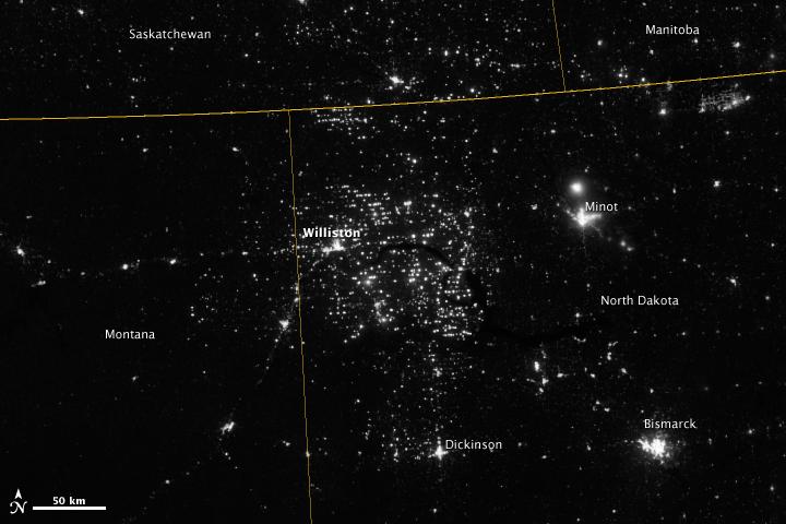
Northwestern North Dakota is one of the least-densely populated parts of the United States. Cities and people are scarce, but satellite imagery shows the area has been aglow at night in recent years. The reason: the area is home to the Bakken shale formation, a site where oil production is booming. Companies hoping to extract oil from the Bakken formation have drilled hundreds of new wells in the last few years; natural gas often bubbles up to the surface as part of the process. Lacking the infrastructure to pipe the gas away, many drillers simply burn it in a practice known as flaring. On November 12, 2012, the Visible Infrared Imaging Radiometer Suite (VIIRS) on the Suomi NPP satellite captured this nighttime view of widespread gas flaring throughout the area. Many of the specks of light are evidence of gas flaring, though others may be the lights around drilling equipment. Some of the brighter areas correspond to towns and cities including Williston, Minot, and Dickinson. The image was captured by the VIIRS “day-night band,” which detects light in a range of wavelengths from green to near-infrared and uses filtering techniques to observe signals such as gas flares, auroras, wildfires, city lights, and reflected moonlight. When VIIRS acquired the image, the moon was in its waning crescent phase, meaning it was reflecting only a small amount of light. According to the U.S. Energy Information Administration, natural gas production from the Bakken shale has increased more than 20-fold between 2007 and 2010. Gas production averaged over 485 million cubic feet per day in September 2011, compared to the 2005 average of about 160 million cubic feet per day. Due to the lack of gas pipeline and processing facilities in the region, about 29 percent of that gas is flared. NASA Earth Observatory image by Jesse Allen and Robert Simmon, using VIIRS Day-Night Band data from the Suomi National Polar-orbiting Partnership. Suomi NPP is the result of a partnership between NASA, the National Oceanic and Atmospheric Administration, and the Department of Defense. Caption by Adam Voiland. Instrument: Suomi NPP - VIIRS Credit: <b><a href="http://www.earthobservatory.nasa.gov/" rel="nofollow"> NASA Earth Observatory</a></b> <b>Click here to view all of the <a href="http://earthobservatory.nasa.gov/Features/NightLights/" rel="nofollow"> Earth at Night 2012 images </a></b> <b>Click here to <a href="http://earthobservatory.nasa.gov/NaturalHazards/view.php?id=79810" rel="nofollow"> read more </a> about this image </b> <b><a href="http://www.nasa.gov/audience/formedia/features/MP_Photo_Guidelines.html" rel="nofollow">NASA image use policy.</a></b> <b><a href="http://www.nasa.gov/centers/goddard/home/index.html" rel="nofollow">NASA Goddard Space Flight Center</a></b> enables NASA’s mission through four scientific endeavors: Earth Science, Heliophysics, Solar System Exploration, and Astrophysics. Goddard plays a leading role in NASA’s accomplishments by contributing compelling scientific knowledge to advance the Agency’s mission. <b>Follow us on <a href="http://twitter.com/NASA_GoddardPix" rel="nofollow">Twitter</a></b> <b>Like us on <a href="http://www.facebook.com/pages/Greenbelt-MD/NASA-Goddard/395013845897?ref=tsd" rel="nofollow">Facebook</a></b> <b>Find us on <a href="http://instagram.com/nasagoddard?vm=grid" rel="nofollow">Instagram</a></b>
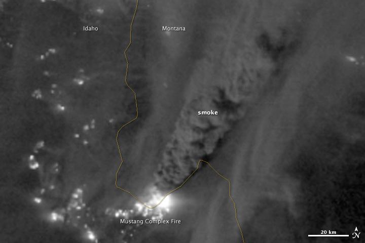
On August 29, 2012, the Visible Infrared Imaging Radiometer Suite (VIIRS) on the Suomi NPP satellite captured this nighttime view of wildfires burning in Idaho and Montana. The image was captured by the VIIRS “day-night band,” which detects light in a range of wavelengths from green to near-infrared and uses filtering techniques to observe signals such as gas flares, auroras, wildfires, city lights, and reflected moonlight. When the image was acquired, the moon was in its waxing gibbous phase, meaning it was more than half-lit, but less than full. Numerous hot spots from the Mustang Complex Fire are visible in northern Idaho. A plume of thick, billowing smoke streams west from the brightest fires near the Idaho-Montana border. The Halstead and Trinity Ridge fires are visible to the south. In addition to the fires, city lights from Boise and other smaller cities appear throughout the image. A bank of clouds is located west of the Mustang Complex, over southeastern Washington and northeastern Oregon. The Operational Line System (OLS)—an earlier generation of night-viewing sensors on the U.S. Defense Meteorological Satellite Program (DMSP) satellites—was also capable of detecting fires at night. But the VIIRS “day-night band” is far better than OLS at resolving them. Each pixel of an VIIRS image shows roughly 740 meters (0.46 miles), compared to the 3-kilometer footprint (1.86 miles) on the OLS system. NASA Earth Observatory image by Jesse Allen and Robert Simmon, using VIIRS Day-Night Band data from the Suomi National Polar-orbiting Partnership. Suomi NPP is the result of a partnership between NASA, the National Oceanic and Atmospheric Administration, and the Department of Defense. Caption by Adam Voiland. Instrument: Suomi NPP - VIIRS Credit: <b><a href="http://www.earthobservatory.nasa.gov/" rel="nofollow"> NASA Earth Observatory</a></b> <b>Click here to view all of the <a href="http://earthobservatory.nasa.gov/Features/NightLights/" rel="nofollow"> Earth at Night 2012 images </a></b> <b>Click here to <a href="http://earthobservatory.nasa.gov/NaturalHazards/view.php?id=79754" rel="nofollow"> read more </a> about this image </b> <b><a href="http://www.nasa.gov/audience/formedia/features/MP_Photo_Guidelines.html" rel="nofollow">NASA image use policy.</a></b> <b><a href="http://www.nasa.gov/centers/goddard/home/index.html" rel="nofollow">NASA Goddard Space Flight Center</a></b> enables NASA’s mission through four scientific endeavors: Earth Science, Heliophysics, Solar System Exploration, and Astrophysics. Goddard plays a leading role in NASA’s accomplishments by contributing compelling scientific knowledge to advance the Agency’s mission. <b>Follow us on <a href="http://twitter.com/NASA_GoddardPix" rel="nofollow">Twitter</a></b> <b>Like us on <a href="http://www.facebook.com/pages/Greenbelt-MD/NASA-Goddard/395013845897?ref=tsd" rel="nofollow">Facebook</a></b> <b>Find us on <a href="http://instagram.com/nasagoddard?vm=grid" rel="nofollow">Instagram</a></b>
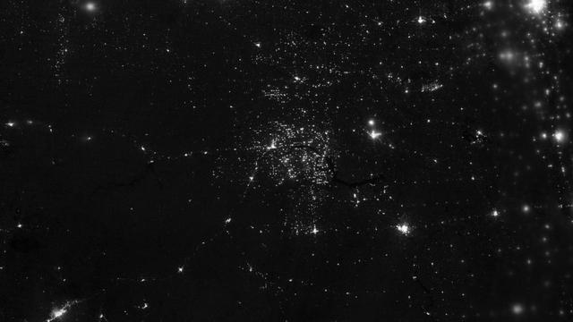
Northwestern North Dakota is one of the least-densely populated parts of the United States. Cities and people are scarce, but satellite imagery shows the area has been aglow at night in recent years. The reason: the area is home to the Bakken shale formation, a site where gas and oil production are booming. On November 12, 2012, the Visible Infrared Imaging Radiometer Suite (VIIRS) on the Suomi NPP satellite captured this nighttime view of widespread drilling throughout the area. Most of the bright specks are lights associated with drilling equipment and temporary housing near drilling sites, though a few are evidence of gas flaring. Some of the brighter areas correspond to towns and cities including Williston, Minot, and Dickinson. The image was captured by the VIIRS “day-night band,” which detects light in a range of wavelengths from green to near-infrared and uses “smart” light sensors to observe dim signals such as gas flares, auroras, wildfires, city lights, and reflected moonlight. When VIIRS acquired the image, the Moon was in its waning crescent phase, so the landscape was reflecting only a small amount of light. According to the U.S. Energy Information Administration, natural gas production from the Bakken shale has increased more than 20-fold between 2007 and 2010. Gas production averaged over 485 million cubic feet per day in September 2011, compared to the 2005 average of about 160 million cubic feet per day. Due to the lack of a gas pipeline and processing facilities in the region, about 29 percent of that gas is flared. NASA Earth Observatory image by Jesse Allen and Robert Simmon, using VIIRS Day-Night Band data from the Suomi National Polar-orbiting Partnership. Suomi NPP is the result of a partnership between NASA, the National Oceanic and Atmospheric Administration, and the Department of Defense. Caption by Adam Voiland. Instrument: Suomi NPP - VIIRS Credit: <b><a href="http://www.earthobservatory.nasa.gov/" rel="nofollow"> NASA Earth Observatory</a></b> <b>Click here to view all of the <a href="http://earthobservatory.nasa.gov/Features/NightLights/" rel="nofollow"> Earth at Night 2012 images </a></b> <b>Click here to <a href="http://earthobservatory.nasa.gov/NaturalHazards/view.php?id=79810" rel="nofollow"> read more </a> about this image </b> <b><a href="http://www.nasa.gov/audience/formedia/features/MP_Photo_Guidelines.html" rel="nofollow">NASA image use policy.</a></b> <b><a href="http://www.nasa.gov/centers/goddard/home/index.html" rel="nofollow">NASA Goddard Space Flight Center</a></b> enables NASA’s mission through four scientific endeavors: Earth Science, Heliophysics, Solar System Exploration, and Astrophysics. Goddard plays a leading role in NASA’s accomplishments by contributing compelling scientific knowledge to advance the Agency’s mission. <b>Follow us on <a href="http://twitter.com/NASA_GoddardPix" rel="nofollow">Twitter</a></b> <b>Like us on <a href="http://www.facebook.com/pages/Greenbelt-MD/NASA-Goddard/395013845897?ref=tsd" rel="nofollow">Facebook</a></b> <b>Find us on <a href="http://instagram.com/nasagoddard?vm=grid" rel="nofollow">Instagram</a></b>
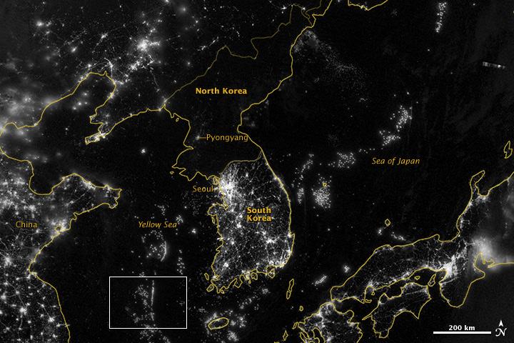
NASA image acquired September 24, 2012 City lights at night are a fairly reliable indicator of where people live. But this isn’t always the case, and the Korean Peninsula shows why. As of July 2012, South Korea’s population was estimated at roughly 49 million people, and North Korea’s population was estimated at about half that number. But where South Korea is gleaming with city lights, North Korea has hardly any lights at all—just a faint glimmer around Pyongyang. On September 24, 2012, the Visible Infrared Imaging Radiometer Suite (VIIRS) on the Suomi NPP satellite captured this nighttime view of the Korean Peninsula. This imagery is from the VIIRS “day-night band,” which detects light in a range of wavelengths from green to near-infrared and uses filtering techniques to observe signals such as gas flares, auroras, wildfires, city lights, and reflected moonlight. The wide-area image shows the Korean Peninsula, parts of China and Japan, the Yellow Sea, and the Sea of Japan. The white inset box encloses an area showing ship lights in the Yellow Sea. Many of the ships form a line, as if assembling along a watery border. Following the 1953 armistice ending the Korean War, per-capita income in South Korea rose to about 17 times the per-capital income level of North Korea, according to the U.S. Central Intelligence Agency. Worldwide, South Korea ranks 12th in electricity production, and 10th in electricity consumption, per 2011 estimates. North Korea ranks 71st in electricity production, and 73rd in electricity consumption, per 2009 estimates. NASA Earth Observatory image by Jesse Allen and Robert Simmon, using VIIRS Day-Night Band data from the Suomi National Polar-orbiting Partnership. Suomi NPP is the result of a partnership between NASA, the National Oceanic and Atmospheric Administration, and the Department of Defense. Caption by Michon Scott. Instrument: Suomi NPP - VIIRS Credit: <b><a href="http://www.earthobservatory.nasa.gov/" rel="nofollow"> NASA Earth Observatory</a></b> <b>Click here to view all of the <a href="http://earthobservatory.nasa.gov/Features/NightLights/" rel="nofollow"> Earth at Night 2012 images </a></b> <b>Click here to <a href="http://earthobservatory.nasa.gov/NaturalHazards/view.php?id=79796" rel="nofollow"> read more </a> about this image </b> <b><a href="http://www.nasa.gov/audience/formedia/features/MP_Photo_Guidelines.html" rel="nofollow">NASA image use policy.</a></b> <b><a href="http://www.nasa.gov/centers/goddard/home/index.html" rel="nofollow">NASA Goddard Space Flight Center</a></b> enables NASA’s mission through four scientific endeavors: Earth Science, Heliophysics, Solar System Exploration, and Astrophysics. Goddard plays a leading role in NASA’s accomplishments by contributing compelling scientific knowledge to advance the Agency’s mission. <b>Follow us on <a href="http://twitter.com/NASA_GoddardPix" rel="nofollow">Twitter</a></b> <b>Like us on <a href="http://www.facebook.com/pages/Greenbelt-MD/NASA-Goddard/395013845897?ref=tsd" rel="nofollow">Facebook</a></b> <b>Find us on <a href="http://instagram.com/nasagoddard?vm=grid" rel="nofollow">Instagram</a></b>
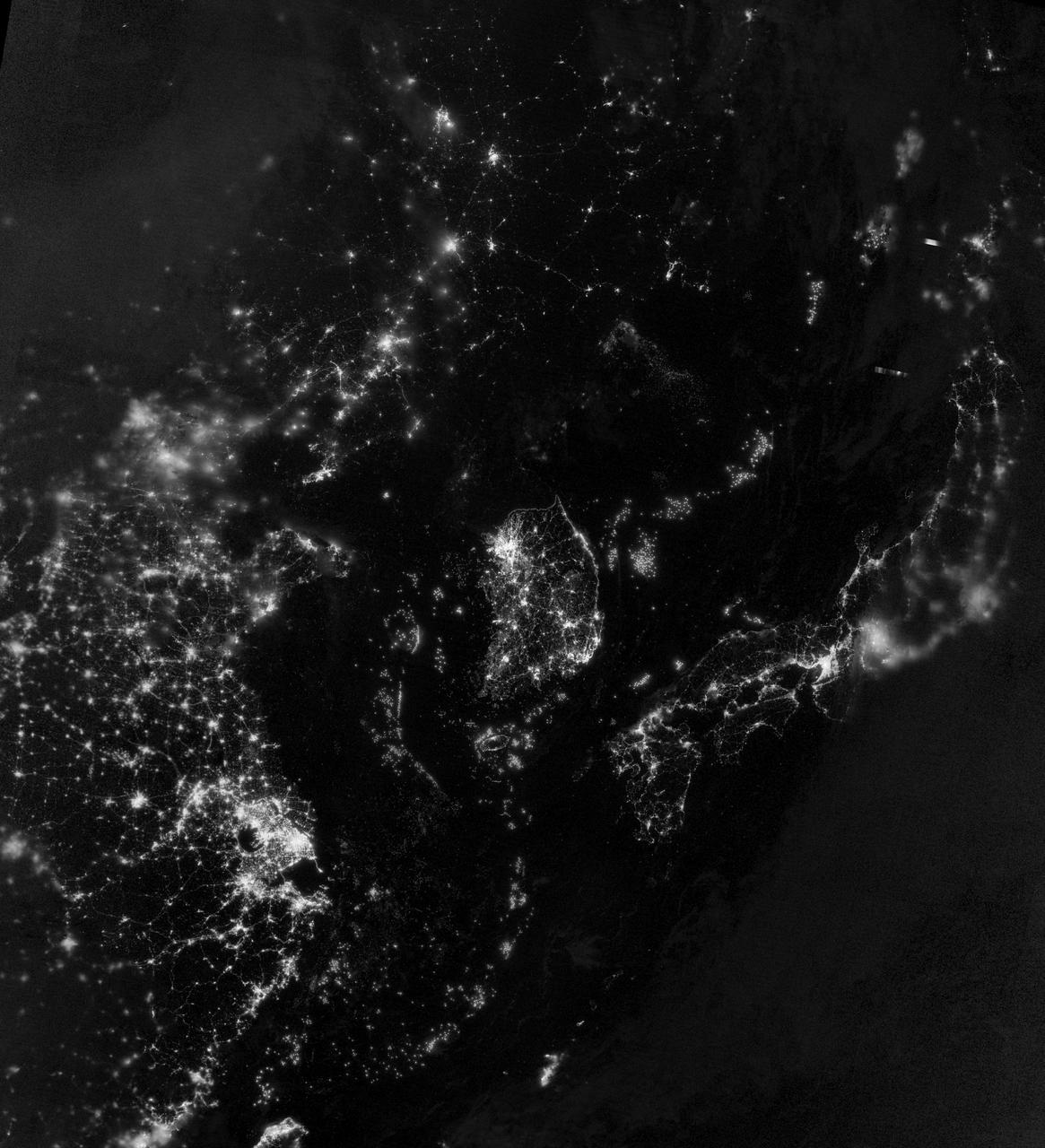
NASA image acquired September 24, 2012 City lights at night are a fairly reliable indicator of where people live. But this isn’t always the case, and the Korean Peninsula shows why. As of July 2012, South Korea’s population was estimated at roughly 49 million people, and North Korea’s population was estimated at about half that number. But where South Korea is gleaming with city lights, North Korea has hardly any lights at all—just a faint glimmer around Pyongyang. On September 24, 2012, the Visible Infrared Imaging Radiometer Suite (VIIRS) on the Suomi NPP satellite captured this nighttime view of the Korean Peninsula. This imagery is from the VIIRS “day-night band,” which detects light in a range of wavelengths from green to near-infrared and uses filtering techniques to observe signals such as gas flares, auroras, wildfires, city lights, and reflected moonlight. The wide-area image shows the Korean Peninsula, parts of China and Japan, the Yellow Sea, and the Sea of Japan. The white inset box encloses an area showing ship lights in the Yellow Sea. Many of the ships form a line, as if assembling along a watery border. Following the 1953 armistice ending the Korean War, per-capita income in South Korea rose to about 17 times the per-capital income level of North Korea, according to the U.S. Central Intelligence Agency. Worldwide, South Korea ranks 12th in electricity production, and 10th in electricity consumption, per 2011 estimates. North Korea ranks 71st in electricity production, and 73rd in electricity consumption, per 2009 estimates. NASA Earth Observatory image by Jesse Allen and Robert Simmon, using VIIRS Day-Night Band data from the Suomi National Polar-orbiting Partnership. Suomi NPP is the result of a partnership between NASA, the National Oceanic and Atmospheric Administration, and the Department of Defense. Caption by Michon Scott. Instrument: Suomi NPP - VIIRS Credit: <b><a href="http://www.earthobservatory.nasa.gov/" rel="nofollow"> NASA Earth Observatory</a></b> <b>Click here to view all of the <a href="http://earthobservatory.nasa.gov/Features/NightLights/" rel="nofollow"> Earth at Night 2012 images </a></b> <b>Click here to <a href="http://earthobservatory.nasa.gov/NaturalHazards/view.php?id=79796" rel="nofollow"> read more </a> about this image </b> <b><a href="http://www.nasa.gov/audience/formedia/features/MP_Photo_Guidelines.html" rel="nofollow">NASA image use policy.</a></b> <b><a href="http://www.nasa.gov/centers/goddard/home/index.html" rel="nofollow">NASA Goddard Space Flight Center</a></b> enables NASA’s mission through four scientific endeavors: Earth Science, Heliophysics, Solar System Exploration, and Astrophysics. Goddard plays a leading role in NASA’s accomplishments by contributing compelling scientific knowledge to advance the Agency’s mission. <b>Follow us on <a href="http://twitter.com/NASA_GoddardPix" rel="nofollow">Twitter</a></b> <b>Like us on <a href="http://www.facebook.com/pages/Greenbelt-MD/NASA-Goddard/395013845897?ref=tsd" rel="nofollow">Facebook</a></b> <b>Find us on <a href="http://instagram.com/nasagoddard?vm=grid" rel="nofollow">Instagram</a></b>
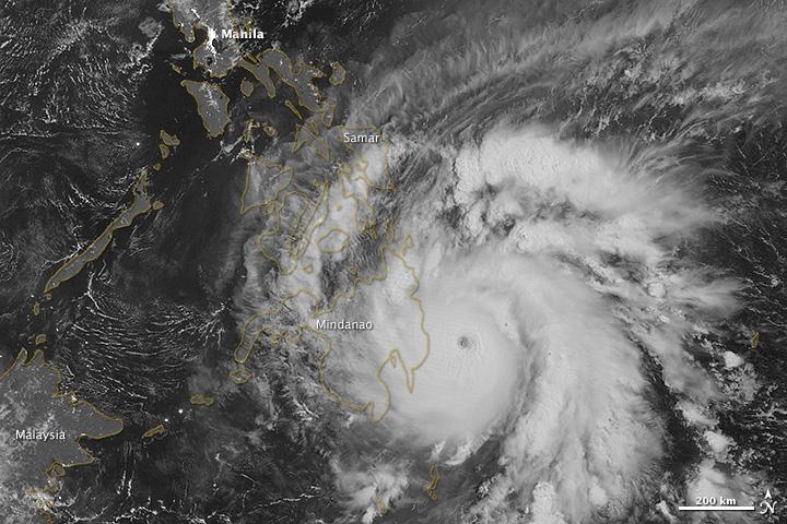
NASA image acquired December 3, 2012 As predicted, Typhoon Bopha made landfall on the Philippine island of Mindanao overnight December 3–4, 2012. Known in the Philippines as Pablo, the storm was blamed for 43 deaths and 25 injuries as of December 4, according to the Philippine Daily Inquirer. (To view the high res or to read more go to: <a href="http://1.usa.gov/XnYhVG" rel="nofollow">1.usa.gov/XnYhVG</a>) The Visible Infrared Imaging Radiometer Suite (VIIRS) on the Suomi NPP satellite acquired this image around 1:12 a.m. local time on December 4 (17:12 UTC on December 3). This image is from the VIIRS “day-night band,” which detects light in a range of wavelengths from green to near-infrared and uses filtering techniques to observe signals such as gas flares, auroras, wildfires, city lights, and reflected moonlight. Bopha remained a powerful typhoon as it made landfall on Mindanao, retaining a distinct eye and spiral shape as storm clouds stretched over the eastern part of the island. Unisys Weather reported that Bopha carried super-typhoon strength at the time it was coming ashore. William Straka, associate researcher at the Cooperative Institute for Meteorological Satellite Studies at the University of Wisconsin–Madison, estimated that the storm spanned at least 1,677 kilometers (1,042 miles). Bopha lost some strength after making landfall. On December 4 (late in the evening in the Philippines), the U.S. Navy’s Joint Typhoon Warning Center (JTWC) reported that the storm had maximum sustained winds of 95 knots (175 kilometers per hour) and gusts up to 115 knots (215 kilometers per hour)—still a fierce storm, but weakened since the previous day. The JTWC projected storm track showed Bopha continuing its movement toward the west-northwest, passing over the southern Philippines toward the South China Sea. NASA Earth Observatory image by Jesse Allen, using VIIRS day-night band data from the Suomi National Polar-orbiting Partnership. Suomi NPP is the result of a partnership between NASA, the National Oceanic and Atmospheric Administration, and the Department of Defense. Caption by Michon Scott. Instrument: Suomi NPP - VIIRS Credit: <b><a href="http://www.earthobservatory.nasa.gov/" rel="nofollow"> NASA Earth Observatory</a></b> <b><a href="http://www.nasa.gov/audience/formedia/features/MP_Photo_Guidelines.html" rel="nofollow">NASA image use policy.</a></b> <b><a href="http://www.nasa.gov/centers/goddard/home/index.html" rel="nofollow">NASA Goddard Space Flight Center</a></b> enables NASA’s mission through four scientific endeavors: Earth Science, Heliophysics, Solar System Exploration, and Astrophysics. Goddard plays a leading role in NASA’s accomplishments by contributing compelling scientific knowledge to advance the Agency’s mission. <b>Follow us on <a href="http://twitter.com/NASA_GoddardPix" rel="nofollow">Twitter</a></b> <b>Like us on <a href="http://www.facebook.com/pages/Greenbelt-MD/NASA-Goddard/395013845897?ref=tsd" rel="nofollow">Facebook</a></b> <b>Find us on <a href="http://instagrid.me/nasagoddard/?vm=grid" rel="nofollow">Instagram</a></b>
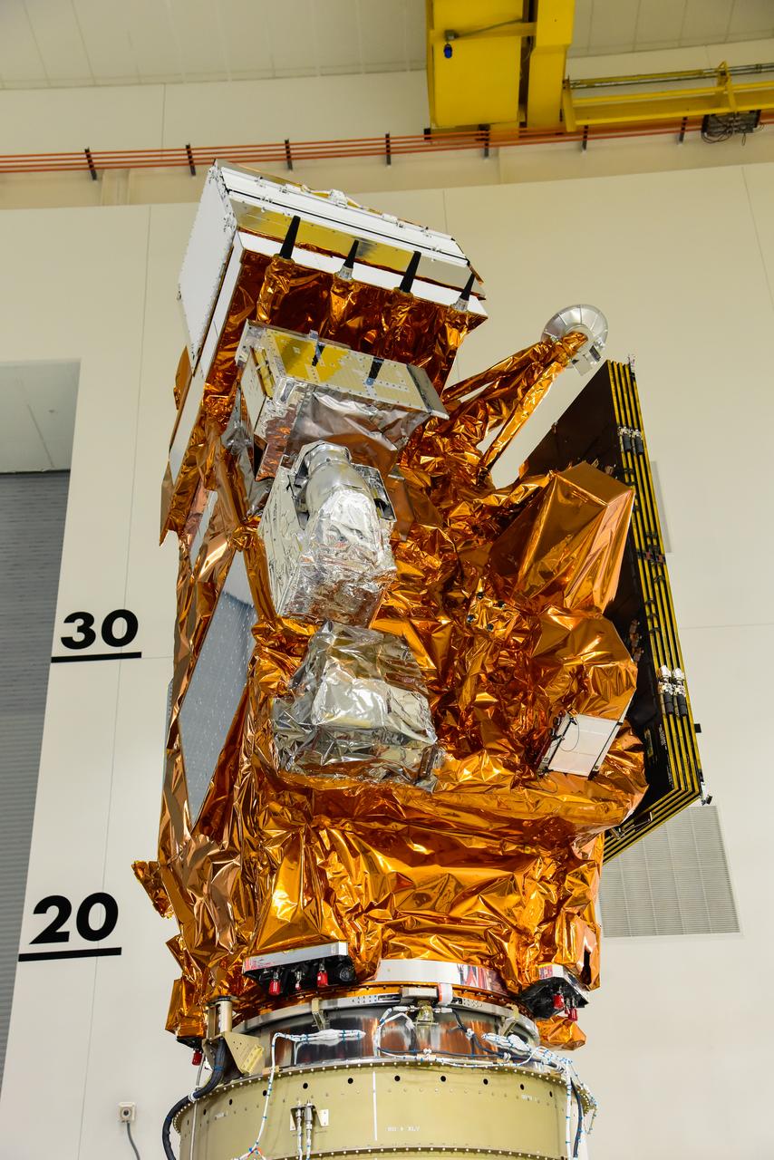
The National Oceanic and Atmospheric Administration’s (NOAA) Joint Polar Satellite System-2 (JPSS-2) is in view inside the Astrotech Space Operations facility at Vandenberg Space Force Base (VSFB) in California on Oct. 12, 2022. JPSS-2 is being prepared for encapsulation inside United Launch Alliance Atlas V payload fairing. The satellite is stacked atop NASA’s Low-Earth Orbit Flight Test of an Inflatable Decelerator (LOFTID) secondary payload. JPSS-2 is the third satellite in the Joint Polar Satellite System series. It is scheduled to lift off from VSFB on Nov. 1 from Space Launch Complex-3. JPSS-2, which will be renamed NOAA-21 after reaching orbit, will join a constellation of JPSS satellites that orbit from the North to the South pole, circling Earth 14 times a day and providing a full view of the entire globe twice daily. The NOAA/NASA Suomi National Polar-orbiting Partnership (Suomi NPP) satellite, and NOAA-20, previously known as JPSS-1, are both already in orbit. Each satellite carries at least four advanced instruments to measure weather and climate conditions on Earth. LOFTID is dedicated to the memory of Bernard Kutter. LOFTID will demonstrate inflatable heat shield technology that could enable a variety of proposed NASA missions to destinations such as Mars, Venus, and Titan, as well as returning heavier payloads from low-Earth orbit.
The United Launch Alliance Atlas V payload fairing containing the National Oceanic and Atmospheric Administration’s (NOAA) Joint Polar Satellite System-2 (JPSS-2) is lifted by crane at the vertical integration facility at Space Launch Complex 3 at Vandenberg Space Force Base (VSFB) in California on Oct. 18, 2022. Inside the fairing, JPSS-2 is stacked atop NASA’s Low-Earth Orbit Flight Test of an Inflatable Decelerator (LOFTID) secondary payload. JPSS-2 is the third satellite in the Joint Polar Satellite System series. It is scheduled to lift off from VSFB on Nov. 1 from SLC-3. JPSS-2, which will be renamed NOAA-21 after reaching orbit, will join a constellation of JPSS satellites that orbit from the North to the South pole, circling Earth 14 times a day and providing a full view of the entire globe twice daily. The NOAA/NASA Suomi National Polar-orbiting Partnership (Suomi NPP) satellite, and NOAA-20, previously known as JPSS-1, are both already in orbit. Each satellite carries at least four advanced instruments to measure weather and climate conditions on Earth. LOFTID is dedicated to the memory of Bernard Kutter. LOFTID will demonstrate inflatable heat shield technology that could enable a variety of proposed NASA missions to destinations such as Mars, Venus, and Titan, as well as returning heavier payloads from low-Earth orbit.