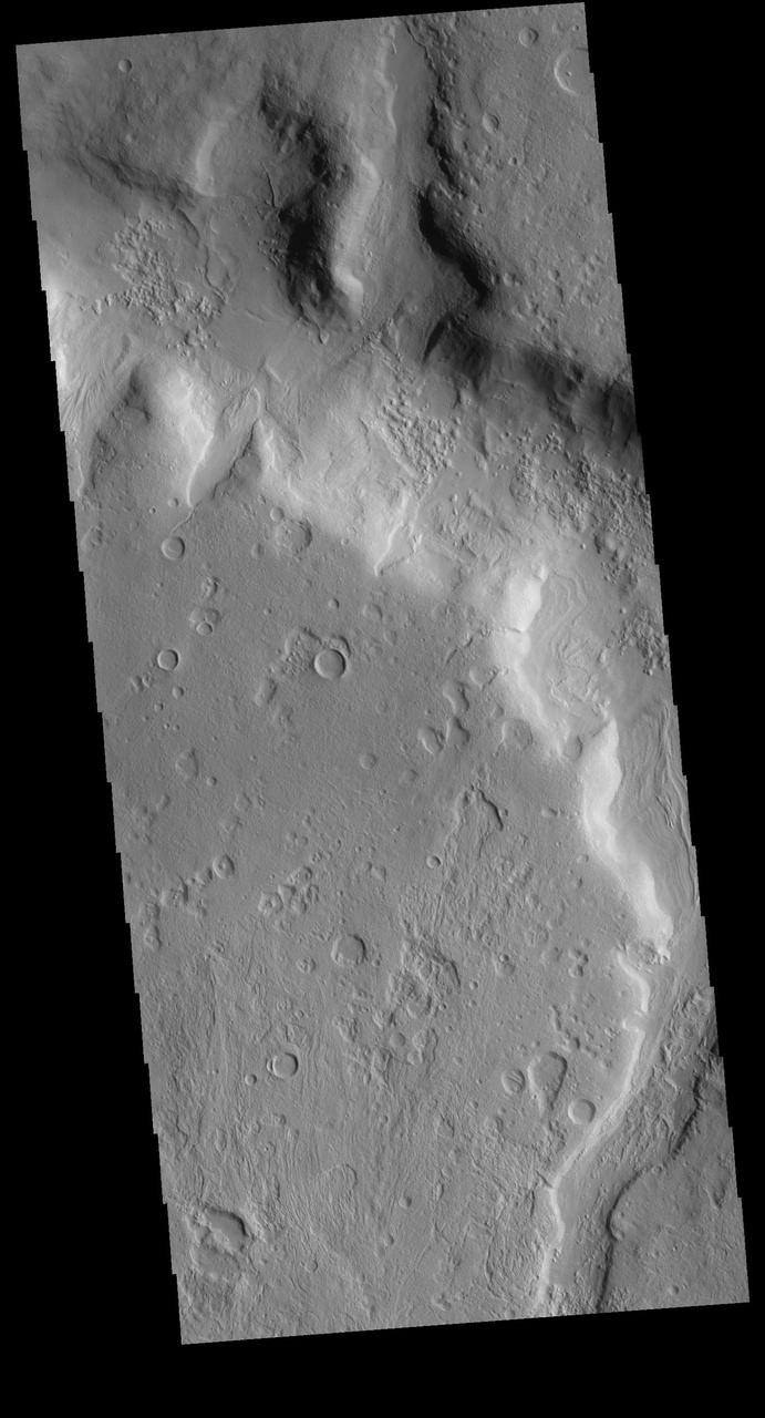
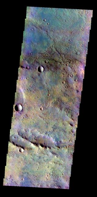
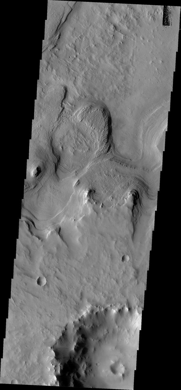
Terra Sabaea
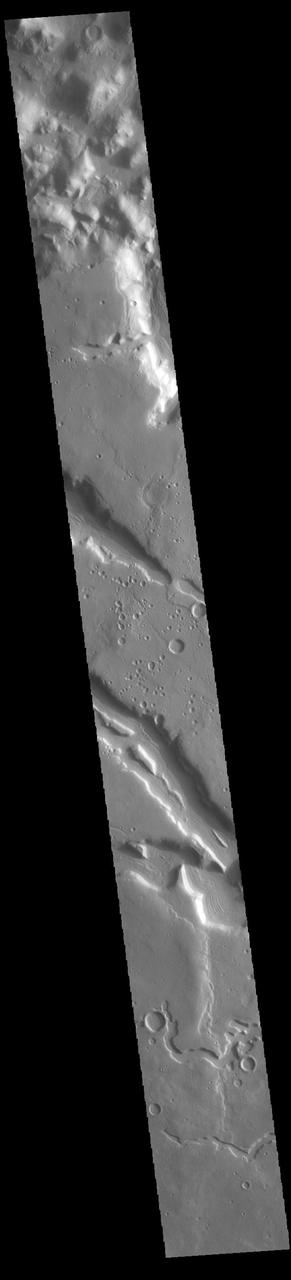
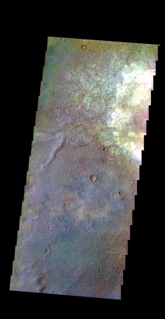
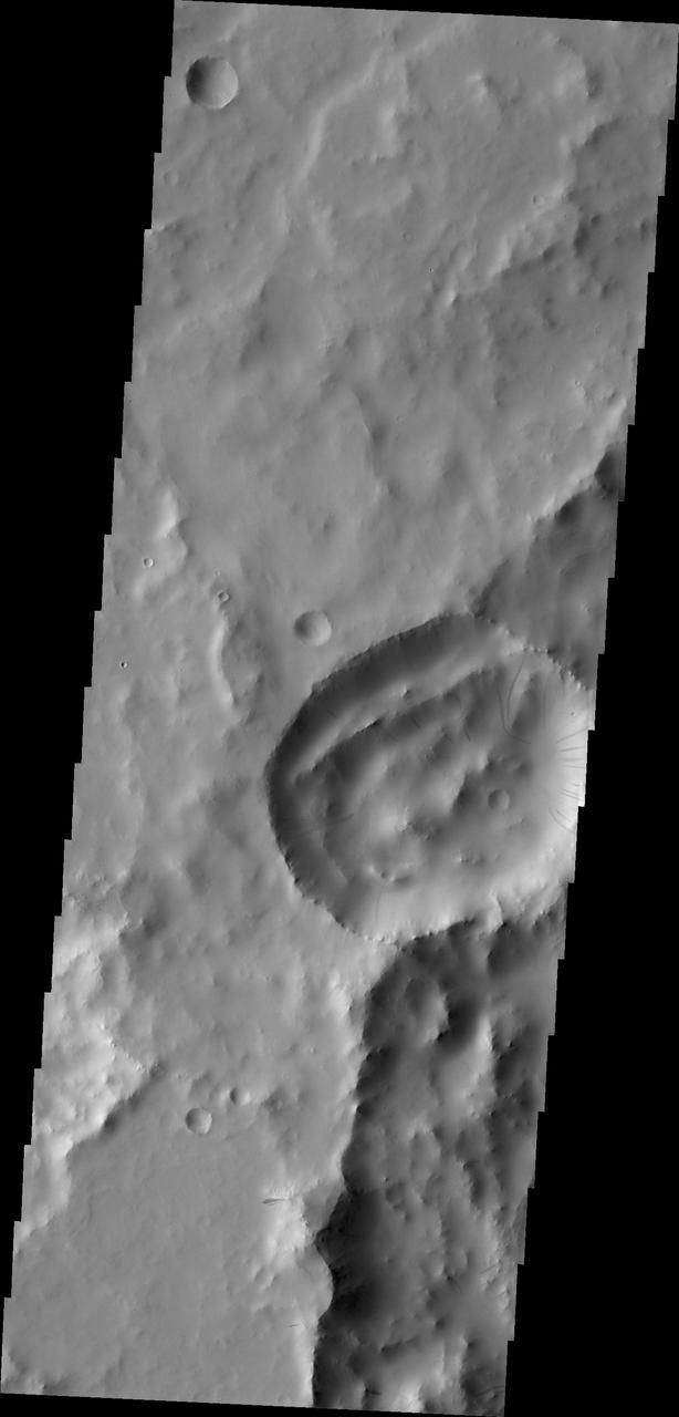
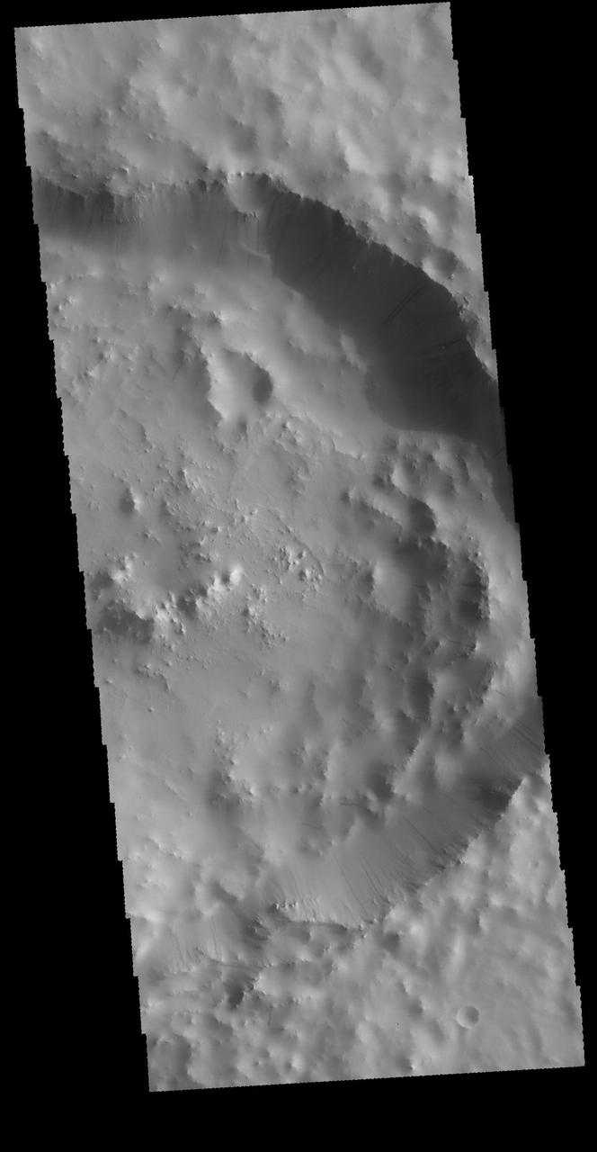
Terra Sabaea
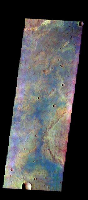
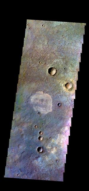
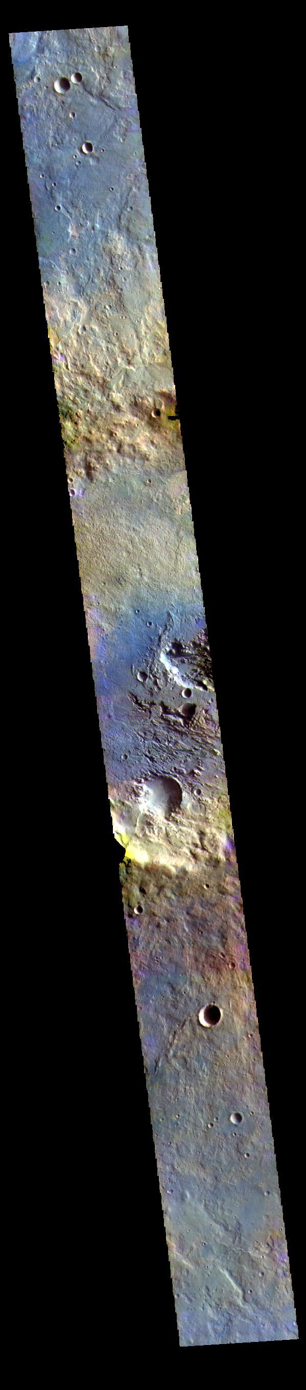
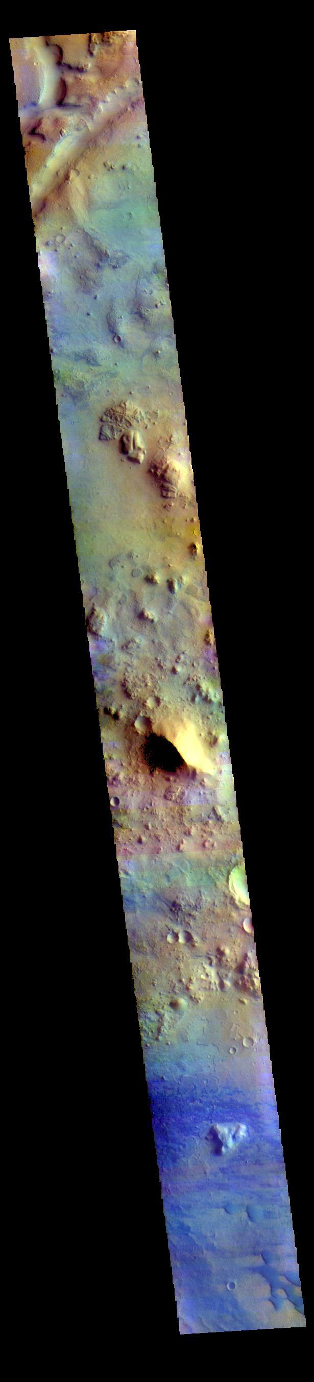
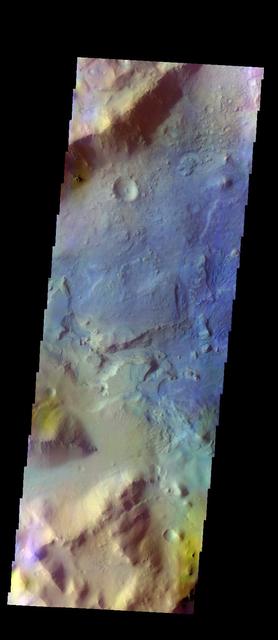
The THEMIS VIS camera contains 5 filters. The data from different filters can be combined in multiple ways to create a false color image. These false color images may reveal subtle variations of the surface not easily identified in a single band image. Today's false color image shows part of Terra Sabaea. Orbit Number: 45137 Latitude: 18.9344 Longitude: 75.7307 Instrument: VIS Captured: 2012-02-16 20:17 http://photojournal.jpl.nasa.gov/catalog/PIA21169
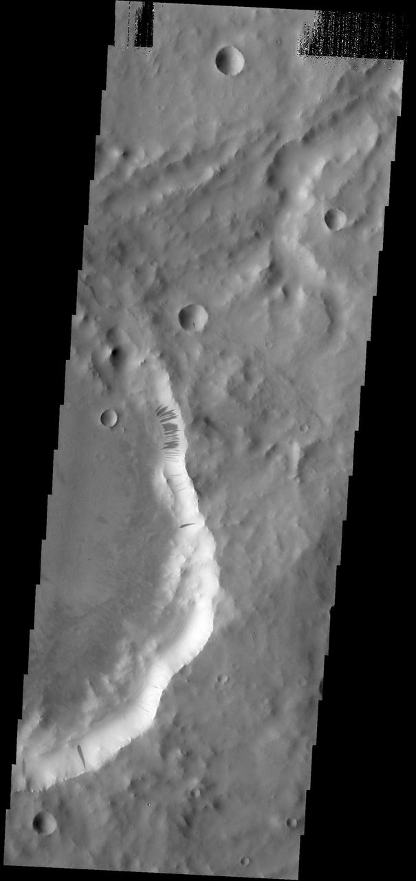
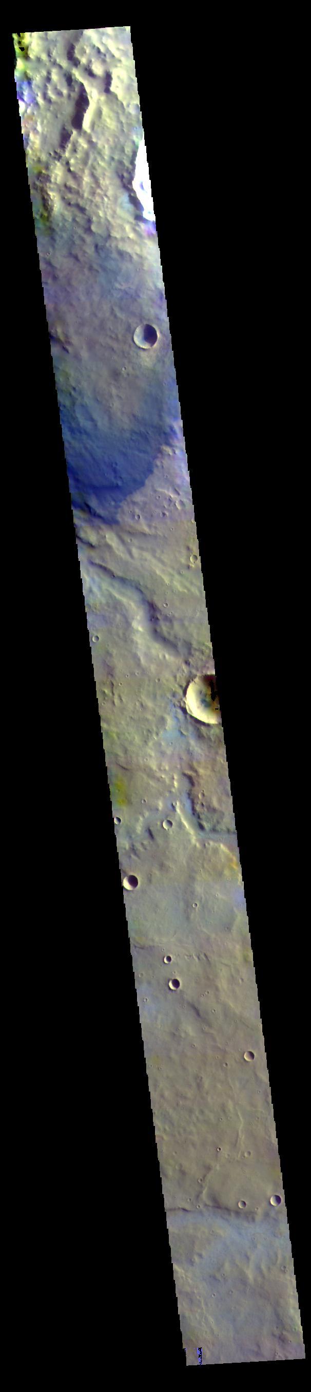
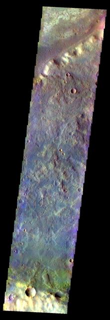
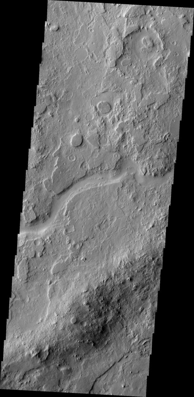
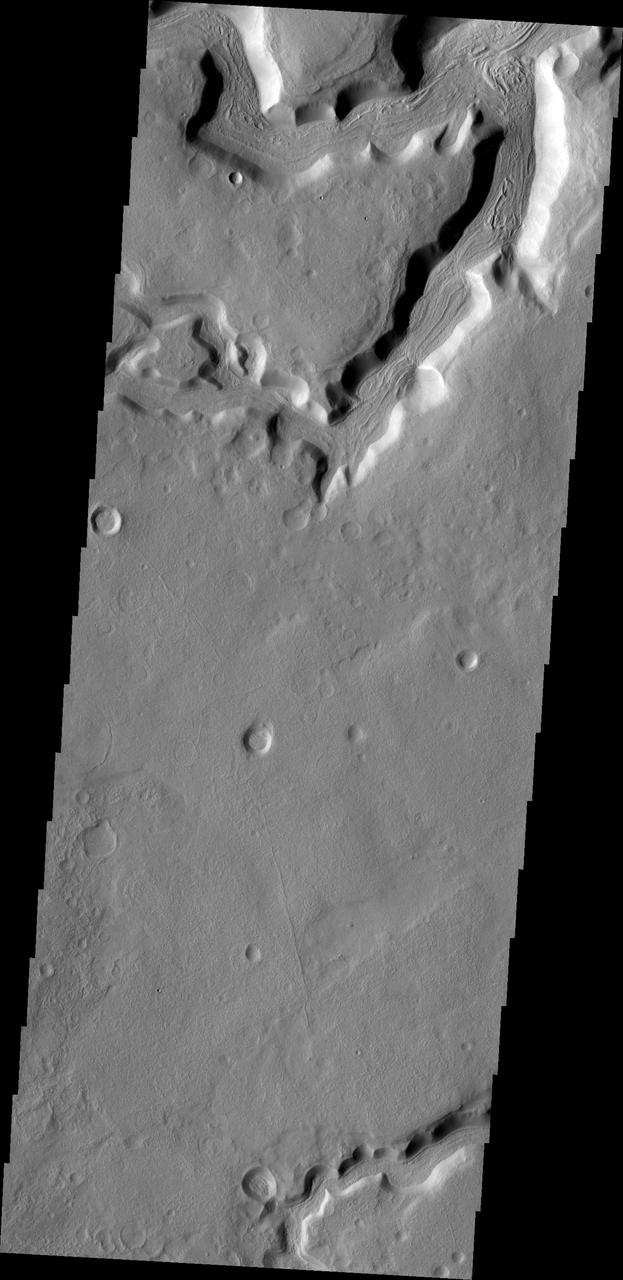
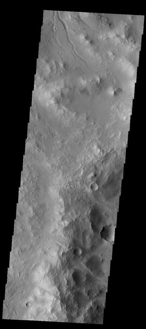
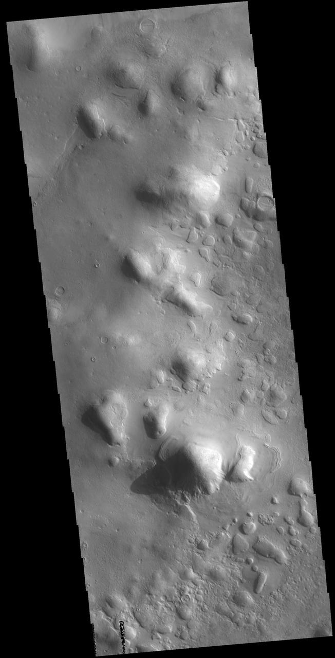
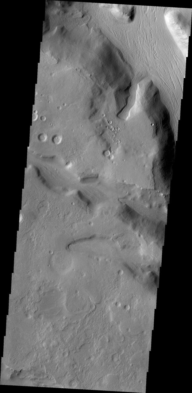
More Terra Sabaea
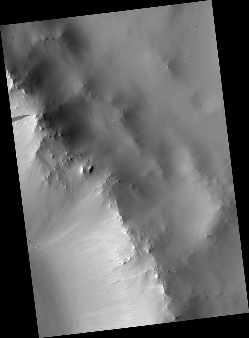
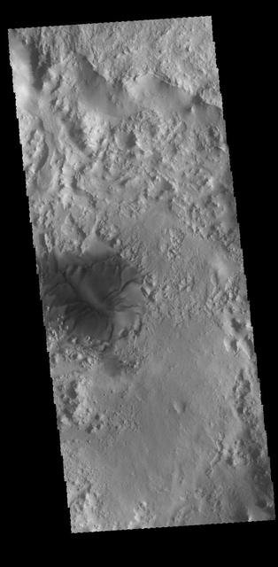
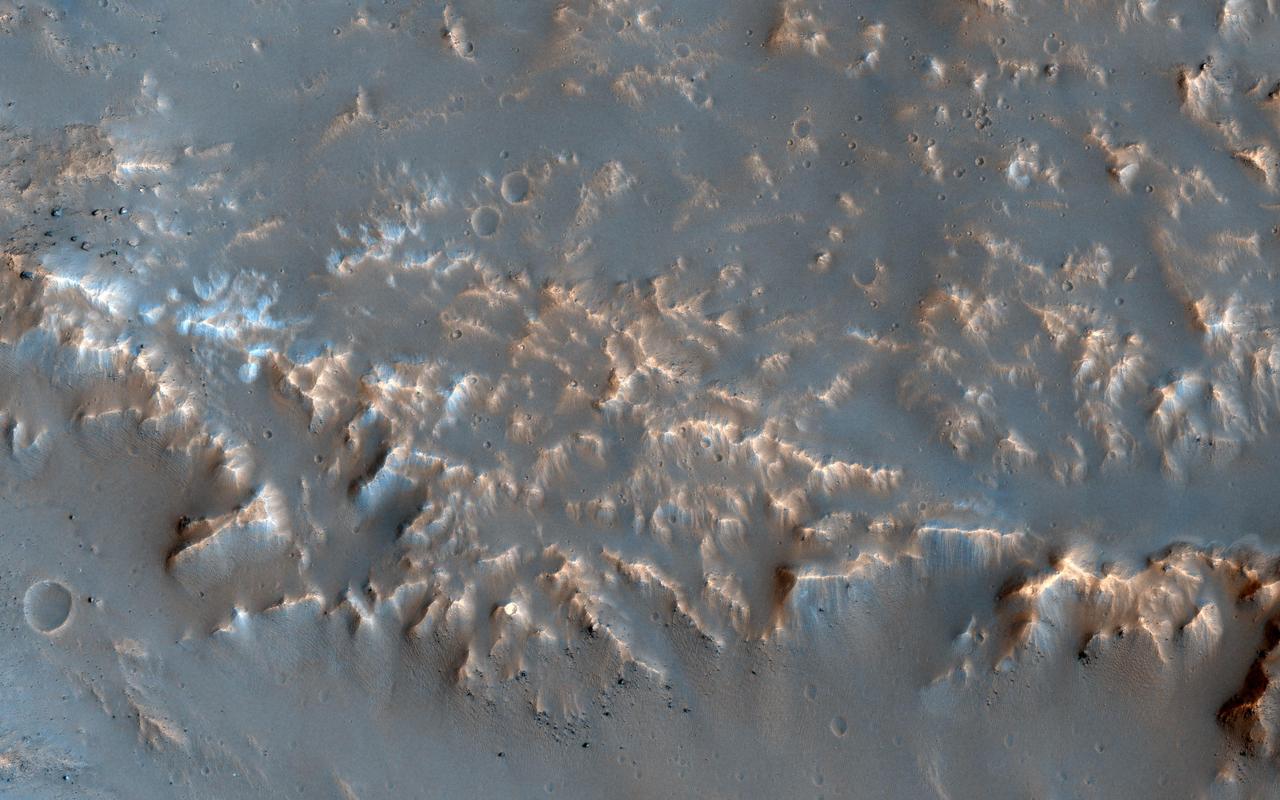
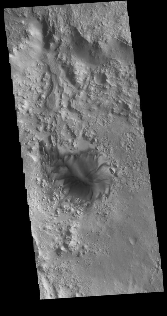
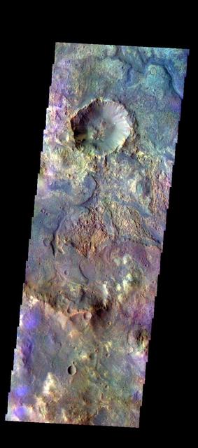
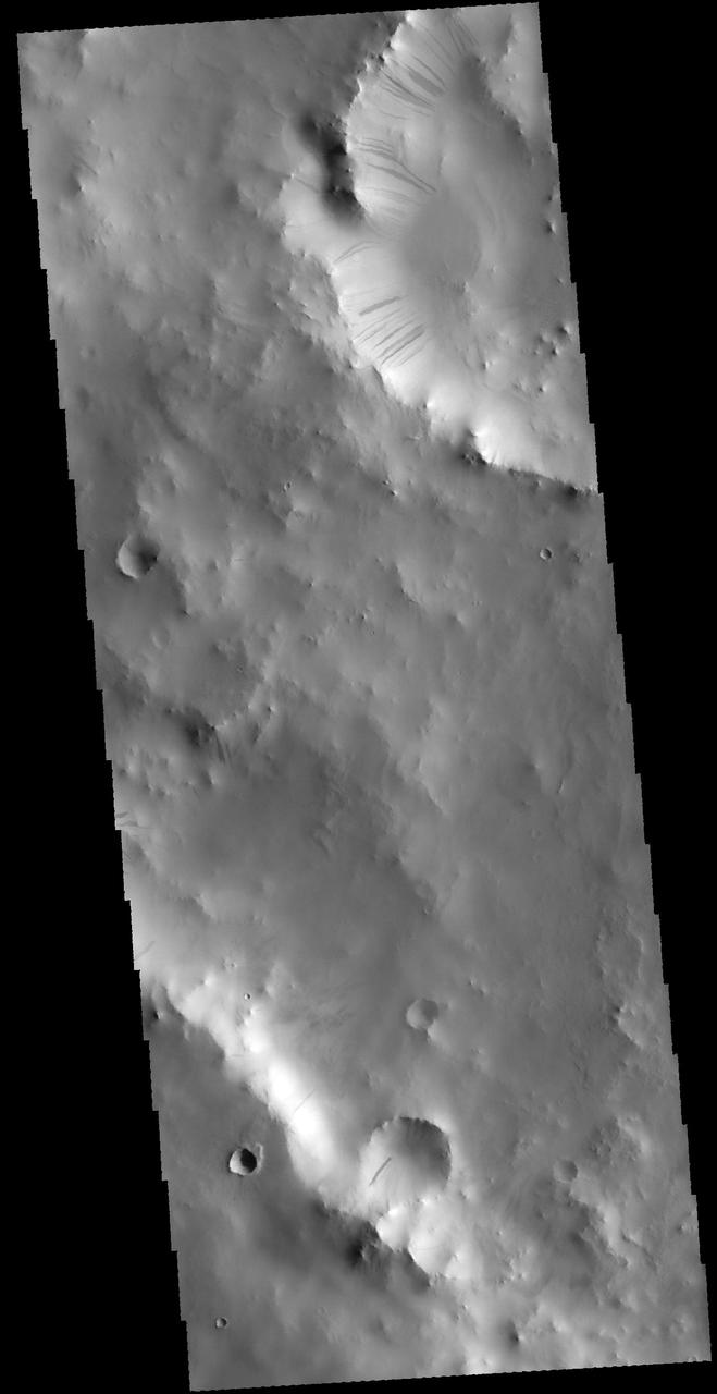
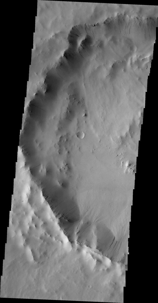
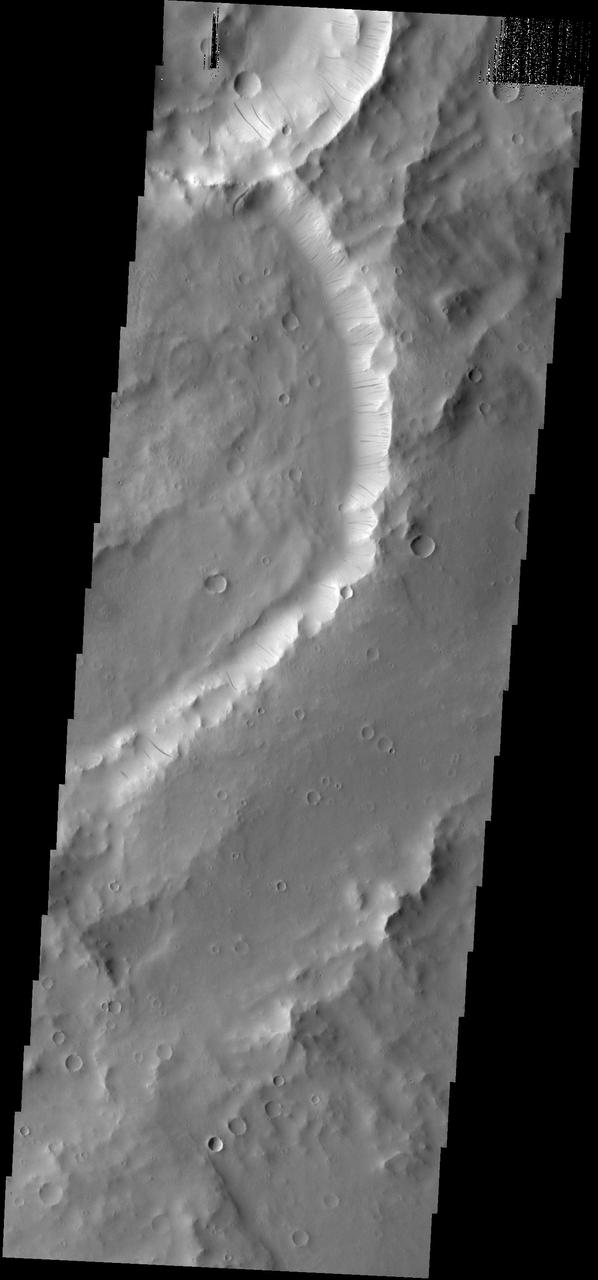
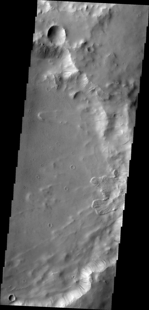
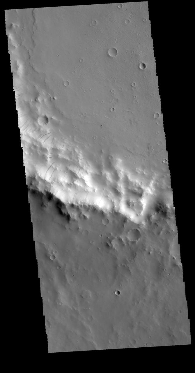
Slope Streaks in Terra Sabaea
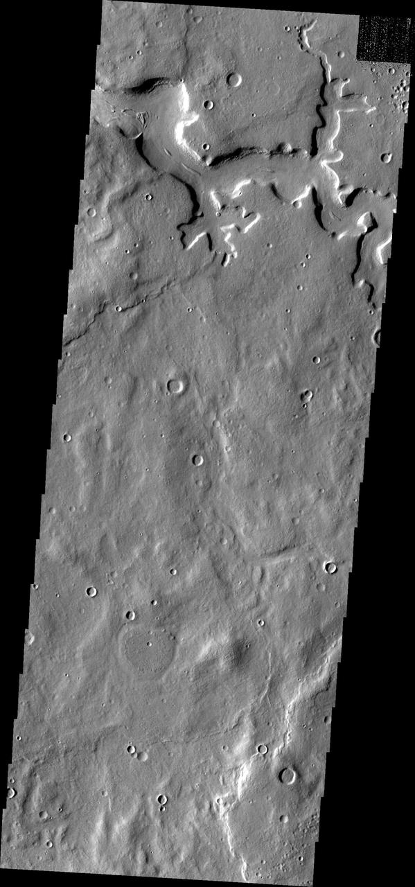
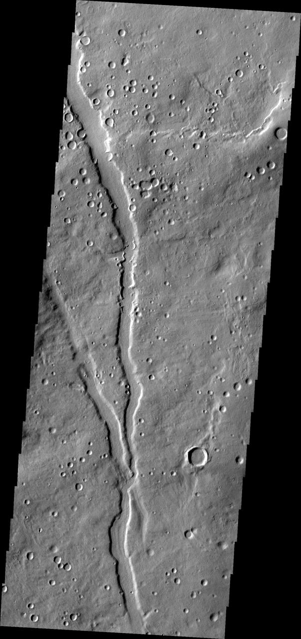
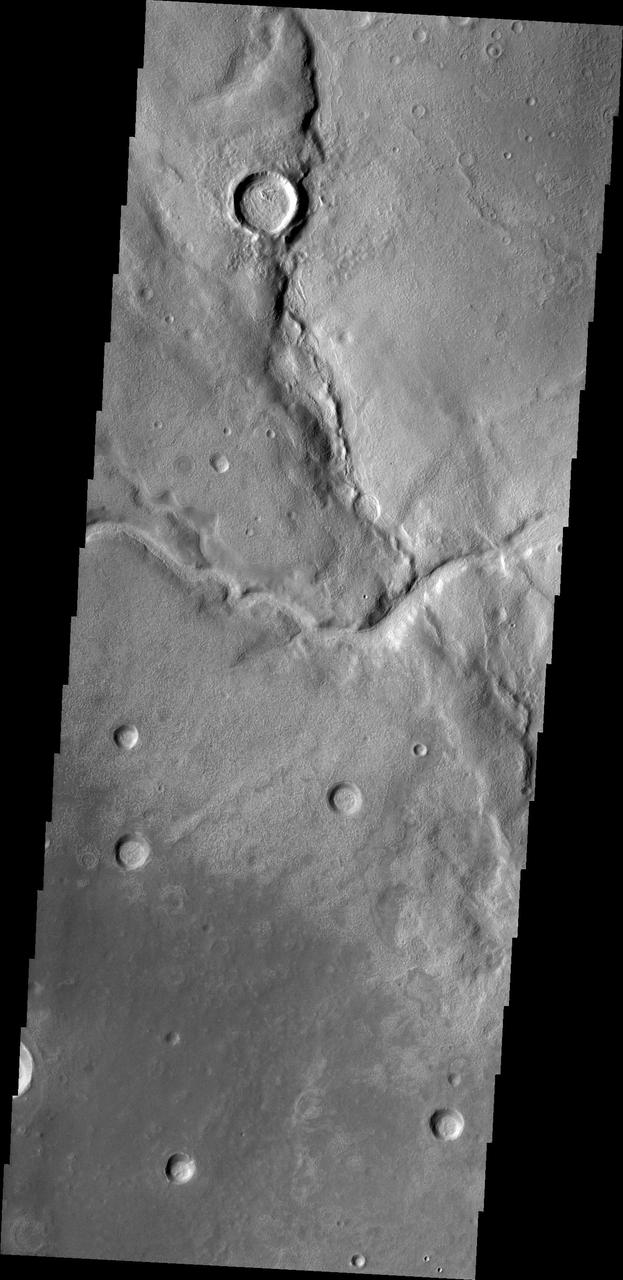
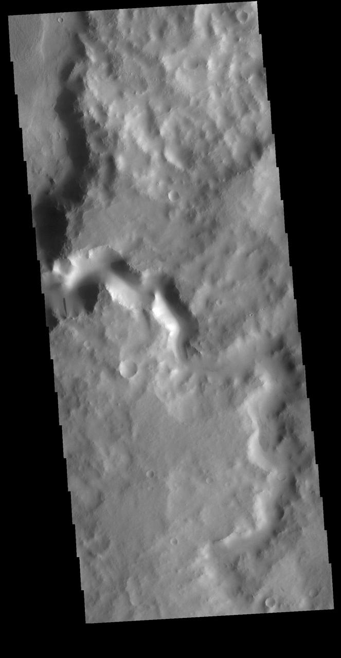
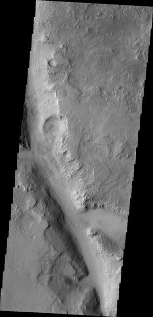
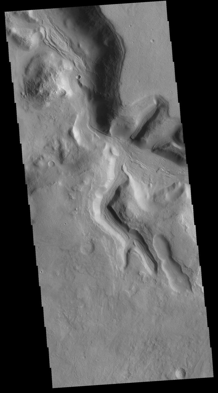
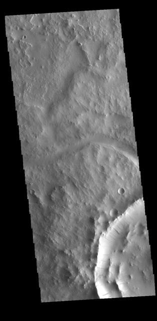
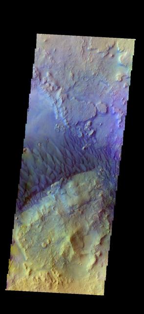
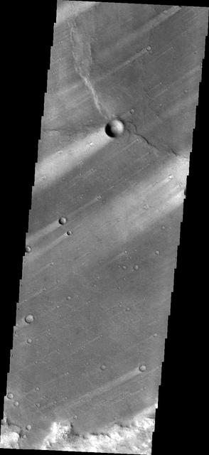
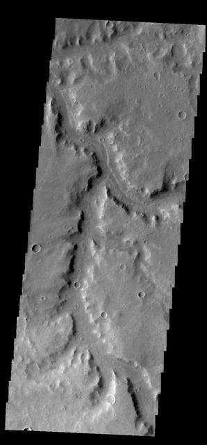
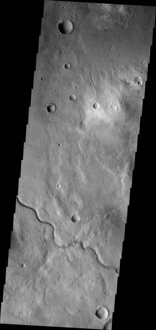
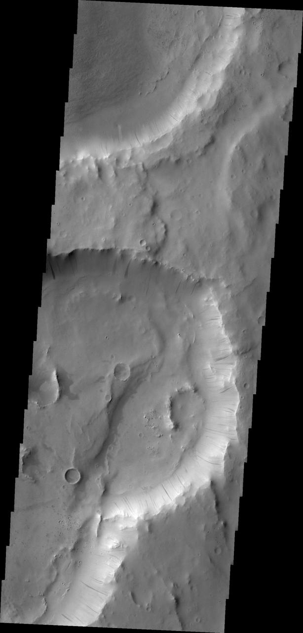
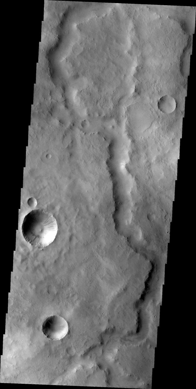
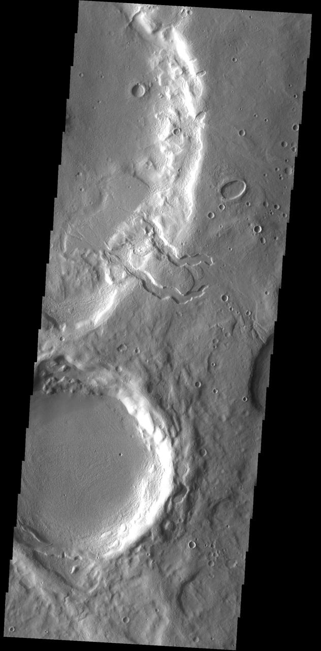
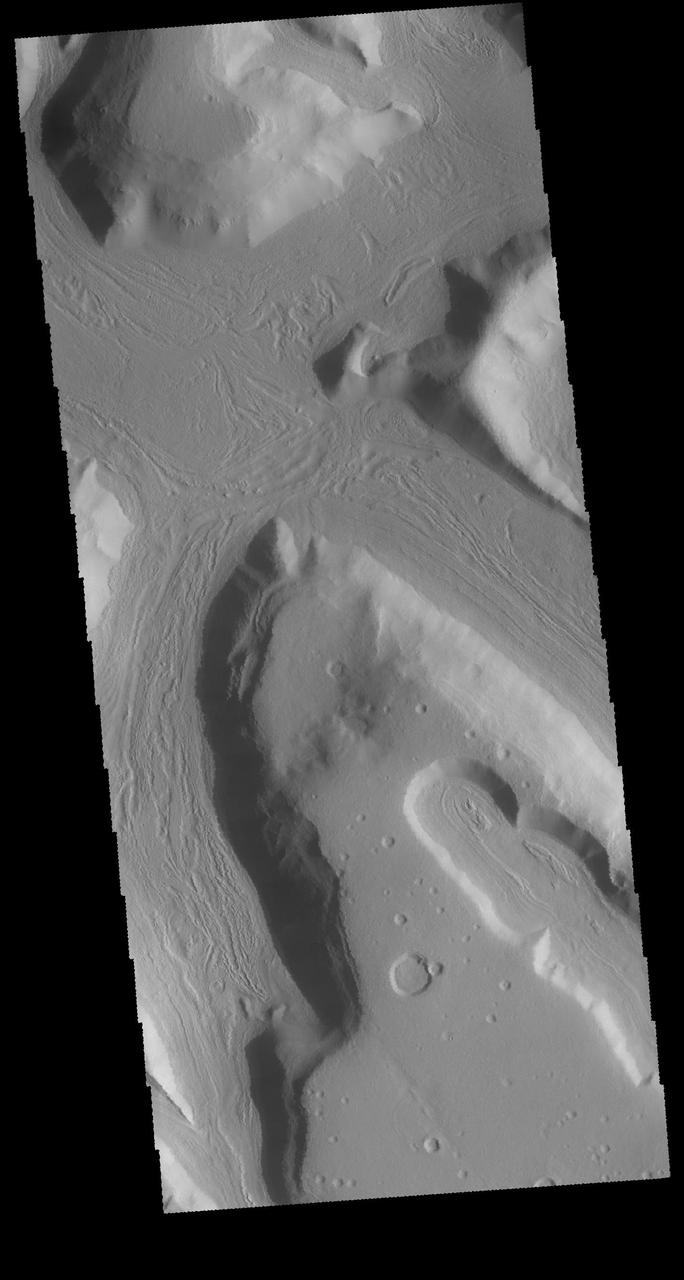
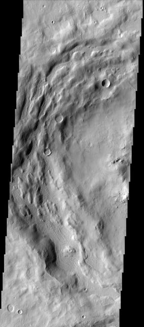
Terra Sabaea Channel
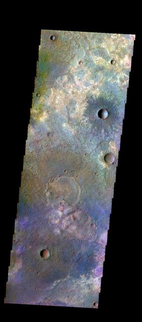
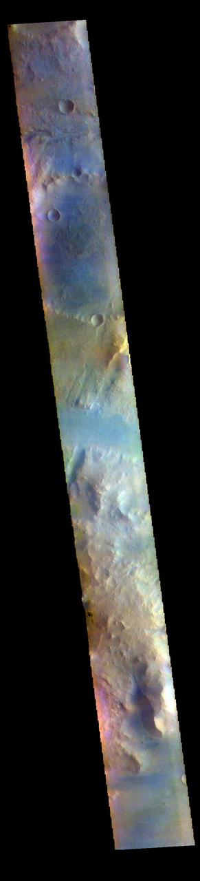
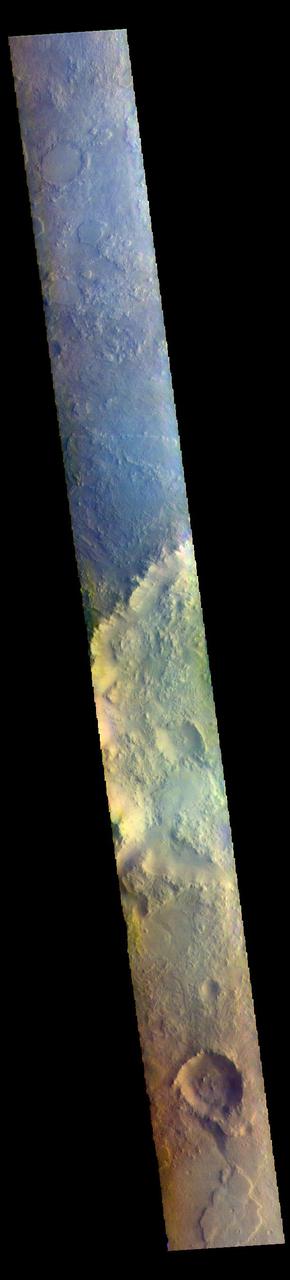
The THEMIS VIS camera contains 5 filters. The data from different filters can be combined in multiple ways to create a false color image. These false color images may reveal subtle variations of the surface not easily identified in a single band image. Today's false color image shows part of the plains of Terra Sabaea. Orbit Number: 49034 Latitude: -25.4878 Longitude: 44.1368 Instrument: VIS Captured: 2013-01-02 12:26 http://photojournal.jpl.nasa.gov/catalog/PIA21200
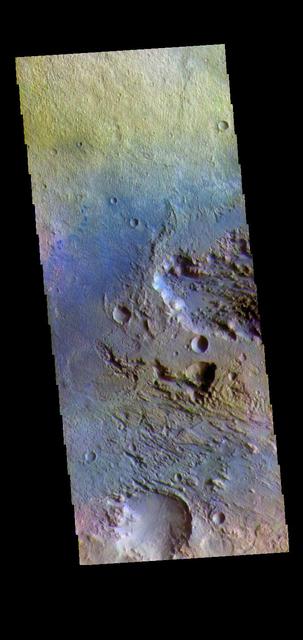
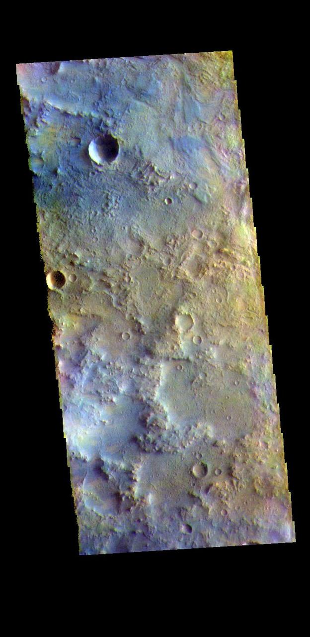
The THEMIS VIS camera contains 5 filters. The data from different filters can be combined in multiple ways to create a false color image. These false color images may reveal subtle variations of the surface not easily identified in a single band image. Today's false color image shows some of the extensive plains that comprise Terra Sabaea. Orbit Number: 50907 Latitude: -24.7157 Longitude: 44.6408 Instrument: VIS Captured: 2013-06-05 15:43 http://photojournal.jpl.nasa.gov/catalog/PIA21281
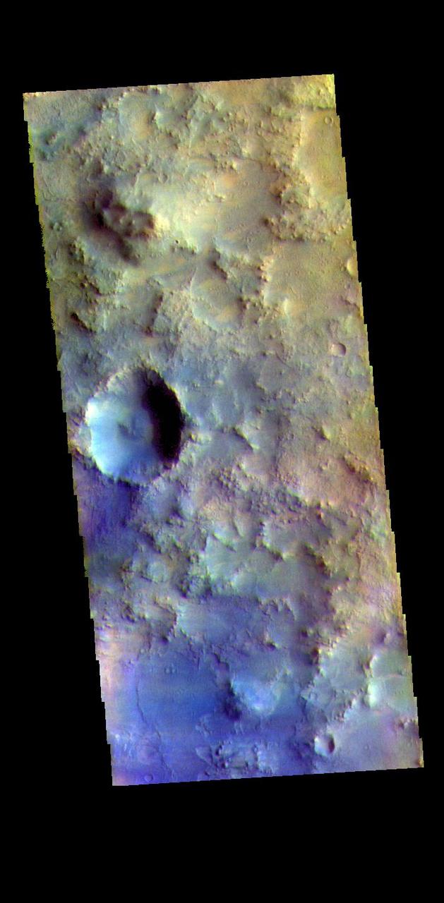
The THEMIS VIS camera contains 5 filters. The data from different filters can be combined in multiple ways to create a false color image. These false color images may reveal subtle variations of the surface not easily identified in a single band image. Today's false color image shows part of the plains in Terra Sabaea. Orbit Number: 43466 Latitude: -24.3218 Longitude: 44.5089 Instrument: VIS Captured: 2011-10-02 05:41 http://photojournal.jpl.nasa.gov/catalog/PIA21010
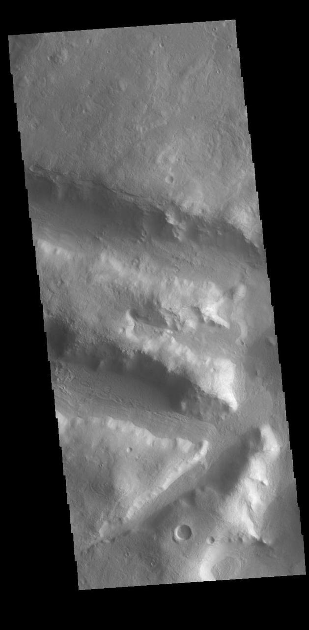
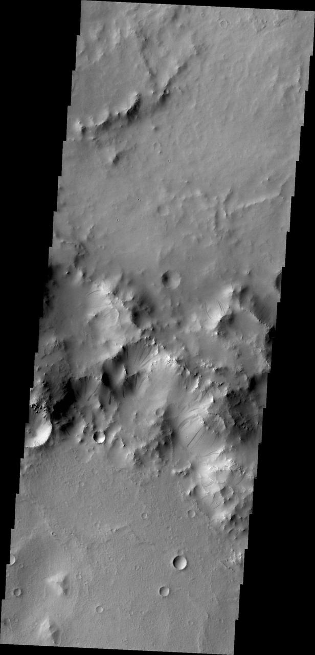
Today's VIS image is located in northern Terra Sabaea, on the topographic boundary between the highlands of Terra Sabaea and the lower elevations of Utopia Planitia. Numerous channels and graben dissect this region. Orbit Number: 94023 Latitude: 33.809 Longitude: 67.6676 Instrument: VIS Captured: 2023-02-24 03:59 https://photojournal.jpl.nasa.gov/catalog/PIA25943

The northern margin of Terra Sabaea has numerous channels. This image from NASA 2001 Mars Odyssey spacecraft shows a portion of an unnamed channel on the margin of Terra Sabaea.

This image captured by NASA 2001 Mars Odyssey spacecraft shows a small unnamed channel in Terra Sabaea.
The northern margins of Arabia Terra and Terra Sabaea contain many unnamed channels. This channel is located in Terra Sabaea. The channel flow is toward the top of the image. This channel has been covered by craters at the top of the image, showing that the channel flow occurred prior to the impacts that created the craters. Orbit Number: 71240 Latitude: 37.1087 Longitude: 40.9077 Instrument: VIS Captured: 2018-01-05 01:18 https://photojournal.jpl.nasa.gov/catalog/PIA22376
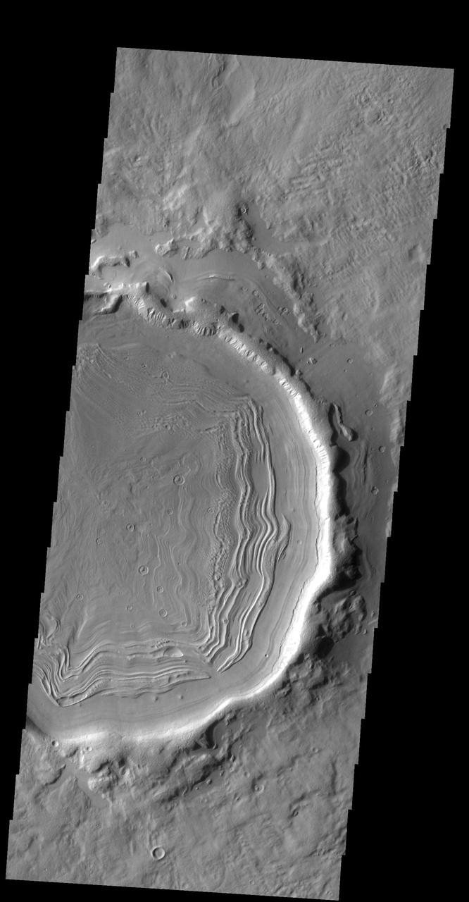
This old crater in Terra Sabaea has patterned floor material that is indicative of having a volitile component. At high latitudes the volitile is most likely ice
NASA Mars Odyssey captured this unnamed channel is west of Flammarion Crater in Terra Sabaea on July 23, 2010.
Today's VIS image shows an unnamed channel in northern Terra Sabaea. The regional boundary between the highlands of Terra Sabaea and lowlands of Utopia Planitia is heavily dissected by both fluid flow channels and extensive faulting. Orbit Number: 86125 Latitude: 38.054 Longitude: 39.8599 Instrument: VIS Captured: 2021-05-14 20:22 https://photojournal.jpl.nasa.gov/catalog/PIA24224
This VIS image shows an unnamed channel located in northern Terra Sabaea. Many channels dissect this complex region between the higher elevations of Terra Sabaea and the lowlands of the northern plains. Orbit Number: 79773 Latitude: 40.1128 Longitude: 47.4749 Instrument: VIS Captured: 2019-12-08 20:04 https://photojournal.jpl.nasa.gov/catalog/PIA23709
Today's VIS image shows an unnamed channel in northern Terra Sabaea. The regional boundary between the highlands of Terra Sabaea and lowlands of Utopia Planitia is heavily dissected by both fluid flow channels and extensive faulting. Orbit Number: 79922 Latitude: 28.8312 Longitude: 70.6552 Instrument: VIS Captured: 2019-12-21 02:28 https://photojournal.jpl.nasa.gov/catalog/PIA23741
Today's VIS image shows an unnamed channel in Terra Sabaea. The channel is flowing into the crater just visible in the upper left portion of the image. Orbit Number: 81221 Latitude: 6.14616 Longitude: 38.9585 Instrument: VIS Captured: 2020-04-06 01:20 https://photojournal.jpl.nasa.gov/catalog/PIA23946
The large isolated dune in this VIS image is located on the floor of an unnamed crater in Terra Sabaea. Orbit Number: 64218 Latitude: 26.2102 Longitude: 57.11 Instrument: VIS Captured: 2016-06-05 12:48 http://photojournal.jpl.nasa.gov/catalog/PIA20802
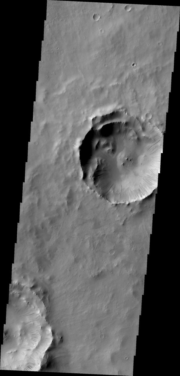
Many dark slope streaks mark the rim of this unnamed crater in Terra Sabaea in this image from NASA 2001 Mars Odyssey spacecraft.
This VIS image shows one of the numerous unnamed channels in northern Terra Sabaea. Orbit Number: 71327 Latitude: 40.229 Longitude: 49.1826 Instrument: VIS Captured: 2018-01-12 05:20 https://photojournal.jpl.nasa.gov/catalog/PIA22384
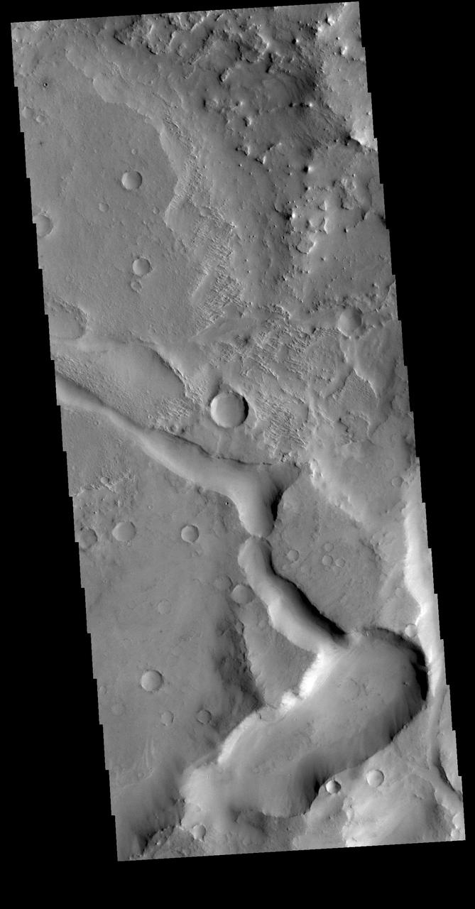
This image taken by NASA 2001 Mars Odyssey shows just one of the many channels located in the northern part of Terra Sabaea which is heavily fractured and channeled, breaking up into a chaotic terrain as the elevation drops down to the northern plains.

Gravity has caused materials to move down the rim of this crater in Terra Sabaea. In this image from NASA 2001 Mars Odyssey, thinner dark slope streaks are less common than broader, lighter markings of downslope movement of materials.

The THEMIS VIS camera contains 5 filters. The data from different filters can be combined in multiple ways to create a false color image. These false color images may reveal subtle variations of the surface not easily identified in a single band image. Today's false color image shows part of Terra Sabaea. Orbit Number: 82045 Latitude: -7.03114 Longitude: 28.9564 Instrument: VIS Captured: 2020-06-12 21:36 https://photojournal.jpl.nasa.gov/catalog/PIA24706

The THEMIS VIS camera contains 5 filters. The data from different filters can be combined in multiple ways to create a false color image. These false color images may reveal subtle variations of the surface not easily identified in a single band image. Today's false color image shows part of Terra Sabaea. Orbit Number: 78225 Latitude: 25.1943 Longitude: 70.6546 Instrument: VIS Captured: 2019-08-03 08:46 https://photojournal.jpl.nasa.gov/catalog/PIA24652
The THEMIS VIS camera contains 5 filters. The data from different filters can be combined in multiple ways to create a false color image. These false color images may reveal subtle variations of the surface not easily identified in a single band image. Today's false color image shows part of Terra Sabaea. Orbit Number: 63009 Latitude: -4.68262 Longitude: 30.975 Instrument: VIS Captured: 2016-02-26 22:42 https://photojournal.jpl.nasa.gov/catalog/PIA23198
This image of a well-preserved unnamed elliptical crater in Terra Sabaea, is illustrative of the complexity of ejecta deposits forming as a by-product of the impact process that shapes much of the surface of Mars. Here we see a portion of the western ejecta deposits emanating from a 10-kilometer impact crater that occurs within the wall of a larger, 60-kilometer-wide crater. In the central part is a lobe-shaped portion of the ejecta blanket from the smaller crater. The crater is elliptical not because of an angled (oblique) impact, but because it occurred on the steep slopes of the wall of a larger crater. This caused it to be truncated along the slope and elongated perpendicular to the slope. As a result, any impact melt from the smaller crater would have preferentially deposited down slope and towards the floor of the larger crater (towards the west). Within this deposit, we can see fine-scale morphological features in the form of a dense network of small ridges and pits. These crater-related pitted materials are consistent with volatile-rich impact melt-bearing deposits seen in some of the best-preserved craters on Mars (e.g., Zumba, Zunil, etc.). These deposits formed immediately after the impact event, and their discernible presence relate to the preservation state of the crater. This image is an attempt to visualize the complex formation and emplacement history of these enigmatic deposits formed by this elliptical crater and to understand its degradation history. http://photojournal.jpl.nasa.gov/catalog/PIA13078
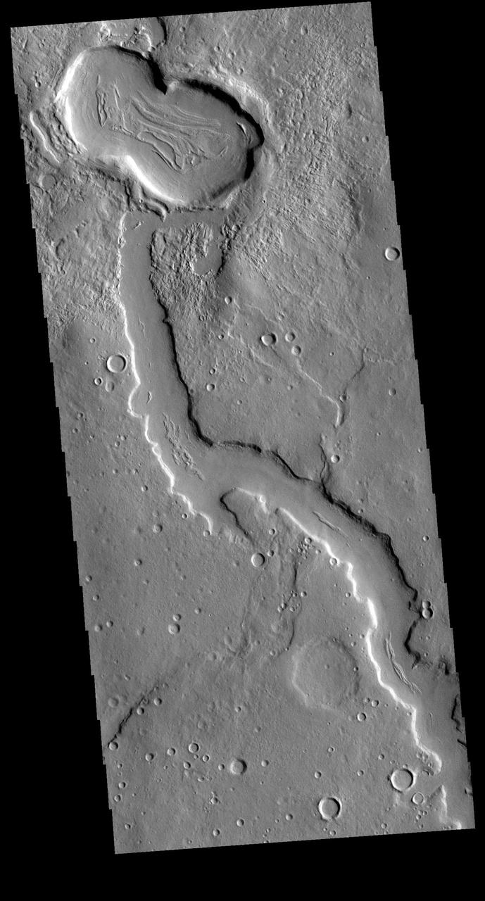
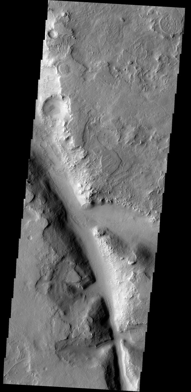
Today's VIS image shows part of the northeastern margin of Terra Sabaea. This regional boundary between the highlands of Terra Sabaea and lowlands of Utopia Planitia is heavily dissected by both fluid flow channels and extensive faulting. While many of the channels are unnamed, this image has three named channels: Clasia Vallis (center of image with ridge in the middle of the channel), Hypsas Vallis (the next channel below Clasia Vallis) and Clanis Valles (the very shallow channel at the bottom of the image). Clasia Vallis is 147km (91 miles) long, Hypsas Vallis is 33km (20 miles) long. and Clanis Valles is 58km (36 miles) long. Orbit Number: 94223 Latitude: 34.7195 Longitude: 57.7232 Instrument: VIS Captured: 2023-03-12 15:13 https://photojournal.jpl.nasa.gov/catalog/PIA25993
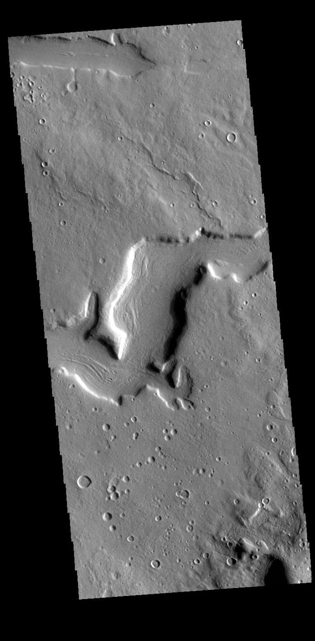
The northern margin of Terra Sabaea is a complex area between a cratered highland and complexly eroded lower plains. This VIS image of the region shows just one of the numerous unnamed channels. The 90 degree bends indicate tectonic fractures have played a part in the channel formation. Orbit Number: 71863 Latitude: 32.1944 Longitude: 59.4512 Instrument: VIS Captured: 2018-02-25 09:02 https://photojournal.jpl.nasa.gov/catalog/PIA22405
Today's VIS image shows an unnamed crater in Terra Sabaea. The central peak of the crater has been surrounded by a deposit of material that is easily eroded, as shown by the wind eroded features on the south side of the deposit. Several craters in this region have large deposits of materials on the crater floor. These deposits postdate the formation of the craters, and have themselves by eroded over time. It is very likely that wind played a roll in the deposition of materials as well as the subsequent erosion. Orbit Number: 93875 Latitude: 7.99639 Longitude: 20.9896 Instrument: VIS Captured: 2023-02-11 23:23 https://photojournal.jpl.nasa.gov/catalog/PIA25909

The THEMIS VIS camera contains 5 filters. The data from different filters can be combined in multiple ways to create a false color image. These false color images may reveal subtle variations of the surface not easily identified in a single band image. Today's false color image shows part of Terra Sabaea near Isidis Planitia. Orbit Number: 77576 Latitude: 17.8943 Longitude: 76.8019 Instrument: VIS Captured: 2019-06-10 22:04 https://photojournal.jpl.nasa.gov/catalog/PIA24632
Today's VIS image shows multiple channel systems located in northern Terra Sabaea. Two of the channels are named: Hypsas Vallis and Clanis Valles, visible in the lower half of the image. Clanis Valles is 54km long (33 miles), while Hypsas Vallis is only 33km long (20 miles). Orbit Number: 93967 Latitude: 33.912 Longitude: 58.1199 Instrument: VIS Captured: 2023-02-19 13:57 https://photojournal.jpl.nasa.gov/catalog/PIA25937
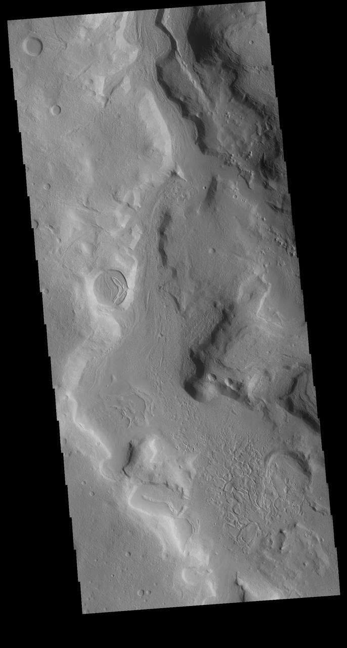
Today's VIS image shows part of a heavily eroded crater near the northern margin of Terra Sabaea. This region is heavily eroded and dissected by a multitude of unnamed channels, regions of chaos and old craters. This crater has a channel within it, seen on the right side of this image. Orbit Number: 86149 Latitude: 31.175 Longitude: 68.5579 Instrument: VIS Captured: 2021-05-16 19:45 https://photojournal.jpl.nasa.gov/catalog/PIA24226
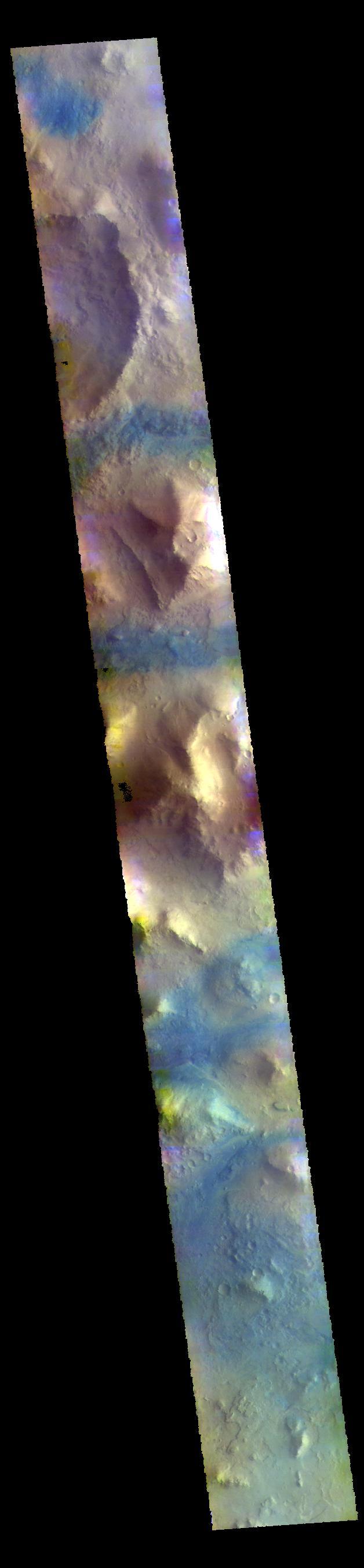
Today's false color image shows plains and unnamed craters in Terra Sabaea. The THEMIS VIS camera contains 5 filters. The data from different filters can be combined in multiple ways to create a false color image. These false color images may reveal subtle variations of the surface not easily identified in a single band image. Orbit Number: 63545 Latitude: -25.0077 Longitude: 46.0332 Instrument: VIS Captured: 2016-04-11 02:07 https://photojournal.jpl.nasa.gov/catalog/PIA23254
Today's VIS image shows an interesting sand dune on the floor of an unnamed crater in Terra Sabaea. With close inspection, multiple dust devil tracks are visible along the margins of the dune. Orbit Number: 79049 Latitude: 26.1914 Longitude: 57.0391 Instrument: VIS Captured: 2019-10-10 05:14 https://photojournal.jpl.nasa.gov/catalog/PIA23564
The THEMIS camera contains 5 filters. The data from different filters can be combined in multiple ways to create a false color image. This image captured by NASA 2001 Mars Odyssey spacecraft shows part of the plains of Terra Sabaea.

The THEMIS camera contains 5 filters. The data from different filters can be combined in multiple ways to create a false color image. This image from NASA 2001 Mars Odyssey spacecraft shows part of the plains of Terra Sabaea.

The THEMIS camera contains 5 filters. The data from different filters can be combined in multiple ways to create a false color image. This image from NASA 2001 Mars Odyssey spacecraft shows a variety of surface materials in the plains of Sabaea Terra.
This VIS image shows several dark slope streaks on the inner rim of an unnamed crater in Terra Sabaea. These features are thought to be formed by downslope movement of material the removes some of the surface dust, revealing the darker rock beneath. The channel to the north of the crater is Indus Vallis. Orbit Number: 68696 Latitude: 18.7889 Longitude: 40.4151 Instrument: VIS Captured: 2017-06-09 10:50 https://photojournal.jpl.nasa.gov/catalog/PIA21792
The THEMIS VIS camera contains 5 filters. The data from different filters can be combined in multiple ways to create a false color image. These false color images may reveal subtle variations of the surface not easily identified in a single band image. Today's false color image shows part of Terra Sabaea between the graben of Nili Fossae (depression at the top of the image) and the lowlands of Isidis Planitia. Small sand dunes are visible near the bottom of the image. Dark blue tones in this filter combination indicate basaltic sands. Orbit Number: 78075 Latitude: 21.3155 Longitude: 79.0343 Instrument: VIS Captured: 2019-07-22 00:17 https://photojournal.jpl.nasa.gov/catalog/PIA24640

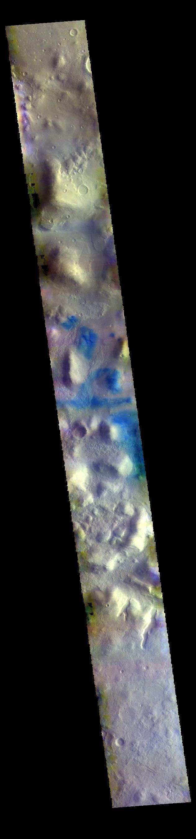
This VIS image shows part of northern Terra Sabaea. Blue tones in false color images usually indicate basaltic sand. The THEMIS VIS camera contains 5 filters. The data from different filters can be combined in multiple ways to create a false color image. These false color images may reveal subtle variations of the surface not easily identified in a single band image. Orbit Number: 61910 Latitude: 37.5082 Longitude: 57.7093 Instrument: VIS Captured: 2015-11-28 10:37 https://photojournal.jpl.nasa.gov/catalog/PIA23086
Today's VIS image shows part of northern Terra Sabaea, where hills are common. The blue tones are usually locations of basaltic sand. The THEMIS VIS camera contains 5 filters. The data from different filters can be combined in multiple ways to create a false color image. These false color images may reveal subtle variations of the surface not easily identified in a single band image. Orbit Number: 60587 Latitude: 34.6347 Longitude: 66.5714 Instrument: VIS Captured: 2015-08-11 11:50 https://photojournal.jpl.nasa.gov/catalog/PIA22710
The THEMIS VIS camera contains 5 filters. The data from different filters can be combined in multiple ways to create a false color image. These false color images may reveal subtle variations of the surface not easily identified in a single band image. Today's false color image shows part of Terra Sabaea. Dark blue tones in this filter combination indicate basaltic sands. Orbit Number: 78125 Latitude: 17.9126 Longitude: 76.888 Instrument: VIS Captured: 2019-07-26 03:05 https://photojournal.jpl.nasa.gov/catalog/PIA24651
This VIS image is located on the floor of an unnamed crater between Terra Sabaea and Utopia Planitia. The center of the image contains several regions of sand dunes. The dunes occupy the lowest elevation of the crater. Towards the bottom of the image is an unusual texture, most likely created by movement of a volatile rich material down towards the center of the crater. This may have formed in a glacial type material, rich in ice. Orbit Number: 72399 Latitude: 42.5577 Longitude: 67.2377 Instrument: VIS Captured: 2018-04-10 12:49 https://photojournal.jpl.nasa.gov/catalog/PIA22583
The THEMIS VIS camera contains 5 filters. The data from different filters can be combined in multiple ways to create a false color image. These false color images may reveal subtle variations of the surface not easily identified in a single band image. Today's false color image shows dunes on the floor of an unnamed crater in Terra Sabaea. Orbit Number: 45125 Latitude: 26.6761 Longitude: 62.9345 Instrument: VIS Captured: 2012-02-15 20:32 http://photojournal.jpl.nasa.gov/catalog/PIA21168
The THEMIS camera contains 5 filters. The data from different filters can be combined in multiple ways to create a false color image. These false color images may reveal subtle variations of the surface not easily identified in a single band image. Today's false color image shows some of the plains of Sabaea Terra. Orbit Number: 41618 Latitude: -23.3082 Longitude: 70.4753 Instrument: VIS Captured: 2011-05-03 02:21 http://photojournal.jpl.nasa.gov/catalog/PIA20790

The THEMIS VIS camera contains 5 filters. The data from different filters can be combined in multiple ways to create a false color image. This image from NASA 2001 Mars Odyssey spacecraft shows part of a linear depression in the plains of Terra Sabaea. Orbit Number: 7639 Latitude: -19.6085 Longitude: 41.1023 Instrument: VIS Captured: 2003-09-04 08:52 http://photojournal.jpl.nasa.gov/catalog/PIA19486
The THEMIS VIS camera contains 5 filters. The data from different filters can be combined in multiple ways to create a false color image. These false color images may reveal subtle variations of the surface not easily identified in a single band image. Today's false color image shows part of Terra Sabaea. Orbit Number: 8001 Latitude: -20.4268 Longitude: 41.3366 Instrument: VIS Captured: 2003-10-04 04:01 http://photojournal.jpl.nasa.gov/catalog/PIA19723
The THEMIS VIS camera contains 5 filters. The data from different filters can be combined in multiple ways to create a false color image. This false color image from NASA 2001 Mars Odyssey spacecraft shows a portion of the plains in Terra Sabaea. Orbit Number: 7502 Latitude: -23.7229 Longitude: 31.4896 Instrument: VIS Captured: 2003-08-24 02:14 http://photojournal.jpl.nasa.gov/catalog/PIA19483
The THEMIS VIS camera contains 5 filters. The data from different filters can be combined in multiple ways to create a false color image. These false color images may reveal subtle variations of the surface not easily identified in a single band image. Today's false color image shows mesas and channels on the margin of Terra Sabaea. Orbit Number: 11194 Latitude: 28.0281 Longitude: 76.1322 Instrument: VIS Captured: 2004-06-23 02:45 http://photojournal.jpl.nasa.gov/catalog/PIA19788

The THEMIS VIS camera contains 5 filters. The data from different filters can be combined in multiple ways to create a false color image. These false color images may reveal subtle variations of the surface not easily identified in a single band image. Today's false color image shows part of the plains of Terra Sabaea. Orbit Number: 58523 Latitude: -29.8442 Longitude: 43.1847 Instrument: VIS Captured: 2015-02-22 11:49 http://photojournal.jpl.nasa.gov/catalog/PIA19745
This false color image shows part of the floor of an unnamed crater in Terra Sabaea. The material in part of the crater floor has been eroded by the wind. The small blue dots are sand dunes. In this false color combination basaltic sand is typically a dark blue. The THEMIS VIS camera contains 5 filters. The data from different filters can be combined in multiple ways to create a false color image. These false color images may reveal subtle variations of the surface not easily identified in a single band image. Orbit Number: 64281 Latitude: -24.9701 Longitude: 46.0487 Instrument: VIS Captured: 2016-06-10 17:03 https://photojournal.jpl.nasa.gov/catalog/PIA23599
This VIS image shows part of Terra Sabaea, including plains, craters, and mesas. The dark blue tones often indicate locations of basaltic sands. The THEMIS VIS camera contains 5 filters. The data from different filters can be combined in multiple ways to create a false color image. These false color images may reveal subtle variations of the surface not easily identified in a single band image. Orbit Number: 60437 Latitude: 29.7491 Longitude: 74.5651 Instrument: VIS Captured: 2015-07-30 03:21 https://photojournal.jpl.nasa.gov/catalog/PIA22707
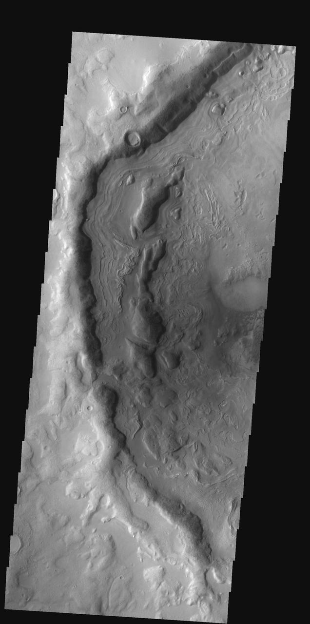
This VIS image is located in Terra Sabaea near the margin of Syrtis Major Planum. The channel-like feature in the bottom of the image is an unnamed feature. There is a high spot within the channel that would not let a fluid pass from one side to the other. This indicates that this is not a water carved channel, but was most likely an underground lava tube, where collapse of the roof has revealed the underlying feature. The 90 degree turns in the channel feature, and the small linear ridges just to the top of the channel indicate tectonic forces are part of the processes at work in this region. Orbit Number: 72337 Latitude: 16.4537 Longitude: 60.7257 Instrument: VIS Captured: 2018-04-05 10:06 https://photojournal.jpl.nasa.gov/catalog/PIA22579

The THEMIS VIS camera contains 5 filters. The data from different filters can be combined in multiple ways to create a false color image. These false color images may reveal subtle variations of the surface not easily identified in a single band image. Today's false color image shows most of the floor of an unnamed crater in Terra Sabaea. Sand dunes are visible on the crater floor. Dark blue tones in this filter combination indicate basaltic sand. Orbit Number: 79163 Latitude: -3.81361 Longitude: 12.2472 Instrument: VIS Captured: 2019-10-19 14:21 https://photojournal.jpl.nasa.gov/catalog/PIA24657

The THEMIS VIS camera contains 5 filters. The data from different filters can be combined in multiple ways to create a false color image. These false color images may reveal subtle variations of the surface not easily identified in a single band image. Today's false color image shows part of an unnamed crater located in Terra Sabaea. Dark blue tones in this filter combination indicate basaltic sand. Orbit Number: 80423 Latitude: -8.92009 Longitude: 22.5362 Instrument: VIS Captured: 2020-01-31 08:18 https://photojournal.jpl.nasa.gov/catalog/PIA24675

The THEMIS VIS camera contains 5 filters. The data from different filters can be combined in multiple ways to create a false color image. These false color images may reveal subtle variations of the surface not easily identified in a single band image. Today's false color image shows part of the floor of an unnamed crater located in Terra Sabaea. The small linear ridges throughout the crater floor indicate that tectonics and erosion have played a part in creating the features seen today. Dark blue tones in this filter combination indicate basaltic sands. Orbit Number: 81245 Latitude: 30.6923 Longitude: 63.0958 Instrument: VIS Captured: 2020-04-08 00:54 https://photojournal.jpl.nasa.gov/catalog/PIA24702

This image is located between Terra Sabaea and Isidis Planitia basin. Blue tones in this band configuration indicate basaltic sands. The sands are more prevalent in the plains at the upper frame part of the image, and only occur in limited number of depressions in the bottom half of the image. The underlying reason for the difference may related to sand abundance or sand mobility by the wind. The THEMIS VIS camera contains 5 filters. The data from different filters can be combined in multiple ways to create a false color image. These false color images may reveal subtle variations of the surface not easily identified in a single band image. Orbit Number: 61560 Latitude: 18.3868 Longitude: 79.0246 Instrument: VIS Captured: 2015-10-30 14:44 https://photojournal.jpl.nasa.gov/catalog/PIA23068
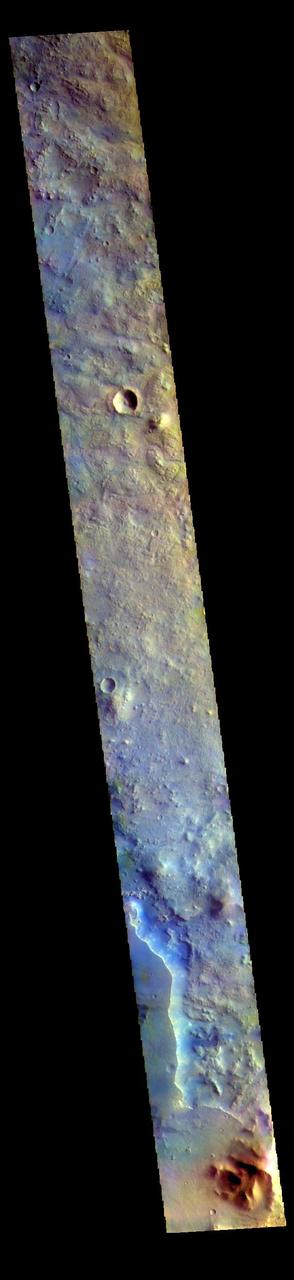
The THEMIS VIS camera contains 5 filters. The data from different filters can be combined in multiple ways to create a false color image. These false color images may reveal subtle variations of the surface not easily identified in a single band image. Today's false color image shows part of Terra Sabaea. The THEMIS VIS camera is capable of capturing color images of the Martian surface using five different color filters. In this mode of operation, the spatial resolution and coverage of the image must be reduced to accommodate the additional data volume produced from using multiple filters. To make a color image, three of the five filter images (each in grayscale) are selected. Each is contrast enhanced and then converted to a red, green, or blue intensity image. These three images are then combined to produce a full color, single image. Because the THEMIS color filters don't span the full range of colors seen by the human eye, a color THEMIS image does not represent true color. Also, because each single-filter image is contrast enhanced before inclusion in the three-color image, the apparent color variation of the scene is exaggerated. Nevertheless, the color variation that does appear is representative of some change in color, however subtle, in the actual scene. Note that the long edges of THEMIS color images typically contain color artifacts that do not represent surface variation. Orbit Number: 87197 Latitude: 18.0891 Longitude: 77.0112 Instrument: VIS Captured: 2021-08-11 02:38 https://photojournal.jpl.nasa.gov/catalog/PIA25380
The THEMIS VIS camera contains 5 filters. The data from different filters can be combined in multiple ways to create a false color image. These false color images may reveal subtle variations of the surface not easily identified in a single band image. Today's false color image shows part of Terra Sabaea. The THEMIS VIS camera is capable of capturing color images of the Martian surface using five different color filters. In this mode of operation, the spatial resolution and coverage of the image must be reduced to accommodate the additional data volume produced from using multiple filters. To make a color image, three of the five filter images (each in grayscale) are selected. Each is contrast enhanced and then converted to a red, green, or blue intensity image. These three images are then combined to produce a full color, single image. Because the THEMIS color filters don't span the full range of colors seen by the human eye, a color THEMIS image does not represent true color. Also, because each single-filter image is contrast enhanced before inclusion in the three-color image, the apparent color variation of the scene is exaggerated. Nevertheless, the color variation that does appear is representative of some change in color, however subtle, in the actual scene. Note that the long edges of THEMIS color images typically contain color artifacts that do not represent surface variation. Orbit Number: 94472 Latitude: 18.2986 Longitude: 76.7725 Instrument: VIS Captured: 2023-04-02 03:11 https://photojournal.jpl.nasa.gov/catalog/PIA26131
The THEMIS VIS camera contains 5 filters. The data from different filters can be combined in multiple ways to create a false color image. These false color images may reveal subtle variations of the surface not easily identified in a single band image. Today's false color image shows part of Terra Sabaea. The THEMIS VIS camera is capable of capturing color images of the Martian surface using five different color filters. In this mode of operation, the spatial resolution and coverage of the image must be reduced to accommodate the additional data volume produced from using multiple filters. To make a color image, three of the five filter images (each in grayscale) are selected. Each is contrast enhanced and then converted to a red, green, or blue intensity image. These three images are then combined to produce a full color, single image. Because the THEMIS color filters don't span the full range of colors seen by the human eye, a color THEMIS image does not represent true color. Also, because each single-filter image is contrast enhanced before inclusion in the three-color image, the apparent color variation of the scene is exaggerated. Nevertheless, the color variation that does appear is representative of some change in color, however subtle, in the actual scene. Note that the long edges of THEMIS color images typically contain color artifacts that do not represent surface variation. Orbit Number: 85450 Latitude: 17.5377 Longitude: 75.8334 Instrument: VIS Captured: 2021-03-20 06:22 https://photojournal.jpl.nasa.gov/catalog/PIA25056
The THEMIS VIS camera contains 5 filters. The data from different filters can be combined in multiple ways to create a false color image. These false color images may reveal subtle variations of the surface not easily identified in a single band image. Today's false color image shows part of Terra Sabaea. The THEMIS VIS camera is capable of capturing color images of the Martian surface using five different color filters. In this mode of operation, the spatial resolution and coverage of the image must be reduced to accommodate the additional data volume produced from using multiple filters. To make a color image, three of the five filter images (each in grayscale) are selected. Each is contrast enhanced and then converted to a red, green, or blue intensity image. These three images are then combined to produce a full color, single image. Because the THEMIS color filters don't span the full range of colors seen by the human eye, a color THEMIS image does not represent true color. Also, because each single-filter image is contrast enhanced before inclusion in the three-color image, the apparent color variation of the scene is exaggerated. Nevertheless, the color variation that does appear is representative of some change in color, however subtle, in the actual scene. Note that the long edges of THEMIS color images typically contain color artifacts that do not represent surface variation. Orbit Number: 88083 Latitude: 17.9048 Longitude: 76.7013 Instrument: VIS Captured: 2021-10-23 01:30 https://photojournal.jpl.nasa.gov/catalog/PIA25387
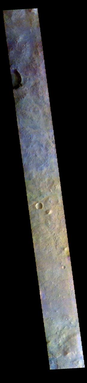
The THEMIS VIS camera contains 5 filters. The data from different filters can be combined in multiple ways to create a false color image. These false color images may reveal subtle variations of the surface not easily identified in a single band image. Today's false color image shows part of eastern Terra Sabaea. The THEMIS VIS camera is capable of capturing color images of the Martian surface using five different color filters. In this mode of operation, the spatial resolution and coverage of the image must be reduced to accommodate the additional data volume produced from using multiple filters. To make a color image, three of the five filter images (each in grayscale) are selected. Each is contrast enhanced and then converted to a red, green, or blue intensity image. These three images are then combined to produce a full color, single image. Because the THEMIS color filters don't span the full range of colors seen by the human eye, a color THEMIS image does not represent true color. Also, because each single-filter image is contrast enhanced before inclusion in the three-color image, the apparent color variation of the scene is exaggerated. Nevertheless, the color variation that does appear is representative of some change in color, however subtle, in the actual scene. Note that the long edges of THEMIS color images typically contain color artifacts that do not represent surface variation. Orbit Number: 89805 Latitude: 18.8055 Longitude: 76.997 Instrument: VIS Captured: 2022-03-13 20:29 https://photojournal.jpl.nasa.gov/catalog/PIA26056
The THEMIS VIS camera contains 5 filters. The data from different filters can be combined in multiple ways to create a false color image. These false color images may reveal subtle variations of the surface not easily identified in a single band image. Today's false color image shows part of Terra Sabaea. The THEMIS VIS camera is capable of capturing color images of the Martian surface using five different color filters. In this mode of operation, the spatial resolution and coverage of the image must be reduced to accommodate the additional data volume produced from using multiple filters. To make a color image, three of the five filter images (each in grayscale) are selected. Each is contrast enhanced and then converted to a red, green, or blue intensity image. These three images are then combined to produce a full color, single image. Because the THEMIS color filters don't span the full range of colors seen by the human eye, a color THEMIS image does not represent true color. Also, because each single-filter image is contrast enhanced before inclusion in the three-color image, the apparent color variation of the scene is exaggerated. Nevertheless, the color variation that does appear is representative of some change in color, however subtle, in the actual scene. Note that the long edges of THEMIS color images typically contain color artifacts that do not represent surface variation. Orbit Number: 85226 Latitude: 26.2646 Longitude: 56.742 Instrument: VIS Captured: 2021-03-01 19:46 https://photojournal.jpl.nasa.gov/catalog/PIA25054
Sand dunes cover the floor of this channel in Terra Sabaea
The THEMIS VIS camera contains 5 filters. The data from different filters can be combined in multiple ways to create a false color image. These false color images may reveal subtle variations of the surface not easily identified in a single band image. Today's false color image shows part of Terra Sabaea, in the region between Nili Fossae and Isidis Planitia. This image is located just east of Jezero Crater, the home of the Mars 2020 rover (Perserverance) and its little helicopter buddy (Ingenuity). The THEMIS VIS camera is capable of capturing color images of the Martian surface using five different color filters. In this mode of operation, the spatial resolution and coverage of the image must be reduced to accommodate the additional data volume produced from using multiple filters. To make a color image, three of the five filter images (each in grayscale) are selected. Each is contrast enhanced and then converted to a red, green, or blue intensity image. These three images are then combined to produce a full color, single image. Because the THEMIS color filters don't span the full range of colors seen by the human eye, a color THEMIS image does not represent true color. Also, because each single-filter image is contrast enhanced before inclusion in the three-color image, the apparent color variation of the scene is exaggerated. Nevertheless, the color variation that does appear is representative of some change in color, however subtle, in the actual scene. Note that the long edges of THEMIS color images typically contain color artifacts that do not represent surface variation. Orbit Number: 95021 Latitude: 18.3774 Longitude: 78.6869 Instrument: VIS Captured: 2023-05-17 08:04 https://photojournal.jpl.nasa.gov/catalog/PIA26138
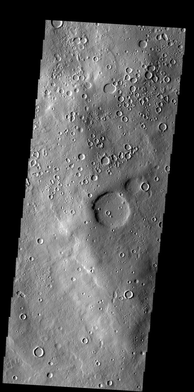
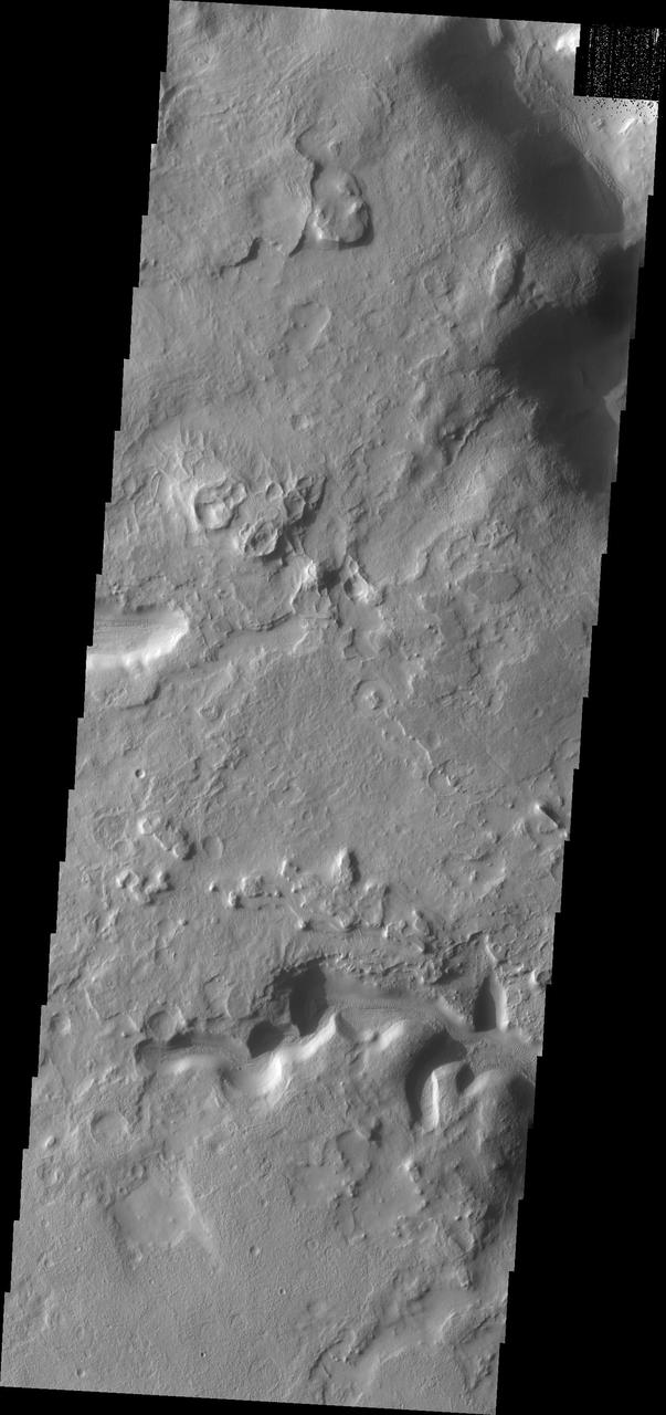
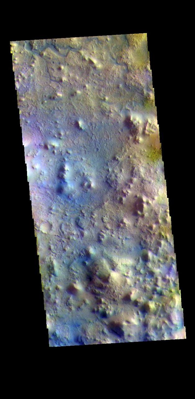
This region of Terra Sabaea contains areas with high densities of small craters
These odd shaped pits occur on the floor of a large crater in Terra Sabaea
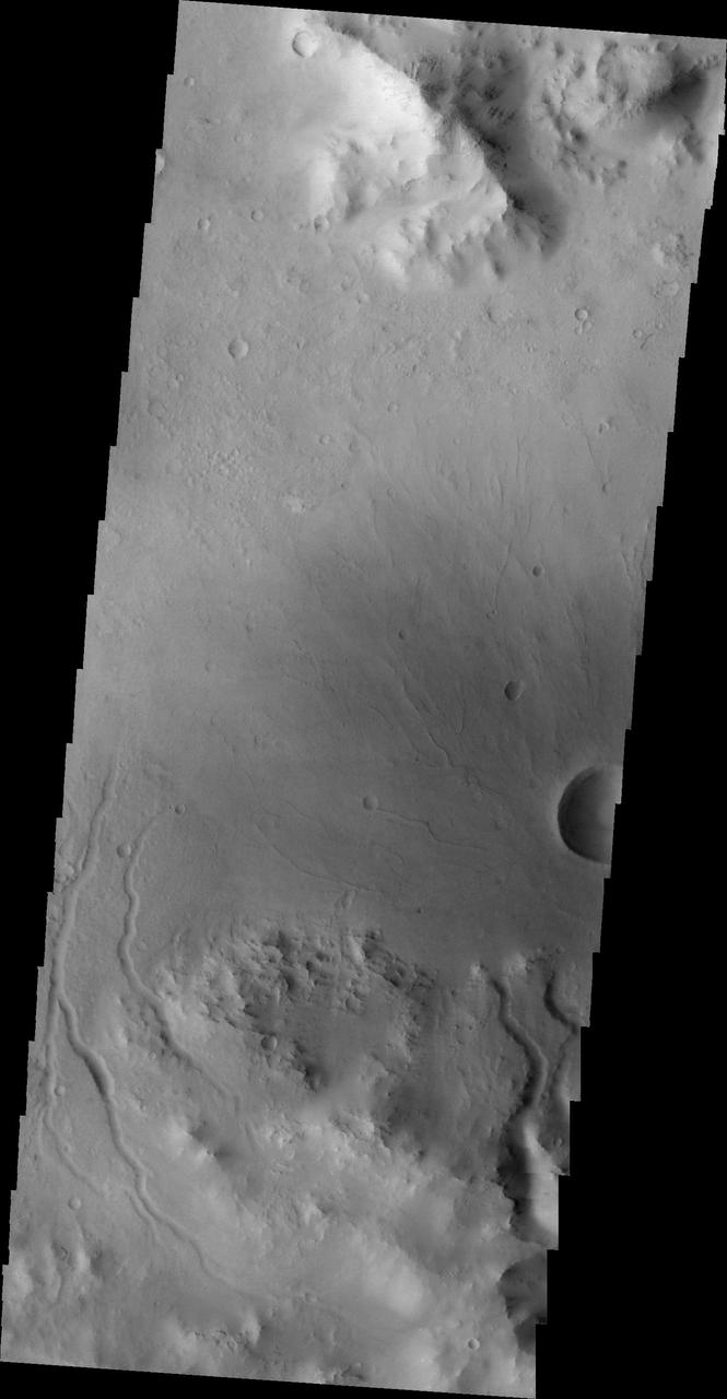
The channels in this image are draining the rim of an unnamed crater in Terra Sabaea.

Dunes are found on the floor of this unnamed crater located on the margin between Arabia Terra and Terra Sabaea in this image from NASA 2001 Mars Odyssey spacecraft.
The texture/pattern on the floor of this unnamed crater in Terra Sabaea indicates that volitiles make up a portion of the material filling the crater
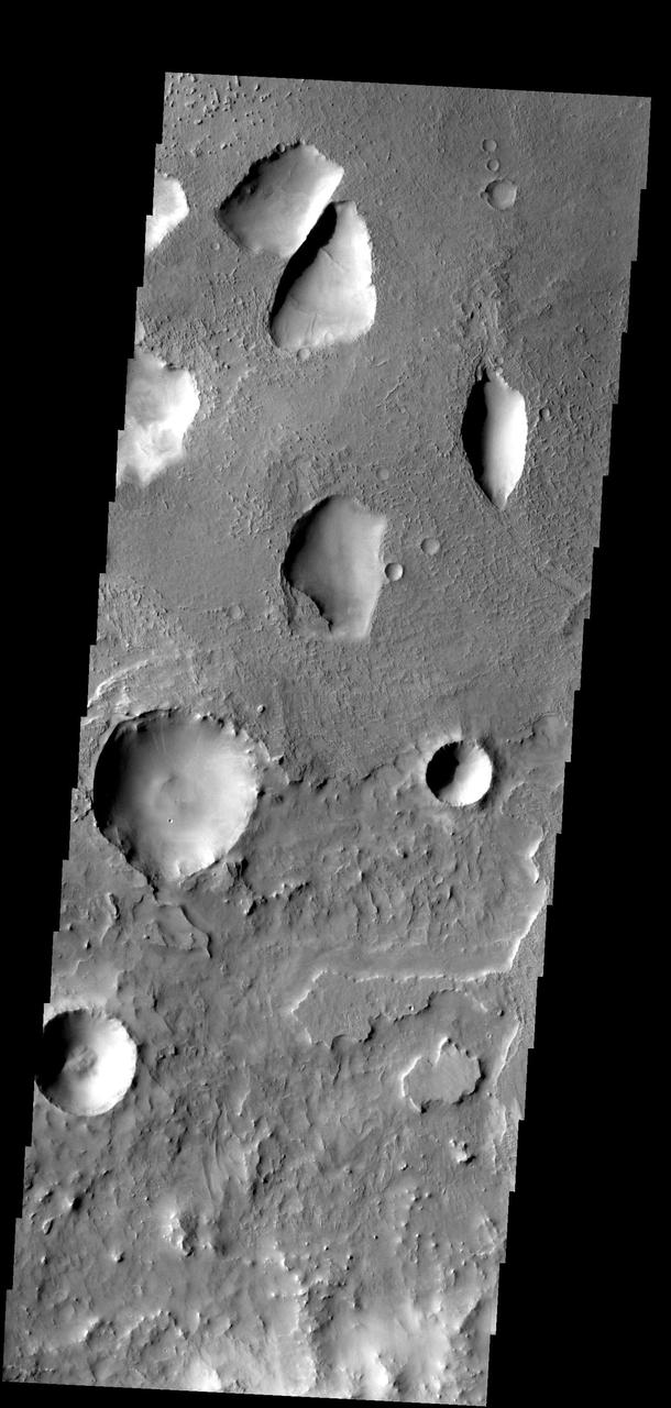
This image captured by NASA 2001 Mars Odyssey spacecraft shows a portion of two unnamed craters in Terra Sabaea.
This image from NASA 2001 Mars Odyssey shows windstreaks mark the plains of northern Terra Sabaea.
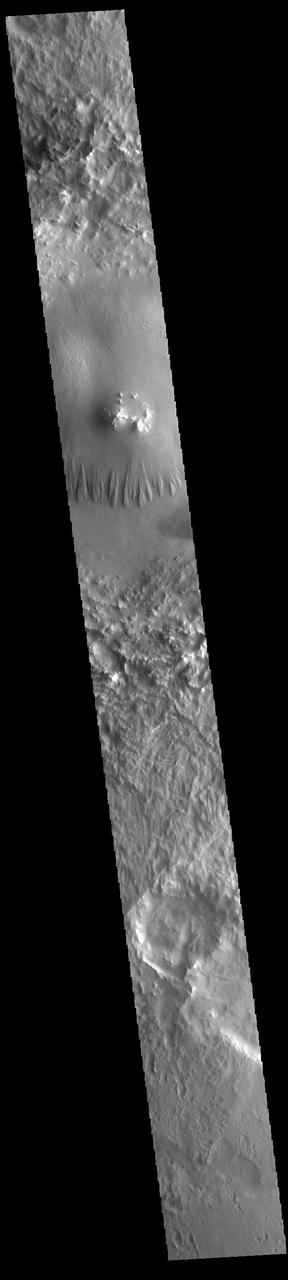
The channel in this image from NASA Mars Odyssey spacecraft is part of Auqakuh Vallis, which is located in northern Terra Sabaea.
This image captured by NASA Mars Odyssey shows dark slope streaks in an unnamed crater in Terra Sabaea.

The windstreaks in this image captured by NASA 2001 Mars Odyssey spacecraft are located in Terra Sabaea.

The unnamed channel in this image captured by NASA 2001 Mars Odyssey spacecraft is located in Terra Sabaea.
This image from NASA 2001 Mars Odyssey spacecraft shows a portion of Naktong Vallis in Terra Sabaea.
Many dark slope streaks are visible in this image of an unnamed crater in Terra Sabaea taken by NASA 2001 Mars Odyssey spacecraft.
Multiple channels in this image from NASA 2001 Mars Odyssey dissect this region on the margin of Terra Sabaea.

This image from NASA 2001 Mars Odyssey spacecraft shows a portion of Naktong Vallis, located in Terra Sabaea.
This image from NASA Mars Odyssey shows layered material surrounding an unnamed crater in Terra Sabaea.
Dark slope streaks mark the inner rim of this unnamed crater in Terra Sabaea, as seen by NASA 2001 Mars Odyssey spacecraft.
The small channel at the top of this image from NASA 2001 Mars Odyssey spacecraft is located on the rim of an unnamed crater in Terra Sabaea.
This image captured by NASA 2001 Mars Odyssey spacecraft shows an unnamed crater in Terra Sabaea.
This image from NASA Mars Odyssey spacecraft shows an unnamed channel located in Terra Sabaea, near Hellas Planitia.
Dark slope streaks mark the rim of this unnamed crater in Terra Sabaea captured by NASA Mars Odyssey.
Dark slope streaks are visible on the rim of this crater in Terra Sabaea in this image captured by NASA 2001 Mars Odyssey.
The hills in this image captured by NASA 2001 Mars Odyssey spacecraft are part of Protonilus Mensae, located on the northern margin of Terra Sabaea.
Dark streaks mark the inner rim of this unnamed crater in Terra Sabaea as seen by NASA 2001 Mars Odyssey spacecraft.
The unnamed channel in this image captured by NASA 2001 Mars Odyssey spacecraft is located southeast of Tikhonravov Crater in Terra Sabaea.
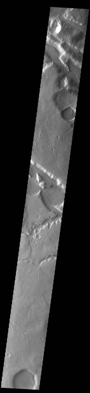
The channels in this image captured by NASA 2001 Mars Odyssey spacecraft are located on the northern margin of Terra Sabaea.
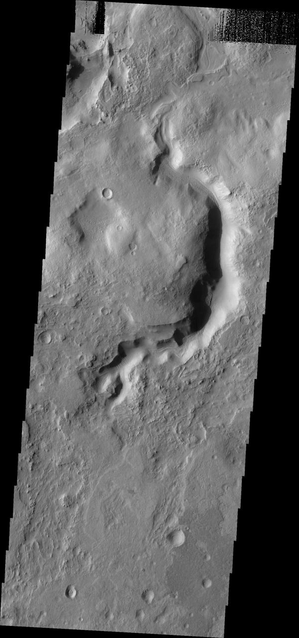
This unnamed crater in Terra Sabaea has two channels dissecting the rim which have formed deltas on the crater floor
This image captured by NASA 2001 Mars Odyssey spacecraft shows part of the rim of an unnamed crater in Terra Sabaea.
This image captured by NASA 2001 Mars Odyssey spacecraft is located on the eastern margin of Terra Sabaea. The boundary region between the highlands of Terra Sabaea and the lower elevations of Utopia Planitia is a complex of channels, chaos and graben. Orbit Number: 63956 Latitude: 35.3885 Longitude: 56.728 Instrument: VIS Captured: 2016-05-14 22:55 http://photojournal.jpl.nasa.gov/catalog/PIA20781
Gravity driven slope modification creates the dark marks on the crater rim in this unnamed crater in Terra Sabaea as seen by NASA 2001 Mars Odyssey spacecraft.
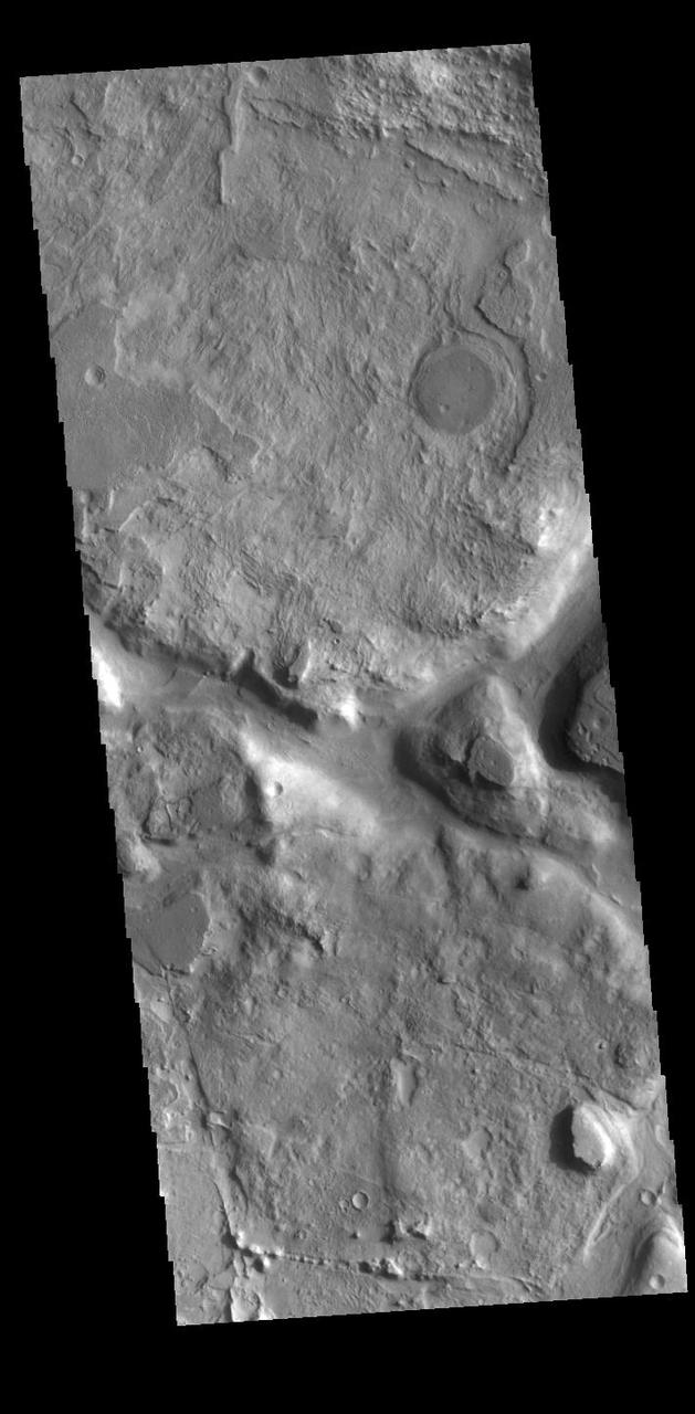
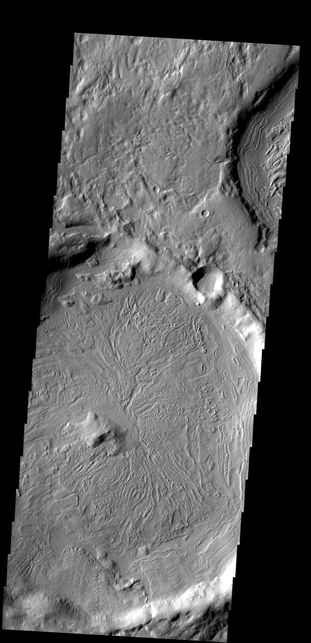
This unnamed crater in this image from NASA 2001 Mars Odyssey spacecraft is located on the margin between Terra Sabaea and Utopia Planitia and is filled with material with a grooved surface.
A multitude of dark slope streaks mark the inner rim of this unnamed crater in Terra Sabaea. This image is from NASA 2001 Mars Odyssey spacecraft.
The depressions in the rim of this unnamed crater in Terra Sabaea are being filled with new material. The surface texture of the new material is different from the surrounding older material