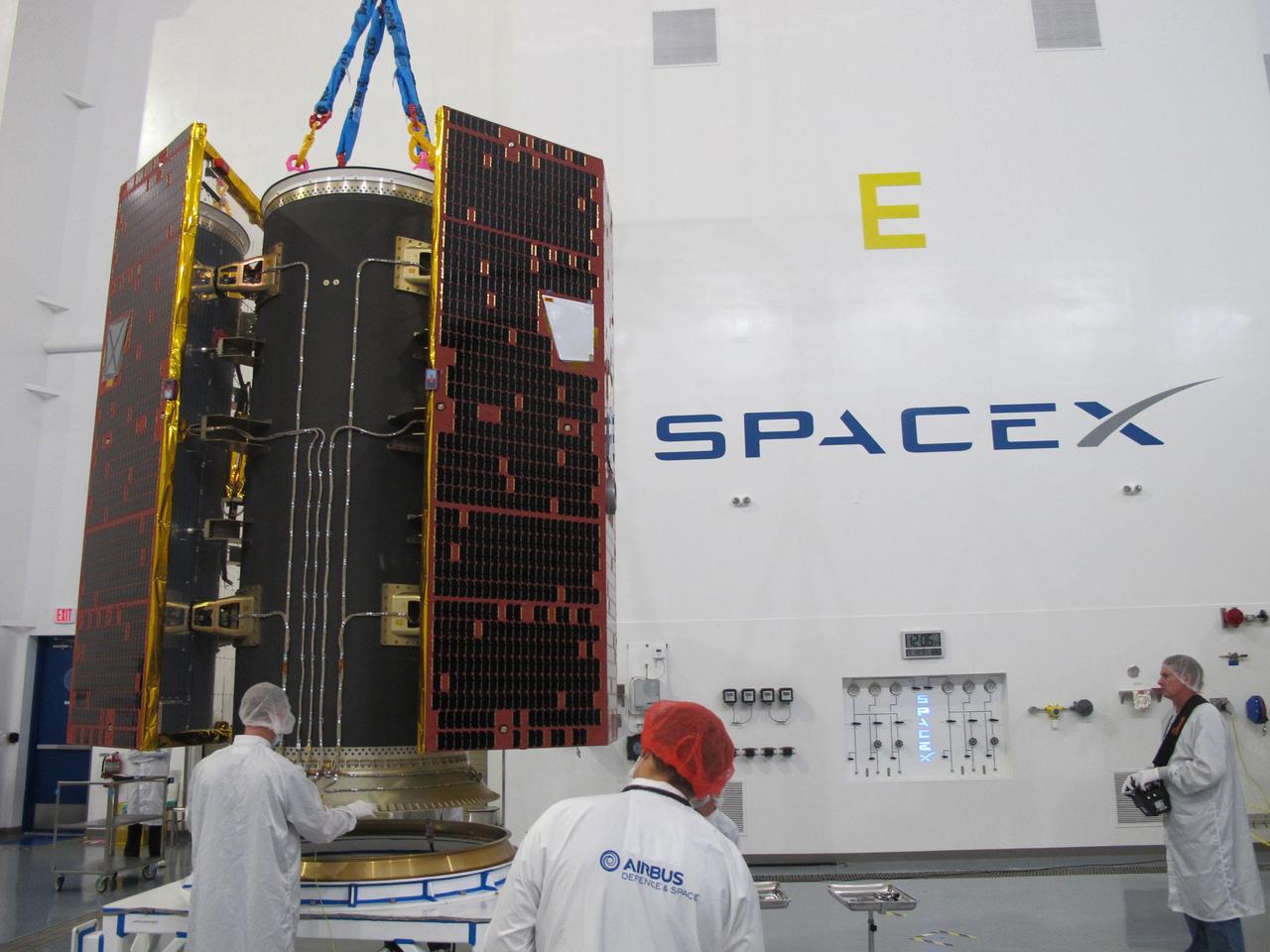
Technicians inspect the twin GRACE Follow-On satellites and their multi-satellite dispenser at the SpaceX facility at Vandenberg Air Force Base in California. The satellites were subsequently stacked atop another satellite dispenser containing the five Iridium NEXT communications satellites they will share a ride to orbit with. https://photojournal.jpl.nasa.gov/catalog/PIA22452
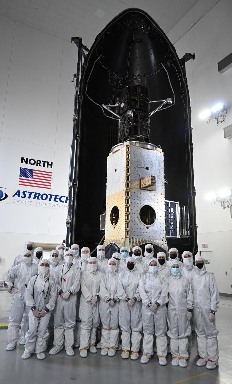
Technicians encapsulate the black twin satellites of NASA’s TRACERS (Tandem Reconnection and Cusp Electrodynamics Reconnaissance Satellites) mission within a payload fairing atop a shiny metallic stack of several other rideshare payloads at the Astrotech Space Operations facility at Vandenberg Space Force Base in California. The TRACERS mission is a pair of twin satellites that will study how Earth’s magnetic shield — the magnetosphere — protects our planet from the supersonic stream of material from the Sun called solar wind.
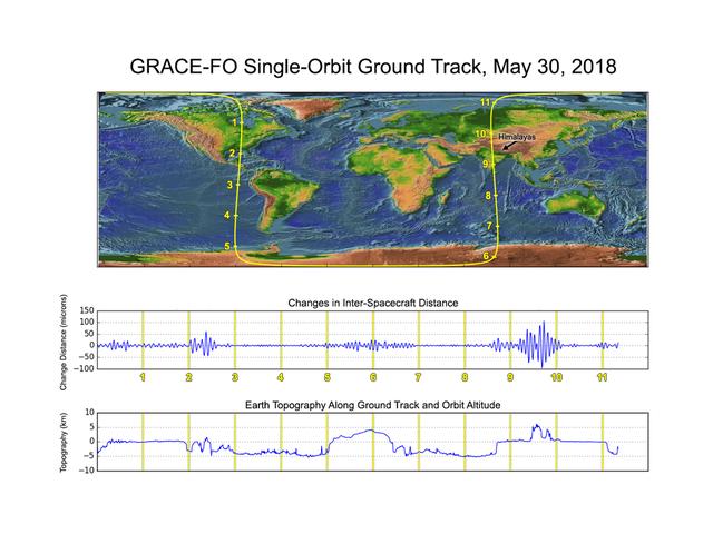
GRACE-FO has completed its first mission phase and demonstrated the performance of the precise ranging system that enables its measurements of how mass migrates around Earth. Along the satellites' ground track (top), the inter-spacecraft distance between them changes as the mass distribution underneath (i.e., from mountains, etc.) varies. The small changes measured by the Microwave Ranging Instrument (middle) agree well with topographic features along the orbit (bottom). https://photojournal.jpl.nasa.gov/catalog/PIA22507
At the Harris Spaceport Systems facility at Vandenberg Air Force Base in California, the twin GRACE-FO satellites are integrated with the multi-satellite dispenser structure that will be used to deploy the satellites during launch on the SpaceX Falcon 9 launch vehicle. https://photojournal.jpl.nasa.gov/catalog/PIA22442
At the Harris Spaceport Systems facility at Vandenberg Air Force Base in California, the twin GRACE-FO satellites are integrated with the multi-satellite dispenser structure that will be used to deploy the satellites during launch on the SpaceX Falcon 9 launch vehicle. https://photojournal.jpl.nasa.gov/catalog/PIA22444
A photo showing the The twin GRACE-FO spacecraft installed on top of the five Iridium NEXT communications satellites is seen as experts discuss the Gravity Recovery and Climate Experiment Follow-On mission during a prelaunch media briefing, Monday, May 21, 2018, at Vandenberg Air Force Base in California. The twin GRACE-FO spacecraft will measure changes in how mass is redistributed within and among Earth's atmosphere, oceans, land and ice sheets, as well as within Earth itself. Photo Credit: (NASA/Bill Ingalls)
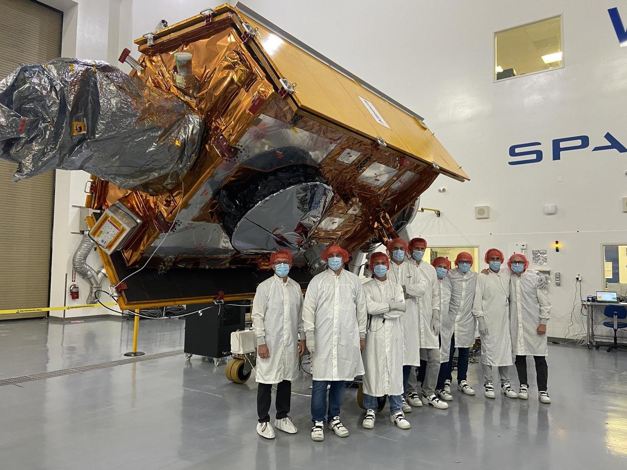
The Gravity Recovery and Climate Experiment Follow-On (GRACE-FO) twin satellites, attached to turntable fixtures, at the Astrotech Space Operations processing facility at Vandenberg Air Force Base, California. GRACE-FO will extend GRACE's legacy of scientific achievements, which range from tracking mass changes of Earth's polar ice sheets and estimating global groundwater changes, to measuring the mass changes of large earthquakes and inferring changes in deep ocean currents, a driving force in climate. To date, GRACE observations have been used in more than 4,300 research publications. Its measurements provide a unique view of the Earth system and have far-reaching benefits to society, such as providing insights into where global groundwater resources may be shrinking or growing and where dry soils are contributing to drought. GRACE-FO is planned to fly at least five years. https://photojournal.jpl.nasa.gov/catalog/PIA22340
The Gravity Recovery and Climate Experiment Follow-On (GRACE-FO) twin satellites, attached to turntable fixtures, at the Astrotech Space Operations processing facility at Vandenberg Air Force Base, California. GRACE-FO will extend GRACE's legacy of scientific achievements, which range from tracking mass changes of Earth's polar ice sheets and estimating global groundwater changes, to measuring the mass changes of large earthquakes and inferring changes in deep ocean currents, a driving force in climate. To date, GRACE observations have been used in more than 4,300 research publications. Its measurements provide a unique view of the Earth system and have far-reaching benefits to society, such as providing insights into where global groundwater resources may be shrinking or growing and where dry soils are contributing to drought. GRACE-FO is planned to fly at least five years. https://photojournal.jpl.nasa.gov/catalog/PIA22341

The Gravity Recovery and Climate Experiment Follow-On (GRACE-FO) twin satellites, attached to turntable fixtures, at the Astrotech Space Operations processing facility at Vandenberg Air Force Base, California. GRACE-FO will extend GRACE's legacy of scientific achievements, which range from tracking mass changes of Earth's polar ice sheets and estimating global groundwater changes, to measuring the mass changes of large earthquakes and inferring changes in deep ocean currents, a driving force in climate. To date, GRACE observations have been used in more than 4,300 research publications. Its measurements provide a unique view of the Earth system and have far-reaching benefits to society, such as providing insights into where global groundwater resources may be shrinking or growing and where dry soils are contributing to drought. GRACE-FO is planned to fly at least five years. https://photojournal.jpl.nasa.gov/catalog/PIA22338
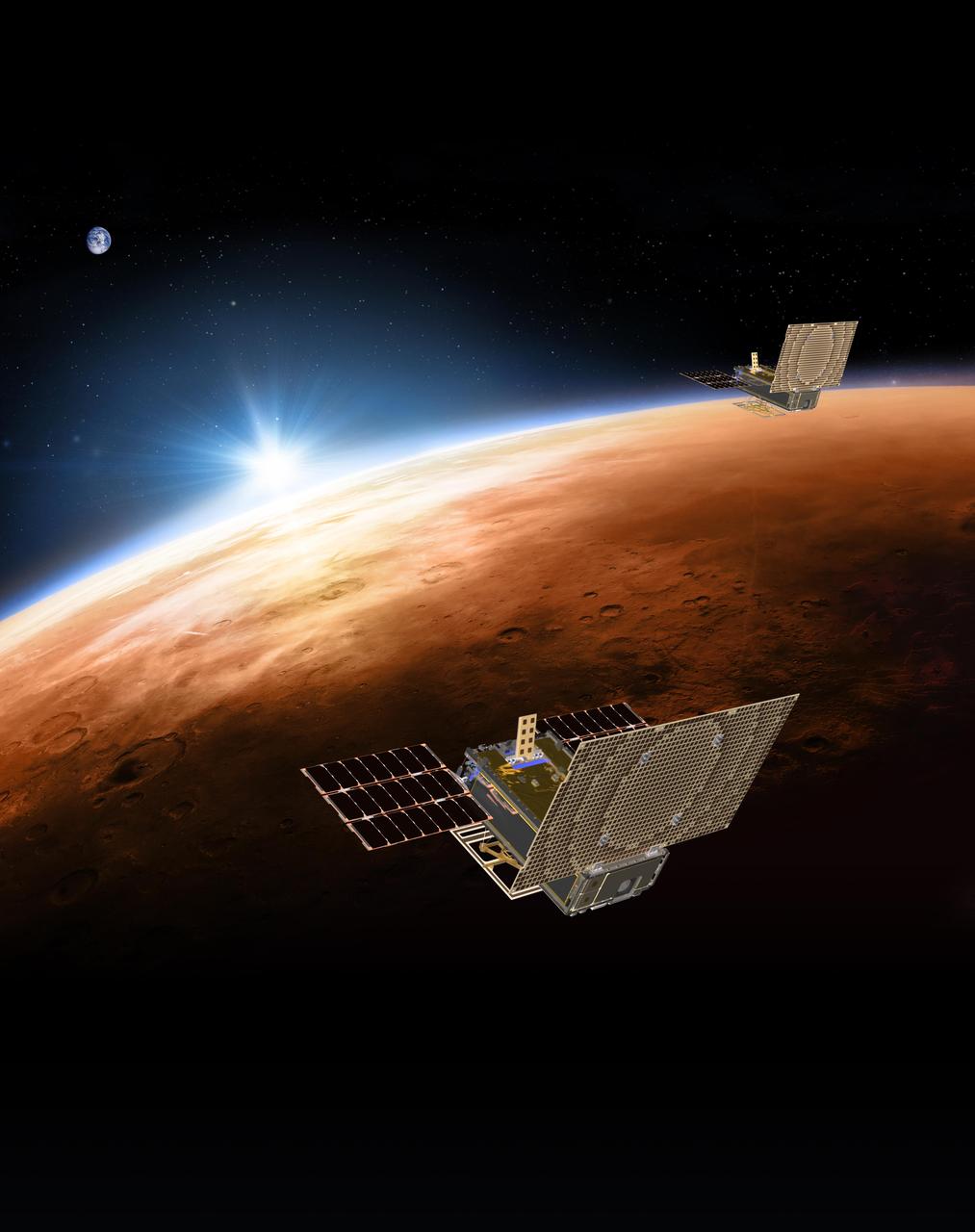
An artist's rendering of the twin Mars Cube One (MarCO) spacecraft flying over Mars with Earth in the distance. The MarCOs will be the first CubeSats -- a kind of modular, mini-satellite -- flown in deep space. They're designed to fly along behind NASA's InSight lander on its cruise to Mars. If they make the journey, they will test a relay of data about InSight's entry, descent and landing back to Earth. Though InSight's mission will not depend on the success of the MarCOs, they will be a test of how CubeSats can be used in deep space. https://photojournal.jpl.nasa.gov/catalog/PIA22316
S89-27380 (15 Dec 1988) --- The 155-ft. long external fuel tank (ET) is slowly lowered for mating with the twin solid rocket boosters (SRB) in Bay 1 of the Vehicle Assembly Building at KSC, as preparations continue for a March 1989 launch of Discovery. Primary payload for the mission will be the tracking and data relay satellite (TDRS-D). Crewmembers are astronauts Michael L. Coats, John E. Blaha, James F. Buchli, Robert C. Springer and James P. Bagain.
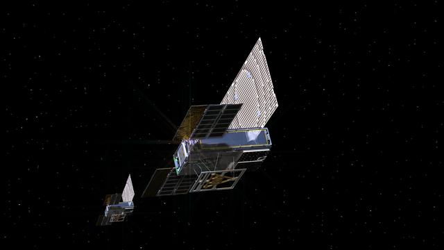
An artist's rendering of the twin Mars Cube One (MarCO) spacecraft as they fly through deep space. The MarCOs will be the first CubeSats -- a kind of modular, mini-satellite -- attempting to fly to another planet. They're designed to fly along behind NASA's InSight lander on its cruise to Mars. If they make the journey, they will test a relay of data about InSight's entry, descent and landing back to Earth. Though InSight's mission will not depend on the success of the MarCOs, they will be a test of how CubeSats can be used in deep space. https://photojournal.jpl.nasa.gov/catalog/PIA22314
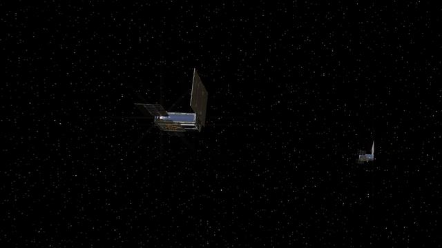
An artist's rendering of the twin Mars Cube One (MarCO) spacecraft on their cruise in deep space. The MarCOs will be the first CubeSats -- a kind of modular, mini-satellite -- attempting to fly to another planet. They're designed to fly along behind NASA's InSight lander on its cruise to Mars. If they make the journey, they will test a relay of data about InSight's entry, descent and landing back to Earth. Though InSight's mission will not depend on the success of the MarCOs, they will be a test of how CubeSats can be used in deep space. https://photojournal.jpl.nasa.gov/catalog/PIA22315
The Sentinel-6 Michael Freilich satellite undergoes final preparations in a clean room at Vandenberg Air Force Base in California for an early November launch. The satellite is named after Dr. Michael Freilich, the former director of NASA's Earth Science Division and an instrumental figure in advancing ocean observations from space. Sentinel-6 Michael Freilich is one of two identical spacecraft that compose the Sentinel-6/Jason-CS (Continuity of Service) mission developed in partnership with ESA (the European Space Agency). Other partners include the National Oceanic and Atmospheric Administration (NOAA), the intergovernmental European Organisation for the Exploitation of Meteorological Satellites (EUMETSAT), and France's National Centre for Space Studies (CNES). ESA is developing the new Sentinel family of missions to support the operational needs of the European Union's Copernicus program, the EU's Earth observation program managed by the European Commission. The spacecraft's twin, Sentinel-6B, will launch in 2025. https://photojournal.jpl.nasa.gov/catalog/PIA24131
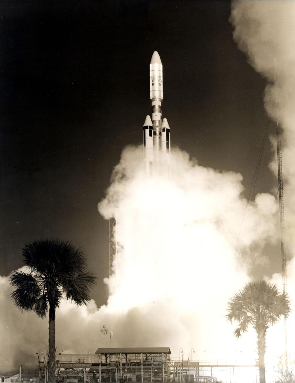
The first Titan_Centaur lifted off from Complex 41 at Cape Kennedy Air Force Station at 9:48 a.m. EDT today. The Titan stages burned as programmed, but when the Centaur stage failed to ignite, it was destroyed by the Range Safety Officer. The new NASA rocket was launched on a proof flight designed to prepare it for twin Viking launches to Mars in 1975 and other missions involving heavy unmanned payloads. The 160-foot-tall rocket combines the Air Force Titan III with the NASA high-energy Centaur final stage. The twin solid rocket boosters have a combined liftoff thrust of 2.4 million pounds. Aboard Titan_Centaur on its proof flight were a dynamic simulator of the Viking spacecraft and a small scientific satellite (SPHYNX) designed to determine how high voltage solar cells, insulators and conductors are affected by the charged particles in space. Launch was conducted by KSC's Unmanned Launch Operations Directorate.
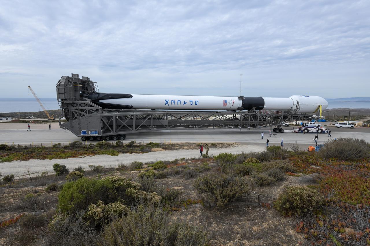
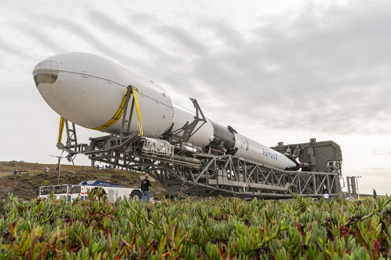
The SpaceX Falcon 9 rocket, topped with the Sentinel-6 Michael Freilich satellite secured inside its payload fairing, rolls from SpaceX’s Payload Processing Facility at Vandenberg Air Force Base in California to Space Launch Complex 4 on Nov. 20, 2020. The Sentinel-6/Jason-CS (Continuity of Service) mission consists of the Sentinel-6 Michael Freilich satellite, which will be followed by its twin, the Sentinel-6B satellite, in 2025. The Sentinel-6/Jason-CS mission is part of Copernicus, the European Union’s Earth observation program, managed by the European Commission. Continuing the legacy of the Jason series missions, Sentinel-6/Jason-CS will extend the records of sea level into their fourth decade, collecting accurate measurements of sea surface height for more than 90% of the world’s seas, and providing crucial information for operational oceanography, marine meteorology, and climate studies. Sentinel-6 Michael Freilich launched Nov. 21, 2020, at 9:17 PST (12:17 EST). NASA’s Launch Services Program at Kennedy Space Center was responsible for launch management.
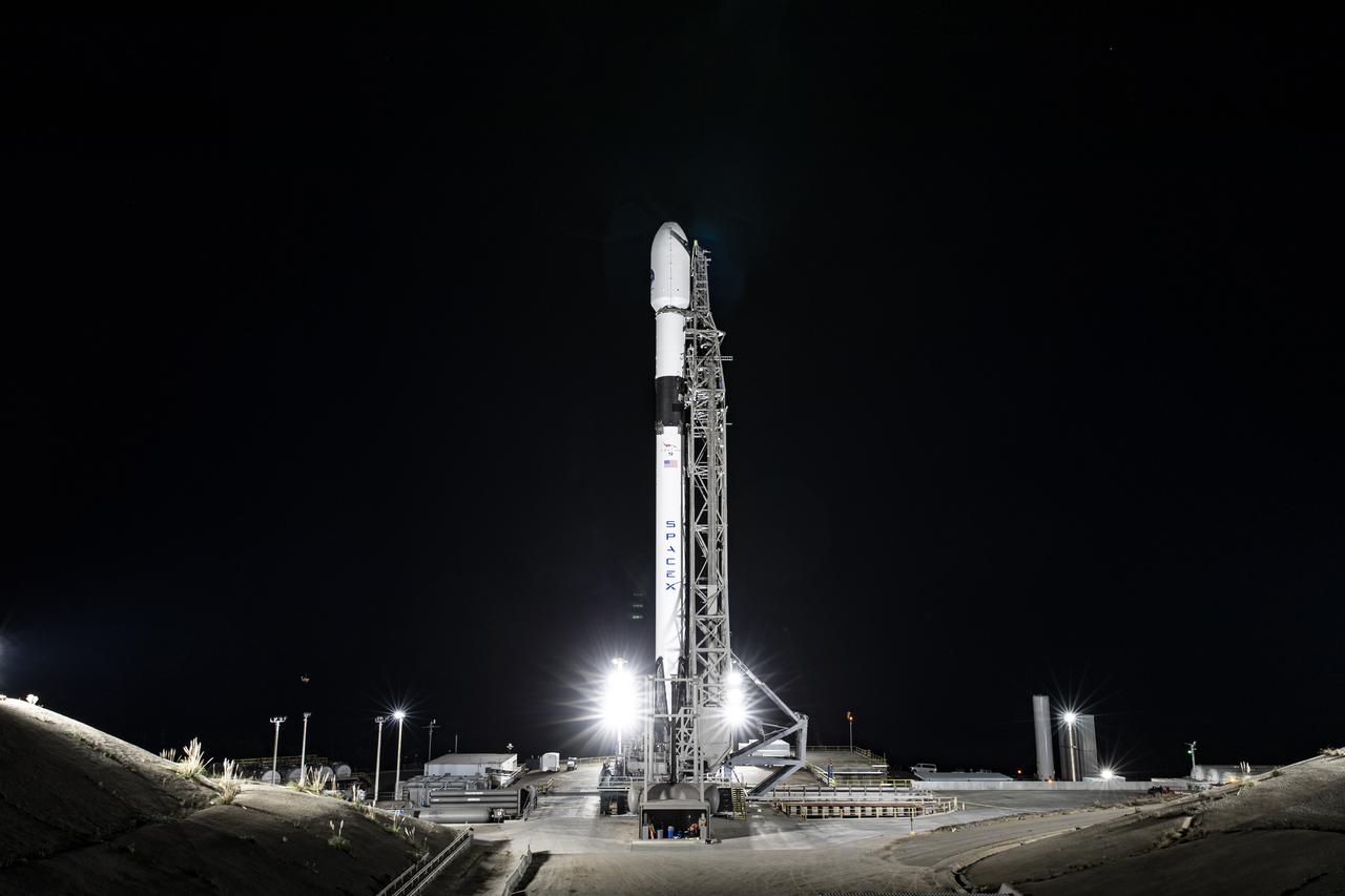
The SpaceX Falcon 9 rocket, topped with the Sentinel-6 Michael Freilich satellite secured inside its payload fairing, is lifted to vertical at Space Launch Complex 4 at Vandenberg Air Force Base in California on Nov. 20, 2020. The Sentinel-6/Jason-CS (Continuity of Service) mission consists of the Sentinel-6 Michael Freilich satellite, which will be followed by its twin, the Sentinel-6B satellite, in 2025. The Sentinel-6/Jason-CS mission is part of Copernicus, the European Union’s Earth observation program, managed by the European Commission. Continuing the legacy of the Jason series missions, Sentinel-6/Jason-CS will extend the records of sea level into their fourth decade, collecting accurate measurements of sea surface height for more than 90% of the world’s seas, and providing crucial information for operational oceanography, marine meteorology, and climate studies. Sentinel-6 Michael Freilich launched Nov. 21, 2020, at 9:17 PST (12:17 EST). NASA’s Launch Services Program at Kennedy Space Center was responsible for launch management.
The SpaceX Falcon 9 rocket, topped with the Sentinel-6 Michael Freilich satellite secured inside its payload fairing, is lifted to vertical at Space Launch Complex 4 at Vandenberg Air Force Base in California on Nov. 20, 2020. The Sentinel-6/Jason-CS (Continuity of Service) mission consists of the Sentinel-6 Michael Freilich satellite, which will be followed by its twin, the Sentinel-6B satellite, in 2025. The Sentinel-6/Jason-CS mission is part of Copernicus, the European Union’s Earth observation program, managed by the European Commission. Continuing the legacy of the Jason series missions, Sentinel-6/Jason-CS will extend the records of sea level into their fourth decade, collecting accurate measurements of sea surface height for more than 90% of the world’s seas, and providing crucial information for operational oceanography, marine meteorology, and climate studies. Sentinel-6 Michael Freilich launched Nov. 21, 2020, at 9:17 PST (12:17 EST). NASA’s Launch Services Program at Kennedy Space Center was responsible for launch management.
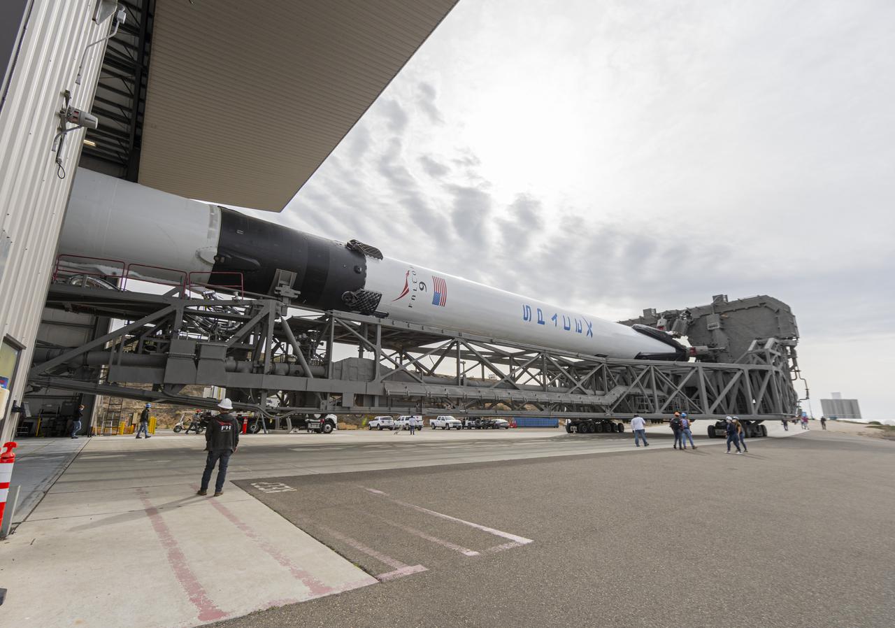
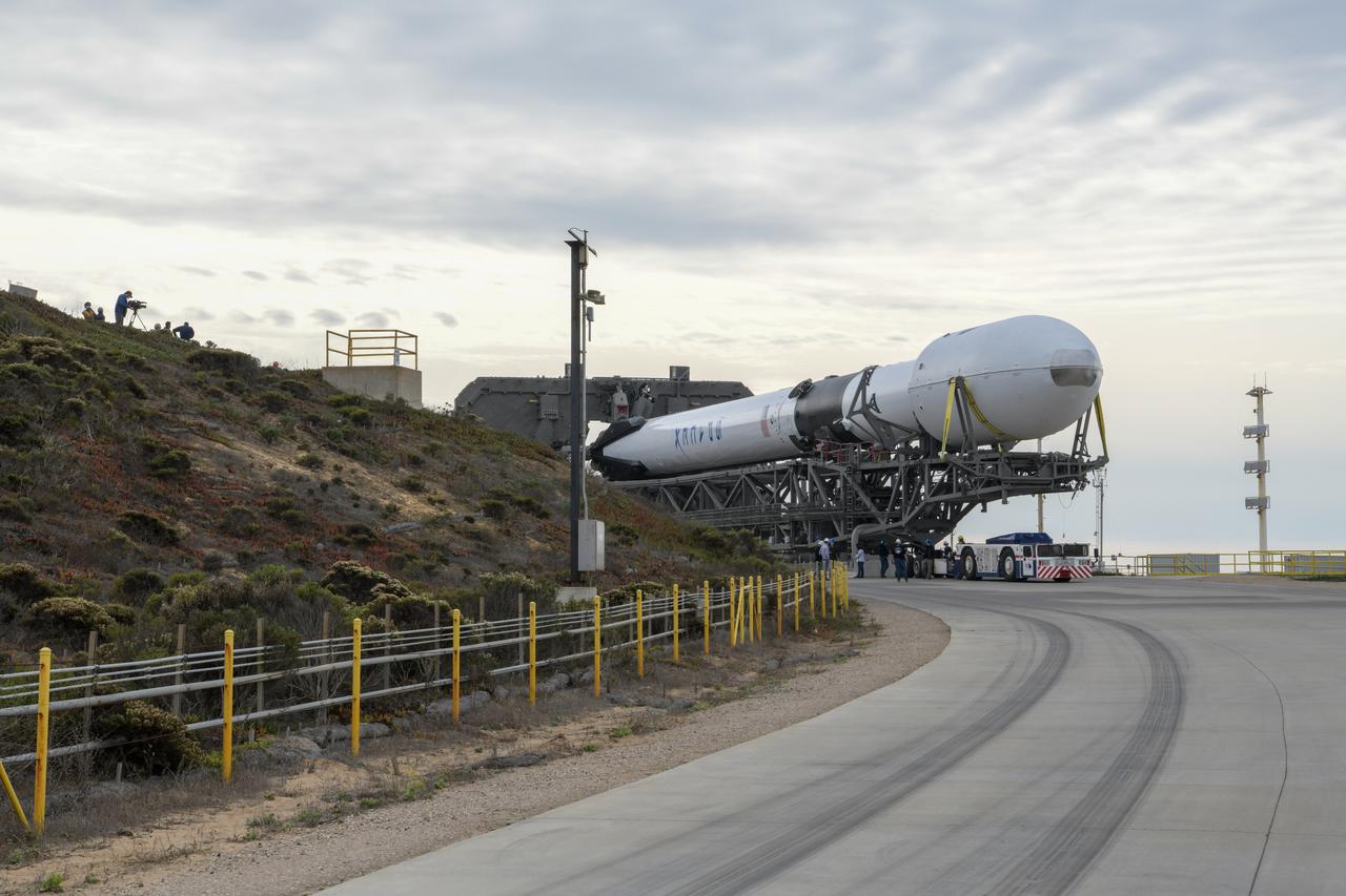
The SpaceX Falcon 9 rocket, topped with the Sentinel-6 Michael Freilich satellite secured inside its payload fairing, is rolled to Space Launch Complex 4 at Vandenberg Air Force Base in California on Nov. 20, 2020, in preparation for launch. The Sentinel-6/Jason-CS (Continuity of Service) mission consists of the Sentinel-6 Michael Freilich satellite, which will be followed by its twin, the Sentinel-6B satellite, in 2025. The Sentinel-6/Jason-CS mission is part of Copernicus, the European Union’s Earth observation program, managed by the European Commission. Continuing the legacy of the Jason series missions, Sentinel-6/Jason-CS will extend the records of sea level into their fourth decade, collecting accurate measurements of sea surface height for more than 90% of the world’s seas, and providing crucial information for operational oceanography, marine meteorology, and climate studies. Sentinel-6 Michael Freilich launched Nov. 21, 2020, at 9:17 PST (12:17 EST). NASA’s Launch Services Program at Kennedy Space Center was responsible for launch management.
The SpaceX Falcon 9 rocket, topped with the Sentinel-6 Michael Freilich satellite secured inside its payload fairing, departs SpaceX’s Payload Processing Facility at Vandenberg Air Force Base in California for its journey to Space Launch Complex 4 on Nov. 20, 2020. The Sentinel-6/Jason-CS (Continuity of Service) mission consists of the Sentinel-6 Michael Freilich satellite, which will be followed by its twin, the Sentinel-6B satellite, in 2025. The Sentinel-6/Jason-CS mission is part of Copernicus, the European Union’s Earth observation program, managed by the European Commission. Continuing the legacy of the Jason series missions, Sentinel-6/Jason-CS will extend the records of sea level into their fourth decade, collecting accurate measurements of sea surface height for more than 90% of the world’s seas, and providing crucial information for operational oceanography, marine meteorology, and climate studies. Sentinel-6 Michael Freilich launched Nov. 21, 2020, at 9:17 PST (12:17 EST). NASA’s Launch Services Program at Kennedy Space Center was responsible for launch management.
The SpaceX Falcon 9 rocket, topped with the Sentinel-6 Michael Freilich satellite secured inside its payload fairing, rolls from SpaceX’s Payload Processing Facility at Vandenberg Air Force Base in California to Space Launch Complex 4 on Nov. 20, 2020. The Sentinel-6/Jason-CS (Continuity of Service) mission consists of the Sentinel-6 Michael Freilich satellite, which will be followed by its twin, the Sentinel-6B satellite, in 2025. The Sentinel-6/Jason-CS mission is part of Copernicus, the European Union’s Earth observation program, managed by the European Commission. Continuing the legacy of the Jason series missions, Sentinel-6/Jason-CS will extend the records of sea level into their fourth decade, collecting accurate measurements of sea surface height for more than 90% of the world’s seas, and providing crucial information for operational oceanography, marine meteorology, and climate studies. Sentinel-6 Michael Freilich launched Nov. 21, 2020, at 9:17 PST (12:17 EST). NASA’s Launch Services Program at Kennedy Space Center was responsible for launch management.
The SpaceX Falcon 9 rocket, topped with the Sentinel-6 Michael Freilich satellite secured inside its payload fairing, is lifted to vertical at Space Launch Complex 4 at Vandenberg Air Force Base in California on Nov. 20, 2020. The Sentinel-6/Jason-CS (Continuity of Service) mission consists of the Sentinel-6 Michael Freilich satellite, which will be followed by its twin, the Sentinel-6B satellite, in 2025. The Sentinel-6/Jason-CS mission is part of Copernicus, the European Union’s Earth observation program, managed by the European Commission. Continuing the legacy of the Jason series missions, Sentinel-6/Jason-CS will extend the records of sea level into their fourth decade, collecting accurate measurements of sea surface height for more than 90% of the world’s seas, and providing crucial information for operational oceanography, marine meteorology, and climate studies. Sentinel-6 Michael Freilich launched Nov. 21, 2020, at 9:17 PST (12:17 EST). NASA’s Launch Services Program at Kennedy Space Center was responsible for launch management.
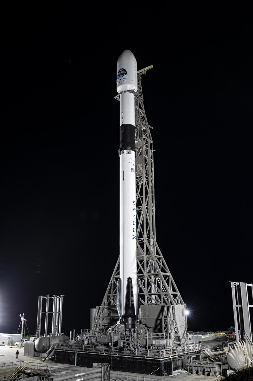
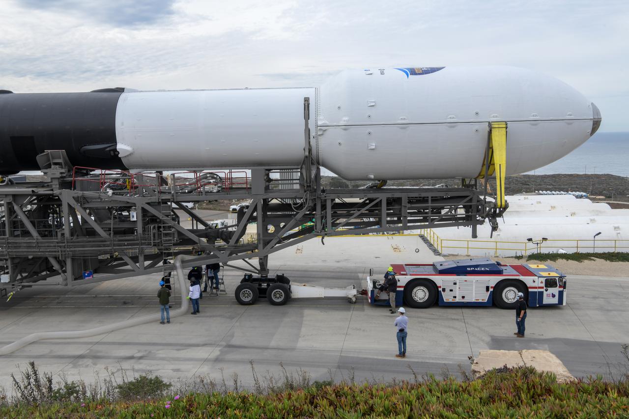
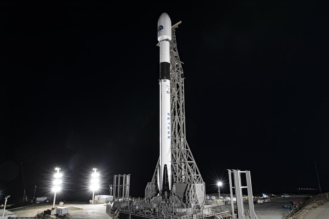
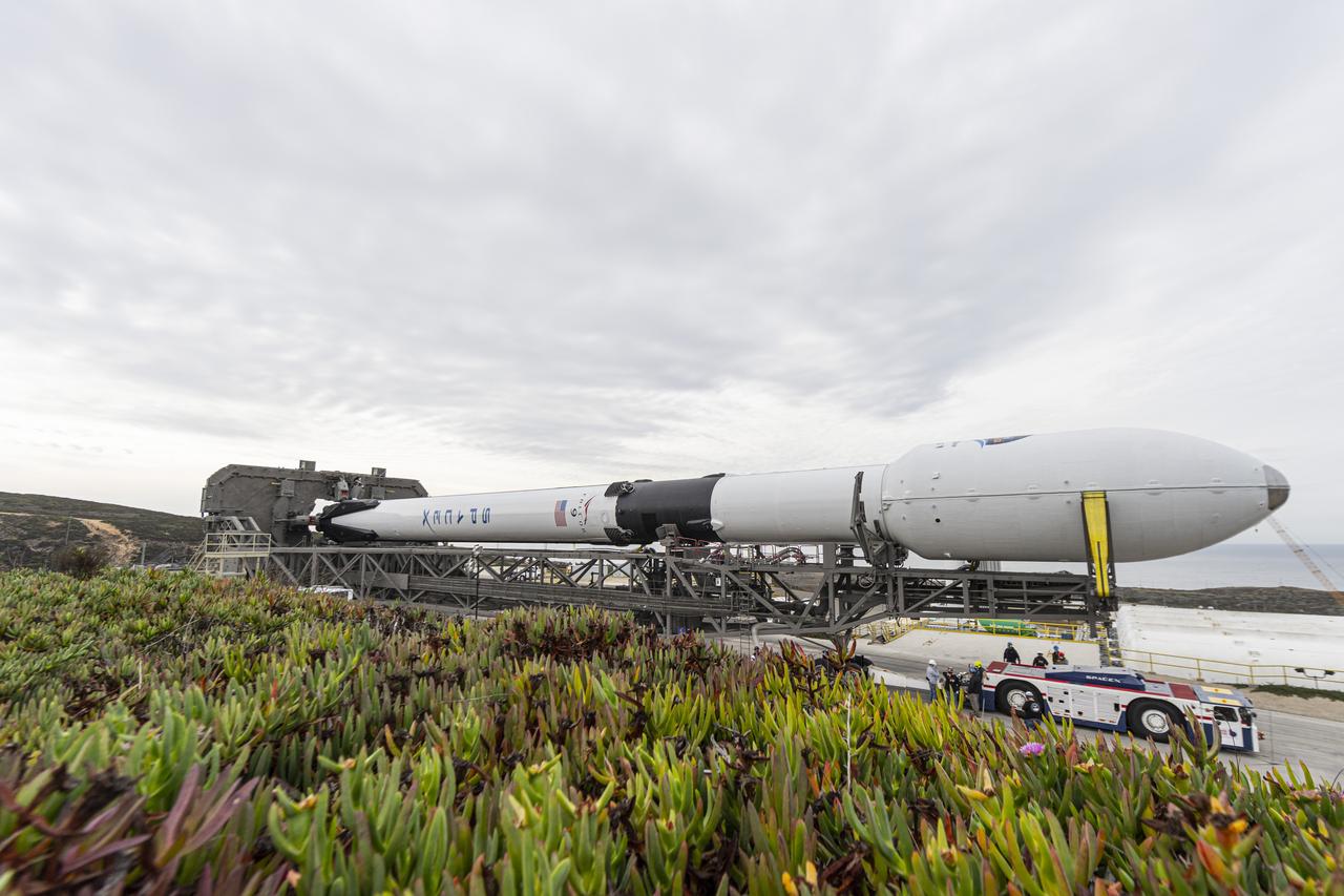
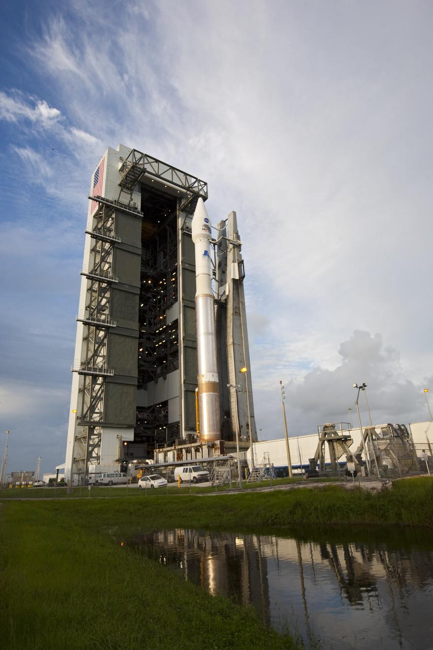
The protective payload fairing containing the Sentinel-6 Michael Freilich satellite is seen atop the SpaceX Falcon 9 after the rocket was lifted to vertical at Space Launch Complex 4 at Vandenberg Air Force Base in California on Nov. 20, 2020. The Sentinel-6/Jason-CS (Continuity of Service) mission consists of the Sentinel-6 Michael Freilich satellite, which will be followed by its twin, the Sentinel-6B satellite, in 2025. The Sentinel-6/Jason-CS mission is part of Copernicus, the European Union’s Earth observation program, managed by the European Commission. Continuing the legacy of the Jason series missions, Sentinel-6/Jason-CS will extend the records of sea level into their fourth decade, collecting accurate measurements of sea surface height for more than 90% of the world’s seas, and providing crucial information for operational oceanography, marine meteorology, and climate studies. Sentinel-6 Michael Freilich launched Nov. 21, 2020, at 9:17 PST (12:17 EST). NASA’s Launch Services Program at Kennedy Space Center was responsible for launch management.
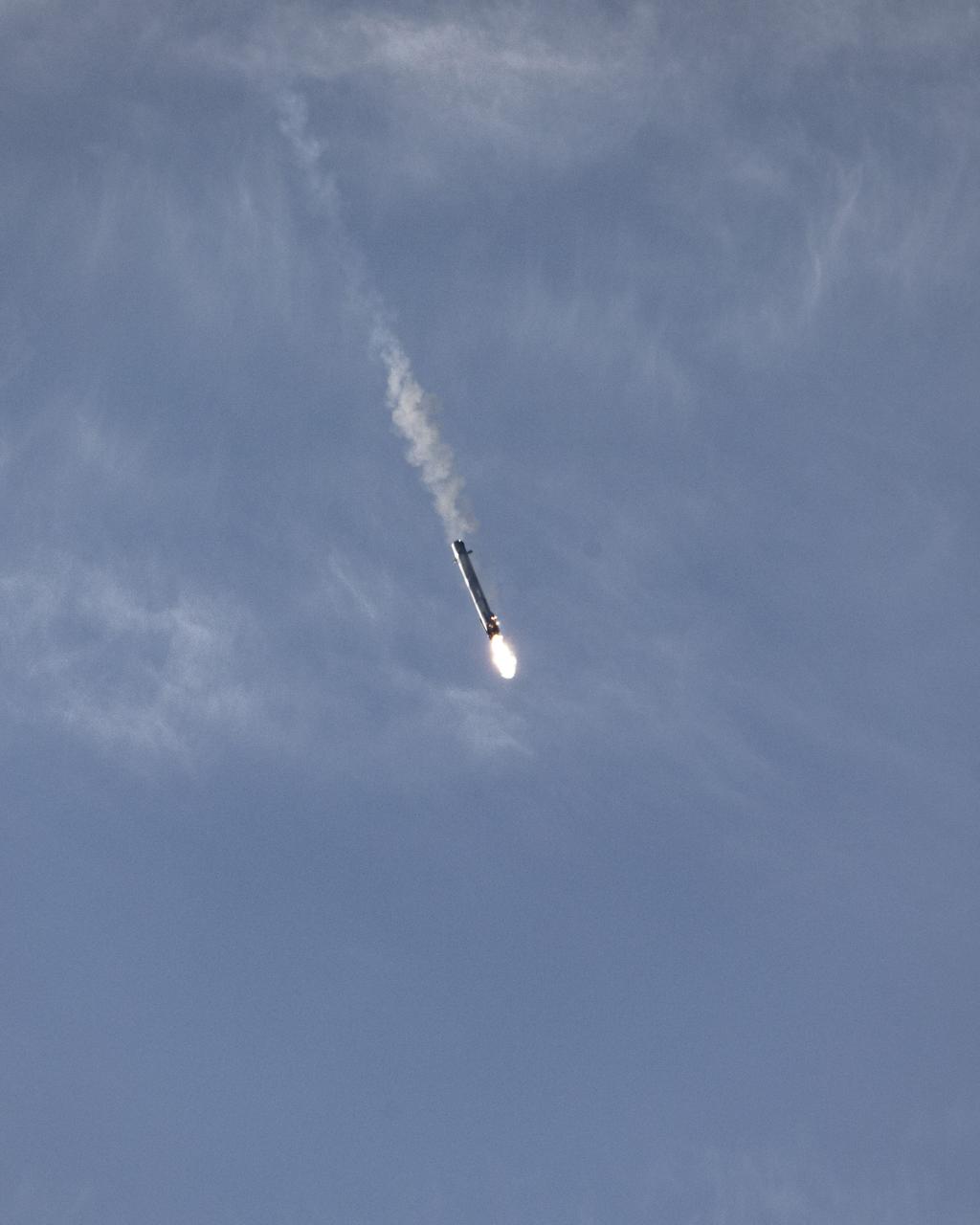
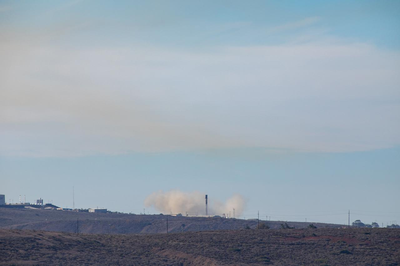
The first-stage booster of a SpaceX Falcon 9 rocket flies down to a landing at Vandenberg Air Force Base in California during the launch of the Sentinel-6 Michael Freilich mission. The Falcon 9 carrying the satellite lifted off from Vandenberg’s Space Launch Complex 4 on Nov. 21, 2020, at 9:17 a.m. PST (12:17 p.m. EST). The Sentinel-6/Jason-CS (Continuity of Service) mission consists of the Sentinel-6 Michael Freilich satellite, which will be followed by its twin, the Sentinel-6B satellite, in 2025. The Sentinel-6/Jason-CS mission is part of Copernicus, the European Union’s Earth observation program, managed by the European Commission. Continuing the legacy of the Jason series missions, Sentinel-6/Jason-CS will extend the records of sea level into their fourth decade, collecting accurate measurements of sea surface height for more than 90% of the world’s seas, and providing crucial information for operational oceanography, marine meteorology, and climate studies. NASA’s Launch Services Program at Kennedy Space Center was responsible for launch management.
The first-stage booster of a SpaceX Falcon 9 rocket flies down to a landing at Vandenberg Air Force Base in California during the launch of the Sentinel-6 Michael Freilich mission. The Falcon 9 carrying the satellite lifted off from Vandenberg’s Space Launch Complex 4 on Nov. 21, 2020, at 9:17 a.m. PST (12:17 p.m. EST). The Sentinel-6/Jason-CS (Continuity of Service) mission consists of the Sentinel-6 Michael Freilich satellite, which will be followed by its twin, the Sentinel-6B satellite, in 2025. The Sentinel-6/Jason-CS mission is part of Copernicus, the European Union’s Earth observation program, managed by the European Commission. Continuing the legacy of the Jason series missions, Sentinel-6/Jason-CS will extend the records of sea level into their fourth decade, collecting accurate measurements of sea surface height for more than 90% of the world’s seas, and providing crucial information for operational oceanography, marine meteorology, and climate studies. NASA’s Launch Services Program at Kennedy Space Center was responsible for launch management.
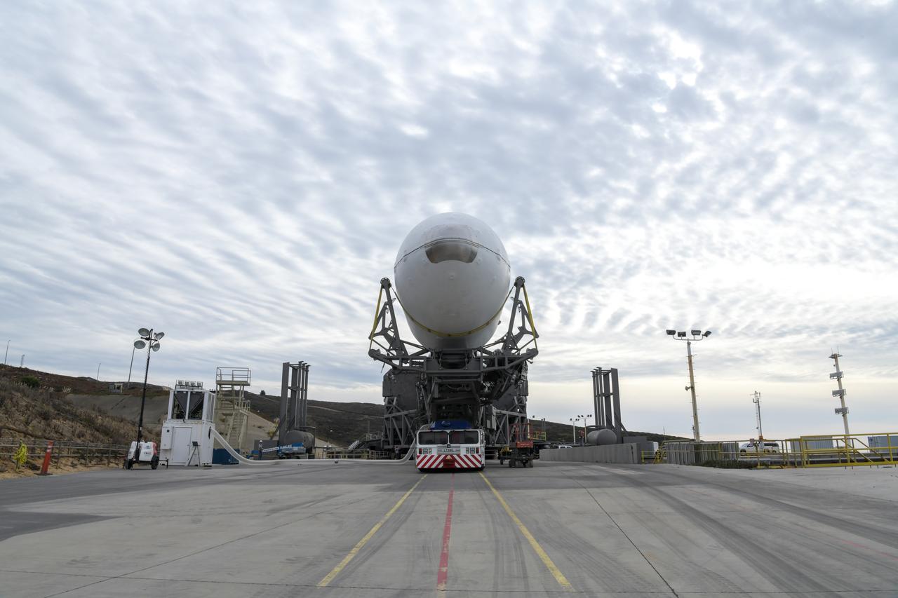
The SpaceX Falcon 9 rocket, topped with the Sentinel-6 Michael Freilich satellite secured inside its payload fairing, rolls from SpaceX’s Payload Processing Facility at Vandenberg Air Force Base in California to Space Launch Complex 4 on Nov. 20, 2020. The Sentinel-6/Jason-CS (Continuity of Service) mission consists of the Sentinel-6 Michael Freilich satellite, which will be followed by its twin, the Sentinel-6B satellite, in 2025. The Sentinel-6/Jason-CS mission is part of Copernicus, the European Union’s Earth observation program, managed by the European Commission. Continuing the legacy of the Jason series missions, Sentinel-6/Jason-CS will extend the records of sea level into their fourth decade, collecting accurate measurements of sea surface height for more than 90% of the world’s seas, and providing crucial information for operational oceanography, marine meteorology, and climate studies. Sentinel-6 Michael Freilich launched Nov. 21, 2020, at 9:17 PST (12:17 EST). NASA’s Launch Services Program at Kennedy Space Center was responsible for launch management.
The SpaceX Falcon 9 rocket, topped with the Sentinel-6 Michael Freilich satellite secured inside its payload fairing, rolls from SpaceX’s Payload Processing Facility at Vandenberg Air Force Base in California to Space Launch Complex 4 on Nov. 20, 2020. The Sentinel-6/Jason-CS (Continuity of Service) mission consists of the Sentinel-6 Michael Freilich satellite, which will be followed by its twin, the Sentinel-6B satellite, in 2025. The Sentinel-6/Jason-CS mission is part of Copernicus, the European Union’s Earth observation program, managed by the European Commission. Continuing the legacy of the Jason series missions, Sentinel-6/Jason-CS will extend the records of sea level into their fourth decade, collecting accurate measurements of sea surface height for more than 90% of the world’s seas, and providing crucial information for operational oceanography, marine meteorology, and climate studies. Sentinel-6 Michael Freilich launched Nov. 21, 2020, at 9:17 PST (12:17 EST). NASA’s Launch Services Program at Kennedy Space Center was responsible for launch management.
The SpaceX Falcon 9 rocket, topped with the Sentinel-6 Michael Freilich satellite secured inside its payload fairing, is rolled to Space Launch Complex 4 at Vandenberg Air Force Base in California on Nov. 20, 2020, in preparation for launch. The Sentinel-6/Jason-CS (Continuity of Service) mission consists of the Sentinel-6 Michael Freilich satellite, which will be followed by its twin, the Sentinel-6B satellite, in 2025. The Sentinel-6/Jason-CS mission is part of Copernicus, the European Union’s Earth observation program, managed by the European Commission. Continuing the legacy of the Jason series missions, Sentinel-6/Jason-CS will extend the records of sea level into their fourth decade, collecting accurate measurements of sea surface height for more than 90% of the world’s seas, and providing crucial information for operational oceanography, marine meteorology, and climate studies. Sentinel-6 Michael Freilich launched Nov. 21, 2020, at 9:17 PST (12:17 EST). NASA’s Launch Services Program at Kennedy Space Center was responsible for launch management.
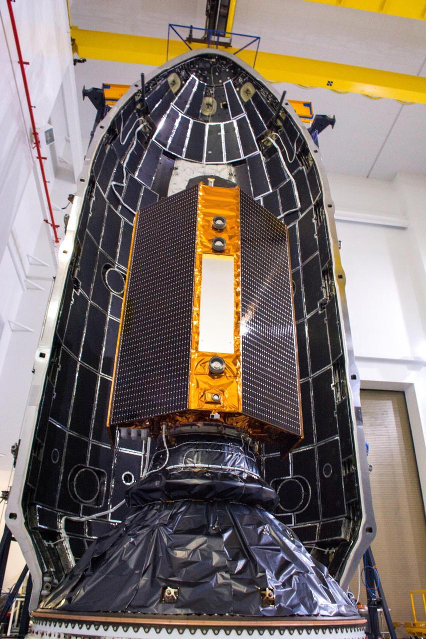
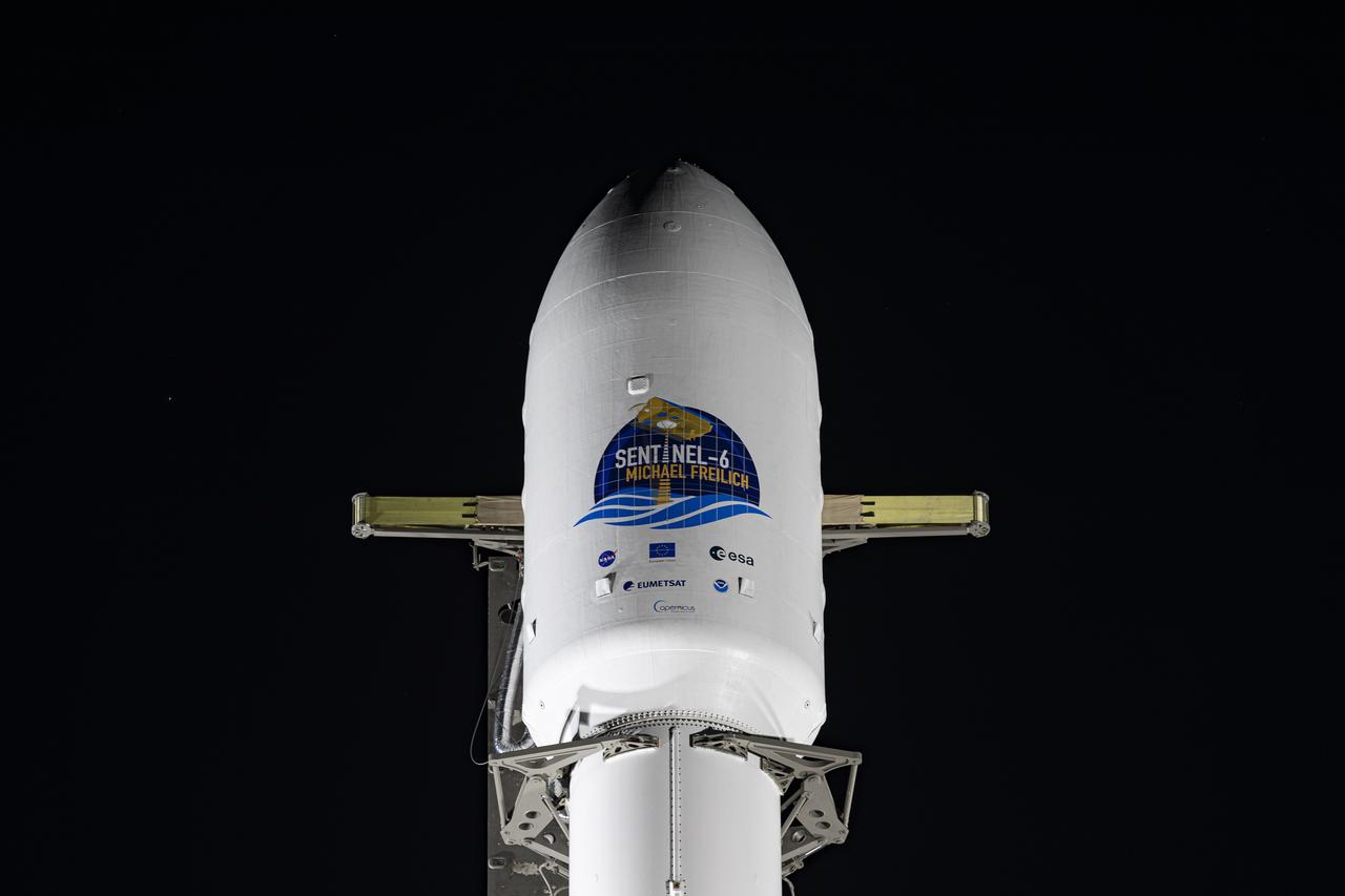
The Sentinel-6 Michael Freilich satellite is encapsulated in a protective nosecone, or payload fairing, in the SpaceX Payload Processing Facility at Vandenberg Air Force Base in California. The fairing will sit atop a SpaceX Falcon 9 rocket during the late-November 2020 launch that will place the satellite in Earth orbit. Sentinel-6 Michael Freilich is one of two identical satellites that are a part of the Sentinel-6/Jason-CS (Continuity of Service) mission, a U.S.-European collaboration. The mission is part of Copernicus, the European Union's Earth observation program managed by the European Commission. Continuing the legacy of the Jason series missions, Sentinel-6/Jason-CS will extend the records of sea level into their fourth decade, collecting accurate measurements of sea surface height for more than 90% of the world's oceans, and providing crucial information for operational oceanography, marine meteorology, and climate studies. Sentinel-6 Michael Freilich's twin, Sentinel-6B, is scheduled to launch in 2025. https://photojournal.jpl.nasa.gov/catalog/PIA24133
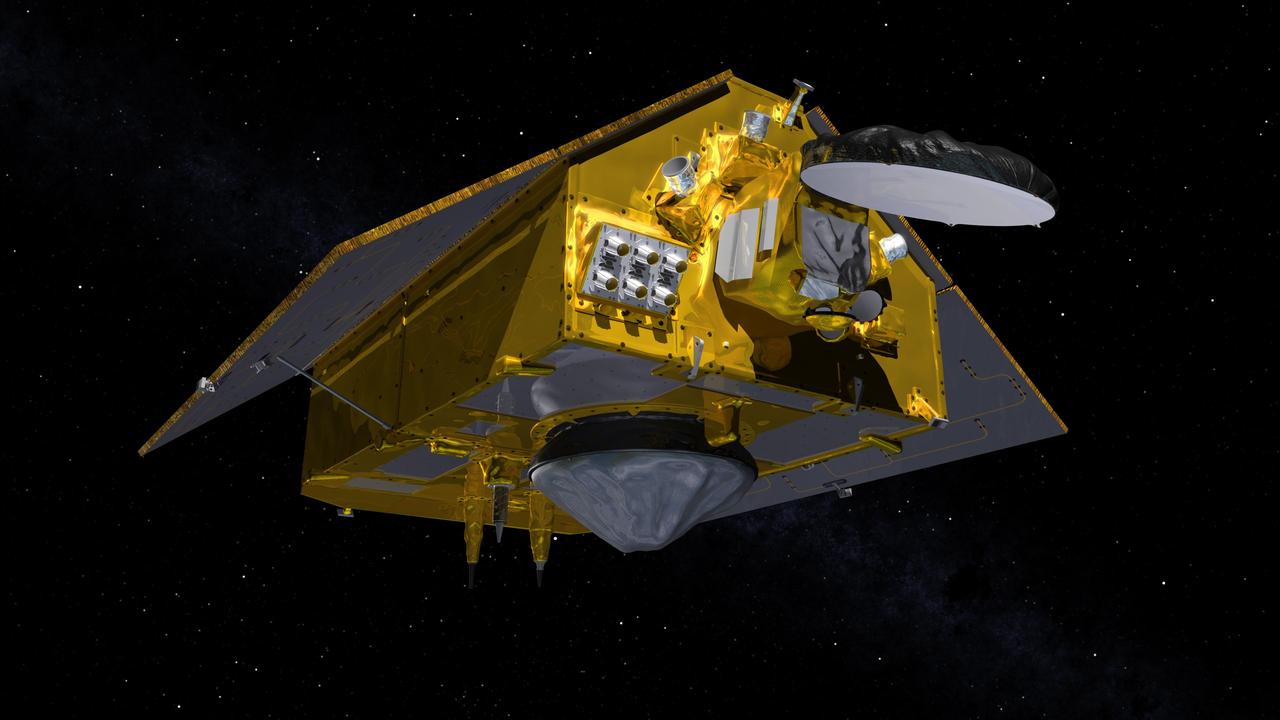
This illustration shows the front of the Sentinel-6 Michael Freilich spacecraft in orbit above Earth with its deployable solar panels extended. As the world's latest ocean-monitoring satellite, it is launching on Nov. 10, 2020, to collect the most accurate data yet on global sea level and how our oceans are rising in response to climate change. The mission will also collect precise data of atmospheric temperature and humidity that will help improve weather forecasts and climate models. The conelike instrument on the bottom (Earth-facing side) of the spacecraft is the satellite's Poseidon-4 radar altimeter. The disklike instrument at the front of the spacecraft is the Advanced Microwave Radiometer (AMR-C). Both instruments will be used together to measure ocean surface height. The gray rectangle with six cones attached at the front-left of the spacecraft is part of the Global Navigation Satellite System - Radio Occultation (GNSS-RO) instrument. Sentinel-6 Michael Freilich extends the near-30-year record of satellite measurements of sea level initiated by the U.S.-European TOPEX/Poseidon mission in 1992 and that continued with the Jason-1, 2, and 3 series of sea level observation satellites. Launched in 2016, Jason-3 is currently providing data. The satellite is named after Dr. Michael Freilich, the former director of NASA's Earth Science Division and an instrumental figure in advancing ocean observations from space. Sentinel-6 Michael Freilich is one of two identical spacecraft that compose the Sentinel-6/Jason-CS (Continuity of Service) mission developed in partnership with ESA (the European Space Agency). Other partners include the National Oceanic and Atmospheric Administration (NOAA), the intergovernmental European Organisation for the Exploitation of Meteorological Satellites (EUMETSAT), and France's National Centre for Space Studies (CNES). ESA is developing the new Sentinel family of missions to support the operational needs of the European Union's Copernicus program, the EU's Earth observation program managed by the European Commission. The spacecraft's twin, Sentinel-6B, will launch in 2025. https://photojournal.jpl.nasa.gov/catalog/PIA24106
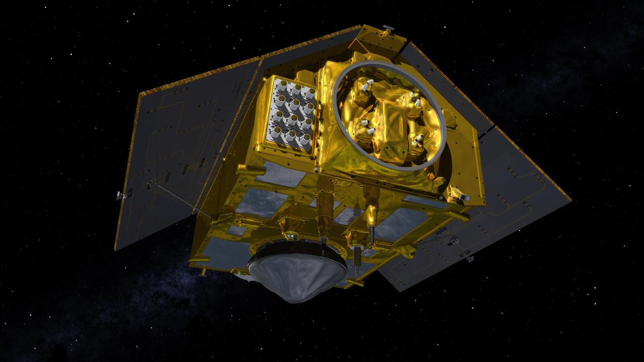
This illustration shows the rear of the Sentinel-6 Michael Freilich spacecraft in orbit above Earth with its deployable solar panels extended. As the world's latest ocean-monitoring satellite, it is launching on Nov. 10, 2020, to collect the most accurate data yet on global sea level and how our oceans are rising in response to climate change. The mission will also collect precise data of atmospheric temperature and humidity that will help improve weather forecasts and climate models. The conelike instrument on the bottom (Earth-facing side) of the spacecraft is the satellite's Poseidon-4 radar altimeter. When used with the Advanced Microwave Radiometer (AMR-C) attached to the front of the spacecraft, both instruments will be used to make precise measurements of sea surface height. The gray rectangle with 12 cones attached at the rear-left of the spacecraft is part of the Global Navigation Satellite System - Radio Occultation (GNSS-RO) instrument. Sentinel-6 Michael Freilich extends the near-30-year record of satellite measurements of sea level initiated by the U.S.-European TOPEX/Poseidon mission in 1992 and that continued with the Jason-1, 2, and 3 series of sea level observation satellites. Launched in 2016, Jason-3 is currently providing data. The satellite is named after Dr. Michael Freilich, the former director of NASA's Earth Science Division and an instrumental figure in advancing ocean observations from space. Sentinel-6 Michael Freilich is one of two identical spacecraft that compose the Sentinel-6/Jason-CS (Continuity of Service) mission developed in partnership with ESA (the European Space Agency). Other partners include the National Oceanic and Atmospheric Administration (NOAA), the intergovernmental European Organisation for the Exploitation of Meteorological Satellites (EUMETSAT), and France's National Centre for Space Studies (CNES). ESA is developing the new Sentinel family of missions to support the operational needs of the European Union's Copernicus program, the EU's Earth observation program managed by the European Commission. The spacecraft's twin, Sentinel-6B, will launch in 2025. https://photojournal.jpl.nasa.gov/catalog/PIA24107

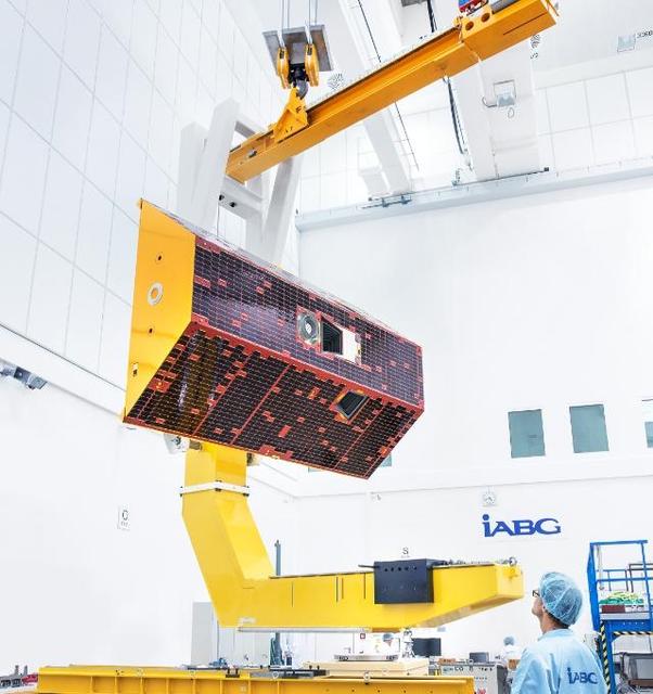
A shipping container containing the Sentinel-6 Michael Freilich satellite is transported on a truck to the SpaceX payload processing facility at Vandenberg Air Force Base after arriving in California on Sept. 24, 2020. An Antonov aircraft carrying the spacecraft arrived at around 10:40 a.m. PDT (1:40 p.m. EDT) after a two-day journey from an IABG engineering facility near Munich, Germany. The ocean-monitoring satellite will undergo prelaunch tests before its scheduled launch on Nov. 10, 2020. Sentinel-6 Michael Freilich will begin a five-and-a-half-year mission to collect sea surface height measurements down to the centimeter for 90% of the world's oceans. The satellite is named after Dr. Michael Freilich, the former director of NASA's Earth Science Division and an instrumental figure in advancing ocean observations from space. Sentinel-6 Michael Freilich is one of two identical spacecraft that compose the Sentinel-6/Jason-CS (Continuity of Service) mission developed in partnership with ESA (the European Space Agency). ESA is developing the new Sentinel family of missions to support the operational needs of the European Union's Copernicus program, the EU's Earth observation program managed by the European Commission. The spacecraft's twin, Sentinel-6B, will launch in 2025. Sentinel-6/Jason-CS is being jointly developed by ESA, the European Organisation for the Exploitation of Meteorological Satellites (EUMETSAT), NASA, and the National Oceanic and Atmospheric Administration, with funding support from the European Commission and technical support from France's National Centre for Space Studies (CNES). JPL, a division of Caltech in Pasadena, is contributing three science instruments for each Sentinel-6 satellite: the Advanced Microwave Radiometer, the Global Navigation Satellite System - Radio Occultation, and the Laser Retroreflector Array. NASA is also contributing launch services, ground systems supporting operation of the NASA science instruments, the science data processors for two of these instruments, and support for the international Ocean Surface Topography Science Team. https://photojournal.jpl.nasa.gov/catalog/PIA24104
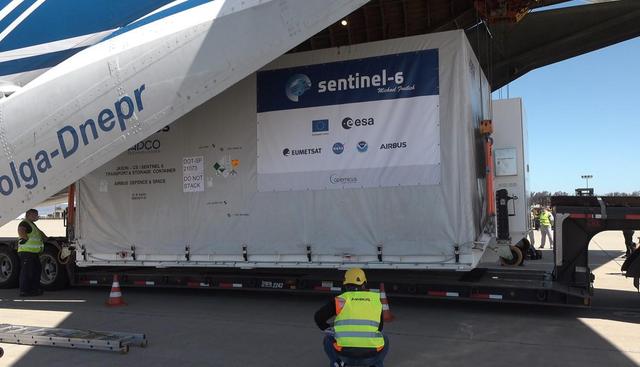
A shipping container containing the Sentinel-6 Michael Freilich satellite is removed from an Antonov 124 aircraft at Vandenberg Air Force Base in California on Sept. 24, 2020. The flight arrived at around 10:40 a.m. PDT (1:40 p.m. EDT) after a two-day journey from an IABG engineering facility near Munich, Germany. The ocean-monitoring satellite will undergo prelaunch tests before its scheduled launch on Nov. 10, 2020. Sentinel-6 Michael Freilich will begin a five-and-a-half-year mission to collect sea surface height measurements down to the centimeter for 90% of the world's oceans. The satellite is named after Dr. Michael Freilich, the former director of NASA's Earth Science Division and an instrumental figure in advancing ocean observations from space. Sentinel-6 Michael Freilich is one of two identical spacecraft that compose the Sentinel-6/Jason-CS (Continuity of Service) mission developed in partnership with ESA (the European Space Agency). ESA is developing the new Sentinel family of missions specifically to support the operational needs of the European Union's Copernicus program, the EU's Earth observation program managed by the European Commission. The spacecraft's twin, Sentinel-6B, will launch in 2025. Sentinel-6/Jason-CS is being jointly developed by ESA, the European Organisation for the Exploitation of Meteorological Satellites (EUMETSAT), NASA, and the National Oceanic and Atmospheric Administration, with funding support from the European Commission and technical support from France's National Centre for Space Studies (CNES). NASA JPL is contributing three science instruments for each Sentinel-6 satellite: the Advanced Microwave Radiometer, the Global Navigation Satellite System - Radio Occultation, and the Laser Retroreflector Array. NASA is also contributing launch services, ground systems supporting operation of the NASA science instruments, the science data processors for two of these instruments, and support for the international Ocean Surface Topography Science Team. https://photojournal.jpl.nasa.gov/catalog/PIA24103
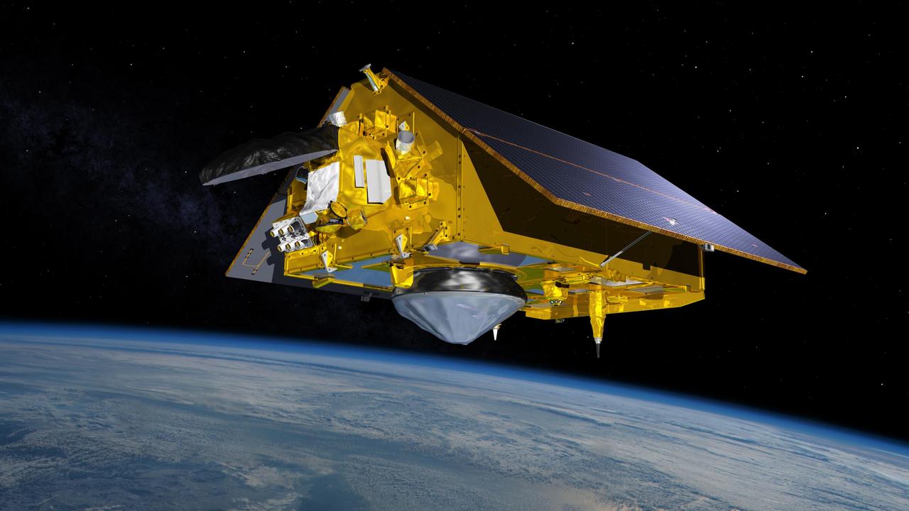
This illustration shows the Sentinel-6 Michael Freilich spacecraft in orbit above Earth with its deployable solar panels extended. As the world's latest ocean-monitoring satellite, it will collect the most accurate data yet on global sea level and how our oceans are rising in response to climate change. The mission will also collect precise data of atmospheric temperature and humidity that will help improve weather forecasts and climate models. Sentinel-6 Michael Freilich extends the near-30-year record of satellite measurements of sea level that was initiated by the U.S.-European TOPEX/Poseidon mission in 1992 and continued with the Jason-1, 2, and 3 series of sea level observation satellites. Launched in 2016, Jason-3 is currently providing data. The satellite is named after Dr. Michael Freilich, the former director of NASA's Earth Science Division and an instrumental figure in advancing ocean observations from space. Sentinel-6 Michael Freilich is one of two identical spacecraft that compose the Sentinel-6/Jason-CS (Continuity of Service) mission developed in partnership with ESA (the European Space Agency). Other partners include the National Oceanic and Atmospheric Administration (NOAA), the intergovernmental European Organisation for the Exploitation of Meteorological Satellites (EUMETSAT), and France's National Centre for Space Studies (CNES). ESA is developing the new Sentinel family of missions to support the operational needs of the European Union's Copernicus program, the EU's Earth observation program managed by the European Commission. The spacecraft's twin, Sentinel-6B, will launch in 2025. https://photojournal.jpl.nasa.gov/catalog/PIA24105

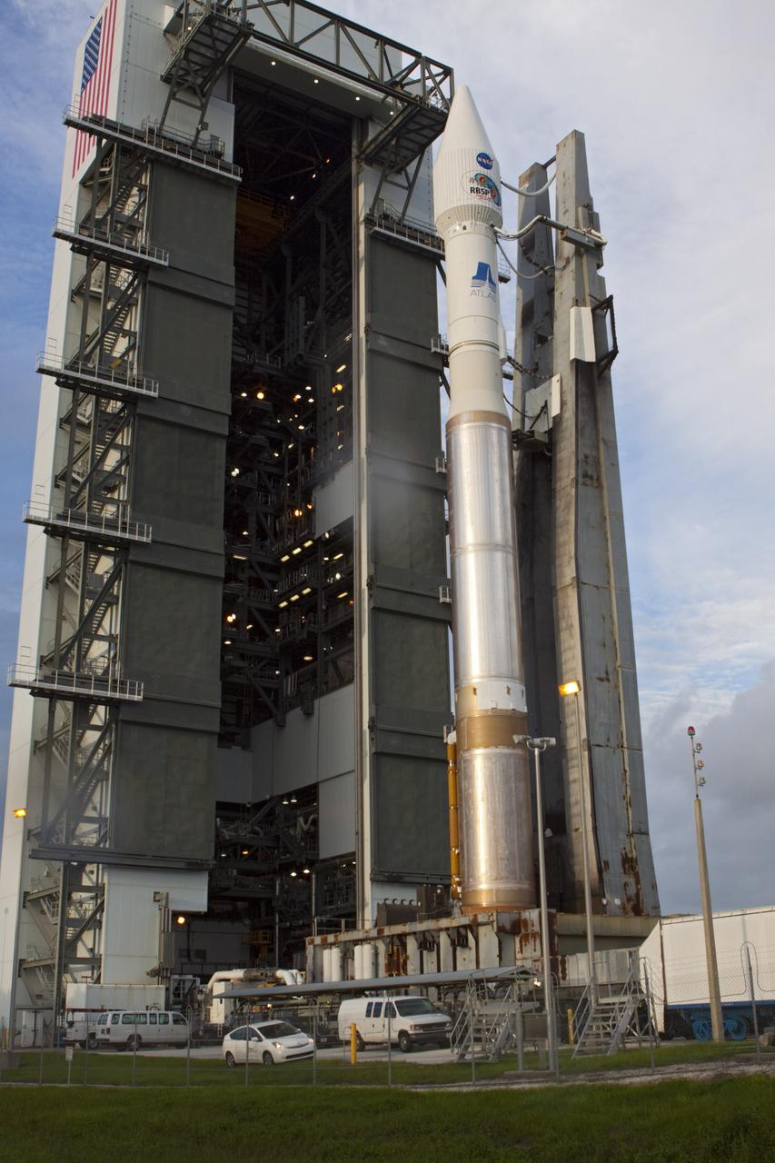
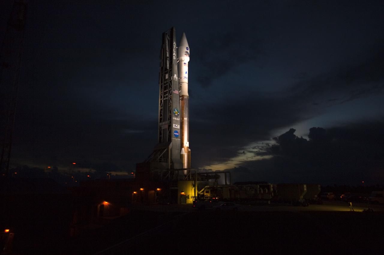
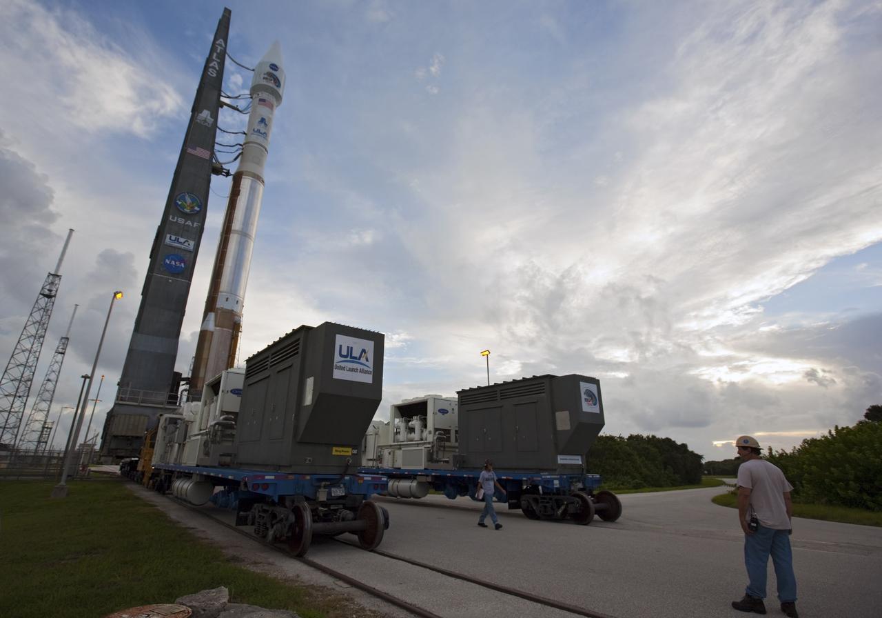
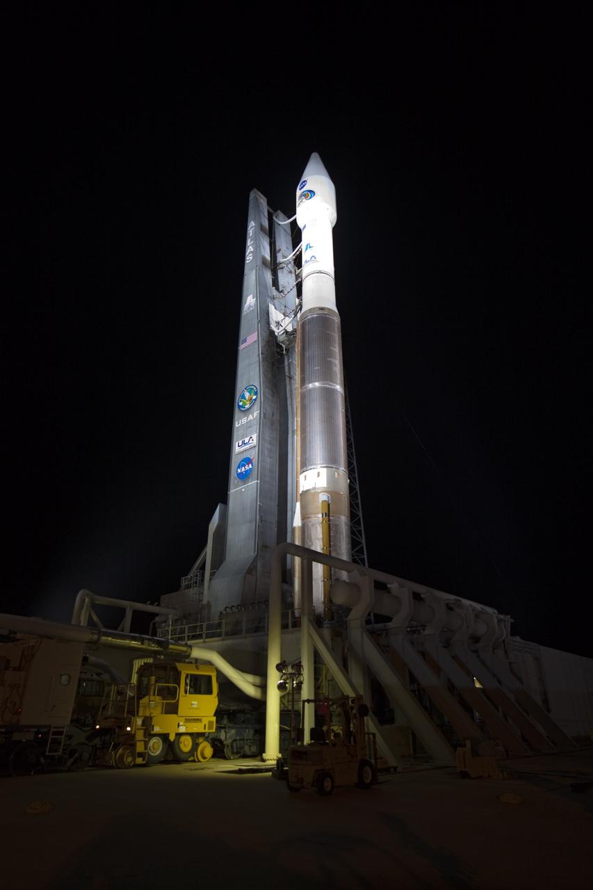
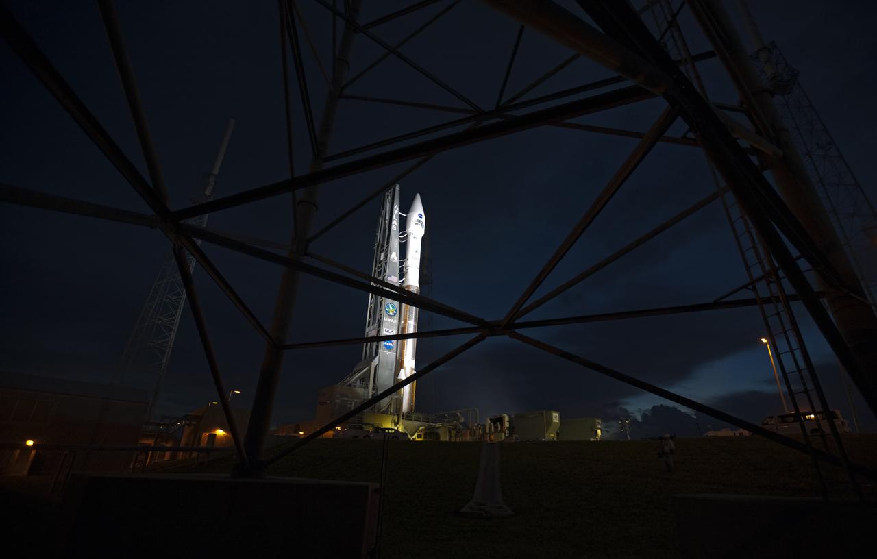
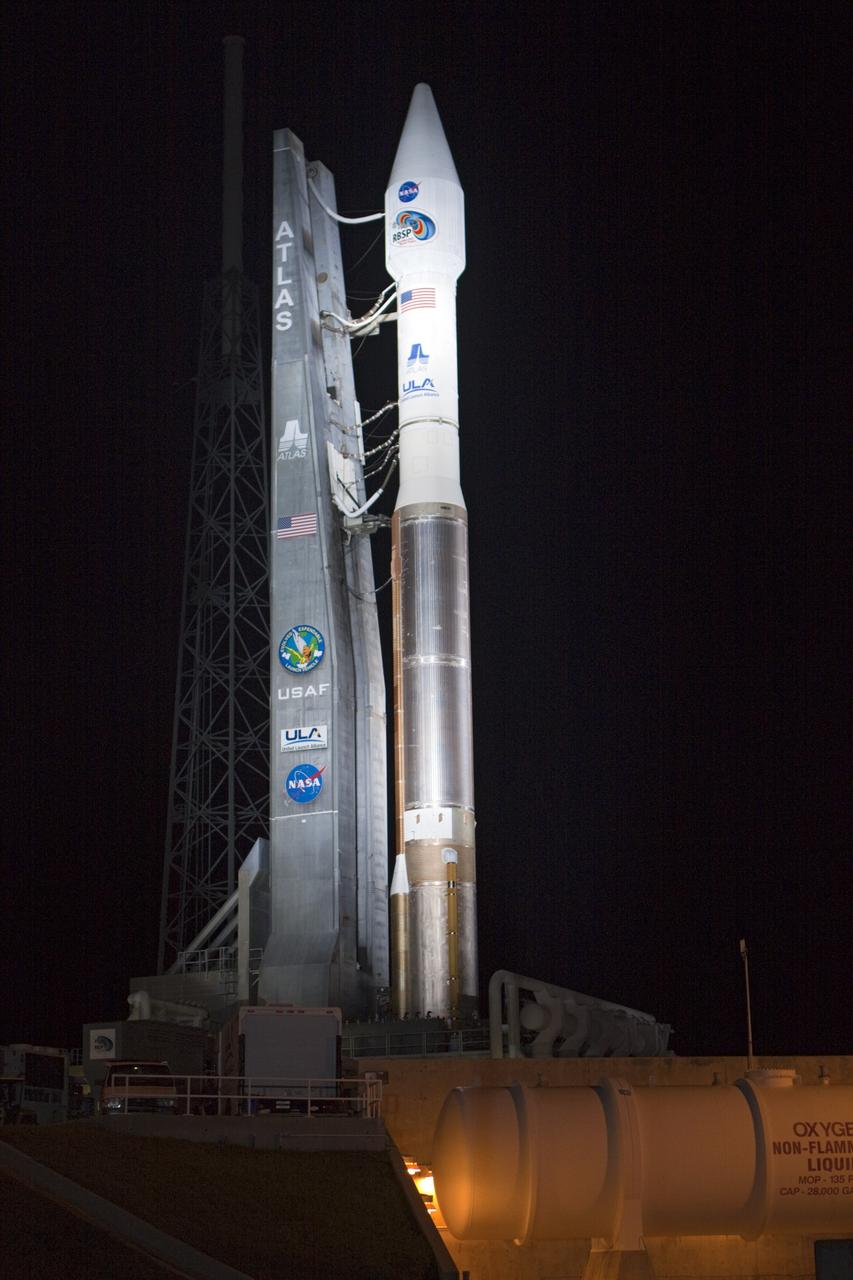
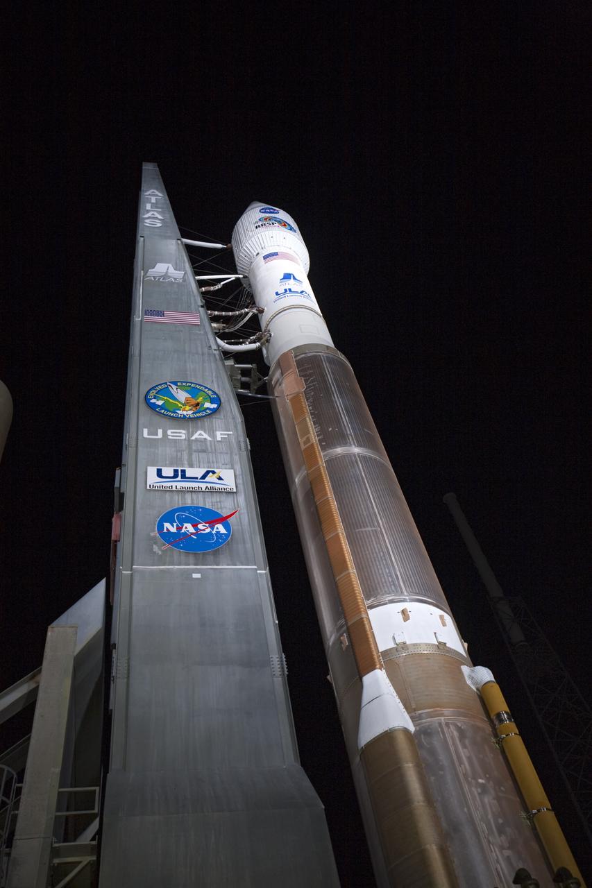
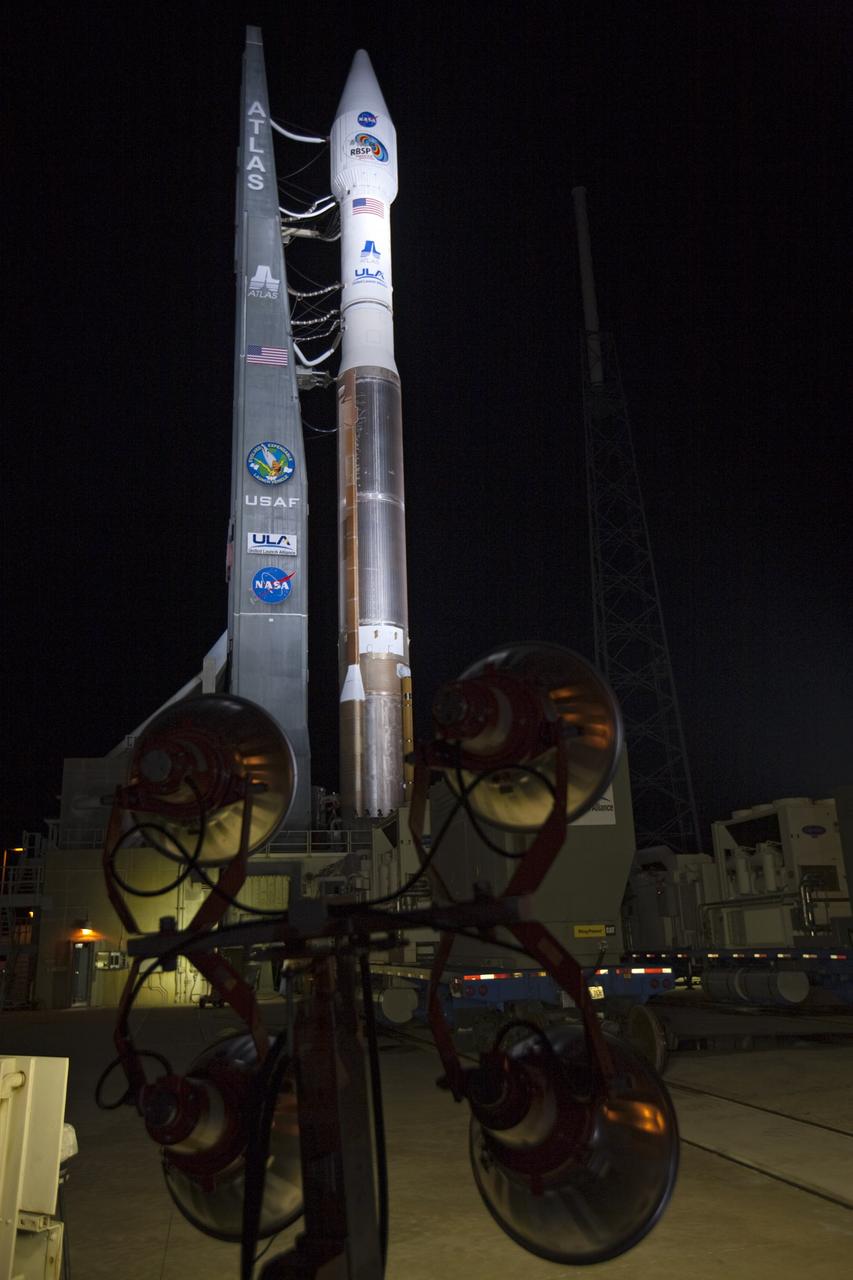
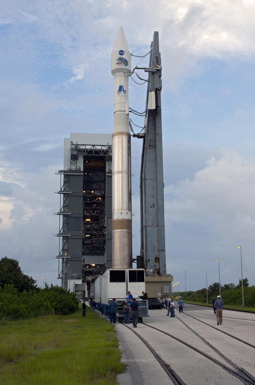
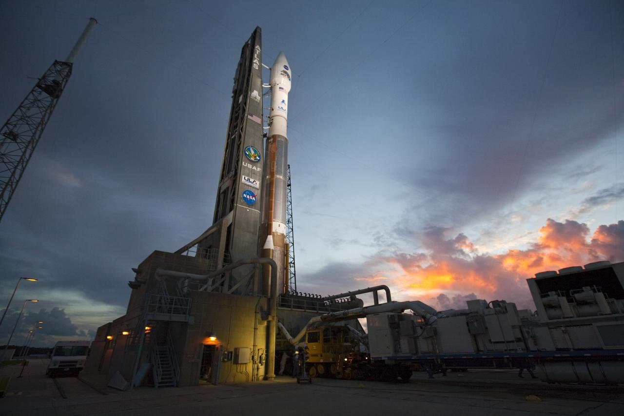
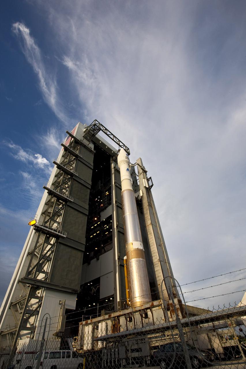
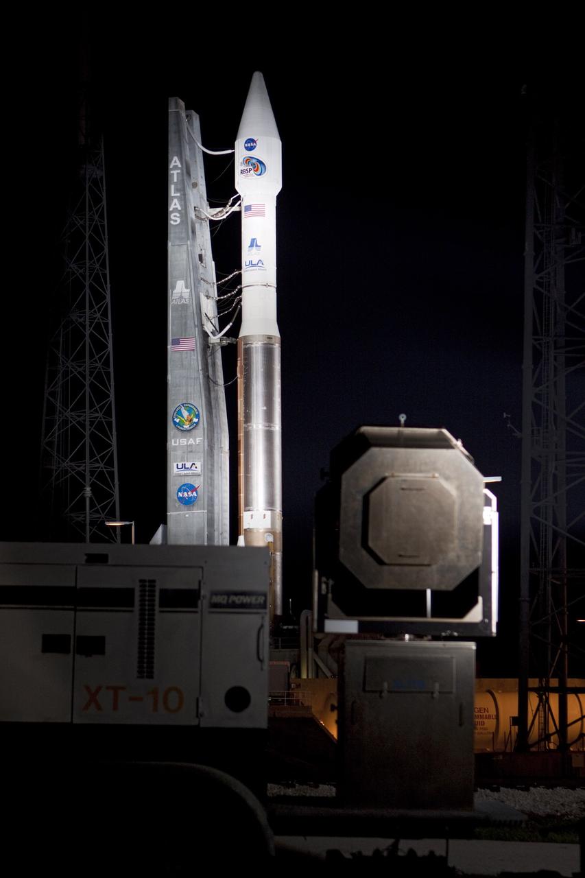
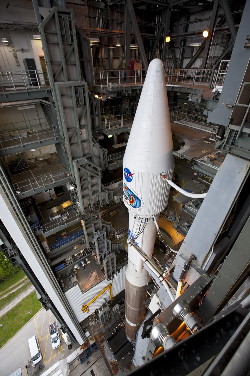
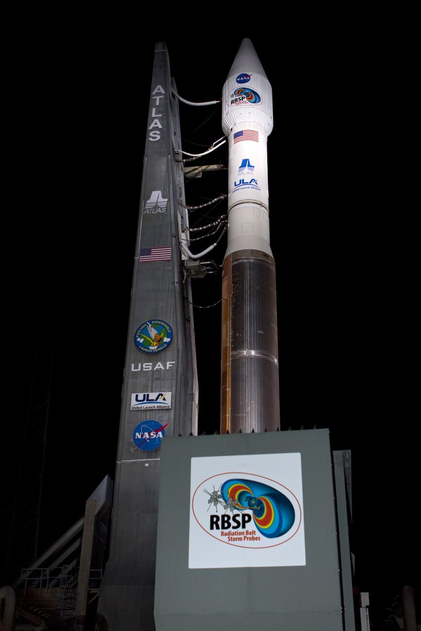
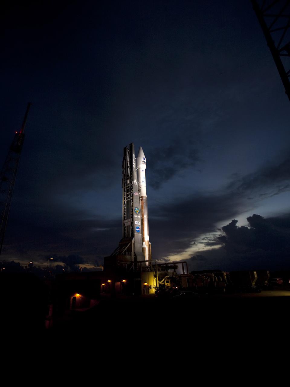
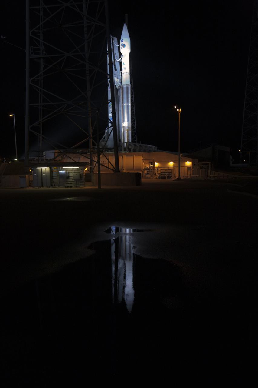
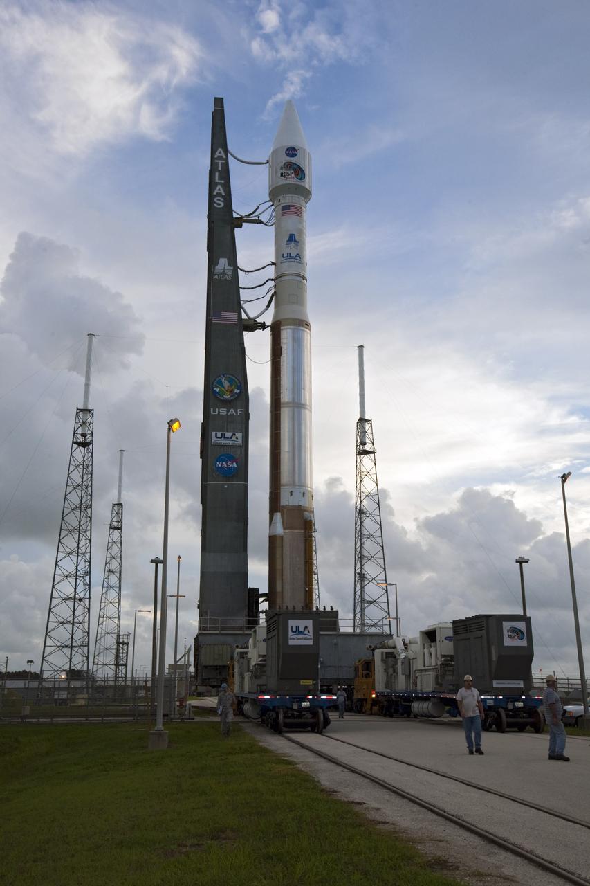
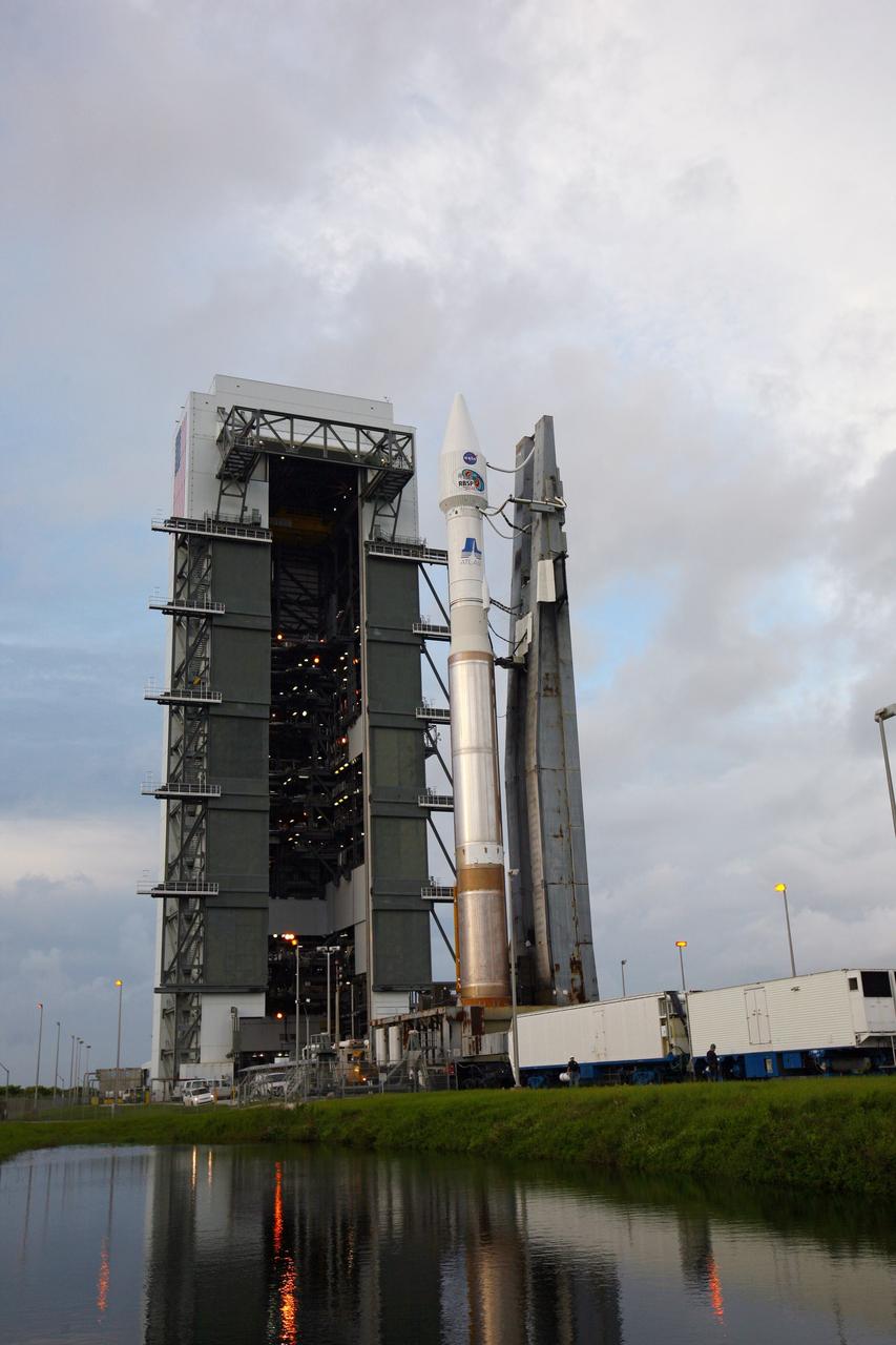
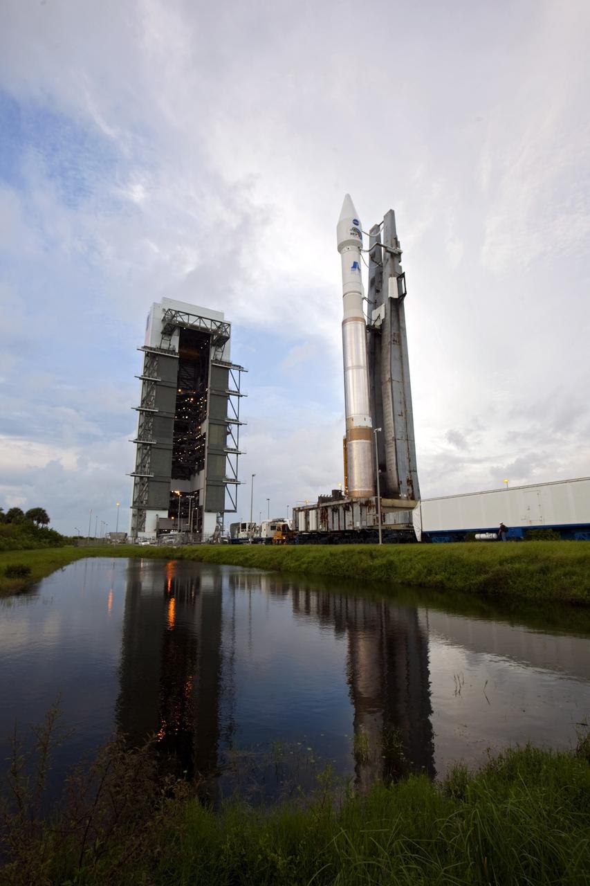
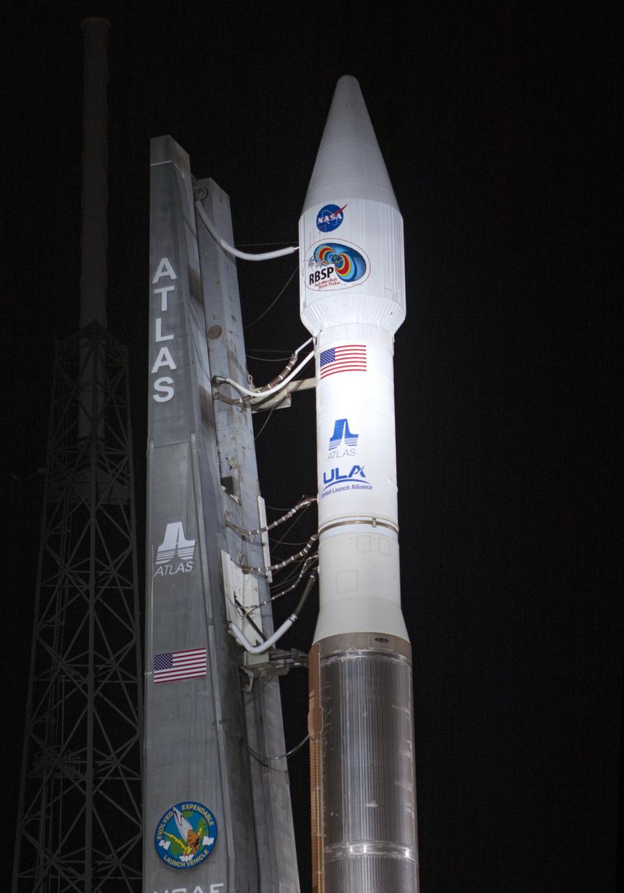
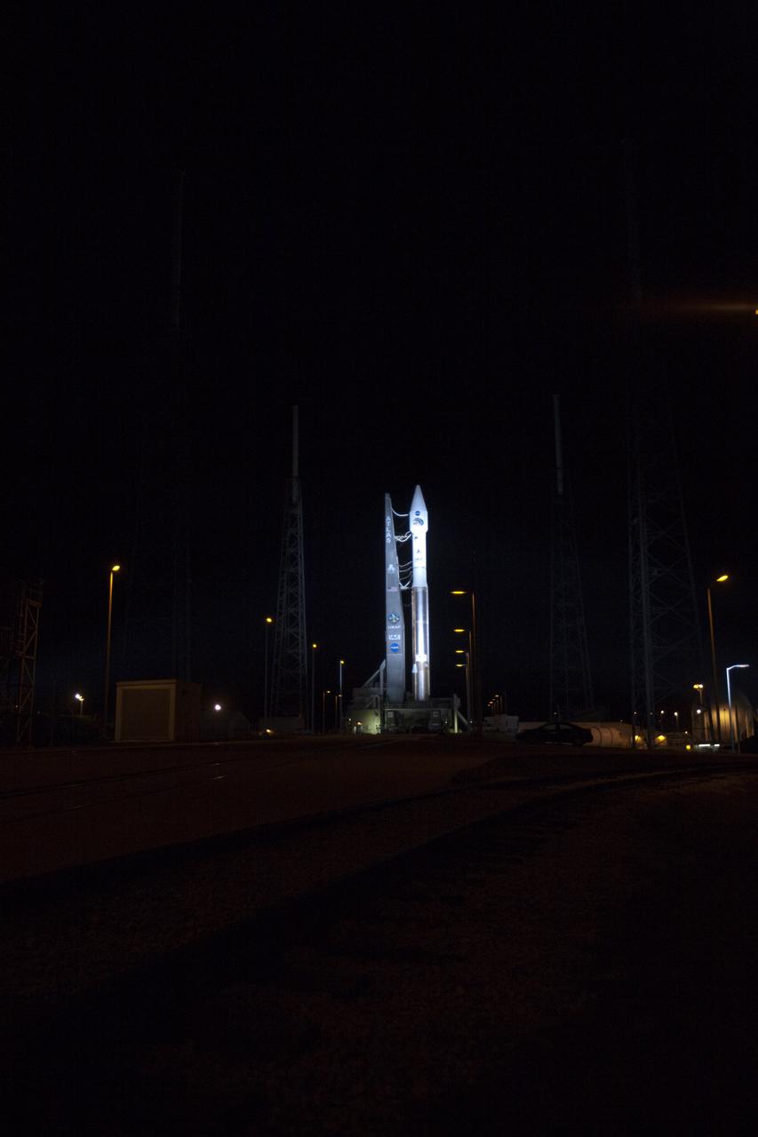
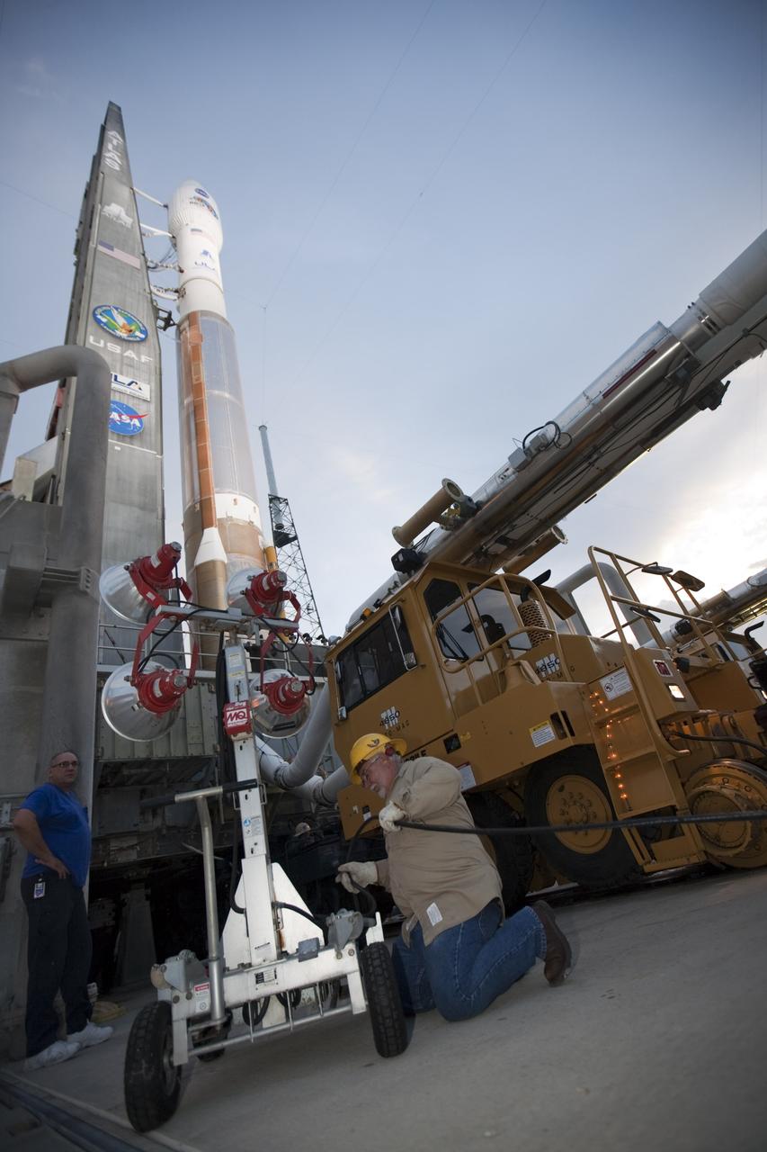
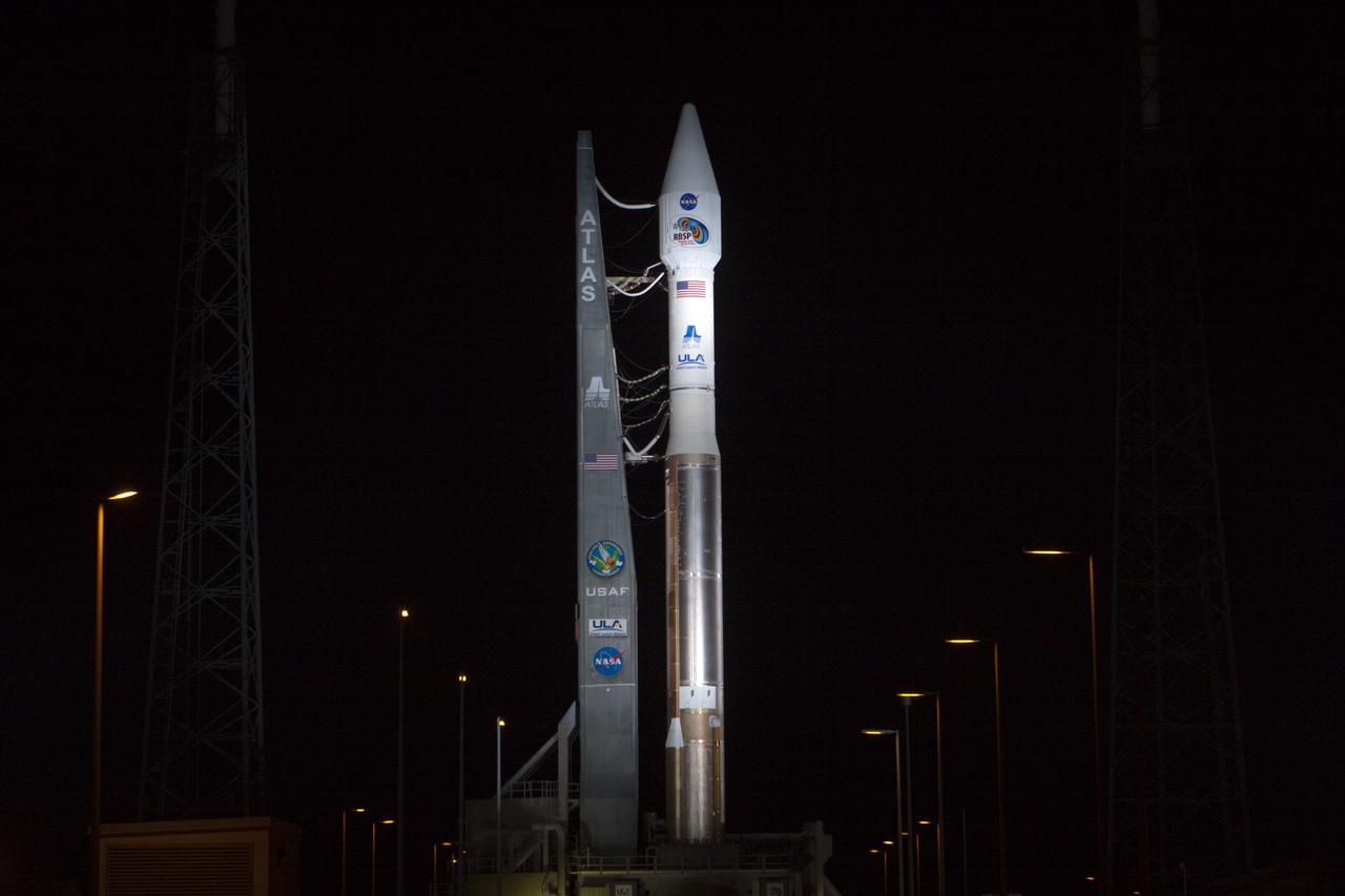
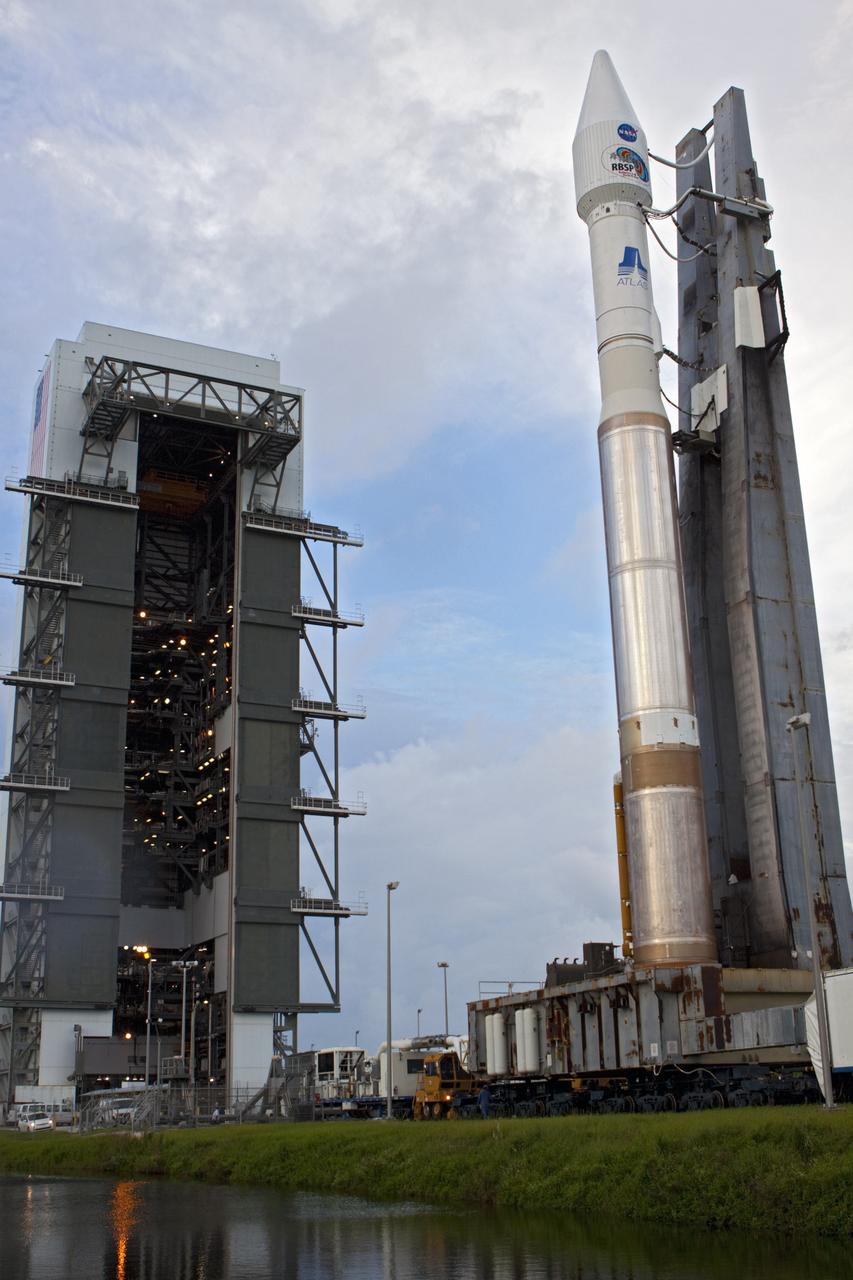
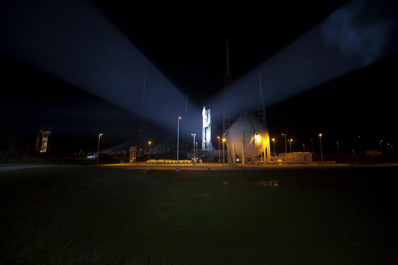
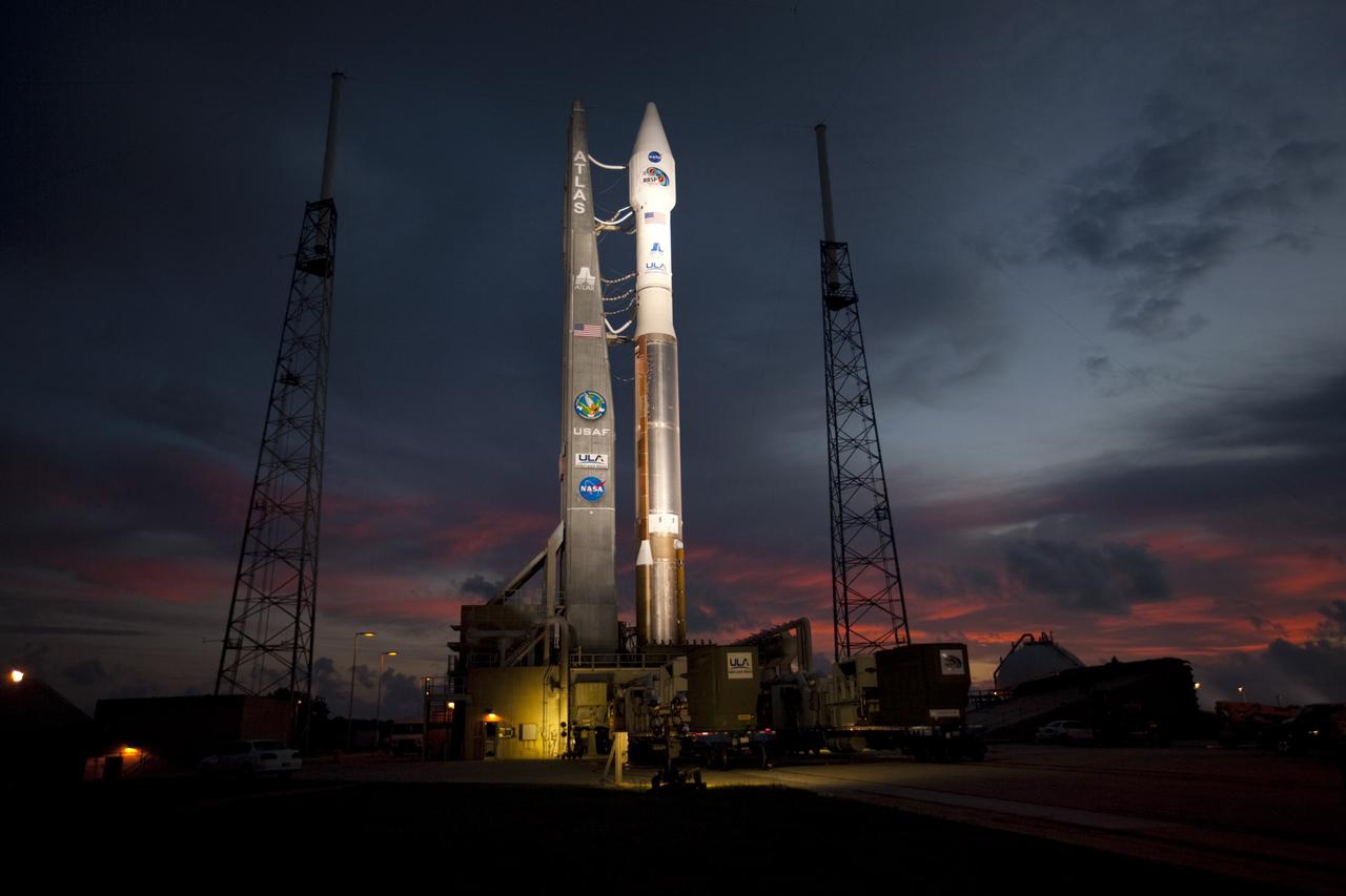
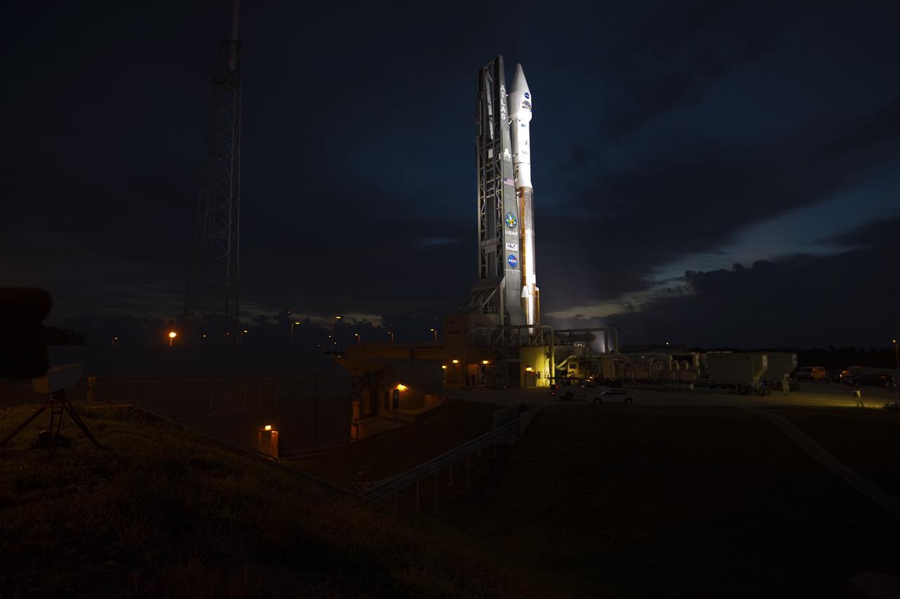
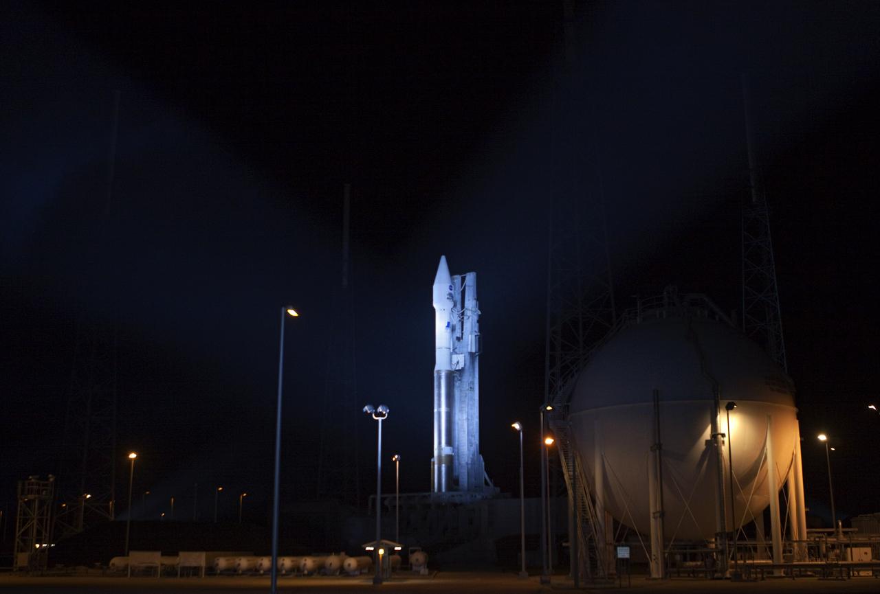
CAPE CANAVERAL, Fla. – At Cape Canaveral Air Force Station in Florida, United Launch Alliance, or ULA, technicians monitor the progress as the ULA Atlas V rocket, carrying NASA’s twin Radiation Belt Storm Probes, or RBSP, are rolled back from Space Launch Complex 41 to the Vertical Integration Facility. The rocket and spacecraft will be secured and protected from inclement weather due to Tropical Storm Isaac. RBSP will explore changes in Earth's space environment caused by the sun -- known as "space weather" -- that can disable satellites, create power-grid failures and disrupt GPS service. The mission also will provide data on the fundamental radiation and particle acceleration processes throughout the universe. The launch is rescheduled for 4:05 a.m. EDT on Aug. 30, pending approval from the range. For more information on RBSP, visit http://www.nasa.gov/rbsp. Photo credit: NASA/Ben Smegelsky

CAPE CANAVERAL, Fla. – At Cape Canaveral Air Force Station in Florida, the United Launch Alliance Atlas V rocket, carrying NASA’s twin Radiation Belt Storm Probes, or RBSP, is rolled back from Space Launch Complex 41 to the Vertical Integration Facility where they will be secured and protected from inclement weather due to Tropical Storm Isaac. RBSP will explore changes in Earth's space environment caused by the sun -- known as "space weather" -- that can disable satellites, create power-grid failures and disrupt GPS service. The mission also will provide data on the fundamental radiation and particle acceleration processes throughout the universe. The launch is rescheduled for 4:05 a.m. EDT on Aug. 30, pending approval from the range. For more information on RBSP, visit http://www.nasa.gov/rbsp. Photo credit: NASA/Ben Smegelsky
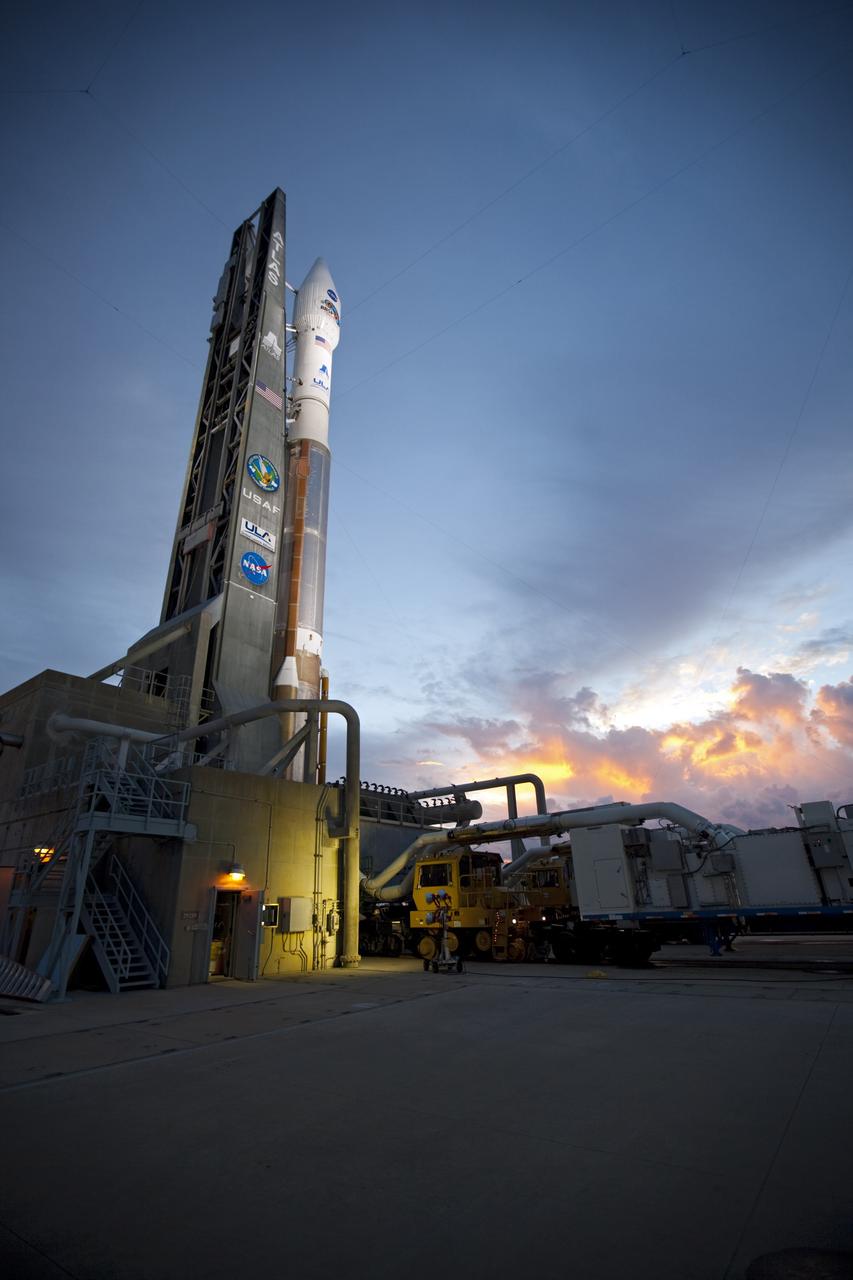
CAPE CANAVERAL, Fla. – An unfavorable weather forecast as a result of Tropical Storm Isaac approaching Florida kept NASA's twin Radiation Belt Storm Probes, or RBSP, on Space Launch Complex 41 at Cape Canaveral Air Force Station in Florida. Managers decided to roll the Atlas V rocket off the launch pad and back to the Vertical Integration Facility to ensure the launch vehicle and RBSP spacecraft are secured and protected from inclement weather. RBSP will explore changes in Earth's space environment caused by the sun -- known as "space weather" -- that can disable satellites, create power-grid failures and disrupt GPS service. The mission also will provide data on the fundamental radiation and particle acceleration processes throughout the universe. The launch is rescheduled for 4:05 a.m. EDT on Aug. 30, pending approval from the range. For more information on RBSP, visit http://www.nasa.gov/rbsp. Photo credit: NASA/Ben Smegelsky
CAPE CANAVERAL, Fla. – At Cape Canaveral Air Force Station in Florida, the United Launch Alliance, or ULA, Atlas V rocket with NASA’s twin Radiation Belt Storm Probes, or RBSP, rolls back to the Vertical Integration Facility from Space Launch Complex 41. The rocket and spacecraft will be secured and protected from inclement weather due to Tropical Storm Isaac. RBSP will explore changes in Earth's space environment caused by the sun -- known as "space weather" -- that can disable satellites, create power-grid failures and disrupt GPS service. The mission also will provide data on the fundamental radiation and particle acceleration processes throughout the universe. The launch is rescheduled for 4:05 a.m. EDT on Aug. 30, pending approval from the range. For more information on RBSP, visit http://www.nasa.gov/rbsp. Photo credit: NASA/Ben Smegelsky
CAPE CANAVERAL, Fla. – At Cape Canaveral Air Force Station in Florida, the United Launch Alliance Atlas V rocket, carrying NASA’s twin Radiation Belt Storm Probes, or RBSP, is rolled back from Space Launch Complex 41 to the Vertical Integration Facility. The rocket and spacecraft will be secured and protected from inclement weather due to Tropical Storm Isaac. RBSP will explore changes in Earth's space environment caused by the sun -- known as "space weather" -- that can disable satellites, create power-grid failures and disrupt GPS service. The mission also will provide data on the fundamental radiation and particle acceleration processes throughout the universe. The launch is rescheduled for 4:05 a.m. EDT on Aug. 30, pending approval from the range. For more information on RBSP, visit http://www.nasa.gov/rbsp. Photo credit: NASA/Ben Smegelsky
CAPE CANAVERAL, Fla. – At Cape Canaveral Air Force Station in Florida, United Launch Alliance, or ULA, technicians monitor the progress as the ULA Atlas V rocket, carrying NASA’s twin Radiation Belt Storm Probes, or RBSP, rolls back from Space Launch Complex 41 to the Vertical Integration Facility. The rocket and spacecraft will be secured and protected from inclement weather due to Tropical Storm Isaac. RBSP will explore changes in Earth's space environment caused by the sun -- known as "space weather" -- that can disable satellites, create power-grid failures and disrupt GPS service. The mission also will provide data on the fundamental radiation and particle acceleration processes throughout the universe. The launch is rescheduled for 4:05 a.m. EDT on Aug. 30, pending approval from the range. For more information on RBSP, visit http://www.nasa.gov/rbsp. Photo credit: NASA/Ben Smegelsky
CAPE CANAVERAL, Fla. – An unfavorable weather forecast as a result of Tropical Storm Isaac approaching Florida kept NASA's twin Radiation Belt Storm Probes, or RBSP, on Space Launch Complex 41 at Cape Canaveral Air Force Station in Florida. Managers decided to roll the Atlas V rocket off the launch pad and back to the Vertical Integration Facility to ensure the launch vehicle and RBSP spacecraft are secured and protected from inclement weather. RBSP will explore changes in Earth's space environment caused by the sun -- known as "space weather" -- that can disable satellites, create power-grid failures and disrupt GPS service. The mission also will provide data on the fundamental radiation and particle acceleration processes throughout the universe. The launch is rescheduled for 4:05 a.m. EDT on Aug. 30, pending approval from the range. For more information on RBSP, visit http://www.nasa.gov/rbsp. Photo credit: NASA/Ben Smegelsky
CAPE CANAVERAL, Fla. – At Cape Canaveral Air Force Station in Florida, the United Launch Alliance Atlas V rocket, carrying NASA’s twin Radiation Belt Storm Probes, or RBSP, is rolled back from Space Launch Complex 41 to the Vertical Integration Facility. The rocket and spacecraft will be secured and protected from inclement weather due to Tropical Storm Isaac. RBSP will explore changes in Earth's space environment caused by the sun -- known as "space weather" -- that can disable satellites, create power-grid failures and disrupt GPS service. The mission also will provide data on the fundamental radiation and particle acceleration processes throughout the universe. The launch is rescheduled for 4:05 a.m. EDT on Aug. 30, pending approval from the range. For more information on RBSP, visit http://www.nasa.gov/rbsp. Photo credit: NASA/Ben Smegelsky
CAPE CANAVERAL, Fla. – At Cape Canaveral Air Force Station in Florida, the United Launch Alliance Atlas V rocket, carrying NASA’s twin Radiation Belt Storm Probes, or RBSP, is rolled back from Space Launch Complex 41 to the Vertical Integration Facility where they will be secured and protected from inclement weather due to Tropical Storm Isaac. RBSP will explore changes in Earth's space environment caused by the sun -- known as "space weather" -- that can disable satellites, create power-grid failures and disrupt GPS service. The mission also will provide data on the fundamental radiation and particle acceleration processes throughout the universe. The launch is rescheduled for 4:05 a.m. EDT on Aug. 30, pending approval from the range. For more information on RBSP, visit http://www.nasa.gov/rbsp. Photo credit: NASA/Ben Smegelsky
CAPE CANAVERAL, Fla. – An unfavorable weather forecast as a result of Tropical Storm Isaac approaching Florida kept NASA's twin Radiation Belt Storm Probes, or RBSP, on Space Launch Complex 41 at Cape Canaveral Air Force Station in Florida. Managers decided to roll the Atlas V rocket off the launch pad and back to the Vertical Integration Facility to ensure the launch vehicle and RBSP spacecraft are secured and protected from inclement weather. RBSP will explore changes in Earth's space environment caused by the sun -- known as "space weather" -- that can disable satellites, create power-grid failures and disrupt GPS service. The mission also will provide data on the fundamental radiation and particle acceleration processes throughout the universe. The launch is rescheduled for 4:05 a.m. EDT on Aug. 30, pending approval from the range. For more information on RBSP, visit http://www.nasa.gov/rbsp. Photo credit: NASA/Ben Smegelsky

CAPE CANAVERAL, Fla. – At Cape Canaveral Air Force Station in Florida, the United Launch Alliance, or ULA, Atlas V rocket carrying NASA’s twin Radiation Belt Storm Probes, or RBSP, is moved into the Vertical Integration Facility after rolling back from Space Launch Complex 41. The rocket and spacecraft will be secured and protected from inclement weather due to Tropical Storm Isaac. RBSP will explore changes in Earth's space environment caused by the sun -- known as "space weather" -- that can disable satellites, create power-grid failures and disrupt GPS service. The mission also will provide data on the fundamental radiation and particle acceleration processes throughout the universe. The launch is rescheduled for 4:05 a.m. EDT on Aug. 30, pending approval from the range. For more information on RBSP, visit http://www.nasa.gov/rbsp. Photo credit: NASA/Ben Smegelsky
CAPE CANAVERAL, Fla. – At Cape Canaveral Air Force Station in Florida, the United Launch Alliance Atlas V rocket, carrying NASA’s twin Radiation Belt Storm Probes, or RBSP, is rolled back from Space Launch Complex 41 to the Vertical Integration Facility where they will be secured and protected from inclement weather due to Tropical Storm Isaac. RBSP will explore changes in Earth's space environment caused by the sun -- known as "space weather" -- that can disable satellites, create power-grid failures and disrupt GPS service. The mission also will provide data on the fundamental radiation and particle acceleration processes throughout the universe. The launch is rescheduled for 4:05 a.m. EDT on Aug. 30, pending approval from the range. For more information on RBSP, visit http://www.nasa.gov/rbsp. Photo credit: NASA/Ben Smegelsky
CAPE CANAVERAL, Fla. – At Cape Canaveral Air Force Station in Florida, United Launch Alliance, or ULA, technicians monitor the progress as the ULA Atlas V rocket with NASA’s twin Radiation Belt Storm Probes, or RBSP, rolls back to the Vertical Integration Facility from Space Launch Complex 41. The rocket and spacecraft will be secured and protected from inclement weather due to Tropical Storm Isaac. RBSP will explore changes in Earth's space environment caused by the sun -- known as "space weather" -- that can disable satellites, create power-grid failures and disrupt GPS service. The mission also will provide data on the fundamental radiation and particle acceleration processes throughout the universe. The launch is rescheduled for 4:05 a.m. EDT on Aug. 30, pending approval from the range. For more information on RBSP, visit http://www.nasa.gov/rbsp. Photo credit: NASA/Ben Smegelsky

CAPE CANAVERAL, Fla. – At Cape Canaveral Air Force Station in Florida, United Launch Alliance, or ULA, technicians monitor the progress as the ULA Atlas V rocket with NASA’s twin Radiation Belt Storm Probes, or RBSP, rolls back to the Vertical Integration Facility from Space Launch Complex 41. The rocket and spacecraft will be secured and protected from inclement weather due to Tropical Storm Isaac. RBSP will explore changes in Earth's space environment caused by the sun -- known as "space weather" -- that can disable satellites, create power-grid failures and disrupt GPS service. The mission also will provide data on the fundamental radiation and particle acceleration processes throughout the universe. The launch is rescheduled for 4:05 a.m. EDT on Aug. 30, pending approval from the range. For more information on RBSP, visit http://www.nasa.gov/rbsp. Photo credit: NASA/Ben Smegelsky
CAPE CANAVERAL, Fla. – An unfavorable weather forecast as a result of Tropical Storm Isaac approaching Florida kept NASA's twin Radiation Belt Storm Probes, or RBSP, on Space Launch Complex 41 at Cape Canaveral Air Force Station in Florida. Managers decided to roll the Atlas V rocket off the launch pad and back to the Vertical Integration Facility to ensure the launch vehicle and RBSP spacecraft are secured and protected from inclement weather. RBSP will explore changes in Earth's space environment caused by the sun -- known as "space weather" -- that can disable satellites, create power-grid failures and disrupt GPS service. The mission also will provide data on the fundamental radiation and particle acceleration processes throughout the universe. The launch is rescheduled for 4:05 a.m. EDT on Aug. 30, pending approval from the range. For more information on RBSP, visit http://www.nasa.gov/rbsp. Photo credit: NASA/Ben Smegelsky
CAPE CANAVERAL, Fla. – At Cape Canaveral Air Force Station in Florida, the United Launch Alliance, or ULA, Atlas V rocket with NASA’s twin Radiation Belt Storm Probes, or RBSP, rolls back to the Vertical Integration Facility from Space Launch Complex 41. The rocket and spacecraft will be secured and protected from inclement weather due to Tropical Storm Isaac. RBSP will explore changes in Earth's space environment caused by the sun -- known as "space weather" -- that can disable satellites, create power-grid failures and disrupt GPS service. The mission also will provide data on the fundamental radiation and particle acceleration processes throughout the universe. The launch is rescheduled for 4:05 a.m. EDT on Aug. 30, pending approval from the range. For more information on RBSP, visit http://www.nasa.gov/rbsp. Photo credit: NASA/Ben Smegelsky
CAPE CANAVERAL, Fla. – At Cape Canaveral Air Force Station in Florida, the United Launch Alliance Atlas V rocket, carrying NASA’s twin Radiation Belt Storm Probes, or RBSP, is rolled back from Space Launch Complex 41 to the Vertical Integration Facility where they will be secured and protected from inclement weather due to Tropical Storm Isaac. RBSP will explore changes in Earth's space environment caused by the sun -- known as "space weather" -- that can disable satellites, create power-grid failures and disrupt GPS service. The mission also will provide data on the fundamental radiation and particle acceleration processes throughout the universe. The launch is rescheduled for 4:05 a.m. EDT on Aug. 30, pending approval from the range. For more information on RBSP, visit http://www.nasa.gov/rbsp. Photo credit: NASA/Ben Smegelsky
CAPE CANAVERAL, Fla. – A view from above shows the United Launch Alliance Atlas V rocket, carrying NASA’s twin Radiation Belt Storm Probes, or RBSP, inside the Vertical Integration Facility after rolling back from Space Launch Complex 41 at Cape Canaveral Air Force Station in Florida. The rocket and spacecraft will be secured and protected from inclement weather due to Tropical Storm Isaac. RBSP will explore changes in Earth's space environment caused by the sun -- known as "space weather" -- that can disable satellites, create power-grid failures and disrupt GPS service. The mission also will provide data on the fundamental radiation and particle acceleration processes throughout the universe. The launch is rescheduled for 4:05 a.m. EDT on Aug. 30, pending approval from the range. For more information on RBSP, visit http://www.nasa.gov/rbsp. Photo credit: NASA/Ben Smegelsky
CAPE CANAVERAL, Fla. – An unfavorable weather forecast as a result of Tropical Storm Isaac approaching Florida kept NASA's twin Radiation Belt Storm Probes, or RBSP, on Space Launch Complex 41 at Cape Canaveral Air Force Station in Florida. Managers decided to roll the Atlas V rocket off the launch pad and back to the Vertical Integration Facility to ensure the launch vehicle and RBSP spacecraft are secured and protected from inclement weather. RBSP will explore changes in Earth's space environment caused by the sun -- known as "space weather" -- that can disable satellites, create power-grid failures and disrupt GPS service. The mission also will provide data on the fundamental radiation and particle acceleration processes throughout the universe. The launch is rescheduled for 4:05 a.m. EDT on Aug. 30, pending approval from the range. For more information on RBSP, visit http://www.nasa.gov/rbsp. Photo credit: NASA/Ben Smegelsky
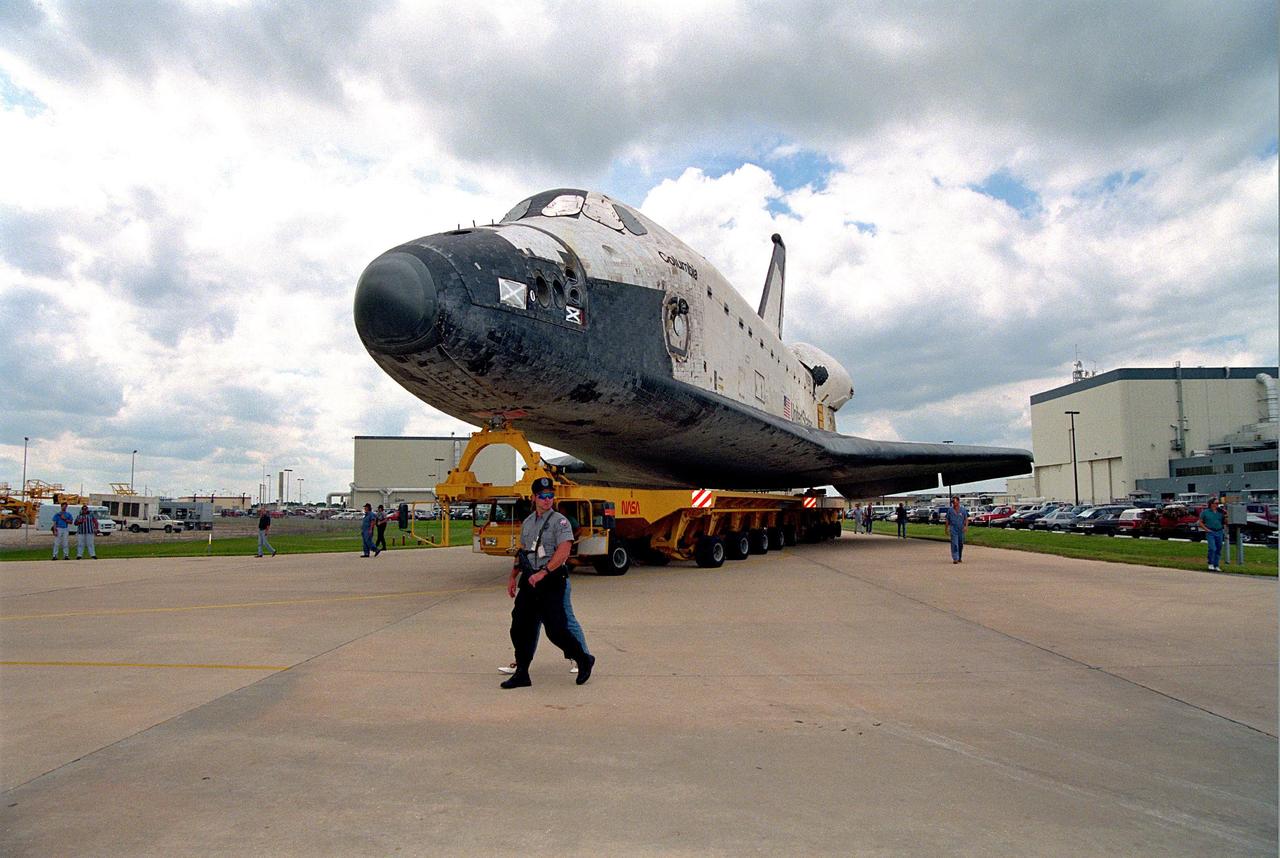
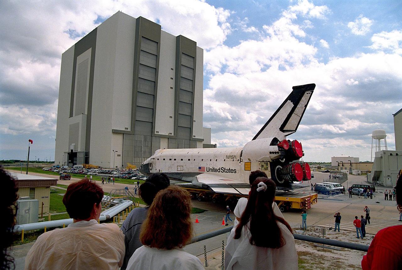
KENNEDY SPACE CENTER, FLA. -- The orbiter Columbia completes the short journey from Orbiter Processing Facility Bay 1 to the Vehicle Assembly Building (VAB). During its approximately one-week stay inside the VAB, the spaceplane will be mated to the external tank and twin solid rocket boosters, and electrical and mechanical interfaces will be verified. Rollout to Launch Pad 39B is planned for Oct. 16, where the two primary payloads of the upcoming STS-80 mission -- the Wake Shield Facility-3 (WSF-3) and Orbiting and Retrievable Far and Extreme Ultraviolet Spectrograph-Shuttle Pallet Satellite-2 (ORFEUS-SPAS-2) -- will be installed. Liftoff on the final Shuttle flight of 1996 is targeted for no earlier than Nov 8 at 2:47 p.m. EST.
CAPE CANAVERAL, Fla. – At Cape Canaveral Air Force Station in Florida, the United Launch Alliance Atlas V rocket, carrying NASA’s twin Radiation Belt Storm Probes, or RBSP, is rolled back from Space Launch Complex 41 to the Vertical Integration Facility. The rocket and spacecraft will be secured and protected from inclement weather due to Tropical Storm Isaac. RBSP will explore changes in Earth's space environment caused by the sun -- known as "space weather" -- that can disable satellites, create power-grid failures and disrupt GPS service. The mission also will provide data on the fundamental radiation and particle acceleration processes throughout the universe. The launch is rescheduled for 4:05 a.m. EDT on Aug. 30, pending approval from the range. For more information on RBSP, visit http://www.nasa.gov/rbsp. Photo credit: NASA/Ben Smegelsky
CAPE CANAVERAL, Fla. – An unfavorable weather forecast as a result of Tropical Storm Isaac approaching Florida kept NASA's twin Radiation Belt Storm Probes, or RBSP, on Space Launch Complex 41 at Cape Canaveral Air Force Station in Florida. Managers decided to roll the Atlas V rocket off the launch pad and back to the Vertical Integration Facility to ensure the launch vehicle and RBSP spacecraft are secured and protected from inclement weather. RBSP will explore changes in Earth's space environment caused by the sun -- known as "space weather" -- that can disable satellites, create power-grid failures and disrupt GPS service. The mission also will provide data on the fundamental radiation and particle acceleration processes throughout the universe. The launch is rescheduled for 4:05 a.m. EDT on Aug. 30, pending approval from the range. For more information on RBSP, visit http://www.nasa.gov/rbsp. Photo credit: NASA/Ben Smegelsky
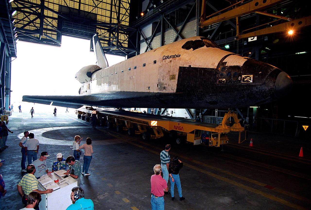
KENNEDY SPACE CENTER, FLA. -- The orbiter Columbia completes the short journey from Orbiter Processing Facility Bay 1 to the Vehicle Assembly Building (VAB). During its approximately one-week stay inside the VAB, the spaceplane will be mated to the external tank and twin solid rocket boosters, and electrical and mechanical interfaces will be verified. Rollout to Launch Pad 39B is planned for Oct. 16, where the two primary payloads of the upcoming STS-80 mission -- the Wake Shield Facility-3 (WSF-3) and Orbiting and Retrievable Far and Extreme Ultraviolet Spectrograph-Shuttle Pallet Satellite-2 (ORFEUS-SPAS-2) -- will be installed. Liftoff on the final Shuttle flight of 1996 is targeted for no earlier than Nov 8 at 2:47 p.m. EST
CAPE CANAVERAL, Fla. – At Cape Canaveral Air Force Station in Florida, United Launch Alliance, or ULA, technicians monitor the progress as the ULA Atlas V rocket, carrying NASA’s twin Radiation Belt Storm Probes, or RBSP, rolls back from Space Launch Complex 41 to the Vertical Integration Facility. The rocket and spacecraft will be secured and protected from inclement weather due to Tropical Storm Isaac. RBSP will explore changes in Earth's space environment caused by the sun -- known as "space weather" -- that can disable satellites, create power-grid failures and disrupt GPS service. The mission also will provide data on the fundamental radiation and particle acceleration processes throughout the universe. The launch is rescheduled for 4:05 a.m. EDT on Aug. 30, pending approval from the range. For more information on RBSP, visit http://www.nasa.gov/rbsp. Photo credit: NASA/Ben Smegelsky
CAPE CANAVERAL, Fla. – At Cape Canaveral Air Force Station in Florida, the United Launch Alliance Atlas V rocket, carrying NASA’s twin Radiation Belt Storm Probes, or RBSP, is rolled back from Space Launch Complex 41 to the Vertical Integration Facility. The rocket and spacecraft will be secured and protected from inclement weather due to Tropical Storm Isaac. RBSP will explore changes in Earth's space environment caused by the sun -- known as "space weather" -- that can disable satellites, create power-grid failures and disrupt GPS service. The mission also will provide data on the fundamental radiation and particle acceleration processes throughout the universe. The launch is rescheduled for 4:05 a.m. EDT on Aug. 30, pending approval from the range. For more information on RBSP, visit http://www.nasa.gov/rbsp. Photo credit: NASA/Ben Smegelsky
CAPE CANAVERAL, Fla. – At Cape Canaveral Air Force Station in Florida, the United Launch Alliance Atlas V rocket, carrying NASA’s twin Radiation Belt Storm Probes, or RBSP, is rolled back from Space Launch Complex 41 to the Vertical Integration Facility. The rocket and spacecraft will be secured and protected from inclement weather due to Tropical Storm Isaac. RBSP will explore changes in Earth's space environment caused by the sun -- known as "space weather" -- that can disable satellites, create power-grid failures and disrupt GPS service. The mission also will provide data on the fundamental radiation and particle acceleration processes throughout the universe. The launch is rescheduled for 4:05 a.m. EDT on Aug. 30, pending approval from the range. For more information on RBSP, visit http://www.nasa.gov/rbsp. Photo credit: NASA/Ben Smegelsky
CAPE CANAVERAL, Fla. – At Cape Canaveral Air Force Station in Florida, the United Launch Alliance Atlas V rocket, carrying NASA’s twin Radiation Belt Storm Probes, or RBSP, is rolled back from Space Launch Complex 41 to the Vertical Integration Facility where they will be secured and protected from inclement weather due to Tropical Storm Isaac. RBSP will explore changes in Earth's space environment caused by the sun -- known as "space weather" -- that can disable satellites, create power-grid failures and disrupt GPS service. The mission also will provide data on the fundamental radiation and particle acceleration processes throughout the universe. The launch is rescheduled for 4:05 a.m. EDT on Aug. 30, pending approval from the range. For more information on RBSP, visit http://www.nasa.gov/rbsp. Photo credit: NASA/Ben Smegelsky
CAPE CANAVERAL, Fla. – An unfavorable weather forecast as a result of Tropical Storm Isaac approaching Florida kept NASA's twin Radiation Belt Storm Probes, or RBSP, on Space Launch Complex 41 at Cape Canaveral Air Force Station in Florida. Managers decided to roll the Atlas V rocket off the launch pad and back to the Vertical Integration Facility to ensure the launch vehicle and RBSP spacecraft are secured and protected from inclement weather. RBSP will explore changes in Earth's space environment caused by the sun -- known as "space weather" -- that can disable satellites, create power-grid failures and disrupt GPS service. The mission also will provide data on the fundamental radiation and particle acceleration processes throughout the universe. The launch is rescheduled for 4:05 a.m. EDT on Aug. 30, pending approval from the range. For more information on RBSP, visit http://www.nasa.gov/rbsp. Photo credit: NASA/Ben Smegelsky
CAPE CANAVERAL, Fla. – At Cape Canaveral Air Force Station in Florida, United Launch Alliance, or ULA, technicians prepare the ULA Atlas V rocket, carrying NASA’s twin Radiation Belt Storm Probes, or RBSP, for rollback from Space Launch Complex 41 to the Vertical Integration Facility. The rocket and spacecraft will be secured and protected from inclement weather due to Tropical Storm Isaac. RBSP will explore changes in Earth's space environment caused by the sun -- known as "space weather" -- that can disable satellites, create power-grid failures and disrupt GPS service. The mission also will provide data on the fundamental radiation and particle acceleration processes throughout the universe. The launch is rescheduled for 4:05 a.m. EDT on Aug. 30, pending approval from the range. For more information on RBSP, visit http://www.nasa.gov/rbsp. Photo credit: NASA/Ben Smegelsky
CAPE CANAVERAL, Fla. – At Cape Canaveral Air Force Station in Florida, the United Launch Alliance Atlas V rocket, carrying NASA’s twin Radiation Belt Storm Probes, or RBSP, is rolled back from Space Launch Complex 41 to the Vertical Integration Facility. The rocket and spacecraft will be secured and protected from inclement weather due to Tropical Storm Isaac. RBSP will explore changes in Earth's space environment caused by the sun -- known as "space weather" -- that can disable satellites, create power-grid failures and disrupt GPS service. The mission also will provide data on the fundamental radiation and particle acceleration processes throughout the universe. The launch is rescheduled for 4:05 a.m. EDT on Aug. 30, pending approval from the range. For more information on RBSP, visit http://www.nasa.gov/rbsp. Photo credit: NASA/Ben Smegelsky
CAPE CANAVERAL, Fla. – An unfavorable weather forecast as a result of Tropical Storm Isaac approaching Florida kept NASA's twin Radiation Belt Storm Probes, or RBSP, on Space Launch Complex 41 at Cape Canaveral Air Force Station in Florida. Managers decided to roll the Atlas V rocket off the launch pad and back to the Vertical Integration Facility to ensure the launch vehicle and RBSP spacecraft are secured and protected from inclement weather. RBSP will explore changes in Earth's space environment caused by the sun -- known as "space weather" -- that can disable satellites, create power-grid failures and disrupt GPS service. The mission also will provide data on the fundamental radiation and particle acceleration processes throughout the universe. The launch is rescheduled for 4:05 a.m. EDT on Aug. 30, pending approval from the range. For more information on RBSP, visit http://www.nasa.gov/rbsp. Photo credit: NASA/Ben Smegelsky
CAPE CANAVERAL, Fla. – An unfavorable weather forecast as a result of Tropical Storm Isaac approaching Florida kept NASA's twin Radiation Belt Storm Probes, or RBSP, on Space Launch Complex 41 at Cape Canaveral Air Force Station in Florida. Managers decided to roll the Atlas V rocket off the launch pad and back to the Vertical Integration Facility to ensure the launch vehicle and RBSP spacecraft are secured and protected from inclement weather. RBSP will explore changes in Earth's space environment caused by the sun -- known as "space weather" -- that can disable satellites, create power-grid failures and disrupt GPS service. The mission also will provide data on the fundamental radiation and particle acceleration processes throughout the universe. The launch is rescheduled for 4:05 a.m. EDT on Aug. 30, pending approval from the range. For more information on RBSP, visit http://www.nasa.gov/rbsp. Photo credit: NASA/Ben Smegelsky
CAPE CANAVERAL, Fla. – At Cape Canaveral Air Force Station in Florida, the United Launch Alliance Atlas V rocket, carrying NASA’s twin Radiation Belt Storm Probes, or RBSP, is rolled back from Space Launch Complex 41 to the Vertical Integration Facility where they will be secured and protected from inclement weather due to Tropical Storm Isaac. RBSP will explore changes in Earth's space environment caused by the sun -- known as "space weather" -- that can disable satellites, create power-grid failures and disrupt GPS service. The mission also will provide data on the fundamental radiation and particle acceleration processes throughout the universe. The launch is rescheduled for 4:05 a.m. EDT on Aug. 30, pending approval from the range. For more information on RBSP, visit http://www.nasa.gov/rbsp. Photo credit: NASA/Ben Smegelsky

CAPE CANAVERAL, Fla. – An unfavorable weather forecast as a result of Tropical Storm Isaac approaching Florida kept NASA's twin Radiation Belt Storm Probes, or RBSP, on Space Launch Complex 41 at Cape Canaveral Air Force Station in Florida. Managers decided to roll the Atlas V rocket off the launch pad and back to the Vertical Integration Facility to ensure the launch vehicle and RBSP spacecraft are secured and protected from inclement weather. RBSP will explore changes in Earth's space environment caused by the sun -- known as "space weather" -- that can disable satellites, create power-grid failures and disrupt GPS service. The mission also will provide data on the fundamental radiation and particle acceleration processes throughout the universe. The launch is rescheduled for 4:05 a.m. EDT on Aug. 30, pending approval from the range. For more information on RBSP, visit http://www.nasa.gov/rbsp. Photo credit: NASA/Ben Smegelsky
CAPE CANAVERAL, Fla. – At Cape Canaveral Air Force Station in Florida, the United Launch Alliance, or ULA, Atlas V rocket with NASA’s twin Radiation Belt Storm Probes, or RBSP, rolls back to the Vertical Integration Facility from Space Launch Complex 41. The rocket and spacecraft will be secured and protected from inclement weather due to Tropical Storm Isaac. RBSP will explore changes in Earth's space environment caused by the sun -- known as "space weather" -- that can disable satellites, create power-grid failures and disrupt GPS service. The mission also will provide data on the fundamental radiation and particle acceleration processes throughout the universe. The launch is rescheduled for 4:05 a.m. EDT on Aug. 30, pending approval from the range. For more information on RBSP, visit http://www.nasa.gov/rbsp. Photo credit: NASA/Ben Smegelsky
KENNEDY SPACE CENTER, FLA. -- The orbiter Columbia completes the short journey from Orbiter Processing Facility Bay 1 to the Vehicle Assembly Building (VAB). During its approximately one-week stay inside the VAB, the spaceplane will be mated to the external tank and twin solid rocket boosters, and electrical and mechanical interfaces will be verified. Rollout to Launch Pad 39B is planned for Oct. 16, where the two primary payloads of the upcoming STS-80 mission -- the Wake Shield Facility-3 (WSF-3) and Orbiting and Retrievable Far and Extreme Ultraviolet Spectrograph-Shuttle Pallet Satellite-2 (ORFEUS-SPAS-2) -- will be installed. Liftoff on the final Shuttle flight of 1996 is targeted for no earlier than Nov 8 at 2:47 p.m. EST
CAPE CANAVERAL, Fla. – Weather conditions associated with lightning, as well as cumulus and anvil clouds, kept NASA's Radiation Belt Storm Probes, or RBSP, on Space Launch Complex 41 at Cape Canaveral Air Force Station in Florida. The twin probes are awaiting launch atop a United Launch Alliance Atlas V rocket. RBSP will explore changes in Earth's space environment caused by the sun -- known as "space weather" -- that can disable satellites, create power-grid failures and disrupt GPS service. The mission also will provide data on the fundamental radiation and particle acceleration processes throughout the universe. The launch is rescheduled for 4:05 a.m. EDT on Aug. 30, pending approval from the range. For more information on RBSP, visit http://www.nasa.gov/rbsp. Photo credit: NASA/Gary Thompson
CAPE CANAVERAL, Fla. – An unfavorable weather forecast as a result of Tropical Storm Isaac approaching Florida kept NASA's twin Radiation Belt Storm Probes, or RBSP, on Space Launch Complex 41 at Cape Canaveral Air Force Station in Florida. Managers decided to roll the Atlas V rocket off the launch pad and back to the Vertical Integration Facility to ensure the launch vehicle and RBSP spacecraft are secured and protected from inclement weather. RBSP will explore changes in Earth's space environment caused by the sun -- known as "space weather" -- that can disable satellites, create power-grid failures and disrupt GPS service. The mission also will provide data on the fundamental radiation and particle acceleration processes throughout the universe. The launch is rescheduled for 4:05 a.m. EDT on Aug. 30, pending approval from the range. For more information on RBSP, visit http://www.nasa.gov/rbsp. Photo credit: NASA/Ben Smegelsky
CAPE CANAVERAL, Fla. – An unfavorable weather forecast as a result of Tropical Storm Isaac approaching Florida kept NASA's twin Radiation Belt Storm Probes, or RBSP, on Space Launch Complex 41 at Cape Canaveral Air Force Station in Florida. Managers decided to roll the Atlas V rocket off the launch pad and back to the Vertical Integration Facility to ensure the launch vehicle and RBSP spacecraft are secured and protected from inclement weather. RBSP will explore changes in Earth's space environment caused by the sun -- known as "space weather" -- that can disable satellites, create power-grid failures and disrupt GPS service. The mission also will provide data on the fundamental radiation and particle acceleration processes throughout the universe. The launch is rescheduled for 4:05 a.m. EDT on Aug. 30, pending approval from the range. For more information on RBSP, visit http://www.nasa.gov/rbsp. Photo credit: NASA/Ben Smegelsky
CAPE CANAVERAL, Fla. – At Cape Canaveral Air Force Station in Florida, the United Launch Alliance Atlas V rocket, carrying NASA’s twin Radiation Belt Storm Probes, or RBSP, is rolled back from Space Launch Complex 41 to the Vertical Integration Facility. The rocket and spacecraft will be secured and protected from inclement weather due to Tropical Storm Isaac. RBSP will explore changes in Earth's space environment caused by the sun -- known as "space weather" -- that can disable satellites, create power-grid failures and disrupt GPS service. The mission also will provide data on the fundamental radiation and particle acceleration processes throughout the universe. The launch is rescheduled for 4:05 a.m. EDT on Aug. 30, pending approval from the range. For more information on RBSP, visit http://www.nasa.gov/rbsp. Photo credit: NASA/Ben Smegelsky
CAPE CANAVERAL, Fla. – At Cape Canaveral Air Force Station in Florida, the United Launch Alliance Atlas V rocket, carrying NASA’s twin Radiation Belt Storm Probes, or RBSP, is rolled back from Space Launch Complex 41 to the Vertical Integration Facility where they will be secured and protected from inclement weather due to Tropical Storm Isaac. RBSP will explore changes in Earth's space environment caused by the sun -- known as "space weather" -- that can disable satellites, create power-grid failures and disrupt GPS service. The mission also will provide data on the fundamental radiation and particle acceleration processes throughout the universe. The launch is rescheduled for 4:05 a.m. EDT on Aug. 30, pending approval from the range. For more information on RBSP, visit http://www.nasa.gov/rbsp. Photo credit: NASA/Ben Smegelsky
CAPE CANAVERAL, Fla. – At Cape Canaveral Air Force Station in Florida, the United Launch Alliance, or ULA, Atlas V rocket with NASA’s twin Radiation Belt Storm Probes, or RBSP, rolls back to the Vertical Integration Facility from Space Launch Complex 41. The rocket and spacecraft will be secured and protected from inclement weather due to Tropical Storm Isaac. RBSP will explore changes in Earth's space environment caused by the sun -- known as "space weather" -- that can disable satellites, create power-grid failures and disrupt GPS service. The mission also will provide data on the fundamental radiation and particle acceleration processes throughout the universe. The launch is rescheduled for 4:05 a.m. EDT on Aug. 30, pending approval from the range. For more information on RBSP, visit http://www.nasa.gov/rbsp. Photo credit: NASA/Ben Smegelsky
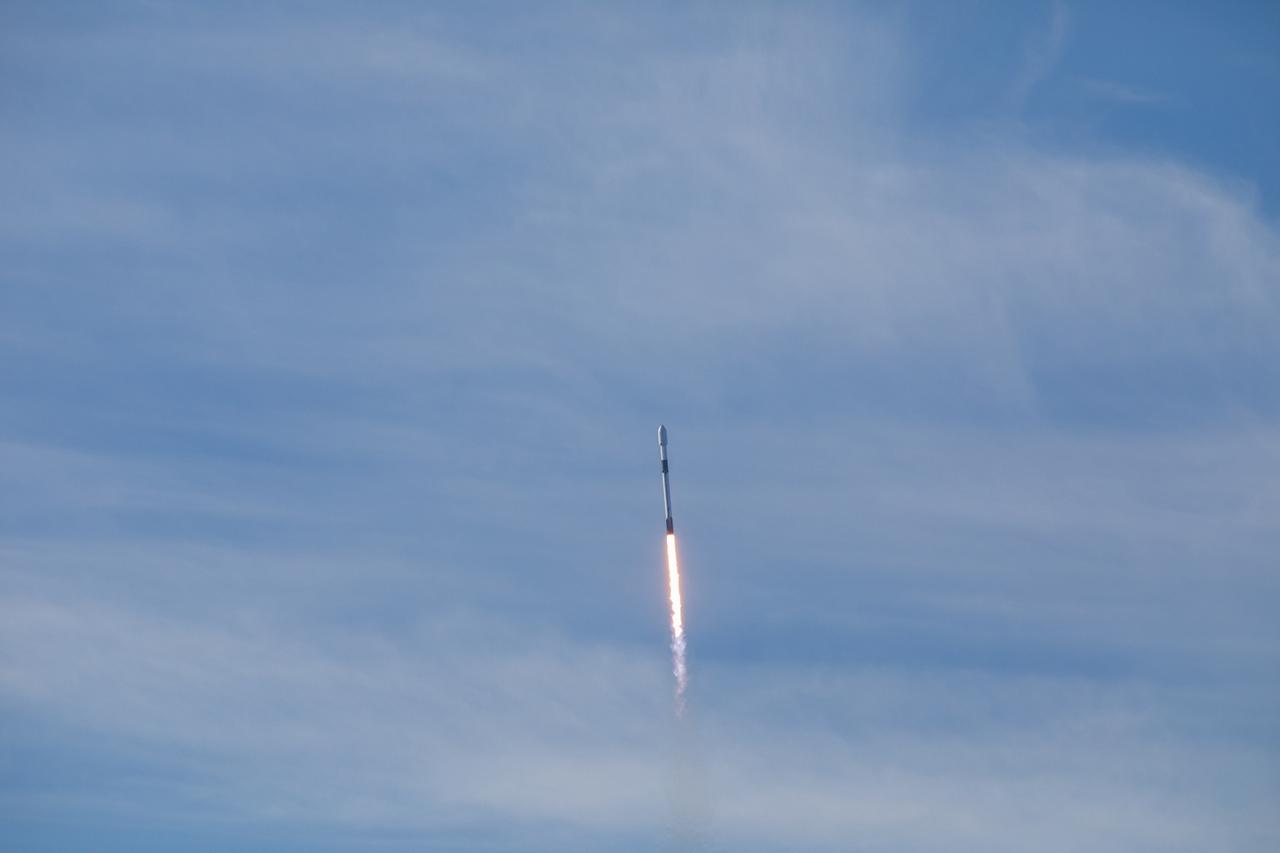
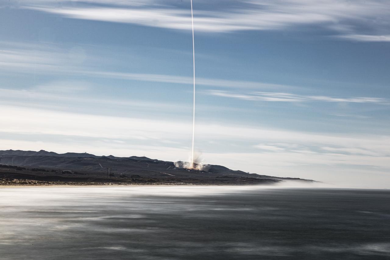
The SpaceX Falcon 9 rocket carrying the Sentinel-6 Michael Freilich spacecraft lifts off from Space Launch Complex 4 at Vandenberg Air Force Base in California, Nov. 21, 2020, at 9:17 a.m. PST (12:17 p.m. EST). The Sentinel-6/Jason-CS (Continuity of Service) mission consists of the Sentinel-6 Michael Freilich satellite, which will be followed by its twin, the Sentinel-6B satellite, in 2025. The Sentinel-6/Jason-CS mission is part of Copernicus, the European Union’s Earth observation program, managed by the European Commission. Continuing the legacy of the Jason series missions, Sentinel-6/Jason-CS will extend the records of sea level into their fourth decade, collecting accurate measurements of sea surface height for more than 90% of the world’s seas, and providing crucial information for operational oceanography, marine meteorology, and climate studies. NASA’s Launch Services Program at Kennedy Space Center was responsible for launch management.
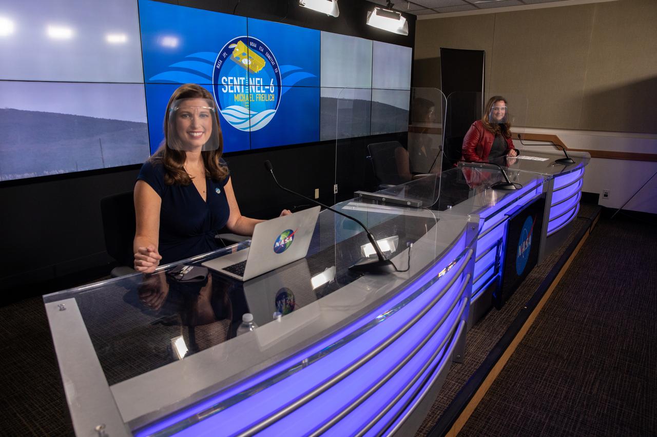
Marina Jurica of NASA’s Jet Propulsion Laboratory in Pasadena, foreground, and Karen St. Germain, director of the agency’s Earth Science Division, participate in a science briefing for the Sentinel-6 Michael Freilich mission at Vandenberg Air Force Base in California on Nov. 20, 2020. The Sentinel-6/Jason-CS (Continuity of Service) mission consists of the Sentinel-6 Michael Freilich satellite, which will be followed by its twin, the Sentinel-6B satellite, in 2025. The Sentinel-6/Jason-CS mission is part of Copernicus, the European Union’s Earth observation program, managed by the European Commission. Continuing the legacy of the Jason series missions, Sentinel-6/Jason-CS will extend the records of sea level into their fourth decade, collecting accurate measurements of sea surface height for more than 90% of the world’s seas, and providing crucial information for operational oceanography, marine meteorology, and climate studies. Sentinel-6 Michael Freilich launched Nov. 21, 2020, at 9:17 PST (12:17 EST). NASA’s Launch Services Program at Kennedy Space Center was responsible for launch management.

Marina Jurica of NASA’s Jet Propulsion Laboratory in Pasadena moderates a science briefing for the Sentinel-6 Michael Freilich mission at Vandenberg Air Force Base in California on Nov. 20, 2020. The Sentinel-6/Jason-CS (Continuity of Service) mission consists of the Sentinel-6 Michael Freilich satellite, which will be followed by its twin, the Sentinel-6B satellite, in 2025. The Sentinel-6/Jason-CS mission is part of Copernicus, the European Union’s Earth observation program, managed by the European Commission. Continuing the legacy of the Jason series missions, Sentinel-6/Jason-CS will extend the records of sea level into their fourth decade, collecting accurate measurements of sea surface height for more than 90% of the world’s seas, and providing crucial information for operational oceanography, marine meteorology, and climate studies. Sentinel-6 Michael Freilich launched Nov. 21, 2020, at 9:17 PST (12:17 EST). NASA’s Launch Services Program at Kennedy Space Center was responsible for launch management.
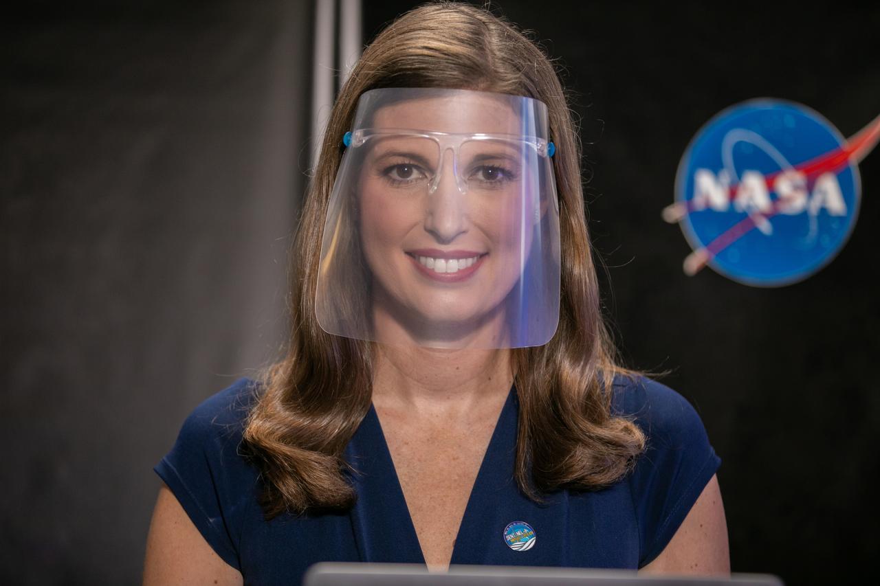
Marina Jurica of NASA’s Jet Propulsion Laboratory in Pasadena moderates a prelaunch news conference for the Sentinel-6 Michael Freilich mission at Vandenberg Air Force Base in California on Nov. 20, 2020. The Sentinel-6/Jason-CS (Continuity of Service) mission consists of the Sentinel-6 Michael Freilich satellite, which will be followed by its twin, the Sentinel-6B satellite, in 2025. The Sentinel-6/Jason-CS mission is part of Copernicus, the European Union’s Earth observation program, managed by the European Commission. Continuing the legacy of the Jason series missions, Sentinel-6/Jason-CS will extend the records of sea level into their fourth decade, collecting accurate measurements of sea surface height for more than 90% of the world’s seas, and providing crucial information for operational oceanography, marine meteorology, and climate studies. Sentinel-6 Michael Freilich launched Nov. 21, 2020, at 9:17 PST (12:17 EST). NASA’s Launch Services Program at Kennedy Space Center was responsible for launch management.

The first-stage booster of a SpaceX Falcon 9 rocket flies down to a landing at Vandenberg Air Force Base in California during the launch of the Sentinel-6 Michael Freilich mission. The Sentinel-6/Jason-CS (Continuity of Service) mission consists of the Sentinel-6 Michael Freilich satellite, which will be followed by its twin, the Sentinel-6B satellite, in 2025. The Sentinel-6/Jason-CS mission is part of Copernicus, the European Union’s Earth observation program, managed by the European Commission. Continuing the legacy of the Jason series missions, Sentinel-6/Jason-CS will extend the records of sea level into their fourth decade, collecting accurate measurements of sea surface height for more than 90% of the world’s seas, and providing crucial information for operational oceanography, marine meteorology, and climate studies. Sentinel-6 Michael Freilich launched Nov. 21, 2020, at 9:17 PST (12:17 EST). NASA’s Launch Services Program at Kennedy Space Center was responsible for launch management.
The first-stage booster of a SpaceX Falcon 9 rocket lands at Vandenberg Air Force Base in California during the launch of the Sentinel-6 Michael Freilich mission. The Sentinel-6/Jason-CS (Continuity of Service) mission consists of the Sentinel-6 Michael Freilich satellite, which will be followed by its twin, the Sentinel-6B satellite, in 2025. The Sentinel-6/Jason-CS mission is part of Copernicus, the European Union’s Earth observation program, managed by the European Commission. Continuing the legacy of the Jason series missions, Sentinel-6/Jason-CS will extend the records of sea level into their fourth decade, collecting accurate measurements of sea surface height for more than 90% of the world’s seas, and providing crucial information for operational oceanography, marine meteorology, and climate studies. Sentinel-6 Michael Freilich launched Nov. 21, 2020, at 9:17 PST (12:17 EST). NASA’s Launch Services Program at Kennedy Space Center was responsible for launch management.
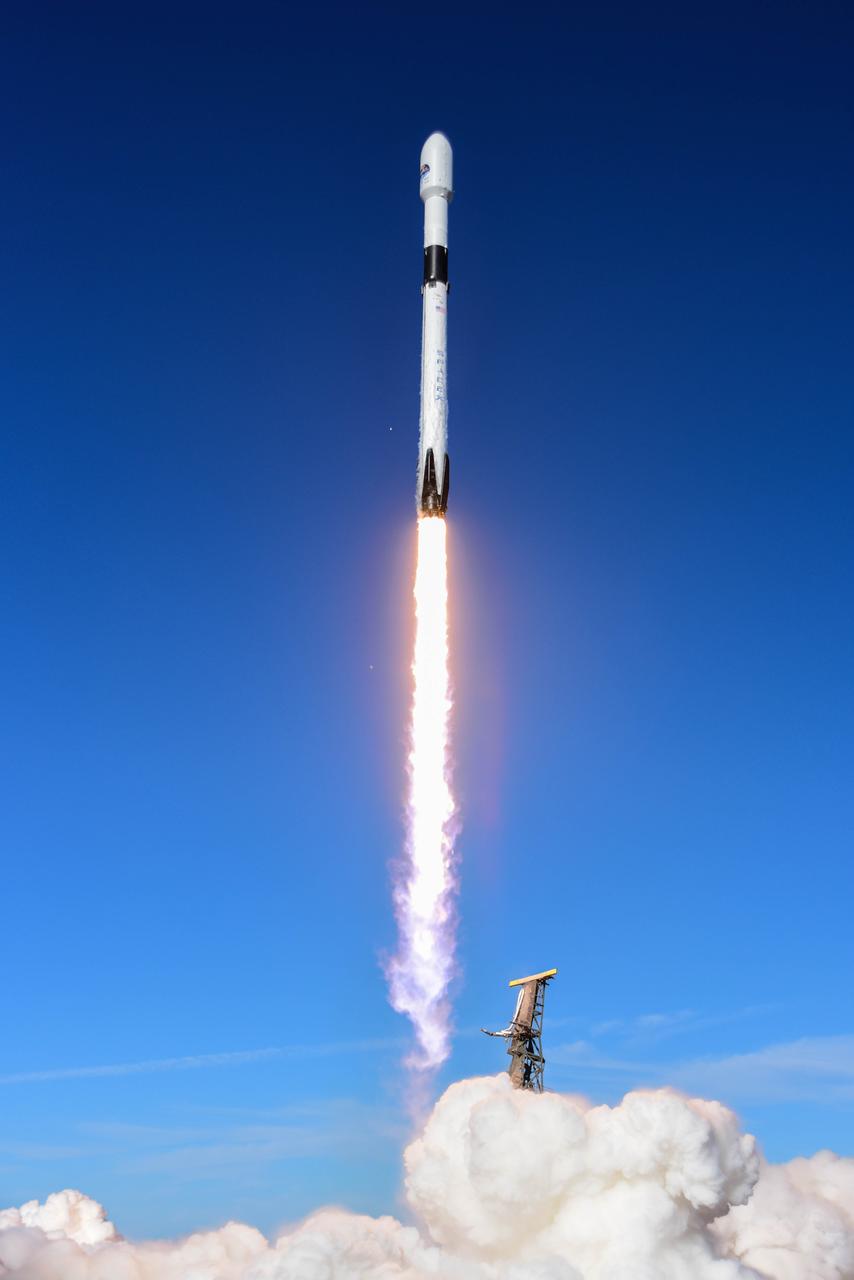
The SpaceX Falcon 9 rocket carrying the Sentinel-6 Michael Freilich spacecraft lifts off from Space Launch Complex 4 at Vandenberg Air Force Base in California, Nov. 21, 2020, at 9:17 a.m. PST (12:17 p.m. EST). The Sentinel-6/Jason-CS (Continuity of Service) mission consists of the Sentinel-6 Michael Freilich satellite, which will be followed by its twin, the Sentinel-6B satellite, in 2025. The Sentinel-6/Jason-CS mission is part of Copernicus, the European Union’s Earth observation program, managed by the European Commission. Continuing the legacy of the Jason series missions, Sentinel-6/Jason-CS will extend the records of sea level into their fourth decade, collecting accurate measurements of sea surface height for more than 90% of the world’s seas, and providing crucial information for operational oceanography, marine meteorology, and climate studies. NASA’s Launch Services Program at Kennedy Space Center was responsible for launch management.
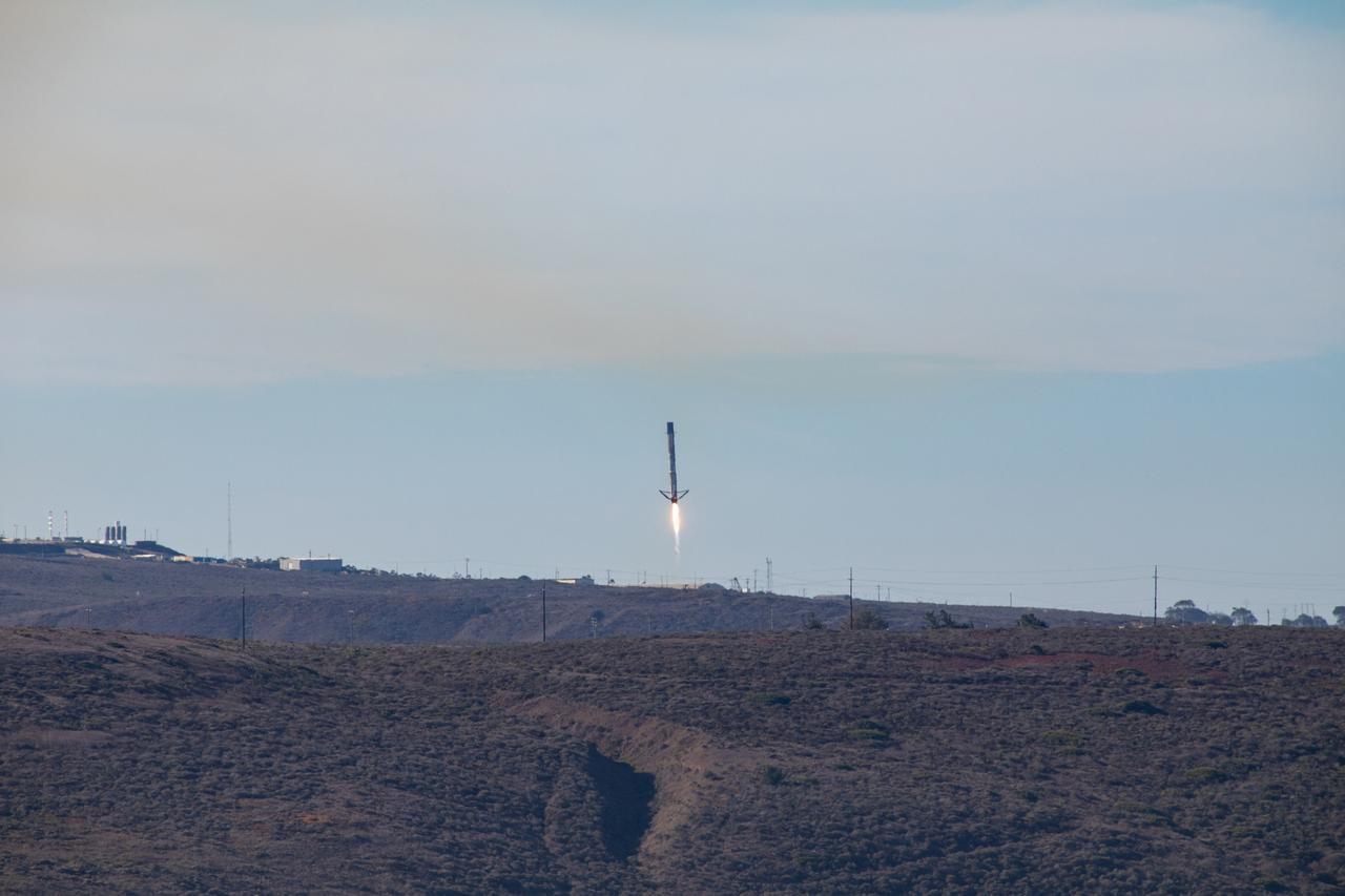
The first-stage booster of a SpaceX Falcon 9 rocket flies down to a landing at Vandenberg Air Force Base in California during the launch of the Sentinel-6 Michael Freilich mission. The Sentinel-6/Jason-CS (Continuity of Service) mission consists of the Sentinel-6 Michael Freilich satellite, which will be followed by its twin, the Sentinel-6B satellite, in 2025. The Sentinel-6/Jason-CS mission is part of Copernicus, the European Union’s Earth observation program, managed by the European Commission. Continuing the legacy of the Jason series missions, Sentinel-6/Jason-CS will extend the records of sea level into their fourth decade, collecting accurate measurements of sea surface height for more than 90% of the world’s seas, and providing crucial information for operational oceanography, marine meteorology, and climate studies. Sentinel-6 Michael Freilich launched Nov. 21, 2020, at 9:17 PST (12:17 EST). NASA’s Launch Services Program at Kennedy Space Center was responsible for launch management.
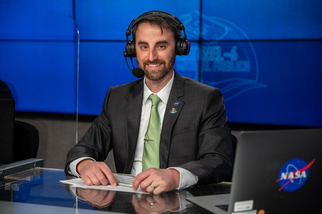
NASA Launch Commentator Joshua Santora participates in the launch broadcast for the Sentinel-6 Michael Freilich mission on Nov. 21, 2020, in the Press Site auditorium at Kennedy Space Center in Florida. The SpaceX Falcon 9 rocket carrying the Sentinel-6 Michael Freilich spacecraft launched from Space Launch Complex 4 at Vandenberg Air Force Base in California at 9:17 a.m. PST (12:17 p.m. EST). The Sentinel-6/Jason-CS (Continuity of Service) mission consists of the Sentinel-6 Michael Freilich satellite, which will be followed by its twin, the Sentinel-6B satellite, in 2025. The Sentinel-6/Jason-CS mission is part of Copernicus, the European Union’s Earth observation program, managed by the European Commission. Continuing the legacy of the Jason series missions, Sentinel-6/Jason-CS will extend the records of sea level into their fourth decade, collecting accurate measurements of sea surface height for more than 90% of the world’s seas, and providing crucial information for operational oceanography, marine meteorology, and climate studies. NASA’s Launch Services Program at Kennedy Space Center was responsible for launch management.
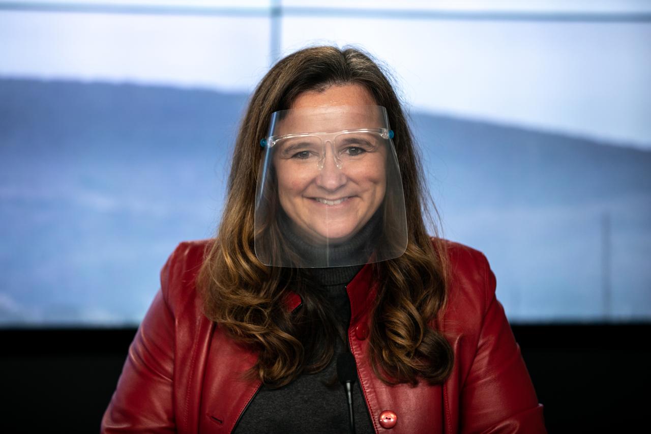
Karen St. Germain, director of NASA’s Earth Science Division, participates in a science briefing for the Sentinel-6 Michael Freilich mission at Vandenberg Air Force Base in California on Nov. 20, 2020. The Sentinel-6/Jason-CS (Continuity of Service) mission consists of the Sentinel-6 Michael Freilich satellite, which will be followed by its twin, the Sentinel-6B satellite, in 2025. The Sentinel-6/Jason-CS mission is part of Copernicus, the European Union’s Earth observation program, managed by the European Commission. Continuing the legacy of the Jason series missions, Sentinel-6/Jason-CS will extend the records of sea level into their fourth decade, collecting accurate measurements of sea surface height for more than 90% of the world’s seas, and providing crucial information for operational oceanography, marine meteorology, and climate studies. Sentinel-6 Michael Freilich launched Nov. 21, 2020, at 9:17 PST (12:17 EST). NASA’s Launch Services Program at Kennedy Space Center was responsible for launch management.
The SpaceX Falcon 9 rocket carrying the Sentinel-6 Michael Freilich spacecraft streaks through the sky after liftoff from Space Launch Complex 4 at Vandenberg Air Force Base in California, Nov. 21, 2020, at 9:17 a.m. PST (12:17 p.m. EST). The Sentinel-6/Jason-CS (Continuity of Service) mission consists of the Sentinel-6 Michael Freilich satellite, which will be followed by its twin, the Sentinel-6B satellite, in 2025. The Sentinel-6/Jason-CS mission is part of Copernicus, the European Union’s Earth observation program, managed by the European Commission. Continuing the legacy of the Jason series missions, Sentinel-6/Jason-CS will extend the records of sea level into their fourth decade, collecting accurate measurements of sea surface height for more than 90% of the world’s seas, and providing crucial information for operational oceanography, marine meteorology, and climate studies. NASA’s Launch Services Program at Kennedy Space Center was responsible for launch management.
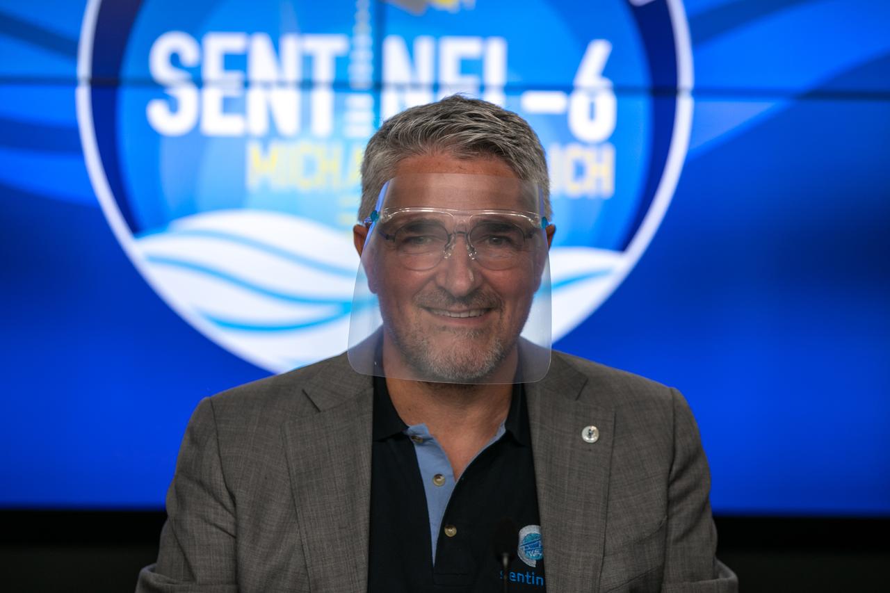
Pierrik Vuilleumier, project manager, European Space Agency (ESA), participates in a prelaunch news conference for the Sentinel-6 Michael Freilich mission at Vandenberg Air Force Base in California on Nov. 20, 2020. The Sentinel-6/Jason-CS (Continuity of Service) mission consists of the Sentinel-6 Michael Freilich satellite, which will be followed by its twin, the Sentinel-6B satellite, in 2025. The Sentinel-6/Jason-CS mission is part of Copernicus, the European Union’s Earth observation program, managed by the European Commission. Continuing the legacy of the Jason series missions, Sentinel-6/Jason-CS will extend the records of sea level into their fourth decade, collecting accurate measurements of sea surface height for more than 90% of the world’s seas, and providing crucial information for operational oceanography, marine meteorology, and climate studies. Sentinel-6 Michael Freilich launched Nov. 21, 2020, at 9:17 PST (12:17 EST). NASA’s Launch Services Program at Kennedy Space Center was responsible for launch management.
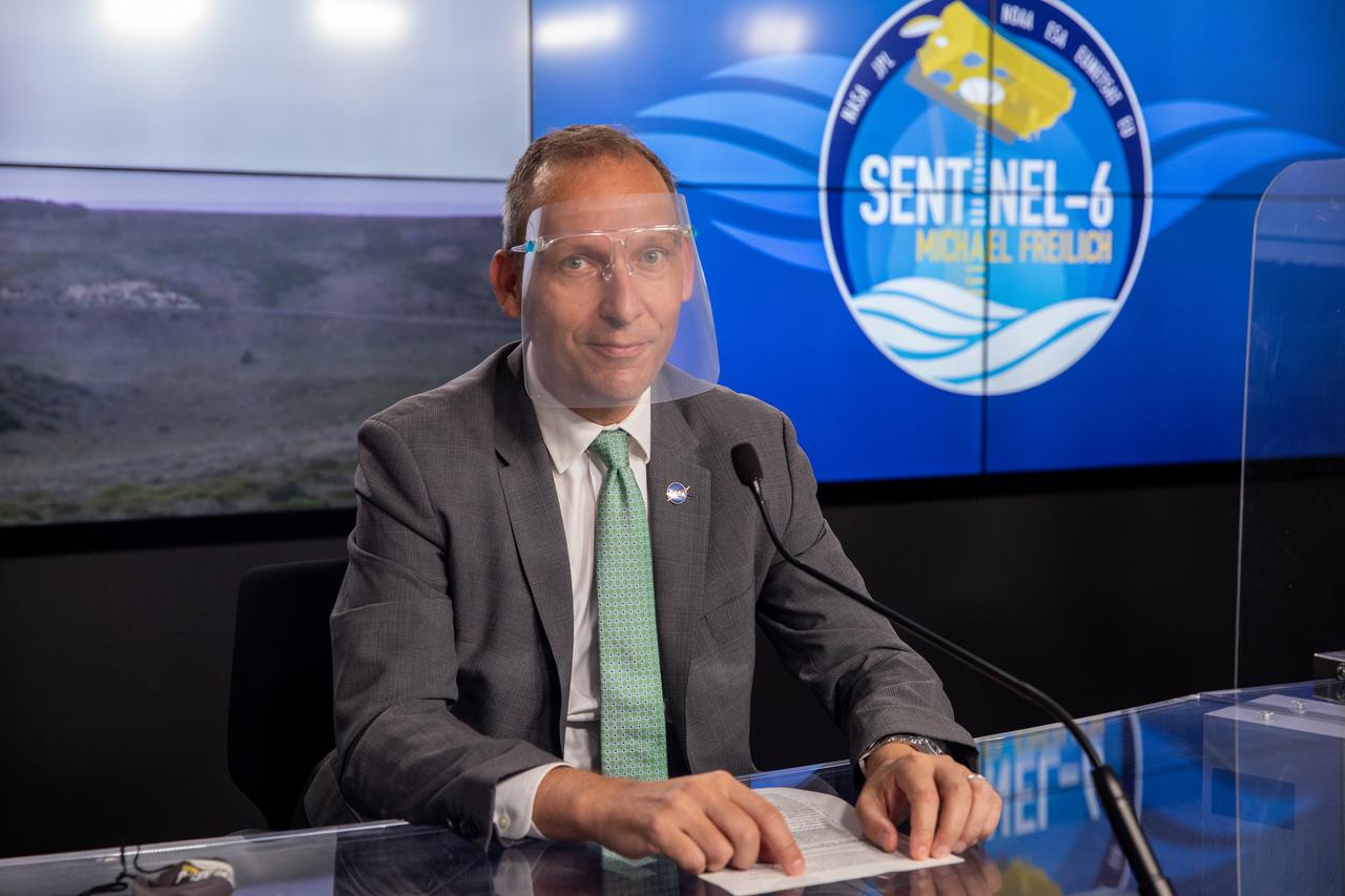
Thomas Zurbuchen, associate administrator for Science Mission Directorate at NASA Headquarters, participates in a prelaunch news conference for the Sentinel-6 Michael Freilich mission at Vandenberg Air Force Base in California on Nov. 20, 2020. The Sentinel-6/Jason-CS (Continuity of Service) mission consists of the Sentinel-6 Michael Freilich satellite, which will be followed by its twin, the Sentinel-6B satellite, in 2025. The Sentinel-6/Jason-CS mission is part of Copernicus, the European Union’s Earth observation program, managed by the European Commission. Continuing the legacy of the Jason series missions, Sentinel-6/Jason-CS will extend the records of sea level into their fourth decade, collecting accurate measurements of sea surface height for more than 90% of the world’s seas, and providing crucial information for operational oceanography, marine meteorology, and climate studies. Sentinel-6 Michael Freilich launched Nov. 21, 2020, at 9:17 PST (12:17 EST). NASA’s Launch Services Program at Kennedy Space Center was responsible for launch management.

Karen St. Germain, director of NASA’s Earth Science Division, participates in a science briefing for the Sentinel-6 Michael Freilich mission at Vandenberg Air Force Base in California on Nov. 20, 2020. The Sentinel-6/Jason-CS (Continuity of Service) mission consists of the Sentinel-6 Michael Freilich satellite, which will be followed by its twin, the Sentinel-6B satellite, in 2025. The Sentinel-6/Jason-CS mission is part of Copernicus, the European Union’s Earth observation program, managed by the European Commission. Continuing the legacy of the Jason series missions, Sentinel-6/Jason-CS will extend the records of sea level into their fourth decade, collecting accurate measurements of sea surface height for more than 90% of the world’s seas, and providing crucial information for operational oceanography, marine meteorology, and climate studies. Sentinel-6 Michael Freilich launched Nov. 21, 2020, at 9:17 PST (12:17 EST). NASA’s Launch Services Program at Kennedy Space Center was responsible for launch management.
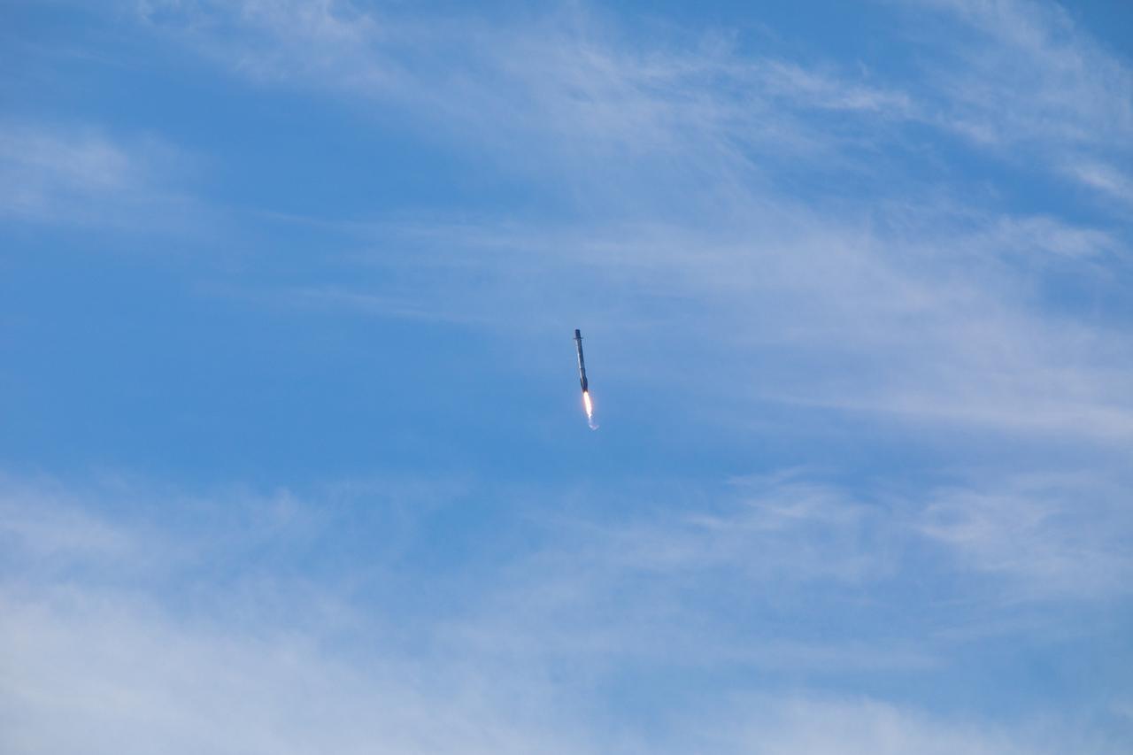
The first-stage booster of a SpaceX Falcon 9 rocket flies down toward a landing at Vandenberg Air Force Base in California during the launch of the Sentinel-6 Michael Freilich mission. The Sentinel-6/Jason-CS (Continuity of Service) mission consists of the Sentinel-6 Michael Freilich satellite, which will be followed by its twin, the Sentinel-6B satellite, in 2025. The Sentinel-6/Jason-CS mission is part of Copernicus, the European Union’s Earth observation program, managed by the European Commission. Continuing the legacy of the Jason series missions, Sentinel-6/Jason-CS will extend the records of sea level into their fourth decade, collecting accurate measurements of sea surface height for more than 90% of the world’s seas, and providing crucial information for operational oceanography, marine meteorology, and climate studies. Sentinel-6 Michael Freilich launched Nov. 21, 2020, at 9:17 PST (12:17 EST). NASA’s Launch Services Program at Kennedy Space Center was responsible for launch management.
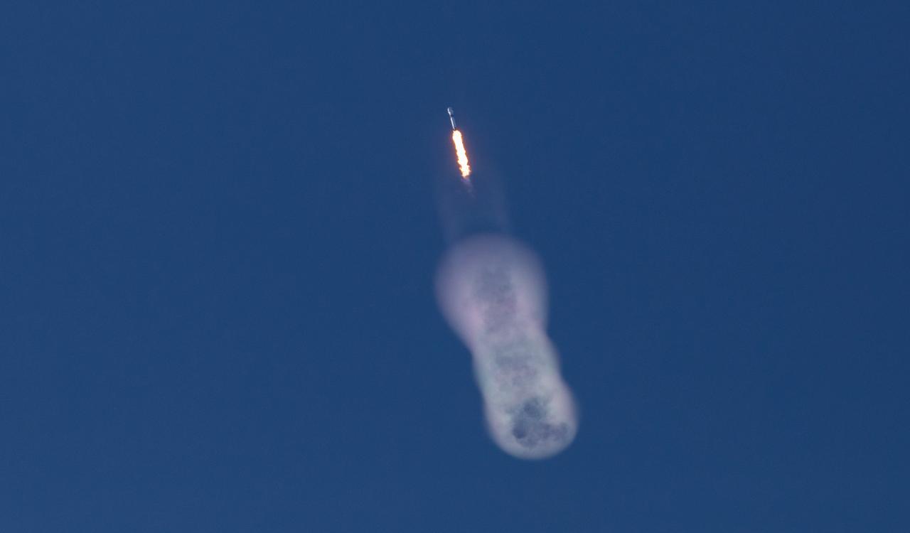
The SpaceX Falcon 9 rocket carrying the Sentinel-6 Michael Freilich spacecraft lifts off from Space Launch Complex 4 at Vandenberg Air Force Base in California, Nov. 21, 2020, at 9:17 a.m. PST (12:17 p.m. EST). The Sentinel-6/Jason-CS (Continuity of Service) mission consists of the Sentinel-6 Michael Freilich satellite, which will be followed by its twin, the Sentinel-6B satellite, in 2025. The Sentinel-6/Jason-CS mission is part of Copernicus, the European Union’s Earth observation program, managed by the European Commission. Continuing the legacy of the Jason series missions, Sentinel-6/Jason-CS will extend the records of sea level into their fourth decade, collecting accurate measurements of sea surface height for more than 90% of the world’s seas, and providing crucial information for operational oceanography, marine meteorology, and climate studies. NASA’s Launch Services Program at Kennedy Space Center was responsible for launch management.
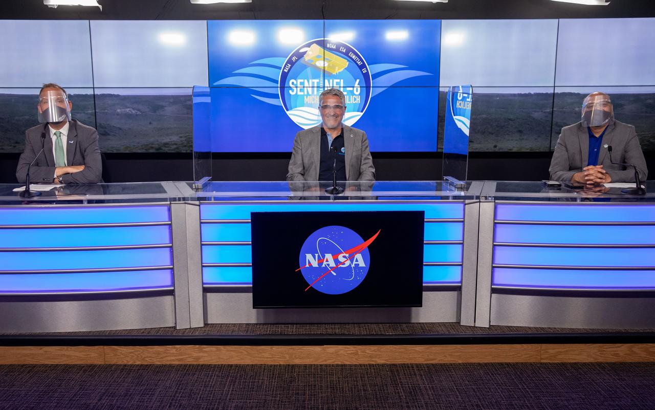
Mission and launch officials participate in a prelaunch news conference for the Sentinel-6 Michael Freilich mission at Vandenberg Air Force Base in California on Nov. 20, 2020. From left are Thomas Zurbuchen, associate administrator for Science Mission Directorate at NASA Headquarters; Pierrik Vuilleumier, project manager, European Space Agency (ESA); and Parag Vaze, project manager, NASA’s Jet Propulsion Laboratory in Pasadena. The Sentinel-6/Jason-CS (Continuity of Service) mission consists of the Sentinel-6 Michael Freilich satellite, which will be followed by its twin, the Sentinel-6B satellite, in 2025. The Sentinel-6/Jason-CS mission is part of Copernicus, the European Union’s Earth observation program, managed by the European Commission. Continuing the legacy of the Jason series missions, Sentinel-6/Jason-CS will extend the records of sea level into their fourth decade, collecting accurate measurements of sea surface height for more than 90% of the world’s seas, and providing crucial information for operational oceanography, marine meteorology, and climate studies. Sentinel-6 Michael Freilich launched Nov. 21, 2020, at 9:17 PST (12:17 EST). NASA’s Launch Services Program at Kennedy Space Center was responsible for launch management.
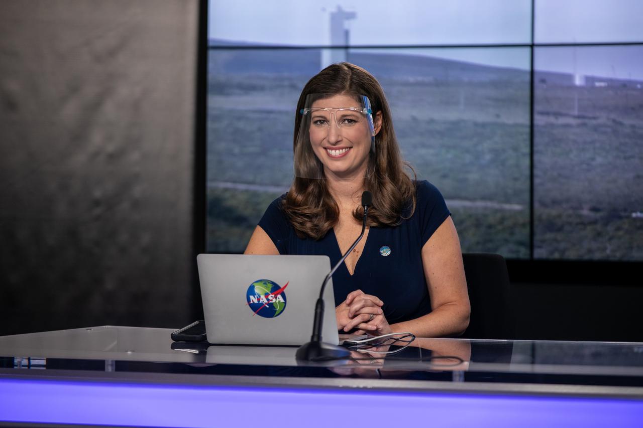
Marina Jurica of NASA’s Jet Propulsion Laboratory in Pasadena moderates a science briefing for the Sentinel-6 Michael Freilich mission at Vandenberg Air Force Base in California on Nov. 20, 2020. The Sentinel-6/Jason-CS (Continuity of Service) mission consists of the Sentinel-6 Michael Freilich satellite, which will be followed by its twin, the Sentinel-6B satellite, in 2025. The Sentinel-6/Jason-CS mission is part of Copernicus, the European Union’s Earth observation program, managed by the European Commission. Continuing the legacy of the Jason series missions, Sentinel-6/Jason-CS will extend the records of sea level into their fourth decade, collecting accurate measurements of sea surface height for more than 90% of the world’s seas, and providing crucial information for operational oceanography, marine meteorology, and climate studies. Sentinel-6 Michael Freilich launched Nov. 21, 2020, at 9:17 PST (12:17 EST). NASA’s Launch Services Program at Kennedy Space Center was responsible for launch management.
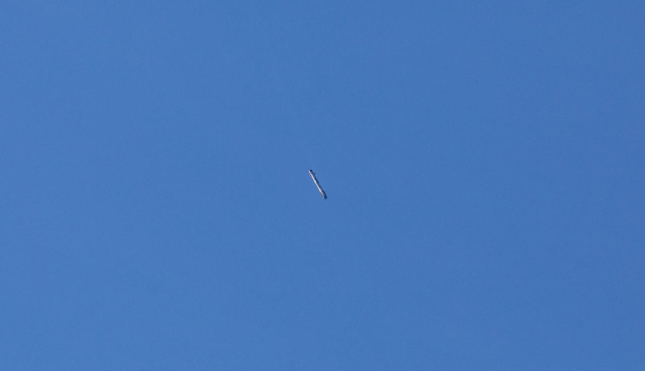
The first-stage booster of a SpaceX Falcon 9 rocket flies down toward a landing at Vandenberg Air Force Base in California during the launch of the Sentinel-6 Michael Freilich mission. The Sentinel-6/Jason-CS (Continuity of Service) mission consists of the Sentinel-6 Michael Freilich satellite, which will be followed by its twin, the Sentinel-6B satellite, in 2025. The Sentinel-6/Jason-CS mission is part of Copernicus, the European Union’s Earth observation program, managed by the European Commission. Continuing the legacy of the Jason series missions, Sentinel-6/Jason-CS will extend the records of sea level into their fourth decade, collecting accurate measurements of sea surface height for more than 90% of the world’s seas, and providing crucial information for operational oceanography, marine meteorology, and climate studies. Sentinel-6 Michael Freilich launched Nov. 21, 2020, at 9:17 PST (12:17 EST). NASA’s Launch Services Program at Kennedy Space Center was responsible for launch management.
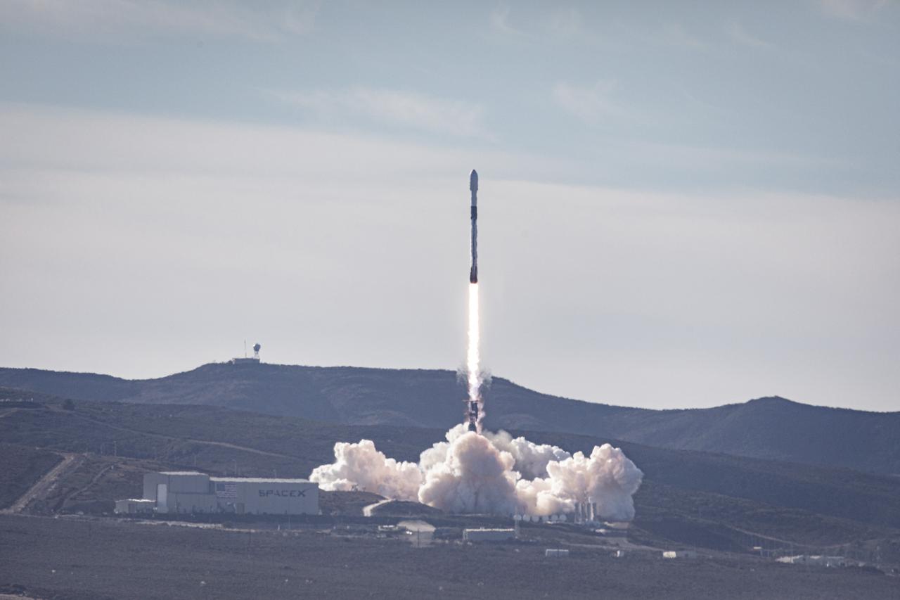
The SpaceX Falcon 9 rocket carrying the Sentinel-6 Michael Freilich spacecraft lifts off from Space Launch Complex 4 at Vandenberg Air Force Base in California, Nov. 21, 2020, at 9:17 a.m. PST (12:17 p.m. EST). The Sentinel-6/Jason-CS (Continuity of Service) mission consists of the Sentinel-6 Michael Freilich satellite, which will be followed by its twin, the Sentinel-6B satellite, in 2025. The Sentinel-6/Jason-CS mission is part of Copernicus, the European Union’s Earth observation program, managed by the European Commission. Continuing the legacy of the Jason series missions, Sentinel-6/Jason-CS will extend the records of sea level into their fourth decade, collecting accurate measurements of sea surface height for more than 90% of the world’s seas, and providing crucial information for operational oceanography, marine meteorology, and climate studies. NASA’s Launch Services Program at Kennedy Space Center was responsible for launch management.
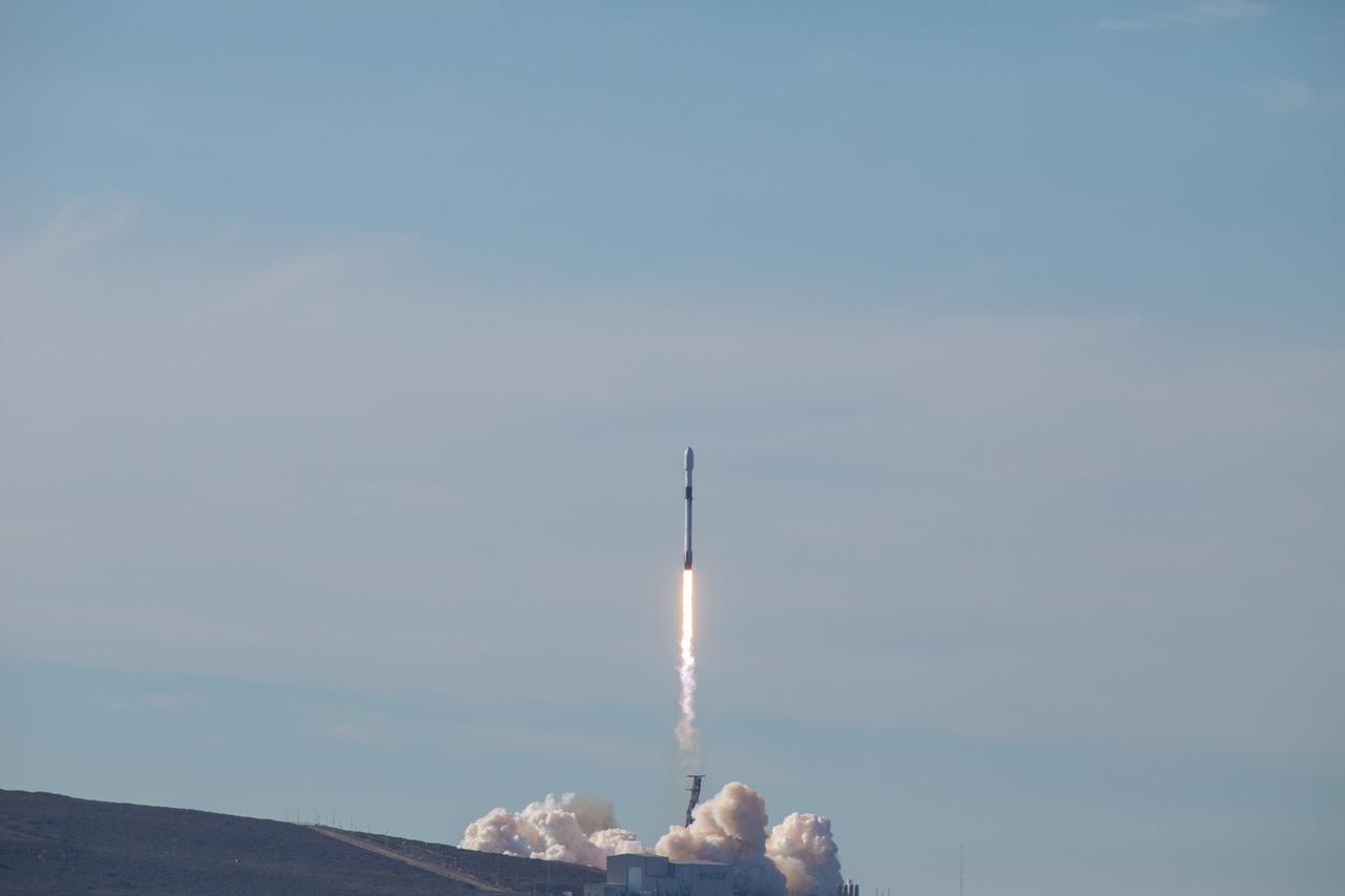
The SpaceX Falcon 9 rocket carrying the Sentinel-6 Michael Freilich spacecraft lifts off from Space Launch Complex 4 at Vandenberg Air Force Base in California, Nov. 21, 2020, at 9:17 a.m. PST (12:17 p.m. EST). The Sentinel-6/Jason-CS (Continuity of Service) mission consists of the Sentinel-6 Michael Freilich satellite, which will be followed by its twin, the Sentinel-6B satellite, in 2025. The Sentinel-6/Jason-CS mission is part of Copernicus, the European Union’s Earth observation program, managed by the European Commission. Continuing the legacy of the Jason series missions, Sentinel-6/Jason-CS will extend the records of sea level into their fourth decade, collecting accurate measurements of sea surface height for more than 90% of the world’s seas, and providing crucial information for operational oceanography, marine meteorology, and climate studies. NASA’s Launch Services Program at Kennedy Space Center was responsible for launch management.
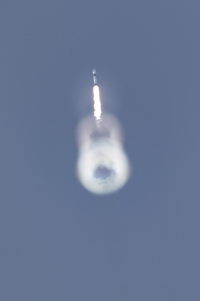
The SpaceX Falcon 9 rocket carrying the Sentinel-6 Michael Freilich spacecraft lifts off from Space Launch Complex 4 at Vandenberg Air Force Base in California, Nov. 21, 2020, at 9:17 a.m. PST (12:17 p.m. EST). The Sentinel-6/Jason-CS (Continuity of Service) mission consists of the Sentinel-6 Michael Freilich satellite, which will be followed by its twin, the Sentinel-6B satellite, in 2025. The Sentinel-6/Jason-CS mission is part of Copernicus, the European Union’s Earth observation program, managed by the European Commission. Continuing the legacy of the Jason series missions, Sentinel-6/Jason-CS will extend the records of sea level into their fourth decade, collecting accurate measurements of sea surface height for more than 90% of the world’s seas, and providing crucial information for operational oceanography, marine meteorology, and climate studies. NASA’s Launch Services Program at Kennedy Space Center was responsible for launch management.
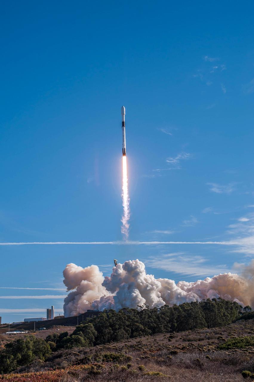
The SpaceX Falcon 9 rocket carrying the Sentinel-6 Michael Freilich spacecraft lifts off from Space Launch Complex 4 at Vandenberg Air Force Base in California, Nov. 21, 2020, at 9:17 a.m. PST (12:17 p.m. EST). The Sentinel-6/Jason-CS (Continuity of Service) mission consists of the Sentinel-6 Michael Freilich satellite, which will be followed by its twin, the Sentinel-6B satellite, in 2025. The Sentinel-6/Jason-CS mission is part of Copernicus, the European Union’s Earth observation program, managed by the European Commission. Continuing the legacy of the Jason series missions, Sentinel-6/Jason-CS will extend the records of sea level into their fourth decade, collecting accurate measurements of sea surface height for more than 90% of the world’s seas, and providing crucial information for operational oceanography, marine meteorology, and climate studies. NASA’s Launch Services Program at Kennedy Space Center was responsible for launch management.
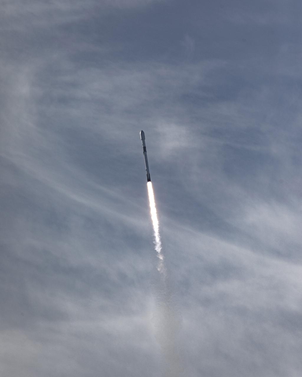
The SpaceX Falcon 9 rocket carrying the Sentinel-6 Michael Freilich spacecraft lifts off from Space Launch Complex 4 at Vandenberg Air Force Base in California, Nov. 21, 2020, at 9:17 a.m. PST (12:17 p.m. EST). The Sentinel-6/Jason-CS (Continuity of Service) mission consists of the Sentinel-6 Michael Freilich satellite, which will be followed by its twin, the Sentinel-6B satellite, in 2025. The Sentinel-6/Jason-CS mission is part of Copernicus, the European Union’s Earth observation program, managed by the European Commission. Continuing the legacy of the Jason series missions, Sentinel-6/Jason-CS will extend the records of sea level into their fourth decade, collecting accurate measurements of sea surface height for more than 90% of the world’s seas, and providing crucial information for operational oceanography, marine meteorology, and climate studies. NASA’s Launch Services Program at Kennedy Space Center was responsible for launch management.