
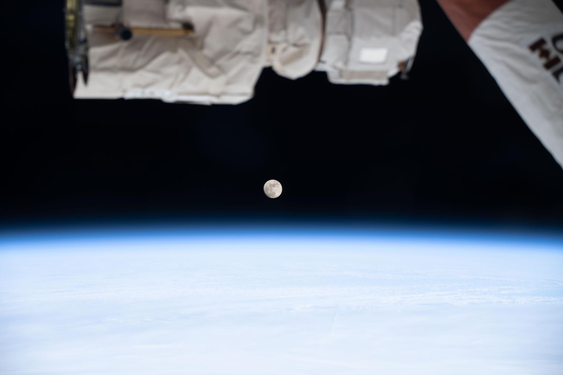
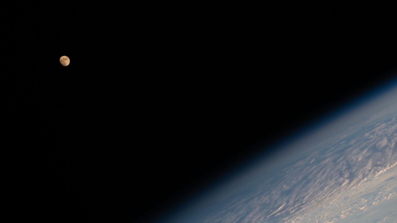
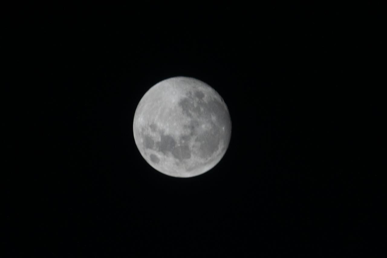
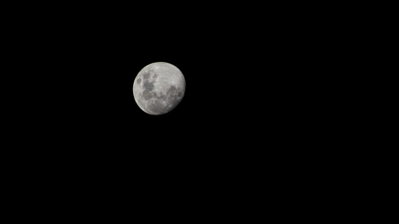
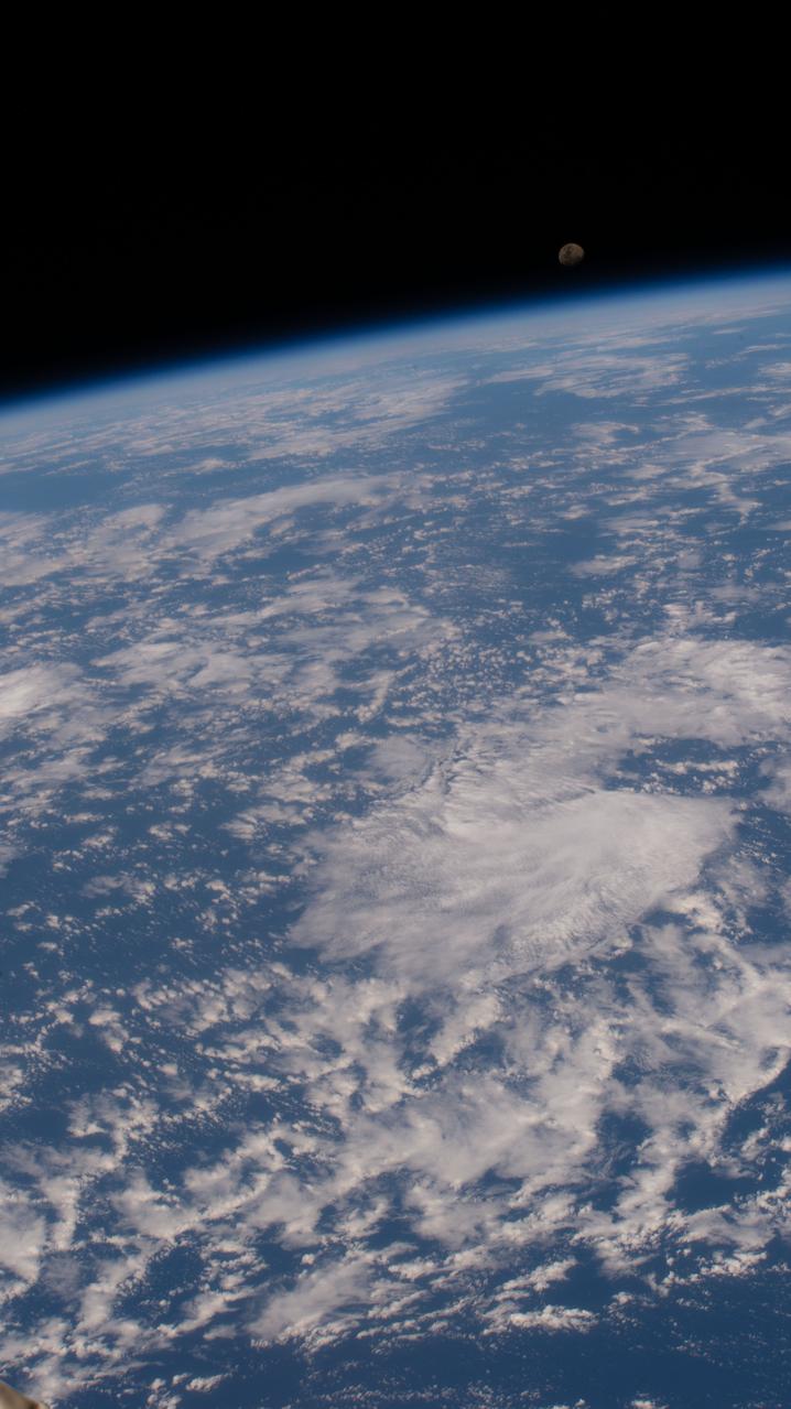
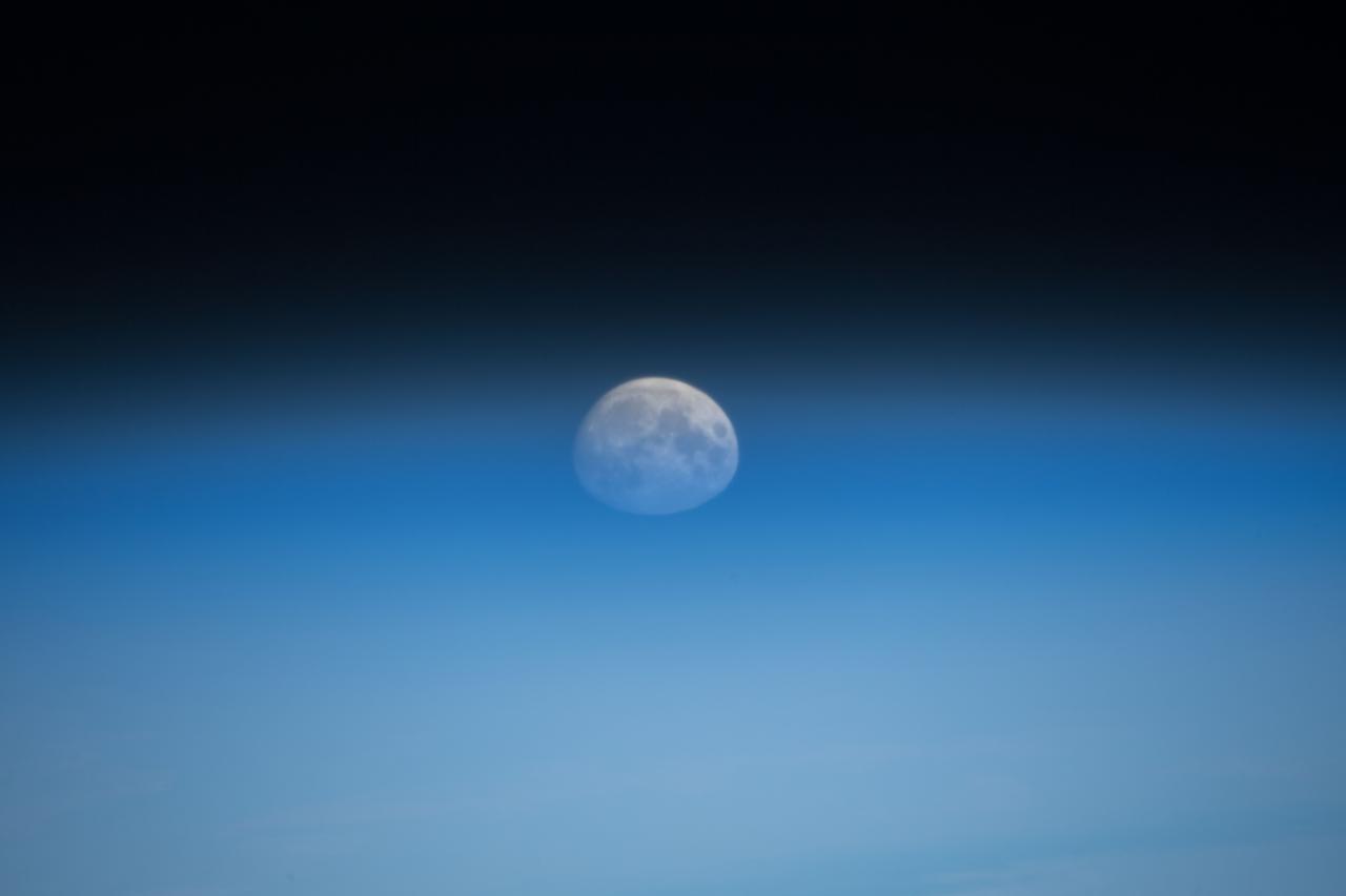
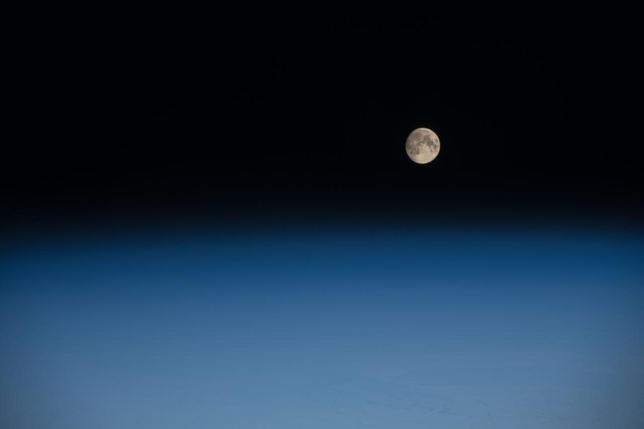
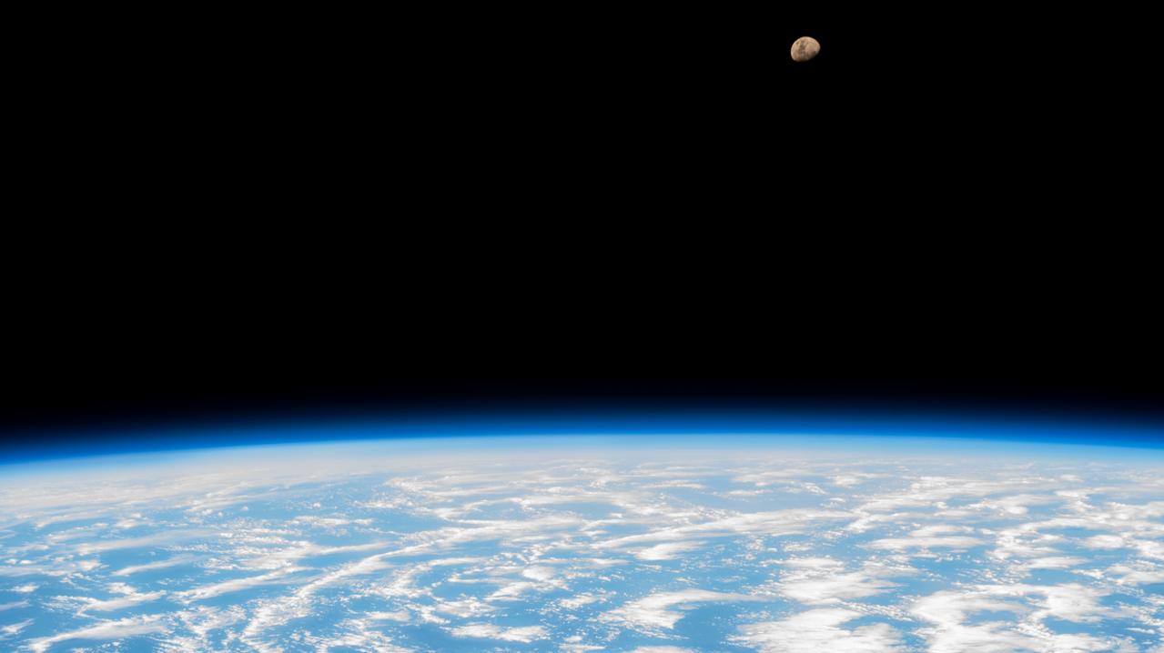
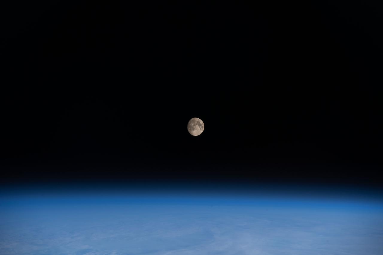
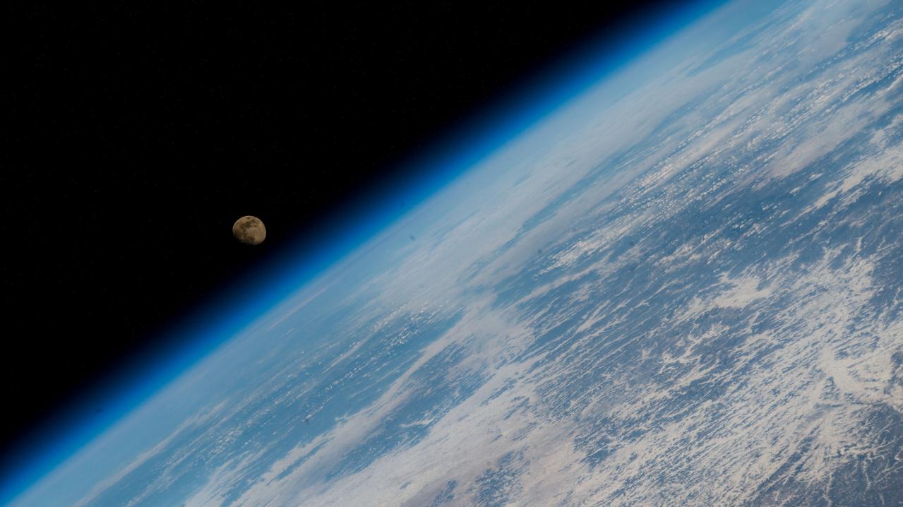
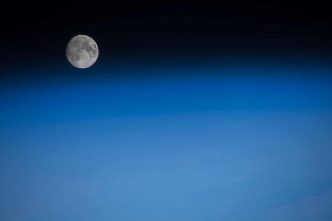
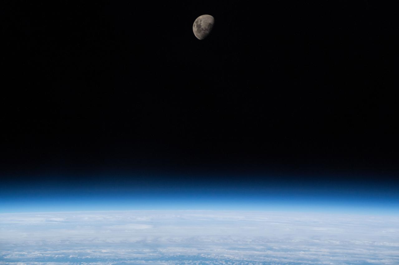
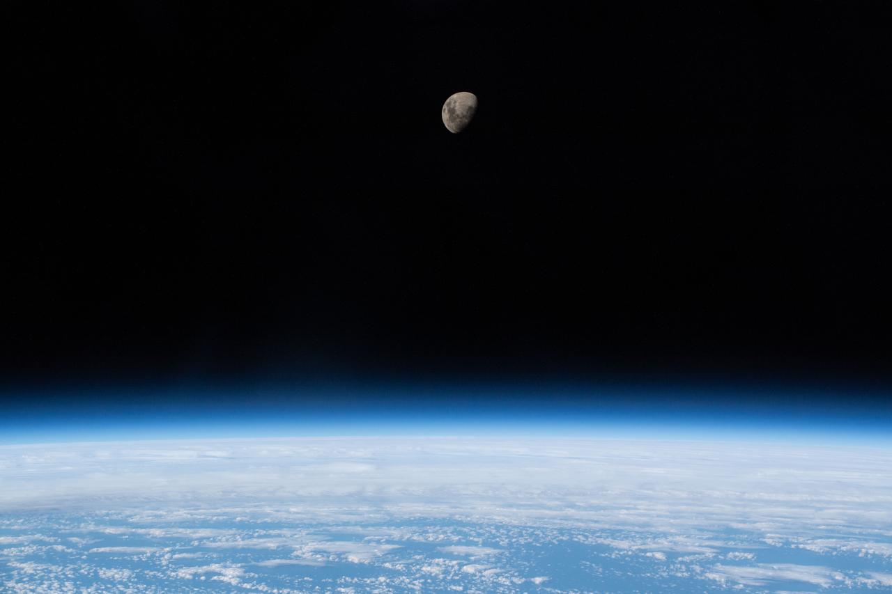
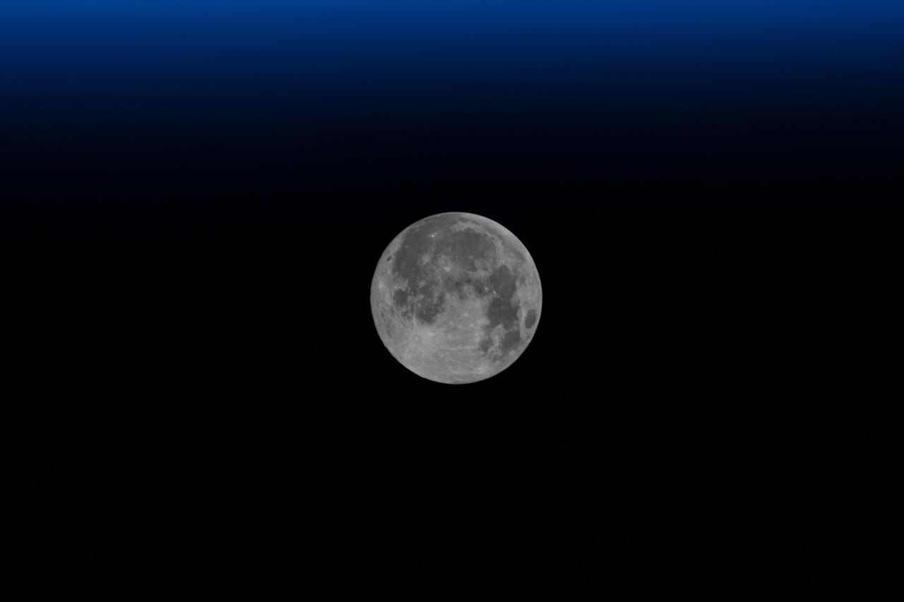
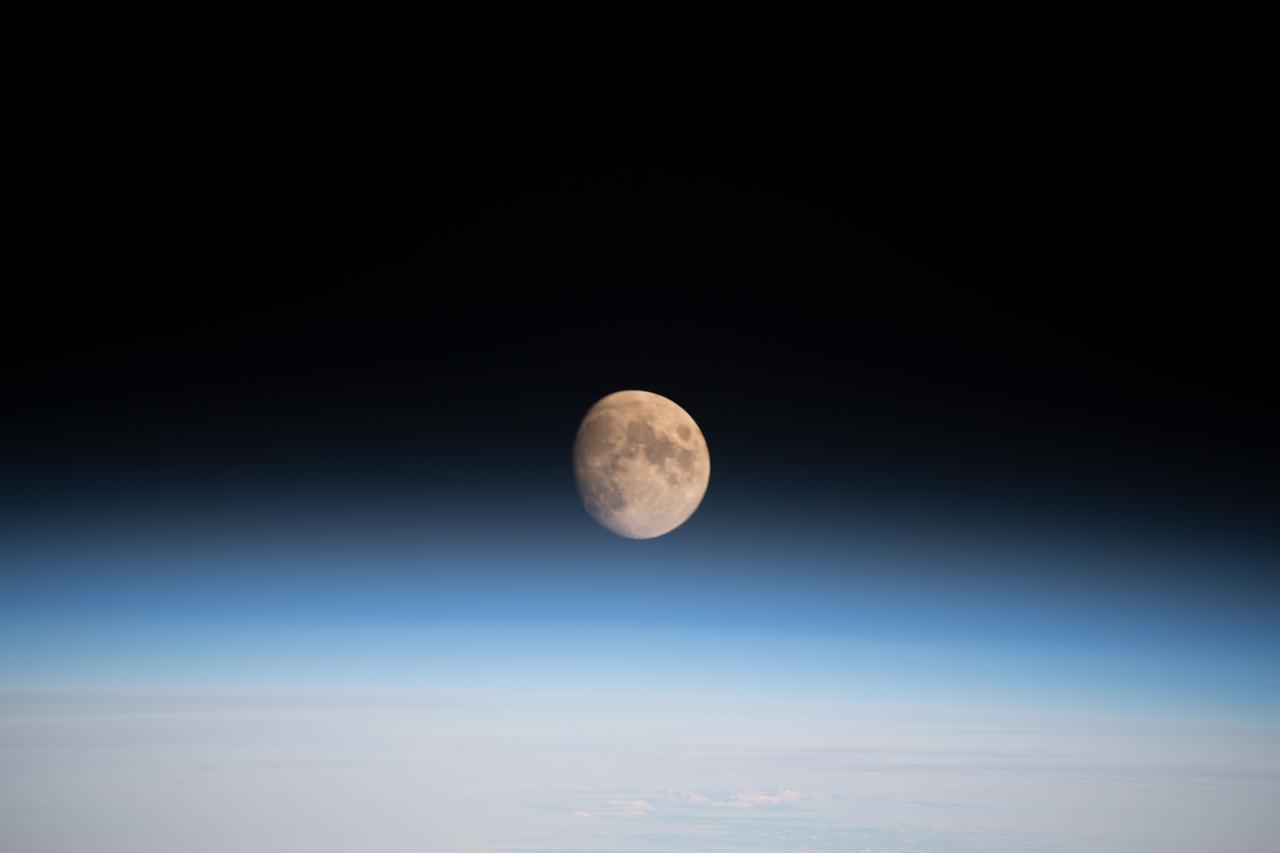
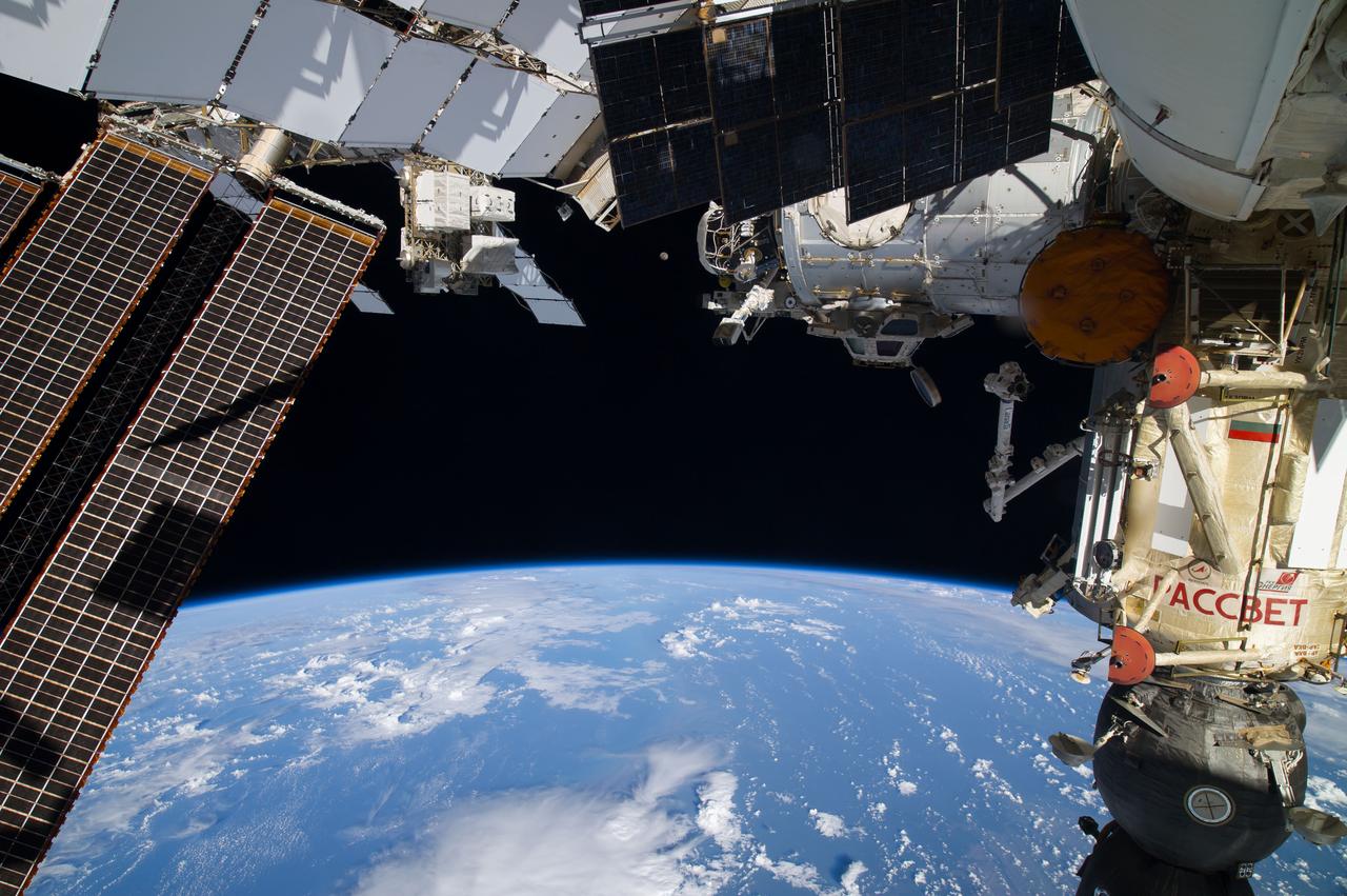
iss069e008558 (May 3, 2-23) --- The waxing gibbous Moon is pictured from the International Space Station as it orbited 268 miles above the southern Atlantic Ocean.
Waxing gibbous. Visible to the southeast in early evening, up for most of the night. NASA's Lunar Reconnaissance Orbiter (LRO) has been in orbit around the Moon since the summer of 2009. Its laser altimeter (LOLA) and camera (LROC) are recording the rugged, airless lunar terrain in exceptional detail, making it possible to visualize the Moon with unprecedented fidelity. This is especially evident in the long shadows cast near the terminator, or day-night line. The pummeled, craggy landscape thrown into high relief at the terminator would be impossible to recreate in the computer without global terrain maps like those from LRO. To download, learn more about this visualization, or to see what the Moon will look like at any hour in 2015, visit <a href="http://svs.gsfc.nasa.gov/goto?4236" rel="nofollow">svs.gsfc.nasa.gov/goto?4236</a> <b><a href="http://www.nasa.gov/audience/formedia/features/MP_Photo_Guidelines.html" rel="nofollow">NASA image use policy.</a></b> <b><a href="http://www.nasa.gov/centers/goddard/home/index.html" rel="nofollow">NASA Goddard Space Flight Center</a></b> enables NASA’s mission through four scientific endeavors: Earth Science, Heliophysics, Solar System Exploration, and Astrophysics. Goddard plays a leading role in NASA’s accomplishments by contributing compelling scientific knowledge to advance the Agency’s mission. <b>Follow us on <a href="http://twitter.com/NASAGoddardPix" rel="nofollow">Twitter</a></b> <b>Like us on <a href="http://www.facebook.com/pages/Greenbelt-MD/NASA-Goddard/395013845897?ref=tsd" rel="nofollow">Facebook</a></b> <b>Find us on <a href="http://instagram.com/nasagoddard?vm=grid" rel="nofollow">Instagram</a></b>
Waxing crescent. Visible toward the southwest in early evening. NASA's Lunar Reconnaissance Orbiter (LRO) has been in orbit around the Moon since the summer of 2009. Its laser altimeter (LOLA) and camera (LROC) are recording the rugged, airless lunar terrain in exceptional detail, making it possible to visualize the Moon with unprecedented fidelity. This is especially evident in the long shadows cast near the terminator, or day-night line. The pummeled, craggy landscape thrown into high relief at the terminator would be impossible to recreate in the computer without global terrain maps like those from LRO. To download, learn more about this visualization, or to see what the Moon will look like at any hour in 2015, visit <a href="http://svs.gsfc.nasa.gov/goto?4236" rel="nofollow">svs.gsfc.nasa.gov/goto?4236</a> <b><a href="http://www.nasa.gov/audience/formedia/features/MP_Photo_Guidelines.html" rel="nofollow">NASA image use policy.</a></b> <b><a href="http://www.nasa.gov/centers/goddard/home/index.html" rel="nofollow">NASA Goddard Space Flight Center</a></b> enables NASA’s mission through four scientific endeavors: Earth Science, Heliophysics, Solar System Exploration, and Astrophysics. Goddard plays a leading role in NASA’s accomplishments by contributing compelling scientific knowledge to advance the Agency’s mission. <b>Follow us on <a href="http://twitter.com/NASAGoddardPix" rel="nofollow">Twitter</a></b> <b>Like us on <a href="http://www.facebook.com/pages/Greenbelt-MD/NASA-Goddard/395013845897?ref=tsd" rel="nofollow">Facebook</a></b> <b>Find us on <a href="http://instagram.com/nasagoddard?vm=grid" rel="nofollow">Instagram</a></b>
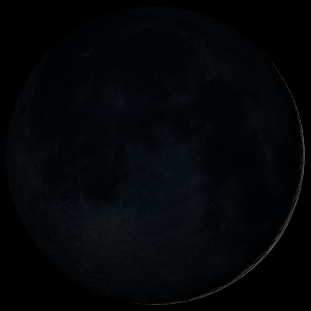
Waxing crescent. Visible toward the southwest in early evening. This marks the first time that accurate shadows at this level of detail are possible in such a computer simulation. The shadows are based on the global elevation map being developed from measurements by the Lunar Orbiter Laser Altimeter (LOLA) aboard the Lunar Reconnaissance Orbiter (LRO). LOLA has already taken more than 10 times as many elevation measurements as all previous missions combined. The Moon always keeps the same face to us, but not exactly the same face. Because of the tilt and shape of its orbit, we see the Moon from slightly different angles over the course of a month. When a month is compressed into 12 seconds, as it is in this animation, our changing view of the Moon makes it look like it's wobbling. This wobble is called libration. The word comes from the Latin for "balance scale" (as does the name of the zodiac constellation Libra) and refers to the way such a scale tips up and down on alternating sides. The sub-Earth point gives the amount of libration in longitude and latitude. The sub-Earth point is also the apparent center of the Moon's disk and the location on the Moon where the Earth is directly overhead. The Moon is subject to other motions as well. It appears to roll back and forth around the sub-Earth point. The roll angle is given by the position angle of the axis, which is the angle of the Moon's north pole relative to celestial north. The Moon also approaches and recedes from us, appearing to grow and shrink. The two extremes, called perigee (near) and apogee (far), differ by more than 10%. The most noticed monthly variation in the Moon's appearance is the cycle of phases, caused by the changing angle of the Sun as the Moon orbits the Earth. The cycle begins with the waxing (growing) crescent Moon visible in the west just after sunset. By first quarter, the Moon is high in the sky at sunset and sets around midnight. The full Moon rises at sunset and is high in the sky at midnight. The third quarter Moon is often surprisingly conspicuous in the daylit western sky long after sunrise. Celestial north is up in these images, corresponding to the view from the northern hemisphere. The descriptions of the print resolution stills also assume a northern hemisphere orientation. To adjust for southern hemisphere views, rotate the images 180 degrees, and substitute "north" for "south" in the descriptions. Credit: <a href="http://svs.gsfc.nasa.gov/index.html" rel="nofollow">NASA/Goddard Space Flight Center Scientific Visualization Studio</a> <b><a href="http://www.nasa.gov/centers/goddard/home/index.html" rel="nofollow">NASA Goddard Space Flight Center</a></b> enables NASA’s mission through four scientific endeavors: Earth Science, Heliophysics, Solar System Exploration, and Astrophysics. Goddard plays a leading role in NASA’s accomplishments by contributing compelling scientific knowledge to advance the Agency’s mission. <b>Follow us on <a href="http://twitter.com/NASA_GoddardPix" rel="nofollow">Twitter</a></b> <b>Join us on <a href="http://www.facebook.com/pages/Greenbelt-MD/NASA-Goddard/395013845897?ref=tsd" rel="nofollow">Facebook</a></b> <b>Find us on <a href="http://web.stagram.com/n/nasagoddard/?vm=grid" rel="nofollow">Instagram</a></b>

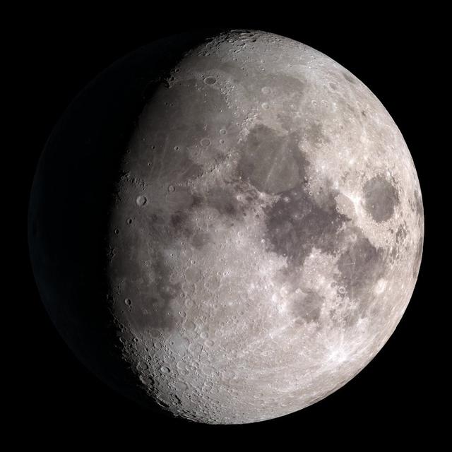
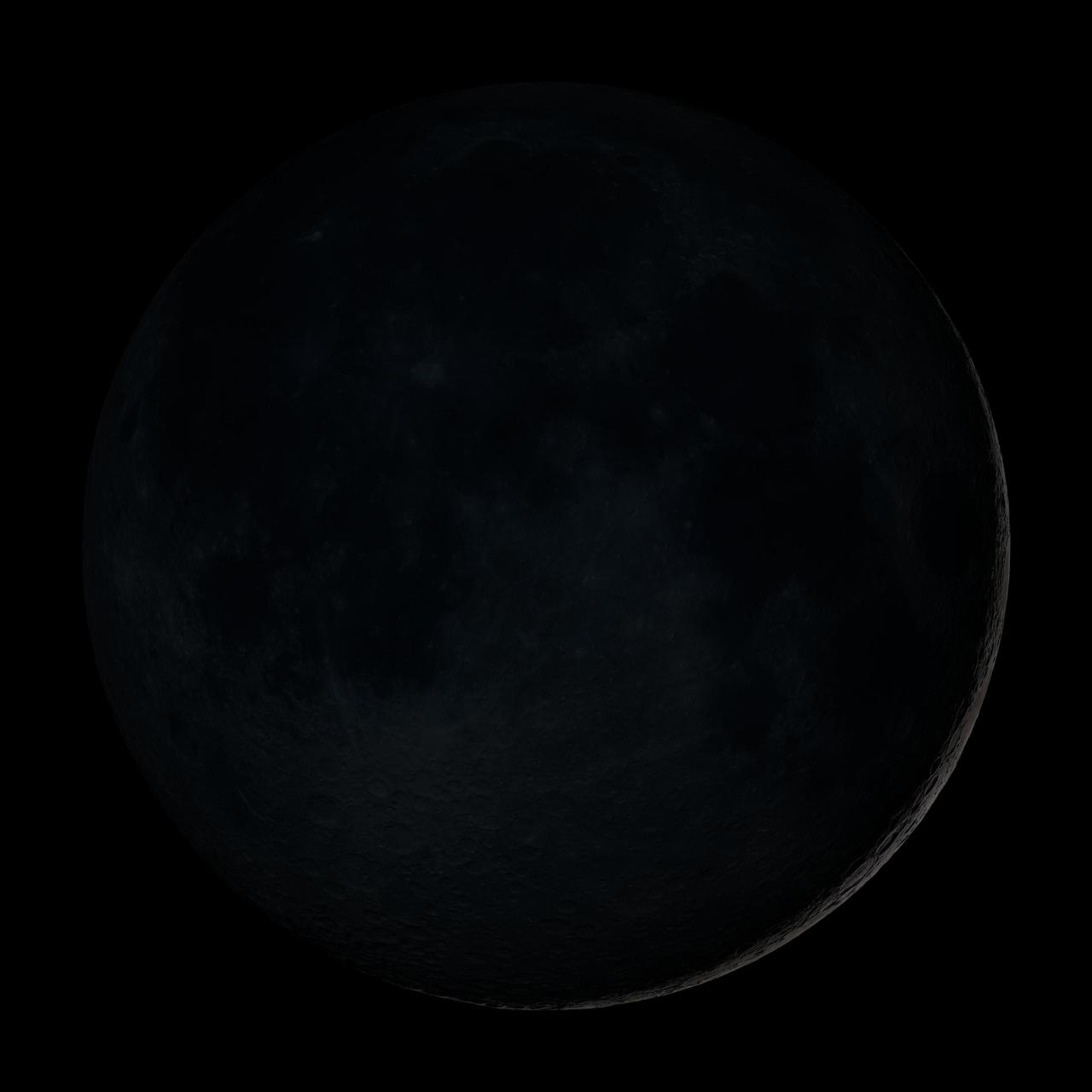
Waxing gibbous. Visible to the southeast in early evening, up for most of the night. This marks the first time that accurate shadows at this level of detail are possible in such a computer simulation. The shadows are based on the global elevation map being developed from measurements by the Lunar Orbiter Laser Altimeter (LOLA) aboard the Lunar Reconnaissance Orbiter (LRO). LOLA has already taken more than 10 times as many elevation measurements as all previous missions combined. The Moon always keeps the same face to us, but not exactly the same face. Because of the tilt and shape of its orbit, we see the Moon from slightly different angles over the course of a month. When a month is compressed into 12 seconds, as it is in this animation, our changing view of the Moon makes it look like it's wobbling. This wobble is called libration. The word comes from the Latin for "balance scale" (as does the name of the zodiac constellation Libra) and refers to the way such a scale tips up and down on alternating sides. The sub-Earth point gives the amount of libration in longitude and latitude. The sub-Earth point is also the apparent center of the Moon's disk and the location on the Moon where the Earth is directly overhead. The Moon is subject to other motions as well. It appears to roll back and forth around the sub-Earth point. The roll angle is given by the position angle of the axis, which is the angle of the Moon's north pole relative to celestial north. The Moon also approaches and recedes from us, appearing to grow and shrink. The two extremes, called perigee (near) and apogee (far), differ by more than 10%. The most noticed monthly variation in the Moon's appearance is the cycle of phases, caused by the changing angle of the Sun as the Moon orbits the Earth. The cycle begins with the waxing (growing) crescent Moon visible in the west just after sunset. By first quarter, the Moon is high in the sky at sunset and sets around midnight. The full Moon rises at sunset and is high in the sky at midnight. The third quarter Moon is often surprisingly conspicuous in the daylit western sky long after sunrise. Celestial north is up in these images, corresponding to the view from the northern hemisphere. The descriptions of the print resolution stills also assume a northern hemisphere orientation. To adjust for southern hemisphere views, rotate the images 180 degrees, and substitute "north" for "south" in the descriptions. Credit: <a href="http://svs.gsfc.nasa.gov/index.html" rel="nofollow">NASA/Goddard Space Flight Center Scientific Visualization Studio</a> <b><a href="http://www.nasa.gov/centers/goddard/home/index.html" rel="nofollow">NASA Goddard Space Flight Center</a></b> enables NASA’s mission through four scientific endeavors: Earth Science, Heliophysics, Solar System Exploration, and Astrophysics. Goddard plays a leading role in NASA’s accomplishments by contributing compelling scientific knowledge to advance the Agency’s mission. <b>Follow us on <a href="http://twitter.com/NASA_GoddardPix" rel="nofollow">Twitter</a></b> <b>Join us on <a href="http://www.facebook.com/pages/Greenbelt-MD/NASA-Goddard/395013845897?ref=tsd" rel="nofollow">Facebook</a></b> <b>Find us on <a href="http://web.stagram.com/n/nasagoddard/?vm=grid" rel="nofollow">Instagram</a></b>
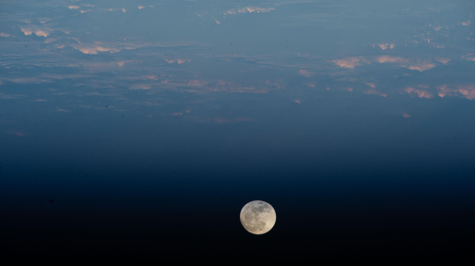
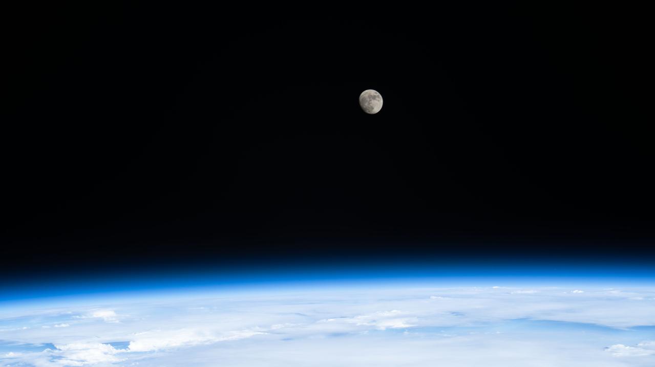
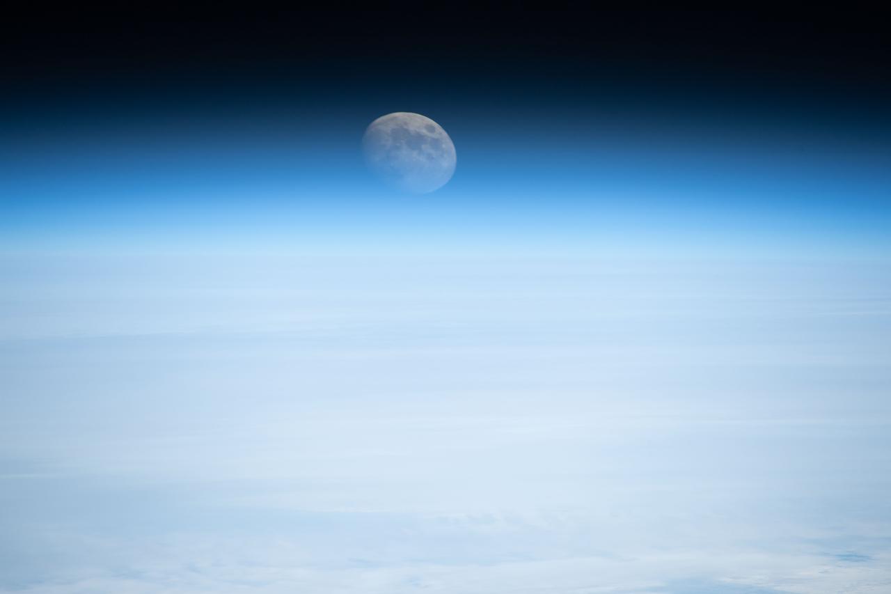
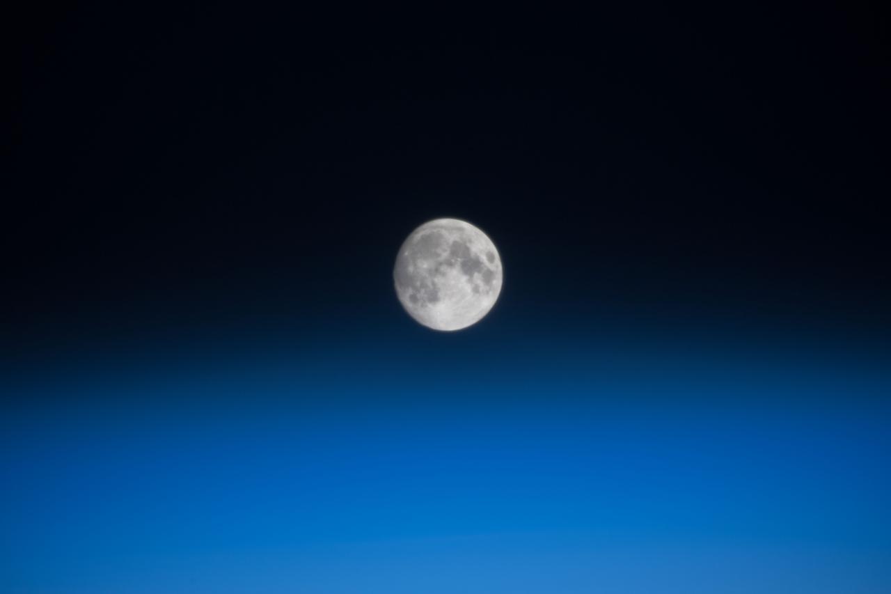
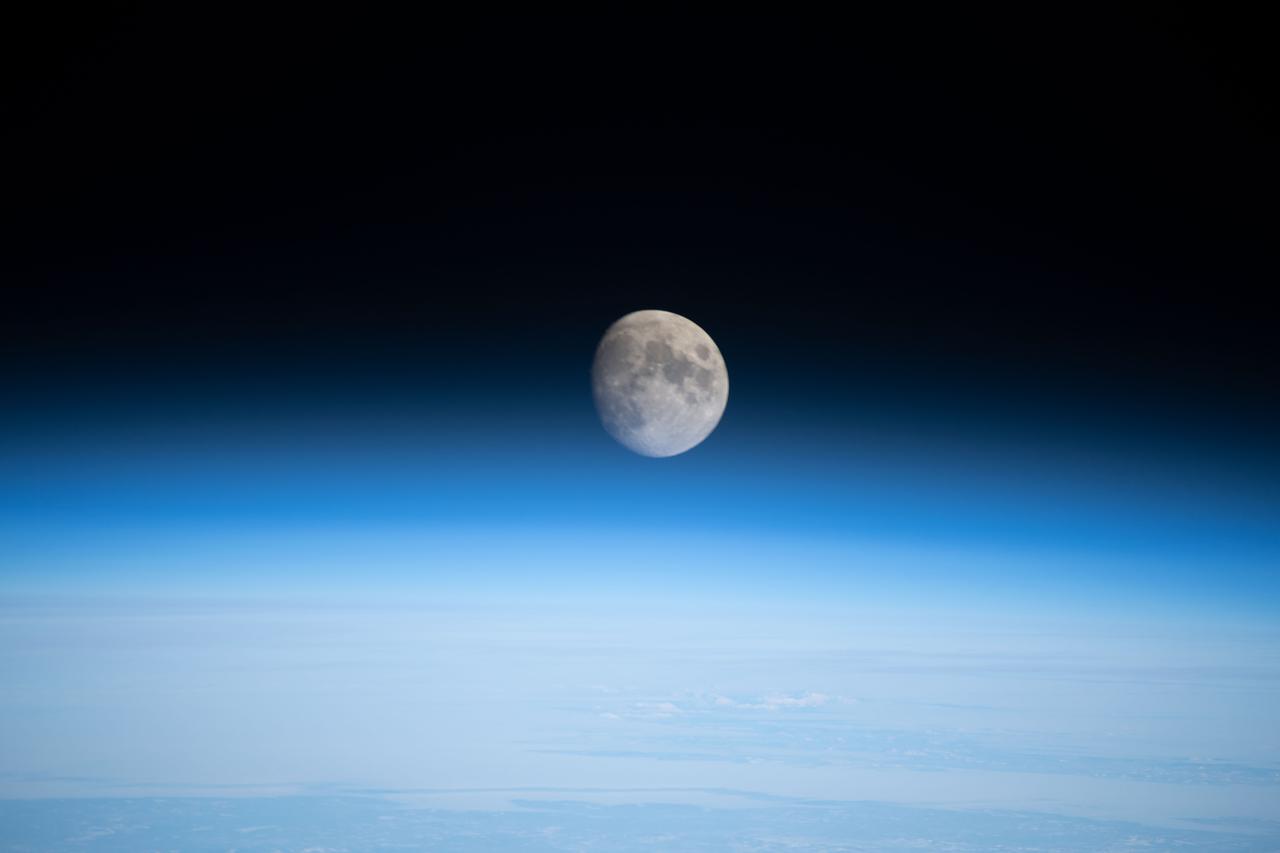
iss071e092177 (May 19, 2024) -- An illuminated waxing gibbous moon is pictured from the International Space Station as it soared 258 miles above the Indian Ocean.
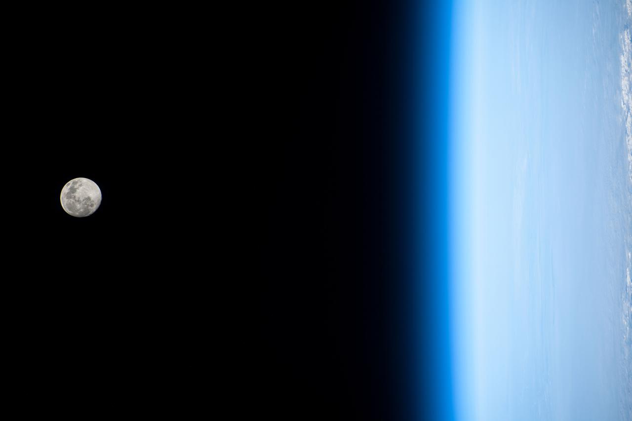
iss071e184156 (June 14, 2024) -- A waxing gibbous moon is illuminated against the black of space as the International Space Station orbited 262 miles above the Indian Ocean.

iss071e206291 (June 20, 2024) -- A waxing gibbous moon rises over the Indian Ocean as the International Space Station orbited 266 miles above.
iss074e0011009 (Jan. 1, 2025) --- The Waxing Gibbous Moon is pictured on New Year's Day from the International Space Station as it orbited 266 miles above the North Pacific Ocean. Credit: JAXA/Kimiya Yui
iss074e0623239 (May 30, 2026) --- A Waxing Gibbous Moon is pictured above the Pacific Ocean northeast of New Zealand in this photograph from the International Space Station as it orbited 266 miles above Earth. Credit: NASA
iss074e0623242 (May 30, 2026) --- A Waxing Gibbous Moon is pictured above the Pacific Ocean northeast of New Zealand in this photograph from the International Space Station as it orbited 266 miles above Earth. Credit: NASA
iss074e0431548 (March 31, 2026) --- A waxing gibbous Moon is pictured above Earth's atmosphere from the International Space Station as it soared 268 miles above far eastern Canada. A portion of the Canadarm2 robotic arm's latching end effector is captured in the top foreground of the image. Credit: NASA/Chris Williams
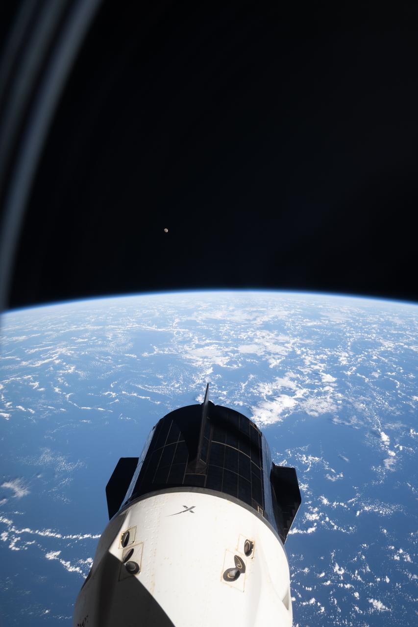
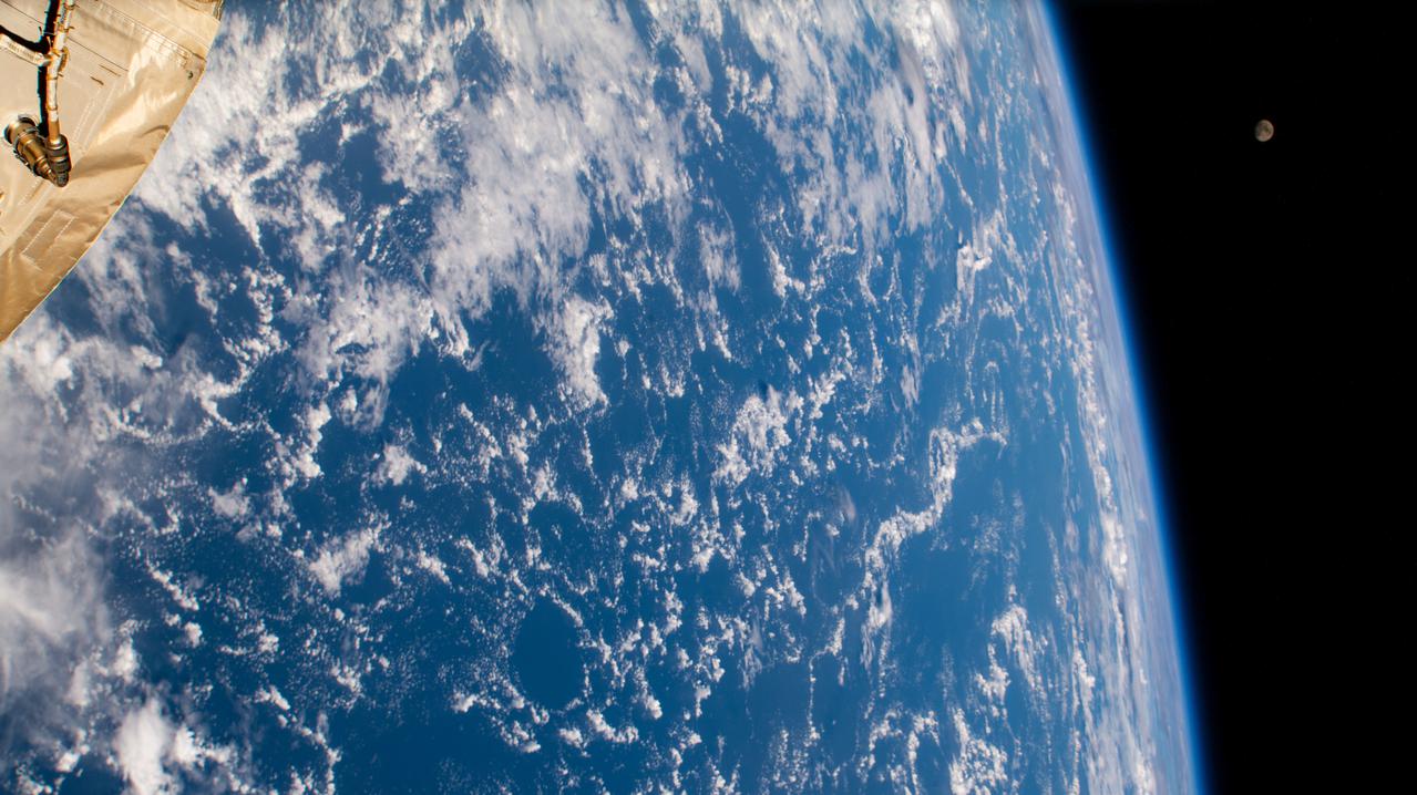
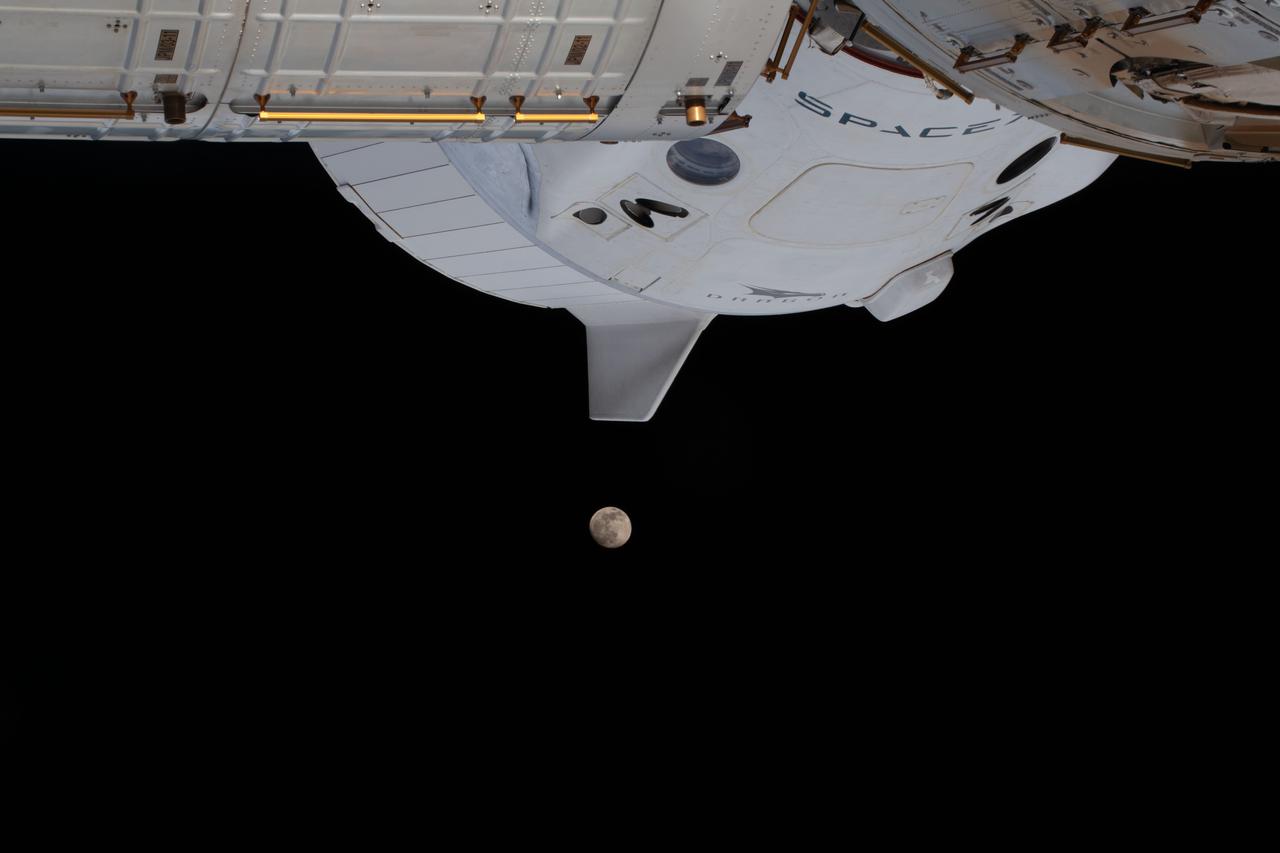
iss073e0505414 (Aug. 6, 2025) --- The SpaceX Dragon crew spacecraft that ferried NASA’s Crew-10 mission to the International Space Station is seen docked to the forward port of the Harmony module, as photographed from NASA’s SpaceX Crew-11 Dragon spacecraft attached to Harmony’s space-facing port. Just above Earth’s horizon at center left, a tiny white dot marks the Waxing Gibbous Moon. This image was captured as the orbital outpost soared 259 miles above the Atlantic Ocean.
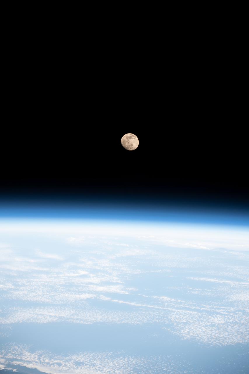
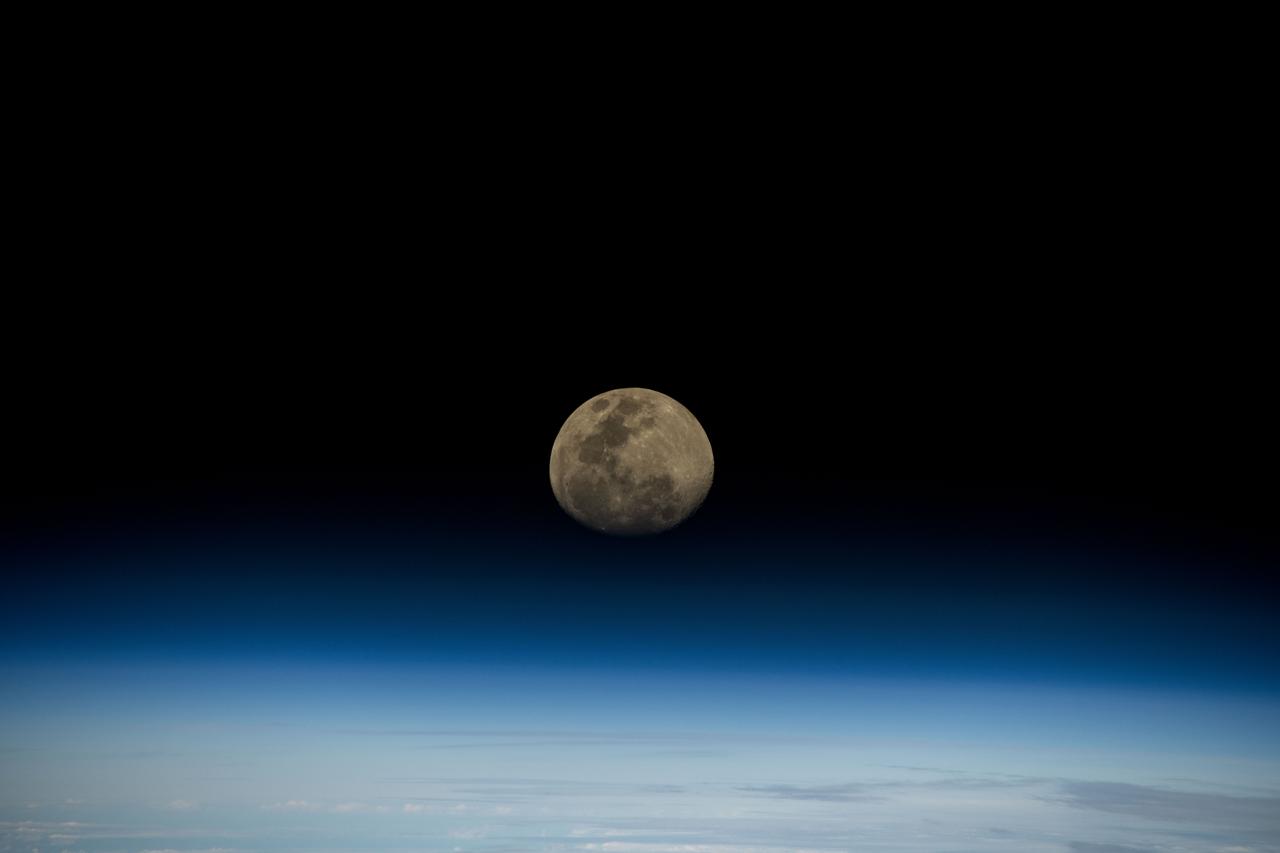
iss073e0819960 (Oct. 3, 2025) --- The waxing gibbous Moon rises above Earth’s blue atmosphere in this photograph taken from the International Space Station as it orbited 263 miles above a cloudy Atlantic Ocean off the coast of Quebec, Canada.
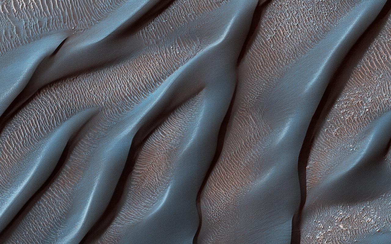
The Hellespontus Montes is a rugged mountain range located on the western rim of one of the largest impact basins in the Solar System: Hellas Basin. The 7-kilometer depth of Hellas and its location in the Southern Hemisphere form an active atmospheric system that directly impacts local landscape evolution. Hellespontus has a large accumulation of sand dunes and other wind-created bedforms that have been migrating on a continual basis since HiRISE began imaging Mars. A dune's steepest area, called a "slip face," indicates the down-wind side of the dune and its migration direction as driven by local winds. At this location, there are many dunes influenced by eastward winds that were draining into Hellas. Meanwhile, other locations show that migration had shifted towards the opposite direction to the west. In certain cases, we see these opposing dune directions in proximity. The complex patterns are not due to winds that are constant in magnitude or direction, but rather they wax and wane over the course of the Martian year. https://photojournal.jpl.nasa.gov/catalog/PIA25899
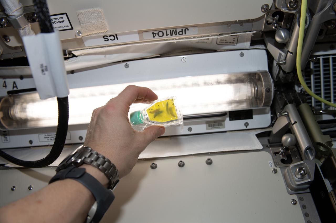
iss062e112447 (3/25/2020) --- A View of the ISSET-Nanoracks-Mission Discovery 4 investigation aboard the International Space Station (ISS). The Degradation of plastic by wax worms in microgravity sub-investigation studies wax worms and their capability to degrade plastic in a space environment. The experiment is contained in a culture flask with wax worms sealed inside a typical supermarket bag made from polyethylene Successful degradation of polyethylene using wax worms may lead to a new method of mitigating plastic waste accumulation in future space missions.
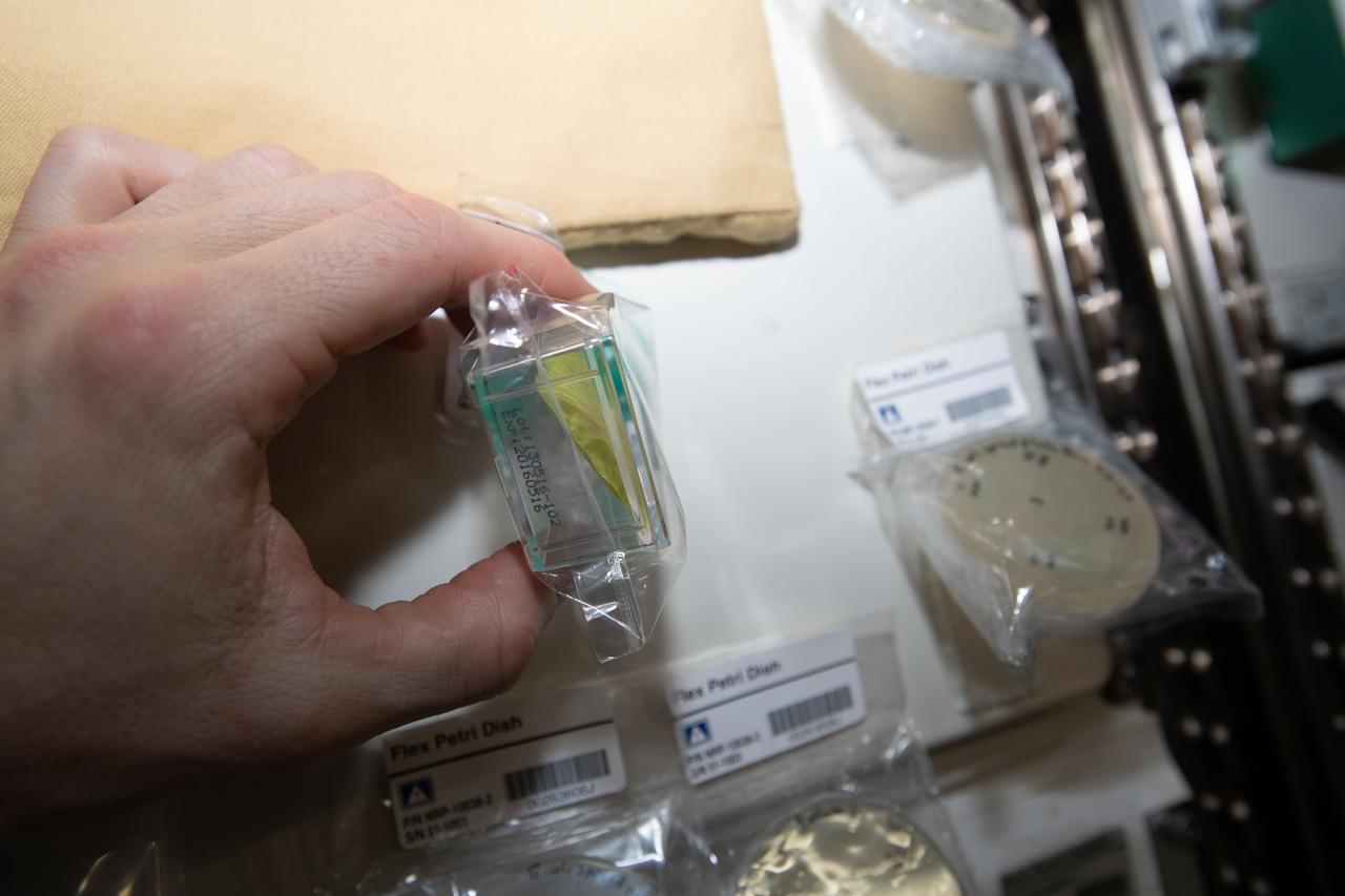
iss062e087552 (3/11/2020) --- A View of the ISSET-Nanoracks-Mission Discovery 4 investigation aboard the International Space Station (ISS). The Degradation of plastic by wax worms in microgravity sub-investigation studies wax worms and their capability to degrade plastic in a space environment. The experiment is contained in a culture flask with wax worms sealed inside a typical supermarket bag made from polyethylene Successful degradation of polyethylene using wax worms may lead to a new method of mitigating plastic waste accumulation in future space missions.
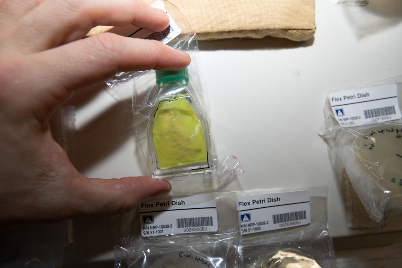
iss062e087549 (3/11/2020) --- A View of the ISSET-Nanoracks-Mission Discovery 4 investigation aboard the International Space Station (ISS). The Degradation of plastic by wax worms in microgravity sub-investigation studies wax worms and their capability to degrade plastic in a space environment. The experiment is contained in a culture flask with wax worms sealed inside a typical supermarket bag made from polyethylene Successful degradation of polyethylene using wax worms may lead to a new method of mitigating plastic waste accumulation in future space missions.
A special maneuver of NASA Terra spacecraft was performed as it traversed the nightside enabling a backward somersault of the spacecraft, allowing the normally Earth-viewing instruments to look at deep space and the waxing gibbous Moon.
iss062e137200 (April 6, 2020) --- A waxing gibbous Moon is pictured from the International Space Station as it orbited above North America.

iss062e137195 (April 6, 2020) --- A waxing gibbous Moon is pictured from the International Space Station as it orbited above North America.
iss068e014814 (Oct. 7, 2022) --- The waxing gibbous Moon is pictured from the International Space Station as it orbited 264 miles above eastern Canada.
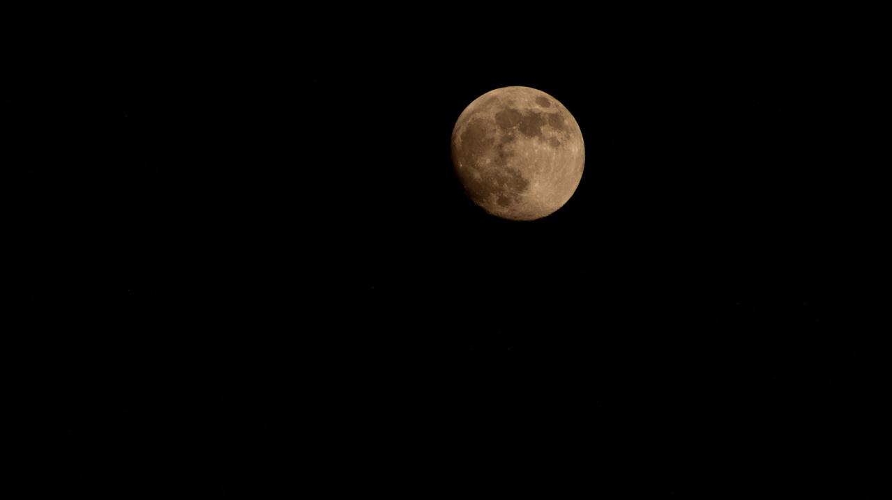
iss072e186908 (Nov. 14, 2024) -- A golden waxing gibbous moon is pictured from the International Space Station as it orbited 259 miles above Earth.
iss064e026149 (Jan. 26, 2021) --- The waxing gibbous Moon is pictured from the International Space Station as it orbited 261 miles above the South China Sea.
iss061e112503 (Jan. 1, 2020) --- A waxing crescent Moon is pictured as the International Space Station orbited 260 miles above the north African country of Algeria.
iss065e484869 (Oct. 16. 2021) --- The waxing gibbous Moon is pictured over Earth's horizon as the International Space Station orbited 262 miles above Tajikistan.
iss065e484849 (Oct. 15. 2021) --- The waxing gibbous Moon is pictured from the International Space Station as it orbited 262 miles above the northeastern United States.
iss065e133389 (June 21, 2021) --- The waxing gibbous Moon is pictured from the International Space Station as it orbited 261 miles above the Indian Ocean south of India.
iss066e105101 (Dec. 17, 2021) --- The waxing gibbous Moon is pictured from the International Space Station as it orbited 265 miles above the U.S. state of Minnesota.
iss064e006423 (Nov. 27, 2020) --- A waxing gibbous moon is pictured from the International Space Station as it orbited northeast of the Bahamas in the Atlantic Ocean.
iss067e123467 (June 12, 2022) --- The waxing gibbous Moon is photographed above Earth's horizon from the International Space Station as it orbited 261 miles above Turkey.
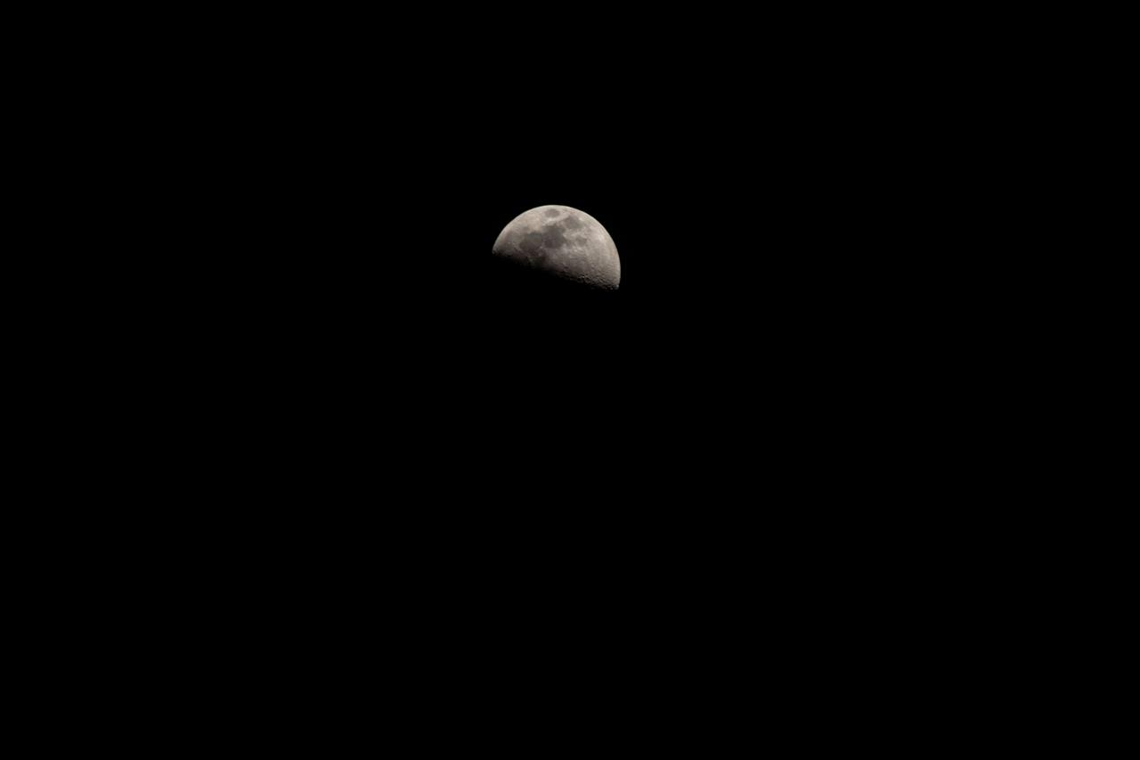
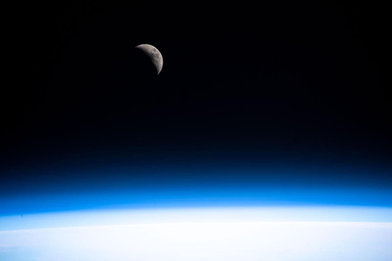
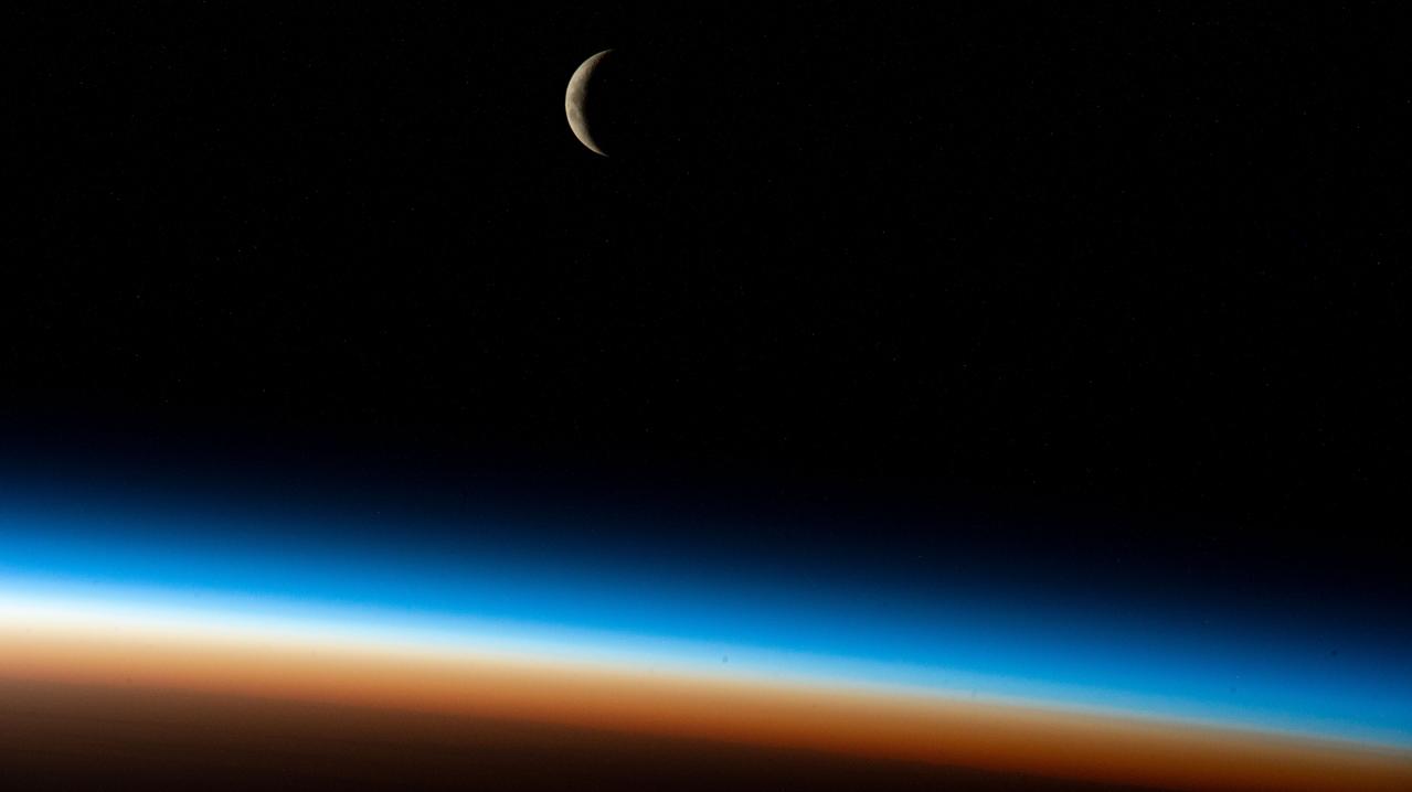
iss068e006913 (Oct. 1, 2022) --- The waxing crescent Moon is pictured from the International Space Station as it orbited 268 miles above the southern Atlantic Ocean.
iss068e037043 (Jan. 4, 2022) --- The Waxing Gibbous Moon is pictured from the International Space Station as it orbited 268 miles above the southern Pacific Ocean.
iss068e036313 (Jan. 2, 2023) --- The Waxing Gibbous Moon is pictured from the International Space Station as it orbited 269 miles above the southern Indian Ocean.
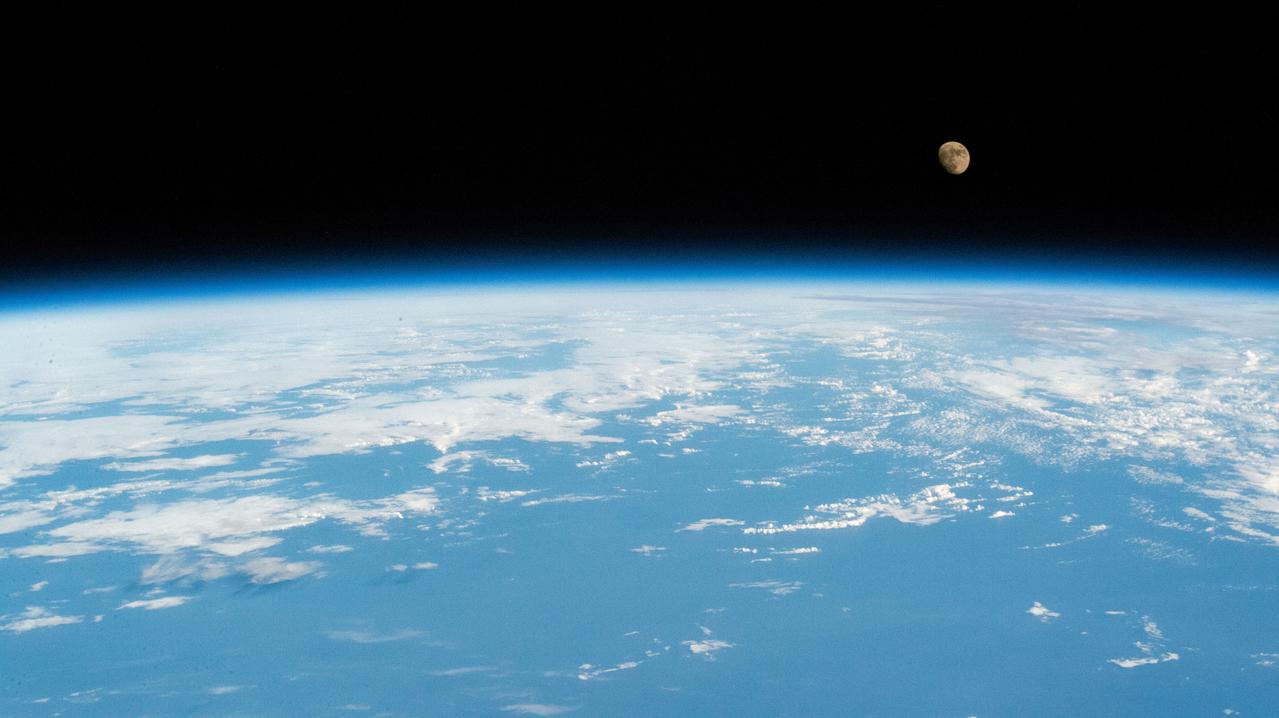
iss065e053289 (May 23, 2021) --- A waxing gibbous Moon is pictured from the International Space Station as it orbited 263 miles above the Pacific Ocean.
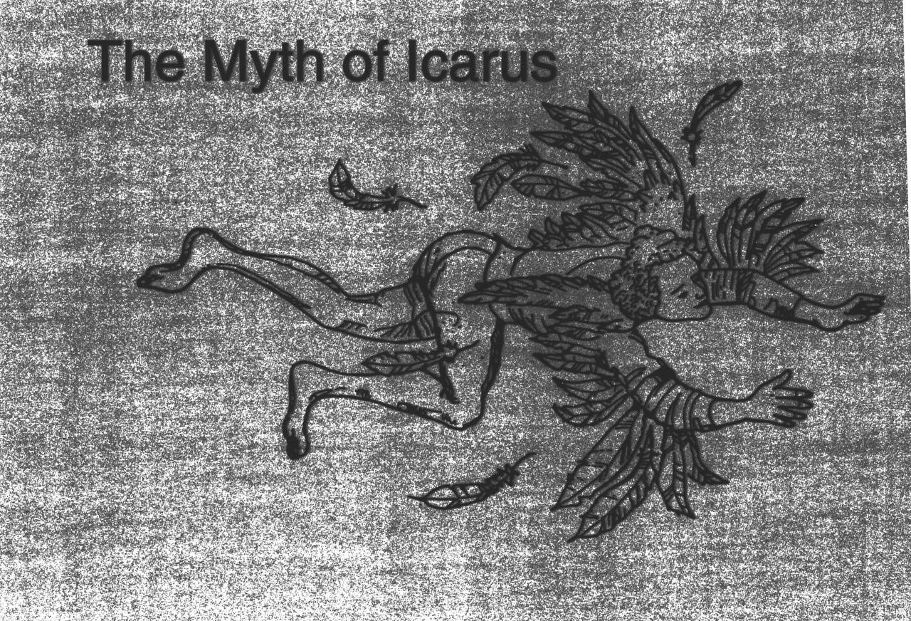
Ever since humans first saw birds soar through the sky, they have wanted to fly. The ancient Greeks and Romans pictured many of their gods with winged feet, and imagined mythological winged animals. According to the legend of Daedalus and Icarus, the father and son escaped prison by attaching wings made of wax and feathers to their bodies. Unfortunately, Icarus flew too near the sun, and the heat caused the wax and feathers to melt. The feathers fell off, and Icarus plummeted to the sea. Daedalus landed safely in Sicily.
iss063e081151 (Aug. 29, 2020) --- A waxing gibbous moon is pictured above the Earth's horizon as the International Space Station orbited above the Atlantic Ocean off the coast of Brazil.
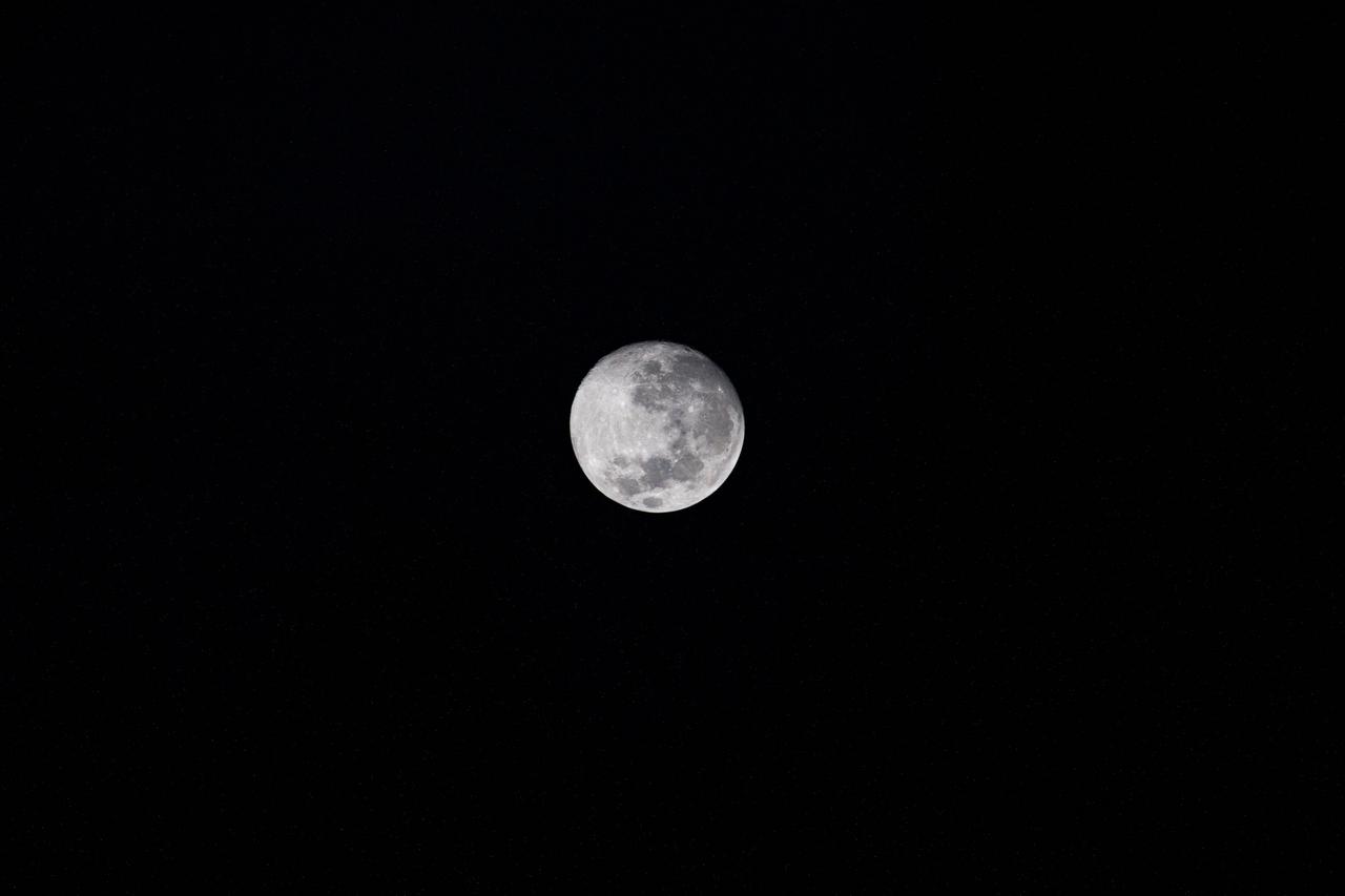
iss059e021191 (April 11, 2019) --- The moon is photographed in its waxing gibbous phase as the International Space Station orbited 256 miles above the North Pacific Ocean south of Alaska's Aleutian Islands.
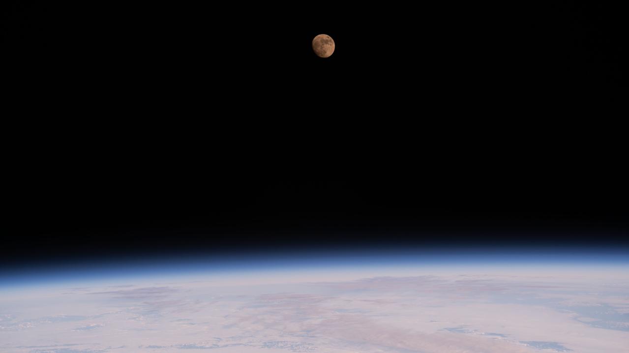
iss064e025547 (Jan. 23, 2021) --- The waxing gibbous Moon is pictured from the International Space Station as it orbited 263 miles above the Pacific Ocean near the island state of Samoa and the U.S. territory of American Samoa. Credit: Roscosmos
This photograph from CFM shows a candle flame burning over time in microgravity, it shows pieces of wax or soot moving through the flame about 25 seconds after ignition.
iss055e000043 (Feb. 28, 2018) --- A waxing gibbous moon was pictured above the Earth's limb as the International Space Station orbited over the southern Indian Ocean just southwest of the African continent.
iss067e249811 (Aug. 10, 2022) --- The waxing gibbous Moon is pictured from the International Space Station as it orbited 259 miles above the Pacific Ocean off the coast of north California.
iss065e280824 (Aug. 19, 2021) --- The waxing gibbous Moon (upper right) is pictured from the International Space Station as it orbited 262 miles above the Atlantic Ocean just east of the Lesser Antilles, a group of islands in the Caribbean Sea.
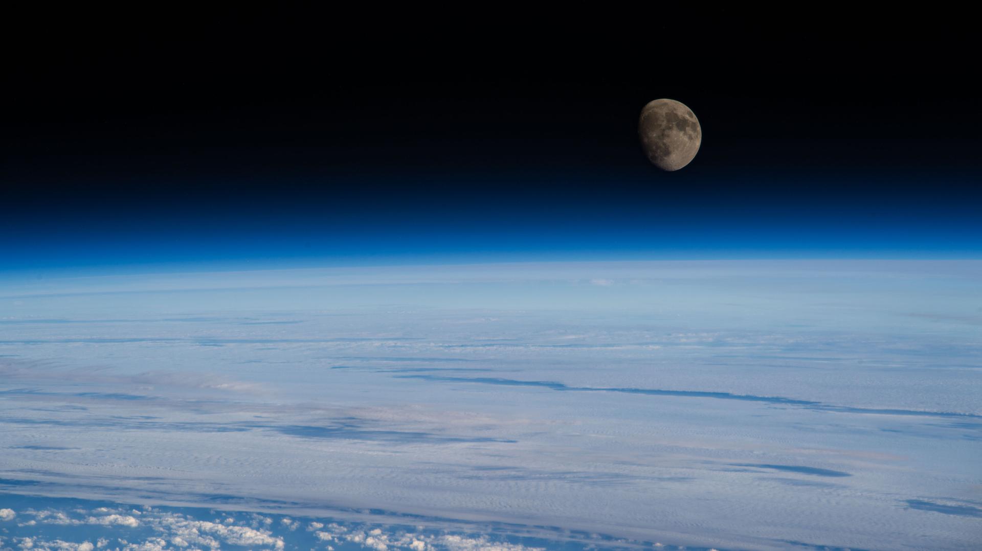
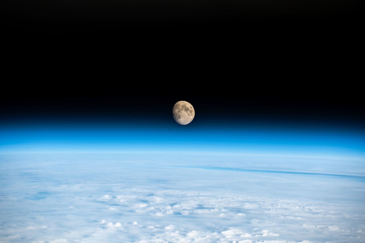
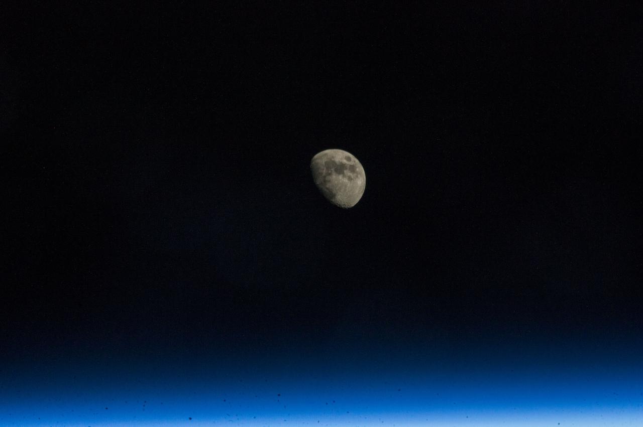
iss065e005949 (April 26, 2021) --- A waxing gibbous Moon, or near Full Moon, is pictured from the International Space Station as it orbited 267 miles above the southern Indian Ocean.
iss055e000030 (Feb. 28, 2018) --- A waxing gibbous moon was pictured above the Earth's limb as the International Space Station orbited over the southern Indian Ocean just southwest of the African continent.
iss066e144042 (Feb. 14, 2022) --- The waxing gibbous Moon is pictured on Valentine's Day from the International Space Station as it orbited 261 miles above the Pacific Ocean off the coast of British Columbia, Canada.
iss070e096713 (Feb. 20, 2024) --- Earth's atmosphere refracts the light of the waxing gibbous Moon in this photograph from the International Space Station as it orbited 261 miles above the Atlantic Ocean off the coast of the northeastern United States.
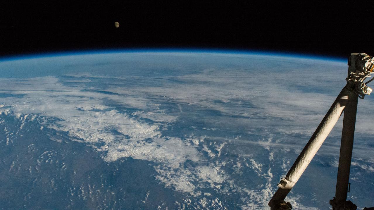
iss072e186870 (Nov. 13, 2024) -- A waxing gibbous moon rises over the blue glow of Earth's horizon as the International Space Station orbited 264 miles above the Indian Ocean.
iss068e020619 (Nov. 4, 2022) --- The waxing gibbous Moon is pictured from the International Space Station as it orbited 271 miles above the Indian Ocean southwest of Australia's island state of Tasmania.
iss067e249822 (Aug. 10, 2022) --- The waxing gibbous Moon is pictured above the Earth's horizon from the International Space Station as it orbited 259 miles above the northern Pacific Ocean.
iss067e249774 (Aug. 9, 2022) --- The waxing gibbous Moon is pictured from the International Space Station as it orbited 260 miles above the Pacific Ocean south of Alaska's Aleutian Islands.

iss069e029091 (July 5, 2023) --- The waxing gibbous Moon is pictured above Earth's horizon in this photograph from the International Space Station as it orbited 261 miles above the Atlantic Ocean off the coast of Namibia.
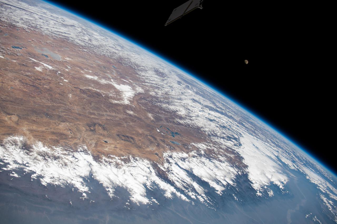
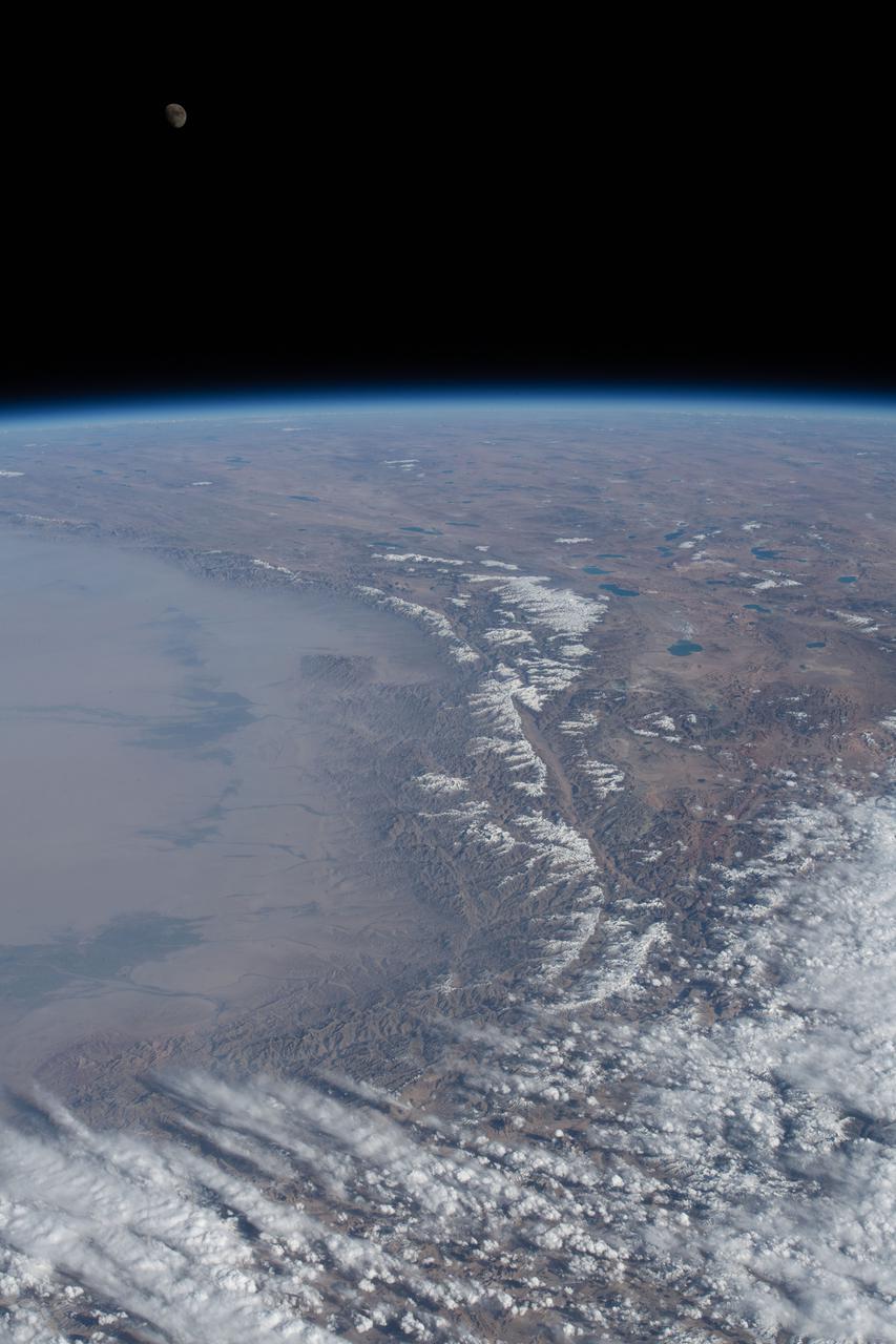
iss064e037041 (Feb. 23, 2021) --- The photograph looks across India, the Himalayas, and into China as the International Space Station orbited 264 miles above. A waxing gibbous Moon is pictured above the Earth's horizon.
iss066e142988 (Feb. 14, 2022) --- The waxing gibbous Moon is pictured on Valentine's Day from the International Space Station as it orbited 261 miles above southwest Kazakhstan near the Caspian Sea.
iss055e000034 (Feb. 28, 2018) --- A waxing gibbous moon was pictured above the Earth's limb as the International Space Station orbited over the southern Indian Ocean just southwest of the African continent.
iss068e004256 (Sept. 30, 2022) --- The waxing crescent Moon is pictured from the International Space Station as it orbited 267 miles above the Atlantic Ocean southwest of South Africa during an orbital sunrise.
iss067e249811 (Aug. 10, 2022) --- The waxing gibbous Moon is pictured from the International Space Station as it orbited 258 miles above the Pacific Ocean north of the Hawaiian island chain.
iss068e045017 (Feb. 2, 2023) -- The waxing gibbous Moon is pictured above Earth's horizon from the International Space Station as it orbited 260 miles above eastern China near the Yellow Sea coast.
iss066e086973 (Dec. 6, 2021) --- A waxing crescent Moon is pictured from the International Space Station during an orbital sunset as it flew 268 miles above the Pacific Ocean east of New Zealand.
iss066e086969 (Dec. 6, 2021) --- A waxing crescent Moon during is pictured from the International Space Station during an orbital sunset as it flew 268 miles above the Pacific Ocean east of New Zealand.
iss055e000039 (Feb. 28, 2018) --- A waxing gibbous moon was pictured above the Earth's limb as the International Space Station orbited over the southern Indian Ocean just southwest of the African continent.
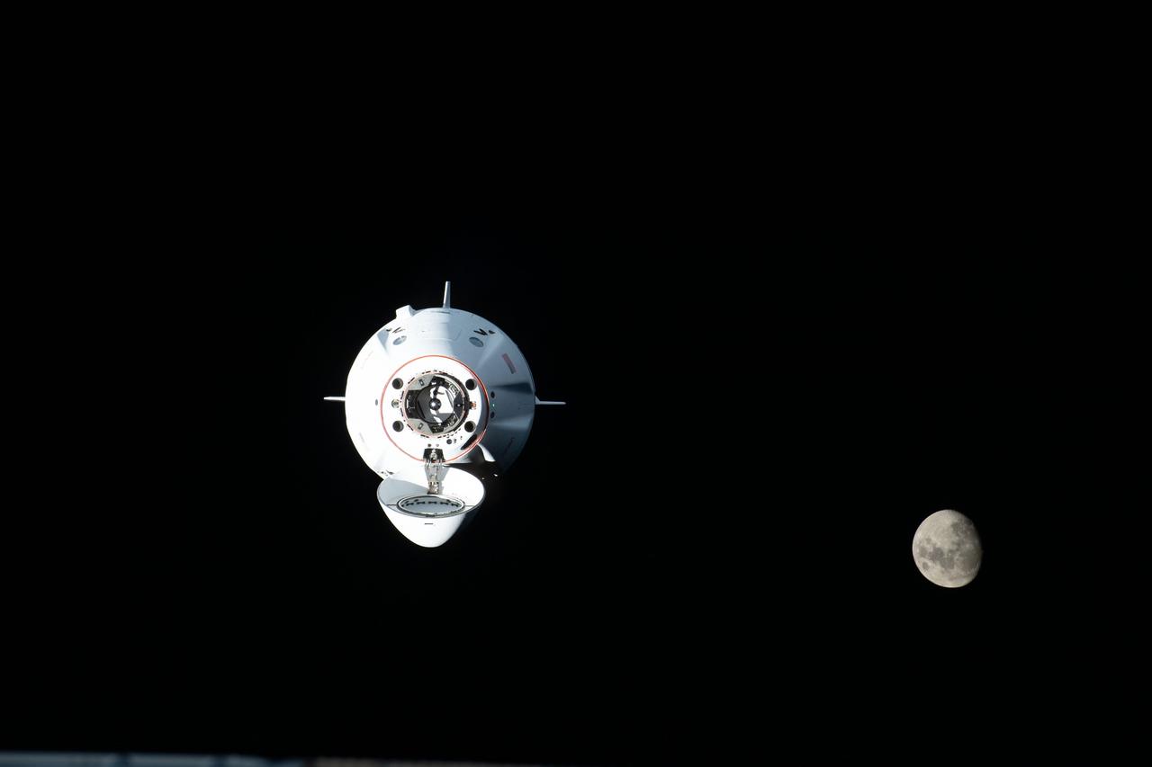
iss068e014262 (Oct. 6, 2022) --- The SpaceX Dragon Endurance crew ship, carrying four Crew-5 members, approaches the International Space Station with the waxing gibbous Moon pictured in the background. Credit: NASA/Kjell Lindgren
iss067e106982 (June 1, 2022) --- The waxing crescent Moon is pictured above Earth's atmosphere illuminated by an orbital sunset as the International Space Station flew 258 miles above the Atlantic Ocean.
iss059e000461 (March 16, 2019) --- The waxing gibbous moon is pictured above Earth's limb as the International Space Station was orbiting 266 miles above the South Atlantic Ocean.

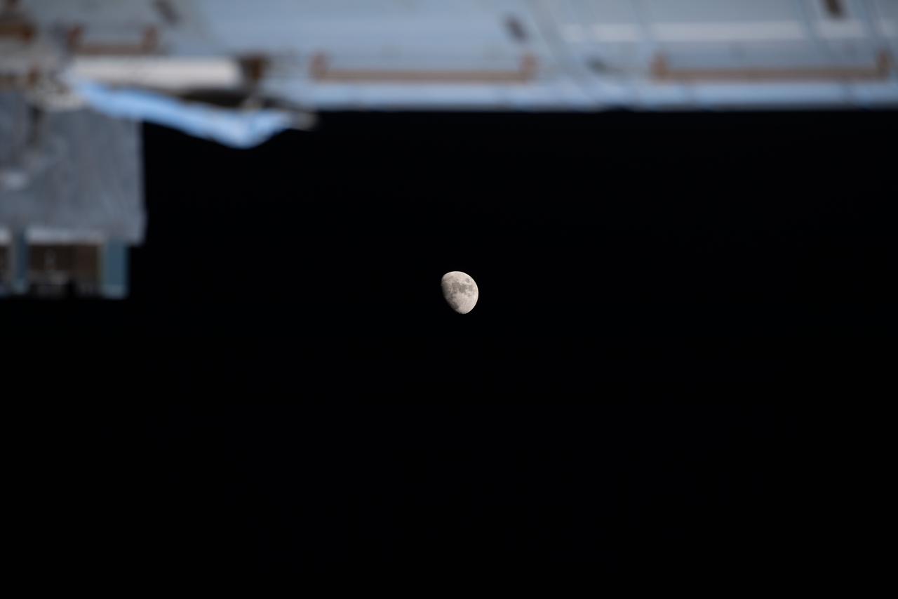
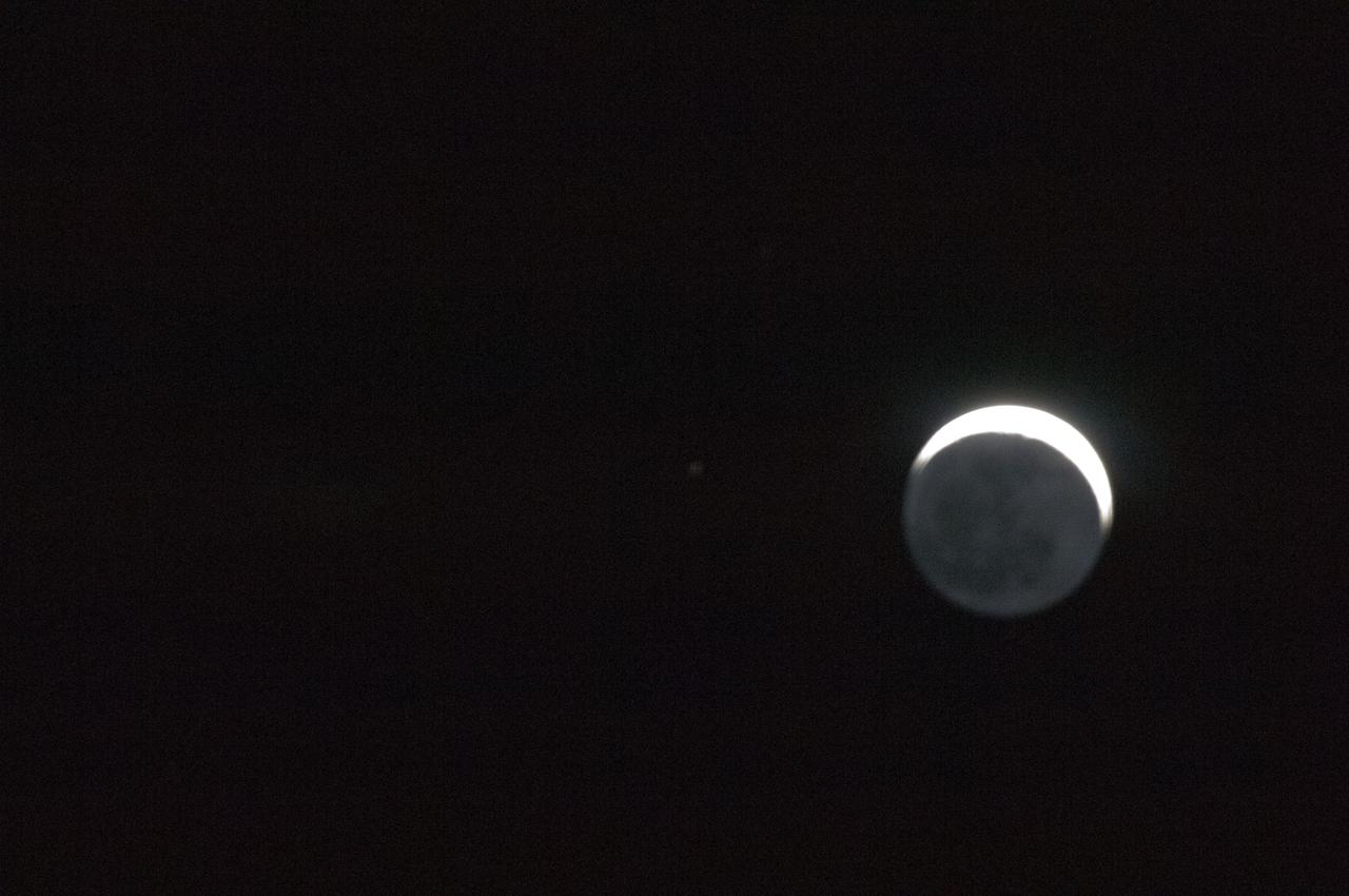
iss065e112847 (June 15, 2021) --- The SpaceX Crew Dragon Endeavour is pictured docked to the Harmony module's forward-facing international docking adapter. The tiny dot just below Endeavour is the Moon in its waxing crescent phase.

iss068e044225 (Jan. 31, 2023) --- The waxing gibbous Moon is pictured above the Earth's horizon from the International Space Station as it orbited 259 miles above the Gulf of Mexico.
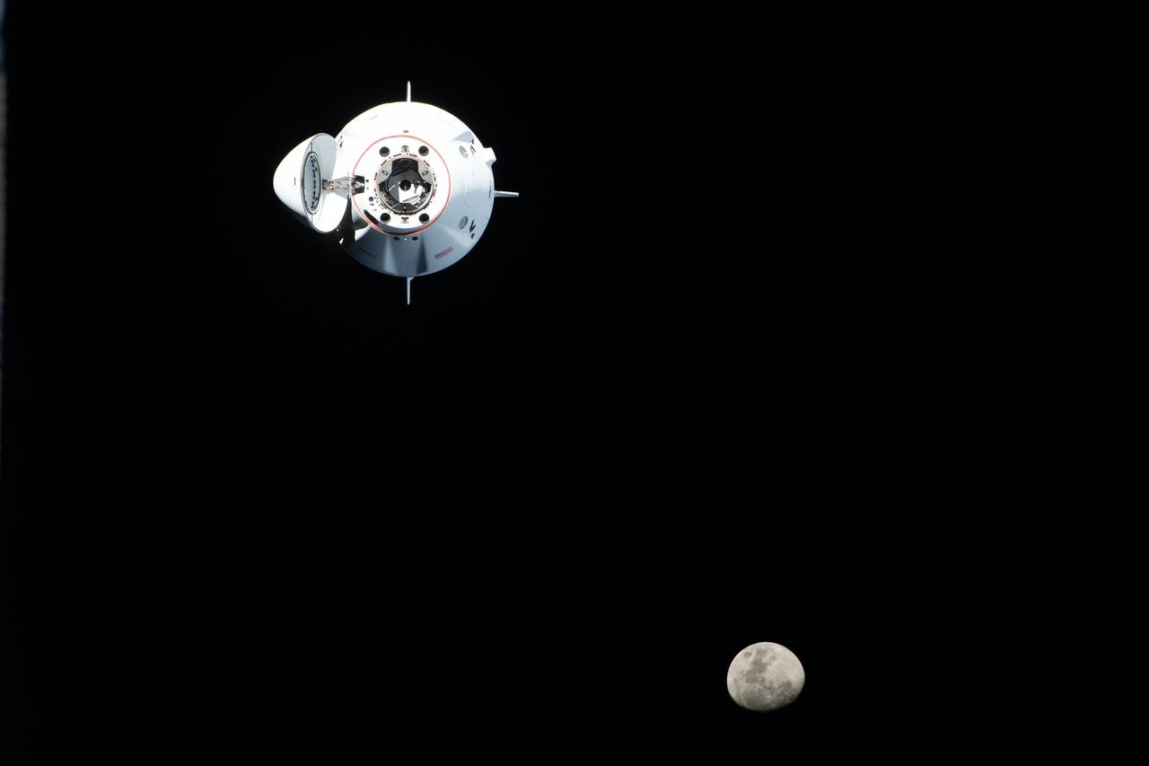
iss068e014220 (Oct. 6, 2022) --- The SpaceX Dragon Endurance crew ship, carrying four Crew-5 members, approaches the International Space Station with the waxing gibbous Moon pictured in the background. Credit: NASA/Kjell Lindgren
iss059e000462 (March 16, 2019) --- The waxing gibbous moon is pictured above Earth's limb as the International Space Station was orbiting 266 miles above the South Atlantic Ocean.
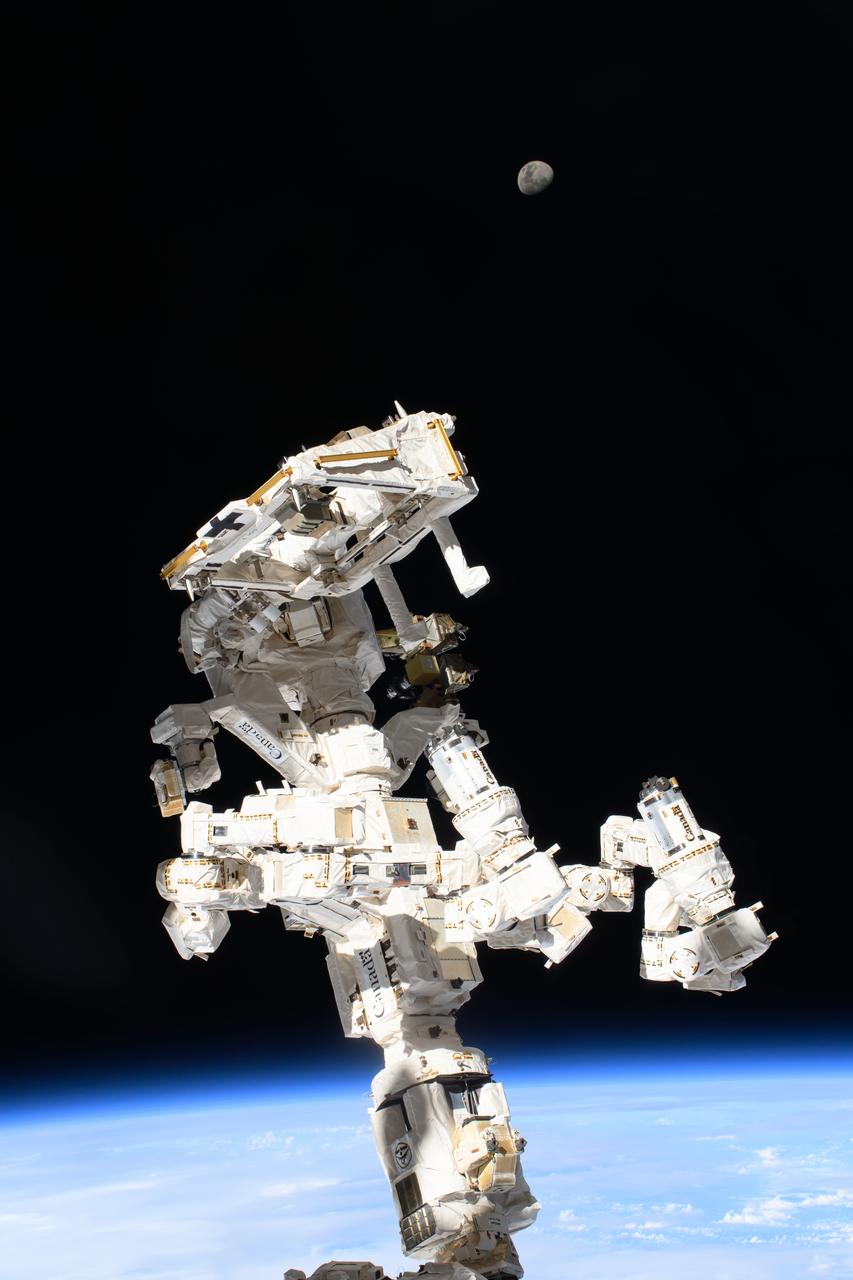
iss071e092171 (May 19, 2024) --- The International Space Station's Dextre, the fine-tuned robotic hand, attached to the Canadarm2 robotic arm dominates the frame with the waxing gibbous Moon (at top) in the background and the Indian Ocean 259 miles below.
iss070e097393 (Feb. 21, 2024) --- The waxing gibbous Moon is pictured above the Earth's horizon in this photograph from the International Space Station as it orbited 262 miles above a cloudy Western Europe.
iss064e016494 (Dec. 29, 2020) --- The waxing gibbous Moon, the phase before it becomes a Full Moon, is pictured from the International Space Station as it orbited 272 miles above the South Atlantic in between the tip of South America and the tip of South Africa.
iss064e026716 (Jan. 26, 2021) --- The waxing gibbous moon is pictured below a portion of the SpaceX Crew Dragon spacecraft docked to the Harmony module's forward international docking adapter. The International Space Station was orbiting 263 miles above Atlanta, Georgia, when this photograph was taken.
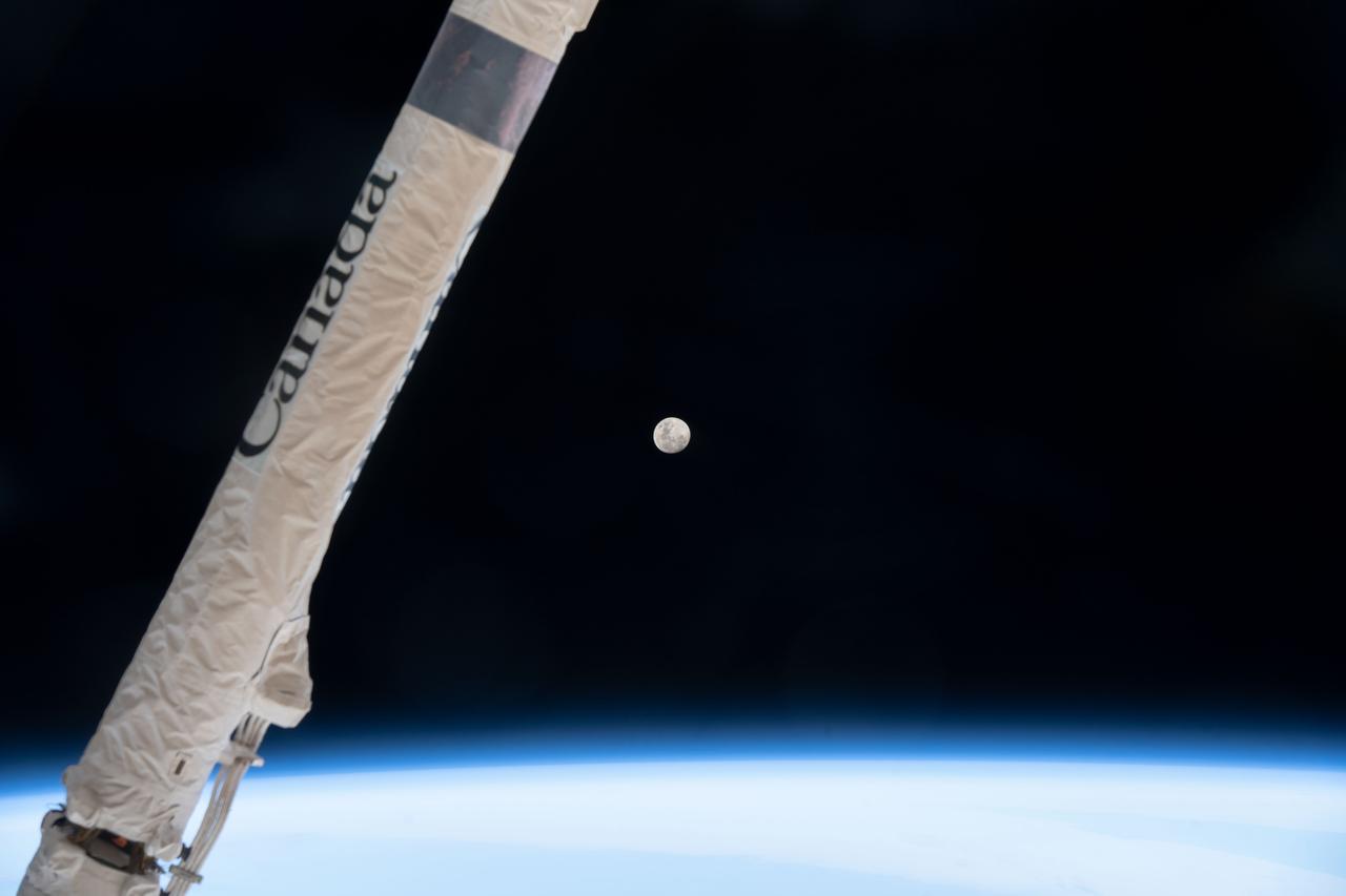
iss068e020765 (Nov. 6, 2022) --- The waxing gibbous Moon is pictured above Earth's horizon as the International Space Station orbited 271 miles over southern Argentina. Crossing the foreground, is a portion of the Canadarm2 robotic arm provided by the Canadian Space Agency.
iss059e059210 (May 8, 2019) --- The waxing crescent moon is photographed just above Earth's limb and the bluish hue of the atmosphere at the beginning of an orbital sunrise. A portion of one of the International Space Station's solar arrays is seen in the left foreground as the orbital complex flew 258 miles above the Sea of Japan.
iss068e012259 (Oct. 6, 2022) --- The waxing gibbous Moon is pictured above the Earth's horizon as the International Space Station orbited 264 miles above the Netherlands. In the right foreground, is the Japanese robotic arm that supports payload operations outside the Kibo laboratory module.

iss059e059211 (May 8, 2019) --- The waxing crescent moon is photographed just above Earth's limb and the bluish hue of the atmosphere at the beginning of an orbital sunrise. A portion of one of the International Space Station's solar arrays is seen in the left foreground as the orbital complex flew 258 miles above the Sea of Japan.
iss064e016473 (Dec. 29, 2020) --- The waxing gibbous Moon, the phase before it becomes a Full Moon, is pictured from the International Space Station as it orbited 272 miles above the South Atlantic in between the tip of South America and the tip of South Africa.
iss068e026672 (Dec. 4, 2022) --- The waxing gibbous Moon is pictured above Earth's horizon from the International Space Station as it orbited 261 miles over the northern Pacific Ocean. At the time of this photograph the Orion vehicle on the Artemis I mission was almost 24,000 miles away from the Moon and approximately 222,200 miles from Earth traveling at a speed of 3,076 miles per hour.
iss068e026681 (Dec. 4, 2022) --- The waxing gibbous Moon is pictured above Earth's horizon from the International Space Station as it orbited 261 miles over the northern Pacific Ocean. At the time of this photograph the Orion vehicle on the Artemis I mission was almost 24,000 miles away from the Moon and approximately 222,200 miles from Earth traveling at a speed of 3,076 miles per hour.
iss068e026677 (Dec. 4, 2022) --- The waxing gibbous Moon is pictured above Earth's horizon from the International Space Station as it orbited 261 miles over the northern Pacific Ocean. At the time of this photograph the Orion vehicle on the Artemis I mission was almost 24,000 miles away from the Moon and approximately 222,200 miles from Earth traveling at a speed of 3,076 miles per hour.
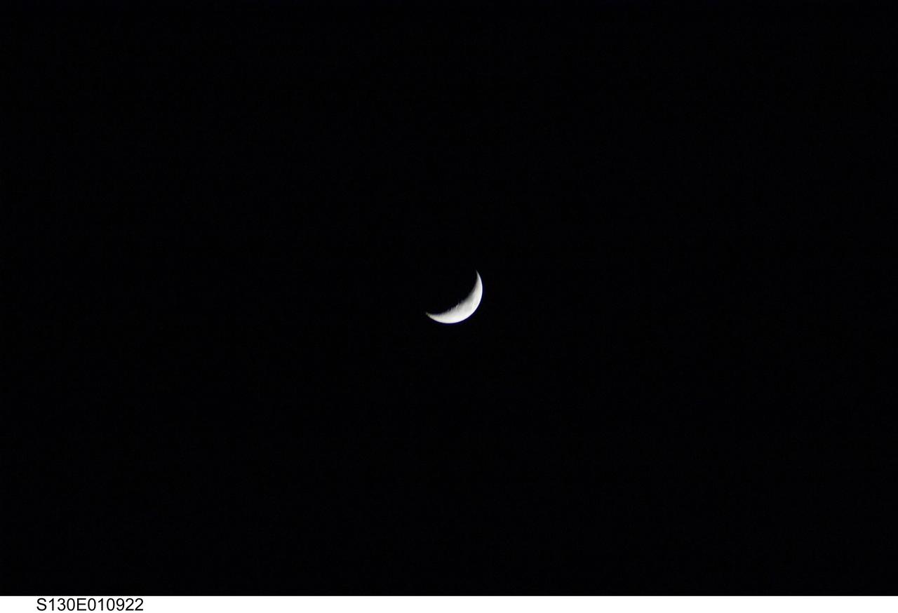
S130-E-010922 (20 Feb. 2010) --- After several days of seeing out-the-window close-up views of the various elements of the International Space Station, the STS-130 crewmembers aboard the space shuttle Endeavour aimed one of their cameras at the waxing crescent moon following separation from the orbital outpost. Eleven astronauts and cosmonauts worked together to continue construction on the orbital outpost and perform other tasks in tandem.
iss068e026673 (Dec. 4, 2022) --- The waxing gibbous Moon is pictured above Earth's horizon from the International Space Station as it orbited 261 miles over the northern Pacific Ocean. At the time of this photograph the Orion vehicle on the Artemis I mission was almost 24,000 miles away from the Moon and approximately 222,200 miles from Earth traveling at a speed of 3,076 miles per hour.
ISS032-E-008651 (21 July 2012) --- From over the Southern Indian Ocean about 155 miles (250 kilometers) northeast of Possession Island on July 21, 2012, one of the members of the Expedition 32 crew took this photo of the waxing crescent moon with 7 per cent of the moon?s visible disk illuminated, giving it an unusual appearance.
ISS038-E-000649 (12 Nov. 2013) --- Although crew members on the International Space Station view literally hundreds of scenes of the moon rising and setting over Earth on each several- month increment, the home planet's natural satellite never ceases to escape the crew's attention and impulse to grab a camera from time to time. Such was the case with this image of a waxing gibbous moon recorded exactly at 00:00:00 GMT, Nov. 12, 2013.
ISS040-E-127888 (6 Sept. 2014) --- A close look at this image, photographed by one of the Expedition 40 crew members onboard the International Space Station at 228 nautical miles above Earth, reveals a waxing gibbous moon in center frame. The image was taken as the orbital outpost was flying over the southwest Pacific in the area of New Zealand. The NanoRacks Cubesat deployer, attached to the Japan Aerospace Exploration Agency’s Kibo robotic arm, can be seen in upper right. Soyuz 39 TMA-13M is on Rassvet at right.

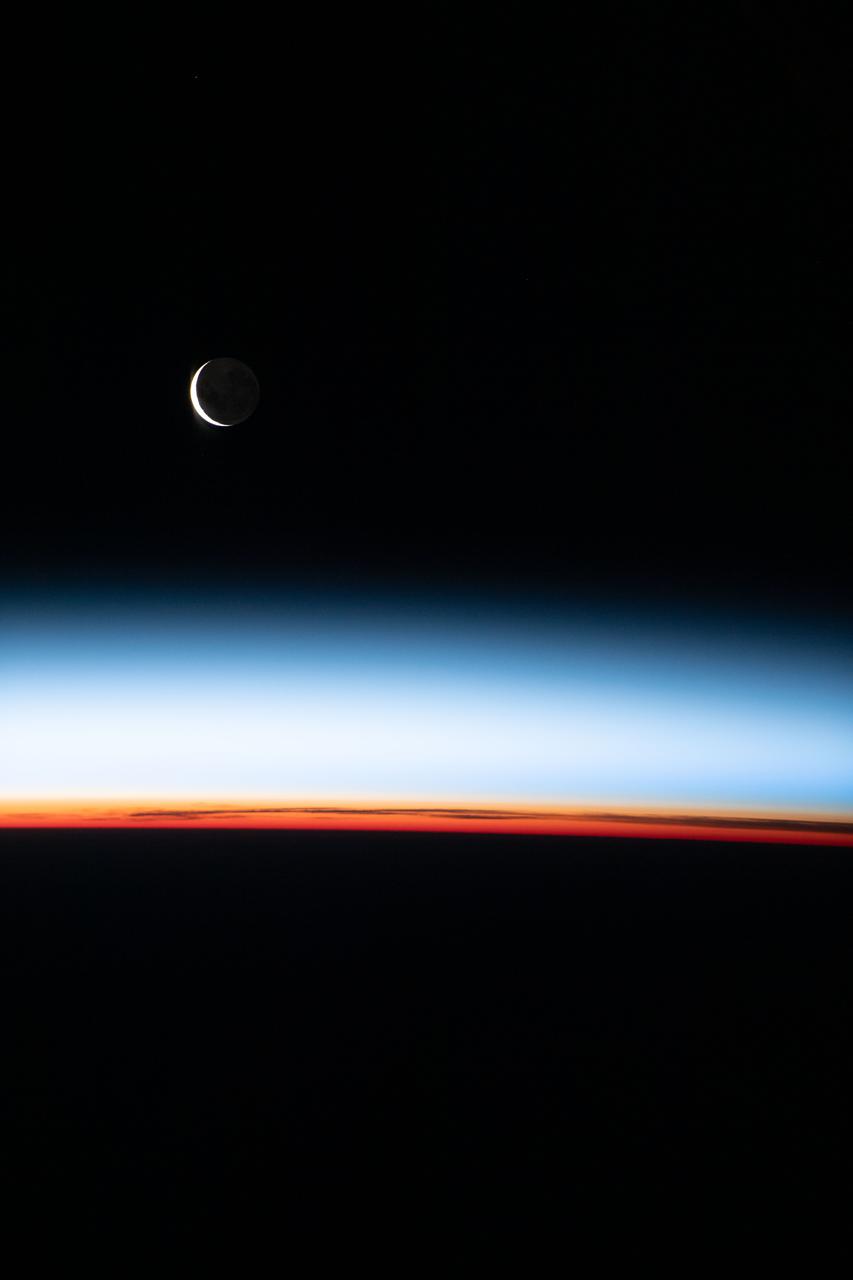
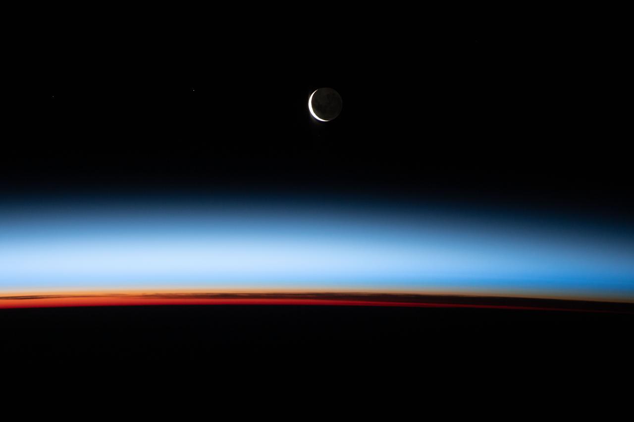
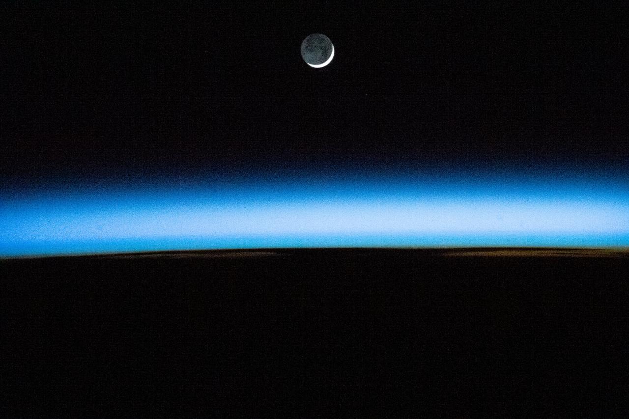
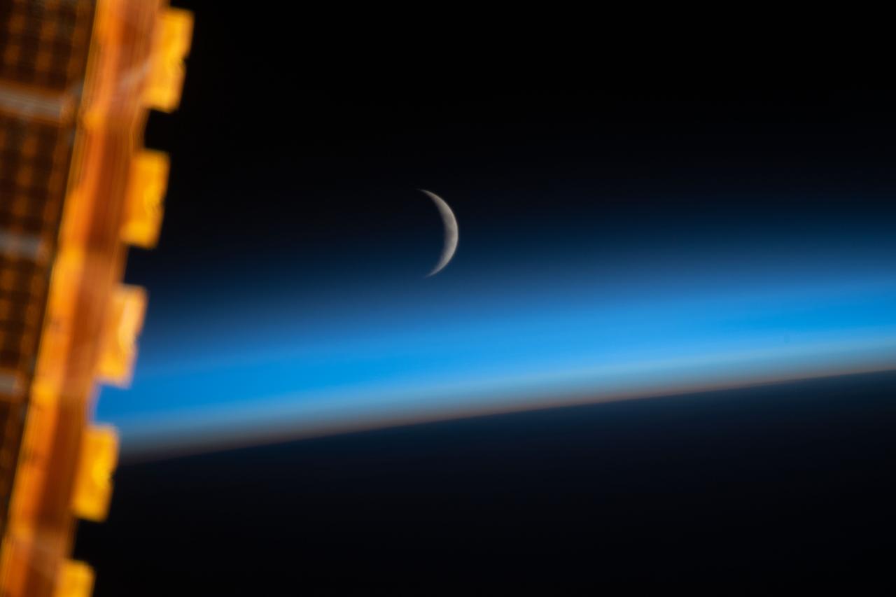
iss071e067226_stk (5/8/2024) --- NASA astronaut Matt Dominick aboard space station captured this waxing lunar crescent illuminated by the Sun. The rest of the Moon dimly glows by earthshine when sunlight reflects off Earth onto the Moon. Scientists track the Earth’s brightness, or albedo, via this phenomenon. This photo also shows a cross-section of Earth’s atmospheric layers, including the orange troposphere nearest to the surface and the thicker, light-blue stratosphere above that.
iss068e026678 (Dec. 4, 2022) --- The waxing gibbous Moon is pictured above Earth's horizon from the International Space Station as it orbited 261 miles over the northern Pacific Ocean. At the time of this photograph the Orion vehicle on the Artemis I mission was almost 24,000 miles away from the Moon and approximately 222,200 miles from Earth traveling at a speed of 3,076 miles per hour.
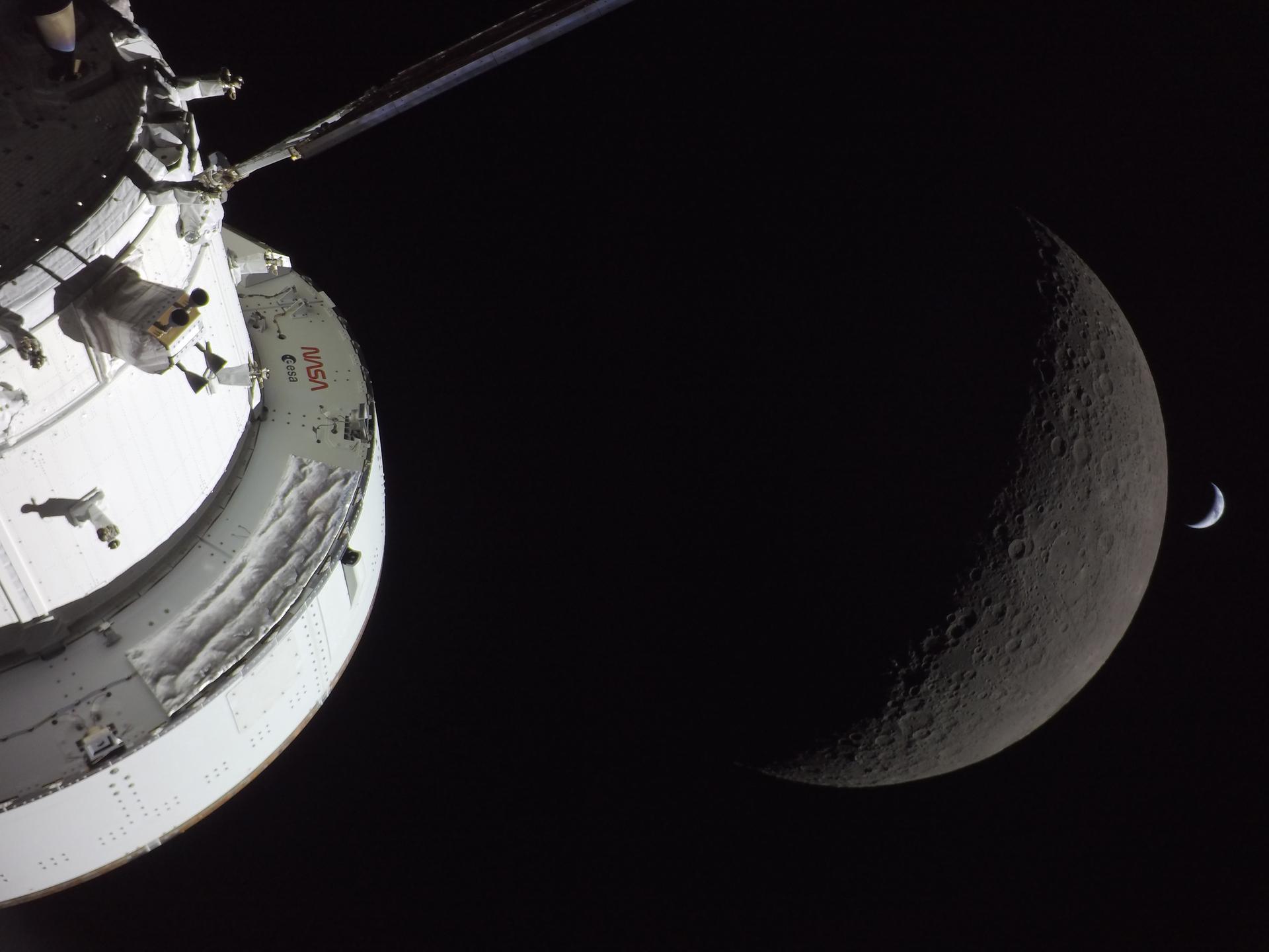
art002e016277 (April 6, 2026) - NASA’s Orion spacecraft captures the Moon and the Earth in one frame during the Artemis II crew’s deep space journey at 6:39 p.m. ET on the sixth day of the mission. The right side of NASA’s Orion spacecraft is seen lit up by the Sun. A waxing crescent Moon is visible behind it. And then, a crescent Earth, tiny compared to the Moon, is about to set below the Moon’s horizon on the right. Credit: NASA

art002e009567 (April 6, 2026) - NASA’s Orion spacecraft captures the Moon and the Earth in one frame during the Artemis II crew’s deep space journey at 6:42 p.m. ET on the sixth day of the mission. The right side of NASA’s Orion spacecraft is seen lit up by the Sun. A waxing crescent Moon is visible behind it. And then, a crescent Earth, tiny compared to the Moon, is about to set below the Moon’s horizon on the right. Credit: NASA
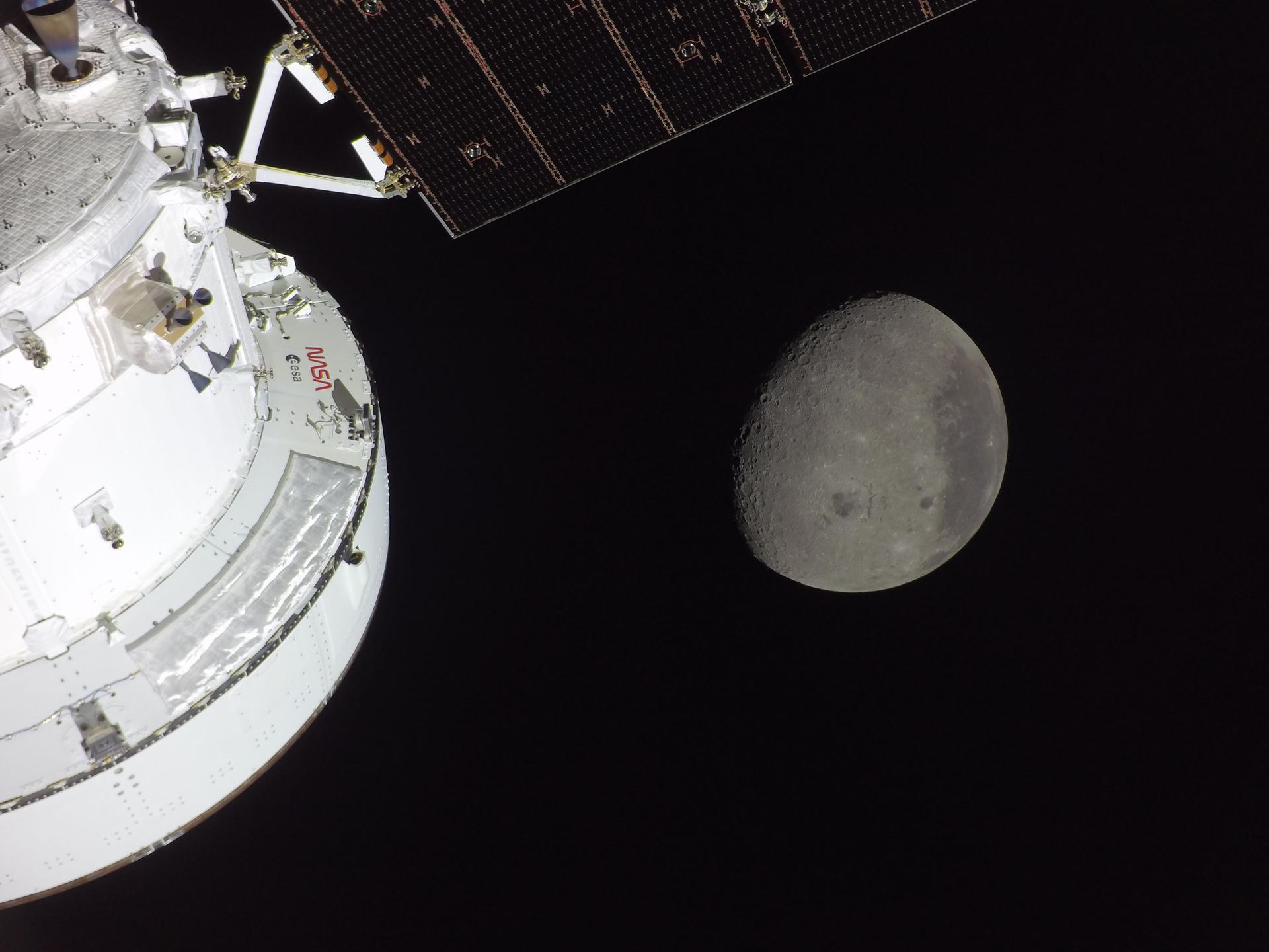
art002e009562 (April 6, 2026) - The Orion spacecraft is seen in the foreground lit up by the Sun. A waxing gibbous Moon is visible in the background. Orientale basin, a 600-mile-wide impact crater ringed by mountains, is visible toward the center bottom of the Moon. This basin straddles the Moon’s near and far sides. To the left of Orientale, which has a patch of ancient lava in its basin, is the far side; this is the hemisphere we don’t get to see from Earth. To the right of Orientale is the near side, the hemisphere we see every day from Earth. The nearside is notable for giant, dark patches of ancient lave flows that cover its surface.

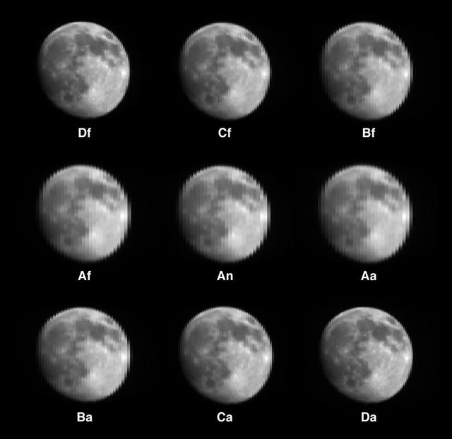
These six views of the Martian moon Phobos were captured by NASA's Odyssey orbiter as of March 2020. The orbiter's infrared camera, the Thermal Emission Imaging System (THEMIS), is used to measure temperature variations that provide insight into the physical properties and composition of the moon. Chronologically, the views represent waxing, waning and full views of the moon. On Feb. 25, 2020, Phobos was observed during a lunar eclipse, where Mars' shadow completely blocked sunlight from reaching the moon's surface. This provided some of the coldest temperatures measured on Phobos to date: The coldest measured was about minus189 degrees Fahrenheit (minus123 degrees Celsius). On March 27, 2020, Phobos was observed exiting an eclipse, when the surface was still warming up. All of the THEMIS infrared images are colorized and overlain on THEMIS visible images taken at the same time, except for the eclipse image, which is overlain on a computer-generated visible image of what Phobos would have looked like if it wasn’t in complete shadow. Phobos is about 15 miles (about 25 kilometers) across. https://photojournal.jpl.nasa.gov/catalog/PIA23893
New Moon. By the modern definition, New Moon occurs when the Moon and Sun are at the same geocentric ecliptic longitude. The part of the Moon facing us is completely in shadow then. Pictured here is the traditional New Moon, the earliest visible waxing crescent, which signals the start of a new month in many lunar and lunisolar calendars. This marks the first time that accurate shadows at this level of detail are possible in such a computer simulation. The shadows are based on the global elevation map being developed from measurements by the Lunar Orbiter Laser Altimeter (LOLA) aboard the Lunar Reconnaissance Orbiter (LRO). LOLA has already taken more than 10 times as many elevation measurements as all previous missions combined. The Moon always keeps the same face to us, but not exactly the same face. Because of the tilt and shape of its orbit, we see the Moon from slightly different angles over the course of a month. When a month is compressed into 12 seconds, as it is in this animation, our changing view of the Moon makes it look like it's wobbling. This wobble is called libration. The word comes from the Latin for "balance scale" (as does the name of the zodiac constellation Libra) and refers to the way such a scale tips up and down on alternating sides. The sub-Earth point gives the amount of libration in longitude and latitude. The sub-Earth point is also the apparent center of the Moon's disk and the location on the Moon where the Earth is directly overhead. The Moon is subject to other motions as well. It appears to roll back and forth around the sub-Earth point. The roll angle is given by the position angle of the axis, which is the angle of the Moon's north pole relative to celestial north. The Moon also approaches and recedes from us, appearing to grow and shrink. The two extremes, called perigee (near) and apogee (far), differ by more than 10%. The most noticed monthly variation in the Moon's appearance is the cycle of phases, caused by the changing angle of the Sun as the Moon orbits the Earth. The cycle begins with the waxing (growing) crescent Moon visible in the west just after sunset. By first quarter, the Moon is high in the sky at sunset and sets around midnight. The full Moon rises at sunset and is high in the sky at midnight. The third quarter Moon is often surprisingly conspicuous in the daylit western sky long after sunrise. Celestial north is up in these images, corresponding to the view from the northern hemisphere. The descriptions of the print resolution stills also assume a northern hemisphere orientation. To adjust for southern hemisphere views, rotate the images 180 degrees, and substitute "north" for "south" in the descriptions. Credit: <a href="http://svs.gsfc.nasa.gov/index.html" rel="nofollow">NASA/Goddard Space Flight Center Scientific Visualization Studio</a> <b><a href="http://www.nasa.gov/centers/goddard/home/index.html" rel="nofollow">NASA Goddard Space Flight Center</a></b> enables NASA’s mission through four scientific endeavors: Earth Science, Heliophysics, Solar System Exploration, and Astrophysics. Goddard plays a leading role in NASA’s accomplishments by contributing compelling scientific knowledge to advance the Agency’s mission. <b>Follow us on <a href="http://twitter.com/NASA_GoddardPix" rel="nofollow">Twitter</a></b> <b>Join us on <a href="http://www.facebook.com/pages/Greenbelt-MD/NASA-Goddard/395013845897?ref=tsd" rel="nofollow">Facebook</a></b> <b>Find us on <a href="http://web.stagram.com/n/nasagoddard/?vm=grid" rel="nofollow">Instagram</a></b>
New Moon. By the modern definition, New Moon occurs when the Moon and Sun are at the same geocentric ecliptic longitude. The part of the Moon facing us is completely in shadow then. Pictured here is the traditional New Moon, the earliest visible waxing crescent, which signals the start of a new month in many lunar and lunisolar calendars. NASA's Lunar Reconnaissance Orbiter (LRO) has been in orbit around the Moon since the summer of 2009. Its laser altimeter (LOLA) and camera (LROC) are recording the rugged, airless lunar terrain in exceptional detail, making it possible to visualize the Moon with unprecedented fidelity. This is especially evident in the long shadows cast near the terminator, or day-night line. The pummeled, craggy landscape thrown into high relief at the terminator would be impossible to recreate in the computer without global terrain maps like those from LRO. To download, learn more about this visualization, or to see what the Moon will look like at any hour in 2015, visit <a href="http://svs.gsfc.nasa.gov/goto?4236" rel="nofollow">svs.gsfc.nasa.gov/goto?4236</a> <b><a href="http://www.nasa.gov/audience/formedia/features/MP_Photo_Guidelines.html" rel="nofollow">NASA image use policy.</a></b> <b><a href="http://www.nasa.gov/centers/goddard/home/index.html" rel="nofollow">NASA Goddard Space Flight Center</a></b> enables NASA’s mission through four scientific endeavors: Earth Science, Heliophysics, Solar System Exploration, and Astrophysics. Goddard plays a leading role in NASA’s accomplishments by contributing compelling scientific knowledge to advance the Agency’s mission. <b>Follow us on <a href="http://twitter.com/NASAGoddardPix" rel="nofollow">Twitter</a></b> <b>Like us on <a href="http://www.facebook.com/pages/Greenbelt-MD/NASA-Goddard/395013845897?ref=tsd" rel="nofollow">Facebook</a></b> <b>Find us on <a href="http://instagram.com/nasagoddard?vm=grid" rel="nofollow">Instagram</a></b>
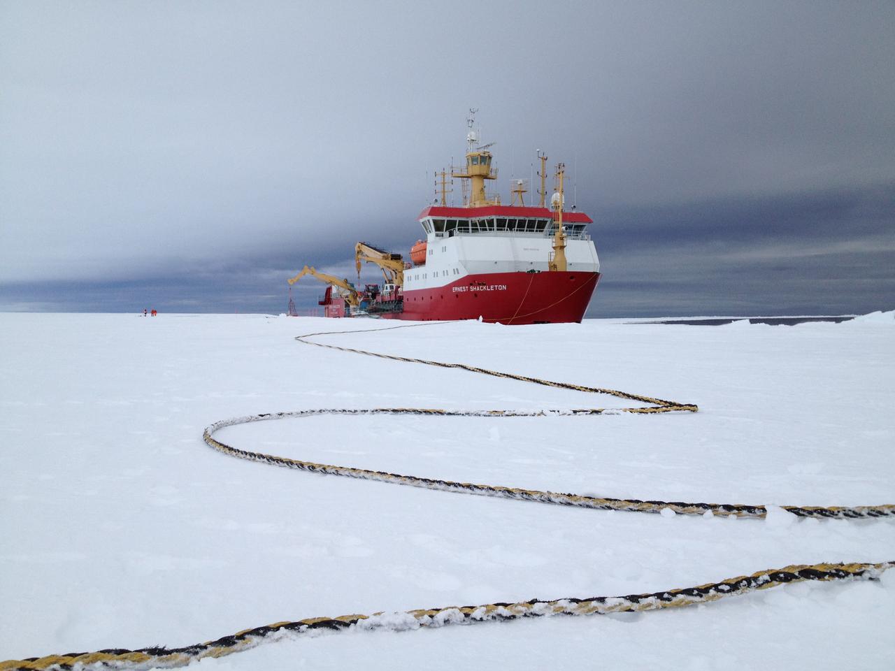
Arrival of the RRS Ernest Shackleton near Halley Research Station in Antarctica. The Shackleton is the regular resupply ship for the station and it also brought in some of the BARREL team scientists. The long tether is for the ship’s mooring. Credit: NASA --- In Antarctica in January, 2013 – the summer at the South Pole – scientists launched 20 balloons up into the air to study an enduring mystery of space weather: when the giant radiation belts surrounding Earth lose material, where do the extra particles actually go? The mission is called BARREL (Balloon Array for Radiation belt Relativistic Electron Losses) and it is led by physicist Robyn Millan of Dartmouth College in Hanover, NH. Millan provided photographs from the team’s time in Antarctica. The team launched a balloon every day or two into the circumpolar winds that circulate around the pole. Each balloon floated for anywhere from 3 to 40 days, measuring X-rays produced by fast-moving electrons high up in the atmosphere. BARREL works hand in hand with another NASA mission called the Van Allen Probes, which travels through the Van Allen radiation belts surrounding Earth. The belts wax and wane over time in response to incoming energy and material from the sun, sometimes intensifying the radiation through which satellites must travel. Scientists wish to understand this process better, and even provide forecasts of this space weather, in order to protect our spacecraft. As the Van Allen Probes were observing what was happening in the belts, BARREL tracked electrons that precipitated out of the belts and hurtled down Earth’s magnetic field lines toward the poles. By comparing data, scientists will be able to track how what’s happening in the belts correlates to the loss of particles – information that can help us understand this mysterious, dynamic region that can impact spacecraft. Having launched balloons in early 2013, the team is back at home building the next set of payloads. They will launch 20 more balloons in 2014. <b><a href="http://www.nasa.gov/audience/formedia/features/MP_Photo_Guidelines.html" rel="nofollow">NASA image use policy.</a></b> <b><a href="http://www.nasa.gov/centers/goddard/home/index.html" rel="nofollow">NASA Goddard Space Flight Center</a></b> enables NASA’s mission through four scientific endeavors: Earth Science, Heliophysics, Solar System Exploration, and Astrophysics. Goddard plays a leading role in NASA’s accomplishments by contributing compelling scientific knowledge to advance the Agency’s mission. <b>Follow us on <a href="http://twitter.com/NASA_GoddardPix" rel="nofollow">Twitter</a></b> <b>Like us on <a href="http://www.facebook.com/pages/Greenbelt-MD/NASA-Goddard/395013845897?ref=tsd" rel="nofollow">Facebook</a></b> <b>Find us on <a href="http://instagram.com/nasagoddard?vm=grid" rel="nofollow">Instagram</a></b>
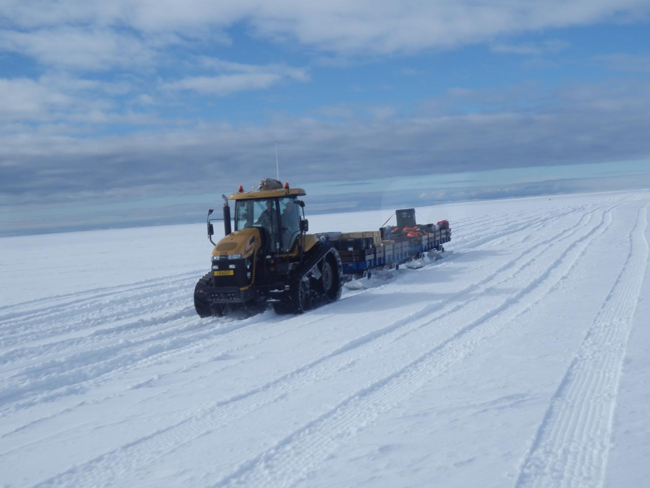
The BARREL cargo on its four-hour journey from the supply ship to the research station. Credit: NASA --- In Antarctica in January, 2013 – the summer at the South Pole – scientists launched 20 balloons up into the air to study an enduring mystery of space weather: when the giant radiation belts surrounding Earth lose material, where do the extra particles actually go? The mission is called BARREL (Balloon Array for Radiation belt Relativistic Electron Losses) and it is led by physicist Robyn Millan of Dartmouth College in Hanover, NH. Millan provided photographs from the team’s time in Antarctica. The team launched a balloon every day or two into the circumpolar winds that circulate around the pole. Each balloon floated for anywhere from 3 to 40 days, measuring X-rays produced by fast-moving electrons high up in the atmosphere. BARREL works hand in hand with another NASA mission called the Van Allen Probes, which travels through the Van Allen radiation belts surrounding Earth. The belts wax and wane over time in response to incoming energy and material from the sun, sometimes intensifying the radiation through which satellites must travel. Scientists wish to understand this process better, and even provide forecasts of this space weather, in order to protect our spacecraft. As the Van Allen Probes were observing what was happening in the belts, BARREL tracked electrons that precipitated out of the belts and hurtled down Earth’s magnetic field lines toward the poles. By comparing data, scientists will be able to track how what’s happening in the belts correlates to the loss of particles – information that can help us understand this mysterious, dynamic region that can impact spacecraft. Having launched balloons in early 2013, the team is back at home building the next set of payloads. They will launch 20 more balloons in 2014. <b><a href="http://www.nasa.gov/audience/formedia/features/MP_Photo_Guidelines.html" rel="nofollow">NASA image use policy.</a></b> <b><a href="http://www.nasa.gov/centers/goddard/home/index.html" rel="nofollow">NASA Goddard Space Flight Center</a></b> enables NASA’s mission through four scientific endeavors: Earth Science, Heliophysics, Solar System Exploration, and Astrophysics. Goddard plays a leading role in NASA’s accomplishments by contributing compelling scientific knowledge to advance the Agency’s mission. <b>Follow us on <a href="http://twitter.com/NASA_GoddardPix" rel="nofollow">Twitter</a></b> <b>Like us on <a href="http://www.facebook.com/pages/Greenbelt-MD/NASA-Goddard/395013845897?ref=tsd" rel="nofollow">Facebook</a></b> <b>Find us on <a href="http://instagram.com/nasagoddard?vm=grid" rel="nofollow">Instagram</a></b>

Pumping helium into the first BARREL balloon to launch from Halley Research Satation. Credit: NASA --- In Antarctica in January, 2013 – the summer at the South Pole – scientists launched 20 balloons up into the air to study an enduring mystery of space weather: when the giant radiation belts surrounding Earth lose material, where do the extra particles actually go? The mission is called BARREL (Balloon Array for Radiation belt Relativistic Electron Losses) and it is led by physicist Robyn Millan of Dartmouth College in Hanover, NH. Millan provided photographs from the team’s time in Antarctica. The team launched a balloon every day or two into the circumpolar winds that circulate around the pole. Each balloon floated for anywhere from 3 to 40 days, measuring X-rays produced by fast-moving electrons high up in the atmosphere. BARREL works hand in hand with another NASA mission called the Van Allen Probes, which travels through the Van Allen radiation belts surrounding Earth. The belts wax and wane over time in response to incoming energy and material from the sun, sometimes intensifying the radiation through which satellites must travel. Scientists wish to understand this process better, and even provide forecasts of this space weather, in order to protect our spacecraft. As the Van Allen Probes were observing what was happening in the belts, BARREL tracked electrons that precipitated out of the belts and hurtled down Earth’s magnetic field lines toward the poles. By comparing data, scientists will be able to track how what’s happening in the belts correlates to the loss of particles – information that can help us understand this mysterious, dynamic region that can impact spacecraft. Having launched balloons in early 2013, the team is back at home building the next set of payloads. They will launch 20 more balloons in 2014. <b><a href="http://www.nasa.gov/audience/formedia/features/MP_Photo_Guidelines.html" rel="nofollow">NASA image use policy.</a></b> <b><a href="http://www.nasa.gov/centers/goddard/home/index.html" rel="nofollow">NASA Goddard Space Flight Center</a></b> enables NASA’s mission through four scientific endeavors: Earth Science, Heliophysics, Solar System Exploration, and Astrophysics. Goddard plays a leading role in NASA’s accomplishments by contributing compelling scientific knowledge to advance the Agency’s mission. <b>Follow us on <a href="http://twitter.com/NASA_GoddardPix" rel="nofollow">Twitter</a></b> <b>Like us on <a href="http://www.facebook.com/pages/Greenbelt-MD/NASA-Goddard/395013845897?ref=tsd" rel="nofollow">Facebook</a></b> <b>Find us on <a href="http://instagram.com/nasagoddard?vm=grid" rel="nofollow">Instagram</a></b>

A crane lowers two BARREL balloon payloads onto the platform at Halley Research Station in Antarctica. Credit: NASA --- In Antarctica in January, 2013 – the summer at the South Pole – scientists launched 20 balloons up into the air to study an enduring mystery of space weather: when the giant radiation belts surrounding Earth lose material, where do the extra particles actually go? The mission is called BARREL (Balloon Array for Radiation belt Relativistic Electron Losses) and it is led by physicist Robyn Millan of Dartmouth College in Hanover, NH. Millan provided photographs from the team’s time in Antarctica. The team launched a balloon every day or two into the circumpolar winds that circulate around the pole. Each balloon floated for anywhere from 3 to 40 days, measuring X-rays produced by fast-moving electrons high up in the atmosphere. BARREL works hand in hand with another NASA mission called the Van Allen Probes, which travels through the Van Allen radiation belts surrounding Earth. The belts wax and wane over time in response to incoming energy and material from the sun, sometimes intensifying the radiation through which satellites must travel. Scientists wish to understand this process better, and even provide forecasts of this space weather, in order to protect our spacecraft. As the Van Allen Probes were observing what was happening in the belts, BARREL tracked electrons that precipitated out of the belts and hurtled down Earth’s magnetic field lines toward the poles. By comparing data, scientists will be able to track how what’s happening in the belts correlates to the loss of particles – information that can help us understand this mysterious, dynamic region that can impact spacecraft. Having launched balloons in early 2013, the team is back at home building the next set of payloads. They will launch 20 more balloons in 2014. <b><a href="http://www.nasa.gov/audience/formedia/features/MP_Photo_Guidelines.html" rel="nofollow">NASA image use policy.</a></b> <b><a href="http://www.nasa.gov/centers/goddard/home/index.html" rel="nofollow">NASA Goddard Space Flight Center</a></b> enables NASA’s mission through four scientific endeavors: Earth Science, Heliophysics, Solar System Exploration, and Astrophysics. Goddard plays a leading role in NASA’s accomplishments by contributing compelling scientific knowledge to advance the Agency’s mission. <b>Follow us on <a href="http://twitter.com/NASA_GoddardPix" rel="nofollow">Twitter</a></b> <b>Like us on <a href="http://www.facebook.com/pages/Greenbelt-MD/NASA-Goddard/395013845897?ref=tsd" rel="nofollow">Facebook</a></b> <b>Find us on <a href="http://instagram.com/nasagoddard?vm=grid" rel="nofollow">Instagram</a></b>

The BARREL team at the SANAE IV research station celebrates their final launch in the Antarctica sun. Credit: NASA --- In Antarctica in January, 2013 – the summer at the South Pole – scientists launched 20 balloons up into the air to study an enduring mystery of space weather: when the giant radiation belts surrounding Earth lose material, where do the extra particles actually go? The mission is called BARREL (Balloon Array for Radiation belt Relativistic Electron Losses) and it is led by physicist Robyn Millan of Dartmouth College in Hanover, NH. Millan provided photographs from the team’s time in Antarctica. The team launched a balloon every day or two into the circumpolar winds that circulate around the pole. Each balloon floated for anywhere from 3 to 40 days, measuring X-rays produced by fast-moving electrons high up in the atmosphere. BARREL works hand in hand with another NASA mission called the Van Allen Probes, which travels through the Van Allen radiation belts surrounding Earth. The belts wax and wane over time in response to incoming energy and material from the sun, sometimes intensifying the radiation through which satellites must travel. Scientists wish to understand this process better, and even provide forecasts of this space weather, in order to protect our spacecraft. As the Van Allen Probes were observing what was happening in the belts, BARREL tracked electrons that precipitated out of the belts and hurtled down Earth’s magnetic field lines toward the poles. By comparing data, scientists will be able to track how what’s happening in the belts correlates to the loss of particles – information that can help us understand this mysterious, dynamic region that can impact spacecraft. Having launched balloons in early 2013, the team is back at home building the next set of payloads. They will launch 20 more balloons in 2014. <b><a href="http://www.nasa.gov/audience/formedia/features/MP_Photo_Guidelines.html" rel="nofollow">NASA image use policy.</a></b> <b><a href="http://www.nasa.gov/centers/goddard/home/index.html" rel="nofollow">NASA Goddard Space Flight Center</a></b> enables NASA’s mission through four scientific endeavors: Earth Science, Heliophysics, Solar System Exploration, and Astrophysics. Goddard plays a leading role in NASA’s accomplishments by contributing compelling scientific knowledge to advance the Agency’s mission. <b>Follow us on <a href="http://twitter.com/NASA_GoddardPix" rel="nofollow">Twitter</a></b> <b>Like us on <a href="http://www.facebook.com/pages/Greenbelt-MD/NASA-Goddard/395013845897?ref=tsd" rel="nofollow">Facebook</a></b> <b>Find us on <a href="http://instagram.com/nasagoddard?vm=grid" rel="nofollow">Instagram</a></b>
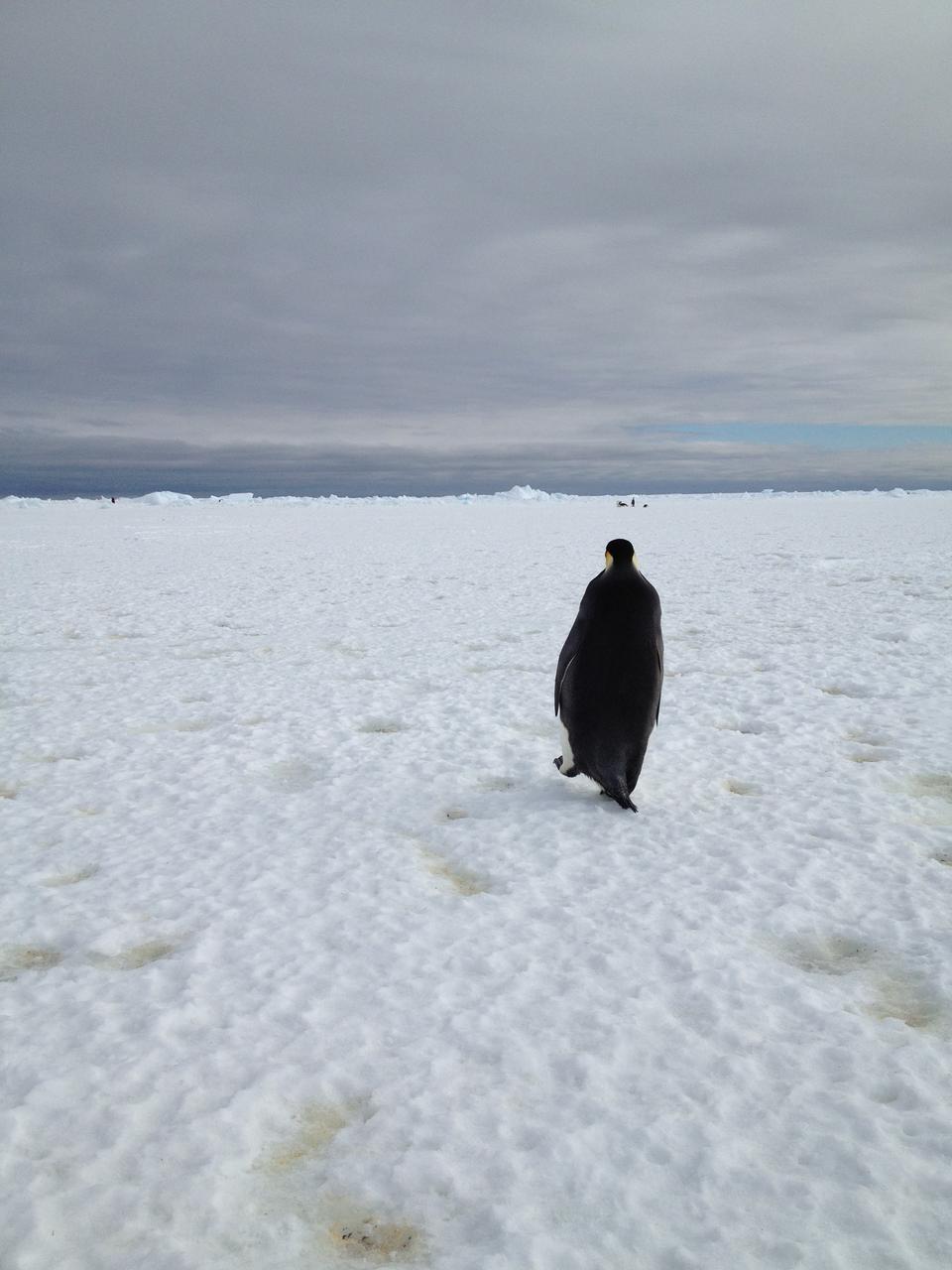
An emperor penguin waddles away on Christmas morning in Antarctica. On Christmas day, the BARREL team visited a penguin colony. Credit: NASA --- In Antarctica in January, 2013 – the summer at the South Pole – scientists launched 20 balloons up into the air to study an enduring mystery of space weather: when the giant radiation belts surrounding Earth lose material, where do the extra particles actually go? The mission is called BARREL (Balloon Array for Radiation belt Relativistic Electron Losses) and it is led by physicist Robyn Millan of Dartmouth College in Hanover, NH. Millan provided photographs from the team’s time in Antarctica. The team launched a balloon every day or two into the circumpolar winds that circulate around the pole. Each balloon floated for anywhere from 3 to 40 days, measuring X-rays produced by fast-moving electrons high up in the atmosphere. BARREL works hand in hand with another NASA mission called the Van Allen Probes, which travels through the Van Allen radiation belts surrounding Earth. The belts wax and wane over time in response to incoming energy and material from the sun, sometimes intensifying the radiation through which satellites must travel. Scientists wish to understand this process better, and even provide forecasts of this space weather, in order to protect our spacecraft. As the Van Allen Probes were observing what was happening in the belts, BARREL tracked electrons that precipitated out of the belts and hurtled down Earth’s magnetic field lines toward the poles. By comparing data, scientists will be able to track how what’s happening in the belts correlates to the loss of particles – information that can help us understand this mysterious, dynamic region that can impact spacecraft. Having launched balloons in early 2013, the team is back at home building the next set of payloads. They will launch 20 more balloons in 2014. <b><a href="http://www.nasa.gov/audience/formedia/features/MP_Photo_Guidelines.html" rel="nofollow">NASA image use policy.</a></b> <b><a href="http://www.nasa.gov/centers/goddard/home/index.html" rel="nofollow">NASA Goddard Space Flight Center</a></b> enables NASA’s mission through four scientific endeavors: Earth Science, Heliophysics, Solar System Exploration, and Astrophysics. Goddard plays a leading role in NASA’s accomplishments by contributing compelling scientific knowledge to advance the Agency’s mission. <b>Follow us on <a href="http://twitter.com/NASA_GoddardPix" rel="nofollow">Twitter</a></b> <b>Like us on <a href="http://www.facebook.com/pages/Greenbelt-MD/NASA-Goddard/395013845897?ref=tsd" rel="nofollow">Facebook</a></b> <b>Find us on <a href="http://instagram.com/nasagoddard?vm=grid" rel="nofollow">Instagram</a></b>
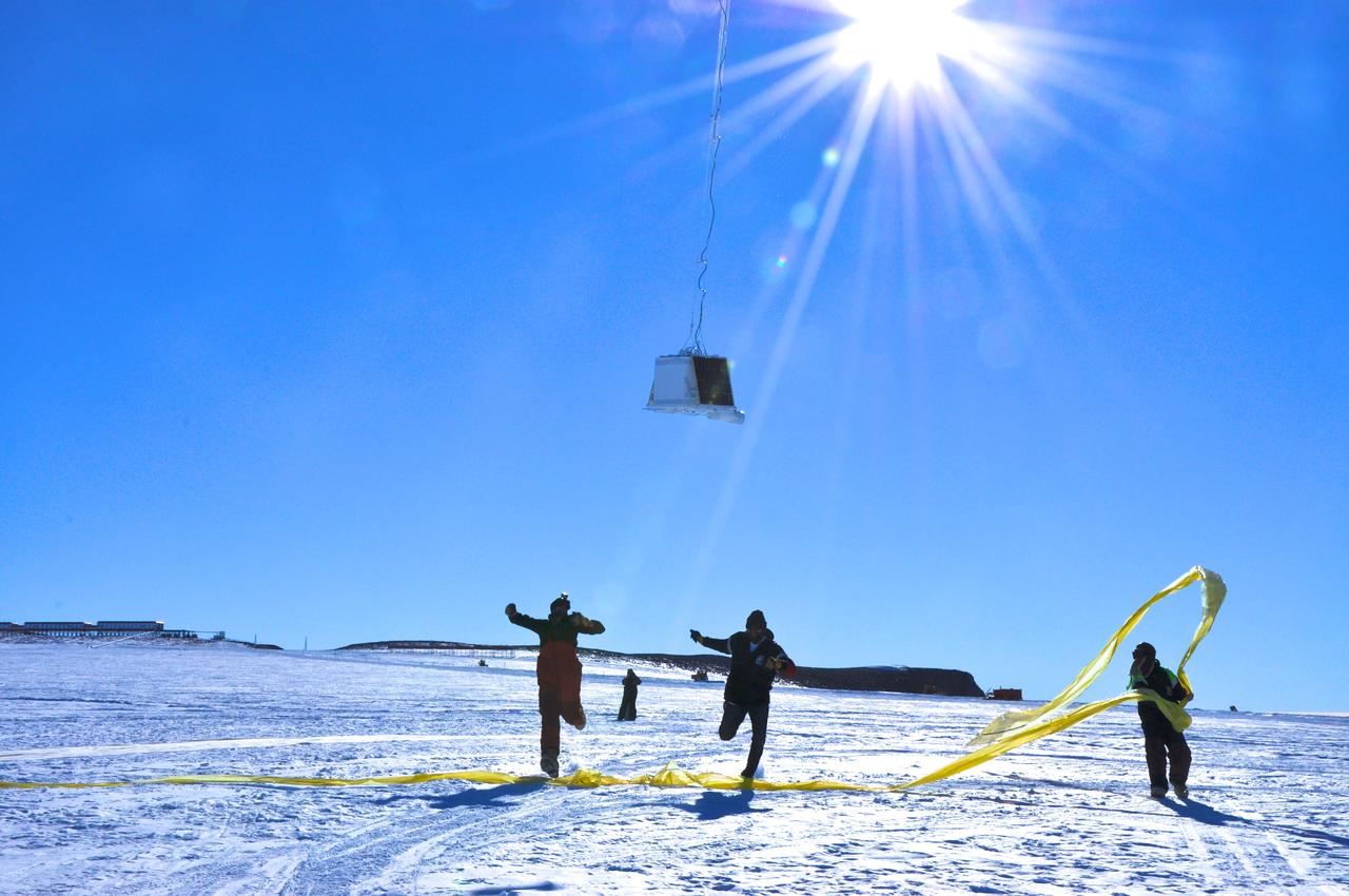
BARREL team members run under the payload as the balloon first takes flight at the SANAE IV research station in Antarctica. Credit: NASA --- In Antarctica in January, 2013 – the summer at the South Pole – scientists launched 20 balloons up into the air to study an enduring mystery of space weather: when the giant radiation belts surrounding Earth lose material, where do the extra particles actually go? The mission is called BARREL (Balloon Array for Radiation belt Relativistic Electron Losses) and it is led by physicist Robyn Millan of Dartmouth College in Hanover, NH. Millan provided photographs from the team’s time in Antarctica. The team launched a balloon every day or two into the circumpolar winds that circulate around the pole. Each balloon floated for anywhere from 3 to 40 days, measuring X-rays produced by fast-moving electrons high up in the atmosphere. BARREL works hand in hand with another NASA mission called the Van Allen Probes, which travels through the Van Allen radiation belts surrounding Earth. The belts wax and wane over time in response to incoming energy and material from the sun, sometimes intensifying the radiation through which satellites must travel. Scientists wish to understand this process better, and even provide forecasts of this space weather, in order to protect our spacecraft. As the Van Allen Probes were observing what was happening in the belts, BARREL tracked electrons that precipitated out of the belts and hurtled down Earth’s magnetic field lines toward the poles. By comparing data, scientists will be able to track how what’s happening in the belts correlates to the loss of particles – information that can help us understand this mysterious, dynamic region that can impact spacecraft. Having launched balloons in early 2013, the team is back at home building the next set of payloads. They will launch 20 more balloons in 2014. <b><a href="http://www.nasa.gov/audience/formedia/features/MP_Photo_Guidelines.html" rel="nofollow">NASA image use policy.</a></b> <b><a href="http://www.nasa.gov/centers/goddard/home/index.html" rel="nofollow">NASA Goddard Space Flight Center</a></b> enables NASA’s mission through four scientific endeavors: Earth Science, Heliophysics, Solar System Exploration, and Astrophysics. Goddard plays a leading role in NASA’s accomplishments by contributing compelling scientific knowledge to advance the Agency’s mission. <b>Follow us on <a href="http://twitter.com/NASA_GoddardPix" rel="nofollow">Twitter</a></b> <b>Like us on <a href="http://www.facebook.com/pages/Greenbelt-MD/NASA-Goddard/395013845897?ref=tsd" rel="nofollow">Facebook</a></b> <b>Find us on <a href="http://instagram.com/nasagoddard?vm=grid" rel="nofollow">Instagram</a></b>