Alien Weather
A Change in the Weather
Global Weather
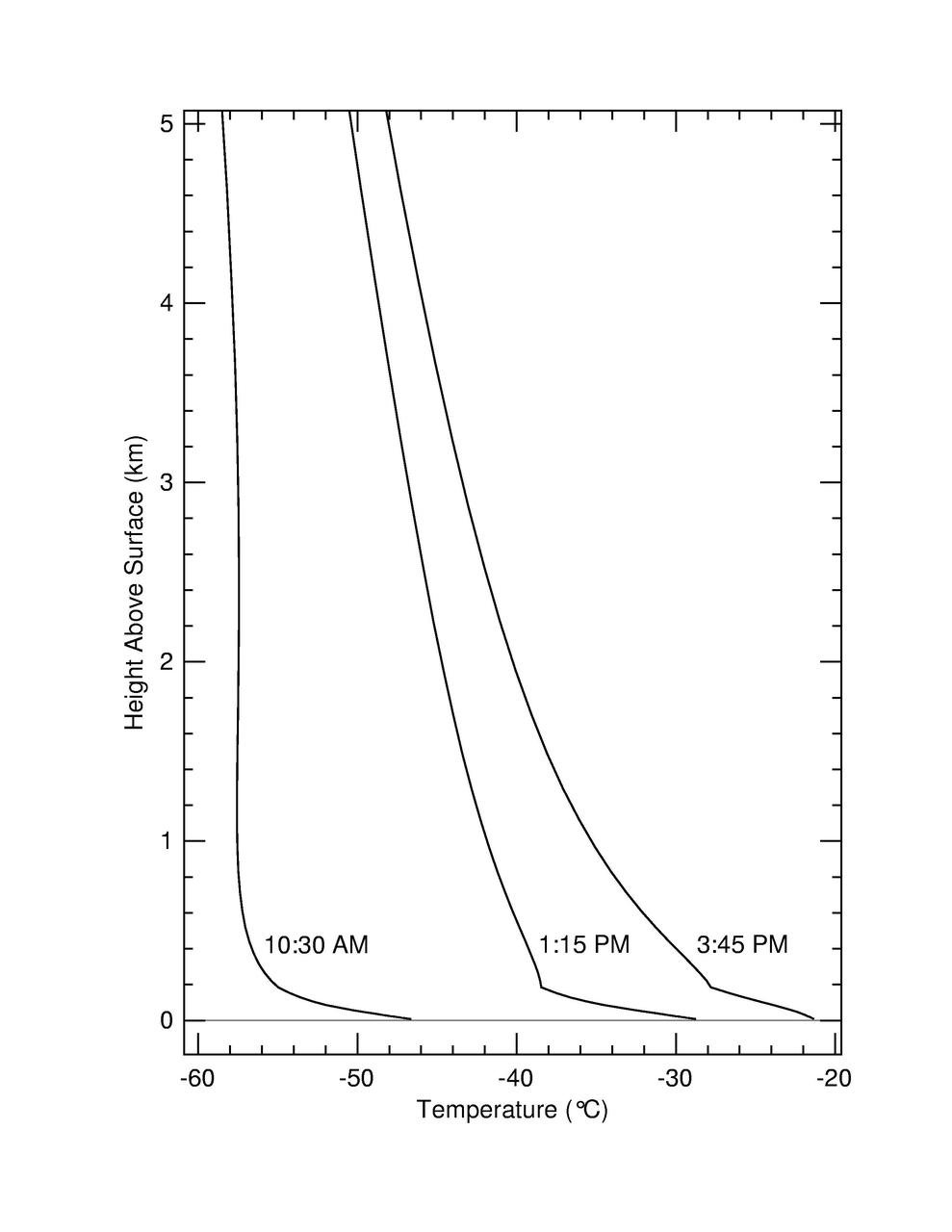
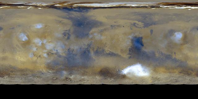
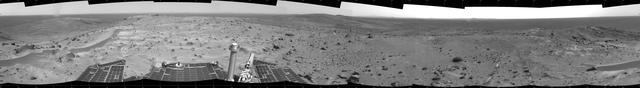
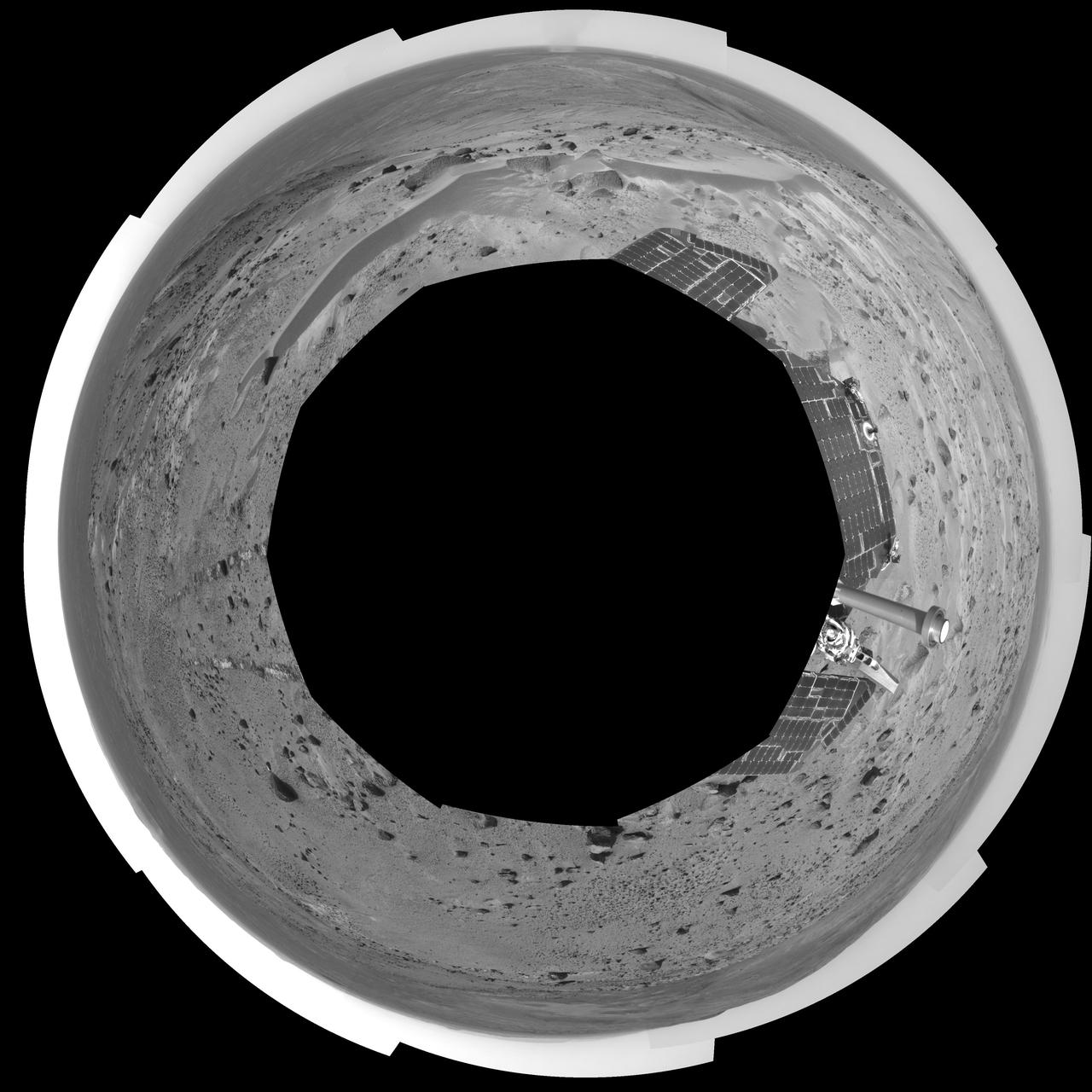
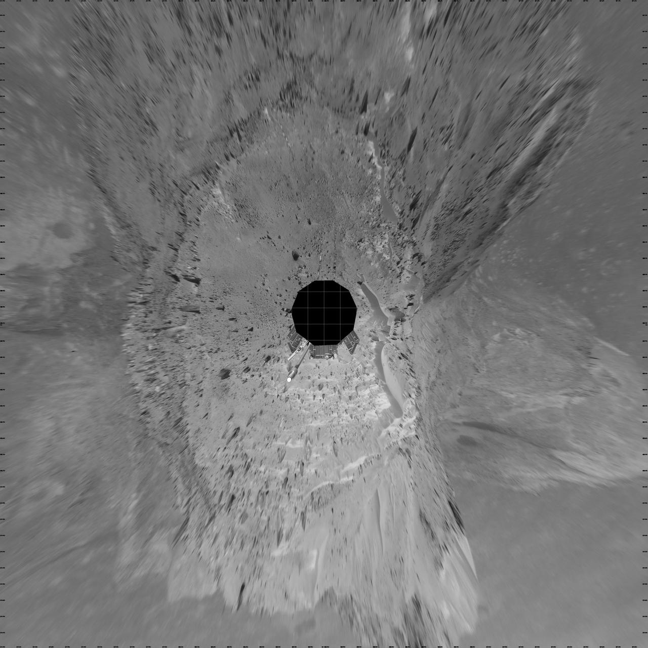
The Unpredictable Weather on Mars
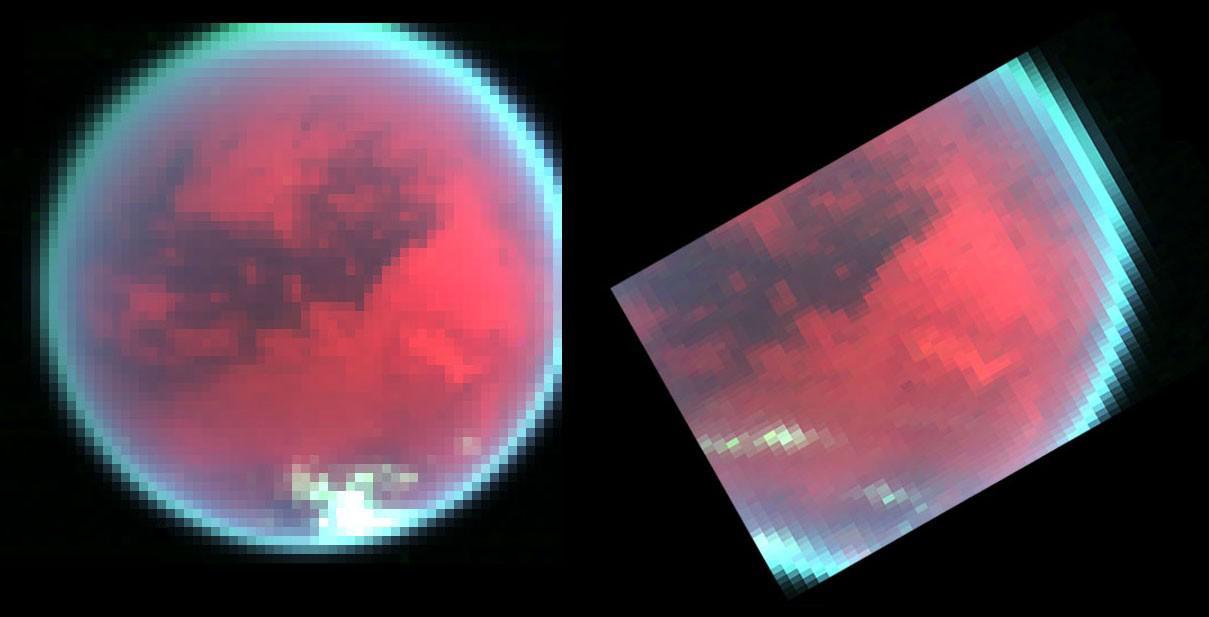
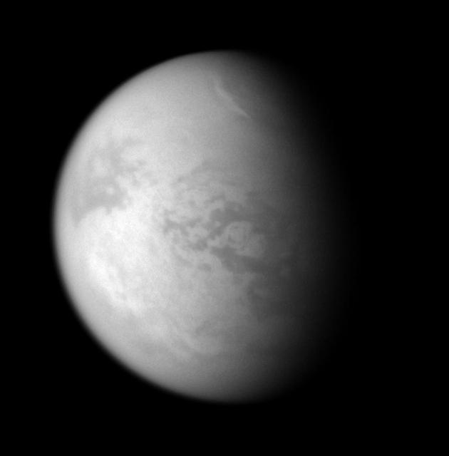
Spying Titan Weather
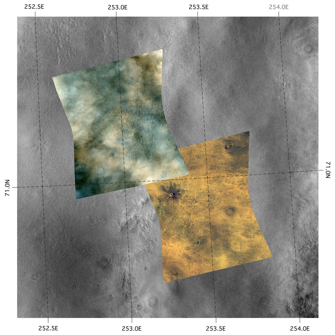
A Great Place to Watch the Weather

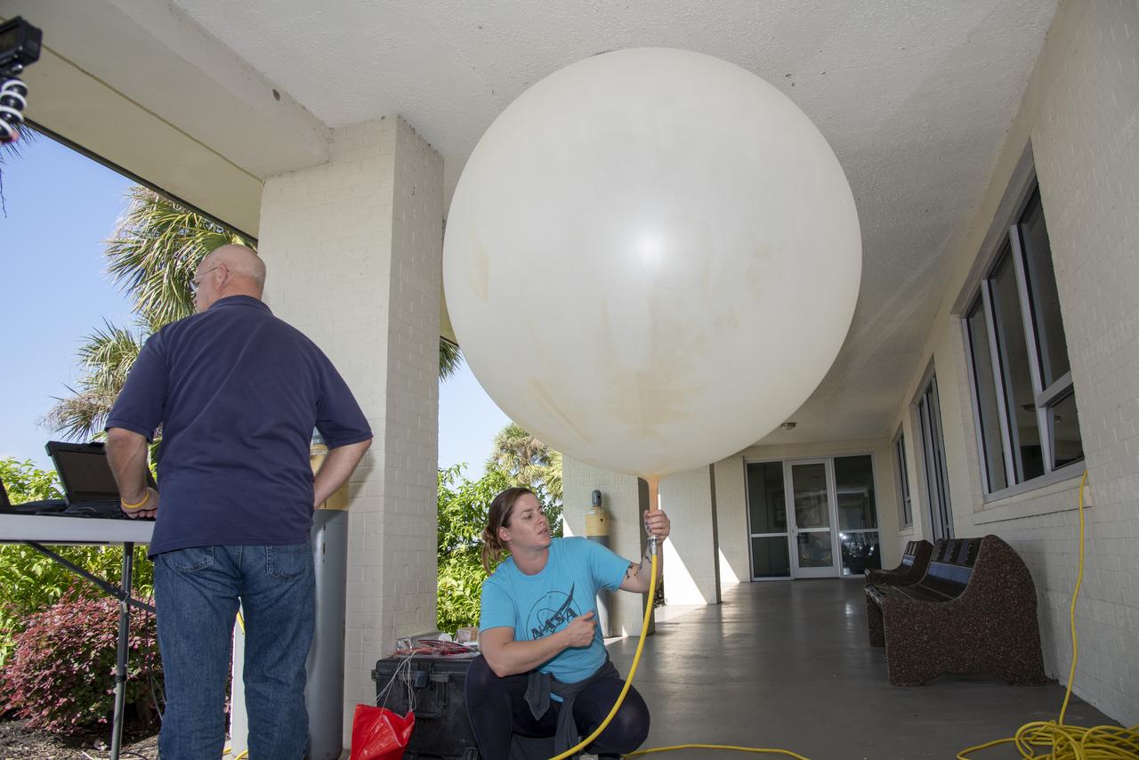
Meteorological Data Specialist Michael Boyer prepares weather balloons for release at the Cape Canaveral Space Force Station (CCSFS) Weather Station in preparation for an Artemis I weather simulation on Nov. 3, 2021. The event involved teams from CCSFS, Kennedy Space Center, Johnson Space Center in Texas, and Marshall Space Flight Center in Alabama. Weather balloons provided data below 6,000 feet and above 62,000 feet, while Kennedy’s Tropospheric Doppler Radar Wind Profiler delivered data from 6,000 to 62,000 feet. The radar wind profiler will be used as the primary upper level wind instrument for NASA’s Artemis missions, including Artemis I, the first launch of the agency’s Space Launch System rocket and the Orion spacecraft on a flight beyond the Moon.
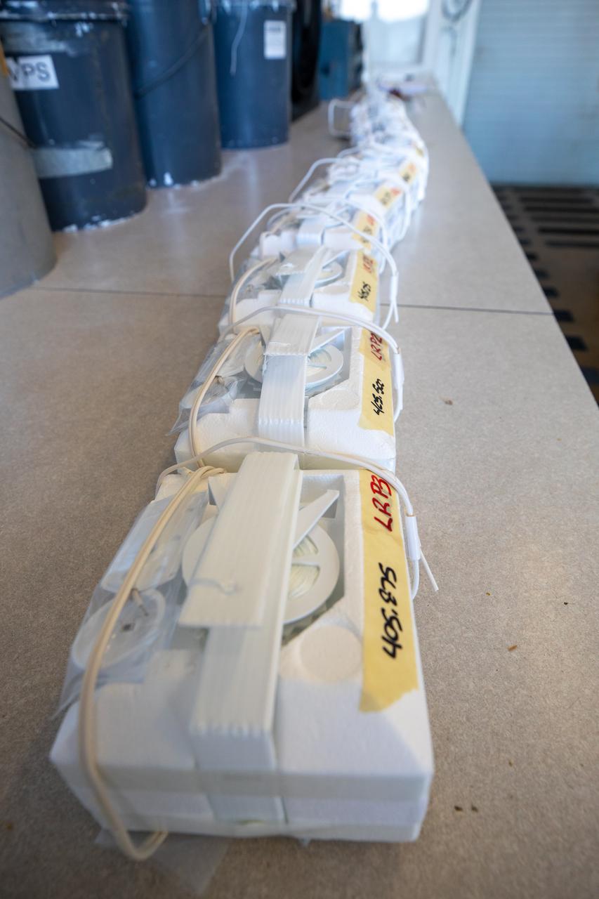
Weather balloons are lined up prior to release at the Cape Canaveral Space Force Station (CCSFS) Weather Station in preparation for an Artemis I weather simulation on Nov. 3, 2021. The event involved teams from CCSFS, Kennedy Space Center, Johnson Space Center in Texas, and Marshall Space Flight Center in Alabama. Weather balloons provided data below 6,000 feet and above 62,000 feet, while Kennedy’s Tropospheric Doppler Radar Wind Profiler delivered data from 6,000 to 62,000 feet. The radar wind profiler will be used as the primary upper level wind instrument for NASA’s Artemis missions, including Artemis I, the first launch of the agency’s Space Launch System rocket and the Orion spacecraft on a flight beyond the Moon.
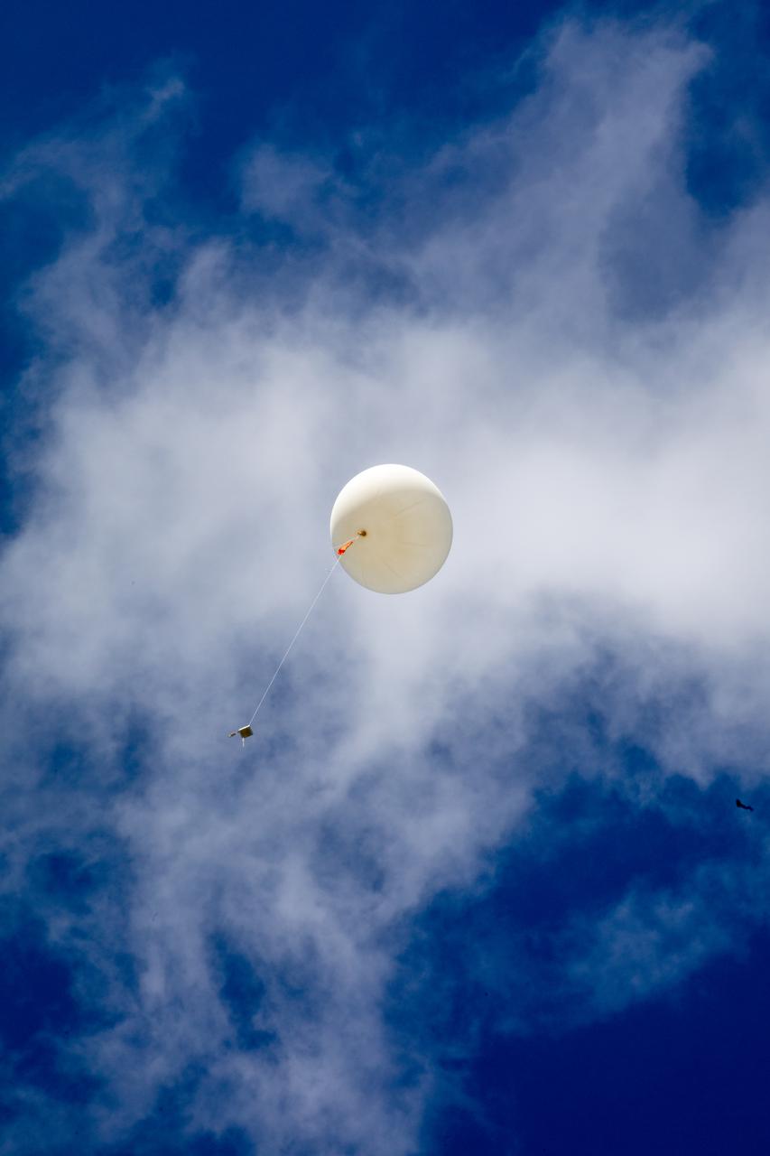
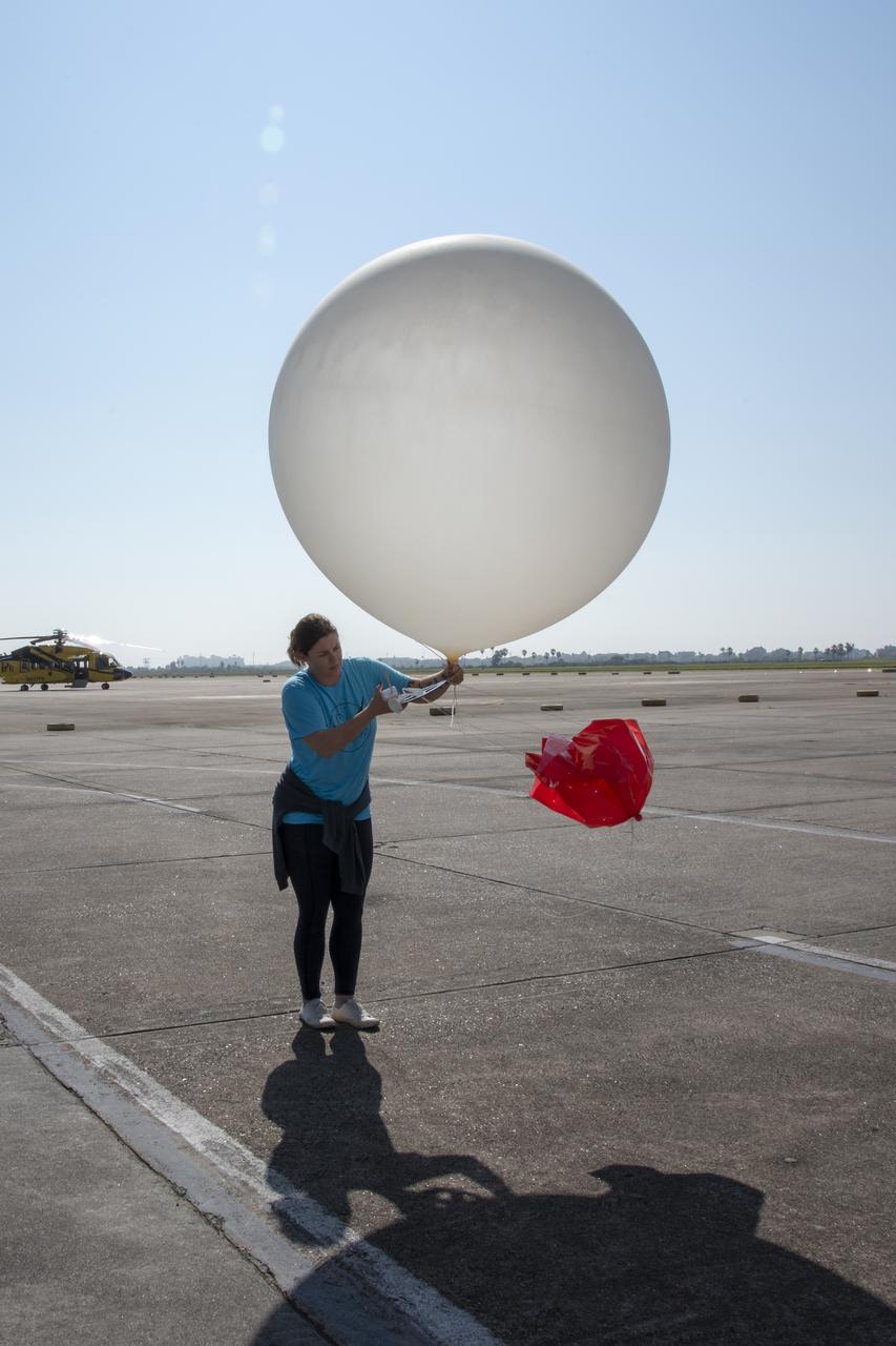
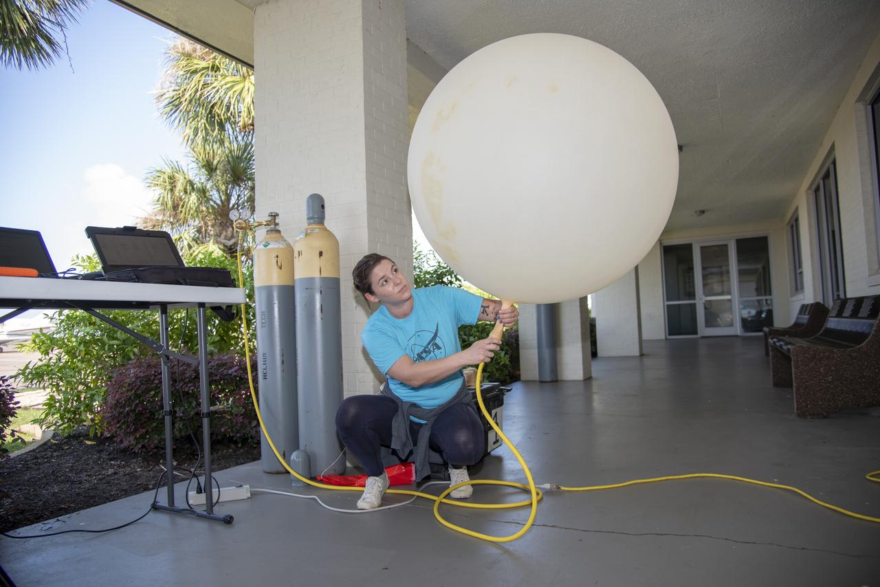
Meteorological Data Specialist Michael Boyer releases a weather balloon at the Cape Canaveral Space Force Station (CCSFS) Weather Station during an Artemis I weather simulation on Nov. 3, 2021. The event involved teams from CCSFS, Kennedy Space Center, Johnson Space Center in Texas, and Marshall Space Flight Center in Alabama. Weather balloons provided data below 6,000 feet and above 62,000 feet, while Kennedy’s Tropospheric Doppler Radar Wind Profiler delivered data from 6,000 to 62,000 feet. The radar wind profiler will be used as the primary upper level wind instrument for NASA’s Artemis missions, including Artemis I, the first launch of the agency’s Space Launch System rocket and the Orion spacecraft on a flight beyond the Moon.
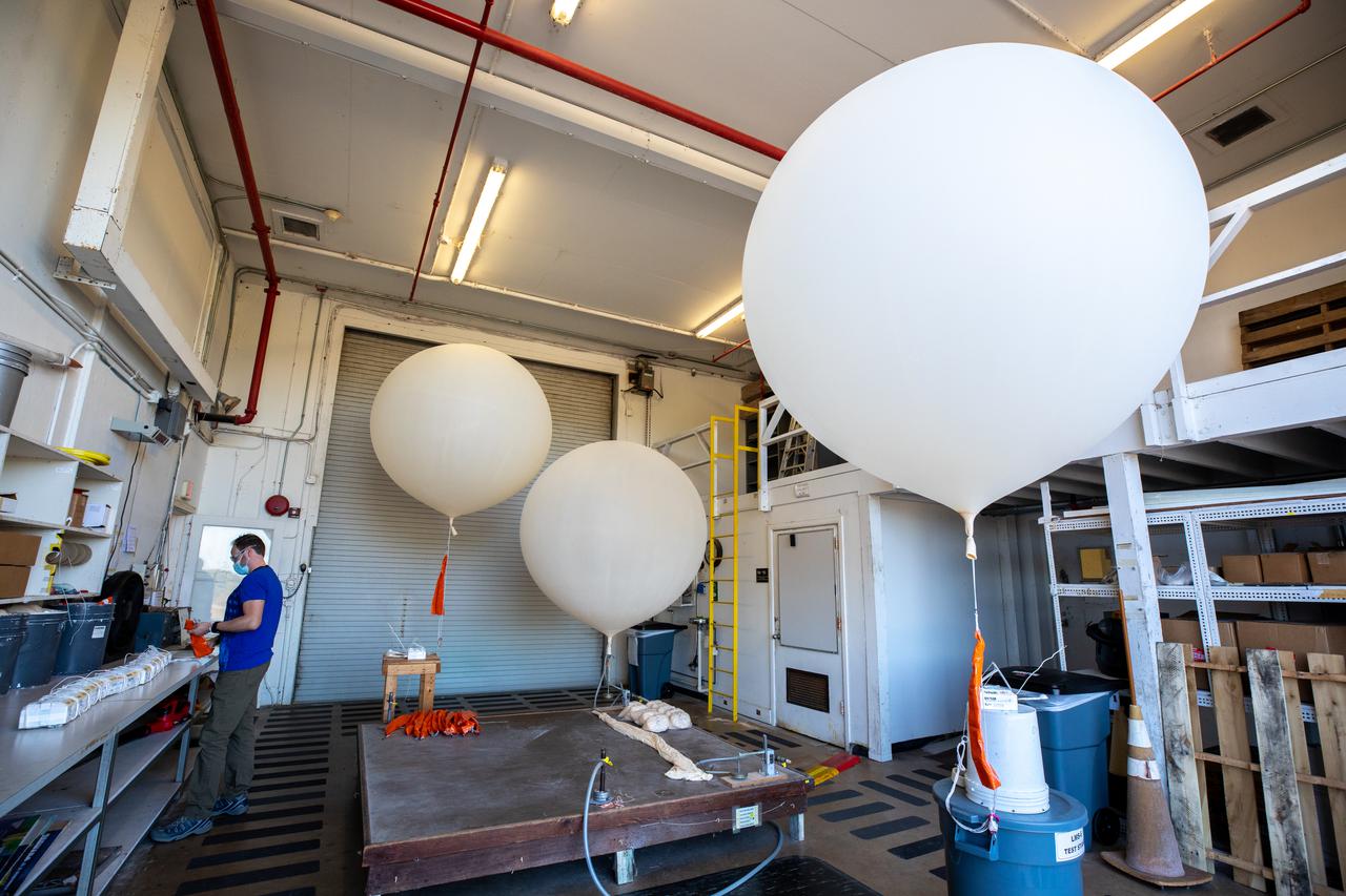
Meteorological Data Specialist Michael Boyer prepares weather balloons for release at the Cape Canaveral Space Force Station (CCSFS) Weather Station in preparation for an Artemis I weather simulation on Nov. 3, 2021. The event involved teams from CCSFS, Kennedy Space Center, Johnson Space Center in Texas, and Marshall Space Flight Center in Alabama. Weather balloons provided data below 6,000 feet and above 62,000 feet, while Kennedy’s Tropospheric Doppler Radar Wind Profiler delivered data from 6,000 to 62,000 feet. The radar wind profiler will be used as the primary upper level wind instrument for NASA’s Artemis missions, including Artemis I, the first launch of the agency’s Space Launch System rocket and the Orion spacecraft on a flight beyond the Moon.
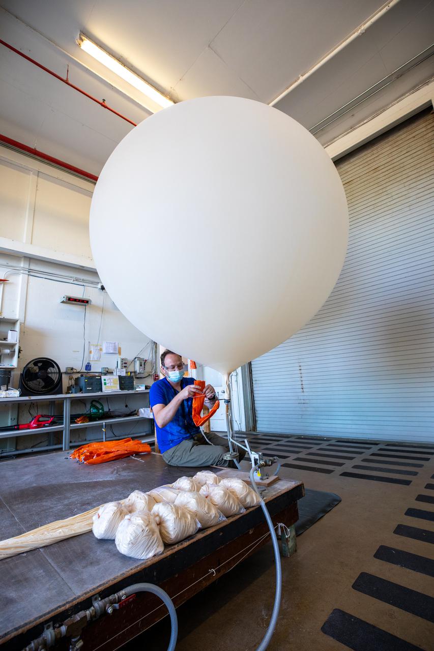
Meteorological Data Specialist Michael Boyer prepares weather balloons for release at the Cape Canaveral Space Force Station (CCSFS) Weather Station in preparation for an Artemis I weather simulation on Nov. 3, 2021. The event involved teams from CCSFS, Kennedy Space Center, Johnson Space Center in Texas, and Marshall Space Flight Center in Alabama. Weather balloons provided data below 6,000 feet and above 62,000 feet, while Kennedy’s Tropospheric Doppler Radar Wind Profiler delivered data from 6,000 to 62,000 feet. The radar wind profiler will be used as the primary upper level wind instrument for NASA’s Artemis missions, including Artemis I, the first launch of the agency’s Space Launch System rocket and the Orion spacecraft on a flight beyond the Moon.

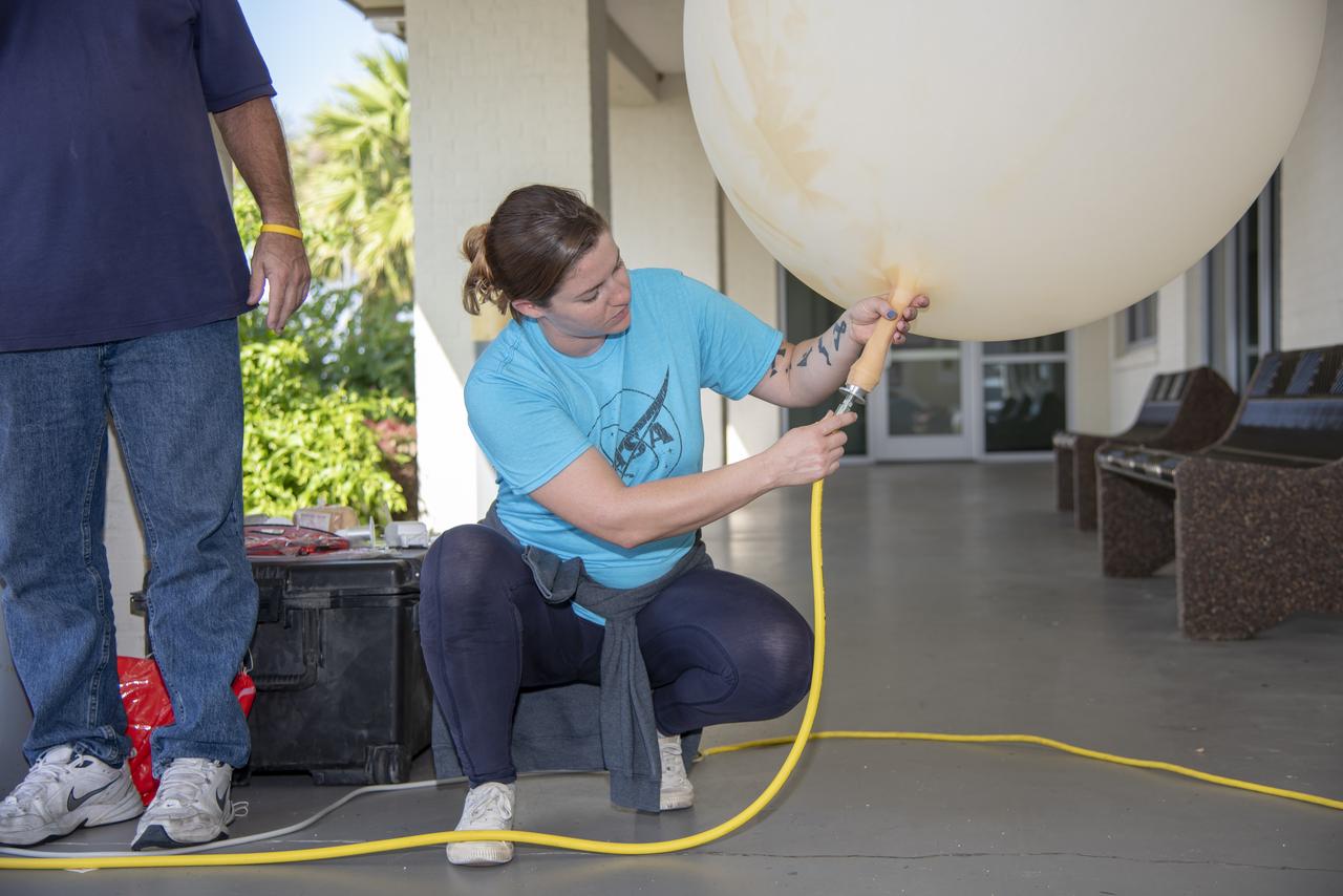
Meteorological Data Specialist Michael Boyer prepares to release a weather balloon at the Cape Canaveral Space Force Station (CCSFS) Weather Station during an Artemis I weather simulation on Nov. 3, 2021. The event involved teams from CCSFS, Kennedy Space Center, Johnson Space Center in Texas, and Marshall Space Flight Center in Alabama. Weather balloons provided data below 6,000 feet and above 62,000 feet, while Kennedy’s Tropospheric Doppler Radar Wind Profiler delivered data from 6,000 to 62,000 feet. The radar wind profiler will be used as the primary upper level wind instrument for NASA’s Artemis missions, including Artemis I, the first launch of the agency’s Space Launch System rocket and the Orion spacecraft on a flight beyond the Moon.

Meteorological Data Specialist Michael Boyer releases a weather balloon at the Cape Canaveral Space Force Station (CCSFS) Weather Station during an Artemis I weather simulation on Nov. 3, 2021. The event involved teams from CCSFS, Kennedy Space Center, Johnson Space Center in Texas, and Marshall Space Flight Center in Alabama. Weather balloons provided data below 6,000 feet and above 62,000 feet, while Kennedy’s Tropospheric Doppler Radar Wind Profiler delivered data from 6,000 to 62,000 feet. The radar wind profiler will be used as the primary upper level wind instrument for NASA’s Artemis missions, including Artemis I, the first launch of the agency’s Space Launch System rocket and the Orion spacecraft on a flight beyond the Moon.
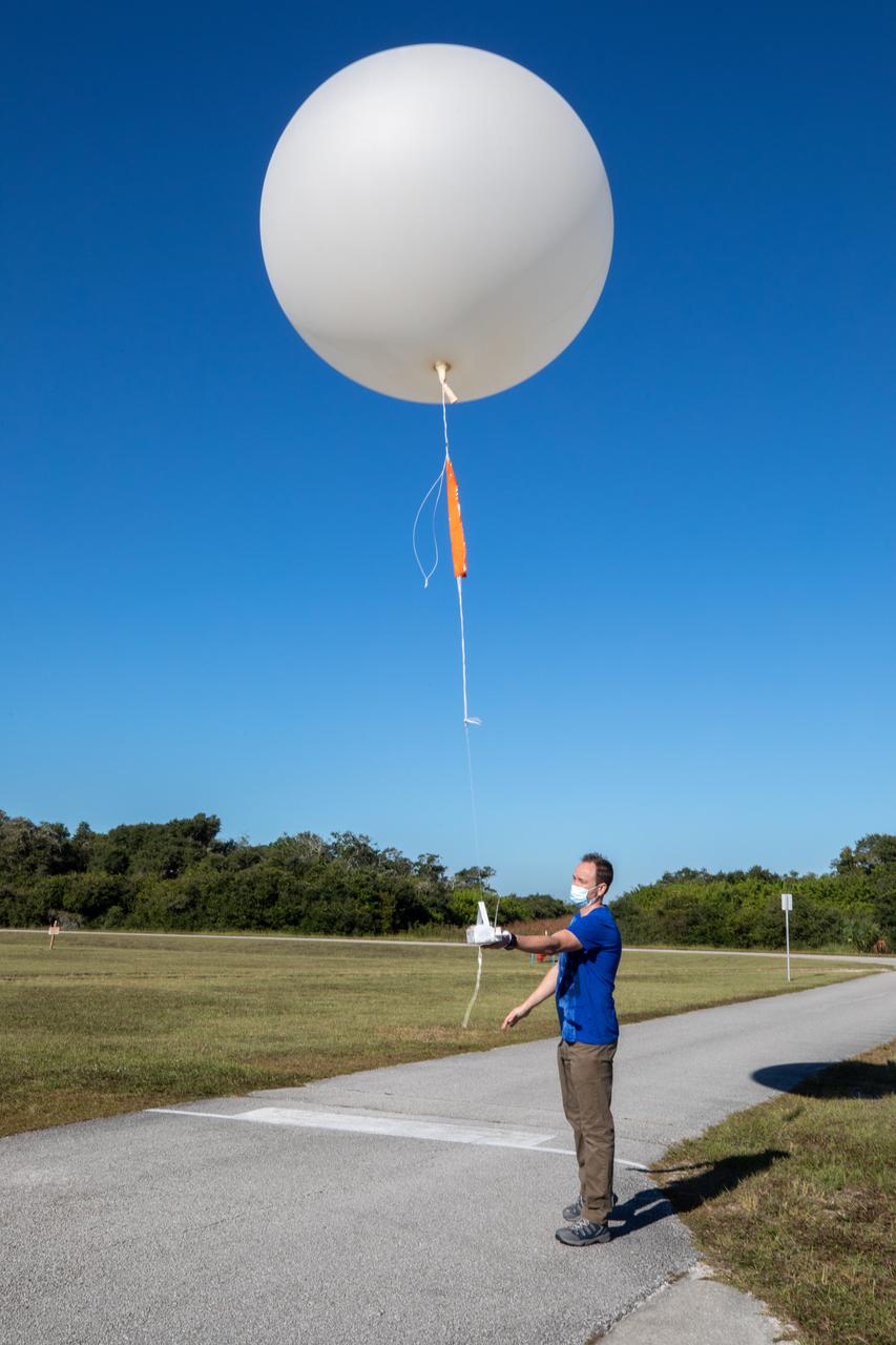
Meteorological Data Specialist Michael Boyer releases a weather balloon at the Cape Canaveral Space Force Station (CCSFS) Weather Station during an Artemis I weather simulation on Nov. 3, 2021. The event involved teams from CCSFS, Kennedy Space Center, Johnson Space Center in Texas, and Marshall Space Flight Center in Alabama. Weather balloons provided data below 6,000 feet and above 62,000 feet, while Kennedy’s Tropospheric Doppler Radar Wind Profiler delivered data from 6,000 to 62,000 feet. The radar wind profiler will be used as the primary upper level wind instrument for NASA’s Artemis missions, including Artemis I, the first launch of the agency’s Space Launch System rocket and the Orion spacecraft on a flight beyond the Moon.
Weather Instrumentation Technician Gavin Oglesby, left, and Weather Instrumentation Engineer Nick O’Connor work with the Tropospheric Doppler Radar Wind Profiler at Kennedy Space Center in Florida during an Artemis I weather simulation on Nov. 3, 2021. The simulation involved teams from Kennedy, Cape Canaveral Space Force Station, Johnson Space Center in Texas, and Marshall Space Flight Center in Alabama. The radar wind profiler delivers data – from 6,000 to 62,000 feet – every five minutes. It will be used as the primary upper level wind instrument for NASA’s Artemis missions, including Artemis I, the first launch of the agency’s Space Launch System rocket and the Orion spacecraft on a flight beyond the Moon.
Weather Instrumentation Technician Gavin Oglesby, left, and Weather Instrumentation Engineer Nick O’Connor work with the Tropospheric Doppler Radar Wind Profiler at Kennedy Space Center in Florida during an Artemis I weather simulation on Nov. 3, 2021. The simulation involved teams from Kennedy, Cape Canaveral Space Force Station, Johnson Space Center in Texas, and Marshall Space Flight Center in Alabama. The radar wind profiler delivers data – from 6,000 to 62,000 feet – every five minutes. It will be used as the primary upper level wind instrument for NASA’s Artemis missions, including Artemis I, the first launch of the agency’s Space Launch System rocket and the Orion spacecraft on a flight beyond the Moon.
Weather Instrumentation Engineer Nick O’Connor works with the Tropospheric Doppler Radar Wind Profiler at Kennedy Space Center in Florida during an Artemis I weather simulation on Nov. 3, 2021. The simulation involved teams from Kennedy, Cape Canaveral Space Force Station, Johnson Space Center in Texas, and Marshall Space Flight Center in Alabama. The radar wind profiler delivers data – from 6,000 to 62,000 feet – every five minutes. It will be used as the primary upper level wind instrument for NASA’s Artemis missions, including Artemis I, the first launch of the agency’s Space Launch System rocket and the Orion spacecraft on a flight beyond the Moon.
Weather Instrumentation Engineer Nick O’Connor works with the Tropospheric Doppler Radar Wind Profiler at Kennedy Space Center in Florida during an Artemis I weather simulation on Nov. 3, 2021. The simulation involved teams from Kennedy, Cape Canaveral Space Force Station, Johnson Space Center in Texas, and Marshall Space Flight Center in Alabama. The radar wind profiler delivers data – from 6,000 to 62,000 feet – every five minutes. It will be used as the primary upper level wind instrument for NASA’s Artemis missions, including Artemis I, the first launch of the agency’s Space Launch System rocket and the Orion spacecraft on a flight beyond the Moon.
Weather Instrumentation Engineer Nick O’Connor works with the Tropospheric Doppler Radar Wind Profiler at Kennedy Space Center in Florida during an Artemis I weather simulation on Nov. 3, 2021. The simulation involved teams from Kennedy, Cape Canaveral Space Force Station, Johnson Space Center in Texas, and Marshall Space Flight Center in Alabama. The radar wind profiler delivers data – from 6,000 to 62,000 feet – every five minutes. It will be used as the primary upper level wind instrument for NASA’s Artemis missions, including Artemis I, the first launch of the agency’s Space Launch System rocket and the Orion spacecraft on a flight beyond the Moon.
A Great Place to Watch the Weather polar
A Great Place to Watch the Weather vertical
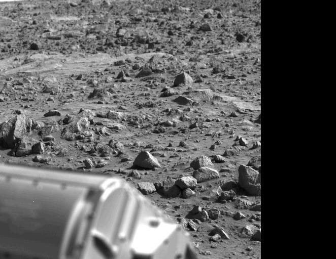
The letter 'B' or perhaps the figure '8' appears to have been etched into the Mars rock at the left edge of this picture taken yesterday by NASA's Viking 1 Lander. It is believed to be an illusion caused by weathering processes and the angle of the sun as it illuminated the scene for the spacecraft camera. The object at lower left is the housing containing the surface sampler scoop. http://photojournal.jpl.nasa.gov/catalog/PIA00386
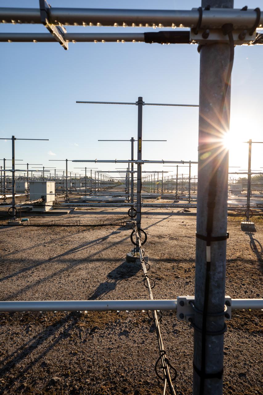
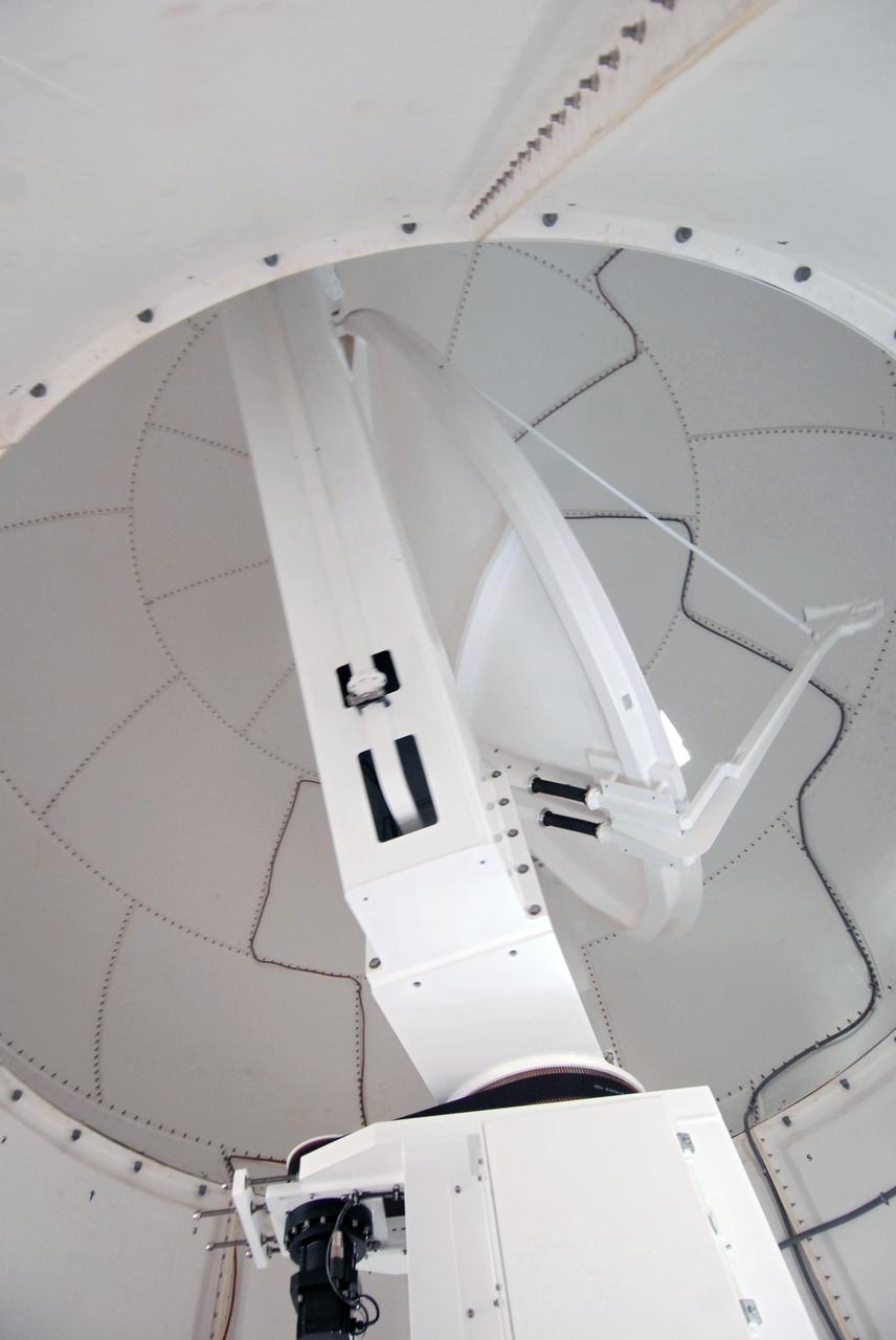
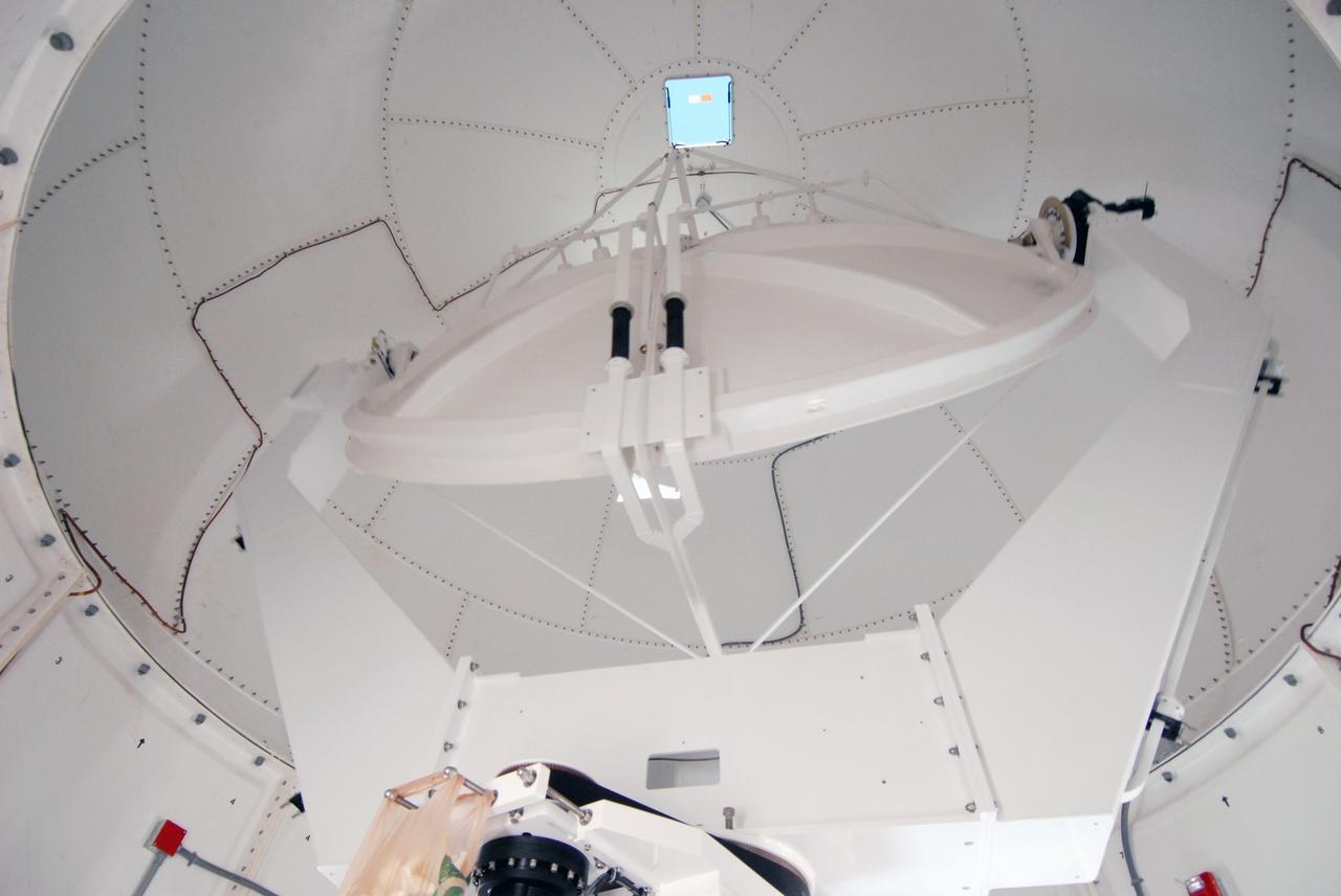
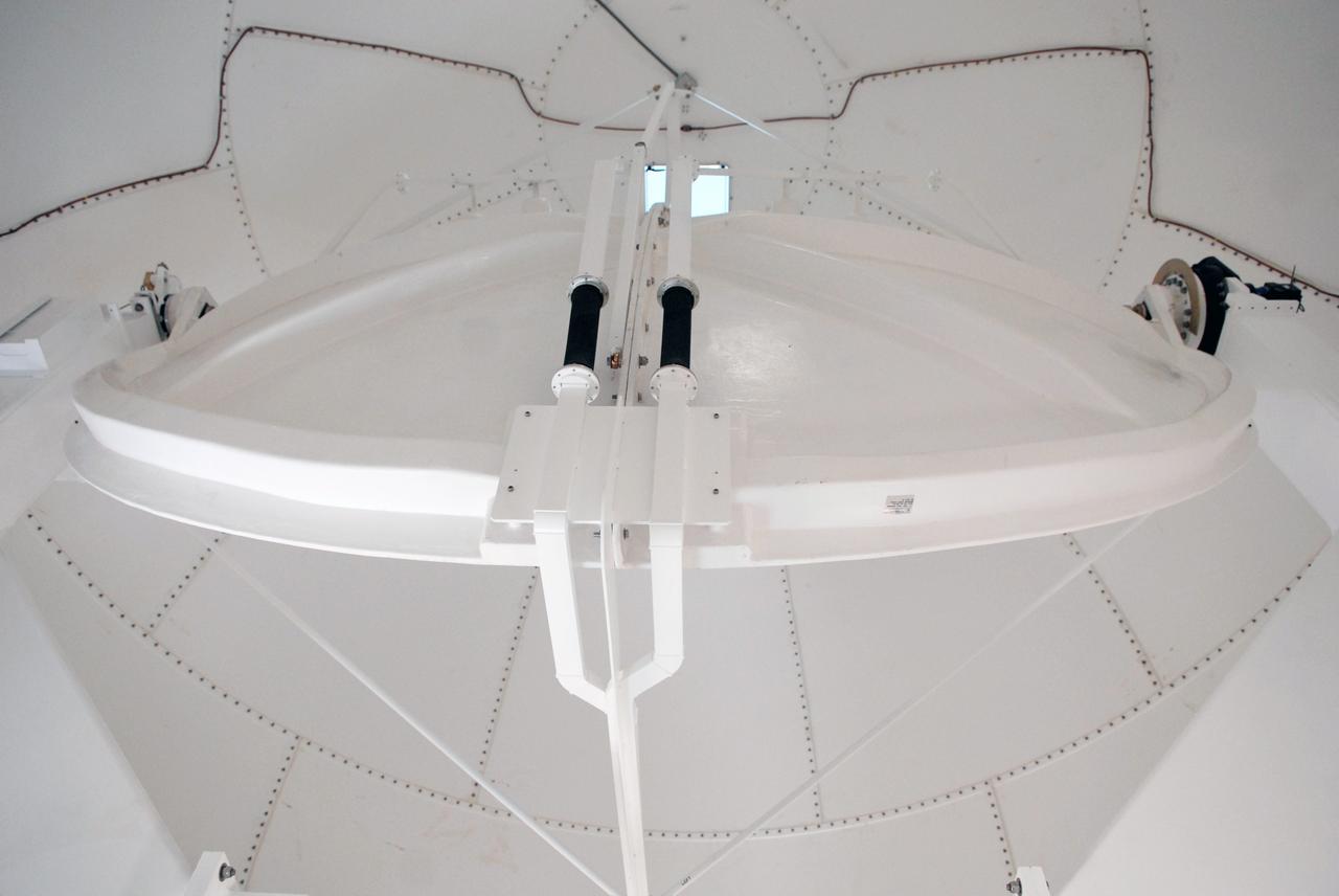
The Tropospheric Doppler Radar Wind Profiler, located on five acres near the Launch and Landing Facility at Kennedy Space Center in Florida, is shown during an Artemis I weather simulation on Nov. 3, 2021. The simulation involved teams from Kennedy, Cape Canaveral Space Force Station, Johnson Space Center in Texas, and Marshall Space Flight Center in Alabama. The radar wind profiler consists of 640 antennae and delivers data – from 6,000 to 62,000 feet – every five minutes. The instrument will be used as the primary upper level wind instrument for NASA’s Artemis missions, including Artemis I, the first launch of the agency’s Space Launch System rocket and the Orion spacecraft on a flight beyond the Moon.
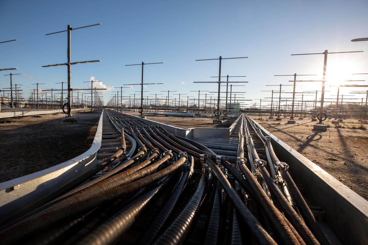
The Tropospheric Doppler Radar Wind Profiler, located on five acres near the Launch and Landing Facility at Kennedy Space Center in Florida, is shown during an Artemis I weather simulation on Nov. 3, 2021. The simulation involved teams from Kennedy, Cape Canaveral Space Force Station, Johnson Space Center in Texas, and Marshall Space Flight Center in Alabama. The radar wind profiler consists of 640 antennae and delivers data – from 6,000 to 62,000 feet – every five minutes. The instrument will be used as the primary upper level wind instrument for NASA’s Artemis missions, including Artemis I, the first launch of the agency’s Space Launch System rocket and the Orion spacecraft on a flight beyond the Moon.
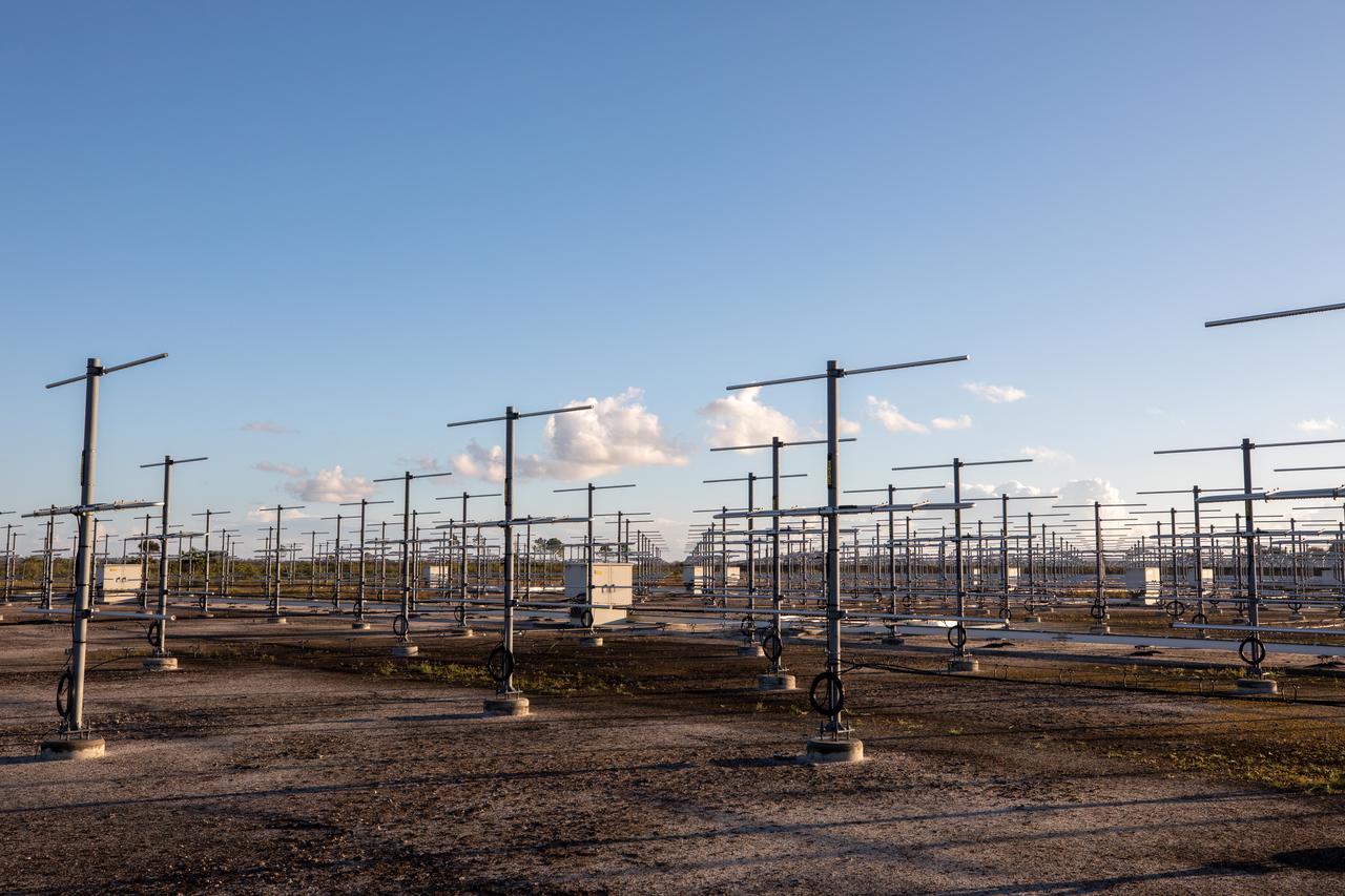
The Tropospheric Doppler Radar Wind Profiler, located on five acres near the Launch and Landing Facility at Kennedy Space Center in Florida, is shown during an Artemis I weather simulation on Nov. 3, 2021. The simulation involved teams from Kennedy, Cape Canaveral Space Force Station, Johnson Space Center in Texas, and Marshall Space Flight Center in Alabama. The radar wind profiler consists of 640 antennae and delivers data – from 6,000 to 62,000 feet – every five minutes. The instrument will be used as the primary upper level wind instrument for NASA’s Artemis missions, including Artemis I, the first launch of the agency’s Space Launch System rocket and the Orion spacecraft on a flight beyond the Moon.
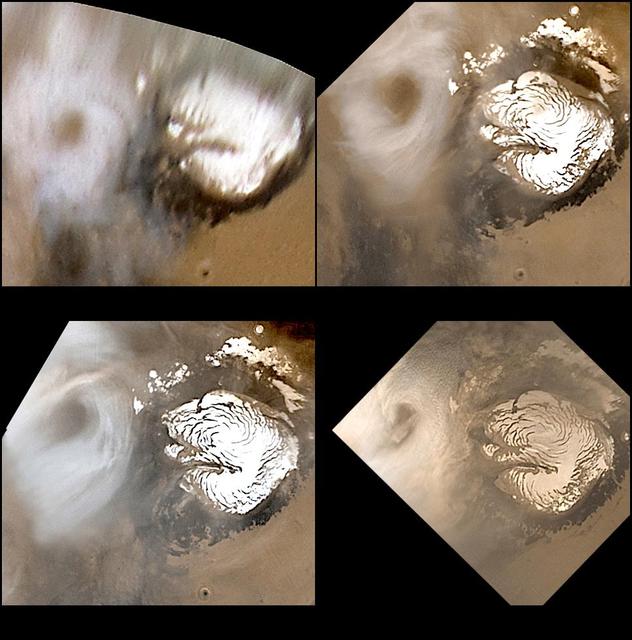
Celebrating 8 Years at Mars: Repeated Weather Events
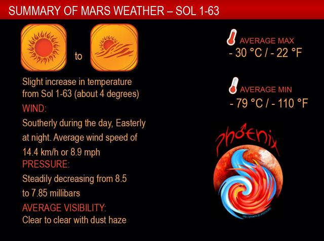
Sixty-One Martian Days of Weather Monitoring
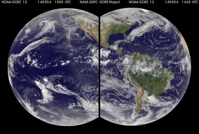
Tomorrow is the start of the Eastern Pacific Ocean hurricane season but the eastern Pacific is currently quiet. The Atlantic Ocean hurricane season begins on June 1. NASA/NOAA's GOES Project combined imagery from NOAA's GOES-13 and GOES-15 satellites to provide this animation of weather in the Atlantic and Eastern Pacific over the last 10 days. Credit: NASA/NOAA GOES Project <b><a href="http://www.nasa.gov/audience/formedia/features/MP_Photo_Guidelines.html" rel="nofollow">NASA image use policy.</a></b> <b><a href="http://www.nasa.gov/centers/goddard/home/index.html" rel="nofollow">NASA Goddard Space Flight Center</a></b> enables NASA’s mission through four scientific endeavors: Earth Science, Heliophysics, Solar System Exploration, and Astrophysics. Goddard plays a leading role in NASA’s accomplishments by contributing compelling scientific knowledge to advance the Agency’s mission. <b>Follow us on <a href="http://twitter.com/NASAGoddardPix" rel="nofollow">Twitter</a></b> <b>Like us on <a href="http://www.facebook.com/pages/Greenbelt-MD/NASA-Goddard/395013845897?ref=tsd" rel="nofollow">Facebook</a></b> <b>Find us on <a href="http://instagram.com/nasagoddard?vm=grid" rel="nofollow">Instagram</a></b>
A worker releases a weather balloon at the Cape Canaveral Air Force Station weather station. The balloon is equipped with a radiosonde, an instrument that transmits measurements on atmospheric pressure, humidity, temperature and winds as it ascends. The data will be used to determine if conditions are acceptable for the launch of NASA's THEMIS mission. THEMIS, an acronym for Time History of Events and Macroscale Interactions during Substorms, consists of five identical probes that will track violent, colorful eruptions near the North Pole. This will be the largest number of scientific satellites NASA has ever launched into orbit aboard a single rocket. The THEMIS mission aims to unravel the mystery behind auroral substorms, an avalanche of magnetic energy powered by the solar wind that intensifies the northern and southern lights. The mission will investigate what causes auroras in the Earth’s atmosphere to dramatically change from slowly shimmering waves of light to wildly shifting streaks of bright color. Launch is planned from Pad 17-B in a window that extends from 6:01 to 6:19 p.m. EST.
A weather balloon is prepared for release at the Cape Canaveral Air Force Station weather station. The balloon is equipped with a radiosonde, an instrument that transmits measurements on atmospheric pressure, humidity, temperature and winds as it ascends. The data will be used to determine if conditions are acceptable for the launch of NASA's THEMIS mission. THEMIS, an acronym for Time History of Events and Macroscale Interactions during Substorms, consists of five identical probes that will track violent, colorful eruptions near the North Pole. This will be the largest number of scientific satellites NASA has ever launched into orbit aboard a single rocket. The THEMIS mission aims to unravel the mystery behind auroral substorms, an avalanche of magnetic energy powered by the solar wind that intensifies the northern and southern lights. The mission will investigate what causes auroras in the Earth’s atmosphere to dramatically change from slowly shimmering waves of light to wildly shifting streaks of bright color. Launch is planned from Pad 17-B in a window that extends from 6:01 to 6:19 p.m. EST.
A radiosonde, an instrument that transmits measurements on atmospheric pressure, humidity, temperature and winds, is prepared for use on a weather balloon at the Cape Canaveral Air Force Station weather station. The data it returns will be used to determine if conditions are acceptable for the launch of NASA's THEMIS mission. THEMIS, an acronym for Time History of Events and Macroscale Interactions during Substorms, consists of five identical probes that will track violent, colorful eruptions near the North Pole. This will be the largest number of scientific satellites NASA has ever launched into orbit aboard a single rocket. The THEMIS mission aims to unravel the mystery behind auroral substorms, an avalanche of magnetic energy powered by the solar wind that intensifies the northern and southern lights. The mission will investigate what causes auroras in the Earth’s atmosphere to dramatically change from slowly shimmering waves of light to wildly shifting streaks of bright color. Launch is planned from Pad 17-B in a window that extends from 6:01 to 6:19 p.m. EST.
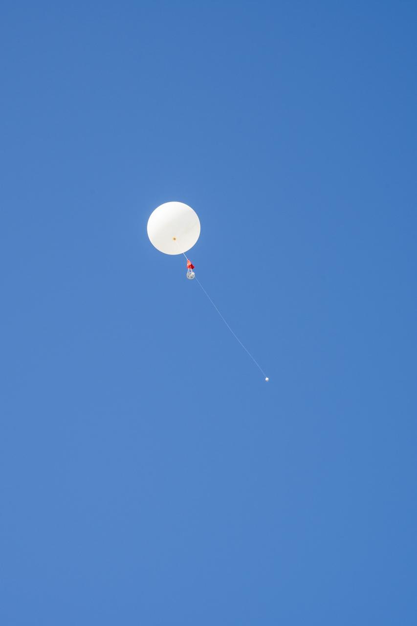
A weather balloon takes flight from the Cape Canaveral Air Force Station weather station. The balloon is equipped with a radiosonde, an instrument that transmits measurements on atmospheric pressure, humidity, temperature and winds as it ascends. The data will be used to determine if conditions are acceptable for the launch of NASA's THEMIS mission. THEMIS, an acronym for Time History of Events and Macroscale Interactions during Substorms, consists of five identical probes that will track violent, colorful eruptions near the North Pole. This will be the largest number of scientific satellites NASA has ever launched into orbit aboard a single rocket. The THEMIS mission aims to unravel the mystery behind auroral substorms, an avalanche of magnetic energy powered by the solar wind that intensifies the northern and southern lights. The mission will investigate what causes auroras in the Earth’s atmosphere to dramatically change from slowly shimmering waves of light to wildly shifting streaks of bright color. Launch is planned from Pad 17-B in a window that extends from 6:01 to 6:19 p.m. EST.
A worker releases a weather balloon at the Cape Canaveral Air Force Station weather station. The balloon is equipped with a radiosonde, an instrument that transmits measurements on atmospheric pressure, humidity, temperature and winds as it ascends. The data will be used to determine if conditions are acceptable for the launch of NASA's THEMIS mission. THEMIS, an acronym for Time History of Events and Macroscale Interactions during Substorms, consists of five identical probes that will track violent, colorful eruptions near the North Pole. This will be the largest number of scientific satellites NASA has ever launched into orbit aboard a single rocket. The THEMIS mission aims to unravel the mystery behind auroral substorms, an avalanche of magnetic energy powered by the solar wind that intensifies the northern and southern lights. The mission will investigate what causes auroras in the Earth’s atmosphere to dramatically change from slowly shimmering waves of light to wildly shifting streaks of bright color. Launch is planned from Pad 17-B in a window that extends from 6:01 to 6:19 p.m. EST.

In late July 2013, a low pressure system off Australia’s southeast coast and moist onshore winds combined to create unsettled weather across central Australia – and a striking image of a broad cloud band across the stark winter landscape. The Moderate Resolution Imaging Spectroradiometer (MODIS) aboard NASA’s Terra satellite captured this true-color image on July 22 at 01:05 UTC (10:35 a.m. Australian Central Standard Time). To the west of the low pressure trough the skies are clear and dry. To the east, the broad band of bright white clouds obscures the landscape. The system brought wind, precipitation and cooler temperatures to the region. The same day as MODIS captured this image, the Naval Research Lab (NRL) published an edition of the Global Storm Tracker (GST), which gave a world-wide view of the low-pressure systems across the world. This tracker shows the entire cloud band across Australia, as well as the location of the low pressure system. A good view of the Storm Tracker is provided by Red Orbit at: <a href="http://www.redorbit.com/media/uploads/2013/07/072213-weather-003-storm-tracker.jpg" rel="nofollow">www.redorbit.com/media/uploads/2013/07/072213-weather-003...</a> Credit: NASA/GSFC/Jeff Schmaltz/MODIS Land Rapid Response Team <b><a href="http://www.nasa.gov/audience/formedia/features/MP_Photo_Guidelines.html" rel="nofollow">NASA image use policy.</a></b> <b><a href="http://www.nasa.gov/centers/goddard/home/index.html" rel="nofollow">NASA Goddard Space Flight Center</a></b> enables NASA’s mission through four scientific endeavors: Earth Science, Heliophysics, Solar System Exploration, and Astrophysics. Goddard plays a leading role in NASA’s accomplishments by contributing compelling scientific knowledge to advance the Agency’s mission. <b>Follow us on <a href="http://twitter.com/NASA_GoddardPix" rel="nofollow">Twitter</a></b> <b>Like us on <a href="http://www.facebook.com/pages/Greenbelt-MD/NASA-Goddard/395013845897?ref=tsd" rel="nofollow">Facebook</a></b> <b>Find us on <a href="http://instagram.com/nasagoddard?vm=grid" rel="nofollow">Instagram</a></b>
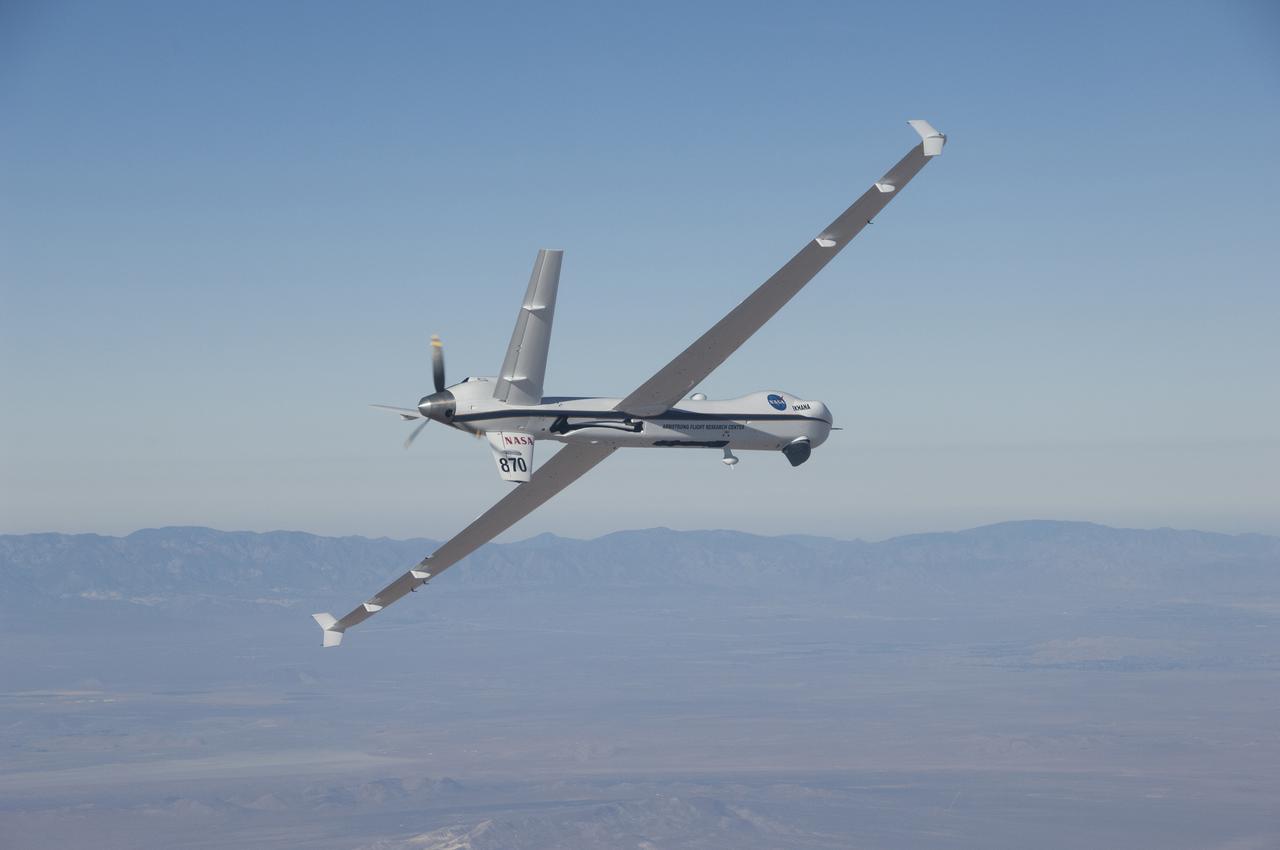
The Ikhana aircraft is flying a TAMDAR Edge probe that could significantly improve weather models and forecasts.
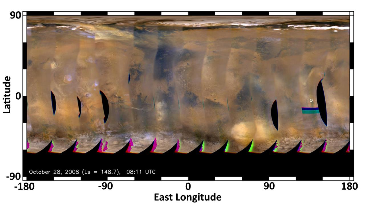
This global map of Mars was acquired on Oct. 28, 2008, by the Mars Color Imager instrument on NASA MRO. One global map is generated each day to forecast weather conditions for the entry, descent and landing of NASA Curiosity rover.
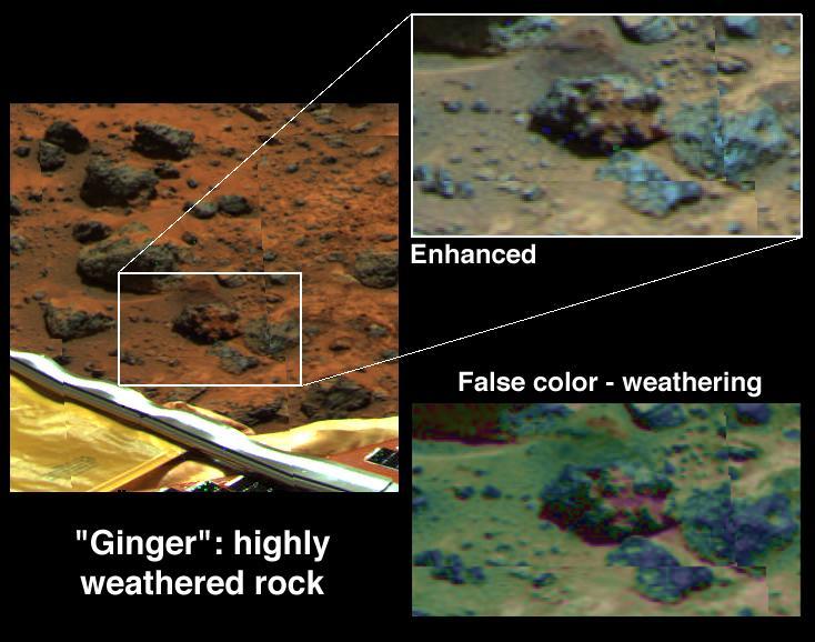
Weathering of Rock Ginger
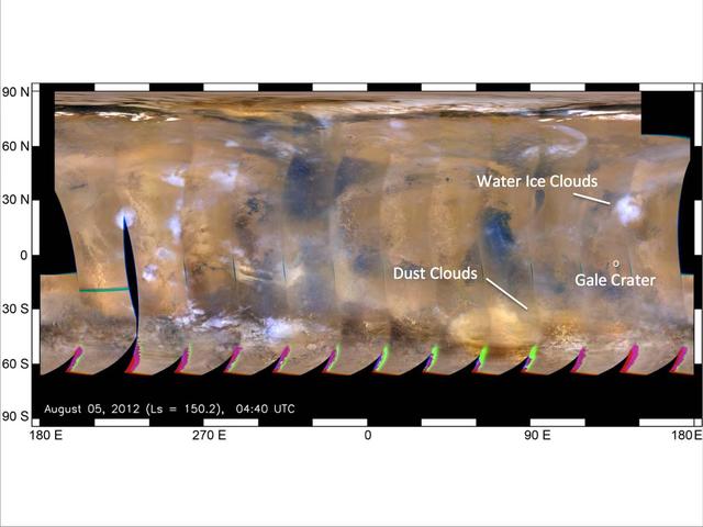
This global map of Mars was acquired on Aug. 5, 2012, by the Mars Color Imager instrument on NASA MRO. One global map is generated each day to forecast weather conditions for the entry, descent and landing of NASA Curiosity rover.
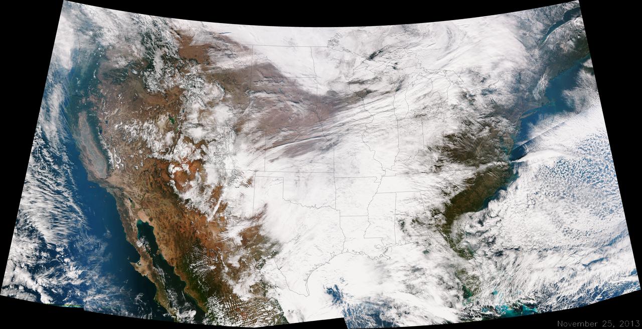
A large winter system is moving across the United States and is combining with cold air moving down from Canada, bringing snow to some areas. Major travel impacts are expected along the main highways throughout the eastern U.S. This true color image of the Continental U.S. was taken on November 25, 2013 by the Suomi NPP satellite and shows the system as it moves through the South and Midwest. <b><a href="http://www.nasa.gov/audience/formedia/features/MP_Photo_Guidelines.html" rel="nofollow">NASA image use policy.</a></b> <b><a href="http://www.nasa.gov/centers/goddard/home/index.html" rel="nofollow">NASA Goddard Space Flight Center</a></b> enables NASA’s mission through four scientific endeavors: Earth Science, Heliophysics, Solar System Exploration, and Astrophysics. Goddard plays a leading role in NASA’s accomplishments by contributing compelling scientific knowledge to advance the Agency’s mission. <b>Follow us on <a href="http://twitter.com/NASA_GoddardPix" rel="nofollow">Twitter</a></b> <b>Like us on <a href="http://www.facebook.com/pages/Greenbelt-MD/NASA-Goddard/395013845897?ref=tsd" rel="nofollow">Facebook</a></b> <b>Find us on <a href="http://instagrid.me/nasagoddard/?vm=grid" rel="nofollow">Instagram</a></b>
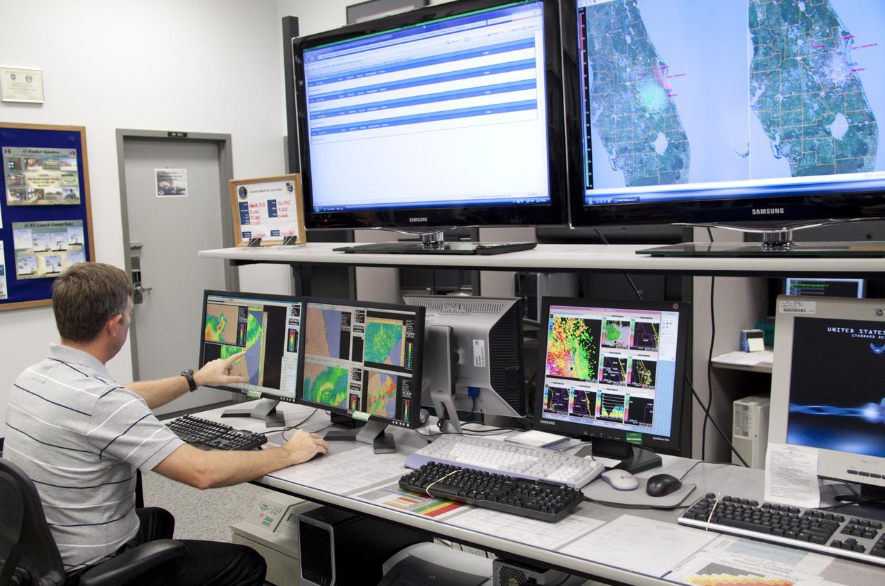
CAPE CANAVERAL, Fla. - At the Cape Canaveral Air Force Station forecast facility in Florida, a member of the weather team demonstrates the effectiveness of the new weather radar display recently installed. The facility is operated by the U.S. Air Force 45th Weather Squadron and will generate a launch weather forecast for the scheduled July 8 lift off of space shuttle Atlantis on the STS-135 mission. Photo credit: NASA/Jack Pfaller
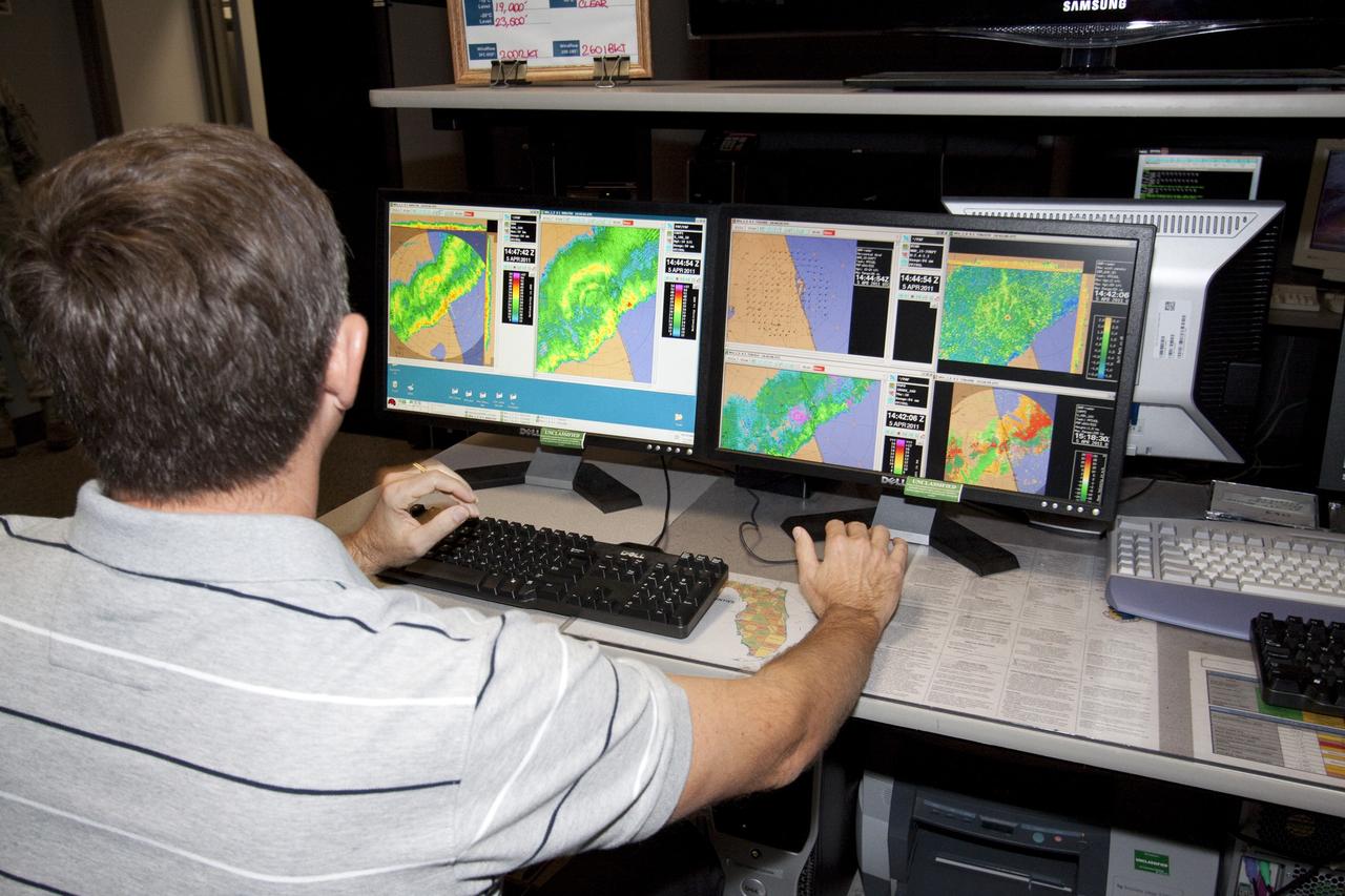
CAPE CANAVERAL, Fla. - At the Cape Canaveral Air Force Station forecast facility in Florida, a member of the weather team demonstrates the effectiveness of the new weather radar display recently installed. The facility is operated by the U.S. Air Force 45th Weather Squadron and will generate a launch weather forecast for the scheduled July 8 lift off of space shuttle Atlantis on the STS-135 mission. Photo credit: NASA/Jack Pfaller
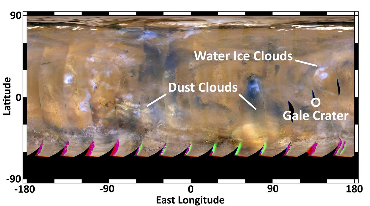
This global map of Mars was acquired on Aug. 4, 2012, by the Mars Color Imager instrument on NASA Mars Reconnaissance Orbiter to forecast weather conditions for the entry, descent and landing of NASA Curiosity rover.
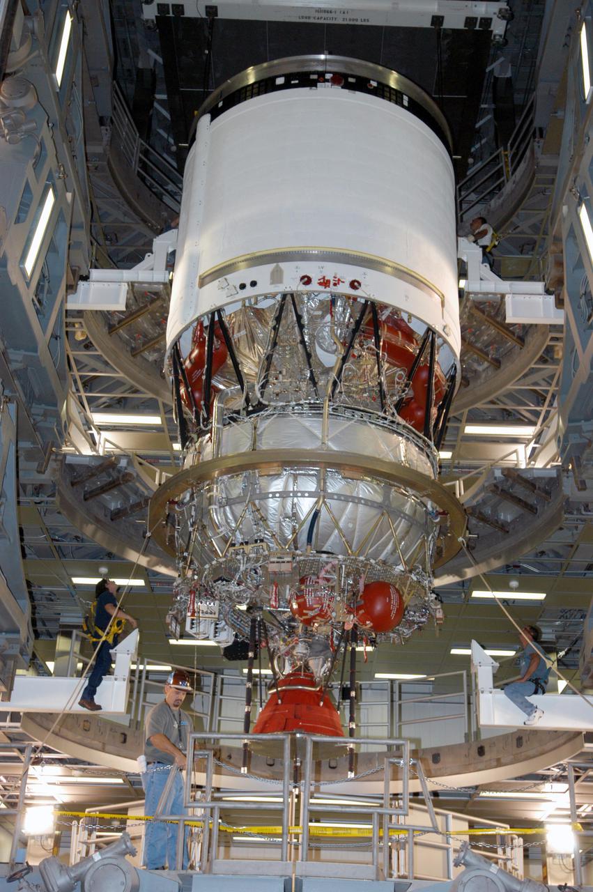
KENNEDY SPACE CENTER, FLA. - At the Boeing Delta Operations Center, the Delta IV second stage is lowered onto a test stand. Nozzles will be installed and a deployment test will follow. The Delta IV rocket will be used for the 2005 launching of the GOES-N weather satellite for NASA and NOAA (National Oceanic and Atmospheric Administration). The first in a series of three advanced weather satellites including GOES-O and GOES-P, the GOES-N will provide continuous monitoring necessary for intensive data analysis. It will provide a constant vigil for the atmospheric “triggers” of severe weather conditions such as tornadoes, flash floods, hail storms and hurricanes. When these conditions develop, GOES-N will be able to monitor storm development and track their movements.
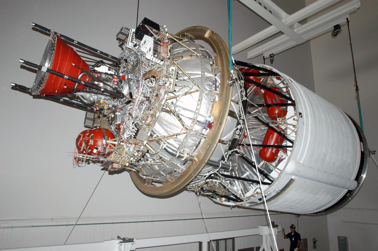
KENNEDY SPACE CENTER, FLA. - At the Boeing Delta Operations Center, the suspended second stage of a Boeing Delta IV launch vehicle is moved toward a work stand. The Delta IV rocket will be used for the 2005 launching of the GOES-N weather satellite for NASA and NOAA (National Oceanic and Atmospheric Administration). The first in a series of three advanced weather satellites including GOES-O and GOES-P, the GOES-N will provide continuous monitoring necessary for intensive data analysis. It will provide a constant vigil for the atmospheric “triggers” of severe weather conditions such as tornadoes, flash floods, hail storms and hurricanes. When these conditions develop, GOES-N will be able to monitor storm development and track their movements.
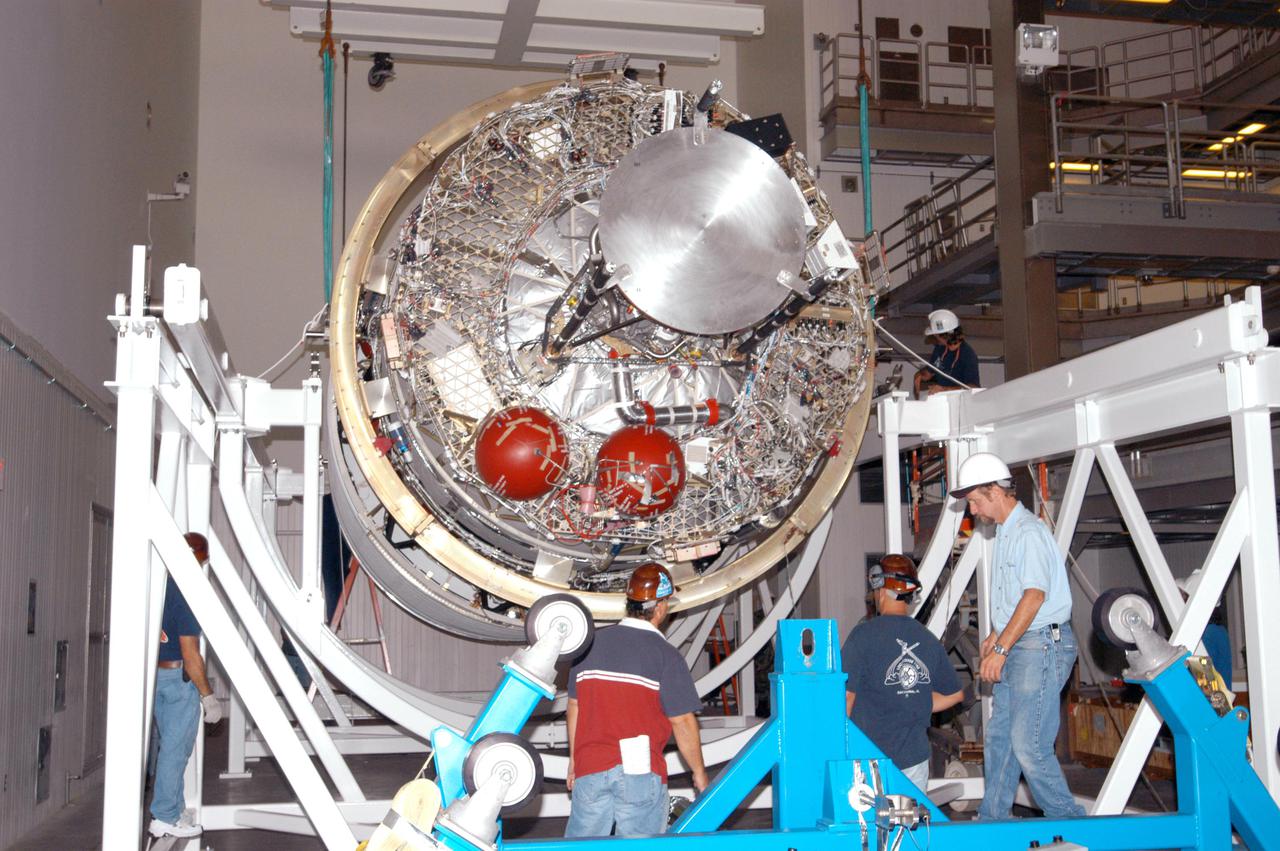
KENNEDY SPACE CENTER, FLA. - In the Boeing Delta Operations Center, the second stage of a Boeing Delta IV launch vehicle is lowered onto a work stand. The Delta IV rocket will be used for the 2005 launching of the GOES-N weather satellite for NASA and NOAA (National Oceanic and Atmospheric Administration). The first in a series of three advanced weather satellites including GOES-O and GOES-P, the GOES-N will provide continuous monitoring necessary for intensive data analysis. It will provide a constant vigil for the atmospheric “triggers” of severe weather conditions such as tornadoes, flash floods, hail storms and hurricanes. When these conditions develop, GOES-N will be able to monitor storm development and track their movements.
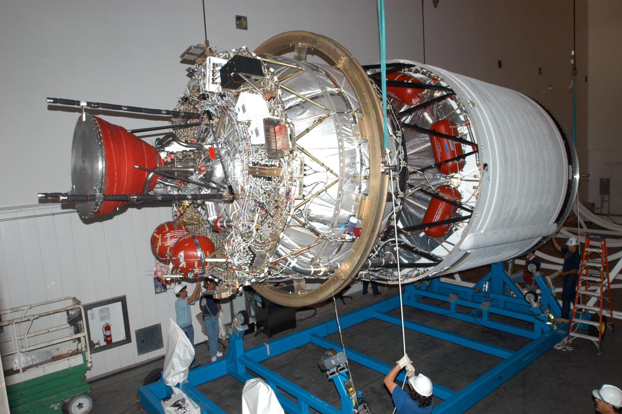
KENNEDY SPACE CENTER, FLA. - At the Boeing Delta Operations Center, the second stage of a Boeing Delta IV launch vehicle is lifted off its transporter for transfer to a work stand. The Delta IV rocket will be used for the 2005 launching of the GOES-N weather satellite for NASA and NOAA (National Oceanic and Atmospheric Administration). The first in a series of three advanced weather satellites including GOES-O and GOES-P, the GOES-N will provide continuous monitoring necessary for intensive data analysis. It will provide a constant vigil for the atmospheric “triggers” of severe weather conditions such as tornadoes, flash floods, hail storms and hurricanes. When these conditions develop, GOES-N will be able to monitor storm development and track their movements.
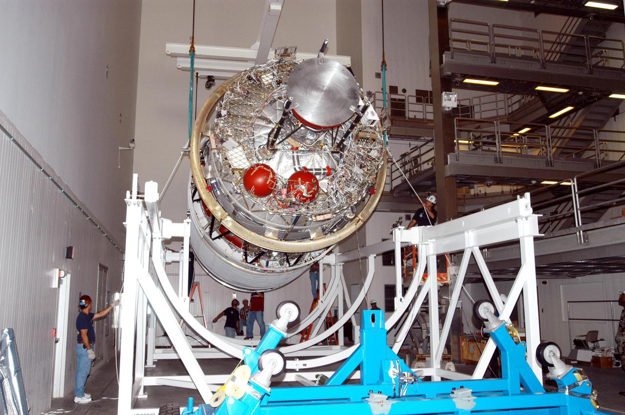
KENNEDY SPACE CENTER, FLA. - In the Boeing Delta Operations Center, the second stage of a Boeing Delta IV launch vehicle is lowered onto a work stand. The Delta IV rocket will be used for the 2005 launching of the GOES-N weather satellite for NASA and NOAA (National Oceanic and Atmospheric Administration). The first in a series of three advanced weather satellites including GOES-O and GOES-P, the GOES-N will provide continuous monitoring necessary for intensive data analysis. It will provide a constant vigil for the atmospheric “triggers” of severe weather conditions such as tornadoes, flash floods, hail storms and hurricanes. When these conditions develop, GOES-N will be able to monitor storm development and track their movements.
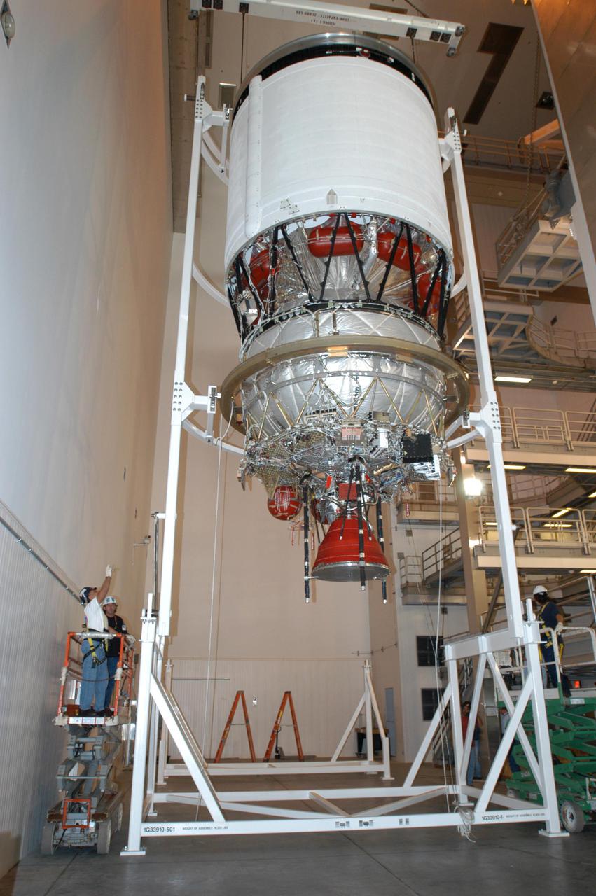
KENNEDY SPACE CENTER, FLA. - At the Boeing Delta Operations Center, the Delta IV second stage is rotated to a vertical position so that the nozzles can be installed. A deployment test will follow. The Delta IV rocket will be used for the 2005 launching of the GOES-N weather satellite for NASA and NOAA (National Oceanic and Atmospheric Administration). The first in a series of three advanced weather satellites including GOES-O and GOES-P, the GOES-N will provide continuous monitoring necessary for intensive data analysis. It will provide a constant vigil for the atmospheric “triggers” of severe weather conditions such as tornadoes, flash floods, hail storms and hurricanes. When these conditions develop, GOES-N will be able to monitor storm development and track their movements.
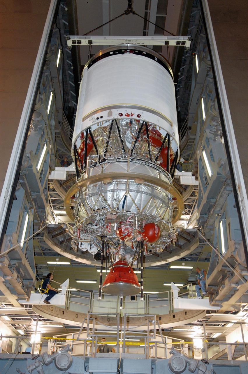
KENNEDY SPACE CENTER, FLA. - At the Boeing Delta Operations Center, the Delta IV second stage is moved to a test stand. Nozzles will be installed and a deployment test will follow. The Delta IV rocket will be used for the 2005 launching of the GOES-N weather satellite for NASA and NOAA (National Oceanic and Atmospheric Administration). The first in a series of three advanced weather satellites including GOES-O and GOES-P, the GOES-N will provide continuous monitoring necessary for intensive data analysis. It will provide a constant vigil for the atmospheric “triggers” of severe weather conditions such as tornadoes, flash floods, hail storms and hurricanes. When these conditions develop, GOES-N will be able to monitor storm development and track their movements.

Astronaut Shannon Walker prepares to release a weather balloon from the deck of the USS Portland alongside members of the U.S. Space Force 45th Weather Squadron ahead of the splashdown of the Orion spacecraft on Dec. 11. NASA's Landing and Recovery team works alongside the DoD to safely recover Orion after Artemis missions to the Moon.
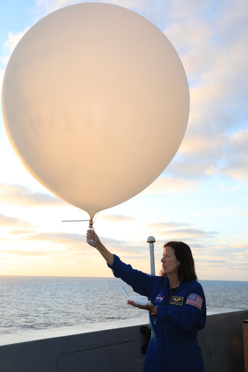
Astronaut Shannon Walker prepares to release a weather balloon from the deck of the USS Portland alongside members of the U.S. Space Force 45th Weather Squadron ahead of the splashdown of the Orion spacecraft on Dec. 11. NASA's Landing and Recovery team works alongside the DoD to safely recover Orion after Artemis missions to the Moon.
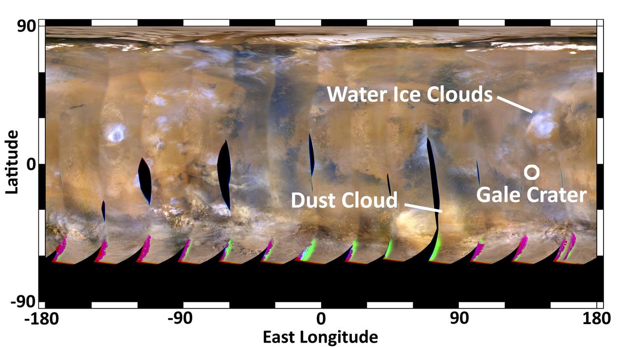
This global map of Mars was acquired on Aug. 2, 2012, by the Mars Color Imager instrument on NASA Mars Reconnaissance Orbiter. One global map is generated each day to forecast weather conditions for the entry, descent and landing of NASA Curiosity.
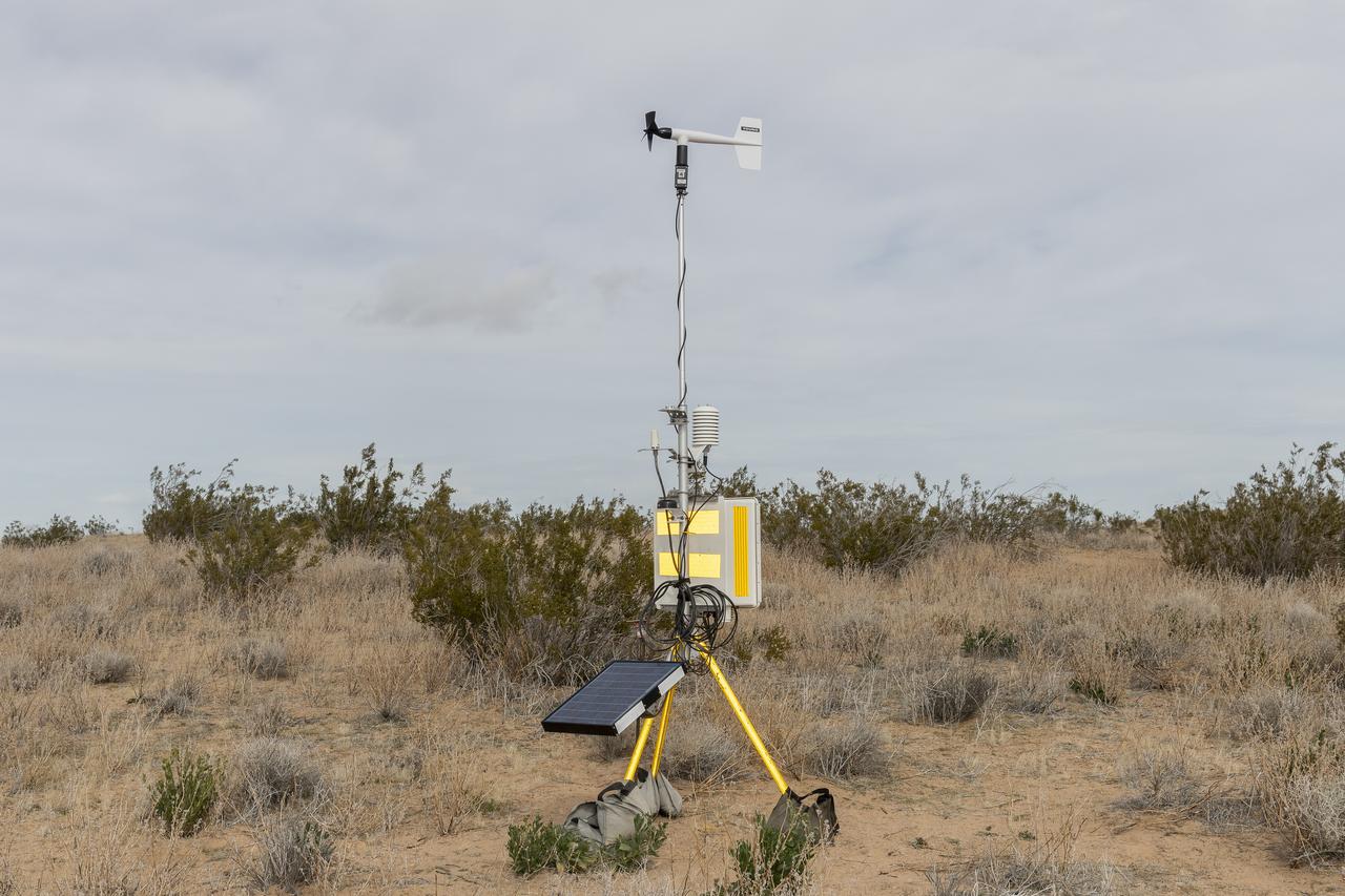
The Quesst mission recently completed testing of operations and equipment to be used in recording the sonic thumps of the X-59. Researchers used three weather towers and a sonic anemometer to collect weather and atmospheric data while recording sonic booms generated by an F-15 and an F-18 from NASA’s Armstrong Flight Research Center.
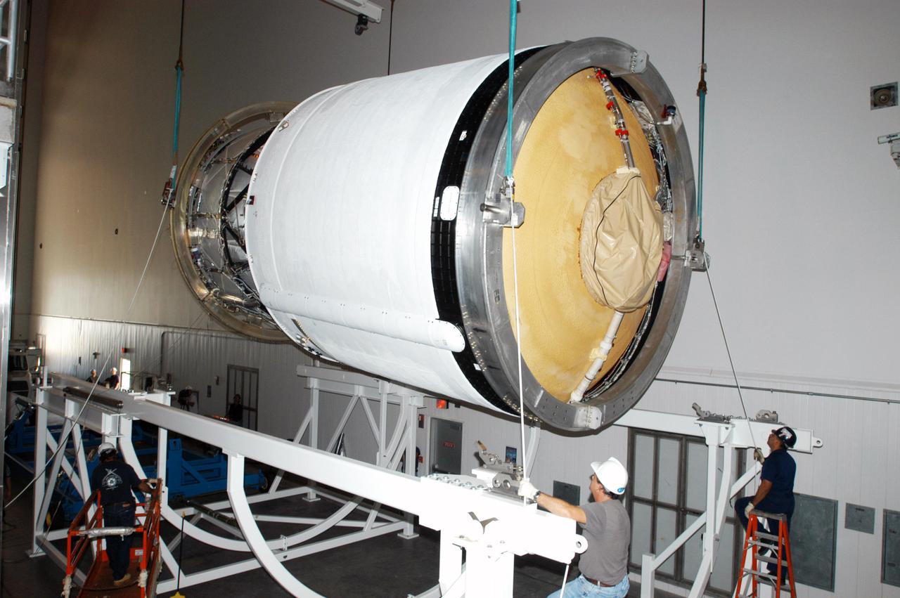
KENNEDY SPACE CENTER, FLA. - In the Boeing Delta Operations Center, workers carefully lower second stage of a Boeing Delta IV launch vehicle, suspended by a crane, onto a work stand. The Delta IV rocket will be used for the 2005 launching of the GOES-N weather satellite for NASA and NOAA (National Oceanic and Atmospheric Administration). The first in a series of three advanced weather satellites including GOES-O and GOES-P, the GOES-N will provide continuous monitoring necessary for intensive data analysis. It will provide a constant vigil for the atmospheric “triggers” of severe weather conditions such as tornadoes, flash floods, hail storms and hurricanes. When these conditions develop, GOES-N will be able to monitor storm development and track their movements.
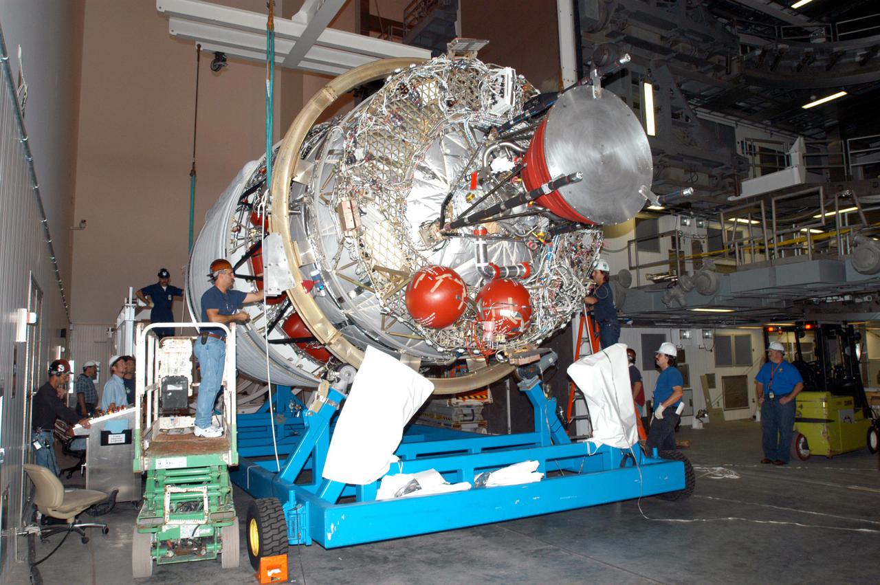
KENNEDY SPACE CENTER, FLA. - At the Boeing Delta Operations Center, workers prepare the second stage of a Boeing Delta IV launch vehicle for transfer from its transporter to a work stand. The Delta IV rocket will be used for the 2005 launching of the GOES-N weather satellite for NASA and NOAA (National Oceanic and Atmospheric Administration). The first in a series of three advanced weather satellites including GOES-O and GOES-P, the GOES-N will provide continuous monitoring necessary for intensive data analysis. It will provide a constant vigil for the atmospheric “triggers” of severe weather conditions such as tornadoes, flash floods, hail storms and hurricanes. When these conditions develop, GOES-N will be able to monitor storm development and track their movements.
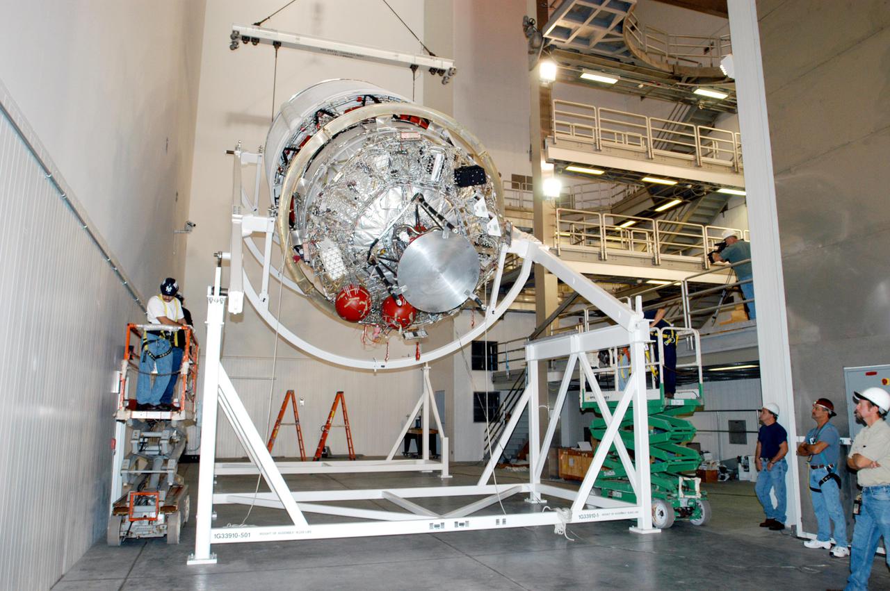
KENNEDY SPACE CENTER, FLA. - At the Boeing Delta Operations Center, the Delta IV second stage is lowered onto a rotation stand so that the nozzles can be installed. A deployment test will follow. The Delta IV rocket will be used for the 2005 launching of the GOES-N weather satellite for NASA and NOAA (National Oceanic and Atmospheric Administration). The first in a series of three advanced weather satellites including GOES-O and GOES-P, the GOES-N will provide continuous monitoring necessary for intensive data analysis. It will provide a constant vigil for the atmospheric “triggers” of severe weather conditions such as tornadoes, flash floods, hail storms and hurricanes. When these conditions develop, GOES-N will be able to monitor storm development and track their movements.
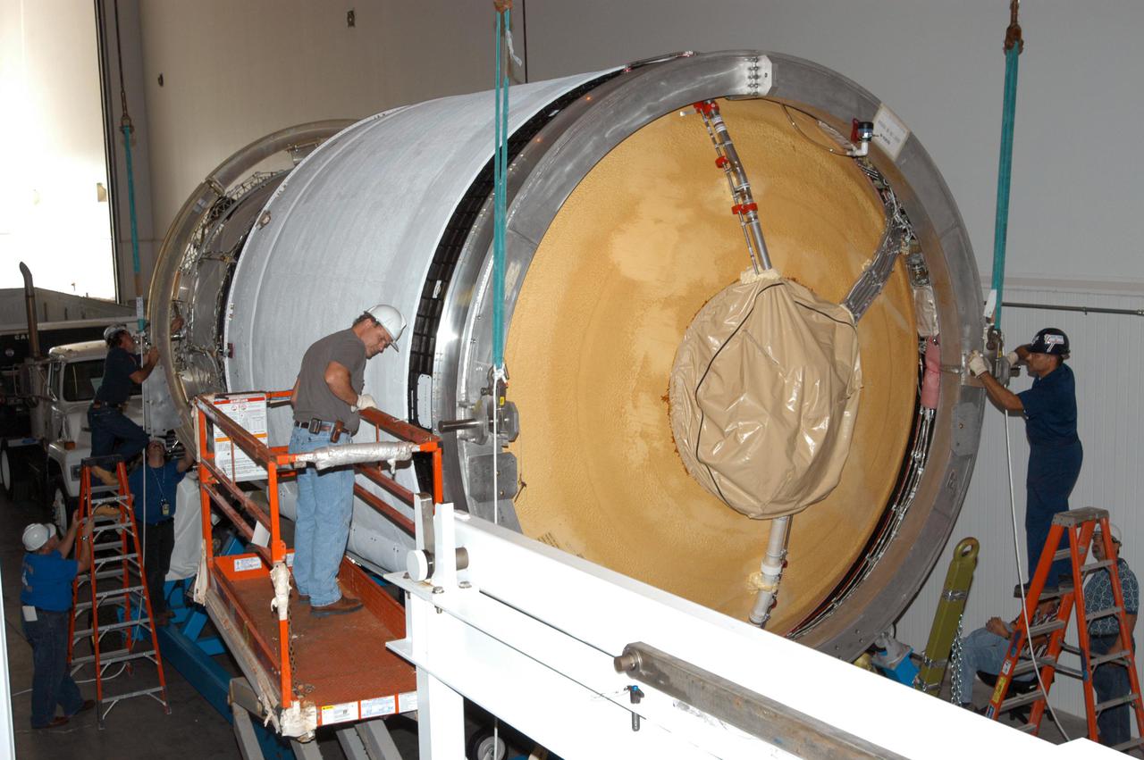
KENNEDY SPACE CENTER, FLA. - At the Boeing Delta Operations Center, workers attach a crane to the second stage of a Boeing Delta IV launch vehicle for transfer from its transporter to a work stand. The Delta IV rocket will be used for the 2005 launching of the GOES-N weather satellite for NASA and NOAA (National Oceanic and Atmospheric Administration). The first in a series of three advanced weather satellites including GOES-O and GOES-P, the GOES-N will provide continuous monitoring necessary for intensive data analysis. It will provide a constant vigil for the atmospheric “triggers” of severe weather conditions such as tornadoes, flash floods, hail storms and hurricanes. When these conditions develop, GOES-N will be able to monitor storm development and track their movements.
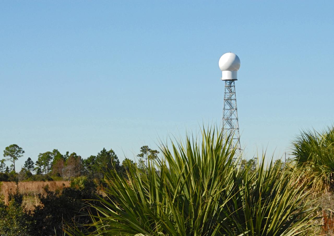
CAPE CANAVERAL, Fla. -- A replacement weather Doppler radar has been installed on top of this tower in a remote field located west of NASA's Kennedy Space Center in Florida. The radome houses the rotating antenna and pedestal and protects them from the elements. The tower is 100 feet high; the radome is 22 feet in diameter, the antenna 14 feet in diameter. It rotates at 6 rpm. The structure can withstand 130 mph winds. It is undergoing initial testing and expected to become operational in the summer. The weather radar is essential in issuing lightning and other severe weather warnings and vital in evaluating lightning launch commit criteria for space shuttle and rocket launches. Photo credit: NASA/Troy Cryder
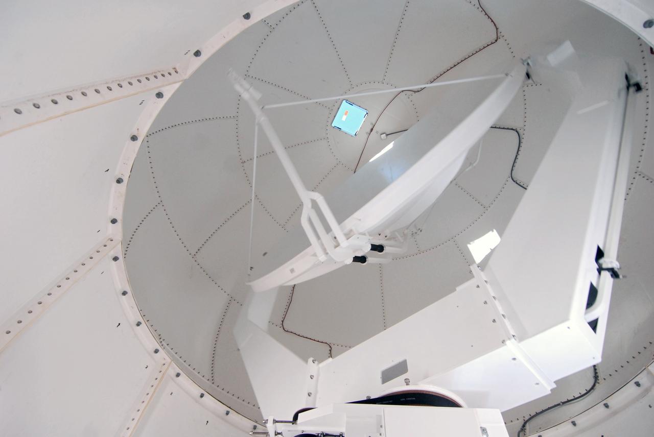
CAPE CANAVERAL, Fla. -- A closeup of the replacement weather Doppler radar being installed in a remote field located west of NASA's Kennedy Space Center in Florida. The tower is 100 feet high; the radome is 22 feet in diameter, the antenna 14 feet in diameter. It rotates at 6 rpm. The structure can withstand 130 mph winds. It is undergoing initial testing and expected to become operational in the summer. The weather radar is essential in issuing lightning and other severe weather warnings and vital in evaluating lightning launch commit criteria for space shuttle and rocket launches. Photo credit: NASA/Troy Cryder
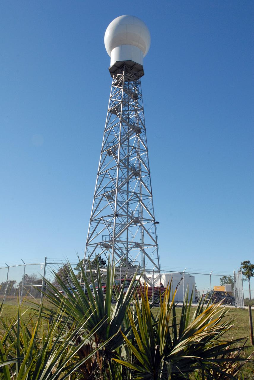
CAPE CANAVERAL, Fla. -- A replacement weather Doppler radar has been installed on top of this tower in a remote field located west of NASA's Kennedy Space Center in Florida. The radome houses the rotating antenna and pedestal and protects them from the elements. The tower is 100 feet high; the radome is 22 feet in diameter, the antenna 14 feet in diameter. It rotates at 6 rpm. The structure can withstand 130 mph winds. It is undergoing initial testing and expected to become operational in the summer. The weather radar is essential in issuing lightning and other severe weather warnings and vital in evaluating lightning launch commit criteria for space shuttle and rocket launches. Photo credit: NASA/Troy Cryder
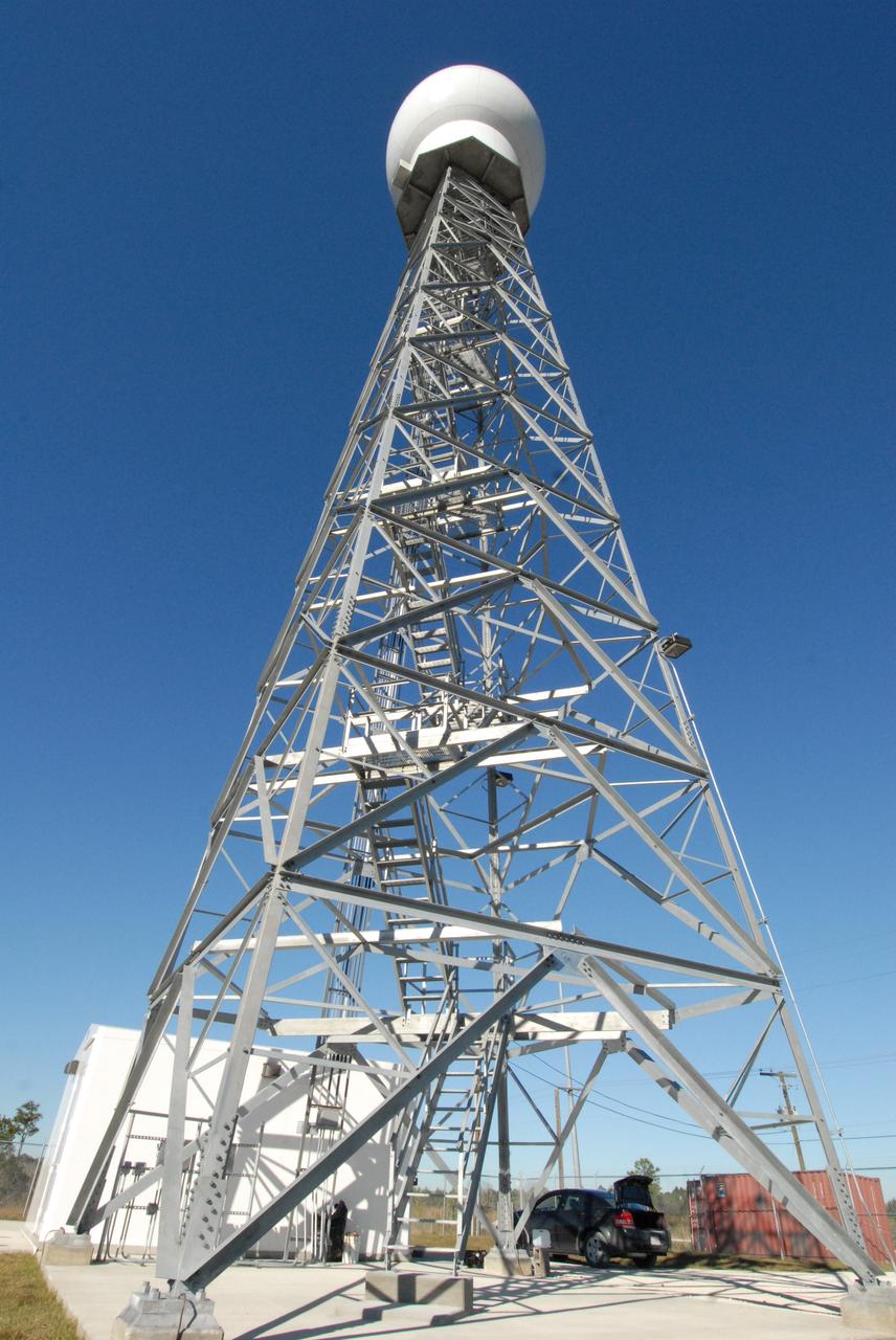
CAPE CANAVERAL, Fla. -- A replacement weather Doppler radar has been installed in the radome on top of this tower in a remote field located west of NASA's Kennedy Space Center in Florida. The dome houses the rotating antenna and pedestal and protects them from the elements. The tower is 100 feet high; the radome is 22 feet in diameter, the antenna 14 feet in diameter. It rotates at 6 rpm. The structure can withstand 130 mph winds. It is undergoing initial testing and expected to become operational in the summer. The weather radar is essential in issuing lightning and other severe weather warnings and vital in evaluating lightning launch commit criteria for space shuttle and rocket launches. Photo credit: NASA/Troy Cryder
CAPE CANAVERAL, Fla. -- A closeup of the replacement weather Doppler radar being installed in a remote field located west of NASA's Kennedy Space Center in Florida. The tower is 100 feet high; the radome is 22 feet in diameter, the antenna 14 feet in diameter. It rotates at 6 rpm. The structure can withstand 130 mph winds. It is undergoing initial testing and expected to become operational in the summer. The weather radar is essential in issuing lightning and other severe weather warnings and vital in evaluating lightning launch commit criteria for space shuttle and rocket launches. Photo credit: NASA/Troy Cryder
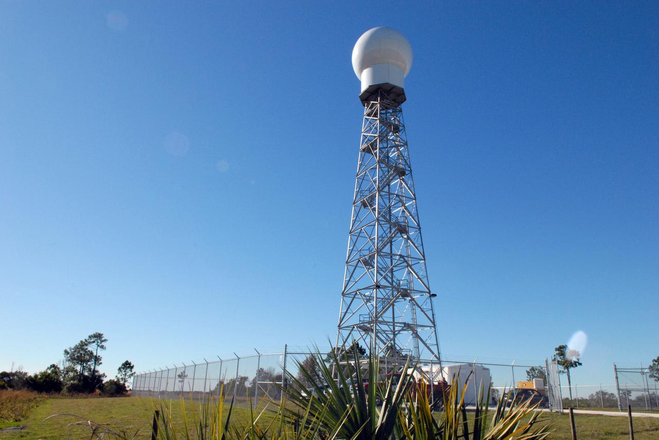
CAPE CANAVERAL, Fla. -- A replacement weather Doppler radar has been installed on top of this tower in a remote field located west of NASA's Kennedy Space Center in Florida. The radome houses the rotating antenna and pedestal and protects them from the elements. The tower is 100 feet high; the radome is 22 feet in diameter, the antenna 14 feet in diameter. It rotates at 6 rpm. The structure can withstand 130 mph winds. It is undergoing initial testing and expected to become operational in the summer. The weather radar is essential in issuing lightning and other severe weather warnings and vital in evaluating lightning launch commit criteria for space shuttle and rocket launches. Photo credit: NASA/Troy Cryder
CAPE CANAVERAL, Fla. -- A closeup of the replacement weather Doppler radar being installed in a remote field located west of NASA's Kennedy Space Center in Florida. The tower is 100 feet high; the radome is 22 feet in diameter, the antenna 14 feet in diameter. It rotates at 6 rpm. The structure can withstand 130 mph winds. It is undergoing initial testing and expected to become operational in the summer. The weather radar is essential in issuing lightning and other severe weather warnings and vital in evaluating lightning launch commit criteria for space shuttle and rocket launches. Photo credit: NASA/Troy Cryder
CAPE CANAVERAL, Fla. -- A closeup of the replacement weather Doppler radar being installed in a remote field located west of NASA's Kennedy Space Center in Florida. The tower is 100 feet high; the radome is 22 feet in diameter, the antenna 14 feet in diameter. It rotates at 6 rpm. The structure can withstand 130 mph winds. It is undergoing initial testing and expected to become operational in the summer. The weather radar is essential in issuing lightning and other severe weather warnings and vital in evaluating lightning launch commit criteria for space shuttle and rocket launches. Photo credit: NASA/Troy Cryder
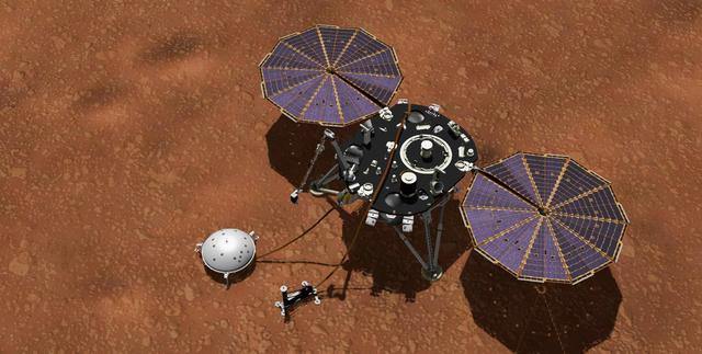
This artist's concept shows NASA's InSight lander with its instruments deployed on the Martian surface. InSight's package of weather sensors, called the Auxiliary Payload Subsystem (APSS), includes an air pressure sensor inside the lander -- its inlet is visible on InSight's deck -- and two air temperature and wind sensors on the deck. Under the deck's edge is a magnetometer, provided by UCLA, to measure changes in the local magnetic field that could also influence SEIS. InSight's air temperature and wind sensors are actually refurbished spares built for Curiosity's Rover Environmental Monitoring Station (REMS). Called Temperature and Wind for InSight, or TWINS, these two east- and west-facing booms sit on the lander's deck and were provided by Spain's Centro de Astrobiología (CAB). https://photojournal.jpl.nasa.gov/catalog/PIA22957
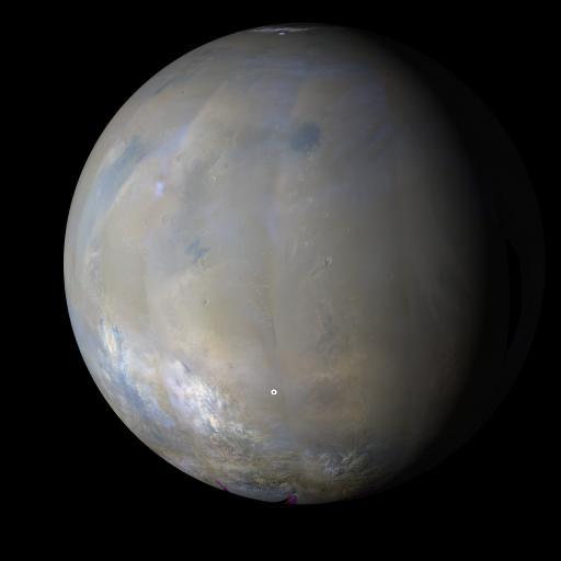
NASA MARCI acquires a global view of the red planet and its weather patterns every day. This image was taken on Nov. 3, 2008 by the Mars Reconnaissance Orbiter.
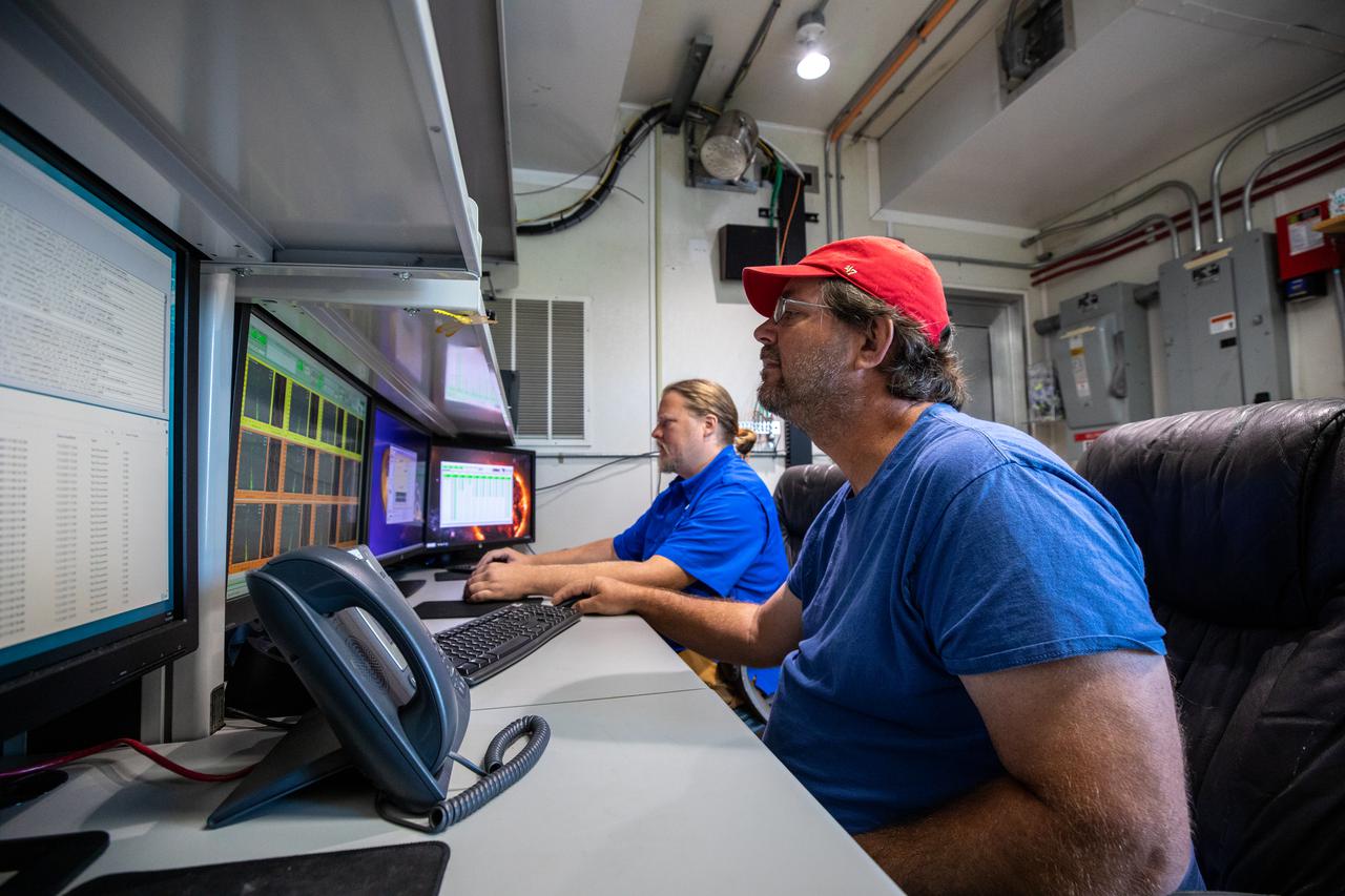
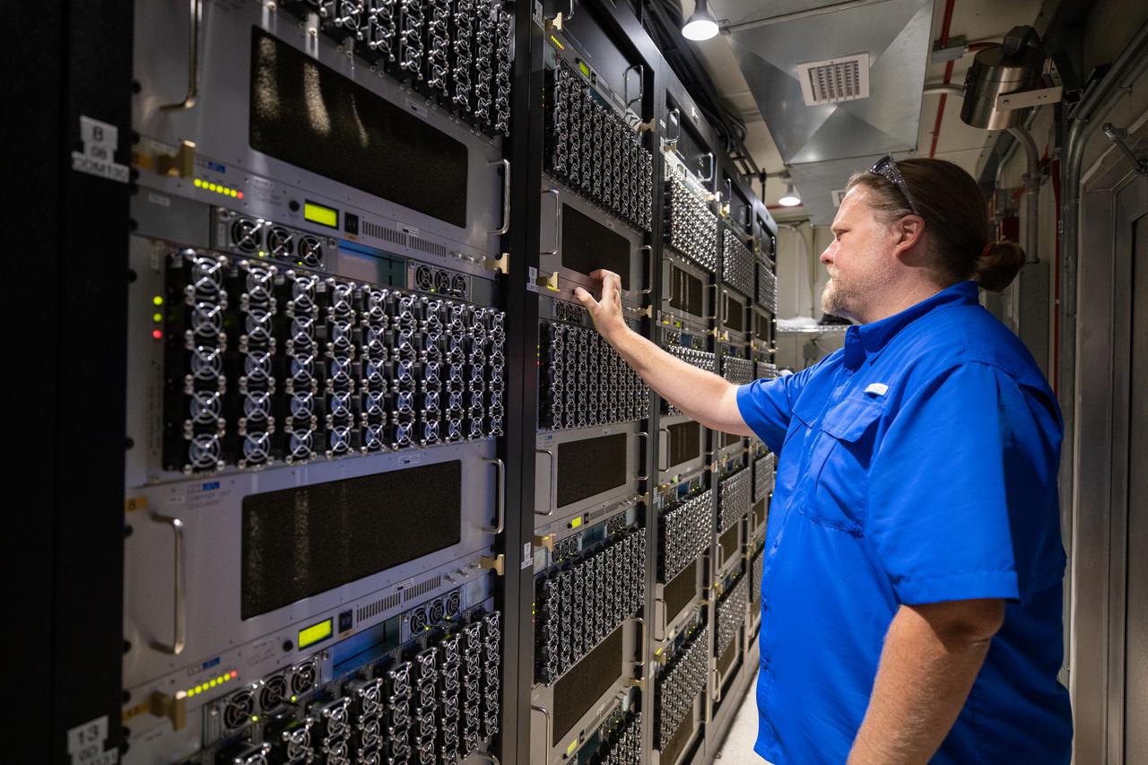
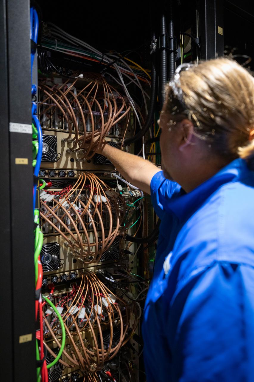
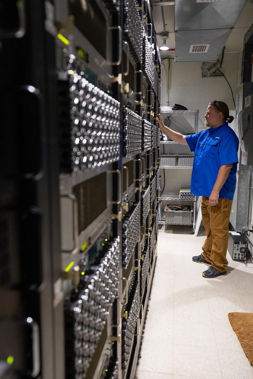
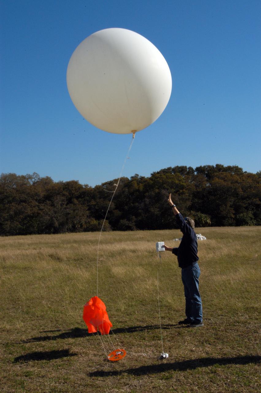
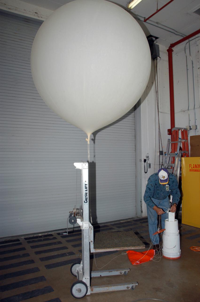
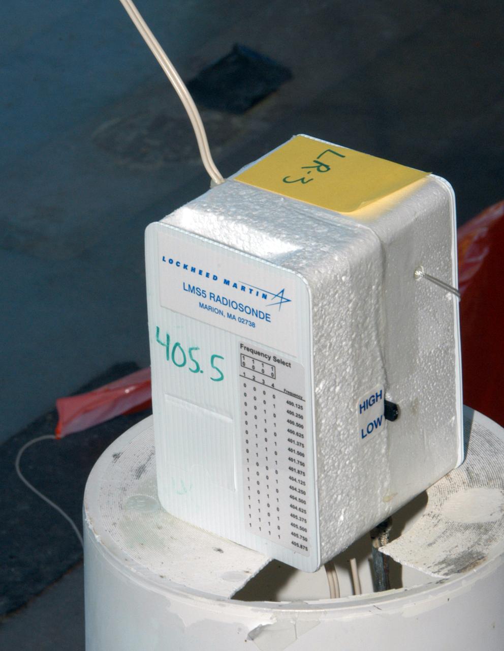
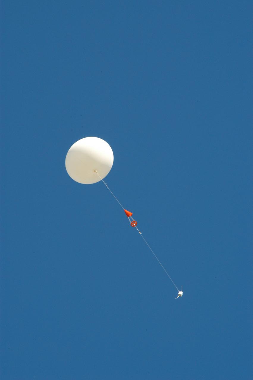
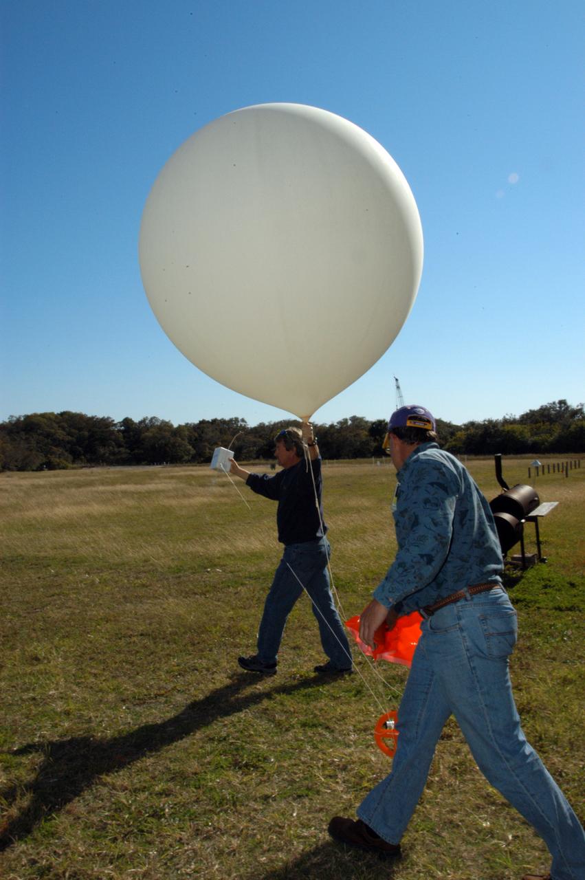
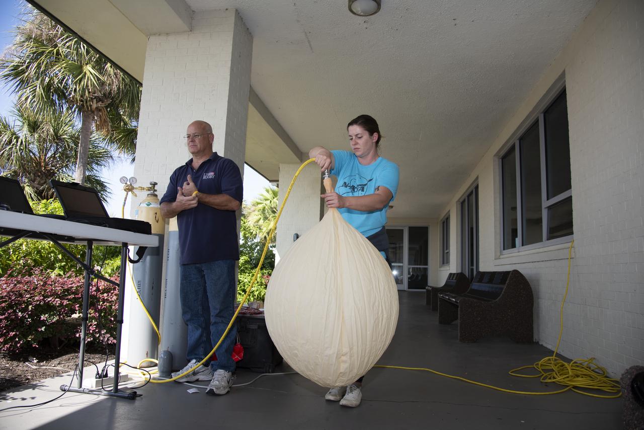
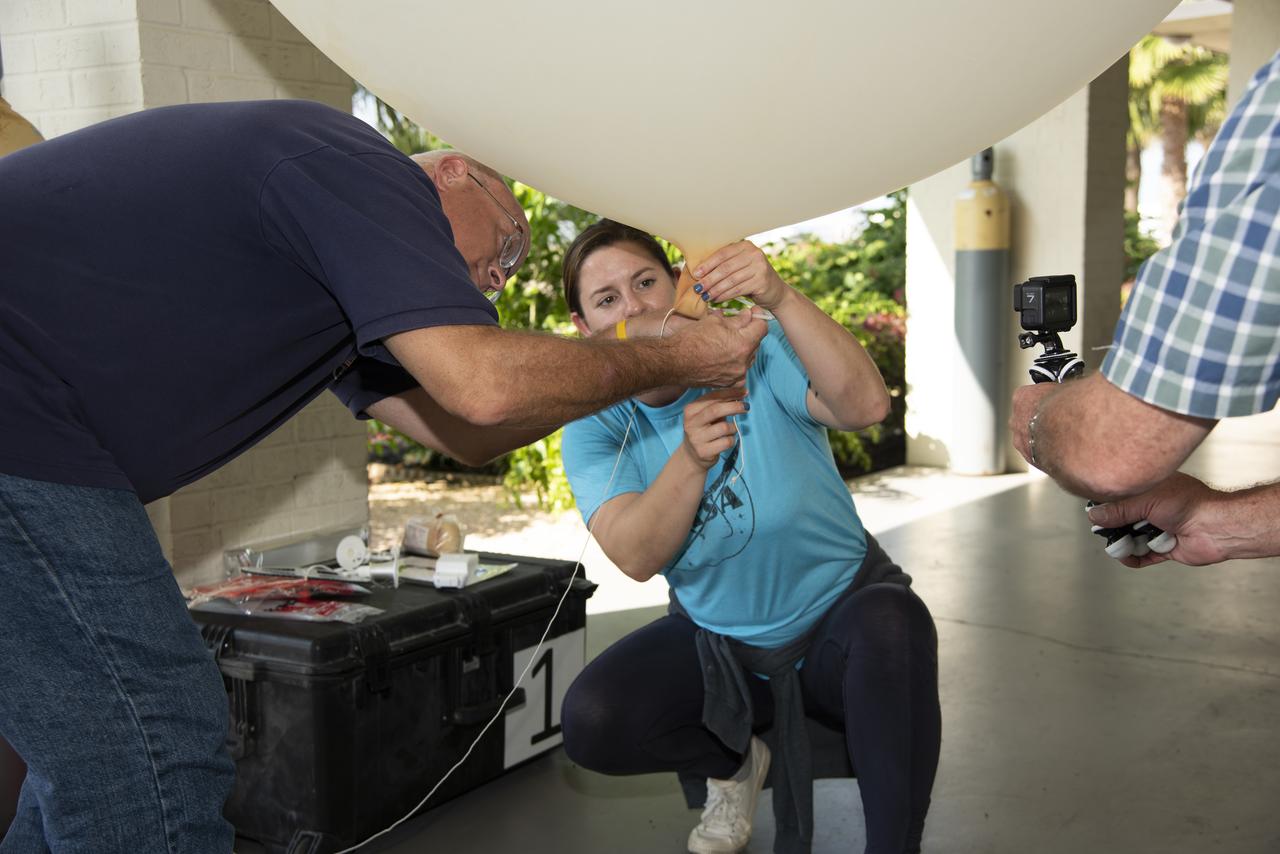
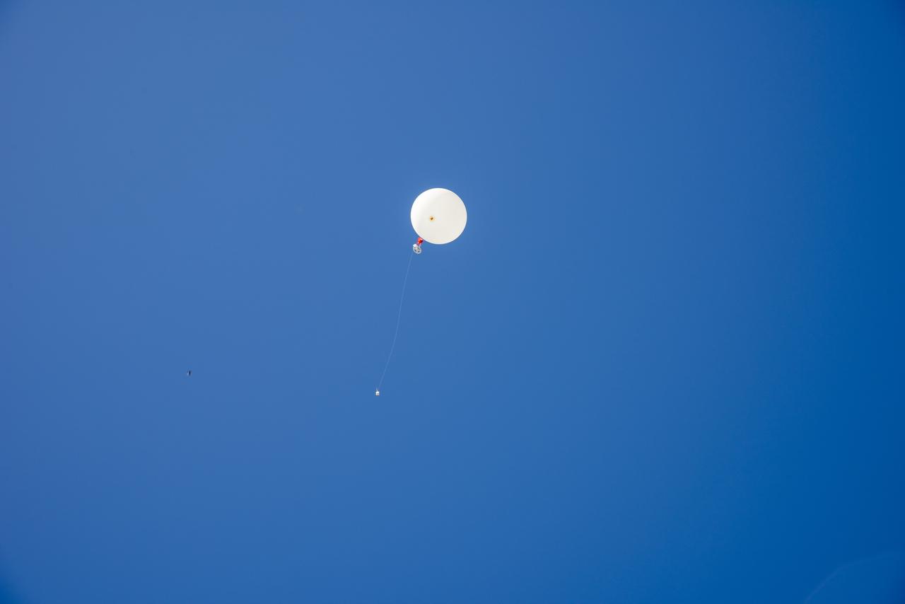
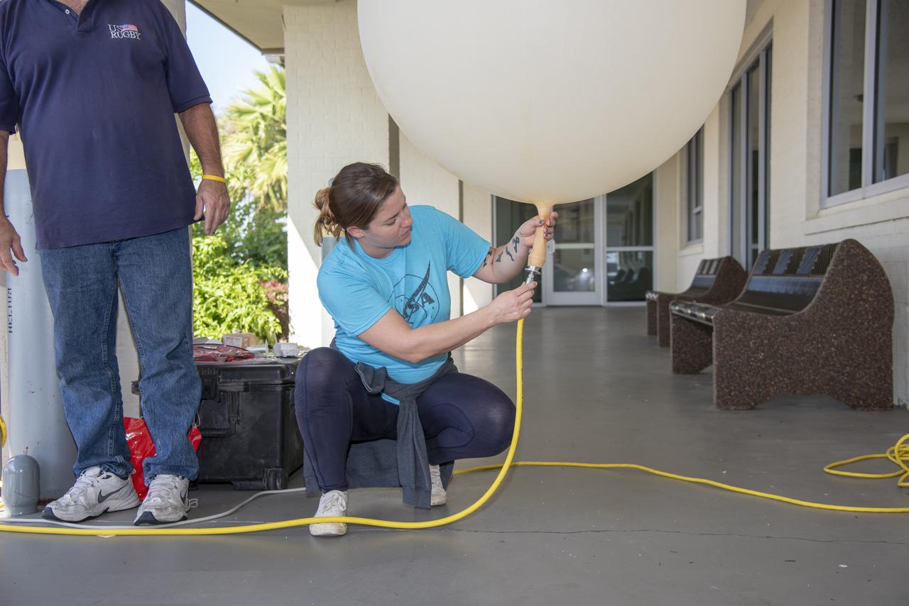
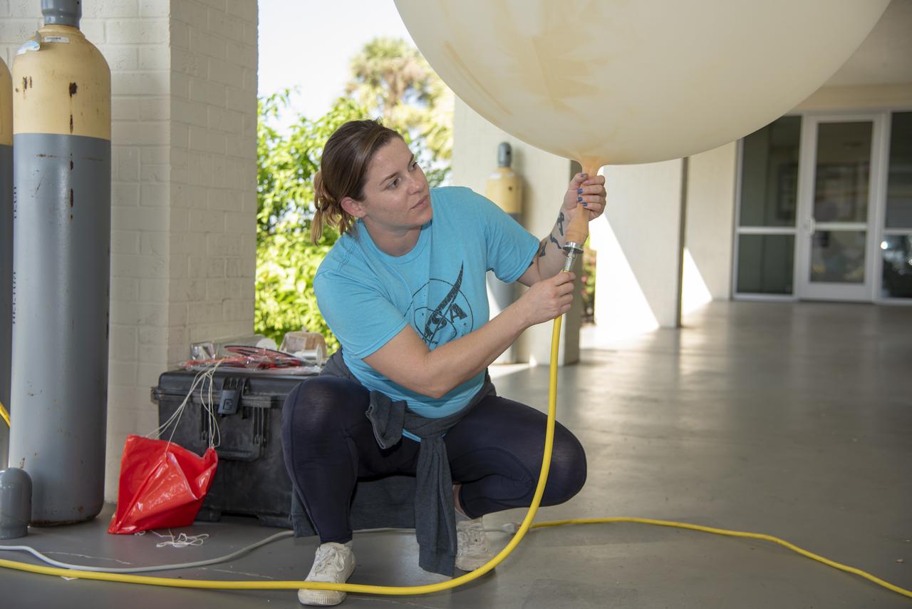
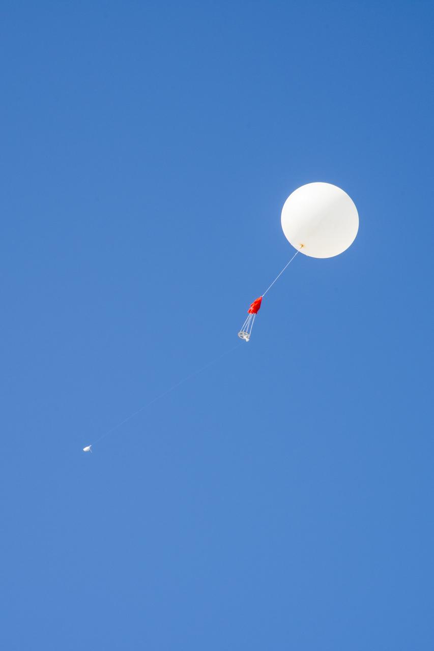
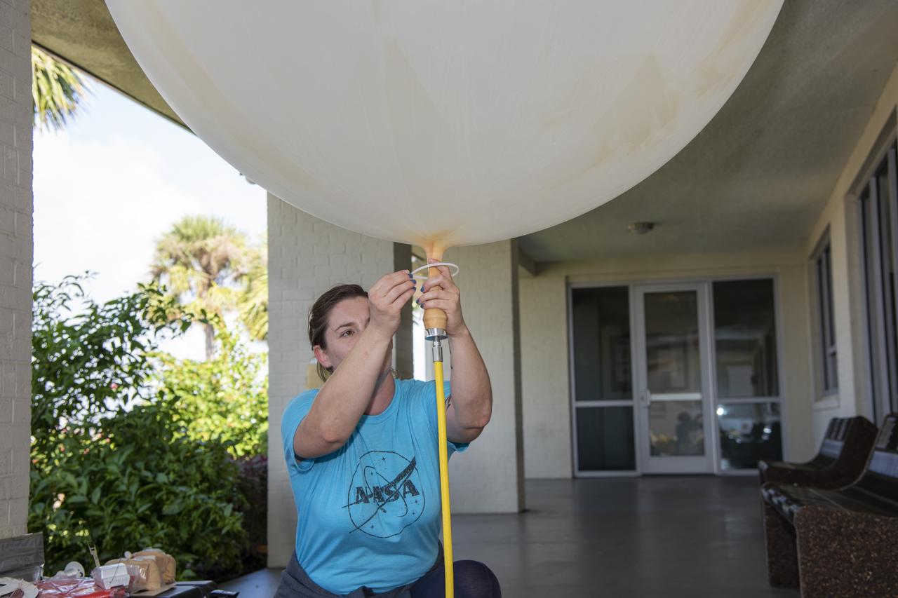
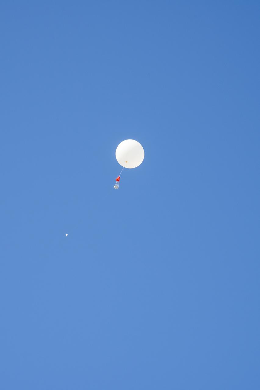
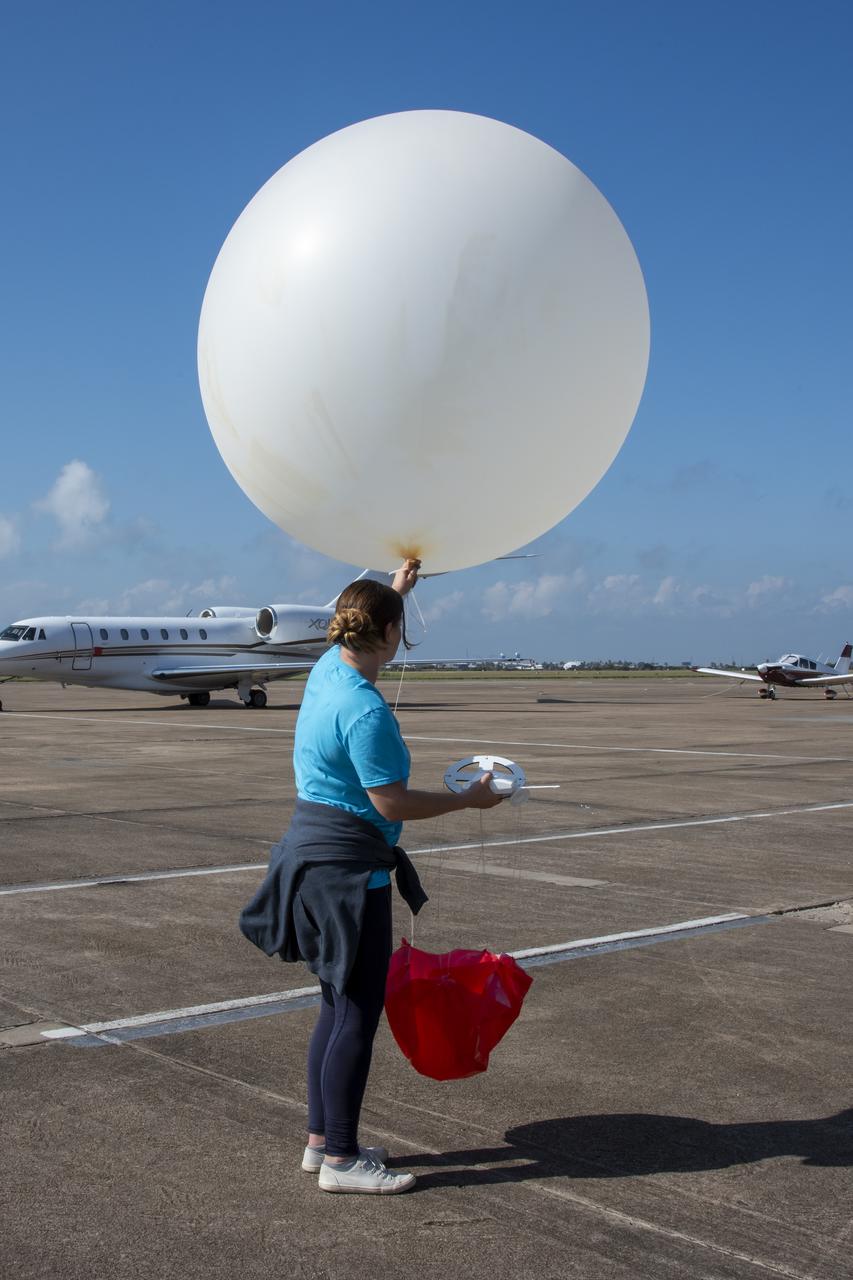
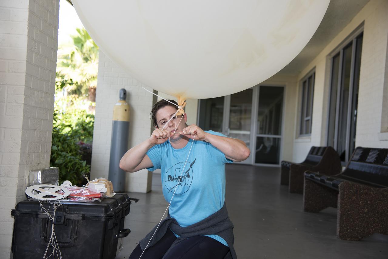
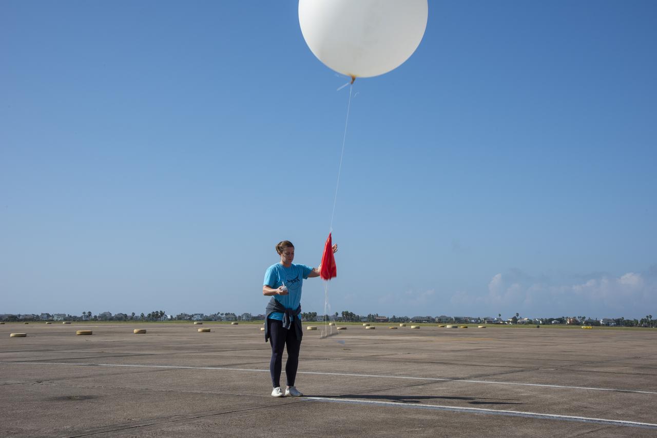
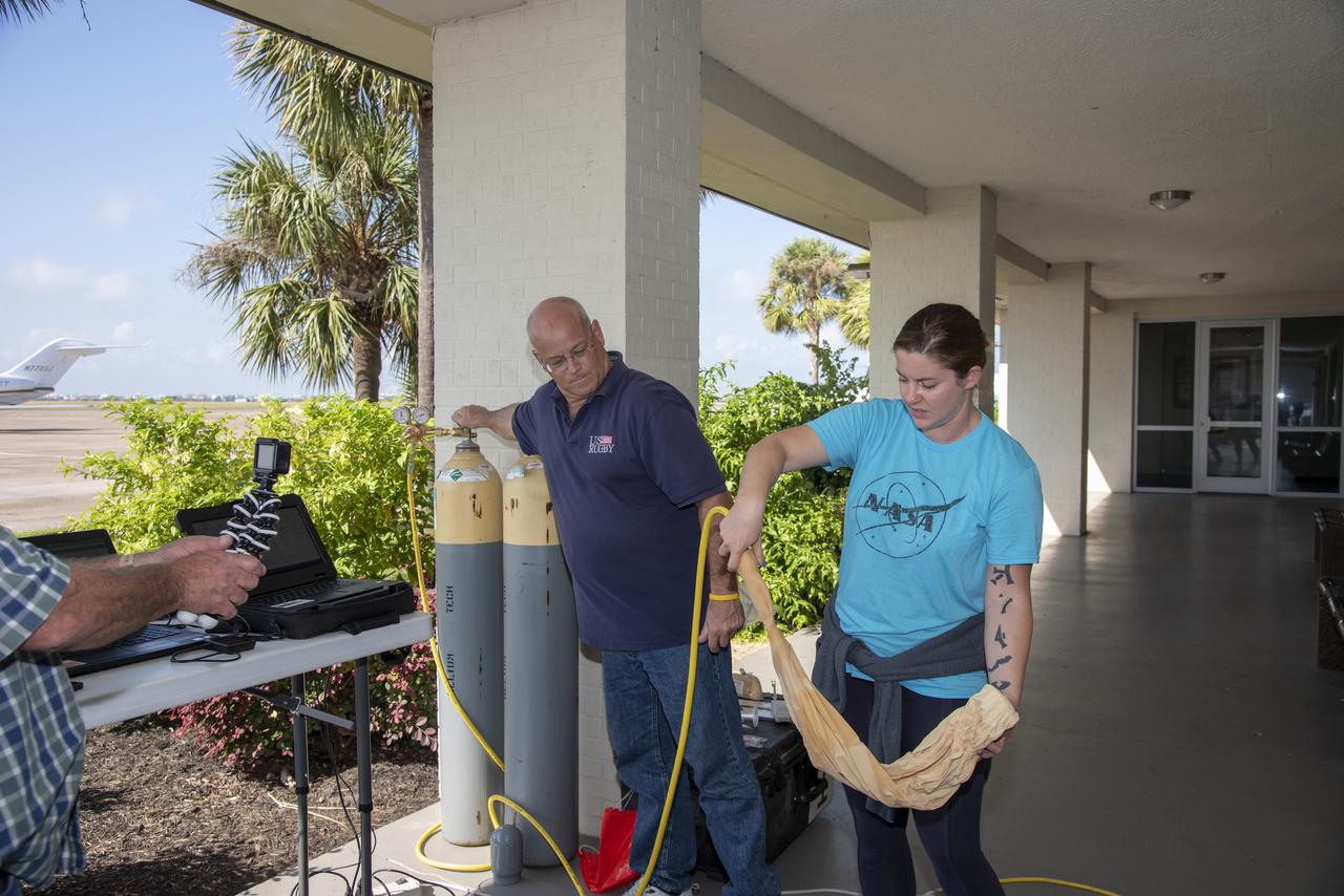
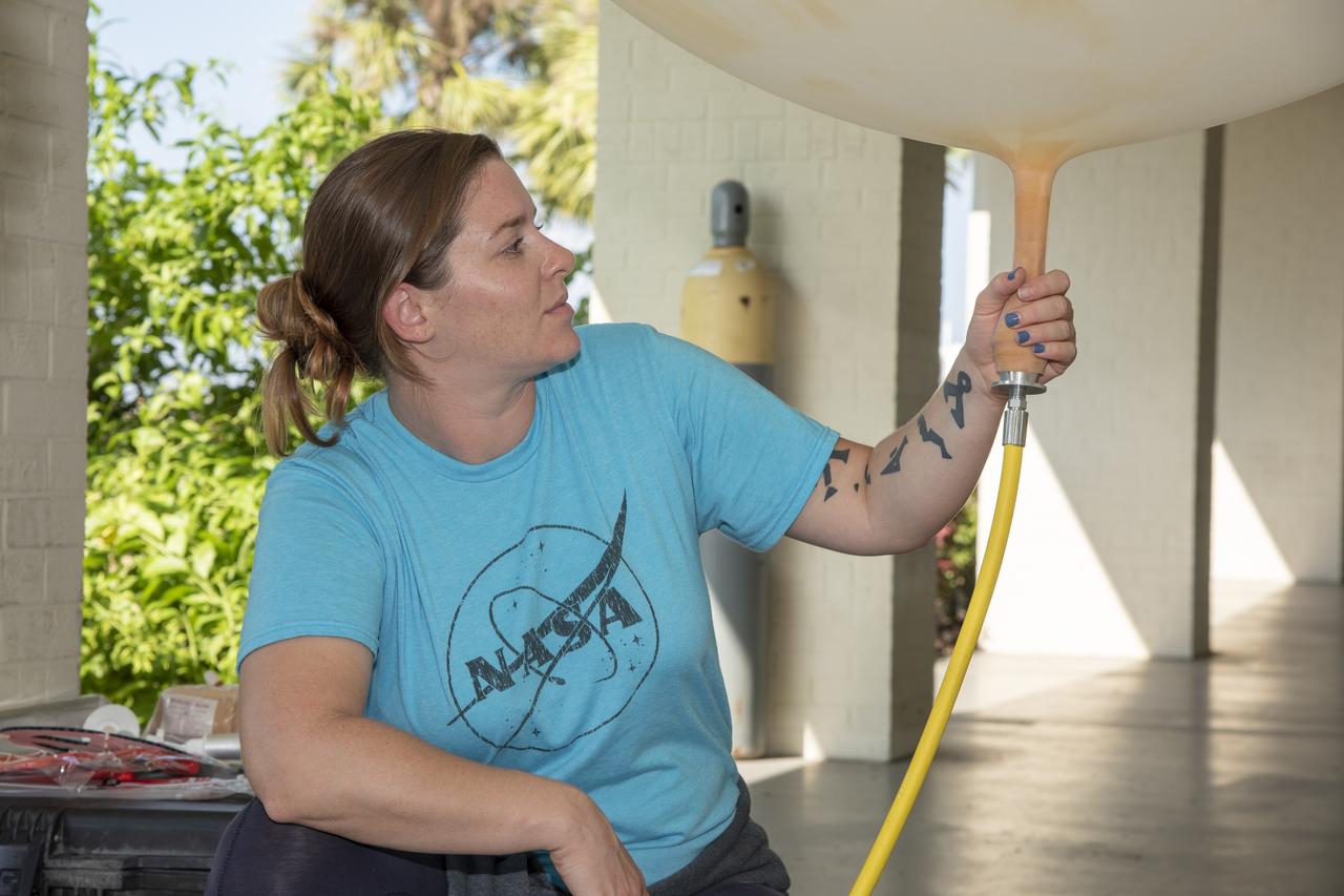
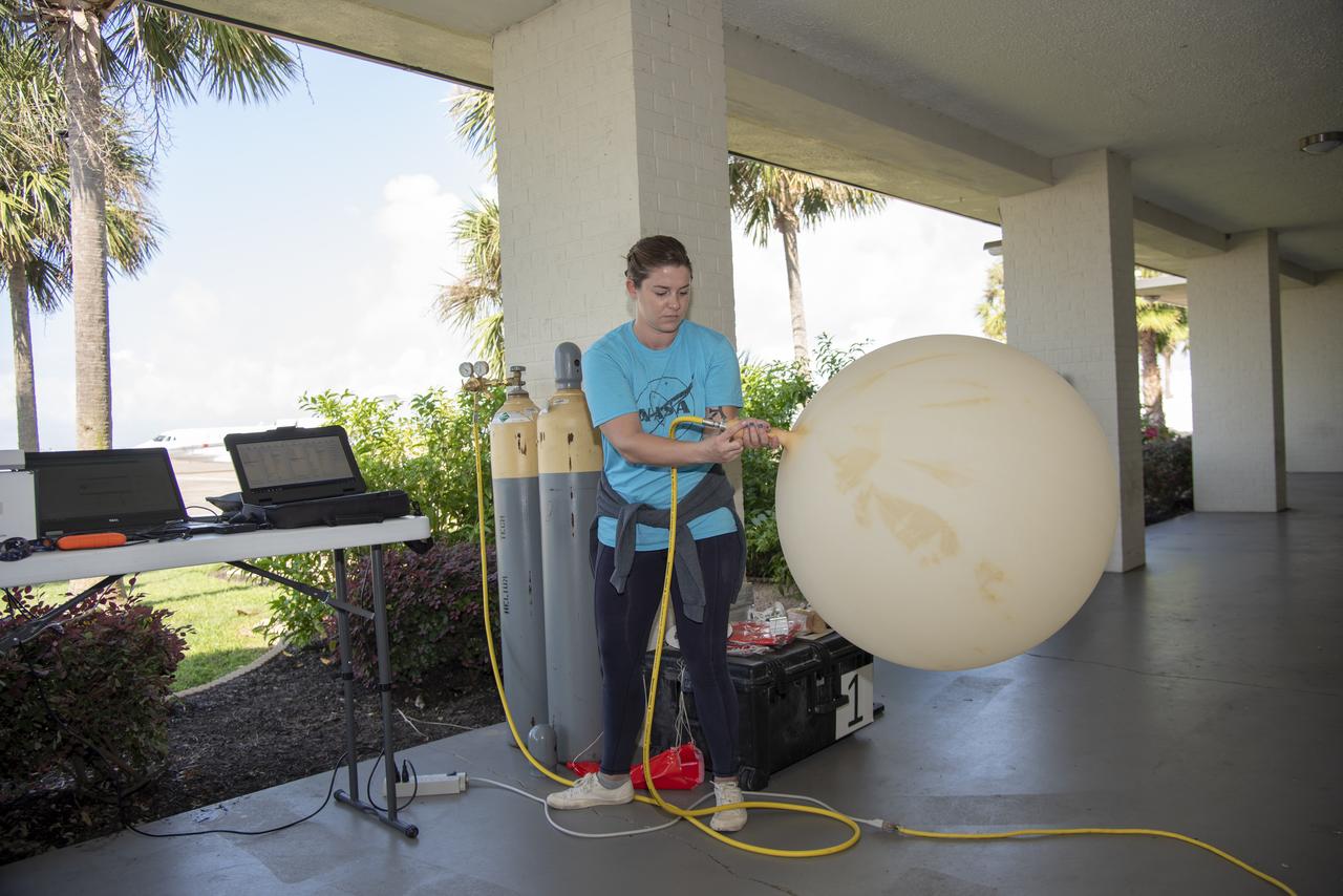
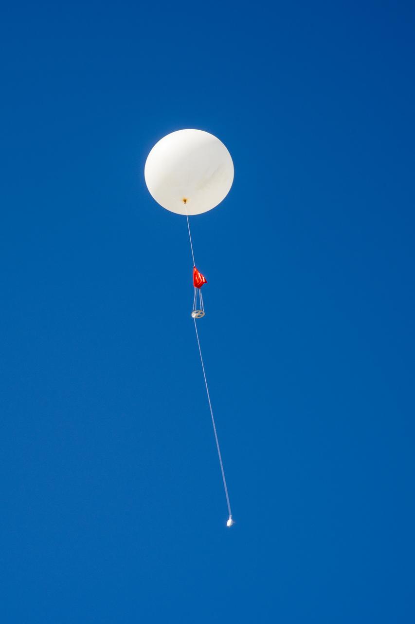
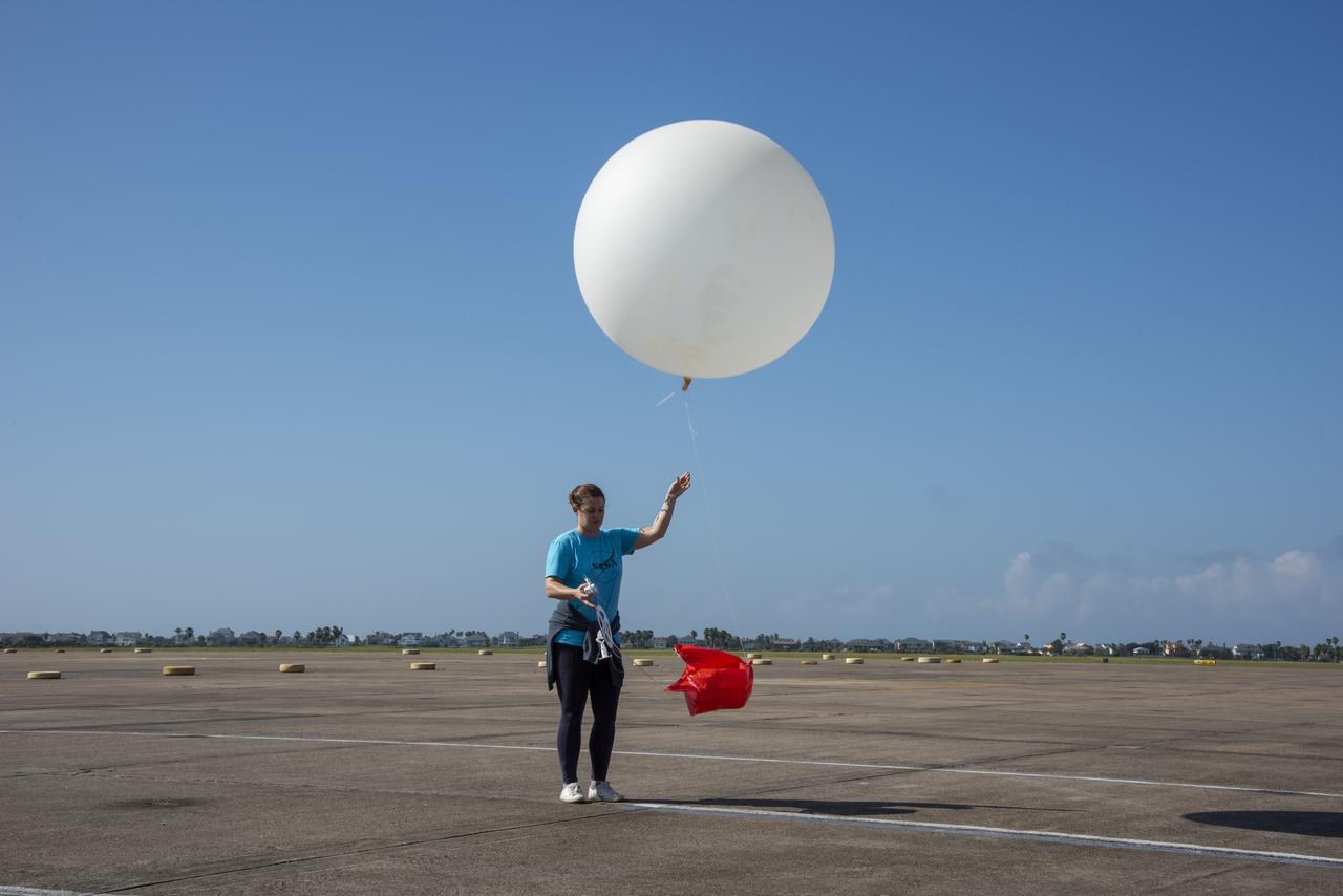
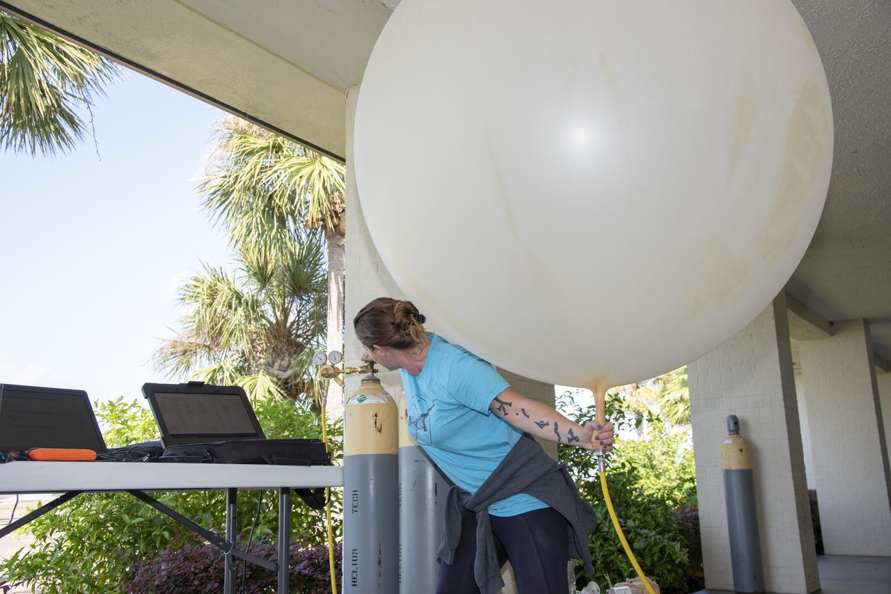
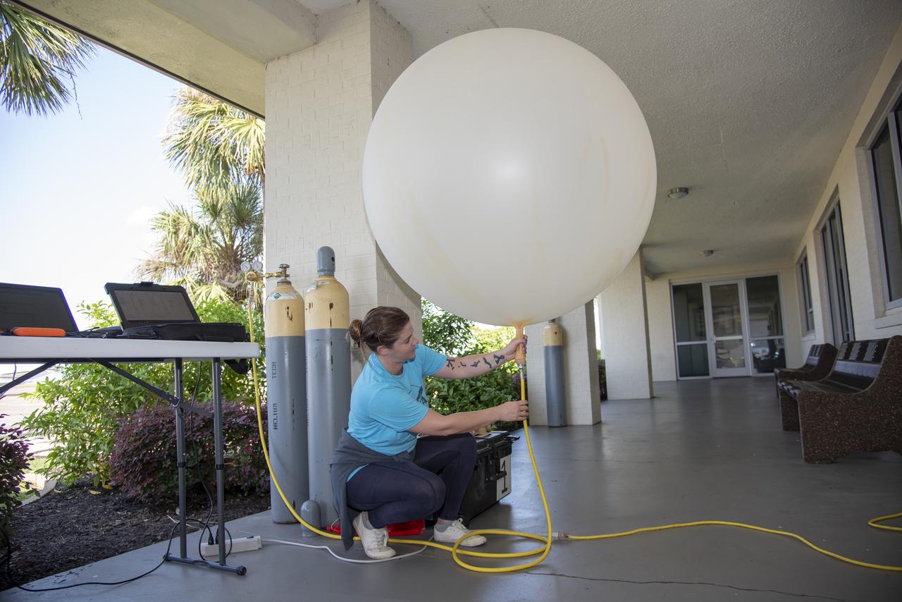
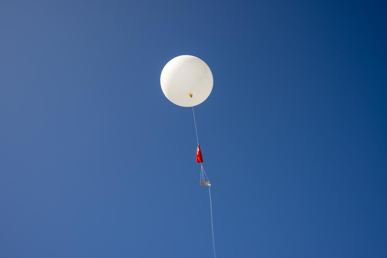
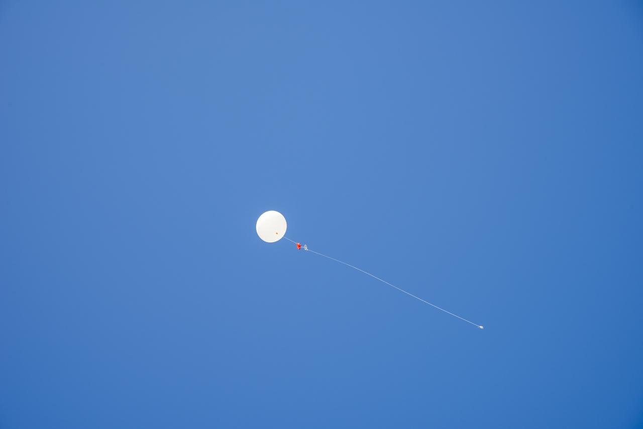
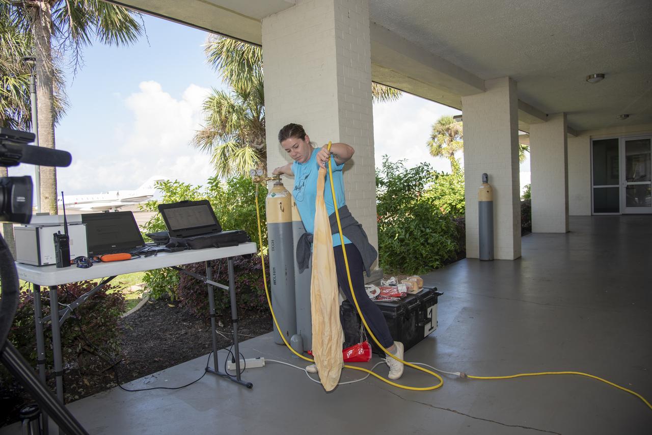
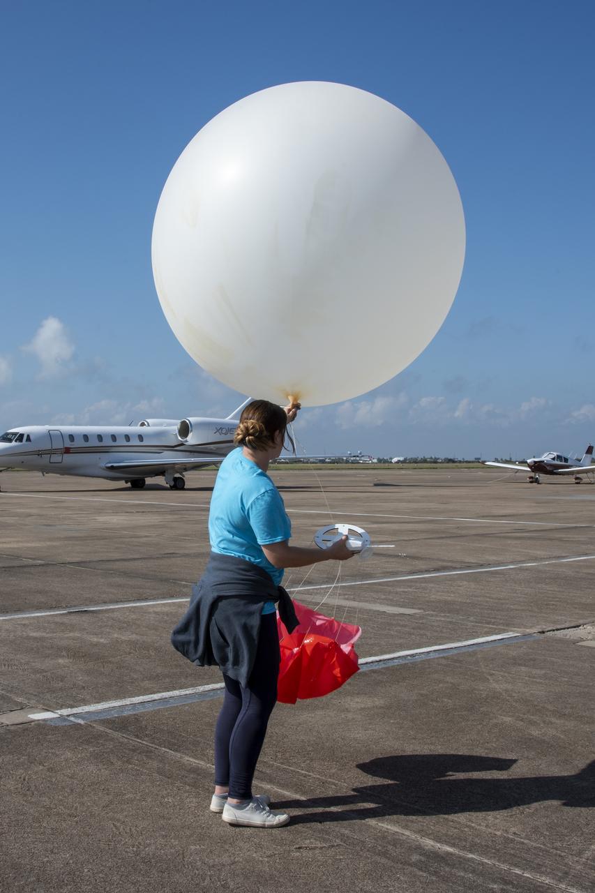
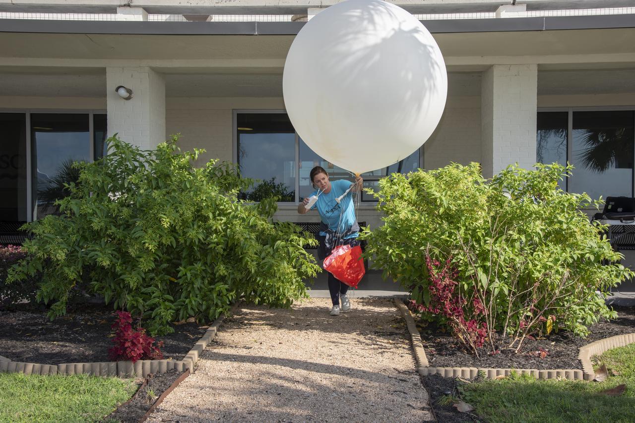
In order to make sure weather conditions are acceptable at multiple altitudes, NASA meteorologists on the ground conduct constant monitoring operations, and launch weather balloons to get accurate data for aircraft and pilot.
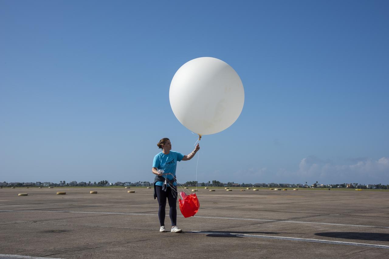
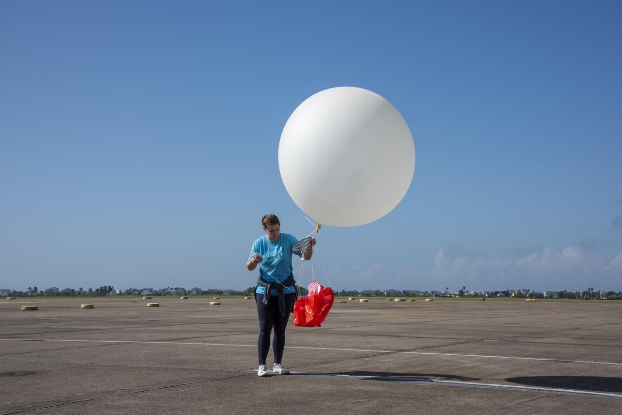
In order to make sure weather conditions are acceptable at multiple altitudes, NASA meteorologists on the ground conduct constant monitoring operations, and launch weather balloons to get accurate data for aircraft and pilot.
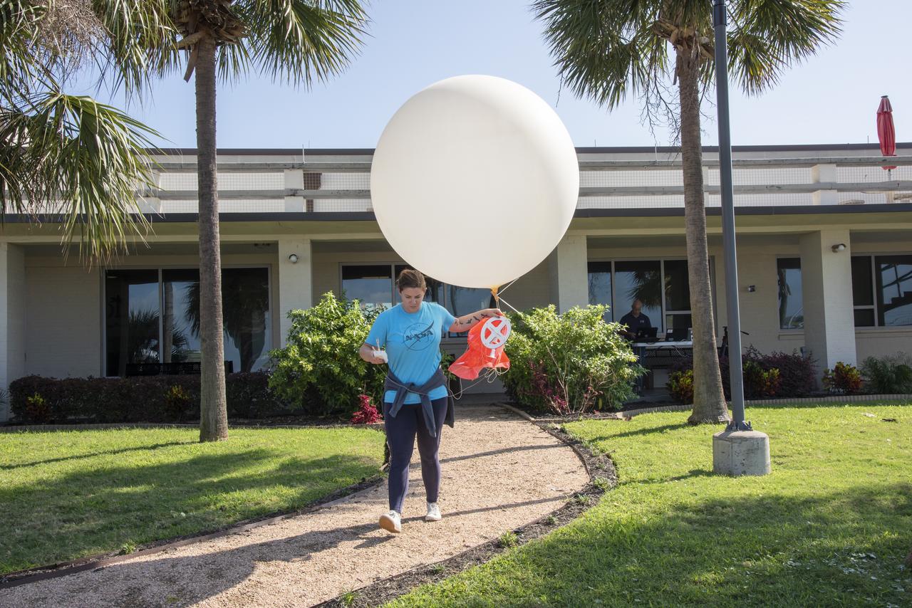
In order to make sure weather conditions are acceptable at multiple altitudes, NASA meteorologists on the ground conduct constant monitoring operations, and launch weather balloons to get accurate data for aircraft and pilot.
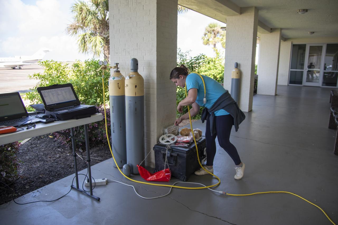
In order to make sure weather conditions are acceptable at multiple altitudes, NASA meteorologists on the ground conduct constant monitoring operations, and launch weather balloons to get accurate data for aircraft and pilot.
In order to make sure weather conditions are acceptable at multiple altitudes, NASA meteorologists on the ground conduct constant monitoring operations, and launch weather balloons to get accurate data for aircraft and pilot.
In order to make sure weather conditions are acceptable at multiple altitudes, NASA meteorologists on the ground conduct constant monitoring operations, and launch weather balloons to get accurate data for aircraft and pilot.
In order to make sure weather conditions are acceptable at multiple altitudes, NASA meteorologists on the ground conduct constant monitoring operations, and launch weather balloons to get accurate data for aircraft and pilot.
In order to make sure weather conditions are acceptable at multiple altitudes, NASA meteorologists on the ground conduct constant monitoring operations, and launch weather balloons to get accurate data for aircraft and pilot.
In order to make sure weather conditions are acceptable at multiple altitudes, NASA meteorologists on the ground conduct constant monitoring operations, and launch weather balloons to get accurate data for aircraft and pilot.
In order to make sure weather conditions are acceptable at multiple altitudes, NASA meteorologists on the ground conduct constant monitoring operations, and launch weather balloons to get accurate data for aircraft and pilot.

In order to make sure weather conditions are acceptable at multiple altitudes, NASA meteorologists on the ground conduct constant monitoring operations, and launch weather balloons to get accurate data for aircraft and pilot.
In order to make sure weather conditions are acceptable at multiple altitudes, NASA meteorologists on the ground conduct constant monitoring operations, and launch weather balloons to get accurate data for aircraft and pilot.
In order to make sure weather conditions are acceptable at multiple altitudes, NASA meteorologists on the ground conduct constant monitoring operations, and launch weather balloons to get accurate data for aircraft and pilot.
In order to make sure weather conditions are acceptable at multiple altitudes, NASA meteorologists on the ground conduct constant monitoring operations, and launch weather balloons to get accurate data for aircraft and pilot.
In order to make sure weather conditions are acceptable at multiple altitudes, NASA meteorologists on the ground conduct constant monitoring operations, and launch weather balloons to get accurate data for aircraft and pilot.
In order to make sure weather conditions are acceptable at multiple altitudes, NASA meteorologists on the ground conduct constant monitoring operations, and launch weather balloons to get accurate data for aircraft and pilot.
In order to make sure weather conditions are acceptable at multiple altitudes, NASA meteorologists on the ground conduct constant monitoring operations, and launch weather balloons to get accurate data for aircraft and pilot.
In order to make sure weather conditions are acceptable at multiple altitudes, NASA meteorologists on the ground conduct constant monitoring operations, and launch weather balloons to get accurate data for aircraft and pilot.
In order to make sure weather conditions are acceptable at multiple altitudes, NASA meteorologists on the ground conduct constant monitoring operations, and launch weather balloons to get accurate data for aircraft and pilot.
In order to make sure weather conditions are acceptable at multiple altitudes, NASA meteorologists on the ground conduct constant monitoring operations, and launch weather balloons to get accurate data for aircraft and pilot.
In order to make sure weather conditions are acceptable at multiple altitudes, NASA meteorologists on the ground conduct constant monitoring operations, and launch weather balloons to get accurate data for aircraft and pilot.
In order to make sure weather conditions are acceptable at multiple altitudes, NASA meteorologists on the ground conduct constant monitoring operations, and launch weather balloons to get accurate data for aircraft and pilot.
In order to make sure weather conditions are acceptable at multiple altitudes, NASA meteorologists on the ground conduct constant monitoring operations, and launch weather balloons to get accurate data for aircraft and pilot.
In order to make sure weather conditions are acceptable at multiple altitudes, NASA meteorologists on the ground conduct constant monitoring operations, and launch weather balloons to get accurate data for aircraft and pilot.
In order to make sure weather conditions are acceptable at multiple altitudes, NASA meteorologists on the ground conduct constant monitoring operations, and launch weather balloons to get accurate data for aircraft and pilot.
In order to make sure weather conditions are acceptable at multiple altitudes, NASA meteorologists on the ground conduct constant monitoring operations, and launch weather balloons to get accurate data for aircraft and pilot.
In order to make sure weather conditions are acceptable at multiple altitudes, NASA meteorologists on the ground conduct constant monitoring operations, and launch weather balloons to get accurate data for aircraft and pilot.
In order to make sure weather conditions are acceptable at multiple altitudes, NASA meteorologists on the ground conduct constant monitoring operations, and launch weather balloons to get accurate data for aircraft and pilot.
In order to make sure weather conditions are acceptable at multiple altitudes, NASA meteorologists on the ground conduct constant monitoring operations, and launch weather balloons to get accurate data for aircraft and pilot.
In order to make sure weather conditions are acceptable at multiple altitudes, NASA meteorologists on the ground conduct constant monitoring operations, and launch weather balloons to get accurate data for aircraft and pilot.
In order to make sure weather conditions are acceptable at multiple altitudes, NASA meteorologists on the ground conduct constant monitoring operations, and launch weather balloons to get accurate data for aircraft and pilot.
In order to make sure weather conditions are acceptable at multiple altitudes, NASA meteorologists on the ground conduct constant monitoring operations, and launch weather balloons to get accurate data for aircraft and pilot.
In order to make sure weather conditions are acceptable at multiple altitudes, NASA meteorologists on the ground conduct constant monitoring operations, and launch weather balloons to get accurate data for aircraft and pilot.