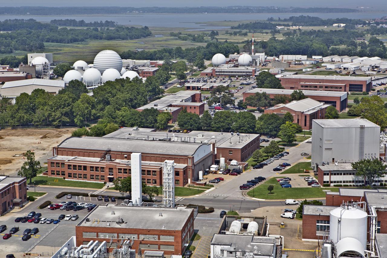
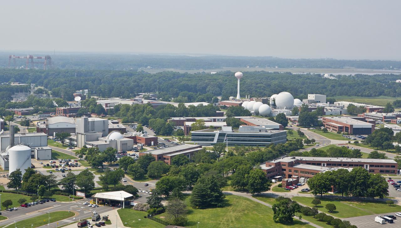
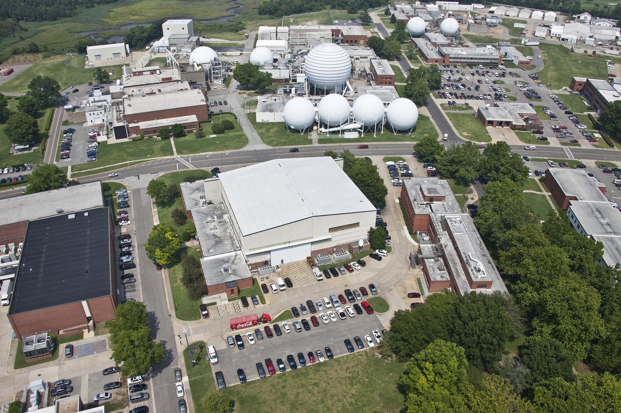
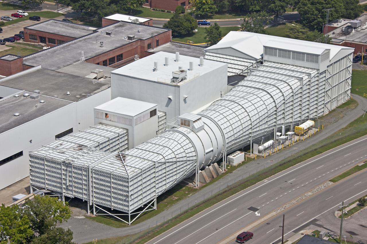
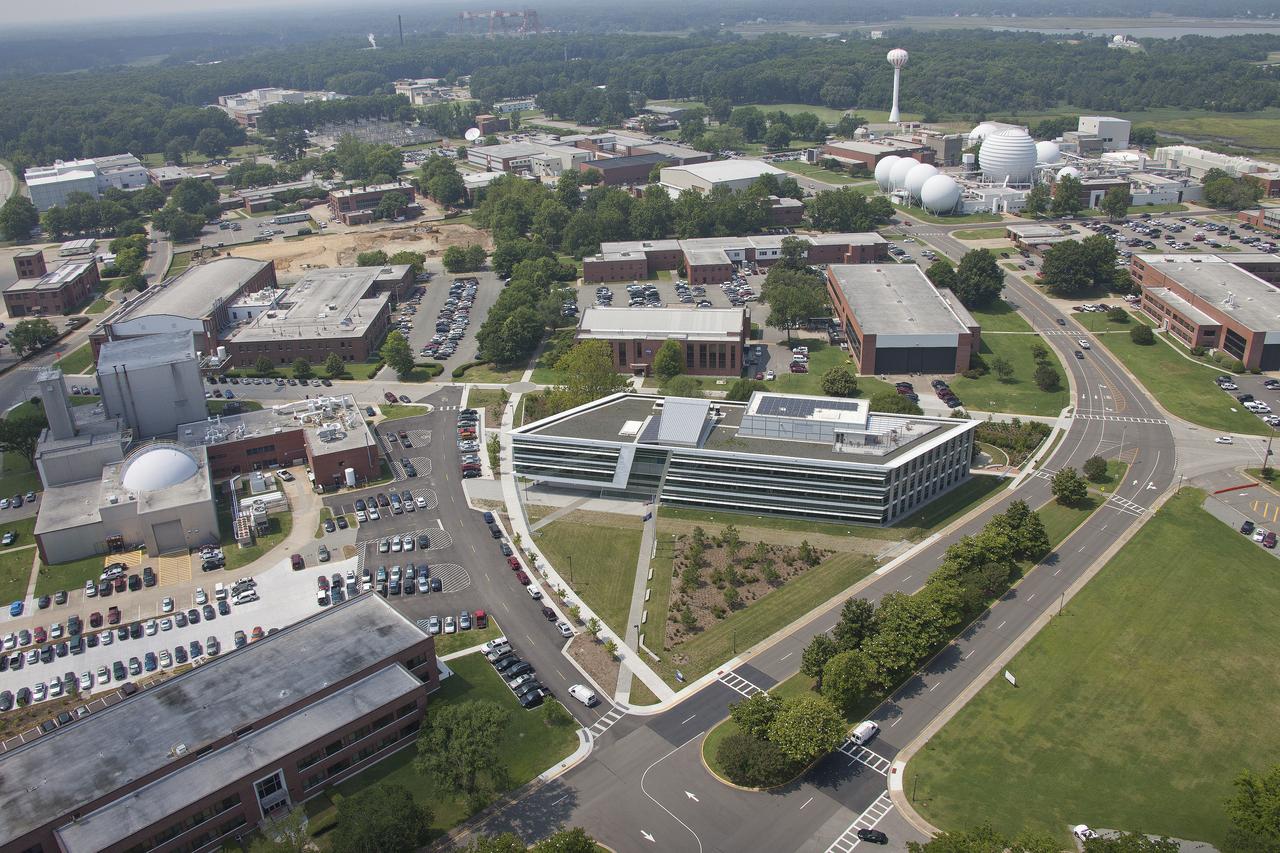
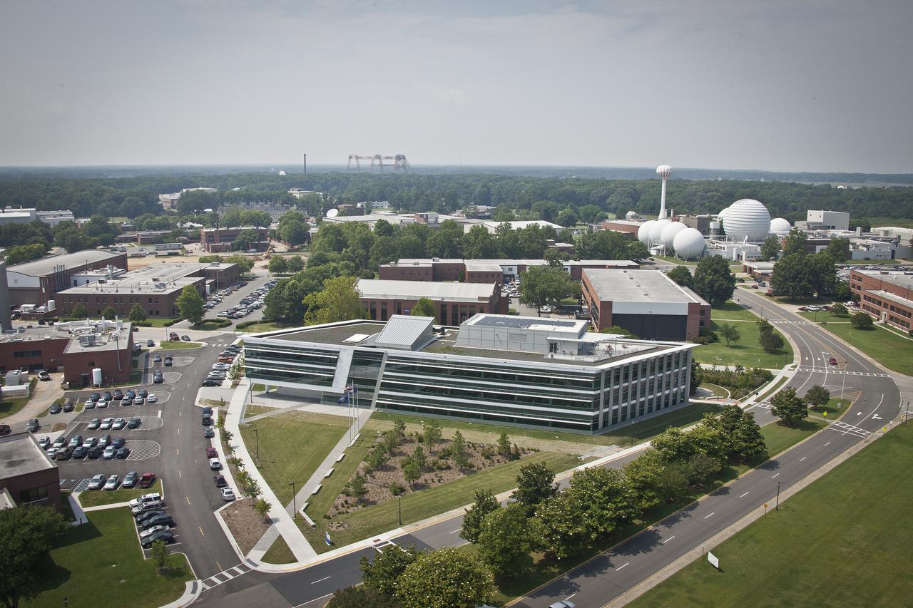
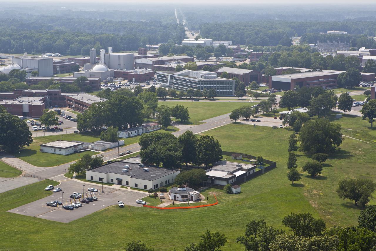
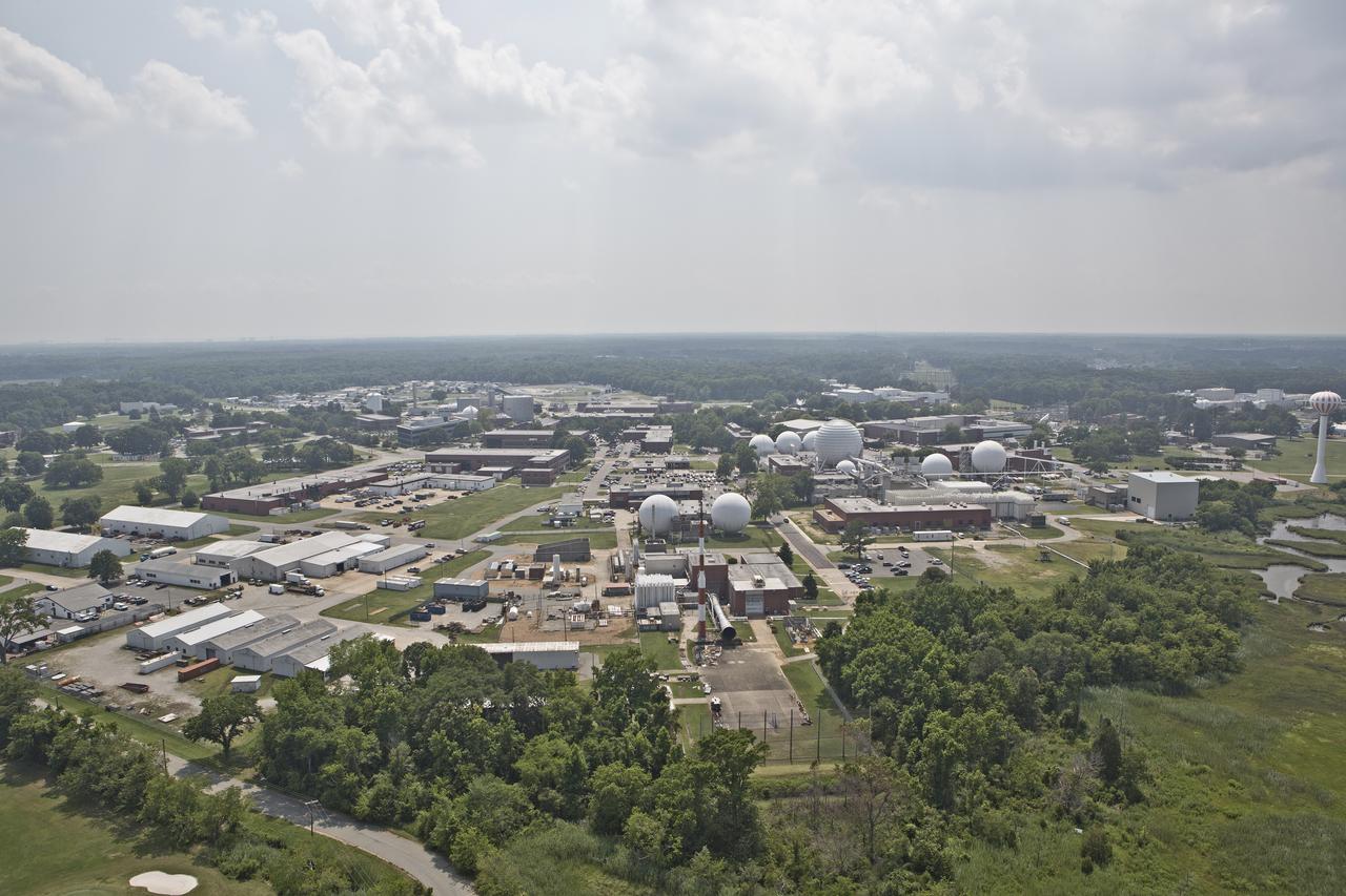
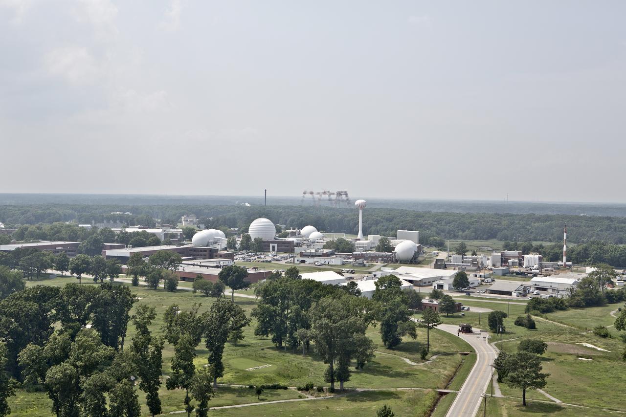
Aerial of NASA Langley Reaseach Center west side
Aerial view of NASA Langley Research Center west side

Aerial view of NASA Langley Research Center west side
Aerial of NASA Langley Reaseach Center west side
Aerial view of NASA Langley Research Center west side
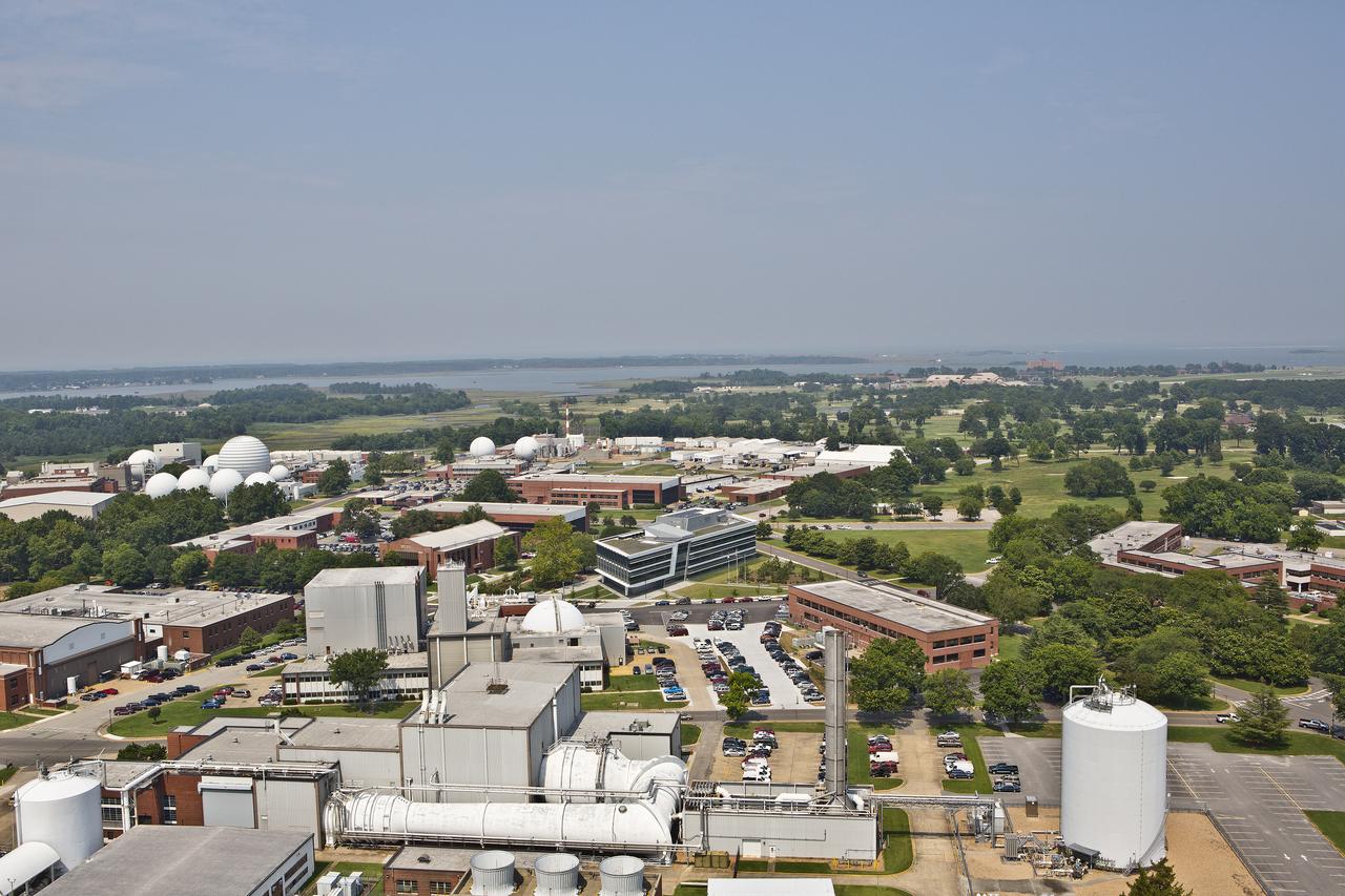
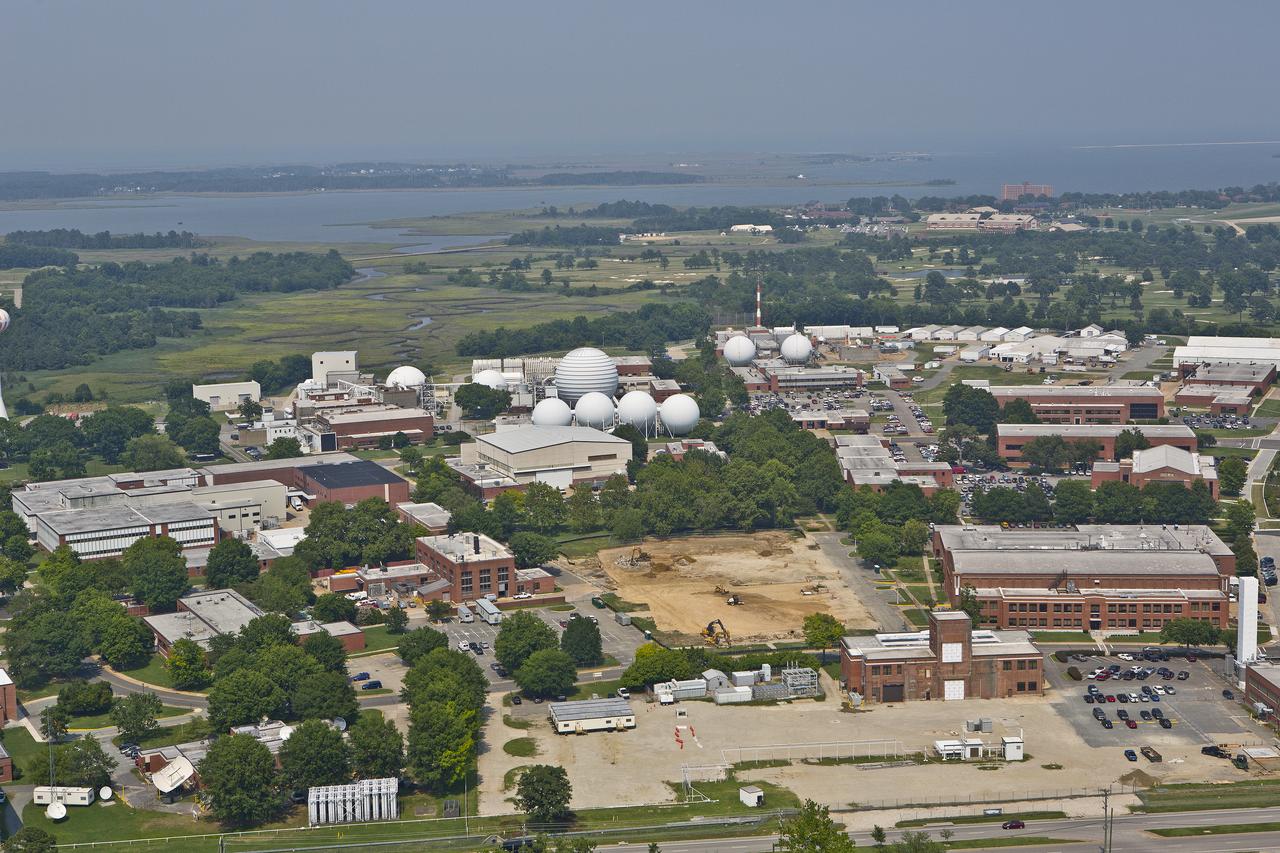
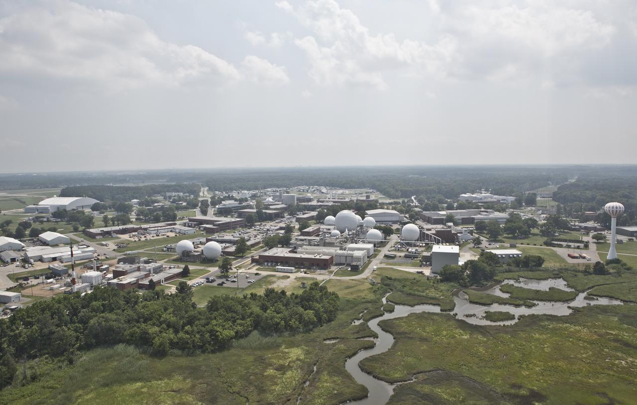
Aerial of NASA Langley Reaseach Center west side
Aerial of NASA Langley Reaseach Center west side
Aerial view of NASA Langley Research Center west side
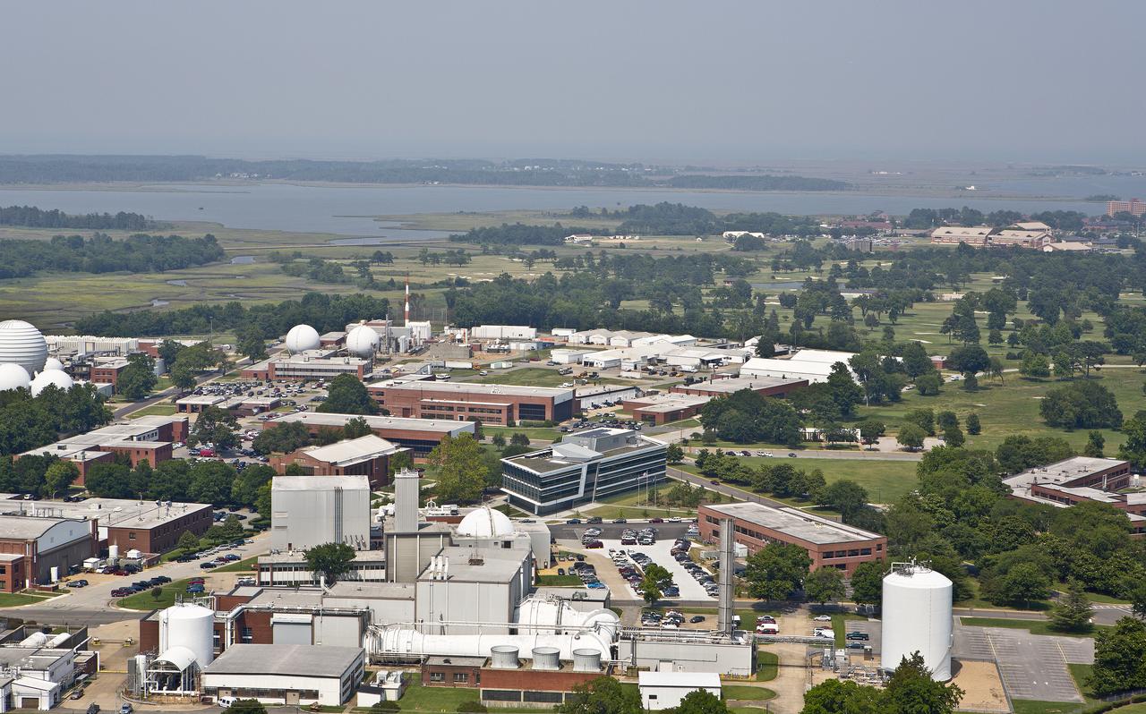
Aerial view of NASA Langley Research Center west side
Aerial view of NASA Langley Research Center west side
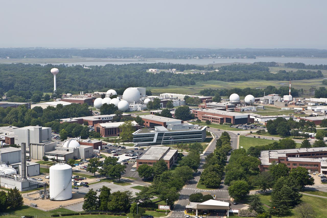
Aerial view of NASA Langley Research Center west side
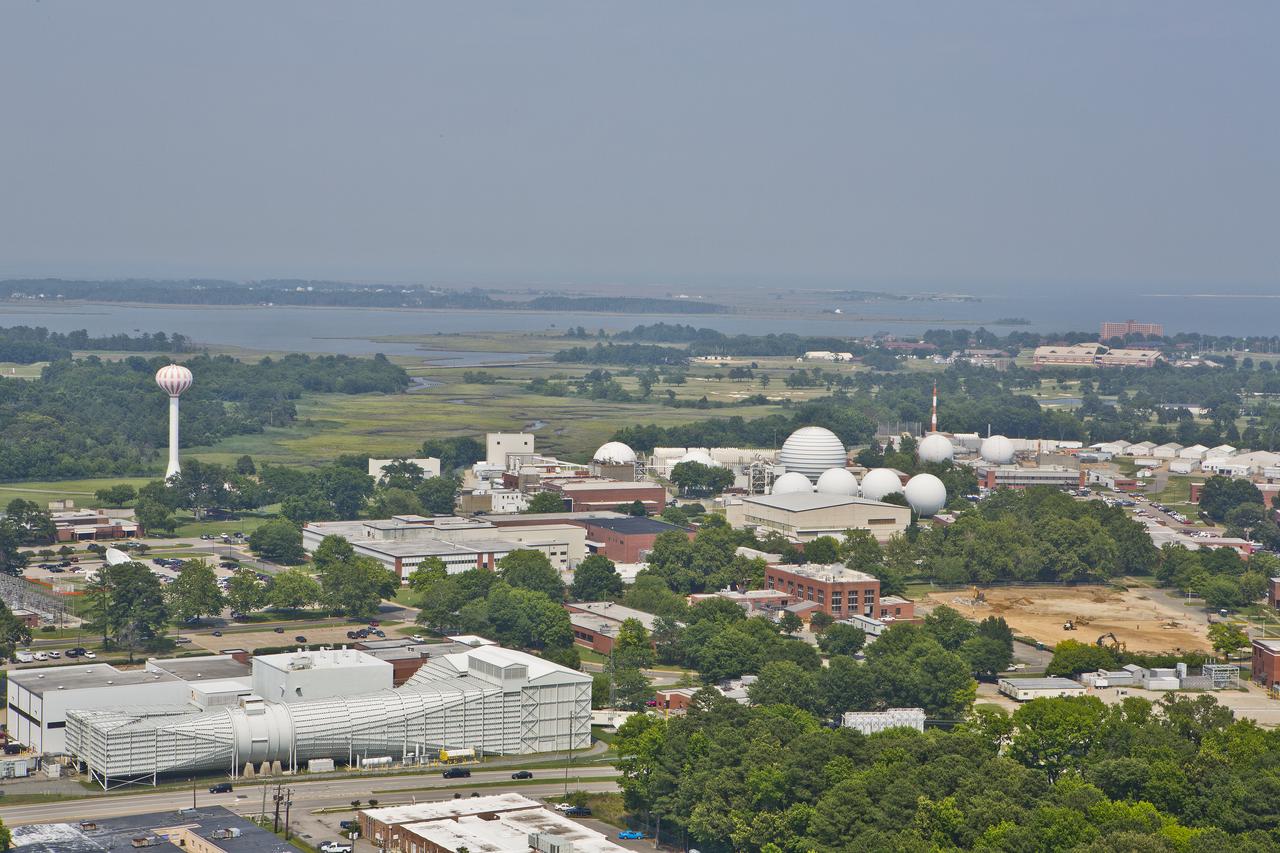
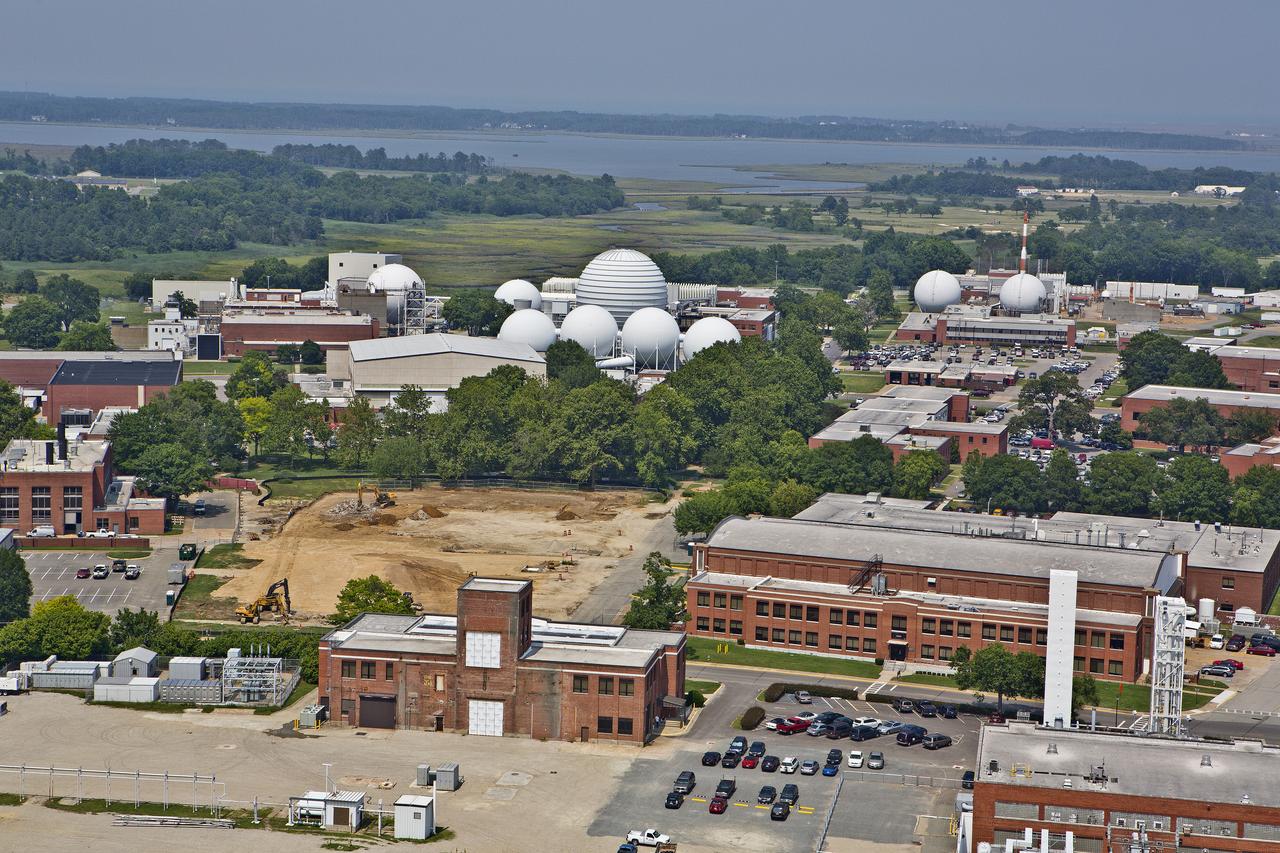
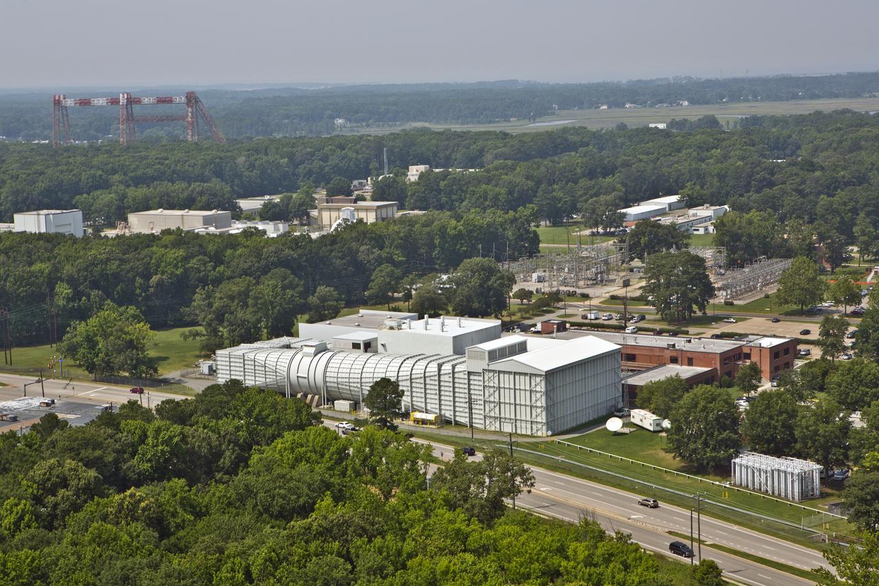
Aerials of NASA Langley Research Center west area
Aerials of NASA Langley Research Center west area

Aerials of NASA Langley Research Center west area
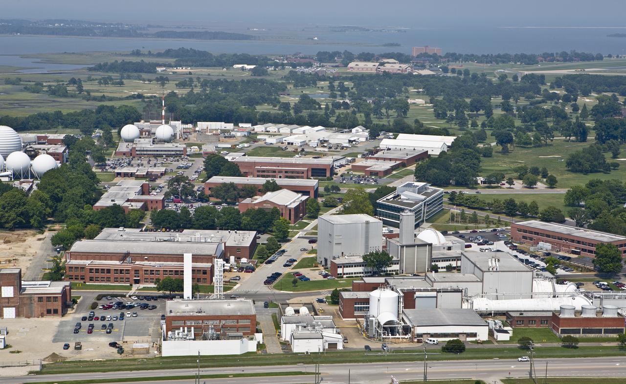
Aerial of NASA Langley Research Center
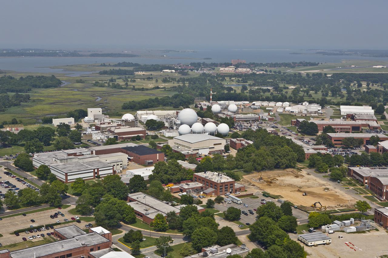
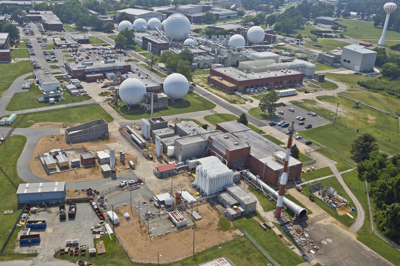
Aerial of west area of Langley Research Center
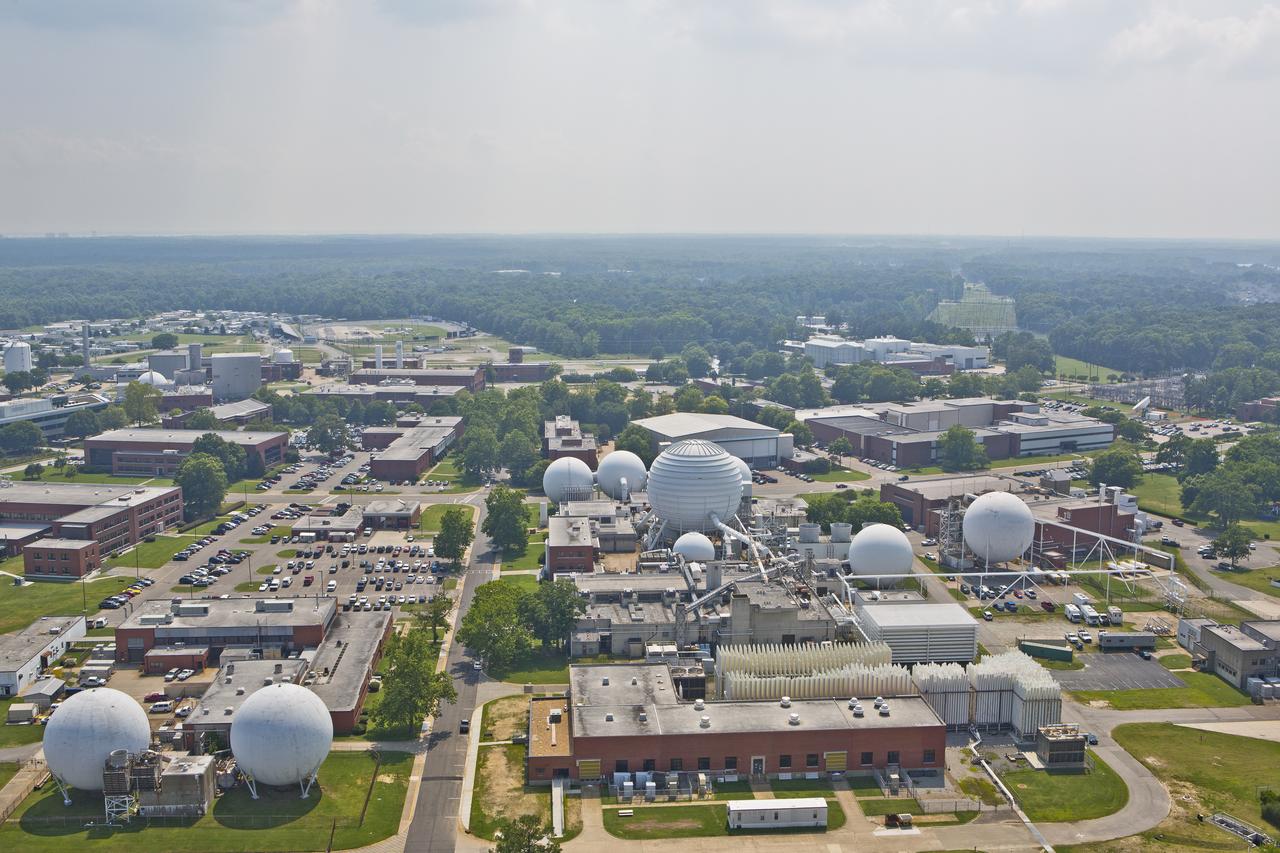
Aerials of NASA Langley Research Center west area
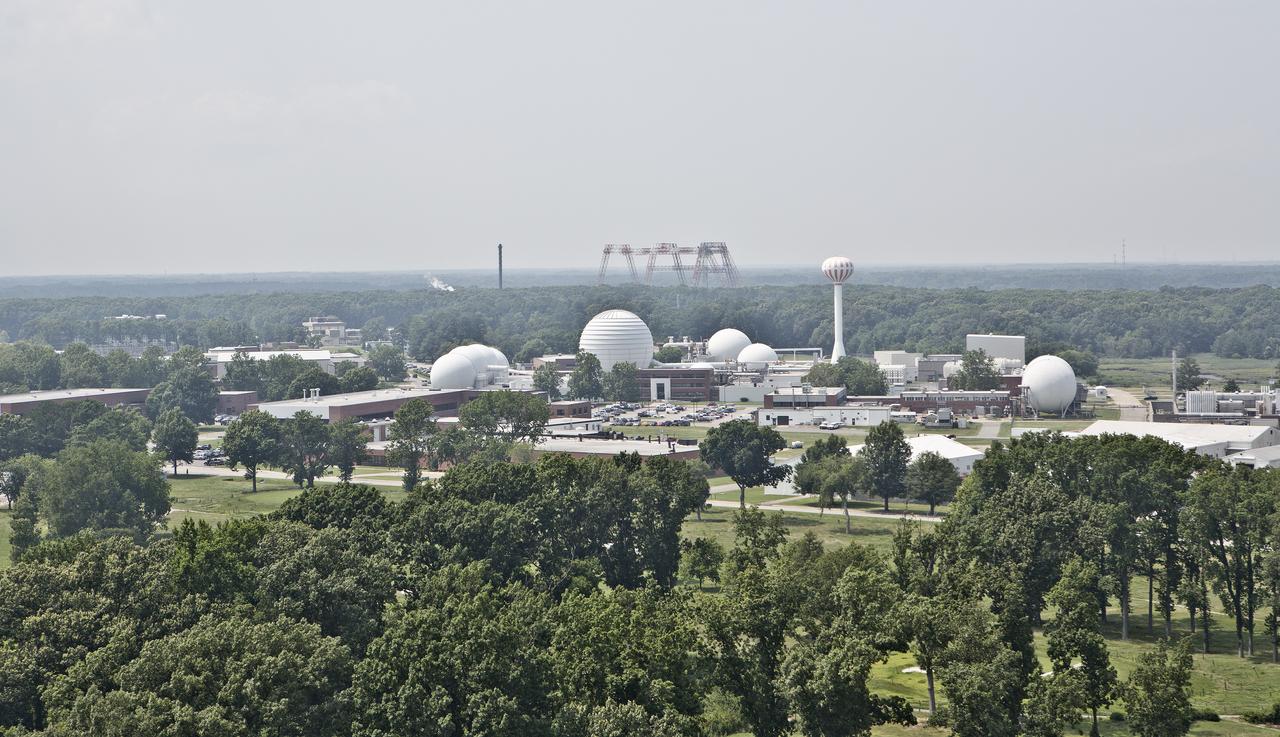
Aerial of west area of Langley Research Center
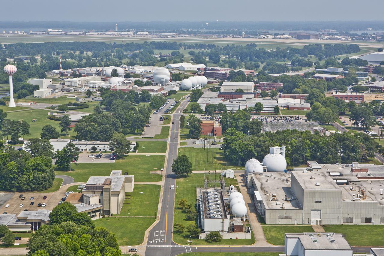
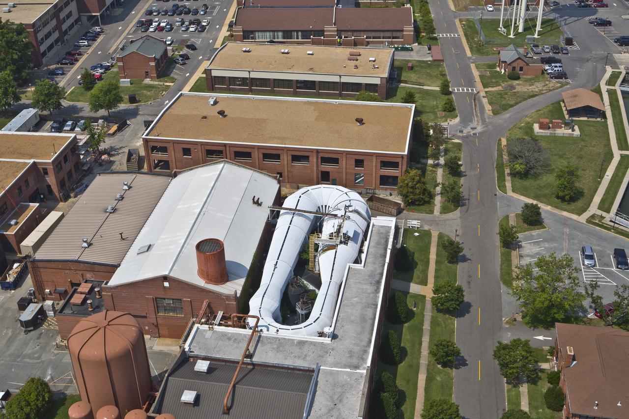
Aerial of NASA Langley Research Center Wind Tunnel
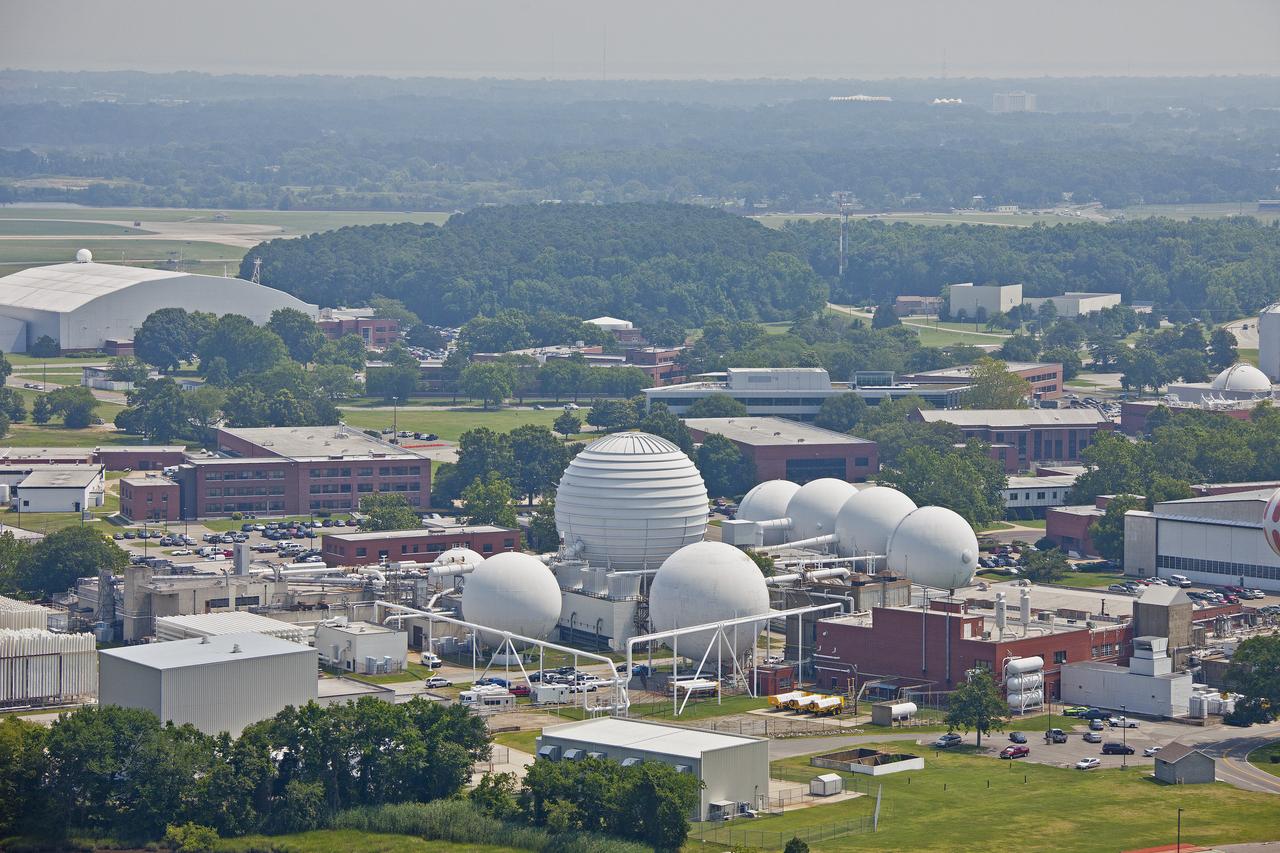
Aerials of NASA Langley Research Center west area
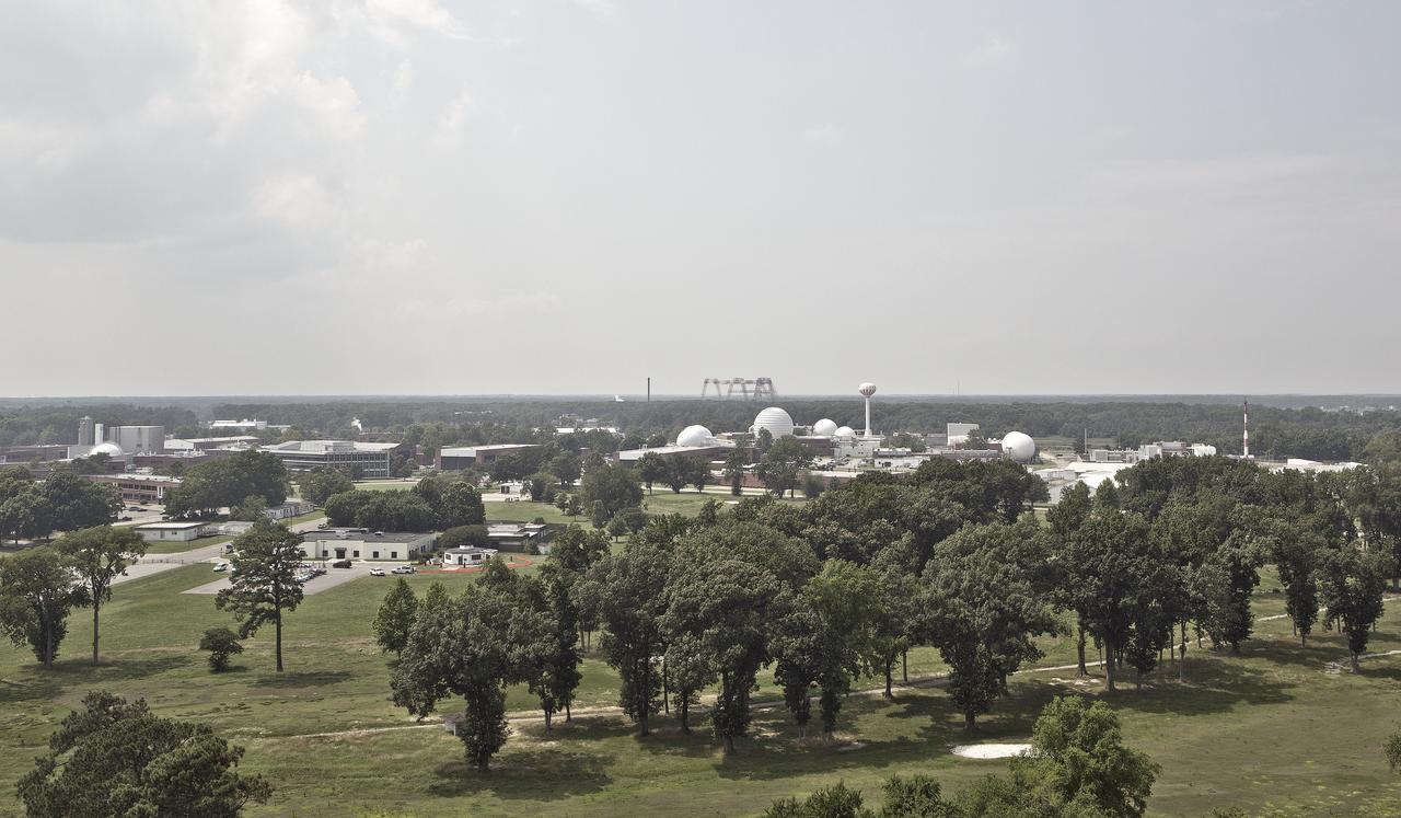
Aerial of west area of Langley Research Center
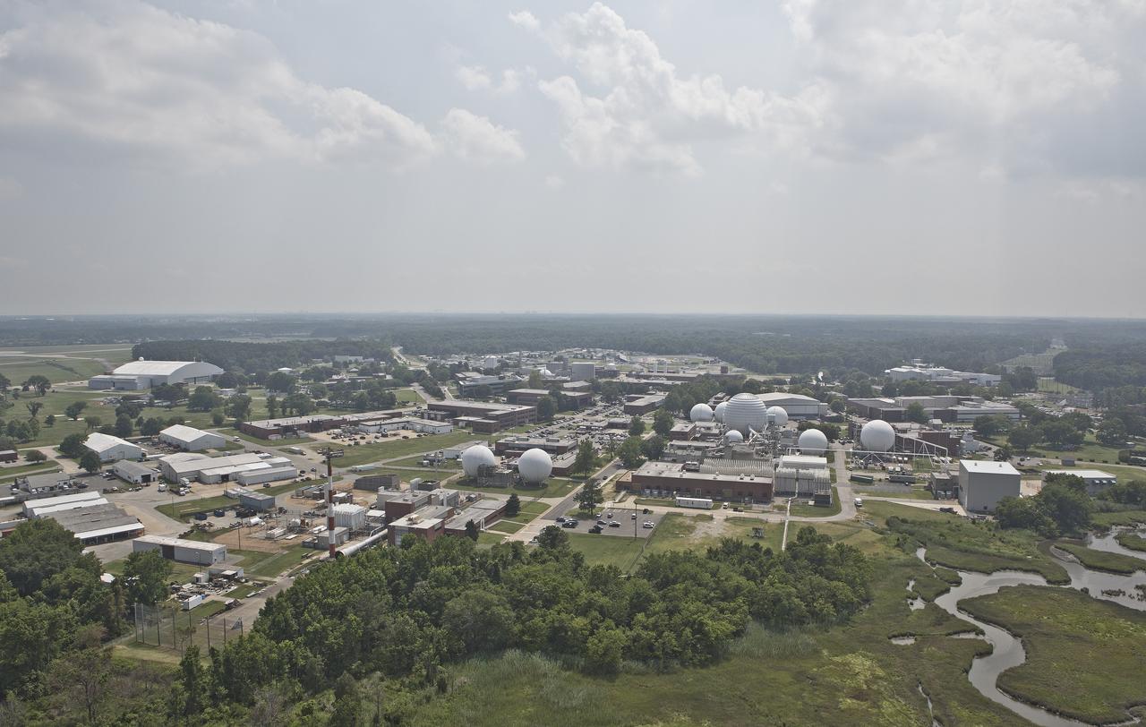
Aerial of west area of Langley Research Center
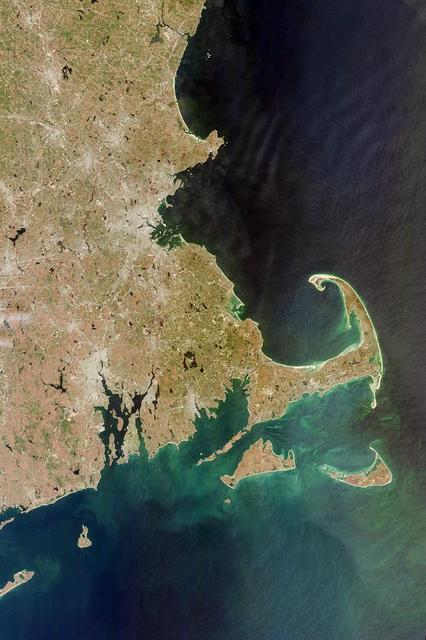
This image acquired on April 13, 2000 from NASA Terra satellite shows west side of Cape Cod Bay.
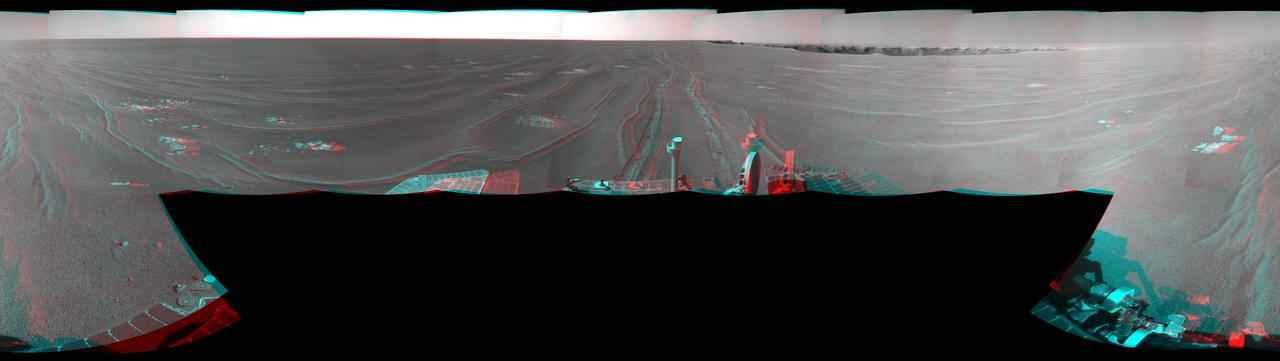
On September 28, 2008, NASA Mars rover Opportunity reached this location on the west side of Victoria Crater. 3D glasses are necessary.
Aerials of NASA Langley Research Center west area
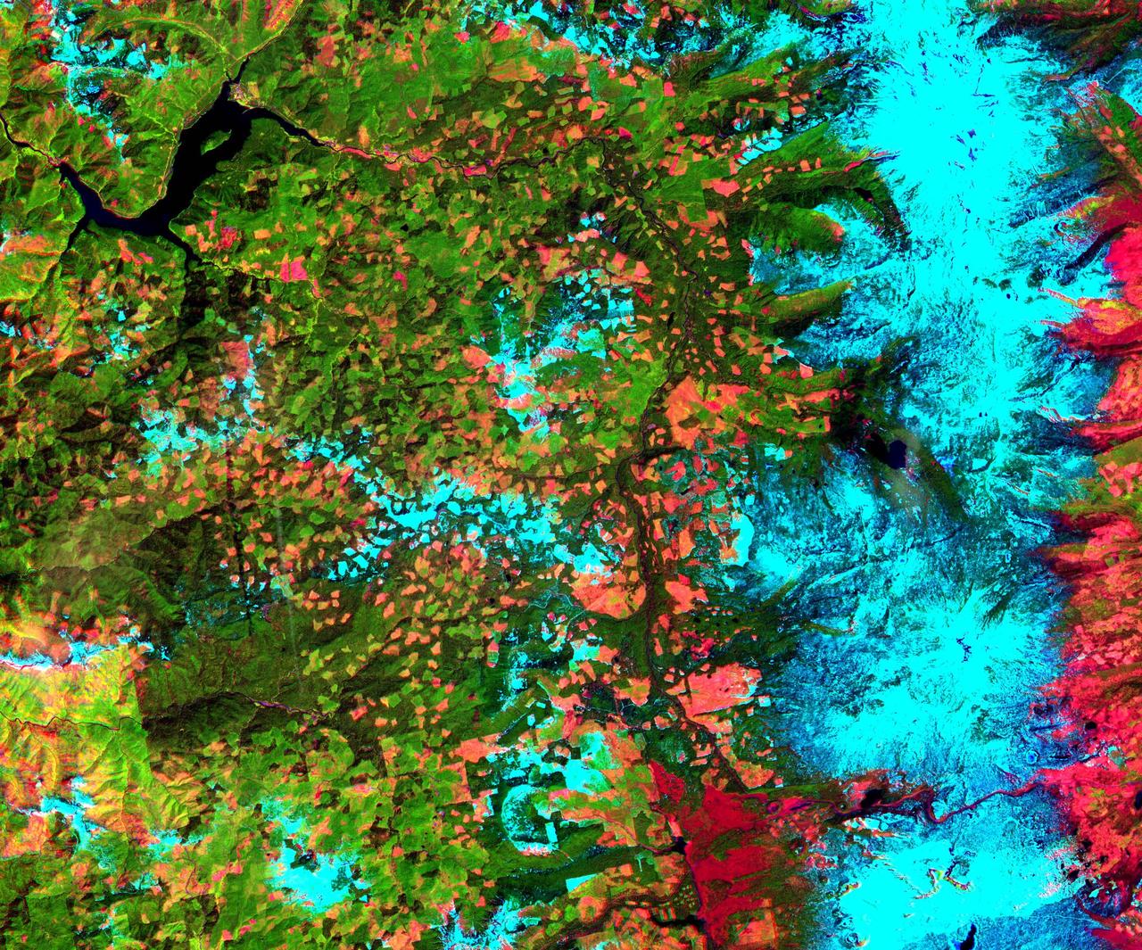
This 39 by 47 km ASTER sub-scene was acquired on May 20, 2000 and shows an area along the west side of the Cascade Range in west central Oregon. Bands 4, 3, and 2 were combined as red, green, and blue. In this composite, snow appears blue, forests are green, and clear-cut areas are orange-pink. The magnitude of logging operations is quite obvious, appearing as a checker board pattern. The image is centered at 44.6 degrees north latitude, 122.2 degrees west longitude. http://photojournal.jpl.nasa.gov/catalog/PIA11165
Aerial of NASA Langley Research Center New Town Center Head Quarters
Aerials of NASA Langley Research Center east side with spin tunnel
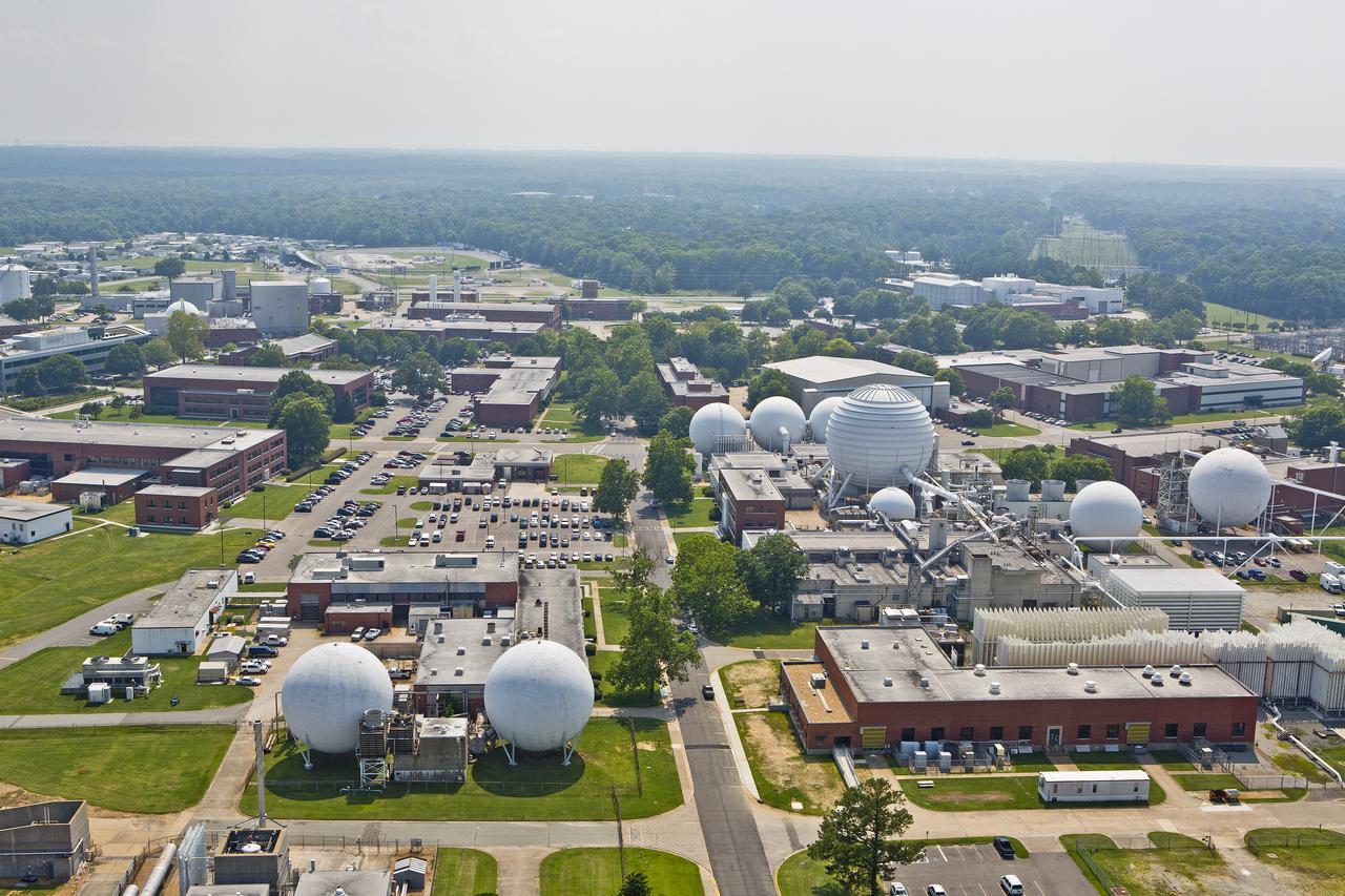
Aerials of NASA Langley Research Center west area
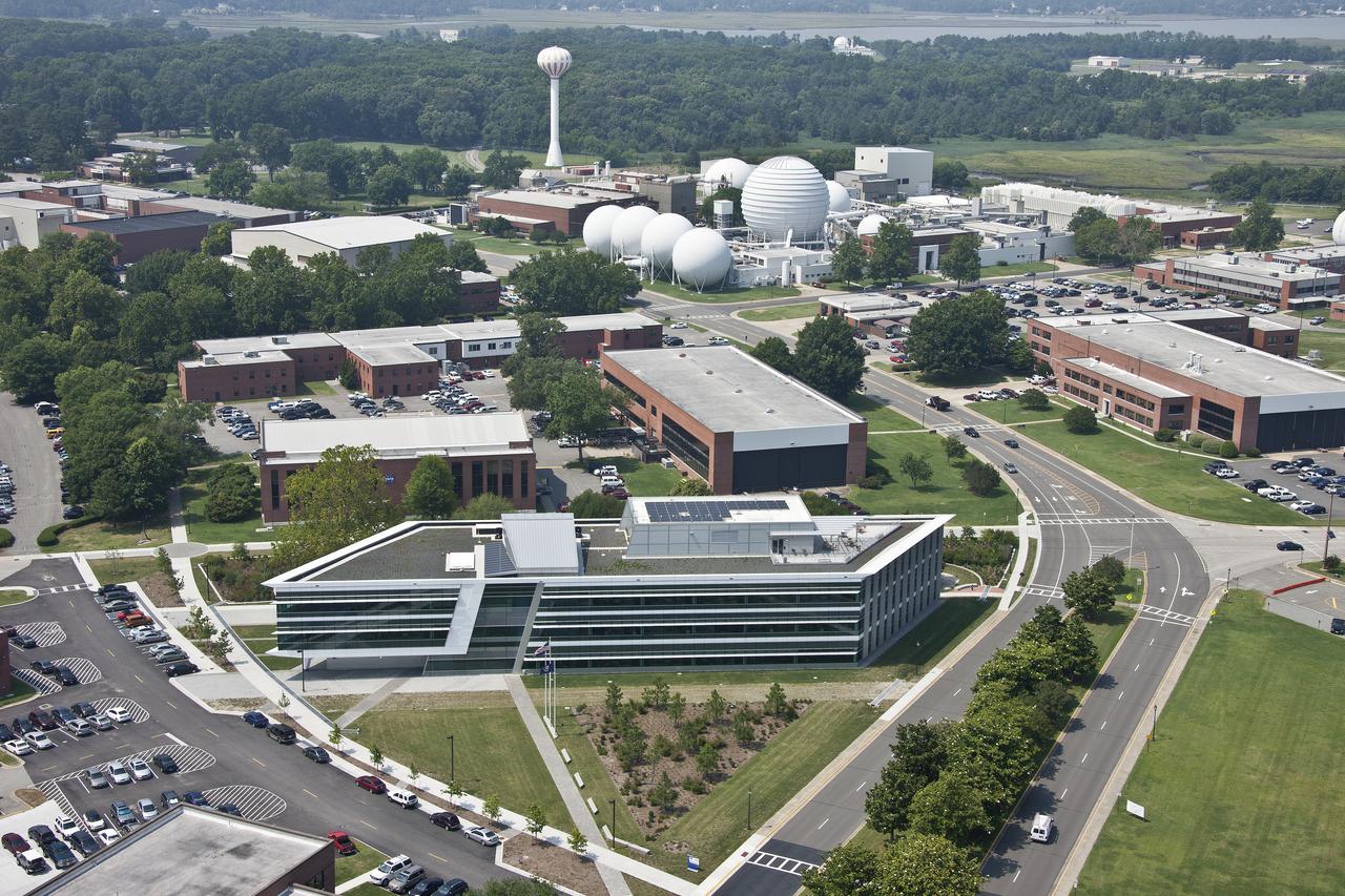
Aerial of NASA Langley Research Center New Town Center Head Quarters
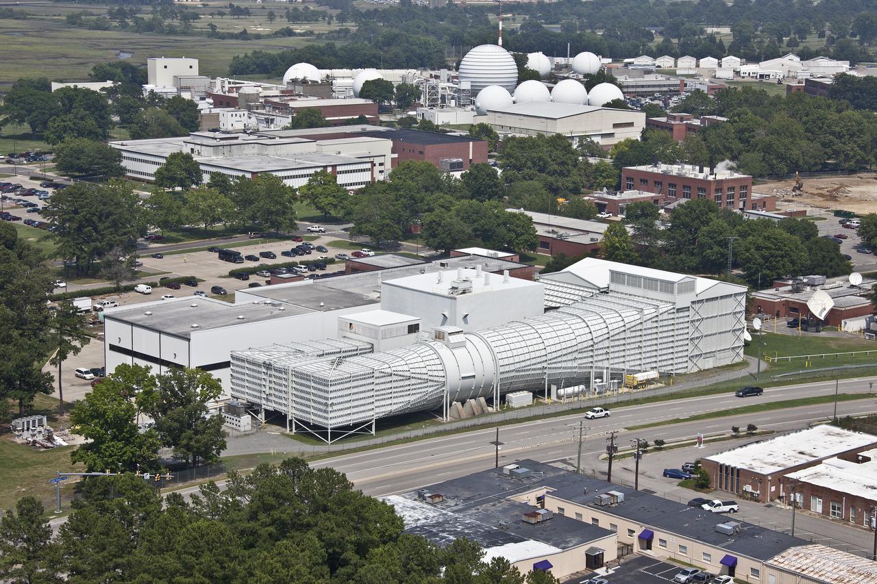
Aerial of NASA Langley Wind Tunnel
NASA Cassini spacecraft peers through Titan atmosphere at the region called Adiri, west of the landing site of the Huygens probe on the anti-Saturn side of the moon.
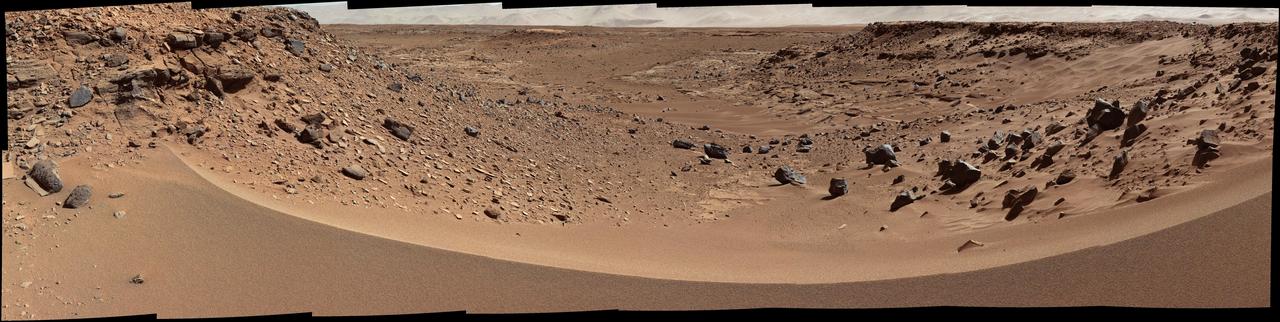
This view combines several frames taken by NASA Mars rover Curiosity, looking into a valley to the west from the eastern side of a dune at the eastern end of the valley.
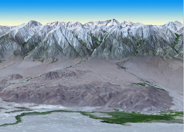
At 14,505 feet high, Mt. Whitney, the highest point in the contiguous U.S., is located in California Sierra Nevada Mountains, on the west side of Owens Valley. The Alabama Hills appear in the foreground of this image from NASA Terra spacecraft.
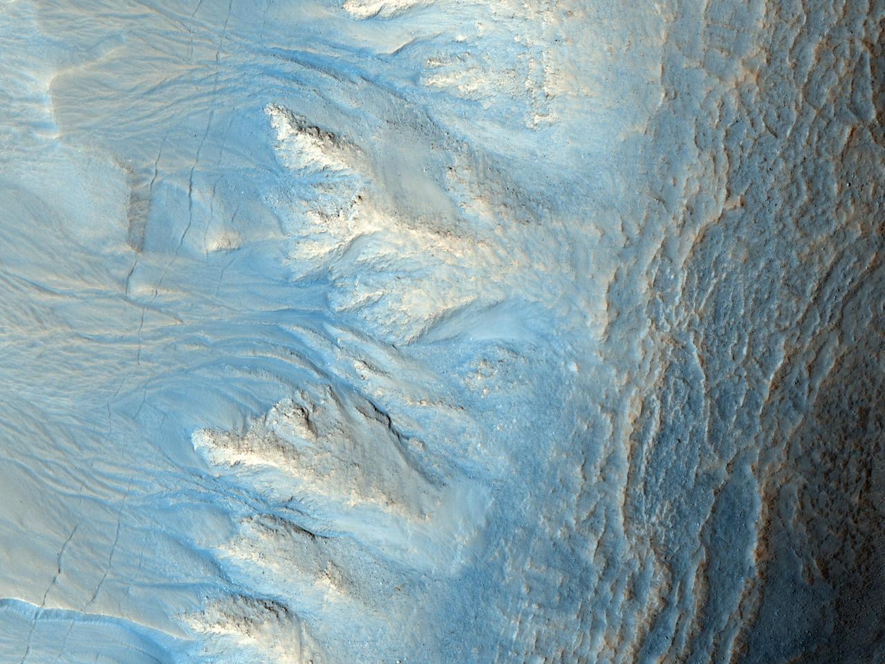
This image from NASA Mars Reconnaissance Orbiter shows the west-facing side of an impact crater in the mid-latitudes of Mars northern hemisphere. This crater has gullies along its walls that are composed of alcoves, channels and debris aprons.
This image from NASA Mars Odyssey shows Pavonis Mons, one of the three huge Tharsis volcanoes, encircled on the west side by a series of arcuate ridges. How these features were formed is still unknown.
Dark slope streaks are common in Lycus Sulci, the complex ridged terrain surrounding the north and west side of Olympus Mons as seen in this image from NASA 2001 Mars Odyssey spacecraft.
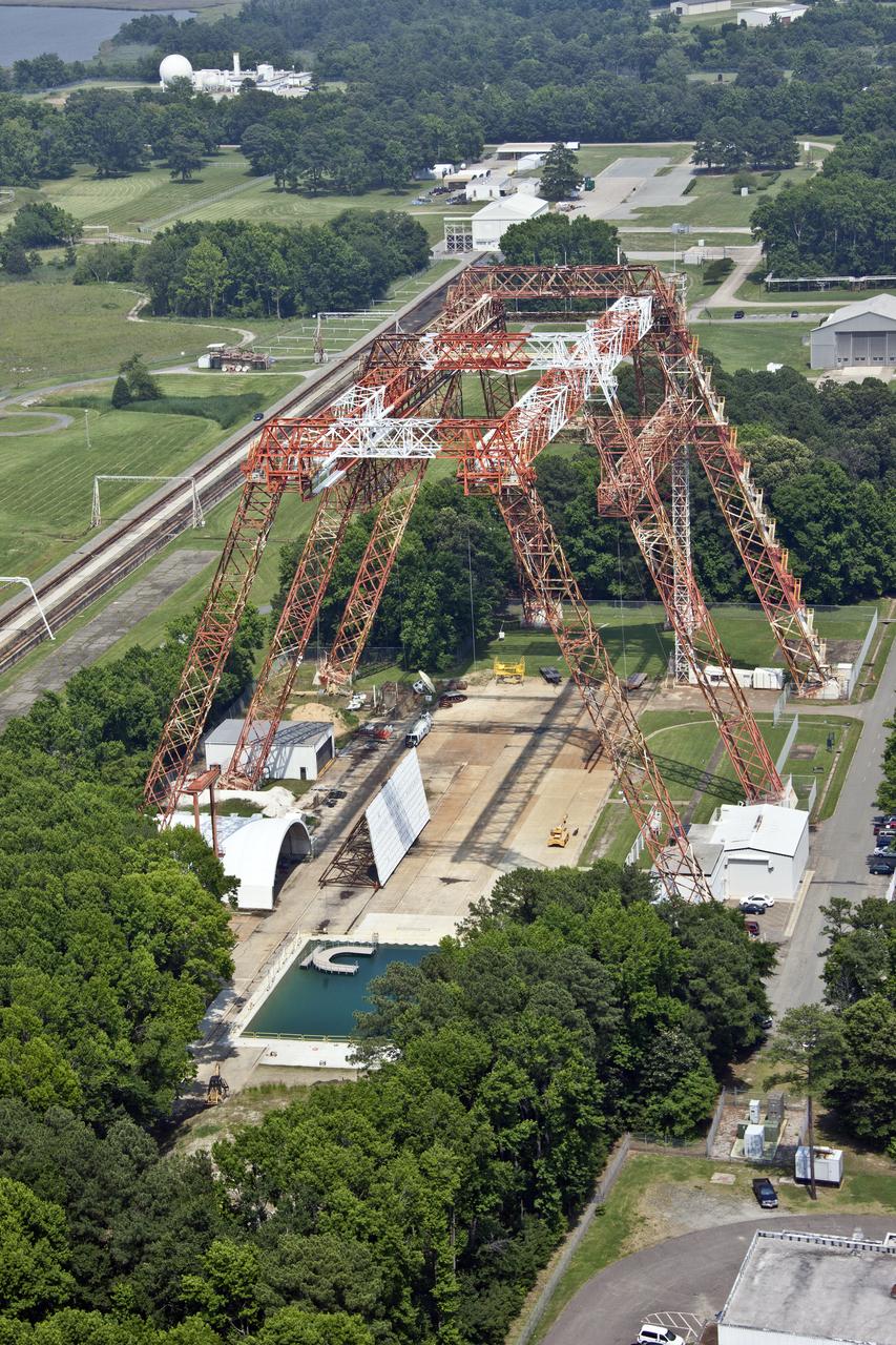
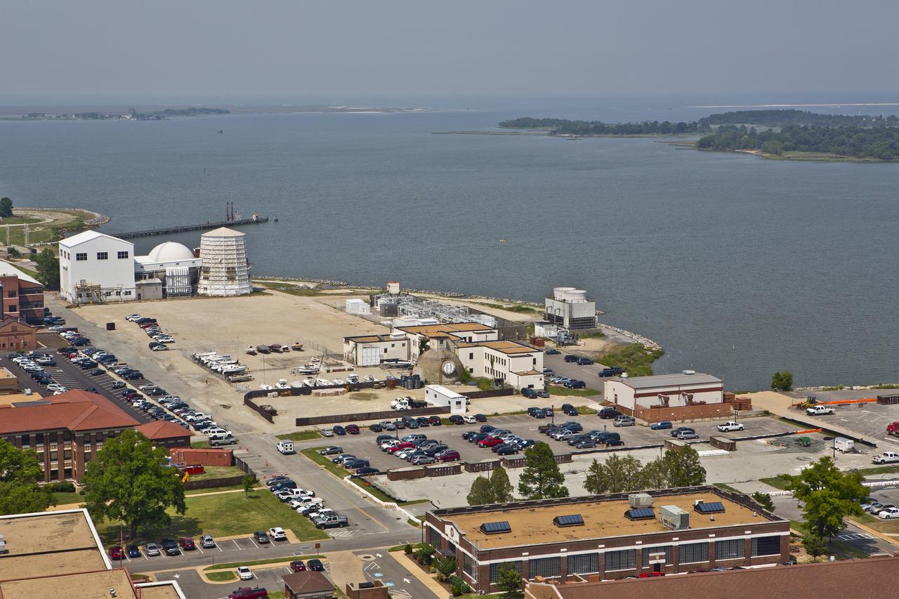
Aerial of NASA Langley's Gantry and slashdown pool also known as Impact Dynamic Faciltiy
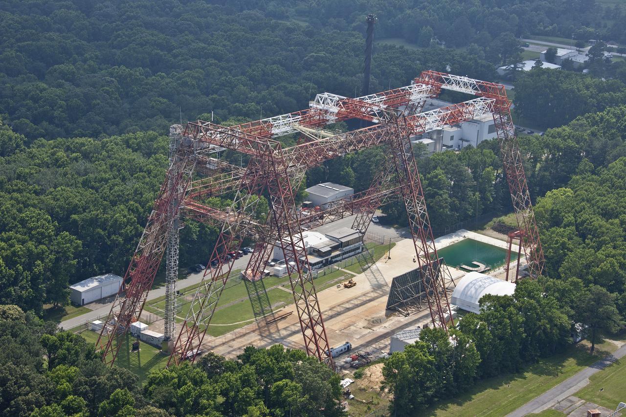
Aerial of NASA Langley's Gantry and slashdown pool also known as Impact Dynamic Faciltiy
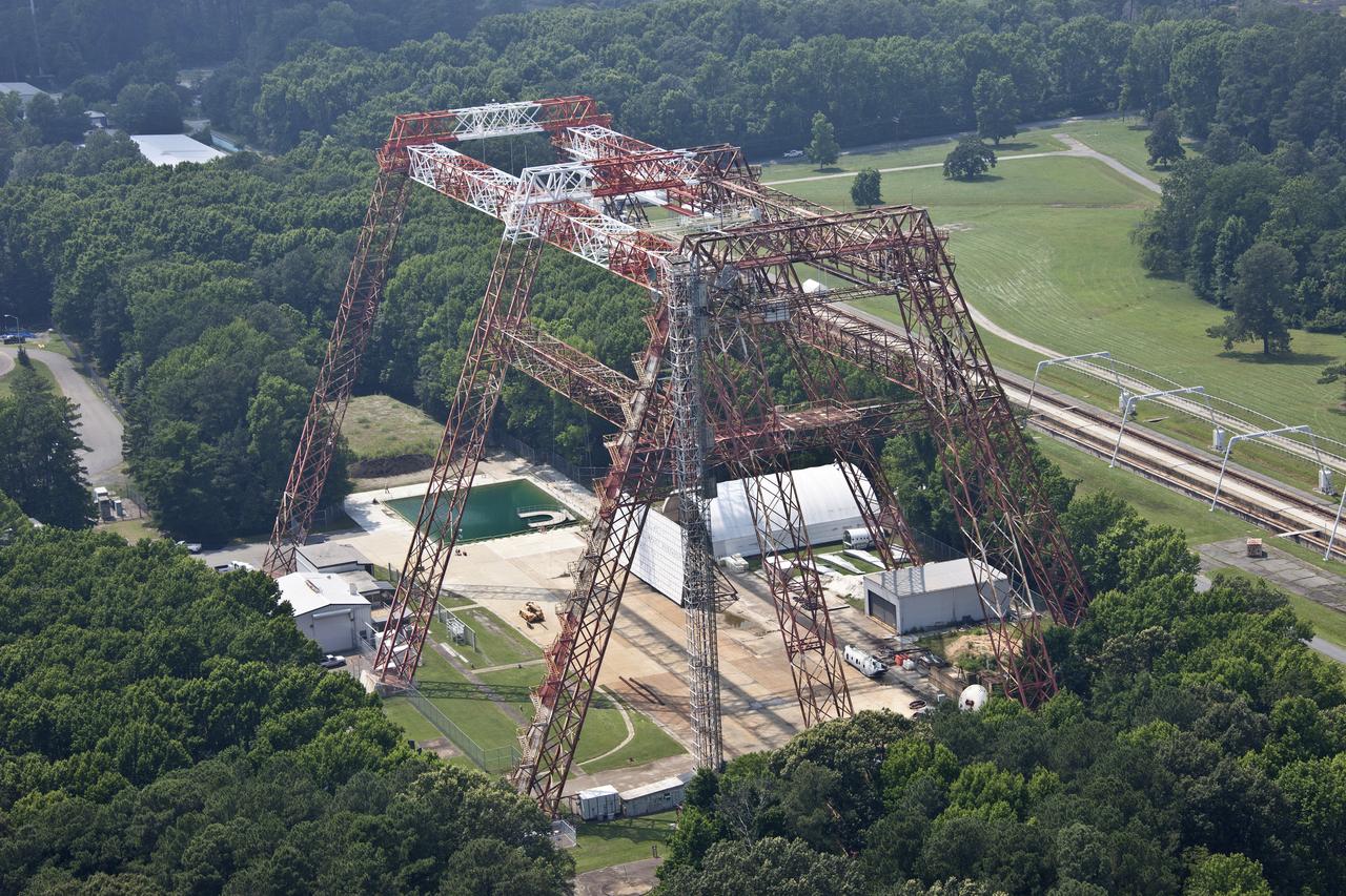
Aerial of NASA Langley's Gantry and slashdown pool also known as Impact Dynamic Faciltiy
Aerial of NASA Langley Research Center New Town Center Head Quarters
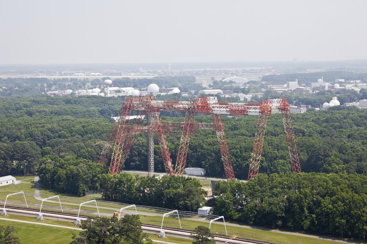
Aerial of NASA Langley's Gantry and slashdown pool also known as Impact Dynamic Faciltiy
Aerial of NASA Langley Research Center New Town Center Head Quarters
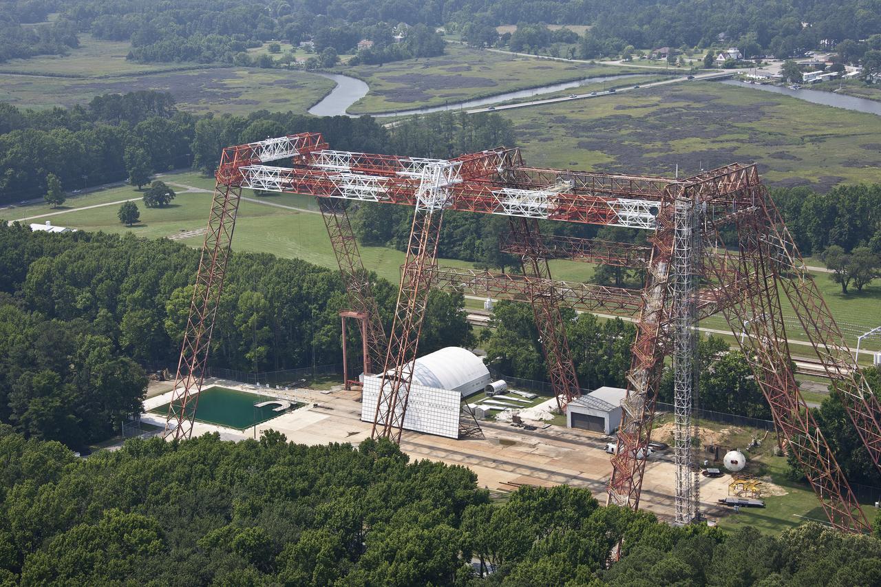
Aerial of NASA Langley's Gantry and slashdown pool also known as Impact Dynamic Faciltiy
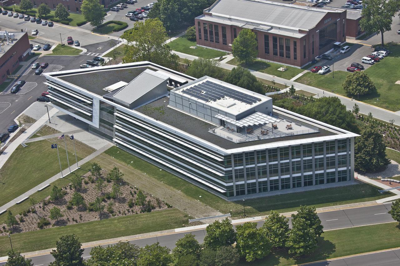
Aerial of NASA Langley Research Center New Town Center Head Quarters
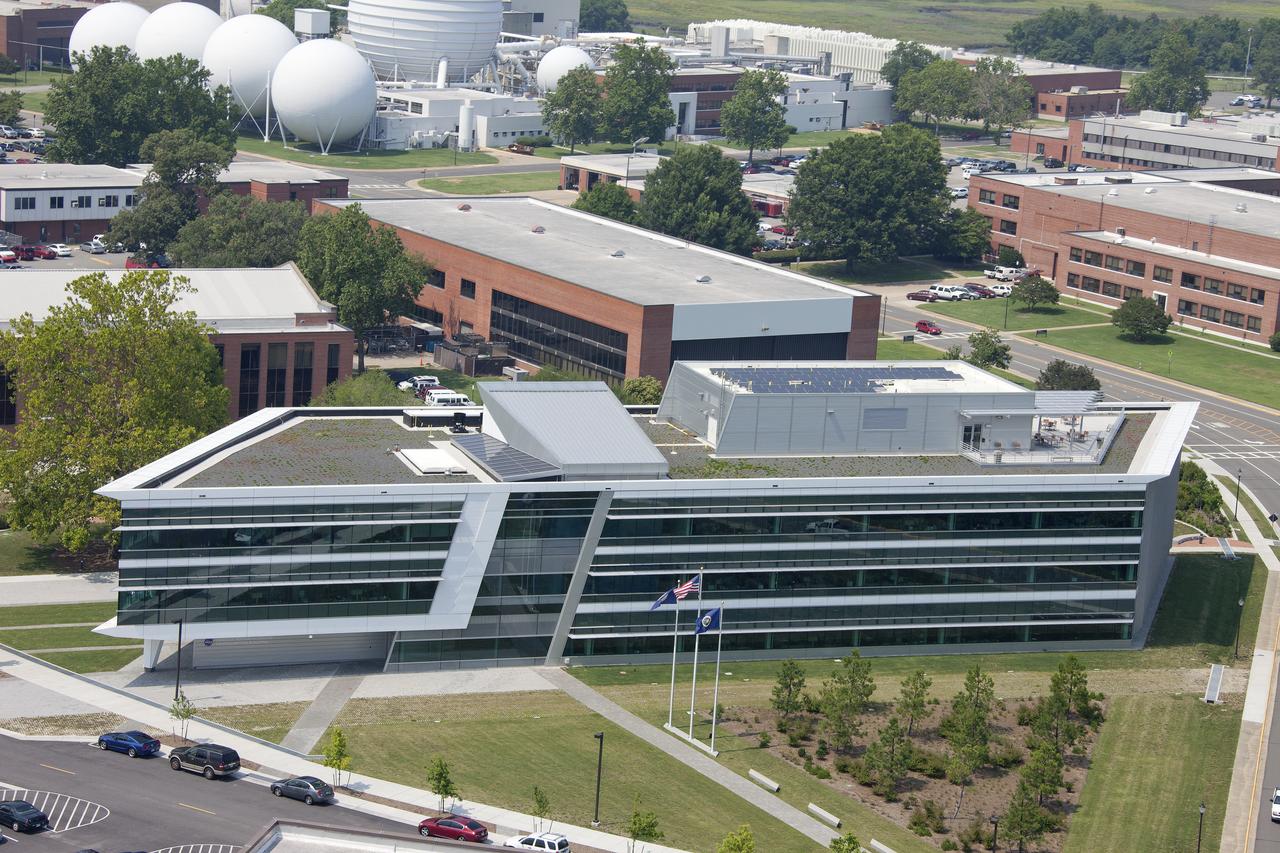
Aerial of NASA Langley Research Center New Town Center Head Quarters
Aerials of NASA Langley Research Center west area
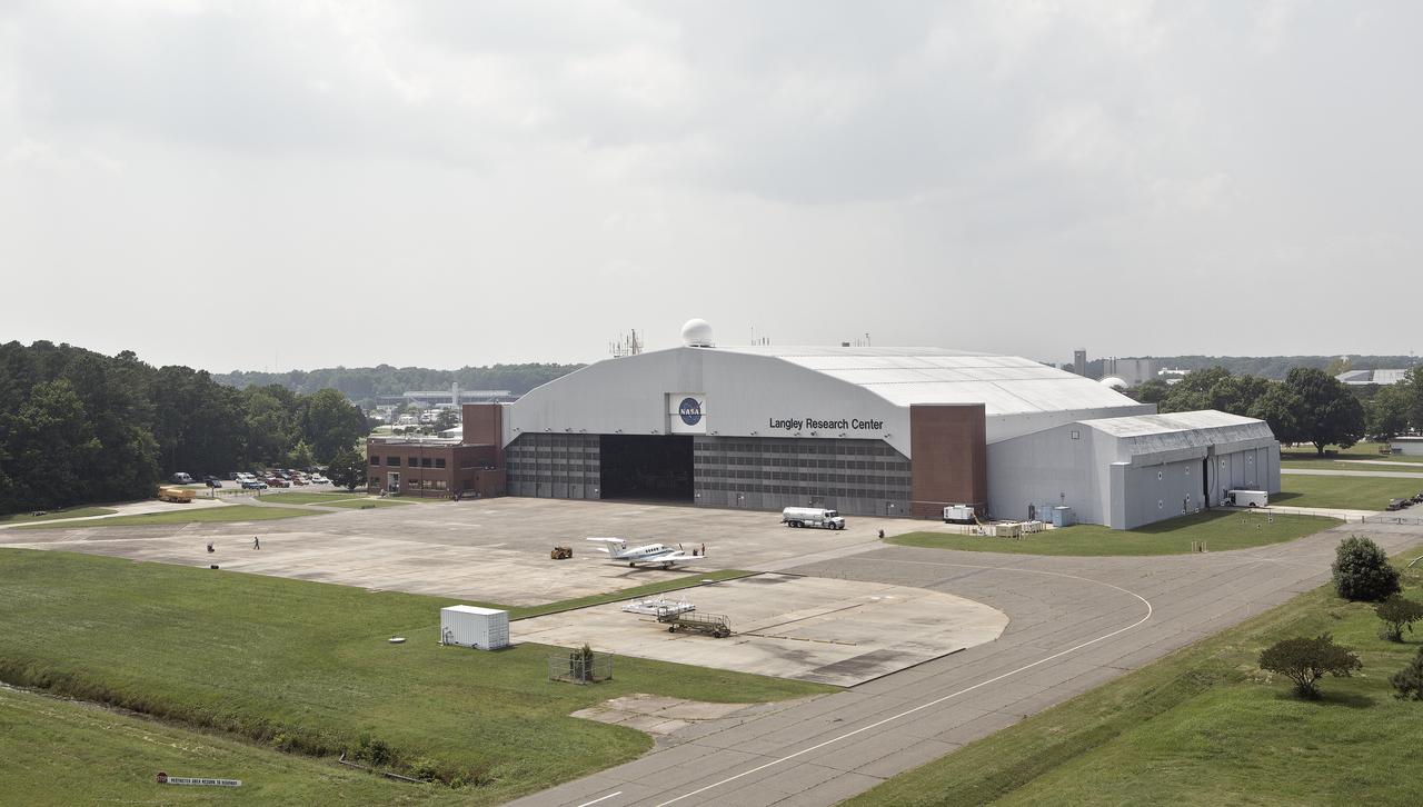
Aerial of NASA Langley Research Center Hangar
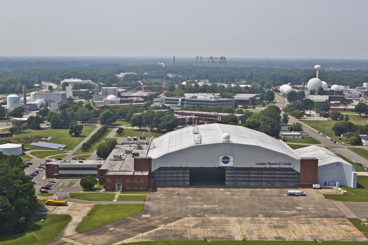
Aerial of NASA Langley Research Center Hangar
Aerials of NASA Langley Research Center east side with spin tunnel
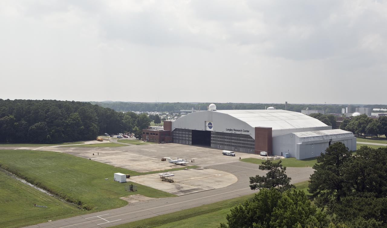
NASA Langley Hangar
Aerial of west area of Langley Research Center
Aerial of west area of Langley Research Center

Aerial of NASA Langley Research Center Hangar
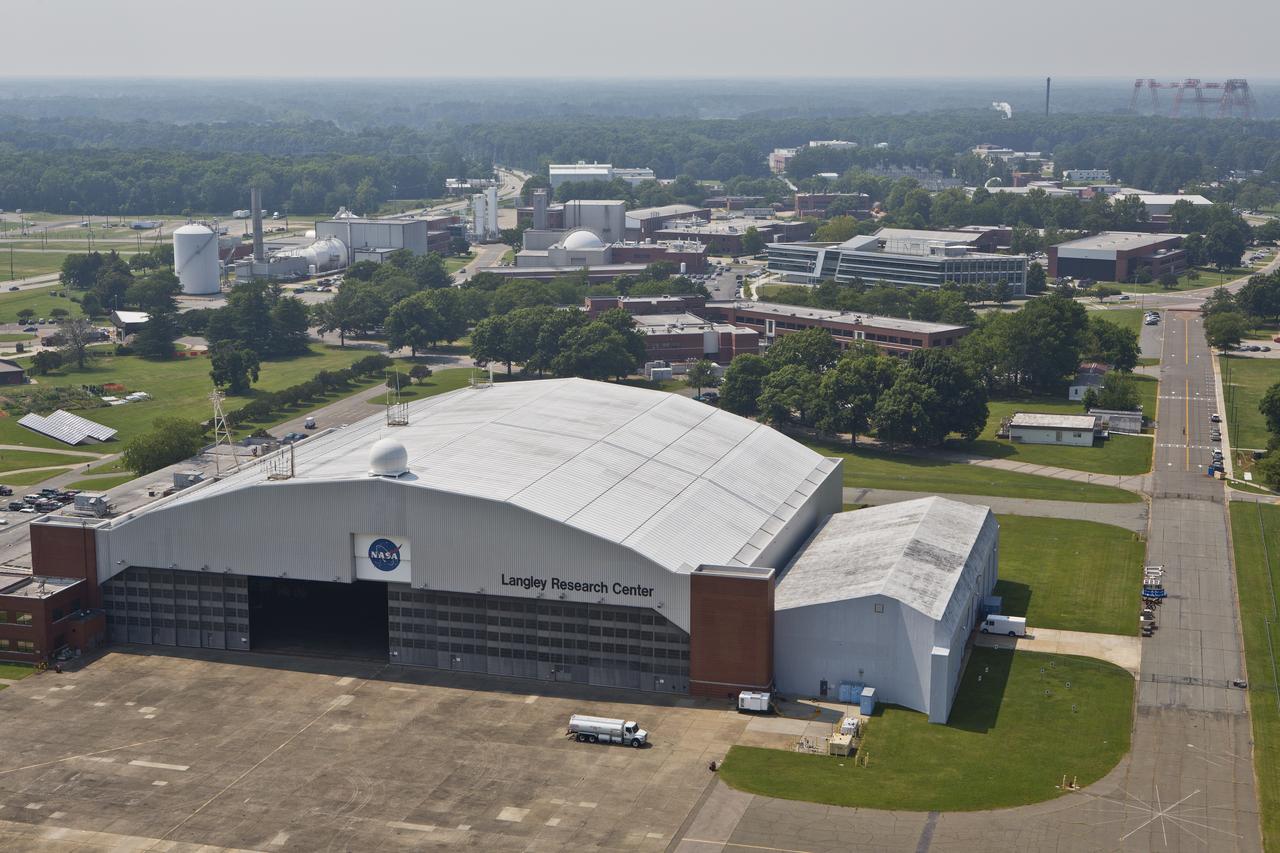
Aerial of NASA Langley Research Center Hangar
NASA Langley Hangar
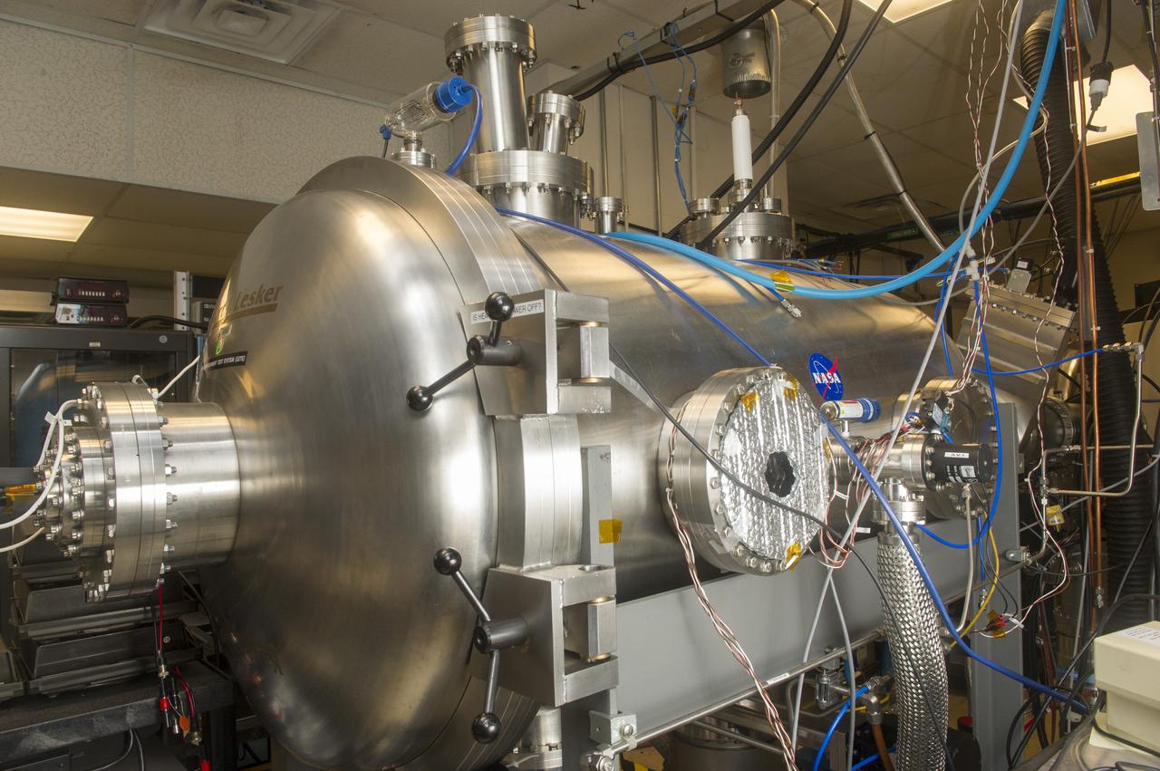
BLDG 4605, LUNAR ENVIRONMENTS TEST SYSTEM VACUUM CHAMBER, WEST SIDE
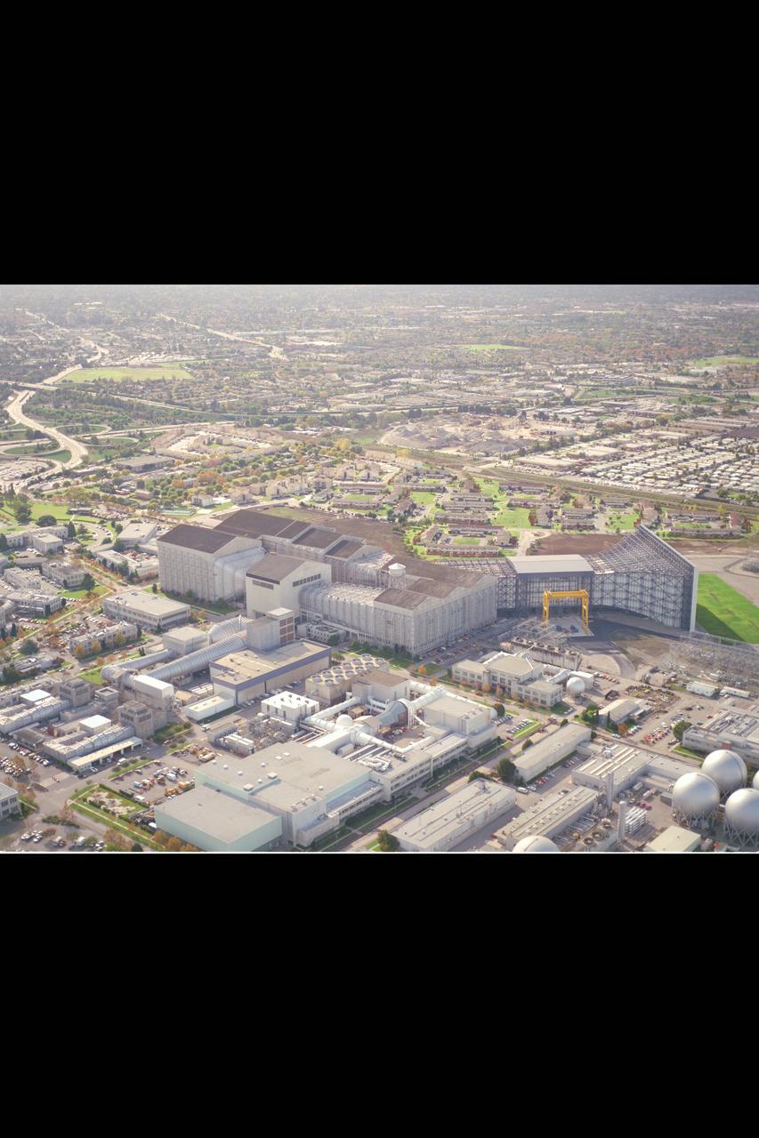
Ames Aerials 40x80x120ft NFAC complex looking west from field side.
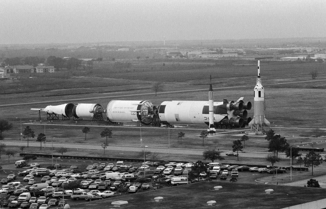
Overall view at JSC lookin west from atop of Bldg. 1 showing rockets, parking lot and all threee stages of Saturn V. first stage of Saturn V exhibit in "Rocket Park" on west side of center little joe and mercury models are seen 1. JSC- Aerials
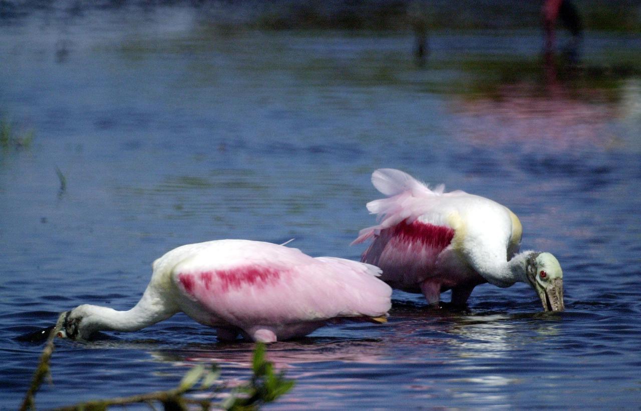
KENNEDY SPACE CENTER, FLA. -- In a lake near Kennedy Space Center, a pair of Roseate Spoonbills search the water for food. They obtain food by sweeping their broad bills from side to side. This species inhabits mangroves, ranging from the coasts of southern Florida and Texas (sometimes Louisiana), the West Indies, Mexico and Central and South America.
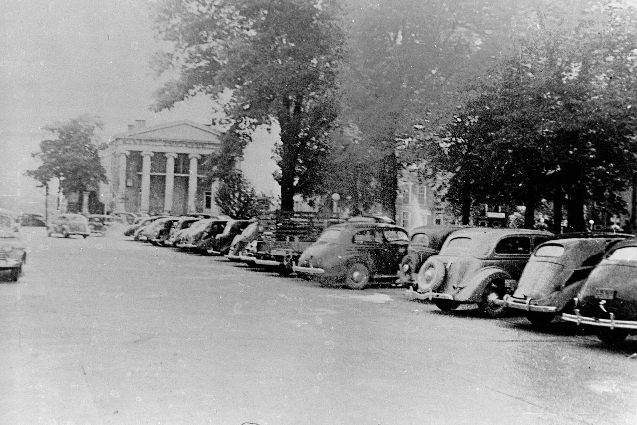
This 1940s photo of the South side of Square in downtown Huntsville, Alabama, looking west, shows a historical bank in the background with cars parked just South of the Courthouse (not shown in photo). (Courtesy of Huntsville/Madison County Public Library)
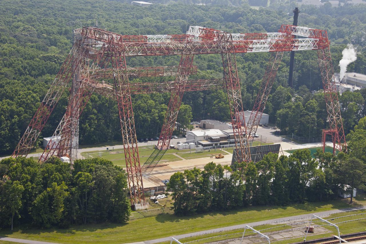
Aerial of NASA Langley's Gantry and slashdown pool also known as Impact Dynamic Faciltiy

Aerial of NASA Langley's Gantry and slashdown pool also known as Impact Dynamic Faciltiy

Aerial of NASA Langley's Gantry and slashdown pool also known as Impact Dynamic Faciltiy
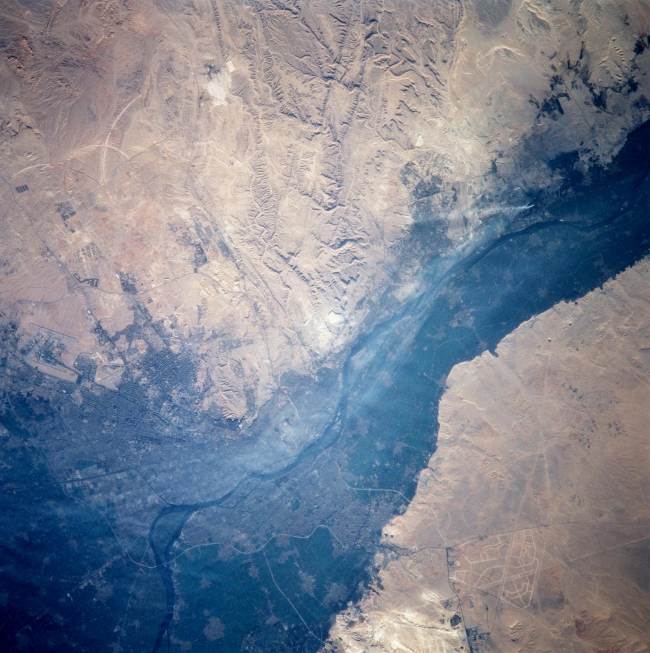
STS099-714-060 (11-22 February 2000) ---One of the STS-99 astronauts aboard the Space Shuttle Endeavour recorded this 70mm image of Cairo, one of the fastest growing cities in the world. The city is moving outside the dark-colored Nile valley into the surrounding desert. New developments are side by side with ancient monuments. The pyramids at Giza are highlighted by their shadows and the new development in the desert to the South is outlined by lighter-colored roads. Further south of the Giza pyramids on the west side of the Nile River are the Step and Bent Pyramids, respectively.
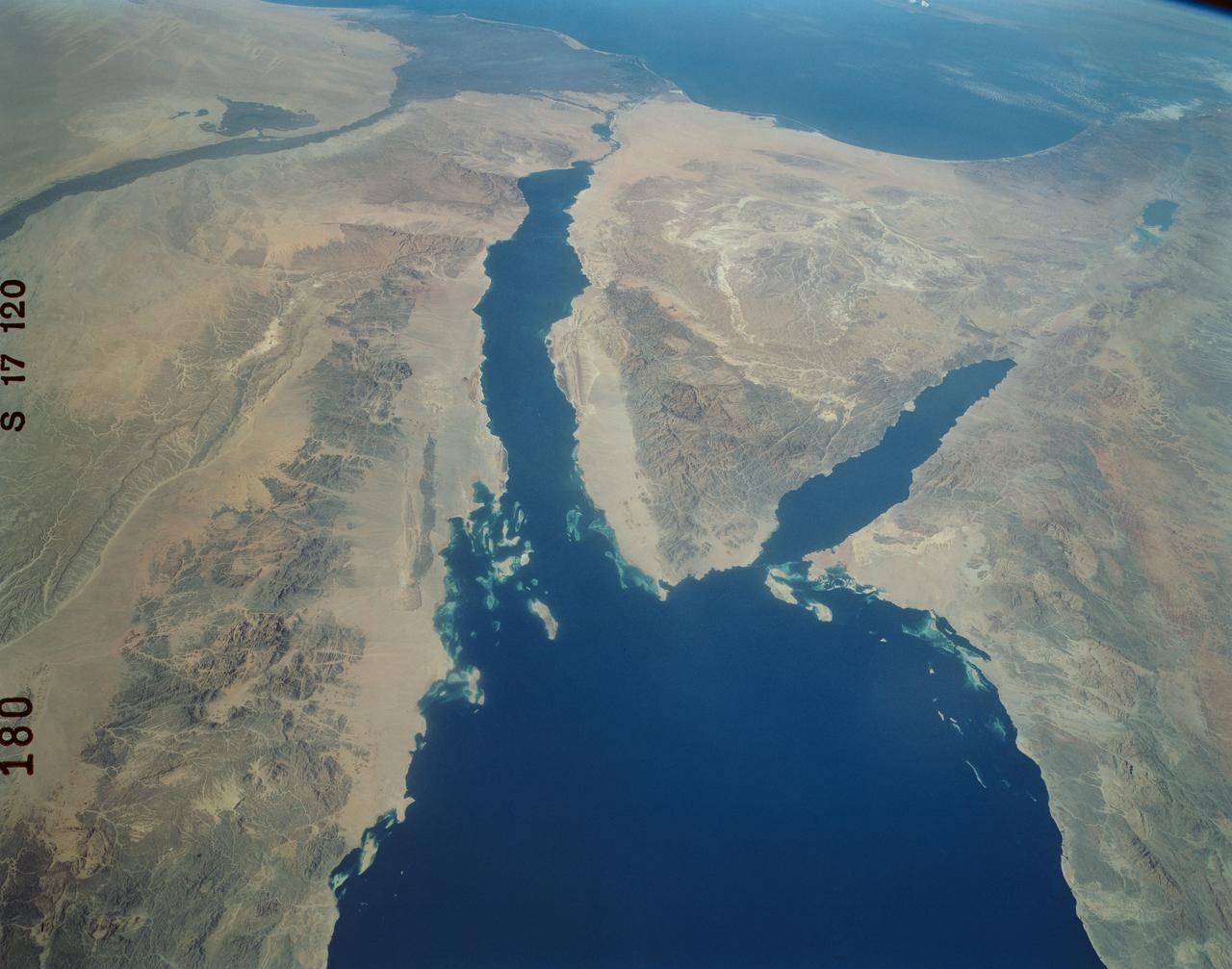
An excellent panoramic view of the entire Sinai Peninsula (29.0N, 34.0E) and the nearby Nile River Delta and eastern Mediterranean coastal region. The Suez Canal, at the top of the scene just to the right of the Delta, connects the Mediterranean Sea with the Gulf of Suez on the west side of the Sinai Peninsula and the Gulf of Aqaba is on the west where they both flow into the Red Sea. At upper right, is the Dead Sea, Jordan River and Lake Tiberius.
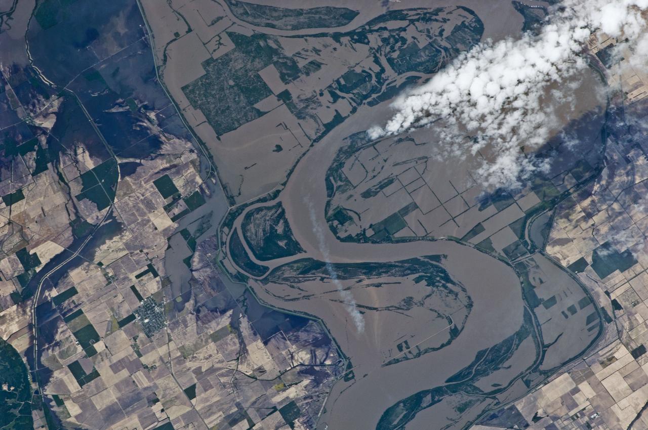
ISS027-E-027023 (12 May 2011) --- An Expediton 27 crew member aboard the International Space Station, 220 miles above Earth and the Mississippi River, captured this May 12 still photo, clearly showing the outlines of some heavily flooded agricultural fields on the Missouri side of the river. The center point for this 400-mm frame is 36.27 degrees north latitude and 89.57 degrees west longitude (north of Caruthersville, Mo. and west of Ridgely, Tenn.). North is towards the lower right corner of the image.
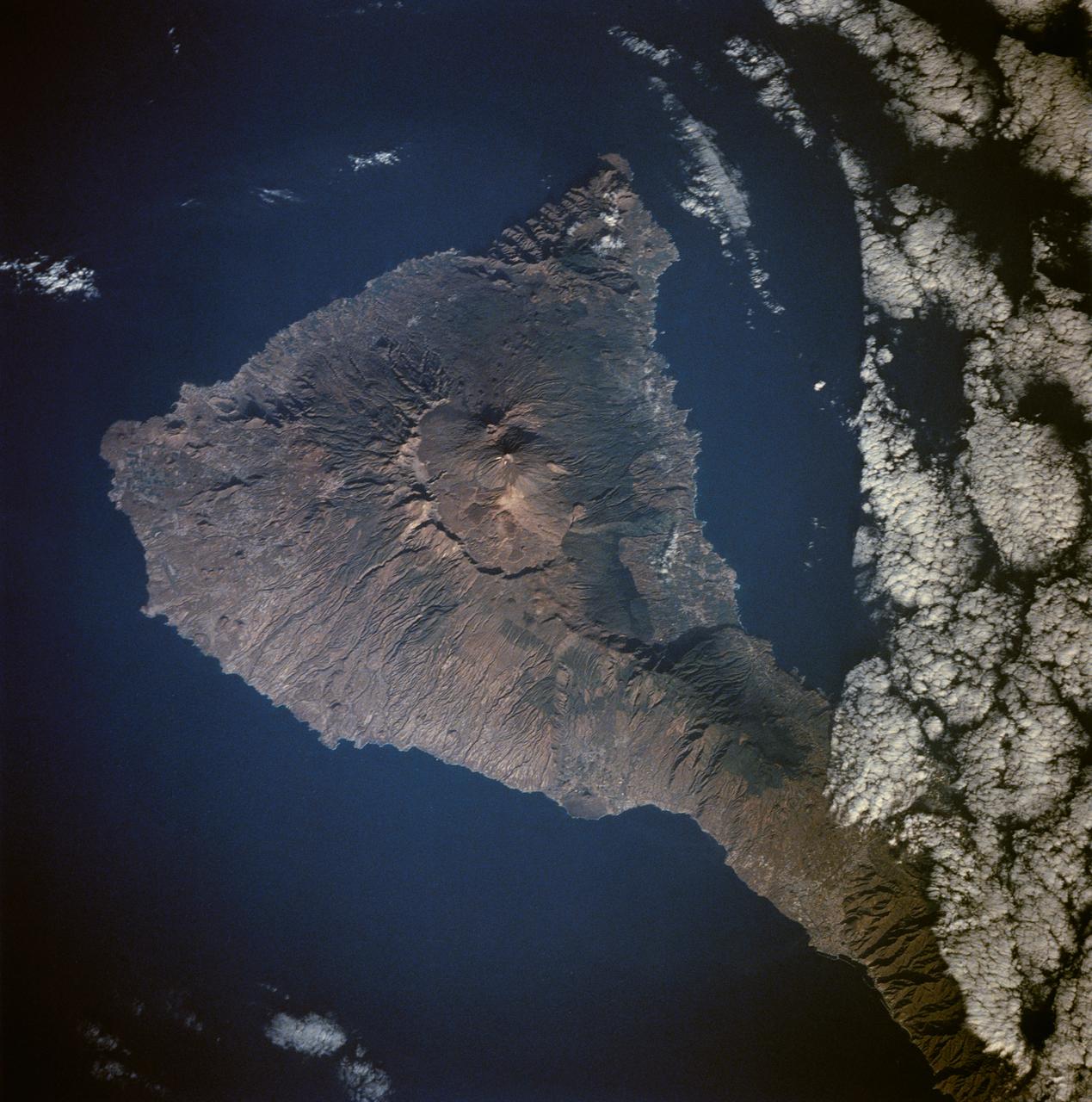
Tenarife Island is one of the most volcanically active of the Canary Island archipelago, Atlantic Ocean, just off the NW coast of Africa, (28.5N, 16.5W). The old central caldera, nearly filled in by successive volcanic activity culminating in two stratocones. From those two peaks, a line of smaller cinder cones extend to the point of the island. Extensive gullies dissect the west side of the island and some forests still remain on the east side.

KENNEDY SPACE CENTER, FLA. - In the Banana Creek at Kennedy Space Center, a school of mullet appear to form an underwater carpet as they swarm in the shallows. The creek flows between the Indian River on the west side of Merritt Island and the Banana River on the east side, passing alongside the Launch Complex 39 Area. Photo credit: NASA/George Shelton

ISS027-E-027019 (12 May 2011) --- Parts of two states highly impacted by recent flooding of the Mississippi River, are pictured in this International Space Station image featuring an area east of Blytheville, Ark., off the right side of the image. Center point coordinates are located at 35.8 degrees north latitude and 89.7 degrees west longitude The areas of Ruckers Place, Tenn. and Tomato, Ark. are surrounded by water, while Barfield, Ark. is still dry behind the levee on the right side of the image. North is toward the bottom of the photo.

KENNEDY SPACE CENTER, FLA. - In the Banana Creek at Kennedy Space Center, a school of mullet appear to form an underwater carpet as they swarm in the shallows. The creek flows between the Indian River on the west side of Merritt Island and the Banana River on the east side, passing alongside the Launch Complex 39 Area. Photo credit: NASA/George Shelton
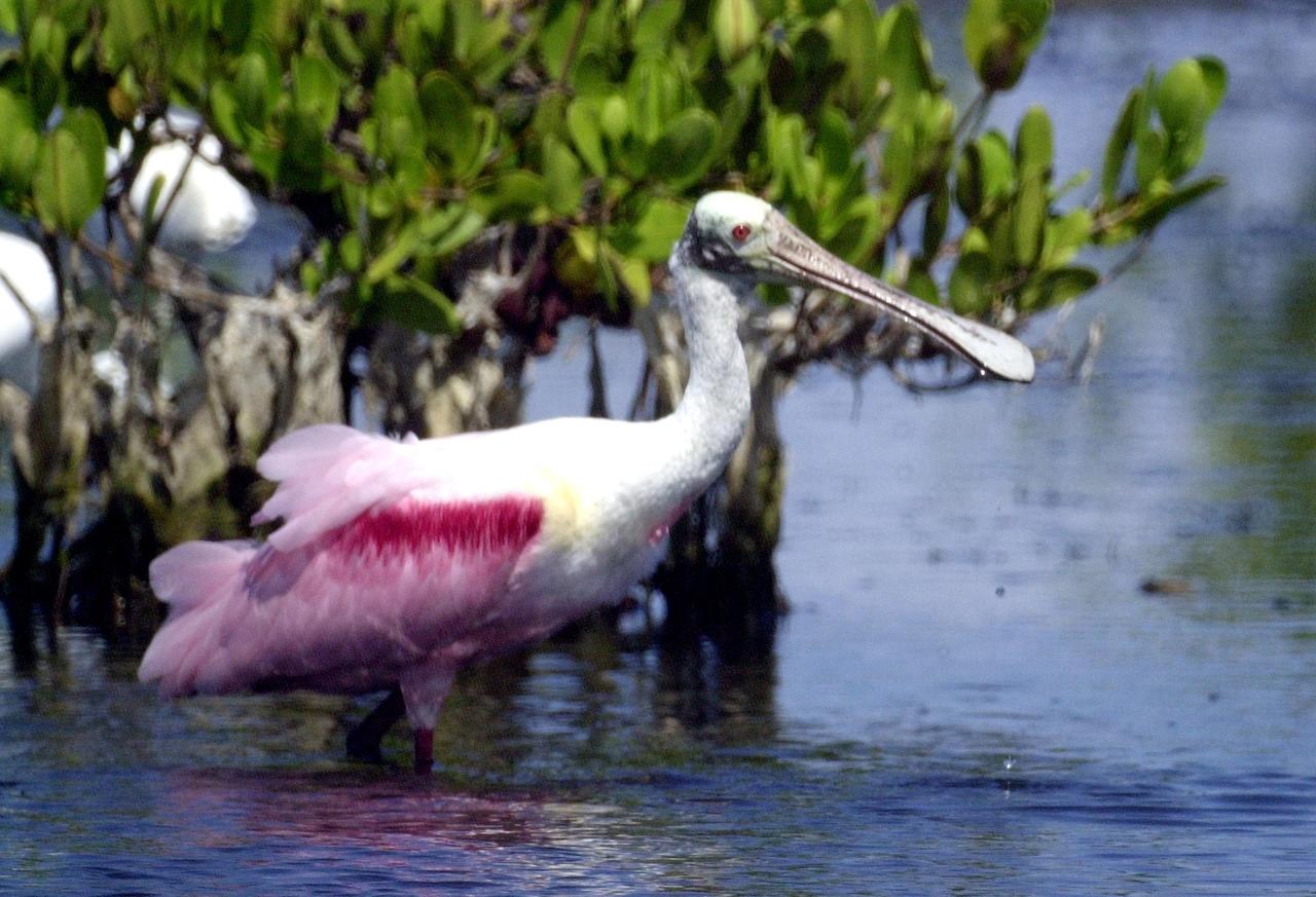
KENNEDY SPACE CENTER, FLA. - Water droplets fall from the broad bill of a Roseate Spoonbill after lifting its head from the water. The site is near Kennedy Space Center. Spoonbills obtain food by sweeping their broad bills from side to side. They inhabit mangroves, ranging from the coasts of southern Florida and Texas (sometimes Louisiana), the West Indies, Mexico and Central and South America.

Swift currents flow through the Strait of Gibraltar, producing complicated patterns in the surface waters. Some of those patterns are highlighted in the sunglint in this photograph. The Mediterranian Sea is on the upper right, the Atlantic Ocean in in the lower left. Few features can be seen on the Mediterranian side, but current shears (straight lines coming off Spain), several sets of internal waves (impinging on the Spanish continental shelf) and ship wakes can be seen on the Atlantic side, west of Cadiz. Both Tangier and Cadiz show up in the sunglint as well.
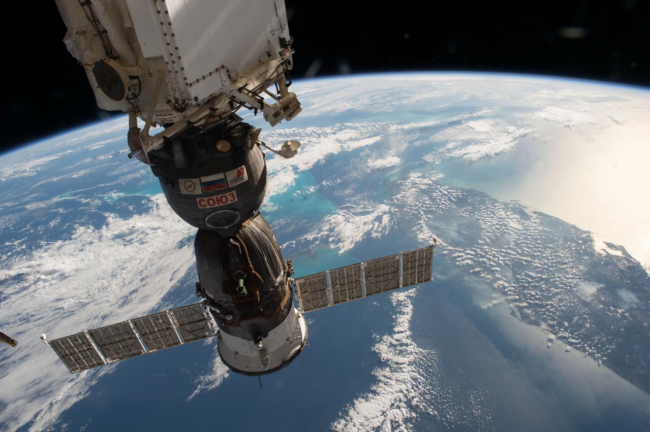
iss050e038462 (02/03/2017) --- A Russian Soyuz spacecraft can be seen in this image from the International Space Station as it passes over the American state of Florida surrounded by the blue waters of the Gulf of Mexico on the west side and the Atlantic Ocean on the other.
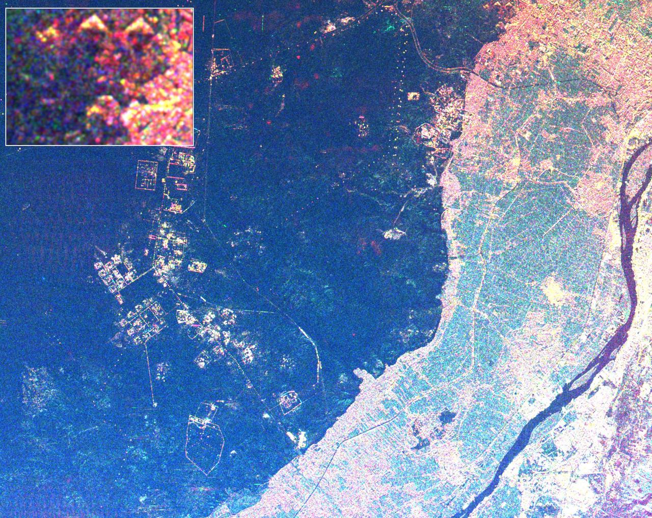
This radar image shows the area west of the Nile River near Cairo, Egypt. The Nile River is the dark band along the right side of the image and it flows approximately due North from the bottom to the right. The boundary between dense urbanization and the desert can be clearly seen between the bright and dark areas in the center of the image. This boundary represents the approximate extent of yearly Nile flooding which played an important part in determining where people lived in ancient Egypt. This land usage pattern persists to this day. The pyramids at Giza appear as three bright triangles aligned with the image top just at the boundary of the urbanized area. They are also shown enlarged in the inset box in the top left of the image. The Great Pyramid of Khufu (Cheops in Greek) is the northern most of the three Giza pyramids. The side-looking radar illuminates the scene from the top, the two sides of the pyramids facing the radar reflect most of the energy back to the antenna and appear radar bright; the two sides away from the radar reflect less energy back and appear dark Two additional pyramids can be seen left of center in the lower portion of the image. The modern development in the desert on the left side of the image is the Sixth of October City, an area of factories and residences started by Anwar Sadat to relieve urban crowding. The image was taken on April 19, 1994 by the Spaceborne Imaging Radar-C/X-Band Synthetic Aperture Radar (SIR-C/X-SAR) aboard the shuttle Endeavour. SIR-C/X-SAR, a joint mission of the German, Italian and the United States space agencies, is part of NASA's Mission to Planet Earth. The image is centered on latitude 29.72 degrees North latitude and 30.83 degrees East longitude. The area shown is approximately 20 kilometers by 30 kilometers. The colors in the image are assigned to different frequencies and polarizations of the radar as follows: red is L-band horizontally transmitted, horizontally received; green is C-band horizontally transmitted, horizontally received; blue is C-band horizontally transmitted, vertically received. http://photojournal.jpl.nasa.gov/catalog/PIA01793
The THEMIS VIS camera contains 5 filters. The data from different filters can be combined in multiple ways to create a false color image. These false color images may reveal subtle variations of the surface not easily identified in a single band image. This false color image shows part of the floor of Kaiser Crater. Kaiser Crater is 207 km (129 miles) in diameter and is located in Noachis Terra west of Hellas Planitia. This sand dune field is one of several regions of sand dunes located in the southern part of the crater floor. With enough wind and sand, sand dunes are formed. Dune morphology typically has a shallow slope on the side the wind is blowing from and a steep face on the other side. The lighter part of the dunes in this image are the steep slopes. Wind blows sand particles up the shallow slope and then the particles 'fall' off the crest of the dune down the steep side. With time, the constant wind will move the crest of the dune forward. Depending on the amount of available sand, dunes can grow to large heights and sizes. The dunes in this image are moving west - towards the left side of the image. Dark blue in this false color combination are typically basaltic sand. Orbit Number: 83387 Latitude: -46.8031 Longitude: 19.7369 Instrument: VIS Captured: 2020-10-01 08:54 https://photojournal.jpl.nasa.gov/catalog/PIA24708

STS109-714-035 (1-12 March 2002) --- The astronauts on board the Space Shuttle Columbia took this 70mm picture featuring the greater metropolitan Houston, Texas area. The view direction is northwest, with Houston's downtown as the brightest region (center) where major highways converge. Interstate 10 is a fine line extending towards the lower right, around the north side of Galveston Bay, part of which appears in the lower right corner. The interstate also appears as a line cutting through the wooded parts of west Houston (just west of downtown). Bush Intercontinental Airport is the largest light patch on the view north of downtown, and lies next to Highway 59, a thin white line that stretches toward the right side of the picture. Forests of East Texas make the top right corner of the view a dark green.
This VIS image is located in the center of Syrtis Major Planum. At the top of the image is Nili Patera, a volcanic summit. The sand dunes located near Nili Patera are visible on the left side of the image. The bottom of the image is just west of Meroe Patera. Dunes located between Nili and Meroe are visible towards the bottom of the image. Winds in the region have created the dunes, but also many windstreaks on the downward side of craters in the image. Wind streaks indicate the direction of the wind. In this region the winds are blowing from east to west. The THEMIS VIS camera contains 5 filters. The data from different filters can be combined in multiple ways to create a false color image. These false color images may reveal subtle variations of the surface not easily identified in a single band image. Orbit Number: 62072 Latitude: 7.99408 Longitude: 67.5512 Instrument: VIS Captured: 2015-12-11 18:39 https://photojournal.jpl.nasa.gov/catalog/PIA23095
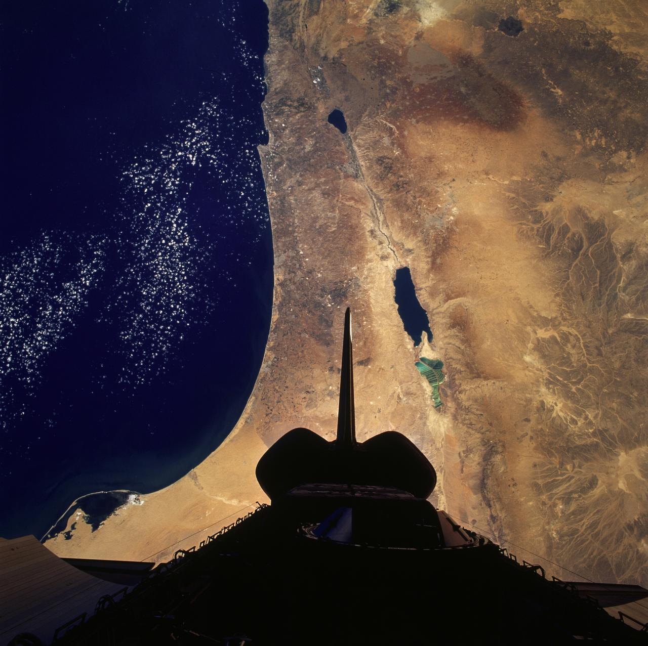
STS079-824-081 (16-26 Sept. 1996) --- In this 70mm frame from the space shuttle Atlantis, the Jordan River Valley can be traced as it separates Lebanon, Palestine and Israel on the west, from Syria and Jordan on the east. The river flows along the Dead Sea rift; the east side of the fault zone (Syria, Jordan, Saudi Arabia) has moved north about 100 kilometers relative to the west side (Lebanon, Israel, Egypt) during the past 24 million years. The Dead Sea and Sea of Galilee are in depressions formed where faults of the zone diverge or step over. The Dead Sea once covered the area of salt evaporation pans (the bright blue water). The lagoon, barrier islands and evaporite deposits (bright white) along the Mediterranean coast of the Sinai Peninsula (lower left of frame) are just east of Port Said.
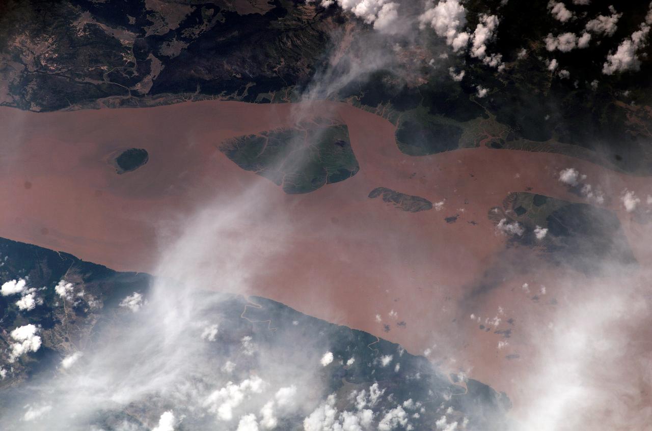
ISS010-E-13029 (13 January 2005) --- The Perigoso Channel and Amazon River mouth are featured in this image photographed by an Expedition 10 crewmember on the International Space Station (ISS). According to NASA scientists studying the Expedition 10 imagery, between 2000 and 2005 the channel on the west side of the island has shifted to the northwest – by eroding ~200 meters of the mainland shoreline and accreting sediment on the west side of the island, broadly maintaining the width of the channel. The North Channel (right) has been significantly widened. This has resulted in the erosional removal of almost 1 kilometer of the north end of the island, as well narrowing of a smaller island downstream (lower right). A more important but subtler visual effect has been the accumulation of sediment on the upstream (left) two-thirds of the island, accompanied by the establishment of permanent vegetation (dark green).
On the west (left) side of this image from NASA's Mars Reconnaissance Orbiter, fairly textbook-looking barchan sand dunes sit atop the bedrock. Barchan dunes pointing in the opposite direction are just a few kilometers away to the east. In between these opposing barchan dunes are star dunes. Barchan dunes form when the sand-moving wind is fairly unidirectional. Star dunes, in contrast, form when the sand-moving wind comes from multiple directions -- not all at once, but from varying directions at different times of day or year. Where is the sand coming from? As with most places on Mars...well, that's an area of on-going research. But the star dunes are telling us that this area seems to be accumulating sand. https://photojournal.jpl.nasa.gov/catalog/PIA21934

KENNEDY SPACE CENTER, FLA. -- For the first time in Space Shuttle history, a fully stacked Shuttle - Atlantis - moves into high bay 2, on the west side of the Vehicle Assembly Building (VAB). The VAB and nearby rock-paved crawlerway have recently undergone major modifications to provide Shuttle fliglht hardware more storage space and protection - "Safe Haven" - from hurricanes or tropical storms. Atlantis begain moving out of VAB high bay 1 on the east side at 2:59 a.m. EDT. After the successful "Safe Haven" fit check, Shuttle Atlantis is scheduled to roll out to Launch Pad 39B in preparation for the STS-106 launch on Sept. 8.
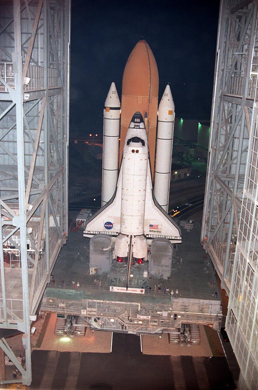
KENNEDY SPACE CENTER, FLA. -- For the first time in Space Shuttle history, a fully stacked Shuttle - Atlantis - moves into high bay 2, on the west side of the Vehicle Assembly Building (VAB). The VAB and nearby rock-paved crawlerway have recently undergone major modifications to provide Shuttle fliglht hardware more storage space and protection - "Safe Haven" - from hurricanes or tropical storms. Atlantis begain moving out of VAB high bay 1 on the east side at 2:59 a.m. EDT. After the successful "Safe Haven" fit check, Shuttle Atlantis is scheduled to roll out to Launch Pad 39B in preparation for the STS-106 launch on Sept. 8.
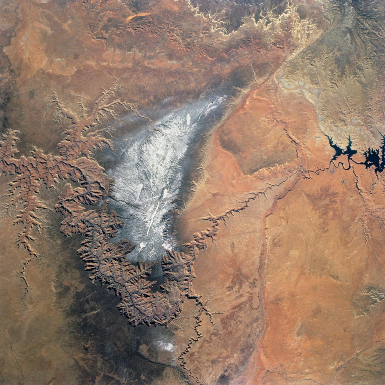
Snow covers the Kaibab Plateau on the northern side of the Colorado River in this November, 1994 view of the Grand Canyon. North is to the bottom of this view. The Colorado River has created a canyon which cuts through billions of years of geologic time. The Grand Canyon is 446 kilometers (277 miles) long, averages 16 kilometers (10 miles) wide, and is approximately 1.6 kilometers (1 mile) deep. The Coconino Plateau is located on the upper left side of the view, or to the south of the Colorado River. The direction of the flow of the Colorado River is from the east to the west. Eventually the river turns south and empties into the Gulf of California. The southern portion of Lake Powell in Utah can be seen at the bottom center of the view.
Today's VIS image shows part of the eastern side of Maunder Crater. This crater has a unique form, with a large amount of fill on the eastern half of the crater floor, and a valley between the crater rim and the crater fill. It is possible that a large landslide may have occurred in this region of the crater. In this image, multiple gullies are located on the west-facing side of the valley. Maunder Crater is located in Noachis Terra. Orbit Number: 74622 Latitude: -49.4561 Longitude: 2.582 Instrument: VIS Captured: 2018-10-10 15:07 https://photojournal.jpl.nasa.gov/catalog/PIA22991
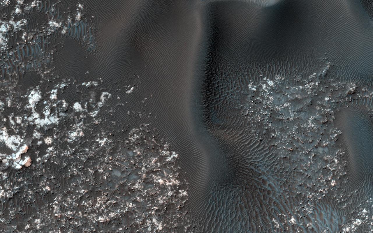
This VIS image is located in Kaiser Crater and shows a dune field on the crater floor. The crater floor is visible between the dunes, indicating that there is a limited sand supply creating the dunes. Local winds continue to move the sand dunes across the crater floor. There are two sides to a dune, the low angle slope of the windward face and the high angle slope of the leeward side. The steep side is called the slip face. Wind blows sand grains up the low angle slope of the dunes which then "fall down" the slip face. In this way the whole dune moves towards the slip face. The winds blow from the windward to the leeward side of the dunes. In this image the slip faces are on the left side of the dune, so the dunes are slowly moving to the left side of this image. Kaiser Crater is 207 km (129 miles) in diameter and is located in Noachis Terra west of Hellas Planitia. Orbit Number: 84585 Latitude: -45.8116 Longitude: 19.5816 Instrument: VIS Captured: 2021-01-08 00:14 https://photojournal.jpl.nasa.gov/catalog/PIA24415
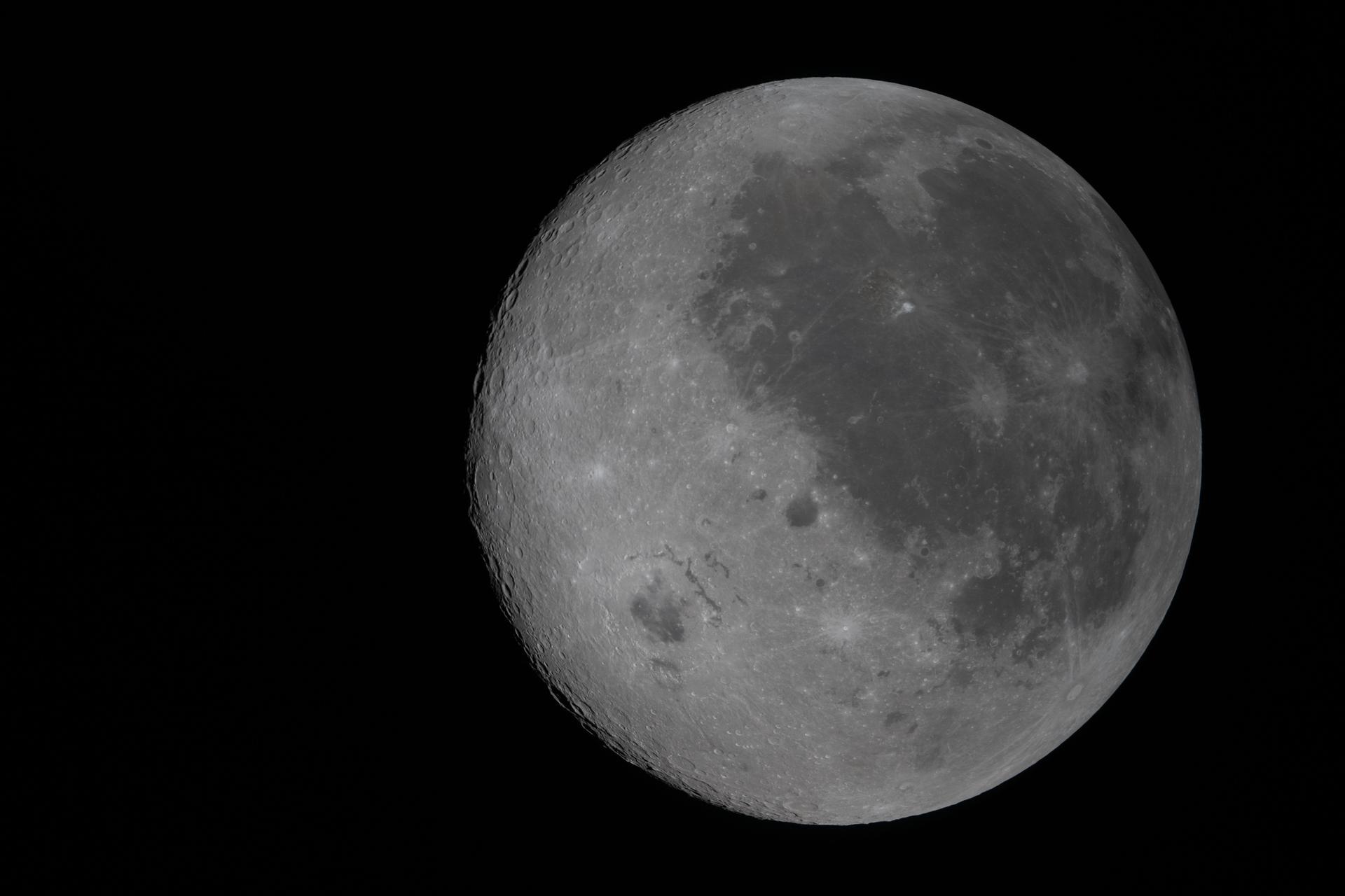
art002e009212 (April 6, 2026) In this fully illuminated view of the Moon, the near side (the hemisphere we see from Earth), is visible on the right. It is identifiable by the dark splotches that cover its surface. These are ancient lava flows from a time early in the Moon’s history when it was volcanically active. The large crater west of the lava flows is Orientale basin, a nearly 600-mile-wide crater that straddles the Moon’s near and far sides. Orientale's left half is not visible from Earth, but in this image we have a full view of the crater. Everything to the left of the crater is the far side, the hemisphere we don’t get to see from Earth because the Moon rotates on its axis at the same rate that it orbits round us.
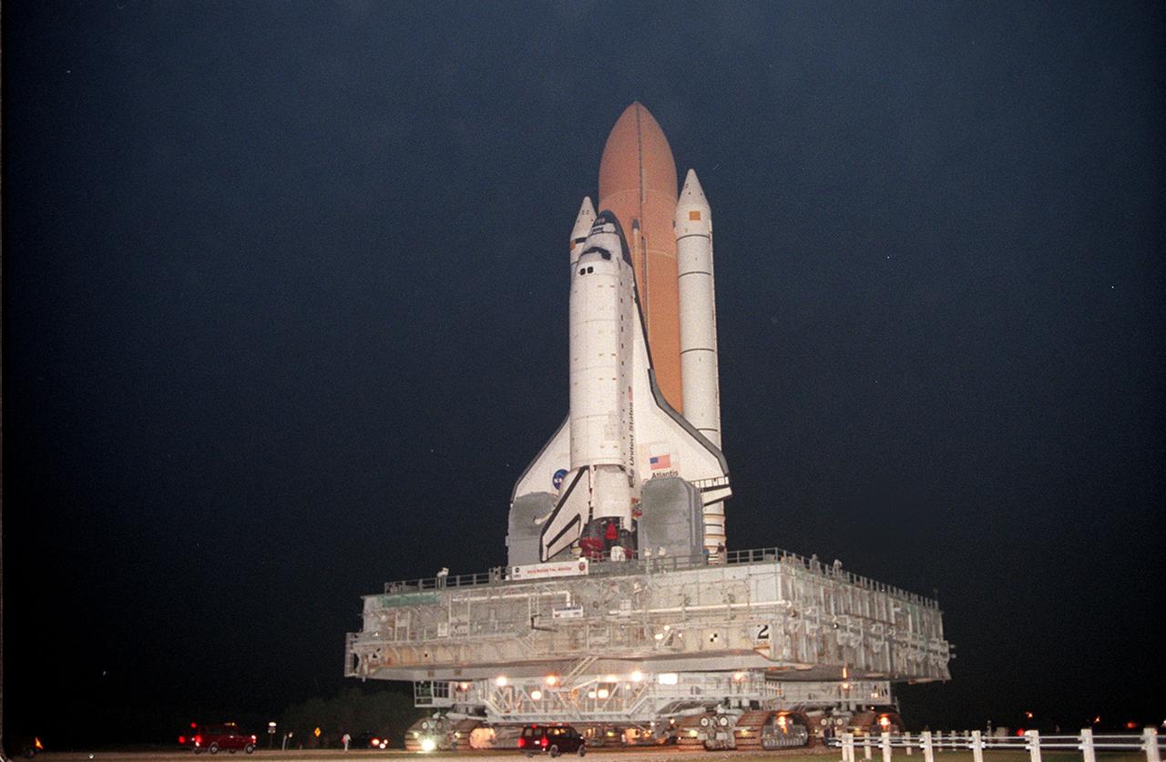
KENNEDY SPACE CENTER, FLA. -- Shuttle Atlantis, with twin solid rocket boosters and external tank atop the Mobile Launcher Platform and crawler-transorter, moves in the predawn hours into high bay 2 in the Vehicle Assembly Building (VAB). For the first time in Space Shuttle history, a fully stacked Shuttle is rolling around the north side of the VAB into high bay 2 on the building's west side. The VAB and nearby rock-paved crawlerway have recently undergone major modifications to provide Shuttle fliglht hardware more storage space and protection - "Safe Haven" - from hurricanes or tropical storms. Atlantis, the twin solid rocket boosters and external tank begain moving out of VAB high bay 1 on the east side at 2:59 a.m. EDT. After the successful "Safe Haven" fit check, Shuttle Atlantis is scheduled to roll out to Launch Pad 39B in preparation for the STS-106 launch on Sept. 8.
KENNEDY SPACE CENTER, FLA. -- For the first time in Space Shuttle history, a fully stacked Shuttle - Atlantis - is rolling into the Vehicle Assembly Building's (VAB) high bay 2 on the building's west side. The VAB and nearby rock-paved crawlerway have recently undergone major modifications to provide Shuttle fliglht hardware more storage space and protection - "Safe Haven" - from hurricanes or tropical storms. Atlantis, the twin solid rocket boosters and external tank begain moving out of VAB high bay 1 on the east side at 2:59 a.m. EDT. The 6-million pound crawler transporter carried the Mobile Launcher Platform and Space Shuttle around the north side of the VAB and into high bay 2. After the successful "Safe Haven" fit check, Shuttle Atlantis is scheduled to roll out to Launch Pad 39B in preparation for the STS-106 launch on Sept. 8.

KENNEDY SPACE CENTER, FLA. -- For the first time in Space Shuttle history, a fully stacked Shuttle - Atlantis - is rolling into the Vehicle Assembly Building's (VAB) high bay 2 on the building's west side. The VAB and nearby rock-paved crawlerway have recently undergone major modifications to provide Shuttle fliglht hardware more storage space and protection - "Safe Haven" - from hurricanes or tropical storms. Atlantis, the twin solid rocket boosters and external tank begain moving out of VAB high bay 1 on the east side at 2:59 a.m. EDT. The 6-million pound crawler transporter carried the Mobile Launcher Platform and Space Shuttle around the north side of the VAB and into high bay 2. After the successful "Safe Haven" fit check, Shuttle Atlantis is scheduled to roll out to Launch Pad 39B in preparation for the STS-106 launch on Sept. 8.

KENNEDY SPACE CENTER, FLA. -- Shuttle Atlantis, with twin solid rocket boosters and external tank atop the Mobile Launcher Platform and crawler-transorter, moves in the predawn hours into high bay 2 in the Vehicle Assembly Building (VAB). For the first time in Space Shuttle history, a fully stacked Shuttle is rolling around the north side of the VAB into high bay 2 on the building's west side. The VAB and nearby rock-paved crawlerway have recently undergone major modifications to provide Shuttle fliglht hardware more storage space and protection - "Safe Haven" - from hurricanes or tropical storms. Atlantis, the twin solid rocket boosters and external tank begain moving out of VAB high bay 1 on the east side at 2:59 a.m. EDT. After the successful "Safe Haven" fit check, Shuttle Atlantis is scheduled to roll out to Launch Pad 39B in preparation for the STS-106 launch on Sept. 8.
ISS033-E-021464 (14 Nov. 2012) --- This nighttime photograph, taken by one of the Expedition 33 crew members aboard the International Space Station, features city lights of Tokyo, on the north west side of Tokyo Bay. North is toward the lower right-hand corner of the image. Nadir point of the location on Earth was 33.9 degrees north latitude and 139.5 degrees east longitude.
Today's VIS image shows windstreaks located in Daedalia Planum. These streaks are formed by the wind interaction with positive topographic features (like craters), with the 'tail' located down wind of the crater. The streaks in this image indicate the prevailing wind was from the right to the left side of the image (east to west). Orbit Number: 80341 Latitude: -11.066 Longitude: 228.449 Instrument: VIS Captured: 2020-01-24 14:14 https://photojournal.jpl.nasa.gov/catalog/PIA23820
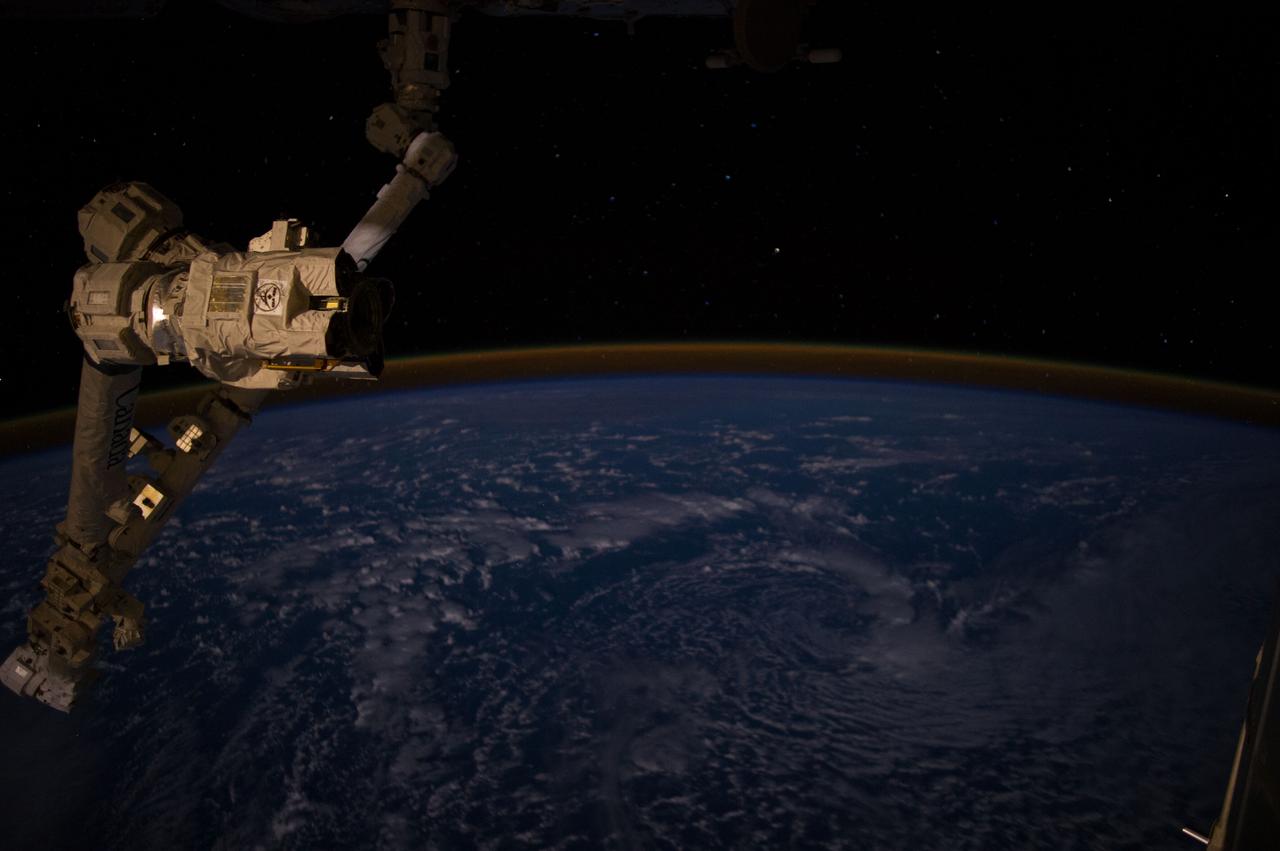
ISS040-E-052112 (8 July 2014) --- One of the Expedition 40 crew members recorded this image from aboard the International Space Station flying 226 nautical miles above the western Pacific Ocean on July 8 at 11:24:26 GMT. The orbital outpost was flying above a point located at 45.4 degrees south latitude and 156.3 degrees west longitude. Part of the station's robotic arm, known as Canadarm2, is on the left side of the frame.

ISS010-E-13680 (17 January 2005) --- The border of Galveston and Brazoria Counties in Texas is visible in this electronic still camera's image, as photographed by the Expedition 10 crew onboard the International Space Station. Polly Ranch, near Friendswood, is visible west of Interstate Highway 45 (right side). FM528 goes horizontally through the middle, and FM518 runs vertically through frame center, with the two roads intersecting near Friendswood.
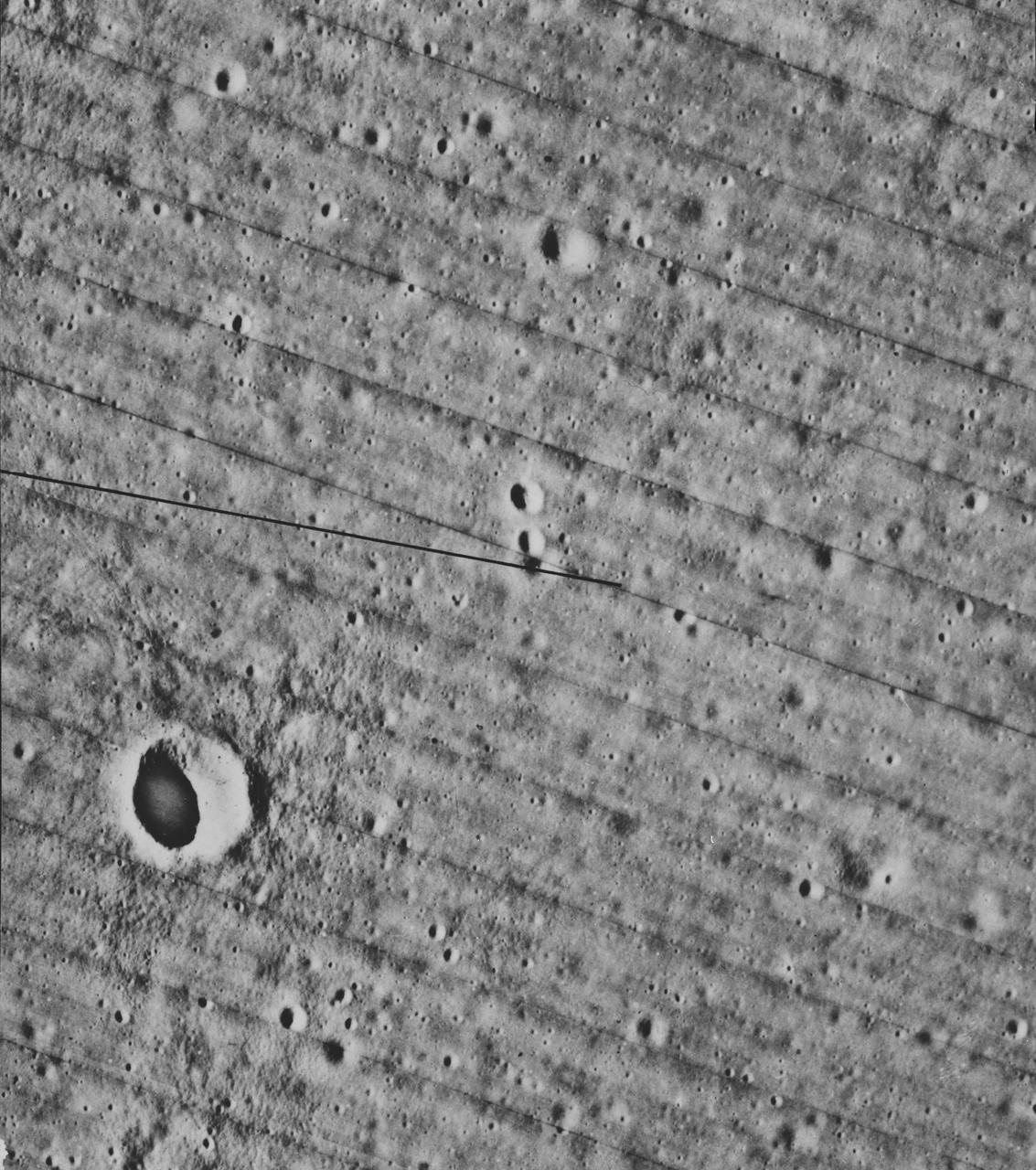
S70-54740 (December 1970) --- A lunar orbiter photograph showing a vertical view of the Apollo 14 landing site located in the Fra Mauro highlands on the lunar nearside. The predicted landing point is 17 degrees 27 minutes 46 seconds west longitude and 3 degrees 40 minutes 19 seconds south latitude. North is toward the right side of the picture. Cone Crater, the largest lunar feature visible, is located near the northeast corner of the photograph. The landing point is between Triplet Crater and Doublet Crater in the center of the picture.
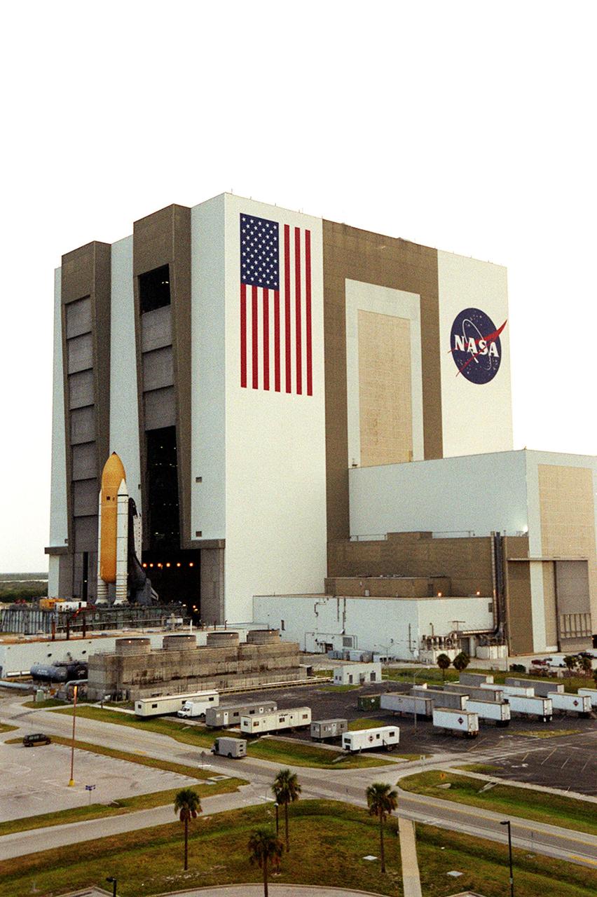
CAPE CANAVERAL, Fla. – An aerial view of Launch Complex 39 shows the south and west sides of the Vehicle Assembly Building. The curved roadway heading to the VAB leads to high bay 2, the Safe Haven facility constructed in 2000. Beyond it is the Orbiter Processing Facility, bays 1 and 2. The OPF bay 3 is farther still, closer to the VAB. Farther in the background are the waters of the Banana Creek in the Merritt Island National Wildlife Refuge. Photo credit: NASA
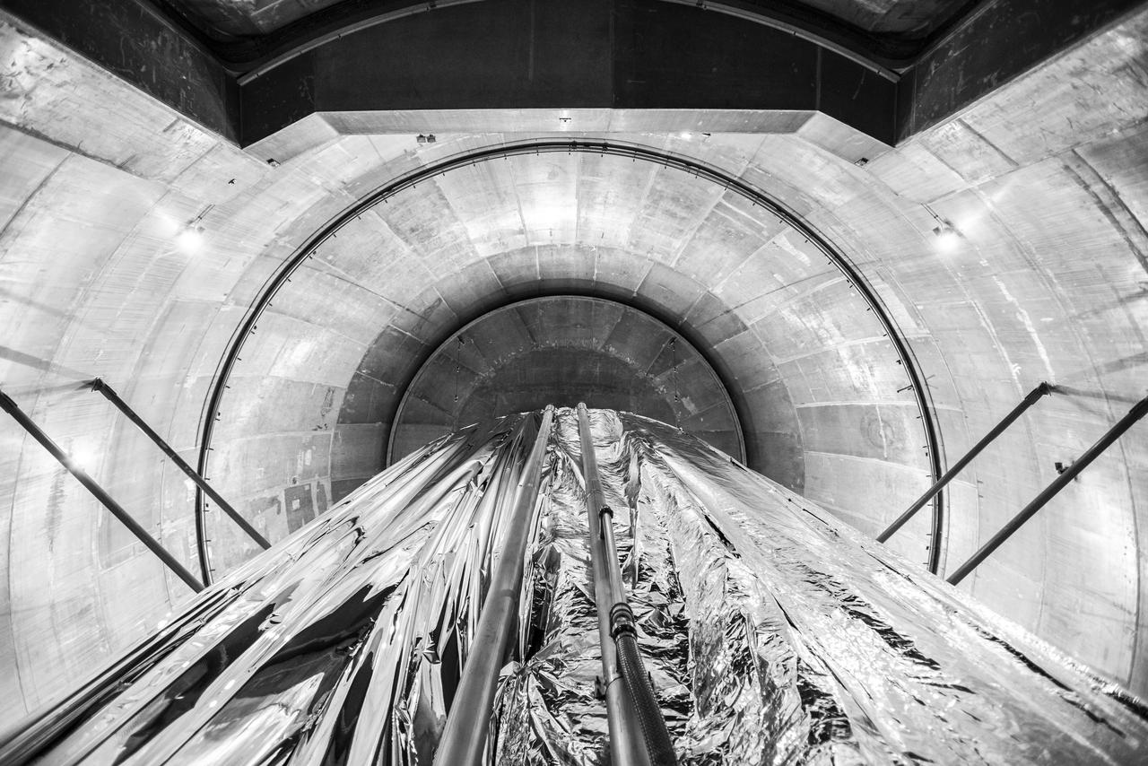
Space Environments Complex Vacuum Chamber. Cryoshroud, used to provide the thermal cold sink for Orion Vehicle testing. This view is looking at the west side of the Cryoshroud where the northwest and southwest walls intersect in the closed position. The view is from the Space Environments Complex, SEC Vacuum Chamber floor, directly up towards the vacuum chamber dome.
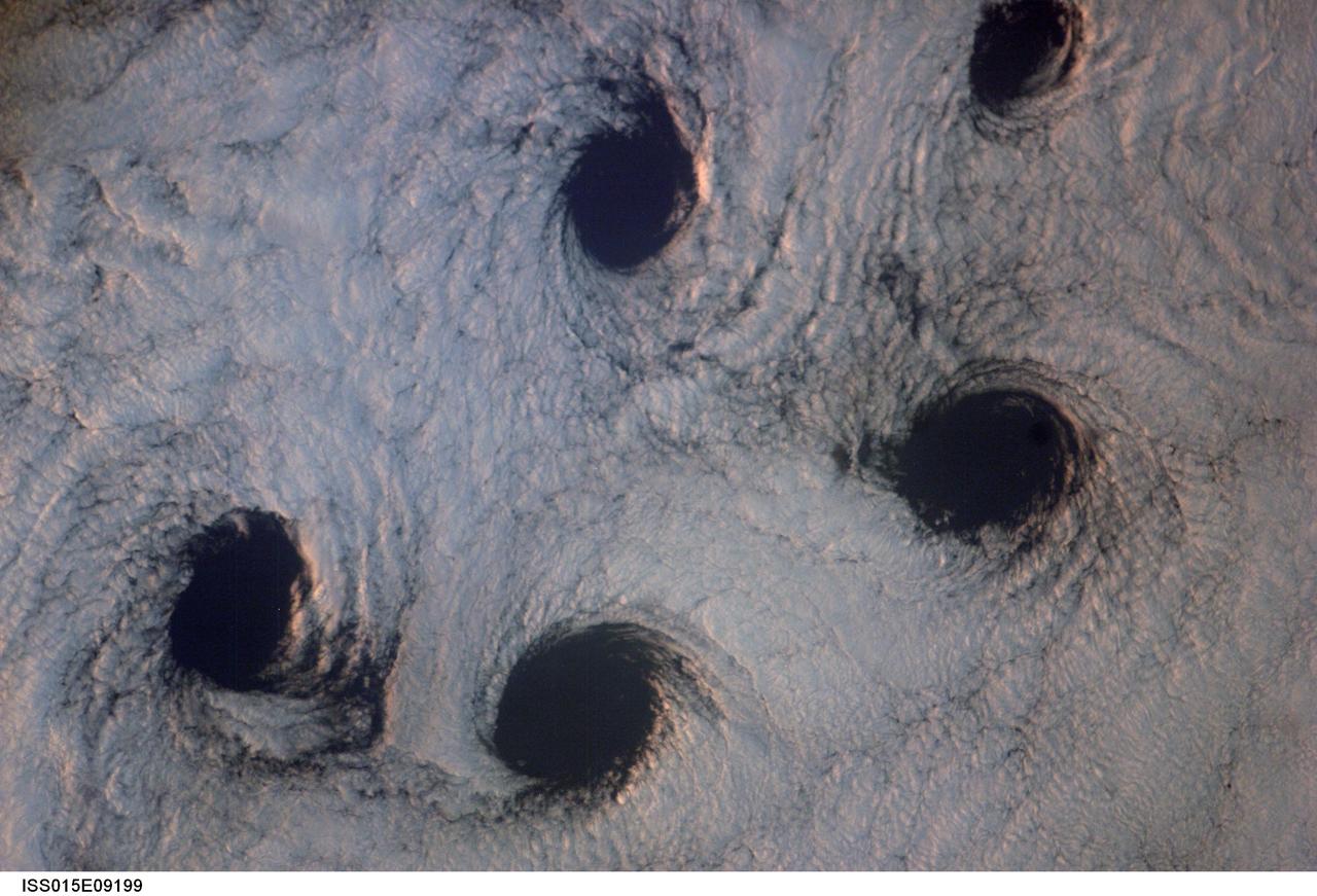
ISS015-E-09199 (23 May 2007) --- Von Karman cloud vortices near the Aleutian Islands are featured in this image photographed by an Expedition 15 crewmember on the International Space Station. The vortices are created by the wind encountering a barrier such as an island, changing direction and velocity and forming eddies in the wind and cloud pattern on the lee side of the island. The nadir point of the space station when the image was taken was 51.1 degrees north latitude and 178.8 degrees west longitude.
AS08-14-2400 (21-27 Dec. 1968) --- This near vertical photograph of the lunar surface taken with a telephoto lens during the Apollo 8 lunar orbit mission. The area covered by the photograph is approximately 20 miles on a side, and the photographed area is located at about 3 degrees south latitude and 160 degrees west longitude on the lunar farside. The lunar surface probably had less pronounced color than indicated by this print.