Western Meridiani
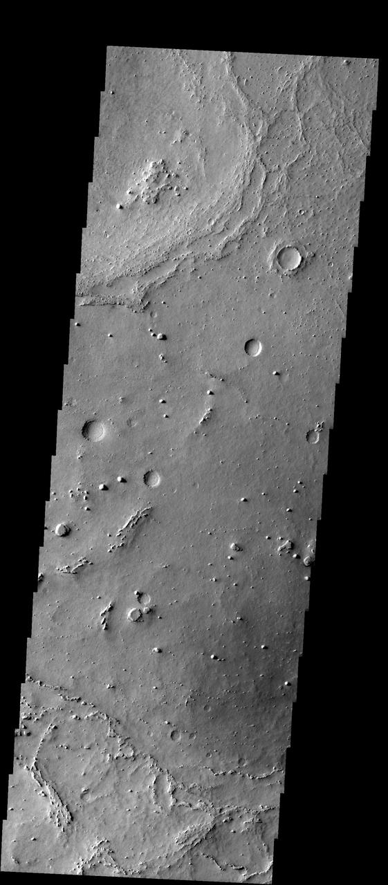
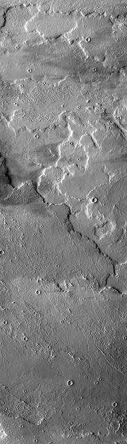
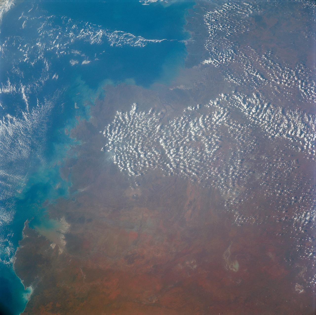
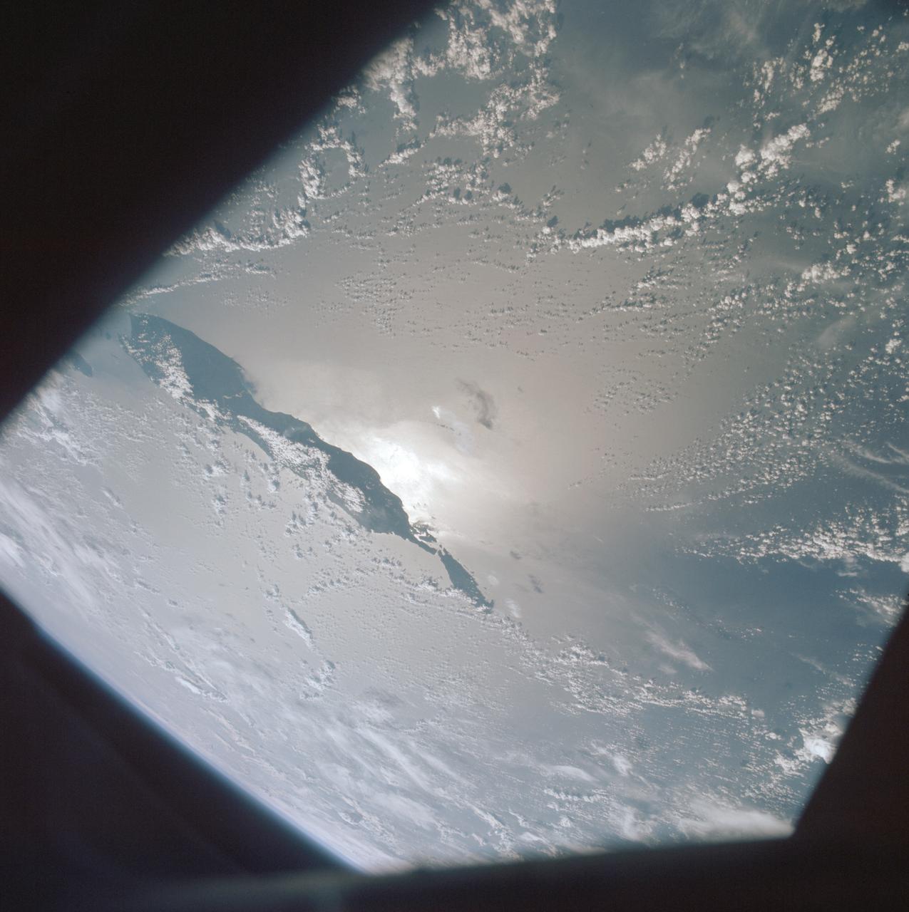
Western Gusev

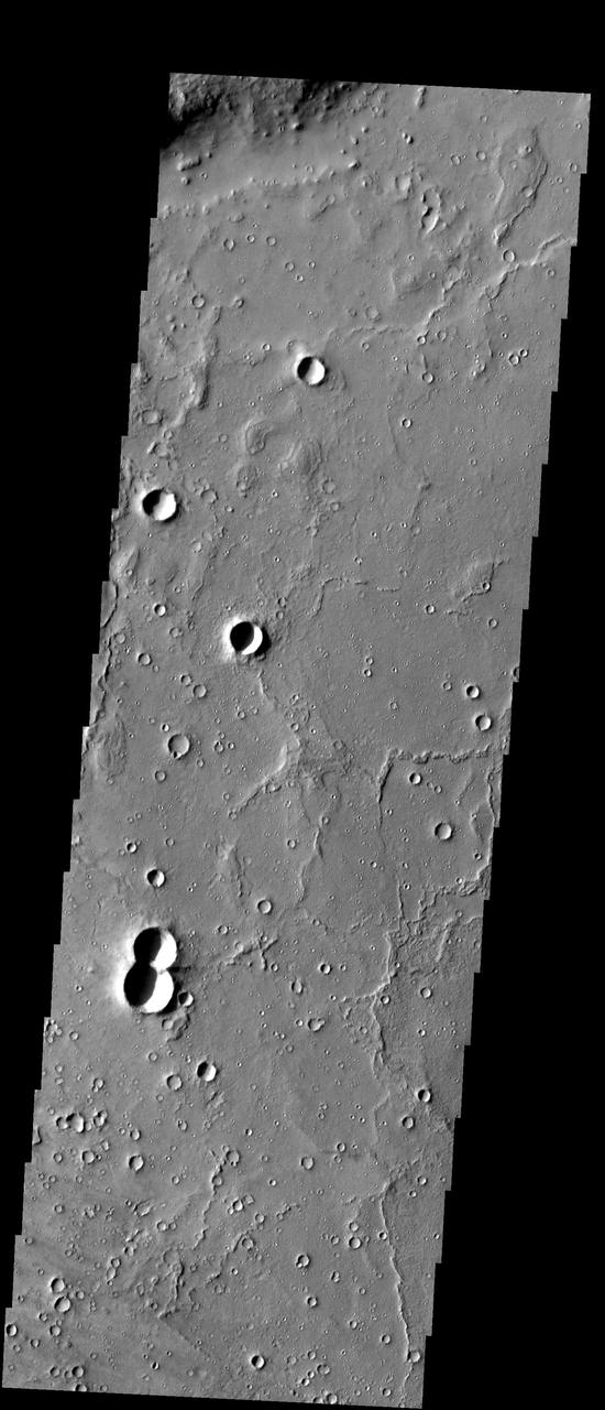
Western Gusev in Infrared
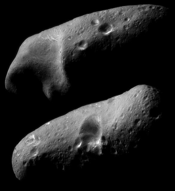
Eros Eastern and Western Hemispheres
Arsia Mons Western Flows
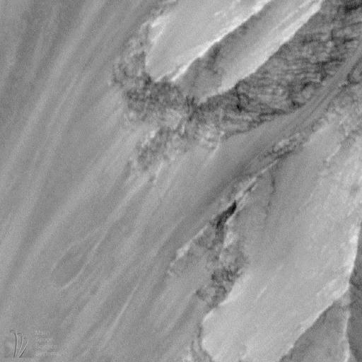
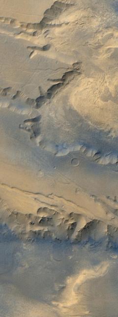
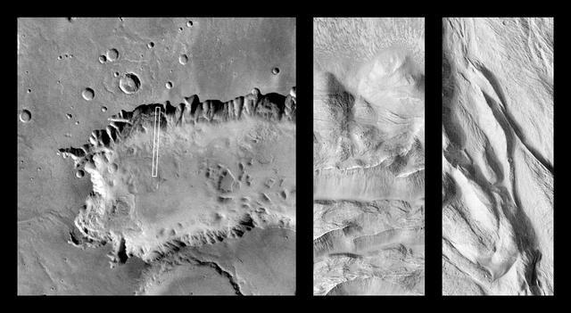
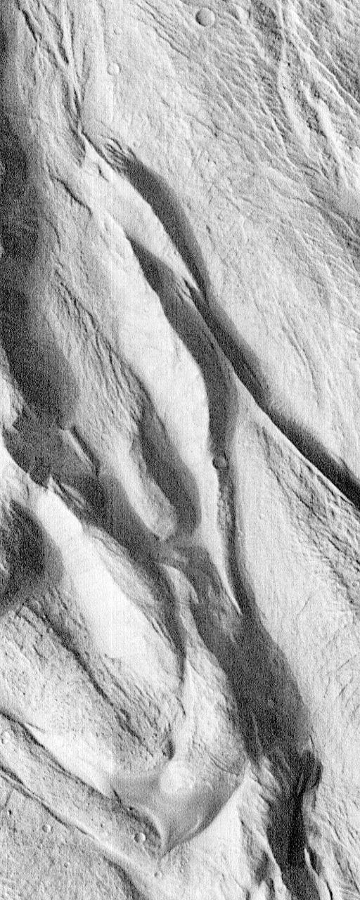
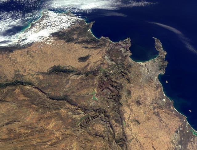
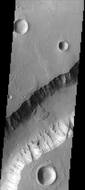
Western Candor Chasma, Valles Marineris
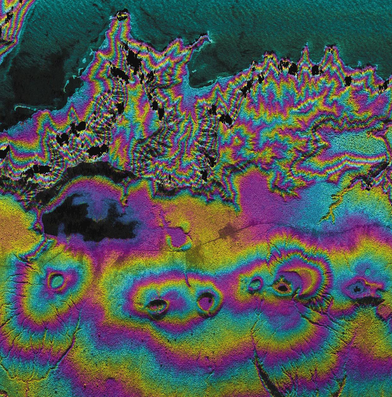
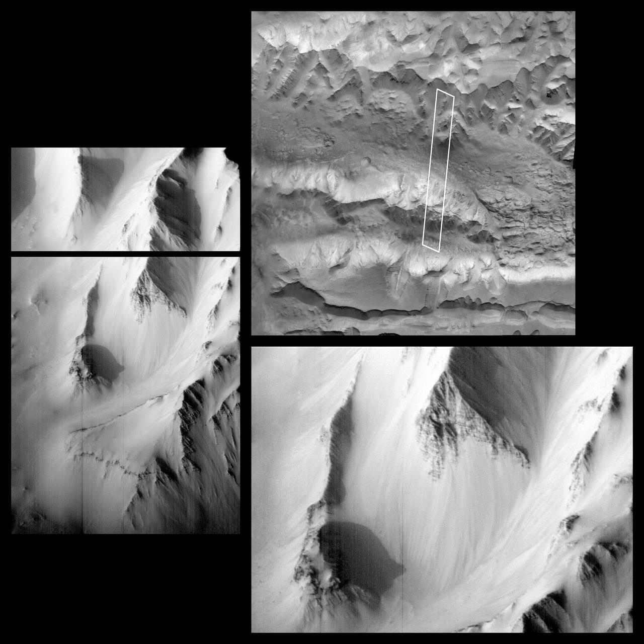
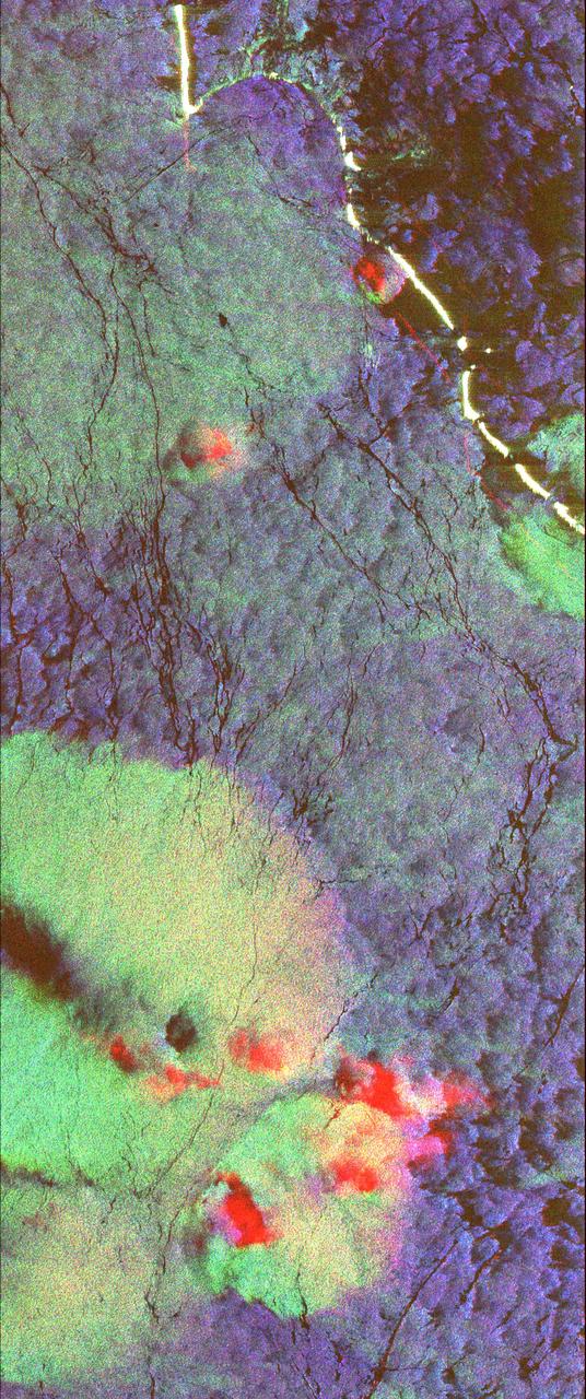
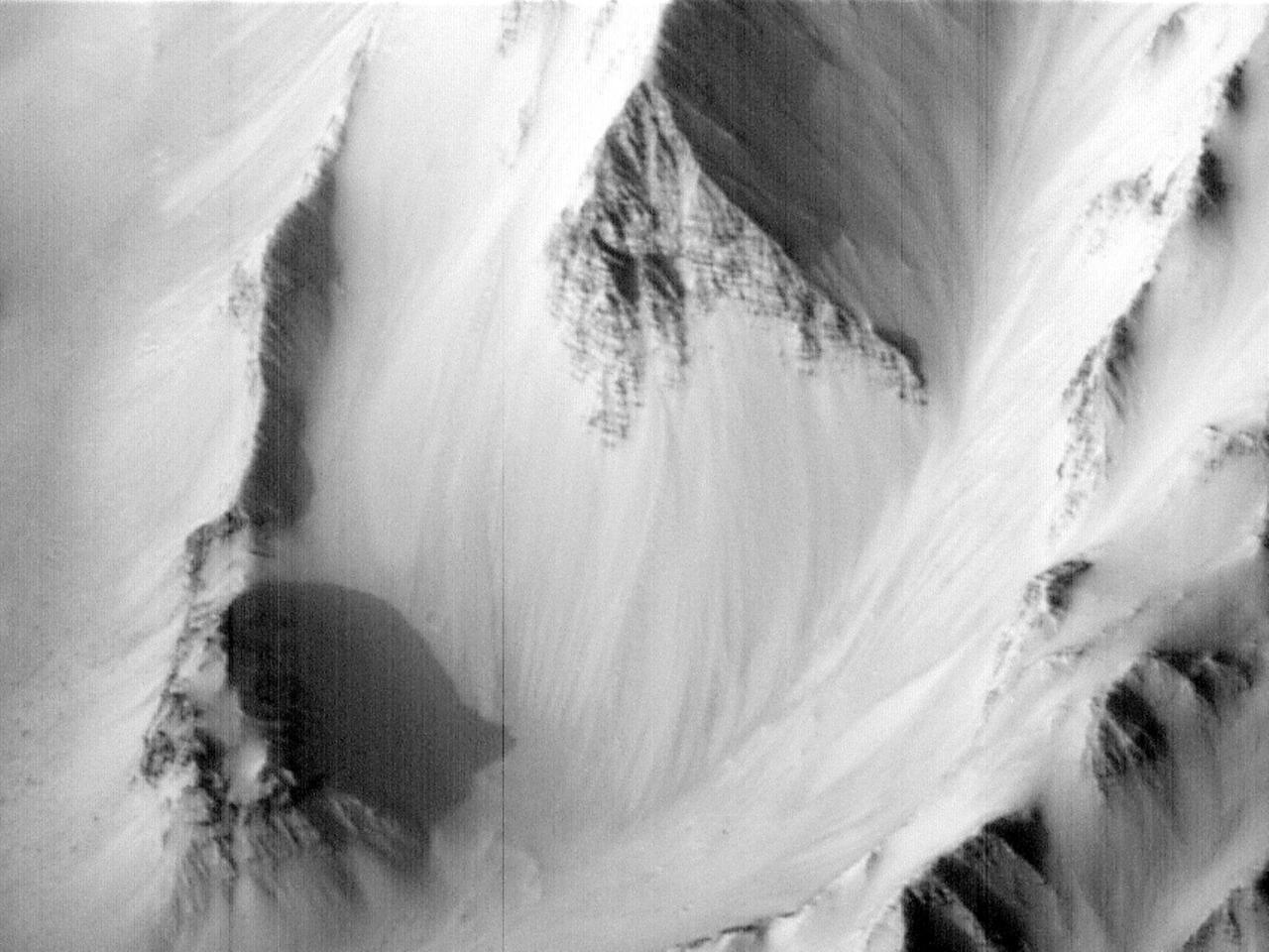
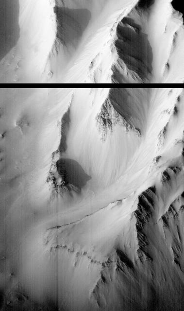
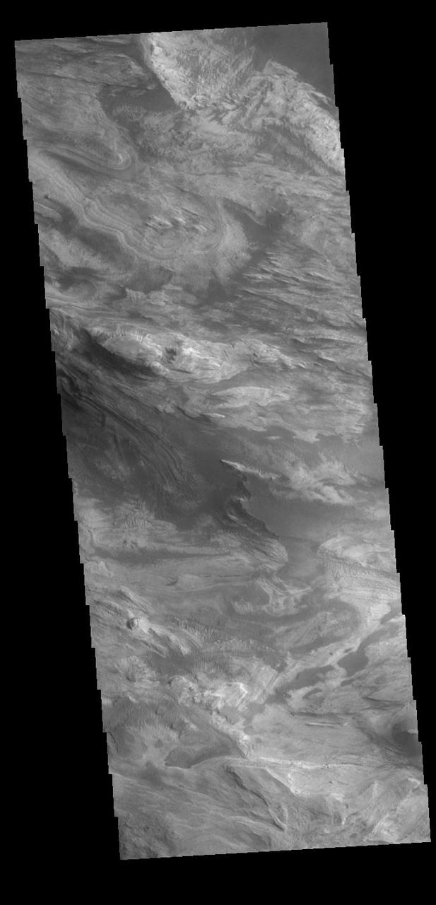
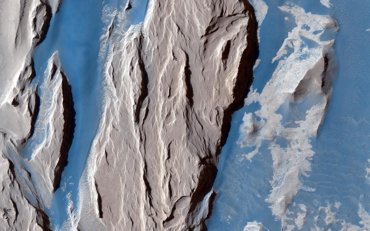
Faults and Folds in Western Candor Chasma
This radar image acquired by NASA Airborne Synthetic Aperture Radar AIRSAR in August, 2000, shows the western end of the island of Upolu in the nation of Western Samoa.
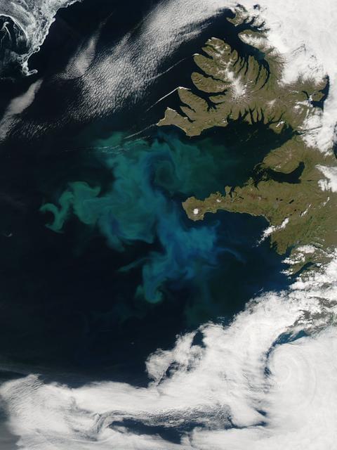
NASA image captured 06/24/2010 at 14 :30 UTC Phytoplankton bloom off western Iceland Satellite: Aqua NASA/GSFC/Jeff Schmaltz/MODIS Land Rapid Response Team To learn more about MODIS go to: <a href="http://rapidfire.sci.gsfc.nasa.gov/gallery/?latest" rel="nofollow">rapidfire.sci.gsfc.nasa.gov/gallery/?latest</a> <b><a href="http://www.nasa.gov/centers/goddard/home/index.html" rel="nofollow">NASA Goddard Space Flight Center</a></b> is home to the nation's largest organization of combined scientists, engineers and technologists that build spacecraft, instruments and new technology to study the Earth, the sun, our solar system, and the universe.
Broad Western Flows from Arsia Mons
Western Tithonium Chasma/Ius Chasma, Valles Marineris
Western Melas and Candor Chasms, Valles Marineris
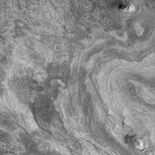
Western Candor Chasma - Layers Exposed near the Middle

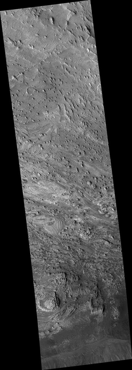
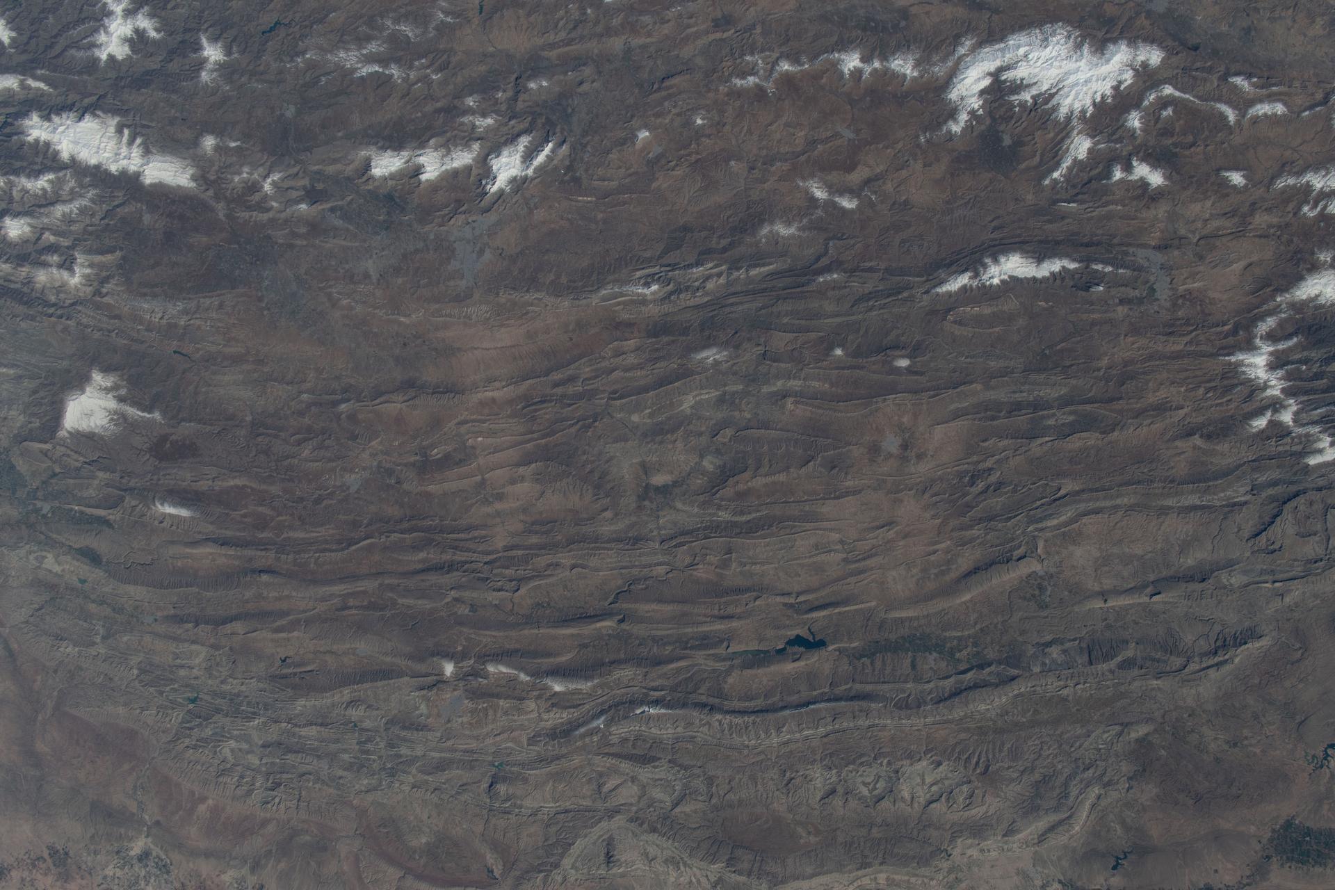
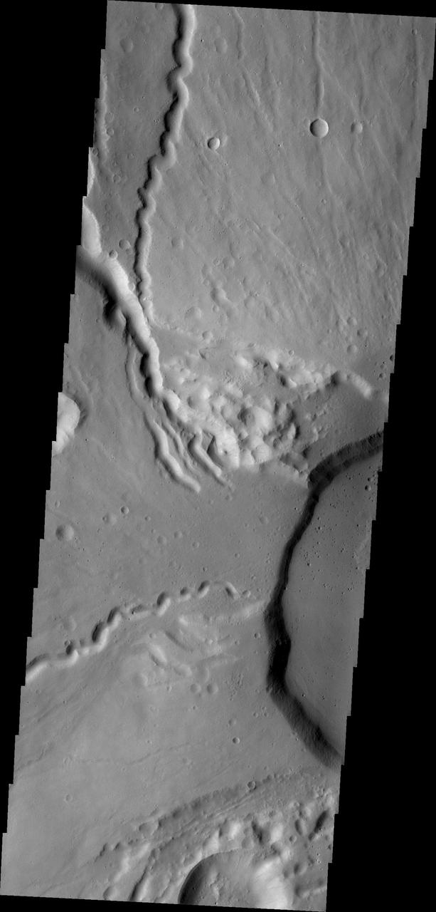
Diverse Geologic Features of Western Tharsis, Mars
This radar image shows the ocean surface in a portion of the Western Pacific Ocean.
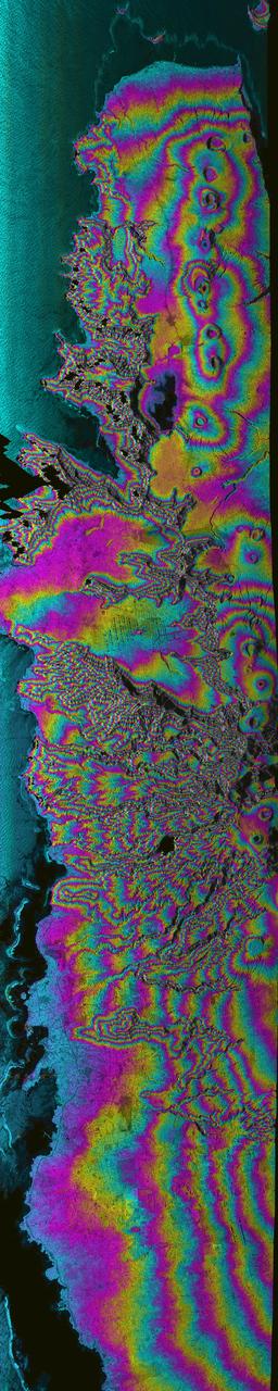
This radar image acquired by NASA Airborne Synthetic Aperture Radar AIRSAR in August, 2000, shows most of the northern coast of the island of Upolu in the nation of Western Samoa.
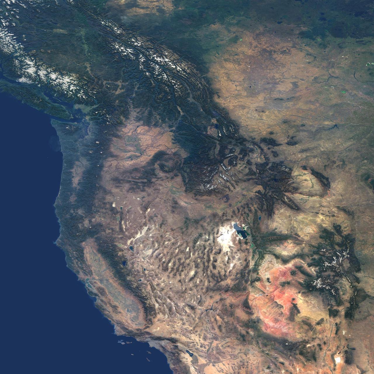
This natural-color image from NASA Terra spacecraft captures the beauty of the western United States and Canada.
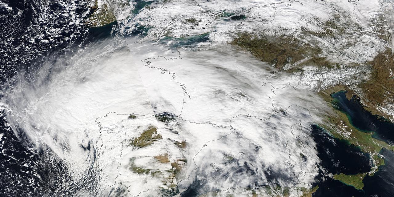
Image acquired February 27, 2010: An extratropical cyclone named Xynthia brought hurricane-force winds and high waves to Western Europe at the end of February 2010, CNN reported. Winds as fast as 200 kilometers (125 miles) per hour reached as far inland as Paris, and at the storm’s peak, hurricane-force winds extended from Portugal to the Netherlands. Hundreds of people had to take refuge from rising waters on their rooftops. By March 1, at least 58 people had died, some of them struck by falling trees. Most of the deaths occurred in France, but the storm also caused casualties in England, Germany, Belgium, Spain, and Portugal. The Moderate Resolution Imaging Spectroradiometer (MODIS) on NASA’s Aqua satellite captured this image of Western Europe, acquired in two separate overpasses on February 27, 2010. MODIS captured the eastern half of the image around 10:50 UTC, and the western half about 12:30 UTC. Forming a giant comma shape, clouds stretch from the Atlantic Ocean to northern Italy. NASA image courtesy MODIS Rapid Response Team at NASA Goddard Space Flight Center. Caption by Michon Scott. Instrument: Aqua - MODIS For more information related to this image go to: <a href="http://earthobservatory.nasa.gov/NaturalHazards/view.php?id=42881" rel="nofollow">earthobservatory.nasa.gov/NaturalHazards/view.php?id=42881</a>
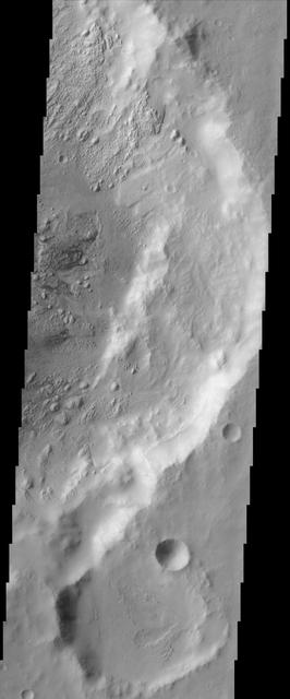
Complex Floor Deposits Within Western Ganges Chasma, Valles Marineris
Western Tithonium Chasma/Ius Chasma, Valles Marineris - High Resolution Image
Western Tithonium Chasma/Ius Chasma, Valles Marineris - High Resolution Image
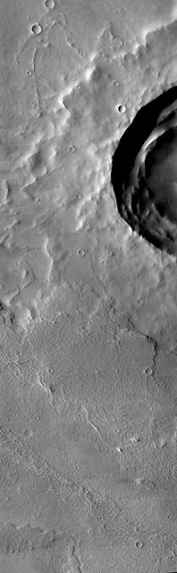
This image from NASA Mars Odyssey covers a region in western Arabia Terra, which contains two interesting craters. The eastern floor of the largest crater seen in most of this image is bumpy and ridged in places and relatively smooth in regions.
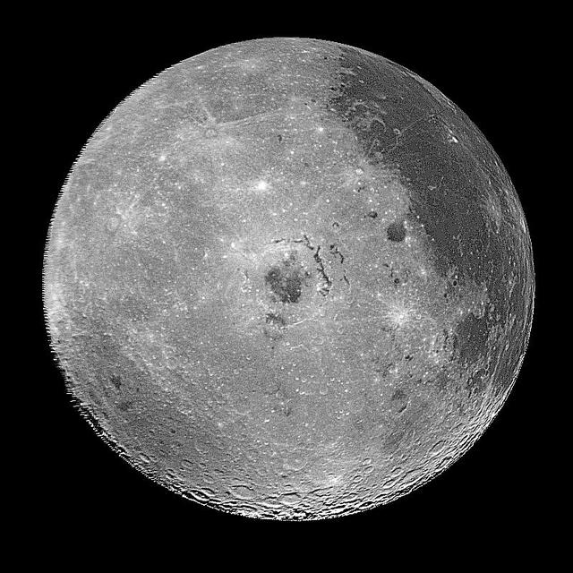
This image of the western hemisphere of the Moon was taken through a green filter by NASA's Galileo spacecraft at 9:35 a.m. PST Dec. 9 at a range of about 350,000 miles. In the center is the Orientale Basin. http://photojournal.jpl.nasa.gov/catalog/PIA00120
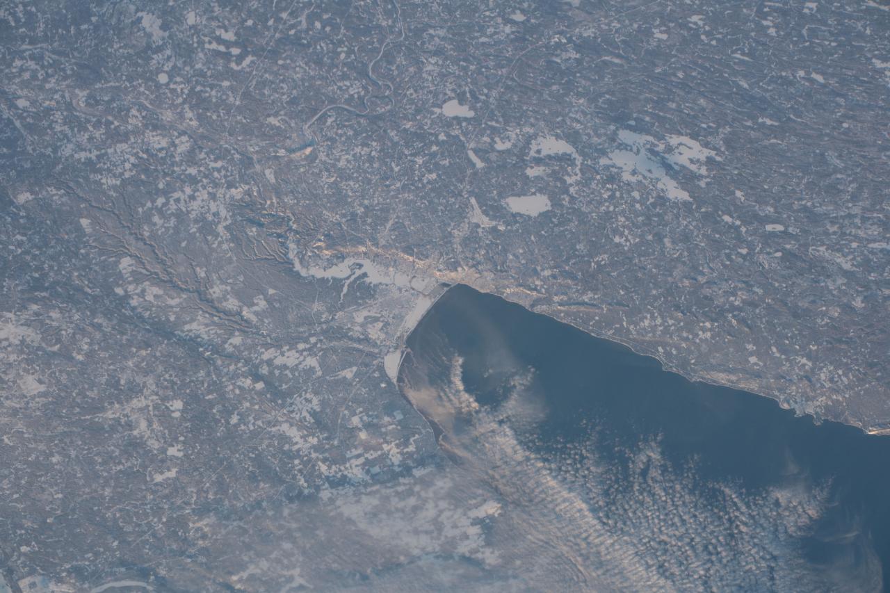
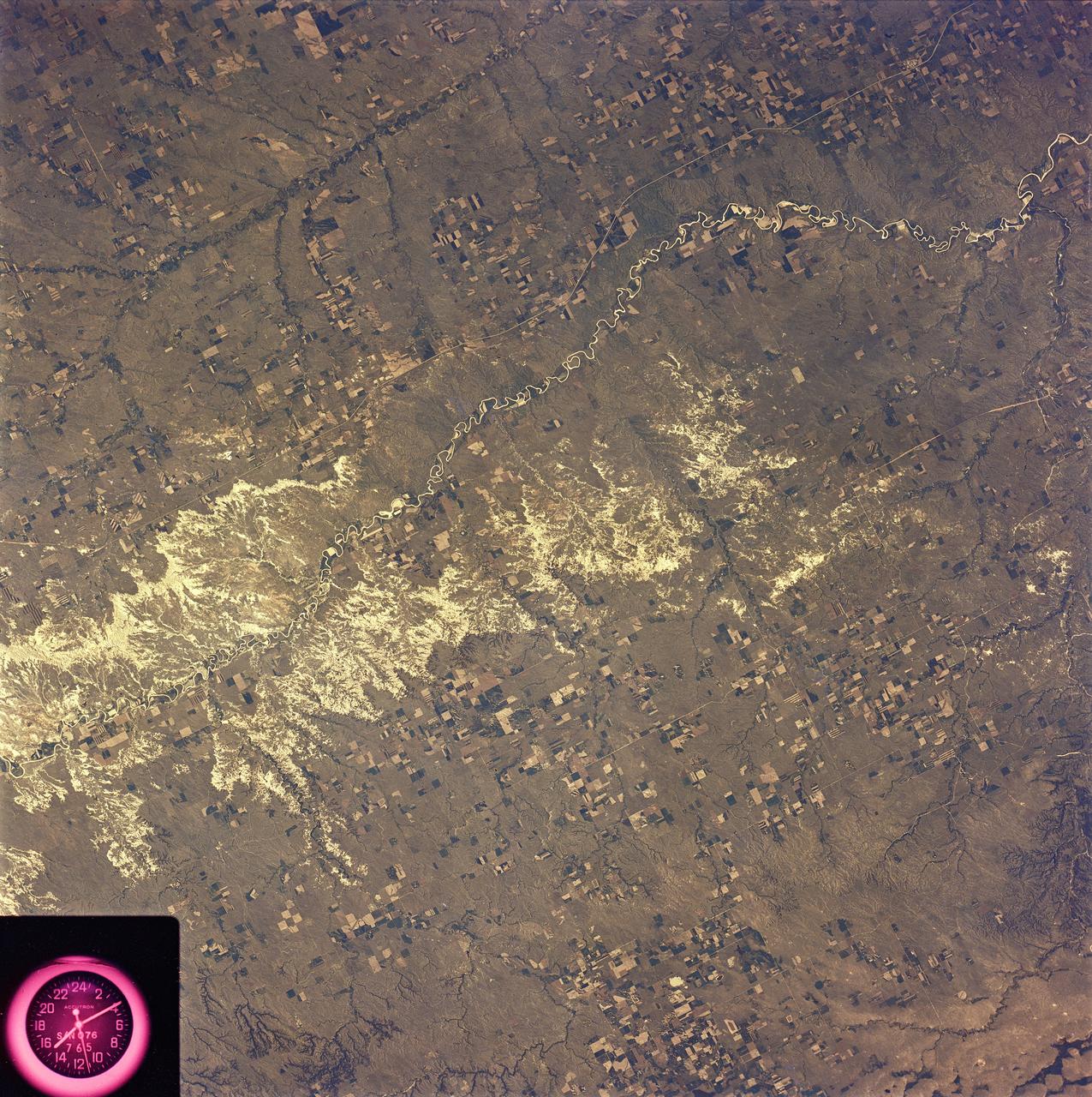
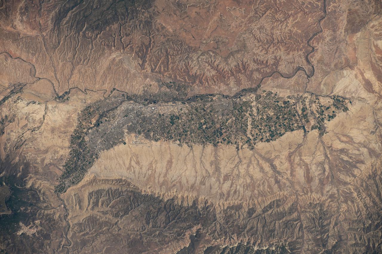
iss058e001857 (Jan. 1, 2019) --- The western tip of Lake Superior and the cities of Duluth, Minnesota and Superior, Wisconsin separated by the frozen St. Louis River, are pictured from the International Space Station on New Year's Day 2019.
Along the western flank of the Andes, 400 km SE of Lima Peru, erosion has carved the mountain slopes into long, narrow serpentine ridges. NASA Terra satellite captured this image on September 28, 2004.
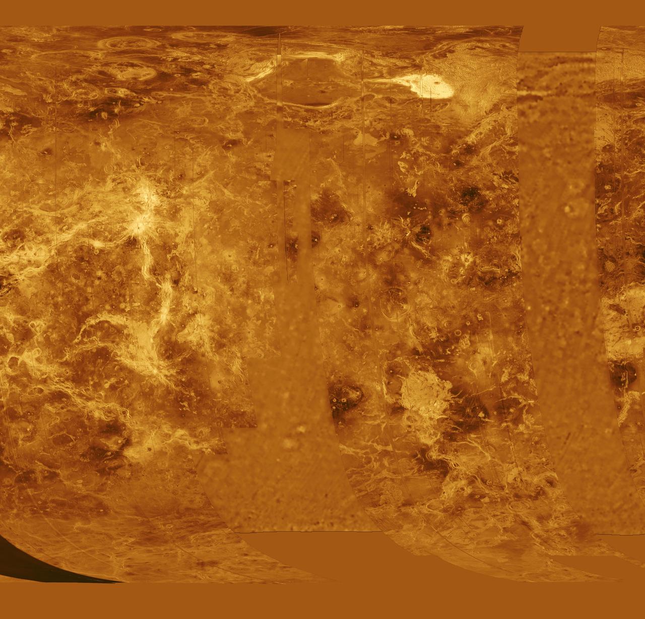
The western half of the planet is displayed in this simple cylindrical map of the surface of Venus obtained by NASA Magellan spacecraft. http://photojournal.jpl.nasa.gov/catalog/PIA00255
Today's VIS image shows part of Ceti Mensa. This mesa feature is located in western Candor Chasma and is composed of layered deposits and sand dunes. Orbit Number: 88887 Latitude: -5.94433 Longitude: 284.64 Instrument: VIS Captured: 2021-12-28 06:13 https://photojournal.jpl.nasa.gov/catalog/PIA25341
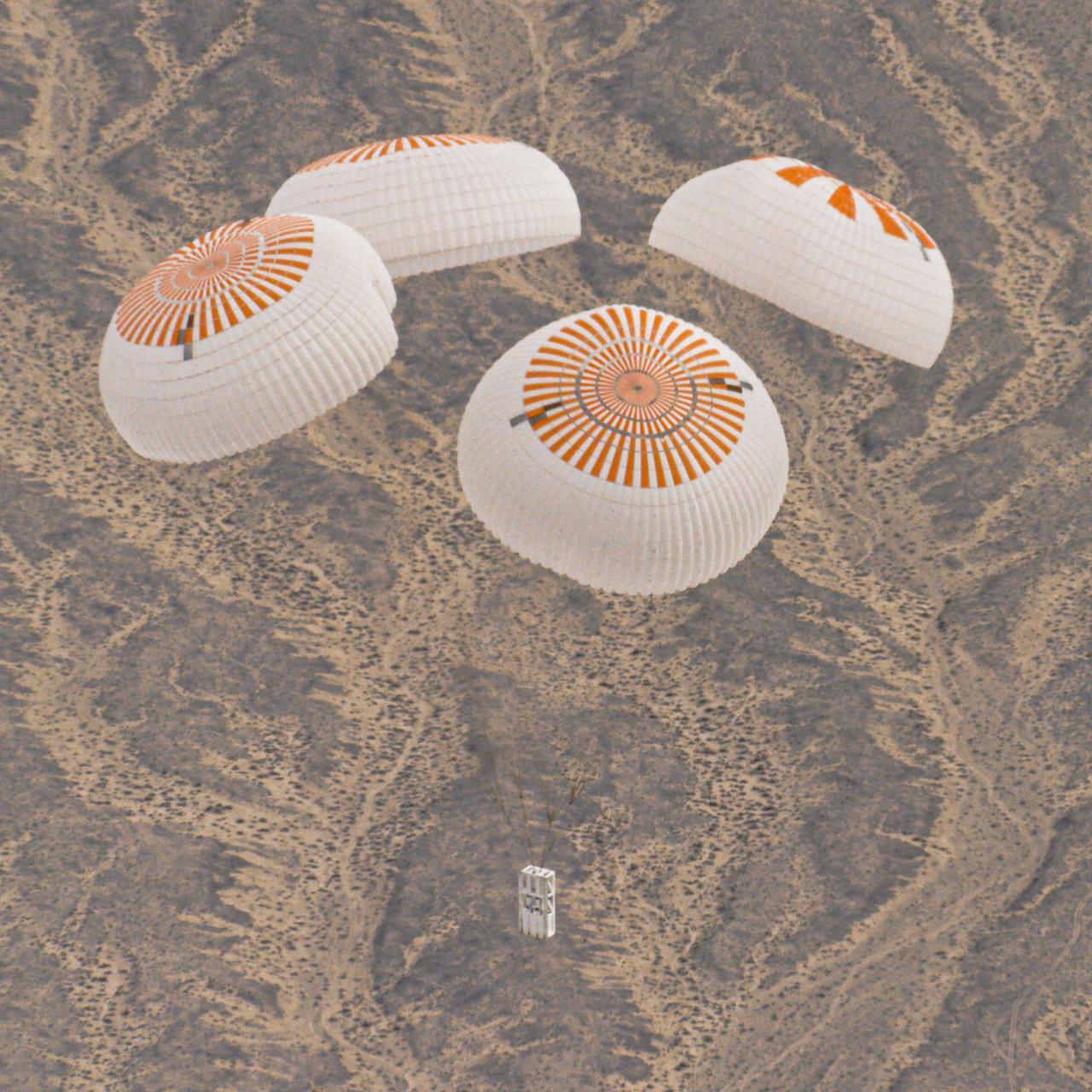
SpaceX completed the 7th successful system test of the Crew Dragon spacecraft’s upgraded Mark 3 parachutes in the western U.S. in December 2019. The parachutes will provide a safe landing on Earth for astronauts returning from the International Space Station in partnership with NASA’s Commercial Crew Program.
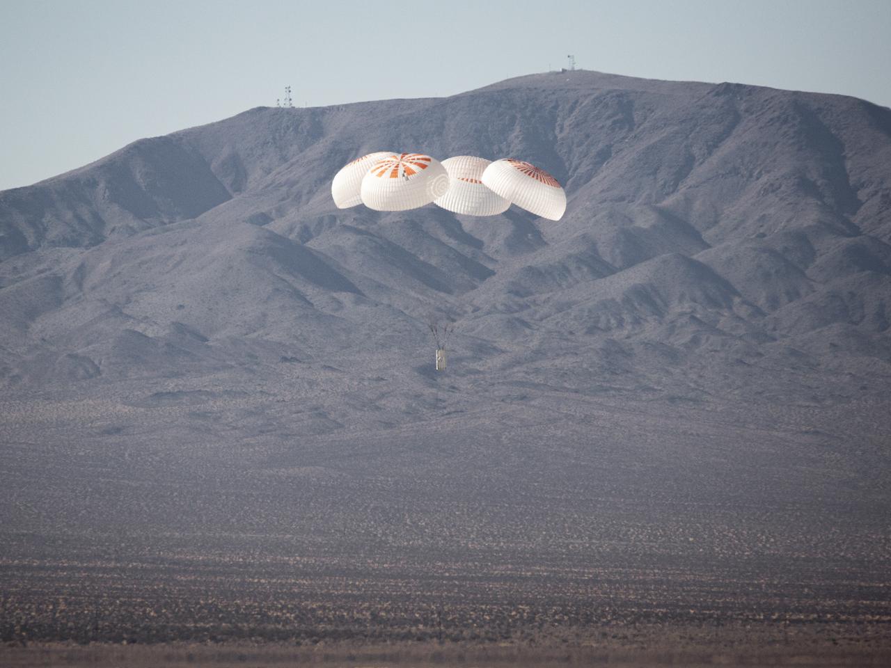
SpaceX completed the 7th successful system test of the Crew Dragon spacecraft’s upgraded Mark 3 parachutes in the western U.S. in December 2019. The parachutes will provide a safe landing on Earth for astronauts returning from the International Space Station in partnership with NASA’s Commercial Crew Program.
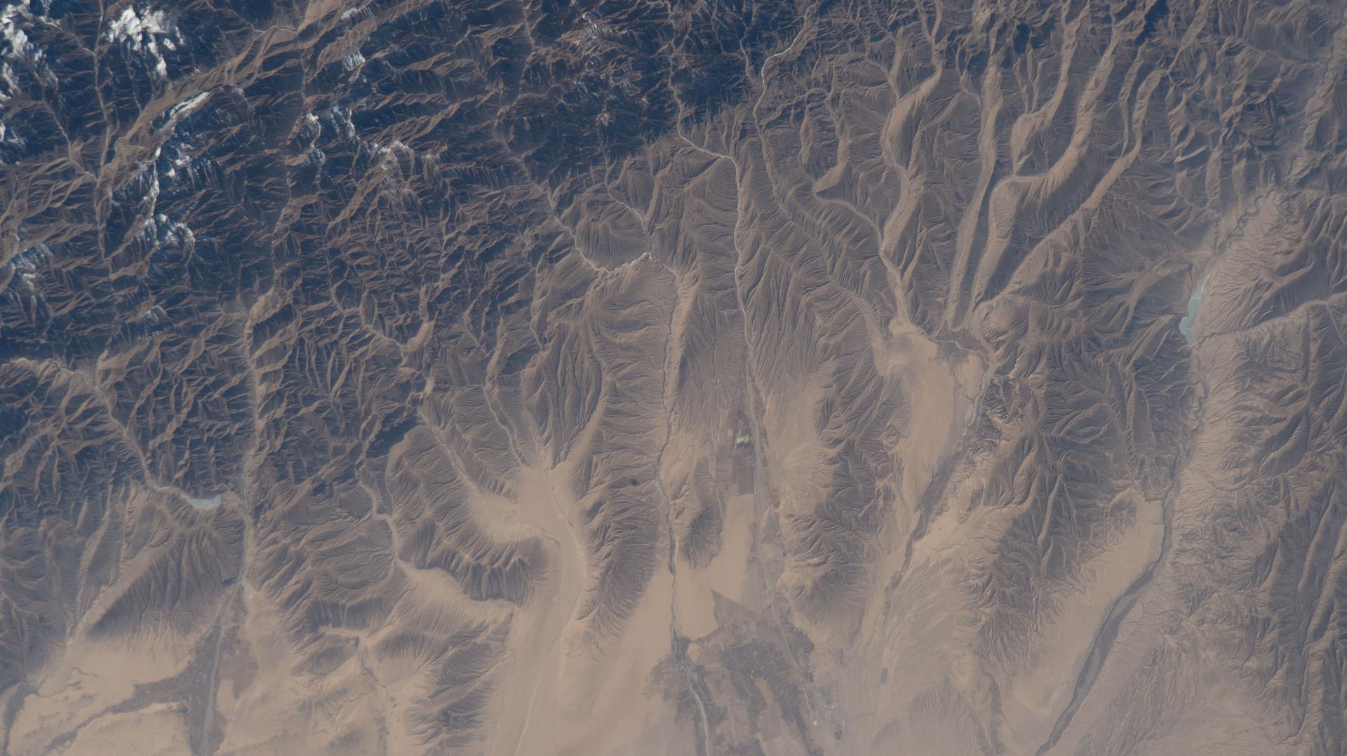
iss072e067740 (Oct. 12, 2024) --- The Tashkurgan River in western China's Hindu Kush mountains near the nations of Tajikistan and Afghanistan is pictured from the International Space Station as it orbited 259 miles above Asia.
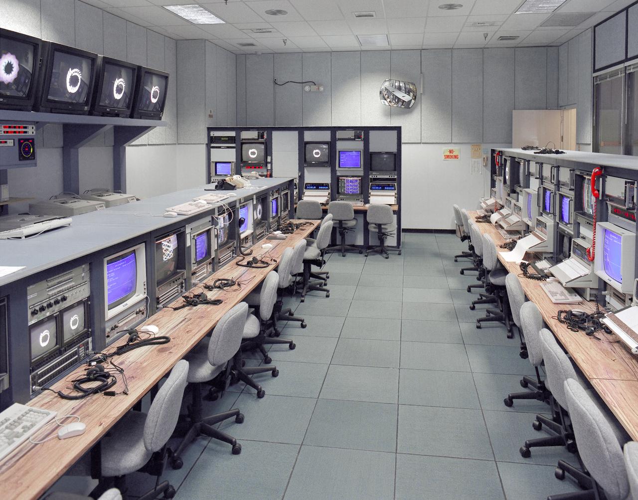
Mission control Blue Room, seen here, in building 4800 at NASA's Dryden Flight Research Center, is part of the Western Aeronautical Test Range (WATR). All aspects of a research mission are monitored from one of two of these control rooms at Dryden. The WATR consists of a highly automated complex of computer controlled tracking, telemetry, and communications systems and control room complexes that are capable of supporting any type of mission ranging from system and component testing, to sub-scale and full-scale flight tests of new aircraft and reentry systems. Designated areas are assigned for spin/dive tests, corridors are provided for low, medium, and high-altitude supersonic flight, and special STOL/VSTOL facilities are available at Ames Moffett and Crows Landing. Special use airspace, available at Edwards, covers approximately twelve thousand square miles of mostly desert area. The southern boundary lies to the south of Rogers Dry Lake, the western boundary lies midway between Mojave and Bakersfield, the northern boundary passes just south of Bishop, and the eastern boundary follows about 25 miles west of the Nevada border except in the northern areas where it crosses into Nevada.
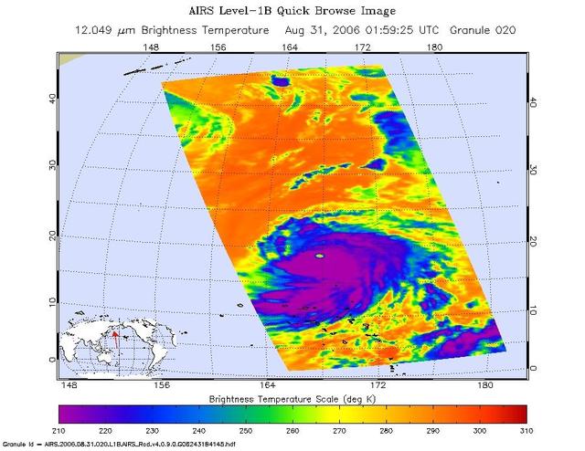
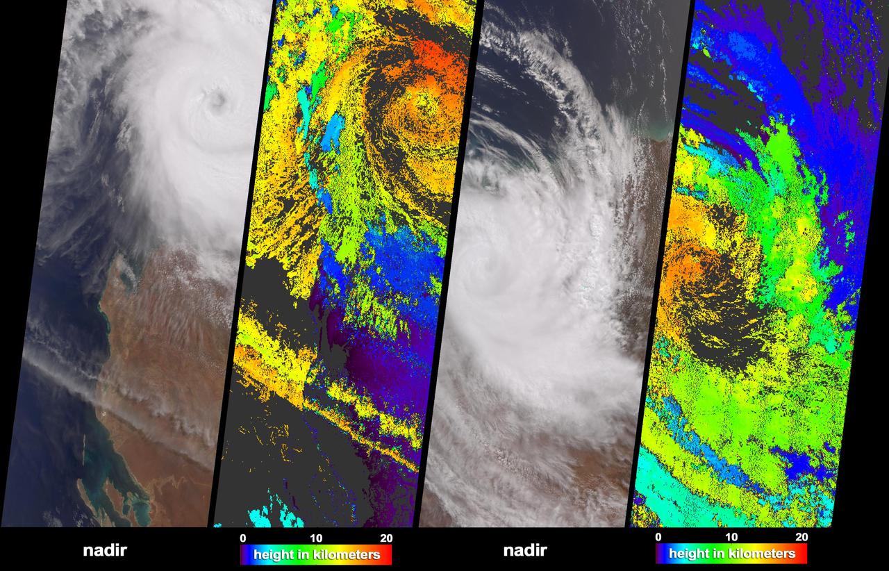
This infrared image shows Typhoon Ioke in the Western Pacific, from the Atmospheric Infrared Sounder AIRS on NASA Aqua satellite in August, 2006. Because infrared radiation does not penetrate through clouds, AIRS infrared images show either the temperature of the cloud tops or the surface of the Earth in cloud-free regions. The lowest temperatures (in purple) are associated with high, cold cloud tops that make up the top of the storm. In cloud-free areas the AIRS instrument will receive the infrared radiation from the surface of the Earth, resulting in the warmest temperatures (orange/red). http://photojournal.jpl.nasa.gov/catalog/PIA00511

On February 4, 2014 the Moderate Resolution Imaging Spectroradiometer (MODIS) flying aboard NASA’s Aqua satellite captured a true-color image of sea ice off of western Alaska. In this true-color image, the snow and ice covered land appears bright white while the floating sea ice appears a duller grayish-white. Snow over the land is drier, and reflects more light back to the instrument, accounting for the very bright color. Ice overlying oceans contains more water, and increasing water decreases reflectivity of ice, resulting in duller colors. Thinner ice is also duller. The ocean waters are tinted with green, likely due to a combination of sediment and phytoplankton. Alaska lies to the east in this image, and Russia to the west. The Bering Strait, covered with ice, lies between to two. South of the Bering Strait, the waters are known as the Bering Sea. To the north lies the Chukchi Sea. The bright white island south of the Bering Strait is St. Lawrence Island. Home to just over 1200 people, the windswept island belongs to the United States, but sits closer to Russia than to Alaska. To the southeast of the island a dark area, loosely covered with floating sea ice, marks a persistent polynya – an area of open water surrounded by more frozen sea ice. Due to the prevailing winds, which blow the sea ice away from the coast in this location, the area rarely completely freezes. The ice-covered areas in this image, as well as the Beaufort Sea, to the north, are critical areas for the survival of the ringed seal, a threatened species. The seals use the sea ice, including ice caves, to rear their young, and use the free-floating sea ice for molting, raising the young and breeding. In December 2014, the National Oceanic and Atmospheric Administration (NOAA) proposed that much of this region be set aside as critical, protected habitat for the ringed seal. Credit: NASA/GSFC/Jeff Schmaltz/MODIS Land Rapid Response Team <b><a href="http://www.nasa.gov/audience/formedia/features/MP_Photo_Guidelines.html" rel="nofollow">NASA image use policy.</a></b> <b><a href="http://www.nasa.gov/centers/goddard/home/index.html" rel="nofollow">NASA Goddard Space Flight Center</a></b> enables NASA’s mission through four scientific endeavors: Earth Science, Heliophysics, Solar System Exploration, and Astrophysics. Goddard plays a leading role in NASA’s accomplishments by contributing compelling scientific knowledge to advance the Agency’s mission. <b>Follow us on <a href="http://twitter.com/NASAGoddardPix" rel="nofollow">Twitter</a></b> <b>Like us on <a href="http://www.facebook.com/pages/Greenbelt-MD/NASA-Goddard/395013845897?ref=tsd" rel="nofollow">Facebook</a></b> <b>Find us on <a href="http://instagram.com/nasagoddard?vm=grid" rel="nofollow">Instagram</a></b>
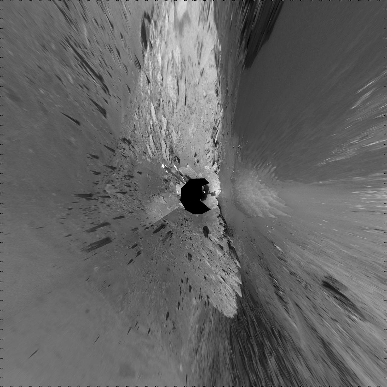
NASA Mars Exploration Rover Opportunity recorded this view of the western edge of Cape York, a segment of the rim of Endeavour Crater. A bright vein, informally named Homestake, is visible on the right side of the image.
The breathtaking beauty of the western United States is apparent in this image from data acquired between April 2000 and September 2001 from the Multi-angle Imaging SpectroRadiometer on NASA Terra spacecraft.
NASA Terra spacecraft acquired these natural color images and cloud top height measurements for Monty before and after the storm made landfall over the remote Pilbara region of Western Australia, on February 29 and March 2, 2004.
Solar eclipse over western Africa (afternoon overpass) at 14:45 UTC. Satellite: Aqua A rare “hybrid” solar eclipse occurred on 03 November 2013, which began over the western Atlantic Ocean as an annular eclipse and transitioned into a full total solar eclipse for observers along the narrow path of totality in the far eastern Atlantic and over parts of Africa. The Lunar Umbra (or solar eclipse shadow) could be seen tracking rapidly southeastward across the Atlantic Ocean. Credit: NASA/GSFC/Jeff Schmaltz/MODIS Land Rapid Response Team <b><a href="http://www.nasa.gov/audience/formedia/features/MP_Photo_Guidelines.html" rel="nofollow">NASA image use policy.</a></b> <b><a href="http://www.nasa.gov/centers/goddard/home/index.html" rel="nofollow">NASA Goddard Space Flight Center</a></b> enables NASA’s mission through four scientific endeavors: Earth Science, Heliophysics, Solar System Exploration, and Astrophysics. Goddard plays a leading role in NASA’s accomplishments by contributing compelling scientific knowledge to advance the Agency’s mission. <b>Follow us on <a href="http://twitter.com/NASA_GoddardPix" rel="nofollow">Twitter</a></b> <b>Like us on <a href="http://www.facebook.com/pages/Greenbelt-MD/NASA-Goddard/395013845897?ref=tsd" rel="nofollow">Facebook</a></b> <b>Find us on <a href="http://instagram.com/nasagoddard?vm=grid" rel="nofollow">Instagram</a></b>
Solar eclipse over western Africa (morning overpass) at 11:45 UTC. Satellite: Terra A rare “hybrid” solar eclipse occurred on 03 November 2013, which began over the western Atlantic Ocean as an annular eclipse and transitioned into a full total solar eclipse for observers along the narrow path of totality in the far eastern Atlantic and over parts of Africa. The Lunar Umbra (or solar eclipse shadow) could be seen tracking rapidly southeastward across the Atlantic Ocean. Credit: NASA/GSFC/Jeff Schmaltz/MODIS Land Rapid Response Team <b><a href="http://www.nasa.gov/audience/formedia/features/MP_Photo_Guidelines.html" rel="nofollow">NASA image use policy.</a></b> <b><a href="http://www.nasa.gov/centers/goddard/home/index.html" rel="nofollow">NASA Goddard Space Flight Center</a></b> enables NASA’s mission through four scientific endeavors: Earth Science, Heliophysics, Solar System Exploration, and Astrophysics. Goddard plays a leading role in NASA’s accomplishments by contributing compelling scientific knowledge to advance the Agency’s mission. <b>Follow us on <a href="http://twitter.com/NASA_GoddardPix" rel="nofollow">Twitter</a></b> <b>Like us on <a href="http://www.facebook.com/pages/Greenbelt-MD/NASA-Goddard/395013845897?ref=tsd" rel="nofollow">Facebook</a></b> <b>Find us on <a href="http://instagram.com/nasagoddard?vm=grid" rel="nofollow">Instagram</a></b>
Extreme rain events have been affecting California and snow has blanketed the Pacific Northwest. This visible image from NASA's Aqua satellite on Jan. 6, 2017, at 3:35 p.m. EST (20:35 UTC) shows snow cover in the U.S. Pacific Northwest in Washington, Idaho, Oregon, northern California and Nevada. On Jan. 9, another area of low pressure moved over Oregon, where the National Weather Service is forecasting heavy snows. It was the same week last year that the West Coast endured a similar bout of very wet weather. Heavy rain affected the Pacific coast in 2016 during the same week from Jan. 5 through Jan. 7, as a progression of storm systems in the Eastern Pacific Ocean hit southern California and generated flooding and mudslides. For updated forecasts, visit the National Weather Service website at: <a href="http://www.weather.gov" rel="nofollow">www.weather.gov</a> Learn more about NASA's view of the storm: <a href="http://go.nasa.gov/2j0xpvW" rel="nofollow">go.nasa.gov/2j0xpvW</a> Credits: NASA Goddard MODIS Rapid Response <b><a href="http://www.nasa.gov/audience/formedia/features/MP_Photo_Guidelines.html" rel="nofollow">NASA image use policy.</a></b> <b><a href="http://www.nasa.gov/centers/goddard/home/index.html" rel="nofollow">NASA Goddard Space Flight Center</a></b> enables NASA’s mission through four scientific endeavors: Earth Science, Heliophysics, Solar System Exploration, and Astrophysics. Goddard plays a leading role in NASA’s accomplishments by contributing compelling scientific knowledge to advance the Agency’s mission. <b>Follow us on <a href="http://twitter.com/NASAGoddardPix" rel="nofollow">Twitter</a></b> <b>Like us on <a href="http://www.facebook.com/pages/Greenbelt-MD/NASA-Goddard/395013845897?ref=tsd" rel="nofollow">Facebook</a></b> <b>Find us on <a href="http://instagrid.me/nasagoddard/?vm=grid" rel="nofollow">Instagram</a></b>
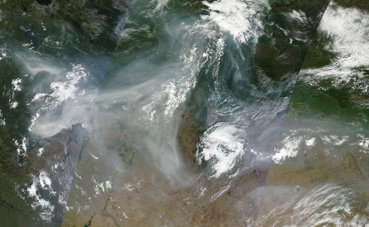
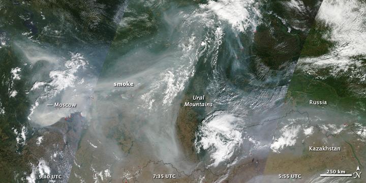
NASA image acquired August 4, 2010 Intense fires continued to rage in western Russia on August 4, 2010. Burning in dry peat bogs and forests, the fires produced a dense plume of smoke that reached across hundreds of kilometers. The Moderate Resolution Imaging Spectroradiometer (MODIS) captured this view of the fires and smoke in three consecutive overpasses on NASA’s Terra satellite. The smooth gray-brown smoke hangs over the Russian landscape, completely obscuring the ground in places. The top image provides a close view of the fires immediately southeast of Moscow, while the lower image shows the full extent of the smoke plume. To read more about this image go to: <a href="http://earthobservatory.nasa.gov/IOTD/view.php?id=45046" rel="nofollow">earthobservatory.nasa.gov/IOTD/view.php?id=45046</a> NASA image courtesy Jeff Schmaltz, MODIS Rapid Response Team at NASA GSFC. <b><a href="http://www.nasa.gov/centers/goddard/home/index.html" rel="nofollow">NASA Goddard Space Flight Center</a></b> is home to the nation's largest organization of combined scientists, engineers and technologists that build spacecraft, instruments and new technology to study the Earth, the sun, our solar system, and the universe. <b>Follow us on <a href="http://twitter.com/NASA_GoddardPix" rel="nofollow">Twitter</a></b> <b>Join us on <a href="http://www.facebook.com/pages/Greenbelt-MD/NASA-Goddard/395013845897?ref=tsd" rel="nofollow">Facebook</a><b></b></b>

It’s usually the big, sprawling storms that attract the attention of meteorologists, but occasionally tiny storms can make news as well. The most recent example is a suspected mini-typhoon that drifted across the western Pacific Ocean in mid-July 2013. The storm system emerged on July 16 and dissipated by July 19 without making landfall or causing any significant damage. The Moderate Resolution Imaging Spectroradiometer (MODIS) on NASA’s Terra satellite captured this true-color image of the storm on July 17, 2013. It had the spiral shape of a tropical cyclone, but the cloud field was less than 100 kilometers (60 miles) across. For comparison, Super Typhoon Jelawat, the most intense storm of the 2012 season, had a cloud field that stretched nearly 1,000 kilometers (600 miles). Jelawat’s eye alone—with a diameter of 64 kilometers (40 miles)—was two-thirds the size of the entire July 2013 storm. Despite their small size, mini-cyclones are driven by the same forces that drive larger storms. Both small and large cyclonic storms are simply organized convection feeding off warm water in areas with low wind shear. According to the Joint Typhoon Warning Center, the low-pressure areas for these mini-typhoons must span less than two degrees of latitude (about 140 miles) and have sustained winds of 65 knots (74 miles per hour). The 2013 storm in the Pacific certainly meets the first criteria, but it is unlikely that the storm achieved typhoon-force winds. It’s also unlikely that the system had a “warm core,” which all true tropical cyclones have. While this storm did not cause damage, other mini storms certainly have. In 1974, the miniature cyclone Tracy hit Darwin, Australia, killing 71 people and destroying more than 70 percent of the city’s buildings. According to the National Hurricane Center, tropical cyclone Marco unseated Tracy as the smallest tropical cyclone on record in 2008. Marco had gale force winds that extended just 19 kilometers (12 miles). Typhoon Tip, with gale force winds extending 1,000 kilometers (675 miles) is the largest tropical cyclone on record. Credit: NASA/GSFC/Jeff Schmaltz/MODIS Land Rapid Response Team <b><a href="http://www.nasa.gov/audience/formedia/features/MP_Photo_Guidelines.html" rel="nofollow">NASA image use policy.</a></b> <b><a href="http://www.nasa.gov/centers/goddard/home/index.html" rel="nofollow">NASA Goddard Space Flight Center</a></b> enables NASA’s mission through four scientific endeavors: Earth Science, Heliophysics, Solar System Exploration, and Astrophysics. Goddard plays a leading role in NASA’s accomplishments by contributing compelling scientific knowledge to advance the Agency’s mission. <b>Follow us on <a href="http://twitter.com/NASA_GoddardPix" rel="nofollow">Twitter</a></b> <b>Like us on <a href="http://www.facebook.com/pages/Greenbelt-MD/NASA-Goddard/395013845897?ref=tsd" rel="nofollow">Facebook</a></b> <b>Find us on <a href="http://instagrid.me/nasagoddard/?vm=grid" rel="nofollow">Instagram</a></b>

From left to right, Provincial Minister for Finance and Economic Opportunities of the Western Cape Government, Mireille Wenger, Premier of the Western Cape Government, Alan Winde, NASA Associate Administrator for the Space Operations Mission Directorate, Ken Bowersox, NASA Deputy Associate Administrator for Space Communications and Navigation, Badri Younes, and Director-General of the Western Cape Government, Dr. Harry Malila, pose for a photo in the Space Operations Center during a meeting with NASA and Western Cape Government representatives, to discuss the path forward for development of an antenna for the Lunar Exploration Ground Sites (LEGS) mission in Matjiesfontein, South Africa, and other opportunities, Tuesday, June 13, 2023, at the Mary W. Jackson NASA Headquarters building in Washington. Photo Credit: (NASA/Aubrey Gemignani)
NASA image acquired August 4, 2010 Intense fires continued to rage in western Russia on August 4, 2010. Burning in dry peat bogs and forests, the fires produced a dense plume of smoke that reached across hundreds of kilometers. The Moderate Resolution Imaging Spectroradiometer (MODIS) captured this view of the fires and smoke in three consecutive overpasses on NASA’s Terra satellite. The smooth gray-brown smoke hangs over the Russian landscape, completely obscuring the ground in places. The top image provides a close view of the fires immediately southeast of Moscow, while the lower image shows the full extent of the smoke plume. To read more about this image go to: <a href="http://earthobservatory.nasa.gov/IOTD/view.php?id=45046" rel="nofollow">earthobservatory.nasa.gov/IOTD/view.php?id=45046</a> To view the high res go here: NASA image courtesy Jeff Schmaltz, MODIS Rapid Response Team at NASA GSFC. <b><a href="http://www.nasa.gov/centers/goddard/home/index.html" rel="nofollow">NASA Goddard Space Flight Center</a></b> is home to the nation's largest organization of combined scientists, engineers and technologists that build spacecraft, instruments and new technology to study the Earth, the sun, our solar system, and the universe. <b>Follow us on <a href="http://twitter.com/NASA_GoddardPix" rel="nofollow">Twitter</a></b> <b>Join us on <a href="http://www.facebook.com/pages/Greenbelt-MD/NASA-Goddard/395013845897?ref=tsd" rel="nofollow">Facebook</a><b></b></b>
The dark dunes in the western Medusae Fossae formation provide some evidence of having a local origin. This image shows no large dunes, but many of the dark sand patches cover slopes up to discrete layers. It is possible that the sand is eroding out from those layers, but slopes can also act as sand traps. http://photojournal.jpl.nasa.gov/catalog/PIA19302
Complex Floor Deposits Within Western Ganges Chasma, Valles Marineris - High Resolution Image
Complex Floor Deposits Within Western Ganges Chasma, Valles Marineris - High Resolution Image
This image shows how a partial solar eclipse darkened clouds over the Yukon and British Columbia in western Canada. It was taken on Oct. 23 at 21:20 UTC (5:20 p.m. EDT) by the Moderate Resolution Imaging Spectroradiometer instrument that flies aboard NASA's Aqua satellite. Credit: NASA Goddard MODIS Rapid Response Team Unlabeled image <b><a href="http://www.nasa.gov/audience/formedia/features/MP_Photo_Guidelines.html" rel="nofollow">NASA image use policy.</a></b> <b><a href="http://www.nasa.gov/centers/goddard/home/index.html" rel="nofollow">NASA Goddard Space Flight Center</a></b> enables NASA’s mission through four scientific endeavors: Earth Science, Heliophysics, Solar System Exploration, and Astrophysics. Goddard plays a leading role in NASA’s accomplishments by contributing compelling scientific knowledge to advance the Agency’s mission. <b>Follow us on <a href="http://twitter.com/NASAGoddardPix" rel="nofollow">Twitter</a></b> <b>Like us on <a href="http://www.facebook.com/pages/Greenbelt-MD/NASA-Goddard/395013845897?ref=tsd" rel="nofollow">Facebook</a></b> <b>Find us on <a href="http://instagram.com/nasagoddard?vm=grid" rel="nofollow">Instagram</a></b>
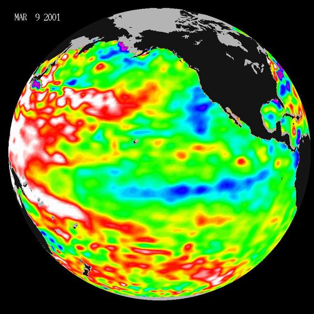
Data taken during a 10-day collection cycle ending March 9, 2001, show that above-normal sea-surface heights and warmer ocean temp. red and white areas still blanket the far-western tropical Pacific and much of the north and south mid-Pacific.

Provincial Minister for Finance and Economic Opportunities of the Western Cape Government, Mireille Wenger, provides remarks during a meeting with the Premier of the Western Cape Government, Alan Winde, right, NASA representatives, and a delegation from South Africa, to discuss the path forward for development of an antenna for the Lunar Exploration Ground Sites (LEGS) mission in Matjiesfontein, South Africa, and other opportunities, Tuesday, June 13, 2023, at the Mary W. Jackson NASA Headquarters building in Washington. Photo Credit: (NASA/Aubrey Gemignani)
This 360-degree mosaic of images from the navigation camera on NASA Mars Exploration Rover Opportunity shows the view from the western rim of Santa Maria crater. South is at the center, north at both ends.
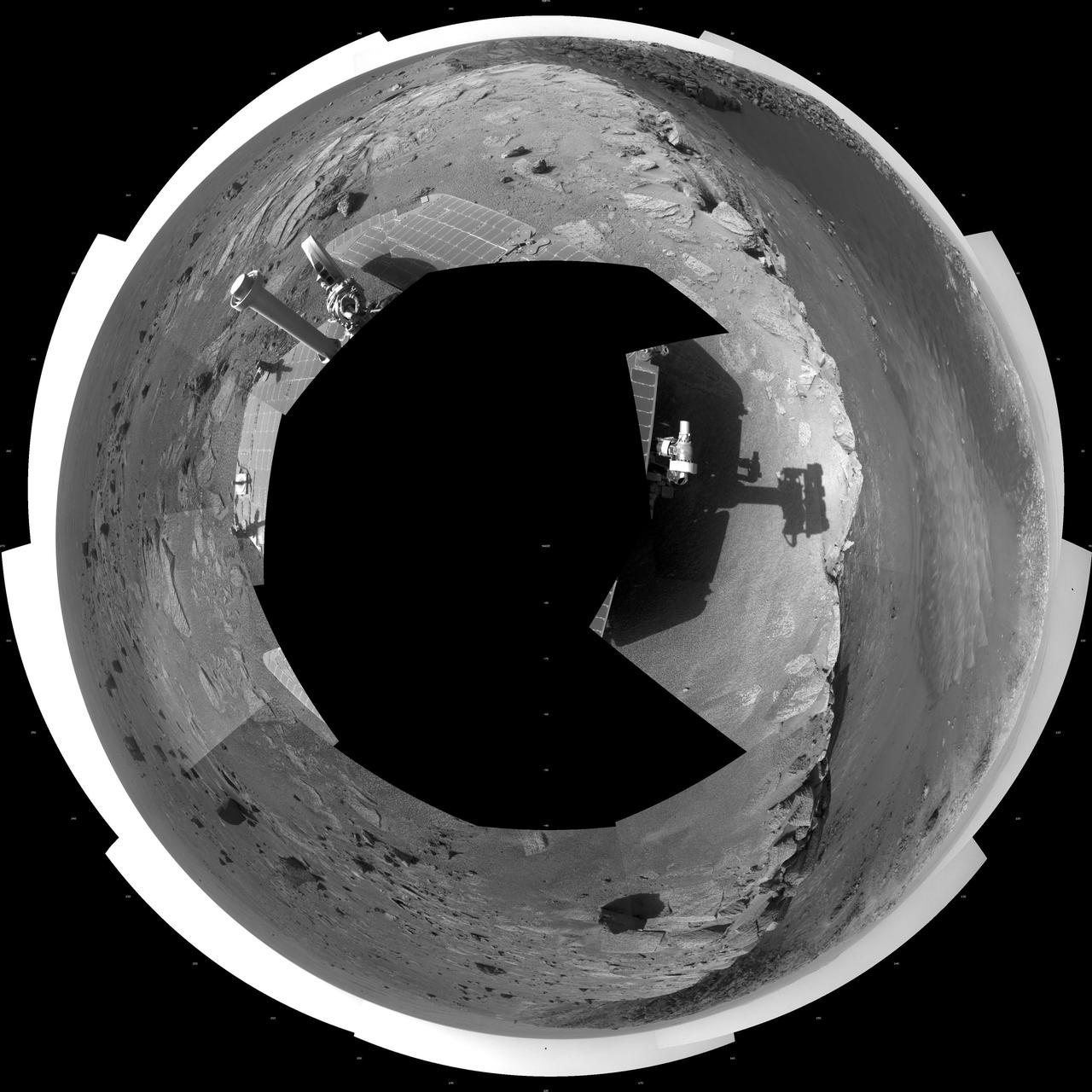
This 360-degree mosaic of images from the navigation camera on NASA Mars Exploration Rover Opportunity shows the view from the western rim of Santa Maria crater is presented as a polar projection, with north at the top.

This 360-degree, stereo mosaic of images from NASA Mars Exploration Rover Opportunity shows the view from the western rim of Santa Maria crater on Dec. 19, 2010. 3D glasses are necessary to view this image.
This 360-degree mosaic of images from the navigation camera on NASA Mars Exploration Rover Opportunity shows the view from the western rim of Santa Maria crater is presented as a vertical projection, with north at the top.
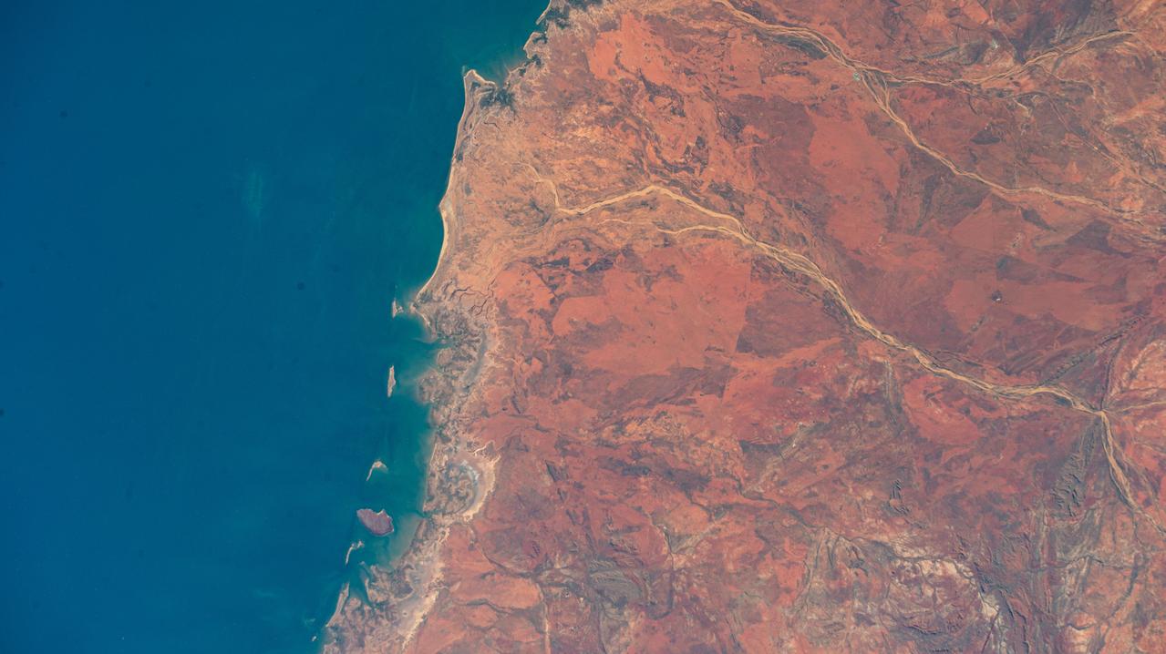
iss072e007019 (Oct. 1, 2024) --- The hot desert coast of Western Australia's sparsely-populated Pilbara region on the Indian Ocean is pictured from the International Space Station as it orbited 262 miles above.
iss073e0078403 (May 23, 2025) --- The sparsely populated, hot desert region of Western Australia near Neale Junction Nature Reserve is pictured from the International Space Station as it orbited 265 miles above the continental nation.
S66-54928 (14 Sept. 1966) --- Eighty-mile beach to Port Darwin in Northern Territory, Western Australia, as seen from the Gemini-11 spacecraft during its 26th revolution of Earth. Photo credit: NASA

Head of Department, Western Cape Government Economic Development and Tourism, Velile Dube, provides remarks during a meeting with NASA Deputy Associate Administrator for Space Communications and Navigation, Badri Younes, Premier of the Western Cape Government, Alan Winde, other NASA representatives, and a delegation from South Africa, to discuss the path forward for development of an antenna for the Lunar Exploration Ground Sites (LEGS) mission in Matjiesfontein, South Africa, and other opportunities, Tuesday, June 13, 2023, at the Mary W. Jackson NASA Headquarters building in Washington. Photo Credit: (NASA/Aubrey Gemignani)

NASA Associate Administrator for the Space Operations Mission Directorate, Ken Bowersox, right, provides remarks during a meeting with from left to right, the Premier of the Western Cape Government, Alan Winde, NASA Deputy Associate Administrator for Space Communications and Navigation, Badri Younes, and Director-General of the Western Cape Government, Dr. Harry Malila, to discuss the path forward for development of an antenna for the Lunar Exploration Ground Sites (LEGS) mission in Matjiesfontein, South Africa, and other opportunities, Tuesday, June 13, 2023, at the Mary W. Jackson NASA Headquarters building in Washington. Photo Credit: (NASA/Aubrey Gemignani)

Director-General of the Western Cape Government, Dr. Harry Malila, third from left, provides remarks during a meeting with the Premier of the Western Cape Government, Alan Winde, left, NASA Deputy Associate Administrator for Space Communications and Navigation, Badri Younes, second from left, and NASA Associate Administrator for the Space Operations Mission Directorate, Ken Bowersox, second from right, to discuss the path forward for development of an antenna for the Lunar Exploration Ground Sites (LEGS) mission in Matjiesfontein, South Africa, and other opportunities, Tuesday, June 13, 2023, at the Mary W. Jackson NASA Headquarters building in Washington. Photo Credit: (NASA/Aubrey Gemignani)

NASA Deputy Associate Administrator for Space Communications and Navigation, Badri Younes, second from left, provides remarks during a meeting with the Premier of the Western Cape Government, Alan Winde, left, Director-General of the Western Cape Government, Dr. Harry Malila, third from left, and NASA Associate Administrator for the Space Operations Mission Directorate, Ken Bowersox, right, to discuss the path forward for development of an antenna for the Lunar Exploration Ground Sites (LEGS) mission in Matjiesfontein, South Africa, and other opportunities, Tuesday, June 13, 2023, at the Mary W. Jackson NASA Headquarters building in Washington. Photo Credit: (NASA/Aubrey Gemignani)

From left to right, the Premier of the Western Cape Government, Alan Winde, NASA Deputy Associate Administrator for Space Communications and Navigation, Badri Younes, and Director-General of the Western Cape Government, Dr. Harry Malila, are seen during a meeting with NASA representatives and a delegation from South Africa, to discuss the path forward for development of an antenna for the Lunar Exploration Ground Sites (LEGS) mission in Matjiesfontein, South Africa, and other opportunities, Tuesday, June 13, 2023, at the Mary W. Jackson NASA Headquarters building in Washington. Photo Credit: (NASA/Aubrey Gemignani)

NASA Associate Administrator for the Space Operations Mission Directorate, Ken Bowersox, right, provides remarks during a meeting with the Premier of the Western Cape Government, Alan Winde, NASA Deputy Associate Administrator for Space Communications and Navigation, Badri Younes, left, and Director-General of the Western Cape Government, Dr. Harry Malila, second from left, to discuss the path forward for development of an antenna for the Lunar Exploration Ground Sites (LEGS) mission in Matjiesfontein, South Africa, and other opportunities, Tuesday, June 13, 2023, at the Mary W. Jackson NASA Headquarters building in Washington. Photo Credit: (NASA/Aubrey Gemignani)
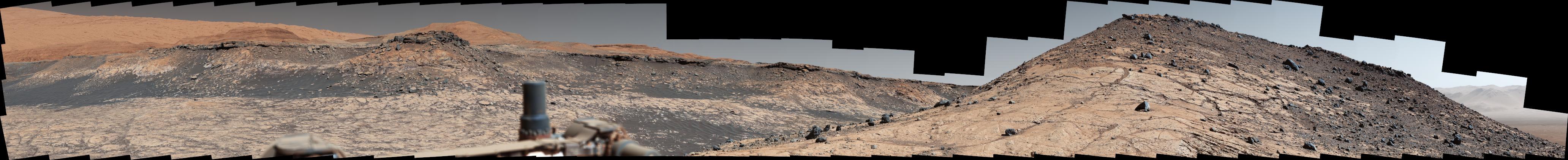
This wide panorama was taken by NASA's Curiosity Mars rover on Dec. 19, 2019, the 2,620th Martian day, or sol, of the mission. On the righthand foreground is Western Butte; the ridge with a crusty cap in the background is the Greenheugh pediment, which Curiosity ascended in March of 2020. The rover's Mast Camera, or Mastcam, used its telephoto lens to produce the panorama, which includes 130 individual images stitched together. The panorama has been white-balanced so that the colors of the rock materials resemble how they would appear under daytime lighting conditions on Earth. https://photojournal.jpl.nasa.gov/catalog/PIA23971
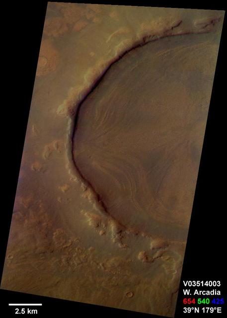
This is a Mars Odyssey visible color image of an unnamed crater in western Arcadia Planitia (near 39 degrees N, 179 degrees E). The crater shows a number of interesting internal and external features that suggest that it has undergone substantial modification since it formed. These features include concentric layers and radial streaks of brighter, redder materials inside the crater, and a heavily degraded rim and ejecta blanket. The patterns inside the crater suggest that material has flowed or slumped towards the center. Other craters with features like this have been seen at both northern and southern mid latitudes The distribution of these kinds of craters suggests the possible influence of surface or subsurface ice in the formation of these enigmatic features. The image was taken on September 29, 2002 during late northern spring. This is an approximate true color image, generated from a long strip of visible red (654 nm), green (540 nm), and blue (425 nm) filter images that were calibrated using a combination of pre-flight measurements and Hubble images of Mars. The colors appear perhaps a bit darker than one might expect; this is most likely because the images were acquired in late afternoon (roughly 4:40 p.m. local solar time) and the low Sun angle results in an overall darker surface. http://photojournal.jpl.nasa.gov/catalog/PIA04263
ECOSTRESS, NASA's new Earth-observing mission aboard the International Space Station, detected three wildfires burning in the western US on July 28, 2018 -- the Carr and Whaleback fires in California, and the Perry Fire in Nevada. The fires can be seen in red in Figures 1 and 2. Zooming in on the two larger fires shows the heat data in more detail and also reveals the fires' thick smoke plumes. ECOSTRESS launched on June 29 as part of a SpaceX commercial resupply mission to the space station. Its primary mission is to measure surface temperatures to detect plant health; however, it can also detect other heat-related phenomenon like heat waves, volcanoes and wildfires. This is the first image of wildfires acquired from ECOSTRESS. https://photojournal.jpl.nasa.gov/catalog/PIA22490
AST-19-1555 (24 July 1975) --- A sunglint in the South Western Pacific Ocean, as photographed from the Apollo spacecraft in Earth orbit during the joint U.S.-USSR Apollo-Soyuz Test Project mission. The island is Bougainville of the Solomon Islands group. The horizon of Earth is in the background. The picture was taken at an altitude of 231 kilometers (143 statute miles), with a 70mm Hasselblad camera using medium-speed Ektachrome QX-807 type film.
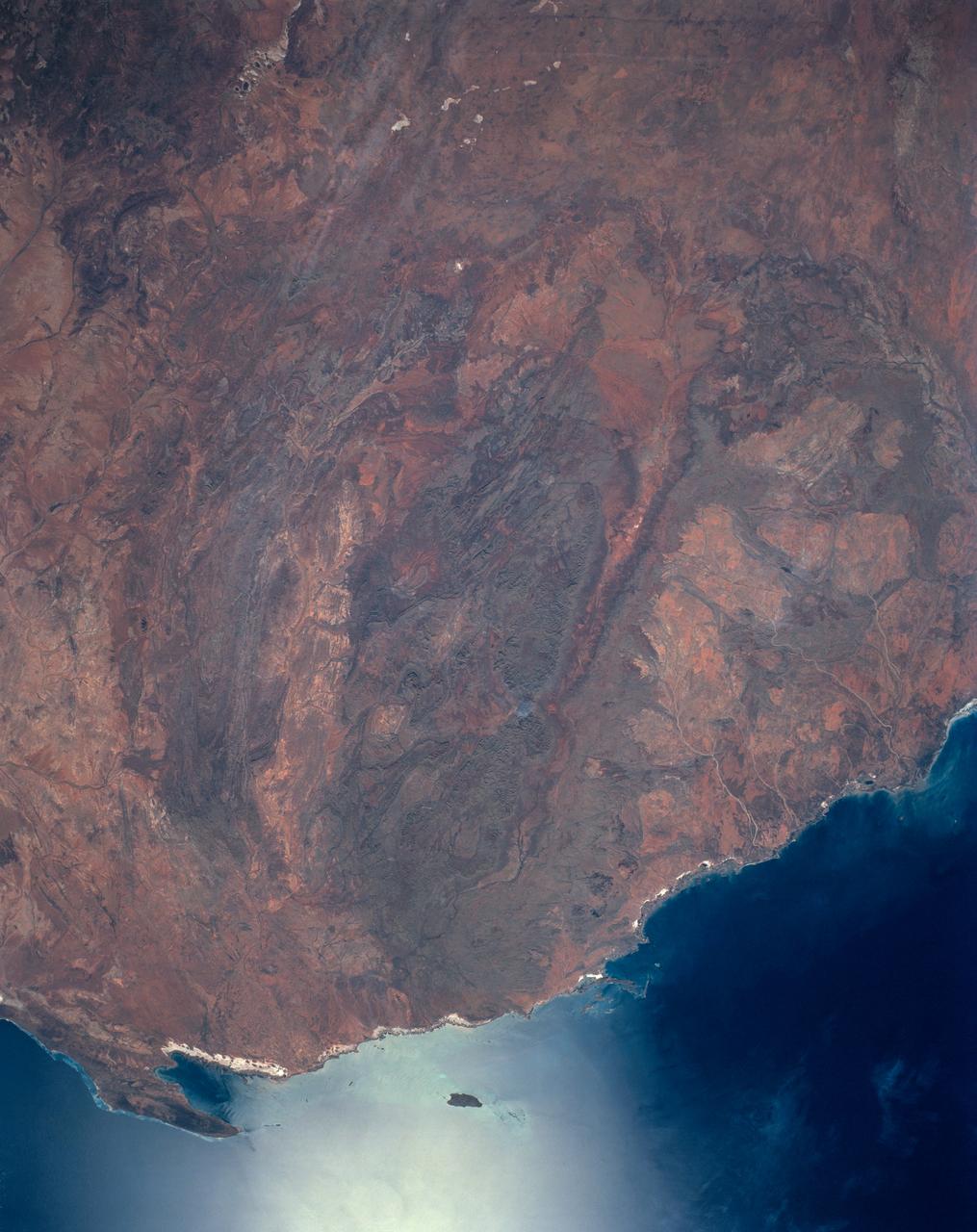
The oval shaped basin of the sedimentary rocks of the Hammersley Range, northern Western Australia (23.0S, 119.0E) dominates the center of this near nadir view. The Fortescue River is the remarkably straight, fault controlled feature bordering the Hammersley on the north. Sand dunes are the main surface features in the northeast and southwest. Many dry lakebeds can be seen to the east as light grey colored patches along the watercourses.
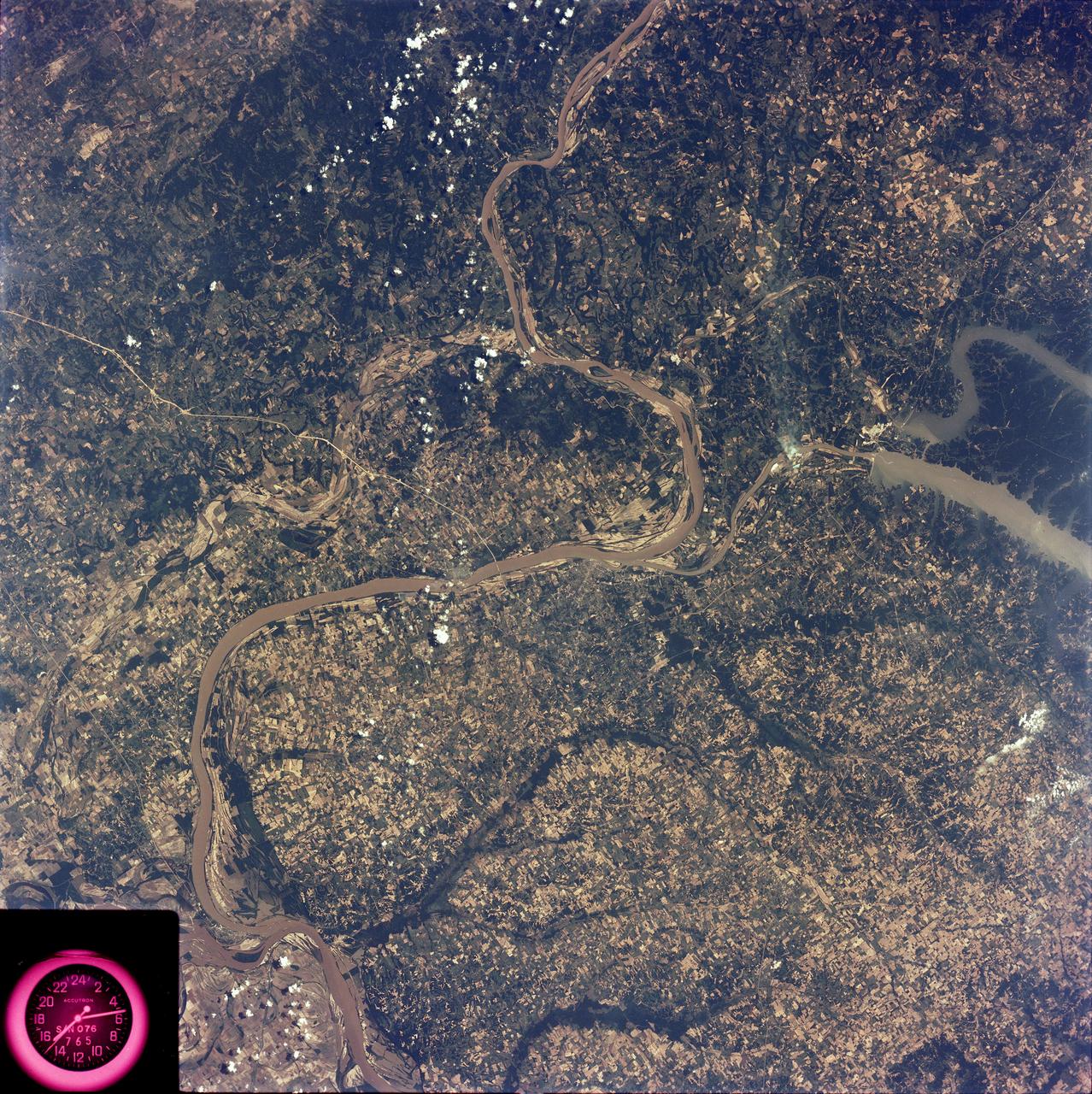
SL2-81-194 (22 June 1973) --- This view of southern Illinois and Western Kentucky (37.0N, 88.5W), with the winding Ohio River in between also illustrates the rich agriculture potential of the flood plains in the river bottom lands. To the east are the waters of Lake Kentucky and Lake Barkley which flow into the Ohio at Paducah, KY and may be seen stretching for several miles. Except for the Land Between the Lakes State Park, Extensive agriculture may be seen throughout the area. Photo credit: NASA
iss074e0315889 (Feb. 16, 2026) --- A portion of the rugged Zagros Mountain range, featuring narrow valleys and rocky outcrops in the semi-arid region of western Iran, is pictured from the International Space Station as it orbited 259 miles above Earth. Credit: NASA/Chris Williams
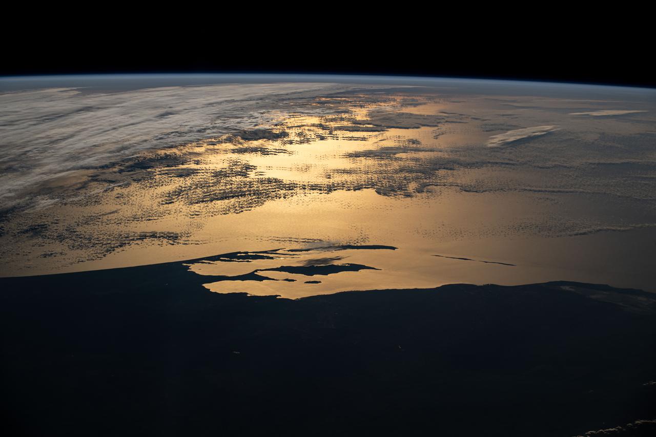
iss072e145182 (Nov. 5, 2024) --- Western Australia's silhouetted coastline contrasts with the sun's golden-hued glint beaming off a partly cloudy Indian Ocean in this photograph from the International Space Station as it orbited 265 miles above the island continent during an orbital sunset.
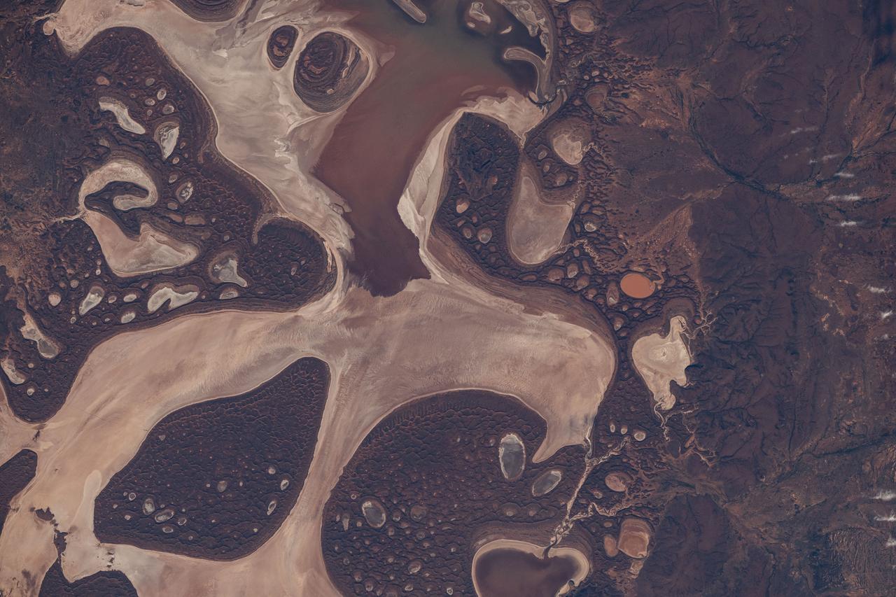
iss071e615200 (Sept. 9, 2024) -- The ephemeral Lake Carnegie, one of Western Australia's largest lakes, displays its mixture of water and mud as the International Space Station orbited 263 miles above. The lake fills with water only during periods of heavy rainfall, while in dry years, the lake is mostly a muddy marsh.
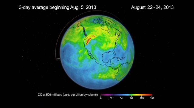
This frame from a movie was produced with data from NASA Aqua spacecraft showing the spread of carbon monoxide pollution across North America from fires in the Western U.S., including the Beaver Creek Fire in Idaho and the Rim Fire in California.
Acquired by the Multi-angle Imaging SpectroRadiometer instrument aboard NASA Terra spacecraft, this image is from the MISR Where on Earth...? Mystery Quiz #13. The location is Western Uzbekistan and Northeastern Turkmenistan.
This image of Western Cape, South Africa was acquired by the Multi-angle Imaging SpectroRadiometer MISR instrument aboard NASA Terra spacecraft. This image is from the MISR Mystery Image Quiz #25.
This beautifully contrasted infrared-color image shows an area approximately 600 by 900 meters. This is a close-up from NASA Mars Reconnaissance Orbiter spacecraft of the western Medusa Fossae formation where we can see dust-covered rocky, bedrock surfaces beige and a bluish-tinted sand sheet that transitions into several dunes. The bluish sand is thought to originate from the bedrock that lies beneath the dust. If true, this has implications for the composition of the formation, which has been highly debated over the years. http://photojournal.jpl.nasa.gov/catalog/PIA19939
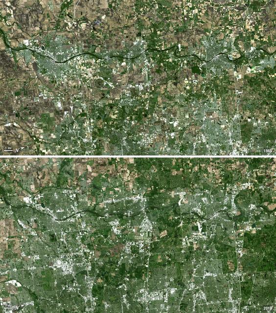
Forty miles west of downtown Chicago, the Fox River meanders its way through what has become the westernmost reaches of metropolitan Chicago, where the sprawling metropolis meets the hinterlands. While Chicago itself has seen a seven percent population decline during the last decade, the population of its metropolitan region, "Chicagoland," has steadily increased. These two natural-color Landsat 5 images acquired a quarter-century apart (on May 2, 1985, and May 23, 2010), stand witness to the soaring growth of this region. Aurora, Illinois’ second largest city, is the silvery-green region to the left hugging the Fox River, just south of the I-88 (North is to the right in this image); Carpentersville is found on the rightmost side, north of the I-90. From 1985 to 2010 a development explosion can been seen as the browns of pasture lands give way to silvery-green suburban areas and large white-colored business districts spring up along and east of the river. A major expansion of Dupage Airport appears in the middle of the 2010 image, and the circular-shaped region north of the I-88 and east of the Fox River, visible on both images, is the Department of Energy’s Fermilab. ---- NASA and the U.S. Department of the Interior through the U.S. Geological Survey (USGS) jointly manage Landsat, and the USGS preserves a 40-year archive of Landsat images that is freely available over the Internet. The next Landsat satellite, now known as the Landsat Data Continuity Mission (LDCM) and later to be called Landsat 8, is scheduled for launch in 2013. In honor of Landsat’s 40th anniversary in July 2012, the USGS released the LandsatLook viewer – a quick, simple way to go forward and backward in time, pulling images of anywhere in the world out of the Landsat archive. <b><a href="http://www.nasa.gov/audience/formedia/features/MP_Photo_Guidelines.html" rel="nofollow">NASA image use policy.</a></b> <b><a href="http://www.nasa.gov/centers/goddard/home/index.html" rel="nofollow">NASA Goddard Space Flight Center</a></b> enables NASA’s mission through four scientific endeavors: Earth Science, Heliophysics, Solar System Exploration, and Astrophysics. Goddard plays a leading role in NASA’s accomplishments by contributing compelling scientific knowledge to advance the Agency’s mission. <b>Follow us on <a href="http://twitter.com/NASA_GoddardPix" rel="nofollow">Twitter</a></b> <b>Like us on <a href="http://www.facebook.com/pages/Greenbelt-MD/NASA-Goddard/395013845897?ref=tsd" rel="nofollow">Facebook</a></b> <b>Find us on <a href="http://instagrid.me/nasagoddard/?vm=grid" rel="nofollow">Instagram</a></b>

Premier of the Western Cape Government, Alan Winde, provides remarks during a meeting with NASA Deputy Associate Administrator for Space Communications and Navigation, Badri Younes, right, other NASA representatives, and a delegation from South Africa, to discuss the path forward for development of an antenna for the Lunar Exploration Ground Sites (LEGS) mission in Matjiesfontein, South Africa, and other opportunities, Tuesday, June 13, 2023, at the Mary W. Jackson NASA Headquarters building in Washington. Photo Credit: (NASA/Aubrey Gemignani)

NASA SCaN Development Manager, Bill Marinelli provides remarks during a meeting with NASA Deputy Associate Administrator for Space Communications and Navigation, Badri Younes, the Premier of the Western Cape Government, Alan Winde, and a delegation from South Africa, to discuss the path forward for development of an antenna for the Lunar Exploration Ground Sites (LEGS) mission in Matjiesfontein, South Africa, and other opportunities, Tuesday, June 13, 2023, at the Mary W. Jackson NASA Headquarters building in Washington. Photo Credit: (NASA/Aubrey Gemignani)

NASA Deputy Associate Administrator for Space Communications and Navigation, Badri Younes, right, speaks with the Premier of the Western Cape Government, Alan Winde, during a meeting with NASA representatives and a delegation from South Africa, to discuss the path forward for development of an antenna for the Lunar Exploration Ground Sites (LEGS) mission in Matjiesfontein, South Africa, and other opportunities, Tuesday, June 13, 2023, at the Mary W. Jackson NASA Headquarters building in Washington. Photo Credit: (NASA/Aubrey Gemignani)

NASA Deputy Associate Administrator for Space Communications and Navigation, Badri Younes, provides remarks during a meeting with the Premier of the Western Cape Government, Alan Winde, NASA representatives, and a delegation from South Africa, to discuss the path forward for development of an antenna for the Lunar Exploration Ground Sites (LEGS) mission in Matjiesfontein, South Africa, and other opportunities, Tuesday, June 13, 2023, at the Mary W. Jackson NASA Headquarters building in Washington. Photo Credit: (NASA/Aubrey Gemignani)

51I-35-078 (30 Aug 1985) --- Typhoons Pat (left) and Odessa in the western Pacific. Of the many tropical cyclones photographed by the STS 51-I crew, the dual typhoons of Pat and Odessa were the most unusual. The twin typhoons constitute a Fujiwara system of connected cyclones first described by the Japanese meteorologist after whom the phenomena has been named. Never before have such paired typhoons been photographed from orbit.

NASA Associate Administrator for the Space Operations Mission Directorate, Ken Bowersox, and NASA Deputy Associate Administrator for Space Communications and Navigation, Badri Younes, meet with the Premier of the Western Cape Government, Alan Winde, and a delegation from South Africa, to discuss the path forward for development of an antenna for the Lunar Exploration Ground Sites (LEGS) mission in Matjiesfontein, South Africa, and other opportunities, Tuesday, June 13, 2023, at the Mary W. Jackson NASA Headquarters building in Washington. Photo Credit: (NASA/Aubrey Gemignani)
STS035-81-040 (2-10 Dec 1990) --- Numerous algae reefs are seen in Shark Bay, Western Australia, Australia (26.0S, 113.5E) especially in the southern portions of the bay. The south end is more saline because tidal flow in and out of the bay is restricted by sediment deposited at the north and central end of the bay opposite the mouth of the Wooramel River. This extremely arid region produces little sediment runoff so that the waters are very clear, saline and rich in algae.
SL2-81-162 (22 June 1973) --- The most striking feature of this scene of the western Great Plains and the Badlands of SD (43.5N, 101.0W) is the rugged topography of the landscape. Over eons of time, the White River has carved out a badlands topography of steep gullies, irregular winding ridges and isolated buttes. The barren wasteland of badlands light toned rock surfaces contrast sharply with the adjacent vegetated landscape of native grasslands and cultivated fields. Photo credit: NASA
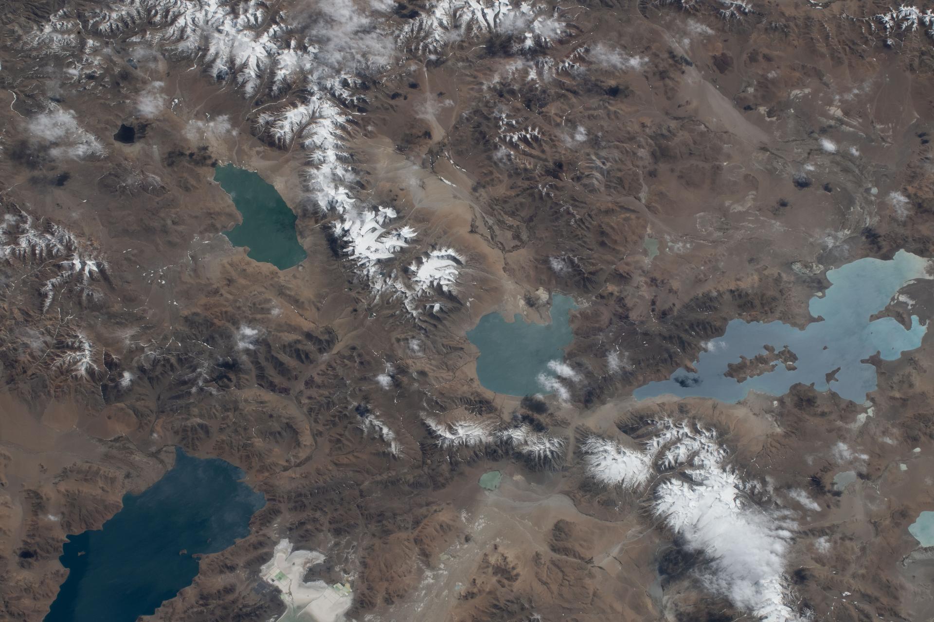
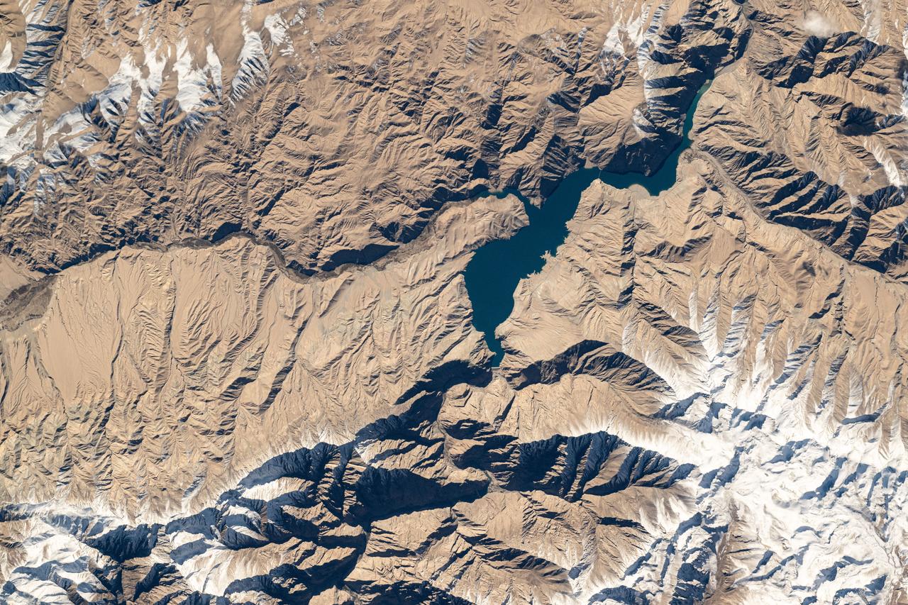
iss074e0603590 (May 20, 2026) --- Lakes on China’s rugged western Tibetan Plateau—an area known for high altitude, extreme weather, and limited infrastructure—are pictured from the International Space Station as it orbited 259 miles above Asia. The lakes’ colors, ranging from turquoise to deep indigo, depend on sunlight and weather, and most are saline. Credit: NASA/Jessica Meir
STS-56 Earth observation taken aboard Discovery, Orbiter Vehicle (OV) 103, is probably the best view of Perth in Western Australia. (For orientation purposes, note that the coastline runs north and south). The major feature on the coast is the large estuary of the Swan River. The large port city of Perth is situated on the north bank and the smaller city of Freemantle on the south bank by the sea. Smaller seaside towns trail off north and south of this center of urban life. Inland lies a prominent escarpment, more than 600 feet high, seen running down the middle of the view and dividing the lighter-colored coastal lowlands from the highlands where dark-colored tree savanna and desert scrub dominates the land. The Moore River can be seen entering the sea at the top of the frame. Rottnest Island is visible in the sea and Garden Island near bottom edge of the frame. Perth is the largest economic center in Western Australia. It receives natural gas from an offshore field hundreds of miles to the north. It lies 3,400 kilometers west of Sydney on the opposite side of this island continent.
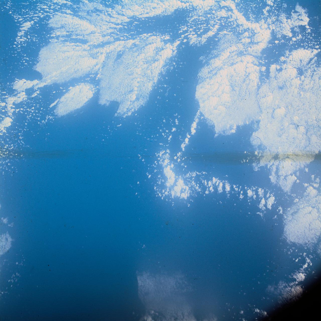
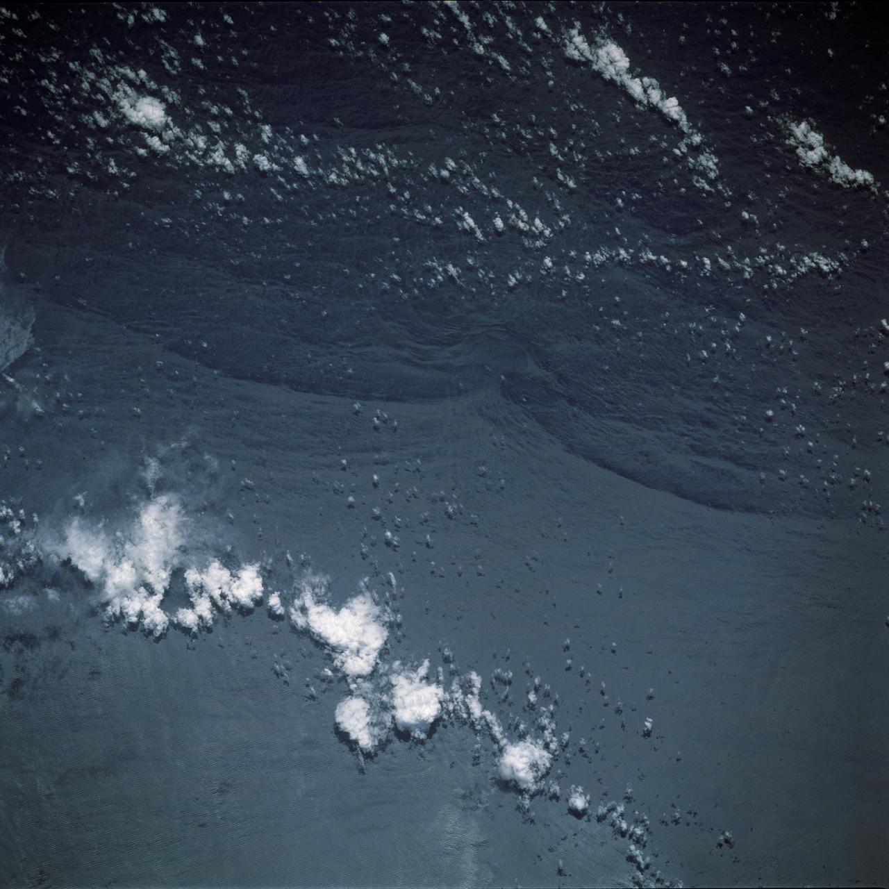
S62-06606 (3 Oct. 1962) --- Cloud formation over Western Atlantic Ocean north of South America taken during the fourth orbit pass of the Mercury-Atlas 8 (MA-8) mission by astronaut Walter M. Schirra Jr. with a hand-held camera. Photo credit: NASA

S62-06607 (3 Oct. 1962) --- Western horizon over South America taken during the sixth orbit pass of the Mercury-Atlas 8 (MA-8) mission by astronaut Walter M. Schirra Jr. with a hand-held camera. Photo credit: NASA
iss073e0429954 (June 21, 2025) --- Colorado's Western Slope region, highlighted by the city of Grand Junction and its surrounding suburbs (at center), is pictured from the International Space Station as it orbited 261 miles above the Centennial State. The municipality's economy is primarily supported by the agribusiness industry, including cattle ranching and fruit cultivation.
iss074e0316083 (Feb. 18, 2026) --- The far western edge of the Taklamakan Desert—the world’s second-largest shifting sand desert—meets the Pamir Mountains in China, where scorching desert conditions transition to frigid alpine terrain. The International Space Station was orbiting 259 miles above Central Asia when this photograph was taken.
S62-06604 (3 Oct. 1962) --- Western horizon over South America taken during the sixth orbit pass of the Mercury-Atlas 8 (MA-8) mission by astronaut Walter M. Schirra Jr. with a hand-held camera. Photo credit: NASA
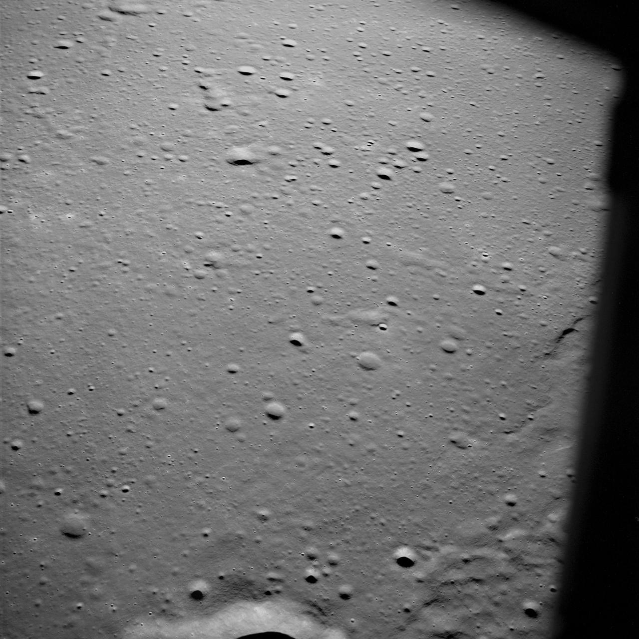
AS10-29-4321 (18-26 May 1969) --- An Apollo 10 oblique view of the western portion of the Sea of Tranquility. The area in the picture is located approximately 70 nautical miles east-southeast of Apollo Landing Site 2. The flat terrain pitted by moderate-sized craters is typical of this portion of Mare Tranquillitatis.
Part of the western wall of Shalbatana Vallis has collapsed and formed a landslide
This NASA 2001 Mars Odyssey spacecraft image shows the western edge of the summit caldera of Ceranus Tholus, one of the smaller volcanic constructs of the Tharsis region. Several channels dissect the western flank of the volcano.
This composite image shows the weather situation over Europe at 12:00 UTC on 13 February 2014. The image is composed of infra-red imagery from the geostationary satellites of EUMETSAT and NOAA, overlaid on NASA's Blue Marble land imagery. Copyright: 2014 EUMETSAT, <a href="http://www.flickr.com/photos/eumetsat/12500210655">www.flickr.com/photos/eumetsat/12500210655</a>
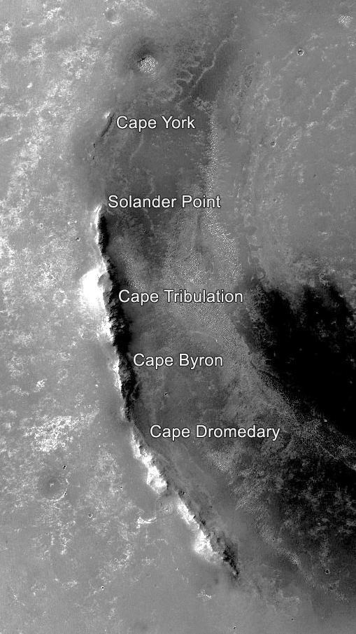
This orbital image of the western rim of Mars' Endeavour Crater covers an area about 5 miles (8 kilometers) east-west by about 9 miles (14 kilometers) north-south and indicates the names of some of the raised segments of the rim. NASA's Mars Exploration Rover Opportunity arrived at Endeavour in 2011 after exploring smaller craters to the northwest during its first six years on Mars. It initially explored the "Cape York" segment, then headed south. It reached the northern end of "Cape Tribulation" in late 2014 and the southern tip of that segment in April 2017. A key destination in the "Cape Byron" segment is "Perseverance Valley," where the rover team plans to investigate whether the valley was carved by water, wind or a debris flow initiated by water. This image is from the Context Camera on NASA's Mars Reconnaissance Orbiter. Malin Space Science Systems, San Diego, California, built and operates that camera. NASA's Jet Propulsion Laboratory, a division of Caltech in Pasadena, California, built and operates Opportunity. https://photojournal.jpl.nasa.gov/catalog/PIA21490

NASA International Program Specialist, Office of International and Interagency Relations, Greg Mann, provide remarks during a meeting with NASA Associate Administrator for the Space Operations Mission Directorate, Ken Bowersox, NASA Deputy Associate Administrator for Space Communications and Navigation, Badri Younes, he Premier of the Western Cape Government, Alan Winde, and a delegation from South Africa, to discuss the path forward for development of an antenna for the Lunar Exploration Ground Sites (LEGS) mission in Matjiesfontein, South Africa, and other opportunities, Tuesday, June 13, 2023, at the Mary W. Jackson NASA Headquarters building in Washington. Photo Credit: (NASA/Aubrey Gemignani)

NASA SCaN Development Manager, Bill Marinelli provides remarks during a meeting with the Associate Administrator for the Space Operations Mission Directorate, Ken Bowersox, NASA Deputy Associate Administrator for Space Communications and Navigation, Badri Younes, the Premier of the Western Cape Government, Alan Winde, and a delegation from South Africa, to discuss the path forward for development of an antenna for the Lunar Exploration Ground Sites (LEGS) mission in Matjiesfontein, South Africa, and other opportunities, Tuesday, June 13, 2023, at the Mary W. Jackson NASA Headquarters building in Washington. Photo Credit: (NASA/Aubrey Gemignani)

iss074e0437897 (April 6, 2026) --- The western portion of Lake Balkhash in Kazakhstan is freshwater, fed predominantly by the Ili River and bordered by woodlands that support a wide range of wildlife, including migratory birds, fish, deer, and ongoing efforts to reintroduce the Caspian tiger. The eastern portion of Lake Balkhash (not pictured) is more saline due to its greater depth, arid climate, and the narrow Uzynaral Strait, which limits the inflow of freshwater between the two basins. The International Space Station was orbiting 267 miles above Kazakhstan at the time of this photograph. Credit: NASA
STS044-79-077 (24 Nov.-1 Dec. 1991) --- This photograph, captured from the Earth-orbiting Space Shuttle Atlantis, shows sunglint pattern in the western tropical Indian Ocean. Several large internal waves reflect around a shallow area on the sea floor. NASA scientists studying the STS-44 photography believe the shallow area to be a sediment (a submerged mountain) on top of the Mascarene Plateau, located northeast of Madagascar at approximately 5.6 degrees south latitude and 55.7 degrees east longitude. Internal waves are similar to surface ocean waves, except that they travel inside the water column along the boundary between water layers of different density. At the surface, their passage is marked on the sea surface by bands of smooth and rough water. These bands appear in the sunglint pattern as areas of brighter or darker water. NASA scientists point out that, when the waves encounter an obstacle, such as a near-surface seamount, they bend or refract around the obstacle in the same manner as surface waves bend around an island or headland.