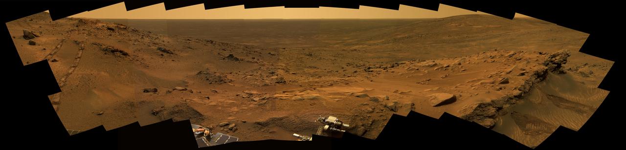
A Whale of a Panorama
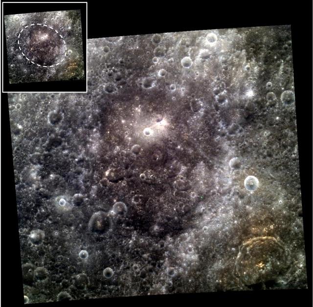
A Whale of a Crater
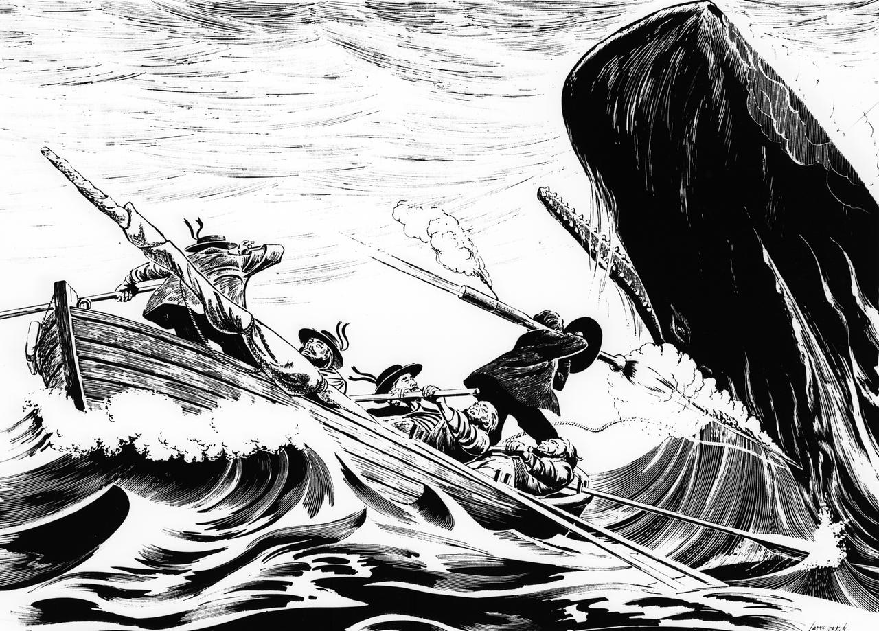
As far back as 1821, sailors hunted whales using rocket-propelled harpoons. These rocket harpoons were launched from a shoulder-held tube equipped with a circular black shield.
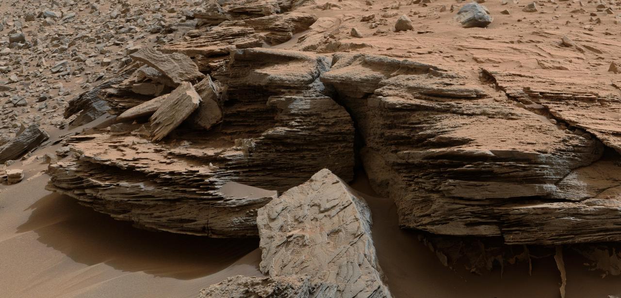
This view from the NASA Curiosity Mars rover shows an example of cross-bedding that results from water passing over a loose bed of sediment. It was taken at a target called Whale Rock within the Pahrump Hills outcrop at the base of Mount Sharp.
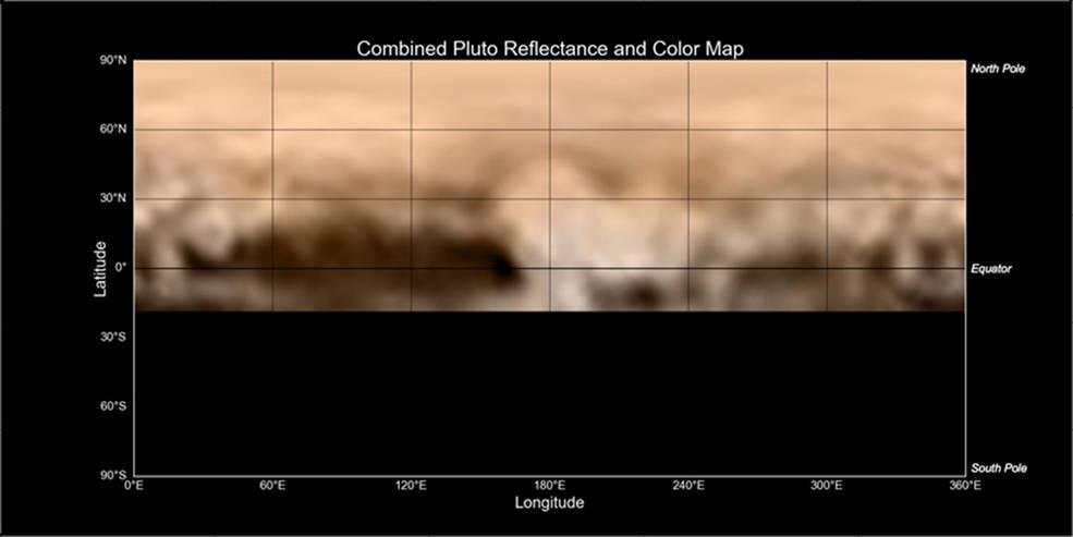
This map of Pluto, created from images taken from June 27-July 3, 2015, by the Long Range Reconnaissance Imager (LORRI) on New Horizons, was combined with lower-resolution color data from the spacecraft's Ralph instrument. The center of the map corresponds to the side of Pluto that will be seen close-up during New Horizons' July 14 flyby. This map gives mission scientists an important tool to decipher the complex and intriguing pattern of bright and dark markings on Pluto's surface. Features from all sides of Pluto can now be seen at a glance and from a consistent perspective, making it much easier to compare their shapes and sizes. The elongated dark area informally known as "the whale," along the equator on the left side of the map, is one of the darkest regions visible to New Horizons. It measures some 1,860 miles (3,000 kilometers) in length. Directly to the right of the whale's "snout" is the brightest region visible on the planet, which is roughly 990 miles (1,600 kilometers) across. This may be a region where relatively fresh deposits of frost -- perhaps including frozen methane, nitrogen and/or carbon monoxide -- form a bright coating. http://photojournal.jpl.nasa.gov/catalog/PIA19700
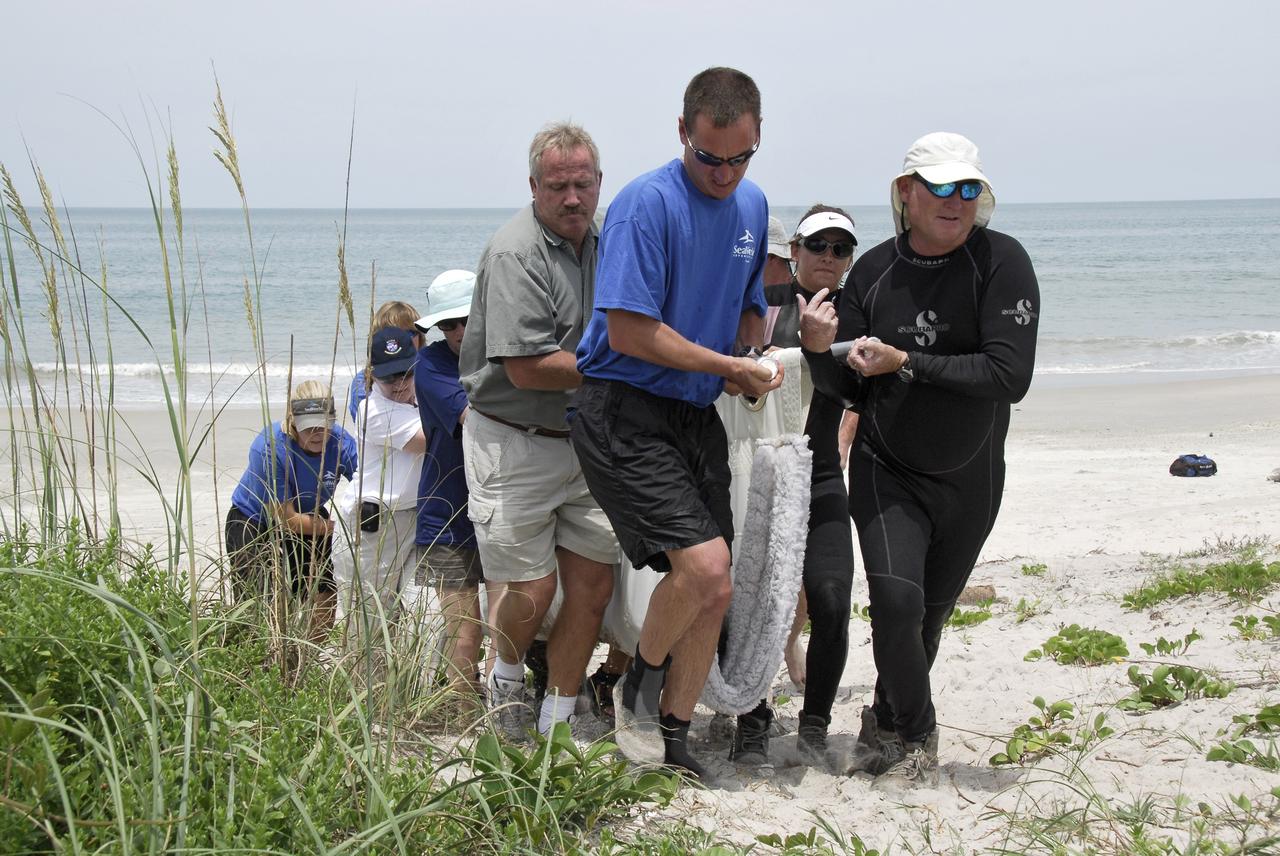
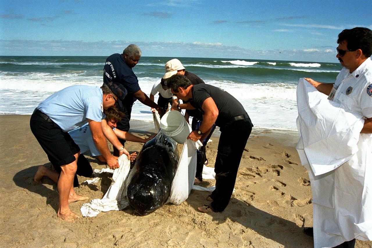
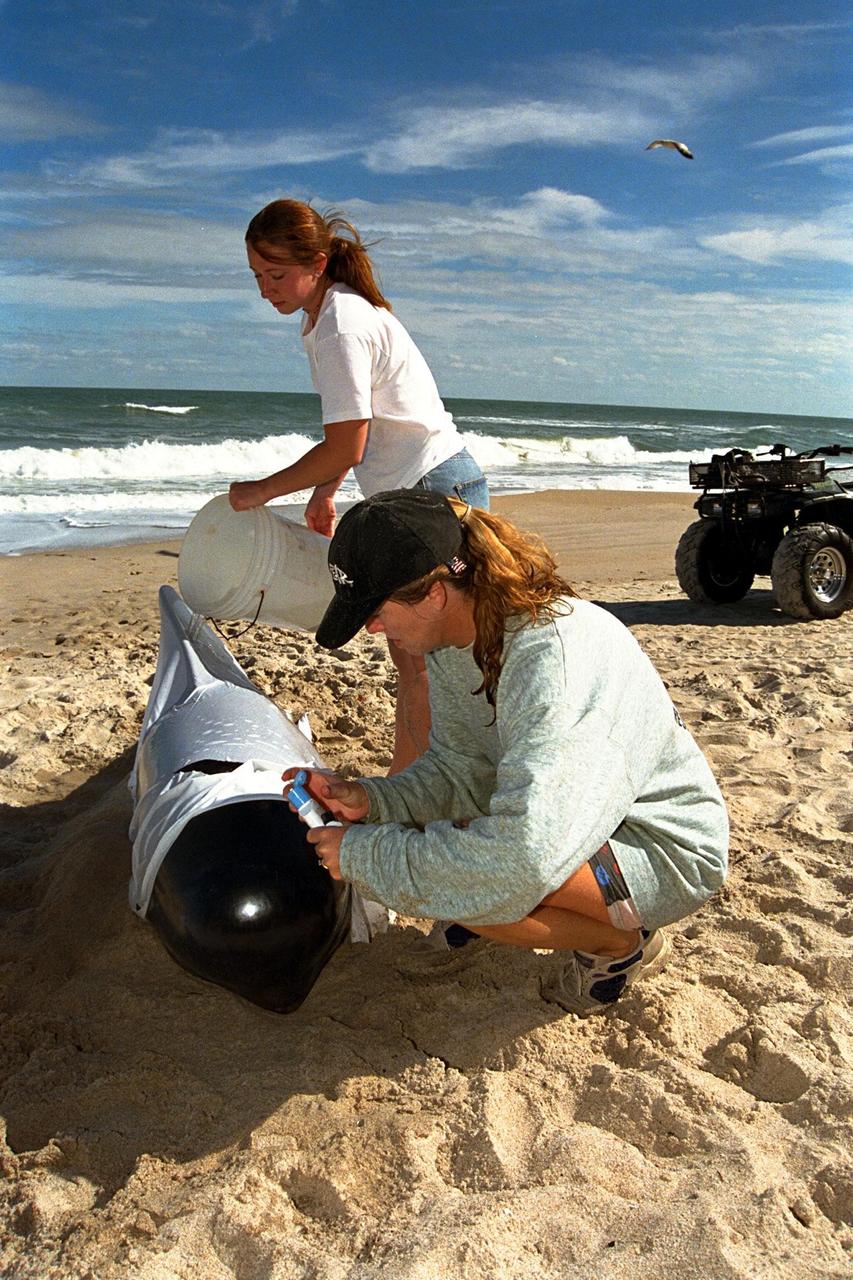
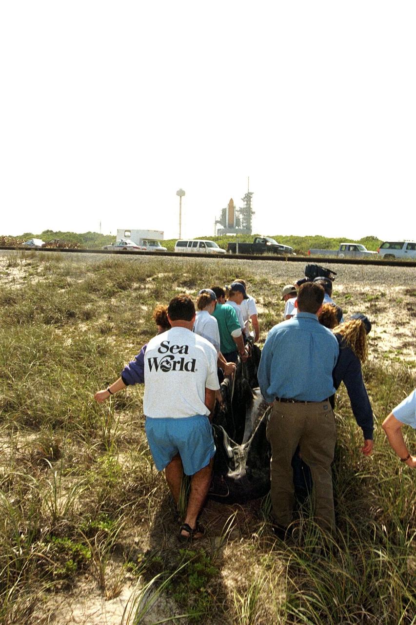
CAPE CANAVERAL, Fla. – Workers from NASA's Kennedy Space Center, a veterinarian and representatives from the Hubbs/Sea World Research Institute support a stranded Melon-Headed Whale on a sling as they carry it to a waiting truck. The whale was found beached south of Launch Pad 39A near Cape Canaveral Air Force Station. The whale will be taken to Sea World for evaluation. After assessment by veterinarians at Sea World, the whale will be transported to a whale rescue center in the Panhandle for rehabilitation and release. The Melon-Headed Whale lives well off-shore in all the world's tropical and sub-tropical oceans. At the northern fringes of its range, it may also be found in the warm currents of temperate waters, such as Florida. It is closely related to the Pygmy Killer Whale and the Pilot Whales. Its primary diet is squid. Photo credit: NASA/Kim Shiflett
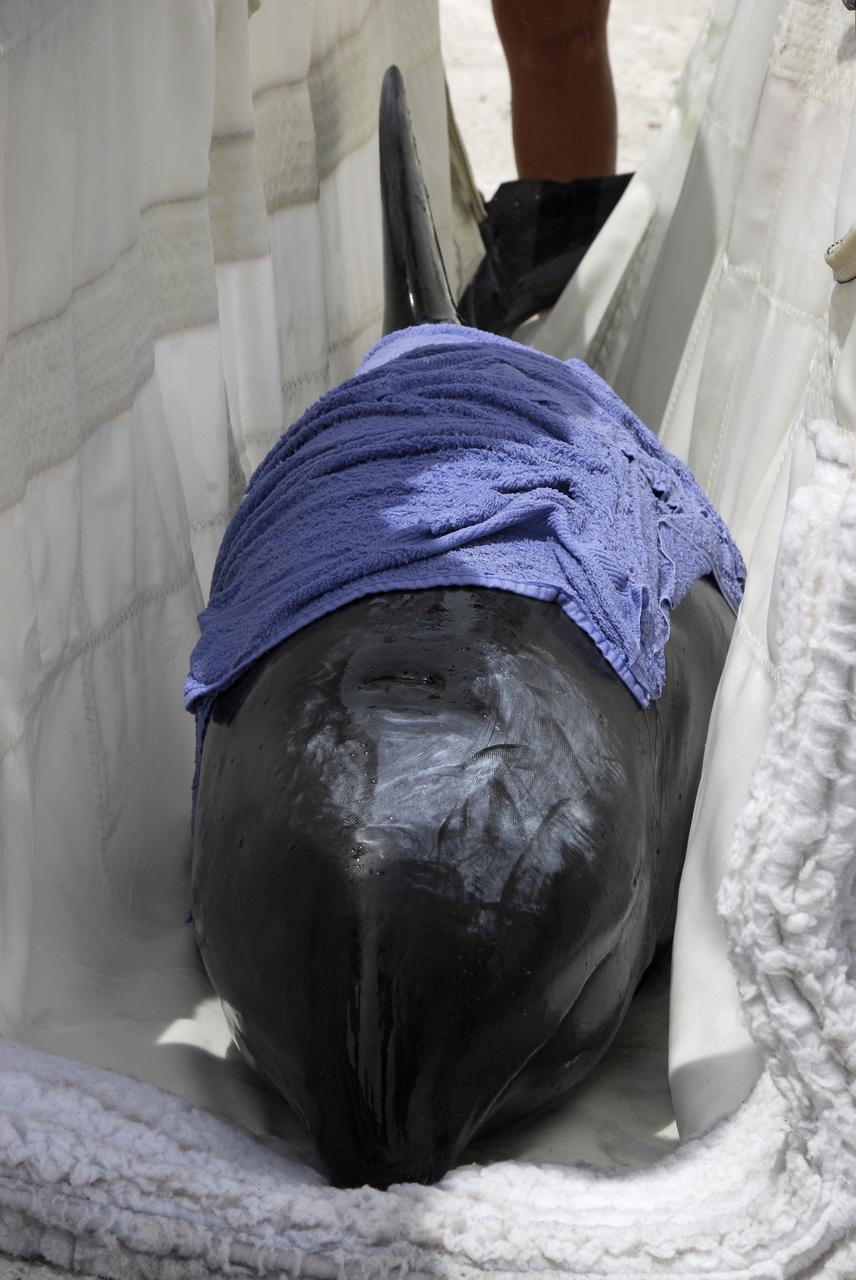
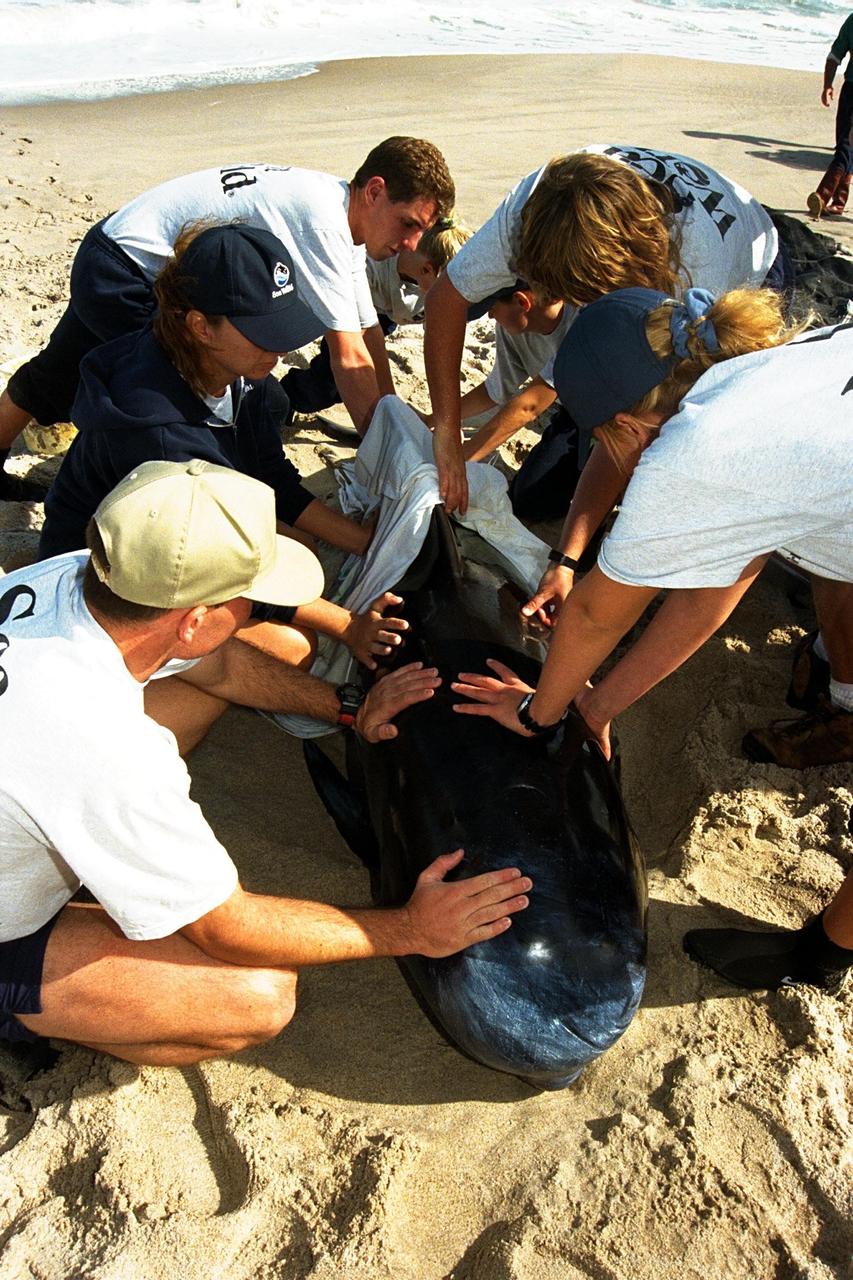
CAPE CANAVERAL, Fla. – This close-up shows the stranded Melon-Headed Whale being carried on a sling to a waiting truck. The whale was found beached south of Launch Pad 39A at NASA's Kennedy Space Center near Cape Canaveral Air Force Station. Workers from Kennedy, a veterinarian and representatives from the Hubbs/Sea World Research Institute share in the rescue. After assessment by veterinarians at Sea World, the whale will be transported to a whale rescue center in the Panhandle for rehabilitation and release. The Melon-Headed Whale lives well off-shore in all the world's tropical and sub-tropical oceans. At the northern fringes of its range, it may also be found in the warm currents of temperate waters, such as Florida. It is closely related to the Pygmy Killer Whale and the Pilot Whales. Its primary diet is squid. Photo credit: NASA/Kim Shiflett

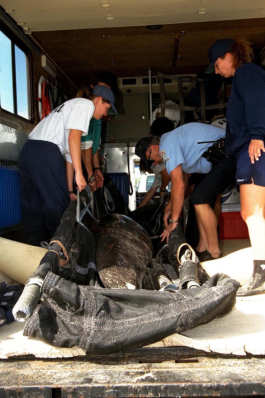
CAPE CANAVERAL, Fla. – Representatives from the Hubbs/Sea World Research Institute calm the stranded Melon-Headed Whale inside the truck that will take it to Sea World for evaluation. The whale was found beached south of Launch Pad 39A at NASA's Kennedy Space Center near Cape Canaveral Air Force Station. After assessment by veterinarians at Sea World, the whale will be transported to a whale rescue center in the Panhandle for rehabilitation and release. The Melon-Headed Whale lives well off-shore in all the world's tropical and sub-tropical oceans. At the northern fringes of its range, it may also be found in the warm currents of temperate waters, such as Florida. It is closely related to the Pygmy Killer Whale and the Pilot Whales. Its primary diet is squid. Photo credit: NASA/Kim Shiflett
CAPE CANAVERAL, Fla. – Workers from NASA's Kennedy Space Center, a veterinarian and representatives from the Hubbs/Sea World Research Institute support a stranded Melon-Headed Whale on a sling as they carry it out of the Atlantic Ocean. The whale was found beached south of Launch Pad 39A near Cape Canaveral Air Force Station. After assessment by veterinarians at Sea World, the whale will be transported to a whale rescue center in the Panhandle for rehabilitation and release. The Melon-Headed Whale lives well off-shore in all the world's tropical and sub-tropical oceans. At the northern fringes of its range, it may also be found in the warm currents of temperate waters, such as Florida. It is closely related to the Pygmy Killer Whale and the Pilot Whales. Its primary diet is squid. Photo credit: NASA/Kim Shiflett
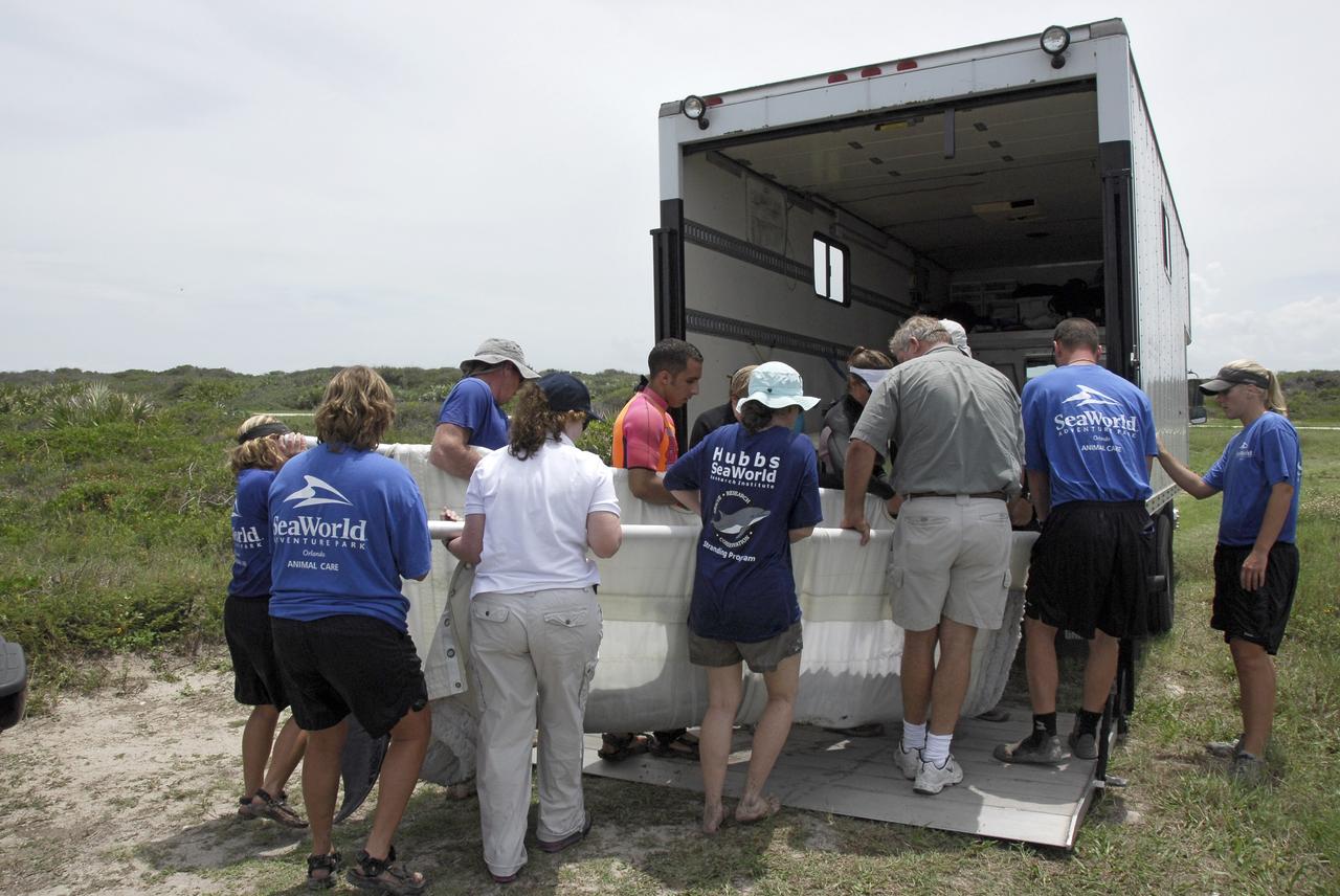
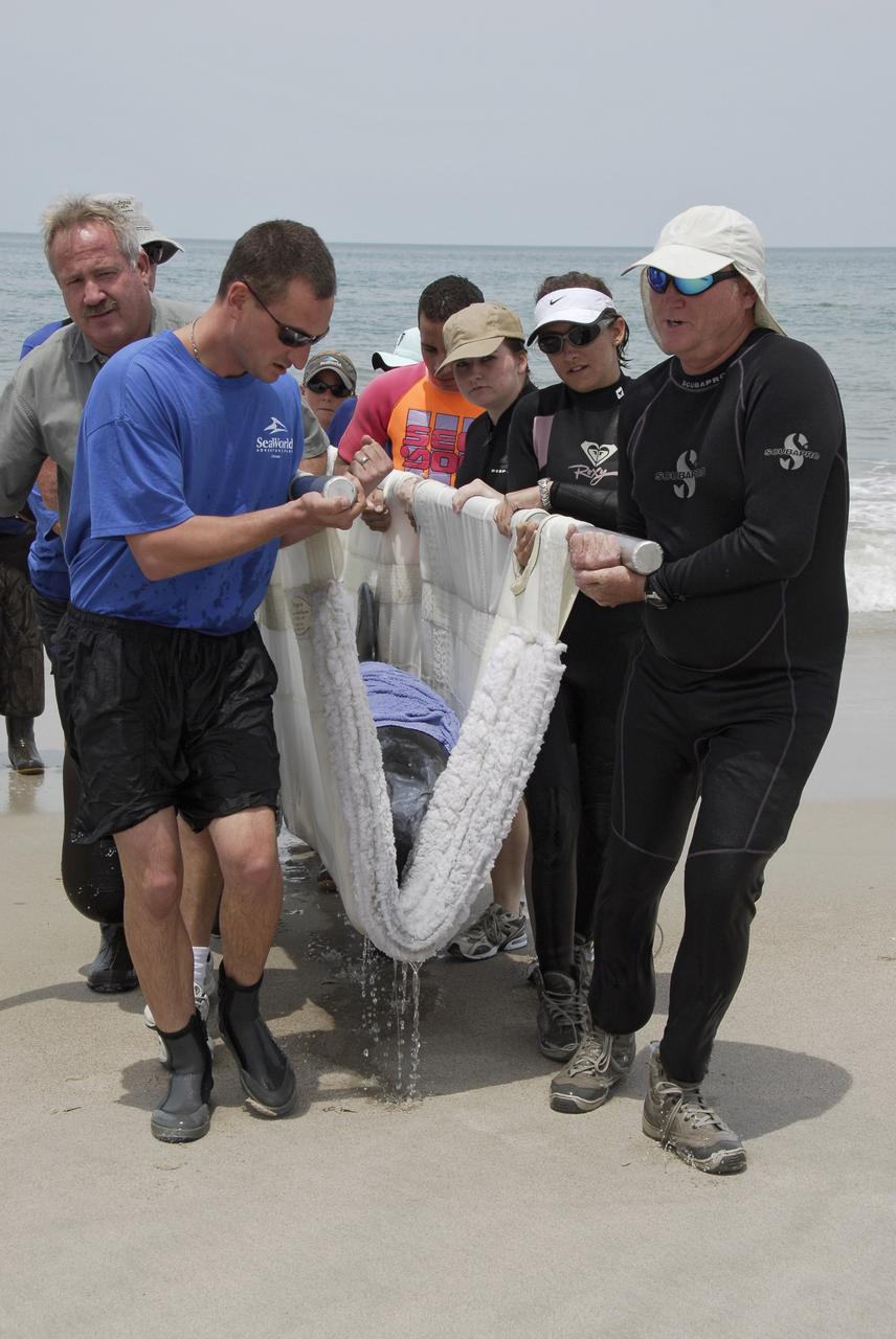
CAPE CANAVERAL, Fla. – Workers from NASA's Kennedy Space Center, a veterinarian and representatives from the Hubbs/Sea World Research Institute approach the truck that will take a stranded Melon-Headed Whale to Sea World for evaluation. The whale was found beached south of Launch Pad 39A near Cape Canaveral Air Force Station. After assessment by veterinarians at Sea World, the whale will be transported to a whale rescue center in the Panhandle for rehabilitation and release. The Melon-Headed Whale lives well off-shore in all the world's tropical and sub-tropical oceans. At the northern fringes of its range, it may also be found in the warm currents of temperate waters, such as Florida. It is closely related to the Pygmy Killer Whale and the Pilot Whales. Its primary diet is squid. Photo credit: NASA/Kim Shiflett
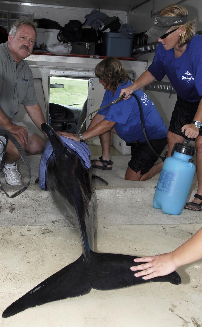
CAPE CANAVERAL, Fla. – Inside a truck, a veterinarian, left, and Sea World representatives cool the skin of a Melon-Headed Whale found stranded south of Launch Pad 39A at NASA's Kennedy Space Center near Cape Canaveral Air Force Station. The whale will be taken to Sea World for evaluation. After assessment by veterinarians at Sea World, the whale will be transported to a whale rescue center in the Panhandle for rehabilitation and release. The Melon-Headed Whale lives well off-shore in all the world's tropical and sub-tropical oceans. At the northern fringes of its range, it may also be found in the warm currents of temperate waters, such as Florida. It is closely related to the Pygmy Killer Whale and the Pilot Whales. Its primary diet is squid. Photo credit: NASA/Kim Shiflett
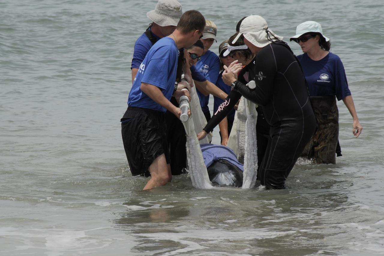
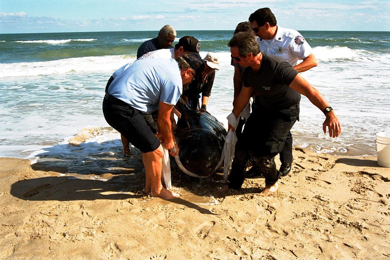
CAPE CANAVERAL, Fla. – Workers from NASA's Kennedy Space Center and representatives from the Hubbs/Sea World Research Institute support a stranded Melon-Headed Whale on a sling in the Atlantic Ocean. The whale was found beached south of Launch Pad 39A near Cape Canaveral Air Force Station. After assessment by veterinarians at Sea World, the whale will be transported to a whale rescue center in the Panhandle for rehabilitation and release. The Melon-Headed Whale lives well off-shore in all the world's tropical and sub-tropical oceans. At the northern fringes of its range, it may also be found in the warm currents of temperate waters, such as Florida. It is closely related to the Pygmy Killer Whale and the Pilot Whales. Its primary diet is squid. Photo credit: NASA/Kim Shiflett
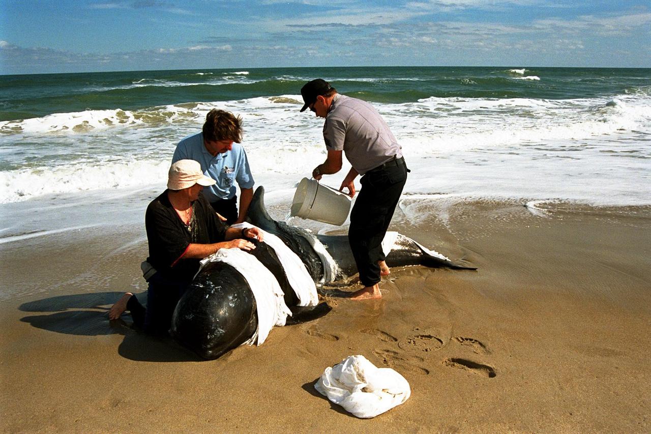
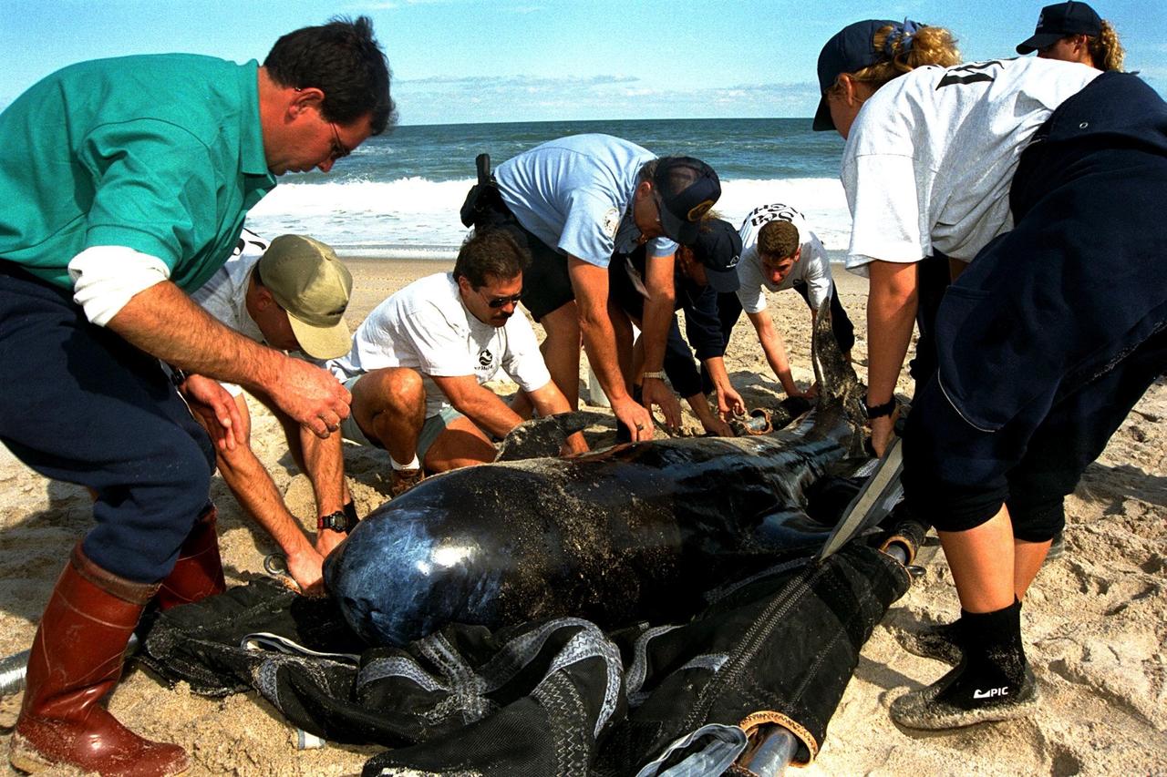
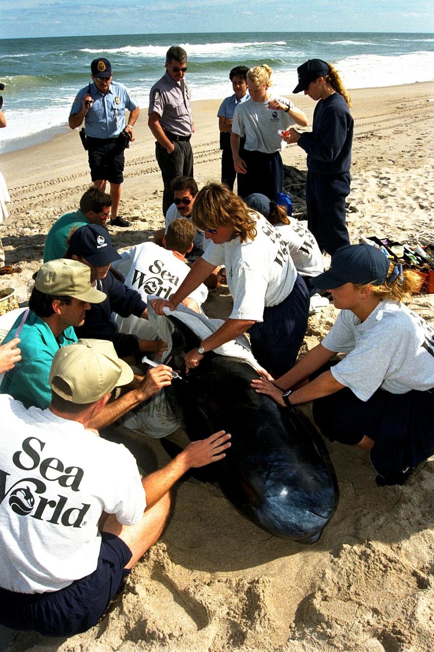
KENNEDY SPACE CENTER, FLA. -- Sea World, Dynamac Life Sciences, and EG&G Protective Services staff tend to a beached whale on the Brevard County shoreline near Kennedy Space Center's Launch Pad 39A. Two pilot whales beached themselves mid-morning on Jan. 20 and were rescued and taken to Marineland near St. Augustine. The two whales, an eight-foot and an 11-foot, bring to six the number of whales being treated at Sea World in Orlando and at Marineland. Nine whales have beached in Brevard County since the beginning of the year.
KENNEDY SPACE CENTER, FLA. -- Sea World, Dynamac Life Sciences, and EG&G Protective Services staff tend to a beached whale on the Brevard County shoreline near Kennedy Space Center's Launch Pad 39A. Two pilot whales beached themselves mid-morning on Jan. 20 and were rescued and taken to Marineland near St. Augustine. The two whales, an eight-foot and an 11-foot, bring to six the number of whales being treated at Sea World in Orlando and at Marineland. Nine whales have beached in Brevard County since the beginning of the year
KENNEDY SPACE CENTER, FLA. -- Sea World, Dynamac Life Sciences, and EG&G Protective Services staff tend to a beached whale on the Brevard County shoreline near Kennedy Space Center's Launch Pad 39A. Two pilot whales beached themselves mid-morning on Jan. 20 and were rescued and taken to Marineland near St. Augustine. The two whales, an eight-foot and an 11-foot, bring to six the number of whales being treated at Sea World in Orlando and at Marineland. Nine whales have beached in Brevard County since the beginning of the year.
KENNEDY SPACE CENTER, FLA. -- Sea World, Dynamac Life Sciences, and EG&G Protective Services staff tend to a beached whale on the Brevard County shoreline near Kennedy Space Center's Launch Pad 39A. Two pilot whales beached themselves mid-morning on Jan. 20 and were rescued and taken to Marineland near St. Augustine. The two whales, an eight-foot and an 11-foot, bring to six the number of whales being treated at Sea World in Orlando and at Marineland. Nine whales have beached in Brevard County since the beginning of the year.
KENNEDY SPACE CENTER, FLA. -- Sea World, Dynamac Life Sciences, and EG&G Protective Services staff tend to a beached whale on the Brevard County shoreline near Kennedy Space Center's Launch Pad 39A. Two pilot whales beached themselves mid-morning on Jan. 20 and were rescued and taken to Marineland near St. Augustine. The two whales, an eight-foot and an 11-foot, bring to six the number of whales being treated at Sea World in Orlando and at Marineland. Nine whales have beached in Brevard County since the beginning of the year.
KENNEDY SPACE CENTER, FLA. -- Sea World, Dynamac Life Sciences, and EG&G Protective Services staff tend to a beached whale on the Brevard County shoreline near Kennedy Space Center's Launch Pad 39A. Two pilot whales beached themselves mid-morning on Jan. 20 and were rescued and taken to Marineland near St. Augustine. The two whales, an eight-foot and an 11-foot, bring to six the number of whales being treated at Sea World in Orlando and at Marineland. Nine whales have beached in Brevard County since the beginning of the year.
KENNEDY SPACE CENTER, FLA. -- Sea World, Dynamac Life Sciences, and EG&G Protective Services staff tend to a beached whale on the Brevard County shoreline near Kennedy Space Center's Launch Pad 39A. Two pilot whales beached themselves mid-morning on Jan. 20 and were rescued and taken to Marineland near St. Augustine. The two whales, an eight-foot and an 11-foot, bring to six the number of whales being treated at Sea World in Orlando and at Marineland. Nine whales have beached in Brevard County since the beginning of the year.
KENNEDY SPACE CENTER, FLA. -- Sea World, Dynamac Life Sciences, and EG&G Protective Services staff tend to a beached whale on the Brevard County shoreline near Kennedy Space Center's Launch Pad 39A. Two pilot whales beached themselves mid-morning on Jan. 20 and were rescued and taken to Marineland near St. Augustine. The two whales, an eight-foot and an 11-foot, bring to six the number of whales being treated at Sea World in Orlando and at Marineland. Nine whales have beached in Brevard County since the beginning of the year.
KENNEDY SPACE CENTER, FLA. -- Sea World, Dynamac Life Sciences, and EG&G Protective Services staff tend to a beached whale on the Brevard County shoreline near Kennedy Space Center's Launch Pad 39A. Two pilot whales beached themselves mid-morning on Jan. 20 and were rescued and taken to Marineland near St. Augustine. The two whales, an eight-foot and an 11-foot, bring to six the number of whales being treated at Sea World in Orlando and at Marineland. Nine whales have beached in Brevard County since the beginning of the year.
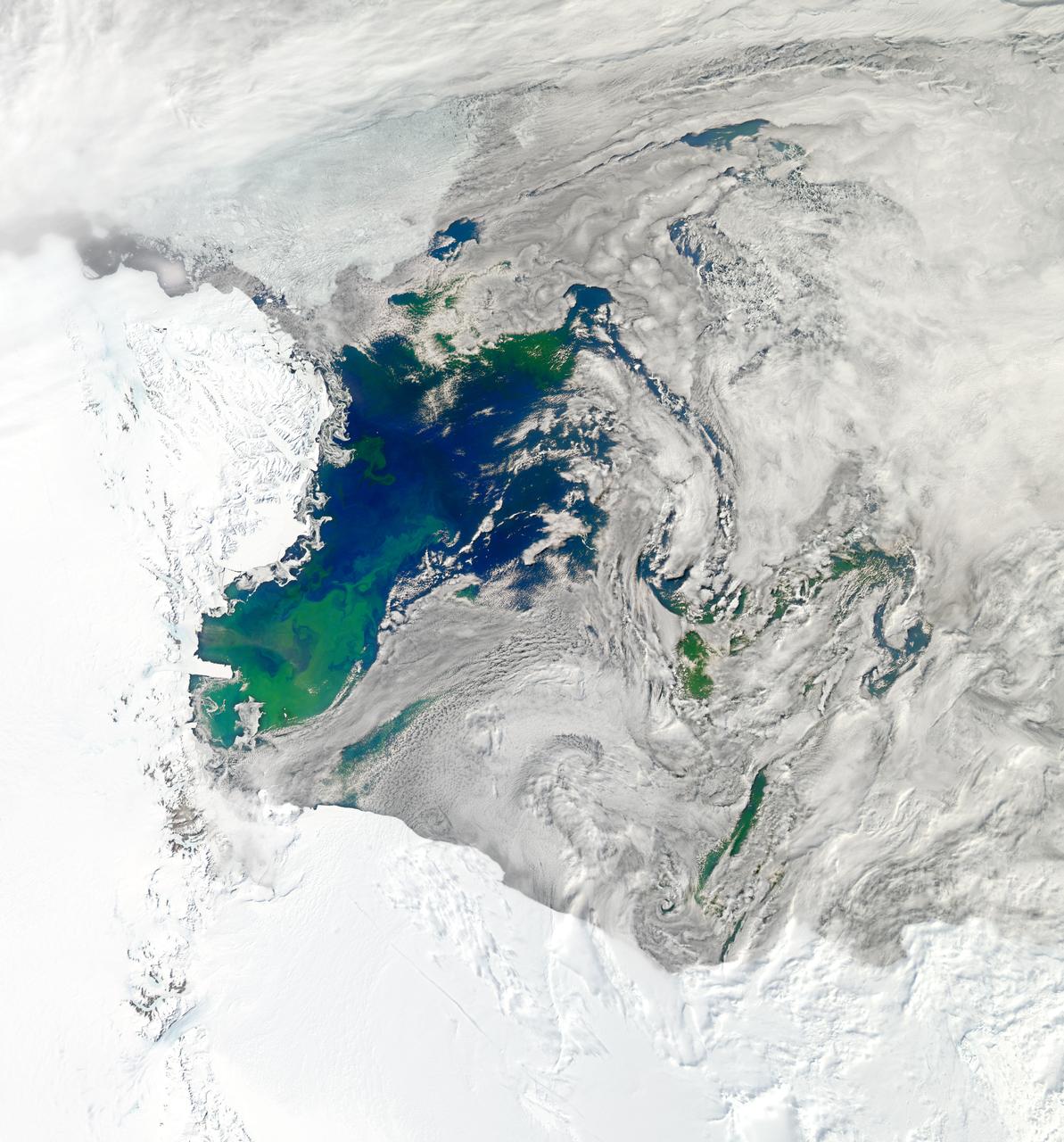
NASA image acquired January 22, 2011 To see a detail of this image go to: <a href="http://www.flickr.com/photos/gsfc/5398237910">www.flickr.com/photos/gsfc/5398237910</a> Every southern spring and summer, after the Sun has risen into its 24-hour circuit around the skies of Antarctica, the Ross Sea bursts with life. Floating, microscopic plants, known as phytoplankton, soak up the sunlight and the nutrients stirring in the Southern Ocean and grow into prodigious blooms. Those blooms become a great banquet for krill, fish, penguins, whales, and other marine species who carve out a living in the cool waters of the far south. This true-color image captures such a bloom in the Ross Sea on January 22, 2011, as viewed by the Moderate Resolution Imaging Spectroradiometer (MODIS) on NASA’s Aqua satellite. Bright greens of plant-life have replaced the deep blues of open ocean water. The Ross Sea is a relatively shallow bay in the Antarctic coastline and due south from New Zealand. As the spring weather thaws the sea ice around Antarctica, areas of open water surrounded by ice—polynyas—open up on the continental shelf. In this open water, sunlight provides the fuel and various current systems provide nutrients from deeper waters to form blooms that can stretch 100 to 200 kilometers (60 to 120 miles). These blooms are among the largest in extent and abundance in the world. Scientists have hypothesized that the Modified Circumpolar Deep Water is the engine behind the blooms, stirring up just the right mix of trace metals and minerals from the deep to sustain plankton growth. This month, researchers aboard the U.S. icebreaking ship Nathaniel B. Palmer are cruising in the Ross Sea in search of the signatures of this current system. NASA image courtesy Norman Kuring, Ocean Color Team at NASA Goddard Space Flight Center. Caption by Mike Carlowicz, with information from Hugh Powell, COSEE-NOW. Instrument: Aqua - MODIS Credit: <b><a href="http://www.earthobservatory.nasa.gov/" rel="nofollow"> NASA Earth Observatory</a></b> <a href="http://earthobservatory.nasa.gov/IOTD/view.php?id=48949" rel="nofollow">earthobservatory.nasa.gov/IOTD/view.php?id=48949</a> <b><a href="http://www.nasa.gov/centers/goddard/home/index.html" rel="nofollow">NASA Goddard Space Flight Center</a></b> enables NASA’s mission through four scientific endeavors: Earth Science, Heliophysics, Solar System Exploration, and Astrophysics. Goddard plays a leading role in NASA’s accomplishments by contributing compelling scientific knowledge to advance the Agency’s mission. <b>Follow us on <a href="http://twitter.com/NASA_GoddardPix" rel="nofollow">Twitter</a></b> <b>Join us on <a href="http://www.facebook.com/pages/Greenbelt-MD/NASA-Goddard/395013845897?ref=tsd" rel="nofollow">Facebook</a></b>
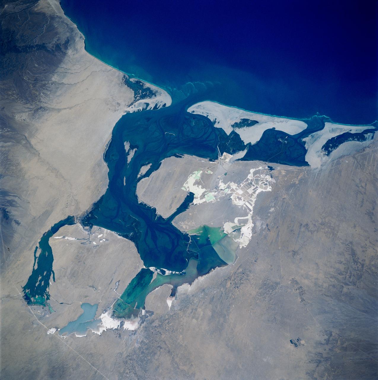
STS083-749-084 (4-8 April 1997) --- Laguna Oja De Liebre, Baja, gray whale breeding ground Laguna Oja De Liebre, Baja (Scammons Lagoon) is located on the west coast in the plains of the central Baja. This lagoon and others like it along the Baja coast are used for breeding grounds for the gray whale. One group of gray whales inhabits the Sea of Okhotsk in summer, migrating south in winter then breed off southern Korea. The other summers in the Bering and Chukchi seas and travels south to winter breeding grounds along the coast of Baja California. The gray whale was hunted almost to extinction by 1925 but was placed under complete international protection and since the 1940s has increased in numbers. The white grids seen in the photo are commercial salt ponds.
NASA image acquired January 22, 2011 To view the full image go to: <a href="http://www.flickr.com/photos/gsfc/5397636843">www.flickr.com/photos/gsfc/5397636843</a> Every southern spring and summer, after the Sun has risen into its 24-hour circuit around the skies of Antarctica, the Ross Sea bursts with life. Floating, microscopic plants, known as phytoplankton, soak up the sunlight and the nutrients stirring in the Southern Ocean and grow into prodigious blooms. Those blooms become a great banquet for krill, fish, penguins, whales, and other marine species who carve out a living in the cool waters of the far south. This true-color image captures such a bloom in the Ross Sea on January 22, 2011, as viewed by the Moderate Resolution Imaging Spectroradiometer (MODIS) on NASA’s Aqua satellite. Bright greens of plant-life have replaced the deep blues of open ocean water. The Ross Sea is a relatively shallow bay in the Antarctic coastline and due south from New Zealand. As the spring weather thaws the sea ice around Antarctica, areas of open water surrounded by ice—polynyas—open up on the continental shelf. In this open water, sunlight provides the fuel and various current systems provide nutrients from deeper waters to form blooms that can stretch 100 to 200 kilometers (60 to 120 miles). These blooms are among the largest in extent and abundance in the world. Scientists have hypothesized that the Modified Circumpolar Deep Water is the engine behind the blooms, stirring up just the right mix of trace metals and minerals from the deep to sustain plankton growth. This month, researchers aboard the U.S. icebreaking ship Nathaniel B. Palmer are cruising in the Ross Sea in search of the signatures of this current system. NASA image courtesy Norman Kuring, Ocean Color Team at NASA Goddard Space Flight Center. Caption by Mike Carlowicz, with information from Hugh Powell, COSEE-NOW. Instrument: Aqua - MODIS For more info go to: <a href="http://earthobservatory.nasa.gov/IOTD/view.php?id=48949" rel="nofollow">earthobservatory.nasa.gov/IOTD/view.php?id=48949</a> Credit: <b><a href="http://www.earthobservatory.nasa.gov/" rel="nofollow"> NASA Earth Observatory</a></b> <b><a href="http://www.nasa.gov/centers/goddard/home/index.html" rel="nofollow">NASA Goddard Space Flight Center</a></b> enables NASA’s mission through four scientific endeavors: Earth Science, Heliophysics, Solar System Exploration, and Astrophysics. Goddard plays a leading role in NASA’s accomplishments by contributing compelling scientific knowledge to advance the Agency’s mission. <b>Follow us on <a href="http://twitter.com/NASA_GoddardPix" rel="nofollow">Twitter</a></b> <b>Join us on <a href="http://www.facebook.com/pages/Greenbelt-MD/NASA-Goddard/395013845897?ref=tsd" rel="nofollow">Facebook</a></b>

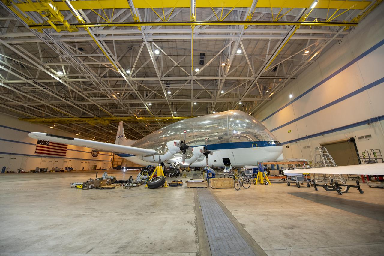
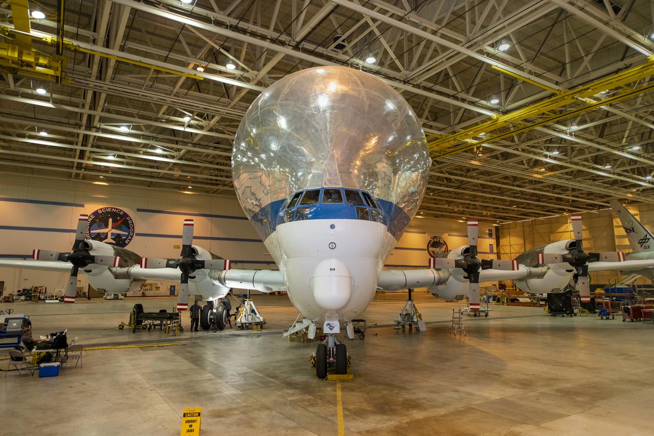
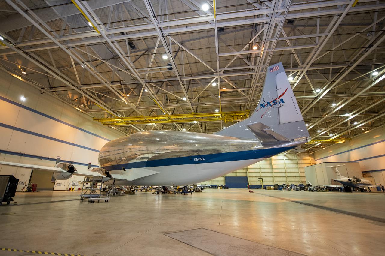
NASA's Super Guppy Turbine cargo aircraft in the hangar at NASA's Armstrong Flight Research Center on August 24, 2021. This unique whale-like aircraft arrived at the center's Building 703 in Palmdale, CA to support crews in the performance of routine maintenance. The Super Guppy aircraft, operated by NASA's Johnson Space Center, aids in the transportation of oversized aerospace cargo in a practical and economical way.
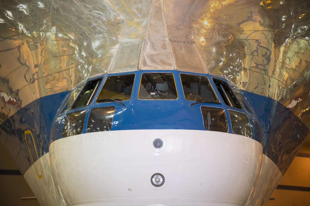
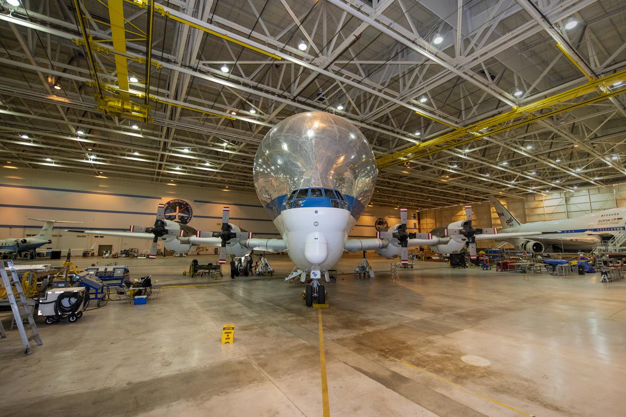
NASA's Super Guppy Turbine cargo aircraft in the hangar at NASA's Armstrong Flight Research Center on August 24, 2021. This unique whale-like aircraft arrived at the center's Building 703 in Palmdale, CA to support crews in the performance of routine maintenance. The Super Guppy aircraft, operated by NASA's Johnson Space Center, aids in the transportation of oversized aerospace cargo in a practical and economical way.
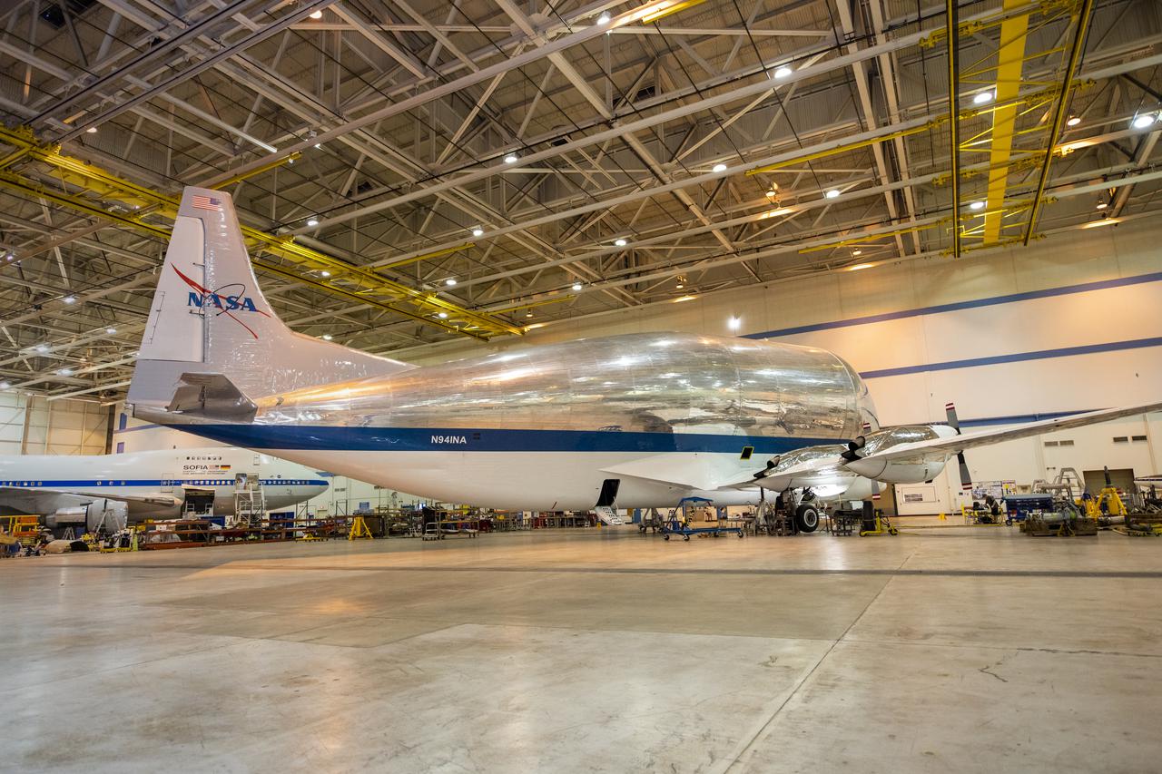
NASA's Super Guppy Turbine cargo aircraft in the hangar at NASA's Armstrong Flight Research Center on August 24, 2021. This unique whale-like aircraft arrived at the center's Building 703 in Palmdale, CA to support crews in the performance of routine maintenance. The Super Guppy aircraft, operated by NASA's Johnson Space Center, aids in the transportation of oversized aerospace cargo in a practical and economical way.
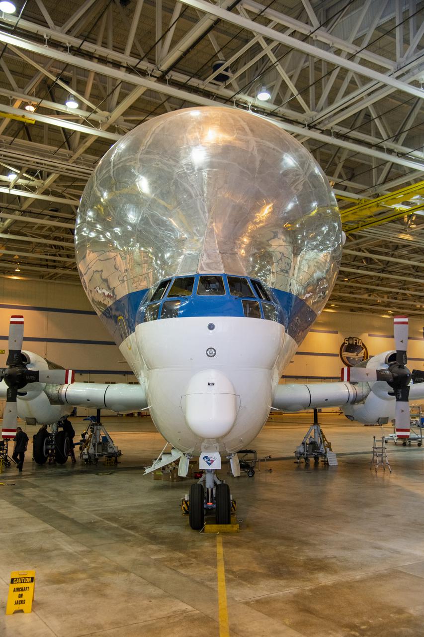
NASA’s Super Guppy Turbine cargo aircraft in the hangar at NASA’s Armstrong Flight Research Center on August 24, 2021. This unique whale-like aircraft arrived at the center’s Building 703 in Palmdale, CA to support crews in the performance of routine maintenance. The Super Guppy aircraft, operated by NASA’s Johnson Space Center, aids in the transportation of oversized aerospace cargo in a practical and economical way.
NASA's Super Guppy Turbine cargo aircraft in the hangar at NASA's Armstrong Flight Research Center on August 24, 2021. This unique whale-like aircraft arrived at the center's Building 703 in Palmdale, CA to support crews in the performance of routine maintenance. The Super Guppy aircraft, operated by NASA's Johnson Space Center, aids in the transportation of oversized aerospace cargo in a practical and economical way.
NASA’s Super Guppy Turbine cargo aircraft in the hangar at NASA’s Armstrong Flight Research Center on August 24, 2021. This unique whale-like aircraft arrived at the center’s Building 703 in Palmdale, CA to support crews in the performance of routine maintenance. The Super Guppy aircraft, operated by NASA’s Johnson Space Center, aids in the transportation of oversized aerospace cargo in a practical and economical way.
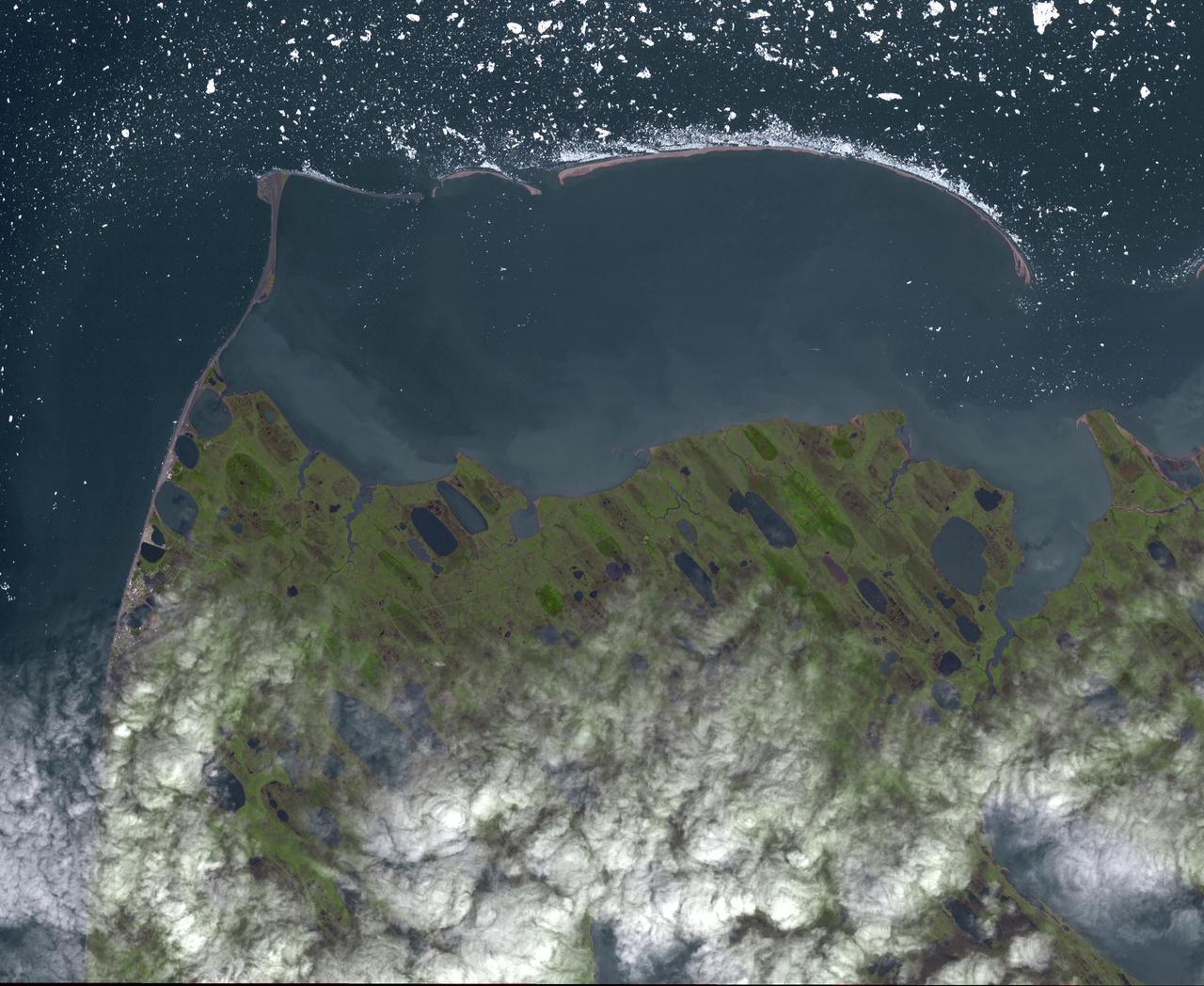
Point Barrow or Nuvuk, Alaska is the northernmost point of all territory of the United States. It also marks the limit between the Chukchi Sea to the west, and the Beaufort Sea to the east. Archaeological evidence indicates that Point Barrow was occupied about 500 CE, probably as hunting camps for whales. The image covers an area of 32 by 38 km, was acquired July 29, 2015, and is located at 71.6 degrees north, 156.45 degrees west. http://photojournal.jpl.nasa.gov/catalog/PIA19775

STS073-745-055 (2 November 1995) --- This photograph in color infrared highlights the different vegetation zones on the island of Maui, Hawaii. The dark red tropical forests live on the steep volcanic slopes on the north side of the island, and the fertile lowlands support large sugar cane plantations, which are the red and black checkered pattern. The Wailuku and Kahului area near the center on the north shore of the island was formerly a whaling center. Much of the eastern part of the island is Haleakala National Park, including the spectacular Haleakala Crater (under clouds).
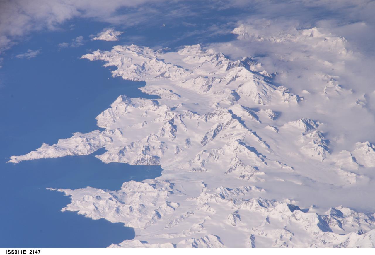
ISS011-E-12147 (26 Aug. 2005) --- South Georgia Island is featured in this image photographed by an Expedition 11 crewmember on the International Space Station. There is no permanent human base on South Georgia Island, a British territory in the South Atlantic Ocean that lies 1300 kilometers east of the Falkland Islands. Using a long lens (800 mm focal length) and positioned for an oblique view, the crew of the international space station was able to capture the rugged and isolated landscape of the northern shore of the island. The high mountains protect the north and eastern coast of the island from the prevailing gales coming from Antarctica and the west. The steep topography also makes deep embayments along the coast that provide habitat for wildlife and anchorages for whaling ships. The island supports major rookeries of penguins and albatrosses, and large seal populations. This view centers on Mt. Paget and Cumberland Bay. The former whaling station Grytviken is located within the bay. The encampment supports the scientific base for the British Antarctic Survey and Bird Island Research Station.
This image of Pluto was taken by New Horizons' Long Range Reconnaissance Imager (LORRI) at 4:18 UT on July 9, 2015, from a range of 3.9 million miles (6.3 million kilometers). It reveals new details on the surface of Pluto, including complex patterns in the transition between the very dark equatorial band (nicknamed "the whale"), which occupies the lower part of the image, and the brighter northern terrain. The bright arc at the bottom of the disk shows that there is more bright terrain beyond the southern margin of the "whale." The side of Pluto that will be studied in great detail during the close encounter on July 14 is now rotating off the visible disk on the right hand side, and will not be seen again until shortly before closest approach. Three consecutive images were combined and sharpened, using a process called deconvolution, to create this view. Deconvolution enhances real detail but can also generate spurious features, including the bright edge seen on the upper and left margins of the disk (though the bright margin on the bottom of the disk is real). The wireframe globe shows the orientation of Pluto in the image: thicker lines indicate the equator and the prime meridian (the direction facing Charon). Central longitude on Pluto is 86°. http://photojournal.jpl.nasa.gov/catalog/PIA19705
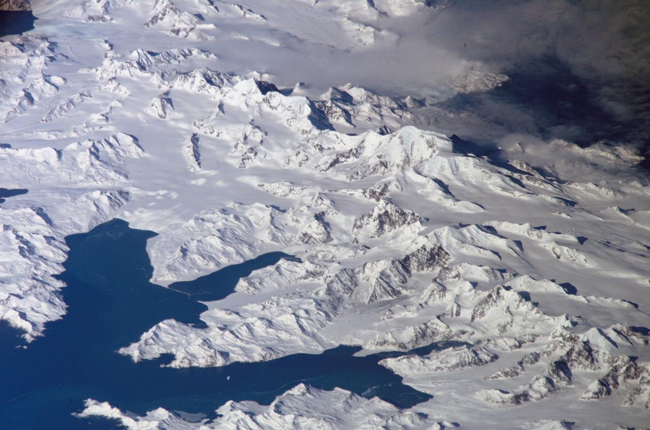
ISS011-E-12148 (26 August 2005) --- South Georgia Island is featured in this image photographed by an Expedition 11 crewmember on the international space station. There is no permanent human base on South Georgia Island, a British territory in the South Atlantic Ocean that lies 1300 kilometers east of the Falkland Islands. Using a long lens (800 mm focal length) and positioned for an oblique view, the crew of the international space station was able to capture the rugged and isolated landscape of the northern shore of the island. The high mountains protect the north and eastern coast of the island from the prevailing gales coming from Antarctica and the west. The steep topography also makes deep embayments along the coast that provide habitat for wildlife and anchorages for whaling ships. The island supports major rookeries of penguins and albatrosses, and large seal populations. This view centers on Mt. Paget and Cumberland Bay. The former whaling station Grytviken is located within the bay. The encampment supports the scientific base for the British Antarctic Survey and Bird Island Research Station.
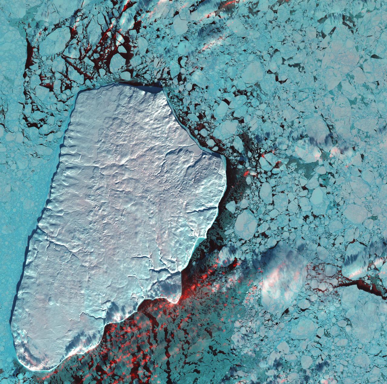
January 1st, 2001: Description: Akpatok Island lies in Ungava Bay in northern Quebec, Canada. Accessible only by air, Akpatok Island rises out of the water as sheer cliffs that soar 500 to 800 feet (150 to 243m) above the sea surface. The island is an important sanctuary for cliff-nesting seabirds. Numerous ice floes around the island attract walrus and whales, making Akpatok a traditional hunting ground for native Inuit people. Source: Landsat 7 To learn more about the Landsat satellite go to: <a href="http://landsat.gsfc.nasa.gov/" rel="nofollow">landsat.gsfc.nasa.gov/</a>
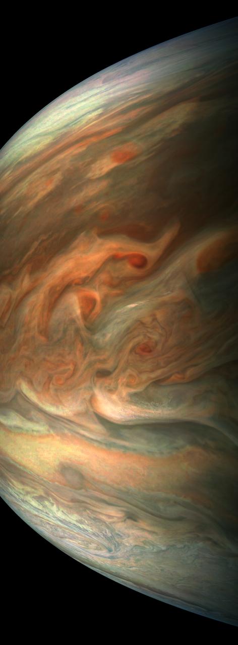
This striking image of Jupiter was captured by NASA's Juno spacecraft as it performed its eighth flyby of the gas giant planet. The image was taken on Sept. 1, 2017 at 2:58 p.m. PDT (5:58 p.m. EDT). At the time the image was taken, the spacecraft was 4,707 miles (7,576 kilometers) from the tops of the clouds of the planet at a latitude of about -17.4 degrees. Citizen scientist Gerald Eichstädt processed this image using data from the JunoCam imager. Points of interest are "Whale's Tail" and "Dan's Spot." https://photojournal.jpl.nasa.gov/catalog/PIA21966. - Enhanced image by Gerald Eichstädt based on images provided courtesy of NASA/JPL-Caltech/SwRI/MSSS

KENNEDY SPACE CENTER, FLA. -- NASA's "Super Guppy" aircraft arrives in KSC air space escorted by two T-38 aircraft after leaving Marshall Space Flight Center in Huntsville, Ala. The whale-like airplane carries the U.S. Laboratory module, considered the centerpiece of the International Space Station. The module will undergo final pre-launch preparations at KSC's Space Station Processing Facility. Scheduled for launch aboard the Shuttle Endeavour on mission STS-98, the laboratory comprises three cylindrical sections with two end cones. Each end-cone contains a hatch opening for entering and exiting the lab. The lab will provide a shirtsleeve environment for research in such areas as life science, microgravity science, Earth science and space science. Designated Flight 5A, this mission is targeted for launch in early 2000
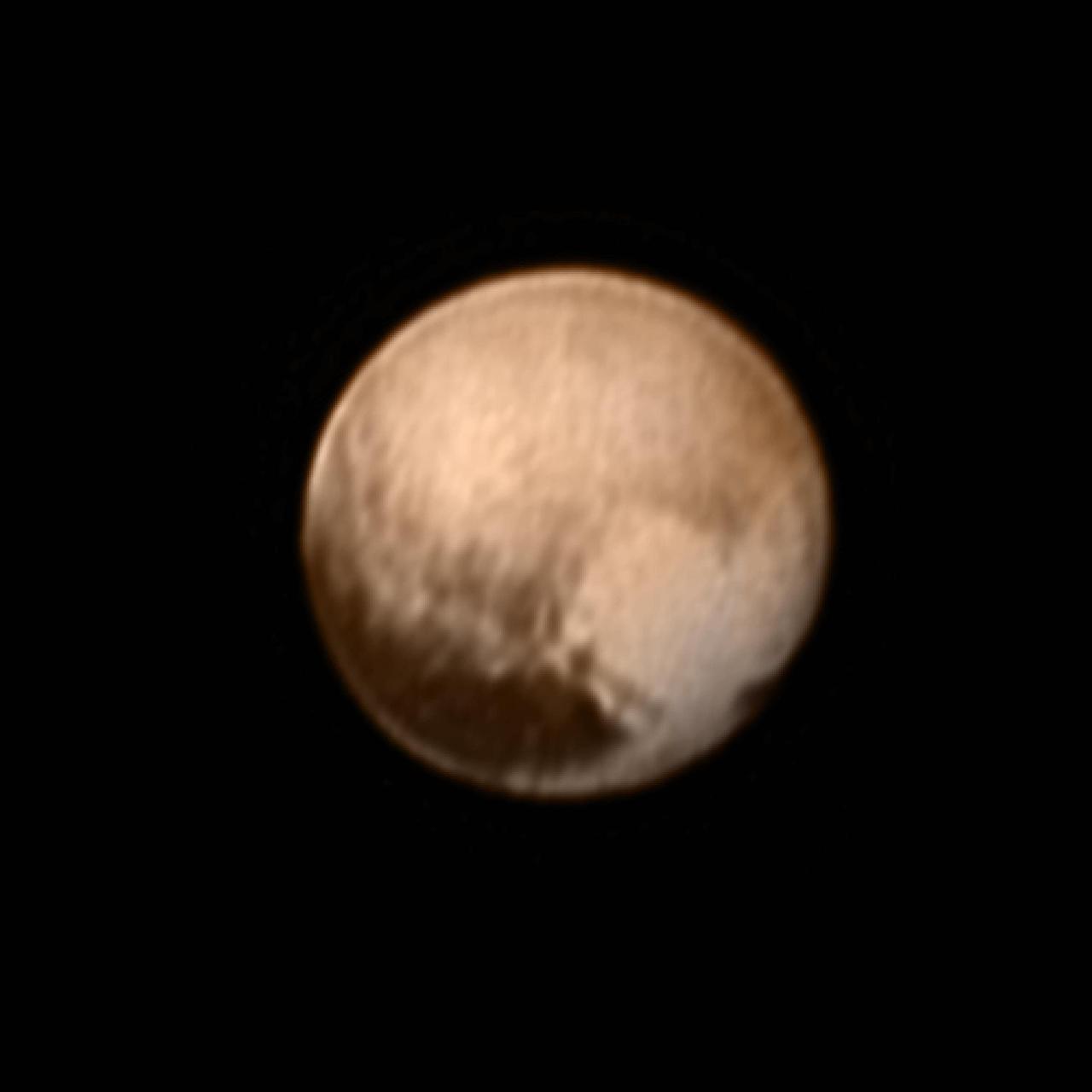
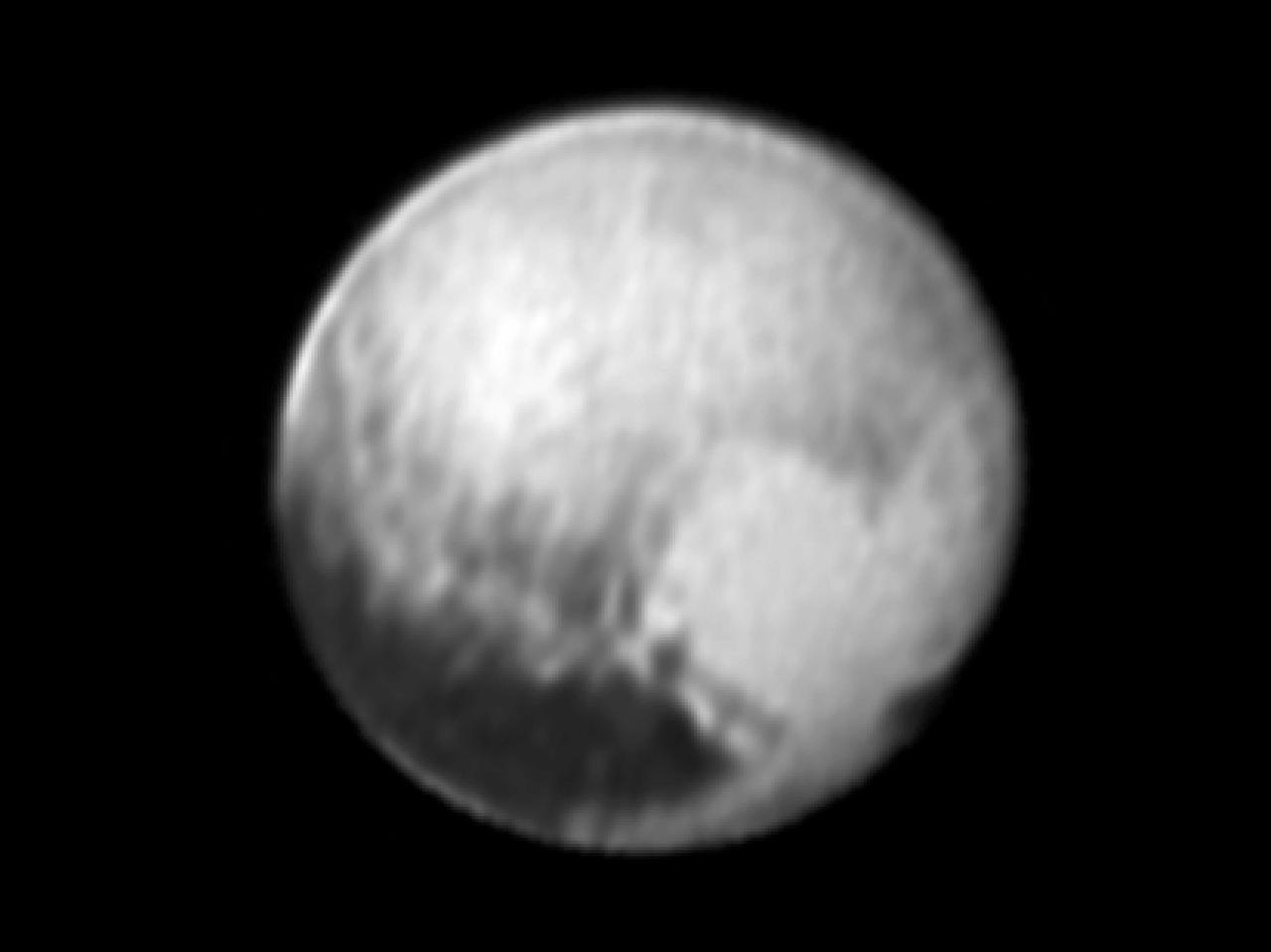
In the early morning hours of July 8, 2015, mission scientists received this new view of Pluto -- the most detailed yet returned by the Long Range Reconnaissance Imager (LORRI) aboard New Horizons. The image was taken on July 7, when the NASA spacecraft was just under 5 million miles (8 million kilometers) from Pluto, and is the first to be received since the July 4 anomaly that sent the spacecraft into safe mode. This view is centered roughly on the area that will be seen close-up during New Horizons' July 14 closest approach. This side of Pluto is dominated by three broad regions of varying brightness. Most prominent are an elongated dark feature at the equator, informally known as "the whale," and a large heart-shaped bright area measuring some 1,200 miles (2,000 kilometers) across on the right. Above those features is a polar region that is intermediate in brightness. http://photojournal.jpl.nasa.gov/catalog/PIA19702

S88-E-5161 (12-14-98) --- Before beginning their pre-sleep period on their next to last day in space, the STS-88 astronauts deployed a small 590-pound satellite called SAC-A for the Argentinean National Committee of Space Activities. Equipped with five technology experiments, including one to track the movement of whales off the coast of Argentina, SAC-A was ejected from a canister in Endeavour's cargo bay at 10:31 p.m. Central time as the shuttle few over the northern Indian Ocean. The satellite is expected to remain in orbit from five to nine months sending back data to Argentine researchers back on Earth. The photo was taken with an electronic still camera (ESC) at 04:35:48 GMT, Dec. 14.
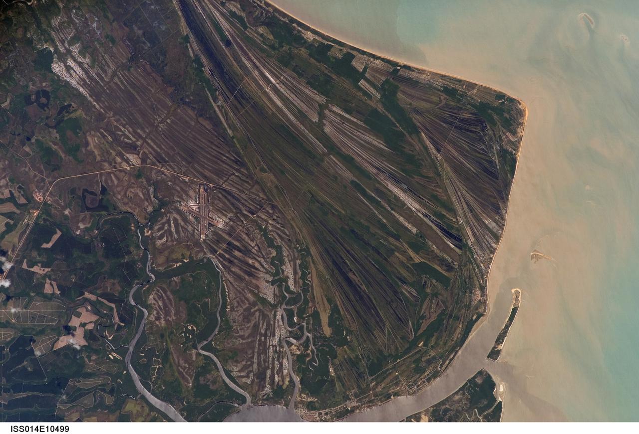
ISS014-E-10499 (23 Dec. 2006) --- Caravelas strandplain, Bahia Province, Brazil is featured in this image photographed by an Expedition 14 crewmember on the International Space Station. This view highlights a flat coastal landform known as a strandplain, or ancient shoreline. The image is dominated by numerous, fine parallel lines (trending diagonally from upper left to lower right), each of which is an ancient shoreline made up of sand transported from rivers to the north. The strandplain has been generated by these narrow shorelines accumulating against one another, line by line in their dozens or even hundreds, over thousands of years. The shorelines can be grouped into at least four packets depending on the crosscutting relationships - younger packets will cut into or stratigraphically overlay older packets. These relationships indicate that the youngest packet lies nearest the coast (furthest right) and the oldest packet lies north of the city of Caravelas (bottom). The Caravelas River flows into the Atlantic Ocean at the bottom of the view. Sediment from this river, and from the current shoreline, produces the light browns and dun colors visible offshore. On the day this image was taken the river water was relatively clear; clear water (gray) is visible flowing out of the main river mouth, and also off to one side to the south over a levee. The Caravelas airport appears near the middle of the view, and is built on one of the ancient shoreline packets. Caravelas itself, a fishing town of about 20,000 inhabitants, lies on an estuary and was once a flourishing whaling center--the prominent cape at top right is known as Ponta da Baleia (Whale Point).
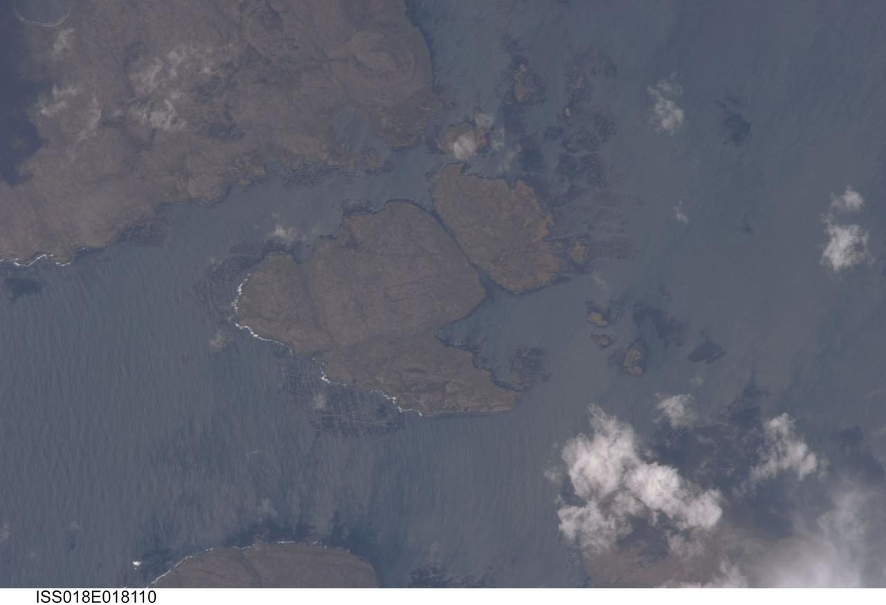
ISS018-E-018110 (6 Jan. 2009) --- Kerguelen Kelp Beds in the Southern Indian Ocean are featured in this image photographed by an Expedition 18 crewmember on the International Space Station. MacMurdo and Howe Islands are two of the 300 islands of the Kerguelen Archipelago, a remote place located in the Southern Indian Ocean that belongs to the French Southern and Antarctic Lands. The Kerguelen Archipelago is also known as the "Desolation Islands". The coastal regions of the islands support low vegetation (mainly genus Acaena), while elevations above 50 meters are rocky. There are no permanent inhabitants of the islands, but there is a permanent settlement (Port aux Francais) that hosts scientists mainly interested in biology, oceanography and earth sciences ? in addition, the settlement maintains a weather station and satellite/rocket tracking station. Latitudinal weather conditions are typical from the ?roaring forties? through the ?furious fifties? - on the day this image was taken, the mean daily temperature was 4.5 degrees Celsius with mean westerly winds of 9 meters per second. A substantial proportion of the coastlines of sub-Antarctic islands, like the Kerguelen Islands, are occupied by highly productive giant kelp beds (Macrocystis pyrifera). One of the largest marine macroalgaes, the species can grow up to 50 meters in length, forming undersea forests in hard-bottom subtidal areas. Fronds can spread out to form a canopy which can totally cover the water surface ? we interpret that the black patches surrounding coastal areas in this astronaut photograph are the offshore kelp beds. These forests serve as a habitat for marine fauna, and due to their large biomass and relatively long turnover act as an efficient sink for atmospheric carbon dioxide. The surface wave pattern traveling southeastward along the gray-blue ocean surface, and through the kelp beds, are visible due to the sunglint from the water surface. This also improves the identification of the kelp beds by creating a different water texture (and therefore a contrast) between the dark vegetation and the ocean surface. Kerguelen Archipelago hosts thousands of marine birds (penguins, albatrosses, and petrels among others) and seals (elephant and Antarctic fur species). Whales (humpback) and dolphins (killer whales and Commerson's dolphin) are very common in the area. Fishing boats also frequent the Archipelago ? including unlicensed, so-called ?pirate? fishing vessels.
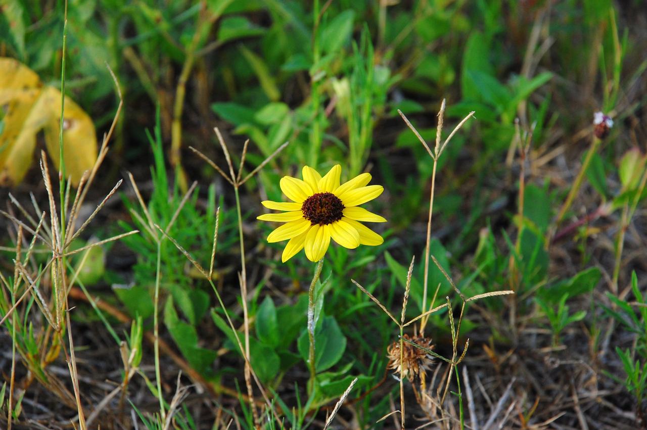
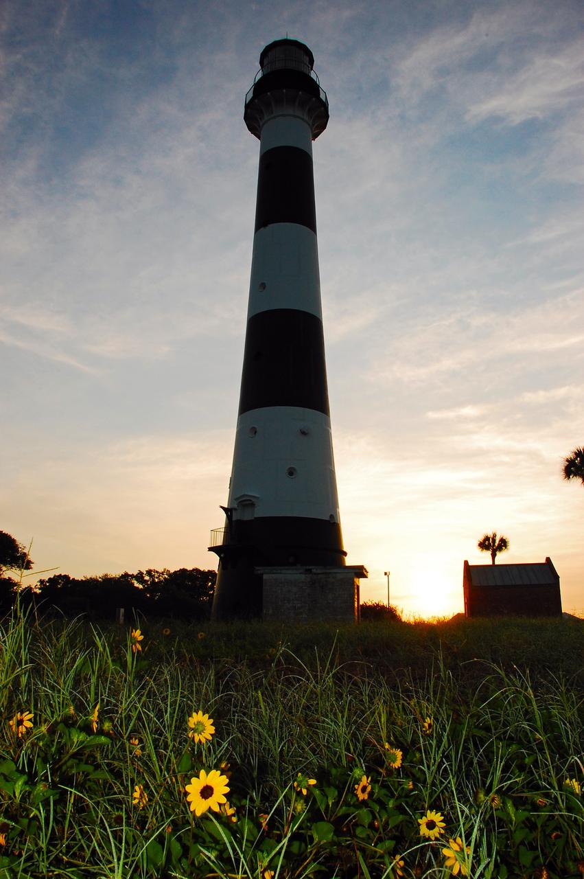
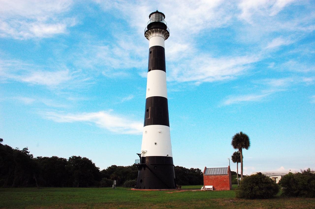
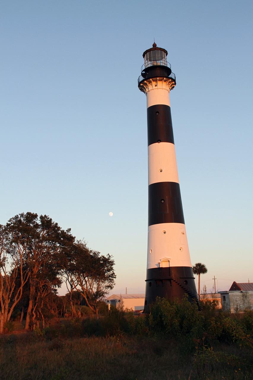
CAPE CANAVERAL, Fla. -- A daisy thrives amidst the natural vegetation surrounding the historic Cape Canaveral Light on Cape Canaveral Air Force Station in Florida. The lighthouse currently is owned by the U.S. Air Force. The first lighthouse on Cape Canaveral was built near the tip of the Cape in 1848. The structure was only about 60 feet high with a rather dim light powered by whale oil. In 1859, work began nearby on a new, taller iron structure. Construction was halted during the Civil War, and the lighthouse was not finished until 1868. The structure, with a brick lining inside its iron exterior, was painted with its "daymark" black and white horizontal bands in 1873 to make it easier to identify during the day as a navigation point. Between 1892 and 1894, the lighthouse was dismantled and moved to a new location about a mile from the coast, where it stands today. For more information on the lighthouse, visit http://www.nasa.gov/centers/kennedy/about/history/lighthouse.html. Photo credit: NASA/Ben Smegelsky
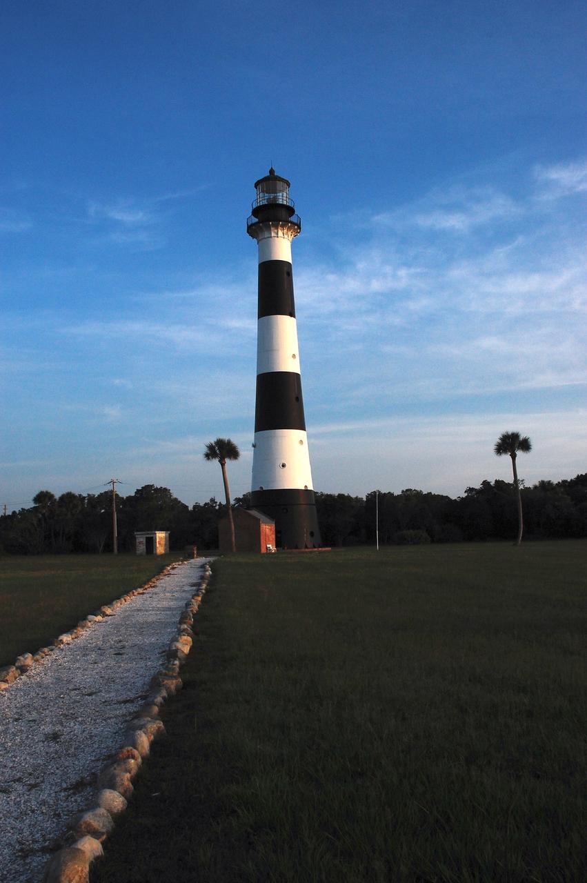
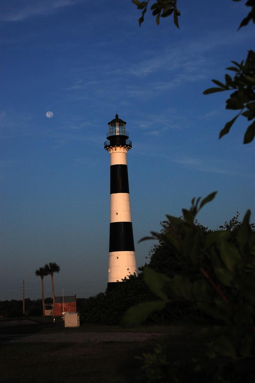
Cape Canaveral Air Force Station, Fla. -- A warm glow envelopes the Cape Canaveral Lighthouse as dawn breaks over the Cape.. The Canaveral light is the only operating lighthouse owned by the U.S. Air Force. In 2000, the Coast Guard transferred ownership of the lighthouse structure and its grounds to the Air Force, which is now responsible for maintaining it. The U.S. Coast Guard continues to operate the modern first-order beacon as an active navigational aid. The first lighthouse at Cape Canaveral was built near the tip of the Cape in 1848. The structure was only about 60 feet high with a rather dim light powered by whale oil. In 1859, work began nearby on a new, taller iron structure. Construction was halted during the Civil War, and the lighthouse finally was finished in 1868. The structure, with a brick lining inside its iron exterior, was painted with its "daymark" black and white horizontal bands in 1873 to make it easier to identify during the day as a navigation point. Between 1892 and 1894, the lighthouse was dismantled and moved to its new home about a mile from the coast, where it stands today. Photo credit: NASA/Ben Smegelsky
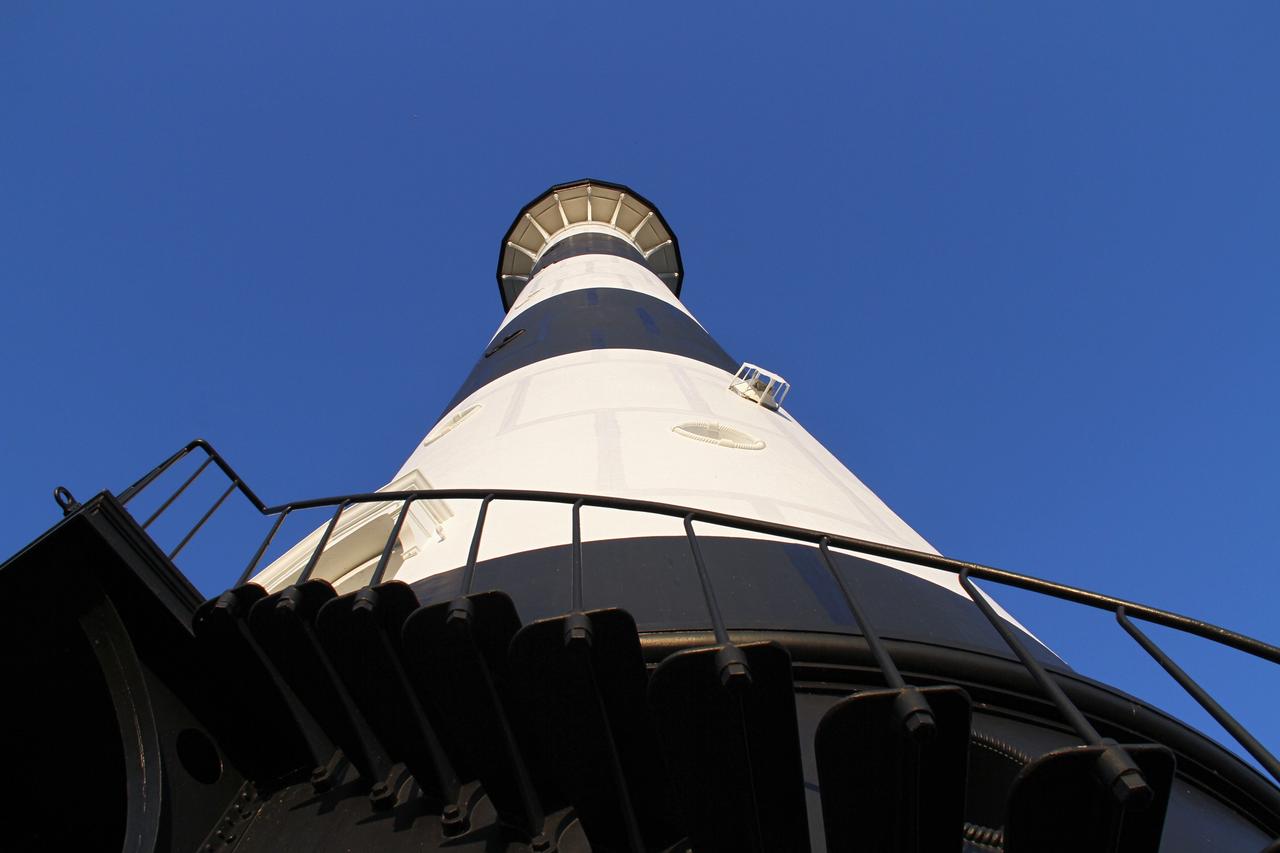
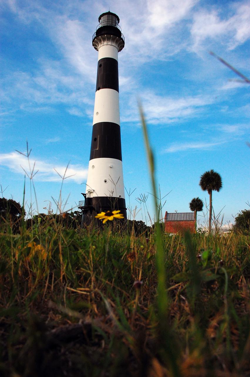
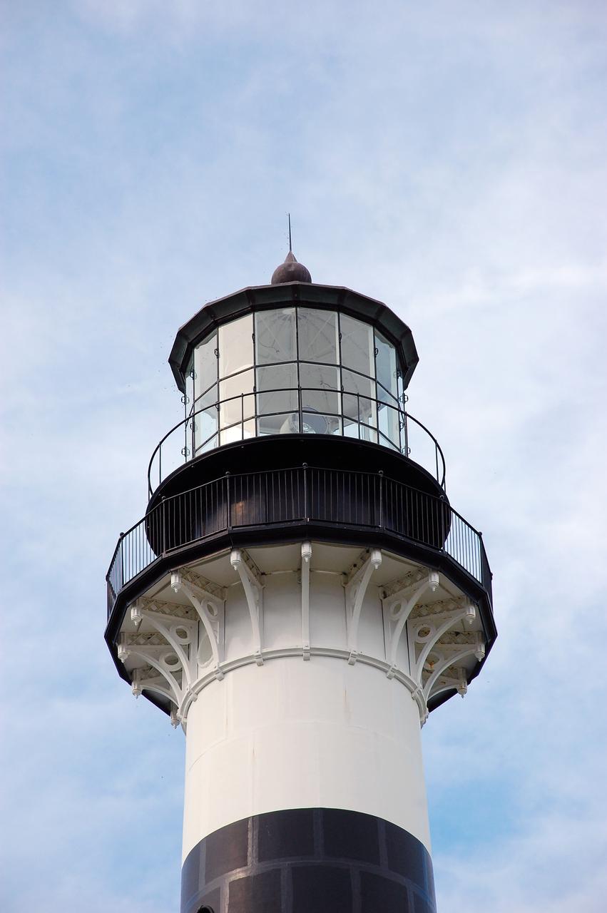
CAPE CANAVERAL AIR FORCE STATION, Fla. – This view looking up contrasts the black and white lighthouse at Cape Canaveral Air Force Station against the Florida sky. The Canaveral light is the only one owned by the U.S. Air Force. In 2000, the Coast Guard transferred ownership of the lighthouse structure and its grounds to the Air Force, which is now responsible for maintaining it. The U.S. Coast Guard continues to operate the beacon as an active navigational aid. The first lighthouse at Cape Canaveral was built near the tip of the Cape in 1848. The structure was only about 60 feet high with a rather dim light powered by whale oil. In 1859, work began nearby on a new, taller iron structure. Construction was halted during the Civil War, and the lighthouse finally was finished in 1868. The structure, with a brick lining inside its iron exterior, was painted with its "daymark" black and white horizontal bands in 1873 to make it easier to identify during the day as a navigation point. Between 1892 and 1894, the lighthouse was dismantled and moved to its new home about a mile from the coast, where it stands today. Photo credit: NASA/Ben Smegelsky
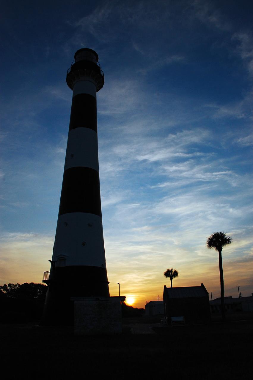
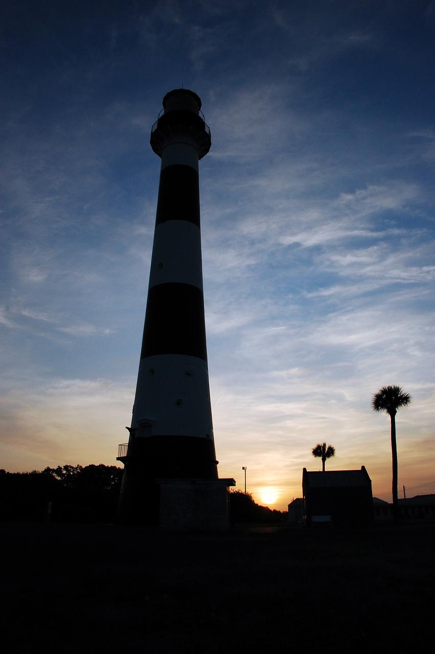
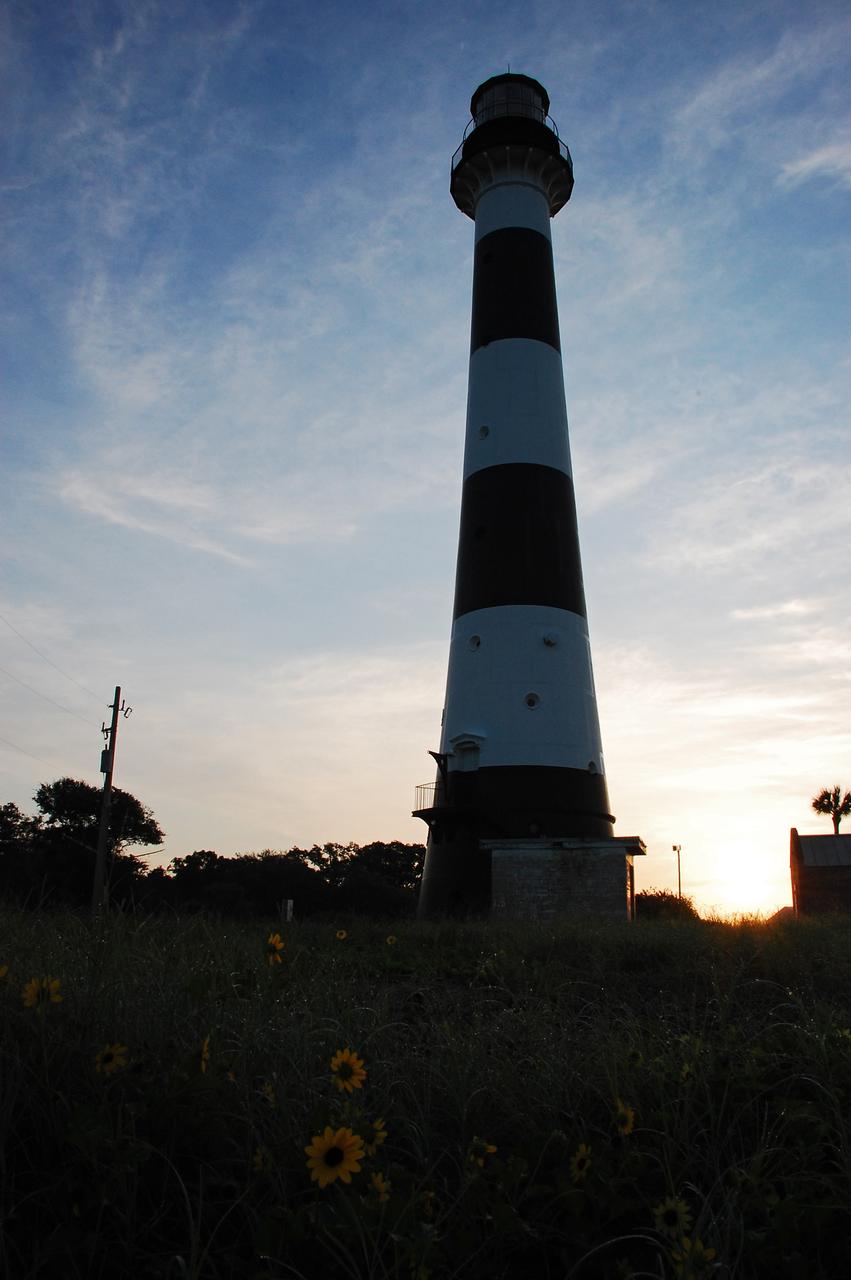
Cape Canaveral Air Force Station, Fla. -- As the sun rises, the Cape Canaveral Lighthouse is silhouetted against the early morning sky. The Canaveral light is the only operating lighthouse owned by the U.S. Air Force. In 2000, the Coast Guard transferred ownership of the lighthouse structure and its grounds to the Air Force, which is now responsible for maintaining it. The U.S. Coast Guard continues to operate the modern first-order beacon as an active navigational aid. The first lighthouse at Cape Canaveral was built near the tip of the Cape in 1848. The structure was only about 60 feet high with a rather dim light powered by whale oil. In 1859, work began nearby on a new, taller iron structure. Construction was halted during the Civil War, and the lighthouse finally was finished in 1868. The structure, with a brick lining inside its iron exterior, was painted with its "daymark" black and white horizontal bands in 1873 to make it easier to identify during the day as a navigation point. Between 1892 and 1894, the lighthouse was dismantled and moved to its new home about a mile from the coast, where it stands today. Photo credit: NASA/Ben Smegelsky
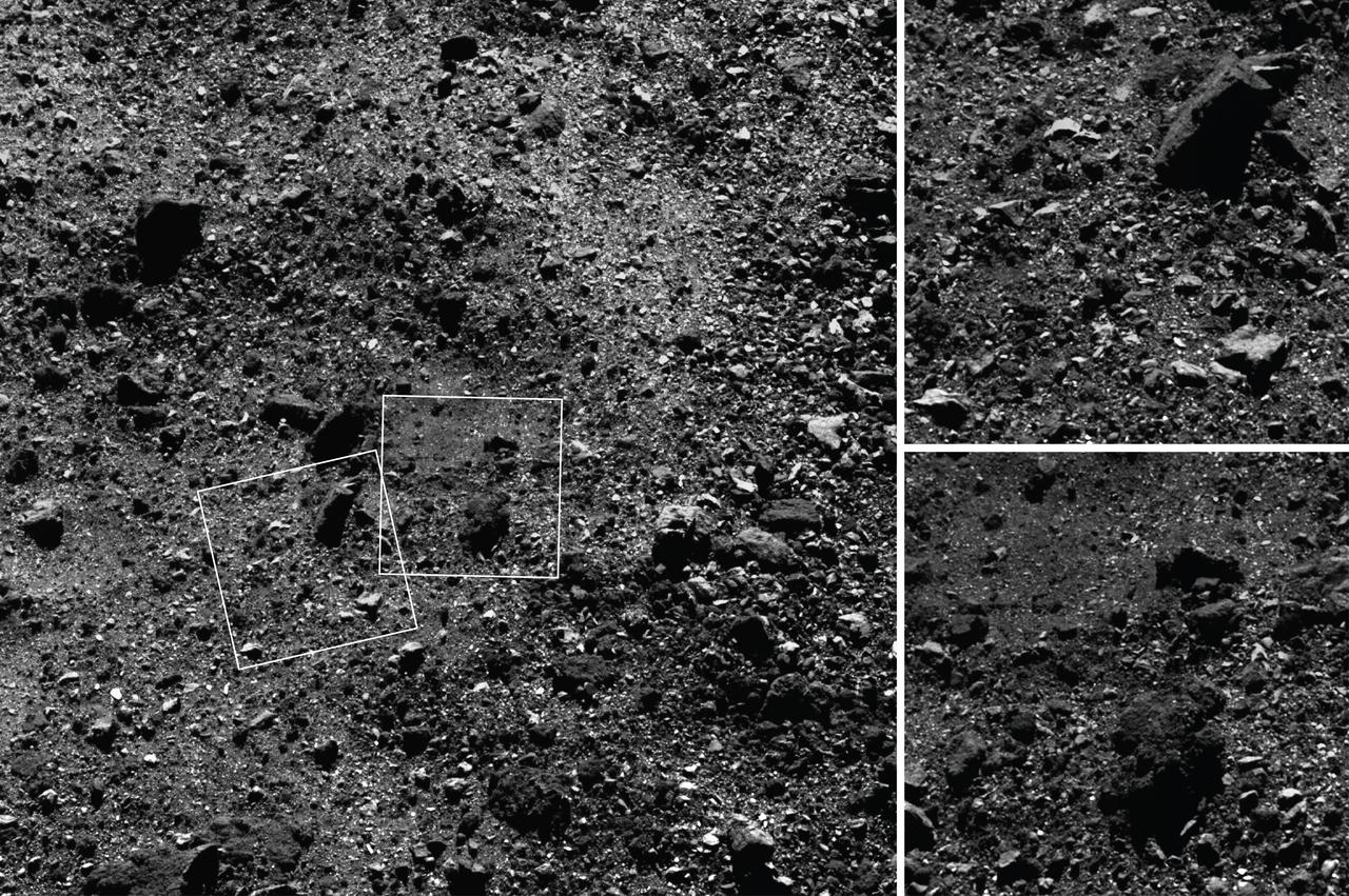
This trio of images acquired by NASA’s OSIRIS-REx spacecraft shows a wide shot and two close-ups of a region in asteroid Bennu’s northern hemisphere. The wide-angle image (left), obtained by the spacecraft’s MapCam camera, shows a 590-foot (180-meter) wide area with many rocks, including some large boulders, and a “pond” of regolith that is mostly devoid of large rocks. The two closer images, obtained by the high-resolution PolyCam camera, show details of areas in the MapCam image, specifically a 50-foot (15 meter) boulder (top) and the regolith pond (bottom). The PolyCam frames are 101 feet (31 meters) across and the boulder depicted is approximately the same size as a humpback whale. The images were taken on February 25 while the spacecraft was in orbit around Bennu, approximately 1.1 miles (1.8 km) from the asteroid’s surface. The observation plan for this day provided for one MapCam and two PolyCam images every 10 minutes, allowing for this combination of context and detail of Bennu’s surface. Credit: NASA/Goddard/University of Arizona
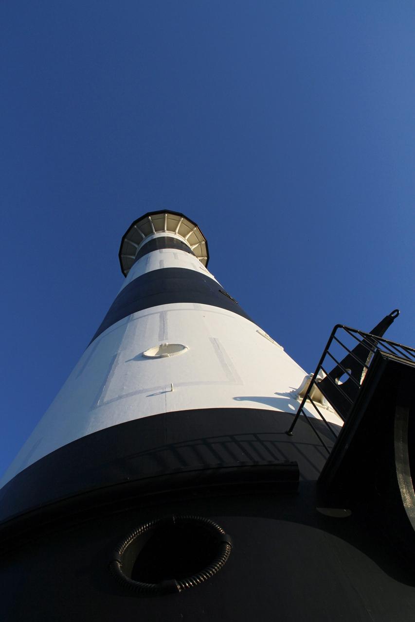
CAPE CANAVERAL AIR FORCE STATION, Fla. – This view looking up contrasts the black and white lighthouse at Cape Canaveral Air Force Station against the Florida sky. The Canaveral light is the only one owned by the U.S. Air Force. In 2000, the Coast Guard transferred ownership of the lighthouse structure and its grounds to the Air Force, which is now responsible for maintaining it. The U.S. Coast Guard continues to operate the beacon as an active navigational aid. The first lighthouse at Cape Canaveral was built near the tip of the Cape in 1848. The structure was only about 60 feet high with a rather dim light powered by whale oil. In 1859, work began nearby on a new, taller iron structure. Construction was halted during the Civil War, and the lighthouse finally was finished in 1868. The structure, with a brick lining inside its iron exterior, was painted with its "daymark" black and white horizontal bands in 1873 to make it easier to identify during the day as a navigation point. Between 1892 and 1894, the lighthouse was dismantled and moved to its new home about a mile from the coast, where it stands today. Photo credit: NASA/Ben Smegelsky
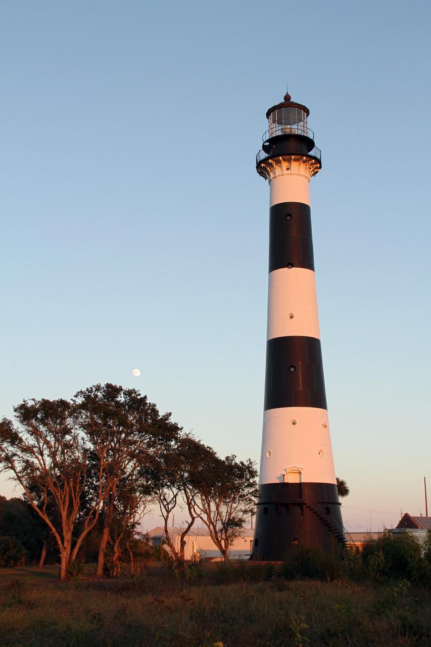
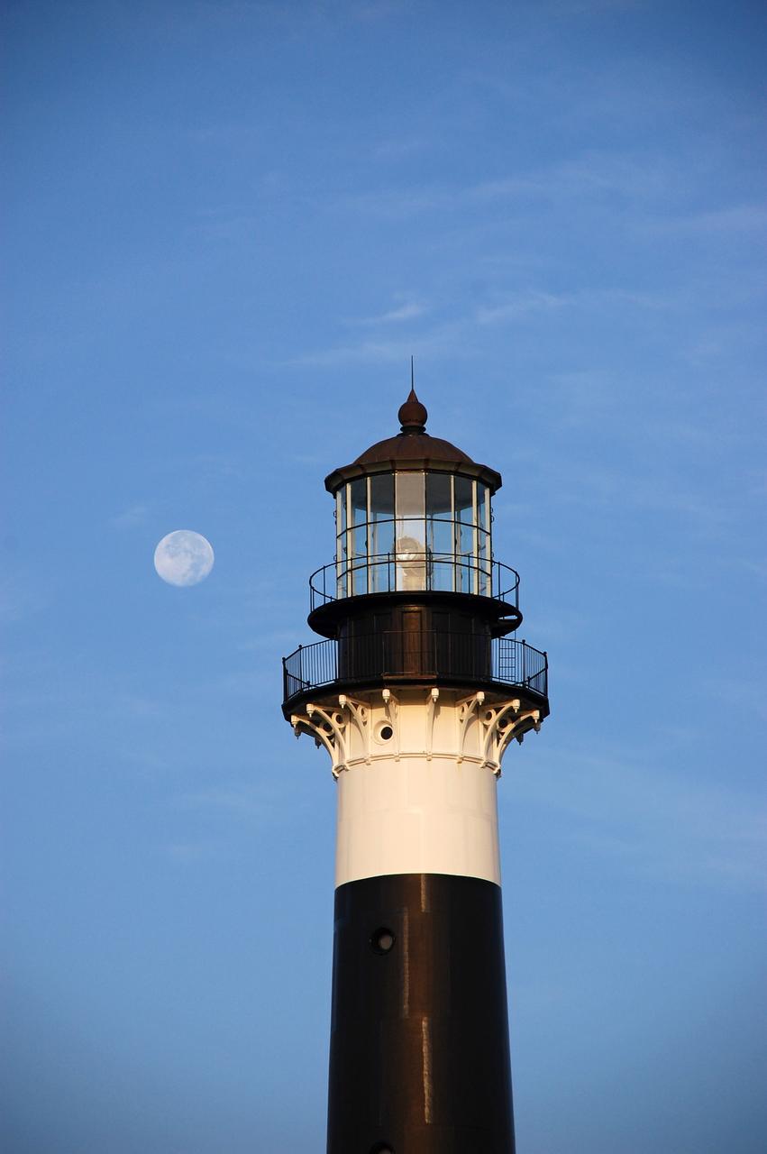
CAPE CANAVERAL AIR FORCE STATION, Fla. – The Cape Canaveral Air Force Station lighthouse takes on a warm glow as dawn breaks and a full moon still shines in the background. The Canaveral light is the only one owned by the U.S. Air Force. In 2000, the Coast Guard transferred ownership of the lighthouse structure and its grounds to the Air Force, which is now responsible for maintaining it. The U.S. Coast Guard continues to operate the beacon as an active navigational aid. The first lighthouse at Cape Canaveral was built near the tip of the Cape in 1848. The structure was only about 60 feet high with a rather dim light powered by whale oil. In 1859, work began nearby on a new, taller iron structure. Construction was halted during the Civil War, and the lighthouse finally was finished in 1868. The structure, with a brick lining inside its iron exterior, was painted with its "daymark" black and white horizontal bands in 1873 to make it easier to identify during the day as a navigation point. Between 1892 and 1894, the lighthouse was dismantled and moved to its new home about a mile from the coast, where it stands today. Photo credit: NASA/Ben Smegelsky
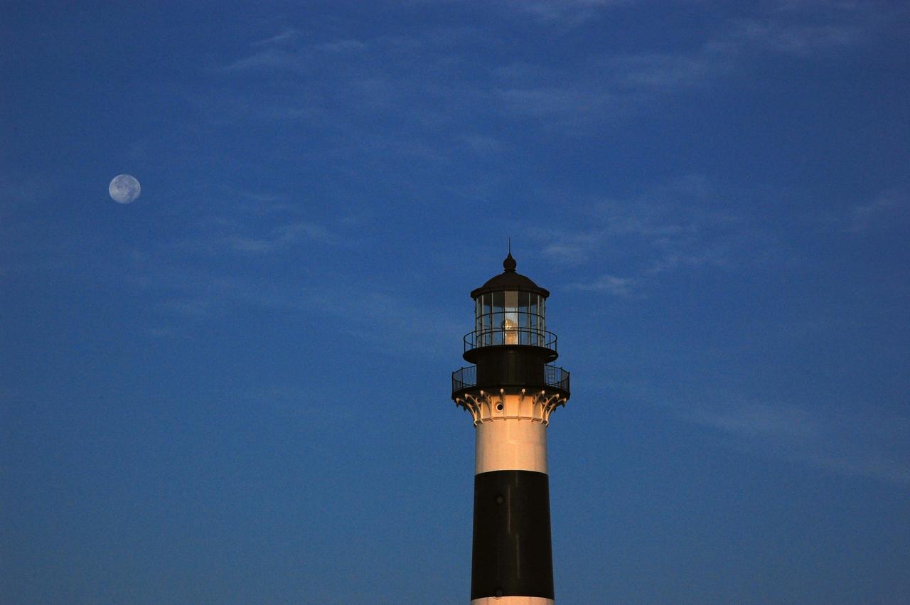
Cape Canaveral Air Force Station, Fla. -- The lantern room of the Cape Canaveral Lighthouse, with its modern first-order optic, takes on a warm glow as dawn breaks and a full moon still shines overhead. The Canaveral light is the only operating lighthouse owned by the U.S. Air Force. In 2000, the Coast Guard transferred ownership of the lighthouse structure and its grounds to the Air Force, which is now responsible for maintaining it. The U.S. Coast Guard continues to operate the beacon as an active navigational aid. The first lighthouse at Cape Canaveral was built near the tip of the Cape in 1848. The structure was only about 60 feet high with a rather dim light powered by whale oil. In 1859, work began nearby on a new, taller iron structure. Construction was halted during the Civil War, and the lighthouse finally was finished in 1868. The structure, with a brick lining inside its iron exterior, was painted with its "daymark" black and white horizontal bands in 1873 to make it easier to identify during the day as a navigation point. Between 1892 and 1894, the lighthouse was dismantled and moved to its new home about a mile from the coast, where it stands today. Photo credit: NASA/Ben Smegelsky
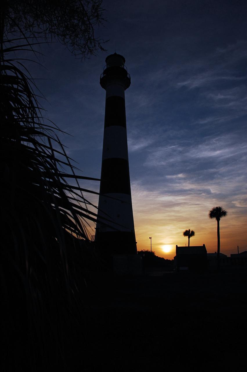
Cape Canaveral Air Force Station, Fla. -- As the sun rises, the Cape Canaveral Lighthouse is silhouetted against the early morning sky. The Canaveral light is the only operating lighthouse owned by the U.S. Air Force. In 2000, the Coast Guard transferred ownership of the lighthouse structure and its grounds to the Air Force, which is now responsible for maintaining it. The U.S. Coast Guard continues to operate the modern first-order beacon as an active navigational aid. The first lighthouse at Cape Canaveral was built near the tip of the Cape in 1848. The structure was only about 60 feet high with a rather dim light powered by whale oil. In 1859, work began nearby on a new, taller iron structure. Construction was halted during the Civil War, and the lighthouse finally was finished in 1868. The structure, with a brick lining inside its iron exterior, was painted with its "daymark" black and white horizontal bands in 1873 to make it easier to identify during the day as a navigation point. Between 1892 and 1894, the lighthouse was dismantled and moved to its new home about a mile from the coast, where it stands today. Photo credit: NASA/Ben Smegelsky
Cape Canaveral Air Force Station, Fla. -- As the sun rises, the Cape Canaveral Lighthouse is silhouetted against the early morning sky. The Canaveral light is the only operating lighthouse owned by the U.S. Air Force. In 2000, the Coast Guard transferred ownership of the lighthouse structure and its grounds to the Air Force, which is now responsible for maintaining it. The U.S. Coast Guard continues to operate the modern first-order beacon as an active navigational aid. The first lighthouse at Cape Canaveral was built near the tip of the Cape in 1848. The structure was only about 60 feet high with a rather dim light powered by whale oil. In 1859, work began nearby on a new, taller iron structure. Construction was halted during the Civil War, and the lighthouse finally was finished in 1868. The structure, with a brick lining inside its iron exterior, was painted with its "daymark" black and white horizontal bands in 1873 to make it easier to identify during the day as a navigation point. Between 1892 and 1894, the lighthouse was dismantled and moved to its new home about a mile from the coast, where it stands today. Photo credit: NASA/Ben Smegelsky
CAPE CANAVERAL, Fla. -- The historic Cape Canaveral Light, now owned by the U.S. Air Force, has resided in its current spot on Cape Canaveral Air Force Station in Florida since 1894. The first lighthouse on Cape Canaveral was built near the tip of the Cape in 1848. The structure was only about 60 feet high with a rather dim light powered by whale oil. In 1859, work began nearby on a new, taller iron structure. Construction was halted during the Civil War, and the lighthouse was not finished until 1868. The structure, with a brick lining inside its iron exterior, was painted with its "daymark" black and white horizontal bands in 1873 to make it easier to identify during the day as a navigation point. Between 1892 and 1894, the lighthouse was dismantled and moved to a new location about a mile from the coast, where it stands today. For more information on the lighthouse, visit http://www.nasa.gov/centers/kennedy/about/history/lighthouse.html. Photo credit: NASA/Ben Smegelsky
Cape Canaveral Air Force Station, Fla. -- The lantern room of the Cape Canaveral Lighthouse, with its modern first-order optic, takes on a warm glow as dawn breaks and a full moon still shines overhead. The Canaveral light is the only operating lighthouse owned by the U.S. Air Force. In 2000, the Coast Guard transferred ownership of the lighthouse structure and its grounds to the Air Force, which is now responsible for maintaining it. The U.S. Coast Guard continues to operate the beacon as an active navigational aid. The first lighthouse at Cape Canaveral was built near the tip of the Cape in 1848. The structure was only about 60 feet high with a rather dim light powered by whale oil. In 1859, work began nearby on a new, taller iron structure. Construction was halted during the Civil War, and the lighthouse finally was finished in 1868. The structure, with a brick lining inside its iron exterior, was painted with its "daymark" black and white horizontal bands in 1873 to make it easier to identify during the day as a navigation point. Between 1892 and 1894, the lighthouse was dismantled and moved to its new home about a mile from the coast, where it stands today. Photo credit: NASA/Ben Smegelsky
Cape Canaveral Air Force Station, Fla. -- A warm glow envelopes the Cape Canaveral Lighthouse as dawn breaks and a full moon still shines overhead. The Canaveral light is the only operating lighthouse owned by the U.S. Air Force. In 2000, the Coast Guard transferred ownership of the lighthouse structure and its grounds to the Air Force, which is now responsible for maintaining it. The U.S. Coast Guard continues to operate the modern first-order beacon as an active navigational aid. The first lighthouse at Cape Canaveral was built near the tip of the Cape in 1848. The structure was only about 60 feet high with a rather dim light powered by whale oil. In 1859, work began nearby on a new, taller iron structure. Construction was halted during the Civil War, and the lighthouse finally was finished in 1868. The structure, with a brick lining inside its iron exterior, was painted with its "daymark" black and white horizontal bands in 1873 to make it easier to identify during the day as a navigation point. Between 1892 and 1894, the lighthouse was dismantled and moved to its new home about a mile from the coast, where it stands today. Photo credit: NASA/Ben Smegelsky
Cape Canaveral Air Force Station, Fla. -- As the sun rises, the Cape Canaveral Lighthouse is silhouetted against the early morning sky. The Canaveral light is the only operating lighthouse owned by the U.S. Air Force. In 2000, the Coast Guard transferred ownership of the lighthouse structure and its grounds to the Air Force, which is now responsible for maintaining it. The U.S. Coast Guard continues to operate the modern first-order beacon as an active navigational aid. The first lighthouse at Cape Canaveral was built near the tip of the Cape in 1848. The structure was only about 60 feet high with a rather dim light powered by whale oil. In 1859, work began nearby on a new, taller iron structure. Construction was halted during the Civil War, and the lighthouse finally was finished in 1868. The structure, with a brick lining inside its iron exterior, was painted with its "daymark" black and white horizontal bands in 1873 to make it easier to identify during the day as a navigation point. Between 1892 and 1894, the lighthouse was dismantled and moved to its new home about a mile from the coast, where it stands today. Photo credit: NASA/Ben Smegelsky
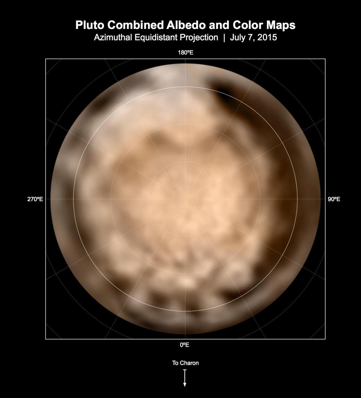
These circular maps shows the distribution of Pluto's dark and bright terrains as revealed by NASA's New Horizons mission prior to July 4, 2015. Each map is an azimuthal equidistant projection centered on the north pole, with latitude and longitude indicated. Both a gray-scale and color version are shown. The gray-scale version is based on 7 days of panchromatic imaging from the Long Range Reconnaissance Imager (LORRI), whereas the color version uses the gray-scale base and incorporates lower-resolution color information from the Multi-spectral Visible Imaging Camera (MVIC), part of the Ralph instrument. The color version is also shown in a simple cylindrical projection in PIA19700. In these maps, the polar bright terrain is surrounded by a somewhat darker polar fringe, one whose latitudinal position varies strongly with longitude. Especially striking are the much darker regions along the equator. A broad dark swath ("the whale") stretches along the equator from approximately 20 to 160 degrees of longitude. Several dark patches appear in a regular sequence centered near 345 degrees of longitude. A spectacular bright region occupies Pluto's mid-latitudes near 180 degrees of longitude, and stretches southward over the equator. New Horizons' closest approach to Pluto will occur near this longitude, which will permit high-resolution visible imaging and compositional mapping of these various regions. http://photojournal.jpl.nasa.gov/catalog/PIA19706
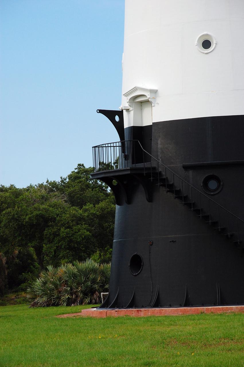
CAPE CANAVERAL, Fla. -- Natural vegetation surrounds the historic Cape Canaveral Light on Cape Canaveral Air Force Station in Florida. The low structure to the right of the lighthouse is the original oil house. The U.S. Air Force now owns the lighthouse. The first lighthouse on Cape Canaveral was built near the tip of the Cape in 1848. The structure was only about 60 feet high with a rather dim light powered by whale oil. In 1859, work began nearby on a new, taller iron structure. Construction was halted during the Civil War, and the lighthouse was not finished until 1868. The structure, with a brick lining inside its iron exterior, was painted with its "daymark" black and white horizontal bands in 1873 to make it easier to identify during the day as a navigation point. Between 1892 and 1894, the lighthouse was dismantled and moved to a new location about a mile from the coast, where it stands today. For more information on the lighthouse, visit http://www.nasa.gov/centers/kennedy/about/history/lighthouse.html. Photo credit: NASA/Ben Smegelsky
Cape Canaveral Air Force Station, Fla. -- As the sun rises, the Cape Canaveral Lighthouse is silhouetted against the early morning sky. The Canaveral light is the only operating lighthouse owned by the U.S. Air Force. In 2000, the Coast Guard transferred ownership of the lighthouse structure and its grounds to the Air Force, which is now responsible for maintaining it. The U.S. Coast Guard continues to operate the modern first-order beacon as an active navigational aid. The first lighthouse at Cape Canaveral was built near the tip of the Cape in 1848. The structure was only about 60 feet high with a rather dim light powered by whale oil. In 1859, work began nearby on a new, taller iron structure. Construction was halted during the Civil War, and the lighthouse finally was finished in 1868. The structure, with a brick lining inside its iron exterior, was painted with its "daymark" black and white horizontal bands in 1873 to make it easier to identify during the day as a navigation point. Between 1892 and 1894, the lighthouse was dismantled and moved to its new home about a mile from the coast, where it stands today. Photo credit: NASA/Ben Smegelsky
CAPE CANAVERAL, Fla. -- The U.S. Coast Guard operates the beacon of the historic Cape Canaveral Light as an active navigational aid. The lighthouse resides on Cape Canaveral Air Force Station in Florida and is owned by the U.S. Air Force. The first lighthouse on Cape Canaveral was built near the tip of the Cape in 1848. The structure was only about 60 feet high with a rather dim light powered by whale oil. In 1859, work began nearby on a new, taller iron structure. Construction was halted during the Civil War, and the lighthouse was not finished until 1868. The structure, with a brick lining inside its iron exterior, was painted with its "daymark" black and white horizontal bands in 1873 to make it easier to identify during the day as a navigation point. Between 1892 and 1894, the lighthouse was dismantled and moved to a new location about a mile from the coast, where it stands today. For more information on the lighthouse, visit http://www.nasa.gov/centers/kennedy/about/history/lighthouse.html. Photo credit: NASA/Ben Smegelsky
CAPE CANAVERAL, Fla. -- The historic Cape Canaveral Light on Cape Canaveral Air Force Station in Florida serves as a navigational aid for boaters and fishing interests along Florida's Atlantic coast. The U.S. Coast Guard operates the lighthouse's beacon the U.S. Air Force owns the lighthouse. The first lighthouse on Cape Canaveral was built near the tip of the Cape in 1848. The structure was only about 60 feet high with a rather dim light powered by whale oil. In 1859, work began nearby on a new, taller iron structure. Construction was halted during the Civil War, and the lighthouse was not finished until 1868. The structure, with a brick lining inside its iron exterior, was painted with its "daymark" black and white horizontal bands in 1873 to make it easier to identify during the day as a navigation point. Between 1892 and 1894, the lighthouse was dismantled and moved to a new location about a mile from the coast, where it stands today. For more information on the lighthouse, visit http://www.nasa.gov/centers/kennedy/about/history/lighthouse.html. Photo credit: NASA/Ben Smegelsky
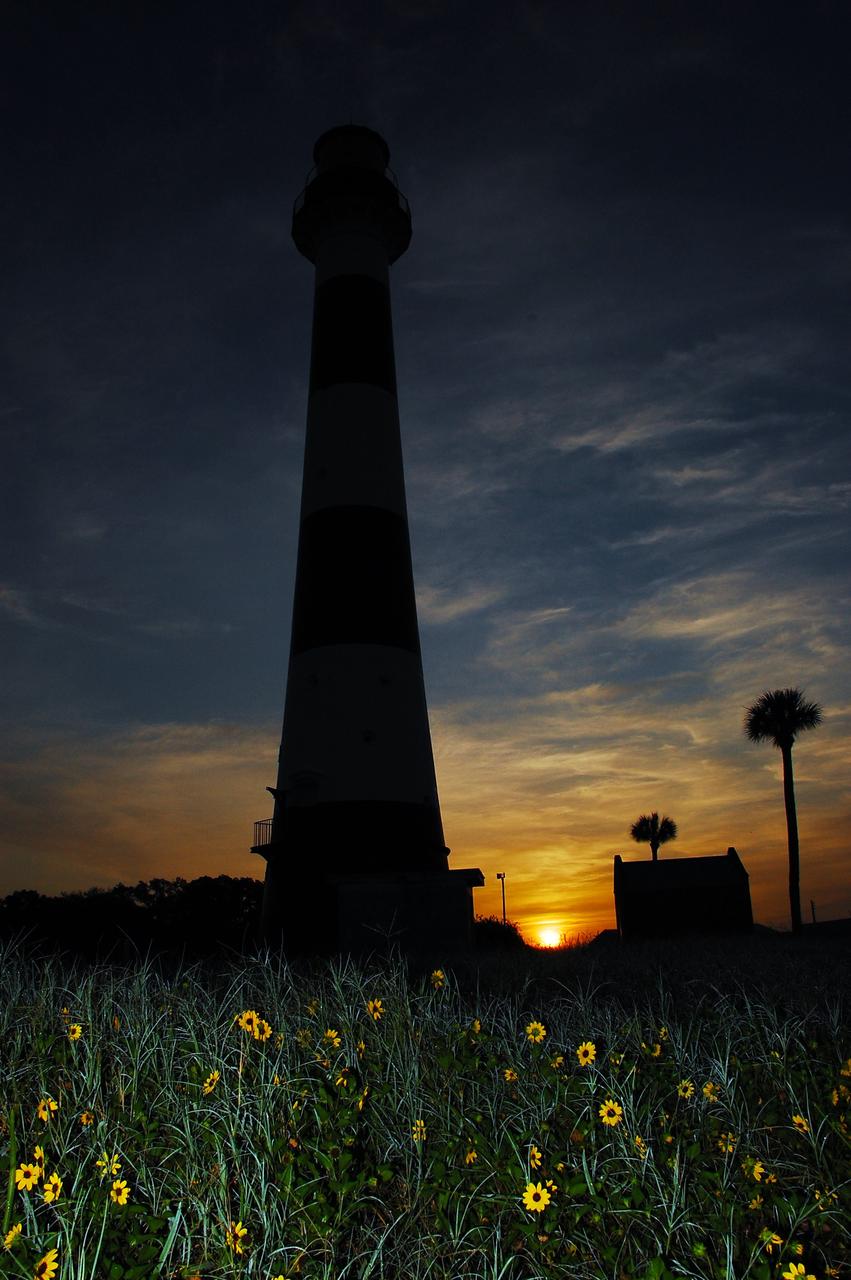
Cape Canaveral Air Force Station, Fla. -- As the sun rises, the Cape Canaveral Lighthouse is silhouetted against the early morning sky. The Canaveral light is the only operating lighthouse owned by the U.S. Air Force. In 2000, the Coast Guard transferred ownership of the lighthouse structure and its grounds to the Air Force, which is now responsible for maintaining it. The U.S. Coast Guard continues to operate the modern first-order beacon as an active navigational aid. The first lighthouse at Cape Canaveral was built near the tip of the Cape in 1848. The structure was only about 60 feet high with a rather dim light powered by whale oil. In 1859, work began nearby on a new, taller iron structure. Construction was halted during the Civil War, and the lighthouse finally was finished in 1868. The structure, with a brick lining inside its iron exterior, was painted with its "daymark" black and white horizontal bands in 1873 to make it easier to identify during the day as a navigation point. Between 1892 and 1894, the lighthouse was dismantled and moved to its new home about a mile from the coast, where it stands today. Photo credit: NASA/Ben Smegelsky
CAPE CANAVERAL, Fla. -- Reconstruction from the original architectural plans of the keeper's house, next to the historic Cape Canaveral Light on Cape Canaveral Air Force Station in Florida, is planned by the Cape Canaveral Lighthouse Foundation. The lighthouse currently is owned by the U.S. Air Force. The first lighthouse on Cape Canaveral was built near the tip of the Cape in 1848. The structure was only about 60 feet high with a rather dim light powered by whale oil. In 1859, work began nearby on a new, taller iron structure. Construction was halted during the Civil War, and the lighthouse was not finished until 1868. The structure, with a brick lining inside its iron exterior, was painted with its "daymark" black and white horizontal bands in 1873 to make it easier to identify during the day as a navigation point. Between 1892 and 1894, the lighthouse was dismantled and moved to a new location about a mile from the coast, where it stands today. For more information on the lighthouse, visit http://www.nasa.gov/centers/kennedy/about/history/lighthouse.html. Photo credit: NASA/Ben Smegelsky
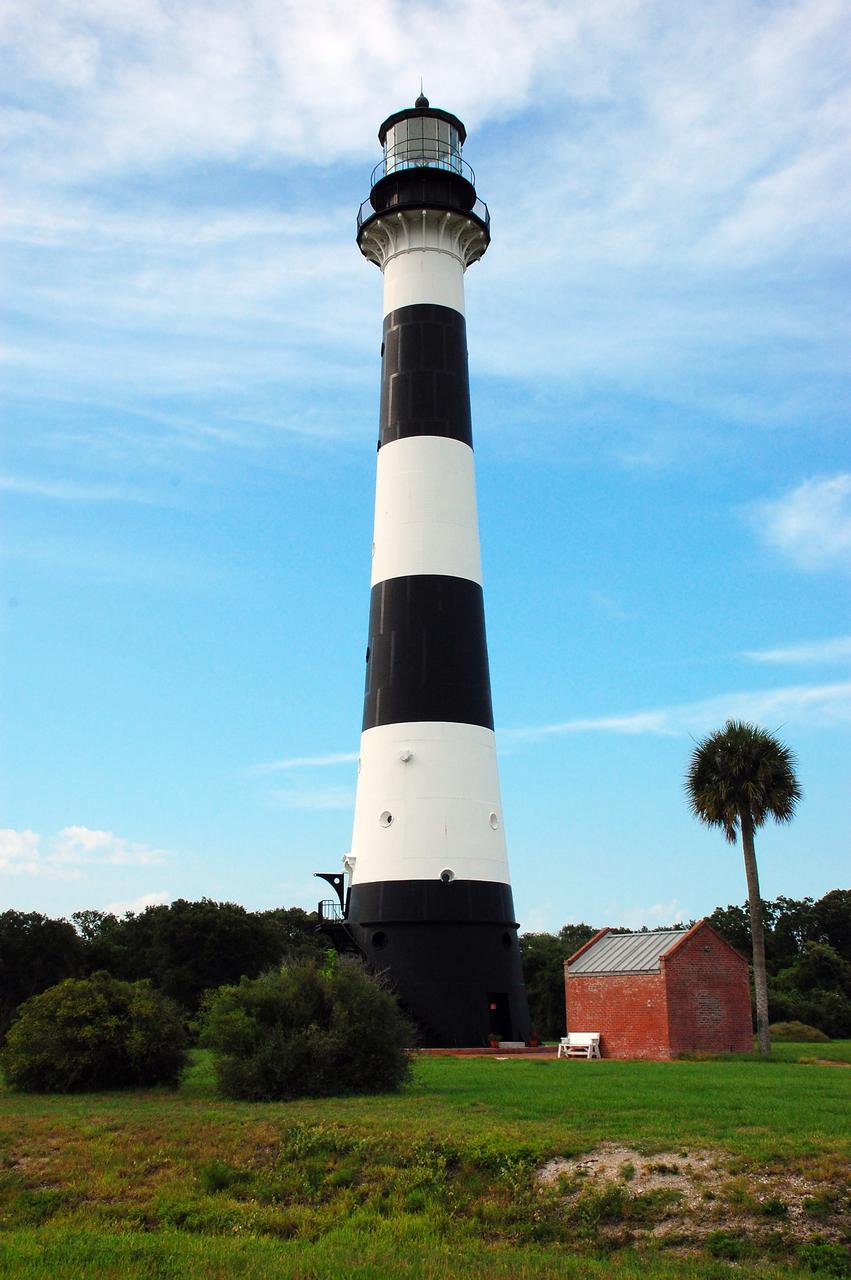
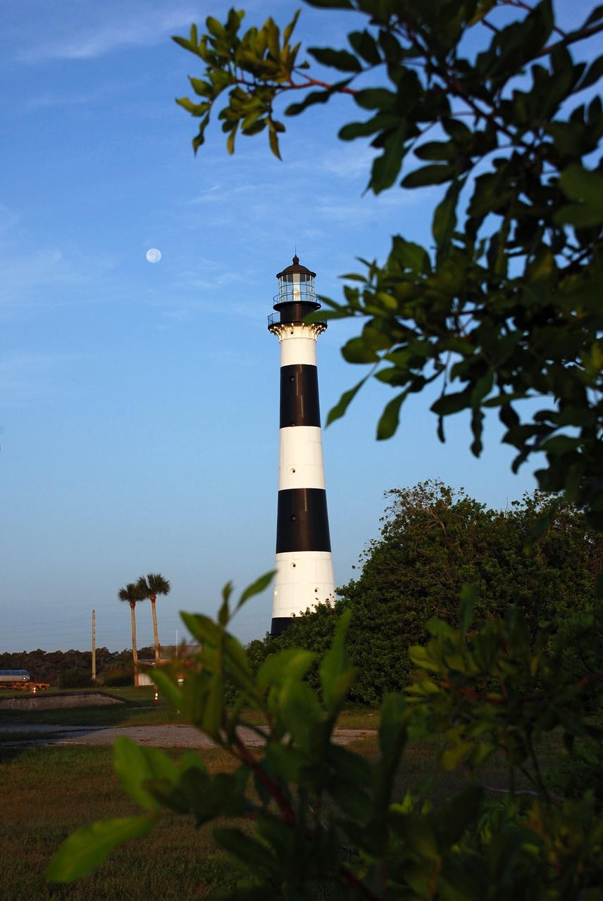
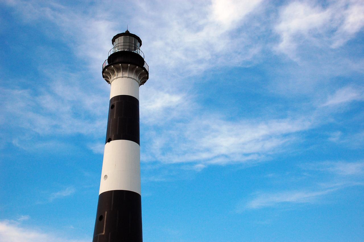
CAPE CANAVERAL, Fla. -- Cape Canaveral Air Force Station in Florida is home to the historic Cape Canaveral Light, a lighthouse built circa 1868 and now owned by the U.S. Air Force. The first lighthouse on Cape Canaveral was built near the tip of the Cape in 1848. The structure was only about 60 feet high with a rather dim light powered by whale oil. In 1859, work began nearby on a new, taller iron structure. Construction was halted during the Civil War, and the lighthouse was not finished until 1868. The structure, with a brick lining inside its iron exterior, was painted with its "daymark" black and white horizontal bands in 1873 to make it easier to identify during the day as a navigation point. Between 1892 and 1894, the lighthouse was dismantled and moved to a new location about a mile from the coast, where it stands today. For more information on the lighthouse, visit http://www.nasa.gov/centers/kennedy/about/history/lighthouse.html. Photo credit: NASA/Ben Smegelsky
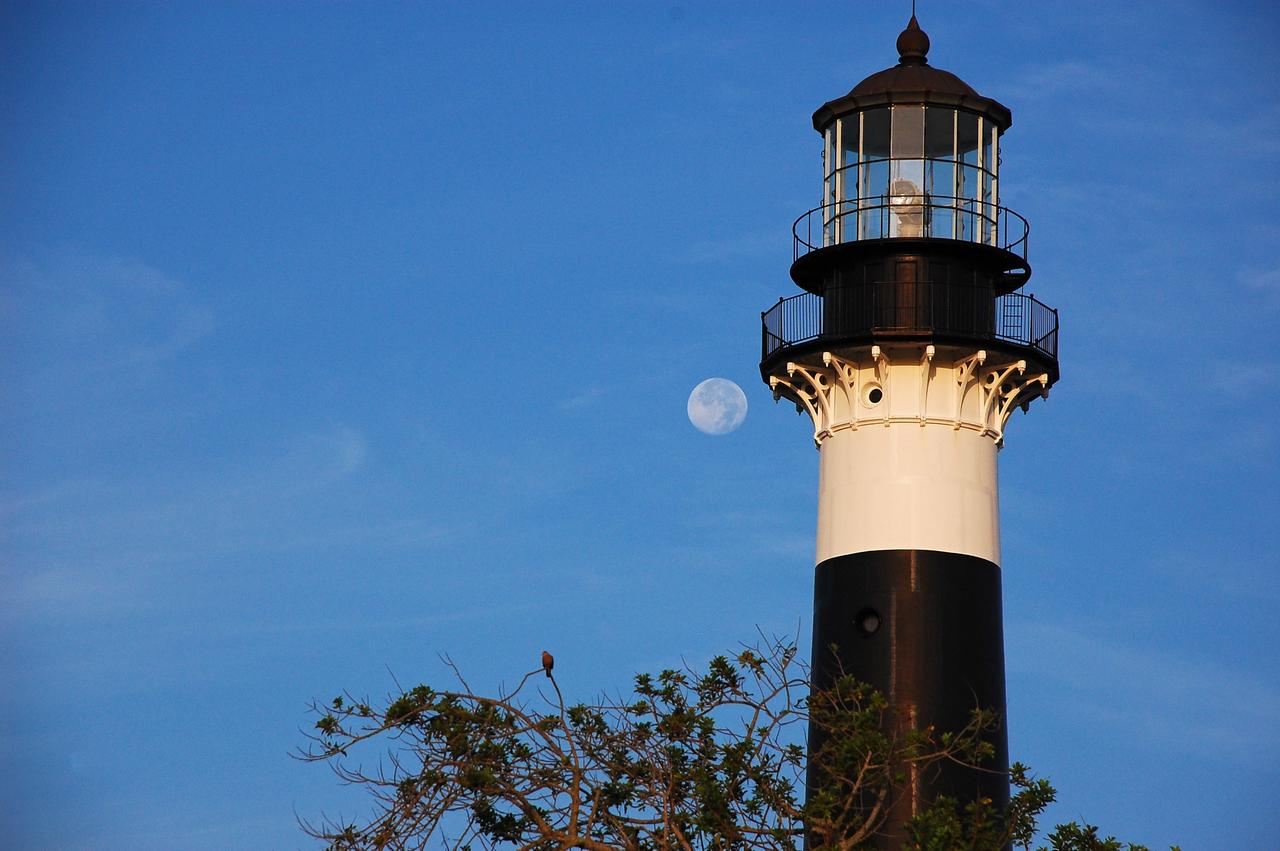
Cape Canaveral Air Force Station, Fla. -- The lantern room of the Cape Canaveral Lighthouse, with its modern first-order optic, takes on a warm glow as dawn breaks and a full moon still shines overhead. The Canaveral light is the only operating lighthouse owned by the U.S. Air Force. In 2000, the Coast Guard transferred ownership of the lighthouse structure and its grounds to the Air Force, which is now responsible for maintaining it. The U.S. Coast Guard continues to operate the beacon as an active navigational aid. The first lighthouse at Cape Canaveral was built near the tip of the Cape in 1848. The structure was only about 60 feet high with a rather dim light powered by whale oil. In 1859, work began nearby on a new, taller iron structure. Construction was halted during the Civil War, and the lighthouse finally was finished in 1868. The structure, with a brick lining inside its iron exterior, was painted with its "daymark" black and white horizontal bands in 1873 to make it easier to identify during the day as a navigation point. Between 1892 and 1894, the lighthouse was dismantled and moved to its new home about a mile from the coast, where it stands today. Photo credit: NASA/Ben Smegelsky
Cape Canaveral Air Force Station, Fla. -- A warm glow envelopes the Cape Canaveral Lighthouse as dawn breaks and a full moon still shines overhead. The Canaveral light is the only operating lighthouse owned by the U.S. Air Force. In 2000, the Coast Guard transferred ownership of the lighthouse structure and its grounds to the Air Force, which is now responsible for maintaining it. The U.S. Coast Guard continues to operate the modern first-order beacon as an active navigational aid. The first lighthouse at Cape Canaveral was built near the tip of the Cape in 1848. The structure was only about 60 feet high with a rather dim light powered by whale oil. In 1859, work began nearby on a new, taller iron structure. Construction was halted during the Civil War, and the lighthouse finally was finished in 1868. The structure, with a brick lining inside its iron exterior, was painted with its "daymark" black and white horizontal bands in 1873 to make it easier to identify during the day as a navigation point. Between 1892 and 1894, the lighthouse was dismantled and moved to its new home about a mile from the coast, where it stands today. Photo credit: NASA/Ben Smegelsky
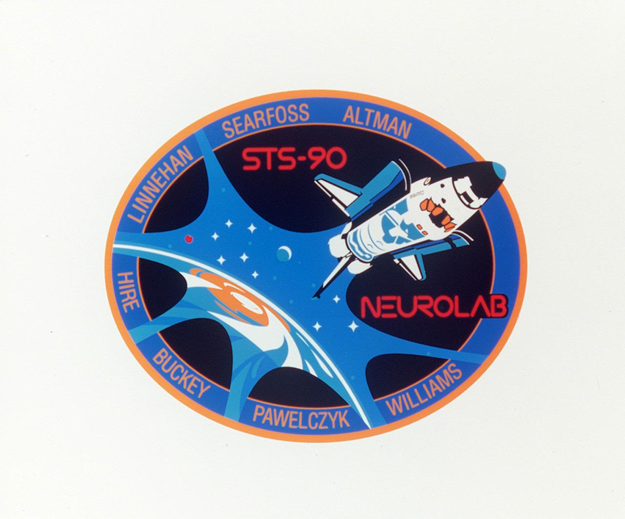
The STS-90 crew patch reflects the dedication of the mission to neuroscience in celebration of the decade of the brain. Earth is revealed through a neuron-shaped window, which symbolizes new perspectives in the understanding of nervous system development, structure and function, both here on Earth and in the microgravity environment of space. The Space Shuttle Columbia is depicted with its open payload bay doors revealing the Spacelab within. An integral component of the mission, the laboratory/science module provided by the European Space Agency (ESA), signifies the strong international involvement in the mission. The seven crew members and two alternate payload specialists, Chiaki Naito-Mukai and Alexander W. Dunlap, are represented by the nine major stars of the constellation Cetus (the whale) in recognition of the International Year of the Ocean. The distant stars illustrate the far reaching implications of the mission science to the many sponsoring agencies, helping prepare for long-duration space flight aboard the International Space Station (ISS). The moon and Mars are depicted to reflect the crew's recognition that those two celestial bodies will be the next great challenges in human exploration of space and represent the key role that life science research will play in supporting such missions.
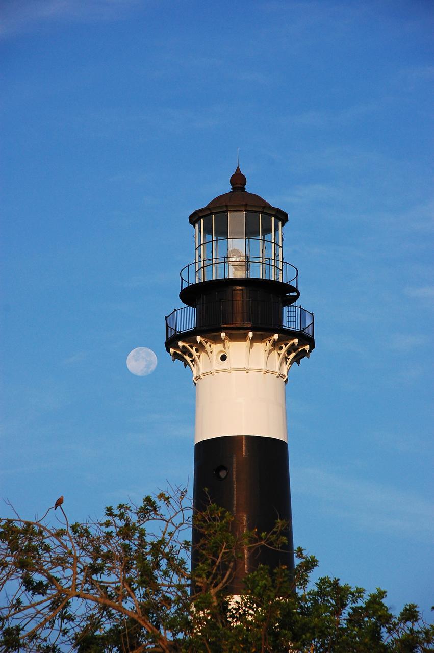
Cape Canaveral Air Force Station, Fla. -- The lantern room of the Cape Canaveral Lighthouse, with its modern first-order optic, takes on a warm glow as dawn breaks and a full moon still shines overhead. The Canaveral light is the only operating lighthouse owned by the U.S. Air Force. In 2000, the Coast Guard transferred ownership of the lighthouse structure and its grounds to the Air Force, which is now responsible for maintaining it. The U.S. Coast Guard continues to operate the beacon as an active navigational aid. The first lighthouse at Cape Canaveral was built near the tip of the Cape in 1848. The structure was only about 60 feet high with a rather dim light powered by whale oil. In 1859, work began nearby on a new, taller iron structure. Construction was halted during the Civil War, and the lighthouse finally was finished in 1868. The structure, with a brick lining inside its iron exterior, was painted with its "daymark" black and white horizontal bands in 1873 to make it easier to identify during the day as a navigation point. Between 1892 and 1894, the lighthouse was dismantled and moved to its new home about a mile from the coast, where it stands today. Photo credit: NASA/Ben Smegelsky
CAPE CANAVERAL AIR FORCE STATION, Fla. – The Cape Canaveral Air Force Station lighthouse takes on a warm glow as dawn breaks and a full moon still shines in the background. The Canaveral light is the only one owned by the U.S. Air Force. In 2000, the Coast Guard transferred ownership of the lighthouse structure and its grounds to the Air Force, which is now responsible for maintaining it. The U.S. Coast Guard continues to operate the beacon as an active navigational aid. The first lighthouse at Cape Canaveral was built near the tip of the Cape in 1848. The structure was only about 60 feet high with a rather dim light powered by whale oil. In 1859, work began nearby on a new, taller iron structure. Construction was halted during the Civil War, and the lighthouse finally was finished in 1868. The structure, with a brick lining inside its iron exterior, was painted with its "daymark" black and white horizontal bands in 1873 to make it easier to identify during the day as a navigation point. Between 1892 and 1894, the lighthouse was dismantled and moved to its new home about a mile from the coast, where it stands today. Photo credit: NASA/Ben Smegelsky
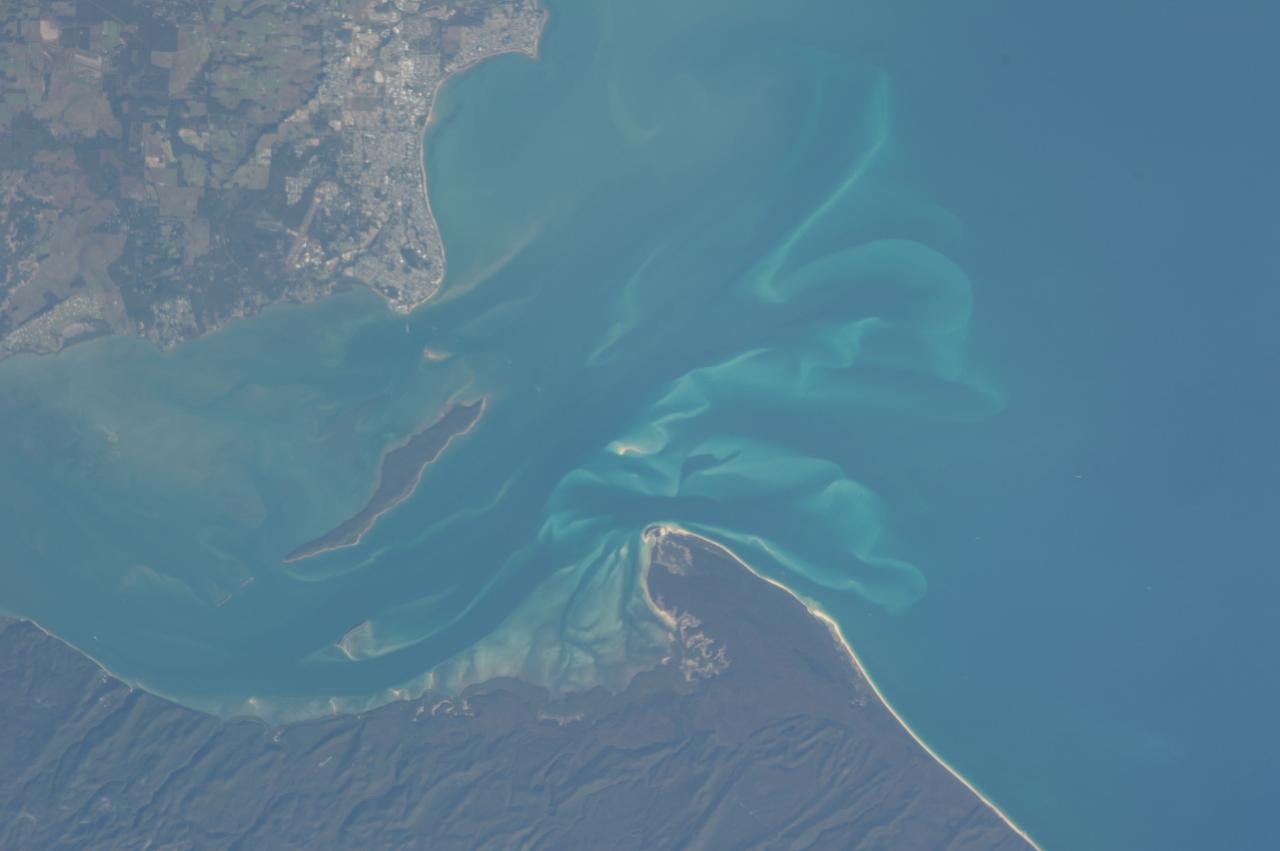
ISS036-E-028444 (3 Aug. 2013) --- Hervey Bay, Queensland, Australia is featured in this image photographed by an Expedition 36 crew member on the International Space Station. The northern end of the Great Sandy Strait and Hervey Bay are highlighted in this photograph. The Strait is an estuary that separates the mainland coastline of the state of Queensland, Australia from neighboring Fraser Island. The mainland side of the Strait includes the city of Hervey Bay, visible at top center. Other communities that have become part of the larger metropolitan area include Scarness, Booral, and Urangan. A small vegetated island and shallow sand bars of the Great Sandy Strait are visible at center left, while submerged sands appear as bright blue flowing ribbons at center. A small, bright white exposure of sand is visible above the water level near the center point of the image. While once a major freighting center for the sugar cane industry, the local economy is now largely based on tourism, with whale watching tours a popular attraction. The Great Sandy Strait estuary provides habitat for breeding fish, crustaceans, turtles, and other sea life, as well as a wide variety of birds. Nearby Fraser Island is the world?s largest sand island and a World Heritage site.
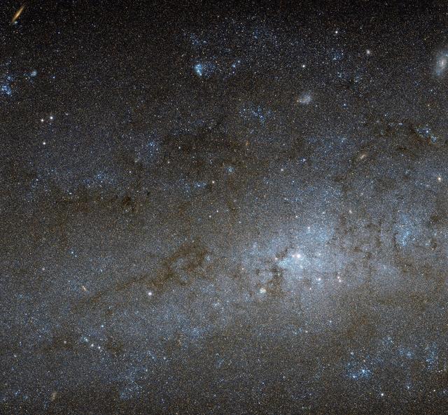
This Hubble image shows the central region of a spiral galaxy known as NGC 247. NGC 247 is a relatively small spiral galaxy in the southern constellation of Cetus (The Whale). Lying at a distance of around 11 million light-years from us, it forms part of the Sculptor Group, a loose collection of galaxies that also contains the more famous NGC 253 (otherwise known as the Sculptor Galaxy). NGC 247’s nucleus is visible here as a bright, whitish patch, surrounded by a mixture of stars, gas and dust. The dust forms dark patches and filaments that are silhouetted against the background of stars, while the gas has formed into bright knots known as H II regions, mostly scattered throughout the galaxy’s arms and outer areas. This galaxy displays one particularly unusual and mysterious feature — it is not visible in this image, but can be seen clearly in wider views of the galaxy, such as a picture from ESO’s MPG/ESO 2.2-meter telescope. The northern part of NGC 247’s disc hosts an apparent void, a gap in the usual swarm of stars and H II regions that spans almost a third of the galaxy’s total length. There are stars within this void, but they are quite different from those around it. They are significantly older, and as a result much fainter and redder. This indicates that the star formation taking place across most of the galaxy’s disk has somehow been arrested in the void region, and has not taken place for around one billion years. Although astronomers are still unsure how the void formed, recent studies suggest it might have been caused by gravitational interactions with part of another galaxy. Image Credit: NASA/ESA

This Hubble image shows the central region of a spiral galaxy known as NGC 247. NGC 247 is a relatively small spiral galaxy in the southern constellation of Cetus (The Whale). Lying at a distance of around 11 million light-years from us, it forms part of the Sculptor Group, a loose collection of galaxies that also contains the more famous NGC 253 (otherwise known as the Sculptor Galaxy). NGC 247’s nucleus is visible here as a bright, whitish patch, surrounded by a mixture of stars, gas and dust. The dust forms dark patches and filaments that are silhouetted against the background of stars, while the gas has formed into bright knots known as H II regions, mostly scattered throughout the galaxy’s arms and outer areas. This galaxy displays one particularly unusual and mysterious feature — it is not visible in this image, but can be seen clearly in wider views of the galaxy, such as this picture from ESO’s MPG/ESO 2.2-metre telescope. The northern part of NGC 247’s disc hosts an apparent void, a gap in the usual swarm of stars and H II regions that spans almost a third of the galaxy’s total length. There are stars within this void, but they are quite different from those around it. They are significantly older, and as a result much fainter and redder. This indicates that the star formation taking place across most of the galaxy’s disc has somehow been arrested in the void region, and has not taken place for around one billion years. Although astronomers are still unsure how the void formed, recent studies suggest it might have been caused by gravitational interactions with part of another galaxy.
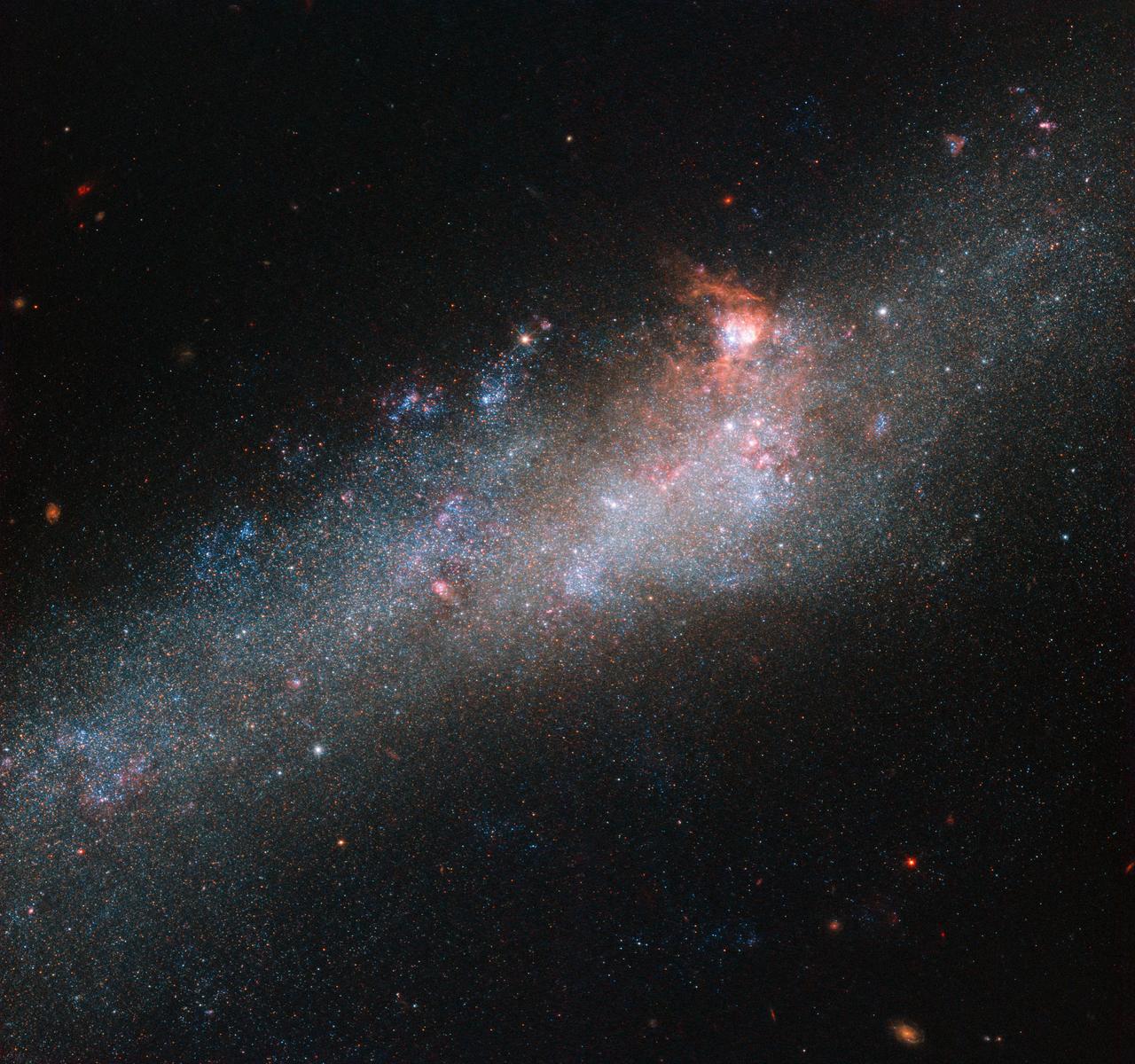
The star of this NASA/ESA Hubble Space Telescope image is a galaxy known as NGC 4656, located in the constellation of Canes Venatici (The Hunting Dogs). However, it also has a somewhat more interesting and intriguing name: the Hockey Stick Galaxy! The reason for this is a little unclear from this partial view, which shows the bright central region, but the galaxy is actually shaped like an elongated, warped stick, stretching out through space until it curls around at one end to form a striking imitation of a celestial hockey stick. This unusual shape is thought to be due to an interaction between NGC 4656 and a couple of near neighbors, NGC 4631 (otherwise known as The Whale Galaxy) and NGC 4627 (a small elliptical). Galactic interactions can completely reshape a celestial object, shifting and warping its constituent gas, stars, and dust into bizarre and beautiful configurations. Credit: ESA/Hubble & NASA <b><a href="http://www.nasa.gov/audience/formedia/features/MP_Photo_Guidelines.html" rel="nofollow">NASA image use policy.</a></b> <b><a href="http://www.nasa.gov/centers/goddard/home/index.html" rel="nofollow">NASA Goddard Space Flight Center</a></b> enables NASA’s mission through four scientific endeavors: Earth Science, Heliophysics, Solar System Exploration, and Astrophysics. Goddard plays a leading role in NASA’s accomplishments by contributing compelling scientific knowledge to advance the Agency’s mission. <b>Follow us on <a href="http://twitter.com/NASAGoddardPix" rel="nofollow">Twitter</a></b> <b>Like us on <a href="http://www.facebook.com/pages/Greenbelt-MD/NASA-Goddard/395013845897?ref=tsd" rel="nofollow">Facebook</a></b> <b>Find us on <a href="http://instagrid.me/nasagoddard/?vm=grid" rel="nofollow">Instagram</a></b>
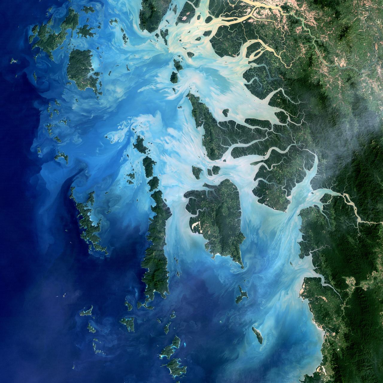
NASA image acquired December 14, 2004 In the southernmost reaches of Burma (Myanmar), along the border with Thailand, lies the Mergui Archipelago. The archipelago in the Andaman Sea is made up of more than 800 islands surrounded by extensive coral reefs. This natural color image acquired by Landsat 5 on Dec. 14, 2004, shows the middle portion of the archipelago, including Auckland and Whale Bays. Swirling patterns are visible in the near-shore waters as sediments carried by rivers slowly settle out and are deposited on the seafloor. The heavy sediment loads make the river appear nearly white. As those sediments settle out, the seawater appears deeper shades of blue. The tropical rainforests of the region appear deep green. Captain Thomas Forrest of the East India Company first described the region to Europeans after a 1782 expedition in search of potential sugar-growing lands. At that time, the islands were mainly inhabited by a nomadic fishing culture. These people, known as the Moken, still call the archipelago home and mostly live a hunter-gatherer lifestyle. As of 2006, 2,000 Moken were known to inhabit the Burmese portion of Mergui. The small population of the archipelago has helped preserve its high diversity of plants and animals. In 1997, Burma opened the region to foreign tourism and in the years since it has become a major diving destination. A valued species of pearl oyster (Pinctada maxima) are found in nearby waters. Today, overfishing is emerging as a regional problem. Landsat image created by Michael Taylor, Landsat Project Science Office. Caption by Laura Rocchio. Instrument: Landsat 5 - TM To read more go to: <a href="http://1.usa.gov/TDmjsk" rel="nofollow">1.usa.gov/TDmjsk</a> Credit: <b><a href="http://www.earthobservatory.nasa.gov/" rel="nofollow"> NASA Earth Observatory</a></b> <b><a href="http://www.nasa.gov/audience/formedia/features/MP_Photo_Guidelines.html" rel="nofollow">NASA image use policy.</a></b> <b><a href="http://www.nasa.gov/centers/goddard/home/index.html" rel="nofollow">NASA Goddard Space Flight Center</a></b> enables NASA’s mission through four scientific endeavors: Earth Science, Heliophysics, Solar System Exploration, and Astrophysics. Goddard plays a leading role in NASA’s accomplishments by contributing compelling scientific knowledge to advance the Agency’s mission. <b>Follow us on <a href="http://twitter.com/NASA_GoddardPix" rel="nofollow">Twitter</a></b> <b>Like us on <a href="http://www.facebook.com/pages/Greenbelt-MD/NASA-Goddard/395013845897?ref=tsd" rel="nofollow">Facebook</a></b> <b>Find us on <a href="http://instagram.com/nasagoddard?vm=grid" rel="nofollow">Instagram</a></b>
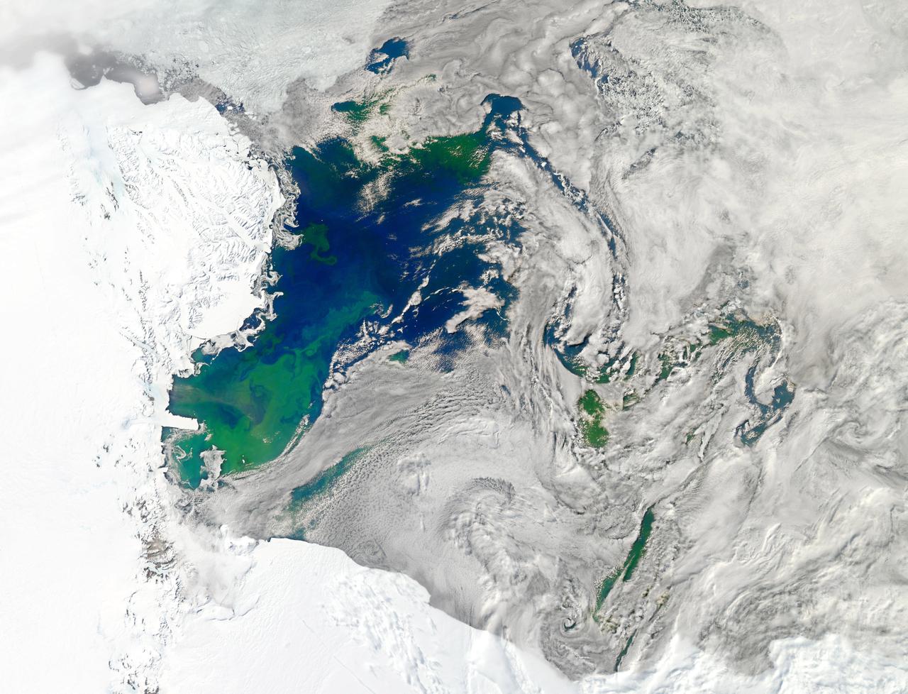
NASA image acquired January 22, 2011 Every southern spring and summer, after the Sun has risen into its 24-hour circuit around the skies of Antarctica, the Ross Sea bursts with life. Floating, microscopic plants, known as phytoplankton, soak up the sunlight and the nutrients stirring in the Southern Ocean and grow into prodigious blooms. Those blooms become a great banquet for krill, fish, penguins, whales, and other marine species who carve out a living in the cool waters of the far south. This true-color image captures such a bloom in the Ross Sea on January 22, 2011, as viewed by the Moderate Resolution Imaging Spectroradiometer (MODIS) on NASA’s Aqua satellite. Bright greens of plant-life have replaced the deep blues of open ocean water. The Ross Sea is a relatively shallow bay in the Antarctic coastline and due south from New Zealand. As the spring weather thaws the sea ice around Antarctica, areas of open water surrounded by ice—polynyas—open up on the continental shelf. In this open water, sunlight provides the fuel and various current systems provide nutrients from deeper waters to form blooms that can stretch 100 to 200 kilometers (60 to 120 miles). These blooms are among the largest in extent and abundance in the world. Scientists have hypothesized that the Modified Circumpolar Deep Water is the engine behind the blooms, stirring up just the right mix of trace metals and minerals from the deep to sustain plankton growth. This month, researchers aboard the U.S. icebreaking ship Nathaniel B. Palmer are cruising in the Ross Sea in search of the signatures of this current system. NASA image courtesy Norman Kuring, Ocean Color Team at NASA Goddard Space Flight Center. Caption by Mike Carlowicz, with information from Hugh Powell, COSEE-NOW. Instrument: Aqua - MODIS Go here to download the full high res file: <a href="http://earthobservatory.nasa.gov/IOTD/view.php?id=48949" rel="nofollow">earthobservatory.nasa.gov/IOTD/view.php?id=48949</a> Credit: <b><a href="http://www.earthobservatory.nasa.gov/" rel="nofollow"> NASA Earth Observatory</a></b> <b><a href="http://www.nasa.gov/audience/formedia/features/MP_Photo_Guidelines.html" rel="nofollow">NASA image use policy.</a></b> <b><a href="http://www.nasa.gov/centers/goddard/home/index.html" rel="nofollow">NASA Goddard Space Flight Center</a></b> enables NASA’s mission through four scientific endeavors: Earth Science, Heliophysics, Solar System Exploration, and Astrophysics. Goddard plays a leading role in NASA’s accomplishments by contributing compelling scientific knowledge to advance the Agency’s mission. <b>Follow us on <a href="http://twitter.com/NASA_GoddardPix" rel="nofollow">Twitter</a></b> <b>Like us on <a href="http://www.facebook.com/pages/Greenbelt-MD/NASA-Goddard/395013845897?ref=tsd" rel="nofollow">Facebook</a></b> <b>Find us on <a href="http://instagrid.me/nasagoddard/?vm=grid" rel="nofollow">Instagram</a></b>