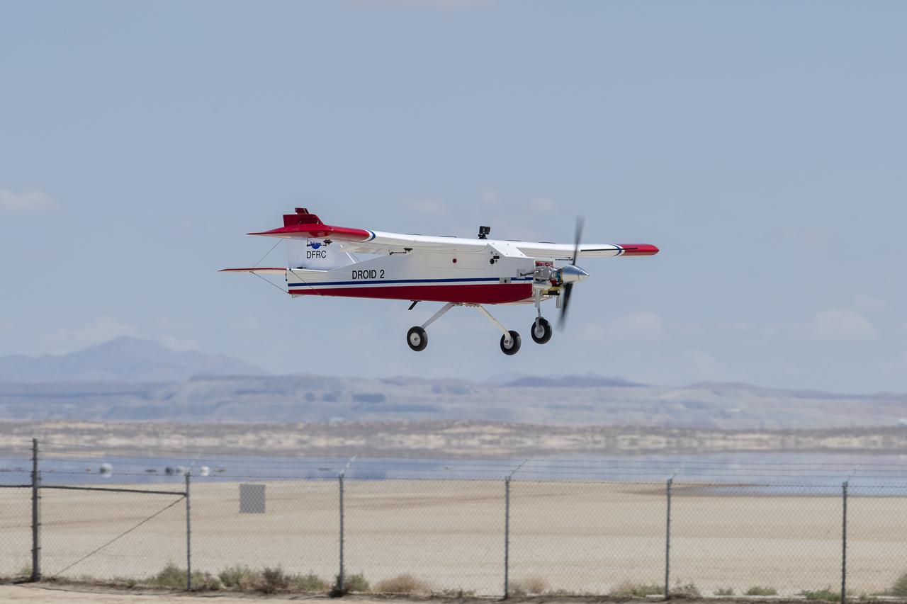
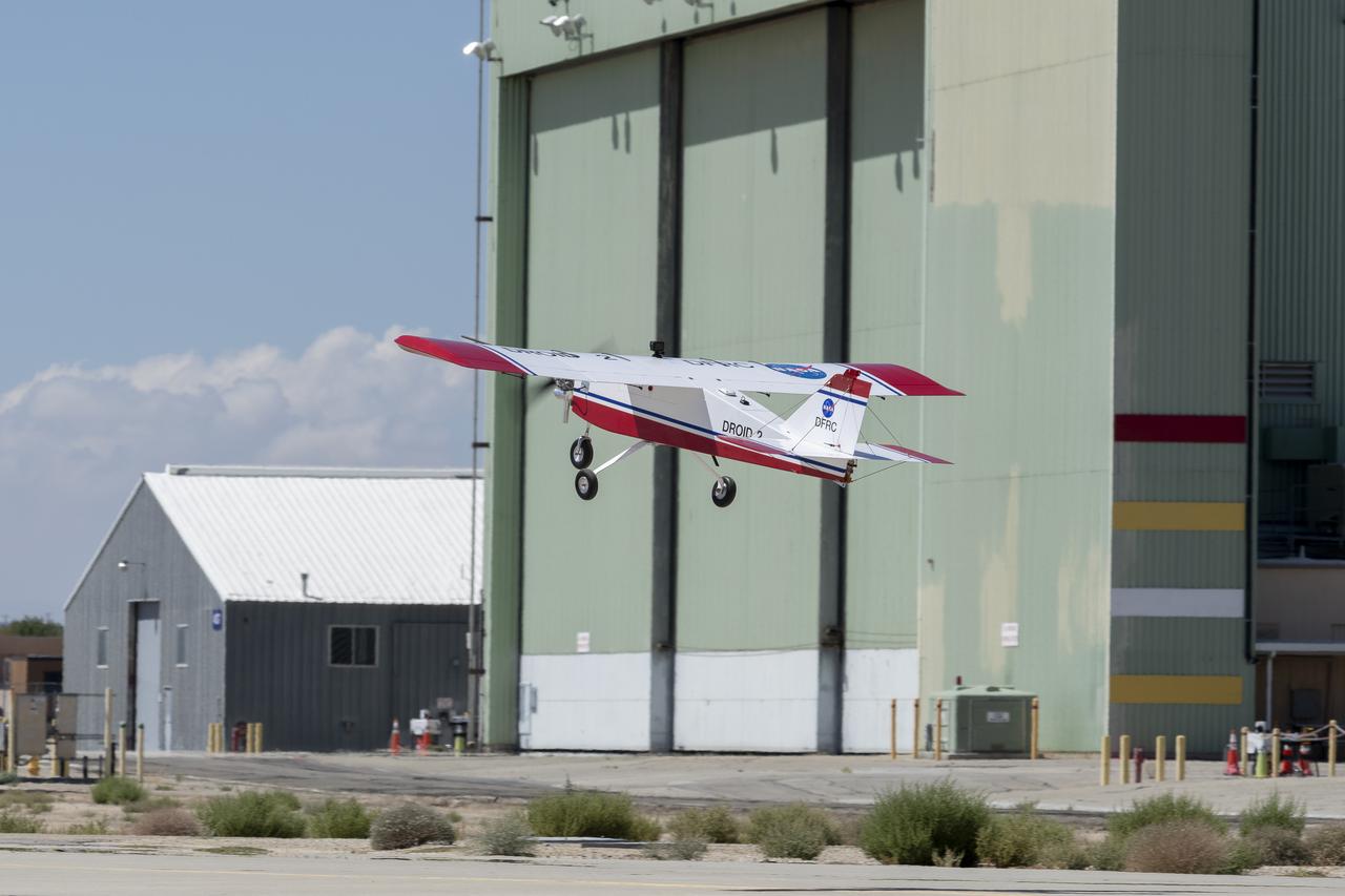
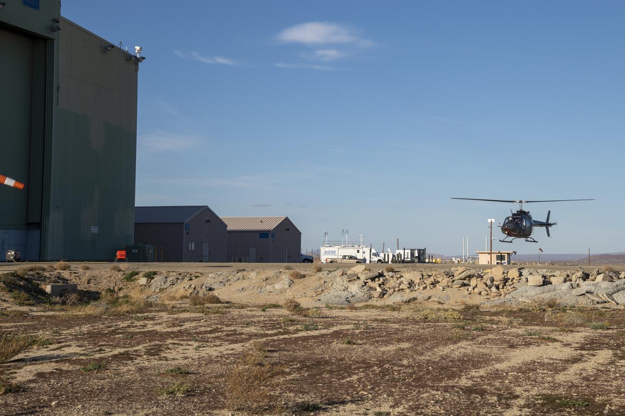
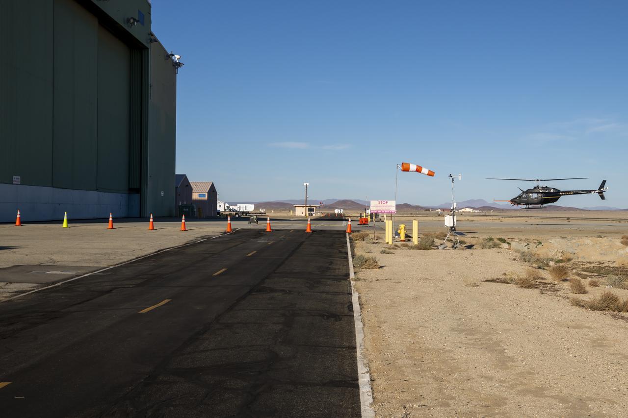
The DROID 2 (Dryden Remotely Operated Integrated Drone 2) prepares to land at NASA's Armstrong Flight Research Center in Edwards, California, as part of the Advanced Exploration of Reliable Operation at Low Altitudes: Meteorology, Simulation, and Technology campaign. The focus was to study wind to provide data for safe takeoff and landing of future air taxis.
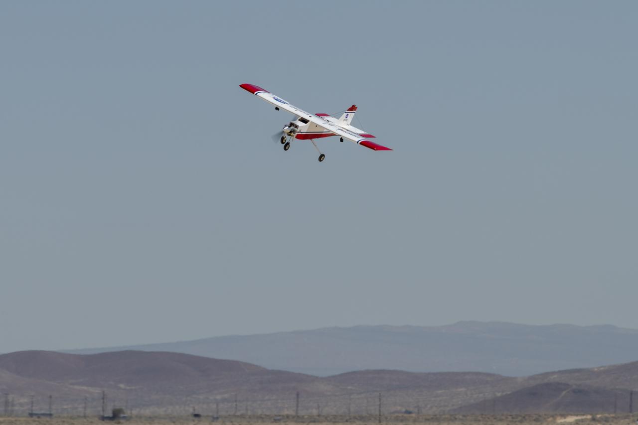
The DROID 2 (Dryden Remotely Operated Integrated Drone 2) flies at NASA's Armstrong Flight Research Center in Edwards, California, as part of the Advanced Exploration of Reliable Operation at Low Altitudes: Meteorology, Simulation, and Technology campaign. The focus was to study wind to provide data for safe takeoff and landing of future air taxis.
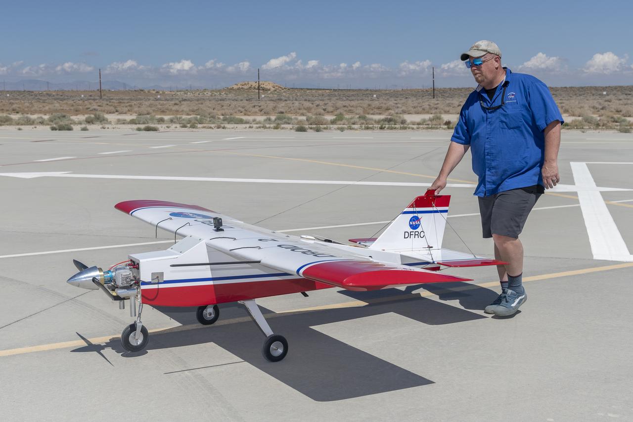
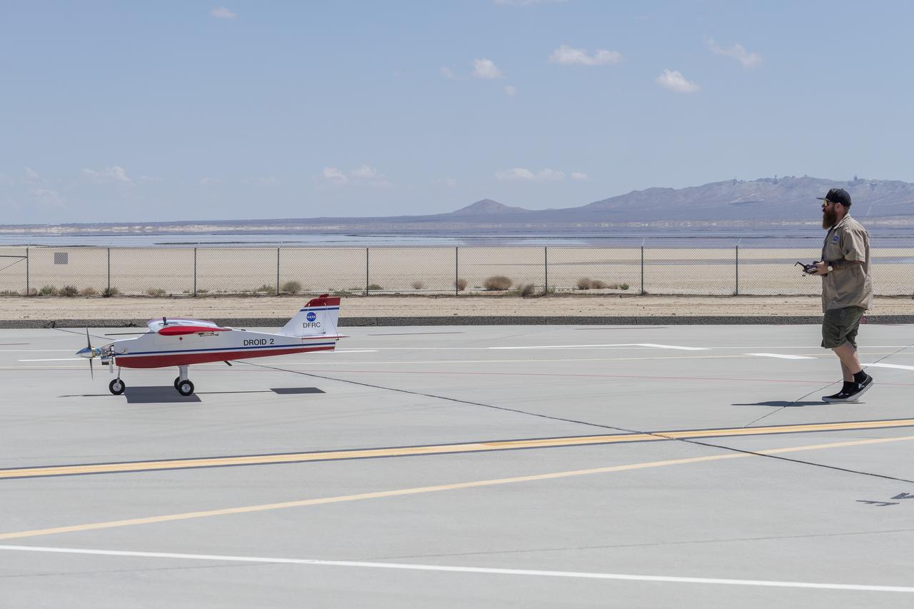
Robert "Red" Jensen positions the DROID 2 (Dryden Remotely Operated Integrated Drone) aircraft before a flight for the Advanced Exploration of Reliable Operation at Low Altitudes: Meteorology, Simulation, and Technology campaign. The weather study was at NASA's Armstrong Flight Research Center in Edwards, California. The focus was to study wind to provide data for safe takeoff and landing of future air taxis.
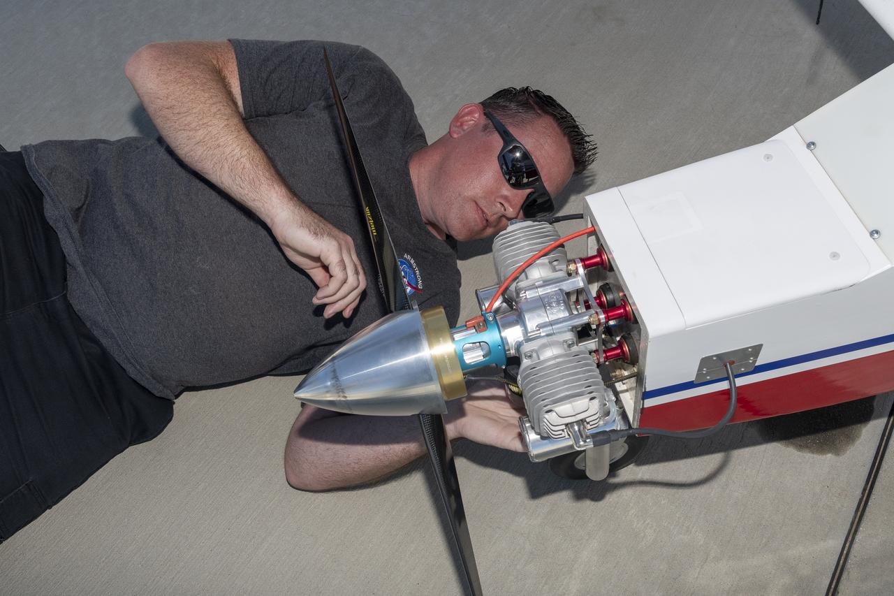
Justin Link prepares the DROID 2 (Dryden Remotely Operated Integrated Drone 2) aircraft before a flight for the Advanced Exploration of Reliable Operation at Low Altitudes: Meteorology, Simulation, and Technology campaign. The weather study was at NASA's Armstrong Flight Research Center in Edwards, California. The focus was to study wind to provide data for safe takeoff and landing of future air taxis.
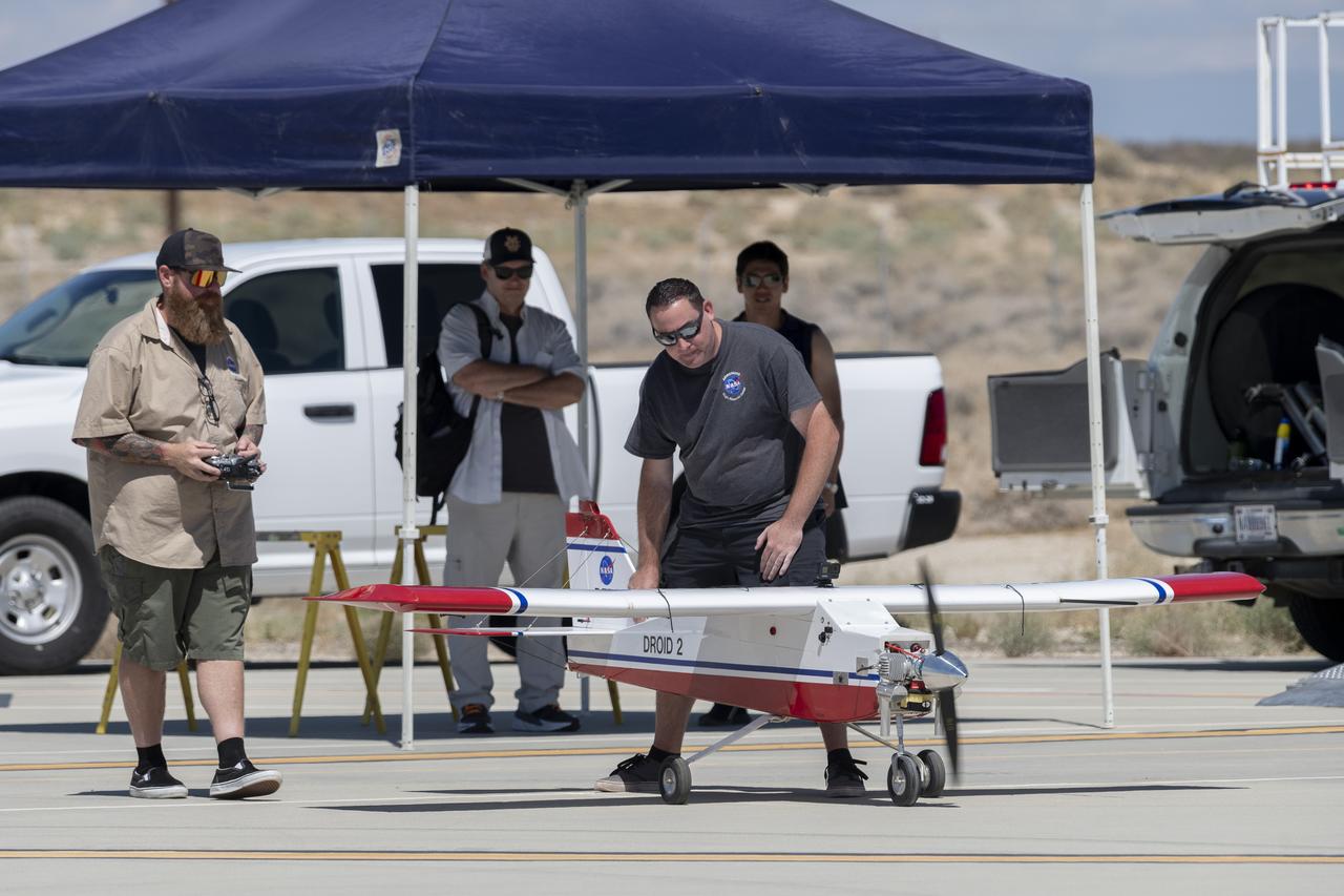
Justin Hall, left, prepares to pilot the DROID 2 (Dryden Remotely Operated Integrated Drone 2) aircraft, as John Melton watches and Justin Link makes a final adjustment. The flight was part of the Advanced Exploration of Reliable Operation at Low Altitudes: Meteorology, Simulation, and Technology campaign. The weather study was at NASA's Armstrong Flight Research Center in Edwards, California. The focus was to study wind to provide data for safe takeoff and landing of future air taxis.
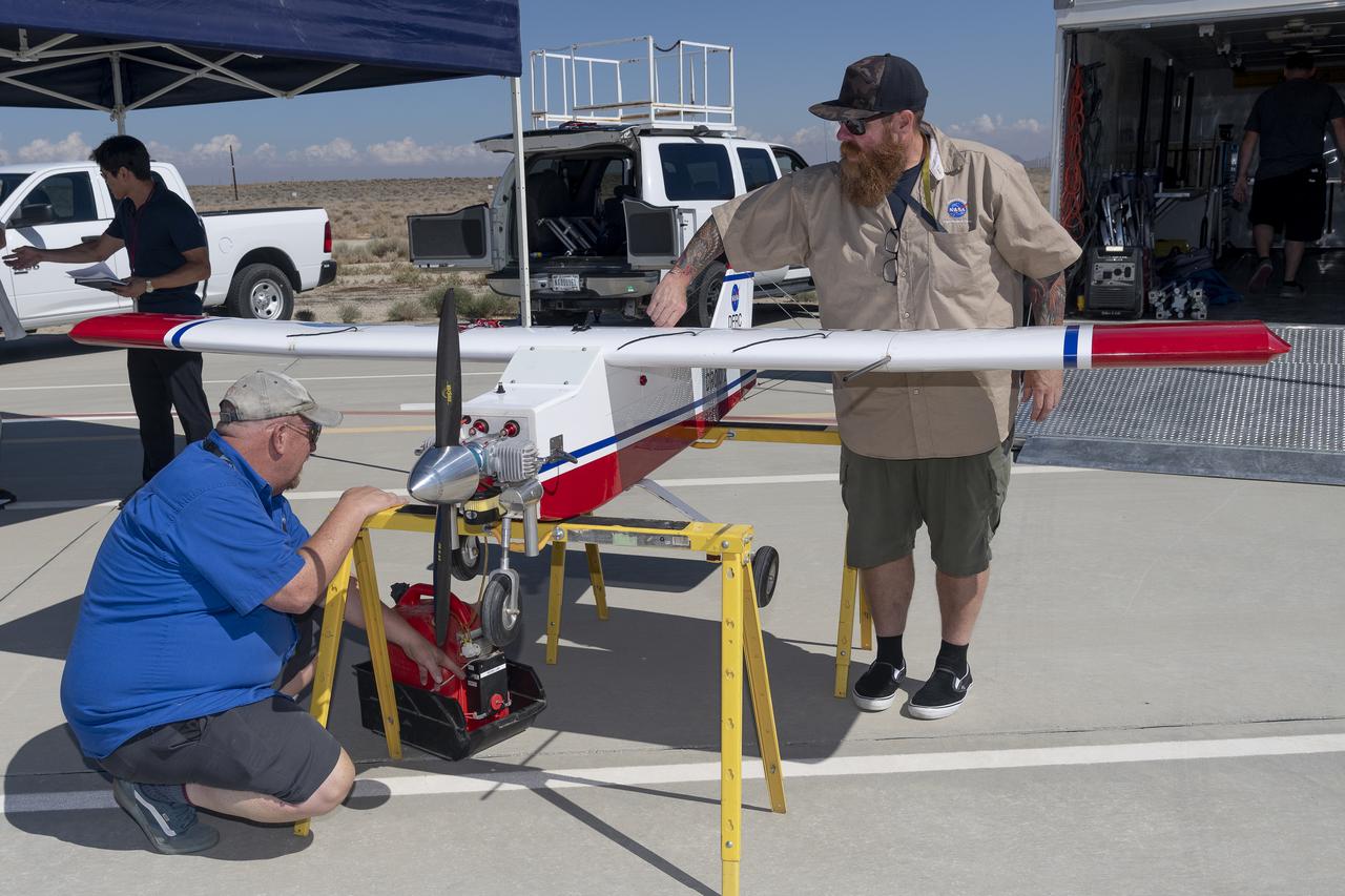
Robert "Red" Jensen and Justin Hall prepare the DROID 2 (Dryden Remotely Operated Integrated Drone 2) aircraft for the Advanced Exploration of Reliable Operation at Low Altitudes: Meteorology, Simulation, and Technology campaign flights. The weather study was at NASA's Armstrong Flight Research Center in Edwards, California. The focus was to study wind to provide data for safe takeoff and landing of future air taxis.
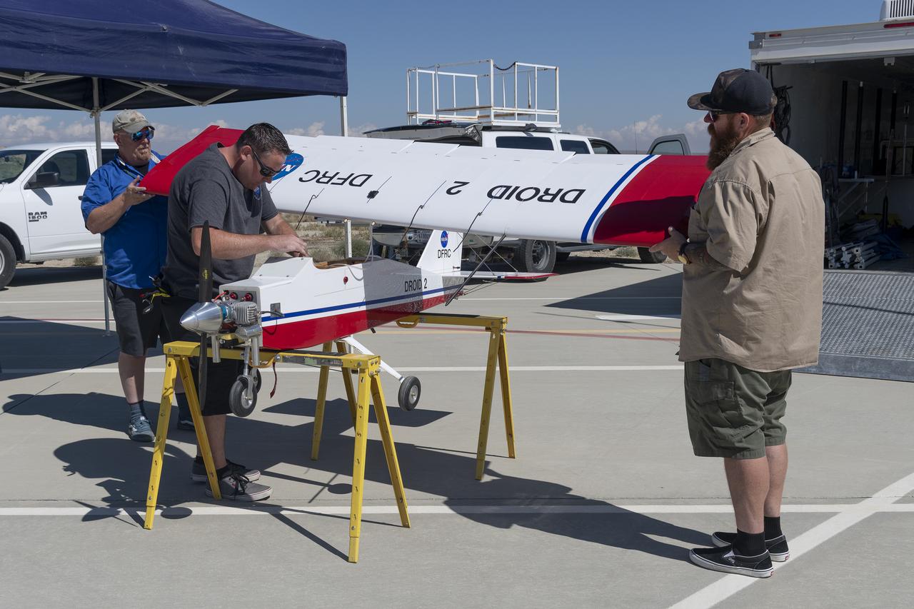
Robert "Red" Jensen, Justin Link, and Justin Hall prepare the DROID 2 (Dryden Remotely Operated Integrated Drone 2) for the Advanced Exploration of Reliable Operation at Low Altitudes: Meteorology, Simulation, and Technology campaign flights. The weather study was at NASA's Armstrong Flight Research Center in Edwards, California. The focus was to study wind to provide data for safe takeoff and landing of future air taxis.
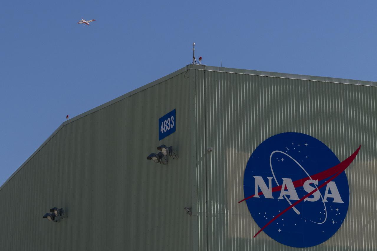
The DROID 2 (Dryden Remotely Operated Integrated Drone 2) aircraft flies by the former space shuttle hangar at NASA's Armstrong Flight Research Center in Edwards, California, as part of the Advanced Exploration of Reliable Operation at Low Altitudes: Meteorology, Simulation, and Technology campaign. The focus was to study wind to provide data for safe takeoff and landing of future air taxis.
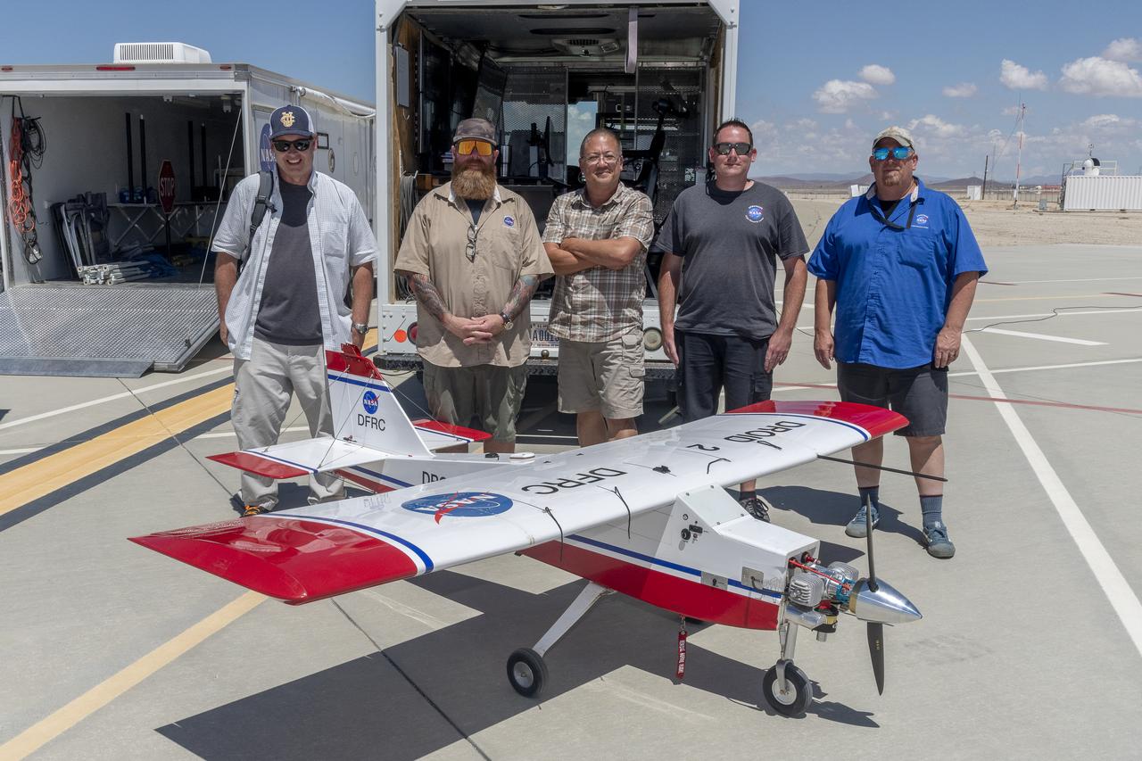
John Melton, Justin Hall, Derek Abramson, Justin Link, and Robert "Red" Jensen were key on mission day for the Advanced Exploration of Reliable Operation at Low Altitudes: Meteorology, Simulation, and Technology campaign. The DROID 2 (Dryden Remotely Operated Integrated Drone 2) aircraft supported the campaign at NASA's Armstrong Flight Research Center in Edwards, California. The focus was to study wind to provide data for safe takeoff and landing of future air taxis.
The DROID 2 (Dryden Remotely Operated Integrated Drone 2) aircraft flies by the former space shuttle hangar at NASA's Armstrong Flight Research Center in Edwards, California, as part of the Advanced Exploration of Reliable Operation at Low Altitudes: Meteorology, Simulation, and Technology campaign. The focus was to study wind to provide data for safe takeoff and landing of future air taxis.

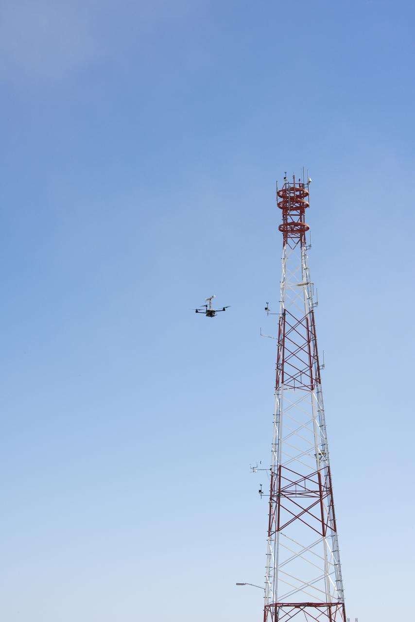
The DROID 2 (Dryden Remotely Operated Integrated Drone 2) flies by a 140-foot instrumented tower at NASA's Armstrong Flight Research Center in Edwards, California, as part of the Advanced Exploration of Reliable Operation at Low Altitudes: Meteorology, Simulation, and Technology campaign. The focus was to study wind to provide data for safe takeoff and landing of future air taxis.
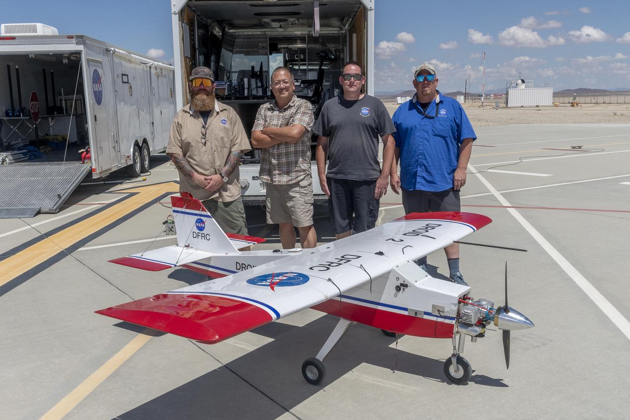
Justin Hall, Derek Abramson, Justin Link, and Robert "Red" Jensen were key to a successful mission for the DROID 2 (Dryden Remotely Operated Integrated Drone 2) aircraft at NASA's Armstrong Flight Research Center in Edwards, California. The aircraft flew as part of the Advanced Exploration of Reliable Operation at Low Altitudes: Meteorology, Simulation, and Technology campaign. The focus was to study wind to provide data for safe takeoff and landing of future air taxis.
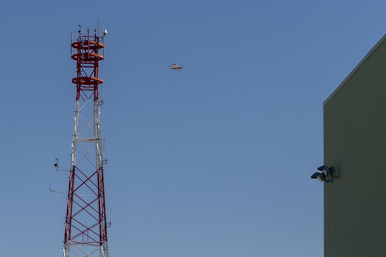
The DROID 2 (Dryden Remotely Operated Integrated Drone 2) flies by a 140-foot instrumented tower and the former space shuttle hangar at NASA's Armstrong Flight Research Center in Edwards, California, as part of the Advanced Exploration of Reliable Operation at Low Altitudes: Meteorology, Simulation, and Technology campaign. The focus was to study wind to provide data for safe takeoff and landing of future air taxis.
Justin Hall lands the DROID 2 (Dryden Remotely Operated Integrated Drone 2) aircraft at NASA's Armstrong Flight Research Center in Edwards, California, as part of the Advanced Exploration of Reliable Operation at Low Altitudes: Meteorology, Simulation, and Technology campaign. The focus was to study wind to provide data for safe takeoff and landing of future air taxis.

Robert "Red" Jensen lands the DROID 2 (Dryden Remotely Operated Integrated Drone 2) aircraft at NASA's Armstrong Flight Research Center in Edwards, California, as part of the Advanced Exploration of Reliable Operation at Low Altitudes: Meteorology, Simulation, and Technology campaign. The focus was to study wind to provide data for safe takeoff and landing of future air taxis.
Tegan French and Rocky Garcia are at a weather balloon system’s ground station monitoring temperature, humidity, pressure, and winds transmitted from an instrument package on the balloon as it ascends. The balloon is part of the different methods to collect wind and weather data for the Advanced Exploration of Reliable Operation at Low Altitudes: Meteorology, Simulation and Technology campaign. The weather study was at NASA’s Armstrong Flight Research Center in Edwards, California. The focus was to study wind from the ground to 2,000 feet to provide data to assist future drones to safely land on rooftop hubs called vertiports and to potentially improve weather prediction.
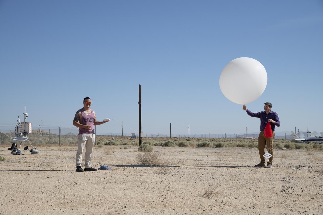
Rocky Garcia and Wesley James prepare a weather balloon to collect wind data for the Advanced Exploration of Reliable Operation at Low Altitudes: Meteorology, Simulation and Technology campaign. The weather study was at NASA’s Armstrong Flight Research Center in Edwards, California. The focus was to study wind from the ground to 2,000 feet to provide data to assist future drones to safely land on rooftop hubs called vertiports and to potentially improve weather prediction.
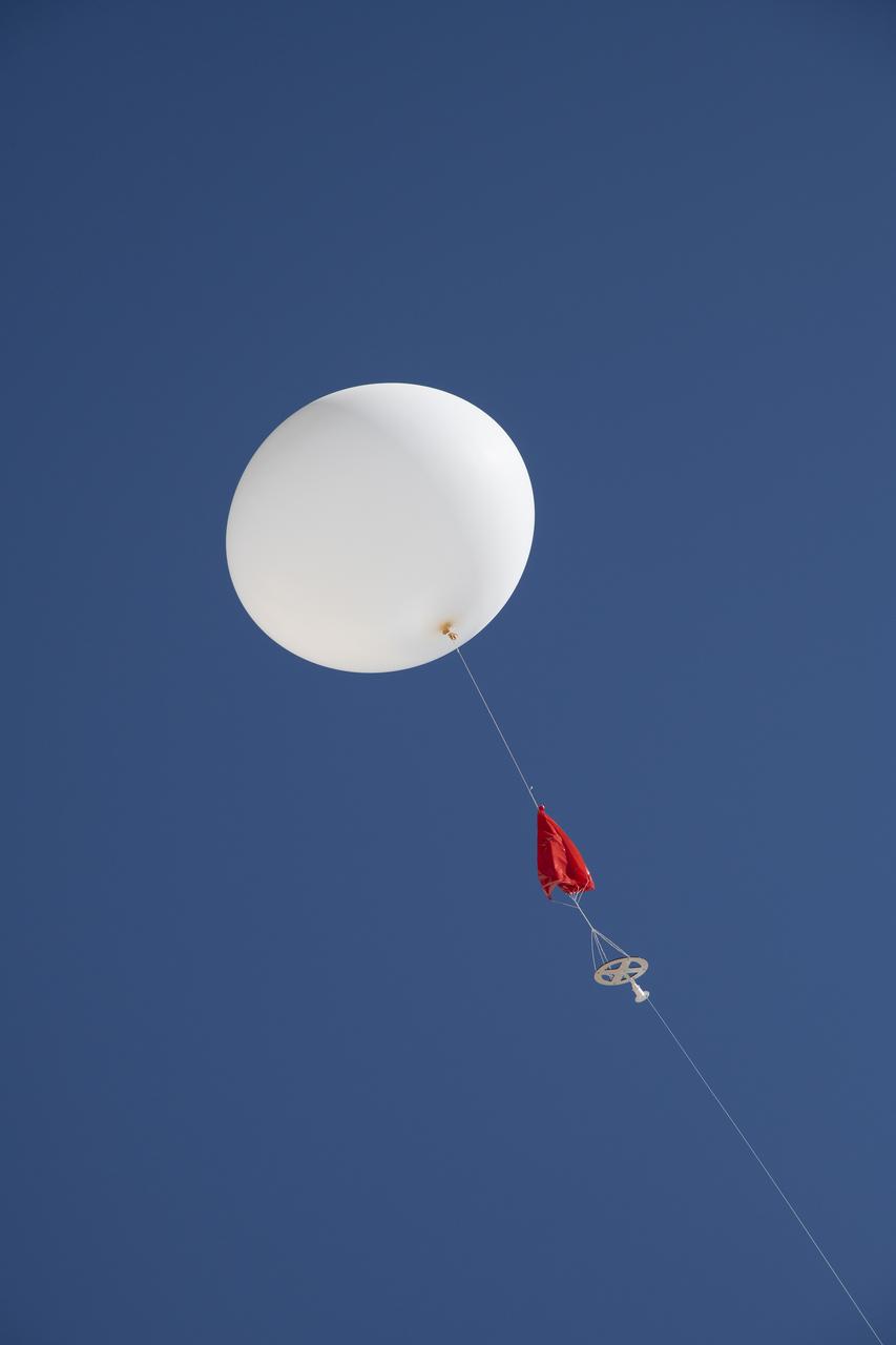
A weather balloon is launched to collect wind data for the Advanced Exploration of Reliable Operation at Low Altitudes: Meteorology, Simulation and Technology campaign. The weather study was at NASA’s Armstrong Flight Research Center in Edwards, California. The focus was to study wind from the ground to 2,000 feet to provide data to assist future drones to safely land on rooftop hubs called vertiports and to potentially improve weather prediction.
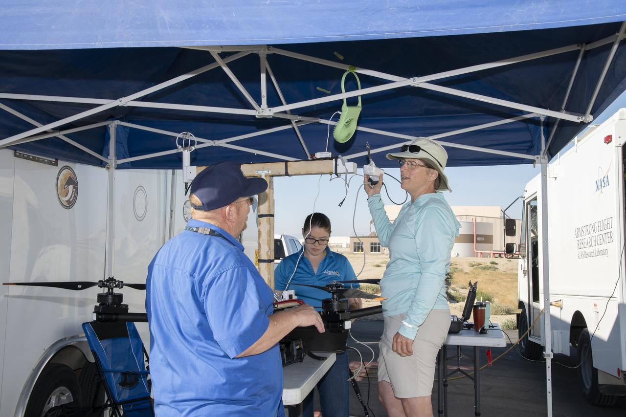
Jennifer Fowler talks to Red Jensen prior to a flight for the Advanced Exploration of Reliable Operation at Low Altitudes: Meteorology, Simulation and Technology campaign. Tyler Willhite completes some equipment checks for the research in the background. The weather study was at NASA’s Armstrong Flight Research Center in Edwards, California. The focus was to study wind from the ground to 2,000 feet to provide data to assist future drones to safely land on rooftop hubs called vertiports and to potentially improve weather prediction.
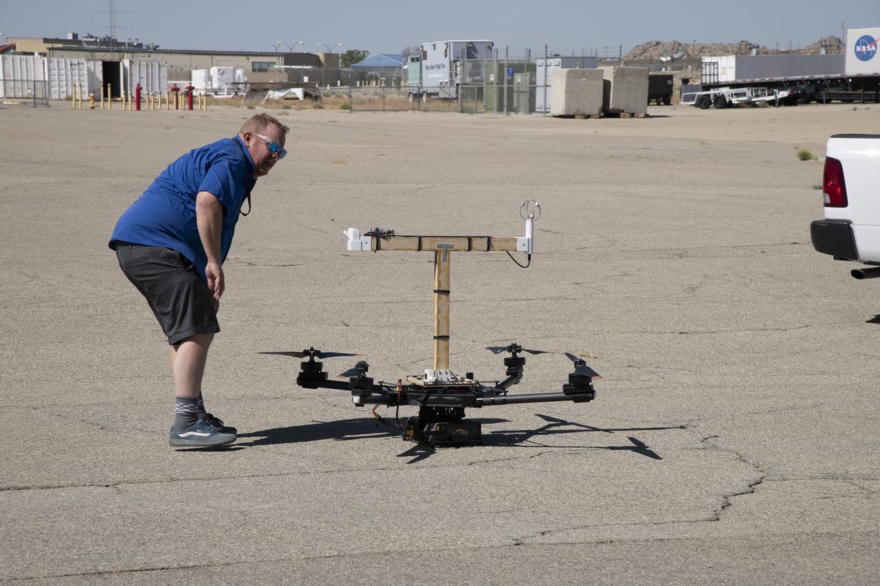
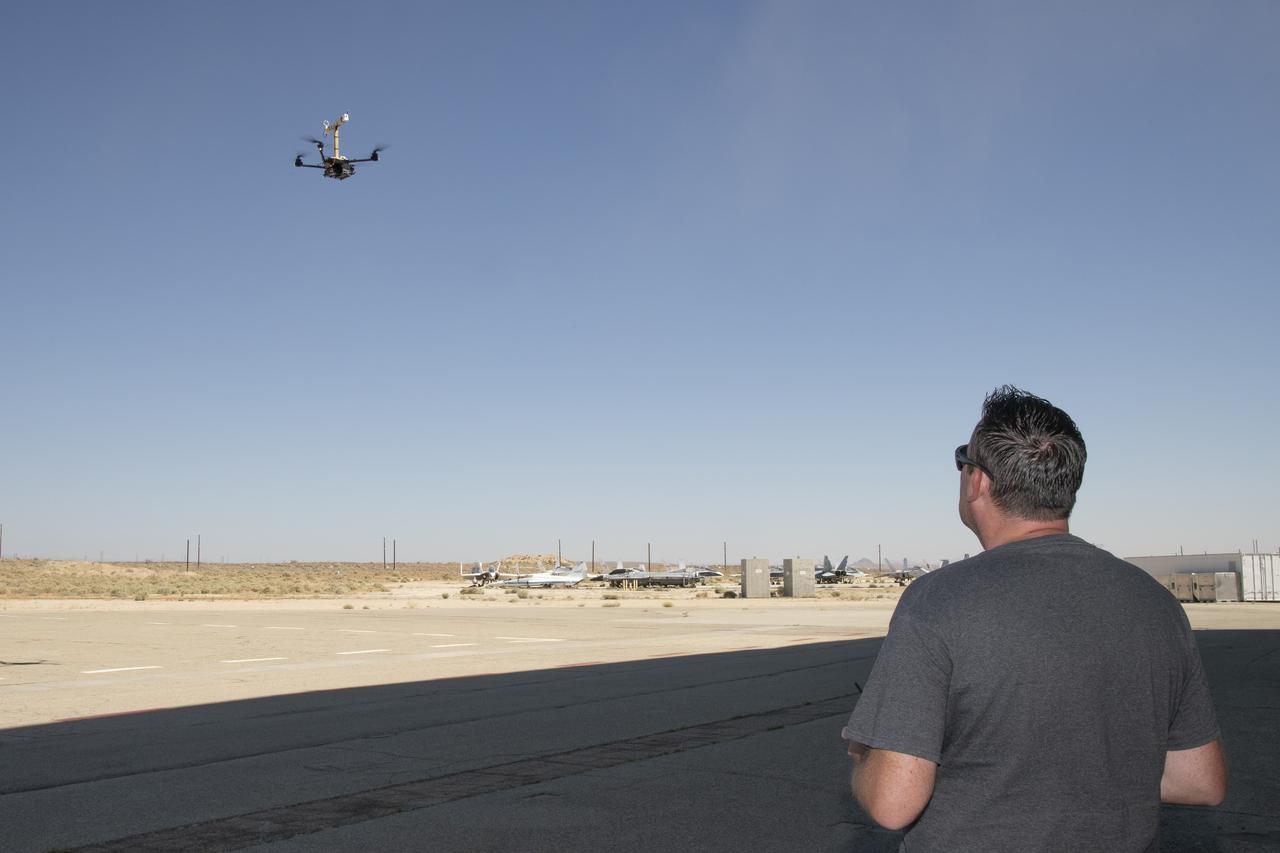
Red Jensen looks over the Alta-X aircraft before a flight for the Advanced Exploration of Reliable Operation at Low Altitudes: Meteorology, Simulation and Technology campaign. The weather study was at NASA’s Armstrong Flight Research Center in Edwards, California. The focus was to study wind from the ground to 2,000 feet to provide data to assist future drones to safely land on rooftop hubs called vertiports and to potentially improve weather prediction.

The Alta-X aircraft flies by the former space shuttle hangar at NASA’s Armstrong Flight Research Center in Edwards, California, as part of the Advanced Exploration of Reliable Operation at Low Altitudes: Meteorology, Simulation and Technology campaign. The campaign was at NASA Armstrong to study wind from the ground to 2,000 feet to provide data to assist future drones to safely land on rooftop hubs called vertiports and to potentially improve weather prediction.
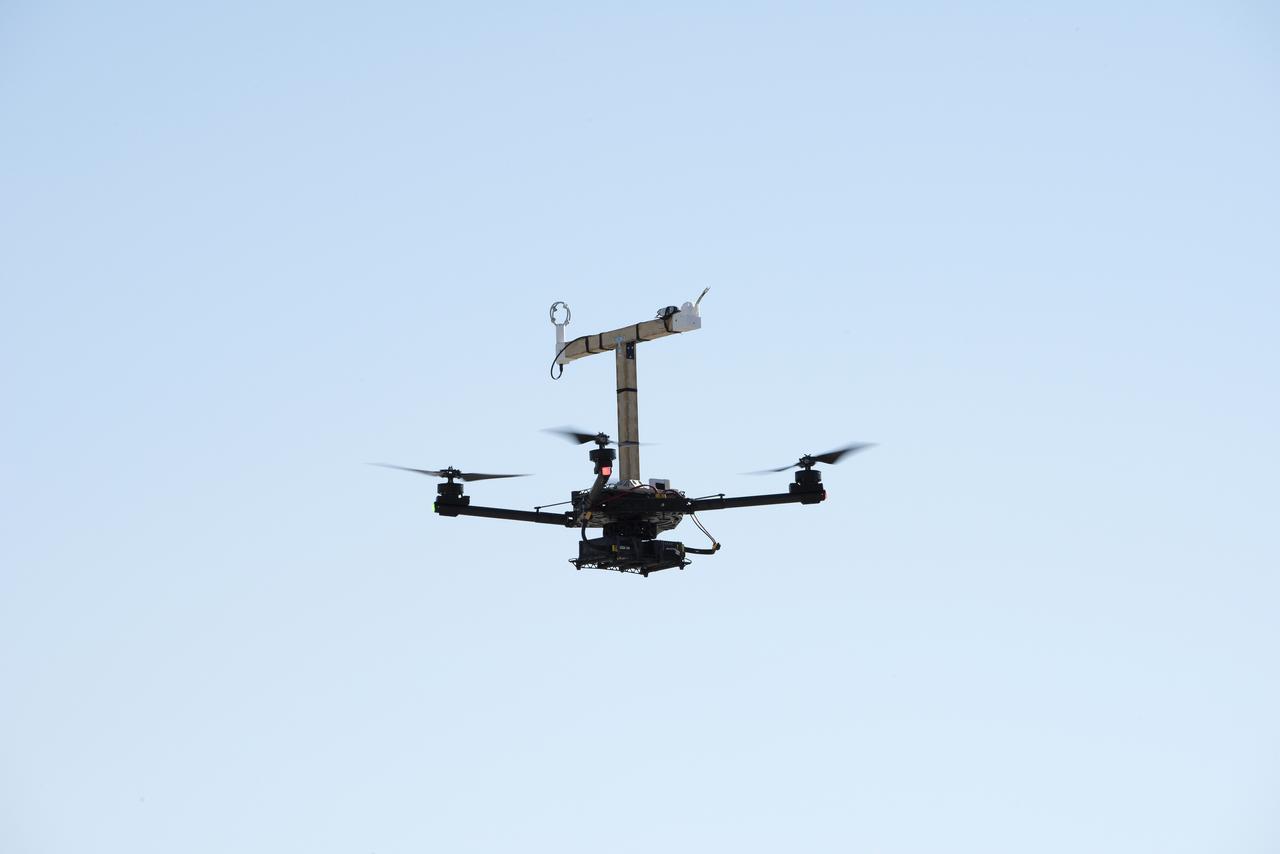
The Alta-X aircraft flies at NASA’s Armstrong Flight Research Center in Edwards, California, as part of the Advanced Exploration of Reliable Operation at Low Altitudes: Meteorology, Simulation and Technology campaign. The campaign was at NASA Armstrong to study wind from the ground to 2,000 feet to provide data to assist future drones to safely land on rooftop hubs called vertiports and to potentially improve weather prediction.
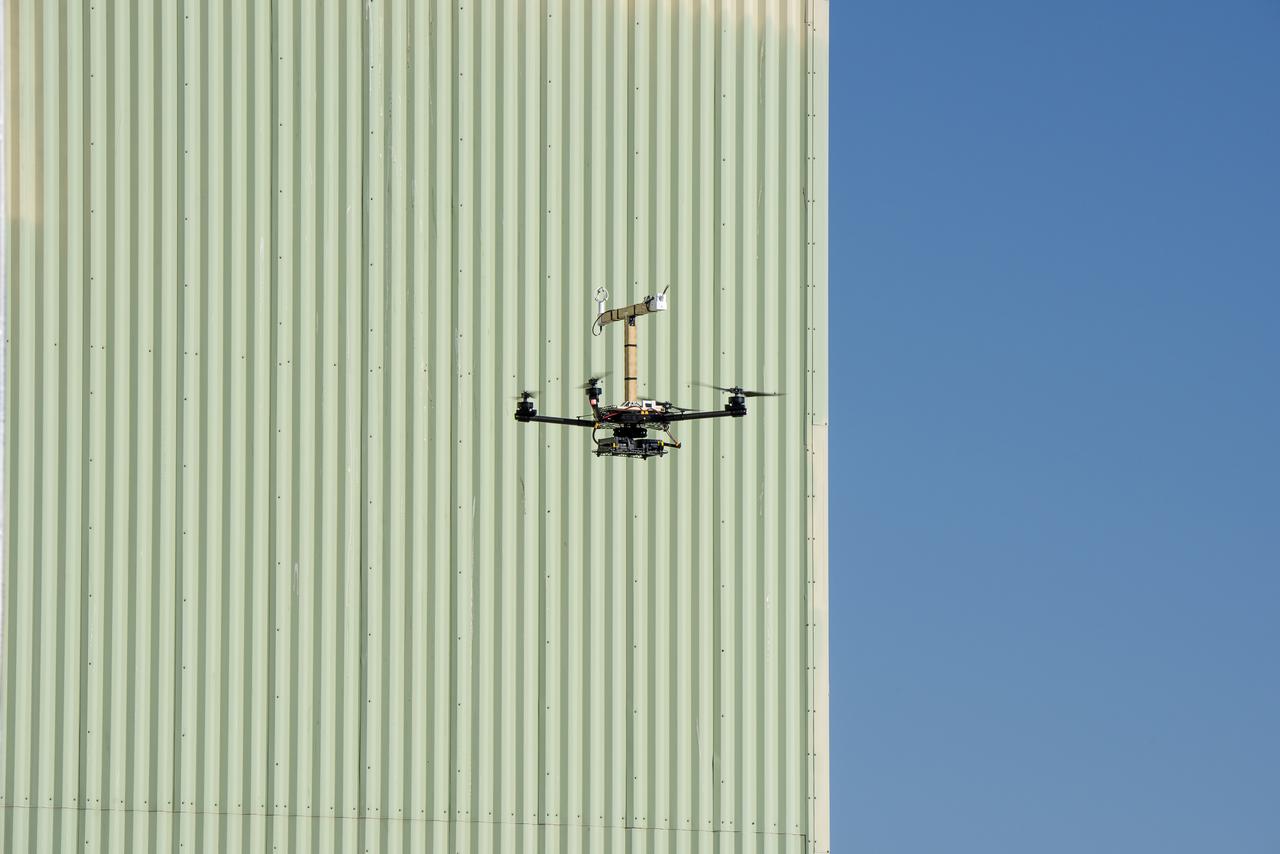
The Alta-X aircraft flies by the former space shuttle hangar at NASA’s Armstrong Flight Research Center in Edwards, California, as part of the Advanced Exploration of Reliable Operation at Low Altitudes: Meteorology, Simulation and Technology campaign. The campaign was at NASA Armstrong Flight to study wind from the ground to 2,000 feet to provide data to assist future drones to safely land on rooftop hubs called vertiports and to potentially improve weather prediction.
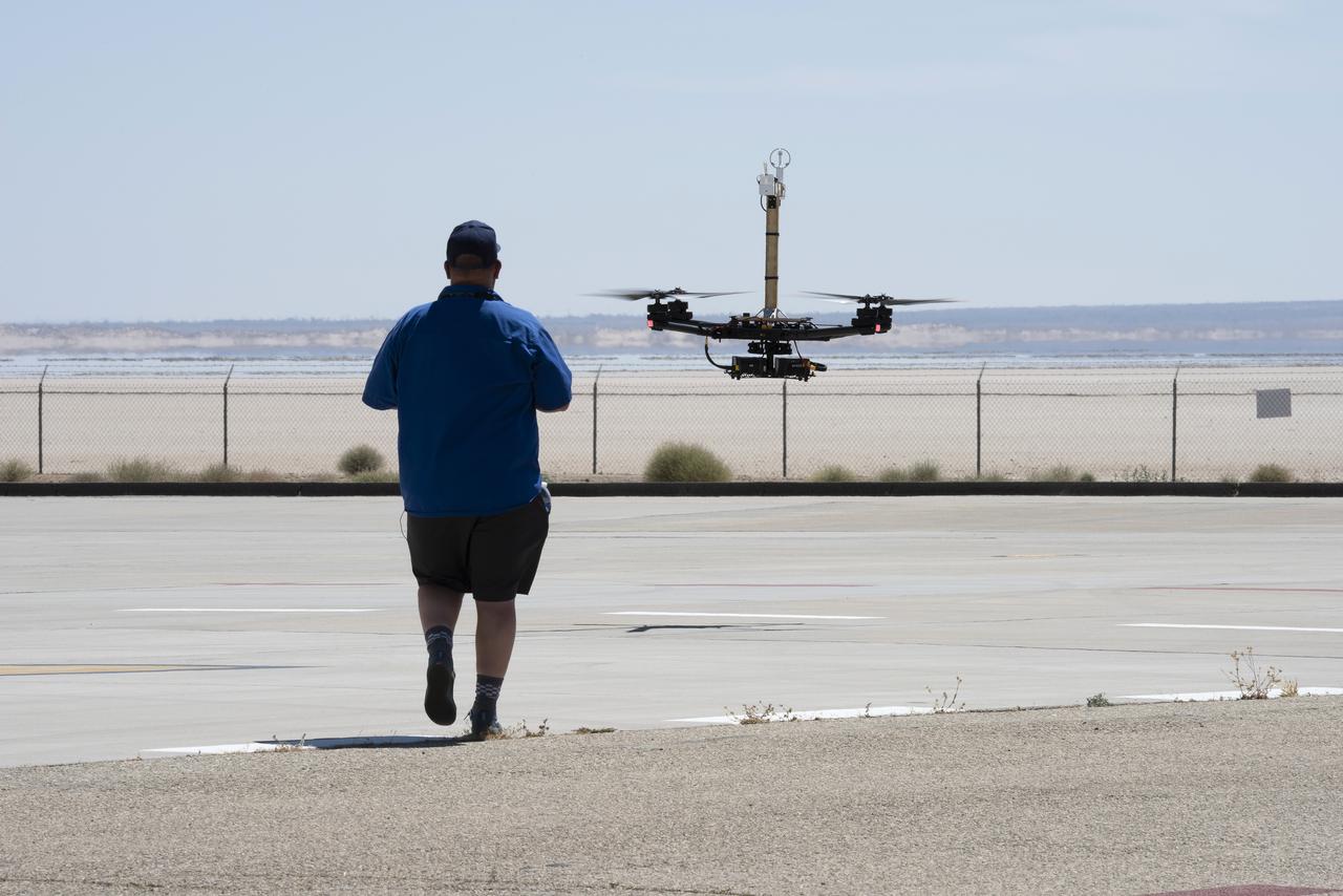
Red Jensen lands the Alta-X aircraft at NASA’s Armstrong Flight Research Center in Edwards, California, as part of the Advanced Exploration of Reliable Operation at Low Altitudes: Meteorology, Simulation and Technology campaign. The campaign was at NASA Armstrong to study wind from the ground to 2,000 feet to provide data to assist future drones to safely land on rooftop hubs called vertiports and to potentially improve weather prediction.
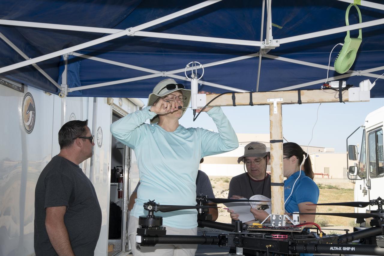
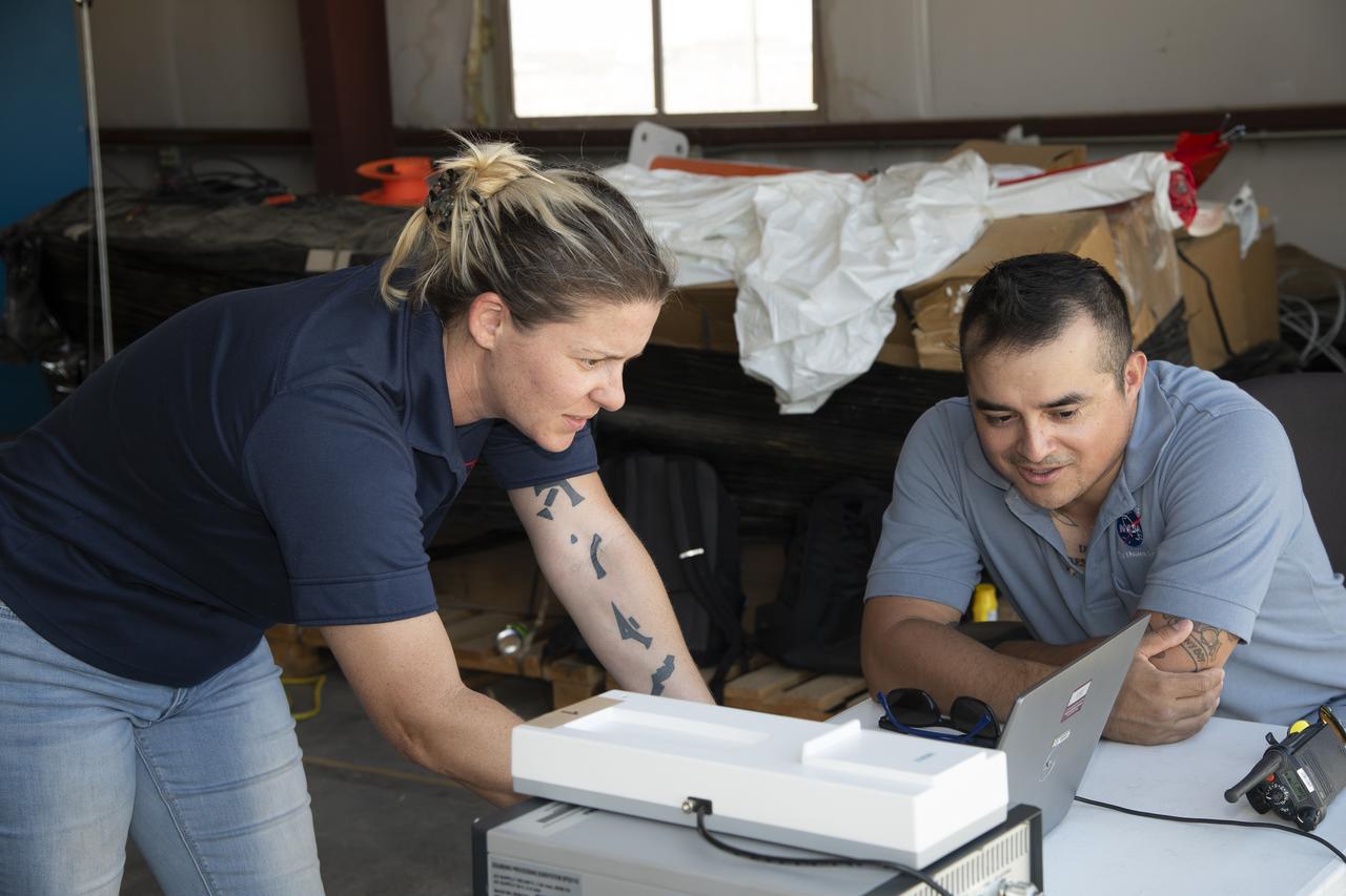
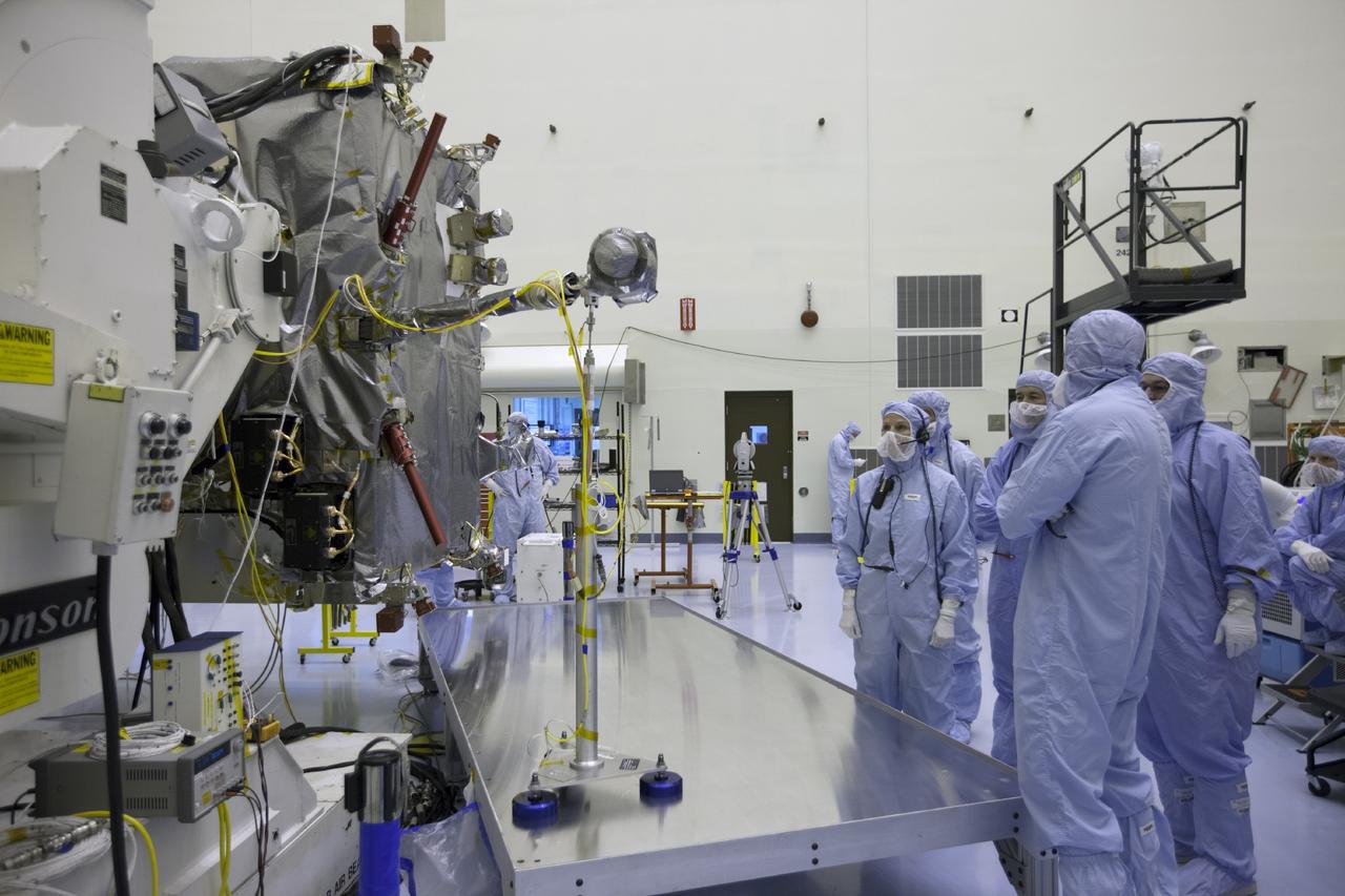
Jennifer Fowler works on securing sensors onto the test fixture on the Alta-X aircraft. Justin Link, Grady Koch, and Tyler Willhite are in the background. The Advanced Exploration of Reliable Operation at Low Altitudes: Meteorology, Simulation and Technology campaign was at NASA’s Armstrong Flight Research Center in Edwards, California. The focus was to study wind from the ground to 2,000 feet to provide data to assist future drones to safely land on rooftop hubs called vertiports and to potentially improve weather prediction.
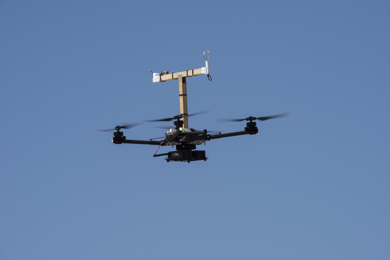
The Alta-X aircraft flies at NASA’s Armstrong Flight Research Center in Edwards, California, as part of the Advanced Exploration of Reliable Operation at Low Altitudes: Meteorology, Simulation and Technology campaign. The campaign was at NASA Armstrong to study wind from the ground to 2,000 feet to provide data to assist future drones to safely land on rooftop hubs called vertiports and to potentially improve weather prediction.
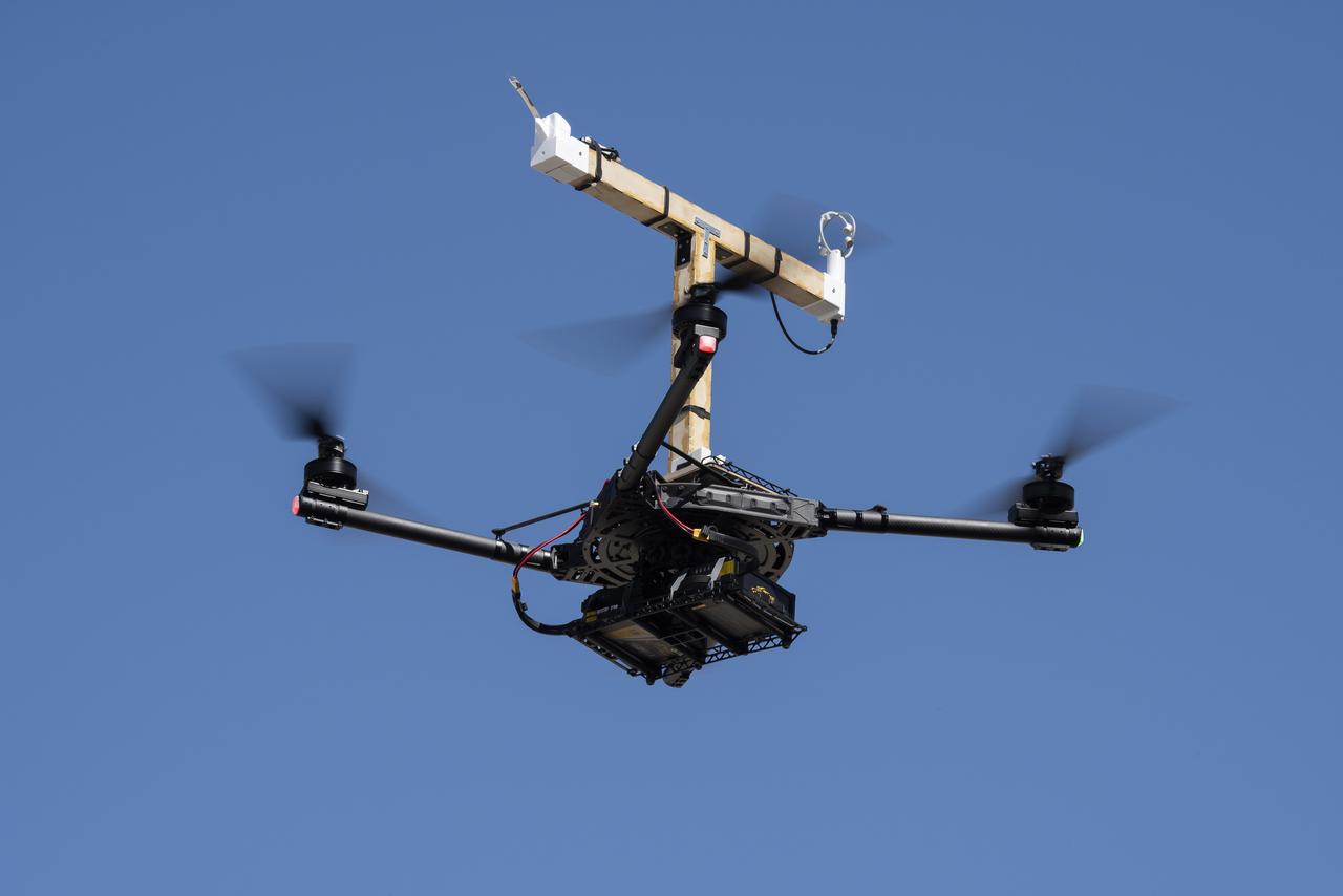
The Alta-X aircraft flies at NASA’s Armstrong Flight Research Center in Edwards, California, as part of the Advanced Exploration of Reliable Operation at Low Altitudes: Meteorology, Simulation and Technology campaign. The campaign was at NASA Armstrong to study wind from the ground to 2,000 feet to provide data to assist future drones to safely land on rooftop hubs called vertiports and to potentially improve weather prediction.
The Alta-X aircraft flies by a 140-foot instrumented tower at NASA’s Armstrong Flight Research Center in Edwards, California, as part of the Advanced Exploration of Reliable Operation at Low Altitudes: Meteorology, Simulation and Technology campaign. The campaign was at NASA Armstrong to study wind from the ground to 2,000 feet to provide data to assist future drones to safely land on rooftop hubs called vertiports and to potentially improve weather prediction.

Justin Link, left, Red Jensen and Derek Abramson prepare for an Alta-X aircraft flight as part of the Advanced Exploration of Reliable Operation at Low Altitudes: Meteorology, Simulation and Technology campaign. In the background are Grady Koch and Jennifer Fowler. The campaign was at NASA Armstrong to study wind from the ground to 2,000 feet to provide data to assist future drones to safely land on rooftop hubs called vertiports and to potentially improve weather prediction.
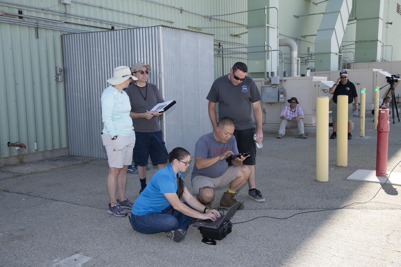
Tyler Willhite, sitting, and Derek Abramson and Justin Link, prepare for an Alta-X aircraft flight. Behind them are Jennifer Fowler, from left and Grady Kock. The Alta-X flight was part of the Advanced Exploration of Reliable Operation at Low Altitudes: Meteorology, Simulation and Technology campaign. The campaign was at NASA Armstrong to study wind from the ground to 2,000 feet to provide data to assist future drones to safely land on rooftop hubs called vertiports and to potentially improve weather prediction.
Justin Link positions the Alta-X aircraft for a hover to capture data as part of the Advanced Exploration of Reliable Operation at Low Altitudes: Meteorology, Simulation and Technology campaign. The campaign was at NASA Armstrong to study wind from the ground to 2,000 feet to provide data to assist future drones to safely land on rooftop hubs called vertiports and to potentially improve weather prediction.
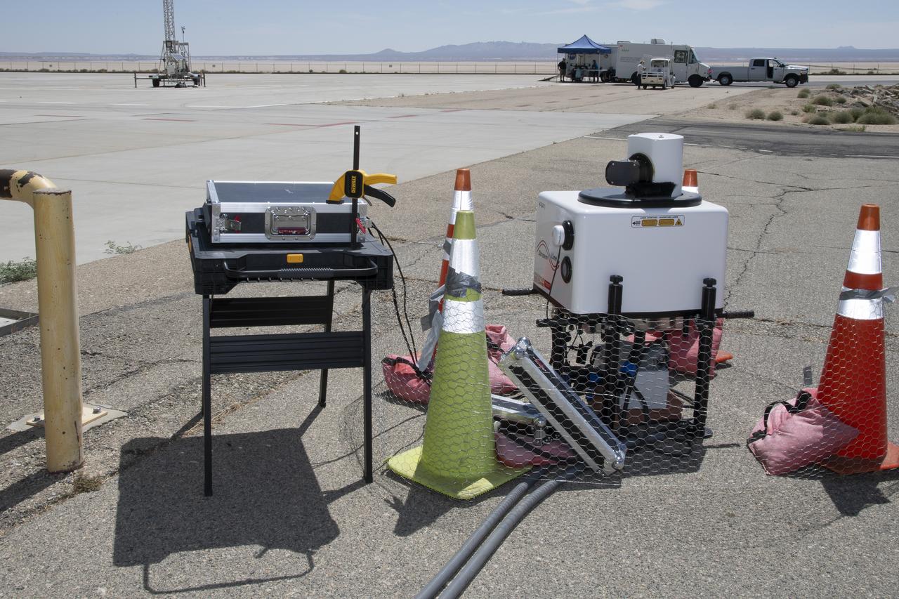
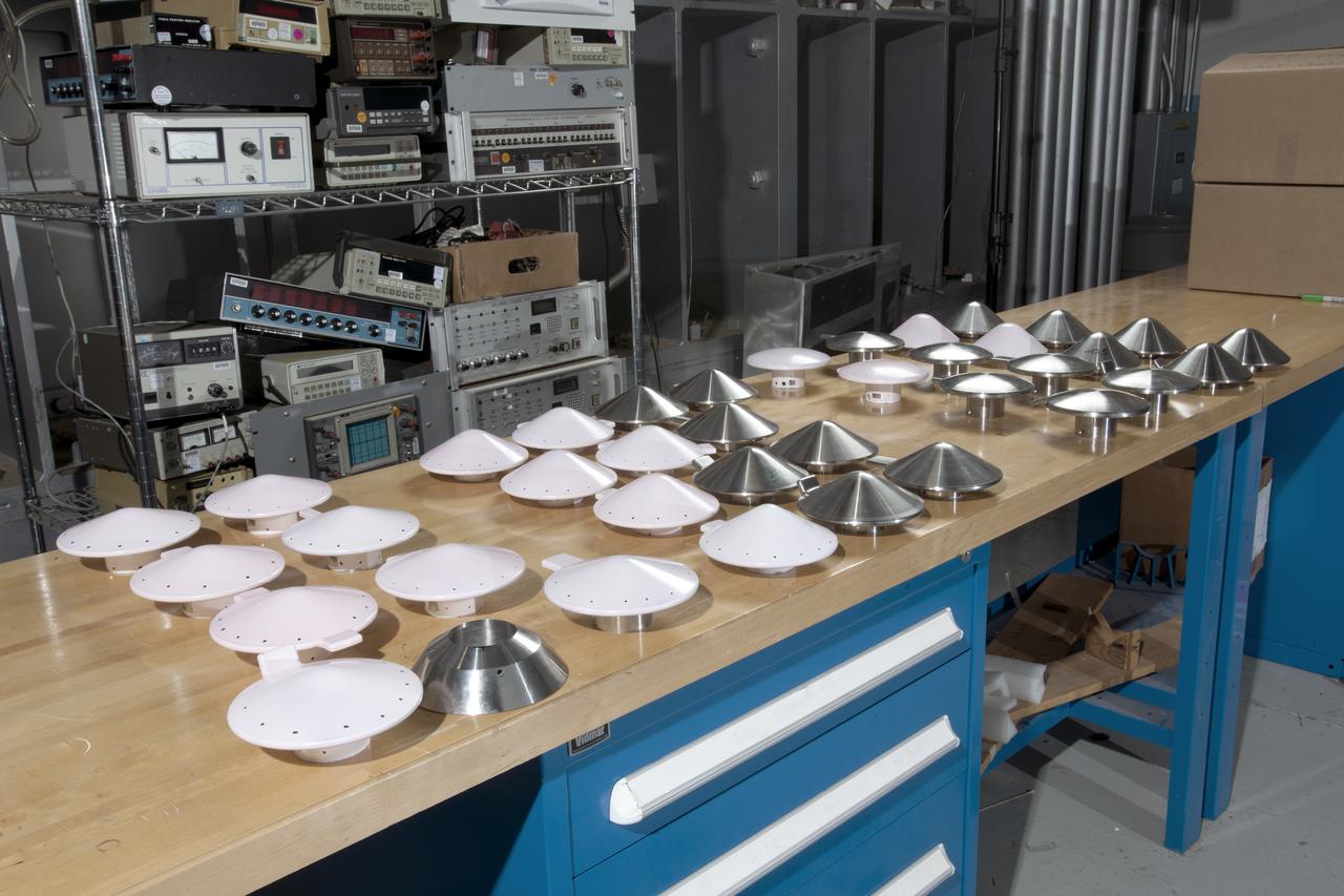
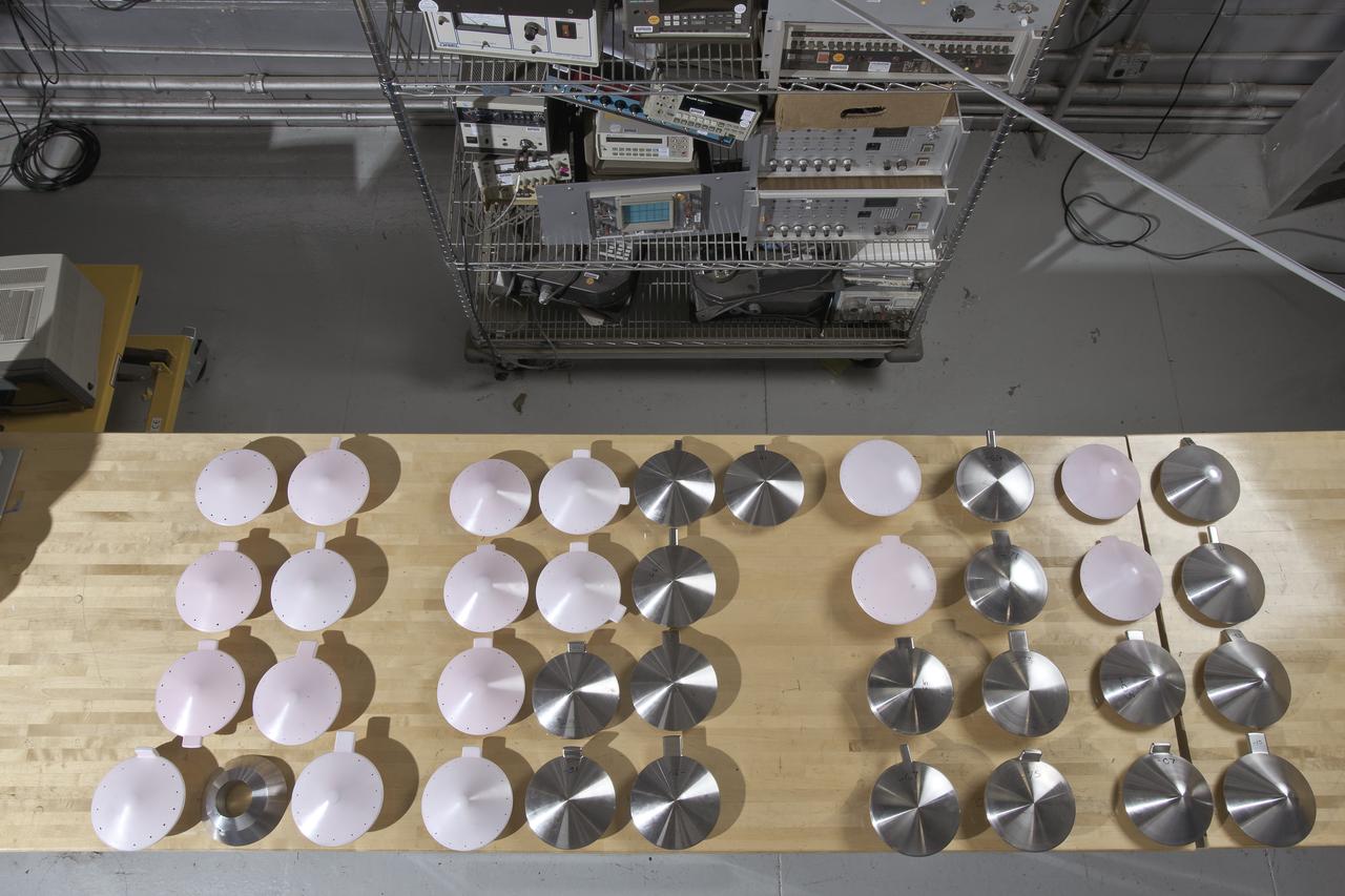
This is one of two lidar units positioned on either end of Building 4833 at NASA’s Armstrong Flight Research Center in Edwards, California, that formed the cutting-edge ‘virtual tower concept.’ The units use lasers to measure airflow from the ground level to 2,000 feet to provide data to assist future drones to safely land on rooftop hubs called vertiports, and to potentially improve weather prediction. It was part of the multi-faceted Advanced Exploration of Reliable Operation at Low Altitudes: Meteorology, Simulation and Technology campaign.
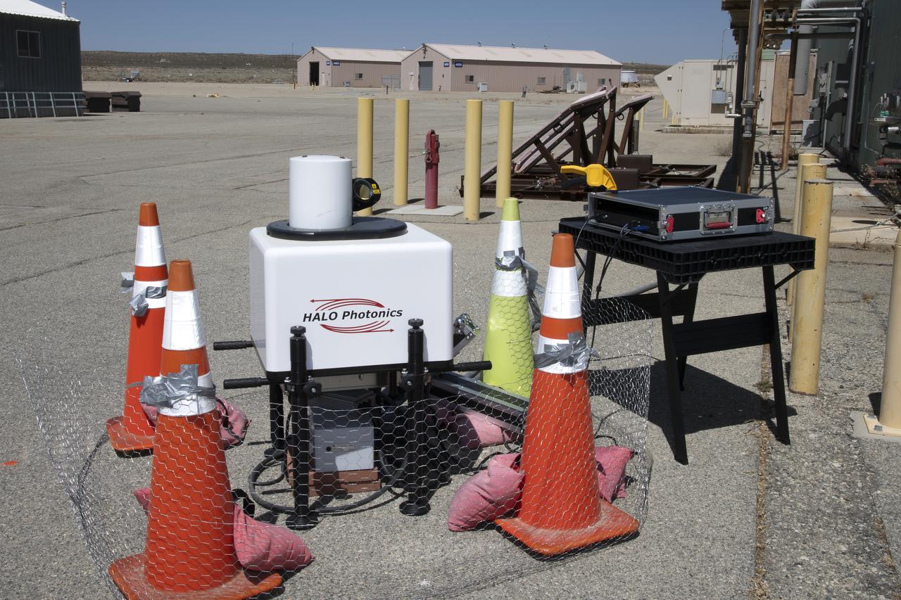
This is one of two lidar units positioned on either end of Building 4833 at NASA’s Armstrong Flight Research Center in Edwards, California, that formed the cutting-edge ‘virtual tower concept.’ The units use lasers to measure airflow from the ground level to 2,000 feet to provide data to assist future drones to safely land on rooftop hubs called vertiports, and to potentially improve weather prediction. It was part of the multi-faceted Advanced Exploration of Reliable Operation at Low Altitudes: Meteorology, Simulation and Technology campaign.
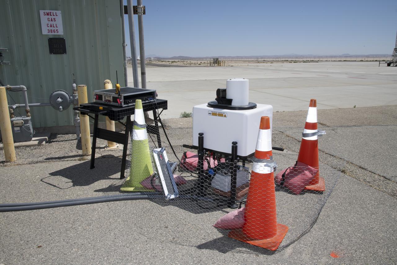
This is one of two lidar units positioned on either end of Building 4833 at NASA’s Armstrong Flight Research Center in Edwards, California, that formed the cutting-edge ‘virtual tower concept.’ The units use lasers to measure airflow from the ground level to 2,000 feet to provide data to assist future drones to safely land on rooftop hubs called vertiports, and to potentially improve weather prediction. It was part of the multi-faceted Advanced Exploration of Reliable Operation at Low Altitudes: Meteorology, Simulation and Technology campaign.

This is one of two lidar units positioned on either end of Building 4833 at NASA’s Armstrong Flight Research Center in Edwards, California, that formed the cutting-edge ‘virtual tower concept.’ The units use lasers to measure airflow from the ground level to 2,000 feet to provide data to assist future drones to safely land on rooftop hubs called vertiports, and to potentially improve weather prediction. It was part of the multi-faceted Advanced Exploration of Reliable Operation at Low Altitudes: Meteorology, Simulation and Technology campaign.
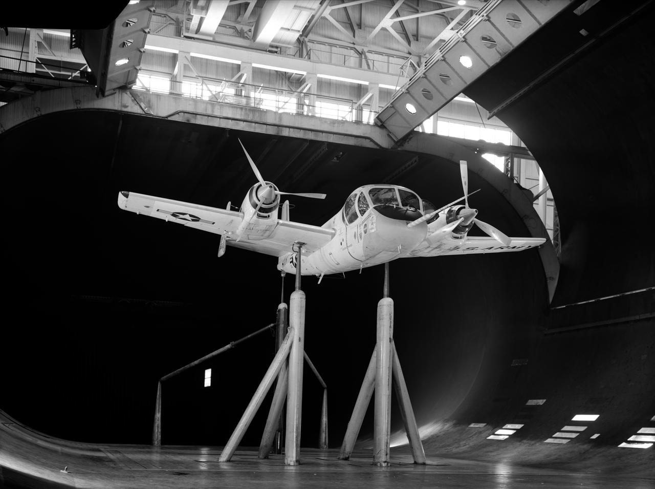
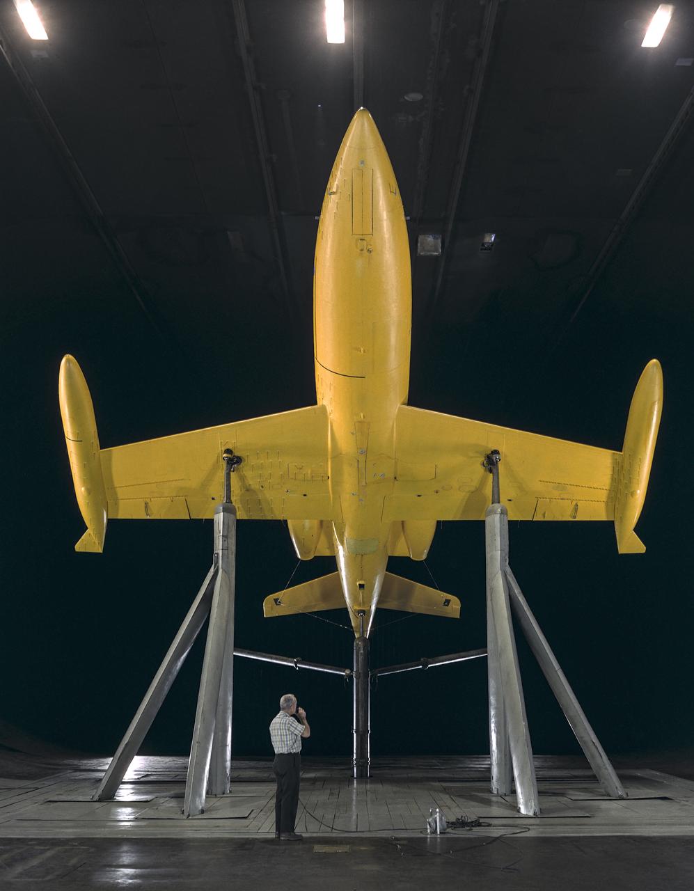
Drag studies for Full Scale wind tunnel test of Grumman YAO-1 airplane, 3/4 front view with propellers on
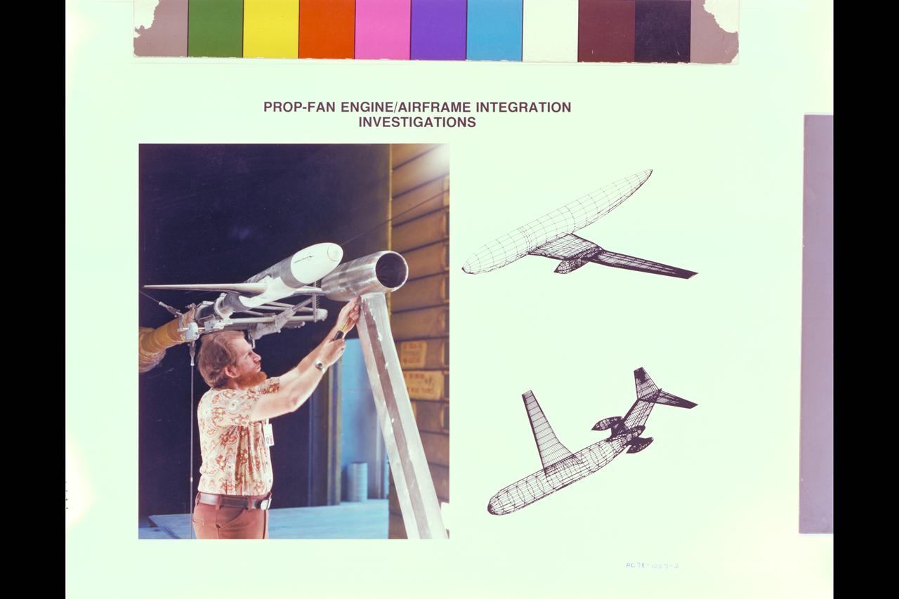
Illustration Future Prop-Fan airraft Studies (DC-9): Prop-Fan engine - airframe integration investigations and computation and wind tunnel tests
Front lower view of Gates Learjet in Ames 40x80 foot wind tunnel at high angel of attack. Test was part of a deep stall study.
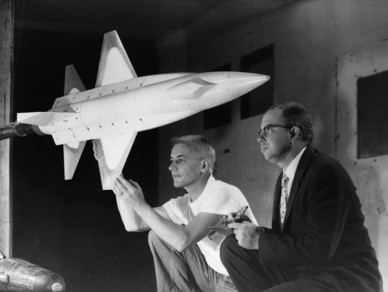
A 1/10th Scale Model of the X-15 research plane is prepared in Langley's 7 x 10 Foot Wind Tunnel for studies relating to spin characteristics. -- Photograph published in Winds of Change, 75th Anniversary NASA publication (page 66), by James Schultz.
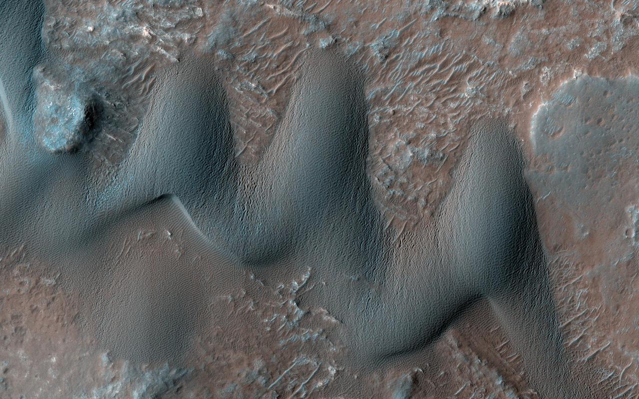
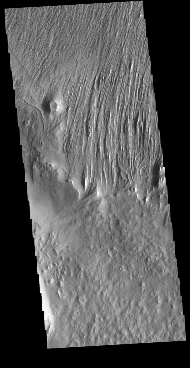
Sand dunes commonly form when particles that are being moved around by the wind find a natural barrier to accumulate and build a hill-like formation. Scientists study dunes because their shape and size can give us valuable information about the wind directions and speeds in current and past climates. For instance, barchan dunes are crescent-shaped, and they form when the wind blows mainly from one direction (perpendicular to the crescent long edge). On the other hand, "star" dunes have three or more "arms," and form in environments that that are affected by multiple wind directions. Our image shows an area on Mars with both star and barchan dunes next to each other. This implies that wind directions have changed with time, or that the surrounding landscape is creating complex wind patterns. Scientists can study HiRISE images collected over time of the same dunes to observe whether they are moving or not, and if so, how fast. By observing multiple dune systems over many seasons, we can get a better picture of wind regimes on Mars and possibly how they have evolved with time. https://photojournal.jpl.nasa.gov/catalog/PIA23849
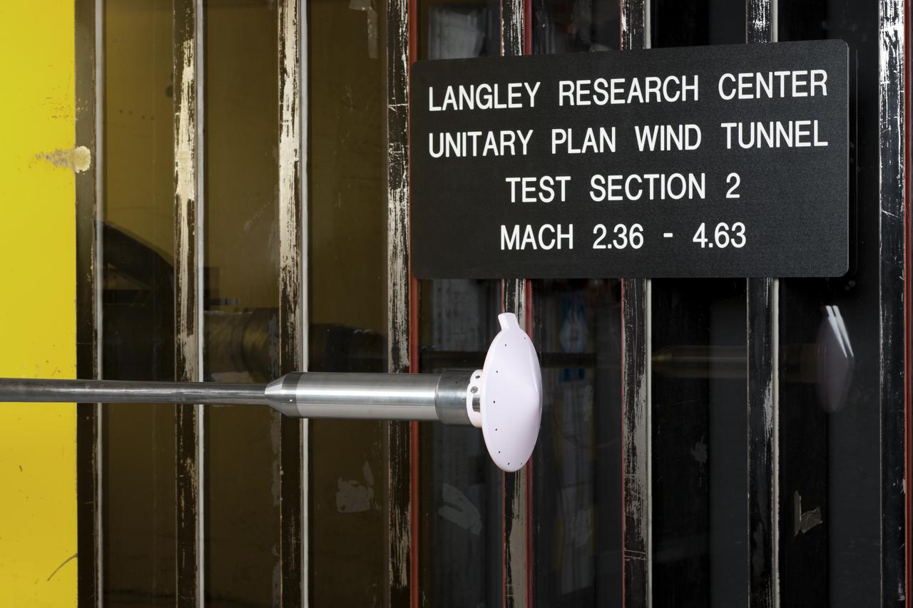
Test 1875 in Unitary Plan Wind Tunnel (UPWT) HIADS TTPM: Trim Tab study on various cone angled heat shields (TTPM) Technology Technical Performance Metric (HIADS) Hypersonic inflatable aerodynamic decelerators
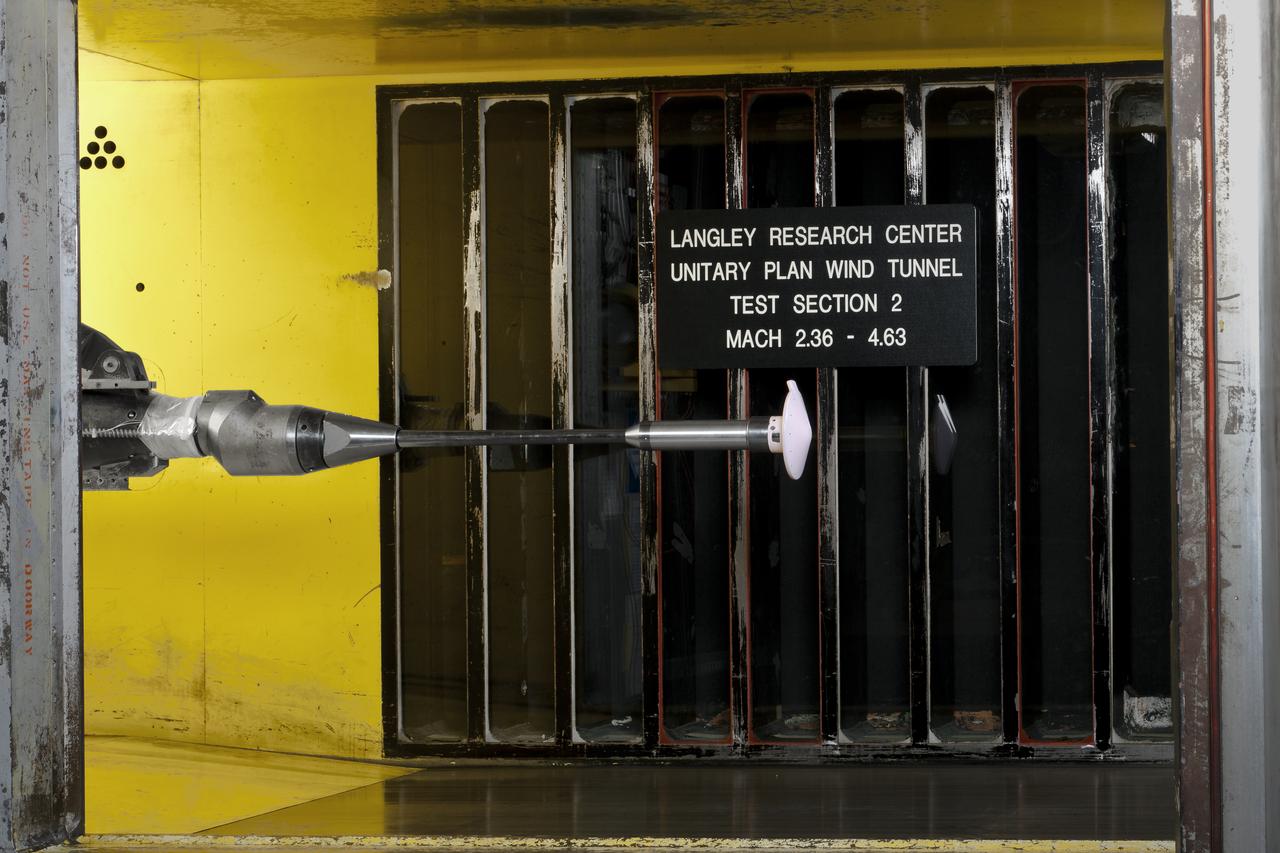
Test 1875 in Unitary Plan Wind Tunnel (UPWT) HIADS TTPM: Trim Tab study on various cone angled heat shields (TTPM) Technology Technical Performance Metric (HIADS) Hypersonic inflatable aerodynamic decelerators
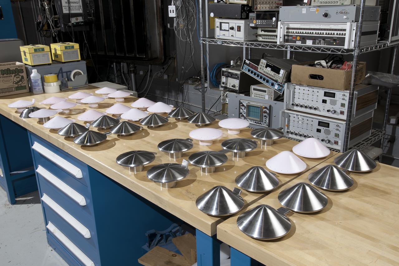
Test 1875 in Unitary Plan Wind Tunnel (UPWT) HIADS TTPM: Trim Tab study on various cone angled heat shields (TTPM) Technology Technical Performance Metric (HIADS) Hypersonic inflatable aerodynamic decelerators
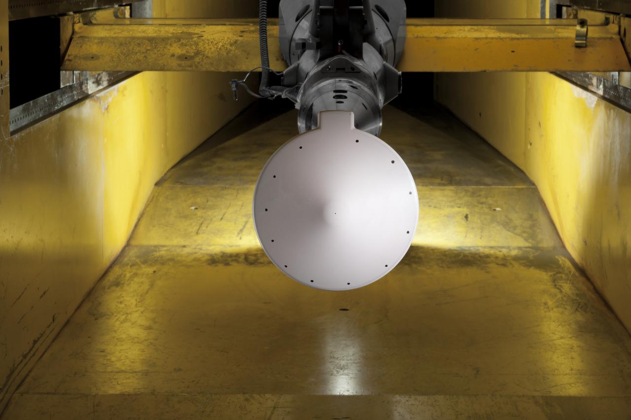
Test 1875 in Unitary Plan Wind Tunnel (UPWT) HIADS TTPM: Trim Tab study on various cone angled heat shields (TTPM) Technology Technical Performance Metric (HIADS) Hypersonic inflatable aerodynamic decelerators
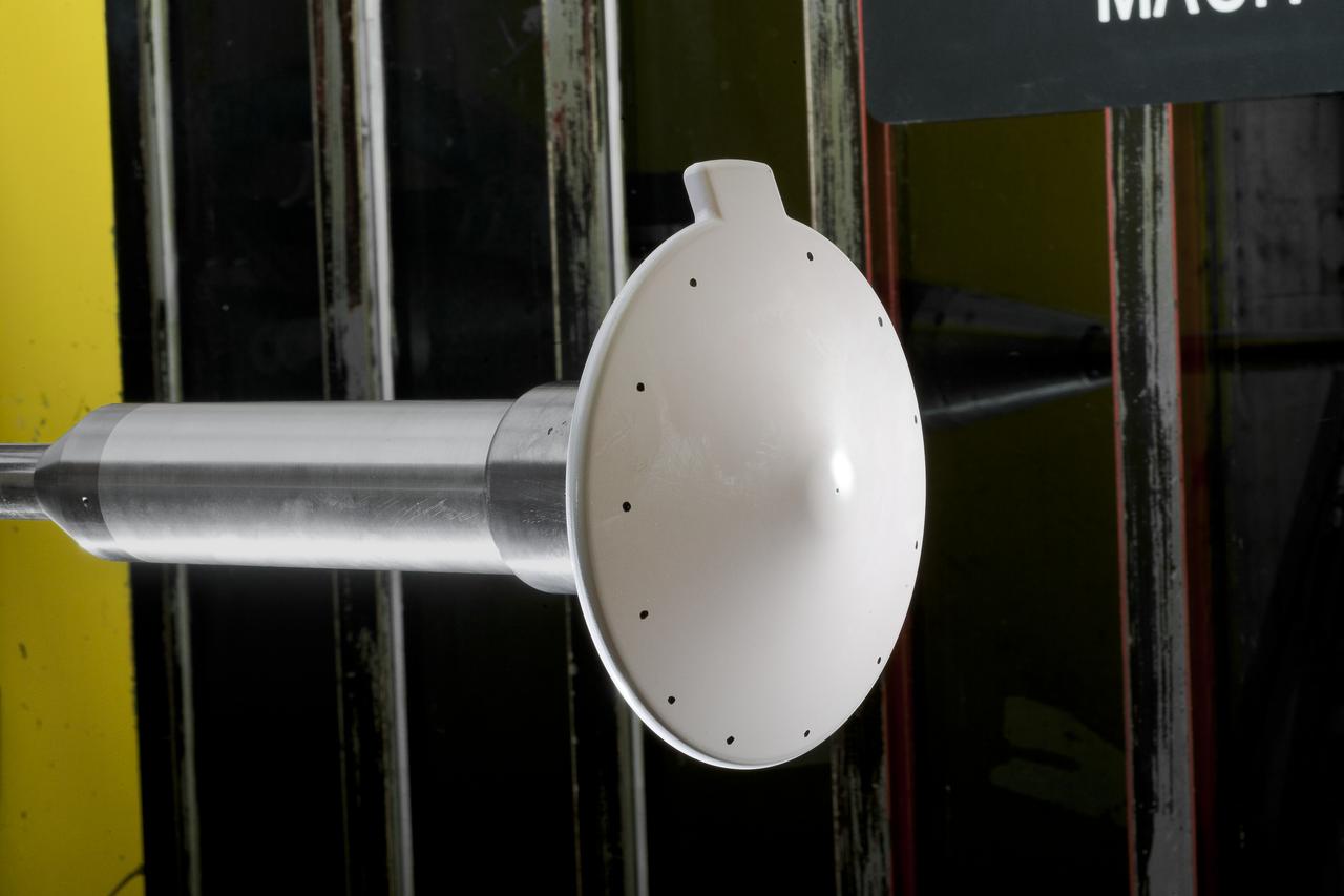
Test 1875 in Unitary Plan Wind Tunnel (UPWT) HIADS TTPM: Trim Tab study on various cone angled heat shields (TTPM) Technology Technical Performance Metric (HIADS) Hypersonic inflatable aerodynamic decelerators
Test 1875 in Unitary Plan Wind Tunnel (UPWT) HIADS TTPM: Trim Tab study on various cone angled heat shields (TTPM) Technology Technical Performance Metric (HIADS) Hypersonic inflatable aerodynamic decelerators
Overhead view of Bell XV-3 Convertiplane. First tilt rotor tested in the 40 x 80 wind tunnel. Transition aerodynamics studied; shown in hover mode.
Test 1875 in Unitary Plan Wind Tunnel (UPWT) HIADS TTPM: Trim Tab study on various cone angled heat shields (TTPM) Technology Technical Performance Metric (HIADS) Hypersonic inflatable aerodynamic decelerators
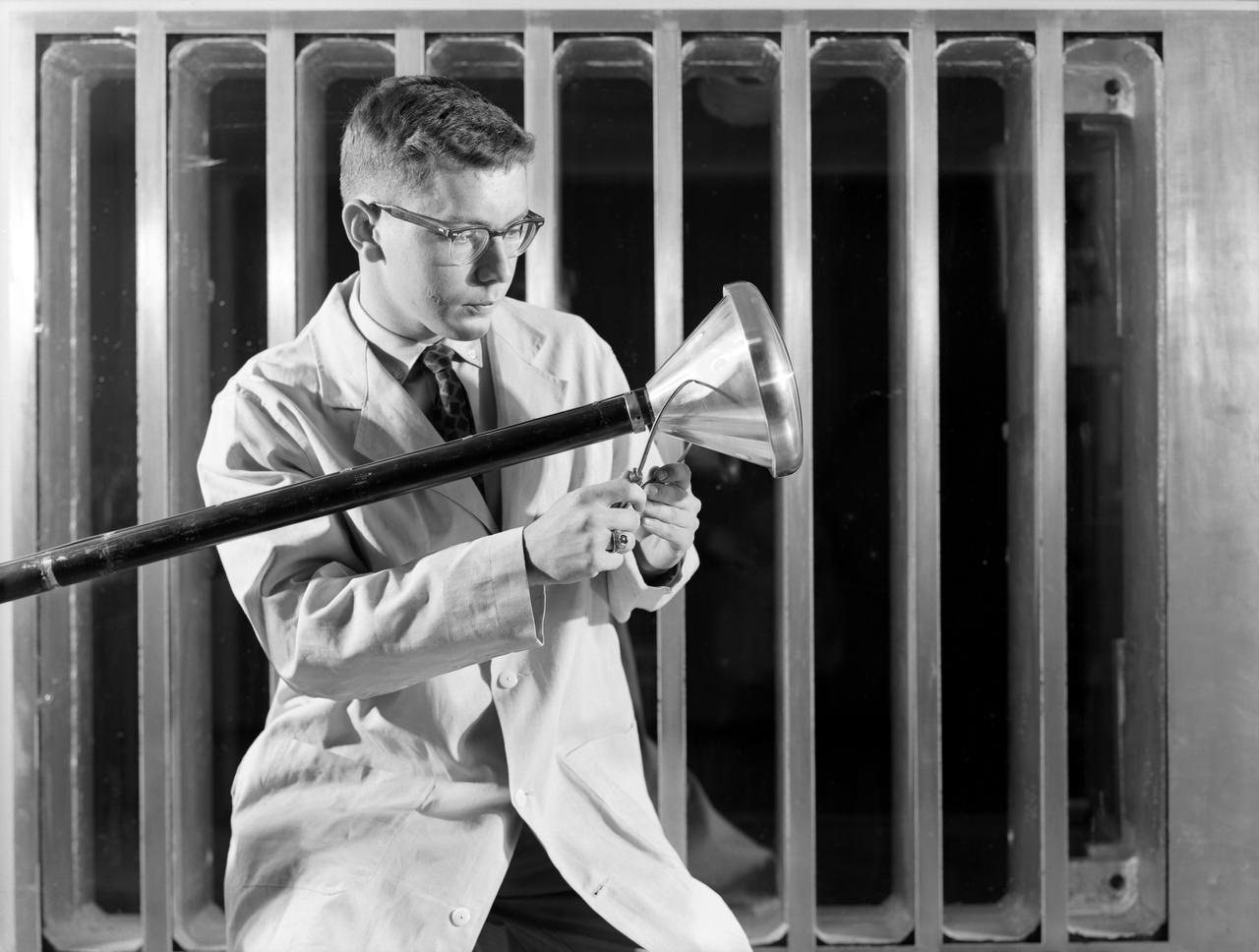
North American P-51B tuft studies done in the NACA Ames Research center 16ft Transonic Wind Tunnel Radiator air scoop with oil and prestone cooler exit flaps in flush position.
Researcher checks model of Project Fire Reentry package to be tested in Unitary Plan Wind Tunnel. Project FIRE (Flight Investigation Reentry Environment) studied the effects of reentry heating on spacecraft materials. It involved both wind tunnel and flight tests, although the majority were tests with Atlas rockets and recoverable reentry packages. These flight tests took place at Cape Canaveral in Florida. Wind tunnel tests were made in several Langley tunnels including the Unitary Plan Wind Tunnel, the 8-foot High-Temperature Tunnel and the 9x6-Foot Thermal Structures Tunnel. Photo published in book "A Century at Langley" by Joseph Chambers pg. 92
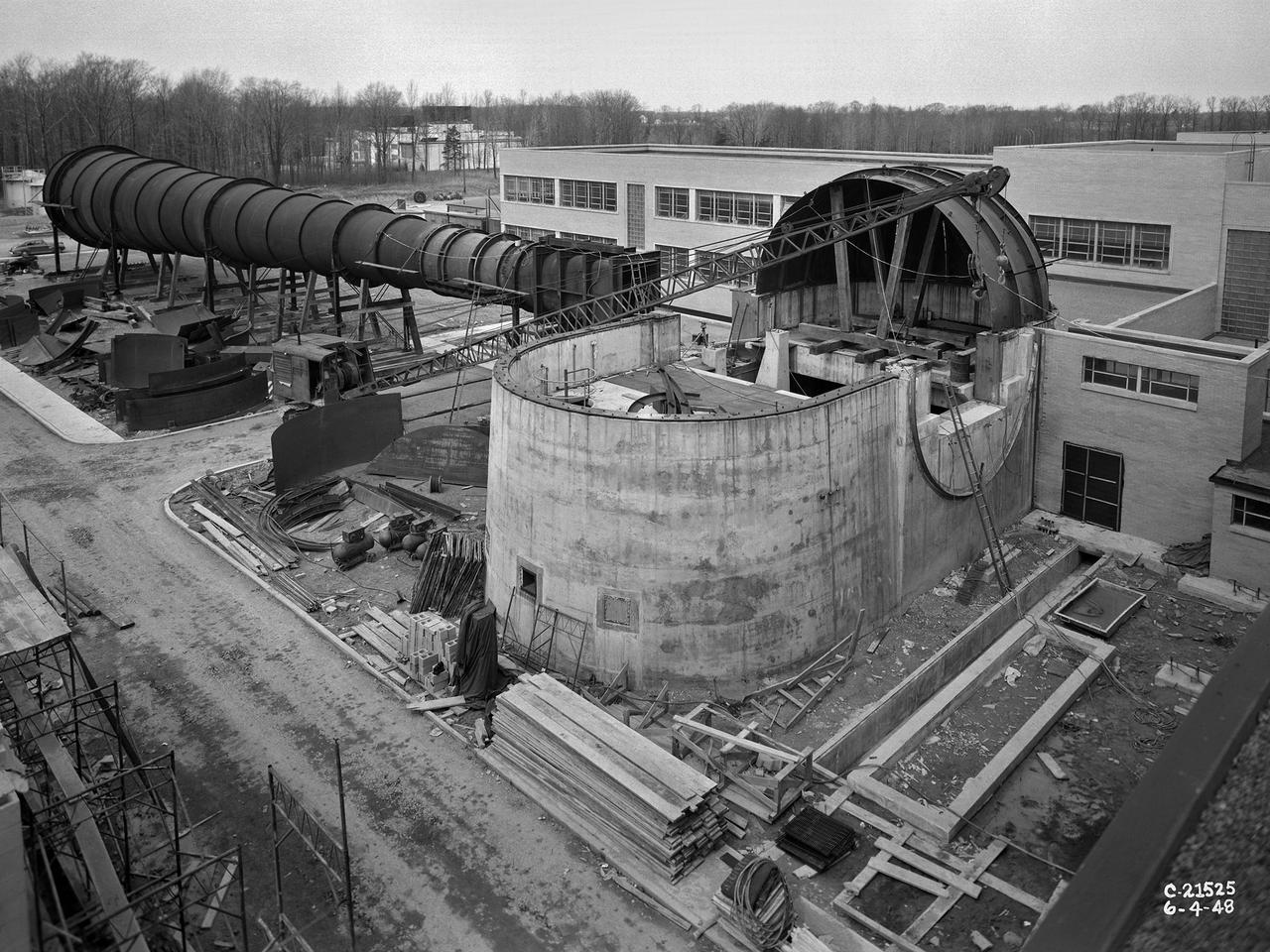
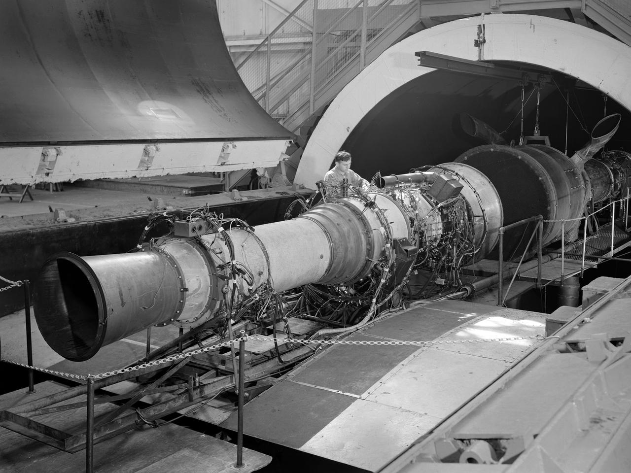
The 8- by 6-Foot Supersonic Wind Tunnel at the National Advisory Committee for Aeronautics (NACA) Lewis Flight Propulsion Laboratory was the nation’s largest supersonic facility when it began operation in April 1949. The emergence of new propulsion technologies such as turbojets, ramjets, and rockets during World War II forced the NACA and the aircraft industry to develop new research tools. In late 1945 the NACA began design work for new large supersonic wind tunnels at its three laboratories. The result was the 4- by 4-Foot Supersonic Wind Tunnel at Langley Memorial Aeronautical Laboratory, 6- by 6-foot supersonic wind tunnel at Ames Aeronautical Laboratory, and the largest facility, the 8- by 6-Foot Supersonic Wind Tunnel in Cleveland. The two former tunnels were to study aerodynamics, while the 8- by 6 facility was designed for supersonic propulsion. The 8- by 6-Foot Supersonic Wind Tunnel was used to study propulsion systems, including inlets and exit nozzles, combustion fuel injectors, flame holders, exit nozzles, and controls on ramjet and turbojet engines. Flexible sidewalls alter the tunnel’s nozzle shape to vary the Mach number during operation. A seven-stage axial compressor, driven by three electric motors that yield a total of 87,000 horsepower, generates air speeds from Mach 0.36 to 2.0. A section of the tunnel is seen being erected in this photograph.
Located east of Eumenides Dorsum, this VIS image contains evidence of long term wind action and erosion. This area of Mars is dominated by poorly cemented surface material that is easily eroded by the wind. Unidirectional winds have created the linear ridge/valley system at the top half of this image. These features are called yardangs. Studies of this area propose volcanic ash eruptions from nearby volcanoes are the source of the surface material. Orbit Number: 81078 Latitude: -2.2665 Longitude: 205.439 Instrument: VIS Captured: 2020-03-25 04:51 https://photojournal.jpl.nasa.gov/catalog/PIA23929

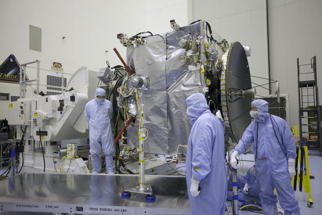
Two small spacecrafts satellites that make up NASA’s ESCAPADE (Escape and Plasma Acceleration and Dynamics Explorers) mission to Mars arrived at Astrotech Space Operations in Titusville, near NASA’s Kennedy Space Center in Florida on Sunday, Aug. 19, 2024. Set to launch from Blue Origin’s New Glenn rocket, the Rocket Lab spacecraft will study the solar wind and how the solar wind interacts with Mars’ magnetic environment and how this interaction drives the planet’s atmospheric escape.

Two small spacecrafts satellites that make up NASA’s ESCAPADE (Escape and Plasma Acceleration and Dynamics Explorers) mission to Mars arrived at Astrotech Space Operations in Titusville, near NASA’s Kennedy Space Center in Florida on Sunday, Aug. 19, 2024. Set to launch from Blue Origin’s New Glenn rocket, the Rocket Lab spacecraft will study the solar wind and how the solar wind interacts with Mars’ magnetic environment and how this interaction drives the planet’s atmospheric escape.

Two small spacecrafts satellites that make up NASA’s ESCAPADE (Escape and Plasma Acceleration and Dynamics Explorers) mission to Mars arrived at Astrotech Space Operations in Titusville, near NASA’s Kennedy Space Center in Florida on Sunday, Aug. 19, 2024. Set to launch from Blue Origin’s New Glenn rocket, the Rocket Lab spacecraft will study the solar wind and how the solar wind interacts with Mars’ magnetic environment and how this interaction drives the planet’s atmospheric escape.
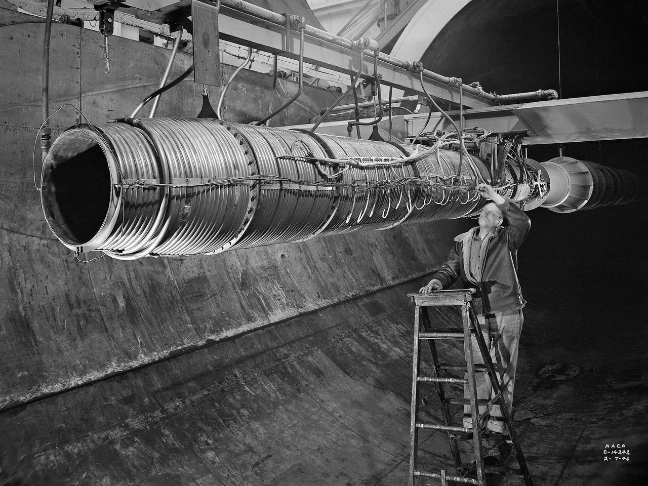
A 20-inch diameter ramjet installed in the Altitude Wind Tunnel at the National Advisory Committee for Aeronautics (NACA) Lewis Flight Propulsion Laboratory. The Altitude Wind Tunnel was used in the 1940s to study early ramjet configurations. Ramjets provide a very simple source of propulsion. They are basically a tube which takes in high-velocity air, ignites it, and then expels the expanded airflow at a significantly higher velocity for thrust. Ramjets are extremely efficient and powerful but can only operate at high speeds. Therefore a turbojet or rocket was needed to launch the vehicle. This NACA-designed 20-inch diameter ramjet was installed in the Altitude Wind Tunnel in May 1945. The ramjet was mounted under a section of wing in the 20-foot diameter test section with conditioned airflow ducted directly to the engine. The mechanic in this photograph was installing instrumentation devices that led to the control room. NACA researchers investigated the ramjet’s overall performance at simulated altitudes up to 47,000 feet. Thrust measurements from these runs were studied in conjunction with drag data obtained during small-scale studies in the laboratory’s small supersonic tunnels. An afterburner was attached to the ramjet during the portions of the test program. The researchers found that an increase in altitude caused a reduction in the engine’s horsepower. They also determined the optimal configurations for the flameholders, which provided the engine’s ignition source.
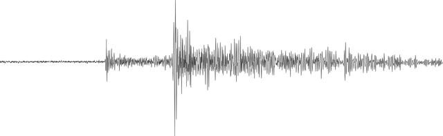
NASA's InSight lander detected a marsquake, represented here as a seismogram, on July 25, 2019, the 235th Martian day, or sol, of its mission. Seismologists study the wiggles in seismograms in order to confirm whether they're really seeing a quake or noise caused by wind. https://photojournal.jpl.nasa.gov/catalog/PIA24761
NASA’s Advanced Air Mobility National Campaign flies maneuvers at NASA’s Armstrong Flight Research Center in Edwards, California, Dec. 6, and 8-10. During this testing, the helicopter is used to study controllability characteristics when operating near buildings during heavy wind conditions. The Bell OH-58 Kiowa helicopter provided by Flight Research Inc. was used to study urban air mobility vehicle performance and flying qualities requirements.
NASA's Advanced Air Mobility National Campaign conducts testing to study controllability characteristics when operating near buildings during heavy wind conditions at NASA's Armstrong Flight Research Center in Edwards, California, Dec. 6 and 8-10. The Bell OH-58 Kiowa helicopter provided by Flight Research Inc. was used to study urban air mobility vehicle performance and flying qualities requirements.
CAPE CANAVERAL, Fla. -- At Cape Canaveral Air Force Station in Florida, British engineers conduct tests on the United Kingdom Subsatellite, part of the three-spacecraft international Active Magnetospheric Particle Tracer Explorer AMPTE mission scheduled for launch on Aug. 9, 1984 aboard a Delta rocket. The 172-pound UKS contains a comprehensive set of plasma measuring instruments to record the effects of chemical clouds released by the West German built Ion Release Module. The other AMPTE spacecraft – the Charged Composition Explorer CCEUnited States) – will operate far below, from inside the Earth’s magnetosphere, where it will track the ionized clouds as it is swept along by the solar wind. With the CCE studying this activity from below, and the IRM and UKS studying it from above, scientists expect to acquire valuable new data on exactly how the solar wind interacts with the Earth’s magnetic fields. Photo Credit: NASA

A Mod-1 2000-kilowatt wind turbine designed by National Aeronautics and Space Administration (NASA) Lewis Research Center and constructed in Boone, North Carolina. The wind turbine program was a joint program between NASA and the Energy Research and Development Administration (ERDA) during the 1970s to develop less expensive forms of energy. NASA Lewis was assigned the responsibility of developing large horizontal-axis wind turbines. The program included a series of increasingly powerful wind turbines, designated: Mod-0A, Mod-1, WTS-4, and Mod-5. The program’s first device was a Mod-0 100-kilowatt wind turbine test bed at NASA’s Plum Brook Station. There were four Mod-0A 200-kilowatt turbines built in New Mexico, Hawaii, Puerto Rico, and Rhode Island. The 2000-kilowatt wind turbine in North Carolina, seen here, was the only Mod-1 machine constructed. The two-bladed, 200-foot diameter device was built in May 1979 and began operation that September. The Mod-1 turbine performed exceedingly well and was fully integrated into the local power grid. NASA researchers also used the North Carolina device to study its effect on noise and television transmission.
A Rolls Royce Avon RA-14 engine was tested in the Altitude Wind Tunnel at the National Advisory Committee for Aeronautics’ (NACA) Lewis Flight Propulsion Laboratory. The Avon RA-14 engine was a 16-stage axial-flow compressor turbojet capable of producing 9,500 pounds of thrust. The Avon replaced Rolls Royce’s successful Nene engine in 1950 and remained in service until 1974. It was one of several British engines studied in the tunnel during the 1950s. The Altitude Wind Tunnel went through a series of modifications in 1951 to increase its capabilities. An annex was attached to the Exhauster Building to house three new Ingersoll-Rand compressors. The wooden blades on the tunnel’s 31-foot diameter fan were replaced, a pump house and exhaust cooler were constructed underneath the tunnel, and two new cells were added to the cooling tower. The modified wind tunnel continued to analyze jet engines in the 1950s, although the engines, like the RA-14 seen here, were much more powerful than those studied several years before. Lewis researchers studied the RA-14 turbojet engine in the Altitude Wind Tunnel for 11 months in 1956. The engine was mounted on a stand capable of gauging engine thrust, and the tunnel’s air was ducted to the engine through a venturi and bellmouth inlet, seen in this photograph. The initial studies established the engine’s performance characteristics with a fixed-area nozzle and its acceleration characteristics. The researchers also used the tunnel to investigate windmilling of the compressor blades, restarting at high altitudes, and the engine’s performance limits at altitude.
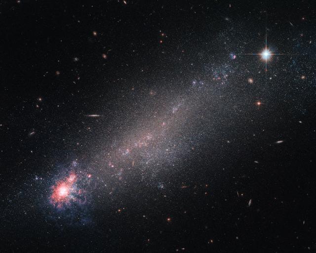
The lesser-known constellation of Canes Venatici (The Hunting Dogs), is home to a variety of deep-sky objects — including this beautiful galaxy, known as NGC 4861. Astronomers are still debating on how to classify it. While its physical properties — such as mass, size and rotational velocity — indicate it to be a spiral galaxy, its appearance looks more like a comet with its dense, luminous “head” and dimmer “tail” trailing off. Features more fitting with a dwarf irregular galaxy. Although small and messy, galaxies like NGC 4861 provide astronomers with interesting opportunities for study. Small galaxies have lower gravitational potentials, which simply means that it takes less energy to move stuff about inside them than it does in other galaxies. As a result, moving in, around, and through such a tiny galaxy is quite easy to do, making them far more likely to be filled with streams and outflows of speedy charged particles known as galactic winds, which can flood such galaxies with little effort. These galactic winds can be powered by the ongoing process of star formation, which involves huge amounts of energy. New stars are springing into life within the bright, colorful ‘head’ of NGC 4861 and ejecting streams of high-speed particles as they do so, which flood outwards to join the wider galactic wind. While NGC 4861 would be a perfect candidate to study such winds, recent studies did not find any galactic winds in it. Image credit: ESA/Hubble & NASA
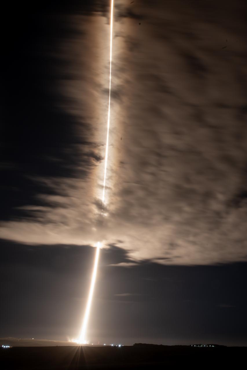
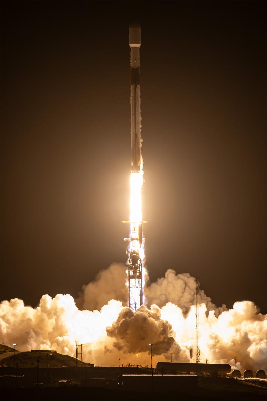
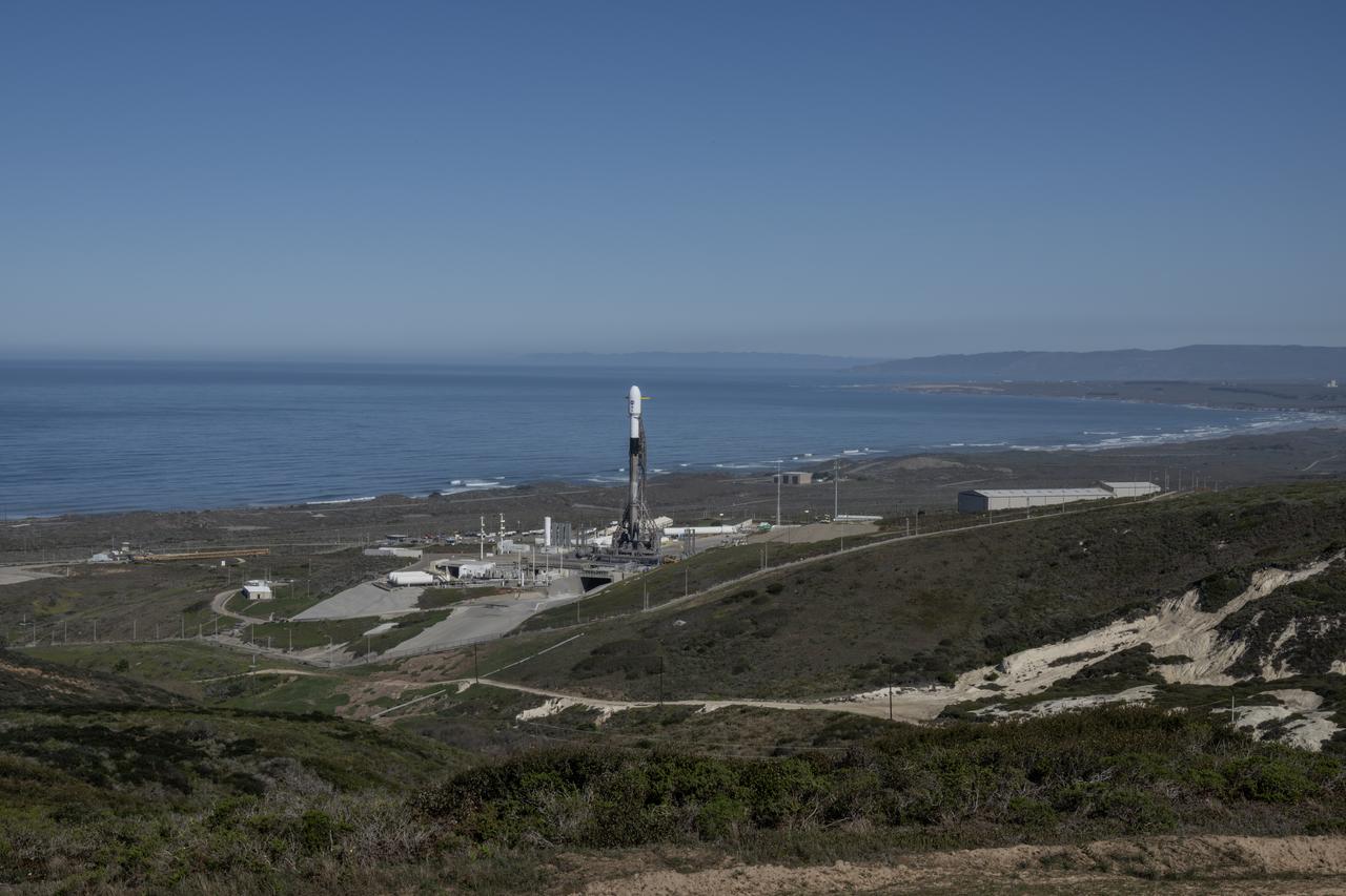
A streak lights up the sky following the launch of NASA’s SPHEREx (Spectro-Photometer for the History of the Universe, Epoch of Reionization and Ices Explorer) observatory and PUNCH (Polarimeter to Unify the Corona and Heliosphere) satellites at Space Launch Complex 4 East from Vandenberg Space Force Base in California on Tuesday, March 11, 2025. SPHEREx will use its telescope to provide an all-sky spectral survey, creating a 3D map of the entire sky to help scientists investigate the origins of our universe. PUNCH will study origins of the Sun’s outflow of material, or the solar wind, capturing continuous 3D images of the Sun’s corona and the solar wind’s journey into the solar system.
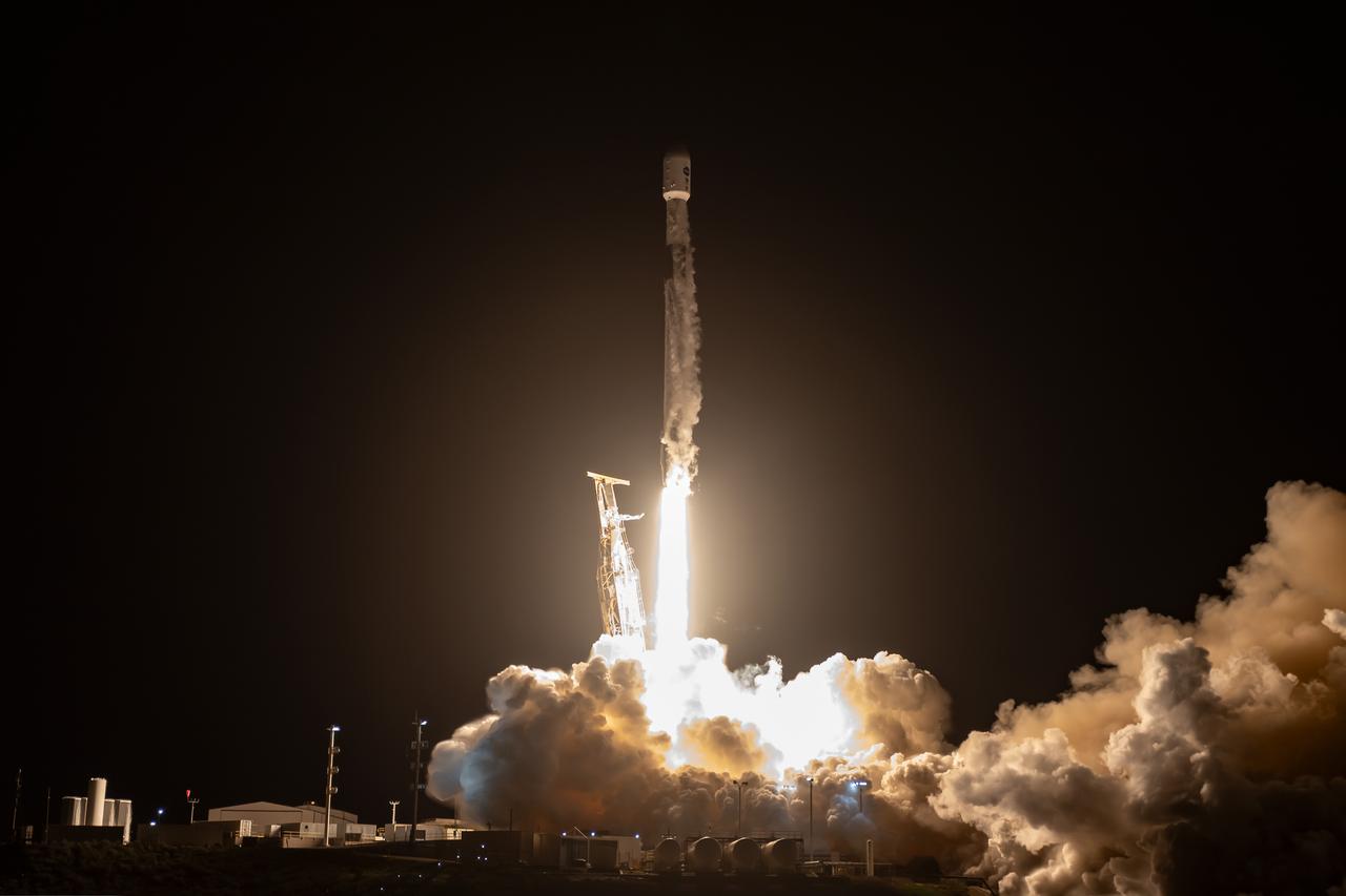
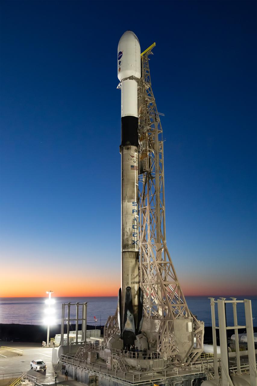
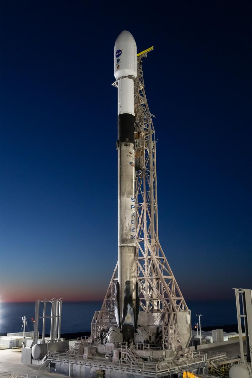
A SpaceX Falcon 9 rocket, carrying NASA’s SPHEREx (Spectro-Photometer for the History of the Universe, Epoch of Reionization and Ices Explorer) observatory and PUNCH (Polarimeter to Unify the Corona and Heliosphere) satellites, launches from Space Launch Complex 4 East at Vandenberg Space Force Base in California on Tuesday, March 11, 2025. SPHEREx will use its telescope to provide an all-sky spectral survey, creating a 3D map of the entire sky to help scientists investigate the origins of our universe. PUNCH will study origins of the Sun’s outflow of material, or the solar wind, capturing continuous 3D images of the Sun’s corona and the solar wind’s journey into the solar system.
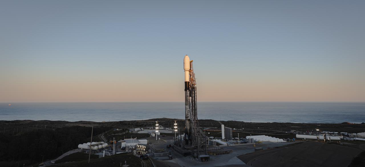
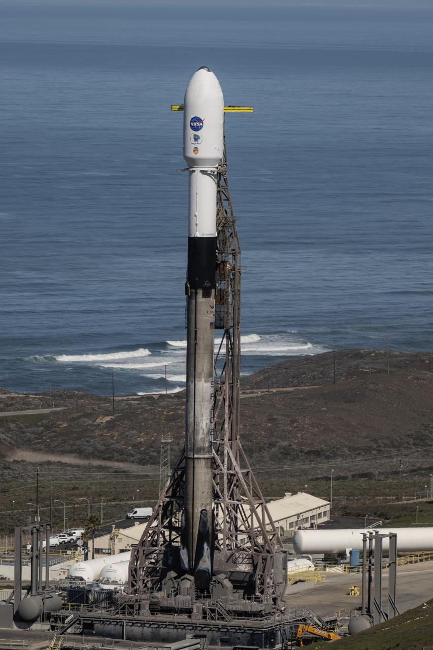
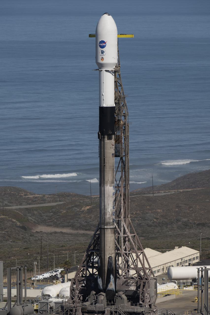
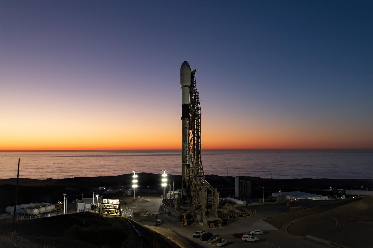
A SpaceX Falcon 9 rocket, carrying NASA’s SPHEREx (Spectro-Photometer for the History of the Universe, Epoch of Reionization and Ices Explorer) observatory and PUNCH (Polarimeter to Unify the Corona and Heliosphere) satellites, is vertical at Space Launch Complex 4 East from Vandenberg Space Force Base in California on Saturday March 8, 2025. SPHEREx will use its telescope to provide an all-sky spectral survey, creating a 3D map of the entire sky to help scientists investigate the origins of our universe. PUNCH will study origins of the Sun’s outflow of material, or the solar wind, capturing continuous 3D images of the Sun’s corona and the solar wind’s journey into the solar system.
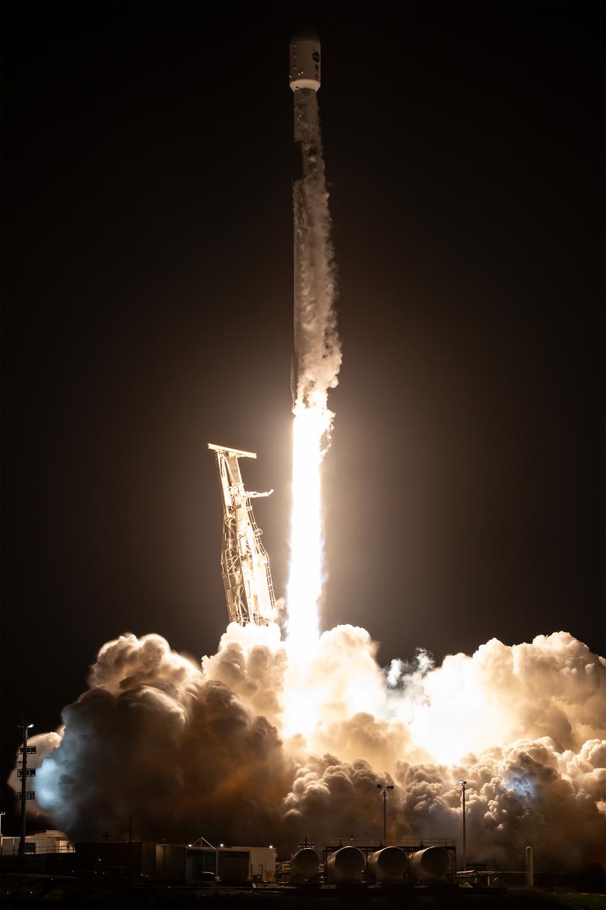
A SpaceX Falcon 9 rocket, carrying NASA’s SPHEREx (Spectro-Photometer for the History of the Universe, Epoch of Reionization and Ices Explorer) observatory and PUNCH (Polarimeter to Unify the Corona and Heliosphere) satellites, launches from Space Launch Complex 4 East at Vandenberg Space Force Base in California on Tuesday, March 11, 2025. SPHEREx will use its telescope to provide an all-sky spectral survey, creating a 3D map of the entire sky to help scientists investigate the origins of our universe. PUNCH will study origins of the Sun’s outflow of material, or the solar wind, capturing continuous 3D images of the Sun’s corona and the solar wind’s journey into the solar system.
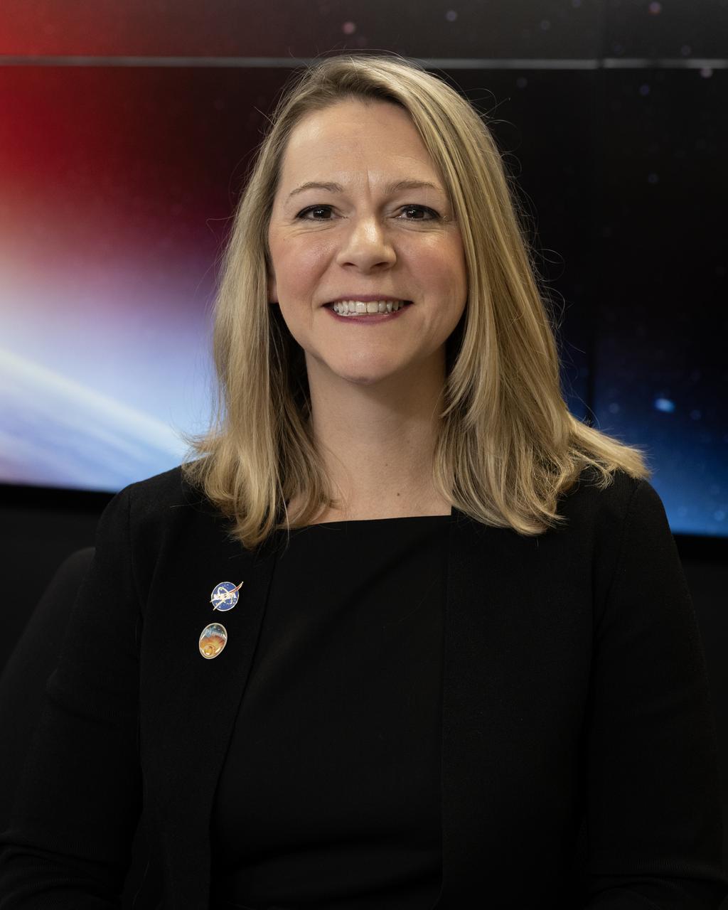
Nicholeen Viall, PUNCH Mission Scientist, NASA’s Goddard Flight Center, participates in a science briefing on Tuesday, Feb. 25, 2025, to discuss the upcoming launch of NASA’s SPHEREx (Spectro-Photometer for the History of the Universe, Epoch of Reionization and Ices Explorer) observatory and PUNCH (Polarimeter to Unify the Corona and Heliosphere) satellites at Vandenberg Space Force Base in California. SPHEREx will use its telescope to provide an all-sky spectral survey, creating a 3D map of the entire sky to help scientists investigate the origins of our universe. PUNCH will study origins of the Sun’s outflow of material, or the solar wind, capturing continuous 3D images of the Sun’s corona and the solar wind’s journey into the solar system.
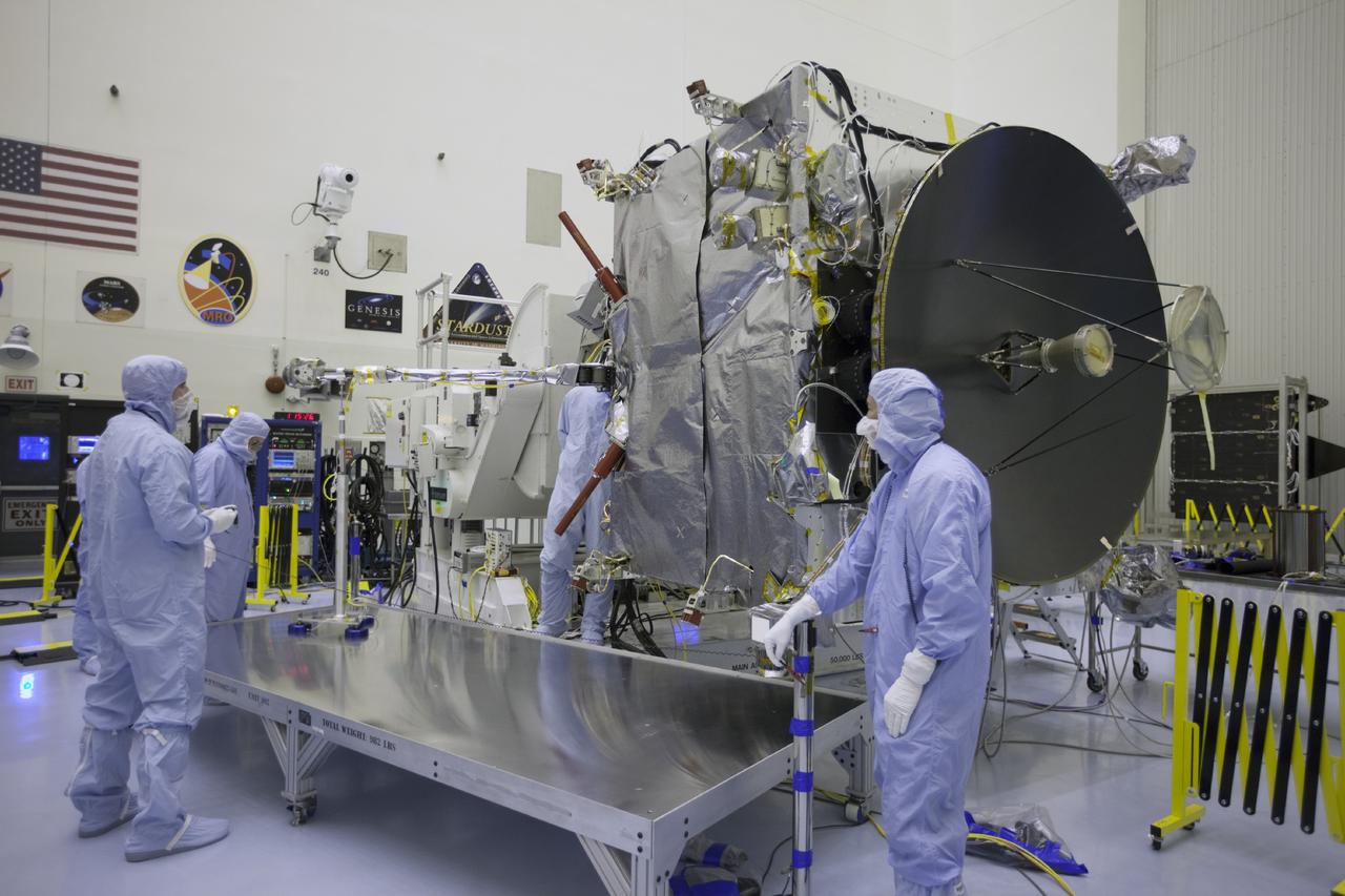
CAPE CANAVERAL, Fla. – Inside the Payload Hazardous Servicing Facility at NASA's Kennedy Space Center in Florida, engineers and technicians deploy the Solar Wind Electron Analyzer boom on the Mars Atmosphere and Volatile Evolution, or MAVEN, spacecraft. The analyzer will measure the solar wind and electrons in the ionosphere of the Red Planet. MAVEN is being prepared for its scheduled launch in November from Cape Canaveral Air Force Station, Fla. atop a United Launch Alliance Atlas V rocket. Positioned in an orbit above the Red Planet, MAVEN will study the upper atmosphere of Mars in unprecedented detail. For more information, visit: http://www.nasa.gov/mission_pages/maven/main/index.html Photo credit: NASA/Kim Shiflett
A SpaceX Falcon 9 rocket, carrying NASA’s SPHEREx (Spectro-Photometer for the History of the Universe, Epoch of Reionization and Ices Explorer) observatory and PUNCH (Polarimeter to Unify the Corona and Heliosphere) satellites, is vertical at Space Launch Complex 4 East from Vandenberg Space Force Base in California on Saturday, March 8, 2025. SPHEREx will use its telescope to provide an all-sky spectral survey, creating a 3D map of the entire sky to help scientists investigate the origins of our universe. PUNCH will study origins of the Sun’s outflow of material, or the solar wind, capturing continuous 3D images of the Sun’s corona and the solar wind’s journey into the solar system.
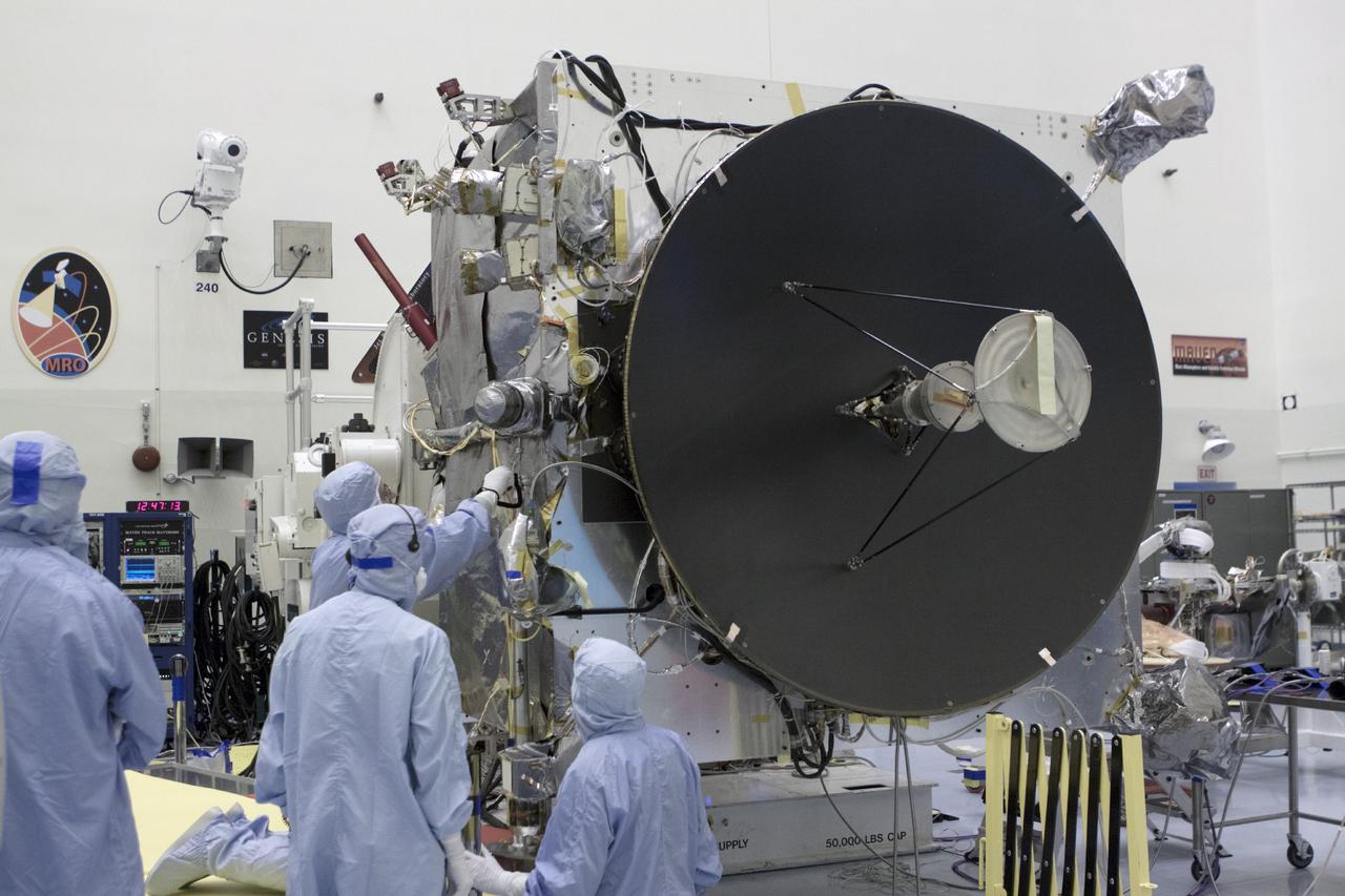
CAPE CANAVERAL, Fla. – Inside the Payload Hazardous Servicing Facility at NASA's Kennedy Space Center in Florida, engineers and technicians prepare to deploy the Solar Wind Electron Analyzer boom on the Mars Atmosphere and Volatile Evolution, or MAVEN, spacecraft. The analyzer will measure the solar wind and electrons in the ionosphere of the Red Planet. MAVEN is being prepared for its scheduled launch in November from Cape Canaveral Air Force Station, Fla. atop a United Launch Alliance Atlas V rocket. Positioned in an orbit above the Red Planet, MAVEN will study the upper atmosphere of Mars in unprecedented detail. For more information, visit: http://www.nasa.gov/mission_pages/maven/main/index.html Photo credit: NASA/Kim Shiflett
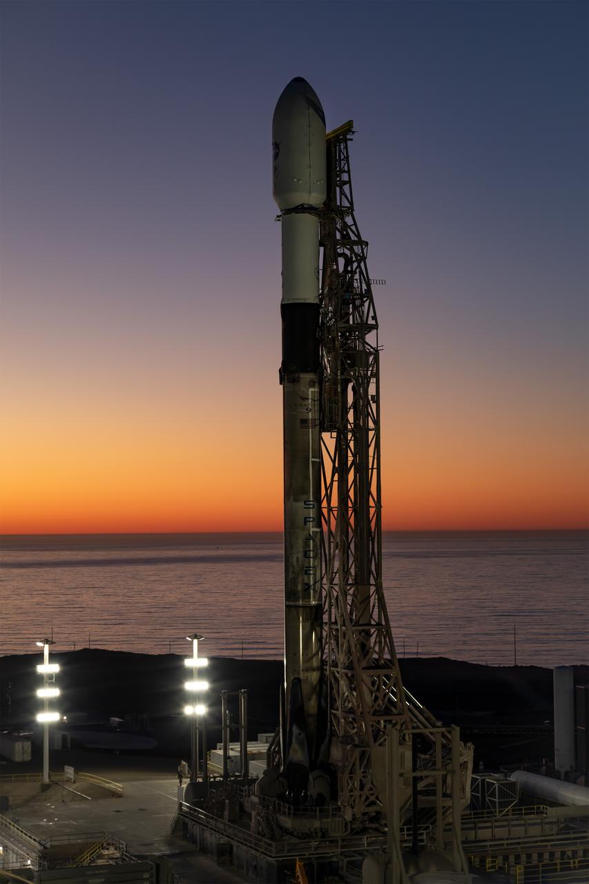
A SpaceX Falcon 9 rocket, carrying NASA’s SPHEREx (Spectro-Photometer for the History of the Universe, Epoch of Reionization and Ices Explorer) observatory and PUNCH (Polarimeter to Unify the Corona and Heliosphere) satellites, is vertical at Space Launch Complex 4 East from Vandenberg Space Force Base in California on Saturday, March 8, 2025. SPHEREx will use its telescope to provide an all-sky spectral survey, creating a 3D map of the entire sky to help scientists investigate the origins of our universe. PUNCH will study origins of the Sun’s outflow of material, or the solar wind, capturing continuous 3D images of the Sun’s corona and the solar wind’s journey into the solar system.
A SpaceX Falcon 9 rocket, carrying NASA’s SPHEREx (Spectro-Photometer for the History of the Universe, Epoch of Reionization and Ices Explorer) observatory and PUNCH (Polarimeter to Unify the Corona and Heliosphere) satellites, is vertical at Space Launch Complex 4 East from Vandenberg Space Force Base in California on Saturday, March 8, 2025. SPHEREx will use its telescope to provide an all-sky spectral survey, creating a 3D map of the entire sky to help scientists investigate the origins of our universe. PUNCH will study origins of the Sun’s outflow of material, or the solar wind, capturing continuous 3D images of the Sun’s corona and the solar wind’s journey into the solar system.
CAPE CANAVERAL, Fla. – Inside the Payload Hazardous Servicing Facility at NASA's Kennedy Space Center in Florida, engineers and technicians deploy the Solar Wind Electron Analyzer boom on the Mars Atmosphere and Volatile Evolution, or MAVEN, spacecraft. The analyzer will measure the solar wind and electrons in the ionosphere of the Red Planet. MAVEN is being prepared for its scheduled launch in November from Cape Canaveral Air Force Station, Fla. atop a United Launch Alliance Atlas V rocket. Positioned in an orbit above the Red Planet, MAVEN will study the upper atmosphere of Mars in unprecedented detail. For more information, visit: http://www.nasa.gov/mission_pages/maven/main/index.html Photo credit: NASA/Kim Shiflett
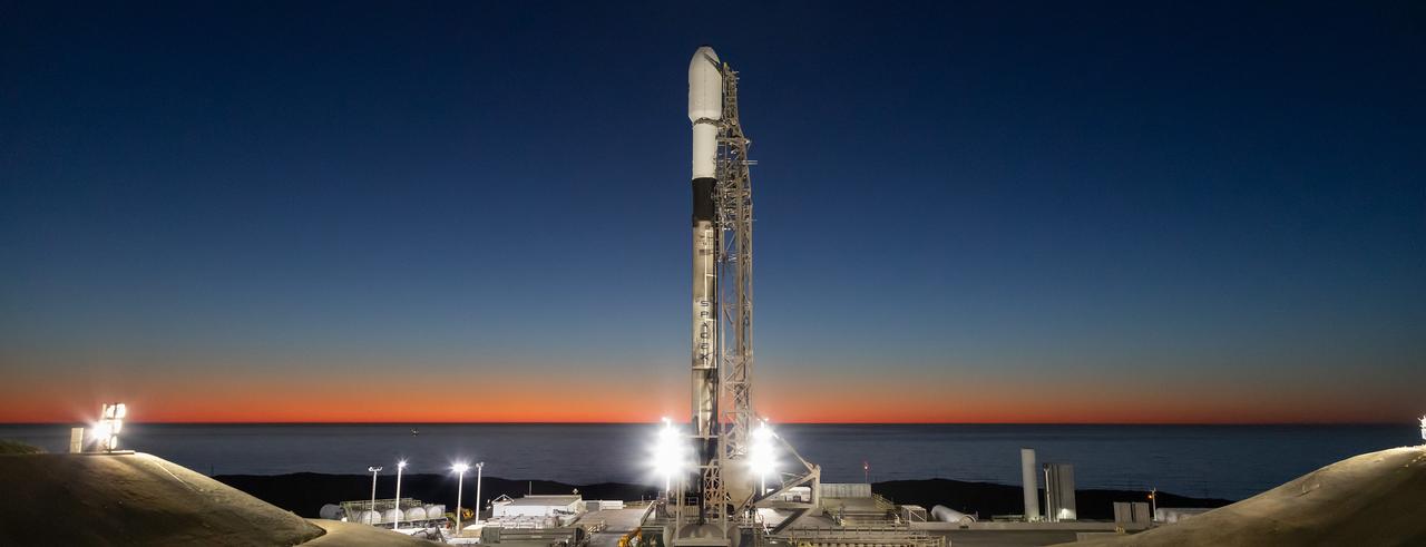
A SpaceX Falcon 9 rocket, carrying NASA’s SPHEREx (Spectro-Photometer for the History of the Universe, Epoch of Reionization and Ices Explorer) observatory and PUNCH (Polarimeter to Unify the Corona and Heliosphere) satellites, is vertical at Space Launch Complex 4 East from Vandenberg Space Force Base in California on Saturday, March 8, 2025. SPHEREx will use its telescope to provide an all-sky spectral survey, creating a 3D map of the entire sky to help scientists investigate the origins of our universe. PUNCH will study origins of the Sun’s outflow of material, or the solar wind, capturing continuous 3D images of the Sun’s corona and the solar wind’s journey into the solar system.
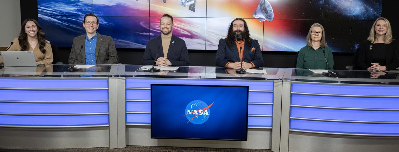
NASA and Caltech participate in a science briefing on Tuesday, Feb. 25, 2025, to discuss the upcoming launch of NASA’s SPHEREx (Spectro-Photometer for the History of the Universe, Epoch of Reionization and Ices Explorer) observatory and PUNCH (Polarimeter to Unify the Corona and Heliosphere) satellites at Vandenberg Space Force Base in California. SPHEREx will use its telescope to provide an all-sky spectral survey, creating a 3D map of the entire sky to help scientists investigate the origins of our universe. PUNCH will study origins of the Sun’s outflow of material, or the solar wind, capturing continuous 3D images of the Sun’s corona and the solar wind’s journey into the solar system.
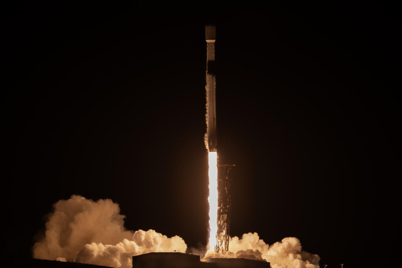
A SpaceX Falcon 9 rocket, carrying NASA’s SPHEREx (Spectro-Photometer for the History of the Universe, Epoch of Reionization and Ices Explorer) observatory and PUNCH (Polarimeter to Unify the Corona and Heliosphere) satellites, launches from Space Launch Complex 4 East at Vandenberg Space Force Base in California on Tuesday, March 11, 2025. SPHEREx will use its telescope to provide an all-sky spectral survey, creating a 3D map of the entire sky to help scientists investigate the origins of our universe. PUNCH will study origins of the Sun’s outflow of material, or the solar wind, capturing continuous 3D images of the Sun’s corona and the solar wind’s journey into the solar system.
A SpaceX Falcon 9 rocket, carrying NASA’s SPHEREx (Spectro-Photometer for the History of the Universe, Epoch of Reionization and Ices Explorer) observatory and PUNCH (Polarimeter to Unify the Corona and Heliosphere) satellites, launches from Space Launch Complex 4 East at Vandenberg Space Force Base in California on Tuesday, March 11, 2025. SPHEREx will use its telescope to provide an all-sky spectral survey, creating a 3D map of the entire sky to help scientists investigate the origins of our universe. PUNCH will study origins of the Sun’s outflow of material, or the solar wind, capturing continuous 3D images of the Sun’s corona and the solar wind’s journey into the solar system.

Alise Fischer, communications, NASA Headquarters participates in a science briefing on Tuesday, Feb. 25, 2025, to discuss the upcoming launch of NASA’s SPHEREx (Spectro-Photometer for the History of the Universe, Epoch of Reionization and Ices Explorer) observatory and PUNCH (Polarimeter to Unify the Corona and Heliosphere) satellites at Vandenberg Space Force Base in California. SPHEREx will use its telescope to provide an all-sky spectral survey, creating a 3D map of the entire sky to help scientists investigate the origins of our universe. PUNCH will study origins of the Sun’s outflow of material, or the solar wind, capturing continuous 3D images of the Sun’s corona and the solar wind’s journey into the solar system.
A SpaceX Falcon 9 rocket, carrying NASA’s SPHEREx (Spectro-Photometer for the History of the Universe, Epoch of Reionization and Ices Explorer) observatory and PUNCH (Polarimeter to Unify the Corona and Heliosphere) satellites, is vertical at Space Launch Complex 4 East from Vandenberg Space Force Base in California on Saturday, March 8, 2025. SPHEREx will use its telescope to provide an all-sky spectral survey, creating a 3D map of the entire sky to help scientists investigate the origins of our universe. PUNCH will study origins of the Sun’s outflow of material, or the solar wind, capturing continuous 3D images of the Sun’s corona and the solar wind’s journey into the solar system.
A SpaceX Falcon 9 rocket, carrying NASA’s SPHEREx (Spectro-Photometer for the History of the Universe, Epoch of Reionization and Ices Explorer) observatory and PUNCH (Polarimeter to Unify the Corona and Heliosphere) satellites, is vertical at Space Launch Complex 4 East from Vandenberg Space Force Base in California on Saturday, March 8, 2025. SPHEREx will use its telescope to provide an all-sky spectral survey, creating a 3D map of the entire sky to help scientists investigate the origins of our universe. PUNCH will study origins of the Sun’s outflow of material, or the solar wind, capturing continuous 3D images of the Sun’s corona and the solar wind’s journey into the solar system.
A SpaceX Falcon 9 rocket, carrying NASA’s SPHEREx (Spectro-Photometer for the History of the Universe, Epoch of Reionization and Ices Explorer) observatory and PUNCH (Polarimeter to Unify the Corona and Heliosphere) satellites, is vertical at Space Launch Complex 4 East from Vandenberg Space Force Base in California on Saturday, March 8, 2025. SPHEREx will use its telescope to provide an all-sky spectral survey, creating a 3D map of the entire sky to help scientists investigate the origins of our universe. PUNCH will study origins of the Sun’s outflow of material, or the solar wind, capturing continuous 3D images of the Sun’s corona and the solar wind’s journey into the solar system.

Rachel Akeson, SPHEREx science data center lead, Caltech/IPAC, participates in a science briefing on Tuesday, Feb. 25, 2025, to discuss the upcoming launch of NASA’s SPHEREx (Spectro-Photometer for the History of the Universe, Epoch of Reionization and Ices Explorer) observatory and PUNCH (Polarimeter to Unify the Corona and Heliosphere) satellites at Vandenberg Space Force Base in California. SPHEREx will use its telescope to provide an all-sky spectral survey, creating a 3D map of the entire sky to help scientists investigate the origins of our universe. PUNCH will study origins of the Sun’s outflow of material, or the solar wind, capturing continuous 3D images of the Sun’s corona and the solar wind’s journey into the solar system.

Phil Korngut, SPHEREx instrument scientist, Caltech, participates in a science briefing on Tuesday, Feb. 25, 2025, to discuss the upcoming launch of NASA’s SPHEREx (Spectro-Photometer for the History of the Universe, Epoch of Reionization and Ices Explorer) observatory and PUNCH (Polarimeter to Unify the Corona and Heliosphere) satellites at Vandenberg Space Force Base in California. SPHEREx will use its telescope to provide an all-sky spectral survey, creating a 3D map of the entire sky to help scientists investigate the origins of our universe. PUNCH will study origins of the Sun’s outflow of material, or the solar wind, capturing continuous 3D images of the Sun’s corona and the solar wind’s journey into the solar system.
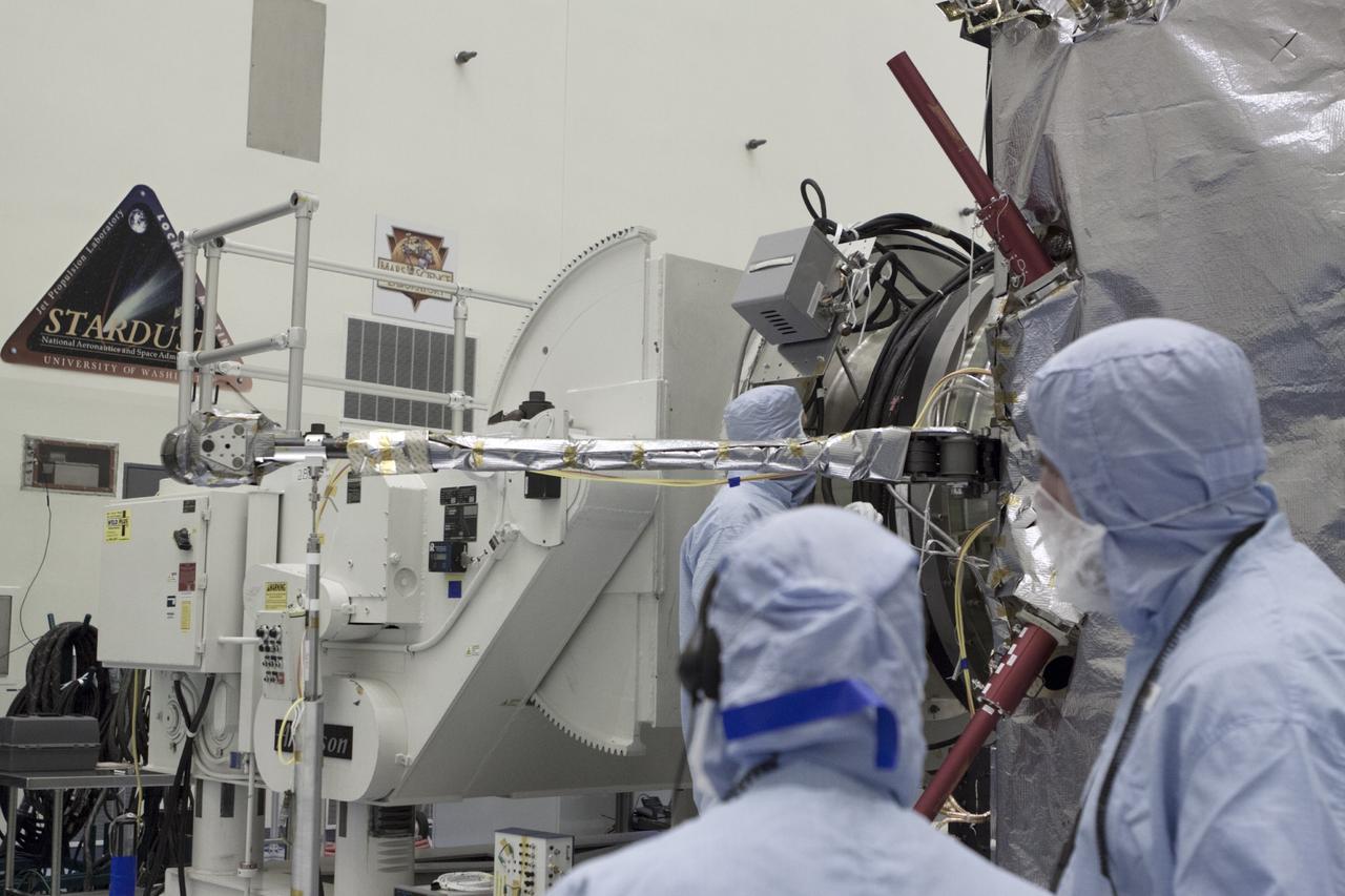
CAPE CANAVERAL, Fla. – Inside the Payload Hazardous Servicing Facility at NASA's Kennedy Space Center in Florida, engineers and technicians deploy the Solar Wind Electron Analyzer boom on the Mars Atmosphere and Volatile Evolution, or MAVEN, spacecraft. The analyzer will measure the solar wind and electrons in the ionosphere of the Red Planet. MAVEN is being prepared for its scheduled launch in November from Cape Canaveral Air Force Station, Fla. atop a United Launch Alliance Atlas V rocket. Positioned in an orbit above the Red Planet, MAVEN will study the upper atmosphere of Mars in unprecedented detail. For more information, visit: http://www.nasa.gov/mission_pages/maven/main/index.html Photo credit: NASA/Kim Shiflett
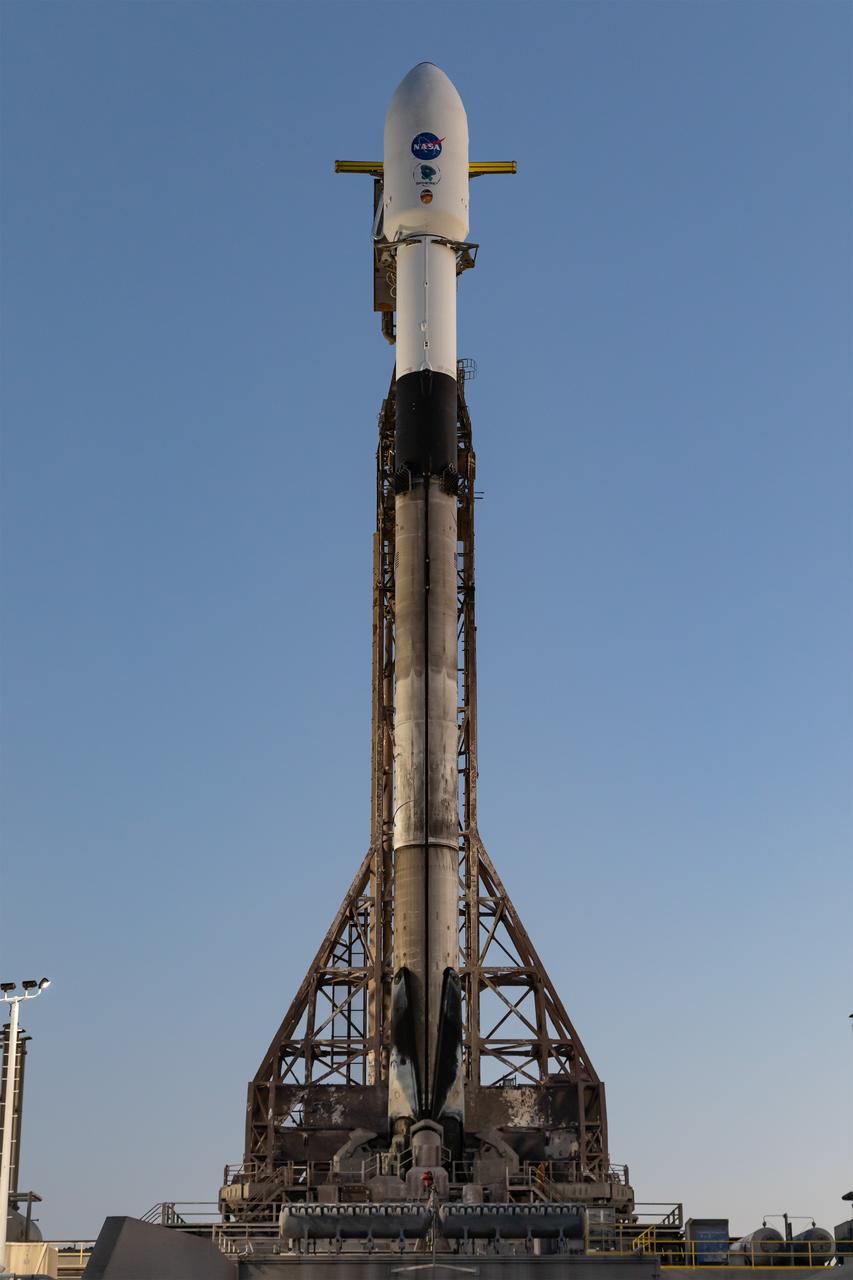
A SpaceX Falcon 9 rocket, carrying NASA’s SPHEREx (Spectro-Photometer for the History of the Universe, Epoch of Reionization and Ices Explorer) observatory and PUNCH (Polarimeter to Unify the Corona and Heliosphere) satellites, is vertical at Space Launch Complex 4 East from Vandenberg Space Force Base in California on Saturday March 8, 2025. SPHEREx will use its telescope to provide an all-sky spectral survey, creating a 3D map of the entire sky to help scientists investigate the origins of our universe. PUNCH will study origins of the Sun’s outflow of material, or the solar wind, capturing continuous 3D images of the Sun’s corona and the solar wind’s journey into the solar system.
CAPE CANAVERAL, Fla. – Inside the Payload Hazardous Servicing Facility at NASA's Kennedy Space Center in Florida, engineers and technicians deploy the Solar Wind Electron Analyzer boom on the Mars Atmosphere and Volatile Evolution, or MAVEN, spacecraft. The analyzer will measure the solar wind and electrons in the ionosphere of the Red Planet. MAVEN is being prepared for its scheduled launch in November from Cape Canaveral Air Force Station, Fla. atop a United Launch Alliance Atlas V rocket. Positioned in an orbit above the Red Planet, MAVEN will study the upper atmosphere of Mars in unprecedented detail. For more information, visit: http://www.nasa.gov/mission_pages/maven/main/index.html Photo credit: NASA/Kim Shiflett

A SpaceX Falcon 9 rocket, carrying NASA’s SPHEREx (Spectro-Photometer for the History of the Universe, Epoch of Reionization and Ices Explorer) observatory and PUNCH (Polarimeter to Unify the Corona and Heliosphere) satellites, launches from Space Launch Complex 4 East at Vandenberg Space Force Base in California on Tuesday, March 11, 2025. SPHEREx will use its telescope to provide an all-sky spectral survey, creating a 3D map of the entire sky to help scientists investigate the origins of our universe. PUNCH will study origins of the Sun’s outflow of material, or the solar wind, capturing continuous 3D images of the Sun’s corona and the solar wind’s journey into the solar system.
A SpaceX Falcon 9 rocket, carrying NASA’s SPHEREx (Spectro-Photometer for the History of the Universe, Epoch of Reionization and Ices Explorer) observatory and PUNCH (Polarimeter to Unify the Corona and Heliosphere) satellites, is vertical at Space Launch Complex 4 East from Vandenberg Space Force Base in California on Saturday, March 8, 2025. SPHEREx will use its telescope to provide an all-sky spectral survey, creating a 3D map of the entire sky to help scientists investigate the origins of our universe. PUNCH will study origins of the Sun’s outflow of material, or the solar wind, capturing continuous 3D images of the Sun’s corona and the solar wind’s journey into the solar system.
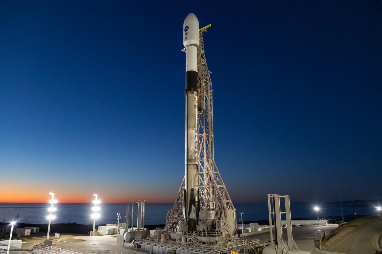
A SpaceX Falcon 9 rocket, carrying NASA’s SPHEREx (Spectro-Photometer for the History of the Universe, Epoch of Reionization and Ices Explorer) observatory and PUNCH (Polarimeter to Unify the Corona and Heliosphere) satellites, is vertical at Space Launch Complex 4 East from Vandenberg Space Force Base in California on Saturday, March 8, 2025. SPHEREx will use its telescope to provide an all-sky spectral survey, creating a 3D map of the entire sky to help scientists investigate the origins of our universe. PUNCH will study origins of the Sun’s outflow of material, or the solar wind, capturing continuous 3D images of the Sun’s corona and the solar wind’s journey into the solar system.
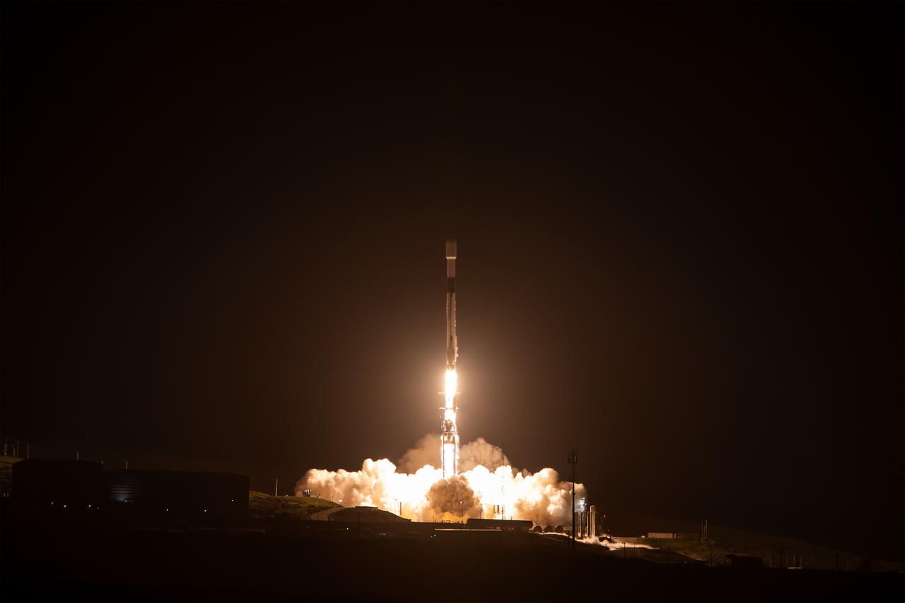
A SpaceX Falcon 9 rocket, carrying NASA’s SPHEREx (Spectro-Photometer for the History of the Universe, Epoch of Reionization and Ices Explorer) observatory and PUNCH (Polarimeter to Unify the Corona and Heliosphere) satellites, launches from Space Launch Complex 4 East at Vandenberg Space Force Base in California on Tuesday, March 11, 2025. SPHEREx will use its telescope to provide an all-sky spectral survey, creating a 3D map of the entire sky to help scientists investigate the origins of our universe. PUNCH will study origins of the Sun’s outflow of material, or the solar wind, capturing continuous 3D images of the Sun’s corona and the solar wind’s journey into the solar system.
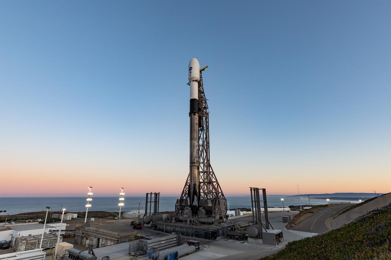
A SpaceX Falcon 9 rocket, carrying NASA’s SPHEREx (Spectro-Photometer for the History of the Universe, Epoch of Reionization and Ices Explorer) observatory and PUNCH (Polarimeter to Unify the Corona and Heliosphere) satellites, is vertical at Space Launch Complex 4 East from Vandenberg Space Force Base in California on Saturday March 8, 2025. SPHEREx will use its telescope to provide an all-sky spectral survey, creating a 3D map of the entire sky to help scientists investigate the origins of our universe. PUNCH will study origins of the Sun’s outflow of material, or the solar wind, capturing continuous 3D images of the Sun’s corona and the solar wind’s journey into the solar system.
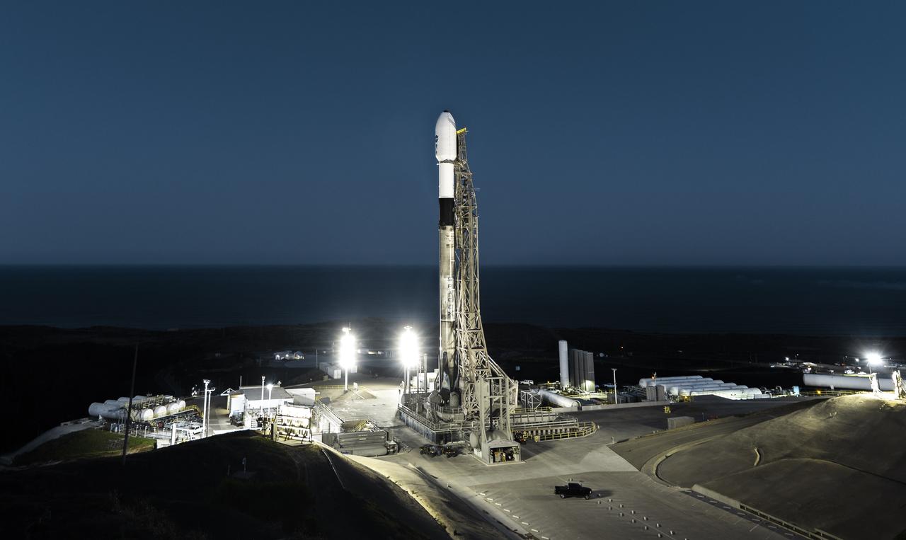
A SpaceX Falcon 9 rocket, carrying NASA’s SPHEREx (Spectro-Photometer for the History of the Universe, Epoch of Reionization and Ices Explorer) observatory and PUNCH (Polarimeter to Unify the Corona and Heliosphere) satellites, is vertical at Space Launch Complex 4 East from Vandenberg Space Force Base in California on Saturday March 8, 2025. SPHEREx will use its telescope to provide an all-sky spectral survey, creating a 3D map of the entire sky to help scientists investigate the origins of our universe. PUNCH will study origins of the Sun’s outflow of material, or the solar wind, capturing continuous 3D images of the Sun’s corona and the solar wind’s journey into the solar system.
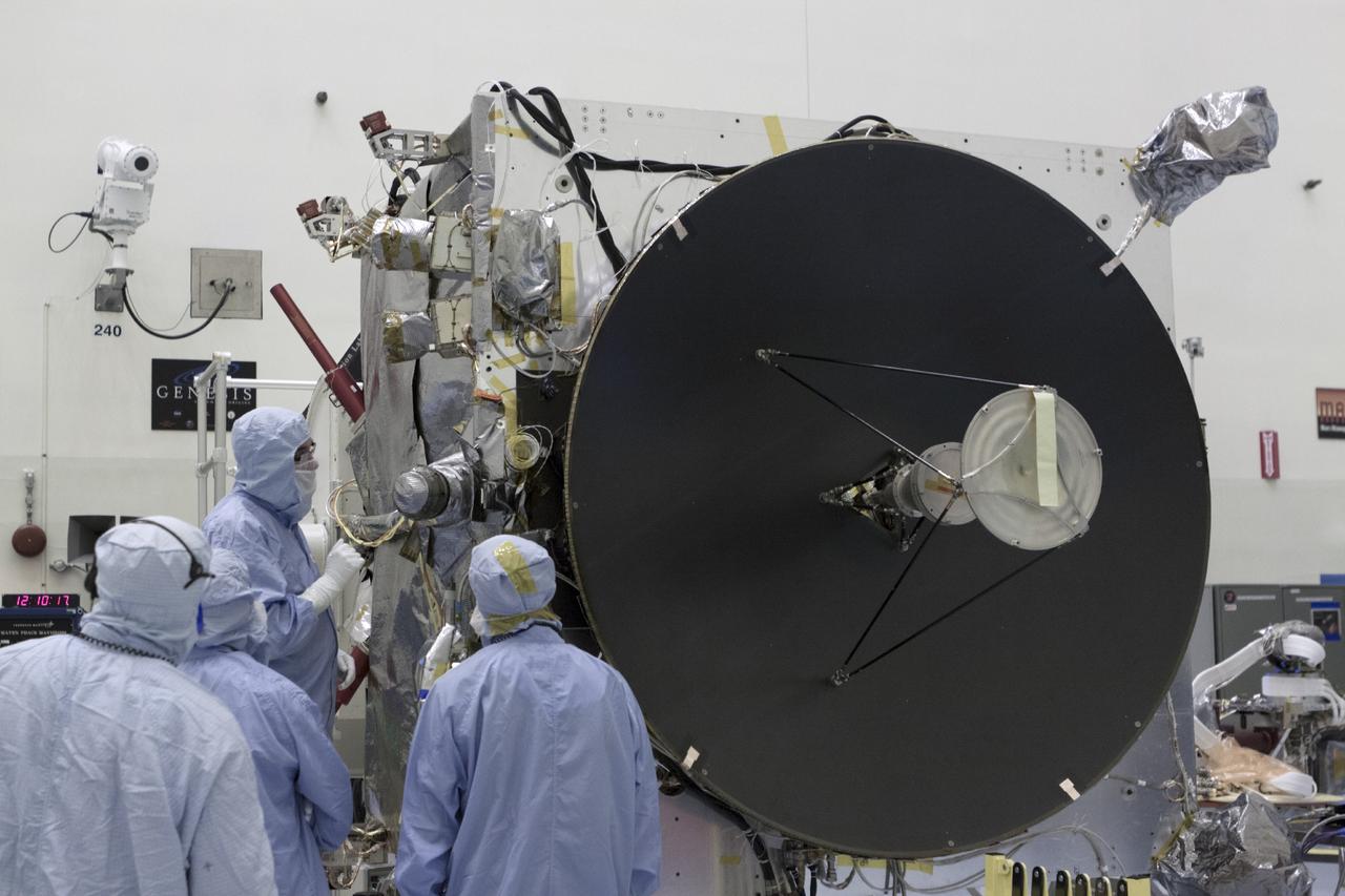
CAPE CANAVERAL, Fla. – Inside the Payload Hazardous Servicing Facility at NASA's Kennedy Space Center in Florida, engineers and technicians prepare to deploy the Solar Wind Electron Analyzer boom on the Mars Atmosphere and Volatile Evolution, or MAVEN, spacecraft. The analyzer will measure the solar wind and electrons in the ionosphere of the Red Planet. MAVEN is being prepared for its scheduled launch in November from Cape Canaveral Air Force Station, Fla. atop a United Launch Alliance Atlas V rocket. Positioned in an orbit above the Red Planet, MAVEN will study the upper atmosphere of Mars in unprecedented detail. For more information, visit: http://www.nasa.gov/mission_pages/maven/main/index.html Photo credit: NASA/Kim Shiflett
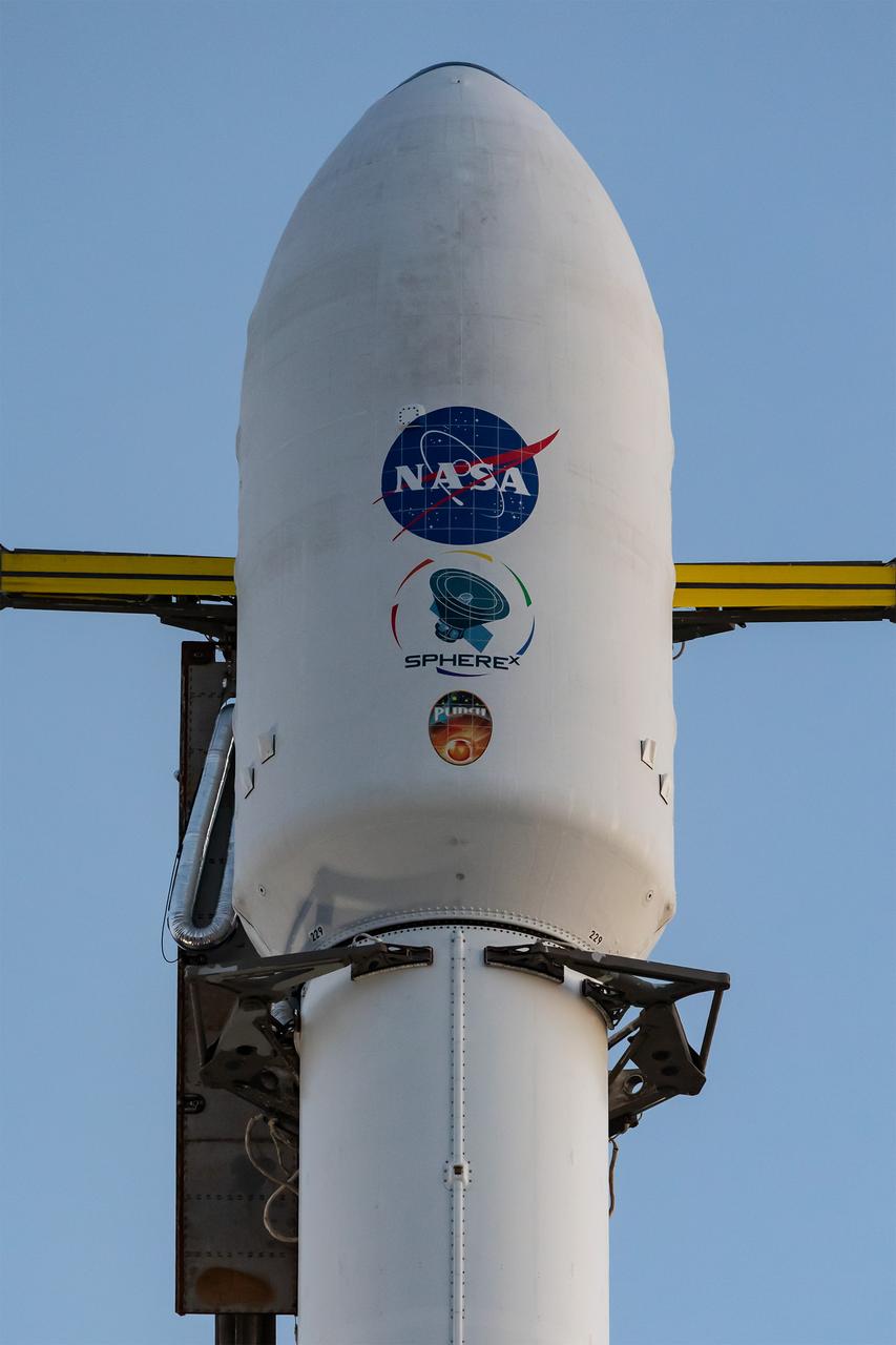
A SpaceX Falcon 9 rocket, carrying NASA’s SPHEREx (Spectro-Photometer for the History of the Universe, Epoch of Reionization and Ices Explorer) observatory and PUNCH (Polarimeter to Unify the Corona and Heliosphere) satellites, is vertical at Space Launch Complex 4 East from Vandenberg Space Force Base in California on Saturday March 8, 2025. SPHEREx will use its telescope to provide an all-sky spectral survey, creating a 3D map of the entire sky to help scientists investigate the origins of our universe. PUNCH will study origins of the Sun’s outflow of material, or the solar wind, capturing continuous 3D images of the Sun’s corona and the solar wind’s journey into the solar system.
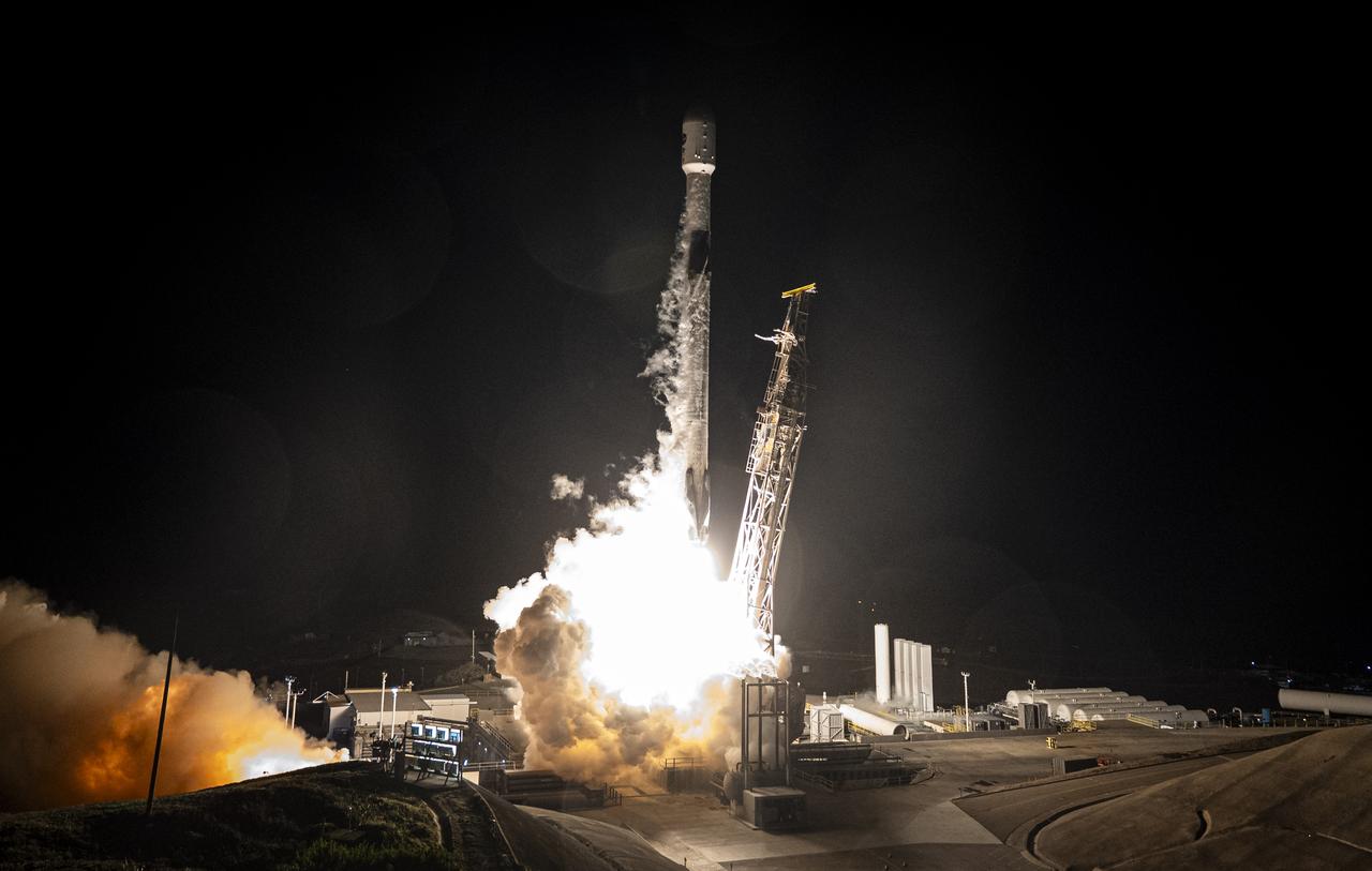
A SpaceX Falcon 9 rocket, carrying NASA’s SPHEREx (Spectro-Photometer for the History of the Universe, Epoch of Reionization and Ices Explorer) observatory and PUNCH (Polarimeter to Unify the Corona and Heliosphere) satellites, launches from Space Launch Complex 4 East at Vandenberg Space Force Base in California on Tuesday, March 11, 2025. SPHEREx will use its telescope to provide an all-sky spectral survey, creating a 3D map of the entire sky to help scientists investigate the origins of our universe. PUNCH will study origins of the Sun’s outflow of material, or the solar wind, capturing continuous 3D images of the Sun’s corona and the solar wind’s journey into the solar system.
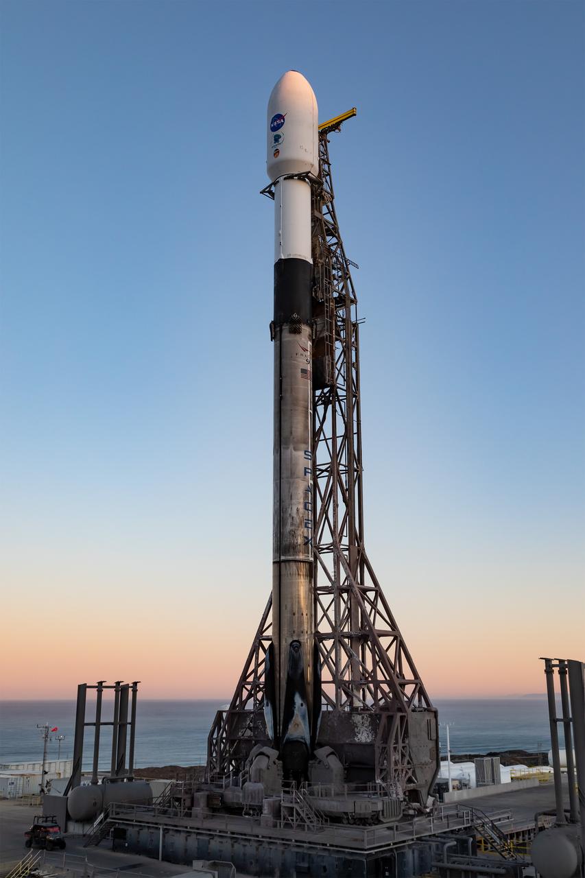
A SpaceX Falcon 9 rocket, carrying NASA’s SPHEREx (Spectro-Photometer for the History of the Universe, Epoch of Reionization and Ices Explorer) observatory and PUNCH (Polarimeter to Unify the Corona and Heliosphere) satellites, is vertical at Space Launch Complex 4 East from Vandenberg Space Force Base in California on Saturday March 8, 2025. SPHEREx will use its telescope to provide an all-sky spectral survey, creating a 3D map of the entire sky to help scientists investigate the origins of our universe. PUNCH will study origins of the Sun’s outflow of material, or the solar wind, capturing continuous 3D images of the Sun’s corona and the solar wind’s journey into the solar system.
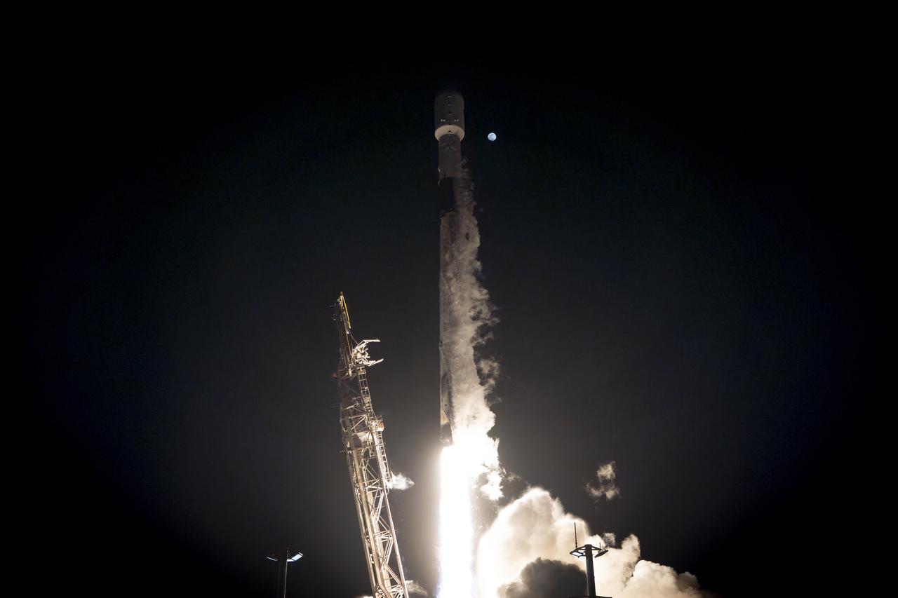
A SpaceX Falcon 9 rocket, carrying NASA’s SPHEREx (Spectro-Photometer for the History of the Universe, Epoch of Reionization and Ices Explorer) observatory and PUNCH (Polarimeter to Unify the Corona and Heliosphere) satellites, launches from Space Launch Complex 4 East at Vandenberg Space Force Base in California on Tuesday, March 11, 2025. SPHEREx will use its telescope to provide an all-sky spectral survey, creating a 3D map of the entire sky to help scientists investigate the origins of our universe. PUNCH will study origins of the Sun’s outflow of material, or the solar wind, capturing continuous 3D images of the Sun’s corona and the solar wind’s journey into the solar system.
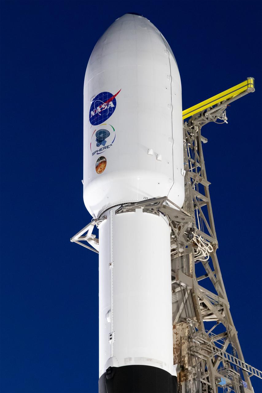
A SpaceX Falcon 9 rocket, carrying NASA’s SPHEREx (Spectro-Photometer for the History of the Universe, Epoch of Reionization and Ices Explorer) observatory and PUNCH (Polarimeter to Unify the Corona and Heliosphere) satellites, is vertical at Space Launch Complex 4 East from Vandenberg Space Force Base in California on Saturday, March 8, 2025. SPHEREx will use its telescope to provide an all-sky spectral survey, creating a 3D map of the entire sky to help scientists investigate the origins of our universe. PUNCH will study origins of the Sun’s outflow of material, or the solar wind, capturing continuous 3D images of the Sun’s corona and the solar wind’s journey into the solar system.
CAPE CANAVERAL, Fla. – Inside the Payload Hazardous Servicing Facility at NASA's Kennedy Space Center in Florida, engineers and technicians deploy the Solar Wind Electron Analyzer boom on the Mars Atmosphere and Volatile Evolution, or MAVEN, spacecraft. The analyzer will measure the solar wind and electrons in the ionosphere of the Red Planet. MAVEN is being prepared for its scheduled launch in November from Cape Canaveral Air Force Station, Fla. atop a United Launch Alliance Atlas V rocket. Positioned in an orbit above the Red Planet, MAVEN will study the upper atmosphere of Mars in unprecedented detail. For more information, visit: http://www.nasa.gov/mission_pages/maven/main/index.html Photo credit: NASA/Kim Shiflett