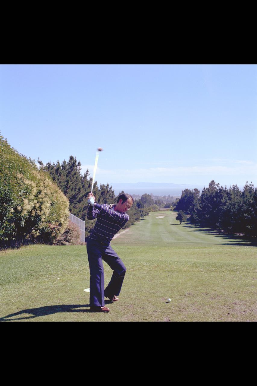
Shot of Bay Area Sports Activities for Ames Recruiting brochures 1979-1995
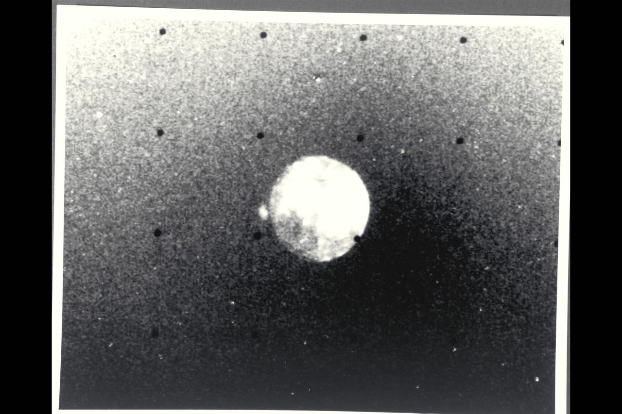
P-21738 BW Raange: 4.76 million kilometers (2.9 million miles) This Voyager 2 picture of Io was taken in ultraviolet light and shows one of the volcanic eruption plumes first photographed by Voyager 1. (the bright spot on the right limb) The plume is more than 200 kilometers (124 miles) high. The volcano apparently has been erupting since it was observed by Voyager 1 in March, 1979. This suggests that the volcanoes on Io probably are in continuous eruption.
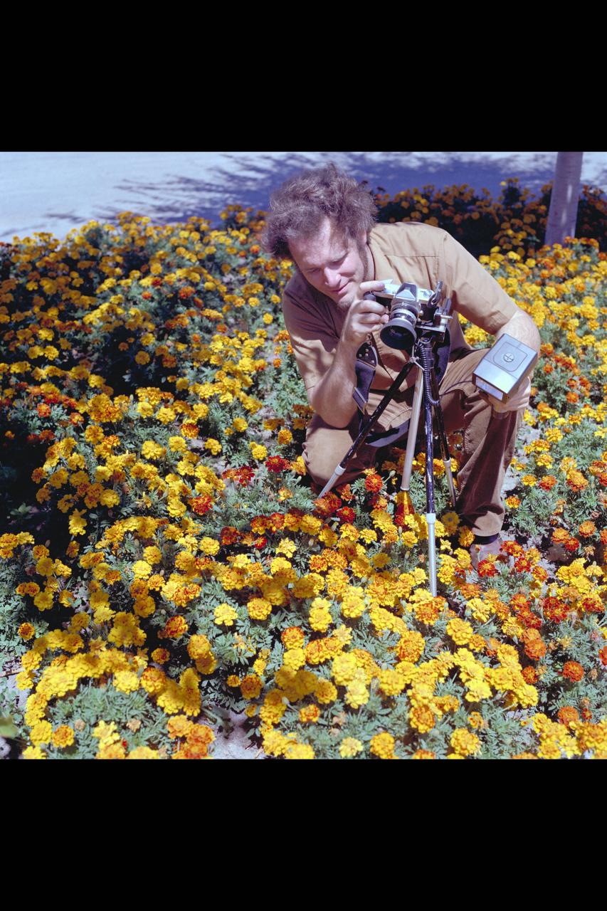
Recruiting Brochure: Ames employee and amateur photographer John Wallace uses base flower gardens as subject of his interest.
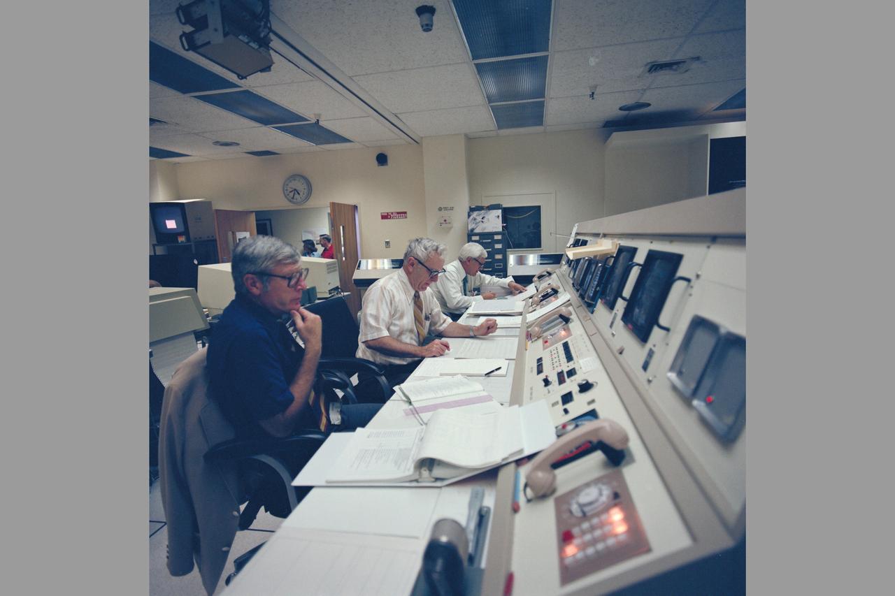
Pioneer Saturn PMOC (Mission Control Center)
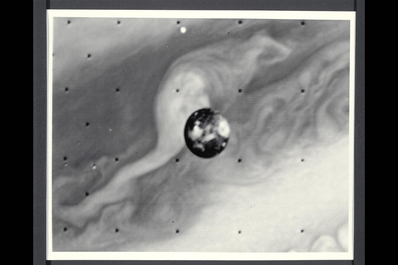
Range : 7 million kilometers (4.3 million miles) Io is Jupiter's innermost of the four Galilean satellites. Photo taken at 2:00 AM through an ultraviolet filter. The photo's background is part of Jupiter's disk. North is at the top and the central longitude of Io is 180 degrees. Io shows a contrasting surface with dark polar areas and many light and dark regions around the equator. This resolution of about 100 miles/160 kilometers, no topographic features, like craters, can be seen. The brighter regions may be areas containing sulfur and various salts, making Io very reflective(six times brighter thanb Earth's Moon). Io is about the same size and density as our Moon, but has followed a different evolutionary path, influenced by its closeness to Jupiter and the intense bombardment it receives from the Jovian radiation belts of energetic charged particles.
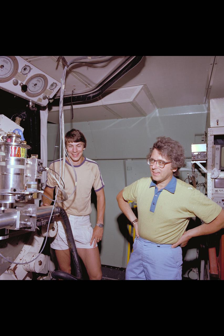
C-141 KAO Rochester, Cornell and California University Experiments packages on board
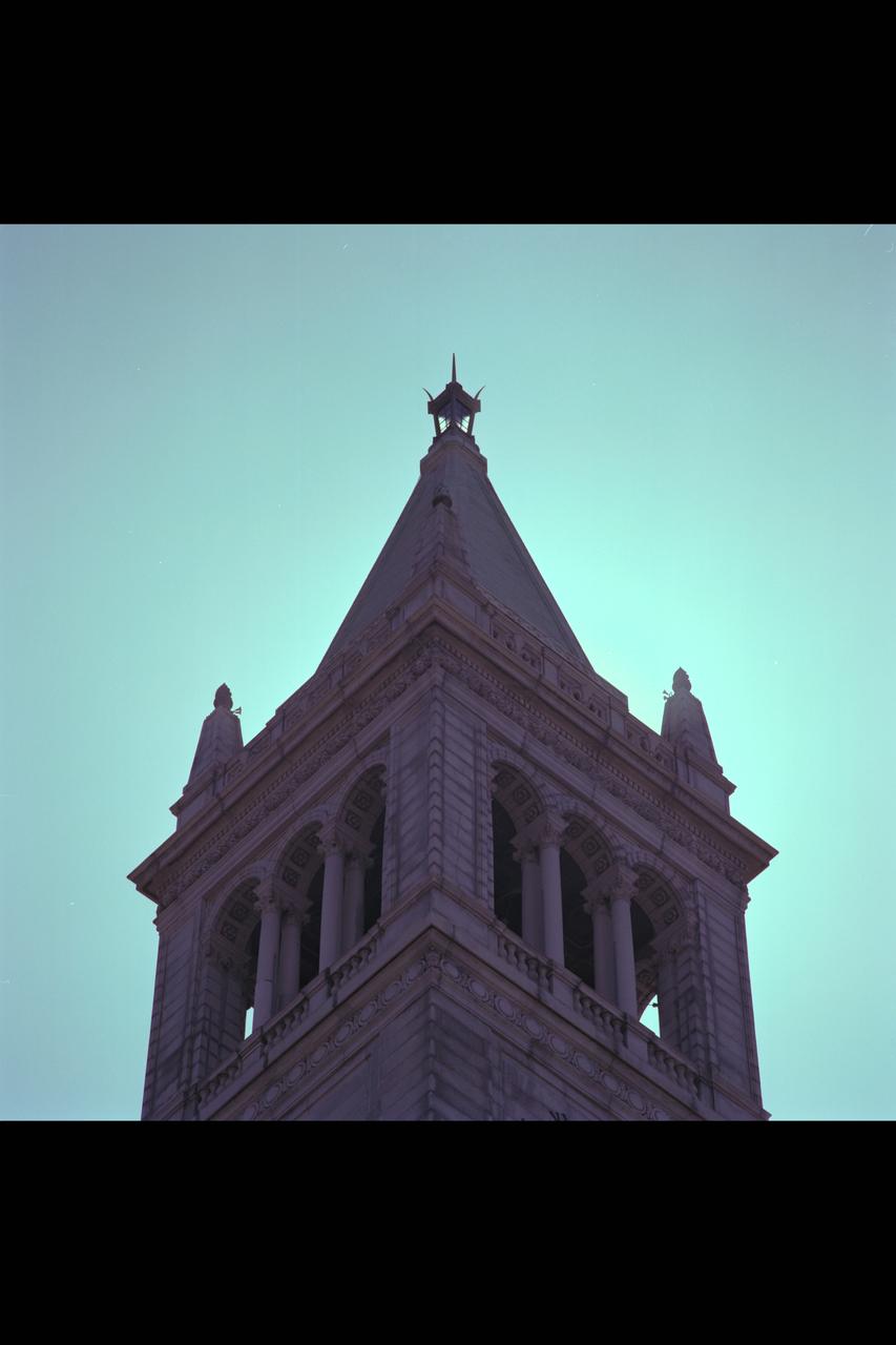
Recruiting Brochure: A San Jose Church tower

This Atlas/Centaur launch vehicle, carrying the High Energy Astronomy Observatory (HEAO)-3, lifted off on September 20, 1979. The HEAO-3's mission was to survey and map the celestial sphere for gamma-ray flux and make detailed measurements of cosmic-ray particles. It carried three scientific experiments: a gamma-ray spectrometer, a cosmic-ray isotope experiment, and a heavy cosmic-ray nuclei experiment. The HEAO-3 was originally identified as HEAO-C but the designation was changed once the spacecraft achieved orbit.

A Mod-1 2000-kilowatt wind turbine designed by National Aeronautics and Space Administration (NASA) Lewis Research Center and constructed in Boone, North Carolina. The wind turbine program was a joint program between NASA and the Energy Research and Development Administration (ERDA) during the 1970s to develop less expensive forms of energy. NASA Lewis was assigned the responsibility of developing large horizontal-axis wind turbines. The program included a series of increasingly powerful wind turbines, designated: Mod-0A, Mod-1, WTS-4, and Mod-5. The program’s first device was a Mod-0 100-kilowatt wind turbine test bed at NASA’s Plum Brook Station. There were four Mod-0A 200-kilowatt turbines built in New Mexico, Hawaii, Puerto Rico, and Rhode Island. The 2000-kilowatt wind turbine in North Carolina, seen here, was the only Mod-1 machine constructed. The two-bladed, 200-foot diameter device was built in May 1979 and began operation that September. The Mod-1 turbine performed exceedingly well and was fully integrated into the local power grid. NASA researchers also used the North Carolina device to study its effect on noise and television transmission.
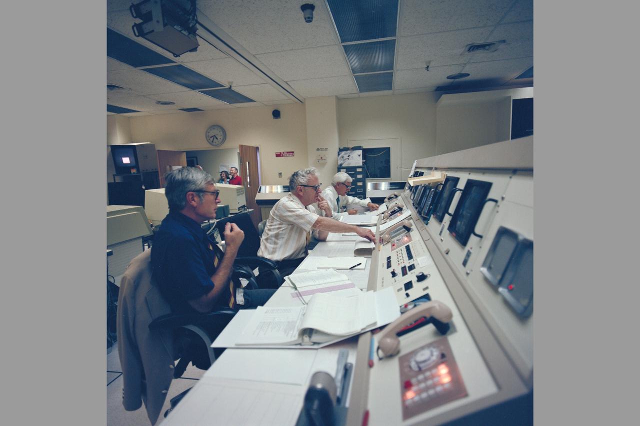
Pioneer Saturn PMOC (Mission Control Center)

S79-29592 (28 Feb 1979) --- Sporting their new Shuttle-type constant-wear garments, these six astronaut candidates pose for a picture in the crew systems laboratory at the Johnson Space Center (JSC) with the personnel rescue enclosure (PRE) or "rescue ball" and an unoccupied Apollo EMU. From left to right are Rhea Seddon, Kathryn D. Sullivan, Judith A. Resnik, Sally K. Ride, Anna L. Fisher and Shannon W. Lucid.

S79-36438 (October 1979) --- Astronaut Karol J. Bobko.
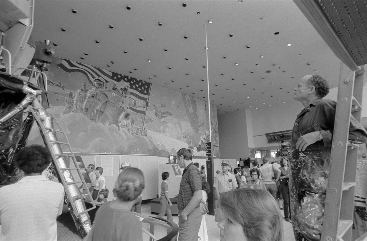
View of mural painted by Artist Bob McCall. JSC, HOUSTON, TX
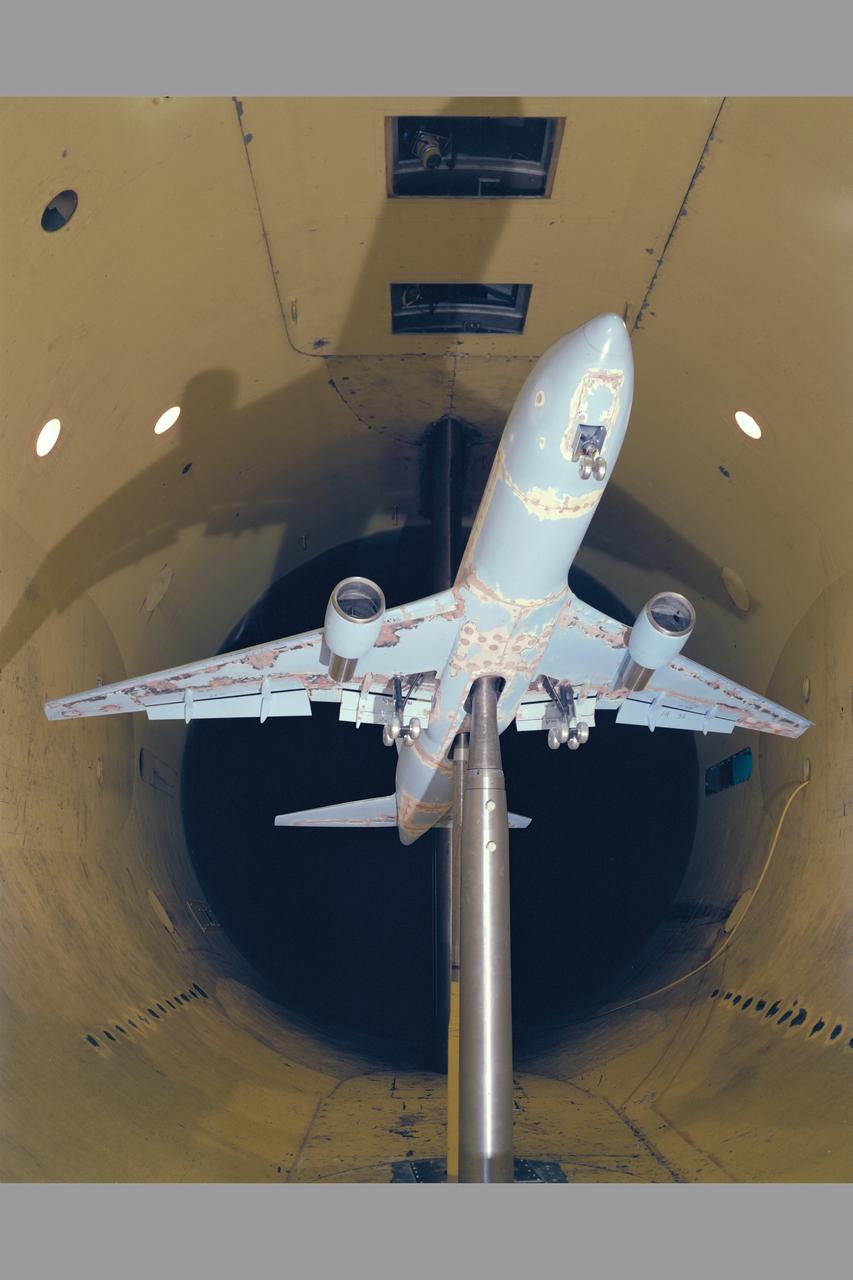
Boeing 767 Model in 12 Ft. W. T. Test -363
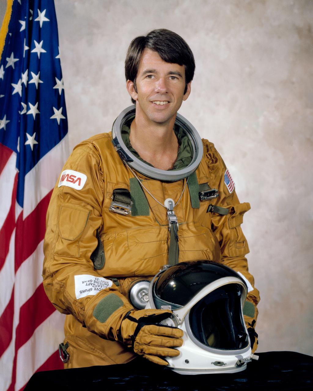
S79-36440 (October 1979) --- Astronaut William B. Lenoir portrait. Photo credit: NASA
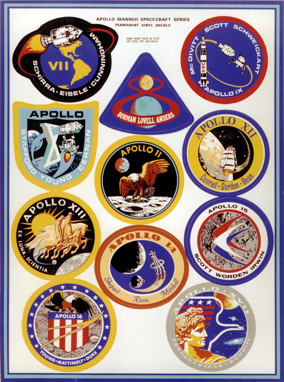
This montage depicts the flight crew patches for the manned Apollo 7 thru Apollo 17 missions. The Apollo 7 through 10 missions were basically manned test flights that paved the way for lunar landing missions. Primary objectives met included the demonstration of the Command Service Module (CSM) crew performance; crew/space vehicle/mission support facilities performance and testing during a manned CSM mission; CSM rendezvous capability; translunar injection demonstration; the first manned Apollo docking, the first Apollo Extra Vehicular Activity (EVA), performance of the first manned flight of the lunar module (LM); the CSM-LM docking in translunar trajectory, LM undocking in lunar orbit, LM staging in lunar orbit, and manned LM-CSM docking in lunar orbit. Apollo 11 through 17 were lunar landing missions with the exception of Apollo 13 which was forced to circle the moon without landing due to an onboard explosion. The craft was,however, able to return to Earth safely. Apollo 11 was the first manned lunar landing mission and performed the first lunar surface EVA. Landing site was the Sea of Tranquility. A message for mankind was delivered, the U.S. flag was planted, experiments were set up and 47 pounds of lunar surface material was collected for analysis back on Earth. Apollo 12, the 2nd manned lunar landing mission landed in the Ocean of Storms and retrieved parts of the unmanned Surveyor 3, which had landed on the Moon in April 1967. The Apollo Lunar Surface Experiments Package (ALSEP) was deployed, and 75 pounds of lunar material was gathered. Apollo 14, the 3rd lunar landing mission landed in Fra Mauro. ALSEP and other instruments were deployed, and 94 pounds of lunar materials were gathered, using a hand cart for first time to transport rocks. Apollo 15, the 4th lunar landing mission landed in the Hadley-Apennine region. With the first use of the Lunar Roving Vehicle (LRV), the crew was bale to gather 169 pounds of lunar material. Apollo 16, the 5th lunar landing mission, landed in the Descartes Highlands for the first study of highlands area. Selected surface experiments were deployed, the ultraviolet camera/spectrograph was used for first time on the Moon, and the LRV was used for second time for a collection of 213 pounds of lunar material. The Apollo program came to a close with Apollo 17, the 6th and final manned lunar landing mission that landed in the Taurus-Littrow highlands and valley area. This mission hosted the first scientist-astronaut, Schmitt, to land on the Moon. The 6th automated research station was set up, and 243 ponds of lunar material was gathered using the LRV.

S79-29594 (28 Feb 1979) --- Sporting their new Shuttle-type constant-wear garments, these six astronaut candidates pose for a picture in the crew systems laboratory at the Johnson Space Center (JSC). From left to right are Rhea Seddon, Sally K. Ride, Kathryn D. Sullivan, Shannon W. Lucid, Anna L. Fisher and Judith A. Resnik.
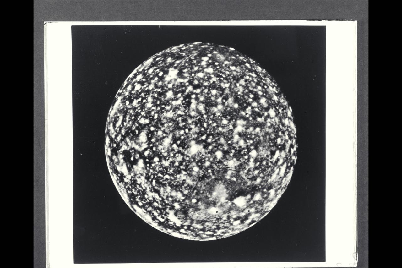
P-21745 BW Range: 1.1 million miles (675,000 miles) This image of Callisto taken by Voyager 2 was enhanced to reveal detail in the scene. Voyager 1's high resolution coverage was of the hemisphere just over the right-hand (eastern) horizon, and the large ring structure discovered by Voyager 1 is just over the eastern limb. This image shows yet another ring structure in the upper part of the picture. Callisto exhibits some of the most ancient terrain seen on any of the satellites. Scientists think Callisto's surface is a mixture of ice and rock dating back to the final stages of planetary accretion (over 4 billion years ago) when the surface was pockmarked by a torrential bombardment of meteorites. Younger craters show as bright spots, probably because they expose fresh ice and frost.

S79-37745 (October 1979) --- Astronaut F. Story Musgrave, mission specialist
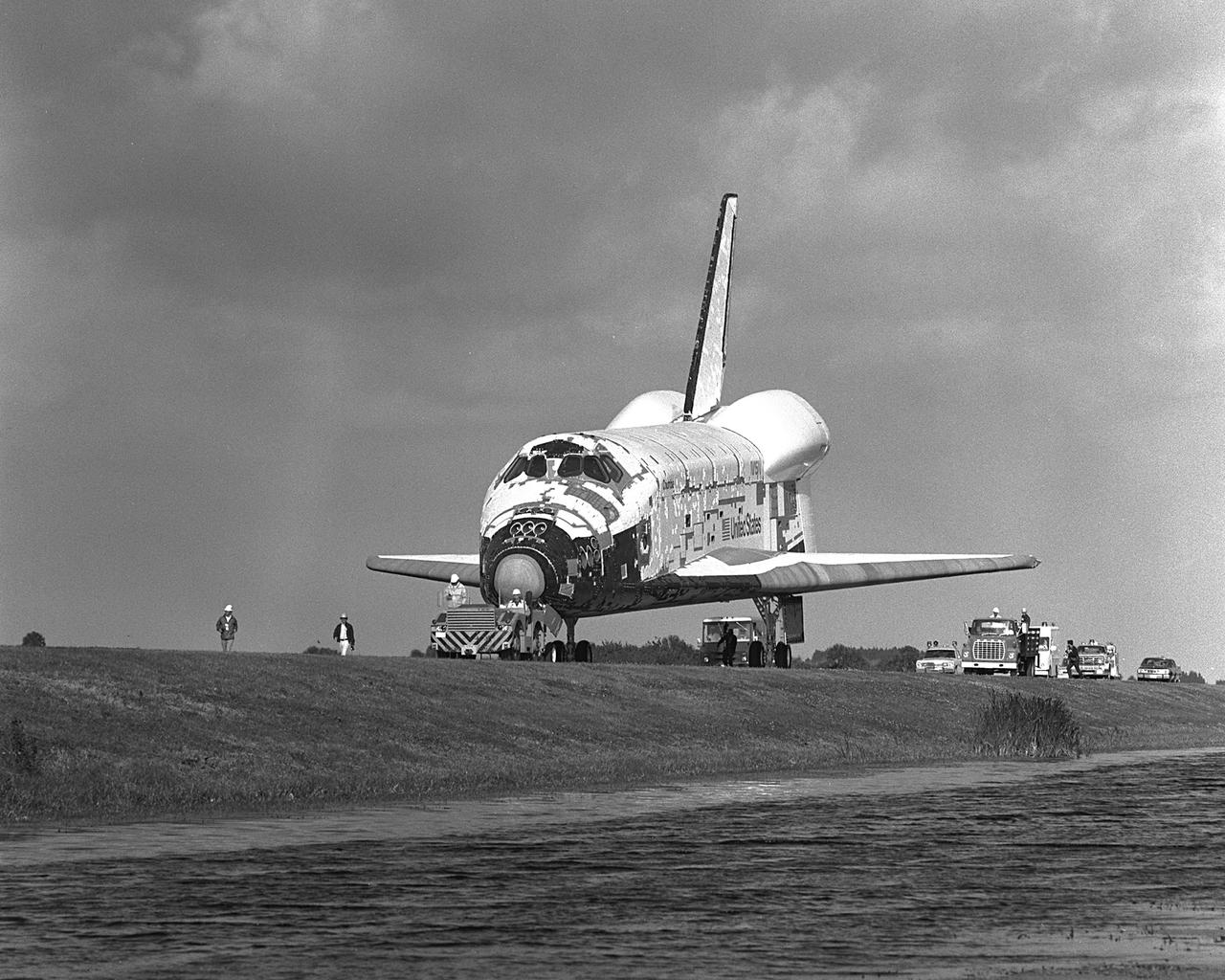
KENNEDY SPACE CENTER, FLA. - Shuttle Orbiter Colulmbia arriving at OPF.
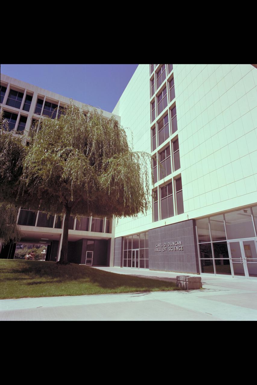
Recruiting Brochure: Carl D. Duncan (Hall of Science)
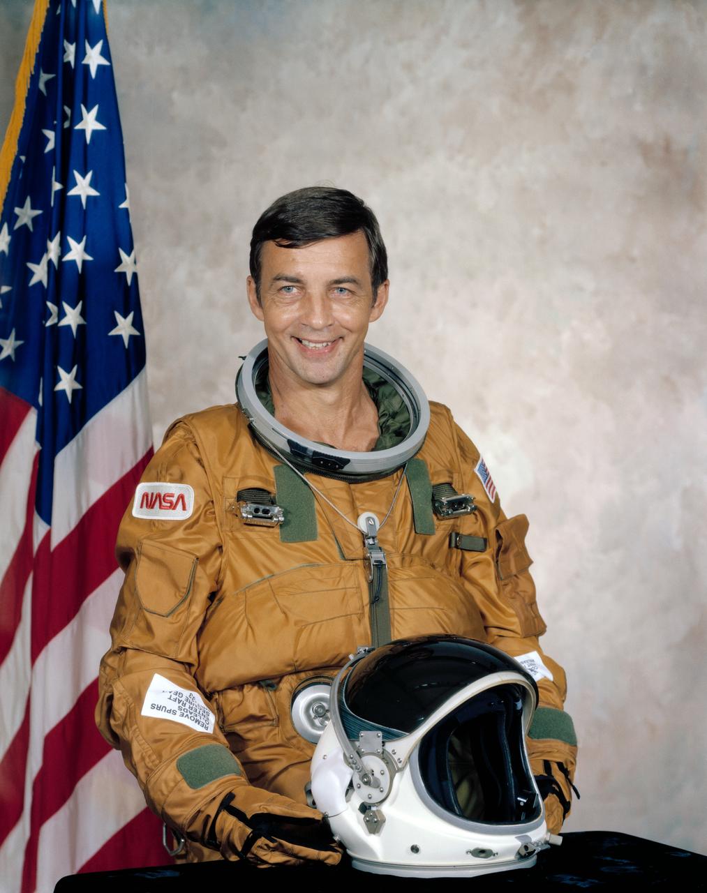
S79-36378 (17 Sept. 1979) --- Astronaut Donald H. Peterson portrait. Photo credit: NASA
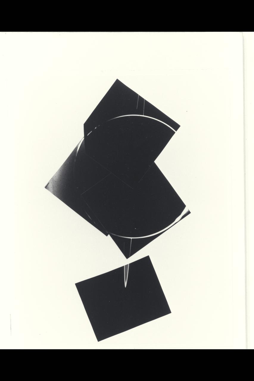
Range : 900,000 miles A brilliant halo around Jupiter, the thin ring of particles discovered by Voyager 1 four months ago, is seen here unusually bright due to forward scattering of the particles within it. Similiarly, the planet is outlined by sunlight scattered toward the spacecraft from a haze layer high in jupiter's atmosphere. The arms of the ring are cut off on each sideby the planet's shadow as they approach the brightly outlined disk. The night side of the planet appears completly dark in this reproduction, but later will be specially reprocessed to search for evidence of lightning sorms and auroras. This 4 image mosaic was obtained with Voyager 2's wide angle camera.
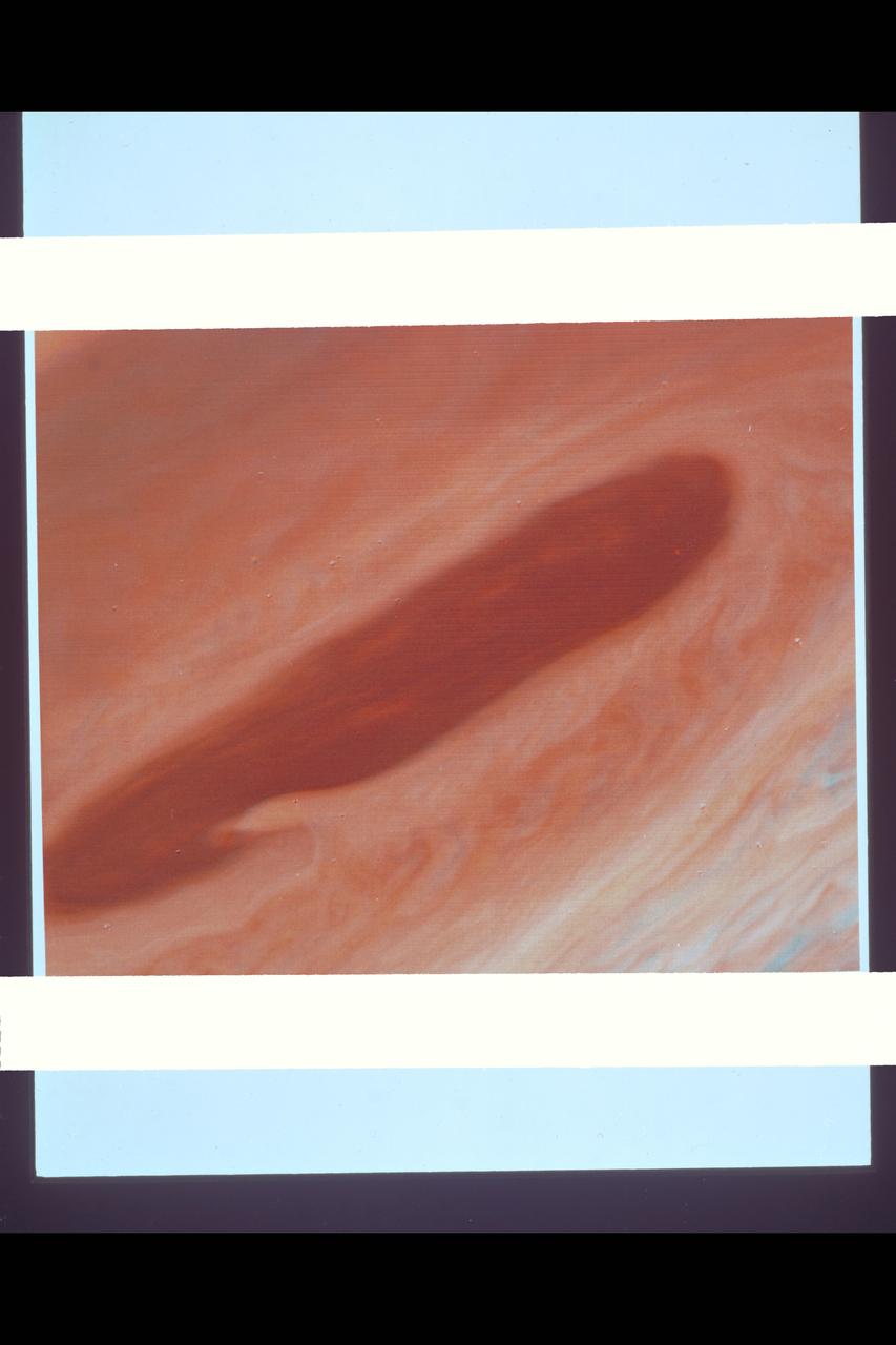
Range : 3.2 million km This image returned by Voyager 2 shows one of the long dark clouds observed in the North Equatorial Belt of Jupiter. A high, white cloud is seen moving over the darker cloud, providing an indication of the structure of the cloud layers. Thin white clouds are also seen within the dark cloud. At right, blue areas, free of high clouds, are seen.
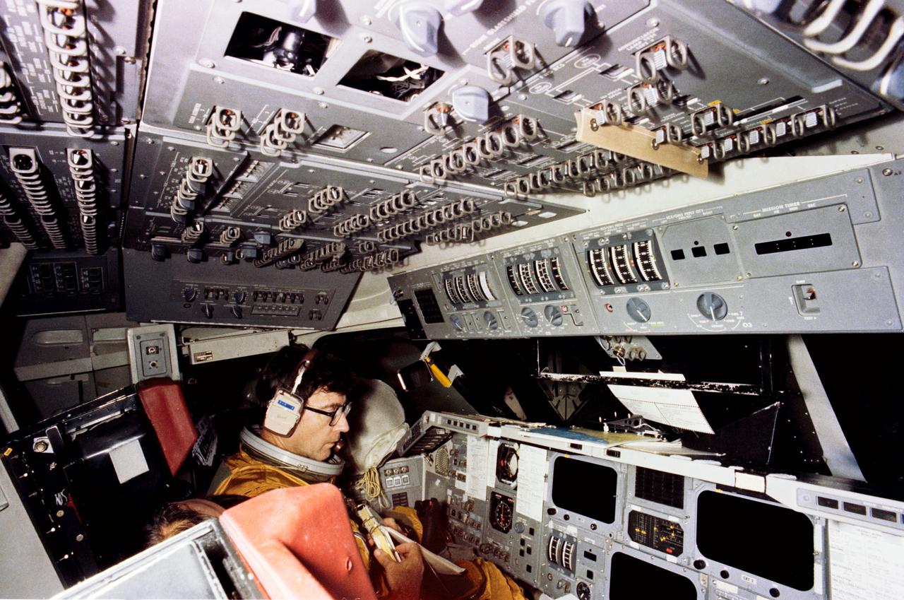
S79-37006 (29 Sept. 1979) --- Astronaut John W. Young, commander of STS-1, goes through a simulation exercises in the shuttle mission simulator (SMS) in the mission simulation and training facility at NASA's Johnson Space Center (JSC). Young and astronaut Robert L. Crippen, prime crew pilot, are in training for the first of series of orbital test missions aboard the Columbia. Photo credit: NASA
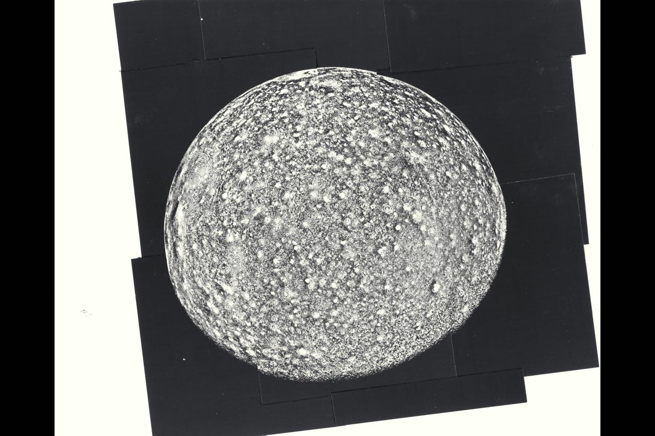
P-21746 BW Range: 390,000 kilometers (245,000 miles) This photomosaic of Callisto is composed of nine frames. The impact crater distribution is very uniform across the disk. Notable are the very bright rayed craters that probably are very young. Near the limb is a giant probable impact structure. Several large structures were discovered by Voyager 1. This one is smaller than the largest one found by Voyager 1 but is more clearly shown. About 15 concentric rings surround the bright central spot. Many hundreds of moderate sized impacts are also seen, a few with bright radial ray patterns. The limb is very smooth confirming that no high topography has been seen on the satellite, and observation consistent with its icy composition.
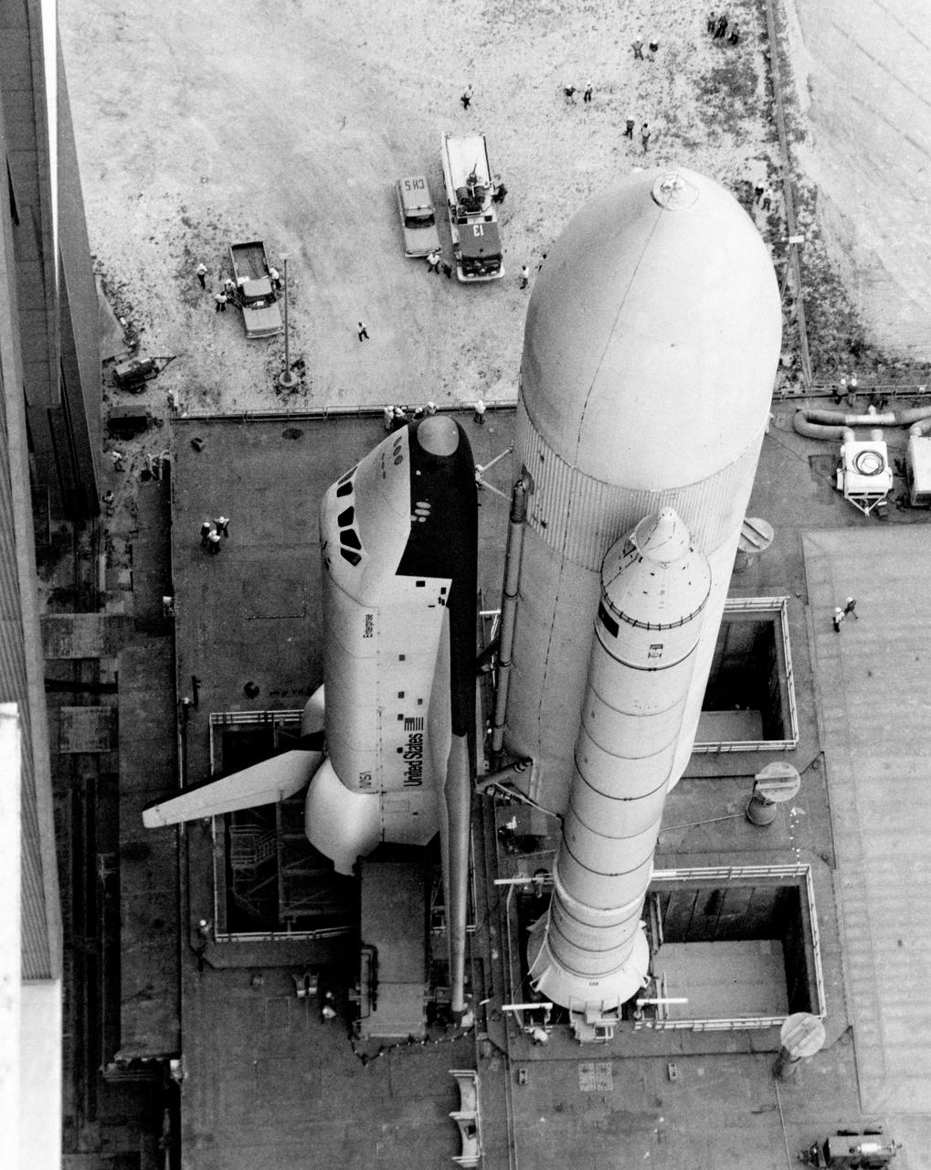
S79-31980 (1 May 1979) --- Space shuttle orbiter 101 Enterprise makes its first appearance mated to supportive propellant containers/boosters cluster, as it is slowly rolled out the front door of the huge Vehicle Assembly Building (VAB) at Kennedy Space Center en route to the launch pad, some 3.5 miles away. It will move slowly there atop this large mobile launch platform. The Enterprise is to undergo several weeks of fit and function checks on the pad in preparation for STS-1, on which its sister craft Columbia will take astronauts John W. Young and Robert L. Crippen into space for a 54-hour test mission. Photo credit: NASA
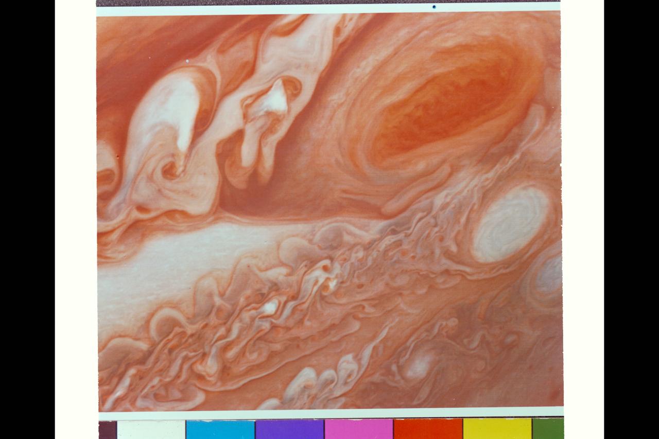
Range : 5 million km. ( 3 million miles ) This photograph, shot from Voyager I, shows Jupiter's Great Red Spot, turbulent regions immediattely to the west, and, middle right, one of the several white ovals seen on Jupiter from Earth. This photograph represents much better resolution than ever seen by telescopic means to date. The Red Spot and Ovals both reveal intricate, involved structures, the smallest details of which, are estimated at 95 km. ( 55 miles ) across.
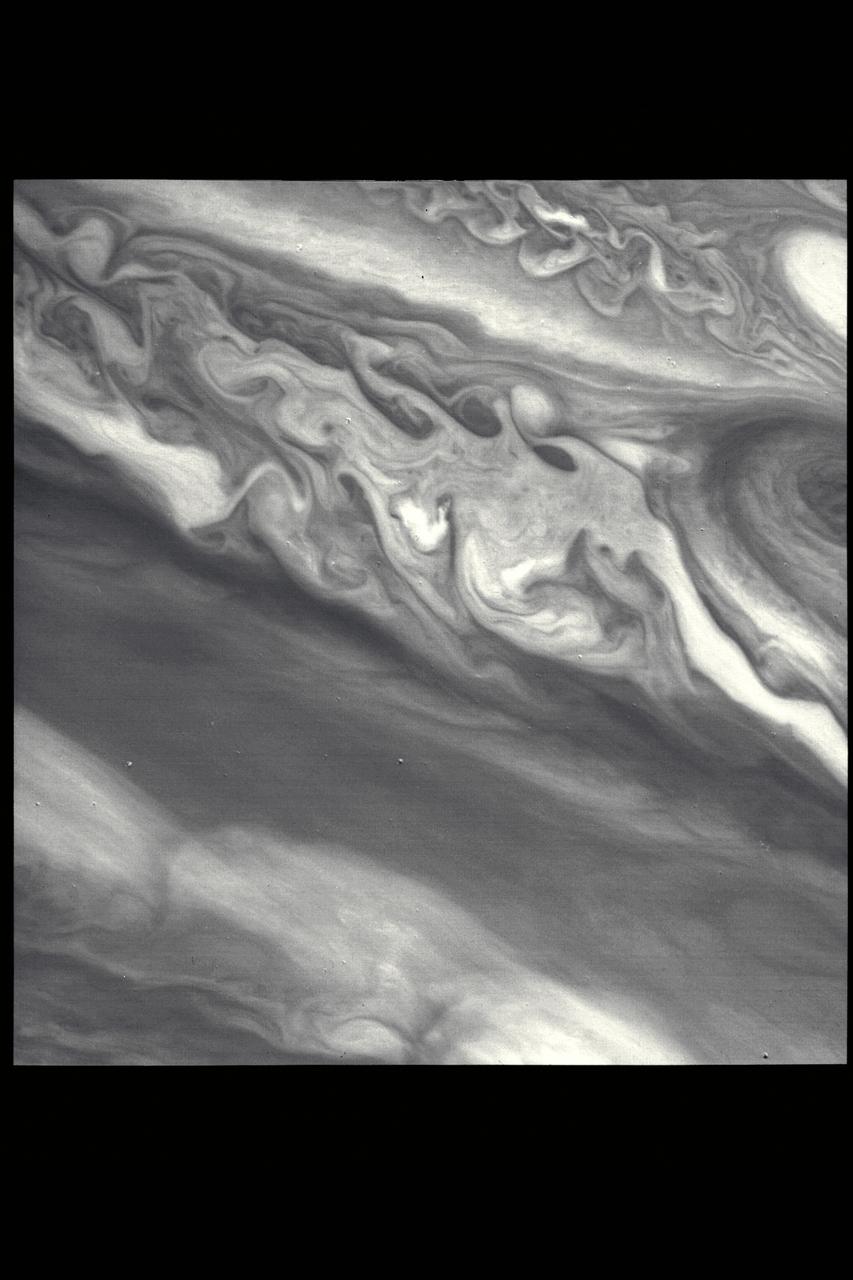
P-21735 BW This Jupiter image taken by Voyager 2 shows an area from 10° N. Lat. to 34° S. Lat. in a region west of the Great Red Spot. At the top of the picture, equatorial plumes are seen. These features move along the edge of the equatorial zone. The remainder of the equatorial region is characterized by diffuse clouds. The region west of the Great Red Spot is seen as a disturbed wave-like pattern. Similiar flows are seen to the west of the white oval at bottom.
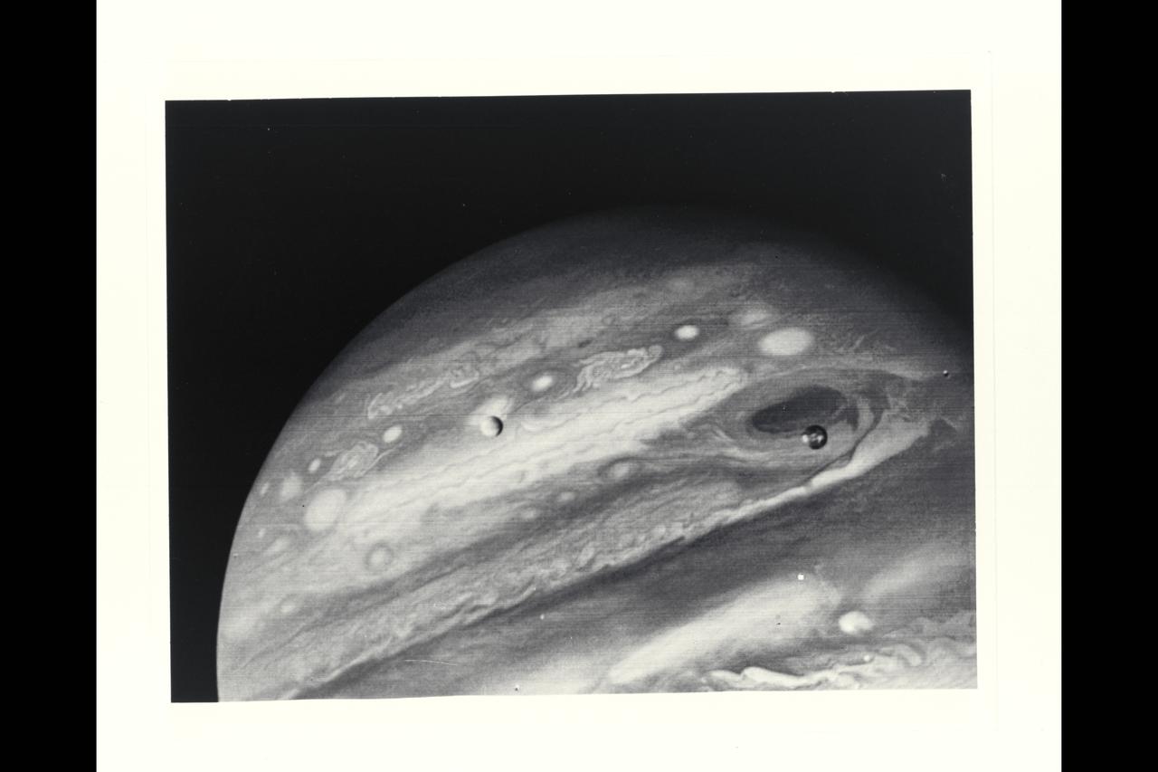
Voyager 1 Image of Jupiter and two of its satellites (Io, left, and Europa). Io is about 350,000 kilometers (220,000 miles) above Jupiter's Great Red Spot; Europa is about 600,000 kilometers (375,000 miles) above Jupiter's clouds. Although both satellites have about the same brightness, Io's color is very different from Europa's. Io's equatorial region show two types of material -- dark orange, broken by several bright spots -- producing a mottled appearance. The poles are darker and reddish. Preliminary evidence suggests color variations within and between the polar regions. Io's surface composition is unknown, but scientists believe it may be a mixture of salts and sulfur. Erupoa is less strongly colored, although still relatively dark at short wavelengths. Markings on Eruopa are less evident that on the other satellites, although this picture shows darker regions toward the trailing half of the visible disk. Jupiter at this point is about 20 million kilometers (12.4 million miles) from the spacecraft. At this resolution (about 400 kimometers or 250 miles) there is evidence of circular motion in Jupiter's atmosphere. While the dominant large-scale motions are west-to-east, small-scale movement includes eddy-like circulation within and between the bands. (JPL ref: P-21082)
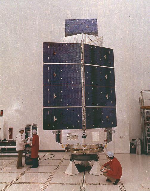
Managed by the Marshall Space Flight Center and built by TRW, the third High Energy Astronomy Observatory was launched September 20, 1979. HEAO-3 was designed to study gamma-rays and cosmic ray particles.
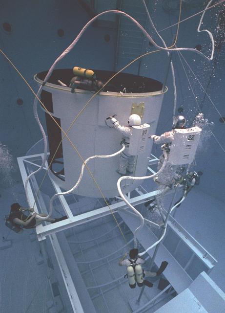
The Hubble Space Telescope (HST) is a cooperative program of the European Space Agency (ESA) and the National Aeronautical and Space Administration (NASA) to operate a long-lived space-based observatory; it was the first and flagship mission of NASA's Great Observatories program. The HST program began as an astronomical dream in the 1940s. During the 1970s and 1980s, HST was finally designed and built; and became operational in the 1990s. HST was deployed into a low-Earth orbit on April 25, 1990 from the cargo bay of the Space Shuttle Discovery (STS-31). The design of the HST took into consideration its length of service and the necessity of repairs and equipment replacement by making the body modular. In doing so, subsequent shuttle missions could recover the HST, replace faulty or obsolete parts and be re-released. Pictured is MSFC's Neutral Buoyancy Simulator which served as the test center for shuttle astronauts training for Hubble related missions. Shown is an astronaut training on a mock-up of a modular section of the HST in removal/replacement of scientific instruments.
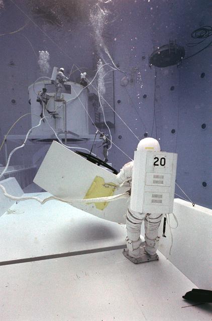
Once the United States' space program had progressed from Earth's orbit into outerspace, the prospect of building and maintaining a permanent presence in space was realized. To accomplish this feat, NASA launched a temporary workstation, Skylab, to discover the effects of low gravity and weightlessness on the human body, and also to develop tools and equipment that would be needed in the future to build and maintain a more permanent space station. The structures, techniques, and work schedules had to be carefully designed to fit this unique construction site. The components had to be lightweight for transport into orbit, yet durable. The station also had to be made with removable parts for easy servicing and repairs by astronauts. All of the tools necessary for service and repairs had to be designed for easy manipulation by a suited astronaut. And construction methods had to be efficient due to limited time the astronauts could remain outside their controlled environment. In lieu of all the specific needs for this project, an environment on Earth had to be developed that could simulate a low gravity atmosphere. A Neutral Buoyancy Simulator (NBS) was constructed by NASA Marshall Space Flight Center (MSFC) in 1968. Since then, NASA scientists have used this facility to understand how humans work best in low gravity and also provide information about the different kinds of structures that can be built. Included in the plans for the space station was a space telescope. This telescope would be attached to the space station and directed towards outerspace. Astronomers hoped that the space telescope would provide a look at space that is impossible to see from Earth because of Earth's atmosphere and other man made influences. In an effort to make replacement and repairs easier on astronauts the space telescope was designed to be modular. Practice makes perfect as demonstrated in this photo: an astronaut practices moving modular pieces of the space telescope in the Neutral Buoyancy Simulator (NBS) at MSFC. The space telescope was later deployed in April 1990 as the Hubble Space Telescope.
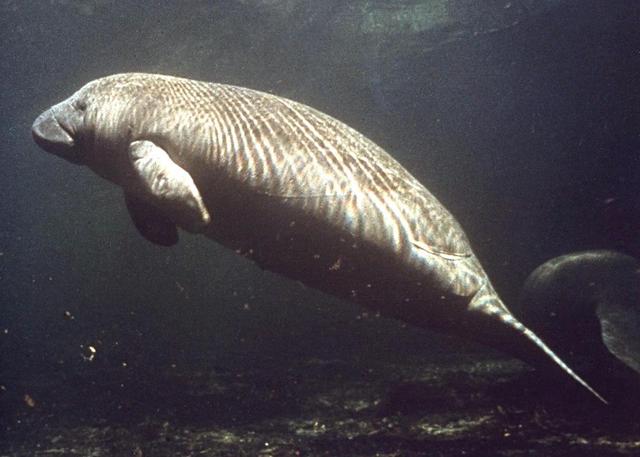
KENNEDY SPACE CENTER, FLA. -- A manatee swims in the water near Kennedy Space Center.
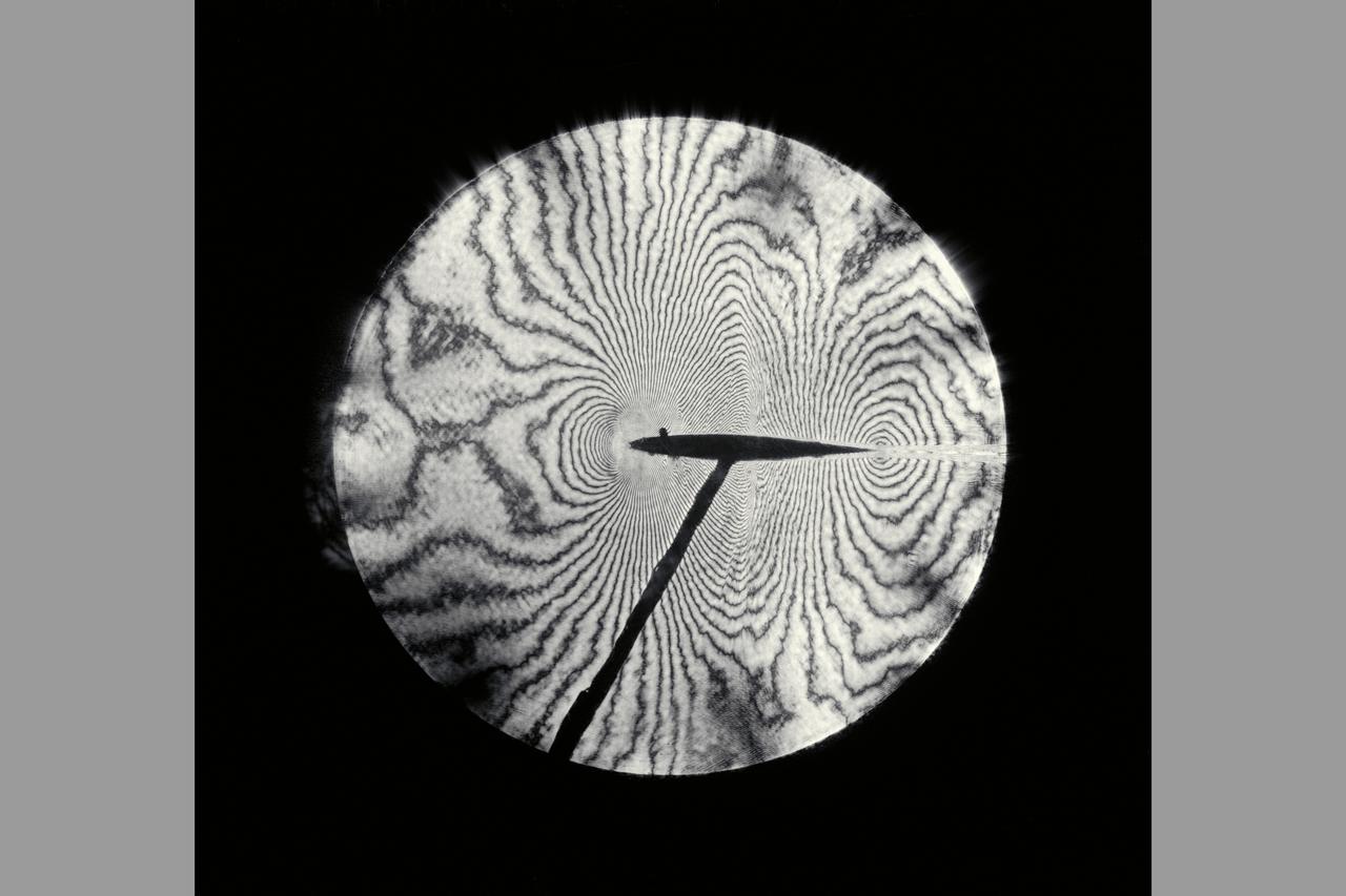
Interferogram of Transonic flow field - reconstructed laser hologram as an infinite-fringe interferogram shows shock-wave shape, location and separaton of the airfoil boundry layer
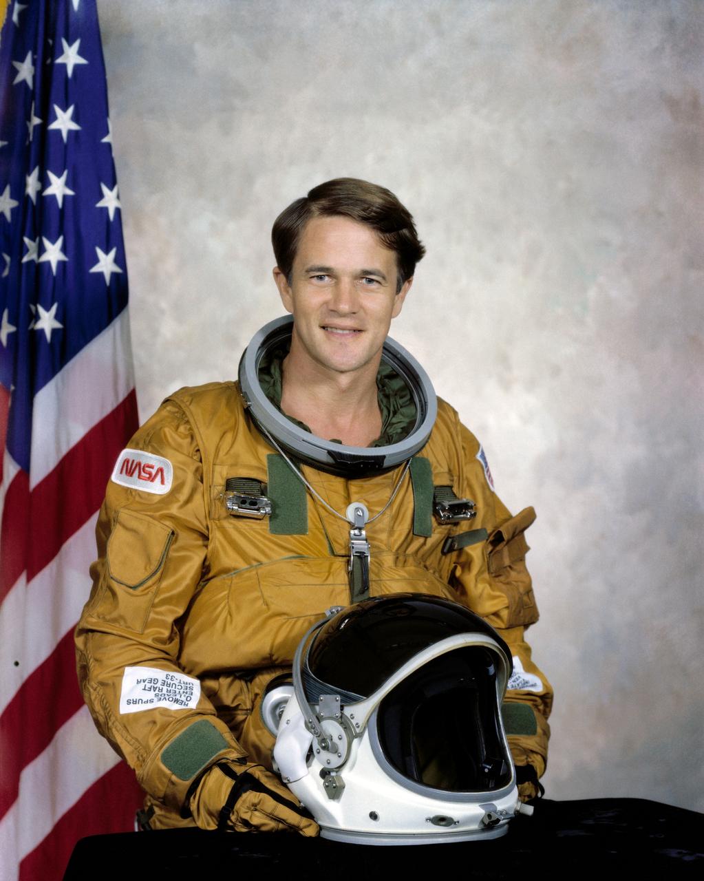
S79-36411 (17 Sept. 1979) --- Astronaut Joseph P. Allen IV.
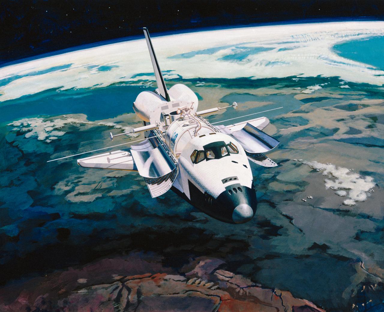
Artist Concept of Shuttle in-orbit flight with Earth limb in the background.
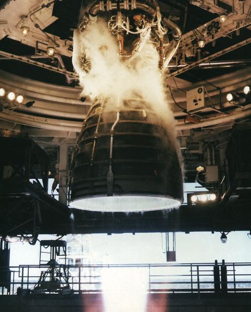
A Space Shuttle engine is shown being test fired at the Sternis, MS facility. MSFC was the managing facility for the Space Shuttle program.
This color reconstruction of part of the northern hemisphere of Ganymede was made from pictures taken at a range of 313,000 km (194,000 mi.). The scene is approx. 1,300 km (806 mi.) across. It shows part of dark, densely cratered block which is bound on the south by lighter, and less cratered, grooved terrain. The dark blocks are believed to be the oldest parts of Ganymede's surface. Numerous craters are visible, many with central peaks. The large bright circular features have little relief and are probably the remnants of old, large craters that have been annealed by flow of the icy near-surface material. The closely-spaced arcuate, linear features are probably analogous to similar features on Ganymede which surround a large impact basin. The linear features here may indicate the former presence of a large impact basin to the southwest.
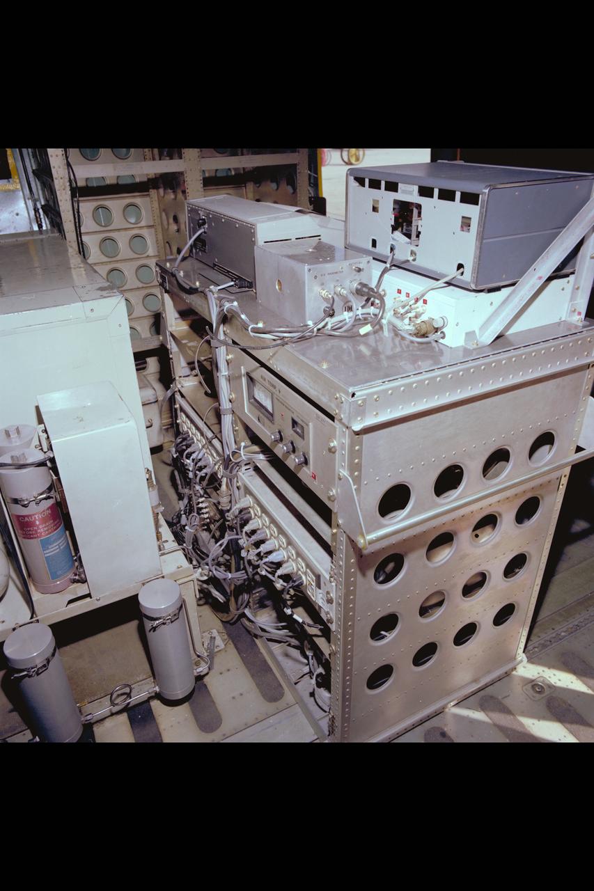
C-141 KAO Research Team for December 1979: Computer equipment
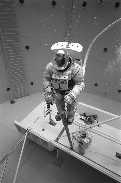
Once the United States' space program had progressed from Earth's orbit into outerspace, the prospect of building and maintaining a permanent presence in space was realized. To accomplish this feat, NASA launched a temporary workstation, Skylab, to discover the effects of low gravity and weightlessness on the human body, and also to develop tools and equipment that would be needed in the future to build and maintain a more permanent space station. The structures, techniques, and work schedules had to be carefully designed to fit this unique construction site. The components had to be lightweight for transport into orbit, yet durable. The station also had to be made with removable parts for easy servicing and repairs by astronauts. All of the tools necessary for service and repairs had to be designed for easy manipulation by a suited astronaut. Construction methods had to be efficient due to the limited time the astronauts could remain outside their controlled environment. In lieu of all the specific needs for this project, an environment on Earth had to be developed that could simulate a low gravity atmosphere. A Neutral Buoyancy Simulator (NBS) was constructed by NASA Marshall Space Flight Center (MSFC) in 1968. Since then, NASA scientists have used this facility to understand how humans work best in low gravity and also provide information about the different kinds of structures that can be built. With the help of the NBS, building a space station became more of a reality. In a joint venture between NASA/Langley Research Center in Hampton, Virginia and the MSFC, the Assembly Concept for Construction of Erectable Space Structures (ACCESS) was developed and demonstrated at MSFC's NBS. The primary objective of this experiment was to test the ACCESS structural assembly concept for suitability as the framework for larger space structures and to identify ways to improve the productivity of space construction. Pictured is a demonstration of ACCESS.
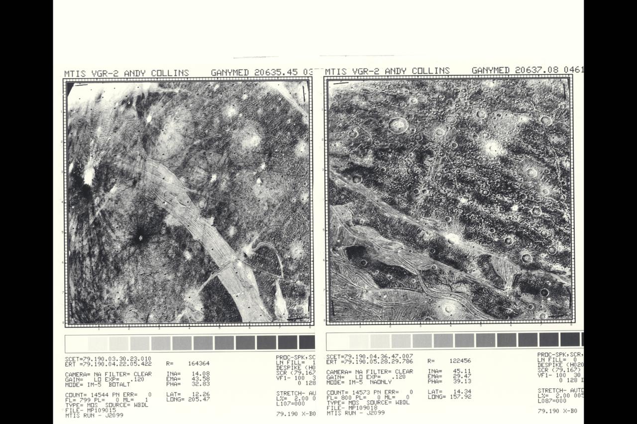
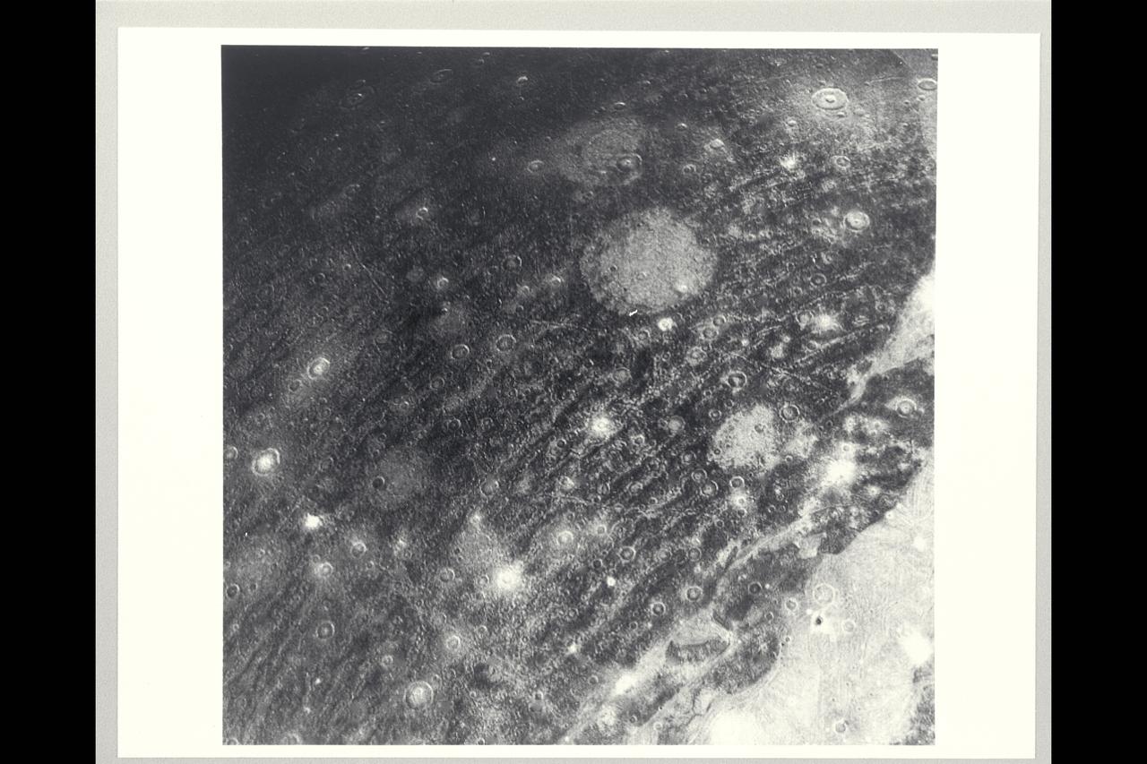
P-21756 BW only Range: 120,000 km (right) 169,000 km (left) Right: In the foreground of this picture taken by Voyager 2, the part of the surface of Ganymede shown is the typical grooved terrain as seen by Voyager 1. It consists of mutually intersecting bands of closely-spaced, parallel ridges and grooves. In the background is newly-cratered dark terrain across which can be traced several widely spaced parellel linear features. When viewed from a distance the line features appear to trace broad circular areas. The features resemble the circular ridges on Callisto that surround an almost complete annealed impact basin. The feature on Ganymede may be of similar origin but all traces of the impact itself have been destroyed. Left: This picture of Ganymede shows that the dark contrast terrain is separated by bright bands of grooved terain. The band of closely spaced linear grooves in the foreground is 150 km across and appears to be offset by another narrow band at right angles, as though by faulting. A variety of ray patterns are seen around the craters. One is in the left of the picture, it has prominent dark rays around an inner bright halo. Other craters have dark haloes; others have diffuse bright rays. The variation of albedo patterns around the craters may be indications of layering in the surface materials. The intensity of the craters suggests the dark areas are extremely old. The bright grooved terrain is less cratered and probably somewhat younger.
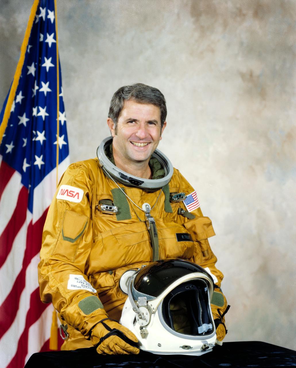
S79-36527 (Oct. 1979) --- Astronaut Richard H. Truly.
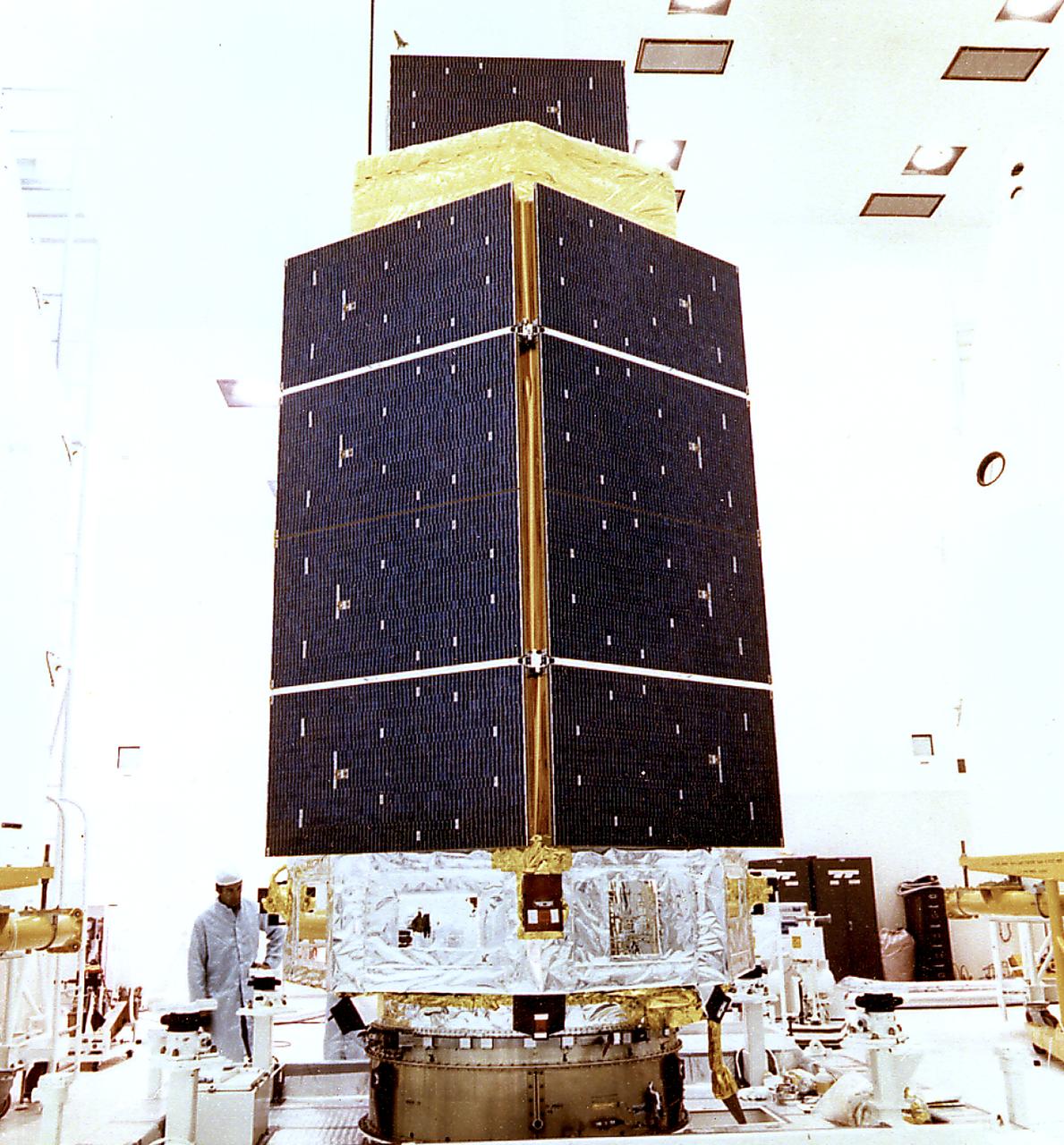
This photograph shows the High Energy Astronomy Observatory (HEAO)-3 being prepared for encapsulation. Designed and developed by TRW, Inc. under the direction of the Marshall Space Flight Center, the objectives of the HEAO-3 were to survey and map the celestial sphere for gamma-ray flux and make detailed measurements of cosmic-ray particles. It carried three scientific experiments: a gamma-ray spectrometer, a cosmic-ray isotope experiment, and a heavy cosmic-ray nuclei experiment. The HEAO-3 was originally identified as HEAO-C but the designation was changed once the spacecraft achieved orbit. The Marshall Space Flight Center had the project management responsibilities for the HEAO missions.
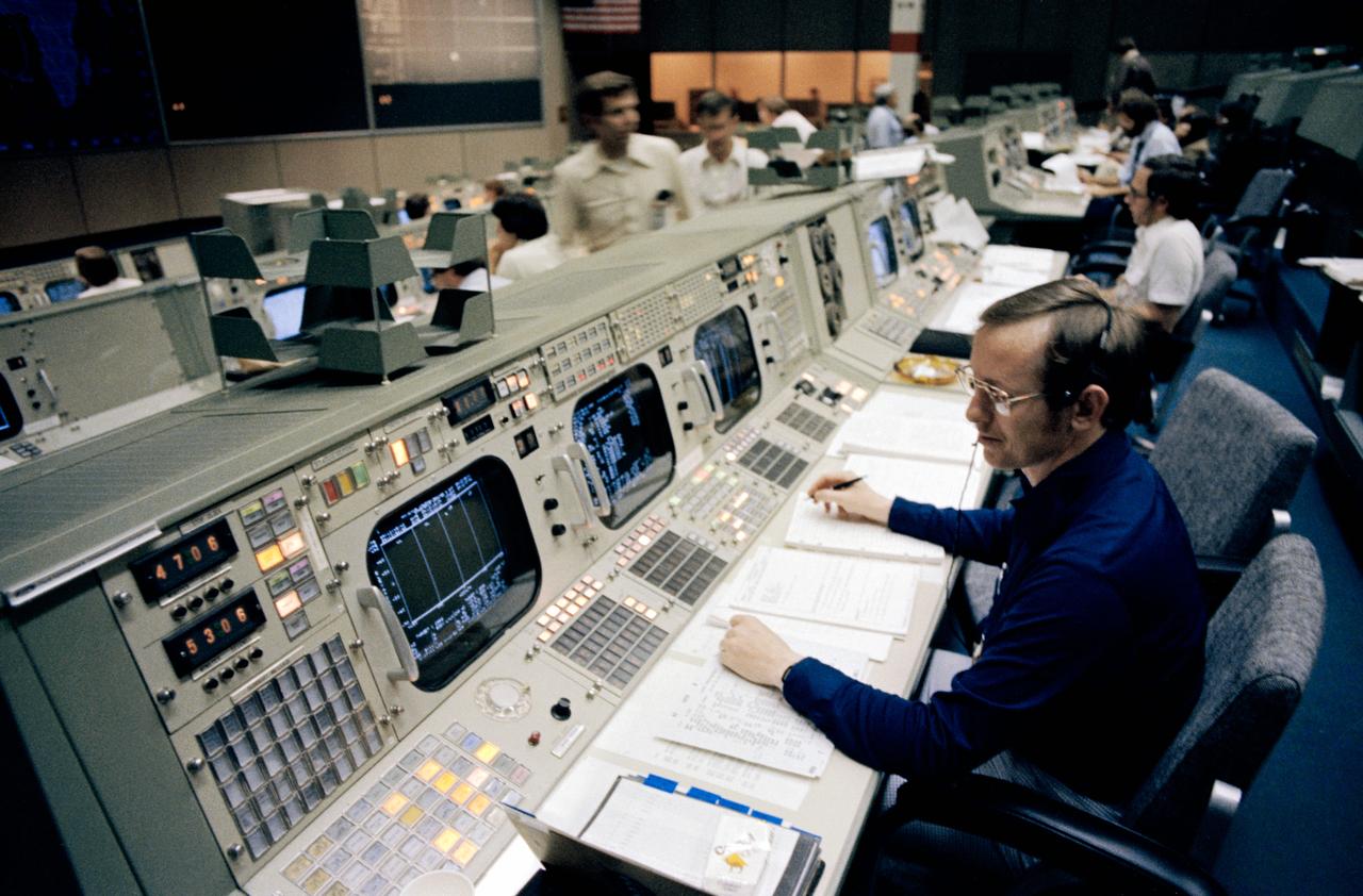
S79-30442 (29 March 1979) --- Granvil A. (Al) Pennington studies the monitor on his console – the instrumentation/communications officer (INCO) position – during simulations in the mission operations control room of the mission control center. The simulations are in preparation for STS-1, the first of a series of orbital fight test (OFT) in the space shuttle orbiter 102 Columbia. Photo credit: NASA
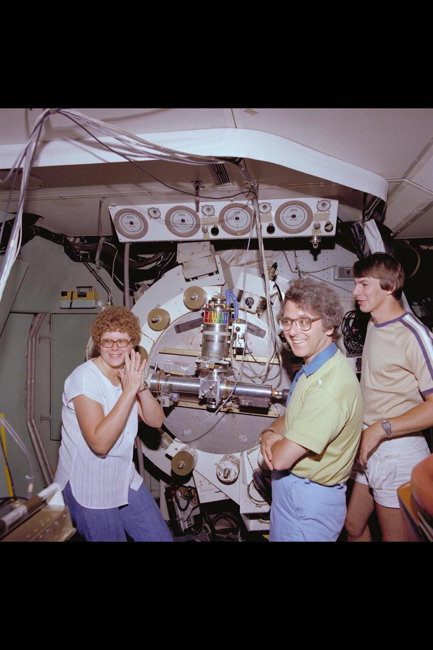
C-141 KAO Rochester, Cornell and California University Experiments packages onboard
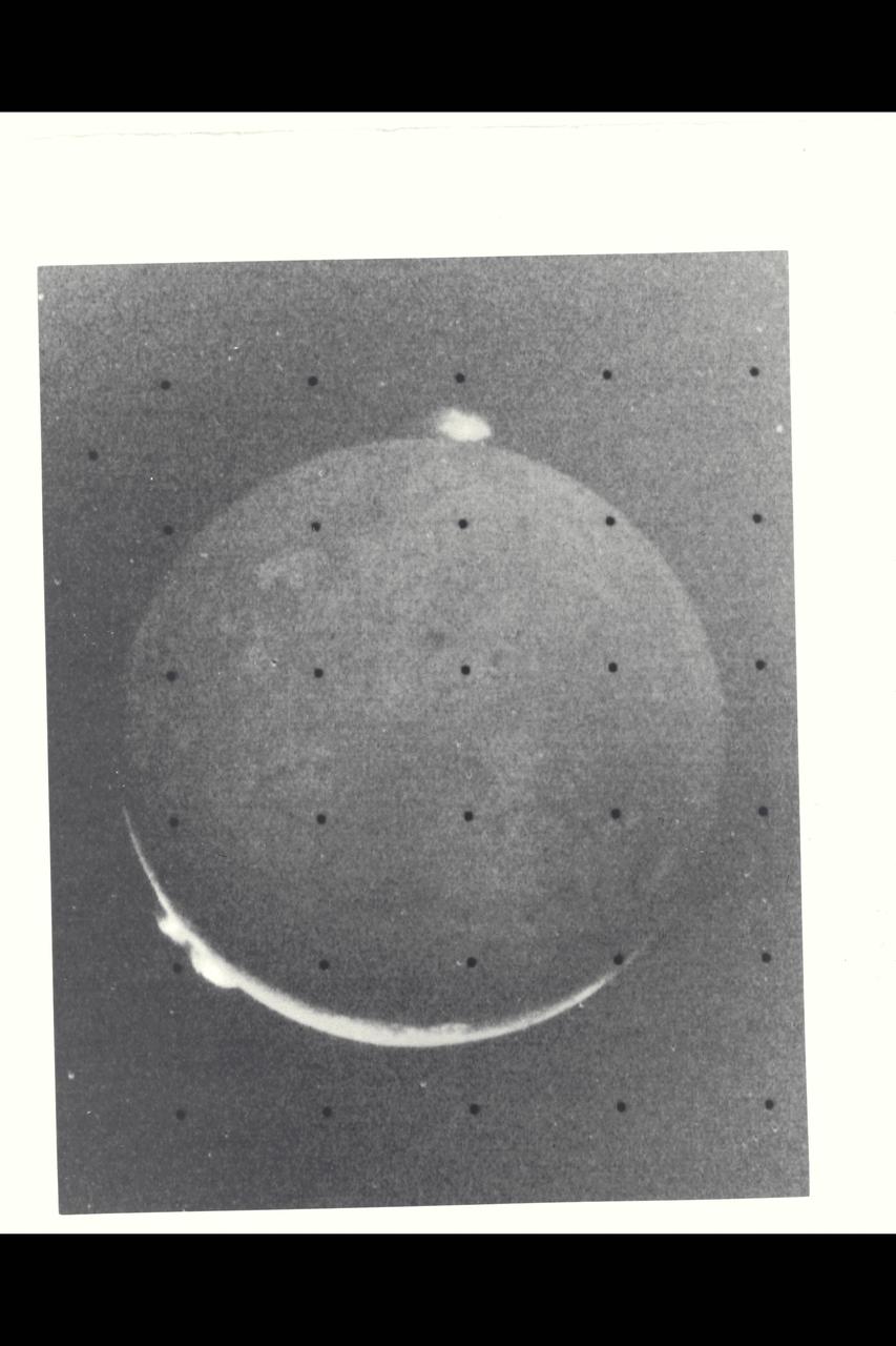
Range : 1.2 million kilometers (750,000 miles) This picture of Io is one of the last sequence of 'volcano watch' pictures planned as a time lapse study of the nearest of Jupiter's Galilean satellites. The sunlit crescent of Io is seen at the left, and the night side illuminated by light reflected from Jupiter can also be seen. Three volcanic eruption plumes are visible on the limb. All three were previously seen by Voyager 1. On the bright limb Plume 5 (upper) and Plume 6 (lower) are about 100 km high, while Plume 2 on the dark limb is about 185 km high and 325 km wide. The dimensions of Plume 2 are about 1 1/2 times greater than during the Boyager 1 encounter, indicating that the intensity of the eruptions has increased during the four-month time interval between the Boyager encounters. The three volcanic eruptions and at least three others have apparently been active at roughly the same intesity or greater for a period of at least four months.
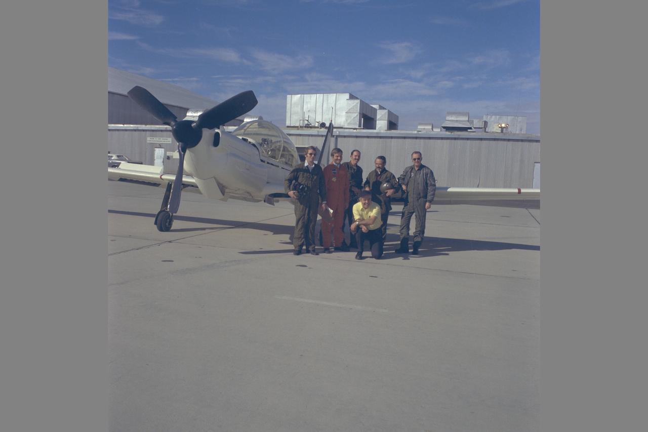
Lockheed YO-3A (USA 69-18010 NASA 718) TEST FLIGHT AT EDWARDS AIRFORCE BASE (FLIGHT RESEARCH CENTER). Rotorcraft Research. Acoustics Research Team from left to right: Don Boxwell, Fred Schmitz, Bob Williams, Lee Jones, Bob George, Vance Duffy. NASA SP Flight Research at Ames: 57 Years of Development and Validation of Aeronautical Technology Fig. 142
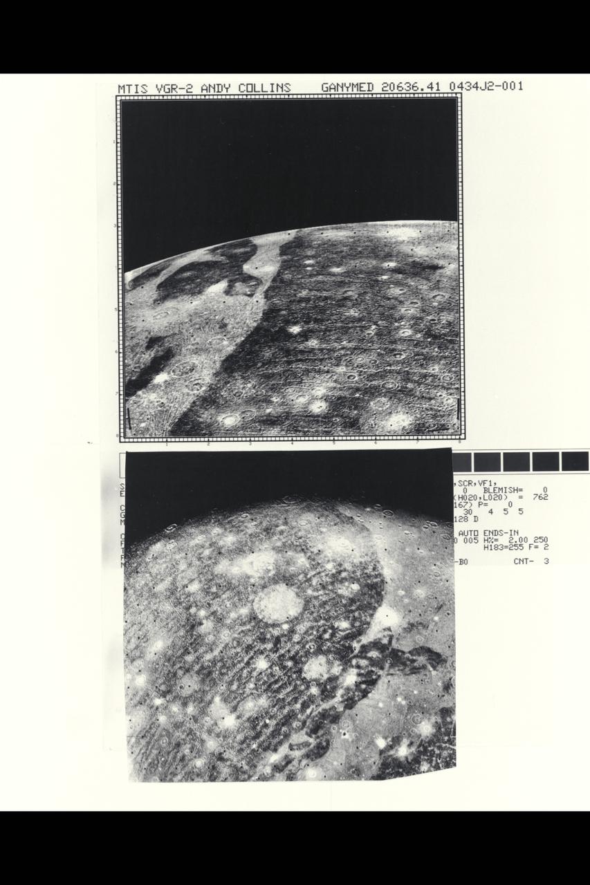
Range : top- 86,000 miles bottom- 192,000 mi. These two close-ups of Ganymede, the largest of Jupiter's 13 moons, show different views of the largest block of dark, heavily cratered terrain. The bottom image shows objects 3 or 4 miles across, with resolution of about 1.5 miles. The light, linear stripes recurring across the dark region resemble the outer rings of the large ring structure around Callisto. If these features are related to an ancient ring structure formed by a large impact, their small curvature suggests that the original structure was even larger than one seen on Callisto. There is no apparent trace now of the center of this suggested structure, which must have been destroyed by the resurfacing evident over most of Ganymede in the grooved terrain. Another interpretation is that these features are not impact-related rings, but rather internally produced fractures crossing the dark terrain, similiar to the grooved bands.
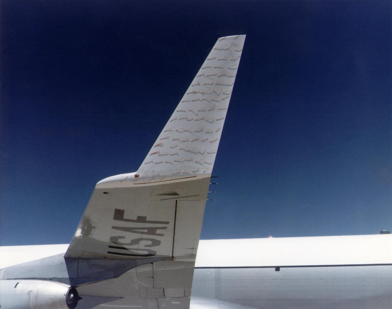
A chase plane view of the tufts on the KC-135 winglet. The use of tufts in flight research dates back to the early days of the NACA, and remains an effective means of observing airflow even today. In this procedure, rows of strings are attached to an airplane's surface, with one end of each string taped to the airplane and the other end free to swing about in the airflow. The movements of the tufts are photographed by on-board cameras or a chase plane. If the tufts are arrayed in neat rows, as seen here, then the airflow is smooth over the airplane's surface. If, however, they are moving about violently, it suggests turbulent airflow. Such motions may indicate high drag, flow separation (such as in a stall), or buffeting. In some cases, tufts will actually point forward, indicating the airflow has reversed direction.
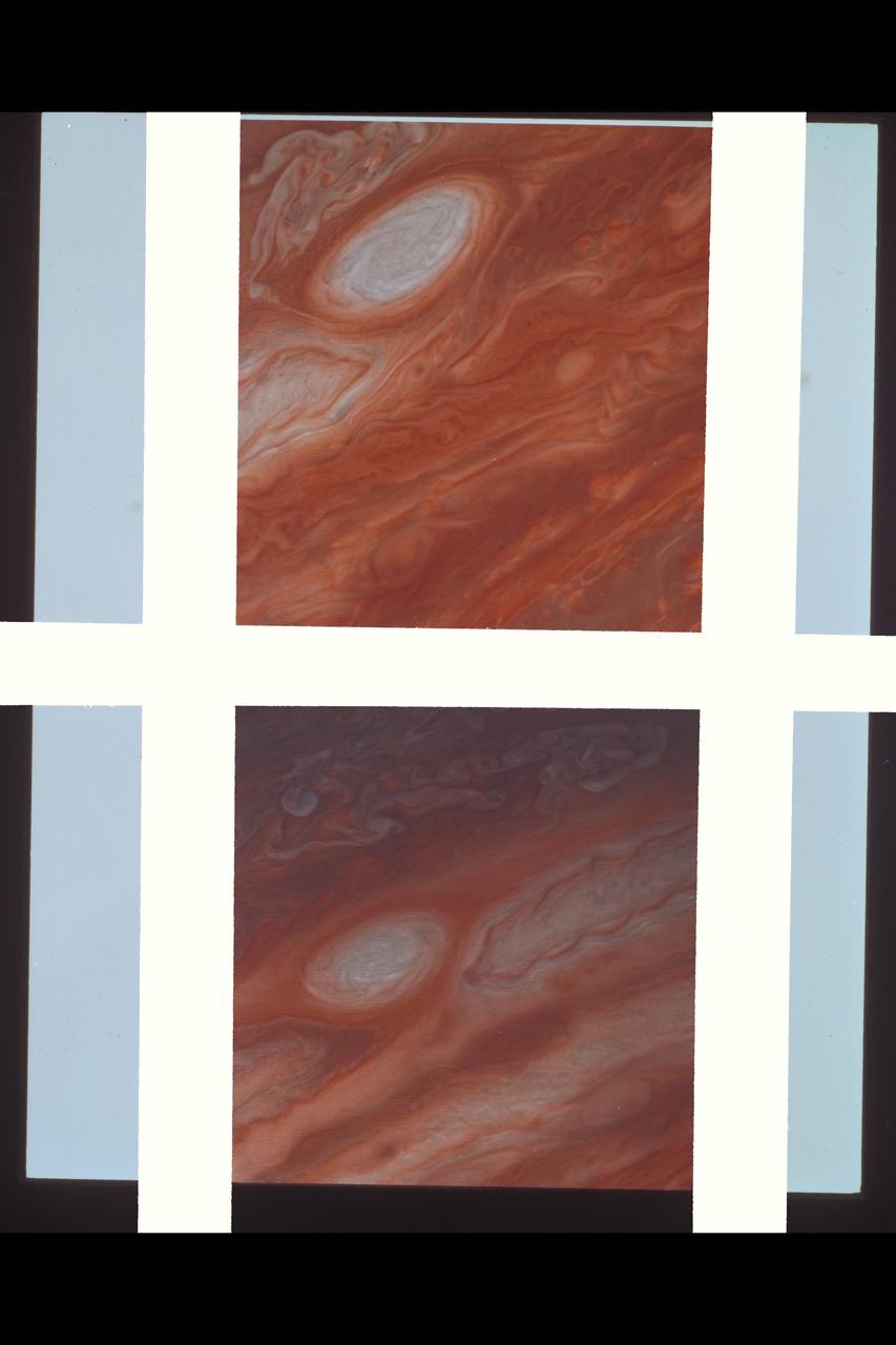
Range : 3.4 million km This pair of images shows two of the long-lived white oval clouds which have resided in the Jovian southern hemisphere for nearly 40 years. The upper picture shows the cloud that is at a longitude west of the Great Red Spot, and the lower frame, the cloud at a longitude east of this feature. The third oval is currently just south of the Great Red Spot. The clouds show very similar internal structures. To the east of each of them, recirculation currents are clearly seen. In the lower frame, a similar structure is seen to the west of the cloud. Although a recirculation current is associated with the upper western region of the cloud, it is further away from this feature and not seen in the image. This photo was taken by Voyager 2.
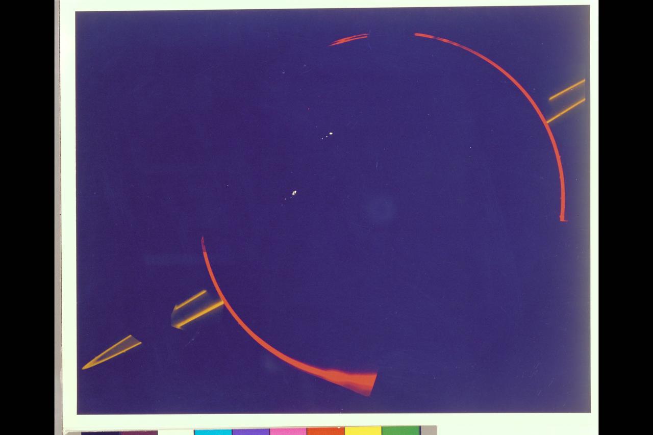
JUPITER'S FAINT RING SYSTEM IS SHOWN HERE AS TWO ORANGE LINES PROTRUDE FROM THE LEFT TOWARD JUPITER'S LIMB. THIS COLORFUL COMPOSITE WAS TAKEN IN JUPITER'S SHADOW THROUGH ORANGE AND VIOLET FILTERS. THE COLORFUL IMAGES OF JUPITER'S LIMB ARE EVIDENCE OF THE SPACECRAFT MOTION DERING THIS LONG EXPOSURE. VOYAGER 2
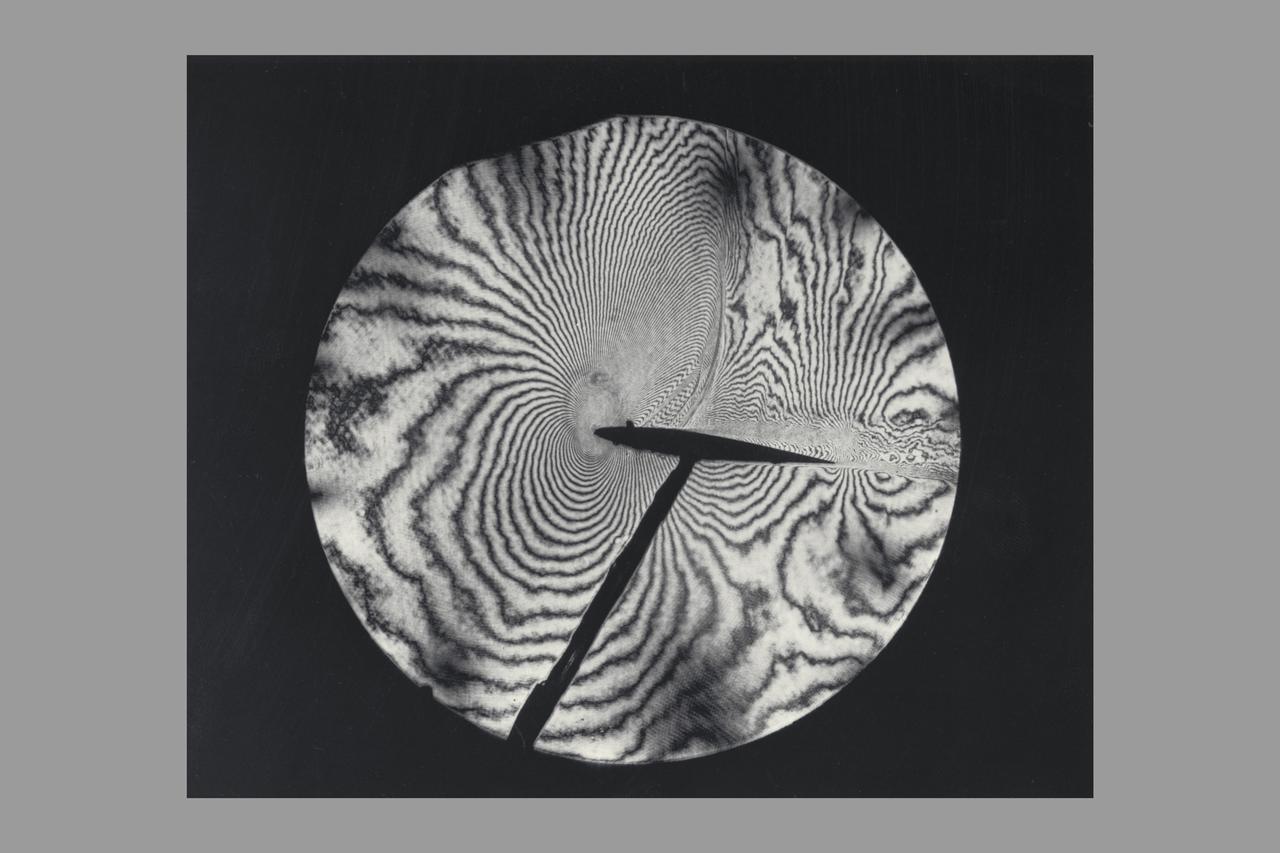
Interferogram of Transonic flow field - reconstructed laser hologram as an infinite-fringe interferogram shows shock-wave shape, location and separaton of the airfoil boundry layer
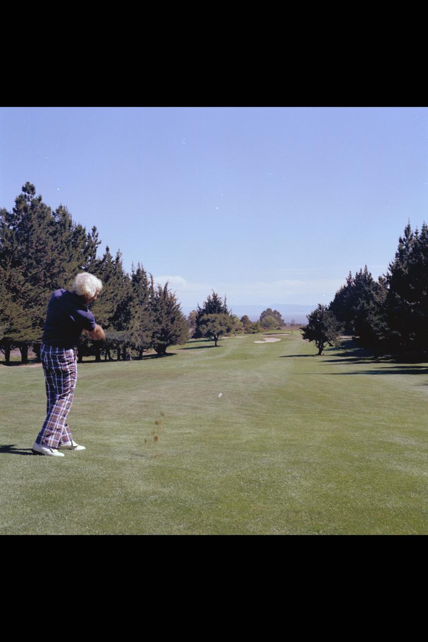
Recruiting Brochure: Shot of Bay Area Sports Activities 1979-1995 (Joe March at Moffett Golf Course)
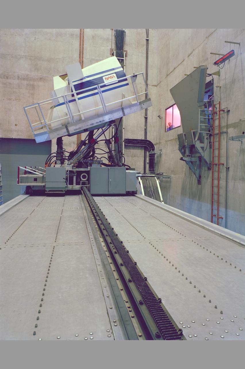
N-243A Vertical Motion Simulator
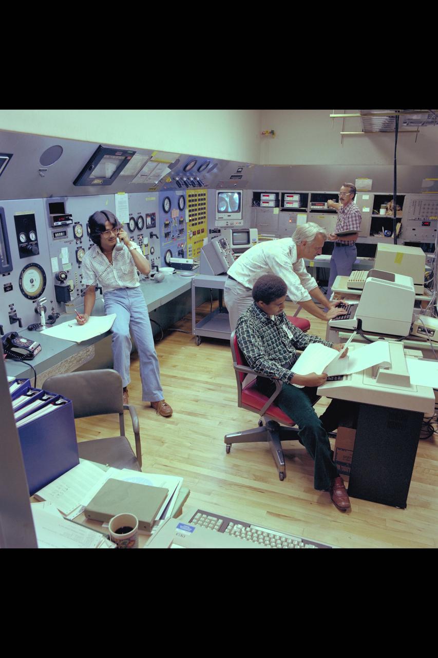
40x80ft Wind Tunnel control room with technicians and engineers used in Ames Recruiting brochures 1979-1995
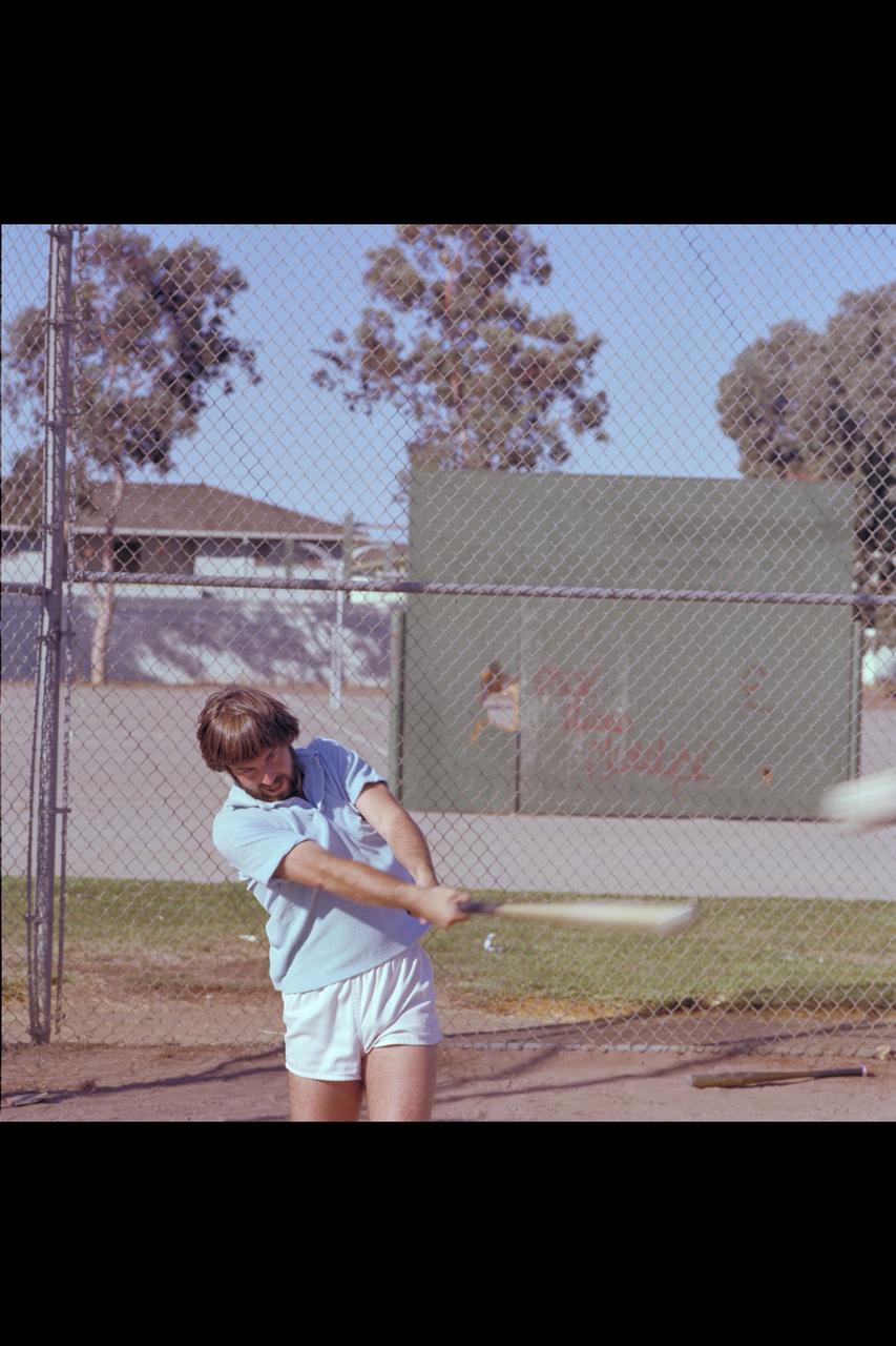
Recruiting Brochure: Ames baseball league
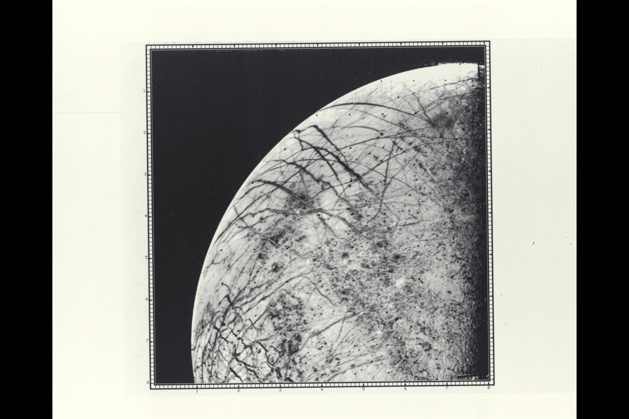
P-21758 BW Range: 246,000 kilometers (152,000 miles) This picture by Voyager 2 is the first close look ever obtained of Jupiter's satellite, Europa. The linear crack-like features had been seen from a much greater distance by Voyager 1 but this image provides a resolution of about four kilometers (2.5 miles). The complicated linear features appear even more like cracks or huge fractures in these images. Also seen are somewhat darker mottled regions which appear to have a slightly pitted appearance, perhaps due to small scale craters. No large craters (more than five kilometers in diameter) are easily identifiable in the Europa photographs to date, suggesting that this satellite has a young surface relative to Ganymede and Callisto, although not perhaps as young as Io's. Various models for Europa's structure will be tested during analysis of these images, including the possibility that the surface is a thin ice crust overlying water or softer ice and that the fracture systems seen are breaks in that crust. Resurfacing mechanisms such as production of fresh ice or snow along the cracks and cold glacier-like flows are being considered as possibilities for removing evidence of impact events. Europa thus appears to truly be a satellite with many properties intermediate between Ganymede and Io.
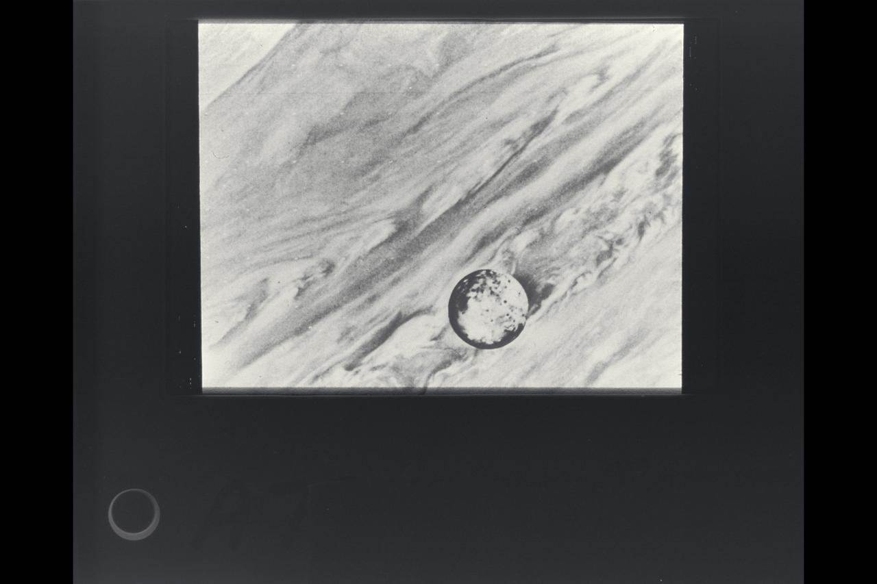
Voyager 1 view Io in its orbit around Jupiter
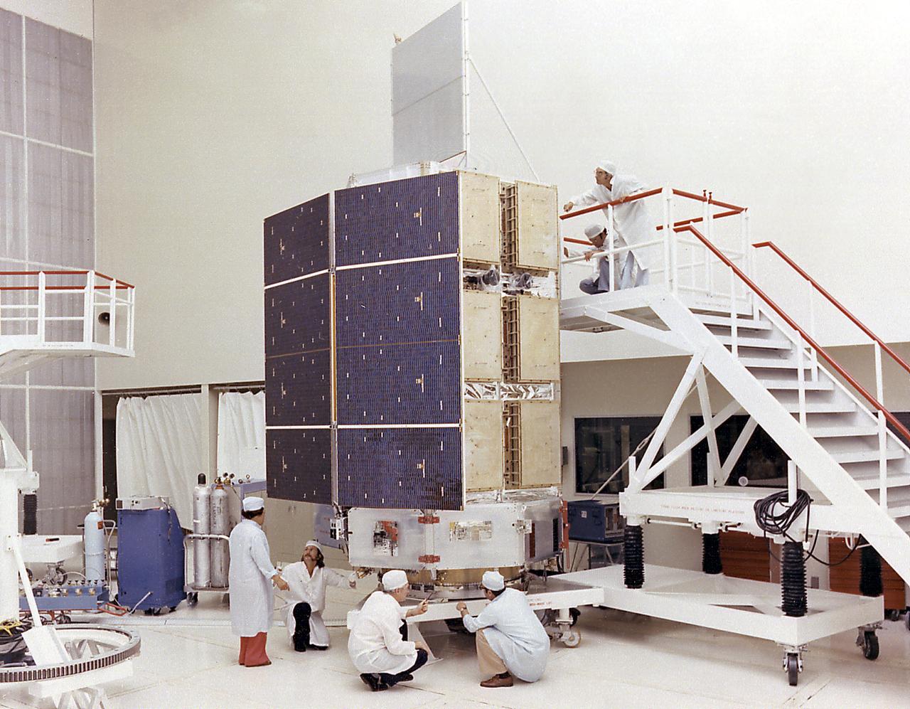
This photograph shows the High Energy Astronomy Observatory (HEAO)-3 being assembled at TRW, Inc. Designed and developed by TRW, Inc. under the direction of the Marshall Space Flight Center, the objectives of the HEAO-3 were to survey and map the celestial sphere for gamma-ray flux and make detailed measurements of cosmic-ray particles. It carried three scientific experiments: a gamma-ray spectrometer, a cosmic-ray isotope experiment, and a heavy cosmic-ray nuclei experiment. The HEAO-3 was originally identified as HEAO-C but the designation was changed once the spacecraft achieved orbit. The Marshall Space Flight Center had the project management responsibilities for the HEAO missions.
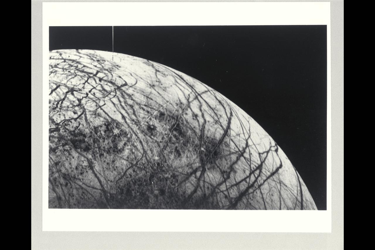
Range : 241,000km (150,600 mi.). This black and white image of Europa, smallest of Jupiter's four Galilean satellites, was acquired by Voyager 2. Europa, the brightest of the Galiliean satellites, has a density slightly less than Io, suggesting it has a substantial quantity of water. Scientists previously speculated that the water must have cooled from the interior and formed a mantle of ice perhaps 100 km thick. The complex patterns on its surface suggest that the icy surface was fractured, and that the cracks filled with dark material from below. Very few impact craters are visible on the surface, suggesting that active processes on the surface are still modifying Europa. The tectonic pattern seen on its surface differs drastically from the fault systems seen on Ganymede where pieces of the crust have moved relative to each other. On Europa, the crust evidently fractures but the pieces remain in roughly their original position.

N-238 60MW Aerodynamic Heating Facility outside of test section with Jean Brian (Arch heater, high pressure water manifold, & water cooled 8' conical nozzle)
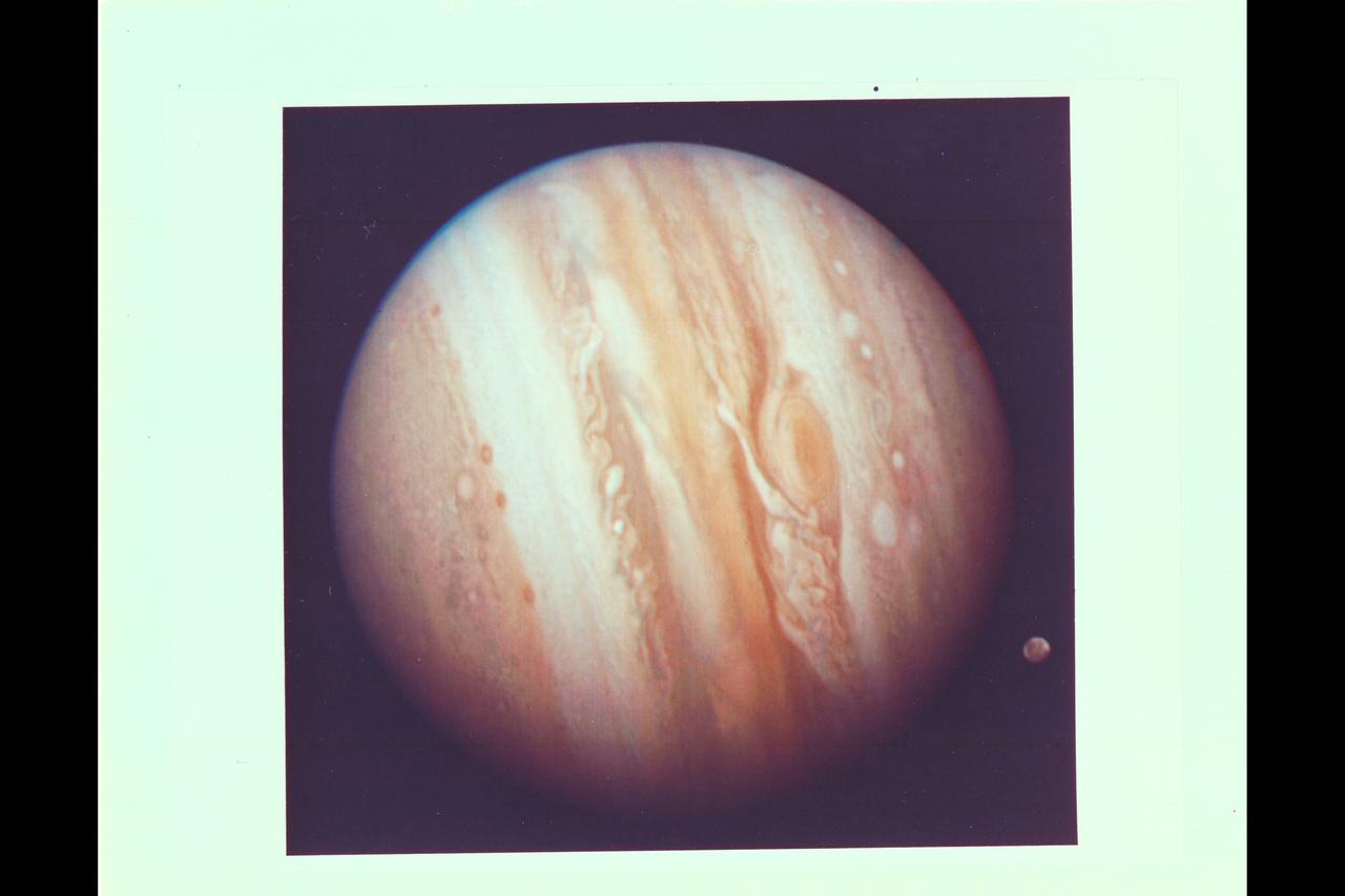
Photo by Voyager 1 (JPL) The spacecraft took this photo of the planet Jupiter on Jan 24, while still more than 25 million miles (40 million kilometers) away. As the spacecraft draws closer to the planet (about 1 million kilometers a day) more details are emergng in the turbulent clouds. The Great Red Spot shows prominently below center, surrounded by what scientists call a remarkably complex region of the giant planet's atmosphere. An elongated yellow cloud within the Great Red Spot is swirling around the spot's interior boundary in a counterclockwise direction with a period of a little less than six days, confirming the whirlpool-like circulation that astronomers have suspected from ground-based photographs. Ganymede, Jupiter's largest satellite, can be seen to the lower left of the planet. Ganymede is a planet-sized body larger than Mercury. This color photo was assembled at Jet Propulsion Laboratory's Image Processing Lab from there black and white images taken through filters. The Voyagers are managed for NASA's Office of Space Science by Jet Propulsion Laboratory. (ref: P-20945C Mission Image 1-9)
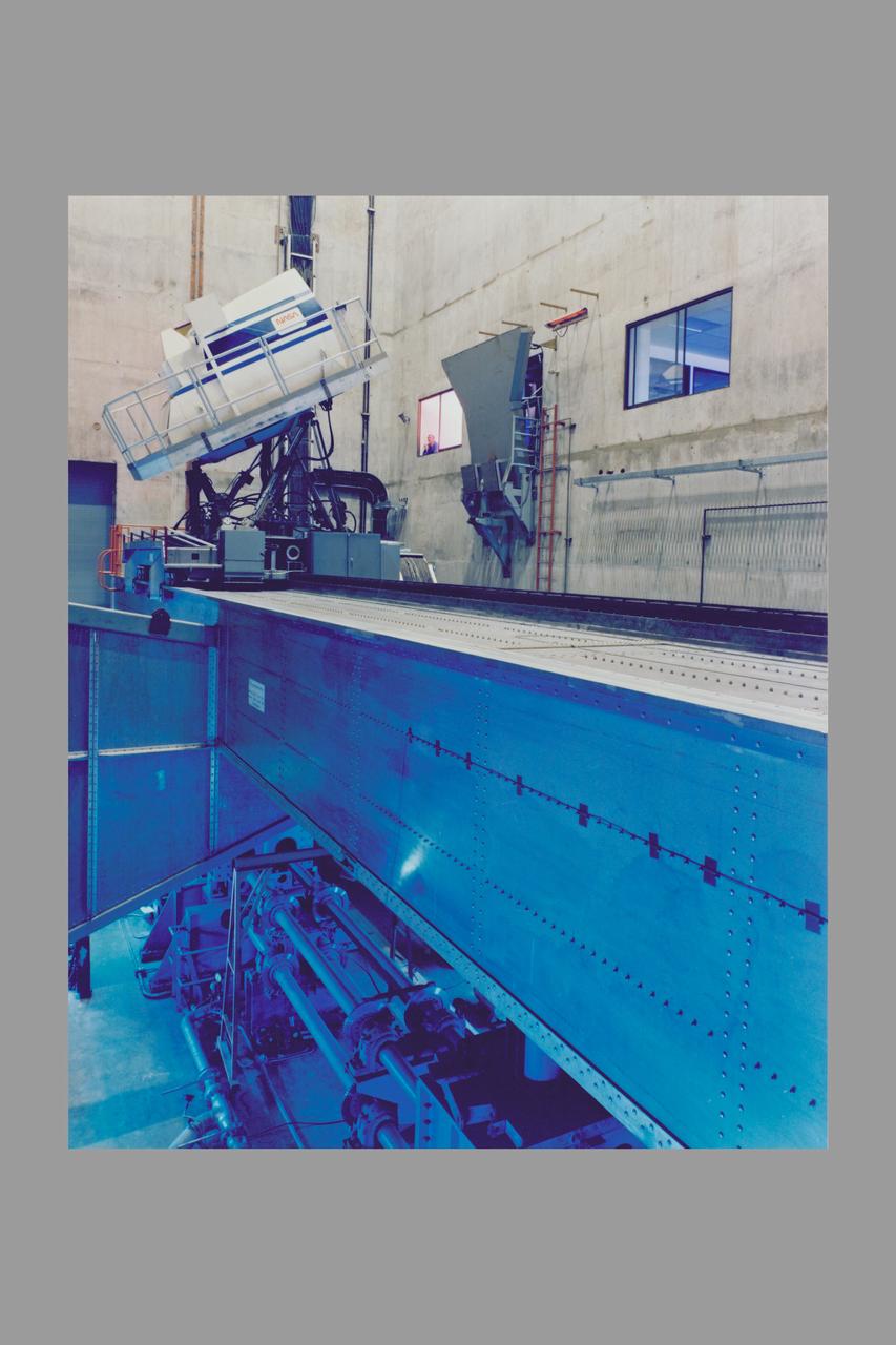
N-243A Vertical Motion Simulator
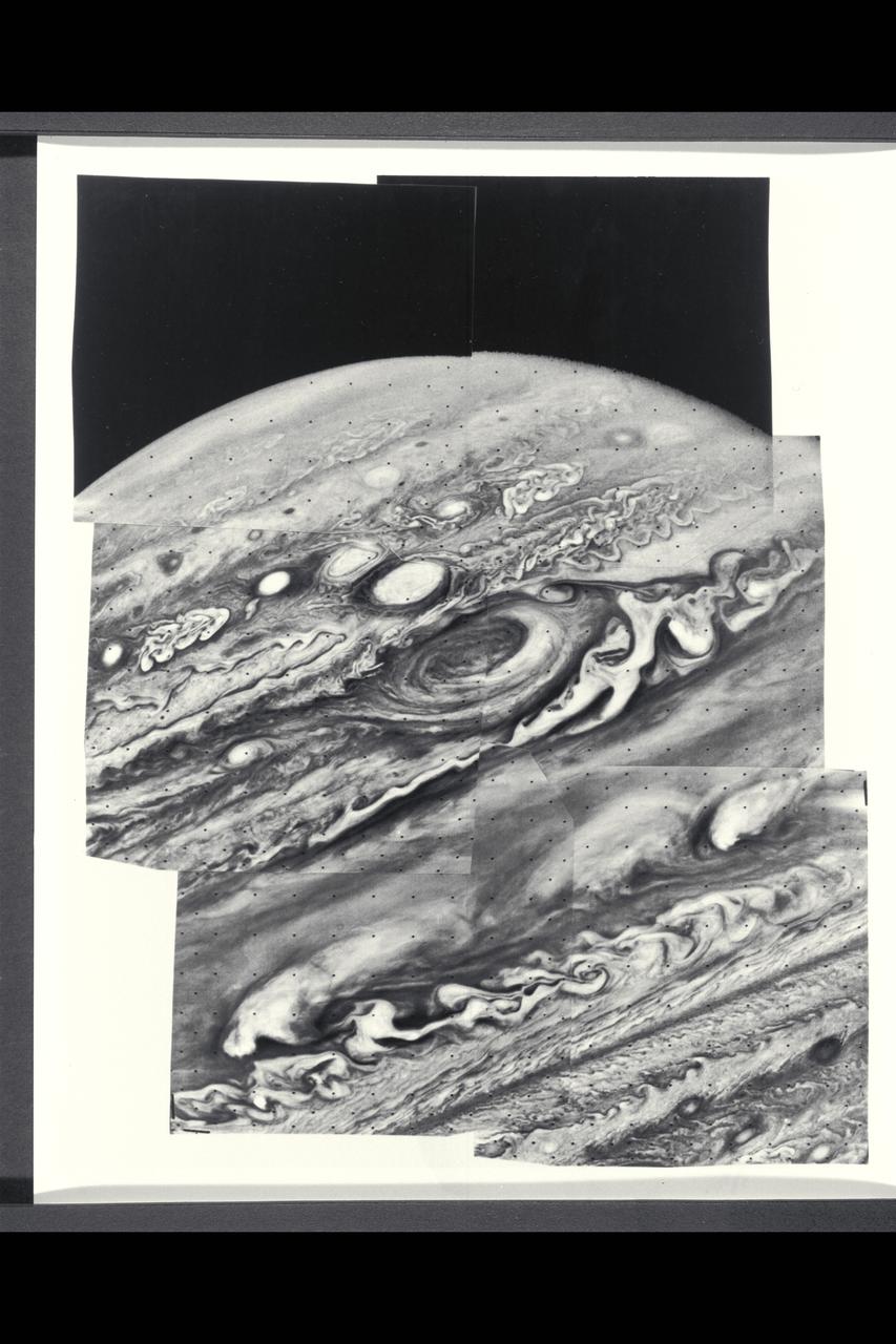
Range : 6.5 million kilometers (4 million miles) Six violet images of Jupiter makes the mosaic photo, showing the Great Red Spot as a swirling vortex type motion. This motion is also seen in several nearby white clouds. These bright white clouds and the Red Spot are rotating in a counter clockwise direction, except the peculiar filimentary cloud to the right of the Red Spot is going clockwise. The top of the picture shows the turbulence from the equatorial jet and more northerly atmospheric currents. The smallest clouds shown are only 70 miles (120 km) across.
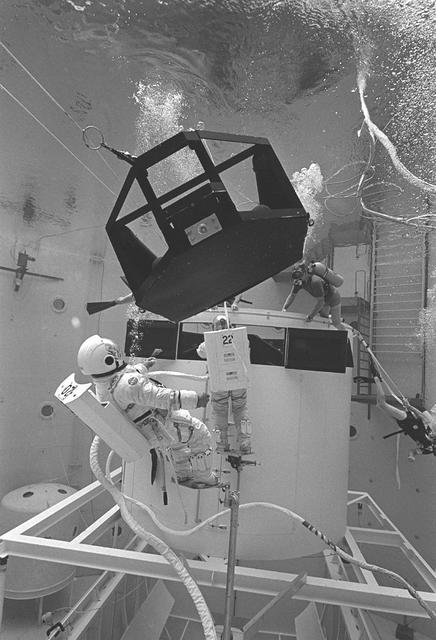
The Hubble Space Telescope (HST) is a cooperative program of the European Space Agency (ESA) and the National Aeronautical and Space Administration (NASA) to operate a long-lived space-based observatory; it was the first and flagship mission of NASA's Great Observatories program. The HST program began as an astronomical dream in the 1940s. During the 1970s and 1980s, HST was finally designed and built; and became operational in the 1990s. HST was deployed into a low-Earth orbit on April 25, 1990 from the cargo bay of the Space Shuttle Discovery (STS-31). The design of the HST took into consideration its length of service and the necessity of repairs and equipment replacement by making the body modular. In doing so, subsequent shuttle missions could recover the HST, replace faulty or obsolete parts and be re-released. Pictured is MSFC's Neutral Buoyancy Simulator which served as the test center for shuttle astronauts training for Hubble related missions. Shown is an astronaut training on a mock-up of a modular section of the HST in removal/replacement of scientific instruments.
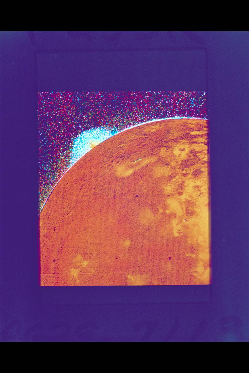
Voyager 1 catches volcanic eruption on Jupiter's moon Io JPL ref No. P-21334
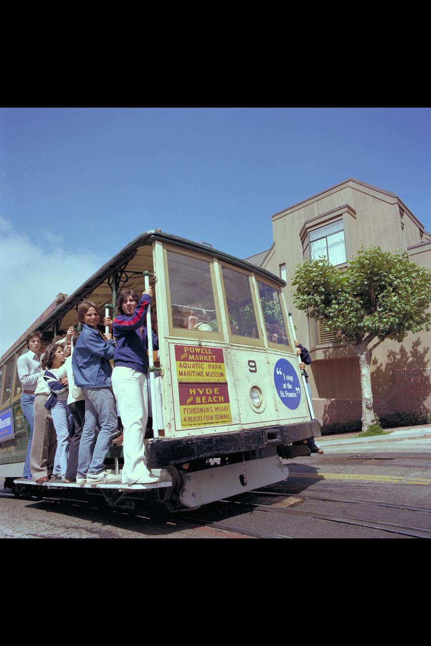
Recruiting Brochure: The San Francisco's Cable Car

S79-29596 (28 Feb 1979) --- Contrasting the old with the new, six astronaut candidates pose for photographers in their new constant wear garments, ideal for the zero-gravity tasks in the pressurized environs of Space Shuttle. The "old" is an Apollo type spacesuit used for extravehicular activity (EVA). From left to right are Shannon W. Lucid, Rhea Seddon, Kathryn D. Sullivan, Judith A. Resnik, Anna L. Fisher and Sally K. Ride.
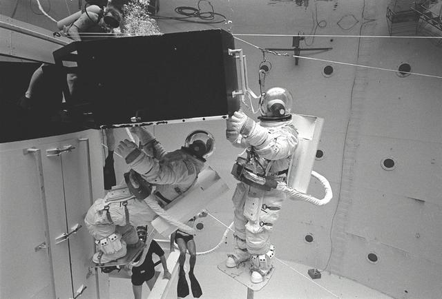
The Hubble Space Telescope (HST) is a cooperative program of the European Space Agency (ESA) and the National Aeronautical and Space Administration (NASA) to operate a long-lived space-based observatory. It was the first and flagship mission of NASA's Great Observatories program. The HST program began as an astronomical dream in the 1940s. During the1970s and 1980s, the HST was finally designed and built becoming operational in the 1990s. The HST was deployed into a low-Earth orbit on April 25, 1990 from the cargo bay of the Space Shuttle Discovery (STS-31). The design of the HST took into consideration its length of service and the necessity of repairs and equipment replacement by making the body modular. In doing so, subsequent shuttle missions could recover the HST, replace faulty or obsolete parts and be re-released. Pictured is MSFC's Neutral Buoyancy Simulator that served as the test center for shuttle astronauts training for Hubble related missions. Shown is an astronaut training on a mock-up of a modular section of the HST in the removal and replacement of scientific instruments.
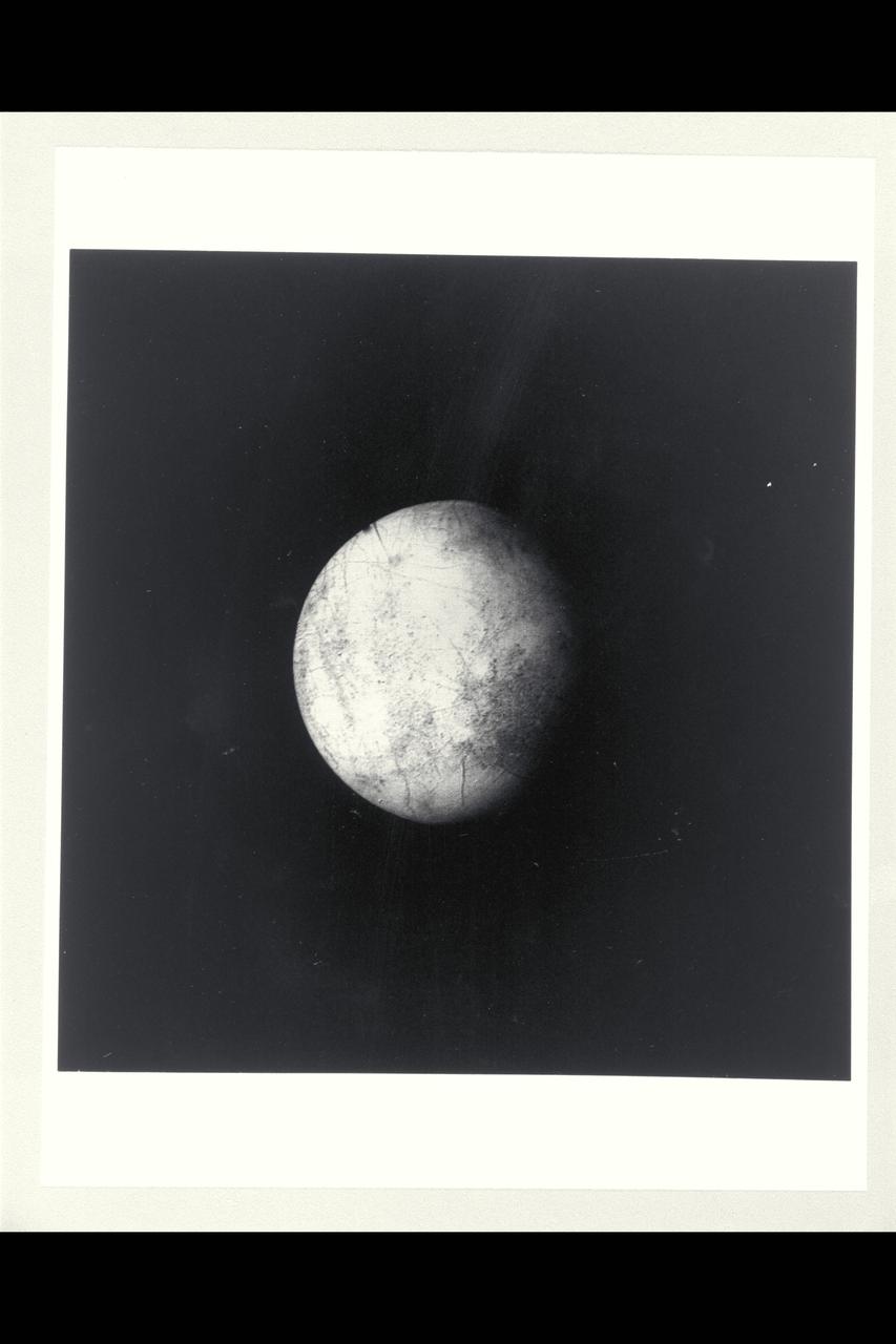
P-21752 BW Range: 1.2 million kilometers This image of Europa shows detail about 20 kilometers across and is somewhat higher resolution than the best Voyager 1 image. The part of Europa shown is the hemisphere that will be viewed at even higher resolution during another Voyager 2 encounter with Europa. Color reconstruction in this image was slightly enhanced to bring out detail in the complicated mottled region on the west limb, containing some of the linear fracture-like features discovered by Voyager 1. The regions in the north and south polar areas which appear bluish in this version are in fact white.
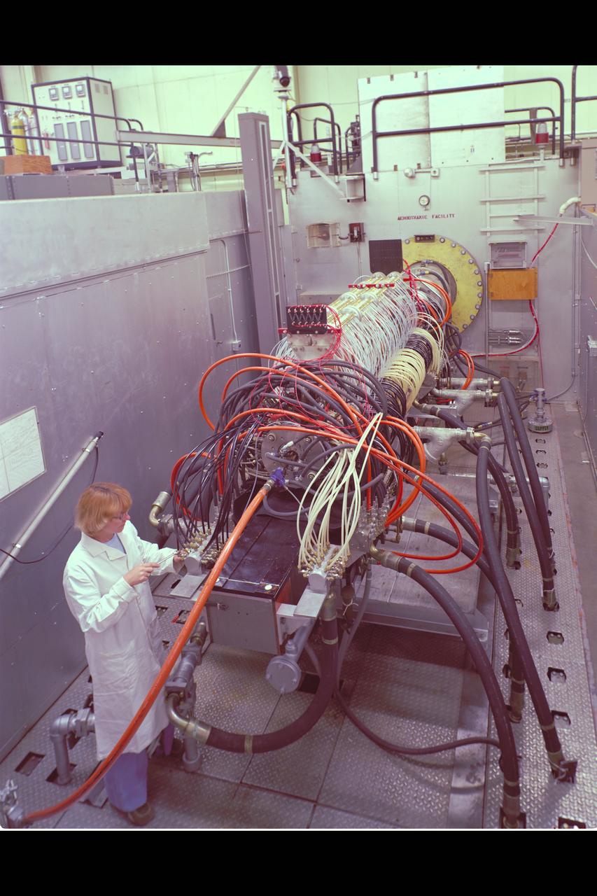
N-238 60MW Aerodynamic Heating Facility outside of test section with Jean Brian (Arc heater, high pressure water manifold, & water cooled 8' conical nozzle)

Pioneer Saturn: Charlie Hall, project manager daily stand up meeting with Dr. Simpson at board
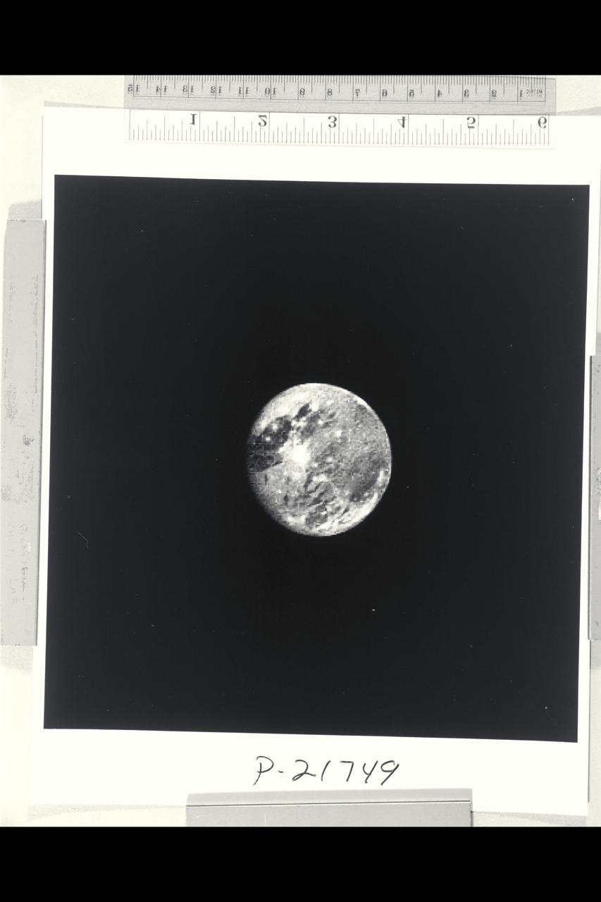
P-21749 BW Range: 6 million kilometers (4 million miles) This photograph of Ganymede, the largest satellite of Jupiter, is shown at approximately the same distance as that photographed at close range by Voyager 1 in March. This picture, taken by Voyager 2, illustrates well the light, bluish regions near the north and south poles. It is known that there is exposed water ice on the surface of Ganymede, and pehaps these polar caps are composed of a light covering of water ice or frost. Voyager 2 will pass within 63,000 kilometers (39,000 miles) of Ganymede.
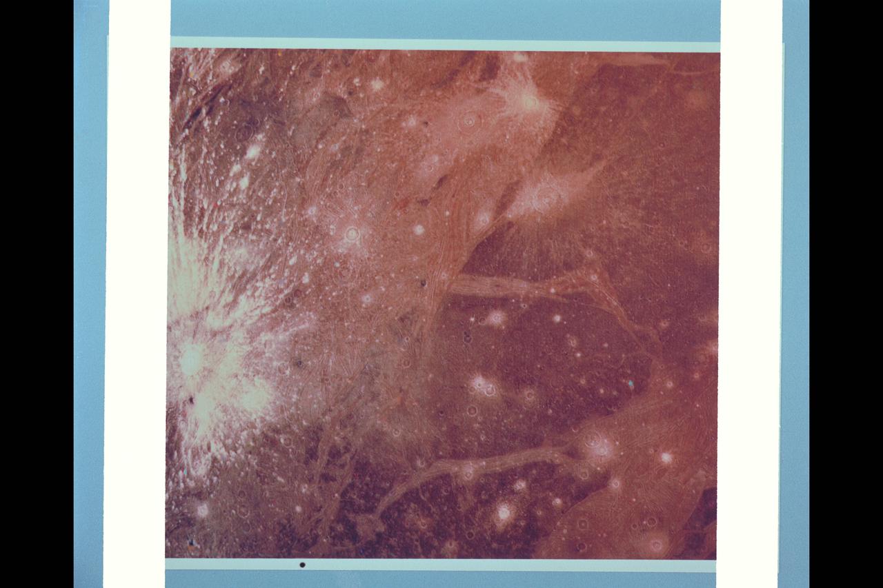
P-21762 C This color picture of Ganymede in the region 30° S 180° W shows features as small as 6 kilometers (3.7 miles) across. Shown is a bright halo impact crater that shows the fresh material thrown out of the crater. In the background is bright grooved terrain that may be the result of shearing of the surface materials along fault planes. The dark background material is the ancient heavily cratered terrain--the oldest material preserved on the Ganymede surface.
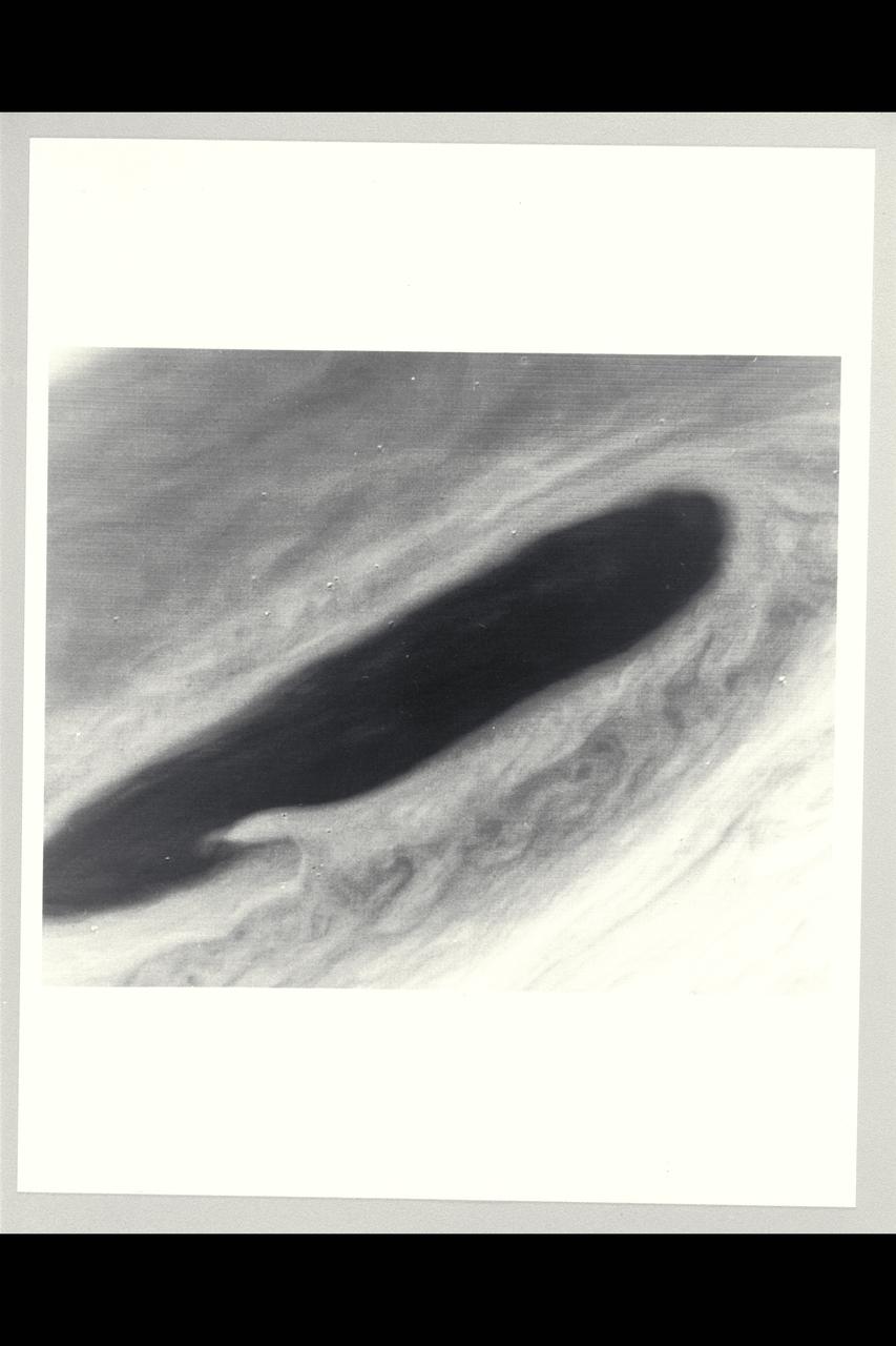
Range : 3.2 million km This image returned by Voyager 2 shows one of the long dark clouds observed in the North Equatorial Belt of Jupiter. A high, white cloud is seen moving over the darker cloud, providing an indication of the structure of the cloud layers. Thin white clouds are also seen within the dark cloud.
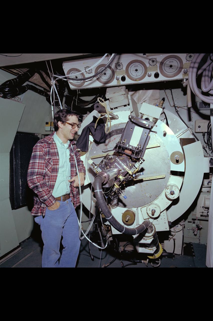
C-141 KAO Research Team for December 1979

P-21747 C Range: 2,200,000 miles This image shows a region of the Jovian atmosphere from approximately 25° N to the equatorial region. The north temperate jet, at approximately 23° N, where the wind speed is about 150 meters per second, is seen as a dark brown line from the left-hand edge to the right-hand corner of the picture. The wispy clouds of the north equatorial belt appear as shades of brown. The lower right-hand corner of the image shows the brighter (white) clouds of the equatorial region. A small blue area is apparent near the lower edge, which corresponds to a region free of the upper clouds, where it is possible to penetrate to cloud layers approximately 60 kilometers below the visible surface.
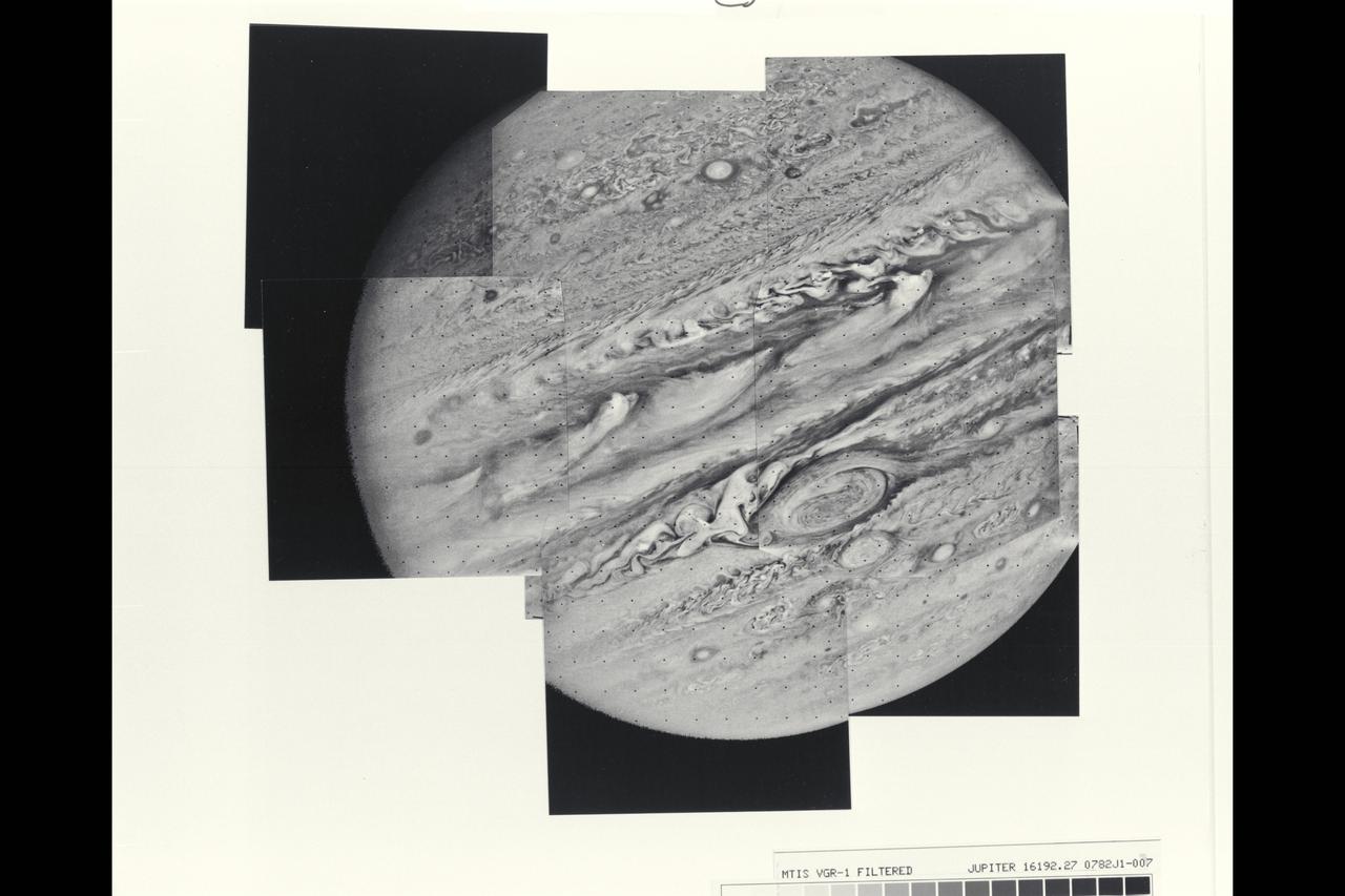
This mosaic of Jupiter was assembled from nine individual photos taken through an orange filter by Voyager 1 on Feb. 6, 1979, when the spacecraft was 4.7 million miles (7.8 million kilometers) from Jupiter. Distortion of the mosaic, especially where portions of the limb have been fitted together, is caused by rotation of the planet during the 96-second intervals between individual pictures. The large atmospheric feature just below and to the right of center is the Great Red Spot. The complex structure of the cloud formations seen over the entire planet gives some hint of the equally complex motions in the Voyager 1 time-lapse photography. The smallest atomospheric features seen in this view are approximately 85 miles (140 kilometers) across. Voyager project is managed and controlled by Jet Propulsion Laboratory for NASA's Office of Space Science. (JPL ref. No. P-21146)
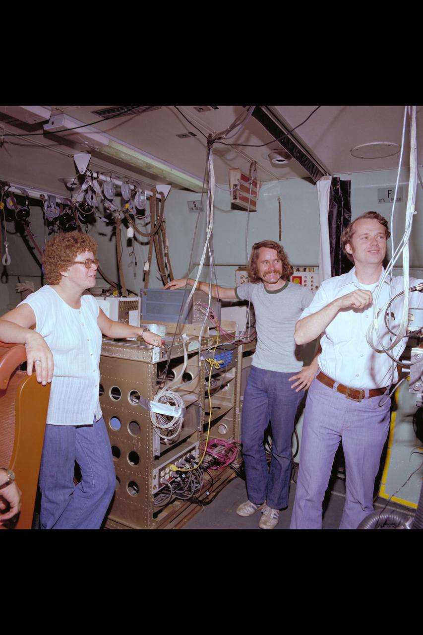
C-141 KAO Rochester, Cornell and California University Experiments packages on board
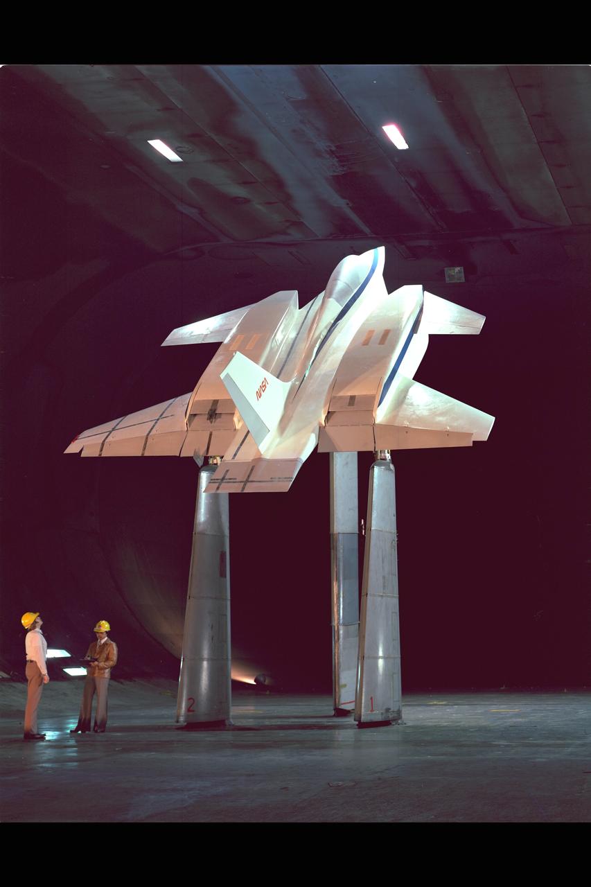
VSTOL Fighter Model in the NASA Ames 40x80ft Subsonic Wind Tunnel. Test-537 with Mike Falarski & Ray Hafalia

This image is an x-ray view of Eta Carinae Nebula showing bright stars taken with the High Energy Astronomy Observatory (HEAO)-2/Einstein Observatory. The Eta Carinae Nebula is a large and complex cloud of gas, crisscrossed with dark lanes of dust, some 6,500 light years from Earth. Buried deep in this cloud are many bright young stars and a very peculiar variable star. The HEAO-2, the first imaging and largest x-ray telescope built to date, was capable of producing actual photographs of x-ray objects. Shortly after launch, the HEAO-2 was nicknamed the Einstein Observatory by its scientific experimenters in honor of the centernial of the birth of Albert Einstein, whose concepts of relativity and gravitation have influenced much of modern astrophysics, particularly x-ray astronomy. The HEAO-2, designed and developed by TRW, Inc. under the project management of the Marshall Space Flight Center, was launched aboard an Atlas/Centaur launch vehicle on November 13, 1978.
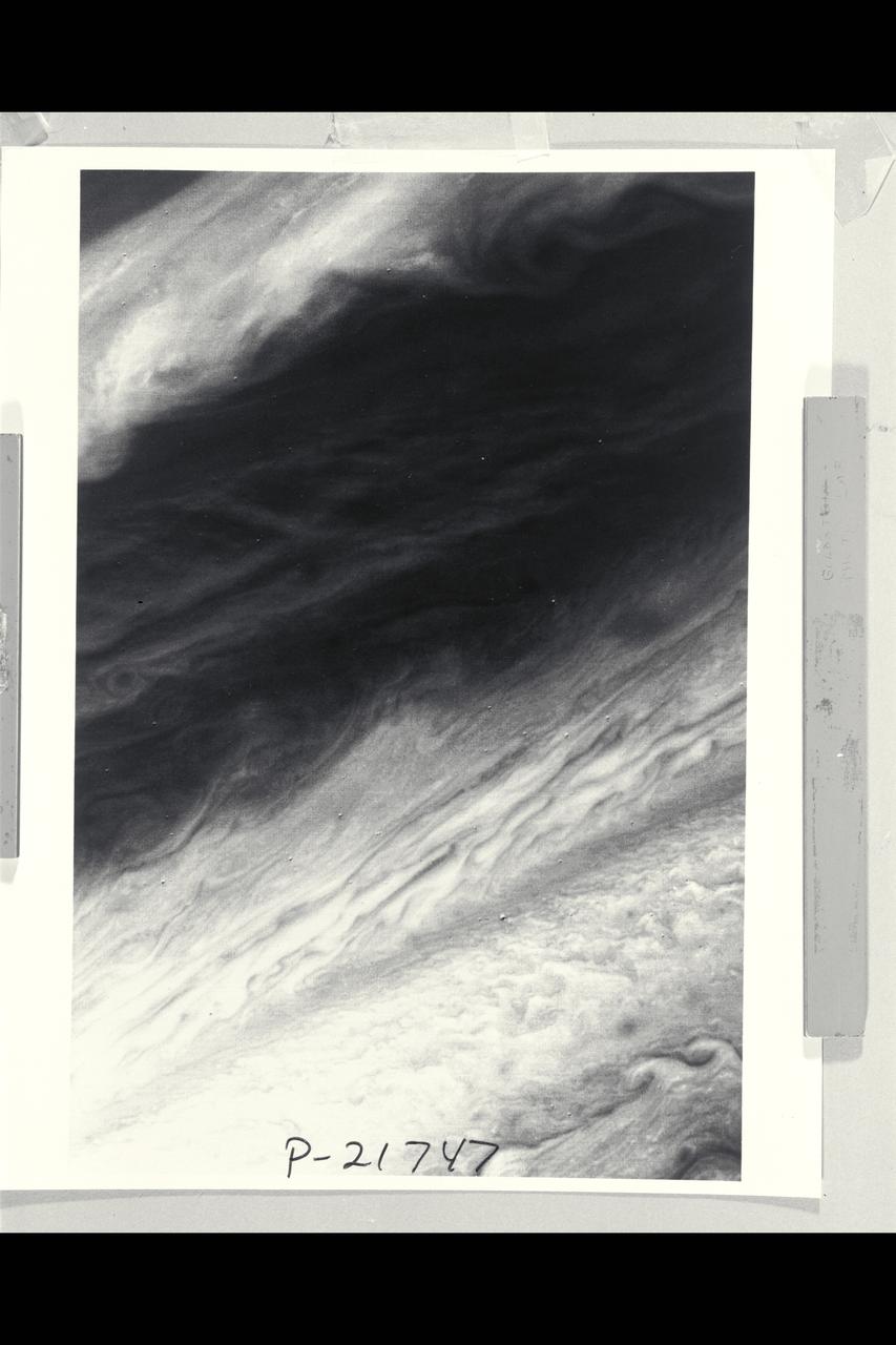
P-21747 BW Range: 2,200,000 miles This image shows a region of the Jovian atmosphere from approximately 25° N to the equatorial region. The north temperate jet, at approximately 23° N, where the wind speed is about 150 meters per second, is seen as a dark brown line from the left-hand edge to the right-hand corner of the picture. The wispy clouds of the north equatorial belt appear as shades of brown. The lower right-hand corner of the image shows the brighter (white) clouds of the equatorial region. A small blue area is apparent near the lower edge, which corresponds to a region free of the upper clouds, where it is possible to penetrate to cloud layers approximately 60 kilometers below the visible surface.
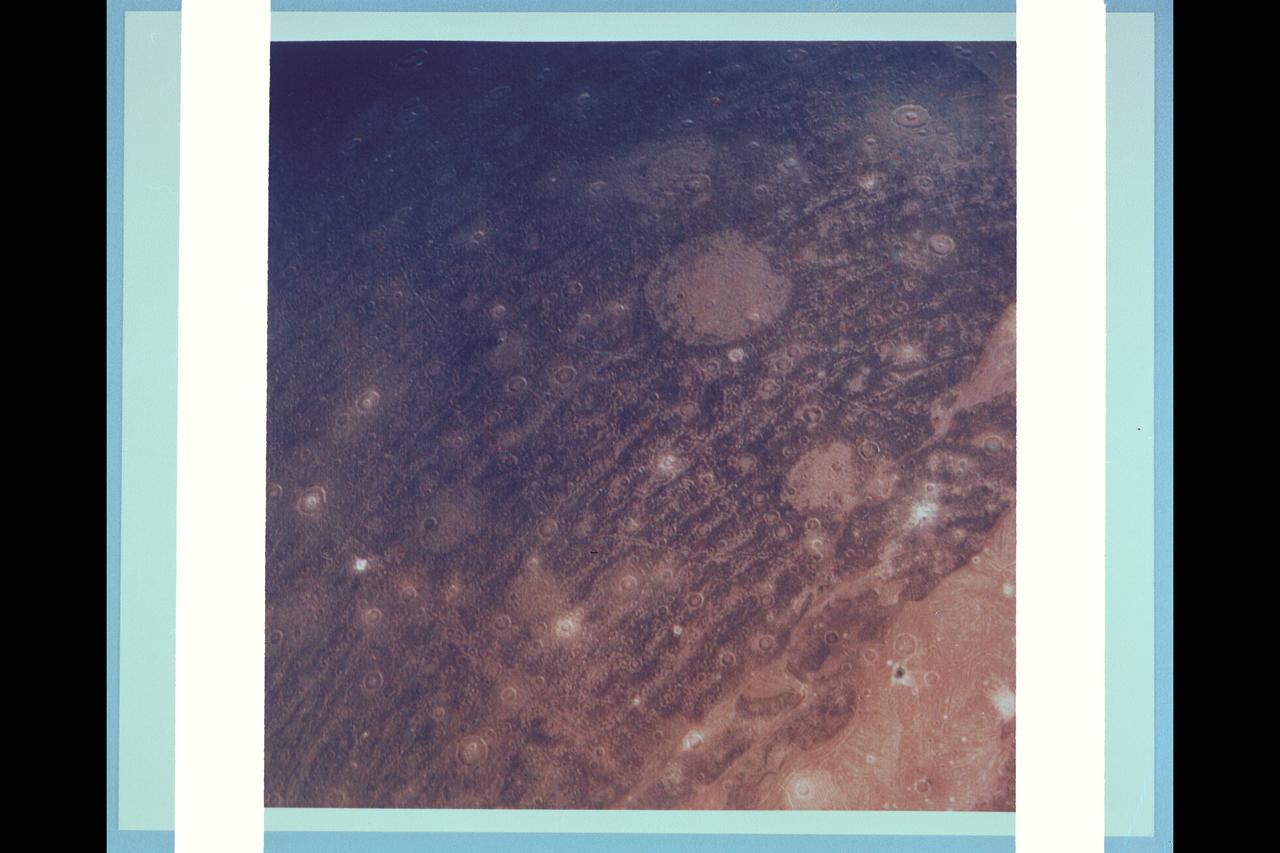
P-21761 C Range: 313,000 kilometers (194,000 miles) This color reconstruction of part of the northern hemisphere of Ganymede shows a scene approximately 1,300 kilometers (806 miles) across. It shows part of dark, densely cratered block which is bound on the south by lighter, and less cratered grooved terrain. The dark blocks are believed to be the oldest parts of Ganymede's surface. Numerous craters are visible, many with central peaks. The large bright circular features have little relief and are probably the remnants of old, large craters that have been annealed by flow of the icy near-surface material. The closely-spaced arcuate, linear features are probably analogous to similiar features on Ganymede which surround a large impact basin. The linear features here may indicate the former presence of a large impact basin to the southwest.
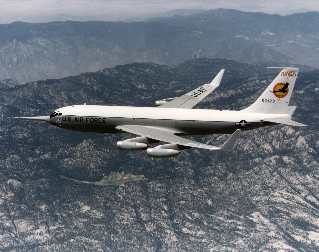
The KC-135 with the winglets in flight over the San Gabriel mountains, south of Edwards AFB. While wind tunnel tests suggested that winglets - developed by NASA Langley's Richard Whitcomb - would significantly reduce drag, flight research proved their usefulness. Winglets were installed on an Air Force KC-135 and research flights were made in 1979 and 1980. These showed drag in flight was reduced by as much as 7 percent. Winglets soon appeared on production aircraft, although these were smaller than those mounted on the KC-135.

C-141 KAO Research Team for December 1979: Computer equipment
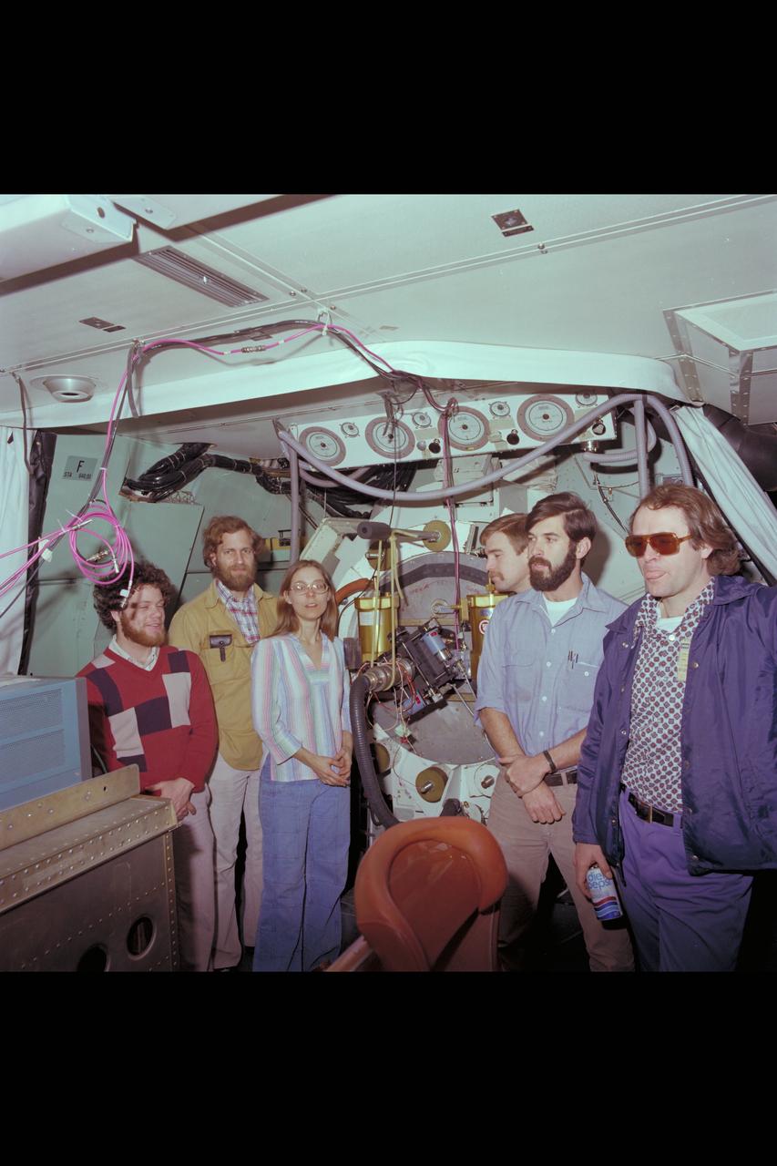
C-141 Circular Variable Filter Spectrometer & Yerkes Infrared (Group Photo)
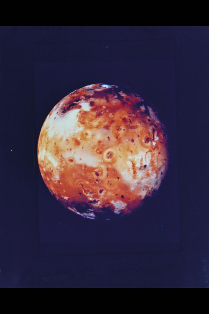
Voyager 1's look at Jupiter's moon Io JPL ref No. P-21457
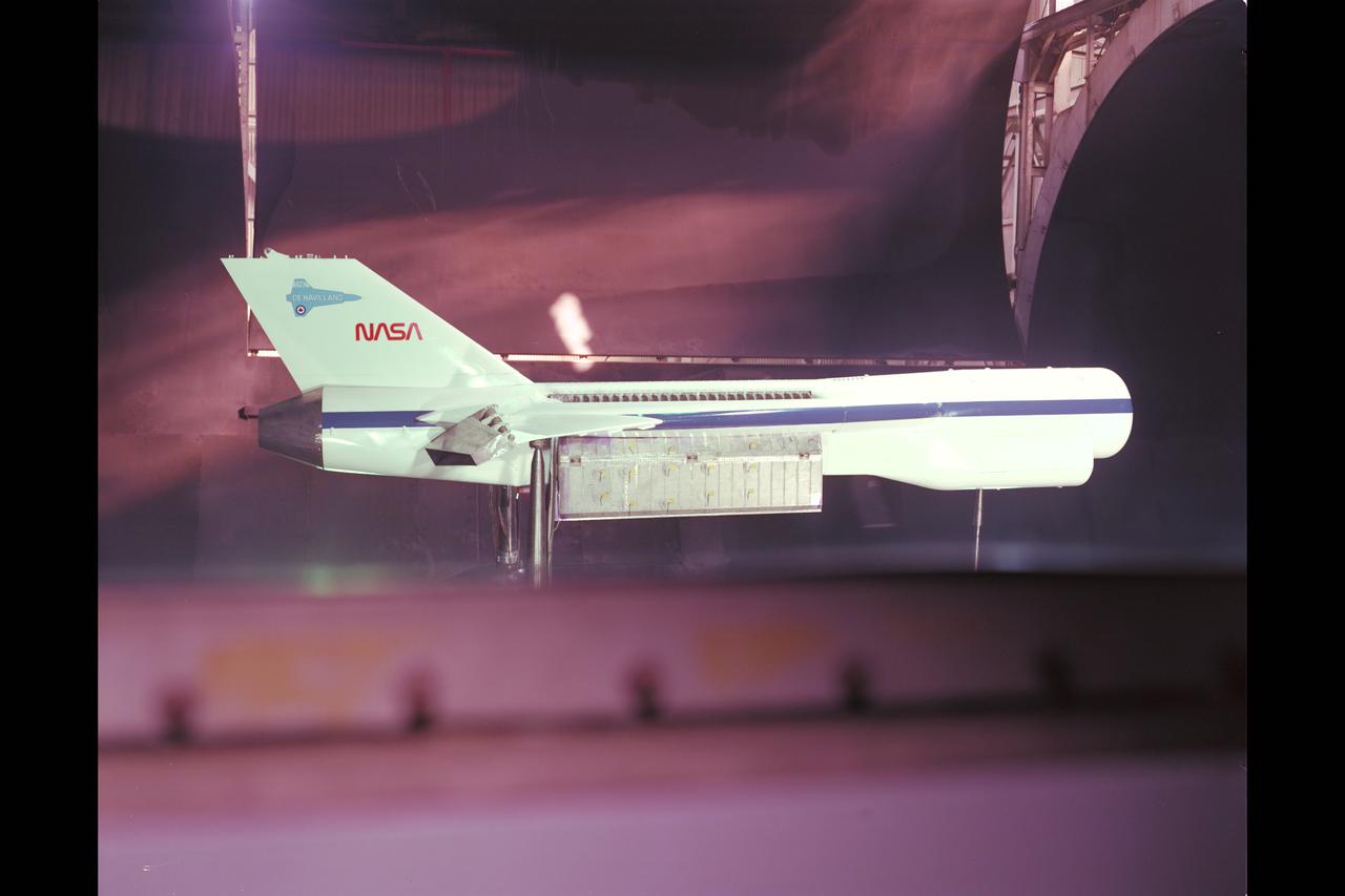
DeHavilland augmentor installation in 40x80ft w.t.
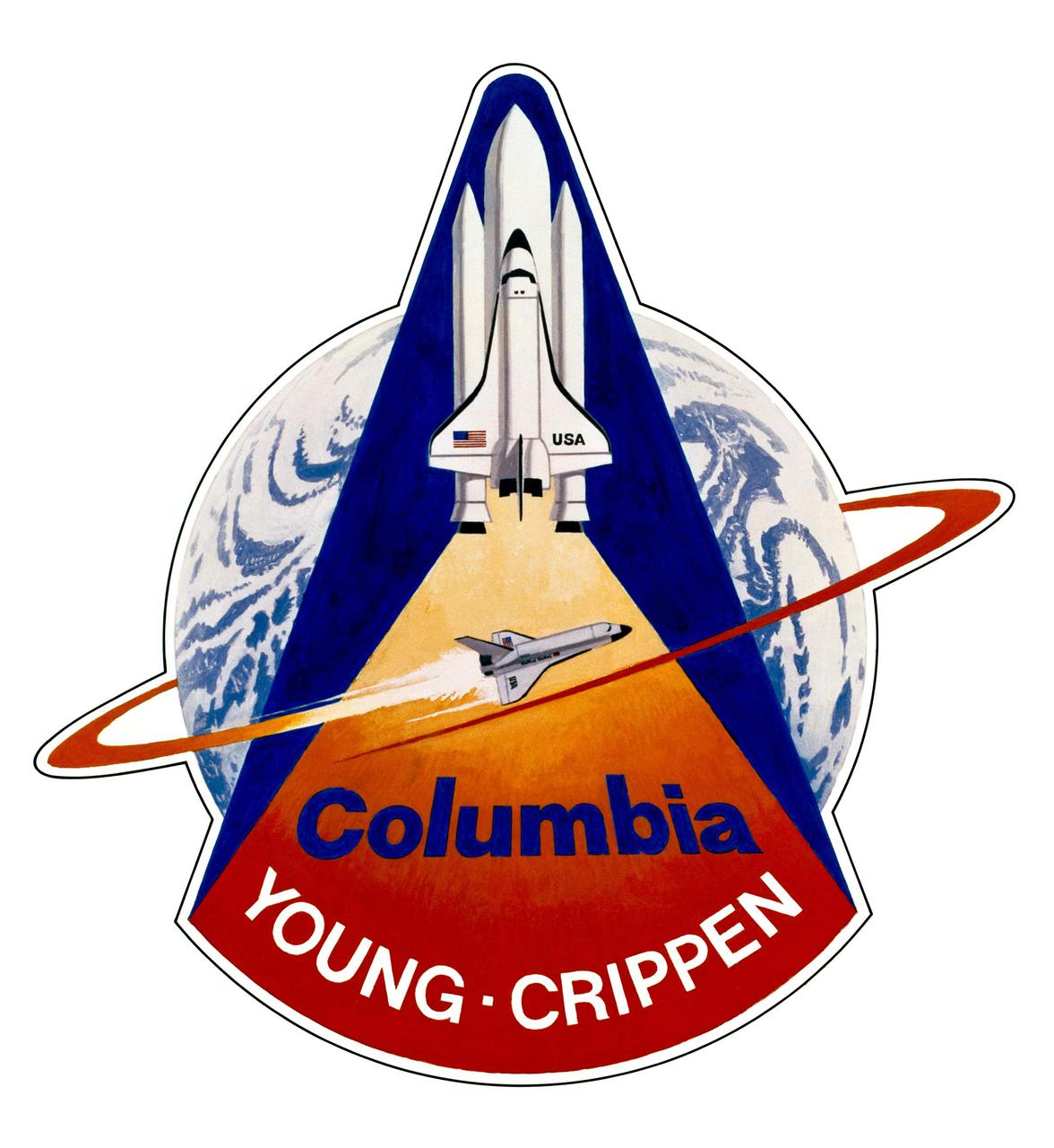
KENNEDY SPACE CENTER, FLA. - This is the official insignia for the first Space Shuttle orbital flight test (STS-1). Crew of the OV-102 Columbia on STS-1 will be astronauts John W. Young, commander, and Robert L. Crippen, pilot. The artwork was done by artist Robert McCall. The STS-1 mission, known as a shuttle systems test flight, will seek to demonstrate safe launch into orbit and safe return of the orbiter and crew and verify the combined performance of the entire shuttle vehicle -- orbiter, solid rocket boosters and external tank. STS-1 will be launched from Pad A at the Kennedy Space Center's Launch Complex 39 no earlier than March 1981.
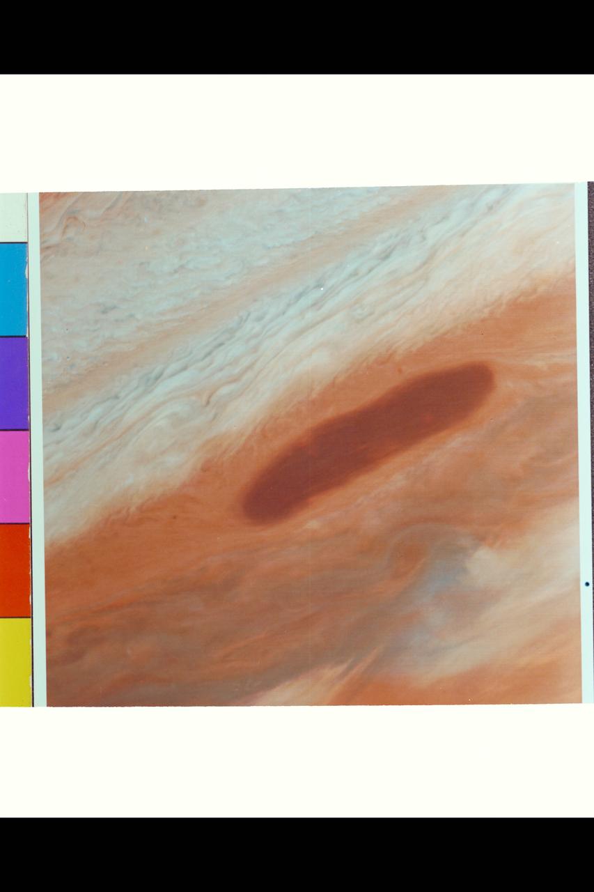
Range : 4.0 million km. ( 2.5 million miles ) This brown oval, located between Jupiter's 13 and 18 degree N latitude, may be an opening in the upper cloud deck. It was a selected target to be photographed by Voyager I on its closest approach to Jupiter because, if observed at high resolution, could provide information on deeper, warmer cloud levels. Above the oval, is the pale orange North Temperate Belt, bounded on the south by the North Temperate Current, with winds of 120 meters/sec. ( 260 Mi./hr ). The smallest resolvable features from this photograph is 75 km ( 45 miles ) wide.
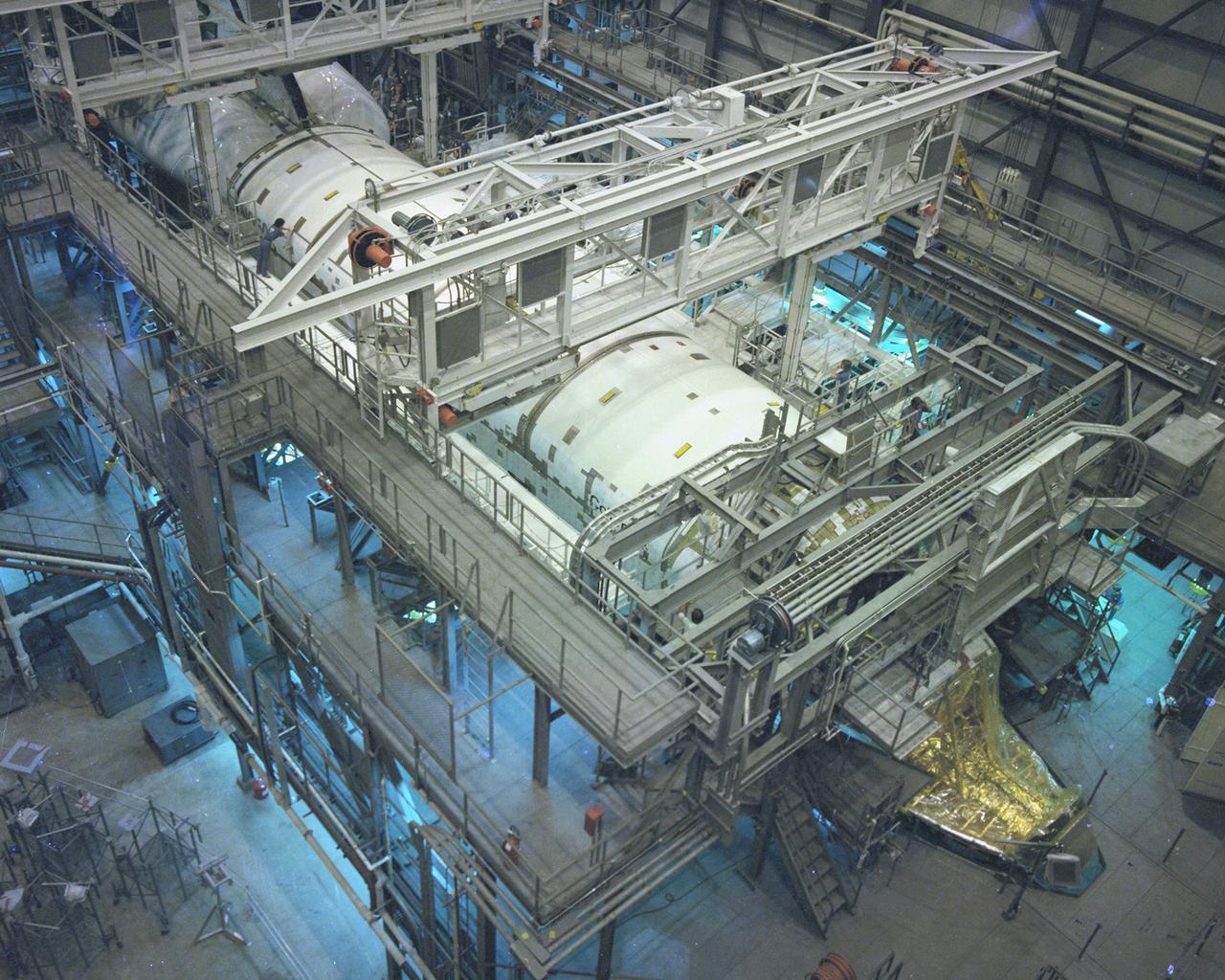
KENNEDY SPACE CENTER, FLA. - Space Shuttle Orbiter Columbia undergoes systems installation and checkout in the Orbiter Processing Facility.
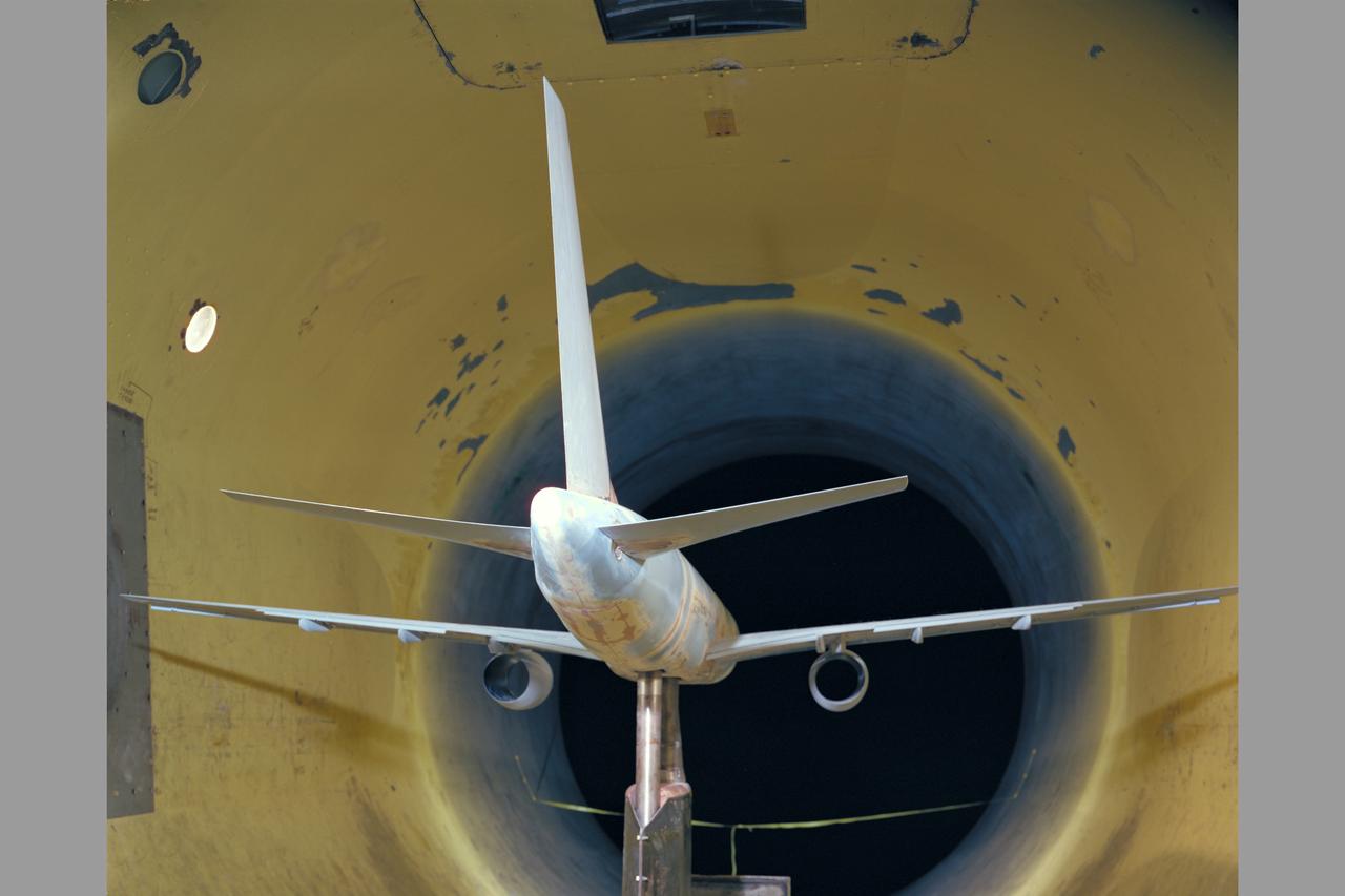
Boeing 757 model test-341 in 12ft w.t.
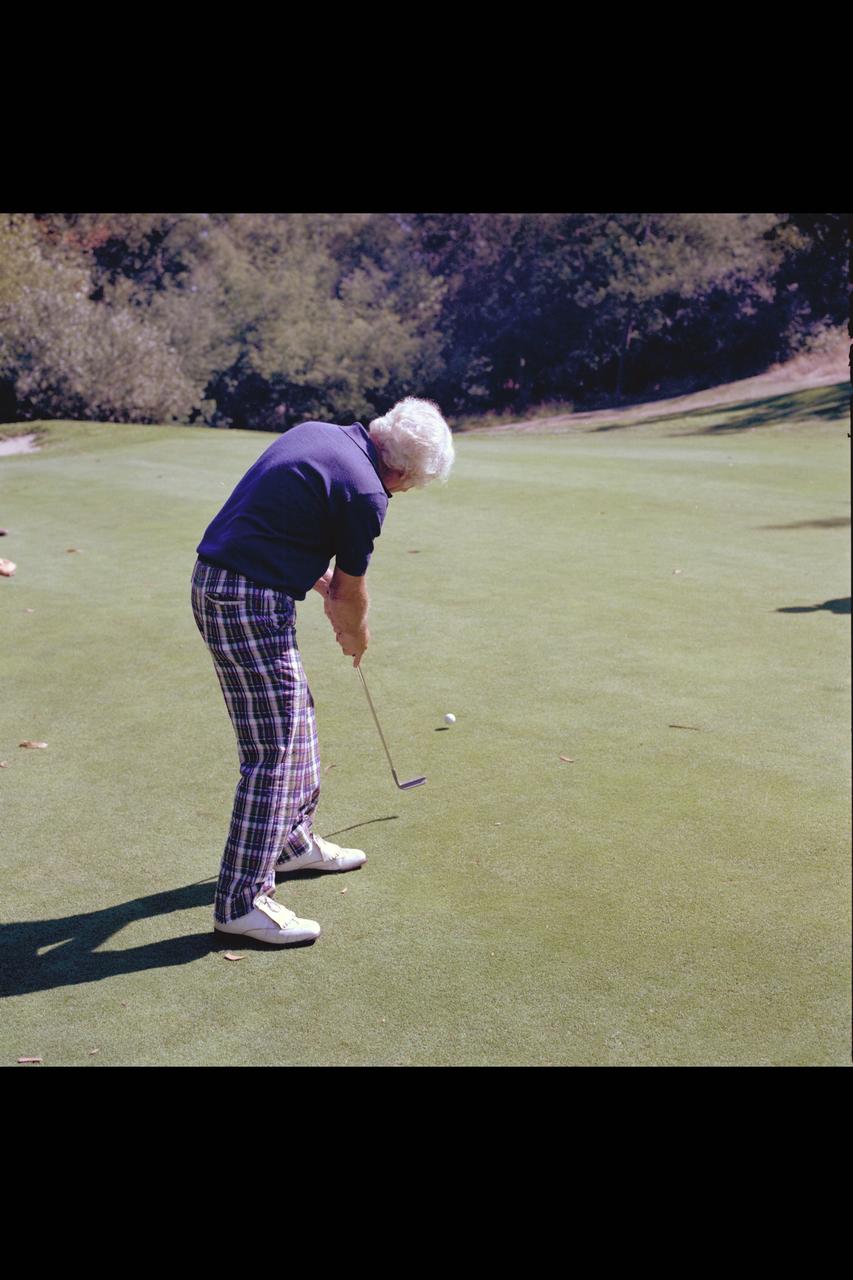
Recruiting Brochure: Shot of Bay Area Sports Activities 1979-1995 (Joe March)
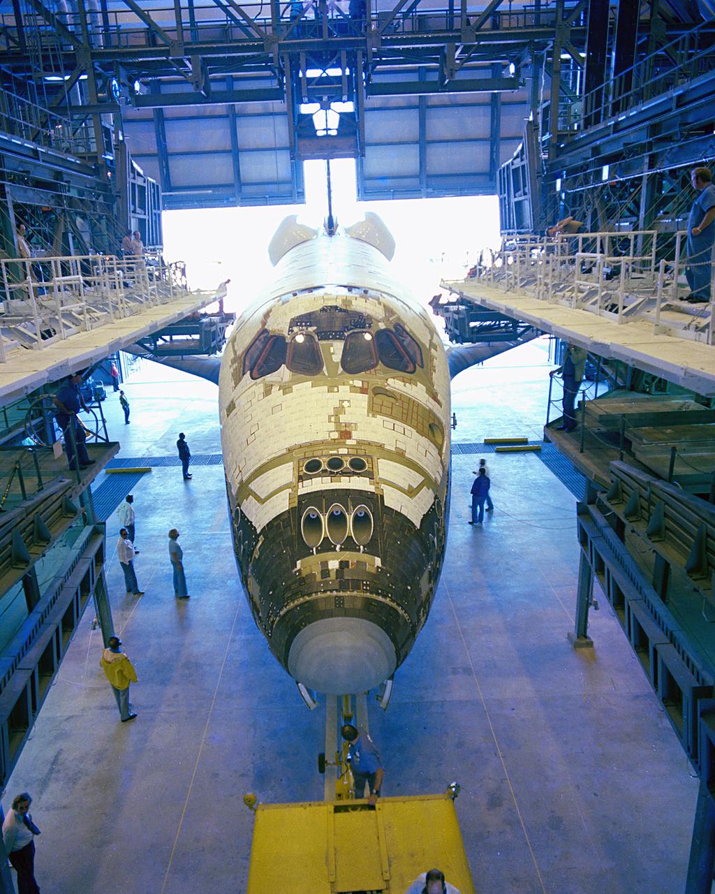
KENNEDY SPACE CENTER, FLA. - Shuttle Orbiter Columbia arriving at OPF.
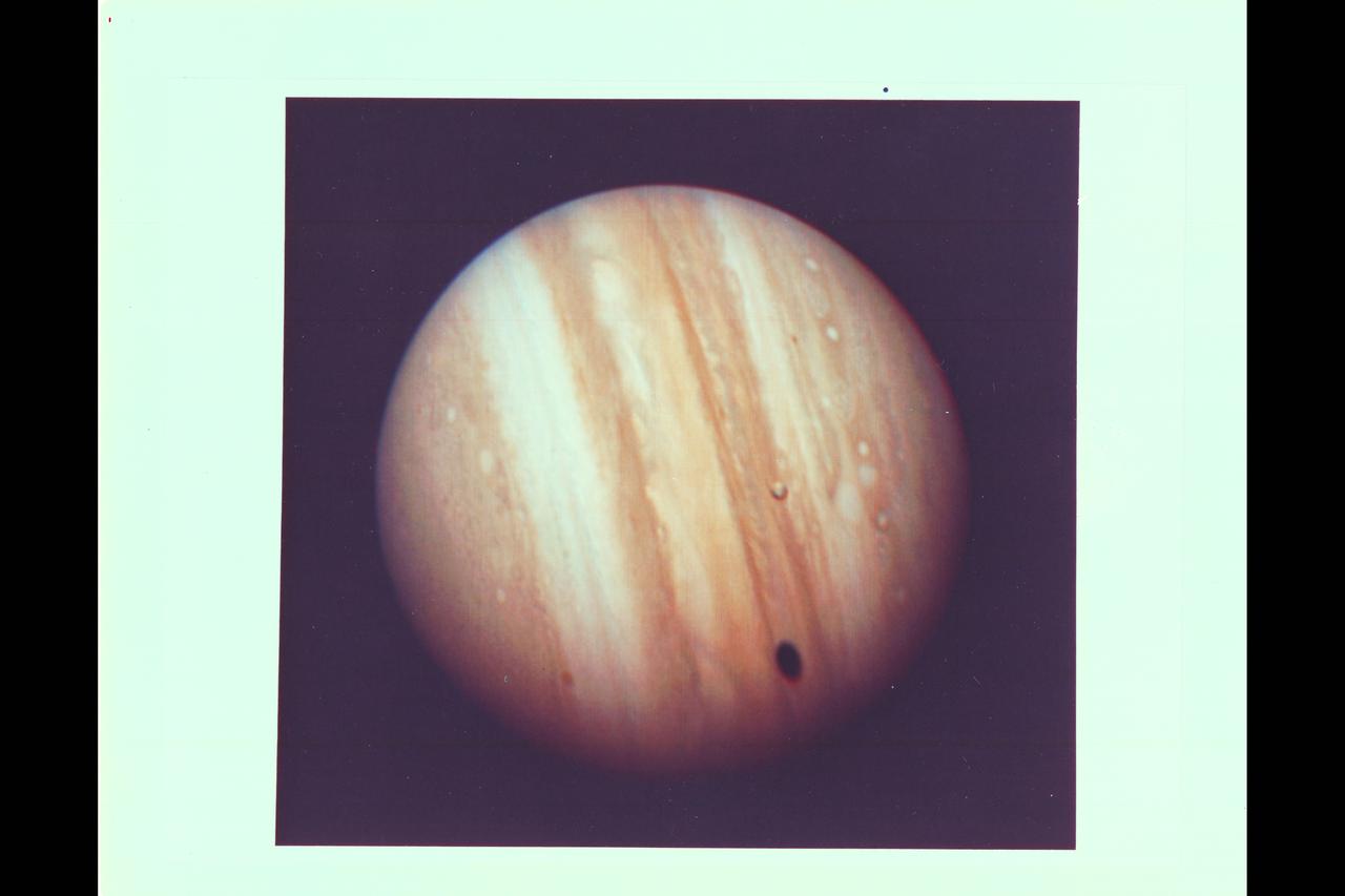
Photo by Voyager 1 Jupiter's satellite Io poses before the giant planet in this photo returned Jan 17, 1979 from a distance of 29 million miles (47 million kilometers). The satellite's shadow can be seen falling on the face of Jupiter at left. Io is traveling from left to right in its one-and-three-quarter-day orbit around Jupiter. Even from this great distance the image of Io shows dark poles and bright equatorial region. Voyager 1 will make its closest approach to Jupiter 174, 000 miles (280,000 kilometer) on March 5. It will then continue to Saturn in November 1980. This color photo was assembled at Jet Propulsion Laboratory's Image Processing Lab from three black and white images taken through filters. The Voyagers are managed for NASA's Office of Space Science by Jet Propulsion Laboratory. (JPL Ref: P-20946C)
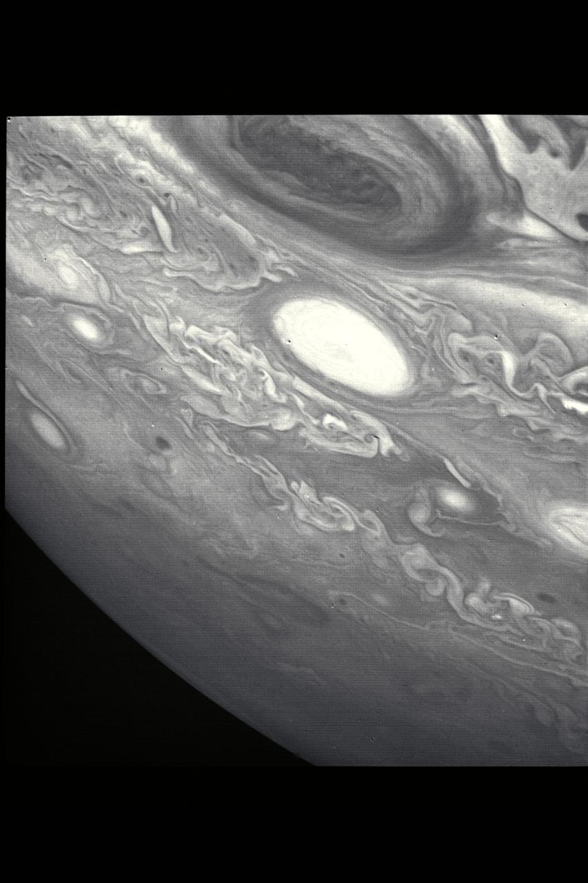
P-21737 BW This picture shows a region of the southern hemisphere extending from the Great Red Spot to the south pole. The white oval is seen beneath the Great Red Spot, and several small scale spots are visible farther to the south. Some of these organized cloud spots have similiar morphologies, such as anticyclonic rotations and cyclonic regions to their west. The presence of the white oval causes the streamlines of the flow to bunch up between it and the Great Red Spot.
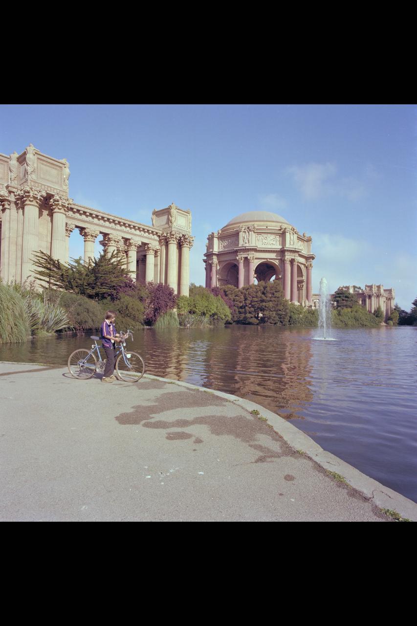
Recruiting Brochure: The Palace of Fine Arts, The Exploratorium in San Francisco
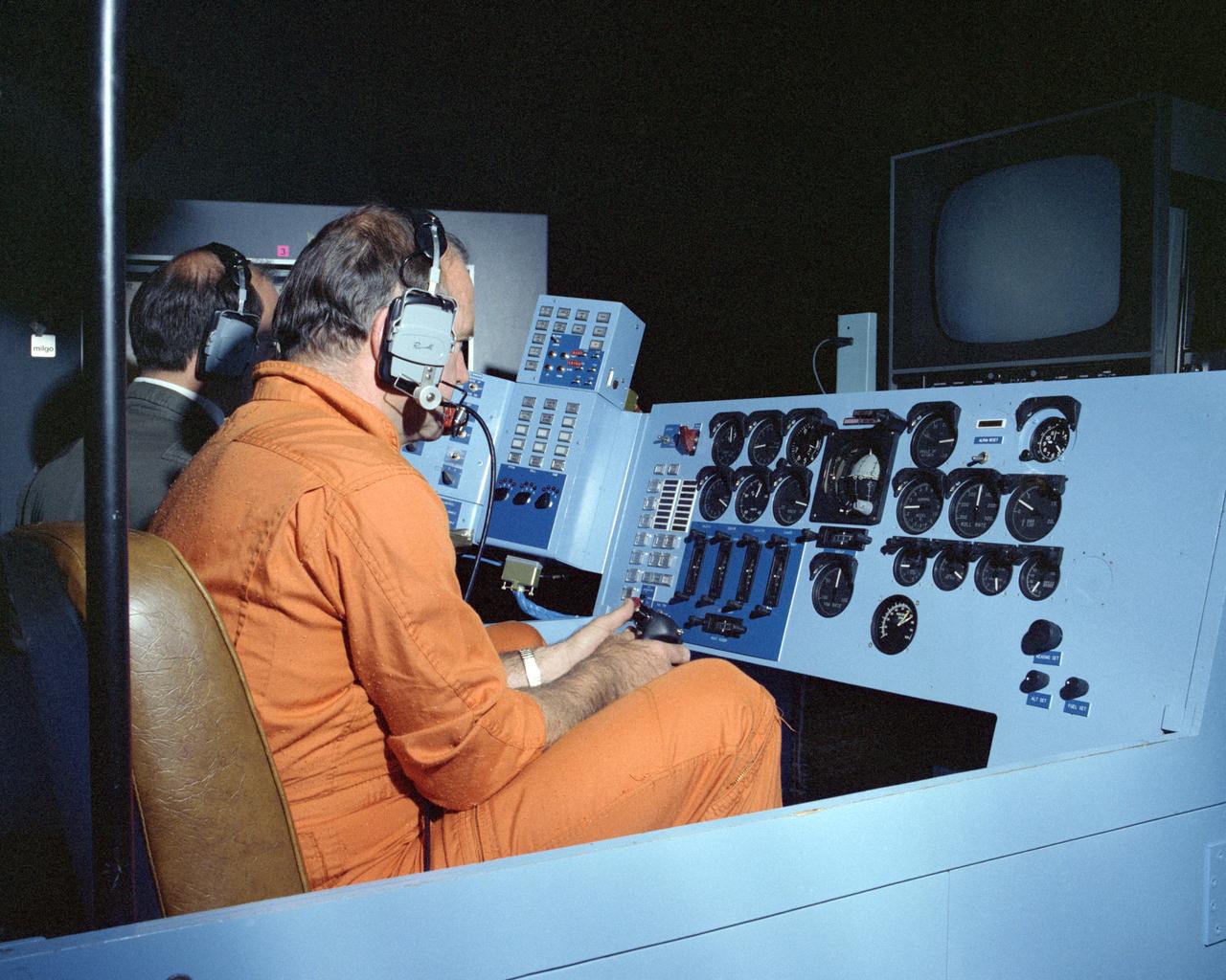
Pilot Bill Dana in HiMAT cockpit
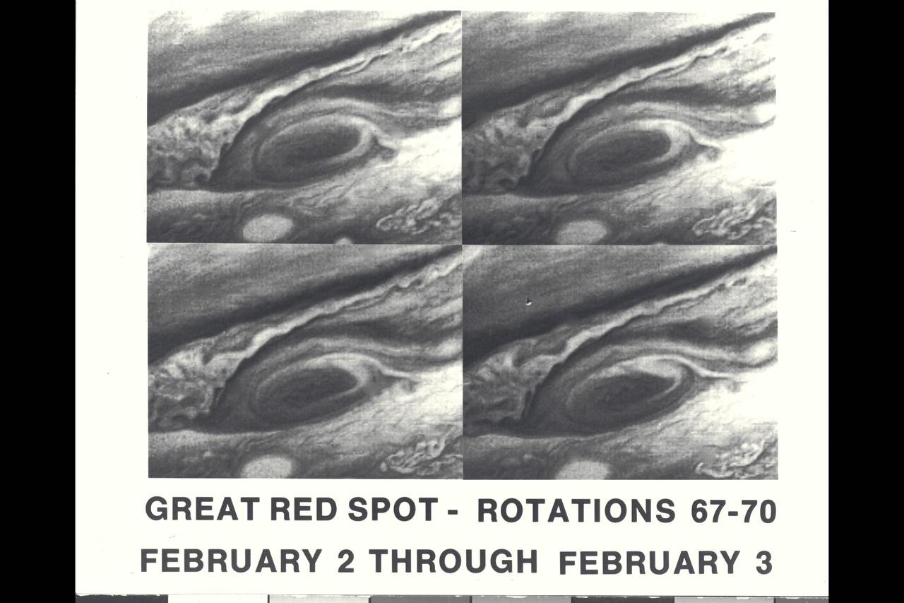
These four pictures of Jupiter's Great Red Spot were taken Feb. 2 and 3, 1979, when Voyager 1 was about 31 million kilometers (19.4 million miles) from Jupiter. The pictures were taken one Jupiter rotation apart, and that together they depict four days in the life of the centuries-old Red Spot. The pictures clearly demonstrate changes in circulation around the Red Spot during the 40-hour period. The photos were taken through a blue filter. Jet Propulsion Laboratory manages the Voyager project for NASA's Office of Space Science. (JPL ref. No. P-21148)