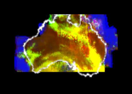
This multispectral map of Australia and surrounding seas was obtained by NASA’s Galileo spacecraft Near Infrared Mapping Spectrometer shortly after closest approach on Dec. 8, 1990 from an altitude of about 50,000 miles.
http://photojournal.jpl.nasa.gov/catalog/PIA00227