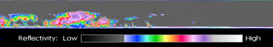
The image at the top of figure 1 is from a geostationary imager. The colors relate to the temperature of the clouds. The higher the clouds, the lower the temperature. The highest, coldest clouds are located near the center of the hurricane.