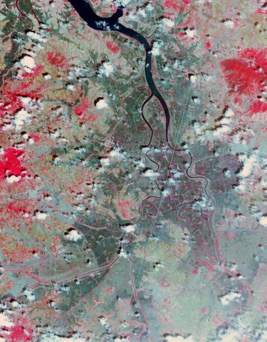
North Korea's state news agency reported the country is facing its worst drought in a century. Rice-growing provinces have been badly affected and more than 30% of rice paddies were parching up. A Landsat 7 image from June 29, 2002, compared with an ASTER image from June 26, 2015, shows the disparity in the rice crop. The images display vegetation in red, and bare fields in dark blue. The images cover an area of 27 x 34.5 km, and are located at 38.5 degrees north, 125.6 degrees east. http://photojournal.jpl.nasa.gov/catalog/PIA19501