
This large tabular iceberg, broken off from the Antarctic Ice Sheet, was spotted in the South Atlantic Ocean (57.0S, 57.0W) southeast of the tip of South America as it was slowly being moved north and east by wind, current and tidal influences. This type of iceberg, never to be seen in the northern hemisphere, is typical for Antarctica. Although some such icebergs are as large as 100 km in length, this one measures about 35 by 69 km.
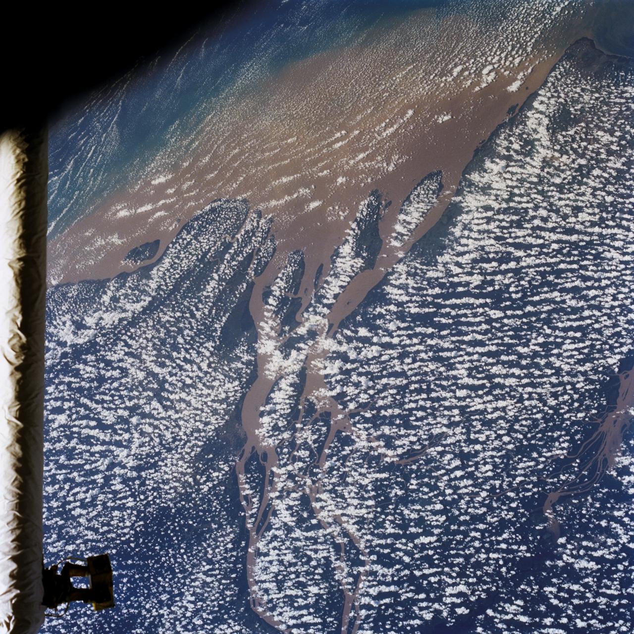
STS046-80-009 (31 July-8 Aug. 1992) --- A view of the mouth of the Amazon River and the Amazon Delta shows a large sediment plume expanding outward into the Atlantic Ocean. The sediment plume can be seen hugging the coast north of the Delta. This is caused by the west-northwest flowing Guyana Current. The large island of Marajo is partially visible through the clouds.
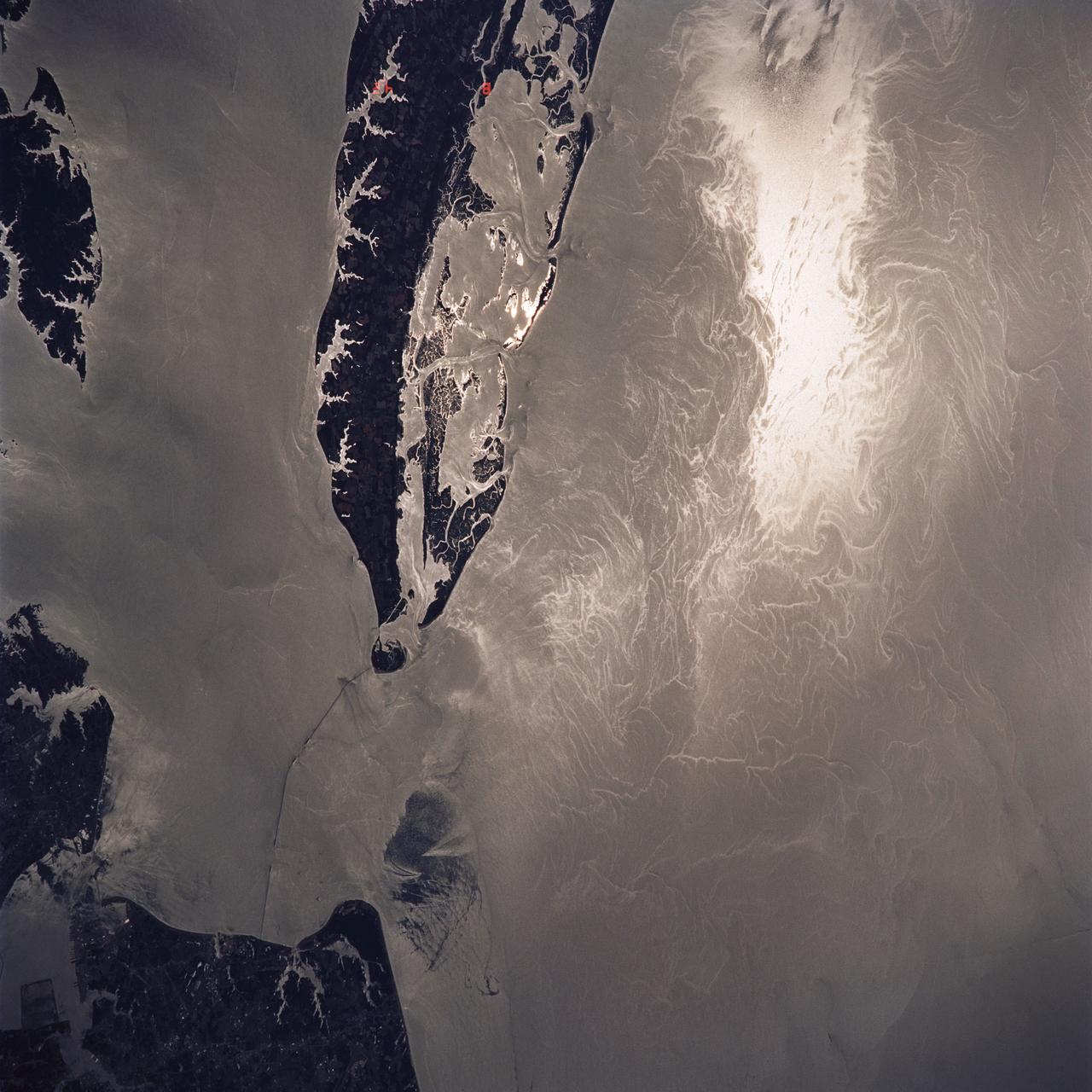
STS040-614-047 (5-14 June 1991) --- This image is of the Norfolk, Virginia -- Southern Delmarva Peninsula Southern Chesapeake Bay Area as seen in sunlight. The exposure is adjusted to emphasize the water patterns present. The outgoing tide generates considerable turbulence as it passes through the mouth of the bay. This is displayed by differences in reflective properties of the water surface due to differences in slope and turbidity. Ship wakes and the wakes of subsurface structures are seen clearly. The bridge tunnel system linking Norfolk with the peninsula and its effect on the system is quite apparent. Sunglint images over land areas were also acquired which emphasize land-water boundaries as demonstrated here in the small Delmarva inlets as a tool for wetland mapping, and river, lake and even pond description. During the first few days of the STS-40 mission the Eastern Seaboard of the United States was free of clouds and haze providing excellent photography of many of the major cities and the countryside of that area as well as the Gulf Stream.
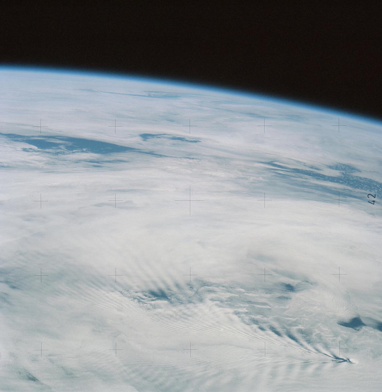
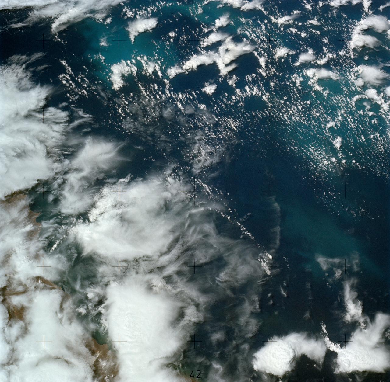
SL4-137-3632 (February 1974) --- A photograph taken from the Skylab space station in Earth orbit illustrating an atmospheric wave pattern by the affect of a small mountainous island on wind currents. Various patterns can be seen downwind of small islands. Often a Von Karmon vortex can be seen which appears as a spiral pattern. Multiple vortices have been photographed on previous missions. This photograph illustrates a "bow wave" pattern which extends for hundreds of miles downwind from the island. The island itself is often clear when a wave pattern is formed downstream. This particular pattern is very symmetrical. These wave patterns are most common in the South Pacific. This picture was taken by a Skylab 4 crewmen using a hand-held 70mm Hasselblad camera. Photo credit: NASA
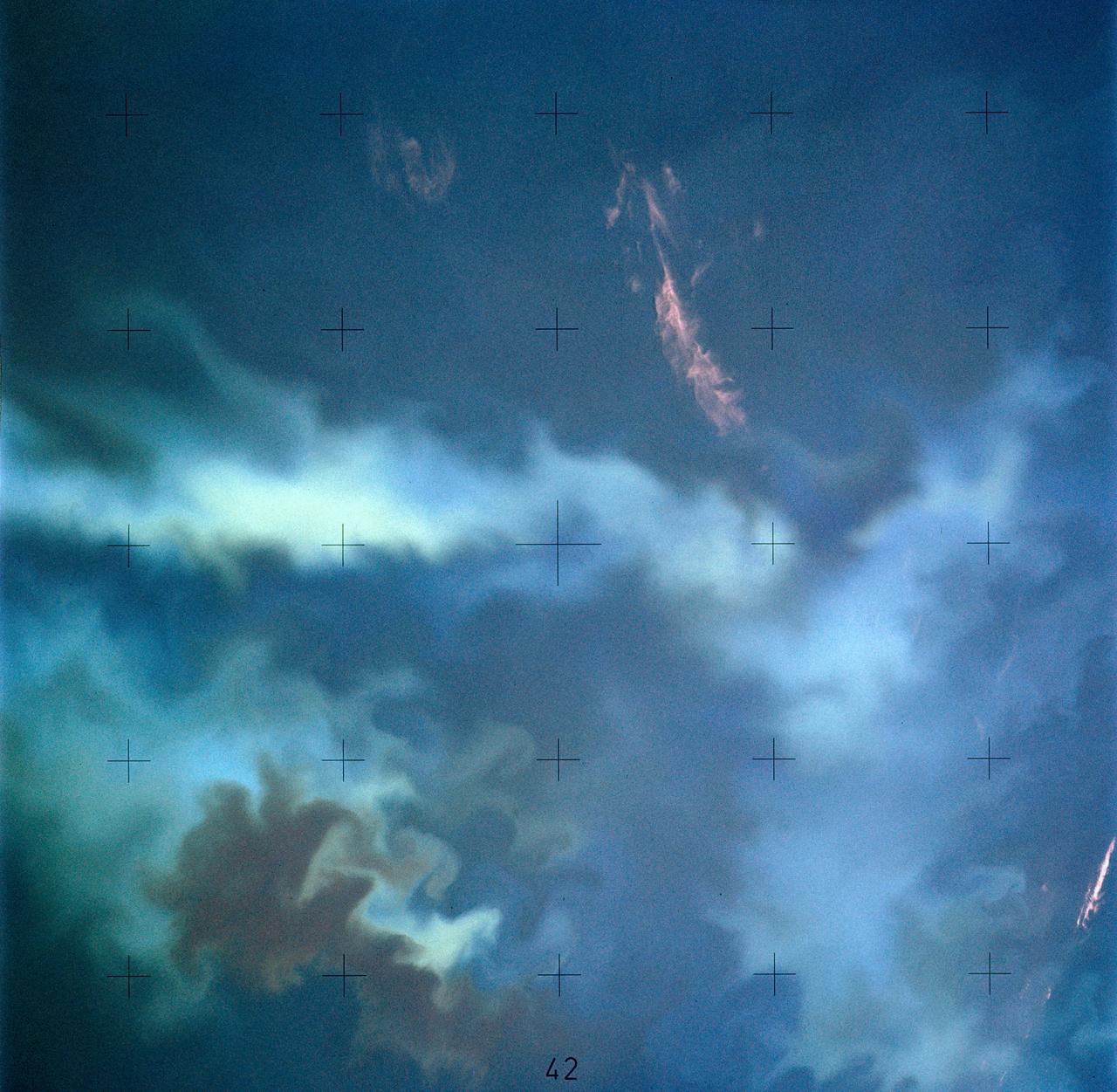
SL4-137-3721 (February 1974) --- Plankton blooms and color variations in the Falkland Current east of the Argentina coast in the South Atlantic Ocean as seen from the Skylab space station in Earth orbit. This picture was taken by one of the Skylab 4 crewmen using a hand-held 70mm Hasselblad camera. The Skylab 4 crew made many observations of the Falkland Current and related phenomena. This current flows north and northeastward along the Argentine coast near 40 degree south latitude where it meets the Brazil Current and the two swing eastward. The study of such photographs as this one can add significantly to our knowledge and understanding of the oceans. Photo credit: NASA

Swift currents flow through the Strait of Gibraltar, producing complicated patterns in the surface waters. Some of those patterns are highlighted in the sunglint in this photograph. The Mediterranian Sea is on the upper right, the Atlantic Ocean in in the lower left. Few features can be seen on the Mediterranian side, but current shears (straight lines coming off Spain), several sets of internal waves (impinging on the Spanish continental shelf) and ship wakes can be seen on the Atlantic side, west of Cadiz. Both Tangier and Cadiz show up in the sunglint as well.

Damaging heavy rains fell on South Carolina in the southeastern United States at the beginning of October 2015. Much of that water had, by mid October, flowed into the Atlantic Ocean bringing with it heavy loads of sediment, nutrients, and dissolved organic material. The above VIIRS image shows the runoff as it interacts with ocean currents on October 15, 2015. Credit: NASA/Goddard/SuomiNPP/VIIRS via NASA's OceanColor
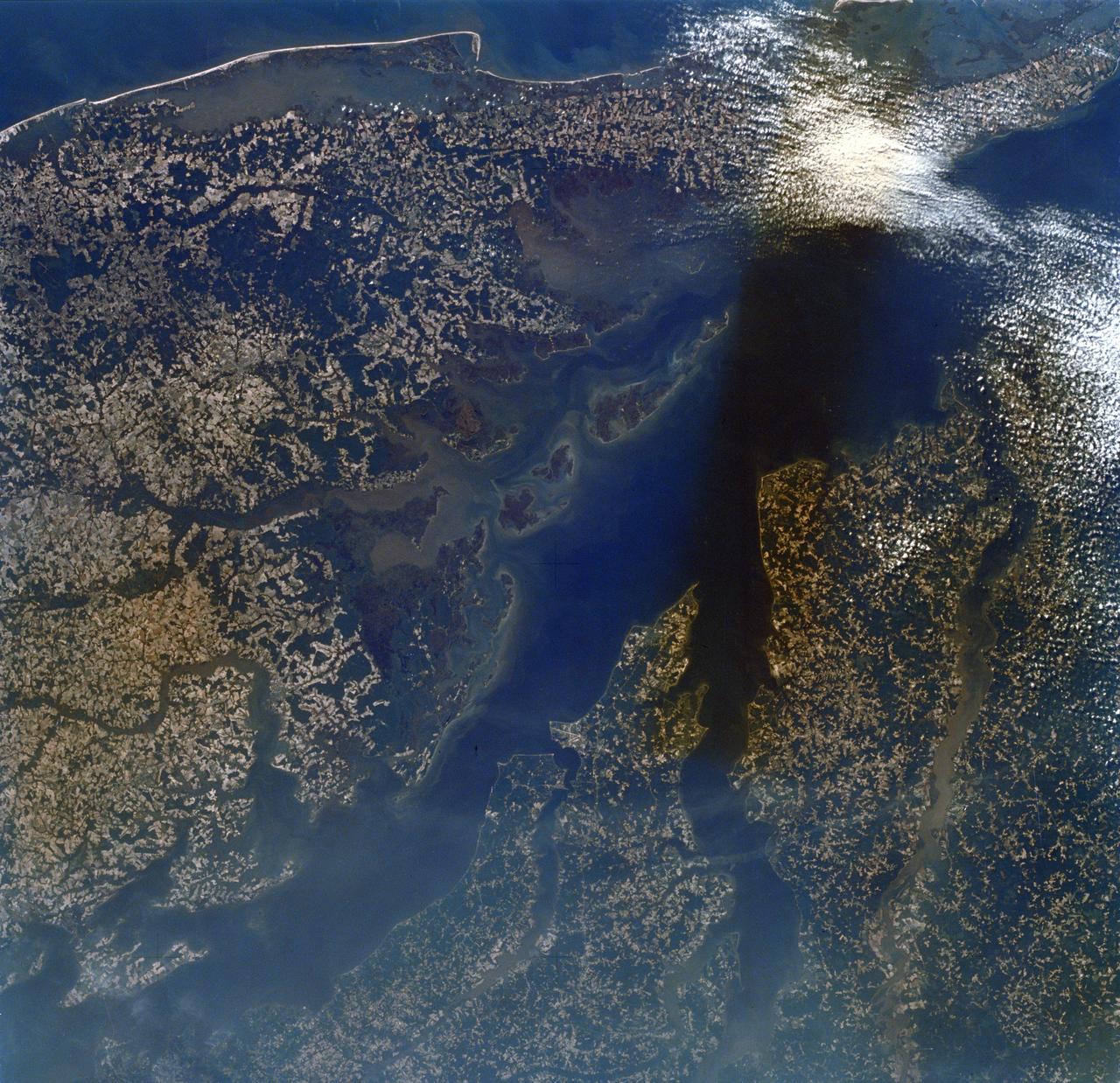
SL2-16-174 (22 June 1973) --- Norfolk and the lower Chesapeake Bay, VA (37.5N, 75.5W) at the interface of the Atlantic Ocean can be seen to be a mixture of complex currents. Outgoing tides from the bay generate considerable turbulence as they encounter coastal currents and can be observed by the sediment plumes stirred up as a result of current dynamics. Smooth flowing water has less sediment and appears darker. Turbulent water has lots of sediment and appears lighter in color. Photo credit: NASA
The southernmost tip of Africa is marked by the Cape Agulhas lighthouse. The warm Atlantic Agulhas current meets the cold water Indian Ocean Benguela current, creating treacherous seas that have claimed many ships over the last 450 years. The image covers an area of 22.5 by 41.1 kilometers, was acquired September 27, 2006, and is located at 34.8 degrees south, 20 degrees east. http://photojournal.jpl.nasa.gov/catalog/PIA21014
SL4-137-3608 (14 Dec. 1973) --- A view of cold water eddies in the Falkland Current off the South Atlantic coast of southern Argentina as seen from the Skylab space station in Earth orbit. This picture was taken by one of the Skylab 4 crewmen using a hand-held 70mm Hasselblad camera. This land area (left corner) extends south along the coast from Puerto Deseado (center left border) for about 50 miles. Within the ocean, several light blue areas are visible and represent the occurrence of plankton with the Falkland Current. Over the ocean, the cold water eddies are identified by the circular cloud-free areas within the cloud street pattern and bordered by cumulus cloud buildup (white). The cloud streets indicate the wind is from the southwest and do not form over eddies because energy form the atmosphere is absorbed by the cold ocean water. On the downwind side of the eddies, cumulus clouds tend to form as the cold moist air flows over the warmer water. Similar cloud and eddy features have been observed by the Skylab 4 crewmen in the Yucatan Current off Yucatan Peninsula and in some parts of the South Pacific. Studies are underway by Dr. George Maul, NOAA, and Dr. Robert Stevenson, ONR, to determine the significance of the cold water eddies to ocean dynamics. Photo credit: NASA
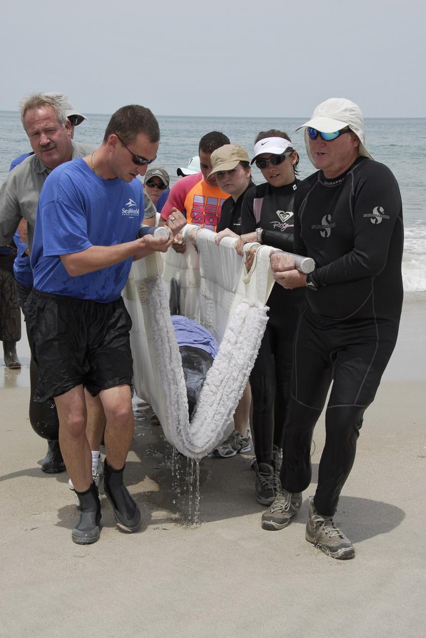
CAPE CANAVERAL, Fla. – Workers from NASA's Kennedy Space Center, a veterinarian and representatives from the Hubbs/Sea World Research Institute support a stranded Melon-Headed Whale on a sling as they carry it out of the Atlantic Ocean. The whale was found beached south of Launch Pad 39A near Cape Canaveral Air Force Station. After assessment by veterinarians at Sea World, the whale will be transported to a whale rescue center in the Panhandle for rehabilitation and release. The Melon-Headed Whale lives well off-shore in all the world's tropical and sub-tropical oceans. At the northern fringes of its range, it may also be found in the warm currents of temperate waters, such as Florida. It is closely related to the Pygmy Killer Whale and the Pilot Whales. Its primary diet is squid. Photo credit: NASA/Kim Shiflett
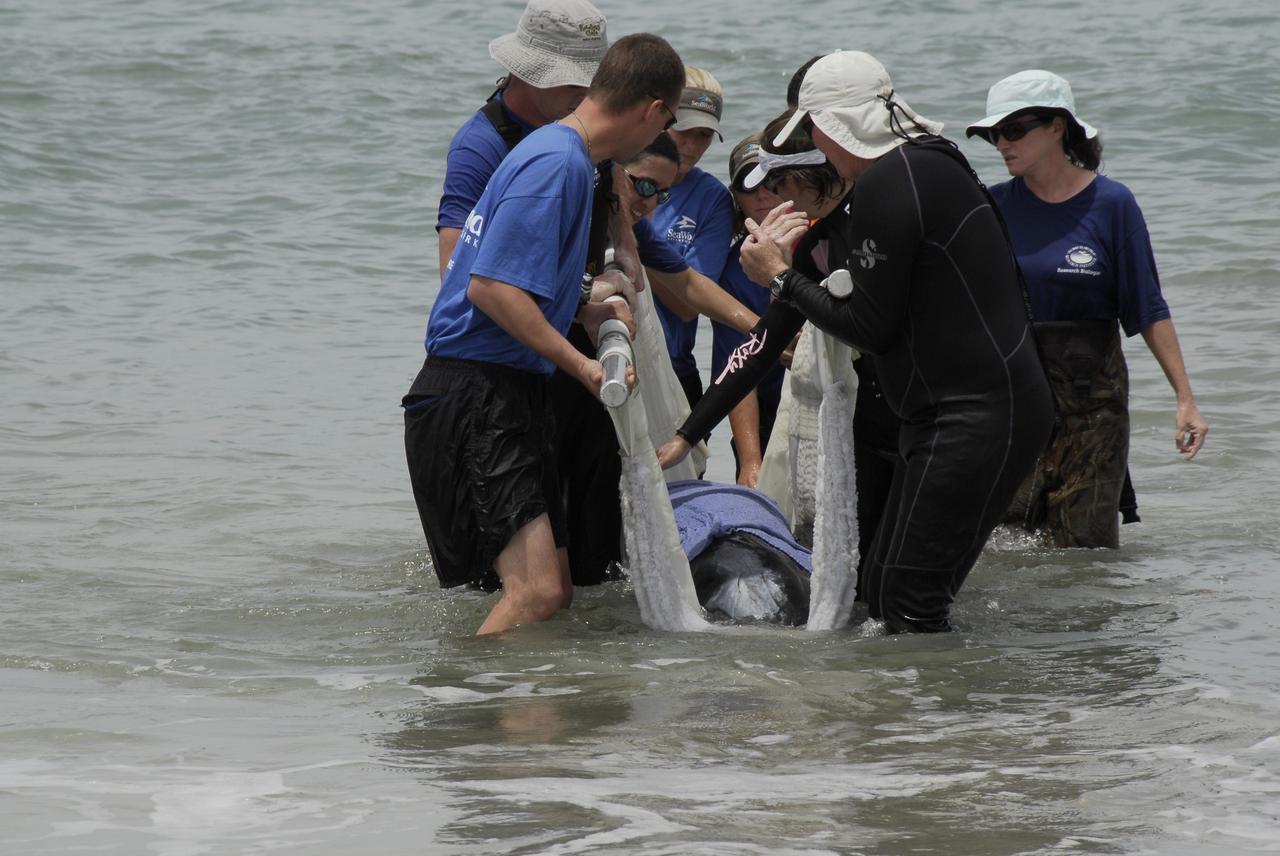
CAPE CANAVERAL, Fla. – Workers from NASA's Kennedy Space Center and representatives from the Hubbs/Sea World Research Institute support a stranded Melon-Headed Whale on a sling in the Atlantic Ocean. The whale was found beached south of Launch Pad 39A near Cape Canaveral Air Force Station. After assessment by veterinarians at Sea World, the whale will be transported to a whale rescue center in the Panhandle for rehabilitation and release. The Melon-Headed Whale lives well off-shore in all the world's tropical and sub-tropical oceans. At the northern fringes of its range, it may also be found in the warm currents of temperate waters, such as Florida. It is closely related to the Pygmy Killer Whale and the Pilot Whales. Its primary diet is squid. Photo credit: NASA/Kim Shiflett
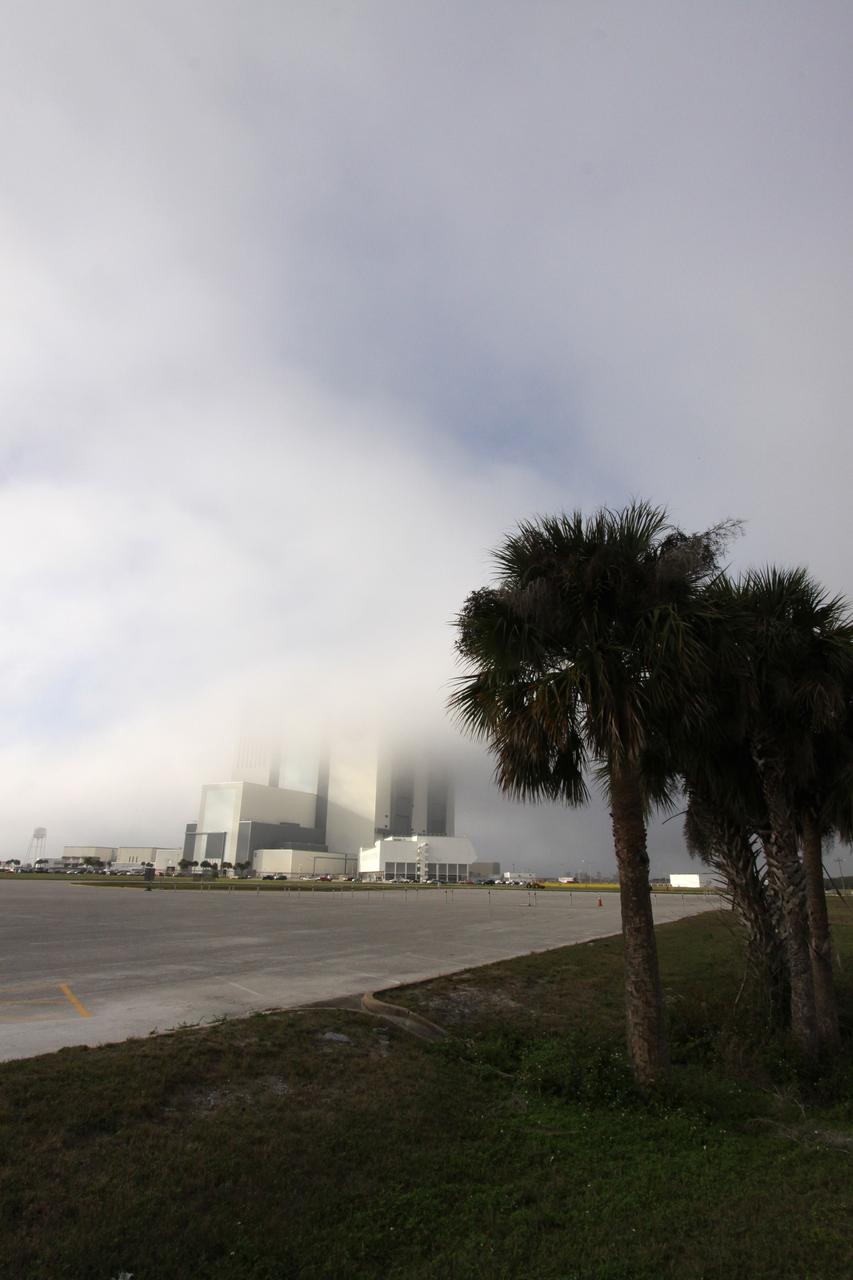
CAPE CANAVERAL, Fla. – At NASA's Kennedy Space Center in Florida, dense fog moving ashore from the Atlantic Ocean engulfs the Vehicle Assembly Building on an atypical December afternoon. It is the second time in one day that fog has obscured the top of the 525-foot-tall processing facility, known as the VAB. Space Shuttle Endeavour currently is in the VAB's High Bay 1 where it is being attached to its external fuel tank and solid rocket boosters in preparation for its targeted launch in early February 2010. Photo credit: NASA/Jack Pfaller

CAPE CANAVERAL, Fla. – Dense fog engulfs Launch Complex 39 at NASA's Kennedy Space Center in Florida, obscuring the view of the 525-foot-tall Vehicle Assembly Building. The fog pushed onshore from the Atlantic Ocean for the second time in one day to create atypical conditions on this humid December afternoon. Space Shuttle Endeavour currently is in the VAB's High Bay 1 where it is being attached to its external fuel tank and solid rocket boosters in preparation for its targeted launch in early February 2010. Photo credit: NASA/Jack Pfaller
Cape Horn is the southernmost point of the Tierra Del Fuego archipelago of Southern Chile, and marks the northern boundary of the Drake Passage where the Atlantic and Pacific Oceans meet. For decades after its 1616 discovery, it was a milestone for the clipper route by which sailing ships carried trade around the world (Wikipedia). Unfortunately, it was also a graveyard for sailing ships due to strong winds, large waves, strong currents, and icebergs. The 1914 opening of the Panama Canal greatly reduced the need for ships to traverse this dangerous passage. The image was acquired December 20, 2009, covers an area of 28.3 by 36.0 kilometers, and is located at 56 degrees south, 67.3 degrees west. https://photojournal.jpl.nasa.gov/catalog/PIA23118
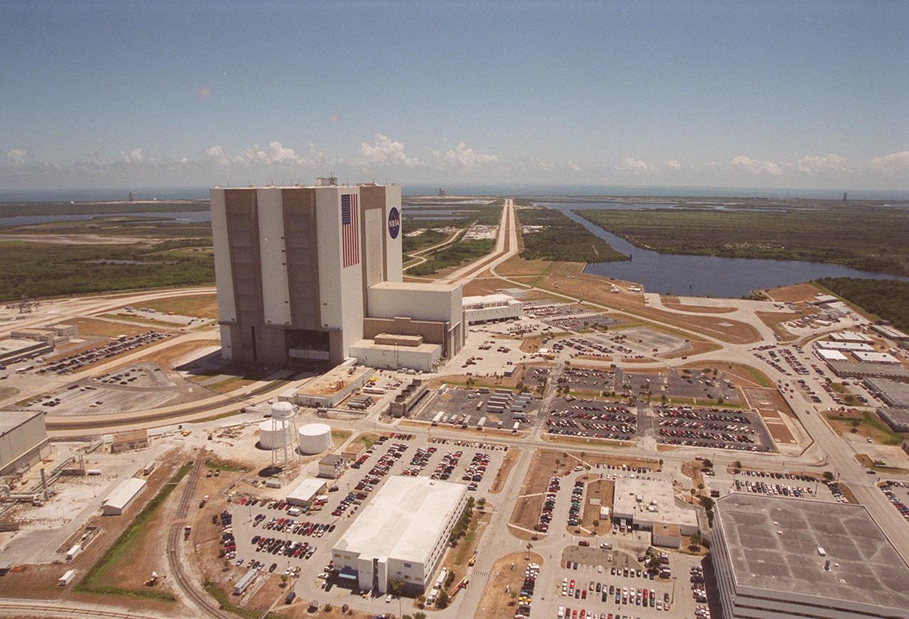
This aerial photo captures many of the facilities involved in Space Shuttle launches. At center is the Vehicle Assembly Building (VAB). The curved road on the near side is the newly restored crawlerway leading into the VAB high bay 2, where a mobile launcher platform/crawler-transporter currently sits. The road restoration and high bay 2 are part of KSC’s Safe Haven project, enabling the storage of orbiters during severe weather. The crawlerway also extends from the east side of the VAB out to the two Space Shuttle launch pads. In the distance is the Atlantic Ocean. To the right of the far crawlerway is the turn basin, into which ships tow the barge for offloading new external tanks from Louisiana
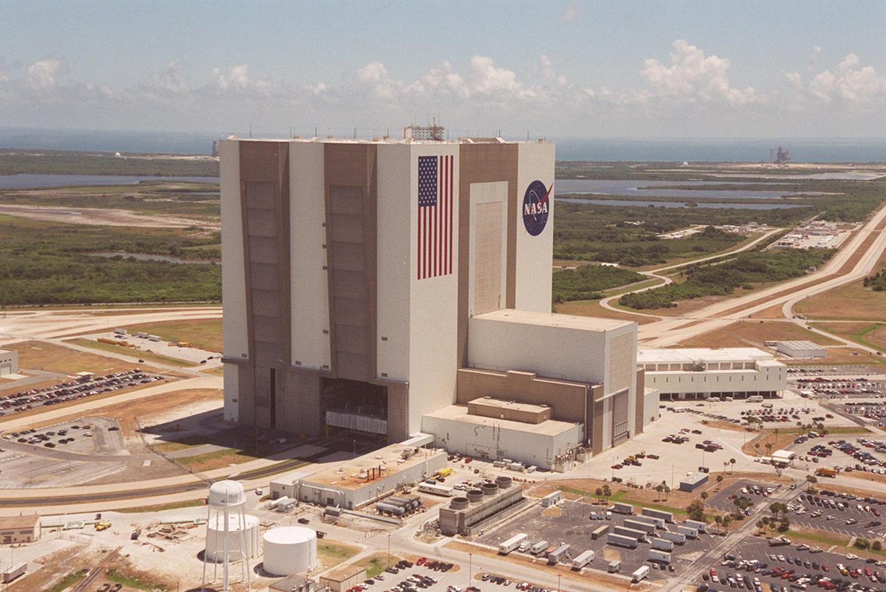
This aerial photo captures many of the facilities involved in Space Shuttle launches. At center is the Vehicle Assembly Building (VAB). The curved road on the near side is the newly restored crawlerway leading into the VAB high bay 2, where a mobile launcher platform/crawler-transporter currently sits. The road restoration and high bay 2 are part of KSC’s Safe Haven project, enabling the storage of orbiters during severe weather. The crawlerway also extends from the east side of the VAB out to the two Space Shuttle launch pads. In the distance is the Atlantic Ocean

This aerial photo captures many of the facilities involved in Space Shuttle launches. At center is the Vehicle Assembly Building (VAB). The curved road on the near side is the newly restored crawlerway leading into the VAB high bay 2, where a mobile launcher platform/crawler-transporter currently sits. The road restoration and high bay 2 are part of KSC’s Safe Haven project, enabling the storage of orbiters during severe weather. The crawlerway also extends from the east side of the VAB out to the two Space Shuttle launch pads. In the distance is the Atlantic Ocean
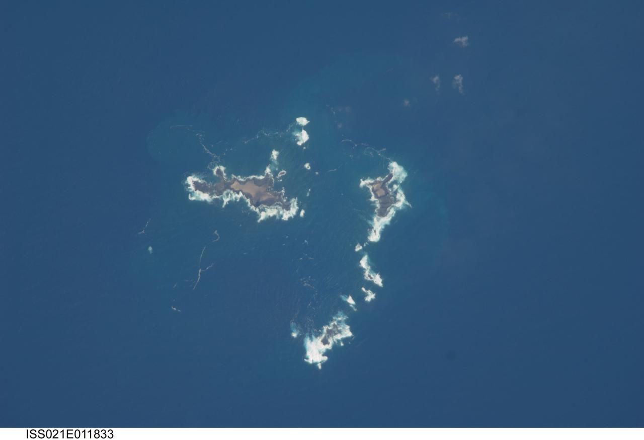
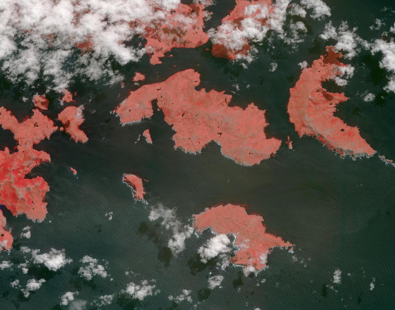
ISS021-E-011833 (22 Oct. 2009) --- The southern Savage Islands in the Atlantic Ocean are featured in this image photographed by an Expedition 21 crew member on the International Space Station. The Savage Islands, or Ilhas Selvagens in Portuguese, comprise a small archipelago in the eastern North Atlantic Ocean between the archipelago of Madeira to the north and the Canary Islands to the south. Like other island groups, the Savage Islands are thought to have been produced by volcanism related to a mantle plume or ?hot spot?. Mantle plumes are relatively fixed regions of upwelling magma that can feed volcanoes on an overlying tectonic plate. Active volcanoes form over the plume, and become dormant as they are carried away on the moving tectonic plate. Scientists believe that over geologic time, this creates a line of older extinct volcanoes, seamounts, and islands extending from the leading active volcanoes that are currently over the plume. This view illustrates the smaller and more irregularly-shaped Ilheus do Norte, Ilheu de Fora, and Selvagem Pequena. Spain and Portugal both claim sovereignty over the Savage Islands. All of the islands of the archipelago are ringed by bright white breaking waves along the fringing beaches. Coral reefs that surround the Savage Islands make it very difficult to land boats there, and there is no permanent settlement on the islands.
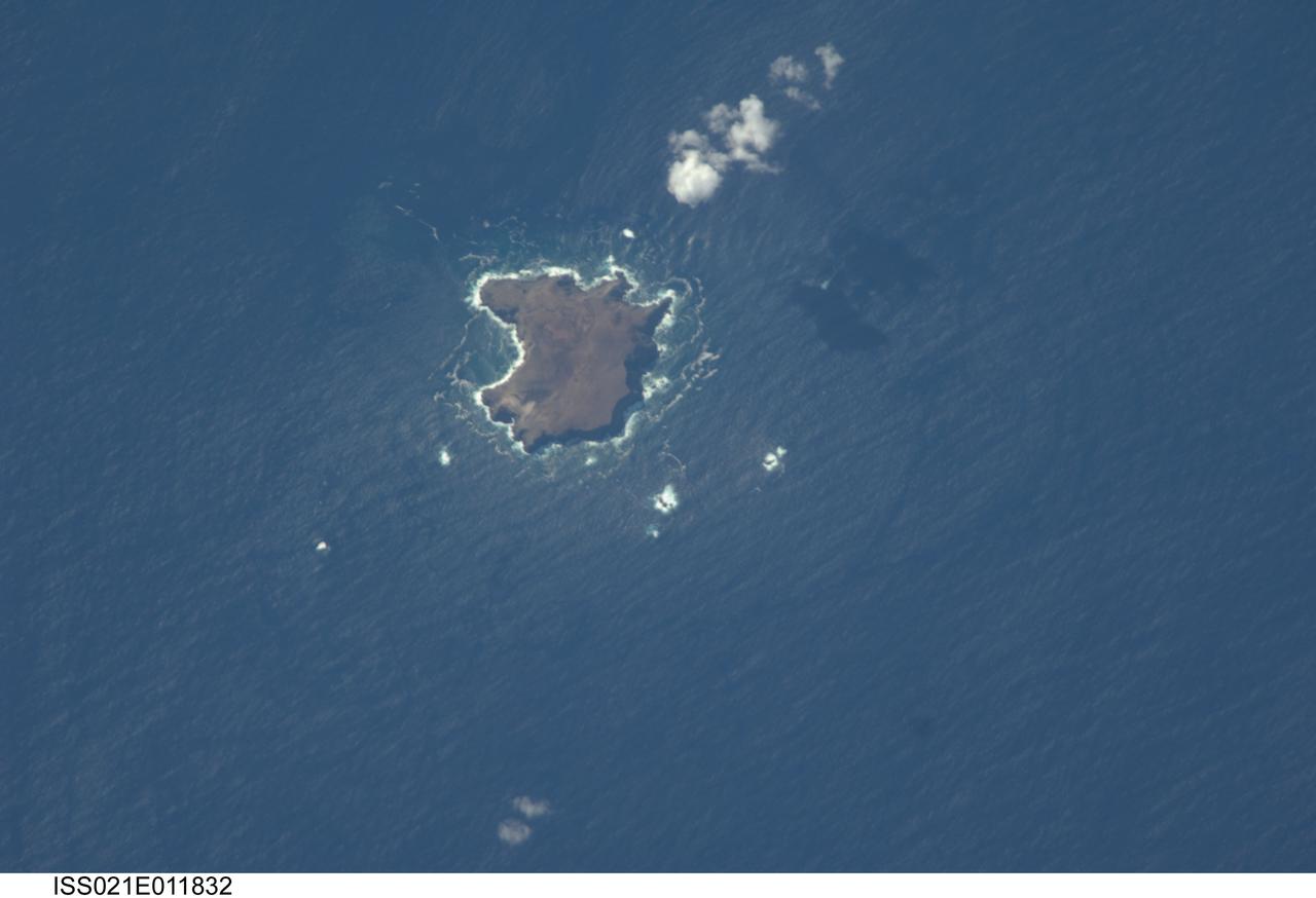
ISS021-E-011832 (22 Oct. 2009) --- The northern Savage Islands in the Atlantic Ocean are featured in this image photographed by an Expedition 21 crew member on the International Space Station. The Savage Islands, or Ilhas Selvagens in Portuguese, comprise a small archipelago in the eastern North Atlantic Ocean between the archipelago of Madeira to the north and the Canary Islands to the south. Like other island groups, the Savage Islands are thought to have been produced by volcanism related to a mantle plume or “hot spot”. Mantle plumes are relatively fixed regions of upwelling magma that can feed volcanoes on an overlying tectonic plate. Active volcanoes form over the plume, and become dormant as they are carried away on the moving tectonic plate. Scientists believe that over geologic time, this creates a line of older extinct volcanoes, seamounts, and islands extending from the leading active volcanoes that are currently over the plume. This view illustrates Selvagem Grande, the largest of the islands with an approximate area of four square kilometers. All of the islands of the archipelago are ringed by bright white breaking waves along the fringing beaches. Coral reefs that surround the Savage Islands make it very difficult to land boats there, and there is no permanent settlement on the islands.

Tomorrow is the start of the Eastern Pacific Ocean hurricane season but the eastern Pacific is currently quiet. The Atlantic Ocean hurricane season begins on June 1. NASA/NOAA's GOES Project combined imagery from NOAA's GOES-13 and GOES-15 satellites to provide this animation of weather in the Atlantic and Eastern Pacific over the last 10 days. Credit: NASA/NOAA GOES Project <b><a href="http://www.nasa.gov/audience/formedia/features/MP_Photo_Guidelines.html" rel="nofollow">NASA image use policy.</a></b> <b><a href="http://www.nasa.gov/centers/goddard/home/index.html" rel="nofollow">NASA Goddard Space Flight Center</a></b> enables NASA’s mission through four scientific endeavors: Earth Science, Heliophysics, Solar System Exploration, and Astrophysics. Goddard plays a leading role in NASA’s accomplishments by contributing compelling scientific knowledge to advance the Agency’s mission. <b>Follow us on <a href="http://twitter.com/NASAGoddardPix" rel="nofollow">Twitter</a></b> <b>Like us on <a href="http://www.facebook.com/pages/Greenbelt-MD/NASA-Goddard/395013845897?ref=tsd" rel="nofollow">Facebook</a></b> <b>Find us on <a href="http://instagram.com/nasagoddard?vm=grid" rel="nofollow">Instagram</a></b>
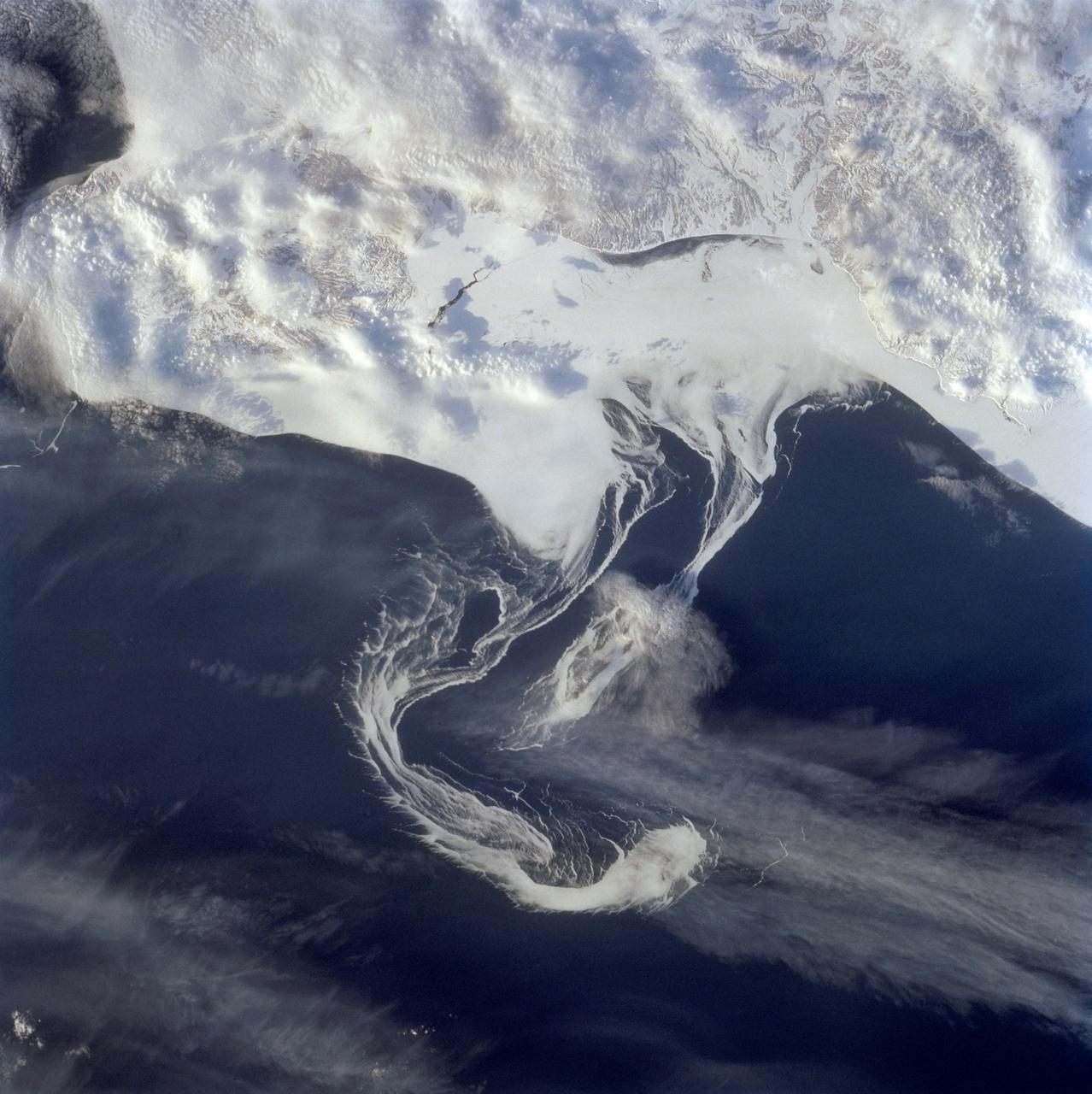
STS060-73-038 (3-11 Feb 1994) --- Pack ice is documented in this photograph along the coast of the Kamchatka Peninsula of Russia in Zaliv Ozernoj. Newly formed ice continually breaks away from the land and takes the form imposed by coastal currents. Detailed photographs of the ice provide information to scientists in both Russia and the united States about the location and fluctuation of ice edges, and how this new sea ice interacts with ocean and littoral currents. This information results in better ice warnings to shipping traffic and provides data points for long-range climate change research for both the Mission-To-Planet Earth and the Russian Priroda ("Nature") monitoring and assessment programs that are respectively coordinated by NASA and the Russian Academy of Sciences. This photography of ice development in the North Pacific, North Atlantic, the Southern Ocean, the Baltic and North Seas, and the Great Lakes is of great interest to the international scientific community. NASA scientists feel high-resolution analog and digital photography from the Space Shuttle and future craft can be a particularly important component in satisfying their data needs on both an operational and a long-term research basis.

STS060-88-070 (3-11 Feb 1994) --- This view shows sunglint in the Strait of Gibralter. In this photograph a high pressure atmospheric system over the Iberian Peninsula has set the conditions for seeing a plankton bloom along the Moroccan coast in the Alboran Sea (Western Mediterranean) coastal counter current as well as illumining the influence of winds in the sunglint pattern near the Strait of Gibraltar. Where the water is ruffled from a wind gust, such as off Cadiz, Spain, the surface is less reflective and thus appears dark. A combination of the effects of the tide and the surface winds through the Strait of Gibraltar have created a unique sunglint pattern at the entrance of the Mediterranean. The Atlantic Ocean waters are flowing with the tide through the Strait of Gibraltar into the Mediterranean Sea and are probably smoothing out some of the smaller waves at the surface. The incoming tide generates internal waves as can be faintly seen in this photograph. The incoming relatively cooler, less dense Atlantic water flows over the warm, more saline Mediterranean water. As the tide moves into the Strait of Gibraltar it encounters the Camarinal Sill, which is like a cliff under the water, south of Camarinal Point, Spain. Internal waves are generated at this sill and they travel along the density boundary between the Atlantic water and the Mediterranean water masses. There is little evidence of the internal waves at the surface of the ocean. We can see them in spacecraft photography because of the sunglint which reflects off the different water layers in differential patterns. The internal waves also smooth out some of the bands of capillary waves at the surface. That is, the sun reflects more brightly from these smooth areas, showing the pattern of the underwater waves more prominently than do the surface waves. The Bay of Cadiz on the southwest coast of Spain, the Rock of Gibraltar, and the Moroccan coast are also beautifully illustrated in this photography. The focus for scientists, however, remains the high clarity and spatial resolution given by sunglint studies to physical phenomena in the ocean.
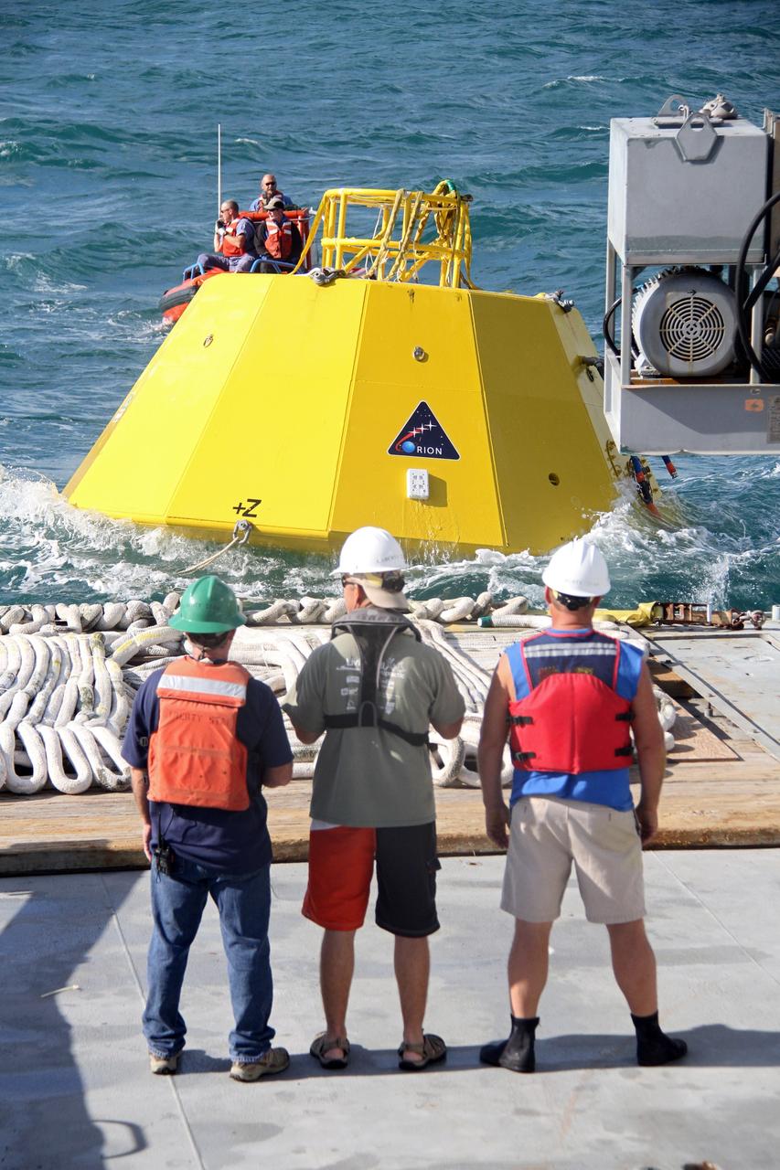
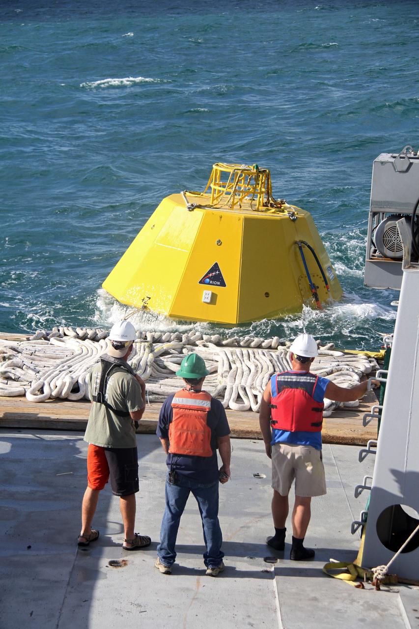
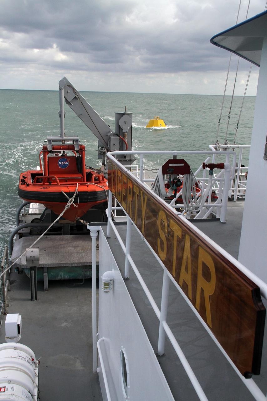
CAPE CANAVERAL, Fla. – Workers, on the deck of NASA's Liberty Star ship and in a boat in the Atlantic Ocean, prepare to begin testing of an Orion flight test capsule. The Crew Module Recovery Attach Fitting Test (CRAFT) on the capsule, which began at-sea operations Nov. 29, is under way. Multiple attach clips are being evaluated against the current recovery cleat configuration by U.S. Air Force pararescue jumpers (PJs) and a U.S. Navy diver. The 21st Century Ground Systems Program will use data collected from the tests to help develop ground operations support equipment that could be used to recover an uncrewed Orion flight test capsule after splashdown. The Orion Multi-Purpose Crew Vehicle is NASA's next-generation spacecraft being developed for deep space missions to asteroids, moons and other interplanetary destinations throughout the solar system. For more information, visit http://www.nasa.gov/orion. Photo credit: NASA/Cory Huston
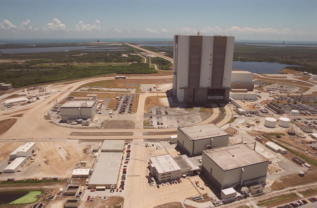
This aerial photo shows the areas recently opened as part of KSC’s Safe Haven project. The curved road in the center is the newly restored crawlerway leading around the Vehicle Assembly Building (VAB) and Orbiter Processing Facility 3 (OPF-3) into the VAB high bay 2 (open on the lower right), where a mobile launcher platform/crawler-transporter currently sits. The Safe Haven project will enable the storage of orbiters during severe weather. OPF1 and OPF-2 are at the lower right. The crawlerway also extends from the east side of the VAB out to the two launch pads. Launch Pad 39A is visible to the left of the crawlerway. In the distance is the Atlantic Ocean. To the right of the VAB is the turn basin, into which ships tow the barge for offloading new external tanks from Louisiana

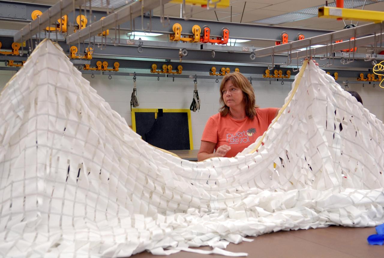
KENNEDY SPACE CENTER, FLA. -- Workers prepare a parachute for an upcoming test at the Parachute Refurbishment Facility. The first stage of the new Ares I rocket and Orion spacecraft will use parachutes to return to Earth. Current tests are being performed in Arizona to make sure the designs can safely handle their intended weight. Ares I is an in-line, two-stage rocket that will transport the Orion crew exploration vehicle to low-Earth orbit. The Ares I first stage will be a five-segment solid rocket booster based on the four-segment design used for the shuttle. As with the shuttle, this booster will fall away when spent, lowered by parachute into the Atlantic Ocean where it can be retrieved for re-use. Unlike the shuttle, the booster will be flying faster, at Mach 6, when its separation from the rest of Ares I occurs. Photo credit: NASA/Kim Shiflett

KENNEDY SPACE CENTER, FLA. -- Workers prepare a parachute for an upcoming test at the Parachute Refurbishment Facility. The first stage of the new Ares I rocket and Orion spacecraft will use parachutes to return to Earth. Current tests are being performed in Arizona to make sure the designs can safely handle their intended weight. Ares I is an in-line, two-stage rocket that will transport the Orion crew exploration vehicle to low-Earth orbit. The Ares I first stage will be a five-segment solid rocket booster based on the four-segment design used for the shuttle. As with the shuttle, this booster will fall away when spent, lowered by parachute into the Atlantic Ocean where it can be retrieved for re-use. Unlike the shuttle, the booster will be flying faster, at Mach 6, when its separation from the rest of Ares I occurs. Photo credit: NASA/Kim Shiflett
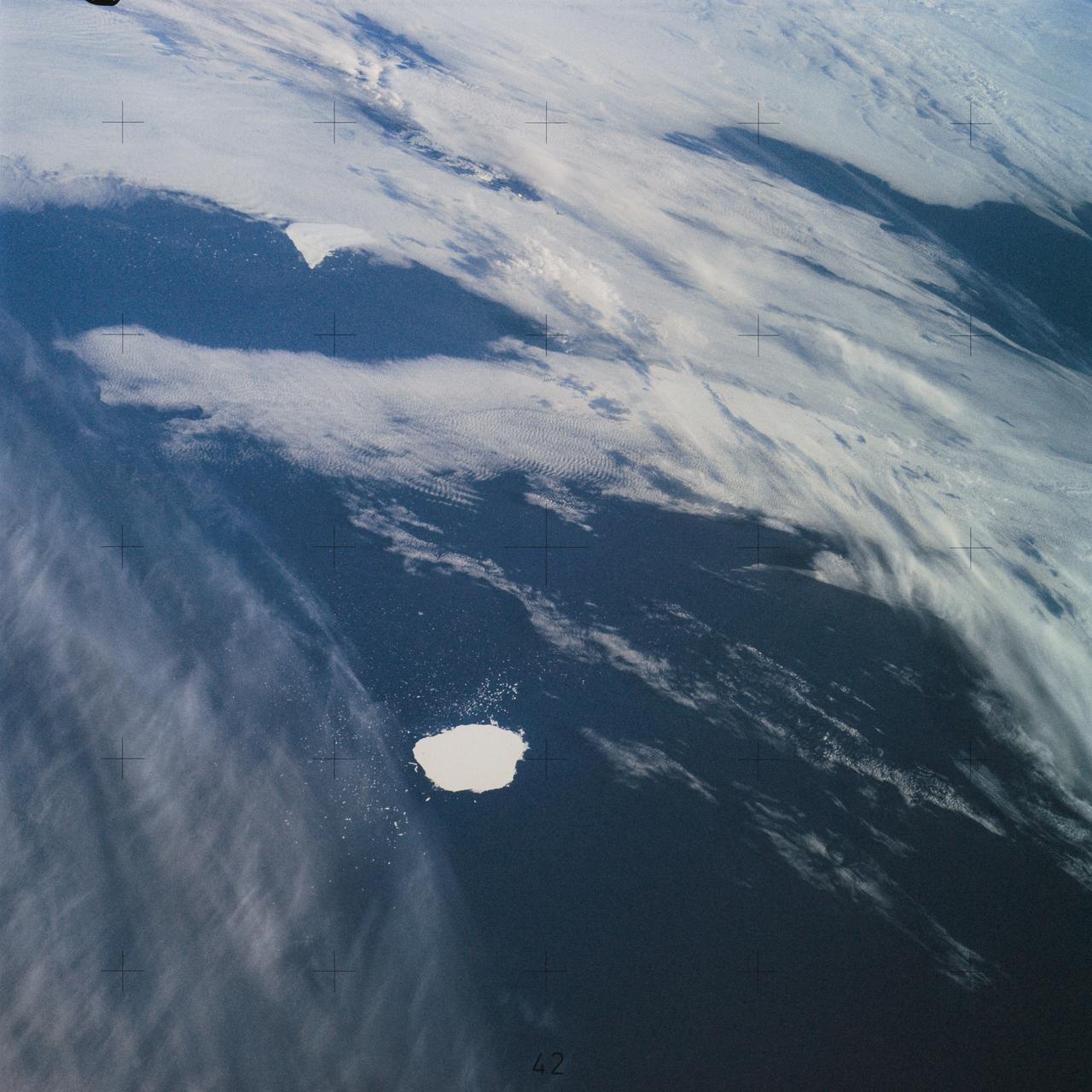
SL4-142-4577 (28 Jan. 1974) --- Two large ice islands in the vicinity of South Georgia Island in the South Atlantic Ocean, as photographed from the Skylab space station in Earth orbit by one of the Skylab 4 crewmen. The camera used was a hand-held 70mm Hasselblad, with SO-368 medium-speed Ektachrome. One of the ice islands is partially obscured by clouds. Ice islands were observed as large as 45 by 60 kilometers (27 x 37 miles) and as far north as 45 degrees south latitude. The size and distribution of the "small" icebergs (to a ship they would look very large) can be used to study the local winds and currents. Recent research has suggested the possibility of towing such Antarctic icebergs to selected areas and using them as water supplies. One such iceberg would contain many times the water as in Lake Powell. Photo credit: NASA
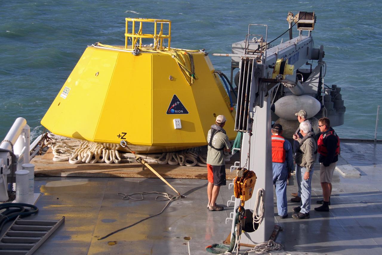
CAPE CANAVERAL, Fla. – Workers on the deck of NASA's Liberty Star ship prepare for testing in the Atlantic Ocean of an Orion flight test capsule to begin. The Crew Module Recovery Attach Fitting Test (CRAFT) on the capsule, which began at-sea operations Nov. 29, is under way. Multiple attach clips are being evaluated against the current recovery cleat configuration by U.S. Air Force pararescue jumpers (PJs) and a U.S. Navy diver. The 21st Century Ground Systems Program will use data collected from the tests to help develop ground operations support equipment that could be used to recover an uncrewed Orion flight test capsule after splashdown. The Orion Multi-Purpose Crew Vehicle is NASA's next-generation spacecraft being developed for deep space missions to asteroids, moons and other interplanetary destinations throughout the solar system. For more information, visit http://www.nasa.gov/orion. Photo credit: NASA/Cory Huston

STS039-84-29AL (28 April-6 May 1991) --- This nearly vertical photograph of the North Atlantic, taken outside of the sunglint pattern, illustrates the extreme contrast between highly reflective ice, having a large percentage of between-crystal air space, and the low-reflectance water, which absorbs most of the light that propagates into it from the air. The ice drifts along with the surface currents and wind and may therefore be used as a natural Langranian* tracer. Photographs such as this, taken several times over the course of a mission, may be used to investigate near-surface circulation in high-latitude oceans. *A Langranian tracer is anything that can be tracked as it drifts along with the water, as opposed to staying in one position and measuring how fast the water goes by.
CAPE CANAVERAL, Fla. – Workers on the deck of NASA's Liberty Star ship prepare for testing in the Atlantic Ocean of an Orion flight test capsule to begin. The Crew Module Recovery Attach Fitting Test (CRAFT) on the capsule, which began at-sea operations Nov. 29, is under way. Multiple attach clips are being evaluated against the current recovery cleat configuration by U.S. Air Force pararescue jumpers (PJs) and a U.S. Navy diver. The 21st Century Ground Systems Program will use data collected from the tests to help develop ground operations support equipment that could be used to recover an uncrewed Orion flight test capsule after splashdown. The Orion Multi-Purpose Crew Vehicle is NASA's next-generation spacecraft being developed for deep space missions to asteroids, moons and other interplanetary destinations throughout the solar system. For more information, visit http://www.nasa.gov/orion. Photo credit: NASA/Cory Huston

This aerial photo shows the areas recently opened as part of KSC’s Safe Haven project. The curved road in the center is the newly restored crawlerway leading around the Vehicle Assembly Building (VAB) and Orbiter Processing Facility 3 (OPF-3) into the VAB high bay 2 (open on the lower right), where a mobile launcher platform/crawler-transporter currently sits. The Safe Haven project will enable the storage of orbiters during severe weather. OPF1 and OPF-2 are at the lower right. The crawlerway also extends from the east side of the VAB out to the two launch pads. Launch Pad 39A is visible to the left of the crawlerway. In the distance is the Atlantic Ocean. To the right of the VAB is the turn basin, into which ships tow the barge for offloading new external tanks from Louisiana

This aerial photo captures many of the facilities involved in Space Shuttle launches. At center is the Vehicle Assembly Building (VAB). The curved road on the near side is the newly restored crawlerway leading into the VAB high bay 2, where a mobile launcher platform/crawler-transporter currently sits. The road restoration and high bay 2 are part of KSC’s Safe Haven project, enabling the storage of orbiters during severe weather. The road circles around the Orbiter Processing Facility 3 (OPF-3) at left center. OPF1 and OPF-2 are just below the curving road. The crawlerway also extends from the east side of the VAB out to the two launch pads, only one visible to the left of the VAB. In the distance is the Atlantic Ocean. To the right of the far crawlerway is the turn basin, into which ships tow the barge for offloading new external tanks from Louisiana
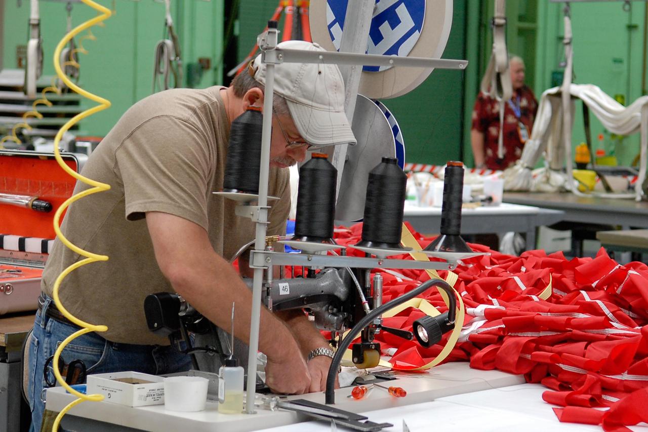
KENNEDY SPACE CENTER, FLA. -- A worker sews a parachute being prepared for an upcoming test at the Parachute Refurbishment Facility. The first stage of the new Ares I rocket and Orion spacecraft will use parachutes to return to Earth. Current tests are being performed in Arizona to make sure the designs can safely handle their intended weight. Ares I is an in-line, two-stage rocket that will transport the Orion crew exploration vehicle to low-Earth orbit. The Ares I first stage will be a five-segment solid rocket booster based on the four-segment design used for the shuttle. As with the shuttle, this booster will fall away when spent, lowered by parachute into the Atlantic Ocean where it can be retrieved for re-use. Unlike the shuttle, the booster will be flying faster, at Mach 6, when its separation from the rest of Ares I occurs. Photo credit: NASA/Kim Shiflett
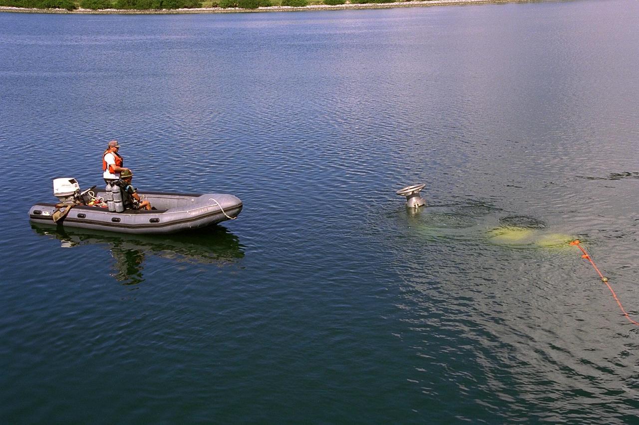
KENNEDY SPACE CENTER, FLA. -- A scuba diver stands by as the unmanned Max Rover submersible goes down to insert a Diver Operated Plug (DOP) into an aft nozzle like the ones used on the Space Shuttle's solid rocket boosters (SRBs). NASA and contractor Deep Sea Systems demonstrated the submersible at Port Canaveral's Trident pier. Kennedy Space Center's SRB retrieval team and Advanced Systems Development laboratory staff hope that the new robotic technology will make the process of inserting the plug into spent SRBs safer and less strenuous. Currently, scuba divers manually insert the DOP into the aft nozzle of a jettisoned SRB 60 to 70 feet below the surface of the Atlantic Ocean. After the plug is installed, water is pumped out of the booster allowing it to float horizontally. It is then towed back to Hangar AF at Cape Canaveral Air Station for refurbishment. Deep Sea Systems of Falmouth, Mass., built the submersible for NASA
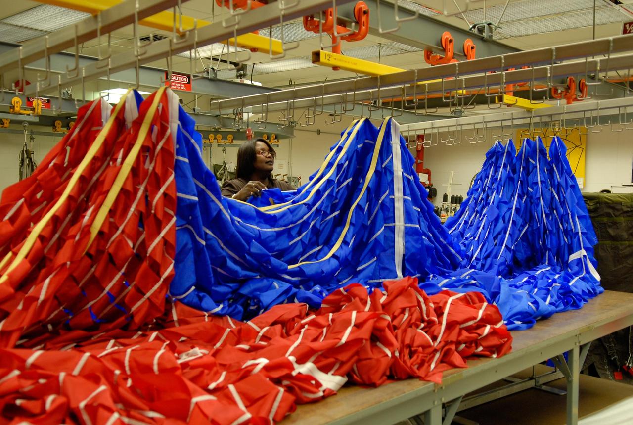
KENNEDY SPACE CENTER, FLA. -- A worker hangs portions of a parachute in preparation for an upcoming test at the Parachute Refurbishment Facility. The first stage of the new Ares I rocket and Orion spacecraft will use parachutes to return to Earth. Current tests are being performed in Arizona to make sure the designs can safely handle their intended weight. Ares I is an in-line, two-stage rocket that will transport the Orion crew exploration vehicle to low-Earth orbit. The Ares I first stage will be a five-segment solid rocket booster based on the four-segment design used for the shuttle. As with the shuttle, this booster will fall away when spent, lowered by parachute into the Atlantic Ocean where it can be retrieved for re-use. Unlike the shuttle, the booster will be flying faster, at Mach 6, when its separation from the rest of Ares I occurs. Photo credit: NASA/Kim Shiflett

This aerial photo captures many of the facilities involved in Space Shuttle launches. At center is the Vehicle Assembly Building (VAB). The curved road on the near side is the newly restored crawlerway leading into the VAB high bay 2, where a mobile launcher platform/crawler-transporter currently sits. The road restoration and high bay 2 are part of KSC’s Safe Haven project, enabling the storage of orbiters during severe weather. The road circles around the Orbiter Processing Facility 3 (OPF-3) at left center. OPF1 and OPF-2 are just below the curving road. The crawlerway also extends from the east side of the VAB out to the two launch pads, only one visible to the left of the VAB. In the distance is the Atlantic Ocean. To the right of the far crawlerway is the turn basin, into which ships tow the barge for offloading new external tanks from Louisiana
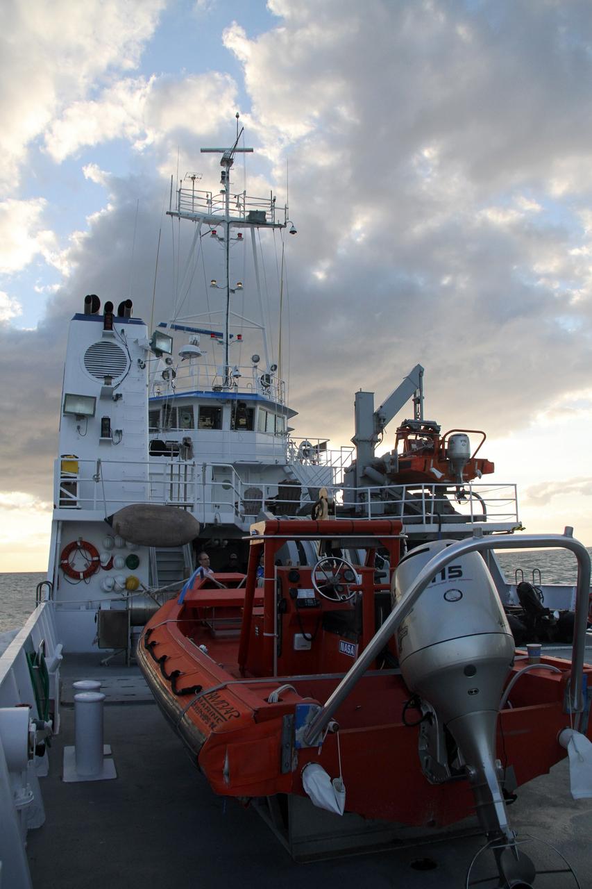
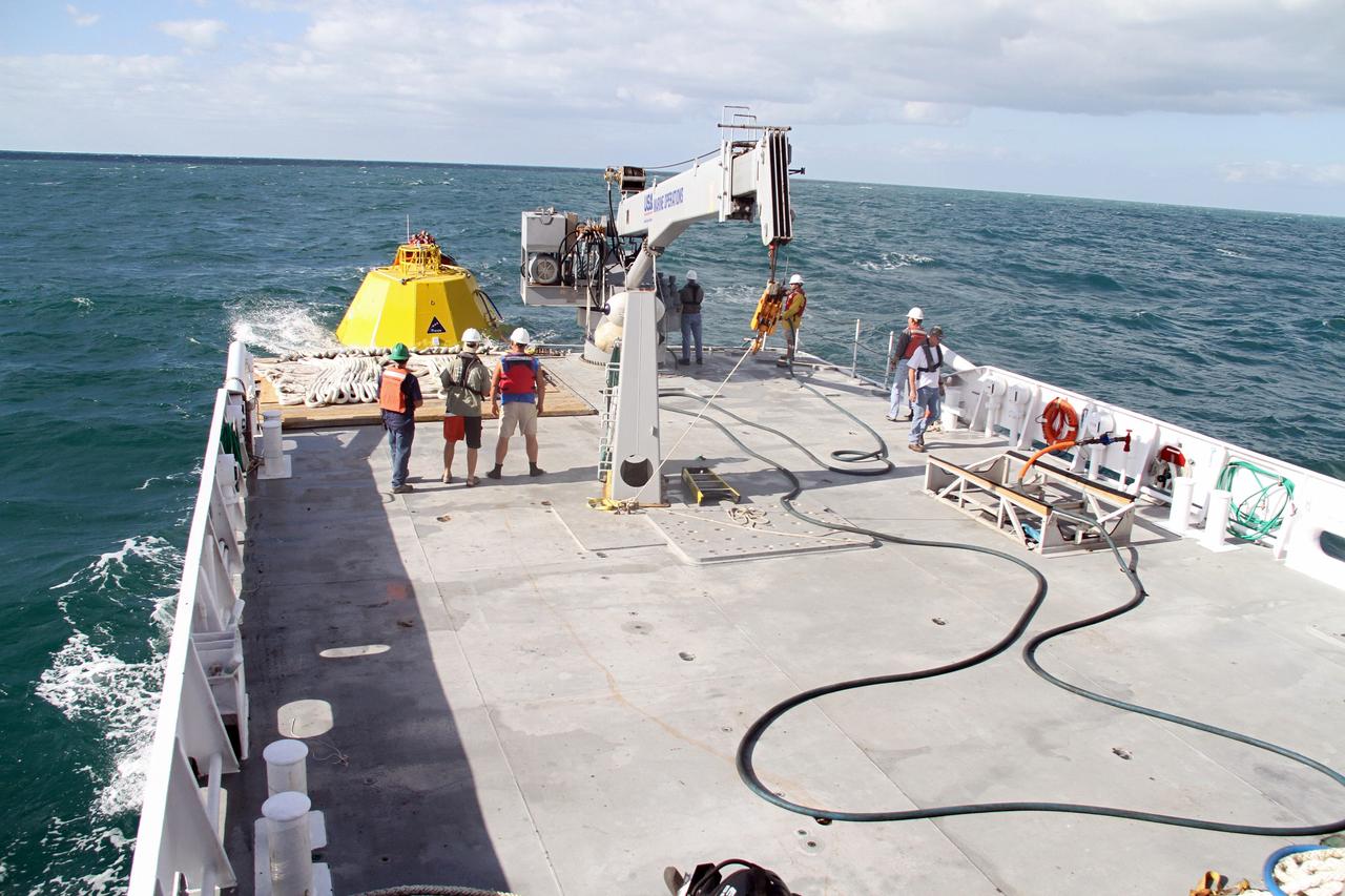
CAPE CANAVERAL, Fla. – NASA's Liberty Star ship heads into the Atlantic Ocean where tests will be performed on an Orion flight test capsule. The Crew Module Recovery Attach Fitting Test (CRAFT) on the capsule, which began at-sea operations Nov. 29, is under way. Multiple attach clips are being evaluated against the current recovery cleat configuration by U.S. Air Force pararescue jumpers (PJs) and a U.S. Navy diver. The 21st Century Ground Systems Program will use data collected from the tests to help develop ground operations support equipment that could be used to recover an uncrewed Orion flight test capsule after splashdown. The Orion Multi-Purpose Crew Vehicle is NASA's next-generation spacecraft being developed for deep space missions to asteroids, moons and other interplanetary destinations throughout the solar system. For more information, visit http://www.nasa.gov/orion. Photo credit: NASA/Cory Huston
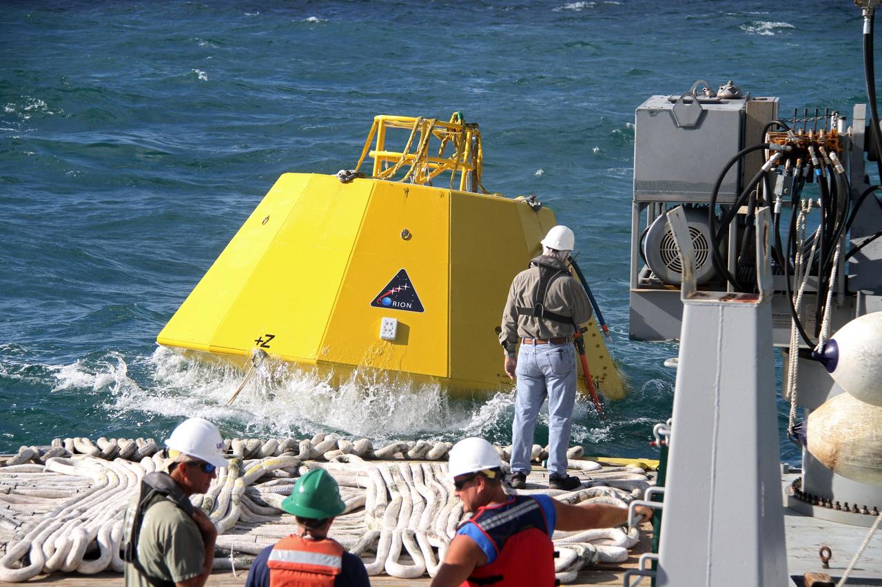
CAPE CANAVERAL, Fla. – An Orion flight test capsule makes a splash into the Atlantic Ocean as it slides from the deck of NASA's Liberty Star ship into the water. The Crew Module Recovery Attach Fitting Test (CRAFT) on the capsule, which began at-sea operations Nov. 29, is under way. Multiple attach clips are being evaluated against the current recovery cleat configuration by U.S. Air Force pararescue jumpers (PJs) and a U.S. Navy diver. The 21st Century Ground Systems Program will use data collected from the tests to help develop ground operations support equipment that could be used to recover an uncrewed Orion flight test capsule after splashdown. The Orion Multi-Purpose Crew Vehicle is NASA's next-generation spacecraft being developed for deep space missions to asteroids, moons and other interplanetary destinations throughout the solar system. For more information, visit http://www.nasa.gov/orion. Photo credit: NASA/Cory Huston

KENNEDY SPACE CENTER, FLA. -- A worker prepares a parachute for an upcoming test at the Parachute Refurbishment Facility. The first stage of the new Ares I rocket and Orion spacecraft will use parachutes to return to Earth. Current tests are being performed in Arizona to make sure the designs can safely handle their intended weight. Ares I is an in-line, two-stage rocket that will transport the Orion crew exploration vehicle to low-Earth orbit. The Ares I first stage will be a five-segment solid rocket booster based on the four-segment design used for the shuttle. As with the shuttle, this booster will fall away when spent, lowered by parachute into the Atlantic Ocean where it can be retrieved for re-use. Unlike the shuttle, the booster will be flying faster, at Mach 6, when its separation from the rest of Ares I occurs. Photo credit: NASA/Kim Shiflett

KENNEDY SPACE CENTER, FLA. -- A worker sews a parachute being prepared for an upcoming test at the Parachute Refurbishment Facility. The first stage of the new Ares I rocket and Orion spacecraft will use parachutes to return to Earth. Current tests are being performed in Arizona to make sure the designs can safely handle their intended weight. Ares I is an in-line, two-stage rocket that will transport the Orion crew exploration vehicle to low-Earth orbit. The Ares I first stage will be a five-segment solid rocket booster based on the four-segment design used for the shuttle. As with the shuttle, this booster will fall away when spent, lowered by parachute into the Atlantic Ocean where it can be retrieved for re-use. Unlike the shuttle, the booster will be flying faster, at Mach 6, when its separation from the rest of Ares I occurs. Photo credit: NASA/Kim Shiflett
KENNEDY SPACE CENTER, FLA. -- A worker prepares a parachute for an upcoming test at the Parachute Refurbishment Facility. The first stage of the new Ares I rocket and Orion spacecraft will use parachutes to return to Earth. Current tests are being performed in Arizona to make sure the designs can safely handle their intended weight. Ares I is an in-line, two-stage rocket that will transport the Orion crew exploration vehicle to low-Earth orbit. The Ares I first stage will be a five-segment solid rocket booster based on the four-segment design used for the shuttle. As with the shuttle, this booster will fall away when spent, lowered by parachute into the Atlantic Ocean where it can be retrieved for re-use. Unlike the shuttle, the booster will be flying faster, at Mach 6, when its separation from the rest of Ares I occurs. Photo credit: NASA/Kim Shiflett
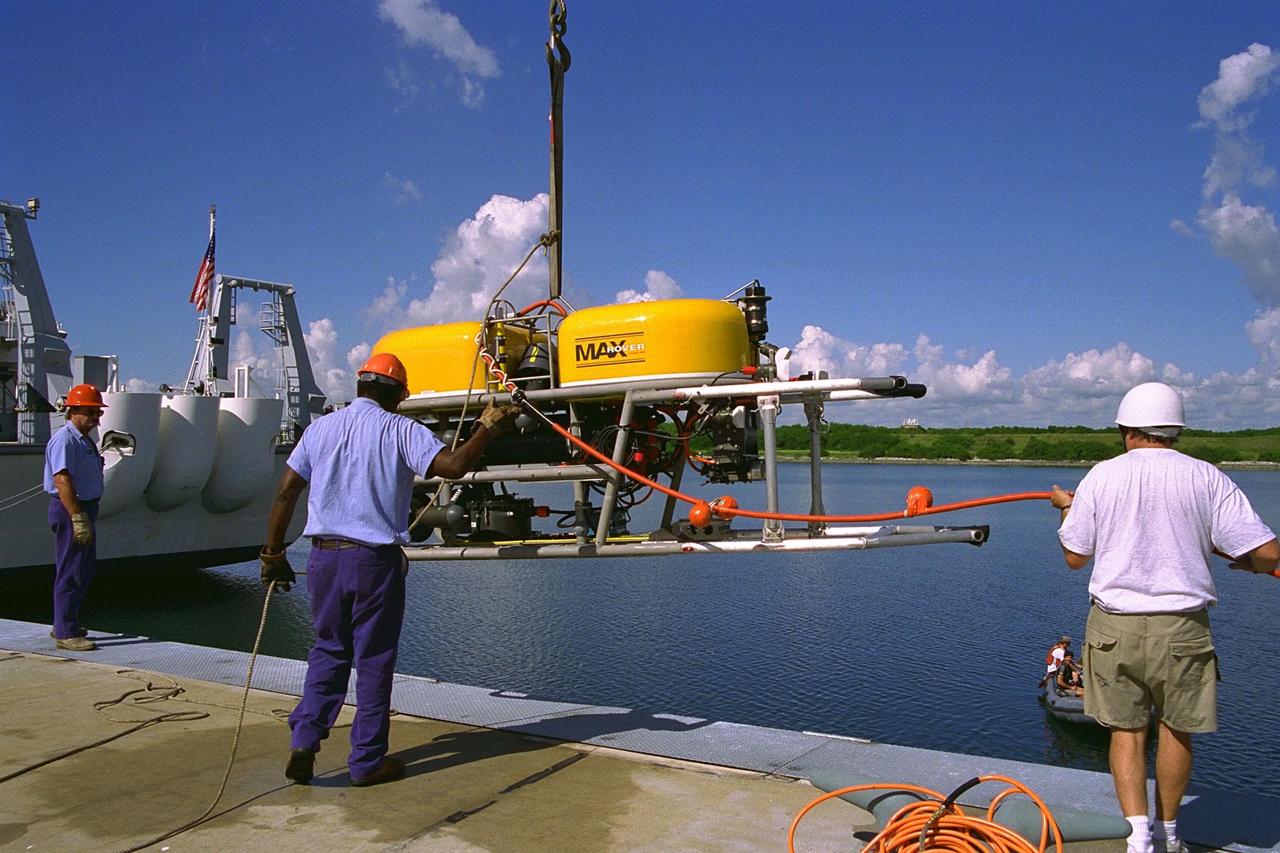
KENNEDY SPACE CENTER, FLA. -- Technicians lower the unmanned robotic submersible recovery system, known as Max Rover, into the water at the Trident Pier at Port Canaveral during a test of the system. Kennedy Space Center's solid rocket booster (SRB) retrieval team and Advanced Systems Development laboratory staff hope that the new robotic technology will make the process of inserting the Diver Operated Plug (DOP) into the aft nozzle of a spent SRB safer and less strenuous. Currently, scuba divers manually insert the DOP into the aft nozzle of a jettisoned SRB 60 to 70 feet below the surface of the Atlantic Ocean. After the plug is installed, water is pumped out of the booster allowing it to float horizontally. It is then towed back to Hangar AF at Cape Canaveral Air Station. Deep Sea Systems of Falmouth, Mass., built the submersible for NASA
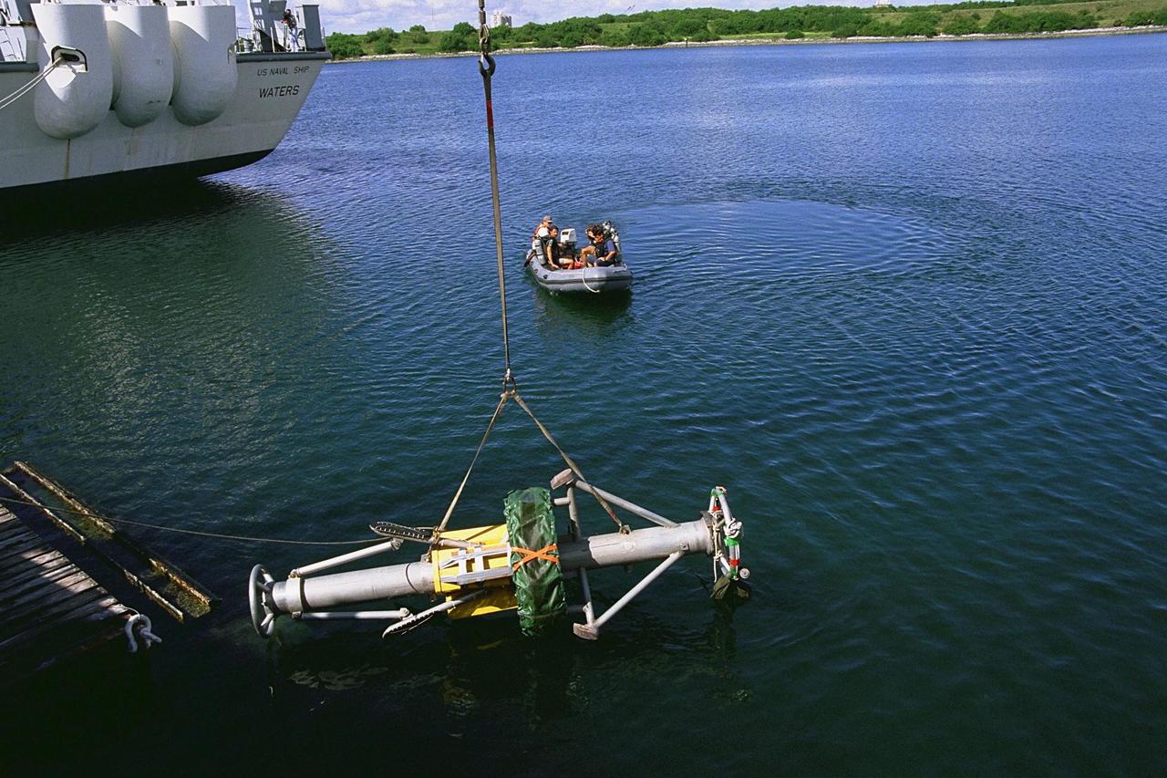
KENNEDY SPACE CENTER, FLA. -- As scuba divers stand by, a Diver Operated Plug (DOP) is lowered into the water at the Trident Pier at Port Canaveral during a test of the unmanned robotic submersible recovery system, known as Max Rover. Kennedy Space Center's solid rocket booster (SRB) retrieval team and Advanced Systems Development laboratory staff hope that the new robotic technology will make the process of inserting the plug into spent SRBs safer and less strenuous. Currently, scuba divers manually insert the DOP into the aft nozzle of a jettisoned SRB 60 to 70 feet below the surface of the Atlantic Ocean. After the plug is installed, water is pumped out of the booster allowing it to float horizontally. It is then towed back to Hangar AF at Cape Canaveral Air Station for refurbishment. Deep Sea Systems of Falmouth, Mass., built the submersible for NASA
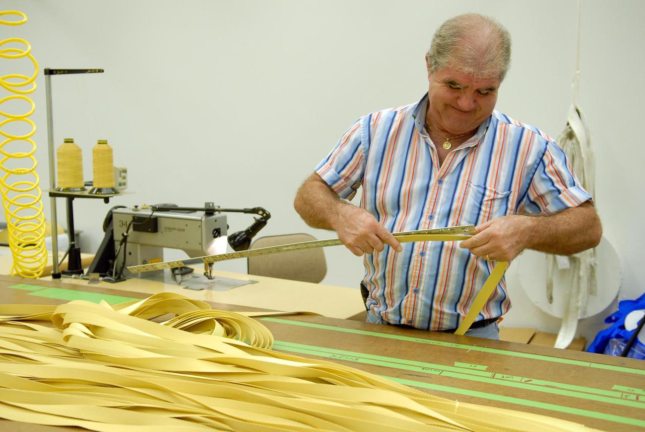
KENNEDY SPACE CENTER, FLA. -- A worker measures straps for parachutes being prepared for an upcoming test at the Parachute Refurbishment Facility. The first stage of the new Ares I rocket and Orion spacecraft will use parachutes to return to Earth. Current tests are being performed in Arizona to make sure the designs can safely handle their intended weight. Ares I is an in-line, two-stage rocket that will transport the Orion crew exploration vehicle to low-Earth orbit. The Ares I first stage will be a five-segment solid rocket booster based on the four-segment design used for the shuttle. As with the shuttle, this booster will fall away when spent, lowered by parachute into the Atlantic Ocean where it can be retrieved for re-use. Unlike the shuttle, the booster will be flying faster, at Mach 6, when its separation from the rest of Ares I occurs. Photo credit: NASA/Kim Shiflett
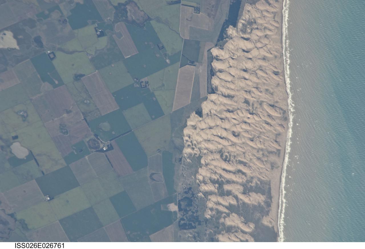
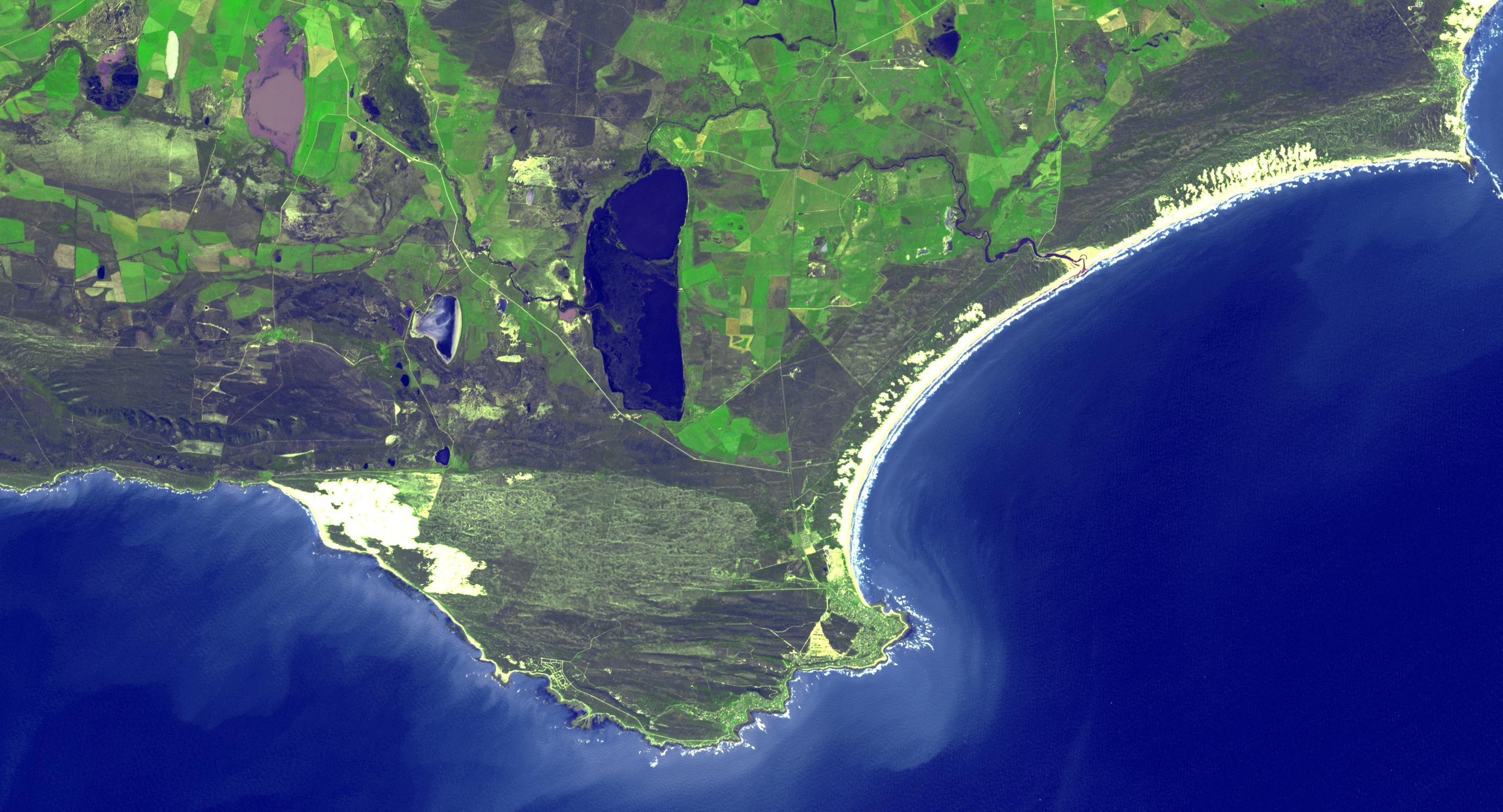
ISS026-E-026761 (13 Feb. 2011) --- Medano Blanco coastal dunes in Buenos Aires Province, Argentina are featured in this image photographed by an Expedition 26 crew member on the International Space Station. The Medano Blanco (White Dunes) are a well known recreational area 35 kilometers west of the twin cities of Nicochea-Quequen, one of the biggest ports in the province of Buenos Aires, central Argentina. The Medano Blanco dunes separate the Atlantic Ocean from intensive sunflower agricultural cropland, visible as the angular pattern of green and brown fields at left. The dune field extends 3.5 kilometers at its widest part. Narrow cordons of coastal dunes stretch along this part of Argentina’s coastline for hundreds of kilometers. Small streams, oriented towards the coast, cross the farmland at upper left. Water from these is dammed behind the dunes, and even within the dunes, where wetlands flourish. This is the drier southern part of Buenos Aires province near the more arid and windier border with Patagonia—one of the windiest places on Earth. The effect of strong westerly winds (blowing bottom to top in this slightly oblique image) can be seen everywhere in this detailed photograph. The dune sand is blown from local beaches onshore where it forms the dunes. The prominent dune ridge crests are oriented at right angles to the prevailing wind. Geologists suspect that erosion by wind has excavated numerous hollows which now dot the farmland as small shallow lakes. A stand of dark green trees has been planted on the upwind side of a health spa—located at the white dot (center left) which is the roof of a stately building—as a protective barrier against the wind. The white fringe along the seashore is formed from lines of breaking waves. Crossing swell trains can be seen offshore in the Atlantic Ocean. The curvature of the swell pattern offshore also shows the effect of the westerly wind, and indeed drives the local sea current in this area—slightly more prominent onshore swells approach the coast from the southeast. The light brown tint of seawater nearer the shore is the fine muddy fraction of the coastal sediment being washed seaward (after being stirred up by wave action) and then east by the current.
Satellite images from 2022 (Main image) and 1999 (Figure A) capture the retreat of Zachariae Isstrom, a glacier in northeast Greenland, as icebergs broke off its edge over the course of 23 years. In a recent study in Nature, researchers from NASA's Jet Propulsion Laboratory in Southern California calculated that Zachariae lost an estimated 176 billion tons (160 billion metric tons) of ice in the period between 1985 and 2022. That was the greatest mass lost for the period of any of the 207 glaciers analyzed in the paper. The earlier image was taken by the Enhanced Thematic Mapper Plus on the Landsat 7 satellite on Aug. 5, 1999, while the later image was captured by the Operational Land Imager on the Landsat 8 satellite on Aug. 22, 2022. The study took a comprehensive look at glacial retreat around the edges of the entire Greenland Ice Sheet from 1985 to 2022 and found that 179 glaciers retreated significantly since 1985, 27 held steady, and just one advanced slightly. The study found that overall the ice sheet shed about 1,140 billion tons (1,034 billion metric tons) of ice from 1985 to 2022, one-fifth more mass than previously estimated, as icebergs fell into the ocean at an accelerating rate. Most of the ice loss came from below sea level, in fjords on Greenland's periphery. Once occupied by ancient glacial ice, many of these deep coastal valleys have filled with seawater – meaning the ice that broke off made little net contribution to sea level. But the loss likely accelerated the movement of ice flowing down from higher elevations, which in turn added to sea level rise. It also added previously unaccounted-for fresh water to the North Atlantic Ocean, which could have impacts on global ocean currents. https://photojournal.jpl.nasa.gov/catalog/PIA26118
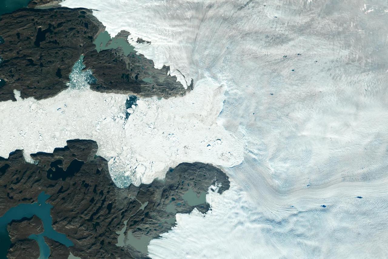
Satellite images from 2022 (Main image) and 1985 (Figure A) capture the retreat of Jakobshavn Isbrae, a glacier on Greenland's western coast, as icebergs broke off its edge over nearly four decades. In a recent study in Nature, researchers from NASA's Jet Propulsion Laboratory in Southern California calculated that Jakobshavn lost an estimated 97 billion tons (88 billion metric tons) of ice in the period between the two images. The earlier image was taken by the Thematic Mapper instrument on the Landsat 5 satellite on Sept. 5, 1985, while the later image was captured by the Operational Land Imager on the Landsat 8 satellite on Sept. 4, 2022. Of the 207 glaciers analyzed in the study, Jakobshavn lost the second most ice mass, trailing only Zachariae Isstrom, a glacier in northeast Greenland. The study took a comprehensive look at glacial retreat around the edges of the entire Greenland Ice Sheet from 1985 to 2022 and found that 179 glaciers retreated significantly since 1985, 27 held steady, and just one advanced slightly. The study found that overall the ice sheet shed about 1,140 billion tons (1,034 billion metric tons) of ice from 1985 to 2022, one-fifth more mass than previously estimated, as icebergs fell into the ocean at an accelerating rate. Most of the ice loss came from below sea level, in fjords on Greenland's periphery. Once occupied by ancient glacial ice, many of these deep coastal valleys have filled with seawater – meaning the ice that broke off made little net contribution to sea level. But the loss likely accelerated the movement of ice flowing down from higher elevations, which in turn added to sea level rise. It also added previously unaccounted-for fresh water to the North Atlantic Ocean, which could have impacts on global ocean currents. https://photojournal.jpl.nasa.gov/catalog/PIA26117
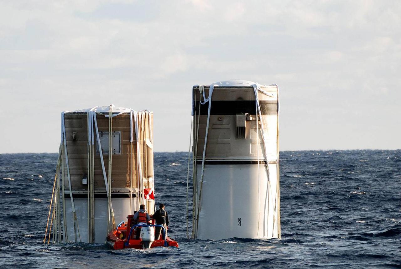
KENNEDY SPACE CENTER, FLA. -- Floating in the Atlantic Ocean about 150 miles north east of Cape Canaveral are the right and left solid rocket boosters, which were jettisoned from the Space Shuttle Discovery two and a half minutes into the ascent to orbit on Dec. 9. Though the boosters landed in the ocean miles from each other, overnight wind and ocean currents allowed the left booster, which was floating higher in the water, to migrate to the location of the right booster. The SRB retrieval team monitored the boosters through the night, and confirmed that the boosters did not contact each other. Both boosters were towed back to Hangar AF at the Cape Canaveral Air Force Station, where the refurbishment operations are now underway. Discovery lifted off from KSC's Launch Pad 39B at 8:47 p.m. EST on mission STS-116. For more information about the process of retrieval, go to http://www-pao.ksc.nasa.gov/kscpao/nasafact/pdf/SRBships06.pdf and http://www.nasa.gov/mission_pages/shuttle/behindscenes/recovery_ships.html. This was the second launch attempt for mission STS-116. The first launch attempt on Dec. 7 was postponed due a low cloud ceiling over Kennedy Space Center. This is Discovery's 33rd mission and the first night launch since 2002. The 20th shuttle mission to the International Space Station, STS-116 carries another truss segment, P5. It will serve as a spacer, mated to the P4 truss that was attached in September. After installing the P5, the crew will reconfigure and redistribute the power generated by two pairs of U.S. solar arrays. Landing is expected Dec. 21 at KSC.
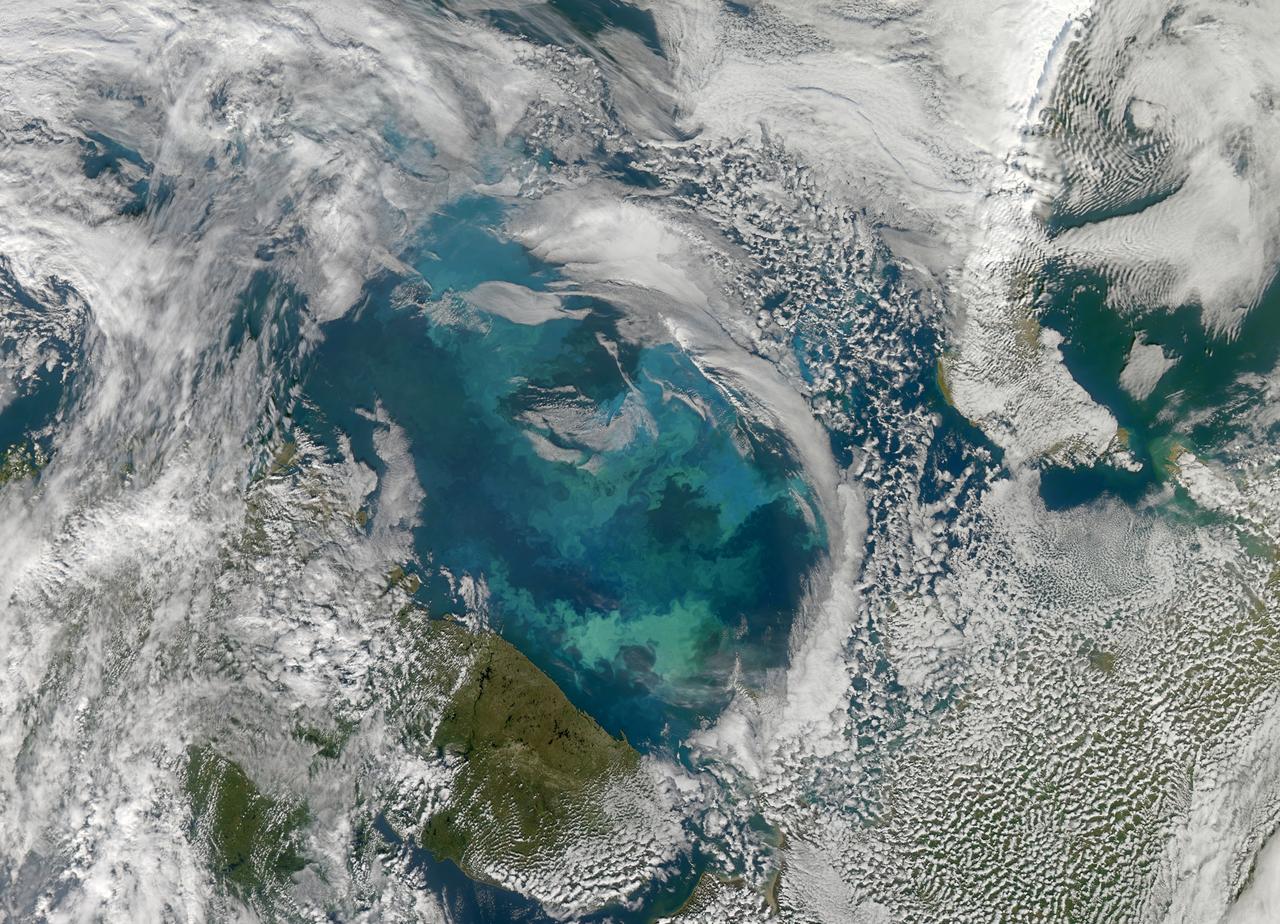
NASA image acquired August 31, 2010 To see a detail of this image go to: <a href="http://www.flickr.com/photos/gsfc/4971318856/">www.flickr.com/photos/gsfc/4971318856/</a> In this natural-color image from August 31, 2010, the ocean’s canvas swirls with turquoise, teal, navy, and green, the abstract art of the natural world. The colors were painted by a massive phytoplankton bloom made up of millions of tiny, light-reflecting organisms growing in the sunlit surface waters of the Barents Sea. Such blooms peak every August in the Barents Sea. The variations in color are caused by different species and concentrations of phytoplankton. The bright blue colors are probably from coccolithophores, a type of phytoplankton that is coated in a chalky shell that reflects light, turning the ocean a milky turquoise. Coccolithophores dominate the Barents Sea in August. Shades of green are likely from diatoms, another type of phytoplankton. Diatoms usually dominate the Barents Sea earlier in the year, giving way to coccolithophores in the late summer. However, field measurements of previous August blooms have also turned up high concentrations of diatoms. The Barents Sea is a shallow sea sandwiched between the coastline of northern Russia and Scandinavia and the islands of Svalbard, Franz Josef Land, and Novaya Zemlya. Within the shallow basin, currents carrying warm, salty water from the Atlantic collide with currents carrying cold, fresher water from the Arctic. During the winter, strong winds drive the currents and mix the waters. When winter’s sea ice retreats and light returns in the spring, diatoms thrive, typically peaking in a large bloom in late May. The shift between diatoms and coccolithophores occurs as the Barents Sea changes during the summer months. Throughout summer, perpetual light falls on the waters, gradually warming the surface. Eventually, the ocean stratifies into layers, with warm water sitting on top of cooler water. The diatoms deplete most of the nutrients in the surface waters and stop growing. Coccolithophores, on the other hand, do well in warm, nutrient-depleted water with a lot of light. In the Barents Sea, these conditions are strongest in August. The shifting conditions and corresponding change in species lead to strikingly beautiful multicolored blooms such as this one. The Moderate Resolution Imaging Spectroradiometer (MODIS) on NASA’s Aqua satellite acquired this image. NASA image courtesy Norman Kuring, NASA Ocean Color Group. Caption by Holli Riebeek. Instrument: Aqua - MODIS Click here to see more images from <b><a href="#//earthobservatory.nasa.gov/" rel="nofollow"> NASA Goddard’s Earth Observatory</a></b> <b><a href="http://www.nasa.gov/centers/goddard/home/index.html" rel="nofollow">NASA Goddard Space Flight Center</a></b> is home to the nation's largest organization of combined scientists, engineers and technologists that build spacecraft, instruments and new technology to study the Earth, the sun, our solar system, and the universe. <b>Follow us on <a href="http://twitter.com/NASA_GoddardPix" rel="nofollow">Twitter</a></b> <b>Join us on <a href="http://www.facebook.com/pages/Greenbelt-MD/NASA-Goddard/395013845897?ref=tsd" rel="nofollow">Facebook</a></b>
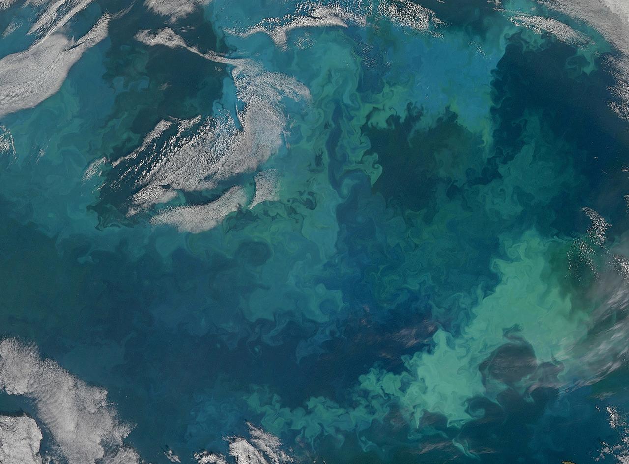
NASA image acquired August 31, 2010 To see the full view of this image go to: <a href="http://www.flickr.com/photos/gsfc/4970549945">www.flickr.com/photos/gsfc/4970549945</a> In this natural-color image from August 31, 2010, the ocean’s canvas swirls with turquoise, teal, navy, and green, the abstract art of the natural world. The colors were painted by a massive phytoplankton bloom made up of millions of tiny, light-reflecting organisms growing in the sunlit surface waters of the Barents Sea. Such blooms peak every August in the Barents Sea. The variations in color are caused by different species and concentrations of phytoplankton. The bright blue colors are probably from coccolithophores, a type of phytoplankton that is coated in a chalky shell that reflects light, turning the ocean a milky turquoise. Coccolithophores dominate the Barents Sea in August. Shades of green are likely from diatoms, another type of phytoplankton. Diatoms usually dominate the Barents Sea earlier in the year, giving way to coccolithophores in the late summer. However, field measurements of previous August blooms have also turned up high concentrations of diatoms. The Barents Sea is a shallow sea sandwiched between the coastline of northern Russia and Scandinavia and the islands of Svalbard, Franz Josef Land, and Novaya Zemlya. Within the shallow basin, currents carrying warm, salty water from the Atlantic collide with currents carrying cold, fresher water from the Arctic. During the winter, strong winds drive the currents and mix the waters. When winter’s sea ice retreats and light returns in the spring, diatoms thrive, typically peaking in a large bloom in late May. The shift between diatoms and coccolithophores occurs as the Barents Sea changes during the summer months. Throughout summer, perpetual light falls on the waters, gradually warming the surface. Eventually, the ocean stratifies into layers, with warm water sitting on top of cooler water. The diatoms deplete most of the nutrients in the surface waters and stop growing. Coccolithophores, on the other hand, do well in warm, nutrient-depleted water with a lot of light. In the Barents Sea, these conditions are strongest in August. The shifting conditions and corresponding change in species lead to strikingly beautiful multicolored blooms such as this one. The Moderate Resolution Imaging Spectroradiometer (MODIS) on NASA’s Aqua satellite acquired this image. NASA image courtesy Norman Kuring, NASA Ocean Color Group. Caption by Holli Riebeek. Instrument: Aqua - MODIS Click here to see more images from <b><a href="#//earthobservatory.nasa.gov/" rel="nofollow"> NASA Goddard’s Earth Observatory</a></b> <b><a href="http://www.nasa.gov/centers/goddard/home/index.html" rel="nofollow">NASA Goddard Space Flight Center</a></b> is home to the nation's largest organization of combined scientists, engineers and technologists that build spacecraft, instruments and new technology to study the Earth, the sun, our solar system, and the universe. <b>Follow us on <a href="http://twitter.com/NASA_GoddardPix" rel="nofollow">Twitter</a></b> <b>Join us on <a href="http://www.facebook.com/pages/Greenbelt-MD/NASA-Goddard/395013845897?ref=tsd" rel="nofollow">Facebook</a></b>
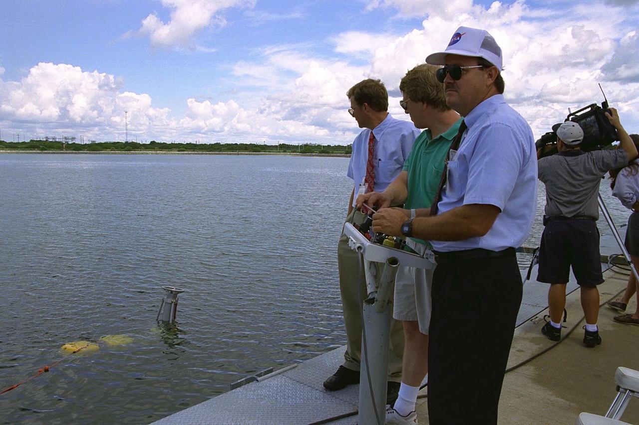
KENNEDY SPACE CENTER, FLA. -- Thomas Lippitt of NASA's Advanced Systems Development (ASD) laboratory observes robotic operations as Chris Nicholson, owner of Deep Sea Systems, and Bill Jones of NASA's ASD laboratory operate the unmanned robotic submersible recovery system, known as Max Rover, during a test of the system at the Trident Pier at Port Canaveral. The submersible is seen in the water with the Diver Operated Plug (DOP). Kennedy Space Center's solid rocket booster (SRB) retrieval team and ASD laboratory staff hope that the new robotic technology will make the process of inserting the plug safer and less strenuous. Currently, scuba divers manually insert the DOP into the aft nozzle of a jettisoned SRB 60 to 70 feet below the surface of the Atlantic Ocean. After the plug is installed, water is pumped out of the booster allowing it to float horizontally. It is then towed back to Hangar AF at Cape Canaveral Air Station for refurbishment. Deep Sea Systems of Falmouth, Mass., built the submersible for NASA
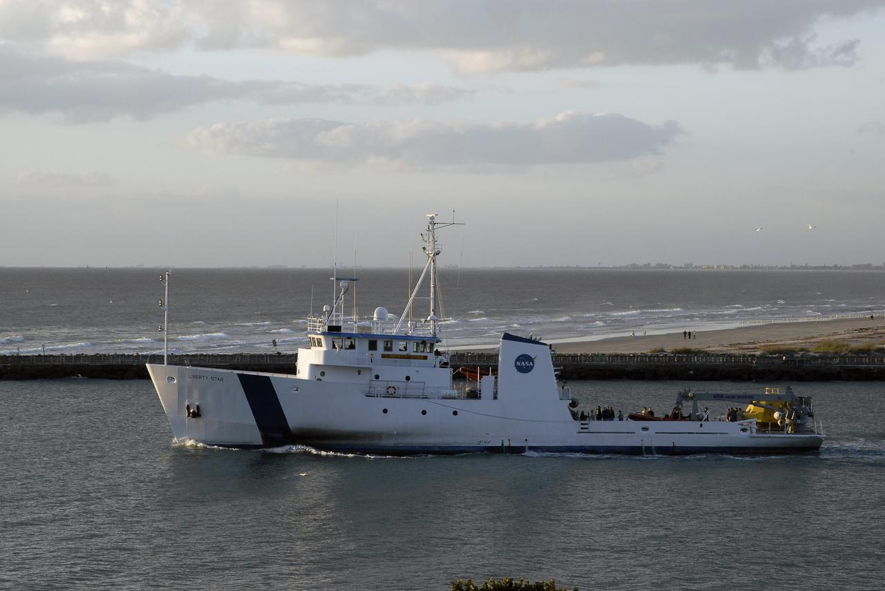
CAPE CANAVERAL, Fla. – At Port Canaveral in Florida, NASA's Liberty Star ship, with an Orion flight test capsule secured to its deck, passes the jetties as it heads toward the Atlantic Ocean. Liberty Star has been enlisted to support the Crew Module Recovery Attach Fitting Test (CRAFT) which began at-sea operations Nov. 29. Multiple attach clips are being evaluated against the current recovery cleat configuration by U.S. Air Force pararescue jumpers (PJs) and a U.S. Navy diver. The 21st Century Ground Systems Program will use data collected from the tests to help develop ground operations support equipment that could be used to recover an uncrewed Orion flight test capsule after splashdown. The Orion Multi-Purpose Crew Vehicle is NASA's next-generation spacecraft being developed for deep space missions to asteroids, moons and other interplanetary destinations throughout the solar system. For more information, visit http://www.nasa.gov/orion. Photo credit: NASA/Tim Jacobs
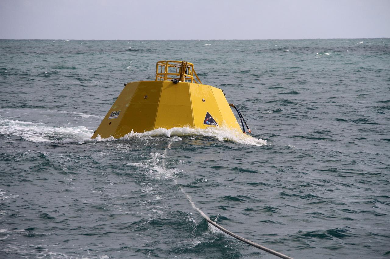
CAPE CANAVERAL, Fla. – Testing is under way on an Orion flight test capsule in the Atlantic Ocean. The tests are being monitored by workers aboard NASA's Liberty Star ship. The Crew Module Recovery Attach Fitting Test (CRAFT) on the capsule, which began at-sea operations Nov. 29, is under way. Multiple attach clips are being evaluated against the current recovery cleat configuration by U.S. Air Force pararescue jumpers (PJs) and a U.S. Navy diver. The 21st Century Ground Systems Program will use data collected from the tests to help develop ground operations support equipment that could be used to recover an uncrewed Orion flight test capsule after splashdown. The Orion Multi-Purpose Crew Vehicle is NASA's next-generation spacecraft being developed for deep space missions to asteroids, moons and other interplanetary destinations throughout the solar system. For more information, visit http://www.nasa.gov/orion. Photo credit: NASA/Cory Huston
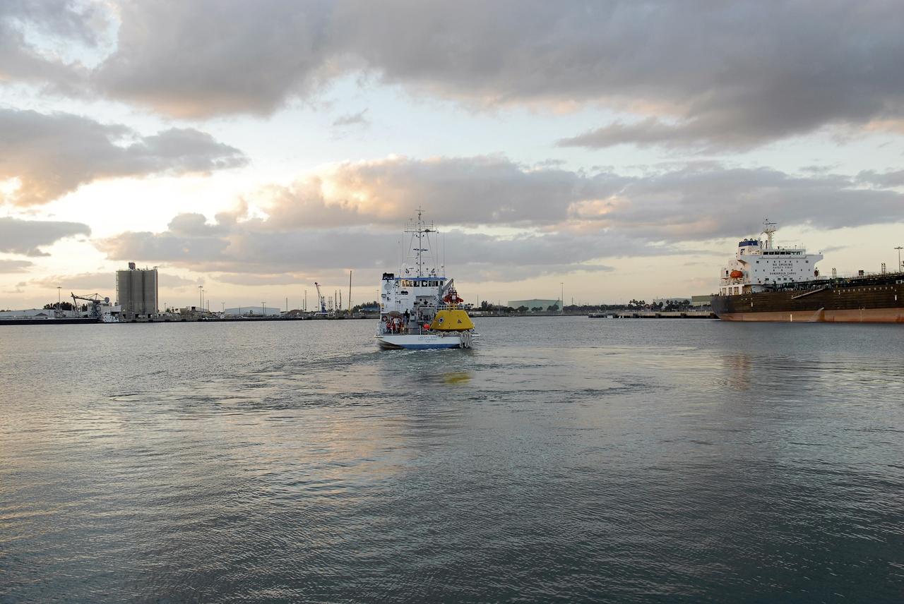
CAPE CANAVERAL, Fla. – At Port Canaveral in Florida, NASA's Liberty Star ship, with an Orion flight test capsule secured to its deck, heads out of port toward the Atlantic Ocean. Liberty Star has been enlisted to support the Crew Module Recovery Attach Fitting Test (CRAFT) which began at-sea operations Nov. 29. Multiple attach clips are being evaluated against the current recovery cleat configuration by U.S. Air Force pararescue jumpers (PJs) and a U.S. Navy diver. The 21st Century Ground Systems Program will use data collected from the tests to help develop ground operations support equipment that could be used to recover an uncrewed Orion flight test capsule after splashdown. The Orion Multi-Purpose Crew Vehicle is NASA's next-generation spacecraft being developed for deep space missions to asteroids, moons and other interplanetary destinations throughout the solar system. For more information, visit http://www.nasa.gov/orion. Photo credit: NASA/Tim Jacobs
CAPE CANAVERAL, Fla. – Testing is under way on an Orion flight test capsule in the Atlantic Ocean. The tests are being monitored by workers aboard NASA's Liberty Star ship. The Crew Module Recovery Attach Fitting Test (CRAFT) on the capsule, which began at-sea operations Nov. 29, is under way. Multiple attach clips are being evaluated against the current recovery cleat configuration by U.S. Air Force pararescue jumpers (PJs) and a U.S. Navy diver. The 21st Century Ground Systems Program will use data collected from the tests to help develop ground operations support equipment that could be used to recover an uncrewed Orion flight test capsule after splashdown. The Orion Multi-Purpose Crew Vehicle is NASA's next-generation spacecraft being developed for deep space missions to asteroids, moons and other interplanetary destinations throughout the solar system. For more information, visit http://www.nasa.gov/orion. Photo credit: NASA/Cory Huston
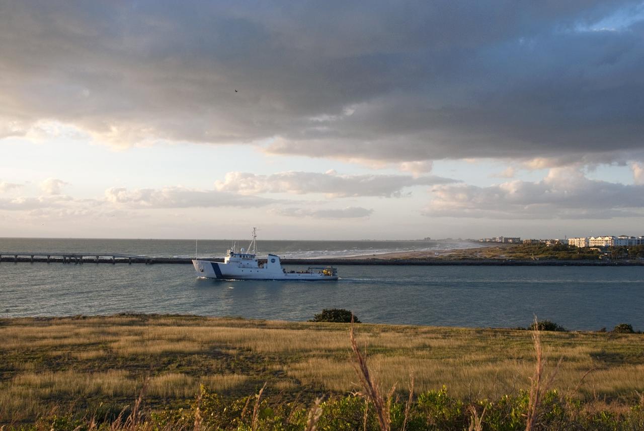
CAPE CANAVERAL, Fla. – NASA's Liberty Star ship, with an Orion flight test capsule secured to its deck, passes through the mouth of Port Canaveral in Florida on its way to the Atlantic Ocean. Liberty Star has been enlisted to support the Crew Module Recovery Attach Fitting Test (CRAFT) which began at-sea operations Nov. 29. Multiple attach clips are being evaluated against the current recovery cleat configuration by U.S. Air Force pararescue jumpers (PJs) and a U.S. Navy diver. The 21st Century Ground Systems Program will use data collected from the tests to help develop ground operations support equipment that could be used to recover an uncrewed Orion flight test capsule after splashdown. The Orion Multi-Purpose Crew Vehicle is NASA's next-generation spacecraft being developed for deep space missions to asteroids, moons and other interplanetary destinations throughout the solar system. For more information, visit http://www.nasa.gov/orion. Photo credit: NASA/Tim Jacobs
CAPE CANAVERAL, Fla. – An Orion flight test capsule aboard the deck of NASA's Liberty Star ship is moments away from being pulled overboard into the Atlantic Ocean. The Crew Module Recovery Attach Fitting Test (CRAFT) on the capsule, which began at-sea operations Nov. 29, is under way. Multiple attach clips are being evaluated against the current recovery cleat configuration by U.S. Air Force pararescue jumpers (PJs) and a U.S. Navy diver. The 21st Century Ground Systems Program will use data collected from the tests to help develop ground operations support equipment that could be used to recover an uncrewed Orion flight test capsule after splashdown. The Orion Multi-Purpose Crew Vehicle is NASA's next-generation spacecraft being developed for deep space missions to asteroids, moons and other interplanetary destinations throughout the solar system. For more information, visit http://www.nasa.gov/orion. Photo credit: NASA/Cory Huston
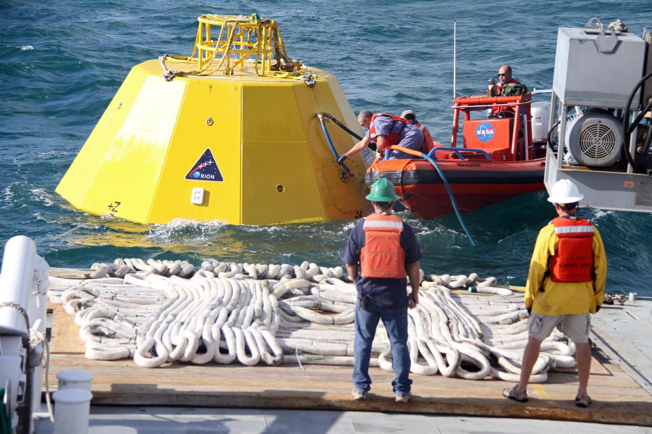
CAPE CANAVERAL, Fla. – From a boat in the Atlantic Ocean, workers secure lines to an Orion flight test capsule during preparations for testing the capsule as their colleagues look on from the deck of NASA's Liberty Star ship. The Crew Module Recovery Attach Fitting Test (CRAFT) on the capsule, which began at-sea operations Nov. 29, is under way. Multiple attach clips are being evaluated against the current recovery cleat configuration by U.S. Air Force pararescue jumpers (PJs) and a U.S. Navy diver. The 21st Century Ground Systems Program will use data collected from the tests to help develop ground operations support equipment that could be used to recover an uncrewed Orion flight test capsule after splashdown. The Orion Multi-Purpose Crew Vehicle is NASA's next-generation spacecraft being developed for deep space missions to asteroids, moons and other interplanetary destinations throughout the solar system. For more information, visit http://www.nasa.gov/orion. Photo credit: NASA/Cory Huston
CAPE CANAVERAL, Fla. – NASA's Liberty Star ship, with an Orion flight test capsule secured to its deck, passes through the mouth of Port Canaveral in Florida into the Atlantic Ocean. Liberty Star has been enlisted to support the Crew Module Recovery Attach Fitting Test (CRAFT) which began at-sea operations Nov. 29. Multiple attach clips are being evaluated against the current recovery cleat configuration by U.S. Air Force pararescue jumpers (PJs) and a U.S. Navy diver. The 21st Century Ground Systems Program will use data collected from the tests to help develop ground operations support equipment that could be used to recover an uncrewed Orion flight test capsule after splashdown. The Orion Multi-Purpose Crew Vehicle is NASA's next-generation spacecraft being developed for deep space missions to asteroids, moons and other interplanetary destinations throughout the solar system. For more information, visit http://www.nasa.gov/orion. Photo credit: NASA/Tim Jacobs
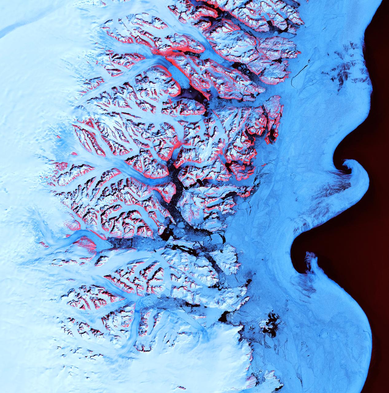
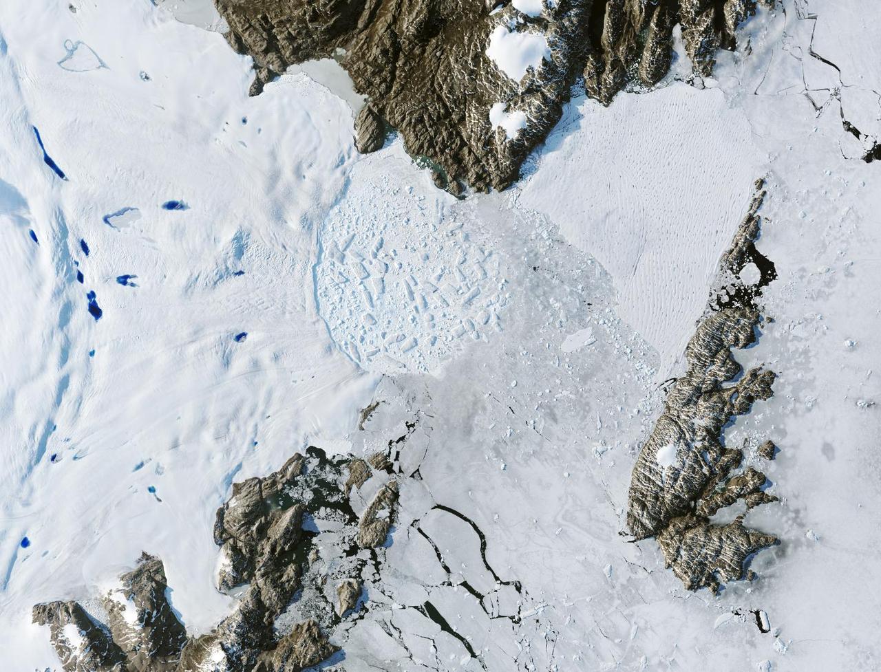
Ice Waves - May 21st, 2001 Description: Along the southeastern coast of Greenland, an intricate network of fjords funnels glacial ice to the Atlantic Ocean. During the summer melting season, newly calved icebergs join slabs of sea ice and older, weathered bergs in an offshore slurry that the southward-flowing East Greenland Current sometimes swirls into stunning shapes. Exposed rock of mountain peaks, tinted red in this image, hints at a hidden landscape. Credit: USGS/NASA/Landsat 7 To learn more about the Landsat satellite go to: <a href="http://landsat.gsfc.nasa.gov/" rel="nofollow">landsat.gsfc.nasa.gov/</a> <b><a href="http://www.nasa.gov/centers/goddard/home/index.html" rel="nofollow">NASA Goddard Space Flight Center</a></b> enables NASA’s mission through four scientific endeavors: Earth Science, Heliophysics, Solar System Exploration, and Astrophysics. Goddard plays a leading role in NASA’s accomplishments by contributing compelling scientific knowledge to advance the Agency’s mission. <b>Follow us on <a href="http://twitter.com/NASA_GoddardPix" rel="nofollow">Twitter</a></b> <b>Join us on <a href="http://www.facebook.com/pages/Greenbelt-MD/NASA-Goddard/395013845897?ref=tsd" rel="nofollow">Facebook</a></b>
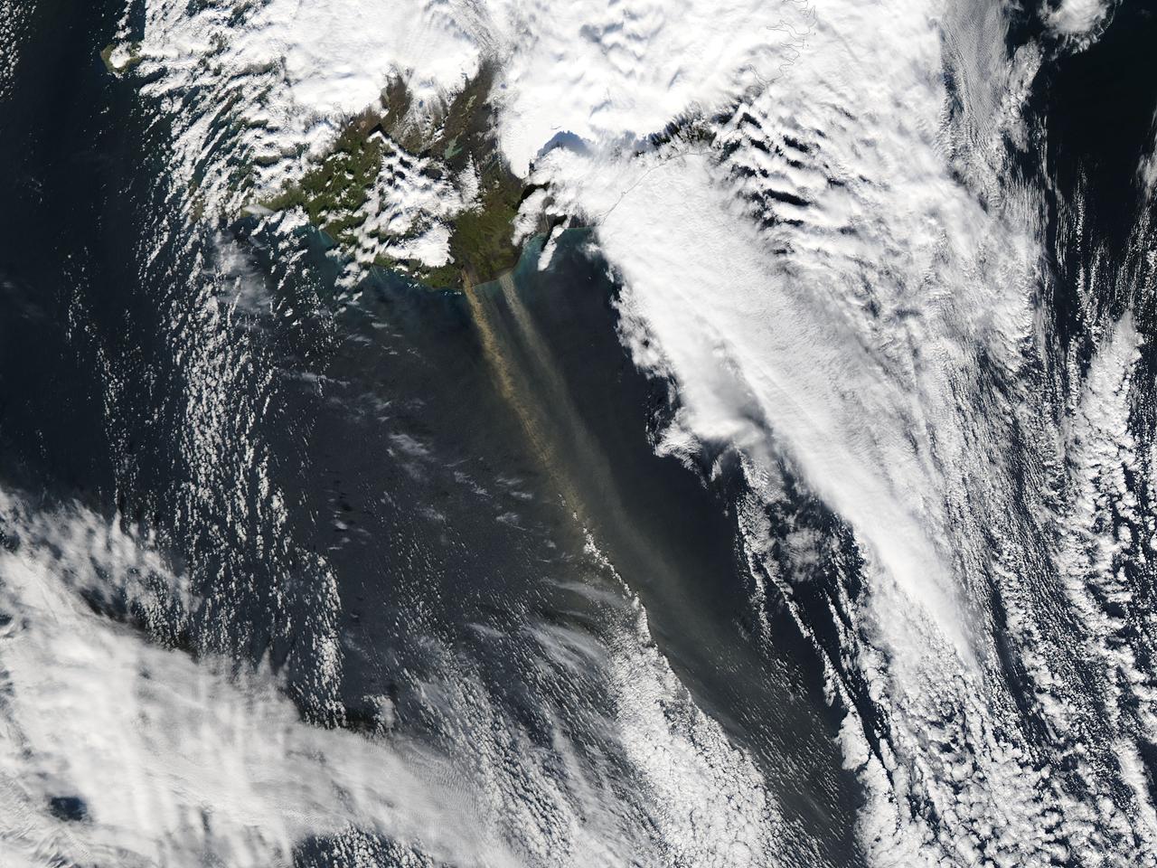
On September 16, 2013 the Moderate Resolution Imaging Spectroradiometer (MODIS) aboard NASA’s Aqua satellite passed over the southern tip of Iceland and captured a remarkable image dust plumes blowing hundreds of kilometers over the Atlantic Ocean. The westernmost plume is dark tan in color and so thick that the blue ocean waters are obscured from view near Iceland's coast. The eastern plume appears broader, thinner and light gray in color. According to the Icelandic Met Office, near the Mýrdalsjökull and Vatnajökull ice-caps there are vast glacial outwash plains which stretch from the glacial margins to the sea. These plains, formed by melt water from glaciers, are known as sandur. Strong northerly winds frequently blow dust from the sandur plains far from the shore. This particular dust plume originates to the east of the Mýrdalsjökull ice cap. The Katla volcano, one of the largest in Iceland, lies under the Mýrdalsjökull glacier and in the general region of the westernmost plume. Katla has a history of large, violent eruptions occurring on an average of every 50-100 years. The volcano has been increasingly restless since 1999, with increased seismicity in recent years. In 2011 a very small eruption was reported, with minimal damage. Because of the increasing restlessness and the dangerous nature of historic eruptions, the volcano is currently carefully monitored. None of the monitoring agencies reported eruption at Katla in mid-September of this year. Credit: NASA/GSFC/Jeff Schmaltz/MODIS Land Rapid Response Team <b><a href="http://www.nasa.gov/audience/formedia/features/MP_Photo_Guidelines.html" rel="nofollow">NASA image use policy.</a></b> <b><a href="http://www.nasa.gov/centers/goddard/home/index.html" rel="nofollow">NASA Goddard Space Flight Center</a></b> enables NASA’s mission through four scientific endeavors: Earth Science, Heliophysics, Solar System Exploration, and Astrophysics. Goddard plays a leading role in NASA’s accomplishments by contributing compelling scientific knowledge to advance the Agency’s mission. <b>Follow us on <a href="http://twitter.com/NASA_GoddardPix" rel="nofollow">Twitter</a></b> <b>Like us on <a href="http://www.facebook.com/pages/Greenbelt-MD/NASA-Goddard/395013845897?ref=tsd" rel="nofollow">Facebook</a></b> <b>Find us on <a href="http://instagram.com/nasagoddard?vm=grid" rel="nofollow">Instagram</a></b>
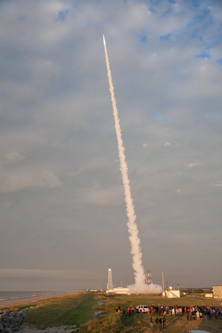
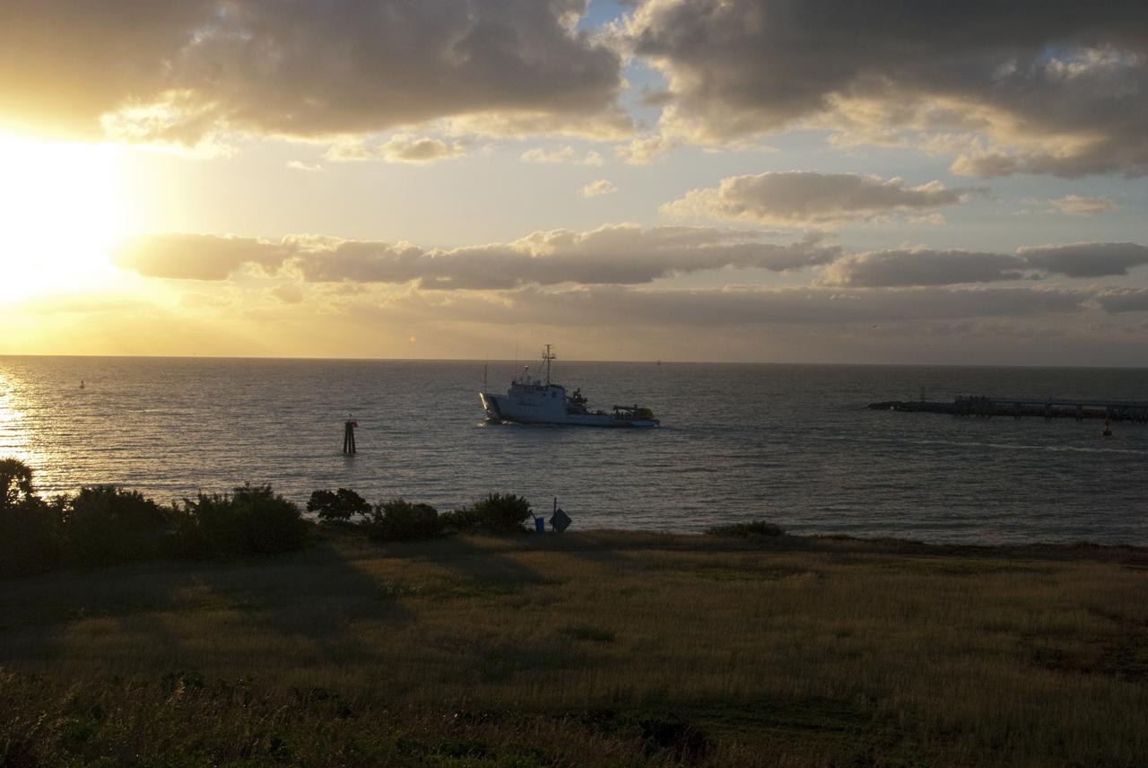
NASA successfully launched a NASA Terrier-Improved Orion suborbital sounding rocket carrying student experiments with the RockOn/RockSat-C programs at 6 a.m., today More than 200 middle school and university students and instructors participating in Rocket Week at Wallops were on hand to witness the launch. Through RockOn and RockSat-C students are learning and applying skills required to develop experiments for suborbital rocket flight. In addition, middle school educators through the Wallops Rocket Academy for Teachers (WRATS) are learning about applying rocketry basics in their curriculum. The payload flew to an altitude of 71.4 miles and descended by parachute into the Atlantic Ocean off the coast of Wallops. Payload recovery is in progress. The next launch from NASA’s Wallops Flight Facility is a Black Brant IX suborbital sounding rocket currently scheduled between 6 and 10 a.m., July 7. For more information on NASA’s Wallops Flight Facility, visit: <a href="http://www.nasa.gov/wallops" rel="nofollow">www.nasa.gov/wallops</a> <b><a href="http://www.nasa.gov/audience/formedia/features/MP_Photo_Guidelines.html" rel="nofollow">NASA image use policy.</a></b> <b><a href="http://www.nasa.gov/centers/goddard/home/index.html" rel="nofollow">NASA Goddard Space Flight Center</a></b> enables NASA’s mission through four scientific endeavors: Earth Science, Heliophysics, Solar System Exploration, and Astrophysics. Goddard plays a leading role in NASA’s accomplishments by contributing compelling scientific knowledge to advance the Agency’s mission. <b>Follow us on <a href="http://twitter.com/NASAGoddardPix" rel="nofollow">Twitter</a></b> <b>Like us on <a href="http://www.facebook.com/pages/Greenbelt-MD/NASA-Goddard/395013845897?ref=tsd" rel="nofollow">Facebook</a></b> <b>Find us on <a href="http://instagrid.me/nasagoddard/?vm=grid" rel="nofollow">Instagram</a></b>
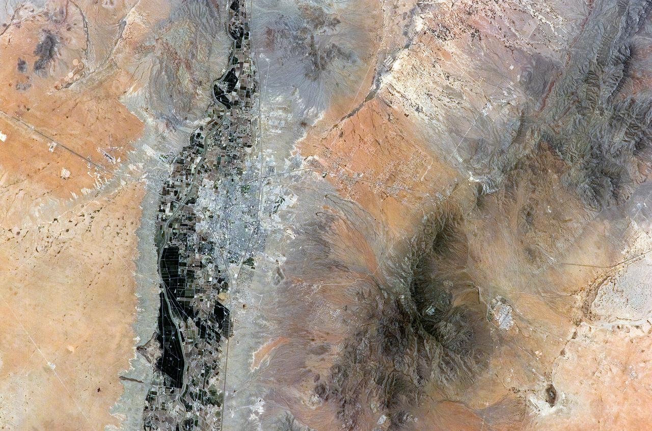
ISS011-E-08410 (9 June 2005) --- Las Cruces, New Mexico is featured in this image photographed by an Expedition 11 crewmember on the International Space Station. The city of Las Cruces is located within the Rio Grande Rift, a large geological feature that extends from Colorado southward into Mexico. According to NASA geologists, rifting usually heralds the breakup of continental landmasses, such as the separation of South America and Africa to form the southern Atlantic Ocean during the Mesozoic Era. The Rift is marked by a series of depressions (known as graben) caused by the subsidence of crustal blocks between parallel faults as the continental crust is pulled apart by tectonic forces. These graben are frequently marked by uplifted rocks along bounding faults — the striking Organ Mountains to the east of Las Cruces are one such uplifted fault block. While separation of the continental crust is no longer occurring, the Rio Grande Rift is still considered active as evidenced by frequent low-intensity earthquakes and hot springs to the north of Las Cruces. The modern city of Las Cruces — the seat of Doña Ana County and home to New Mexico State University — is undergoing rapid urban expansion due to influx of new residents attracted to the climate and landscape. The current urban area (gray to white region at image center) contrasts sharply with agricultural lands (dark green and grey brown) located along the Rio Grande River and the surrounding desert valley floor to the northeast and southwest (brown, blue gray and tan areas).
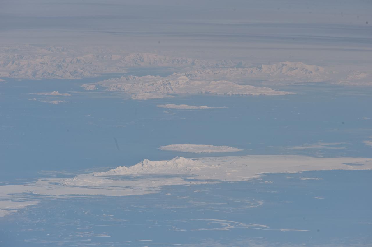
ISS029-E-041836 (4 Oct. 2011) --- South Shetland Islands and Antarctic Peninsula are featured in this image photographed by an Expedition 29 crew member on the International Space Station (ISS). The inclined equatorial orbit of the space station limits nadir Earth views?looking ?straight down? at the surface from the spacecraft?to latitudes between approximately 52 North and 52 South. When viewing conditions are ideal, the crew can obtain detailed oblique imagery?looking outwards at an angle from the space station?of regions at higher latitudes such as Greenland or, in this image, Antarctica. While the bulk of the continent of Antarctica is currently situated over the South Pole, the narrow Antarctic Peninsula extends like a finger towards the southern tip of South America. The northernmost part of the Peninsula is known as Graham Land, a small portion of which (located at approximately 64 South latitude) can be seen at top left in this photograph. Two of the South Shetland Islands that lay off the coast of Graham Land to the north-northwest, Livingston Island and Deception Island, are visible in the image. While both islands have a volcanic origin, active volcanism at Deception Island has been recorded since 1800; the last verified eruptive activity occurred in 1970. Closer to the coastline of Graham Land, Brabant Island (not considered to be part of the South Shetlands) also includes numerous outcrops of volcanic rock attesting to the complex tectonic history of the region. The space station was located over the South Atlantic Ocean, approximately 1,800 kilometers to the northeast in terms of its ground track, when this image was taken. This long viewing distance, combined with the highly oblique viewing angle, accentuates shadowing of the ground surface and provides a sense of the topography similar to the view one gets from an airplane. It also causes foreshortening of features visible in the image, making them appear closer to each other than they actually are ? for example, the actual distance between Livingston and Deception Islands is approximately 20 kilometers.

NASA successfully launched a NASA Terrier-Improved Orion suborbital sounding rocket carrying student experiments with the RockOn/RockSat-C programs at 6 a.m., today. More than 200 middle school and university students and instructors participating in Rocket Week at Wallops were on hand to witness the launch. Through RockOn and RockSat-C students are learning and applying skills required to develop experiments for suborbital rocket flight. In addition, middle school educators through the Wallops Rocket Academy for Teachers (WRATS) are learning about applying rocketry basics in their curriculum. The payload flew to an altitude of 71.4 miles and descended by parachute into the Atlantic Ocean off the coast of Wallops. Payload recovery is in progress. The next launch from NASA’s Wallops Flight Facility is a Black Brant IX suborbital sounding rocket currently scheduled between 6 and 10 a.m., July 7. Credits: NASA Wallops Optics Lab <b><a href="http://www.nasa.gov/audience/formedia/features/MP_Photo_Guidelines.html" rel="nofollow">NASA image use policy.</a></b> <b><a href="http://www.nasa.gov/centers/goddard/home/index.html" rel="nofollow">NASA Goddard Space Flight Center</a></b> enables NASA’s mission through four scientific endeavors: Earth Science, Heliophysics, Solar System Exploration, and Astrophysics. Goddard plays a leading role in NASA’s accomplishments by contributing compelling scientific knowledge to advance the Agency’s mission. <b>Follow us on <a href="http://twitter.com/NASAGoddardPix" rel="nofollow">Twitter</a></b> <b>Like us on <a href="http://www.facebook.com/pages/Greenbelt-MD/NASA-Goddard/395013845897?ref=tsd" rel="nofollow">Facebook</a></b> <b>Find us on <a href="http://instagrid.me/nasagoddard/?vm=grid" rel="nofollow">Instagram</a></b>
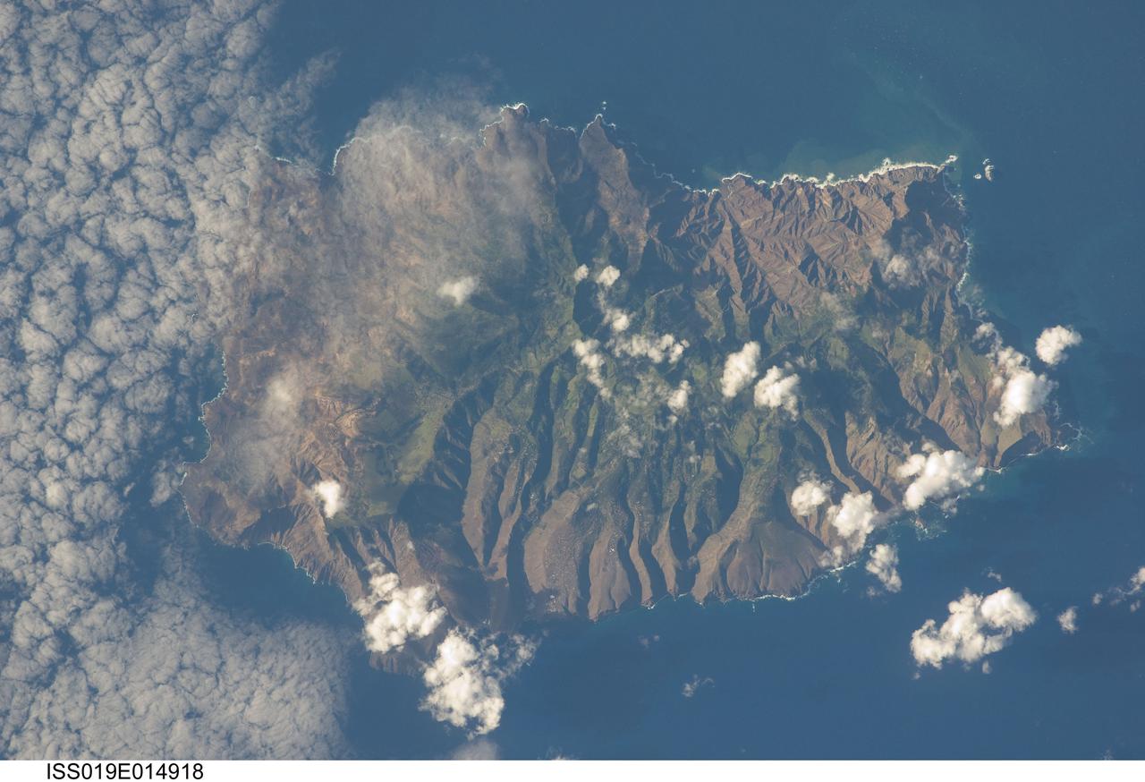
ISS019-E-014918 (7 May 2009) --- Saint Helena Island is featured in this image photographed by an Expedition 19 crewmember on the International Space Station. This isolated island, located in the South Atlantic Ocean approximately 1860 kilometers to the west of the African coastline, is perhaps best known as the final resting place of Napoleon Bonaparte I of France. Bonaparte was exiled to the island following his defeat at the Battle of Waterloo in 1815; he died on the island six years later in 1821. Today, the island is a British Overseas Territory, with access provided thirty times a year by a single ship, the RMS St. Helena. The rugged topography evident in this photograph is the result of erosion of the volcanic rocks that make up the island into sharp peaks and deep ravines. A climatic gradient related to elevation is also evident ? the higher, wetter central portion of the island is covered with green vegetation, whereas the lower coastal areas are drier and hotter with little vegetation cover. Human presence on the island has also caused dramatic changes to the original flora and fauna of the island. Only approximately 10 percent of the forest cover observed by the first explorers now remains in a semi-natural state, and that is concentrated in the interior highlands. Saint Helena Island was also visited by Charles Darwin during his scientific voyages in the 19th century. He visited the island in 1836 aboard HMS Beagle, recording observations of the flora, fauna, and geology that would inform his theory of evolution. This image was acquired by crew members onboard the International Space Station as part of an ongoing project (the HMS Beagle Project) to document current biodiversity in areas visited by Charles Darwin.
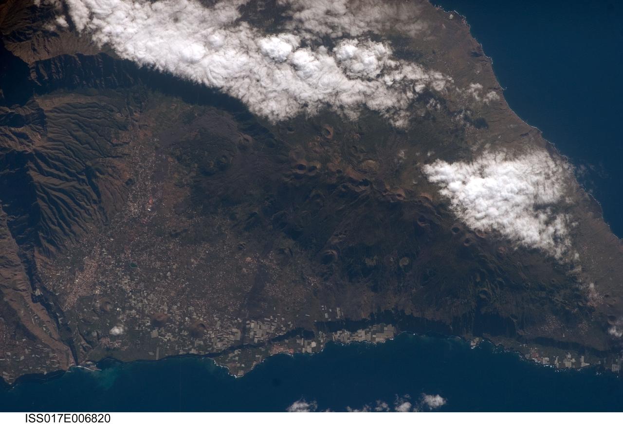
ISS017-E-006820 (13 May 2008) --- Isla de la Palma in the Canary Islands is featured in this image photographed by an Expedition 17 crewmember on the International Space Station. The Canary Islands, a group of volcanic islands, lie just off the west coast of Morocco in the Atlantic Ocean; at the northwest end of the chain of islands is Isla de la Palma. According to scientists, the island started forming as a submarine volcano approximately 3-4 million years ago. Subaerial (above the water surface) volcanic activity and island formation began around 2 million years ago. Most geologists believe the Canary Islands formed over the remnants of an old "hotspot" in the mantle, or mantle plume. The residual hotspot melting produced the magma that resulted in the Canary Island volcanoes. While there is little evidence to support the current existence of a mantle plume, volcanic activity is still taking place -- the most recent lava flows on Isla de Palma were erupted in 1971. In addition to volcanic hazards, the Canary Islands are also subject to occasional dust storms originating in the Sahara Desert. This view highlights volcanic landforms on the southern portion of Isla de Palma. The elongated, 1949-meter high Cumbre Vieja volcanic center is characterized by numerous cinder cones, craters, and gray lava flows that punctuate the green vegetated hillslopes. To the north, the cities of El Paso and Los Llanos de Aridanes nestle against collapsed fragments of the Caldera Taburiente (left), formed by massive slope failure of an older volcanic center to the north. Tourism is a major component of the local economy, but the high mountains and clear air of Isla de la Palma are also attractive to astronomers -- several large observatories (not shown) are located along the northern edge of the Caldera Taburiente.
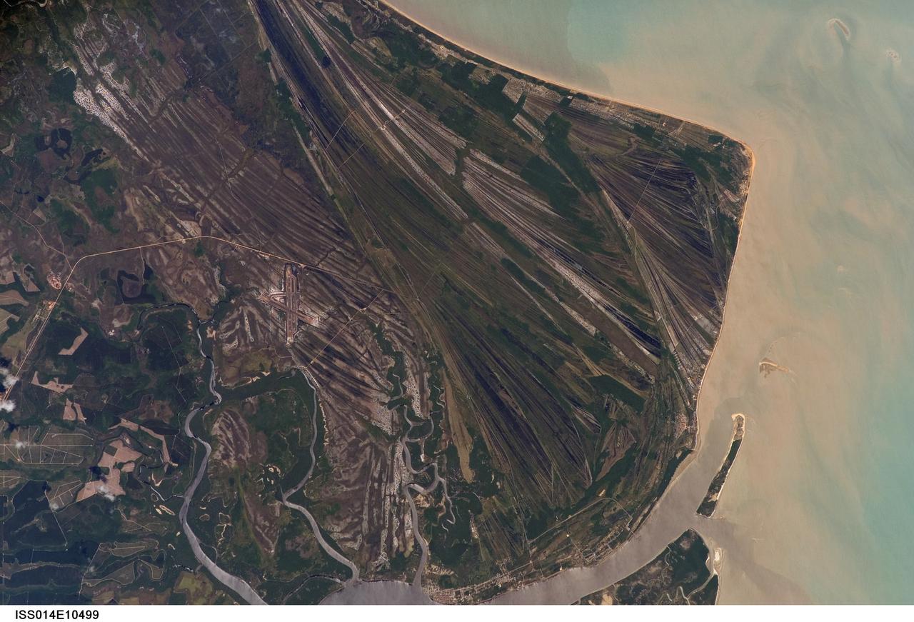
ISS014-E-10499 (23 Dec. 2006) --- Caravelas strandplain, Bahia Province, Brazil is featured in this image photographed by an Expedition 14 crewmember on the International Space Station. This view highlights a flat coastal landform known as a strandplain, or ancient shoreline. The image is dominated by numerous, fine parallel lines (trending diagonally from upper left to lower right), each of which is an ancient shoreline made up of sand transported from rivers to the north. The strandplain has been generated by these narrow shorelines accumulating against one another, line by line in their dozens or even hundreds, over thousands of years. The shorelines can be grouped into at least four packets depending on the crosscutting relationships - younger packets will cut into or stratigraphically overlay older packets. These relationships indicate that the youngest packet lies nearest the coast (furthest right) and the oldest packet lies north of the city of Caravelas (bottom). The Caravelas River flows into the Atlantic Ocean at the bottom of the view. Sediment from this river, and from the current shoreline, produces the light browns and dun colors visible offshore. On the day this image was taken the river water was relatively clear; clear water (gray) is visible flowing out of the main river mouth, and also off to one side to the south over a levee. The Caravelas airport appears near the middle of the view, and is built on one of the ancient shoreline packets. Caravelas itself, a fishing town of about 20,000 inhabitants, lies on an estuary and was once a flourishing whaling center--the prominent cape at top right is known as Ponta da Baleia (Whale Point).