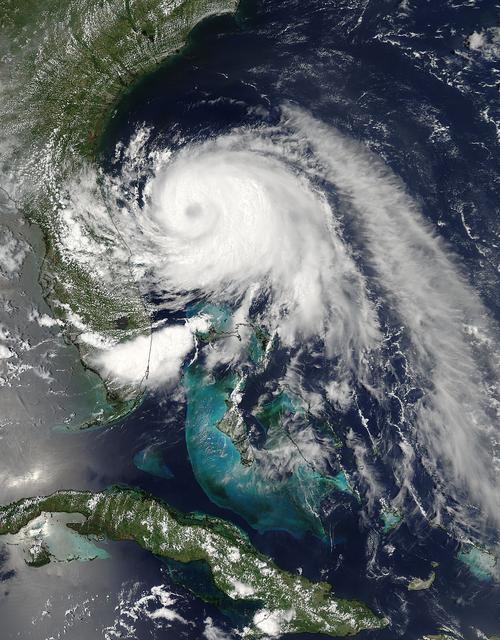
This visible image of Tropical Storm Arthur was taken by the MODIS instrument aboard NASA's Aqua satellite on July 2 at 18:50 UTC (2:50 p.m. EDT). A cloud-covered eye is clearly visible. Credit: NASA Goddard MODIS Rapid Response Team Read more: <a href="http://www.nasa.gov/content/goddard/arthur-atlantic/" rel="nofollow">www.nasa.gov/content/goddard/arthur-atlantic/</a> <b><a href="http://www.nasa.gov/audience/formedia/features/MP_Photo_Guidelines.html" rel="nofollow">NASA image use policy.</a></b> <b><a href="http://www.nasa.gov/centers/goddard/home/index.html" rel="nofollow">NASA Goddard Space Flight Center</a></b> enables NASA’s mission through four scientific endeavors: Earth Science, Heliophysics, Solar System Exploration, and Astrophysics. Goddard plays a leading role in NASA’s accomplishments by contributing compelling scientific knowledge to advance the Agency’s mission. <b>Follow us on <a href="http://twitter.com/NASAGoddardPix" rel="nofollow">Twitter</a></b> <b>Like us on <a href="http://www.facebook.com/pages/Greenbelt-MD/NASA-Goddard/395013845897?ref=tsd" rel="nofollow">Facebook</a></b> <b>Find us on <a href="http://instagram.com/nasagoddard?vm=grid" rel="nofollow">Instagram</a></b>
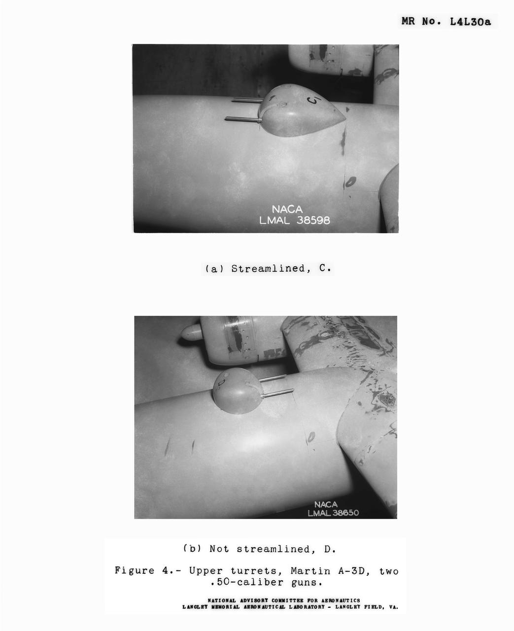
Detail Shots of B-32 Turret Figure 4. Upper turrets, Martin A-3D, Two .50 Caliber guns. Test conducted in the NACA 19 foot pressure tunnel LMAL-38560 NACA document.
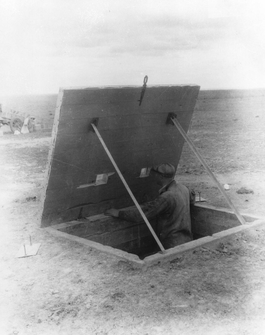
New Mexico - This concrete dugout was consturcted 50 feet from Dr. Robert Goddard's launching tower, so that an observer could watch the launching of the rocket at close range. <b><a href="http://www.nasa.gov/centers/goddard/home/index.html" rel="nofollow">NASA Goddard Space Flight Center</a></b> enables NASA’s mission through four scientific endeavors: Earth Science, Heliophysics, Solar System Exploration, and Astrophysics. Goddard plays a leading role in NASA’s accomplishments by contributing compelling scientific knowledge to advance the Agency’s mission. <b>Follow us on <a href="http://twitter.com/NASA_GoddardPix" rel="nofollow">Twitter</a></b> <b>Join us on <a href="http://www.facebook.com/pages/Greenbelt-MD/NASA-Goddard/395013845897?ref=tsd" rel="nofollow">Facebook</a></b>

STS070-329-022 (13-22 JULY 1995)--- Astronaut Donald A. Thomas, mission specialist, prepares to activate the Microcapsules in Space (MIS-B) experiment on the space shuttle Discovery?s middeck. MIS-B is an Army project to improve the understanding of microencapsulated drug technology and demonstrate the feasibility of producing pharmaceutical microcapsules in the weightlessness of space. This is the second flight of the experiment, which originally flew on STS-53 in 1992. Microcapsules are tiny spheres about 50 to 100 micrometers in diameter (about the thickness of a strand of human hair). They are used to develop high-performance chemical products and innovative pharmaceuticals such as time-release prescriptions. The drug used in the MIS experiments was ampicillin.

Despite a somewhat ragged appearance on satellite imagery, Arthur has strengthened overnight. NOAA and Air Force Reserve Hurricane Hunter aircraft have found surface winds in the 45-50 kt range to the south and northeast of the center, while also finding the central pressure has fallen to about 996 mb. Arthur has begun moving steadily northward at around 5 kt. The overall track forecast reasoning remains unchanged, as the tropical cyclone should continue northward for the next 12 to 24 hours. This image was taken by GOES West at the far eastern periphery of its scan, at 1200Z on July 2, 2014. <b><a href="http://goes.gsfc.nasa.gov/" rel="nofollow">Image credit: NOAA/NASA GOES Project</a></b> Caption credit: NASA/NOAA via <b><a href="www.nnvl.noaa.gov/" rel="nofollow"> NOAA Environmental Visualization Laboratory</a></b> <b><a href="http://www.nasa.gov/audience/formedia/features/MP_Photo_Guidelines.html" rel="nofollow">NASA image use policy.</a></b> <b><a href="http://www.nasa.gov/centers/goddard/home/index.html" rel="nofollow">NASA Goddard Space Flight Center</a></b> enables NASA’s mission through four scientific endeavors: Earth Science, Heliophysics, Solar System Exploration, and Astrophysics. Goddard plays a leading role in NASA’s accomplishments by contributing compelling scientific knowledge to advance the Agency’s mission. <b>Follow us on <a href="http://twitter.com/NASAGoddardPix" rel="nofollow">Twitter</a></b> <b>Like us on <a href="http://www.facebook.com/pages/Greenbelt-MD/NASA-Goddard/395013845897?ref=tsd" rel="nofollow">Facebook</a></b> <b>Find us on <a href="http://instagram.com/nasagoddard?vm=grid" rel="nofollow">Instagram</a></b>

The X-2, initially an Air Force program, was scheduled to be transferred to the civilian National Advisory Committee for Aeronautics (NACA) for scientific research. The Air Force delayed turning the aircraft over to the NACA in the hope of attaining Mach 3 in the airplane. The service requested and received a two-month extension to qualify another Air Force test pilot, Capt. Miburn "Mel" Apt, in the X-2 and attempt to exceed Mach 3. After several ground briefings in the simulator, Apt (with no previous rocket plane experience) made his flight on 27 September 1956. Apt raced away from the B-50 under full power, quickly outdistancing the F-100 chase planes. At high altitude, he nosed over, accelerating rapidly. The X-2 reached Mach 3.2 (2,094 mph) at 65,000 feet. Apt became the first man to fly more than three times the speed of sound. Still above Mach 3, he began an abrupt turn back to Edwards. This maneuver proved fatal as the X-2 began a series of diverging rolls and tumbled out of control. Apt tried to regain control of the aircraft. Unable to do so, Apt separated the escape capsule. Too late, he attempted to bail out and was killed when the capsule impacted on the Edwards bombing range. The rest of the X-2 crashed five miles away. The wreckage of the X-2 rocket plane was later taken to NACA's High Speed Flight Station for analysis following the crash.

Typhoon Kilo continues to thrive in the Northwestern Pacific and imagery from NASA's Terra satellite late on September 7 showed that the storm still maintained a clear eye. The MODIS or Moderate Resolution Imaging Spectroradiometer instrument that flies aboard Terra provided a visible-light image of Kilo on September 7 at 23:50 UTC (7:50 p.m. EDT). The image showed thick bands of thunderstorms wrapping around the eastern and northern quadrants of the visible eye. At 0900 UTC (5 a.m. EDT) on September 9, Typhoon Kilo had maximum sustained winds near 65 knots (74.8 mph/120.4 kph). Kilo is expected to strengthen to 75 knots (86.3 mph/ 138.9 kph) later in the day before weakening. It was centered near 26.8 North latitude and 158.5 East longitude, about 289 nautical miles northeast of Minami Tori Shima, Japan. Kilo was moving to the west-northwest at 18 knots (20.7 mph/33.3 kph). The Joint Typhoon Warning Center noted that Kilo is expected to take more of a northerly track by September 10. Thereafter, Kilo is expected to become extra-tropical and curve to the northeast near the Kuril Islands in Russia's Sakhalin Oblast region. The islands form an 808 mile (1,300 kilometer) volcanic archipelago that stretches northeast from Hokkaido, Japan, to Kamchatka, Russia. For updated watches and warnings from the Japan Meteorological Agency, visit: <a href="http://www.jma.go.jp/en/warn/" rel="nofollow">www.jma.go.jp/en/warn/</a> <b><a href="http://www.nasa.gov/audience/formedia/features/MP_Photo_Guidelines.html" rel="nofollow">NASA image use policy.</a></b> <b><a href="http://www.nasa.gov/centers/goddard/home/index.html" rel="nofollow">NASA Goddard Space Flight Center</a></b> enables NASA’s mission through four scientific endeavors: Earth Science, Heliophysics, Solar System Exploration, and Astrophysics. Goddard plays a leading role in NASA’s accomplishments by contributing compelling scientific knowledge to advance the Agency’s mission. <b>Follow us on <a href="http://twitter.com/NASAGoddardPix" rel="nofollow">Twitter</a></b> <b>Like us on <a href="http://www.facebook.com/pages/Greenbelt-MD/NASA-Goddard/395013845897?ref=tsd" rel="nofollow">Facebook</a></b> <b>Find us on <a href="http://instagrid.me/nasagoddard/?vm=grid" rel="nofollow">Instagram</a></b>
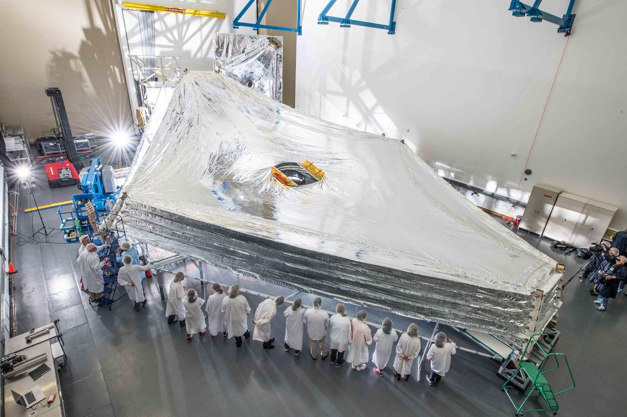
The Sunshield on NASA's James Webb Space Telescope is the largest part of the observatory—five layers of thin membrane that must unfurl reliably in space to precise tolerances. Last week, for the first time, engineers stacked and unfurled a full-sized test unit of the Sunshield and it worked perfectly. The Sunshield is about the length of a tennis court, and will be folded up like an umbrella around the Webb telescope’s mirrors and instruments during launch. Once it reaches its orbit, the Webb telescope will receive a command from Earth to unfold, and separate the Sunshield's five layers into their precisely stacked arrangement with its kite-like shape. The Sunshield test unit was stacked and expanded at a cleanroom in the Northrop Grumman facility in Redondo Beach, California. The Sunshield separates the observatory into a warm sun-facing side and a cold side where the sunshine is blocked from interfering with the sensitive infrared instruments. The infrared instruments need to be kept very cold (under 50 K or -370 degrees F) to operate. The Sunshield protects these sensitive instruments with an effective sun protection factor or SPF of 1,000,000 (suntan lotion generally has an SPF of 8-50). In addition to providing a cold environment, the Sunshield provides a thermally stable environment. This stability is essential to maintaining proper alignment of the primary mirror segments as the telescope changes its orientation to the sun. The James Webb Space Telescope is the successor to NASA's Hubble Space Telescope. It will be the most powerful space telescope ever built. Webb is an international project led by NASA with its partners, the European Space Agency and the Canadian Space Agency. For more information about the Webb telescope, visit: <a href="http://www.jwst.nasa.gov" rel="nofollow">www.jwst.nasa.gov</a> or <a href="http://www.nasa.gov/webb" rel="nofollow">www.nasa.gov/webb</a> For more information on the Webb Sunshield, visit: <a href="http://jwst.nasa.gov/sunshield.html" rel="nofollow">jwst.nasa.gov/sunshield.html</a> Credit: NASA/Goddard/Chris Gunn <b><a href="http://www.nasa.gov/audience/formedia/features/MP_Photo_Guidelines.html" rel="nofollow">NASA image use policy.</a></b> <b><a href="http://www.nasa.gov/centers/goddard/home/index.html" rel="nofollow">NASA Goddard Space Flight Center</a></b> enables NASA’s mission through four scientific endeavors: Earth Science, Heliophysics, Solar System Exploration, and Astrophysics. Goddard plays a leading role in NASA’s accomplishments by contributing compelling scientific knowledge to advance the Agency’s mission. <b>Follow us on <a href="http://twitter.com/NASAGoddardPix" rel="nofollow">Twitter</a></b> <b>Like us on <a href="http://www.facebook.com/pages/Greenbelt-MD/NASA-Goddard/395013845897?ref=tsd" rel="nofollow">Facebook</a></b> <b>Find us on <a href="http://instagram.com/nasagoddard?vm=grid" rel="nofollow">Instagram</a></b>
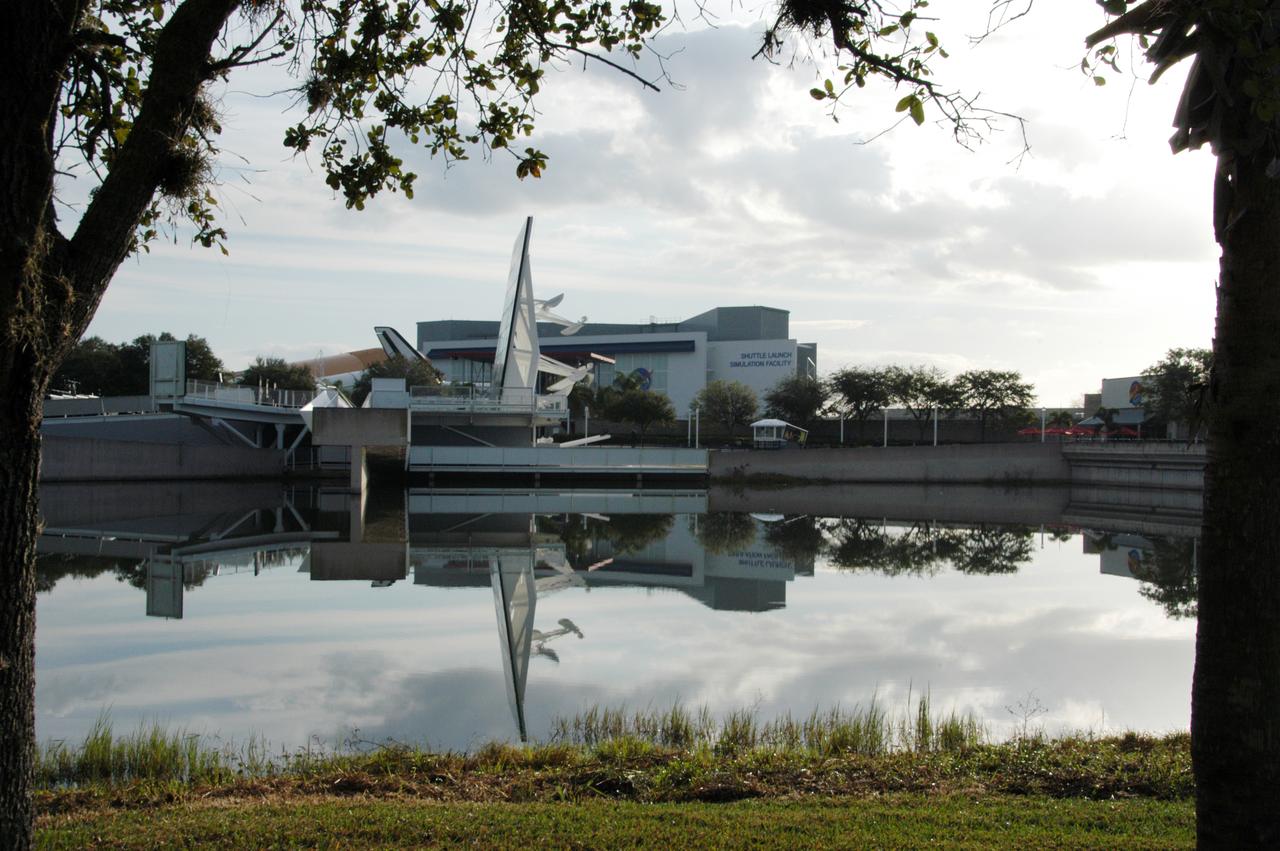
The Space Mirror Memorial, seen in profile, is reflected in the nearby lake at the KSC Visitor Complex. The memorial is the scene of a ceremony being held in remembrance of the astronauts lost in the Apollo 1 fire: Virgil "Gus" Grissom, Edward H. White II and Roger B. Chaffee. The mirror was designated as a national memorial by Congress and President George Bush in 1991 to honor fallen astronauts. Their names are emblazoned on the monument's 42-1/2-foot-high by 50-foot-wide black granite surface as if to be projected into the heavens.
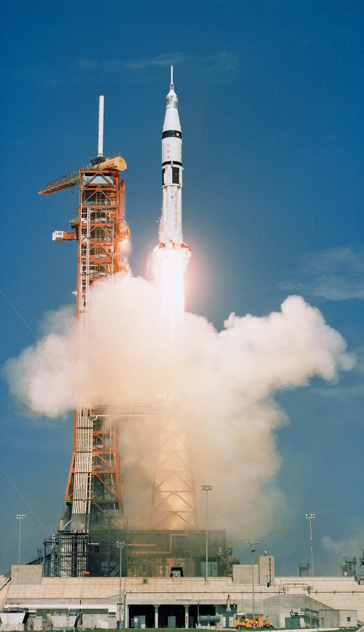
S75-28550 (15 July 1975) --- The Apollo-Soyuz Test Project's (ASTP) NASA Apollo/Saturn 1B space vehicle is launched from Pad B, Launch Complex 39, Kennedy Space Center (KSC), Florida, at 3:50 p.m. (EDT), July 15, 1975, to begin Apollo's catch-up journey toward the already Earth-orbiting Soviet Soyuz spacecraft. Aboard the Apollo spacecraft were astronauts Thomas P. Stafford, Vance D. Brand and Donald K. (Deke) Slayton.
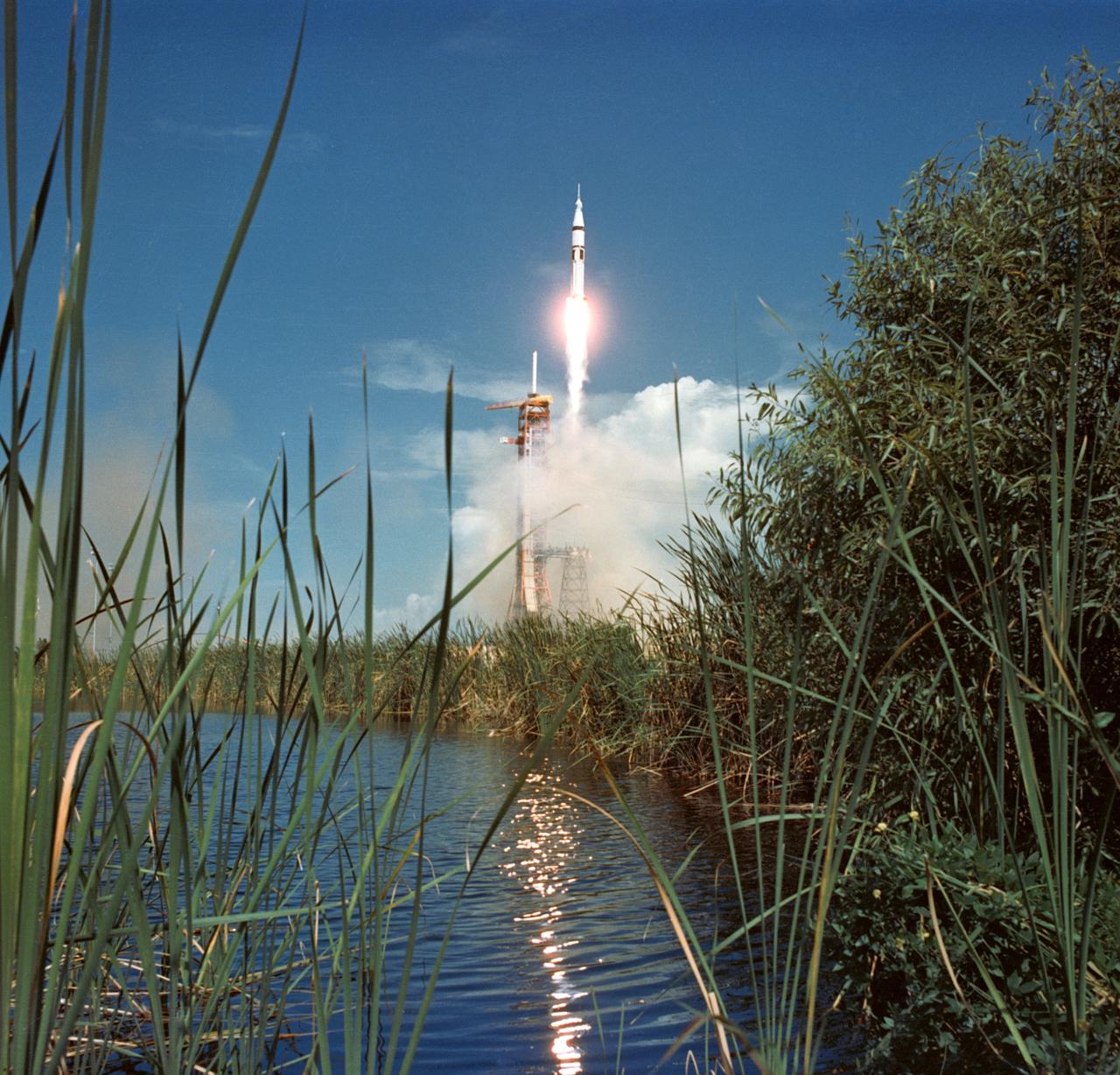
S75-28547 (15 July 1975) --- The Apollo-Soyuz Test Project's (ASTP) NASA Apollo/Saturn 1B space vehicle is launched from Pad B, Launch Complex 39, Kennedy Space Center (KSC), Florida, at 3:50 p.m. (EDT), July 15, 1975, to begin Apollo's catch-up journey toward the already Earth-orbiting Soviet Soyuz spacecraft. Aboard the Apollo spacecraft were astronauts Thomas P. Stafford, Vance D. Brand and Donald K. (Deke) Slayton.
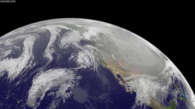
1-9 January 2014. The full-disk images every 3 hours from GOES-WEST capture the sweep of a polar vortex that emerged from the arctic at the beginning of the new year, pushing a blizzard into the northeastern USA on January 3, followed by extensive bitter cold (-20 F, windchill -50 F) around the Great Lakes, and single digit temperatures as far south as Atlanta, Georgia. This western viewpoint displays the persistent flow of arctic air from northern Alaska and Yukon into North America. <b><a href="http://goes.gsfc.nasa.gov/" rel="nofollow">Credit: NOAA/NASA GOES Project</a></b> <b><a href="http://www.nasa.gov/audience/formedia/features/MP_Photo_Guidelines.html" rel="nofollow">NASA image use policy.</a></b> <b><a href="http://www.nasa.gov/centers/goddard/home/index.html" rel="nofollow">NASA Goddard Space Flight Center</a></b> enables NASA’s mission through four scientific endeavors: Earth Science, Heliophysics, Solar System Exploration, and Astrophysics. Goddard plays a leading role in NASA’s accomplishments by contributing compelling scientific knowledge to advance the Agency’s mission. <b>Follow us on <a href="http://twitter.com/NASA_GoddardPix" rel="nofollow">Twitter</a></b> <b>Like us on <a href="http://www.facebook.com/pages/Greenbelt-MD/NASA-Goddard/395013845897?ref=tsd" rel="nofollow">Facebook</a></b> <b>Find us on <a href="http://instagram.com/nasagoddard?vm=grid" rel="nofollow">Instagram</a></b>
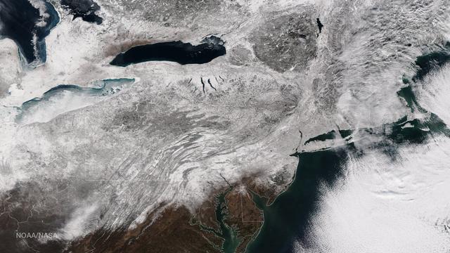
As the storm moves offshore and the skies clear over the Northeast United States, the extent of snowfall from the blizzard is shown in this image from the Suomi NPP satellite imagery, taken on January 28, 2015 at 1:50 EST. Portions of Suffolk County, New York and parts of eastern and southern New England, including areas in and around Portland, Maine, Boston, Massachusetts, and Providence, Rhode Island, received more than 20 inches of snowfall. Up to 36 inches of snow were reported in Auburn, Hudson and Lunenburg, Massachusetts. Credit: NASA/NOAA/NPP/VIIRS Via: <b><a href="www.nnvl.noaa.gov/" rel="nofollow"> NOAA Environmental Visualization Laboratory</a></b> <b><a href="http://www.nasa.gov/audience/formedia/features/MP_Photo_Guidelines.html" rel="nofollow">NASA image use policy.</a></b> <b><a href="http://www.nasa.gov/centers/goddard/home/index.html" rel="nofollow">NASA Goddard Space Flight Center</a></b> enables NASA’s mission through four scientific endeavors: Earth Science, Heliophysics, Solar System Exploration, and Astrophysics. Goddard plays a leading role in NASA’s accomplishments by contributing compelling scientific knowledge to advance the Agency’s mission. <b>Follow us on <a href="http://twitter.com/NASAGoddardPix" rel="nofollow">Twitter</a></b> <b>Like us on <a href="http://www.facebook.com/pages/Greenbelt-MD/NASA-Goddard/395013845897?ref=tsd" rel="nofollow">Facebook</a></b> <b>Find us on <a href="http://instagram.com/nasagoddard?vm=grid" rel="nofollow">Instagram</a></b>
There’s more than one way to study the impact of biofuels. For NASA scientists, it means trailing an aircraft from as little as 300 feet behind while flying 34,000 feet in the air. Earlier this year, a NASA-led team conducted a series of carefully choreographed flights over California in order to sniff out how aircraft emissions differ when using petroleum fuels or biofuels. Early results from the Alternative Fuel Effects on Contrails and Cruise Emissions (ACCESS II) experiment confirm that blended biofuel is the cleaner-burning fuel. "Our findings show we definitely see a 50 percent reduction in soot emissions from the DC-8 when it burns the blended fuel as opposed to jet fuel alone," said Bruce Anderson, ACCESS principal investigator from NASA's Langley Research Center. The DC-8 is a NASA science workhorse: a flying laboratory equipped to collect—or, in this case, produce—data for basic Earth science research. During the ACESS experiment, scientists took advantage of the aircraft's segregated fuel tank. On the fly, the pilot switched the fuel type sent to each of the four engines. The engines burned either jet fuel, or a 50-50 blend of jet fuel and a renewable alternative produced from camelina plant oil. With each change of fuel, three other instrumented aircraft took turns lining up in the DC-8's wake and flying anywhere from 90 meters (300 feet) to more than 30 kilometers (20 miles) behind to catch a sniff. Richard Moore, a post-doctoral fellow at NASA Langley, took this photograph with a DSLR camera on May 7, 2014, during an ACCESS II test flight over Edwards Air Force Base in California. The photo was taken from Langley's HU-25C Guardian jet as it descended toward NASA's Armstrong Flight Research Center after a successful three-hour sampling flight behind the DC-8. The aircraft trailing the DC-8 in the photo was a Falcon 20-E5 jet owned by the German Aerospace Center. The flight on May 7 was just the first in a series of flights that lasted throughout the month. After the campaign, researchers continued to examine the data to determine whether a reduction in soot emissions translates to a reduction in contrail formation, and how that might affect climate. Read more: <a href="http://1.usa.gov/1wBfaKq" rel="nofollow">1.usa.gov/1wBfaKq</a> <b><a href="http://www.nasa.gov/audience/formedia/features/MP_Photo_Guidelines.html" rel="nofollow">NASA image use policy.</a></b> <b><a href="http://www.nasa.gov/centers/goddard/home/index.html" rel="nofollow">NASA Goddard Space Flight Center</a></b> enables NASA’s mission through four scientific endeavors: Earth Science, Heliophysics, Solar System Exploration, and Astrophysics. Goddard plays a leading role in NASA’s accomplishments by contributing compelling scientific knowledge to advance the Agency’s mission. <b>Follow us on <a href="http://twitter.com/NASAGoddardPix" rel="nofollow">Twitter</a></b> <b>Like us on <a href="http://www.facebook.com/pages/Greenbelt-MD/NASA-Goddard/395013845897?ref=tsd" rel="nofollow">Facebook</a></b> <b>Find us on <a href="http://instagram.com/nasagoddard?vm=grid" rel="nofollow">Instagram</a></b>
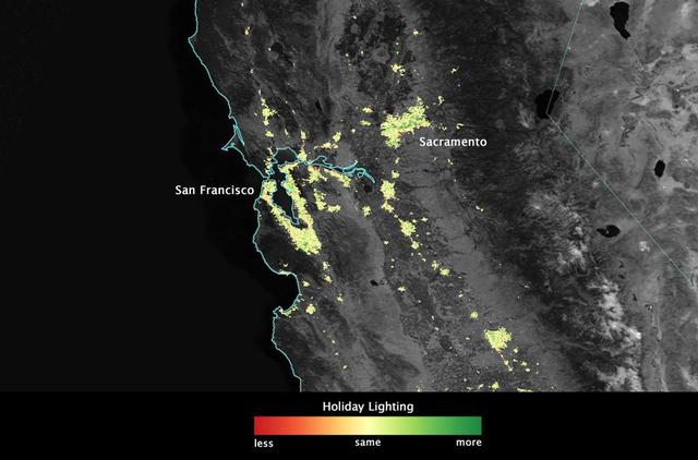
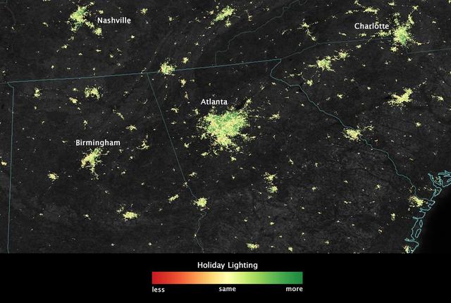
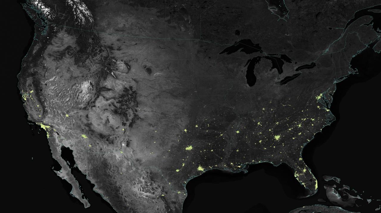
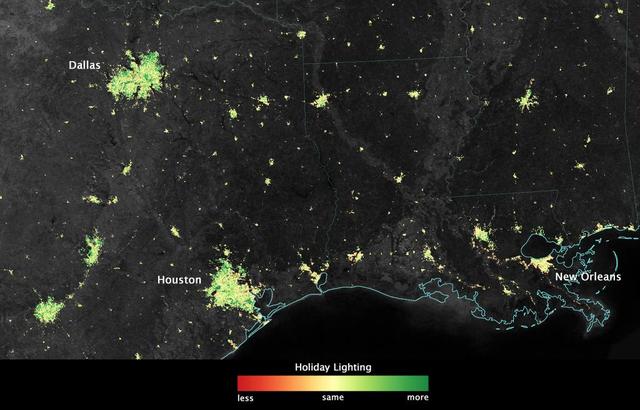
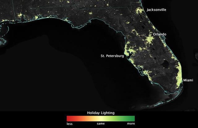
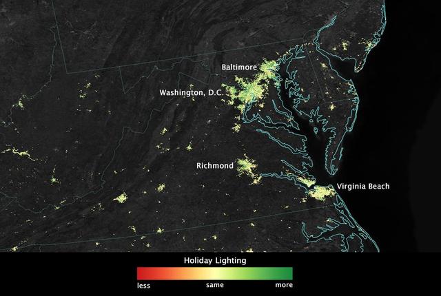
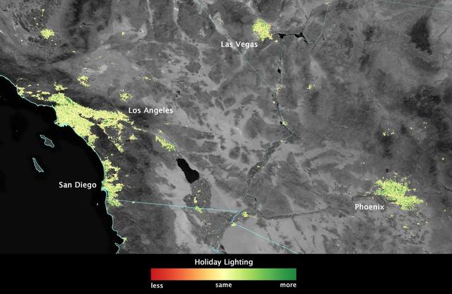
City lights shine brighter during the holidays in the United States when compared with the rest of the year, as shown using a new analysis of daily data from the NASA-NOAA Suomi NPP satellite. Dark green pixels are areas where lights are 50 percent brighter, or more, during December. Because snow reflects so much light, the researchers could only analyze snow-free cities. They focused on the U.S. West Coast from San Francisco and Los Angeles, and cities south of a rough imaginary line from St. Louis to Washington, D.C. Credit: Jesse Allen, NASA’s Earth Observatory Read more: <a href="http://www.nasa.gov/content/goddard/satellite-sees-holiday-lights-brighten-cities." rel="nofollow">www.nasa.gov/content/goddard/satellite-sees-holiday-light...</a>.<b><a href="http://www.nasa.gov/audience/formedia/features/MP_Photo_Guidelines.html" rel="nofollow">NASA image use policy.</a></b> <b><a href="http://www.nasa.gov/centers/goddard/home/index.html" rel="nofollow">NASA Goddard Space Flight Center</a></b> enables NASA’s mission through four scientific endeavors: Earth Science, Heliophysics, Solar System Exploration, and Astrophysics. Goddard plays a leading role in NASA’s accomplishments by contributing compelling scientific knowledge to advance the Agency’s mission. <b>Follow us on <a href="http://twitter.com/NASAGoddardPix" rel="nofollow">Twitter</a></b> <b>Like us on <a href="http://www.facebook.com/pages/Greenbelt-MD/NASA-Goddard/395013845897?ref=tsd" rel="nofollow">Facebook</a></b> <b>Find us on <a href="http://instagram.com/nasagoddard?vm=grid" rel="nofollow">Instagram</a></b>
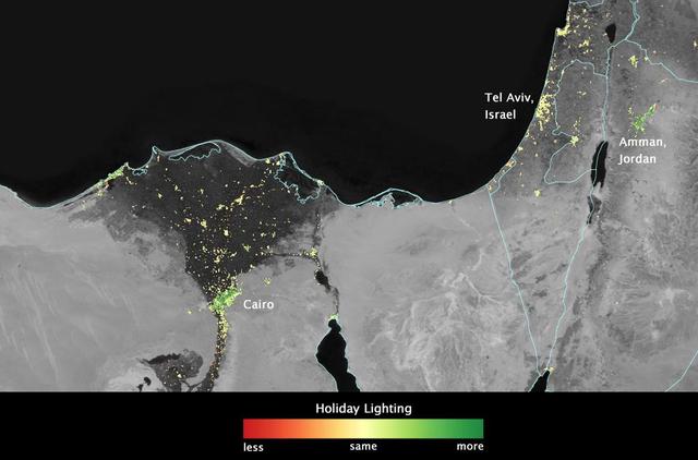
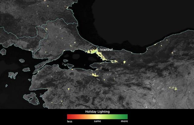
In several cities in the Middle East, city lights brighten during the Muslim holy month of Ramadan, as seen using a new analysis of daily data from the NASA-NOAA Suomi NPP satellite. Dark green pixels are areas where the lights are 50 percent brighter, or more, during Ramadan. Credit: Jesse Allen, NASA’s Earth Observatory Read more: <a href="http://www.nasa.gov/content/goddard/satellite-sees-holiday-lights-brighten-cities" rel="nofollow">www.nasa.gov/content/goddard/satellite-sees-holiday-light...</a> <b><a href="http://www.nasa.gov/audience/formedia/features/MP_Photo_Guidelines.html" rel="nofollow">NASA image use policy.</a></b> <b><a href="http://www.nasa.gov/centers/goddard/home/index.html" rel="nofollow">NASA Goddard Space Flight Center</a></b> enables NASA’s mission through four scientific endeavors: Earth Science, Heliophysics, Solar System Exploration, and Astrophysics. Goddard plays a leading role in NASA’s accomplishments by contributing compelling scientific knowledge to advance the Agency’s mission. <b>Follow us on <a href="http://twitter.com/NASAGoddardPix" rel="nofollow">Twitter</a></b> <b>Like us on <a href="http://www.facebook.com/pages/Greenbelt-MD/NASA-Goddard/395013845897?ref=tsd" rel="nofollow">Facebook</a></b> <b>Find us on <a href="http://instagram.com/nasagoddard?vm=grid" rel="nofollow">Instagram</a></b>
City lights shine brighter during the holidays in the United States when compared with the rest of the year, as shown using a new analysis of daily data from the NASA-NOAA Suomi NPP satellite. Dark green pixels are areas where lights are 50 percent brighter, or more, during December. Because snow reflects so much light, the researchers could only analyze snow-free cities. They focused on the U.S. West Coast from San Francisco and Los Angeles, and cities south of a rough imaginary line from St. Louis to Washington, D.C. Credit: Jesse Allen, NASA’s Earth Observatory Read more: <a href="http://www.nasa.gov/content/goddard/satellite-sees-holiday-lights-brighten-cities." rel="nofollow">www.nasa.gov/content/goddard/satellite-sees-holiday-light...</a>.<b><a href="http://www.nasa.gov/audience/formedia/features/MP_Photo_Guidelines.html" rel="nofollow">NASA image use policy.</a></b> <b><a href="http://www.nasa.gov/centers/goddard/home/index.html" rel="nofollow">NASA Goddard Space Flight Center</a></b> enables NASA’s mission through four scientific endeavors: Earth Science, Heliophysics, Solar System Exploration, and Astrophysics. Goddard plays a leading role in NASA’s accomplishments by contributing compelling scientific knowledge to advance the Agency’s mission. <b>Follow us on <a href="http://twitter.com/NASAGoddardPix" rel="nofollow">Twitter</a></b> <b>Like us on <a href="http://www.facebook.com/pages/Greenbelt-MD/NASA-Goddard/395013845897?ref=tsd" rel="nofollow">Facebook</a></b> <b>Find us on <a href="http://instagram.com/nasagoddard?vm=grid" rel="nofollow">Instagram</a></b>
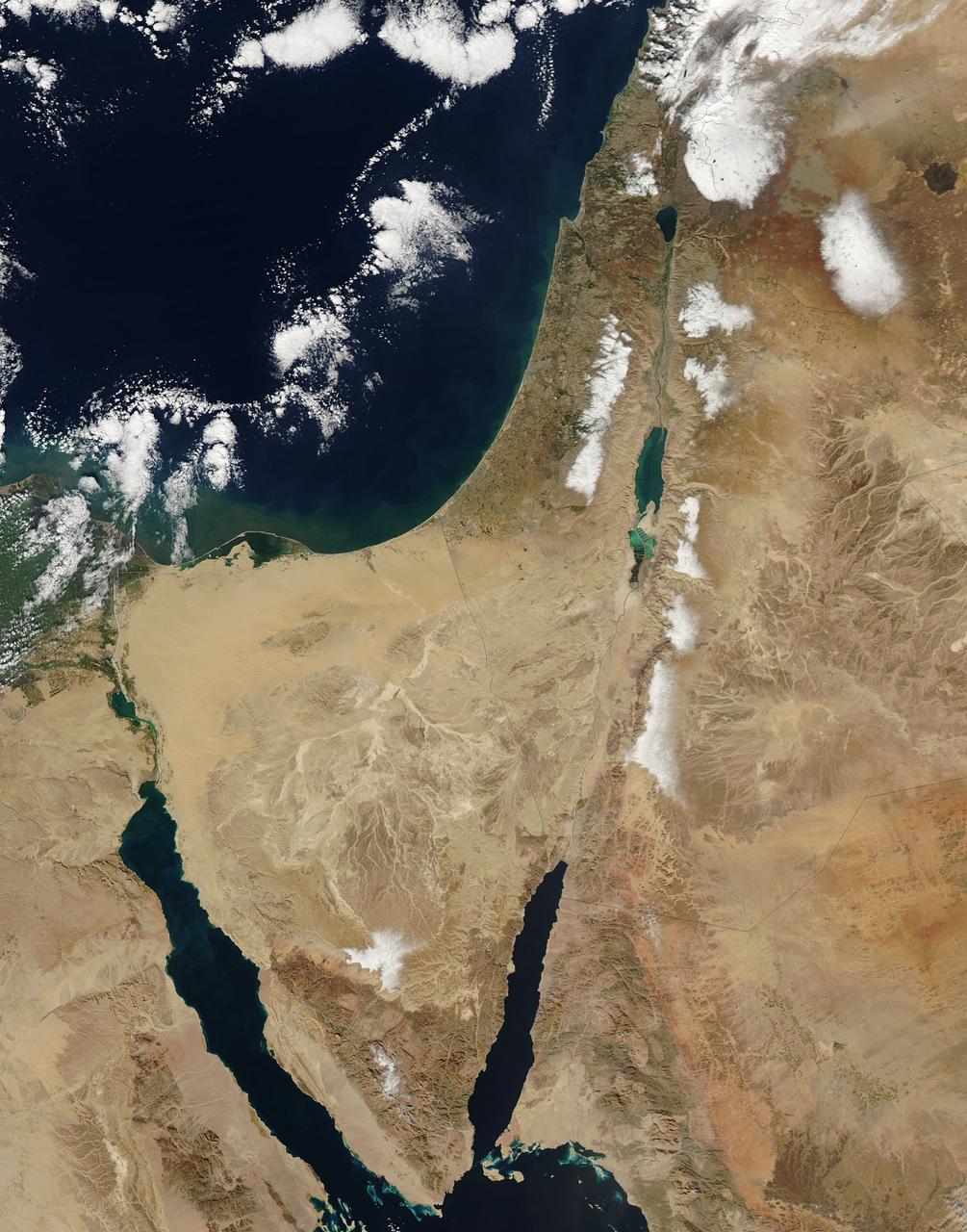
This image from the Aqua satellite's MODIS instrument taken at 11:10 UTC on December 16, 2013 shows areas of snow in Syria, Jordan, Israel and the Palestinian Territory. Snow storms in the Middle East are not frequent but not uncommon either. However, this one was unusually early in the winter and more intense than normal. The storm paralyzed Jerusalem with 30 to 50 centimeters (12 to 20 inches) of snow, knocking out power for roughly 15,000 households. The snow closed mountain roads leading into the city, effectively cutting Jerusalem off. Amman, Jordan, received about 45 cm (18 inches) of snow, and Lebanon and Syria also were unusually cold and snowy. Lower elevations near the coast received torrential rain during the storm, resulting in flooding. Some 40,000 people were forced to evacuate flooded areas in Gaza, according to the Associated Press. The floods are not visible at this scale, but tan and green plumes of sediment are visible along the Mediterranean Sea coast. Such plumes can be caused by floods and run off, though stormy, turbid waters may also bring sediment to the surface. <b><a href="http://www.nasa.gov/audience/formedia/features/MP_Photo_Guidelines.html" rel="nofollow">NASA image use policy.</a></b> <b><a href="http://www.nasa.gov/centers/goddard/home/index.html" rel="nofollow">NASA Goddard Space Flight Center</a></b> enables NASA’s mission through four scientific endeavors: Earth Science, Heliophysics, Solar System Exploration, and Astrophysics. Goddard plays a leading role in NASA’s accomplishments by contributing compelling scientific knowledge to advance the Agency’s mission. <b>Follow us on <a href="http://twitter.com/NASA_GoddardPix" rel="nofollow">Twitter</a></b> <b>Like us on <a href="http://www.facebook.com/pages/Greenbelt-MD/NASA-Goddard/395013845897?ref=tsd" rel="nofollow">Facebook</a></b> <b>Find us on <a href="http://instagram.com/nasagoddard?vm=grid" rel="nofollow">Instagram</a></b>
In several cities in the Middle East, city lights brighten during the Muslim holy month of Ramadan, as seen using a new analysis of daily data from the NASA-NOAA Suomi NPP satellite. Dark green pixels are areas where the lights are 50 percent brighter, or more, during Ramadan. Credit: Jesse Allen, NASA’s Earth Observatory Read more: <a href="http://www.nasa.gov/content/goddard/satellite-sees-holiday-lights-brighten-cities" rel="nofollow">www.nasa.gov/content/goddard/satellite-sees-holiday-light...</a> <b><a href="http://www.nasa.gov/audience/formedia/features/MP_Photo_Guidelines.html" rel="nofollow">NASA image use policy.</a></b> <b><a href="http://www.nasa.gov/centers/goddard/home/index.html" rel="nofollow">NASA Goddard Space Flight Center</a></b> enables NASA’s mission through four scientific endeavors: Earth Science, Heliophysics, Solar System Exploration, and Astrophysics. Goddard plays a leading role in NASA’s accomplishments by contributing compelling scientific knowledge to advance the Agency’s mission. <b>Follow us on <a href="http://twitter.com/NASAGoddardPix" rel="nofollow">Twitter</a></b> <b>Like us on <a href="http://www.facebook.com/pages/Greenbelt-MD/NASA-Goddard/395013845897?ref=tsd" rel="nofollow">Facebook</a></b> <b>Find us on <a href="http://instagram.com/nasagoddard?vm=grid" rel="nofollow">Instagram</a></b>
City lights shine brighter during the holidays in the United States when compared with the rest of the year, as shown using a new analysis of daily data from the NASA-NOAA Suomi NPP satellite. Dark green pixels are areas where lights are 50 percent brighter, or more, during December. Because snow reflects so much light, the researchers could only analyze snow-free cities. They focused on the U.S. West Coast from San Francisco and Los Angeles, and cities south of a rough imaginary line from St. Louis to Washington, D.C. Credit: Jesse Allen, NASA’s Earth Observatory Read more: <a href="http://www.nasa.gov/content/goddard/satellite-sees-holiday-lights-brighten-cities" rel="nofollow">www.nasa.gov/content/goddard/satellite-sees-holiday-light...</a> <b><a href="http://www.nasa.gov/audience/formedia/features/MP_Photo_Guidelines.html" rel="nofollow">NASA image use policy.</a></b> <b><a href="http://www.nasa.gov/centers/goddard/home/index.html" rel="nofollow">NASA Goddard Space Flight Center</a></b> enables NASA’s mission through four scientific endeavors: Earth Science, Heliophysics, Solar System Exploration, and Astrophysics. Goddard plays a leading role in NASA’s accomplishments by contributing compelling scientific knowledge to advance the Agency’s mission. <b>Follow us on <a href="http://twitter.com/NASAGoddardPix" rel="nofollow">Twitter</a></b> <b>Like us on <a href="http://www.facebook.com/pages/Greenbelt-MD/NASA-Goddard/395013845897?ref=tsd" rel="nofollow">Facebook</a></b> <b>Find us on <a href="http://instagram.com/nasagoddard?vm=grid" rel="nofollow">Instagram</a></b>
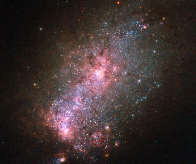
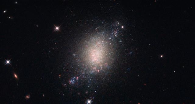
This NASA/ESA Hubble Space Telescope image reveals the vibrant core of the galaxy NGC 3125. Discovered by John Herschel in 1835, NGC 3125 is a great example of a starburst galaxy — a galaxy in which unusually high numbers of new stars are forming, springing to life within intensely hot clouds of gas. Located approximately 50 million light-years away in the constellation of Antlia (The Air Pump), NGC 3125 is similar to, but unfathomably brighter and more energetic than, one of the Magellanic Clouds. Spanning 15,000 light-years, the galaxy displays massive and violent bursts of star formation, as shown by the hot, young, and blue stars scattered throughout the galaxy’s rose-tinted core. Some of these clumps of stars are notable — one of the most extreme Wolf–Rayet star clusters in the local Universe, NGC 3125-A1, resides within NGC 3125. Despite their appearance, the fuzzy white blobs dotted around the edge of this galaxy are not stars, but globular clusters. Found within a galaxy’s halo, globular clusters are ancient collections of hundreds of thousands of stars. They orbit around galactic centers like satellites — the Milky Way, for example, hosts over 150 of them. Image credit: ESA/Hubble & NASA, Acknowledgement: Judy Schmidt <b><a href="http://www.nasa.gov/audience/formedia/features/MP_Photo_Guidelines.html" rel="nofollow">NASA image use policy.</a></b> <b><a href="http://www.nasa.gov/centers/goddard/home/index.html" rel="nofollow">NASA Goddard Space Flight Center</a></b> enables NASA’s mission through four scientific endeavors: Earth Science, Heliophysics, Solar System Exploration, and Astrophysics. Goddard plays a leading role in NASA’s accomplishments by contributing compelling scientific knowledge to advance the Agency’s mission. <b>Follow us on <a href="http://twitter.com/NASAGoddardPix" rel="nofollow">Twitter</a></b> <b>Like us on <a href="http://www.facebook.com/pages/Greenbelt-MD/NASA-Goddard/395013845897?ref=tsd" rel="nofollow">Facebook</a></b> <b>Find us on <a href="http://instagrid.me/nasagoddard/?vm=grid" rel="nofollow">Instagram</a></b>
City lights shine brighter during the holidays in the United States when compared with the rest of the year, as shown using a new analysis of daily data from the NASA-NOAA Suomi NPP satellite. Dark green pixels are areas where lights are 50 percent brighter, or more, during December. Because snow reflects so much light, the researchers could only analyze snow-free cities. They focused on the U.S. West Coast from San Francisco and Los Angeles, and cities south of a rough imaginary line from St. Louis to Washington, D.C. Credit: Jesse Allen, NASA’s Earth Observatory Read more: <a href="http://www.nasa.gov/content/goddard/satellite-sees-holiday-lights-brighten-cities." rel="nofollow">www.nasa.gov/content/goddard/satellite-sees-holiday-light...</a>.<b><a href="http://www.nasa.gov/audience/formedia/features/MP_Photo_Guidelines.html" rel="nofollow">NASA image use policy.</a></b> <b><a href="http://www.nasa.gov/centers/goddard/home/index.html" rel="nofollow">NASA Goddard Space Flight Center</a></b> enables NASA’s mission through four scientific endeavors: Earth Science, Heliophysics, Solar System Exploration, and Astrophysics. Goddard plays a leading role in NASA’s accomplishments by contributing compelling scientific knowledge to advance the Agency’s mission. <b>Follow us on <a href="http://twitter.com/NASAGoddardPix" rel="nofollow">Twitter</a></b> <b>Like us on <a href="http://www.facebook.com/pages/Greenbelt-MD/NASA-Goddard/395013845897?ref=tsd" rel="nofollow">Facebook</a></b> <b>Find us on <a href="http://instagram.com/nasagoddard?vm=grid" rel="nofollow">Instagram</a></b>
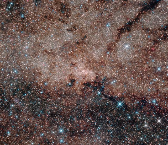
This picture, spanning 50 light-years across, is a mosaic stitched from nine separate images from Hubble’s Wide Field Camera 3. The center of the Milky Way is located 27,000 light-years away. The “snowstorm” of stars in the image is just the tip of the iceberg: Astronomers estimate that about 10 million stars in this cluster are too faint to be captured in this image. Read more: <a href="http://www.nasa.gov/feature/goddard/2016/hubble-s-journey-to-the-center-of-our-galaxy" rel="nofollow">www.nasa.gov/feature/goddard/2016/hubble-s-journey-to-the...</a> <b><a href="http://www.nasa.gov/audience/formedia/features/MP_Photo_Guidelines.html" rel="nofollow">NASA image use policy.</a></b> <b><a href="http://www.nasa.gov/centers/goddard/home/index.html" rel="nofollow">NASA Goddard Space Flight Center</a></b> enables NASA’s mission through four scientific endeavors: Earth Science, Heliophysics, Solar System Exploration, and Astrophysics. Goddard plays a leading role in NASA’s accomplishments by contributing compelling scientific knowledge to advance the Agency’s mission. <b>Follow us on <a href="http://twitter.com/NASAGoddardPix" rel="nofollow">Twitter</a></b> <b>Like us on <a href="http://www.facebook.com/pages/Greenbelt-MD/NASA-Goddard/395013845897?ref=tsd" rel="nofollow">Facebook</a></b> <b>Find us on <a href="http://instagrid.me/nasagoddard/?vm=grid" rel="nofollow">Instagram</a></b>
City lights shine brighter during the holidays in the United States when compared with the rest of the year, as shown using a new analysis of daily data from the NASA-NOAA Suomi NPP satellite. Dark green pixels are areas where lights are 50 percent brighter, or more, during December. Because snow reflects so much light, the researchers could only analyze snow-free cities. They focused on the U.S. West Coast from San Francisco and Los Angeles, and cities south of a rough imaginary line from St. Louis to Washington, D.C. Credit: Jesse Allen, NASA’s Earth Observatory Read more: <a href="http://www.nasa.gov/content/goddard/satellite-sees-holiday-lights-brighten-cities." rel="nofollow">www.nasa.gov/content/goddard/satellite-sees-holiday-light...</a>.<b><a href="http://www.nasa.gov/audience/formedia/features/MP_Photo_Guidelines.html" rel="nofollow">NASA image use policy.</a></b> <b><a href="http://www.nasa.gov/centers/goddard/home/index.html" rel="nofollow">NASA Goddard Space Flight Center</a></b> enables NASA’s mission through four scientific endeavors: Earth Science, Heliophysics, Solar System Exploration, and Astrophysics. Goddard plays a leading role in NASA’s accomplishments by contributing compelling scientific knowledge to advance the Agency’s mission. <b>Follow us on <a href="http://twitter.com/NASAGoddardPix" rel="nofollow">Twitter</a></b> <b>Like us on <a href="http://www.facebook.com/pages/Greenbelt-MD/NASA-Goddard/395013845897?ref=tsd" rel="nofollow">Facebook</a></b> <b>Find us on <a href="http://instagram.com/nasagoddard?vm=grid" rel="nofollow">Instagram</a></b>
This image displays a galaxy known as ESO 486-21 (with several other background galaxies and foreground stars visible in the field as well). ESO 486-21 is a spiral galaxy — albeit with a somewhat irregular and ill-defined structure — located some 30 million light-years from Earth. The NASA/ESA (European Space Agency) Hubble Space Telescope observed this object while performing a survey — the Legacy ExtraGalactic UV Survey (LEGUS) — of 50 nearby star-forming galaxies. The LEGUS sample was selected to cover a diverse range of galactic morphologies, star formation rates, galaxy masses and more. Astronomers use such data to understand how stars form and evolve within clusters, and how these processes affect both their home galaxy and the wider universe. ESO 486-21 is an ideal candidate for inclusion in such a survey because it is known to be in the process of forming new stars, which are created when large clouds of gas and dust (seen here in pink) within the galaxy crumple inwards upon themselves. Credit: NASA/ESA <b><a href="http://www.nasa.gov/audience/formedia/features/MP_Photo_Guidelines.html" rel="nofollow">NASA image use policy.</a></b> <b><a href="http://www.nasa.gov/centers/goddard/home/index.html" rel="nofollow">NASA Goddard Space Flight Center</a></b> enables NASA’s mission through four scientific endeavors: Earth Science, Heliophysics, Solar System Exploration, and Astrophysics. Goddard plays a leading role in NASA’s accomplishments by contributing compelling scientific knowledge to advance the Agency’s mission. <b>Follow us on <a href="http://twitter.com/NASAGoddardPix" rel="nofollow">Twitter</a></b> <b>Like us on <a href="http://www.facebook.com/pages/Greenbelt-MD/NASA-Goddard/395013845897?ref=tsd" rel="nofollow">Facebook</a></b> <b>Find us on <a href="http://instagrid.me/nasagoddard/?vm=grid" rel="nofollow">Instagram</a></b>
City lights shine brighter during the holidays in the United States when compared with the rest of the year, as shown using a new analysis of daily data from the NASA-NOAA Suomi NPP satellite. Dark green pixels are areas where lights are 50 percent brighter, or more, during December. Because snow reflects so much light, the researchers could only analyze snow-free cities. They focused on the U.S. West Coast from San Francisco and Los Angeles, and cities south of a rough imaginary line from St. Louis to Washington, D.C. Credit: Jesse Allen, NASA’s Earth Observatory Read more: <a href="http://www.nasa.gov/content/goddard/satellite-sees-holiday-lights-brighten-cities." rel="nofollow">www.nasa.gov/content/goddard/satellite-sees-holiday-light...</a>.<b><a href="http://www.nasa.gov/audience/formedia/features/MP_Photo_Guidelines.html" rel="nofollow">NASA image use policy.</a></b> <b><a href="http://www.nasa.gov/centers/goddard/home/index.html" rel="nofollow">NASA Goddard Space Flight Center</a></b> enables NASA’s mission through four scientific endeavors: Earth Science, Heliophysics, Solar System Exploration, and Astrophysics. Goddard plays a leading role in NASA’s accomplishments by contributing compelling scientific knowledge to advance the Agency’s mission. <b>Follow us on <a href="http://twitter.com/NASAGoddardPix" rel="nofollow">Twitter</a></b> <b>Like us on <a href="http://www.facebook.com/pages/Greenbelt-MD/NASA-Goddard/395013845897?ref=tsd" rel="nofollow">Facebook</a></b> <b>Find us on <a href="http://instagram.com/nasagoddard?vm=grid" rel="nofollow">Instagram</a></b>
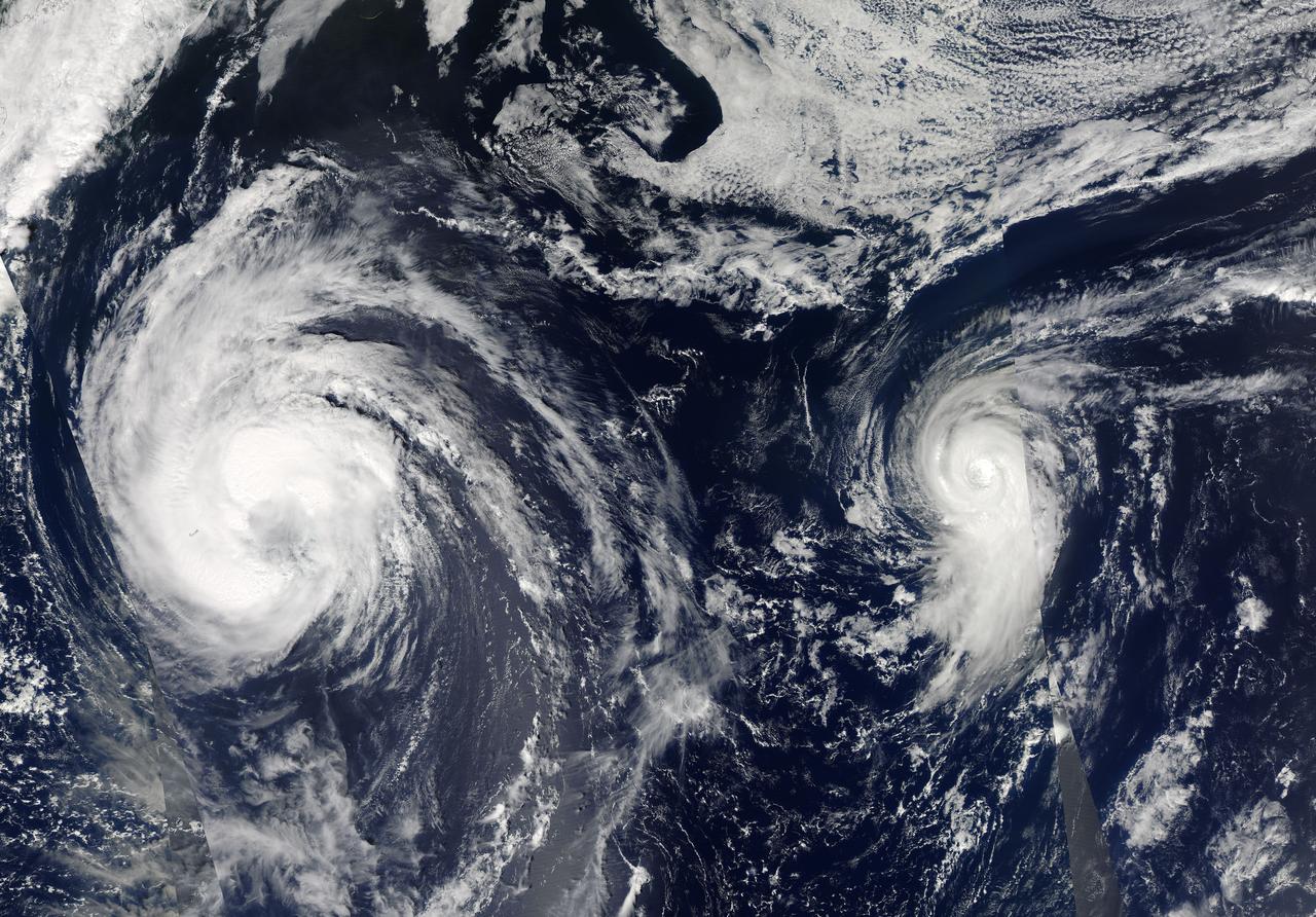
This visible image of Tropical Storm Leslie and Hurricane Michael was taken by the MODIS instrument aboard both NASA's Aqua and Terra satellites on Sept. 9 at 12:50 p.m. EDT. Credit: NASA Goddard/MODIS Rapid Response Team -- Satellite images from two NASA satellites were combined to create a full picture of Tropical Storm Leslie and Hurricane Michael spinning in the Atlantic Ocean. Imagery from NASA's Aqua and Terra satellites showed Leslie now past Bermuda and Michael in the north central Atlantic, and Leslie is much larger than the smaller, more powerful Michael. Images of each storm were taken by the Moderate Resolution Imaging Spectroradiometer, or MODIS instrument that flies onboard both the Aqua and Terra satellites. Both satellites captured images of both storms on Sept. 7 and Sept. 10. The image from Sept. 7 showed a much more compact Michael with a visible eye. By Sept. 10, the eye was no longer visible in Michael and the storm appeared more elongated from south to north. To continue reading go to: <a href="http://1.usa.gov/NkUPqn" rel="nofollow">1.usa.gov/NkUPqn</a> <b><a href="http://www.nasa.gov/audience/formedia/features/MP_Photo_Guidelines.html" rel="nofollow">NASA image use policy.</a></b> <b><a href="http://www.nasa.gov/centers/goddard/home/index.html" rel="nofollow">NASA Goddard Space Flight Center</a></b> enables NASA’s mission through four scientific endeavors: Earth Science, Heliophysics, Solar System Exploration, and Astrophysics. Goddard plays a leading role in NASA’s accomplishments by contributing compelling scientific knowledge to advance the Agency’s mission. <b>Follow us on <a href="http://twitter.com/NASA_GoddardPix" rel="nofollow">Twitter</a></b> <b>Like us on <a href="http://www.facebook.com/pages/Greenbelt-MD/NASA-Goddard/395013845897?ref=tsd" rel="nofollow">Facebook</a></b> <b>Find us on <a href="http://instagrid.me/nasagoddard/?vm=grid" rel="nofollow">Instagram</a></b>
City lights shine brighter during the holidays in the United States when compared with the rest of the year, as shown using a new analysis of daily data from the NASA-NOAA Suomi NPP satellite. Dark green pixels are areas where lights are 50 percent brighter, or more, during December. Because snow reflects so much light, the researchers could only analyze snow-free cities. They focused on the U.S. West Coast from San Francisco and Los Angeles, and cities south of a rough imaginary line from St. Louis to Washington, D.C. Credit: Jesse Allen, NASA’s Earth Observatory Read more: <a href="http://www.nasa.gov/content/goddard/satellite-sees-holiday-lights-brighten-cities." rel="nofollow">www.nasa.gov/content/goddard/satellite-sees-holiday-light...</a>.<b><a href="http://www.nasa.gov/audience/formedia/features/MP_Photo_Guidelines.html" rel="nofollow">NASA image use policy.</a></b> <b><a href="http://www.nasa.gov/centers/goddard/home/index.html" rel="nofollow">NASA Goddard Space Flight Center</a></b> enables NASA’s mission through four scientific endeavors: Earth Science, Heliophysics, Solar System Exploration, and Astrophysics. Goddard plays a leading role in NASA’s accomplishments by contributing compelling scientific knowledge to advance the Agency’s mission. <b>Follow us on <a href="http://twitter.com/NASAGoddardPix" rel="nofollow">Twitter</a></b> <b>Like us on <a href="http://www.facebook.com/pages/Greenbelt-MD/NASA-Goddard/395013845897?ref=tsd" rel="nofollow">Facebook</a></b> <b>Find us on <a href="http://instagram.com/nasagoddard?vm=grid" rel="nofollow">Instagram</a></b>
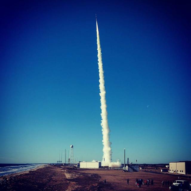
The Multiple User Suborbital Instrument Carrier or MUSIC payload was successfully launched at 9:50 a.m. today on a Terrier-Improved Malemute suborbital sounding rocket from NASA’s Wallops Flight Facility. The payload flew to approximately 115 miles apogee and preliminary analysis shows good data was received. Payload recovery is in progress. The next launch from Wallops is between 7 and 10 a.m. EST, Monday, March 7. Three space technology payloads will be carried on a Terrier-Improved Orion suborbital sounding rocket. Credit: NASA/Wallops/Allison Stancil <b><a href="http://www.nasa.gov/audience/formedia/features/MP_Photo_Guidelines.html" rel="nofollow">NASA image use policy.</a></b> <b><a href="http://www.nasa.gov/centers/goddard/home/index.html" rel="nofollow">NASA Goddard Space Flight Center</a></b> enables NASA’s mission through four scientific endeavors: Earth Science, Heliophysics, Solar System Exploration, and Astrophysics. Goddard plays a leading role in NASA’s accomplishments by contributing compelling scientific knowledge to advance the Agency’s mission. <b>Follow us on <a href="http://twitter.com/NASAGoddardPix" rel="nofollow">Twitter</a></b> <b>Like us on <a href="http://www.facebook.com/pages/Greenbelt-MD/NASA-Goddard/395013845897?ref=tsd" rel="nofollow">Facebook</a></b> <b>Find us on <a href="http://instagrid.me/nasagoddard/?vm=grid" rel="nofollow">Instagram</a></b>
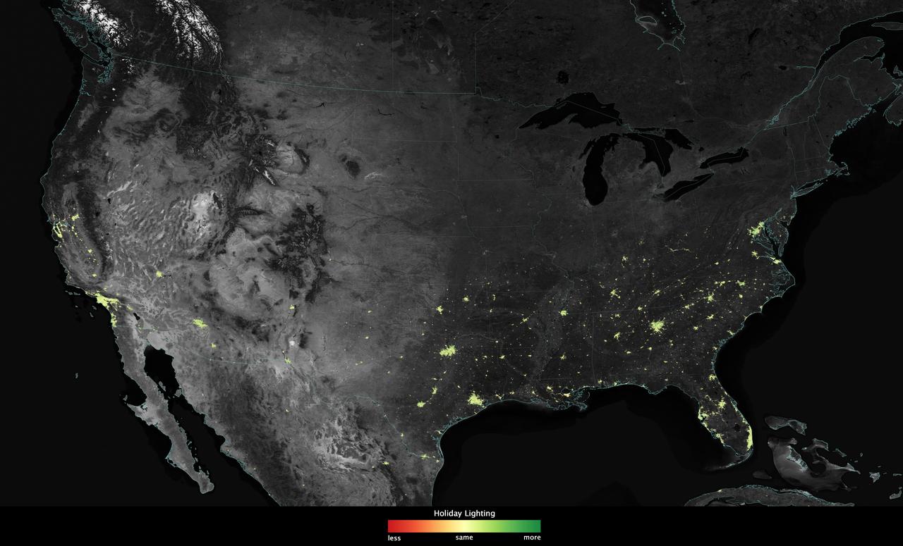
City lights shine brighter during the holidays in the United States when compared with the rest of the year, as shown using a new analysis of daily data from the NASA-NOAA Suomi NPP satellite. Dark green pixels are areas where lights are 50 percent brighter, or more, during December. Because snow reflects so much light, the researchers could only analyze snow-free cities. They focused on the U.S. West Coast from San Francisco and Los Angeles, and cities south of a rough imaginary line from St. Louis to Washington, D.C. Credit: Jesse Allen, NASA’s Earth Observatory Read more: <a href="http://www.nasa.gov/content/goddard/satellite-sees-holiday-lights-brighten-cities." rel="nofollow">www.nasa.gov/content/goddard/satellite-sees-holiday-light...</a>.<b><a href="http://www.nasa.gov/audience/formedia/features/MP_Photo_Guidelines.html" rel="nofollow">NASA image use policy.</a></b> <b><a href="http://www.nasa.gov/centers/goddard/home/index.html" rel="nofollow">NASA Goddard Space Flight Center</a></b> enables NASA’s mission through four scientific endeavors: Earth Science, Heliophysics, Solar System Exploration, and Astrophysics. Goddard plays a leading role in NASA’s accomplishments by contributing compelling scientific knowledge to advance the Agency’s mission. <b>Follow us on <a href="http://twitter.com/NASAGoddardPix" rel="nofollow">Twitter</a></b> <b>Like us on <a href="http://www.facebook.com/pages/Greenbelt-MD/NASA-Goddard/395013845897?ref=tsd" rel="nofollow">Facebook</a></b> <b>Find us on <a href="http://instagram.com/nasagoddard?vm=grid" rel="nofollow">Instagram</a></b>
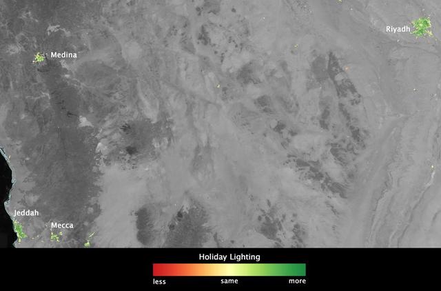
In several cities in the Middle East, city lights brighten during the Muslim holy month of Ramadan, as seen using a new analysis of daily data from the NASA-NOAA Suomi NPP satellite. Dark green pixels are areas where the lights are 50 percent brighter, or more, during Ramadan. Credit: Jesse Allen, NASA’s Earth Observatory Read more: <a href="http://www.nasa.gov/content/goddard/satellite-sees-holiday-lights-brighten-cities" rel="nofollow">www.nasa.gov/content/goddard/satellite-sees-holiday-light...</a> <b><a href="http://www.nasa.gov/audience/formedia/features/MP_Photo_Guidelines.html" rel="nofollow">NASA image use policy.</a></b> <b><a href="http://www.nasa.gov/centers/goddard/home/index.html" rel="nofollow">NASA Goddard Space Flight Center</a></b> enables NASA’s mission through four scientific endeavors: Earth Science, Heliophysics, Solar System Exploration, and Astrophysics. Goddard plays a leading role in NASA’s accomplishments by contributing compelling scientific knowledge to advance the Agency’s mission. <b>Follow us on <a href="http://twitter.com/NASAGoddardPix" rel="nofollow">Twitter</a></b> <b>Like us on <a href="http://www.facebook.com/pages/Greenbelt-MD/NASA-Goddard/395013845897?ref=tsd" rel="nofollow">Facebook</a></b> <b>Find us on <a href="http://instagram.com/nasagoddard?vm=grid" rel="nofollow">Instagram</a></b>

NASA’s Aqua satellite captured a large area of smoke from the Long Valley Wildfire that was affecting Yosemite National Park. This natural-color satellite image was collected by the Moderate Resolution Imaging Spectroradiometer instrument that flies aboard the Aqua satellite. The image, taken July 20, showed actively burning areas in red, as detected by MODIS’s thermal bands. According to Inciweb, an interagency all-risk incident information management system that coordinates with federal, state and local agencies to manage wildfires, the fire started on Tuesday July 11, 2017. It is located about two miles north of Doyle, California and about 50 miles north of Reno, Nevada. As of July 21 the fire covered 83,733 acres and was 91 percent contained. NASA image courtesy NASA MODIS Rapid Response Team <b><a href="http://www.nasa.gov/audience/formedia/features/MP_Photo_Guidelines.html" rel="nofollow">NASA image use policy.</a></b> <b><a href="http://www.nasa.gov/centers/goddard/home/index.html" rel="nofollow">NASA Goddard Space Flight Center</a></b> enables NASA’s mission through four scientific endeavors: Earth Science, Heliophysics, Solar System Exploration, and Astrophysics. Goddard plays a leading role in NASA’s accomplishments by contributing compelling scientific knowledge to advance the Agency’s mission. <b>Follow us on <a href="http://twitter.com/NASAGoddardPix" rel="nofollow">Twitter</a></b> <b>Like us on <a href="http://www.facebook.com/pages/Greenbelt-MD/NASA-Goddard/395013845897?ref=tsd" rel="nofollow">Facebook</a></b> <b>Find us on <a href="http://instagrid.me/nasagoddard/?vm=grid" rel="nofollow">Instagram</a></b>
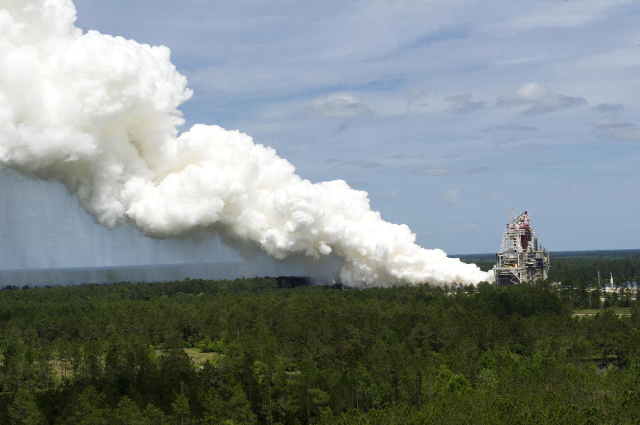
What better way to mark 50 years of rocket engine testing than with a rocket engine test? Stennis Space Center employees enjoyed a chance to view an RS-68 engine test at the B-1 Test Stand on April 19, almost 50 years to the day that the first test was conducted at the south Mississippi site in 1966. The test viewing was part of a weeklong celebration of the 50th year of rocket engine testing at Stennis. The first test at the site occurred April 23, 1966, with a 15-second firing of a Saturn V second stage prototype (S-II-C) on the A-2 Test Stand. The center subsequently tested Apollo rocket stages that carried humans to the moon and every main engine used to power 135 space shuttle missions. It currently tests engines for NASA’s new Space Launch System vehicle.
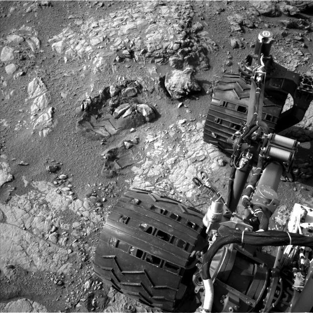
This view of Curiosity's left-front and left-center wheels and of marks made by wheels on the ground in the "Yellowknife Bay" area comes from one of six cameras used on Mars for the first time more than six months after the rover landed. The left Navigation Camera (Navcam) linked to Curiosity's B-side computer took this image during the 223rd Martian day, or sol, of Curiosity's work on Mars (March 22, 2013). The wheels are 20 inches (50 centimeters) in diameter. Curiosity carries a pair of main computers, redundant to each other, in order to have a backup available if one fails. Each of the computers, A-side and B-side, also has other redundant subsystems linked to just that computer. Curiosity operated on its A-side from before the August 2012 landing until Feb. 28, when engineers commanded a switch to the B-side in response to a memory glitch on the A-side. One set of activities after switching to the B-side computer has been to check the six engineering cameras that are hard-linked to that computer. The rover's science instruments, including five science cameras, can each be operated by either the A-side or B-side computer, whichever is active. However, each of Curiosity's 12 engineering cameras is linked to just one of the computers. The engineering cameras are the Navigation Camera (Navcam), the Front Hazard-Avoidance Camera (Front Hazcam) and Rear Hazard-Avoidance Camera (Rear Hazcam). Each of those three named cameras has four cameras as part of it: two stereo pairs of cameras, with one pair linked to each computer. Only the pairs linked to the active computer can be used, and the A-side computer was active from before landing, in August, until Feb. 28. All six of the B-side engineering cameras have been used during March 2013 and checked out OK. Image Credit: NASA/JPL-Caltech <b><a href="http://www.nasa.gov/audience/formedia/features/MP_Photo_Guidelines.html" rel="nofollow">NASA image use policy.</a></b> <b><a href="http://www.nasa.gov/centers/goddard/home/index.html" rel="nofollow">NASA Goddard Space Flight Center</a></b> enables NASA’s mission through four scientific endeavors: Earth Science, Heliophysics, Solar System Exploration, and Astrophysics. Goddard plays a leading role in NASA’s accomplishments by contributing compelling scientific knowledge to advance the Agency’s mission. <b>Follow us on <a href="http://twitter.com/NASA_GoddardPix" rel="nofollow">Twitter</a></b> <b>Like us on <a href="http://www.facebook.com/pages/Greenbelt-MD/NASA-Goddard/395013845897?ref=tsd" rel="nofollow">Facebook</a></b> <b>Find us on <a href="http://instagram.com/nasagoddard?vm=grid" rel="nofollow">Instagram</a></b>
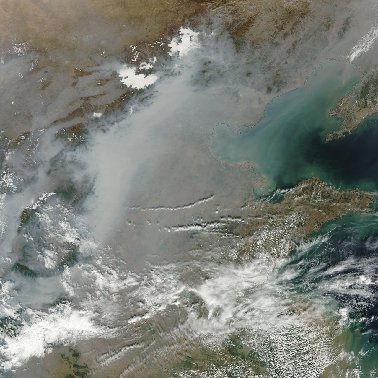
A thick layer of haze blanketed the North China Plain on October 9, 2014, when the Moderate Resolution Imaging Spectroradiometer (MODIS) on NASA’s Terra satellite acquired this natural-color image at 2:50 Coordinated Universal Time (10:50 a.m. local time). The haze obscured many features usually visible in MODIS imagery of the area, including China’s largest city, Beijing. On the day this image was acquired, measurements from ground-based sensors at the U.S. Consulate in Beijing reported PM2.5 measurements of 334 micrograms per cubic meter of air. Fine, airborne particulate matter (PM) that is smaller than 2.5 microns (about one thirtieth the width of a human hair) is considered dangerous because it is small enough to enter the passages of the human lungs. Most PM2.5 aerosol particles come from the burning of fossil fuels and biomass (wood fires and agricultural burning). The World Health Organization considers PM2.5 to be safe when it is below 25. Haze in this region tends to worsen in the fall and winter, when cold, heavy air traps pollutants near the surface. In this case, the haze was likely trapped by a temperature inversion. Normally, air is warmest near the surface of the Earth. Occasionally, a mass of warm air will move over cooler air so that the atmosphere actually warms with altitude. Since the cool air does not have the energy to rise through the warm air, vertical circulation slows and air becomes trapped near the surface. Any pollutant that enters the air gets trapped as well, and haze builds up over time. Daily satellite images of the North China Plain show that visible haze began to accumulate on October 7, 2014. NASA image courtesy Jeff Schmaltz, LANCE MODIS Rapid Response. Caption by Adam Voiland. Read more: <a href="http://earthobservatory.nasa.gov/NaturalHazards/view.php?id=84530&eocn=home&eoci=nh" rel="nofollow">earthobservatory.nasa.gov/NaturalHazards/view.php?id=8453...</a> Credit: <b><a href="http://www.earthobservatory.nasa.gov/" rel="nofollow"> NASA Earth Observatory</a></b> <b><a href="http://www.nasa.gov/audience/formedia/features/MP_Photo_Guidelines.html" rel="nofollow">NASA image use policy.</a></b> <b><a href="http://www.nasa.gov/centers/goddard/home/index.html" rel="nofollow">NASA Goddard Space Flight Center</a></b> enables NASA’s mission through four scientific endeavors: Earth Science, Heliophysics, Solar System Exploration, and Astrophysics. Goddard plays a leading role in NASA’s accomplishments by contributing compelling scientific knowledge to advance the Agency’s mission. <b>Follow us on <a href="http://twitter.com/NASAGoddardPix" rel="nofollow">Twitter</a></b> <b>Like us on <a href="http://www.facebook.com/pages/Greenbelt-MD/NASA-Goddard/395013845897?ref=tsd" rel="nofollow">Facebook</a></b> <b>Find us on <a href="http://instagram.com/nasagoddard?vm=grid" rel="nofollow">Instagram</a></b>
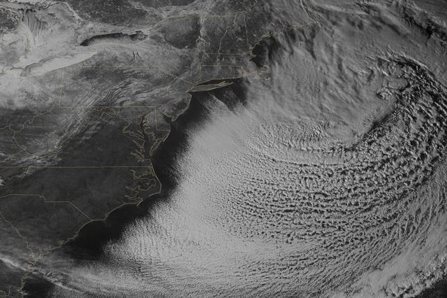
Yet another potent winter storm battered the northeastern United States on February 14-15, 2015. The nor'easter brought 12 to 20 inches (30 to 50 centimeters) of snow across much of eastern New England, along with tropical storm force winds over 60 miles (100 kilometers) per hour. The latest snowfall pushed Boston to its highest monthly total on record—58 inches and counting—and its third highest yearly snow total. This image was acquired by the GOES-East weather satellite at 3:45 p.m. Eastern Standard Time (20:45 Universal Time) on February 15, 2015, as the storm was mostly out to sea. Note the comma-like shape of the nor'easter, which spawned blizzard conditions at coastal locations. The official meteorological definition of a blizzard is three consecutive hours of falling or blowing snow with winds gusting above 35 miles (56 kilometers) per hour and visibility below one-fourth of a mile (0.4 kilometers). As of February 17, the snow depth near Boston was greater than in all but two reported locations in Alaska. It was significantly higher than the notoriously snowy states of Michigan, Wisconsin, and Minnesota. Only Buffalo, New York, had a higher snow pack. On February 16-17, more snow and ice fell across the eastern United States from northern Mississippi all the way to Maine. Read more: <a href="http://1.usa.gov/19wR4LI" rel="nofollow">1.usa.gov/19wR4LI</a> Via: <b><a href="http://www.earthobservatory.nasa.gov/" rel="nofollow"> NASA Earth Observatory</a></b> GOES image courtesy of the NASA/NOAA GOES Project Science team. Terra MODIS image by Jeff Schmaltz, LANCE/EOSDIS Rapid Response at NASA Goddard Space Flight Center. Caption by Mike Carlowicz. <b><a href="http://www.nasa.gov/audience/formedia/features/MP_Photo_Guidelines.html" rel="nofollow">NASA image use policy.</a></b> <b><a href="http://www.nasa.gov/centers/goddard/home/index.html" rel="nofollow">NASA Goddard Space Flight Center</a></b> enables NASA’s mission through four scientific endeavors: Earth Science, Heliophysics, Solar System Exploration, and Astrophysics. Goddard plays a leading role in NASA’s accomplishments by contributing compelling scientific knowledge to advance the Agency’s mission. <b>Follow us on <a href="http://twitter.com/NASAGoddardPix" rel="nofollow">Twitter</a></b> <b>Like us on <a href="http://www.facebook.com/pages/Greenbelt-MD/NASA-Goddard/395013845897?ref=tsd" rel="nofollow">Facebook</a></b> <b>Find us on <a href="http://instagram.com/nasagoddard?vm=grid" rel="nofollow">Instagram</a></b>
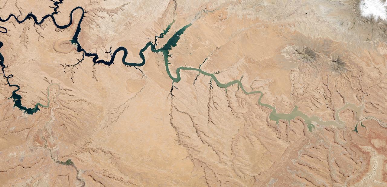
After 14 years of drought, Lake Powell was at 42 percent of its capacity as of May 20, 2014. The low water levels are evident in these images, which were acquired by the Landsat 8 satellite on May 13, 2014. White bleached rock show where Lake Powell’s shore is when the reservoir is at capacity. It is normal for water levels to fluctuate in the reservoir depending on how much water flows in from snow and rain and how much flows out to meet needs. However, it has been dry in all but three of the past 14 years. At the beginning of 2000, Lake Powell was at 94 percent of capacity. By October 2013 (the beginning of the 2014 water year), water levels had dropped to a low of 50 percent capacity, according to the Bureau of Reclamation, the agency that manages the reservoir. The Earth Observatory’s World of Change shows this annual fluctuation and overall decline. With slightly above average snowpack in the basin that feeds the lake, water levels are expected to rebound to about 51 percent of capacity by October 2014, the end of the water year. While the drop in water levels are worrying for those who generate electricity or use the water for agriculture, the lower water levels may be a draw for recreation. Boaters coming to Lake Powell in the spring of 2014 will find beaches and rock formations that are usually underwater. Bullfrog Bay is the starting point for many boat rentals. The popularity of the spot is evident in the lower image: boats dot the surface of the water, just tiny white flecks at this scale. NASA Earth Observatory image by Robert Simmon, using Landsat data from the U.S. Geological Survey. Caption by Holli Riebeek. Instrument(s): Landsat 8 - OLI Read more: <a href="http://1.usa.gov/1hck6NX" rel="nofollow">1.usa.gov/1hck6NX</a> Credit: <b><a href="http://www.earthobservatory.nasa.gov/" rel="nofollow"> NASA Earth Observatory</a></b> <b><a href="http://www.nasa.gov/audience/formedia/features/MP_Photo_Guidelines.html" rel="nofollow">NASA image use policy.</a></b> <b><a href="http://www.nasa.gov/centers/goddard/home/index.html" rel="nofollow">NASA Goddard Space Flight Center</a></b> enables NASA’s mission through four scientific endeavors: Earth Science, Heliophysics, Solar System Exploration, and Astrophysics. Goddard plays a leading role in NASA’s accomplishments by contributing compelling scientific knowledge to advance the Agency’s mission. <b>Follow us on <a href="http://twitter.com/NASAGoddardPix" rel="nofollow">Twitter</a></b> <b>Like us on <a href="http://www.facebook.com/pages/Greenbelt-MD/NASA-Goddard/395013845897?ref=tsd" rel="nofollow">Facebook</a></b> <b>Find us on <a href="http://instagram.com/nasagoddard?vm=grid" rel="nofollow">Instagram</a></b>
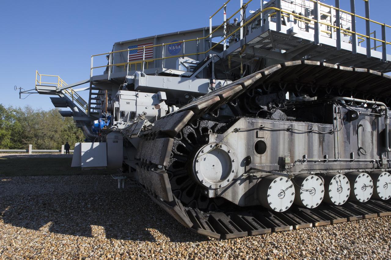
Crawler-transporter 2 (CT-2) moves slowly along the crawlerway on its way back to the Vehicle Assembly Building at NASA's Kennedy Space Center in Florida. The crawler took a trip to the Pad A/B split to test upgrades recently completed that will allow the giant vehicle to handle the load of the agency's Space Launch System rocket and Orion spacecraft atop the mobile launcher. The Ground Systems Development and Operations Program oversaw upgrades to the 50-year-old CT-2. New generators, gear assemblies, jacking, equalizing and leveling (JEL) hydraulic cylinders, roller bearings and brakes were installed, and other components were upgraded to prepare for Exploration Mission 1.
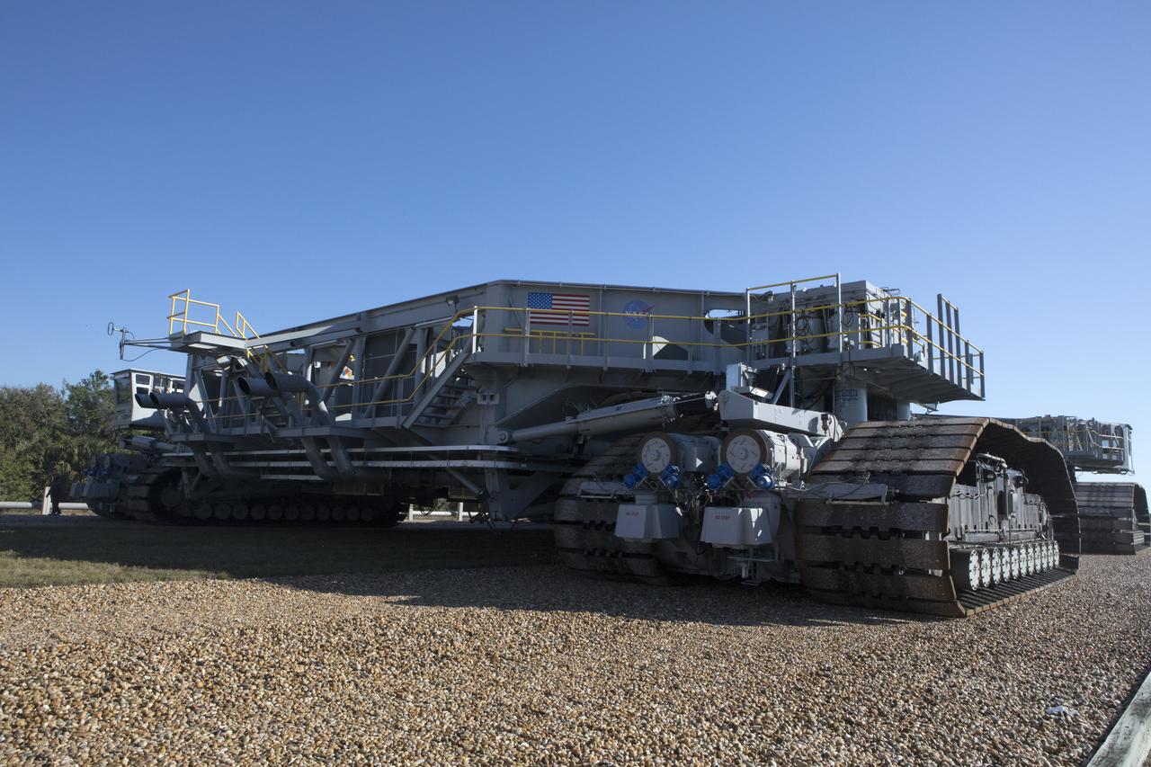
Crawler-transporter 2 (CT-2) moves slowly along the crawlerway on its way back to the Vehicle Assembly Building at NASA's Kennedy Space Center in Florida. The crawler took a trip to the Pad A/B split to test upgrades recently completed that will allow the giant vehicle to handle the load of the agency's Space Launch System rocket and Orion spacecraft atop the mobile launcher. The Ground Systems Development and Operations Program oversaw upgrades to the 50-year-old CT-2. New generators, gear assemblies, jacking, equalizing and leveling (JEL) hydraulic cylinders, roller bearings and brakes were installed, and other components were upgraded to prepare for Exploration Mission 1.
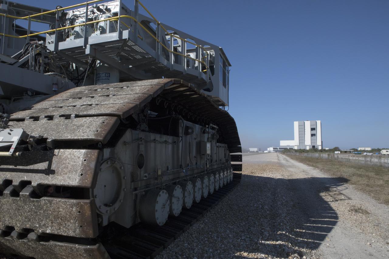
Crawler-transporter 2 (CT-2) moves slowly along the crawlerway toward the Vehicle Assembly Building (in the background) at NASA's Kennedy Space Center in Florida. The crawler took a trip to the Pad A/B split to test upgrades recently completed that will allow the giant vehicle to handle the load of the agency's Space Launch System rocket and Orion spacecraft atop the mobile launcher. The Ground Systems Development and Operations Program oversaw upgrades to the 50-year-old CT-2. New generators, gear assemblies, jacking, equalizing and leveling (JEL) hydraulic cylinders, roller bearings and brakes were installed, and other components were upgraded to prepare for Exploration Mission 1.

KENNEDY SPACE CENTER, FLA. -- The Space Mirror Memorial, seen in profile, is reflected in the nearby lake at the KSC Visitor Complex. The memorial is the scene of a ceremony being held in remembrance of the astronauts lost in the Apollo 1 fire: Virgil "Gus" Grissom, Edward H. White II and Roger B. Chaffee. The mirror was designated as a national memorial by Congress and President George Bush in 1991 to honor fallen astronauts. Their names are emblazoned on the monument's 42-1/2-foot-high by 50-foot-wide black granite surface as if to be projected into the heavens. Photo credit:NASA/George Shelton
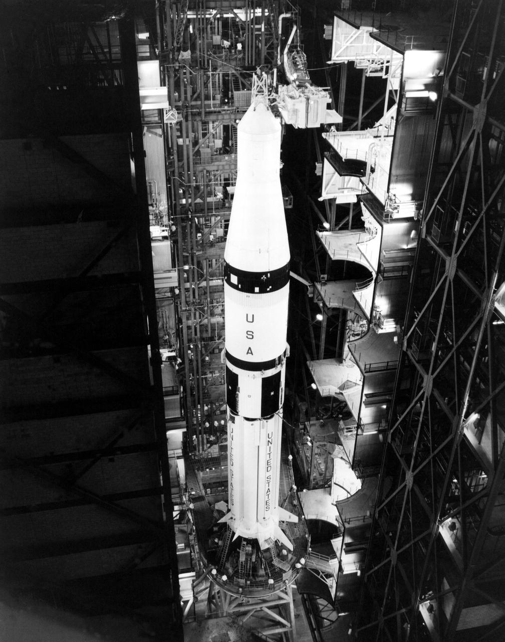
KENNEDY SPACE CENTER, FLA. -- The Saturn IB booster for the United States mission of the Apollo Soyuz Test Project is shown on its mobile launcher in a Vehicle Assembly Building high bay with a boilerplate Apollo spacecraft installed atop the instrument unit. The encapsulated Apollo spacecraft, docking module and docking adapter that will be launched atop the Chrysler-built booster will replace the boilerplate spacecraft prior to rollout of the space vehicle to Complex 39's Pad B, now scheduled March 24. Launch is scheduled at 3:50 p.m. EDT July 15.
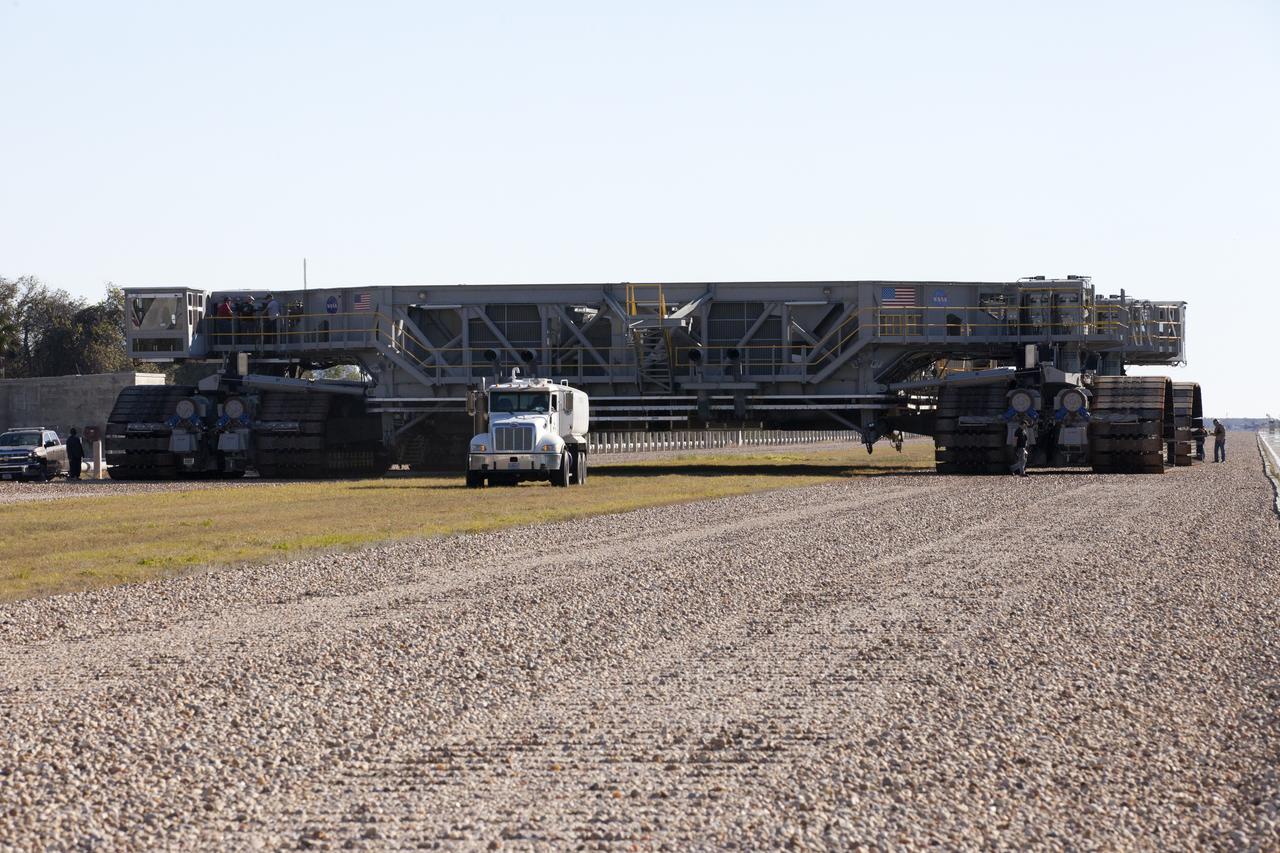
Crawler-transport 2 (CT-2) moves slowly along the crawlerway on its way back to the Vehicle Assembly Building at NASA's Kennedy Space Center in Florida. The crawler took a trip to the pad A/B split to test upgrades recently completed that will allow the giant vehicle to handle the load of the agency's Space Launch System rocket and Orion spacecraft atop the mobile launcher. The Ground Systems Development and Operations Program oversaw upgrades to the 50-year-old CT-2. New generators, gear assemblies, jacking, equalizing and leveling (JEL) hydraulic cylinders, roller bearings and brakes were installed, and other components were upgraded to prepare for Exploration Mission 1.
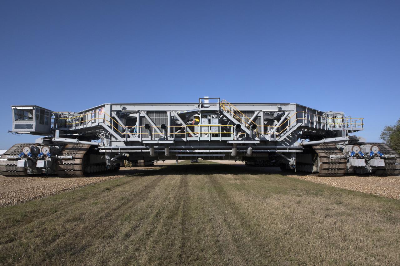
A full view of crawler-transporter 2 (CT-2) as it moves slowly along the crawlerway on its way back to the Vehicle Assembly Building at NASA's Kennedy Space Center in Florida. The crawler took a trip to the Pad A/B split to test upgrades recently completed that will allow the giant vehicle to handle the load of the agency's Space Launch System rocket and Orion spacecraft atop the mobile launcher. The Ground Systems Development and Operations Program oversaw upgrades to the 50-year-old CT-2. New generators, gear assemblies, jacking, equalizing and leveling (JEL) hydraulic cylinders, roller bearings and brakes were installed, and other components were upgraded to prepare for Exploration Mission 1.
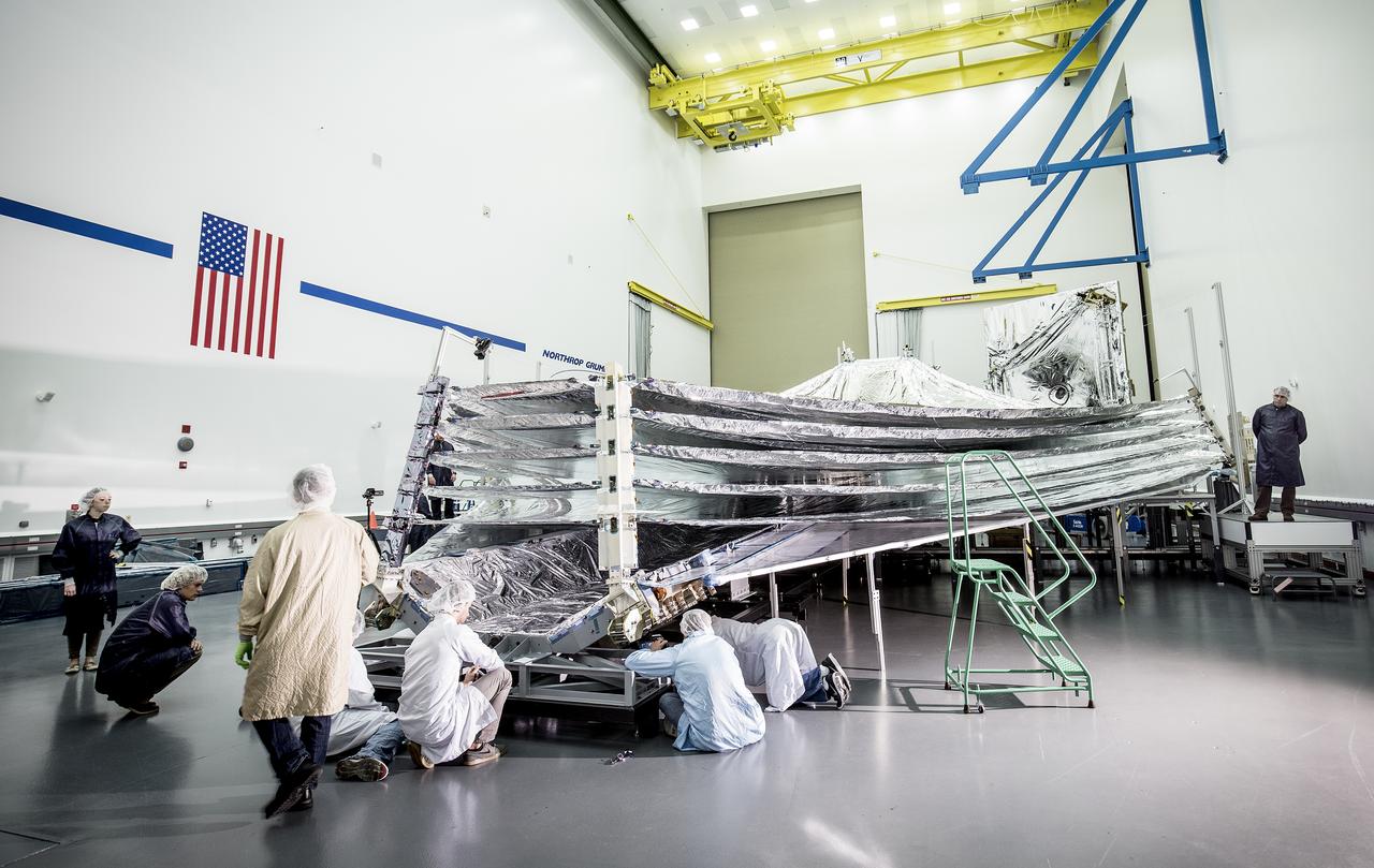
The sunshield on NASA's James Webb Space Telescope is the largest part of the observatory—five layers of thin, silvery membrane that must unfurl reliably in space. The precision in which the tennis-court sized sunshield has to open must be no more than a few centimeters different from its planned position. In this photo, engineers and scientists examine the sunshield layers on this full-sized test unit. Because there's a layer of the shiny silver material on the base under the five layers of the sunshield, it appears as if the sunshield has a mouth that is "open wide" while engineers take a look. The photo was taken in a clean room at Northrop Grumman Corporation, Redondo Beach, California. The sunshield separates the observatory into a warm sun-facing side and a cold side where the sunshine is blocked from interfering with the sensitive infrared instruments. The infrared instruments need to be kept very cold (under 50 K or -370 degrees Fahrenheit) to operate. The sunshield protects these sensitive instruments with an effective sun protection factor, or SPF, of 1,000,000. Sunscreen generally has an SPF of 8 to 50. In addition to providing a cold environment, the sunshield provides a thermally stable environment. This stability is essential to maintaining proper alignment of the primary mirror segments as the telescope changes its orientation to the sun. Earlier this year, the first flight layer of the sunshield was delivered to Northrop Grumman. Northrop Grumman is designing the Webb Telescope’s sunshield for NASA’s Goddard Space Flight Center, in Greenbelt, Maryland. Innovative sunshield membranes are being designed and manufactured by NeXolve Corporation of Huntsville, Alabama. The James Webb Space Telescope is the successor to NASA's Hubble Space Telescope. It will be the most powerful space telescope ever built. Webb is an international project led by NASA with its partners, the European Space Agency and the Canadian Space Agency. For more information about the Webb telescope, visit: <a href="http://www.jwst.nasa.gov" rel="nofollow">www.jwst.nasa.gov</a> or <a href="http://www.nasa.gov/webb" rel="nofollow">www.nasa.gov/webb</a> For more information on the Webb Sunshield, visit: <a href="http://jwst.nasa.gov/sunshield.html" rel="nofollow">jwst.nasa.gov/sunshield.html</a> Photo credit: Alex Evers/Northrop Grumman Corporation <b><a href="http://www.nasa.gov/audience/formedia/features/MP_Photo_Guidelines.html" rel="nofollow">NASA image use policy.</a></b> <b><a href="http://www.nasa.gov/centers/goddard/home/index.html" rel="nofollow">NASA Goddard Space Flight Center</a></b> enables NASA’s mission through four scientific endeavors: Earth Science, Heliophysics, Solar System Exploration, and Astrophysics. Goddard plays a leading role in NASA’s accomplishments by contributing compelling scientific knowledge to advance the Agency’s mission. <b>Follow us on <a href="http://twitter.com/NASAGoddardPix" rel="nofollow">Twitter</a></b> <b>Like us on <a href="http://www.facebook.com/pages/Greenbelt-MD/NASA-Goddard/395013845897?ref=tsd" rel="nofollow">Facebook</a></b> <b>Find us on <a href="http://instagrid.me/nasagoddard/?vm=grid" rel="nofollow">Instagram</a></b>
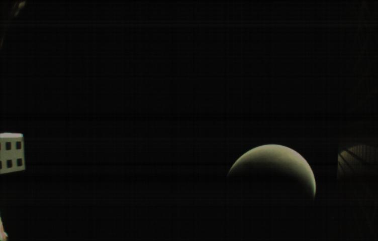
MarCO-B, one of the experimental Mars Cube One (MarCO) CubeSats, took this image of Mars from about 10,900 miles (17,500 kilometers) away just after NASA’s InSight spacecraft landed on Mars on Nov. 26, 2018. MarCO-B flew by Mars with its twin, MarCO-A, to serve as communications relays for InSight as it touched down on the Red Planet around noon PST (3 p.m. EST). This image was taken at 1 p.m. PST (4 p.m. EST). A crescent Mars with its south pole in the 4 o’clock position is visible in this picture. MarCO-B’s antenna reflector mirrors a portion of the illuminated part of Mars on the bottom right. The antenna feed (white rectangle with gold squares) is visible on the left. This image was taken about 50 minutes after PIA22833 and 10 seconds after PIA22832. The MarCO and InSight projects are managed for NASA's Science Mission Directorate, Washington, by JPL, a division of Caltech, Pasadena. Credit: NASA/JPL-Caltech

Discovered by British astronomer William Herschel over 200 years ago, NGC 2500 lies about 30 million light-years away in the northern constellation of Lynx. As this NASA/ESA Hubble Space Telescope image shows, NGC 2500 is a particular kind of spiral galaxy known as a barred spiral, its wispy arms swirling out from a bright, elongated core. Barred spirals are actually more common than was once thought. Around two-thirds of all spiral galaxies — including the Milky Way — exhibit these straight bars cutting through their centers. These cosmic structures act as glowing nurseries for newborn stars, and funnel material towards the active core of a galaxy. NGC 2500 is still actively forming new stars, although this process appears to be occurring very unevenly. The upper half of the galaxy — where the spiral arms are slightly better defined — hosts many more star-forming regions than the lower half, as indicated by the bright, dotted islands of light. There is another similarity between NGC 2500 and our home galaxy. Together with Andromeda, Triangulum and many smaller natural satellites, the Milky Way is part of the Local Group of galaxies, a gathering of over 50 galaxies all loosely held together by gravity. NGC 2500 forms a similar group with some of its nearby neighbors, including NGC 2541, NGC 2552, NGC 2537 and the bright, Andromeda-like spiral NGC 2481 (known collectively as the NGC 2841 group). Image Credit: ESA/Hubble/NASA <b><a href="http://www.nasa.gov/audience/formedia/features/MP_Photo_Guidelines.html" rel="nofollow">NASA image use policy.</a></b> <b><a href="http://www.nasa.gov/centers/goddard/home/index.html" rel="nofollow">NASA Goddard Space Flight Center</a></b> enables NASA’s mission through four scientific endeavors: Earth Science, Heliophysics, Solar System Exploration, and Astrophysics. Goddard plays a leading role in NASA’s accomplishments by contributing compelling scientific knowledge to advance the Agency’s mission. <b>Follow us on <a href="http://twitter.com/NASAGoddardPix" rel="nofollow">Twitter</a></b> <b>Like us on <a href="http://www.facebook.com/pages/Greenbelt-MD/NASA-Goddard/395013845897?ref=tsd" rel="nofollow">Facebook</a></b> <b>Find us on <a href="http://instagrid.me/nasagoddard/?vm=grid" rel="nofollow">Instagram</a></b>
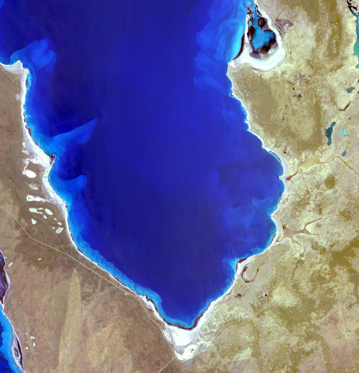
Hamelin Pool Marine Nature Reserve is located in the Shark Bay World Heritage Site in Western Australia. It is one of the very few places in the world where living stromatolites can be found. These are the first living examples of structures built by cyanobacteria. These bacteria are direct descendants of the oldest form of photosynthetic life on earth, dating back 3,500 million years (Wikipedia). The image was acquired December 30, 2010, covers an area of 34 x 46 km, and is located at 26.4 degrees south latitude, 114.1 degrees east longitude. With its 14 spectral bands from the visible to the thermal infrared wavelength region and its high spatial resolution of 15 to 90 meters (about 50 to 300 feet), ASTER images Earth to map and monitor the changing surface of our planet. ASTER is one of five Earth-observing instruments launched Dec. 18, 1999, on Terra. The instrument was built by Japan's Ministry of Economy, Trade and Industry. A joint U.S./Japan science team is responsible for validation and calibration of the instrument and data products. The broad spectral coverage and high spectral resolution of ASTER provides scientists in numerous disciplines with critical information for surface mapping and monitoring of dynamic conditions and temporal change. Example applications are: monitoring glacial advances and retreats; monitoring potentially active volcanoes; identifying crop stress; determining cloud morphology and physical properties; wetlands evaluation; thermal pollution monitoring; coral reef degradation; surface temperature mapping of soils and geology; and measuring surface heat balance. The U.S. science team is located at NASA's Jet Propulsion Laboratory, Pasadena, Calif. The Terra mission is part of NASA's Science Mission Directorate, Washington, D.C. More information about ASTER is available at <a href="http://asterweb.jpl.nasa.gov/" rel="nofollow">asterweb.jpl.nasa.gov/</a>. Credit: NASA/GSFC/METI/ERSDAC/JAROS, and U.S./Japan ASTER Science Team Image Addition Date: 2013-03-15 <b><a href="http://www.nasa.gov/audience/formedia/features/MP_Photo_Guidelines.html" rel="nofollow">NASA image use policy.</a></b> <b><a href="http://www.nasa.gov/centers/goddard/home/index.html" rel="nofollow">NASA Goddard Space Flight Center</a></b> enables NASA’s mission through four scientific endeavors: Earth Science, Heliophysics, Solar System Exploration, and Astrophysics. Goddard plays a leading role in NASA’s accomplishments by contributing compelling scientific knowledge to advance the Agency’s mission. <b>Follow us on <a href="http://twitter.com/NASA_GoddardPix" rel="nofollow">Twitter</a></b> <b>Like us on <a href="http://www.facebook.com/pages/Greenbelt-MD/NASA-Goddard/395013845897?ref=tsd" rel="nofollow">Facebook</a></b> <b>Find us on <a href="http://instagram.com/nasagoddard?vm=grid" rel="nofollow">Instagram</a></b>
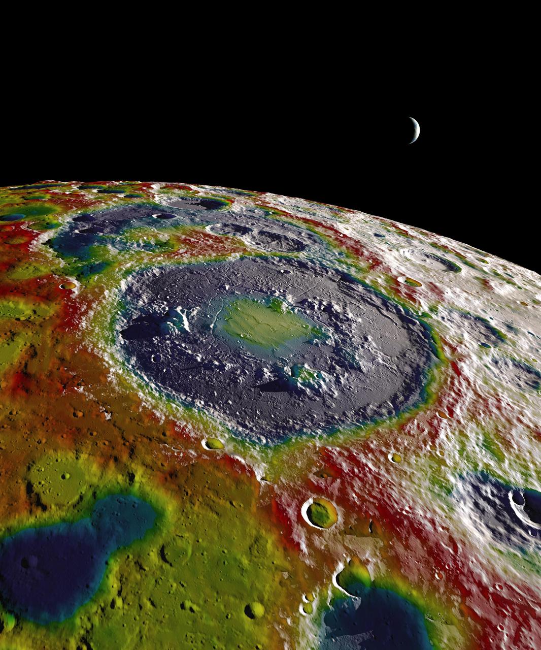
This still image features a free-air gravity map of the Moon's southern latitudes developed by S. Goossens et al. from data returned by the Gravity Recovery and Interior Laboratory (GRAIL) mission. If the Moon were a perfectly smooth sphere of uniform density, the gravity map would be a single, featureless color, indicating that the force of gravity at a given elevation was the same everywhere. But like other rocky bodies in the solar system, including Earth, the Moon has both a bumpy surface and a lumpy interior. Spacecraft in orbit around the Moon experience slight variations in gravity caused by both of these irregularities. The free-air gravity map shows deviations from the mean gravity that a cueball Moon would have. The deviations are measured in milliGals, a unit of acceleration. On the map, purple is at the low end of the range, at around -400 mGals, and red is at the high end near +400 mGals. Yellow denotes the mean. The map shown here extends from the south pole of the Moon up to 50°S and reveals the gravity for that region in even finer detail than the global gravity maps published previously. The image illustrates the very good correlation between the gravity map and topographic features such as peaks and craters, as well as the mass concentration lying beneath the large Schrödinger basin in the center of the frame. The terrain in the image is based on Lunar Reconnaissance Orbiter (LRO) altimeter and camera data. Credit: NASA's Scientific Visualization Studio <b><a href="http://www.nasa.gov/audience/formedia/features/MP_Photo_Guidelines.html" rel="nofollow">NASA image use policy.</a></b> <b><a href="http://www.nasa.gov/centers/goddard/home/index.html" rel="nofollow">NASA Goddard Space Flight Center</a></b> enables NASA’s mission through four scientific endeavors: Earth Science, Heliophysics, Solar System Exploration, and Astrophysics. Goddard plays a leading role in NASA’s accomplishments by contributing compelling scientific knowledge to advance the Agency’s mission. <b>Follow us on <a href="http://twitter.com/NASAGoddardPix" rel="nofollow">Twitter</a></b> <b>Like us on <a href="http://www.facebook.com/pages/Greenbelt-MD/NASA-Goddard/395013845897?ref=tsd" rel="nofollow">Facebook</a></b> <b>Find us on <a href="http://instagram.com/nasagoddard?vm=grid" rel="nofollow">Instagram</a></b>
It is easy to see the effect of the strong northeasterly wind shear battering Tropical Storm Gaemi in satellite imagery from NASA. This true-color image acquired on Oct. 5 shows a large oval-shaped area of showers and thunderstorms associated with the storm, southwest of the exposed center of circulation. NASA's Aqua satellite passed over Tropical Storm Gaemi as it was approaching Vietnam on Oct. 5, 2012 at 0550 UTC (1:50 a.m. EDT). A true-color image of the storm was captured by the Moderate Resolution Imaging Spectroradiometer (MODIS) instrument and shows bulk of showers and thunderstorms were clearly to the southwest of the center. The circulation center appears as a ring of concentric bands of clouds northeast of the large rounded area of clouds and showers associated with the storm. On Tuesday, October 5, 2012 at 1500 UTC (11 a.m. EDT), Tropical Storm Gaemi still had maximum sustained winds near 35 knots (40 mph/65 km/h) as it did 24 hours before. It was located 425 nautical miles (489 miles/787 km) east of Hue, Vietnam near 14.7 North latitude and 117.7 East longitude. Early on October 7, Tropical Storm Gaemi made landfall over Vietnam with wind speeds reported at 34 mph (55 mph), and bringing rainfall of more than 4 inches in some areas of Vietnam. Once ashore, the storm quickly moved inland and rapidly weakened as it headed towards Cambodia. With winds reduced, Gaemi served primarily as a rainmaker, but the rain may bring flooding and landslides to the region. Credit: NASA/GSFC/Jeff Schmaltz/MODIS Land Rapid Response Team <b><a href="http://www.nasa.gov/audience/formedia/features/MP_Photo_Guidelines.html" rel="nofollow">NASA image use policy.</a></b> <b><a href="http://www.nasa.gov/centers/goddard/home/index.html" rel="nofollow">NASA Goddard Space Flight Center</a></b> enables NASA’s mission through four scientific endeavors: Earth Science, Heliophysics, Solar System Exploration, and Astrophysics. Goddard plays a leading role in NASA’s accomplishments by contributing compelling scientific knowledge to advance the Agency’s mission. <b>Follow us on <a href="http://twitter.com/NASA_GoddardPix" rel="nofollow">Twitter</a></b> <b>Like us on <a href="http://www.facebook.com/pages/Greenbelt-MD/NASA-Goddard/395013845897?ref=tsd" rel="nofollow">Facebook</a></b> <b>Find us on <a href="http://instagrid.me/nasagoddard/?vm=grid" rel="nofollow">Instagram</a></b>
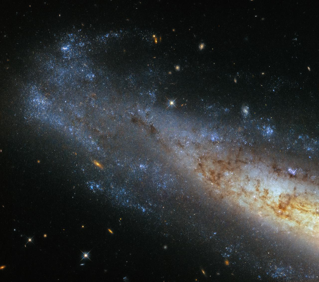
This image from Hubble’s Wide Field Camera 3 (WFC3) shows a section of NGC 1448, a spiral galaxy located about 50 million light-years from Earth in the little-known constellation of Horologium (The Pendulum Clock). We tend to think of spiral galaxies as massive and roughly circular celestial bodies, so this glittering oval does not immediately appear to fit the visual bill. What’s going on? Imagine a spiral galaxy as a circular frisbee spinning gently in space. When we see it face on, our observations reveal a spectacular amount of detail and structure — a great example from Hubble is the telescope’s view of Messier 51, otherwise known as the Whirlpool Galaxy. However, the NGC 1448 frisbee is very nearly edge-on with respect to Earth, giving it an appearance that is more oval than circular. The spiral arms, which curve out from NGC 1448’s dense core, can just about be seen. Although spiral galaxies might appear static with their picturesque shapes frozen in space, this is very far from the truth. The stars in these dramatic spiral configurations are constantly moving as they orbit around the galaxy’s core, with those on the inside making the orbit faster than those sitting further out. This makes the formation and continued existence of a spiral galaxy’s arms something of a cosmic puzzle, because the arms wrapped around the spinning core should become wound tighter and tighter as time goes on — but this is not what we see. This is known as the winding problem. Credit: ESA/Hubble & NASA #nasagoddard #space #science #Hubble #star <b><a href="http://www.nasa.gov/audience/formedia/features/MP_Photo_Guidelines.html" rel="nofollow">NASA image use policy.</a></b> <b><a href="http://www.nasa.gov/centers/goddard/home/index.html" rel="nofollow">NASA Goddard Space Flight Center</a></b> enables NASA’s mission through four scientific endeavors: Earth Science, Heliophysics, Solar System Exploration, and Astrophysics. Goddard plays a leading role in NASA’s accomplishments by contributing compelling scientific knowledge to advance the Agency’s mission. <b>Follow us on <a href="http://twitter.com/NASAGoddardPix" rel="nofollow">Twitter</a></b> <b>Like us on <a href="http://www.facebook.com/pages/Greenbelt-MD/NASA-Goddard/395013845897?ref=tsd" rel="nofollow">Facebook</a></b> <b>Find us on <a href="http://instagrid.me/nasagoddard/?vm=grid" rel="nofollow">Instagram</a></b>

On September 24, 2013, a major strike-slip earthquake rattled western Pakistan, killing at least 350 people and leaving more than 100,000 homeless. The 7.7 magnitude quake struck the Baluchistan province of northwestern Pakistan. Amidst the destruction, a new island was created offshore in the Paddi Zirr (West Bay) near Gwadar, Pakistan. On September 26, 2013, the Advanced Land Imager (ALI) on NASA’s Earth Observing-1 (EO-1) satellite captured the top image of that new island, which sits roughly one kilometer (0.6 miles) offshore. Likely a “mud volcano,” the island rose from the seafloor near Gwadar on September 24, shortly after the earthquake struck about 380 kilometers (230 miles) inland. The lower image, acquired by the Operational Land Imager on the Landsat 8 satellite, shows the same area on April 17, 2013. In the satellite images, lighter shades of green and tan in the water reveal shallow seafloor or suspended sediment. The water depth around the new island is roughly 15 to 20 meters (50 to 65 feet), according to marine geologist Asif Inam of Pakistan’s National Institute of Oceanography. “The floor in that area is generally flat, but the gradient in this area changes quite abruptly,” Inam said. The top image from ALI is also clear enough to show the parallel ripples of waves marching toward the shore. Read more: <a href="https://earthobservatory.nasa.gov/IOTD/view.php?id=82146" rel="nofollow">earthobservatory.nasa.gov/IOTD/view.php?id=82146</a> NASA Earth Observatory image by Jesse Allen and Robert Simmon, using EO-1 ALI data from the NASA EO-1 team. <b><a href="http://www.nasa.gov/audience/formedia/features/MP_Photo_Guidelines.html" rel="nofollow">NASA image use policy.</a></b> <b><a href="http://www.nasa.gov/centers/goddard/home/index.html" rel="nofollow">NASA Goddard Space Flight Center</a></b> enables NASA’s mission through four scientific endeavors: Earth Science, Heliophysics, Solar System Exploration, and Astrophysics. Goddard plays a leading role in NASA’s accomplishments by contributing compelling scientific knowledge to advance the Agency’s mission. <b>Follow us on <a href="http://twitter.com/NASAGoddardPix" rel="nofollow">Twitter</a></b> <b>Like us on <a href="http://www.facebook.com/pages/Greenbelt-MD/NASA-Goddard/395013845897?ref=tsd" rel="nofollow">Facebook</a></b> <b>Find us on <a href="http://instagrid.me/nasagoddard/?vm=grid" rel="nofollow">Instagram</a></b>

Mars is looking mighty fine in this portrait nabbed by the Hubble Space Telescope on a near close approach! Read more: <a href="http://go.nasa.gov/1rWYiBT" rel="nofollow">go.nasa.gov/1rWYiBT</a> The Hubble Space Telescope is more well known for its picturesque views of nebulae and galaxies, but it's also useful for studying our own planets, including Mars. Hubble imaged Mars on May 12, 2016 - ten days before Mars would be on the exact opposite side of the Earth from the Sun. Bright, frosty polar caps, and clouds above a vivid, rust-colored landscape reveal Mars as a dynamic seasonal planet in this NASA Hubble Space Telescope view taken on May 12, 2016, when Mars was 50 million miles from Earth. The Hubble image reveals details as small as 20 to 30 miles across. The large, dark region at far right is Syrtis Major Planitia, one of the first features identified on the surface of the planet by seventeenth-century observers. Christiaan Huygens used this feature to measure the rotation rate of Mars. (A Martian day is about 24 hours and 37 minutes.) Today we know that Syrtis Major is an ancient, inactive shield volcano. Late-afternoon clouds surround its summit in this view. A large oval feature to the south of Syrtis Major is the bright Hellas Planitia basin. About 1,100 miles across and nearly five miles deep, it was formed about 3.5 billion years ago by an asteroid impact. The orange area in the center of the image is Arabia Terra, a vast upland region in northern Mars that covers about 2,800 miles. The landscape is densely cratered and heavily eroded, indicating that it could be among the oldest terrains on the planet. Dried river canyons (too small to be seen here) wind through the region and empty into the large northern lowlands. Credit: NASA, ESA, the Hubble Heritage Team (STScI/AURA), J. Bell (ASU), and M. Wolff (Space Science Institute) #nasagoddard #mars #hubble #space <b><a href="http://www.nasa.gov/audience/formedia/features/MP_Photo_Guidelines.html" rel="nofollow">NASA image use policy.</a></b> <b><a href="http://www.nasa.gov/centers/goddard/home/index.html" rel="nofollow">NASA Goddard Space Flight Center</a></b> enables NASA’s mission through four scientific endeavors: Earth Science, Heliophysics, Solar System Exploration, and Astrophysics. Goddard plays a leading role in NASA’s accomplishments by contributing compelling scientific knowledge to advance the Agency’s mission. <b>Follow us on <a href="http://twitter.com/NASAGoddardPix" rel="nofollow">Twitter</a></b> <b>Like us on <a href="http://www.facebook.com/pages/Greenbelt-MD/NASA-Goddard/395013845897?ref=tsd" rel="nofollow">Facebook</a></b> <b>Find us on <a href="http://instagrid.me/nasagoddard/?vm=grid" rel="nofollow">Instagram</a></b>
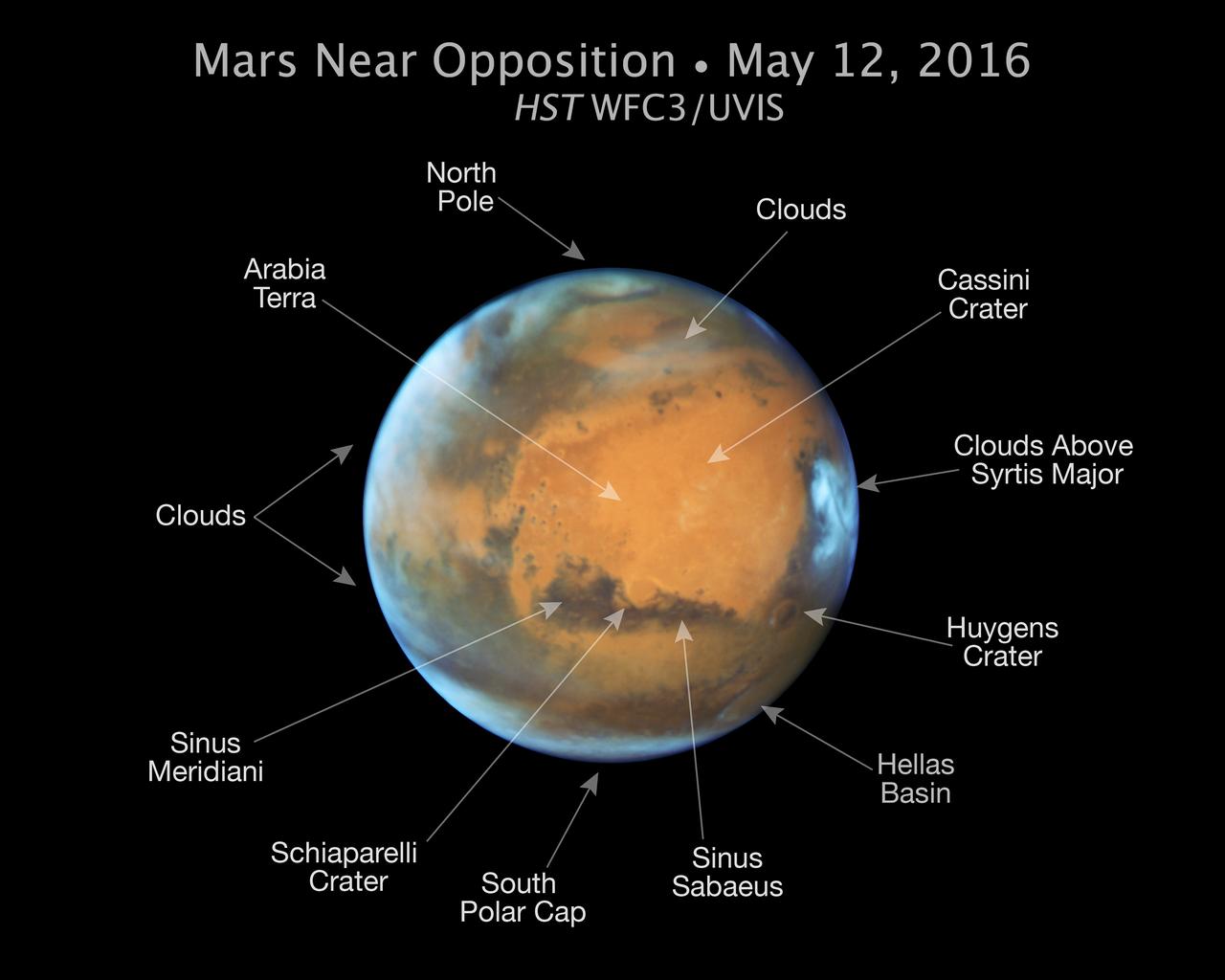
Mars is looking mighty fine in this portrait nabbed by the Hubble Space Telescope on a near close approach! Read more: <a href="http://go.nasa.gov/1rWYiBT" rel="nofollow">go.nasa.gov/1rWYiBT</a> The Hubble Space Telescope is more well known for its picturesque views of nebulae and galaxies, but it's also useful for studying our own planets, including Mars. Hubble imaged Mars on May 12, 2016 - ten days before Mars would be on the exact opposite side of the Earth from the Sun. Bright, frosty polar caps, and clouds above a vivid, rust-colored landscape reveal Mars as a dynamic seasonal planet in this NASA Hubble Space Telescope view taken on May 12, 2016, when Mars was 50 million miles from Earth. The Hubble image reveals details as small as 20 to 30 miles across. The large, dark region at far right is Syrtis Major Planitia, one of the first features identified on the surface of the planet by seventeenth-century observers. Christiaan Huygens used this feature to measure the rotation rate of Mars. (A Martian day is about 24 hours and 37 minutes.) Today we know that Syrtis Major is an ancient, inactive shield volcano. Late-afternoon clouds surround its summit in this view. A large oval feature to the south of Syrtis Major is the bright Hellas Planitia basin. About 1,100 miles across and nearly five miles deep, it was formed about 3.5 billion years ago by an asteroid impact. The orange area in the center of the image is Arabia Terra, a vast upland region in northern Mars that covers about 2,800 miles. The landscape is densely cratered and heavily eroded, indicating that it could be among the oldest terrains on the planet. Dried river canyons (too small to be seen here) wind through the region and empty into the large northern lowlands. Credit: NASA, ESA, the Hubble Heritage Team (STScI/AURA), J. Bell (ASU), and M. Wolff (Space Science Institute) #nasagoddard #mars #hubble #space <b><a href="http://www.nasa.gov/audience/formedia/features/MP_Photo_Guidelines.html" rel="nofollow">NASA image use policy.</a></b> <b><a href="http://www.nasa.gov/centers/goddard/home/index.html" rel="nofollow">NASA Goddard Space Flight Center</a></b> enables NASA’s mission through four scientific endeavors: Earth Science, Heliophysics, Solar System Exploration, and Astrophysics. Goddard plays a leading role in NASA’s accomplishments by contributing compelling scientific knowledge to advance the Agency’s mission. <b>Follow us on <a href="http://twitter.com/NASAGoddardPix" rel="nofollow">Twitter</a></b> <b>Like us on <a href="http://www.facebook.com/pages/Greenbelt-MD/NASA-Goddard/395013845897?ref=tsd" rel="nofollow">Facebook</a></b> <b>Find us on <a href="http://instagrid.me/nasagoddard/?vm=grid" rel="nofollow">Instagram</a></b>
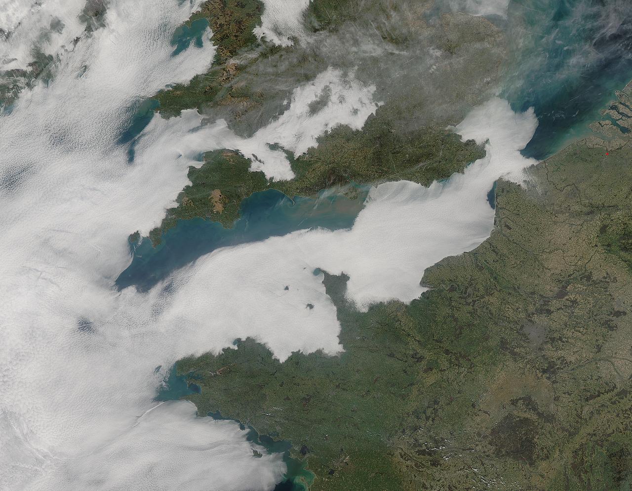
A thick blanket of low clouds covered the English Channel, Celtic Sea and Irish Sea on March 13, 2014. The fog also crept over major cities in the United Kingdom and Ireland. While citizens living in parts of Ireland, England, Wales, Scotland and Northern Ireland were posting ground-based photos of fog-shrouded landscape on social media, the internet and news outlets, the scene was also captured from space. The Moderate Resolution Imaging Spectroradiometer (MODIS) aboard NASA’s Aqua captured this true-color image of the cloudy day at 13:00 UTC (1:00 p.m. in London) on that same day. The dense fog (low clouds) affected air travel, causing the cancellation of hundreds of flights going through London City Airport, where visibility was reported at less than 100 meters (328 ft) – less than the length of an American football field. Flights were also cancelled at Heathrow, Gatwick and Manchester. A private helicopter flying to Northern Ireland went down in by the fog near the Norfolk-Suffolk border, with loss of four lives. Driving was little better in many areas, causing the Met Office to issue a yellow weather warning and to caution drivers of difficult conditions. The lowest visibility of the day was reported at Roches Point weather station. Located at the southeastern tip of Cork Harbor, Ireland, the station reported visibility of less than 50 meters (164 ft) – the length of an Olympic size swimming pool. In this image, the fog-covered Celtic Sea is located in the southwest. Ireland lies under tendrils of low cloud in the northwest corner of the image. Banks of clouds part around England, near the center of the image, and southern Wales (top and center) completely under the foggy blanket. Fog also creeps over the coasts of France, Belgium and the Netherlands on the east side of the English Channel. Credit: NASA/GSFC/Jeff Schmaltz/MODIS Land Rapid Response Team <b><a href="http://www.nasa.gov/audience/formedia/features/MP_Photo_Guidelines.html" rel="nofollow">NASA image use policy.</a></b> <b><a href="http://www.nasa.gov/centers/goddard/home/index.html" rel="nofollow">NASA Goddard Space Flight Center</a></b> enables NASA’s mission through four scientific endeavors: Earth Science, Heliophysics, Solar System Exploration, and Astrophysics. Goddard plays a leading role in NASA’s accomplishments by contributing compelling scientific knowledge to advance the Agency’s mission. <b>Follow us on <a href="http://twitter.com/NASAGoddardPix" rel="nofollow">Twitter</a></b> <b>Like us on <a href="http://www.facebook.com/pages/Greenbelt-MD/NASA-Goddard/395013845897?ref=tsd" rel="nofollow">Facebook</a></b> <b>Find us on <a href="http://instagram.com/nasagoddard?vm=grid" rel="nofollow">Instagram</a></b>
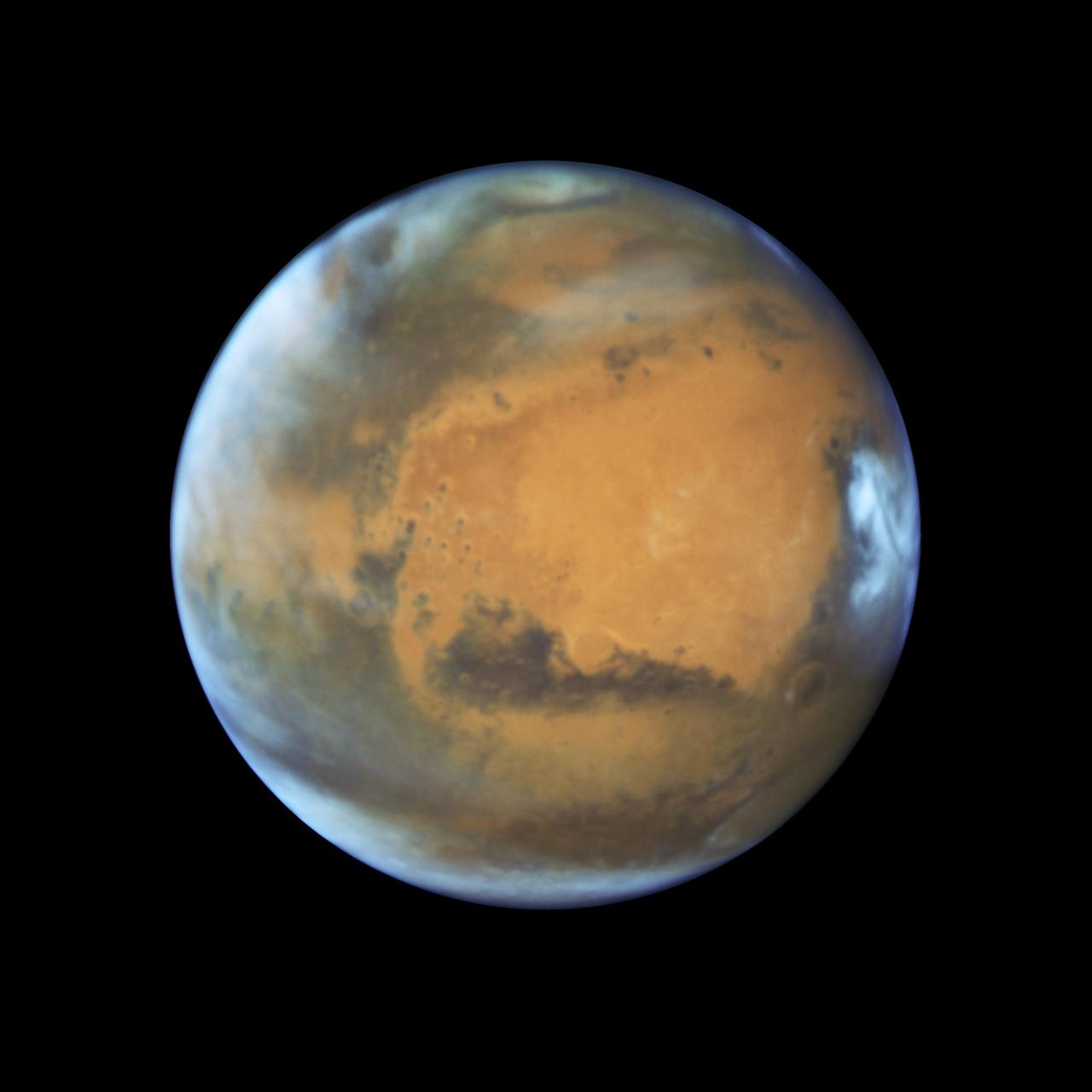
Mars is looking mighty fine in this portrait nabbed by the Hubble Space Telescope on a near close approach! Read more: <a href="http://go.nasa.gov/1rWYiBT" rel="nofollow">go.nasa.gov/1rWYiBT</a> The Hubble Space Telescope is more well known for its picturesque views of nebulae and galaxies, but it's also useful for studying our own planets, including Mars. Hubble imaged Mars on May 12, 2016 - ten days before Mars would be on the exact opposite side of the Earth from the Sun. Bright, frosty polar caps, and clouds above a vivid, rust-colored landscape reveal Mars as a dynamic seasonal planet in this NASA Hubble Space Telescope view taken on May 12, 2016, when Mars was 50 million miles from Earth. The Hubble image reveals details as small as 20 to 30 miles across. The large, dark region at far right is Syrtis Major Planitia, one of the first features identified on the surface of the planet by seventeenth-century observers. Christiaan Huygens used this feature to measure the rotation rate of Mars. (A Martian day is about 24 hours and 37 minutes.) Today we know that Syrtis Major is an ancient, inactive shield volcano. Late-afternoon clouds surround its summit in this view. A large oval feature to the south of Syrtis Major is the bright Hellas Planitia basin. About 1,100 miles across and nearly five miles deep, it was formed about 3.5 billion years ago by an asteroid impact. The orange area in the center of the image is Arabia Terra, a vast upland region in northern Mars that covers about 2,800 miles. The landscape is densely cratered and heavily eroded, indicating that it could be among the oldest terrains on the planet. Dried river canyons (too small to be seen here) wind through the region and empty into the large northern lowlands. Credit: NASA, ESA, the Hubble Heritage Team (STScI/AURA), J. Bell (ASU), and M. Wolff (Space Science Institute) #nasagoddard #mars #hubble #space <b><a href="http://www.nasa.gov/audience/formedia/features/MP_Photo_Guidelines.html" rel="nofollow">NASA image use policy.</a></b> <b><a href="http://www.nasa.gov/centers/goddard/home/index.html" rel="nofollow">NASA Goddard Space Flight Center</a></b> enables NASA’s mission through four scientific endeavors: Earth Science, Heliophysics, Solar System Exploration, and Astrophysics. Goddard plays a leading role in NASA’s accomplishments by contributing compelling scientific knowledge to advance the Agency’s mission. <b>Follow us on <a href="http://twitter.com/NASAGoddardPix" rel="nofollow">Twitter</a></b> <b>Like us on <a href="http://www.facebook.com/pages/Greenbelt-MD/NASA-Goddard/395013845897?ref=tsd" rel="nofollow">Facebook</a></b> <b>Find us on <a href="http://instagrid.me/nasagoddard/?vm=grid" rel="nofollow">Instagram</a></b>
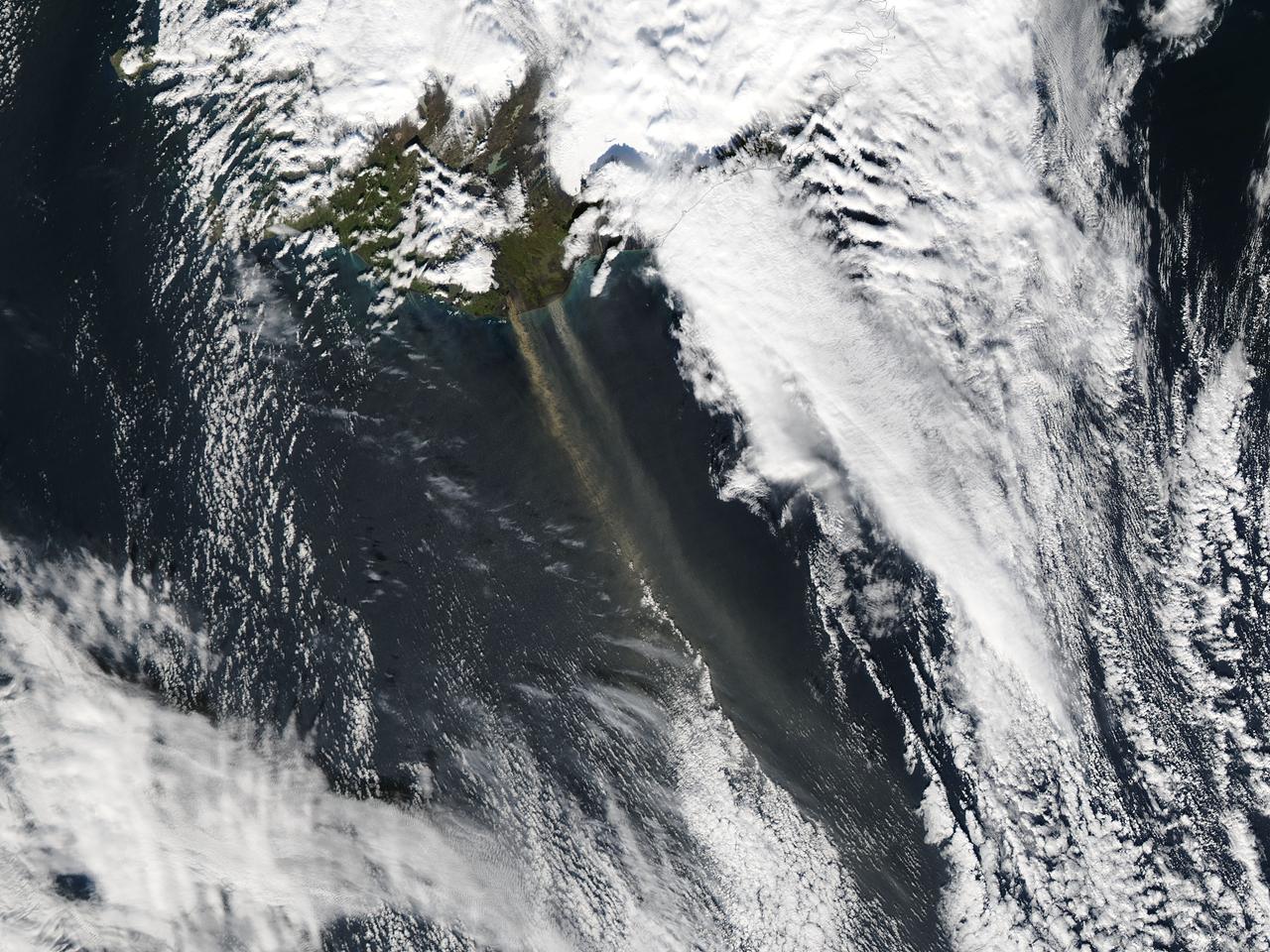
On September 16, 2013 the Moderate Resolution Imaging Spectroradiometer (MODIS) aboard NASA’s Aqua satellite passed over the southern tip of Iceland and captured a remarkable image dust plumes blowing hundreds of kilometers over the Atlantic Ocean. The westernmost plume is dark tan in color and so thick that the blue ocean waters are obscured from view near Iceland's coast. The eastern plume appears broader, thinner and light gray in color. According to the Icelandic Met Office, near the Mýrdalsjökull and Vatnajökull ice-caps there are vast glacial outwash plains which stretch from the glacial margins to the sea. These plains, formed by melt water from glaciers, are known as sandur. Strong northerly winds frequently blow dust from the sandur plains far from the shore. This particular dust plume originates to the east of the Mýrdalsjökull ice cap. The Katla volcano, one of the largest in Iceland, lies under the Mýrdalsjökull glacier and in the general region of the westernmost plume. Katla has a history of large, violent eruptions occurring on an average of every 50-100 years. The volcano has been increasingly restless since 1999, with increased seismicity in recent years. In 2011 a very small eruption was reported, with minimal damage. Because of the increasing restlessness and the dangerous nature of historic eruptions, the volcano is currently carefully monitored. None of the monitoring agencies reported eruption at Katla in mid-September of this year. Credit: NASA/GSFC/Jeff Schmaltz/MODIS Land Rapid Response Team <b><a href="http://www.nasa.gov/audience/formedia/features/MP_Photo_Guidelines.html" rel="nofollow">NASA image use policy.</a></b> <b><a href="http://www.nasa.gov/centers/goddard/home/index.html" rel="nofollow">NASA Goddard Space Flight Center</a></b> enables NASA’s mission through four scientific endeavors: Earth Science, Heliophysics, Solar System Exploration, and Astrophysics. Goddard plays a leading role in NASA’s accomplishments by contributing compelling scientific knowledge to advance the Agency’s mission. <b>Follow us on <a href="http://twitter.com/NASA_GoddardPix" rel="nofollow">Twitter</a></b> <b>Like us on <a href="http://www.facebook.com/pages/Greenbelt-MD/NASA-Goddard/395013845897?ref=tsd" rel="nofollow">Facebook</a></b> <b>Find us on <a href="http://instagram.com/nasagoddard?vm=grid" rel="nofollow">Instagram</a></b>
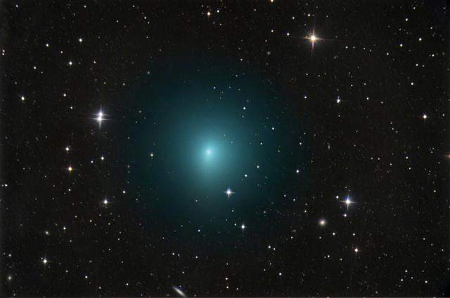
On April 1, 2017, comet 41P will pass closer than it normally does to Earth, giving observers with binoculars or a telescope a special viewing opportunity. Comet hunters in the Northern Hemisphere should look for it near the constellations Draco and Ursa Major, which the Big Dipper is part of. Whether a comet will put on a good show for observers is notoriously difficult to predict, but 41P has a history of outbursts, and put on quite a display in 1973. If the comet experiences similar outbursts this time, there’s a chance it could become bright enough to see with the naked eye. The comet is expected to reach perihelion, or its closest approach to the sun, on April 12. A member of the Jupiter family of comets, 41P makes a trip around the sun every 5.4 years, coming relatively close to Earth on some of those trips. On this approach, the comet will pass our planet at a distance of about 13 million miles (0.14 astronomical units), or about 55 times the distance from Earth to the moon. This is the comet’s closest approach to Earth in more than 50 years and perhaps more than a century. Read more: <a href="https://go.nasa.gov/2nLNzes" rel="nofollow">go.nasa.gov/2nLNzes</a> Photo caption: In this image taken March 24, 2017, comet 41P/Tuttle-Giacobini-Kresák is shown moving through a field of faint galaxies in the bowl of the Big Dipper. On April 1, the comet will pass by Earth at a distance of about 13 million miles (0.14 astronomical units), or 55 times the distance from Earth to the moon; that is a much closer approach than usual for this Jupiter-family comet. Photo credit: Image copyright Chris Schur©, used with permission <b><a href="http://www.nasa.gov/audience/formedia/features/MP_Photo_Guidelines.html" rel="nofollow">NASA image use policy.</a></b> <b><a href="http://www.nasa.gov/centers/goddard/home/index.html" rel="nofollow">NASA Goddard Space Flight Center</a></b> enables NASA’s mission through four scientific endeavors: Earth Science, Heliophysics, Solar System Exploration, and Astrophysics. Goddard plays a leading role in NASA’s accomplishments by contributing compelling scientific knowledge to advance the Agency’s mission. <b>Follow us on <a href="http://twitter.com/NASAGoddardPix" rel="nofollow">Twitter</a></b> <b>Like us on <a href="http://www.facebook.com/pages/Greenbelt-MD/NASA-Goddard/395013845897?ref=tsd" rel="nofollow">Facebook</a></b> <b>Find us on <a href="http://instagrid.me/nasagoddard/?vm=grid" rel="nofollow">Instagram</a></b>
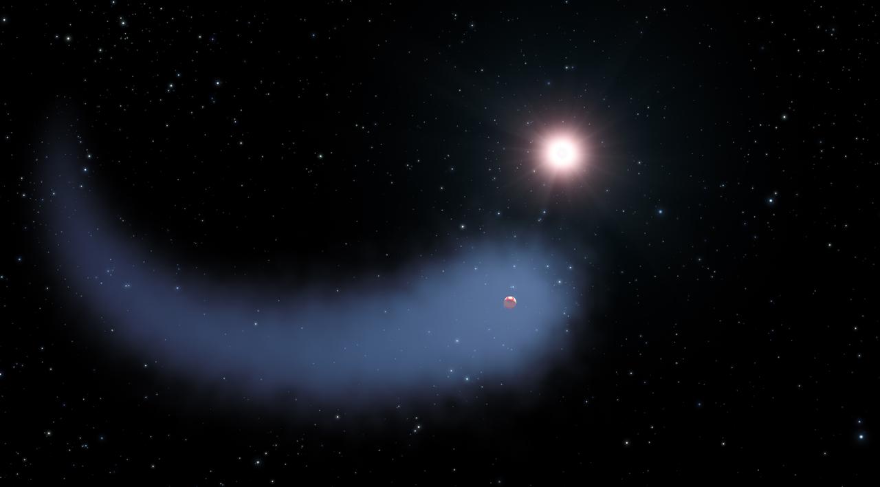
Astronomers using NASA’s Hubble Space Telescope have discovered an immense cloud of hydrogen dubbed “The Behemoth” bleeding from a planet orbiting a nearby star. The enormous, comet-like feature is about 50 times the size of the parent star. The hydrogen is evaporating from a warm, Neptune-sized planet, due to extreme radiation from the star. This phenomenon has never been seen around an exoplanet so small. It may offer clues to how other planets with hydrogen-enveloped atmospheres could have their outer layers evaporated by their parent star, leaving behind solid, rocky cores. Hot, rocky planets such as these that roughly the size of Earth are known as Hot-Super Earths. “This cloud is very spectacular, though the evaporation rate does not threaten the planet right now,” explains the study’s leader, David Ehrenreich of the Observatory of the University of Geneva in Switzerland. “But we know that in the past, the star, which is a faint red dwarf, was more active. This means that the planet evaporated faster during its first billion years of existence because of the strong radiation from the young star. Overall, we estimate that it may have lost up to 10 percent of its atmosphere over the past several billion years.” Read more: <a href="http://www.nasa.gov/feature/goddard/hubble-sees-a-behemoth-bleeding-atmosphere-around-a-warm-exoplanet" rel="nofollow">www.nasa.gov/feature/goddard/hubble-sees-a-behemoth-bleed...</a> Caption: This artist's concept shows "The Behemoth," an enormous comet-like cloud of hydrogen bleeding off of a warm, Neptune-sized planet just 30 light-years from Earth. Also depicted is the parent star, which is a faint red dwarf named GJ 436. The hydrogen is evaporating from the planet due to extreme radiation from the star. A phenomenon this large has never before been seen around any exoplanet. Credits: NASA, ESA, and G. Bacon (STScI) <b><a href="http://www.nasa.gov/audience/formedia/features/MP_Photo_Guidelines.html" rel="nofollow">NASA image use policy.</a></b> <b><a href="http://www.nasa.gov/centers/goddard/home/index.html" rel="nofollow">NASA Goddard Space Flight Center</a></b> enables NASA’s mission through four scientific endeavors: Earth Science, Heliophysics, Solar System Exploration, and Astrophysics. Goddard plays a leading role in NASA’s accomplishments by contributing compelling scientific knowledge to advance the Agency’s mission. <b>Follow us on <a href="http://twitter.com/NASAGoddardPix" rel="nofollow">Twitter</a></b> <b>Like us on <a href="http://www.facebook.com/pages/Greenbelt-MD/NASA-Goddard/395013845897?ref=tsd" rel="nofollow">Facebook</a></b> <b>Find us on <a href="http://instagrid.me/nasagoddard/?vm=grid" rel="nofollow">Instagram</a></b>

Located off the east coast of Russia, the Sea of Okhotsk stretches down to 45 degrees North latitude, and sea ice forms regularly in the basin. In fact, it is the lowest latitude for seasonal sea ice formation in the world. On January 4, 2015, the Moderate Resolution Imaging Spectroradiometer (MODIS) on NASA’s Terra satellite captured this true-color image of the ice-covered Sea of Okhotsk. Every winter, winds from East Siberia, frigid air temperatures, and a large amount of freshwater flowing out from rivers promote the formation of sea ice in the region. Much of the freshwater comes from the Amur River, one of the ten longest rivers in the world. From year to year, variations in temperature and wind speed can cause large fluctuations in sea ice extent. The sea spans more than 1,500,000 square kilometers (600,000 square miles), and ice cover can spread across 50 to 90 percent of it at its annual peak. On average, that ice persists for 180 days. According to research published in 2014, the region's sea ice has been decreasing over a 34-year period. Annual ice production in the Sea of Okhotsk dropped by more than 11 percent from 1974 to 2008. The researchers suggest that this decline has, at least in part, "led to weakening of the overturning in the North Pacific." Water with less sea ice is fresher, less dense, and unable to sink and circulate as well as salty, dense water. A weakened circulation in the North Pacific has implications for the supply of nutrients, such as iron, that affect biological productivity. Credit: NASA/GSFC/Jeff Schmaltz/MODIS Land Rapid Response Team <b><a href="http://www.nasa.gov/audience/formedia/features/MP_Photo_Guidelines.html" rel="nofollow">NASA image use policy.</a></b> <b><a href="http://www.nasa.gov/centers/goddard/home/index.html" rel="nofollow">NASA Goddard Space Flight Center</a></b> enables NASA’s mission through four scientific endeavors: Earth Science, Heliophysics, Solar System Exploration, and Astrophysics. Goddard plays a leading role in NASA’s accomplishments by contributing compelling scientific knowledge to advance the Agency’s mission. <b>Follow us on <a href="http://twitter.com/NASAGoddardPix" rel="nofollow">Twitter</a></b> <b>Like us on <a href="http://www.facebook.com/pages/Greenbelt-MD/NASA-Goddard/395013845897?ref=tsd" rel="nofollow">Facebook</a></b> <b>Find us on <a href="http://instagram.com/nasagoddard?vm=grid" rel="nofollow">Instagram</a></b>
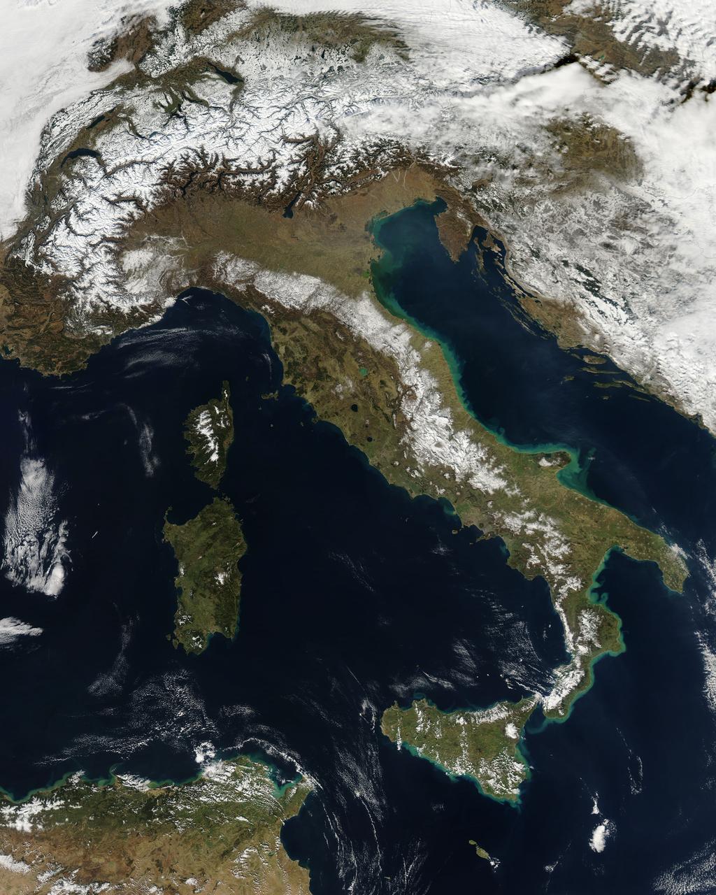
NASA image acquired February 24, 2012 By late February, 2012, the great European cold wave had begun to loosen its frigid grip, but significant snow still remained in the region. The Moderate Resolution Imaging Spectroradiometer (MODIS) aboard the Aqua satellite captured this true-color image of snow in Italy on February 24 at 12:35 UTC (1:30 p.m. local time). In the north of the image, bright white clouds blanket the region in a broad arc. Snow, which tends to be generally less bright that clouds, covers the Alps in the north of Italy. The Apennine Mountains, which form the backbone of the Italian peninsula, also carry a blanket of snow. Although clouds and snow can, at times, be distinguished visually in a true-color image, sometimes they can appear very similar. When it is important to clearly define snow from cloud, false color images are often helpful. Rome, which can be seen as a gray smudge on the southwestern coast of the peninsula, recorded highs of a spring-like 50°F the day this image was captured, but earlier in the month the temperatures dove as low as 26°F on February 5. During that cold snap a rare intense snowfall blanketed Rome, causing the closure of the Colosseum, the Roman Forum and the Palatine Hill due to concerns of the risk of icy footing for tourists, and roads became impassible. Further north, temperatures plummeted to −21 °C (−6 °F) on 7 February. On February 11, news media reported over 2 meters (6.5 feet) of snow had fallen in Urbino, a walled town situated on a high sloping hillside on the eastern side of the Apennine Mountains. That same snowfall cut access to many remote towns in the Apennines, blocking roads and trapping some people in the homes. Credit: NASA/GSFC/Jeff Schmaltz/MODIS Land Rapid Response Team <b><a href="http://www.nasa.gov/centers/goddard/home/index.html" rel="nofollow">NASA Goddard Space Flight Center</a></b> enables NASA’s mission through four scientific endeavors: Earth Science, Heliophysics, Solar System Exploration, and Astrophysics. Goddard plays a leading role in NASA’s accomplishments by contributing compelling scientific knowledge to advance the Agency’s mission. <b>Follow us on <a href="http://twitter.com/NASA_GoddardPix" rel="nofollow">Twitter</a></b> <b>Like us on <a href="http://www.facebook.com/pages/Greenbelt-MD/NASA-Goddard/395013845897?ref=tsd" rel="nofollow">Facebook</a></b> <b>Find us on <a href="http://instagrid.me/nasagoddard/?vm=grid" rel="nofollow">Instagram</a></b>
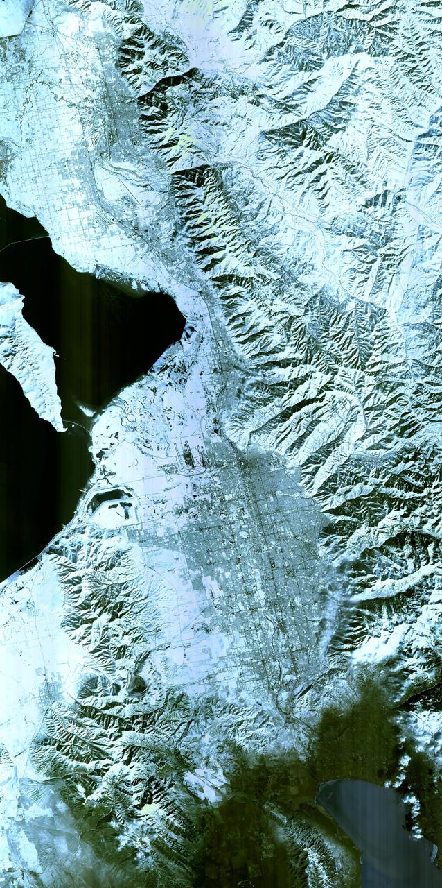
Salt Lake City, Utah, Winter 2001 The 2002 Winter Olympics are hosted by Salt Lake City at several venues within the city, in nearby cities, and within the adjacent Wasatch Mountains. This simulated natural color image presents a snowy, winter view of north central Utah that includes all of the Olympic sites. The image extends from Ogden in the north, to Provo in the south; and includes the snow-capped Wasatch Mountains and the eastern part of the Great Salt Lake. This image was acquired on February 8, 2001 by the Advanced Spaceborne Thermal Emission and Reflection Radiometer (ASTER) on NASA's Terra satellite. With its 14 spectral bands from the visible to the thermal infrared wavelength region, and its high spatial resolution of 15 to 90 meters (about 50 to 300 feet), ASTER will image Earth for the next 6 years to map and monitor the changing surface of our planet. ASTER is one of five Earth-observing instruments launched December 18,1999, on NASA's Terra satellite. The instrument was built by Japan's Ministry of Economy, Trade and Industry. A joint U.S./Japan science team is responsible for validation and calibration of the instrument and the data products. Dr. Anne Kahle at NASA's Jet Propulsion Laboratory, Pasadena, California, is the U.S. Science team leader; Bjorn Eng of JPL is the project manager. ASTER is the only high resolution imaging sensor on Terra. The Terra mission is part of NASA's Earth Science Enterprise, along-term research and technology program designed to examine Earth's land, oceans, atmosphere, ice and life as a total integrated system. The broad spectral coverage and high spectral resolution of ASTER will provide scientists in numerous disciplines with critical information for surface mapping, and monitoring dynamic conditions and temporal change. Example applications are: monitoring glacial advances and retreats; monitoring potentially active volcanoes; identifying crop stress; determining cloud morphology and physical properties; wetlands evaluation; thermal pollution monitoring; coral reef degradation; surface temperature mapping of soils and geology; and measuring surface heat balance. Image credit: NASA/GSFC/METI/ERSDAC/JAROS, and U.S./Japan ASTER Science Team Credit: <b><a href="http://www.earthobservatory.nasa.gov/" rel="nofollow"> NASA Earth Observatory</a></b> <b><a href="http://www.nasa.gov/audience/formedia/features/MP_Photo_Guidelines.html" rel="nofollow">NASA image use policy.</a></b> <b><a href="http://www.nasa.gov/centers/goddard/home/index.html" rel="nofollow">NASA Goddard Space Flight Center</a></b> enables NASA’s mission through four scientific endeavors: Earth Science, Heliophysics, Solar System Exploration, and Astrophysics. Goddard plays a leading role in NASA’s accomplishments by contributing compelling scientific knowledge to advance the Agency’s mission. <b>Follow us on <a href="http://twitter.com/NASAGoddardPix" rel="nofollow">Twitter</a></b> <b>Like us on <a href="http://www.facebook.com/pages/Greenbelt-MD/NASA-Goddard/395013845897?ref=tsd" rel="nofollow">Facebook</a></b> <b>Find us on <a href="http://instagram.com/nasagoddard?vm=grid" rel="nofollow">Instagram</a></b>
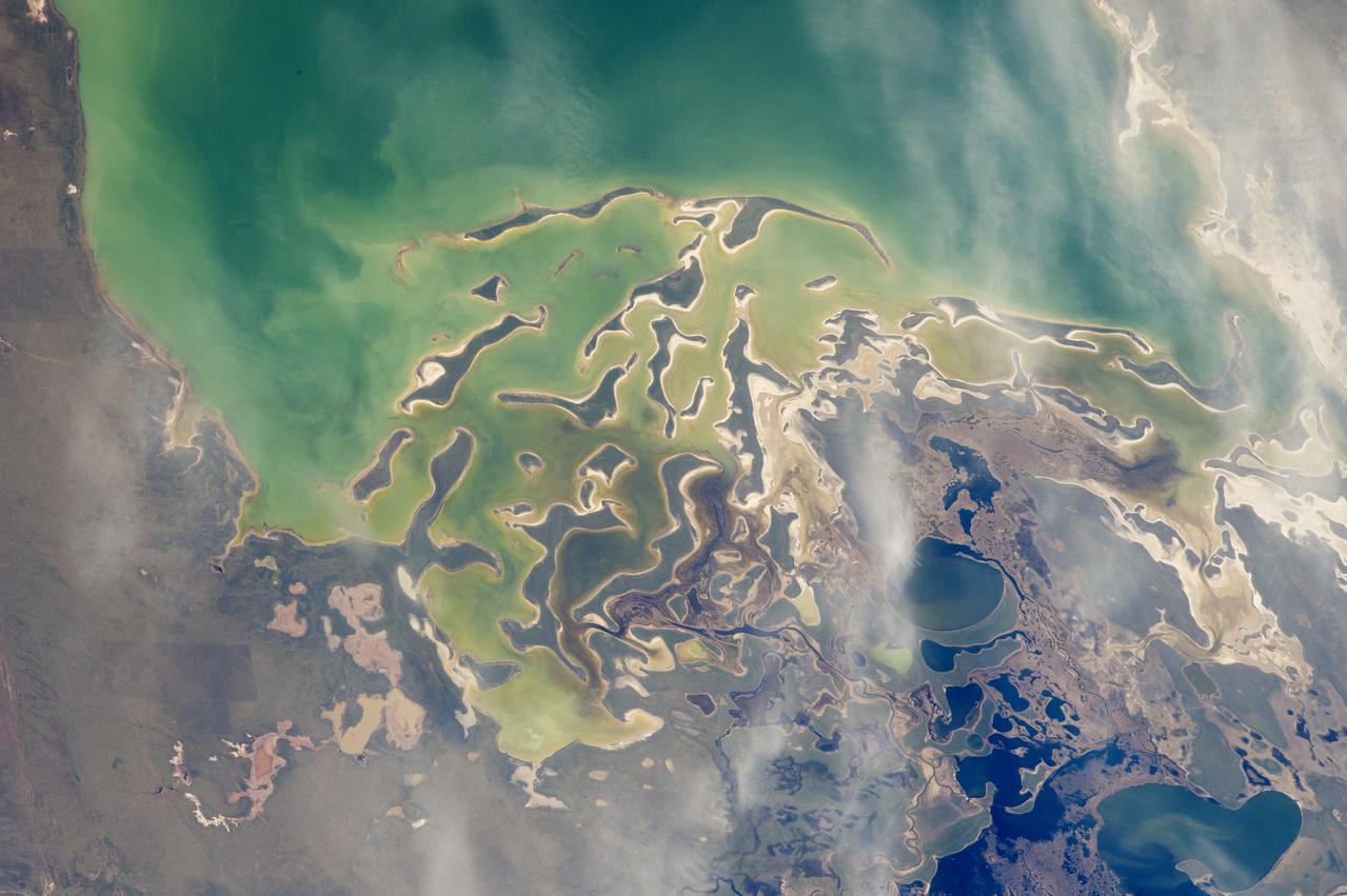
In orbit above the semi-desert grasslands in Kazakhstan, an astronaut aboard the International Space Station spotted one of the few features that stand out. Lake Tengiz is the only large lake (1590 square kilometers, 615 square miles) in northern Kazakhstan. Through white wisps of cloud, the crew member photographed the 50 kilometer-long eastern shore of the lake, with its thin, winding islands and white beaches. The islands and intervening waterways make a rich habitat for birds in this part of Asia. At least 318 species of birds have been identified at the lake; 22 of them are endangered. It is the northernmost habitat of the pink flamingo. The lake system is Kazakhstan’s first UNESCO World Heritage Site, and it has been declared a RAMSAR wetland site of international importance. Part of the richness of area is its complex hydrology. Fresh water enters the system via the Kulanutpes River, so there are small lakes (lower right) full of fresh water. But in this closed basin, the water in the main lake (top) slowly evaporates, becoming salty. Winds stir up bigger waves on the main lake, dispersing sediment and salt and making the water a cloudier and lighter blue-green. (Another astronaut photograph shows the entire lake system, while this story provides more information.) The strange shape of the islands is not easy to interpret. They may be drowned remnants of delta distributaries of the Kulanutpes River. Westerly winds probably have had a smoothing effect on the shorelines, especially in a shallow lake like Tengiz, which is only about 6 meters (20 feet) deep. The lake has an exciting history for people who follow space exploration. In 1976, a Soyuz spacecraft landed in the lake near the north shore (top right). The capsule crashed through the ice and sank during an October snowstorm when temperatures were -22°C (-8°F). Because of low power, the capsule was unheated and the crew was feared lost. It was many hours before the airtight capsule was located and divers could attach flotation tanks to get the capsule to the surface. It was then dragged ashore across the ice by helicopter. The rescue effort took nine hours before the crew was able to safely exit the capsule. Credit: <b><a href="http://www.earthobservatory.nasa.gov/" rel="nofollow"> NASA Earth Observatory</a></b> <b><a href="http://www.nasa.gov/audience/formedia/features/MP_Photo_Guidelines.html" rel="nofollow">NASA image use policy.</a></b> <b><a href="http://www.nasa.gov/centers/goddard/home/index.html" rel="nofollow">NASA Goddard Space Flight Center</a></b> enables NASA’s mission through four scientific endeavors: Earth Science, Heliophysics, Solar System Exploration, and Astrophysics. Goddard plays a leading role in NASA’s accomplishments by contributing compelling scientific knowledge to advance the Agency’s mission. <b>Follow us on <a href="http://twitter.com/NASAGoddardPix" rel="nofollow">Twitter</a></b> <b>Like us on <a href="http://www.facebook.com/pages/Greenbelt-MD/NASA-Goddard/395013845897?ref=tsd" rel="nofollow">Facebook</a></b> <b>Find us on <a href="http://instagrid.me/nasagoddard/?vm=grid" rel="nofollow">Instagram</a></b>
This striking image of the coastline of southwestern Saudi Arabia was taken by astronauts on the International Space Station. Patchy cloud cover partially obscures and blurs the city lights, especially in the vicinity of Khamis Mushait and Abha. While much of the country is lightly populated desert—and relatively dark at night due to lack of city and roadway lights—the southwestern coastal region has a more moderate climate and several large cities. Three brightly lit urban centers are visible at image top left: Jeddah, Mecca, and Taif. Jeddah is the gateway city for Islamic pilgrims going to nearby Mecca, a religious journey known as the Hajj. Taif is located on the slopes of the Sarawat Mountains and provides a summer retreat for the Saudi government from the desert heat of the capital, Riyadh. Bright yellow-orange lighting marks highways that parallel the trend of the Asir Mountains (image center), connecting Mecca to the resort cities of Al Bahah and Abha. Smaller roadways, lit with blue lights, extend to the west to small cities along the Red Sea coastline. The bright yellow-orange glow of the city of Abha is matched by that of Khamis Mushait (or Khamis Mushayt) to the northeast. The brightly lit ribbon of highway continues towards other large cities to the south (Jazan, not shown) and southeast (Najran, not shown). Astronaut photograph ISS036-E-25802 was acquired on July 26, 2013, with a Nikon D3S digital camera using a 50 millimeter lens, and is provided by the ISS Crew Earth Observations experiment and Image Science & Analysis Laboratory, Johnson Space Center. The image was taken by the Expedition 36 crew. It has been cropped and enhanced to improve contrast, and lens artifacts have been removed. The International Space Station Program supports the laboratory as part of the ISS National Lab to help astronauts take pictures of Earth that will be of the greatest value to scientists and the public, and to make those images freely available on the Internet. Additional images taken by astronauts and cosmonauts can be viewed at the NASA/JSC Gateway to Astronaut Photography of Earth. Caption by William L. Stefanov, Jacobs/JETS at NASA-JSC. Instrument: ISS - Digital Camera More info: <a href="http://1.usa.gov/13TqPcr" rel="nofollow">1.usa.gov/13TqPcr</a> Credit: <b><a href="http://www.earthobservatory.nasa.gov/" rel="nofollow"> NASA Earth Observatory</a></b> <b><a href="http://www.nasa.gov/audience/formedia/features/MP_Photo_Guidelines.html" rel="nofollow">NASA image use policy.</a></b> <b><a href="http://www.nasa.gov/centers/goddard/home/index.html" rel="nofollow">NASA Goddard Space Flight Center</a></b> enables NASA’s mission through four scientific endeavors: Earth Science, Heliophysics, Solar System Exploration, and Astrophysics. Goddard plays a leading role in NASA’s accomplishments by contributing compelling scientific knowledge to advance the Agency’s mission. <b>Follow us on <a href="http://twitter.com/NASA_GoddardPix" rel="nofollow">Twitter</a></b> <b>Like us on <a href="http://www.facebook.com/pages/Greenbelt-MD/NASA-Goddard/395013845897?ref=tsd" rel="nofollow">Facebook</a></b> <b>Find us on <a href="http://instagram.com/nasagoddard?vm=grid" rel="nofollow">Instagram</a></b>
The Atlas 1 payload fairing with the encapsulated GOES-K advanced weather satellite awaits transport to the launch pad. GOES-K was prepared for launch at the Astrotech Space Operations LP facility in Titusville. GOES-K will be the third spacecraft to be launched in the advanced series of Geostationary Operational Environmental Satellites (GOES). The GOES satellites are owned and operated by the National Oceanic and Atmospheric Administration (NOAA); NASA manages the design, development and launch of the spacecraft. GOES-K is targeted for an <a href="http://www-pao.ksc.nasa.gov/kscpao/release/1997/63-97.htm">April 24 launch</a> aboard a Lockheed Martin Atlas 1 expendable launch vehicle (AC-79) from Launch Complex 36, Pad B, Cape Canaveral Air Station. The launch window opens at 1:50 a.m. and extends to 3:09 a.m. EDT. Once in orbit, GOES-K will become GOES-10, joining GOES-8 and GOES-9 in space
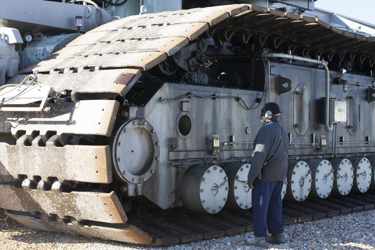
A ground support technician checks the giant treads on crawler-transporter 2 (CT-2) as the vehicle moves slowly along the crawlerway toward the Vehicle Assembly Building at NASA's Kennedy Space Center in Florida. The crawler took a trip to the pad A/B split to test upgrades recently completed that will allow the giant vehicle to handle the load of the agency's Space Launch System rocket and Orion spacecraft atop the mobile launcher. The Ground Systems Development and Operations Program oversaw upgrades to the 50-year-old CT-2. New generators, gear assemblies, jacking, equalizing and leveling (JEL) hydraulic cylinders, roller bearings and brakes were installed, and other components were upgraded to prepare for Exploration Mission 1.
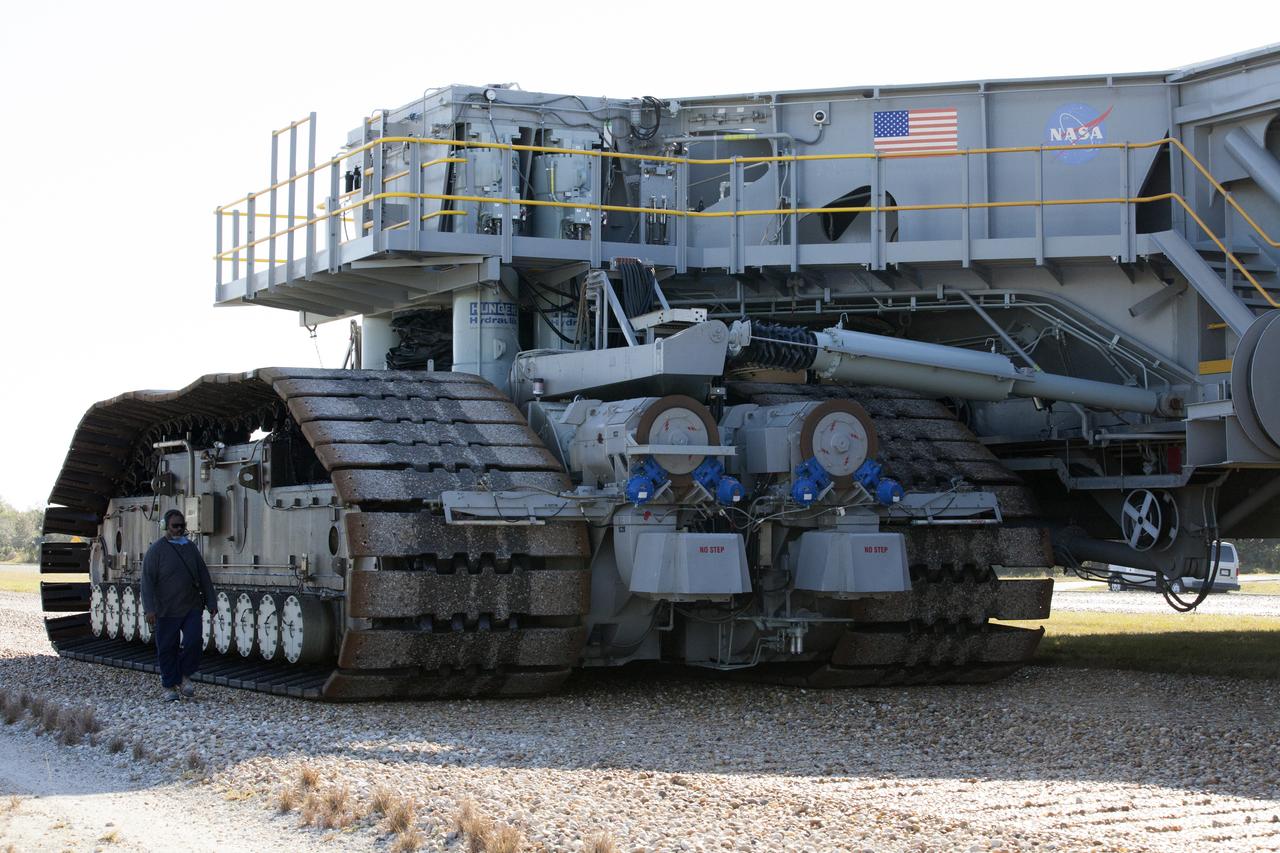
A ground support technician walks alongside crawler-transporter 2 (CT-2) as the vehicle moves slowly along the crawlerway toward the Vehicle Assembly Building at NASA's Kennedy Space Center in Florida. The crawler took a trip to the Pad A/B split to test upgrades recently completed that will allow the giant vehicle to handle the load of the agency's Space Launch System rocket and Orion spacecraft atop the mobile launcher. The Ground Systems Development and Operations Program oversaw upgrades to the 50-year-old CT-2. New generators, gear assemblies, jacking, equalizing and leveling (JEL) hydraulic cylinders, roller bearings and brakes were installed, and other components were upgraded to prepare for Exploration Mission 1.
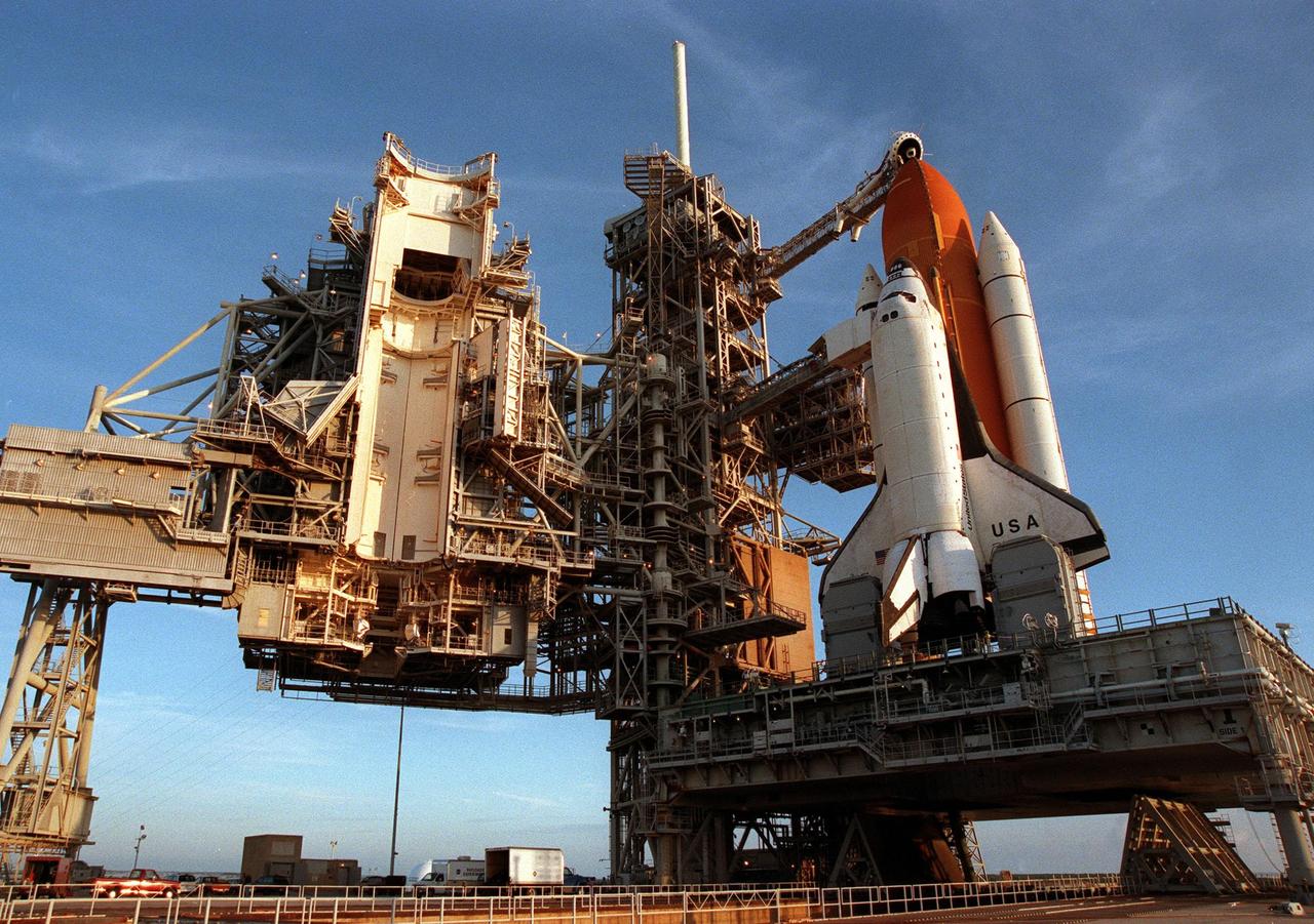
The rollback of the Rotating Service Structure on launch Pad 39-B reveals Space Shuttle Columbia on its mobile launcher platform, waiting for the launch of mission STS-93 on July 20 at 12:36 a.m. EDT. The primary payload of STS-93 is the Chandra X-ray Observatory, which will allow scientists from around the world to study some of the most distant, powerful and dynamic objects in the universe. The new telescope is 20 to 50 times more sensitive than any previous X-ray telescope and is expected unlock the secrets of supernovae, quasars and black holes. The STS-93 crew numbers five: Commander Eileen M. Collins, Pilot Jeffrey S. Ashby, and Mission Specialists Steven A. Hawley (Ph.D.), Catherine G. Coleman (Ph.D.) and Michel Tognini of France, with the Centre National d'Etudes Spatiales (CNES). Collins is the first woman to serve as commander of a shuttle mission

Former astronaut John Young addresses guests and attendees at a ceremony at the KSC Visitor Complex held in remembrance of the astronauts lost in the Apollo 1 fire: Virgil "Gus" Grissom, Edward H. White II and Roger B. Chaffee. Members of their families, along with Associate Administrator for Space Operations William Gerstenmaier, President of the Astronauts Memorial Foundation Stephen Feldman, Chairman of the Board of Directors of the Astronauts Memorial Foundation William Potter and former astronaut John Young, attended the ceremony. Behind the stage is the Space Mirror Memorial, designated as a national memorial by Congress and President George Bush in 1991 to honor fallen astronauts. Their names are emblazoned on the monument’s 42-1/2-foot-high by 50-foot-wide black granite surface as if to be projected into the heavens.
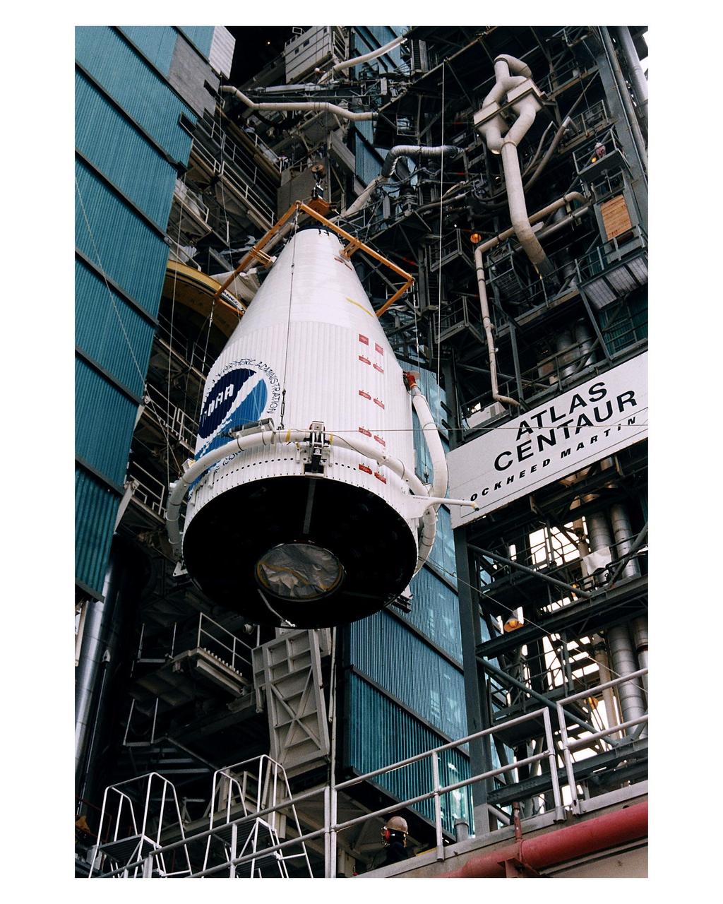
The Atlas 1 payload fairing with the encapsulated GOES-K advanced weather satellite is being lifted into position for mating to the Lockheed Martin Atlas 1 expendable launch vehicle (AC-79) at Launch Complex 36, Pad B, Cape Canaveral Air Station. GOES-K will be the third spacecraft to be launched in the advanced series of Geostationary Operational Environmental Satellites (GOES). The GOES satellites are owned and operated by the National Oceanic and Atmospheric Administration (NOAA); NASA manages the design, development and launch of the spacecraft. GOES-K is targeted for an <a href="http://www-pao.ksc.nasa.gov/kscpao/release/1997/63-97.htm">April 24 launch</a> during a launch window which extends from 1:50-3:09 a.m. EDT. Once in orbit, GOES-K will become GOES-10, joining GOES-8 and GOES-9 in space
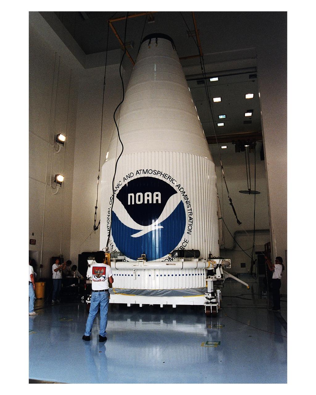
The GOES-K advanced weather satellite, already encapsulated in the Atlas 1 payload fairing, is carefully placed on the transporter at Astrotech Space Operations LP facility in Titusville. GOES-K will be the third spacecraft to be launched in the advanced series of Geostationary Operational Environmental Satellites (GOES). The GOES satellites are owned and operated by the National Oceanic and Atmospheric Administration (NOAA); NASA manages the design, development and launch of the spacecraft. GOES-K is targeted for an <a href="http://www-pao.ksc.nasa.gov/kscpao/release/1997/63-97.htm">April 24 launch</a> aboard a Lockheed Martin Atlas 1 expendable launch vehicle (AC-79) from Launch Complex 36, Pad B, Cape Canaveral Air Station. The launch window opens at 1:50 a.m. and extends to 3:09 a.m. EDT. Once in orbit, GOES-K will become GOES-10, joining GOES-8 and GOES-9 in space
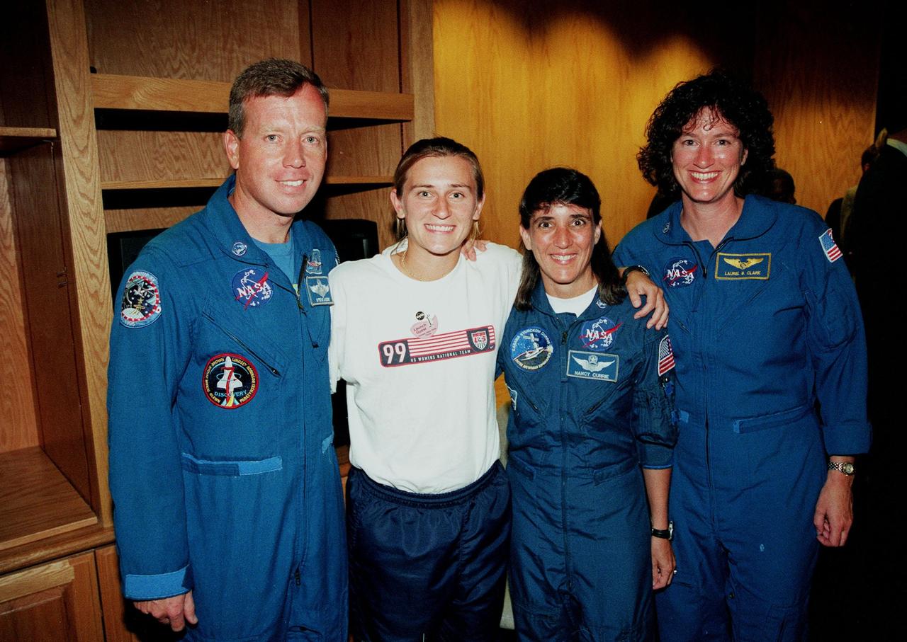
A member of the U.S. Women's World Cup Soccer Team poses with Astronauts (from left) Steven W. Lindsey, Nancy Jane Currie and Laurel B. Clark. The team arrived at the Skid Strip at Cape Canaveral Air Station with First Lady Hillary Rodham Clinton to view the launch of Space Shuttle mission STS-93. Liftoff is scheduled for 12:36 a.m. EDT July 20. Much attention has been generated over the launch due to Commander Eileen M. Collins, the first woman to serve as commander of a Shuttle mission. The primary payload of the five-day mission is the Chandra X-ray Observatory, which will allow scientists from around the world to study some of the most distant, powerful and dynamic objects in the universe. The new telescope is 20 to 50 times more sensitive than any previous X-ray telescope and is expected to unlock the secrets of supernovae, quasars and black holes
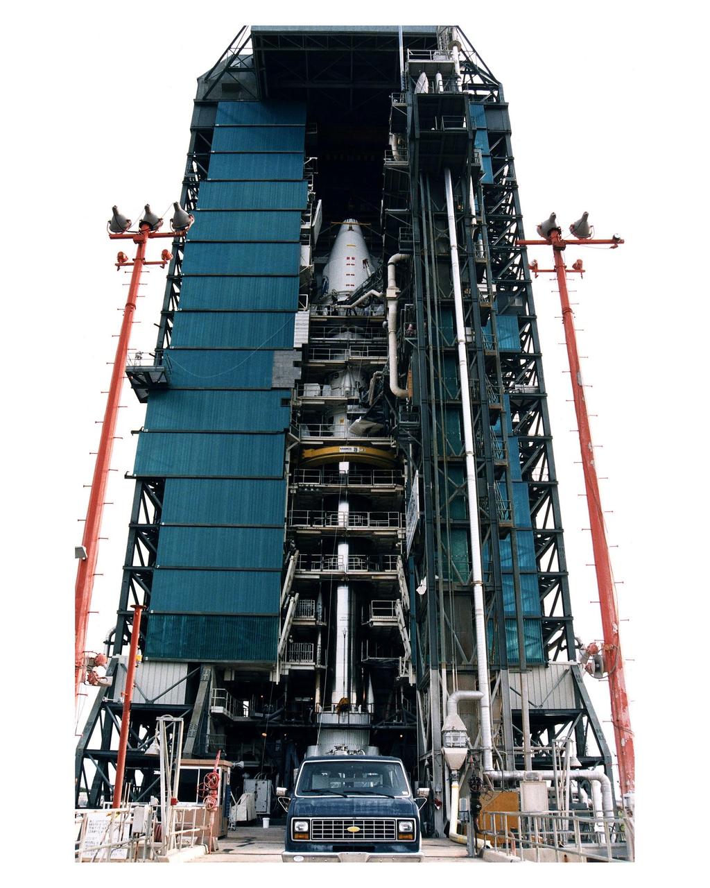
The Atlas 1 payload fairing with the encapsulated GOES-K advanced weather satellite, at top center, is mated to the Lockheed Martin Atlas 1 expendable launch vehicle (AC-79) at Launch Complex 36, Pad B, Cape Canaveral Air Station. GOES-K will be the third spacecraft to be launched in the advanced series of Geostationary Operational Environmental Satellites (GOES). The GOES satellites are owned and operated by the National Oceanic and Atmospheric Administration (NOAA); NASA manages the design, development and launch of the spacecraft. GOES-K is targeted for an <a href="http://www-pao.ksc.nasa.gov/kscpao/release/1997/63-97.htm">April 24 launch</a> during a launch window which extends from 1:50-3:09 a.m. EDT
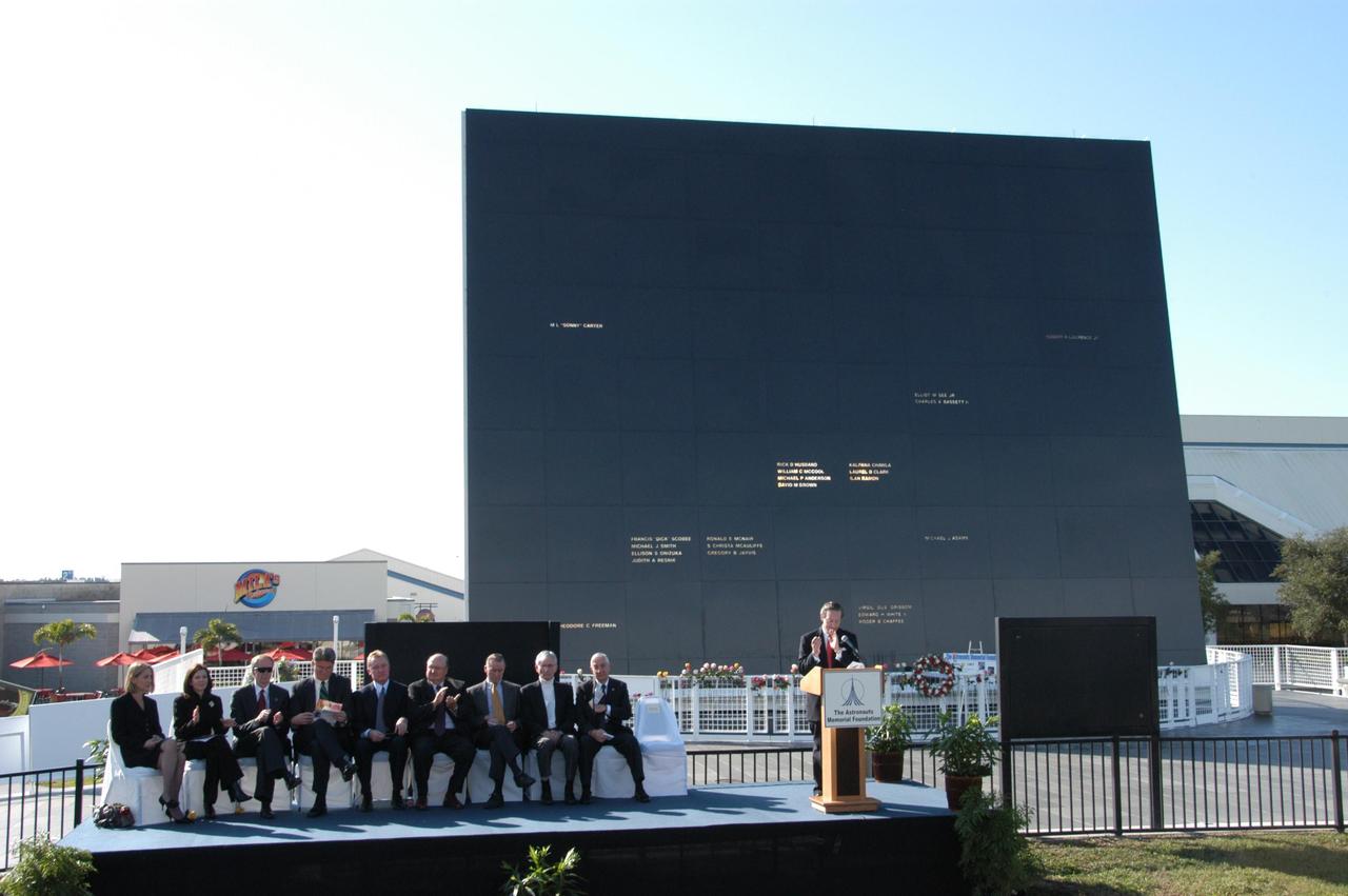
KENNEDY SPACE CENTER, FLA. -- Guests are gathered on stage during a ceremony at the KSC Visitor Complex held in remembrance of the astronauts lost in the Apollo 1 fire: Virgil "Gus" Grissom, Edward H. White II and Roger B. Chaffee. Among those gathered on stage are (from left) Faith Johnson, daughter of Theodore Freeman and Martha Chaffee, daughter of Roger Chaffee, Associate Administrator for Space Operations William Gerstenmaier and KSC Director Bill Parsons, plus former astronaut John Young (second from right). Members of the astronauts' families were guests at the ceremony. At the podium is Stephen Feldman, president of the Astronauts Memorial Foundation. Behind the stage is the Space Mirror Memorial, designated as a national memorial by Congress and President George Bush in 1991 to honor fallen astronauts. Their names are emblazoned on the monument’s 42-1/2-foot-high by 50-foot-wide black granite surface as if to be projected into the heavens. Photo credit:NASA/George Shelton
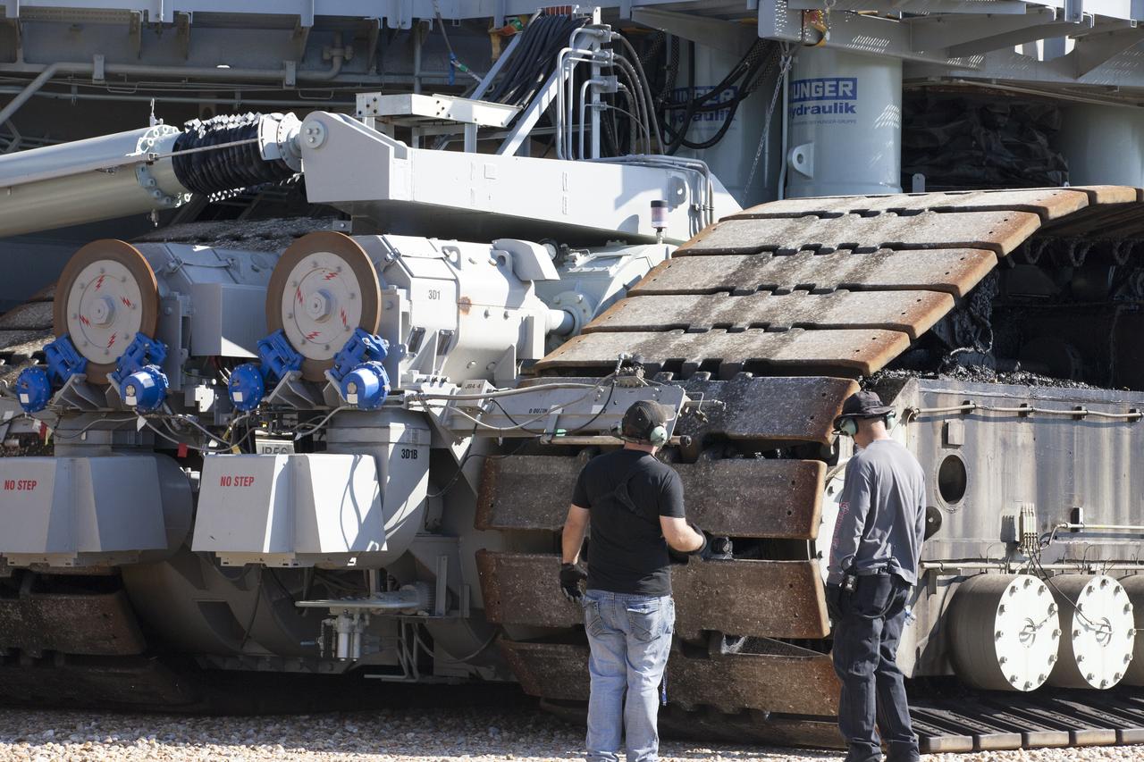
Ground support technicians check out the treads on crawler-transporter 2 (CT-2) as the vehicle moves slowly along the crawlerway toward the Vehicle Assembly Building at NASA's Kennedy Space Center in Florida. The crawler took a trip to the Pad A/B split to test upgrades recently completed that will allow the giant vehicle to handle the load of the agency's Space Launch System rocket and Orion spacecraft atop the mobile launcher. The Ground Systems Development and Operations Program oversaw upgrades to the 50-year-old CT-2. New generators, gear assemblies, jacking, equalizing and leveling (JEL) hydraulic cylinders, roller bearings and brakes were installed, and other components were upgraded to prepare for Exploration Mission 1.
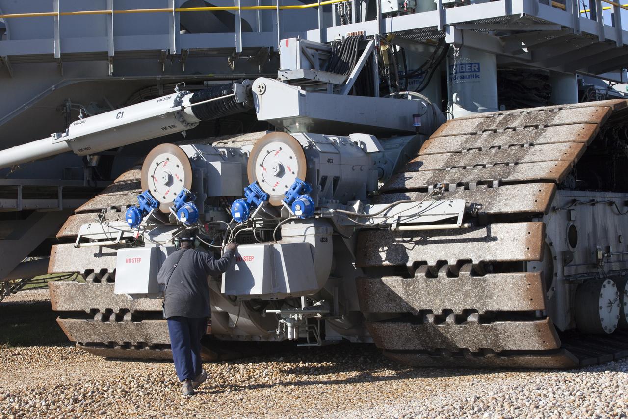
A ground support technician checks the new hydraulic cylinders on crawler-transporter 2 (CT-2) as the vehicle moves slowly along the crawlerway toward the Vehicle Assembly Building at NASA's Kennedy Space Center in Florida. The crawler took a trip to the Pad A/B split to test upgrades recently completed that will allow the giant vehicle to handle the load of the agency's Space Launch System rocket and Orion spacecraft atop the mobile launcher. The Ground Systems Development and Operations Program oversaw upgrades to the 50-year-old CT-2. New generators, gear assemblies, jacking, equalizing and leveling (JEL) hydraulic cylinders, roller bearings and brakes were installed, and other components were upgraded to prepare for Exploration Mission 1.
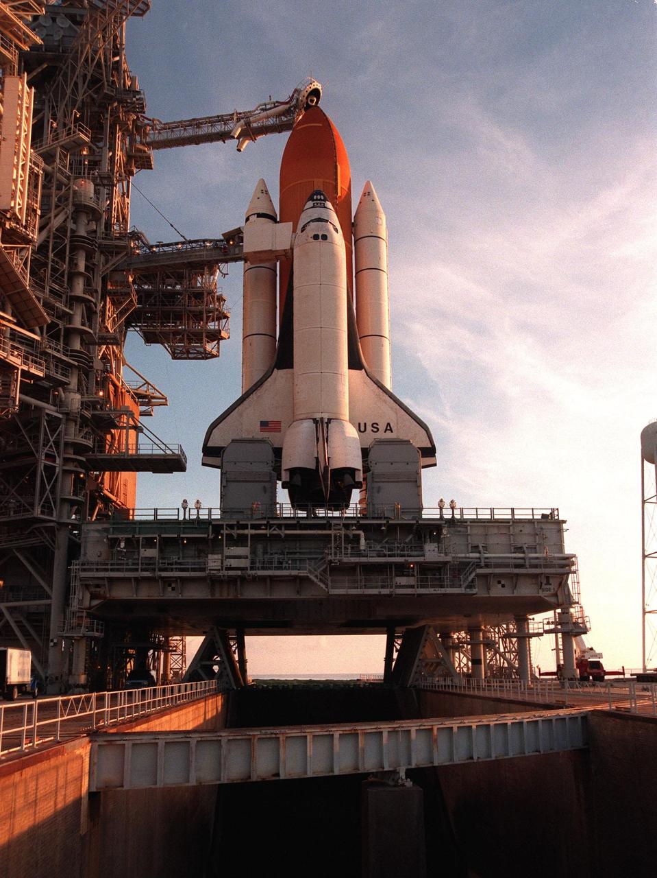
Space Shuttle Columbia, sitting on its mobile launcher platform, is framed against the early morning sky after the rollback of the Rotating Service Structure on Launch Pad 39-B. Columbia waits for the launch of mission STS-93 July 20 at 12:36 a.m. EDT. The primary payload of STS-93 is the Chandra X-ray Observatory, which will allow scientists from around the world to study some of the most distant, powerful and dynamic objects in the universe. The new telescope is 20 to 50 times more sensitive than any previous X-ray telescope and is expected unlock the secrets of supernovae, quasars and black holes. The STS-93 crew numbers five: Commander Eileen M. Collins, Pilot Jeffrey S. Ashby, and Mission Specialists Steven A. Hawley (Ph.D.), Catherine G. Coleman (Ph.D.) and Michel Tognini of France, with the Centre National d'Etudes Spatiales (CNES). Collins is the first woman to serve as commander of a shuttle mission
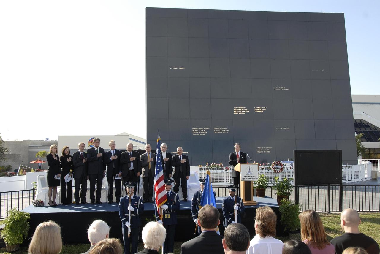
KENNEDY SPACE CENTER, FLA. -- Guests and attendees salute the U.S. flag during a ceremony at the KSC Visitor Complex held in remembrance of the astronauts lost in the Apollo 1 fire: Virgil "Gus" Grissom, Edward H. White II and Roger B. Chaffee. Among those gathered on stage are (from left) Faith Johnson, daughter of Theodore Freeman and Martha Chaffee, daughter of Roger Chaffee, Associate Administrator for Space Operations William Gerstenmaier and KSC Director Bill Parsons, plus former astronaut John Young and Lowell Grissom, brother of Gus Grissom (far right). At the podium is Stephen Feldman, president of the Astronauts Memorial Foundation. Behind the stage is the Space Mirror Memorial, designated as a national memorial by Congress and President George Bush in 1991 to honor fallen astronauts. Their names are emblazoned on the monument’s 42-½-foot-high by 50-foot-wide black granite surface as if to be projected into the heavens. Photo credit:NASA/Kim Shiflett
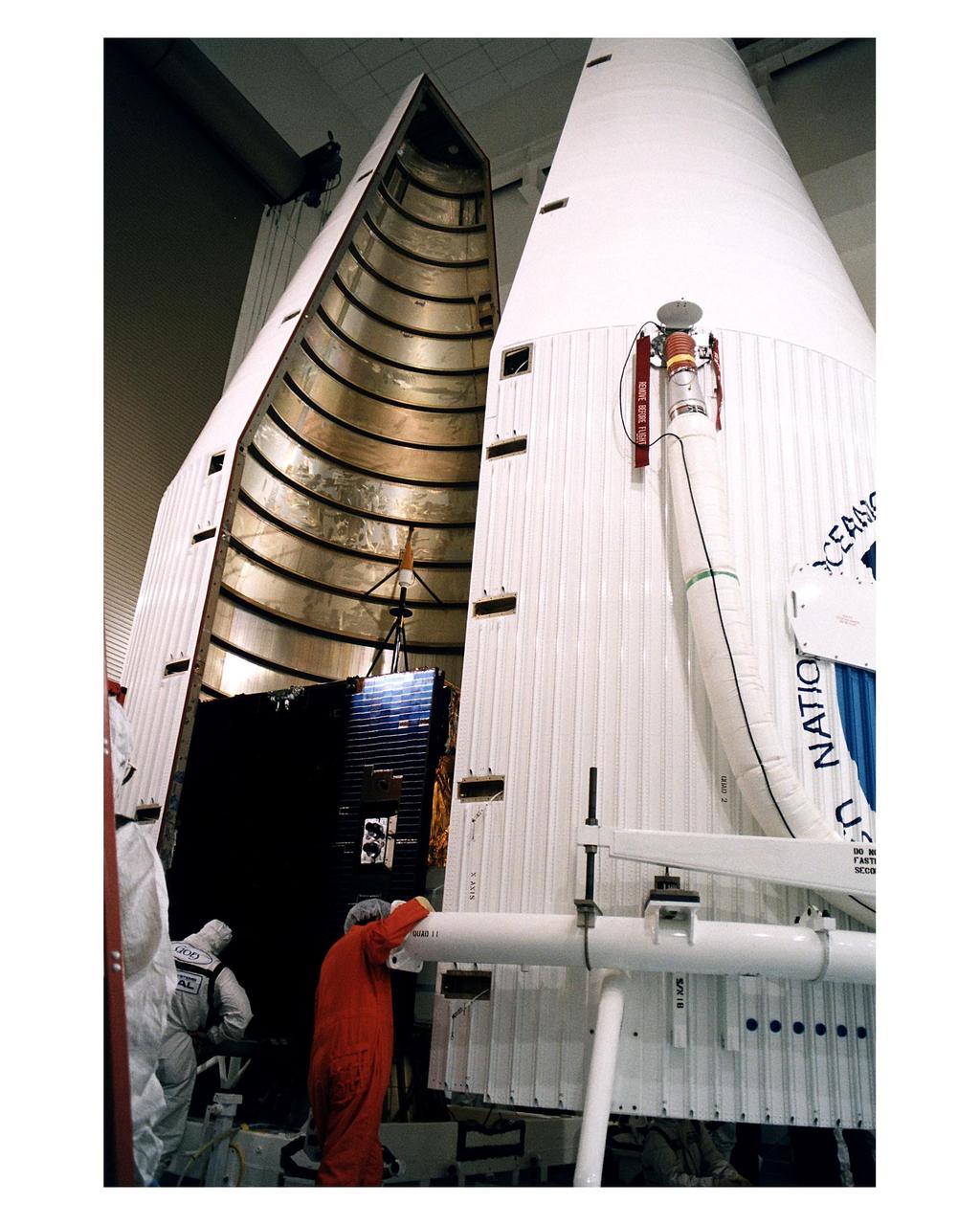
Workers at the Astrotech Space Operations LP facility in Titusville make final checks and adjustments after encapsulating the GOES-K advanced weather satellite in the Atlas 1 payload fairing. GOES-K will be the third spacecraft to be launched in the advanced series of Geostationary Operational Environmental Satellites (GOES). The GOES satellites are owned and operated by the National Oceanic and Atmospheric Administration (NOAA); NASA manages the design, development and launch of the spacecraft. GOES-K is targeted for an <a href="http://www-pao.ksc.nasa.gov/kscpao/release/1997/63-97.htm">April 24 launch</a> aboard a Lockheed Martin Atlas 1 expendable launch vehicle (AC-79) from Launch Complex 36, Pad B, Cape Canaveral Air Station. The launch window opens at 1:50 a.m. and extends to 3:09 a.m. EDT. Once in orbit, GOES-K will become GOES-10, joining GOES-8 and GOES-9 in space
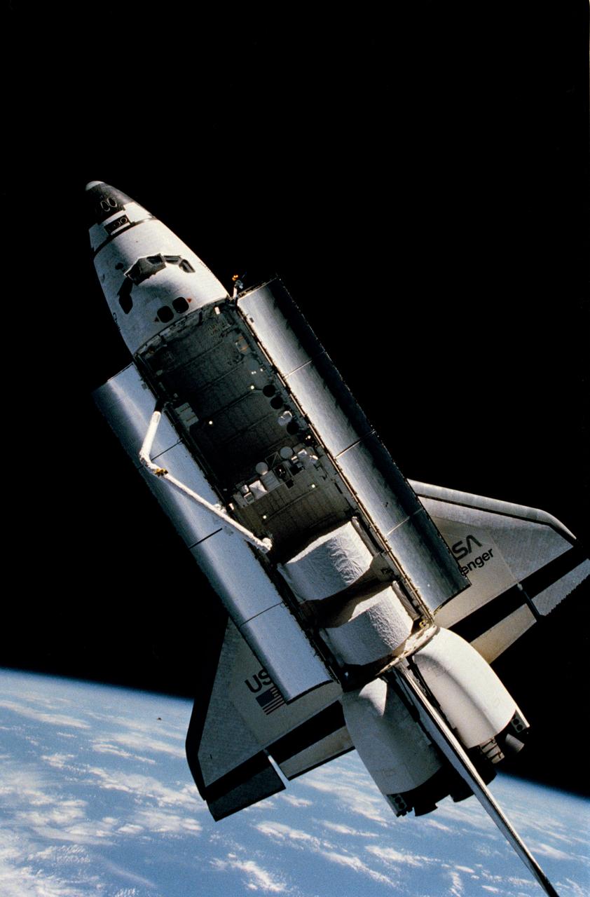
S84-27020 (7 Feb 1984) --- A fixed camera on astronaut Bruce McCandless II's helmet recorded this rare scene of the Space Shuttle Challenger some 50 to 60 meters away during a history-making extravehicular activity (EVA), February 7, 1984. The Shuttle Pallet Satellite (SPAS-01A) is configured mid-cargo bay. Astronaut Robert L. Stewart, standing beneath the Remote Manipulator System (RMS) arm, later donned the same Manned Maneuvering Unit (MMU) which afforded McCandless the freedom of movement to record this image. Also visible in the cargo bay are the support stations for the two MMU back-packs, the sunshields for the Palapa B and Westar VI Satellites, KU-Band antenna and a number of Getaway Special (GAS) canisters.

KENNEDY SPACE CENTER, FLA. -- In the Vertical Processing Facility, the Hubble Space Telescope (HST) has been installed in the payload canister and will ride atop the associated payload transporter for a 10-mile trip to Pad B on Launch Complex 39. The telescope is contained within a protective cocoon which is a double bag sanitary liner. This provides added cleanliness and protection and has been on HST since its arrival at KSC in October 1989. It was removed immediately prior to installation of the telescope into the payload bay of the Space Shuttle Discovery. With HST, astronomers will be able to view 97 percent of the known universe, and will be able to get pictures unlimited and undistorted by the Earth's atmosphere. Compared with earth-based observatories, the HST will be able to view celestial objects that are 50 times fainter, provide images that are 10 times sharper, and see objects that are seven times farther away. .
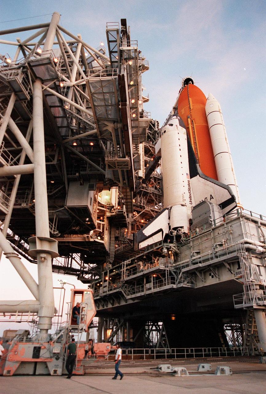
The Rotating Service Structure is rolled back from Space Shuttle Columbia on Launch Pad 39-B, in preparation for launch of mission STS-93 July 20 at 12:36 a.m. EDT. The primary payload of STS-93 is the Chandra X-ray Observatory, which will allow scientists from around the world to study some of the most distant, powerful and dynamic objects in the universe. The new telescope is 20 to 50 times more sensitive than any previous X-ray telescope and is expected unlock the secrets of supernovae, quasars and black holes. The STS-93 crew numbers five: Commander Eileen M. Collins, Pilot Jeffrey S. Ashby, and Mission Specialists Steven A. Hawley (Ph.D.), Catherine G. Coleman (Ph.D.) and Michel Tognini of France, with the Centre National d'Etudes Spatiales (CNES). Collins is the first woman to serve as commander of a shuttle mission

KENNEDY SPACE CENTER, FLA. -- Flowers and plaque are in place in front of the Space Mirror Memorial at the KSC Visitor Complex for the ceremony held in remembrance of the astronauts lost in the Apollo 1 fire: Virgil "Gus" Grissom, Edward H. White II and Roger B. Chaffee. Members of their families, along with KSC Director Bill Parsons, Associate Administrator for Space Operations William Gerstenmaier, President of the Astronauts Memorial Foundation Stephen Feldman and Chairman of the Board of Directors of the Astronauts Memorial Foundation William Potter, attended the ceremony. The mirror was designated as a national memorial by Congress and President George Bush in 1991 to honor fallen astronauts. Their names are emblazoned on the monument’s 42-½-foot-high by 50-foot-wide black granite surface as if to be projected into the heavens. Photo credit:NASA/Kim Shiflett
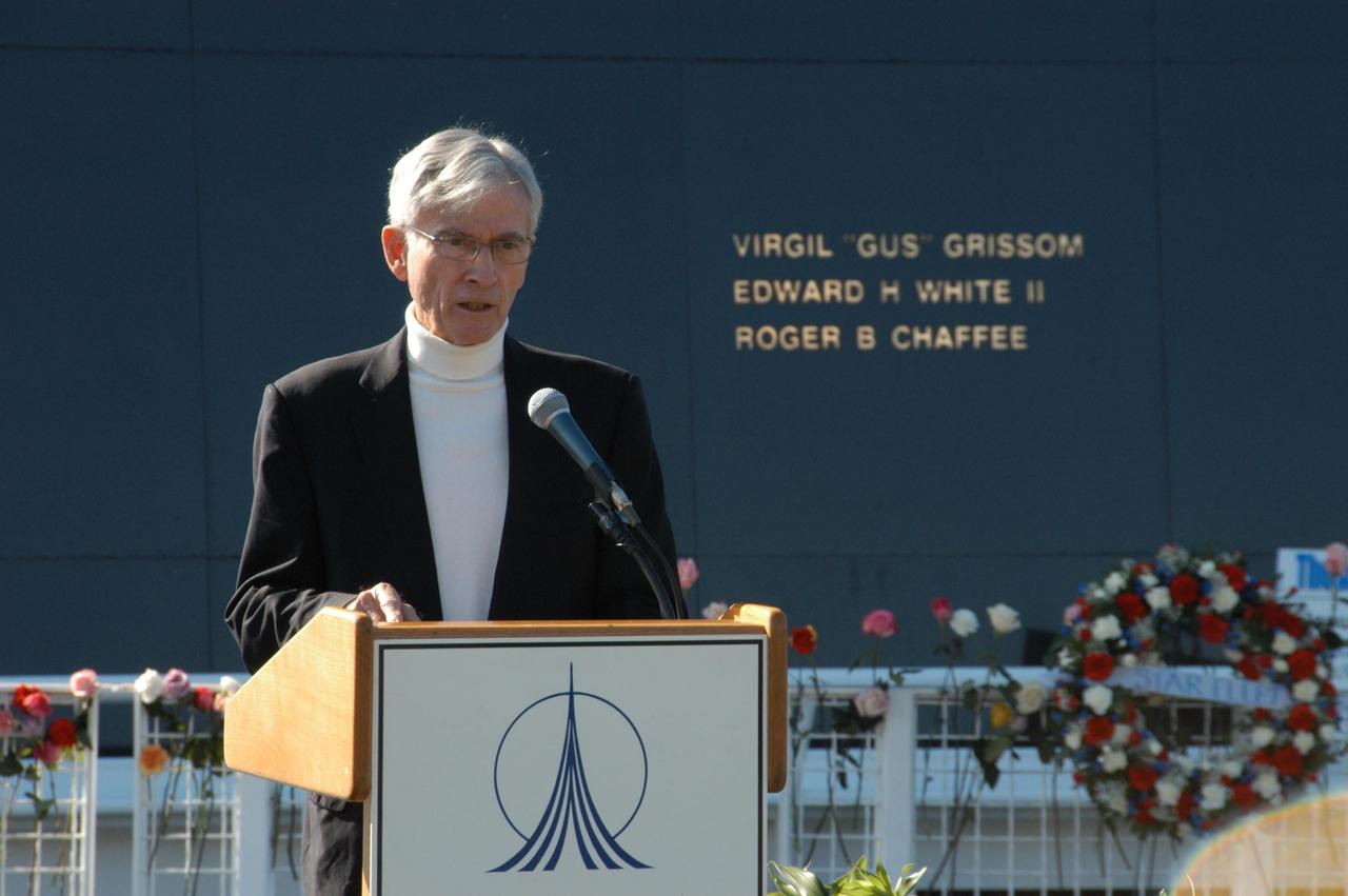
KENNEDY SPACE CENTER, FLA. -- Former astronaut John Young addresses guests and attendees at a ceremony at the KSC Visitor Complex held in remembrance of the astronauts lost in the Apollo 1 fire: Virgil "Gus" Grissom, Edward H. White II and Roger B. Chaffee. Members of their families, along with Associate Administrator for Space Operations William Gerstenmaier, President of the Astronauts Memorial Foundation Stephen Feldman, Chairman of the Board of Directors of the Astronauts Memorial Foundation William Potter and former astronaut John Young, attended the ceremony. Behind the stage is the Space Mirror Memorial, designated as a national memorial by Congress and President George Bush in 1991 to honor fallen astronauts. Their names are emblazoned on the monument’s 42-1/2-foot-high by 50-foot-wide black granite surface as if to be projected into the heavens. Photo credit:NASA/George Shelton
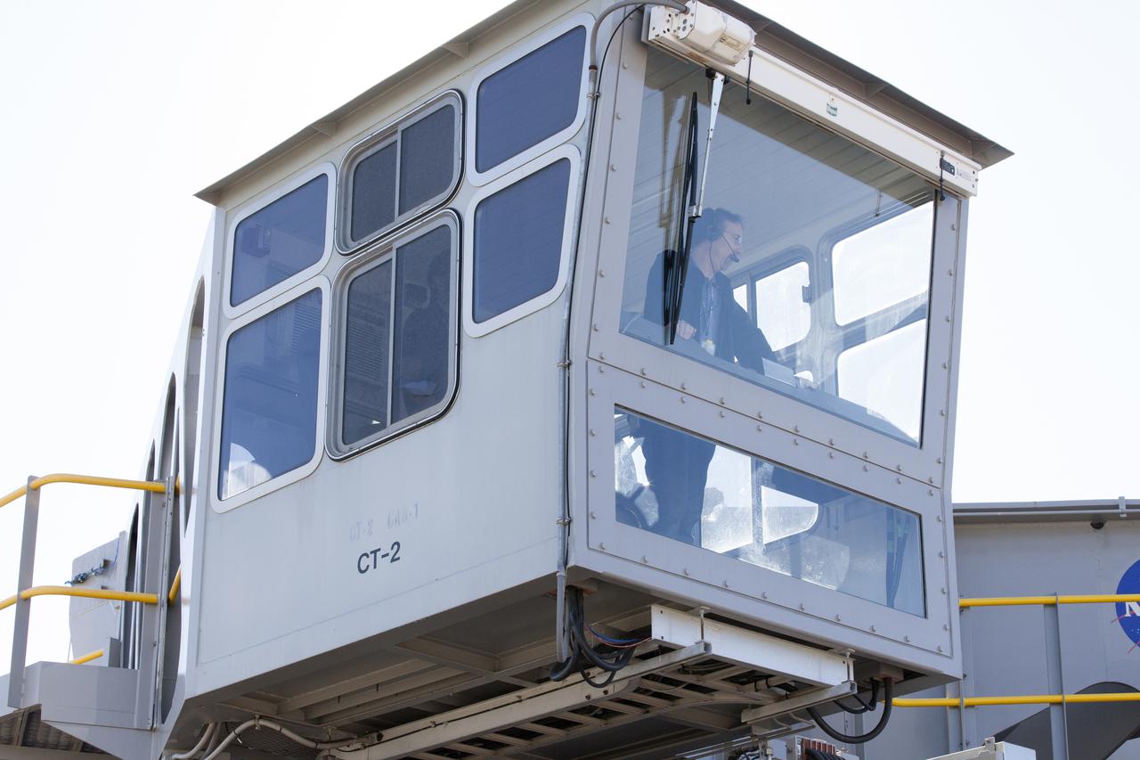
Brad Lawarre, a crawler engineer and driver on the Test and Operations Support Contract, monitors the progress from one of the crawler-transporter 2 (CT-2) cabs as the vehicle moves slowly along the crawlerway toward the Vehicle Assembly Building at NASA's Kennedy Space Center Florida. The crawler took a trip to the Pad A/B split to test upgrades recently completed that will allow the giant vehicle to handle the load of the agency's Space Launch System rocket and Orion spacecraft atop the mobile launcher. The Ground Systems Development and Operations Program oversaw upgrades to the 50-year-old CT-2. New generators, gear assemblies, jacking, equalizing and leveling (JEL) hydraulic cylinders, roller bearings and brakes were installed, and other components were upgraded to prepare for Exploration Mission 1.
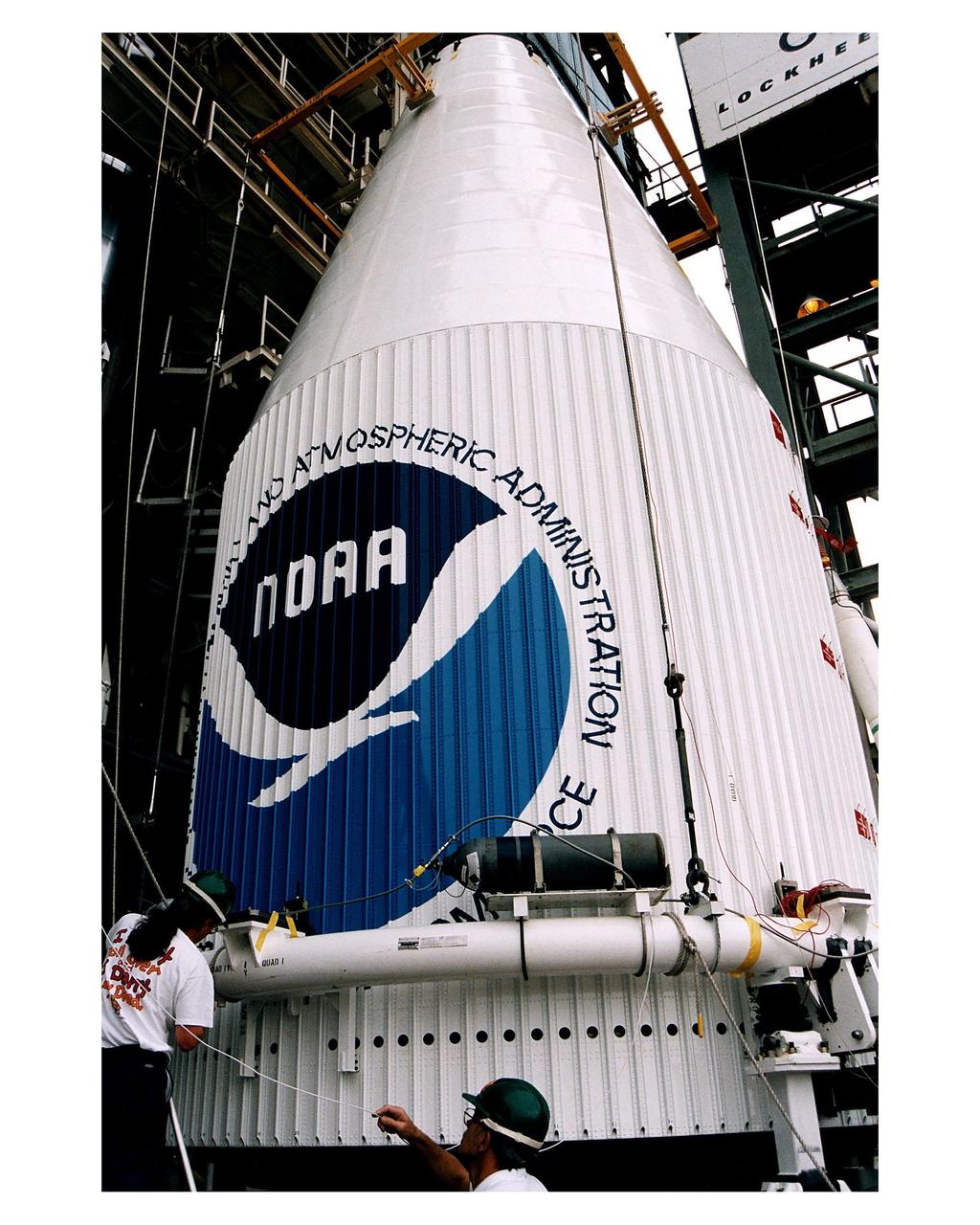
Workers prepare for the mating of the Atlas 1 payload fairing containing the GOES-K advanced weather satellite with the Lockheed Martin Atlas 1 expendable launch vehicle (AC-79) at Launch Complex 36, Pad B, Cape Canaveral Air Station. GOES-K will be the third spacecraft to be launched in the advanced series of Geostationary Operational Environmental Satellites (GOES). The GOES satellites are owned and operated by the National Oceanic and Atmospheric Administration (NOAA); NASA manages the design, development and launch of the spacecraft. GOES-K is targeted for an <a href="http://www-pao.ksc.nasa.gov/kscpao/release/1997/63-97.htm">April 24 launch</a> during a launch window which extends from 1:50-3:09 a.m. EDT

A ground support technician walks alongside crawler-transporter 2 (CT-2) as the vehicle moves slowly along the crawlerway toward the Vehicle Assembly Building at NASA's Kennedy Space Center in Florida. The crawler took a trip to the Pad A/B split to test upgrades recently completed that will allow the giant vehicle to handle the load of the agency's Space Launch System rocket and Orion spacecraft atop the mobile launcher. The Ground Systems Development and Operations Program oversaw upgrades to the 50-year-old CT-2. New generators, gear assemblies, jacking, equalizing and leveling (JEL) hydraulic cylinders, roller bearings and brakes were installed, and other components were upgraded to prepare for Exploration Mission 1.
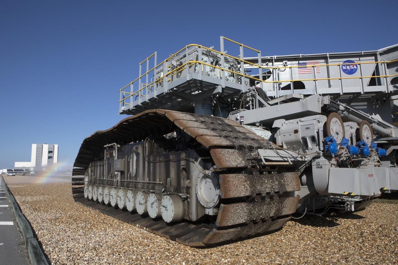
Crawler-transporter 2 (CT-2) moves slowly along the crawlerway on its way back to the Vehicle Assembly Building (in view in the background) at NASA's Kennedy Space Center in Florida. Water sprayed by a truck in front to reduce dust creates a small rainbow. The crawler took a trip to the Pad A/B split to test upgrades recently completed that will allow the giant vehicle to handle the load of the agency's Space Launch System rocket and Orion spacecraft atop the mobile launcher. The Ground Systems Development and Operations Program oversaw upgrades to the 50-year-old CT-2. New generators, gear assemblies, jacking, equalizing and leveling (JEL) hydraulic cylinders, roller bearings and brakes were installed, and other components were upgraded to prepare for Exploration Mission 1.

KENNEDY SPACE CENTER, FLA. -- Ed White III touches his father's name engraved in the Space Mirror Memorial at the KSC Visitor Complex. White attended the ceremony held in remembrance of the astronauts lost in the Apollo 1 fire: Virgil "Gus" Grissom, Edward H. White II and Roger B. Chaffee. Members of their families, along with KSC Director Bill Parsons, Associate Administrator for Space Operations William Gerstenmaier, President of the Astronauts Memorial Foundation Stephen Feldman and Chairman of the Board of Directors of the Astronauts Memorial Foundation William Potter, attended the ceremony. The mirror was designated as a national memorial by Congress and President George Bush in 1991 to honor fallen astronauts. Their names are emblazoned on the monument’s 42-½-foot-high by 50-foot-wide black granite surface as if to be projected into the heavens. Photo credit:NASA/Kim Shiflett
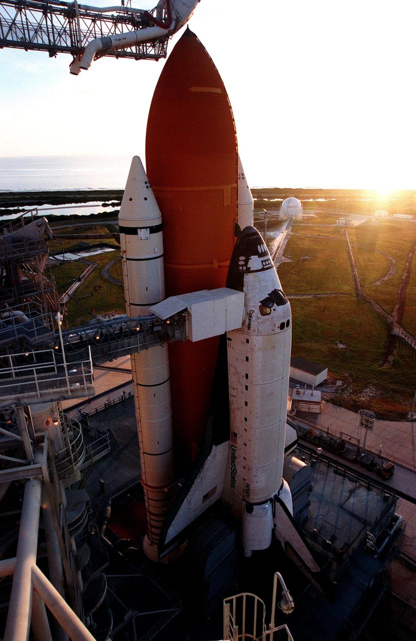
Space Shuttle Columbia catches the rising sun after the rollback of the Rotating Service Structure on Launch Pad 39-B. Columbia waits for the launch of mission STS-93 July 20 at 12:36 a.m. EDT. The primary payload of STS-93 is the Chandra X-ray Observatory, which will allow scientists from around the world to study some of the most distant, powerful and dynamic objects in the universe. The new telescope is 20 to 50 times more sensitive than any previous X-ray telescope and is expected unlock the secrets of supernovae, quasars and black holes. The STS-93 crew numbers five: Commander Eileen M. Collins, Pilot Jeffrey S. Ashby, and Mission Specialists Steven A. Hawley (Ph.D.), Catherine G. Coleman (Ph.D.) and Michel Tognini of France, with the Centre National d'Etudes Spatiales (CNES). Collins is the first woman to serve as commander of a shuttle mission
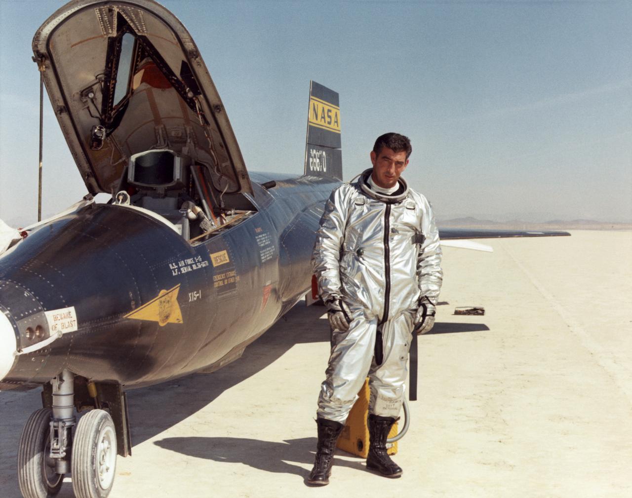
Air Force test pilot Maj. Michael J. Adams stands beside X-15 ship number one. Adams was selected for the X-15 program in 1966 and made his first flight on Oct. 6, 1966. On Nov. 15, 1967, Adams made his seventh and final X-15 flight. The X-15 launched from the B-52, but during the ascent an electrical problem affected the X-15's control system. The aircraft crashed northwest of Cuddeback Lake, California, causing the death of Adams. He was posthumously awarded Air Force astronaut wings because his final flight exceeded 50 miles in altitude. Adams was the only pilot lost in the 199-flight X-15 program.

Guests are gathered on stage during a ceremony at the KSC Visitor Complex held in remembrance of the astronauts lost in the Apollo 1 fire: Virgil "Gus" Grissom, Edward H. White II and Roger B. Chaffee. Among those gathered on stage are (from left) Faith Johnson, daughter of Theodore Freeman and Martha Chaffee, daughter of Roger Chaffee, Associate Administrator for Space Operations William Gerstenmaier and KSC Director Bill Parsons, plus former astronaut John Young (second from right). Members of the astronauts' families were guests at the ceremony. At the podium is Stephen Feldman, president of the Astronauts Memorial Foundation. Behind the stage is the Space Mirror Memorial, designated as a national memorial by Congress and President George Bush in 1991 to honor fallen astronauts. Their names are emblazoned on the monument’s 42-1/2-foot-high by 50-foot-wide black granite surface as if to be projected into the heavens.
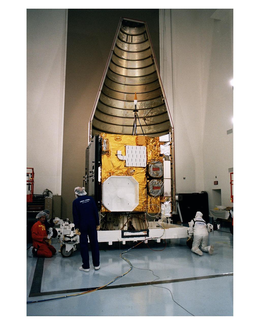
Workers at the Astrotech Space Operations LP facility in Titusville make final checks and adjustments after encapsulating the GOES-K advanced weather satellite in the Atlas 1 payload fairing. GOES-K will be the third spacecraft to be launched in the advanced series of Geostationary Operational Environmental Satellites (GOES). The GOES satellites are owned and operated by the National Oceanic and Atmospheric Administration (NOAA); NASA manages the design, development and launch of the spacecraft. GOES-K is targeted for an <a href="http://www-pao.ksc.nasa.gov/kscpao/release/1997/63-97.htm">April 24 launch</a> aboard a Lockheed Martin Atlas 1 expendable launch vehicle (AC-79) from Launch Complex 36, Pad B, Cape Canaveral Air Station. The launch window opens at 1:50 a.m. and extends to 3:09 a.m. EDT. Once in orbit, GOES-K will become GOES-10, joining GOES-8 and GOES-9 in space
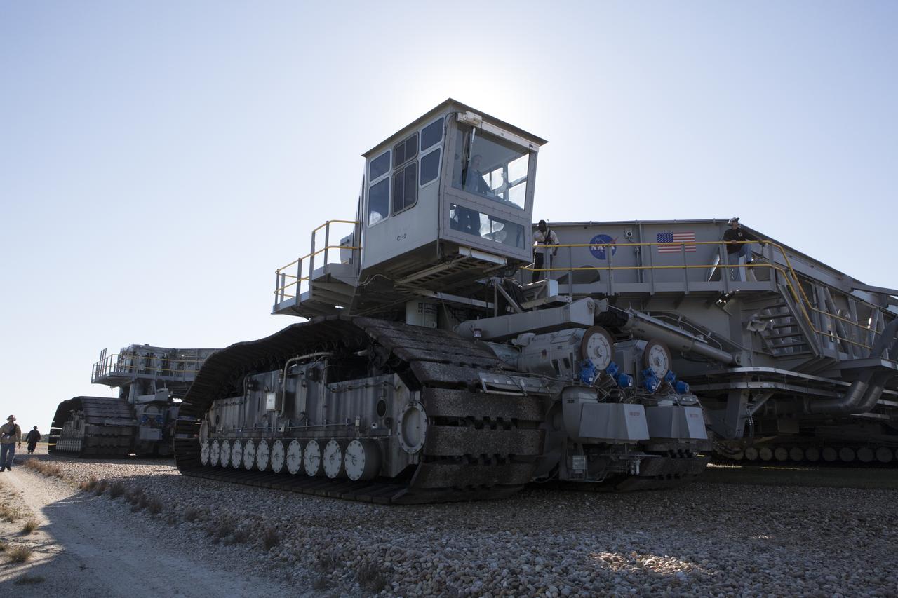
Ground support technicians walks alongside crawler-transporter 2 (CT-2) as the vehicle moves slowly along the crawlerway toward the Vehicle Assembly Building at NASA's Kennedy Space Center in Florida. The crawler took a trip to the Pad A/B split to test upgrades recently completed that will allow the giant vehicle to handle the load of the agency's Space Launch System rocket and Orion spacecraft atop the mobile launcher. The Ground Systems Development and Operations Program oversaw upgrades to the 50-year-old CT-2. New generators, gear assemblies, jacking, equalizing and leveling (JEL) hydraulic cylinders, roller bearings and brakes were installed, and other components were upgraded to prepare for Exploration Mission 1.

KENNEDY SPACE CENTER, FLA. -- In the Vertical Processing Facility, the Hubble Space Telescope (HST) has been installed in the payload canister and will ride atop the associated payload transporter for a 10-mile trip to Pad B on Launch Complex 39. The telescope is contained within a protective cocoon which is a double bag sanitary liner. This provides added cleanliness and protection and has been on HST since its arrival at KSC in October 1989. It was removed immediately prior to installation of the telescope into the payload bay of the Space Shuttle Discovery. With HST, astronomers will be able to view 97 percent of the known universe, and will be able to get pictures unlimited and undistorted by the Earth's atmosphere. Compared with earth-based observatories, the HST will be able to view celestial objects that are 50 times fainter, provide images that are 10 times sharper, and see objects that are seven times farther away. .
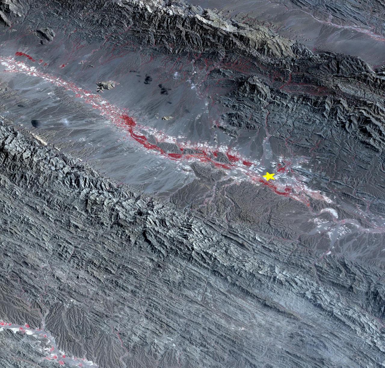
On September 24 at 11:29 GMT, a magnitude 7.7 earthquake struck in south-central Pakistan at a relatively shallow depth of 20 kilometers. The earthquake occurred as the result of oblique strike-slip motion, consistent with rupture within the Eurasian tectonic plate. Tremors were felt as far away as New Delhi as well as Karachi in Pakistan. Even though the immediate area to the epicenter is sparsely populated, the majority of houses are of mud brick construction and damage is expected to be extensive. The perspective view, looking to the east, shows the location of the epicenter in Pakistan's Makran fold belt. The image is centered near 27 degrees north latitude, 65.5 degrees east longitude, and was acquired December 13, 2012. With its 14 spectral bands from the visible to the thermal infrared wavelength region and its high spatial resolution of 15 to 90 meters (about 50 to 300 feet), ASTER images Earth to map and monitor the changing surface of our planet. ASTER is one of five Earth-observing instruments launched Dec. 18, 1999, on Terra. The instrument was built by Japan's Ministry of Economy, Trade and Industry. A joint U.S./Japan science team is responsible for validation and calibration of the instrument and data products. The broad spectral coverage and high spectral resolution of ASTER provides scientists in numerous disciplines with critical information for surface mapping and monitoring of dynamic conditions and temporal change. Example applications are: monitoring glacial advances and retreats; monitoring potentially active volcanoes; identifying crop stress; determining cloud morphology and physical properties; wetlands evaluation; thermal pollution monitoring; coral reef degradation; surface temperature mapping of soils and geology; and measuring surface heat balance. The U.S. science team is located at NASA's Jet Propulsion Laboratory, Pasadena, Calif. The Terra mission is part of NASA's Science Mission Directorate, Washington, D.C. More information about ASTER is available at <a href="http://asterweb.jpl.nasa.gov/" rel="nofollow">asterweb.jpl.nasa.gov/</a>. Image Credit: NASA/GSFC/METI/ERSDAC/JAROS, and U.S./Japan ASTER Science Team Image Addition Date: 2013-09-24 <b><a href="http://www.nasa.gov/audience/formedia/features/MP_Photo_Guidelines.html" rel="nofollow">NASA image use policy.</a></b> <b><a href="http://www.nasa.gov/centers/goddard/home/index.html" rel="nofollow">NASA Goddard Space Flight Center</a></b> enables NASA’s mission through four scientific endeavors: Earth Science, Heliophysics, Solar System Exploration, and Astrophysics. Goddard plays a leading role in NASA’s accomplishments by contributing compelling scientific knowledge to advance the Agency’s mission. <b>Follow us on <a href="http://twitter.com/NASA_GoddardPix" rel="nofollow">Twitter</a></b> <b>Like us on <a href="http://www.facebook.com/pages/Greenbelt-MD/NASA-Goddard/395013845897?ref=tsd" rel="nofollow">Facebook</a></b> <b>Find us on <a href="http://instagram.com/nasagoddard?vm=grid" rel="nofollow">Instagram</a></b>
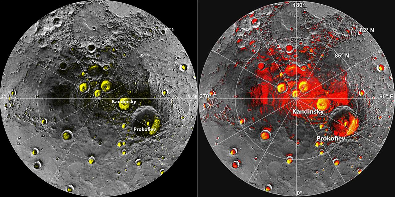
New observations by the MESSENGER spacecraft provide compelling support for the long-held hypothesis that Mercury harbors abundant water ice and other frozen volatile materials in its permanently shadowed polar craters. Three independent lines of evidence support this conclusion: the first measurements of excess hydrogen at Mercury's north pole with MESSENGER's Neutron Spectrometer, the first measurements of the reflectance of Mercury's polar deposits at near-infrared wavelengths with the Mercury Laser Altimeter (MLA), and the first detailed models of the surface and near-surface temperatures of Mercury's north polar regions that utilize the actual topography of Mercury's surface measured by the MLA. These findings are presented in three papers published online today in Science Express. Given its proximity to the Sun, Mercury would seem to be an unlikely place to find ice. But the tilt of Mercury's rotational axis is almost zero — less than one degree — so there are pockets at the planet's poles that never see sunlight. Scientists suggested decades ago that there might be water ice and other frozen volatiles trapped at Mercury's poles. The idea received a boost in 1991, when the Arecibo radio telescope in Puerto Rico detected unusually radar-bright patches at Mercury's poles, spots that reflected radio waves in the way one would expect if there were water ice. Many of these patches corresponded to the location of large impact craters mapped by the Mariner 10 spacecraft in the 1970s. But because Mariner saw less than 50 percent of the planet, planetary scientists lacked a complete diagram of the poles to compare with the images. MESSENGER's arrival at Mercury last year changed that. Images from the spacecraft's Mercury Dual Imaging System taken in 2011 and earlier this year confirmed that radar-bright features at Mercury's north and south poles are within shadowed regions on Mercury's surface, findings that are consistent with the water-ice hypothesis. To read more go to: <a href="http://1.usa.gov/TtNwM2" rel="nofollow">1.usa.gov/TtNwM2</a> Image Credit: NASA/Johns Hopkins University Applied Physics Laboratory/Carnegie Institution of Washington/National Astronomy and Ionosphere Center, Arecibo Observatory <b><a href="http://www.nasa.gov/audience/formedia/features/MP_Photo_Guidelines.html" rel="nofollow">NASA image use policy.</a></b> <b><a href="http://www.nasa.gov/centers/goddard/home/index.html" rel="nofollow">NASA Goddard Space Flight Center</a></b> enables NASA’s mission through four scientific endeavors: Earth Science, Heliophysics, Solar System Exploration, and Astrophysics. Goddard plays a leading role in NASA’s accomplishments by contributing compelling scientific knowledge to advance the Agency’s mission. <b>Follow us on <a href="http://twitter.com/NASA_GoddardPix" rel="nofollow">Twitter</a></b> <b>Like us on <a href="http://www.facebook.com/pages/Greenbelt-MD/NASA-Goddard/395013845897?ref=tsd" rel="nofollow">Facebook</a></b> <b>Find us on <a href="http://instagram.com/nasagoddard?vm=grid" rel="nofollow">Instagram</a></b>
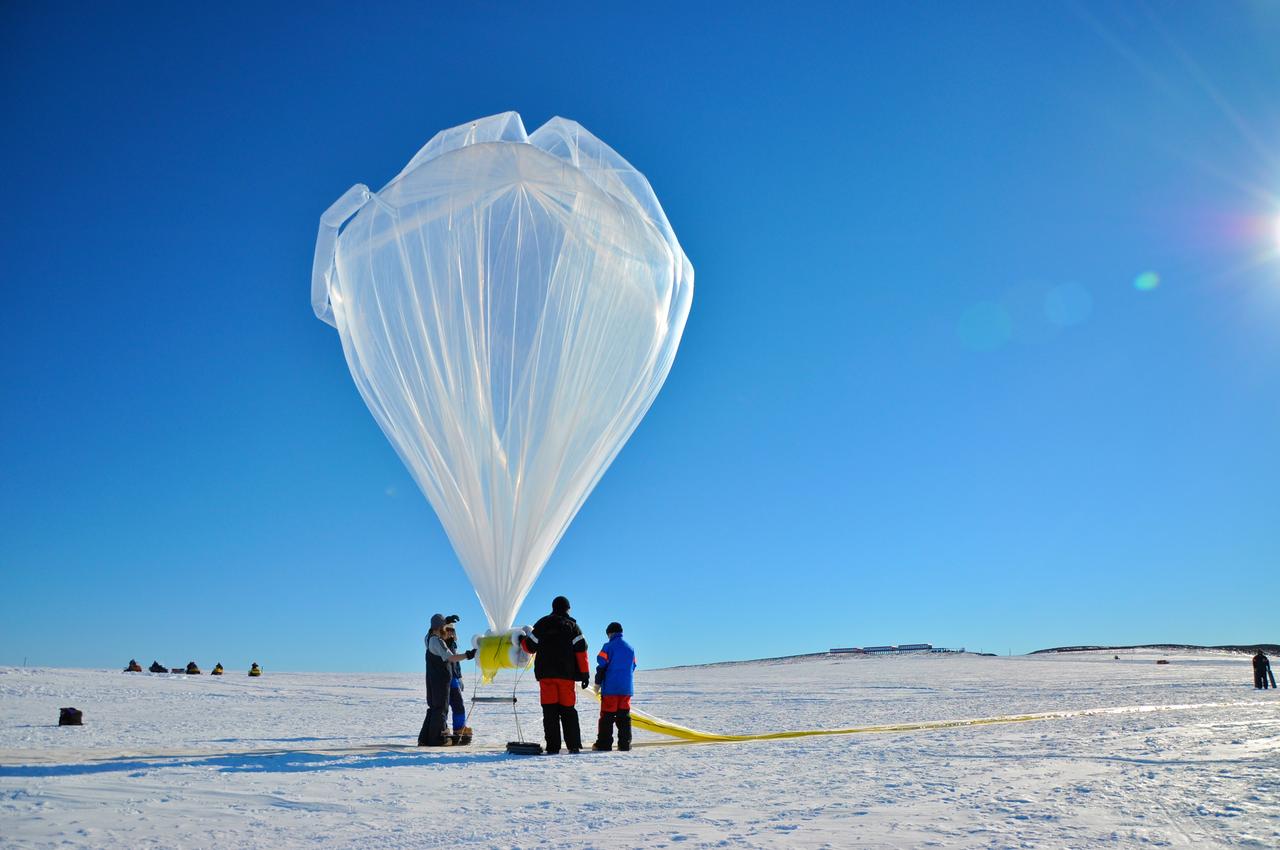
A BARREL balloon floats into the sky as it is partially filled. When fully inflated, each balloon is 90 feet in diameter and carries an instrument suite that weighs 50 pounds. This is small for an Antarctica balloon launch, which can have balloons Typical balloons l the size of a football field with payloads of some 3,000 pounds. Credit: NASA --- In Antarctica in January, 2013 – the summer at the South Pole – scientists launched 20 balloons up into the air to study an enduring mystery of space weather: when the giant radiation belts surrounding Earth lose material, where do the extra particles actually go? The mission is called BARREL (Balloon Array for Radiation belt Relativistic Electron Losses) and it is led by physicist Robyn Millan of Dartmouth College in Hanover, NH. Millan provided photographs from the team’s time in Antarctica. The team launched a balloon every day or two into the circumpolar winds that circulate around the pole. Each balloon floated for anywhere from 3 to 40 days, measuring X-rays produced by fast-moving electrons high up in the atmosphere. BARREL works hand in hand with another NASA mission called the Van Allen Probes, which travels through the Van Allen radiation belts surrounding Earth. The belts wax and wane over time in response to incoming energy and material from the sun, sometimes intensifying the radiation through which satellites must travel. Scientists wish to understand this process better, and even provide forecasts of this space weather, in order to protect our spacecraft. As the Van Allen Probes were observing what was happening in the belts, BARREL tracked electrons that precipitated out of the belts and hurtled down Earth’s magnetic field lines toward the poles. By comparing data, scientists will be able to track how what’s happening in the belts correlates to the loss of particles – information that can help us understand this mysterious, dynamic region that can impact spacecraft. Having launched balloons in early 2013, the team is back at home building the next set of payloads. They will launch 20 more balloons in 2014. <b><a href="http://www.nasa.gov/audience/formedia/features/MP_Photo_Guidelines.html" rel="nofollow">NASA image use policy.</a></b> <b><a href="http://www.nasa.gov/centers/goddard/home/index.html" rel="nofollow">NASA Goddard Space Flight Center</a></b> enables NASA’s mission through four scientific endeavors: Earth Science, Heliophysics, Solar System Exploration, and Astrophysics. Goddard plays a leading role in NASA’s accomplishments by contributing compelling scientific knowledge to advance the Agency’s mission. <b>Follow us on <a href="http://twitter.com/NASA_GoddardPix" rel="nofollow">Twitter</a></b> <b>Like us on <a href="http://www.facebook.com/pages/Greenbelt-MD/NASA-Goddard/395013845897?ref=tsd" rel="nofollow">Facebook</a></b> <b>Find us on <a href="http://instagram.com/nasagoddard?vm=grid" rel="nofollow">Instagram</a></b>
On April 9, 2013 at 11:52 GMT, a magnitude 6.3 earthquake hit southwestern Iran's Bushehr province near the town of Kaki. Preliminary information is that several villages have been destroyed and many people have died, as reported by BBC News. This perspective view of the region was acquired Nov. 17, 2012, by the Advanced Spaceborne Thermal Emission and Reflection Radiometer (ASTER) instrument on NASA's Terra spacecraft. The location of the earthquake's epicenter is marked with a yellow star. Vegetation is displayed in red; the vertical exaggeration of the topography is 2X. The image is centered near 28.5 degrees north latitude, 51.6 degrees east longitude. With its 14 spectral bands from the visible to the thermal infrared wavelength region and its high spatial resolution of 15 to 90 meters (about 50 to 300 feet), ASTER images Earth to map and monitor the changing surface of our planet. ASTER is one of five Earth-observing instruments launched Dec. 18, 1999, on Terra. The instrument was built by Japan's Ministry of Economy, Trade and Industry. A joint U.S./Japan science team is responsible for validation and calibration of the instrument and data products. The broad spectral coverage and high spectral resolution of ASTER provides scientists in numerous disciplines with critical information for surface mapping and monitoring of dynamic conditions and temporal change. Example applications are: monitoring glacial advances and retreats; monitoring potentially active volcanoes; identifying crop stress; determining cloud morphology and physical properties; wetlands evaluation; thermal pollution monitoring; coral reef degradation; surface temperature mapping of soils and geology; and measuring surface heat balance. The U.S. science team is located at NASA's Jet Propulsion Laboratory, Pasadena, Calif. The Terra mission is part of NASA's Science Mission Directorate, Washington, D.C. More information about ASTER is available at <a href="http://asterweb.jpl.nasa.gov/" rel="nofollow">asterweb.jpl.nasa.gov/</a>. Image Credit: NASA/GSFC/METI/ERSDAC/JAROS, and U.S./Japan ASTER Science Team Image Addition Date: 2013-04-10 <b><a href="http://www.nasa.gov/audience/formedia/features/MP_Photo_Guidelines.html" rel="nofollow">NASA image use policy.</a></b> <b><a href="http://www.nasa.gov/centers/goddard/home/index.html" rel="nofollow">NASA Goddard Space Flight Center</a></b> enables NASA’s mission through four scientific endeavors: Earth Science, Heliophysics, Solar System Exploration, and Astrophysics. Goddard plays a leading role in NASA’s accomplishments by contributing compelling scientific knowledge to advance the Agency’s mission. <b>Follow us on <a href="http://twitter.com/NASA_GoddardPix" rel="nofollow">Twitter</a></b> <b>Like us on <a href="http://www.facebook.com/pages/Greenbelt-MD/NASA-Goddard/395013845897?ref=tsd" rel="nofollow">Facebook</a></b> <b>Find us on <a href="http://instagram.com/nasagoddard?vm=grid" rel="nofollow">Instagram</a></b>
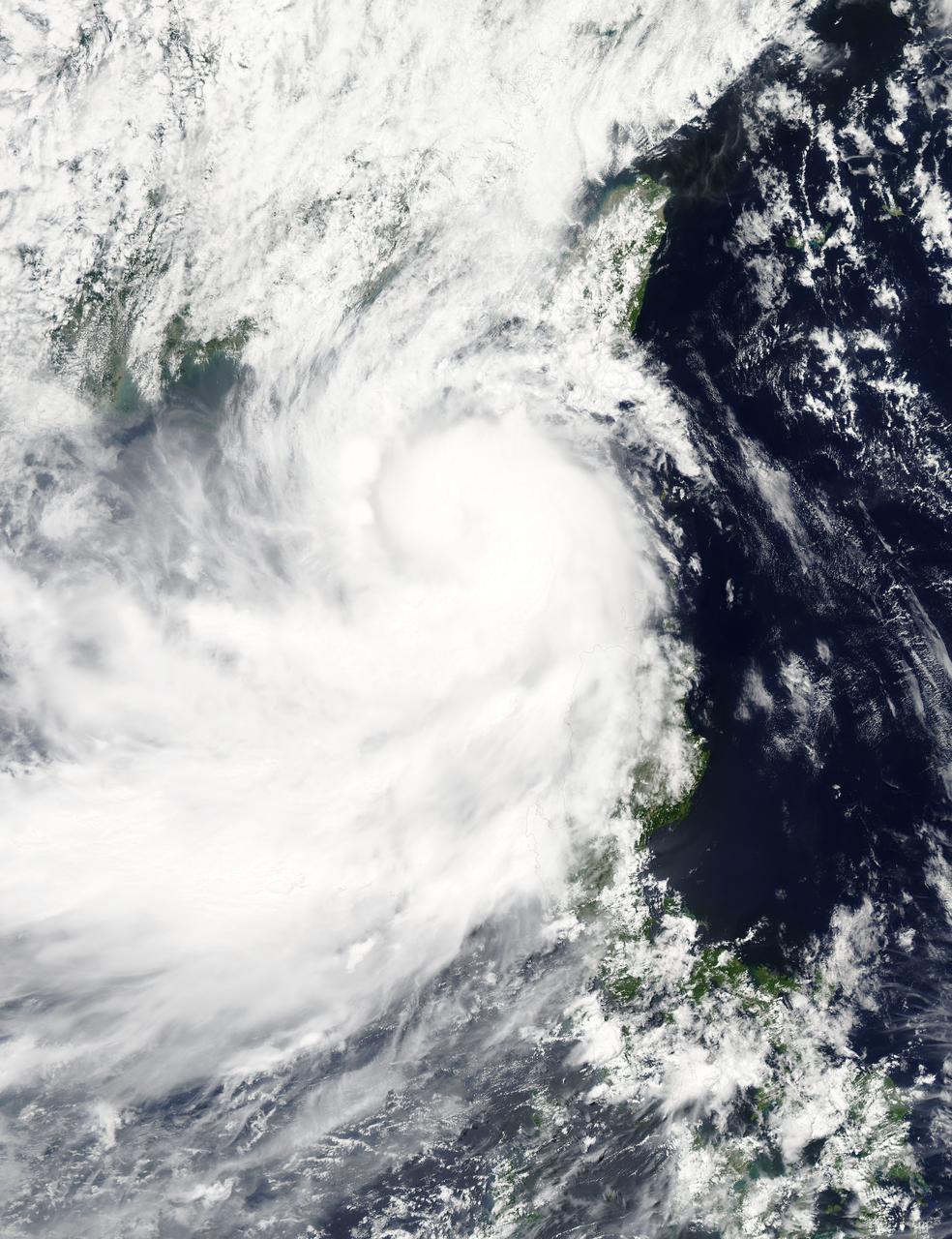
NASA's Aqua satellite captured a picture of Tropical Storm Linfa in the South China Sea on July 7 when it was between southern Taiwan and the northern Philippines. Aqua passed over Linfa on July 7 at 05:25 UTC (1:25 a.m. EDT) and the Moderate Resolution Imaging Spectroradiometer or MODIS instrument captured a visible image of the storm. Bands of thunderstorms wrapping into the center of circulation from the south, draped over western Luzon. The MODIS image showed the tight concentration of thunderstorms around Linfa's center were located over the South China Sea. Fragmented bands of thunderstorms north of the center were brushing over Southern Taiwan while clouds from another band of fragmented thunderstorms stretched northwest through the Taiwan Strait. On July 7 at 1500 UTC (11 a.m. EDT), Tropical Storm Linfa's maximum sustained winds had increased to 50 knots (57.5 mph/92.6 kph), up from 45 knots (51.7 mph/83.3 kph) six hours before. Linfa strengthened in the warm waters of the South China Sea now that its center has moved away from the northern Philippines and was no longer over land. Linfa was centered near 21.0 North latitude and 118.8 East longitude, about 277 nautical miles (319 miles/513.3 km) east-southeast of Hong Kong, China. Linfa has tracked northward at 3 knots (3.5 mph/5.5 kph). China's National Meteorological Centre has (CNMC) issued a yellow category warning of typhoon at 6:00 a.m. July 7, Beijing Time. CNMC noted that Linfa is the tenth typhoon this year and at that time it was centered about 430 km (267.2 miles) southeast of border between Fujian and Guangdong For updated warnings and watches from the China Meteorological Service, visit: <a href="http://www.cma.gov.cn/en/WeatherWarnings/" rel="nofollow">www.cma.gov.cn/en/WeatherWarnings/</a>. Linfa is moving north between Luzon and Taiwan. The Joint Typhoon Warning Center expects Linfa to strengthen to 60 knots (69 mph/111 kph) by mid-day on July 9, before weakening and then making landfall in mainland China. Credit: NASA/GSFC/Jeff Schmaltz/MODIS Land Rapid Response Team <b><a href="http://www.nasa.gov/audience/formedia/features/MP_Photo_Guidelines.html" rel="nofollow">NASA image use policy.</a></b> <b><a href="http://www.nasa.gov/centers/goddard/home/index.html" rel="nofollow">NASA Goddard Space Flight Center</a></b> enables NASA’s mission through four scientific endeavors: Earth Science, Heliophysics, Solar System Exploration, and Astrophysics. Goddard plays a leading role in NASA’s accomplishments by contributing compelling scientific knowledge to advance the Agency’s mission. <b>Follow us on <a href="http://twitter.com/NASAGoddardPix" rel="nofollow">Twitter</a></b> <b>Like us on <a href="http://www.facebook.com/pages/Greenbelt-MD/NASA-Goddard/395013845897?ref=tsd" rel="nofollow">Facebook</a></b> <b>Find us on <a href="http://instagrid.me/nasagoddard/?vm=grid" rel="nofollow">Instagram</a></b>