
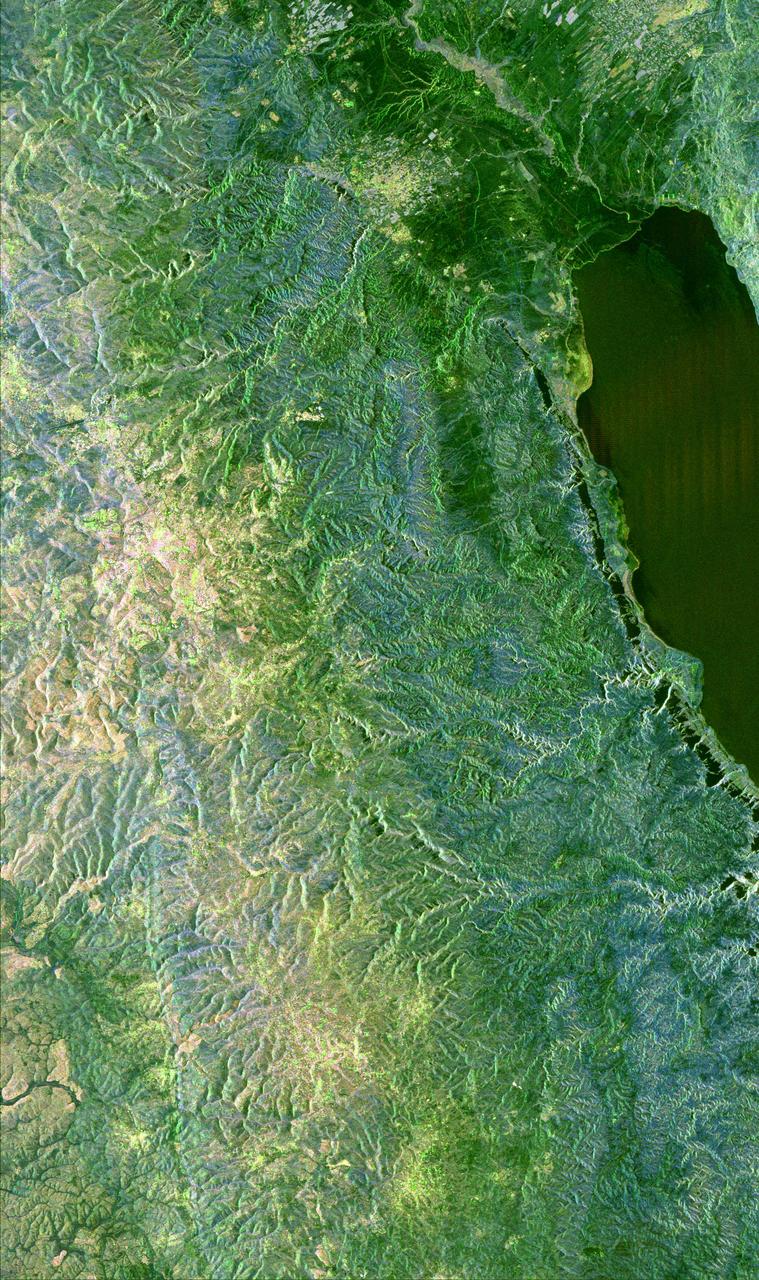
The Banks Peninsula, New Zealand was created by volcanic activity in the Miocene epoch about 10 million years ago. This image is from NASA Terra spacecraft.
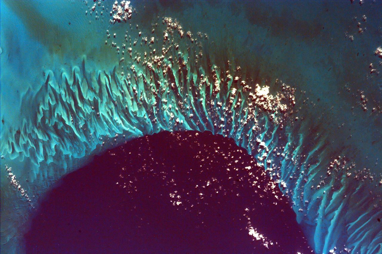
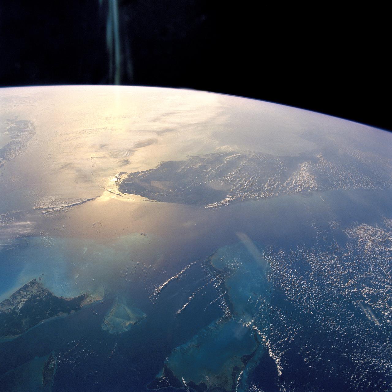
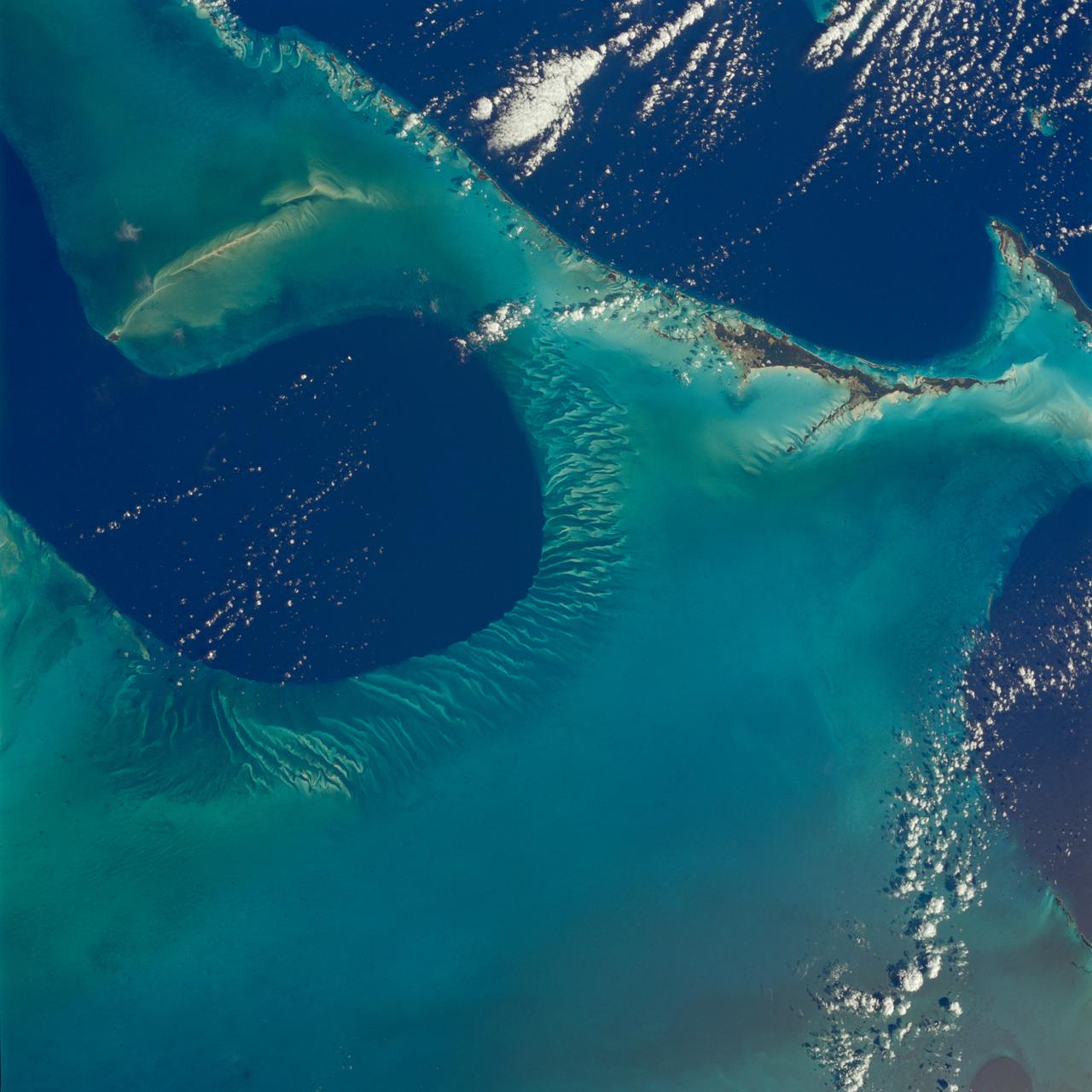
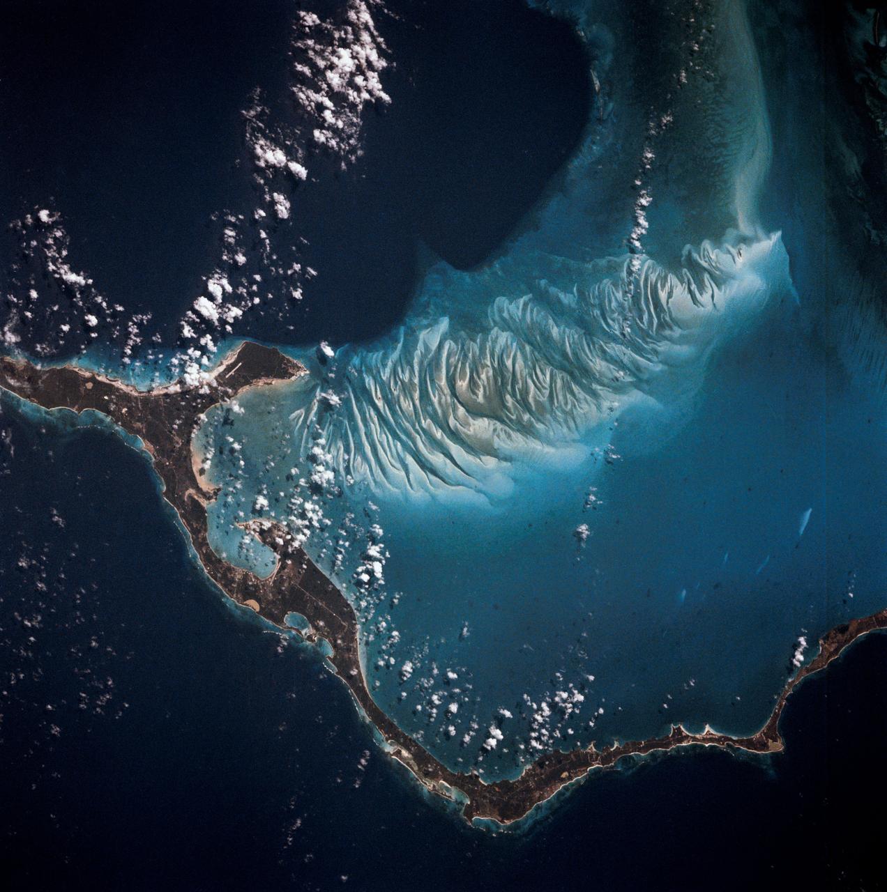
This extraordinary image captures the meeting place of the deep waters of the Tongue of the Ocean and the much shallower, completely submerged Grand Bahama Bank. This image is from NASA EarthKAM.
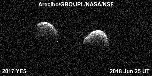
Bi-static radar images of the binary asteroid 2017 YE5 from the Arecibo Observatory and the Green Bank Observatory on June 25. The observations show that the asteroid consists of two separate objects in orbit around each other. A movie is available at https://photojournal.jpl.nasa.gov/catalog/PIA22559
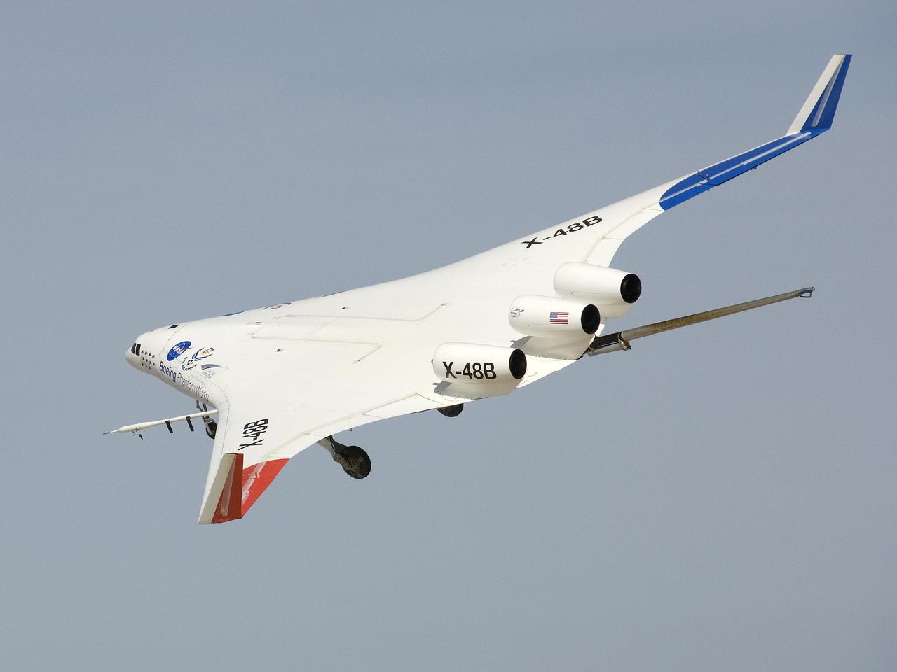
The X-48B Blended Wing Body research aircraft banked smartly in this Block 2 flight phase image.
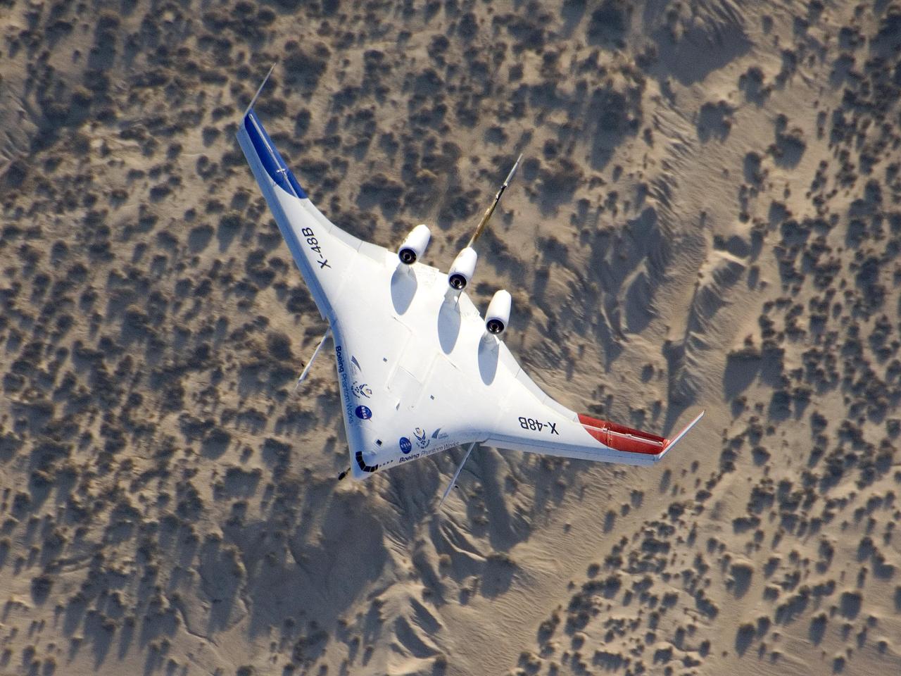
The unique X-48B Blended Wing Body subscale demonstrator banked over desert scrub at Edwards AFB during the aircraft's fifth test flight Aug. 14, 2007.
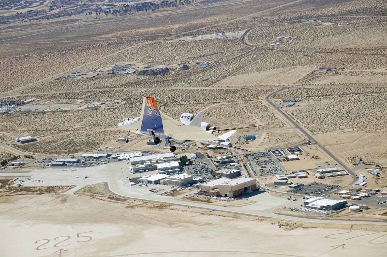
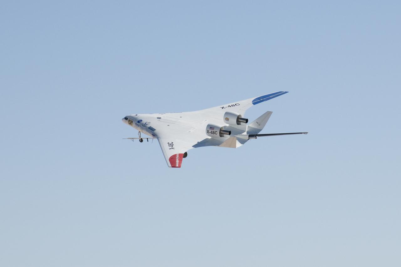
The X-48C Hybrid Wing Body research aircraft banked right over NASA's Dryden Flight Research Center at Edwards, CA during one of the sub-scale aircraft's final test flights on Feb. 28, 2013.
STS045-78-016 (24 March-2 April 1992) --- This view is of the Bahamas and Florida looking westward into the sunglint. The Bahama Banks are in the foreground; from left to right, Andros Island, the Berry Islands, and Grand Bahama Island are surrounded by shallow limestone banks. Bimini is the double dark spot on the edge of the Straits of Florida, with the peninsula of Florida within the sunglint. Cuba can be seen to the upper left.
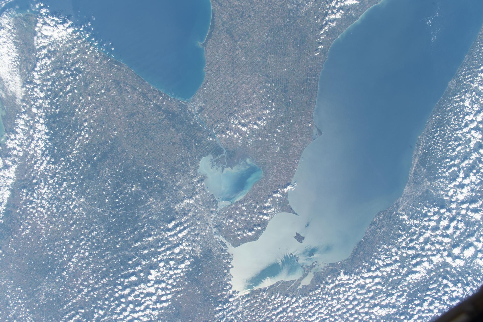
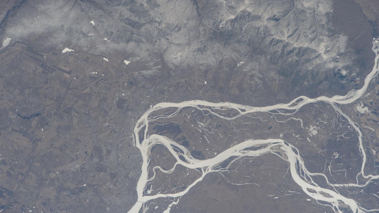
iss073e0814049 (Sept. 26, 2025) --- Detroit, Michigan, sits on the banks of the Detroit River, which connects Lake St. Clair (center) to Lake Erie to the south. To the north, the St. Clair River links Lake St. Clair with Lake Huron. Both rivers serve as natural borders between the United States and Canada. The International Space Station was orbiting 259 miles above Ontario, Canada, at the time of this photograph.
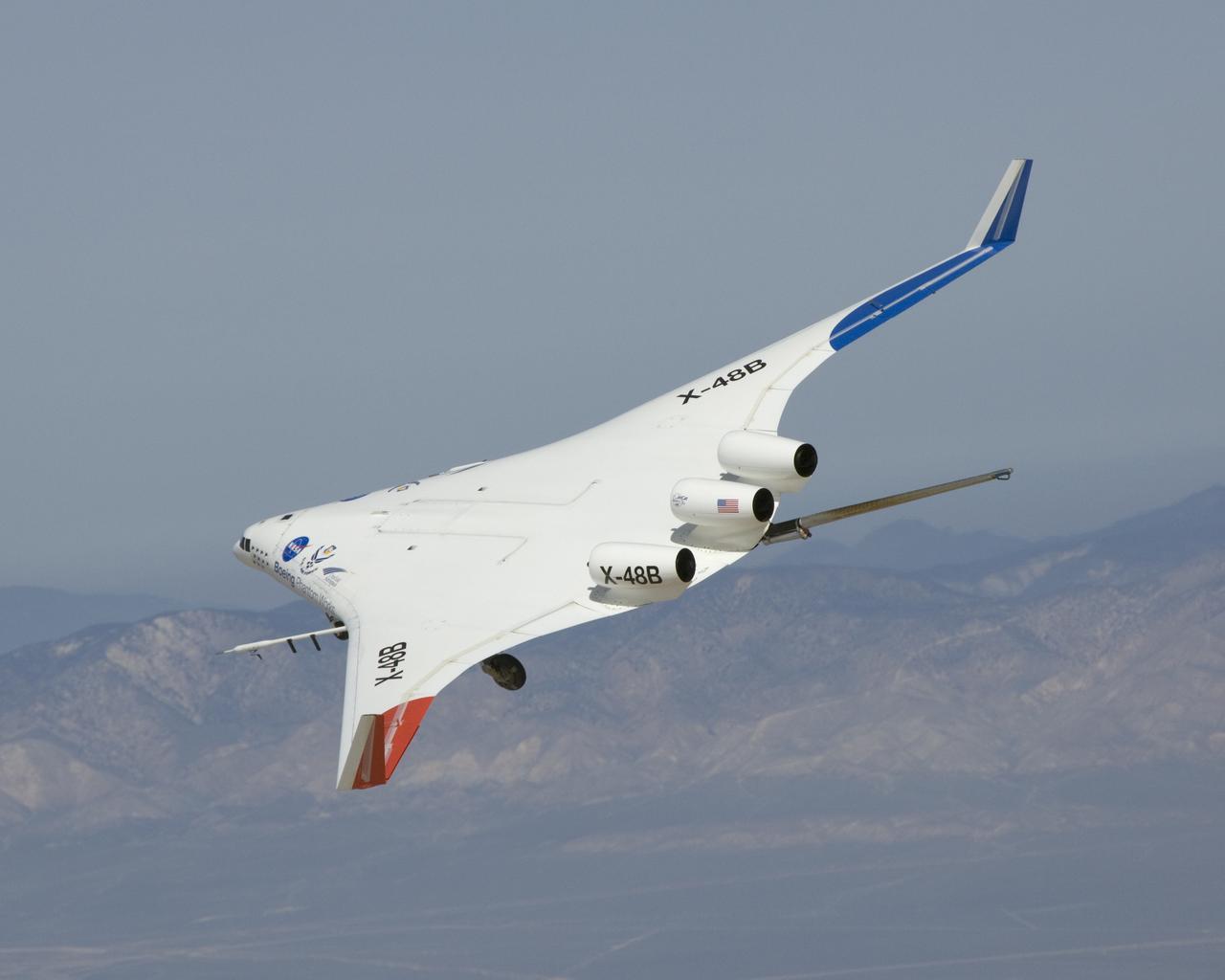
The X-48B Blended Wing Body research aircraft banks smartly in this Block 2 flight phase image.
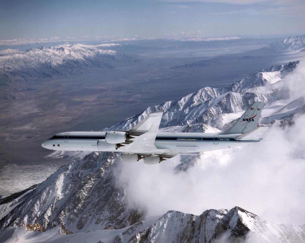
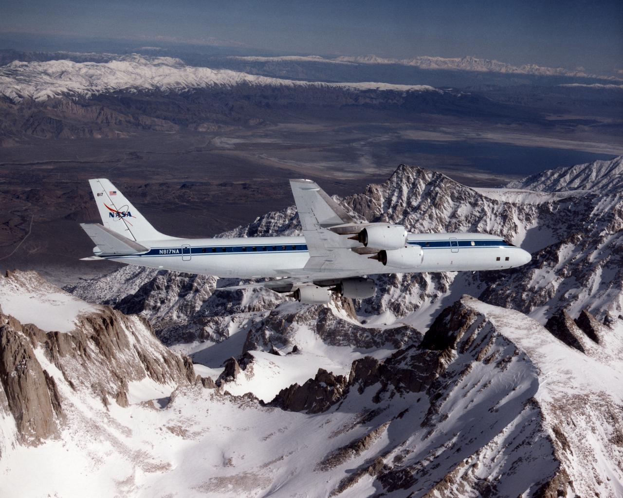
DC-8 Airborne Laboratory in banked flight over snow-capped Sierra Nevada mountain range
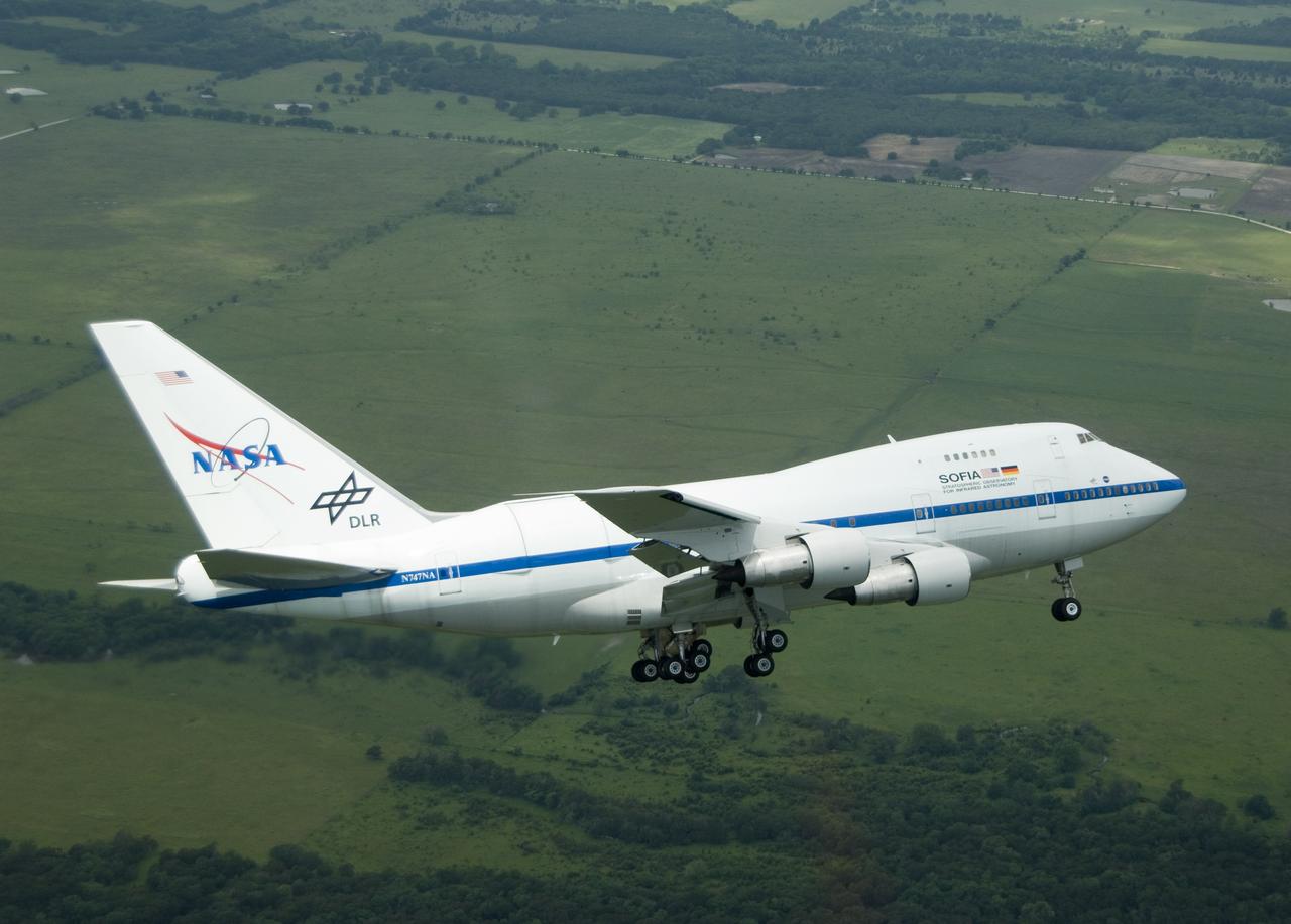
NASA's highly modified Boeing 747SP SOFIA observatory banks low over the Texas countryside as it heads for landing at Waco to conclude its second check flight.
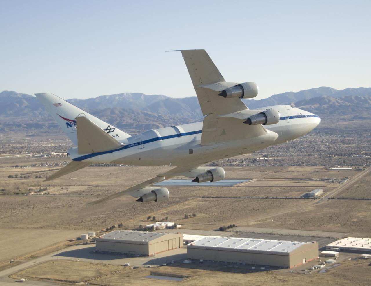
NASA's SOFIA flying infrared observatory banks over the Dryden Aircraft Operations Facility upon arrival at its new base of operations on Jan. 15, 2008.
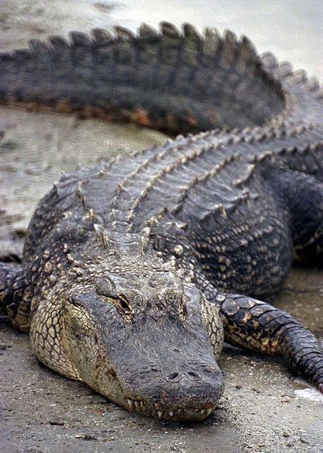
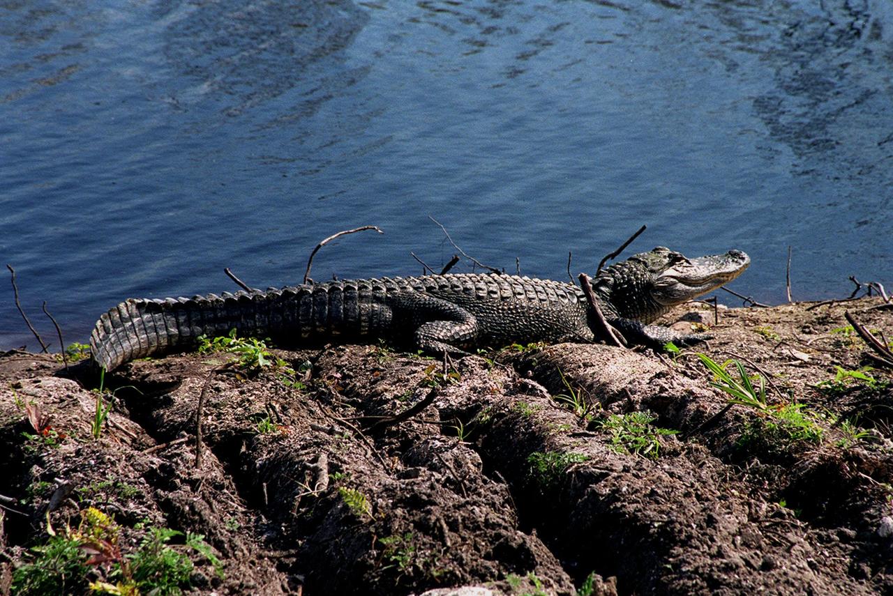
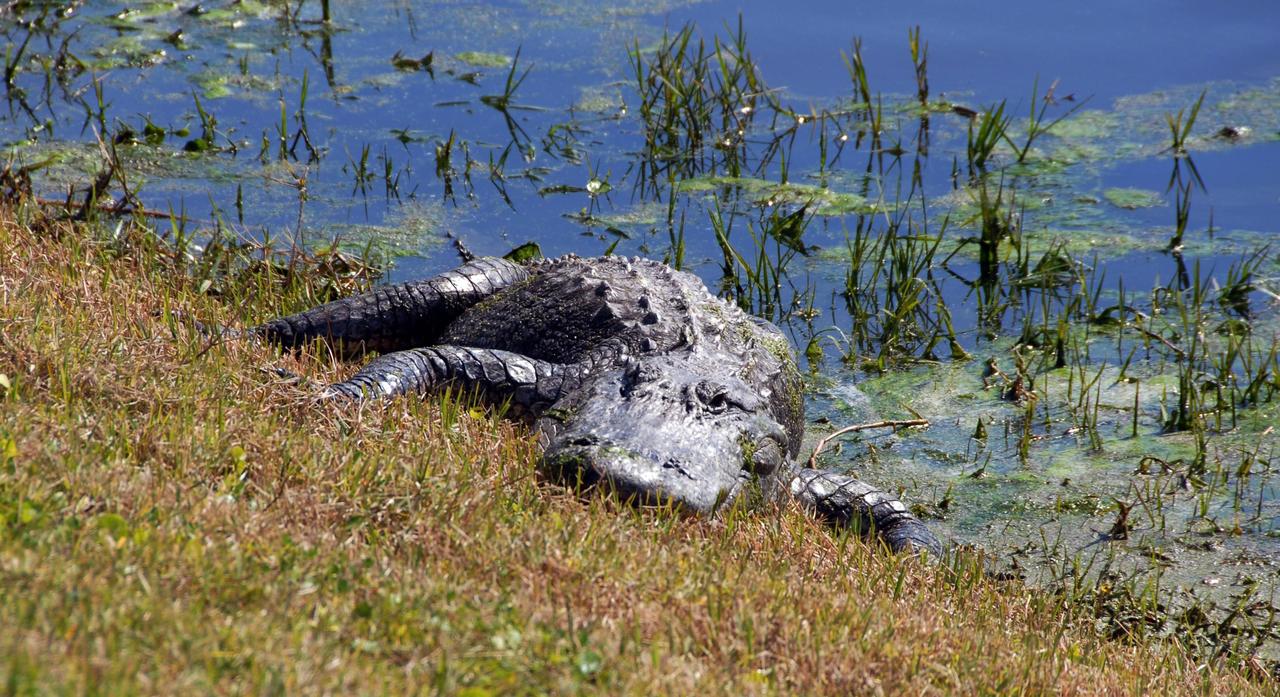
KENNEDY SPACE CENTER, FLA. -- An alligator is spotted sunning on the muddy bank of a canal in KSC. Nearly 5,000 alligators can be found in canals, ponds, and waterways throughout the Center and the surrounding Merritt Island National Wildlife Refuge. American alligators feed and rest in the water, and lay their eggs in dens they dig into the banks. The young alligators spend their first several weeks in these dens. The Wildlife Refuge encompasses 92,000 acres that are a habitat for more than 331 species of birds, 31 mammals, 117 fishes, and 65 amphibians and reptiles.
KENNEDY SPACE CENTER, FLA. -- An alligator is spotted sunning on the muddy bank of a canal in KSC. Nearly 5,000 alligators can be found in canals, ponds, and waterways throughout the Center and the surrounding Merritt Island National Wildlife Refuge. American alligators feed and rest in the water, and lay their eggs in dens they dig into the banks. The young alligators spend their first several weeks in these dens. The Wildlife Refuge encompasses 92,000 acres that are a habitat for more than 331 species of birds, 31 mammals, 117 fishes, and 65 amphibians and reptiles.
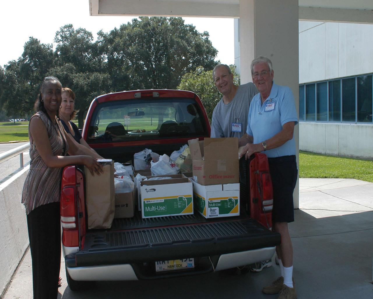
Cabrina Bell (l to r) and Jeanie Frederick with the Stennis Space Center Office of Human Capital help Hancock County Food Pantry representatives Edward Catone and Frank Manchester load collected food items July 9 as part of the 2010 Feds Feed Families campaign. The second annual national food drive was launched last month and involves federal agencies and employees across the country. Organizers hope to collect 1.2 million pounds of food items throughout the summer.
This image from NASA EarthKAM captures the tropical beauty of the major islands of the Little Bahama Bank, the most northerly of the island groups that comprise the Bahamas.
Two small Range Safety System antennas are located just behind the engine inlets of NASA's NF-15B research aircraft as it banks away from the chase plane.
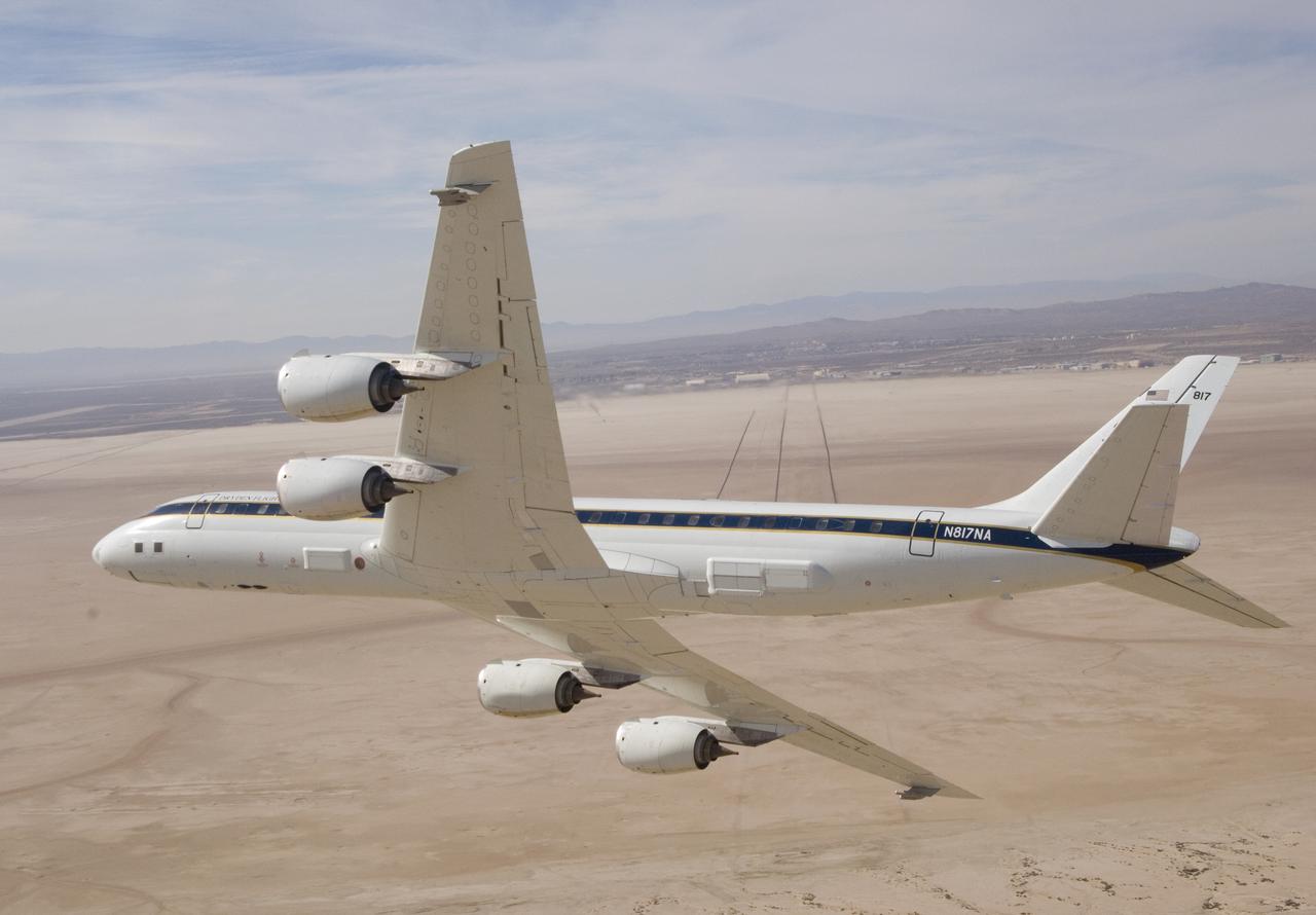
NASA's DC-8 airborne science laboratory banks low over Rogers Dry Lake at Edwards Air Force upon its return to NASA Dryden Flight Research Center Nov. 8, 2007.
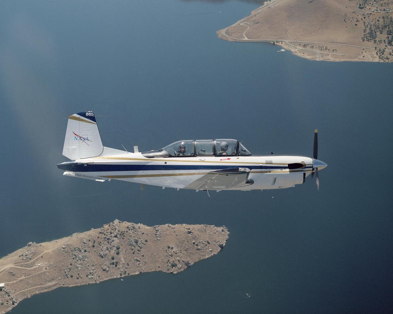
A Beech T-34C aircraft used by NASA Dryden Flight Research Center for mission support banks over Lake Isabella in Kern County during a recent flight.
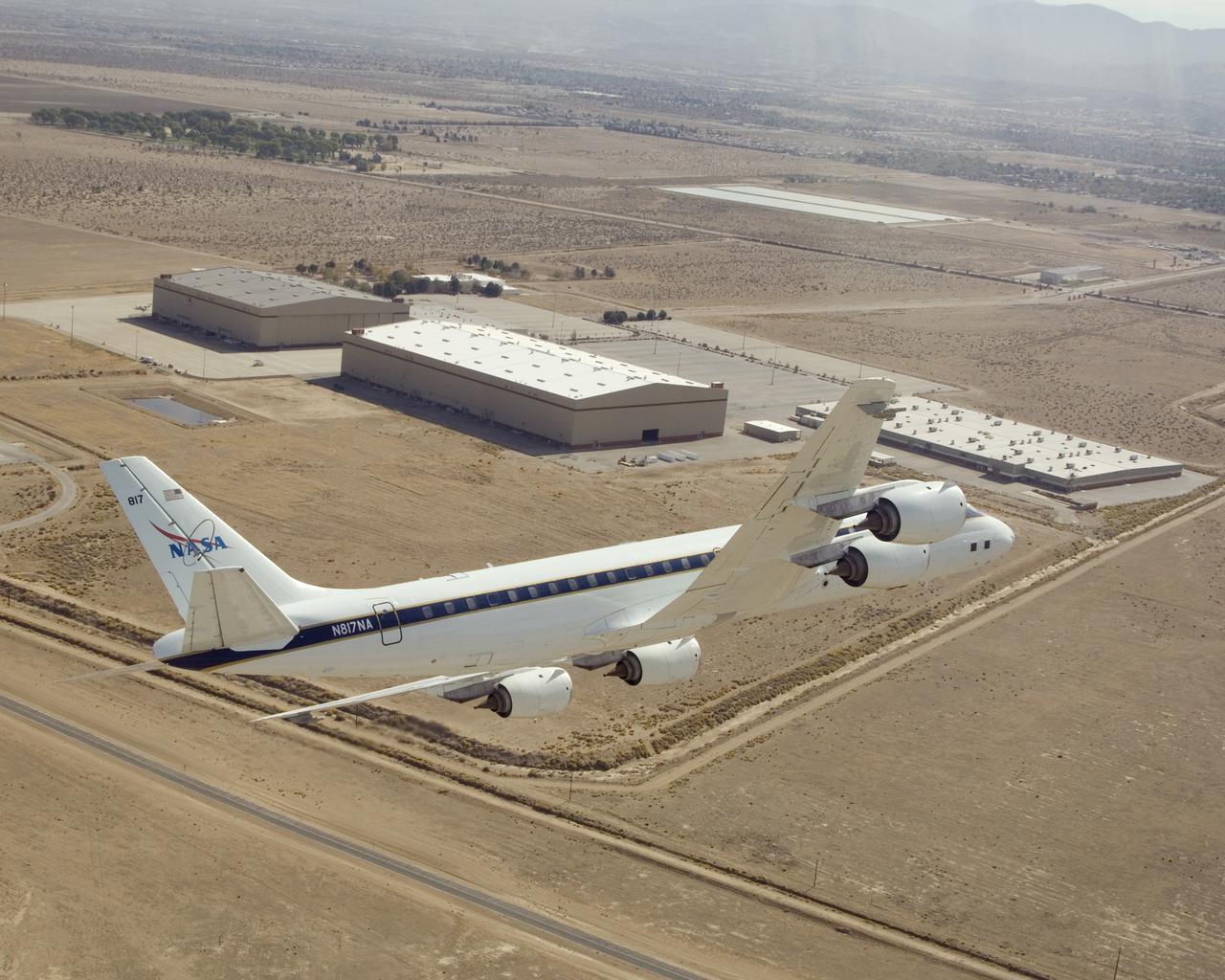
NASA's DC-8 airborne science laboratory banks low over the Dryden Aircraft Operations Facility at Air Force Plant 42 in Palmdale, Calif., upon arrival November 8, 2007.

A Beech T-34C aircraft used by NASA Dryden Flight Research Center for mission support banks over Lake Isabella in Kern County during a recent flight.
Notice anything different about the wings on this airliner? This conceptual truss-braced wing narrowbody is an aircraft with a 170ft span folding wing. By utilizing trusses, the aircraft can have longer, thinner wings with greater aspect ratios. This, in turn, translates into less drag and 5-10% less fuel burned. The Transonic Truss-Braced Wing aircraft originated from a joint effort by NASA and Boeing to develop subsonic commercial transport concepts – meeting NASA-defined metrics in terms of reduced noise, emissions, and fuel consumption. The design is currently undergoing wind tunnel testing and other studies by NASA researchers.

Notice anything different about the wings on this airliner? This conceptual truss-braced wing narrowbody is an aircraft with a 170ft span folding wing. By utilizing trusses, the aircraft can have longer, thinner wings with greater aspect ratios. This, in turn, translates into less drag and 5-10% less fuel burned. The Transonic Truss-Braced Wing aircraft originated from a joint effort by NASA and Boeing to develop subsonic commercial transport concepts – meeting NASA-defined metrics in terms of reduced noise, emissions, and fuel consumption. The design is currently undergoing wind tunnel testing and other studies by NASA researchers.

An ER-2 high-altitude Earth science aircraft banks away during a flight over the southern Sierra Nevada. NASA’s Armstrong Flight Research Center operates two of the Lockheed-built aircraft on a wide variety of environmental science, atmospheric sampling, and satellite data verification missions.
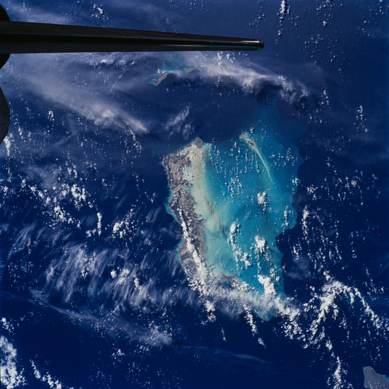
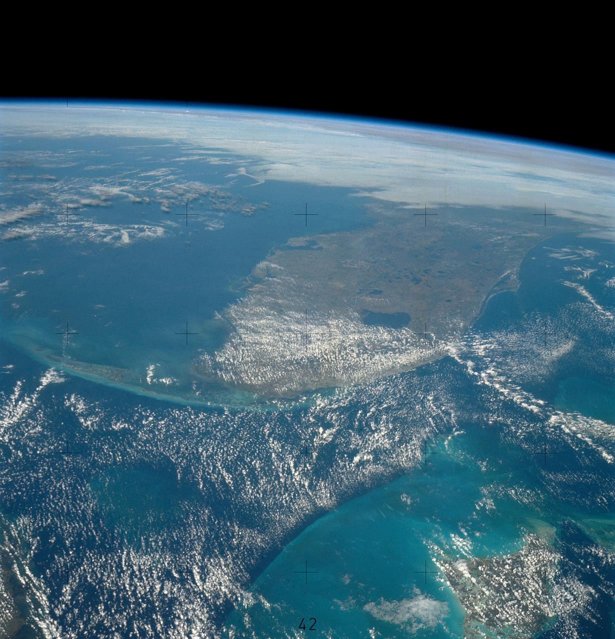
STS100-708-78 (19 April-1 May 2001) --- Southwest of the Bahamas and north of Hispaniola lie the Turks and Caicos Islands, photographed by the astronaut/cosmonaut crew aboard the Earth-orbiting Space Shuttle Endeavour. In this view, the extensive shallow water areas of Caicos Bank (turquoise blue) dominate to the south of the Caicos Islands. Caicos Bank covers an area of 7,680 square kilometers (1.9 million acres). The coral reefs of Caicos are primarily along the north deep water edge of the islands, and in a barrier along the south margin of the bank. The area is known for its marine caves and blowholes. To the east of Caicos Bank, near the tail of the Shuttle, is the island of Grand Turk, part of the much smaller Turks Bank. The channel that runs between the two banks is more than 2,200 meters (1.4 miles) deep.
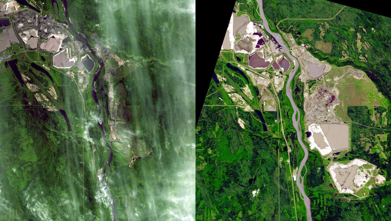
Near Fort McMurray, Alberta, Canada, on the east bank of the Athabasca River, are found the Steepbank and Millennium open pit mines. These images were acquired by NASA Terra satellite on September 22, 2000 and July 31, 2007.
This space radar image shows the area surrounding the Dead Sea along the West Bank between Israel and Jordan. This region is of major cultural and historical importance to millions of Muslims, Jews and Christians who consider it the Holy Land.
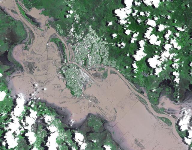
On Jan. 7, 2011, NASA Terra spacecraft captured this image of the inundated city of Rockhampton, Queensland, Australia. Torrential rains in NE Australia caused the Fitzroy River to overflow its banks and flood much of the city.
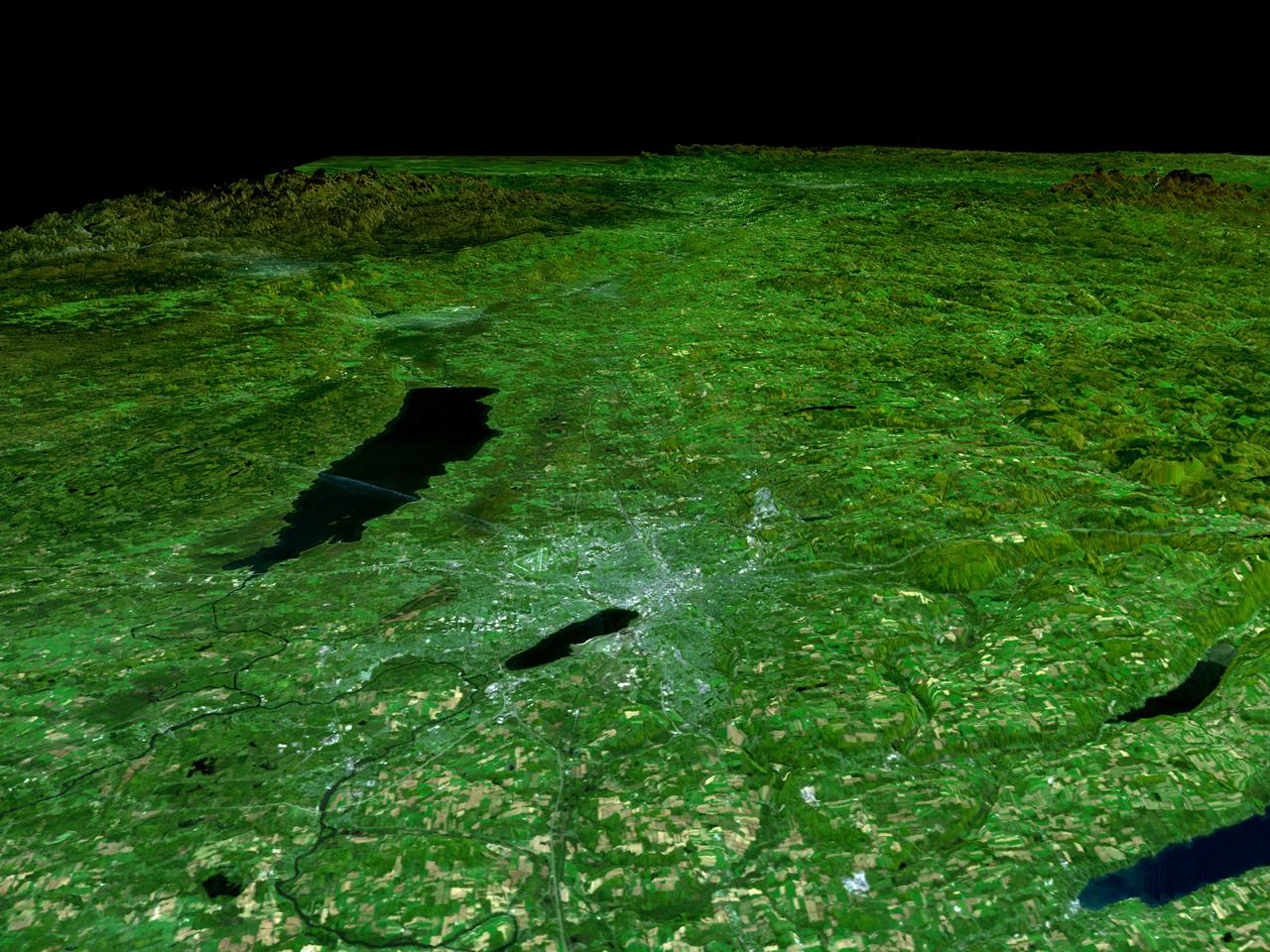
In the lower center of this perspective view of upstate New York, the city of Syracuse hugs the southeastern banks top right side of Lake Onondaga, the smaller of the two dark features that dominate the scene.
On Jan. 14, 2011, NASA Terra spacecraft captured this image of the inundated city of St. George, Queensland, Australia. Torrential rains in northeastern Australia caused the Balonne River to overflow its banks and flood much of the city.
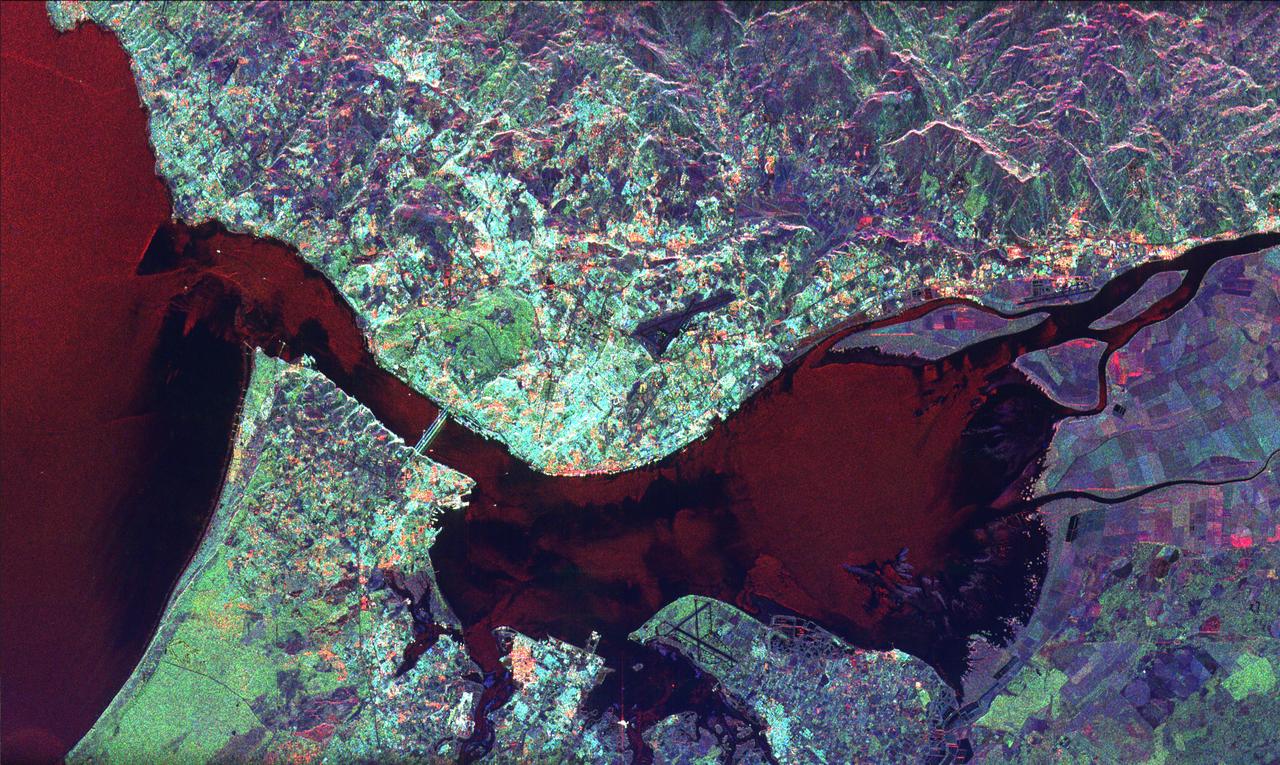
This radar image of Lisbon, Portugal illustrates the different land use patterns that are present in coastal Portugal. Lisbon, the national capital, lies on the north bank of the Rio Tejo where the river enters the Atlantic Ocean.
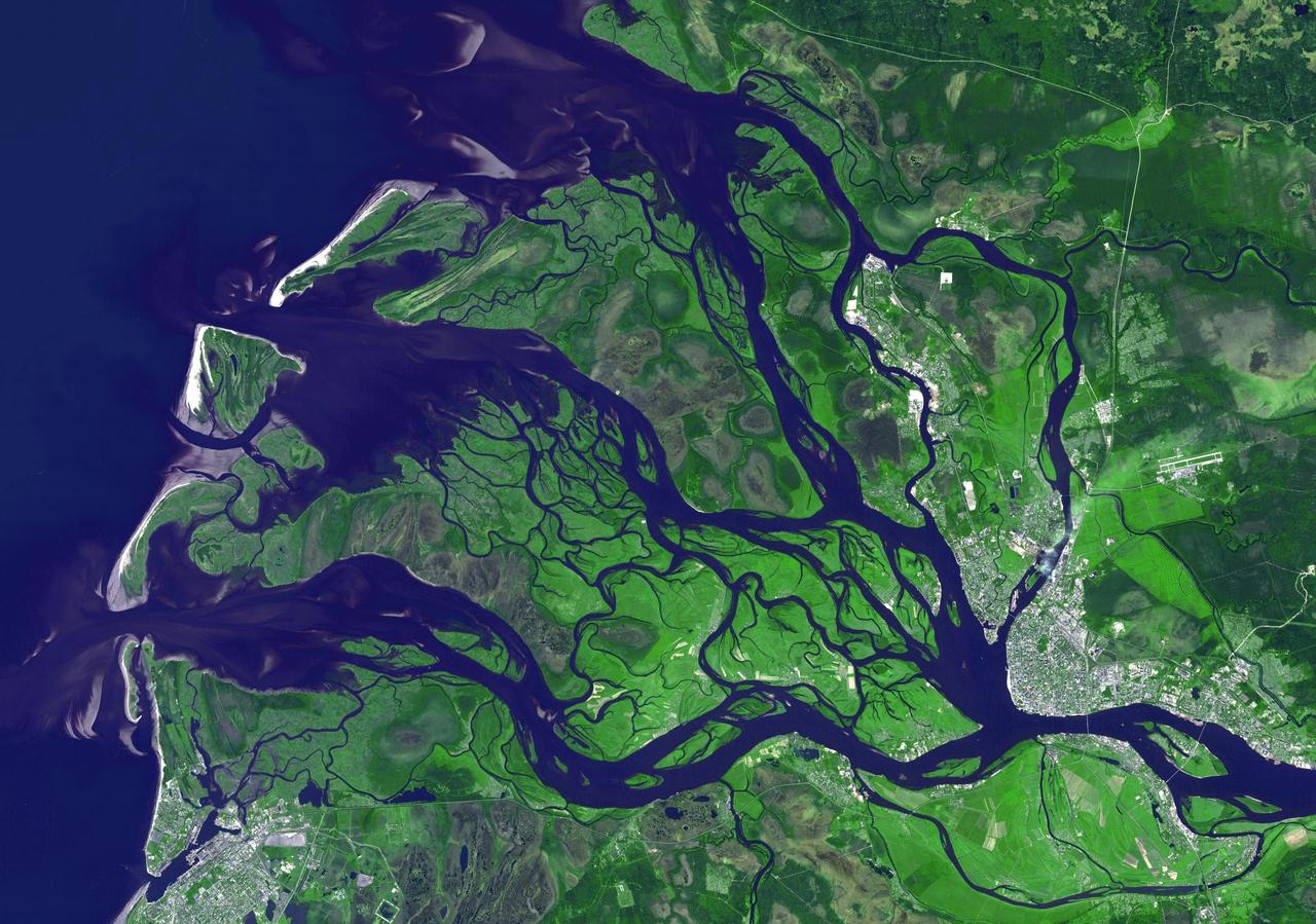
NASA Terra spacecraft captured this image of the city of Arkhangelsk or Archangel in English and administrative capital of Archangelsk Oblast, Russia. It is situated on both banks of the Dvina River near where it flows into the White Sea.
On Oct. 23, 2011, when this image from NASA Terra spacecraft was acquired, flood waters were approaching the capital city of Bangkok as the Ayutthaya River overflowed its banks.
This image of Neptune south polar region was obtained by NASA Voyager on Aug. 23, 1989. The image shows the discovery of shadows in Neptune atmosphere, shadows cast onto a deep cloud bank by small elevated clouds.
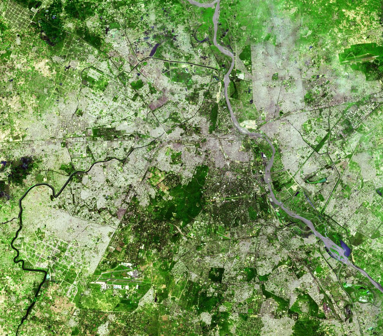
Delhi is the second largest metropolis in India, with a population of 16 million and is located in northern India along the banks of the Yamuna River. This image was acquired by NASA Terra satellite on September 22, 2003.
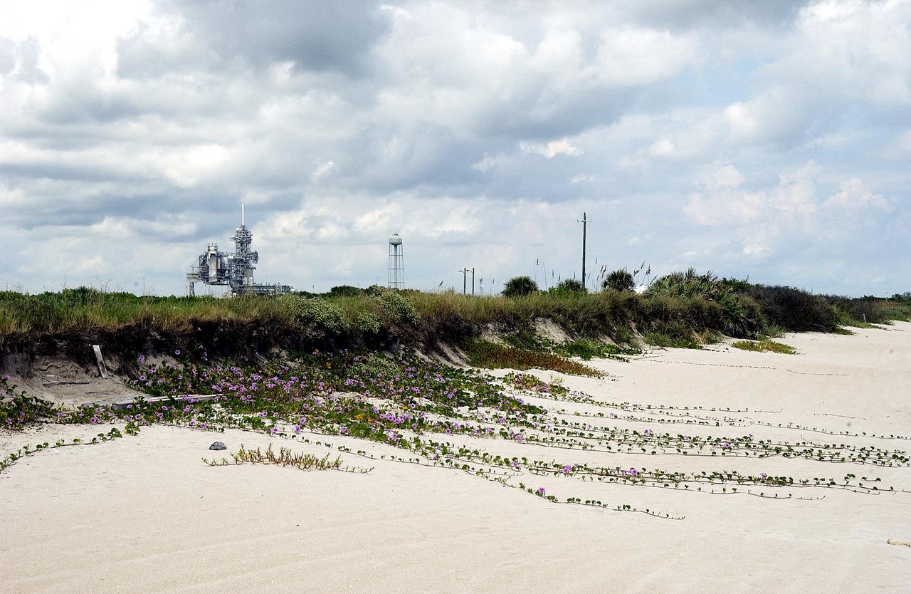
KENNEDY SPACE CENTER, FLA. - The sand dunes facing the Atlantic Ocean near Launch Pad 39A (background) at KSC spill purple flowers down its banks. The beach is just south of the Canaveral National Seashore, managed by the National Wildlife Service.
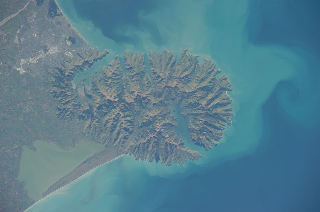
ISS040-E-006165 (31 May 2014 ) --- One of the Expedition 40 crew members aboard the International Space Station photographed this nadir image of the volcanic-born Banks Peninsula, on the east coast of the South Island of New Zealand on May 31, 2014. Banks Peninsula covers an area of approximately 1,150 square kilometers.
The NASA-Boeing X-48C Hybrid/Blended Wing Body research aircraft banked left during one of its final test flights over Edwards Air Force Base from NASA's Dryden Flight Research Center on Feb. 28, 2013.
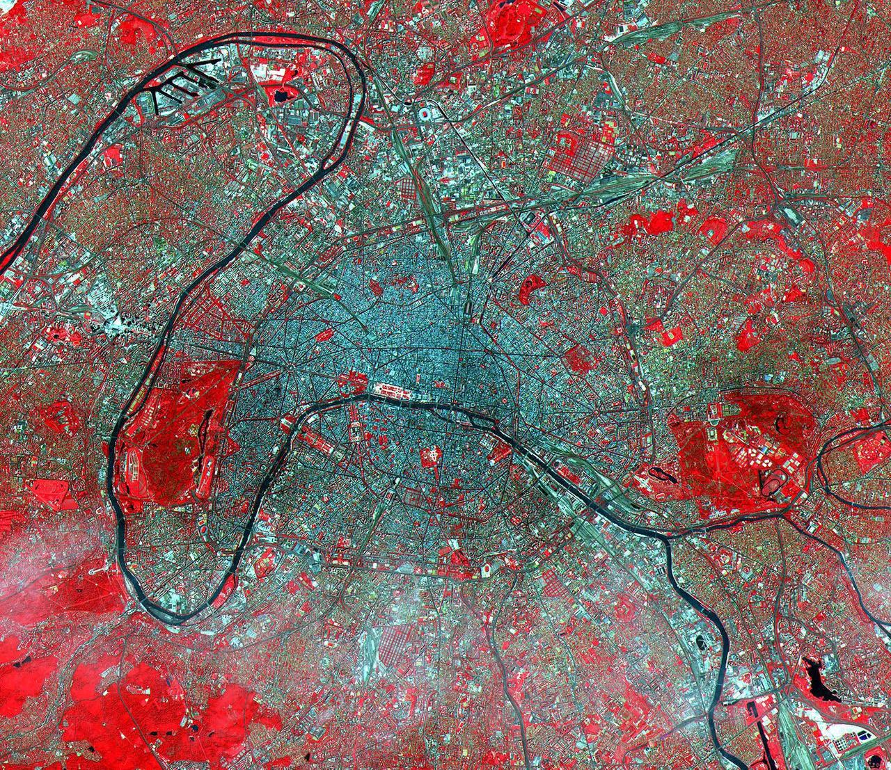
This image of Paris was acquired on July 23, 2000 and covers an area of 23 by 20 km. Known as the City of Light, Paris has been extolled for centuries as one of the great cities of the world. Its location on the Seine River, at a strategic crossroads of land and river routes, has been the key to its expansion since the Parisii tribe first settled here in the 3rd century BC. Paris is an alluring city boasting many monumental landmarks, such as the Cathedral of Notre Dame, the Louvre, and the Eiffel Tower. Its beautiful gardens, world-class cuisine, high fashion, sidewalk cafés, and intellectual endeavors are well known. The city's cultural life is centered on the Left Bank of the Seine, while business and commerce dominate the Right Bank. The image is located at 48.8 degrees north latitude and 2.3 degrees east longitude. http://photojournal.jpl.nasa.gov/catalog/PIA11168
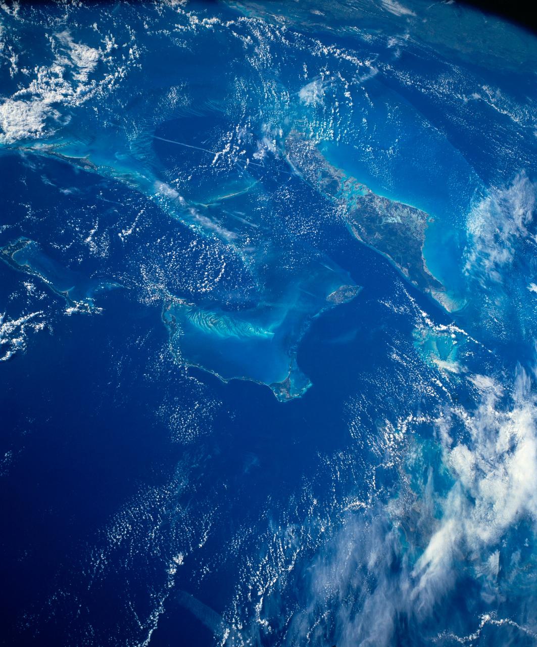
STS054-152-102 (13-19 Jan. 1993) --- This is a south-looking, wide angle view of the northern Bahamas, featuring the islands (from mid-foreground toward background) of Eleuthera, New Providence, and Andros. The northern shore of Cuba can be seen in the background. The resort city of Nassau occupies much of eastern New Providence. The Bahamas host some very distinctive features -- the deep blue channels and the shallow, light blue platforms, feathery sand bars at the edges of the deep water sounds, and colorful lakes and tidal channels like seen on Andros Island.
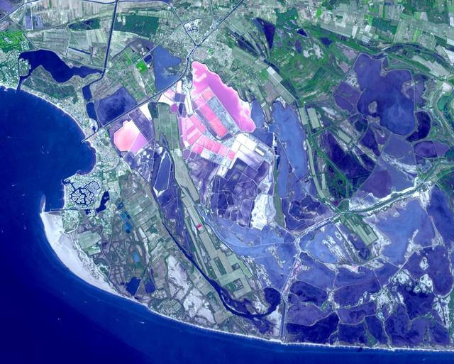
Salin-de-Giraud is a major center of salt production on the right bank of the Rhone River in southern France. Through evaporation of seawater, about one million tons of salt are produced every year. In addition, the recovery of sodium carbonate is key to the manufacture of the soap of Marseille. The image was acquired September 2, 2020, covers an area of 14.7 by 18.3 km, and is located at 43.4 degrees north, 4.7 degrees east. https://photojournal.jpl.nasa.gov/catalog/PIA26325
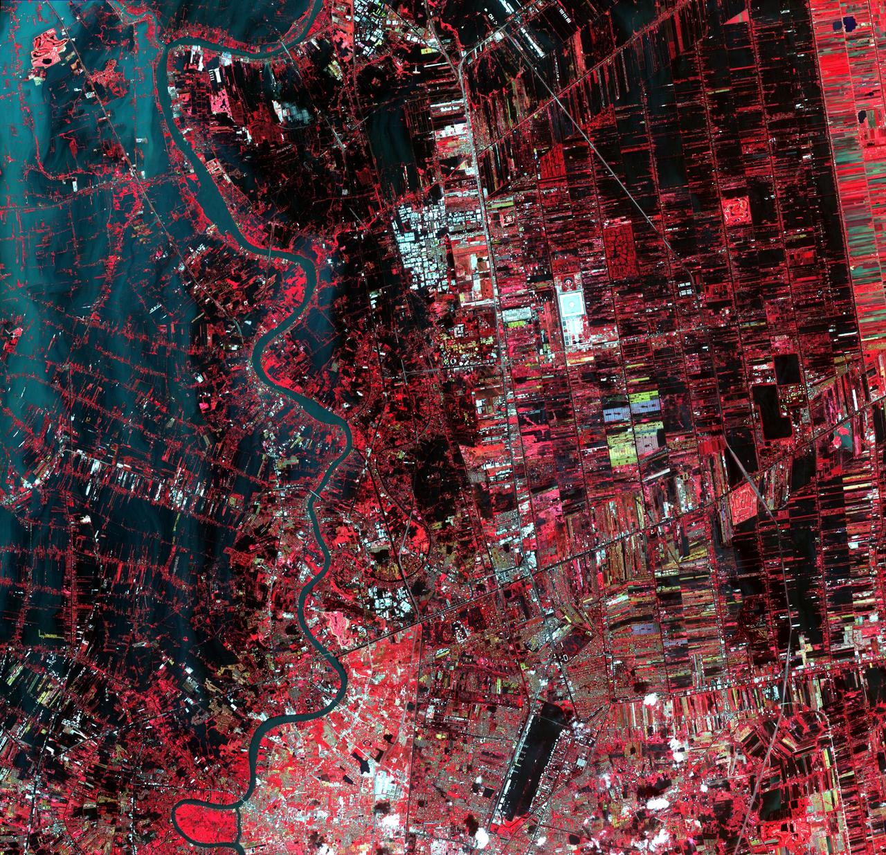
Flooding from the Chao Phraya River, Thailand, had begun to ebb in this image acquired by NASA Terra spacecraft on Nov. 1, 2011. Here, in blue-gray is the muddy water that had overflowed the banks of the river, flooding agricultural fields and villages.
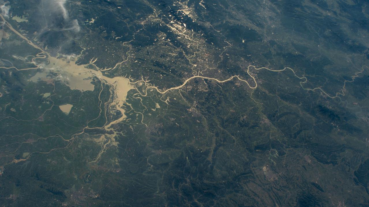
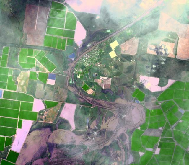
iss071e439833 (Aug. 8, 2024) --- Xiang River runs through the city of Changsha (center) in China's province of Hunan. At far left, the city of Yueyang lies on the bank of Dongdongting Lake in Hunan's humid, subtropical region. The International Space Station was orbiting 262 miles above the Asian nation at the time of this photograph.
NASA Terra spacecraft shows the water flow after the U.S. Army Corps of Engineers opened the Morganza Spillway, a flood control structure along the western bank of the Mississippi River in Louisiana, to ease flooding along levee systems on May 14, 2011.
NASA Terra spacecraft acquired this image of flooding from the Chao Phraya River, Thailand on Nov. 8, 2011. The muddy water that had overflowed the banks of the river, flooding agricultural fields and villages, is seen in dark blue and blue-gray.
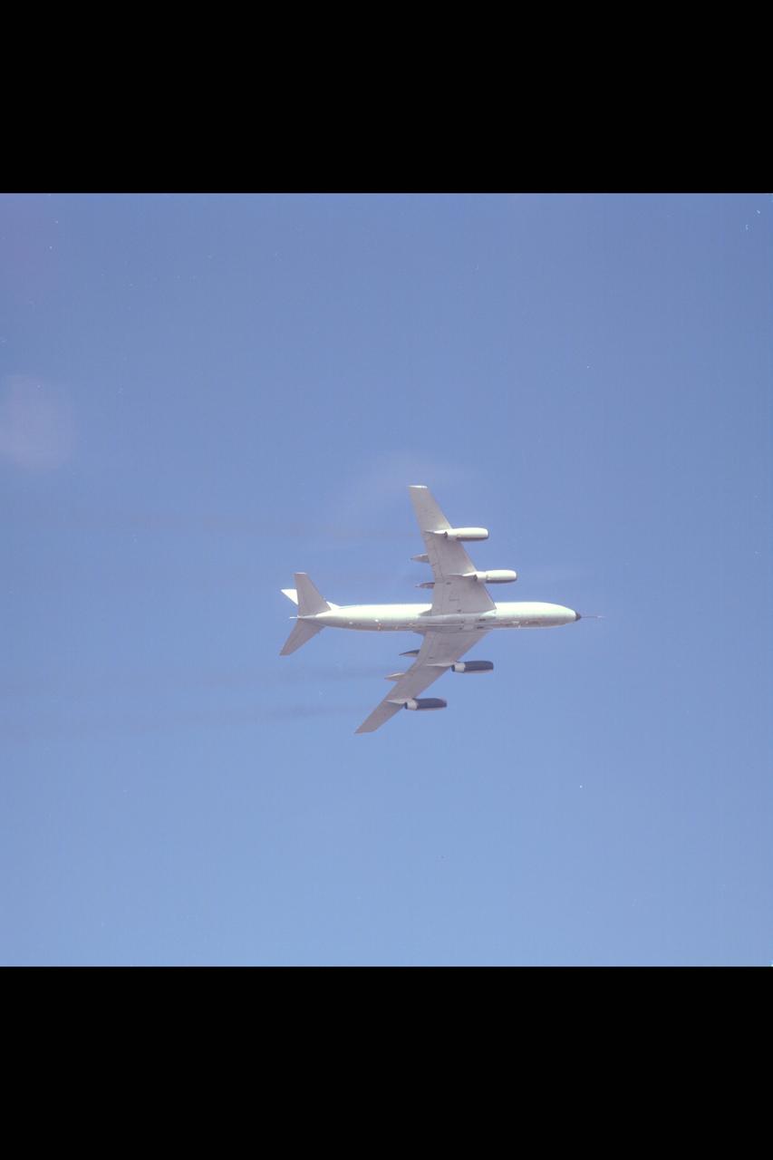
CV-990 (NASA-712) air to air view of underside of aircraft during banked turn during flight up California coastline
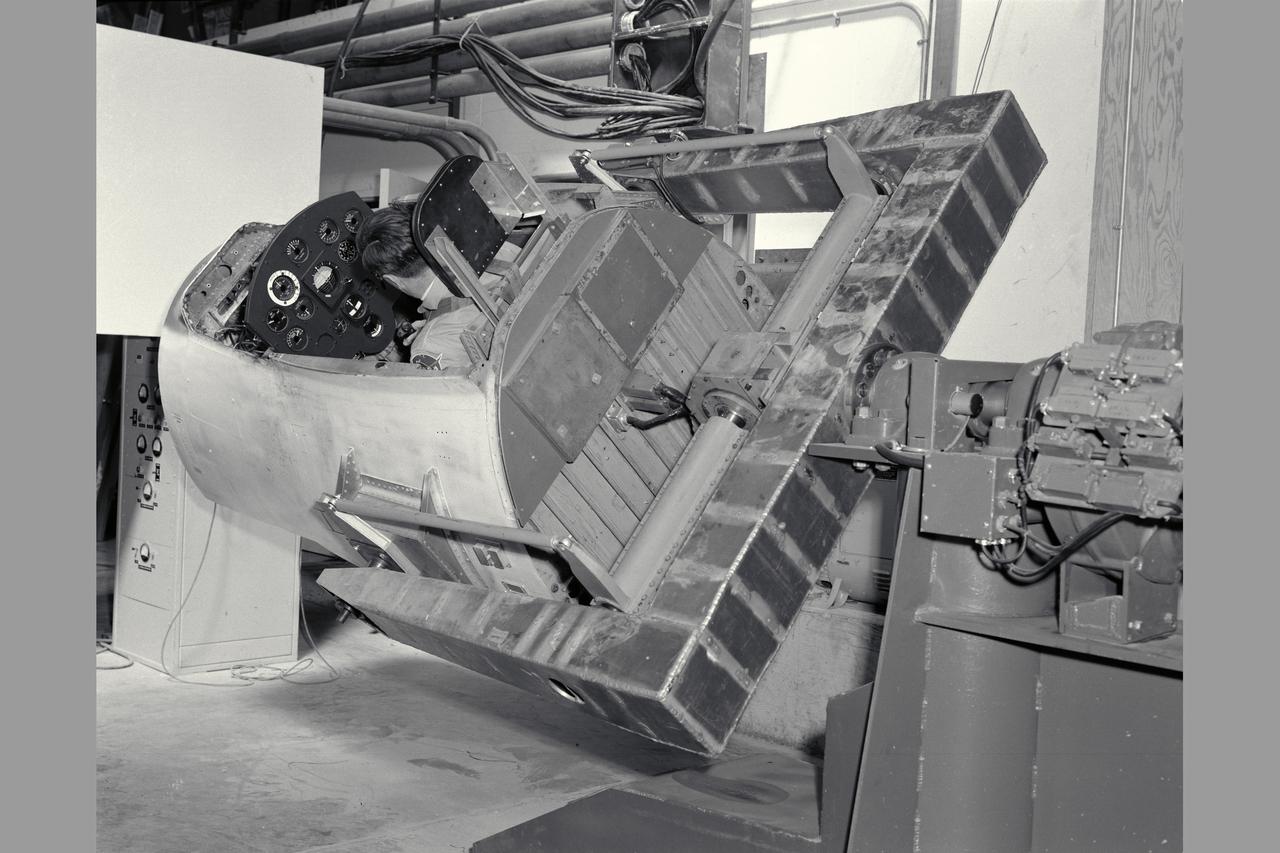
3/4 rear view with pilot Merriweather - 60 degrees bank angle. NE-2 degree of freedom simulator set-up for pitch and roll motion.
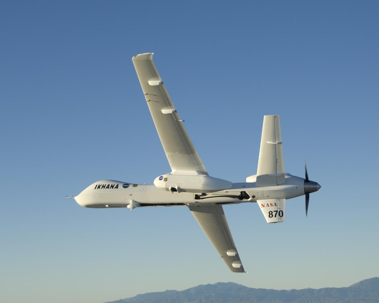
Carrying its sensor pod, NASA's remotely piloted Ikhana unmanned aircraft banks away during a checkout flight in the Western States Fire Mission.
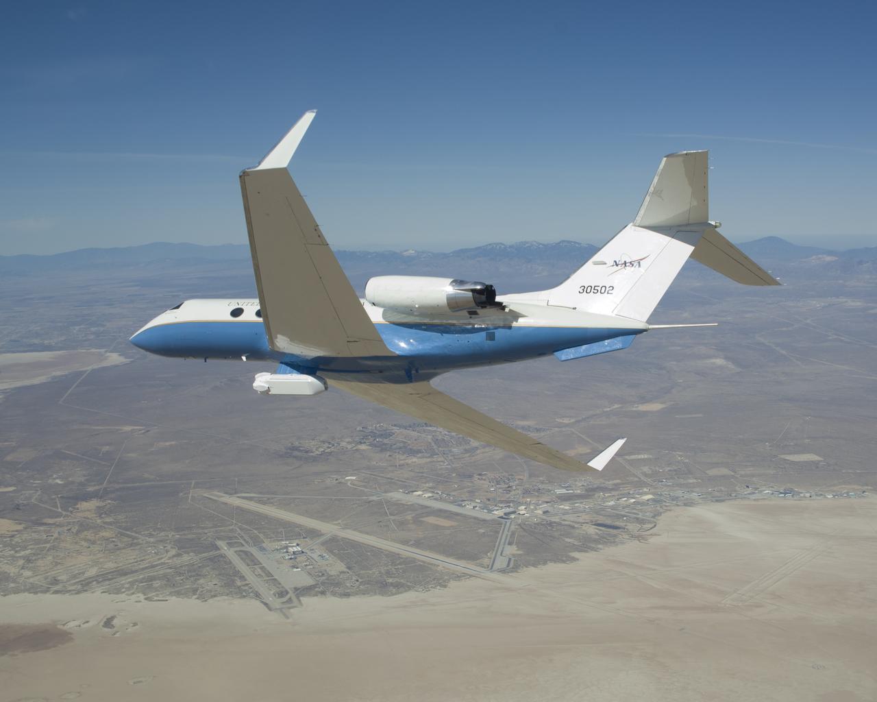
The UAVSAR underbelly pod is in clear view as NASA's Gulfstream-III research aircraft banks away over Edwards AFB during aerodynamic clearance flights.
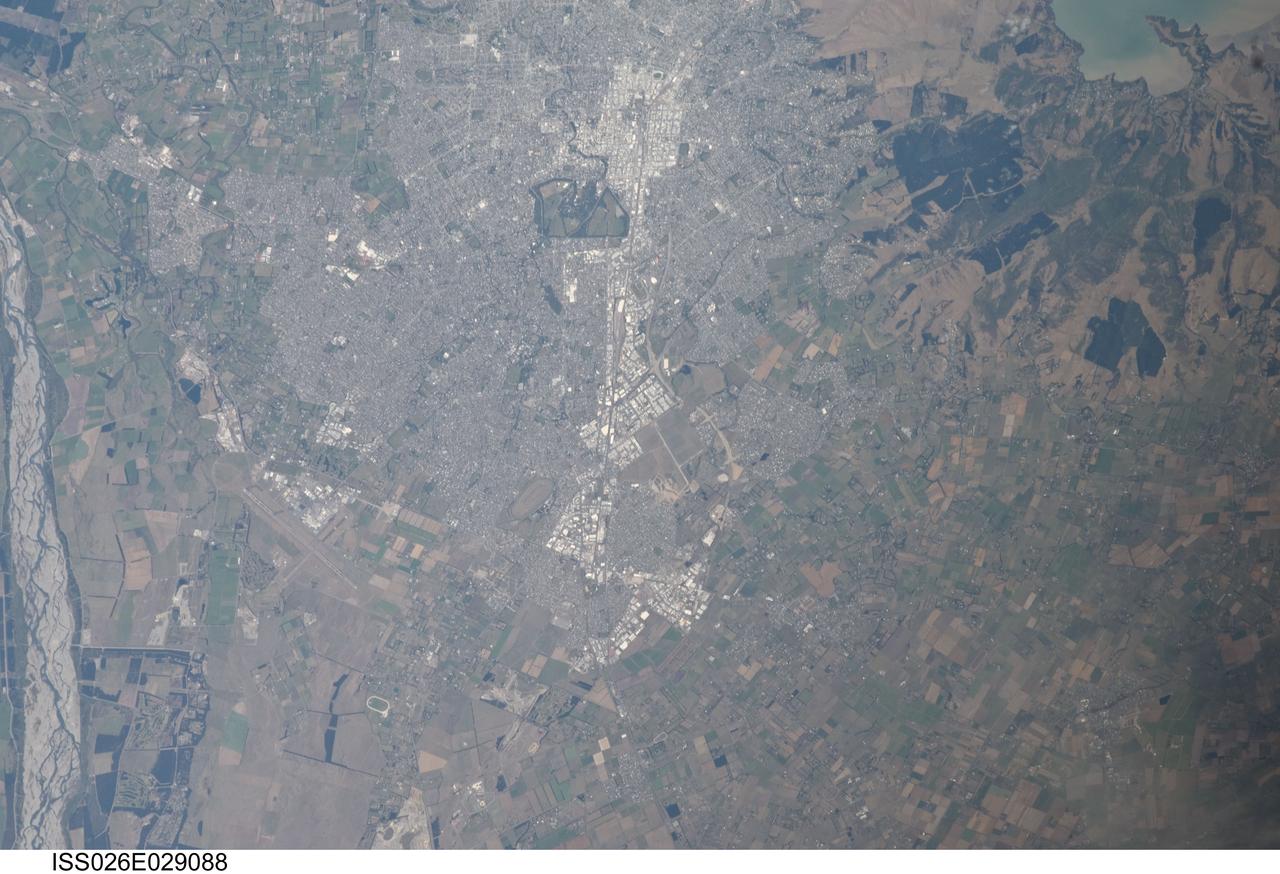
ISS026-E-029088 (24 Feb. 2011) --- From approximately 220 miles above Earth, an Expedition 26 crew member aboard the International Space Station exposed this still frame of parts of New Zealand including those impacted by an earthquake almost four days ago. This image shows portions of the city of Christchurch and includes a small area of the Banks Peninsula and Lyttelton Harbours. Banks Peninsula is made up of two volcanoes -- Lyttelton and Akaroa. The boundaries of the city of Christchurch approach the slopes of the crater rim of the Lyttelton volcano
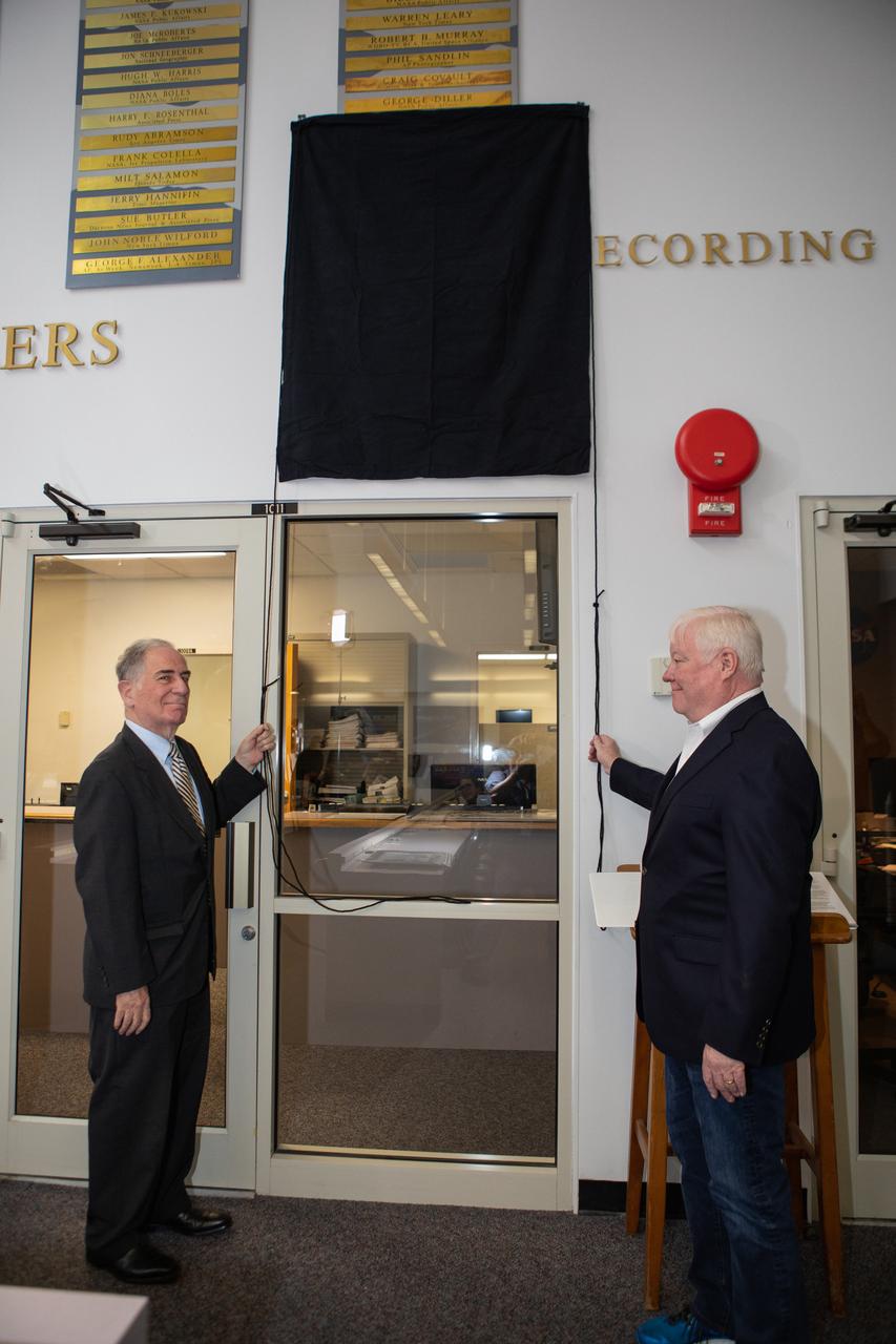
Vic Ratner, left, and Todd Halvorson unveil their names, along with the names of Jim Banke and Peter Cosgrove, now on display on The Chroniclers wall at Kennedy Space Center’s NASA News Center in Florida during a ceremony May 3, 2019. Banke, Halvorson, Ratner and Cosgrove were honored as members of The Chroniclers, which recognizes retirees of the news and communications business who have helped spread news of American space exploration from Kennedy for 10 years or more. They were selected by a committee of their peers on March 25.

STS003-10-606 (30 March 1982) --- The entire state of New Jersey (39.5N, 74.5W) is seen in great detail in this photograph. Philadelphia, PA on the west bank of the Delaware River and Camden, NJ on the east bank of this natural boundary, are easily seen as well as the coastal resort of Atlantic City. Further north, New York City and most of Long Island can be seen in fair detail while further inland, the northern Appalachian Mountains can be seen going diagonal across the scene. Photo credit: NASA
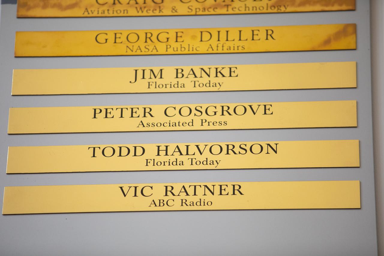
Brass strips engraved with the names of Jim Banke, Peter Cosgrove, Todd Halvorson and Vic Ratner were unveiled during a ceremony on May 3, 2019, at Kennedy Space Center’s NASA News Center in Florida. Banke, Halvorson, Ratner and Cosgrove were honored as members of The Chroniclers, which recognizes retirees of the news and communications business who have helped spread news of American space exploration from Kennedy for 10 years or more. They were selected by a committee of their peers on March 25.
STS080-742-070 (19 Nov.-7 Dec. 1996) --- A view of the Tongue of the Ocean in the Bahama Islands east of Florida. The lines leading from the flat bottom of the Great Bahama Bank, leading into the Tongue, are caused by rapid transfer of ocean water caused by both temperature changes in the water and hurricanes that periodically cross the area. The water is about 30 feet deep on the Great Bahama Bank, and nearly a mile deep in the tongue. To the left is the Exuma Sound, over a mile deep, and a series of islands along its edge with Great Exuma Island the easiest to see. Green Cay, the small dot lower left, leaving a wake to the southeast of light colored coral. The deep blue area to the top right center is the southeastern edge of the Great Bahama Bank.
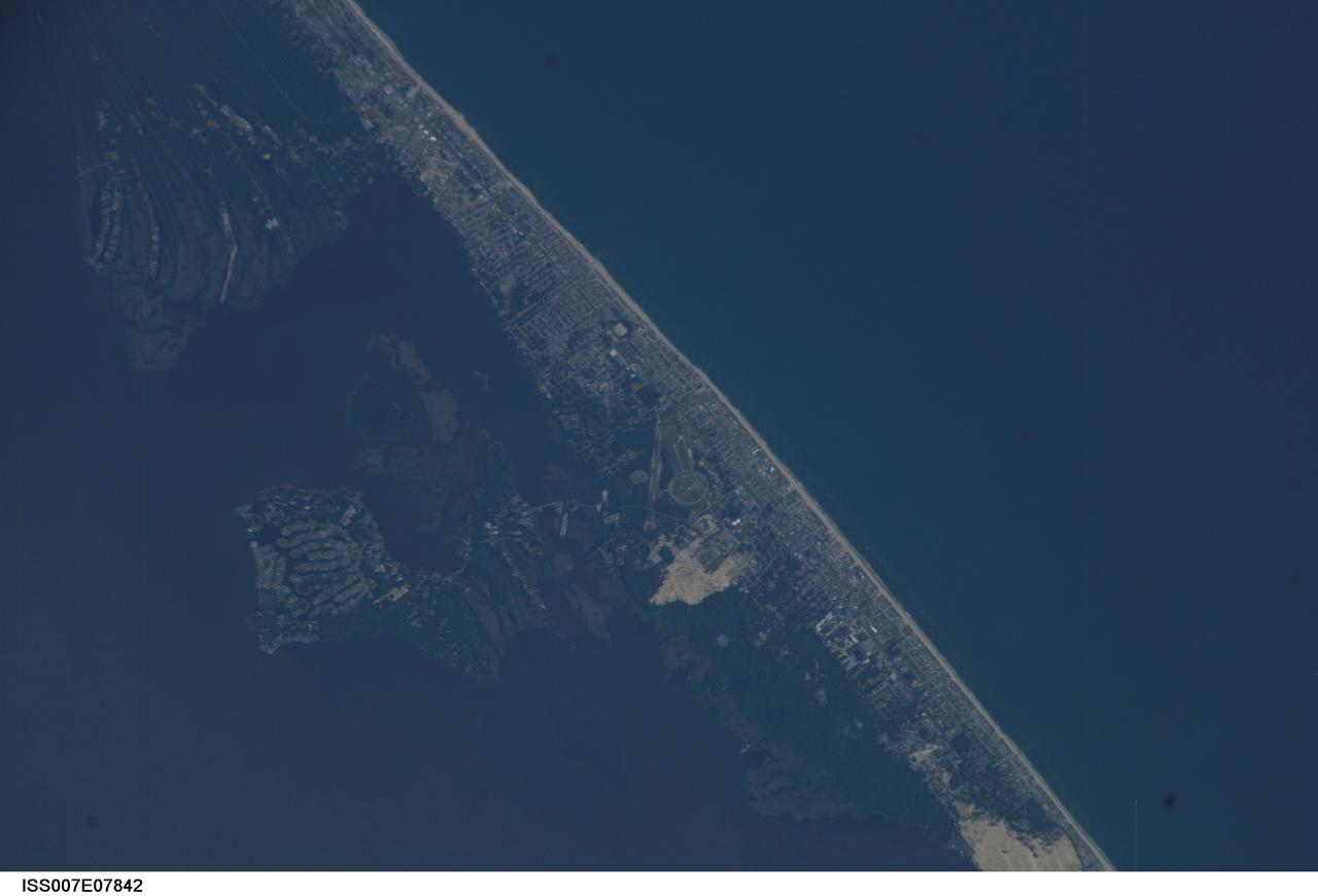
ISS007-E-07842 (22 June 2003) --- This image, photographed by an Expedition 7 crewmember onboard the International Space Station (ISS), features Kitty Hawk, N.C., on North Carolina’s Outer Banks. The view shows part of Pamlico Sound and the Atlantic side of the banks as well. This year the world celebrates a century of human flight with the 100th anniversary of the Wright Brothers' first flight at Kitty Hawk. The Wrights used the Outer Banks’ prevailing winds and the altitude gained by climbing a 90-foot hill (Kill Devil Hill) to successfully demonstrate powered flight. The large circle on the image is a road that wraps around Kill Devil Hill, now part of the Wright Brothers National Memorial.
iss068e053748 (Feb. 14, 2023) --- At lower left, the city of Adana, Turkey, rests on the banks of the Seyhan Dam Lake in this photograph from the International Space Station as it orbited 264 miles above. Prominent at lower center, is the Çatalan Bridge.
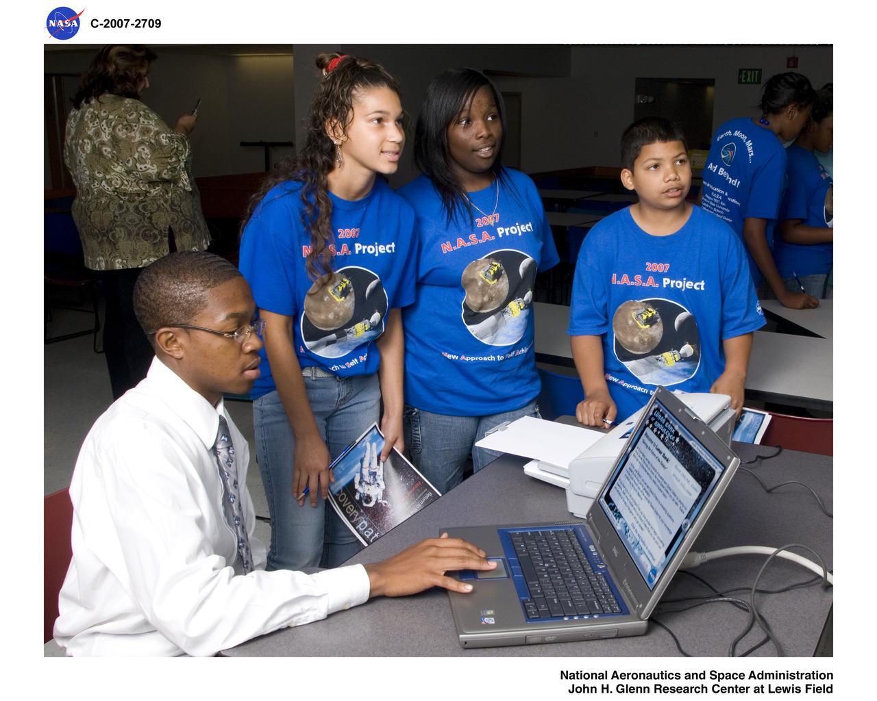
New Approach to Self Achievement (N.A.S.A.) Project Students test their knowledge of Moon Facts at the Aerospace Education Center Return to the Moon Discovery Path Lunar Bank of Knowledge
SPACE SHUTTLE ORBITER ENTERPRISE STANDS ON KSC'S PAD 39A HIGHLIGHTED AGAINST THE DARKENED FLORIDA SKY DURING TESTING OF THE HIGH-INTENSITY LIGHTING SYSTMES. THE BANKS OF XENON LIGHTS ARE USED DURING LAUCH PREPARATIONS.
iss071e003218 (April 9, 2024) --- Khabarovsk, Russia, on the bank of the Amur River and about 17 miles east of the border with China, is pictured from the International Space Station as it orbited 260 miles above.
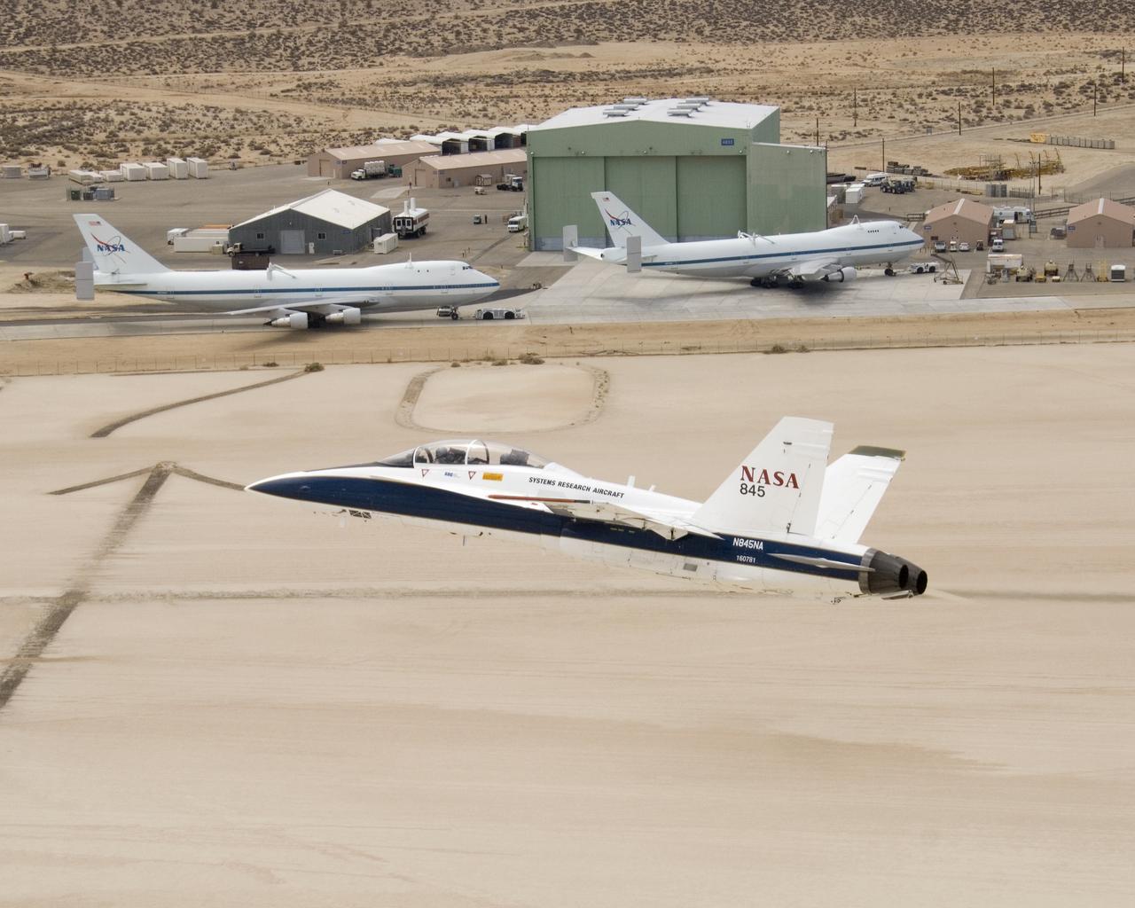
NASA's two Boeing 747 Shuttle Carrier Aircraft form the backdrop as pilot Dick Ewers banks NASA F/A-18 #845 low over Rogers Dry Lake to end a research flight.
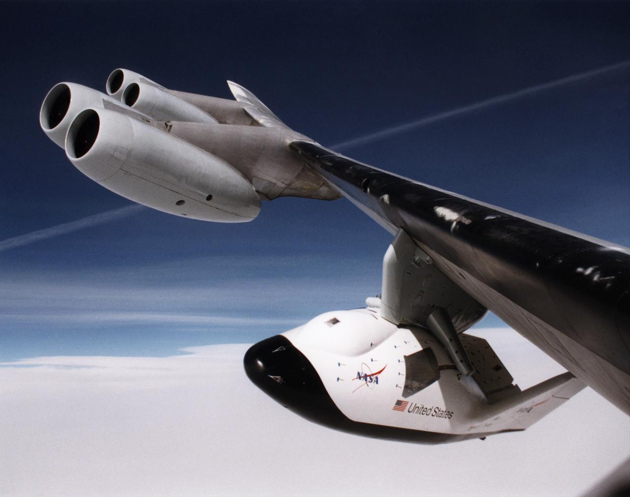
A unique, close-up view of the X-38 under the wing of NASA's B-52 mothership prior to launch of the lifting-body research vehicle. The photo was taken from the observation window of the B-52 bomber as it banked in flight.
The Space Shuttle 'Enterprise' stands on Kenndey Space Center Pad 39A highlighted against the darkened Florida sky during testing of the high-intensity lighting system. The banks of xenon lights are used during lanuch preparations.

This 1940s photo of the South side of Square in downtown Huntsville, Alabama, looking west, shows a historical bank in the background with cars parked just South of the Courthouse (not shown in photo). (Courtesy of Huntsville/Madison County Public Library)
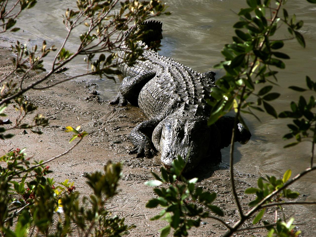
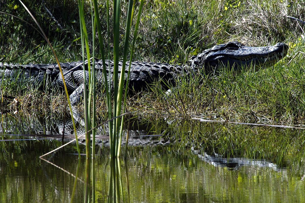
KENNEDY SPACE CENTER, FLA. -- An alligator rests on the bank of a creek in Kennedy Space Center. Alligators are common in the waters of Central Florida, and especially within the Merritt Island National Wildlife Refuge, which is located on Kennedy property.
iss072e474251 (Jan. 14, 2025) --- A portion of the Libyan Desert near the Northern Sudan city of Al Dabbah, on the bank of Nile River, is pictured from the International Space Station as it orbited 259 miles above the African nation.

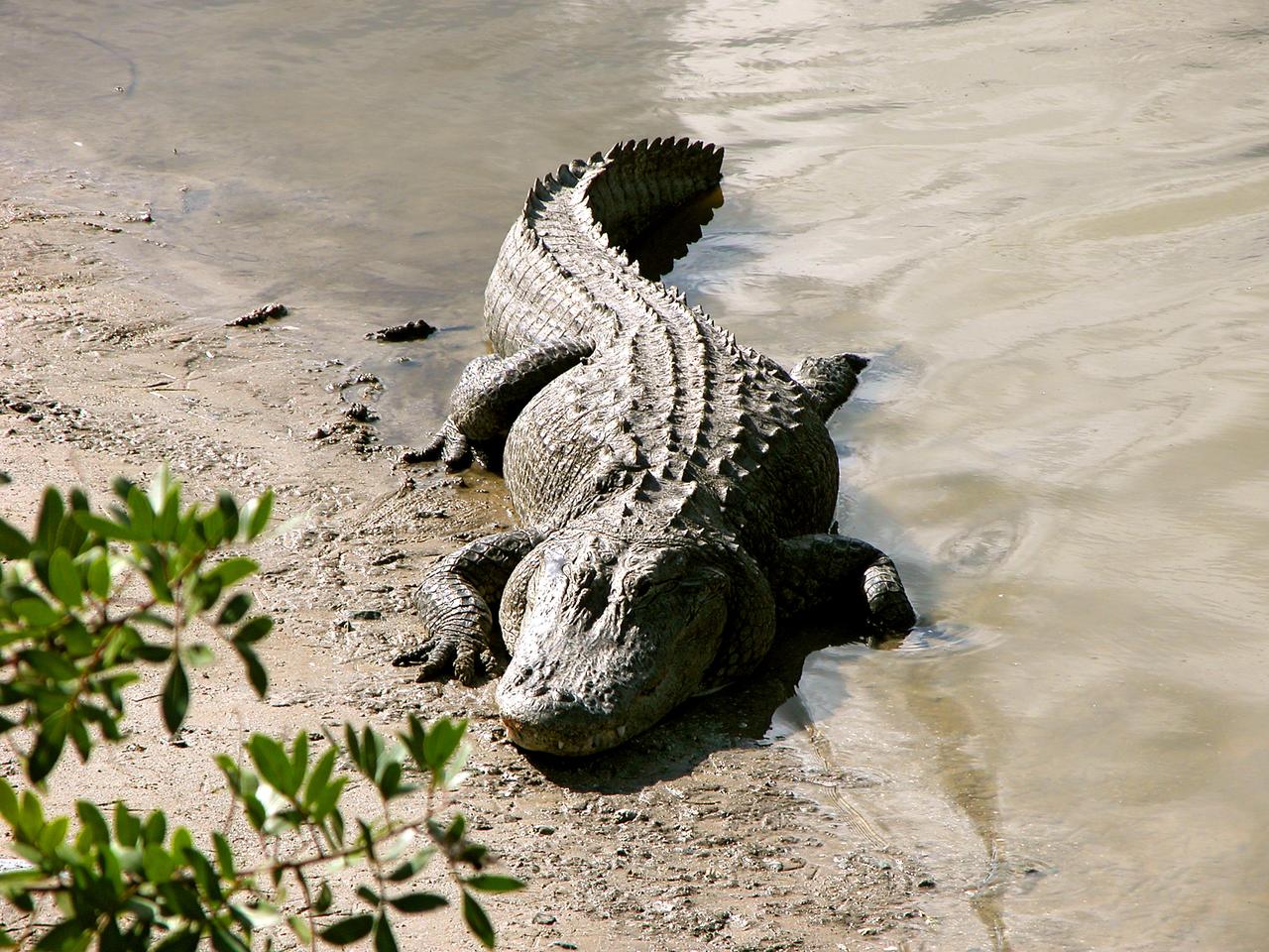
KENNEDY SPACE CENTER, FLA. - A moss-covered alligator stretches out on the water’s edge at a bank on the west side of NASA’s Kennedy Space Center. Nearly 5,000 alligators can be found in canals, ponds and waterways throughout the Center and the surrounding Merritt Island National Wildlife Refuge. American alligators feed and rest in the water, and lay their eggs in dens they dig into the banks. The young alligators spend their first several weeks in these dens. The Wildlife Refuge encompasses 92,000 acres that are a habitat for more than 331 species of birds, 31 mammals, 117 fishes, and 65 amphibians and reptiles.
ISS006-E-50419 (2003) --- This digital still camera image of Cape Hatteras and Cape Lookout, North Carolina, with a Soyuz vehicle docked to the orbital outpost in the foreground was taken by Expedition 6 crewmember Don Pettit during his 5 1/2 month stay on the International Space Station (ISS). The largest inland body of water is Pamlico Sound. Kitty Hawk, on North Carolina's Outer Banks is also visible. On Dec. 17, 2003, the world celebrates a century of human flight with the anniversary of the Wright Brothers' first flight at Kitty Hawk. The brothers used the Outer Banks' prevailing winds and a 90-foot hill (Kill Devil Hill) to successfully demonstrate powered flight.
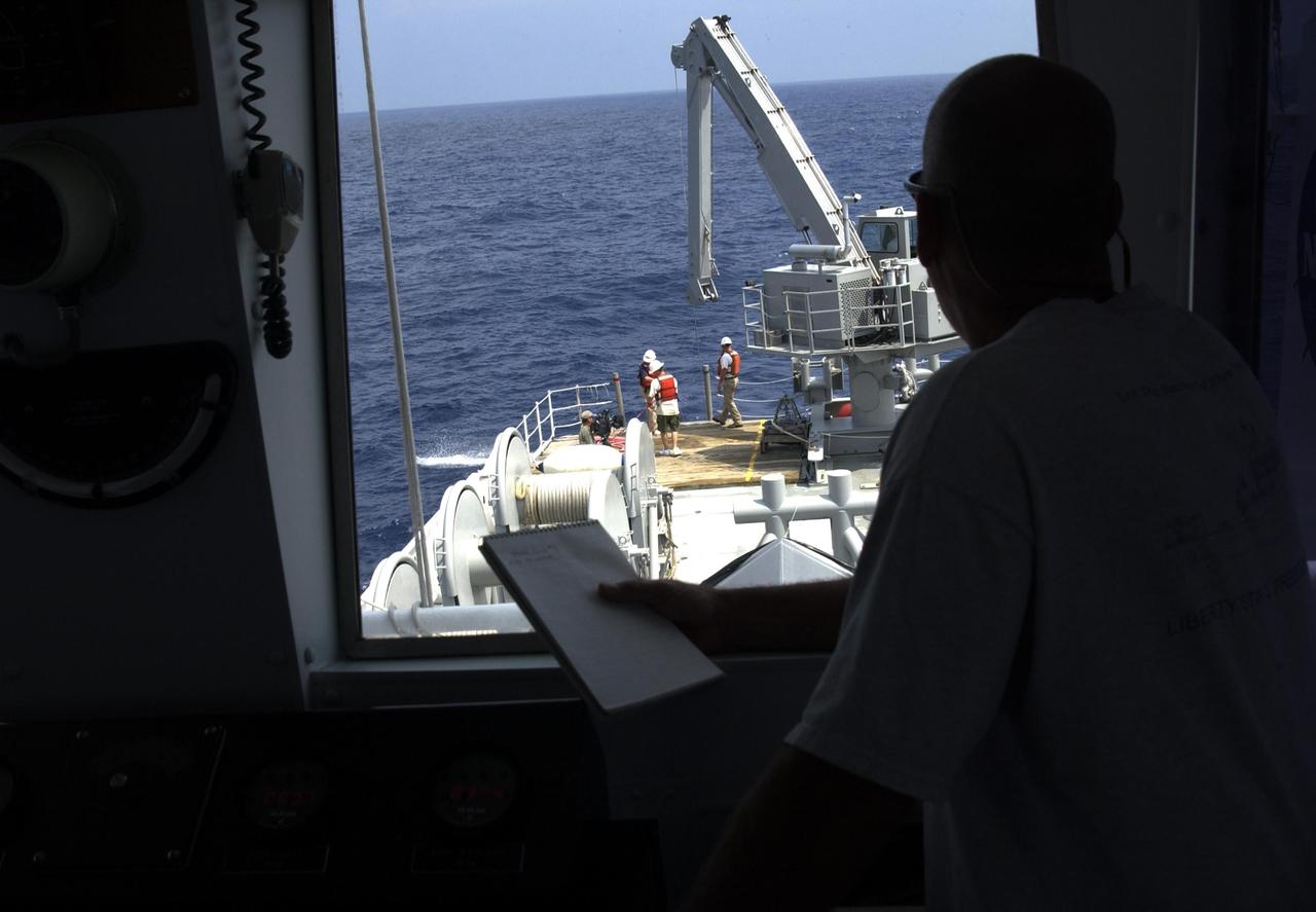
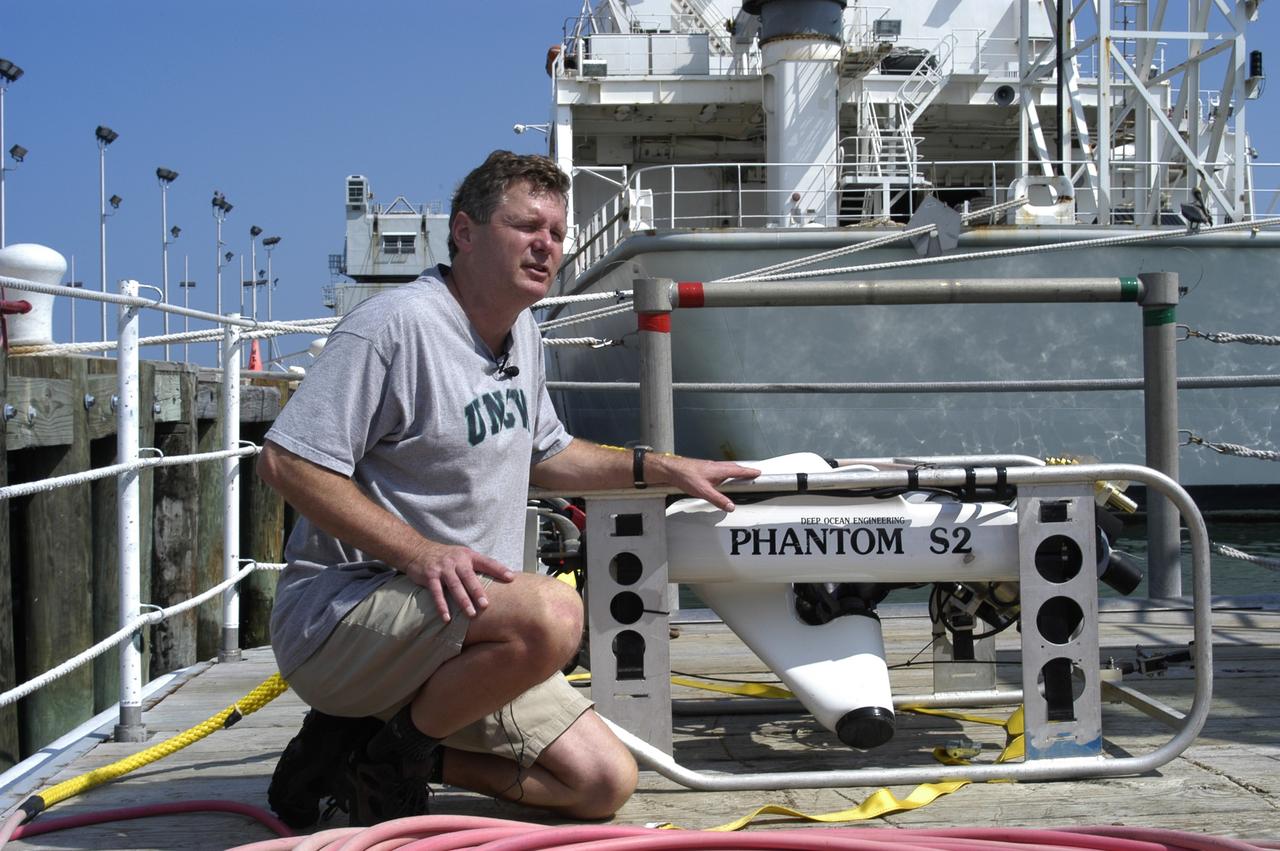
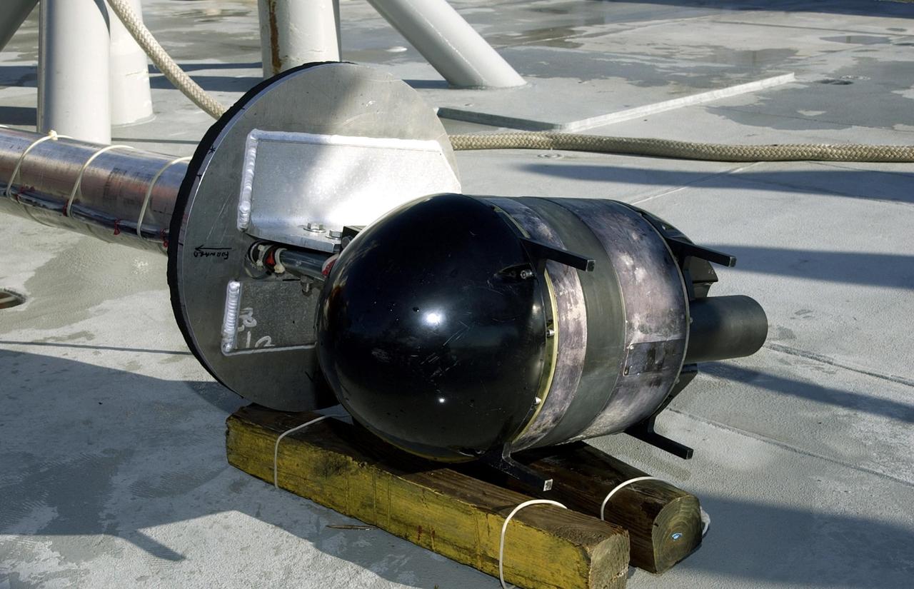
KENNEDY SPACE CENTER, FLA. - A view from inside the pilot house of the Liberty Star overlooks the stern where a team secures lines to underwater research equipment being used on an expedition to characterize the condition of the deep-sea coral reefs and reef fish populations in the Oculina Banks. The banks are a marine protected area, 20 miles offshore of the east coast of Florida. The equipment includes an underwater robot, a seafloor sampler, and the Passive Acoustic Monitoring System (PAMS), originally developed by NASA to monitor the impact of rocket launches on wildlife refuge lagoons at KSC. The research is sponsored by NOAA Fisheries. The ship departed from Port Canaveral April 29 and will return May 9.
S81-30396 (12-14 April 1981) --- A vertical view of Eleuthera Island in the Bahamas and part of the great Bahama Bank, as photographed with a 70mm handheld camera from the space shuttle Columbia in Earth orbit. The light blue of the Bahama Bank contrasts sharply with the darker blue of the deep ocean waters. Astronauts John W. Young, commander, and Robert L. Crippen, pilot, took a series of Earth photos from inside the flight deck of the Columbia, which has windows on its top side, convenient for shooting photographs as the spacecraft flew ?upside down? above Earth. The mission frame ID number is STS001-12-322. Photo credit: NASA
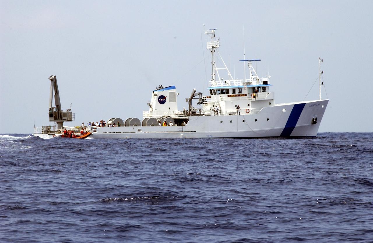
KENNEDY SPACE CENTER, FLA. - The Liberty Star makes its way along the Oculina Banks, a marine protected area, 20 miles offshore of the east coast of Florida. The ship is taking part in an undersea expedition to characterize the condition of the deep-sea coral reefs and reef fish populations in the Oculina Banks. Equipment being used for the research includes an underwater robot, a seafloor sampler, and the Passive Acoustic Monitoring System (PAMS), originally developed by NASA to monitor the impact of rocket launches on wildlife refuge lagoons at KSC. The research is sponsored by NOAA Fisheries. The ship departed from Port Canaveral April 29 and will return May 9.

KENNEDY SPACE CENTER, FLA. - An alligator slides off a bank into the water on the west side of NASA’s Kennedy Space Center. Nearly 5,000 alligators can be found in canals, ponds and waterways throughout the Center and the surrounding Merritt Island National Wildlife Refuge. American alligators feed and rest in the water, and lay their eggs in dens they dig into the banks. The young alligators spend their first several weeks in these dens. The Wildlife Refuge encompasses 92,000 acres that are a habitat for more than 331 species of birds, 31 mammals, 117 fishes, and 65 amphibians and reptiles.

KENNEDY SPACE CENTER, FLA. - John Reed, co-principal investigator, Harbor Branch Oceanographic Institution, points to the Oculina Banks, a marine protected area, 20 miles offshore of the east coast of Florida. A team of scientists will deploy an underwater robot, a seafloor sampler, and the Passive Acoustic Monitoring System (PAMS), on an undersea expedition to characterize the condition of the deep-sea coral reefs and reef fish populations in the Oculina Banks. The PAMS was originally developed by NASA to monitor the impact of rocket launches on wildlife refuge lagoons at KSC. The research is sponsored by NOAA Fisheries and will take place onboard the Liberty Star. The ship departed from Port Canaveral April 29 and will return May 9.
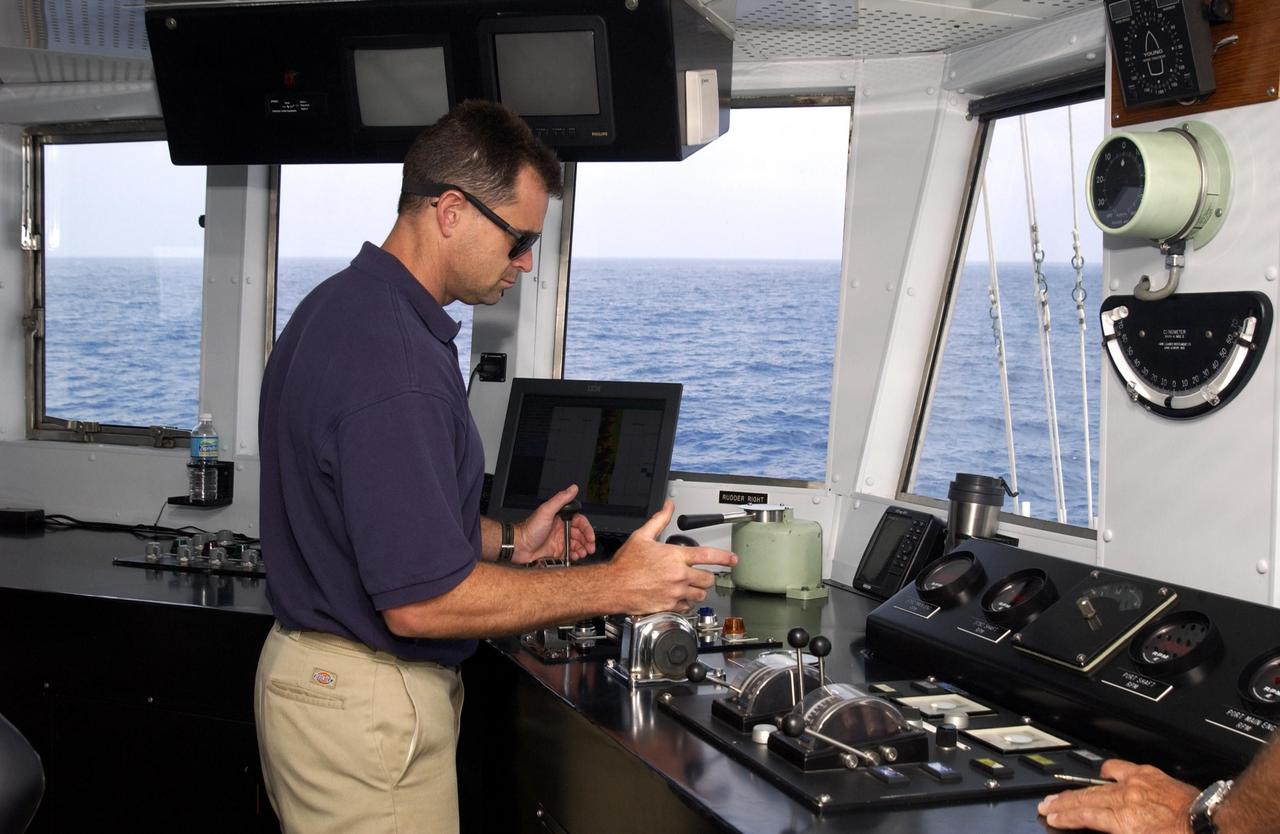
KENNEDY SPACE CENTER, FLA. - A view inside the pilot house of the Liberty Star. The ship is taking part in an undersea expedition to characterize the condition of the deep-sea coral reefs and reef fish populations in the Oculina Banks. The banks are a marine protected area, 20 miles offshore of the east coast of Florida. The equipment includes an underwater robot, a seafloor sampler, and the Passive Acoustic Monitoring System (PAMS), originally developed by NASA to monitor the impact of rocket launches on wildlife refuge lagoons at KSC. The research is sponsored by NOAA Fisheries. The ship departed from Port Canaveral April 29 and will return May 9.
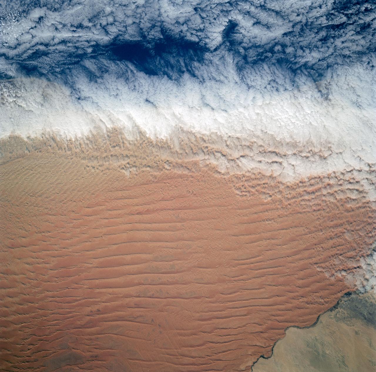
Fog is the only source of moisture for desert dwelling animals and plants living in the Namib Desert sand dune field, Namibia (23.5N, 15.0E). Coastal stratus clouds provide most of the life supporting moisture as fog droplets in this arid land where the usual annual rainfall is less than a quarter of an inch for decades at a time. In this view, the stratus clouds over the coast conform to the dune pattern proving that the fog is in ground contact.
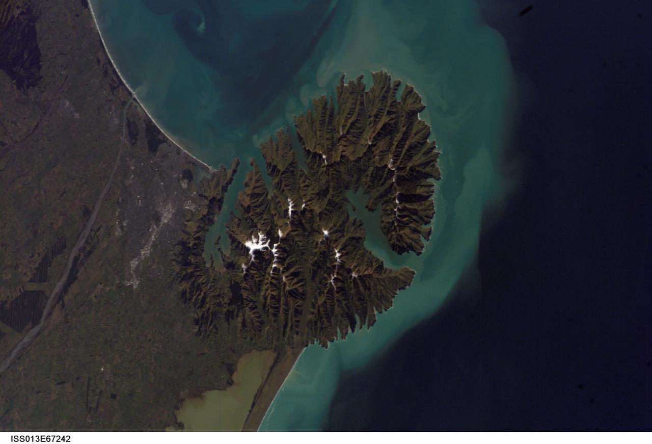
ISS013-E-67242 (15 Aug. 2006) --- Christchurch, New Zealand is featured in this image photographed by an Expedition 13 crewmember on the International Space Station. Snow highlights the peaks of the Banks Peninsula to the southeast of the city. The Peninsula has a radically different landscape compared to the adjoining flat Canterbury Plains on which Christchurch is situated. This is a result of the geology of the Banks Peninsula -- it is formed from the overlapping cones of the extinct Lyttelton and Akaroa volcanoes. Subsequent erosion of the cones formed the heavily dissected terrain visible in the image, and sea level rise led to the creation of several harbors around the Peninsula. Erosion continues unabated today, as evidenced by the apron of greenish blue sediment-laden waters surrounding the Banks Peninsula. Other features of interest in the image include the braided Waimakariri River to the north-northwest of the city, and the greenish brown waters of Lake Ellesmere. The coloration of the water is due both to its shallow depth (1.4 meters average) and its high concentrations of nitrogen and phosphorus - conditions which lead to a high abundance of green algae.
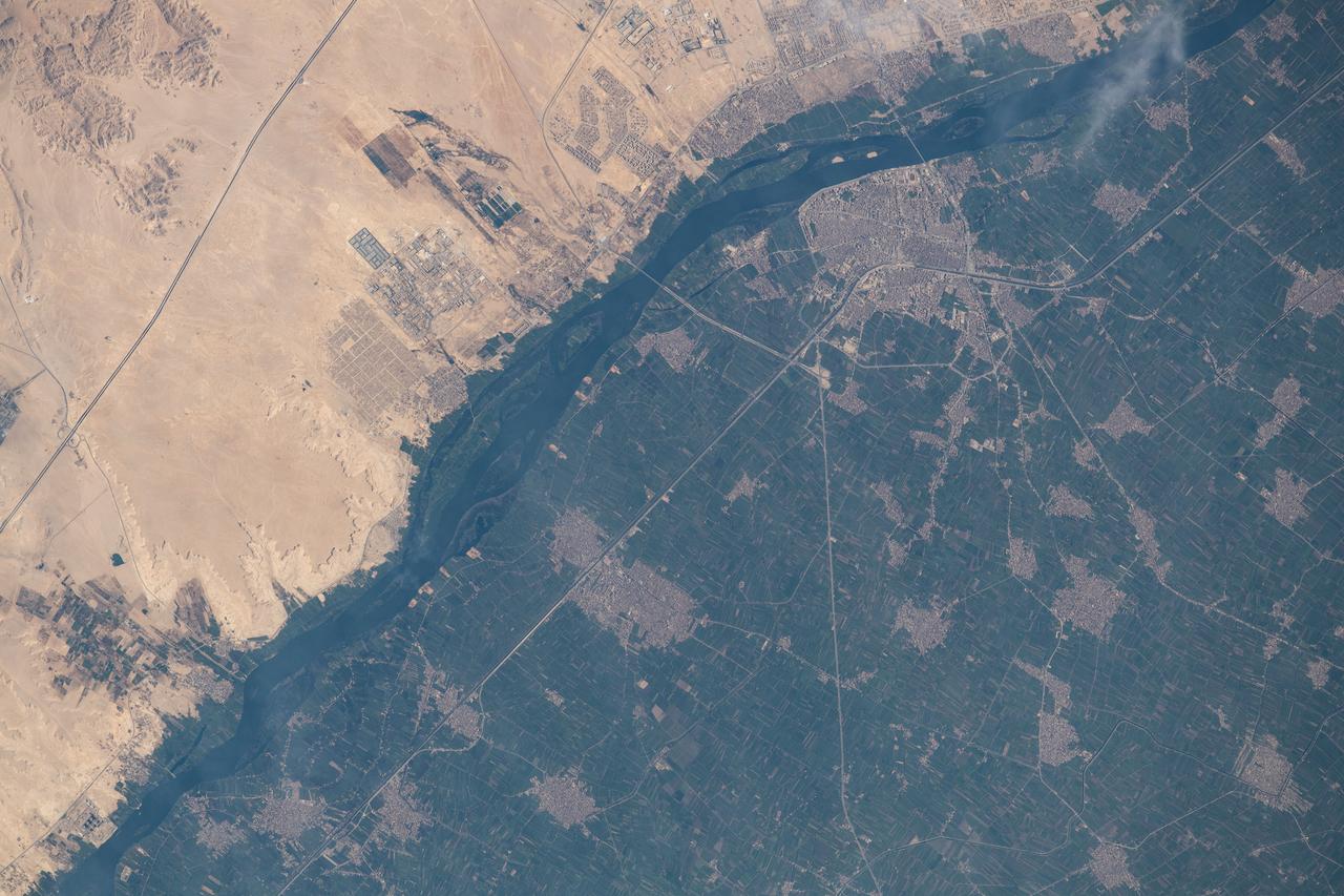
iss063e067888 (Aug. 11, 2020) --- The International Space Station was orbiting above Egypt just east of the Nile River when this photograph was taken of the city of Beni Suef (toward the upper right), an important agricultural trade center on the west bank of the Nile, about 65 miles (110 kilometers) south of Cairo.
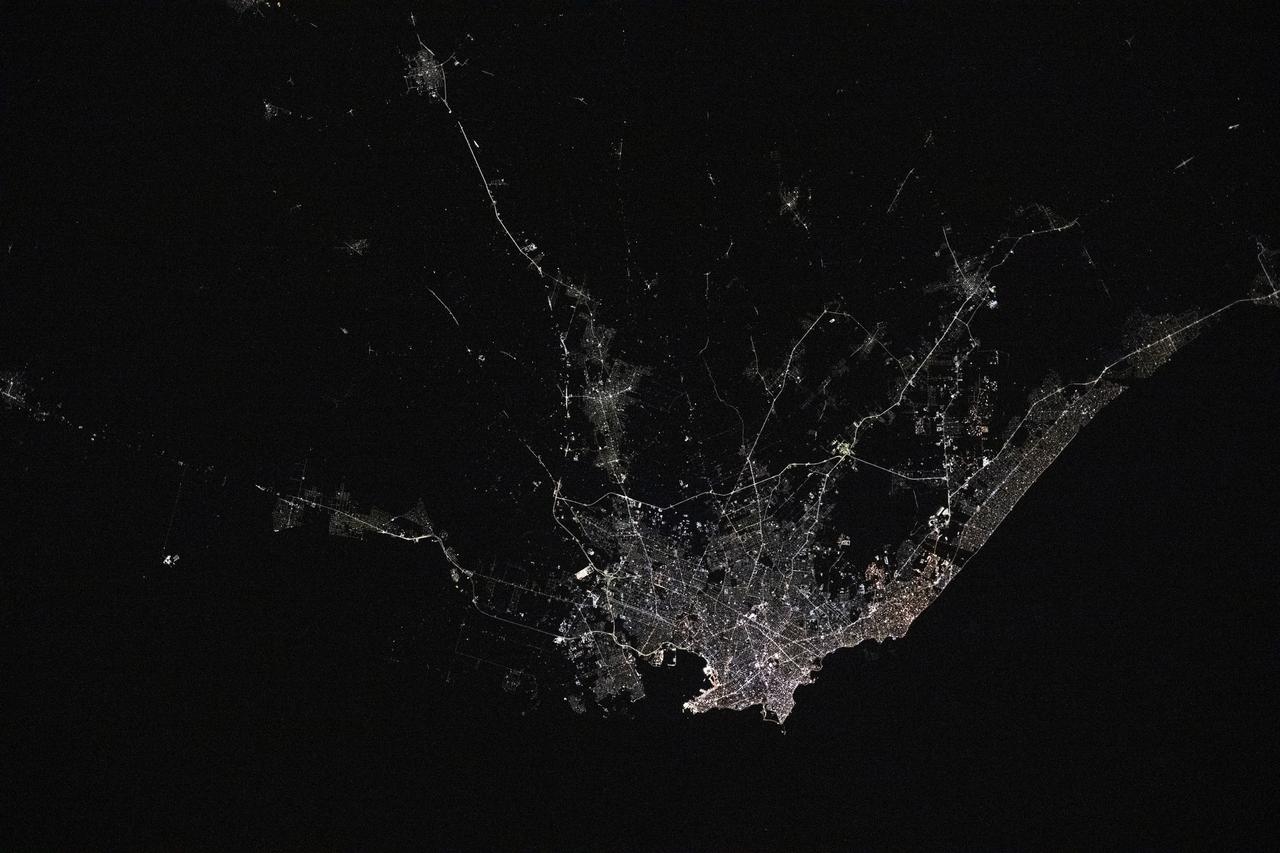
iss073e0176311 (May 20, 2025) --- Montevideo, Uruguay, the South American nation's capital and largest city with a population of about 1.28 million on the bank of the Rio de la Plata, is pictured at approximately 4:43 a.m. local time from the International Space Station as it orbited 267 miles above.
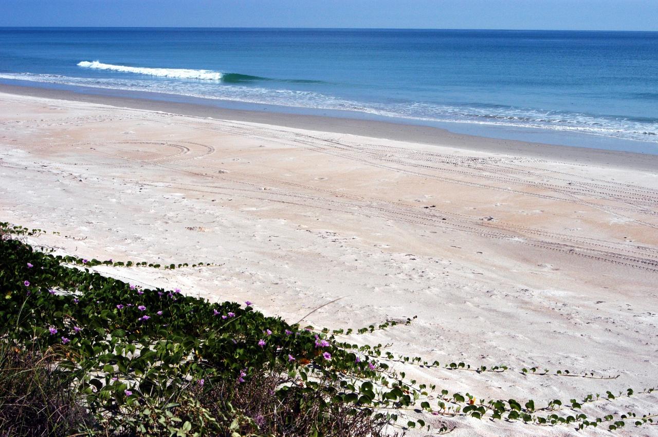
KENNEDY SPACE CENTER, FLA. - The calm blue ocean near the launch pads at KSC beckons. The sand dunes facing the Atlantic Ocean spill pink flowers down its banks. The vegetation helps prevent the dunes from eroding. The beach is part of the Canaveral National Seashore, managed by the National Wildlife Service.

ISS023-E-020655 (7 April 2010) --- NASA astronaut Stephanie Wilson (left) and Japan Aerospace Exploration Agency astronaut Naoko Yamazaki, both STS-131 flight engineers, share perhaps their first session at this bank of computers and controls in the Destiny laboratory of the International Space Station.
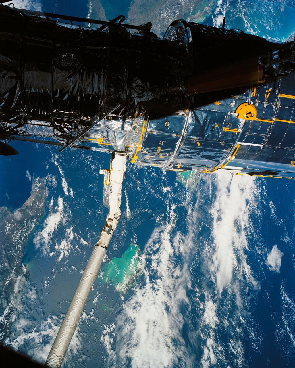
A close up deploy view of the Hubble Space Telescope on the end of the space shuttle remote manipulator system (RMS) with Eastern Cuba, (20.0N, 74.0W) seen on the left side of the telescope and northern Haiti seen on the right side of the telescope. The light colored blue feature in the water north of Haiti is the shallow waters of the Caicos Bank.
iss073e0176306 (May 20, 2025) --- Buenos Aires, Argentina, the South American nation's largest city with a population of about 3.12 million, surrounded by numerous suburbs on the bank of the Rio de la Plata is pictured at approximately 4:43 a.m. local time from the International Space Station as it orbited 267 miles above.
The DC-8 banking over the jagged peak of Mount Whitney on a February 25, 1998 flight. The DC-8 and a pair of ER-2 aircraft are operated by the Airborne Science program at the NASA Dryden Flight Research Center. NASA, other governmental agencies, academia, and scientific and technical organizations employ the DC-8 for a variety of experiments.

JSC2011-E-040215 (10 March 2011) --- A bank of video screens shows the progress of a simulated spacewalk as the crew of STS-135 trains in the Neutral Buoyancy Laboratory near NASA?s Johnson Space Center in Houston March 10, 2011. Photo credit: NASA Photo/Houston Chronicle, Smiley N. Pool
KENNEDY SPACE CENTER, FLA. -- Workers on the deck of the Liberty Star, one of NASA's solid rocket booster retrieval ships, help guide sonar mapping equipment toward the side of the ship. The equipment will be attached to the ship's hull for an eight-day expedition surveying deep-water coral reefs on the Oculina Banks off eastern Florida. NASA joins the National Oceanic and Atmospheric Administration (NOAA) and other ocean scientists for the sophisticated mapping system that will provide the first high-resolution, three-dimensional map of the Oculina Banks. The survey results are expected to guide another expedition in Spring 2003, using NASA's ship, when the reef fish spawn. Also used will be NASA's underwater robot and an acoustic hydrophone system for listening to fish and vessel noise. Dive sites will be chosen based on the new charts.
KENNEDY SPACE CENTER, FLA. -- On NASA's Kennedy Space Center, the bank of a pond provides the perfect spot for sunbathing alligators. American alligators feed and rest in the water, and lay their eggs in dens they dig into the banks. The young alligators spend their first several weeks in these dens. A protected species, alligators can be spotted in the drainage canals and other waters surrounding KSC. KSC shares a boundary with the Merritt Island Wildlife Nature Refuge. The refuge is a habitat for more than 310 species of birds, 25 mammals, 117 fishes and 65 amphibians and reptiles. In addition, the Refuge supports 19 endangered or threatened wildlife species on Federal or State lists, more than any other single refuge in the U.S. Photo credit: NASA/Ken Thornsley

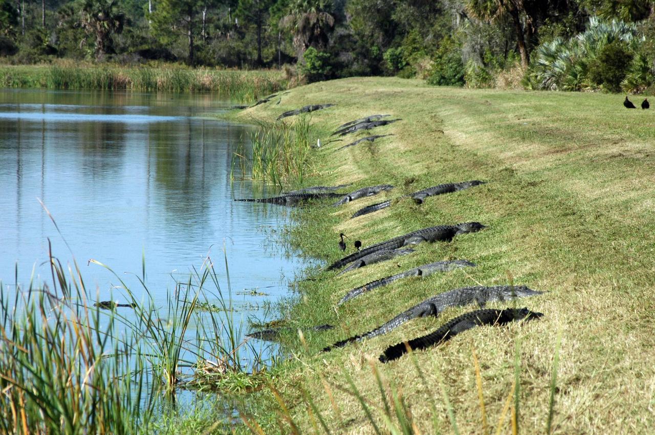
KENNEDY SPACE CENTER, FLA. -- This pond near Schwartz Rd. at Kennedy Space Center is host to a least the nine alligators shown on the banks and in the water. Nearly 5,000 alligators can be found in canals, ponds, and waterways throughout the Center and the Merritt Island National Wildlife Refuge, which shares a boundary with the Center. American alligators feed and rest in the water, and lay their eggs in dens they dig into the banks. The young alligators spend their first several weeks in these dens. The Wildlife Refuge encompasses 92,000 acres that are a habitat for more than 331 species of birds, 31 mammals, 117 fishes, and 65 amphibians and reptiles. The marshes and open water of the refuge provide wintering areas for 23 species of migratory waterfowl, as well as a year-round home for great blue herons, great egrets, wood storks, cormorants, brown pelicans and other species of marsh and shore birds, as well as a variety of insects

KENNEDY SPACE CENTER, FLA. -- From the bank of a pond on Kennedy Space Center, an alligator slides into the water, perhaps eyeing nearby prey. American alligators feed and rest in the water, and lay their eggs in dens they dig into the banks. The young alligators spend their first several weeks in these dens. A protected species, alligators can be spotted in the drainage canals and other waters surrounding KSC. KSC shares a boundary with the Merritt Island Wildlife Nature Refuge. The refuge is a habitat for more than 310 species of birds, 25 mammals, 117 fishes and 65 amphibians and reptiles. In addition, the Refuge supports 19 endangered or threatened wildlife species on Federal or State lists, more than any other single refuge in the U.S. Photo credit: NASA/Dimitri Gerondidakis
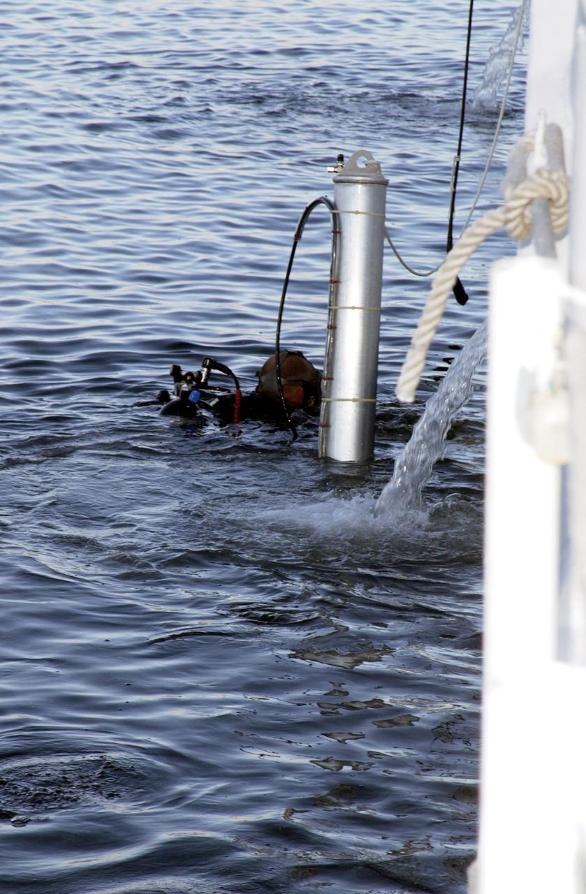
KENNEDY SPACE CENTER, FLA. -- A diver helps lower sonar mapping equipment into the water alongside the Liberty Star, one of NASA's solid rocket booster retrieval ships. The equipment will be attached to the ship's hull for an eight-day expedition surveying deep-water coral reefs on the Oculina Banks off eastern Florida. NASA joins the National Oceanic and Atmospheric Administration (NOAA) and other ocean scientists for the sophisticated mapping system that will provide the first high-resolution, three-dimensional map of the Oculina Banks. The survey results are expected to guide another expedition in Spring 2003, using NASA's ship, when the reef fish spawn. Also used will be NASA's underwater robot and an acoustic hydrophone system for listening to fish and vessel noise. Dive sites will be chosen based on the new charts.
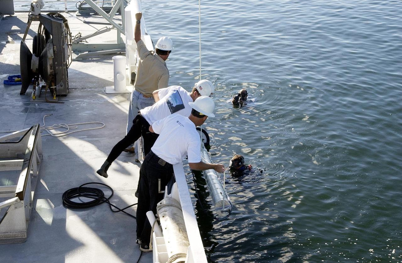
KENNEDY SPACE CENTER, FLA. -- Workers on the deck of the Liberty Star, one of NASA's solid rocket booster retrieval ships, as well as divers in the water, help lower sonar mapping equipment alongside the ship. The equipment will be attached to the ship's hull for an eight-day expedition surveying deep-water coral reefs on the Oculina Banks off eastern Florida. NASA joins the National Oceanic and Atmospheric Administration (NOAA) and other ocean scientists for the sophisticated mapping system that will provide the first high-resolution, three-dimensional map of the Oculina Banks. The survey results are expected to guide another expedition in Spring 2003, using NASA's ship, when the reef fish spawn. Also used will be NASA's underwater robot and an acoustic hydrophone system for listening to fish and vessel noise. Dive sites will be chosen based on the new charts.
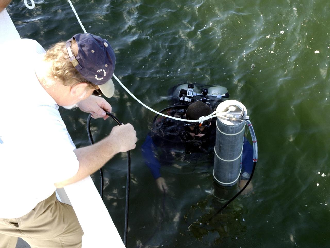
KENNEDY SPACE CENTER, FLA. -- A diver helps lower sonar mapping equipment into the water alongside the Liberty Star, one of NASA's solid rocket booster retrieval ships. The equipment will be attached to the ship's hull for an eight-day expedition surveying deep-water coral reefs on the Oculina Banks off eastern Florida. NASA joins the National Oceanic and Atmospheric Administration (NOAA) and other ocean scientists for the sophisticated mapping system that will provide the first high-resolution, three-dimensional map of the Oculina Banks. The survey results are expected to guide another expedition in Spring 2003, using NASA's ship, when the reef fish spawn. Also used will be NASA's underwater robot and an acoustic hydrophone system for listening to fish and vessel noise. Dive sites will be chosen based on the new charts.
KENNEDY SPACE CENTER, FLA. - Andrew Shepard, expedition leader, National Undersea Research Center, University of North Carolina at Wilmington, N. Car., poses on deck of the Liberty Star with some of the equipment to be used in the Oculina Banks project. The ship will be the site of an undersea expedition to characterize the condition of the deep-sea coral reefs and reef fish populations in the Oculina Banks, a marine protected area, 20 miles offshore of the east coast of Florida. He and other scientists will be deploying an underwater robot, a seafloor sampler, and the Passive Acoustic Monitoring System (PAMS). Dr. Grant Gilmore was co-principle investigator of the PAMS, originally developed by NASA to monitor the impact of rocket launches on wildlife refuge lagoons at KSC. The research is sponsored by NOAA Fisheries. The ship departed from Port Canaveral April 29 and will return May 9.

KENNEDY SPACE CENTER, FLA. - At NASA Kennedy Space Center, alligators sun themselves on the bank of a pond. American alligators feed and rest in the water, and lay their eggs in dens they dig into the banks. The young alligators spend their first several weeks in these dens. A protected species, alligators can be spotted in the drainage canals and other waters surrounding the Center. The Center shares a boundary with the Merritt Island National Wildlife Refuge, which is a habitat for more than 310 species of birds, 25 mammals, 117 fishes and 65 amphibians and reptiles. In addition, the Refuge supports 19 endangered or threatened wildlife species on Federal or State lists, more than any other single refuge in the U.S. Photo credit: NASA/Jim Grossmann
SL4-139-4029 (10 Jan. 1974) --- An oblique view of the State of Florida, looking northward up the peninsula, as photographed from the Skylab space station in Earth orbit by one of the Skylab 4 crewman. The camera used was a hand-held 70mm Hasselblad, with SO-368 medium-speed Ektachrome. This view shows almost the entire state, except the panhandle region. The Bahama Banks area appears in the southeast part of the picture as the light blue water. Andros Island in the Bahamas group is the island in the lower right corner. The Gulfstream flows between Florida and the Bahama Banks. This fast-moving, warm-water current transports energy from the tropics to the northern latitudes. The effect of the warmer Gulfstream waters on the atmosphere is seen as increased convection (caused by the warmer water heating the air from below) resulting in the fair weather cumulus seen confined primarily over the Gulfstream. A portion of Cuba is seen in the lower left corner of the picture. Photo credit: NASA

KENNEDY SPACE CENTER, FLA. -- On the bank of a levee near Schwartz Rd. at Kennedy Space Center, an alligator suns itself with a wary eye out for trespassers. Nearly 5,000 alligators can be found in canals, ponds, and waterways throughout the Center and the Merritt Island National Wildlife Refuge, which shares a boundary with the Center. American alligators feed and rest in the water, and lay their eggs in dens they dig into the banks. The young alligators spend their first several weeks in these dens. The Wildlife Refuge encompasses 92,000 acres that are a habitat for more than 331 species of birds, 31 mammals, 117 fishes, and 65 amphibians and reptiles. The marshes and open water of the refuge provide wintering areas for 23 species of migratory waterfowl, as well as a year-round home for great blue herons, great egrets, wood storks, cormorants, brown pelicans and other species of marsh and shore birds, as well as a variety of insects
KENNEDY SPACE CENTER, FLA. -- Sonar mapping equipment lies on the deck of the Liberty Star, one of NASA's solid rocket booster retrieval ships. The equipment will be attached to the ship's hull for an eight-day expedition surveying deep-water coral reefs on the Oculina Banks off eastern Florida. NASA joins the National Oceanic and Atmospheric Administration (NOAA) and other ocean scientists for the sophisticated mapping system that will provide the first high-resolution, three-dimensional map of the Oculina Banks. The survey results are expected to guide another expedition in Spring 2003, using NASA's ship, when the reef fish spawn. Also used will be NASA's underwater robot and an acoustic hydrophone system for listening to fish and vessel noise. Dive sites will be chosen based on the new charts.

KENNEDY SPACE CENTER, FLA. -- Partly covered with moss (foreleg and mouth), a large alligator suns on the bank of a pond within NASA's Kennedy Space Center. A protected species, alligators can be spotted in the drainage canals and other waters surrounding KSC. American alligators feed and rest in the water, and lay their eggs in dens they dig into the banks. The young alligators spend their first several weeks in these dens. KSC shares a boundary with the Merritt Island National Wildlife Refuge. The refuge is a habitat for more than 310 species of birds, 25 mammals, 117 fishes and 65 amphibians and reptiles. In addition, the refuge supports 19 endangered or threatened wildlife species on Federal or State lists, more than any other single refuge in the U.S. Photo credit: NASA/Ken Thornsley
KENNEDY SPACE CENTER, FLA. -- On the bank of a levee near Schwartz Rd. at Kennedy Space Center, an alligator suns itself with a wary eye out for trespassers. Nearly 5,000 alligators can be found in canals, ponds, and waterways throughout the Center and the Merritt Island National Wildlife Refuge, which shares a boundary with the Center. American alligators feed and rest in the water, and lay their eggs in dens they dig into the banks. The young alligators spend their first several weeks in these dens. The Wildlife Refuge encompasses 92,000 acres that are a habitat for more than 331 species of birds, 31 mammals, 117 fishes, and 65 amphibians and reptiles. The marshes and open water of the refuge provide wintering areas for 23 species of migratory waterfowl, as well as a year-round home for great blue herons, great egrets, wood storks, cormorants, brown pelicans and other species of marsh and shore birds, as well as a variety of insects
KENNEDY SPACE CENTER, FLA. -- A large alligator suns on the bank of a pond within NASA's Kennedy Space Center. A protected species, alligators can be spotted in the drainage canals and other waters surrounding KSC. American alligators feed and rest in the water, and lay their eggs in dens they dig into the banks. The young alligators spend their first several weeks in these dens. KSC shares a boundary with the Merritt Island National Wildlife Refuge. The refuge is a habitat for more than 310 species of birds, 25 mammals, 117 fishes and 65 amphibians and reptiles. In addition, the refuge supports 19 endangered or threatened wildlife species on Federal or State lists, more than any other single refuge in the U.S. Photo credit: NASA/Ken Thornsley
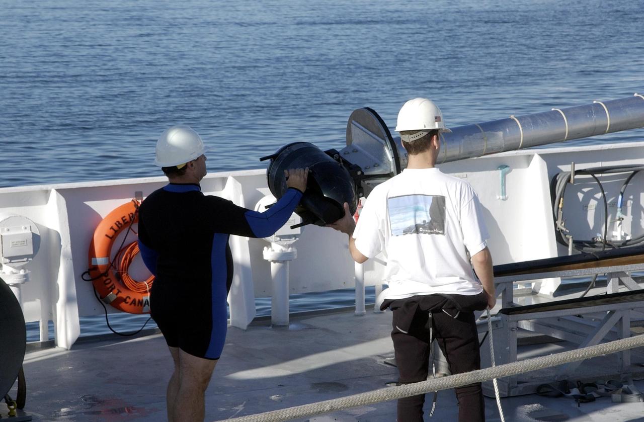
KENNEDY SPACE CENTER, FLA. -- Workers on the deck of the Liberty Star, one of NASA's solid rocket booster retrieval ships, oversee the lifting of sonar mapping equipment from the deck toward the side of the ship. The equipment will be attached to the ship's hull for an eight-day expedition surveying deep-water coral reefs on the Oculina Banks off eastern Florida. NASA joins the National Oceanic and Atmospheric Administration (NOAA) and other ocean scientists for the sophisticated mapping system that will provide the first high-resolution, three-dimensional map of the Oculina Banks. The survey results are expected to guide another expedition in Spring 2003, using NASA's ship, when the reef fish spawn. Also used will be NASA's underwater robot and an acoustic hydrophone system for listening to fish and vessel noise. Dive sites will be chosen based on the new charts.
KENNEDY SPACE CENTER, FLA. -- This alligator strolls the bank alongside the Tow Road on Kennedy Space Center. Nearly 5,000 alligators can be found in canals, ponds, and waterways throughout the Center and the surrounding Merritt Island National Wildlife Refuge. American alligators feed and rest in the water, and lay their eggs in dens they dig into the banks. The young alligators spend their first several weeks in these dens. The Wildlife Refuge encompasses 92,000 acres that are a habitat for more than 331 species of birds, 31 mammals, 117 fishes, and 65 amphibians and reptiles. The marshes and open water of the refuge provide wintering areas for 23 species of migratory waterfowl, as well as a year-round home for great blue herons, great egrets, wood storks, cormorants, brown pelicans and other species of marsh and shore birds, plus a variety of insects.