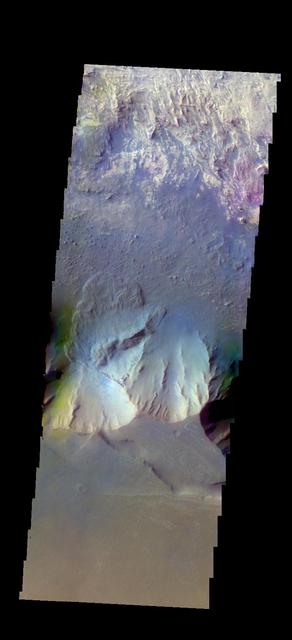
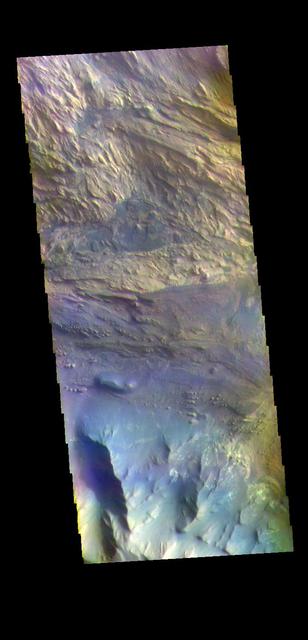
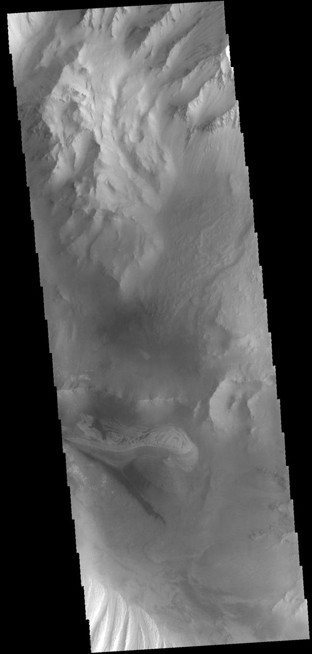
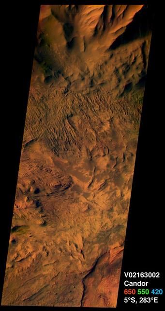
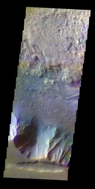
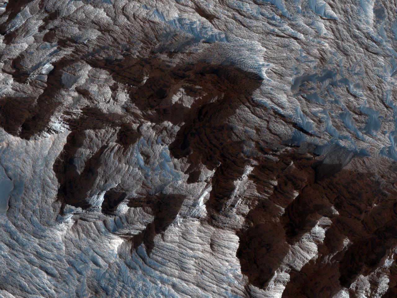
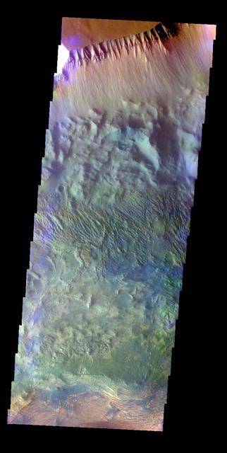
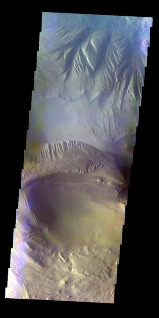
The THEMIS VIS camera contains 5 filters. The data from different filters can be combined in multiple ways to create a false color image. These false color images may reveal subtle variations of the surface not easily identified in a single band image. Today's false color image shows part of Candor Chasma. There is a landslide deposit from the rim of the chasma. Orbit Number: 44856 Latitude: -6.68095 Longitude: 283.729 Instrument: VIS Captured: 2012-01-24 15:20 http://photojournal.jpl.nasa.gov/catalog/PIA21167

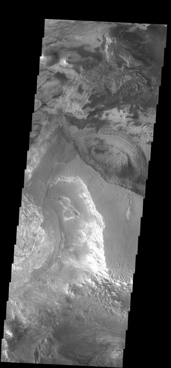
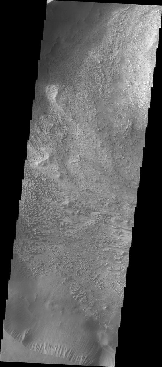
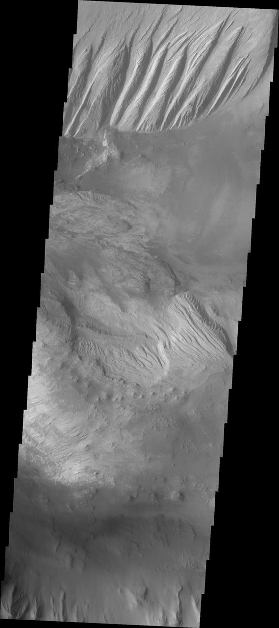
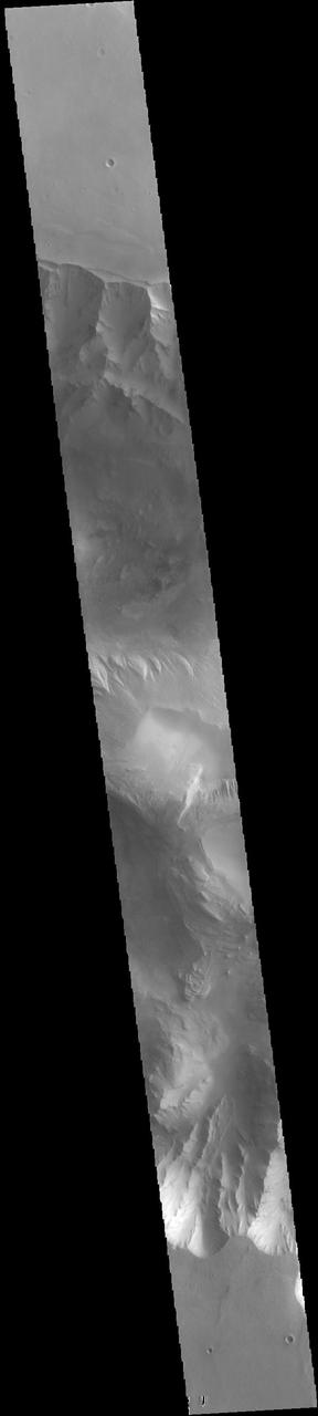
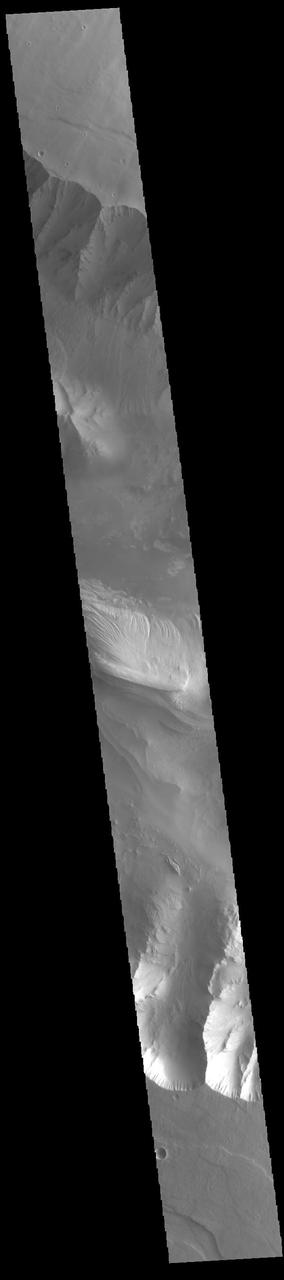
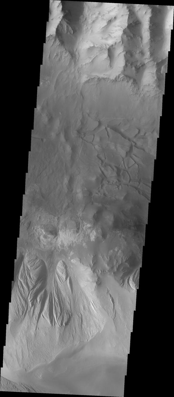
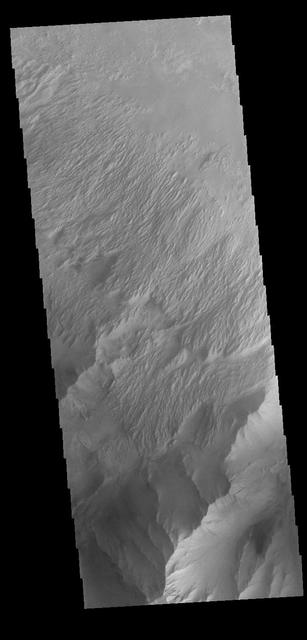
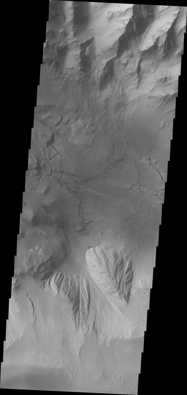
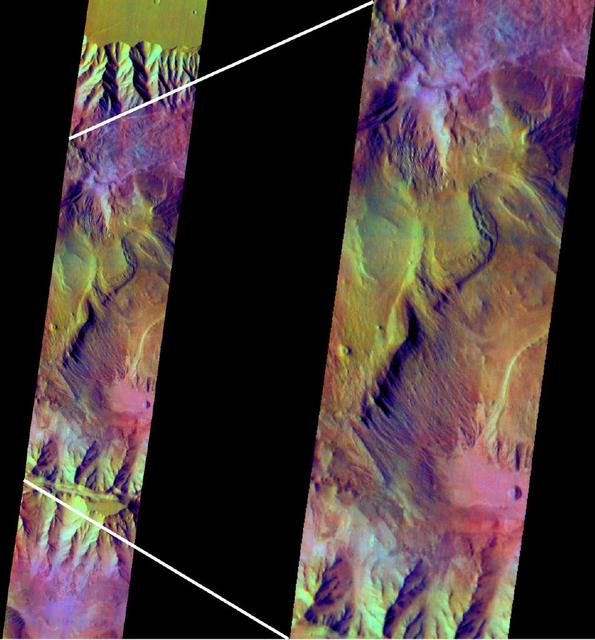
Candor Chasma

Candor Chasma

Candor Chasma

Candor Chasma

Candor Chasma

Candor Chasma

Candor Chasma

Candor Chasma

Candor Chasma

Candor Chasma

Candor Chasma

Candor Chasma

Candor Chasma

Southwest Candor Chasma and Surroundings
Candor Chasma Floor

Candor Chasma Plateau
Wind Etching in Candor Chasma
Layered Candor Chasma
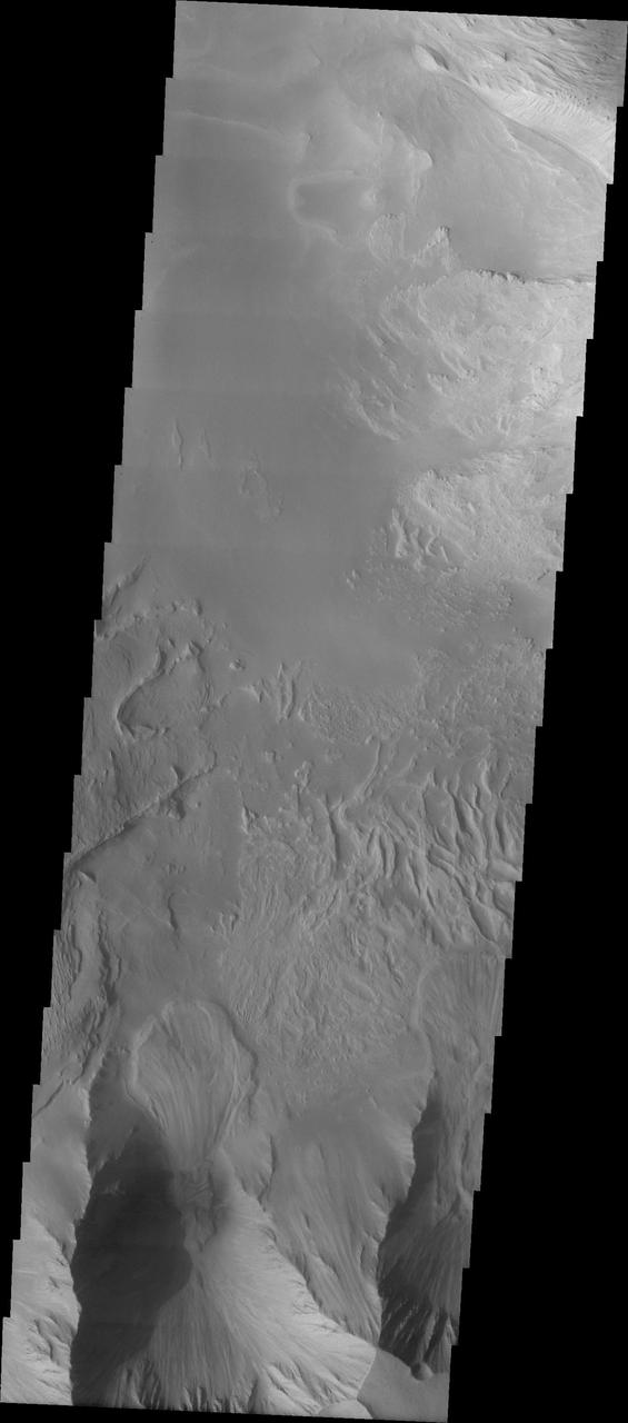
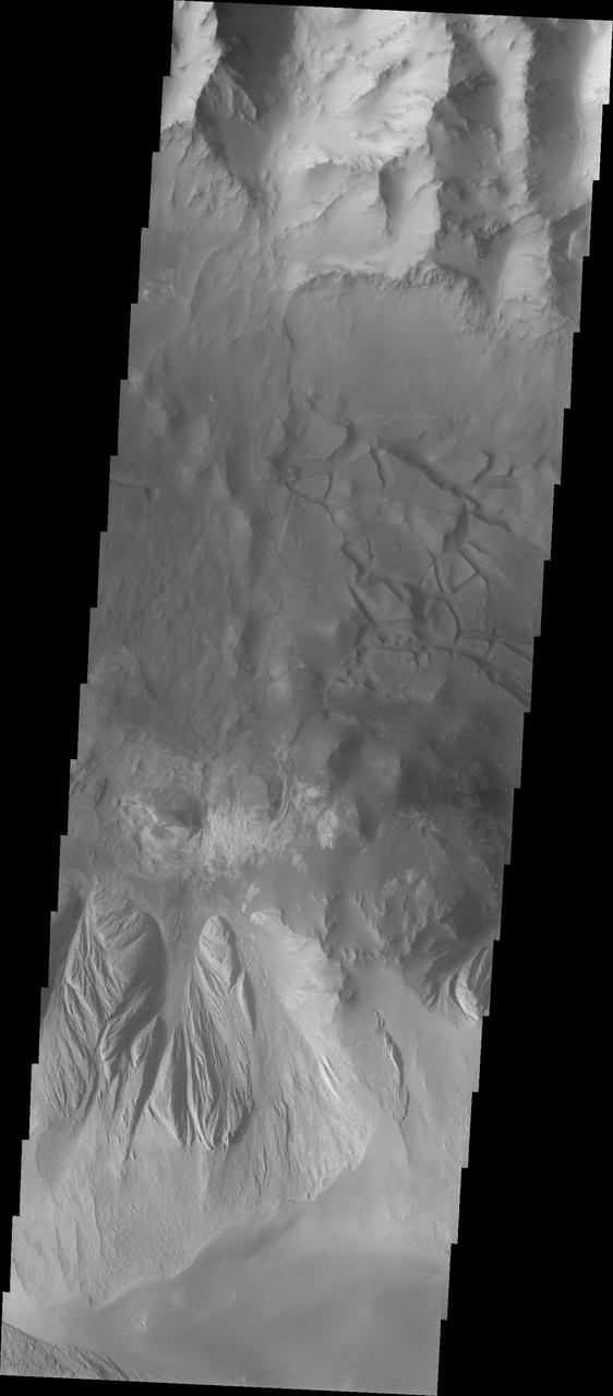
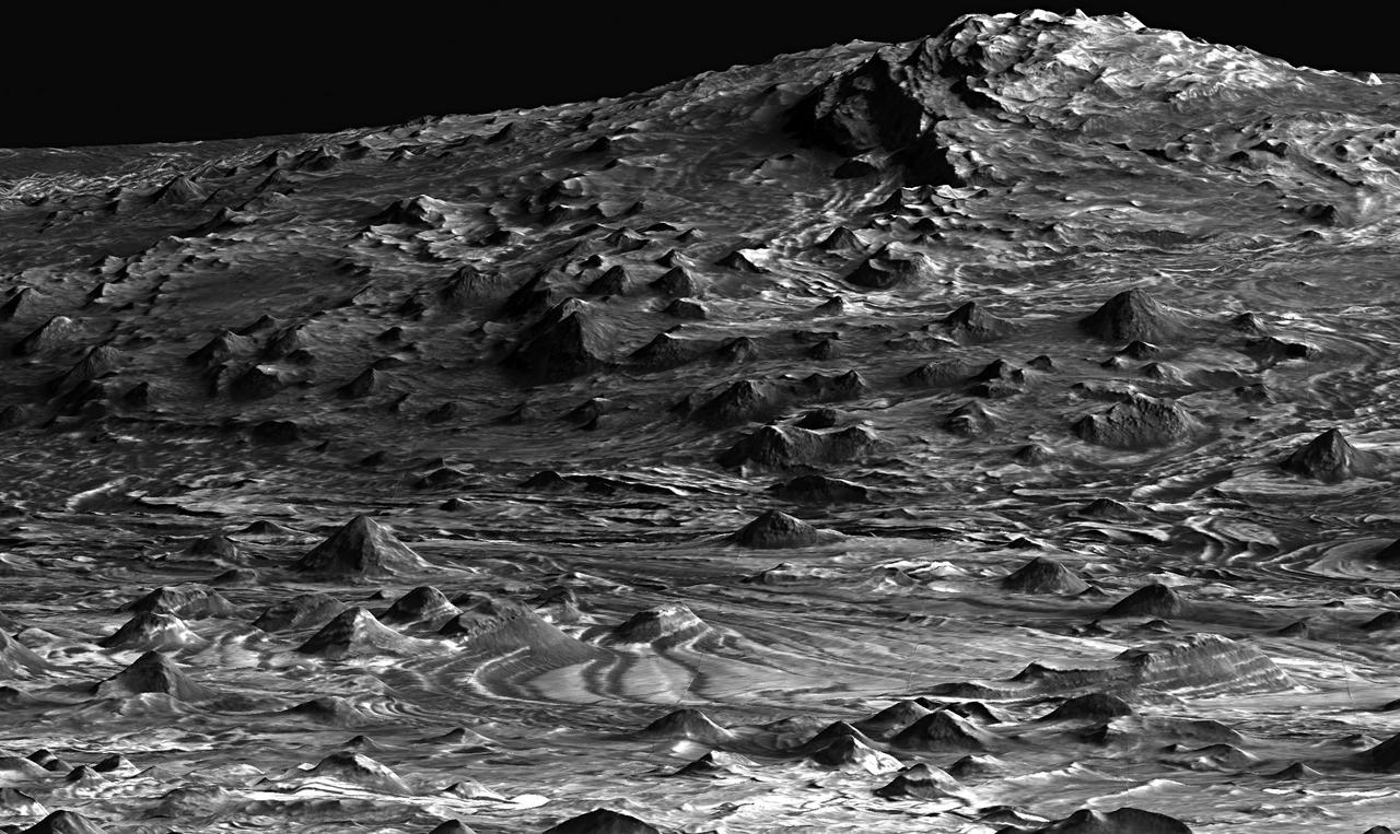
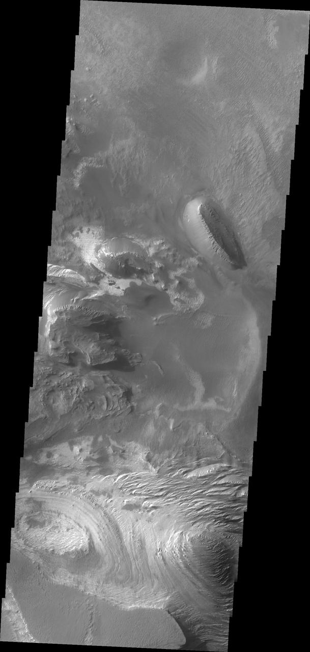
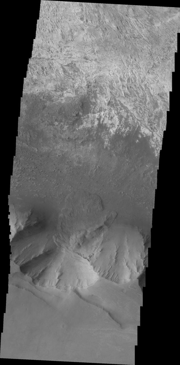
Candor Chasma Landslides
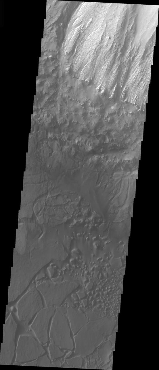
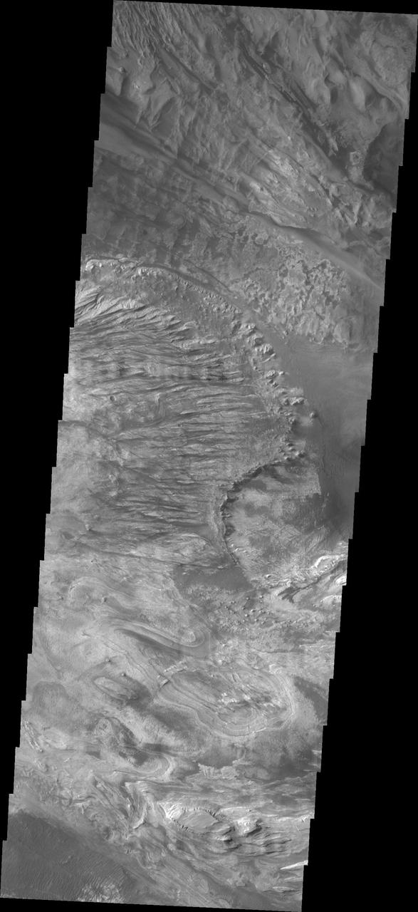
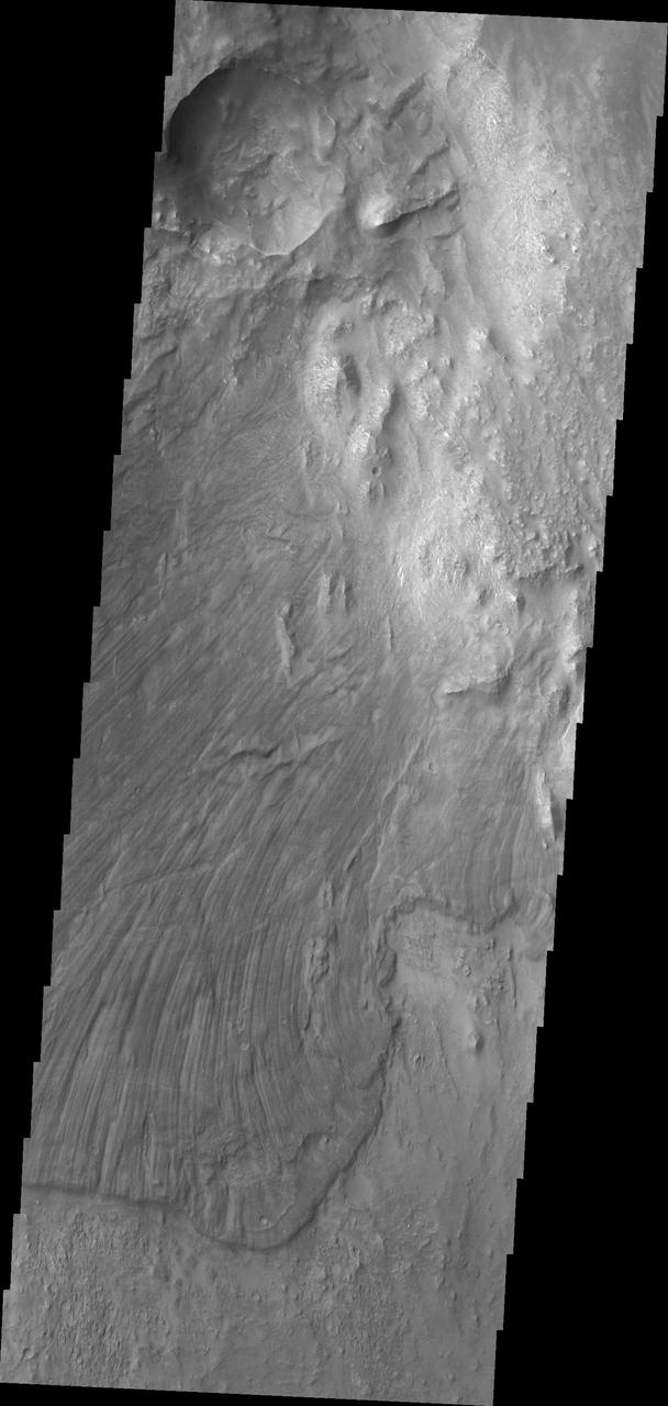
Candor Chasma Chaos
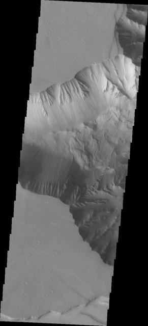
Layered Rock in Candor Chasma
Candor Chasma Features
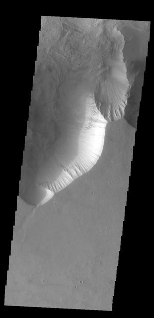
Candor Chasma Landslide
Candor Chasma Rim
Candor Chasma Rim
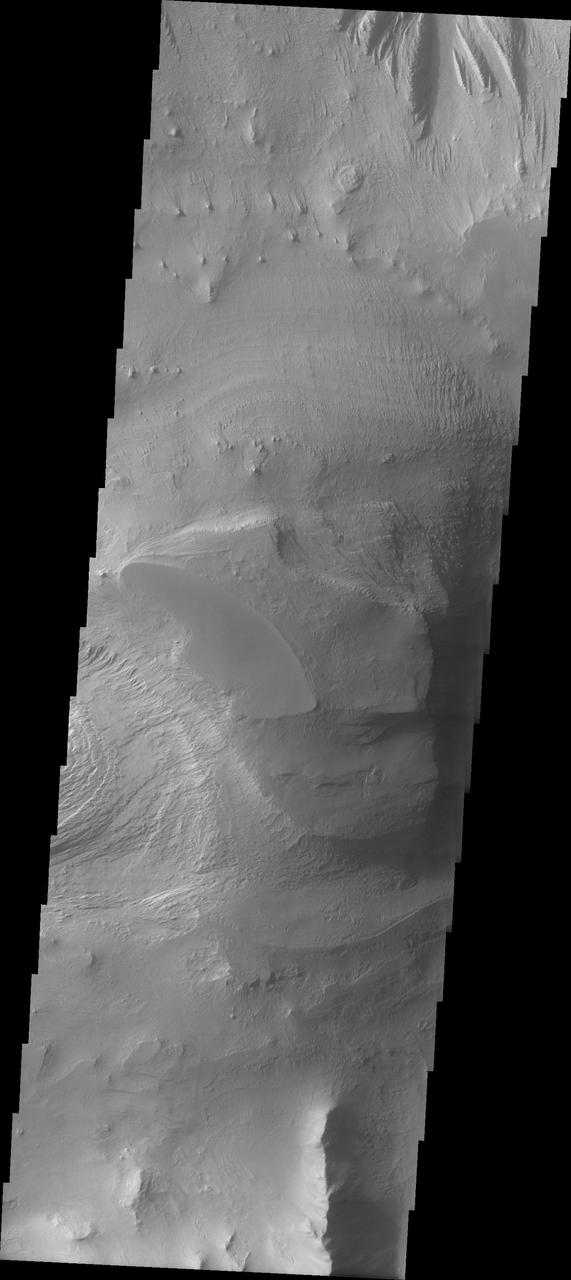
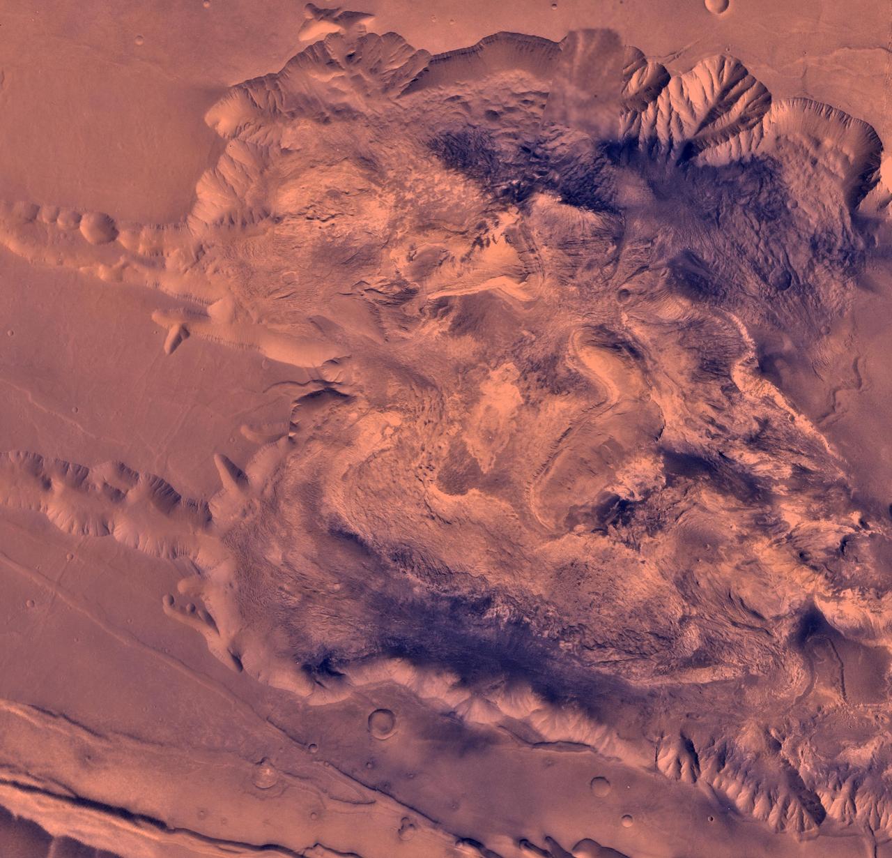
Swirls of Rock in Candor Chasma
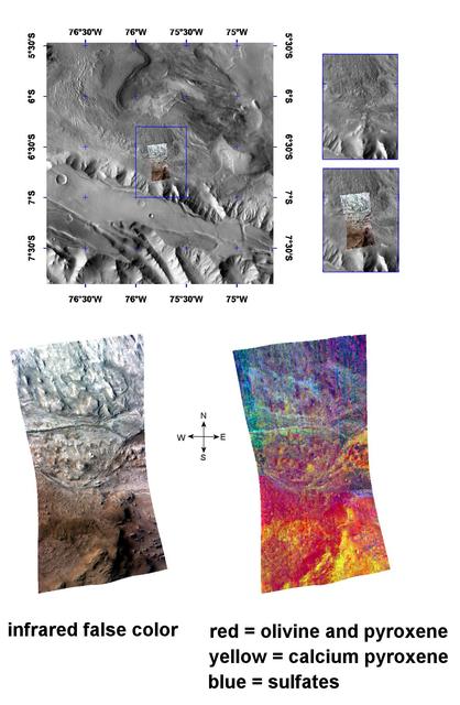
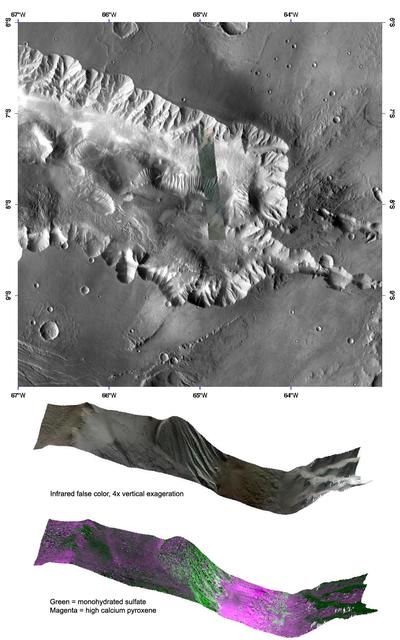
The Minerals of Candor Chasma
Chaotic Candor Chasma
West Candor Chasma http://photojournal.jpl.nasa.gov/catalog/PIA00403
Today's VIS image shows part of Candor Chasma. Candor Chasma is one of the largest canyons that make up Valles Marineris. It is approximately 810 km long (503 miles) and has is divided into two regions – eastern and western Candor Chasma. Candor Chasma is located south of Ophir Chasma and north of Melas Chasma. The border with Melas Chasma contains many large landslide deposits. The floor of Candor Chasma includes a variety of landforms, including layered deposits, dunes, landslide deposits and steep sided cliffs and mesas. Many forms of erosion have shaped Candor Chasma. There is evidence of wind and water erosion, as well as significant gravity driven mass wasting (landslides). The bright features in this image are layered deposits that have been eroded by wind, and possible water. Orbit Number: 89623 Latitude: -6.93421 Longitude: 291.118 Instrument: VIS Captured: 2022-02-26 20:41 https://photojournal.jpl.nasa.gov/catalog/PIA25451
Today's VIS image shows part of eastern Candor Chasma. Candor Chasma is one of the largest canyons that make up Valles Marineris. It is approximately 810 km long (503 miles) and has is divided into two regions - eastern and western Candor. Candor is located south of Ophir Chasma and north of Melas Chasma. The border with Melas Chasma contains many large landslide deposits. The floor of Candor Chasma includes a variety of landforms, including layered deposits, dunes, landslide deposits and steep sided cliffs and mesas. Many forms of erosion have shaped Candor Chasma. There is evidence of wind and water erosion, as well as significant gravity driven mass wasting (landslides). Orbit Number: 88163 Latitude: -7.04697 Longitude: 292.058 Instrument: VIS Captured: 2021-10-29 15:27 https://photojournal.jpl.nasa.gov/catalog/PIA25152
Today's VIS image shows part of eastern Candor Chasma. Candor Chasma is one of the largest canyons that make up Valles Marineris. It is approximately 810 km long (503 miles) and is divided into two regions – eastern and western Candor. Candor is located south of Ophir Chasma and north of Melas Chasma. The border with Melas Chasma contains many large landslide deposits. The floor of Candor Chasma includes a variety of landforms, including layered deposits (bright region in the center of the image), dunes, landslide deposits and steep sided cliffs and mesas. Many forms of erosion have shaped Candor Chasma. There is evidence of wind and water erosion, as well as significant gravity driven mass wasting (landslides). Orbit Number: 85817 Latitude: -6.96093 Longitude: 291.605 Instrument: VIS Captured: 2021-04-19 11:28 https://photojournal.jpl.nasa.gov/catalog/PIA24875
Western Candor Chasma, Valles Marineris
Stair-Stepped Terrain in Candor Chasma
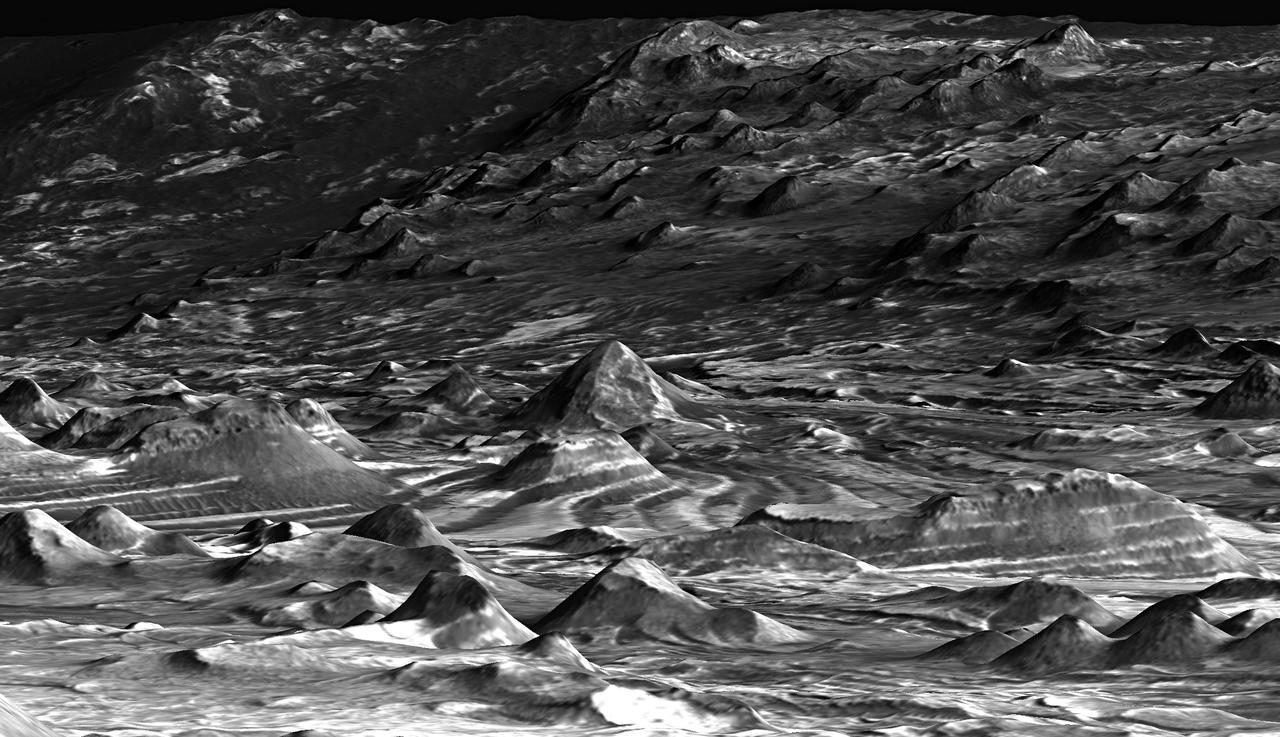
Hilltop View of the Terrain in Candor Chasma
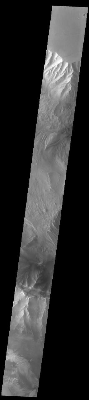
Faults and Folds in Western Candor Chasma

This image captured by NASA 2001 Mars Odyssey spacecraft spans Candor Chasma.
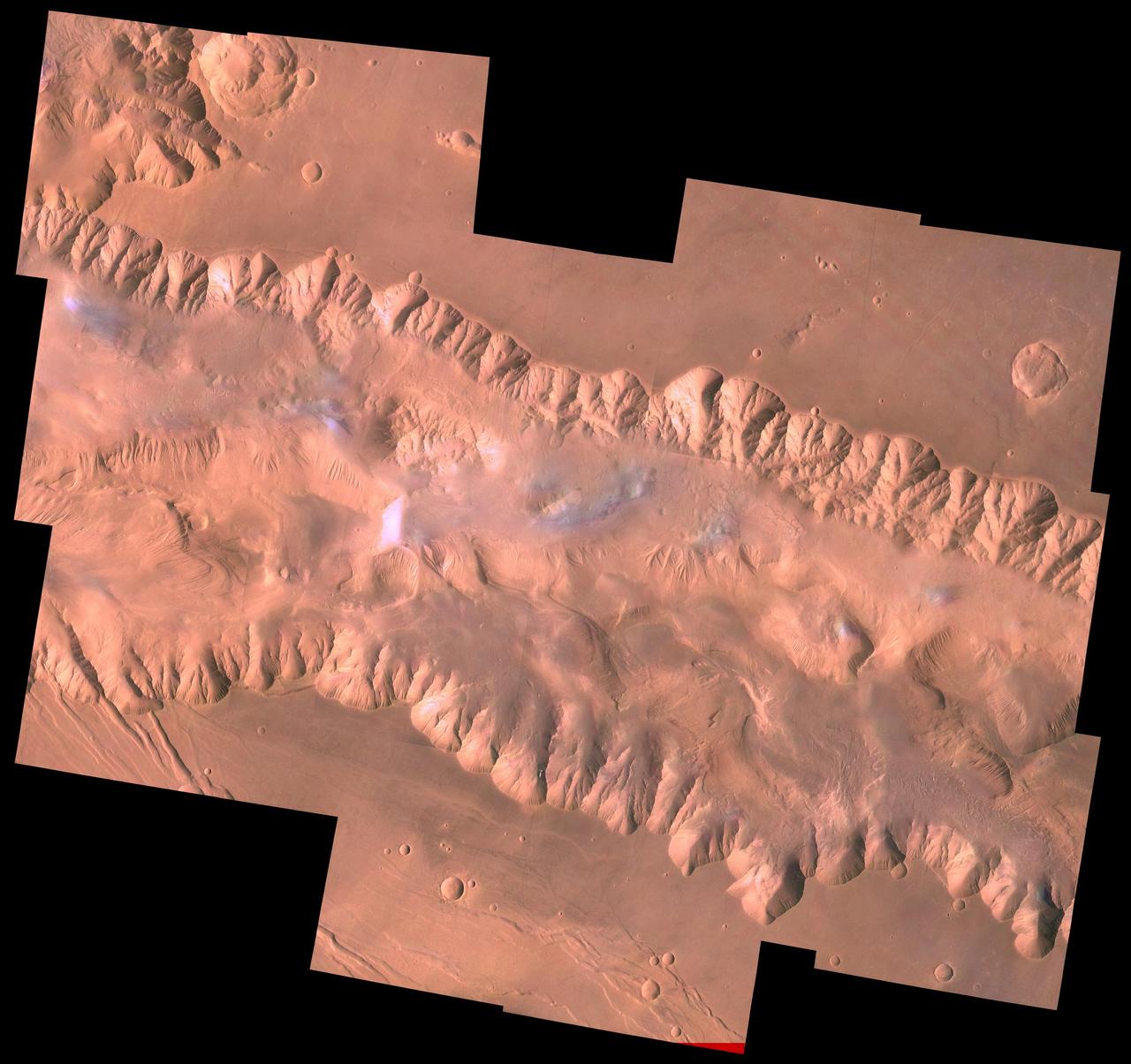
During its examination of Mars, NASA's Viking 1 spacecraft returned images of Valles Marineris, a huge canyon system 5,000 km long, up to 240 km wide, and 6.5 km deep, whose connected chasma or valleys may have formed from a combination of erosional collapse and structural activity. The view shows east Candor Chasma, one of the connected valleys of Valles Marineris; north toward top of frame; for scale, the impact crater in upper right corner is 15 km (9 miles) wide. The image, centered at latitude 7.5 degrees S., longitude 67.5 degrees, is a composite of Viking 1 Orbiter high-resolution (about 80 m/pixel or picture element) images in black and white and low-resolution (about 250 m/pixel) images in color. The Viking 1 craft landed on Mars in July of 1976. East Candor Chasma occupies the eastern part of the large west-northwest-trending trough of Candor Chasma. This section is about 150 km wide. East Candor Chasma is bordered on the north and south by walled cliffs, most likely faults. The walls may have been dissected by landslides forming reentrants; one area on the north wall shows what appears to be landslide debris. Both walls show spur-and-gully morphology and smooth sections. In the lower part of the image northwest-trending, linear depressions on the plateau are younger graben or fault valleys that cut the south wall. Material central to the chasma shows layering in places and has been locally eroded by the wind to form flutes and ridges. These interior layered deposits have curvilinear reentrants carved into them, and in one locale a lobe flows away from the top of the interior deposit. The lobe may be mass-wasting deposits due to collapse of older interior deposits (Lucchitta, 1996, LPSC XXVII abs., p. 779- 780); this controversial idea requires that the older layered deposits were saturated with ice, perhaps from former lakes, and that young volcanism and/or tectonism melted the ice and made the material flow. http://photojournal.jpl.nasa.gov/catalog/PIA00424
The THEMIS VIS camera contains 5 filters. The data from different filters can be combined in multiple ways to create a false color image. These false color images may reveal subtle variations of the surface not easily identified in a single band image. Today's false color image shows part of western Candor Chasma. Candor Chasma is one of the largest canyons that make up Valles Marineris. It is approximately 810 km long (503 miles) and has is divided into two regions — eastern and western Candor. Candor is located south of Ophir Chasma and north of Melas Chasma. The border with Melas Chasma contains many large landslide deposits. The floor of Candor Chasma includes a variety of landforms, including layered deposits, dunes, landslide deposits and steep sided cliffs and mesas. Many forms of erosion have shaped Candor Chasma. There is evidence of wind and water erosion, as well as significant gravity driven mass wasting (landslides). Orbit Number: 69411 Latitude: -5.95186 Longitude: 283.147 Instrument: VIS Captured: 2017-08-07 08:33 https://photojournal.jpl.nasa.gov/catalog/PIA24081
The THEMIS VIS camera contains 5 filters. The data from different filters can be combined in multiple ways to create a false color image. These false color images may reveal subtle variations of the surface not easily identified in a single band image. Today's false color image shows part of Candor Chasma. Candor Chasma is one of the largest canyons that make up Valles Marineris. It is approximately 810 km long (503 miles) and has is divided into two regions – eastern and western Candor. Candor is located south of Ophir Chasma and north of Melas Chasma. The border with Melas Chasma contains many large landslide deposits. The floor of Candor Chasma includes a variety of landforms, including layered deposits (seen in this image), dunes, landslide deposits and steep sided cliffs and mesas. Many forms of erosion have shaped Candor Chasma. There is evidence of wind and water erosion, as well as significant gravity driven mass wasting (landslides). Orbit Number: 71132 Latitude: -6.71232 Longitude: 284.46 Instrument: VIS Captured: 2017-12-27 03:31 https://photojournal.jpl.nasa.gov/catalog/PIA24508
The THEMIS VIS camera contains 5 filters. The data from different filters can be combined in multiple ways to create a false color image. These false color images may reveal subtle variations of the surface not easily identified in a single band image. Today's false color image shows part of eastern Candor Chasma. Candor Chasma is one of the largest canyons that make up Valles Marineris. It is approximately 810 km long (503 miles) and has is divided into two regions — eastern and western Candor. Candor is located south of Ophir Chasma and north of Melas Chasma. The border with Melas Chasma contains many large landslide deposits. The floor of Candor Chasma includes a variety of landforms, including layered deposits, dunes, landslide deposits and steep sided cliffs and mesas. Many forms of erosion have shaped Candor Chasma. There is evidence of wind and water erosion, as well as significant gravity driven mass wasting (landslides). Orbit Number: 68438 Latitude: -7.05392 Longitude: 291.853 Instrument: VIS Captured: 2017-05-19 04:30 https://photojournal.jpl.nasa.gov/catalog/PIA24078
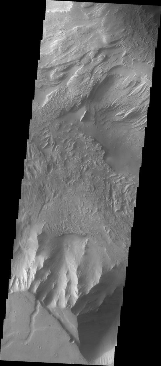
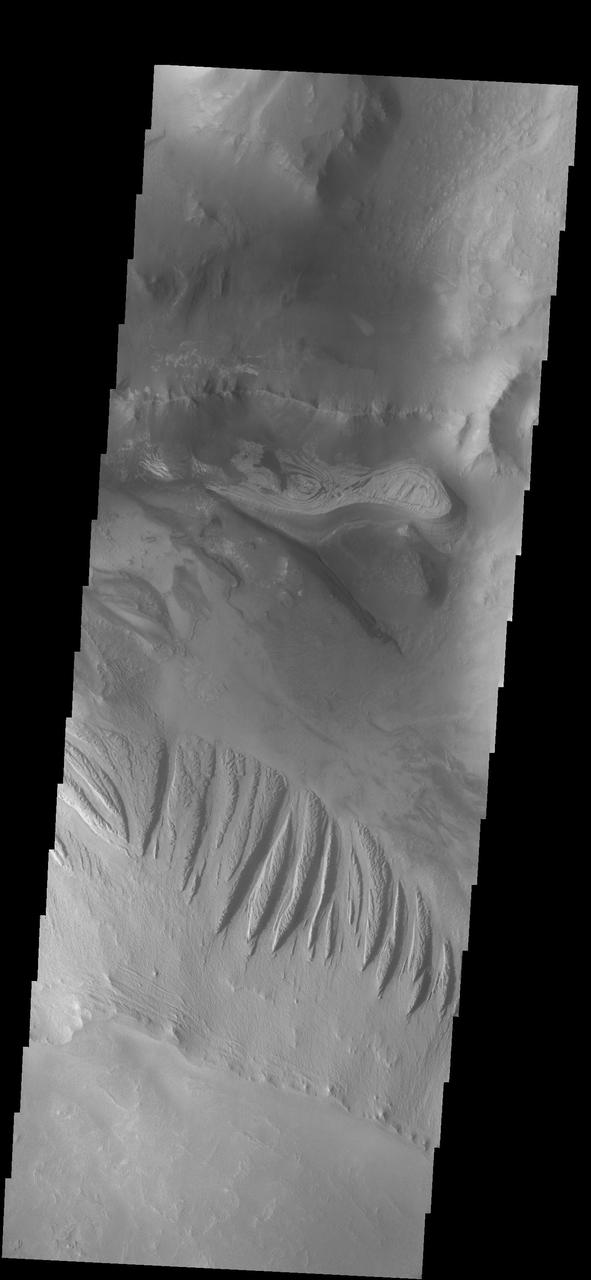
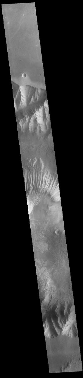
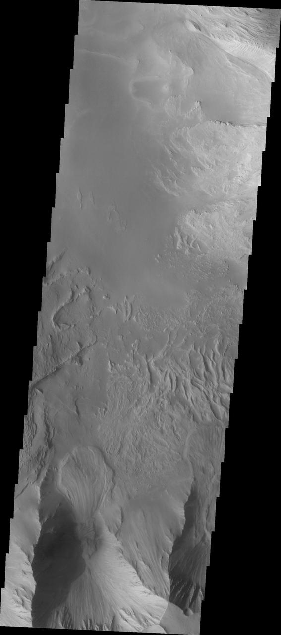
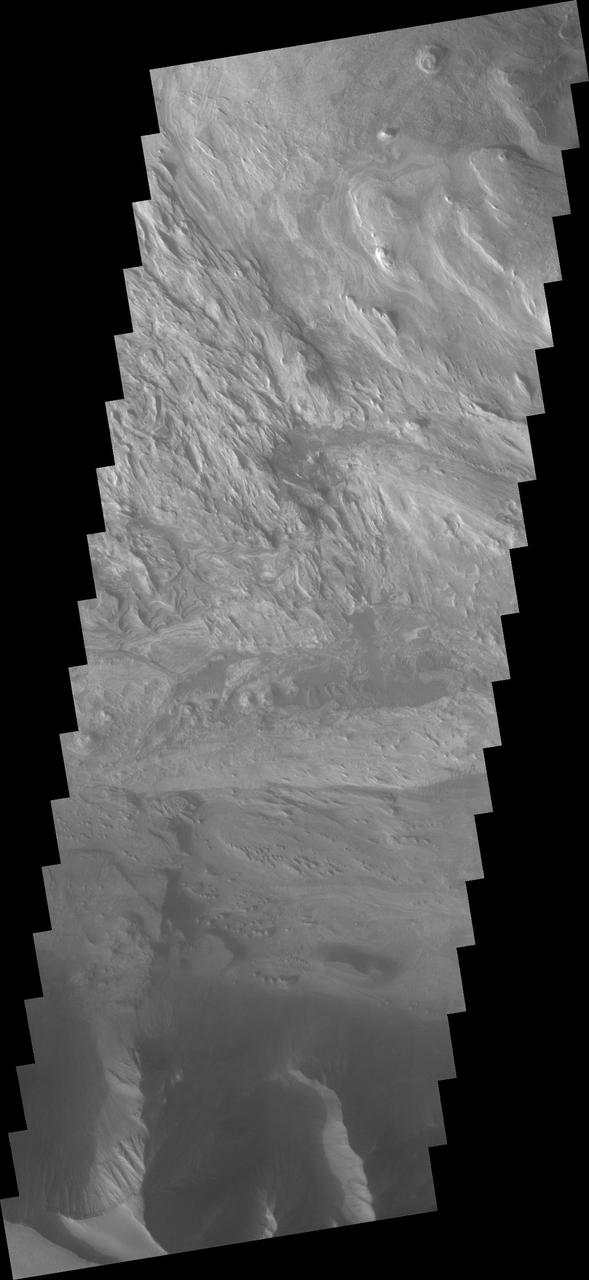
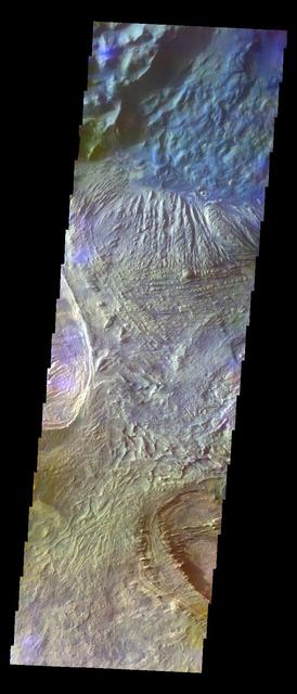
Candor Chasma is one of the largest canyons that make up Valles Marineris. It is approximately 810 km long (503 miles) and is divided into two regions – eastern and western Candor. Candor Chasma is located south of Ophir Chasma and north of Melas Chasma. The border with Melas Chasma contains many large landslide deposits. The floor of Candor Chasma includes a variety of landforms, including layered deposits, dunes, landslide deposits and steep sided cliffs and mesas. Many forms of erosion have shaped Candor Chasma. There is evidence of wind and water erosion, as well as significant gravity driven mass wasting (landslides). Orbit Number: 95151 Latitude: -7.05226 Longitude: 291.676 Instrument: VIS Captured: 2023-05-28 00:49 https://photojournal.jpl.nasa.gov/catalog/PIA26263
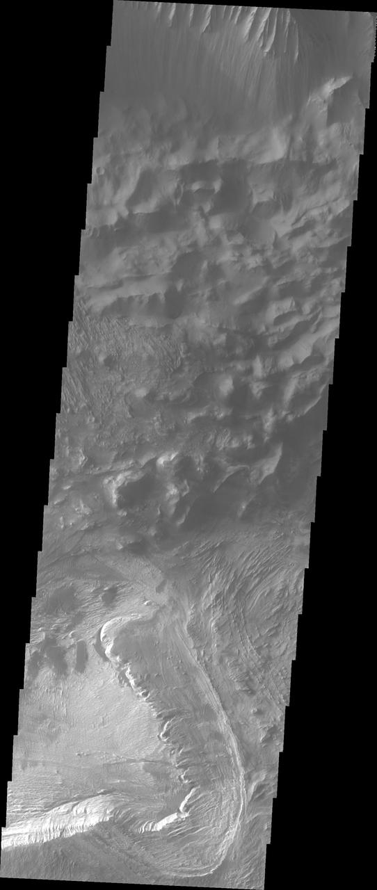
Today's VIS image shows part of the southern margin of Candor Chasma. While not as deep as the northern regions of eastern Candor Chasma, the southern region contains all the features seen at the lower elevations to the north. Candor Chasma is one of the largest canyons that make up Valles Marineris. It is approximately 810 km long (503 miles) and is divided into two regions - eastern and western Candor. Candor is located south of Ophir Chasma and north of Melas Chasma. The border with Melas Chasma contains many large landslide deposits. The floor of Candor Chasma includes a variety of landforms, including layered deposits, dunes, landslide deposits and steep sided cliffs and mesas. Many forms of erosion have shaped Candor Chasma. There is evidence of wind and water erosion, as well as significant gravity driven mass wasting (landslides). Orbit Number: 89860 Latitude: -8.00834 Longitude: 293.829 Instrument: VIS Captured: 2022-03-18 09:02 https://photojournal.jpl.nasa.gov/catalog/PIA25398
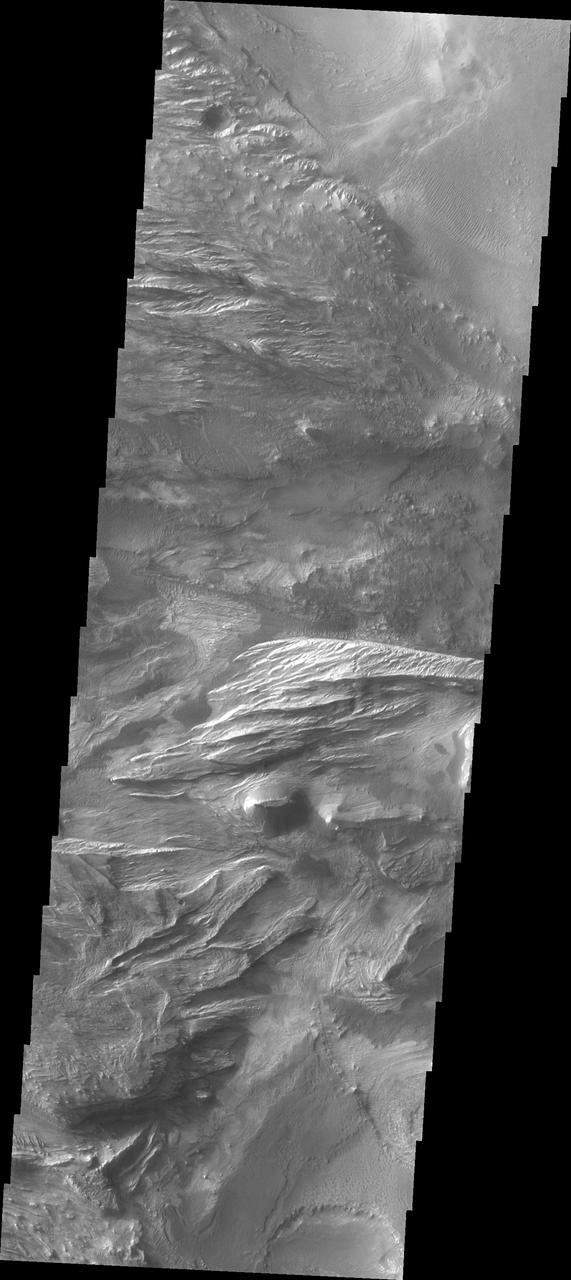
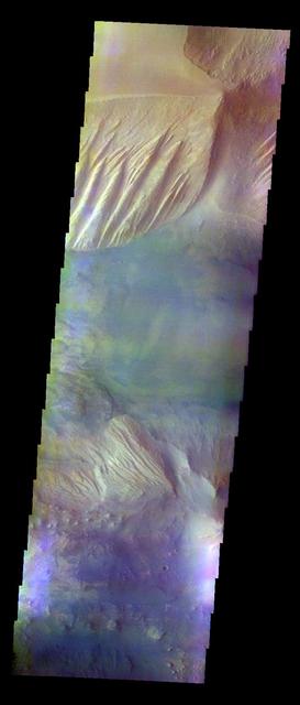
Candor Chasma is one of the largest canyons that make up Valles Marineris. It is approximately 810 km long (503 miles) and is divided into two regions - eastern and western Candor. Candor is located south of Ophir Chasma and north of Melas Chasma. The border with Melas Chasma contains many large landslide deposits. The floor of Candor Chasma includes a variety of landforms, including layered deposits, dunes, landslide deposits and steep sided cliffs and mesas. Many forms of erosion have shaped Candor Chasma. There is evidence of wind and water erosion, as well as significant gravity driven mass wasting (landslides). Orbit Number: 94789 Latitude: -8.22898 Longitude: 295.219 Instrument: VIS Captured: 2023-04-28 05:27 https://photojournal.jpl.nasa.gov/catalog/PIA26158
Western Candor Chasma - Layers Exposed near the Middle
Layered Outcrops of Far West Candor Chasma

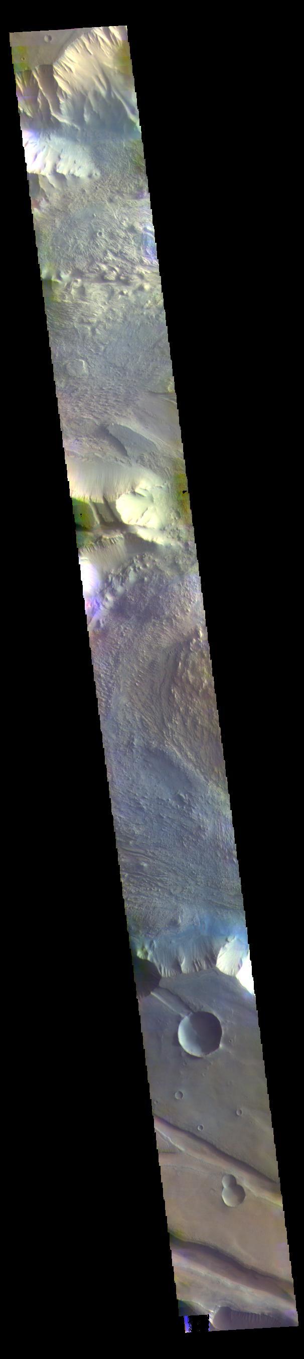
CRISM Mulitspectral Map of Eastern Candor Chasma
Wallrock and Light-toned Layering in Candor Chasma
Low-flying View of Terrain in Candor Chasma
Candor Chasma - Massive non-layered Material Expos
Eolian Features Provide a Glimpse of Candor Chasma Mineralology
NASA 2001 Mars Odyssey spacecraft took this image of Candor Chasma showing a complex region of eroded layered deposits.
This image shows a portion of Candor Chasma as seen by NASA 2001 Mars Odyssey spacecraft.
This image captured by NASA 2001 Mars Odyssey spacecraft shows eroded materials on the floor of Candor Chasma.
The mitten-shaped feature in Candor Chasma is a landslide deposit in this image from NASA 2001 Mars Odyssey spacecraft.
This image captured by NASA 2001 Mars Odyssey spacecraft shows part of the floor of Candor Chasma.
This image of Candor Chasma captured by NASA 2001 Mars Odyssey spacecraft shows layered floor materials.
This image from NASA Mars Odyssey shows the western end of Candor Chasma, including a large landslide deposit.
This image from NASA 2001 Mars Odyssey spacecraft shows part of Candor Chasma.
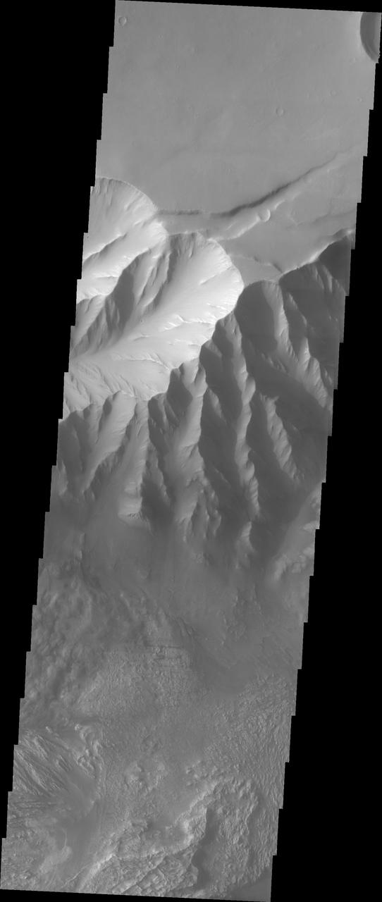
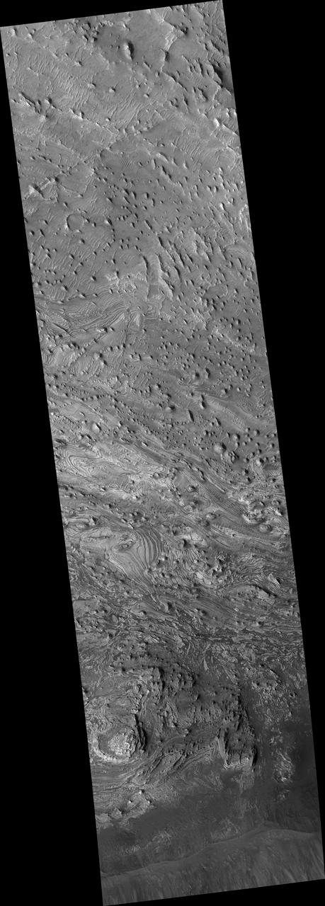
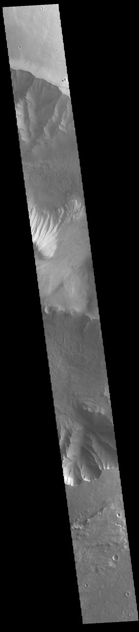
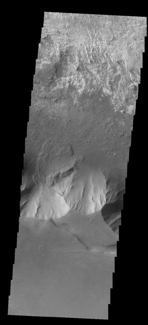
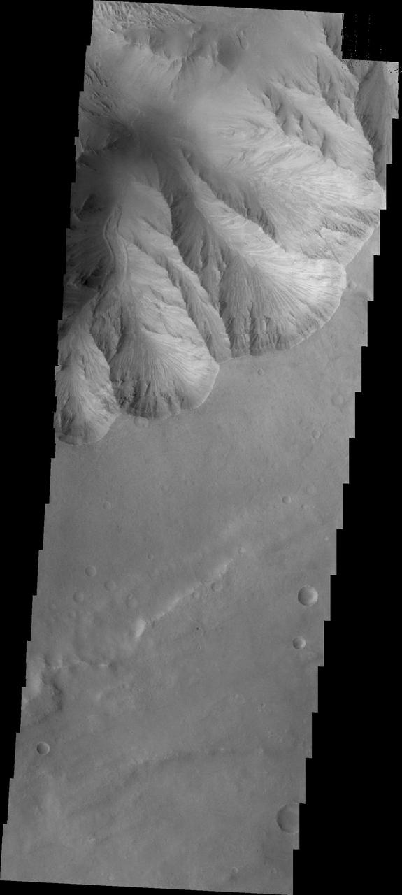
Today's VIS image shows part of the large hill near the eastern edge of Candor Chasma. Layering is visible toward the bottom of the image. The sides of the hill are deeply incised by erosion, probably including both wind and water processes. Candor Chasma is one of the largest canyons that make up Valles Marineris. It is approximately 810 km long (503 miles) and has is divided into two regions - eastern and western Candor. Candor is located south of Ophir Chasma and north of Melas Chasma. The border with Melas Chasma contains many large landslide deposits. The floor of Candor Chasma includes a variety of landforms, including layered deposits, dunes, landslide deposits and steep sided cliffs and mesas. Many forms of erosion have shaped Candor Chasma. There is evidence of wind and water erosion, as well as significant gravity driven mass wasting (landslides). Orbit Number: 88687 Latitude: -7.91852 Longitude: 294.829 Instrument: VIS Captured: 2021-12-11 18:58 https://photojournal.jpl.nasa.gov/catalog/PIA25202
Today's VIS image shows a cross section of eastern Candor Chasma. In the center of this image is a large hill. The sides of the hill are deeply incised by erosion, probably including both wind and water processes. Candor Chasma is one of the largest canyons that make up Valles Marineris. It is approximately 810 km long (503 miles) and has is divided into two regions – eastern and western Candor. Candor is located south of Ophir Chasma and north of Melas Chasma. The border with Melas Chasma contains many large landslide deposits. The floor of Candor Chasma includes a variety of landforms, including layered deposits, dunes, landslide deposits and steep sided cliffs and mesas. Many forms of erosion have shaped Candor Chasma. There is evidence of wind and water erosion, as well as significant gravity driven mass wasting (landslides). Orbit Number: 89548 Latitude: -7.8126 Longitude: 294.967 Instrument: VIS Captured: 2022-02-20 16:28 https://photojournal.jpl.nasa.gov/catalog/PIA25379
Today's VIS image shows part of the interior of Candor Chasma. At the bottom of the frame is a bright feature formed by layers of material deposited in the canyon after it formed. Additional darker material is likely sand blown into the canyon and eroded from rocks within the chasma. Candor Chasma is just one of the canyons that make up Valles Marineris. Orbit Number: 71344 Latitude: -6.20728 Longitude: 285.115 Instrument: VIS Captured: 2018-01-13 14:41 https://photojournal.jpl.nasa.gov/catalog/PIA22388
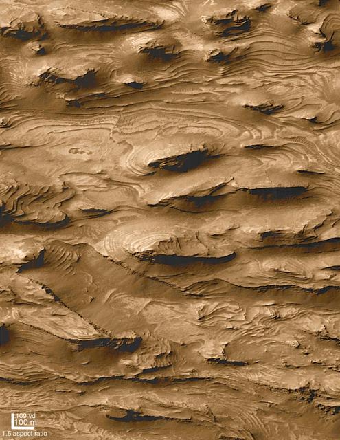
This NASA Mars Odyssey image shows the effects of erosion on a beautiful sequence of dramatically layered rocks within Candor Chasma, which is part of the Valles Marineris.
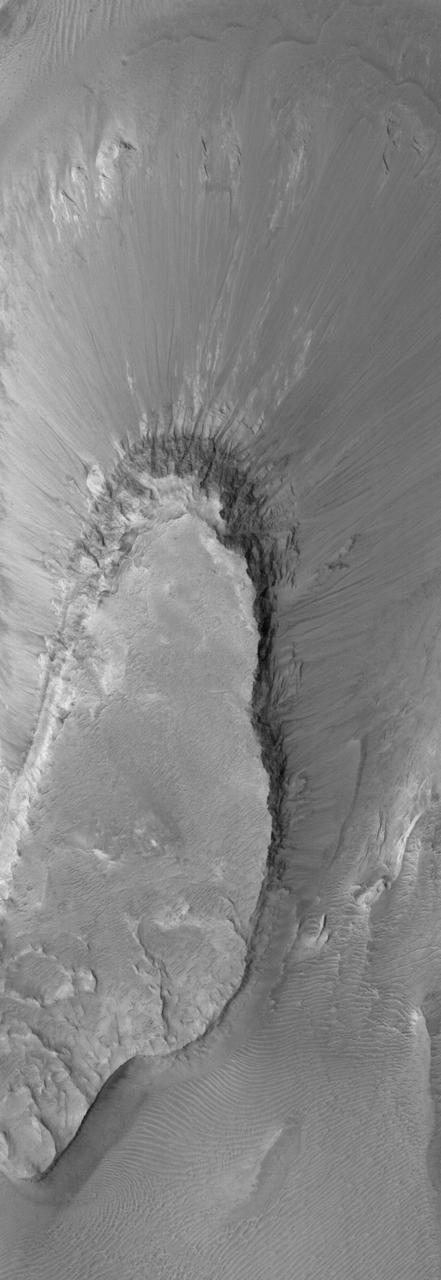
This image from NASA 2001 Mars Odyssey spacecraft shows a small landslide chute and deposit. This feature is located on the easternmost end of Candor Chasma.
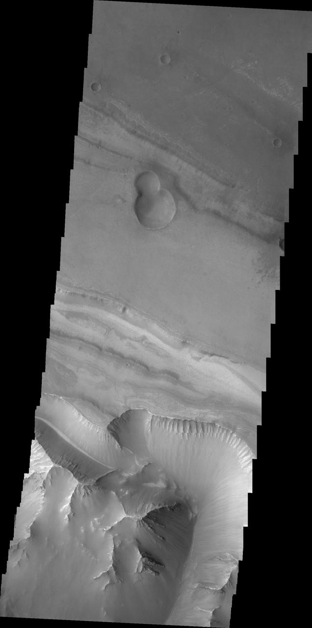
This image shows part of eastern Candor Chasma. At the bottom of the image is the steep cliff between the upper surface elevation and the depths of Candor Chasma. The small lobate feature at the base of the cliff in the bottom of the image is a landslide deposit formed by failure of the cliff face and gravitational downslope movement of the material. Candor Chasma is one of the largest canyons that make up Valles Marineris. It is approximately 810 km long (503 miles) and has is divided into two regions - eastern and western Candor. Candor is located south of Ophir Chasma and north of Melas Chasma. The border with Melas Chasma contains many large landslide deposits. The floor of Candor Chasma includes a variety of landforms, including layered deposits, dunes, landslide deposits and steep sided cliffs and mesas. Many forms of erosion have shaped Chandor Chasma. There is evidence of wind and water erosion, as well as significant gravity driven mass wasting (landslides). The Odyssey spacecraft has spent over 15 years in orbit around Mars, circling the planet more than 69000 times. It holds the record for longest working spacecraft at Mars. THEMIS, the IR/VIS camera system, has collected data for the entire mission and provides images covering all seasons and lighting conditions. Over the years many features of interest have received repeated imaging, building up a suite of images covering the entire feature. From the deepest chasma to the tallest volcano, individual dunes inside craters and dune fields that encircle the north pole, channels carved by water and lava, and a variety of other feature, THEMIS has imaged them all. For the next several months the image of the day will focus on the Tharsis volcanoes, the various chasmata of Valles Marineris, and the major dunes fields. We hope you enjoy these images! Orbit Number: 8916 Latitude: -7.95016 Longitude: 293.509 Instrument: VIS Captured: 2003-12-18 11:38 https://photojournal.jpl.nasa.gov/catalog/PIA22162
Today's VIS image shows part of Candor Chasma. Orbit Number: 59700 Latitude: -8.61477 Longitude: 292.969 Instrument: VIS Captured: 2015-05-30 09:44 http://photojournal.jpl.nasa.gov/catalog/PIA19758
A large landslide located in Candor Chasma is seen by NASA 2001 Mars Odyssey spacecraft.
This image taken by NASA 2001 Mars Odyssey spacecraft shows a landslide deposit on the southern rim of Candor Chasma.

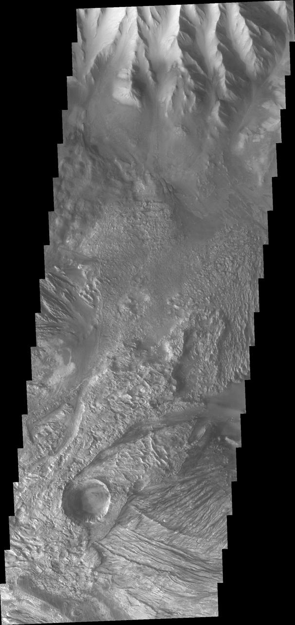
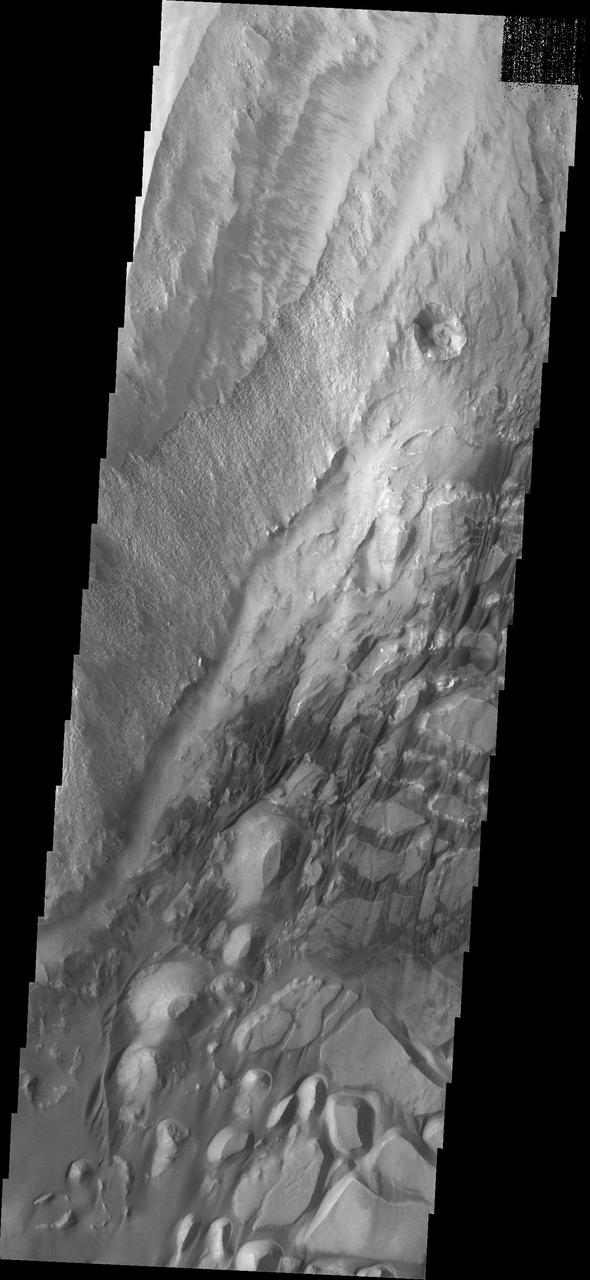
This image shows part of eastern Candor Chasma. At the top of the image is the steep cliff between the upper surface elevation and the depths of Candor Chasma. The bottom of the image is the cliff side of a large mesa. The two cliff faces have very different appearances. The cliff face between the top of the canyon and the bottom is likely layers of volcanic flows from the nearby Tharsis volcanoes. The mesa, however, is probably layers of sediments deposited in the canyon from wind, water and gravity driven erosion and deposition. These layered materials are much more easily eroded than the solid rock of the canyon sides. There is a landslide that originate from the northern cliff face and ran out into the canyon floor, visible as the lobate "tongue" at the right near the center of the image. Candor Chasma is one of the largest canyons that make up Valles Marineris. It is approximately 810 km long (503 miles) and has is divided into two regions - eastern and western Candor. Candor is located south of Ophir Chasma and north of Melas Chasma. The border with Melas Chasma contains many large landslide deposits. The floor of Candor Chasma includes a variety of landforms, including layered deposits, dunes, landslide deposits and steep sided cliffs and mesas. Many forms of erosion have shaped Chandor Chasma. There is evidence of wind and water erosion, as well as significant gravity driven mass wasting (landslides). The Odyssey spacecraft has spent over 15 years in orbit around Mars, circling the planet more than 69000 times. It holds the record for longest working spacecraft at Mars. THEMIS, the IR/VIS camera system, has collected data for the entire mission and provides images covering all seasons and lighting conditions. Over the years many features of interest have received repeated imaging, building up a suite of images covering the entire feature. From the deepest chasma to the tallest volcano, individual dunes inside craters and dune fields that encircle the north pole, channels carved by water and lava, and a variety of other feature, THEMIS has imaged them all. For the next several months the image of the day will focus on the Tharsis volcanoes, the various chasmata of Valles Marineris, and the major dunes fields. We hope you enjoy these images! Orbit Number: 36232 Latitude: -6.78692 Longitude: 292.732 Instrument: VIS Captured: 2010-02-13 14:46 https://photojournal.jpl.nasa.gov/catalog/PIA22170
This image shows part of eastern Candor Chasma. At the top of the image is the steep cliff between the upper surface elevation and the depths of Candor Chasma. The bottom of the image is the cliff side of a large mesa. The two cliff faces have very different appearances. The cliff face between the top of the canyon and the bottom is likely layers of volcanic flows from the nearby Tharsis volcanoes. The mesa, however, is probably layers of sediments deposited in the canyon from wind, water and gravity driven erosion and deposition. These layered materials are much more easily eroded than the solid rock of the canyon sides. Candor Chasma is one of the largest canyons that make up Valles Marineris. It is approximately 810 km long (503 miles) and has is divided into two regions - eastern and western Candor. Candor is located south of Ophir Chasma and north of Melas Chasma. The border with Melas Chasma contains many large landslide deposits. The floor of Candor Chasma includes a variety of landforms, including layered deposits, dunes, landslide deposits and steep sided cliffs and mesas. Many forms of erosion have shaped Chandor Chasma. There is evidence of wind and water erosion, as well as significant gravity driven mass wasting (landslides). The Odyssey spacecraft has spent over 15 years in orbit around Mars, circling the planet more than 69000 times. It holds the record for longest working spacecraft at Mars. THEMIS, the IR/VIS camera system, has collected data for the entire mission and provides images covering all seasons and lighting conditions. Over the years many features of interest have received repeated imaging, building up a suite of images covering the entire feature. From the deepest chasma to the tallest volcano, individual dunes inside craters and dune fields that encircle the north pole, channels carved by water and lava, and a variety of other feature, THEMIS has imaged them all. For the next several months the image of the day will focus on the Tharsis volcanoes, the various chasmata of Valles Marineris, and the major dunes fields. We hope you enjoy these images! Orbit Number: 9540 Latitude: -6.76471 Longitude: 292.539 Instrument: VIS Captured: 2004-02-07 20:41 https://photojournal.jpl.nasa.gov/catalog/PIA22163
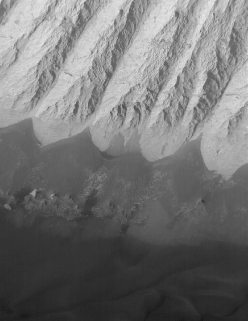
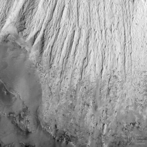
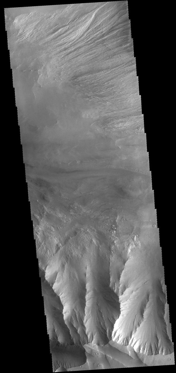
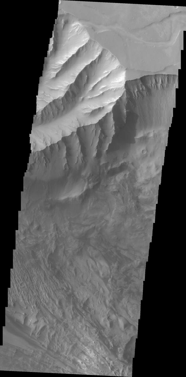
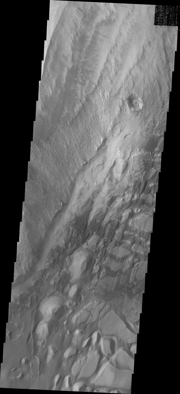
This VIS image shows part of the eastern end of Candor Chasma. The edge of the canyon is at the bottom of the image. The slopes of the chasma a eroded into a series of ridges and valleys. Winnowing of unconsolidated sediments by long term unidirectional winds can create these features. The ridge and valley system is called a yardang. Orbit Number: 74936 Latitude: -8.6632 Longitude: 294.841 Instrument: VIS Captured: 2018-11-05 12:02 https://photojournal.jpl.nasa.gov/catalog/PIA23012
This image of Candor Chasma taken by NASA 2001 Mars Odyssey contains eroded deposits of material and a large landslide deposit. Gravity, wind, and water all played a role in shaping the landforms we see in this image.
This image from NASA Mars Odyssey spacecraft was acquired of Candor Chasma within Valles Marineris and shows the effects of erosion on a sequence of dramatically layered rocks.

This image from NASA Mars Odyssey was acquired of Candor Chasma within Valles Marineris and shows the effects of erosion on a sequence of dramatically layered rocks.
This false color image captured by NASA 2001 Mars Odyssey spacecraft shows part of the complex region at the west end of Candor Chasma.
This VIS image from NASA 2001 Mars Odyssey spacecraft shows part of the layered and wind sculpted deposit that occurs on the floor of Candor Chasma.
Candor Chasma is one of the largest canyons that make up Valles Marineris. It is approximately 810 km long (503 miles) and has is divided into two regions - eastern and western Candor. Candor is located south of Ophir Chasma and north of Melas Chasma. The border with Melas Chasma contains many large landslide deposits. The floor of Candor Chasma includes a variety of landforms, including layered deposits, dunes, landslide deposits and steep sided cliffs and mesas. Many forms of erosion have shaped Chandor Chasma. There is evidence of wind and water erosion, as well as significant gravity driven mass wasting (landslides). This image shows part of western Candor and the erosion of a large mesa. Layered materials are visible throughout the image and small dunes exist in several places. The Odyssey spacecraft has spent over 15 years in orbit around Mars, circling the planet more than 69000 times. It holds the record for longest working spacecraft at Mars. THEMIS, the IR/VIS camera system, has collected data for the entire mission and provides images covering all seasons and lighting conditions. Over the years many features of interest have received repeated imaging, building up a suite of images covering the entire feature. From the deepest chasma to the tallest volcano, individual dunes inside craters and dune fields that encircle the north pole, channels carved by water and lava, and a variety of other feature, THEMIS has imaged them all. For the next several months the image of the day will focus on the Tharsis volcanoes, the various chasmata of Valles Marineris, and the major dunes fields. We hope you enjoy these images! Orbit Number: 4360 Latitude: -6.08522 Longitude: 284.85 Instrument: VIS Captured: 2002-12-08 10:51 https://photojournal.jpl.nasa.gov/catalog/PIA22160
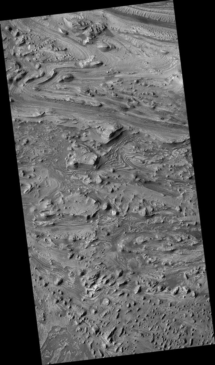
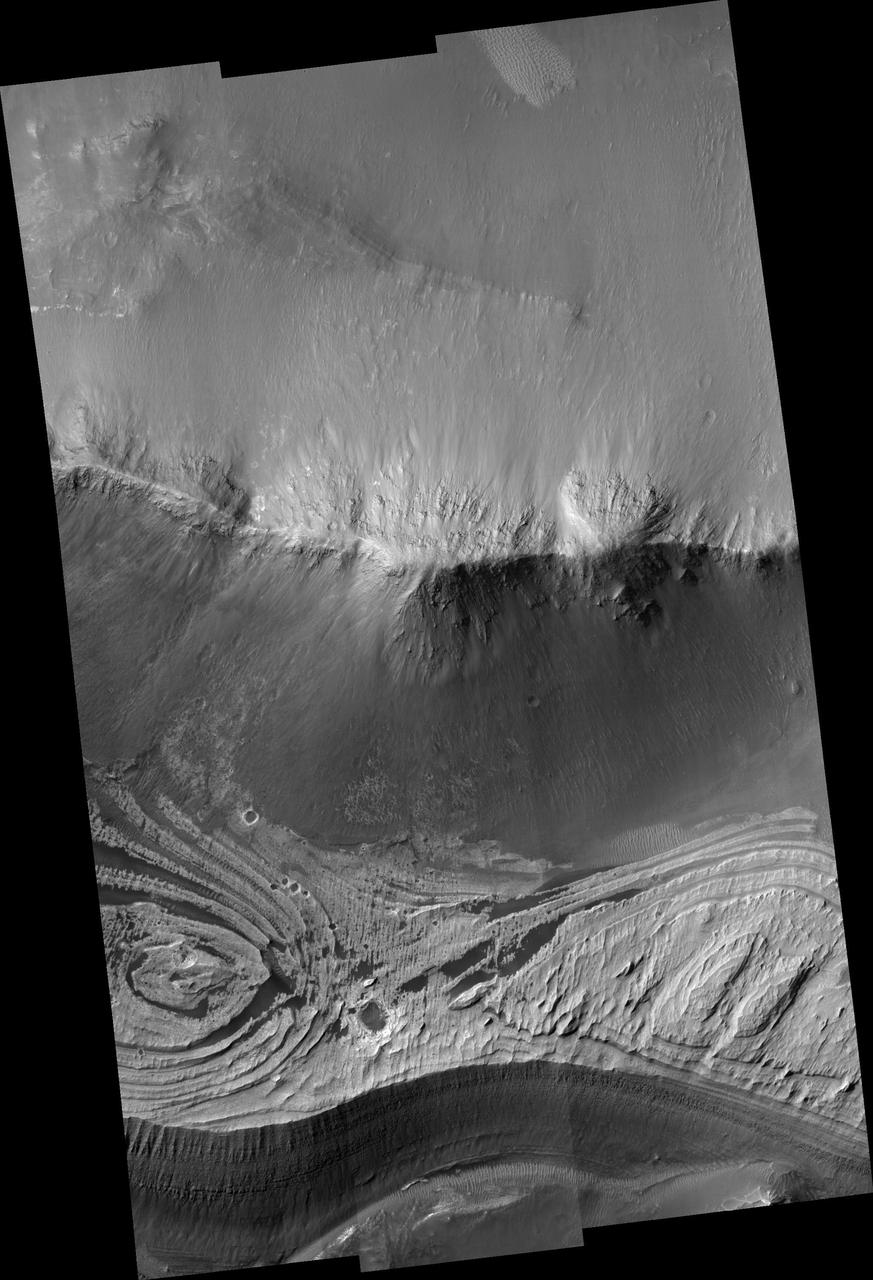
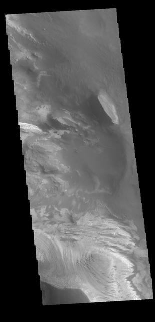
The bottom half of this image of central Candor Chasma shows a surface topography called chaos. Chaos is a region of small to medium sized mesas surrounded by valleys that are usually the same elevation. In this image sand and sand dunes are accumulating in the valleys and increasing in depth. Candor Chasma is one of the largest canyons that make up Valles Marineris. It is approximately 810 km long (503 miles) and has is divided into two regions - eastern and western Candor. Candor is located south of Ophir Chasma and north of Melas Chasma. The border with Melas Chasma contains many large landslide deposits. The floor of Candor Chasma includes a variety of landforms, including layered deposits, dunes, landslide deposits and steep sided cliffs and mesas. Many forms of erosion have shaped Chandor Chasma. There is evidence of wind and water erosion, as well as significant gravity driven mass wasting (landslides). The Odyssey spacecraft has spent over 15 years in orbit around Mars, circling the planet more than 69000 times. It holds the record for longest working spacecraft at Mars. THEMIS, the IR/VIS camera system, has collected data for the entire mission and provides images covering all seasons and lighting conditions. Over the years many features of interest have received repeated imaging, building up a suite of images covering the entire feature. From the deepest chasma to the tallest volcano, individual dunes inside craters and dune fields that encircle the north pole, channels carved by water and lava, and a variety of other feature, THEMIS has imaged them all. For the next several months the image of the day will focus on the Tharsis volcanoes, the various chasmata of Valles Marineris, and the major dunes fields. We hope you enjoy these images! Orbit Number: 18251 Latitude: -6.45589 Longitude: 287.35 Instrument: VIS Captured: 2006-01-25 01:39 https://photojournal.jpl.nasa.gov/catalog/PIA22168
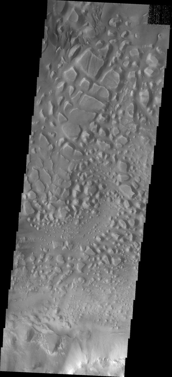
This image of central Candor Chasma shows a surface topography called chaos. Chaos is a region of small to medium sized mesas surrounded by valleys that are usually the same elevation. In this image sand and sand dunes have accumulated in the valleys near the top of the image, but are not as prevalent towards the bottom of the image. Candor Chasma is one of the largest canyons that make up Valles Marineris. It is approximately 810 km long (503 miles) and has is divided into two regions - eastern and western Candor. Candor is located south of Ophir Chasma and north of Melas Chasma. The border with Melas Chasma contains many large landslide deposits. The floor of Candor Chasma includes a variety of landforms, including layered deposits, dunes, landslide deposits and steep sided cliffs and mesas. Many forms of erosion have shaped Chandor Chasma. There is evidence of wind and water erosion, as well as significant gravity driven mass wasting (landslides). The Odyssey spacecraft has spent over 15 years in orbit around Mars, circling the planet more than 69000 times. It holds the record for longest working spacecraft at Mars. THEMIS, the IR/VIS camera system, has collected data for the entire mission and provides images covering all seasons and lighting conditions. Over the years many features of interest have received repeated imaging, building up a suite of images covering the entire feature. From the deepest chasma to the tallest volcano, individual dunes inside craters and dune fields that encircle the north pole, channels carved by water and lava, and a variety of other feature, THEMIS has imaged them all. For the next several months the image of the day will focus on the Tharsis volcanoes, the various chasmata of Valles Marineris, and the major dunes fields. We hope you enjoy these images! Orbit Number: 26213 Latitude: -7.25478 Longitude: 287.032 Instrument: VIS Captured: 2007-11-11 14:48 https://photojournal.jpl.nasa.gov/catalog/PIA22169
This THEMIS image shows part of western Candor Chasma. Near the bottom of the image is an impact crater. Impact craters are relatively rare within all the canyons of Valles Marineris. The lack of craters may be due to the relative young age of the canyon system - younger surfaces on Mars have fewer craters than older surfaces. Another factor is that the high rate of erosion and deposition within the canyon erodes the ejecta blanket and fills in the crater, effectively removing the crater over time. Candor Chasma is one of the largest canyons that make up Valles Marineris. It is approximately 810 km long (503 miles) and has is divided into two regions - eastern and western Candor. Candor is located south of Ophir Chasma and north of Melas Chasma. The border with Melas Chasma contains many large landslide deposits. The floor of Candor Chasma includes a variety of landforms, including layered deposits, dunes, landslide deposits and steep sided cliffs and mesas. Many forms of erosion have shaped Chandor Chasma. There is evidence of wind and water erosion, as well as significant gravity driven mass wasting (landslides). The Odyssey spacecraft has spent over 15 years in orbit around Mars, circling the planet more than 69000 times. It holds the record for longest working spacecraft at Mars. THEMIS, the IR/VIS camera system, has collected data for the entire mission and provides images covering all seasons and lighting conditions. Over the years many features of interest have received repeated imaging, building up a suite of images covering the entire feature. From the deepest chasma to the tallest volcano, individual dunes inside craters and dune fields that encircle the north pole, channels carved by water and lava, and a variety of other feature, THEMIS has imaged them all. For the next several months the image of the day will focus on the Tharsis volcanoes, the various chasmata of Valles Marineris, and the major dunes fields. We hope you enjoy these images! Orbit Number: 16479 Latitude: -5.02282 Longitude: 284.268 Instrument: VIS Captured: 2005-09-01 04:09 https://photojournal.jpl.nasa.gov/catalog/PIA22166
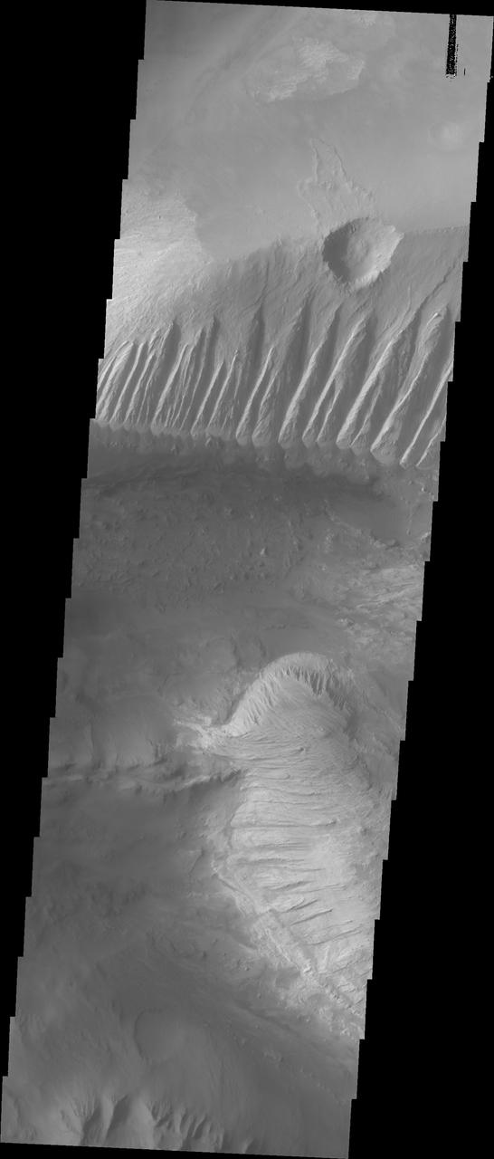
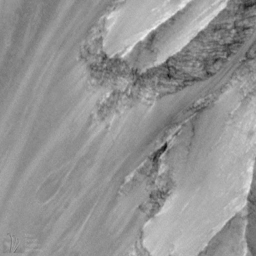
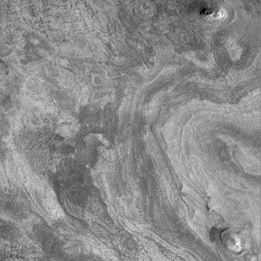
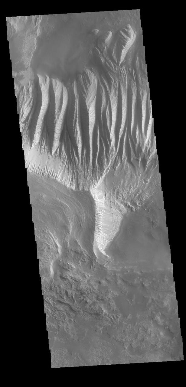
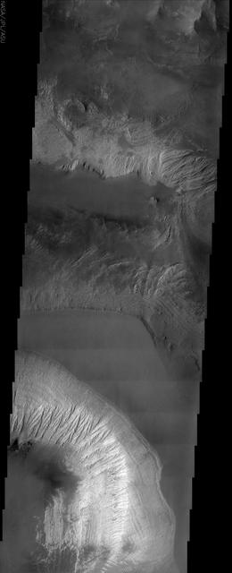
This image shows part of eastern Candor Chasma. In the middle of the image is a set of linear ridges and valleys. These features are called yardangs and are created by uniform winds that winnow away materials. Once the valleys are formed the wind then is funneled through the valley and erosion continues more in the valley than on the ridges. At the bottom of the valleys there are sand materials covering the slope between the valleys and the surrounding chasma floor. Beyond this coating of sand there are darker sand deposits where wind has accumulated the sand into larger dunes. The brighter mesa on the right side of the image has also been wind eroded into yardangs, but are aligned in a different direction than the larger yardangs. This indicates that wind directions within the canyon have changed over time. Candor Chasma is one of the largest canyons that make up Valles Marineris. It is approximately 810 km long (503 miles) and has is divided into two regions - eastern and western Candor. Candor is located south of Ophir Chasma and north of Melas Chasma. The border with Melas Chasma contains many large landslide deposits. The floor of Candor Chasma includes a variety of landforms, including layered deposits, dunes, landslide deposits and steep sided cliffs and mesas. Many forms of erosion have shaped Chandor Chasma. There is evidence of wind and water erosion, as well as significant gravity driven mass wasting (landslides). The Odyssey spacecraft has spent over 15 years in orbit around Mars, circling the planet more than 69000 times. It holds the record for longest working spacecraft at Mars. THEMIS, the IR/VIS camera system, has collected data for the entire mission and provides images covering all seasons and lighting conditions. Over the years many features of interest have received repeated imaging, building up a suite of images covering the entire feature. From the deepest chasma to the tallest volcano, individual dunes inside craters and dune fields that encircle the north pole, channels carved by water and lava, and a variety of other feature, THEMIS has imaged them all. For the next several months the image of the day will focus on the Tharsis volcanoes, the various chasmata of Valles Marineris, and the major dunes fields. We hope you enjoy these images! Orbit Number: 10551 Latitude: -6.93639 Longitude: 288.562 Instrument: VIS Captured: 2004-05-01 02:24 https://photojournal.jpl.nasa.gov/catalog/PIA22165
In this image from NASA Mars Odyssey, a mantling layer of sediment slumps off the edge of a mesa in Candor Chasma producing a ragged pattern of erosion that hints at the presence of a volatile component mixed in with the sediment.
This image from NASA Mars Reconnaissance Orbiter shows an area of layered deposits in Candor Chasma. Sheets and dunes of dark-toned sand cover the light-toned, layered bedrock.
Today's VIS image shows part of Ceti Mensa. This mesa feature is located in western Candor Chasma and is composed of layered deposits and sand dunes. Orbit Number: 88887 Latitude: -5.94433 Longitude: 284.64 Instrument: VIS Captured: 2021-12-28 06:13 https://photojournal.jpl.nasa.gov/catalog/PIA25341
This image shows part of western Candor and the erosion of a large mesa. Layered materials are visible throughout the image. The dark material with the linear appearance in the middle of the image are sand dunes. Sand dunes are created by wind action. At the present time, wind is the active process shaping the surface. Candor Chasma is one of the largest canyons that make up Valles Marineris. It is approximately 810 km long (503 miles) and has is divided into two regions - eastern and western Candor. Candor is located south of Ophir Chasma and north of Melas Chasma. The border with Melas Chasma contains many large landslide deposits. The floor of Candor Chasma includes a variety of landforms, including layered deposits, dunes, landslide deposits and steep sided cliffs and mesas. Many forms of erosion have shaped Chandor Chasma. There is evidence of wind and water erosion, as well as significant gravity driven mass wasting (landslides). The Odyssey spacecraft has spent over 15 years in orbit around Mars, circling the planet more than 69000 times. It holds the record for longest working spacecraft at Mars. THEMIS, the IR/VIS camera system, has collected data for the entire mission and provides images covering all seasons and lighting conditions. Over the years many features of interest have received repeated imaging, building up a suite of images covering the entire feature. From the deepest chasma to the tallest volcano, individual dunes inside craters and dune fields that encircle the north pole, channels carved by water and lava, and a variety of other feature, THEMIS has imaged them all. For the next several months the image of the day will focus on the Tharsis volcanoes, the various chasmata of Valles Marineris, and the major dunes fields. We hope you enjoy these images! Orbit Number: 6245 Latitude: -5.77639 Longitude: 284.339 Instrument: VIS Captured: 2003-05-12 14:49 https://photojournal.jpl.nasa.gov/catalog/PIA22161
This VIS image shows part of the border between Chandor and Melas Chasmata. The entire image is landslide deposits. It is very common for landslides to develop linear surface grooves that parallel the direction of flow. Candor Chasma is one of the largest canyons that make up Valles Marineris. It is approximately 810 km long (503 miles) and has is divided into two regions - eastern and western Candor. Candor is located south of Ophir Chasma and north of Melas Chasma. The border with Melas Chasma contains many large landslide deposits. The floor of Candor Chasma includes a variety of landforms, including layered deposits, dunes, landslide deposits and steep sided cliffs and mesas. Many forms of erosion have shaped Chandor Chasma. There is evidence of wind and water erosion, as well as significant gravity driven mass wasting (landslides). The Odyssey spacecraft has spent over 15 years in orbit around Mars, circling the planet more than 69000 times. It holds the record for longest working spacecraft at Mars. THEMIS, the IR/VIS camera system, has collected data for the entire mission and provides images covering all seasons and lighting conditions. Over the years many features of interest have received repeated imaging, building up a suite of images covering the entire feature. From the deepest chasma to the tallest volcano, individual dunes inside craters and dune fields that encircle the north pole, channels carved by water and lava, and a variety of other feature, THEMIS has imaged them all. For the next several months the image of the day will focus on the Tharsis volcanoes, the various chasmata of Valles Marineris, and the major dunes fields. We hope you enjoy these images! Orbit Number: 17003 Latitude: -8.20616 Longitude: 288.108 Instrument: VIS Captured: 2005-10-14 07:36 https://photojournal.jpl.nasa.gov/catalog/PIA22167
The THEMIS VIS camera contains 5 filters. The data from different filters can be combined in multiple ways to create a false color image. This false color image from NASA 2001 Mars Odyssey spacecraft shows part of the northern wall of Candor Chasma. Orbit Number: 7381 Latitude: -4.72297 Longitude: 283.559 Instrument: VIS Captured: 2003-08-14 03:05 http://photojournal.jpl.nasa.gov/catalog/PIA19481
The THEMIS VIS camera contains 5 filters. The data from different filters can be combined in multiple ways to create a false color image. These false color images may reveal subtle variations of the surface not easily identified in a single band image. Today's false color image shows part of the floor of Candor Chasma. Orbit Number: 10963 Latitude: -5.19848 Longitude: 283.975 Instrument: VIS Captured: 2004-06-04 00:30 http://photojournal.jpl.nasa.gov/catalog/PIA19784
The THEMIS VIS camera contains 5 filters. The data from different filters can be combined in multiple ways to create a false color image. This image from NASA 2001 Mars Odyssey spacecraft shows part of Candor Chasma. Orbit Number: 14532 Latitude: -6.98504 Longitude: 288.916 Instrument: VIS Captured: 2005-03-24 20:53 http://photojournal.jpl.nasa.gov/catalog/PIA20087
The THEMIS VIS camera contains 5 filters. The data from different filters can be combined in multiple ways to create a false color image. These false color images may reveal subtle variations of the surface not easily identified in a single band image. Today's false color image shows part of Candor Chasma. Orbit Number: 9428 Latitude: -5.22568 Longitude: 283.582 Instrument: VIS Captured: 2004-01-29 15:22 http://photojournal.jpl.nasa.gov/catalog/PIA19748
The THEMIS VIS camera contains 5 filters. The data from different filters can be combined in multiple ways to create a false color image. This false color image from NASA 2001 Mars Odyssey spacecraft shows part of Candor Chasma. Orbit Number: 6407 Latitude: -7.24526 Longitude: 292.303 Instrument: VIS Captured: 2003-05-25 22:52 http://photojournal.jpl.nasa.gov/catalog/PIA19265
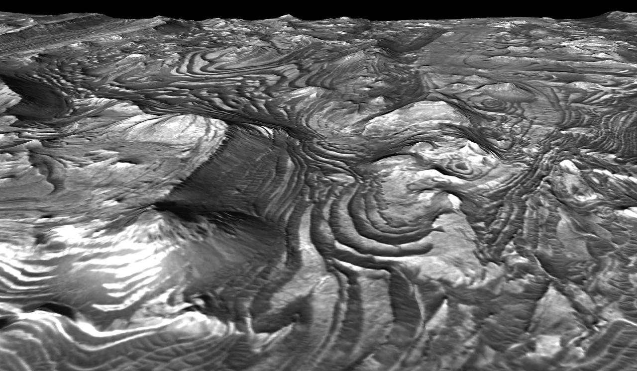
Candor Chasma in central Valles Marineris is filled with light-toned layered deposits thought to be sandstones, perhaps formed in an ancient wet and potentially habitable environment. The CRISM instrument on MRO has acquired thousands high-resolution spectral images across Mars, often with simultaneous coverage by HiRISE, but sometimes, for a variety of reasons, without HiRISE coverage. We are now trying to complete coordinated coverage over such locations, to enable geologic interpretations based on both the compositional information of CRISM and the high-resolution imaging of HiRISE. https://photojournal.jpl.nasa.gov/catalog/PIA23676
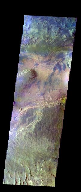
Today's VIS image shows parts of Ophir Chasma (top of image) and Candor Chasma (bottom of image). Both are part of Valles Marineris. Candor Chasma is approximately 810 km long (503 miles) and is divided into two regions — eastern and western Candor. This image is of western Candor Chasma. The floor of Candor Chasma includes a variety of landforms, including layered deposits, dunes, landslide deposits and steep sided cliffs and mesas. Many forms of erosion have shaped Candor Chasma. There is evidence of wind and water erosion, as well as significant gravity driven mass wasting (landslides). Ophir Chasma is approximately 317km long (197 miles). This image shows the western end of Ophir Chasma. A landslide is visible in Ophir Chasma. Orbit Number: 82086 Latitude: -4.67658 Longitude: 285.773 Instrument: VIS Captured: 2020-06-16 06:38 https://photojournal.jpl.nasa.gov/catalog/PIA24123
The THEMIS VIS camera contains 5 filters. The data from different filters can be combined in multiple ways to create a false color image. These false color images may reveal subtle variations of the surface not easily identified in a single band image. Today's false color image shows part of Candor Chasma. The bright tones in this image are the canyon walls, the bluer material is sand and other debris on the canyon floor. Orbit Number: 15156 Latitude: -6.9737 Longitude: 288.593 Instrument: VIS Captured: 2005-05-15 05:54 http://photojournal.jpl.nasa.gov/catalog/PIA20103
This image captured by NASA 2001 Mars Odyssey spacecraft shows the region between Candor Chasma and Melas Chasma.
This sand sheet and dune field occurs on the floor of Candor Chasma
This MOC image shows a portion of a mesa in eastern Candor Chasma
Today's VIS image shows western parts of Ophir Chasma (top of image) and Candor Chasma (bottom of image). Both are part of Valles Marineris. Candor Chasma is approximately 810 km long (503 miles) and is divided into two regions – eastern and western Candor. Ophir Chasma is approximately 317km long (197 miles). The floors of both chasmata include a variety of landforms, including layered deposits, dunes, landslide deposits and steep sided cliffs and mesas. Many forms of erosion have shaped both chasmata. There is evidence of wind and water erosion, as well as significant gravity driven mass wasting (landslides). Orbit Number: 93311 Latitude: -4.15087 Longitude: 286.533 Instrument: VIS Captured: 2022-12-27 11:51 https://photojournal.jpl.nasa.gov/catalog/PIA25850
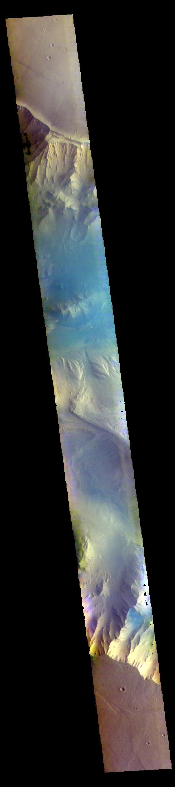
This false-color infrared image from NASA Mars Odyssey was acquired over the region of Ophir and Candor Chasma in Valles Marineris.