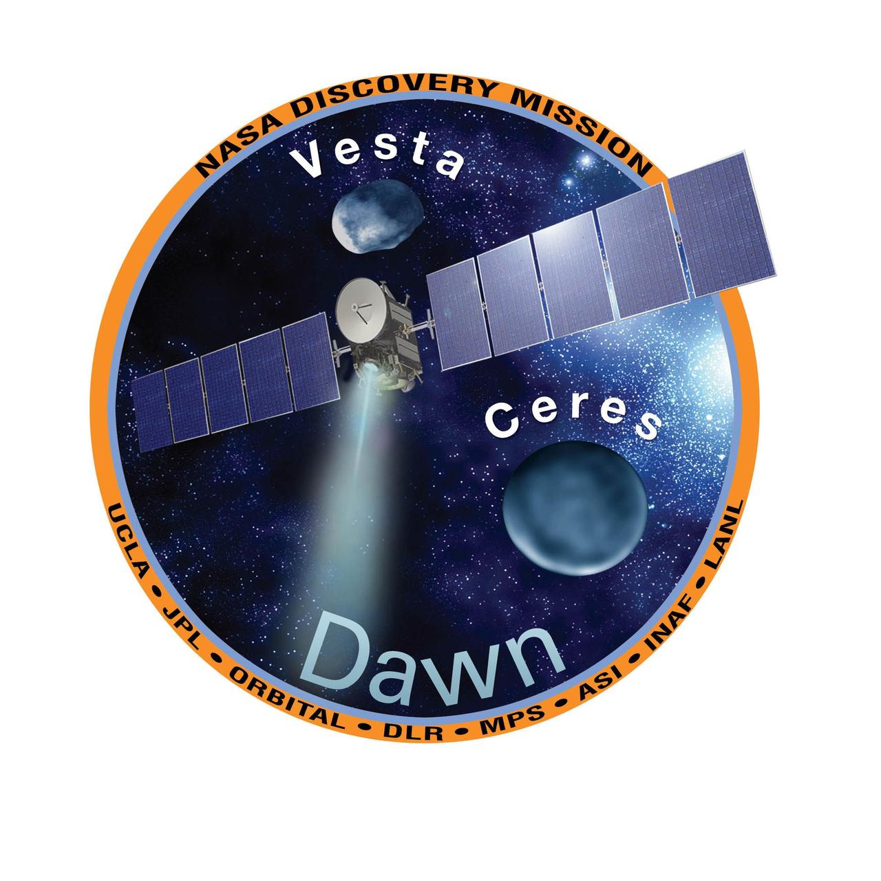
NASA Dawn mission patch, part of the Dawn Mission Art series. http://photojournal.jpl.nasa.gov/catalog/PIA19375
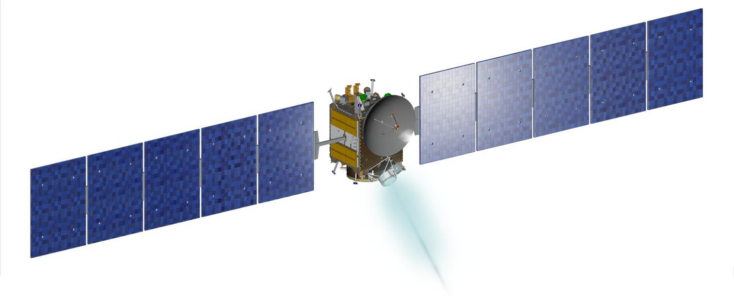
Artist rendition of NASA Dawn spacecraft, part of the Dawn Mission Art series. http://photojournal.jpl.nasa.gov/catalog/PIA19376
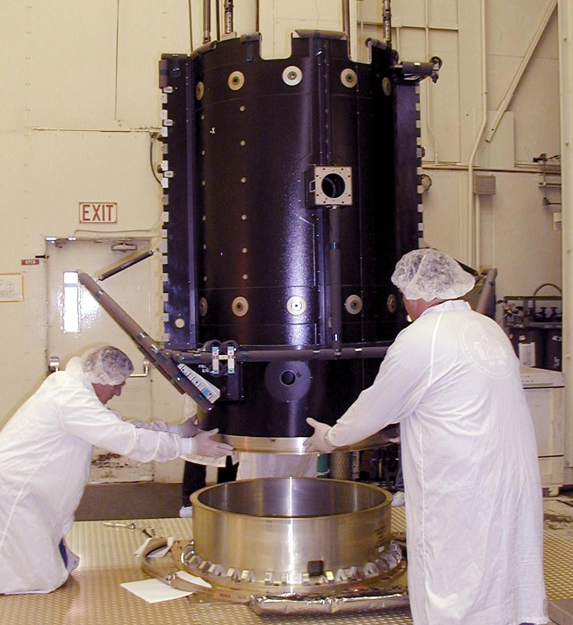
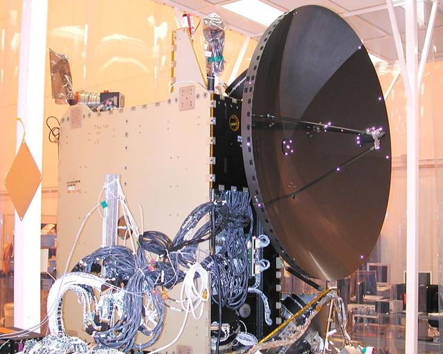
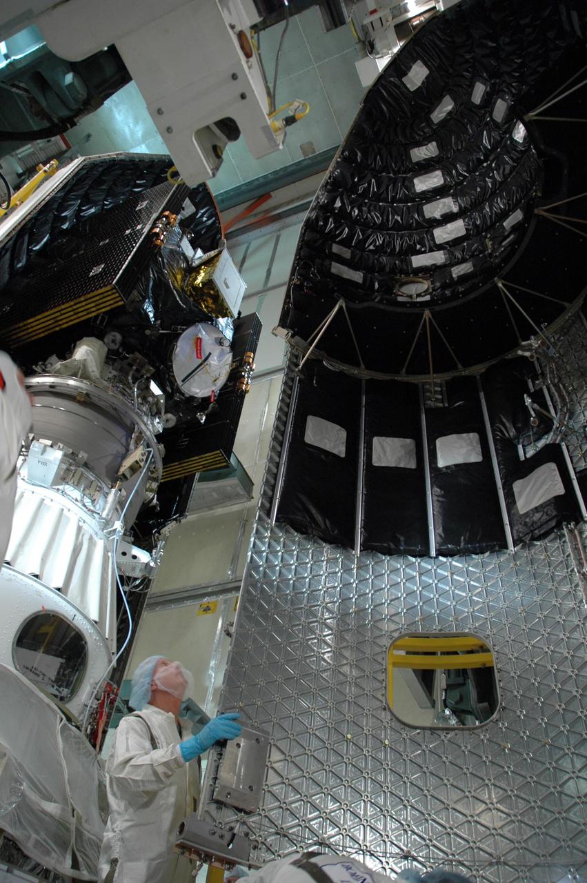
NASA Dawn spacecraft being assembled.

Dawn cartoon character, part of Dawn Mission Art series. http://photojournal.jpl.nasa.gov/catalog/PIA19381
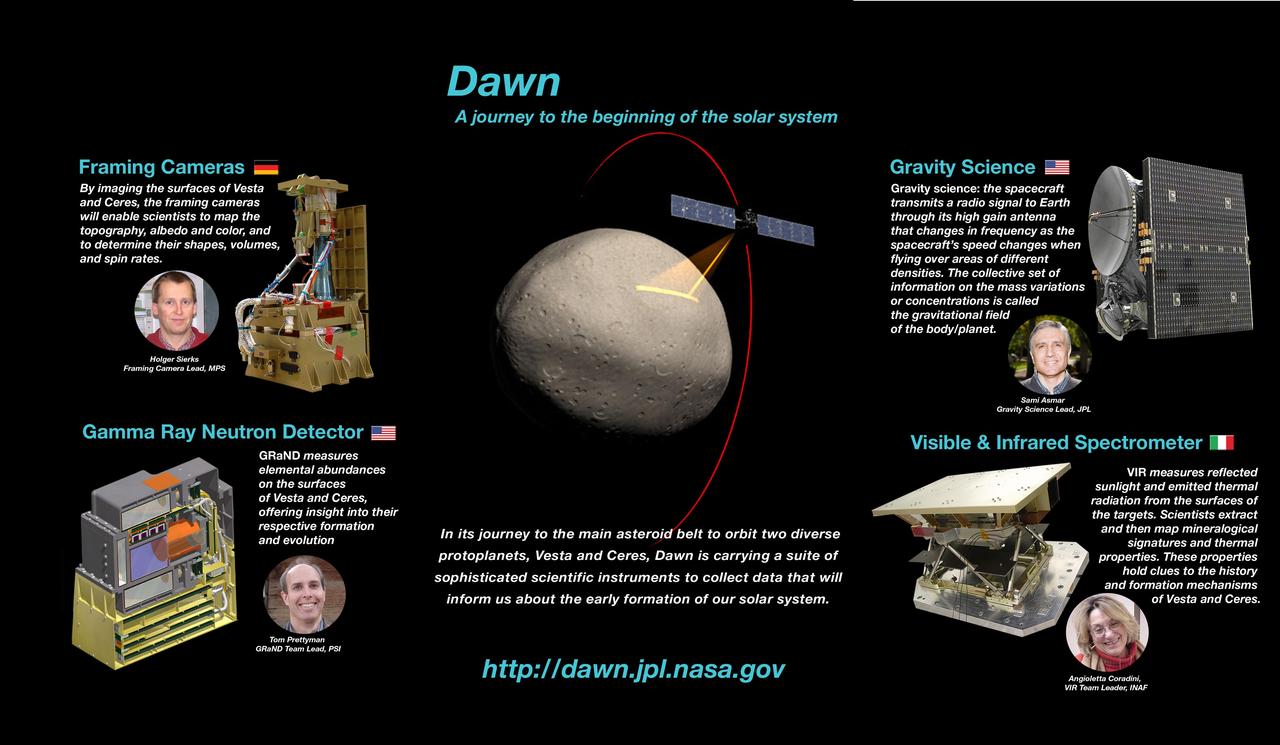
NASA Dawn instrumentation poster, part of the Dawn Mission Art series. http://photojournal.jpl.nasa.gov/catalog/PIA19374
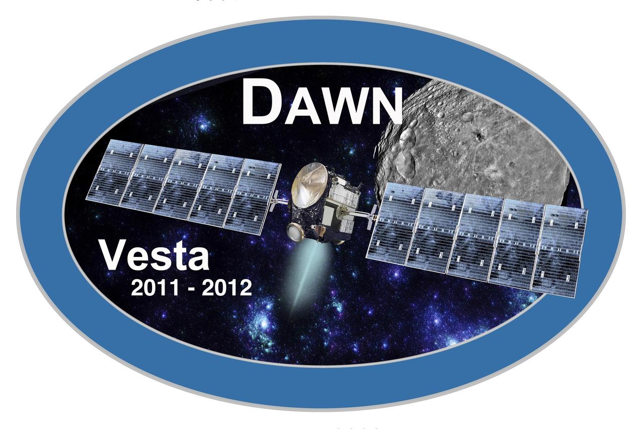
Dawn mission Vesta Logo, part of NASA Dawn Mission Art series. http://photojournal.jpl.nasa.gov/catalog/PIA19372
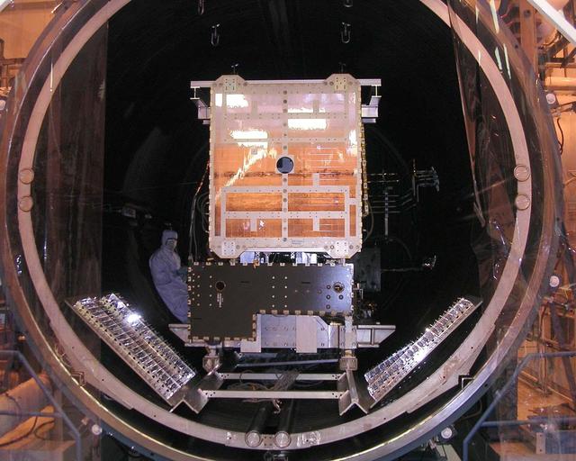
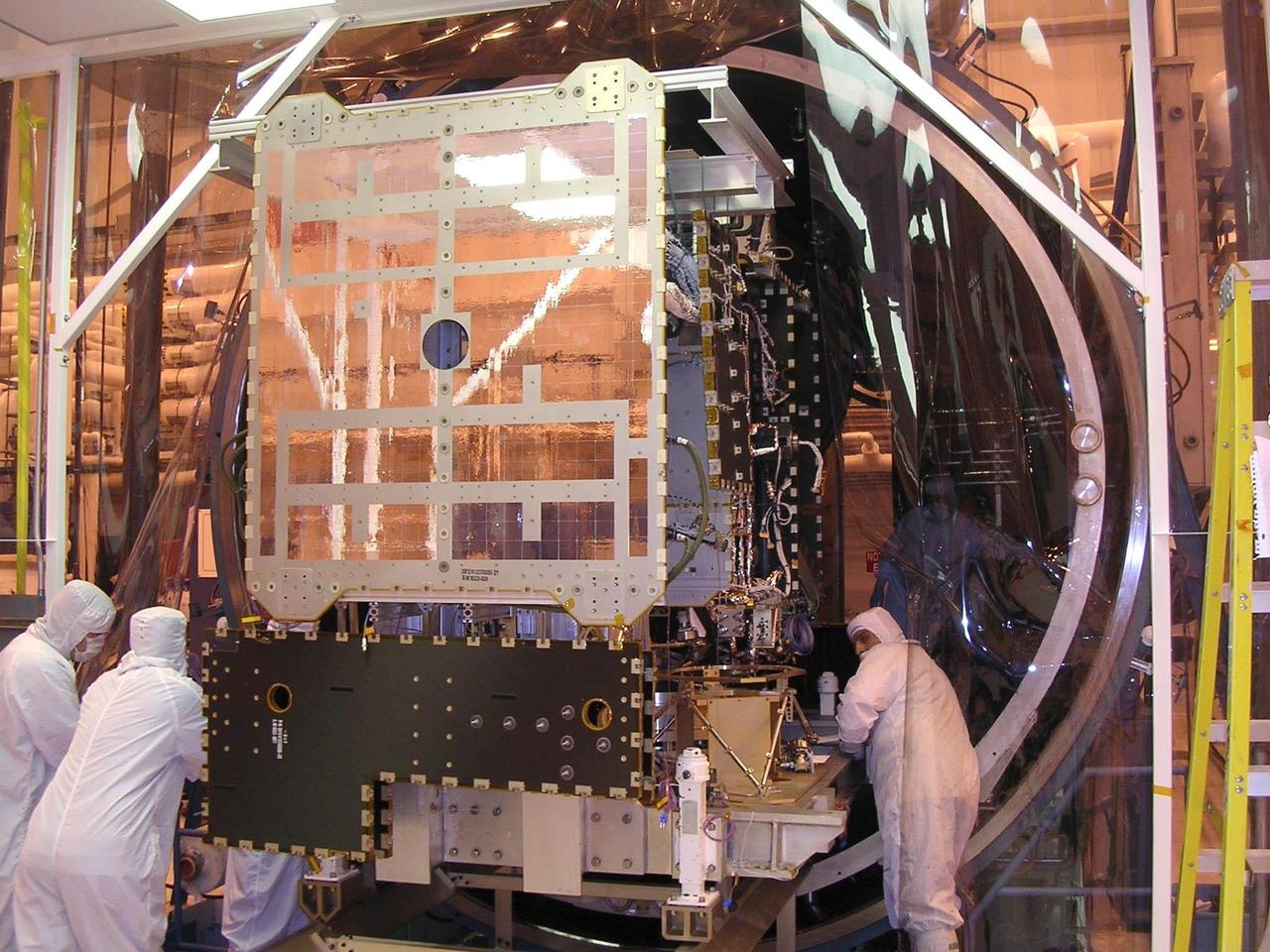
NASA Dawn spacecraft in thermal vacuum chamber.
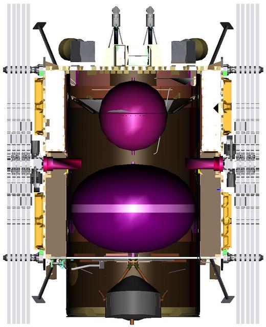
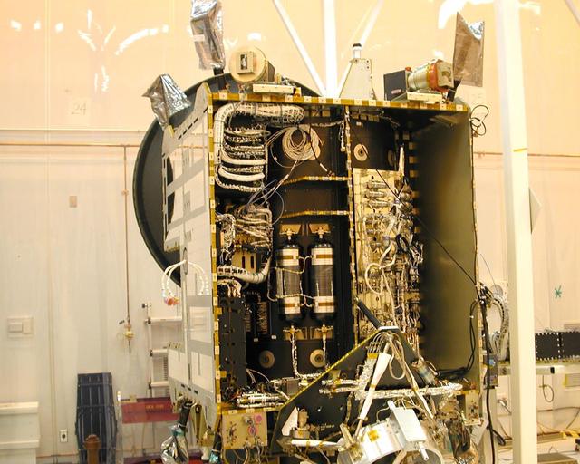
This illustration shows an inside view of the NASA Dawn spacecraft.
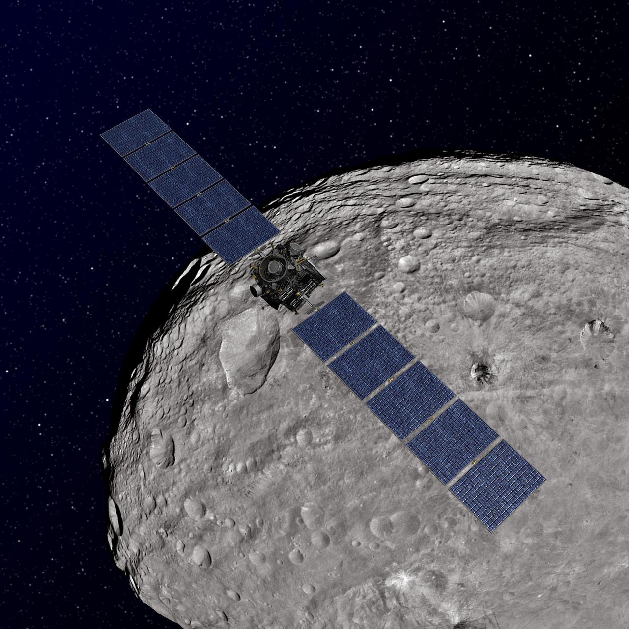
This artist concept shows NASA Dawn spacecraft orbiting the giant asteroid Vesta. The depiction of Vesta is based on images obtained by Dawn framing cameras.
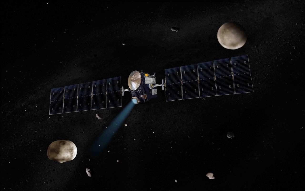
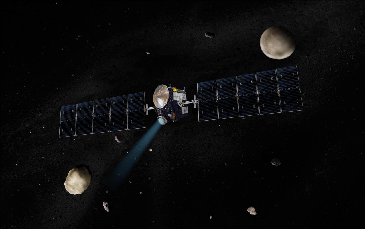
Artist concept of NASA Dawn spacecraft. The giant asteroid Vesta, Dawn next destination, is on the lower left. Another larger asteroid and Dawn second destination, Ceres, is on the upper right.
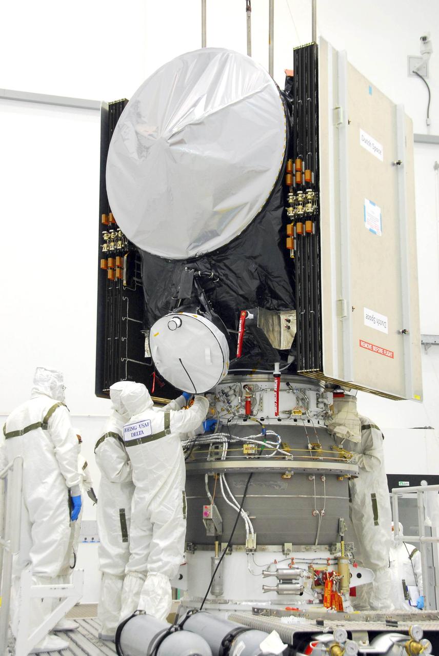
Workers secure the attachments of NASA Dawn spacecraft onto the upper stage booster.
Artist concept of Earth reflection in Dawn spacecraft.

Artist concept of Dawn spacecraft leaving Earth.

Artist concept of the Dawn spacecraft orbiting Ceres.
Artist concept of the Dawn spacecraft with Vesta and Ceres.
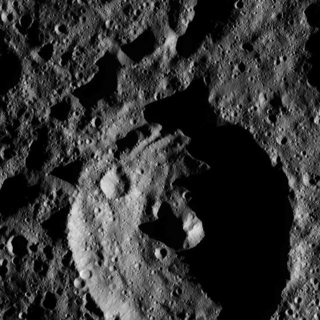
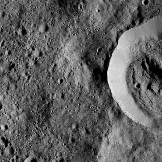
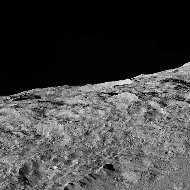
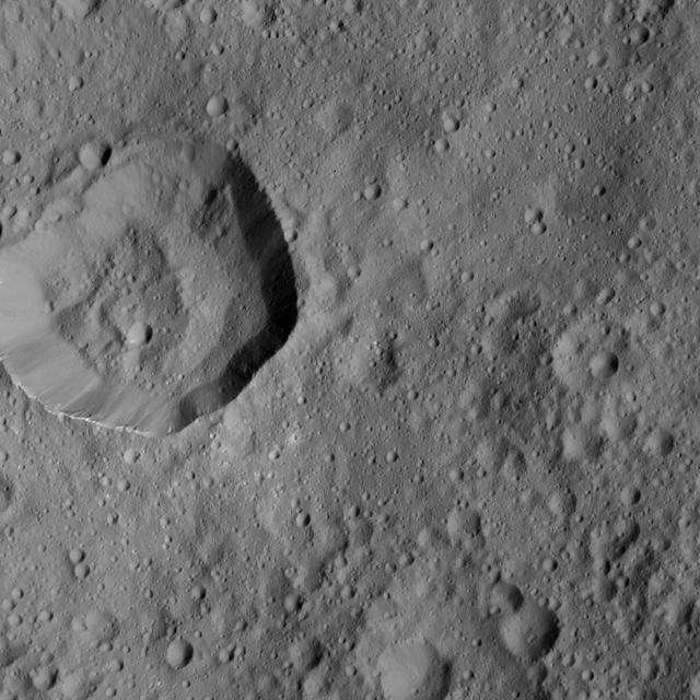
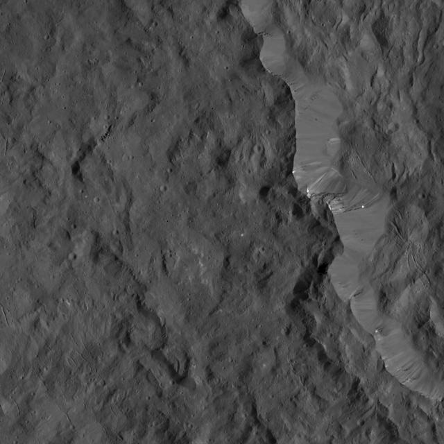
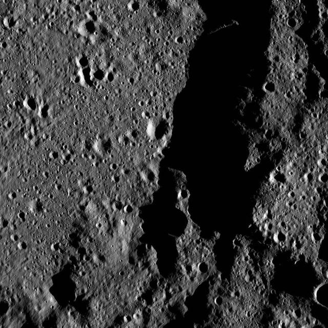
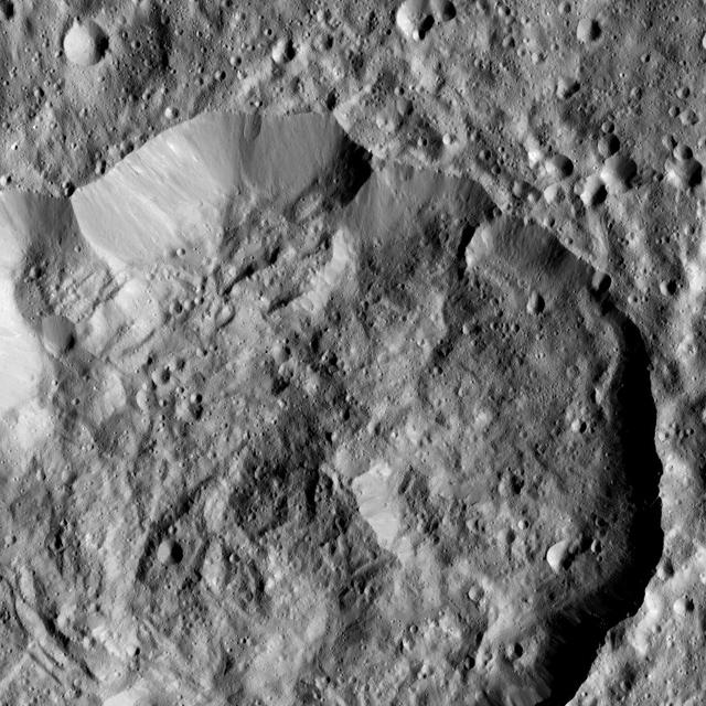
The rim of Ezinu Crater is seen in this view from NASA Dawn spacecraft.
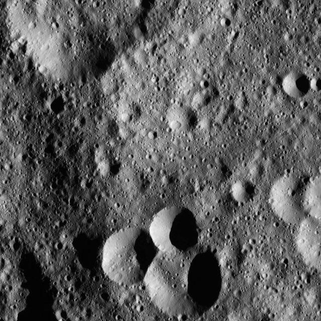
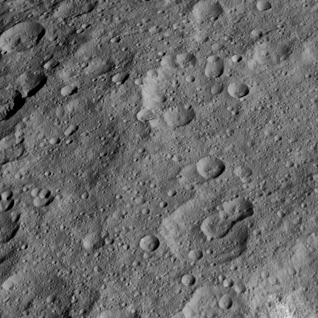
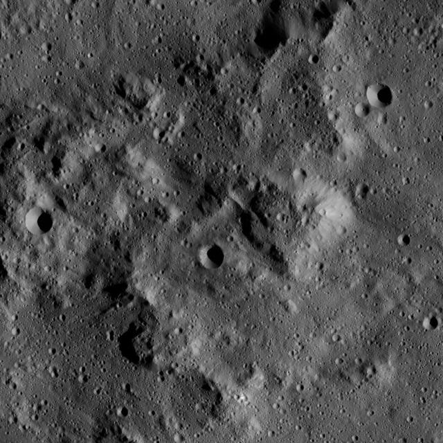
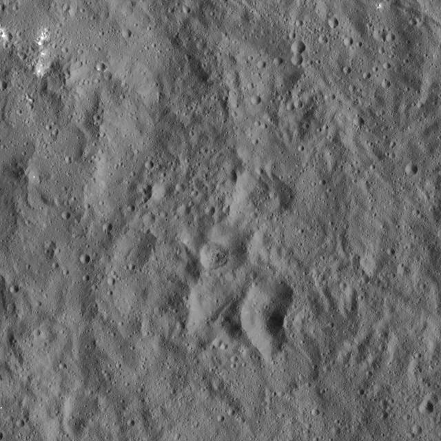
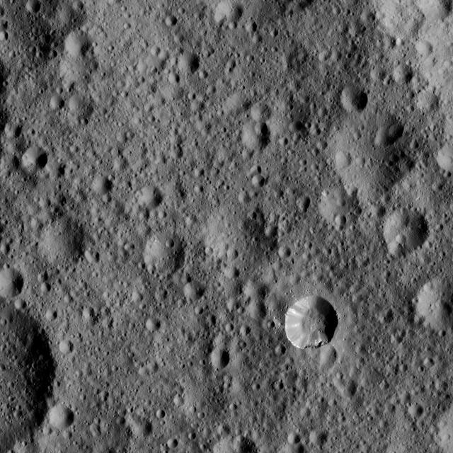
This image, taken by NASA Dawn spacecraft, shows a variety of small craters in the northern hemisphere of Ceres. The majority of Ceres images from Dawn show heavily cratered terrains such as this.
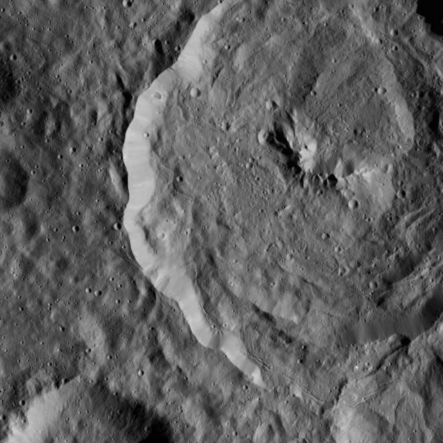
Tupo Crater on Ceres is seen in this view from NASA Dawn spacecraft. This crater, located in the southern hemisphere of Ceres, was named for the Polynesian god of turmeric. Dawn captured the scene on Dec. 24, 2015.
This image from NASA Dawn mission reveals the creeping dawn over the north pole of the giant asteroid Vesta now that sunlight is shining over that area. The mosaic shows two large impact craters.
NASA Dawn spacecraft flys over dwarf planet Ceres which Dawn has been orbiting for mre than a year, providing us with fascinating views of an alien world.
Exposed interior of NASA Dawn spacecraft showing ion propulsion system xenon feed system.
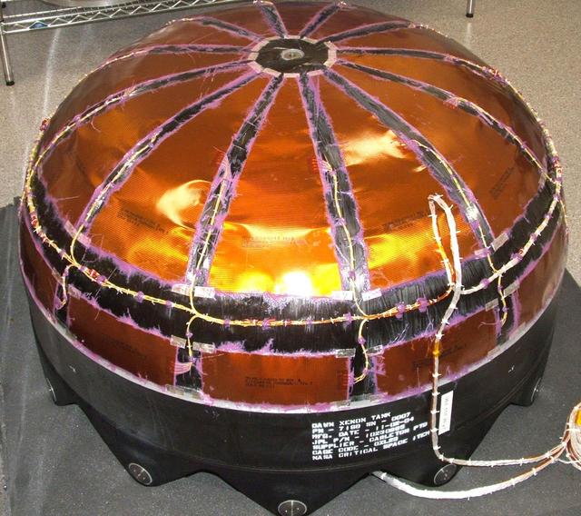
This image shows NASA Dawn spacecraft Xenon tank -- composite overwrapped pressure vessel with titanium liner.
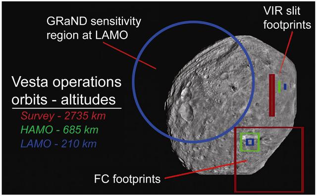
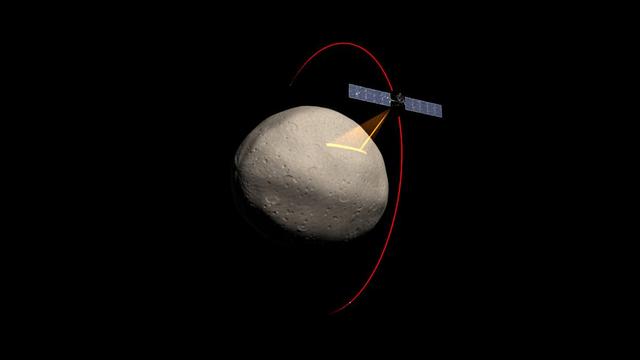
This graphic from NASA's Dawn shows fields of view of Dawn instruments from Survey orbit (red), High Altitude Mapping Orbit (green), and Low Altitude Mapping Orbit (blue) and is part of the Mission Art series from NASA's Dawn mission. http://photojournal.jpl.nasa.gov/catalog/PIA19371
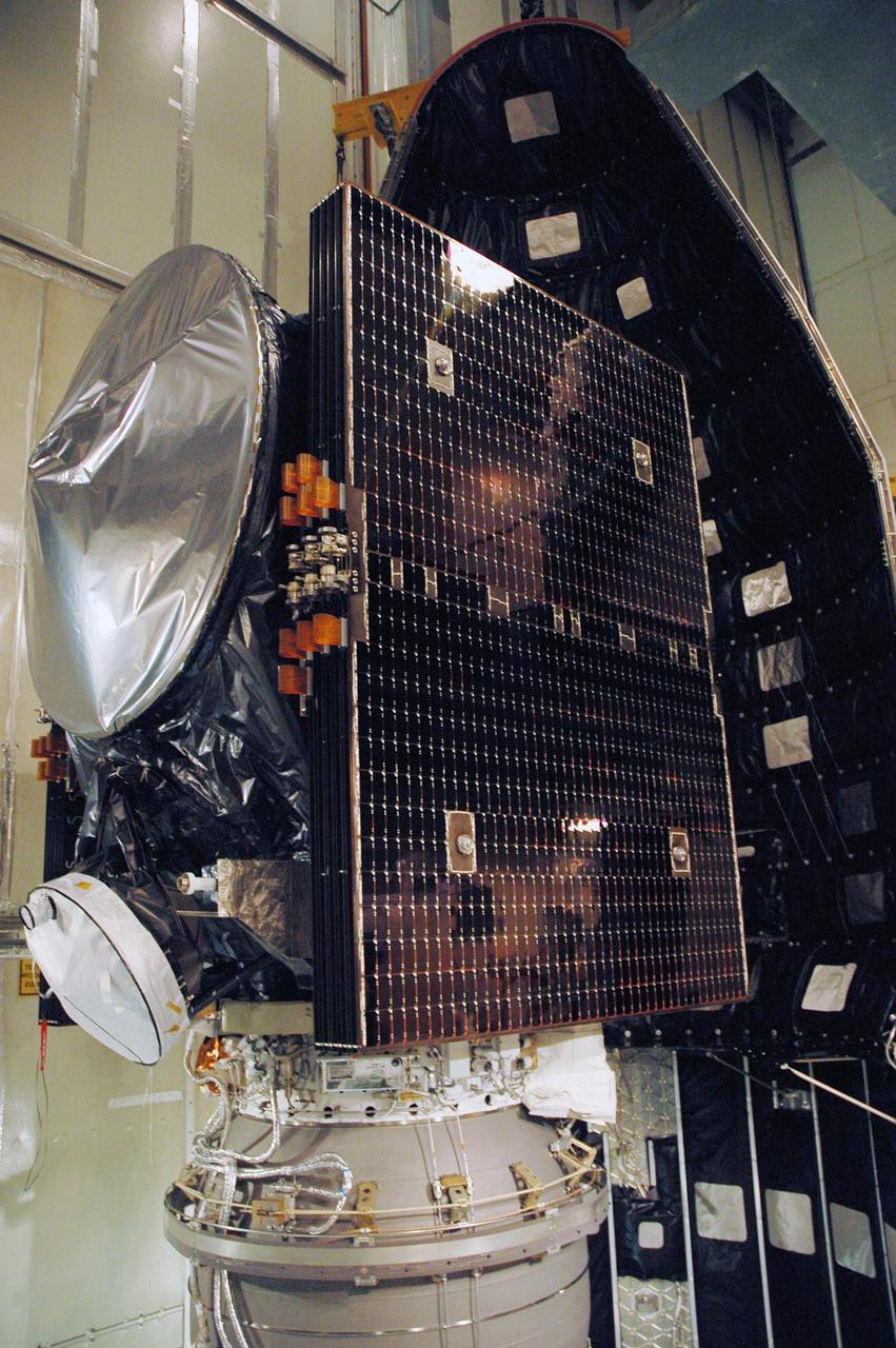
NASA Dawn spacecraft after installation of high gain antenna.
NASA Dawn spacecraft being moved into thermal vacuum chamber for bake-out.
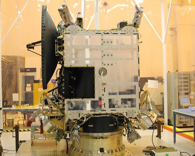
NASA Dawn spacecraft after installation of high gain antenna.

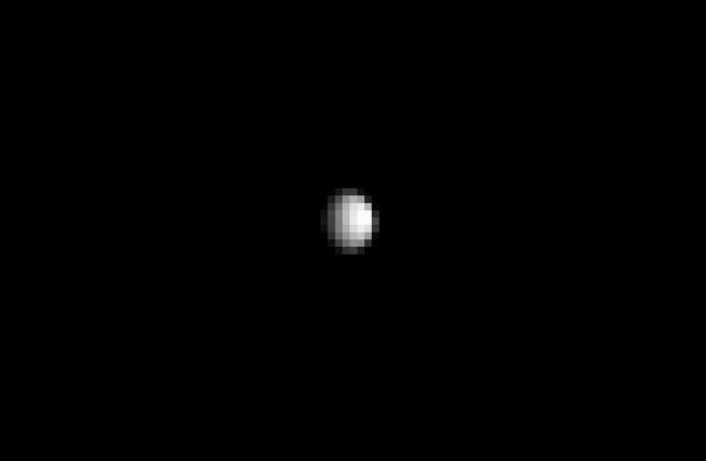
This is a raw image, taken Jan. 13, 2015, showing the dwarf planet Ceres as seen from the Dawn spacecraft on its approach. Dawn framing camera took this image at 238,000 miles 383,000 kilometers from Ceres. http://photojournal.jpl.nasa.gov/catalog/PIA19166
This image shows the first, unprocessed image obtained by NASA Dawn spacecraft of the giant asteroid Vesta in front of a background of stars. It was obtained by Dawn framing camera on May 3, 2011.

This illustration shows the core structure with ion propulsion system installed aboard NASA Dawn spacecraft.

This processed image, taken Jan. 13, 2015, shows the dwarf planet Ceres as seen from the Dawn spacecraft. The image hints at craters on the surface of Ceres. Dawn framing camera took this image at 238,000 miles 383,000 kilometers from Ceres. http://photojournal.jpl.nasa.gov/catalog/PIA19167
This view from NASA Dawn spacecraft shows a crater in the southern hemisphere of Ceres with a prominent central peak. The image is centered at approximately 63 degrees south latitude, 143 degrees east longitude. Dawn captured the scene on Dec. 24, 2015.
This view from NASA Dawn spacecraft shows high northern latitudes on Ceres. Dawn acquired the image on Oct. 17, 2015, from an altitude of 915 miles 1,470 kilometers. It has a resolution of 450 feet 140 meters per pixel. http://photojournal.jpl.nasa.gov/catalog/PIA20138
This view from NASA Dawn spacecraft captures the northern rim of Toharu Crater on Ceres. Dawn captured the scene on Dec. 24, 2015 from its low-altitude mapping orbit LAMO, at an approximate altitude of 240 miles 385 kilometers above Ceres.
This frame from a movie presents a series of animations showing NASA Dawn spacecraft traveling to and operating at the giant asteroid Vesta.
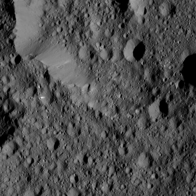
This image, taken by NASA Dawn spacecraft, shows a knobby surface on Ceres. The region is adjacent to the giant impact crater Urvara.
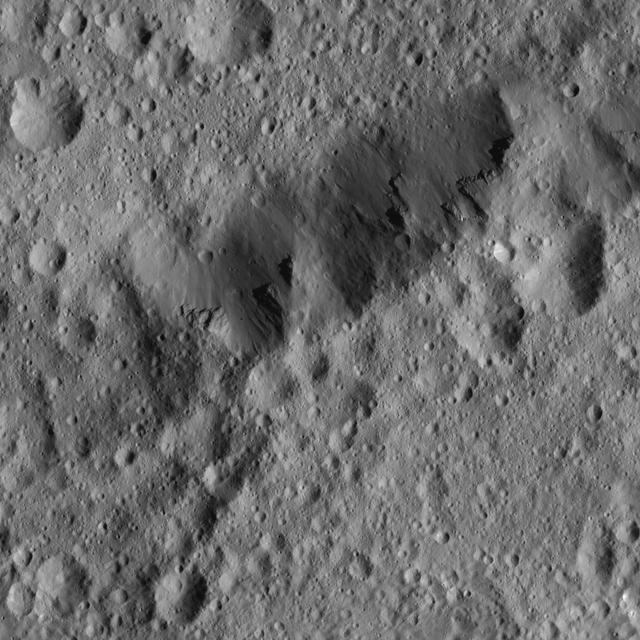
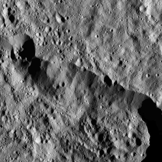
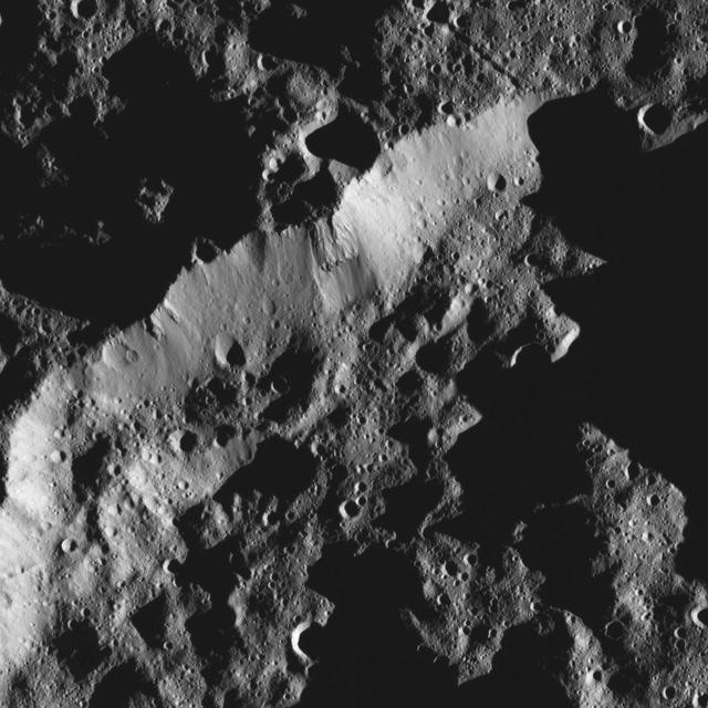
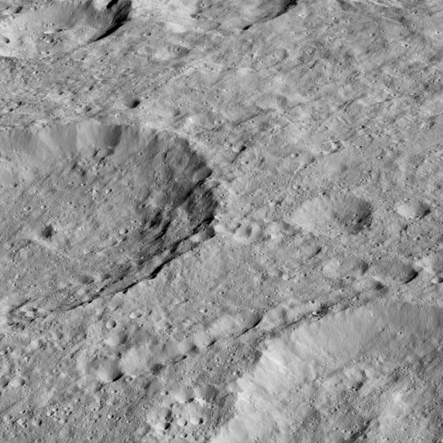
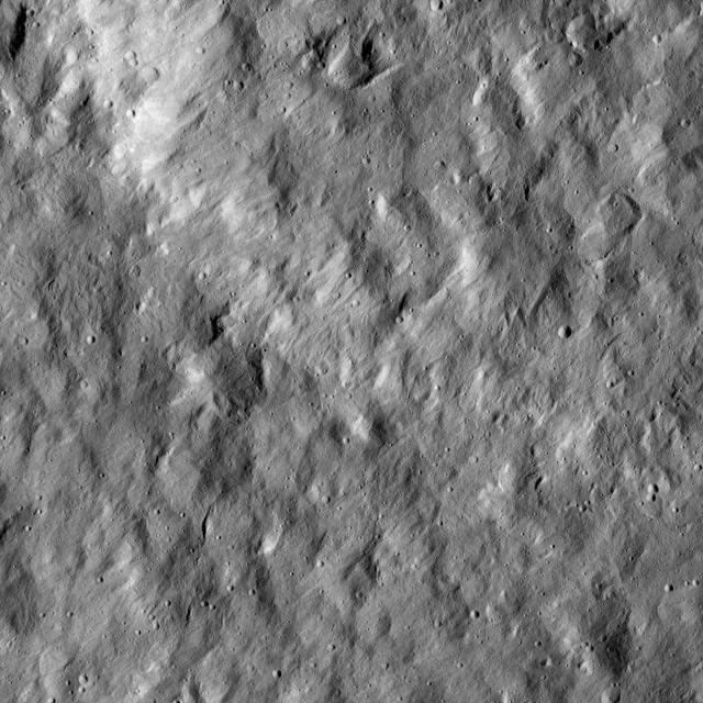
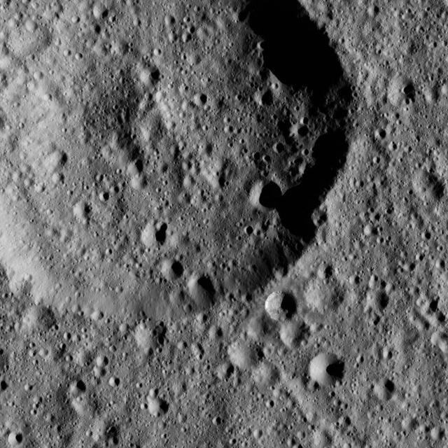
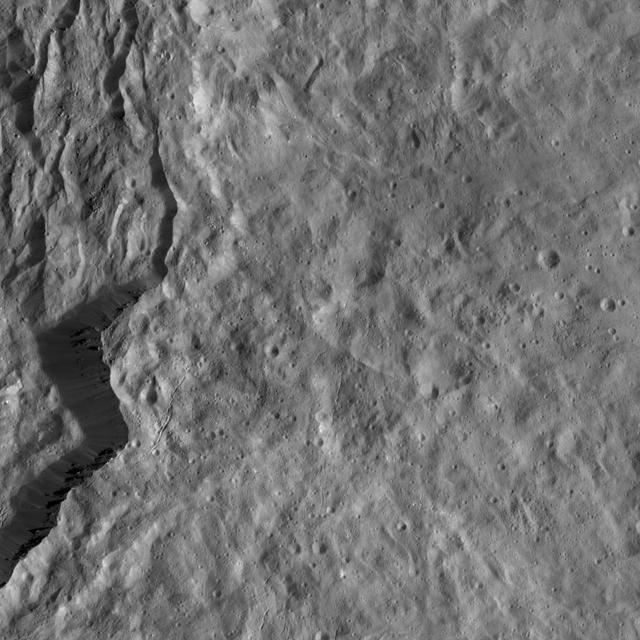
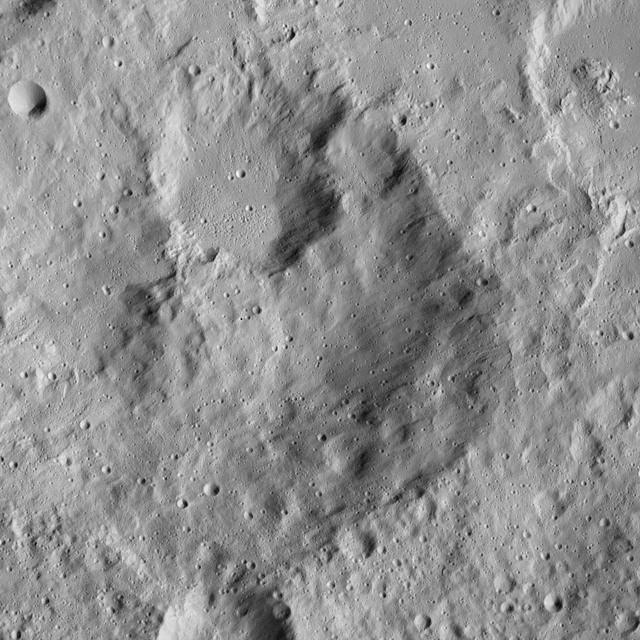
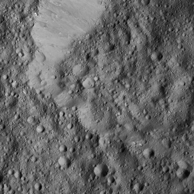
This Ceres scene captured by NASA Dawn spacecraft shows an ancient crater wall that has been disrupted, possibly by a landslide.
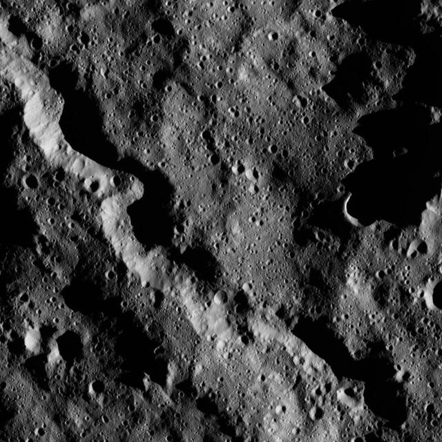
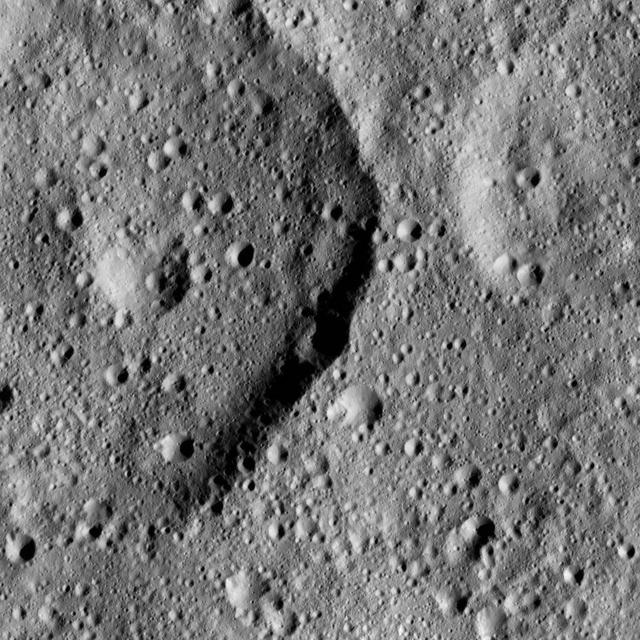
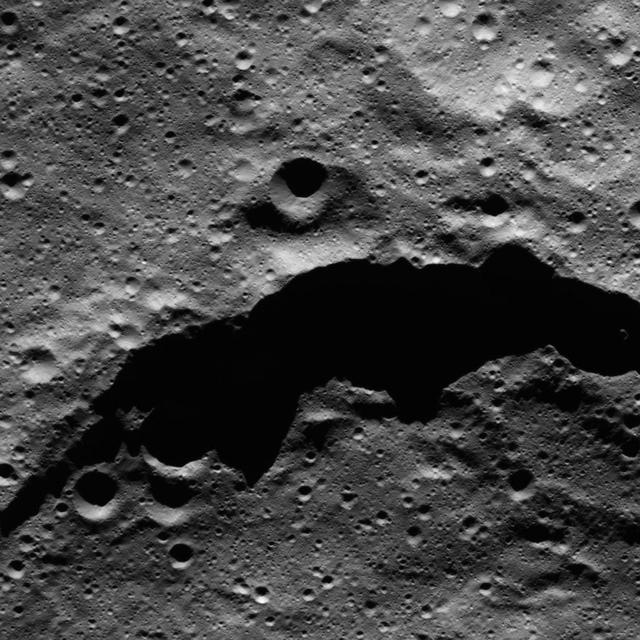
This view from NASA Dawn spacecraft shows a sinuous canyon in the southern hemisphere of Ceres, south of Yalode Crater.
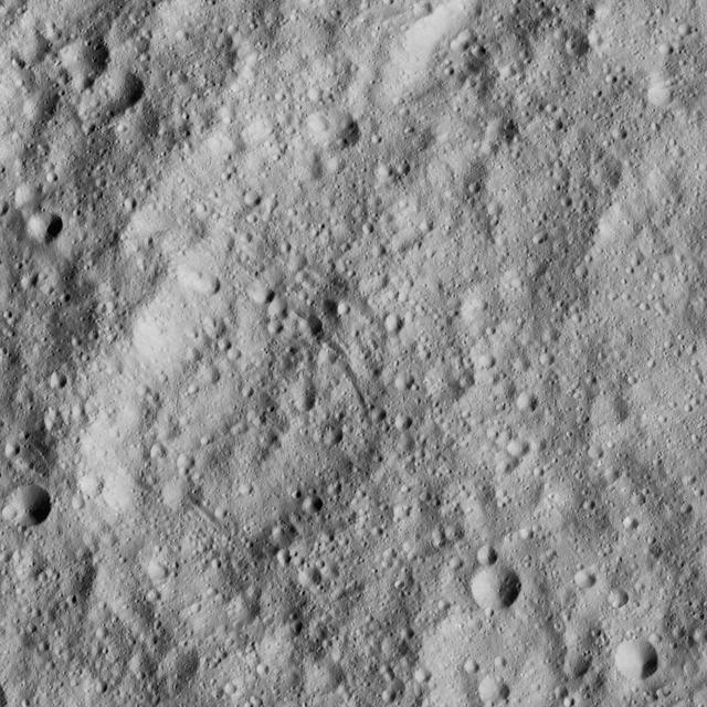
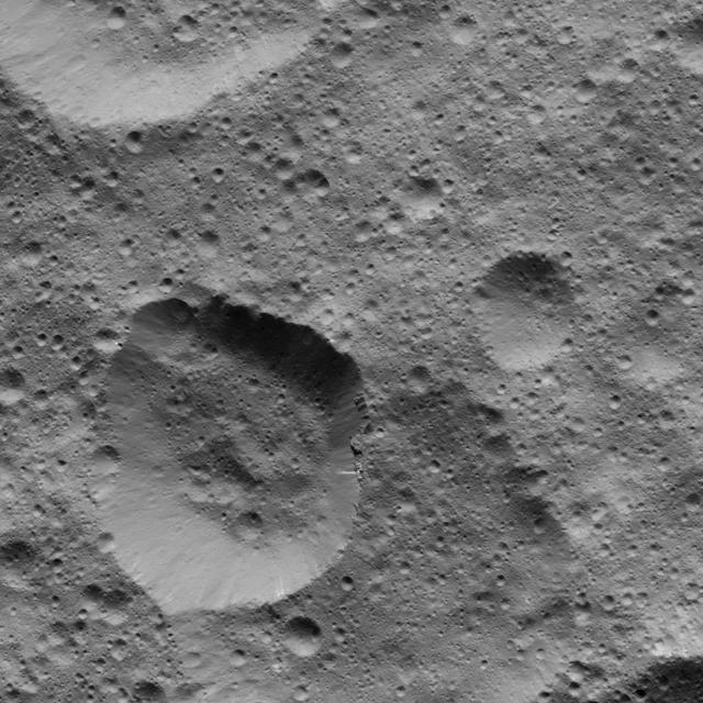
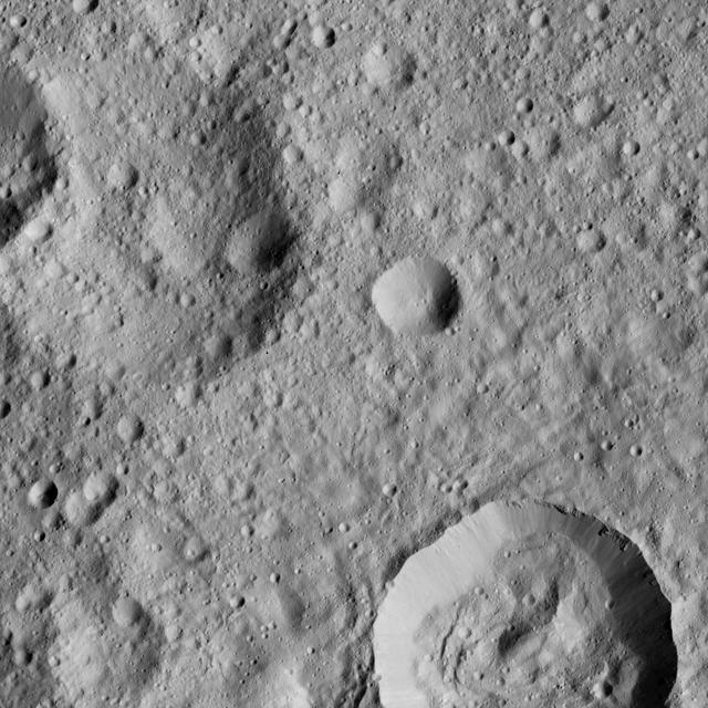
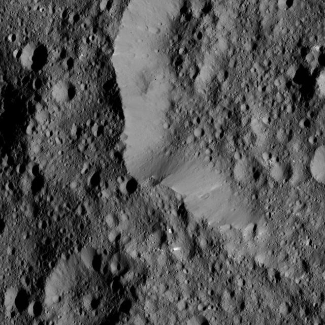
This view from NASA Dawn spacecraft shows a fresh crater among older terrain on Ceres, typical of the terrain of the dwarf planet.
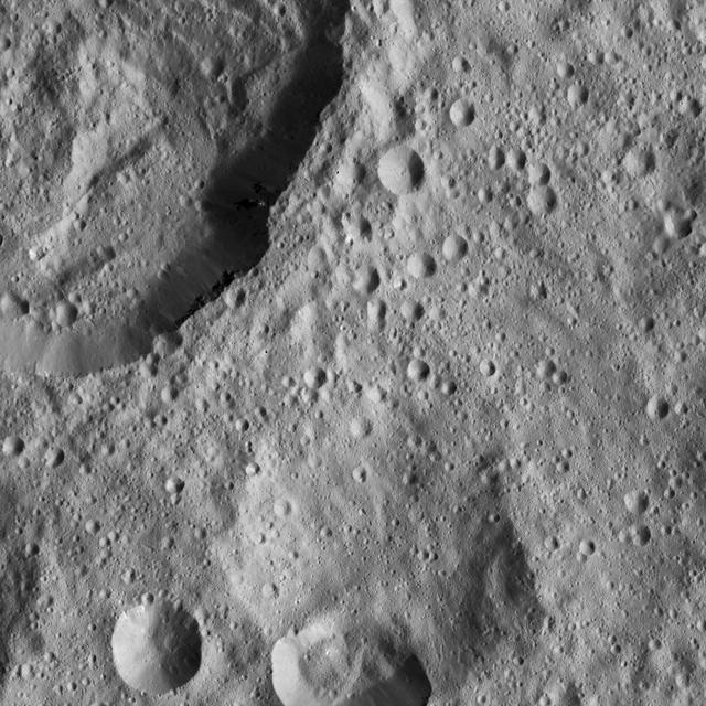
This view from NASA Dawn spacecraft features the sharp rim of a steep-walled crater on Ceres.
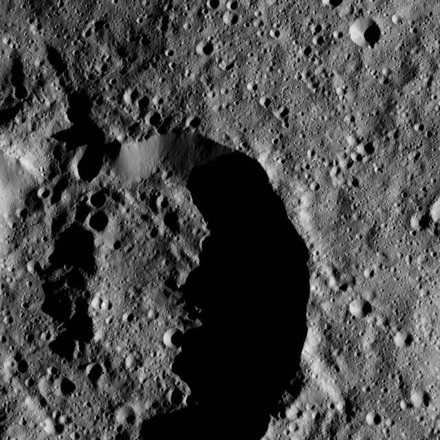
This view from NASA Dawn spacecraft shows the rim of a crater near the south pole of Ceres, taken on Feb. 8, 2016.
This view from NASA Dawn spacecraft shows two medium-sized craters at high northern latitudes on Ceres.

Patches of bright material can be seen on the walls of a relatively fresh crater on Ceres in this view from NASA Dawn spacecraft.
This view from NASA Dawn spacecraft shows the southwestern rim of Sintana Crater. The inside of the crater shows a hummocky surface.
These views of Ceres, taken by NASA Dawn spacecraft on December 10, show an area in the southern part of the southern hemisphere of the dwarf planet.
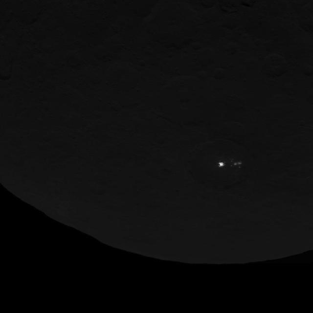
This image of dwarf planet Ceres, taken by NASA's Dawn spacecraft on June 15, 2015, shows a cluster of mysterious spots that are clearly brighter than their surroundings. Dawn took this image at an altitude of 2,700 miles (4,400 kilometers). The resolution is 1,400 feet (410 meters) per pixel. http://photojournal.jpl.nasa.gov/catalog/PIA19584
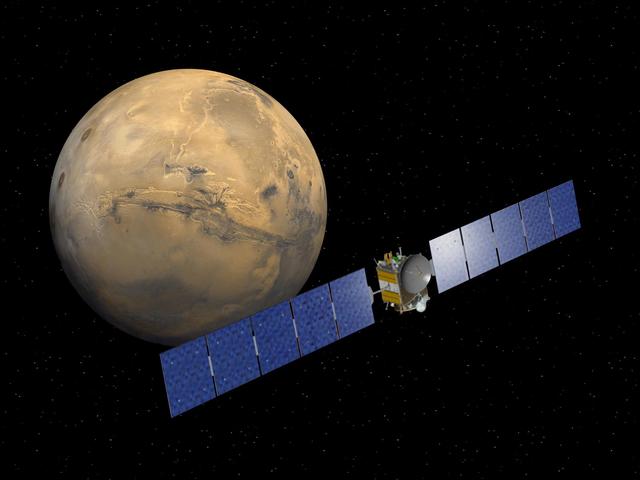
Artist rendering of NASA's Dawn spacecraft approaching Mars. Dawn, part of NASA's Discovery Program of competitively selected missions, was launched in 2007 to orbit the large asteroid Vesta and the dwarf planet Ceres. The two bodies have very different properties from each other. By observing them both with the same set of instruments, Dawn will probe the early solar system and specify the properties of each body. http://photojournal.jpl.nasa.gov/catalog/PIA18152
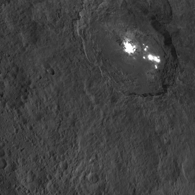
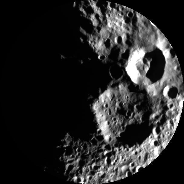
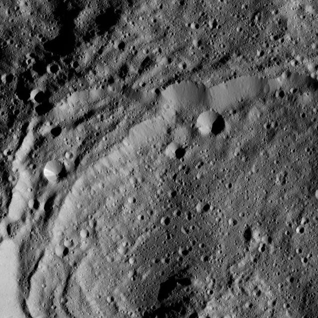
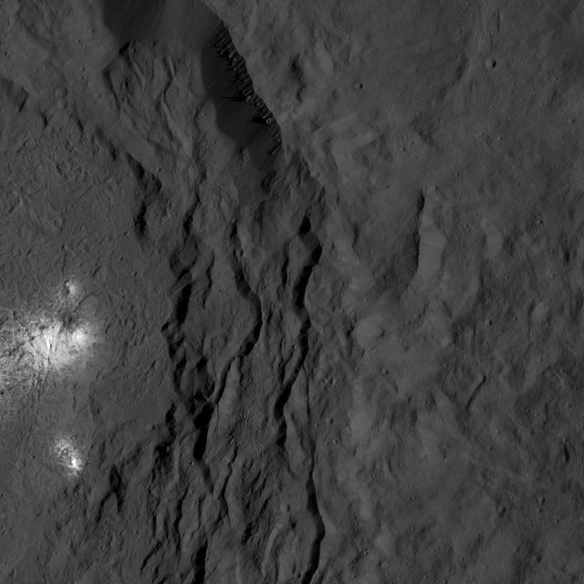
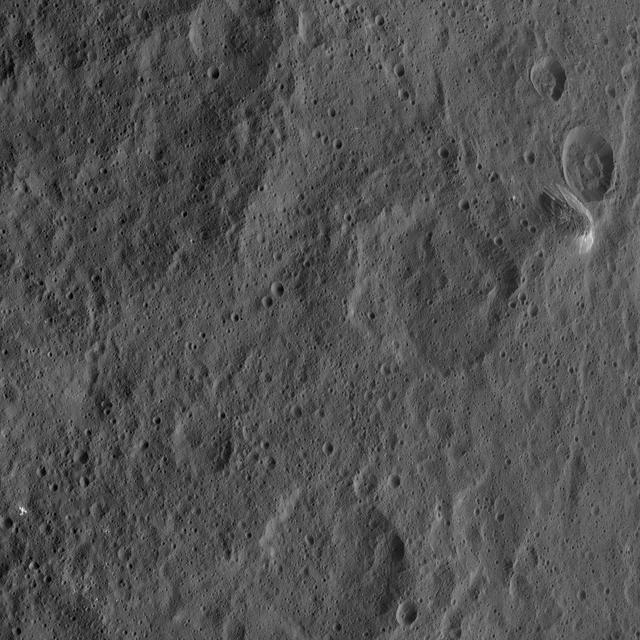
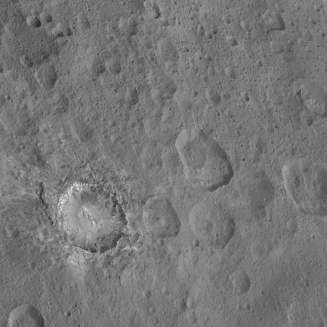
One of the most intriguing features on Ceres, Occator crater, is seen in this oblique view from NASA's Dawn spacecraft. This crater is 60 miles (90 kilometers) across and 2 miles (4 kilometers) deep, and is home to the brightest areas on Ceres. This image was acquired from an altitude of 915 miles (1,470 kilometers). Dawn took this image on Oct. 18, 2015. http://photojournal.jpl.nasa.gov/catalog/PIA20132
Flecks of bright material can be seen in this image of Ceres, taken by NASA's Dawn spacecraft. The view is centered at approximately 13.7 degrees north latitude, 144 degrees east longitude. Dawn took this image on Dec. 19, 2015, from its low-altitude mapping orbit (LAMO), at an approximate altitude of 240 miles (385 kilometers) above Ceres. The image resolution is 120 feet (35 meters) per pixel. http://photojournal.jpl.nasa.gov/catalog/PIA20298
This view of Ceres from NASA's Dawn spacecraft shows the rim of Sintana Crater (36 miles, 58 kilometers wide). Sinatana is also seen in PIA20149, an image taken from a higher altitude earlier in Dawn's mission. The image is centered at approximately 47 degrees south latitude, 43 degrees east longitude. Dawn took this image on May 27, 2016, from its low-altitude mapping orbit, at a distance of about 240 miles (385 kilometers) above the surface. The image resolution is 120 feet (35 meters) per pixel. http://photojournal.jpl.nasa.gov/catalog/PIA20874
Artist concept of the Dawn spacecraft gathering spectral data from Vesta.

This artist concept shows NASA Dawn spacecraft arriving at the dwarf planet Ceres, the most massive body in the asteroid belt. Dawn is the first mission to visit a dwarf planet.
This view from NASA's Dawn spacecraft taken on May 29, 2016, shows the southern rim of Gaue Crater on Ceres. Dawn took this image on May 29, 2016, from its low-altitude mapping orbit, at a distance of about 240 miles (385 kilometers) above the surface. The image resolution is 120 feet (35 meters) per pixel. http://photojournal.jpl.nasa.gov/catalog/PIA20923
This oblique view from NASA's Dawn spacecraft shows Rao Crater (7 miles, 12 kilometers) at center left. Dawn took this image on May 30, 2016, from its low-altitude mapping orbit, at a distance of about 240 miles (385 kilometers) above the surface. The image resolution is 120 feet (35 meters) per pixel. http://photojournal.jpl.nasa.gov/catalog/PIA20868

This image from NASA's Dawn spacecraft shows an area of Ceres that includes a small, bright crater. The image is centered at 3.4 degrees north latitude, 115 degrees east longitude. Dawn took this image on June 6, 2016, from its low-altitude mapping orbit, at a distance of about 240 miles (385 kilometers) above the surface. The image resolution is 120 feet (35 meters) per pixel. http://photojournal.jpl.nasa.gov/catalog/PIA20955
This view from NASA's Dawn spacecraft features Liber Crater (14 miles, 23 kilometers wide) in Ceres' northern hemisphere, at right. Dawn took this image on June 17, 2016, from its low-altitude mapping orbit, at a distance of about 240 miles (385 kilometers) above the surface. The image resolution is 120 feet (35 meters) per pixel. http://photojournal.jpl.nasa.gov/catalog/PIA20863
This image from NASA's Dawn spacecraft shows Tibong Crater (22 miles, 36 kilometers wide), at left, on Ceres. The image is centered at 29 degrees south latitude, 354 degrees east longitude. Dawn took this image on June 17, 2016, from its low-altitude mapping orbit, at a distance of about 240 miles (385 kilometers) above the surface. The image resolution is 120 feet (35 meters) per pixel. http://photojournal.jpl.nasa.gov/catalog/PIA20951
This view from NASA Dawn spacecraft taken on May 29, 2016, shows the eastern rim of Gaue Crater on Ceres. Dawn took this image on May 29, 2016, from its low-altitude mapping orbit, at a distance of about 240 miles (385 kilometers) above the surface. The image resolution is 120 feet (35 meters) per pixel. http://photojournal.jpl.nasa.gov/catalog/PIA20922

This image from NASA Dawn spacecraft shows Dawn visible and infrared spectrometer image, overlain on top of a framing camera image of the same region on asteroid Vesta.
Technician helps guide the second half of the fairing for installation around NASA Dawn spacecraft.
NASA Dawn spacecraft solar array wings are folded to fit inside nose section of protective fairing.
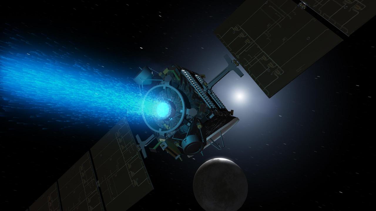
This artist's rendering shows NASA's Dawn spacecraft maneuvering above Ceres with its ion propulsion system. Dawn arrived into orbit at Ceres on March 6, 2015, and continues to collect data about the mysterious and fascinating world. The mission celebrated its ninth launch anniversary on September 27, 2016. This illustration is an update to PIA18921, which was produced before Dawn had mapped Ceres' surface. http://photojournal.jpl.nasa.gov/catalog/PIA20919
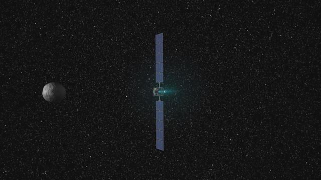
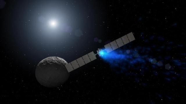
This artist concept shows NASA Dawn spacecraft arriving at the dwarf planet Ceres. Dawn travels through space using a technology called ion propulsion, with ions glowing with blue light are accelerated out of an engine, giving the spacecraft thrust.

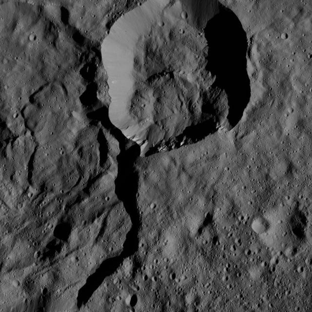
This view from NASA's Dawn spacecraft captures the southeast rim of Dantu Crater. Bright material can be seen in some places along the walls. A network of fractures in the crater floor is visible at upper right. Dawn previously imaged the whole of Dantu from a higher-altitude mapping orbit (see PIA19993). The image is centered at approximately 20 degrees north latitude, 142 degrees east longitude. Dawn captured the scene on Dec. 20, 2015 from its low-altitude mapping orbit (LAMO), at an approximate altitude of 240 miles (385 kilometers) above Ceres. The image resolution is 120 feet (35 meters) per pixel. http://photojournal.jpl.nasa.gov/catalog/PIA20300
This image from NASA's Dawn spacecraft shows cratered terrain on Ceres. The image is centered at 23 degrees north latitude, 186 degrees east longitude. Dawn took this image on June 10, 2016, from its low-altitude mapping orbit, at a distance of about 240 miles (385 kilometers) above the surface. The image resolution is 120 feet (35 meters) per pixel. http://photojournal.jpl.nasa.gov/catalog/PIA20963
This image from NASA's Dawn spacecraft shows cratered terrain just south of the equator of Ceres. The image is centered at 17 degrees south latitude, 295 degrees east longitude. Dawn took this image on June 15, 2016, from its low-altitude mapping orbit, at a distance of about 240 miles (385 kilometers) above the surface. The image resolution is 120 feet (35 meters) per pixel. http://photojournal.jpl.nasa.gov/catalog/PIA20969
This view from NASA Dawn spacecraft shows a scene from the northern hemisphere of Ceres, north of Occator Crater, which is home of the brightest area on the dwarf planet.

Achita Crater on Ceres was named for the Nigerian god of agriculture. NASA Dawn spacecraft took this image of the crater on January 15, 2016. Achita is located in the northern hemisphere.
This image from NASA Dawn spacecraft shows the center of Datan Crater on Ceres. Datan measures about 40 miles 60 kilometers in diameter.
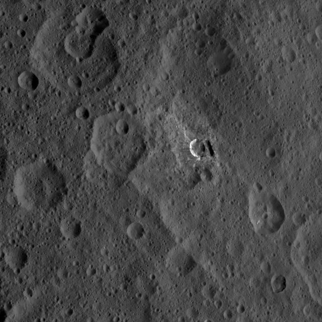
This image from NASA Dawn spacecraft shows the western rim of Occator Crater. Several small, bright patches of material can be seen along the rim.
This picture from NASA Dawn spacecraft shows craters in the northern hemisphere of Ceres. The large crater at lower left displays several bright streaks on its walls.
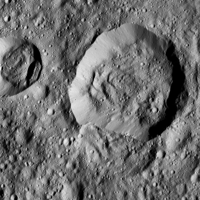
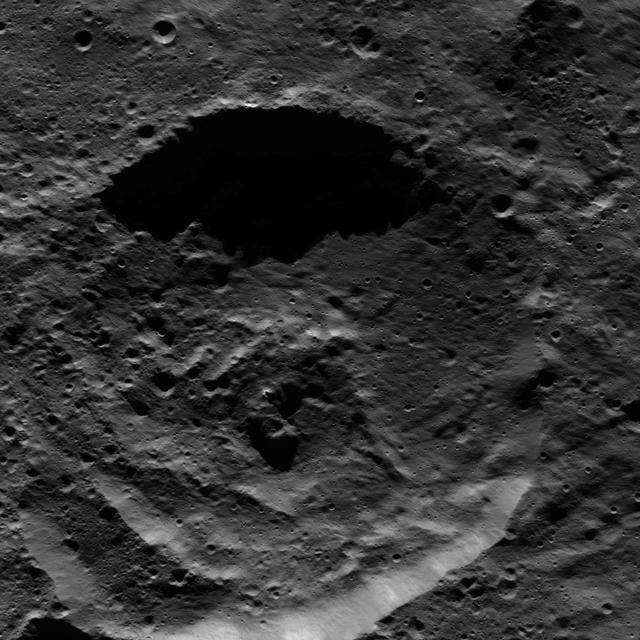
This ancient crater on Ceres displays a flattened floor and a low, rounded central peak. NASA Dawn spacecraft captured the scene on Jan. 2, 2016.

This image of Ceres is part of a sequence taken by NASA Dawn spacecraft on April 29, 2015, from a distance of 8,400 miles 13,600 kilometers.
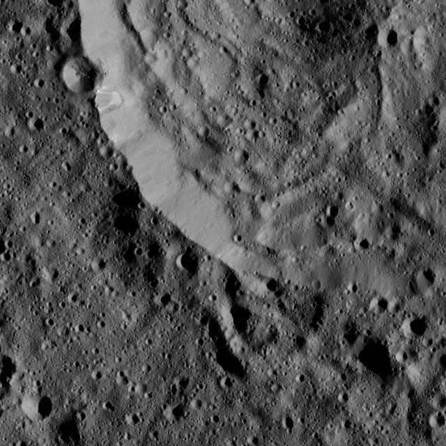
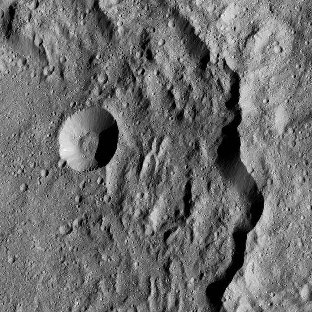
This image from NASA Dawn spacecraft of Ceres shows a portion of a large crater with prominent spurs of compacted material and gullies along its rim.

This image captured by NASA Dawn spacecraft shows small craters within Meanderi Crater on Ceres, which measures 64 miles 103 kilometers in diameter.

Part of the southern hemisphere on dwarf planet Ceres is seen in this image taken by NASA Dawn spacecraft. This left side of the image shows the eastern rim of Urvara crater.
This view from NASA Dawn spacecraft shows a portion of Mondamin Crater, an impact feature 78 miles 126 kilometers in diameter, in the southern hemisphere of Ceres.
The image from NASA Dawn spacecraft shows the northeast rim of Sintana Crater on Ceres. The crater steep rim is shadowed in this particular view.
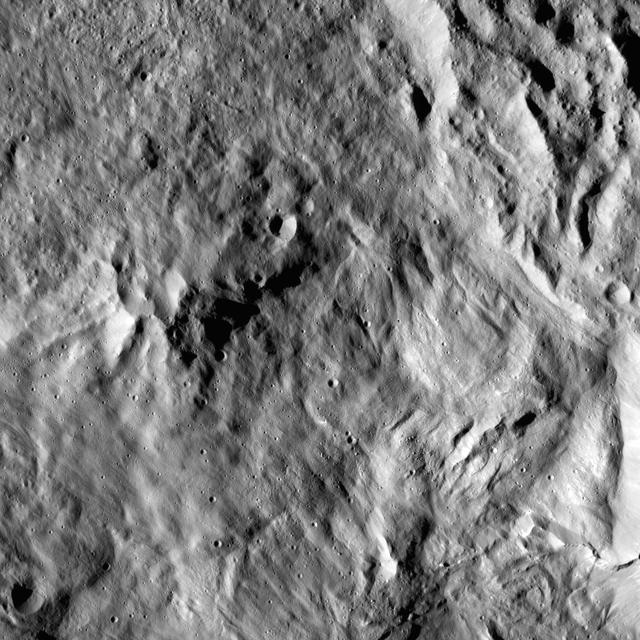
This picture from NASA Dawn spacecraft shows a crater within the floor of the Mondamin impact basin, which lies in the southern hemisphere of Ceres.
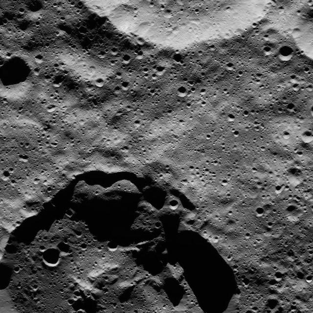
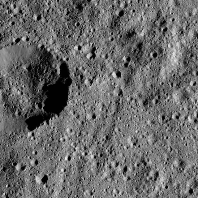
Shadows cast a dark mood on this scene from Ceres, near the dwarf planet north pole in this image acquired by NASA Dawn spacecraft.
Ninsar Crater, in the northern hemisphere of Ceres, is seen this view from NASA Dawn spacecraft. Ninsar was named for a Sumerian goddess of plants and vegetation.
NASA Dawn spacecraft took this view from Ceres on June 16, 2016, showing Ernutet Crater 32 miles, 52 kilometers in diameter at top. NASA's Dawn spacecraft took this image on June 16, 2016, from its low-altitude mapping orbit, at a distance of about 240 miles (385 kilometers) above the surface. The image resolution is 120 feet (35 meters) per pixel. http://photojournal.jpl.nasa.gov/catalog/PIA20833
A cluster of bright areas in Ceres Occator Crater are seen in this image from NASA Dawn spacecraft. These areas are not as bright as the material at the center of the crater. Dawn took this image on June 16, 2016, from its low-altitude mapping orbit, at a distance of about 240 miles (385 kilometers) above the surface. The image resolution is 120 feet (35 meters) per pixel. http://photojournal.jpl.nasa.gov/catalog/PIA20831

NASA's Dawn spacecraft looked northward toward the limb of Ceres to capture this scene, with Rao Crater (7 miles, 12 kilometers) at bottom. Dawn took this image on May 30, 2016, from its low-altitude mapping orbit, at a distance of about 240 miles (385 kilometers) above the surface. The image resolution is 120 feet (35 meters) per pixel. http://photojournal.jpl.nasa.gov/catalog/PIA20869
This view from NASA's Dawn spacecraft shows cratered terrain on Ceres, centered at 10 degrees south latitude, 197 degrees east longitude. Dawn took this image on June 1, 2016, from its low-altitude mapping orbit, at a distance of about 240 miles (385 kilometers) above the surface. The image resolution is 120 feet (35 meters) per pixel. http://photojournal.jpl.nasa.gov/catalog/PIA20931
This view from NASA's Dawn spacecraft shows cratered terrain typical of Ceres, with a small bright crater highlighting the scene at lower right. The view is centered at approximately 37 degrees north latitude, 349 degrees east longitude. Dawn acquired this image on Feb. 9, 2016, from its low-altitude mapping orbit, at a distance of about 240 miles (385 kilometers) from the surface. The image resolution is 120 feet (35 meters) per pixel. http://photojournal.jpl.nasa.gov/catalog/PIA20556
This view from NASA's Dawn spacecraft features the rugged rim of Occator Crater at left. A number of thin fractures are visible, roughly parallel to the rim. Dawn took this image on April 18, 2016, from its low-altitude mapping orbit, at a distance of about 240 miles (385 kilometers) above the surface. The image resolution is 120 feet (35 meters) per pixel. http://photojournal.jpl.nasa.gov/catalog/PIA20818
This view from NASA's Dawn spacecraft shows terrain on Ceres centered at approximately 37 degrees south latitude, 51 degrees east longitude. Dawn took this image on May 27, 2016, from its low-altitude mapping orbit, at a distance of about 240 miles (385 kilometers) above the surface. The image resolution is 120 feet (35 meters) per pixel. http://photojournal.jpl.nasa.gov/catalog/PIA20873
This view from NASA's Dawn spacecraft shows the rim of Ernutet Crater (32 miles, 52 kilometers in diameter) on Ceres. NASA's Dawn spacecraft took this image on June 17, 2016, from its low-altitude mapping orbit, at a distance of about 240 miles (385 kilometers) above the surface. The image resolution is 120 feet (35 meters) per pixel. http://photojournal.jpl.nasa.gov/catalog/PIA20862

This view of Ceres from NASA Dawn spacecraft, taken on May 29, 2016, features a small crater at upper left that adjoins Messor Crater. Dawn took this image on May 29, 2016, from its low-altitude mapping orbit, at a distance of about 240 miles (385 kilometers) above the surface. The image resolution is 120 feet (35 meters) per pixel. http://photojournal.jpl.nasa.gov/catalog/PIA20924
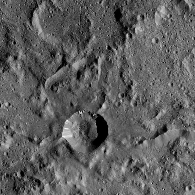
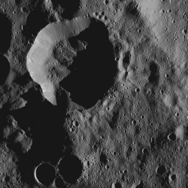
The tall, cone-shaped mountain Ahuna Mons is seen in this image taken by NASA's Dawn spacecraft. Ahuna Mons, named for the traditional post-harvest festival of the Sumi tribe of Nagaland in India, is about 4 miles (6 kilometers) tall and 12 miles (20 kilometers) in diameter. Dawn took this image on Oct. 14, 2015, from an altitude of 915 miles (1,470 kilometers). It has a resolution of 450 feet (140 meters) per pixel. http://photojournal.jpl.nasa.gov/catalog/PIA20130
This view from NASA's Dawn spacecraft features Liber Crater (14 miles, 23 kilometers wide) in Ceres' northern hemisphere, at right. Dawn took this image on June 17, 2016, from its low-altitude mapping orbit, at a distance of about 240 miles (385 kilometers) above the surface. The image resolution is 120 feet (35 meters) per pixel. http://photojournal.jpl.nasa.gov/catalog/PIA20863
Cratered terrain in the northern hemisphere of Ceres is seen in this image from NASA's Dawn spacecraft. The scene is dotted with small impacts among larger, more ancient craters. The view is centered at approximately 28 degrees north latitude, 37 degrees east longitude. Dawn took this image on April 18, 2016, from its low-altitude mapping orbit, at a distance of about 240 miles (385 kilometers) above the surface. The image resolution is 120 feet (35 meters) per pixel. http://photojournal.jpl.nasa.gov/catalog/PIA20821
NASA's Dawn spacecraft views a crater at top center that touches the rim of Messor Crater (25 miles, 40 kilometers), shown at left. The view is similar to PIA20572, but from a different viewing angle. Dawn took this image on May 30, 2016, from its low-altitude mapping orbit, at a distance of about 240 miles (385 kilometers) above the surface. The image resolution is 120 feet (35 meters) per pixel. http://photojournal.jpl.nasa.gov/catalog/PIA20866

In Astrotech's Payload Processing Facility, an overhead crane lifts the Dawn spacecraft from its transporter. Dawn will be moved into clean room C for unbagging and further processing. Dawn's mission is to explore two of the asteroid belt's most intriguing and dissimilar occupants: asteroid Vesta and the dwarf planet Ceres. The Dawn mission is managed by JPL, a division of the California Institute of Technology in Pasadena, for NASA's Science Mission Directorate in Washington, D.C

In Astrotech's Payload Processing Facility, technicians help secure the Dawn spacecraft onto a moveable stand. Dawn will be moved into clean room C for unbagging and further processing. Dawn's mission is to explore two of the asteroid belt's most intriguing and dissimilar occupants: asteroid Vesta and the dwarf planet Ceres. The Dawn mission is managed by JPL, a division of the California Institute of Technology in Pasadena, for NASA's Science Mission Directorate in Washington, D.C.
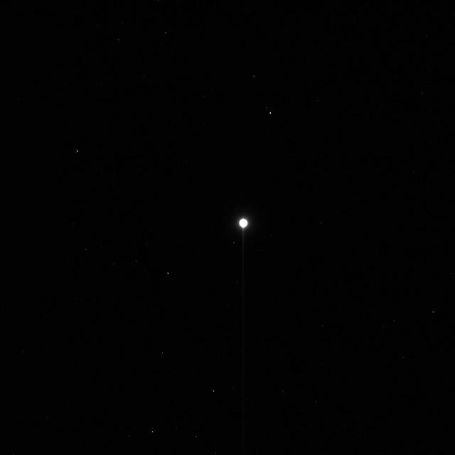
From about three times the distance from Earth to the moon, NASA's Dawn spacecraft spies its final destination -- the dwarf planet Ceres. The resolution of this image does not yet exceed the best views of Ceres, which were obtained by the Hubble Space Telescope (see PIA10235). Nonetheless, Ceres' spherical shape is clearly revealed here. Sunlight illuminates the dwarf planet from the right, leaving a sliver of the surface in shadow at left. A zoomed-in view is provided in Figure 1, along with the original unmagnified, uncropped view. The image was taken on Dec. 1, 2014 with the Dawn spacecraft's framing camera, using a clear spectral filter. Dawn was about 740,000 miles (1.2 million kilometers) from Ceres at the time. Ceres is 590 miles (950 kilometers) across and was discovered in 1801. http://photojournal.jpl.nasa.gov/catalog/PIA19049
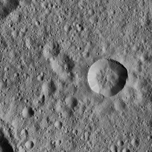
This image from NASA's Dawn spacecraft shows the dramatic-looking crater named Haulani on Ceres. This relatively young crater was named for a Hawaiian plant goddess, and measures 19 miles (31 kilometers) in diameter. The crater features a central ridge and streaks of bright material on its walls. Ejected material from the crater's formation blankets the surrounding area, muting the appearance of older impact features. Dawn took this image on Oct. 14, 2015, from an altitude of 915 miles (1,470 kilometers). It has a resolution of 450 feet (140 meters) per pixel. http://photojournal.jpl.nasa.gov/catalog/PIA20129
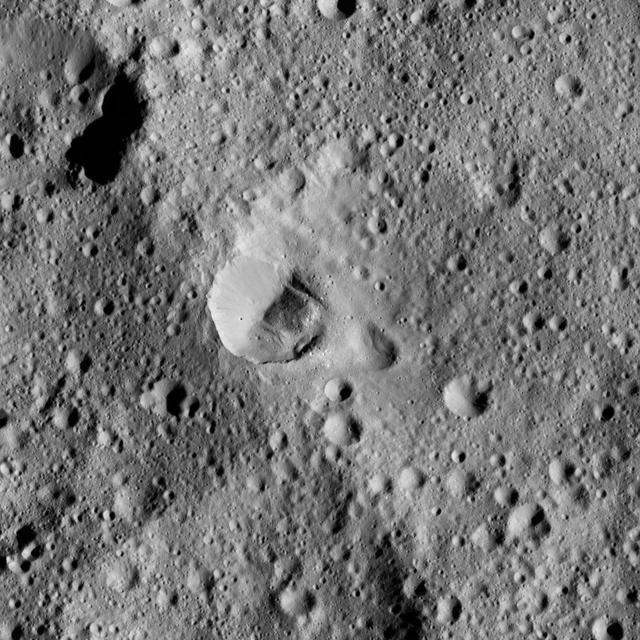
Oxo Crater and its surroundings are featured in this image of Ceres' surface from NASA's Dawn spacecraft. Dawn took this image on Oct. 18, 2016, from its second extended-mission science orbit (XMO2), at a distance of about 920 miles (1,480 kilometers) above the surface. The image resolution is about 460 feet (140 meters) per pixel. http://photojournal.jpl.nasa.gov/catalog/PIA21225
This view from NASA's Dawn spacecraft shows Rongo Crater, located near Ceres' equator. The image is centered at 0 degrees south latitude, 346 degrees east longitude. Dawn took this image on June 1, 2016, from its low-altitude mapping orbit, at a distance of about 240 miles (385 kilometers) above the surface. The image resolution is 120 feet (35 meters) per pixel. http://photojournal.jpl.nasa.gov/catalog/PIA20935
This view from NASA's Dawn spacecraft shows cratered terrain at 59 degrees north latitude, 89 degrees east longitude on Ceres, just east of the large crater named Omonga. Dawn took this image on June 1, 2016, from its low-altitude mapping orbit, at a distance of about 240 miles (385 kilometers) above the surface. The image resolution is 120 feet (35 meters) per pixel. http://photojournal.jpl.nasa.gov/catalog/PIA20929