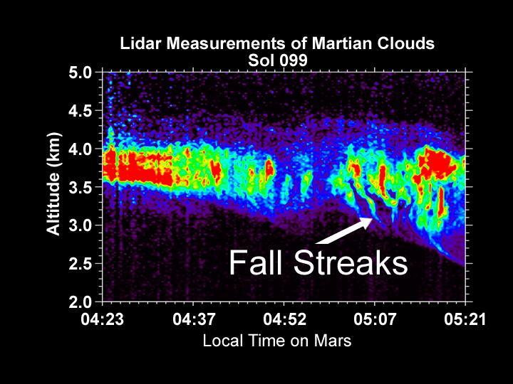
Lidar Measurements of Snow Falling from Martian Clouds

This image is of the Canadian-built lidar in operation with the cover open was acquired at the NASA Mars Phoenix Lander landing site on Sol 3.

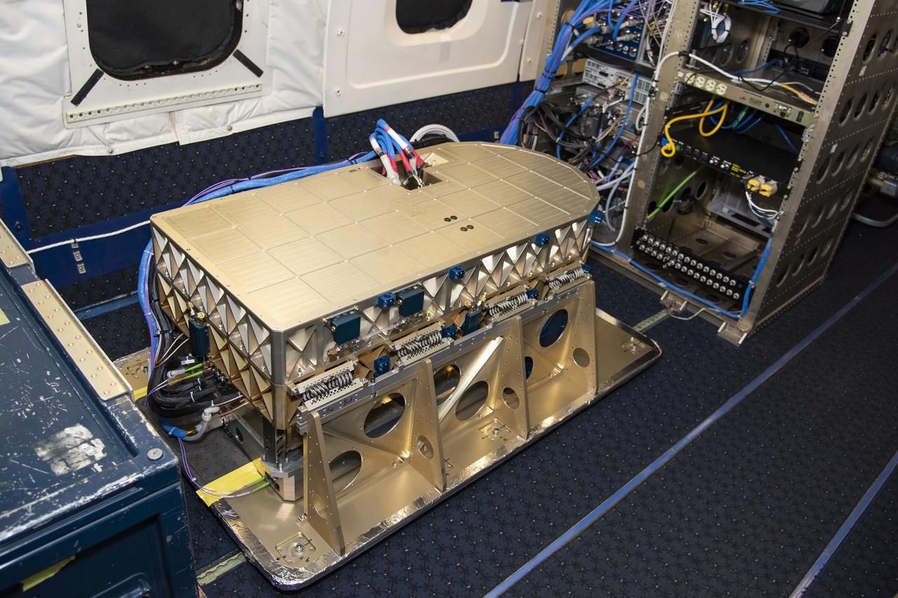
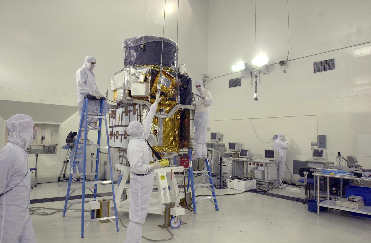
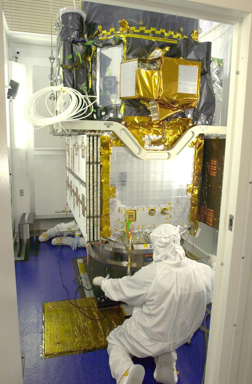
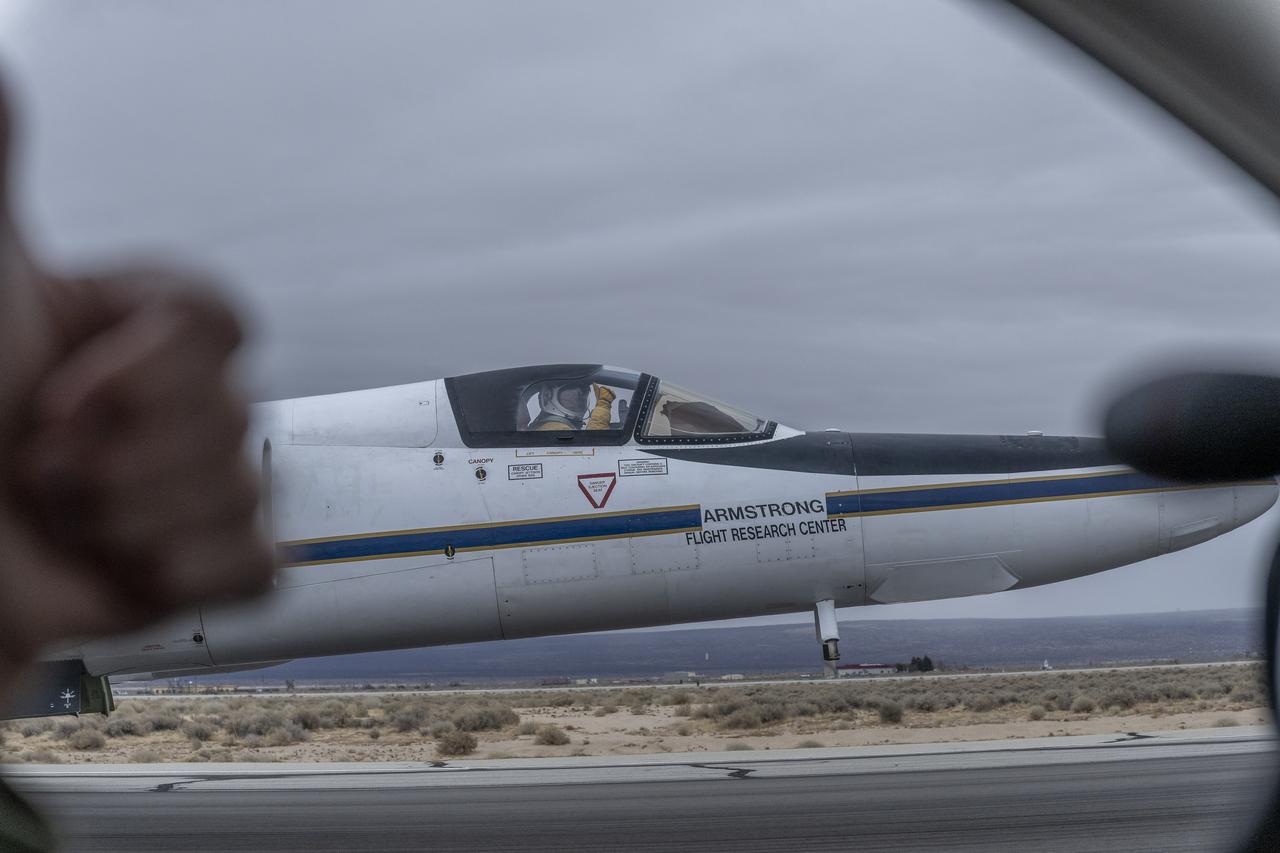
The High Altitude Lidar Observatory (HALO) instrument head, which houses the lidar instrument, is installed onto the DC-8 airborne science laboratory at NASA Armstrong Flight Research Center in Edwards, California. The gold and blue casing holds the laser, optics, detectors, and electronics, which are at the heart of the lidar.
Aerosol data from the High Altitude Lidar Observatory (HALO), pictured here, will give mission scientists a better sense how Doppler Aerosol Wind Lidar (DAWN) is working and what its strengths and weaknesses are.
Lidar Atmospheric Sensing Experiment (Lase).
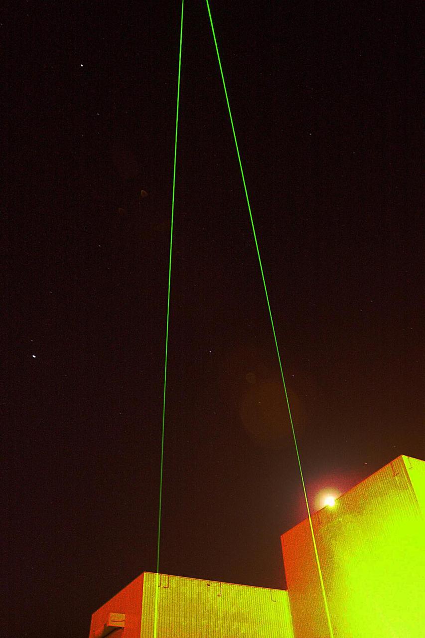
This image from NASA Phoenix Mars Lander of the Canadian-built meteorological station lidar, which was successfully activated on Sol 2 by first opening its dust cover, then emitting rapid pulses of light.
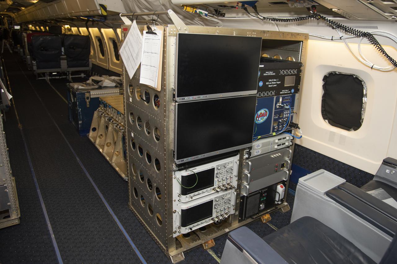
The High Altitude Lidar Observatory (HALO) system electronics and diagnostic tools are integrated onto the DC-8 airborne science laboratory at NASA Armstrong Flight Research Center in Edwards, California. The lidar system control electronics are on the right hand side of the rack. The large monitors on the left are used to display real-time images of water vapor and aerosol profiles, which are used by the science team to guide in-flight decisions and navigation. The compact HALO instrument head can be seen directly behind the electronics rack.

Researchers Anna Noe and Eric Altman check out the Doppler Aerosol Wind Lidar (DAWN), an airborne instrument that uses pulsed lasers to detect the movement of atmospheric aerosols such as dust or sea salt. In detecting those movements, it can profile wind vector — both speed and direction. Researchers are testing DAWNs capabilities during flights over the eastern Pacific.
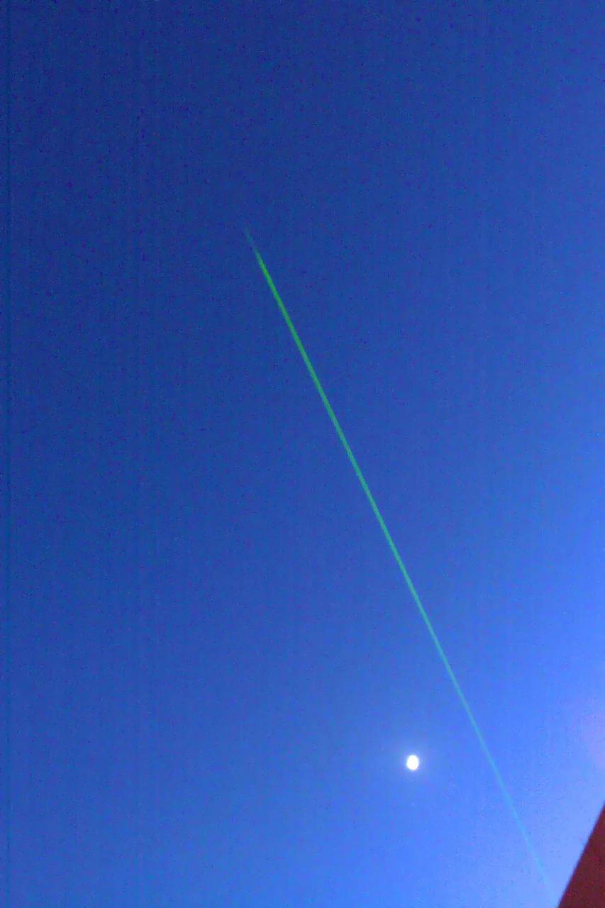
A laser beam from the Canadian-built lidar instrument on NASA Phoenix Mars Lander can be seen in this contrast-enhanced image taken by Phoenix Surface Stereo Imager on July 26, 2008, during early Martian morning hours of the 61st Martian day.

Caption: Mike Krainak (left) and Diego Janches recently won NASA follow-on funding to advance a spaceborne sodium lidar needed to probe Earth’s poorly understood mesosphere. Credits: NASA/W. Hrybyk More: A team of NASA scientists and engineers now believes it can leverage recent advances in a greenhouse-detecting instrument to build the world’s first space-based sodium lidar to study Earth’s poorly understood mesosphere. Scientist Diego Janches and laser experts Mike Krainak and Tony Yu, all of whom work at NASA’s Goddard Space Flight Center in Greenbelt, Maryland, are leading a research-and-development effort to further advance the sodium lidar, which the group plans to deploy on the International Space Station if it succeeds in proving its flightworthiness. Read more: <a href="https://go.nasa.gov/2rcGpSM" rel="nofollow">go.nasa.gov/2rcGpSM</a> <b><a href="http://www.nasa.gov/audience/formedia/features/MP_Photo_Guidelines.html" rel="nofollow">NASA image use policy.</a></b> <b><a href="http://www.nasa.gov/centers/goddard/home/index.html" rel="nofollow">NASA Goddard Space Flight Center</a></b> enables NASA’s mission through four scientific endeavors: Earth Science, Heliophysics, Solar System Exploration, and Astrophysics. Goddard plays a leading role in NASA’s accomplishments by contributing compelling scientific knowledge to advance the Agency’s mission. <b>Follow us on <a href="http://twitter.com/NASAGoddardPix" rel="nofollow">Twitter</a></b> <b>Like us on <a href="http://www.facebook.com/pages/Greenbelt-MD/NASA-Goddard/395013845897?ref=tsd" rel="nofollow">Facebook</a></b> <b>Find us on <a href="http://instagrid.me/nasagoddard/?vm=grid" rel="nofollow">Instagram</a></b>
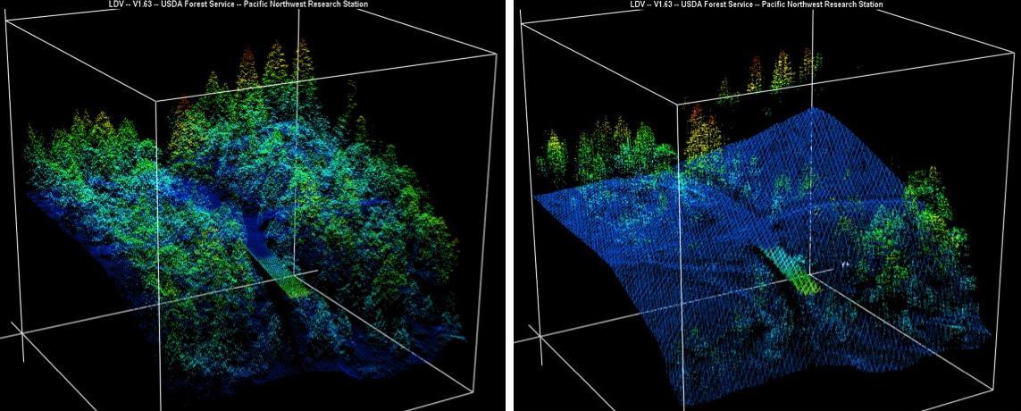
New maps of two recent California megafires that combine unique data sets from the U.S. Forest Service and NASA's Jet Propulsion Laboratory in Pasadena, California, are answering some of the urgent questions that follow a huge wildfire. These before-and-after USFS LIght Detection And Ranging (LIDAR) images from the 2014 King fire region in El Dorado National Forest, California are among new maps. They show a small section of the Rubicon River drainage basin, where fire damage was severe. Blue indicates ground level; lighter colors are higher. A road -- bordered by dense trees in the before image at left -- and part of a bridge are in the center, with the bridge appearing green. http://photojournal.jpl.nasa.gov/catalog/PIA19360
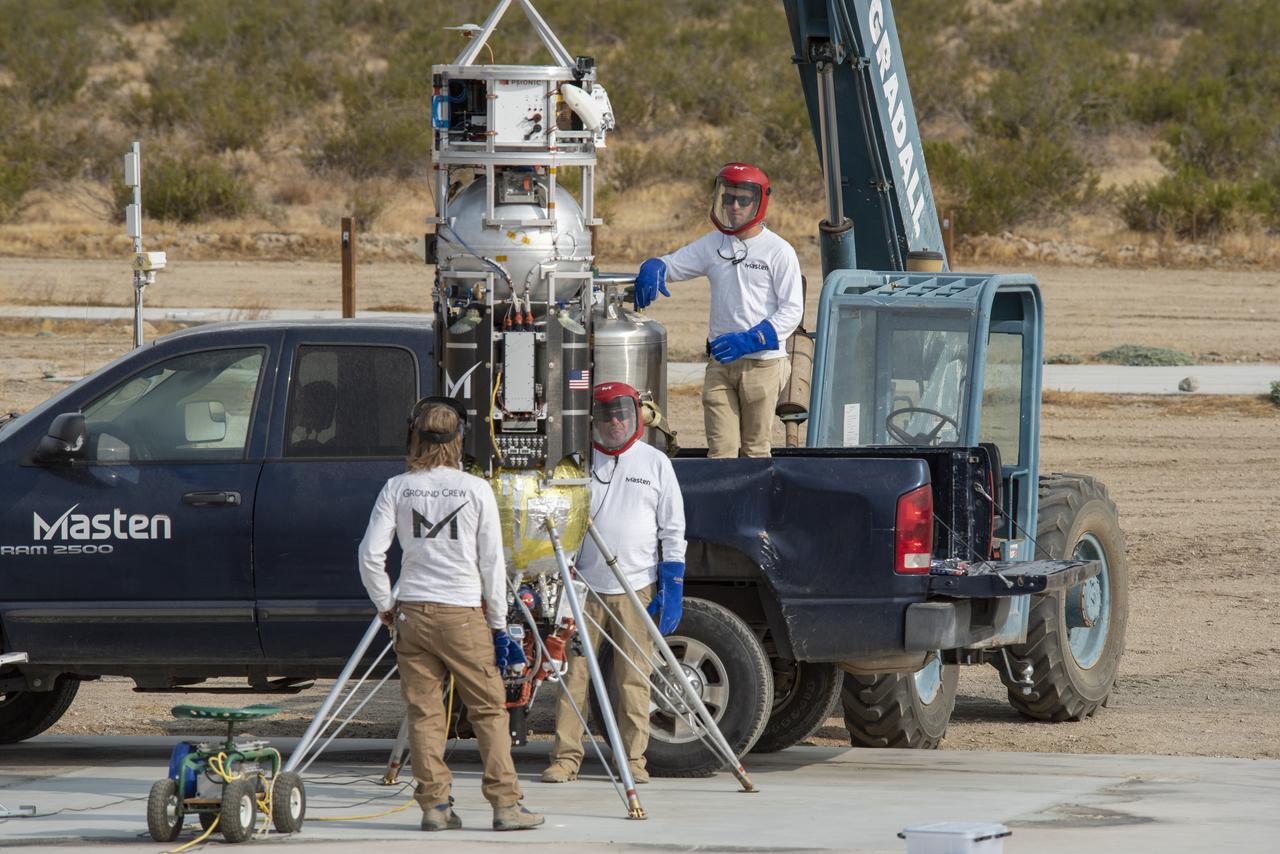
Masten Space Systems employees prepare its rocket to flight test NASA -licensed Psionic navigation doppler lidar technology that enables precision landing on celestial bodies where GPS for navigation only available on Earth is not an option.
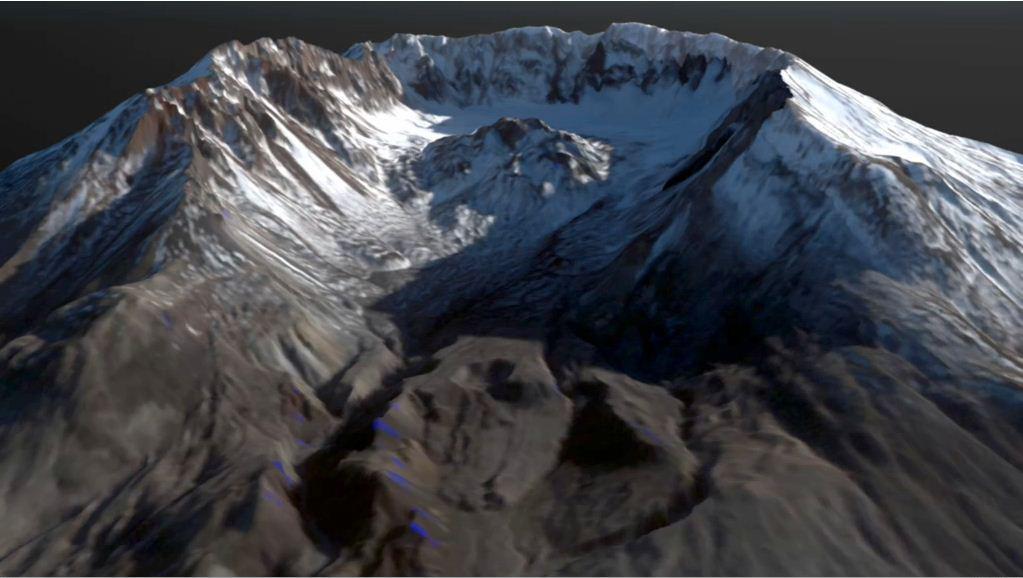
This frame from an animation depicts the growth of the lava dome at Mount St. Helens during the most recent period of activity. Lidar data courtesy USGS.
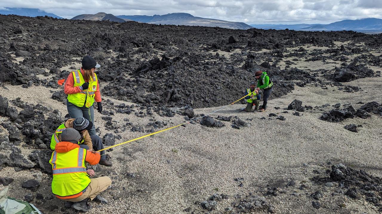
During their August 2023 Iceland field campaign, international science team members of NASA's VERITAS (Venus Emissivity, Radio science, InSAR, Topography, And Spectroscopy) mission prepare for lidar (Light Detection and Ranging) imaging of rocks at a study area. Lidar measurements of rocky terrain can provide information about the material, such as surface roughness. While the science team led by NASA's Jet Propulsion Laboratory gathered lidar data on the ground, their partners from the German Aerospace Center (Deutsches Zentrum für Luft- und Raumfahrt, or DLR) carried out overflights to gather radar observations of the same study areas. By doing this, the team was able to ground-truth the radar data that will be used to help inform the science that VERITAS will do at Venus. VERITAS will peer through the planet's thick atmosphere with a suite of powerful science instruments to create global maps of Venus' surface – including topography, radar images, rock type, and gravity measurements – as well as detect surface changes. VERITAS is designed to understand what processes are currently active, search for evidence of past and current interior water, and understand the geologic evolution of the planet, illuminating how rocky planets throughout the galaxy evolve. https://photojournal.jpl.nasa.gov/catalog/PIA25839
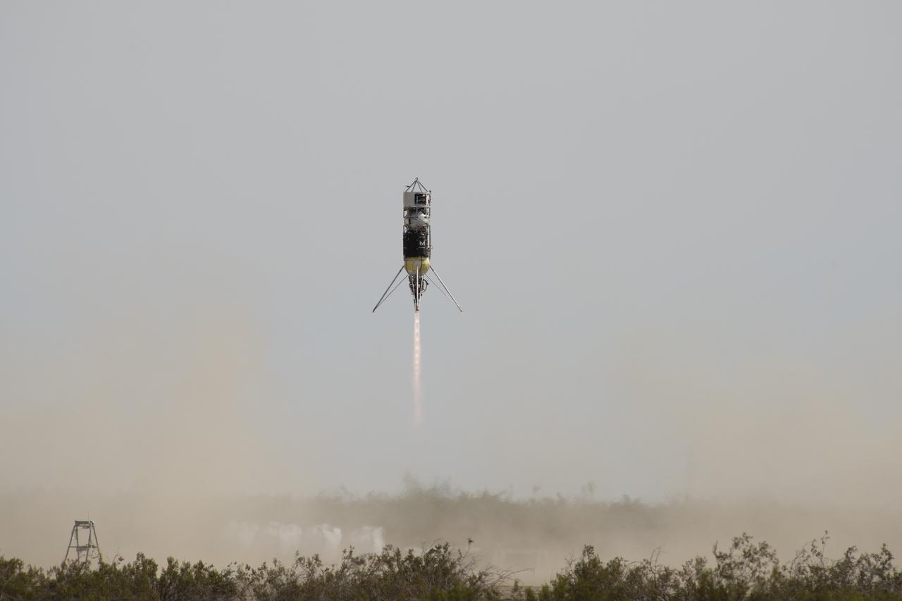
Masten Space Systems vertical takeoff vertical landing rocket launched September 10, 2020 to flight test NASA-licensed Psionic navigation doppler lidar technology that enables precision landing on celestial bodies where GPS for navigation only available on Earth is not an option.
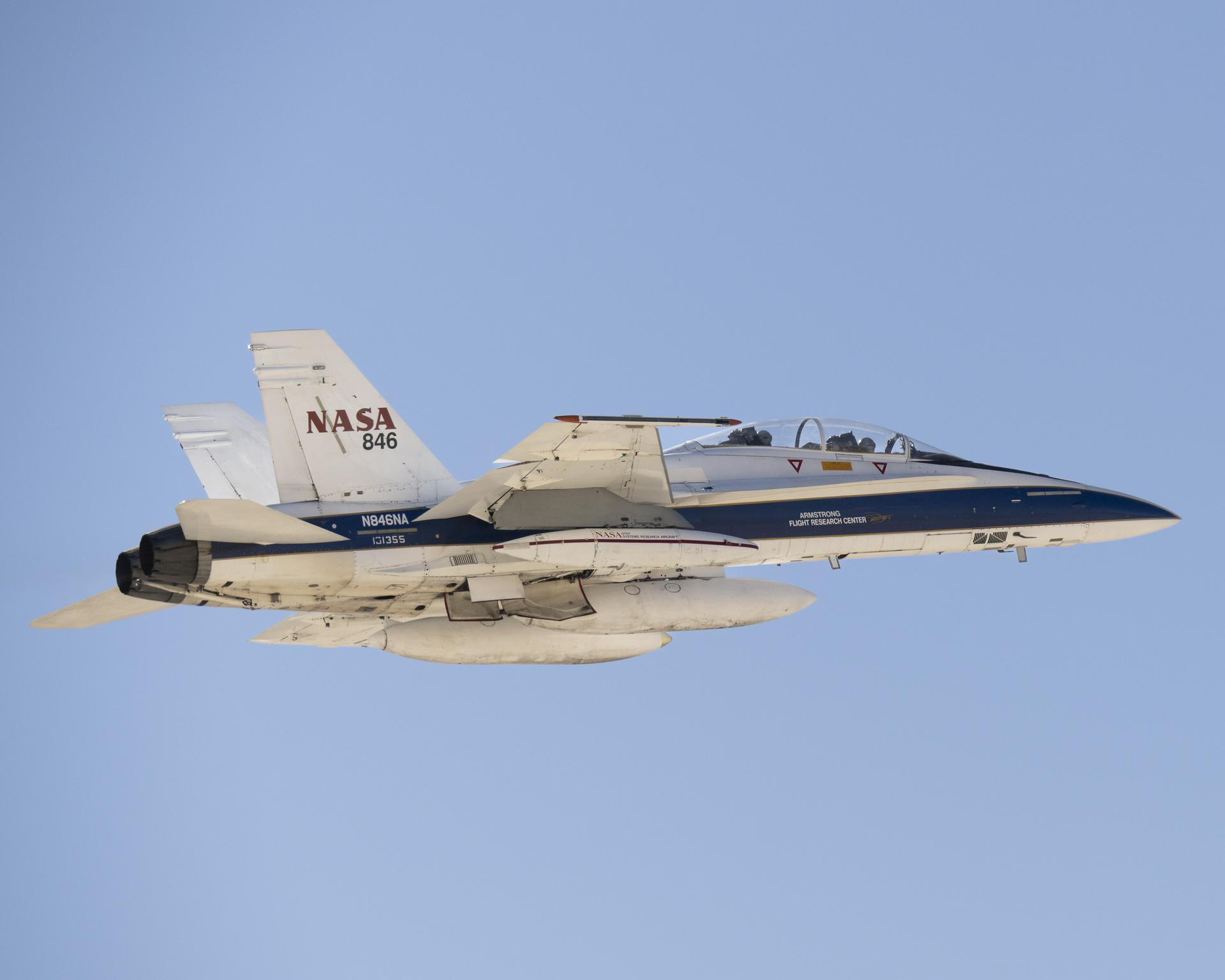
A NASA F/A-18 research aircraft flies near NASA’s Armstrong Flight Research Center in Edwards, California, on Feb. 24, 2025, testing a commercial precision landing technology for future space missions. The Psionic Space Navigation Doppler Lidar (PSNDL) system is installed in a pod located under the right wing of the aircraft.
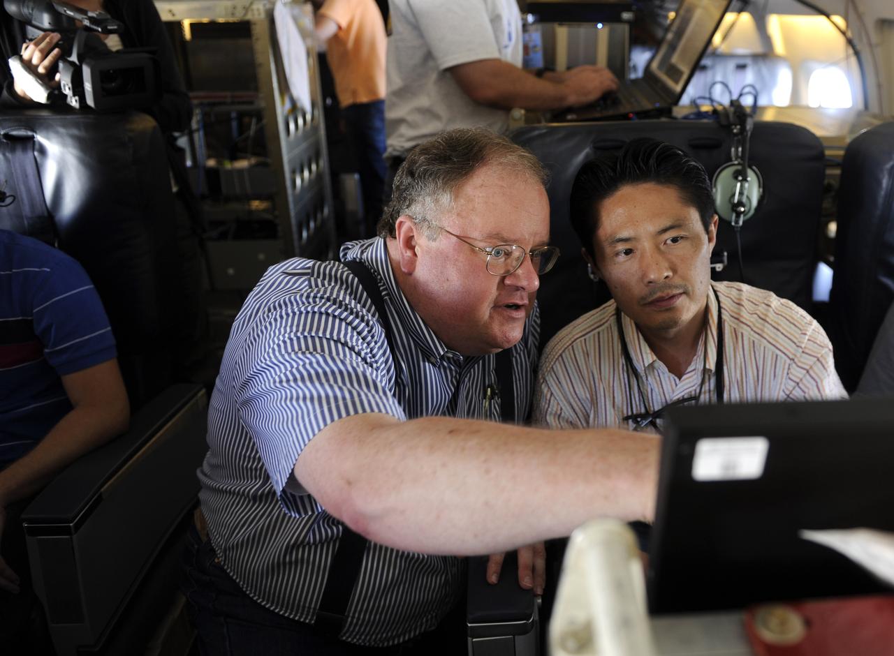
Michael Kavaya, of the NASA Langley Research Center, a Principal Investigator for the DAWN experiment, looks over data with Jeffrey Beyon during a flight of the NASA DC-8, Tuesday, Aug. 17, 2010, in the Gulf of Mexico. The DAWN experiment, also known as the Doppler Aerosol Wind Lidar, is one of many experiments supporting the Genesis and Rapid Intensification Processes (GRIP) experiment, a NASA Earth science field experiment in 2010 that is being conducted to better understand how tropical storms form and develop into major hurricanes. Photo Credit: (NASA/Paul E. Alers)
Syed Ismail, from the Langley Research Center, principal investigator for the Lidar Atmospheric Sensing Experiment (LASE) is seen aboard the NASA DC-8 aircraft, Monday, August 16, 2010, at Fort Lauderdale Hollywood International Airport in Fort Lauderdale, Fla. The Genesis and Rapid Intensification Processes (GRIP) experiment is a NASA Earth science field experiment in 2010 that is being conducted to better understand how tropical storms form and develop into major hurricanes. Photo Credit: (NASA/Paul E. Alers)
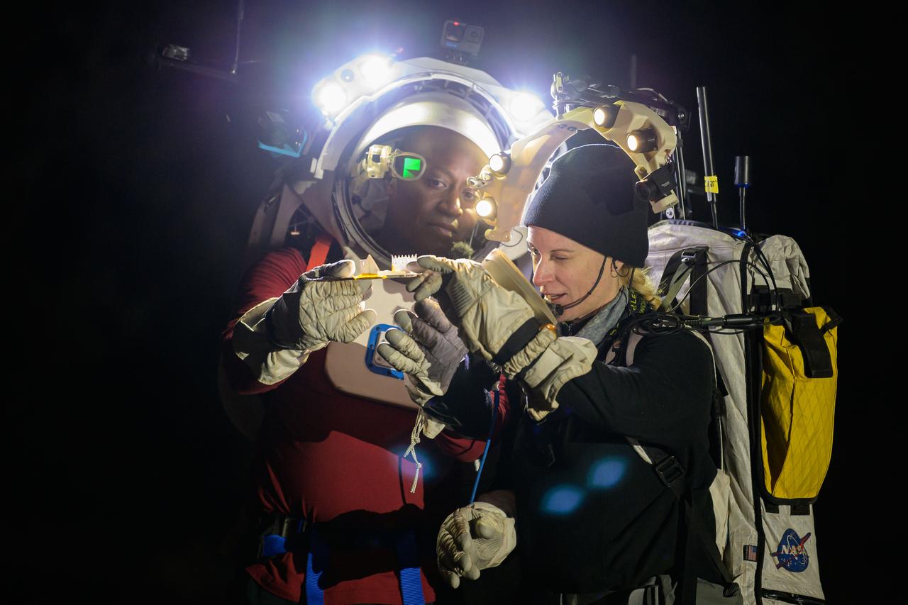
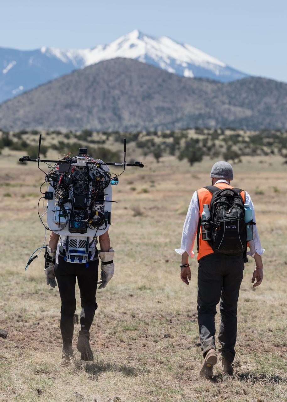
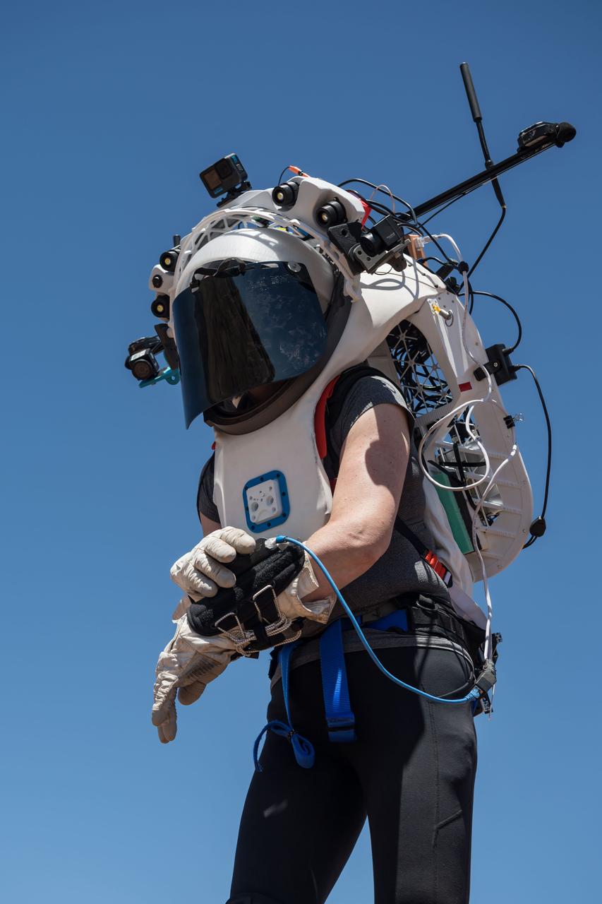
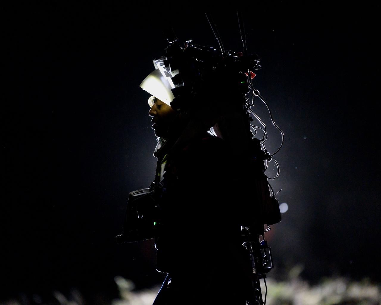
NASA astronauts Andre Douglas and Kate Rubins during a nighttime advanced technology run in the San Francisco Volcanic Field in Northern Arizona on May 21, 2024. Douglas is wearing the Joint AR (Joint Augmented Reality Visual Informatics System) display. The suit display features include navigation, photo capture, graphical format of consumables, procedure viewing, mission control updates, and other augmented reality cues and graphics. The team successfully tested navigation displays using data from four different data streams: GPS (Global Positioning System)/IMU (Inertial Measurement Unit), camera/IMU, LiDAR (Light Detection and Ranging), and static maps. Technology like this may be used for future Artemis missions to augment mission control communication and help guide crew back to the lunar lander. Credit: NASA/Josh Valcarcel
NASA astronaut Kate Rubins uses the hand controller on her wrist to display information while wearing the Joint AR (Joint Augmented Reality Visual Informatics System) display during an advanced technology run in the San Francisco Volcanic Field in Northern Arizona on May 21, 2024. The suit display features include navigation, photo capture, graphical format of consumables, procedure viewing, mission control updates, and other augmented reality cues and graphics. The team successfully tested navigation displays using data from four different data streams: GPS (Global Positioning System)/IMU (Inertial Measurement Unit), camera/IMU, LiDAR (Light Detection and Ranging), and static maps. Technology like this may be used for future Artemis missions to augment mission control communication and help guide crew back to the lunar lander. Credit: NASA/Josh Valcarcel
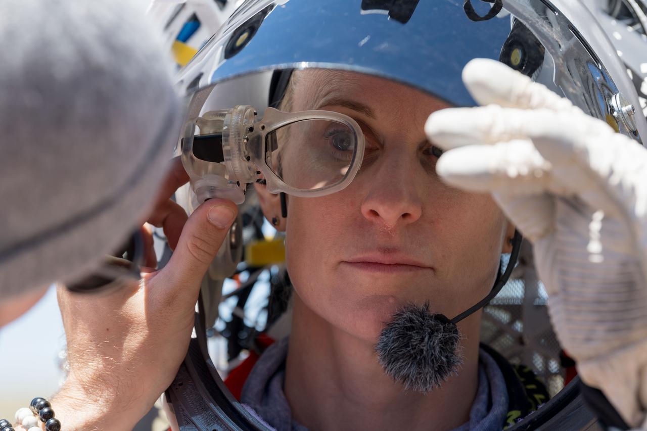
An engineer helps NASA astronaut Kate Rubins adjust the lens on the Joint AR (Joint Augmented Reality Visual Informatics System) display she’s wearing during an advanced technology run in the San Francisco Volcanic Field in Northern Arizona on May 19, 2024. The suit display features include navigation, photo capture, graphical format of consumables, procedure viewing, mission control updates, and other augmented reality cues and graphics. The team successfully tested navigation displays using data from four different data streams: GPS (Global Positioning System)/IMU (Inertial Measurement Unit), camera/IMU, LiDAR (Light Detection and Ranging), and static maps. Technology like this may be used for future Artemis missions to augment mission control communication and help guide crew back to the lunar lander. Credit: NASA/Josh Valcarcel
NASA astronaut Kate Rubins walks through the lunar-like landscape wearing the Joint AR (Joint Augmented Reality Visual Informatics System) display during an advanced technology run in the San Francisco Volcanic Field in Northern Arizona on May 19, 2024. The suit display features include navigation, photo capture, graphical format of consumables, procedure viewing, mission control updates, and other augmented reality cues and graphics. The team successfully tested navigation displays using data from four different data streams: GPS (Global Positioning System)/IMU (Inertial Measurement Unit), camera/IMU, LiDAR (Light Detection and Ranging), and static maps. Technology like this may be used for future Artemis missions to augment mission control communication and help guide crew back to the lunar lander. Credit: NASA/Josh Valcarcel
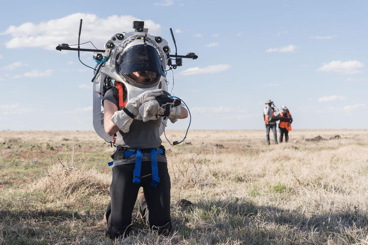
NASA astronaut Andre Douglas views the lunar-like landscape at dusk while wearing the Joint AR (Joint Augmented Reality Visual Informatics System) display during an advanced technology run in the San Francisco Volcanic Field in Northern Arizona on May 21, 2024. The suit display features include navigation, photo capture, graphical format of consumables, procedure viewing, mission control updates, and other augmented reality cues and graphics. The team successfully tested navigation displays using data from four different data streams: GPS (Global Positioning System)/IMU (Inertial Measurement Unit), camera/IMU, LiDAR (Light Detection and Ranging), and static maps. Technology like this may be used for future Artemis missions to augment mission control communication and help guide crew back to the lunar lander. Credit: NASA/Josh Valcarcel
NASA astronaut Kate Rubins walks through the lunar-like landscape wearing the Joint AR (Joint Augmented Reality Visual Informatics System) display during an advanced technology run in the San Francisco Volcanic Field in Northern Arizona on May 19, 2024. The suit display features include navigation, photo capture, graphical format of consumables, procedure viewing, mission control updates, and other augmented reality cues and graphics. The team successfully tested navigation displays using data from four different data streams: GPS (Global Positioning System)/IMU (Inertial Measurement Unit), camera/IMU, LiDAR (Light Detection and Ranging), and static maps. Technology like this may be used for future Artemis missions to augment mission control communication and help guide crew back to the lunar lander. Credit: NASA/Josh Valcarcel
NASA astronaut Kate Rubins uses the hand controller on her wrist to display information while wearing the Joint AR (Joint Augmented Reality Visual Informatics System) display during an advanced technology run in the San Francisco Volcanic Field in Northern Arizona on May 19, 2024. The suit display features include navigation, photo capture, graphical format of consumables, procedure viewing, mission control updates, and other augmented reality cues and graphics. The team successfully tested navigation displays using data from four different data streams: GPS (Global Positioning System)/IMU (Inertial Measurement Unit), camera/IMU, LiDAR (Light Detection and Ranging), and static maps. Technology like this may be used for future Artemis missions to augment mission control communication and help guide crew back to the lunar lander. Credit: NASA/Josh Valcarcel
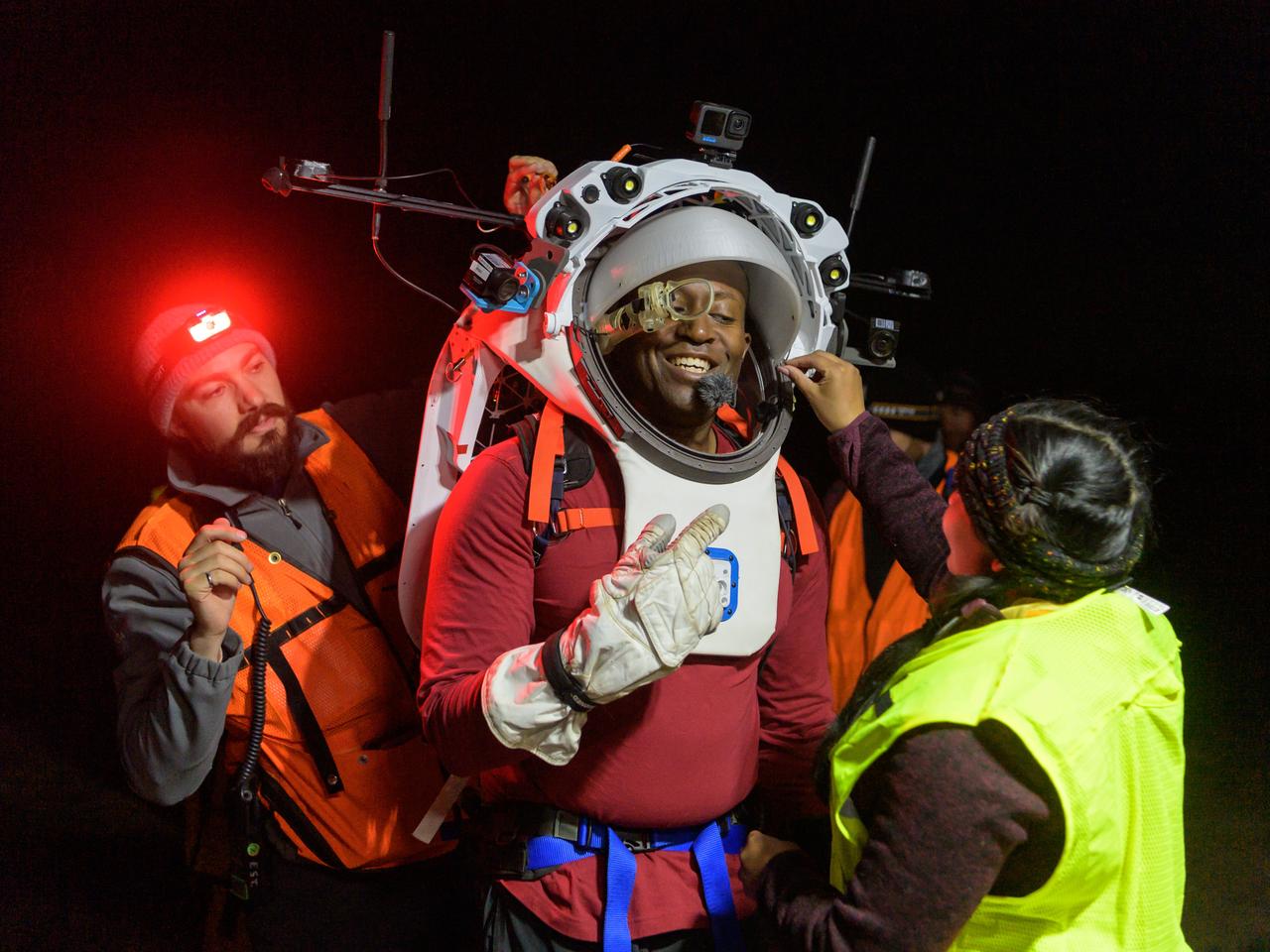
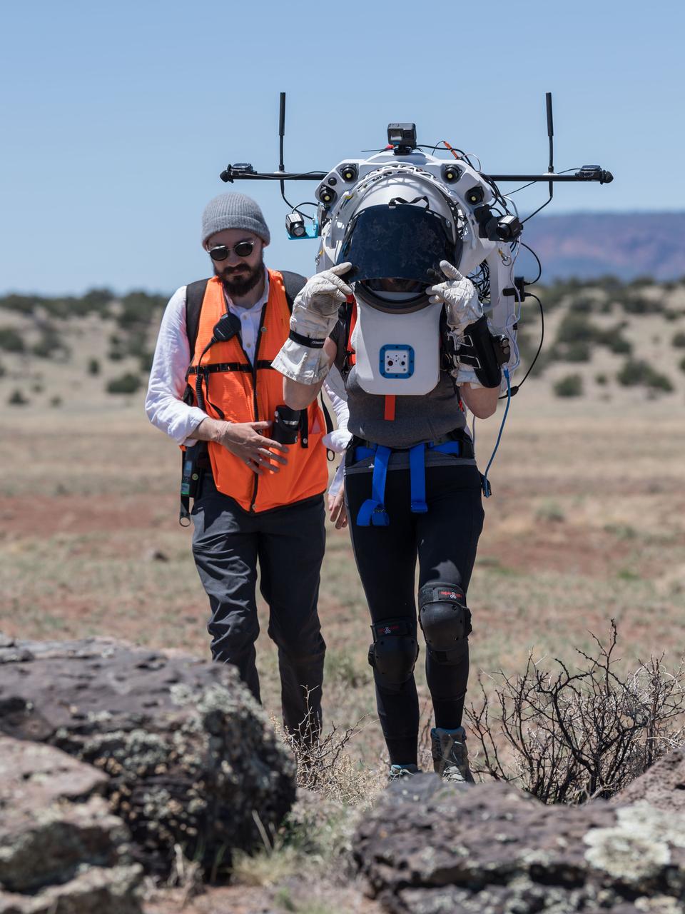
Engineers help NASA astronaut Andre Douglas adjust the Joint AR (Joint Augmented Reality Visual Informatics System) display he’s wearing during a nighttime advanced technology run in the San Francisco Volcanic Field in Northern Arizona on May 21, 2024. The suit display features include navigation, photo capture, graphical format of consumables, procedure viewing, mission control updates, and other augmented reality cues and graphics. The team successfully tested navigation displays using data from four different data streams: GPS (Global Positioning System)/IMU (Inertial Measurement Unit), camera/IMU, LiDAR (Light Detection and Ranging), and static maps. Technology like this may be used for future Artemis missions to augment mission control communication and help guide crew back to the lunar lander. Credit: NASA/Josh Valcarcel
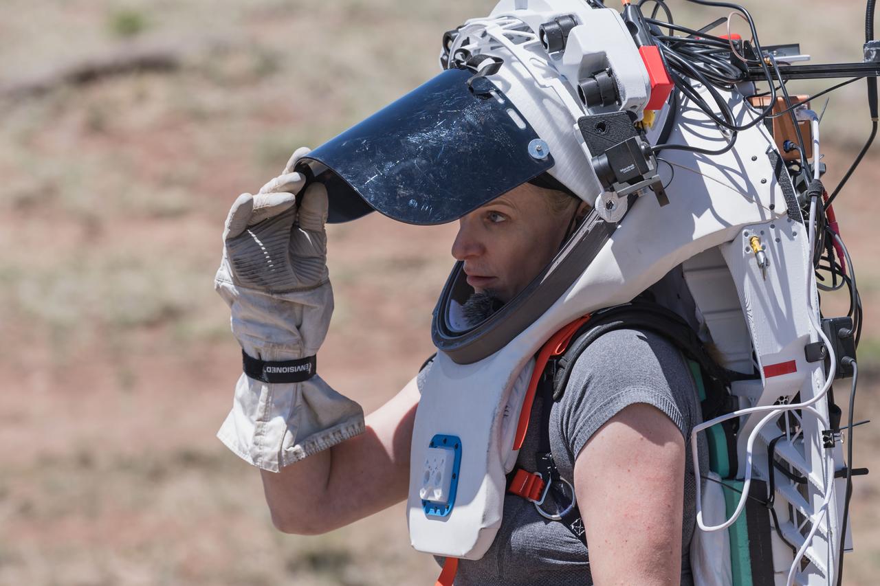
NASA astronaut Kate Rubins opens the sun visor on the Joint AR (Joint Augmented Reality Visual Informatics System) display she’s wearing during an advanced technology run in the San Francisco Volcanic Field in Northern Arizona on May 19, 2024. The suit display features include navigation, photo capture, graphical format of consumables, procedure viewing, mission control updates, and other augmented reality cues and graphics. The team successfully tested navigation displays using data from four different data streams: GPS (Global Positioning System)/IMU (Inertial Measurement Unit), camera/IMU, LiDAR (Light Detection and Ranging), and static maps. Technology like this may be used for future Artemis missions to augment mission control communication and help guide crew back to the lunar lander. Credit: NASA/Josh Valcarcel
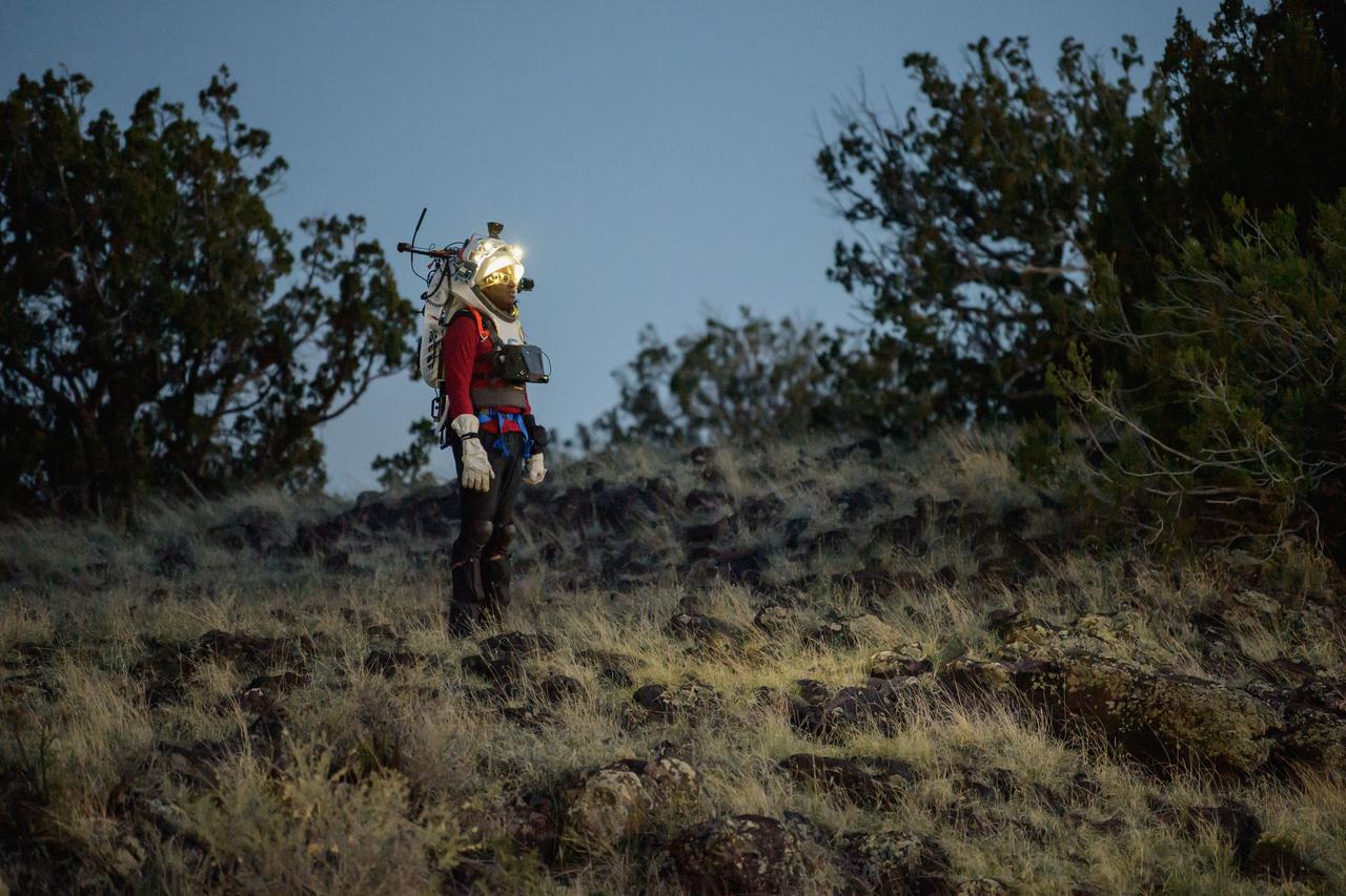
NASA astronaut Andre Douglas wears the Joint AR (Joint Augmented Reality Visual Informatics System) display during a nighttime advanced technology run in the San Francisco Volcanic Field in Northern Arizona on May 21, 2024. The suit display features include navigation, photo capture, graphical format of consumables, procedure viewing, mission control updates, and other augmented reality cues and graphics. The team successfully tested navigation displays using data from four different data streams: GPS (Global Positioning System)/IMU (Inertial Measurement Unit), camera/IMU, LiDAR (Light Detection and Ranging), and static maps. Technology like this may be used for future Artemis missions to augment mission control communication and help guide crew back to the lunar lander. Credit: NASA/Josh Valcarcel
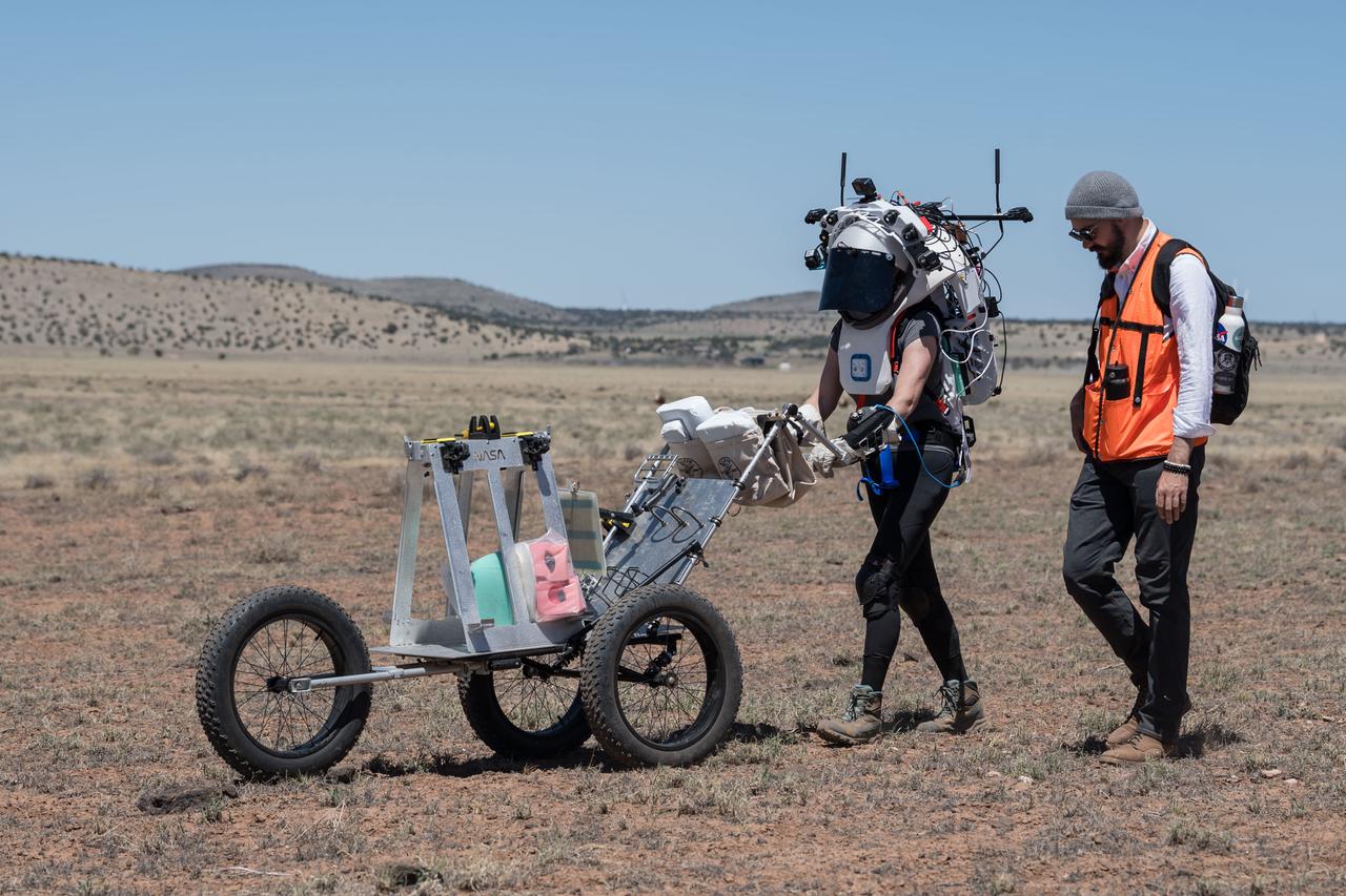
NASA astronaut Kate Rubins pushes a cart through the lunar-like landscape while wearing the Joint AR (Joint Augmented Reality Visual Informatics System) display during an advanced technology run in the San Francisco Volcanic Field in Northern Arizona on May 19, 2024. The suit display features include navigation, photo capture, graphical format of consumables, procedure viewing, mission control updates, and other augmented reality cues and graphics. The team successfully tested navigation displays using data from four different data streams: GPS (Global Positioning System)/IMU (Inertial Measurement Unit), camera/IMU, LiDAR (Light Detection and Ranging), and static maps. Technology like this may be used for future Artemis missions to augment mission control communication and help guide crew back to the lunar lander. Credit: NASA/Josh Valcarcel
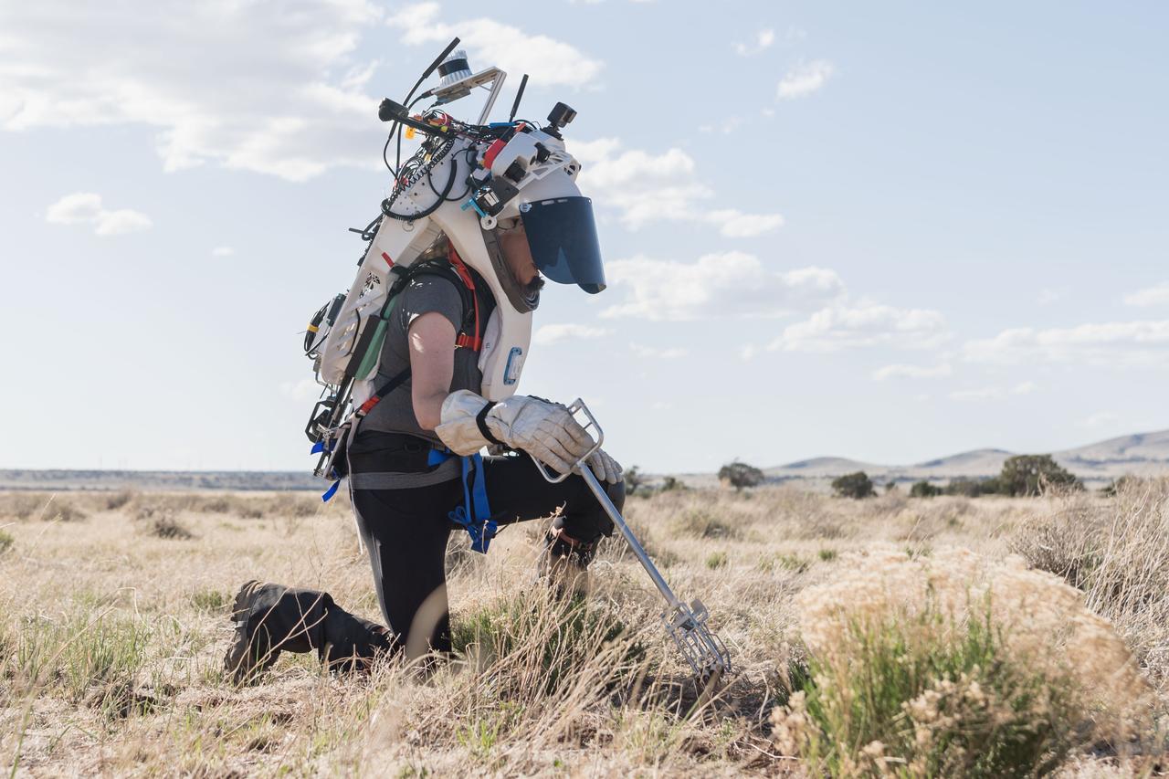
NASA astronaut Kate Rubins uses tongs to collect geologic samples while wearing the Joint AR (Joint Augmented Reality Visual Informatics System) display during an advanced technology run in the San Francisco Volcanic Field in Northern Arizona on May 21, 2024. The suit display features include navigation, photo capture, graphical format of consumables, procedure viewing, mission control updates, and other augmented reality cues and graphics. The team successfully tested navigation displays using data from four different data streams: GPS (Global Positioning System)/IMU (Inertial Measurement Unit), camera/IMU, LiDAR (Light Detection and Ranging), and static maps. Technology like this may be used for future Artemis missions to augment mission control communication and help guide crew back to the lunar lander. Credit: NASA/Josh Valcarcel
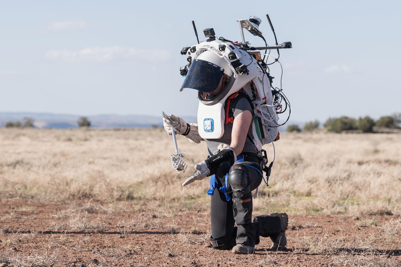
NASA astronaut Kate Rubins uses tongs to pick up a geologic sample while wearing the Joint AR (Joint Augmented Reality Visual Informatics System) display during an advanced technology run in the San Francisco Volcanic Field in Northern Arizona on May 21, 2024. The suit display features include navigation, photo capture, graphical format of consumables, procedure viewing, mission control updates, and other augmented reality cues and graphics. The team successfully tested navigation displays using data from four different data streams: GPS (Global Positioning System)/IMU (Inertial Measurement Unit), camera/IMU, LiDAR (Light Detection and Ranging), and static maps. Technology like this may be used for future Artemis missions to augment mission control communication and help guide crew back to the lunar lander. Credit: NASA/Josh Valcarcel
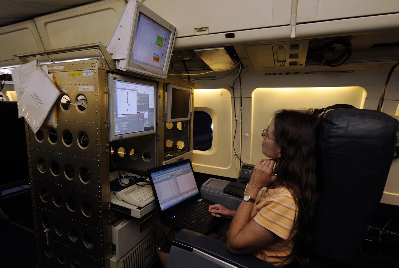
Susan Kool, a researcher from the Langley Research Center, works on monitoring the Lidar Atmospheric Sensing Experiment (LASE) aboard the NASA DC-8 aircraft, Monday, Aug. 16, 2010, at Fort Lauderdale Hollywood International Airport in Fort Lauderdale, Fla. LASE probes the atmosphere using lasers and is part of the Genesis and Rapid Intensification Processes (GRIP) experiment is a NASA Earth science field experiment in 2010 that is being conducted to better understand how tropical storms form and develop into major hurricanes. Photo Credit: (NASA/Paul E. Alers)
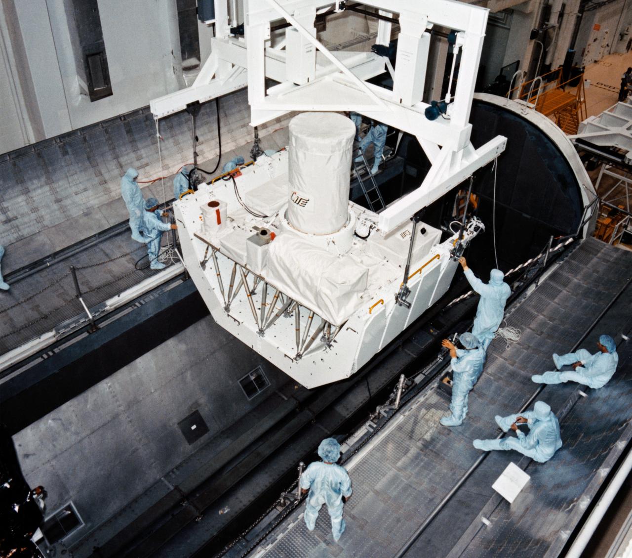
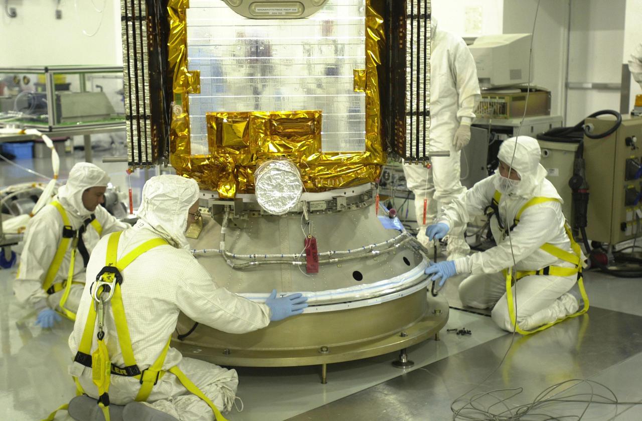
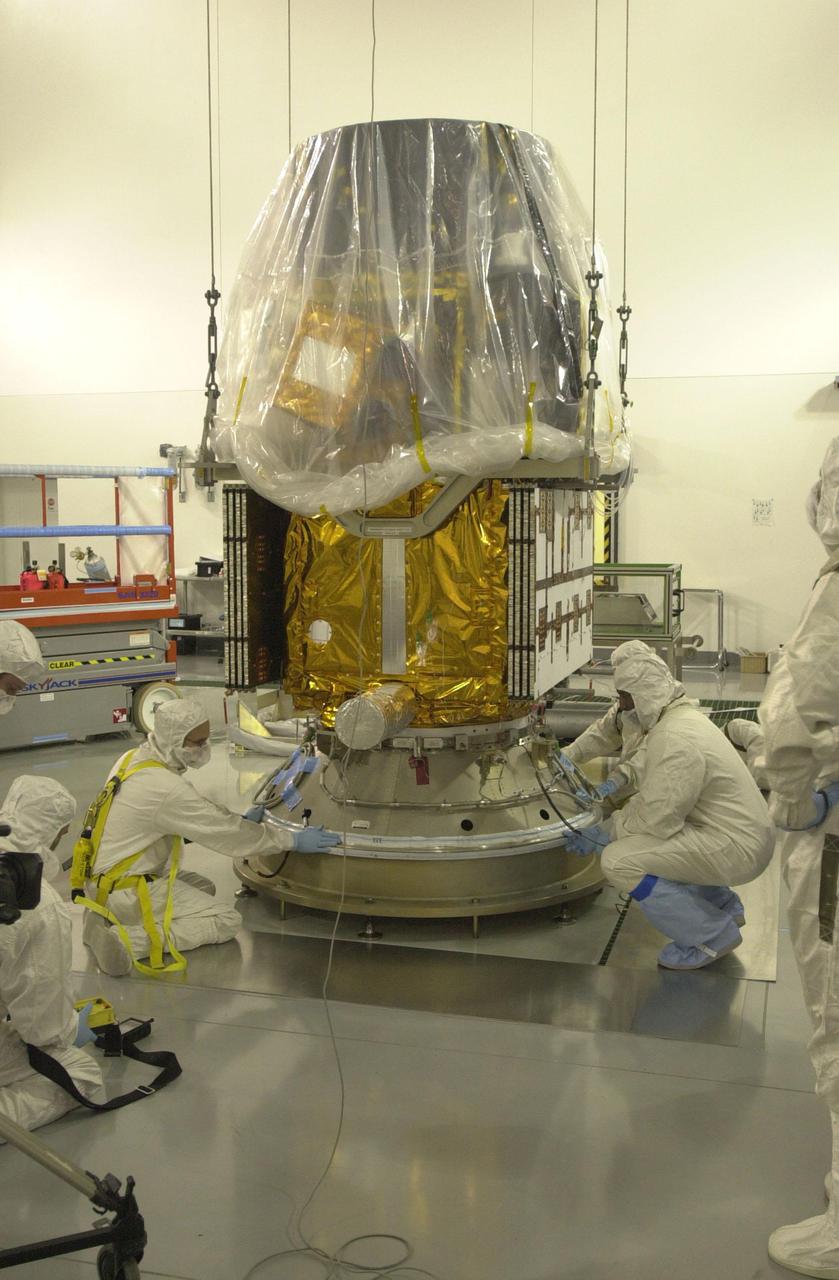
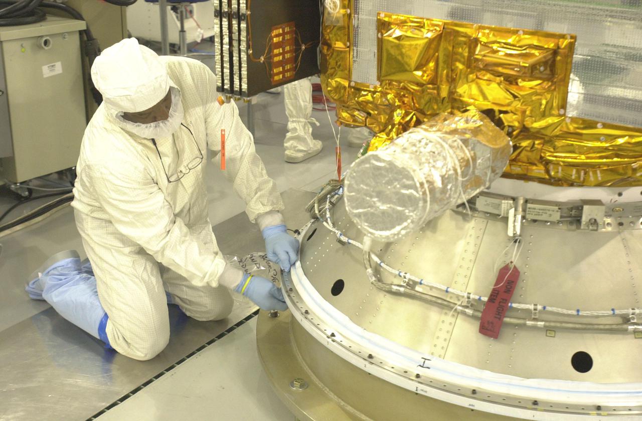
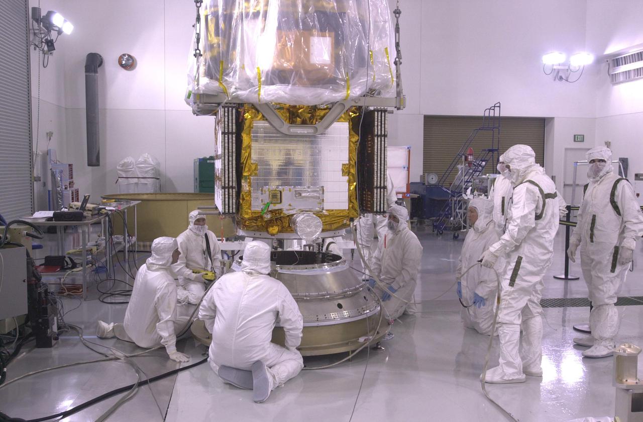
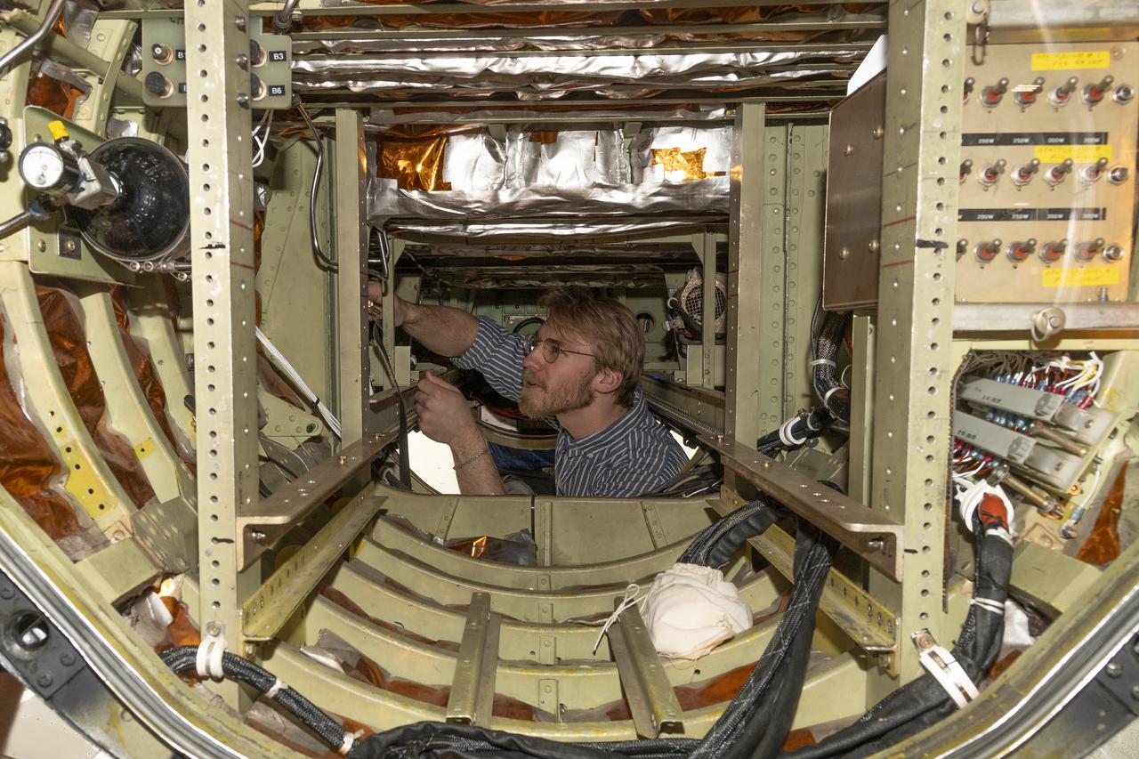
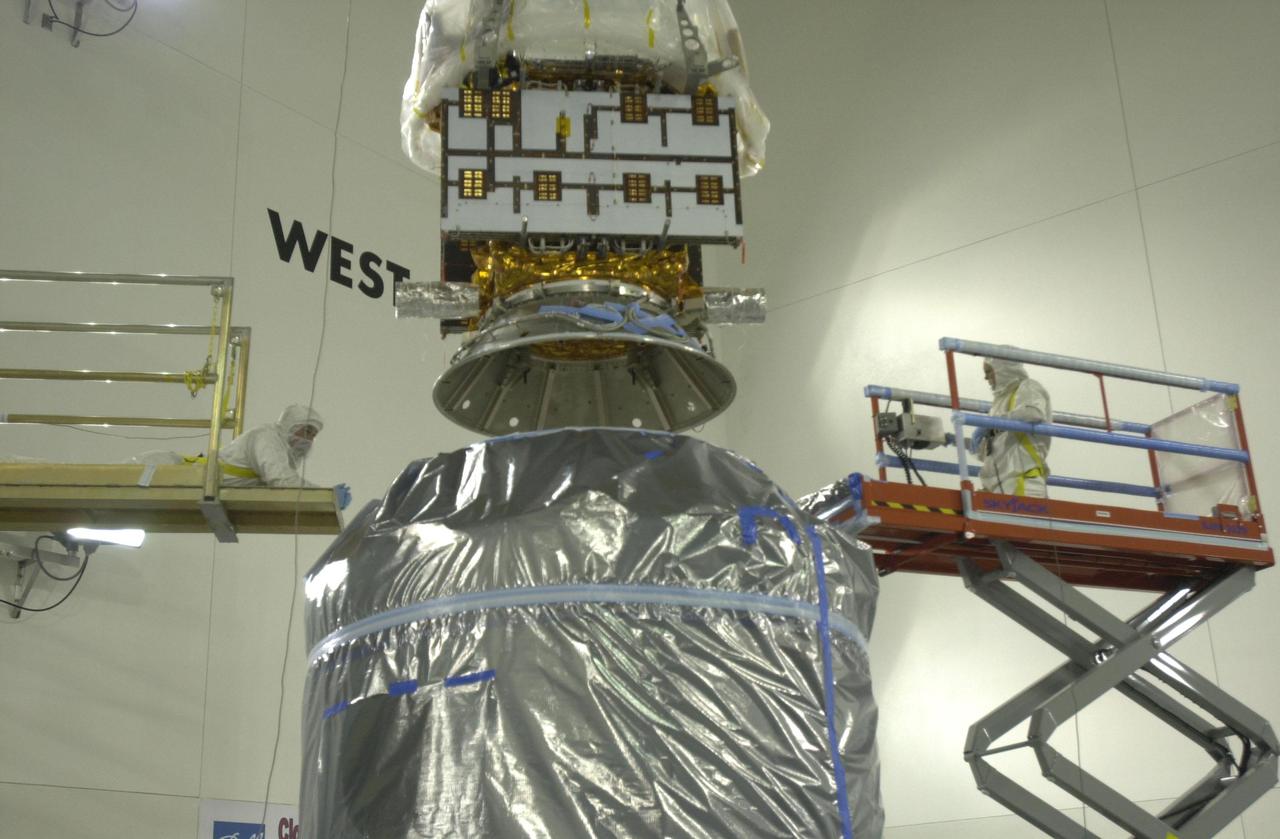
S94-40916 (5 July 1994) --- Workers in the Operations and Checkout Building are transporting the Lidar In-Space Technology Experiment (LITE-1) into the payload canister transporter for transfer to the Orbiter Processing Facility, where it will be installed into the cargo bay of the space shuttle Discovery. LITE-1, which will demonstrate the technology of a spaceborne Lidar instrument, is scheduled to fly on STS-64 later this year. Photo credit: NASA or National Aeronautics and Space Administration
A team of experts prepares the ER-2 aircraft at Armstrong Flight Research Center in Edwards, California for the GSFC Lidar Observation and Validation Experiment (GLOVE) in February 2025. Researcher Jennifer Moore from NASA’s Goddard Space Flight Center smiles beside the ER-2 aircraft’s forebody pod where the Cloud Physics Lidar (CPL) instrument will be installed. As a collaboration between engineers, scientists, and aircraft professionals, GLOVE aims to improve satellite data products for Earth Science applications.
A team of experts prepares the ER-2 aircraft at Armstrong Flight Research Center in Edwards, California for the GSFC Lidar Observation and Validation Experiment (GLOVE) in February 2025. Researcher Grant Finneman from the University of Iowa installs the insulations at the front of the ER-2 forebody pod where the Cloud Physics Lidar (CPL) flies. As a collaboration between engineers, scientists, and aircraft professionals, GLOVE aims to improve satellite data products for Earth Science applications.
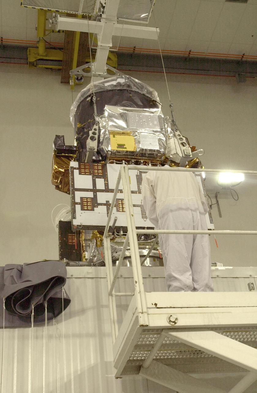
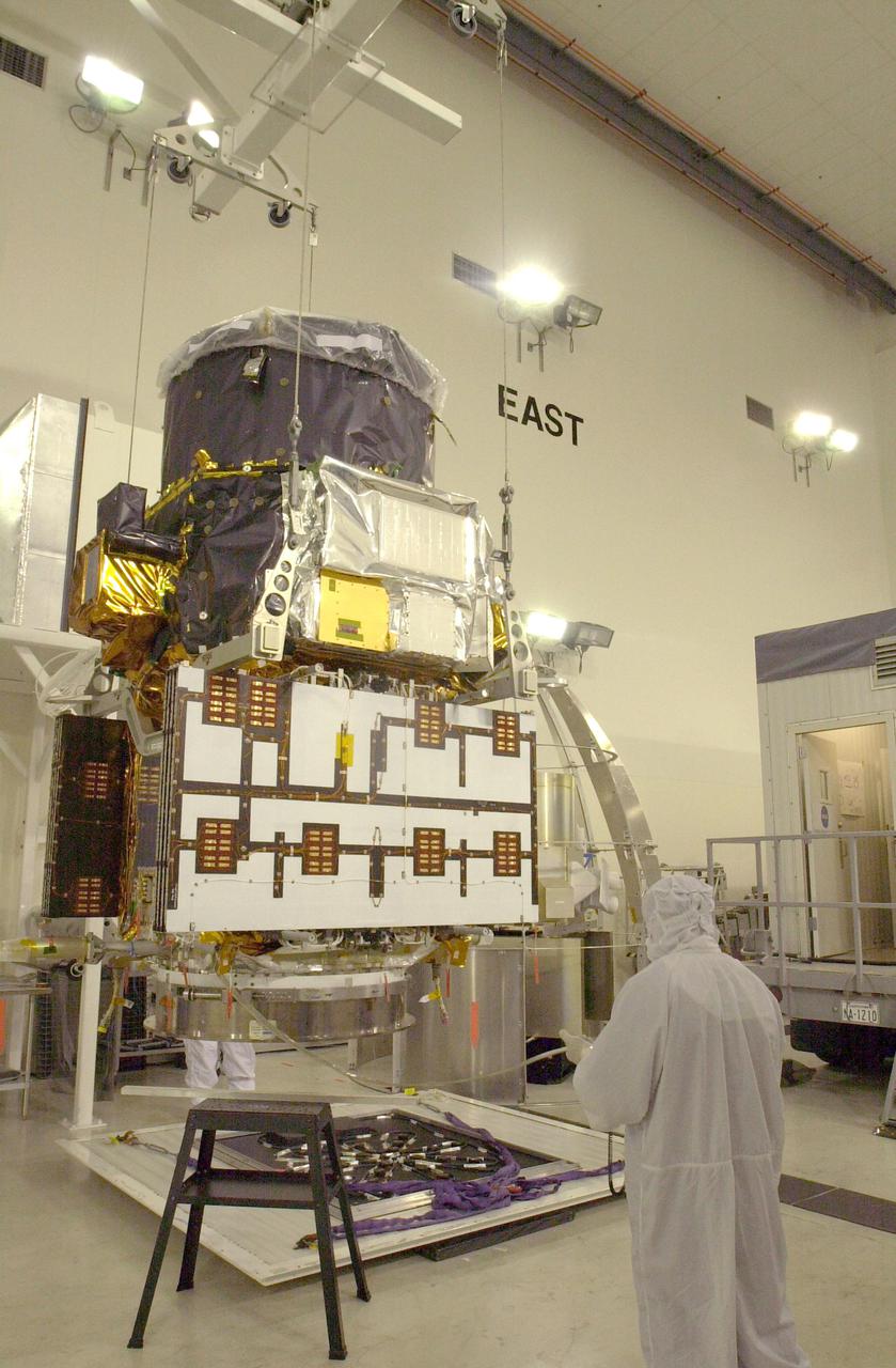
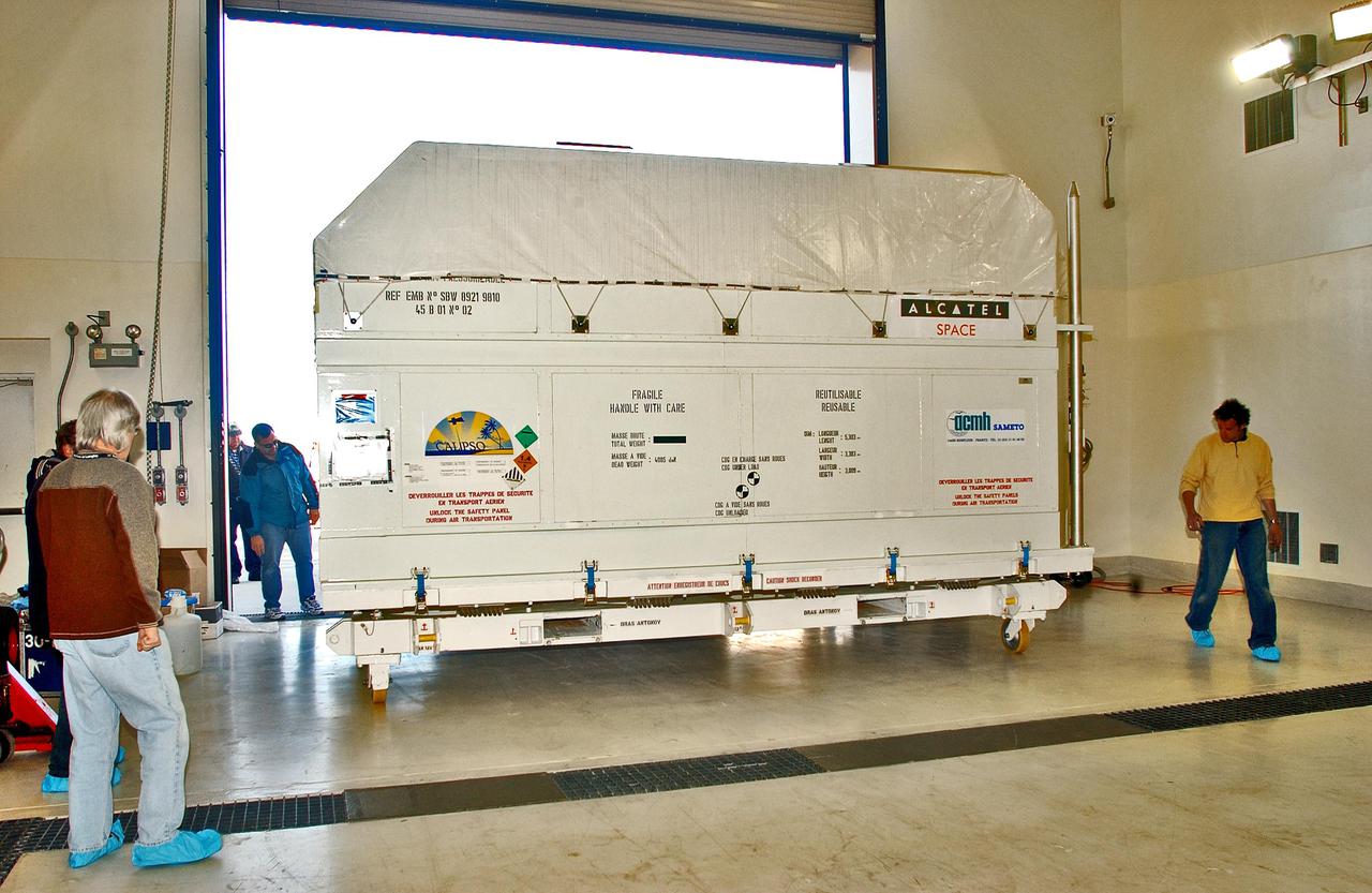
VANDENBERG AIR FORCE BASE, CALIF. - At Vandenberg Air Force Base in California, a worker prepares the CALIPSO spacecraft for a move to a specially modified container where LIDAR (LIght Detection And Ranging) laser testing will take place. CALIPSO stands for Cloud-Aerosol LIDAR and Infrared Pathfinder Satellite Observation. LIDAR measures distance, speed, rotation, chemical composition and concentration. CALIPSO and CloudSat will fly in formation with three other satellites in the A-train constellation to enhance understanding of our climate system. They are highly complementary satellites and together they will provide never-before-seen 3-D perspectives of how clouds and aerosols form, evolve, and affect weather and climate. Launch of CALIPSO_CloudSat aboard a Boeing Delta II rocket is scheduled for 3:01 a.m. PDT Sept. 29.
VANDENBERG AIR FORCE BASE, CALIF. - At Vandenberg Air Force Base in California, a light beam is emitted during LIDAR (LIght Detection And Ranging) laser testing on the CALIPSO spacecraft. CALIPSO stands for Cloud-Aerosol LIDAR and Infrared Pathfinder Satellite Observation. LIDAR measures distance, speed, rotation, chemical composition and concentration. CALIPSO and CloudSat will fly in formation with three other satellites in the A-train constellation to enhance understanding of our climate system. They are highly complementary satellites and together they will provide never-before-seen 3-D perspectives of how clouds and aerosols form, evolve, and affect weather and climate. Launch of CALIPSO_CloudSat aboard a Boeing Delta II rocket is scheduled for 3:01 a.m. PDT Sept. 29.
VANDENBERG AIR FORCE BASE, CALIF. - At Vandenberg Air Force Base in California, the CALIPSO spacecraft is being prepared for a move to a specially modified container where LIDAR (LIght Detection And Ranging) laser testing will take place. CALIPSO stands for Cloud-Aerosol LIDAR and Infrared Pathfinder Satellite Observation. LIDAR measures distance, speed, rotation, chemical composition and concentration. CALIPSO and CloudSat will fly in formation with three other satellites in the A-train constellation to enhance understanding of our climate system. They are highly complementary satellites and together they will provide never-before-seen 3-D perspectives of how clouds and aerosols form, evolve, and affect weather and climate. Launch of CALIPSO_CloudSat aboard a Boeing Delta II rocket is scheduled for 3:01 a.m. PDT Sept. 29.
VANDENBERG AIR FORCE BASE, CALIF. - At Vandenberg Air Force Base in California, workers help secure the CALIPSO spacecraft inside a specially modified container where LIDAR (LIght Detection And Ranging) laser testing will take place. CALIPSO stands for Cloud-Aerosol LIDAR and Infrared Pathfinder Satellite Observation. LIDAR measures distance, speed, rotation, chemical composition and concentration. CALIPSO and CloudSat will fly in formation with three other satellites in the A-train constellation to enhance understanding of our climate system. They are highly complementary satellites and together they will provide never-before-seen 3-D perspectives of how clouds and aerosols form, evolve, and affect weather and climate. Launch of CALIPSO_CloudSat aboard a Boeing Delta II rocket is scheduled for 3:01 a.m. PDT Sept. 29.
VANDENBERG AIR FORCE BASE, CALIF. - At Vandenberg Air Force Base in California, light beams are emitted during LIDAR (LIght Detection And Ranging) laser testing on the CALIPSO spacecraft. CALIPSO stands for Cloud-Aerosol LIDAR and Infrared Pathfinder Satellite Observation. LIDAR measures distance, speed, rotation, chemical composition and concentration. CALIPSO and CloudSat will fly in formation with three other satellites in the A-train constellation to enhance understanding of our climate system. They are highly complementary satellites and together they will provide never-before-seen 3-D perspectives of how clouds and aerosols form, evolve, and affect weather and climate. Launch of CALIPSO_CloudSat aboard a Boeing Delta II rocket is scheduled for 3:01 a.m. PDT Sept. 29.
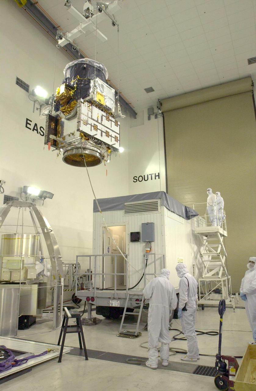
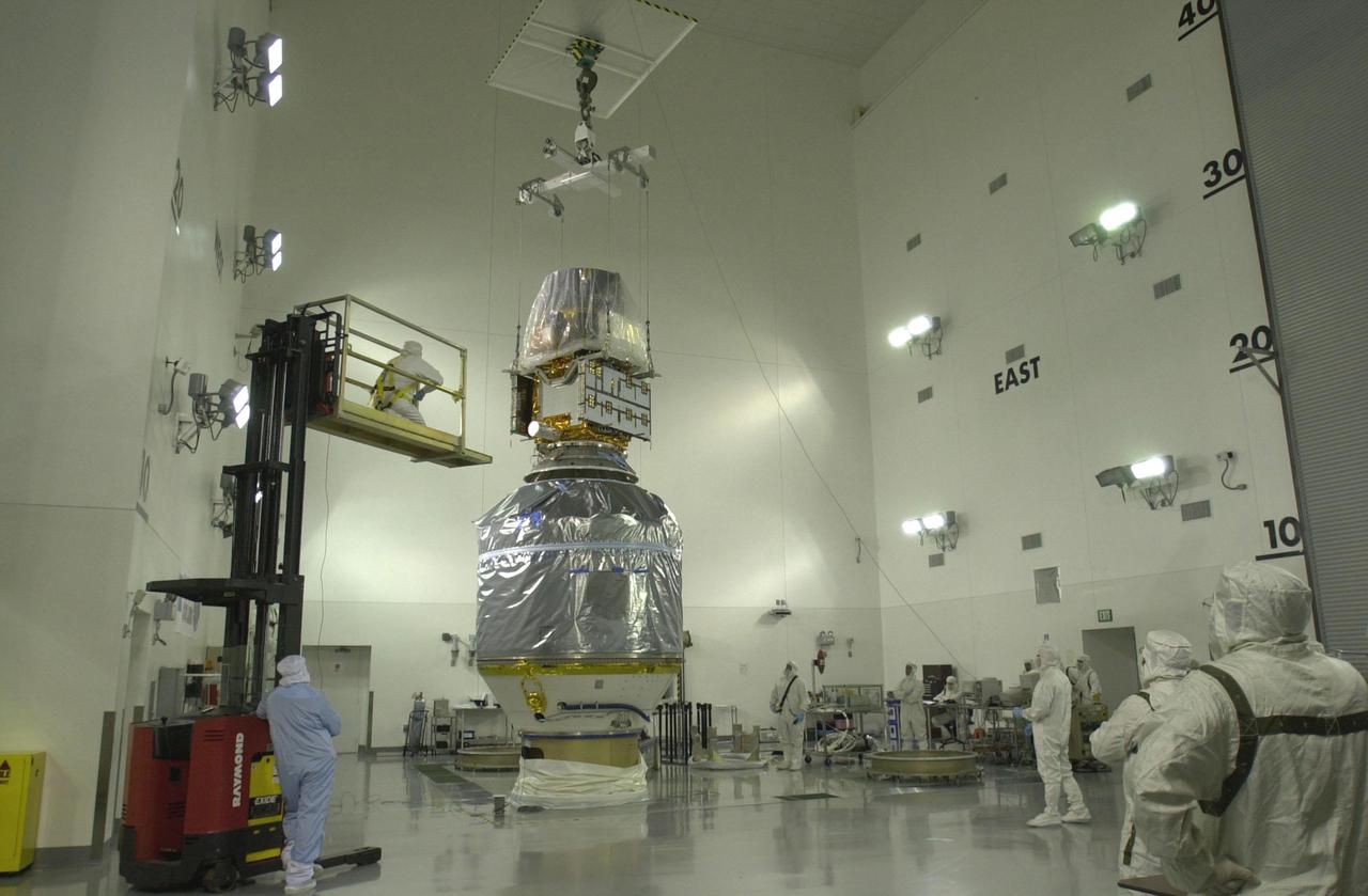
VANDENBERG AIR FORCE BASE, CALIF. - At Vandenberg Air Force Base in California, an overhead crane lowers the suspended CALIPSO spacecraft into a specially modified container (lower right) where LIDAR (LIght Detection And Ranging) laser testing will take place. CALIPSO stands for Cloud-Aerosol LIDAR and Infrared Pathfinder Satellite Observation. LIDAR measures distance, speed, rotation, chemical composition and concentration. CALIPSO and CloudSat will fly in formation with three other satellites in the A-train constellation to enhance understanding of our climate system. They are highly complementary satellites and together they will provide never-before-seen 3-D perspectives of how clouds and aerosols form, evolve, and affect weather and climate. Launch of CALIPSO_CloudSat aboard a Boeing Delta II rocket is scheduled for 3:01 a.m. PDT Sept. 29.

VANDENBERG AIR FORCE BASE, CALIF. - At Vandenberg Air Force Base in California, the suspended CALIPSO spacecraft is moved toward a specially modified container (lower right) where LIDAR (LIght Detection And Ranging) laser testing will take place. CALIPSO stands for Cloud-Aerosol LIDAR and Infrared Pathfinder Satellite Observation. LIDAR measures distance, speed, rotation, chemical composition and concentration. CALIPSO and CloudSat will fly in formation with three other satellites in the A-train constellation to enhance understanding of our climate system. They are highly complementary satellites and together they will provide never-before-seen 3-D perspectives of how clouds and aerosols form, evolve, and affect weather and climate. Launch of CALIPSO_CloudSat aboard a Boeing Delta II rocket is scheduled for 3:01 a.m. PDT Sept. 29.
VANDENBERG AIR FORCE BASE, CALIF. - At Vandenberg Air Force Base in California, the CALIPSO spacecraft is lifted off a work stand for a move to a specially modified container where LIDAR (LIght Detection And Ranging) laser testing will take place. CALIPSO stands for Cloud-Aerosol LIDAR and Infrared Pathfinder Satellite Observation. LIDAR measures distance, speed, rotation, chemical composition and concentration. CALIPSO and CloudSat will fly in formation with three other satellites in the A-train constellation to enhance understanding of our climate system. They are highly complementary satellites and together they will provide never-before-seen 3-D perspectives of how clouds and aerosols form, evolve, and affect weather and climate. Launch of CALIPSO_CloudSat aboard a Boeing Delta II rocket is scheduled for 3:01 a.m. PDT Sept. 29.
VANDENBERG AIR FORCE BASE, CALIF. - At Vandenberg Air Force Base in California, the suspended CALIPSO spacecraft is lowered inside a specially modified container where LIDAR (LIght Detection And Ranging) laser testing will take place. CALIPSO stands for Cloud-Aerosol LIDAR and Infrared Pathfinder Satellite Observation. LIDAR measures distance, speed, rotation, chemical composition and concentration. CALIPSO and CloudSat will fly in formation with three other satellites in the A-train constellation to enhance understanding of our climate system. They are highly complementary satellites and together they will provide never-before-seen 3-D perspectives of how clouds and aerosols form, evolve, and affect weather and climate. Launch of CALIPSO_CloudSat aboard a Boeing Delta II rocket is scheduled for 3:01 a.m. PDT Sept. 29.
VANDENBERG AIR FORCE BASE, CALIF. - At Vandenberg Air Force Base in California, workers oversee the CALIPSO spacecraft as it is lowered inside a specially modified container where LIDAR (LIght Detection And Ranging) laser testing will take place. CALIPSO stands for Cloud-Aerosol LIDAR and Infrared Pathfinder Satellite Observation. LIDAR measures distance, speed, rotation, chemical composition and concentration. CALIPSO and CloudSat will fly in formation with three other satellites in the A-train constellation to enhance understanding of our climate system. They are highly complementary satellites and together they will provide never-before-seen 3-D perspectives of how clouds and aerosols form, evolve, and affect weather and climate. Launch of CALIPSO_CloudSat aboard a Boeing Delta II rocket is scheduled for 3:01 a.m. PDT Sept. 29.
VANDENBERG AIR FORCE BASE, CALIF. - At Vandenberg Air Force Base in California, the suspended CALIPSO spacecraft is moved toward a specially modified container (lower right) where LIDAR (LIght Detection And Ranging) laser testing will take place. CALIPSO stands for Cloud-Aerosol LIDAR and Infrared Pathfinder Satellite Observation. LIDAR measures distance, speed, rotation, chemical composition and concentration. CALIPSO and CloudSat will fly in formation with three other satellites in the A-train constellation to enhance understanding of our climate system. They are highly complementary satellites and together they will provide never-before-seen 3-D perspectives of how clouds and aerosols form, evolve, and affect weather and climate. Launch of CALIPSO_CloudSat aboard a Boeing Delta II rocket is scheduled for 3:01 a.m. PDT Sept. 29.
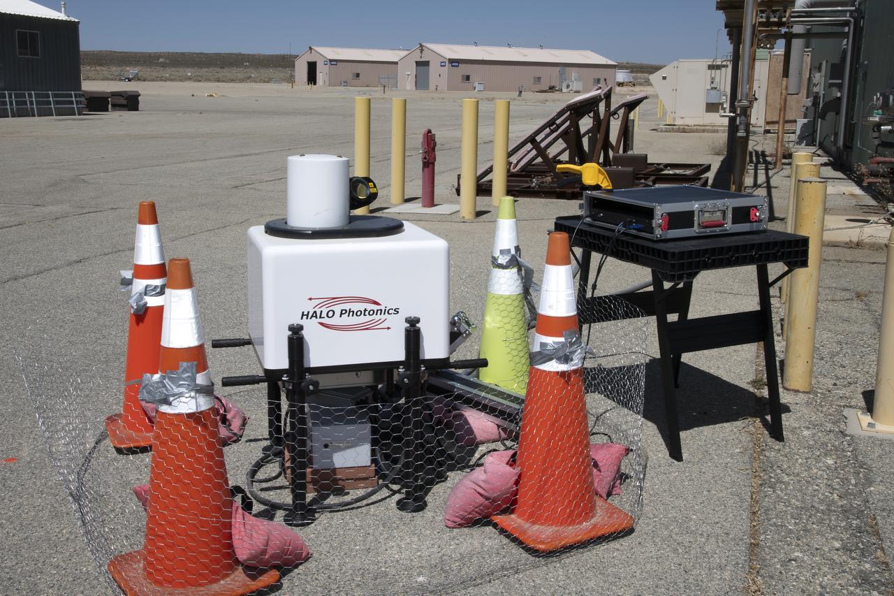
This is one of two lidar units positioned on either end of Building 4833 at NASA’s Armstrong Flight Research Center in Edwards, California, that formed the cutting-edge ‘virtual tower concept.’ The units use lasers to measure airflow from the ground level to 2,000 feet to provide data to assist future drones to safely land on rooftop hubs called vertiports, and to potentially improve weather prediction. It was part of the multi-faceted Advanced Exploration of Reliable Operation at Low Altitudes: Meteorology, Simulation and Technology campaign.
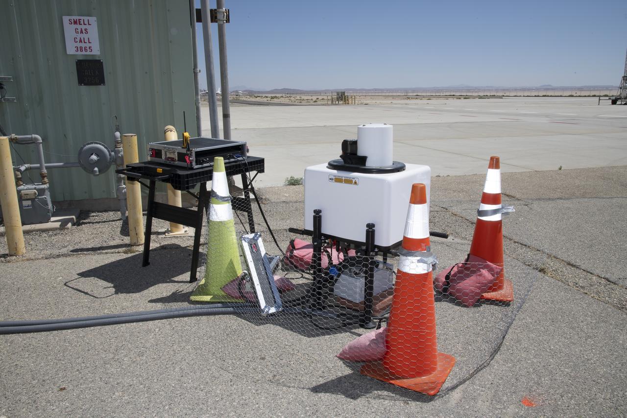
This is one of two lidar units positioned on either end of Building 4833 at NASA’s Armstrong Flight Research Center in Edwards, California, that formed the cutting-edge ‘virtual tower concept.’ The units use lasers to measure airflow from the ground level to 2,000 feet to provide data to assist future drones to safely land on rooftop hubs called vertiports, and to potentially improve weather prediction. It was part of the multi-faceted Advanced Exploration of Reliable Operation at Low Altitudes: Meteorology, Simulation and Technology campaign.
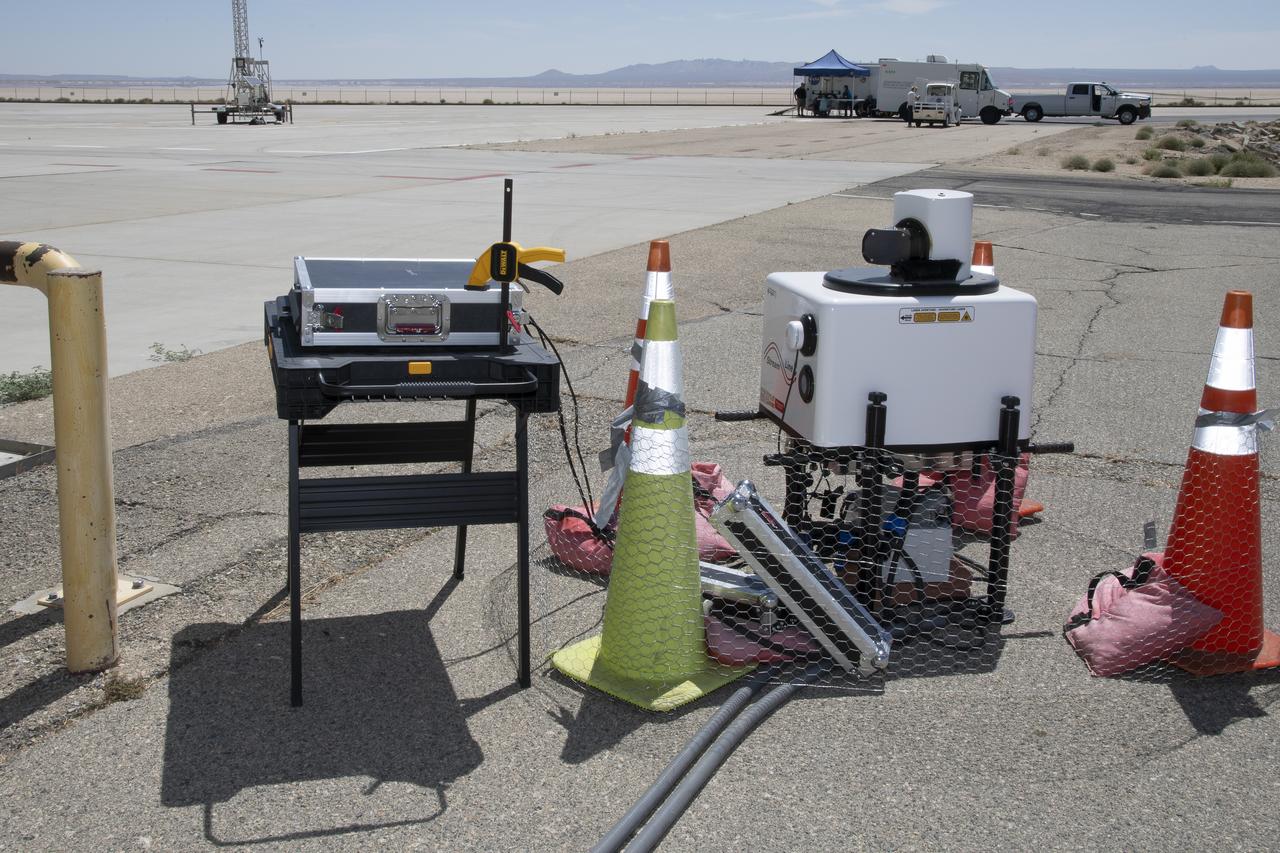
This is one of two lidar units positioned on either end of Building 4833 at NASA’s Armstrong Flight Research Center in Edwards, California, that formed the cutting-edge ‘virtual tower concept.’ The units use lasers to measure airflow from the ground level to 2,000 feet to provide data to assist future drones to safely land on rooftop hubs called vertiports, and to potentially improve weather prediction. It was part of the multi-faceted Advanced Exploration of Reliable Operation at Low Altitudes: Meteorology, Simulation and Technology campaign.

This is one of two lidar units positioned on either end of Building 4833 at NASA’s Armstrong Flight Research Center in Edwards, California, that formed the cutting-edge ‘virtual tower concept.’ The units use lasers to measure airflow from the ground level to 2,000 feet to provide data to assist future drones to safely land on rooftop hubs called vertiports, and to potentially improve weather prediction. It was part of the multi-faceted Advanced Exploration of Reliable Operation at Low Altitudes: Meteorology, Simulation and Technology campaign.
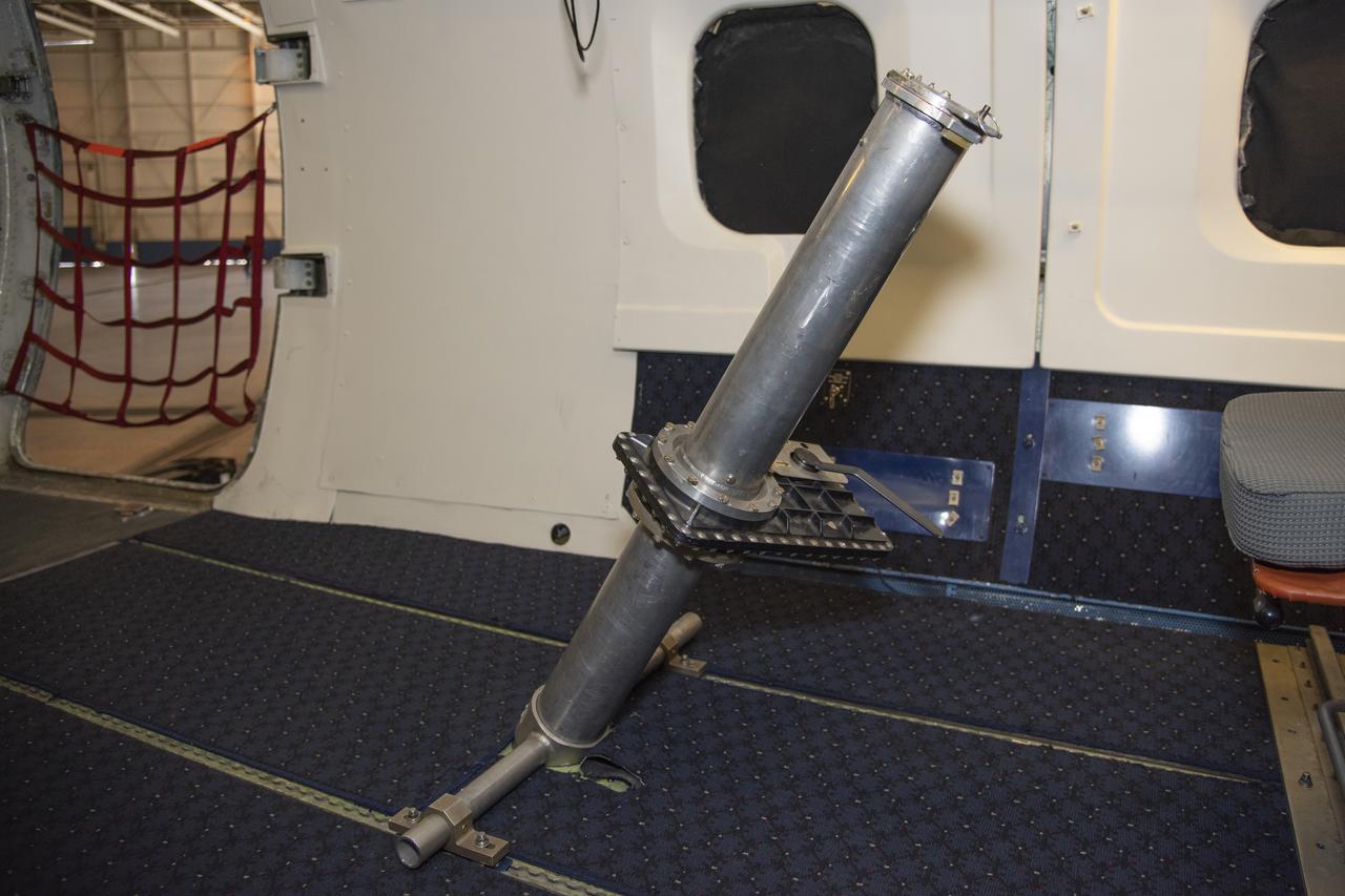
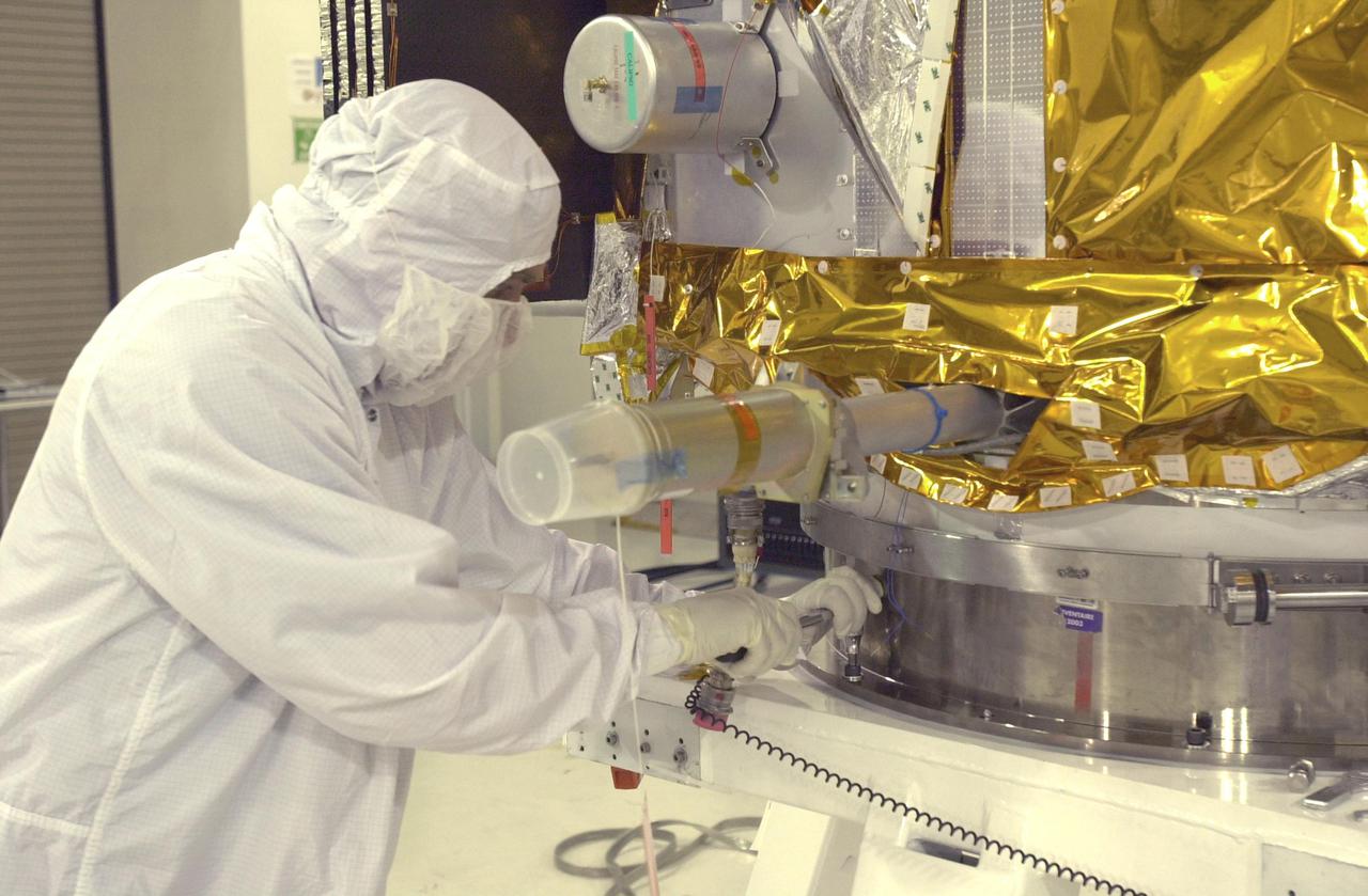
To verify the lidar data they're collecting on the DC-8 airborne science laboratory, Aeolus mission scientists will use dropsondes, which are devices they'll drop from this tube in the aircraft to collect wind and water vapor data.
A team of experts wrap up science flights on the ER-2 aircraft at Armstrong Flight Research Center in Edwards, California after the GSFC Lidar Observation and Validation Experiment (GLOVE) in February 2025. Pilot Tim Williams ascends the ER-2 on the runway for one of the final science flights validating satellite-borne data. As a collaboration between engineers, scientists, and aircraft professionals, GLOVE aims to improve satellite data products for Earth Science applications.
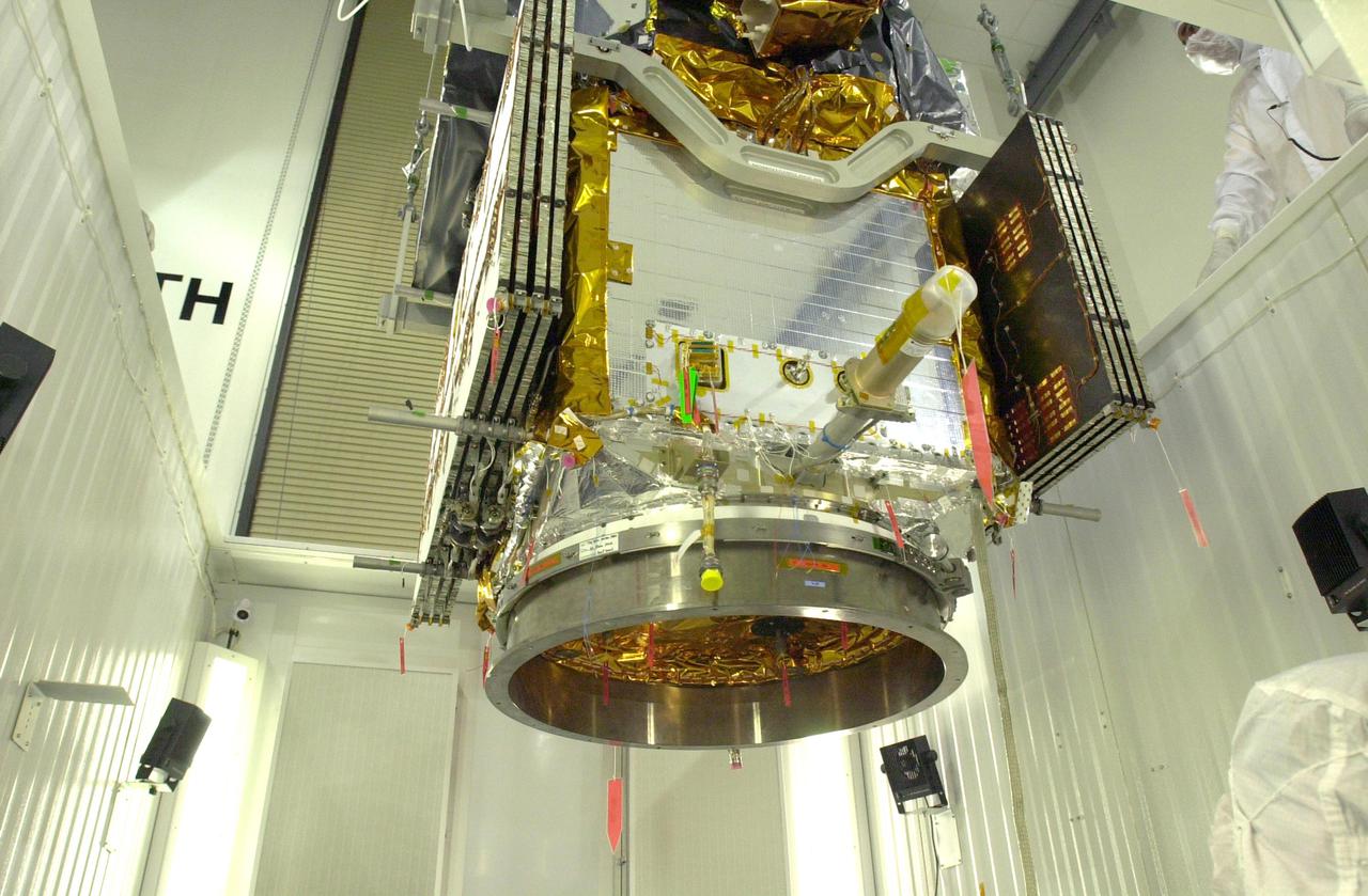
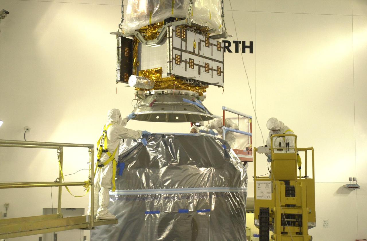
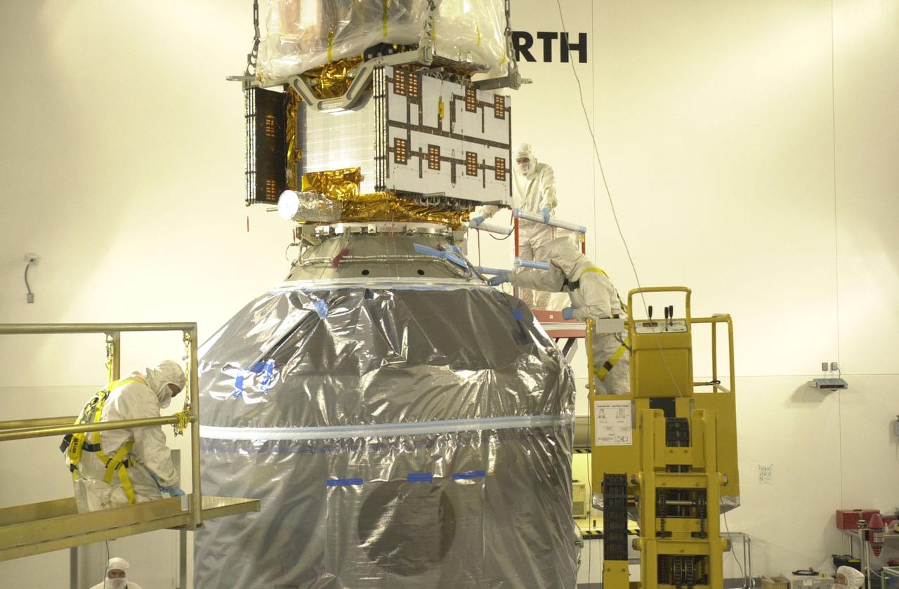
VANDENBERG AIR FORCE BASE, CALIF. — Inside the Astrotech Payload Processing Facility on Vandenberg Air Force Base in California, workers lift the CALIPSO spacecraft from the Upper Delta Payload Attach Fitting (UDPAF) to adjust the attachment. CALIPSO will be mated with the Lower Delta Payload Attach Fitting (LDPAF) that contains the CloudSat satellite. The PAF is the interface between the spacecraft and the second stage of the rocket. CALIPSO stands for Cloud-Aerosol Lidar and Infrared Pathfinder Satellite Observation.
A team of experts prepares the ER-2 aircraft at Armstrong Flight Research Center in Edwards, California for the GSFC Lidar Observation and Validation Experiment (GLOVE) in February 2025. Researcher Jennifer Moore checks the cabling on the Roscoe instrument which flew at high altitudes on the ER-2. As a collaboration between engineers, scientists, and aircraft professionals, GLOVE aims to improve satellite data products for Earth Science applications.
VANDENBERG AIR FORCE BASE, CALIF. — Inside the Astrotech Payload Processing Facility on Vandenberg Air Force Base in California, workers attach the CALIPSO spacecraft onto another payload attach fitting. CALIPSO will be mated with the Lower Delta Payload Attach Fitting (LDPAF) that contains the CloudSat satellite. Later the UDPAF will be mated with the lower Delta Payload Attach Fitting, which contains the CloudSat satellite. The PAF is the interface between the spacecraft and the second stage of the rocket. CALIPSO stands for Cloud-Aerosol Lidar and Infrared Pathfinder Satellite Observation.
Ralph Dubayah, principal investigator for Global Ecosystem Dynamics Investigation lidar, or GEDI, speaks to members of the media in the Kennedy Space Center’s Press Site auditorium. The briefing focused on research planned for launch to the International Space Station. The scientific materials and supplies will be aboard a Dragon spacecraft scheduled for liftoff from Cape Canaveral Air Force Station's Space Launch Complex 40. The SpaceX Falcon 9 rocket will launch the company's 16th Commercial Resupply Services mission to the space station.
A team of experts wrap up science flights on the ER-2 aircraft at Armstrong Flight Research Center in Edwards, California after the GSFC Lidar Observation and Validation Experiment (GLOVE) in February 2025. Nikolas Gibson from NASA Ames Research Center integrates the enhanced MODIS Airbrone Simulator (eMAS) instrument onto the ER-2. As a collaboration between engineers, scientists, and aircraft professionals, GLOVE aims to improve satellite data products for Earth Science applications.

iss049e006037 (Sep. 17, 2016) --- Cloud-Aerosol Transport System (CATS) mounted on the Japanese Experiment Module's Exposed Facility (JEM-EF). The CATS investigation uses a light detection and ranging (LiDAR) system to measure the location, composition and distribution of pollution, dust, smoke, aerosols and other particulates in the atmosphere. CATS is used to study the atmospheric constituents that impact global climate. By gaining a better understanding of cloud and aerosol coverage, scientists can create a better model of the Earth's climate feedback processes.
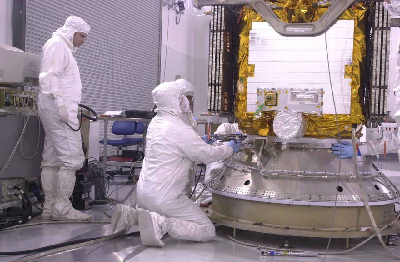
VANDENBERG AIR FORCE BASE, CALIF. — Inside the Astrotech Payload Processing Facility on Vandenberg Air Force Base in California, workers check the Upper Delta Payload Attach Fitting (UDPAF) holding the CALIPSO spacecraft. CALIPSO will be mated with the Lower Delta Payload Attach Fitting (LDPAF) that contains the CloudSat satellite. The PAF is the interface between the spacecraft and the second stage of the rocket. CALIPSO stands for Cloud-Aerosol Lidar and Infrared Pathfinder Satellite Observation.
VANDENBERG AIR FORCE BASE, CALIF. — Inside the Astrotech Payload Processing Facility on Vandenberg Air Force Base in California, a worker makes an adjustment on the Upper Delta Payload Attach Fitting (UDPAF) holding the CALIPSO spacecraft. CALIPSO will be mated with the Lower Delta Payload Attach Fitting (LDPAF) that contains the CloudSat satellite. The PAF is the interface between the spacecraft and the second stage of the rocket. CALIPSO stands for Cloud-Aerosol Lidar and Infrared Pathfinder Satellite Observation.
A team of experts prepares the ER-2 aircraft at Armstrong Flight Research Center in Edwards, California for the GSFC Lidar Observation and Validation Experiment (GLOVE) in February 2025. Aircraft mechanic Darick Alvarez-Alonzo installs a satellite-simulating instrument which will fly at high altitudes on the ER-2 to validate satellite-borne data. As a collaboration between engineers, scientists, and aircraft professionals, GLOVE aims to improve satellite data products for Earth Science applications.
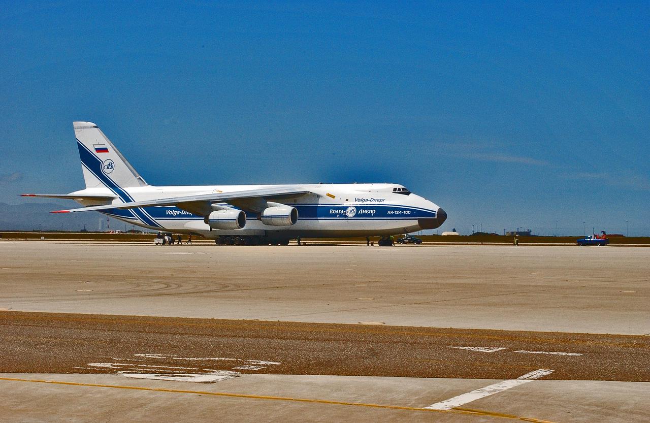
KENNEDY SPACE CENTER, FLA. - An Antonov aircraft arrives at Vandenberg Air Force Base in California carrying the Cloud-Aerosol Lidar and Infrared Pathfinder Satellite Observation (CALIPSO) spacecraft. CALIPSO will fly in combination with the CloudSat satellite to provide never-before-seen 3-D perspectives of how clouds and aerosols form, evolve, and affect weather and climate. CALIPSO and CloudSat will join three other satellites in orbit to enhance understanding of climate systems. The launch date for CALIPSO_CloudSat is no earlier than Aug. 22.

jsc2021e029976 (6/30/2021) --- A preflight view of the TARGIT cubesat. The Tethering And Ranging Mission of the Georgia Institute of Technology (TARGIT) tests a miniaturized Light Detection and Ranging (LiDAR) imaging camera. The camera tracks and takes images of a tethered inflatable target to verify its performance and demonstrate precision topographic mapping capability and use of an inflatable as a drag device. These capabilities could help support future planetary missions. Image courtesy of Candler Hobbs
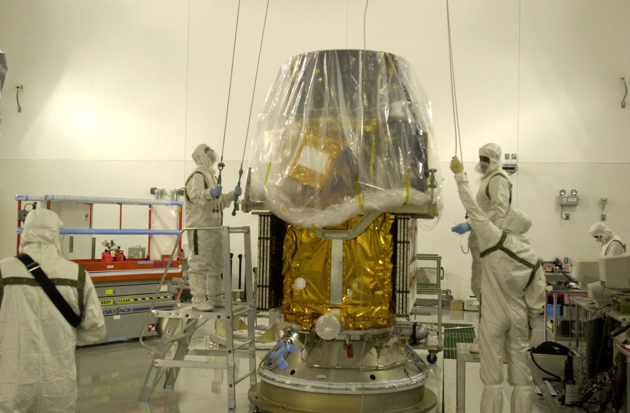
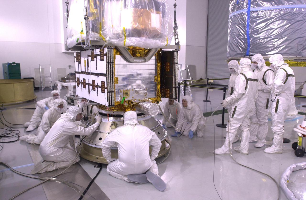
VANDENBERG AIR FORCE BASE, CALIF. — Inside the Astrotech Payload Processing Facility on Vandenberg Air Force Base in California, workers oversee the lowering of the CALIPSO spacecraft toward the upper Delta Payload Attach Fitting (UDPAF). Later the UDPAF will be mated with the lower Delta Payload Attach Fitting, which contains the CloudSat satellite. The PAF is the interface between the spacecraft and the second stage of the rocket. CALIPSO stands for Cloud-Aerosol Lidar and Infrared Pathfinder Satellite Observation.
VANDENBERG AIR FORCE BASE, CALIF. — Inside the Astrotech Payload Processing Facility on Vandenberg Air Force Base in California, workers again lower the CALIPSO spacecraft and Upper Delta Payload Attach Fitting (UDPAF) toward the Lower Delta Payload Attach Fitting (LDPAF) that contains the CloudSat satellite. The PAF is the interface between the spacecraft and the second stage of the rocket. CALIPSO stands for Cloud-Aerosol Lidar and Infrared Pathfinder Satellite Observation.
VANDENBERG AIR FORCE BASE, CALIF. — Inside the Astrotech Payload Processing Facility on Vandenberg Air Force Base in California, the CALIPSO spacecraft is back on the floor or further adjustments. CALIPSO will be mated with the Lower Delta Payload Attach Fitting (LDPAF) that contains the CloudSat satellite. Later the UDPAF will be mated with the lower Delta Payload Attach Fitting, which contains the CloudSat satellite. The PAF is the interface between the spacecraft and the second stage of the rocket. CALIPSO stands for Cloud-Aerosol Lidar and Infrared Pathfinder Satellite Observation.
A team of experts wrap up science flights on the ER-2 aircraft at Armstrong Flight Research Center in Edwards, California after the GSFC Lidar Observation and Validation Experiment (GLOVE) in February 2025. Pilot Tim Williams ascends the ER-2 to higher skies for one of the final science flights validating satellite-borne data. As a collaboration between engineers, scientists, and aircraft professionals, GLOVE aims to improve satellite data products for Earth Science applications.
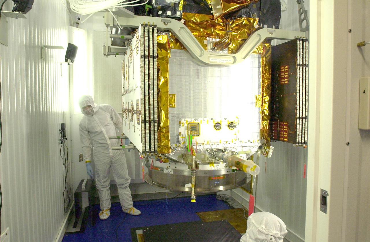
VANDENBERG AIR FORCE BASE, CALIF. — Inside the Astrotech Payload Processing Facility on Vandenberg Air Force Base in California, workers secure the CALIPSO spacecraft on the upper Delta Payload Attach Fitting (UDPAF). Later the UDPAF will be mated with the lower Delta Payload Attach Fitting, which contains the CloudSat satellite. The PAF is the interface between the spacecraft and the second stage of the rocket. CALIPSO stands for Cloud-Aerosol Lidar and Infrared Pathfinder Satellite Observation.
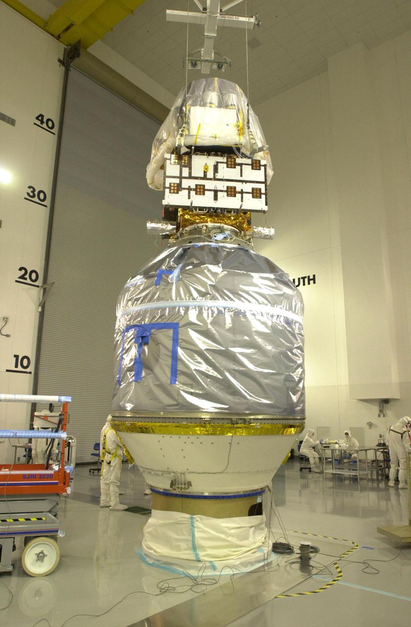
VANDENBERG AIR FORCE BASE, CALIF. — Inside the Astrotech Payload Processing Facility on Vandenberg Air Force Base in California, the Upper Delta Payload Attach Fitting (UDPAF) with the CALIPSO spacecraft has been lowered onto the Lower Delta Payload Attach Fitting (LDPAF) that contains the CloudSat satellite. The PAF is the interface between the spacecraft and the second stage of the rocket. CALIPSO stands for Cloud-Aerosol Lidar and Infrared Pathfinder Satellite Observation.
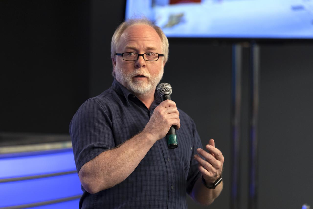
Bryan Blair, deputy principal investigator for Global Ecosystem Dynamics Investigation lidar, or GEDI, speaks to members of the media in the Kennedy Space Center’s Press Site auditorium. The briefing focused on research planned for launch to the International Space Station. The scientific materials and supplies will be aboard a Dragon spacecraft scheduled for liftoff from Cape Canaveral Air Force Station's Space Launch Complex 40. The SpaceX Falcon 9 rocket will launch the company's 16th Commercial Resupply Services mission to the space station.
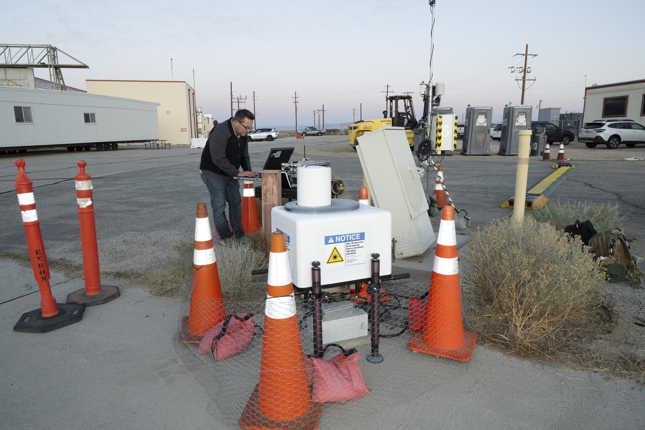
NASA aeronautical meteorologist Luke Bard adjusts one of several wind lidar (light detection and ranging) sensors near NASA’s Armstrong Flight Research Center in Edwards, California, on March 12, 2025, in preparation to collect data from Joby Aviation’s experimental air taxi aircraft. NASA is collecting information during this study to help advance weather-tolerant air taxi operations for the entire industry
A team of experts prepares the ER-2 aircraft at Armstrong Flight Research Center in Edwards, California for the GSFC Lidar Observation and Validation Experiment (GLOVE) in February 2025. Researcher Jackson Begolka from the University of Iowa examines the instrument connectors in the ER-2 onboard the ER-2, which flies at high altitudes to validate satellite-borne data. As a collaboration between engineers, scientists, and aircraft professionals, GLOVE aims to improve satellite data products for Earth Science applications.
A team of experts wrap up science flights on the ER-2 aircraft at Armstrong Flight Research Center in Edwards, California after the GSFC Lidar Observation and Validation Experiment (GLOVE) in February 2025. Pilot Kirt Stallings ascends the ER-2 on the runway for one of the final science flights validating satellite-borne data. As a collaboration between engineers, scientists, and aircraft professionals, GLOVE aims to improve satellite data products for Earth Science applications.
VANDENBERG AIR FORCE BASE, CALIF. — Inside the Astrotech Payload Processing Facility on Vandenberg Air Force Base in California, workers check the lowering of the CALIPSO spacecraft and Upper Delta Payload Attach Fitting (UDPAF) onto the Lower Delta Payload Attach Fitting (LDPAF) that contains the CloudSat satellite. The PAF is the interface between the spacecraft and the second stage of the rocket. CALIPSO stands for Cloud-Aerosol Lidar and Infrared Pathfinder Satellite Observation.
VANDENBERG AIR FORCE BASE, CALIF. — Inside the Astrotech Payload Processing Facility on Vandenberg Air Force Base in California, workers check the attachment of the CALIPSO spacecraft onto the upper Delta Payload Attach Fitting (UDPAF). Later the UDPAF will be mated with the lower Delta Payload Attach Fitting, which contains the CloudSat satellite. The PAF is the interface between the spacecraft and the second stage of the rocket. CALIPSO stands for Cloud-Aerosol Lidar and Infrared Pathfinder Satellite Observation.
VANDENBERG AIR FORCE BASE, CALIF. — Inside the Astrotech Payload Processing Facility on Vandenberg Air Force Base in California, workers secure the CALIPSO spacecraft on the upper Delta Payload Attach Fitting (UDPAF). Later the UDPAF will be mated with the lower Delta Payload Attach Fitting, which contains the CloudSat satellite. The PAF is the interface between the spacecraft and the second stage of the rocket. CALIPSO stands for Cloud-Aerosol Lidar and Infrared Pathfinder Satellite Observation.
KENNEDY SPACE CENTER, FLA. - At the Astrotech Payload Processing Facility on Vandenberg Air Force Base in California, the newly arrived Cloud-Aerosol Lidar and Infrared Pathfinder Satellite Observation (CALIPSO) is moved inside. CALIPSO will fly in combination with the CloudSat satellite to provide never-before-seen 3-D perspectives of how clouds and aerosols form, evolve, and affect weather and climate. CALIPSO and CloudSat will join three other satellites in orbit to enhance understanding of climate systems. The launch date for CALIPSO_CloudSat is no earlier than Aug. 22.

VANDENBERG AIR FORCE BASE, CALIF. — Inside the Astrotech Payload Processing Facility on Vandenberg Air Force Base in California, workers move the CALIPSO spacecraft away from the Lower Delta Payload Attach Fitting, which contains the CloudSat satellite. Later the UDPAF will be mated with the lower Delta Payload Attach Fitting, which contains the CloudSat satellite. The PAF is the interface between the spacecraft and the second stage of the rocket. CALIPSO stands for Cloud-Aerosol Lidar and Infrared Pathfinder Satellite Observation.
VANDENBERG AIR FORCE BASE, CALIF. — Inside the Astrotech Payload Processing Facility on Vandenberg Air Force Base in California, workers lower the CALIPSO spacecraft and Upper Delta Payload Attach Fitting (UDPAF) toward the Lower Delta Payload Attach Fitting (LDPAF) that contains the CloudSat satellite. Later the UDPAF will be mated with the lower Delta Payload Attach Fitting, which contains the CloudSat satellite. The PAF is the interface between the spacecraft and the second stage of the rocket. CALIPSO stands for Cloud-Aerosol Lidar and Infrared Pathfinder Satellite Observation.
jsc2013e090265 (Sep. 26, 2013) --- Cloud Aerosol Transport System (CATS) at NASA's Johnson Space Center undergoing payload fit-check and Support Equipment Installation (SEI). The CATS investigation uses a light detection and ranging (LiDAR) system to measure the location, composition and distribution of pollution, dust, smoke, aerosols and other particulates in the atmosphere. CATS is used to study the atmospheric constituents that impact global climate. By gaining a better understanding of cloud and aerosol coverage, scientists can create a better model of the Earth's climate feedback processes.
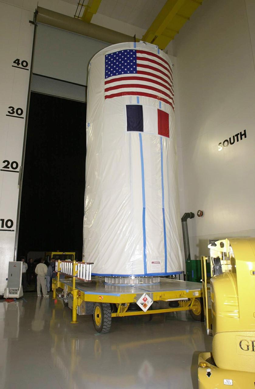
VANDENBERG AIR FORCE BASE, CALIF. - The CALIPSO/CloudSat spacecraft is in a transport canister ready for the move to Space Launch Complex 2. There it will be lifted and mated with a Boeing Delta II rocket for launch on April 21. CALIPSO stands for Cloud-Aerosol Lidar and Infrared Pathfinder Satellite Observation. It will fly in combination with the CloudSat satellite to provide never-before-seen 3-D perspectives of how clouds and aerosols form, evolve, and affect weather and climate. CALIPSO and CloudSat will join three other satellites in orbit to enhance understanding of climate systems.
VANDENBERG AIR FORCE BASE, CALIF. — From an elevated platform, workers inside the Astrotech Payload Processing Facility on Vandenberg Air Force Base in California guide the lowering of the CALIPSO spacecraft onto the Lower Delta Payload Attach Fitting (LDPAF) that contains the CloudSat satellite.Later the UDPAF will be mated with the lower Delta Payload Attach Fitting, which contains the CloudSat satellite. The PAF is the interface between the spacecraft and the second stage of the rocket. CALIPSO stands for Cloud-Aerosol Lidar and Infrared Pathfinder Satellite Observation.
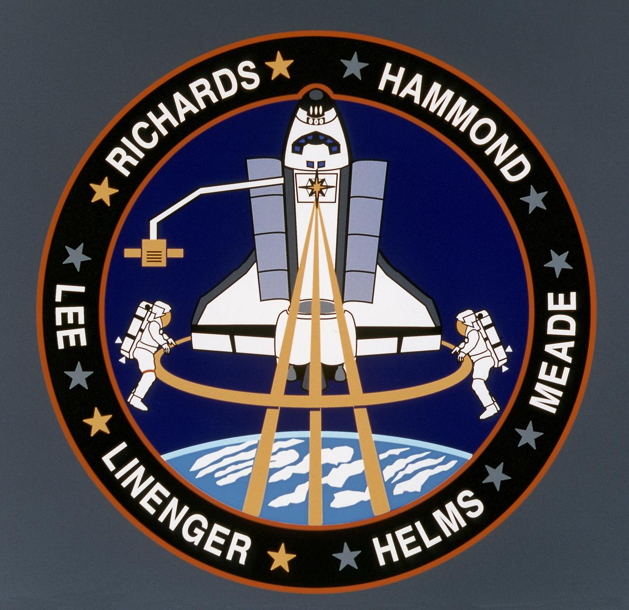
The STS-64 patch depicts the Space Shuttle Discovery in a payload-bay-to-Earth attitude with its primary payload, Lidar In-Space Technology Experiment (LITE-1) operating in support of Mission to Planet Earth. LITE-1 is a lidar system that uses a three-wavelength laser, symbolized by the three gold rays emanating from the star in the payload bay that form part of the astronaut symbol. The major objective of the LITE-1 is to gather data about the Earth's troposphere and stratosphere, represented by the clouds and dual-colored Earth limb. A secondary payload on STS-64 is the free-flier SPARTAN 201 satellite shown on the Remote Manipulator System (RMS) arm post-retrieval. The RMS also operated another payload, Shuttle Plume Impingement Flight Experiment (SPIFEX). A newly tested extravehicular activity (EVA) maneuvering device, Simplified Aid for EVA Rescue (SAFER), represented symbolically by the two small nozzles on the backpacks of the two untethered EVA crew men. The names of the crew members encircle the patch: Astronauts Richard N. Richards, L. Blaine Hammond, Jr., Jerry M. Linenger, Susan J. Helms, Carl J. Meade and Mark C. Lee. The gold or silver stars by each name represent that person's parent service.
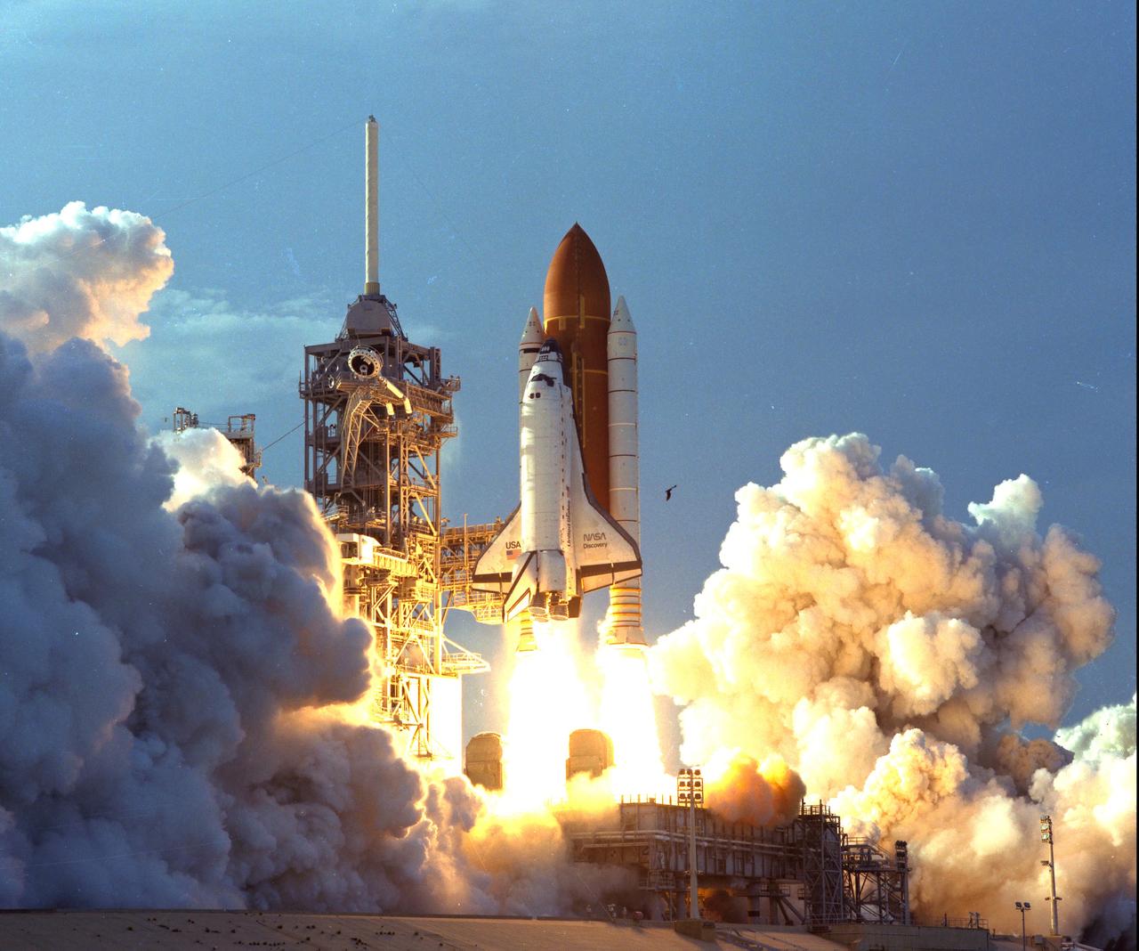
KENNEDY SPACE CENTER, FLA. - The turbulent weather common to a Florida afternoon in the summer subsides into a serene canopy of cornflower blue, and a manmade "bird" takes flight. The Space Shuttle Discovery soars skyward from Launch Pad 39B on Mission STS-64 at 6:22:35 p.m. EDT, Sept. 9. On board are a crew of six: Commander Richard N. Richards; Pilot L. Blaine Hammond Jr.; and Mission Specialists Mark C. Lee, Carl J. Meade, Susan J. Helms and Dr. J.M. Linenger. Payloads for the flight include the Lidar In-Space Technology Experiment (LITE), the Shuttle Pointed Autonomous Research Tool for Astronomy-201 (SPARTAN-201) and the Robot Operated Material Processing System (ROMPS). Mission Specialists Lee and Meade also are scheduled to perform an extravehicular activity during the 64th Shuttle mission.
VANDENBERG AIR FORCE BASE, Calif. - Inside the Astrotech Payload Processing Facility on Vandenberg Air Force Base in California, the transport canister is lowered toward the covered dual spacecraft CALIPSO and CloudSat below. Once inside the canister, the spacecraft will be moved to Space Launch Complex 2. There the spacecraft will be lifted and mated with a Boeing Delta II rocket for launch on April 21. CALIPSO stands for Cloud-Aerosol Lidar and Infrared Pathfinder Satellite Observation. It will fly in combination with the CloudSat satellite to provide never-before-seen 3-D perspectives of how clouds and aerosols form, evolve, and affect weather and climate. CALIPSO and CloudSat will join three other satellites in orbit to enhance understanding of climate systems.
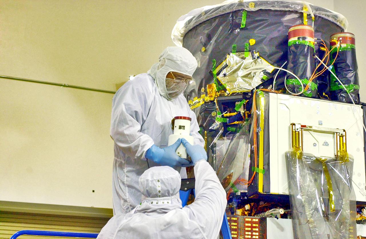
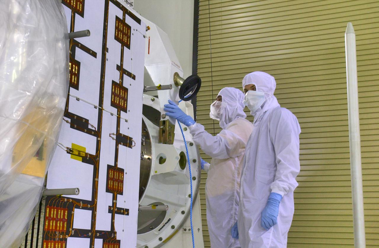
KENNEDY SPACE CENTER, FLA. - Inside the Astrotech Payload Processing Facility on Vandenberg Air Force Base in California, workers hold the Wide Field Camera that they will install on the Cloud-Aerosol Lidar and Infrared Pathfinder Satellite Observation (CALIPSO) spacecraft at right. CALIPSO will fly in combination with the CloudSat satellite to provide never-before-seen 3-D perspectives of how clouds and aerosols form, evolve, and affect weather and climate. CALIPSO and CloudSat will join three other satellites in orbit to enhance understanding of climate systems. The launch date for CALIPSO_CloudSat is no earlier than Aug. 22.

VANDENBERG AIR FORCE BASE, Calif. - This is the mission patch for the CALIPSO/CloudSat mission showing the dual spacecraft. It hangs on the wall inside the Astrotech Payload Processing Facility at Vandenberg Air Force Base in California, where the CALIPSO/CloudSat spacecraft is being readied for launch. CALIPSO stands for Cloud-Aerosol Lidar and Infrared Pathfinder Satellite Observation. It will fly in combination with the CloudSat satellite to provide never-before-seen 3-D perspectives of how clouds and aerosols form, evolve, and affect weather and climate. CALIPSO and CloudSat will join three other satellites in orbit to enhance understanding of climate systems. Launch of CALIPSO/CloudSat is scheduled for April 21.
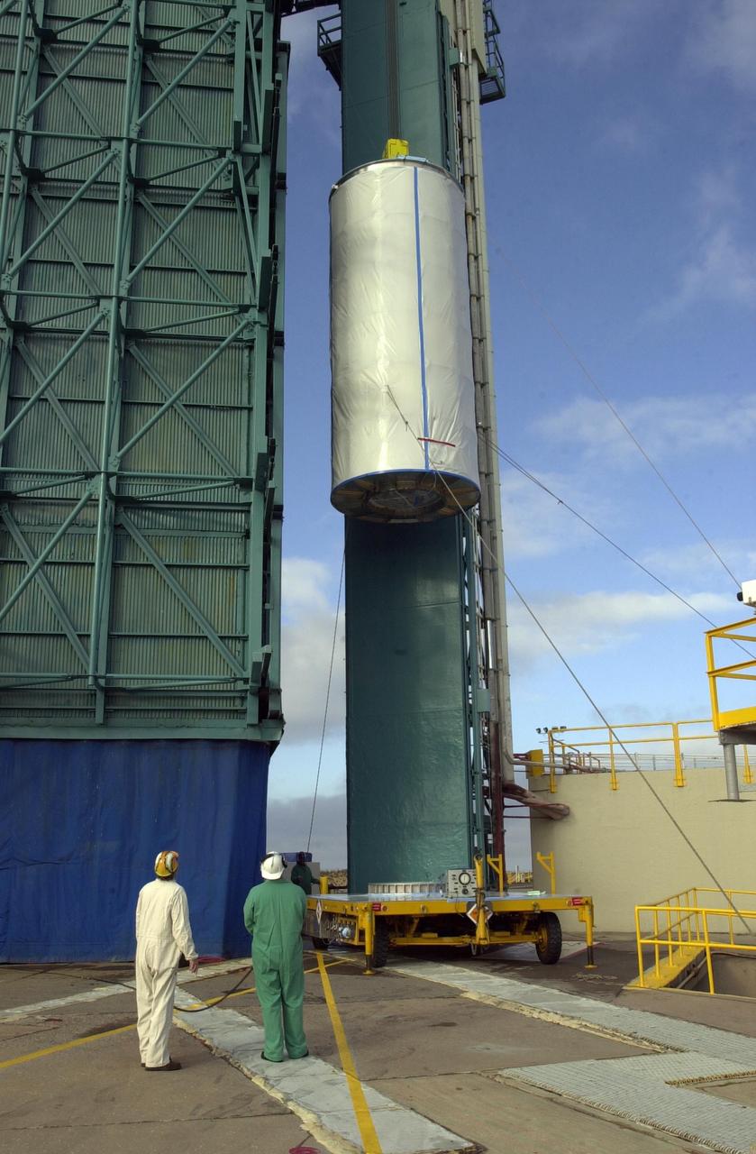
VANDENBERG AIR FORCE BASE, Calif. - On Space Launch Complex 2 at Vandenberg Air Force Base in California, the dual spacecraft CALIPSO and CloudSat, covered by a transport canister, is lifted up into the mobile service tower. There the spacecraft will be mated with a Boeing Delta II rocket for launch on April 21. CALIPSO stands for Cloud-Aerosol Lidar and Infrared Pathfinder Satellite Observation. It will fly in combination with the CloudSat satellite to provide never-before-seen 3-D perspectives of how clouds and aerosols form, evolve, and affect weather and climate. CALIPSO and CloudSat will join three other satellites in orbit to enhance understanding of climate systems. Launch of CALIPSO/CloudSat is scheduled for April 21.
KENNEDY SPACE CENTER, FLA. -Inside the Astrotech Payload Processing Facility on Vandenberg Air Force Base in California, workers prepare to attach equipment that will enable the Cloud-Aerosol Lidar and Infrared Pathfinder Satellite Observation (CALIPSO) spacecraft to be raised to a vertical position and moved to a workstand. It will undergo state-of-health checks, and electrical ground-support equipment testing. CALIPSO will fly in combination with the CloudSat satellite to provide never-before-seen 3-D perspectives of how clouds and aerosols form, evolve, and affect weather and climate. CALIPSO and CloudSat will join three other satellites in orbit to enhance understanding of climate systems. The launch date for CALIPSO_CloudSat is no earlier than Aug. 22.
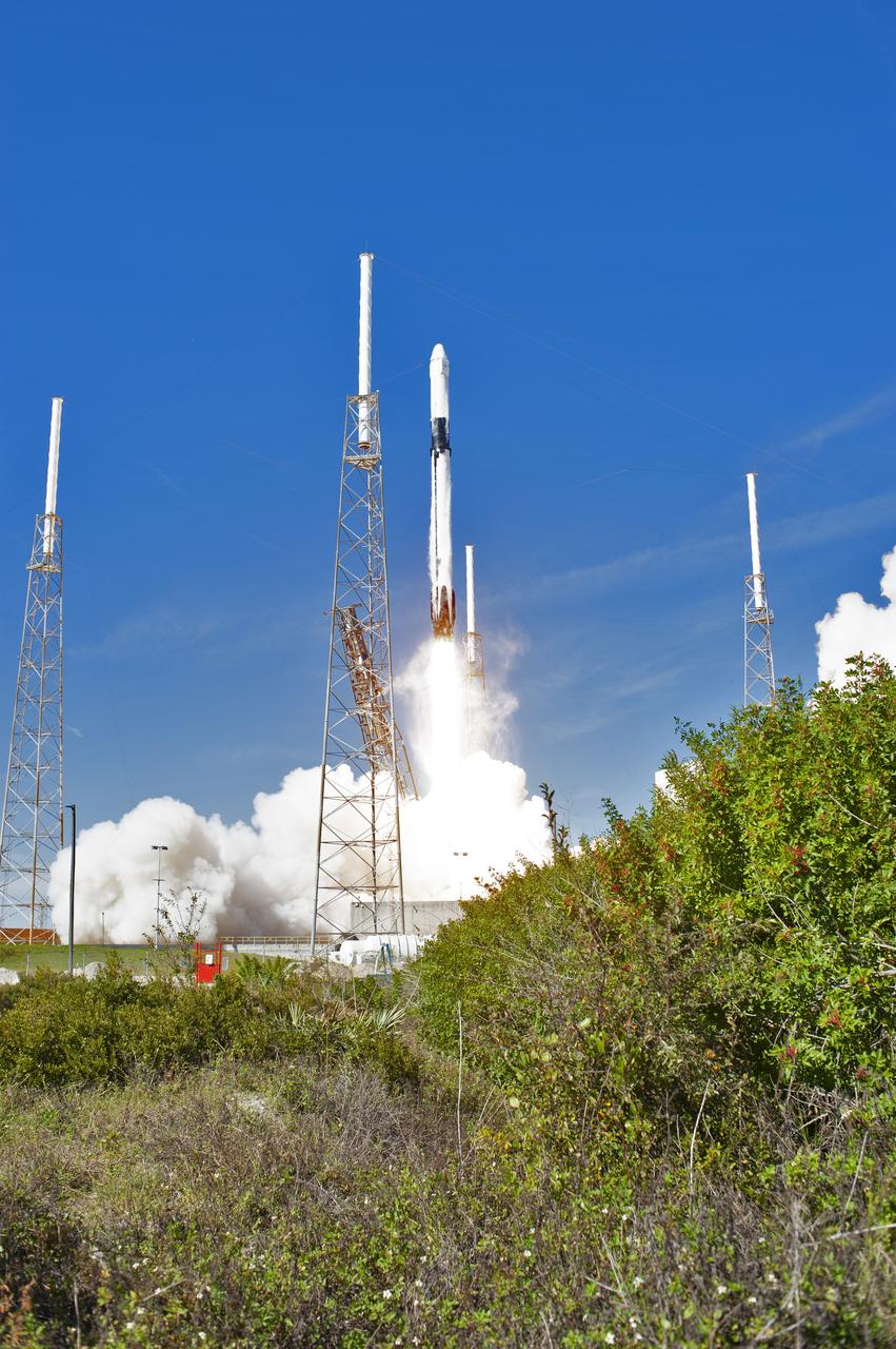
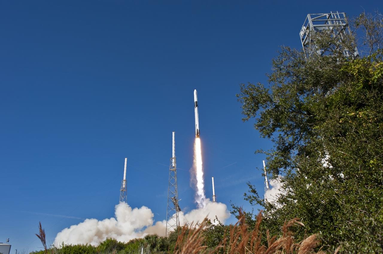
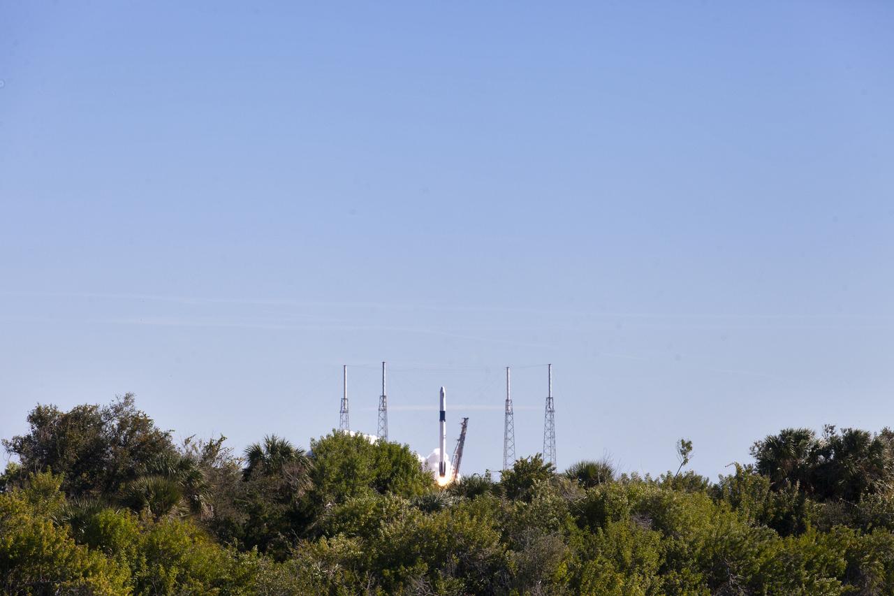
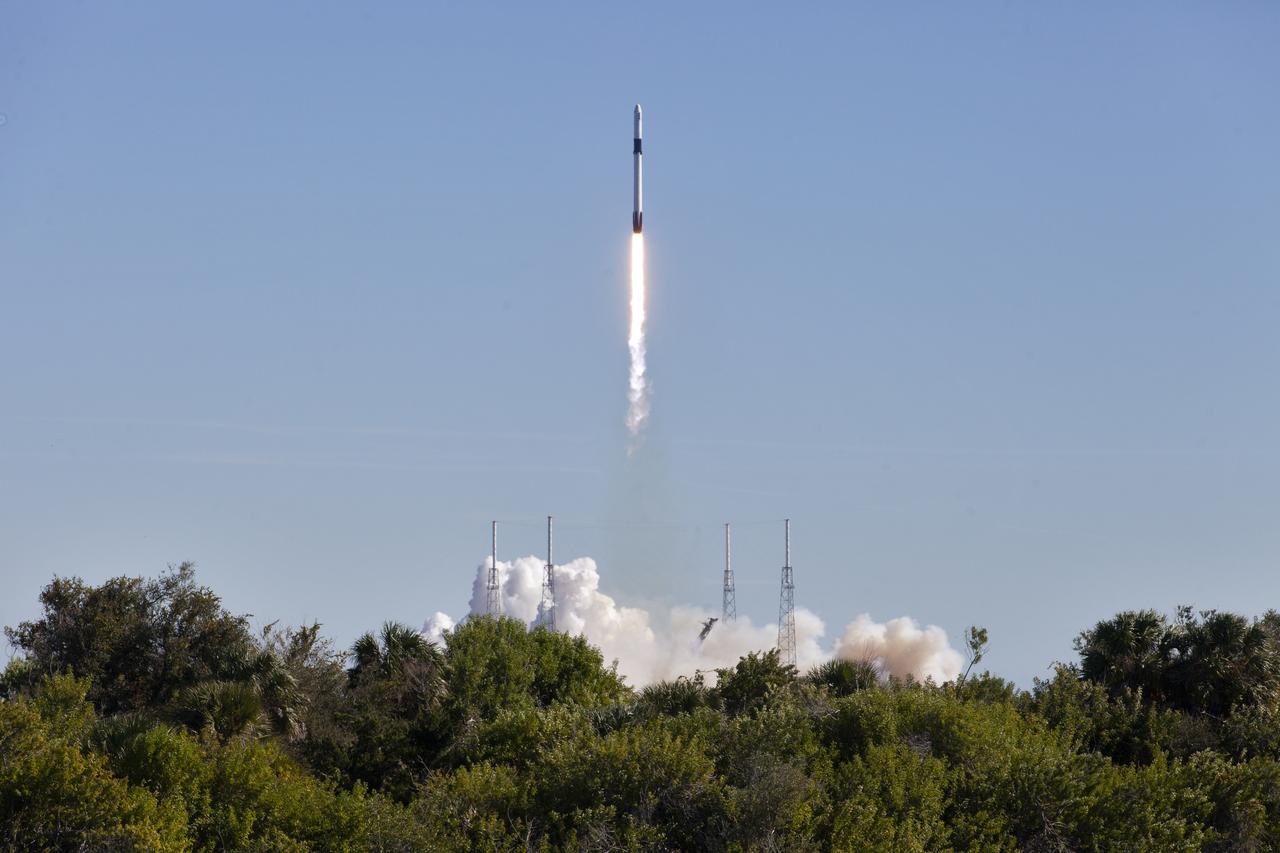
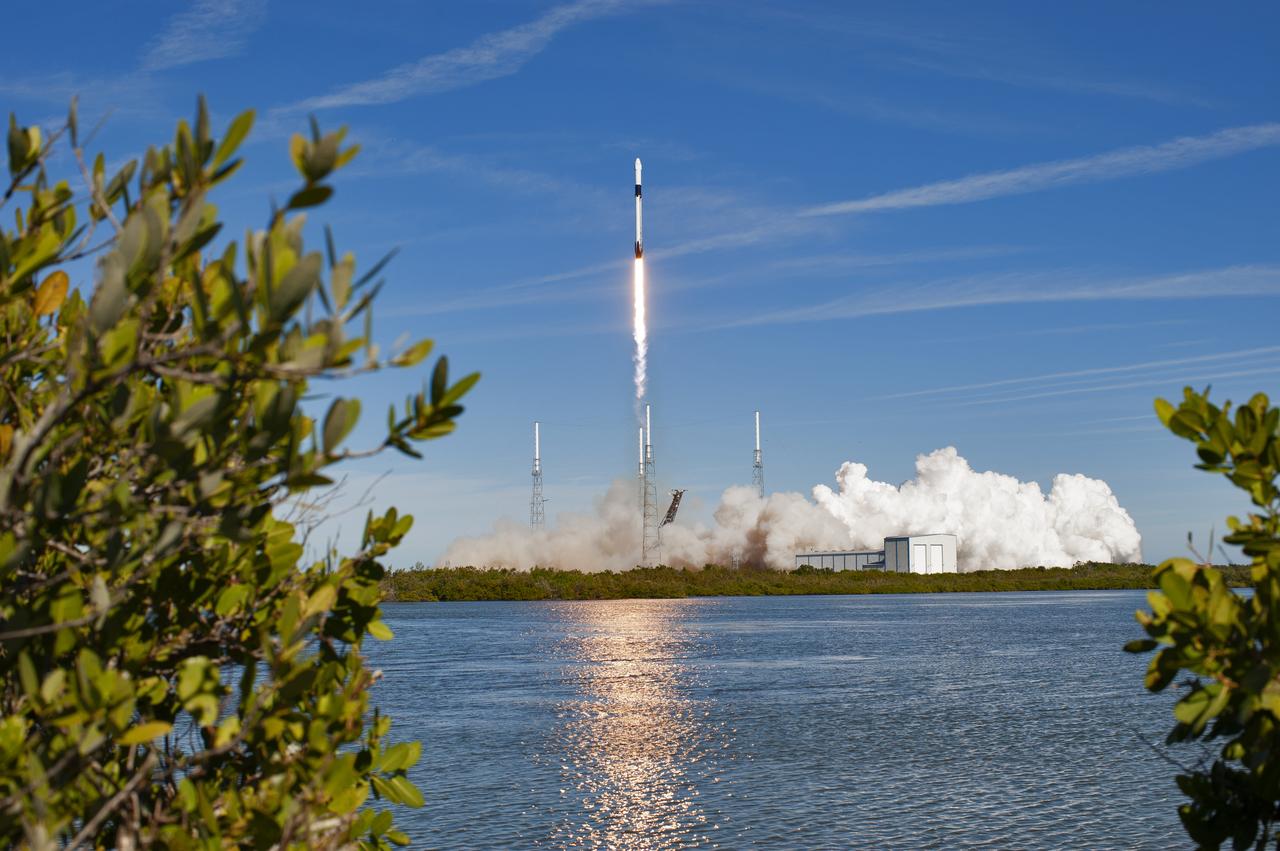
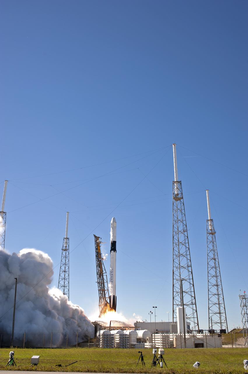
The two-stage Falcon 9 launch vehicle lifts off Space Launch Complex 40 at Cape Canaveral Air Force Station carrying the SpaceX’s Dragon resupply spacecraft to the International Space Station. Liftoff was at 1:16 p.m. EST, Dec. 5, 2018. On its 16th commercial resupply services mission to the space station, Dragon will deliver several science investigations to the space station, including the Global Ecosystem Dynamics Investigation lidar (GEDI). GEDI will provide high-quality laser ranging observations of the Earth’s forests and topography required to advance the understanding of important carbon and water cycling processes, biodiversity and habitat.
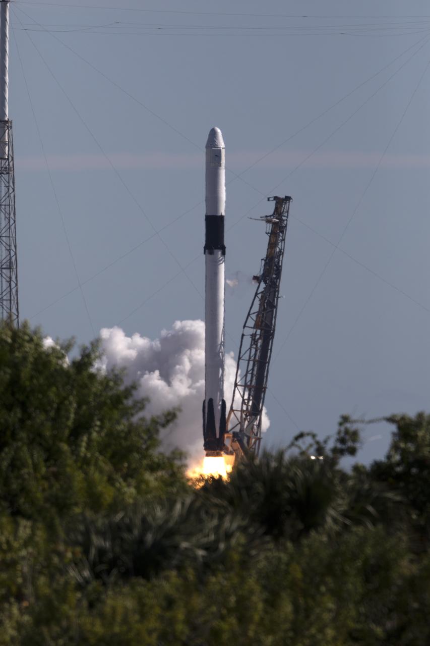
The two-stage Falcon 9 launch vehicle lifts off Space Launch Complex 40 at Cape Canaveral Air Force Station carrying the SpaceX’s Dragon resupply spacecraft to the International Space Station. Liftoff was at 1:16 p.m. EST, Dec. 5, 2018. On its 16th commercial resupply services mission to the space station, Dragon will deliver several science investigations to the space station, including the Global Ecosystem Dynamics Investigation lidar (GEDI). GEDI will provide high-quality laser ranging observations of the Earth’s forests and topography required to advance the understanding of important carbon and water cycling processes, biodiversity and habitat.

VANDENBERG AIR FORCE BASE, Calif. - On Space Launch Complex 2 at Vandenberg Air Force Base in California, the dual spacecraft CALIPSO and CloudSat, removed from its transport canister, is being mated in the mobile service tower with the second stage of its Boeing Delta II rocket for launch on April 21. CALIPSO stands for Cloud-Aerosol Lidar and Infrared Pathfinder Satellite Observation. It will fly in combination with the CloudSat satellite to provide never-before-seen 3-D perspectives of how clouds and aerosols form, evolve, and affect weather and climate. CALIPSO and CloudSat will join three other satellites in orbit to enhance understanding of climate systems. Launch of CALIPSO/CloudSat is scheduled for April 21.
VANDENBERG AIR FORCE BASE, Calif. - On Space Launch Complex 2 at Vandenberg Air Force Base in California, a crane is attached to the dual spacecraft CALIPSO and CloudSat, covered by a transport canister. The spacecraft will be lifted and mated with a Boeing Delta II rocket for launch on April 21. CALIPSO stands for Cloud-Aerosol Lidar and Infrared Pathfinder Satellite Observation. It will fly in combination with the CloudSat satellite to provide never-before-seen 3-D perspectives of how clouds and aerosols form, evolve, and affect weather and climate. CALIPSO and CloudSat will join three other satellites in orbit to enhance understanding of climate systems. Launch of CALIPSO/CloudSat is scheduled for April 21.
The two-stage Falcon 9 launch vehicle lifts off Space Launch Complex 40 at Cape Canaveral Air Force Station carrying the SpaceX’s Dragon resupply spacecraft to the International Space Station. Liftoff was at 1:16 p.m. EST, Dec. 5, 2018. On its 16th commercial resupply services mission to the space station, Dragon will deliver several science investigations to the space station, including the Global Ecosystem Dynamics Investigation lidar (GEDI). GEDI will provide high-quality laser ranging observations of the Earth’s forests and topography required to advance the understanding of important carbon and water cycling processes, biodiversity and habitat.

The two-stage Falcon 9 launch vehicle lifts off Space Launch Complex 40 at Cape Canaveral Air Force Station carrying the SpaceX’s Dragon resupply spacecraft to the International Space Station. Liftoff was at 1:16 p.m. EST, Dec. 5, 2018. On its 16th commercial resupply services mission to the space station, Dragon will deliver several science investigations to the space station, including the Global Ecosystem Dynamics Investigation lidar (GEDI). GEDI will provide high-quality laser ranging observations of the Earth’s forests and topography required to advance the understanding of important carbon and water cycling processes, biodiversity and habitat.
The two-stage Falcon 9 launch vehicle lifts off Space Launch Complex 40 at Cape Canaveral Air Force Station carrying the SpaceX’s Dragon resupply spacecraft to the International Space Station. Liftoff was at 1:16 p.m. EST, Dec. 5, 2018. On its 16th commercial resupply services mission to the space station, Dragon will deliver several science investigations to the space station, including the Global Ecosystem Dynamics Investigation lidar (GEDI). GEDI will provide high-quality laser ranging observations of the Earth’s forests and topography required to advance the understanding of important carbon and water cycling processes, biodiversity and habitat.
The two-stage Falcon 9 launch vehicle lifts off Space Launch Complex 40 at Cape Canaveral Air Force Station carrying the SpaceX’s Dragon resupply spacecraft to the International Space Station. Liftoff was at 1:16 p.m. EST, Dec. 5, 2018. On its 16th commercial resupply services mission to the space station, Dragon will deliver several science investigations to the space station, including the Global Ecosystem Dynamics Investigation lidar (GEDI). GEDI will provide high-quality laser ranging observations of the Earth’s forests and topography required to advance the understanding of important carbon and water cycling processes, biodiversity and habitat.
The two-stage Falcon 9 launch vehicle lifts off Space Launch Complex 40 at Cape Canaveral Air Force Station carrying the SpaceX’s Dragon resupply spacecraft to the International Space Station. Liftoff was at 1:16 p.m. EST, Dec. 5, 2018. On its 16th commercial resupply services mission to the space station, Dragon will deliver several science investigations to the space station, including the Global Ecosystem Dynamics Investigation lidar (GEDI). GEDI will provide high-quality laser ranging observations of the Earth’s forests and topography required to advance the understanding of important carbon and water cycling processes, biodiversity and habitat.
The two-stage Falcon 9 launch vehicle lifts off Space Launch Complex 40 at Cape Canaveral Air Force Station carrying the SpaceX’s Dragon resupply spacecraft to the International Space Station. Liftoff was at 1:16 p.m. EST, Dec. 5, 2018. On its 16th commercial resupply services mission to the space station, Dragon will deliver several science investigations to the space station, including the Global Ecosystem Dynamics Investigation lidar (GEDI). GEDI will provide high-quality laser ranging observations of the Earth’s forests and topography required to advance the understanding of important carbon and water cycling processes, biodiversity and habitat.
KENNEDY SPACE CENTER, FLA. - At the Astrotech Payload Processing Facility on Vandenberg Air Force Base in California, an overhead crane is attached to the CloudSat spacecraft to lift it out of its shipping container. CloudSat was shipped from Ball Aerospace and Technologies Corp. in Boulder, Colo. The spacecraft will undergo electrical and spacecraft transmitter testing. In combination with the Cloud-Aerosol Lidar and Infrared Pathfinder Satellite Observation (CALIPSO), the spacecraft will provide never-before-seen 3-D perspectives of how clouds and aerosols form, evolve, and affect weather and climate. CALIPSO and CloudSat will fly in formation with three other satellites to enhance understanding of climate systems. The launch date for CloudSat_CALIPSO is no earlier than Aug. 22.