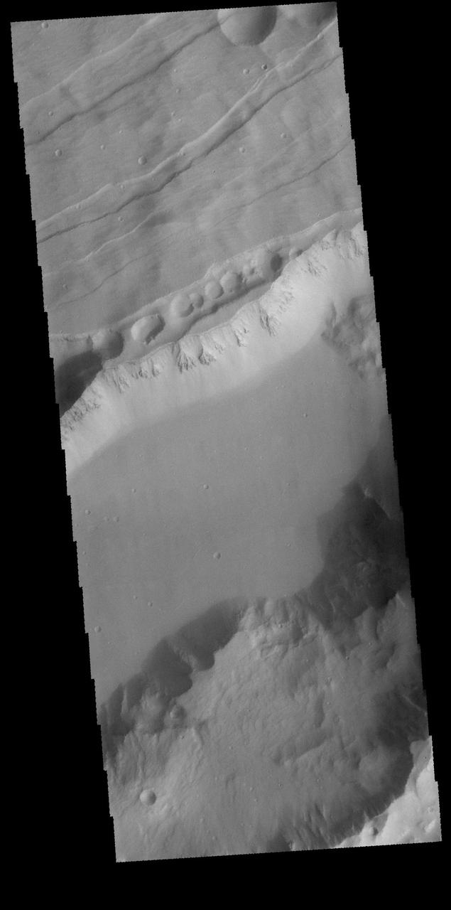
This image captured by NASA 2001 Mars Odyssey spacecraft shows part of Sirenum Fossae, a large graben on the margin between Terra Sirenum and Daedalis Planum. Grabens are formed by the downward movement of material between parallel tectonic faults. Orbit Number: 65672 Latitude: -25.6345 Longitude: 220.325 Instrument: VIS Captured: 2016-10-03 07:01 http://photojournal.jpl.nasa.gov/catalog/PIA21177

Sirenum Fossae

Sirenum Fossae

Sirenum Fossae

Sirenum Fossae
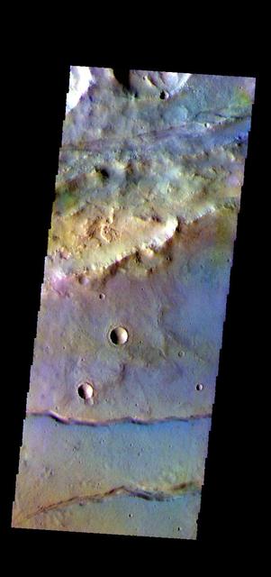
The THEMIS camera contains 5 filters. The data from different filters can be combined in multiple ways to create a false color image. These false color images may reveal subtle variations of the surface not easily identified in a single band image. This image from NASA 2001 Mars Odyssey spacecraft shows part of Sirenum Fossae. The linear depressions in this image were formed by tectonic activity. Orbit Number: 58880 Latitude: -38.91 Longitude: 183.505 Instrument: VIS Captured: 2015-03-23 21:22 https://photojournal.jpl.nasa.gov/catalog/PIA21547
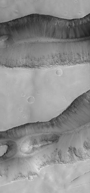
Sirenum Fossae Troughs

Sirenum Fossae Troughs

Sirenum Fossae Trough
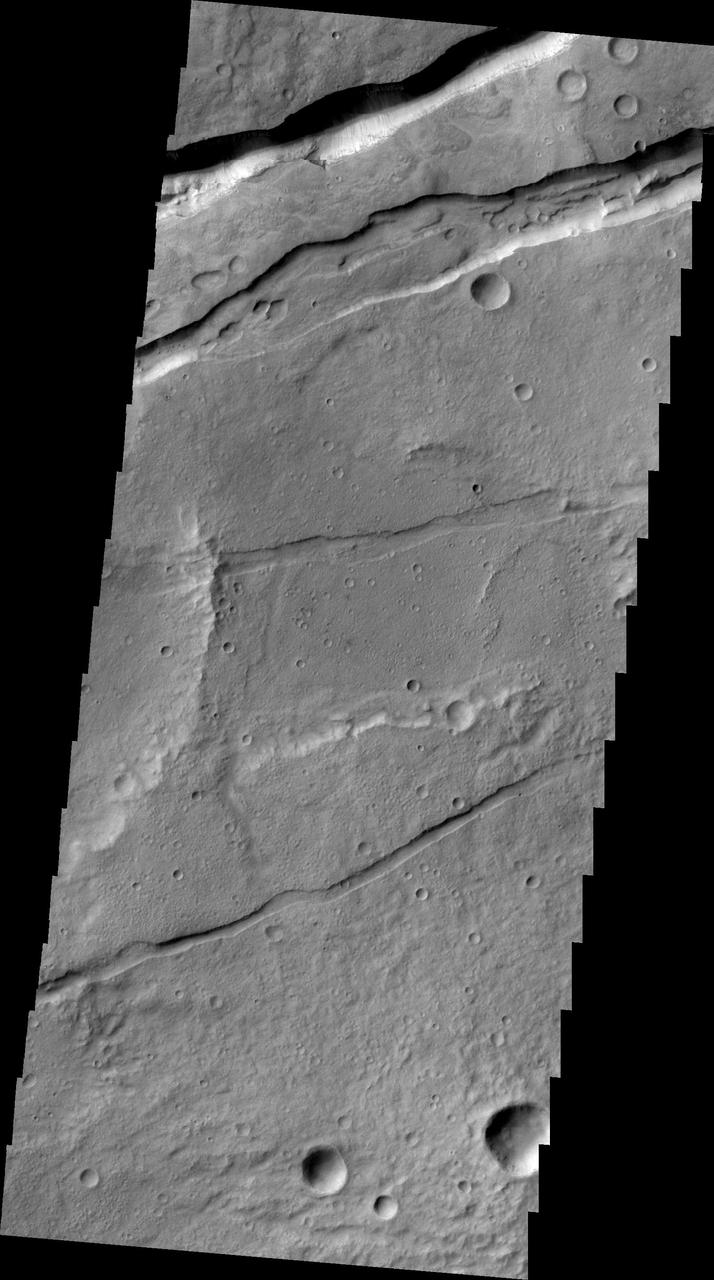
This image from NASA 2001 Mars Odyssey spacecraft shows a small portion of Sirenum Fossae. The fractures of the Fossae are graben -- a downdropped block between two faults.
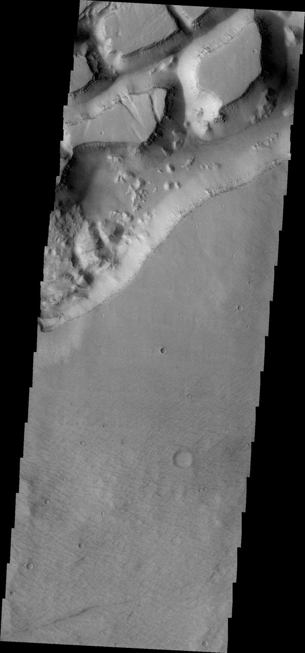
This 2001 Mars Odyssey THEMIS VIS image of the western portion of Sirenum Fossae shows mesa formation.
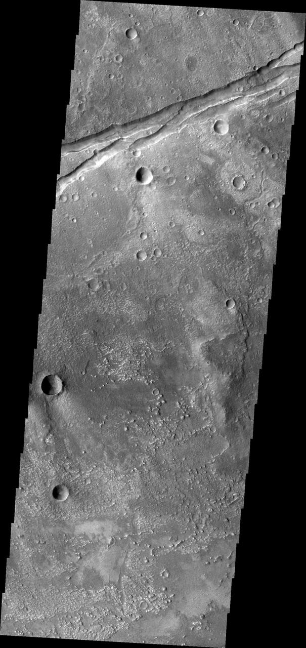
This 2001 Mars Odyssey THEMIS VIS image shows a portion of the eastern end of Sirenum Fossae.
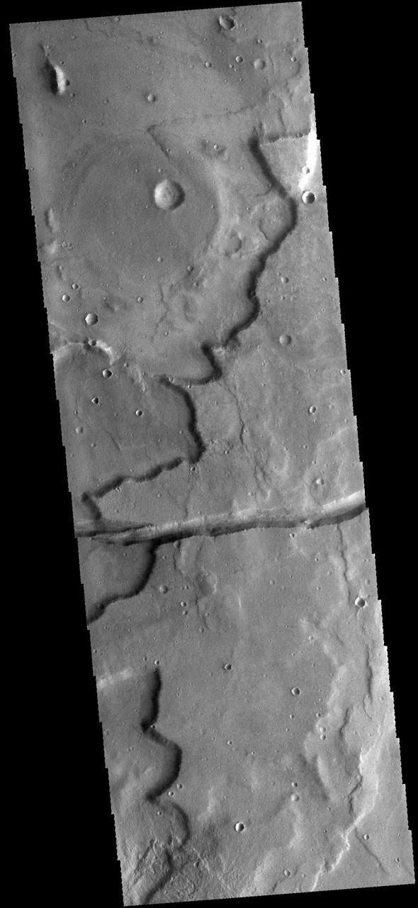
The linear depression in this image from NASA 2001 Mars Odyssey spacecraft is a graben. The graben in this area of Mars are called Sirenum Fossae.
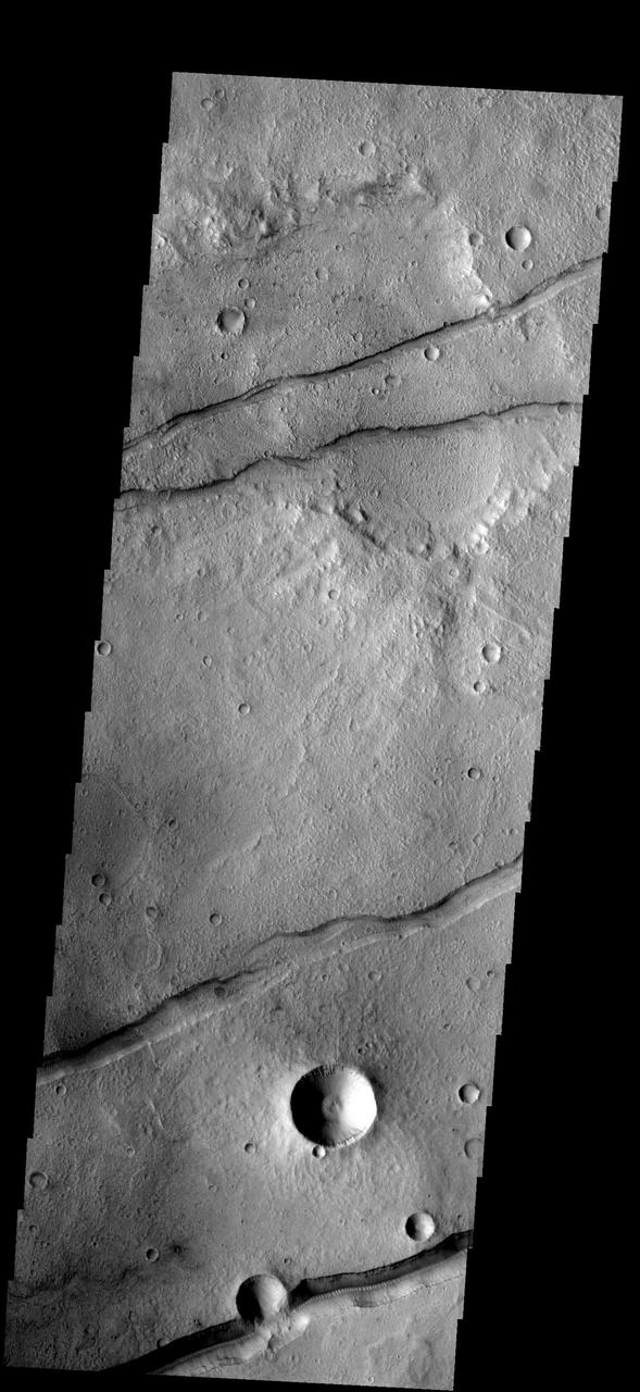
These fractures and graben are part of Sirenum Fossae as seen by NASA 2001 Mars Odyssey spacecraft.
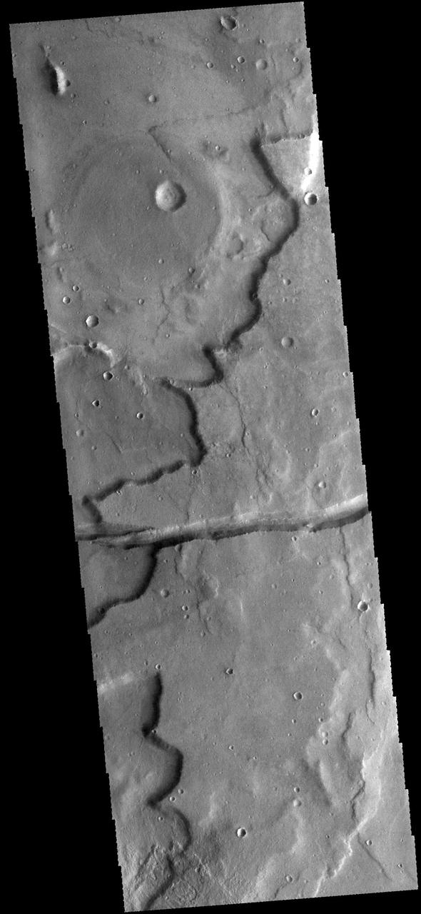
This image captured by NASA 2001 Mars Odyssey spacecraft shows a graben cutting through a plateau. The graben is part of Sirenum Fossae.
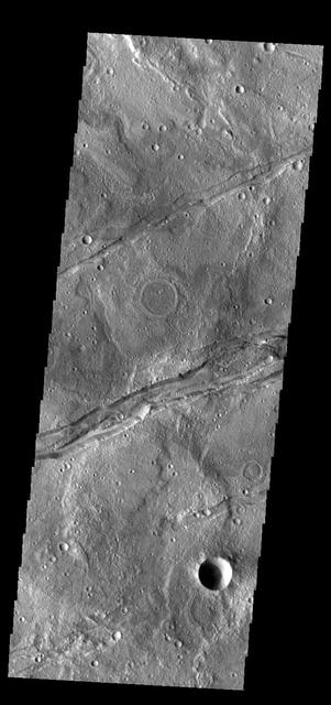
The linear depressions in this VIS image are part of Sirenum Fossae. These depressions are called graben, which form by the down drop of material between two parallel faults. The faults are caused by tectonic stresses in the region. The Sirenum Fossae graben are 2735km (1700 miles) long. Orbit Number: 83493 Latitude: -32.8399 Longitude: 204.159 Instrument: VIS Captured: 2020-10-10 02:18 https://photojournal.jpl.nasa.gov/catalog/PIA24258
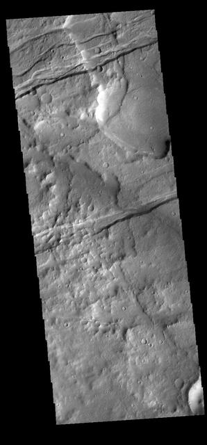
The linear depressions in this VIS image are part of Sirenum Fossae. These depressions are called graben, which form by the down drop of material between two parallel faults. The faults are caused by tectonic stresses in the region. The Sirenum Fossae graben are 2735km (1700 miles) long. Orbit Number: 83262 Latitude: -33.4902 Longitude: 203.133 Instrument: VIS Captured: 2020-09-21 02:25 https://photojournal.jpl.nasa.gov/catalog/PIA24246

The linear depressions in this VIS image are part of Sirenum Fossae. Depressions of this type are called graben, which form by the down drop of material between two parallel faults. The faults are caused by tectonic stresses in the region. The Sirenum Fossae graben are 2735km (1700 miles) long. Orbit Number: 84092 Latitude: -32.8748 Longitude: 203.947 Instrument: VIS Captured: 2020-11-28 09:58 https://photojournal.jpl.nasa.gov/catalog/PIA24392

The linear depressions in this VIS image are part of Sirenum Fossae. These depressions are called graben, which form by the down drop of material between two parallel faults. The faults are caused by tectonic stresses in the region. The Sirenum Fossae graben are 2735km (1700 miles) long. Orbit Number: 83249 Latitude: -27.3935 Longitude: 217.279 Instrument: VIS Captured: 2020-09-20 00:46 https://photojournal.jpl.nasa.gov/catalog/PIA24245
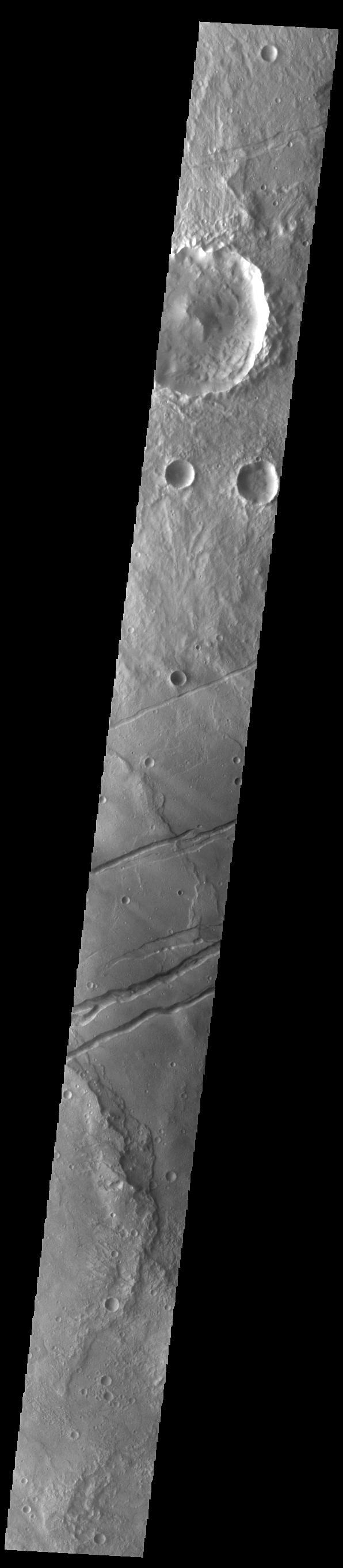
The channel-like features in this VIS image are tectonic graben. These graben are called Sirenum Fossae. Graben are created in regions of extensional tectonic stress, where the bedrock is faulted and pulled apart, allowing linear sections of the surface to drop downward along paired faults. The Sirenum Fossae graben are 2735km (1700 miles) long. Orbit Number: 84903 Latitude: -30.8518 Longitude: 208.42 Instrument: VIS Captured: 2021-02-03 04:32 https://photojournal.jpl.nasa.gov/catalog/PIA24737
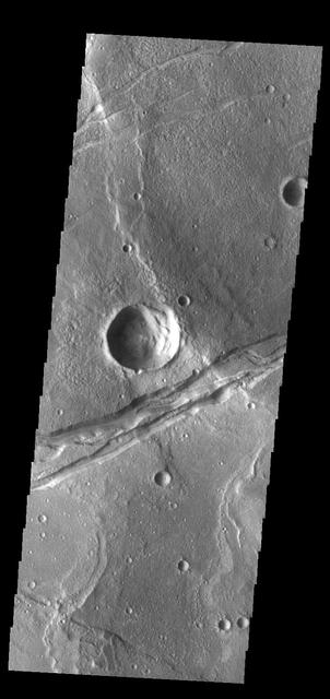
The linear depression in this VIS image is part of Sirenum Fossae. Depressions of this type are called graben, which form by the down drop of material between two parallel faults. The faults are caused by tectonic stresses in the region. The Sirenum Fossae graben are 2735km (1700 miles) long. Orbit Number: 84067 Latitude: -32.5029 Longitude: 205.188 Instrument: VIS Captured: 2020-11-26 08:34 https://photojournal.jpl.nasa.gov/catalog/PIA24368
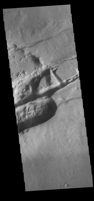
The linear depressions in this VIS image are part of Sirenum Fossae. These depressions are called graben, which form by the down drop of material between two parallel faults. The faults are caused by extensional tectonic stresses in the region. The Sirenum Fossae graben are 2735km (1700 miles) long. Orbit Number: 82775 Latitude: -29.7098 Longitude: 211.959 Instrument: VIS Captured: 2020-08-12 00:05 https://photojournal.jpl.nasa.gov/catalog/PIA24154
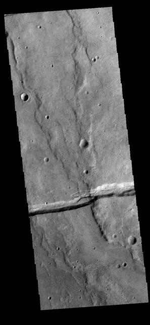
The linear depression in this VIS image is part of Sirenum Fossae. Depressions of this type are called graben, which form by the down drop of material between two parallel faults. The faults are caused by tectonic stresses in the region. The Sirenum Fossae graben are 2735km (1700 miles) long. Orbit Number: 83300 Latitude: -38.3682 Longitude: 187.612 Instrument: VIS Captured: 2020-09-24 05:29 https://photojournal.jpl.nasa.gov/catalog/PIA24251

The linear depressions in this VIS image are part of Sirenum Fossae. These depressions are called graben, which form by the down drop of material between two parallel faults. The faults are caused by tectonic stresses in the region. The Sirenum Fossae graben are 2735km (1700 miles) long. Orbit Number: 82039 Latitude: -32.4137 Longitude: 205.574 Instrument: VIS Captured: 2020-06-12 09:36 https://photojournal.jpl.nasa.gov/catalog/PIA24116

The linear depressions in this VIS image are part of Sirenum Fossae. These depressions are called graben, which form by the down drop of material between two parallel faults. The faults are caused by tectonic stresses in the region. The Sirenum Fossae graben are 2735km (1700 miles) long. Orbit Number: 83243 Latitude: -27.3042 Longitude: 217.186 Instrument: VIS Captured: 2020-09-19 12:14 https://photojournal.jpl.nasa.gov/catalog/PIA24244
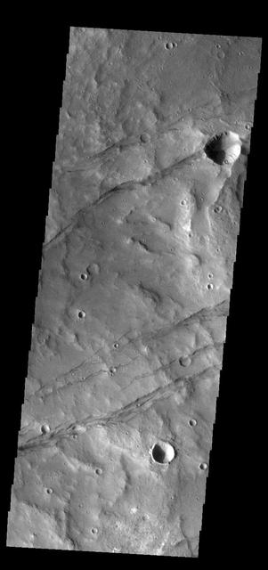
The linear depression in this VIS image is part of Sirenum Fossae. Depressions of this type are called graben, which form by the down drop of material between two parallel faults. The faults are caused by tectonic stresses in the region. The Sirenum Fossae graben are 2735km (1700 miles) long. Orbit Number: 83743 Latitude: -37.2437 Longitude: 191.251 Instrument: VIS Captured: 2020-10-30 16:21 https://photojournal.jpl.nasa.gov/catalog/PIA24280

Sirenum Fossae is comprised of long, parallel fracture systems, some of which are seen in this image from NASA 2001 Mars Odyssey spacecraft.

The THEMIS camera contains 5 filters. The data from different filters can be combined in mulitple ways to create a false color image. These false color images may reveal subtle variations of the surface not easily identified in a single band image. Today's false color image shows part of the plains of Terra Sirenum near Sirenum Fossae. Orbit Number: 43011 Latitude: -32.8634 Longitude: 206.015 Instrument: VIS Captured: 2011-08-25 18:51 http://photojournal.jpl.nasa.gov/catalog/PIA20978
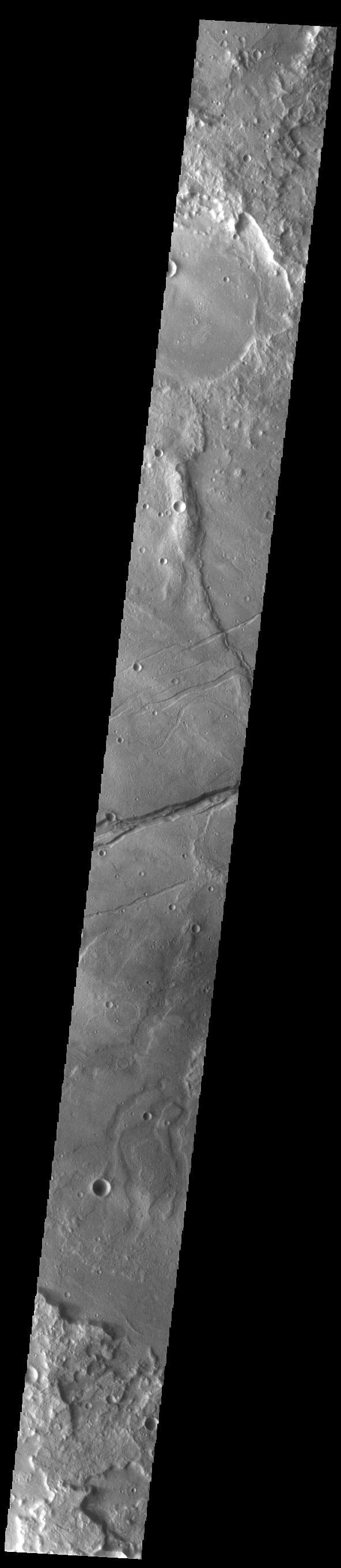
The linear depression in this VIS image is part of Sirenum Fossae. Depressions of this type are called graben, which form by the down drop of material between two parallel faults. The faults are caused by tectonic stresses in the region. The Sirenum Fossae graben are 2735km (1700 miles) long. Orbit Number: 84379 Latitude: -32.7135 Longitude: 204.562 Instrument: VIS Captured: 2020-12-22 01:06 https://photojournal.jpl.nasa.gov/catalog/PIA24398
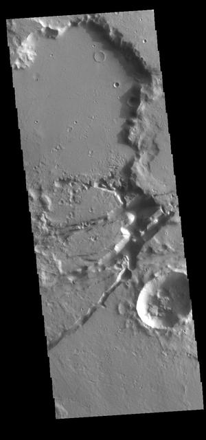
The linear depressions in this VIS image are part of Sirenum Fossae. These depressions are called graben, which form by the down drop of material between two parallel faults. The faults are caused by tectonic stresses in the region. The Sirenum Fossae graben are 2735km (1700 miles) long. Orbit Number: 80454 Latitude: -29.9435 Longitude: 211.124 Instrument: VIS Captured: 2020-02-02 21:26 https://photojournal.jpl.nasa.gov/catalog/PIA23844

The linear features in this VIS image are tectonic graben. These graben are called Sirenum Fossae. Graben are formed by extension of the crust and faulting. When large amounts of pressure or tension are applied to rocks on timescales that are fast enough that the rock cannot respond by deforming, the rock breaks along faults. In the case of a graben, two parallel faults are formed by extension of the crust and the rock in between the faults drops downward into the space created by the extension. Several graben are visible in this THEMIS VIS image, trending from east to west. Because the faults defining the graben are formed parallel to the direction of the applied stress, we know that extensional forces were pulling the crust apart in the north/south direction. The majority of the stresses that created Sirenum Fossae are aligned in the in a north-northwest to south-southeast direction. The Sirenum Fossae graben are 2735km (1700 miles) long. Orbit Number: 89864 Latitude: -38.9631 Longitude: 182.869 Instrument: VIS Captured: 2022-03-18 16:46 https://photojournal.jpl.nasa.gov/catalog/PIA25399
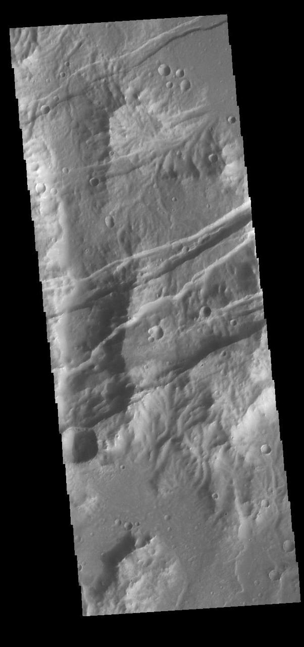
The linear features in this VIS image are tectonic graben. These graben are called Sirenum Fossae. Graben are formed by extension of the crust and faulting. When large amounts of pressure or tension are applied to rocks on timescales that are fast enough that the rock cannot respond by deforming, the rock breaks along faults. In the case of a graben, two parallel faults are formed by extension of the crust and the rock in between the faults drops downward into the space created by the extension. Several graben are visible in this THEMIS VIS image, trending from east to west. Because the faults defining the graben are formed parallel to the direction of the applied stress, we know that extensional forces were pulling the crust apart in the north/south direction. The majority of the stresses that created Sirenum Fossae are aligned in the in a north-northwest to south-southeast direction. The Sirenum Fossae graben are 2735km (1700 miles) long. Orbit Number: 91772 Latitude: -27.9695 Longitude: 216.058 Instrument: VIS Captured: 2022-08-22 19:21 https://photojournal.jpl.nasa.gov/catalog/PIA25642
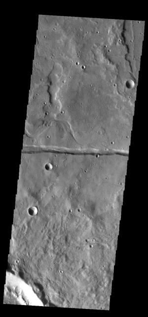
The linear depression in this VIS image is part of Sirenum Fossae. Depressions of this type are called graben, which form by the down drop of material between two parallel faults. The faults are caused by extensional tectonic stresses in the region. The fossae are 2735km long (1700 miles). Orbit Number: 83781 Latitude: -39.5762 Longitude: 174.649 Instrument: VIS Captured: 2020-11-02 19:27 https://photojournal.jpl.nasa.gov/catalog/PIA24288

The linear depressions in this VIS image are part of Sirenum Fossae. These depressions are called graben, which form by the down drop of material between two parallel faults. The faults are caused by extensional tectonic stresses in the region. The fossae are 2735km long (1700 miles). Orbit Number: 81265 Latitude: -28.9299 Longitude: 214.351 Instrument: VIS Captured: 2020-04-09 16:06 https://photojournal.jpl.nasa.gov/catalog/PIA23950
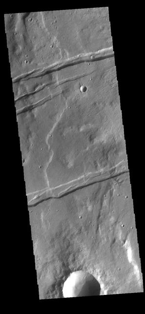
The linear depressions in this VIS image are part of Sirenum Fossae. These depressions are called graben, which form by the down drop of material between two parallel faults. The faults are caused by extensional tectonic stresses in the region. The fossae are 2735km long (1700 miles). Orbit Number: 83512 Latitude: -37.4693 Longitude: 191.543 Instrument: VIS Captured: 2020-10-11 16:26 https://photojournal.jpl.nasa.gov/catalog/PIA24272

The linear depressions in this VIS image are part of Sirenum Fossae. These depressions are called graben, which form by the down drop of material between two parallel faults. The faults are caused by extensional tectonic stresses in the region. The fossae are 2735km long (1700 miles). Orbit Number: 83511 Latitude: -26.424 Longitude: 218.759 Instrument: VIS Captured: 2020-10-11 14:31 https://photojournal.jpl.nasa.gov/catalog/PIA24271
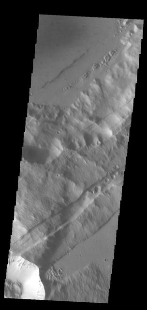
The linear depressions in this VIS image are part of Sirenum Fossae. These depressions are called graben, which form by the down drop of material between two parallel faults. The faults are caused by extensional tectonic stresses in the region. The fossae are 2735km long (1700 miles). Orbit Number: 83767 Latitude: -25.1526 Longitude: 220.709 Instrument: VIS Captured: 2020-11-01 15:42 https://photojournal.jpl.nasa.gov/catalog/PIA24287

Evidence for Recent Liquid Water on Mars: Gullies in Sirenum Fossae Trough
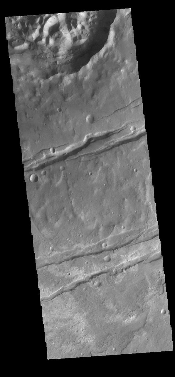
Today's VIS image shows a portion of Sirenum Fossae. The linear features are tectonic graben. Graben are formed by extension of the crust and faulting. When large amounts of pressure or tension are applied to rocks on timescales that are fast enough that the rock cannot respond by deforming, the rock breaks along faults. In the case of a graben, two parallel faults are formed by extension of the crust and the rock in between the faults drops downward into the space created by the extension. Numerous sets of graben are visible in this THEMIS image, trending from north-northeast to south-southwest. Because the faults defining the graben are formed perpendicular to the direction of the applied stress, we know that extensional forces were pulling the crust apart in the west-northwest/east-southeast direction. The Sirenum Fossae graben are 2735km (1700 miles) long and stretch from eastern Terra Sirenum into western Daedalia Planum. Orbit Number: 91436 Latitude: -37.5623 Longitude: 190.938 Instrument: VIS Captured: 2022-07-26 03:19 https://photojournal.jpl.nasa.gov/catalog/PIA25550
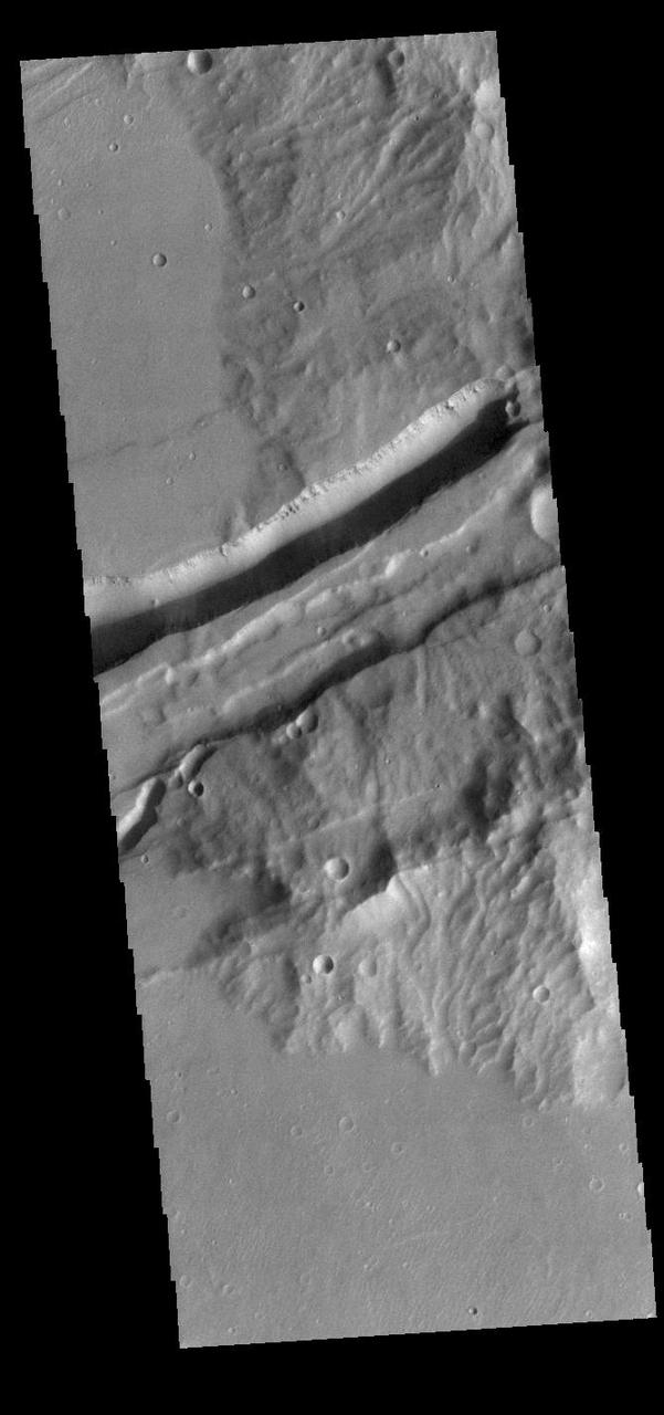
Today's VIS image shows a portion of Sirenum Fossae. The linear features are tectonic graben. Graben are formed by extension of the crust and faulting. When large amounts of pressure or tension are applied to rocks on timescales that are fast enough that the rock cannot respond by deforming, the rock breaks along faults. In the case of a graben, two parallel faults are formed by extension of the crust and the rock in between the faults drops downward into the space created by the extension. Numerous sets of graben are visible in this THEMIS image, trending from north-northeast to south-southwest. Because the faults defining the graben are formed perpendicular to the direction of the applied stress, we know that extensional forces were pulling the crust apart in the west-northwest/east-southeast direction. The Sirenum Fossae graben are 2735km (1700 miles) long and stretch from eastern Terra Sirenum into western Daedalia Planum. Orbit Number: 90574 Latitude: -27.0842 Longitude: 217.82 Instrument: VIS Captured: 2022-05-16 03:55 https://photojournal.jpl.nasa.gov/catalog/PIA25477
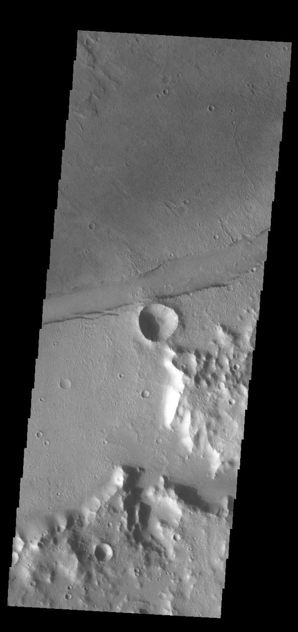
The linear feature in this VIS image is part of Sirenum Fossae. The linear feature is a tectonic graben. Graben are formed by extension of the crust and faulting. When large amounts of pressure or tension are applied to rocks on timescales that are fast enough that the rock cannot respond by deforming, the rock breaks along faults. In the case of a graben, two parallel faults are formed by extension of the crust and the rock in between the faults drops downward into the space created by the extension. The graben in this THEMIS image is aligned trending from north-northeast to south-southwest. Because the faults defining the graben are formed perpendicular to the direction of the applied stress, we know that extensional forces were pulling the crust apart in the west-northwest/east-southeast direction. The Sirenum Fossae graben are 2735km (1700 miles) long and stretch from eastern Terra Sirenum into western Daedalia Planum. Orbit Number: 91854 Latitude: -35.8913 Longitude: 195.821 Instrument: VIS Captured: 2022-08-29 12:46 https://photojournal.jpl.nasa.gov/catalog/PIA25714
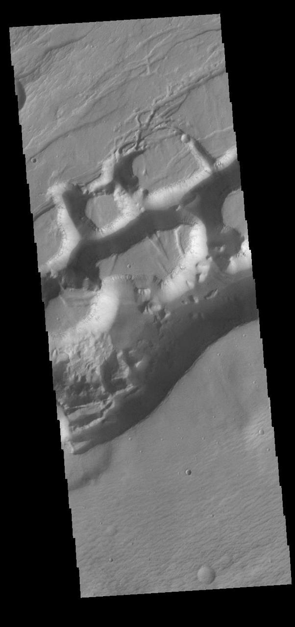
Today's VIS image shows a portion of Sirenum Fossae. The linear features are tectonic graben. Graben are formed by extension of the crust and faulting. When large amounts of pressure or tension are applied to rocks on timescales that are fast enough that the rock cannot respond by deforming, the rock breaks along faults. In the case of a graben, two parallel faults are formed by extension of the crust and the rock in between the faults drops downward into the space created by the extension. Numerous sets of graben are visible in this THEMIS image, trending from north-northeast to south-southwest. Because the faults defining the graben are formed perpendicular to the direction of the applied stress, we know that extensional forces were pulling the crust apart in the west-northwest/east-southeast direction. The Sirenum Fossae graben are 2735km (1700 miles) long and stretch from eastern Terra Sirenum into western Daedalia Planum. Orbit Number: 91410 Latitude: -26.2112 Longitude: 219.344 Instrument: VIS Captured: 2022-07-24 (All day) https://photojournal.jpl.nasa.gov/catalog/PIA25548
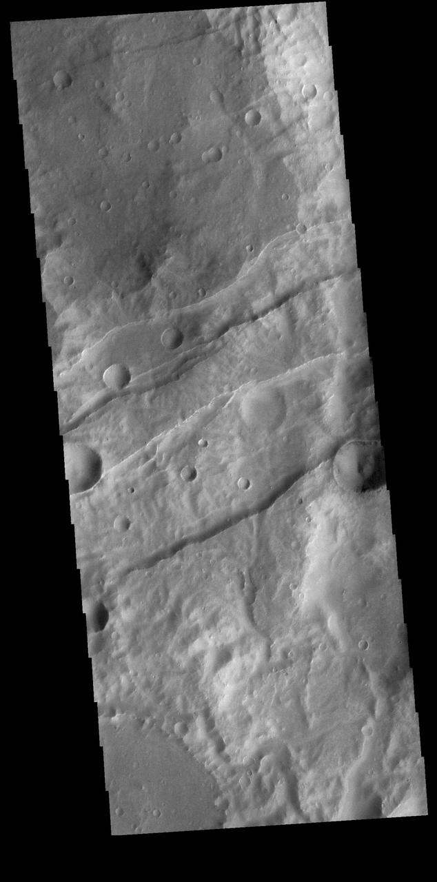
This VIS image shows a section of Sirenum Fossae. The linear features are called graben. Graben are formed by blocks of material sliding downward between pairs of faults. Orbit Number: 74365 Latitude: -28.1401 Longitude: 215.795 Instrument: VIS Captured: 2018-09-19 11:11 https://photojournal.jpl.nasa.gov/catalog/PIA22802
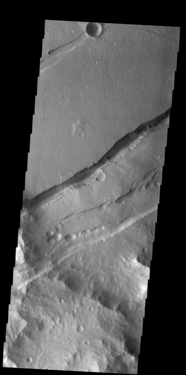
Today's VIS image shows a portion of Sirenum Fossae. The linear features are tectonic graben. Graben are formed by extension of the crust and faulting. When large amounts of pressure or tension are applied to rocks on timescales that are fast enough that the rock cannot respond by deforming, the rock breaks along faults. In the case of a graben, two parallel faults are formed by extension of the crust and the rock in between the faults drops downward into the space created by the extension. Numerous sets of graben are visible in this THEMIS image, trending from north-northeast to south-southwest. Because the faults defining the graben are formed perpendicular to the direction of the applied stress, we know that extensional forces were pulling the crust apart in the west-northwest/east-southeast direction. The Sirenum Fossae graben are 2735km (1700 miles) long and stretch from eastern Terra Sirenum into western Daedalia Planum. Orbit Number: 92627 Latitude: -27.7786 Longitude: 216.392 Instrument: VIS Captured: 2022-11-01 04:18 https://photojournal.jpl.nasa.gov/catalog/PIA25766
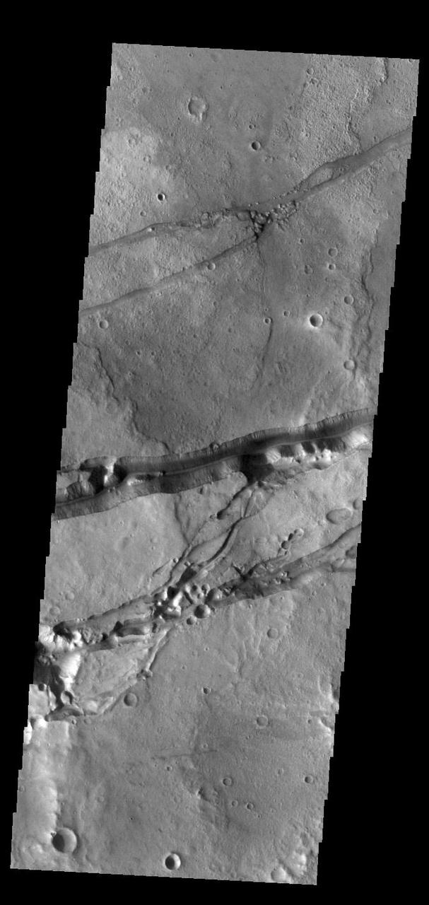
Today's VIS image shows a portion of Sirenum Fossae. The linear features are tectonic graben. Graben are formed by extension of the crust and faulting. When large amounts of pressure or tension are applied to rocks on timescales that are fast enough that the rock cannot respond by deforming, the rock breaks along faults. In the case of a graben, two parallel faults are formed by extension of the crust and the rock in between the faults drops downward into the space created by the extension. Numerous sets of graben are visible in this THEMIS image, trending from north-northeast to south-southwest. Because the faults defining the graben are formed perpendicular to the direction of the applied stress, we know that extensional forces were pulling the crust apart in the west-northwest/east-southeast direction. The Sirenum Fossae graben are 2735km (1700 miles) long and stretch from eastern Terra Sirenum into western Daedalia Planum. Orbit Number: 91816 Latitude: -29.2208 Longitude: 213.139 Instrument: VIS Captured: 2022-08-26 09:39 https://photojournal.jpl.nasa.gov/catalog/PIA25645
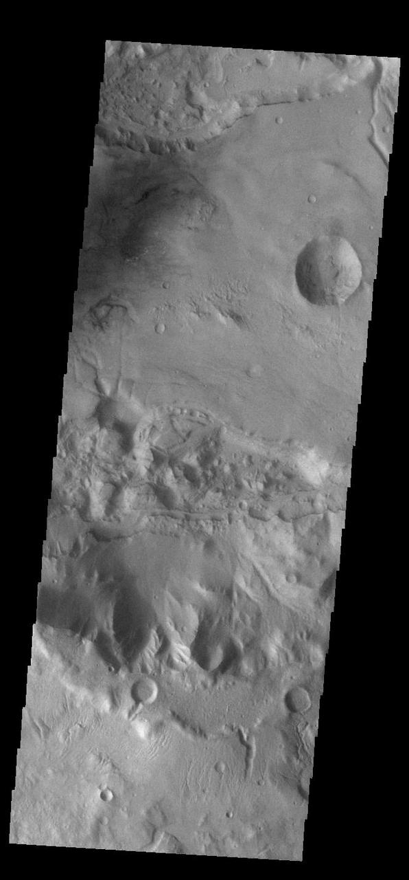
Today's VIS image shows a portion of Sirenum Fossae. The linear features are tectonic graben. Graben are formed by extension of the crust and faulting. When large amounts of pressure or tension are applied to rocks on timescales that are fast enough that the rock cannot respond by deforming, the rock breaks along faults. In the case of a graben, two parallel faults are formed by extension of the crust and the rock in between the faults drops downward into the space created by the extension. Numerous sets of graben are visible in this THEMIS image, trending from north-northeast to south-southwest. Because the faults defining the graben are formed perpendicular to the direction of the applied stress, we know that extensional forces were pulling the crust apart in the west-northwest/east-southeast direction. The Sirenum Fossae graben are 2735km (1700 miles) long and stretch from eastern Terra Sirenum into western Daedalia Planum. Orbit Number: 92416 Latitude: -39.2691 Longitude: 181.857 Instrument: VIS Captured: 2022-10-14 19:23 https://photojournal.jpl.nasa.gov/catalog/PIA25758
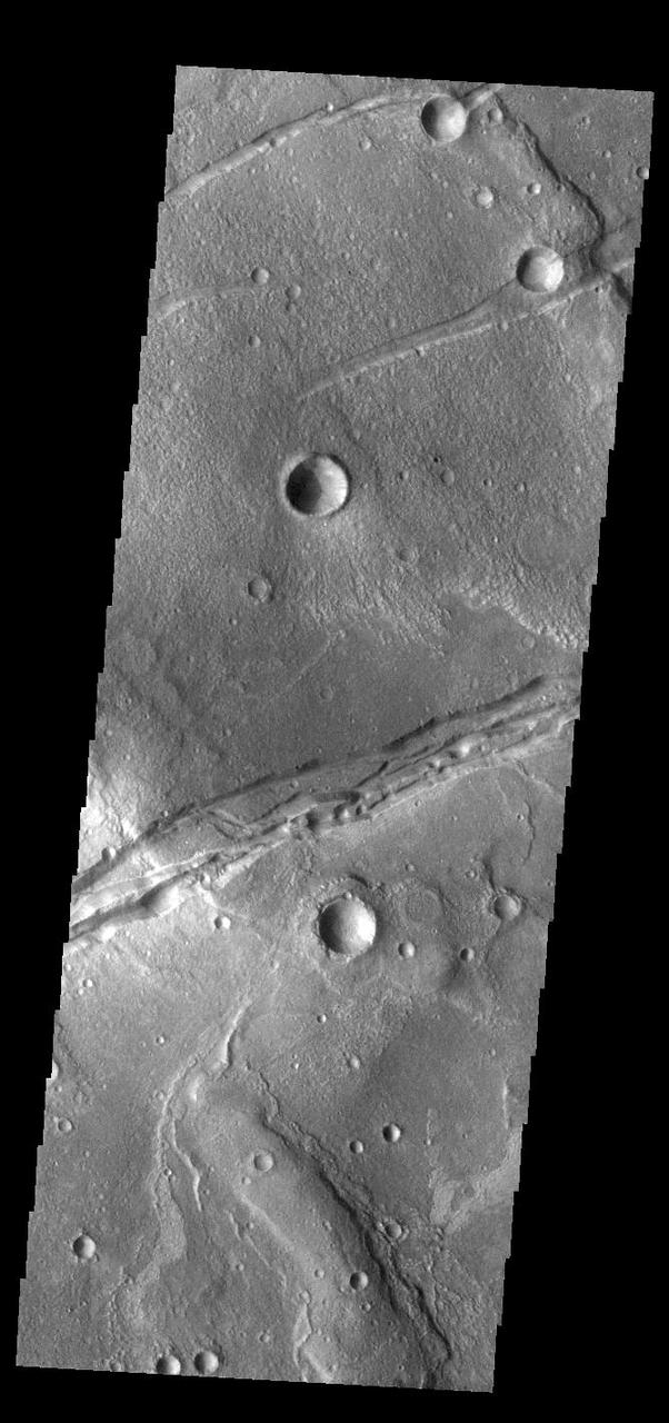
Today's VIS image shows a portion of Sirenum Fossae. The linear features are tectonic graben. Graben are formed by extension of the crust and faulting. When large amounts of pressure or tension are applied to rocks on timescales that are fast enough that the rock cannot respond by deforming, the rock breaks along faults. In the case of a graben, two parallel faults are formed by extension of the crust and the rock in between the faults drops downward into the space created by the extension. Numerous sets of graben are visible in this THEMIS image, trending from north-northeast to south-southwest. Because the faults defining the graben are formed perpendicular to the direction of the applied stress, we know that extensional forces were pulling the crust apart in the west-northwest/east-southeast direction. The Sirenum Fossae graben are 2735km (1700 miles) long and stretch from eastern Terra Sirenum into western Daedalia Planum. Orbit Number: 92253 Latitude: -32.4503 Longitude: 205.396 Instrument: VIS Captured: 2022-10-01 09:14 https://photojournal.jpl.nasa.gov/catalog/PIA25753
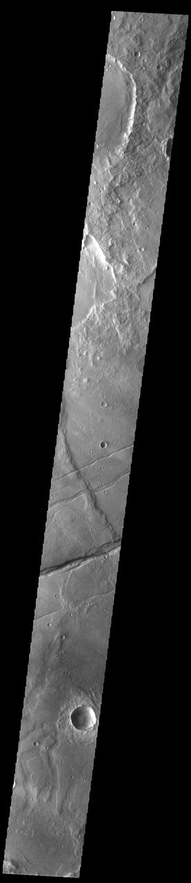
Today's VIS image shows a portion of Sirenum Fossae. The linear features are tectonic graben. Graben are formed by extension of the crust and faulting. When large amounts of pressure or tension are applied to rocks on timescales that are fast enough that the rock cannot respond by deforming, the rock breaks along faults. In the case of a graben, two parallel faults are formed by extension of the crust and the rock in between the faults drops downward into the space created by the extension. Numerous sets of graben are visible in this THEMIS image, trending from north-northeast to south-southwest. Because the faults defining the graben are formed perpendicular to the direction of the applied stress, we know that extensional forces were pulling the crust apart in the west-northwest/east-southeast direction. The Sirenum Fossae graben are 2735km (1700 miles) long and stretch from eastern Terra Sirenum into western Daedalia Planum. Orbit Number: 93139 Latitude: -32.2816 Longitude: 204.773 Instrument: VIS Captured: 2022-12-13 08:06 https://photojournal.jpl.nasa.gov/catalog/PIA25842

The linear depressions in this VIS image are part of Sirenum Fossae. These depressions are called graben, which form by the down drop of material between two parallel faults. The faults are caused by tectonic stresses in the region. Orbit Number: 74908 Latitude: -29.8729 Longitude: 211.936 Instrument: VIS Captured: 2018-11-03 03:55 https://photojournal.jpl.nasa.gov/catalog/PIA22902
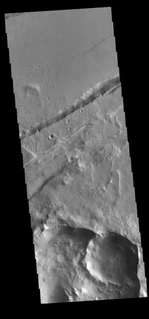
This VIS image shows a section of Sirenum Fossae. The linear depression was created by tectonic forces stretching the surface. Paired faults allow blocks of the surface to slide down into the open space. The linear depression is called a graben. Orbit Number: 80616 Latitude: -27.3687 Longitude: 217.266 Instrument: VIS Captured: 2020-02-16 05:35 https://photojournal.jpl.nasa.gov/catalog/PIA23856
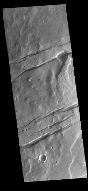
The channel-like features in this VIS image are tectonic graben. These graben are called Sirenum Fossae. Graben are created in regions of extensional tectonic stress, where the bedrock is faulted and pulled apart, allowing linear sections of the surface to drop downward along paired faults. The Sirenum Fossae graben are 2735km (1700 miles) long. Orbit Number: 84111 Latitude: -37.1819 Longitude: 191.303 Instrument: VIS Captured: 2020-11-30 00:06 https://photojournal.jpl.nasa.gov/catalog/PIA24406
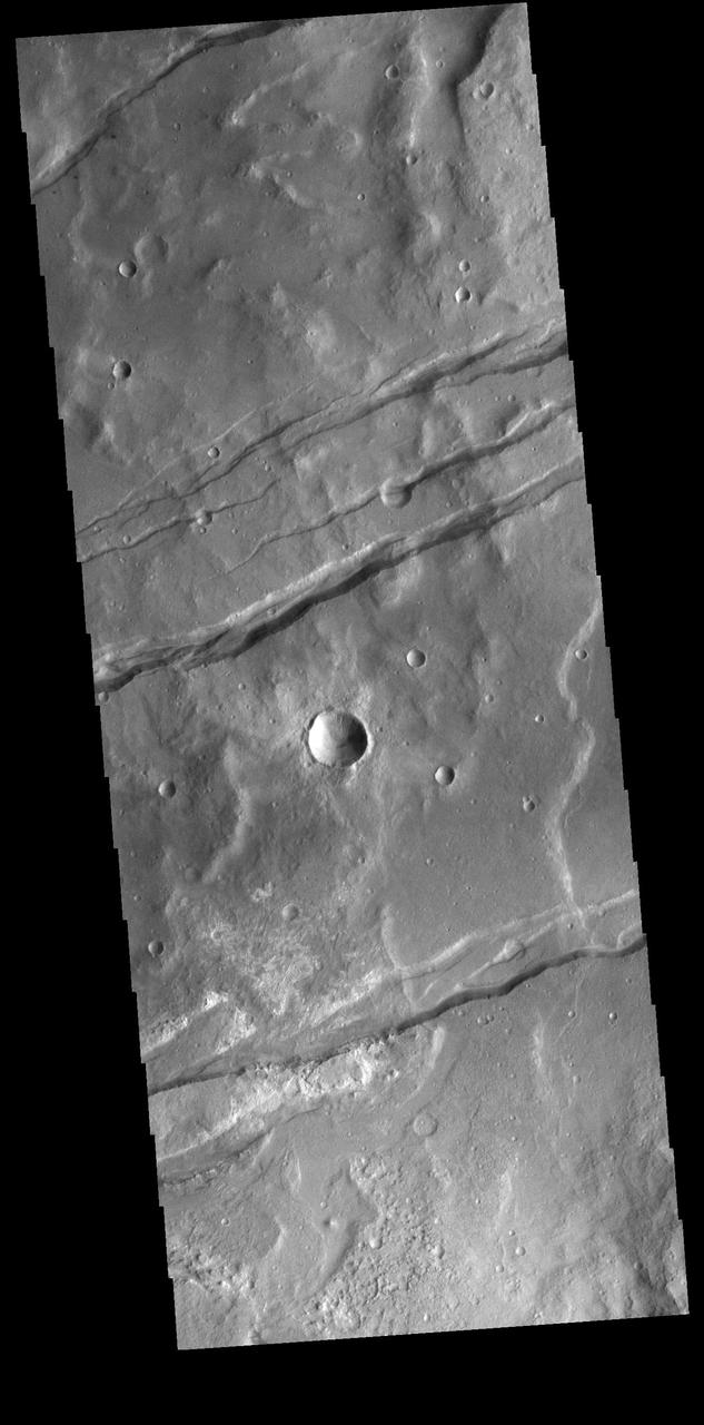
The linear depressions in this VIS image are part of Sirenum Fossae. These depressions are called graben, which form by the down drop of material between two parallel faults. The faults are caused by tectonic stresses in the region. The Sirenum Fossae graben are 2735km (1700 miles) long. Orbit Number: 82052 Latitude: -37.4717 Longitude: 191.302 Instrument: VIS Captured: 2020-06-13 11:16 https://photojournal.jpl.nasa.gov/catalog/PIA24118
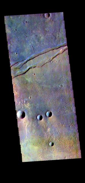
The THEMIS VIS camera contains 5 filters. The data from different filters can be combined in multiple ways to create a false color image. These false color images may reveal subtle variations of the surface not easily identified in a single band image. Today's false color image shows part of Sirenum Fossae. The linear depressions at the top of the image are called graben. Graben are created in regions of extensional tectonic stress, where the bedrock is faulted and pulled apart, allowing linear sections of the surface to drop downward along paired faults. The Sirenum Fossae graben are 2735km (1700 miles) long. Orbit Number: 82613 Latitude: -32.4226 Longitude: 206.01 Instrument: VIS Captured: 2020-07-29 15:55 https://photojournal.jpl.nasa.gov/catalog/PIA24707
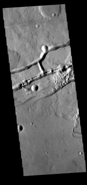
This VIS image shows a section of Sirenum Fossae. The linear depressions were created by tectonic forces stretching the surface. Paired faults allow blocks of the surface to slide down into the open space. The linear depressions are called graben. A small channel is visible on the lower right side of the image. Orbit Number: 81889 Latitude: -29.5423 Longitude: 212.521 Instrument: VIS Captured: 2020-05-31 01:12 https://photojournal.jpl.nasa.gov/catalog/PIA24087
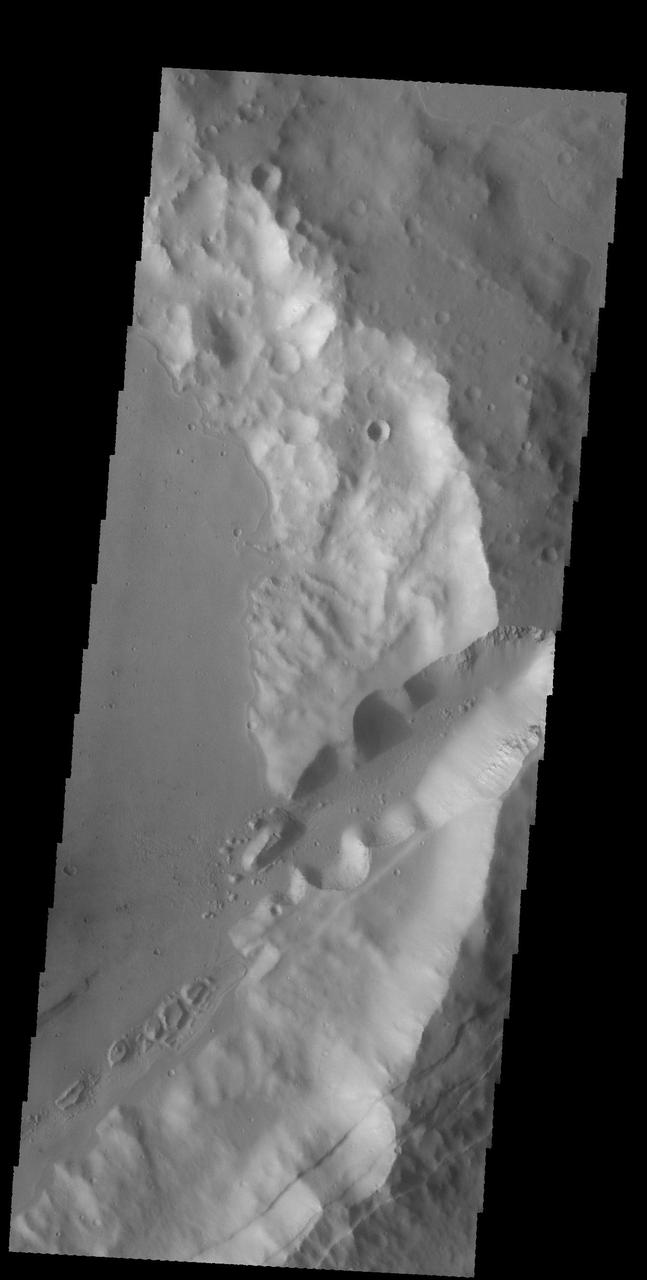
The linear features in this VIS image are faults. Where depressions are formed bounded by faulting the feature is called a graben. These faults and graben are part of a large region of faulting called Sirenum Fossae. Orbit Number: 59353 Latitude: -24.4596 Longitude: 220.937 Instrument: VIS Captured: 2015-05-01 20:03 http://photojournal.jpl.nasa.gov/catalog/PIA19503

This VIS image is located in Sirenum Fossae near Daedalia Planum. The arc at the bottom of the image is the rim of a crater that was dissected when the tectonic event created the linear faults and down dropped blocks of highland material visible in this image. The linear breaks near the top of the cliff sides indicates surface layered materials. Orbit Number: 74527 Latitude: -25.7241 Longitude: 220.258 Instrument: VIS Captured: 2018-10-02 19:27 https://photojournal.jpl.nasa.gov/catalog/PIA22852
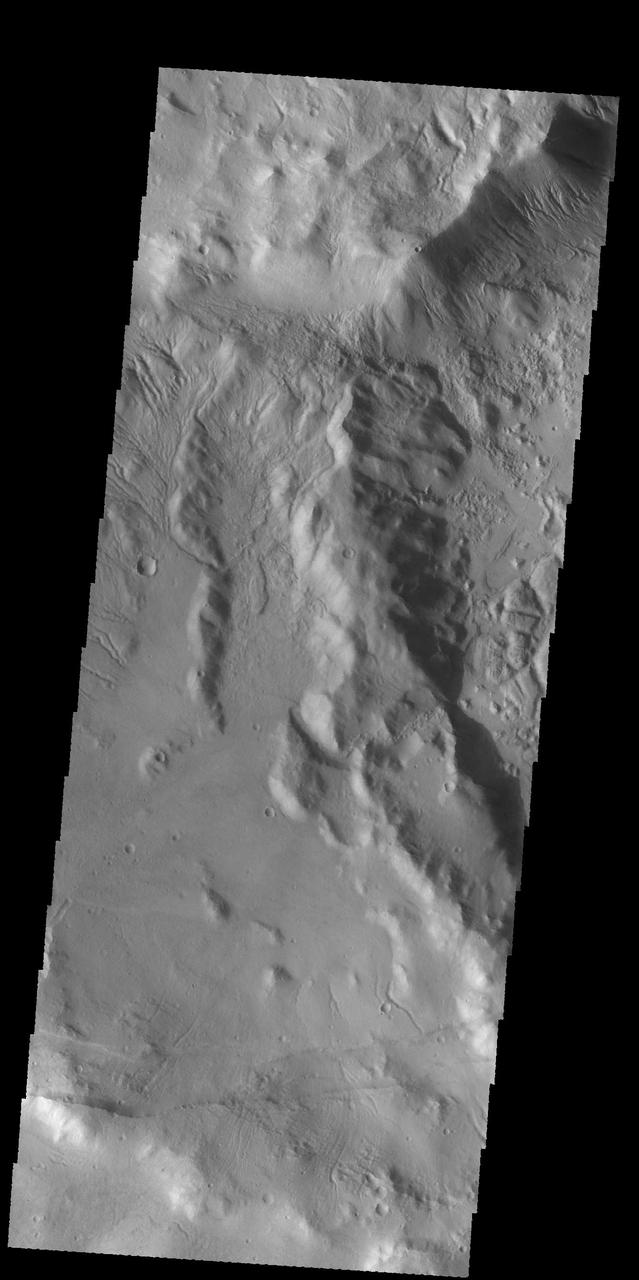
The subtle paired fractues at the bottom of this image from NASA 2001 Mars Odyssey spacecraft are part of Sirenum Fossae, though it is hundreds of km away from yesterday image location. Numerous gullies at the top of the image are located on the intersection of two crater rims. Orbit Number: 58618 Latitude: -38.9581 Longitude: 181.314 Instrument: VIS Captured: 2015-03-02 07:36 http://photojournal.jpl.nasa.gov/catalog/PIA19441
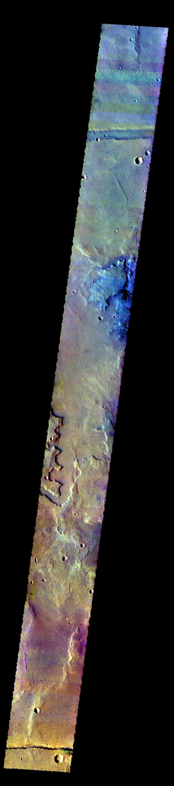
The THEMIS camera contains 5 filters. The data from different filters can be combined in multiple ways to create a false color image. These false color images may reveal subtle variations of the surface not easily identified in a single band image. The linear features at the top and bottom of this image are the graben called Sirenum Fossae. Orbit Number: 58743 Latitude: -38.0839 Longitude: 175.637 Instrument: VIS Captured: 2015-03-12 14:37 http://photojournal.jpl.nasa.gov/catalog/PIA20102
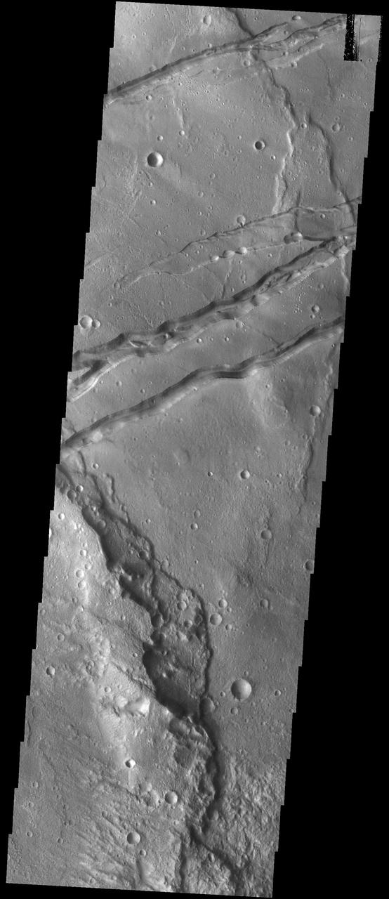
The linear features in this VIS image are graben called Sirenum Fossae. Graben are formed when blocks of material move downward between parallel faults. The faults were created by tectonic stresses in this region. The ground is pulling apart and breaks into faults, continued stress moves the sides of the faults further apart and form the graben. Orbit Number: 75220 Latitude: -31.3869 Longitude: 208.356 Instrument: VIS Captured: 2018-11-28 20:39 https://photojournal.jpl.nasa.gov/catalog/PIA22989
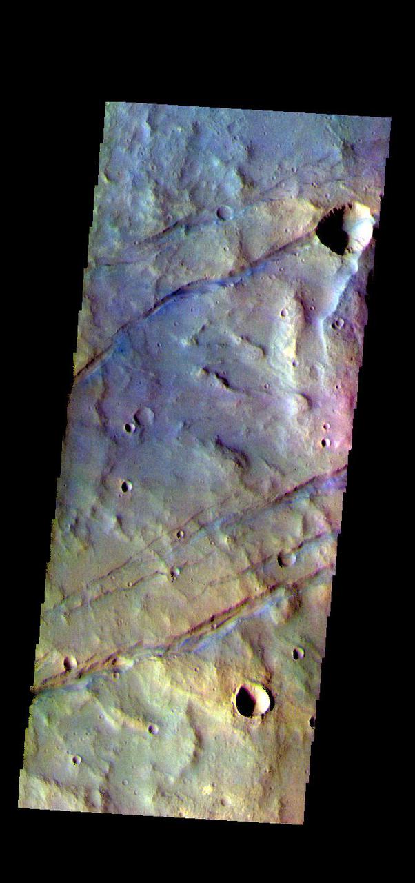
The THEMIS VIS camera contains 5 filters. The data from different filters can be combined in multiple ways to create a false color image. These false color images may reveal subtle variations of the surface not easily identified in a single band image. Today's false color image shows some of the graben that comprise Sirenum Fossae. The linear features, called graben, are created in regions of extensional tectonic stress, where the bedrock is faulted and pulled apart, allowing linear sections of the surface to drop downward along paired faults. The Sirenum Fossae graben are 2735km (1700 miles) long. The THEMIS VIS camera is capable of capturing color images of the Martian surface using five different color filters. In this mode of operation, the spatial resolution and coverage of the image must be reduced to accommodate the additional data volume produced from using multiple filters. To make a color image, three of the five filter images (each in grayscale) are selected. Each is contrast enhanced and then converted to a red, green, or blue intensity image. These three images are then combined to produce a full color, single image. Because the THEMIS color filters don't span the full range of colors seen by the human eye, a color THEMIS image does not represent true color. Also, because each single-filter image is contrast enhanced before inclusion in the three-color image, the apparent color variation of the scene is exaggerated. Nevertheless, the color variation that does appear is representative of some change in color, however subtle, in the actual scene. Note that the long edges of THEMIS color images typically contain color artifacts that do not represent surface variation. Orbit Number: 83743 Latitude: -37.2437 Longitude: 191.251 Instrument: VIS Captured: 2020-10-30 16:21 https://photojournal.jpl.nasa.gov/catalog/PIA25000
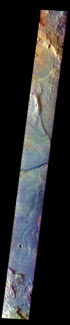
The THEMIS VIS camera contains 5 filters. The data from different filters can be combined in multiple ways to create a false color image. These false color images may reveal subtle variations of the surface not easily identified in a single band image. Today's false color image shows part of Sirenum Fossae. The linear depressions in this VIS image are tectonic graben. Graben are formed by extension of the crust and faulting. When large amounts of pressure or tension are applied to rocks on timescales that are fast enough that the rock cannot respond by deforming, the rock breaks along faults. In the case of a graben, two parallel faults are formed by extension of the crust and the rock in between the faults drops downward into the space created by the extension. Several graben are visible in this THEMIS VIS image, trending from north-northeast to south-southwest. Because the faults defining the graben are formed parallel to the direction of the applied stress, we know that extensional forces were pulling the crust apart in the west-northwest/east-southeast direction. The Sirenum Fossae graben are 2735km (1700 miles) long. The THEMIS VIS camera is capable of capturing color images of the Martian surface using five different color filters. In this mode of operation, the spatial resolution and coverage of the image must be reduced to accommodate the additional data volume produced from using multiple filters. To make a color image, three of the five filter images (each in grayscale) are selected. Each is contrast enhanced and then converted to a red, green, or blue intensity image. These three images are then combined to produce a full color, single image. Because the THEMIS color filters don't span the full range of colors seen by the human eye, a color THEMIS image does not represent true color. Also, because each single-filter image is contrast enhanced before inclusion in the three-color image, the apparent color variation of the scene is exaggerated. Nevertheless, the color variation that does appear is representative of some change in color, however subtle, in the actual scene. Note that the long edges of THEMIS color images typically contain color artifacts that do not represent surface variation. Orbit Number: 84379 Latitude: -32.7134 Longitude: 204.562 Instrument: VIS Captured: 2020-12-22 01:06 https://photojournal.jpl.nasa.gov/catalog/PIA25004
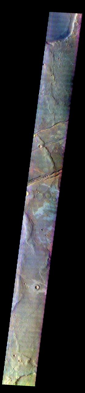
The THEMIS VIS camera contains 5 filters. The data from different filters can be combined in multiple ways to create a false color image. These false color images may reveal subtle variations of the surface not easily identified in a single band image. Today's false color image shows part of Sirenum Fossae. The linear depressions in this VIS image are tectonic graben. Graben are formed by extension of the crust and faulting. When large amounts of pressure or tension are applied to rocks on timescales that are fast enough that the rock cannot respond by deforming, the rock breaks along faults. In the case of a graben, two parallel faults are formed by extension of the crust and the rock in between the faults drops downward into the space created by the extension. Several graben are visible in this THEMIS VIS image, trending from north-northeast to south-southwest. Because the faults defining the graben are formed perpendicular to the direction of the applied stress, we know that extensional forces were pulling the crust apart in the west-northwest/east-southeast direction. The Sirenum Fossae graben are 2735km (1700 miles) long. The THEMIS VIS camera is capable of capturing color images of the Martian surface using five different color filters. In this mode of operation, the spatial resolution and coverage of the image must be reduced to accommodate the additional data volume produced from using multiple filters. To make a color image, three of the five filter images (each in grayscale) are selected. Each is contrast enhanced and then converted to a red, green, or blue intensity image. These three images are then combined to produce a full color, single image. Because the THEMIS color filters don't span the full range of colors seen by the human eye, a color THEMIS image does not represent true color. Also, because each single-filter image is contrast enhanced before inclusion in the three-color image, the apparent color variation of the scene is exaggerated. Nevertheless, the color variation that does appear is representative of some change in color, however subtle, in the actual scene. Note that the long edges of THEMIS color images typically contain color artifacts that do not represent surface variation. Orbit Number: 92540 Latitude: -32.6048 Longitude: 205.563 Instrument: VIS Captured: 2022-10-25 00:23 https://photojournal.jpl.nasa.gov/catalog/PIA26122
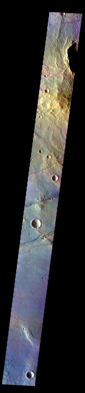
The THEMIS VIS camera contains 5 filters. The data from different filters can be combined in multiple ways to create a false color image. These false color images may reveal subtle variations of the surface not easily identified in a single band image. Today's false color image shows part of Sirenum Fossae. The linear depressions in this VIS image are tectonic graben. Graben are formed by extension of the crust and faulting. When large amounts of pressure or tension are applied to rocks on timescales that are fast enough that the rock cannot respond by deforming, the rock breaks along faults. In the case of a graben, two parallel faults are formed by extension of the crust and the rock in between the faults drops downward into the space created by the extension. Several graben are visible in this THEMIS VIS image, trending from north-northeast to south-southwest. Because the faults defining the graben are formed perpendicular to the direction of the applied stress, we know that extensional forces were pulling the crust apart in the west-northwest/east-southeast direction. The Sirenum Fossae graben are 2735km (1700 miles) long. The THEMIS VIS camera is capable of capturing color images of the Martian surface using five different color filters. In this mode of operation, the spatial resolution and coverage of the image must be reduced to accommodate the additional data volume produced from using multiple filters. To make a color image, three of the five filter images (each in grayscale) are selected. Each is contrast enhanced and then converted to a red, green, or blue intensity image. These three images are then combined to produce a full color, single image. Because the THEMIS color filters don't span the full range of colors seen by the human eye, a color THEMIS image does not represent true color. Also, because each single-filter image is contrast enhanced before inclusion in the three-color image, the apparent color variation of the scene is exaggerated. Nevertheless, the color variation that does appear is representative of some change in color, however subtle, in the actual scene. Note that the long edges of THEMIS color images typically contain color artifacts that do not represent surface variation. Orbit Number: 92203 Latitude: -31.0389 Longitude: 208.065 Instrument: VIS Captured: 2022-09-27 06:25 https://photojournal.jpl.nasa.gov/catalog/PIA26087
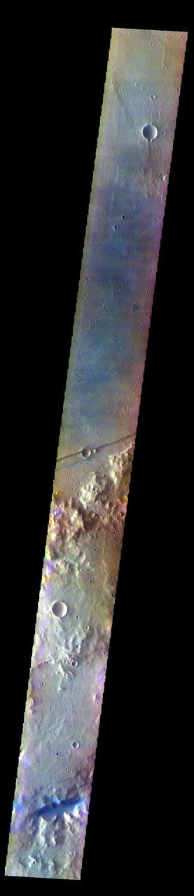
The THEMIS VIS camera contains 5 filters. The data from different filters can be combined in multiple ways to create a false color image. These false color images may reveal subtle variations of the surface not easily identified in a single band image. Today's false color image shows part of Sirenum Fossae. The linear depressions in this VIS image are tectonic graben. Graben are formed by extension of the crust and faulting. When large amounts of pressure or tension are applied to rocks on timescales that are fast enough that the rock cannot respond by deforming, the rock breaks along faults. In the case of a graben, two parallel faults are formed by extension of the crust and the rock in between the faults drops downward into the space created by the extension. Several graben are visible in this THEMIS VIS image, trending from north-northeast to south-southwest. Because the faults defining the graben are formed parallel to the direction of the applied stress, we know that extensional forces were pulling the crust apart in the west-northwest/east-southeast direction. The Sirenum Fossae graben are 2735km (1700 miles) long. The THEMIS VIS camera is capable of capturing color images of the Martian surface using five different color filters. In this mode of operation, the spatial resolution and coverage of the image must be reduced to accommodate the additional data volume produced from using multiple filters. To make a color image, three of the five filter images (each in grayscale) are selected. Each is contrast enhanced and then converted to a red, green, or blue intensity image. These three images are then combined to produce a full color, single image. Because the THEMIS color filters don't span the full range of colors seen by the human eye, a color THEMIS image does not represent true color. Also, because each single-filter image is contrast enhanced before inclusion in the three-color image, the apparent color variation of the scene is exaggerated. Nevertheless, the color variation that does appear is representative of some change in color, however subtle, in the actual scene. Note that the long edges of THEMIS color images typically contain color artifacts that do not represent surface variation. Orbit Number: 84841 Latitude: -35.7019 Longitude: 196.266 Instrument: VIS Captured: 2021-01-29 02:03 https://photojournal.jpl.nasa.gov/catalog/PIA25005
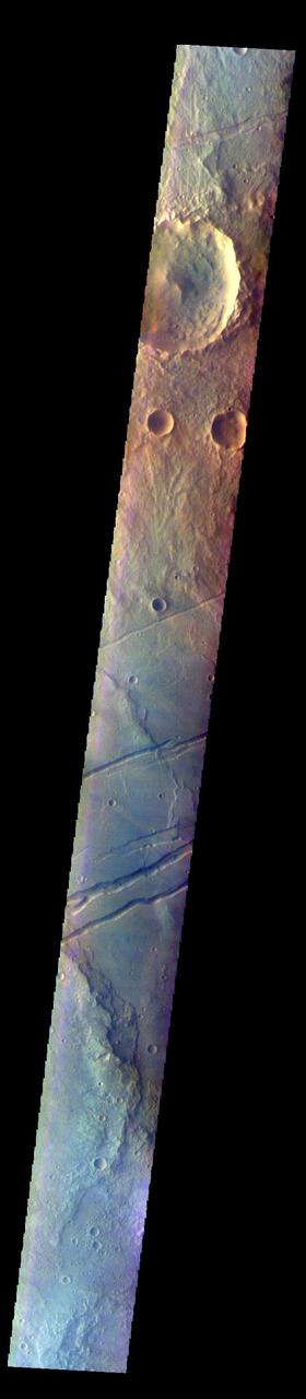
The THEMIS VIS camera contains 5 filters. The data from different filters can be combined in multiple ways to create a false color image. These false color images may reveal subtle variations of the surface not easily identified in a single band image. Today's false color image shows part of Sirenum Fossae. The linear depressions in this VIS image are tectonic graben. Graben are formed by extension of the crust and faulting. When large amounts of pressure or tension are applied to rocks on timescales that are fast enough that the rock cannot respond by deforming, the rock breaks along faults. In the case of a graben, two parallel faults are formed by extension of the crust and the rock in between the faults drops downward into the space created by the extension. Several graben are visible in this THEMIS VIS image, trending from north-northeast to south-southwest. Because the faults defining the graben are formed parallel to the direction of the applied stress, we know that extensional forces were pulling the crust apart in the west-northwest/east-southeast direction. The Sirenum Fossae graben are 2735km (1700 miles) long. The THEMIS VIS camera is capable of capturing color images of the Martian surface using five different color filters. In this mode of operation, the spatial resolution and coverage of the image must be reduced to accommodate the additional data volume produced from using multiple filters. To make a color image, three of the five filter images (each in grayscale) are selected. Each is contrast enhanced and then converted to a red, green, or blue intensity image. These three images are then combined to produce a full color, single image. Because the THEMIS color filters don't span the full range of colors seen by the human eye, a color THEMIS image does not represent true color. Also, because each single-filter image is contrast enhanced before inclusion in the three-color image, the apparent color variation of the scene is exaggerated. Nevertheless, the color variation that does appear is representative of some change in color, however subtle, in the actual scene. Note that the long edges of THEMIS color images typically contain color artifacts that do not represent surface variation. Orbit Number: 84903 Latitude: -30.8518 Longitude: 208.42 Instrument: VIS Captured: 2021-02-03 04:32 https://photojournal.jpl.nasa.gov/catalog/PIA25007
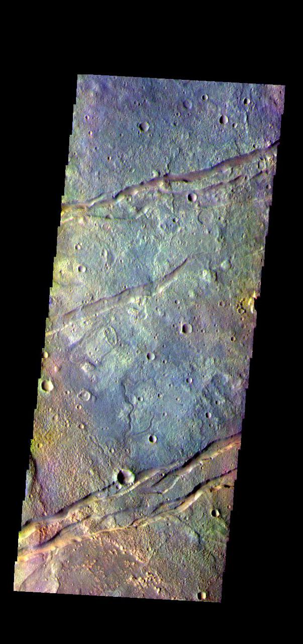
The THEMIS VIS camera contains 5 filters. The data from different filters can be combined in multiple ways to create a false color image. These false color images may reveal subtle variations of the surface not easily identified in a single band image. Today's false color image shows part of Sirenum Fossae. The linear depressions in this VIS image are tectonic graben. Graben are formed by extension of the crust and faulting. When large amounts of pressure or tension are applied to rocks on timescales that are fast enough that the rock cannot respond by deforming, the rock breaks along faults. In the case of a graben, two parallel faults are formed by extension of the crust and the rock in between the faults drops downward into the space created by the extension. Several graben are visible in this THEMIS VIS image, trending from north-northeast to south-southwest. Because the faults defining the graben are formed parallel to the direction of the applied stress, we know that extensional forces were pulling the crust apart in the west-northwest/east-southeast direction. The Sirenum Fossae graben are 2735km (1700 miles) long. The THEMIS VIS camera is capable of capturing color images of the Martian surface using five different color filters. In this mode of operation, the spatial resolution and coverage of the image must be reduced to accommodate the additional data volume produced from using multiple filters. To make a color image, three of the five filter images (each in grayscale) are selected. Each is contrast enhanced and then converted to a red, green, or blue intensity image. These three images are then combined to produce a full color, single image. Because the THEMIS color filters don't span the full range of colors seen by the human eye, a color THEMIS image does not represent true color. Also, because each single-filter image is contrast enhanced before inclusion in the three-color image, the apparent color variation of the scene is exaggerated. Nevertheless, the color variation that does appear is representative of some change in color, however subtle, in the actual scene. Note that the long edges of THEMIS color images typically contain color artifacts that do not represent surface variation. Orbit Number: 83755 Latitude: -32.1324 Longitude: 205.871 Instrument: VIS Captured: 2020-10-31 16:02 https://photojournal.jpl.nasa.gov/catalog/PIA25001
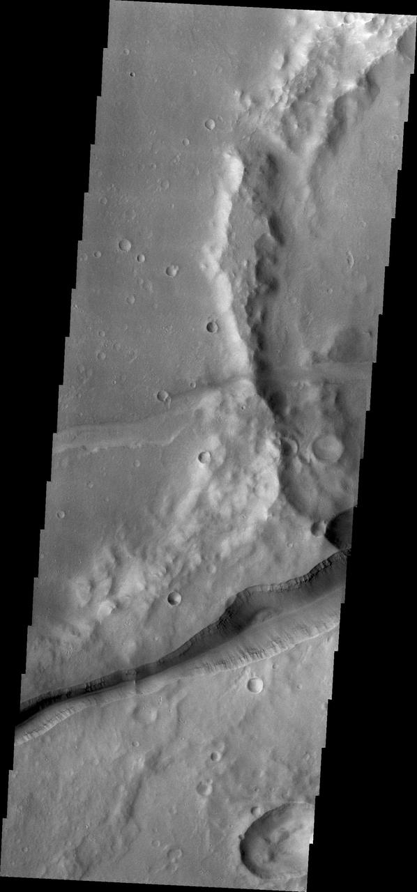
Huge fractures cutting through the surface of Terra Sirenum are called Memnonia Fossae. The term fossae means linear depression. This image is from NASA 2001 Mars Odyssey.
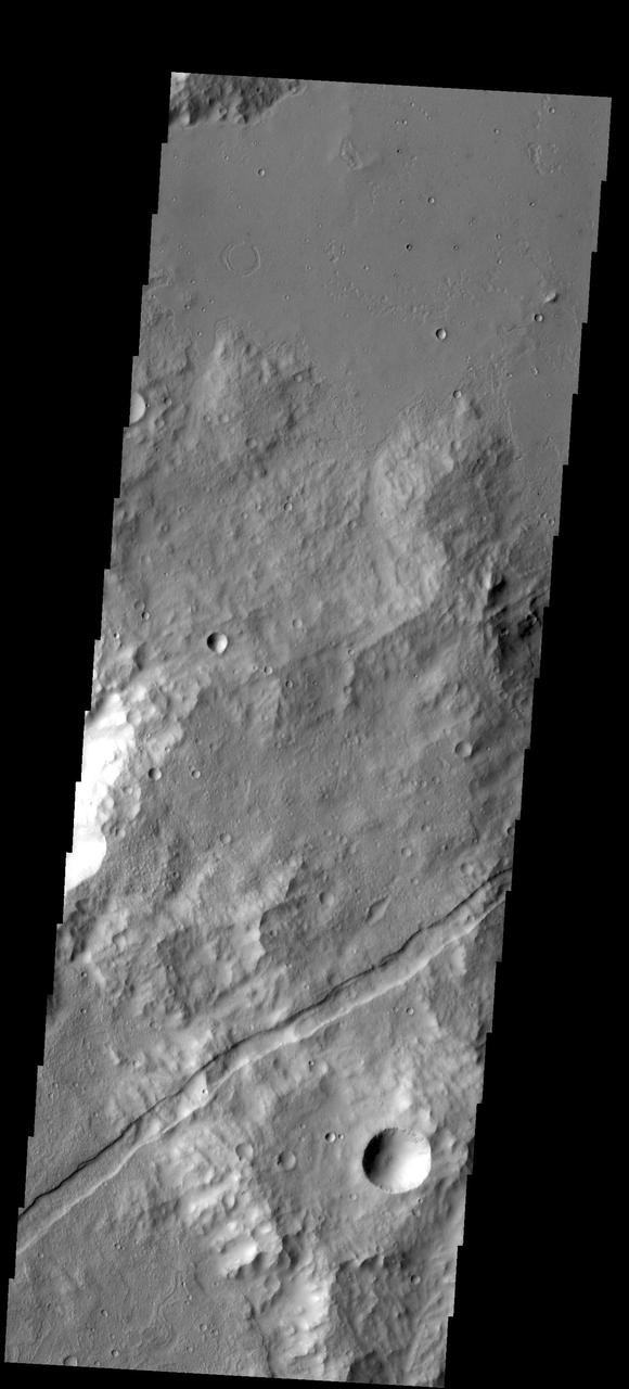
A graben is a downdropped block of material bounded on both sides by faults. The graben in this image from NASA 2001 Mars Odyssey spacecraft follows the trend of the nearby Sirenum Fossae graben.
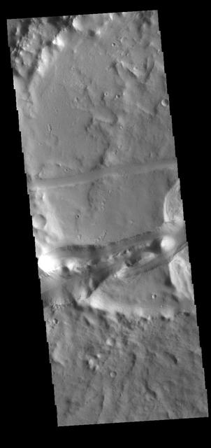
This VIS image shows part of the Memnonia Fossae graben. Memnonia Fossae, Mangala Fossae and Sirenum Fossae are all long graben (tectonic troughs) systems that stretch from eastern Terra Sirenum into western Daedalia Planum. Orbit Number: 80629 Latitude: -21.8719 Longitude: 201.417 Instrument: VIS Captured: 2020-02-17 07:18 https://photojournal.jpl.nasa.gov/catalog/PIA23909
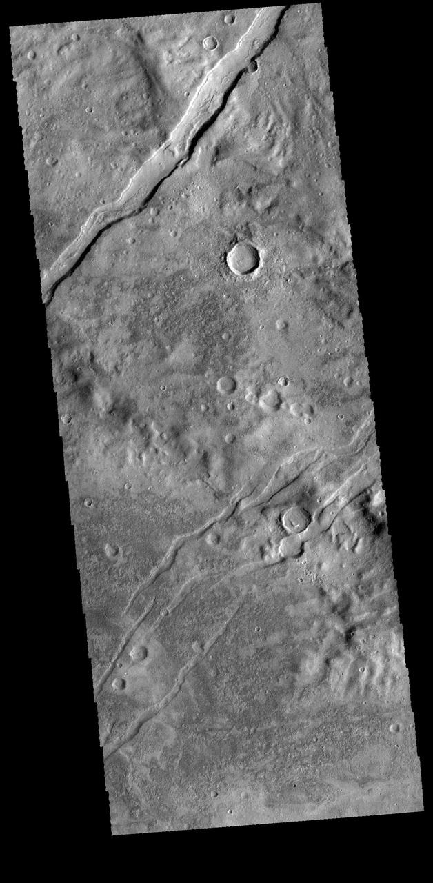
The channel-like features in this image from NASA 2001 Mars Odyssey spacecraft are tectonic graben. The graben called Icaria Fossae are located in Terra Sirenum. Orbit Number: 65846 Latitude: -41.5696 Longitude: 240.567 Instrument: VIS Captured: 2016-10-17 14:57 http://photojournal.jpl.nasa.gov/catalog/PIA21185
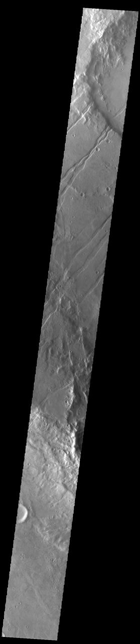
The linear features in this VIS image are tectonic graben called Icaria Fossae and are located in Terra Sirenum. Graben are formed by extension of the crust and faulting. When large amounts of pressure or tension are applied to rocks on timescales that are fast enough that the rock cannot respond by deforming, the rock breaks along faults. In the case of a graben, two parallel faults are formed by extension of the crust and the rock in between the faults drops downward into the space created by the extension. The Icaria Fossae graben are 2115km (1314 miles) long. Orbit Number: 93200 Latitude: -41.7764 Longitude: 243.379 Instrument: VIS Captured: 2022-12-18 08:42 https://photojournal.jpl.nasa.gov/catalog/PIA25847
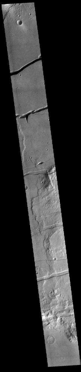
Fossae are long linear depressions called a graben and are formed by extension of the crust and faulting. When large amounts of pressure or tension are applied to rocks on timescales that are fast enough that the rock cannot respond by deforming, the rock breaks along faults. In the case of a graben, two parallel faults are formed by extension of the crust and the rock in between the faults drops downward into the space created by the extension. The graben at the top of the image is Mangala Fossae, the rest are part of Memnonia Fossae. Memnonia Fossae, Mangala Fossae and Sirenum Fossae are all long graben systems that stretch from eastern Terra Sirenum into western Daedalia Planum. Orbit Number: 91373 Latitude: -21.0528 Longitude: 206.009 Instrument: VIS Captured: 2022-07-20 22:54 https://photojournal.jpl.nasa.gov/catalog/PIA25546
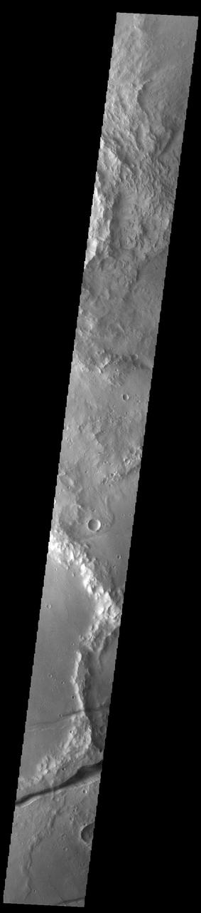
Fossae are long linear depressions called graben and are formed by extension of the crust and faulting. When large amounts of pressure or tension are applied to rocks on timescales that are fast enough that the rock cannot respond by deforming, the rock breaks along faults. In the case of a graben, two parallel faults are formed by extension of the crust and the rock in between the faults drops downward into the space created by the extension. The graben in this VIS image are part of Memnonia Fossae. Memnonia Fossae, Mangala Fossae and Sirenum Fossae are all long graben systems that stretch from eastern Terra Sirenum into western Daedalia Planum. Orbit Number: 92952 Latitude: -20.9228 Longitude: 201.274 Instrument: VIS Captured: 2022-11-27 22:30 https://photojournal.jpl.nasa.gov/catalog/PIA25807
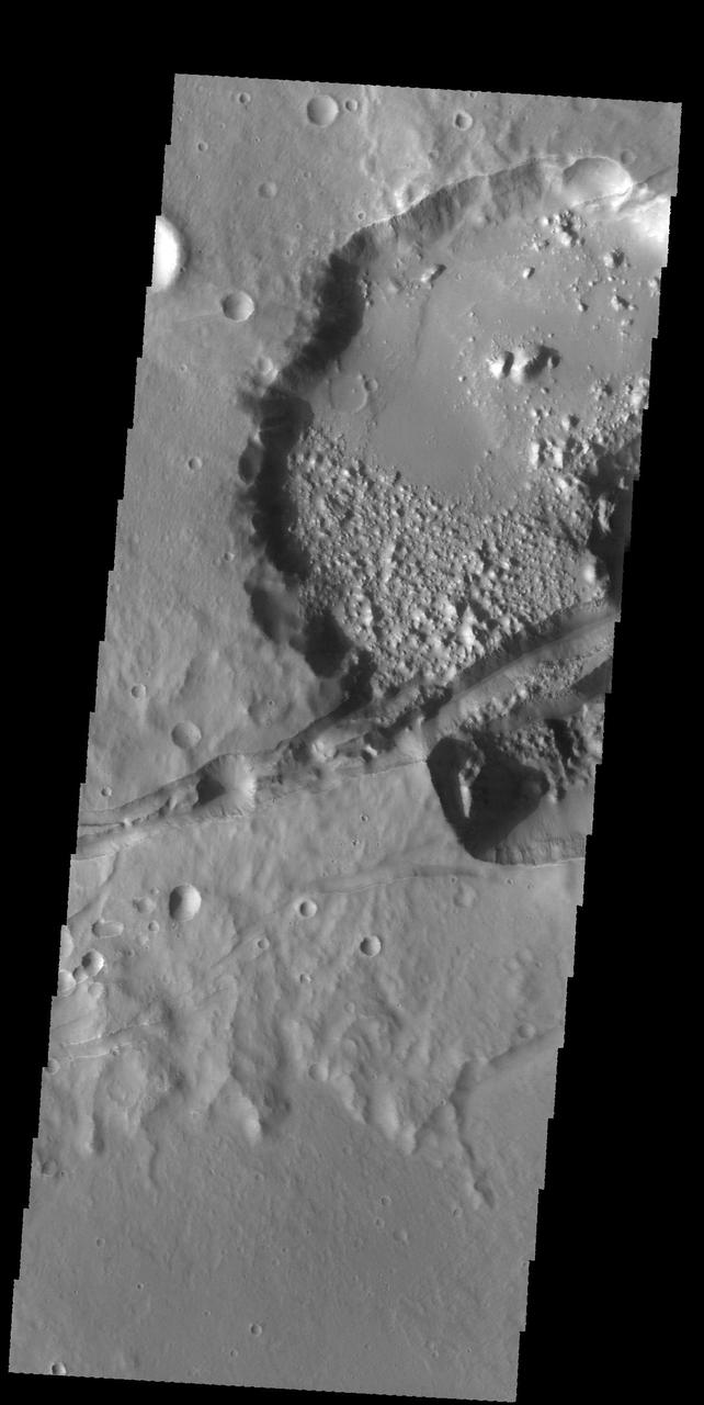
This image captured by NASA 2001 Mars Odyssey spacecraft shows several linear depressions that cross an unnamed crater. The depressions are tectonic fractures that are hundreds of km long. Orbit Number: 58617 Latitude: -29.6672 Longitude: 211.652 Instrument: VIS Captured: 2015-03-02 05:34 http://photojournal.jpl.nasa.gov/catalog/PIA19440
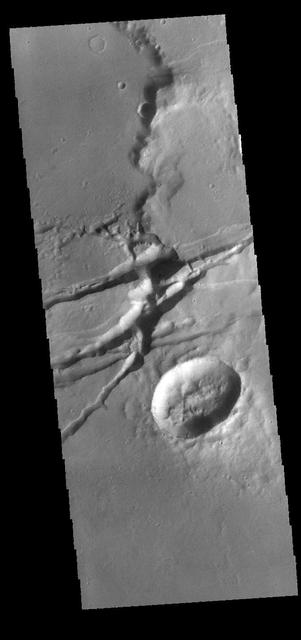
The linear depressions in this VIS image are graben. Graben are formed from tectonic activity with large blocks of material moving downward between paired faults. The crater in the bottom half of the image is oval rather than round, which could have been due to impacting into this region of tectonic deformation. Orbit Number: 66271 Latitude: -29.9918 Longitude: 211.199 Instrument: VIS Captured: 2016-11-21 15:19 http://photojournal.jpl.nasa.gov/catalog/PIA21287
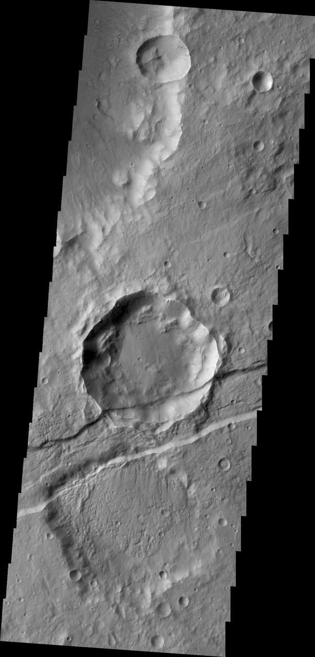
The downdropped block of surface seen in this image captured by NASA 2001 Mars Odyssey spacecraft is called a graben. The graben is younger than the crater, since the crater is cut by the graben.
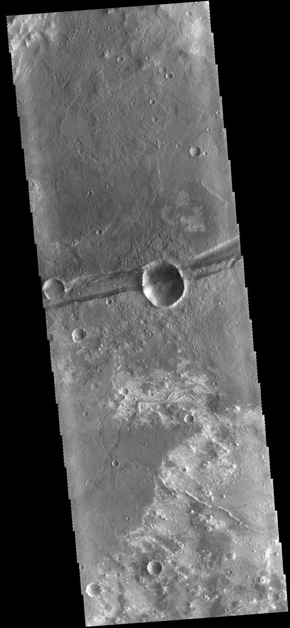
The linear depression in the center of this image captured by NASA Mars Odyssey spacecraft is a graben - a fault bounded block of material. The graben crosses the crater and ejecta in the middle of the image.
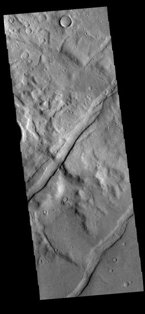
The channel-like features in this VIS image are tectonic graben. These graben are called Icaria Fossae and are located in Terra Sirenum. Graben are created in regions of extensional tectonic stress, where the bedrock is faulted and pulled apart, allowing linear sections of the surface to drop downward along paired faults. Orbit Number: 81751 Latitude: -46.5369 Longitude: 236.614 Instrument: VIS Captured: 2020-05-19 16:24 https://photojournal.jpl.nasa.gov/catalog/PIA24010
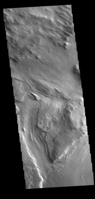
Several named and unnamed channels are located south of the Medusa Fossae Formation on the margin with Terra Sirenum. One of the unnamed channels is visible in the lower half of this VIS image. Wind erosion and deposition have modified the channel, indicating the channel is older than the wind action. Orbit Number: 77996 Latitude: -6.80206 Longitude: 202.156 Instrument: VIS Captured: 2019-07-15 12:00 https://photojournal.jpl.nasa.gov/catalog/PIA23415
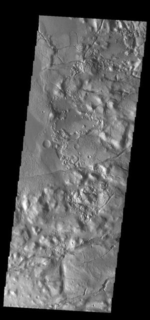
This VIS image shows part of Gorgonum Chaos. Chaotic regions form when groundwater escapes to the surface, undermining it and causing the ground to collapse. The linear depressions at the bottom of the image are part of Sirenum Fossae. Gorgonum Chaos is located in Terra Sirenum. Orbit Number: 84080 Latitude: -37.7334 Longitude: 189.356 Instrument: VIS Captured: 2020-11-27 10:17 https://photojournal.jpl.nasa.gov/catalog/PIA24369
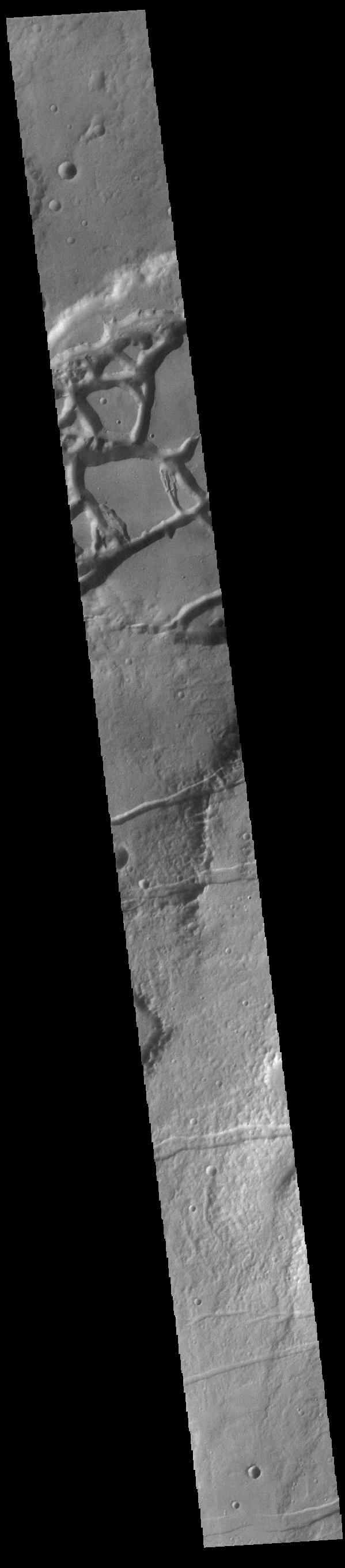
This VIS image shows several linear depressions called graben. Graben are formed due to extensional tectonic stresses, creating linear faults that allow subsidence of blocks of material between paired faults. At the top of the image several graben of Mangala Fossae intersect an impact crater. The other graben in the rest of the image are part of Memnonia Fossae. Both sets of fossae cross between Terra Sirenum and Daedalia Planum. Orbit Number: 83137 Latitude: -19.9645 Longitude: 207.232 Instrument: VIS Captured: 2020-09-10 19:29 https://photojournal.jpl.nasa.gov/catalog/PIA24190

The THEMIS VIS camera contains 5 filters. The data from different filters can be combined in multiple ways to create a false color image. This false color image from NASA 2001 Mars Odyssey spacecraft shows several linear depressions. Orbit Number: 7371 Latitude: -31.4383 Longitude: 208.19 Instrument: VIS Captured: 2003-08-13 07:28 http://photojournal.jpl.nasa.gov/catalog/PIA19472
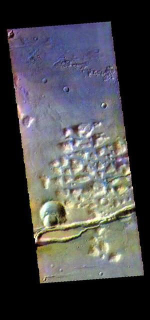
The THEMIS camera contains 5 filters. The data from different filters can be combined in multiple ways to create a false color image. hese false color images may reveal subtle variations of the surface not easily identified in a single band image. This image from NASA 2001 Mars Odyssey spacecraft shows part of Gorgonum Chaos. The linear depression at the bottom of the image are part of Sirenum Fossae. Gorgonum Chaos is located in Terra Sirenum. Orbit Number: 58237 Latitude: -38.0276 Longitude: 188.624 Instrument: VIS Captured: 2015-01-29 23:14 https://photojournal.jpl.nasa.gov/catalog/PIA21545
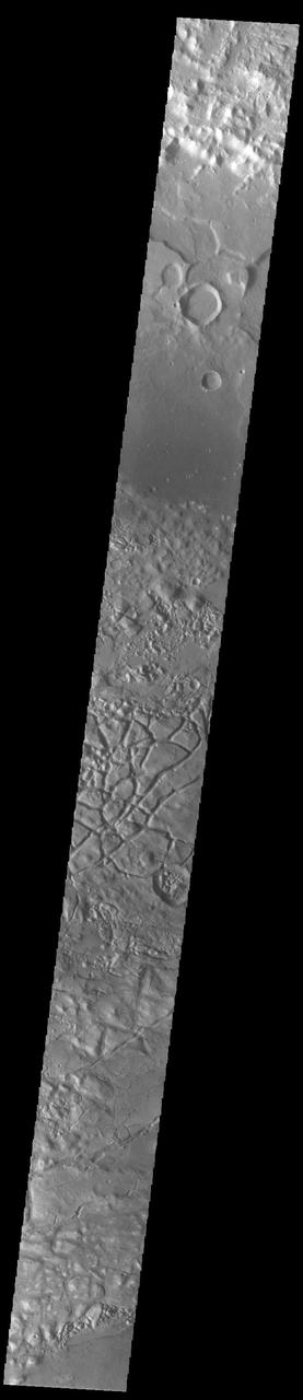
This VIS image shows part of Gorgonum Chaos. Chaos terrain is typified by regions of blocky, often steep sided, mesas interspersed with deep valleys. With time and erosion the valleys widen and the mesas become smaller. Chaotic regions form when groundwater escapes to the surface, undermining it and causing the ground to collapse. The linear depressions at the bottom of the image are part of Sirenum Fossae. Gorgonum Chaos is located in Terra Sirenum. Orbit Number: 92266 Latitude: -36.8519 Longitude: 189.676 Instrument: VIS Captured: 2022-10-02 10:57 https://photojournal.jpl.nasa.gov/catalog/PIA25754
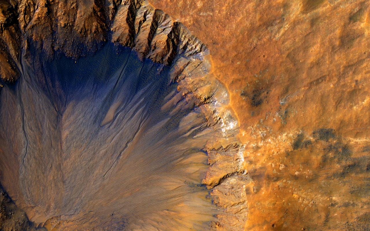
This impact crater, as seen by NASA Mars Reconnaissance Orbiter, appears relatively recent as it has a sharp rim and well-preserved ejecta.
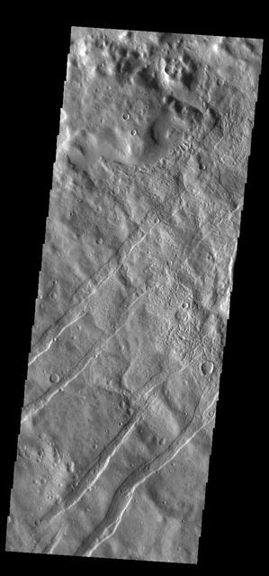
The linear depressions in this VIS image are tectonic graben. These graben are called Icaria Fossae and are located in Terra Sirenum. Graben are created in regions of extensional tectonic stress, where the bedrock is faulted and pulled apart, allowing linear sections of the surface to drop downward along paired faults. Orbit Number: 83941 Latitude: -43.6426 Longitude: 238.128 Instrument: VIS Captured: 2020-11-15 23:39 https://photojournal.jpl.nasa.gov/catalog/PIA24353
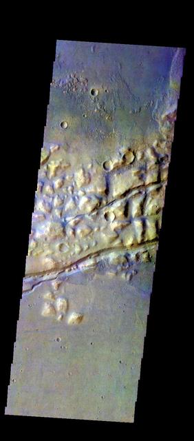
The THEMIS VIS camera contains 5 filters. The data from different filters can be combined in multiple ways to create a false color image. These false color images may reveal subtle variations of the surface not easily identified in a single band image. Today's false color image shows part of Gorgonum Chaos. The linear features are graben that are part of Sirenum Fossae. Orbit Number: 50827 Latitude: -38.1132 Longitude: 188.825 Instrument: VIS Captured: 2013-05-30 01:48 http://photojournal.jpl.nasa.gov/catalog/PIA21279

This VIS image shows a portion of eastern Terra Cimmeria. The image contains from bottom to top: a region of hills, part of Sirenum Fossae, channels dissecting a ridge, and a region of linear erosion. The top of the image is higher in elevation than the bottom. Orbit Number: 81703 Latitude: -36.0913 Longitude: 179.445 Instrument: VIS Captured: 2020-05-15 17:36 https://photojournal.jpl.nasa.gov/catalog/PIA24004
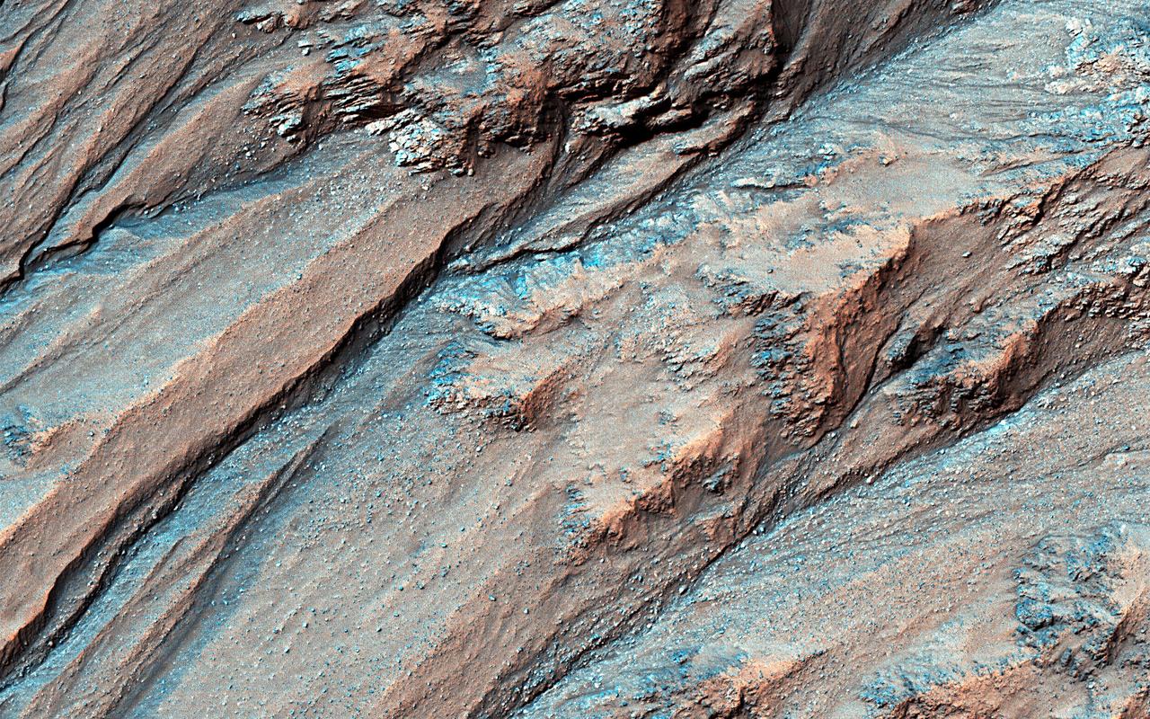
Gullies lying on the northeast slopes of Triolet Crater (about 11.6 km in diameter ), are located in the Southern Highlands just east of Gorgonum Chaos. Some gullies have eroded through resistant layers up to the crater rim. At the downslope are fans of debris that overlap with those of nearby gully systems, suggesting that there were multiple periods of gully activity in this region. Just south of the gullies is a large fracture that cuts through the crater rim. This fracture is part of the Sirenum Fossae system that slices across the region for over 1,000 kilometers from the northeast to the southwest. Because this fracture (or "fossae") cuts through the rim and ejecta blanket of Triolet Crater, this means that the crater is older than the fracture. This is known as a cross-cutting relationship and demonstrates a basic principle in geology known as the "law of superposition." https://photojournal.jpl.nasa.gov/catalog/PIA25708
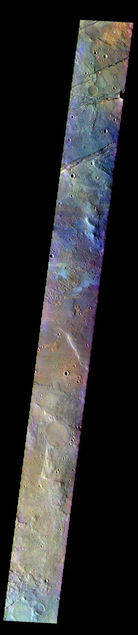
The THEMIS VIS camera contains 5 filters. The data from different filters can be combined in multiple ways to create a false color image. These false color images may reveal subtle variations of the surface not easily identified in a single band image. Today's false color image shows part of Terra Sirenum. The linear features at the top of the image are tectonic features called graben. These graben are part of Sirenum Fossae. Graben are formed by extension of the crust and faulting. When large amounts of pressure or tension are applied to rocks on timescales that are fast enough that the rock cannot respond by deforming, the rock breaks along faults. In the case of a graben, two parallel faults are formed by extension of the crust and the rock in between the faults drops downward into the space created by the extension.The graben in this image are trending from north-northeast to south-southwest. Because the faults defining the graben are formed perpendicular to the direction of the applied stress, we know that extensional forces were pulling the crust apart in the west-northwest/east-southeast direction. The Sirenum Fossae graben are 2735km (1700 miles) long. The THEMIS VIS camera is capable of capturing color images of the Martian surface using five different color filters. In this mode of operation, the spatial resolution and coverage of the image must be reduced to accommodate the additional data volume produced from using multiple filters. To make a color image, three of the five filter images (each in grayscale) are selected. Each is contrast enhanced and then converted to a red, green, or blue intensity image. These three images are then combined to produce a full color, single image. Because the THEMIS color filters don't span the full range of colors seen by the human eye, a color THEMIS image does not represent true color. Also, because each single-filter image is contrast enhanced before inclusion in the three-color image, the apparent color variation of the scene is exaggerated. Nevertheless, the color variation that does appear is representative of some change in color, however subtle, in the actual scene. Note that the long edges of THEMIS color images typically contain color artifacts that do not represent surface variation. Orbit Number: 91654 Latitude: -33.0364 Longitude: 206.174 Instrument: VIS Captured: 2022-08-13 01:31 https://photojournal.jpl.nasa.gov/catalog/PIA26083
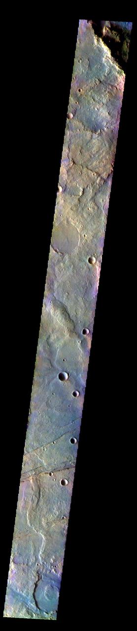
The THEMIS VIS camera contains 5 filters. The data from different filters can be combined in multiple ways to create a false color image. These false color images may reveal subtle variations of the surface not easily identified in a single band image. Today's false color image shows part of Terra Sirenum. The linear features at the bottom of the image are tectonic features called graben. These graben are part of Sirenum Fossae. Graben are formed by extension of the crust and faulting. When large amounts of pressure or tension are applied to rocks on timescales that are fast enough that the rock cannot respond by deforming, the rock breaks along faults. In the case of a graben, two parallel faults are formed by extension of the crust and the rock in between the faults drops downward into the space created by the extension.The graben in this image are trending from north-northeast to south-southwest. Because the faults defining the graben are formed perpendicular to the direction of the applied stress, we know that extensional forces were pulling the crust apart in the west-northwest/east-southeast direction. The Sirenum Fossae graben are 2735km (1700 miles) long. The THEMIS VIS camera is capable of capturing color images of the Martian surface using five different color filters. In this mode of operation, the spatial resolution and coverage of the image must be reduced to accommodate the additional data volume produced from using multiple filters. To make a color image, three of the five filter images (each in grayscale) are selected. Each is contrast enhanced and then converted to a red, green, or blue intensity image. These three images are then combined to produce a full color, single image. Because the THEMIS color filters don't span the full range of colors seen by the human eye, a color THEMIS image does not represent true color. Also, because each single-filter image is contrast enhanced before inclusion in the three-color image, the apparent color variation of the scene is exaggerated. Nevertheless, the color variation that does appear is representative of some change in color, however subtle, in the actual scene. Note that the long edges of THEMIS color images typically contain color artifacts that do not represent surface variation. Orbit Number: 91704 Latitude: -32.2019 Longitude: 203.852 Instrument: VIS Captured: 2022-08-17 04:19 https://photojournal.jpl.nasa.gov/catalog/PIA26084