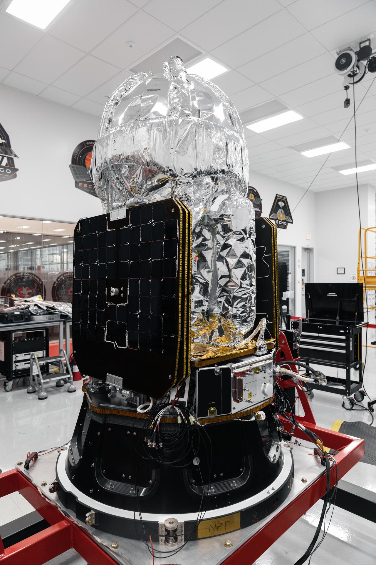
The LOXSAT payload is displayed inside Rocket Lab’s Spacecraft Production Complex on March 6, 2026, in Long Beach, California. Eta Space built LOXSAT as part of a NASA Tipping Point opportunity, and Rocket Lab is providing spacecraft and launch services to deliver it to low Earth orbit.
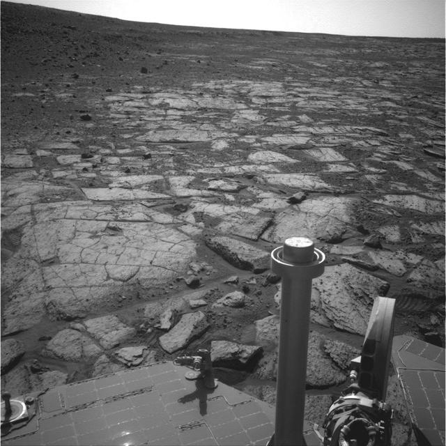
NASA Mars Exploration Rover Opportunity used its navigation camera Navcam to record this image of the northern end of Solander Point, a raised section of the western rim of Endeavour Crater.
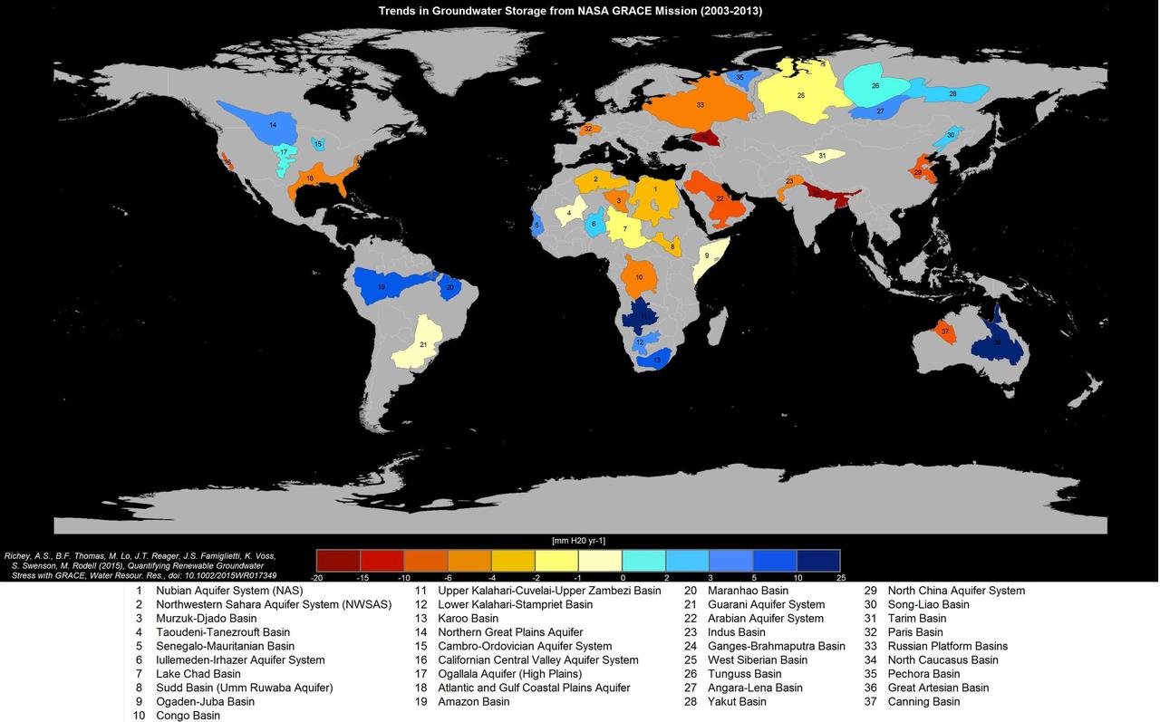
Groundwater storage trends for Earth's 37 largest aquifers from UCI-led study using NASA GRACE data (2003-2013). Of these, 21 have exceeded sustainability tipping points and are being depleted, with 13 considered significantly distressed, threatening regional water security and resilience. http://photojournal.jpl.nasa.gov/catalog/PIA19685

art001e002128 Dec. 5, 2022 A portion of the Moon looms large just beyond the Orion spacecraft in this image taken on the 20th day of the Artemis I mission by a camera on the tip of one of Orion’s solar arrays. The return powered flyby burn committed Orion to a return to Earth trajectory ahead of a splashdown off the coast of California on Dec. 11. At its closest point, Orion flew within 80 miles of the lunar surface.

art001e002129 Dec. 5, 2022 A portion of the Moon looms large just beyond the Orion spacecraft in this image taken on the 20th day of the Artemis I mission by a camera on the tip of one of Orion’s solar arrays. The return powered flyby burn committed Orion to a return to Earth trajectory ahead of a splashdown off the coast of California on Dec. 11. At its closest point, Orion flew within 80 miles of the lunar surface.

art001e002132 Dec. 5, 2022 A portion of the Moon looms large just beyond the Orion spacecraft in this image taken on the 20th day of the Artemis I mission by a camera on the tip of one of Orion’s solar arrays. The return powered flyby burn committed Orion to a return to Earth trajectory ahead of a splashdown off the coast of California on Dec. 11. At its closest point, Orion flew within 80 miles of the lunar surface.
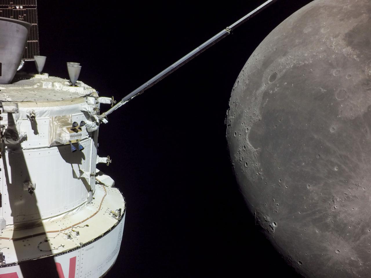
art001e002130 Dec. 5, 2022 A portion of the Moon looms large just beyond the Orion spacecraft in this image taken on the 20th day of the Artemis I mission by a camera on the tip of one of Orion’s solar arrays. The return powered flyby burn committed Orion to a return to Earth trajectory ahead of a splashdown off the coast of California on Dec. 11. At its closest point, Orion flew within 80 miles of the lunar surface.
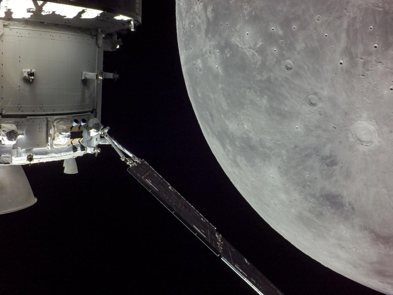
art001e002131 (Dec. 5, 2022) A portion of the Moon looms large just beyond the Orion spacecraft in this image taken on the 20th day of the Artemis I mission by a camera on the tip of one of Orion’s solar arrays. The return powered flyby burn committed Orion to a return to Earth trajectory ahead of a splashdown off the coast of California on Dec. 11. At its closest point, Orion flew within 80 miles of the lunar surface.
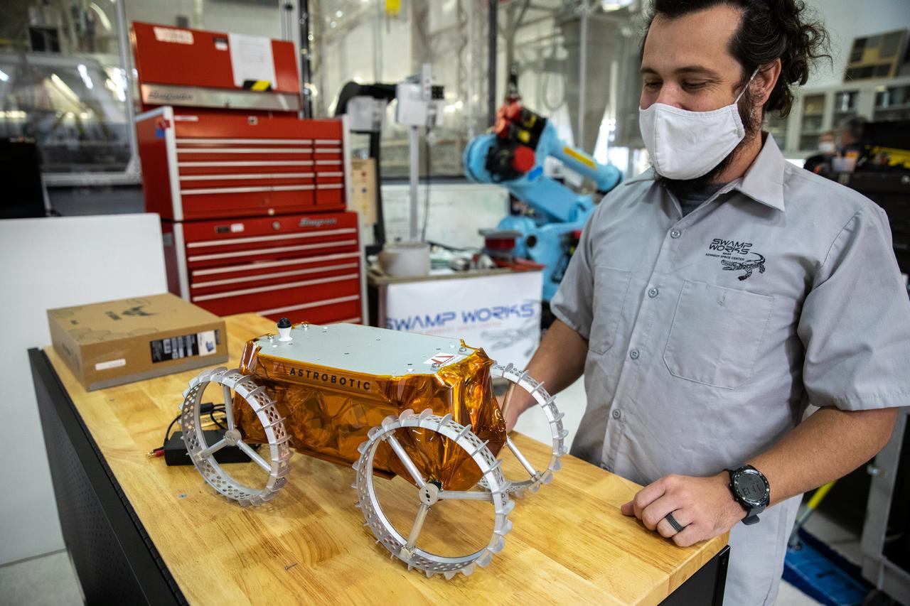
A.J. Nick, with Kennedy Space Center’s Exploration and Research and Technology programs, unboxes a CubeRover at the Florida spaceport on Oct. 9, 2020. The rover was delivered by Pittsburgh-based space robotics company Astrobotic, as part of a Small Business Innovative Research (SBIR) award from NASA. Nick will lead CubeRover testing in the coming months in the Granular Mechanics and Regolith Operations (GMRO) Laboratory’s regolith bin, which holds approximately 120 tons of lunar regolith simulant at Kennedy’s Swamp Works. In 2019, NASA announced a $2 million Tipping Point award to develop more mature CubeRover’s payload interfaces and increase its capabilities.

Senior Software Engineer Taylor Whitaker reports the results of a drawbar pull run to Astrobotic staff outside of the Granular Mechanics and Regolith Operations (GMRO) Laboratory’s regolith pit at NASA Kennedy Space Center’s Swamp Works facility on June 30, 2022. Astrobotic – a Pittsburgh-based space robotics company – is using the GMRO lab’s regolith bin, which holds approximately 120 tons of lunar regolith simulant, to depict how the company’s CubeRover would perform on the Moon. NASA’s Small Business Innovation Research program provided the funding for initial development, and a $2 million Tipping Point award from the agency has provided additional funding for continued development into a more mature rover.

Jim Mantovani, left, and A.J. Nick, with Kennedy Space Center’s Exploration and Research and Technology programs, unbox a CubeRover at the Florida spaceport on Oct. 9, 2020. The rover was delivered by Pittsburgh-based space robotics company Astrobotic, as part of a Small Business Innovative Research (SBIR) award from NASA. Nick will lead CubeRover testing in the coming months in the Granular Mechanics and Regolith Operations (GMRO) Laboratory’s regolith bin, which holds approximately 120 tons of lunar regolith simulant at Kennedy’s Swamp Works. In 2019, NASA announced a $2 million Tipping Point award to develop more mature CubeRover’s payload interfaces and increase its capabilities.

Jim Mantovani, left, and A.J. Nick, with Kennedy Space Center’s Exploration and Research and Technology programs, unbox a CubeRover at the Florida spaceport on Oct. 9, 2020. The rover was delivered by Pittsburgh-based space robotics company Astrobotic, as part of a Small Business Innovative Research (SBIR) award from NASA. Nick will lead CubeRover testing in the coming months in the Granular Mechanics and Regolith Operations (GMRO) Laboratory’s regolith bin, which holds approximately 120 tons of lunar regolith simulant at Kennedy’s Swamp Works. In 2019, NASA announced a $2 million Tipping Point award to develop more mature CubeRover’s payload interfaces and increase its capabilities.
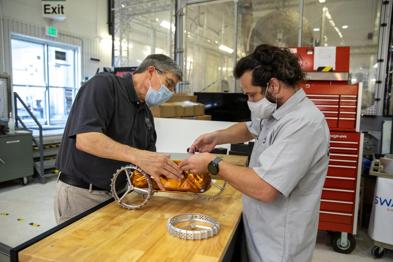
Jim Mantovani, left, and A.J. Nick, with Kennedy Space Center’s Exploration and Research and Technology programs, unbox a CubeRover at the Florida spaceport on Oct. 9, 2020. The rover was delivered by Pittsburgh-based space robotics company Astrobotic, as part of a Small Business Innovative Research (SBIR) award from NASA. Nick will lead CubeRover testing in the coming months in the Granular Mechanics and Regolith Operations (GMRO) Laboratory’s regolith bin, which holds approximately 120 tons of lunar regolith simulant at Kennedy’s Swamp Works. In 2019, NASA announced a $2 million Tipping Point award to develop more mature CubeRover’s payload interfaces and increase its capabilities.
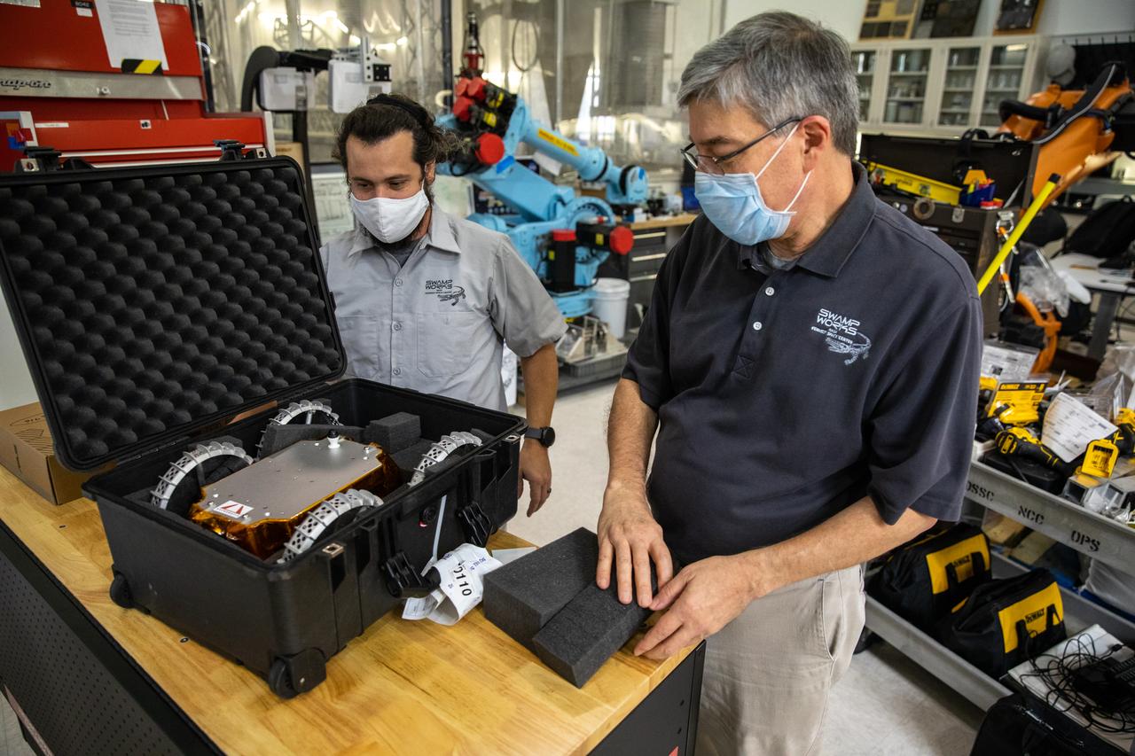
A.J. Nick, left, and Jim Mantovani, with Kennedy Space Center’s Exploration and Research and Technology programs, unbox a CubeRover at the Florida spaceport on Oct. 9, 2020. The rover was delivered by Pittsburgh-based space robotics company Astrobotic, as part of a Small Business Innovative Research (SBIR) award from NASA. Nick will lead CubeRover testing in the coming months in the Granular Mechanics and Regolith Operations (GMRO) Laboratory’s regolith bin, which holds approximately 120 tons of lunar regolith simulant at Kennedy’s Swamp Works. In 2019, NASA announced a $2 million Tipping Point award to develop more mature CubeRover’s payload interfaces and increase its capabilities.

Astrobotic’s CubeRover – a lightweight, modular planetary rover – undergoes mobility testing inside the Granular Mechanics and Regolith Operations (GMRO) Laboratory’s regolith pit at NASA Kennedy Space Center’s Swamp Works facility on June 30, 2022. Astrobotic – a Pittsburgh-based space robotics company – is using the GMRO lab’s regolith bin, which holds approximately 120 tons of lunar regolith simulant, to depict how the company’s CubeRover would perform on the Moon. NASA’s Small Business Innovation Research program provided the funding for initial development, and a $2 million Tipping Point award from the agency has provided additional funding for continued development into a more mature rover.
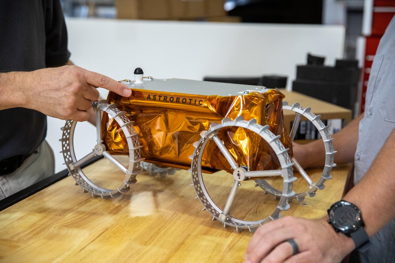
Jim Mantovani, left, and A.J. Nick, with Kennedy Space Center’s Exploration and Research and Technology programs, unbox a CubeRover at the Florida spaceport on Oct. 9, 2020. The rover was delivered by Pittsburgh-based space robotics company Astrobotic, as part of a Small Business Innovative Research (SBIR) award from NASA. Nick will lead CubeRover testing in the coming months in the Granular Mechanics and Regolith Operations (GMRO) Laboratory’s regolith bin, which holds approximately 120 tons of lunar regolith simulant at Kennedy’s Swamp Works. In 2019, NASA announced a $2 million Tipping Point award to develop more mature CubeRover’s payload interfaces and increase its capabilities.
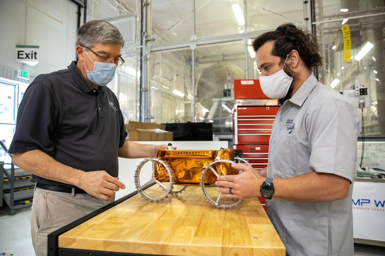
Jim Mantovani, left, and A.J. Nick, with Kennedy Space Center’s Exploration and Research and Technology programs, unbox a CubeRover at the Florida spaceport on Oct. 9, 2020. The rover was delivered by Pittsburgh-based space robotics company Astrobotic, as part of a Small Business Innovative Research (SBIR) award from NASA. Nick will lead CubeRover testing in the coming months in the Granular Mechanics and Regolith Operations (GMRO) Laboratory’s regolith bin, which holds approximately 120 tons of lunar regolith simulant at Kennedy’s Swamp Works. In 2019, NASA announced a $2 million Tipping Point award to develop more mature CubeRover’s payload interfaces and increase its capabilities.

A.J. Nick, with Kennedy Space Center’s Exploration and Research and Technology programs, unboxes a CubeRover at the Florida spaceport on Oct. 9, 2020. The rover was delivered by Pittsburgh-based space robotics company Astrobotic, as part of a Small Business Innovative Research (SBIR) award from NASA. Nick will lead CubeRover testing in the coming months in the Granular Mechanics and Regolith Operations (GMRO) Laboratory’s regolith bin, which holds approximately 120 tons of lunar regolith simulant at Kennedy’s Swamp Works. In 2019, NASA announced a $2 million Tipping Point award to develop more mature CubeRover’s payload interfaces and increase its capabilities.
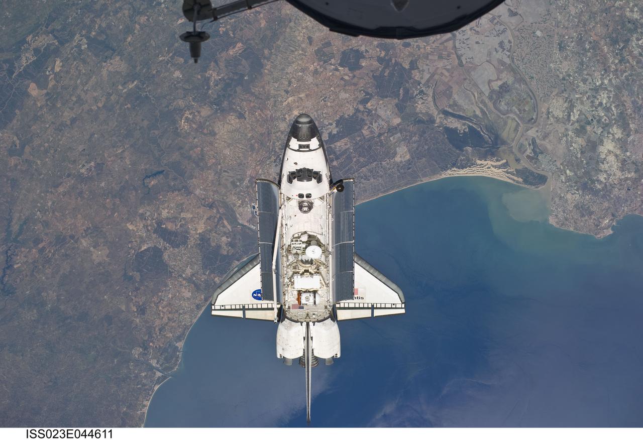
ISS023-E-044611 (16 May 2010) --- Flying above the Atlantic coast of Spain and the Gulf of Cadiz, the space shuttle Atlantis is shown making its relative approach to the International Space Station, from which this photo was taken. The tip of a Russian spacecraft, temporarily docked to the orbital outpost can be seen at top center. The coast includes the city of Ayamonte (left of image as photographed), past Huelva (under Atlantis), past the sand dunes, the Rio Guadalquivir, to the city of Rota. Center point coordinates of the area pictured in the image are 37.3 degrees north latitude and 6.7 degrees west longitude. Photo credit: NASA or National Aeronautics and Space Administration
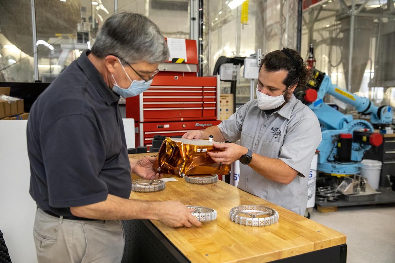
Jim Mantovani, left, and A.J. Nick, with Kennedy Space Center’s Exploration and Research and Technology programs, unbox a CubeRover at the Florida spaceport on Oct. 9, 2020. The rover was delivered by Pittsburgh-based space robotics company Astrobotic, as part of a Small Business Innovative Research (SBIR) award from NASA. Nick will lead CubeRover testing in the coming months in the Granular Mechanics and Regolith Operations (GMRO) Laboratory’s regolith bin, which holds approximately 120 tons of lunar regolith simulant at Kennedy’s Swamp Works. In 2019, NASA announced a $2 million Tipping Point award to develop more mature CubeRover’s payload interfaces and increase its capabilities.
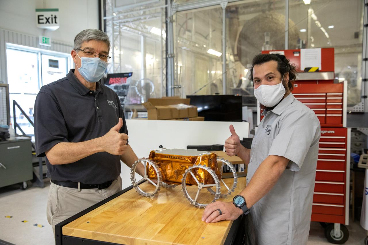
Jim Mantovani, left, and A.J. Nick, with Kennedy Space Center’s Exploration and Research and Technology programs, unbox a CubeRover at the Florida spaceport on Oct. 9, 2020. The rover was delivered by Pittsburgh-based space robotics company Astrobotic, as part of a Small Business Innovative Research (SBIR) award from NASA. Nick will lead CubeRover testing in the coming months in the Granular Mechanics and Regolith Operations (GMRO) Laboratory’s regolith bin, which holds approximately 120 tons of lunar regolith simulant at Kennedy’s Swamp Works. In 2019, NASA announced a $2 million Tipping Point award to develop more mature CubeRover’s payload interfaces and increase its capabilities.
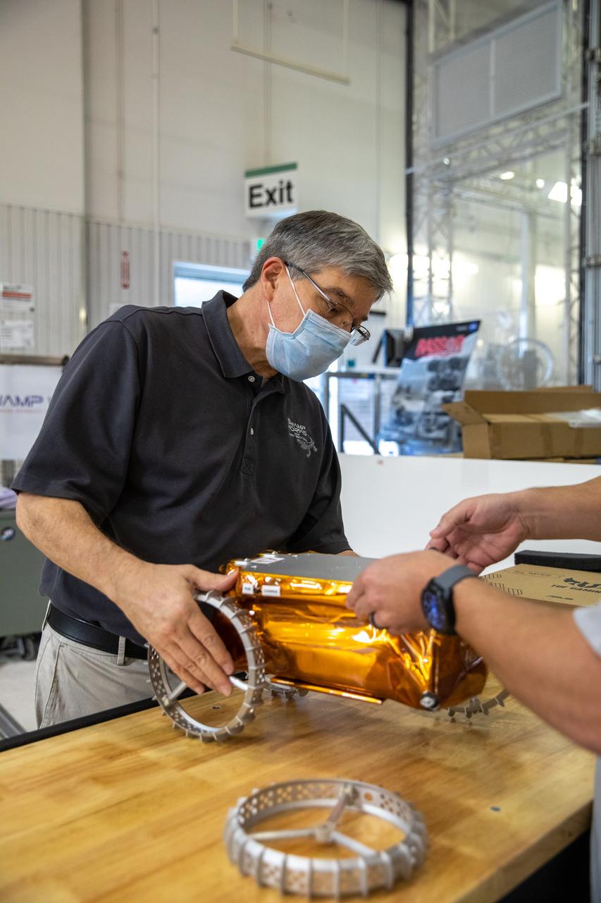
Jim Mantovani, with Kennedy Space Center’s Exploration and Research and Technology programs, unboxes a CubeRover at the Florida spaceport on Oct. 9, 2020. The rover was delivered by Pittsburgh-based space robotics company Astrobotic, as part of a Small Business Innovative Research (SBIR) award from NASA. Kennedy’s A.J. Nick will lead CubeRover testing in the coming months in the Granular Mechanics and Regolith Operations (GMRO) Laboratory’s regolith bin, which holds approximately 120 tons of lunar regolith simulant at Kennedy’s Swamp Works. In 2019, NASA announced a $2 million Tipping Point award to develop more mature CubeRover’s payload interfaces and increase its capabilities.
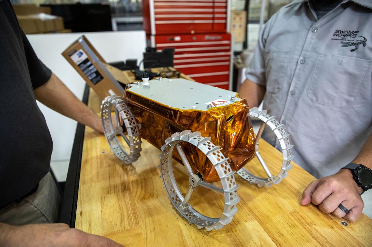
Jim Mantovani, left, and A.J. Nick, with Kennedy Space Center’s Exploration and Research and Technology programs, unbox a CubeRover at the Florida spaceport on Oct. 9, 2020. The rover was delivered by Pittsburgh-based space robotics company Astrobotic, as part of a Small Business Innovative Research (SBIR) award from NASA. Nick will lead CubeRover testing in the coming months in the Granular Mechanics and Regolith Operations (GMRO) Laboratory’s regolith bin, which holds approximately 120 tons of lunar regolith simulant at Kennedy’s Swamp Works. In 2019, NASA announced a $2 million Tipping Point award to develop more mature CubeRover’s payload interfaces and increase its capabilities.

Jim Mantovani, left, and A.J. Nick, with Kennedy Space Center’s Exploration and Research and Technology programs, unbox a CubeRover at the Florida spaceport on Oct. 9, 2020. The rover was delivered by Pittsburgh-based space robotics company Astrobotic, as part of a Small Business Innovative Research (SBIR) award from NASA. Nick will lead CubeRover testing in the coming months in the Granular Mechanics and Regolith Operations (GMRO) Laboratory’s regolith bin, which holds approximately 120 tons of lunar regolith simulant at Kennedy’s Swamp Works. In 2019, NASA announced a $2 million Tipping Point award to develop more mature CubeRover’s payload interfaces and increase its capabilities.

ISS037-E-002225 (18 Sept. 2013) --- One of three Expedition 37 crew members aboard the International Space Station on Sept. 18 photographed this high oblique night image showing dozens of major cities and communities on the east coast and points west toward the Great Lakes area, and even areas to the southwest. Long Island, NY is a tell-tale identifier as it juts out into the Atlantic Ocean in the lower right portion of the image. The estuary known as Long Island Sound is also visible at lower right. The New York metropolitan area is largely visible below the tip of one of the space station's solar array panels.

Astrobotic’s mass-offloaded CubeRover – a lightweight, modular planetary rover – undergoes mobility testing inside the Granular Mechanics and Regolith Operations (GMRO) Laboratory’s regolith pit at NASA Kennedy Space Center’s Swamp Works facility on June 30, 2022. Astrobotic – a Pittsburgh-based space robotics company – is using the GMRO lab’s regolith bin, which holds approximately 120 tons of lunar regolith simulant, to depict how the company’s CubeRover would perform on the Moon. NASA’s Small Business Innovation Research program provided the funding for initial development, and a $2 million Tipping Point award from the agency has provided additional funding for continued development into a more mature rover.
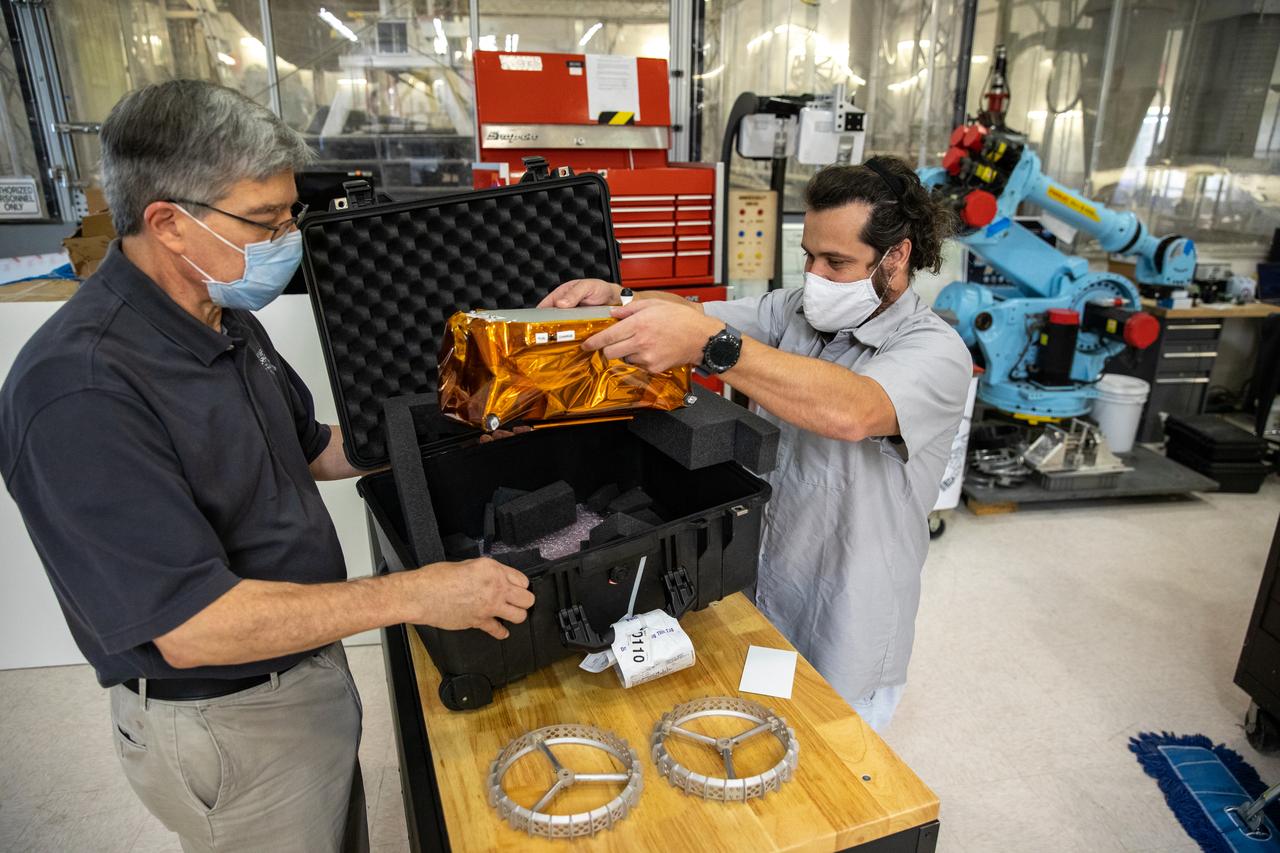
Jim Mantovani, left, and A.J. Nick, with Kennedy Space Center’s Exploration and Research and Technology programs, unbox a CubeRover at the Florida spaceport on Oct. 9, 2020. The rover was delivered by Pittsburgh-based space robotics company Astrobotic, as part of a Small Business Innovative Research (SBIR) award from NASA. Nick will lead CubeRover testing in the coming months in the Granular Mechanics and Regolith Operations (GMRO) Laboratory’s regolith bin, which holds approximately 120 tons of lunar regolith simulant at Kennedy’s Swamp Works. In 2019, NASA announced a $2 million Tipping Point award to develop more mature CubeRover’s payload interfaces and increase its capabilities.

KENNEDY SPACE CENTER, FLA. -- A twisting column of smoke points the way to Space Shuttle Columbia at its tip as the Shuttle hurtles toward space on mission STS-107. Following a flawless and uneventful countdown, liftoff occurred on-time at 10:39 a.m. EST. The 16-day research mission will include FREESTAR (Fast Reaction Experiments Enabling Science, Technology, Applications and Research) and the SHI Research Double Module (SHI/RDM), known as SPACEHAB. Experiments on the module range from material sciences to life sciences. Landing is scheduled at about 8:53 a.m. EST on Saturday, Feb. 1. This mission is the first Shuttle mission of 2003. Mission STS-107 is the 28th flight of the orbiter Columbia and the 113th flight overall in NASA's Space Shuttle program.
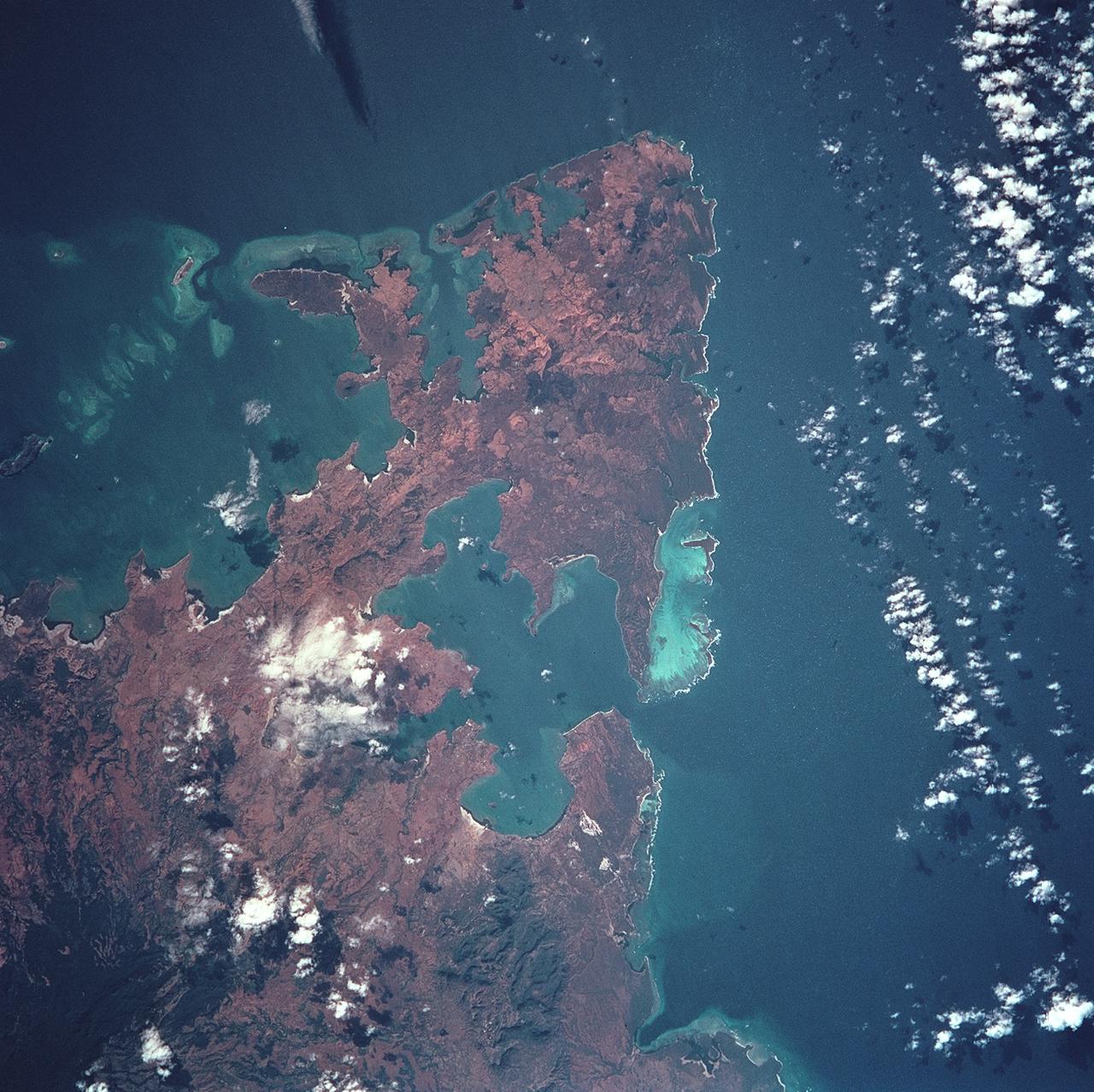
STS093-722-051 (23-27 July 1999) --- The STS-93 astronauts aboard the Space Shuttle Columbia took this picture over the Indian Ocean. The distinctive arrowhead shape of the northern tip of the island of Madagascar is easily recognizable. The land appears red with patches of dark green on the upper slopes. According to NASA scientists studying the STS-93 photo collection, the dark areas are the remnants of forests and the red areas are cleared land. When the photo was taken, the shuttle was flying over a point located at 14.7 degrees south latitude and 44.0 degrees east longitude. Data back information on the 70mm film listed the date and time of the photo as 11:38:20 GMT, July 24, 1999 (Orbit 21).
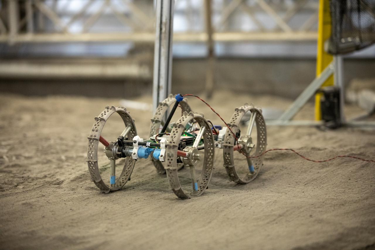
A mass-offloaded version of Astrobotic’s CubeRover – a lightweight, modular planetary rover – is used to simulate mobility in low lunar gravity inside the Granular Mechanics and Regolith Operations (GMRO) Laboratory’s regolith pit at NASA Kennedy Space Center’s Swamp Works facility on June 30, 2022. Astrobotic – a Pittsburgh-based space robotics company – is using the GMRO lab’s regolith bin, which holds approximately 120 tons of lunar regolith simulant, to depict how the company’s CubeRover would perform on the Moon. NASA’s Small Business Innovation Research program provided the funding for initial development, and a $2 million Tipping Point award from the agency has provided additional funding for continued development into a more mature rover.

Senior Software Engineer Taylor Whitaker stages Astrobotic’s mass-offloaded CubeRover – a lightweight, modular planetary rover – for a drawbar pull test inside the Granular Mechanics and Regolith Operations (GMRO) Laboratory’s regolith pit at NASA Kennedy Space Center’s Swamp Works facility on June 30, 2022. Astrobotic – a Pittsburgh-based space robotics company – is using the GMRO lab’s regolith bin, which holds approximately 120 tons of lunar regolith simulant, to depict how the company’s CubeRover would perform on the Moon. NASA’s Small Business Innovation Research program provided the funding for initial development, and a $2 million Tipping Point award from the agency has provided additional funding for continued development into a more mature rover.

This four-panel graphic illustrates how the binary-star system V Hydrae is launching balls of plasma into space. Panel 1 shows the two stars orbiting each other. One of the stars is nearing the end of its life and has swelled in size, becoming a red giant. In panel 2, the smaller star's orbit carries the star into the red giant's expanded atmosphere. As the star moves through the atmosphere, it gobbles up material from the red giant that settles into a disk around the star. The buildup of material reaches a tipping point and is eventually ejected as blobs of hot plasma along the star's spin axis, as shown in panel 3. This ejection process is repeated every eight years, which is the time it takes for the orbiting star to make another pass through the bloated red giant's envelope, as shown in panel 4. http://photojournal.jpl.nasa.gov/catalog/PIA21071
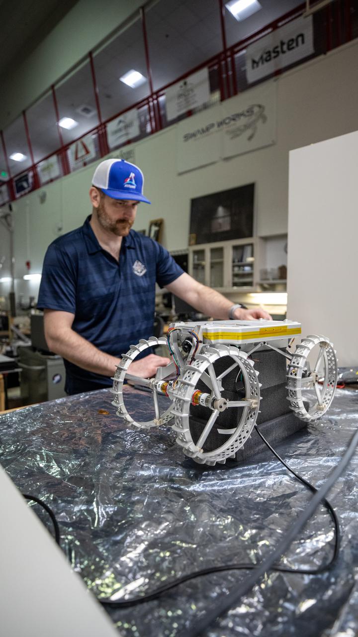
Robotics Software Engineer II Chris Rampolla runs benchtop verifications on Astrobotic’s CubeRover – a lightweight, modular planetary rover – before delivery to Swamp Works at NASA’s Kennedy Space Center in Florida on June 30, 2022. Astrobotic – a Pittsburgh-based space robotics company – is planning to use Swamp Work’s Granular Mechanics and Regolith Operations Laboratory’s regolith bin, which holds approximately 120 tons of lunar regolith simulant, to depict how the company’s CubeRover would perform on the Moon. NASA’s Small Business Innovation Research program provided the funding for initial development, and a $2 million Tipping Point award from the agency has provided additional funding for continued development into a more mature rover.

KENNEDY SPACE CENTER, FLA. -- A twisting column of smoke points the way to Space Shuttle Columbia at its tip as the Shuttle hurtles toward space on mission STS-107. Following a flawless and uneventful countdown, liftoff occurred on-time at 10:39 a.m. EST. The 16-day research mission will include FREESTAR (Fast Reaction Experiments Enabling Science, Technology, Applications and Research) and the SHI Research Double Module (SHI/RDM), known as SPACEHAB. Experiments on the module range from material sciences to life sciences. Landing is scheduled at about 8:53 a.m. EST on Saturday, Feb. 1. This mission is the first Shuttle mission of 2003. Mission STS-107 is the 28th flight of the orbiter Columbia and the 113th flight overall in NASA's Space Shuttle program.
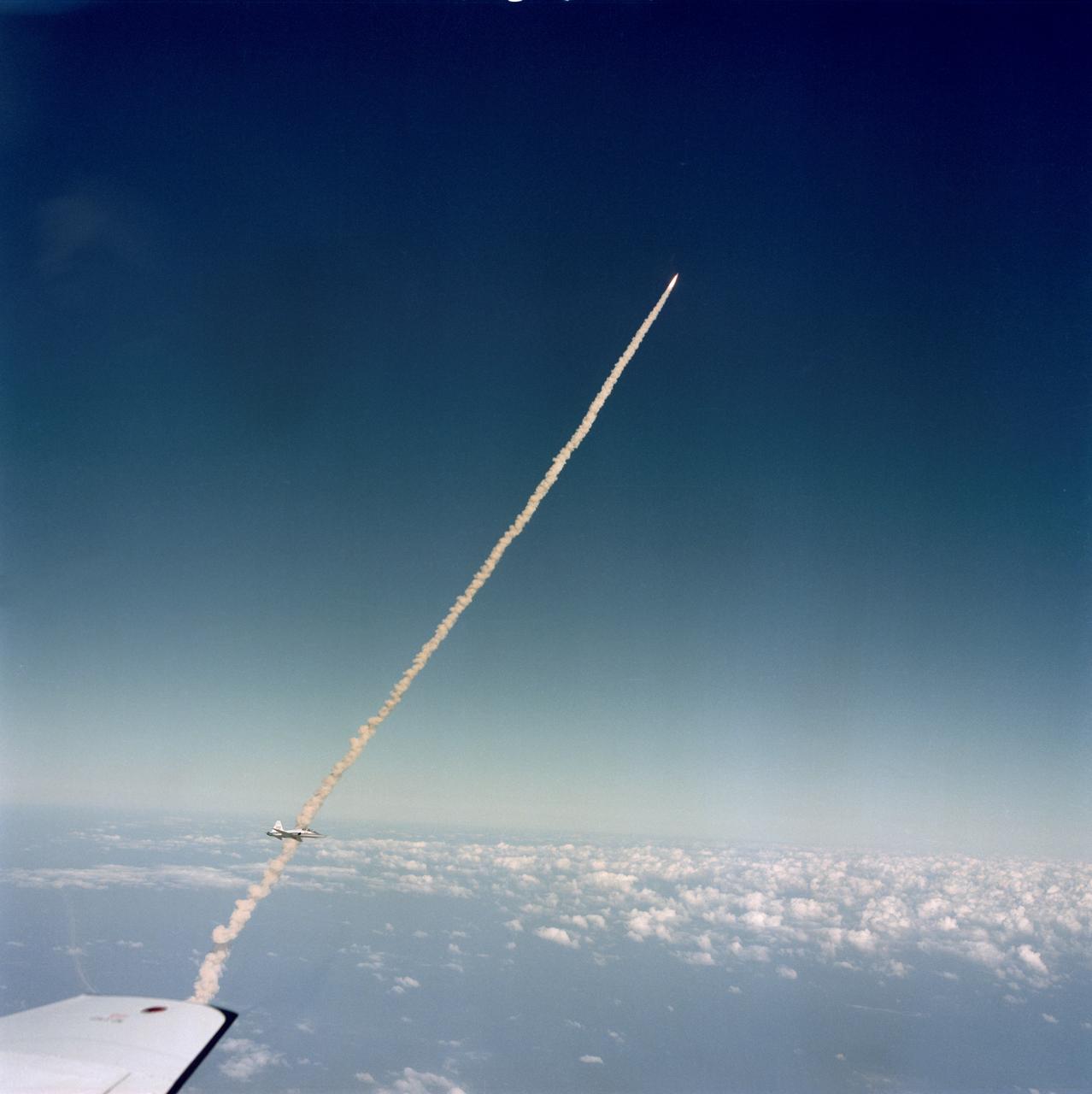
S81-39527 (12 Nov. 1981) --- This photograph of the STS-2 crew and the space shuttle Columbia soaring toward Earth orbit was captured with a hand-held 70mm camera (using an 80mm lens) operated from the rear station of a T-38 jet aircraft. Mission specialist-astronaut Kathryn D. Sullivan took the picture, and part of the wing tip of her aircraft can be seen in lower left corner. Astronaut John W. Young piloting NASA?s shuttle training aircraft (STA) was taking pictures from a higher angle. A close look can delineate his craft above the orbiter and supportive elements, almost perpendicular to them from this point of view. Another T-38 jet, with a TV camera operator as back-seat passenger, can be seen at lower left corner near the smoke trails from the shuttle. Photo credit: NASA
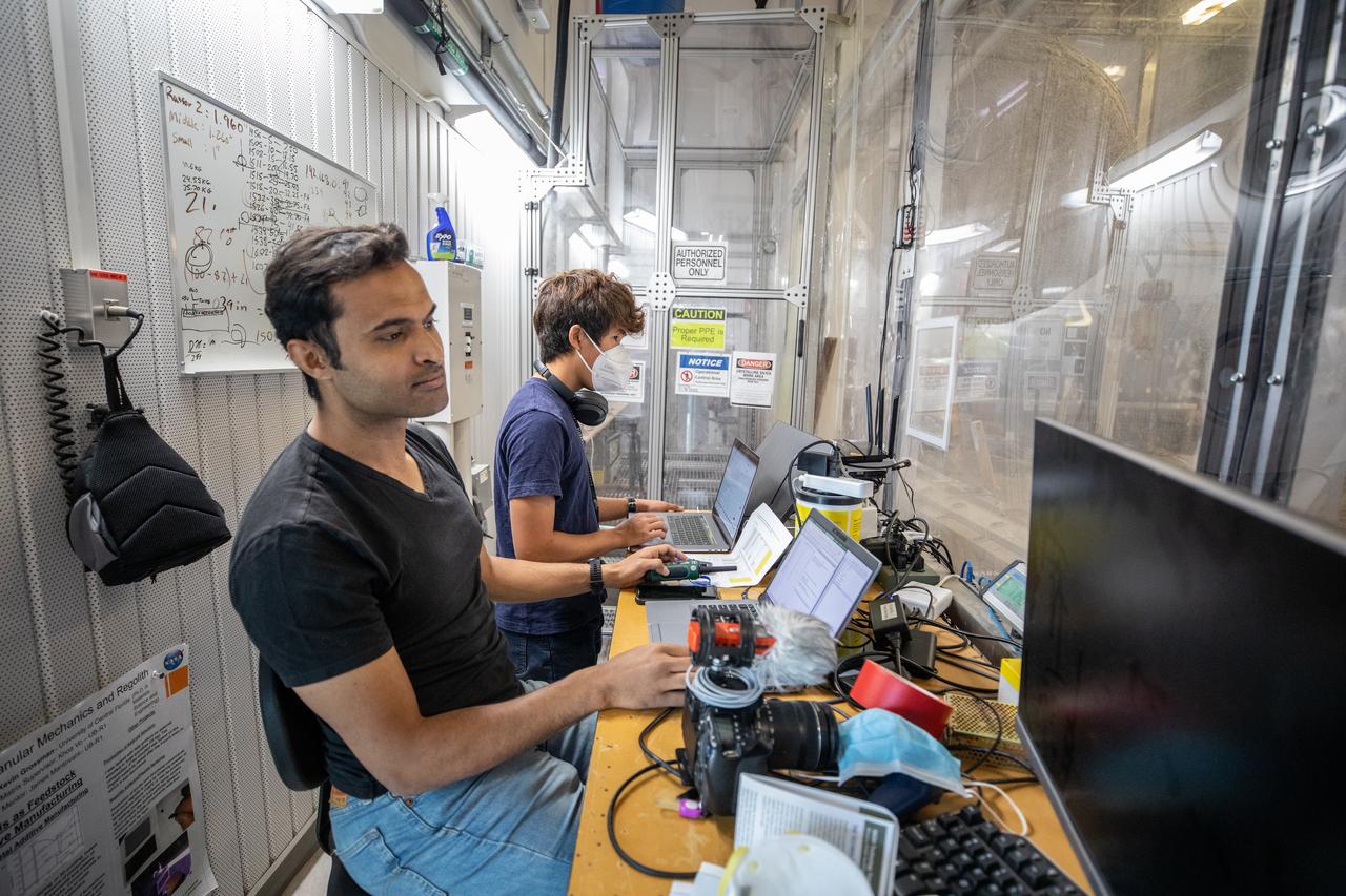
Senior Embedded Software Engineer Aamer Almujahed (left) and Software Engineering intern Ashten Akemoto run the ground software for Astrobotic’s CubeRover drawbar pull test inside the Granular Mechanics and Regolith Operations (GMRO) Laboratory’s regolith pit at NASA Kennedy Space Center’s Swamp Works facility on June 30, 2022. Astrobotic – a Pittsburgh-based space robotics company – is using the GMRO lab’s regolith bin, which holds approximately 120 tons of lunar regolith simulant, to depict how the company’s CubeRover would perform on the Moon. NASA’s Small Business Innovation Research program provided the funding for initial development, and a $2 million Tipping Point award from the agency has provided additional funding for continued development into a more mature rover.
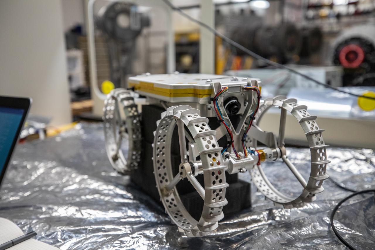
Astrobotic’s CubeRover – a lightweight, modular planetary rover – is photographed in its benchtop testing configuration at NASA’s Kennedy Space Center in Florida on June 30, 2022. Astrobotic – a Pittsburgh-based space robotics company – is planning to use the spaceport’s Swamp Works facility and Granular Mechanics and Regolith Operations Laboratory to conduct mobility testing of their rover. The laboratory’s regolith bin, which holds approximately 120 tons of lunar regolith simulant, will help depict how the company’s CubeRover would perform on the Moon. NASA’s Small Business Innovation Research program provided the funding for initial development, and a $2 million Tipping Point award from the agency has provided additional funding for continued development into a more mature rover.

Senior Software Engineer Taylor Whitaker (right) and Software Engineering intern Ashten Akemoto create a mobility routine for Astrobotic’s CubeRover – a lightweight, modular planetary rover – using the company’s ground software at NASA’s Kennedy Space Center in Florida on June 30, 2022. Astrobotic – a Pittsburgh-based space robotics company – is using the spaceport’s Swamp Works facility and the Granular Mechanics and Regolith Operations Laboratory to conduct mobility testing of their rover. The laboratory’s regolith bin, which holds approximately 120 tons of lunar regolith simulant, will help depict how the company’s CubeRover would perform on the Moon. NASA’s Small Business Innovation Research program provided the funding for initial development, and a $2 million Tipping Point award from the agency has provided additional funding for continued development into a more mature rover.
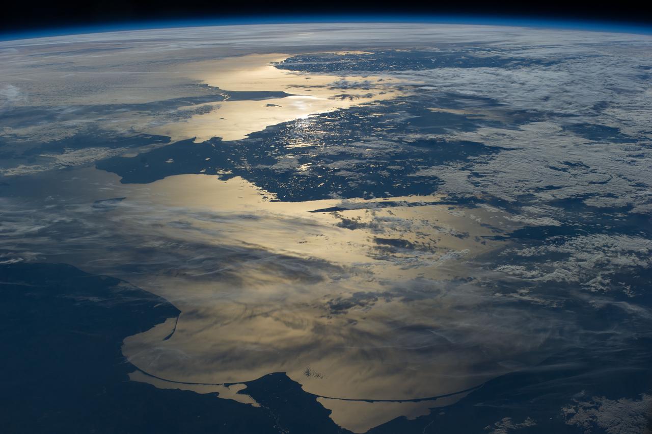
ISS040-E-012110 (15 June 2014) --- Coastlines of the southern Baltic Sea are featured in this image photographed by an Expedition 40 crew member on the International Space Station. The crew photographed this panorama looking aft (back along the orbital path) of the spacecraft as the sun was setting over the North Sea. Seen from the space station, the sun’s reflection point moves quickly across the landscape, momentarily lighting up water bodies. In this fleeting view the coast of southern Norway is outlined near the horizon. The strongest reflection of the sun highlights the narrow sea passage known as the Skagerrak—revealing the thin tip of Denmark. Numerous small lakes in southern Sweden appear at center, and scattered clouds cast complex shadows on the southern Baltic Sea. The sweeping curves of the sand spit on the Polish coast, and the long barrier islands on the Russian coast appear in the foreground at the edge of the sun’s reflection disc.

Robotics Software Engineer II Chris Rampolla (right) and Software Engineering intern Ashten Akemoto issue commands to Astrobotic’s CubeRover using the company’s ground software during mobility testing at NASA’s Kennedy Space Center in Florida on June 30, 2022. Astrobotic – a Pittsburgh-based space robotics company – is using the spaceport’s Swamp Works facility and the Granular Mechanics and Regolith Operations Laboratory to conduct mobility testing of their rover. The laboratory’s regolith bin, which holds approximately 120 tons of lunar regolith simulant, will help depict how the company’s CubeRover would perform on the Moon. NASA’s Small Business Innovation Research program provided the funding for initial development, and a $2 million Tipping Point award has provided additional funding for continued development into a more mature rover.

This image provides the clearest ever view of galaxy NGC 949, which lies over 30 million light-years away in the constellation of Triangulum. The galaxy has an unusual shape, made more obscure due to its inclination. From our point of view, it is difficult to discern exactly what type of galaxy NGC 949 is, but it is certainly a disc galaxy of some kind, most likely a spiral. NGC 949 was first discovered by Sir William Herschel on 21 September 1786, using an 18.7-inch reflecting telescope. The galaxy was one of about 3000 objects Herschel catalogued as "nebulae" during an intense and systematic deep sky survey, the results of which eventually formed the bulk of the New General Catalogue (NGC). Taken with Hubble’s Advanced Camera for Surveys (ACS), this new image shows extraordinary detail. This detail allows us to see a strange asymmetric alignment in the dark lanes of dust that snake across the galaxy. The top-right half of the galaxy appears considerably more marbled with dust in this image; a curious observation explained by stars tending to favour locations towards the centre of a galaxy, and dust preferring almost invariably to reside along the galactic plane. When a galaxy is inclined as NGC 949 is, some regions — in this case the top-right — are tipped towards us and the light from the stars we see in these regions has had to travel through more dust. This causes the light to appear redder — the result of the same process that gives the sun’s light a red hue at dusk — or else disappear entirely, making the dust appear more prominent on that side of the galaxy. In the part tipped away from us, the light from the stars has had to pass through much less dust to reach us, so it appears brighter, and the dust is much less prominent. Were it possible to view NGC 949 from the opposite side, the apparent alignment of the dust would be reversed. The scientific advantages of this effect were recently displayed in suitably stunning style in the M31 PHAT mosa
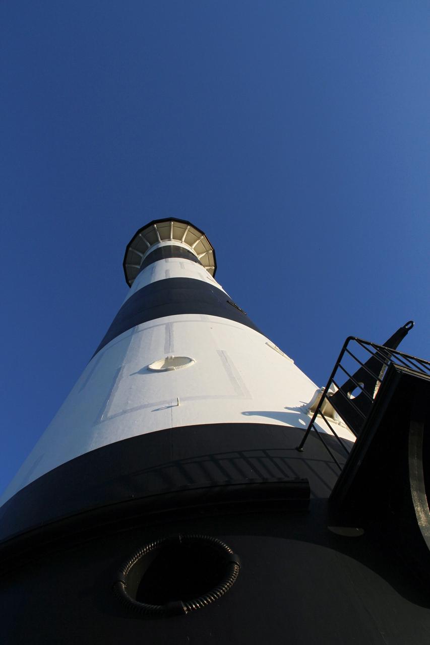
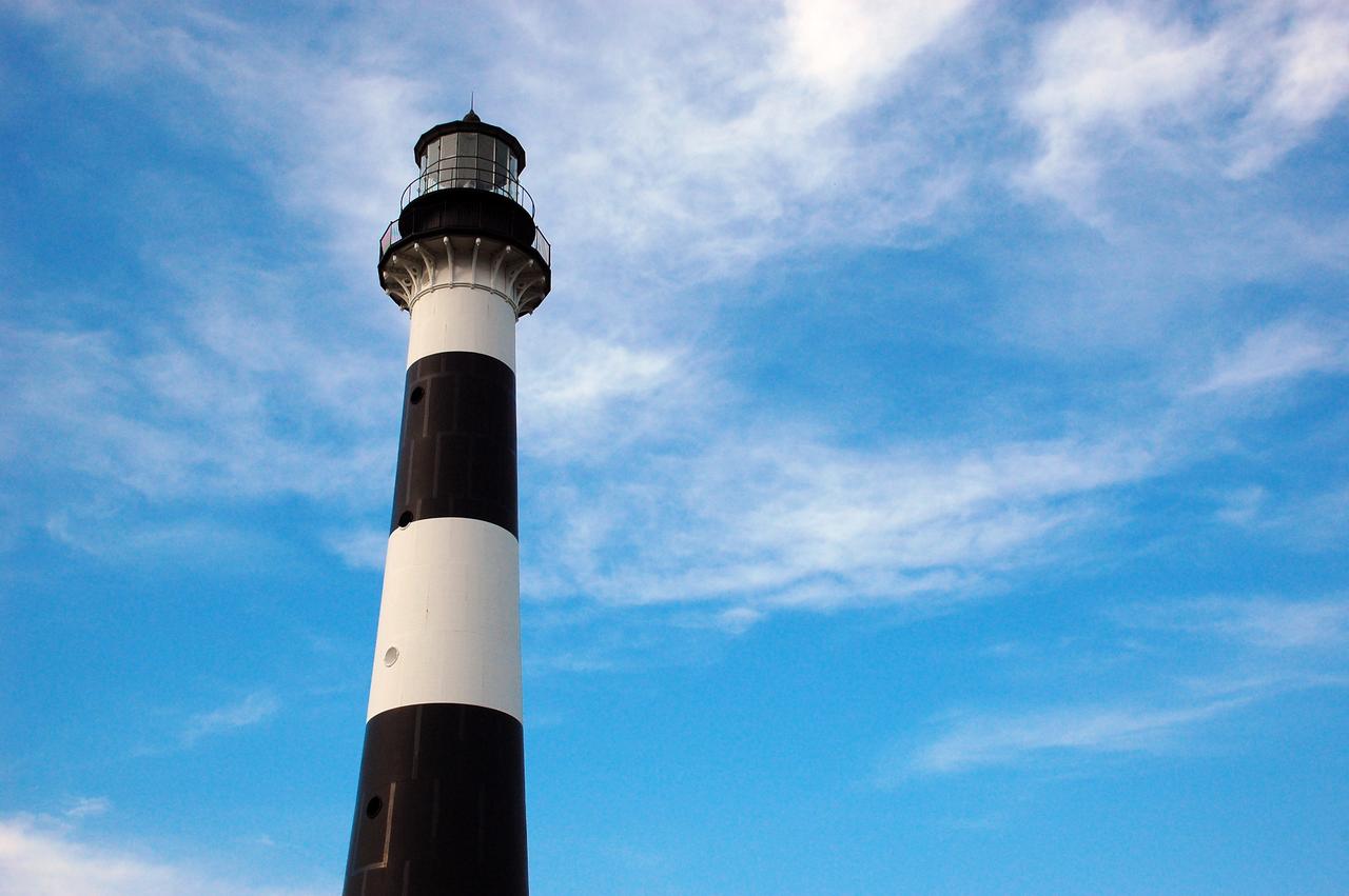
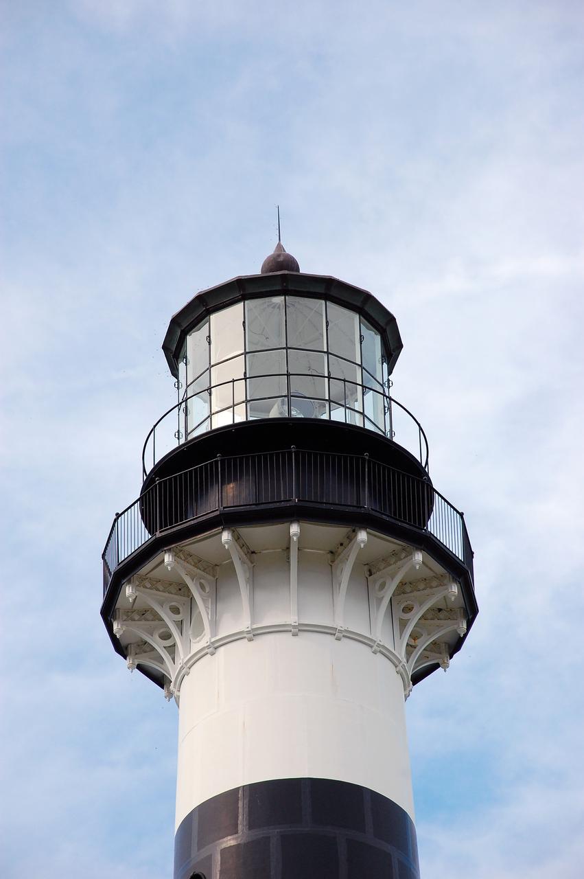
CAPE CANAVERAL AIR FORCE STATION, Fla. – This view looking up contrasts the black and white lighthouse at Cape Canaveral Air Force Station against the Florida sky. The Canaveral light is the only one owned by the U.S. Air Force. In 2000, the Coast Guard transferred ownership of the lighthouse structure and its grounds to the Air Force, which is now responsible for maintaining it. The U.S. Coast Guard continues to operate the beacon as an active navigational aid. The first lighthouse at Cape Canaveral was built near the tip of the Cape in 1848. The structure was only about 60 feet high with a rather dim light powered by whale oil. In 1859, work began nearby on a new, taller iron structure. Construction was halted during the Civil War, and the lighthouse finally was finished in 1868. The structure, with a brick lining inside its iron exterior, was painted with its "daymark" black and white horizontal bands in 1873 to make it easier to identify during the day as a navigation point. Between 1892 and 1894, the lighthouse was dismantled and moved to its new home about a mile from the coast, where it stands today. Photo credit: NASA/Ben Smegelsky
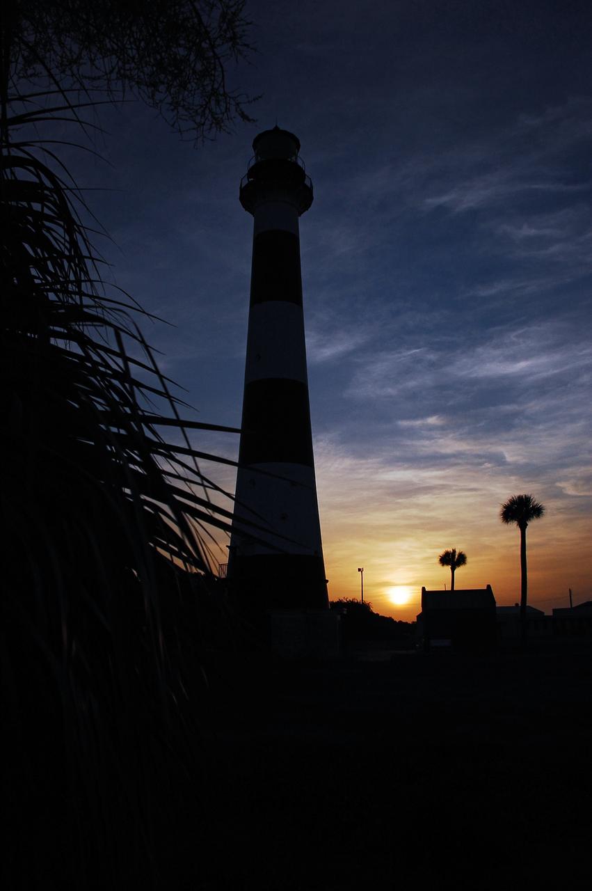
Cape Canaveral Air Force Station, Fla. -- As the sun rises, the Cape Canaveral Lighthouse is silhouetted against the early morning sky. The Canaveral light is the only operating lighthouse owned by the U.S. Air Force. In 2000, the Coast Guard transferred ownership of the lighthouse structure and its grounds to the Air Force, which is now responsible for maintaining it. The U.S. Coast Guard continues to operate the modern first-order beacon as an active navigational aid. The first lighthouse at Cape Canaveral was built near the tip of the Cape in 1848. The structure was only about 60 feet high with a rather dim light powered by whale oil. In 1859, work began nearby on a new, taller iron structure. Construction was halted during the Civil War, and the lighthouse finally was finished in 1868. The structure, with a brick lining inside its iron exterior, was painted with its "daymark" black and white horizontal bands in 1873 to make it easier to identify during the day as a navigation point. Between 1892 and 1894, the lighthouse was dismantled and moved to its new home about a mile from the coast, where it stands today. Photo credit: NASA/Ben Smegelsky

CAPE CANAVERAL, Fla. -- A daisy thrives amidst the natural vegetation surrounding the historic Cape Canaveral Light on Cape Canaveral Air Force Station in Florida. The lighthouse currently is owned by the U.S. Air Force. The first lighthouse on Cape Canaveral was built near the tip of the Cape in 1848. The structure was only about 60 feet high with a rather dim light powered by whale oil. In 1859, work began nearby on a new, taller iron structure. Construction was halted during the Civil War, and the lighthouse was not finished until 1868. The structure, with a brick lining inside its iron exterior, was painted with its "daymark" black and white horizontal bands in 1873 to make it easier to identify during the day as a navigation point. Between 1892 and 1894, the lighthouse was dismantled and moved to a new location about a mile from the coast, where it stands today. For more information on the lighthouse, visit http://www.nasa.gov/centers/kennedy/about/history/lighthouse.html. Photo credit: NASA/Ben Smegelsky
CAPE CANAVERAL, Fla. -- The historic Cape Canaveral Light on Cape Canaveral Air Force Station in Florida serves as a navigational aid for boaters and fishing interests along Florida's Atlantic coast. The U.S. Coast Guard operates the lighthouse's beacon the U.S. Air Force owns the lighthouse. The first lighthouse on Cape Canaveral was built near the tip of the Cape in 1848. The structure was only about 60 feet high with a rather dim light powered by whale oil. In 1859, work began nearby on a new, taller iron structure. Construction was halted during the Civil War, and the lighthouse was not finished until 1868. The structure, with a brick lining inside its iron exterior, was painted with its "daymark" black and white horizontal bands in 1873 to make it easier to identify during the day as a navigation point. Between 1892 and 1894, the lighthouse was dismantled and moved to a new location about a mile from the coast, where it stands today. For more information on the lighthouse, visit http://www.nasa.gov/centers/kennedy/about/history/lighthouse.html. Photo credit: NASA/Ben Smegelsky
CAPE CANAVERAL, Fla. -- Cape Canaveral Air Force Station in Florida is home to the historic Cape Canaveral Light, a lighthouse built circa 1868 and now owned by the U.S. Air Force. The first lighthouse on Cape Canaveral was built near the tip of the Cape in 1848. The structure was only about 60 feet high with a rather dim light powered by whale oil. In 1859, work began nearby on a new, taller iron structure. Construction was halted during the Civil War, and the lighthouse was not finished until 1868. The structure, with a brick lining inside its iron exterior, was painted with its "daymark" black and white horizontal bands in 1873 to make it easier to identify during the day as a navigation point. Between 1892 and 1894, the lighthouse was dismantled and moved to a new location about a mile from the coast, where it stands today. For more information on the lighthouse, visit http://www.nasa.gov/centers/kennedy/about/history/lighthouse.html. Photo credit: NASA/Ben Smegelsky
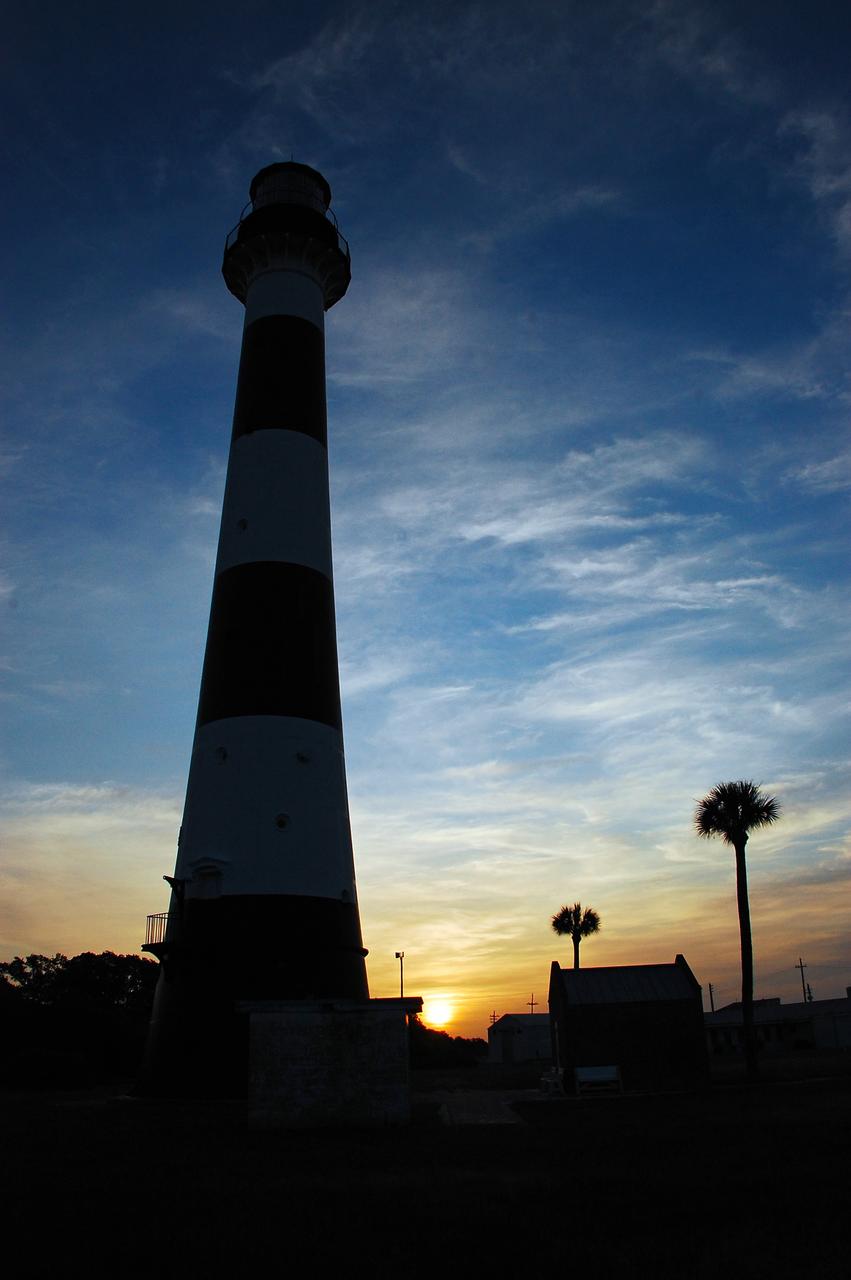
Cape Canaveral Air Force Station, Fla. -- As the sun rises, the Cape Canaveral Lighthouse is silhouetted against the early morning sky. The Canaveral light is the only operating lighthouse owned by the U.S. Air Force. In 2000, the Coast Guard transferred ownership of the lighthouse structure and its grounds to the Air Force, which is now responsible for maintaining it. The U.S. Coast Guard continues to operate the modern first-order beacon as an active navigational aid. The first lighthouse at Cape Canaveral was built near the tip of the Cape in 1848. The structure was only about 60 feet high with a rather dim light powered by whale oil. In 1859, work began nearby on a new, taller iron structure. Construction was halted during the Civil War, and the lighthouse finally was finished in 1868. The structure, with a brick lining inside its iron exterior, was painted with its "daymark" black and white horizontal bands in 1873 to make it easier to identify during the day as a navigation point. Between 1892 and 1894, the lighthouse was dismantled and moved to its new home about a mile from the coast, where it stands today. Photo credit: NASA/Ben Smegelsky
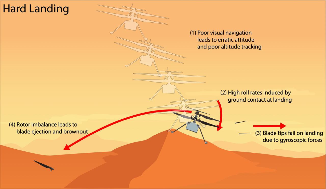
This graphic depicts the most likely scenario for the hard landing NASA's Ingenuity Mars Helicopter took during its 72nd and final flight on Jan. 18, 2024. Engineers at JPL and AeroVironment, which collaborated with NASA on the helicopter's design and development, are completing a detailed assessment of the final flight that will be published as an agency technical report. Flight 72 was planned as a brief vertical hop to assess Ingenuity's flight systems and photograph the surrounding area. Data from the flight shows Ingenuity climbing to 40 feet (12 meters), hovering, and capturing images. It initiated its descent at 19 seconds, and by 32 seconds the helicopter was back on the surface and had halted communications. The assessment describes the mostly likely scenario for Flight 72, as follows. Lack of suitable features on the planet's surface for the helicopter's navigation system to track resulted in high horizontal velocities at the time the helicopter touched down. This caused a hard impact on a sloping sand ripple, making Ingenuity pitch and roll. The rapid attitude change resulted in loads on the fast-rotating rotor blades beyond their design limits, snapping all four of them off at their weakest point – about a third of the way from the tip. The damaged blades caused excessive vibration in the rotor system, ripping the remainder of one blade from its root and generating an excessive power demand that resulted in loss of communications. https://photojournal.jpl.nasa.gov/catalog/PIA26482
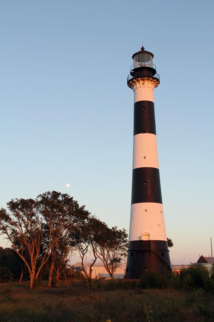
CAPE CANAVERAL AIR FORCE STATION, Fla. – The Cape Canaveral Air Force Station lighthouse takes on a warm glow as dawn breaks and a full moon still shines in the background. The Canaveral light is the only one owned by the U.S. Air Force. In 2000, the Coast Guard transferred ownership of the lighthouse structure and its grounds to the Air Force, which is now responsible for maintaining it. The U.S. Coast Guard continues to operate the beacon as an active navigational aid. The first lighthouse at Cape Canaveral was built near the tip of the Cape in 1848. The structure was only about 60 feet high with a rather dim light powered by whale oil. In 1859, work began nearby on a new, taller iron structure. Construction was halted during the Civil War, and the lighthouse finally was finished in 1868. The structure, with a brick lining inside its iron exterior, was painted with its "daymark" black and white horizontal bands in 1873 to make it easier to identify during the day as a navigation point. Between 1892 and 1894, the lighthouse was dismantled and moved to its new home about a mile from the coast, where it stands today. Photo credit: NASA/Ben Smegelsky
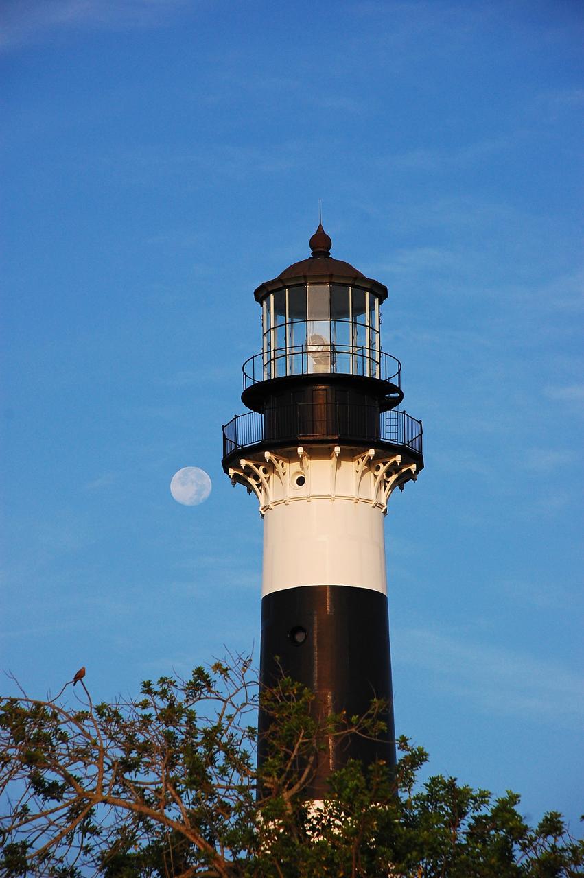
Cape Canaveral Air Force Station, Fla. -- The lantern room of the Cape Canaveral Lighthouse, with its modern first-order optic, takes on a warm glow as dawn breaks and a full moon still shines overhead. The Canaveral light is the only operating lighthouse owned by the U.S. Air Force. In 2000, the Coast Guard transferred ownership of the lighthouse structure and its grounds to the Air Force, which is now responsible for maintaining it. The U.S. Coast Guard continues to operate the beacon as an active navigational aid. The first lighthouse at Cape Canaveral was built near the tip of the Cape in 1848. The structure was only about 60 feet high with a rather dim light powered by whale oil. In 1859, work began nearby on a new, taller iron structure. Construction was halted during the Civil War, and the lighthouse finally was finished in 1868. The structure, with a brick lining inside its iron exterior, was painted with its "daymark" black and white horizontal bands in 1873 to make it easier to identify during the day as a navigation point. Between 1892 and 1894, the lighthouse was dismantled and moved to its new home about a mile from the coast, where it stands today. Photo credit: NASA/Ben Smegelsky
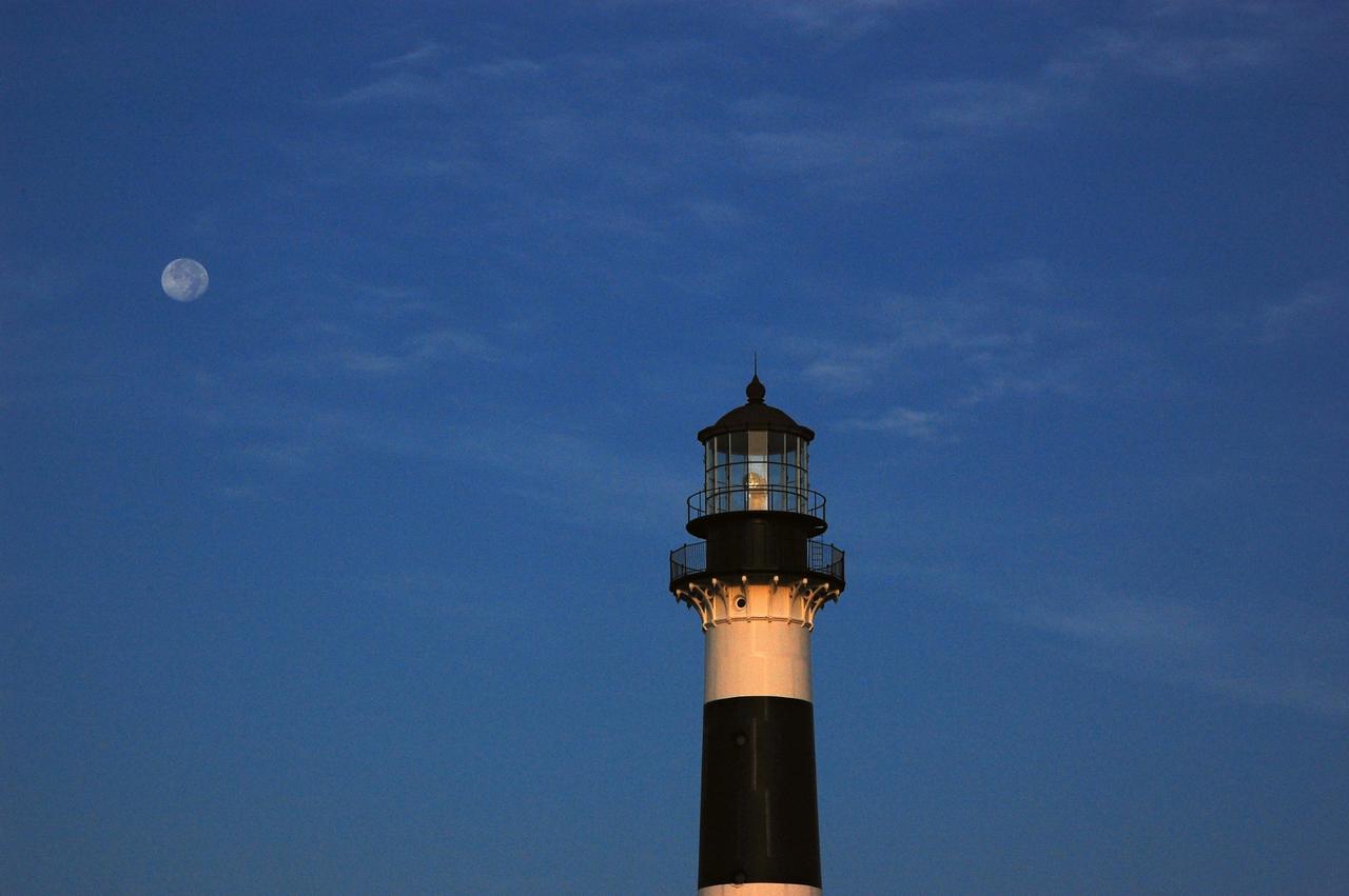
Cape Canaveral Air Force Station, Fla. -- The lantern room of the Cape Canaveral Lighthouse, with its modern first-order optic, takes on a warm glow as dawn breaks and a full moon still shines overhead. The Canaveral light is the only operating lighthouse owned by the U.S. Air Force. In 2000, the Coast Guard transferred ownership of the lighthouse structure and its grounds to the Air Force, which is now responsible for maintaining it. The U.S. Coast Guard continues to operate the beacon as an active navigational aid. The first lighthouse at Cape Canaveral was built near the tip of the Cape in 1848. The structure was only about 60 feet high with a rather dim light powered by whale oil. In 1859, work began nearby on a new, taller iron structure. Construction was halted during the Civil War, and the lighthouse finally was finished in 1868. The structure, with a brick lining inside its iron exterior, was painted with its "daymark" black and white horizontal bands in 1873 to make it easier to identify during the day as a navigation point. Between 1892 and 1894, the lighthouse was dismantled and moved to its new home about a mile from the coast, where it stands today. Photo credit: NASA/Ben Smegelsky
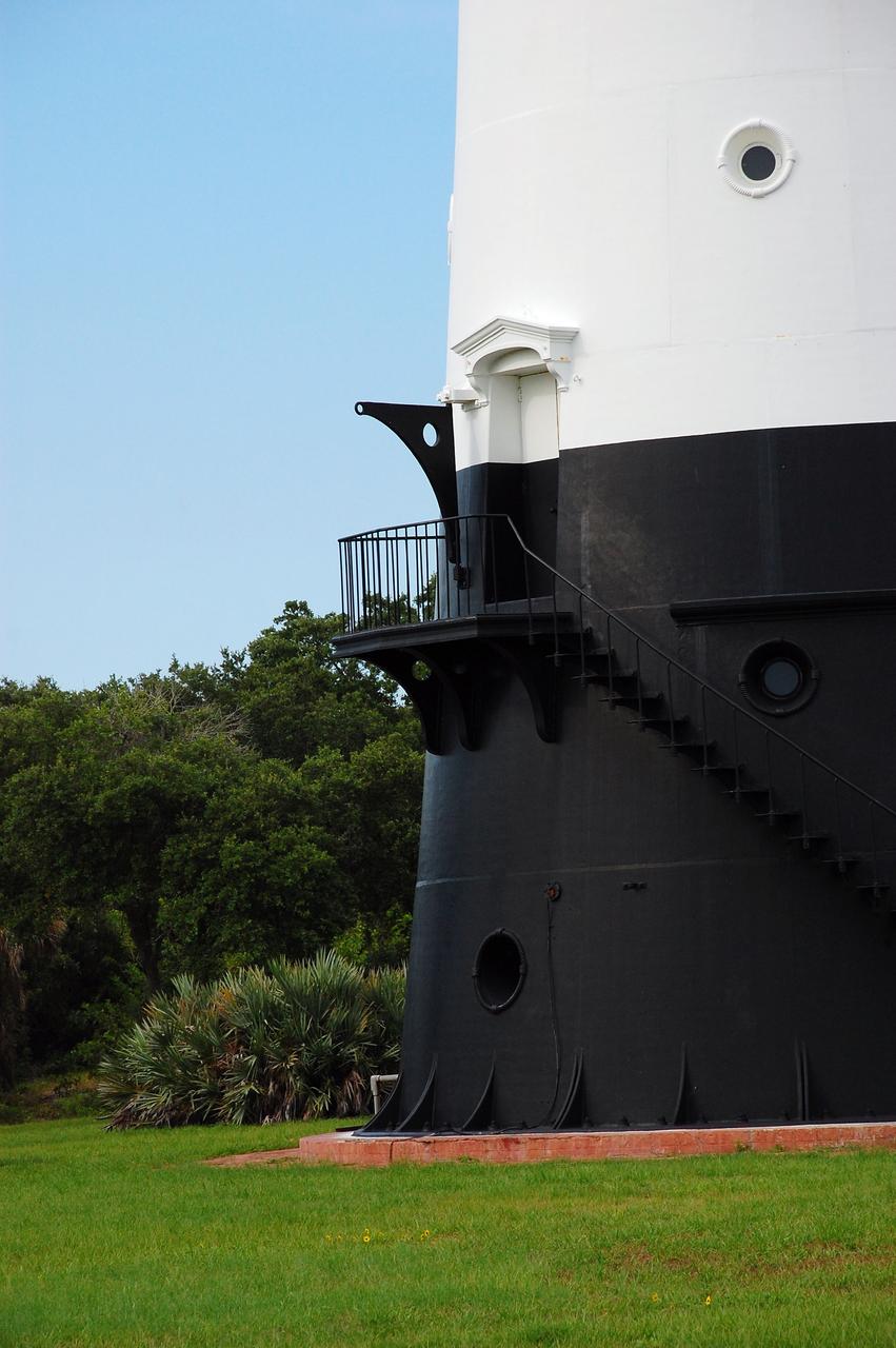
CAPE CANAVERAL, Fla. -- The historic Cape Canaveral Light, now owned by the U.S. Air Force, has resided in its current spot on Cape Canaveral Air Force Station in Florida since 1894. The first lighthouse on Cape Canaveral was built near the tip of the Cape in 1848. The structure was only about 60 feet high with a rather dim light powered by whale oil. In 1859, work began nearby on a new, taller iron structure. Construction was halted during the Civil War, and the lighthouse was not finished until 1868. The structure, with a brick lining inside its iron exterior, was painted with its "daymark" black and white horizontal bands in 1873 to make it easier to identify during the day as a navigation point. Between 1892 and 1894, the lighthouse was dismantled and moved to a new location about a mile from the coast, where it stands today. For more information on the lighthouse, visit http://www.nasa.gov/centers/kennedy/about/history/lighthouse.html. Photo credit: NASA/Ben Smegelsky
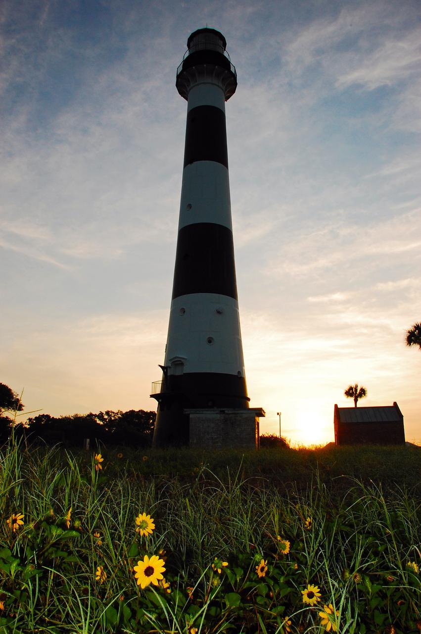
Cape Canaveral Air Force Station, Fla. -- As the sun rises, the Cape Canaveral Lighthouse is silhouetted against the early morning sky. The Canaveral light is the only operating lighthouse owned by the U.S. Air Force. In 2000, the Coast Guard transferred ownership of the lighthouse structure and its grounds to the Air Force, which is now responsible for maintaining it. The U.S. Coast Guard continues to operate the modern first-order beacon as an active navigational aid. The first lighthouse at Cape Canaveral was built near the tip of the Cape in 1848. The structure was only about 60 feet high with a rather dim light powered by whale oil. In 1859, work began nearby on a new, taller iron structure. Construction was halted during the Civil War, and the lighthouse finally was finished in 1868. The structure, with a brick lining inside its iron exterior, was painted with its "daymark" black and white horizontal bands in 1873 to make it easier to identify during the day as a navigation point. Between 1892 and 1894, the lighthouse was dismantled and moved to its new home about a mile from the coast, where it stands today. Photo credit: NASA/Ben Smegelsky
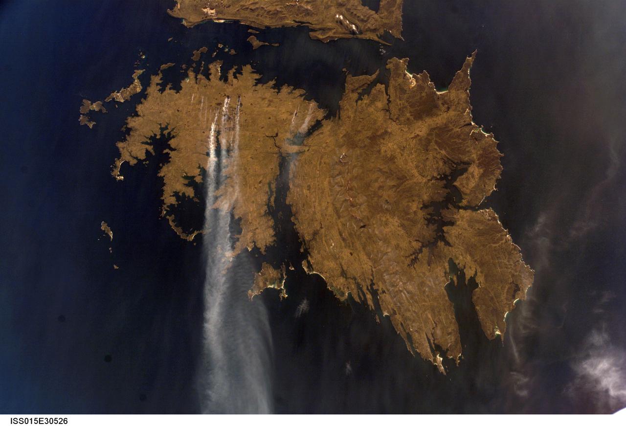
ISS015-E-30526 (25 Sept. 2007) --- Fires in East Falkland Island in the South Atlantic Ocean are featured in this image photographed by an Expedition 15 crewmember on the International Space Station. The Falkland Islands are an overseas territory of the United Kingdom, referred to by Argentina (which also claims the islands) as the Islas Malvinas. The main islands of East Falkland and West Falkland are separated by Falkland Sound (12 kilometers) wide at the narrow point. Together they total about the same area as the State of Connecticut or Northern Ireland. The islands lie almost 500 kilometers from the Argentine coast and less than 1,000 kilometers from Antarctica. The first air links to these remote islands were only put in place in 1971. The capital city of Stanley lies on the eastern tip of East Falkland. The local inhabitants are mainly English speakers, and interestingly, the islands have become a center of English-language learning for students from South America. The windy and relatively dry climate has given rise to natural vegetation comprised of treeless grassland with scattered bogs. The grasslands are ideal for sheep rearing which was the dominant occupation until recent decades, when fishing (mainly squid to Spain) and tourism became the mainstay of the economy. These expanses of grassland provide ready fuel for fires, as indicated by the several long smoke plumes visible in this image.
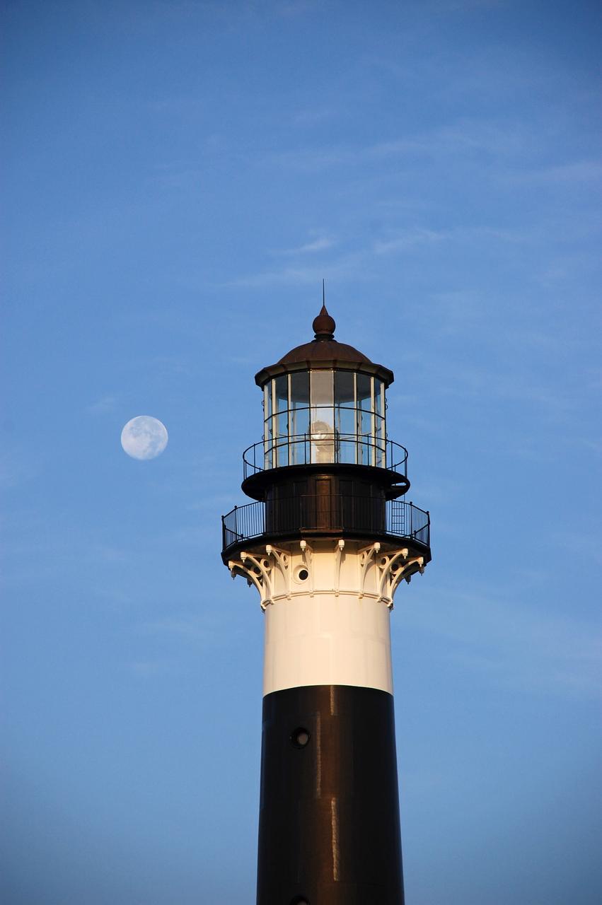
Cape Canaveral Air Force Station, Fla. -- The lantern room of the Cape Canaveral Lighthouse, with its modern first-order optic, takes on a warm glow as dawn breaks and a full moon still shines overhead. The Canaveral light is the only operating lighthouse owned by the U.S. Air Force. In 2000, the Coast Guard transferred ownership of the lighthouse structure and its grounds to the Air Force, which is now responsible for maintaining it. The U.S. Coast Guard continues to operate the beacon as an active navigational aid. The first lighthouse at Cape Canaveral was built near the tip of the Cape in 1848. The structure was only about 60 feet high with a rather dim light powered by whale oil. In 1859, work began nearby on a new, taller iron structure. Construction was halted during the Civil War, and the lighthouse finally was finished in 1868. The structure, with a brick lining inside its iron exterior, was painted with its "daymark" black and white horizontal bands in 1873 to make it easier to identify during the day as a navigation point. Between 1892 and 1894, the lighthouse was dismantled and moved to its new home about a mile from the coast, where it stands today. Photo credit: NASA/Ben Smegelsky
CAPE CANAVERAL, Fla. -- Reconstruction from the original architectural plans of the keeper's house, next to the historic Cape Canaveral Light on Cape Canaveral Air Force Station in Florida, is planned by the Cape Canaveral Lighthouse Foundation. The lighthouse currently is owned by the U.S. Air Force. The first lighthouse on Cape Canaveral was built near the tip of the Cape in 1848. The structure was only about 60 feet high with a rather dim light powered by whale oil. In 1859, work began nearby on a new, taller iron structure. Construction was halted during the Civil War, and the lighthouse was not finished until 1868. The structure, with a brick lining inside its iron exterior, was painted with its "daymark" black and white horizontal bands in 1873 to make it easier to identify during the day as a navigation point. Between 1892 and 1894, the lighthouse was dismantled and moved to a new location about a mile from the coast, where it stands today. For more information on the lighthouse, visit http://www.nasa.gov/centers/kennedy/about/history/lighthouse.html. Photo credit: NASA/Ben Smegelsky
CAPE CANAVERAL, Fla. -- The U.S. Coast Guard operates the beacon of the historic Cape Canaveral Light as an active navigational aid. The lighthouse resides on Cape Canaveral Air Force Station in Florida and is owned by the U.S. Air Force. The first lighthouse on Cape Canaveral was built near the tip of the Cape in 1848. The structure was only about 60 feet high with a rather dim light powered by whale oil. In 1859, work began nearby on a new, taller iron structure. Construction was halted during the Civil War, and the lighthouse was not finished until 1868. The structure, with a brick lining inside its iron exterior, was painted with its "daymark" black and white horizontal bands in 1873 to make it easier to identify during the day as a navigation point. Between 1892 and 1894, the lighthouse was dismantled and moved to a new location about a mile from the coast, where it stands today. For more information on the lighthouse, visit http://www.nasa.gov/centers/kennedy/about/history/lighthouse.html. Photo credit: NASA/Ben Smegelsky
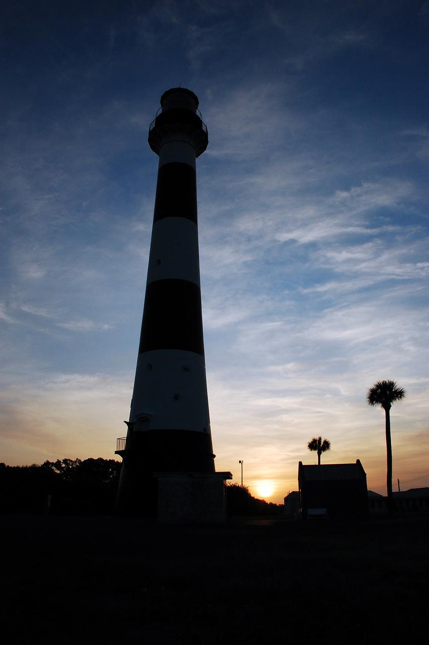
Cape Canaveral Air Force Station, Fla. -- As the sun rises, the Cape Canaveral Lighthouse is silhouetted against the early morning sky. The Canaveral light is the only operating lighthouse owned by the U.S. Air Force. In 2000, the Coast Guard transferred ownership of the lighthouse structure and its grounds to the Air Force, which is now responsible for maintaining it. The U.S. Coast Guard continues to operate the modern first-order beacon as an active navigational aid. The first lighthouse at Cape Canaveral was built near the tip of the Cape in 1848. The structure was only about 60 feet high with a rather dim light powered by whale oil. In 1859, work began nearby on a new, taller iron structure. Construction was halted during the Civil War, and the lighthouse finally was finished in 1868. The structure, with a brick lining inside its iron exterior, was painted with its "daymark" black and white horizontal bands in 1873 to make it easier to identify during the day as a navigation point. Between 1892 and 1894, the lighthouse was dismantled and moved to its new home about a mile from the coast, where it stands today. Photo credit: NASA/Ben Smegelsky
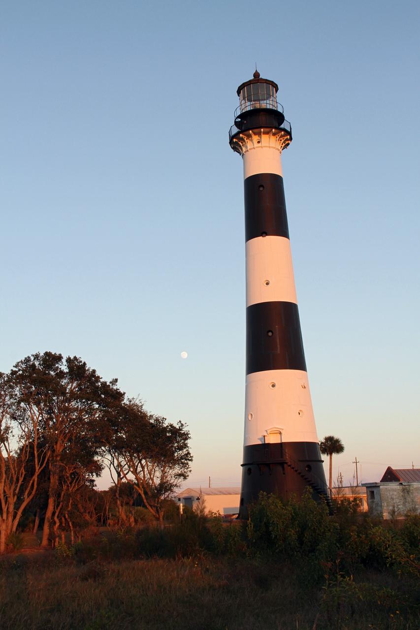
CAPE CANAVERAL AIR FORCE STATION, Fla. – The Cape Canaveral Air Force Station lighthouse takes on a warm glow as dawn breaks and a full moon still shines in the background. The Canaveral light is the only one owned by the U.S. Air Force. In 2000, the Coast Guard transferred ownership of the lighthouse structure and its grounds to the Air Force, which is now responsible for maintaining it. The U.S. Coast Guard continues to operate the beacon as an active navigational aid. The first lighthouse at Cape Canaveral was built near the tip of the Cape in 1848. The structure was only about 60 feet high with a rather dim light powered by whale oil. In 1859, work began nearby on a new, taller iron structure. Construction was halted during the Civil War, and the lighthouse finally was finished in 1868. The structure, with a brick lining inside its iron exterior, was painted with its "daymark" black and white horizontal bands in 1873 to make it easier to identify during the day as a navigation point. Between 1892 and 1894, the lighthouse was dismantled and moved to its new home about a mile from the coast, where it stands today. Photo credit: NASA/Ben Smegelsky
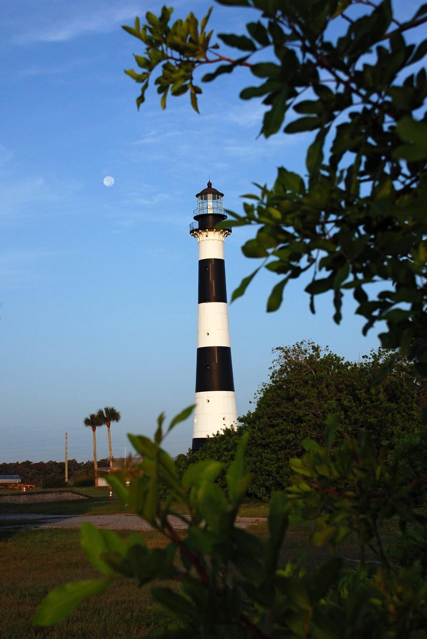
Cape Canaveral Air Force Station, Fla. -- A warm glow envelopes the Cape Canaveral Lighthouse as dawn breaks and a full moon still shines overhead. The Canaveral light is the only operating lighthouse owned by the U.S. Air Force. In 2000, the Coast Guard transferred ownership of the lighthouse structure and its grounds to the Air Force, which is now responsible for maintaining it. The U.S. Coast Guard continues to operate the modern first-order beacon as an active navigational aid. The first lighthouse at Cape Canaveral was built near the tip of the Cape in 1848. The structure was only about 60 feet high with a rather dim light powered by whale oil. In 1859, work began nearby on a new, taller iron structure. Construction was halted during the Civil War, and the lighthouse finally was finished in 1868. The structure, with a brick lining inside its iron exterior, was painted with its "daymark" black and white horizontal bands in 1873 to make it easier to identify during the day as a navigation point. Between 1892 and 1894, the lighthouse was dismantled and moved to its new home about a mile from the coast, where it stands today. Photo credit: NASA/Ben Smegelsky
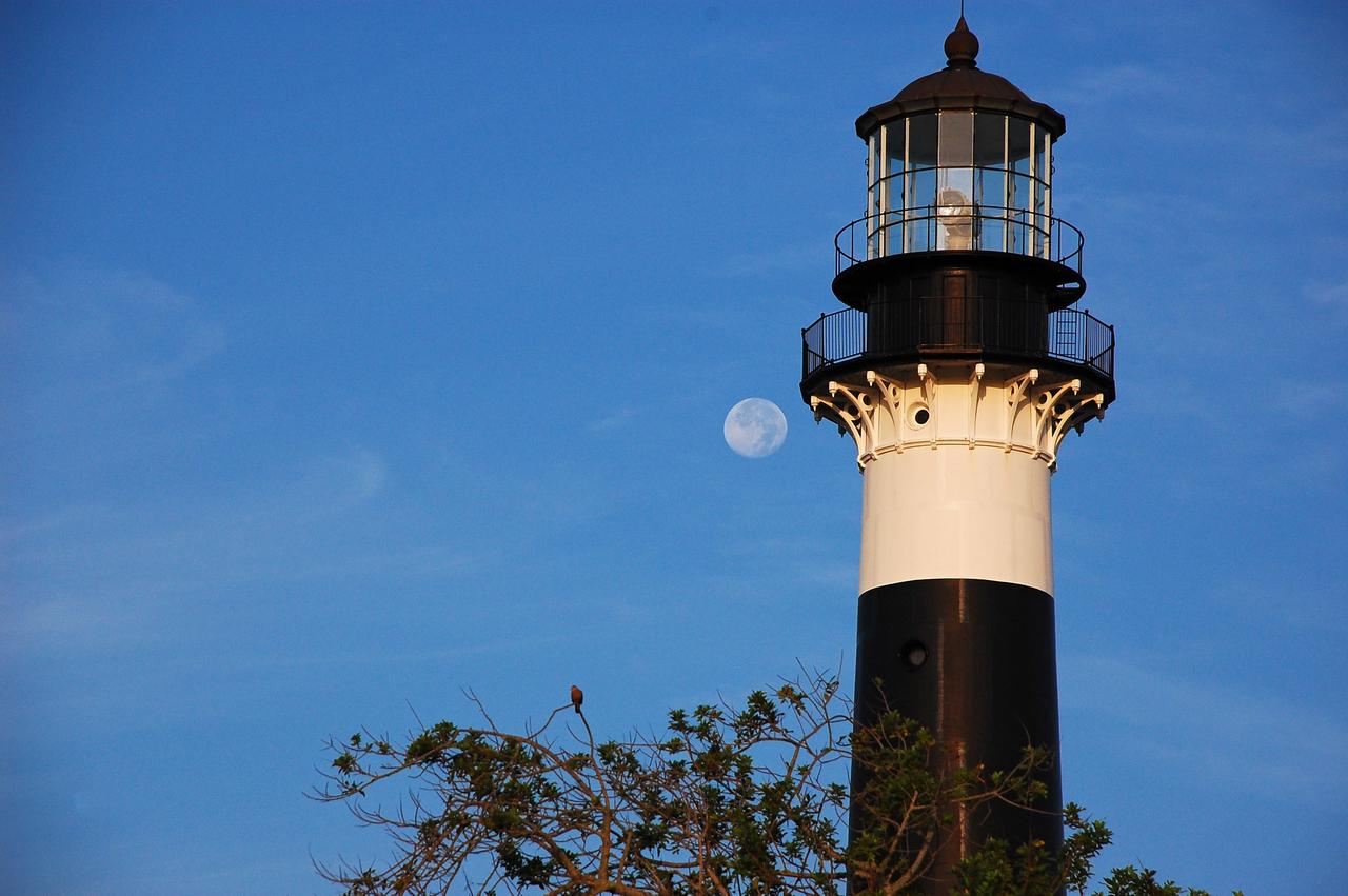
Cape Canaveral Air Force Station, Fla. -- The lantern room of the Cape Canaveral Lighthouse, with its modern first-order optic, takes on a warm glow as dawn breaks and a full moon still shines overhead. The Canaveral light is the only operating lighthouse owned by the U.S. Air Force. In 2000, the Coast Guard transferred ownership of the lighthouse structure and its grounds to the Air Force, which is now responsible for maintaining it. The U.S. Coast Guard continues to operate the beacon as an active navigational aid. The first lighthouse at Cape Canaveral was built near the tip of the Cape in 1848. The structure was only about 60 feet high with a rather dim light powered by whale oil. In 1859, work began nearby on a new, taller iron structure. Construction was halted during the Civil War, and the lighthouse finally was finished in 1868. The structure, with a brick lining inside its iron exterior, was painted with its "daymark" black and white horizontal bands in 1873 to make it easier to identify during the day as a navigation point. Between 1892 and 1894, the lighthouse was dismantled and moved to its new home about a mile from the coast, where it stands today. Photo credit: NASA/Ben Smegelsky
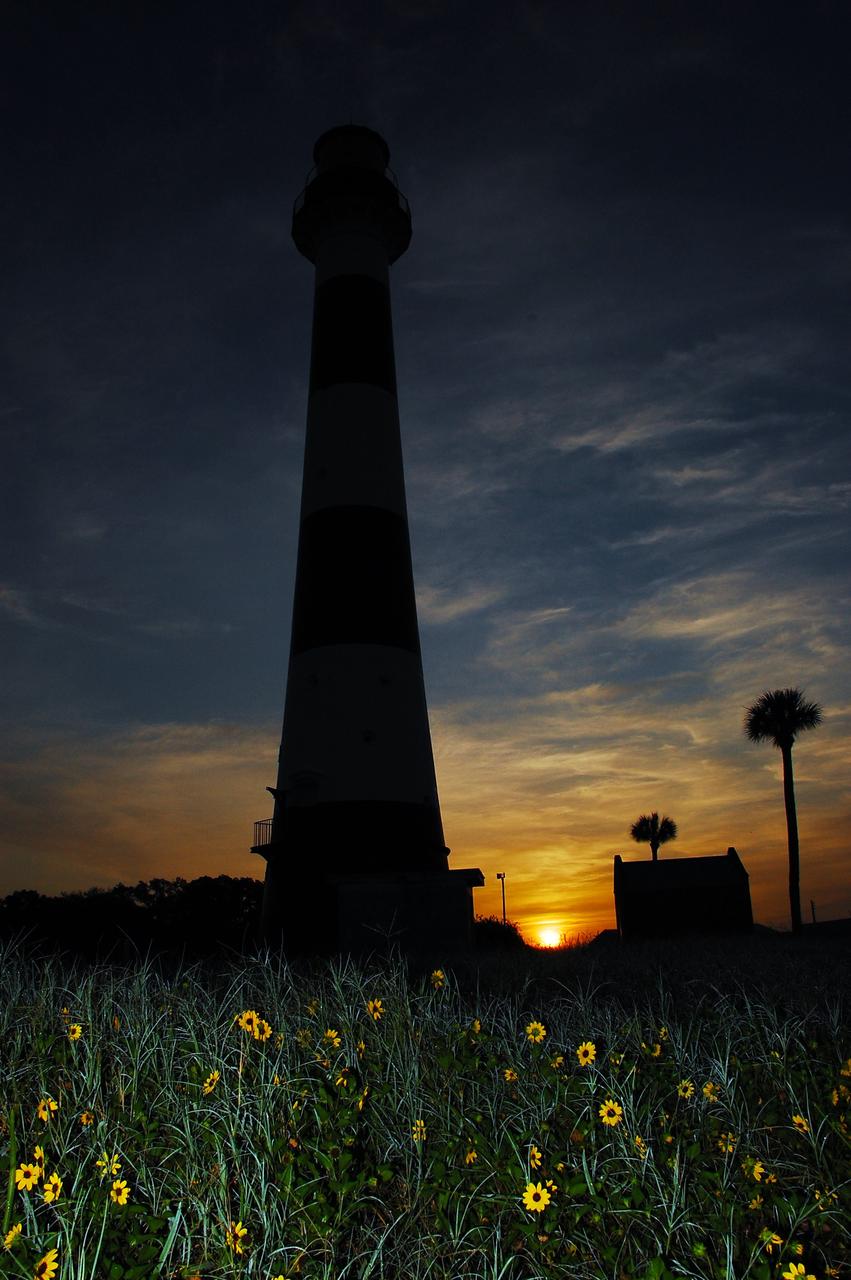
Cape Canaveral Air Force Station, Fla. -- As the sun rises, the Cape Canaveral Lighthouse is silhouetted against the early morning sky. The Canaveral light is the only operating lighthouse owned by the U.S. Air Force. In 2000, the Coast Guard transferred ownership of the lighthouse structure and its grounds to the Air Force, which is now responsible for maintaining it. The U.S. Coast Guard continues to operate the modern first-order beacon as an active navigational aid. The first lighthouse at Cape Canaveral was built near the tip of the Cape in 1848. The structure was only about 60 feet high with a rather dim light powered by whale oil. In 1859, work began nearby on a new, taller iron structure. Construction was halted during the Civil War, and the lighthouse finally was finished in 1868. The structure, with a brick lining inside its iron exterior, was painted with its "daymark" black and white horizontal bands in 1873 to make it easier to identify during the day as a navigation point. Between 1892 and 1894, the lighthouse was dismantled and moved to its new home about a mile from the coast, where it stands today. Photo credit: NASA/Ben Smegelsky
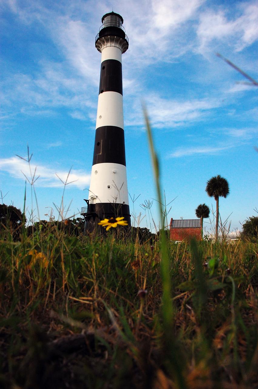
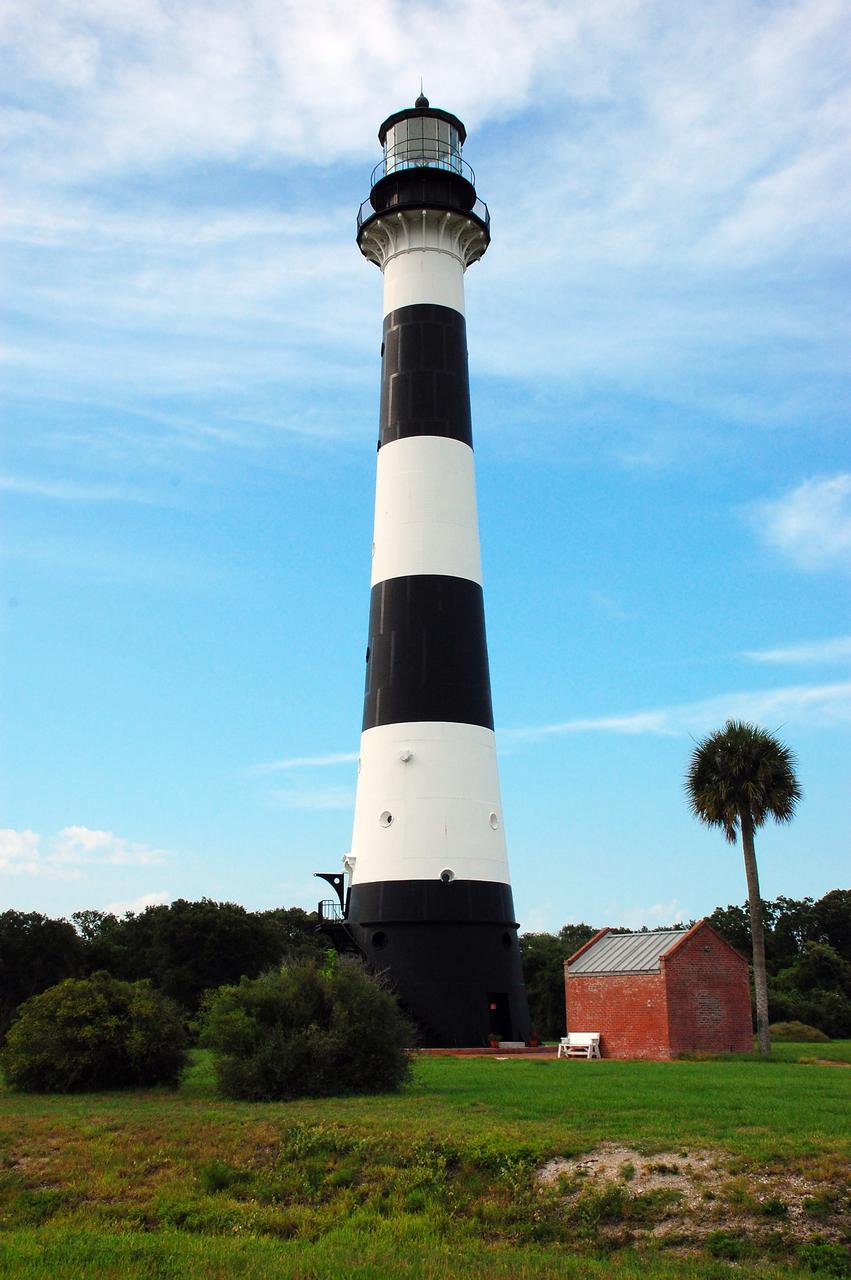
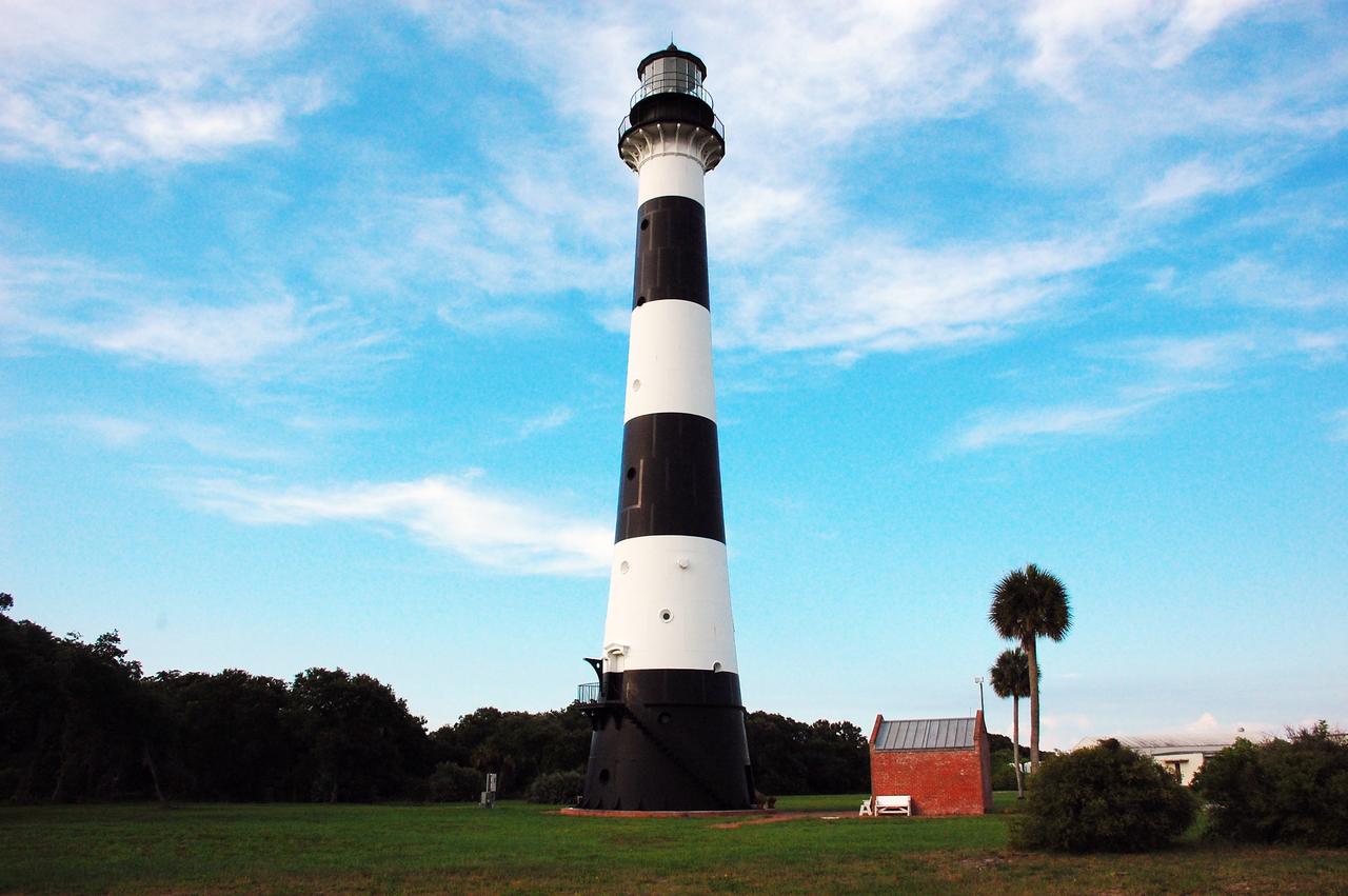
CAPE CANAVERAL, Fla. -- Natural vegetation surrounds the historic Cape Canaveral Light on Cape Canaveral Air Force Station in Florida. The low structure to the right of the lighthouse is the original oil house. The U.S. Air Force now owns the lighthouse. The first lighthouse on Cape Canaveral was built near the tip of the Cape in 1848. The structure was only about 60 feet high with a rather dim light powered by whale oil. In 1859, work began nearby on a new, taller iron structure. Construction was halted during the Civil War, and the lighthouse was not finished until 1868. The structure, with a brick lining inside its iron exterior, was painted with its "daymark" black and white horizontal bands in 1873 to make it easier to identify during the day as a navigation point. Between 1892 and 1894, the lighthouse was dismantled and moved to a new location about a mile from the coast, where it stands today. For more information on the lighthouse, visit http://www.nasa.gov/centers/kennedy/about/history/lighthouse.html. Photo credit: NASA/Ben Smegelsky
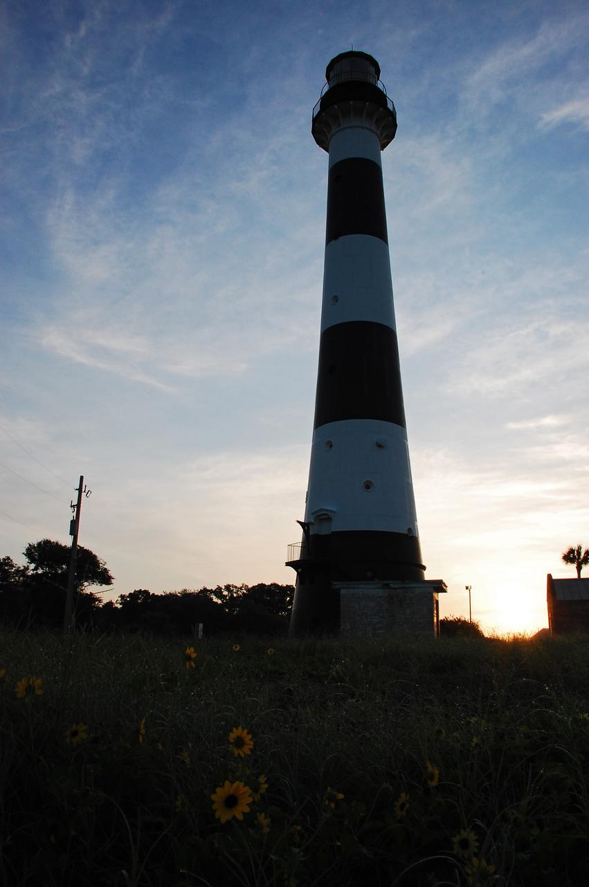
Cape Canaveral Air Force Station, Fla. -- As the sun rises, the Cape Canaveral Lighthouse is silhouetted against the early morning sky. The Canaveral light is the only operating lighthouse owned by the U.S. Air Force. In 2000, the Coast Guard transferred ownership of the lighthouse structure and its grounds to the Air Force, which is now responsible for maintaining it. The U.S. Coast Guard continues to operate the modern first-order beacon as an active navigational aid. The first lighthouse at Cape Canaveral was built near the tip of the Cape in 1848. The structure was only about 60 feet high with a rather dim light powered by whale oil. In 1859, work began nearby on a new, taller iron structure. Construction was halted during the Civil War, and the lighthouse finally was finished in 1868. The structure, with a brick lining inside its iron exterior, was painted with its "daymark" black and white horizontal bands in 1873 to make it easier to identify during the day as a navigation point. Between 1892 and 1894, the lighthouse was dismantled and moved to its new home about a mile from the coast, where it stands today. Photo credit: NASA/Ben Smegelsky
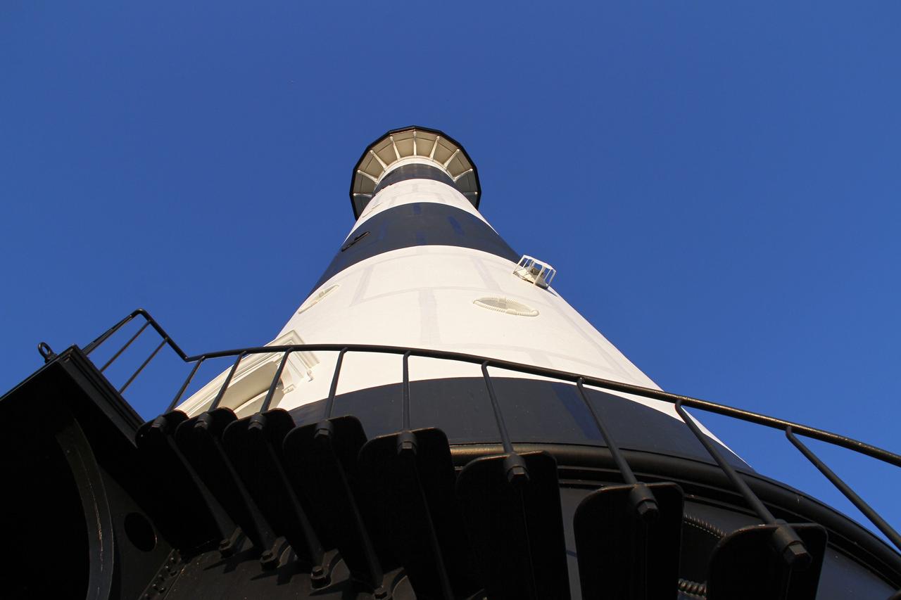
CAPE CANAVERAL AIR FORCE STATION, Fla. – This view looking up contrasts the black and white lighthouse at Cape Canaveral Air Force Station against the Florida sky. The Canaveral light is the only one owned by the U.S. Air Force. In 2000, the Coast Guard transferred ownership of the lighthouse structure and its grounds to the Air Force, which is now responsible for maintaining it. The U.S. Coast Guard continues to operate the beacon as an active navigational aid. The first lighthouse at Cape Canaveral was built near the tip of the Cape in 1848. The structure was only about 60 feet high with a rather dim light powered by whale oil. In 1859, work began nearby on a new, taller iron structure. Construction was halted during the Civil War, and the lighthouse finally was finished in 1868. The structure, with a brick lining inside its iron exterior, was painted with its "daymark" black and white horizontal bands in 1873 to make it easier to identify during the day as a navigation point. Between 1892 and 1894, the lighthouse was dismantled and moved to its new home about a mile from the coast, where it stands today. Photo credit: NASA/Ben Smegelsky
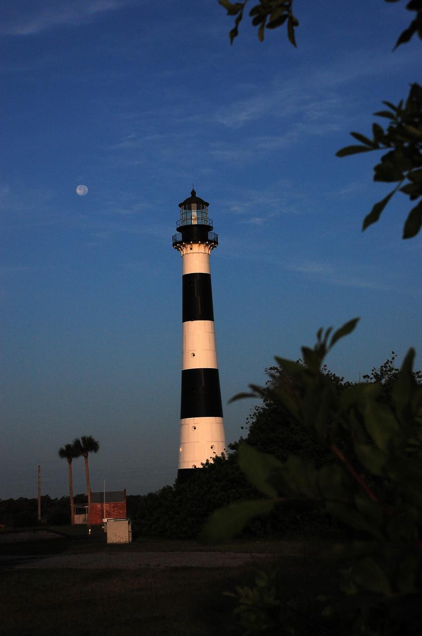
Cape Canaveral Air Force Station, Fla. -- A warm glow envelopes the Cape Canaveral Lighthouse as dawn breaks and a full moon still shines overhead. The Canaveral light is the only operating lighthouse owned by the U.S. Air Force. In 2000, the Coast Guard transferred ownership of the lighthouse structure and its grounds to the Air Force, which is now responsible for maintaining it. The U.S. Coast Guard continues to operate the modern first-order beacon as an active navigational aid. The first lighthouse at Cape Canaveral was built near the tip of the Cape in 1848. The structure was only about 60 feet high with a rather dim light powered by whale oil. In 1859, work began nearby on a new, taller iron structure. Construction was halted during the Civil War, and the lighthouse finally was finished in 1868. The structure, with a brick lining inside its iron exterior, was painted with its "daymark" black and white horizontal bands in 1873 to make it easier to identify during the day as a navigation point. Between 1892 and 1894, the lighthouse was dismantled and moved to its new home about a mile from the coast, where it stands today. Photo credit: NASA/Ben Smegelsky
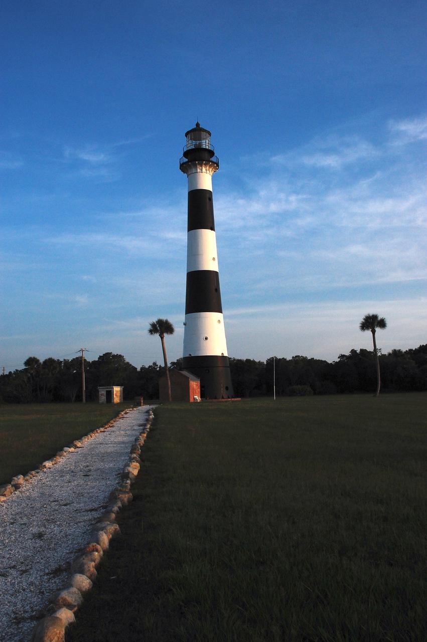
Cape Canaveral Air Force Station, Fla. -- A warm glow envelopes the Cape Canaveral Lighthouse as dawn breaks over the Cape.. The Canaveral light is the only operating lighthouse owned by the U.S. Air Force. In 2000, the Coast Guard transferred ownership of the lighthouse structure and its grounds to the Air Force, which is now responsible for maintaining it. The U.S. Coast Guard continues to operate the modern first-order beacon as an active navigational aid. The first lighthouse at Cape Canaveral was built near the tip of the Cape in 1848. The structure was only about 60 feet high with a rather dim light powered by whale oil. In 1859, work began nearby on a new, taller iron structure. Construction was halted during the Civil War, and the lighthouse finally was finished in 1868. The structure, with a brick lining inside its iron exterior, was painted with its "daymark" black and white horizontal bands in 1873 to make it easier to identify during the day as a navigation point. Between 1892 and 1894, the lighthouse was dismantled and moved to its new home about a mile from the coast, where it stands today. Photo credit: NASA/Ben Smegelsky
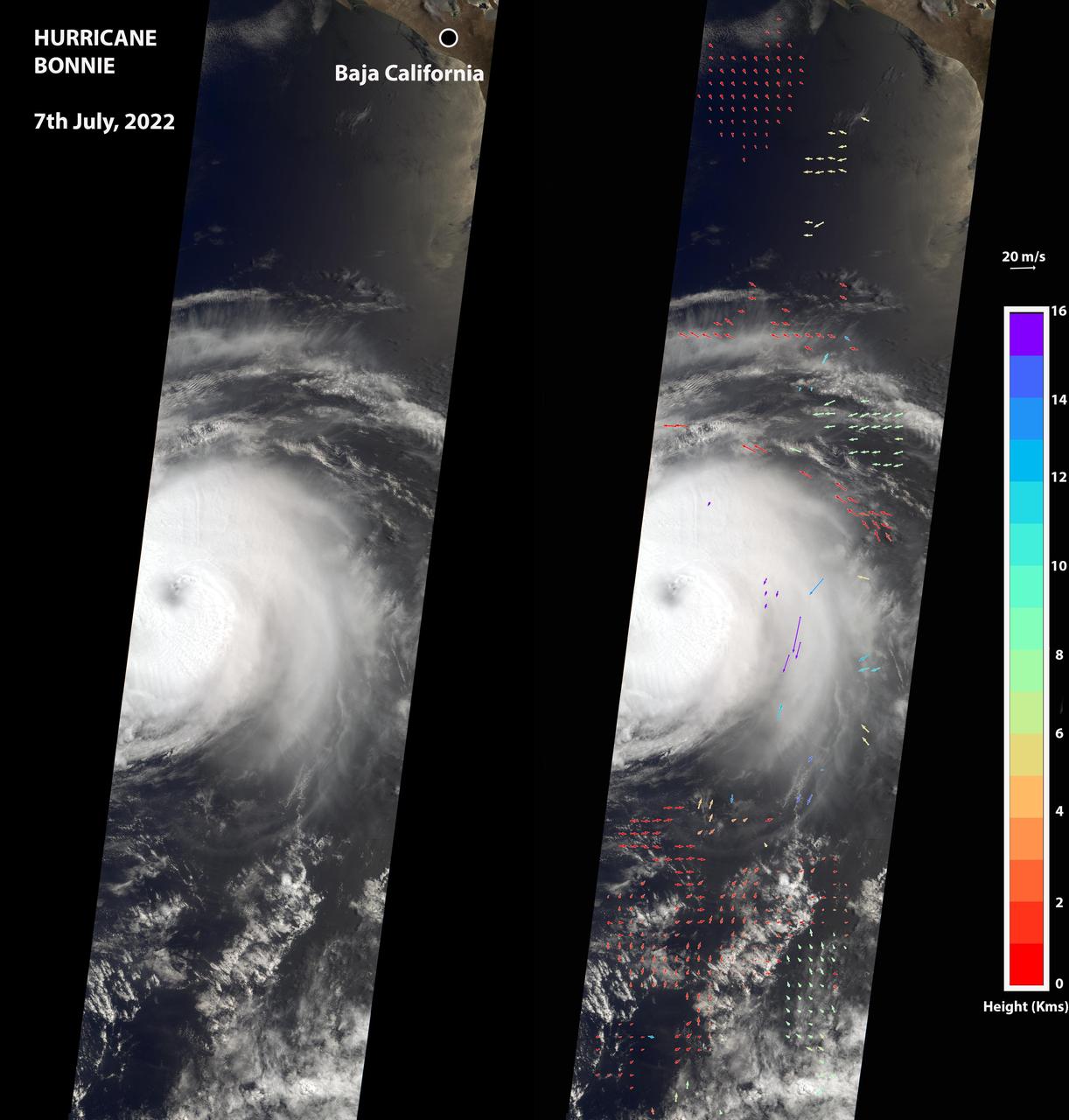
The Multi-angle Imaging SpectroRadiometer (MISR) instrument aboard NASA's Terra satellite captured this image of the eye of Hurricane Bonnie, located about 500 miles (800 kilometers) southwest of the southern tip of Baja California, Mexico, at about 11 a.m. local time on July 7, 2022. Initially classified as a tropical storm on July 2, Bonnie intensified to a Category 3 hurricane on July 5. It was later downgraded, and as of July 8, was considered a tropical storm. MISR carries nine cameras pointed at Earth at different angles and each camera viewed Bonnie over a period of seven minutes. The motion of the hurricane between those views provides information on wind speed and direction at the height of the clouds. The panel on the left shows the image from MISR's downward-pointing camera. The colored arrows in the panel on the right, superimposed on the same image as the left panel, show wind speed and direction. The length of the arrows is proportional to wind speed, and their color shows the altitude of the cloud tops in kilometers. MISR observed winds blowing counterclockwise at about 34 mph (55 kph) at altitudes of 6,500 to 33,000 feet (2 to 10 kilometers), consistent with maximal wind gusts reported by the National Hurricane Center based on data from local weather stations and buoys. At altitudes of about 36,000 to 52,000 feet (11 to 16 kilometers), MISR observed winds blowing clockwise at up to 123 mph (198 kph). The eye, spiral rainbands, and reversal of wind direction between low and high altitudes are typical features of a hurricane. https://photojournal.jpl.nasa.gov/catalog/PIA24906

This majestic false-color image from NASA's Spitzer Space Telescope shows the "mountains" where stars are born. Dubbed "Mountains of Creation" by Spitzer scientists, these towering pillars of cool gas and dust are illuminated at their tips with light from warm embryonic stars. The new infrared picture is reminiscent of Hubble's iconic visible-light image of the Eagle Nebula, which also features a star-forming region, or nebula, that is being sculpted into pillars by radiation and winds from hot, massive stars. The pillars in the Spitzer image are part of a region called W5, in the Cassiopeia constellation 7,000 light-years away and 50 light-years across. They are more than 10 times in the size of those in the Eagle Nebula (shown to scale here). The Spitzer's view differs from Hubble's because infrared light penetrates dust, whereas visible light is blocked by it. In the Spitzer image, hundreds of forming stars (white/yellow) can seen for the first time inside the central pillar, and dozens inside the tall pillar to the left. Scientists believe these star clusters were triggered into existence by radiation and winds from an "initiator" star more than 10 times the mass of our Sun. This star is not pictured, but the finger-like pillars "point" toward its location above the image frame. The Spitzer picture also reveals stars (blue) a bit older than the ones in the pillar tips in the evacuated areas between the clouds. Scientists believe these stars were born around the same time as the massive initiator star not pictured. A third group of young stars occupies the bright area below the central pillar. It is not known whether these stars formed in a related or separate event. Some of the blue dots are foreground stars that are not members of this nebula. The red color in the Spitzer image represents organic molecules known as polycyclic aromatic hydrocarbons. These building blocks of life are often found in star-forming clouds of gas and dust. Like small dust grains, they are heated by the light from the young stars, then emit energy in infrared wavelengths. This image was taken by the infrared array camera on Spitzer. It is a 4-color composite of infrared light, showing emissions from wavelengths of 3.6 microns (blue), 4.5 microns (green), 5.8 microns (orange), and 8.0 microns (red). http://photojournal.jpl.nasa.gov/catalog/PIA03096
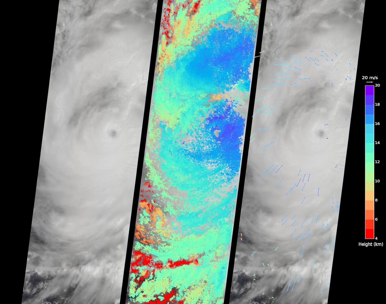
On Sept. 14, 2016, the eye of Super Typhoon Meranti passed just south of Taiwan. The enormous storm, classified as a Category 5 typhoon at the time, still caused much disruption on the island. Nearly 500,000 homes lost power, schools were closed, and most flights were cancelled. Maximum wind speeds were 180 miles per hour (290 kilometers per hour) as the storm passed, and more than 25 inches (64 centimeters) of rain fell on some areas of the country. However, the storm did not pass over Taiwan's mountainous landscape, which would have weakened it. That means it will remain strong as it heads toward mainland China, unlike Super Typhoon Nepartak in July, which weakened from a Category 5 typhoon to a tropical storm after crossing Taiwan. Meranti is currently maintaining Category 4 strength and is expected to make landfall near Shantou, Guangdong province, on Thursday, September 15. The coast of China is more vulnerable to storm surges than Taiwan due to shallower coastal waters and recent rainfall. There is risk of substantial flooding. On Sept. 14, at 10:45 AM local time, the Multi-angle Imaging SpectroRadiometer (MISR) instrument aboard NASA's Terra satellite passed directly over the eye of Meranti. On the left is a natural-color image from MISR's nadir-pointing camera. At this time the eye of Meranti was just off the southern tip of Taiwan, which is invisible under the clouds. The coast of China is barely visible through the clouds in the upper left portion of the image. The small eye and dense high clouds are both markers of the storm's power. MISR's nine cameras, each pointed at a different angle, can be used to determine the heights of clouds based on geometric shifts among the nine images. The middle panel shows these stereo-derived cloud top heights superimposed on the natural color image. The clouds of the central core of Typhoon Meranti have heights ranging between 16 and 20 kilometers (10 and 12.5 miles). It takes about seven minutes for all nine cameras to image the same location on the ground, and wind velocity can be calculated from the motion of the clouds over this seven-minute period. The right panel plots these wind velocities as vectors which indicate both direction and speed. The length of the arrow corresponds to the wind speed, which can be compared to the reference 20 meters per second (45 miles per hour) arrow in the key. Hurricanes and typhoons in the Northern Hemisphere rotate counterclockwise due to the Earth's rotation, but these wind vectors mainly show motion outward from the eye at the storm tops. This is due to the fact that hurricanes draw in moist air at low altitudes, which then flows upwards and outwards around the eye reversing direction. These data were acquired during Terra orbit 88865. http://photojournal.jpl.nasa.gov/catalog/PIA17309
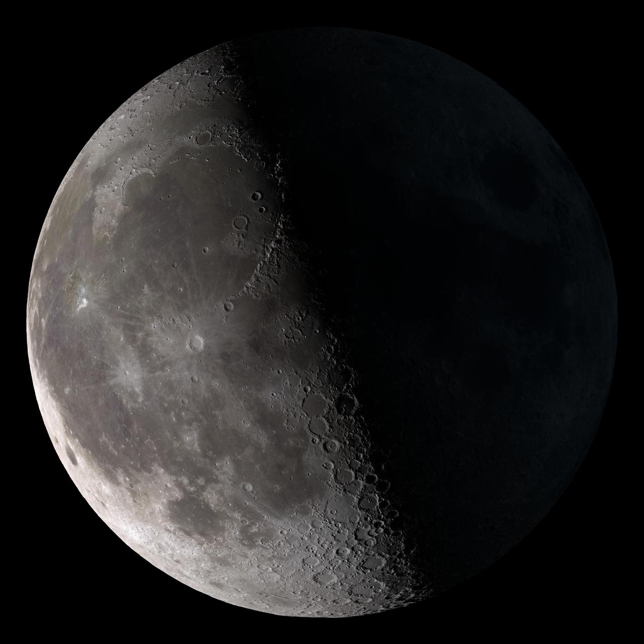
Third quarter. Rises around midnight, visible to the south after sunrise. This marks the first time that accurate shadows at this level of detail are possible in such a computer simulation. The shadows are based on the global elevation map being developed from measurements by the Lunar Orbiter Laser Altimeter (LOLA) aboard the Lunar Reconnaissance Orbiter (LRO). LOLA has already taken more than 10 times as many elevation measurements as all previous missions combined. The Moon always keeps the same face to us, but not exactly the same face. Because of the tilt and shape of its orbit, we see the Moon from slightly different angles over the course of a month. When a month is compressed into 12 seconds, as it is in this animation, our changing view of the Moon makes it look like it's wobbling. This wobble is called libration. The word comes from the Latin for "balance scale" (as does the name of the zodiac constellation Libra) and refers to the way such a scale tips up and down on alternating sides. The sub-Earth point gives the amount of libration in longitude and latitude. The sub-Earth point is also the apparent center of the Moon's disk and the location on the Moon where the Earth is directly overhead. The Moon is subject to other motions as well. It appears to roll back and forth around the sub-Earth point. The roll angle is given by the position angle of the axis, which is the angle of the Moon's north pole relative to celestial north. The Moon also approaches and recedes from us, appearing to grow and shrink. The two extremes, called perigee (near) and apogee (far), differ by more than 10%. The most noticed monthly variation in the Moon's appearance is the cycle of phases, caused by the changing angle of the Sun as the Moon orbits the Earth. The cycle begins with the waxing (growing) crescent Moon visible in the west just after sunset. By first quarter, the Moon is high in the sky at sunset and sets around midnight. The full Moon rises at sunset and is high in the sky at midnight. The third quarter Moon is often surprisingly conspicuous in the daylit western sky long after sunrise. Celestial north is up in these images, corresponding to the view from the northern hemisphere. The descriptions of the print resolution stills also assume a northern hemisphere orientation. To adjust for southern hemisphere views, rotate the images 180 degrees, and substitute "north" for "south" in the descriptions. Credit: <a href="http://svs.gsfc.nasa.gov/index.html" rel="nofollow">NASA/Goddard Space Flight Center Scientific Visualization Studio</a> <b><a href="http://www.nasa.gov/centers/goddard/home/index.html" rel="nofollow">NASA Goddard Space Flight Center</a></b> enables NASA’s mission through four scientific endeavors: Earth Science, Heliophysics, Solar System Exploration, and Astrophysics. Goddard plays a leading role in NASA’s accomplishments by contributing compelling scientific knowledge to advance the Agency’s mission. <b>Follow us on <a href="http://twitter.com/NASA_GoddardPix" rel="nofollow">Twitter</a></b> <b>Join us on <a href="http://www.facebook.com/pages/Greenbelt-MD/NASA-Goddard/395013845897?ref=tsd" rel="nofollow">Facebook</a></b> <b>Find us on <a href="http://web.stagram.com/n/nasagoddard/?vm=grid" rel="nofollow">Instagram</a></b>
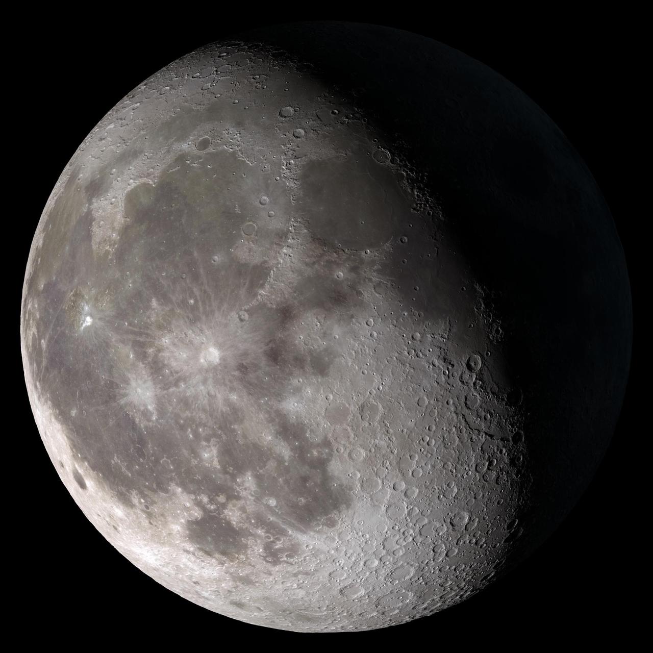
Waning gibbous. Rises after sunset, high in the sky after midnight, visible to the southwest after sunrise. This marks the first time that accurate shadows at this level of detail are possible in such a computer simulation. The shadows are based on the global elevation map being developed from measurements by the Lunar Orbiter Laser Altimeter (LOLA) aboard the Lunar Reconnaissance Orbiter (LRO). LOLA has already taken more than 10 times as many elevation measurements as all previous missions combined. The Moon always keeps the same face to us, but not exactly the same face. Because of the tilt and shape of its orbit, we see the Moon from slightly different angles over the course of a month. When a month is compressed into 12 seconds, as it is in this animation, our changing view of the Moon makes it look like it's wobbling. This wobble is called libration. The word comes from the Latin for "balance scale" (as does the name of the zodiac constellation Libra) and refers to the way such a scale tips up and down on alternating sides. The sub-Earth point gives the amount of libration in longitude and latitude. The sub-Earth point is also the apparent center of the Moon's disk and the location on the Moon where the Earth is directly overhead. The Moon is subject to other motions as well. It appears to roll back and forth around the sub-Earth point. The roll angle is given by the position angle of the axis, which is the angle of the Moon's north pole relative to celestial north. The Moon also approaches and recedes from us, appearing to grow and shrink. The two extremes, called perigee (near) and apogee (far), differ by more than 10%. The most noticed monthly variation in the Moon's appearance is the cycle of phases, caused by the changing angle of the Sun as the Moon orbits the Earth. The cycle begins with the waxing (growing) crescent Moon visible in the west just after sunset. By first quarter, the Moon is high in the sky at sunset and sets around midnight. The full Moon rises at sunset and is high in the sky at midnight. The third quarter Moon is often surprisingly conspicuous in the daylit western sky long after sunrise. Celestial north is up in these images, corresponding to the view from the northern hemisphere. The descriptions of the print resolution stills also assume a northern hemisphere orientation. To adjust for southern hemisphere views, rotate the images 180 degrees, and substitute "north" for "south" in the descriptions. Credit: <a href="http://svs.gsfc.nasa.gov/index.html" rel="nofollow">NASA/Goddard Space Flight Center Scientific Visualization Studio</a> <b><a href="http://www.nasa.gov/centers/goddard/home/index.html" rel="nofollow">NASA Goddard Space Flight Center</a></b> enables NASA’s mission through four scientific endeavors: Earth Science, Heliophysics, Solar System Exploration, and Astrophysics. Goddard plays a leading role in NASA’s accomplishments by contributing compelling scientific knowledge to advance the Agency’s mission. <b>Follow us on <a href="http://twitter.com/NASA_GoddardPix" rel="nofollow">Twitter</a></b> <b>Join us on <a href="http://www.facebook.com/pages/Greenbelt-MD/NASA-Goddard/395013845897?ref=tsd" rel="nofollow">Facebook</a></b> <b>Find us on <a href="http://web.stagram.com/n/nasagoddard/?vm=grid" rel="nofollow">Instagram</a></b>

Full Moon. Rises at sunset, high in the sky around midnight. Visible all night. This marks the first time that accurate shadows at this level of detail are possible in such a computer simulation. The shadows are based on the global elevation map being developed from measurements by the Lunar Orbiter Laser Altimeter (LOLA) aboard the Lunar Reconnaissance Orbiter (LRO). LOLA has already taken more than 10 times as many elevation measurements as all previous missions combined. The Moon always keeps the same face to us, but not exactly the same face. Because of the tilt and shape of its orbit, we see the Moon from slightly different angles over the course of a month. When a month is compressed into 12 seconds, as it is in this animation, our changing view of the Moon makes it look like it's wobbling. This wobble is called libration. The word comes from the Latin for "balance scale" (as does the name of the zodiac constellation Libra) and refers to the way such a scale tips up and down on alternating sides. The sub-Earth point gives the amount of libration in longitude and latitude. The sub-Earth point is also the apparent center of the Moon's disk and the location on the Moon where the Earth is directly overhead. The Moon is subject to other motions as well. It appears to roll back and forth around the sub-Earth point. The roll angle is given by the position angle of the axis, which is the angle of the Moon's north pole relative to celestial north. The Moon also approaches and recedes from us, appearing to grow and shrink. The two extremes, called perigee (near) and apogee (far), differ by more than 10%. The most noticed monthly variation in the Moon's appearance is the cycle of phases, caused by the changing angle of the Sun as the Moon orbits the Earth. The cycle begins with the waxing (growing) crescent Moon visible in the west just after sunset. By first quarter, the Moon is high in the sky at sunset and sets around midnight. The full Moon rises at sunset and is high in the sky at midnight. The third quarter Moon is often surprisingly conspicuous in the daylit western sky long after sunrise. Celestial north is up in these images, corresponding to the view from the northern hemisphere. The descriptions of the print resolution stills also assume a northern hemisphere orientation. To adjust for southern hemisphere views, rotate the images 180 degrees, and substitute "north" for "south" in the descriptions. Credit: <a href="http://svs.gsfc.nasa.gov/index.html" rel="nofollow">NASA/Goddard Space Flight Center Scientific Visualization Studio</a> <b><a href="http://www.nasa.gov/centers/goddard/home/index.html" rel="nofollow">NASA Goddard Space Flight Center</a></b> enables NASA’s mission through four scientific endeavors: Earth Science, Heliophysics, Solar System Exploration, and Astrophysics. Goddard plays a leading role in NASA’s accomplishments by contributing compelling scientific knowledge to advance the Agency’s mission. <b>Follow us on <a href="http://twitter.com/NASA_GoddardPix" rel="nofollow">Twitter</a></b> <b>Join us on <a href="http://www.facebook.com/pages/Greenbelt-MD/NASA-Goddard/395013845897?ref=tsd" rel="nofollow">Facebook</a></b> <b>Find us on <a href="http://web.stagram.com/n/nasagoddard/?vm=grid" rel="nofollow">Instagram</a></b>
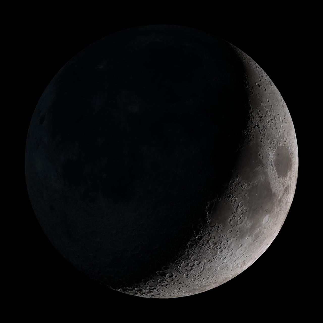
Waxing crescent. Visible toward the southwest in early evening. This marks the first time that accurate shadows at this level of detail are possible in such a computer simulation. The shadows are based on the global elevation map being developed from measurements by the Lunar Orbiter Laser Altimeter (LOLA) aboard the Lunar Reconnaissance Orbiter (LRO). LOLA has already taken more than 10 times as many elevation measurements as all previous missions combined. The Moon always keeps the same face to us, but not exactly the same face. Because of the tilt and shape of its orbit, we see the Moon from slightly different angles over the course of a month. When a month is compressed into 12 seconds, as it is in this animation, our changing view of the Moon makes it look like it's wobbling. This wobble is called libration. The word comes from the Latin for "balance scale" (as does the name of the zodiac constellation Libra) and refers to the way such a scale tips up and down on alternating sides. The sub-Earth point gives the amount of libration in longitude and latitude. The sub-Earth point is also the apparent center of the Moon's disk and the location on the Moon where the Earth is directly overhead. The Moon is subject to other motions as well. It appears to roll back and forth around the sub-Earth point. The roll angle is given by the position angle of the axis, which is the angle of the Moon's north pole relative to celestial north. The Moon also approaches and recedes from us, appearing to grow and shrink. The two extremes, called perigee (near) and apogee (far), differ by more than 10%. The most noticed monthly variation in the Moon's appearance is the cycle of phases, caused by the changing angle of the Sun as the Moon orbits the Earth. The cycle begins with the waxing (growing) crescent Moon visible in the west just after sunset. By first quarter, the Moon is high in the sky at sunset and sets around midnight. The full Moon rises at sunset and is high in the sky at midnight. The third quarter Moon is often surprisingly conspicuous in the daylit western sky long after sunrise. Celestial north is up in these images, corresponding to the view from the northern hemisphere. The descriptions of the print resolution stills also assume a northern hemisphere orientation. To adjust for southern hemisphere views, rotate the images 180 degrees, and substitute "north" for "south" in the descriptions. Credit: <a href="http://svs.gsfc.nasa.gov/index.html" rel="nofollow">NASA/Goddard Space Flight Center Scientific Visualization Studio</a> <b><a href="http://www.nasa.gov/centers/goddard/home/index.html" rel="nofollow">NASA Goddard Space Flight Center</a></b> enables NASA’s mission through four scientific endeavors: Earth Science, Heliophysics, Solar System Exploration, and Astrophysics. Goddard plays a leading role in NASA’s accomplishments by contributing compelling scientific knowledge to advance the Agency’s mission. <b>Follow us on <a href="http://twitter.com/NASA_GoddardPix" rel="nofollow">Twitter</a></b> <b>Join us on <a href="http://www.facebook.com/pages/Greenbelt-MD/NASA-Goddard/395013845897?ref=tsd" rel="nofollow">Facebook</a></b> <b>Find us on <a href="http://web.stagram.com/n/nasagoddard/?vm=grid" rel="nofollow">Instagram</a></b>
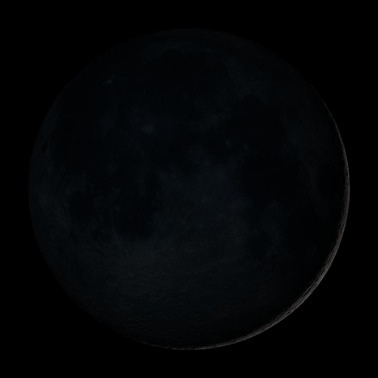
New Moon. By the modern definition, New Moon occurs when the Moon and Sun are at the same geocentric ecliptic longitude. The part of the Moon facing us is completely in shadow then. Pictured here is the traditional New Moon, the earliest visible waxing crescent, which signals the start of a new month in many lunar and lunisolar calendars. This marks the first time that accurate shadows at this level of detail are possible in such a computer simulation. The shadows are based on the global elevation map being developed from measurements by the Lunar Orbiter Laser Altimeter (LOLA) aboard the Lunar Reconnaissance Orbiter (LRO). LOLA has already taken more than 10 times as many elevation measurements as all previous missions combined. The Moon always keeps the same face to us, but not exactly the same face. Because of the tilt and shape of its orbit, we see the Moon from slightly different angles over the course of a month. When a month is compressed into 12 seconds, as it is in this animation, our changing view of the Moon makes it look like it's wobbling. This wobble is called libration. The word comes from the Latin for "balance scale" (as does the name of the zodiac constellation Libra) and refers to the way such a scale tips up and down on alternating sides. The sub-Earth point gives the amount of libration in longitude and latitude. The sub-Earth point is also the apparent center of the Moon's disk and the location on the Moon where the Earth is directly overhead. The Moon is subject to other motions as well. It appears to roll back and forth around the sub-Earth point. The roll angle is given by the position angle of the axis, which is the angle of the Moon's north pole relative to celestial north. The Moon also approaches and recedes from us, appearing to grow and shrink. The two extremes, called perigee (near) and apogee (far), differ by more than 10%. The most noticed monthly variation in the Moon's appearance is the cycle of phases, caused by the changing angle of the Sun as the Moon orbits the Earth. The cycle begins with the waxing (growing) crescent Moon visible in the west just after sunset. By first quarter, the Moon is high in the sky at sunset and sets around midnight. The full Moon rises at sunset and is high in the sky at midnight. The third quarter Moon is often surprisingly conspicuous in the daylit western sky long after sunrise. Celestial north is up in these images, corresponding to the view from the northern hemisphere. The descriptions of the print resolution stills also assume a northern hemisphere orientation. To adjust for southern hemisphere views, rotate the images 180 degrees, and substitute "north" for "south" in the descriptions. Credit: <a href="http://svs.gsfc.nasa.gov/index.html" rel="nofollow">NASA/Goddard Space Flight Center Scientific Visualization Studio</a> <b><a href="http://www.nasa.gov/centers/goddard/home/index.html" rel="nofollow">NASA Goddard Space Flight Center</a></b> enables NASA’s mission through four scientific endeavors: Earth Science, Heliophysics, Solar System Exploration, and Astrophysics. Goddard plays a leading role in NASA’s accomplishments by contributing compelling scientific knowledge to advance the Agency’s mission. <b>Follow us on <a href="http://twitter.com/NASA_GoddardPix" rel="nofollow">Twitter</a></b> <b>Join us on <a href="http://www.facebook.com/pages/Greenbelt-MD/NASA-Goddard/395013845897?ref=tsd" rel="nofollow">Facebook</a></b> <b>Find us on <a href="http://web.stagram.com/n/nasagoddard/?vm=grid" rel="nofollow">Instagram</a></b>
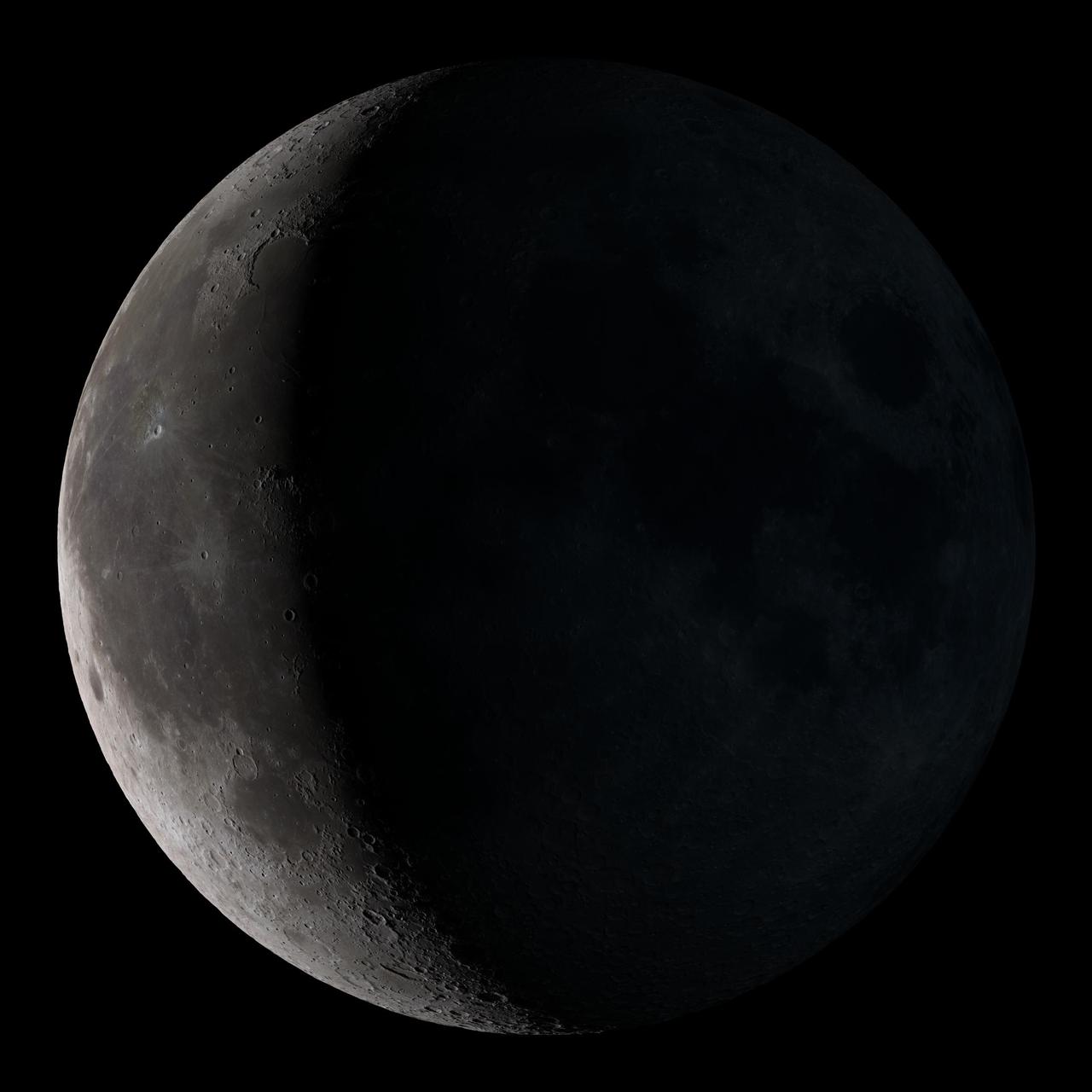
Waning crescent. Low to the east before sunrise. This marks the first time that accurate shadows at this level of detail are possible in such a computer simulation. The shadows are based on the global elevation map being developed from measurements by the Lunar Orbiter Laser Altimeter (LOLA) aboard the Lunar Reconnaissance Orbiter (LRO). LOLA has already taken more than 10 times as many elevation measurements as all previous missions combined. The Moon always keeps the same face to us, but not exactly the same face. Because of the tilt and shape of its orbit, we see the Moon from slightly different angles over the course of a month. When a month is compressed into 12 seconds, as it is in this animation, our changing view of the Moon makes it look like it's wobbling. This wobble is called libration. The word comes from the Latin for "balance scale" (as does the name of the zodiac constellation Libra) and refers to the way such a scale tips up and down on alternating sides. The sub-Earth point gives the amount of libration in longitude and latitude. The sub-Earth point is also the apparent center of the Moon's disk and the location on the Moon where the Earth is directly overhead. The Moon is subject to other motions as well. It appears to roll back and forth around the sub-Earth point. The roll angle is given by the position angle of the axis, which is the angle of the Moon's north pole relative to celestial north. The Moon also approaches and recedes from us, appearing to grow and shrink. The two extremes, called perigee (near) and apogee (far), differ by more than 10%. The most noticed monthly variation in the Moon's appearance is the cycle of phases, caused by the changing angle of the Sun as the Moon orbits the Earth. The cycle begins with the waxing (growing) crescent Moon visible in the west just after sunset. By first quarter, the Moon is high in the sky at sunset and sets around midnight. The full Moon rises at sunset and is high in the sky at midnight. The third quarter Moon is often surprisingly conspicuous in the daylit western sky long after sunrise. Celestial north is up in these images, corresponding to the view from the northern hemisphere. The descriptions of the print resolution stills also assume a northern hemisphere orientation. To adjust for southern hemisphere views, rotate the images 180 degrees, and substitute "north" for "south" in the descriptions. Credit: <a href="http://svs.gsfc.nasa.gov/index.html" rel="nofollow">NASA/Goddard Space Flight Center Scientific Visualization Studio</a> <b><a href="http://www.nasa.gov/centers/goddard/home/index.html" rel="nofollow">NASA Goddard Space Flight Center</a></b> enables NASA’s mission through four scientific endeavors: Earth Science, Heliophysics, Solar System Exploration, and Astrophysics. Goddard plays a leading role in NASA’s accomplishments by contributing compelling scientific knowledge to advance the Agency’s mission. <b>Follow us on <a href="http://twitter.com/NASA_GoddardPix" rel="nofollow">Twitter</a></b> <b>Join us on <a href="http://www.facebook.com/pages/Greenbelt-MD/NASA-Goddard/395013845897?ref=tsd" rel="nofollow">Facebook</a></b> <b>Find us on <a href="http://web.stagram.com/n/nasagoddard/?vm=grid" rel="nofollow">Instagram</a></b>

Waxing gibbous. Visible to the southeast in early evening, up for most of the night. This marks the first time that accurate shadows at this level of detail are possible in such a computer simulation. The shadows are based on the global elevation map being developed from measurements by the Lunar Orbiter Laser Altimeter (LOLA) aboard the Lunar Reconnaissance Orbiter (LRO). LOLA has already taken more than 10 times as many elevation measurements as all previous missions combined. The Moon always keeps the same face to us, but not exactly the same face. Because of the tilt and shape of its orbit, we see the Moon from slightly different angles over the course of a month. When a month is compressed into 12 seconds, as it is in this animation, our changing view of the Moon makes it look like it's wobbling. This wobble is called libration. The word comes from the Latin for "balance scale" (as does the name of the zodiac constellation Libra) and refers to the way such a scale tips up and down on alternating sides. The sub-Earth point gives the amount of libration in longitude and latitude. The sub-Earth point is also the apparent center of the Moon's disk and the location on the Moon where the Earth is directly overhead. The Moon is subject to other motions as well. It appears to roll back and forth around the sub-Earth point. The roll angle is given by the position angle of the axis, which is the angle of the Moon's north pole relative to celestial north. The Moon also approaches and recedes from us, appearing to grow and shrink. The two extremes, called perigee (near) and apogee (far), differ by more than 10%. The most noticed monthly variation in the Moon's appearance is the cycle of phases, caused by the changing angle of the Sun as the Moon orbits the Earth. The cycle begins with the waxing (growing) crescent Moon visible in the west just after sunset. By first quarter, the Moon is high in the sky at sunset and sets around midnight. The full Moon rises at sunset and is high in the sky at midnight. The third quarter Moon is often surprisingly conspicuous in the daylit western sky long after sunrise. Celestial north is up in these images, corresponding to the view from the northern hemisphere. The descriptions of the print resolution stills also assume a northern hemisphere orientation. To adjust for southern hemisphere views, rotate the images 180 degrees, and substitute "north" for "south" in the descriptions. Credit: <a href="http://svs.gsfc.nasa.gov/index.html" rel="nofollow">NASA/Goddard Space Flight Center Scientific Visualization Studio</a> <b><a href="http://www.nasa.gov/centers/goddard/home/index.html" rel="nofollow">NASA Goddard Space Flight Center</a></b> enables NASA’s mission through four scientific endeavors: Earth Science, Heliophysics, Solar System Exploration, and Astrophysics. Goddard plays a leading role in NASA’s accomplishments by contributing compelling scientific knowledge to advance the Agency’s mission. <b>Follow us on <a href="http://twitter.com/NASA_GoddardPix" rel="nofollow">Twitter</a></b> <b>Join us on <a href="http://www.facebook.com/pages/Greenbelt-MD/NASA-Goddard/395013845897?ref=tsd" rel="nofollow">Facebook</a></b> <b>Find us on <a href="http://web.stagram.com/n/nasagoddard/?vm=grid" rel="nofollow">Instagram</a></b>
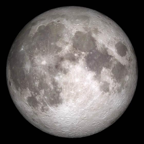
Current moon as viewed on Wednesday, June 15, 2011, 19:00 UT (Phase 100%) This marks the first time that accurate shadows at this level of detail are possible in such a computer simulation. The shadows are based on the global elevation map being developed from measurements by the Lunar Orbiter Laser Altimeter (LOLA) aboard the Lunar Reconnaissance Orbiter (LRO). LOLA has already taken more than 10 times as many elevation measurements as all previous missions combined. The Moon always keeps the same face to us, but not exactly the same face. Because of the tilt and shape of its orbit, we see the Moon from slightly different angles over the course of a month. When a month is compressed into 12 seconds, as it is in this animation, our changing view of the Moon makes it look like it's wobbling. This wobble is called libration. The word comes from the Latin for "balance scale" (as does the name of the zodiac constellation Libra) and refers to the way such a scale tips up and down on alternating sides. The sub-Earth point gives the amount of libration in longitude and latitude. The sub-Earth point is also the apparent center of the Moon's disk and the location on the Moon where the Earth is directly overhead. The Moon is subject to other motions as well. It appears to roll back and forth around the sub-Earth point. The roll angle is given by the position angle of the axis, which is the angle of the Moon's north pole relative to celestial north. The Moon also approaches and recedes from us, appearing to grow and shrink. The two extremes, called perigee (near) and apogee (far), differ by more than 10%. The most noticed monthly variation in the Moon's appearance is the cycle of phases, caused by the changing angle of the Sun as the Moon orbits the Earth. The cycle begins with the waxing (growing) crescent Moon visible in the west just after sunset. By first quarter, the Moon is high in the sky at sunset and sets around midnight. The full Moon rises at sunset and is high in the sky at midnight. The third quarter Moon is often surprisingly conspicuous in the daylit western sky long after sunrise. Celestial north is up in these images, corresponding to the view from the northern hemisphere. The descriptions of the print resolution stills also assume a northern hemisphere orientation. To adjust for southern hemisphere views, rotate the images 180 degrees, and substitute "north" for "south" in the descriptions. Credit: <a href="http://svs.gsfc.nasa.gov/index.html" rel="nofollow">NASA/Goddard Space Flight Center Scientific Visualization Studio</a> <b><a href="http://www.nasa.gov/centers/goddard/home/index.html" rel="nofollow">NASA Goddard Space Flight Center</a></b> enables NASA’s mission through four scientific endeavors: Earth Science, Heliophysics, Solar System Exploration, and Astrophysics. Goddard plays a leading role in NASA’s accomplishments by contributing compelling scientific knowledge to advance the Agency’s mission. <b>Follow us on <a href="http://twitter.com/NASA_GoddardPix" rel="nofollow">Twitter</a></b> <b>Join us on <a href="http://www.facebook.com/pages/Greenbelt-MD/NASA-Goddard/395013845897?ref=tsd" rel="nofollow">Facebook</a></b> <b>Find us on <a href="http://web.stagram.com/n/nasagoddard/?vm=grid" rel="nofollow">Instagram</a></b>
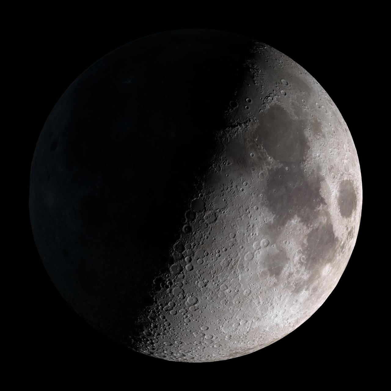
First quarter. Visible high in the southern sky in early evening. This marks the first time that accurate shadows at this level of detail are possible in such a computer simulation. The shadows are based on the global elevation map being developed from measurements by the Lunar Orbiter Laser Altimeter (LOLA) aboard the Lunar Reconnaissance Orbiter (LRO). LOLA has already taken more than 10 times as many elevation measurements as all previous missions combined. The Moon always keeps the same face to us, but not exactly the same face. Because of the tilt and shape of its orbit, we see the Moon from slightly different angles over the course of a month. When a month is compressed into 12 seconds, as it is in this animation, our changing view of the Moon makes it look like it's wobbling. This wobble is called libration. The word comes from the Latin for "balance scale" (as does the name of the zodiac constellation Libra) and refers to the way such a scale tips up and down on alternating sides. The sub-Earth point gives the amount of libration in longitude and latitude. The sub-Earth point is also the apparent center of the Moon's disk and the location on the Moon where the Earth is directly overhead. The Moon is subject to other motions as well. It appears to roll back and forth around the sub-Earth point. The roll angle is given by the position angle of the axis, which is the angle of the Moon's north pole relative to celestial north. The Moon also approaches and recedes from us, appearing to grow and shrink. The two extremes, called perigee (near) and apogee (far), differ by more than 10%. The most noticed monthly variation in the Moon's appearance is the cycle of phases, caused by the changing angle of the Sun as the Moon orbits the Earth. The cycle begins with the waxing (growing) crescent Moon visible in the west just after sunset. By first quarter, the Moon is high in the sky at sunset and sets around midnight. The full Moon rises at sunset and is high in the sky at midnight. The third quarter Moon is often surprisingly conspicuous in the daylit western sky long after sunrise. Celestial north is up in these images, corresponding to the view from the northern hemisphere. The descriptions of the print resolution stills also assume a northern hemisphere orientation. To adjust for southern hemisphere views, rotate the images 180 degrees, and substitute "north" for "south" in the descriptions. Credit: <a href="http://svs.gsfc.nasa.gov/index.html" rel="nofollow">NASA/Goddard Space Flight Center Scientific Visualization Studio</a> <b><a href="http://www.nasa.gov/centers/goddard/home/index.html" rel="nofollow">NASA Goddard Space Flight Center</a></b> enables NASA’s mission through four scientific endeavors: Earth Science, Heliophysics, Solar System Exploration, and Astrophysics. Goddard plays a leading role in NASA’s accomplishments by contributing compelling scientific knowledge to advance the Agency’s mission. <b>Follow us on <a href="http://twitter.com/NASA_GoddardPix" rel="nofollow">Twitter</a></b> <b>Join us on <a href="http://www.facebook.com/pages/Greenbelt-MD/NASA-Goddard/395013845897?ref=tsd" rel="nofollow">Facebook</a></b> <b>Find us on <a href="http://web.stagram.com/n/nasagoddard/?vm=grid" rel="nofollow">Instagram</a></b>
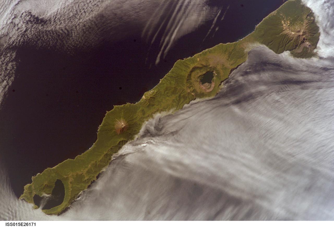
ISS015-E-26171 (1 Sept. 2007) --- Simushir Island, Kuril Archipelago, Russian Far East, is featured in this image photographed by an Expedition 15 crewmember on the International Space Station. Simushir is a deserted, 5-mile-wide volcanic island in the Kuril island chain, half way between northern Japan and the Kamchatka Peninsula of Russia. Four volcanoes - Milne, Prevo, Urataman and Zavaritski - have built cones that are high enough to rise above the altitude of green forest. The remaining remnant of Zavaritski volcano is a caldera -- a structure formed when a volcano collapses into its emptied magma chamber. A small lake fills the innermost of three nested calderas which make up Zavaritski Caldera. The larger caldera of Urataman Volcano is connected to the sea. A defunct Soviet naval base occupies the northern tip of the island next to this caldera. The islands and volcanoes of the Kuril chain are part of the Pacific Rim of Fire, marking the edge of the Pacific tectonic plate. Low stratus clouds approaching from the northwest (from the Sea of Okhotsk--top left) bank up against the northwest side of the island, making complex cloud patterns. A small finger of cloud can be seen entering the northernmost caldera (Urataman) at sea level. When this image was taken, the cloud layer had stopped at the northwest coast of the island, not flowing over even the low points of the island between the volcanoes. The cloud pattern suggests that the air mass flowed up and over the island, descending on the southeast side. This descending motion was enough--under stable atmospheric conditions--to warm up the atmosphere locally so that a cloud-free zone formed on the southeastern, lee side of the island.
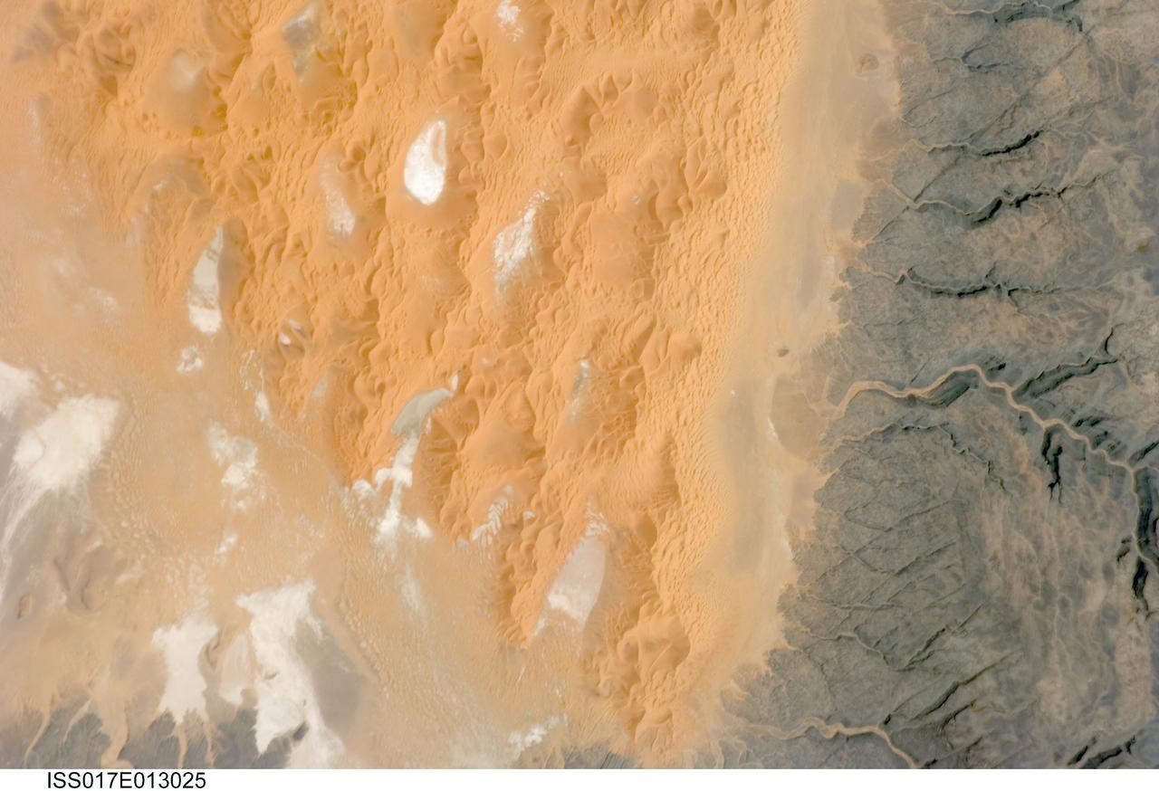
ISS017-E-013025 (12 Aug. 2008) --- The Tifernine Dune Field in Algeria is featured in this image photographed by an Expedition 17 crewmember on the International Space Station. The Tifernine Dune Field is located at the southernmost tip of the Grand Erg Oriental, a "dune sea" that occupies a large portion of the Sahara Desert in eastern Algeria. This view illustrates the interface between the yellow-orange sand dunes of the field and adjacent dark brown consolidated rocks of the Tinrhert Plateau to the south and east (right). NASA scientists point out that three distinct landform types are visible in the image, each providing information about past and present climate in the area. The oldest landform is represented by the rocks of the Tinrhert Plateau, which are characterized by a number of incised channels in the bedrock -- these formed during a wet and cool climate period, most probably by glacial meltwater streams. As the present dry and hot climate that characterizes the Sahara became established, water ceased to flow in these channels, and large amounts of drying sediment (sand, silt, and clay) were eroded and transported by predominantly northeast-southwest winds -- forming large linear dunes that roughly parallel the prevailing wind direction (center). The present climate regime is still hot and dry, but current wind directions are more variable, leading to the formation of star dunes -- recognizable by a starfish-like pattern when seem from above -- that are modifying the older large linear dunes. White to grey regions within the dune field are exposed deposits of silt and clay, together with evaporite minerals (such as halite, or common table salt) formed by evaporation of water that collected in small basins between the dunes.
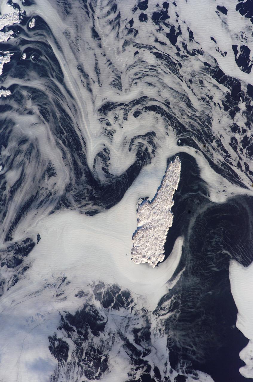
ISS012-E-15918 (24 Jan. 2006) --- Belle Isle and a portion of Newfoundland, Canada are featured in this image photographed by an Expedition 12 crew member on the International Space Station. Belle Isle (center) is surrounded by sea ice in this recent winter view. Belle Isle lies in the strait between the Island of Newfoundland and Labrador (the mainland portion of Canada’s province of Newfoundland). Small islands along the coast of Labrador appear in the top left corner. In this key location Belle Isle lies on the shortest shipping lanes between the Great Lakes and Europe, and also on the main north-south shipping route to Hudson Bay and the Northwest Territories. Snow and ice in this recent winter view obliterate the dozens of glacier-scoured lakes that dot the surface of the island. The single community of Belle Isle Landing on the southeast tip is equally hard to see. Ice patterns also show that the island lies at the meeting point of two sea currents. The Labrador Current flows from the northwest (top left), and a smaller current, driven by dominant westerly winds, flows from the southwest (lower left) out of the narrow Belle Isle Strait (out of frame lower left). Flow lines in sea ice indicate the sense of movement of the ice. Ice floes embedded in the Labrador Current appear in the upper part of the image as a relatively open pattern. Sea ice with a denser pattern enters from the lower left corner, banking against the west side of Belle Isle. Tendrils flow around capes at either end of the island, with an ice-free “shadow” on the opposite, downstream side. Eddies (center) in the ice patterns show where the currents interact, north and west of the island.

ISS005-E-21295 (23 November 2002) --- Fire scars in Australia are featured in this image photographed by an Expedition 5 crewmember on the International Space Station (ISS). Bright orange fire scars show up the underlying dune sand in the Simpson Desert, 300 kilometers east of Alice Springs. The background is an intricate pattern of sand cordons that angles across the view from lower left to upper right. These cordons are now mostly green, showing that they have become generally static--“tied down” since they were formed by a vegetation mat of desert scrub. The fire scars were produced in a recent fire, probably within the last year. According to NASA scientists who are studying the Space Station photography, a time sequence of events can be interpreted. Fires first advanced into the view from the lower left--parallel with the major dune trend and dominant wind direction. Then the wind shifted direction by about 90 degrees so that fires advanced across the dunes in a series of frond-like tendrils. Each frond starts at some point on the earlier fire scar, and sharp tips of the fronds show where the fires burned out naturally at the end of the episode. The scientists added that the sharp edges of the fire scars are due to steady but probably weak southwesterly winds—weaker winds reduced sparking of additional fires in adjacent scrub on either side of the main fire pathways.
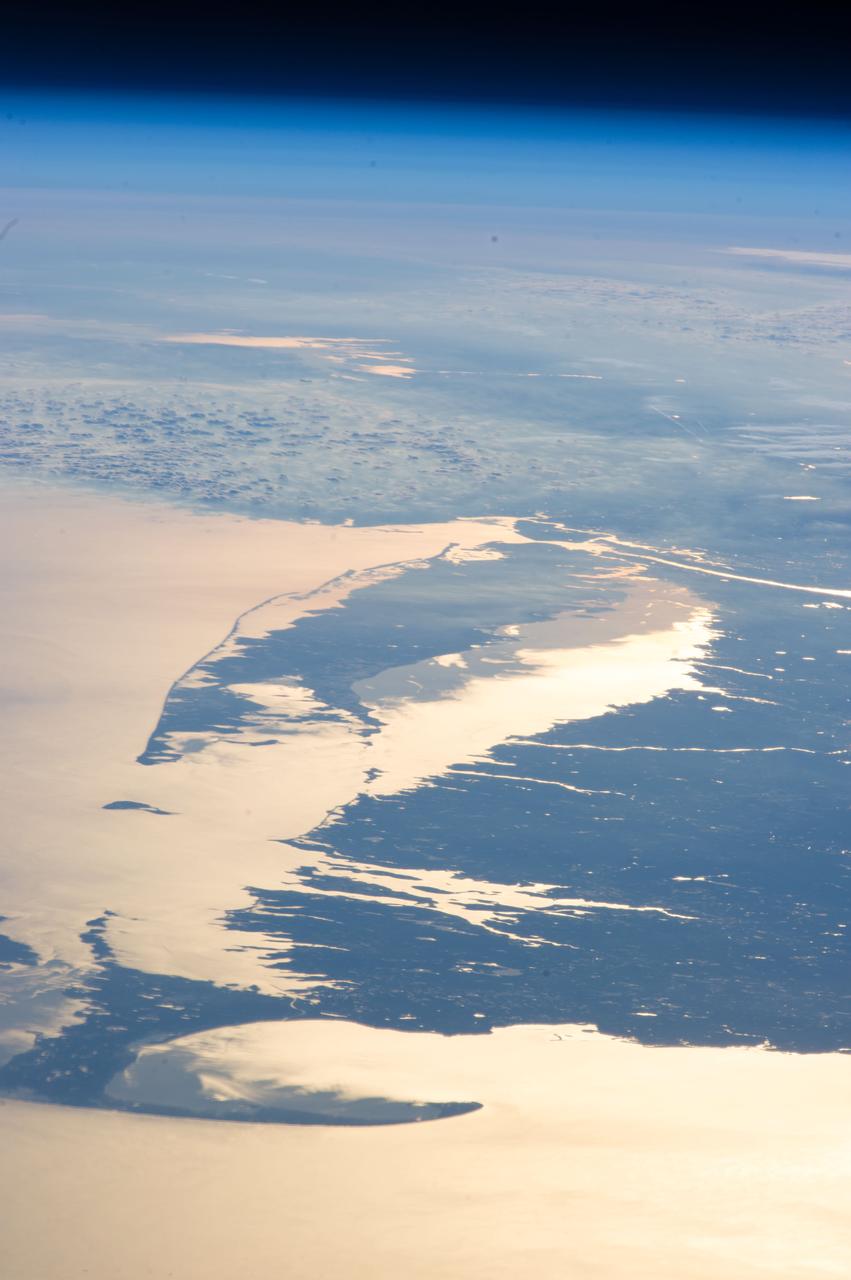
ISS034-E-48455 (14 Feb. 2013) --- Looking out at Earth?s surface from the International Space Station (ISS), astronauts and cosmonauts frequently observe sunglint highlighting both ocean and inland water surfaces. The Atlantic Ocean, including Cape Cod Bay and Buzzards Bay, along the coastlines of Massachusetts and Rhode Island, has a burnished, mirror-like appearance in this image. This is due to sunlight reflected off the water surface back towards the station crew member who took the photo. The peak reflection point is towards the right side of the image, lending the waters of Long Island Sound and the upper Massachusetts coastline an even brighter appearance. Sunglint also illuminates the surface waters of Chesapeake Bay, located over 400 kilometers (250 miles) to the southwest of the tip of Long Island. This suggests that the Sun was low on the horizon due to the observed extent of the sunglint effect. The time of image acquisition, approximately 4:26 p.m. Eastern Standard Time, was about one hour before local sunset. There is little in this image to indicate that the region was still recovering from a major winter storm that dropped almost one meter (three feet) of snow over much of the northeastern USA less than a week earlier. The high viewing angle from the space station also allows Earth?s curvature, or limb, to be seen; blue atmospheric layers gradually fade into the darkness of space across the top part of the image. Low clouds near Cape Cod, Long Island, and further down the Atlantic coastline cast shadows over the water surfaces, reducing the sunglint in some areas.

This image provides the clearest ever view of galaxy NGC 949, which lies over 30 million light-years away in the constellation of Triangulum. The galaxy has an unusual shape, made more obscure due to its inclination. From our point of view, it is difficult to discern exactly what type of galaxy NGC 949 is, but it is certainly a disk galaxy of some kind, most likely a spiral. NGC 949 was first discovered by Sir William Herschel on September 21, 1786, using an 18.7-inch reflecting telescope. The galaxy was one of about 3,000 objects Herschel cataloged as "nebulae" during an intense and systematic deep sky survey, the results of which eventually formed the bulk of the New General Catalogue (NGC). Taken with Hubble’s Advanced Camera for Surveys (ACS), this image shows extraordinary detail. This detail allows us to see a strange asymmetric alignment in the dark lanes of dust that snake across the galaxy. The top-right half of the galaxy appears considerably more marbled with dust in this image; a curious observation explained by stars tending to favor locations towards the center of a galaxy, and dust preferring almost invariably to reside along the galactic plane. When a galaxy is inclined as NGC 949 is, some regions — in this case the top-right — are tipped toward us and the light from the stars we see in these regions has had to travel through more dust. This causes the light to appear redder — the result of the same process that gives the sun’s light a red hue at dusk — or else disappear entirely, making the dust appear more prominent on that side of the galaxy. In the part tipped away from us, the light from the stars has had to pass through much less dust to reach us, so it appears brighter, and the dust is much less prominent. Were it possible to view NGC 949 from the opposite side, the apparent alignment of the dust would be reversed. The scientific advantages of this effect were recently displayed in suitably stunning style in the M31 PHAT mosaic, which allowed astronomers to produce a partial three-dimensional dust map of M31 four times clearer than any previously attempted. Credit: ESA/Hubble & NASA <b><a href="http://www.nasa.gov/audience/formedia/features/MP_Photo_Guidelines.html" rel="nofollow">NASA image use policy.</a></b> <b><a href="http://www.nasa.gov/centers/goddard/home/index.html" rel="nofollow">NASA Goddard Space Flight Center</a></b> enables NASA’s mission through four scientific endeavors: Earth Science, Heliophysics, Solar System Exploration, and Astrophysics. Goddard plays a leading role in NASA’s accomplishments by contributing compelling scientific knowledge to advance the Agency’s mission. <b>Follow us on <a href="http://twitter.com/NASAGoddardPix" rel="nofollow">Twitter</a></b> <b>Like us on <a href="http://www.facebook.com/pages/Greenbelt-MD/NASA-Goddard/395013845897?ref=tsd" rel="nofollow">Facebook</a></b> <b>Find us on <a href="http://instagrid.me/nasagoddard/?vm=grid" rel="nofollow">Instagram</a></b>
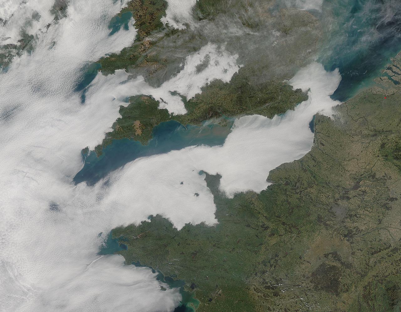
A thick blanket of low clouds covered the English Channel, Celtic Sea and Irish Sea on March 13, 2014. The fog also crept over major cities in the United Kingdom and Ireland. While citizens living in parts of Ireland, England, Wales, Scotland and Northern Ireland were posting ground-based photos of fog-shrouded landscape on social media, the internet and news outlets, the scene was also captured from space. The Moderate Resolution Imaging Spectroradiometer (MODIS) aboard NASA’s Aqua captured this true-color image of the cloudy day at 13:00 UTC (1:00 p.m. in London) on that same day. The dense fog (low clouds) affected air travel, causing the cancellation of hundreds of flights going through London City Airport, where visibility was reported at less than 100 meters (328 ft) – less than the length of an American football field. Flights were also cancelled at Heathrow, Gatwick and Manchester. A private helicopter flying to Northern Ireland went down in by the fog near the Norfolk-Suffolk border, with loss of four lives. Driving was little better in many areas, causing the Met Office to issue a yellow weather warning and to caution drivers of difficult conditions. The lowest visibility of the day was reported at Roches Point weather station. Located at the southeastern tip of Cork Harbor, Ireland, the station reported visibility of less than 50 meters (164 ft) – the length of an Olympic size swimming pool. In this image, the fog-covered Celtic Sea is located in the southwest. Ireland lies under tendrils of low cloud in the northwest corner of the image. Banks of clouds part around England, near the center of the image, and southern Wales (top and center) completely under the foggy blanket. Fog also creeps over the coasts of France, Belgium and the Netherlands on the east side of the English Channel. Credit: NASA/GSFC/Jeff Schmaltz/MODIS Land Rapid Response Team <b><a href="http://www.nasa.gov/audience/formedia/features/MP_Photo_Guidelines.html" rel="nofollow">NASA image use policy.</a></b> <b><a href="http://www.nasa.gov/centers/goddard/home/index.html" rel="nofollow">NASA Goddard Space Flight Center</a></b> enables NASA’s mission through four scientific endeavors: Earth Science, Heliophysics, Solar System Exploration, and Astrophysics. Goddard plays a leading role in NASA’s accomplishments by contributing compelling scientific knowledge to advance the Agency’s mission. <b>Follow us on <a href="http://twitter.com/NASAGoddardPix" rel="nofollow">Twitter</a></b> <b>Like us on <a href="http://www.facebook.com/pages/Greenbelt-MD/NASA-Goddard/395013845897?ref=tsd" rel="nofollow">Facebook</a></b> <b>Find us on <a href="http://instagram.com/nasagoddard?vm=grid" rel="nofollow">Instagram</a></b>