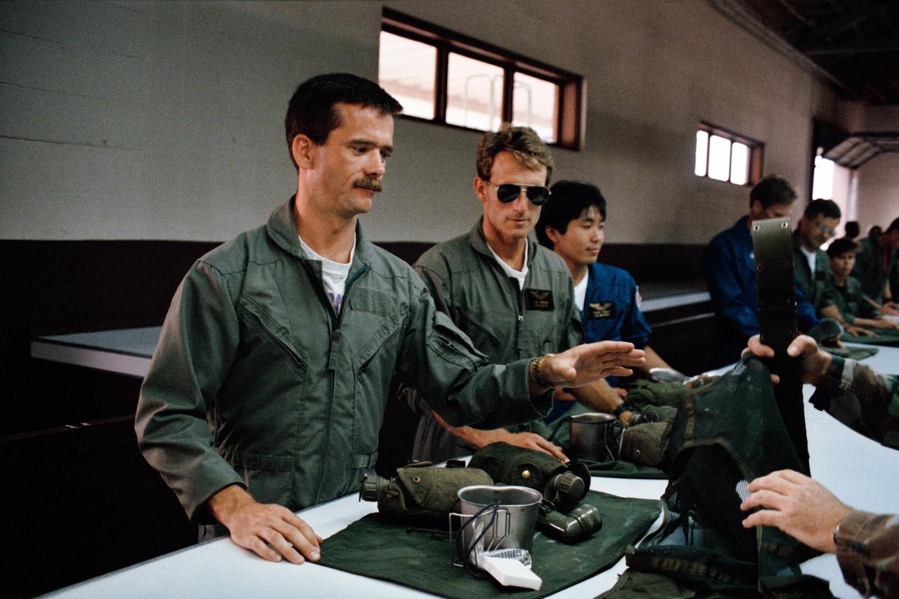
S92-46536 (16 Aug. 1992) --- Astronaut candidates Chris A. Hadfield, Jerry M. Linenger and Koichi Wakata (left to right in foreground) are issued gear for a survival school hosted by Fairchild Air Force Base. Hadfield, from Canada, and Wakata, from Japan, are among the five international candidates in the group of astronaut candidates currently involved in a year-long training and evaluation program.
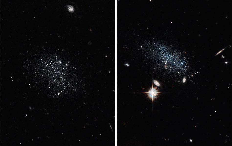
NASA’s Hubble Space Telescope uncovered two tiny dwarf galaxies that have wandered from a vast cosmic wilderness into a nearby “big city” packed with galaxies. After being idle for billions of years, they are ready to party by starting a firestorm of star birth. Hubble captured the glow of new stars in these small, ancient galaxies, called Pisces A and Pisces B. Observations suggests the galaxies are late bloomers because they have spent most of their existence in the Local Void, a region of the universe sparsely populated with galaxies. The Local Void is roughly 150 million light-years across. Credits: NASA, ESA, and E. Tollerud (STScI) <b><a href="http://www.nasa.gov/audience/formedia/features/MP_Photo_Guidelines.html" rel="nofollow">NASA image use policy.</a></b> <b><a href="http://www.nasa.gov/centers/goddard/home/index.html" rel="nofollow">NASA Goddard Space Flight Center</a></b> enables NASA’s mission through four scientific endeavors: Earth Science, Heliophysics, Solar System Exploration, and Astrophysics. Goddard plays a leading role in NASA’s accomplishments by contributing compelling scientific knowledge to advance the Agency’s mission. <b>Follow us on <a href="http://twitter.com/NASAGoddardPix" rel="nofollow">Twitter</a></b> <b>Like us on <a href="http://www.facebook.com/pages/Greenbelt-MD/NASA-Goddard/395013845897?ref=tsd" rel="nofollow">Facebook</a></b> <b>Find us on <a href="http://instagrid.me/nasagoddard/?vm=grid" rel="nofollow">Instagram</a></b>
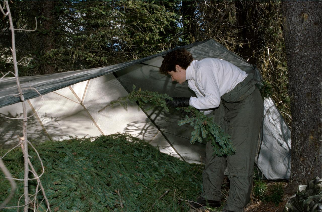
1990 Group 13 Astronaut Candidate (ASCAN) Susan J. Helms gathers pine branches to create bedding under a tent she has constructed from a parachute. Helms, along with her classmates, is participating in wilderness survival training at Fairchild Air Force Base (AFB) Spokane, Washington. The training was conducted in the mountain forests of Washington from 08-26-90 through 08-30-90.
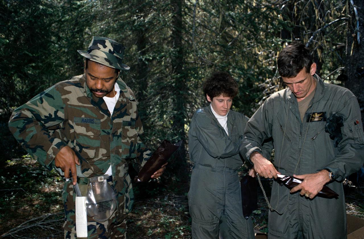
1990 Group 13 Astronaut Candidates (ASCANs) (left to right) Bernard J. Harris, Jr, Susan J. Helms, and William S. McArthur, Jr open dehydrated food packages during wilderness survival training at Fairchild Air Force Base (AFB) in Spokane, Washington. The training was conducted in the mountain forests of Washington from 08-26-90 through 08-30-90.
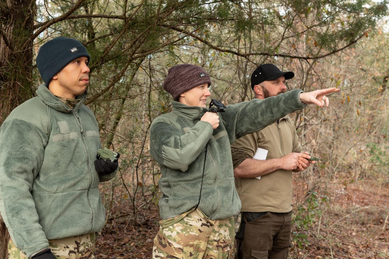
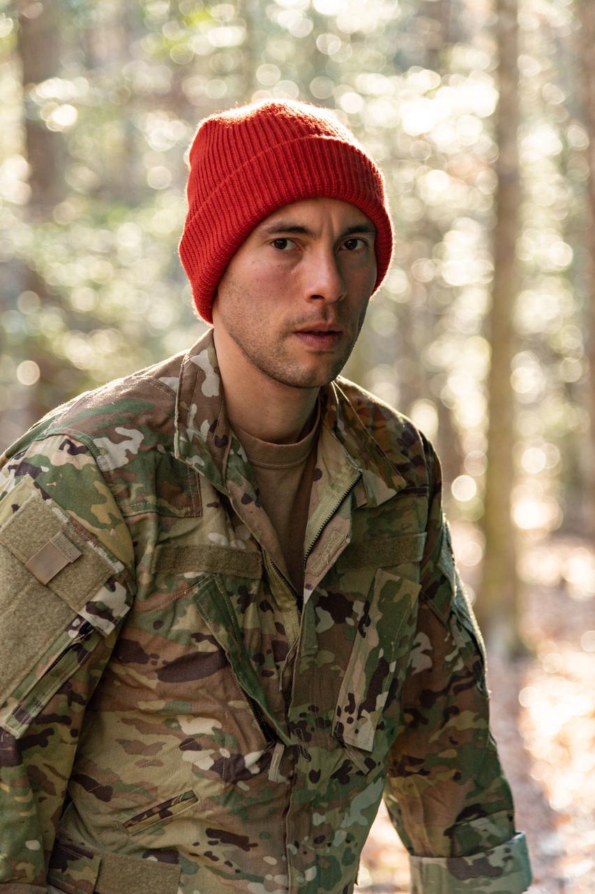
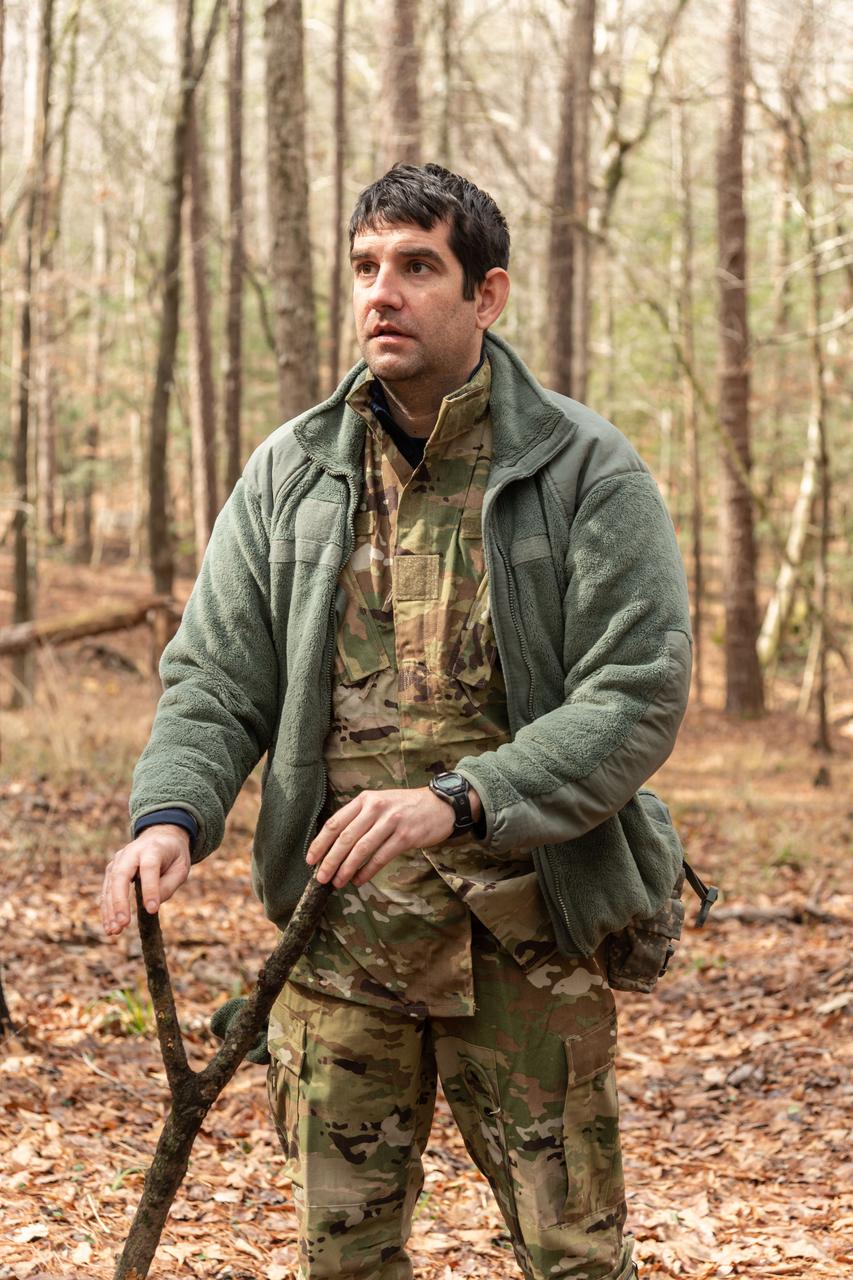
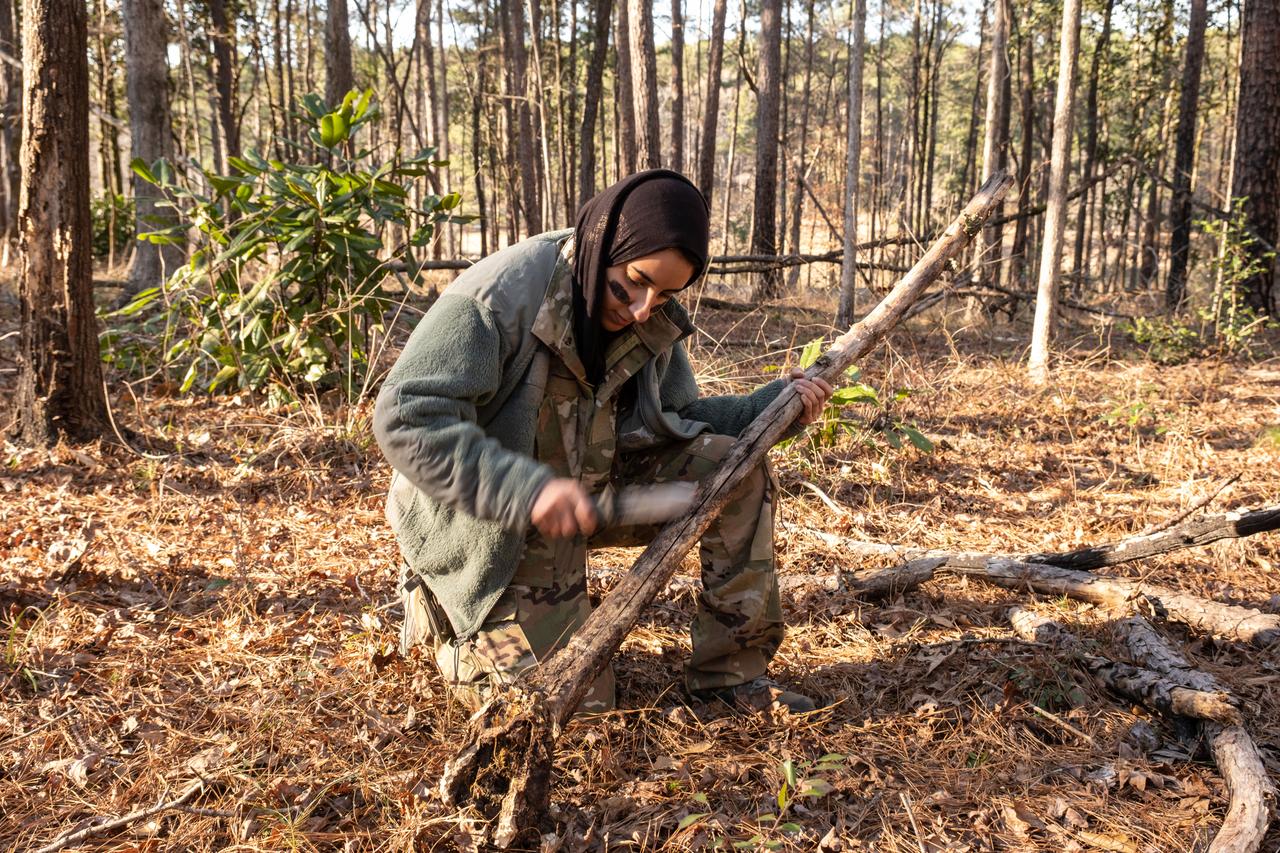
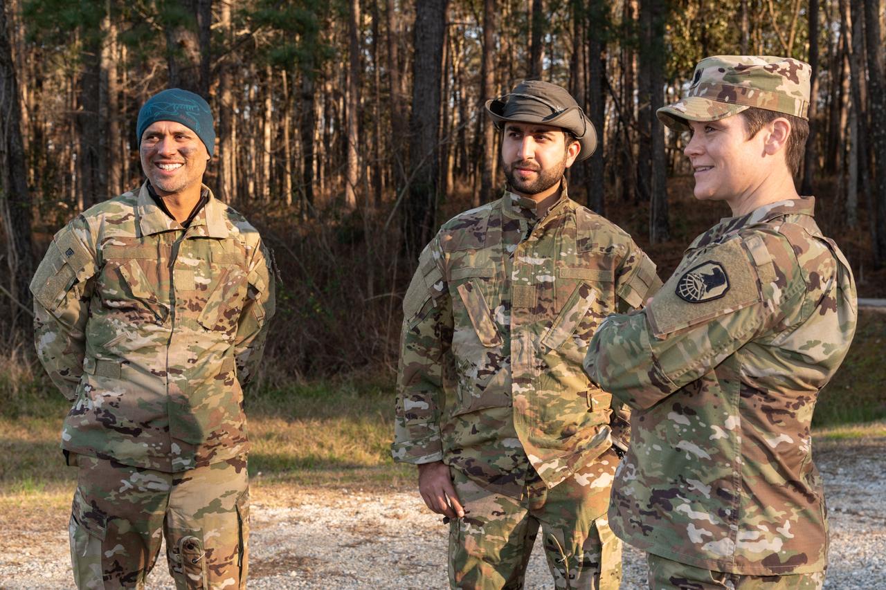
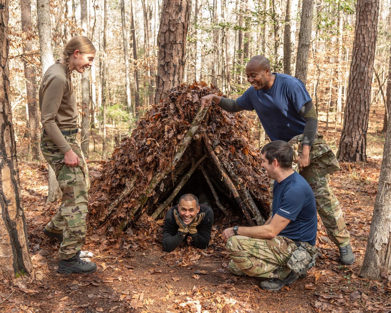
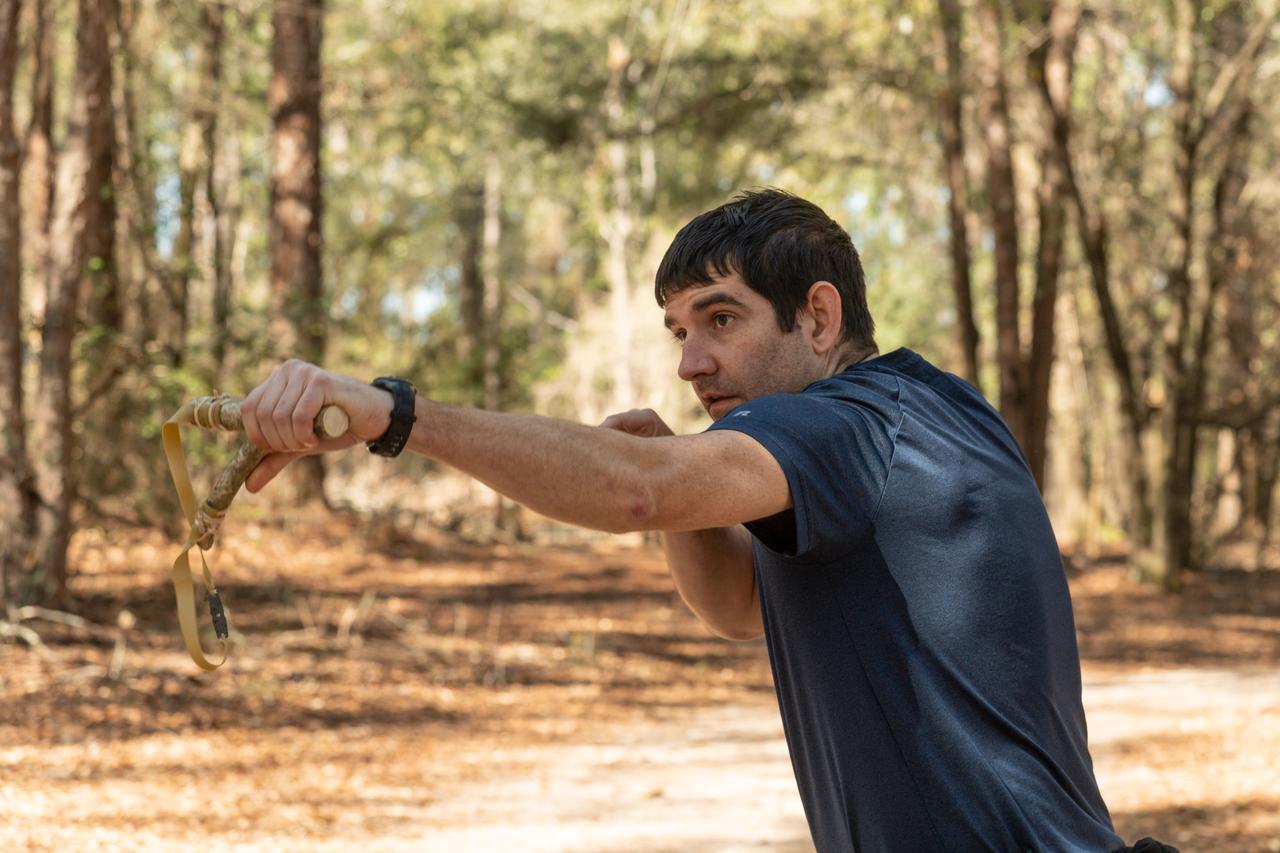
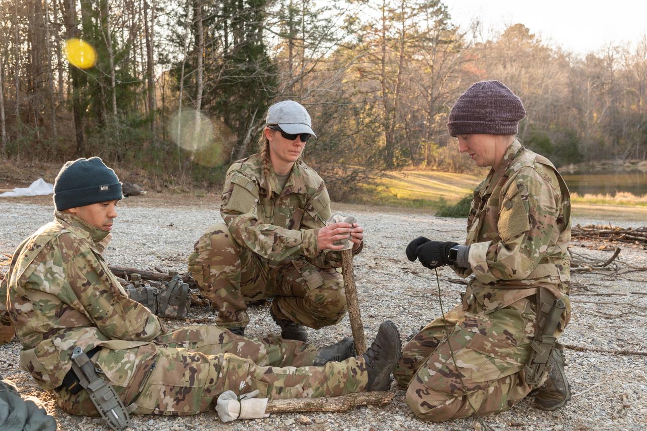
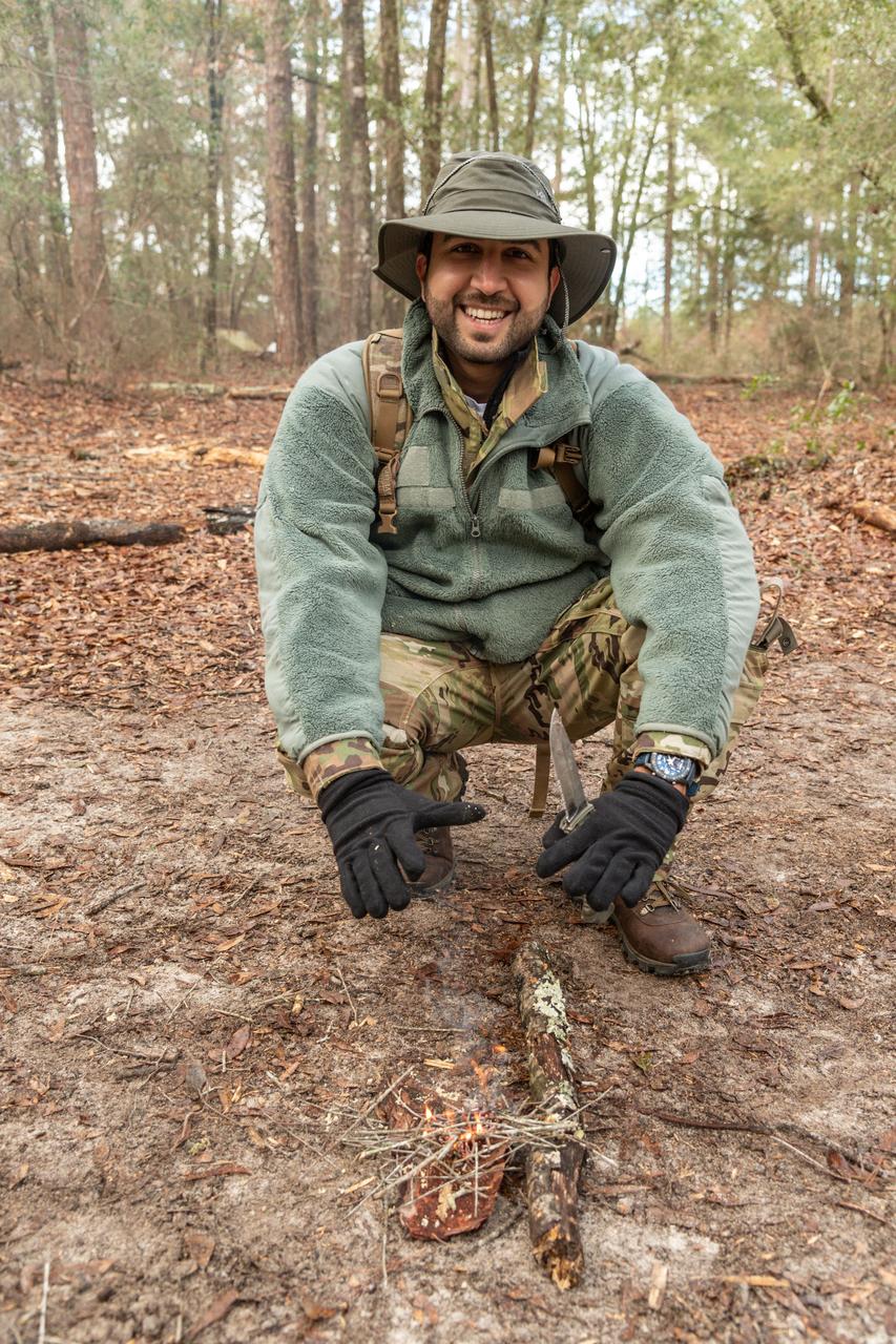
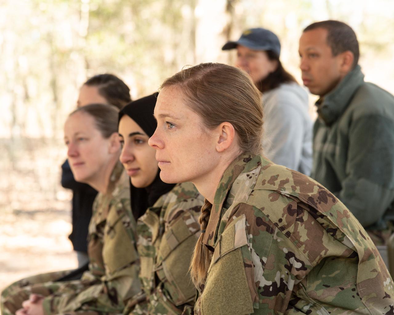
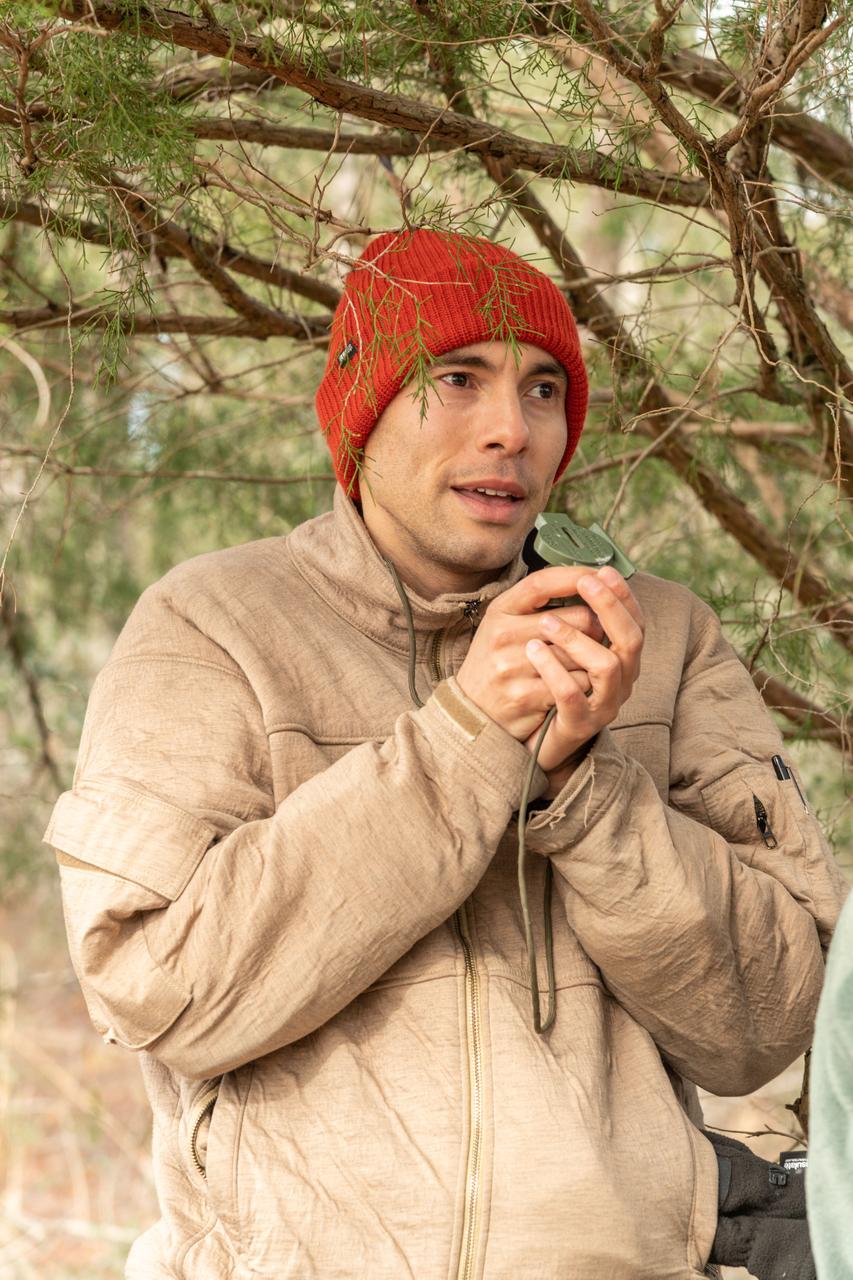
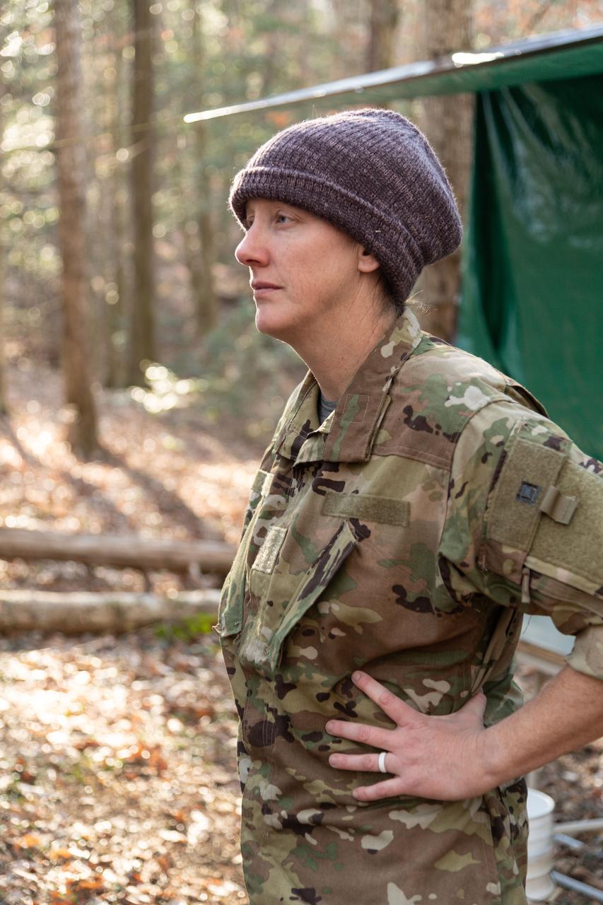
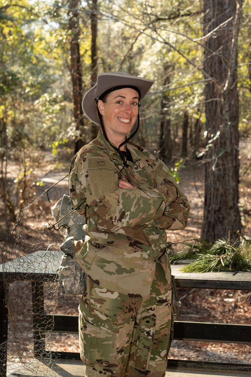
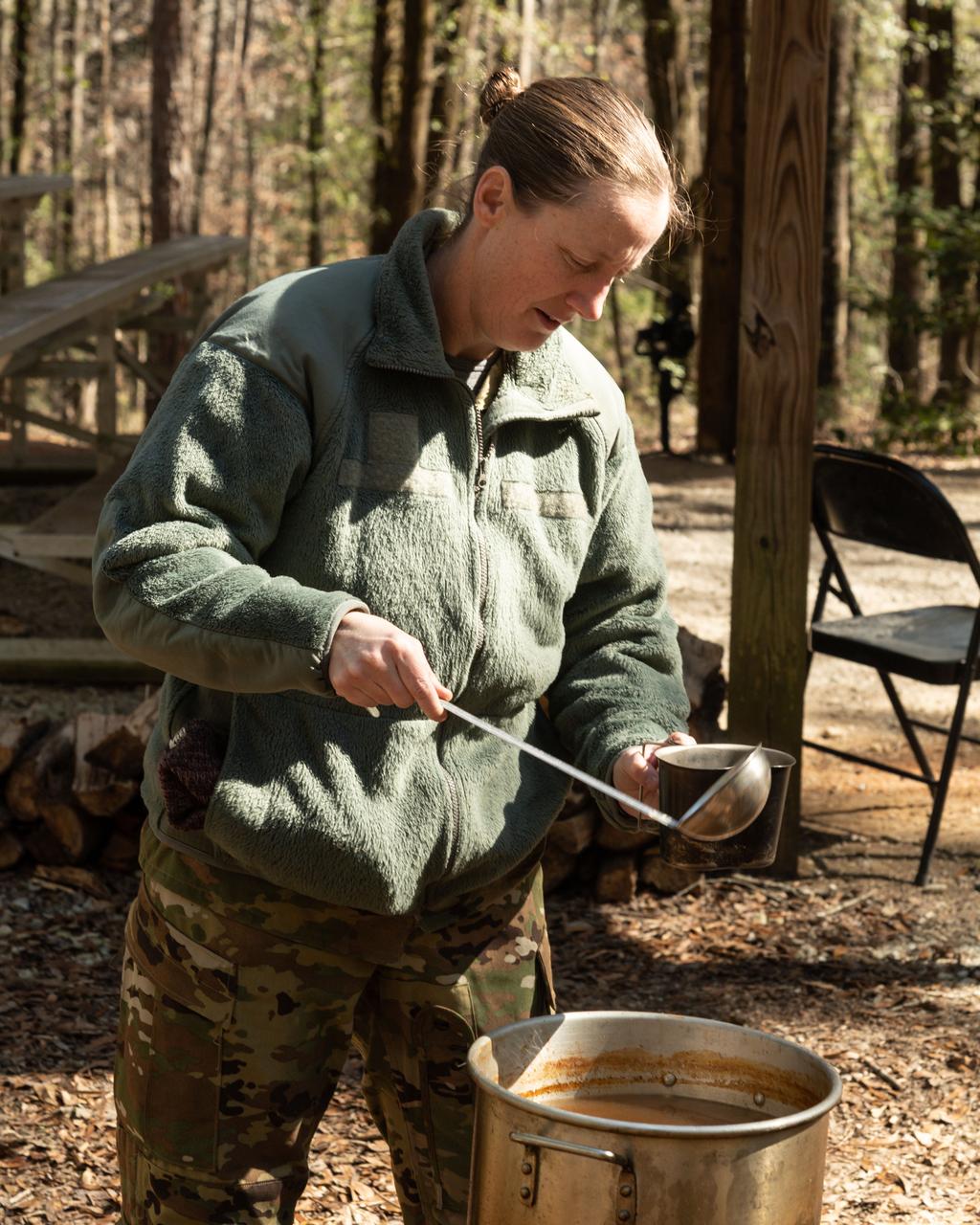
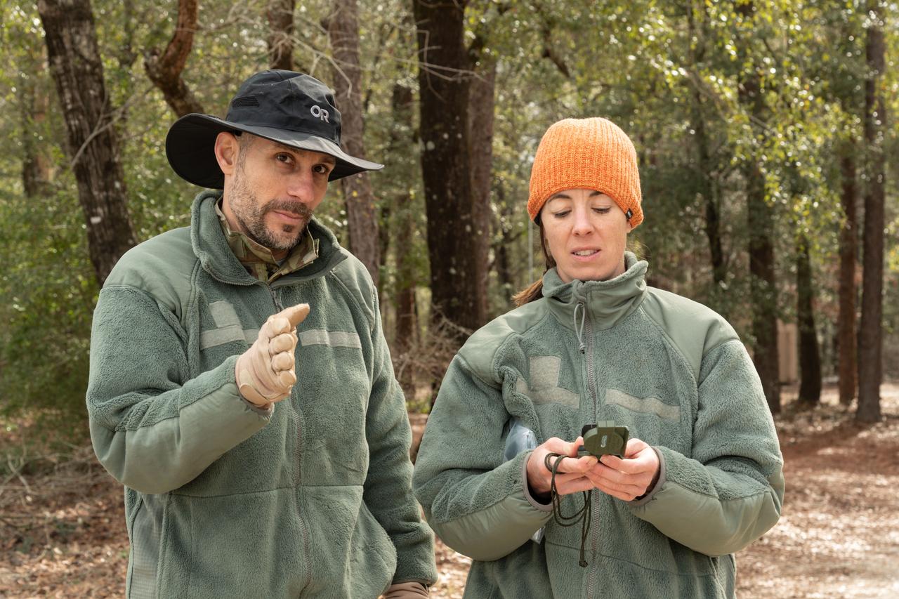
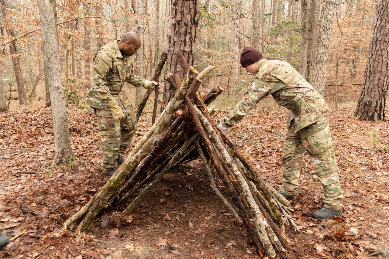
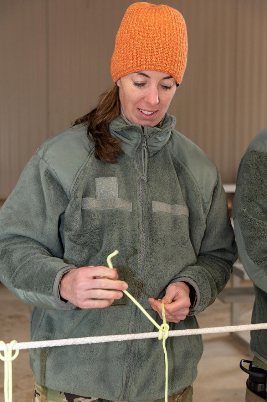
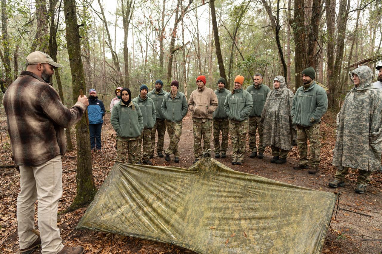
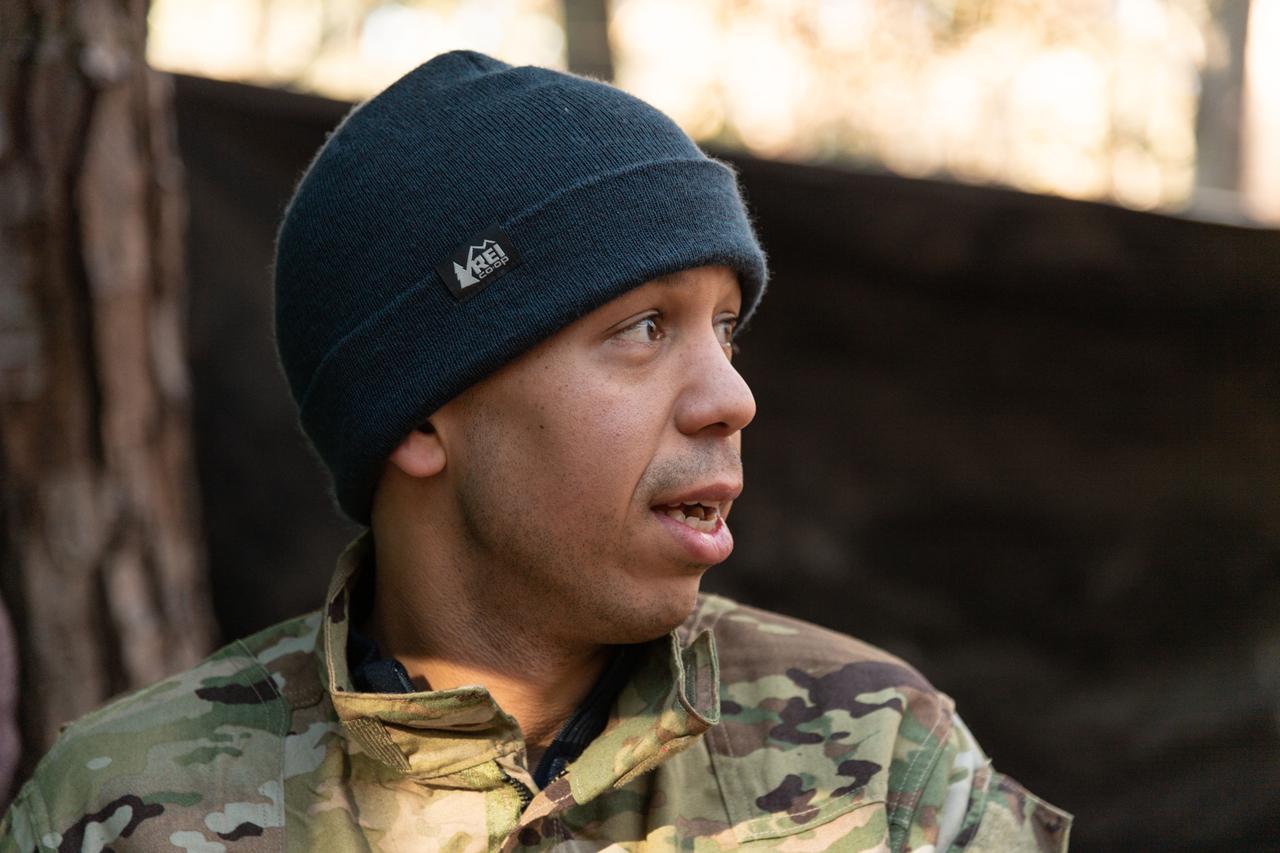
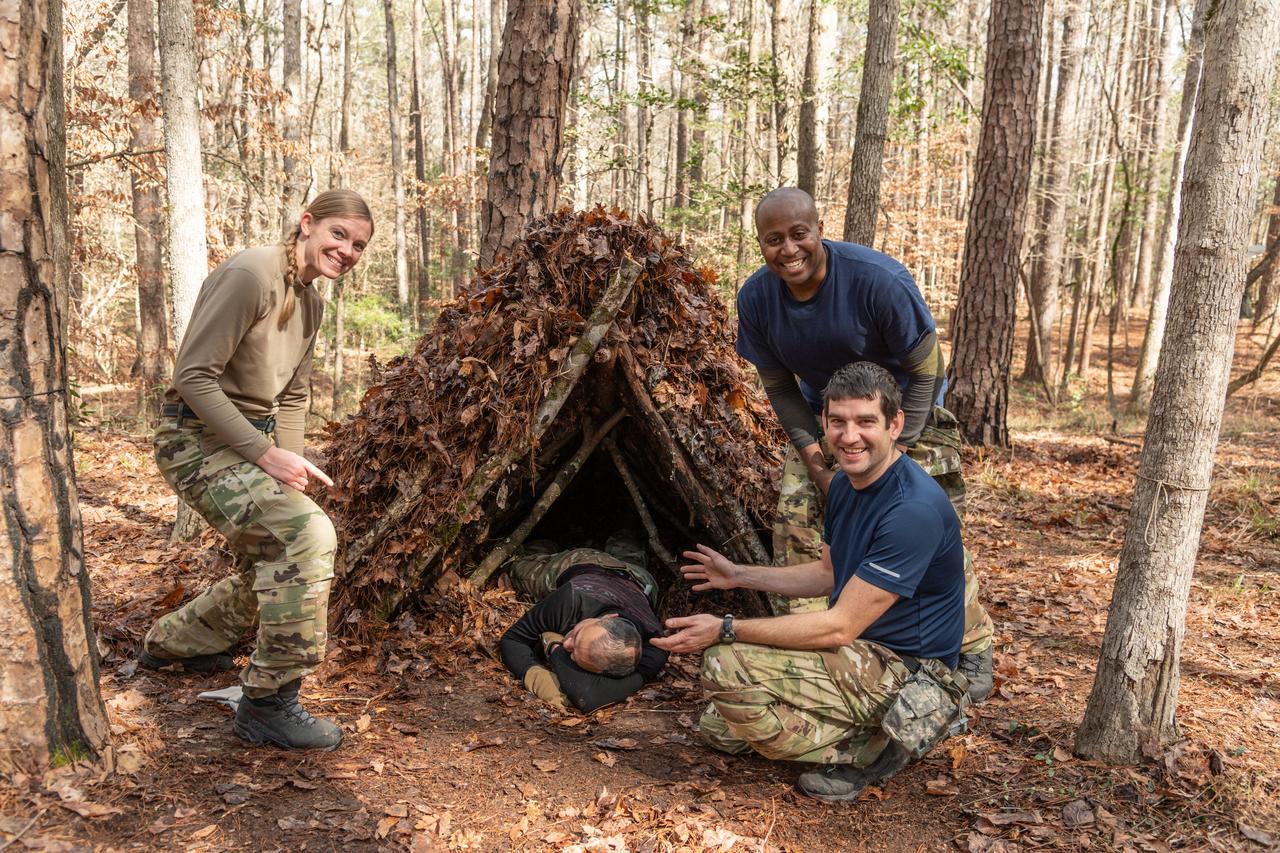
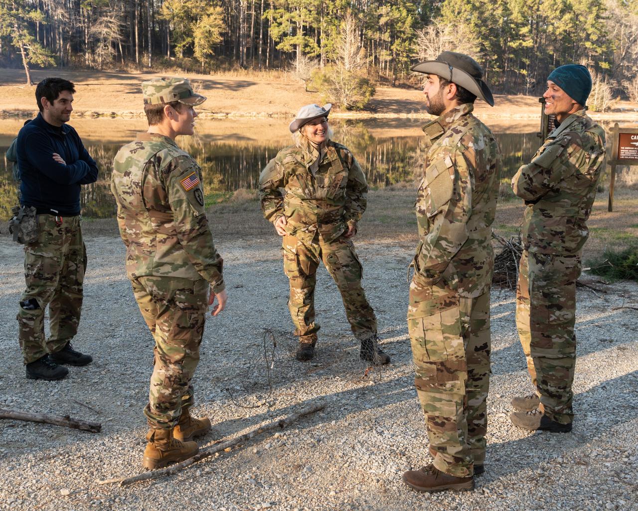
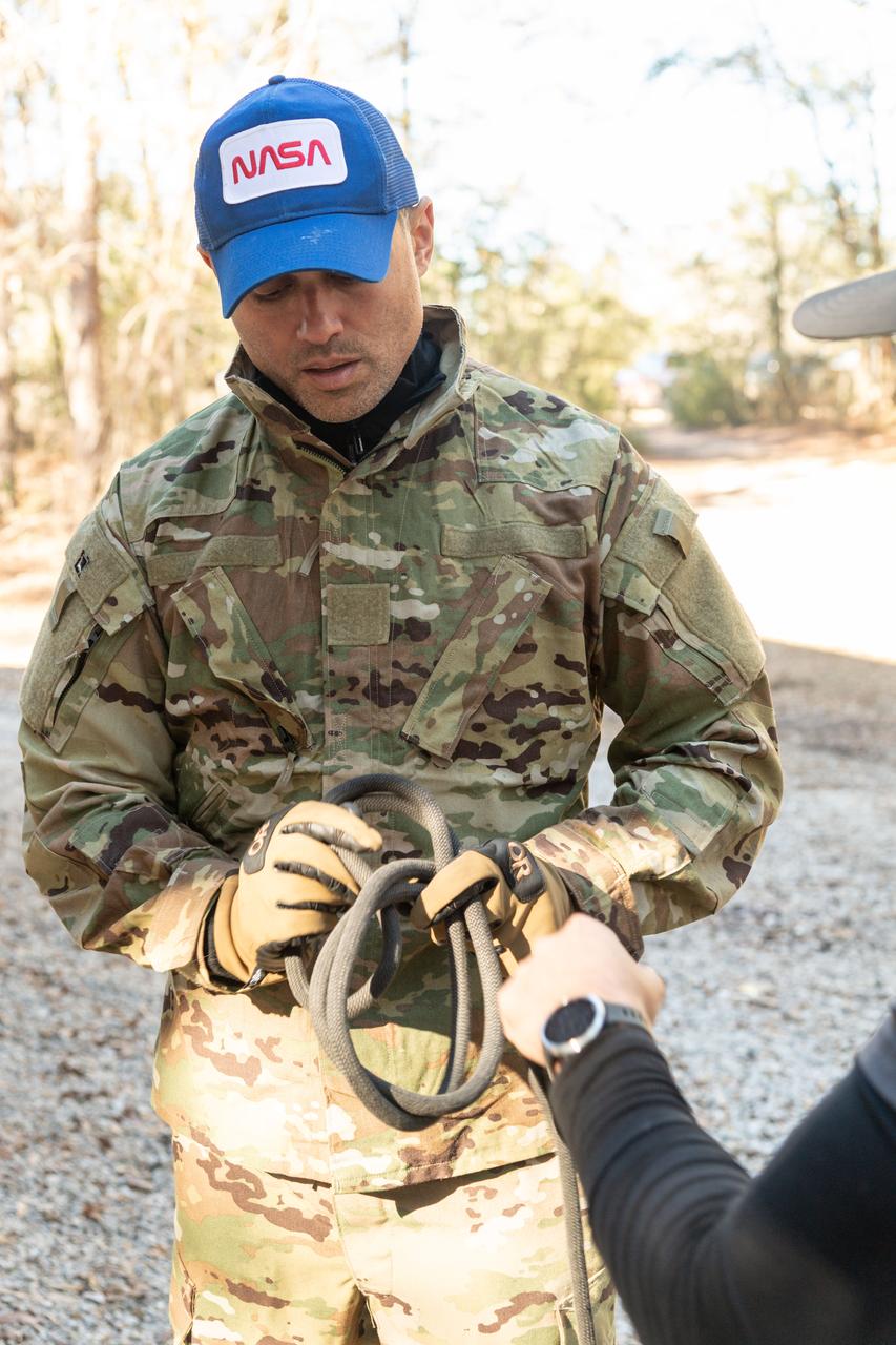
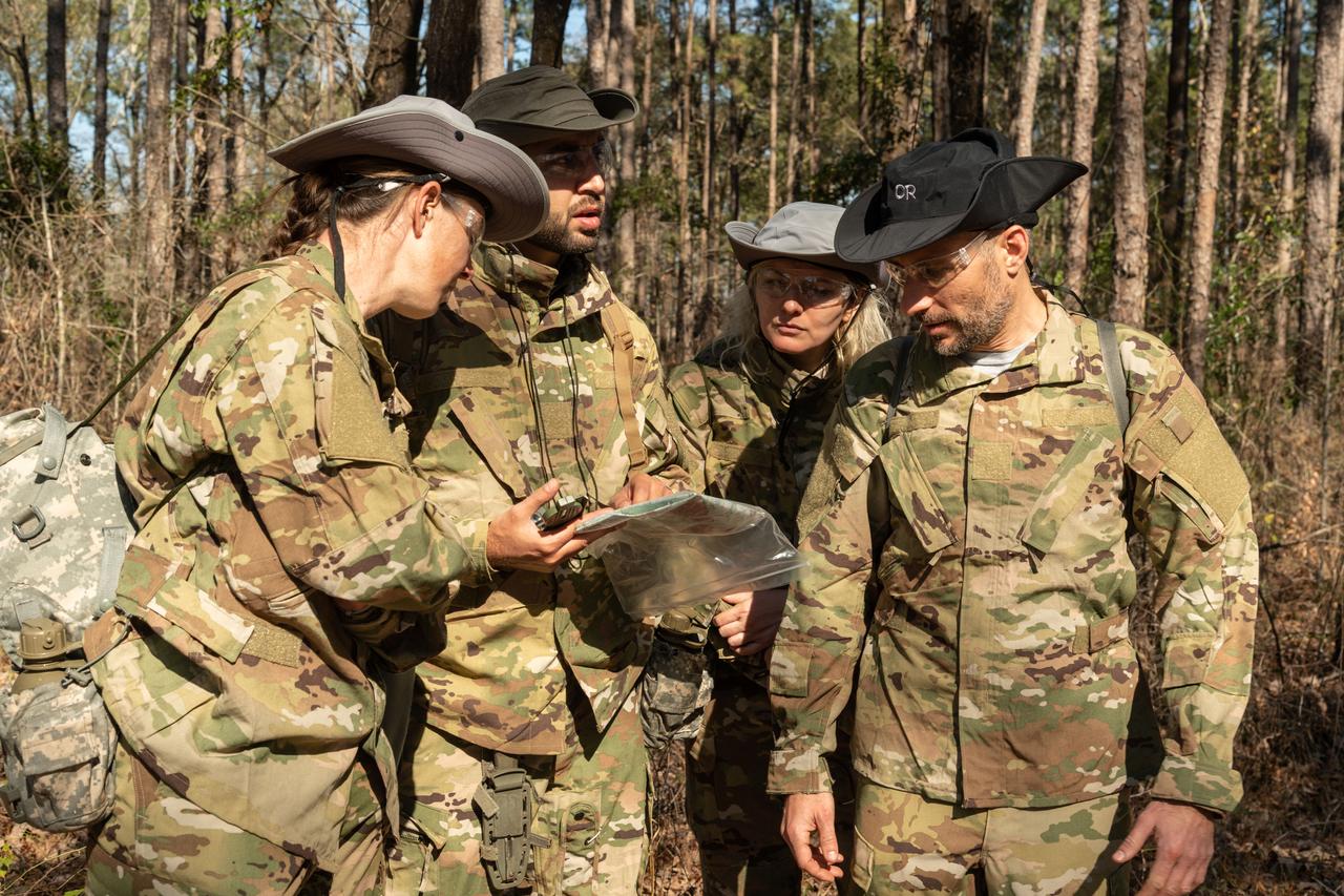
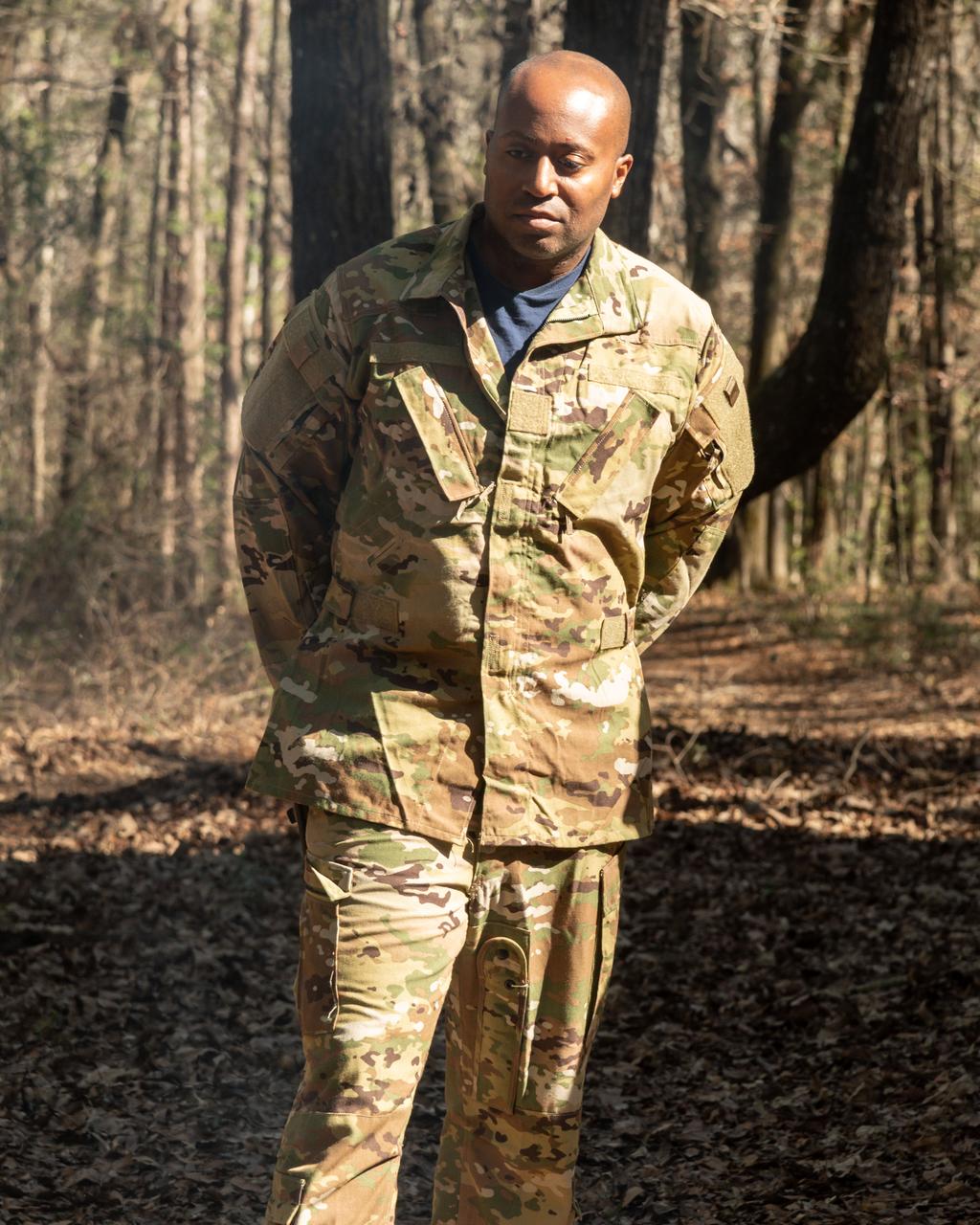
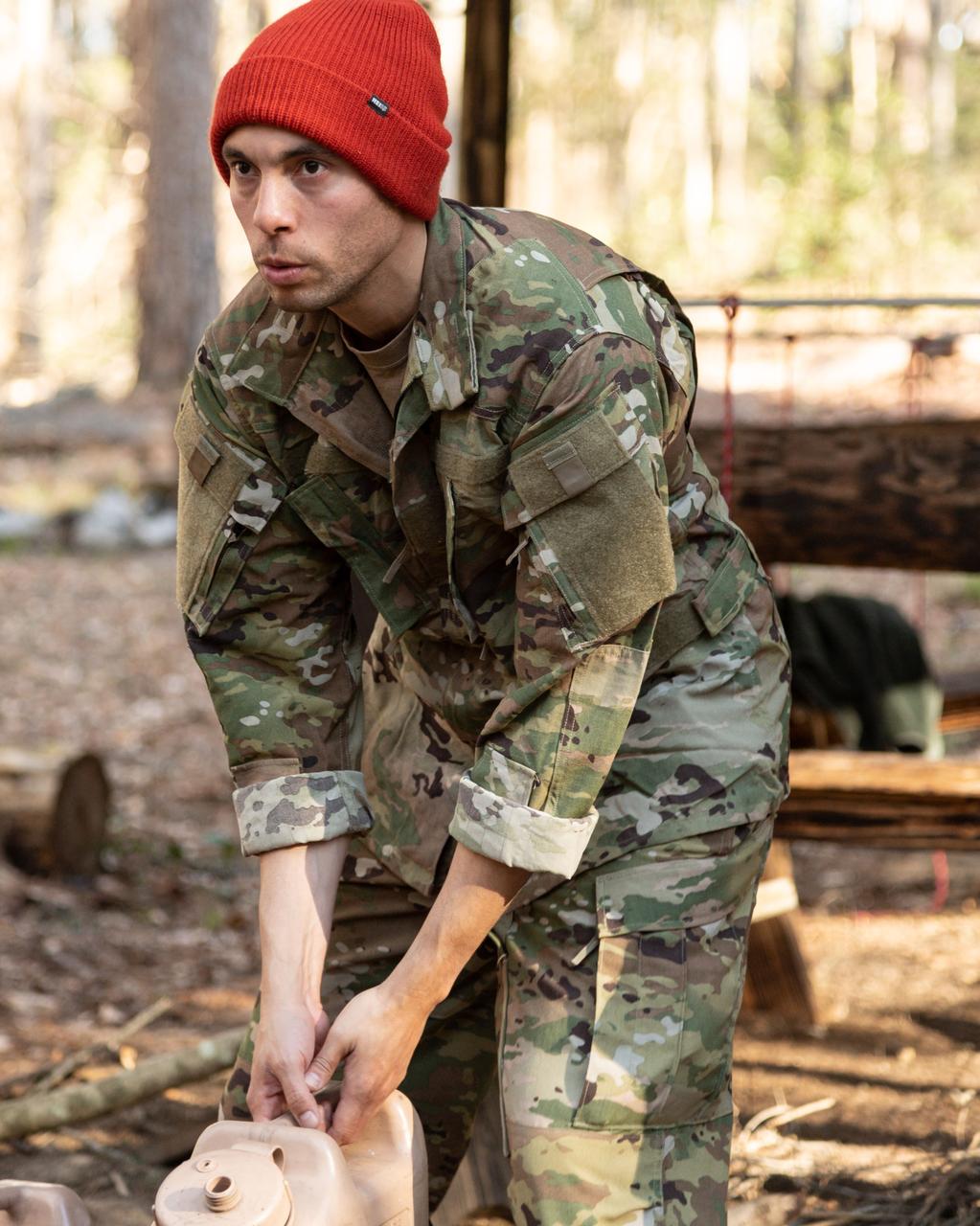
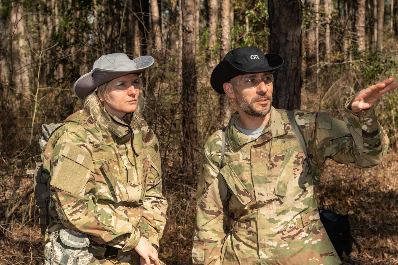
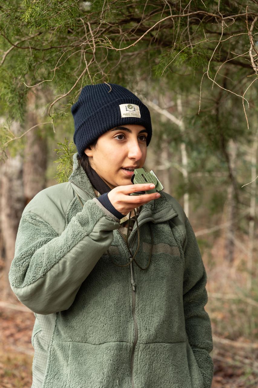
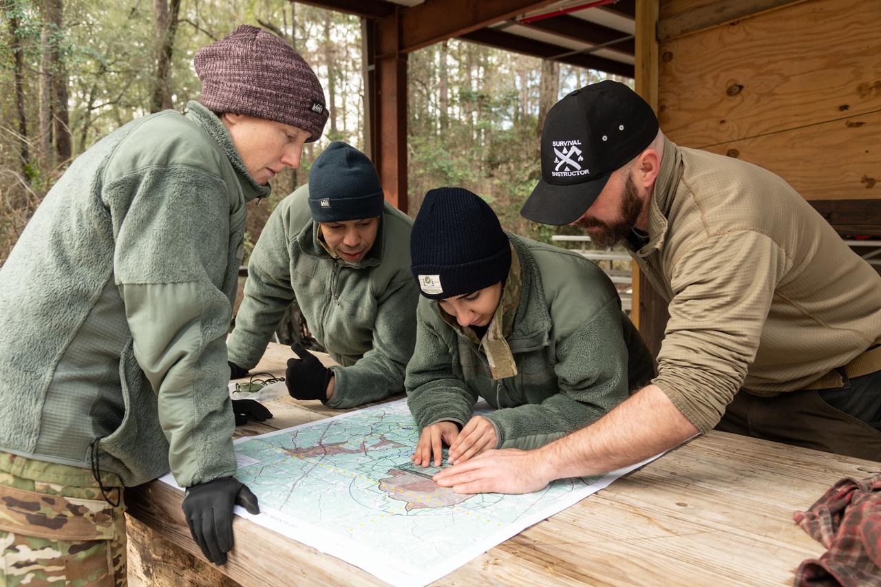
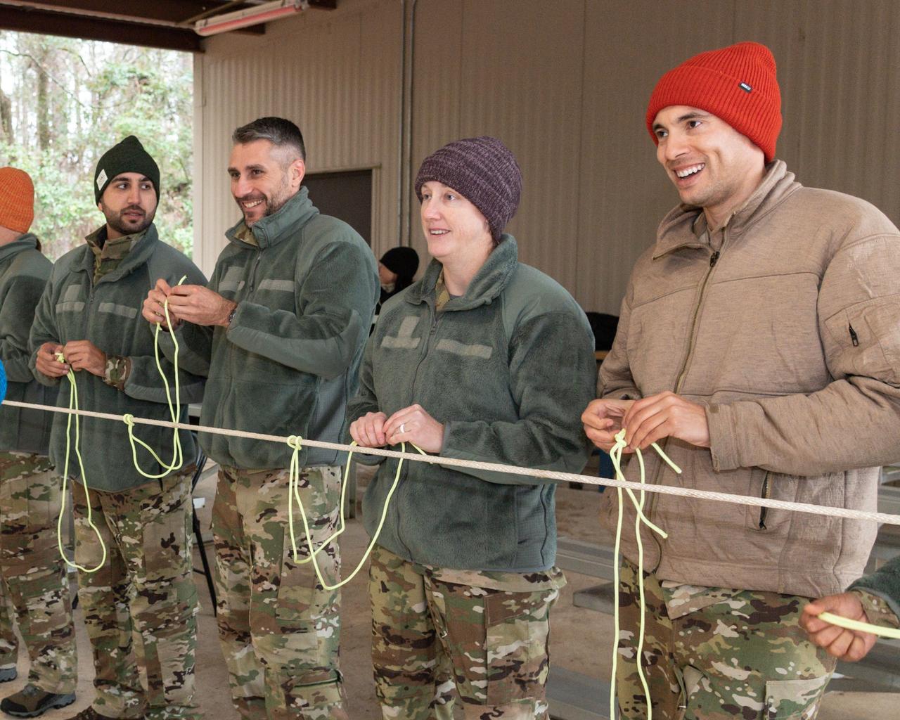
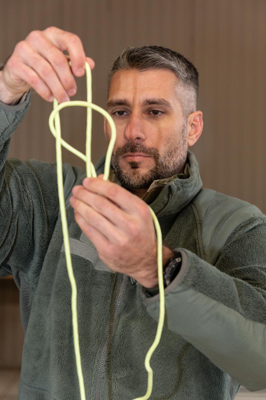
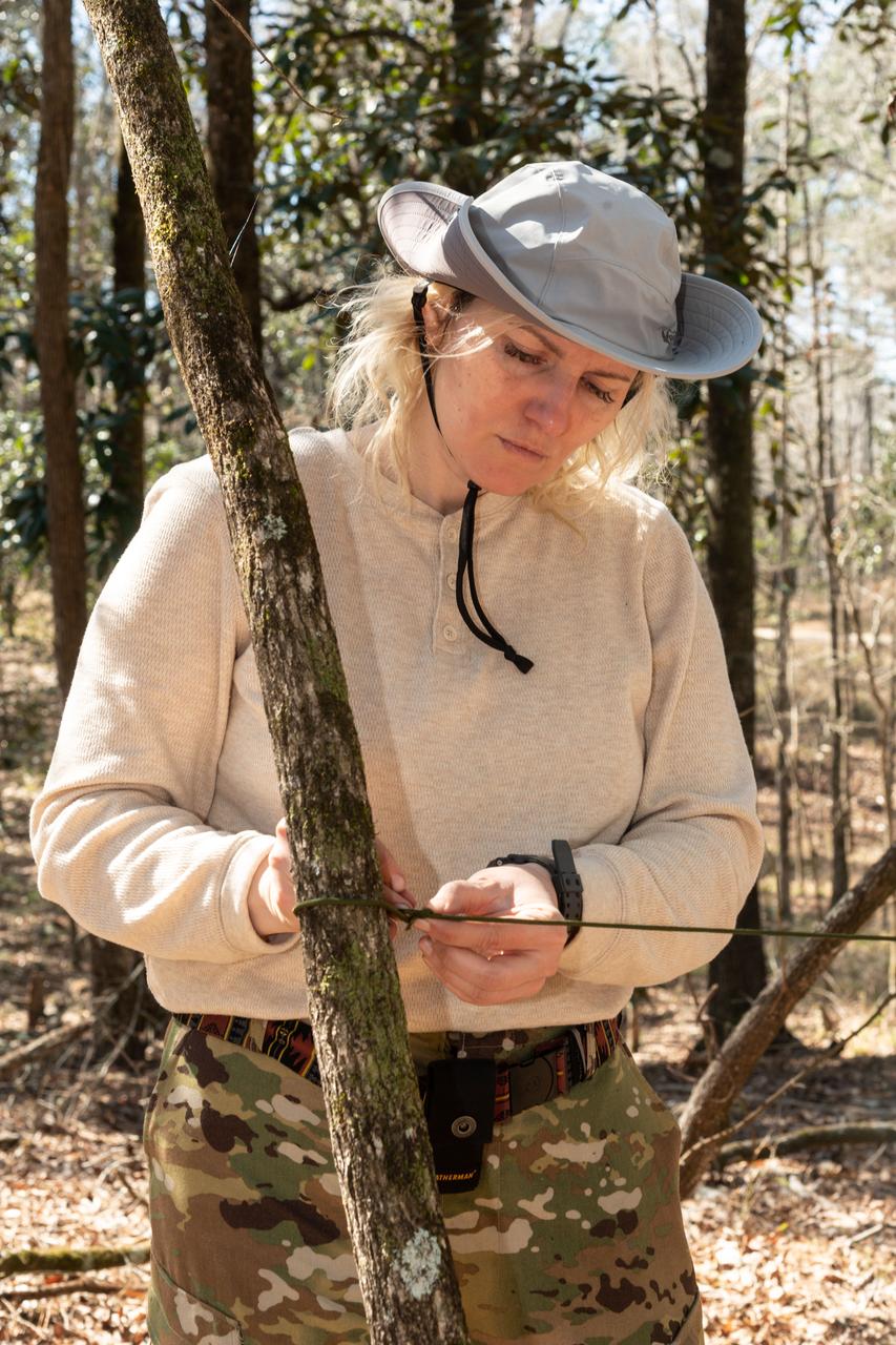
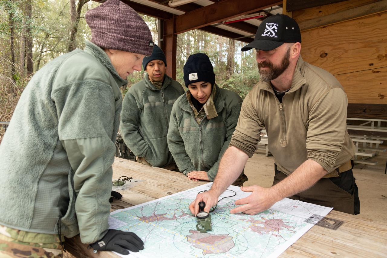
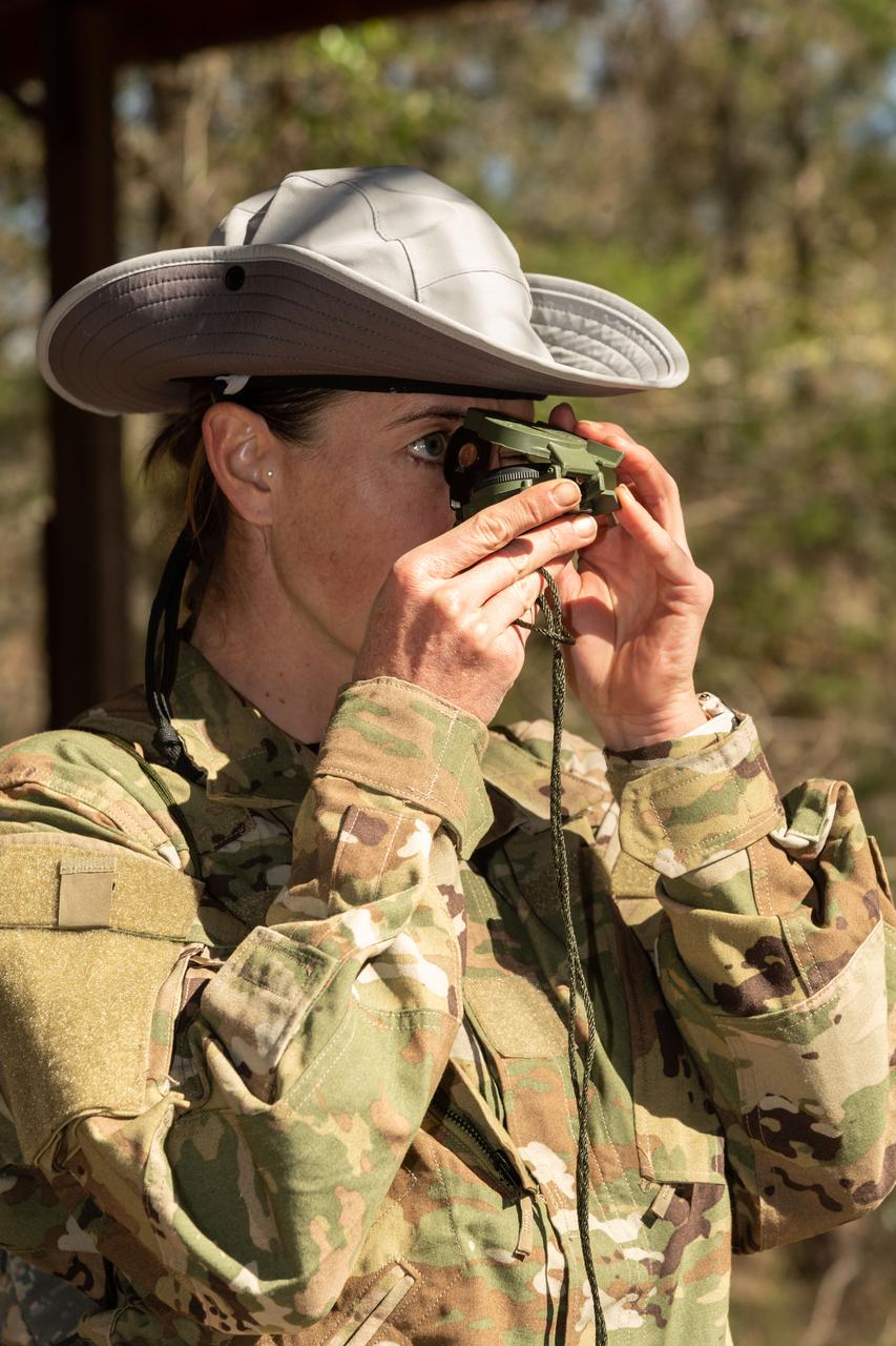
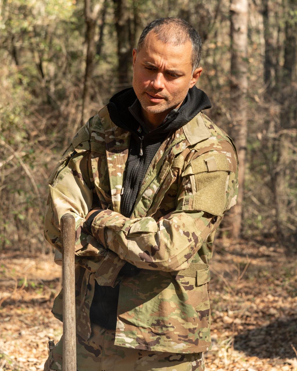
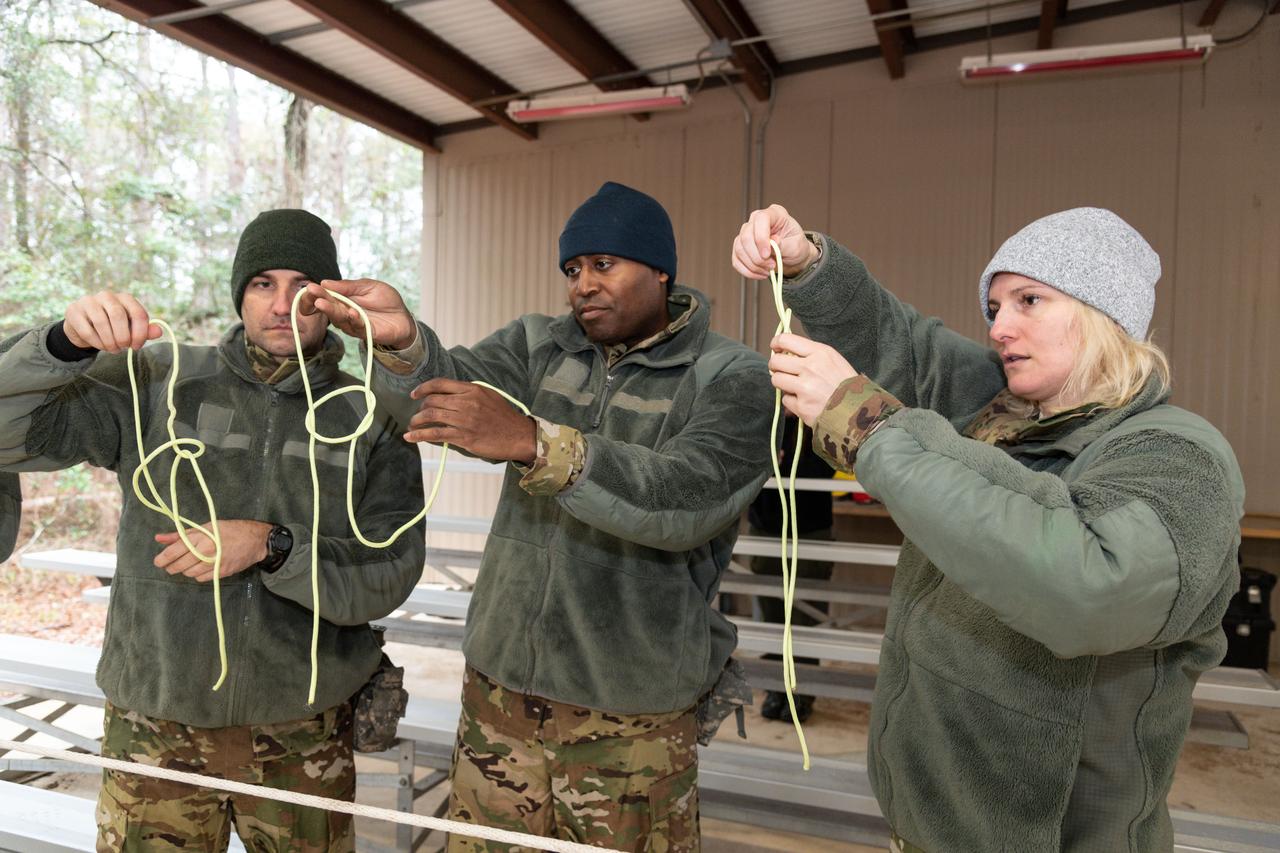
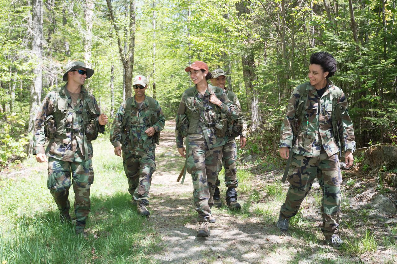
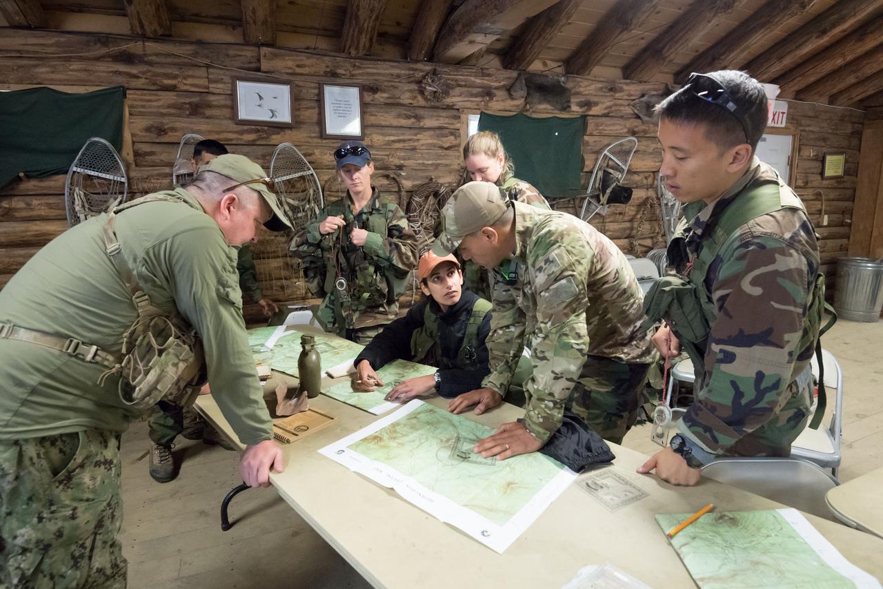
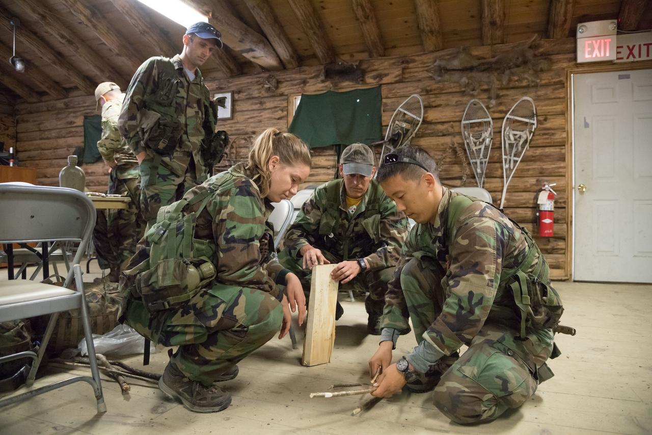
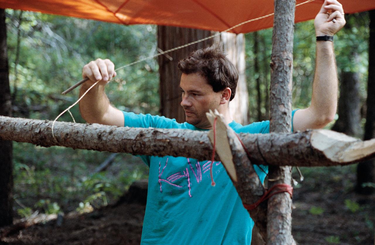
Work Request Description: Photographic coverage of ASCAN 2021 Class Wilderness Survival Training at Ft. Rucker, Alabama
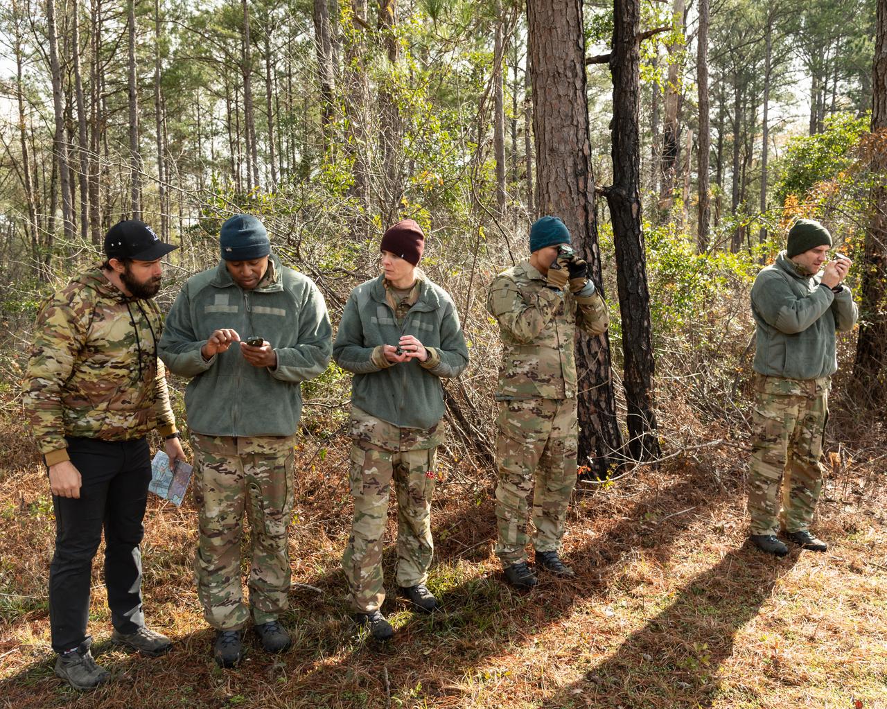
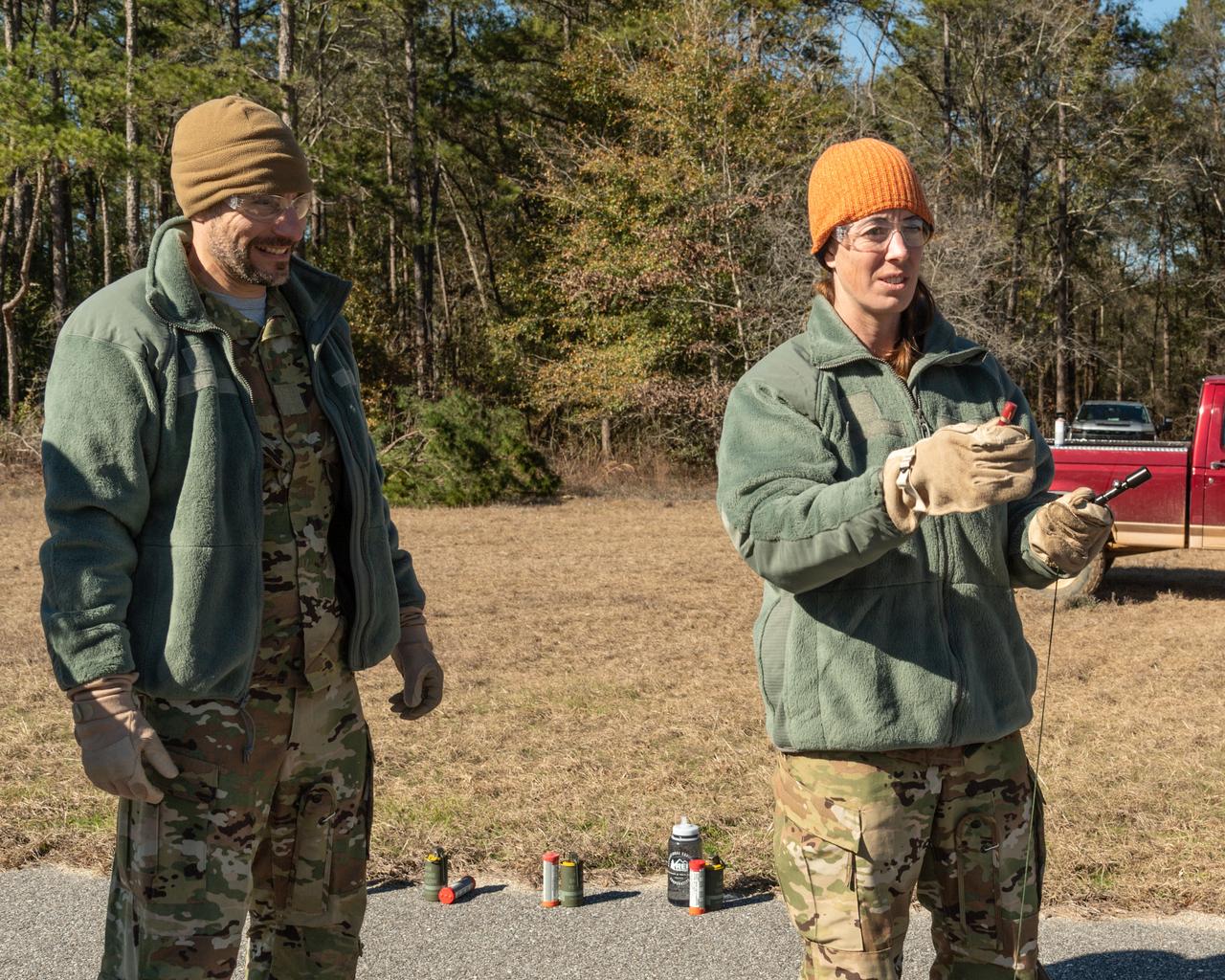
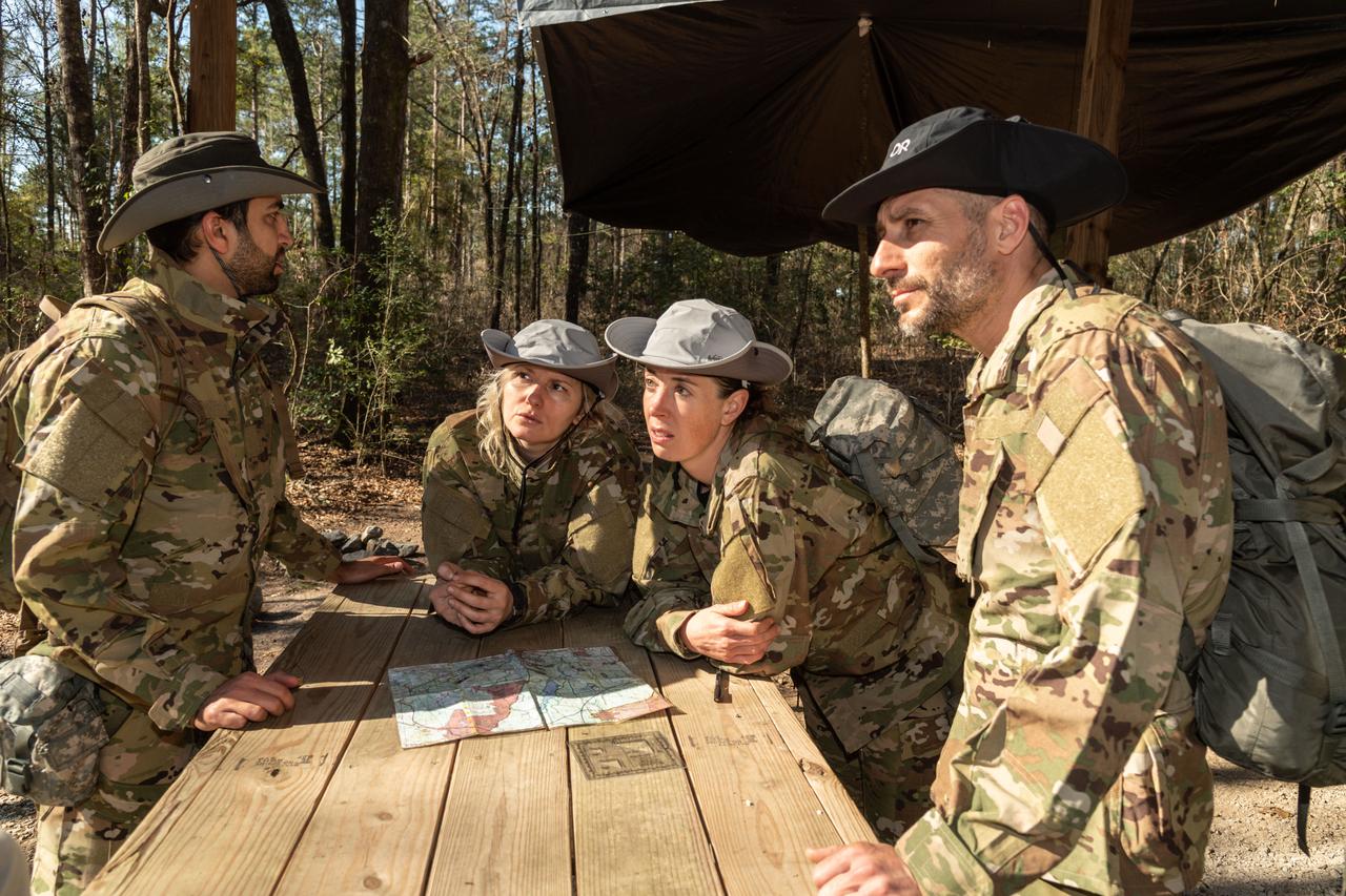
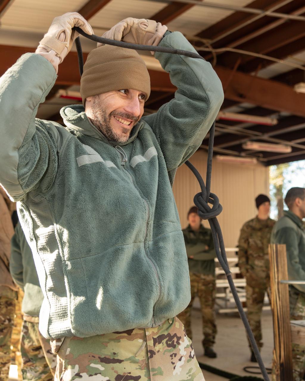
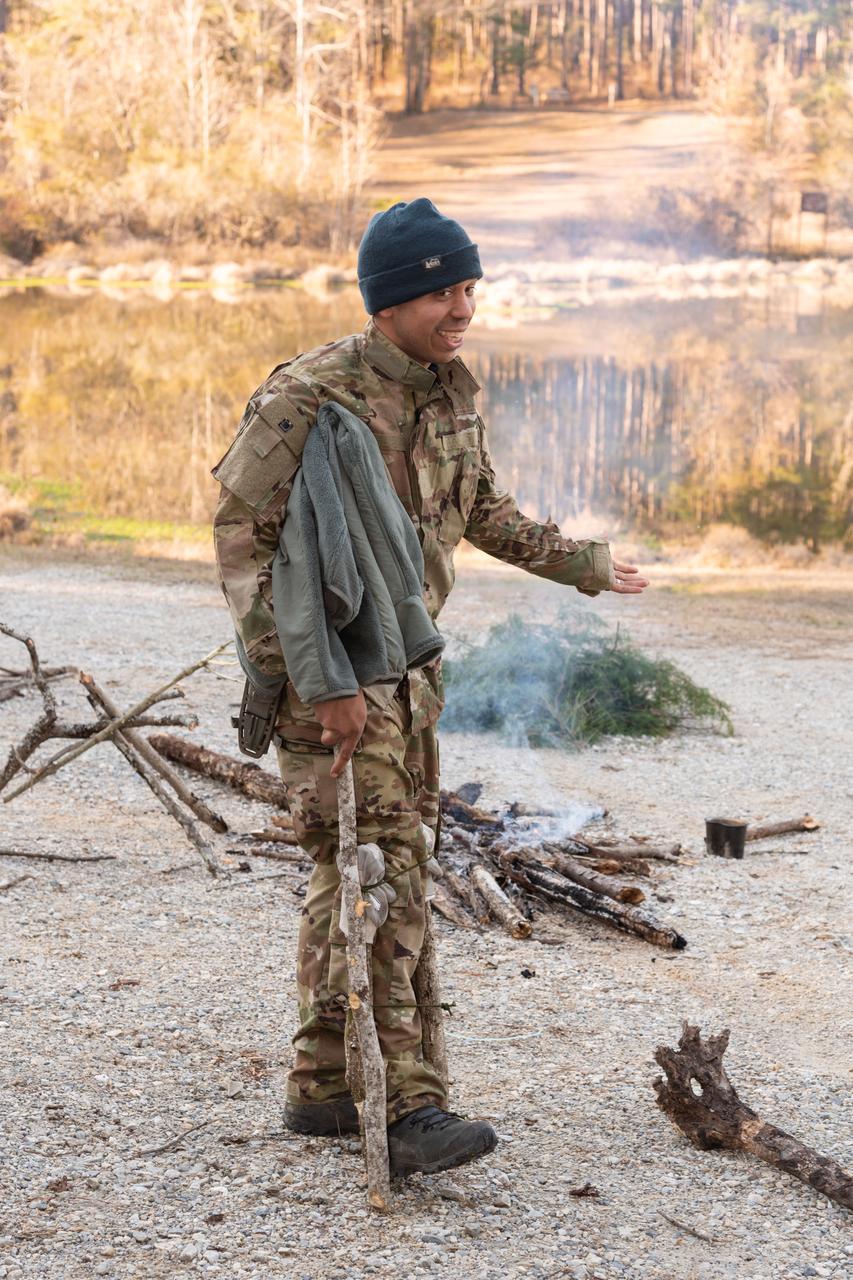
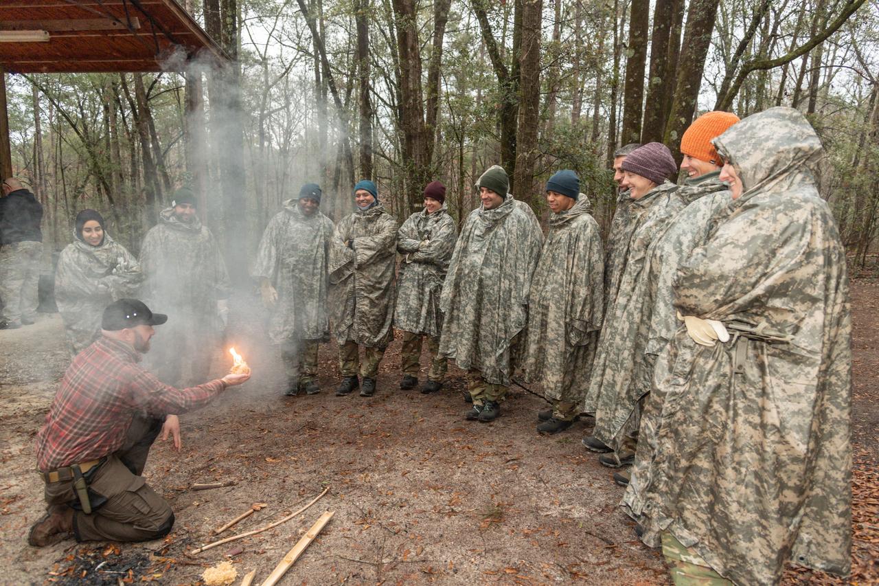
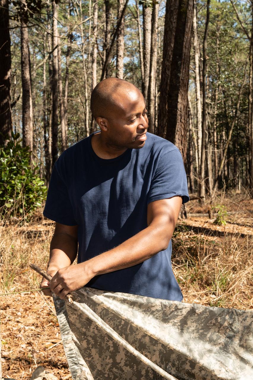
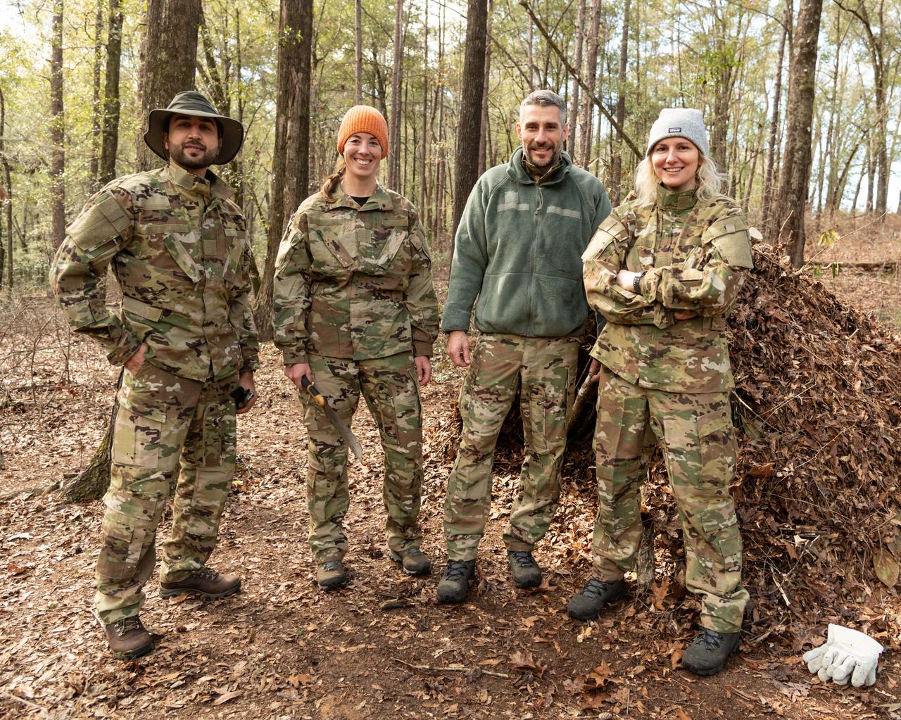
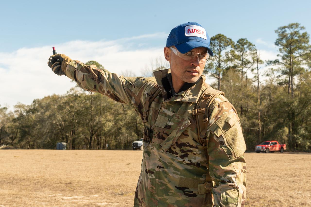
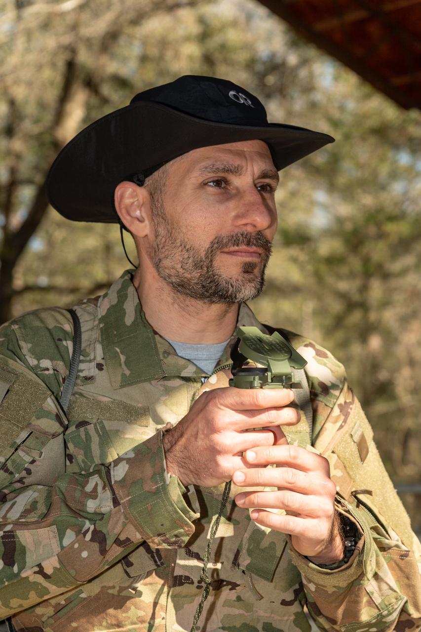
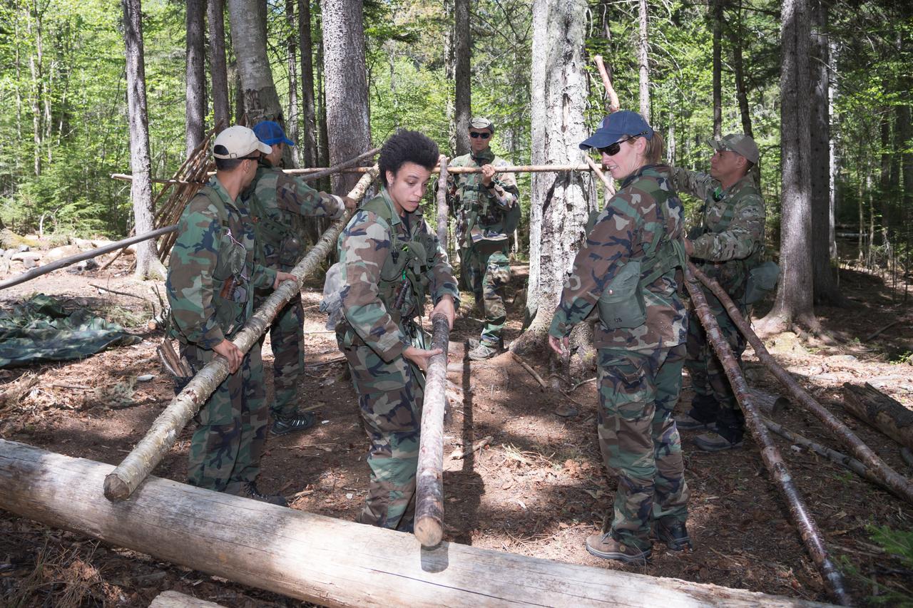
Work Request Description: Photographic coverage of ASCAN 2021 Class Wilderness Survival Training at Ft. Rucker, Alabama
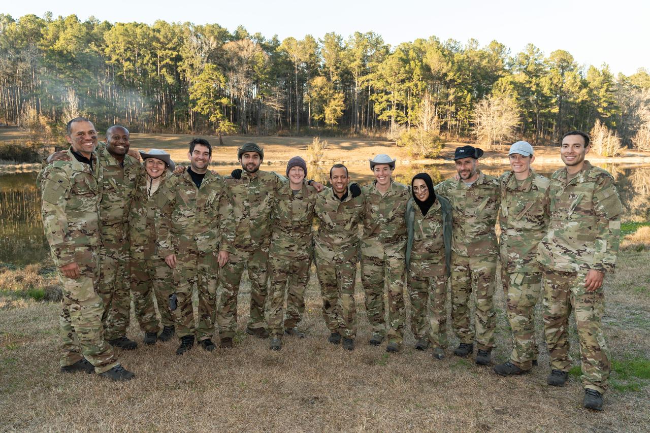
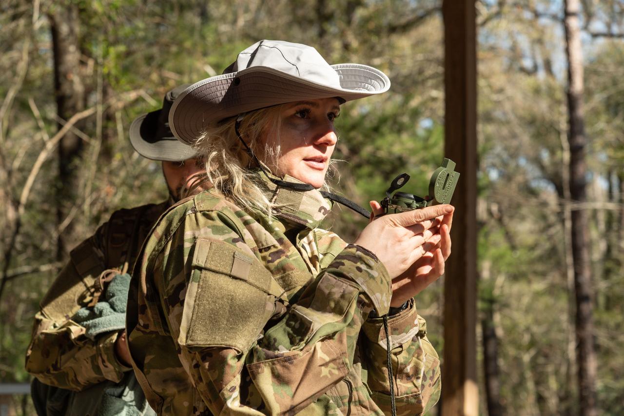
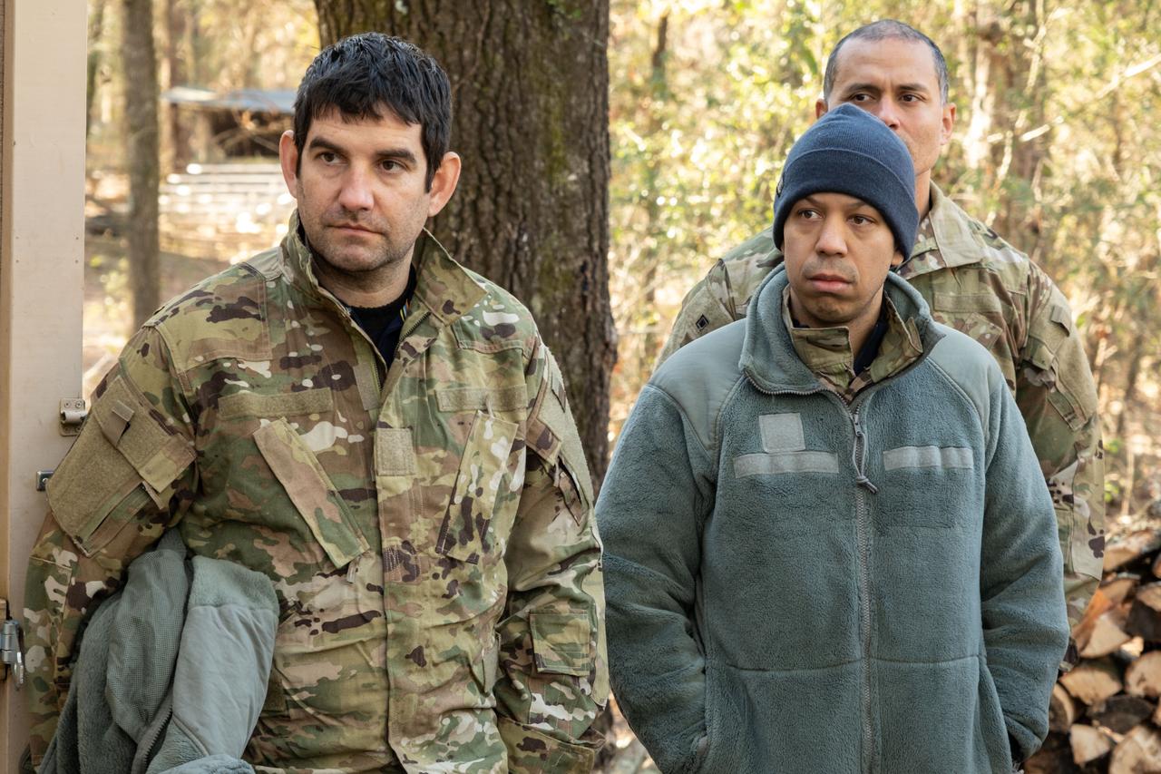
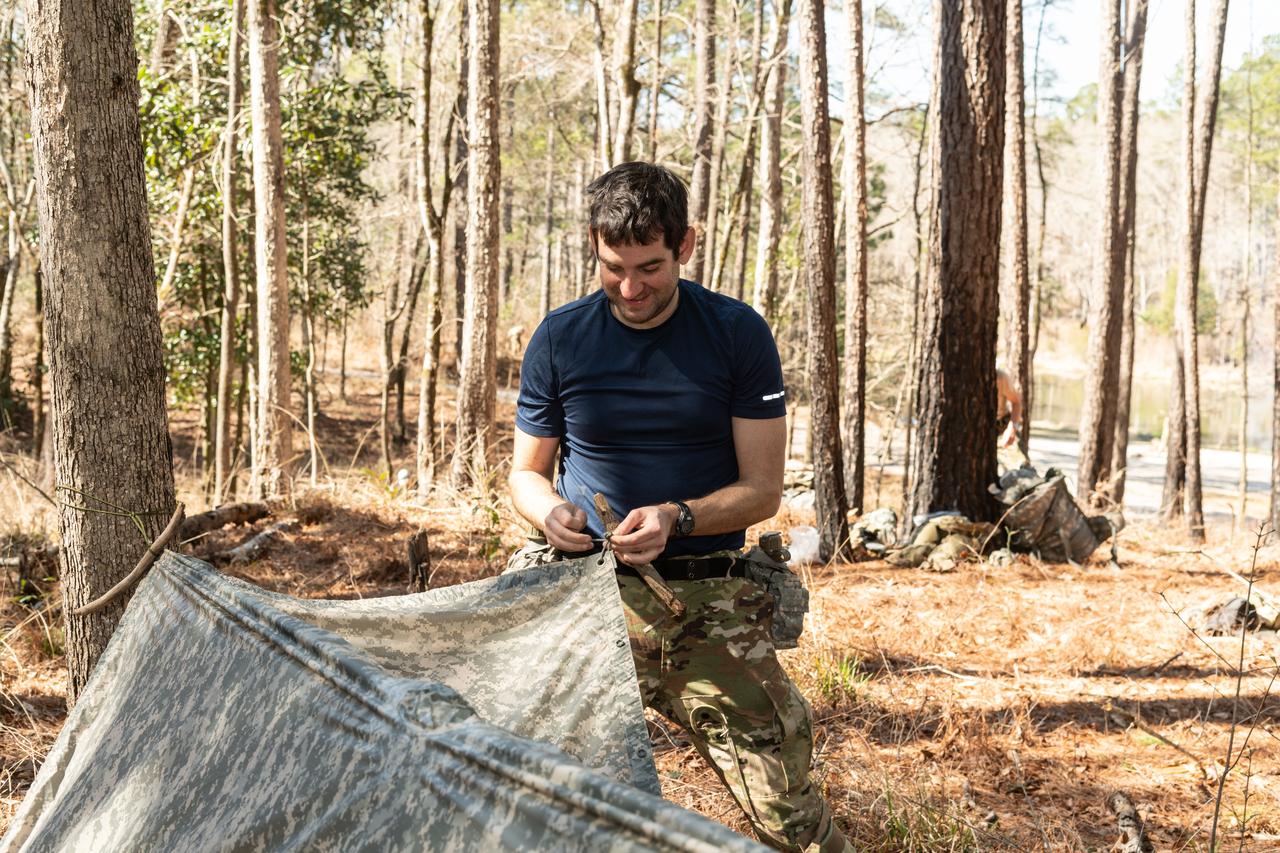
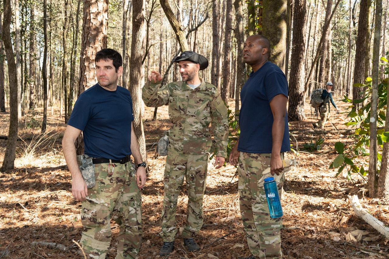
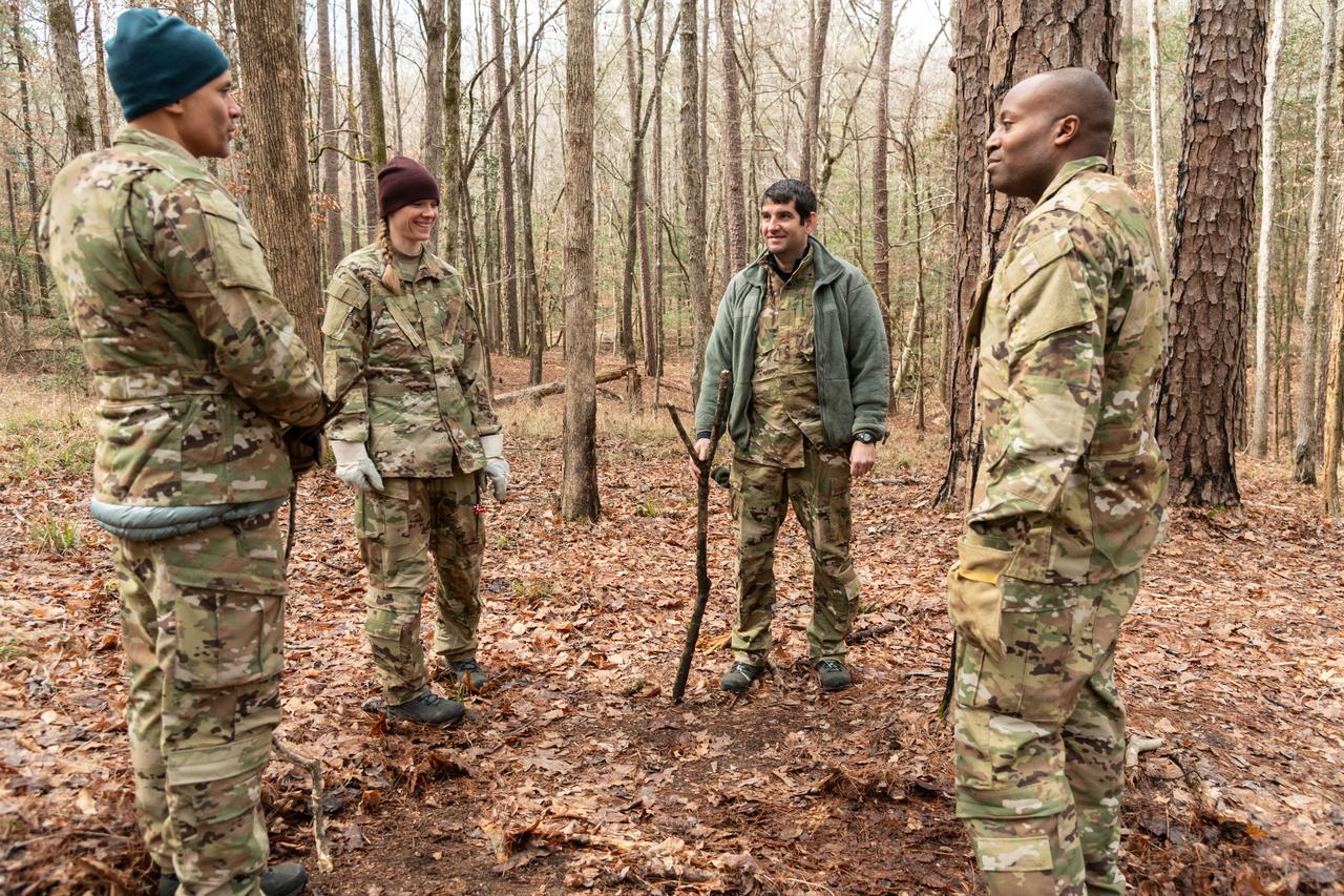
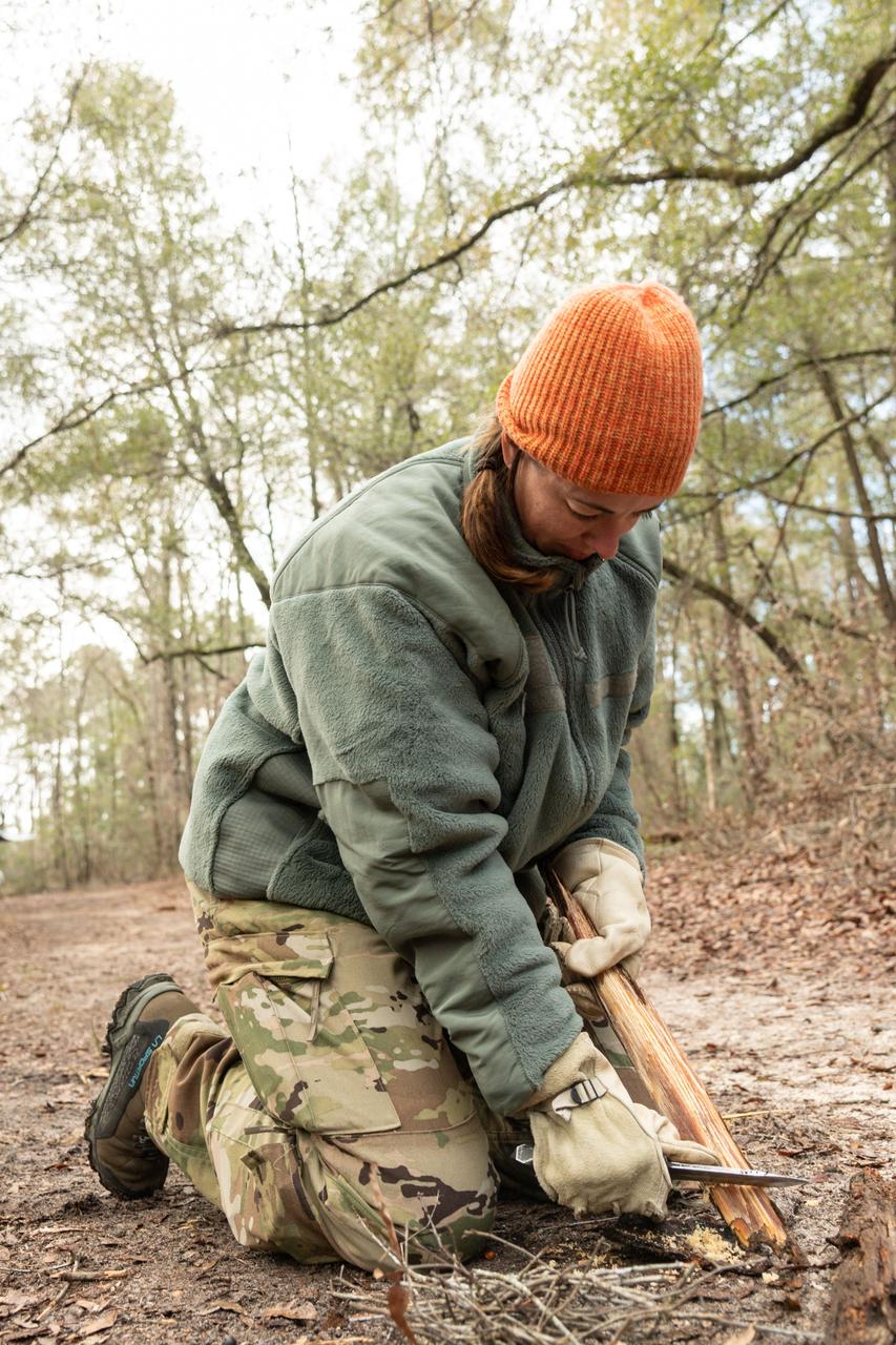
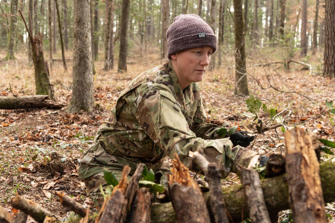
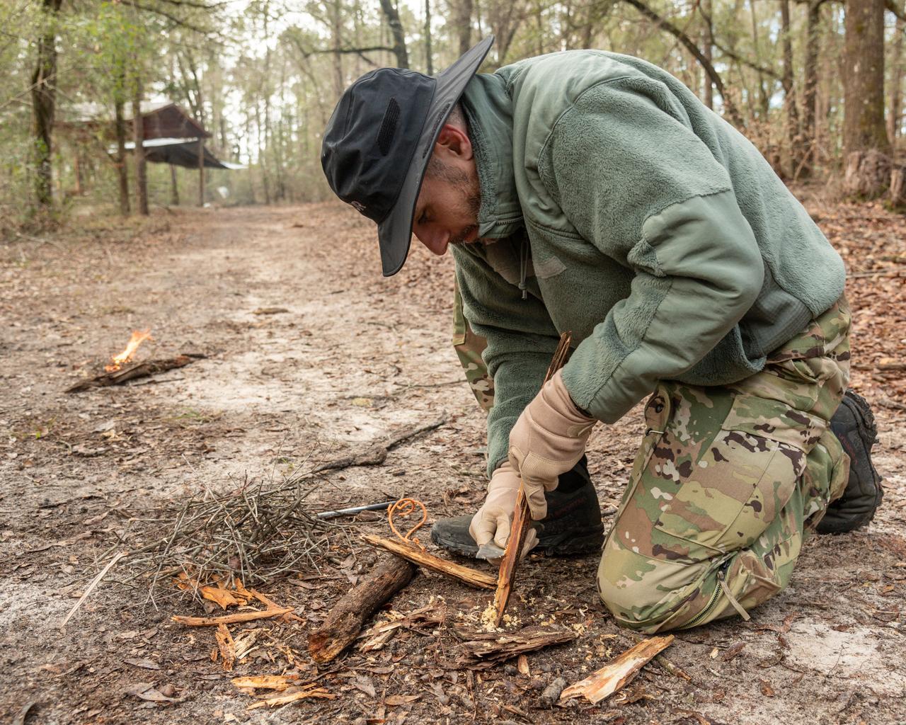
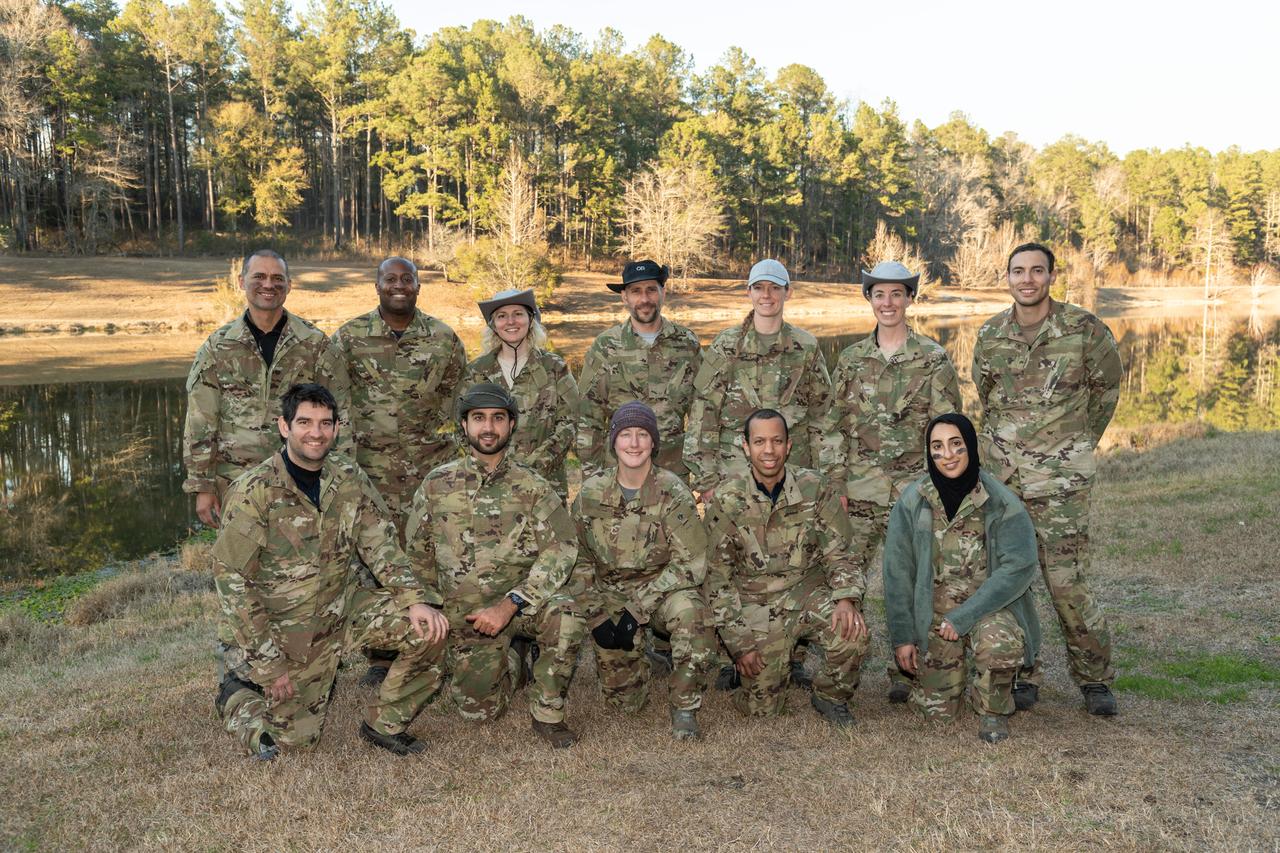
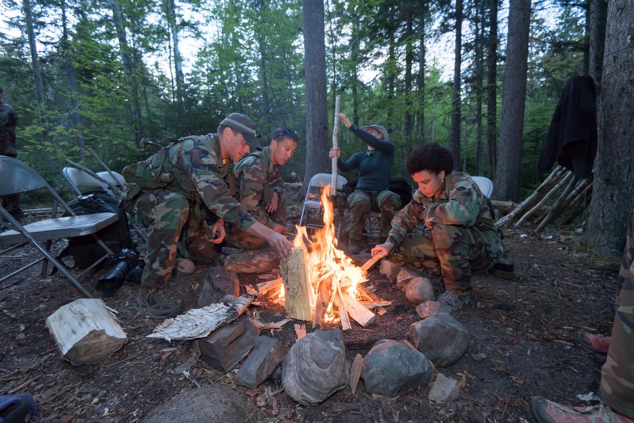
Work Request Description: Photographic coverage of ASCAN 2021 Class Wilderness Survival Training at Ft. Rucker, Alabama
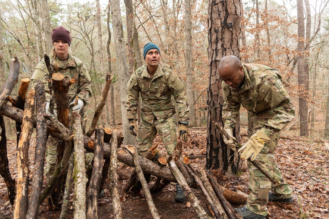
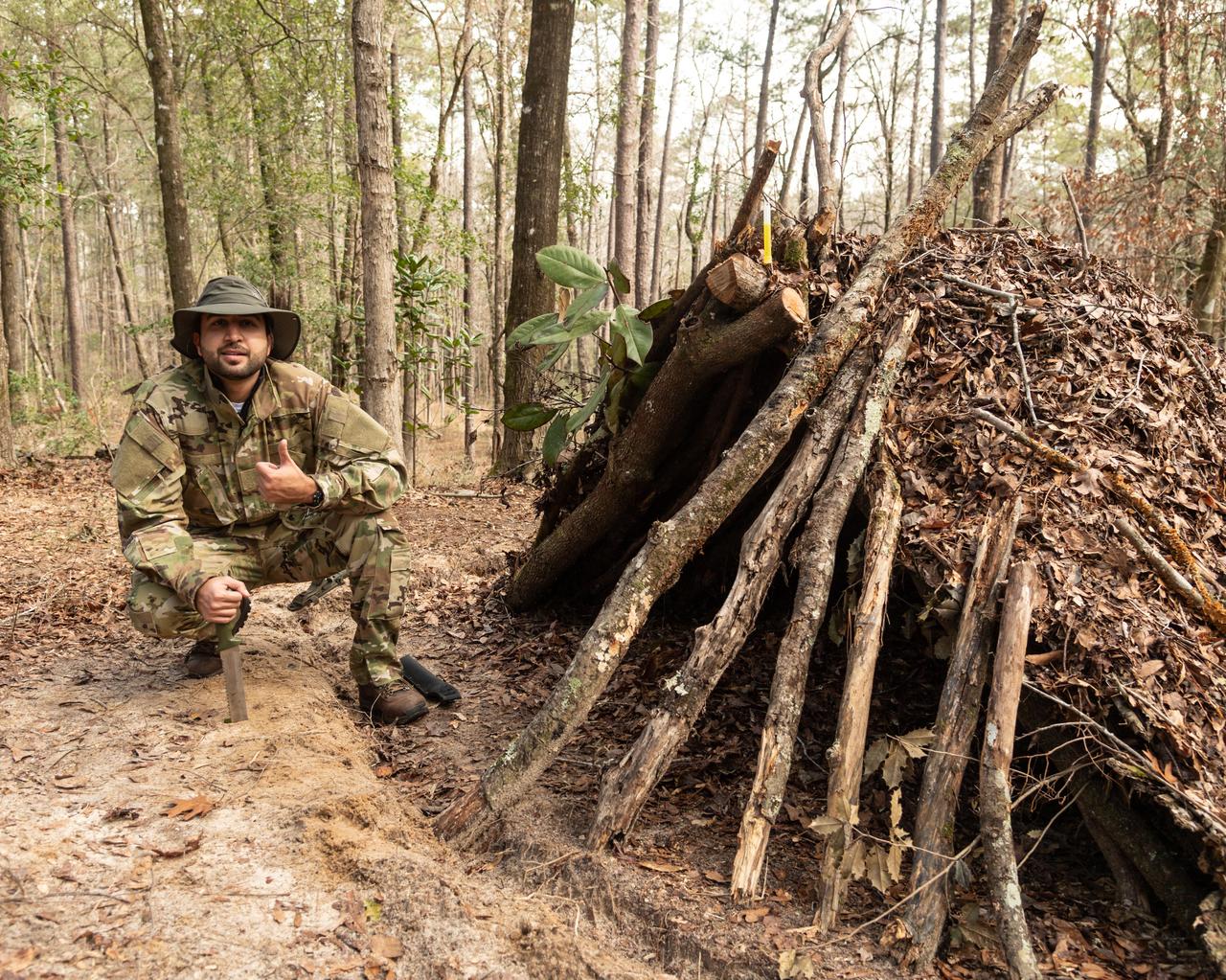
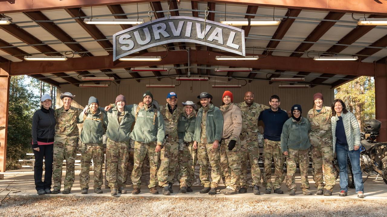
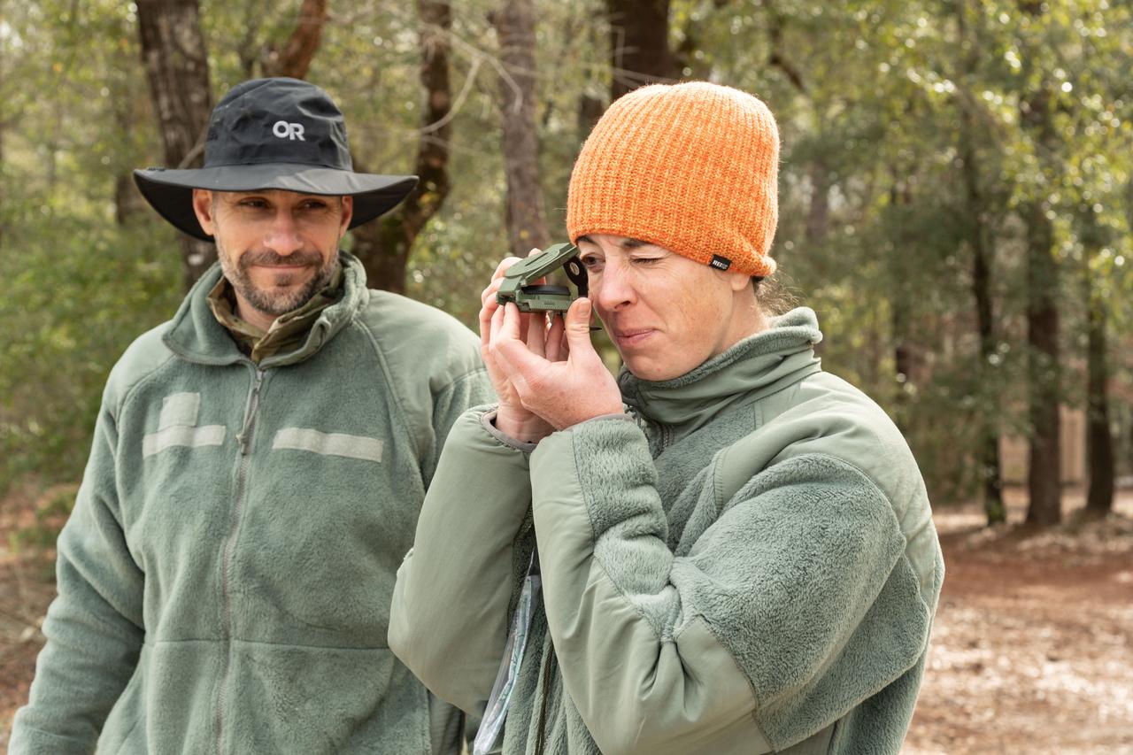
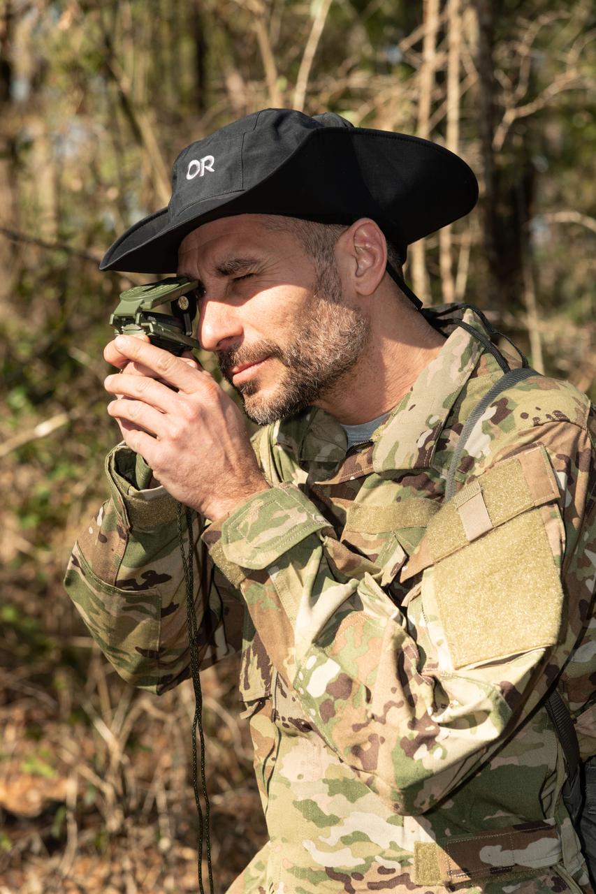
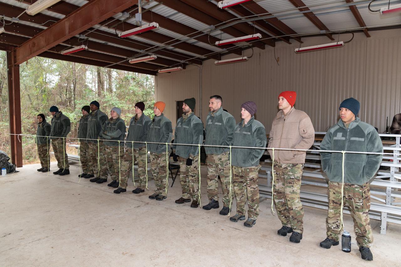
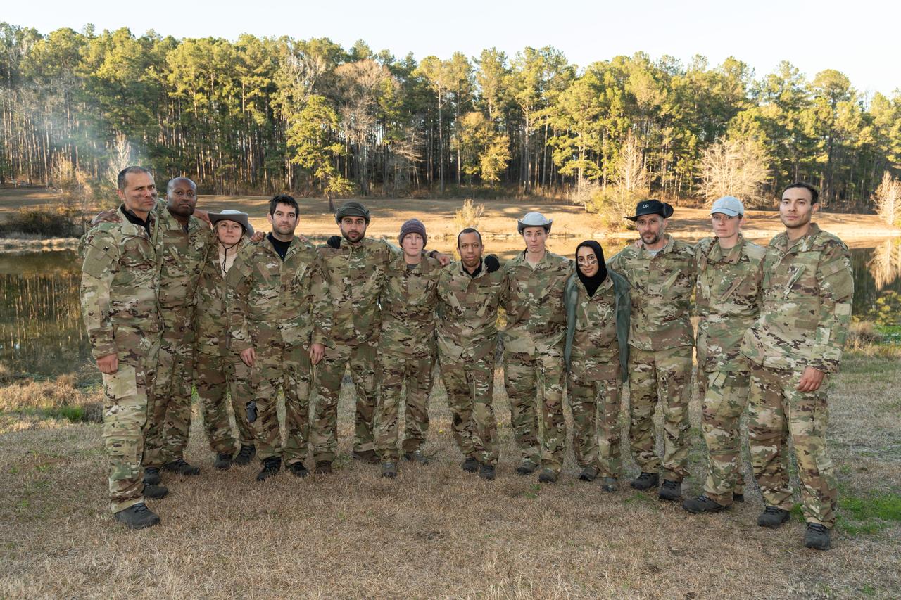
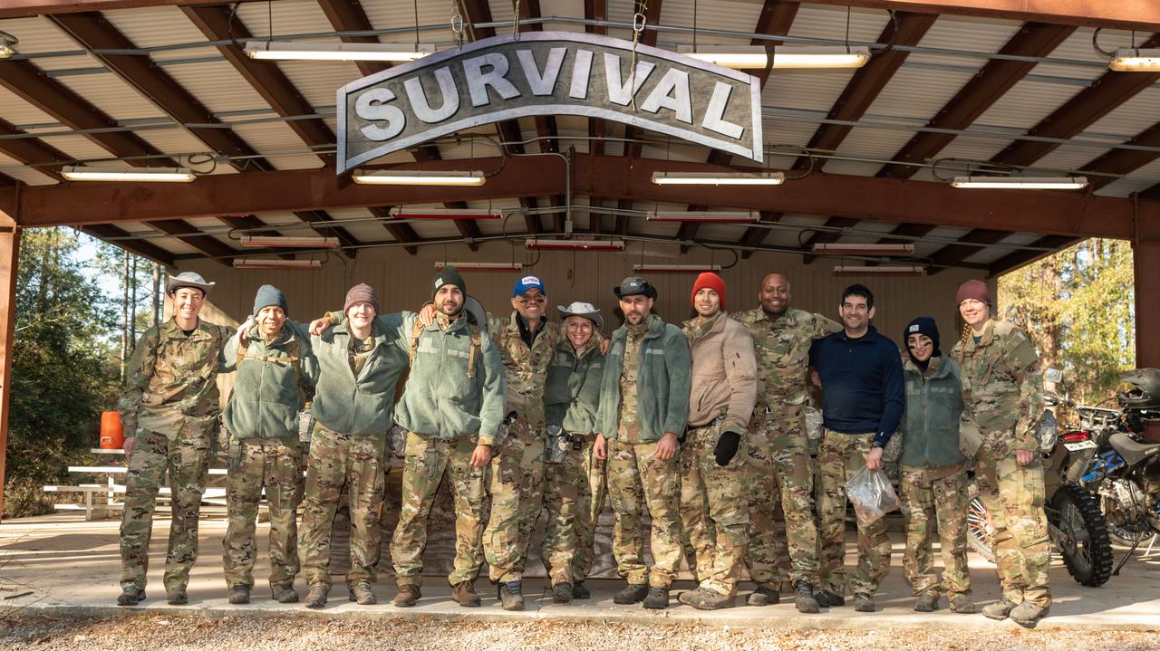
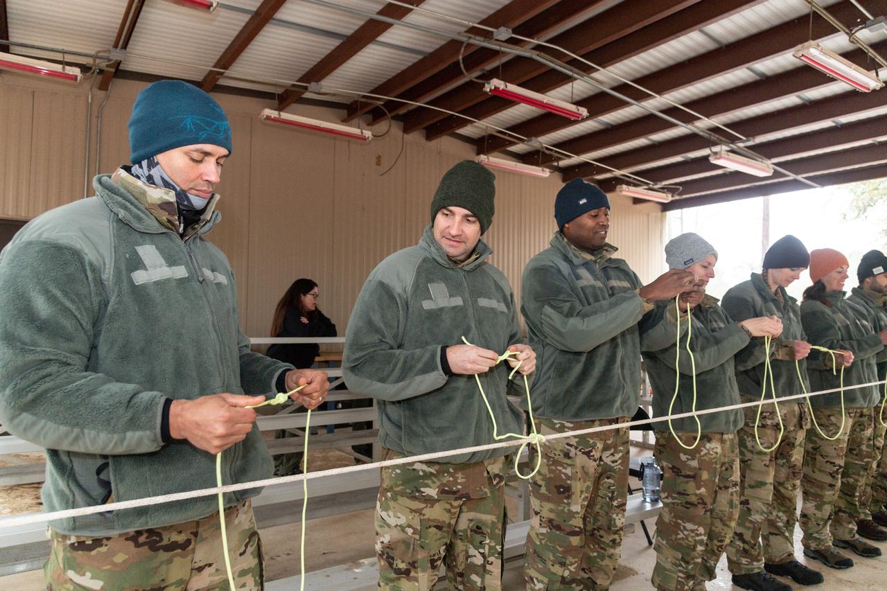
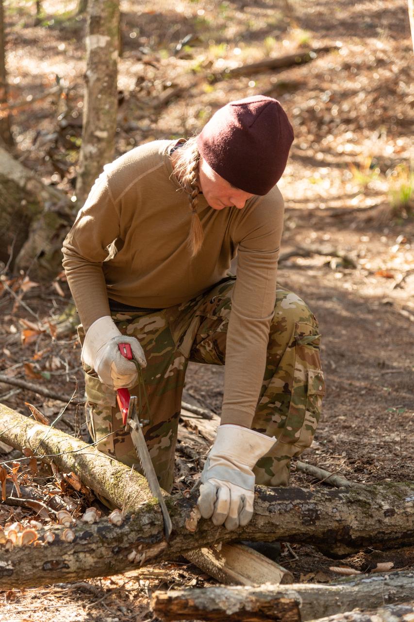
Work Request Description: Photographic coverage of ASCAN 2021 Class Wilderness Survival Training at Ft. Rucker, Alabama
Work Request Description: Photographic coverage of ASCAN 2021 Class Wilderness Survival Training at Ft. Rucker, Alabama
Work Request Description: Photographic coverage of ASCAN 2021 Class Wilderness Survival Training at Ft. Rucker, Alabama
Work Request Description: Photographic coverage of ASCAN 2021 Class Wilderness Survival Training at Ft. Rucker, Alabama
Work Request Description: Photographic coverage of ASCAN 2021 Class Wilderness Survival Training at Ft. Rucker, Alabama
Work Request Description: Photographic coverage of ASCAN 2021 Class Wilderness Survival Training at Ft. Rucker, Alabama
Work Request Description: Photographic coverage of ASCAN 2021 Class Wilderness Survival Training at Ft. Rucker, Alabama
Work Request Description: Photographic coverage of ASCAN 2021 Class Wilderness Survival Training at Ft. Rucker, Alabama
Work Request Description: Photographic coverage of ASCAN 2021 Class Wilderness Survival Training at Ft. Rucker, Alabama
Work Request Description: Photographic coverage of ASCAN 2021 Class Wilderness Survival Training at Ft. Rucker, Alabama
Work Request Description: Photographic coverage of ASCAN 2021 Class Wilderness Survival Training at Ft. Rucker, Alabama
Work Request Description: Photographic coverage of ASCAN 2021 Class Wilderness Survival Training at Ft. Rucker, Alabama

Work Request Description: Photographic coverage of ASCAN 2021 Class Wilderness Survival Training at Ft. Rucker, Alabama
Work Request Description: Photographic coverage of ASCAN 2021 Class Wilderness Survival Training at Ft. Rucker, Alabama
Work Request Description: Photographic coverage of ASCAN 2021 Class Wilderness Survival Training at Ft. Rucker, Alabama
Work Request Description: Photographic coverage of ASCAN 2021 Class Wilderness Survival Training at Ft. Rucker, Alabama
Work Request Description: Photographic coverage of ASCAN 2021 Class Wilderness Survival Training at Ft. Rucker, Alabama

Work Request Description: Photographic coverage of ASCAN 2021 Class Wilderness Survival Training at Ft. Rucker, Alabama
Work Request Description: Photographic coverage of ASCAN 2021 Class Wilderness Survival Training at Ft. Rucker, Alabama
Work Request Description: Photographic coverage of ASCAN 2021 Class Wilderness Survival Training at Ft. Rucker, Alabama
Work Request Description: Photographic coverage of ASCAN 2021 Class Wilderness Survival Training at Ft. Rucker, Alabama
Work Request Description: Photographic coverage of ASCAN 2021 Class Wilderness Survival Training at Ft. Rucker, Alabama
Work Request Description: Photographic coverage of ASCAN 2021 Class Wilderness Survival Training at Ft. Rucker, Alabama
Work Request Description: Photographic coverage of ASCAN 2021 Class Wilderness Survival Training at Ft. Rucker, Alabama
Work Request Description: Photographic coverage of ASCAN 2021 Class Wilderness Survival Training at Ft. Rucker, Alabama
Work Request Description: Photographic coverage of ASCAN 2021 Class Wilderness Survival Training at Ft. Rucker, Alabama
Work Request Description: Photographic coverage of ASCAN 2021 Class Wilderness Survival Training at Ft. Rucker, Alabama
Work Request Description: Photographic coverage of ASCAN 2021 Class Wilderness Survival Training at Ft. Rucker, Alabama
Work Request Description: Photographic coverage of ASCAN 2021 Class Wilderness Survival Training at Ft. Rucker, Alabama
Work Request Description: Photographic coverage of ASCAN 2021 Class Wilderness Survival Training at Ft. Rucker, Alabama
Work Request Description: Photographic coverage of ASCAN 2021 Class Wilderness Survival Training at Ft. Rucker, Alabama
Work Request Description: Photographic coverage of ASCAN 2021 Class Wilderness Survival Training at Ft. Rucker, Alabama
Work Request Description: Photographic coverage of ASCAN 2021 Class Wilderness Survival Training at Ft. Rucker, Alabama
Work Request Description: Photographic coverage of ASCAN 2021 Class Wilderness Survival Training at Ft. Rucker, Alabama
Work Request Description: Photographic coverage of ASCAN 2021 Class Wilderness Survival Training at Ft. Rucker, Alabama
Work Request Description: Photographic coverage of ASCAN 2021 Class Wilderness Survival Training at Ft. Rucker, Alabama
Work Request Description: Photographic coverage of ASCAN 2021 Class Wilderness Survival Training at Ft. Rucker, Alabama
Work Request Description: Photographic coverage of ASCAN 2021 Class Wilderness Survival Training at Ft. Rucker, Alabama
Work Request Description: Photographic coverage of ASCAN 2021 Class Wilderness Survival Training at Ft. Rucker, Alabama
Work Request Description: Photographic coverage of ASCAN 2021 Class Wilderness Survival Training at Ft. Rucker, Alabama
Work Request Description: Photographic coverage of ASCAN 2021 Class Wilderness Survival Training at Ft. Rucker, Alabama
Work Request Description: Photographic coverage of ASCAN 2021 Class Wilderness Survival Training at Ft. Rucker, Alabama
Work Request Description: Photographic coverage of ASCAN 2021 Class Wilderness Survival Training at Ft. Rucker, Alabama
Work Request Description: Photographic coverage of ASCAN 2021 Class Wilderness Survival Training at Ft. Rucker, Alabama
Work Request Description: Photographic coverage of ASCAN 2021 Class Wilderness Survival Training at Ft. Rucker, Alabama
Work Request Description: Photographic coverage of ASCAN 2021 Class Wilderness Survival Training at Ft. Rucker, Alabama

Work Request Description: Photographic coverage of ASCAN 2021 Class Wilderness Survival Training at Ft. Rucker, Alabama
Work Request Description: Photographic coverage of ASCAN 2021 Class Wilderness Survival Training at Ft. Rucker, Alabama
Work Request Description: Photographic coverage of ASCAN 2021 Class Wilderness Survival Training at Ft. Rucker, Alabama
Work Request Description: Photographic coverage of ASCAN 2021 Class Wilderness Survival Training at Ft. Rucker, Alabama
Work Request Description: Photographic coverage of ASCAN 2021 Class Wilderness Survival Training at Ft. Rucker, Alabama
Work Request Description: Photographic coverage of ASCAN 2021 Class Wilderness Survival Training at Ft. Rucker, Alabama
Work Request Description: Photographic coverage of ASCAN 2021 Class Wilderness Survival Training at Ft. Rucker, Alabama
Work Request Description: Photographic coverage of ASCAN 2021 Class Wilderness Survival Training at Ft. Rucker, Alabama

Work Request Description: Photographic coverage of ASCAN 2021 Class Wilderness Survival Training at Ft. Rucker, Alabama
Work Request Description: Photographic coverage of ASCAN 2021 Class Wilderness Survival Training at Ft. Rucker, Alabama
Work Request Description: Photographic coverage of ASCAN 2021 Class Wilderness Survival Training at Ft. Rucker, Alabama
Work Request Description: Photographic coverage of ASCAN 2021 Class Wilderness Survival Training at Ft. Rucker, Alabama
Work Request Description: Photographic coverage of ASCAN 2021 Class Wilderness Survival Training at Ft. Rucker, Alabama
Work Request Description: Photographic coverage of ASCAN 2021 Class Wilderness Survival Training at Ft. Rucker, Alabama
Work Request Description: Photographic coverage of ASCAN 2021 Class Wilderness Survival Training at Ft. Rucker, Alabama
Work Request Description: Photographic coverage of ASCAN 2021 Class Wilderness Survival Training at Ft. Rucker, Alabama
Work Request Description: Photographic coverage of ASCAN 2021 Class Wilderness Survival Training at Ft. Rucker, Alabama
Work Request Description: Photographic coverage of ASCAN 2021 Class Wilderness Survival Training at Ft. Rucker, Alabama

Work Request Description: Photographic coverage of ASCAN 2021 Class Wilderness Survival Training at Ft. Rucker, Alabama

Work Request Description: Photographic coverage of ASCAN 2021 Class Wilderness Survival Training at Ft. Rucker, Alabama
Work Request Description: Photographic coverage of ASCAN 2021 Class Wilderness Survival Training at Ft. Rucker, Alabama
Work Request Description: Photographic coverage of ASCAN 2021 Class Wilderness Survival Training at Ft. Rucker, Alabama
jsc2018e052153 (May 30, 2018) --- 2017 NASA astronaut candidate Jessica Watkins preps her station with fellow candidate Loral O’Hara looking on during wilderness survival training at the U.S. Navy’s Survival, Evasion, Resistance, and Escape School in Brunswick, Maine. Photo Credit: (NASA/Josh Valcarcel)
The Whitewater Fire in the Mount Jefferson Wilderness in Oregon was started by a lightning strike. As of Aug. 18, 2017, more than 117,000 acres and 30 miles (48 kilometers) of the Pacific Crest Trail are closed to the public in an area that had been expected to be popular with people there to view the August 21 solar eclipse. The smoke clouds sit over the burned area, just west-northwest of Mount Jefferson. The image was acquired Aug. 18, 2017, covers an area of 16 by 17 miles (26.1 by 27.2 kilometers), and is located at 44.7 degrees north, 121.8 degrees west. https://photojournal.jpl.nasa.gov/catalog/PIA21877
jsc2018e052190 (May 30, 2018) --- (From left) 2017 NASA astronaut candidates Bob Hines, Jonny Kim, and Jessica Watkins care for their fire while Canadian Space Agency astronaut candidate Jennifer Sidey-Gibbons preps more wood during wilderness survival training at the U.S. Navy’s Survival, Evasion, Resistance, and Escape School in Brunswick, Maine. Photo Credit: NASA/Josh Valcarcel
jsc2018e052141 (May 30, 2018) --- (From left) 2017 NASA astronaut candidates Matthew Dominick, Raja Chari, Jasmin Moghbeli, Frank Rubio, and Jessica Watkins take time to bond on their hike during wilderness survival training at the U.S. Navy’s Survival, Evasion, Resistance, and Escape School in Brunswick, Maine. Photo Credit: (NASA/Josh Valcarcel)
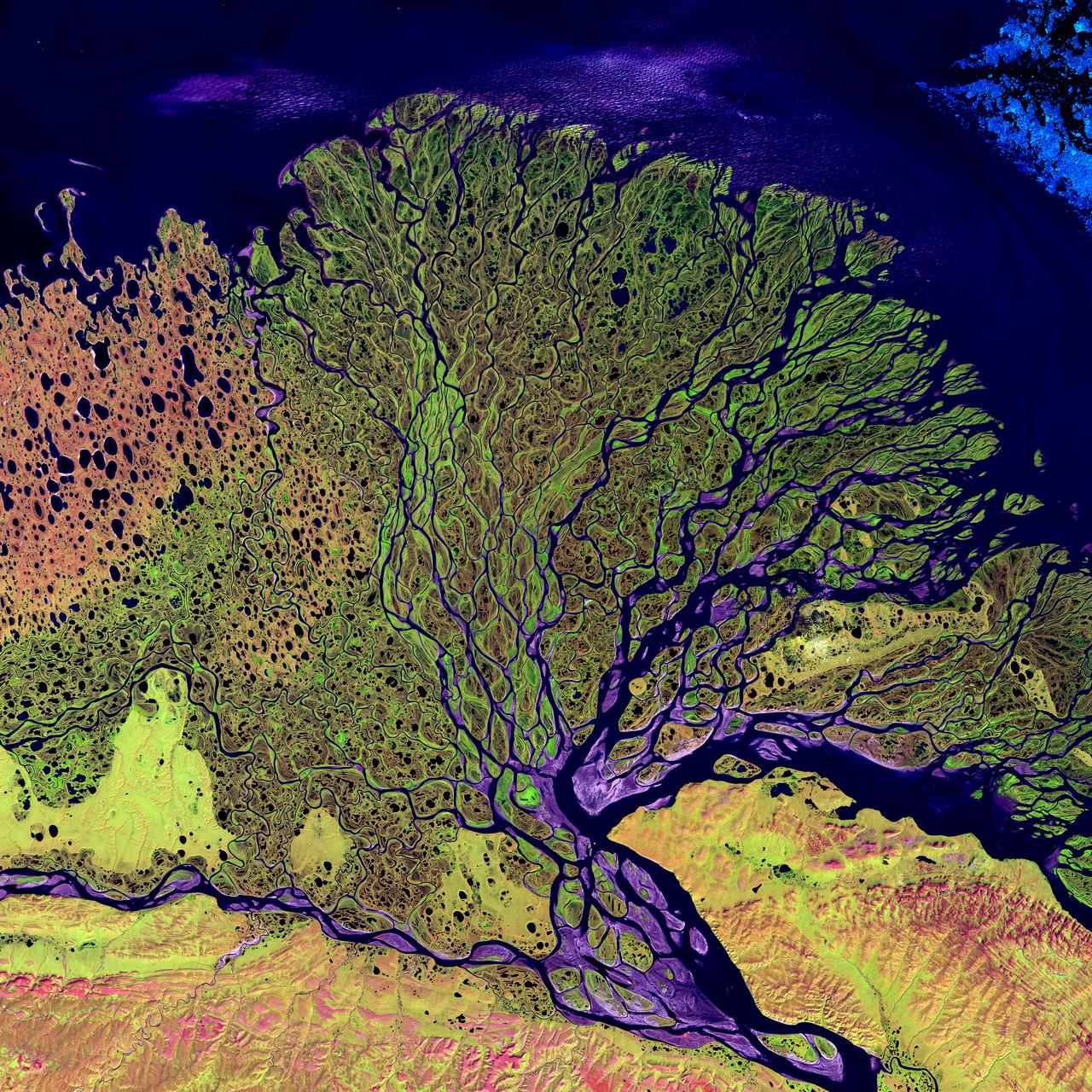
Image taken 7/27/2000: The Lena River, some 2,800 miles (4,400 km) long, is one of the largest rivers in the world. The Lena Delta Reserve is the most extensive protected wilderness area in Russia. It is an important refuge and breeding grounds for many species of Siberian wildlife. The Lena Delta can be found on Landsat 7 WRS Path 131 Row 8/9, center: 72.21, 126.15. To learn more about the Landsat satellite go to: <a href="http://landsat.gsfc.nasa.gov/" rel="nofollow">landsat.gsfc.nasa.gov/</a>
jsc2018e052124 (May 30, 2018) --- 2017 NASA astronaut candidates Jasmin Moghbeli and Frank Rubio discuss their next plan of action while fellow astronaut candidates and their instructor study their topographical maps during wilderness survival training at the U.S. Navy’s Survival, Evasion, Resistance, and Escape School in Brunswick, Maine. Photo Credit: (NASA/Josh Valcarcel)
jsc2018e052122 (May 30, 2018) --- (From left) 2017 NASA astronaut candidate Jonny Kim prepares for his next assignment as Canadian Space Agency astronaut candidates Joshua Kutryk (standing), Jennifer Sidey-Gibbons, and NASA astronaut candidate Bob Hines look on during wilderness survival training at the U.S. Navy’s Survival, Evasion, Resistance, and Escape School in Brunswick, Maine. Photo Credit: (NASA/Josh Valcarcel)

STS099-729-086 (11-22 February 2000) ---In this 70mm frame photographed by one of the STS-99 crew members, the city of Miami encroaches the eastern edge of the Everglades in Florida. The Everglades is an International Biosphere Reserve World Heritage Site. This subtropical wilderness encompasses a relatively flat (does not exceed 2.4 meters above sea level) saw-grass marsh region of 10,000 square kilometers (4,000 square miles). The only source of water in the Everglades is from rainfall. The flow of water is detectable in this image, slowly moving from Lake Okeechobee to Florida Bay; the light blue, shallow area (less than 3 meters) between the mainland and the Keys; and the southwestern Florida coast.
S92-46167 (16-20 Aug. 1992) --- Michael E. Lopez-Alegria, one of 19 astronaut candidates announced in March, fashions a shelter from wood and parachute material. He was taking in a four-day wilderness survival training course at Fairchild Air Force Base in Washington. Lopez-Alegria and his class mates had reported to the Johnson Space Center (JSC) in Houston, Texas, for initial training and evaluation earlier this month. EDITOR?S NOTE: Lopez-Alegria has been named fly aboard the Space Shuttle Columbia for the STS-73 mission, scheduled for 1995
STS103-501-152 (19-27 December 1999) --- One of the astronauts aboard the Earth-orbiting Space Shuttle Discovery used a handheld large format camera to photograph this southern Florida scene. The city of Miami encroaches the eastern edge of the Everglades, which constitute an International Biosphere Reserve World Heritage Site. This subtropical wilderness encompasses a relatively flat (does not exceed 2.4 m above sea level) saw-grass marsh region of 10,000 square kilometers (4,000 square miles). According to NASA Earth scientists, the only source of water in the Everglades is from rainfall. The flow of water is detectable in this image, slowly moving from Lake Okeechobee to Florida Bay; the light blue, shallow area between the mainland and the Keys; and the southwestern Florida coast.
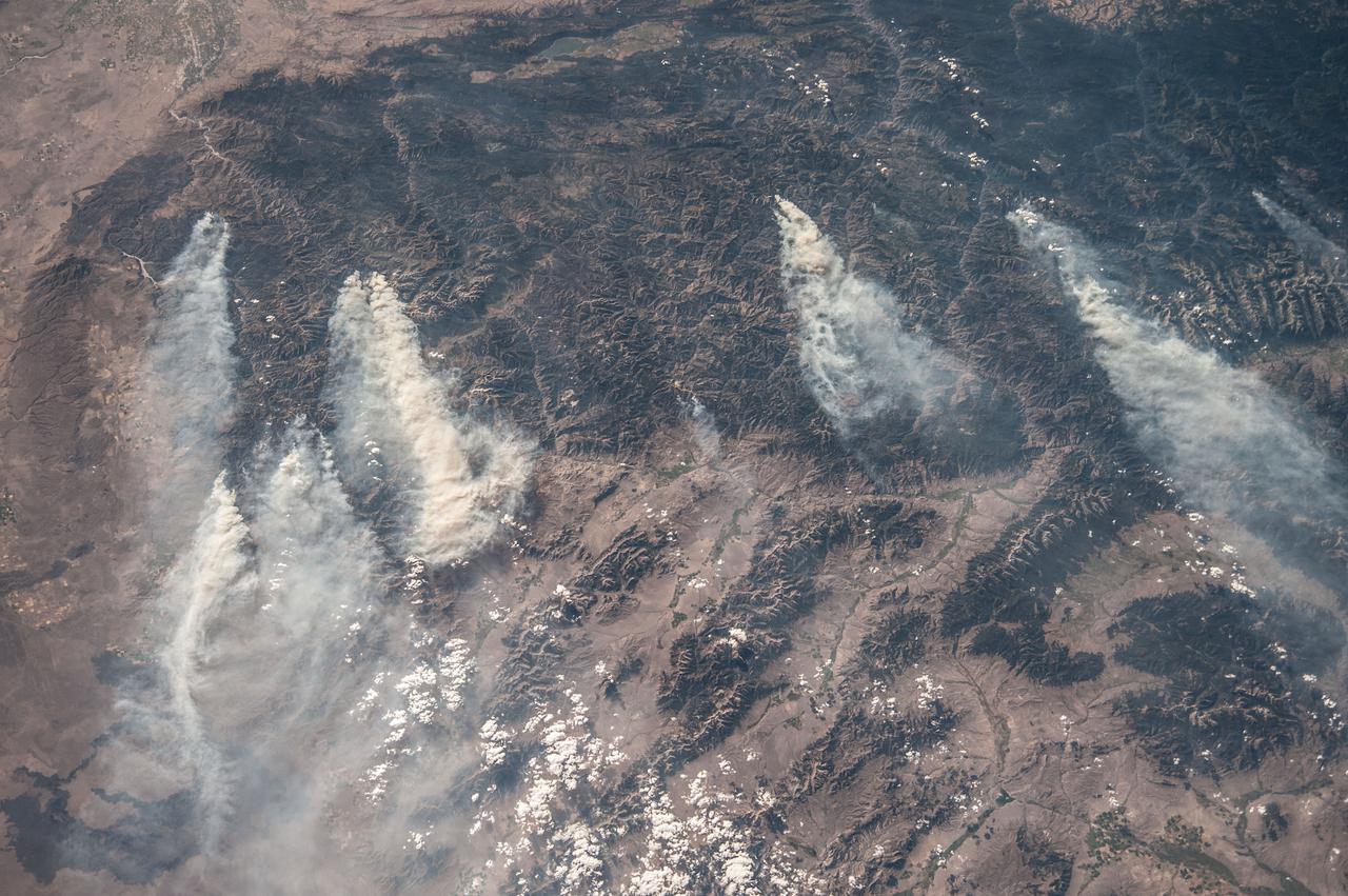
ISS036-E-032853 (18 Aug. 2013) --- Central Idaho wildfires are featured in this image photographed by an Expedition 36 crew member on the International Space Station. Taken with a short lens (50 mm), this west-looking image covers much of forested central Idaho?the dark areas are all wooded mountains. The image highlights part of the largest single wilderness area in the contiguous United States (the Frank Church-River of No Return Wilderness). Within this mountainous region, several fires can be seen producing extensive smoke plumes. Some fires had been named by Aug. 20, 2013, two days after the image was taken. The densest smoke on that day appears to be generated by a combination of the Little Queens and Leggit fires (left, within the Salmon River Mountains). The named fires were mostly set by lightning, and on Aug. 20 totaled 53,000 acres of burned forest south of the Salmon River, and many more if the unnamed fires are included. The Gold Pan fire north of the Salmon River had burned 27,000 acres. For a sense of scale in this oblique view, the Gold Pan fire lies about 125 miles north of the Little Queens fire. This image shows the common pattern of westerly winds transporting smoke in an easterly direction, as seen during the wildfire season of one year ago. Ten days before this image was taken, fires in central Idaho near Boise were aggravated by southerly winds. Some of the fires began to burn in July but were quelled and remain under observation for new flare-ups. Smoke from fires in the south partly obscures the black lava flows of the Craters of the Moon National Monument (lower left). The Beaverhead Mountains mark the eastern boundary of Idaho with Montana.

ISS032-E-024687 (3 Sept. 2012) --- Idaho fires are featured in this image photographed by an Expedition 32 crew member on the International Space Station. Taken with a short lens (45 mm), this west-looking photograph has a field of view covering much of the forested region of central Idaho. The dark areas are all wooded mountains—the Salmon River Mountains (left), Bitterroot Mountains (lower right) and Clearwater Mountains (right). All three areas experienced wildfires in September 2012—this image illustrates the situation early in the month. Smaller fire ‘complexes” appear as tendrils of smoke near the sources (e.g. Halstead complex at left), and as major white smoke plumes from the Mustang fire complex in the densest forests (darkest green, center) of the Clearwater Mountains. This was the largest plume noted in the region with thick smoke blowing eastward over the Beaverhead Mountains at bottom. The linear shape of the smoke plumes gives a sense of the generally eastward smoke transport on this day in early September. The smoke distribution shows another kind of transport: at night, when winds are weak, cooling of the atmosphere near the ground causes drainage of cooled (denser) air down into the major valleys. Here the smoke can be seen flowing west down into the narrow Salmon and Lochsa River valleys (at a local time of 12:18:50 p.m.) – in the opposite direction to the higher winds and the thick smoke masses. The bright yellow-tan areas at top left and top right contrasting with the mountains are grasslands of the Snake River in southern Idaho around Boise, and the Palouse region in western Idaho–SE Washington state. This latter area is known to ecologists as the Palouse Grasslands Ecoregion. Light green areas visible in the center of many of the valleys are agricultural crops including barley, alfalfa, and wheat. The image also shows several firsts of which Idaho can boast. The Snake River between Boise and the Palouse region has cut Hells Canyon (top), the deepest gorge in the U.S. at almost 2,436 meters (8,000 feet). The largest single wilderness area in the contiguous U.S., the Frank Church-River of No Return Wilderness occupies the wooded zones of the Salmon River Mountains and the Clearwater Mountains, i.e. most of the area shown in the middle of the image. Idaho’s highest peak is Borah Peak (lower left) at 3,860 meters above sea level (12,662 feet ASL). The Continental Divide cuts through the bottom of the image—rivers on the eastern slopes of the Beaverhead Mountains drain to the Atlantic Ocean, whereas rivers in the rest of the area drain to the Pacific Ocean.
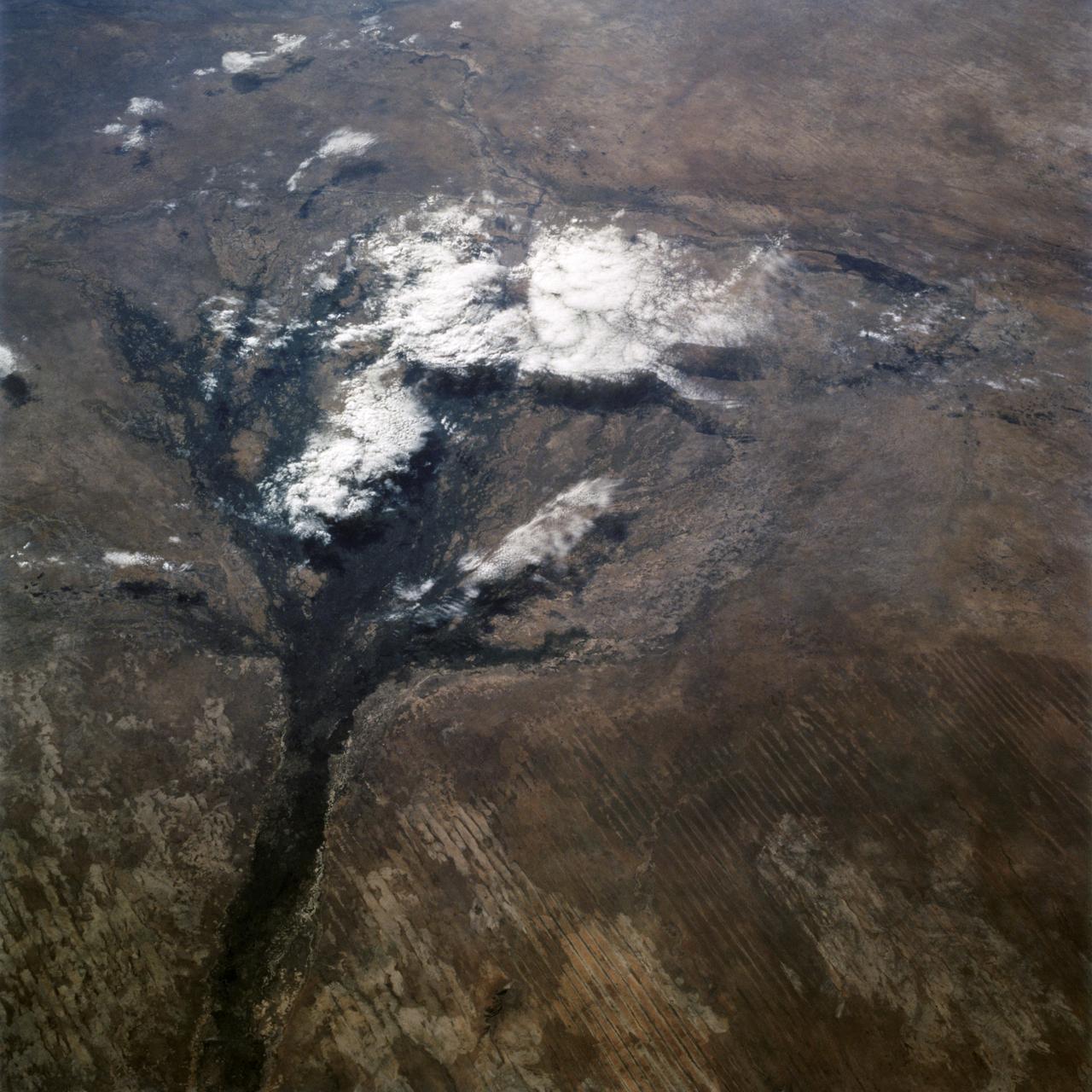
STS066-122-091 (3-14 Nov. 1994) --- This November 1994 view looking south-southeast shows clouds over the Okavango Delta area of northern Botswana. The Okavango is one of the wilder, less spoiled regions of Africa. The area still supports great herds of wild animals such as elephant, zebra and the cape buffalo. Despite conservation efforts from the stable government of Botswana, delta habitats are pressured. The Okavango River (lower left of view) brings water from the high, wet plateaus of Angola into the Kalahari Desert, and enormous inland basin. As a result of a series of small faults (upper center of the view) related to the African Rift System, the river is dammed up in the form of swampy inland delta. Here, water is consumed by evaporation, infiltration, and the swamp forests. Late summer floods take six months to slowly penetrate the 160 kilometer (95 miles) to the other end of the Delta. The visual patterns of the area are strongly linear: straight sand dunes occur in many places and can be seen across the bottom portion of the photograph. Numerous brush-fire scars produce a complex, straight-edged pattern over much of the lower portion of this view. Lake Ngami (upper right of view) was once permanently full as late as the middle 1800's. Changes in the climate of the area over the last 100 years has changed the size and shape of the inland delta.
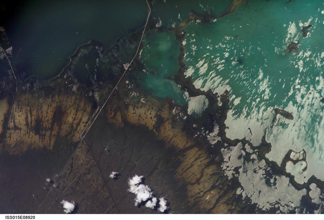
ISS015-E-08920 (19 May 2007) --- Southern Everglades National Park, Florida is featured in this image photographed by an Expedition 15 crewmember on the International Space Station. Everglades National Park in southern Florida is the largest subtropical wilderness in the United States. Known as the "river of grass", the Everglades wetlands and wooded uplands host a variety of endangered species including crocodiles, manatees, and panthers. During the late 19th and 20th centuries, the original 11,000 square miles of wetlands were viewed as useless swampland in need of reclamation. The success of reclamation efforts -- for agriculture and urban expansion in southern Florida -- has led to the loss of approximately 50 per cent of the original wetlands and 90 per cent of wading bird species. Today, an extensive restoration effort is underway to return portions of the Everglades to a more natural state and prevent further ecosystem degradation. This view highlights the southern Everglades estuarine ecosystem where the wetlands meet Florida Bay. Thin fingers of land and small islands (keys) host mangrove, hardwood hammocks, marsh and prairie (mainly dark to light green in the image). The tan and grayish-brown areas are dominantly scrub, marshland and prairie; small green "dots" and narrow lines in this region are isolated mangrove and hardwood stands indicating the general direction of slow water flow toward the bay. The silver-gray regions are water surfaces highlighted by sunglint. The roadway forming the western boundary of the National Park is US Route 1 connecting the Miami metropolitan area to the north (not shown) with the Florida Keys to the south (not shown). A small built feature visible along the roadway is a fishing camp.
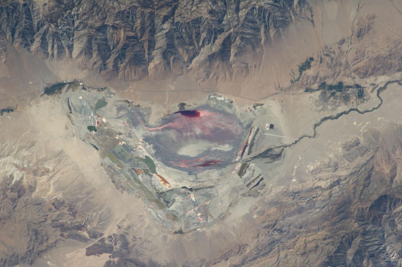
ISS028-E-035137 (30 Aug. 2011) --- Owens Lake in California is featured in this image photographed by an Expedition 28 crew member on the International Space Station. This photograph highlights the mostly dry bed of Owens Lake, located in the Owens River Valley between the Inyo Mountains and the Sierra Nevada. Shallow groundwater, springs, and seeps support minor wetlands and a central brine pool. Two bright red areas along the margins of the brine pool indicate the presence of halophilic, or salt-loving organisms known as Achaeans. Grey and white materials within the lake bed are exposed lakebed sediments and salt crusts. The towns of Olancha and Lone Pine are delineated by the presence of green vegetation indicating a more constant availability of water. According to scientists, the present-day Owens Lake was part of a much larger lake and river system that existed during the Pleistocene Epoch (approximately 3 million to approximately 12,000 years ago) along the current northeastern border of California with Nevada. Meltwater from alpine glaciers in the Sierra Nevada filled the regional valleys of the Basin and Range to form several glacial lakes that were ancestral to the now-dry lakebeds (or playas) of Owens, Searles Lake, and China Lake. While Searles and China Lakes dried out due to regional changes to a hotter and drier climate over thousands of years, Owens Lake became desiccated largely due to the diversion of Owens River water in the early 20th century to serve the needs of the City of Los Angeles, CA located 266 kilometers to the south. Following complete desiccation of the lakebed in 1926, significant amounts of windblown dust were produced ? indeed, the term ?Keeler fog? was coined by residents of the now largely abandoned town on the eastern side of Owens Lake due to the dust. In addition to adverse health effects on local residents, dust from Owens Lake has been linked to visibility reduction in nearby national parks, forests, and wilderness areas. Recently, efforts to control dust evolution from the lakebed have been undertaken by the City of Los Angeles.
ISS018-E-005321 (24 Oct. 2008) --- The Hell's Half Acre Lava Field in Idaho is featured in this image photographed by an Expedition 18 crewmember on the International Space Station. Located in eastern Idaho, the Hell's Half Acre Lava Field is the easternmost large field associated with the Snake River Plain that arcs across the center of the state. The abundant lava flows and other volcanic rocks of the Snake River Plain are thought to be the result of southwest passage of the North American tectonic plate over a fixed mantle plume or "hotspot". According to scientists, Volcanism attributed to the hotspot began approximately 15 million years ago in the western portion of the Plain, with lava fields becoming younger to the east -- with lavas erupted approximately 4,100 years ago, Hell's Half Acre is one of the youngest lava fields. Today, the center of hotspot volcanism is located in Yellowstone National Park and feeds the extensive geyser system there. Portions of the Hell's Half Acre Lava Field are designated as a National Natural Landmark and Wilderness Study Area. This detailed photograph illustrates the forbidding landscape of the basaltic lava field -- the complex ridge patterns of the black to grey-green flow surfaces, comprised of ropy pahoehoe and blocky A a lava, are clearly visible. Regions of tan soil surrounded by lava are known as kipukas -- these "islands" are windows onto the older underlaying soil surface as they were never covered by lava. The kipukas are used for agriculture (both crops and grazing) -- several green fields are visible to the northwest of Interstate Highway 15 (right). Light to dark mottling visible in the kipukas is most likely due to variations in moisture and disturbance by agricultural activities.
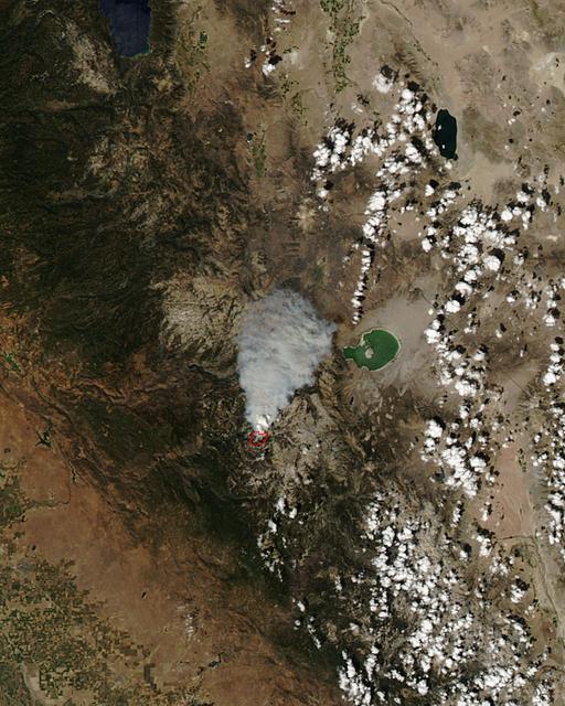
The Meadow Fire in Yosemite National Park is a remote, hold-over lightning caused fire which began on September 4 and is located five miles east of Yosemite Valley, CA. The fuel burning is timber and brush. There is active fire behavior with long range spotting. The National Park Service reports that a fire, that may be a spot fire, from the Meadow lightning-caused fire, was discovered at approximately 12:30 PM, Sunday September 7. The fire is approximately 2,582 acres. It is burning within the Little Yosemite Valley on both sides of the Merced River. All trails in the area are closed. Approximately 100 hikers and backpackers were evacuated from the fire area in Little Yosemite Valley. Half-Dome, a popular tourist destination, has been closed. The fire is burning in Yosemite Wilderness. Eighty-five hikers and climbers were also evacuated from the summit of Half Dome by helicopters from the California Highway Patrol, US Department of Agriculture Forest Service, Sequoia Kings Canyon National Park, and CAL Fire. This natural-color satellite image was collected by the Moderate Resolution Imaging Spectroradiometer (MODIS) aboard the Aqua satellite on Sept. 07, 2014. Actively burning areas, detected by MODIS’s thermal bands, are outlined in red. NASA image courtesy Jeff Schmaltz, MODIS Rapid Response Team. Caption: NASA/Goddard, Lynn Jenner with information from the National Park Service and the National Interagency Coordination Center. <b><a href="http://www.nasa.gov/audience/formedia/features/MP_Photo_Guidelines.html" rel="nofollow">NASA image use policy.</a></b> <b><a href="http://www.nasa.gov/centers/goddard/home/index.html" rel="nofollow">NASA Goddard Space Flight Center</a></b> enables NASA’s mission through four scientific endeavors: Earth Science, Heliophysics, Solar System Exploration, and Astrophysics. Goddard plays a leading role in NASA’s accomplishments by contributing compelling scientific knowledge to advance the Agency’s mission. <b>Follow us on <a href="http://twitter.com/NASAGoddardPix" rel="nofollow">Twitter</a></b> <b>Like us on <a href="http://www.facebook.com/pages/Greenbelt-MD/NASA-Goddard/395013845897?ref=tsd" rel="nofollow">Facebook</a></b> <b>Find us on <a href="http://instagram.com/nasagoddard?vm=grid" rel="nofollow">Instagram</a></b>
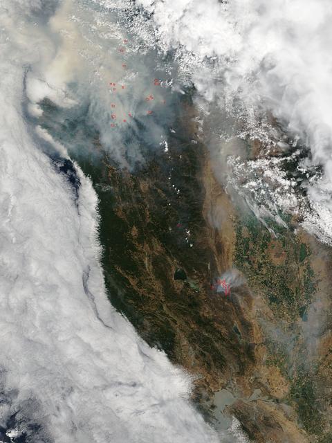
The fire season in California has been anything but cooperative this year. Hot conditions combined with a state-wide drought and dry lightning makes for unpleasant conditions and leads to an abundance of forest fires. On August 12, lightning struck and started the fire that grew into the Happy Camp Complex. Currently over 113,000 acres have been affected and the fire is only 55% contained as of today. Strong winds tested fire lines yesterday (8/15), and are expected to do so again today. Despite the high winds, existing fire lines held with no spotting or expansion outside current containment lines. The south end of the fire continued backing slowly toward Elk Creek in the Marble Mountain Wilderness. The Man Fire joined with the Happy Camp Complex yesterday and will be managed by California Interagency Incident Management Team 4 as of 6:00am on Wednesday, September 17, 2014. Nearby the Happy Camp Complex, near Mt. Shasta and the town of Weed, another fire erupted that fire officials said quickly damaged or destroyed 100 structures Monday (8/15). Hundreds of firefighters were trying to contain that fire. A California Fire spokesman said more than 300 acres were scorched and more than 100 structures damaged or destroyed in just a few hours. The blaze, dubbed the Boles Fire, also led to the closure of Interstate 5 and U.S. 97. Weed is in Siskiyou County, about 50 miles south of the California-Oregon border. With strong winds, the fire was able to rage into the community before firefighters could get equipment to the blaze. About 1,500 to 2,000 residents were being evacuated to the Siskiyou County fairgrounds. An evacuation center was set up at the county fairgrounds in Yreka. NASA's Aqua satellite collected this natural-color image with the Moderate Resolution Imaging Spectroradiometer, MODIS, instrument on September 15, 2014. Actively burning areas, detected by MODIS’s thermal bands, are outlined in red. NASA image courtesy Jeff Schmaltz LANCE/EOSDIS MODIS Rapid Response Team, GSFC. Caption by Lynn Jenner with information from Inciweb and California Department of Forestry and Fire Protection. <b><a href="http://www.nasa.gov/audience/formedia/features/MP_Photo_Guidelines.html" rel="nofollow">NASA image use policy.</a></b> <b><a href="http://www.nasa.gov/centers/goddard/home/index.html" rel="nofollow">NASA Goddard Space Flight Center</a></b> enables NASA’s mission through four scientific endeavors: Earth Science, Heliophysics, Solar System Exploration, and Astrophysics. Goddard plays a leading role in NASA’s accomplishments by contributing compelling scientific knowledge to advance the Agency’s mission. <b>Follow us on <a href="http://twitter.com/NASAGoddardPix" rel="nofollow">Twitter</a></b> <b>Like us on <a href="http://www.facebook.com/pages/Greenbelt-MD/NASA-Goddard/395013845897?ref=tsd" rel="nofollow">Facebook</a></b> <b>Find us on <a href="http://instagram.com/nasagoddard?vm=grid" rel="nofollow">Instagram</a></b>
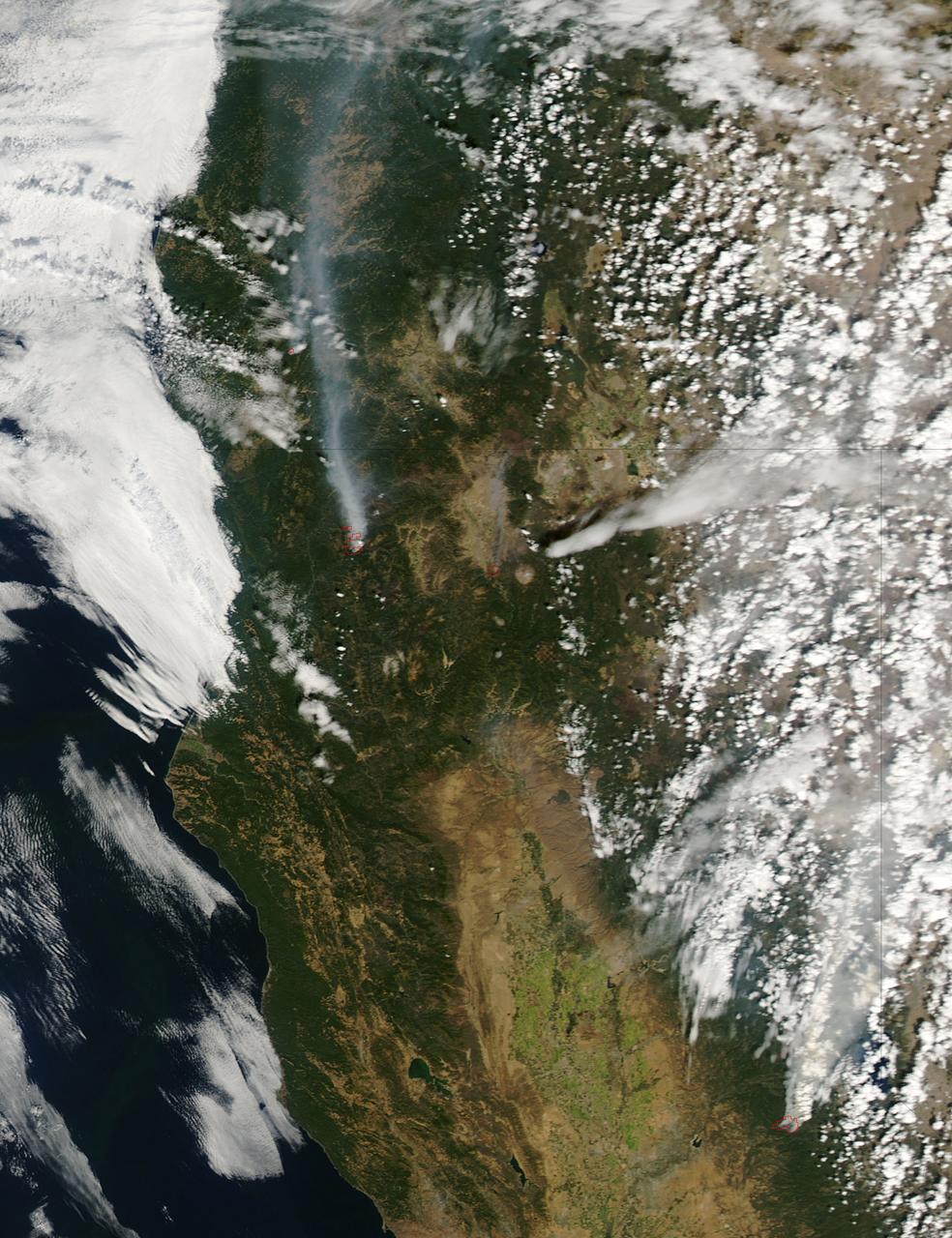
This satellite image shows smoke from several fires in Oregon and California on Aug. 2, 2015. The Moderate Resolution Imaging Spectroradiometer (MODIS) instrument that flies aboard NASA's Aqua satellite captured an image of smoke from these fires Aug. 2 at 21:05 UTC (5:05 p.m. EDT). The multiple red pixels are heat signatures detected by MODIS. The smoke appears to be a light brown color. InciWeb is an interagency all-risk incident information management system that coordinates with federal, state and local agencies to manage wildfires. In Oregon smoke from the Cable Crossing Fire, the Stouts Fire and the Potter Mountain Complex Fire commingle. The Cable Crossing Fire was reported burning on forestlands protected by the Douglas Forest Protective Association (DFPA) at approximately 3:25 p.m. on Tuesday, July 28, 2015, near Oregon Highway 138 East, near Mile Post 23, east of Glide. South of the Cable Crossing Fire is the Stouts Fire also in forestlands of the DFPA. This fire was reported on Thursday, July 30, 2015, burning approximately 11 miles east of Canyonville near the community of Milo. East of the other fires is the Potter Mountain Complex Fire. These fires are located in the Deschutes Forest consists of eight fires. According to Inciweb they were started by dry lightning on Saturday, Aug. 2, at approximately 5:30 p.m. about five miles north of Toketee Lake. In northern California, smoke from the River Complex Fire, the Fork Complex Fire and the Shf July Lightning Fire was visible in the MODIS image. The River Complex currently consists of seven reported and observed fires on the Six Rivers and Shasta Trinity National Forests. Originally identified as 18 fires, some have burned together. Inciweb noted that in the Six Rivers National Forest there are fires in the Trinity Alps Wilderness. Those fires include the Groves Fire and the Elk Fire. In the Shasta-Trinity National Forest the fires include the Happy Fire at 2,256 acres, Daily Fire at 16 acres, the Look Fire at 7 acres, Onion Fire at 136 acres and Smokey Fire at 1 acre. In the same forest, south of the River Complex is the Fork Complex fire. Inciweb reported that the Fork Complex consists of (at current count) over 40 fires, all of which were ignited by lightning between July 29 and 31, 2015. To the southwest of this complex is the Mad River Complex. This is a series of seven lightning fires that started on July 30, 2015 after a lightning storm moved through Northern California. To the east of this and the other fires, burns another near Redding, California, called the Shf July Lightning Fire. This is also under the Shasta-Trinity National Forest management. At 8 p.m. PDT on Aug. 2, Inciweb reported that approximately 15 lightning strikes occurred within 24 hours throughout the Shasta Trinity National Forest and resulted in two new fires. The Caves fire, east of Mt. Shasta, is approximately one-tenth of an acre. The Bluejay fire, east of Shasta Lake, is approximately four acres. Image credit: NASA Goddard's MODIS Rapid Response Team, Jeff Schmaltz <b><a href="http://www.nasa.gov/audience/formedia/features/MP_Photo_Guidelines.html" rel="nofollow">NASA image use policy.</a></b> <b><a href="http://www.nasa.gov/centers/goddard/home/index.html" rel="nofollow">NASA Goddard Space Flight Center</a></b> enables NASA’s mission through four scientific endeavors: Earth Science, Heliophysics, Solar System Exploration, and Astrophysics. Goddard plays a leading role in NASA’s accomplishments by contributing compelling scientific knowledge to advance the Agency’s mission. <b>Follow us on <a href="http://twitter.com/NASAGoddardPix" rel="nofollow">Twitter</a></b> <b>Like us on <a href="http://www.facebook.com/pages/Greenbelt-MD/NASA-Goddard/395013845897?ref=tsd" rel="nofollow">Facebook</a></b> <b>Find us on <a href="http://instagrid.me/nasagoddard/?vm=grid" rel="nofollow">Instagram</a></b>