Spin Offs Macro Series - Water Filter
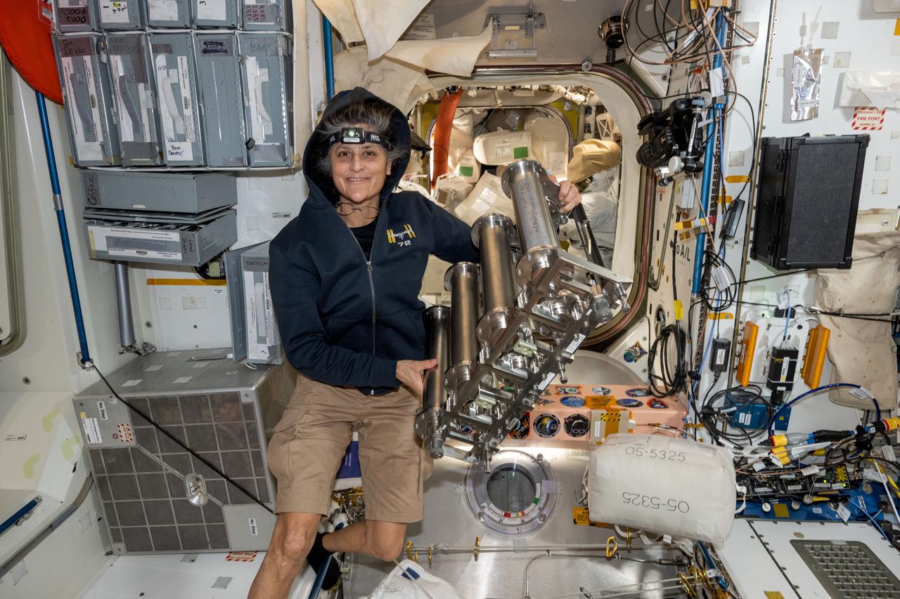
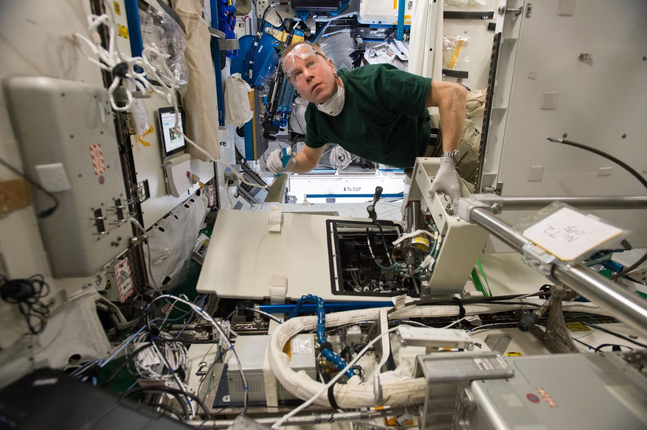
iss072e143163 (Nov. 1, 2024) --- NASA astronaut and Expedition 72 Commander Suni Williams replaces particulate filters on the water recovery system, a component of the Tranquility module's waste and hygiene compartment, the International Space Station's bathroom.
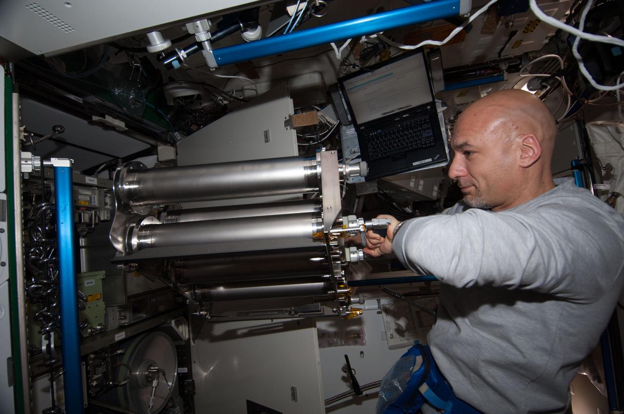
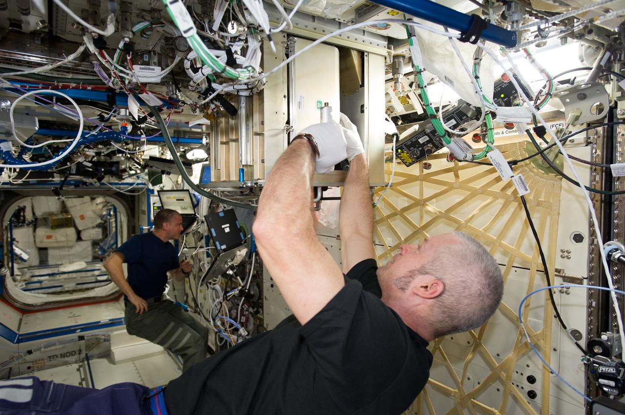
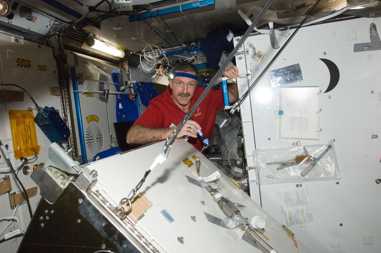
ISS036-E-018008 (12 July 2013) --- European Space Agency astronaut Luca Parmitano, Expedition 36 flight engineer, removes and replaces the particulate filter for the Water Pump Assembly 2 (WPA2) in Tranquility (also called Node 3) on the International Space Station.
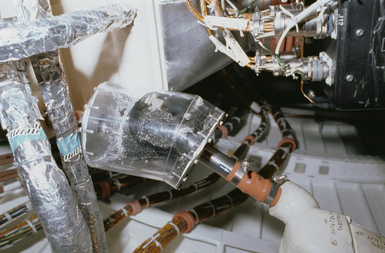
STS040-34-001 (5-14 June 1991) --- This 35mm scene shows a close-up of a prototype filter designed to remove contamination from air and water, before it flows into the Orbiter's humidity separators. This experiment is part of Development Test Objective (DTO) 647, Water Separator Filter Performance Evaluation. Astronauts Bryan D. O'Connor, mission commander, and Sidney M. Gutierrez, pilot, carried out the test and down linked television to the ground for engineering analysis.
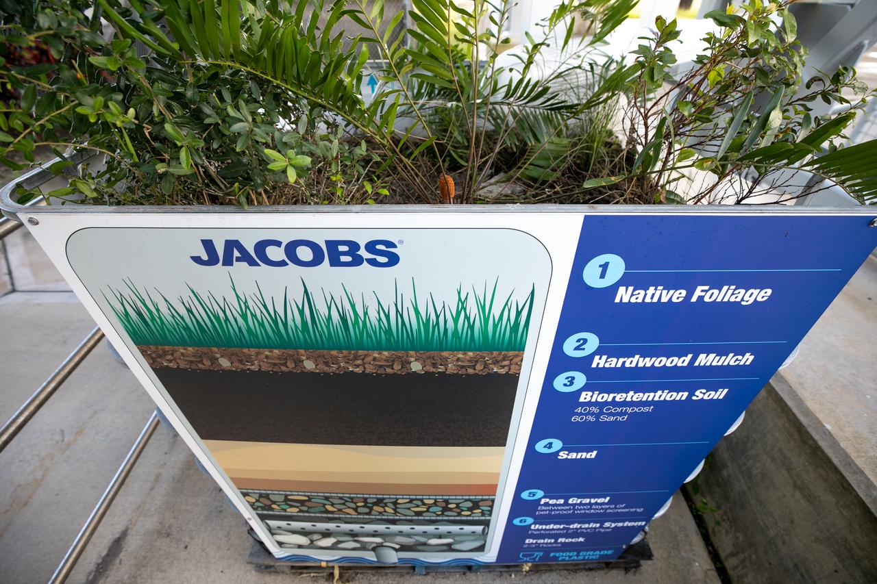
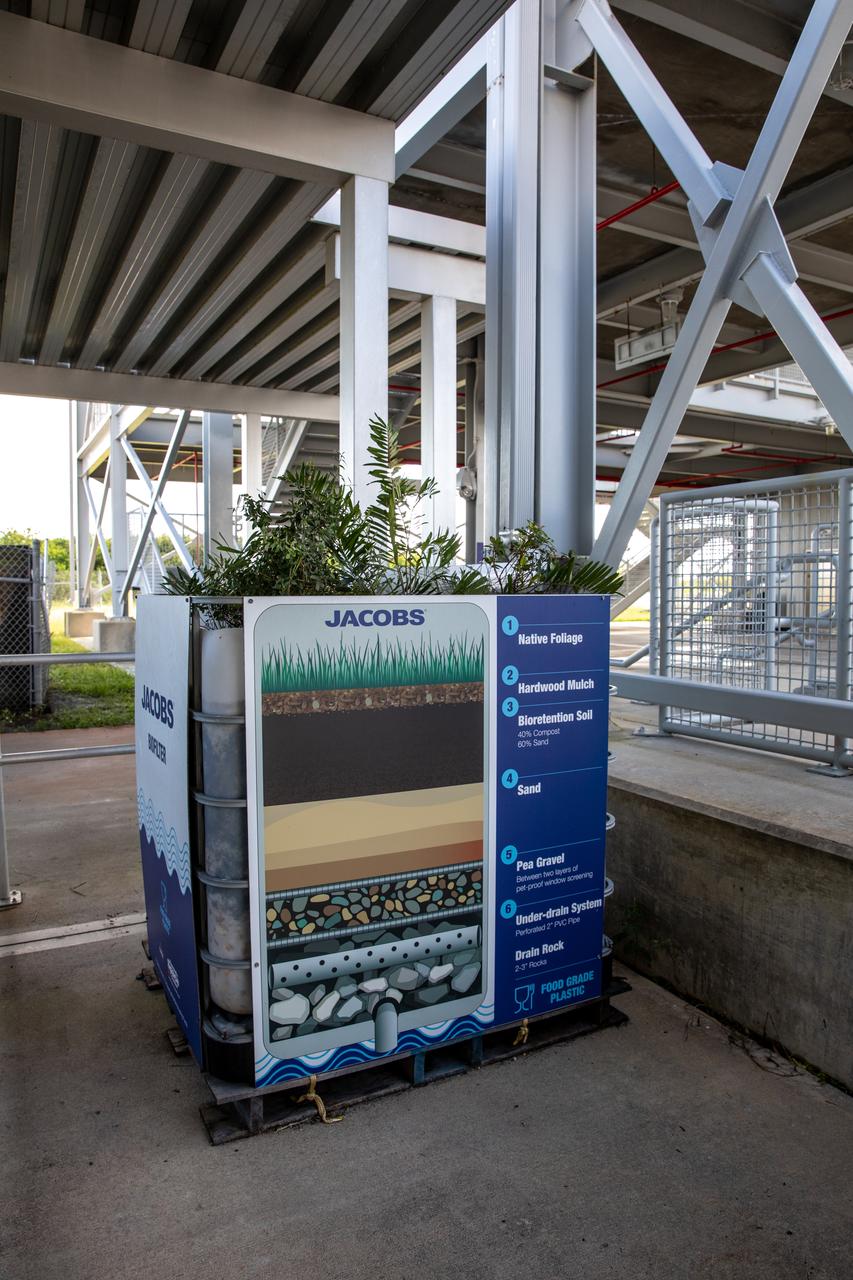
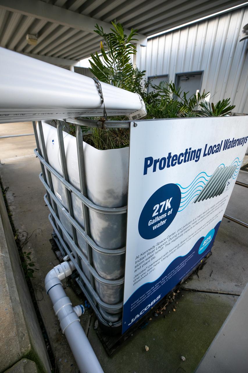
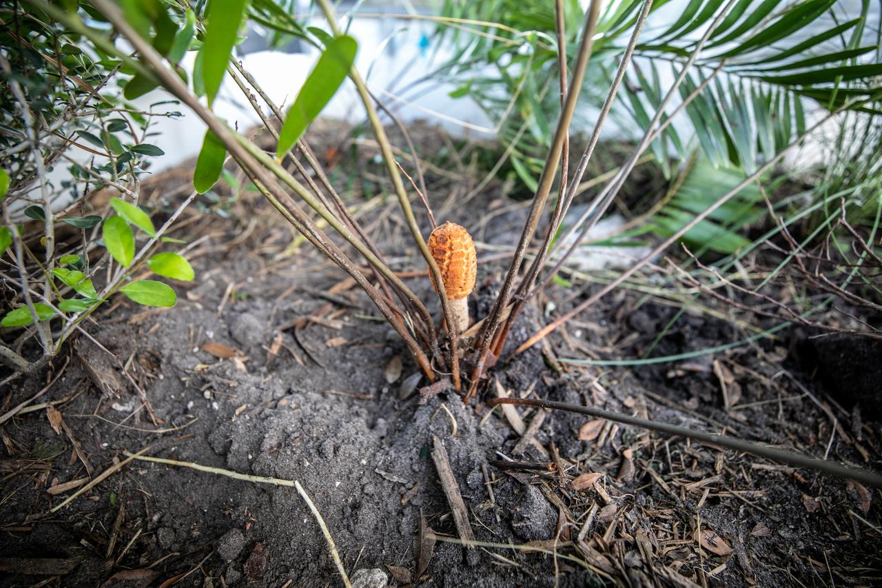
NASA Kennedy Space Center’s unrivaled dedication to the environment is highlighted through a variety of environmental programs and projects. Through a partnership with Jacobs Technology, Inc., teams have constructed a bio-filter – made of layered rock, soil, and native plants – as an eco-friendly way to filter zinc out of rainwater runoff. Photographed on Sept. 29, 2020, at the Florida spaceport’s Launch Complex 39 observation tower, the bio-filter catches water that runs off of this location’s galvanized roof, which contains a coating of zinc to help protect the metal from rust or corrosion. The plants in the bio-filter bind to the zinc so that when the water comes out of the bottom, it’s clean and safe to go into the Indian River Lagoon – its waterline located about 20 to 30 feet away.
NASA Kennedy Space Center’s unrivaled dedication to the environment is highlighted through a variety of environmental programs and projects. Through a partnership with Jacobs Technology, Inc., teams have constructed a bio-filter – made of layered rock, soil, and native plants – as an eco-friendly way to filter zinc out of rainwater runoff. Photographed on Sept. 29, 2020, at the Florida spaceport’s Launch Complex 39 observation tower, the bio-filter catches water that runs off of this location’s galvanized roof, which contains a coating of zinc to help protect the metal from rust or corrosion. The plants in the bio-filter bind to the zinc so that when the water comes out of the bottom, it’s clean and safe to go into the Indian River Lagoon – its waterline located about 20 to 30 feet away.
NASA Kennedy Space Center’s unrivaled dedication to the environment is highlighted through a variety of environmental programs and projects. Through a partnership with Jacobs Technology, Inc., teams have constructed a bio-filter – made of layered rock, soil, and native plants – as an eco-friendly way to filter zinc out of rainwater runoff. Photographed on Sept. 29, 2020, at the Florida spaceport’s Launch Complex 39 observation tower, the bio-filter catches water that runs off of this location’s galvanized roof, which contains a coating of zinc to help protect the metal from rust or corrosion. The plants in the bio-filter bind to the zinc so that when the water comes out of the bottom, it’s clean and safe to go into the Indian River Lagoon – its waterline located about 20 to 30 feet away.
NASA Kennedy Space Center’s unrivaled dedication to the environment is highlighted through a variety of environmental programs and projects. Through a partnership with Jacobs Technology, Inc., teams have constructed a bio-filter – made of layered rock, soil, and native plants – as an eco-friendly way to filter zinc out of rainwater runoff. Photographed on Sept. 29, 2020, at the Florida spaceport’s Launch Complex 39 observation tower, the bio-filter catches water that runs off of this location’s galvanized roof, which contains a coating of zinc to help protect the metal from rust or corrosion. The plants in the bio-filter bind to the zinc so that when the water comes out of the bottom, it’s clean and safe to go into the Indian River Lagoon – its waterline located about 20 to 30 feet away.
NASA Kennedy Space Center’s unrivaled dedication to the environment is highlighted through a variety of environmental programs and projects. Through a partnership with Jacobs Technology, Inc., teams have constructed a bio-filter – made of layered rock, soil, and native plants – as an eco-friendly way to filter zinc out of rainwater runoff. Photographed on Sept. 29, 2020, at the Florida spaceport’s Launch Complex 39 observation tower, the bio-filter catches water that runs off of this location’s galvanized roof, which contains a coating of zinc to help protect the metal from rust or corrosion. The plants in the bio-filter bind to the zinc so that when the water comes out of the bottom, it’s clean and safe to go into the Indian River Lagoon – its waterline located about 20 to 30 feet away.

NASA Kennedy Space Center’s unrivaled dedication to the environment is highlighted through a variety of environmental programs and projects. Through a partnership with Jacobs Technology, Inc., teams have constructed a bio-filter – made of layered rock, soil, and native plants – as an eco-friendly way to filter zinc out of rainwater runoff. Photographed on Sept. 29, 2020, at the Florida spaceport’s Launch Complex 39 observation tower, the bio-filter catches water that runs off of this location’s galvanized roof, which contains a coating of zinc to help protect the metal from rust or corrosion. The plants in the bio-filter bind to the zinc so that when the water comes out of the bottom, it’s clean and safe to go into the Indian River Lagoon – its waterline located about 20 to 30 feet away.
NASA Kennedy Space Center’s unrivaled dedication to the environment is highlighted through a variety of environmental programs and projects. Through a partnership with Jacobs Technology, Inc., teams have constructed a bio-filter – made of layered rock, soil, and native plants – as an eco-friendly way to filter zinc out of rainwater runoff. Photographed on Sept. 29, 2020, at the Florida spaceport’s Launch Complex 39 observation tower, the bio-filter catches water that runs off of this location’s galvanized roof, which contains a coating of zinc to help protect the metal from rust or corrosion. The plants in the bio-filter bind to the zinc so that when the water comes out of the bottom, it’s clean and safe to go into the Indian River Lagoon – its waterline located about 20 to 30 feet away.

NASA Kennedy Space Center’s unrivaled dedication to the environment is highlighted through a variety of environmental programs and projects. Through a partnership with Jacobs Technology, Inc., teams have constructed a bio-filter – made of layered rock, soil, and native plants – as an eco-friendly way to filter zinc out of rainwater runoff. Photographed on Sept. 29, 2020, at the Florida spaceport’s Launch Complex 39 observation tower, the bio-filter catches water that runs off of this location’s galvanized roof, which contains a coating of zinc to help protect the metal from rust or corrosion. The plants in the bio-filter bind to the zinc so that when the water comes out of the bottom, it’s clean and safe to go into the Indian River Lagoon – its waterline located about 20 to 30 feet away.
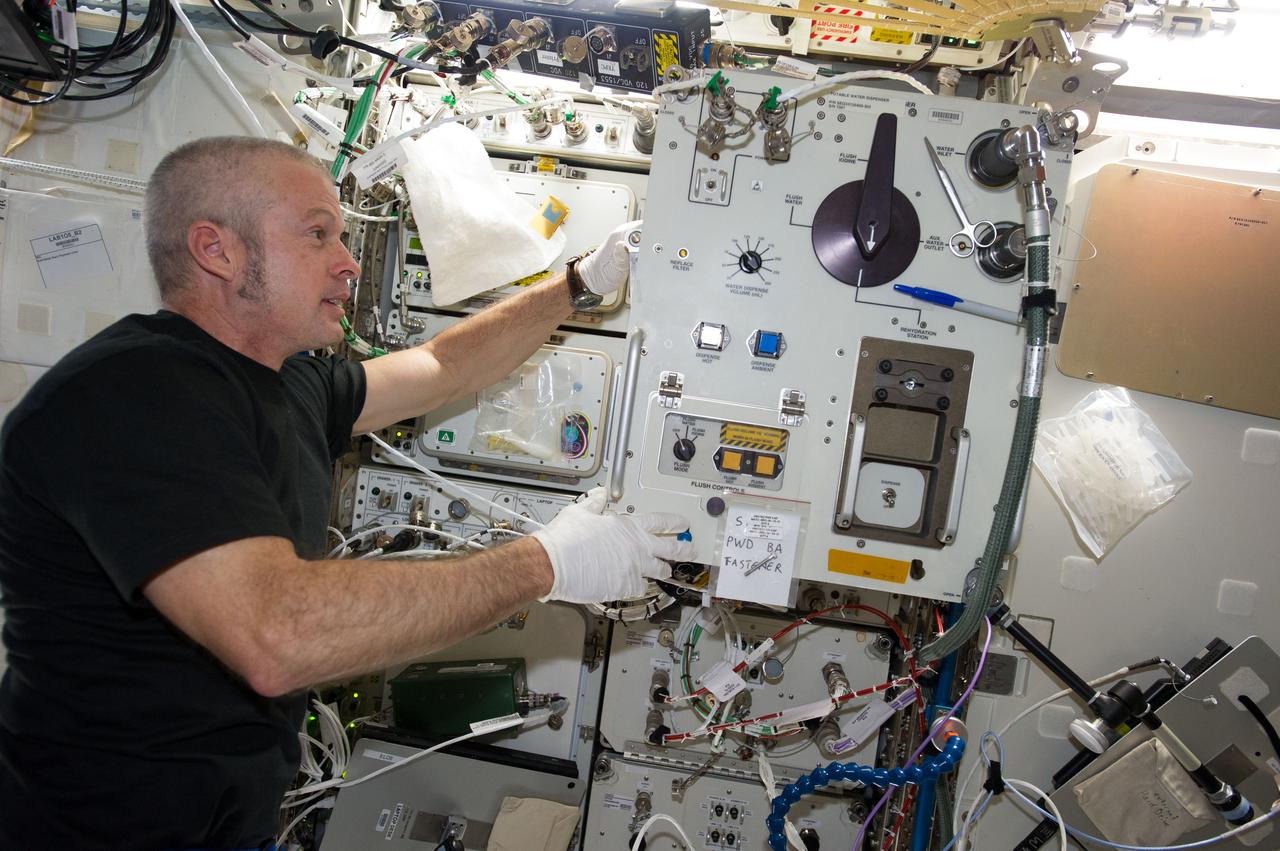
ISS040-E-064628 (15 July 2014) --- NASA astronaut Steve Swanson, Expedition 40 commander, replaces filters in the Potable Water Dispenser (PWD) in the Destiny laboratory of the International Space Station.
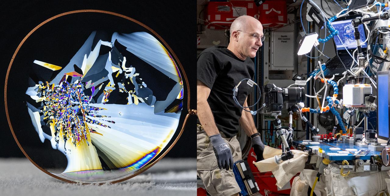
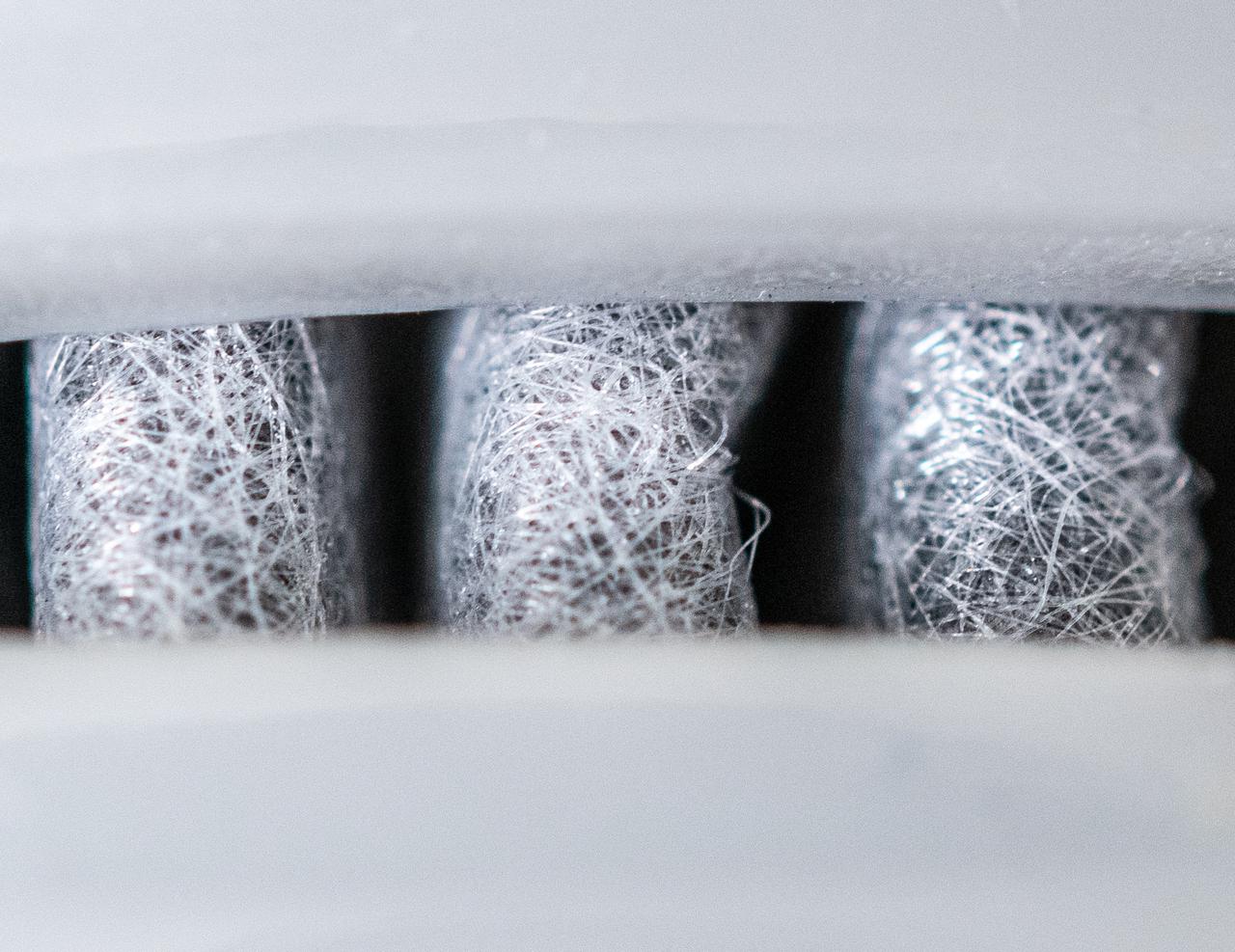
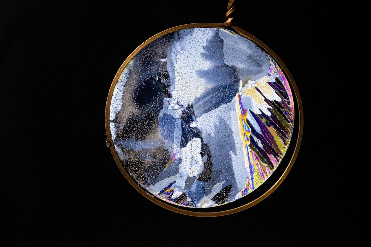
iss072e096196 and iss072e098100 (Oct. 23, 2024) -- NASA Astronaut Don Pettit views thin wafers of ice under polarized filters on the International Space Station. Pettit conducts “science of opportunity” using station’s MELFI freezer to understand the behaviors of freezing water under microgravity conditions without gravitational buoyancy. This ice wafer was photographed between a polarized filter and a laptop display used to illuminate and cross-polarize the thin ice, giving a colorful image highlighting the fragmented crystals. This is a composite image of iss072e098100 and iss072e096196.
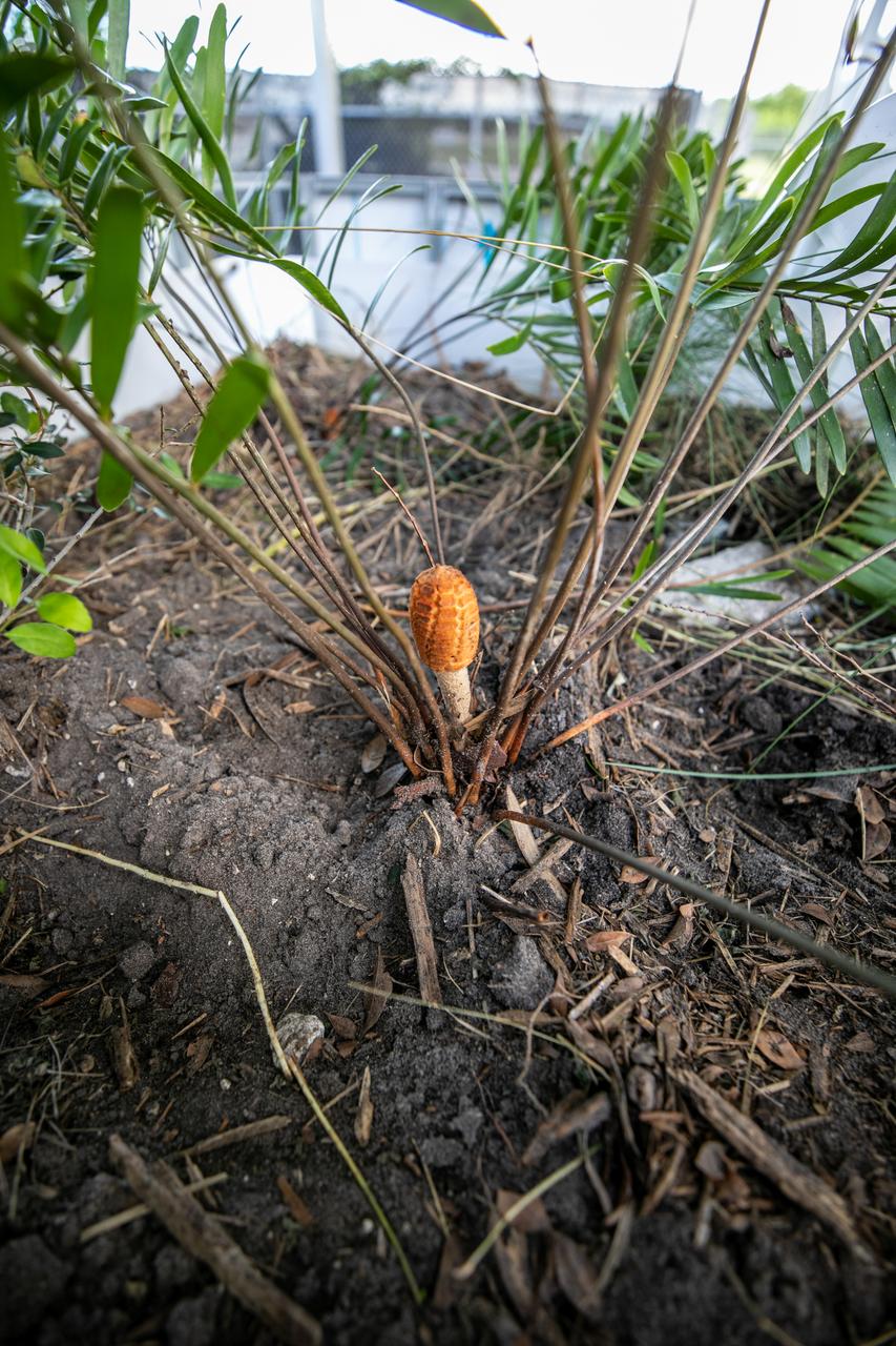
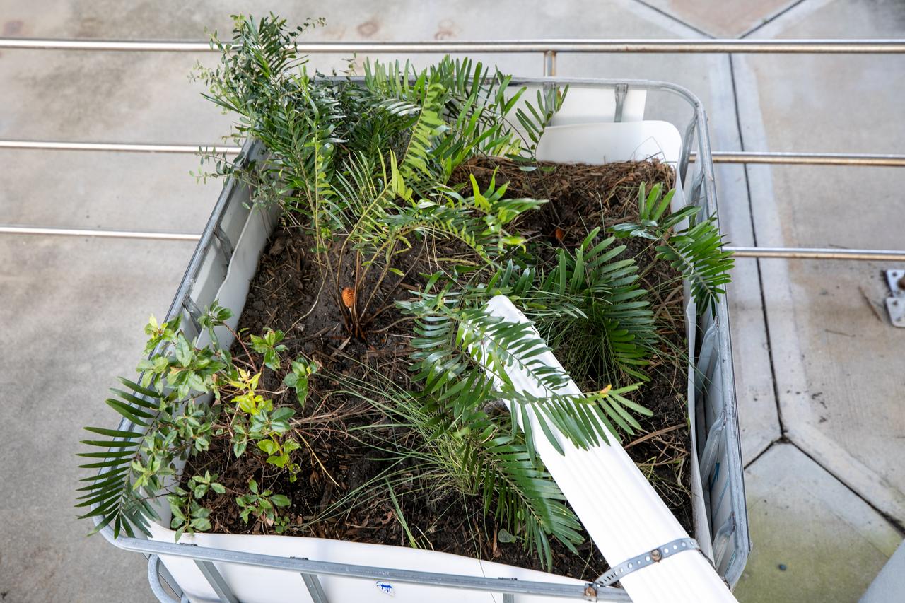
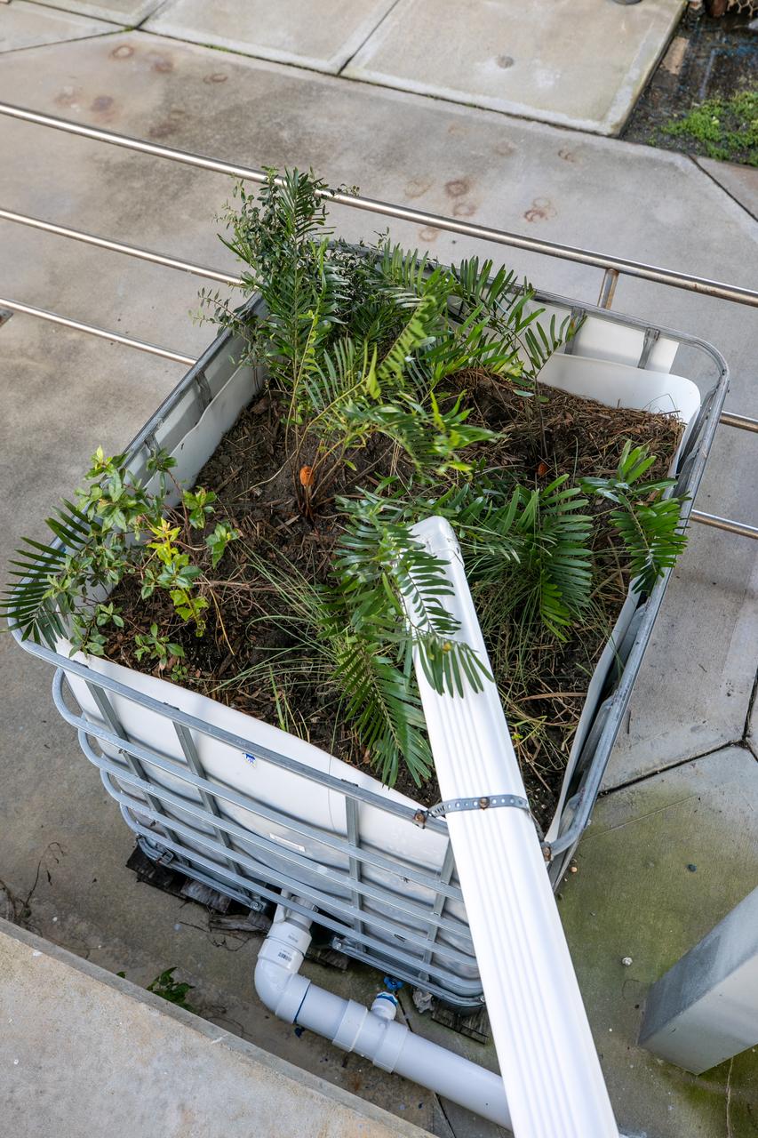
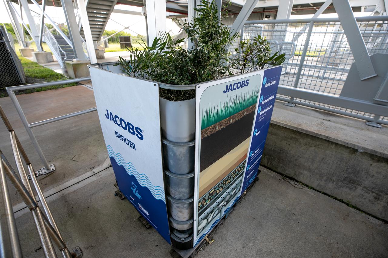
NASA Kennedy Space Center’s unrivaled dedication to the environment is highlighted through a variety of environmental programs and projects. An up-close view of the plants that make up a bio-filter constructed by teams with Kennedy and Jacobs Technology, Inc. is shown on Sept. 29, 2020. The bio-filter – made of layered rock, soil, and native plants – is used to catch and filter zinc out of rainwater that runs off of the roof at the Florida spaceport’s Launch Complex 39 observation tower. Many facilities at Kennedy have galvanized roofs, which contain a coating of zinc to help protect the metal from rust or corrosion but can have serious effects on fish and other aquatic life if it runs into the Indian River Lagoon. The plants in the bio-filter bind to the zinc so that when the water comes out of the bottom, it’s clean and safe to go into the lagoon – its waterline located about 20 to 30 feet away.
NASA Kennedy Space Center’s unrivaled dedication to the environment is highlighted through a variety of environmental programs and projects. An up-close view of the plants that make up a bio-filter constructed by teams with Kennedy and Jacobs Technology, Inc. is shown on Sept. 29, 2020. The bio-filter – made of layered rock, soil, and native plants – is used to catch and filter zinc out of rainwater that runs off of the roof at the Florida spaceport’s Launch Complex 39 observation tower. Many facilities at Kennedy have galvanized roofs, which contain a coating of zinc to help protect the metal from rust or corrosion but can have serious effects on fish and other aquatic life if it runs into the Indian River Lagoon. The plants in the bio-filter bind to the zinc so that when the water comes out of the bottom, it’s clean and safe to go into the lagoon – its waterline located about 20 to 30 feet away.
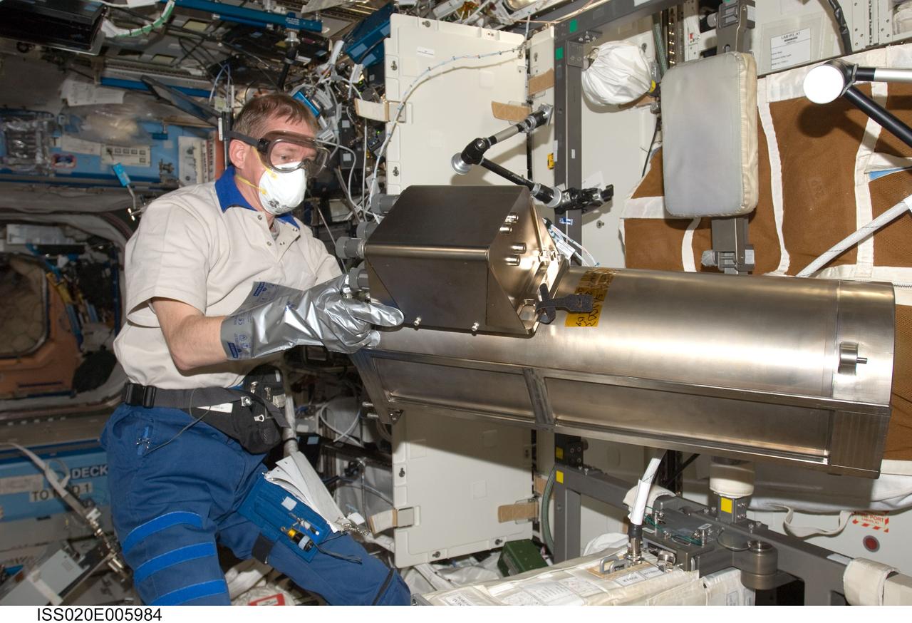
ISS020-E-005984 (2 June 2009) --- European Space Agency astronaut Frank De Winne, Expedition 20 flight engineer, works with the Water Recovery System Recycle Filter Tank Assembly (RFTA) in the Destiny laboratory of the International Space Station.
ISS029-E-021648 (10 Oct. 2011) --- NASA astronaut Mike Fossum, Expedition 29 commander, installs the Advanced Recycle Filter Tank Assembly (ARFTA) at the Urine Processor Assembly / Water Recovery System (UPA WRS) in the Destiny laboratory of the International Space Station.

ISS013-E-80066 (10 Sept. 2006) --- European Space Agency (ESA) astronaut Thomas Reiter, Expedition 13 flight engineer, works with the surface, water and air biocharacterization (SWAB) air sampling device (ASD) filter kit in the Destiny laboratory of the International Space Station.
ISS046e023885 (01/25/2016) --- NASA astronaut Tim Kopra performs regular maintenance on the Urine Processing Assembly (UPA) aboard the International Space Station. The UPA is used by the crew to recycle water for use on the station. The image shows Tim replacing the brine filter from the UPA Fill Drain Valve enclosure.

iss055e008298 (April 2, 2018) --- Astronauts Scott Tingle (left) and Ricky Arnold wrap up spacesuit work following a successful spacewalk on March 29, 2018. The duo scrubbed cooling loops, performed the iodination of ion filters and tested the water conductivity inside a pair of U.S. spacesuits.
ISS040-E-064624 (15 July 2014) --- NASA astronaut Steve Swanson, Expedition 40 commander, replaces filters in the Potable Water Dispenser (PWD) in the Destiny laboratory of the International Space Station. NASA astronaut Reid Wiseman, flight engineer, works in the background.
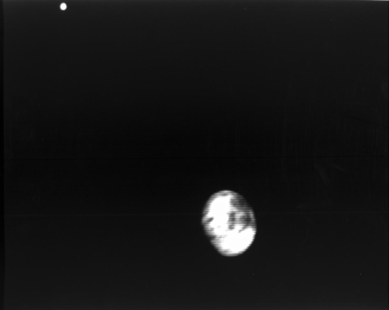
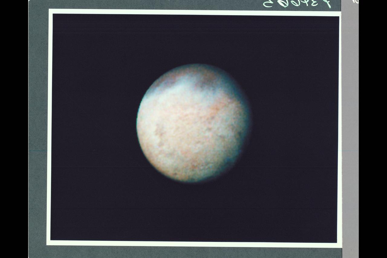
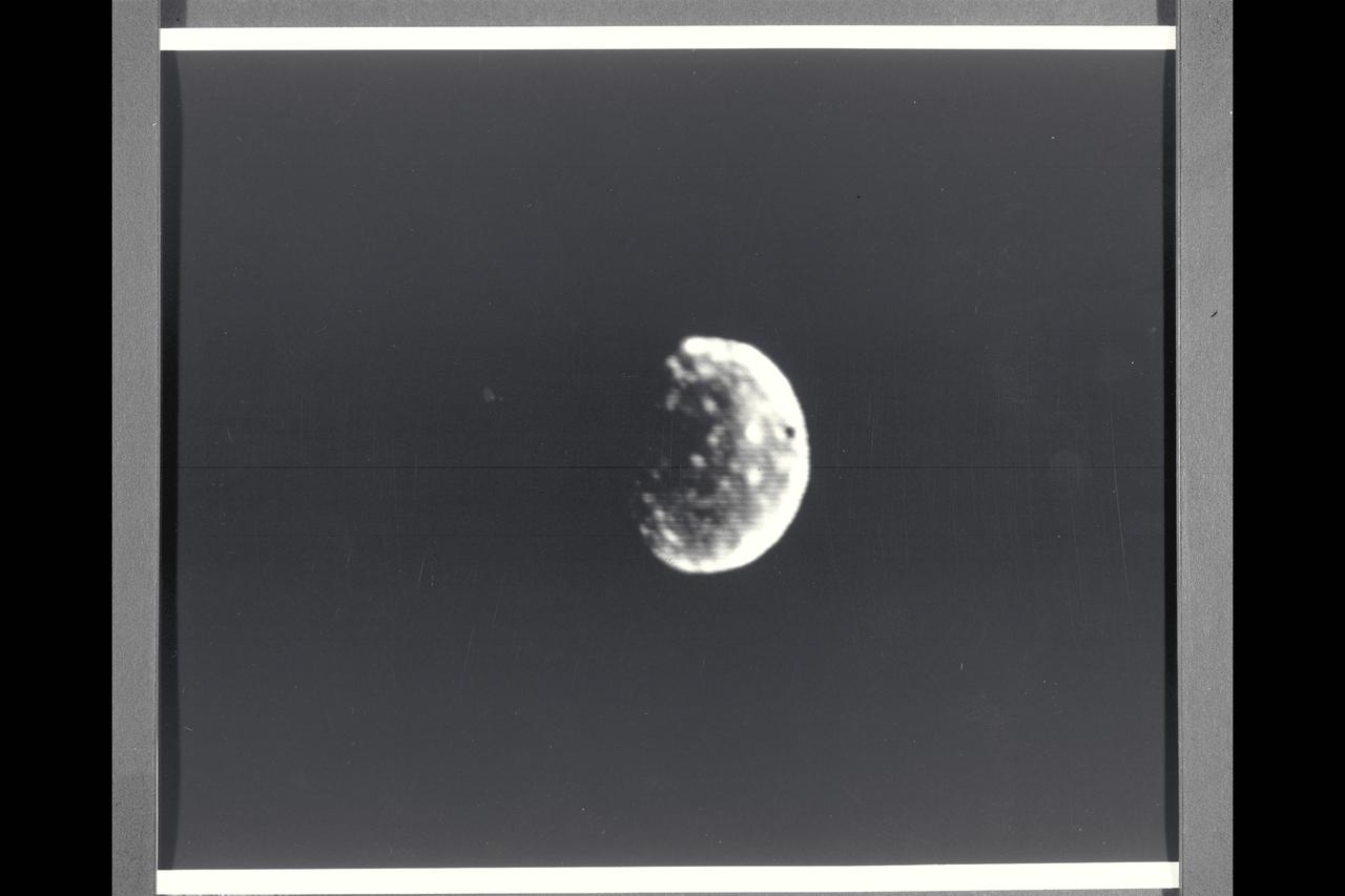
Range : 5.9 million kilometers (3.66 million miles) Europa is Jupiter's 2nd Galilean satellites from the planet and the brightest. Photo taken early morning through violet filter. Faint swirls and linear patterns show in the equatorial region (which shows darker than the poles). This hemisphere always faces Jupiter. North is up. Density and size comparable to Earth's Moon and seems to show water ice or ground water on its surface. JPL Reference # P-21163.
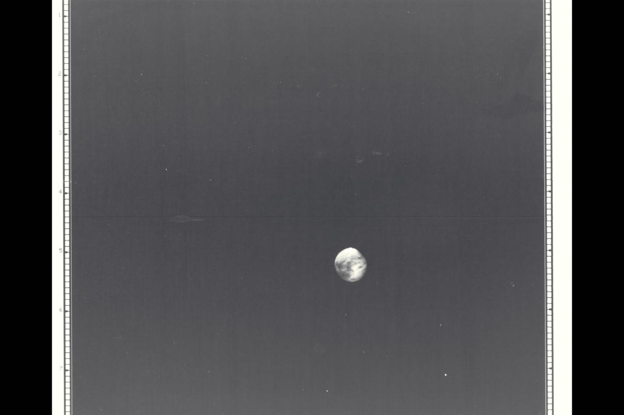
Range : 5.9 million kilometers (3.66 million miles) Europa is Jupiter's 2nd Galilean satellite from the planet. Photo taken early morning and through a violet filter. Faint swirls and Linear Patterns show in the equarorial region(which is darker than the poles). The hemisphere shown always faces Jupiter. North is up. Europa is the brightest of the Galilian satellites but shows low contrast on this hemisphere. Density and size is similar to Earth's Moon. Indications of water ice or ground water on surface is shown
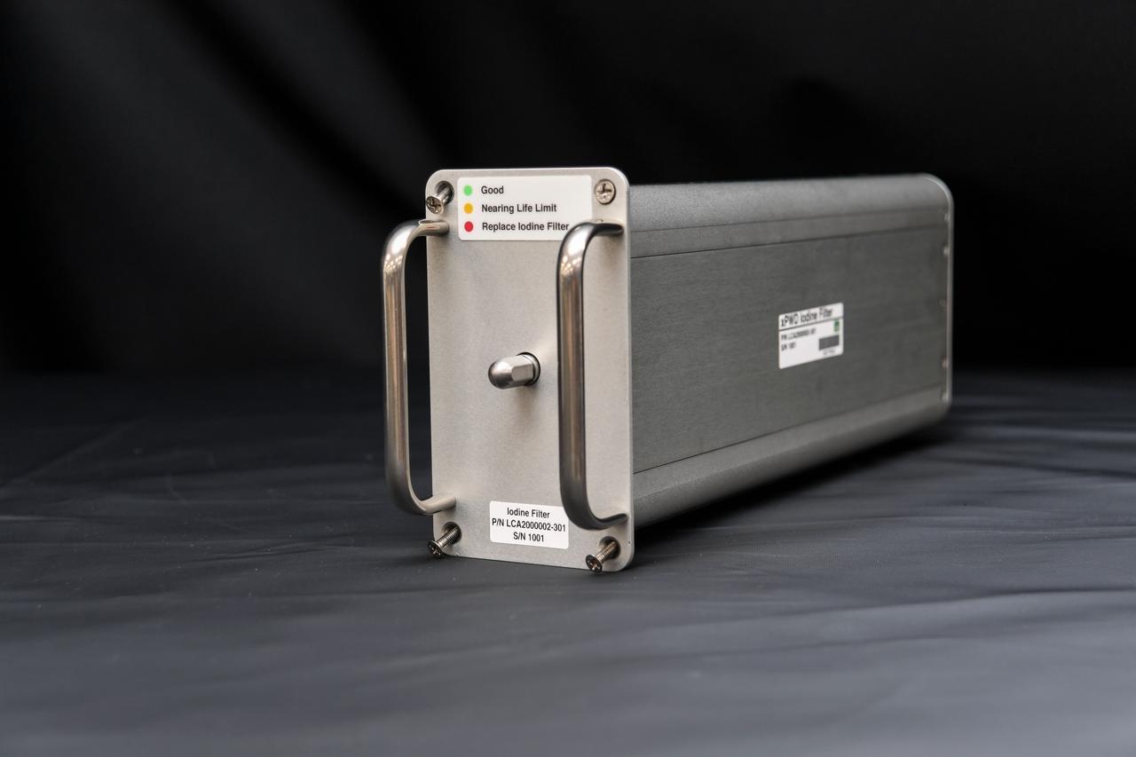
jsc2023e008494 (Feb. 10, 2023) --- A preflight image of the Exploration Potable Water Dispenser (Exploration PWD) iodine filter. Exploration PWD is a device that dispenses ambient and hot water into crew food and drink bags. The Exploration PWD is an improvement to the International Space Station (ISS) legacy PWD. Successful demonstration of this technology could lead to its adoption for future exploration missions and continued use for the space station crew.

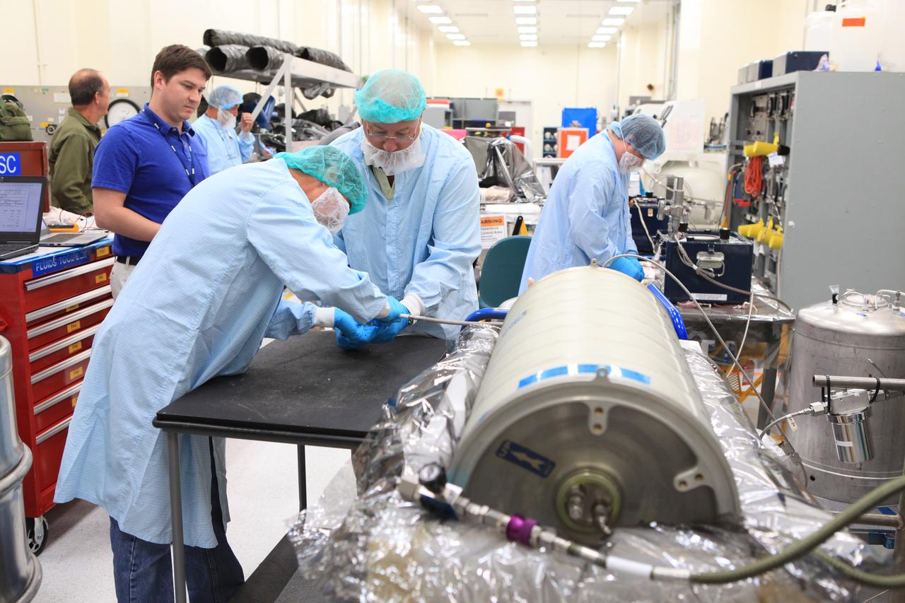
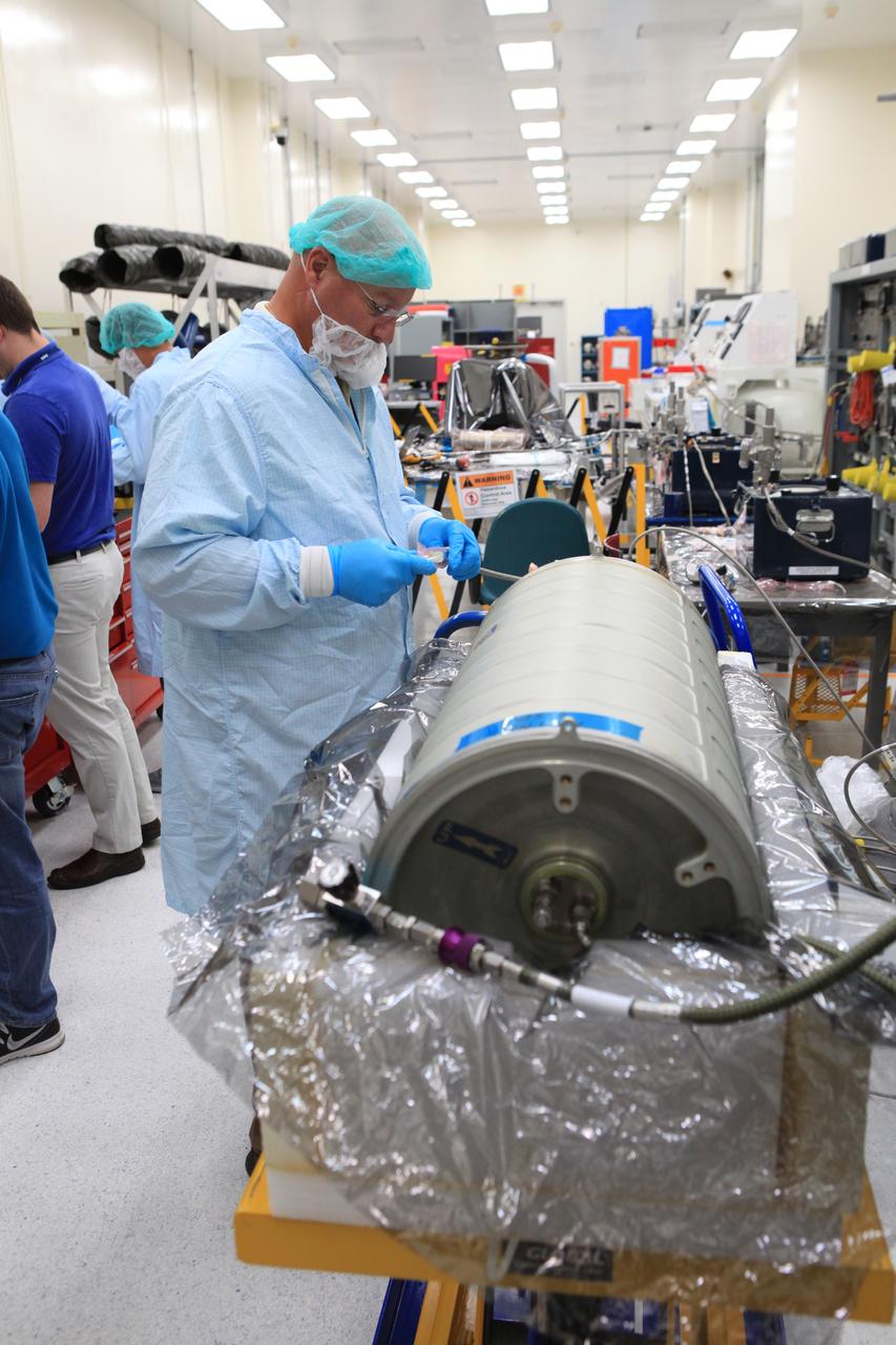
jsc2024e043917 (7/10/2024) --- Packed Bed Reactor Experiment-Water Recovery (PBRE-WR) examines flow rates of gas and liquid through a filtering substrate in the space station water processor, replacing oxygen with nitrogen. This preflight image shows the PBRE-WR test section with alumina packed bed material loaded. Scientists aim to learn more about how reduced gravity affects the performance and reliability of various filtration systems
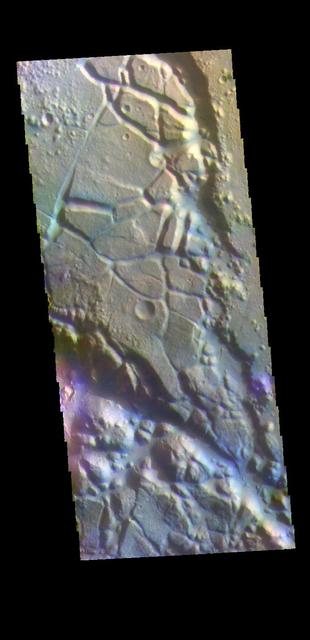
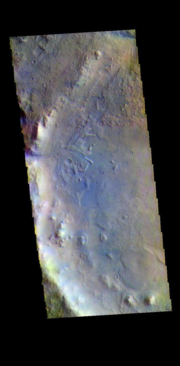
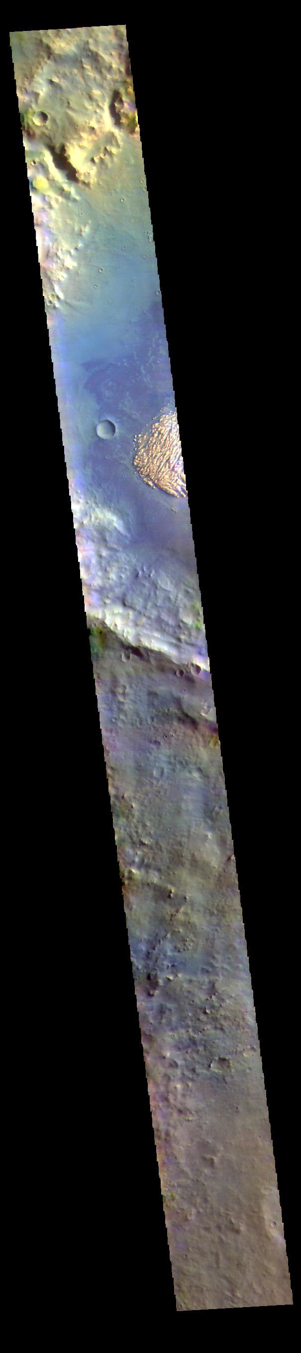
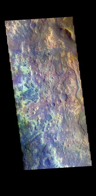
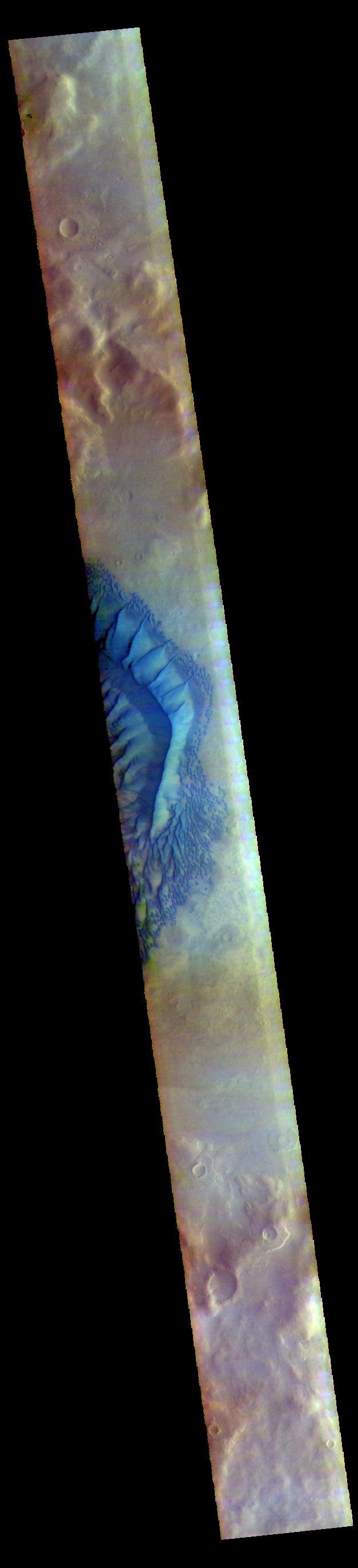
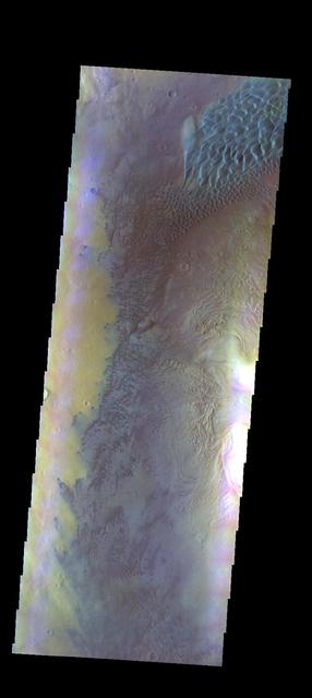
Today's VIS image is located in Aram Chaos. Aram Chaos was initially formed by a large impact. Over time the crater interior was modified by several different processes, including liquid water. Located near Ares Vallis, a narrow channel links the Aram Chaos crater with Ares Vallis indicating a substantial amount of water was located in the crater. Chaos forms from erosion of the surface into mesa features. With time the valleys expand creating the jumble of hills seen in the image. The THEMIS VIS camera contains 5 filters. The data from different filters can be combined in multiple ways to create a false color image. These false color images may reveal subtle variations of the surface not easily identified in a single band image. Orbit Number: 62100 Latitude: 4.04973 Longitude: 340.137 Instrument: VIS Captured: 2015-12-14 01:59 https://photojournal.jpl.nasa.gov/catalog/PIA23107

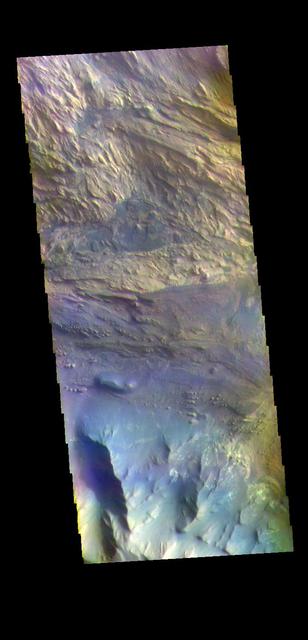
The THEMIS VIS camera contains 5 filters. The data from different filters can be combined in multiple ways to create a false color image. These false color images may reveal subtle variations of the surface not easily identified in a single band image. Today's false color image is located in Aram Chaos. Aram Chaos was initially formed by a large impact. Over time the crater interior was modified by several different processes, including liquid water. Located near Ares Vallis, a narrow channel links the Aram Chaos crater with Ares Vallis indicating a substantial amount of water was located in the crater. Chaos forms from erosion of the surface into mesa features. With time the valleys expand creating the jumble of hills seen in the image. Orbit Number: 79214 Latitude: 2.40411 Longitude: 340.023 Instrument: VIS Captured: 2019-10-23 19:10 https://photojournal.jpl.nasa.gov/catalog/PIA24659
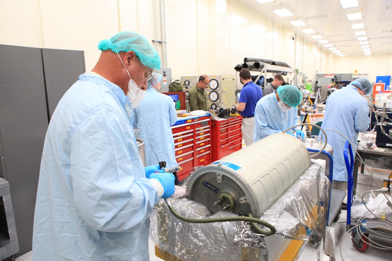
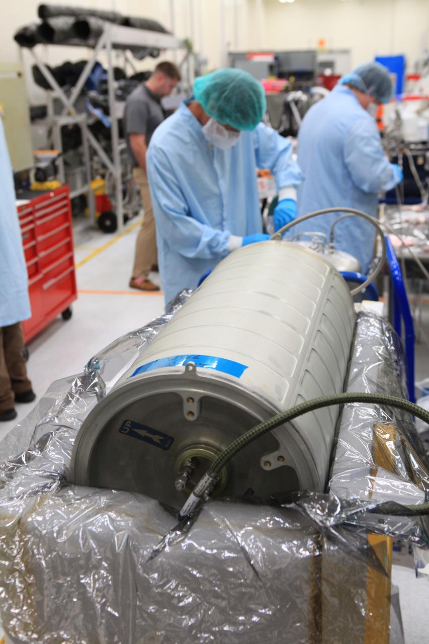
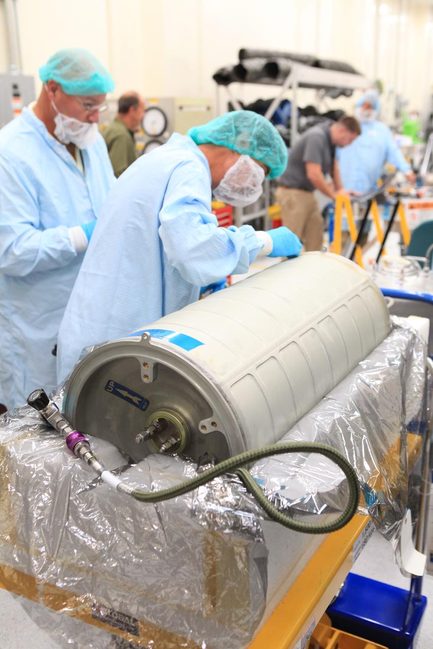
Inside the Space Station Processing Facility high bay at NASA's Kennedy Space Center in Florida, technicians work on the pump package assembly (PPA) on Aug. 30, 2018. The payload will be carried to the International Space Station on SpaceX's 16th Commercial Resupply Services mission. The PPA will be used to continuously drive the cooling water in the space station's thermal control system. The assembly includes a centrifuge pump, a fine filter and gas trap for pump protection, a coarse outlet filter, sensors, and an accumulator. The PPA also will provide a reservoir used for makeup of coolant if leakage occurred. CRS-16 is scheduled to launch to the space station later this year.
Inside the Space Station Processing Facility high bay at NASA's Kennedy Space Center in Florida, a technician works on the pump package assembly (PPA) on Aug. 30, 2018. The payload will be carried to the International Space Station on SpaceX's 16th Commercial Resupply Services mission. The PPA will be used to continuously drive the cooling water in the space station's thermal control system. The assembly includes a centrifuge pump, a fine filter and gas trap for pump protection, a coarse outlet filter, sensors, and an accumulator. The PPA also will provide a reservoir used for makeup of coolant if leakage occurred. CRS-16 is scheduled to launch to the space station later this year.
Inside the Space Station Processing Facility high bay at NASA's Kennedy Space Center in Florida, technicians work on the pump package assembly (PPA) on Aug. 30, 2018. The payload will be carried to the International Space Station on SpaceX's 16th Commercial Resupply Services mission. The PPA will be used to continuously drive the cooling water in the space station's thermal control system. The assembly includes a centrifuge pump, a fine filter and gas trap for pump protection, a coarse outlet filter, sensors, and an accumulator. The PPA also will provide a reservoir used for makeup of coolant if leakage occurred. CRS-16 is scheduled to launch to the space station later this year.
Inside the Space Station Processing Facility high bay at NASA's Kennedy Space Center in Florida, technicians work on the pump package assembly (PPA) on Aug. 30, 2018. The payload will be carried to the International Space Station on SpaceX's 16th Commercial Resupply Services mission. The PPA will be used to continuously drive the cooling water in the space station's thermal control system. The assembly includes a centrifuge pump, a fine filter and gas trap for pump protection, a coarse outlet filter, sensors, and an accumulator. The PPA also will provide a reservoir used for makeup of coolant if leakage occurred. CRS-16 is scheduled to launch to the space station later this year.
Inside the Space Station Processing Facility high bay at NASA's Kennedy Space Center in Florida, technicians work on the pump package assembly (PPA) on Aug. 30, 2018. The payload will be carried to the International Space Station on SpaceX's 16th Commercial Resupply Services mission. The PPA will be used to continuously drive the cooling water in the space station's thermal control system. The assembly includes a centrifuge pump, a fine filter and gas trap for pump protection, a coarse outlet filter, sensors, and an accumulator. The PPA also will provide a reservoir used for makeup of coolant if leakage occurred. CRS-16 is scheduled to launch to the space station later this year.
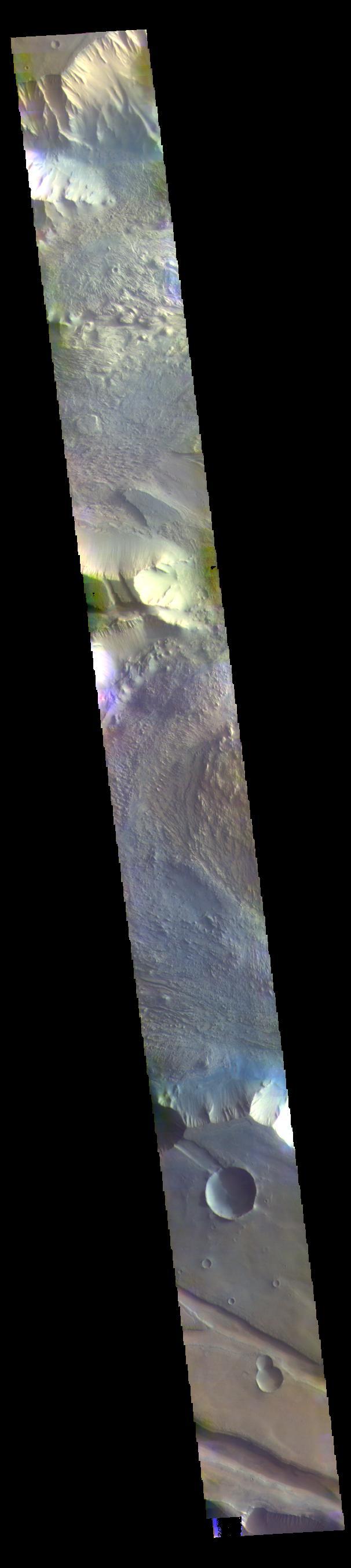
The THEMIS VIS camera contains 5 filters. The data from different filters can be combined in multiple ways to create a false color image. These false color images may reveal subtle variations of the surface not easily identified in a single band image. Today's false color image shows the western half of Jezero Crater. The Perserverance Rover is located in this part of the crater – near the delta deposit formed by the influx of silt laden water into the crater at a time during Mars' past that was wetter. The crater most likely hosted a lake for a period of time. Jezero Crater is 47km (29 miles) in diameter. The THEMIS VIS camera is capable of capturing color images of the Martian surface using five different color filters. In this mode of operation, the spatial resolution and coverage of the image must be reduced to accommodate the additional data volume produced from using multiple filters. To make a color image, three of the five filter images (each in grayscale) are selected. Each is contrast enhanced and then converted to a red, green, or blue intensity image. These three images are then combined to produce a full color, single image. Because the THEMIS color filters don't span the full range of colors seen by the human eye, a color THEMIS image does not represent true color. Also, because each single-filter image is contrast enhanced before inclusion in the three-color image, the apparent color variation of the scene is exaggerated. Nevertheless, the color variation that does appear is representative of some change in color, however subtle, in the actual scene. Note that the long edges of THEMIS color images typically contain color artifacts that do not represent surface variation. Orbit Number: 95046 Latitude: 18.449 Longitude: 77.436 Instrument: VIS Captured: 2023-05-19 09:28 https://photojournal.jpl.nasa.gov/catalog/PIA26140
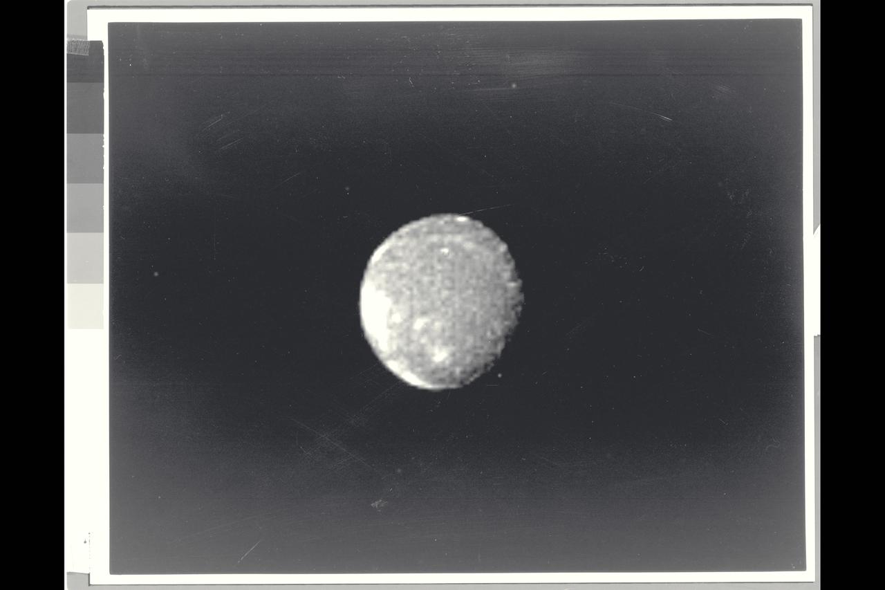
Range : 5 million miles (8.025 million kilometers) This is a morning shot of Ganymede, largest of Jupiter's 13 satellites. It's slightly larger than Mercury with a density about twice that of water. It's believed to be made of rock and ice with a surface of water and ice. Ganymede is 4 times brighter than our Moon with the bright spot in center of photo 5 times brighter than the Moon, and may contain more ice than surrounding areas. The bright pattern around the spot seems like ray craters on the Moon and Mercury and the area may in fact be an impact crater that has exposed fresh, underlying ice. Photo taken through blue, green and orange filters.

Range : 5 million miles (8.025 million kilometers) This is a morning shot of Ganymede, largest of Jupiter's 13 satellites. It's slightly larger than Mercury with a density about twice that of water. It's believed to be made of rock and ice with a surface of water and ice. Ganymede is 4 times brighter than our Moon with the bright spot in center of photo 5 times brighter than the Moon, and may contain more ice than surrounding areas. The bright pattern around the spot seems like ray craters on the Moon and Mercury and the area may in fact be an impact crater that has exposed fresh, underlying ice. Photo taken through blue, green and orange filters.

iss072e098102 (Oct. 23, 2024) -- NASA astronaut and Expedition 72 Flight Engineer Don Pettit is pictured setting up one of his "Science of Opportunity" experiments aboard the International Space Station. For this specific experiment, Pettit grew thin wafers of water ice using the orbiting lab's freezer, and photographed them in front of a white, blank computer screen and polarizing filter to display the colorful fragments of ice crystals.
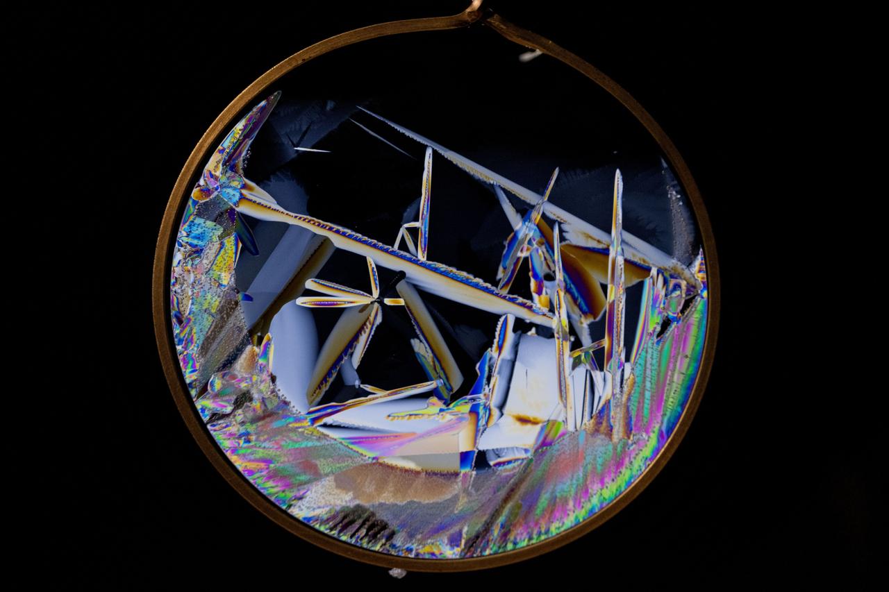
iss072e097465 (Oct. 23, 2024) -- Where space science meets art! Using a blank, white laptop display as the illuminator, a polarizing filter, and the International Space Station's freezer, which sits at -140 degrees F (-95 C), NASA astronaut and Expedition 72 Flight Engineer Don Pettit grew thin wafers of water ice in microgravity. What results is colorful, fragmented ice crystals.
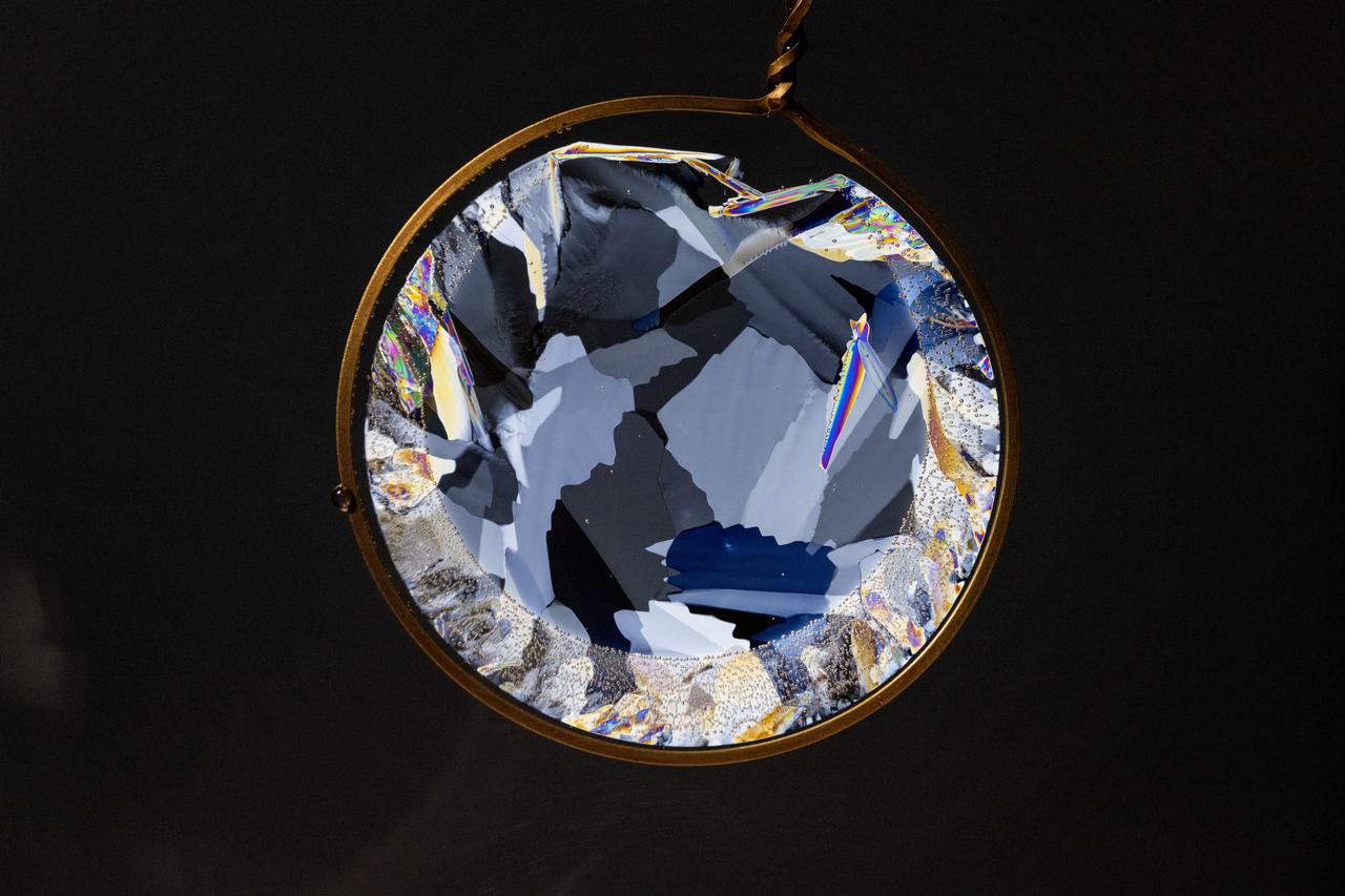
iss072e097523 (Oct. 23, 2024) -- Where space science meets art! Using a blank, white laptop display as the illuminator, a polarizing filter, and the International Space Station's freezer, which sits at -140 degrees F (-95 C), NASA astronaut and Expedition 72 Flight Engineer Don Pettit grew thin wafers of water ice in microgravity. What results is colorful, fragmented ice crystals.
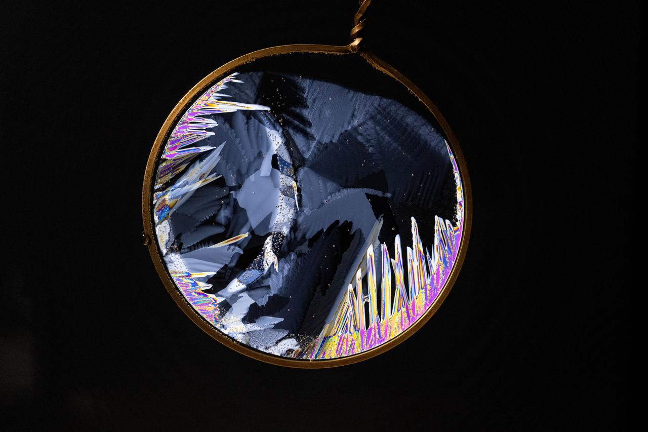
iss072e097582 (Oct. 23, 2024) -- Where space science meets art! Using a blank, white laptop display as the illuminator, a polarizing filter, and the International Space Station's freezer, which sits at -140 degrees F (-95 C), NASA astronaut and Expedition 72 Flight Engineer Don Pettit grew thin wafers of water ice in microgravity. What results is colorful, fragmented ice crystals.
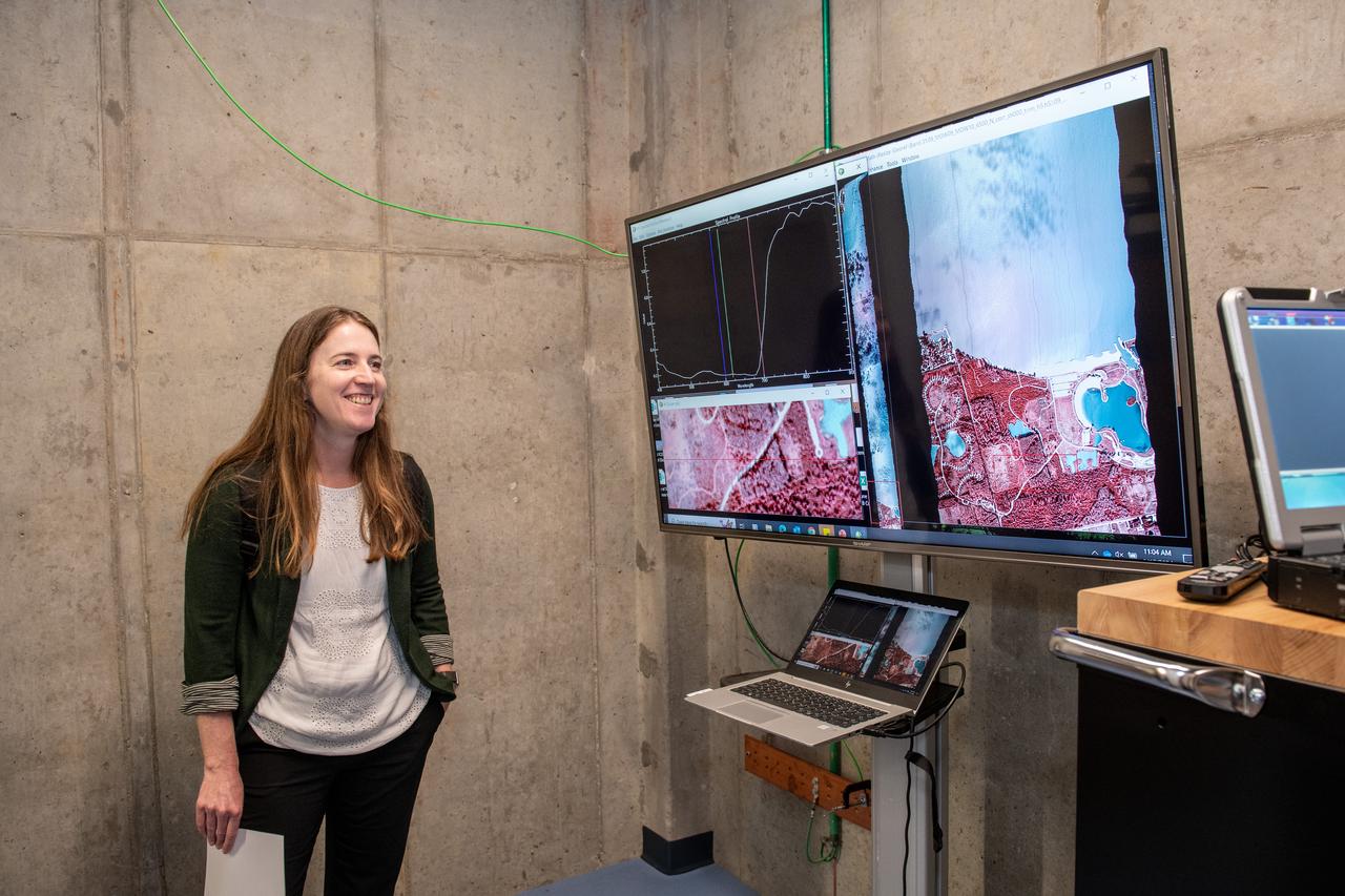
Dr. Katherine Calvin listens to a harmful algal bloom presentation on June 17, 2024. NASA Glenn Research Center conducts aerial remote sensing of harmful algal blooms to warn water filtration plants to enact more stringent filtering when harmful blooms are present. Aerial remote sensing is advantageous to satellite remote sensing that is limited by factors of resolution, on demand performance, cloud cover, and upgrades to instrumentation. Photo Credit: (NASA/Sara Lowthian-Hanna)
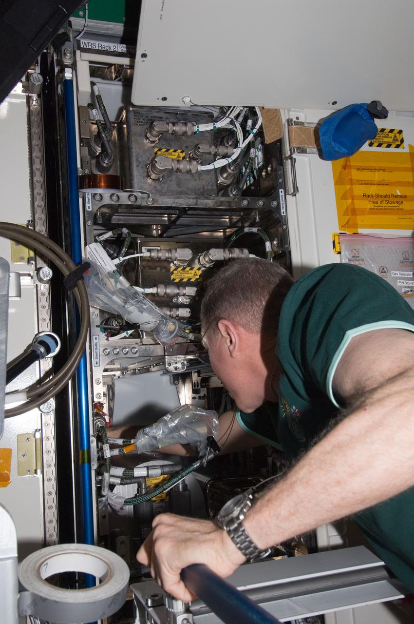
ISS030-E-128752 (8 March 2012) --- NASA astronaut Dan Burbank, Expedition 30 commander, performs part one of the Water Recovery System-1 (WRS-1) repair in the Tranquility node of the International Space Station. Burbank removed and replaced the failed Catalytic Reactor (CR), and installed a temporary filter kit between the new CR and the Microbial Check Valve (MCV) to support a system flush of the new Orbital Replacement Unit (ORU).
P-34665 This false color Voyager 2 image of Neptune's satellite Triton, is a composite of three images taken through ultraviolet, green, and viloet filters. The smallest resolvable features are about 47 km., or 29 miles accross. Mottling in the bright southern hemisphere may be the result of topography, if Triton's crust is predominently water ice, which is rigid at Triton's surface temperature. Alternatively, the mottling could be due to markings on a smooth surface, if the crust is composed of nitrogen, carbon monoxide, or methane ice, since they are soft at the same temperature.

iss072e098100 (Oct. 23, 2024) -- NASA astronaut and Expedition 72 Flight Engineer Don Pettit is pictured setting up one of his "Science of Opportunity" experiments aboard the International Space Station. For this specific experiment, Pettit grew thin wafers of water ice using the orbiting lab's freezer, and photographed them in front of a white, blank computer screen and polarizing filter to display the colorful fragments of ice crystals.
iss072e097623 (Oct. 23, 2024) -- Where space science meets art! Using a blank, white laptop display as the illuminator, a polarizing filter, and the International Space Station's freezer, which sits at -140 degrees F (-95 C), NASA astronaut and Expedition 72 Flight Engineer Don Pettit grew thin wafers of water ice in microgravity. What results is colorful, fragmented ice crystals.
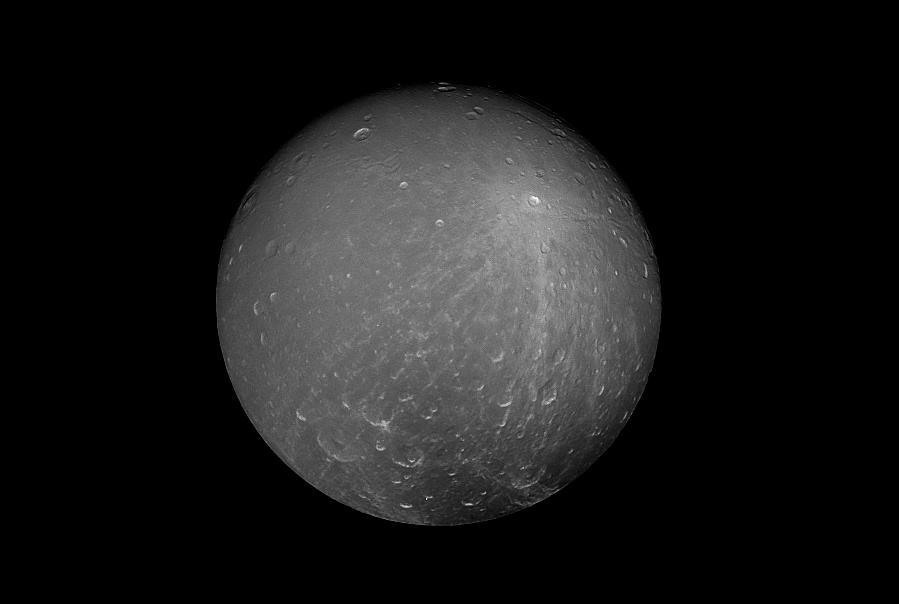
Cassini captured this striking view of Saturn's moon Dione on July 23, 2012. Dione is about 698 miles (1,123 kilometers) across. Its density suggests that about a third of the moon is made up of a dense core (probably silicate rock) with the remainder of its material being water ice. At Dione's average temperature of -304 degrees Fahrenheit (-186 degrees Celsius), ice is so hard it behaves like rock. The image was taken with Cassini's narrow-angle camera at a distance of approximately 260,000 miles (418,000 kilometers) from Dione, through a polarized filter and a spectral filter sensitive to green light. The Cassini spacecraft ended its mission on Sept. 15, 2017. https://photojournal.jpl.nasa.gov/catalog/PIA17197
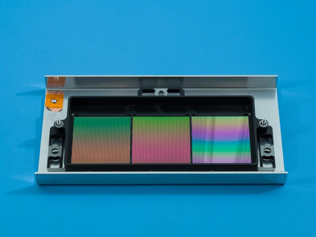
NASA's SPHEREx mission will use these filters to conduct spectroscopy, a technique that lets scientists measure individual wavelengths of light from a source, which can reveal information such as the chemical composition of the object or how far away it is. Each about the size of a cracker, the filters appear iridescent to the naked eye. The filters have multiple segments that block all but one specific wavelength of infrared light. Every object SPHEREx images will be observed by each segment, enabling scientists to see the specific infrared wavelengths emitted by every star or galaxy the telescope views. In total, SPHEREx can observe more than 100 distinct wavelengths. Short for Specto-Photometer for the History of the Universe, Epoch of Reionization and Ices Explorer, SPHEREx will create a map of the cosmos like no other, imaging the entire sky and gathering information about millions of galaxies. With this map, scientists will study what happened in the first fraction of a second after the big bang, the history of galaxy evolution, and the origins of water in planetary systems in our galaxy. https://photojournal.jpl.nasa.gov/catalog/PIA25788

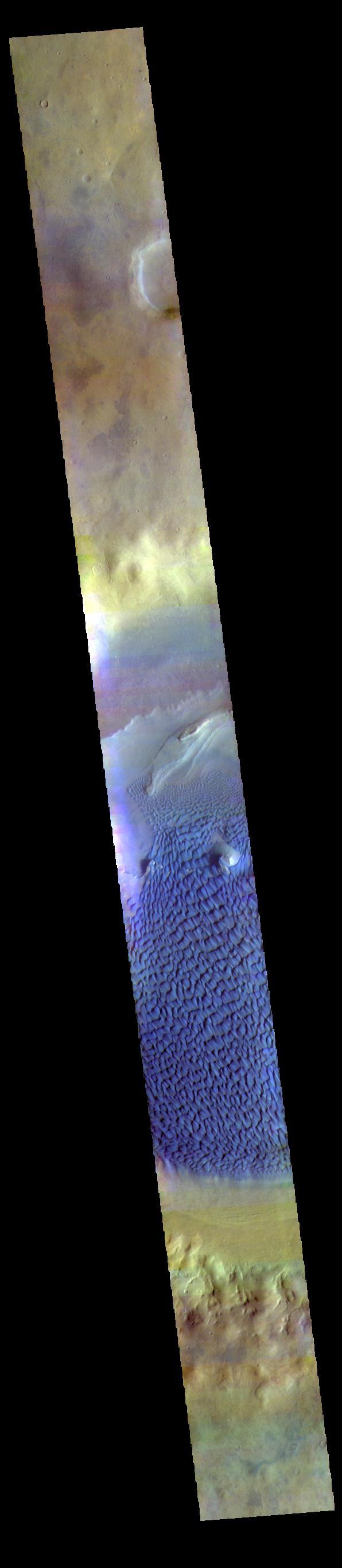
The THEMIS VIS camera contains 5 filters. The data from different filters can be combined in multiple ways to create a false color image. These false color images may reveal subtle variations of the surface not easily identified in a single band image. Today's false color image shows part of Rabe Crater. Rabe Crater is 108 km (67 miles) across. Craters of similar size often have flat floors. Rabe Crater has some areas of flat floor, but also has a large complex pit occupying a substantial part of the floor. The interior fill of the crater is thought to be layered sediments created by wind and or water action. The pit is eroded into this material. The eroded materials appear to have stayed within the crater forming a large sand sheet with surface dune forms as well as individual dunes where the crater floor is visible. The movement of the sand is from the lower right towards the upper left. In this combination of filters "blue" typically means basaltic sand. Orbit Number: 67013 Latitude: -43.2572 Longitude: 34.5875 Instrument: VIS Captured: 2017-01-21 18:25 https://photojournal.jpl.nasa.gov/catalog/PIA24055
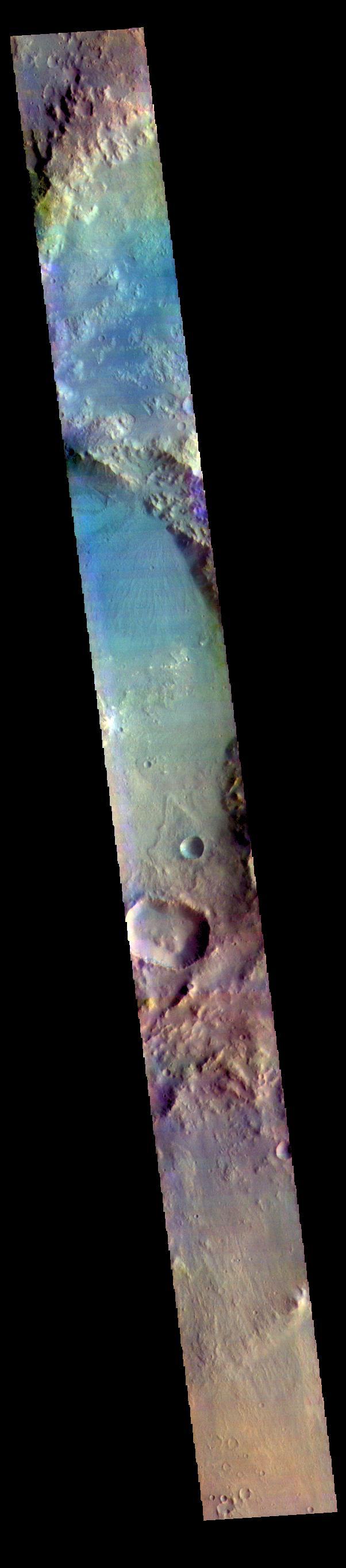
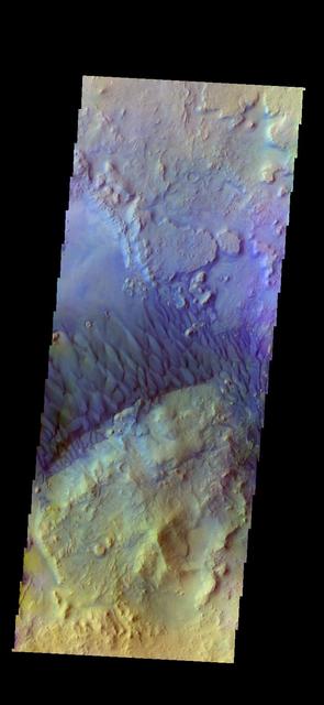
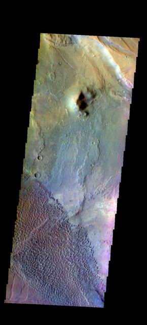
This false color image shows part of Harris crater (center of image) and an unnamed crater (top of image). These craters are located north of Hellas Planitia. At the upper right part of the Harris Crater rim, there is a fan shaped form. Fans can be created by different processes. Delta deposit fans are created under water, when a river flow slows down and drops sediments from the water column. These sediments are typically fine grained silts. Deltas form over time and can take many shapes as the river changes channels. The Mississippi River delta is formed this way. Alluvial fans are created in dry climates with short fluid seasons. In this case a single stream hits a topographic opening (think ravine) and sheds the rocks and sand down hill. The alluvial fan shape is created from the single opening. Either way, fans form by the action of a fluid. The THEMIS VIS camera contains 5 filters. The data from different filters can be combined in multiple ways to create a false color image. These false color images may reveal subtle variations of the surface not easily identified in a single band image. Orbit Number: 64642 Latitude: -21.9957 Longitude: 67.2664 Instrument: VIS Captured: 2016-07-10 10:43 https://photojournal.jpl.nasa.gov/catalog/PIA23611
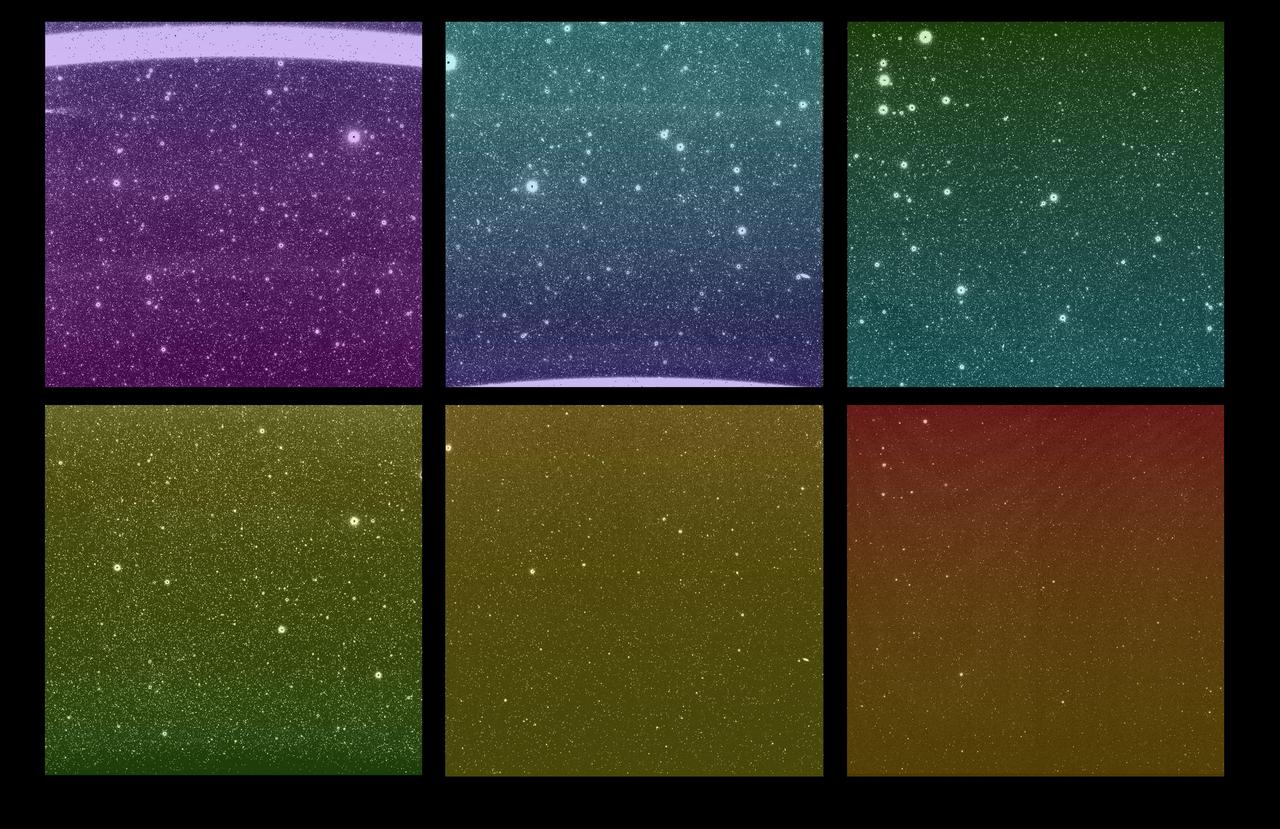
Some of the first images from NASA's SPHEREx (Spectro-Photometer for the History of the Universe, Epoch of Reionization and Ices Explorer) mission were captured March 27, 2025. Although the new images are uncalibrated and not yet ready to use for science, they give a tantalizing look at SPHEREx's wide view of the sky. Each bright spot is a source of light, like a star or galaxy, and each image is expected to contain more than 100,000 detected sources. There are six images in every SPHEREx exposure – one for each detector. The top three images show the same area of sky as the bottom three images; this is the observatory's full field of view, a rectangular area about 20 times wider than the full Moon. When the SPHEREx observatory begins routine science operations in April, it will take approximately 600 exposures every day. SPHEREx detects infrared light, which is invisible to the human eye. To make the images shown here, science team members assigned a visible color to each infrared wavelength captured by the observatory. With each detector capturing 17 unique infrared wavelength bands, there are 102 hues in this image. To detect so many infrared colors, SPHEREx uses color filters set on top of the detectors. (If the detectors are like SPHEREx's eyes, the filters are like color-tinted glasses). A standard color filter blocks all wavelengths but one, but the SPHEREx filters are more like rainbow-tinted glasses, in that the wavelengths they block change gradually from the top of the filter to the bottom. The legend at the top shows that the detectors are placed to observe infrared wavelengths from shortest to longest. Certain chemical elements are visible at specific wavelengths, as is the case with helium from Earth's atmosphere, which creates a bright line in the wavelength at the top of the top-left image. Breaking down color this way can reveal the composition of an object or the distance to a galaxy. With that data, scientists can study topics ranging from the physics that governed the universe less than a second after its birth to the origins of water in our galaxy. https://photojournal.jpl.nasa.gov/catalog/PIA26280
Range : 7 million kilometers (5 million miles) Callisto is Jupiter's outermost Galilean satellites and darkest of the four(but almost twice as bright as Earth's Moon). Mottled appearance from bright and dark patches. Bright spots seem like rayed or bright halved craters seen on our Moon. This face is always turned toward Jupiter. Photo taken through violet filter. Ganymede is slightly larger than Mercury but much less dense (twice the density of water). Its surface brightness is 4 times of Earth's Moon. Mare regions (dark features) are like the Moon's but have twice the brightness, and believed to be unlikely of rock or lava as the Moon's are. It's north pole seems covered with brighter material and may be water frost. Scattered brighter spots may be related to impact craters or source of fresh ice.
Range : 2.52 million miles (1.56 million miles) Resolution : 47km. ( 29 mi.) Closest Approach: 127,000 km. (79,000 mi.) P-29479B/W This Voyager 2 image of the brightest Uranian satellite of the five largest, Ariel, was shot through a clear filter with the narrow angle camera. Ariel is about 1,300 km. ( 800 mi. )in diameter. This image shows several distinct bright areas that reflect nearly 45 % of the incident sunlight. On average, the satellite displays reflectivity of about 25-30 %. The bright areas are probably fresh water ice, perhaps excavated by impacts. the south pole of Ariel is slightly off center of the disk in this view.

STS003-22-122 (30 March 1982) --- STS-3 Commander Lousma, wearing communications kit assembly (ASSY) mini-headset (HDST), records Plant Growth Unit (PGU) data for the Influence of Weightlessness on Plant Lignification Experiment at forward middeck locker MF14K. The experiment is designed to demonstrate the effect of weightlessness on the quantity and rate of lignin formation in different plant species during early stages of development. Port side bulkhead with window shade and filter kit appears behind Lousma and potable water tank below him. Trash bag also appears in view. Photo credit: NASA
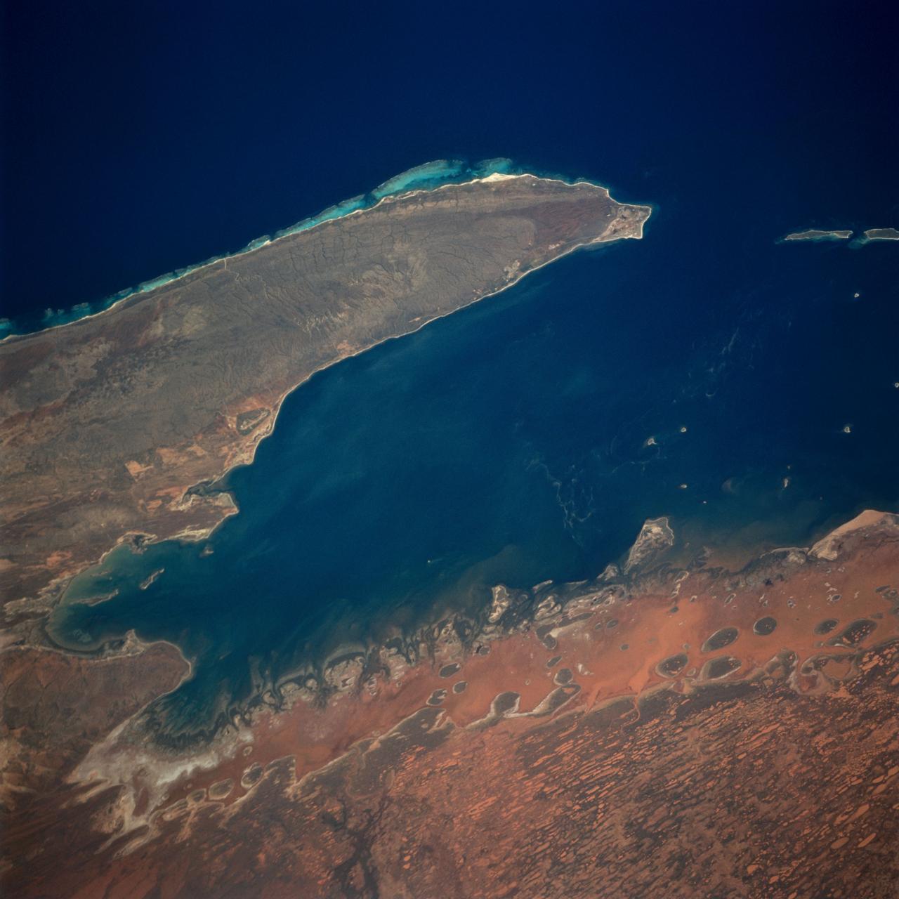
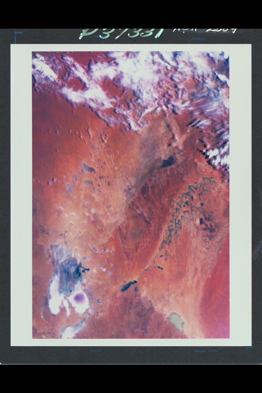
The Exmouth Gulf, western Australia, is bounded on the west by the Cape Ranges; near the base of the peninsula the Learmonth Airfield, site of a solar observatory, can be seen. Spit-accretion ridges formed on ancient beaches extend along the western edge of the peninsula, which today is lined by the Ningaloo Reef. Red mud carried by floodwaters, the result of Hurricane Bobby the previous week, cover flat coastal land along the eastern side of the gulf. The mud is mixing slowly with marine water as it filters through passes between mangrove-covered islands. A filamentous pattern in the gulf probably indicates a plankton bloom. Island paleodunes stretching from south to north cover the landscape.
This is a false color image of Rabe Crater. In this combination of filters "blue" typically means basaltic sand. This VIS image crosses the entire crater and demonstrates how extensive the dunes are on the floor of Rabe Crater. Rabe Crater is 108 km (67 miles) across. Craters of similar size often have flat floors. Rabe Crater has some areas of flat floor, but also has a large complex pit occupying a substantial part of the floor. The interior fill of the crater is thought to be layered sediments created by wind and or water action. The pit is eroded into this material. The eroded materials appear to have stayed within the crater forming a large sand sheet with surface dune forms as well as individual dunes where the crater floor is visible. The dunes also appear to be moving from the upper floor level into the pit. The THEMIS VIS camera contains 5 filters. The data from different filters can be combined in multiple ways to create a false color image. These false color images may reveal subtle variations of the surface not easily identified in a single band image. The Odyssey spacecraft has spent over 15 years in orbit around Mars, circling the planet more than 69000 times. It holds the record for longest working spacecraft at Mars. THEMIS, the IR/VIS camera system, has collected data for the entire mission and provides images covering all seasons and lighting conditions. Over the years many features of interest have received repeated imaging, building up a suite of images covering the entire feature. From the deepest chasma to the tallest volcano, individual dunes inside craters and dune fields that encircle the north pole, channels carved by water and lava, and a variety of other feature, THEMIS has imaged them all. For the next several months the image of the day will focus on the Tharsis volcanoes, the various chasmata of Valles Marineris, and the major dunes fields. We hope you enjoy these images! Orbit Number: 67013 Latitude: -43.2572 Longitude: 34.5875 Instrument: VIS Captured: 2017-01-21 18:25 https://photojournal.jpl.nasa.gov/catalog/PIA22147
This is a false color image of Rabe Crater. In this combination of filters "blue" typically means basaltic sand. Rabe Crater is 108 km (67 miles) across. Craters of similar size often have flat floors. Rabe Crater has some areas of flat floor, but also has a large complex pit occupying a substantial part of the floor. The interior fill of the crater is thought to be layered sediments created by wind and or water action. The pit is eroded into this material. The eroded materials appear to have stayed within the crater forming a large sand sheet with surface dune forms as well as individual dunes where the crater floor is visible. The dunes also appear to be moving from the upper floor level into the pit. The THEMIS VIS camera contains 5 filters. The data from different filters can be combined in multiple ways to create a false color image. These false color images may reveal subtle variations of the surface not easily identified in a single band image. The Odyssey spacecraft has spent over 15 years in orbit around Mars, circling the planet more than 69000 times. It holds the record for longest working spacecraft at Mars. THEMIS, the IR/VIS camera system, has collected data for the entire mission and provides images covering all seasons and lighting conditions. Over the years many features of interest have received repeated imaging, building up a suite of images covering the entire feature. From the deepest chasma to the tallest volcano, individual dunes inside craters and dune fields that encircle the north pole, channels carved by water and lava, and a variety of other feature, THEMIS has imaged them all. For the next several months the image of the day will focus on the Tharsis volcanoes, the various chasmata of Valles Marineris, and the major dunes fields. We hope you enjoy these images! Orbit Number: 67144 Latitude: -43.5512 Longitude: 34.5951 Instrument: VIS Captured: 2017-02-01 12:57 https://photojournal.jpl.nasa.gov/catalog/PIA22148
This is a false color image of Rabe Crater. In this combination of filters "blue" typically means basaltic sand. Rabe Crater is 108 km (67 miles) across. Craters of similar size often have flat floors. Rabe Crater has some areas of flat floor, but also has a large complex pit occupying a substantial part of the floor. The interior fill of the crater is thought to be layered sediments created by wind and or water action. The pit is eroded into this material. The eroded materials appear to have stayed within the crater forming a large sand sheet with surface dune forms as well as individual dunes where the crater floor is visible. The dunes also appear to be moving from the upper floor level into the pit. The THEMIS VIS camera contains 5 filters. The data from different filters can be combined in multiple ways to create a false color image. These false color images may reveal subtle variations of the surface not easily identified in a single band image. The Odyssey spacecraft has spent over 15 years in orbit around Mars, circling the planet more than 69000 times. It holds the record for longest working spacecraft at Mars. THEMIS, the IR/VIS camera system, has collected data for the entire mission and provides images covering all seasons and lighting conditions. Over the years many features of interest have received repeated imaging, building up a suite of images covering the entire feature. From the deepest chasma to the tallest volcano, individual dunes inside craters and dune fields that encircle the north pole, channels carved by water and lava, and a variety of other feature, THEMIS has imaged them all. For the next several months the image of the day will focus on the Tharsis volcanoes, the various chasmata of Valles Marineris, and the major dunes fields. We hope you enjoy these images! Orbit Number: 52231 Latitude: -43.6665 Longitude: 34.2627 Instrument: VIS Captured: 2013-09-22 14:29 https://photojournal.jpl.nasa.gov/catalog/PIA22146
This is a false color image of Rabe Crater. In this combination of filters "blue" typically means basaltic sand. Rabe Crater is 108 km (67 miles) across. Craters of similar size often have flat floors. Rabe Crater has some areas of flat floor, but also has a large complex pit occupying a substantial part of the floor. The interior fill of the crater is thought to be layered sediments created by wind and or water action. The pit is eroded into this material. The eroded materials appear to have stayed within the crater forming a large sand sheet with surface dune forms as well as individual dunes where the crater floor is visible. The dunes also appear to be moving from the upper floor level into the pit. The THEMIS VIS camera contains 5 filters. The data from different filters can be combined in multiple ways to create a false color image. These false color images may reveal subtle variations of the surface not easily identified in a single band image. The Odyssey spacecraft has spent over 15 years in orbit around Mars, circling the planet more than 69000 times. It holds the record for longest working spacecraft at Mars. THEMIS, the IR/VIS camera system, has collected data for the entire mission and provides images covering all seasons and lighting conditions. Over the years many features of interest have received repeated imaging, building up a suite of images covering the entire feature. From the deepest chasma to the tallest volcano, individual dunes inside craters and dune fields that encircle the north pole, channels carved by water and lava, and a variety of other feature, THEMIS has imaged them all. For the next several months the image of the day will focus on the Tharsis volcanoes, the various chasmata of Valles Marineris, and the major dunes fields. We hope you enjoy these images! Orbit Number: 51157 Latitude: -43.6787 Longitude: 34.3985 Instrument: VIS Captured: 2013-06-26 05:33 https://photojournal.jpl.nasa.gov/catalog/PIA22145
The THEMIS VIS camera contains 5 filters. The data from different filters can be combined in multiple ways to create a false color image. These false color images may reveal subtle variations of the surface not easily identified in a single band image. Today's false color image shows part of western Candor Chasma. Candor Chasma is one of the largest canyons that make up Valles Marineris. It is approximately 810 km long (503 miles) and has is divided into two regions — eastern and western Candor. Candor is located south of Ophir Chasma and north of Melas Chasma. The border with Melas Chasma contains many large landslide deposits. The floor of Candor Chasma includes a variety of landforms, including layered deposits, dunes, landslide deposits and steep sided cliffs and mesas. Many forms of erosion have shaped Candor Chasma. There is evidence of wind and water erosion, as well as significant gravity driven mass wasting (landslides). Orbit Number: 69411 Latitude: -5.95186 Longitude: 283.147 Instrument: VIS Captured: 2017-08-07 08:33 https://photojournal.jpl.nasa.gov/catalog/PIA24081
This VIS image shows part of the floor of Pollack Crater. First imaged by Mariner 9, the high contrast between the crater floor and the bright feature, led to the informal name "white rock" for the bright floor feature. More recent images have shown that the floor of Pollack Crater is darker then normal in that part of the crater, which has produced the high contrast. THEMIS IR images of the feature indicate a composition produced by wind deposition, rather than water. Additionally, the deposit does not appear to be solid rock. The deposit is most likely a combination of dust and a more solid material. Taken together, the Mariner 9 image of white rock didn't hold up under careful study, it's not white and it's not rock! The THEMIS VIS camera contains 5 filters. The data from different filters can be combined in multiple ways to create a false color image. These false color images may reveal subtle variations of the surface not easily identified in a single band image. Orbit Number: 62872 Latitude: -8.53297 Longitude: 24.916 Instrument: VIS Captured: 2016-02-15 15:52 https://photojournal.jpl.nasa.gov/catalog/PIA23114
The THEMIS VIS camera contains 5 filters. The data from different filters can be combined in multiple ways to create a false color image. These false color images may reveal subtle variations of the surface not easily identified in a single band image. Today's false color image shows part of Candor Chasma. Candor Chasma is one of the largest canyons that make up Valles Marineris. It is approximately 810 km long (503 miles) and has is divided into two regions – eastern and western Candor. Candor is located south of Ophir Chasma and north of Melas Chasma. The border with Melas Chasma contains many large landslide deposits. The floor of Candor Chasma includes a variety of landforms, including layered deposits (seen in this image), dunes, landslide deposits and steep sided cliffs and mesas. Many forms of erosion have shaped Candor Chasma. There is evidence of wind and water erosion, as well as significant gravity driven mass wasting (landslides). Orbit Number: 71132 Latitude: -6.71232 Longitude: 284.46 Instrument: VIS Captured: 2017-12-27 03:31 https://photojournal.jpl.nasa.gov/catalog/PIA24508
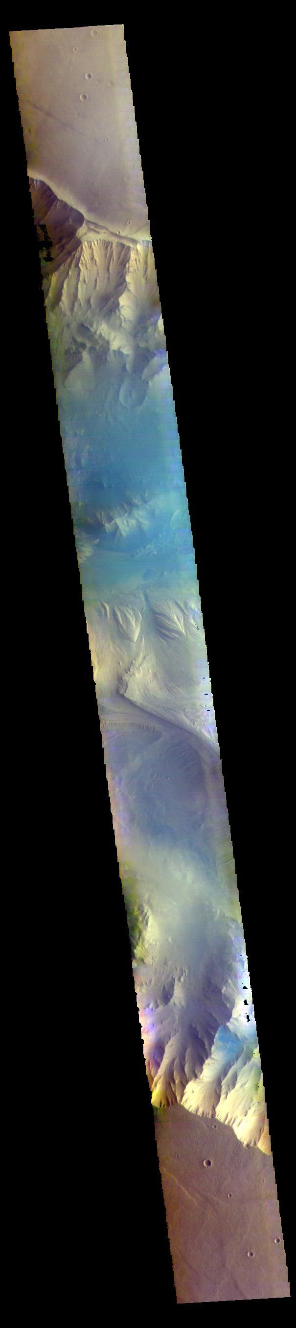
The THEMIS VIS camera contains 5 filters. The data from different filters can be combined in multiple ways to create a false color image. These false color images may reveal subtle variations of the surface not easily identified in a single band image. Today's false color image shows part of eastern Candor Chasma. Candor Chasma is one of the largest canyons that make up Valles Marineris. It is approximately 810 km long (503 miles) and has is divided into two regions — eastern and western Candor. Candor is located south of Ophir Chasma and north of Melas Chasma. The border with Melas Chasma contains many large landslide deposits. The floor of Candor Chasma includes a variety of landforms, including layered deposits, dunes, landslide deposits and steep sided cliffs and mesas. Many forms of erosion have shaped Candor Chasma. There is evidence of wind and water erosion, as well as significant gravity driven mass wasting (landslides). Orbit Number: 68438 Latitude: -7.05392 Longitude: 291.853 Instrument: VIS Captured: 2017-05-19 04:30 https://photojournal.jpl.nasa.gov/catalog/PIA24078

The THEMIS VIS camera contains 5 filters. The data from different filters can be combined in multiple ways to create a false color image. These false color images may reveal subtle variations of the surface not easily identified in a single band image. Today's false color image shows a small section of Mawrth Vallis (near the top of the image). Of all the channels carved by flowing water on Mars, one of the more unusual is Mawrth Vallis, whose name comes from the Welsh word for Mars. Mawrth winds through northwest Arabia Terra for some 640 kilometers (400 miles) before emptying into Acidalia Planitia on the edge of the vast northern lowlands. Unlike many outflow channels that start in regions of chaotic terrain, Mawrth Vallis just appears and then grows deeper as it heads downstream, holding a width of approximately 15 km (9 mi) until it widens near its mouth at Chryse Planitia. Orbit Number: 68698 Latitude: 21.9401 Longitude: 342.256 Instrument: VIS Captured: 2017-06-09 14:48 https://photojournal.jpl.nasa.gov/catalog/PIA24079
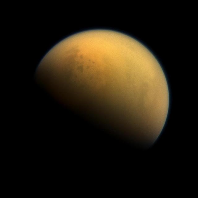
Using a special spectral filter, the high-resolution camera aboard NASA's Cassini spacecraft was able to peer through the hazy atmosphere of Saturn's moon Titan. It captured this image, which features the largest seas and some of the many hydrocarbon lakes that are present on Titan's surface. Titan is the only place in the solar system, other than Earth, that has stable liquids on its surface. In this case, the liquid consists of ethane and methane rather than water. This view looks towards the side of Titan (3,200 miles or 5,150 kilometers across) that leads in its orbit around Saturn. North on Titan is up and rotated 36 degrees to the left. Images taken using red, green and blue spectral filters were combined to create this natural-color view. The images were taken with the Cassini spacecraft narrow-angle camera on Oct. 7, 2013. The view was acquired at a distance of approximately 809,000 miles (1.303 million kilometers) from Titan. Image scale is 5 miles (8 kilometers) per pixel. http://photojournal.jpl.nasa.gov/catalog/PIA17179
The THEMIS VIS camera contains 5 filters. The data from different filters can be combined in multiple ways to create a false color image. These false color images may reveal subtle variations of the surface not easily identified in a single band image. Today's false color image shows the channel floor of Mawrth Vallis. Of all the channels carved by flowing water on Mars, one of the more unusual is Mawrth Vallis, whose name comes from the Welsh word for Mars. Mawrth Vallis winds through northwest Arabia Terra for some 640 kilometers (400 miles) before emptying into Acidalia Planitia on the edge of the vast northern lowlands. Unlike many outflow channels that start in regions of chaotic terrain, Mawrth Vallis just appears and then grows deeper as it heads downstream, holding a width of approximately 15 km (9 mi) until it widens near its mouth at Chryse Planitia. Orbit Number: 71080 Latitude: 22.9484 Longitude: 341.466 Instrument: VIS Captured: 2017-12-22 20:52 https://photojournal.jpl.nasa.gov/catalog/PIA24507
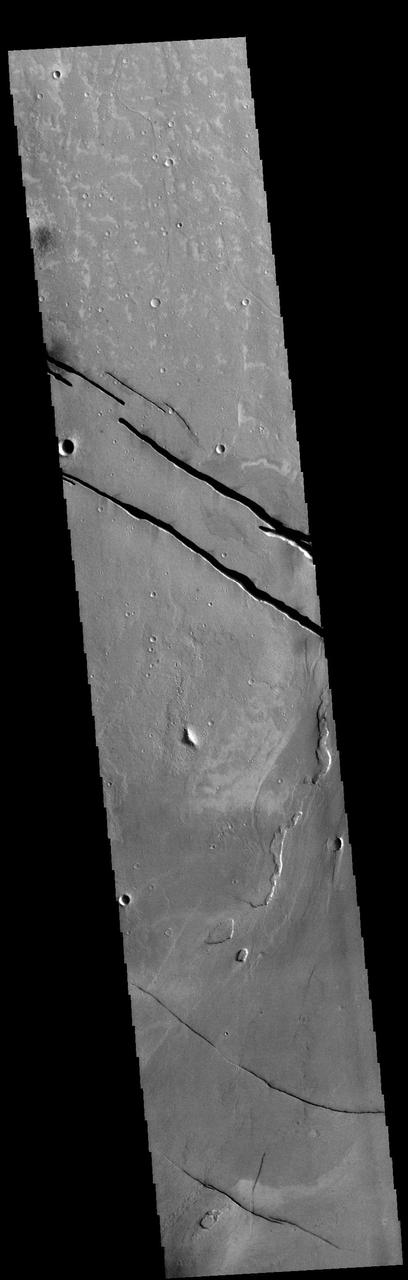
Today's VIS image shows a section of Cerberus Fossae. Located southeast of the Elysium Planitia volcanic complex, the linear graben in the image were created by tectonic forces related to the volcanic activity. The graben are sources of both channels and significant volcanic flows. The Cerberus Fossae graben cut across features such as hills, indicating the relative youth of the tectonic activity. Graben form where extensional tectonic forces allows blocks of material to subside between paired faults. Cerberus Fossae are 270km (168 miles) long. Just off the image to the right is the start of Athabasca Valles, which is seen flowing below the graben to the bottom left of the image. Arising from Cerberus Fossae, the formation mode of this channel is still being debated. While the channel features are similar to water flow, other features are similar to lava flows, and yet other features have an appearance of slabs of material that floated on an underlying fluid. It is thought that Athabasca Valles is the youngest outflow channel system on Mars. Athabasca Valles is just one of the complex channel formations in the Elysium Planitia region. The THEMIS VIS camera is capable of capturing color images of the Martian surface using five different color filters. In this mode of operation, the spatial resolution and coverage of the image must be reduced to accommodate the additional data volume produced from using multiple filters. To make a color image, three of the five filter images (each in grayscale) are selected. Each is contrast enhanced and then converted to a red, green, or blue intensity image. These three images are then combined to produce a full color, single image. Because the THEMIS color filters don't span the full range of colors seen by the human eye, a color THEMIS image does not represent true color. Also, because each single-filter image is contrast enhanced before inclusion in the three-color image, the apparent color variation of the scene is exaggerated. Nevertheless, the color variation that does appear is representative of some change in color, however subtle, in the actual scene. Note that the long edges of THEMIS color images typically contain color artifacts that do not represent surface variation. Orbit Number: 86770 Latitude: 10.3516 Longitude: 156.539 Instrument: VIS Captured: 2021-07-06 22:48 https://photojournal.jpl.nasa.gov/catalog/PIA24994
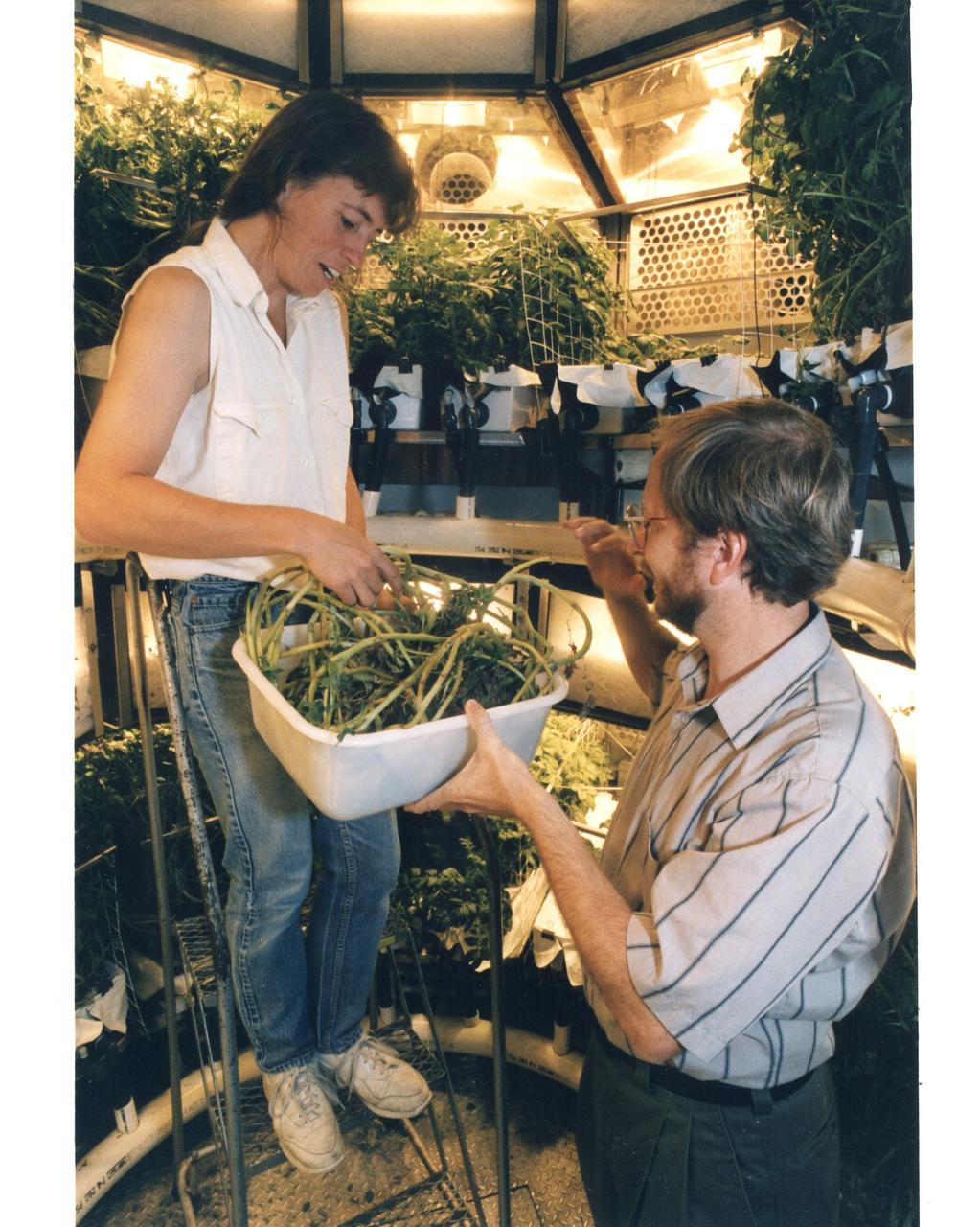
Original photo and caption dated August 14, 1995: <i>"KSC plant physiologist Dr. Gary Stutte (right) and Cheryl Mackowiak harvest potatoes grown in the Biomass Production Chamber of the Controlled Enviornment Life Support System (CELSS in Hangar L at Cape Canaveral Air Station. During a 418-day "human rated" experiment, potato crops grown in the chamber provided the equivalent of a continuous supply of the oxygen for one astronaut, along with 55 percent of that long-duration space flight crew member's caloric food requirements and enough purified water for four astronauts while absorbing their expelled carbon dioxide. The experiment provided data that will help demonstarte the feasibility of the CELSS operating as a bioregenerative life support system for lunar and deep-space missions that can operate independently without the need to carry consumables such as air, water and food, while not requiring the expendable air and water system filters necessary on today's human-piloted spacecraft."</i
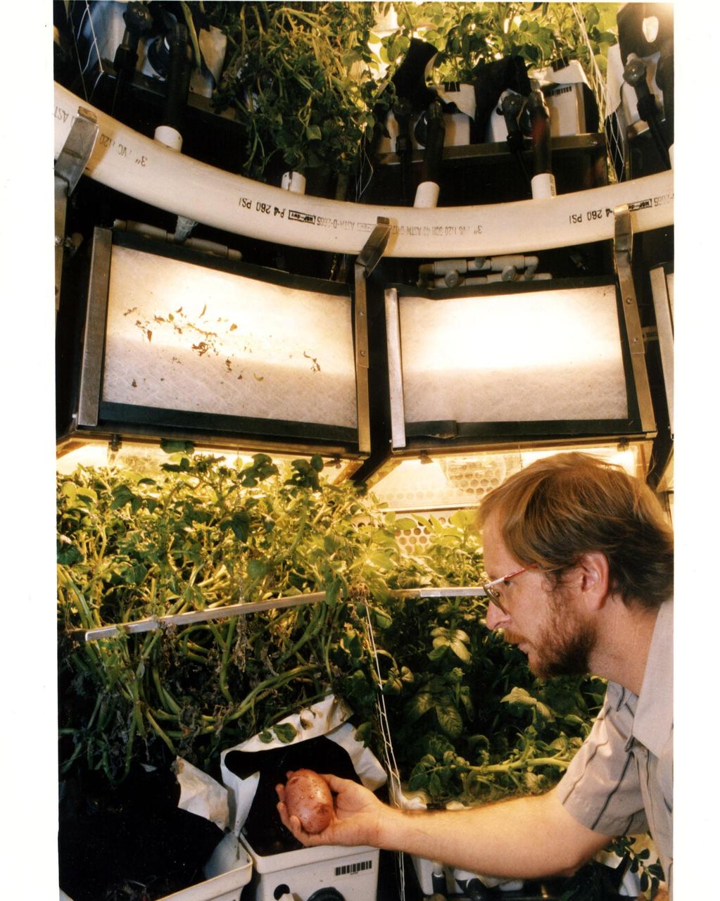
Original photo and caption dated August 14, 1995: <i>"KSC plant physiologist Dr. Gary Stutte harvests a potato grown in the Biomass Production Chamber of the Controlled environment Life Support system (CELSS) in Hangar L at Cape Canaveral Air Station. During a 418-day "human rated" experiment, potato crops grown in the chamber provided the equivalent of a continuous supply of the oxygen for one astronaut, along with 55 percent of that long-duration space flight crew member's caloric food requirements and enough purified water for four astronauts while absorbing their expelled carbon dioxide. The experiment provided data that will help demonstarte the feasibility of the CELSS operating as a bioregenerative life support system for lunar and deep-space missions that can operate independently without the need to carry consumables such as air, water and food, while not requiring the expendable air and water system filters necessary on today's human-piloted spacecraft."</i
This is a false color image of Kaiser Crater. In this combination of filters "blue" typically means basaltic sand. This VIS image crosses 3/4 of the crater and demonstrates how extensive the dunes are on the floor of Kaiser Crater. Kaiser Crater is located in the southern hemisphere in the Noachis region west of Hellas Planitia. Kaiser Crater is just one of several large craters with extensive dune fields on the crater floor. Other nearby dune filled craters are Proctor, Russell, and Rabe. Kaiser Crater is 207 km (129 miles) in diameter. The dunes are located in the southern part of the crater floor. The THEMIS VIS camera contains 5 filters. The data from different filters can be combined in multiple ways to create a false color image. These false color images may reveal subtle variations of the surface not easily identified in a single band image. The Odyssey spacecraft has spent over 15 years in orbit around Mars, circling the planet more than 71,000 times. It holds the record for longest working spacecraft at Mars. THEMIS, the IR/VIS camera system, has collected data for the entire mission and provides images covering all seasons and lighting conditions. Over the years many features of interest have received repeated imaging, building up a suite of images covering the entire feature. From the deepest chasma to the tallest volcano, individual dunes inside craters and dune fields that encircle the north pole, channels carved by water and lava, and a variety of other feature, THEMIS has imaged them all. For the next several months the image of the day will focus on the Tharsis volcanoes, the various chasmata of Valles Marineris, and the major dunes fields. We hope you enjoy these images! Orbit Number: 66602 Latitude: -47.0551 Longitude: 19.446 Instrument: VIS Captured: 2016-12-18 21:42 https://photojournal.jpl.nasa.gov/catalog/PIA22265
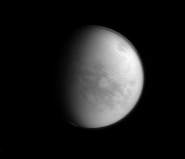
Named after a Japanese paradise, the Senkyo region of Titan (the dark area below and to the right of center) is a bit less welcoming than its namesake. With a very inhospitable average temperature of approximately 290 degrees below zero Fahrenheit (-180 degrees Celsius), water on Titan (3,200 miles or 5,150 kilometers across) freezes hard enough to be essentially considered rock. This view looks toward the Saturn-facing side of Titan. North on Titan is up and rotated 33 degrees to the right. The image was taken with the Cassini spacecraft narrow-angle camera on Jan. 8, 2015 using a near-infrared filter which is centered at 938 nanometers. The view was acquired at a distance of approximately 1.2 million miles (1.9 million kilometers) from Titan. Image scale is 7 miles (11 kilometers) per pixel. http://photojournal.jpl.nasa.gov/catalog/pia18309
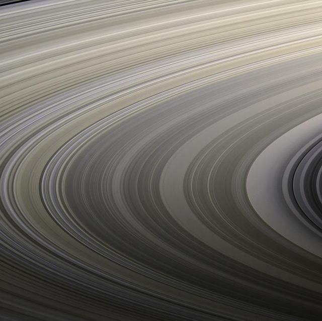
Saturn's rings display their subtle colors in this view captured on Aug. 22, 2009, by NASA's Cassini spacecraft. The particles that make up the rings range in size from smaller than a grain of sand to as large as mountains, and are mostly made of water ice. The exact nature of the material responsible for bestowing color on the rings remains a matter of intense debate among scientists. Images taken using red, green and blue spectral filters were combined to create this natural color view. Cassini's narrow-angle camera took the images at a distance of approximately 1.27 million miles (2.05 million kilometers) from the center of the rings. The Cassini spacecraft ended its mission on Sept. 15, 2017 https://photojournal.jpl.nasa.gov/catalog/PIA22418
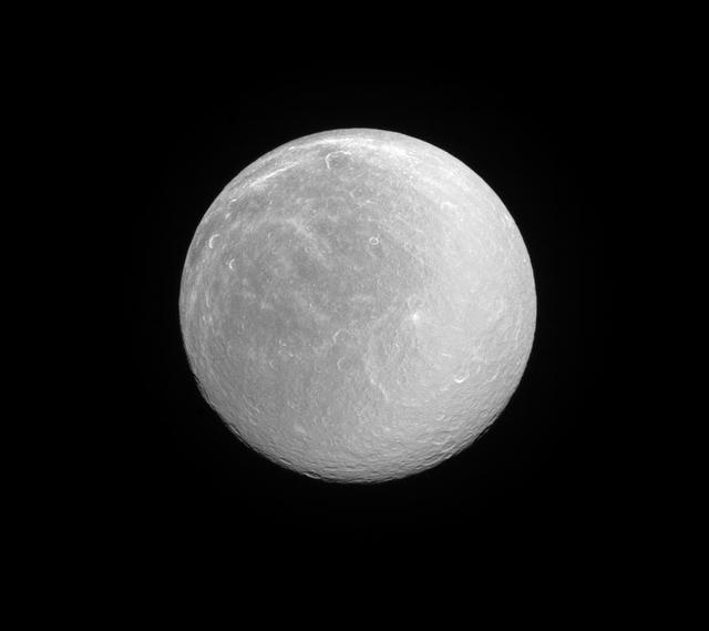
Rhea, like many moons in the outer solar system, appears dazzlingly bright in full sunlight. This is the signature of the water ice that forms most of the moon's surface. Rhea (949 miles or 1,527 kilometers across) is Saturn's second largest moon after Titan. Its ancient surface is one of the most heavily cratered of all of Saturn's moons. Subtle albedo variations across the disk of Rhea hint at past geologic activity. This view looks toward the anti-Saturn hemisphere of Rhea. North on Rhea is up and rotated 36 degrees to the right. The image was taken with the Cassini spacecraft narrow-angle camera on June 3, 2016 using a spectral filter which preferentially admits wavelengths of ultraviolet light centered at 338 nanometers. http://photojournal.jpl.nasa.gov/catalog/PIA20495
Range : 35,000 miles plus. This color image of the Simpson Desert in Australia was obtained by the Galileo spacecraft at aboaut 2:30 pm PST. The color composite was made from images taken through the red, green and violet filters. The area shown, about 280 miles wide by about 340 miles north-to-south, is southeast of Alice Springs. At lower left is Lake Eyre, a salt lake below sea level, subject to seasonal water-level fluctuations; when this image was acquired the lake was nearly dry. At lower right is the greenish Lake Blanche. Fields of linear sand dunes stretch north and east of Lake Eyre, shaped by prevailing winds from the south and showing, in different colors, the various sources and/or ages of their sands.
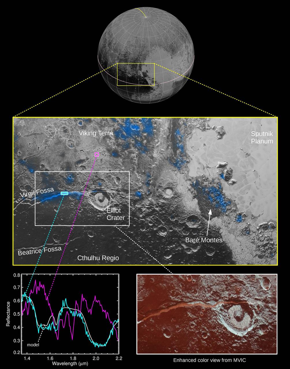
The Ralph instrument on NASA's New Horizons spacecraft detected water ice on Pluto's surface, picking up on the ice's near-infrared spectral characteristics. (See featured image from Oct. 8, 2015.) The middle panel shows a region west of Pluto's "heart" feature -- which the mission team calls Tombaugh Regio -- about 280 miles (450 kilometers) across. It combines visible imagery from Ralph's Multispectral Visible Imaging Camera (MVIC) with infrared spectroscopy from the Linear Etalon Imaging Spectral Array (LEISA). Areas with the strongest water ice spectral signature are highlighted in blue. Major outcrops of water ice occur in regions informally called Viking Terra, along Virgil Fossa west of Elliot crater, and in Baré Montes. Numerous smaller outcrops are associated with impact craters and valleys between mountains. In the lower left panel, LEISA spectra are shown for two regions indicated by cyan and magenta boxes. The white curve is a water ice model spectrum, showing similar features to the cyan spectrum. The magenta spectrum is dominated by methane ice absorptions. The lower right panel shows an MVIC enhanced color view of the region in the white box, with MVIC's blue, red and near-infrared filters displayed in blue, green and red channels, respectively. The regions showing the strongest water ice signature are associated with terrains that are actually a lighter shade of red. http://photojournal.jpl.nasa.gov/catalog/PIA20030
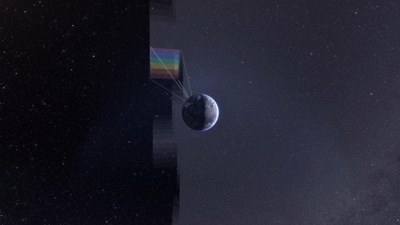
NASA's SPHEREx observatory will map the entire sky to help scientists answer big-picture questions about the origins of our universe, galaxies, and key ingredients for life in our galaxy, such as water. Operating from low Earth orbit, the telescope will sweep across the sky, taking about 600 exposures each day. Using a technique called spectroscopy, the observatory will image every section of the sky 102 times, each time using a different color filter that blocks all wavelengths except one. By combining those images, the mission will produce a map containing information about the composition of and distance to millions of stars and other objects in our galaxy and hundreds of millions of galaxies beyond. (See an animation of this process, depicted in a still artist's concept above, at spherex.caltech.edu/video/all-sky-survey.) Short for Spectro-Photometer for the History of the Universe, Epoch of Reionization and Ices Explorer, SPHEREx will help scientists study what happened in the first fraction of a second after the big bang, how galaxies formed and evolved, and the origins of water in planetary systems in our galaxy. https://photojournal.jpl.nasa.gov/catalog/PIA26533
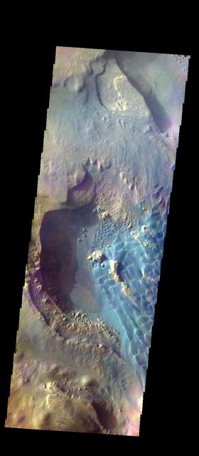
This image of Moreux Crater shows the highest elevations of the central peak, as well as the nearby sand dunes. In this false color image sand dunes are "blue". Smaller patches of blue are located on the central peak materials and indicate where surface winds have moved fine materials on/off the peak deposits. The pitted and curvilinear morphology of the central peak deposits have been interpreted to have formed by glacial activity. Moreux Crater is located in northern Arabia Terra and has a diameter of 138 kilometers. The THEMIS VIS camera contains 5 filters. The data from different filters can be combined in multiple ways to create a false color image. These false color images may reveal subtle variations of the surface not easily identified in a single band image. The Odyssey spacecraft has spent over 15 years in orbit around Mars, circling the planet more than 69000 times. It holds the record for longest working spacecraft at Mars. THEMIS, the IR/VIS camera system, has collected data for the entire mission and provides images covering all seasons and lighting conditions. Over the years many features of interest have received repeated imaging, building up a suite of images covering the entire feature. From the deepest chasma to the tallest volcano, individual dunes inside craters and dune fields that encircle the north pole, channels carved by water and lava, and a variety of other feature, THEMIS has imaged them all. For the next several months the image of the day will focus on the Tharsis volcanoes, the various chasmata of Valles Marineris, and the major dunes fields. We hope you enjoy these images! Orbit Number: 46786 Latitude: 41.7667 Longitude: 44.3482 Instrument: VIS Captured: 2012-07-01 13:41 https://photojournal.jpl.nasa.gov/catalog/PIA22127
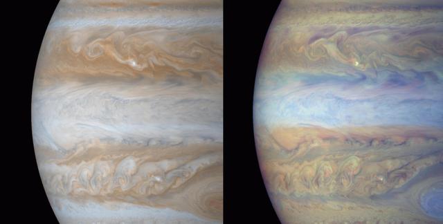
These color composite frames of the mid-section of Jupiter were of narrow angle images acquired on December 31, 2000, a day after Cassini's closest approach to the planet. The smallest features in these frames are roughly ~ 60 kilometers. The left is natural color, composited to yield the color that Jupiter would have if seen by the naked eye. The right frame is composed of 3 images: two were taken through narrow band filters centered on regions of the spectrum where the gaseous methane in Jupiter's atmosphere absorbs light, and the third was taken in a red continuum region of the spectrum, where Jupiter has no absorptions. The combination yields an image whose colors denote the height of the clouds. Red regions are deep water clouds, bright blue regions are high haze (like the blue covering the Great Red Spot). Small, intensely bright white spots are energetic lightning storms which have penetrated high into the atmosphere where there is no opportunity for absorption of light: these high cloud systems reflect all light equally. The darkest blue regions -- for example, the long linear regions which border the northern part of the equatorial zone, are the very deep "hot spots', seen in earlier images, from which Jovian thermal emission is free to escape to space. This is the first time that global images of Jupiter in all the methane and attendant continuum filters have been acquired by a spacecraft. From images like these, the stratigraphy of Jupiter's dynamic atmosphere will be determined. http://photojournal.jpl.nasa.gov/catalog/PIA02877
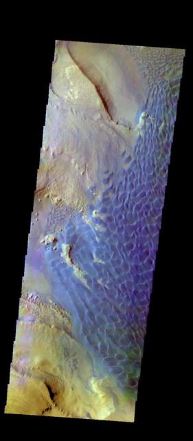
This image shows the western part of the dune field on the floor of Russell Crater. This is a false color image of Russell crater and it's surroundings. Sand Dunes usually appear "blue" in false color images. Russell Crater is located in Noachis Terra. A spectacular dune ridge and other dune forms on the crater floor have caused extensive imaging. The THEMIS VIS camera contains 5 filters. The data from different filters can be combined in multiple ways to create a false color image. These false color images may reveal subtle variations of the surface not easily identified in a single band image. The Odyssey spacecraft has spent over 15 years in orbit around Mars, circling the planet more than 69000 times. It holds the record for longest working spacecraft at Mars. THEMIS, the IR/VIS camera system, has collected data for the entire mission and provides images covering all seasons and lighting conditions. Over the years many features of interest have received repeated imaging, building up a suite of images covering the entire feature. From the deepest chasma to the tallest volcano, individual dunes inside craters and dune fields that encircle the north pole, channels carved by water and lava, and a variety of other feature, THEMIS has imaged them all. For the next several months the image of the day will focus on the Tharsis volcanoes, the various chasmata of Valles Marineris, and the major dunes fields. We hope you enjoy these images! Orbit Number: 59591 Latitude: -54.471 Longitude: 13.1288 Instrument: VIS Captured: 2015-05-21 10:57 https://photojournal.jpl.nasa.gov/catalog/PIA21808
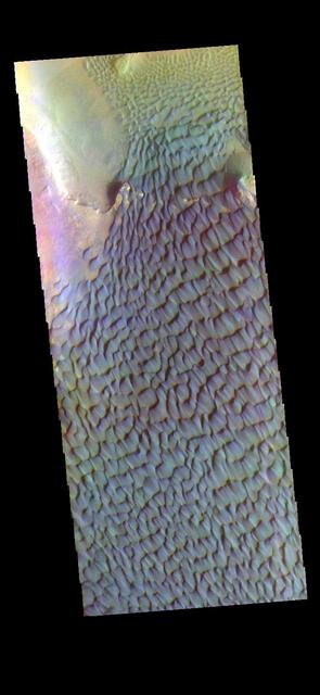
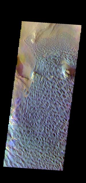
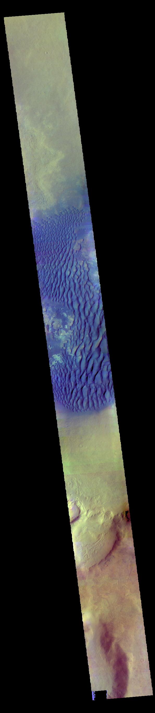
The THEMIS VIS camera contains 5 filters. The data from different filters can be combined in multiple ways to create a false color image. These false color images may reveal subtle variations of the surface not easily identified in a single band image. Today's false color image shows part of the floor of Rabe Crater. Located in Noachis Terra, Rabe Crater is 108 km (67 miles) across. Dunes cover the majority of this image of Rabe Crater. As the dunes are created by wind action the forms of the dunes record the wind direction. Dunes will have a long low angle component and a short high angle side. The steep side is called the slip face. The wind blows up the long side of the dune. In this VIS image the slip faces are illuminated more than the longer side. In this part of the crater the winds were generally moving from the lower right corner of the image towards the upper left. Craters of similar size as Rabe Crater often have flat floors. Rabe Crater has some areas of flat floor, but also has a large complex pit occupying a substantial part of the floor. The interior fill of the crater is thought to be layered sediments created by wind and or water action. The pit is eroded into this material. The eroded materials appear to have stayed within the crater forming a large sand sheet with surface dune forms as well as individual dunes where the crater floor is visible. Several other craters in this region have complex floors with pits. Orbit Number: 83505 Latitude: -43.6272 Longitude: 34.5903 Instrument: VIS Captured: 2020-10-11 02:34 https://photojournal.jpl.nasa.gov/catalog/PIA24709
This is a false color image of the dune field in the Arabia Terra crater. In this combination of bands, sand appears as a blue to dark blue color. In this image, the smaller areas of sand are easily visible and indicate the large amount of available material for creating dunes. Located in eastern Arabia is an unnamed crater, 120 kilometers (75 miles) across. The floor of this crater contains a large exposure of rocky material, a field of dark sand dunes, and numerous patches of what is probably fine-grain sand. The shape of the dunes indicate that prevailing winds have come from different directions over the years. The THEMIS VIS camera contains 5 filters. The data from different filters can be combined in multiple ways to create a false color image. These false color images may reveal subtle variations of the surface not easily identified in a single band image. The Odyssey spacecraft has spent over 15 years in orbit around Mars, circling the planet more than 71,000 times. It holds the record for longest working spacecraft at Mars. THEMIS, the IR/VIS camera system, has collected data for the entire mission and provides images covering all seasons and lighting conditions. Over the years many features of interest have received repeated imaging, building up a suite of images covering the entire feature. From the deepest chasma to the tallest volcano, individual dunes inside craters and dune fields that encircle the north pole, channels carved by water and lava, and a variety of other feature, THEMIS has imaged them all. For the next several months the image of the day will focus on the Tharsis volcanoes, the various chasmata of Valles Marineris, and the major dunes fields. We hope you enjoy these images! Orbit Number: 45125 Latitude: 26.6761 Longitude: 62.9345 Instrument: VIS Captured: 2012-02-15 20:32 https://photojournal.jpl.nasa.gov/catalog/PIA22302

The THEMIS VIS camera contains 5 filters. The data from different filters can be combined in multiple ways to create a false color image. These false color images may reveal subtle variations of the surface not easily identified in a single band image. Today's false color image shows part of the floor of Rabe Crater. Located in Noachis Terra, Rabe Crater is 108 km (67 miles) across. Dunes cover the majority of this image of Rabe Crater. As the dunes are created by wind action the forms of the dunes record the wind direction. Dunes will have a long low angle component and a short high angle side. The steep side is called the slip face. The wind blows up the long side of the dune. In this VIS image the slip faces are illuminated more than the longer side. In this part of the crater the winds were generally moving from the lower right corner of the image towards the upper left. Craters of similar size as Rabe Crater often have flat floors. Rabe Crater has some areas of flat floor, but also has a large complex pit occupying a substantial part of the floor. The interior fill of the crater is thought to be layered sediments created by wind and or water action. The pit is eroded into this material. The eroded materials appear to have stayed within the crater forming a large sand sheet with surface dune forms as well as individual dunes where the crater floor is visible. Several other craters in this region have complex floors with pits. Orbit Number: 67144 Latitude: -43.5512 Longitude: 34.5951 Instrument: VIS Captured: 2017-02-01 12:57 https://photojournal.jpl.nasa.gov/catalog/PIA24056
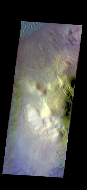
This image of Moreux Crater shows the western floor of the crater and the multitude of sand dunes that are found on the floor of the crater. A large sand sheet with surface dunes forms is located at the top of the image, and smaller individual dunes stretch from the bottom of the sand sheet to the bottom of the image. In this false color image sand dunes are "blue". Moreux Crater is located in northern Arabia Terra and has a diameter of 138 kilometers. The THEMIS VIS camera contains 5 filters. The data from different filters can be combined in multiple ways to create a false color image. These false color images may reveal subtle variations of the surface not easily identified in a single band image. The Odyssey spacecraft has spent over 15 years in orbit around Mars, circling the planet more than 69000 times. It holds the record for longest working spacecraft at Mars. THEMIS, the IR/VIS camera system, has collected data for the entire mission and provides images covering all seasons and lighting conditions. Over the years many features of interest have received repeated imaging, building up a suite of images covering the entire feature. From the deepest chasma to the tallest volcano, individual dunes inside craters and dune fields that encircle the north pole, channels carved by water and lava, and a variety of other feature, THEMIS has imaged them all. For the next several months the image of the day will focus on the Tharsis volcanoes, the various chasmata of Valles Marineris, and the major dunes fields. We hope you enjoy these images! Orbit Number: 10384 Latitude: 41.841 Longitude: 44.087 Instrument: VIS Captured: 2004-04-17 10:07 https://photojournal.jpl.nasa.gov/catalog/PIA22035

This is a false color image of part of the Nili Patera dune field. High resolution imaging by other spacecraft has revealed that the dunes in this region are moving. Winds are blowing the dunes across a rough surface of regional volcanic lava flows. The paterae are calderas on the volcanic complex called Syrtis Major Planum. Dunes are found in both Nili and Meroe Paterae and in the region between the two calderas. The THEMIS VIS camera contains 5 filters. The data from different filters can be combined in multiple ways to create a false color image. These false color images may reveal subtle variations of the surface not easily identified in a single band image. The Odyssey spacecraft has spent over 15 years in orbit around Mars, circling the planet more than 69000 times. It holds the record for longest working spacecraft at Mars. THEMIS, the IR/VIS camera system, has collected data for the entire mission and provides images covering all seasons and lighting conditions. Over the years many features of interest have received repeated imaging, building up a suite of images covering the entire feature. From the deepest chasma to the tallest volcano, individual dunes inside craters and dune fields that encircle the north pole, channels carved by water and lava, and a variety of other feature, THEMIS has imaged them all. For the next several months the image of the day will focus on the Tharsis volcanoes, the various chasmata of Valles Marineris, and the major dunes fields. We hope you enjoy these images! Orbit Number: 19306 Latitude: 8.80756 Longitude: 67.4616 Instrument: VIS Captured: 2006-04-22 00:12 https://photojournal.jpl.nasa.gov/catalog/PIA22008
This is a false color image of part of the Nili Patera dune field. High resolution imaging by other spacecraft has revealed that the dunes in this region are moving. Winds are blowing the dunes across a rough surface of regional volcanic lava flows. The paterae are calderas on the volcanic complex called Syrtis Major Planum. Dunes are found in both Nili and Meroe Paterae and in the region between the two calderas. The THEMIS VIS camera contains 5 filters. The data from different filters can be combined in multiple ways to create a false color image. These false color images may reveal subtle variations of the surface not easily identified in a single band image. The Odyssey spacecraft has spent over 15 years in orbit around Mars, circling the planet more than 69000 times. It holds the record for longest working spacecraft at Mars. THEMIS, the IR/VIS camera system, has collected data for the entire mission and provides images covering all seasons and lighting conditions. Over the years many features of interest have received repeated imaging, building up a suite of images covering the entire feature. From the deepest chasma to the tallest volcano, individual dunes inside craters and dune fields that encircle the north pole, channels carved by water and lava, and a variety of other feature, THEMIS has imaged them all. For the next several months the image of the day will focus on the Tharsis volcanoes, the various chasmata of Valles Marineris, and the major dunes fields. We hope you enjoy these images! Orbit Number: 48021 Latitude: 8.95091 Longitude: 67.3366 Instrument: VIS Captured: 2012-10-11 05:22 https://photojournal.jpl.nasa.gov/catalog/PIA22009
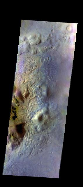
This image of Moreux Crater shows the eastern side of the central peak, as well as the nearby sand dunes. In this false color image sand dunes are "blue". Smaller patches of blue are located on the central peak materials and indicate where surface winds have moved fine materials on/off the peak deposits. The pitted and curvilinear morphology of the central peak deposits have been interpreted to have formed by glacial activity. Moreux Crater is located in northern Arabia Terra and has a diameter of 138 kilometers. The THEMIS VIS camera contains 5 filters. The data from different filters can be combined in multiple ways to create a false color image. These false color images may reveal subtle variations of the surface not easily identified in a single band image. The Odyssey spacecraft has spent over 15 years in orbit around Mars, circling the planet more than 69000 times. It holds the record for longest working spacecraft at Mars. THEMIS, the IR/VIS camera system, has collected data for the entire mission and provides images covering all seasons and lighting conditions. Over the years many features of interest have received repeated imaging, building up a suite of images covering the entire feature. From the deepest chasma to the tallest volcano, individual dunes inside craters and dune fields that encircle the north pole, channels carved by water and lava, and a variety of other feature, THEMIS has imaged them all. For the next several months the image of the day will focus on the Tharsis volcanoes, the various chasmata of Valles Marineris, and the major dunes fields. We hope you enjoy these images! Orbit Number: 12518 Latitude: 41.8223 Longitude: 44.7638 Instrument: VIS Captured: 2004-10-10 02:55 https://photojournal.jpl.nasa.gov/catalog/PIA22126
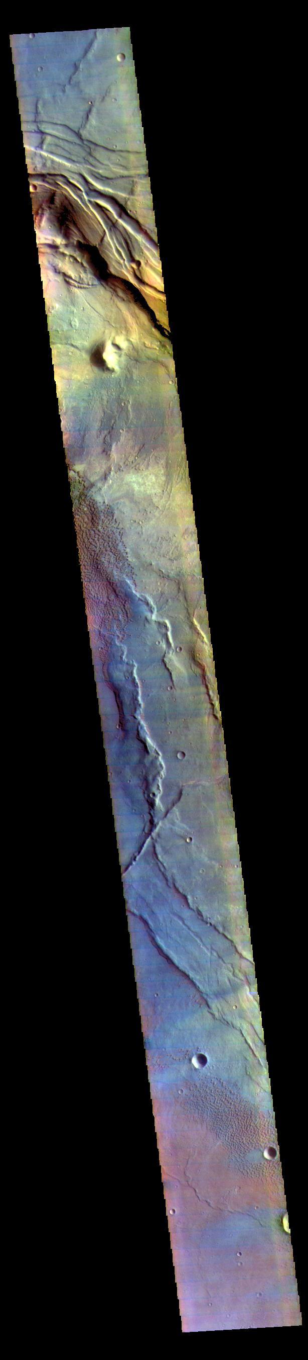
This false color image covers the region from Nili Patera at the top of the frame to the dunes near Meroe Patera (which is off the bottom of the image). High resolution imaging by other spacecraft has revealed that the dunes in this region are moving. Winds are blowing the dunes across a rough surface of regional volcanic lava flows. The paterae are calderas on the volcanic complex called Syrtis Major Planum. Dunes are found in both Nili and Meroe Paterae and in the region between the two calderas. The THEMIS VIS camera contains 5 filters. The data from different filters can be combined in multiple ways to create a false color image. These false color images may reveal subtle variations of the surface not easily identified in a single band image. The Odyssey spacecraft has spent over 15 years in orbit around Mars, circling the planet more than 69000 times. It holds the record for longest working spacecraft at Mars. THEMIS, the IR/VIS camera system, has collected data for the entire mission and provides images covering all seasons and lighting conditions. Over the years many features of interest have received repeated imaging, building up a suite of images covering the entire feature. From the deepest chasma to the tallest volcano, individual dunes inside craters and dune fields that encircle the north pole, channels carved by water and lava, and a variety of other feature, THEMIS has imaged them all. For the next several months the image of the day will focus on the Tharsis volcanoes, the various chasmata of Valles Marineris, and the major dunes fields. We hope you enjoy these images! Orbit Number: 61810 Latitude: 8.37503 Longitude: 67.4659 Instrument: VIS Captured: 2015-11-20 04:48 https://photojournal.jpl.nasa.gov/catalog/PIA22015
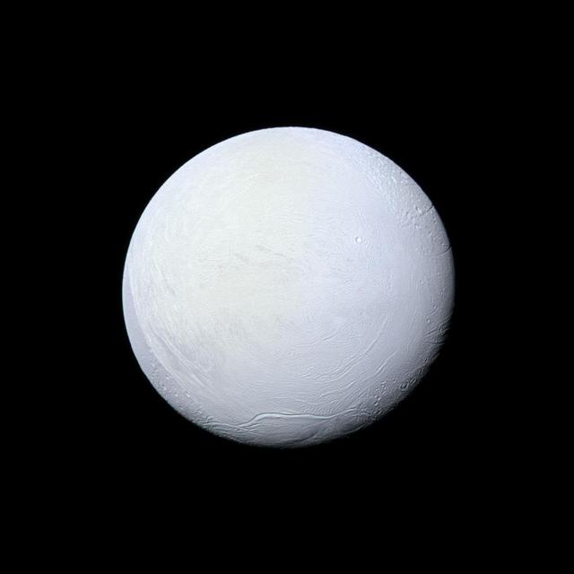
Saturn's moon Enceladus, covered in snow and ice, resembles a perfectly packed snowball in this image from NASA's Cassini mission. Cassini has imaged Enceladus many times throughout its mission, discovering a fractured surface and the now-famous geysers that erupt icy particles and water vapor from fractures crossing the moons' 200-mile-wide (300-kilometer-wide) south polar terrain. The mountain ridge seen in the south in this image is part of the undulating mountain belt that circumscribes this region. This view looks toward the leading side of Enceladus (313 miles, 504 kilometers across). North on Enceladus is up and rotated 6 degrees to the left. The image was taken with the Cassini spacecraft narrow-angle camera on March 10, 2012, using filters sensitive to ultraviolet, visible and infrared light (spanning wavelengths from 338 to 750 nanometers). The view was acquired at a distance of approximately 106,000 miles (170,000 kilometers) from Enceladus. Image scale is 3,336 feet (1 kilometer) per pixel. http://photojournal.jpl.nasa.gov/catalog/PIA17182
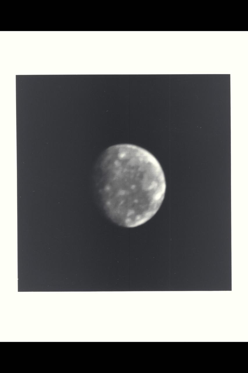
This photo of Callisto, outermost of Jupiter's four Galilean satellites, was taken a few minutes after midnight (PST) Feb. 25 by Voyager 1. The distance to Callisto was 8,023,000 kilometers (4.98 million miles). The hemisphere in this picture shows a fairly uniform surface dotted with brighter spots that are up to several hundred kilometers across. Scientists believe the spots may be impact craters but higher-resolution photos will be necessary before the features can be interpreted. Callisto is about the same size as the planet Mercury--about 5,000 kilometers (3,000 miles) in diameter. Callisto is less massive than Mercury, however, giving it a density less than twice that of water. Scientists believe Callisto, therefore, is composed of a mixture of rock and ice (up to about 50 percent by weight). Its surface is darker than those of the other Galilean satellites, but is still about twice as bright as Earth's Moon. This black-and-white photo was taken through a violet filter. Jet Propulsion Laboratory manages and controls the Voyager project for NASA's Office of Space Science. (JPL ref. No. P-21149)
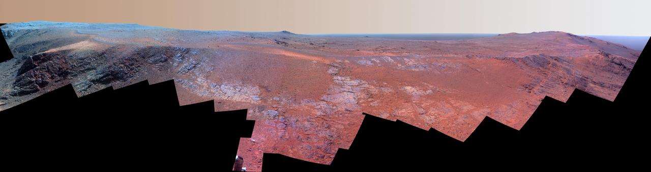
A ridge called "Rocheport" on the western rim of Mars' Endeavour Crater spans this mosaic of images from the panoramic camera (Pancam) on NASA's Mars Exploration Rover Opportunity. In this version of the scene the landscape is presented in enhanced color to make differences in surface materials more easily visible. The view extends from south-southeast on the left to north on the right. Rocheport is near the southern end of an Endeavour rim segment called "Cape Tribulation." The Pancam took the component images for this panorama on Feb. 25, 2017, during the 4,654th Martian day, or sol, of Opportunity's work on Mars. Opportunity began exploring the western rim of Endeavour Crater in 2011 and reached the north end of Cape Tribulation in 2014. This ridge bears some grooves on its side, such as between the two dark shoulders angling down near the left edge of the scene. For scale, those shoulders are about 10 to 16 feet (3 to 5 meters) long. The grooves might have been carved long ago by water or ice or wind. The Rocheport name comes from a riverbank town in Missouri along the route of Lewis and Clark's "Corps of Discovery" Expedition. The view merges exposures taken through three of the Pancam's color filters, centered on wavelengths of 753 nanometers (near-infrared), 535 nanometers (green) and 432 nanometers (violet). https://photojournal.jpl.nasa.gov/catalog/PIA21492
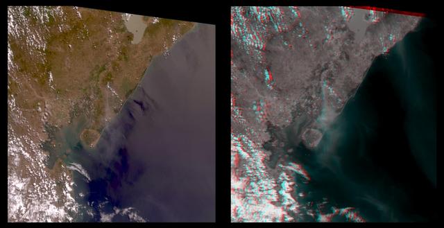
The true-color image at left is a downward-looking (nadir) view of the area around the San Cristobal volcano, which erupted the previous day. This image is oriented with east at the top and north at the left. The right image is a stereo anaglyph of the same area, created from red band multi-angle data taken by the 45.6-degree aftward and 70.5-degree aftward cameras on the Multi-angle Imaging SpectroRadiometer (MISR) instrument on NASA's Terra satellite. View this image through red/blue 3D glasses, with the red filter over the left eye. A plume from San Cristobal (approximately at image center) is much easier to see in the anaglyph, due to 3 effects: the long viewing path through the atmosphere at the oblique angles, the reduced reflection from the underlying water, and the 3D stereoscopic height separation. In this image, the plume floats between the surface and the overlying cumulus clouds. A second plume is also visible in the upper right (southeast of San Cristobal). This very thin plume may originate from the Masaya volcano, which is continually degassing at as low rate. The spatial resolution is 275 meters (300 yards). http://photojournal.jpl.nasa.gov/catalog/PIA02600

A ridge called "Rocheport" on the western rim of Mars' Endeavour Crater spans this mosaic of images from the panoramic camera (Pancam) on NASA's Mars Exploration Rover Opportunity. The view extends from south-southeast on the left to north on the right. Rocheport is near the southern end of an Endeavour rim segment called "Cape Tribulation." The Pancam took the component images for this panorama on Feb. 25, 2017, during the 4,654th Martian day, or sol, of Opportunity's work on Mars. Opportunity began exploring the western rim of Endeavour Crater in 2011 and reached the north end of Cape Tribulation in 2014. This ridge bears some grooves on its side, such as between the two dark shoulders angling down near the left edge of the scene. For scale, those shoulders are about 10 to 16 feet (3 to 5 meters) long. The grooves might have been carved long ago by water or ice or wind. The view merges exposures taken through three of the Pancam's color filters, centered on wavelengths of 753 nanometers (near-infrared), 535 nanometers (green) and 432 nanometers (violet). It is presented in approximately true color. The Rocheport name comes from a riverbank town in Missouri along the route of Lewis and Clark's "Corps of Discovery" Expedition. https://photojournal.jpl.nasa.gov/catalog/PIA21493
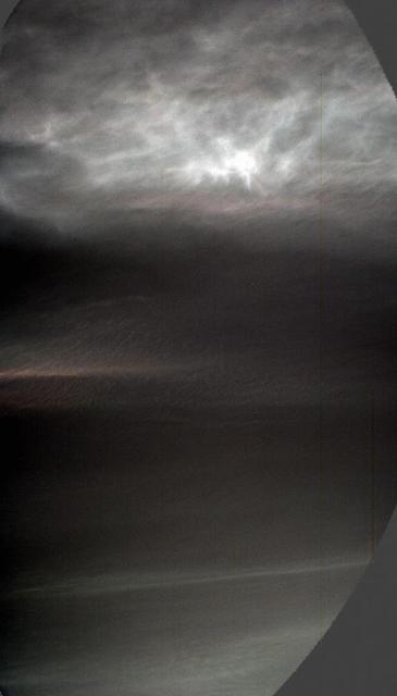
NASA's Curiosity Mars rover used its left Mast Camera, or Mastcam, to capture these drifting noctilucent, or twilight, clouds on Jan. 17, 2025, the 4,426th Martian day, or sol, of the mission. The left Mastcam has a stuck color filter wheel, which is why part of the imagery appears cut off in three corners. The original recording taken by Curiosity was 16 minutes; this video has been speeded up by about 480 times (and it loops four times). The clouds at the top of the frame, including the falling white plumes, are made of carbon dioxide ice. The plumes are an estimated 37 to 50 miles (60 to 80 kilometers) above the Martian surface; they could fall as low as 31 miles (50 kilometers) above the surface before they would evaporate due to rising temperatures. In the lower half of the frame at the beginning of the video, a different set of very faint clouds is visible. These are water-ice clouds are hovering at roughly 31 miles (50 kilometers) in altitude. The brightness has been stretched to make certain colors more visible in this enhanced-color imagery. This is the fourth Mars year that twilight clouds have been observed by Curiosity; previous observations were made in 2019, 2021, and 2023. Animation available at https://photojournal.jpl.nasa.gov/catalog/PIA26519
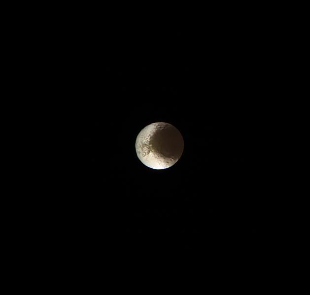
Cassini bids farewell to Saturn's yin-and-yang moon, Iapetus. This image is from the last set of observations Cassini made of this world of striking contrasts. The spacecraft helped scientists better understand Iapetus, solving a centuries-old mystery of why it should be bright on one side and dark on the other. Cassini observations of Iapetus (914 mile or 1471 kilometers across) support the prevailing theory that led to the understanding that the dichotomy of the surface is due to a combination of infalling dust from outside of the moon followed by a migration of water ice from the darker (therefore warmer) areas to the cold, brighter surfaces. See PIA11690 for more details. This false-color view is a composite of individual frames obtained using filters sensitive to ultraviolet (centered at 338 nanometers), green (centered at 568 nanometers) and infrared light (centered at 930 nanometers). The view has been enhanced to accentuate subtle color differences and fine-scale surface features. This view looks toward the Saturn-facing hemisphere of Iapetus. North on Iapetus is up and rotated 12 degrees to the left. The view was acquired on May 30, 2017, at a distance of approximately 1.5 million miles (2.5 million kilometers) from Iapetus. Image scale is 9 miles (15 kilometers) per pixel. https://photojournal.jpl.nasa.gov/catalog/PIA21347
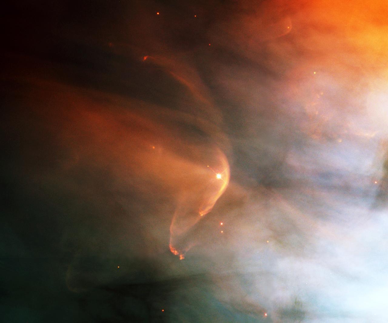
The nearby intense star-forming region known as the Great Nebula in the Orion constellation reveals a bow shock around a very young star as seen by NASA's Hubble Space Telescope (HST). Named for the crescent-shaped wave made by a ship as it moves through the water, a bow shock can be created in space where two streams of gas collide. LL Ori emits a vigorous solar wind, a stream of charged particles moving rapidly outward from the star. Our own sun has a less energetic version of this wind. The material in the fast wind from LL Ori collides with slow moving gas evaporating away form the center of the Orion Nebula, which is located in the lower right of this image, producing the crescent shaped bow shock seen in the image. Astronomers have identified numerous shock fronts in this complex star-forming region and are using this data to understand the many complex phenomena associated with the birth of stars. A close visitor in our Milky Way Galaxy, the nebula is only 1,500 light years away from Earth. The filters used in this color composite represent oxygen, nitrogen, and hydrogen emissions.
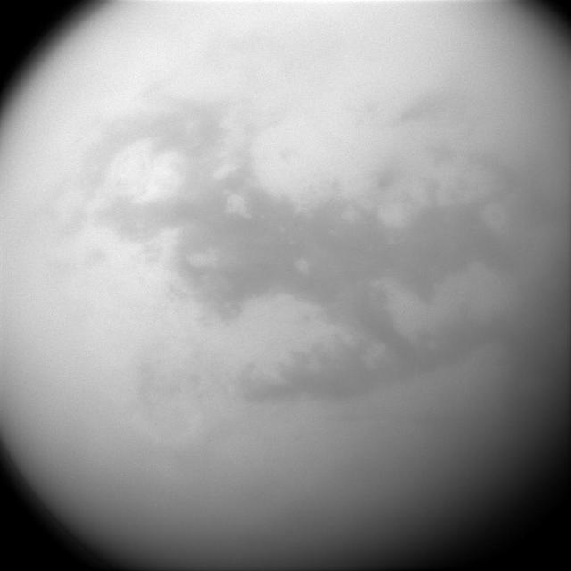
Saturn's frigid moon Titan has some characteristics that are oddly similar to Earth, but still slightly alien. It has clouds, rain and lakes (made of methane and ethane), a solid surface (made of water ice), and vast dune fields (filled with hydrocarbon sands). The dark, H-shaped area seen here contains two of the dune-filled regions, Fensal (in the north) and Aztlan (to the south). Cassini's cameras have frequently monitored the surface of Titan (3200 miles or 5150 kilometers across) to look for changes in its features over the course of the mission. Any changes would help scientists better understand different phenomena like winds and dune formation on this strangely earth-like moon. For a closer view of Fensal-Aztlan, see PIA07732 . This view looks toward the leading side of Titan. North on Titan is up. The image was taken with the Cassini spacecraft narrow-angle camera on July 25, 2015 using a spectral filter sensitive to wavelengths of near-infrared light centered at 938 nanometers. The view was obtained at a distance of approximately 450,000 miles (730,000 kilometers) from Titan and at a Sun-Titan-spacecraft, or phase, angle of 32 degrees. Image scale is 3 miles (4 kilometers) per pixel. http://photojournal.jpl.nasa.gov/catalog/PIA18341
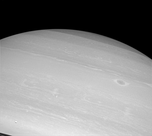
Enceladus (visible in the lower-left corner of the image) is but a speck before enormous Saturn, but even a small moon can generate big waves of excitement throughout the scientific community. Enceladus, only 313 miles (504 kilometers) across, spurts vapor jets from its south pole. The presence of these jets from Enceladus has been the subject of intense study since they were discovered by Cassini. Their presence may point to a sub-surface water reservoir. This view looks toward the unilluminated side of the rings from about 2 degrees below the ringplane. The image was taken with the Cassini spacecraft wide-angle camera on Oct. 20, 2014 using a spectral filter which preferentially admits wavelengths of near-infrared light centered at 752 nanometers. The view was obtained at a distance of approximately 589,000 miles (948,000 kilometers) from Saturn and at a Sun-Saturn-spacecraft, or phase, angle of 26 degrees. Image scale is 35 miles (57 kilometers) per pixel. http://photojournal.jpl.nasa.gov/catalog/PIA18296

These are the highest-resolution color images of any part of Saturn's rings, to date, showing a portion of the inner-central part of the planet's B Ring. The view is a mosaic of two images that show a region that lies between 61,300 and 65,600 miles (98,600 and 105,500 kilometers) from Saturn's center. This image is a natural color composite, created using images taken with red, green and blue spectral filters. The pale tan color is generally not perceptible with the naked eye in telescope views, especially given that Saturn has a similar hue. The material responsible for bestowing this color on the rings -- which are mostly water ice and would otherwise appear white -- is a matter of intense debate among ring scientists that will hopefully be settled by new in-situ observations before the end of Cassini's mission. The different ringlets seen here are part of what is called the "irregular structure" of the B ring. Cassini radio occultations of the rings have shown that these features have extremely sharp boundaries on even smaller scales (radially, or along the direction outward from Saturn) than the camera can resolve here. Closer to Saturn, the irregular structures become fuzzier and more rounded, less opaque, and their color contrast diminishes. The narrow ringlets in the middle of this scene are each about 25 miles (40 kilometers) wide, and the broader bands at right are about 200 to 300 miles (300 to 500 kilometers) across. It remains unclear exactly what causes the variable brightness of these ringlets and bands -- the basic brightness of the ring particles themselves, shadowing on their surfaces, their absolute abundance, and how densely the particles are packed, may all play a role. The second image (Figure 1) is a color-enhanced version. Blue colors represent areas where the spectrum at visible wavelengths is less reddish (meaning the spectrum is flatter toward red wavelengths), while red colors represent areas that are spectrally redder (meaning the spectrum has a steeper spectrum toward red wavelengths). Observations from the Voyager mission and Cassini's visual and infrared mapping spectrometer previously showed these color variations at lower resolution, but it was not known that such well-defined color contrasts would be this sharply defined down to the scale (radial scale) of a couple of miles or kilometers, as seen here. Analysis of additional images from this observation, taken using infrared spectral filters sensitive to absorption of light by water ice, indicates that the areas that appear more visibly reddish in the color-enhanced version are also richer in water ice. The third image (Figure 2) is a composite of the "true" and "enhanced" color images for easy comparison. This image was taken on July 6, 2017, with the Cassini spacecraft narrow-angle camera. The image was acquired on the sunlit side of the rings from a distance of 47,000 miles (76,000 kilometers) away from the area pictured. The image scale is about 2 miles (3 kilometers) per pixel. The phase angle, or sun-ring-spacecraft angle, is 90 degrees. https://photojournal.jpl.nasa.gov/catalog/PIA21628
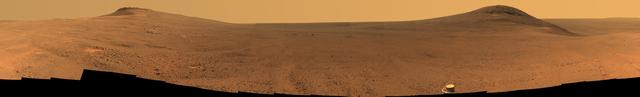
Toward the right side of this enhanced-color scene is a broad notch in the crest of the western rim of Endeavour Crater. Wheel tracks in that area were left by NASA's Mars Exploration Rover Opportunity as it observed "Perseverance Valley" from above in the spring of 2017. The valley is a major destination for the rover's extended mission. It descends out of sight on the inner slope of the rim, extending down and eastward from that notch. Opportunity's panoramic camera (Pancam) took the component images for this view from a position outside the crater during the span of June 7 to June 19, 2017, sols 4753 to 4765 of the rover's work on Mars. This scene includes features that might have been ancient channels from water, ice or wind moving toward the notch in the rim, which might have been a spillway. Perseverance Valley, just on the other side, was likely carved by action of some fluid, such as water, water-lubricated debris, or wind. The mission is investigating to learn more about that process from evidence in place. The panorama spans about three-fourths of a full-circle view, from southeastward on the left, through westward in the middle, to northeastward on the right. High points visible on the rim of Endeavour Crater include "Winnemucca" on the left and "Cape Tribulation" on the right. Winnemucca is part of the "Cape Byron" portion of the crater rim. The horizon at far right extends across the floor of Endeavour Crater, which is about 14 miles (22 kilometers) in diameter. Opportunity has been investigating sites on and near the western rim of Endeavour since 2011, following seven years of exploring smaller craters after its 2004 landing. This view merges exposures taken through three of the Pancam's color filters, centered on wavelengths of 753 nanometers (near-infrared), 535 nanometers (green) and 432 nanometers (violet). Color is enhanced in this version to make differences in surface materials more easily visible. The rover team calls this the "Sprained Ankle" panorama because the images were collected during a driving moratorium while engineers diagnosed a temporary steering stall with one front wheel pointed outward more than 30 degrees. The team was able to straighten the wheel to point straight ahead, and then resumed driving. The location from which this scene was recorded is labeled as "Sol 4752" on a later traverse map. Opportunity subsequently entered the upper end of Perseverance Valley and returned views looking down the valley and back up toward the rim crest from the location it reached on July 7 (Sol 4782). https://photojournal.jpl.nasa.gov/catalog/PIA21722
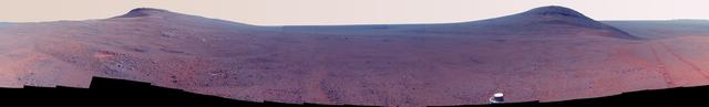
Toward the right side of this enhanced-color scene is a broad notch in the crest of the western rim of Endeavour Crater. Wheel tracks in that area were left by NASA's Mars Exploration Rover Opportunity as it observed "Perseverance Valley" from above in the spring of 2017. The valley is a major destination for the rover's extended mission. It descends out of sight on the inner slope of the rim, extending down and eastward from that notch. Opportunity's panoramic camera (Pancam) took the component images for this view from a position outside the crater during the span of June 7 to June 19, 2017, sols 4753 to 4765 of the rover's work on Mars. This scene includes features that might have been ancient channels from water, ice or wind moving toward the notch in the rim, which might have been a spillway. Perseverance Valley, just on the other side, was likely carved by action of some fluid, such as water, water-lubricated debris, or wind. The mission is investigating to learn more about that process from evidence in place. The panorama spans about three-fourths of a full-circle view, from southeastward on the left, through westward in the middle, to northeastward on the right. High points visible on the rim of Endeavour Crater include "Winnemucca" on the left and "Cape Tribulation" on the right. Winnemucca is part of the "Cape Byron" portion of the crater rim. The horizon at far right extends across the floor of Endeavour Crater, which is about 14 miles (22 kilometers) in diameter. Opportunity has been investigating sites on and near the western rim of Endeavour since 2011, following seven years of exploring smaller craters after its 2004 landing. This view merges exposures taken through three of the Pancam's color filters, centered on wavelengths of 753 nanometers (near-infrared), 535 nanometers (green) and 432 nanometers (violet). Color is enhanced in this version to make differences in surface materials more easily visible. The rover team calls this the "Sprained Ankle" panorama because the images were collected during a driving moratorium while engineers diagnosed a temporary steering stall with one front wheel pointed outward more than 30 degrees. The team was able to straighten the wheel to point straight ahead, and then resumed driving. The location from which this scene was recorded is labeled as "Sol 4752" on a later traverse map. Opportunity subsequently entered the upper end of Perseverance Valley and returned views looking down the valley and back up toward the rim crest from the location it reached on July 7 (Sol 4782). https://photojournal.jpl.nasa.gov/catalog/PIA21722
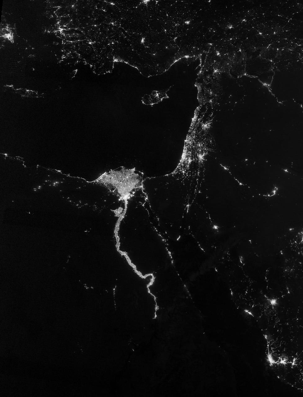
NASA image acquired October 13, 2012 The Nile River Valley and Delta comprise less than 5 percent of Egypt’s land area, but provide a home to roughly 97 percent of the country’s population. Nothing makes the location of human population clearer than the lights illuminating the valley and delta at night. On October 13, 2012, the Visible Infrared Imaging Radiometer Suite (VIIRS) on the Suomi NPP satellite captured this nighttime view of the Nile River Valley and Delta. This image is from the VIIRS “day-night band,” which detects light in a range of wavelengths from green to near-infrared and uses filtering techniques to observe signals such as gas flares, auroras, wildfires, city lights, and reflected moonlight. The city lights resemble a giant calla lily, just one with a kink in its stem near the city of Luxor. Some of the brightest lights occur around Cairo, but lights are abundant along the length of the river. Bright city lights also occur along the Suez Canal and around Tel Aviv. Away from the lights, however, land and water appear uniformly black. This image was acquired near the time of the new Moon, and little moonlight was available to brighten land and water surfaces. NASA Earth Observatory image by Jesse Allen and Robert Simmon, using VIIRS Day-Night Band data from the Suomi National Polar-orbiting Partnership. Suomi NPP is the result of a partnership between NASA, the National Oceanic and Atmospheric Administration, and the Department of Defense. Caption by Michon Scott. Instrument: Suomi NPP - VIIRS Credit: <b><a href="http://www.earthobservatory.nasa.gov/" rel="nofollow"> NASA Earth Observatory</a></b> <b>Click here to view all of the <a href="http://earthobservatory.nasa.gov/Features/NightLights/" rel="nofollow"> Earth at Night 2012 images </a></b> <b>Click here to <a href="http://earthobservatory.nasa.gov/NaturalHazards/view.php?id=79807" rel="nofollow"> read more </a> about this image </b> <b><a href="http://www.nasa.gov/audience/formedia/features/MP_Photo_Guidelines.html" rel="nofollow">NASA image use policy.</a></b> <b><a href="http://www.nasa.gov/centers/goddard/home/index.html" rel="nofollow">NASA Goddard Space Flight Center</a></b> enables NASA’s mission through four scientific endeavors: Earth Science, Heliophysics, Solar System Exploration, and Astrophysics. Goddard plays a leading role in NASA’s accomplishments by contributing compelling scientific knowledge to advance the Agency’s mission. <b>Follow us on <a href="http://twitter.com/NASA_GoddardPix" rel="nofollow">Twitter</a></b> <b>Like us on <a href="http://www.facebook.com/pages/Greenbelt-MD/NASA-Goddard/395013845897?ref=tsd" rel="nofollow">Facebook</a></b> <b>Find us on <a href="http://instagram.com/nasagoddard?vm=grid" rel="nofollow">Instagram</a></b>