
Carbon monoxide from California wildfire, a visualization created using data from the Atmospheric Infrared Sounder AIRS on NASA Aqua satellite, June-July, 2008.
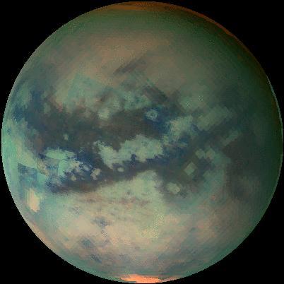
This movie of Titan shows data taken with Cassini visual and infrared mapping spectrometer during the last three flybys of Titan
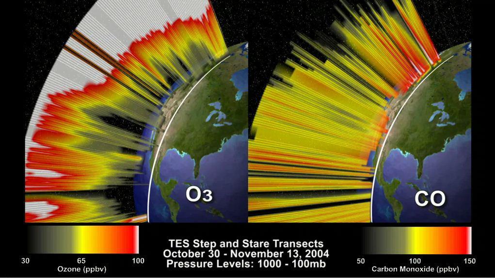
This frame from an animation depicts the distribution of O3 and CO in the atmosphere over North America. This visualization is based on data acquired by NASA Tropospheric Emission Spectrometer TES.
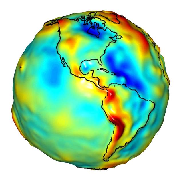
This visualization of a gravity model was created with data from NASA Gravity Recovery and Climate Experiment and shows variations in the gravity field across the Americas.
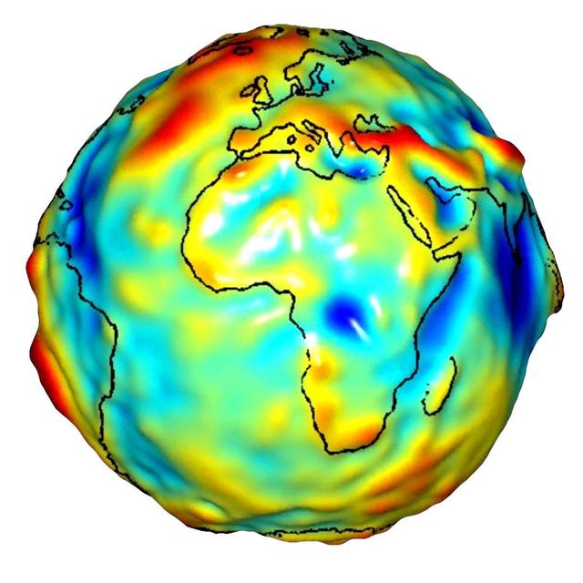
This visualization of a gravity model was created with data from NASA’s Gravity Recovery and Climate Experiment and shows variations in the gravity field across Africa and Europe.
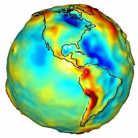
This visualization of a gravity model was created with data from NASA Gravity Recovery and Climate Experiment GRACE and shows variations in Earth’s gravity field.
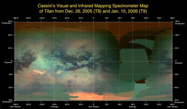
This global infrared map of Titan was composed with data from Cassini visual and infrared mapping spectrometer taken during the last two Titan flybys
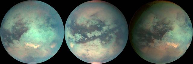
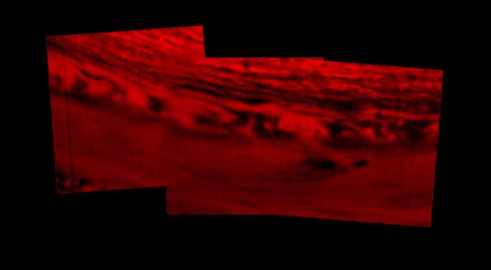
The three mosaics shown here were composed with data from Cassini visual and infrared mapping spectrometer taken during the last three Titan flybys
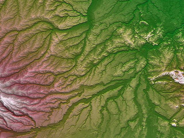
Pando Province, Bolivia, and adjacent parts of Brazil and Peru are seen in this visualization of NASA Shuttle Radar Topography Mission SRTM elevation data covering part of the Amazon Basin.
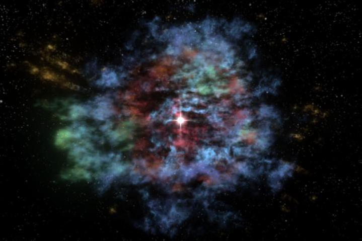
For the first time, a multiwavelength three-dimensional reconstruction of a supernova remnant has been created. This visualization of Cassiopeia A, or Cas A, the result of an explosion approximately 330 years ago, uses data from several NASA telescopes.

As winter turns to spring at the south polar ice cap of Mars, the rising sun reveals dark spots and fans emerging from the cold polar night. Using visual images left and temperature data right
Visualization of the formation and evolution of the Antarctic Vortex ozone hole over the South Pole from Sept. 1 to Dec. 4, 2014, created using data from NASA Aqua spacecraft.
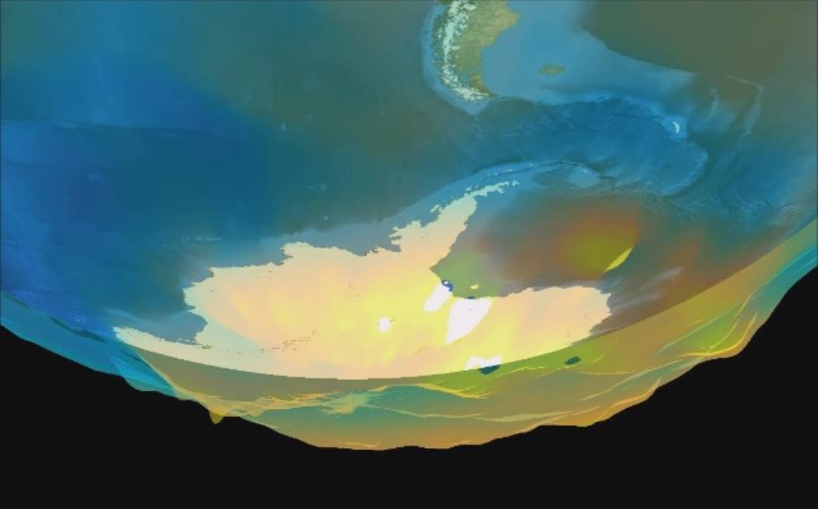
This data visualization image above shows sea surface heights off the northern California coast in August 2023 as measured by the Surface Water and Ocean Topography (SWOT) satellite. Red indicates higher-than-average ocean heights, while blue represents lower-than-average heights. Warm ocean waters from the developing El Niño are shifting north along coastlines in the eastern Pacific Ocean. Along the coast of California, these warm waters are interacting with a persistent marine heat wave that recently influenced the development of Hurricane Hilary. SWOT is able to spot the movement of these warm ocean waters in unprecedented detail. The SWOT science team made the measurements with the Ka-band Radar Interferometer (KaRIn) instrument. With two antennas spread 33 feet (10 meters) apart on a boom, KaRIn produces a pair of data swaths as it circles the globe, bouncing radar pulses off the water's surface to collect water-height measurements. The visualization combines data from two passes of the SWOT satellite. https://photojournal.jpl.nasa.gov/catalog/PIA26091
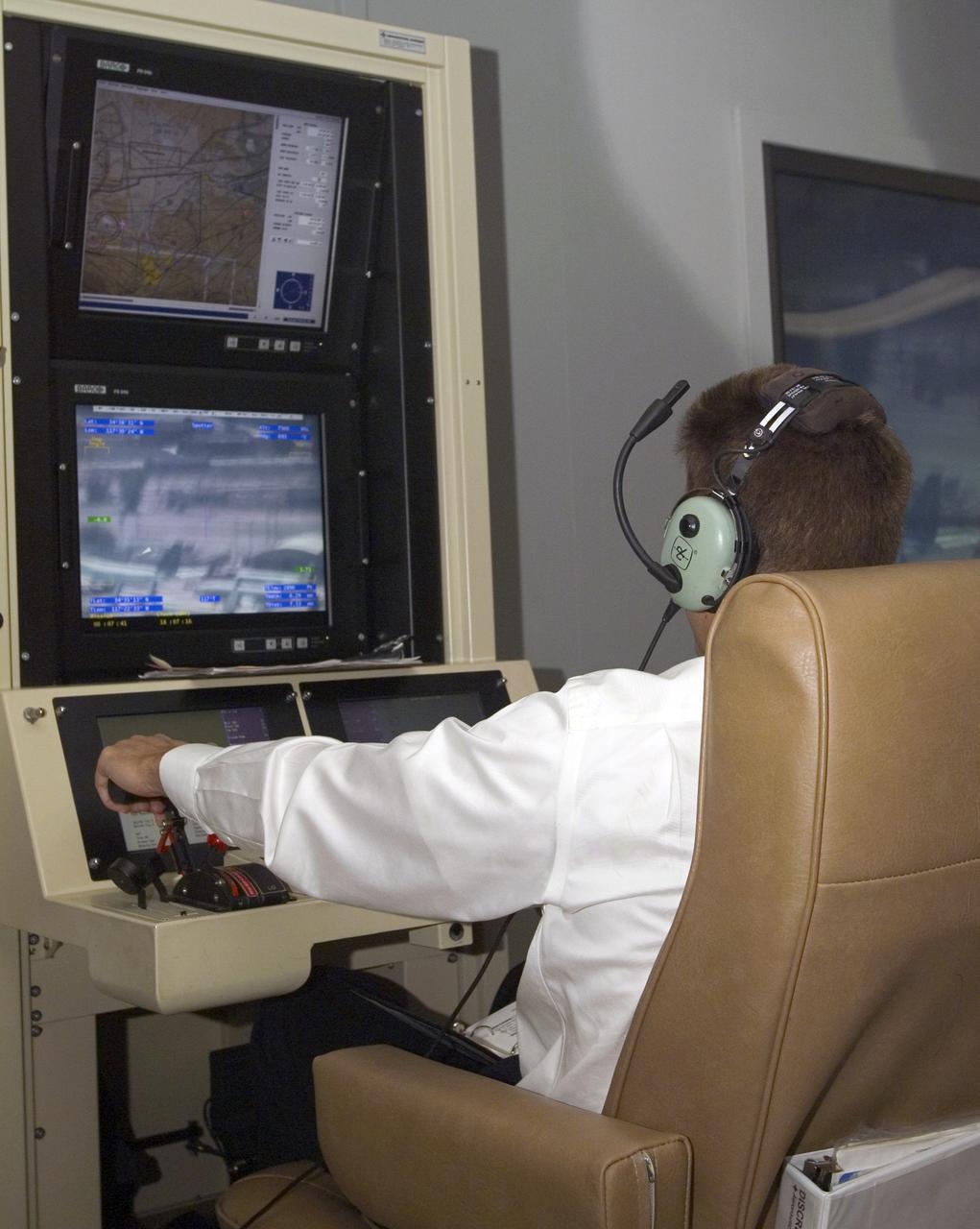
A pilot for General Atomics guides the Altair remotely operated aircraft from a ground control station using both visual and telemetered data.

A person observes the computational Fluid Dynamics solution for cryogenic storage tank mixing inside the Glenn Reconfigurable User-interface and Virtual Reality Exploration on October 18, 2023. The GRUVE Lab provides a fully interactive virtual reality space in which to observe and analyze data and environments. Photo Credit: (NASA/Sara Lowthian-Hanna)
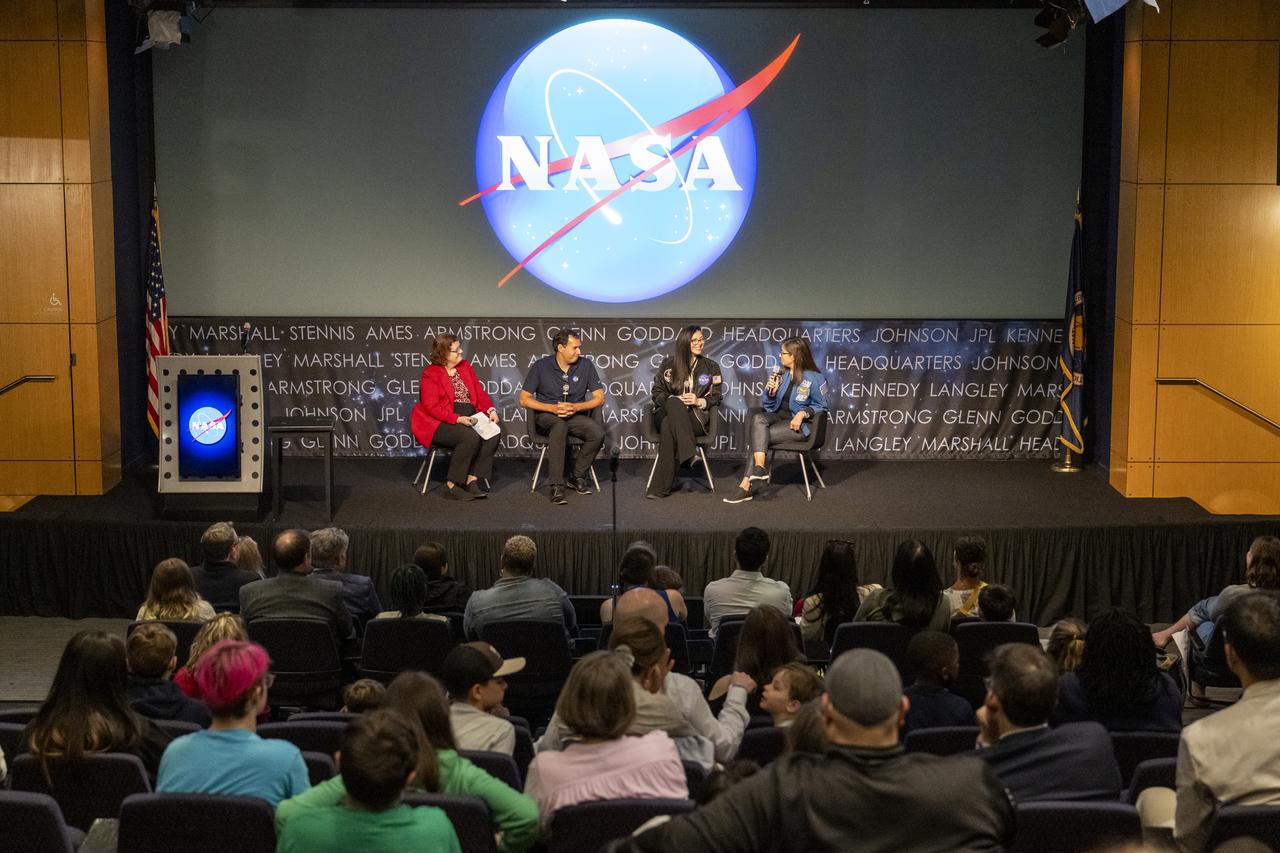
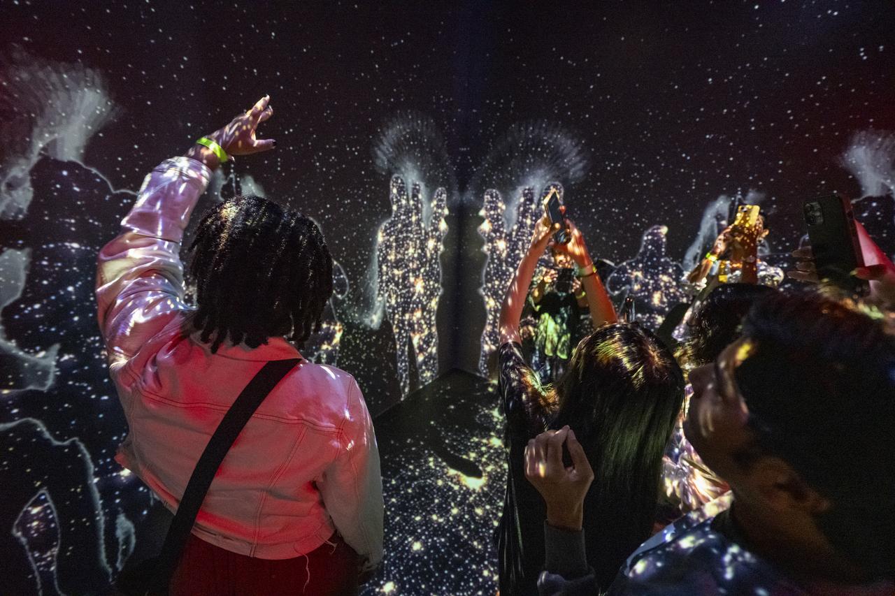
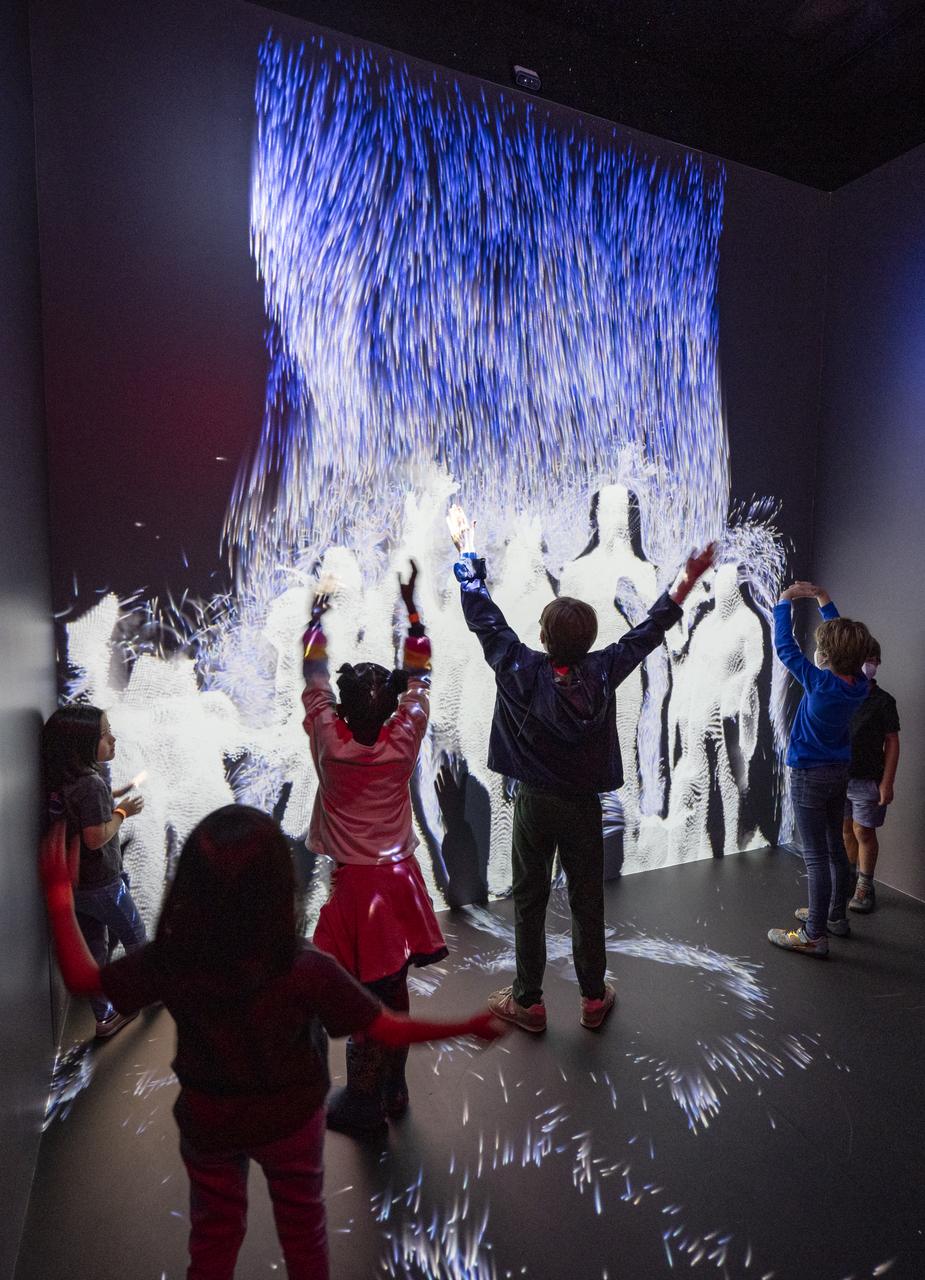
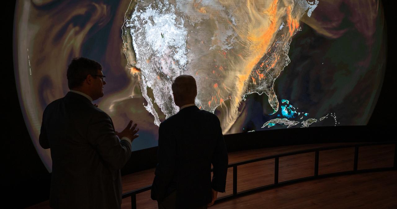
From left to right, NASA Earth Science Division Deputy Director Julie Robinson, NASA Scientific Visualization Studio Lead Mark Subbarao, NASA Jet Propulsion Laboratory (JPL) Art Director Erica Bernhard, and Former NASA Astronaut Nicole Stott participate in a fireside chat during an Earth Information Center (EIC) student engagement event, Friday, June 23, 2023, at the Mary W. Jackson NASA Headquarters building in Washington. The EIC is a new immersive experience that combines live data sets with cutting-edge data visualization and storytelling to allow visitors to see how our planet is changing. Photo Credit: (NASA/Keegan Barber)
From left to right, NASA Earth Science Division Deputy Director Julie Robinson, NASA Scientific Visualization Studio Lead Mark Subbarao, NASA Jet Propulsion Laboratory (JPL) Art Director Erica Bernhard, and Former NASA Astronaut Nicole Stott participate in a fireside chat during an Earth Information Center (EIC) student engagement event, Friday, June 23, 2023, at the Mary W. Jackson NASA Headquarters building in Washington. The EIC is a new immersive experience that combines live data sets with cutting-edge data visualization and storytelling to allow visitors to see how our planet is changing. Photo Credit: (NASA/Keegan Barber)
From left to right, NASA Earth Science Division Deputy Director Julie Robinson, NASA Scientific Visualization Studio Lead Mark Subbarao, NASA Jet Propulsion Laboratory (JPL) Art Director Erica Bernhard, and Former NASA Astronaut Nicole Stott participate in a fireside chat during an Earth Information Center (EIC) student engagement event, Friday, June 23, 2023, at the Mary W. Jackson NASA Headquarters building in Washington. The EIC is a new immersive experience that combines live data sets with cutting-edge data visualization and storytelling to allow visitors to see how our planet is changing. Photo Credit: (NASA/Keegan Barber)
From left to right, NASA Earth Science Division Deputy Director Julie Robinson, NASA Scientific Visualization Studio Lead Mark Subbarao, NASA Jet Propulsion Laboratory (JPL) Art Director Erica Bernhard, and Former NASA Astronaut Nicole Stott participate in a fireside chat during an Earth Information Center (EIC) student engagement event, Friday, June 23, 2023, at the Mary W. Jackson NASA Headquarters building in Washington. The EIC is a new immersive experience that combines live data sets with cutting-edge data visualization and storytelling to allow visitors to see how our planet is changing. Photo Credit: (NASA/Keegan Barber)
This montage of images, made from data obtained by Cassini's visual and infrared mapping spectrometer, shows the location on Saturn where the NASA spacecraft entered Saturn's atmosphere on Sept. 15, 2017. This view shows Saturn in the thermal infrared, at a wavelength of 5 microns. Here, the instrument is sensing heat coming from Saturn's interior, in red. Clouds in the atmosphere are silhouetted against that inner glow. This location -- the site of Cassini's atmospheric entry -- was at this time on the night side of the planet, but would rotate into daylight by the time Cassini made its final dive into Saturn's upper atmosphere, ending its remarkable 13-year exploration of Saturn. Both an annotated version and an animation are available at https://photojournal.jpl.nasa.gov/catalog/PIA21896
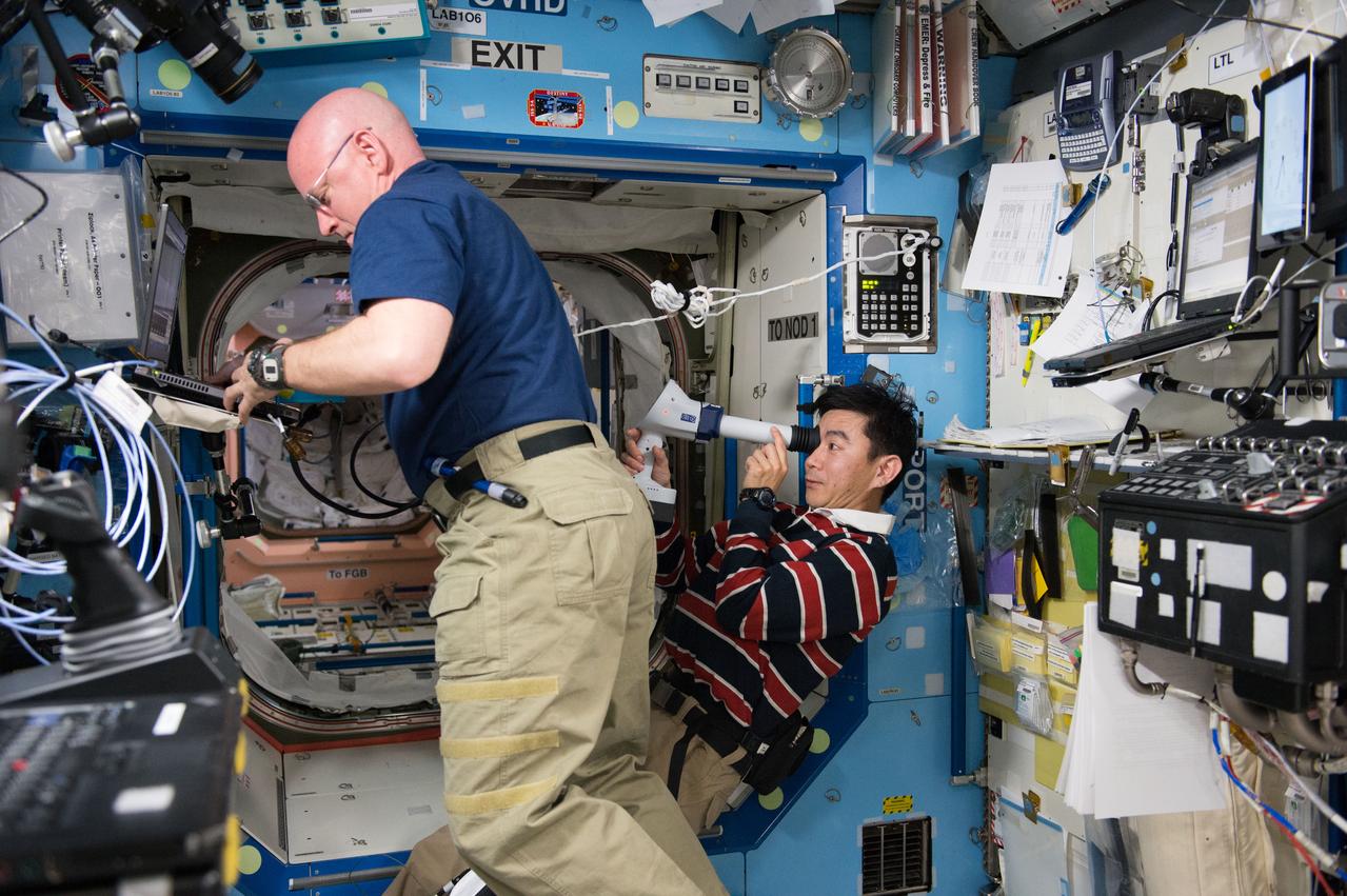
ISS044E033352 (08/05/2015) --- NASA astronaut Scott Kelly (left) assists Japan Aerospace Exploration Agency (JAXA) astronaut Kimiya Yui (right) with measurements for the ongoing Ocular Health study. Yui is seen operating a device called a Fundoscope which is used to take images of the retinal surface of an astronaut’s eye. Ocular Health is gathering data on crew visual health during and after long-duration space station missions to characterize how living in microgravity can affect the visual, vascular and central nervous systems.
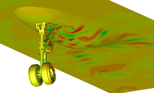
Snapshot from a simulation run on the Pleiades supercomputer. It depicts a fluctuating pressure field on aircraft nose landing gear and fuselage surfaces. The simulation helped scientists better understand the effects of landing gear and acoustic noise. The goal of the study was to improve the current understanding of aircraft nose landing gear noise, which will lead to quieter, more efficient airframe components for future aircraft designs. The visualization was produced with help from the NAS Data Analysis & Visualization group. Investigator: Mehdi Khorrami, NASA Langley Research Center.
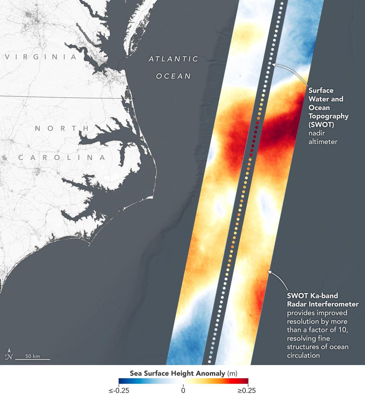
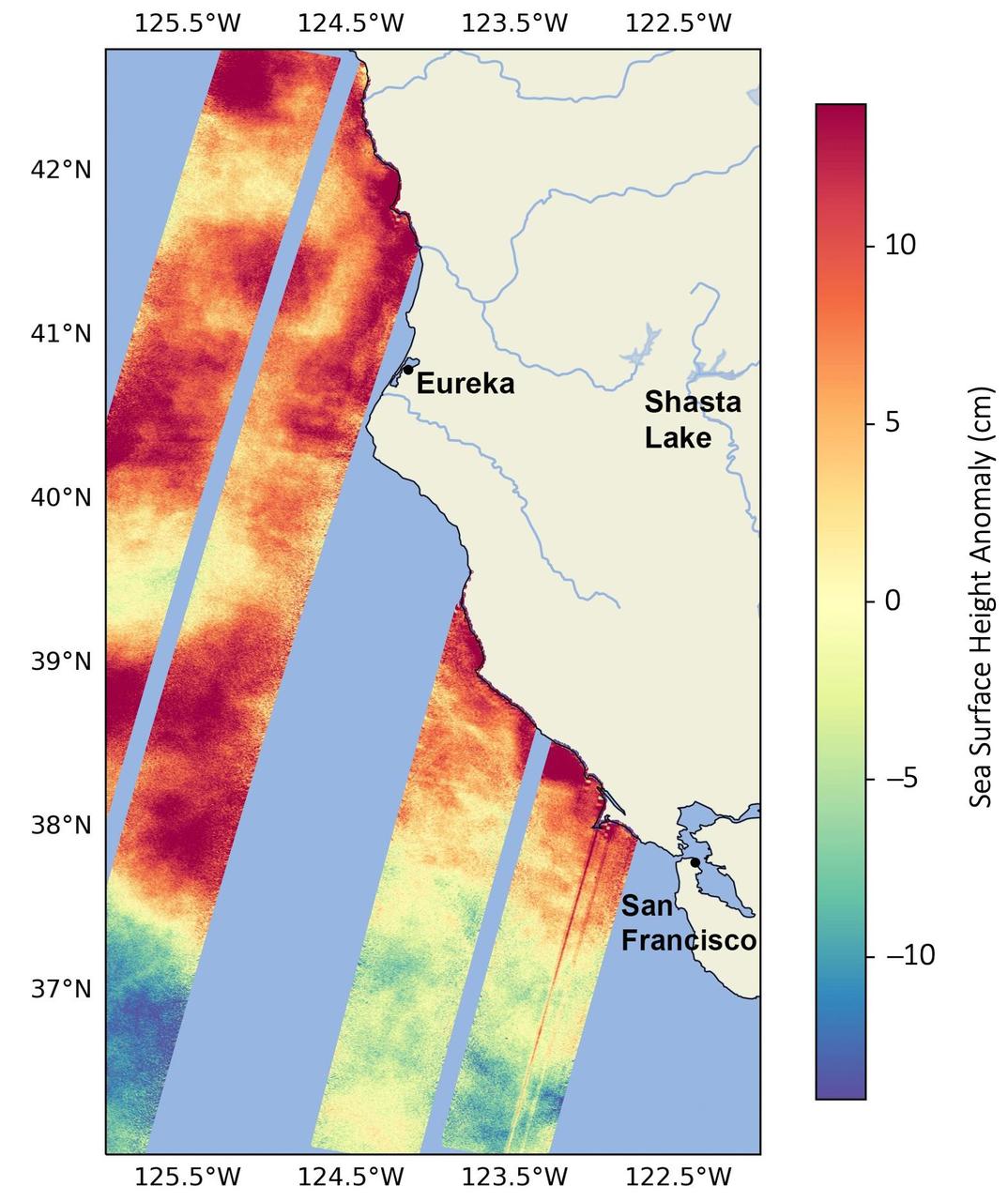
This visualization shows sea surface height measurements in the Gulf Stream off the coast of North Carolina and Virginia. The data was collected on Jan. 21, 2023, by an instrument on the Surface Water and Ocean Topography (SWOT) satellite called the Ka-band Radar Interferometer (KaRIn). KaRIn's two antennas acquired data that was mapped as two wide, colored strips spanning a total of 75 miles (120 kilometers) across. In the visualization, red and orange areas represent sea levels that are higher than the global average, while shades of blue represent sea levels that are lower than average. The spatial resolution of SWOT ocean measurements is 10 times greater than the composite of sea surface height data gathered over the same area by seven other satellites that same day. KaRIn is the scientific heart of the SWOT mission. It's a radar instrument with one antenna at each end of a boom that's 33 feet (10 meters) long. This enables KaRIn to look off to either side of a center line directly below the satellite as the instrument bounces microwave signals off of Earth's surface. The returning radar signals arrive at each antenna slightly out of step, or phase, from one another. When these signals are combined with other information about the antennas and the satellite's altitude, scientists will be able to map the height of water on Earth's surface with never-before-seen clarity. Led by NASA and the French space agency Centre National d'Études Spatiales (CNES), SWOT will measure the height of water on over 90% of Earth's surface, providing a high-definition survey of our planet's water for the first time. The satellite's measurements of freshwater bodies and the ocean will provide insights into how the ocean influences climate change; how a warming world affects lakes, rivers, and reservoirs; and how communities can better prepare for disasters like floods. Launched on Dec. 16, 2022, from Vandenberg Space Force Base in central California, SWOT is now in a six-month period called commissioning, calibration and validation. This is when engineers on the mission check out the satellite's systems and science instruments to ensure data accuracy before the start of science operations in July. https://photojournal.jpl.nasa.gov/catalog/PIA25772
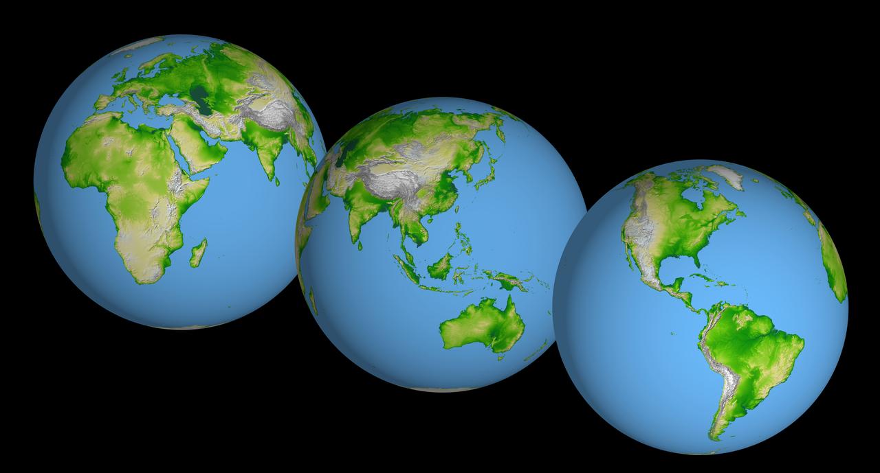
These images of the world were generated with data from the Shuttle Radar Topography Mission (SRTM). The SRTM Project has recently released a new global data set called SRTM30, where the original one arcsecond of latitude and longitude resolution (about 30 meters, or 98 feet, at the equator) was reduced to 30 arcseconds (about 928 meters, or 1496 feet.) These images were created from that data set and show the Earth as it would be viewed from a point in space centered over the Americas, Africa and the western Pacific. Two visualization methods were combined to produce the image: shading and color coding of topographic height. The shade image was derived by computing topographic slope in the northwest-southeast direction, so that northwest slopes appear bright and southeast slopes appear dark. Color coding is directly related to topographic height, with green at the lower elevations, rising through yellow and tan, to white at the highest elevations. Elevation data used in this image were acquired by the Shuttle Radar Topography Mission aboard the Space Shuttle Endeavour, launched on Feb. 11, 2000. http://photojournal.jpl.nasa.gov/catalog/PIA03394
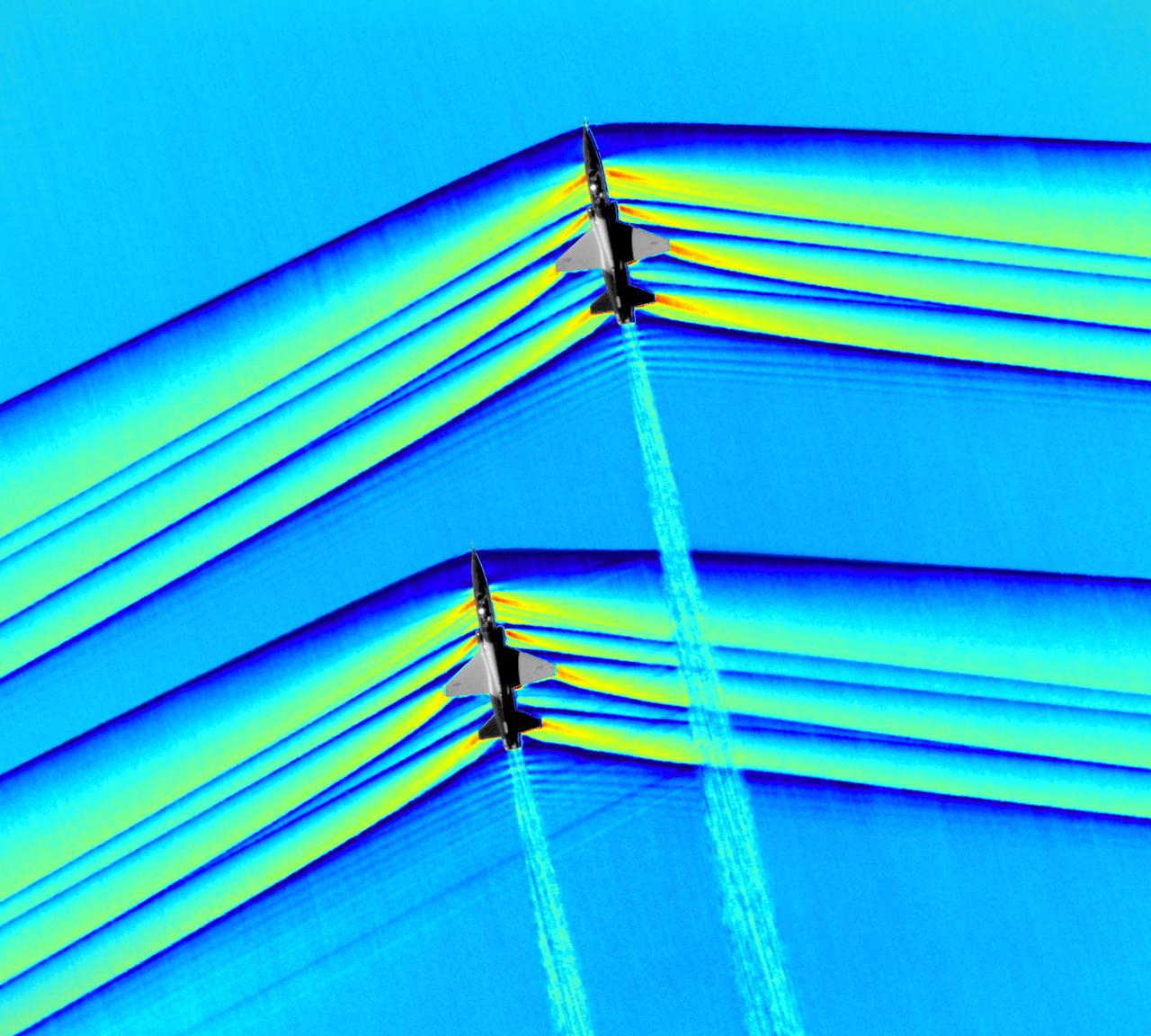
Composite image of Background Oriented Schlieren (BOS) data (contour) with a cut-out images of the T-38’s during a Mach Number 1.01 pass. This data is the first time shockwave interactions between two full scale aircraft traveling faster than the speed of sound have been imaged and shown with schlieren visualization. Original recording of the pass taken in the Black Mountain Supersonic Corridor at near Edwards AFB in December of 2018. Image acquired by JT Heineck, schlieren data processed by Neal Smith

Composite image of Background Oriented Schlieren (BOS) data (contour) with a cut-out images of the T-38’s during a Mach Number 1.01 pass. This data is the first time shockwave interactions between two full scale aircraft traveling faster than the speed of sound have been imaged and shown with schlieren visualization. Original recording of the pass taken in the Black Mountain Supersonic Corridor at near Edwards AFB in December of 2018. Image acquired by JT Heineck, schlieren data processed by Neal Smith
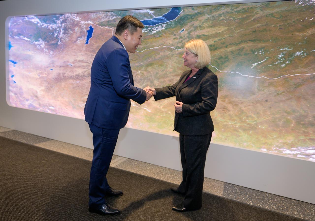
Prime Minister Oyun-Erdene Luvsannamsrai of Mongolia, left, and NASA Deputy Administrator Pam Melroy shake hands at the conclusion of meeting and touring NASA’s Earth Information Center, Friday, Aug. 4, 2023, at the NASA Headquarters Mary W. Jackson Building in Washington. The Earth Information Center is a new immersive experience that combines live data sets with cutting-edge data visualization to show NASA data can improve lives in the face of disasters, environmental challenges, and our changing world. Photo Credit: (NASA/Bill Ingalls)

Composite image of Background Oriented Schlieren (BOS) data (contour) with a cut-out images of the T-38’s during a Mach Number 1.01 pass. This data is the first time shockwave interactions between two full scale aircraft traveling faster than the speed of sound have been imaged and shown with schlieren visualization. Original recording of the pass taken in the Black Mountain Supersonic Corridor at near Edwards AFB in December of 2018. Image acquired by JT Heineck, schlieren data processed by Neal Smith.
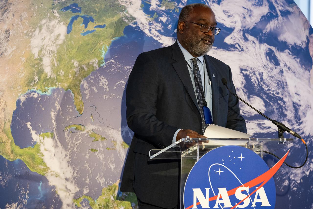
NASA Earth Science Division Director Karen St. Germain, left, talks with Prime Minister Oyun-Erdene Luvsannamsrai of Mongolia, as they tour NASA’s Earth Information Center, Friday, Aug. 4, 2023, at the NASA Headquarters Mary W. Jackson Building in Washington. The Earth Information Center is a new immersive experience that combines live data sets with cutting-edge data visualization to show NASA data can improve lives in the face of disasters, environmental challenges, and our changing world. Photo Credit: (NASA/Bill Ingalls)
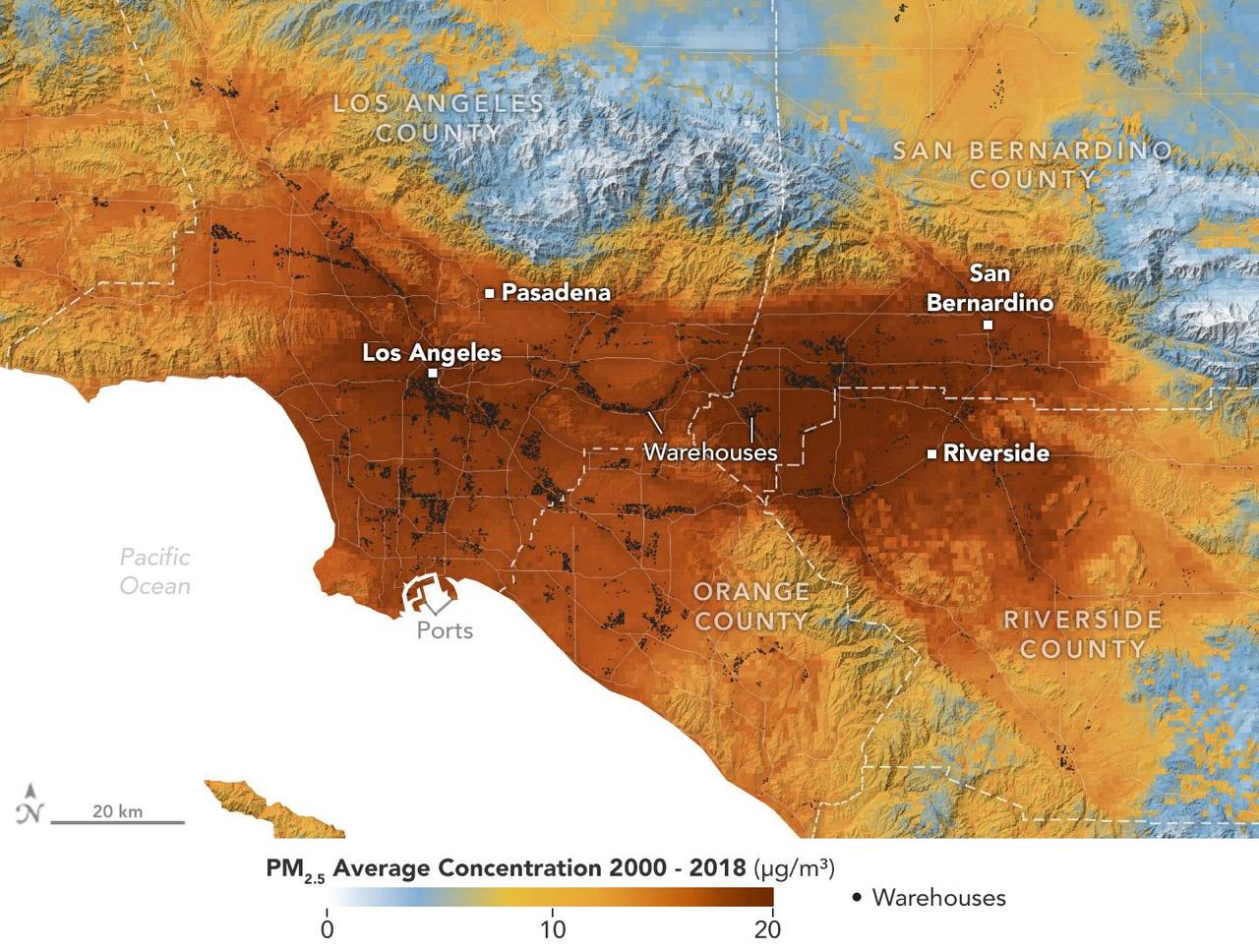
A data visualization shows the average concentration of PM2.5 particulate pollution in the Los Angeles region from 2000 to 2018, along with the locations of nearly 11,000 warehouses over the same time period. Particles measuring 2.5 micrometers or less, PM2.5 are pollutants that can be inhaled into the lungs and absorbed into the bloodstream. A NASA-funded study published in September 2024 in GeoHealth analyzed patterns and trends of atmospheric PM2.5 concentration and found that ZIP codes with more or larger warehouses had higher levels of PM2.5 and elemental carbon over time than those with fewer warehouses. Elemental carbon is a type of PM2.5 that is produced by heavy-duty diesel engines. In the visualization, areas with higher concentrations of PM2.5 are shown in darker red, and locations of warehouses are indicated by small black circles (many of them clustered closely together). The PM2.5 data came from models based on satellite observations, including from NASA's Moderate Resolution Imaging Spectroradiometer (MODIS) and Advanced Spaceborne Thermal Emission and Reflection Radiometer (ASTER) instruments. The PM2.5 warehouse locations were derived from a commercial real estate database. Particulate pollution has been linked to respiratory and cardiovascular diseases, some cancers, and adverse birth outcomes, including premature birth and low infant birth weight. As the e-commerce boom of recent decades has spurred warehouse construction, pollution in nearby neighborhoods has become a growing area for research. https://photojournal.jpl.nasa.gov/catalog/PIA26415
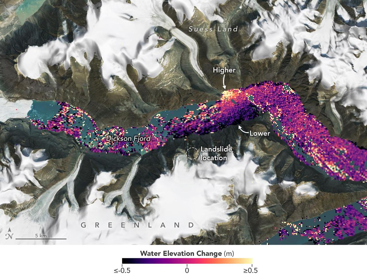
A visualization based on data from the international SWOT satellite mission shows the unique contours of a tsunami that sloshed within the steep walls of a fjord in Greenland in September 2023. Triggered by a massive landslide, the tsunami generated a seismic rumble that reverberated around the world for nine days. Short for Surface Water and Ocean Topography, SWOT collected water elevation measurements in the Dickson Fjord on Sept. 17, 2023, the day after the initial landslide and tsunami. The data was compared with measurements made under normal conditions a few weeks prior, on Aug. 6, 2023. Colors toward the lighter end of the scale indicate higher water levels, and darker colors indicate lower-than-normal levels. The data suggest that water levels at some points along the north side of the fjord were as much as 4 feet (1.2 meters) higher than on the south. In a September 2024 paper in Science, researchers traced a seismic signal back to the tsunami, which began when more than 880 million cubic feet of rock and ice (25 million cubic meters) fell into the Dickson Fjord. Part of a network of channels on Greenland's eastern coast, the fjord is about 1,772 feet (540 meters) deep and 1.7 miles (2.7 kilometers) wide, with walls taller than 6,000 feet (1,830 meters). Far from the open ocean, in a confined space, the energy of the tsunami's motion had limited opportunity to dissipate, so the wave moved back and forth about every 90 seconds for nine days. It caused tremors recorded on seismic instruments thousands of miles away. Launched in December 2022 from Vandenberg Space Force Base in central California, SWOT is now in its operations phase, collecting data that will be used for research and other purposes. https://photojournal.jpl.nasa.gov/catalog/PIA26420
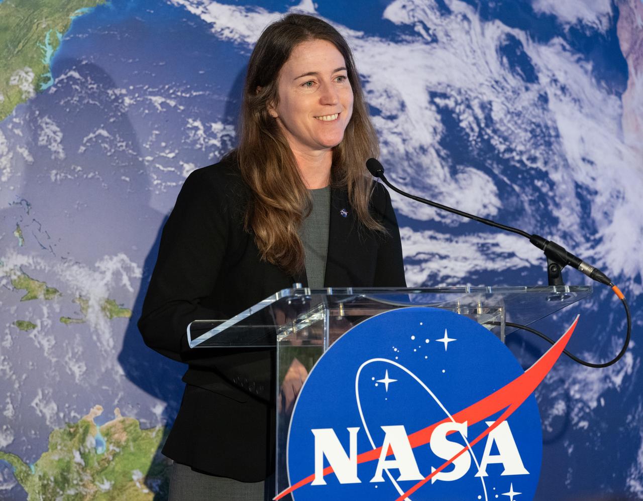
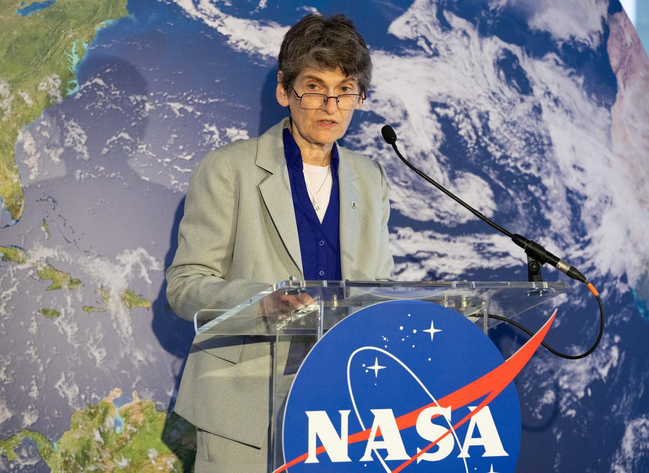
NASA Earth Science Division Deputy Director Julie Robinson delivers remarks during an Earth Information Center (EIC) student engagement event, Friday, June 23, 2023, at the Mary W. Jackson NASA Headquarters building in Washington. The EIC is a new immersive experience that combines live data sets with cutting-edge data visualization and storytelling to allow visitors to see how our planet is changing. Photo Credit: (NASA/Keegan Barber)
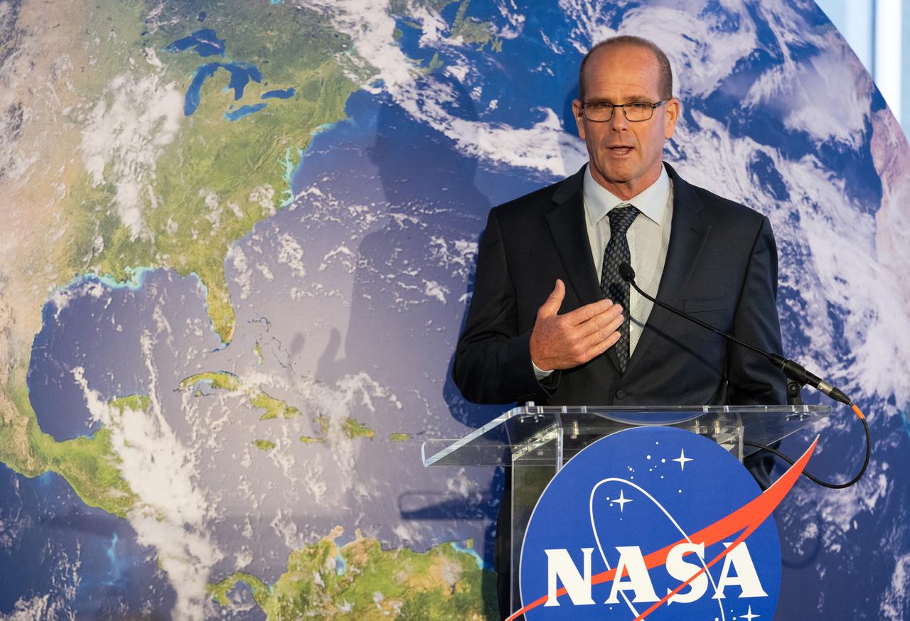
Karen St. Germain, Director of the Earth Science Division of NASA’s Science Mission Directorate, gives and interview following the ribbon cutting ceremony to open NASA’s Earth Information Center, Wednesday, June 21, 2023, at the Mary W. Jackson NASA Headquarters building in Washington. The Earth Information Center is new immersive experience that combines live data sets with cutting-edge data visualization and storytelling to allow visitors to see how our planet is changing. Photo Credit: (NASA/Joel Kowsky)
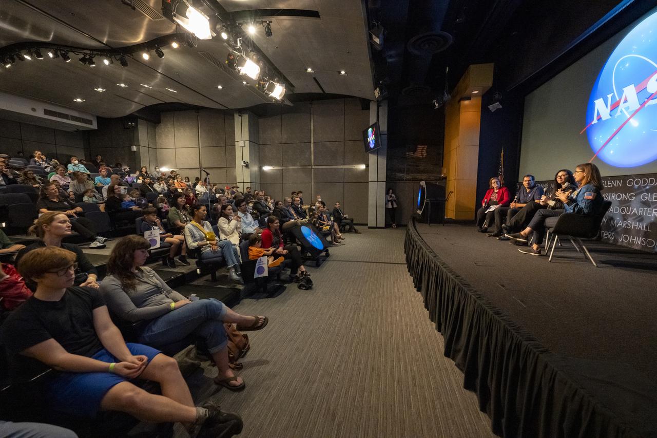
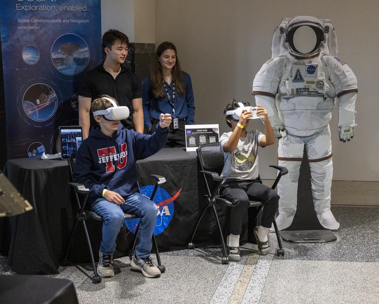
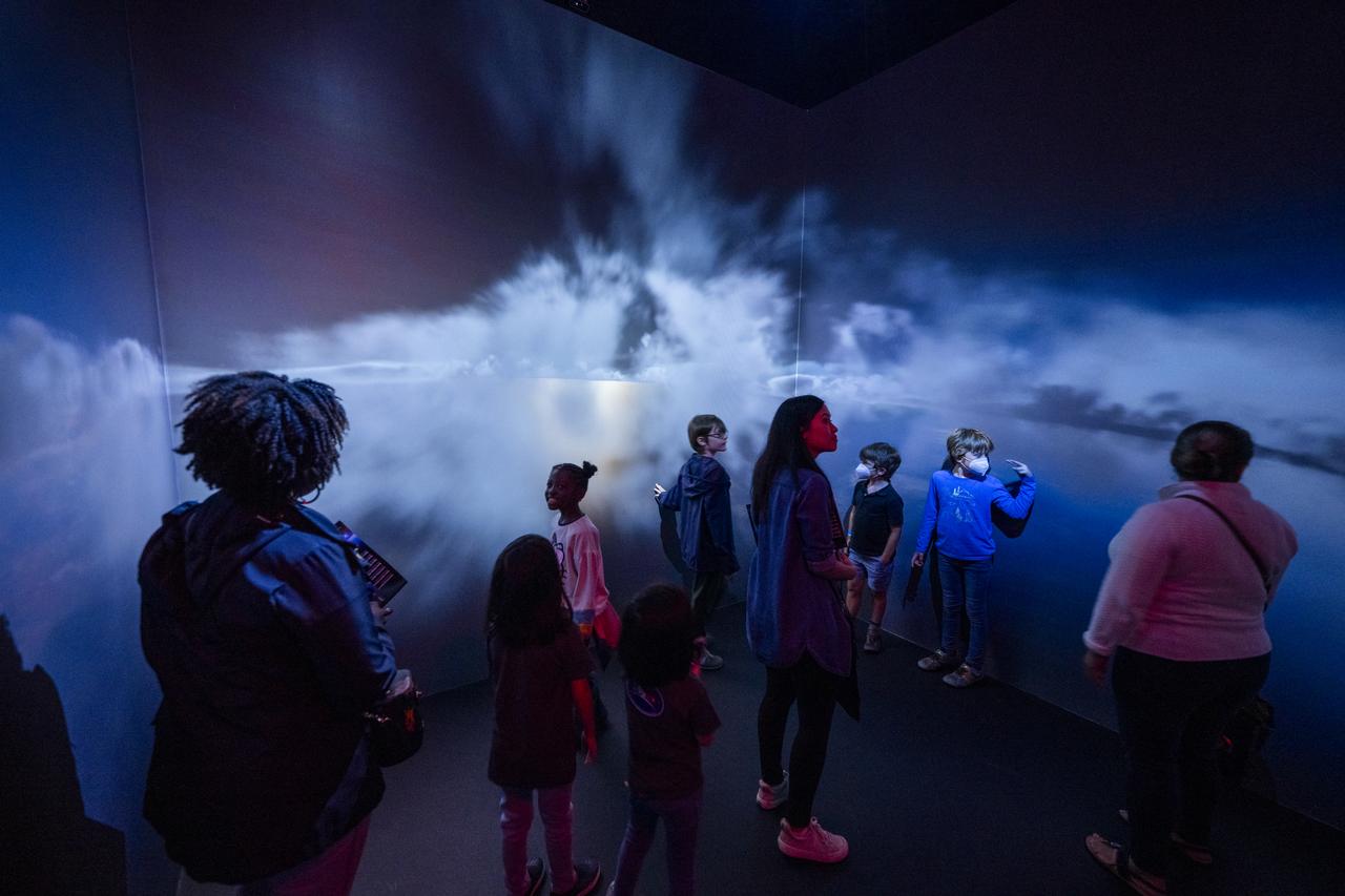
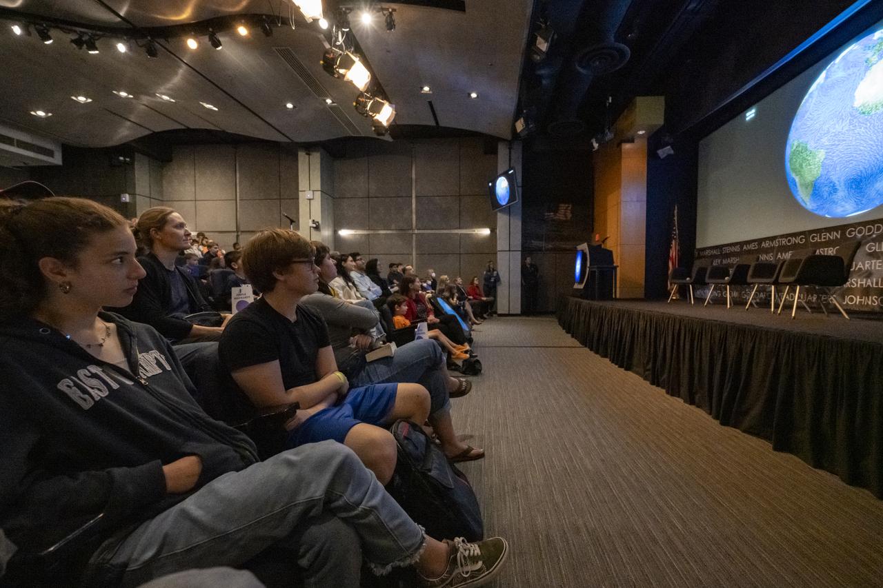
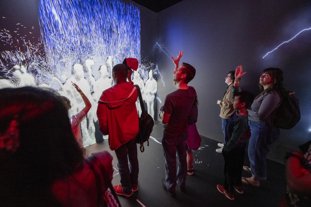
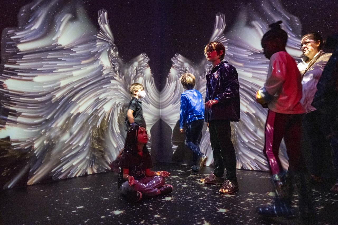
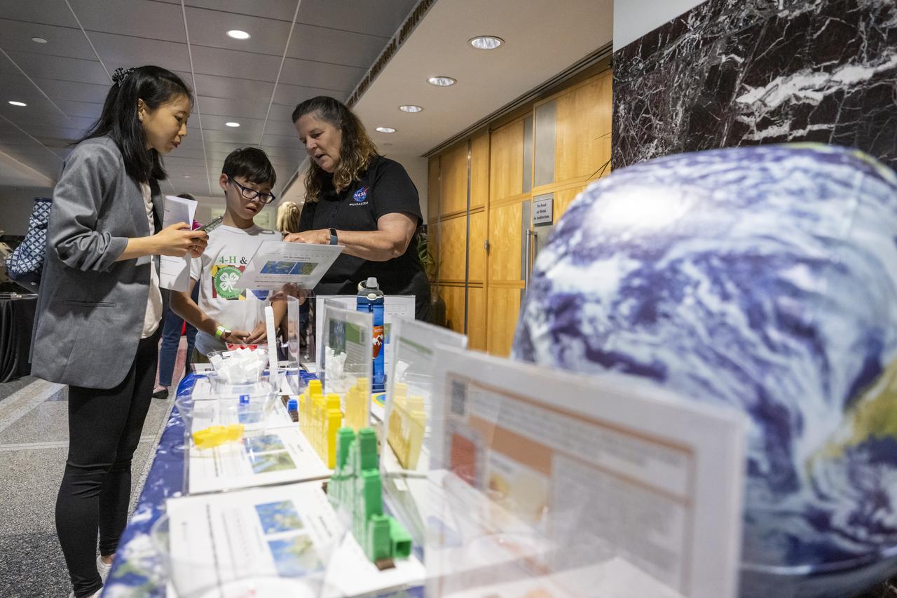
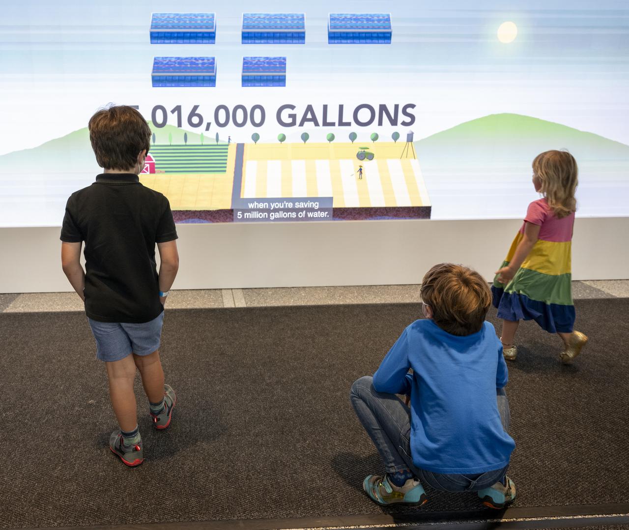
Local students participate in an Earth Information Center (EIC) student engagement event, Friday, June 23, 2023, at the Mary W. Jackson NASA Headquarters building in Washington. The EIC is a new immersive experience that combines live data sets with cutting-edge data visualization and storytelling to allow visitors to see how our planet is changing. Photo Credit: (NASA/Keegan Barber)
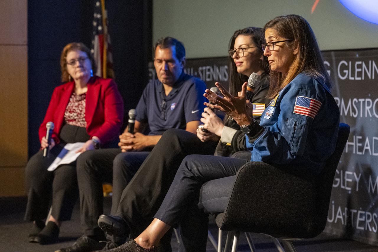
Former NASA Astronaut Nicole Stott delivers remarks during an Earth Information Center (EIC) student engagement event, Friday, June 23, 2023, at the Mary W. Jackson NASA Headquarters building in Washington. The EIC is a new immersive experience that combines live data sets with cutting-edge data visualization and storytelling to allow visitors to see how our planet is changing. Photo Credit: (NASA/Keegan Barber)

Local students participate in an Earth Information Center (EIC) student engagement event, Friday, June 23, 2023, at the Mary W. Jackson NASA Headquarters building in Washington. The EIC is a new immersive experience that combines live data sets with cutting-edge data visualization and storytelling to allow visitors to see how our planet is changing. Photo Credit: (NASA/Keegan Barber)
Dwane Roth of Big D Farms in Kansas, speaks before the ribbon cutting ceremony to open NASA’s Earth Information Center, Wednesday, June 21, 2023, at the Mary W. Jackson NASA Headquarters building in Washington. The Earth Information Center is new immersive experience that combines live data sets with cutting-edge data visualization and storytelling to allow visitors to see how our planet is changing. Photo Credit: (NASA/Joel Kowsky)
Local students participate in STEM activities prior to an Earth Information Center (EIC) student engagement event, Friday, June 23, 2023, at the Mary W. Jackson NASA Headquarters building in Washington. The EIC is a new immersive experience that combines live data sets with cutting-edge data visualization and storytelling to allow visitors to see how our planet is changing. Photo Credit: (NASA/Keegan Barber)
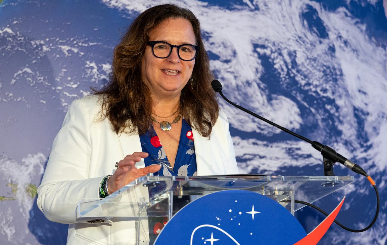
Kate Calvin, NASA’s Chief Scientist, speaks before the ribbon cutting ceremony to open NASA’s Earth Information Center, Wednesday, June 21, 2023, at the Mary W. Jackson NASA Headquarters building in Washington. The Earth Information Center is new immersive experience that combines live data sets with cutting-edge data visualization and storytelling to allow visitors to see how our planet is changing. Photo Credit: (NASA/Joel Kowsky)
Local students participate in an Earth Information Center (EIC) student engagement event, Friday, June 23, 2023, at the Mary W. Jackson NASA Headquarters building in Washington. The EIC is a new immersive experience that combines live data sets with cutting-edge data visualization and storytelling to allow visitors to see how our planet is changing. Photo Credit: (NASA/Keegan Barber)
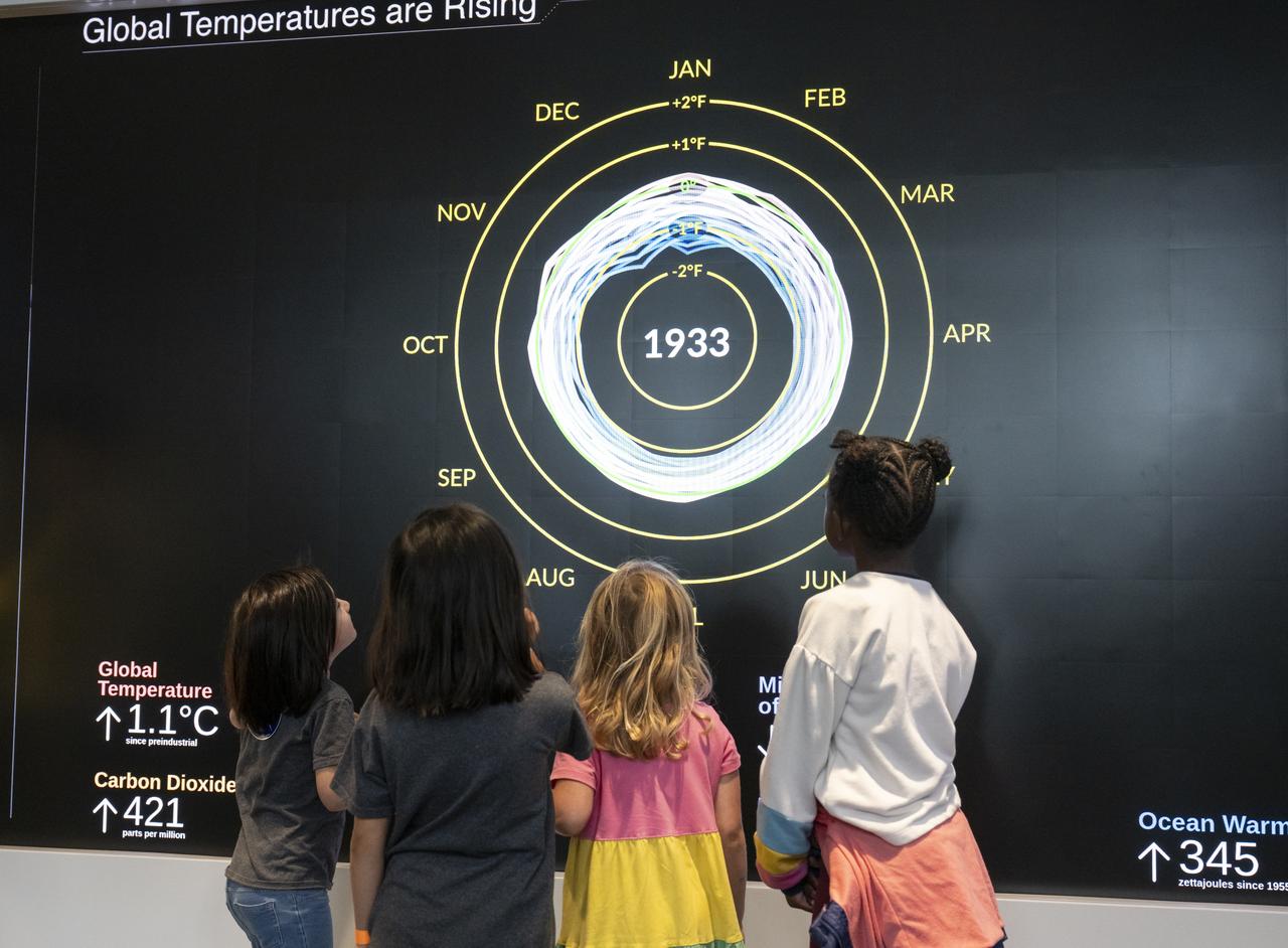
Local students participate in an Earth Information Center (EIC) student engagement event, Friday, June 23, 2023, at the Mary W. Jackson NASA Headquarters building in Washington. The EIC is a new immersive experience that combines live data sets with cutting-edge data visualization and storytelling to allow visitors to see how our planet is changing. Photo Credit: (NASA/Keegan Barber)
Local students participate in an Earth Information Center (EIC) student engagement event, Friday, June 23, 2023, at the Mary W. Jackson NASA Headquarters building in Washington. The EIC is a new immersive experience that combines live data sets with cutting-edge data visualization and storytelling to allow visitors to see how our planet is changing. Photo Credit: (NASA/Keegan Barber)

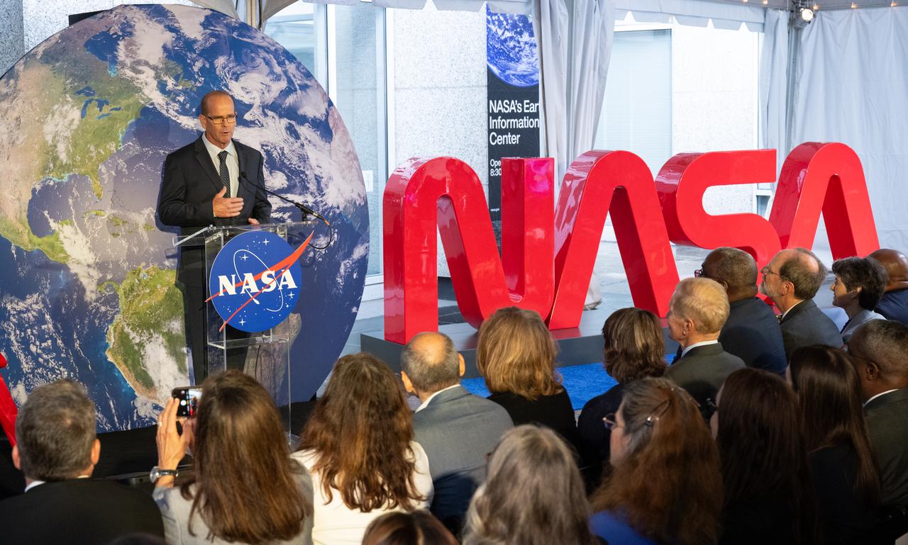
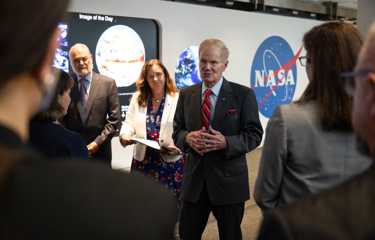
NASA Administrator Bill Nelson delivers remarks before the ribbon cutting ceremony to open NASA’s Earth Information Center, Wednesday, June 21, 2023, at the Mary W. Jackson NASA Headquarters building in Washington. The Earth Information Center is new immersive experience that combines live data sets with cutting-edge data visualization and storytelling to allow visitors to see how our planet is changing. Photo Credit: (NASA/Joel Kowsky)

Local students participate in an Earth Information Center (EIC) student engagement event, Friday, June 23, 2023, at the Mary W. Jackson NASA Headquarters building in Washington. The EIC is a new immersive experience that combines live data sets with cutting-edge data visualization and storytelling to allow visitors to see how our planet is changing. Photo Credit: (NASA/Keegan Barber)
Michael Morgan, Assistant Secretary of Commerce for Environmental Observation and Prediction at the National Oceanic and Atmospheric Administration (NOAA), speaks before the ribbon cutting ceremony to open NASA’s Earth Information Center, Wednesday, June 21, 2023, at the Mary W. Jackson NASA Headquarters building in Washington. The Earth Information Center is new immersive experience that combines live data sets with cutting-edge data visualization and storytelling to allow visitors to see how our planet is changing. Photo Credit: (NASA/Joel Kowsky)
Local students participate in an Earth Information Center (EIC) student engagement event, Friday, June 23, 2023, at the Mary W. Jackson NASA Headquarters building in Washington. The EIC is a new immersive experience that combines live data sets with cutting-edge data visualization and storytelling to allow visitors to see how our planet is changing. Photo Credit: (NASA/Keegan Barber)

NASA Administrator Bill Nelson, center, cuts the ribbon to open NASA’s Earth Information Center alongside agency leadership and leadership from NOAA, USGS, USDA, USAID, EPA, and FEMA, Wednesday, June 21, 2023, at the Mary W. Jackson NASA Headquarters building in Washington. The Earth Information Center is new immersive experience that combines live data sets with cutting-edge data visualization and storytelling to allow visitors to see how our planet is changing. Photo Credit: (NASA/Joel Kowsky)
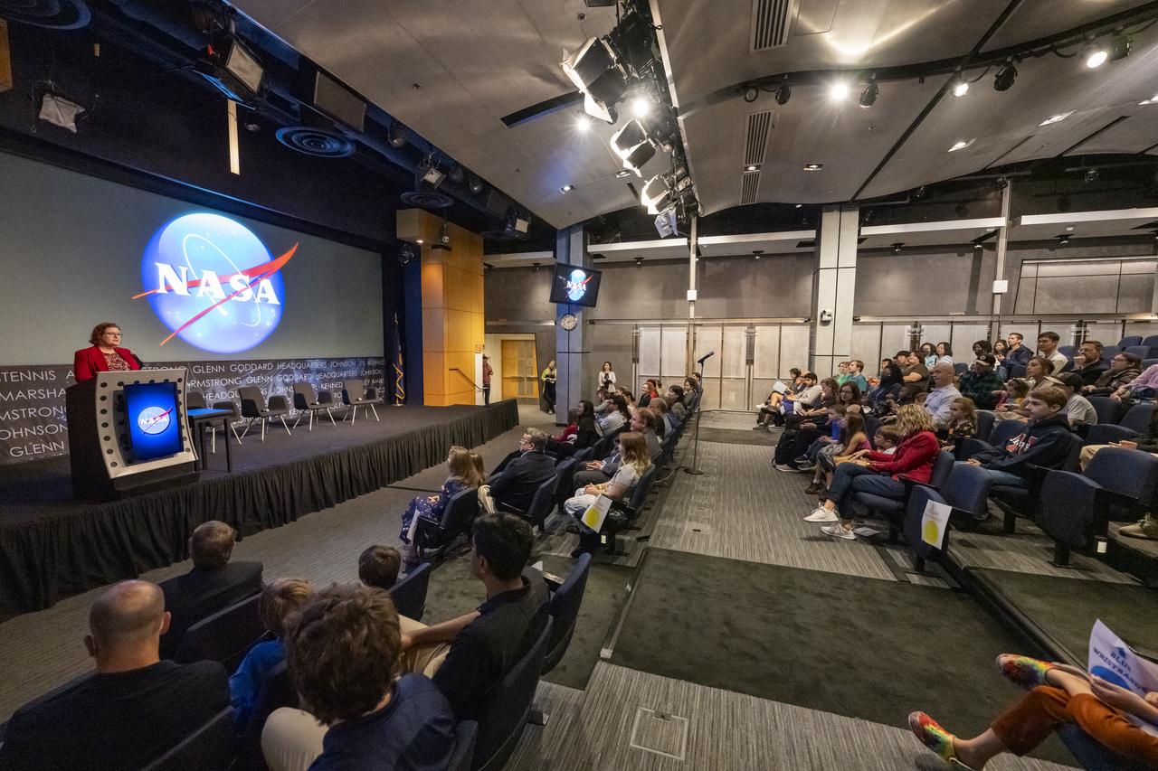
NASA Earth Science Division Deputy Director Julie Robinson delivers remarks during an Earth Information Center (EIC) student engagement event, Friday, June 23, 2023, at the Mary W. Jackson NASA Headquarters building in Washington. The EIC is a new immersive experience that combines live data sets with cutting-edge data visualization and storytelling to allow visitors to see how our planet is changing. Photo Credit: (NASA/Keegan Barber)
Local students participate in an Earth Information Center (EIC) student engagement event, Friday, June 23, 2023, at the Mary W. Jackson NASA Headquarters building in Washington. The EIC is a new immersive experience that combines live data sets with cutting-edge data visualization and storytelling to allow visitors to see how our planet is changing. Photo Credit: (NASA/Keegan Barber)

The NASA Worm Logo sign is unveiled before the ribbon cutting ceremony to open NASA’s Earth Information Center, Wednesday, June 21, 2023, at the Mary W. Jackson NASA Headquarters building in Washington. The Earth Information Center is new immersive experience that combines live data sets with cutting-edge data visualization and storytelling to allow visitors to see how our planet is changing. Photo Credit: (NASA/Joel Kowsky)
NASA Earth Science Division Deputy Director Julie Robinson delivers remarks during an Earth Information Center (EIC) student engagement event, Friday, June 23, 2023, at the Mary W. Jackson NASA Headquarters building in Washington. The EIC is a new immersive experience that combines live data sets with cutting-edge data visualization and storytelling to allow visitors to see how our planet is changing. Photo Credit: (NASA/Keegan Barber)

Karen St. Germain, Director of the Earth Science Division of NASA’s Science Mission Directorate, before the ribbon cutting ceremony to open NASA’s Earth Information Center, Wednesday, June 21, 2023, at the Mary W. Jackson NASA Headquarters building in Washington. The Earth Information Center is new immersive experience that combines live data sets with cutting-edge data visualization and storytelling to allow visitors to see how our planet is changing. Photo Credit: (NASA/Joel Kowsky)
Mike Michener, Deputy Assistant Administrator for the Bureau for Resilience and Food Security at the United States Agency for International Development (USAID), speaks before the ribbon cutting ceremony to open NASA’s Earth Information Center, Wednesday, June 21, 2023, at the Mary W. Jackson NASA Headquarters building in Washington. The Earth Information Center is new immersive experience that combines live data sets with cutting-edge data visualization and storytelling to allow visitors to see how our planet is changing. Photo Credit: (NASA/Joel Kowsky)
Marlen Eve, Deputy Administrator for the Agricultural Research Service at the U.S. Department of Agriculture (USDA), speaks before the ribbon cutting ceremony to open NASA’s Earth Information Center, Wednesday, June 21, 2023, at the Mary W. Jackson NASA Headquarters building in Washington. The Earth Information Center is new immersive experience that combines live data sets with cutting-edge data visualization and storytelling to allow visitors to see how our planet is changing. Photo Credit: (NASA/Joel Kowsky)

The NASA Worm Logo sign is unveiled before the ribbon cutting ceremony to open NASA’s Earth Information Center, Wednesday, June 21, 2023, at the Mary W. Jackson NASA Headquarters building in Washington. The Earth Information Center is new immersive experience that combines live data sets with cutting-edge data visualization and storytelling to allow visitors to see how our planet is changing. Photo Credit: (NASA/Joel Kowsky)
NASA Administrator Bill Nelson speaks to leadership from NOAA, USGS, USDA, USAID, EPA, and FEMA at the opening of NASA’s Earth Information Center, Wednesday, June 21, 2023, at the Mary W. Jackson NASA Headquarters building in Washington. The Earth Information Center is new immersive experience that combines live data sets with cutting-edge data visualization and storytelling to allow visitors to see how our planet is changing. Photo Credit: (NASA/Joel Kowsky)
NASA Administrator Bill Nelson speaks to leadership from NOAA, USGS, USDA, USAID, EPA, and FEMA at the opening of NASA’s Earth Information Center, Wednesday, June 21, 2023, at the Mary W. Jackson NASA Headquarters building in Washington. The Earth Information Center is new immersive experience that combines live data sets with cutting-edge data visualization and storytelling to allow visitors to see how our planet is changing. Photo Credit: (NASA/Joel Kowsky)
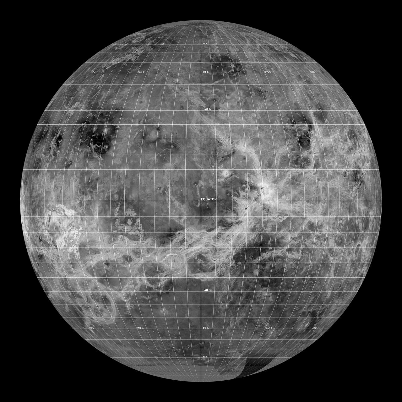
This global view of the surface of Venus is centered at 180 degrees east longitude. Magellan synthetic aperture radar mosaics from the first cycle of Magellan mapping, and a 5 degree latitude-longitude grid, are mapped onto a computer-simulated globe to create this image. Data gaps are filled with Pioneer-Venus Orbiter data, or a constant mid-range value. The image was produced by the Solar System Visualization project and the Magellan Science team at the JPL Multimission Image Processing Laboratory. http://photojournal.jpl.nasa.gov/catalog/PIA00478
Local students participate in an Earth Information Center (EIC) student engagement event, Friday, June 23, 2023, at the Mary W. Jackson NASA Headquarters building in Washington. The EIC is a new immersive experience that combines live data sets with cutting-edge data visualization and storytelling to allow visitors to see how our planet is changing. Photo Credit: (NASA/Keegan Barber)
Local students participate in STEM activities prior to an Earth Information Center (EIC) student engagement event, Friday, June 23, 2023, at the Mary W. Jackson NASA Headquarters building in Washington. The EIC is a new immersive experience that combines live data sets with cutting-edge data visualization and storytelling to allow visitors to see how our planet is changing. Photo Credit: (NASA/Keegan Barber)
Local students participate in an Earth Information Center (EIC) student engagement event, Friday, June 23, 2023, at the Mary W. Jackson NASA Headquarters building in Washington. The EIC is a new immersive experience that combines live data sets with cutting-edge data visualization and storytelling to allow visitors to see how our planet is changing. Photo Credit: (NASA/Keegan Barber)
Local students participate in an Earth Information Center (EIC) student engagement event, Friday, June 23, 2023, at the Mary W. Jackson NASA Headquarters building in Washington. The EIC is a new immersive experience that combines live data sets with cutting-edge data visualization and storytelling to allow visitors to see how our planet is changing. Photo Credit: (NASA/Keegan Barber)
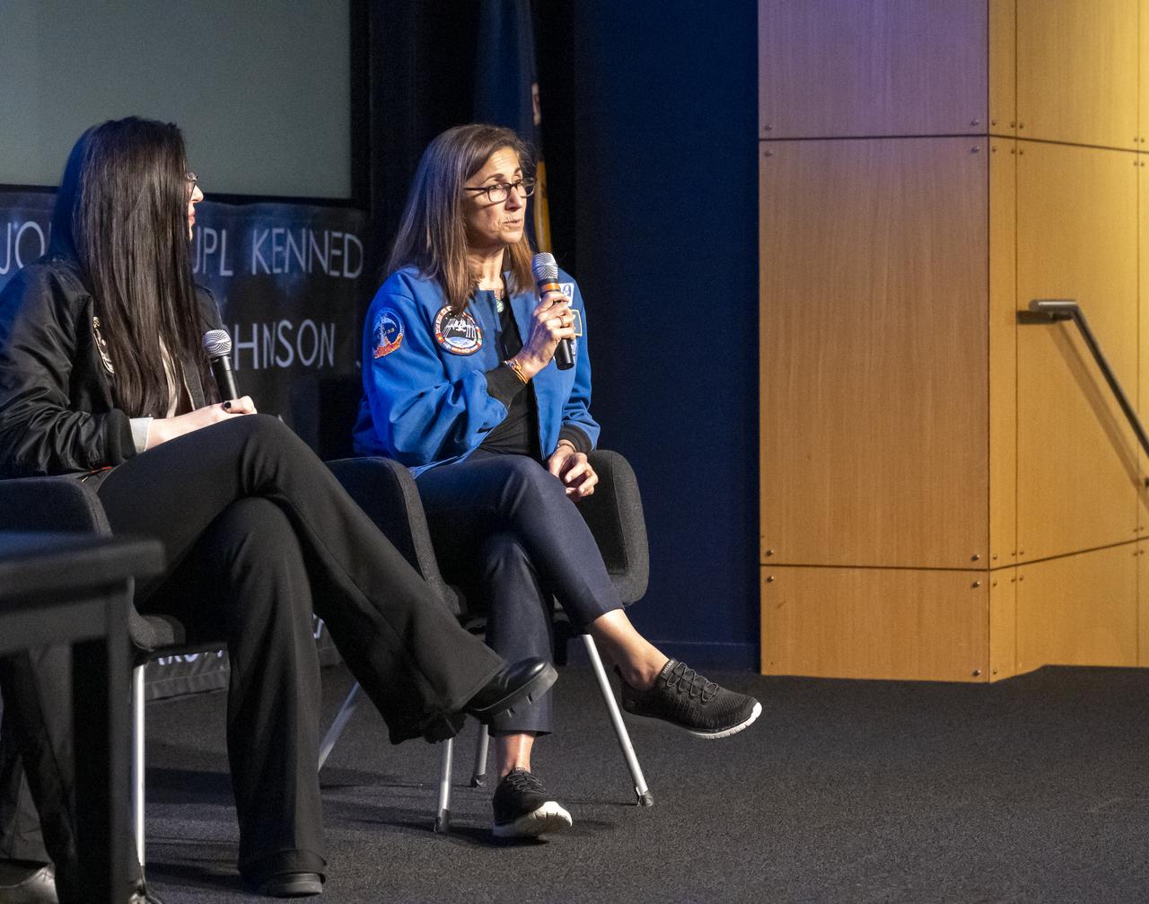
Former NASA Astronaut Nicole Stott, right, delivers remarks during an Earth Information Center (EIC) student engagement event, Friday, June 23, 2023, at the Mary W. Jackson NASA Headquarters building in Washington. The EIC is a new immersive experience that combines live data sets with cutting-edge data visualization and storytelling to allow visitors to see how our planet is changing. Photo Credit: (NASA/Keegan Barber)
Local students participate in an Earth Information Center (EIC) student engagement event, Friday, June 23, 2023, at the Mary W. Jackson NASA Headquarters building in Washington. The EIC is a new immersive experience that combines live data sets with cutting-edge data visualization and storytelling to allow visitors to see how our planet is changing. Photo Credit: (NASA/Keegan Barber)
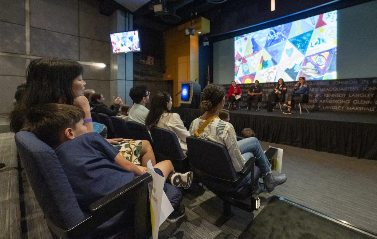
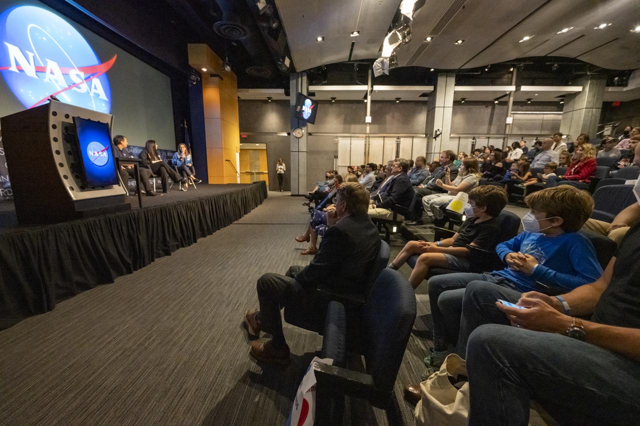
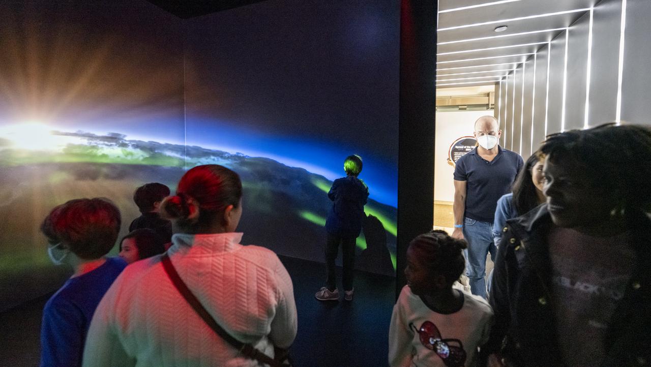
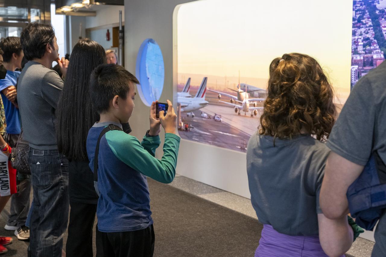
Local students view a video presentation during an Earth Information Center (EIC) student engagement event, Friday, June 23, 2023, at the Mary W. Jackson NASA Headquarters building in Washington. The EIC is a new immersive experience that combines live data sets with cutting-edge data visualization and storytelling to allow visitors to see how our planet is changing. Photo Credit: (NASA/Keegan Barber)
Local students participate in an Earth Information Center (EIC) student engagement event, Friday, June 23, 2023, at the Mary W. Jackson NASA Headquarters building in Washington. The EIC is a new immersive experience that combines live data sets with cutting-edge data visualization and storytelling to allow visitors to see how our planet is changing. Photo Credit: (NASA/Keegan Barber)

NASA Administrator Bill Nelson delivers remarks before the ribbon cutting ceremony to open NASA’s Earth Information Center, Wednesday, June 21, 2023, at the Mary W. Jackson NASA Headquarters building in Washington. The Earth Information Center is new immersive experience that combines live data sets with cutting-edge data visualization and storytelling to allow visitors to see how our planet is changing. Photo Credit: (NASA/Joel Kowsky)
Local students participate in an Earth Information Center (EIC) student engagement event, Friday, June 23, 2023, at the Mary W. Jackson NASA Headquarters building in Washington. The EIC is a new immersive experience that combines live data sets with cutting-edge data visualization and storytelling to allow visitors to see how our planet is changing. Photo Credit: (NASA/Keegan Barber)
Local students participate in STEM activities prior to an Earth Information Center (EIC) student engagement event, Friday, June 23, 2023, at the Mary W. Jackson NASA Headquarters building in Washington. The EIC is a new immersive experience that combines live data sets with cutting-edge data visualization and storytelling to allow visitors to see how our planet is changing. Photo Credit: (NASA/Keegan Barber)
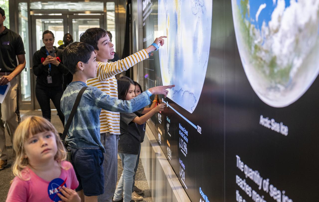
Local students participate in an Earth Information Center (EIC) student engagement event, Friday, June 23, 2023, at the Mary W. Jackson NASA Headquarters building in Washington. The EIC is a new immersive experience that combines live data sets with cutting-edge data visualization and storytelling to allow visitors to see how our planet is changing. Photo Credit: (NASA/Keegan Barber)
Janet McCabe, Deputy Administrator of the Environmental Protection Agency (EPA), speaks before the ribbon cutting ceremony to open NASA’s Earth Information Center, Wednesday, June 21, 2023, at the Mary W. Jackson NASA Headquarters building in Washington. The Earth Information Center is new immersive experience that combines live data sets with cutting-edge data visualization and storytelling to allow visitors to see how our planet is changing. Photo Credit: (NASA/Joel Kowsky)

Dave Applegate, Director of the U.S. Geologic Survey (USGS), speaks before the ribbon cutting ceremony to open NASA’s Earth Information Center, Wednesday, June 21, 2023, at the Mary W. Jackson NASA Headquarters building in Washington. The Earth Information Center is new immersive experience that combines live data sets with cutting-edge data visualization and storytelling to allow visitors to see how our planet is changing. Photo Credit: (NASA/Joel Kowsky)
Local students participate in an Earth Information Center (EIC) student engagement event, Friday, June 23, 2023, at the Mary W. Jackson NASA Headquarters building in Washington. The EIC is a new immersive experience that combines live data sets with cutting-edge data visualization and storytelling to allow visitors to see how our planet is changing. Photo Credit: (NASA/Keegan Barber)
Karen St. Germain, Director of the Earth Science Division of NASA’s Science Mission Directorate, before the ribbon cutting ceremony to open NASA’s Earth Information Center, Wednesday, June 21, 2023, at the Mary W. Jackson NASA Headquarters building in Washington. The Earth Information Center is new immersive experience that combines live data sets with cutting-edge data visualization and storytelling to allow visitors to see how our planet is changing. Photo Credit: (NASA/Joel Kowsky)
Dwane Roth of Big D Farms in Kansas, speaks before the ribbon cutting ceremony to open NASA’s Earth Information Center, Wednesday, June 21, 2023, at the Mary W. Jackson NASA Headquarters building in Washington. The Earth Information Center is new immersive experience that combines live data sets with cutting-edge data visualization and storytelling to allow visitors to see how our planet is changing. Photo Credit: (NASA/Joel Kowsky)

Kate Calvin, NASA’s Chief Scientist, speaks before the ribbon cutting ceremony to open NASA’s Earth Information Center, Wednesday, June 21, 2023, at the Mary W. Jackson NASA Headquarters building in Washington. The Earth Information Center is new immersive experience that combines live data sets with cutting-edge data visualization and storytelling to allow visitors to see how our planet is changing. Photo Credit: (NASA/Joel Kowsky)

NASA Administrator Bill Nelson delivers remarks before the ribbon cutting ceremony to open NASA’s Earth Information Center, Wednesday, June 21, 2023, at the Mary W. Jackson NASA Headquarters building in Washington. The Earth Information Center is new immersive experience that combines live data sets with cutting-edge data visualization and storytelling to allow visitors to see how our planet is changing. Photo Credit: (NASA/Joel Kowsky)
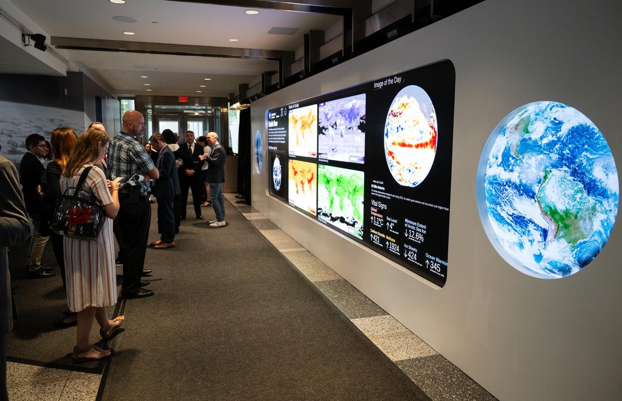
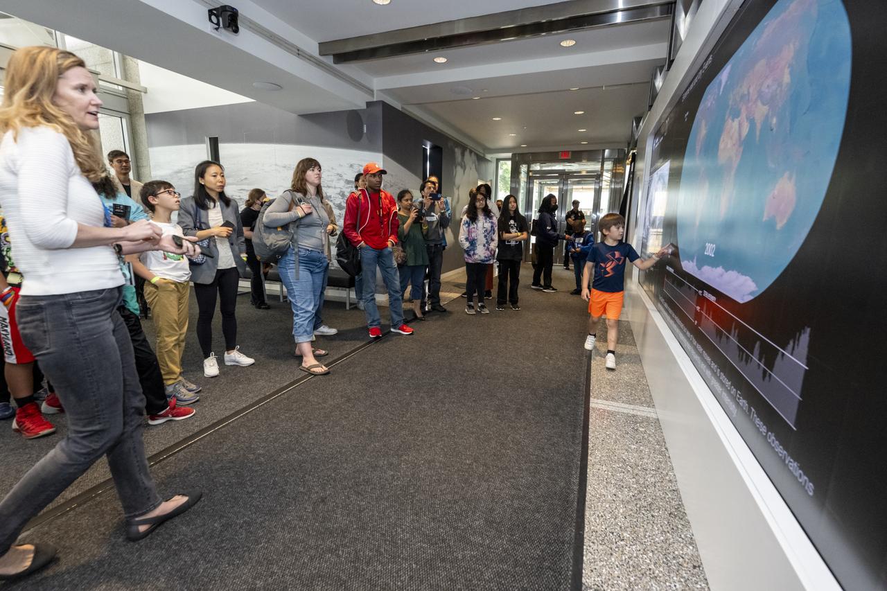
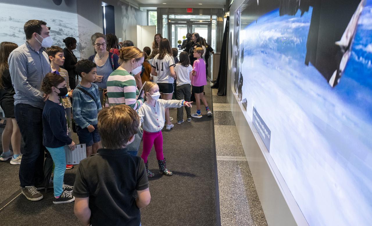
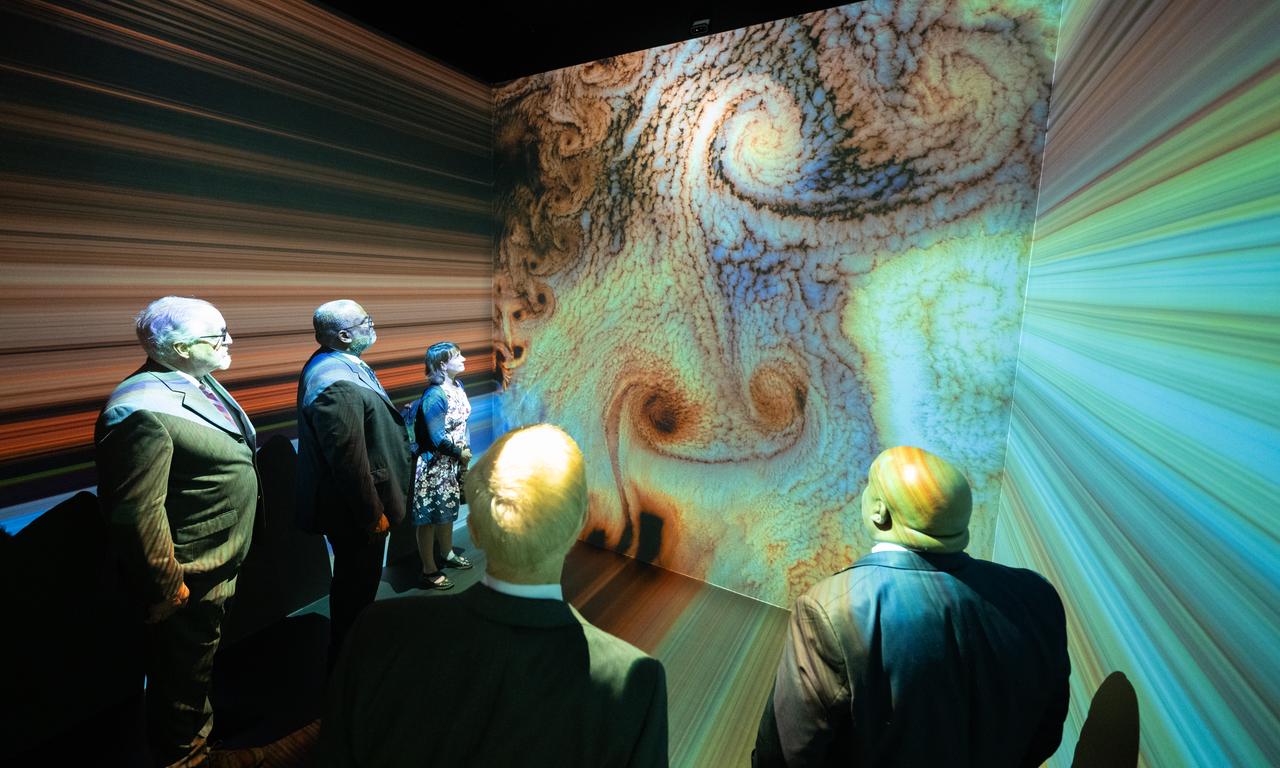
The hyperwall of NASA’s Earth Information Center is seen, Wednesday, June 21, 2023, at the Mary W. Jackson NASA Headquarters building in Washington. The Earth Information Center is new immersive experience that combines live data sets with cutting-edge data visualization and storytelling to allow visitors to see how our planet is changing. Photo Credit: (NASA/Joel Kowsky)

NASA Administrator Bill Nelson, center, cuts the ribbon to open NASA’s Earth Information Center alongside agency leadership and leadership from NOAA, USGS, USDA, USAID, EPA, and FEMA, Wednesday, June 21, 2023, at the Mary W. Jackson NASA Headquarters building in Washington. The Earth Information Center is new immersive experience that combines live data sets with cutting-edge data visualization and storytelling to allow visitors to see how our planet is changing. Photo Credit: (NASA/Joel Kowsky)
Local students participate in an Earth Information Center (EIC) student engagement event, Friday, June 23, 2023, at the Mary W. Jackson NASA Headquarters building in Washington. The EIC is a new immersive experience that combines live data sets with cutting-edge data visualization and storytelling to allow visitors to see how our planet is changing. Photo Credit: (NASA/Keegan Barber)

Eric Hooks, Deputy Administrator of the Federal Emergency Management Agency (FEMA), speaks before the ribbon cutting ceremony to open NASA’s Earth Information Center, Wednesday, June 21, 2023, at the Mary W. Jackson NASA Headquarters building in Washington. The Earth Information Center is new immersive experience that combines live data sets with cutting-edge data visualization and storytelling to allow visitors to see how our planet is changing. Photo Credit: (NASA/Joel Kowsky)
![KENNEDY SPACE CENTER, FLA. - These towers are part of one of the world’s highest performing visual film analysis systems, developed to review and analyze previous shuttle flight data in preparation for the shuttle fleet’s return to flight. The system is being used today for another purpose. NASA has permitted its use in helping to analyze a film that shows a recent kidnapping in progress in Florida. Developed by NASA, United Space Alliance (USA) and Silicon Graphics Inc., the system allows multiple-person collaboration, highly detailed manipulation and evaluation of specific imagery. The system is housed in the Image Analysis Facility inside the Vehicle Assembly Building. [Photo taken Aug. 15, 2003, courtesy of Terry Wallace, SGI ]](https://images-assets.nasa.gov/image/KSC-04pd0152/KSC-04pd0152~medium.jpg)
KENNEDY SPACE CENTER, FLA. - These towers are part of one of the world’s highest performing visual film analysis systems, developed to review and analyze previous shuttle flight data in preparation for the shuttle fleet’s return to flight. The system is being used today for another purpose. NASA has permitted its use in helping to analyze a film that shows a recent kidnapping in progress in Florida. Developed by NASA, United Space Alliance (USA) and Silicon Graphics Inc., the system allows multiple-person collaboration, highly detailed manipulation and evaluation of specific imagery. The system is housed in the Image Analysis Facility inside the Vehicle Assembly Building. [Photo taken Aug. 15, 2003, courtesy of Terry Wallace, SGI ]
![KENNEDY SPACE CENTER, FLA. - One of the world’s highest performing visual film analysis systems, developed to review and analyze previous shuttle flight data (shown here) in preparation for the shuttle fleet’s return to flight, is being used today for another purpose. NASA has permitted its use in helping to analyze a film that shows a recent kidnapping in progress in Florida. The system, developed by NASA, United Space Alliance (USA) and Silicon Graphics Inc., allows multiple-person collaboration, highly detailed manipulation and evaluation of specific imagery. The system is housed in the Image Analysis Facility inside the Vehicle Assembly Building. [Photo taken Aug. 15, 2003, courtesy of Terry Wallace, SGI ]](https://images-assets.nasa.gov/image/KSC-04pd0150/KSC-04pd0150~medium.jpg)
KENNEDY SPACE CENTER, FLA. - One of the world’s highest performing visual film analysis systems, developed to review and analyze previous shuttle flight data (shown here) in preparation for the shuttle fleet’s return to flight, is being used today for another purpose. NASA has permitted its use in helping to analyze a film that shows a recent kidnapping in progress in Florida. The system, developed by NASA, United Space Alliance (USA) and Silicon Graphics Inc., allows multiple-person collaboration, highly detailed manipulation and evaluation of specific imagery. The system is housed in the Image Analysis Facility inside the Vehicle Assembly Building. [Photo taken Aug. 15, 2003, courtesy of Terry Wallace, SGI ]
![KENNEDY SPACE CENTER, FLA. - One of the world’s highest performing visual film analysis systems, developed to review and analyze previous shuttle flight data (shown here) in preparation for the shuttle fleet’s return to flight, is being used today for another purpose. NASA has permitted its use in helping to analyze a film that shows a recent kidnapping in progress in Florida. The system, developed by NASA, United Space Alliance (USA) and Silicon Graphics Inc., allows multiple-person collaboration, highly detailed manipulation and evaluation of specific imagery. The system is housed in the Image Analysis Facility inside the Vehicle Assembly Building. [Photo taken Aug. 15, 2003, courtesy of Terry Wallace, SGI ]](https://images-assets.nasa.gov/image/KSC-04pd0151/KSC-04pd0151~medium.jpg)
KENNEDY SPACE CENTER, FLA. - One of the world’s highest performing visual film analysis systems, developed to review and analyze previous shuttle flight data (shown here) in preparation for the shuttle fleet’s return to flight, is being used today for another purpose. NASA has permitted its use in helping to analyze a film that shows a recent kidnapping in progress in Florida. The system, developed by NASA, United Space Alliance (USA) and Silicon Graphics Inc., allows multiple-person collaboration, highly detailed manipulation and evaluation of specific imagery. The system is housed in the Image Analysis Facility inside the Vehicle Assembly Building. [Photo taken Aug. 15, 2003, courtesy of Terry Wallace, SGI ]
![KENNEDY SPACE CENTER, FLA. - One of the world’s highest performing visual film analysis systems, developed to review and analyze previous shuttle flight data (shown here) in preparation for the shuttle fleet’s return to flight, is being used today for another purpose. NASA has permitted its use in helping to analyze a film that shows a recent kidnapping in progress in Florida. The system, developed by NASA, United Space Alliance (USA) and Silicon Graphics Inc., allows multiple-person collaboration, highly detailed manipulation and evaluation of specific imagery. The system is housed in the Image Analysis Facility inside the Vehicle Assembly Building. [Photo taken Aug. 15, 2003, courtesy of Terry Wallace, SGI ]](https://images-assets.nasa.gov/image/KSC-04pd0154/KSC-04pd0154~medium.jpg)
KENNEDY SPACE CENTER, FLA. - One of the world’s highest performing visual film analysis systems, developed to review and analyze previous shuttle flight data (shown here) in preparation for the shuttle fleet’s return to flight, is being used today for another purpose. NASA has permitted its use in helping to analyze a film that shows a recent kidnapping in progress in Florida. The system, developed by NASA, United Space Alliance (USA) and Silicon Graphics Inc., allows multiple-person collaboration, highly detailed manipulation and evaluation of specific imagery. The system is housed in the Image Analysis Facility inside the Vehicle Assembly Building. [Photo taken Aug. 15, 2003, courtesy of Terry Wallace, SGI ]

The dedication ceremony of the University of Southern Mississippi Center of Higher Learning (CHL) High-Performance Visualization Center at SSC was held Oct. 17. The center's RAVE II 3-D visualization system, available to both on- and off-site scientists, turns data into a fully immersive environment for the user. Cutting the ribbon are, from left, Rear Adm. Thomas Donaldson, commander of the Naval Meteorology and Oceanography Command; Jim Meredith, former director of the CHL; USM President Dr. Shelby Thames; Lt. Gov. Amy Tuck; Dr. Peter Ranelli, director of the CHL; Dewey Herring, chairman of the policy board for the CHL; and former Sen. Cecil Burge.
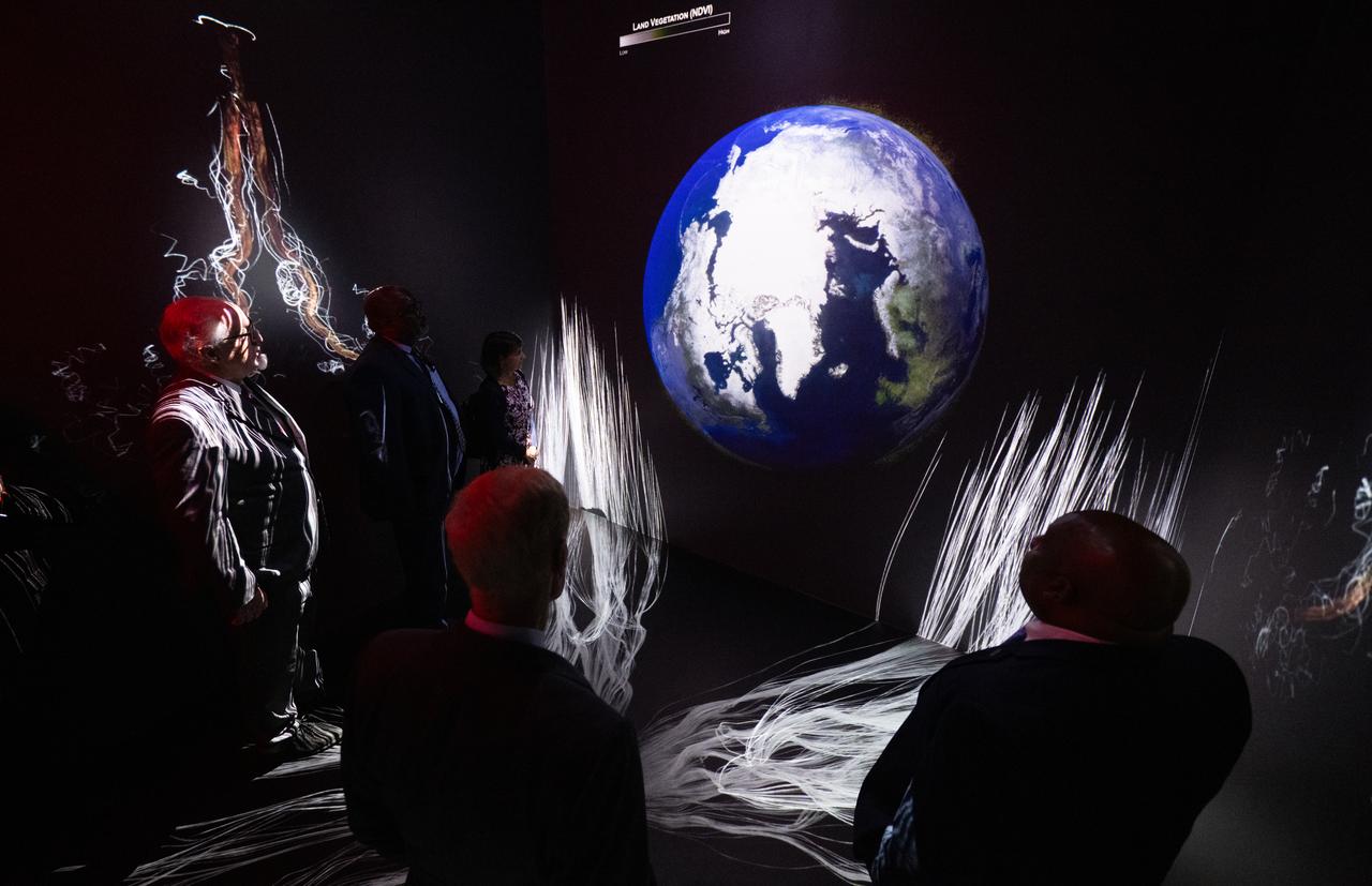
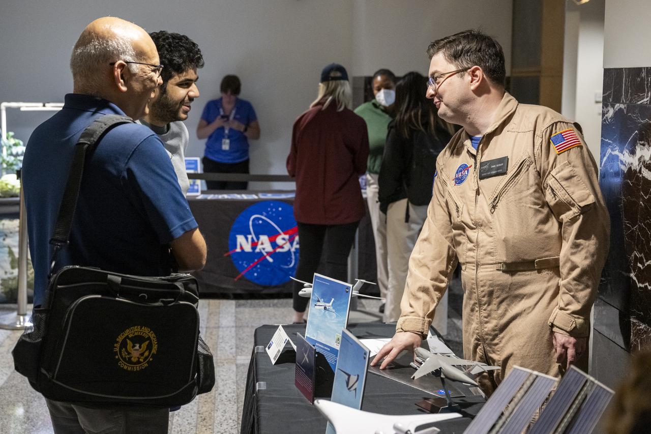
NASA Administrator Bill Nelson, Michael Morgan, Assistant Secretary of Commerce for Environmental Observation and Prediction at the National Oceanic and Atmospheric Administration (NOAA), Marlen Eve, Deputy Administrator for the Agricultural Research Service at the U.S. Department of Agriculture (USDA), and Eric Hooks, Deputy Administrator of the Federal Emergency Management Agency (FEMA), are seen as they watch “Space for Earth,” the immersive audio-visual installation in NASA’s Earth Information Center, following the ribbon cutting ceremony, Wednesday, June 21, 2023, at the Mary W. Jackson NASA Headquarters building in Washington. The Earth Information Center is new immersive experience that combines live data sets with cutting-edge data visualization and storytelling to allow visitors to see how our planet is changing. Photo Credit: (NASA/Joel Kowsky)
NASA Administrator Bill Nelson, Michael Morgan, Assistant Secretary of Commerce for Environmental Observation and Prediction at the National Oceanic and Atmospheric Administration (NOAA), Marlen Eve, Deputy Administrator for the Agricultural Research Service at the U.S. Department of Agriculture (USDA), and Eric Hooks, Deputy Administrator of the Federal Emergency Management Agency (FEMA), are seen as they watch “Space for Earth,” the immersive audio-visual installation in NASA’s Earth Information Center, following the ribbon cutting ceremony, Wednesday, June 21, 2023, at the Mary W. Jackson NASA Headquarters building in Washington. The Earth Information Center is new immersive experience that combines live data sets with cutting-edge data visualization and storytelling to allow visitors to see how our planet is changing. Photo Credit: (NASA/Joel Kowsky)
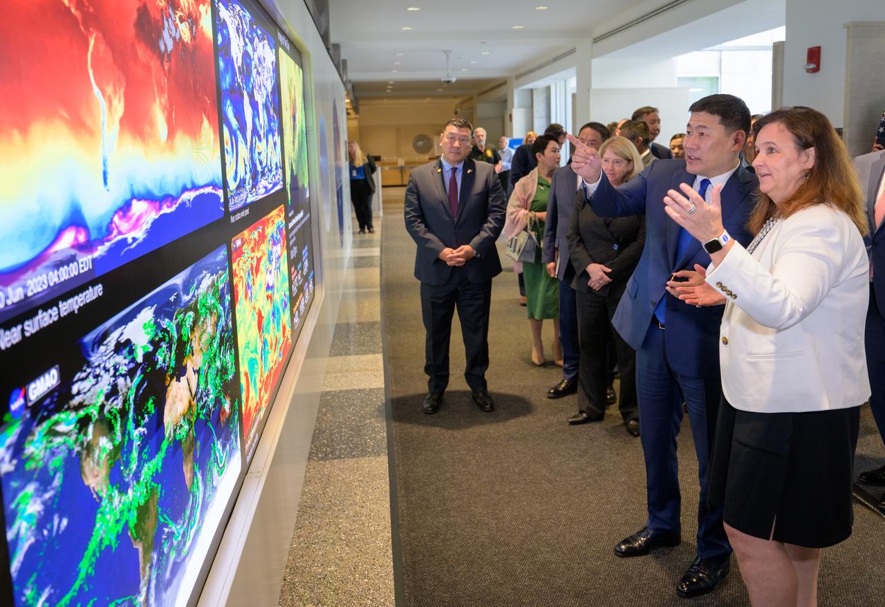
NASA Earth Science Division Director Karen St. Germain, far right, talks with Prime Minister Oyun-Erdene Luvsannamsrai of Mongolia, as they along with NASA Deputy Administrator Pam Melroy tour NASA’s Earth Information Center, Friday, Aug. 4, 2023, at the NASA Headquarters Mary W. Jackson Building in Washington. The Earth Information Center is a new immersive experience that combines live data sets with cutting-edge data visualization to show NASA data can improve lives in the face of disasters, environmental challenges, and our changing world. Photo Credit: (NASA/Bill Ingalls)

NASA Earth Science Division Director Karen St. Germain, far right, talks with Prime Minister Oyun-Erdene Luvsannamsrai of Mongolia, as they along with NASA Deputy Administrator Pam Melroy, left, tour NASA’s Earth Information Center, Friday, Aug. 4, 2023, at the NASA Headquarters Mary W. Jackson Building in Washington. The Earth Information Center is a new immersive experience that combines live data sets with cutting-edge data visualization to show NASA data can improve lives in the face of disasters, environmental challenges, and our changing world. Photo Credit: (NASA/Bill Ingalls)
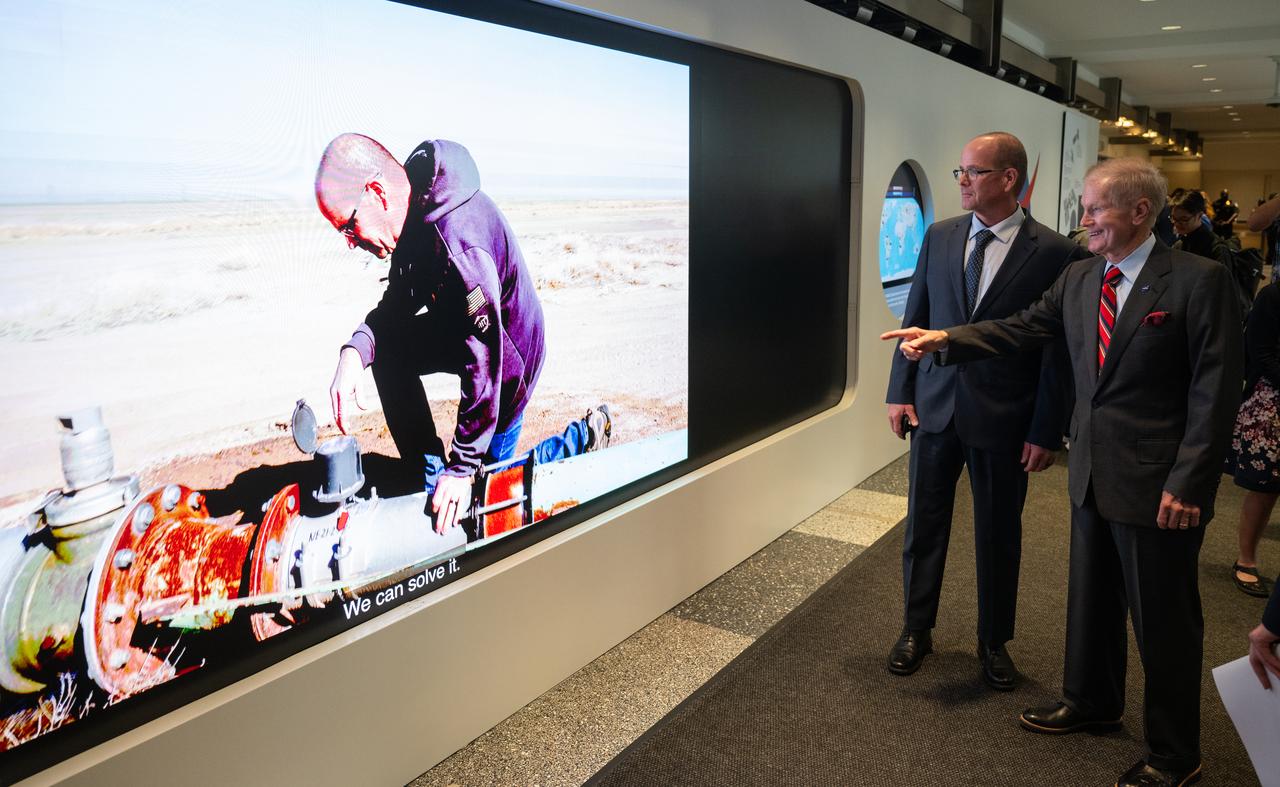
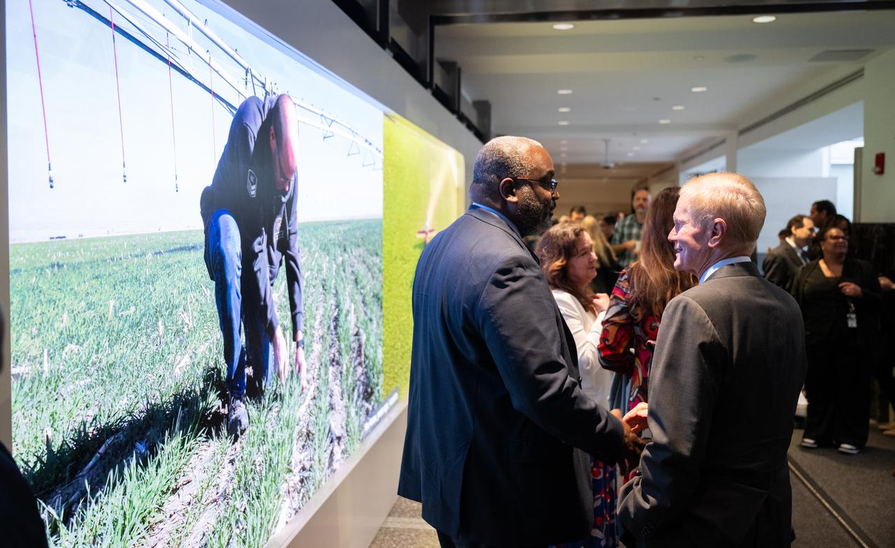
NASA Administrator Bill Nelson, right, and Dwane Roth of Big D Farms in Kansas are seen watching a video on the hyperwall that shows Roth’s farm following a ribbon cutting ceremony to open NASA’s Earth Information Center, Wednesday, June 21, 2023, at the Mary W. Jackson NASA Headquarters building in Washington. The Earth Information Center is new immersive experience that combines live data sets with cutting-edge data visualization and storytelling to allow visitors to see how our planet is changing. Photo Credit: (NASA/Joel Kowsky)
NASA Administrator Bill Nelson, right, and Michael Morgan, Assistant Secretary of Commerce for Environmental Observation and Prediction at the National Oceanic and Atmospheric Administration (NOAA), are seen in front of the hyperwall following the ribbon cutting ceremony to open NASA’s Earth Information Center, Wednesday, June 21, 2023, at the Mary W. Jackson NASA Headquarters building in Washington. The Earth Information Center is new immersive experience that combines live data sets with cutting-edge data visualization and storytelling to allow visitors to see how our planet is changing. Photo Credit: (NASA/Joel Kowsky)
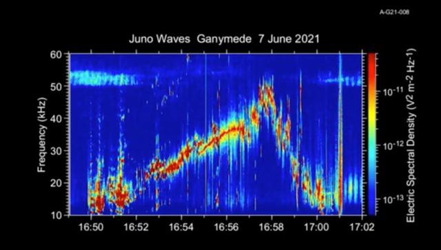
This 50-second animation provides an auditory as well as visual glimpse at data collected by Juno's Waves instrument as the spacecraft flew past the Jovian moon Ganymede on June 7, 2021. The abrupt change to higher frequencies around the midpoint of the recording represents the spacecraft's move from one region of Ganymede's magnetosphere to another. The audio track is made by shifting the frequency of those emissions – which range from 10 to 50 kHz – into the lower audio range. The animation is shorter than the duration of Juno's flyby because the Waves data is edited onboard to reduce telemetry requirements. Movie available at https://photojournal.jpl.nasa.gov/catalog/PIA25030
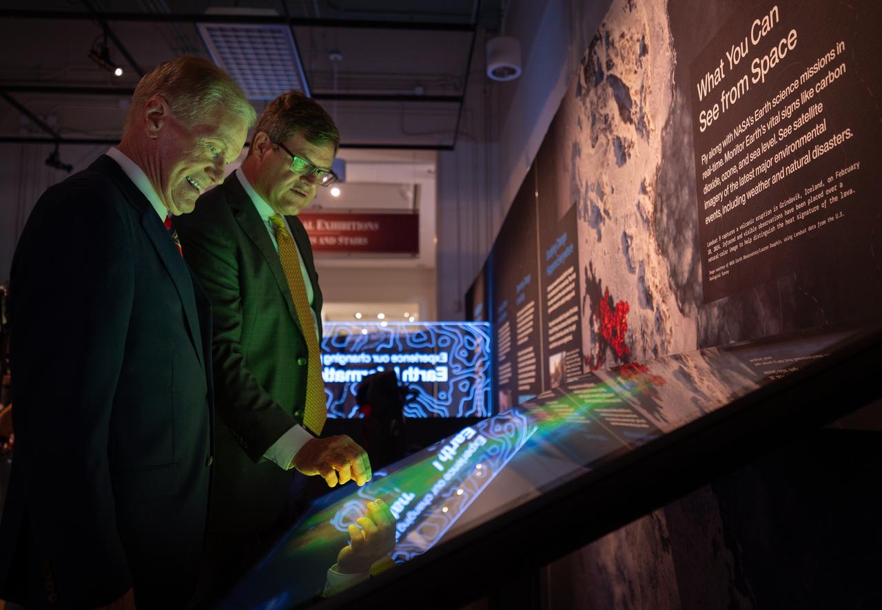
NASA Earth Sciences Division, Deputy Director, Julie Robinson, previews of the Earth Information Center at the Smithsonian National Museum of Natural History, in Washington, Monday, Oct. 7, 2024. The exhibit includes a video wall displaying Earth science data visualizations and videos, an interpretive panel showing Earth’s connected systems, information on our changing world, and an overview of how NASA and the Smithsonian study our home planet. Photo Credit: (NASA/Bill Ingalls)
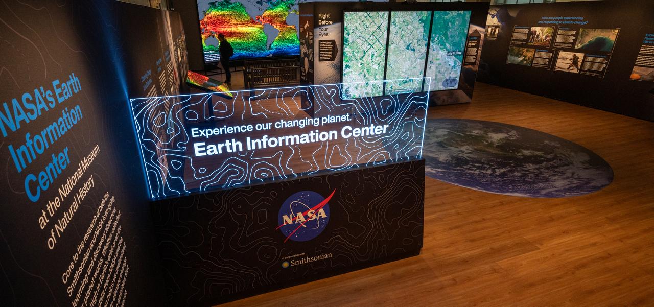
The Earth Information Center at the Smithsonian National Museum of Natural History, in Washington, is previewed, Monday, Oct. 7, 2024. The exhibit includes a video wall displaying Earth science data visualizations and videos, an interpretive panel showing Earth’s connected systems, information on our changing world, and an overview of how NASA and the Smithsonian study our home planet. Photo Credit: (NASA/Bill Ingalls)
NASA Administrator Bill Nelson, left, talks with Smithsonian Museum of Natural History, Sant Director, Kirk Johnson, during a preview of the Earth Information Center at the Smithsonian National Museum of Natural History, in Washington, Monday, Oct. 7, 2024. The exhibit includes a video wall displaying Earth science data visualizations and videos, an interpretive panel showing Earth’s connected systems, information on our changing world, and an overview of how NASA and the Smithsonian study our home planet. Photo Credit: (NASA/Bill Ingalls)
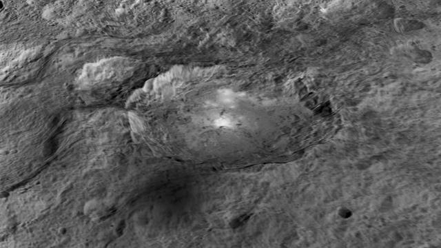
The intriguing brightest spots on Ceres lie in a crater named Occator, which is about 60 miles (90 kilometers) across and 2 miles (4 kilometers) deep. This image comes from an animation, shown in PIA19619, generated using data from NASA's Dawn spacecraft. Vertical relief has been exaggerated by a factor of five. Exaggerating the relief helps scientists understand and visualize the topography much more easily, and highlights features that are sometimes subtle. http://photojournal.jpl.nasa.gov/catalog/PIA19617
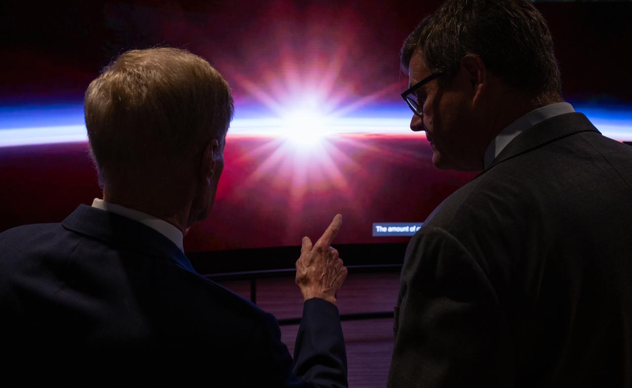
NASA Administrator Bill Nelson, left, and Smithsonian Museum of Natural History, Sant Director, Kirk Johnson, preview the Earth Information Center at the Smithsonian National Museum of Natural History, in Washington, Monday, Oct. 7, 2024. The exhibit includes a video wall displaying Earth science data visualizations and videos, an interpretive panel showing Earth’s connected systems, information on our changing world, and an overview of how NASA and the Smithsonian study our home planet. Photo Credit: (NASA/Bill Ingalls)
NASA Administrator Bill Nelson, left, and Smithsonian Museum of Natural History, Sant Director, Kirk Johnson, preview the Earth Information Center at the Smithsonian National Museum of Natural History, in Washington, Monday, Oct. 7, 2024. The exhibit includes a video wall displaying Earth science data visualizations and videos, an interpretive panel showing Earth’s connected systems, information on our changing world, and an overview of how NASA and the Smithsonian study our home planet. Photo Credit: (NASA/Bill Ingalls)
Smithsonian Museum of Natural History, Sant Director, Kirk Johnson, left, talks with NASA Administrator Bill Nelson, during a preview of the Earth Information Center at the Smithsonian National Museum of Natural History, in Washington, Monday, Oct. 7, 2024. The exhibit includes a video wall displaying Earth science data visualizations and videos, an interpretive panel showing Earth’s connected systems, information on our changing world, and an overview of how NASA and the Smithsonian study our home planet. Photo Credit: (NASA/Bill Ingalls)