NextSafe 2.5 Motion Simulation Experiment Crew evaluation of vision system technologies
NextSafe 2.5 Motion Simulation Experiment Crew evaluation of vision system technologies
NextSafe 2.5 Motion Simulation Experiment Crew evaluation of vision system technologies
NextSafe 2.5 Motion Simulation Experiment Crew evaluation of vision system technologies

NextSafe 2.5 Motion Simulation Experiment Crew evaluation of vision system technologies

NextSafe 2.5 Motion Simulation Experiment Crew evaluation of vision system technologies

NextSafe 2.5 Motion Simulation Experiment Crew evaluation of vision system technologies

NextSafe 2.5 Motion Simulation Experiment Crew evaluation of vision system technologies

NextSafe 2.5 Motion Simulation Experiment Crew evaluation of vision system technologies
NextSafe 2.5 Motion Simulation Experiment Crew evaluation of vision system technologies
NextSafe 2.5 Motion Simulation Experiment Crew evaluation of vision system technologies

The NASA imaging processing technology, an advanced computer technique to enhance images sent to Earth in digital form by distant spacecraft, helped develop a new vision screening process. The Ocular Vision Screening system, an important step in preventing vision impairment, is a portable device designed especially to detect eye problems in children through the analysis of retinal reflexes.
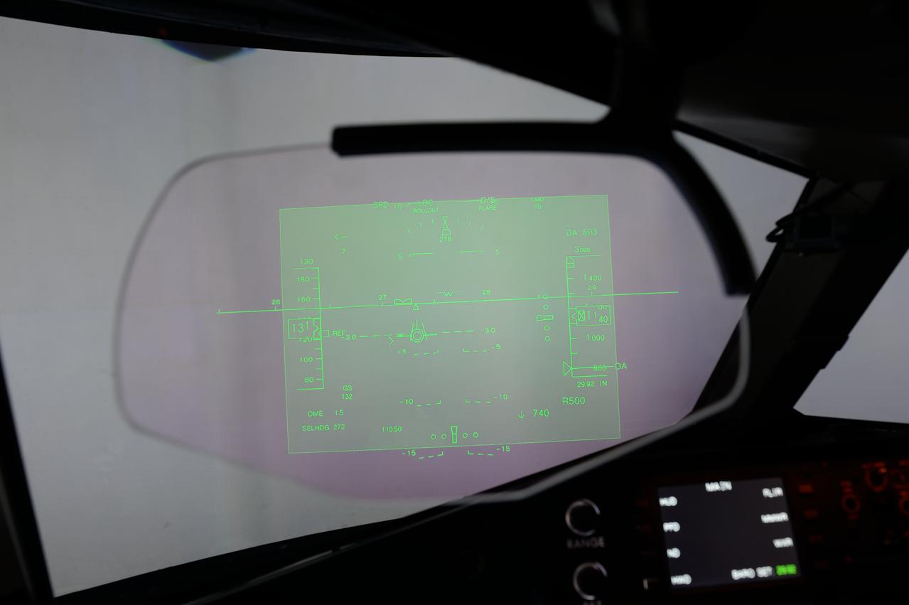
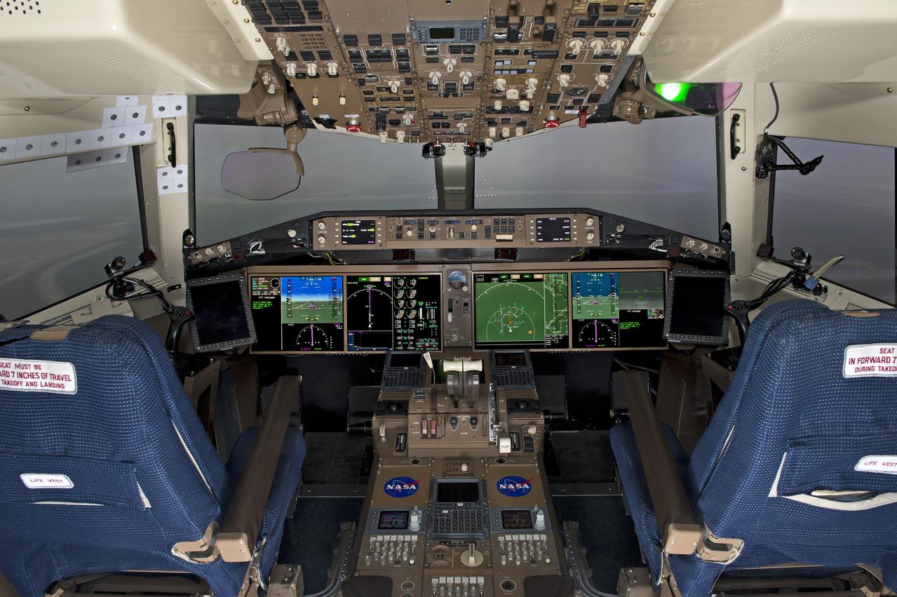
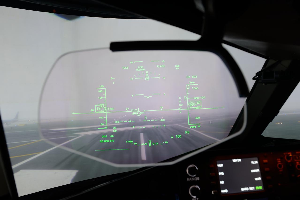
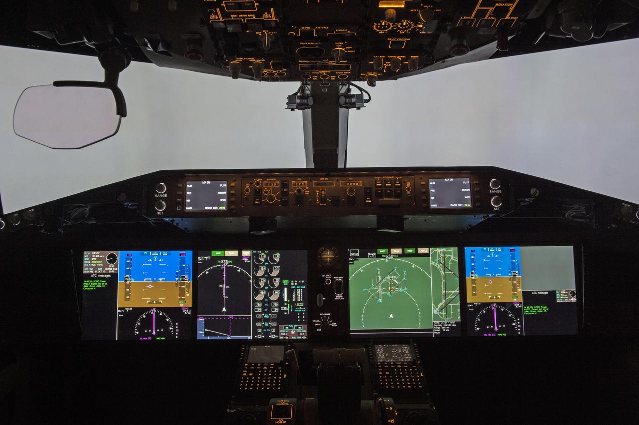
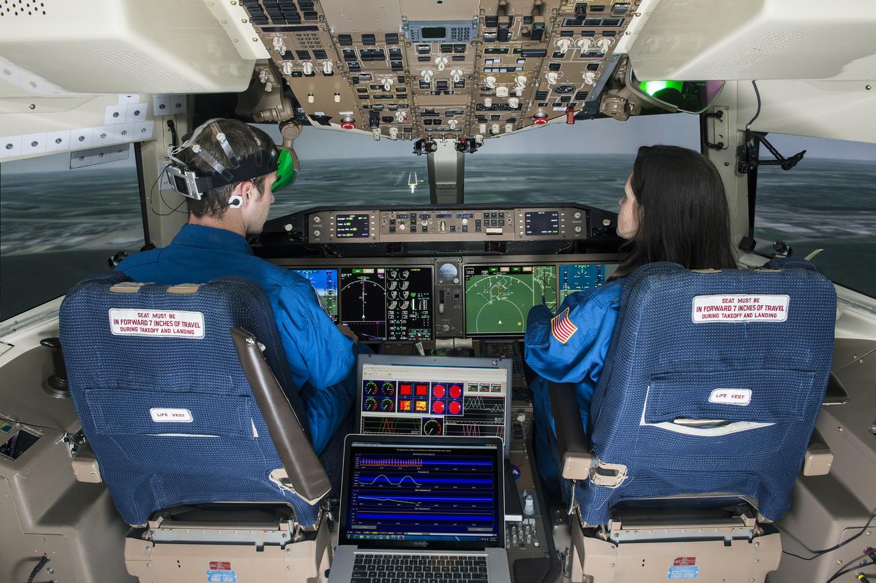
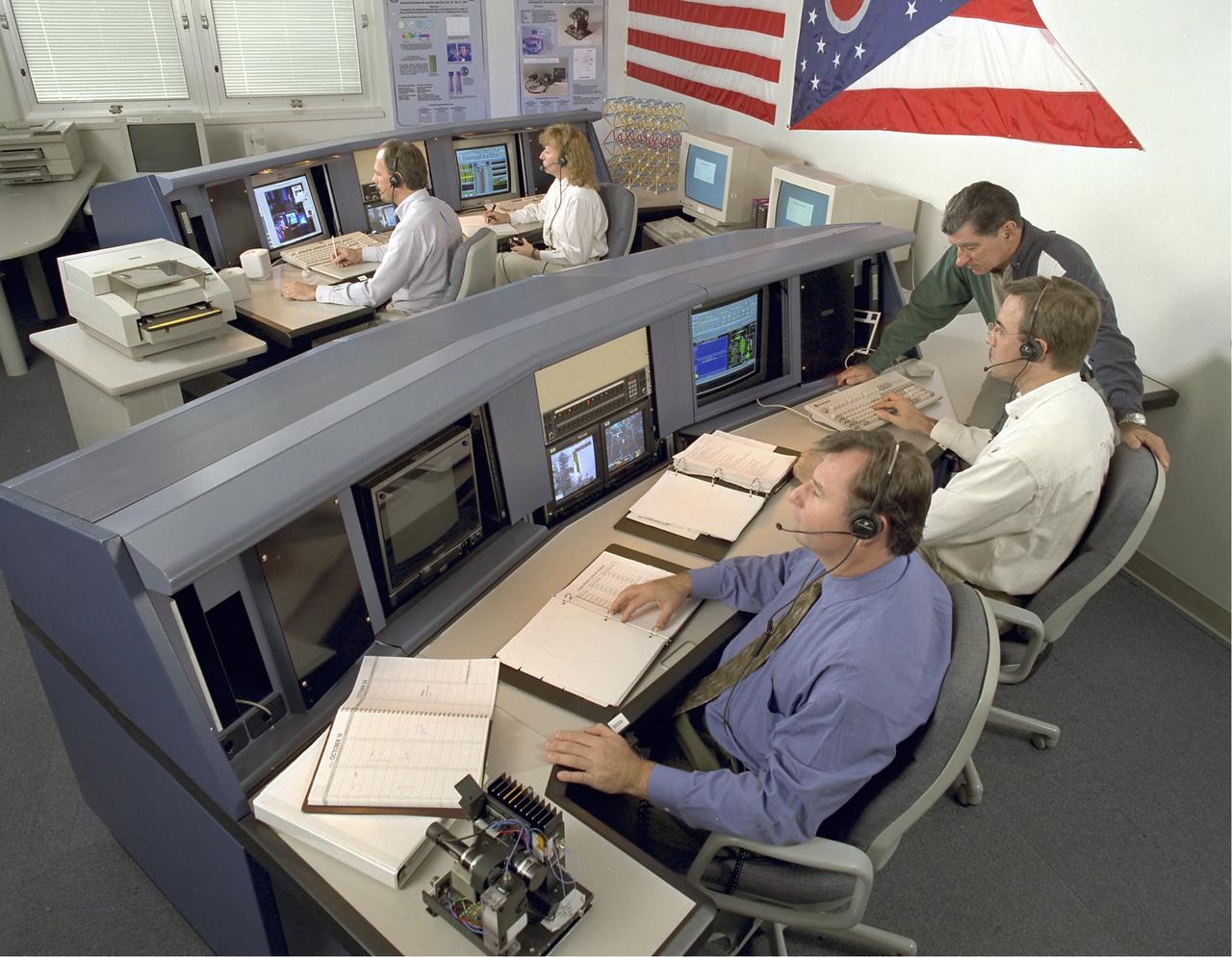
(left to right) NASA Langley aerospace engineer Bruce Jackson briefs astronauts Rex Walheim and Gregory Johnson about the Synthetic Vision (SV) and Enhanced Vision (EV) systems in a flight simulator at the center's Cockpit Motion Facility. The astronauts were training to land the Dream Chaser spacecraft May 15th 2013. credit NASA/David C. Bowman
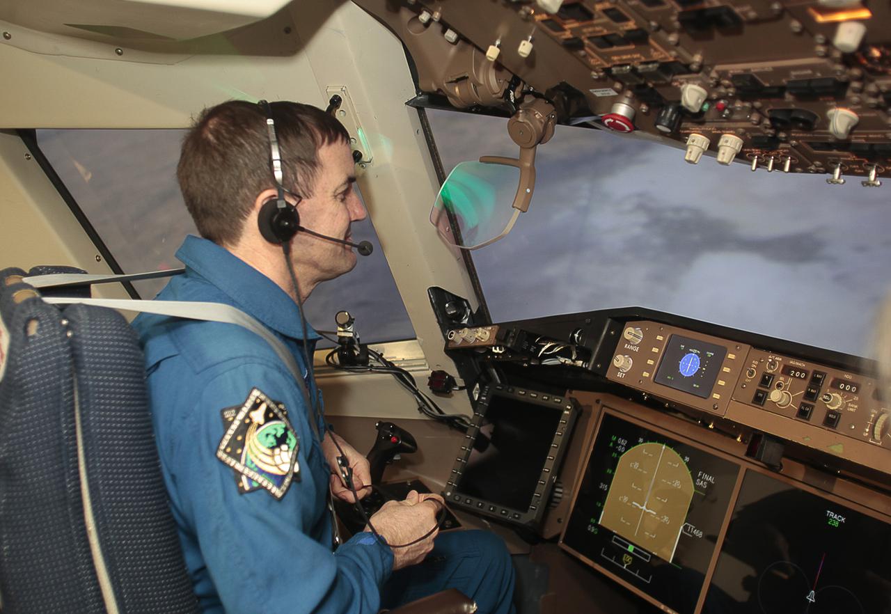
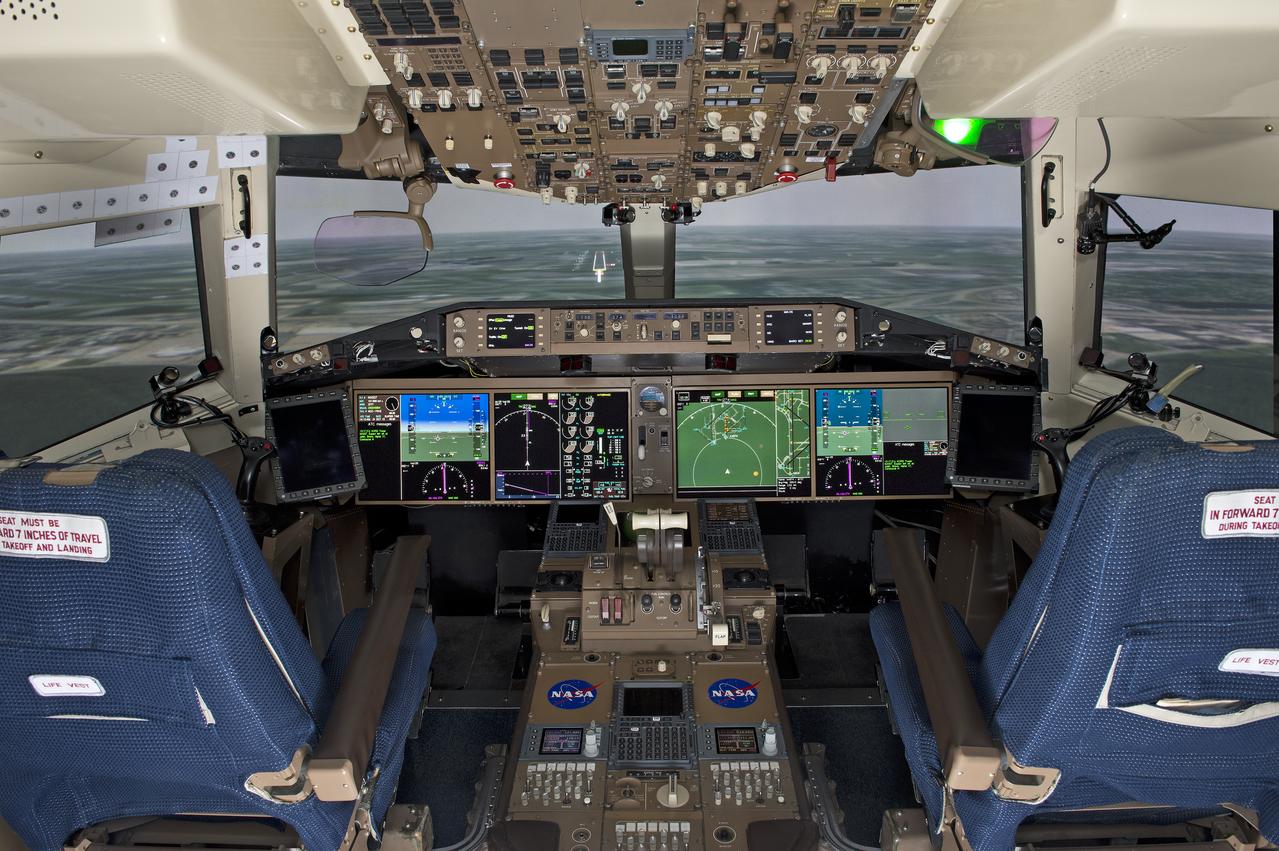
HAMPTON, Va. – At NASA's Langley Research Center in Hampton, Va., astronaut Rex Walheim flies simulations of a Dream Chaser approach and landing to help evaluate the spacecraft's subsonic handling in support of the agency's Commercial Crew Program, or CCP, efforts. The simulation makes use of the Synthetic Vision and Enhanced Vision systems in the center's Cockpit Motion Facility. SNC is one of three companies working with CCP during the agency's Commercial Crew Integrated Capability, or CCiCap, initiative, which is intended to lead to the availability of commercial human spaceflight services for government and commercial customers. To learn more about CCP and its industry partners, visit www.nasa.gov_commercialcrew. Image credit: NASA_David C. Bowman

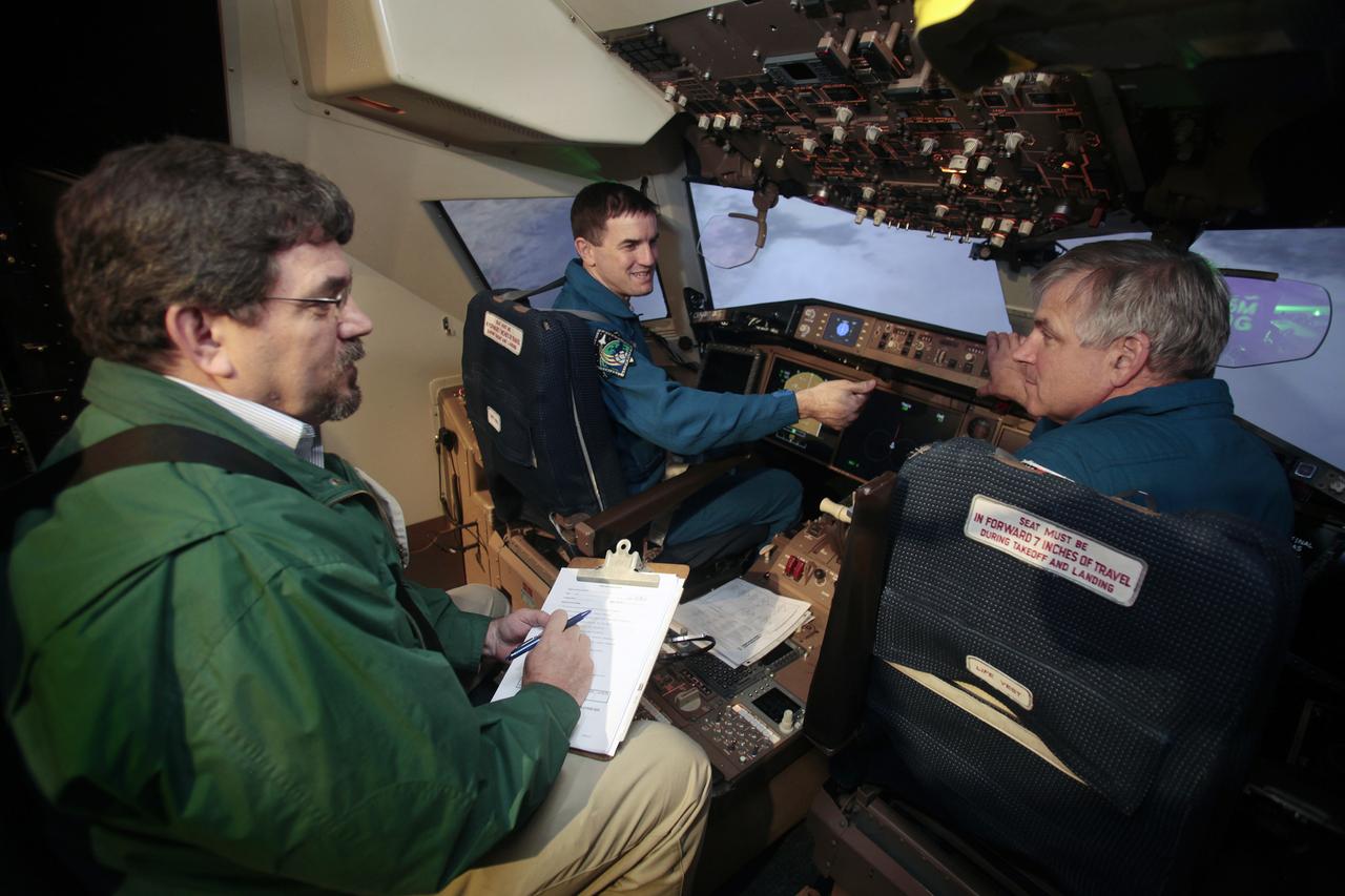
HAMPTON, Va. – Bruce Jackson, an aerospace engineer at NASA’s Langley Flight Research Center, briefs astronauts Rex Walheim, left, and Gregory Johnson as they evaluate Sierra Nevada Corporation, or SNC, Space Systems' Dream Chaser landing simulation, in support of NASA Commercial Crew Program, or CCP, efforts. The simulation makes use of the Synthetic Vision and Enhanced Vision systems in the center's Cockpit Motion Facility. SNC is one of three companies working with CCP during the agency's Commercial Crew Integrated Capability, or CCiCap, initiative, which is intended to lead to the availability of commercial human spaceflight services for government and commercial customers. To learn more about CCP and its industry partners, visit www.nasa.gov/commercialcrew. Image credit: NASA/David C. Bowman
The Glenn Research Center (GRC) Telescience Support Center (TSC) is a NASA telescience ground facility that provides the capability to execute ground support operations of on-orbit International Space Station (ISS) and Space Shuttle payloads. This capability is provided with the coordination with the Marshall Space Flight Center (MSFC) Huntsville Operations Support Center (HOSC), the Johnson Space Center (JSC) Mission Control Center in Houston (MCC-H) and other remote ground control facilities. The concept of telescience is a result of NASA's vision to provide worldwide distributed ISS ground operations that will enable payload developers and scientists to control and monitor their on-board payloads from any location -- not necessarily a NASA site. This concept enhances the quality of scientific and technological data while decreasing operation costs of long-term support activities by providing ground operation services to a Principal Investigator and Engineering Team at their home site. The TSC acts as a hub in which users can either locate their operations staff within the walls of the TSC or request the TSC operation capabilities be extended to a location more convenient such as a university.
There have been several proposals to send people to Mars but not land them on the surface. Instead, they would either fly by Mars once and return to Earth, or orbit Mars for a period of time. Would they at least get spectacular naked-eye views of the Martian surface? Some parts of Mars would be interesting: for example the polar ice caps, and the bright (dust-covered) regions would be seen reasonably well, although the color is very uniform. The dark (low reflectance) regions of Mars are some of the most interesting and important regions studied by our orbiters and rovers, but they would appear very bland to humans outside of the planet's atmosphere. This is because the thin atmosphere of Mars is quite bright and dusty, so when looking at dark surface areas, most of what you would see is scattered light from the atmospheric dust, and the surface would have a very low contrast. It would also appear reddish, even if the surface materials are not reddish, from the scattered light. Here is an example from the Nili Patera region of Mars, a candidate future landing site. At the top is an approximation of the natural color as seen by people with normal color vision -- almost no surface detail is visible. In the middle is the standard HiRISE IRB color product, consisting of the infrared, red, and blue-green images displayed as red, green, and blue, respectively, and with a min-max stretch applied to each color. In other words, the darkest pixel in the entire image is set to black, the brightest pixel is set to white, and all others are linearly interpolated. At bottom is an enhanced color product, in which each bandpass is given a linear stretch for the local subimage, sometimes saturating a small percentage of data to black or white to give the rest of the scene more contrast, followed by color saturation enhancement. Now we can see a diversity of colors that distinguish different surface units: dust, sand, and rocks with different minerals. http://photojournal.jpl.nasa.gov/catalog/PIA21040

This collage shows some of the most interesting geological sites that NASA's Dawn spacecraft has revealed at dwarf planet Ceres. Images were acquired with the spacecraft's framing camera during various phases of the mission: Survey orbit at a distance of about 2,700 miles (4,400 kilometers); high-altitude mapping orbit (HAMO) at a distance of 915 miles (1,470 kilometers) from Ceres; and low-altitude mapping orbit (LAMO) at an altitude of 240 miles (385 kilometers). In the first row, from left to right: Ceres in shown in false color, roughly centered on Occator Crater, home of the brightest area on Ceres. This picture combines color images obtained by Dawn in its survey orbit. Red corresponds to a wavelength range around 980 nanometers (near infrared), green to a wavelength range around 750 nanometers (red, visible light) and blue to a wavelength range of around 430 nanometers (blue, visible light). This picture illustrates the diversity of terrains on Ceres where the bluish material points to recently emplaced material and the brownish background material is associated with older terrains. Juling Crater (12 miles, 20 kilometers in diameter) as seen in LAMO. Central coordinates are 36 degrees south latitude, 168 degrees east longitude. It is named after the Sakai/Orang Asli (Malaysia) spirit of the crops. This crater displays evidence for the presence of ice -- for example, in the form of a large flow feature seen at the top of the image. Oxo Crater (6 miles, 10 kilometers in diameter) as seen in LAMO. Center coordinates are 42 degrees north latitude, 0 degrees east longitude. It is named after the god of agriculture in Afro-Brazilian beliefs of Yoruba derivation. Oxo hosts the first site at which Dawn detected ice on Ceres, exposed by a landslide. Ahuna Mons is not only a volcano, but also the tallest mountain on Ceres. It is about 2.5 miles (4 kilometers) high and 11 miles (17 kilometers) wide. Center coordinates are 10 degrees south latitude, 316 degrees east longitude. This view combines images obtained in LAMO in blue (430 nanometers), green (750 nanometers) and infrared (980 nanometers) color filters. Ahuna is named after the Sumi tribe (Nagaland, northeastern India) traditional post-harvest thanksgiving festival. Second Row Occator Crater (57 miles, 92 kilometers across) is seen in LAMO images. Center coordinates are 20 degrees north latitude, 239 degrees east longitude. Named after the Roman agricultural deity of the harrowing. This image shows a "Type I" flow feature with a thick "toe" typical of rock glaciers and icy landslides on Earth as viewed in LAMO. The flow feature, found in Ghanan Crater (77 degrees north latitude, 31 degrees east longitude), is one of the most voluminous on Ceres. Enhanced color view of Haulani Crater (21 miles, 34 kilometers in diameter) in color observed in HAMO. Central coordinates: 6 degrees north latitude, 11 degrees east longitude. Named after the Hawaiian plant goddess. Kokopelli Crater (21 miles, 34 kilometers in diameter) seen in LAMO. Central coordinates: 18 degrees north latitude, 125 degrees east longitude. Named after the Pueblo (SW USA) fertility deity, who presides over agriculture. This crater displays a nice arrangement of scarps that likely formed when the crater partly collapsed during its formation. Third Row Central region of Occator Crater, called Cerealia Facula, seen in color. The facula -- or "bright spot" -- is about 9 miles (14 kilometers) in diameter. Center coordinates: 20 N, 240 E. Cerealia refers to the major festival in Ancient Rome that celebrates the grain goddess Ceres (8 days in mid- to late April). The view was produced by combining the highest resolution images of Occator obtained in LAMO (at image scales of 35 meters, or 115 feet, per pixel) with color images obtained in HAMO (at image scales of 135 meters, or about 440 feet, per pixel). The three images used to produce the color were taken using filters centered at 430, 750 and 980 nanometers (the last being slightly beyond the range of human vision, in the near-infrared). North part of Nar Sulcus seen in LAMO. The full feature is about 39 miles (63 km) in length and is located around 42 degrees south latitude, 280 degrees east longitude. Nar is a Azerbaijani festival of pomegranate harvest held in October-November in Goychay city, center of pomegranate cultivation in Azerbaijan. A sulcus is a set of parallel furrows or ridges. Ikapati Crater (31 miles, 50 kilometers in diameter) seen in LAMO. Central coordinates: 34 degrees north latitude, 46 degrees east longitude. Ikapati is named after the Philippine goddess of the cultivated lands. The crater has a smooth floor, probably because heat from the impact that formed Ikapati caused ice in the ground to melt, and then refreeze. This view of Ceres, taken in LAMO, shows an area located at approximately 86 degrees south longitude, 177 degrees east longitude. This part of Ceres, near the south pole, has such long shadows because, from the perspective of this location, the sun is near the horizon. At the time this image was taken, the sun was 4 degrees north of the equator. If you were standing this close to Ceres' south pole, the sun would never get high in the sky during the course of a nine-hour Cerean day. https://photojournal.jpl.nasa.gov/catalog/PIA22090