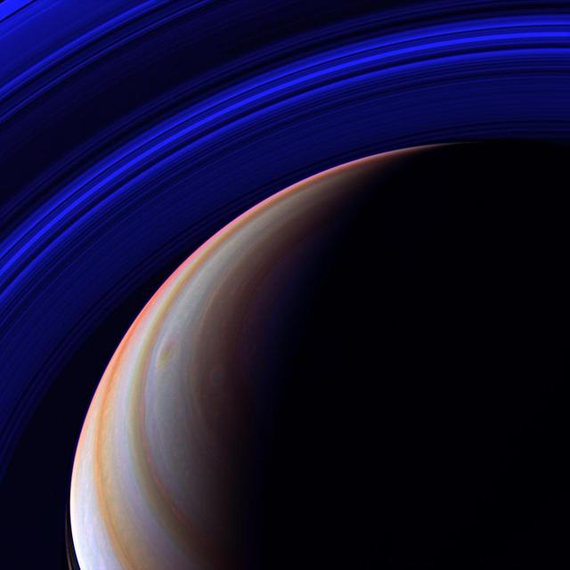
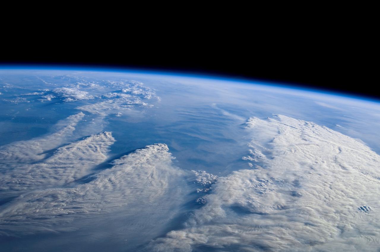
Blue Expanse

Expanse of Ice

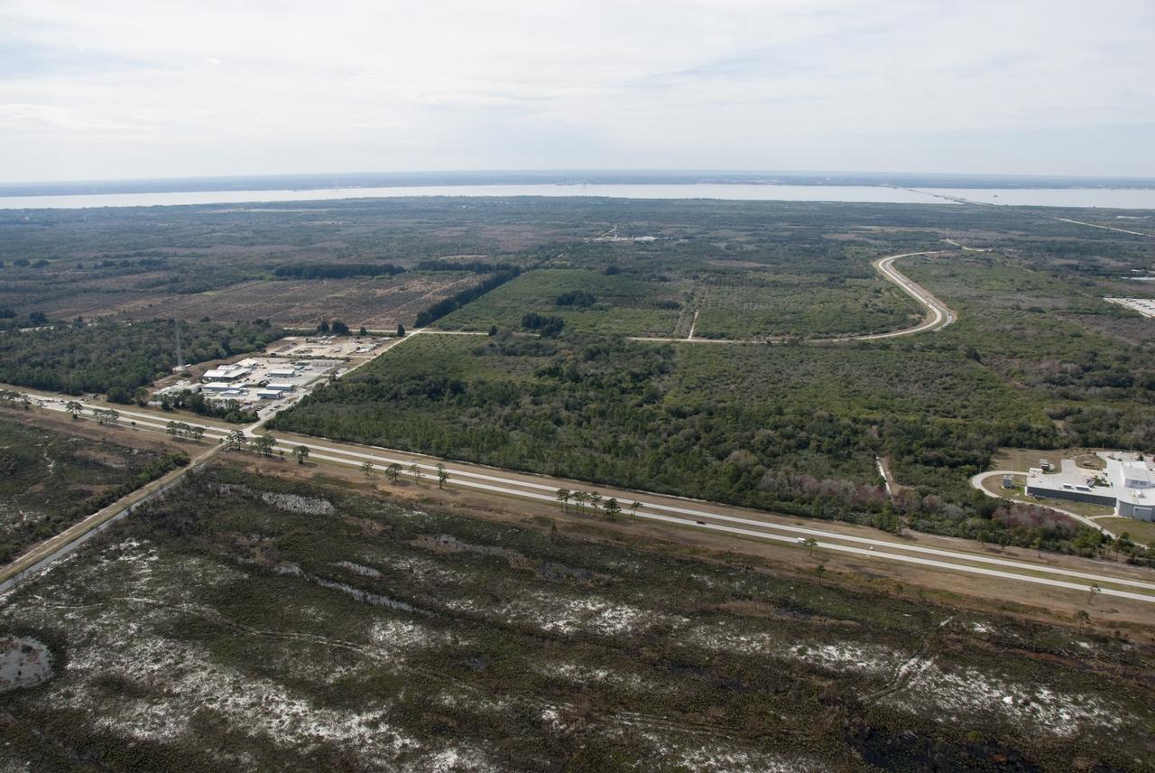
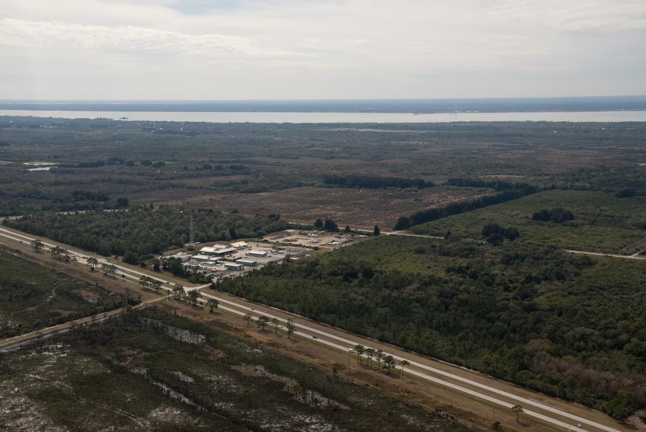
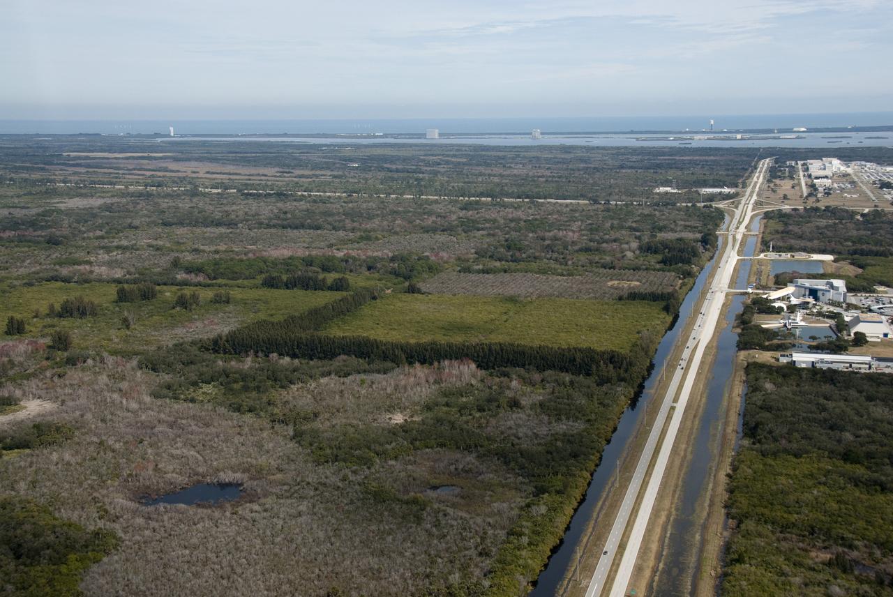
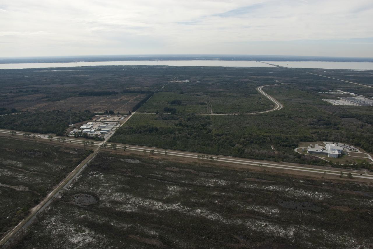
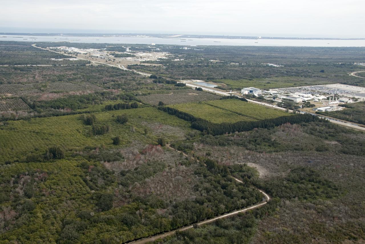
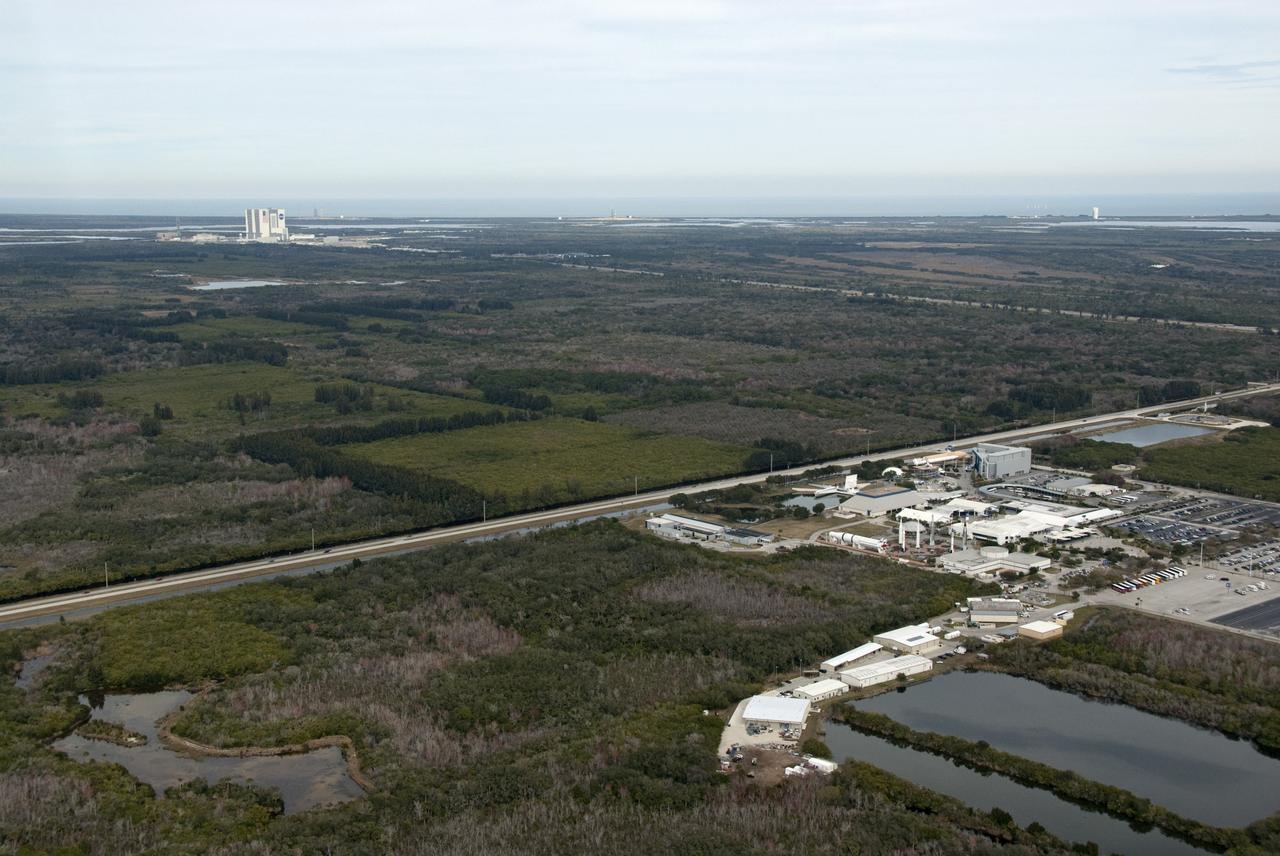
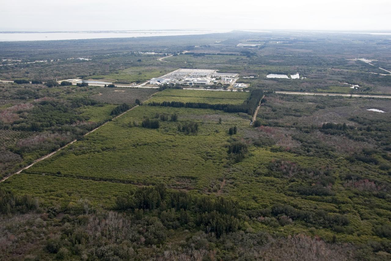
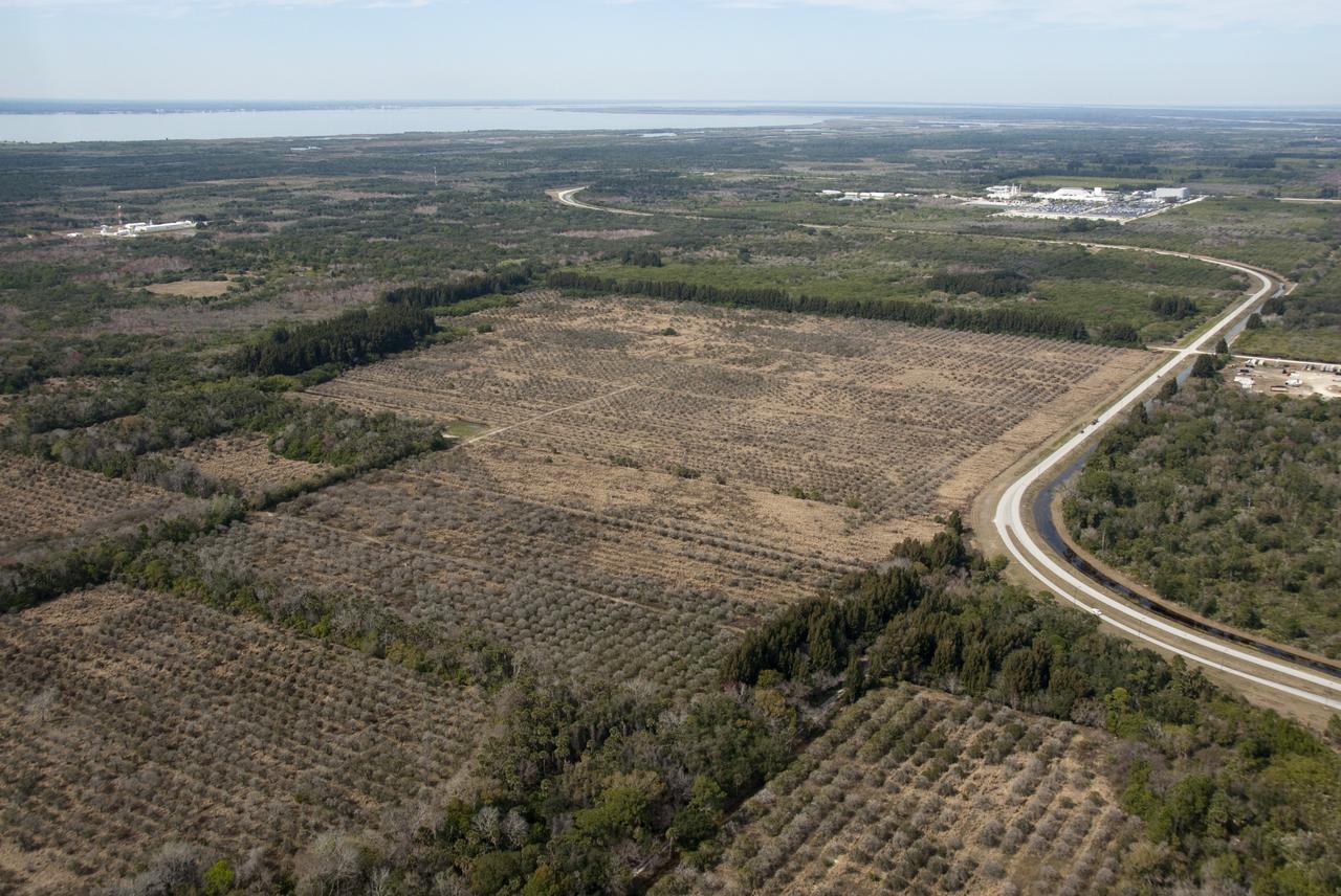
A view of the entrance to SpaceX’s Roberts Road off of State Road 3 at NASA’s Kennedy Space Center in Florida on April 21, 2023. The company wishes to extend the road to allow for expansion of its current facilities. An environmental impact study is underway to investigate the feasibility of the campus expansion.

A view of the entrance to SpaceX’s Roberts Road off of State Road 3 at NASA’s Kennedy Space Center in Florida on April 21, 2023. The company wishes to extend the road to allow for expansion of its current facilities. An environmental impact study is underway to investigate the feasibility of the campus expansion.
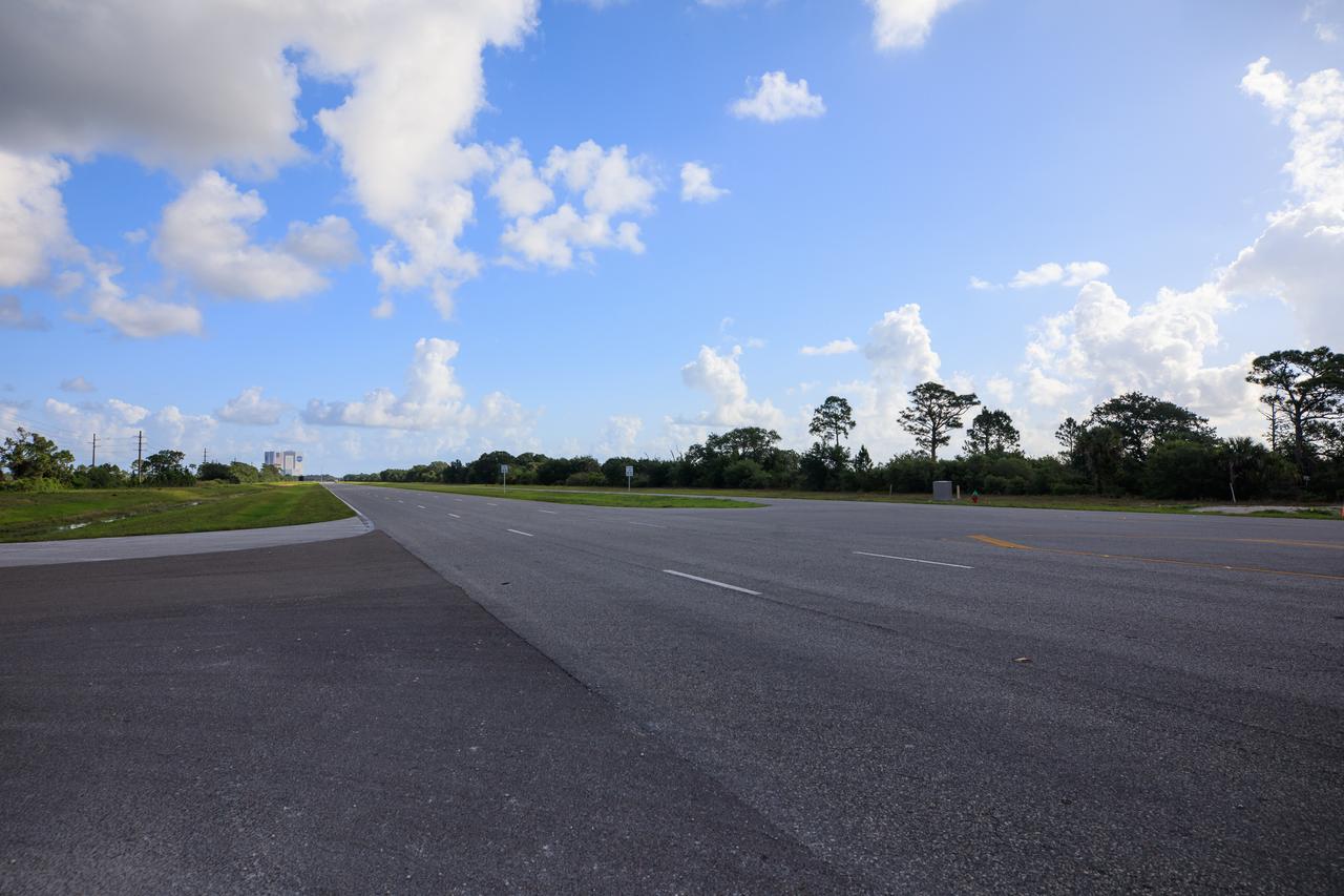
A view of the entrance to SpaceX’s Roberts Road off of State Road 3 at NASA’s Kennedy Space Center in Florida on April 21, 2023. The company wishes to extend the road to allow for expansion of its current facilities. An environmental impact study is underway to investigate the feasibility of the campus expansion.
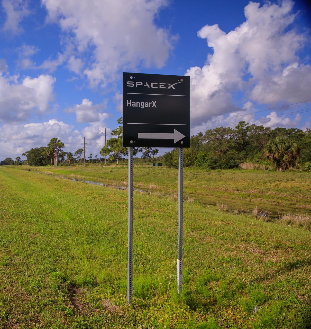
A sign marks the entrance to SpaceX’s Roberts Road off of State Road 3 at NASA’s Kennedy Space Center in Florida on April 21, 2023. The company wishes to extend the road to allow for expansion of its current facilities. An environmental impact study is underway to investigate the feasibility of the campus expansion.
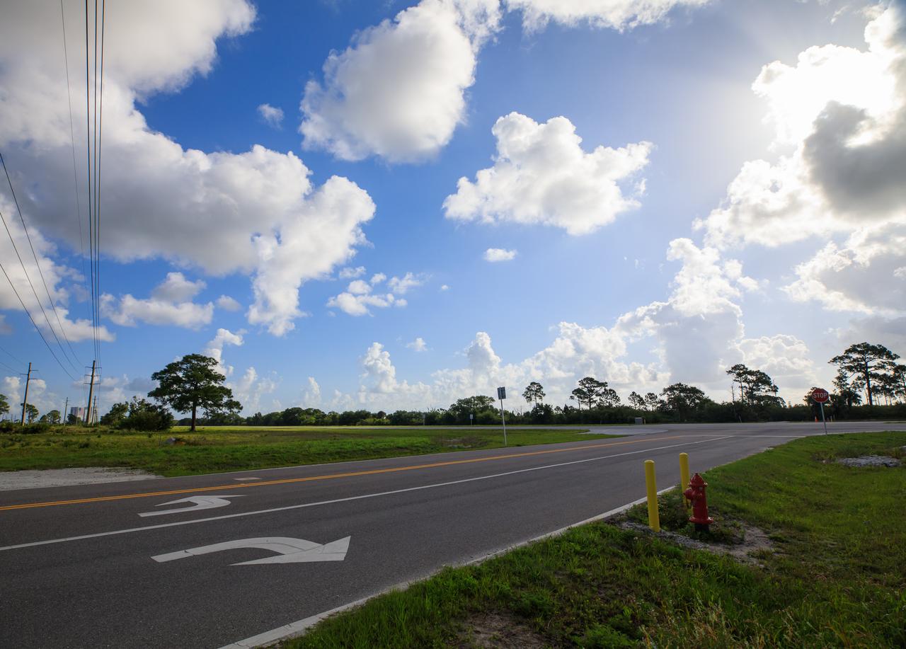
A view of the entrance to SpaceX’s Roberts Road off of State Road 3 at NASA’s Kennedy Space Center in Florida on April 21, 2023. The company wishes to extend the road to allow for expansion of its current facilities. An environmental impact study is underway to investigate the feasibility of the campus expansion.
Mercury Vast Expanses of Smooth Plains
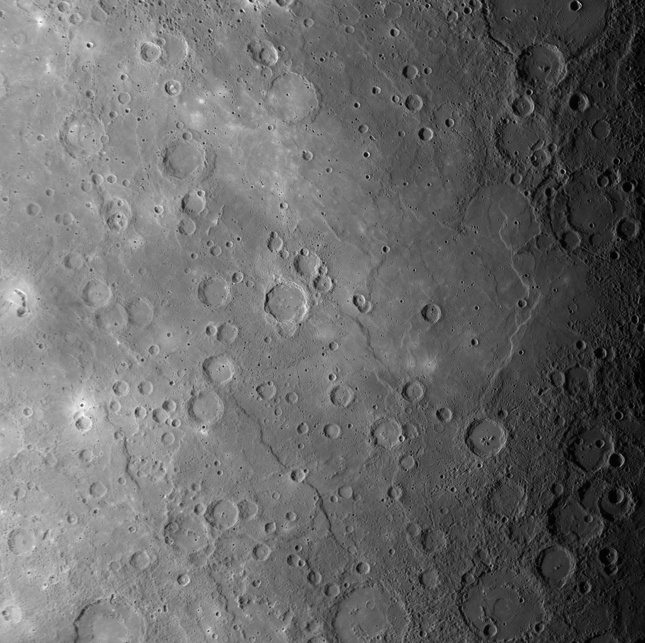
Mercury northern region is dominated by expansive smooth plains, created by huge amounts of volcanic material flooding across Mercury surface in the past, as seen by NASA MESSENGER spacecraft. The volcanic lava flows buried craters, leaving only traces of their rims visible. Such craters are called ghost craters, and there are many visible in this image, including a large one near the center. Wrinkle ridges cross this scene and small troughs are visible regionally within ghost craters, formed as a result of the lava cooling. The northern plains are often described as smooth since their surface has fewer impact craters and thus has been less battered by such events. This indicates that these volcanic plains are younger than Mercury's rougher surfaces. Instrument: Mercury Dual Imaging System (MDIS) Center Latitude: 60.31° N Center Longitude: 36.87° E Scale: The large ghost crater at the center of the image is approximately 103 kilometers (64 miles) in diameter http://photojournal.jpl.nasa.gov/catalog/PIA19415
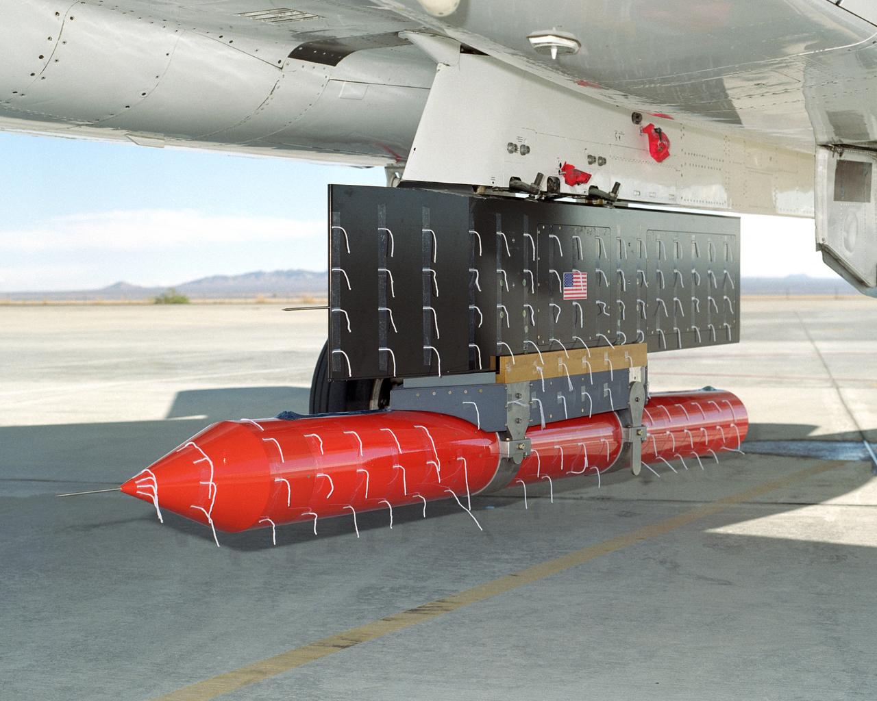
NASA Dryden's new in-house designed Propulsion Flight Test Fixture (PFTF), carried on an F-15B's centerline attachment point, underwent flight envelope expansion in order to verify its design and capabilities.
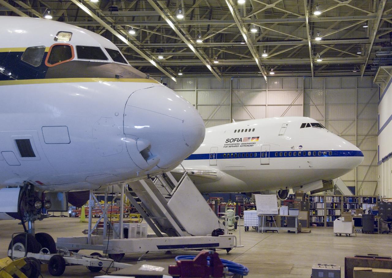
The cavernous expanse of the Dryden Aircraft Operations Facility in Palmdale, Calif., now houses NASA's DC-8 science laboratory and SOFIA infrared observatory.
NASA Cassini spacecraft captures Saturn tiny irregular moon Janus surrounded by the vast, dark expanse of the outer solar system.
This MOC image shows the contact between an area of light-toned rock and an expanse of darker-toned materials on the floor of Coprates Chasma
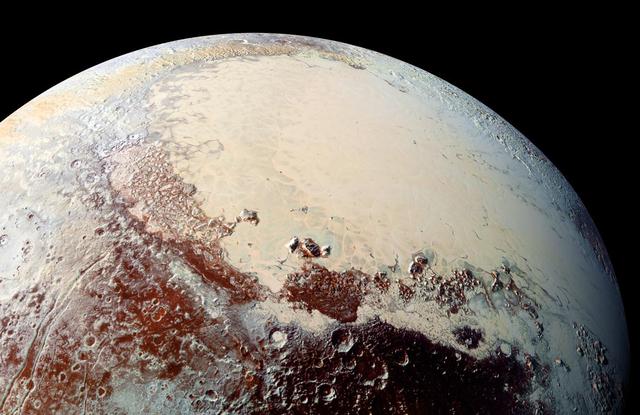
NASA New Horizons spacecraft captured this image of a chain of snow-capped mountains stretching across the dark expanse on Pluto informally named Cthulhu Regio.
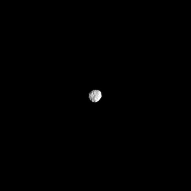
Odysseus Crater, with a size of epic proportions, stretches across a large northern expanse on Saturn moon Tethys in this image taken by NASA Cassini spacecraft.
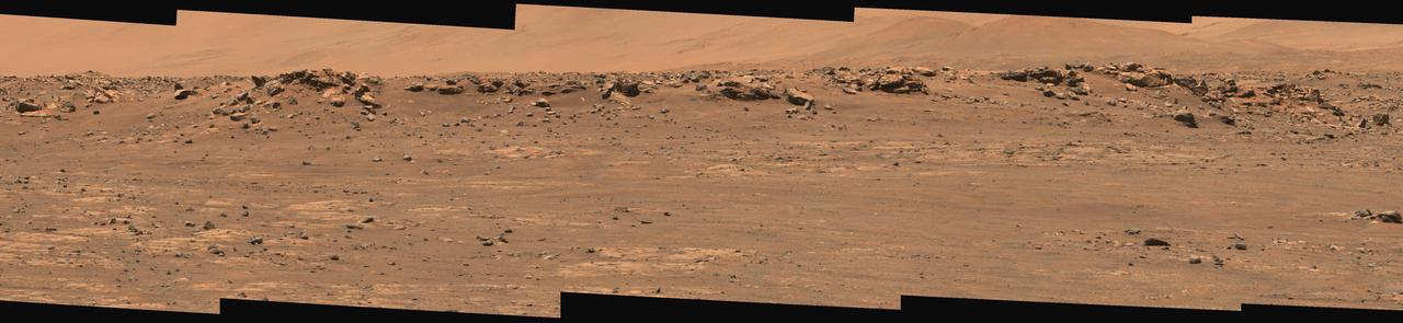
This wide view of Mars' Jezero Crater was taken by NASA's Perseverance rover on July 15, 2021 (the 143rd sol, or Martian day, of its mission). The rover has driven nearly a mile (1.5 kilometers) south of its landing site, "Octavia E. Butler Landing," into a region the team has nicknamed the "Crater Floor Fractured Rough" unit. The stones that appear light-colored and flat in this image are informally referred to as the "paver rocks" and will be the first type from which Perseverance will collect a sample for planned return to Earth by subsequent missions. Small hills to the south of the rover and the sloping inner walls of the Jezero Crater rim fill the distant background of this view. Five images from the rover's Mastcam-Z instrument were calibrated and combined to make this mosaic. Perseverance has been exploring the floor of Jezero since landing on Feb. 18, 2021. The Mastcam-Z investigation is led and operated by Arizona State University in Tempe, working in collaboration with Malin Space Science Systems in San Diego, California, on the design, fabrication, testing, and operation of the cameras, and in collaboration with the Neils Bohr Institute of the University of Copenhagen on the design, fabrication, and testing of the calibration targets. A key objective for Perseverance's mission on Mars is astrobiology, including the search for signs of ancient microbial life. The rover will characterize the planet's geology and past climate, pave the way for human exploration of the Red Planet, and be the first mission to collect and cache Martian rock and regolith. The Mars 2020 Perseverance mission is part of NASA's Moon to Mars exploration approach, which includes Artemis missions to the Moon that will help prepare for human exploration of the Red Planet. Subsequent NASA missions, in cooperation with ESA (European Space Agency), would send spacecraft to Mars to collect these sealed samples from the surface and return them to Earth for in-depth analysis. https://photojournal.jpl.nasa.gov/catalog/PIA24745
NASA Spitzer Space Telescope was able to show that a tandard candle used to measure cosmological distances is shrinking, a finding that affects precise measurements of the age, size and expansion rate of our universe.
This shaded relief view from NASA New Horizons of the region surrounding the left side of Pluto heart-shaped feature, informally named Sputnik Planum, shows that the vast expanse of its icy surface.
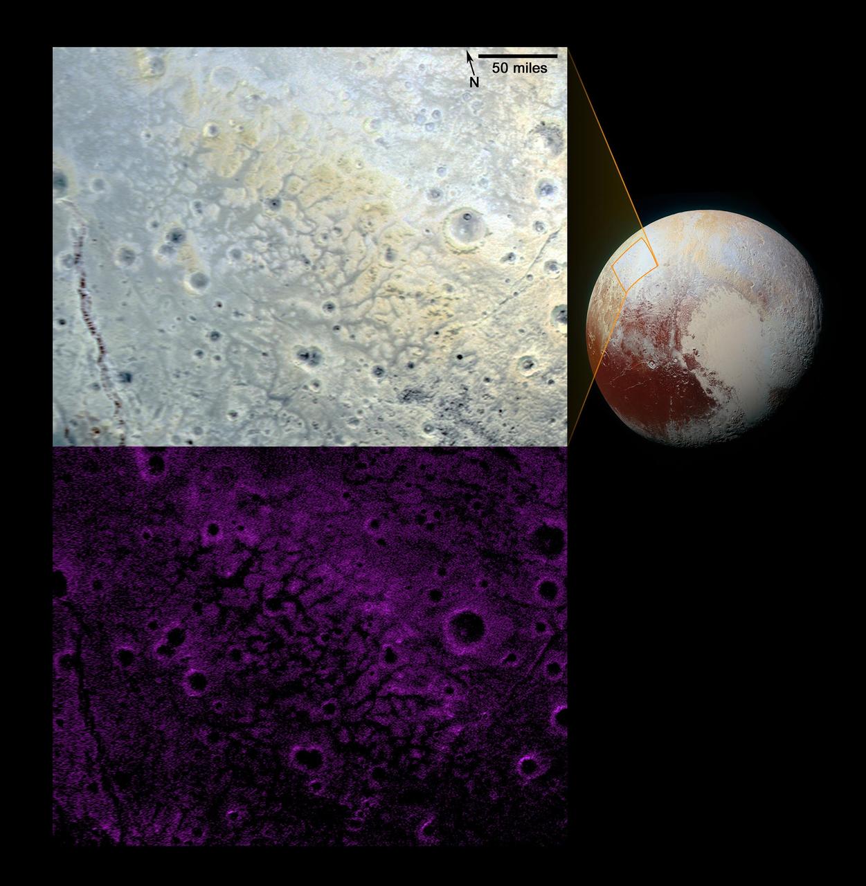
NASA New Horizons scientists have spotted an expanse of terrain they describe as fretted bright plains divided into polygon-shaped blocks by a network of dark, connected valleys in Pluto informally named Venera Terra region.
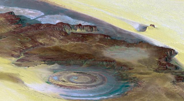
This prominent circular feature, known as the Richat Structure, in the Sahara desert of Mauritania is often noted by astronauts because it forms a conspicuous bull-eye on the otherwise rather featureless expanse of the desert.
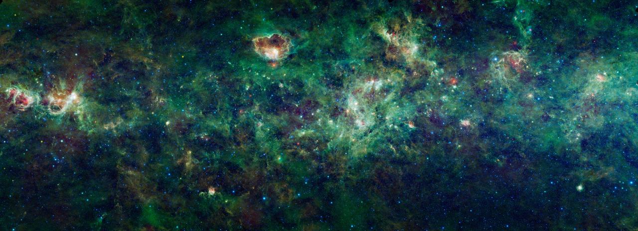
This enormous section of the Milky Way galaxy is a mosaic of images from NASA Wide-field Infrared Survey Explorer. The constellations Cassiopeia and Cepheus are featured in this 1,000-square degree expanse.
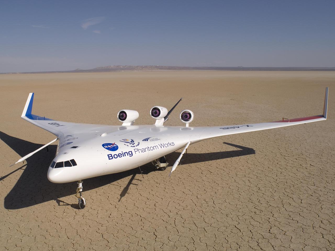
Boeing's sub-scale X-48B Blended Wing Body technology demonstrator showed off its unique lines on the vast expanse of Rogers Dry Lake adjacent to NASA Dryden.
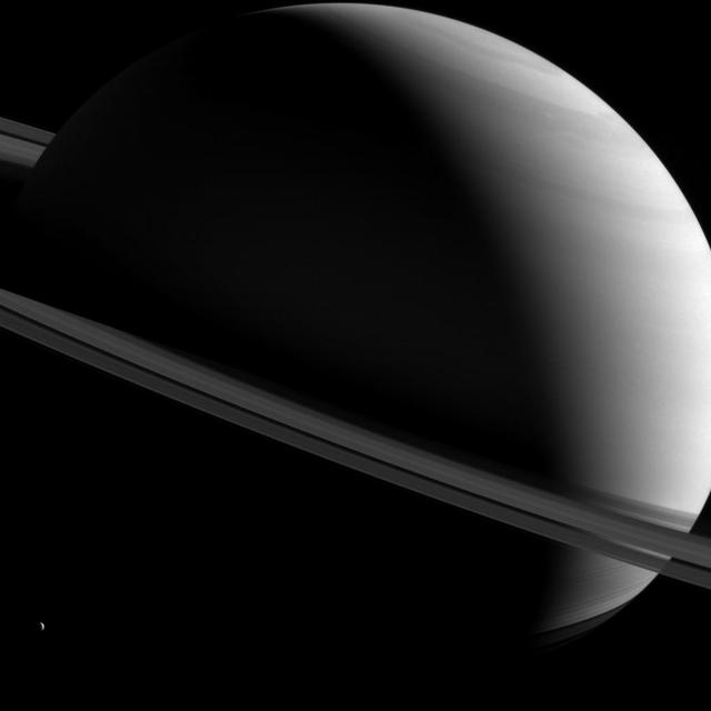
NASA Cassini spacecraft captured this image of Saturn as it views the planet and its expansive rings from all sorts of angles. Here, a half-lit Saturn sits askew as tiny Dione looks on from lower left.
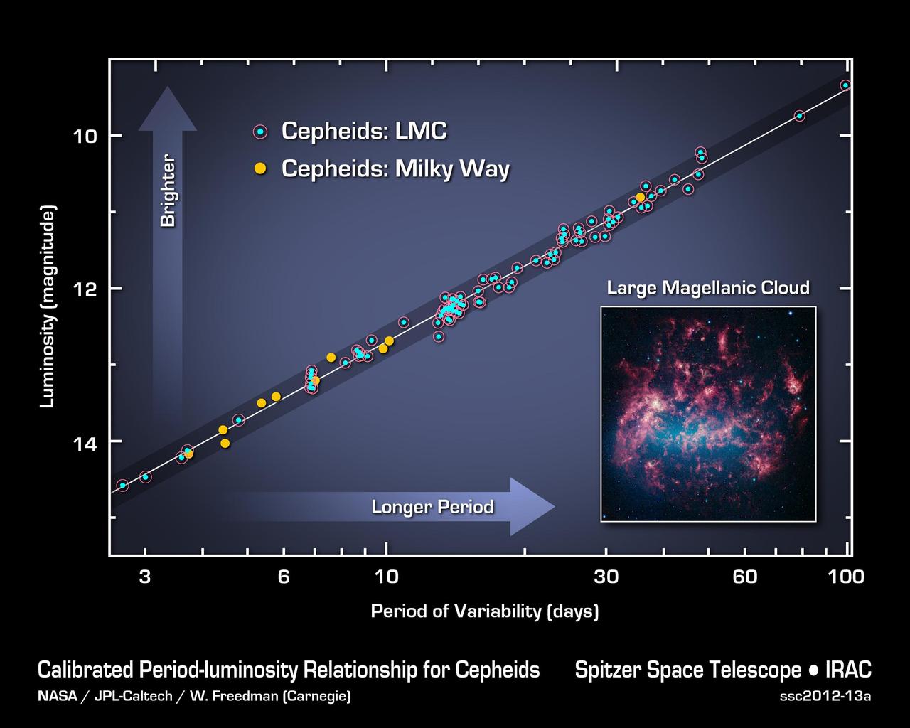
This graph illustrates the Cepheid period-luminosity relationship, used to calculate the size, age and expansion rate of the universe. The data shown are from NASA Spitzer Space Telescope which has made the most precise measurements yet.
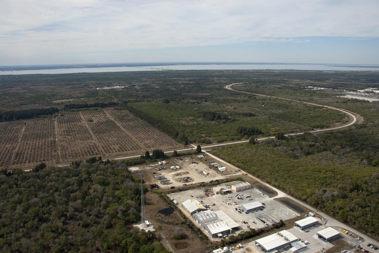
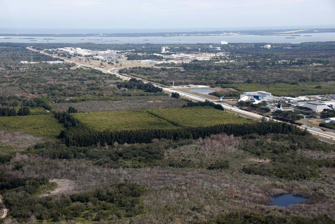
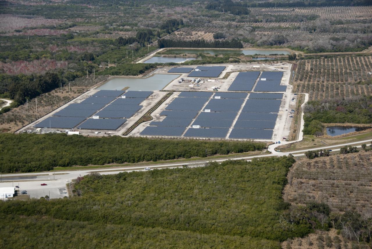
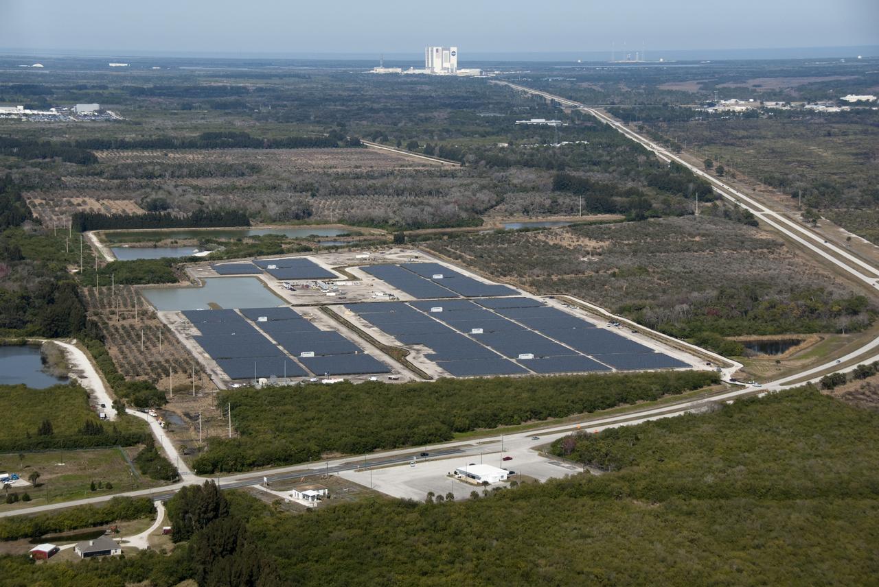
AERIALS - SR3 SOLAR FACILITY & NEW EXPANSION SITE, EXLORATION PARK
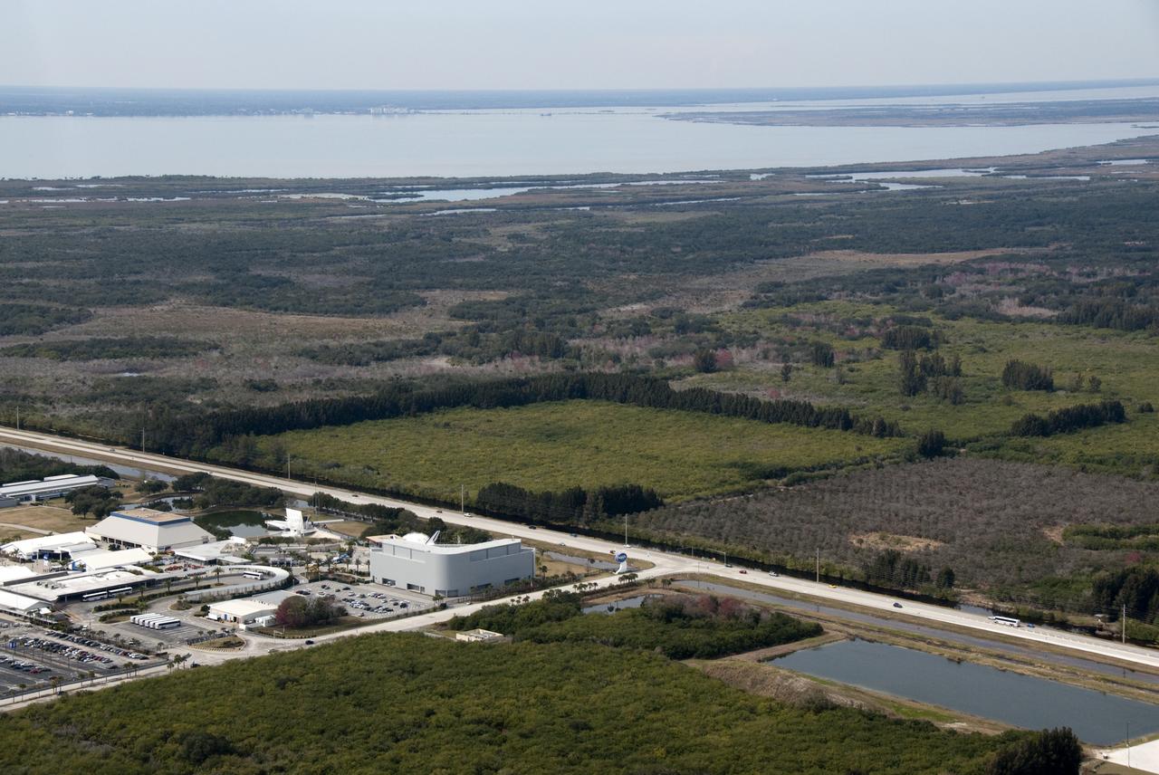
AERIALS - SR3 SOLAR FACILITY & NEW EXPANSION SITE, EXLORATION PARK
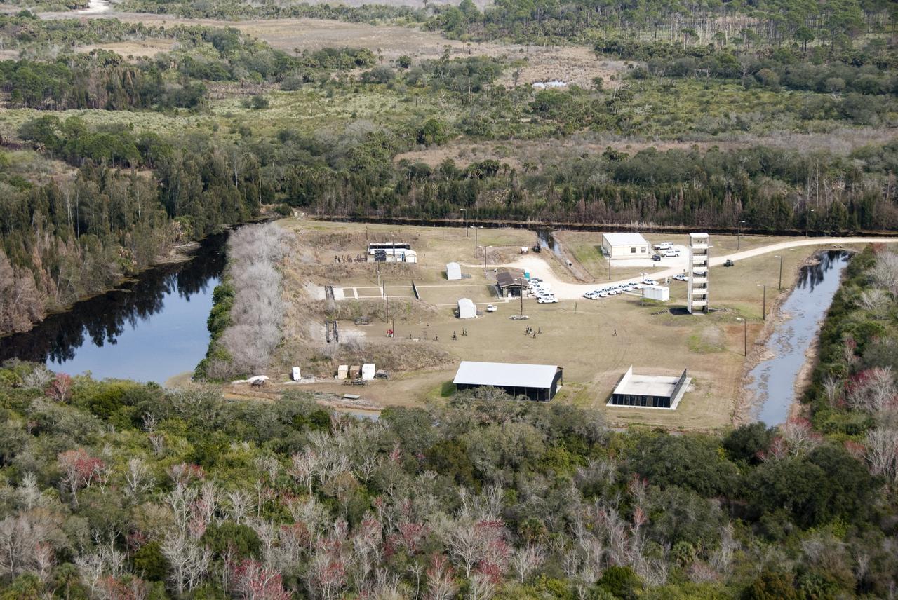
AERIALS - SR3 SOLAR FACILTY & NEW EXPANSION SITE, EXPLORATION PARK
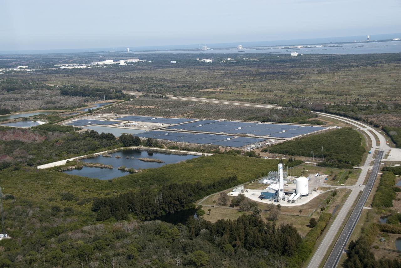
AERIALS - SR3 SOLAR FACILITY & NEW EXPANSION SITE, EXLORATION PARK
AERIALS - SR3 SOLAR FACILITY & NEW EXPANSION SITE, EXLORATION PARK
AERIALS - SR3 SOLAR FACILTY & NEW EXPANSION SITE, EXPLORATION PARK
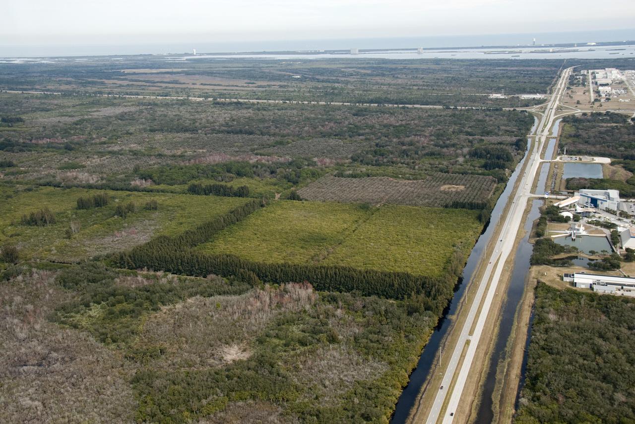
AERIALS - SR3 SOLAR FACILITY & NEW EXPANSION SITE, EXLORATION PARK
AERIALS - SR3 SOLAR FACILTY & NEW EXPANSION SITE, EXPLORATION PARK

AERIALS - SR3 SOLAR FACILITY & NEW EXPANSION SITE, EXLORATION PARK
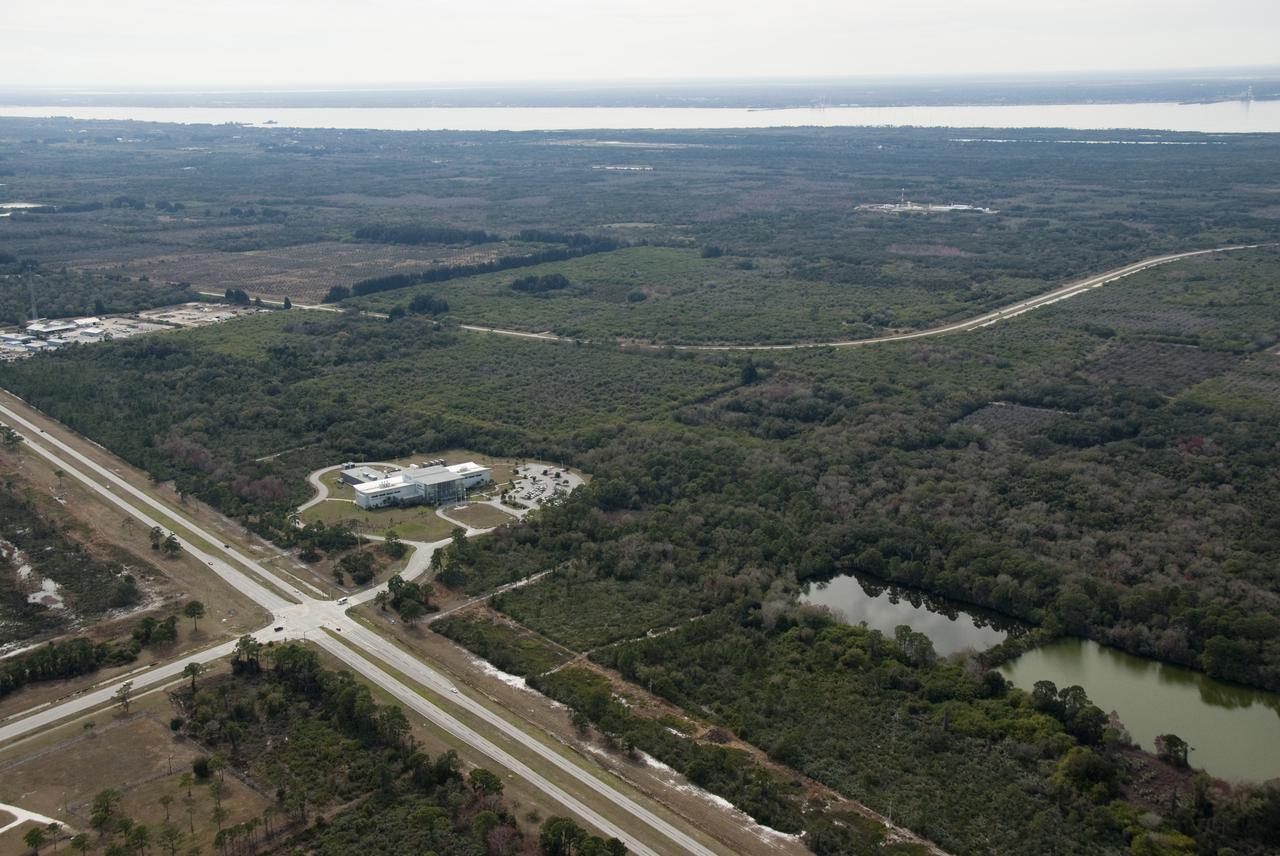
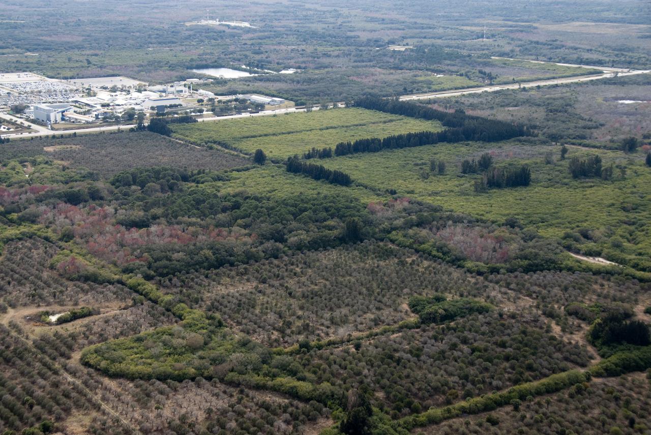
AERIALS - SR3 SOLAR FACILITY & NEW EXPANSION SITE, EXLORATION PARK
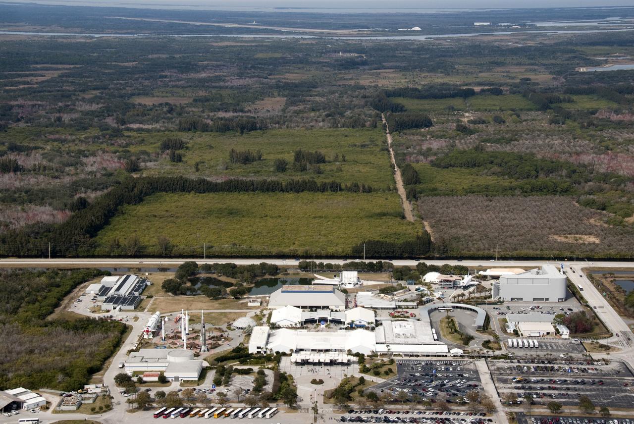
AERIALS - SR3 SOLAR FACILITY & NEW EXPANSION SITE, EXLORATION PARK
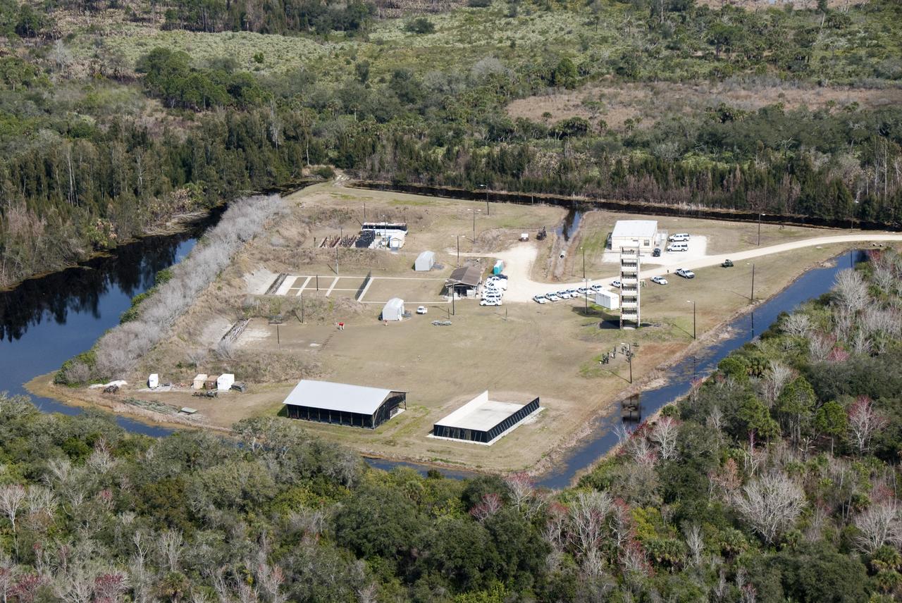
AERIALS - SR3 SOLAR FACILTY & NEW EXPANSION SITE, EXPLORATION PARK
AERIALS - SR3 SOLAR FACILITY & NEW EXPANSION SITE, EXLORATION PARK
AERIALS - SR3 SOLAR FACILITY & NEW EXPANSION SITE, EXLORATION PARK
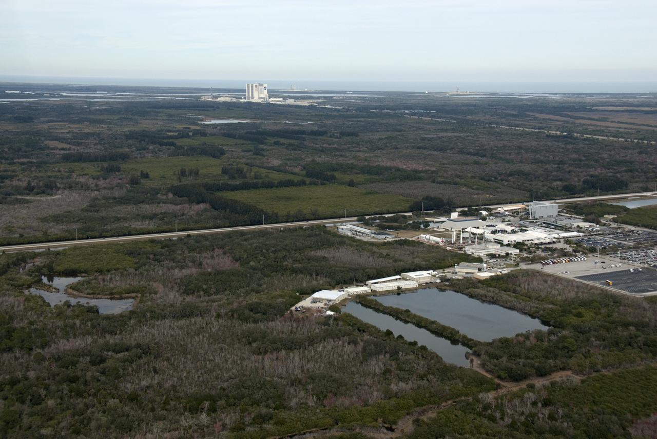
AERIALS - SR3 SOLAR FACILITY & NEW EXPANSION SITE, EXLORATION PARK
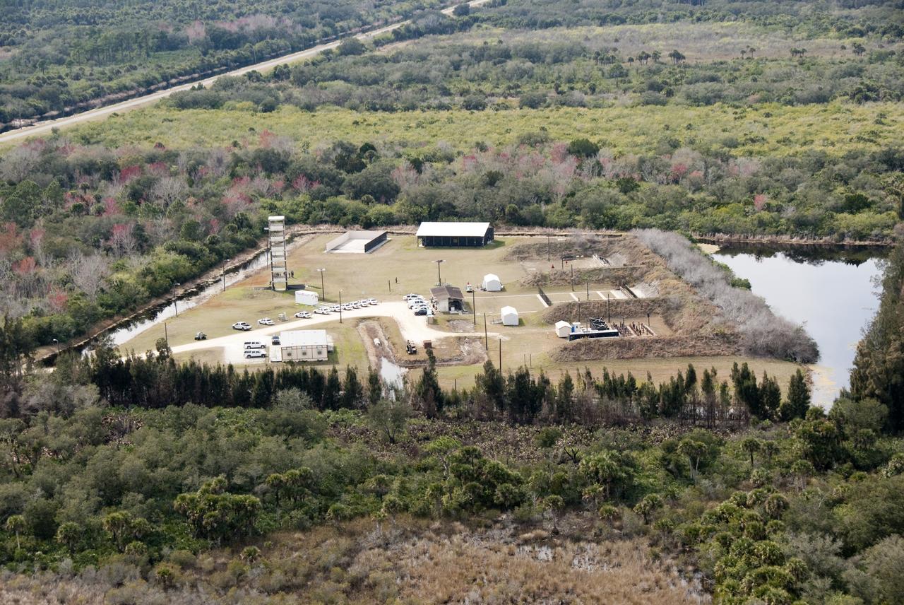
AERIALS - SR3 SOLAR FACILTY & NEW EXPANSION SITE, EXPLORATION PARK
AERIALS - SR3 SOLAR FACILITY & NEW EXPANSION SITE, EXLORATION PARK
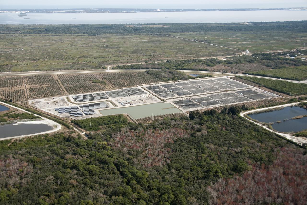
AERIALS - SR3 SOLAR FACILITY & NEW EXPANSION SITE, EXLORATION PARK
AERIALS - SR3 SOLAR FACILITY & NEW EXPANSION SITE, EXLORATION PARK
AERIALS - SR3 SOLAR FACILITY & NEW EXPANSION SITE, EXLORATION PARK
AERIALS - SR3 SOLAR FACILITY & NEW EXPANSION SITE, EXLORATION PARK
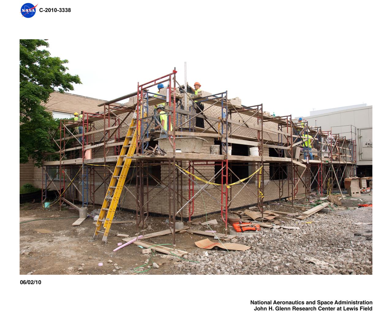
Icing Research Tunnel (IRT) Expansion Addition Construction Documentation

AERIALS - SR3 SOLAR FACILITY & NEW EXPANSION SITE, EXLORATION PARK
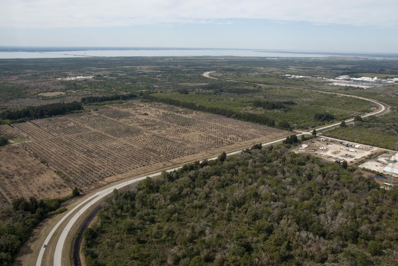
AERIALS - SR3 SOLAR FACILITY & NEW EXPANSION SITE, EXLORATION PARK
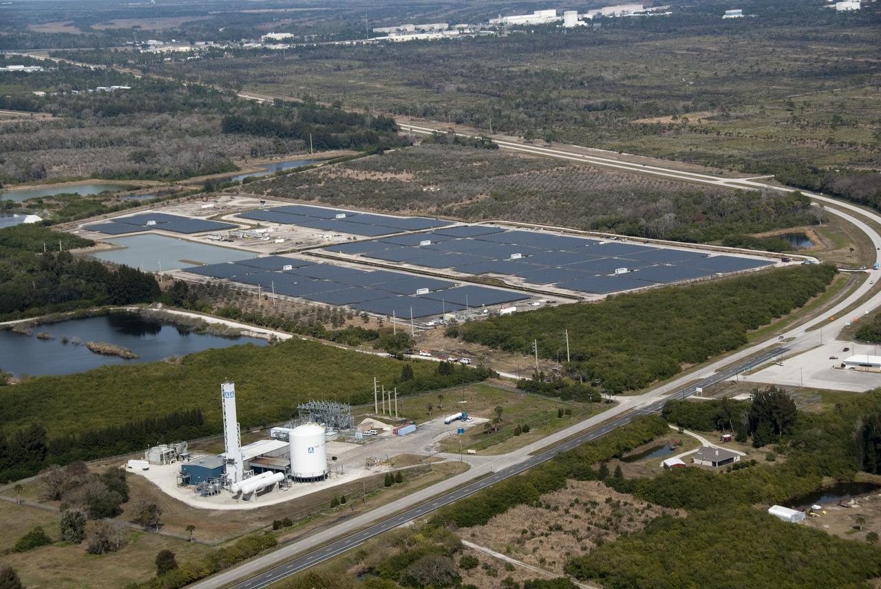
AERIALS - SR3 SOLAR FACILITY & NEW EXPANSION SITE, EXLORATION PARK
AERIALS - SR3 SOLAR FACILITY & NEW EXPANSION SITE, EXLORATION PARK
AERIALS - SR3 SOLAR FACILITY & NEW EXPANSION SITE, EXLORATION PARK
AERIALS - SR3 SOLAR FACILITY & NEW EXPANSION SITE, EXLORATION PARK
AERIALS - SR3 SOLAR FACILITY & NEW EXPANSION SITE, EXLORATION PARK
BioServe’s BioCells a the start of the experiment for the expansion of the cells over 3 passages. (Credit: BioServe)
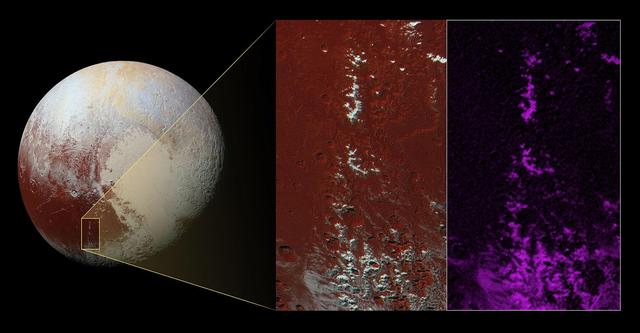
This high-resolution image captured by NASA's New Horizons spacecraft combines blue, red and infrared images taken by the Ralph/Multispectral Visual Imaging Camera (MVIC). The bright expanse is the western lobe of the "heart," informally called Sputnik Planum, which has been found to be rich in nitrogen, carbon monoxide and methane ices. http://photojournal.jpl.nasa.gov/catalog/PIA20007
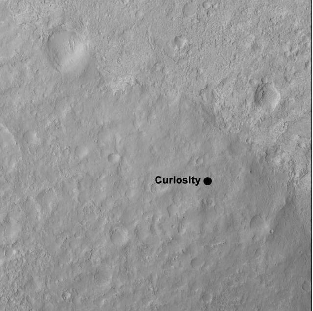
This image shows the quadrangle where NASA Curiosity rover landed, within the expansive Gale Crater. The mission science team has divided the landing region into several square quadrangles, or quads, of interest about 1-mile 1.3-kilometers wide.
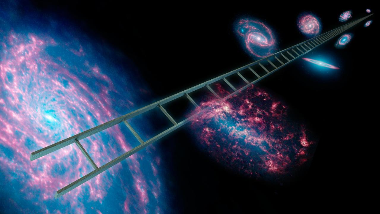
Astronomers using NASA Spitzer Space Telescope have greatly improved the cosmic distance ladder used to measure the expansion rate of the universe, its size and age. This artist concept symbolically shows a series of stars that have known distances.

NASA's Gulfstream-III research testbed lifts off the Edwards AFB runway on an envelope-expansion flight test with the UAV synthetic aperture radar pod.
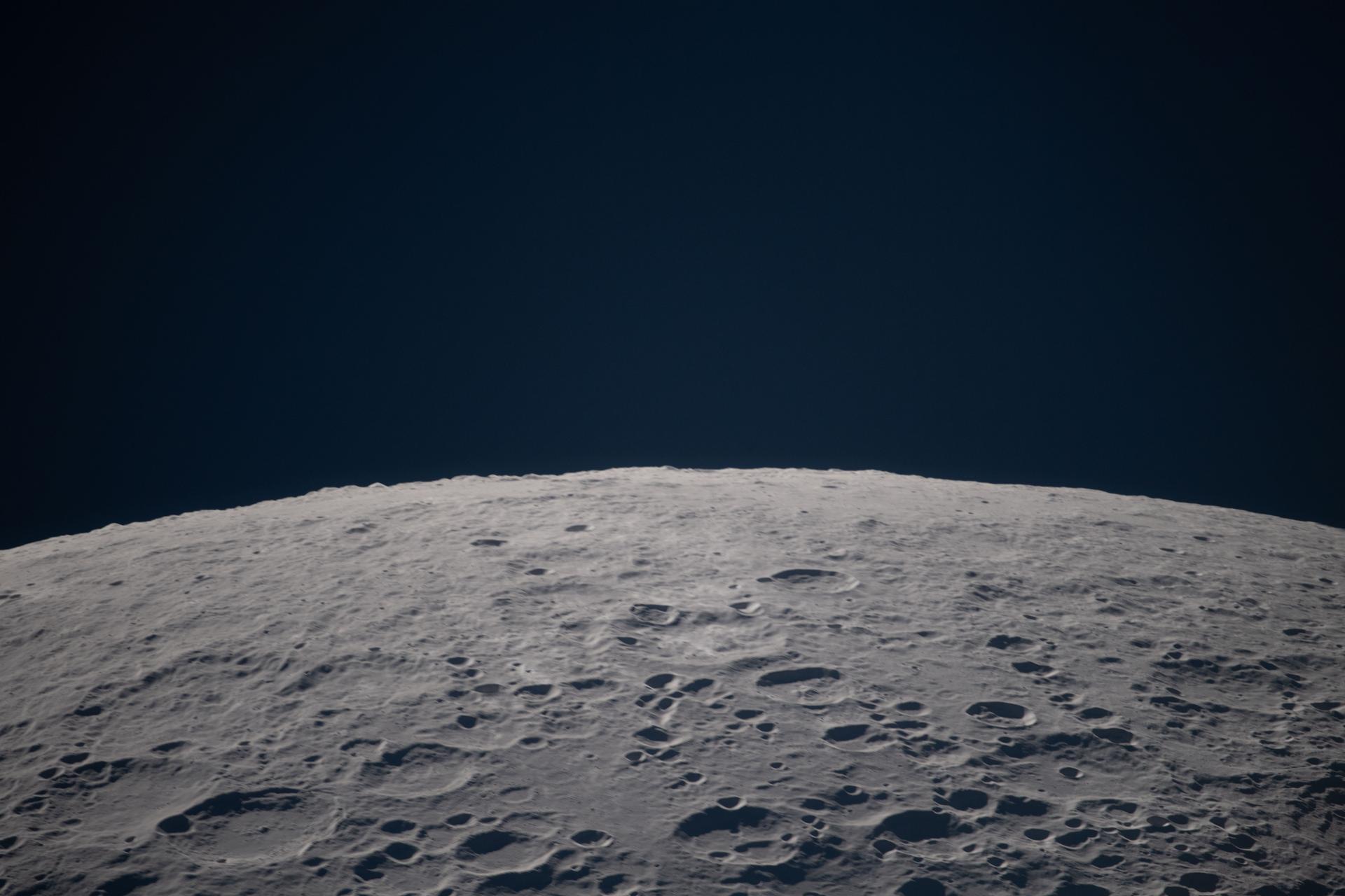
art002e012673 (April 6, 2026) – As the Artemis II crew passes the Moon during an observation period, the lunar landscape sharpens into focus: a terrain scattered with craters and shadows stretching beneath the black expanse of space.
In addition to the historic A-2 Test Stand (foreground) and A-1 Test Stand (back right), construction of a new A-3 Test Stand (back left) is under way at Stennis Space Center. The new stand will allow operators to test next-generation rocket engines at simulated altitudes of 100,000 feet. Such testing is critical for engines that will carry humans into deep space once more.

This synthetic perspective view of Pluto, based on the latest high-resolution images to be downlinked from NASA's New Horizons spacecraft, shows what you would see if you were approximately 1,100 miles (1,800 kilometers) above Pluto's equatorial area, looking northeast over the dark, cratered, informally named Cthulhu Regio toward the bright, smooth, expanse of icy plains informally called Sputnik Planum. The entire expanse of terrain seen in this image is 1,100 miles (1,800 kilometers) across. The images were taken as New Horizons flew past Pluto on July 14, 2015, from a distance of 50,000 miles (80,000 kilometers). http://photojournal.jpl.nasa.gov/catalog/PIA19937

This graph shows the rise in global mean sea level from 1993 to 2024 based on data from a series of five international satellites. The solid red line indicates the trajectory of this increase, which has more than doubled over the three decades. The dotted red line projects future sea level rise. Global sea level rose faster than expected in 2024 due mostly to ocean water expanding as it warms, or thermal expansion. According to a NASA-led analysis, last year's rate of rise was 0.23 inches (0.59 centimeters) per year, compared to the expected rate of 0.17 inches (0.43 centimeters) per year. In recent years, about two-thirds of sea level rise was due to the addition of water from land into the ocean by melting ice sheets and glaciers. About a third came from thermal expansion of seawater. But in 2024, those contributions flipped, with two-thirds of sea level rise coming from thermal expansion. This NASA-led analysis is based on a sea level dataset featuring more than 30 years of satellite observations, starting with the U.S.-French TOPEX/Poseidon mission, which launched in 1992. The Sentinel-6 Michael Freilich mission, which launched in November 2020, is the latest in the series of satellites that have contributed to this sea level record. https://photojournal.jpl.nasa.gov/catalog/PIA26189

Stennis Space Center Director Patrick Scheuermann (l) addresses visitors gathered for the official transfer of the former Mississippi Army Ammunition Plant facilities to NASA. The action transferred 1.6 million square feet of facility space, increasing Stennis work facilities by about one-third and setting the stage for years of expansion.
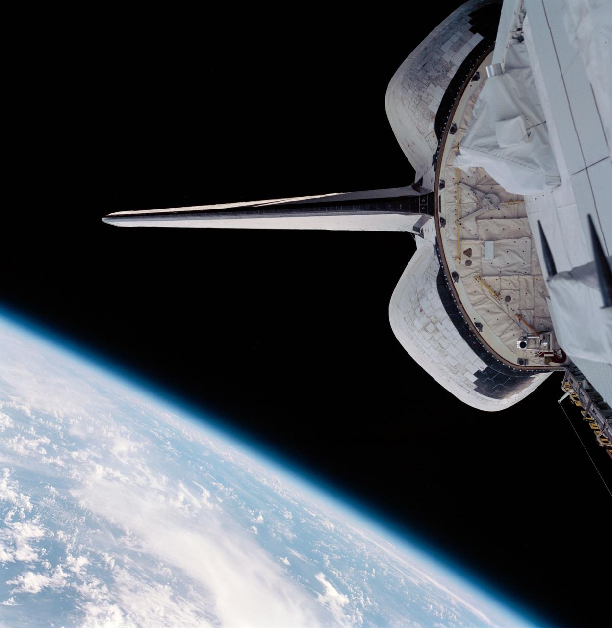
STS099-703-082 (11-22 February 2000) --- Part of the Space Shuttle Endeavour's aft cargo bay, its vertical stabilizer and orbital maneuvering system (OMS) pods are seen in this 70mm frame. Part of Earth's horizon, with an expanse of heavy cloud cover over land and water, is at bottom of frame.
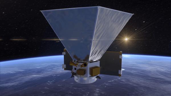
NASA's SPHEREx mission will study the universe's early expansion, the history of galaxies, and the composition of planetary systems. This animation shows the preliminary design for the spacecraft, including hexagonal sun shields that will help keep the instruments cool. Movie available at https://photojournal.jpl.nasa.gov/catalog/PIA23869
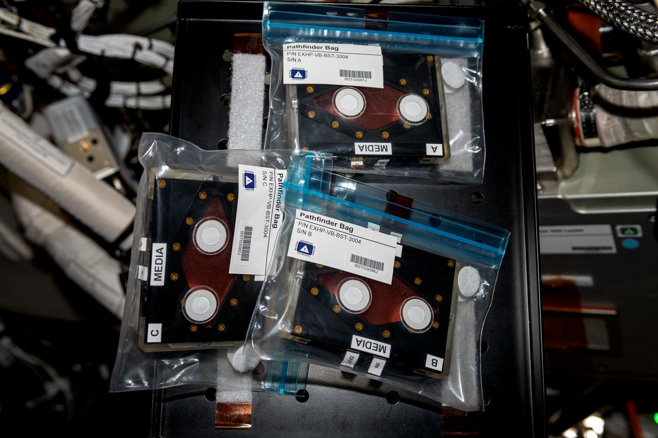
iss069e054973 (8/8/2023) --- A view of the StemCellEX-H Pathfinder sample cassettes aboard the International space Station (ISS). Hematopoietic Stem Cell Expansion in Space: Pathfinder Investigation (StemCellEX-H Pathfinder) tests methods for producing human hematopoietic stem cells in space.
Stennis Space Center Director Patrick Scheuermann (l) addresses visitors gathered for the official transfer of the former Mississippi Army Ammunition Plant facilities to NASA. The action transferred 1.6 million square feet of facility space, increasing Stennis work facilities by about one-third and setting the stage for years of expansion.
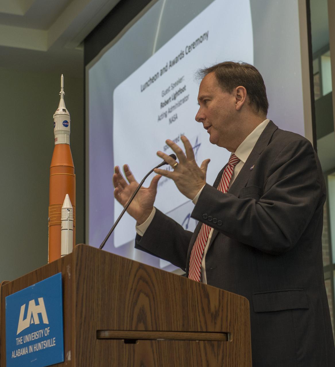
Acting NASA Administrator Robert Lightfoot, in his luncheon speech at the symposium Oct. 26, spoke about the newly reestablished National Space Council chaired by Vice President Mike Pence and NASA’s directive to develop a plan for an innovative and sustainable program of exploration with commercial and international partners to enable human expansion across the solar system
art002e020904 (April 6, 2026) – As the Artemis II crew went around the Moon, during one of the observation periods, the crew captured the details of the lunar terrain, showcasing the rugged craters, deep basins, and the black expanse of space below. Credit: NASA
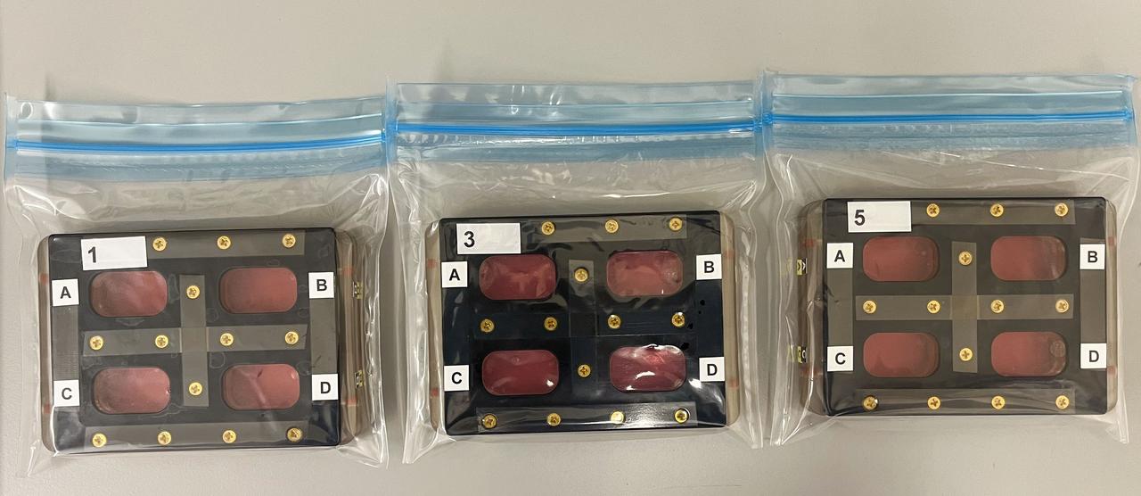
jsc2024e043914 (7/10/2024) --- In-Space Expansion of Hematopoietic Stem Cells for Clinical Application (InSPA-StemCellEX-H1) continues tests of a technology to produce human hematopoietic stem cells (HSCs) in space. In this image, HSCs were incubated with a fluorescent probe that identifies living cells. Dead cells would fluoresce green. The cells have been loaded into a device called a hemocytometer that provides a grid to make it easy to obtain an accurate count of cells. Astronauts will use a similar technique in space to help determine the rate of HSC expansion over time. Expanding HSC production has the potential to improve patient outcomes and reduce overall mortality for thousands of people diagnosed and living with blood cancer every year. Image courtesy of University of Colorado Boulder.
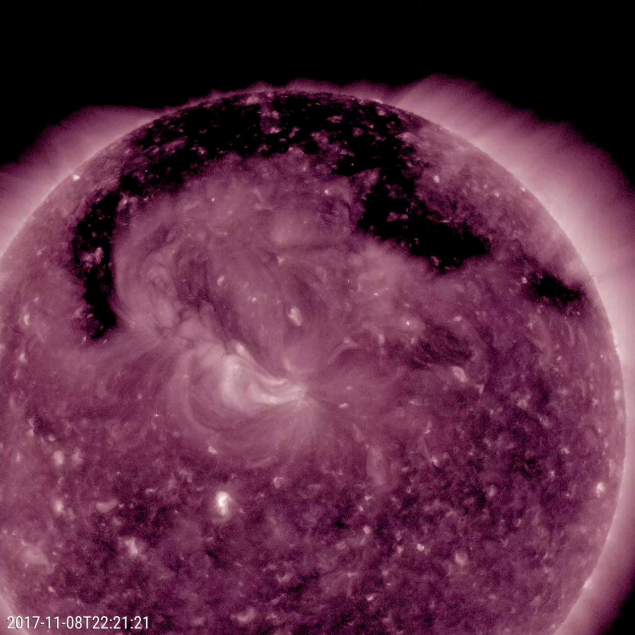
This image from NASA's Solar Dynamics Observatory shows a broad coronal hole was the dominant feature this week on the sun (Nov. 7-9, 2017). It was easily recognizable as the dark expanse across the top of the sun and extending down in each side. Coronal holes are magnetically open areas on the sun that allow high-speed solar wind to gush out into space. They always appear darker in extreme ultraviolet. This one was likely the source of bright aurora that shimmered for numerous observers, with some reaching down even to Nebraska. Movies are available at https://photojournal.jpl.nasa.gov/catalog/PIA22113
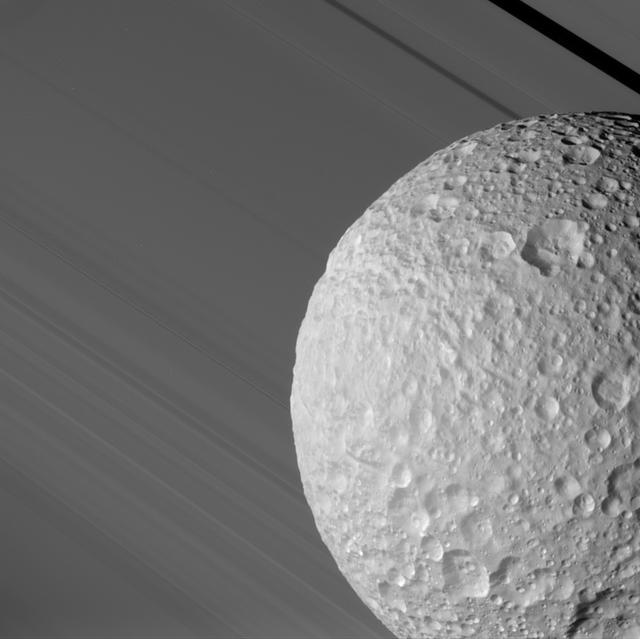
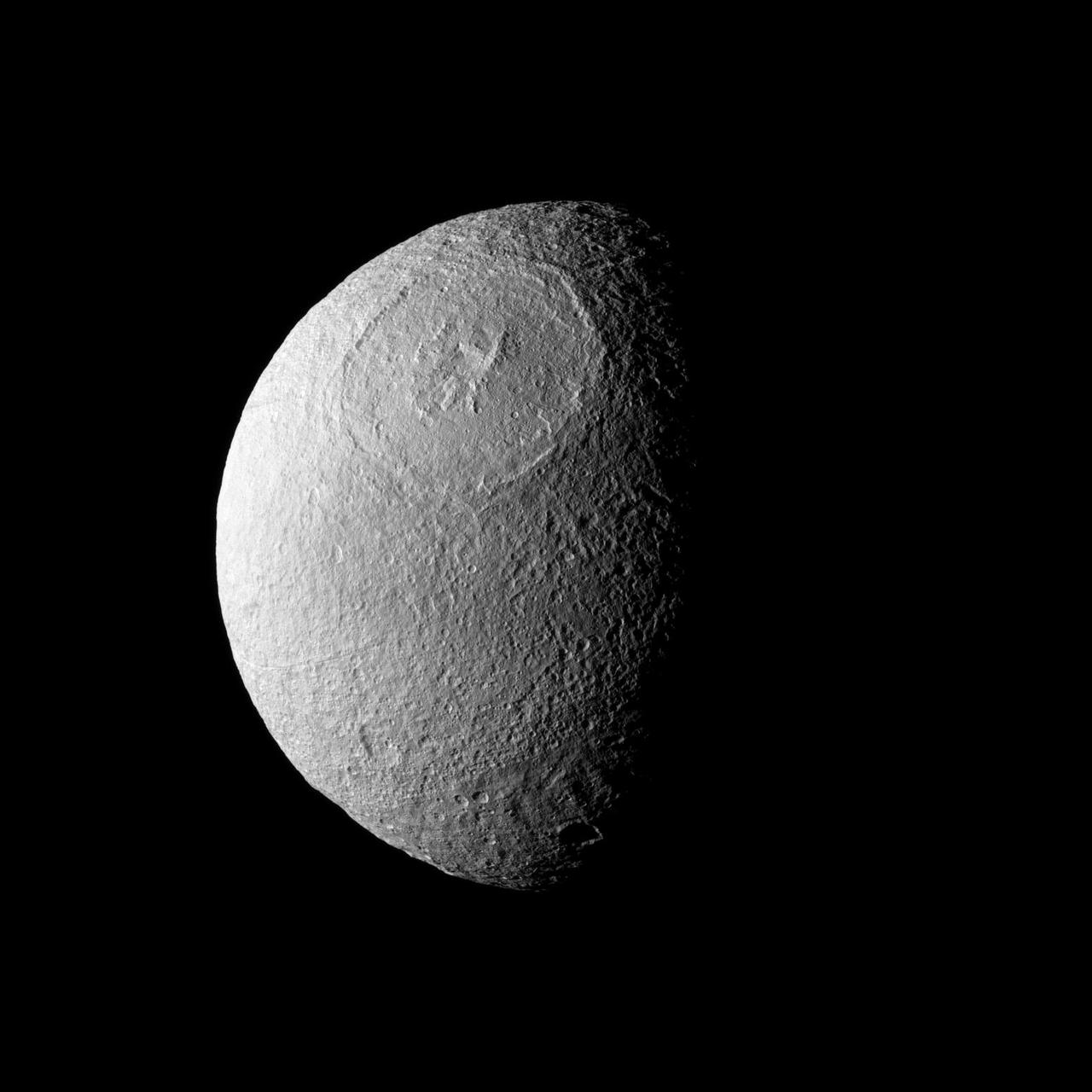
During its close flyby of Saturn's moon Mimas on Aug. 2, 2005, Cassini caught a glimpse of Mimas against the broad expanse of Saturn's rings. The Keeler Gap in the outer A ring, in which Cassini spied a never-before-seen small moon (see PIA06237), is at the upper right. The ancient, almost asteroid-like surface of Mimas is evident in its crater-upon-crater appearance. Even the material which has slumped down into the bottom of some of its craters bears the marks of later impacts. This image was taken through the clear filter of the Cassini spacecraft narrow-angle camera at a distance of 68,000 kilometers (42,500 miles) from Mimas and very near closest approach. The smallest features seen on the moon are about 400 meters wide (440 yards); the Sun-Mimas-Cassini angle is 44 degrees. http://photojournal.jpl.nasa.gov/catalog/PIA06412
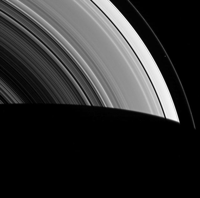
Seen by NASA Cassini spacecraft within the vast expanse of Saturn rings, Prometheus appears as little more than a dot. But that little moon still manages to shape the F ring, confining it to its narrow domain. Prometheus (53 miles, or 86 kilometers across) and its fellow moon Pandora (50 miles, or 81 kilometers across) orbit beside the F ring and keep the ring from spreading outward through a process dubbed "shepherding." This view looks toward the unilluminated side of the rings from about 45 degrees below the ringplane. The image was taken in green light with the Cassini spacecraft wide-angle camera on March 8, 2014. The view was obtained at a distance of approximately 533,000 miles (858,000 kilometers) from Prometheus and at a Sun-Prometheus-spacecraft, or phase, angle of 90 degrees. Image scale is 32 miles (51 kilometers) per pixel. http://photojournal.jpl.nasa.gov/catalog/PIA18272
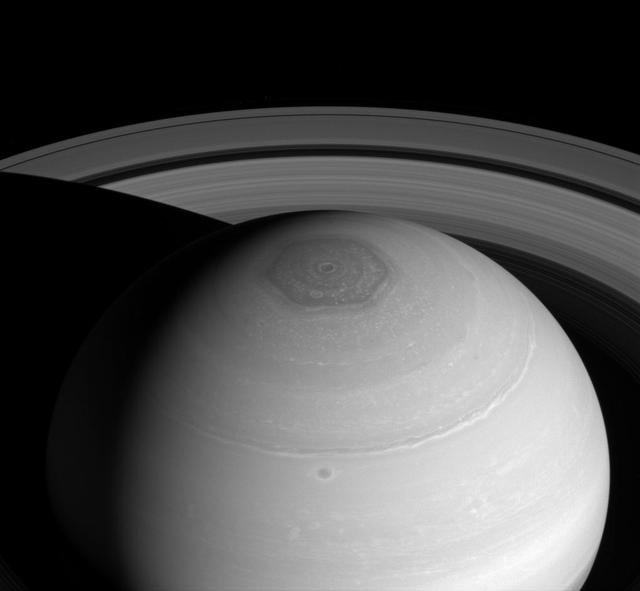
NASA Cassini spacecraft captures three magnificent sights at once: Saturn north polar vortex and hexagon along with its expansive rings. The hexagon, which is wider than two Earths, owes its appearance to the jet stream that forms its perimeter. The jet stream forms a six-lobed, stationary wave which wraps around the north polar regions at a latitude of roughly 77 degrees North. This view looks toward the sunlit side of the rings from about 37 degrees above the ringplane. The image was taken with the Cassini spacecraft wide-angle camera on April 2, 2014 using a spectral filter which preferentially admits wavelengths of near-infrared light centered at 752 nanometers. The view was obtained at a distance of approximately 1.4 million miles (2.2 million kilometers) from Saturn and at a Sun-Saturn-spacecraft, or phase, angle of 43 degrees. Image scale is 81 miles (131 kilometers) per pixel. http://photojournal.jpl.nasa.gov/catalog/PIA18274
ISS015-E-22276 (13 Aug. 2007) --- Smoke plumes from wide-spread fires across Idaho, Utah and Montana are featured in this image photographed by an Expedition 15 crewmember on the International Space Station while Space Shuttle Endeavour (STS-118) was docked with the station. Looking westward toward the horizon, this image covers an expanse from northern Utah to central Idaho with southwest Montana in the foreground.
The Direct Gain Solar Thermal Engine was designed with no moving parts. The concept of Solar Thermal Propulsion Research uses focused solar energy from an inflatable concentrator (a giant magnifying glass) to heat a propellant (hydrogen) and allows thermal expansion through the nozzle for low thrust without chemical combustion. Energy limitations and propellant weight associated with traditional combustion engines are non-existant with this concept. The Direct Gain Solar Thermal Engine would be used for moving from a lower orbit to an upper synchronous orbit.

Inside Kennedy Space Center’s Vehicle Assembly Building, Bethanne’ Hull, left, of NASA Outreach, and engineer Krista Shaffer, right, participate in Introduce a Girl to Engineering Day on NASA’s Digital Expansion to Engage the Public (DEEP) Network. Held in conjunction with National Engineers Week and Girl Day, the event allowed students from throughout the nation to speak with female NASA scientists and technical experts.
ISS047e133469 (05/25/2016) --- ESA (European Space Agency) astronaut Tim Peak (left) and NASA Astronaut Jeff Williams (right) prepare the Bigelow Expandable Activity Module (BEAM) for expansion. The pair were outfitting the area known as the vestibule, which is the space between the hatch on BEAM and hatch on Tranquility. NASA Astronaut Jeff Williams and the NASA and Bigelow Aerospace teams working at Mission Control Center at NASA’s Johnson Space Center spent more than seven hours on operations to fill the BEAM with air to cause it to expand.
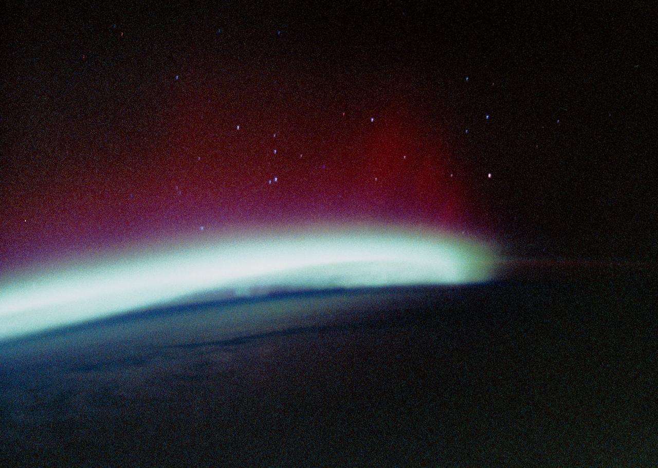
STS034-44-023 (20 Oct. 1989) --- The Southern Lights or Aurora Australis were photographed by the STS-34 crewmembers aboard the Earth-orbiting Space Shuttle Atlantis. From the Shuttle astronauts can photograph expanses of auroras, an advantage over scientists on Earth who can only get small sections at a time in a frame of photography. The space position allows for large-scale changes. This scene was one of 26 shown to the press by the five STS-34 crewmembers at their post-flight press conference.
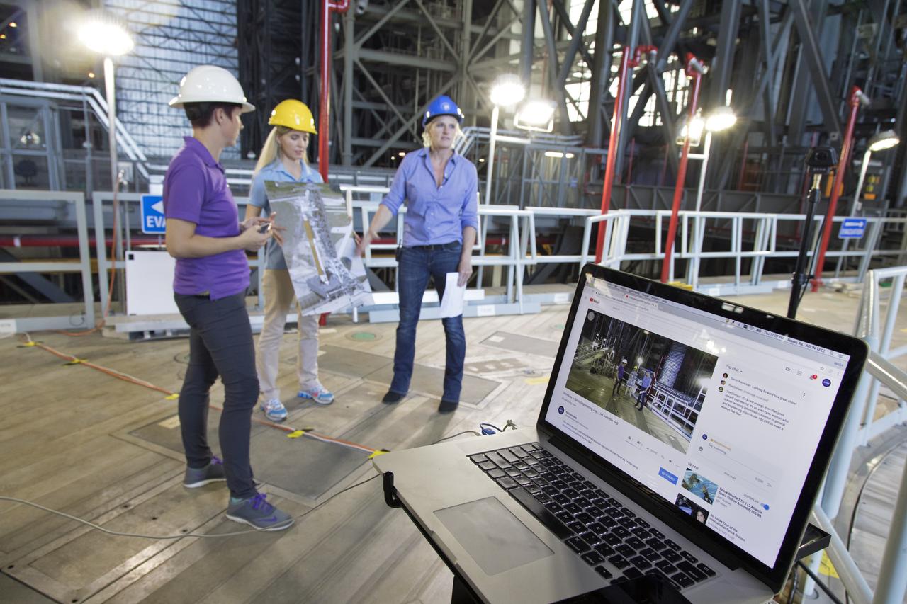
The laptop computer in the foreground displays Rachel Power, left, of NASA’s Digital Expansion to Engage the Public (DEEP) Network; Bethanne’ Hull, center, of NASA Outreach; and NASA engineer Krista Shaffer inside Kennedy Space Center’s Vehicle Assembly Building during Introduce a Girl to Engineering Day. Held in conjunction with National Engineers Week and Girl Day, the event allowed students from throughout the nation to speak with female NASA scientists and technical experts.

Phoenix is the capital and most populous city in Arizona. It is also the fifth largest city in the US. It was settled in the 1880s as an agricultural community. Between 1980 and 2017, the metropolitan area grew from 1.5 million residents to 4.9 million. This astonishing expansion is dramatically seen in these two satellite images. The Landsat TM image was acquired November 28, 1982, and the ASTER image September 12, 2018. The images cover an area of 42 by 51 km, and are located at 33.4 degrees north, 112.1 degrees west. https://photojournal.jpl.nasa.gov/catalog/PIA23411

The camera in the foreground is recording NASA engineer Krista Shaffer, left, and Rachel Power of NASA’s Digital Expansion to Engage the Public (DEEP) Network inside Kennedy Space Center’s Vehicle Assembly Building during Introduce a Girl to Engineering Day. Held in conjunction with National Engineers Week and Girl Day, the event allowed students from throughout the nation to speak with female NASA scientists and technical experts.
SL2-05-422 (22 June 1973) --- This section of the lower Mississippi River (34.0N, 90.0W) known as the Yazoo Basin, is characterized by a wide expanse of rich river bottomland with many oxbow lakes, the remains of the many changes in the riverbed over the course of many thousands of years. This soil is very fertile and productive but the region is prone to flooding. In this view, some of the back areas around the Delta National Forest show the effects of heavy spring rains. Photo credit: NASA

S115-E-06186 (14 Sept. 2006) --- Space Shuttle Atlantis astronauts spread a second set of wings for the International Space Station today. The new solar arrays were fully extended at 7:44 a.m. (CDT). The new arrays span a total of 240 feet and have a width of 38 feet. They are attached to the station's newest component, the P3/P4 integrated truss segment. The installation of the P3/P4, which occurred Sept. 12 and the deployment of the arrays set the stage for future expansion of the station.
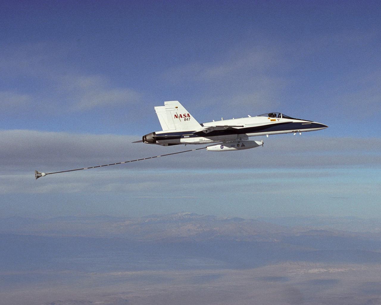
NASA Dryden's Automated Aerial Refueling (AAR) project evaluated the capability of an F/A-18A aircraft as an in-flight refueling tanker with the objective of developing analytical models for an automated aerial refueling system for unmanned air vehicles. The F/A-18 "tanker" aircraft (No. 847) underwent flight test envelope expansion with an aerodynamic pod containing air-refueling equipment carried beneath the fuselage. The second aircraft (No. 843) flew as the receiver aircraft during the study to assess the free-stream hose and drogue dynamics on the F/A-18A.

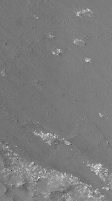
The Chinese Zhurong rover, named after the god of fire in Chinese mythology, landed in Utopia Planitia in May 2021. Utopia Planitia is a volcanic region located in the low-lying Northern Hemisphere of Mars. The expansive, flat, smooth plains of Utopia are dimpled by impact craters, volcanic domes, light-toned ridges made of wind-blown materials, and troughs. If the rover continues to drive south from its landing site, this HiRISE view shows the kind of terrain and features Zhurong may explore. https://photojournal.jpl.nasa.gov/catalog/PIA24914

NASA engineer Krista Shaffer, right, is interviewed by Rachel Power of NASA’s Digital Expansion to Engage the Public (DEEP) Network inside Kennedy Space Center’s Vehicle Assembly Building during Introduce a Girl to Engineering Day. Held in conjunction with National Engineers Week and Girl Day, the event allowed students from throughout the nation to speak with female NASA scientists and technical experts.
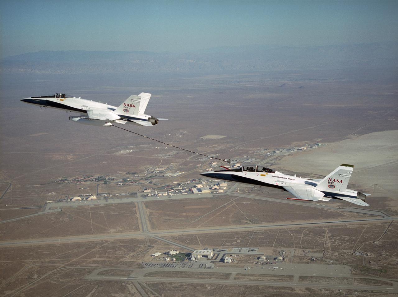
NASA Dryden's Automated Aerial Refueling (AAR) project evaluated the capability of an F/A-18A aircraft as an in-flight refueling tanker with the objective of developing analytical models for an automated aerial refueling system for unmanned air vehicles. The F/A-18 "tanker" aircraft (No. 847) underwent flight test envelope expansion with an aerodynamic pod containing air-refueling equipment carried beneath the fuselage. The second aircraft flew as the receiver aircraft during the study to assess the free-stream hose and drogue dynamics on the F/A-18A.
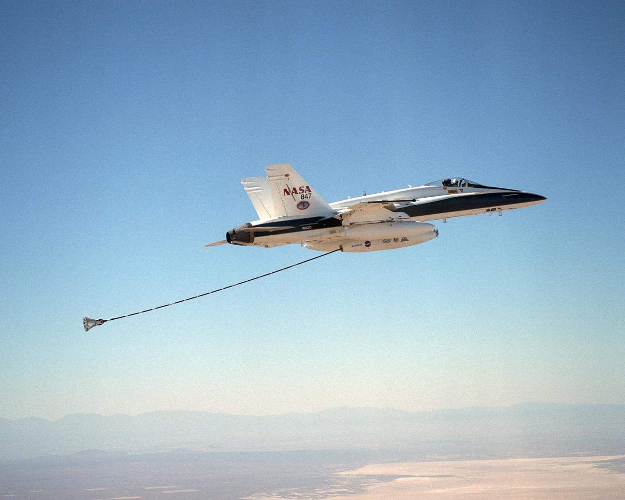
NASA Dryden's Automated Aerial Refueling (AAR) project evaluated the capability of an F/A-18A aircraft as an in-flight refueling tanker with the objective of developing analytical models for an automated aerial refueling system for unmanned air vehicles. The F/A-18 "tanker" aircraft (No. 847) underwent flight test envelope expansion with an aerodynamic pod containing air-refueling equipment carried beneath the fuselage. The second aircraft flew as the receiver aircraft during the study to assess the free-stream hose and drogue dynamics on the F/A-18A.
This image is an oblique view from NASA's Mars Reconnaissance Orbiter of the sloping edge of the stack of icy layers over the South Pole has some interesting morphologies. The slope appears to be eroding from a combination of landslides, block falls, and sublimation. The bright icy exposure in the larger landslide scar (upper right) suggests that this was a relatively recent event. Small-scale textures over the scene are due to both blowing wind and the thermal expansion and contraction of shallow ice. https://photojournal.jpl.nasa.gov/catalog/PIA21637
KENNEDY SPACE CENTER, FLA. - Atlantis is slowly lifted into the upper expanse of the Vehicle Assembly Building at NASA Kennedy Space Center. The orbiter will be lifted over the cross-beam into high bay 1 and mated with the Solid Rocket Boosters and External Tank already stacked there on the Mobile Launcher Platform. Atlantis is the designated orbiter for Return to Flight mission STS-121. The lighted planning window for launch extends from Sept. 9 to Sept. 25.
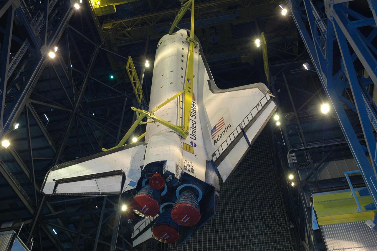
KENNEDY SPACE CENTER, FLA. - Atlantis is slowly lifted into the upper expanse of the Vehicle Assembly Building at NASA Kennedy Space Center. The orbiter will be lifted over the cross-beam into high bay 1 and mated with the Solid Rocket Boosters and External Tank already stacked there on the Mobile Launcher Platform. Atlantis is the designated orbiter for Return to Flight mission STS-121. The lighted planning window for launch extends from Sept. 9 to Sept. 25.

S115-E-05996 (14 Sept. 2006) --- Space Shuttle Atlantis astronauts spread a second set of wings for the International Space Station today. The new solar arrays were fully extended at 7:44 a.m. (CDT). The new arrays span a total of 240 feet and have a width of 38 feet. They are attached to the station's newest component, the P3/P4 integrated truss segment. The installation of the P3/P4, which occurred Tuesday and the deployment of the arrays set the stage for future expansion of the station.
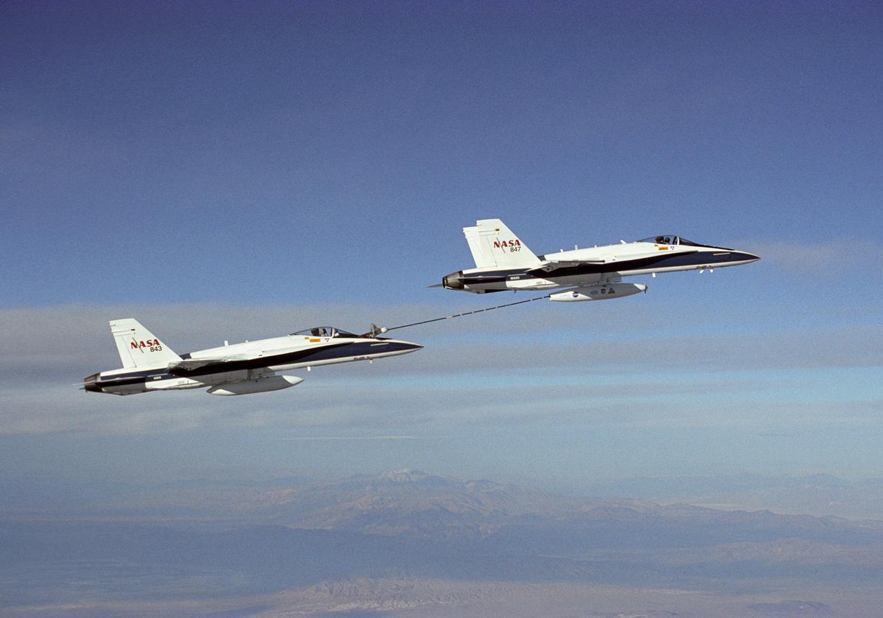
NASA Dryden's Automated Aerial Refueling (AAR) project evaluated the capability of an F/A-18A aircraft as an in-flight refueling tanker with the objective of developing analytical models for an automated aerial refueling system for unmanned air vehicles. The F/A-18 "tanker" aircraft (No. 847) underwent flight test envelope expansion with an aerodynamic pod containing air-refueling equipment carried beneath the fuselage. The second aircraft (No. 843) flew as the receiver aircraft during the study to assess the free-stream hose and drogue dynamics on the F/A-18A.
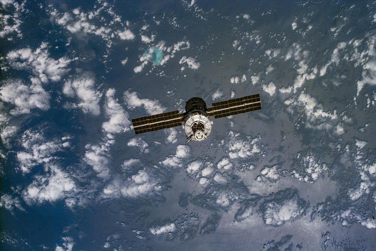
S96-E-5218 (3 June 1999) --- Partially silhouetted over clouds and a wide expanse of ocean waters, the unmanned International Space Station (ISS) moves away from the Space Shuttle Discovery. An electronic still camera (ESC) was aimed through aft flight deck windows to capture the image at 23:01:00 GMT, June 3, 1999.
STS054-152-001 (13-19 Jan 1993) --- View southeastward across the northern, arid coastal plain of Somalia from Dhul Hafun (Hafun Peninsula) on the extreme left to Ras (Cape) Illig on the extreme right. There are no good harbors, no permanent streams, and few people in this 200-mile-wide expanse of dry coastal Plain. The cloud line offshore marks the limit of offshore breeze, and provides a partial explanation of the lack of rain in this region.

S115-E-06052 (14 Sept. 2006) --- Space Shuttle Atlantis astronauts spread a second set of wings for the International Space Station today. The new solar arrays were fully extended at 7:44 a.m. (CDT). The new arrays span a total of 240 feet and have a width of 38 feet. They are attached to the station's newest component, the P3/P4 integrated truss segment. The installation of the P3/P4, which occurred Tuesday, and the deployment of the arrays set the stage for future expansion of the station.

iss059e013388 (April 8, 2019) --- NASA astronaut Anne McClain is suited up in the U.S. Quest airlock preparing to begin what would be a six-and-a-half hour spacewalk with astronaut David Saint-Jacques (out of frame) of the Canadian Space Agency. The two spacewalkers established a redundant path of power to the Canadian-built robotic arm, known as Canadarm2, and installed cables to provide for more expansive wireless communications.
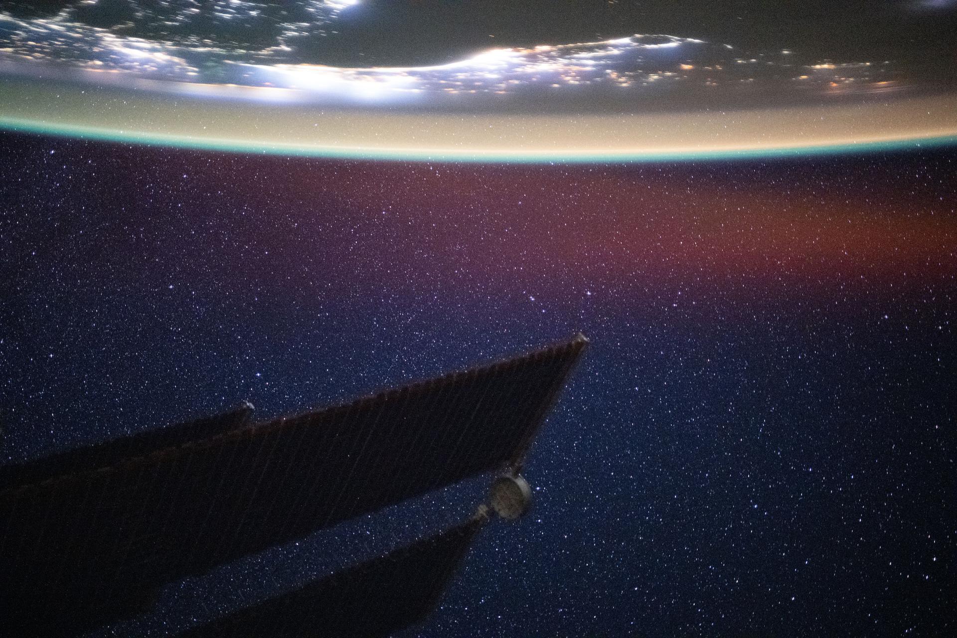
iss073e0982720 (Oct. 25, 2025) --- The Persian Gulf region—from Oman to the United Arab Emirates, with Iran's southwest coast visible across the geographically important waterway—is illuminated beneath a bright yellow-green airglow. This long-exposure photograph, taken at approximately 11:40 p.m. local time from the International Space Station as it orbited 259 miles above northwestern India, also captures the starry expanse of the night sky.
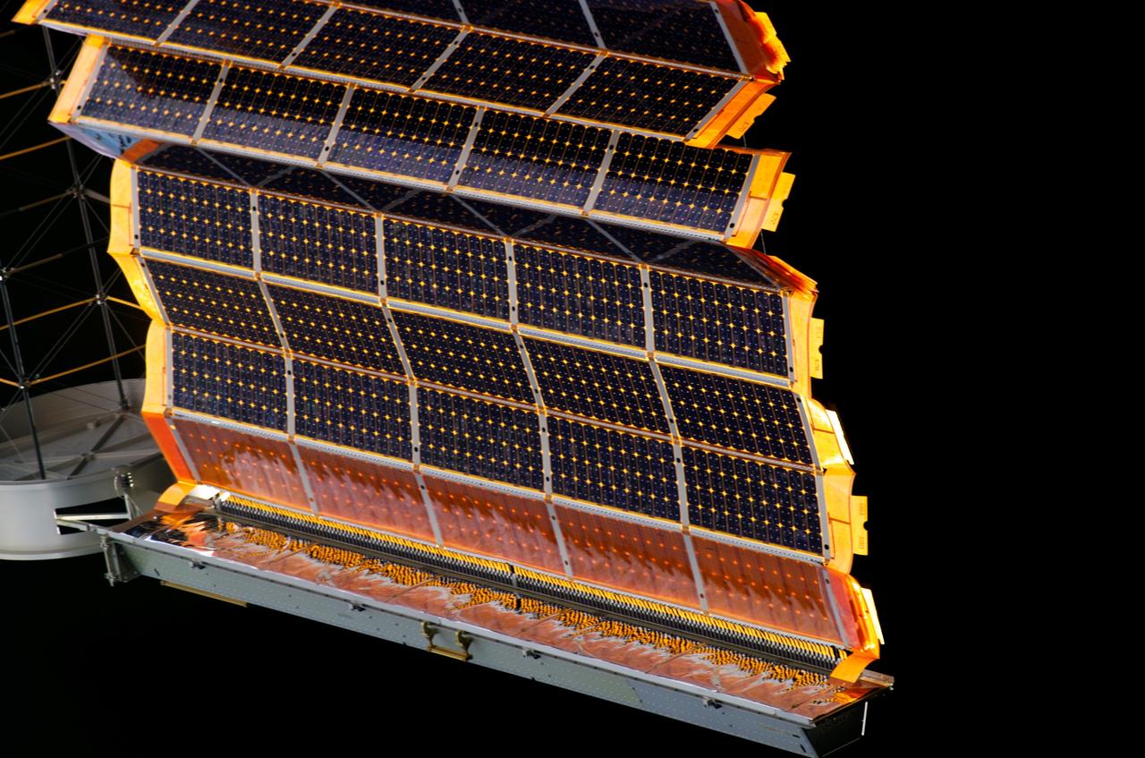
S115-E-06184 (14 Sept. 2006) --- Space Shuttle Atlantis astronauts spread a second set of wings for the International Space Station today. The new solar arrays were fully extended at 7:44 a.m. (CDT). The new arrays span a total of 240 feet and have a width of 38 feet. They are attached to the station's newest component, the P3/P4 integrated truss segment. The installation of the P3/P4, which occurred Sept. 12 and the deployment of the arrays set the stage for future expansion of the station.