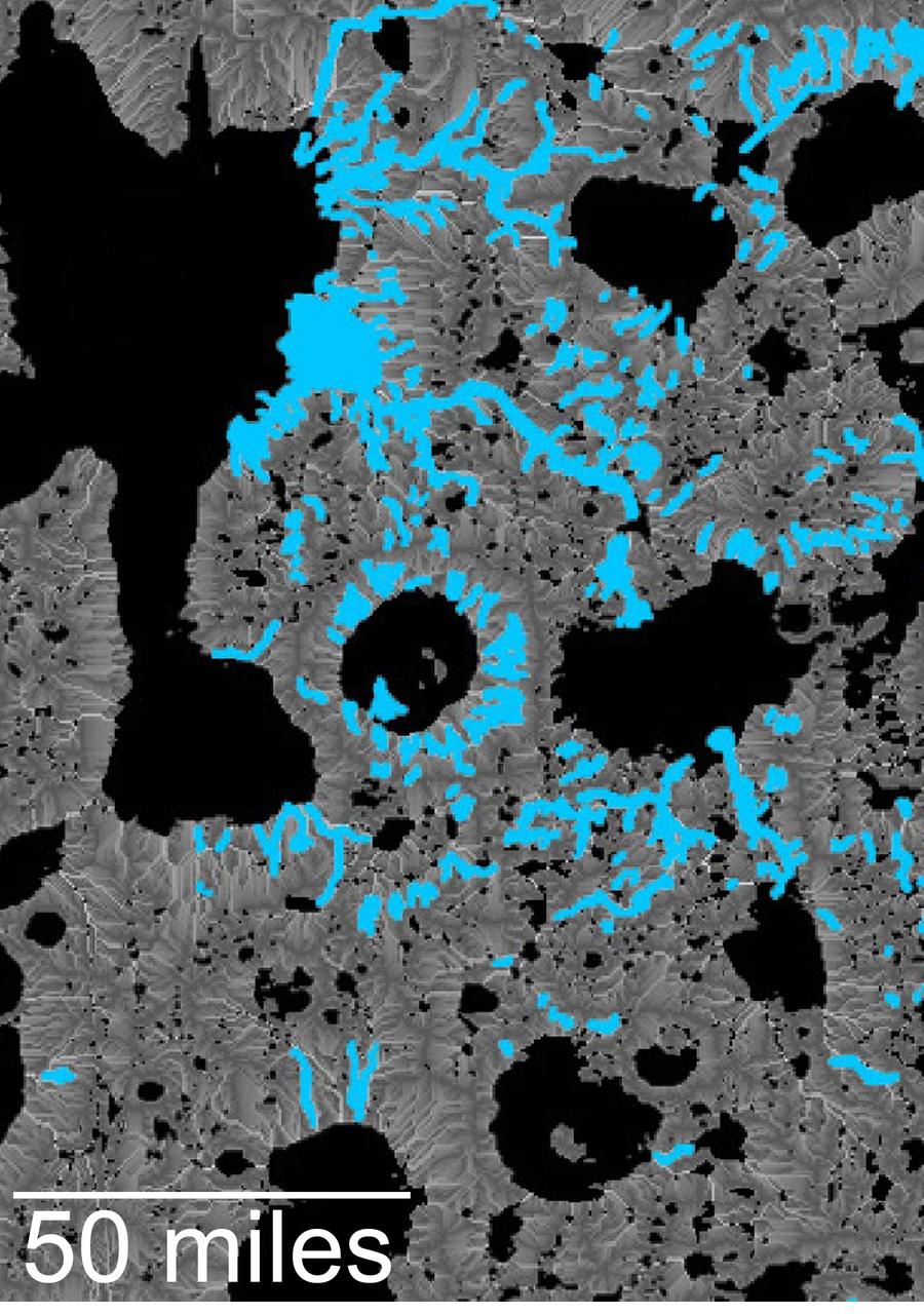
This map of an area within the Arabia Terra region on Mars shows where hydrologic modeling predicts locations of depressions that would have been lakes (black), overlaid with a map of the preserved valleys (blue lines, with width exaggerated for recognition) that would have been streams. The area today holds numerous features called "fresh shallow valleys." Research findings in 2016 interpret the fresh shallow valleys as evidence for flows of liquid water that occurred several hundred million years -- up to about a billion years -- after the ancient lakes and streams previously documented on Mars. Most of the fresh shallow valleys in this northern portion of Arabia Terra terminate at the margins of model-predicted submerged basins, consistent with an interpretation of flows into lakes and out of lakes. Some valley segments connect to form longer systems, consistent with connections forged by flowing water between interspersed lakes. In the area mapped here, for example, valleys connect basin "A" to basin "B," and basin B to "Heart Lake," each lower in elevation in that chain. http://photojournal.jpl.nasa.gov/catalog/PIA20839
Southern California dramatic topography plays acritical role in its climate, hydrology, ecology, agriculture, and habitability.
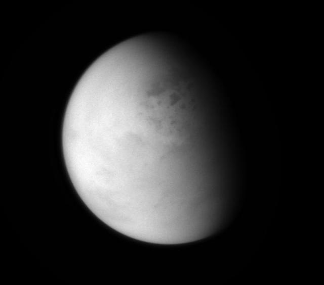
NASA Cassini spacecraft peers down though layers of haze to glimpse the lakes of Titan northern regions. Titan has a hydrological cycle similar to Earth, but instead of water, Titan lakes and seas are filled with liquid methane and ethane.

Understanding both the spatial and temporal distribution of hydrated (water-bearing) minerals on Mars is essential for deciphering the aqueous history of the planet. Over 300 meters of layered beds are exposed in this trough of Noctis Labyrinthus, at the western edge of Valles Marineris. The beds are mixtures of light- and dark-toned materials, and include units that contain hydrated minerals, like sulfates and clays. Mapping these minerals and their stratigraphic relationships indicates numerous hydrologic and/or depositional events in localized environments spread over time. The diversity of materials within the trough implies active hydrologic processes and/or changing chemical conditions, perhaps due to influxes of groundwater from nearby Tharsis volcanism. http://photojournal.jpl.nasa.gov/catalog/PIA14455

VANDENBERG AIR FORCE BASE, CALIF. - The logo of the National Oceanic and Atmospheric Administration is affixed to the side of the Boeing Delta II rocket that will launch the NOAA-N rocket. Launch is currently scheduled for no earlier than May 11, 2005. NOAA-N is the fourth in the series of support dedicated microwave instruments for the generation of temperature, moisture, surface, and hydrological products in cloudy regions where visible and infrared (IR) instruments have decreased capability. Launch of NOAA-N aboard the Boeing Delta II rocket is currently scheduled for May 11, 2005. NOAA-N is the fourth in the series of support dedicated microwave instruments for the generation of temperature, moisture, surface, and hydrological products in cloudy regions where visible and infrared (IR) instruments have decreased capability.
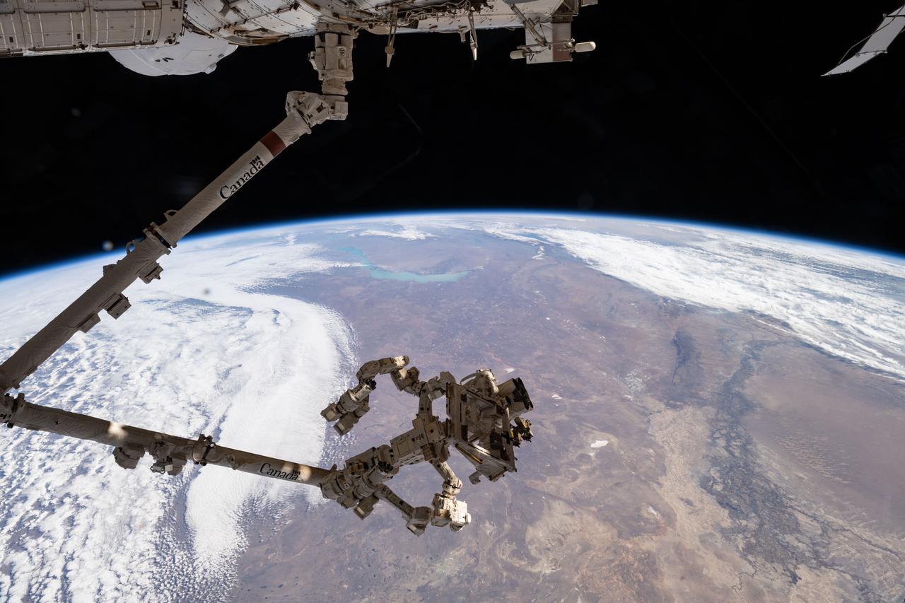
iss073e0819948 (Oct. 2, 2025) --- The Canadarm2 robotic arm, with Dextre—its fine-tuned robotic hand—attached, extends from the International Space Station’s Harmony module as the orbital outpost soars 263 miles above Kazakhstan. At upper center is Lake Balkhash, notable for its two distinct segments: the western portion contains freshwater, while the eastern portion holds saltwater due to a combination of geography, hydrology, and limited water circulation.
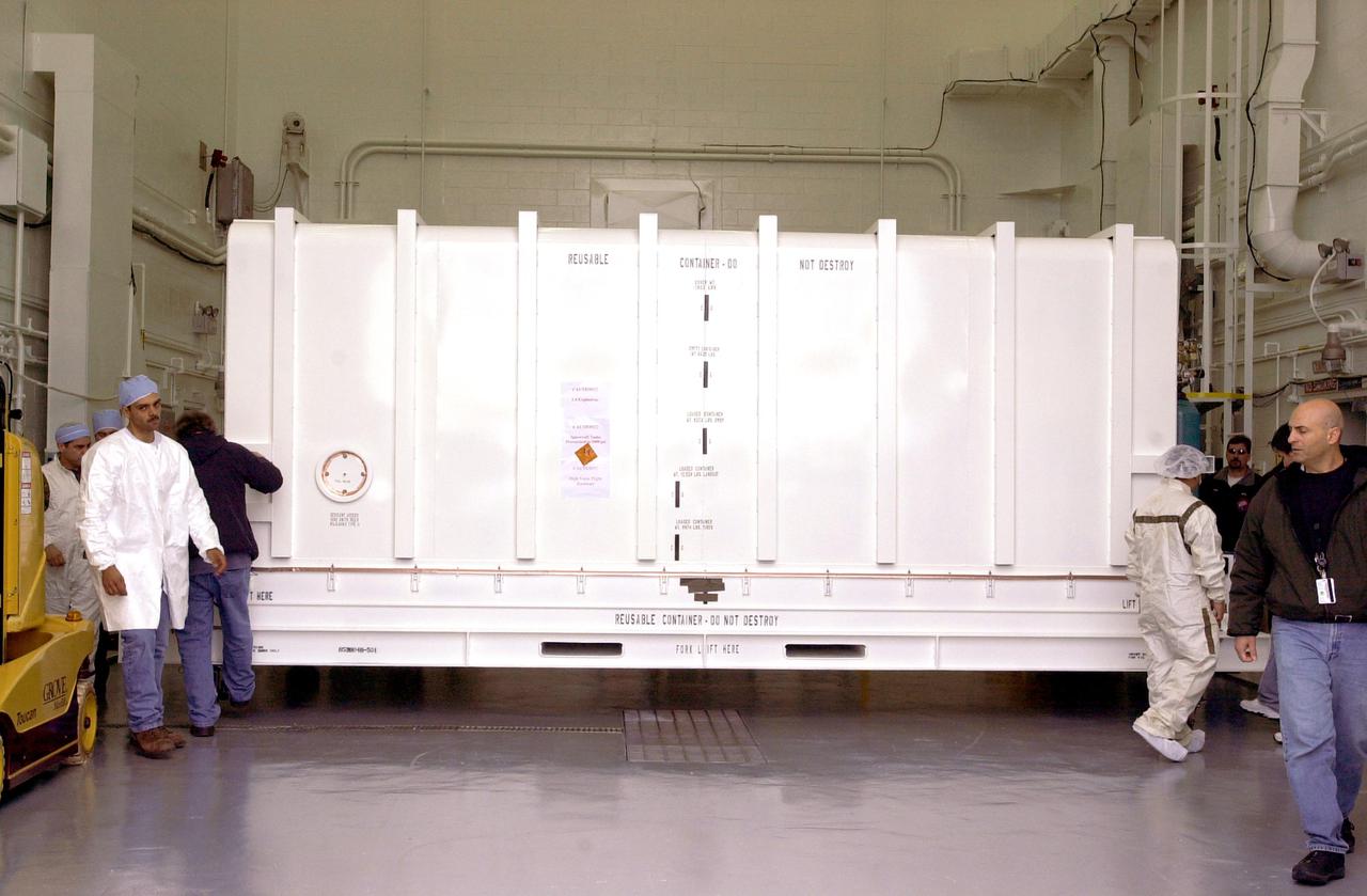
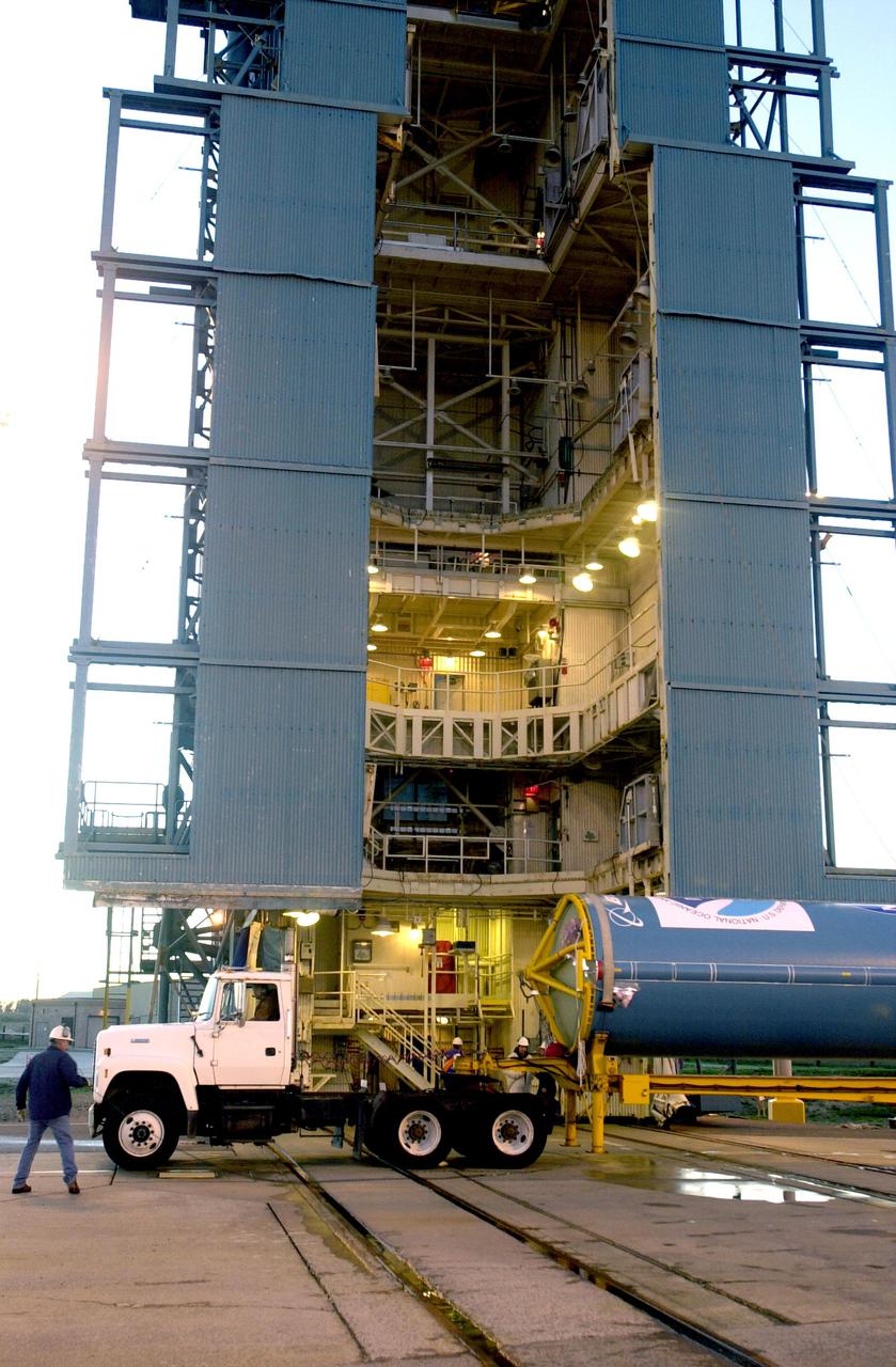
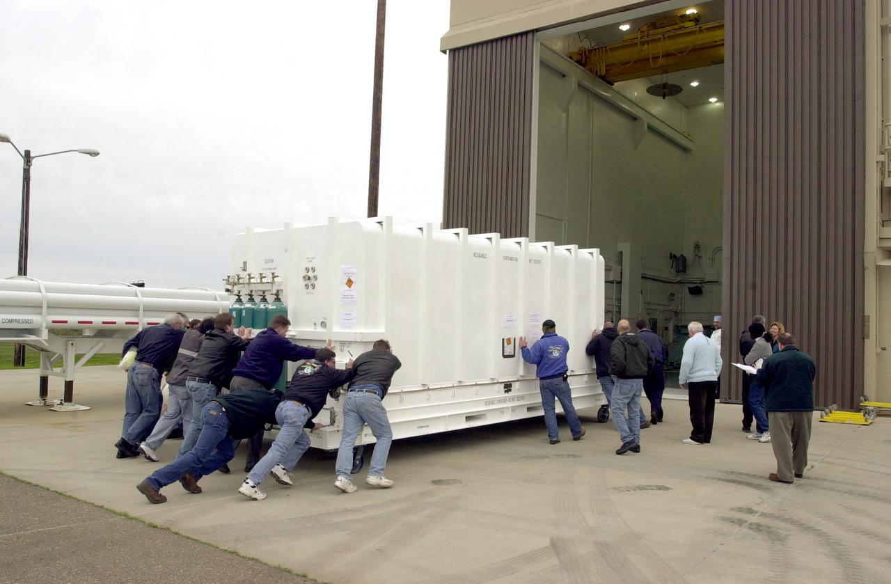
VANDENBERG AIR FORCE BASE, CALIF. - At Vandenberg Air Force Base in California, the container holding the National Oceanic and Atmospheric Administration (NOAA-N) spacecraft arrives inside a hangar where it will undergo preflight processing. NOAA-N is the fourth in the series of support dedicated microwave instruments for the generation of temperature, moisture, surface, and hydrological products in cloudy regions where visible and infrared (IR) instruments have decreased capability. Launch aboard a Boeing Delta II rocket is currently scheduled for no earlier than May 11, 2005.

A paper led by researchers at NASA's Jet Propulsion Laboratory estimates the total volume of water in Earth's rivers – called river storage – on average between 1980 and 2009, and maps out the results for the planet's major hydrological regions. This graphic, adapted from data gathered for the paper, indicates the amount of storage by hydrologic regions that contain one or more river basins, with shades of blue deepening as the amount of storage increases. The paper, published in Nature Geoscience in April 2024, calculated Earth's river storage at about 539 cubic miles (2,246 cubic kilometers), and found that the Amazon River basin, shown in dark blue in South America, was the region with the most storage, with 204 cubic miles (850 cubic kilometers), or about 38% of the global total. The study also estimated the flow of water through more than 3 million segments of river around the world and identified several locations marked by intense human water use, including parts of the Colorado River basin in the United States, portions of the Amazon basin in South America, the Orange River basin in southern Africa, and the Murray-Darling basin in southeastern Australia. https://photojournal.jpl.nasa.gov/catalog/PIA26119
VANDENBERG AIR FORCE BASE, CALIF. - On Space Launch Complex 2 at Vandenberg Air Force Base in California, the two fairing sections for the National Oceanic and Atmospheric Administration (NOAA-N) spacecraft are ready to be lifted up the launch service tower. The fairing is placed around the spacecraft to protect it during launch. NOAA-N is the fourth in the series of support dedicated microwave instruments for the generation of temperature, moisture, surface, and hydrological products in cloudy regions where visible and infrared (IR) instruments have decreased capability. Launch aboard a Boeing Delta II rocket is currently scheduled for no earlier than May 11, 2005.
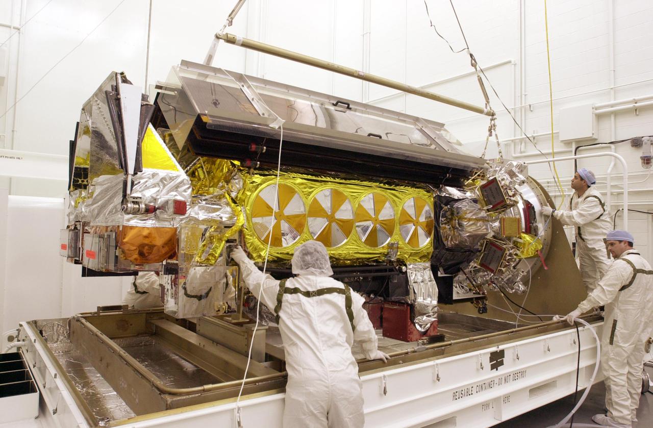
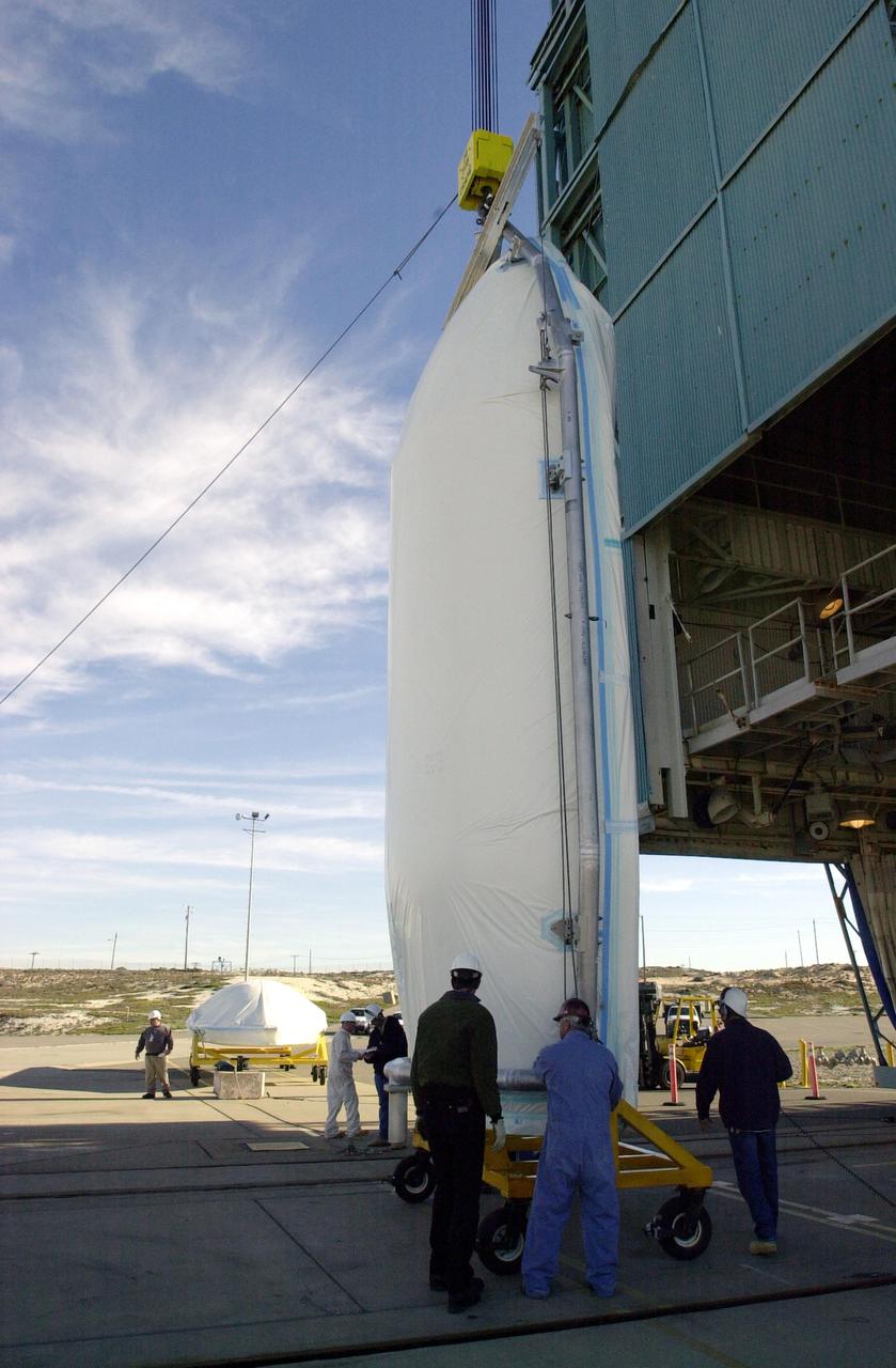
VANDENBERG AIR FORCE BASE, CALIF. - Inside the NASA spacecraft processing hangar 1610 located on North Vandenberg Air Force Base in California, the National Oceanic and Atmospheric Administration (NOAA-N) spacecraft is undergoing testing. The testing includes the Spacecraft Electrical Performance Test, battery conditioning, a Solar Array Illumination Telemetry Test, final instrument inspections and closeouts for flight. Launch of NOAA-N aboard the Boeing Delta II rocket is currently scheduled for May 11, 2005. NOAA-N is the fourth in the series of support dedicated microwave instruments for the generation of temperature, moisture, surface, and hydrological products in cloudy regions where visible and infrared (IR) instruments have decreased capability.
VANDENBERG AIR FORCE BASE, CALIF. - Inside the NASA spacecraft processing hangar 1610 located on North Vandenberg Air Force Base in California, the National Oceanic and Atmospheric Administration (NOAA-N) spacecraft is undergoing testing. The testing includes a Spacecraft Electrical Performance Test, battery conditioning, a Solar Array Illumination Telemetry Test, final instrument inspections and closeouts for flight. Launch of NOAA-N aboard the Boeing Delta II rocket is currently scheduled for May 11, 2005. NOAA-N is the fourth in the series of support dedicated microwave instruments for the generation of temperature, moisture, surface, and hydrological products in cloudy regions where visible and infrared (IR) instruments have decreased capability.
VANDENBERG AIR FORCE BASE, CALIF. - The first stage of a Boeing Delta 2 rocket arrives at the launch service tower on Space Launch Complex 2 at Vandenberg Air Force Base in California. The Delta 2 is the launch vehicle for the National Oceanic and Atmospheric Administration (NOAA-N) spacecraft. NOAA-N is the fourth in the series of support dedicated microwave instruments for the generation of temperature, moisture, surface, and hydrological products in cloudy regions where visible and infrared (IR) instruments have decreased capability. Launch aboard a Boeing Delta II rocket is currently scheduled for no earlier than May 11, 2005.
VANDENBERG AIR FORCE BASE, CALIF. - On Space Launch Complex 2 at Vandenberg Air Force Base in California, one of the two fairing sections for the National Oceanic and Atmospheric Administration (NOAA-N) spacecraft is raised to a vertical position for lifting up into the launch service tower. The fairing will be placed around the spacecraft to protect it during launch. NOAA-N is the fourth in the series of support dedicated microwave instruments for the generation of temperature, moisture, surface, and hydrological products in cloudy regions where visible and infrared (IR) instruments have decreased capability. Launch aboard a Boeing Delta II rocket is currently scheduled for no earlier than May 11, 2005.
VANDENBERG AIR FORCE BASE, CALIF. - Inside the NASA spacecraft processing hangar 1610 located on North Vandenberg Air Force Base in California, Lockheed Martin workers place a protective cover around the National Oceanic and Atmospheric Administration (NOAA-N) spacecraft. Mechanical and electrical ground support equipment will be set up and the necessary connections made with the spacecraft. Launch of NOAA-N aboard the Boeing Delta II rocket is currently scheduled for May 11, 2005. NOAA-N is the fourth in the series of support dedicated microwave instruments for the generation of temperature, moisture, surface, and hydrological products in cloudy regions where visible and infrared (IR) instruments have decreased capability.
VANDENBERG AIR FORCE BASE, CALIF. - - The interstage of a Boeing Delta 2 rocket is lifted up the launch service tower on Space Launch Complex 2 at Vandenberg Air Force Base in California. It will be mated with the first stage in the launch service tower. The Delta 2 is the launch vehicle for the National Oceanic and Atmospheric Administration (NOAA-N) spacecraft. NOAA-N is the fourth in the series of support dedicated microwave instruments for the generation of temperature, moisture, surface, and hydrological products in cloudy regions where visible and infrared (IR) instruments have decreased capability. Launch aboard a Boeing Delta II rocket is currently scheduled for no earlier than May 11, 2005.
VANDENBERG AIR FORCE BASE, CALIF. - After its arrival at Space Launch Complex 2 on Vandenberg Air Force Base in California, one of three Solid Rocket Boosters is lifted from the transporter and will be raised to a vertical position. It will be lifted up the launch service tower and mated with a Boeing Delta II rocket for the launch of the National Oceanic and Atmospheric Administration (NOAA-N) spacecraft. Launch of NOAA-N aboard the Boeing Delta II rocket is currently scheduled for May 11, 2005. NOAA-N is the fourth in the series of support dedicated microwave instruments for the generation of temperature, moisture, surface, and hydrological products in cloudy regions where visible and infrared (IR) instruments have decreased capability.
VANDENBERG AIR FORCE BASE, CALIF. - Inside the NASA spacecraft processing hangar 1610 located on North Vandenberg Air Force Base in California, the National Oceanic and Atmospheric Administration (NOAA-N) spacecraft is undergoing testing. The testing includes the Spacecraft Electrical Performance Test, battery conditioning, a Solar Array Illumination Telemetry Test, final instrument inspections and closeouts for flight. Launch of NOAA-N aboard the Boeing Delta II rocket is currently scheduled for May 11, 2005. NOAA-N is the fourth in the series of support dedicated microwave instruments for the generation of temperature, moisture, surface, and hydrological products in cloudy regions where visible and infrared (IR) instruments have decreased capability.
VANDENBERG AIR FORCE BASE, CALIF. - On Space Launch Complex 2 at Vandenberg Air Force Base in California, one of the two fairing sections for the National Oceanic and Atmospheric Administration (NOAA-N) spacecraft arrives at the launch service tower where it will be lifted to an upper level. The fairing will be placed around the spacecraft to protect it during launch. NOAA-N is the fourth in the series of support dedicated microwave instruments for the generation of temperature, moisture, surface, and hydrological products in cloudy regions where visible and infrared (IR) instruments have decreased capability. Launch aboard a Boeing Delta II rocket is currently scheduled for no earlier than May 11, 2005.
VANDENBERG AIR FORCE BASE, CALIF. - Inside the NASA spacecraft processing hangar 1610 located on North Vandenberg Air Force Base in California, the National Oceanic and Atmospheric Administration (NOAA-N) spacecraft has been raised to a vertical position on an assembly and test stand. It will be mated to the Delta II payload attach fitting. Launch of NOAA-N aboard the Boeing Delta II rocket is currently scheduled for May 11, 2005. NOAA-N is the fourth in the series of support dedicated microwave instruments for the generation of temperature, moisture, surface, and hydrological products in cloudy regions where visible and infrared (IR) instruments have decreased capability.
VANDENBERG AIR FORCE BASE, CALIF. - On Space Launch Complex 2 at Vandenberg Air Force Base in California, one of the two fairing sections for the National Oceanic and Atmospheric Administration (NOAA-N) spacecraft is being lifted up to an upper level of the launch service tower. The fairing will be placed around the spacecraft to protect it during launch. NOAA-N is the fourth in the series of support dedicated microwave instruments for the generation of temperature, moisture, surface, and hydrological products in cloudy regions where visible and infrared (IR) instruments have decreased capability. Launch aboard a Boeing Delta II rocket is currently scheduled for no earlier than May 11, 2005.
VANDENBERG AIR FORCE BASE, CALIF. - Inside the NASA spacecraft processing hangar 1610 located on North Vandenberg Air Force Base in California, Lockheed Martin workers help guide the suspended National Oceanic and Atmospheric Administration (NOAA-N) spacecraft toward the Boeing Delta II payload attach fitting in the foreground. Launch of NOAA-N aboard the Boeing Delta II rocket is currently scheduled for May 11, 2005. NOAA-N is the fourth in the series of support dedicated microwave instruments for the generation of temperature, moisture, surface, and hydrological products in cloudy regions where visible and infrared (IR) instruments have decreased capability.
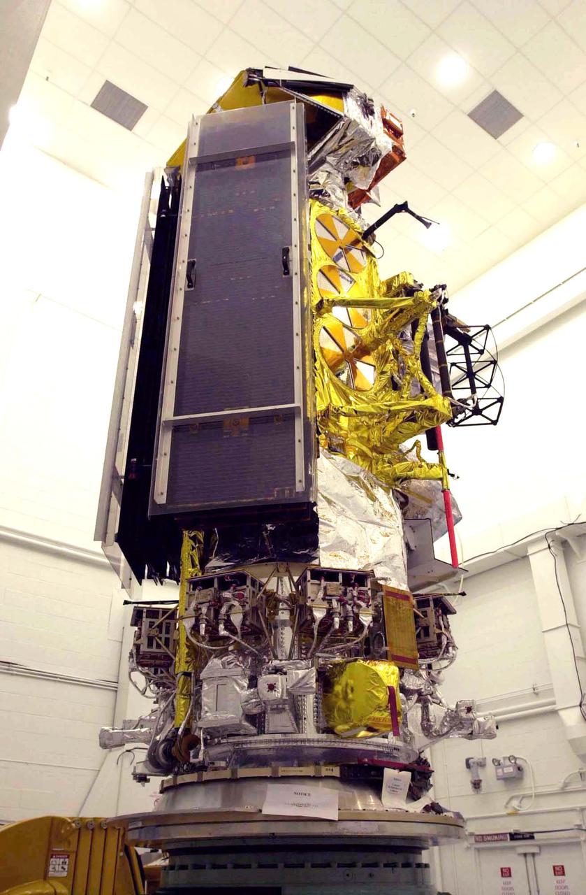
VANDENBERG AIR FORCE BASE, CALIF. - Inside the NASA spacecraft processing hangar 1610 located on North Vandenberg Air Force Base in California, the National Oceanic and Atmospheric Administration (NOAA-N) spacecraft is seen from a different view that includes the solar arrays while on an assembly and test stand. It will be mated to the Delta II payload attach fitting. Launch of NOAA-N aboard the Boeing Delta II rocket is currently scheduled for May 11, 2005. NOAA-N is the fourth in the series of support dedicated microwave instruments for the generation of temperature, moisture, surface, and hydrological products in cloudy regions where visible and infrared (IR) instruments have decreased capability.
VANDENBERG AIR FORCE BASE, CALIF. - Inside the NASA spacecraft processing hangar 1610 located on North Vandenberg Air Force Base in California, the National Oceanic and Atmospheric Administration (NOAA-N) spacecraft sits attached to the Boeing Delta II payload attach fitting on the bottom. Launch of NOAA-N aboard the Boeing Delta II rocket is currently scheduled for May 11, 2005. NOAA-N is the fourth in the series of support dedicated microwave instruments for the generation of temperature, moisture, surface, and hydrological products in cloudy regions where visible and infrared (IR) instruments have decreased capability.
VANDENBERG AIR FORCE BASE, CALIF. - One of three Solid Rocket Boosters arrives at Space Launch Complex 2 on Vandenberg Air Force Base in California. It will be mated with a Boeing Delta II rocket for the launch of the National Oceanic and Atmospheric Administration (NOAA-N) spacecraft. Launch of NOAA-N aboard the Boeing Delta II rocket is currently scheduled for May 11, 2005. NOAA-N is the fourth in the series of support dedicated microwave instruments for the generation of temperature, moisture, surface, and hydrological products in cloudy regions where visible and infrared (IR) instruments have decreased capability.
VANDENBERG AIR FORCE BASE, CALIF. - Inside the NASA spacecraft processing hangar 1610 located on North Vandenberg Air Force Base in California, the National Oceanic and Atmospheric Administration (NOAA-N) spacecraft is raised to a vertical position on an assembly and test stand. It will be mated to the Delta II payload attach fitting. Launch of NOAA-N aboard the Boeing Delta II rocket is currently scheduled for May 11, 2005. NOAA-N is the fourth in the series of support dedicated microwave instruments for the generation of temperature, moisture, surface, and hydrological products in cloudy regions where visible and infrared (IR) instruments have decreased capability.
VANDENBERG AIR FORCE BASE, CALIF. - Inside the NASA spacecraft processing hangar 1610 located on North Vandenberg Air Force Base in California, Lockheed Martin workers maneuver the Boeing Delta II payload attach fitting onto a connecting ring on the floor. The National Oceanic and Atmospheric Administration (NOAA-N) spacecraft, in the background, will then be mated to the payload attach fitting. Launch of NOAA-N aboard the Boeing Delta II rocket is currently scheduled for May 11, 2005. NOAA-N is the fourth in the series of support dedicated microwave instruments for the generation of temperature, moisture, surface, and hydrological products in cloudy regions where visible and infrared (IR) instruments have decreased capability.
VANDENBERG AIR FORCE BASE, CALIF. - Inside the NASA spacecraft processing hangar 1610 located on North Vandenberg Air Force Base in California, the National Oceanic and Atmospheric Administration (NOAA-N) spacecraft is undergoing testing. The testing includes a the Spacecraft Electrical Performance Test, battery conditioning, a Solar Array Illumination Telemetry Test, final instrument inspections and closeouts for flight. Launch of NOAA-N aboard the Boeing Delta II rocket is currently scheduled for May 11, 2005. NOAA-N is the fourth in the series of support dedicated microwave instruments for the generation of temperature, moisture, surface, and hydrological products in cloudy regions where visible and infrared (IR) instruments have decreased capability.
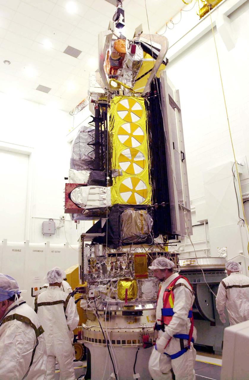
VANDENBERG AIR FORCE BASE, CALIF. - Inside the NASA spacecraft processing hangar 1610 located on North Vandenberg Air Force Base in California, Lockheed Martin workers attach a crane to move the National Oceanic and Atmospheric Administration (NOAA-N) spacecraft. NOAA-N will be lifted and mated to the Boeing Delta II payload attach fitting. Launch of NOAA-N aboard the Boeing Delta II rocket is currently scheduled for May 11, 2005. NOAA-N is the fourth in the series of support dedicated microwave instruments for the generation of temperature, moisture, surface, and hydrological products in cloudy regions where visible and infrared (IR) instruments have decreased capability.
VANDENBERG AIR FORCE BASE, CALIF. - The first stage of a Boeing Delta II rocket is in the launch service tower of Space Launch Complex 2 on Vandenberg Air Force Base in California. It will be mated with an interstage adapter and Solid Rocket Boosters for the launch of the National Oceanic and Atmospheric Administration (NOAA-N) spacecraft. Launch of NOAA-N aboard the Boeing Delta II rocket is currently scheduled for May 11, 2005. NOAA-N is the fourth in the series of support dedicated microwave instruments for the generation of temperature, moisture, surface, and hydrological products in cloudy regions where visible and infrared (IR) instruments have decreased capability.
VANDENBERG AIR FORCE BASE, CALIF. - Another Solid Rocket Booster arrives at Space Launch Complex 2 on Vandenberg Air Force Base in California. It will be mated with a Boeing Delta II rocket for the launch of the National Oceanic and Atmospheric Administration (NOAA-N) spacecraft. Launch of NOAA-N aboard the Boeing Delta II rocket is currently scheduled for May 11, 2005. NOAA-N is the fourth in the series of support dedicated microwave instruments for the generation of temperature, moisture, surface, and hydrological products in cloudy regions where visible and infrared (IR) instruments have decreased capability.
VANDENBERG AIR FORCE BASE, CALIF. - Inside the NASA spacecraft processing hangar 1610 located on North Vandenberg Air Force Base in California, Lockheed Martin workers help guide the National Oceanic and Atmospheric Administration (NOAA-N) spacecraft, above, onto the Boeing Delta II payload attach fitting below. Launch of NOAA-N aboard the Boeing Delta II rocket is currently scheduled for May 11, 2005. NOAA-N is the fourth in the series of support dedicated microwave instruments for the generation of temperature, moisture, surface, and hydrological products in cloudy regions where visible and infrared (IR) instruments have decreased capability.
VANDENBERG AIR FORCE BASE, CALIF. - At Space Launch Complex 2 on Vandenberg Air Force Base in California, one of three Solid Rocket Boosters is lifted alongside the first stage of a Boeing Delta II rocket for mating. The Boeing Delta II will launch the National Oceanic and Atmospheric Administration (NOAA-N) spacecraft. Launch of NOAA-N aboard the Boeing Delta II rocket is currently scheduled for May 11, 2005. NOAA-N is the fourth in the series of support dedicated microwave instruments for the generation of temperature, moisture, surface, and hydrological products in cloudy regions where visible and infrared (IR) instruments have decreased capability.
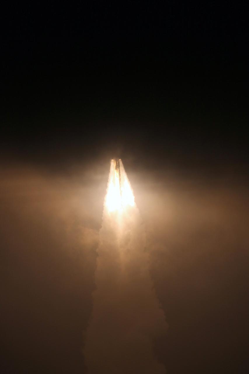
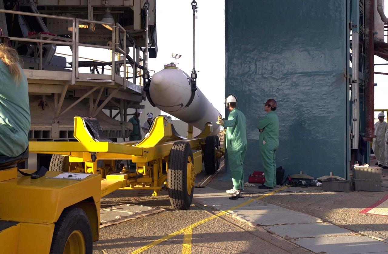
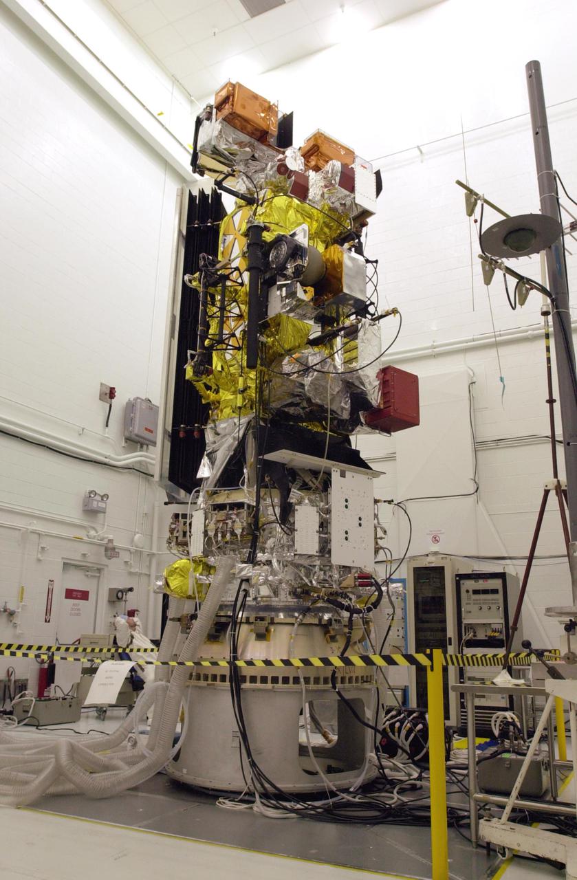
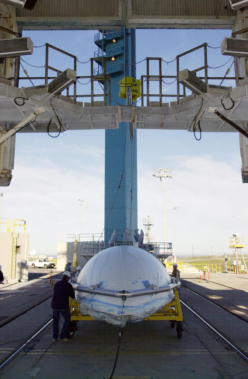
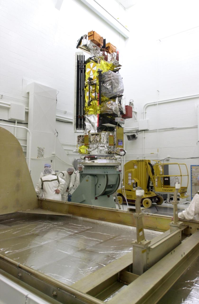
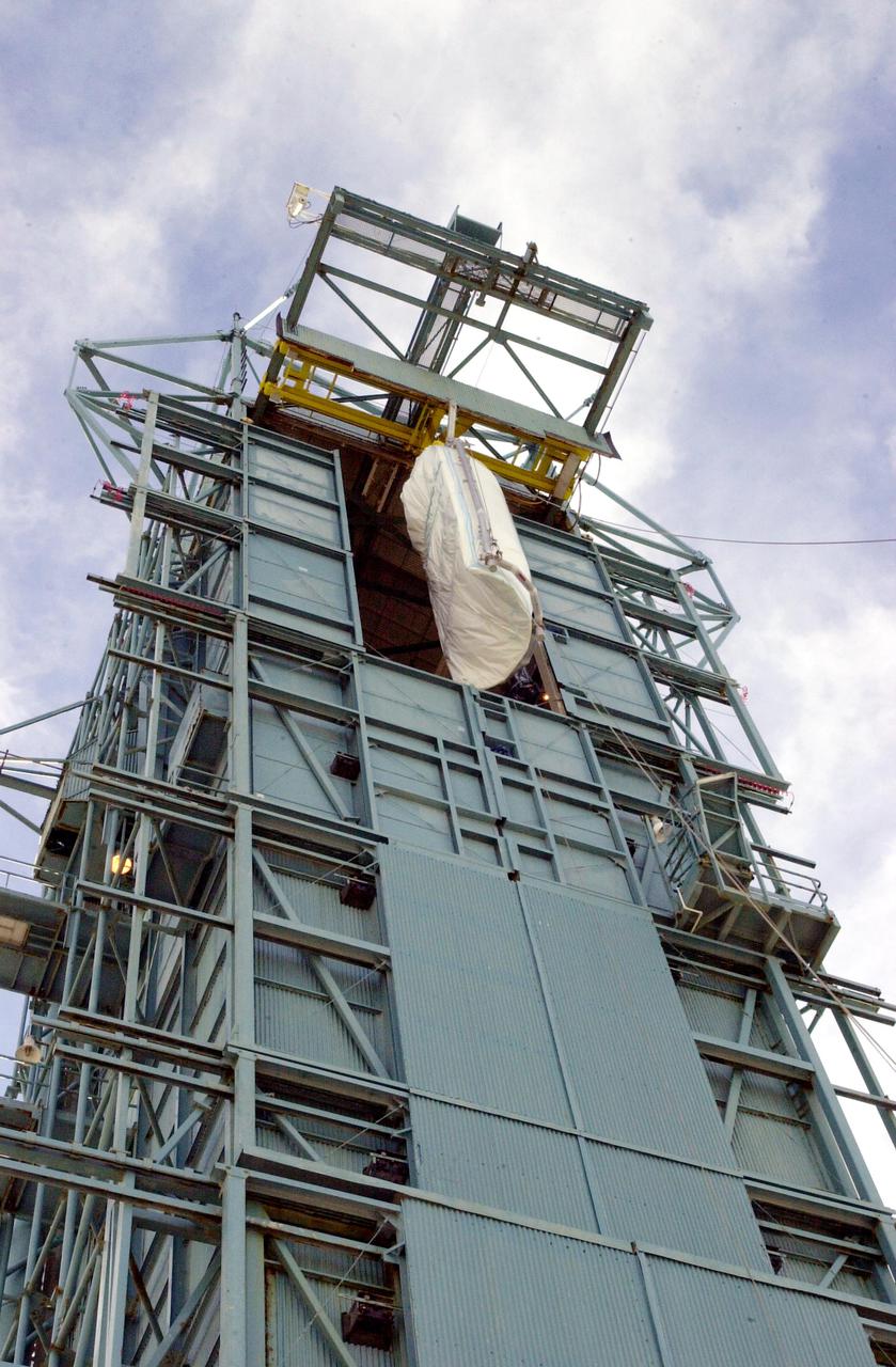
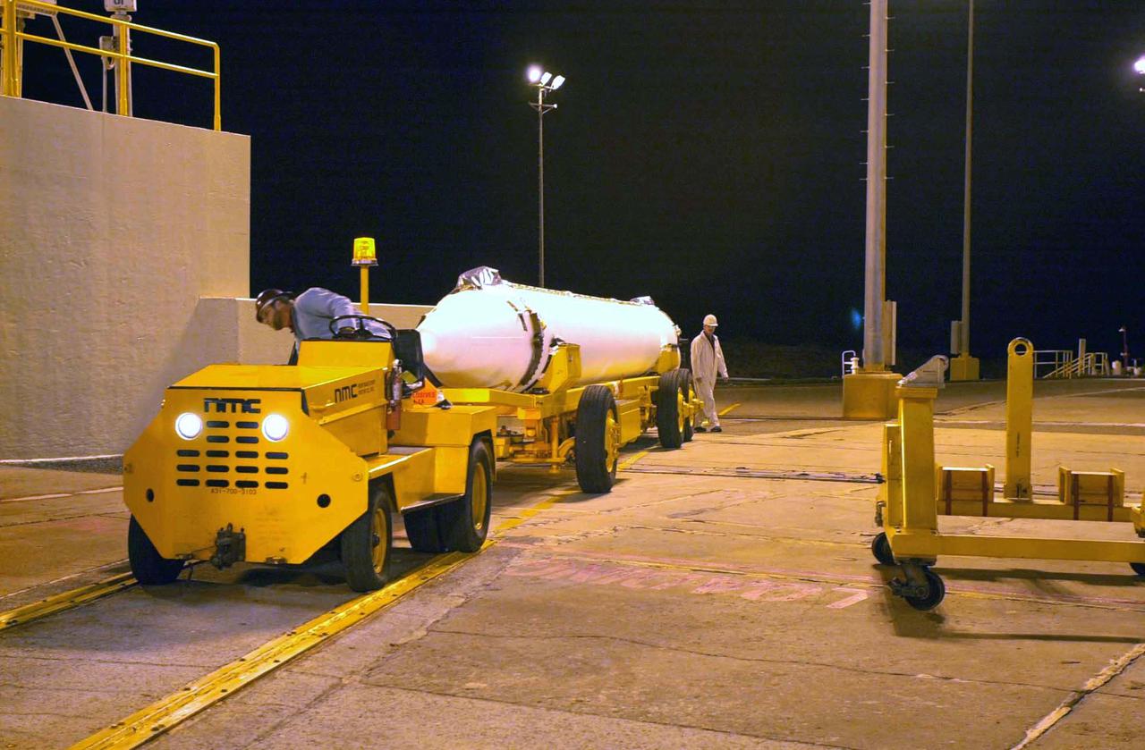
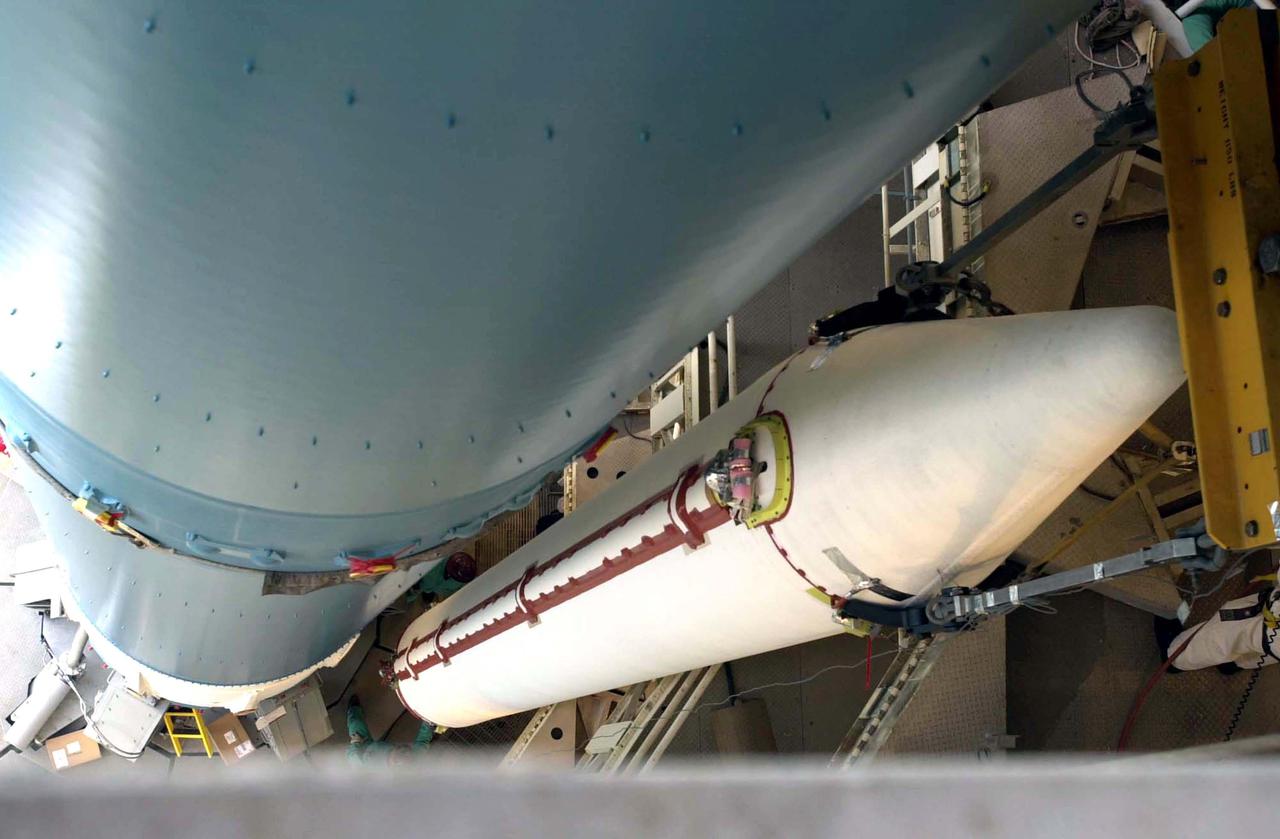
VANDENBERG AIR FORCE BASE, Calif. – A Delta II rocket lifts off Space Launch Complex 2 at Vandenberg Air Force Base, carrying NASA's Soil Moisture Active Passive satellite, or SMAP, to Earth orbit. Liftoff was at 9:22 a.m. EST. SMAP's measurements will be invaluable across many science and applications disciplines including hydrology, climate, carbon cycle, and the meteorological, environmental and ecology applications communities. SMAP is designed to produce the highest-resolution maps of soil moisture ever obtained from space. To learn more about SMAP, visit http://www.nasa.gov/smap. Photo credit: NASA/Kim Shiflett
VANDENBERG AIR FORCE BASE, CALIF. - On Space Launch Complex 2 at Vandenberg Air Force Base in California, one of the two fairing sections for the National Oceanic and Atmospheric Administration (NOAA-N) spacecraft is being lifted up into the launch service tower. The fairing will be placed around the spacecraft to protect it during launch. NOAA-N is the fourth in the series of support dedicated microwave instruments for the generation of temperature, moisture, surface, and hydrological products in cloudy regions where visible and infrared (IR) instruments have decreased capability. Launch aboard a Boeing Delta II rocket is currently scheduled for no earlier than May 11, 2005.
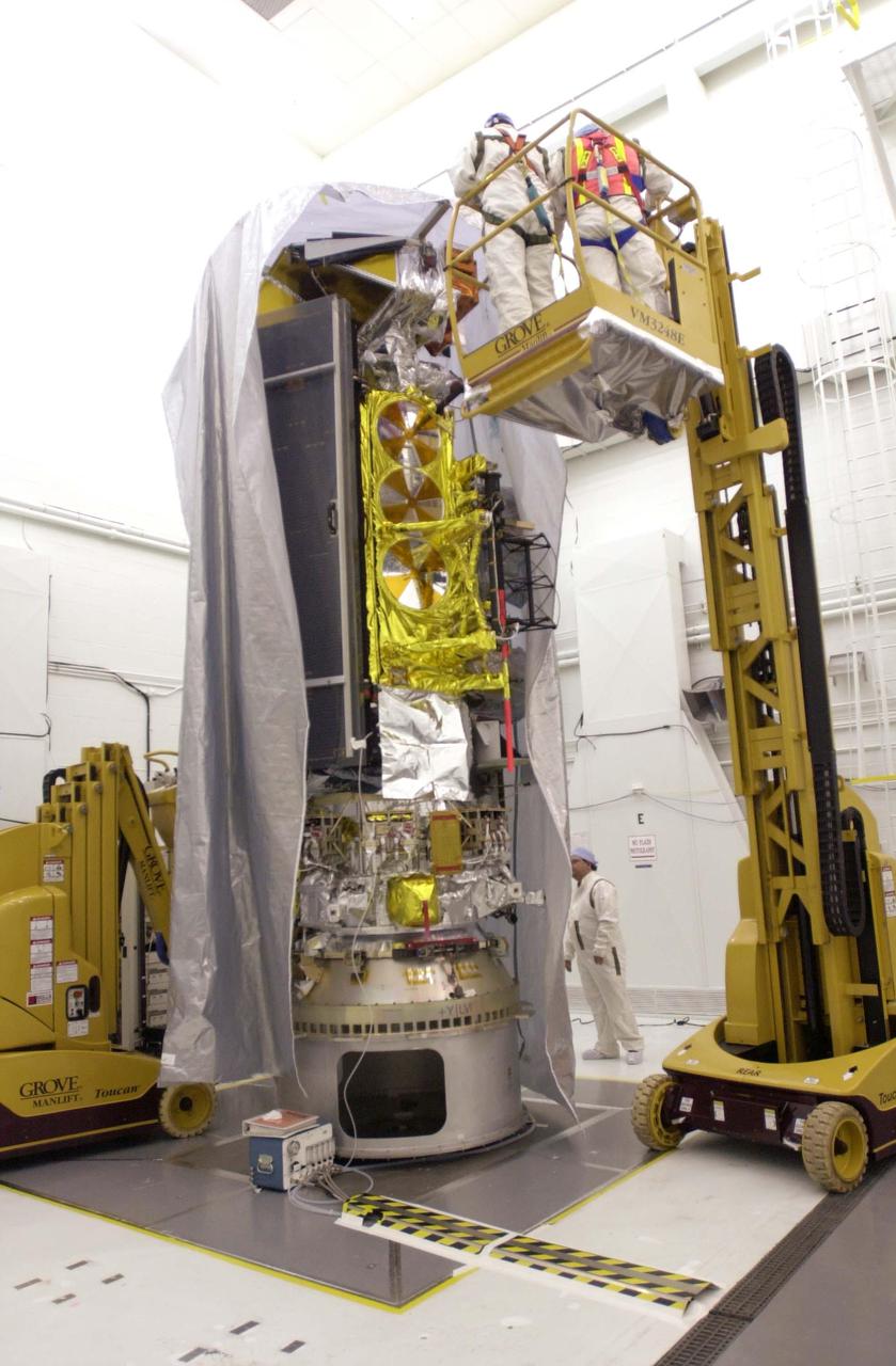
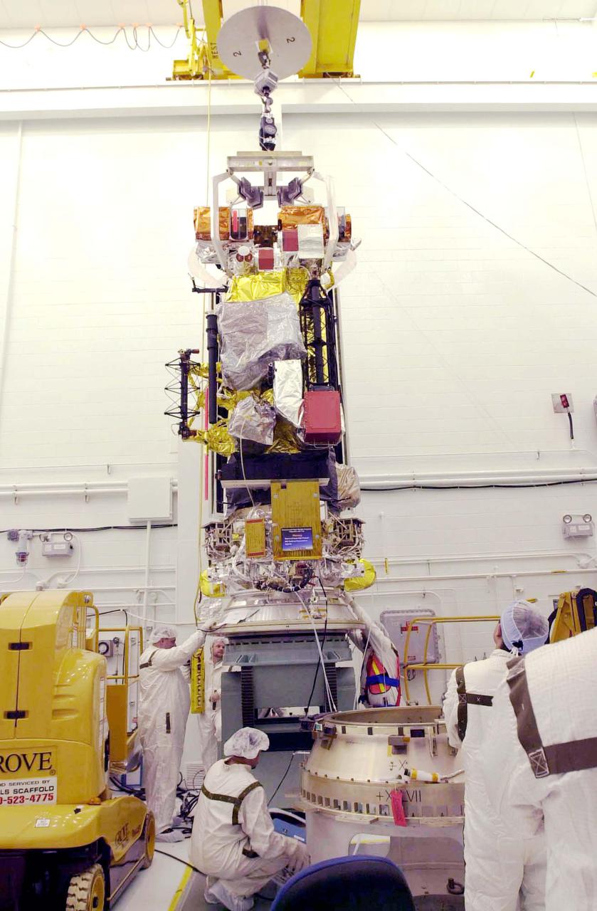
VANDENBERG AIR FORCE BASE, CALIF. - Inside the NASA spacecraft processing hangar 1610 located on North Vandenberg Air Force Base in California, Lockheed Martin workers attach a crane to lift the National Oceanic and Atmospheric Administration (NOAA-N) spacecraft from its shipping container and move it to an assembly and test stand. It will be mated to the Delta II payload attach fitting. Launch of NOAA-N aboard the Boeing Delta II rocket is currently scheduled for May 11, 2005. NOAA-N is the fourth in the series of support dedicated microwave instruments for the generation of temperature, moisture, surface, and hydrological products in cloudy regions where visible and infrared (IR) instruments have decreased capability.
VANDENBERG AIR FORCE BASE, CALIF. - Inside the NASA spacecraft processing hangar 1610 located on North Vandenberg Air Force Base in California, the National Oceanic and Atmospheric Administration (NOAA-N) spacecraft is undergoing testing. The testing includes a the Spacecraft Electrical Performance Test, battery conditioning, a Solar Array Illumination Telemetry Test, final instrument inspections and closeouts for flight. Launch of NOAA-N aboard the Boeing Delta II rocket is currently scheduled for May 11, 2005. NOAA-N is the fourth in the series of support dedicated microwave instruments for the generation of temperature, moisture, surface, and hydrological products in cloudy regions where visible and infrared (IR) instruments have decreased capability.
VANDENBERG AIR FORCE BASE, CALIF. - Inside the NASA spacecraft processing hangar 1610 located on North Vandenberg Air Force Base in California, Lockheed Martin workers place a protective cover around the National Oceanic and Atmospheric Administration (NOAA-N) spacecraft. Mechanical and electrical ground support equipment will be set up and the necessary connections made with the spacecraft. Launch of NOAA-N aboard the Boeing Delta II rocket is currently scheduled for May 11, 2005. NOAA-N is the fourth in the series of support dedicated microwave instruments for the generation of temperature, moisture, surface, and hydrological products in cloudy regions where visible and infrared (IR) instruments have decreased capability.
VANDENBERG AIR FORCE BASE, CALIF. - Inside the NASA spacecraft processing hangar 1610 located on North Vandenberg Air Force Base in California, Lockheed Martin workers check out the National Oceanic and Atmospheric Administration (NOAA-N) spacecraft. Mechanical and electrical ground support equipment will be set up and the necessary connections made with the spacecraft. Launch of NOAA-N aboard the Boeing Delta II rocket is currently scheduled for May 11, 2005. NOAA-N is the fourth in the series of support dedicated microwave instruments for the generation of temperature, moisture, surface, and hydrological products in cloudy regions where visible and infrared (IR) instruments have decreased capability.
VANDENBERG AIR FORCE BASE, CALIF. - Inside the NASA spacecraft processing hangar 1610 located on North Vandenberg Air Force Base in California, the National Oceanic and Atmospheric Administration (NOAA-N) spacecraft is seen from a different view on an assembly and test stand. It will be mated to the Delta II payload attach fitting. Launch of NOAA-N aboard the Boeing Delta II rocket is currently scheduled for May 11, 2005. NOAA-N is the fourth in the series of support dedicated microwave instruments for the generation of temperature, moisture, surface, and hydrological products in cloudy regions where visible and infrared (IR) instruments have decreased capability.
VANDENBERG AIR FORCE BASE, CALIF. - The interstage of a Boeing Delta 2 rocket is mated with the interstage adapter below it in the launch service tower on Space Launch Complex 2 at Vandenberg Air Force Base in California. The Delta 2 is the launch vehicle for the National Oceanic and Atmospheric Administration (NOAA-N) spacecraft. NOAA-N is the fourth in the series of support dedicated microwave instruments for the generation of temperature, moisture, surface, and hydrological products in cloudy regions where visible and infrared (IR) instruments have decreased capability. Launch aboard a Boeing Delta II rocket is currently scheduled for no earlier than May 11, 2005.
VANDENBERG AIR FORCE BASE, CALIF. - Inside the NASA spacecraft processing hangar 1610 located on North Vandenberg Air Force Base in California, Lockheed Martin workers check connections on the National Oceanic and Atmospheric Administration (NOAA-N) spacecraft. Launch of NOAA-N aboard the Boeing Delta II rocket is currently scheduled for May 11, 2005. NOAA-N is the fourth in the series of support dedicated microwave instruments for the generation of temperature, moisture, surface, and hydrological products in cloudy regions where visible and infrared (IR) instruments have decreased capability.
VANDENBERG AIR FORCE BASE, CALIF. - At Space Launch Complex 2 on Vandenberg Air Force Base in California, the first of three Solid Rocket Boosters is lifted alongside the first stage of a Boeing Delta II rocket for mating. The Boeing Delta II will launch the National Oceanic and Atmospheric Administration (NOAA-N) spacecraft. Launch of NOAA-N aboard the Boeing Delta II rocket is currently scheduled for May 11, 2005. NOAA-N is the fourth in the series of support dedicated microwave instruments for the generation of temperature, moisture, surface, and hydrological products in cloudy regions where visible and infrared (IR) instruments have decreased capability.

NASA DC-8 airborne laboratory flying over Mint Canyon near the snow-covered San Gabriel Mountains of California. The mostly white aircraft is silhouetted against the darker mountains in the background.
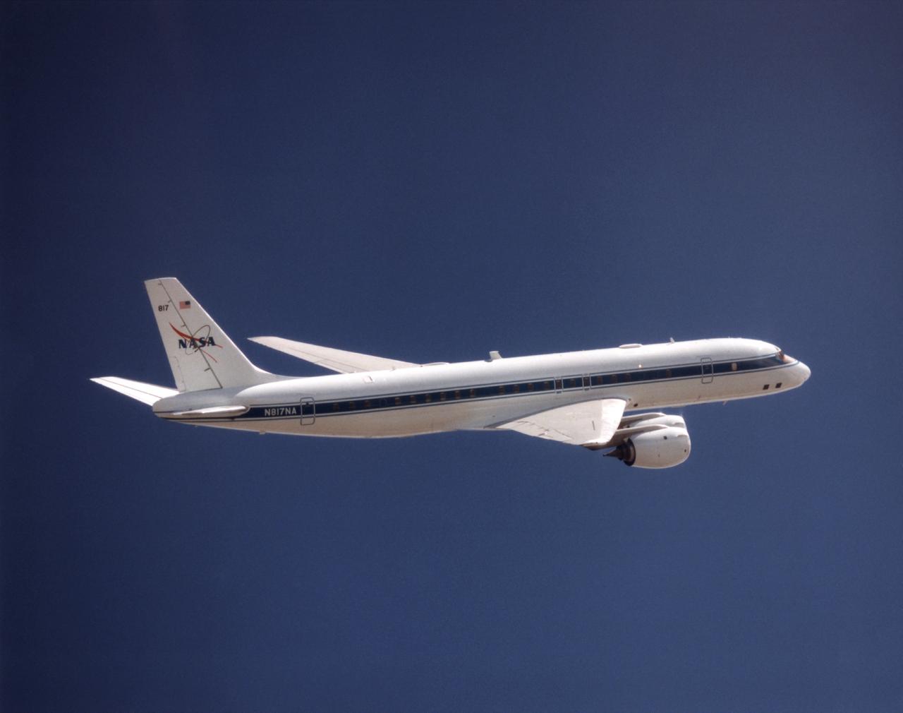
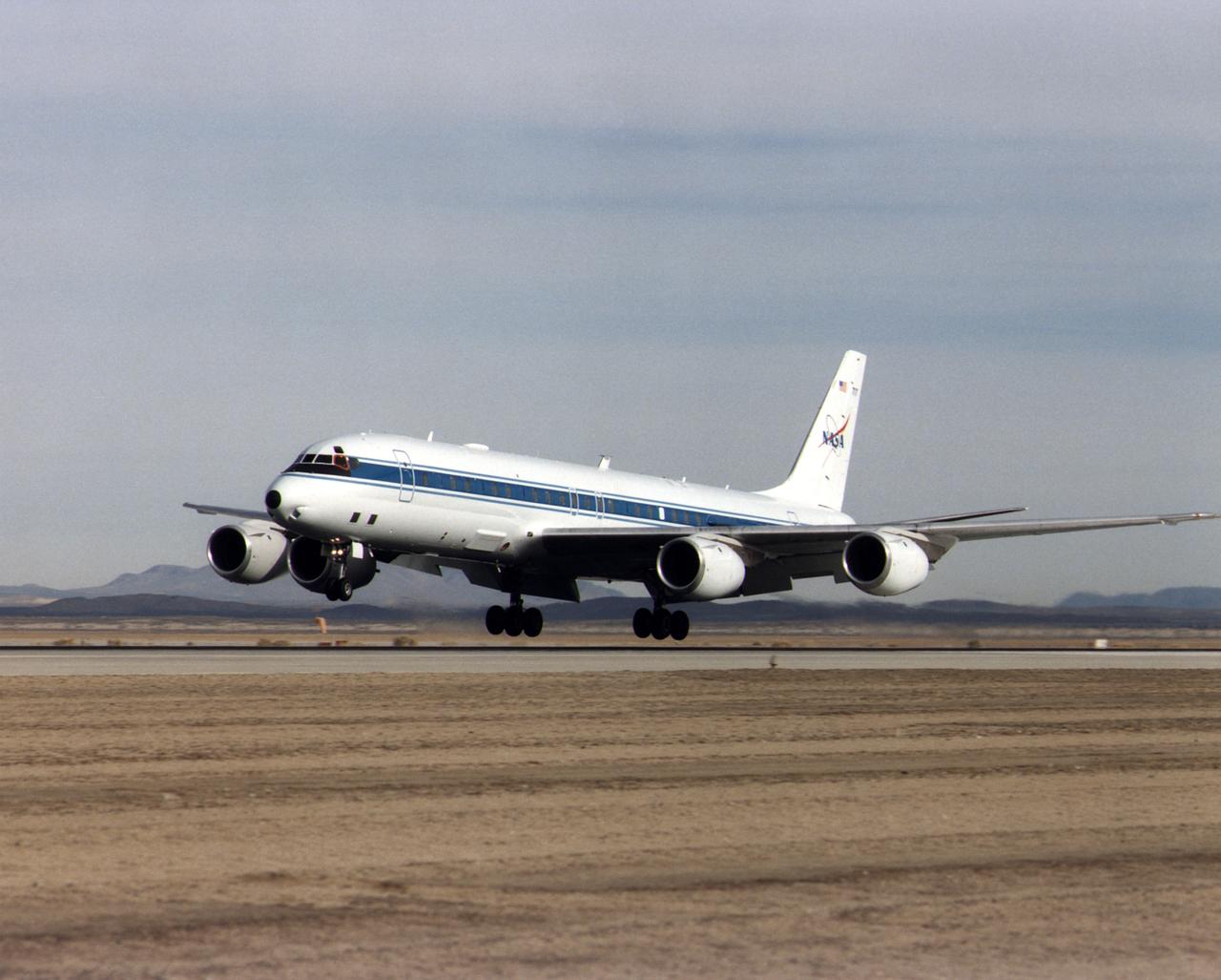
The DC-8 Airborne Laboratory in a left banking turn above the airport at Palmdale, California. The right wing is silhouetted against the blue sky, while the left wing contrasts with the desert terrain. The former airliner is a "dash-72" model and has a range of 5,400 miles. The craft can stay airborne for 12 hours and has an operational speed range between 300 and 500 knots. The research flights are made at between 500 and 41,000 feet. The aircraft can carry up to 30,000 lbs of research/science payload equipment installed in 15 mission-definable spaces.
NASA's DC-8 Airborne Science platform shown against a background of a dark blue sky on February 20, 1998. The aircraft is shown from the right rear, slightly above its plane, with the right wing in the foreground and the left wing and horizontal tail in the background. The former airliner is a "dash-72" model and has a range of 5,400 miles. The craft can stay airborne for 12 hours and has an operational speed range between 300 and 500 knots. The research flights are made at between 500 and 41,000 feet. The aircraft can carry up to 30,000 lbs of research/science payload equipment installed in 15 mission-definable spaces.
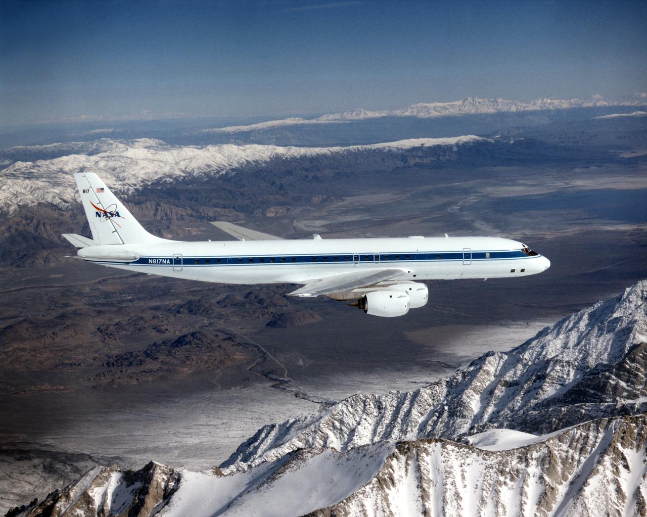
NASA's DC-8 Airborne Laboratory during a flight over the snow-covered Sierra Nevada Mountains. Over the past several years the DC-8 has conducted research missions in such diverse places as the Pacific in spring and Sweden in winter.
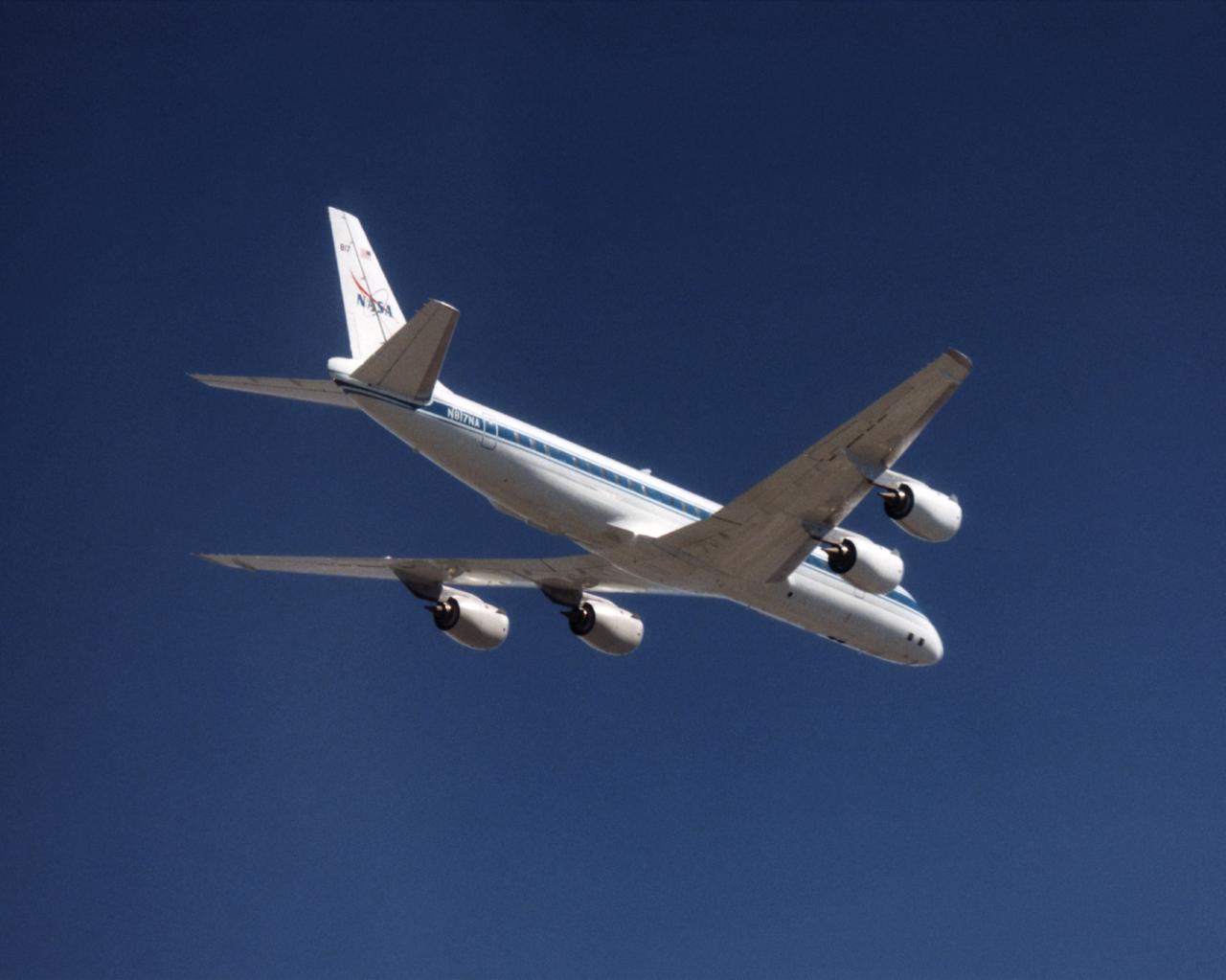
The NASA DC-8 in a right bank over the rugged Sierra Nevada Mountains. The former airliner is a "dash-72" model and has a range of 5,500 miles. The craft can stay airborne for 12 hours and has an operational speed range between 300 and 500 knots. The research flights are made at between 500 and 41,000 feet. The aircraft can carry up to 30,000 lbs of research/science payload equipment installed in 15 mission-definable spaces. In this photo, the aircraft is shown in flight from below, with the DC-8 silhouetted against a blue sky.
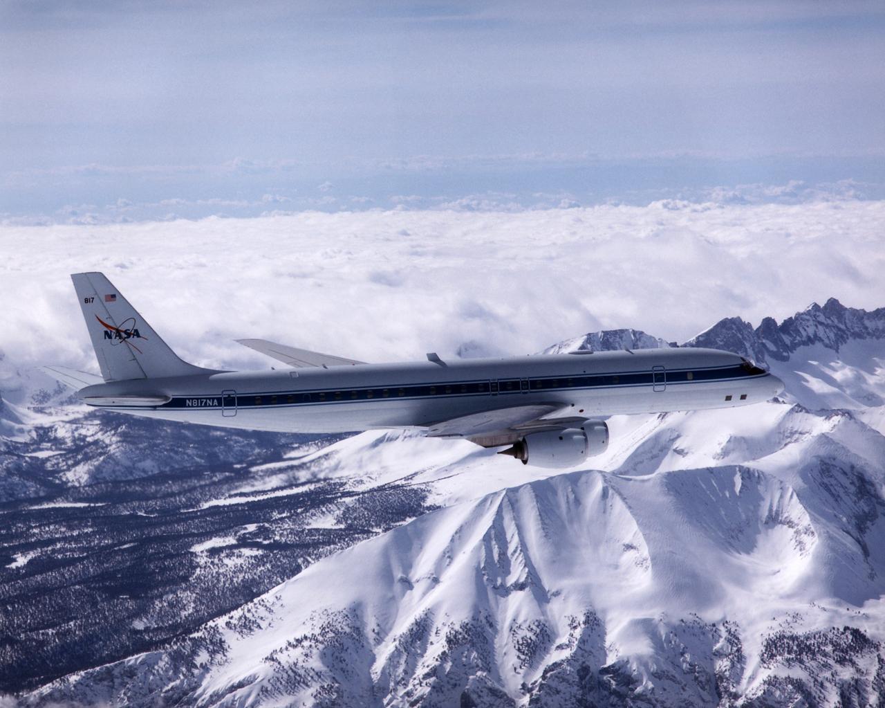
The DC-8 in flight near Lone Pine, Calif. In the foreground are the Sierra Nevada Mountains, covered with winter snow. In the distance are the White Mountains. The DC-8's fuselage is painted white with a dark blue stripe down the side. The wings are silver, while the engine pods are white. In this view of the airplane's right-hand side, only a few of its antennas are visible. The experimental payload can be as great as 30,000 pounds of equipment for gathering data of various sorts.
This is an X-band image showing seasonal changes at the hydrological test site of Bebedouro in Brazil. The image is centered at 9 degrees south latitude and 40.2 degrees west longitude. This image was acquired by the Spaceborne Imaging Radar-C and X-band Synthetic Aperture Radar (SIR-C/X-SAR) aboard the space shuttle Endeavour on April 10, 1994, during the first flight of the radar system, and on October 1, 1994, during the second mission. The swath width is approximately 16.5 kilometers (10.5 miles) wide. The image channels have the following color assignments: red represents data acquired on April 10; green represents data acquired on October 1; blue corresponds to the ratio of the two data sets. Agriculture plays an important economic and social role in Brazil. One of the major problems related to Brazilian agriculture is estimating the size of planting areas and their productivity. Due to cloud cover and the rainy season, which occurs from November through April, optical and infrared Earth observations are seldom used to survey the region. An additional goal of monitoring this region is to watch the floodplains of rivers like Rio Sao Francisco in order to determine suitable locations for additional agricultural fields. This area belongs to the semi-arid northeastern region of Brazil, where estimates have suggested that about 10 times more land could be used for agriculture, including some locations which could be used for irrigation projects. Monitoring of soil moisture during the important summer crop season is of high priority for the future development and productivity of this region. In April the area was covered with vegetation because of the moisture of the soil and only small differences could be seen in X-band data. In October the run-off channels of this hilly region stand out quite clearly because the greenish areas indicated much less soil moisture and water content in plants. http://photojournal.jpl.nasa.gov/catalog/PIA01733
S73-34295B (June 1973) --- A vertical view of a portion of northern California reproduced from data taken from the Skylab Multispectral Scanner, experiment S192, in the Skylab space station in Earth orbit. This view is the most westerly one-third of Frame No. 001, Roll No. 518, S192, Skylab 2. Frame No. 001 extends from the Pacific coast at the Eureka area southeasterly 175 nautical miles to the Feather River drainage basin. Included in this view are Lake Shasta, Sacramento River Valley, Redding and Red Bluff. This non-photographic image is a color composite of channels 2 (visible), 7, and 12 (infrared) from the Earth Resources Experiments Package (EREP) S192 scanner. The scanner techniques assist with spectral signature identification and mapping of ground truth targets in agriculture, forestry, geology, hydrology and oceanography. Photo credit: NASA
S73-34295 (June 1973) --- A vertical view of a portion of northern California reproduced from data taken from the Skylab Multispectral Scanner, experiment S192, in the Skylab space station in Earth orbit. This view is the most westerly one-third of Frame No. 001, Roll No. 518, S192, Skylab 2. Frame No. 001 extends from the Pacific coast at the Eureka area southeasterly 175 nautical miles to the Feather River drainage basin. Included in this view are Eureka, Trinidad, Klamath & Trinity Rivers and the Coastal Range mountains. This non-photographic image is a color composite of channels 2 (visible), 7, and 12 (infrared) from the Earth Resources Experiments Package (EREP) S192 scanner. The scanner techniques assist with spectral signature identification and mapping of ground truth targets in agriculture, forestry, geology, hydrology and oceanography. Photo credit: NASA
SL4-139-4040 (10 Jan. 1974) --- An oblique view of a portion of the Western United States, as photographed from the Skylab space station in Earth orbit by one of the Skylab 4 crewmen. The camera used was a hand-held 70mm Hasselblad, with SO-368 medium-speed Ektachrome film. This photograph is one of a stereo pair (the other being 4039) taken to support the hydrological studies of the changing snow patterns in several watersheds. Stereo analysis will enable snow to be distinguished from clouds quantitatively. In a qualitative sense, the clouds are the fuzzy white, whereas the snow is distinct white. The area covered is from the Colorado Springs, Colorado area at the south to (and beyond) the Black Hills, South Dakota area. The Black Forest between Colorado Springs and Denver is evident as are the mountains west of these cities. South Park, west of Colorado Springs, and the South Platte River running north and east from Denver are two other conspicuous features. Photo credit: NASA
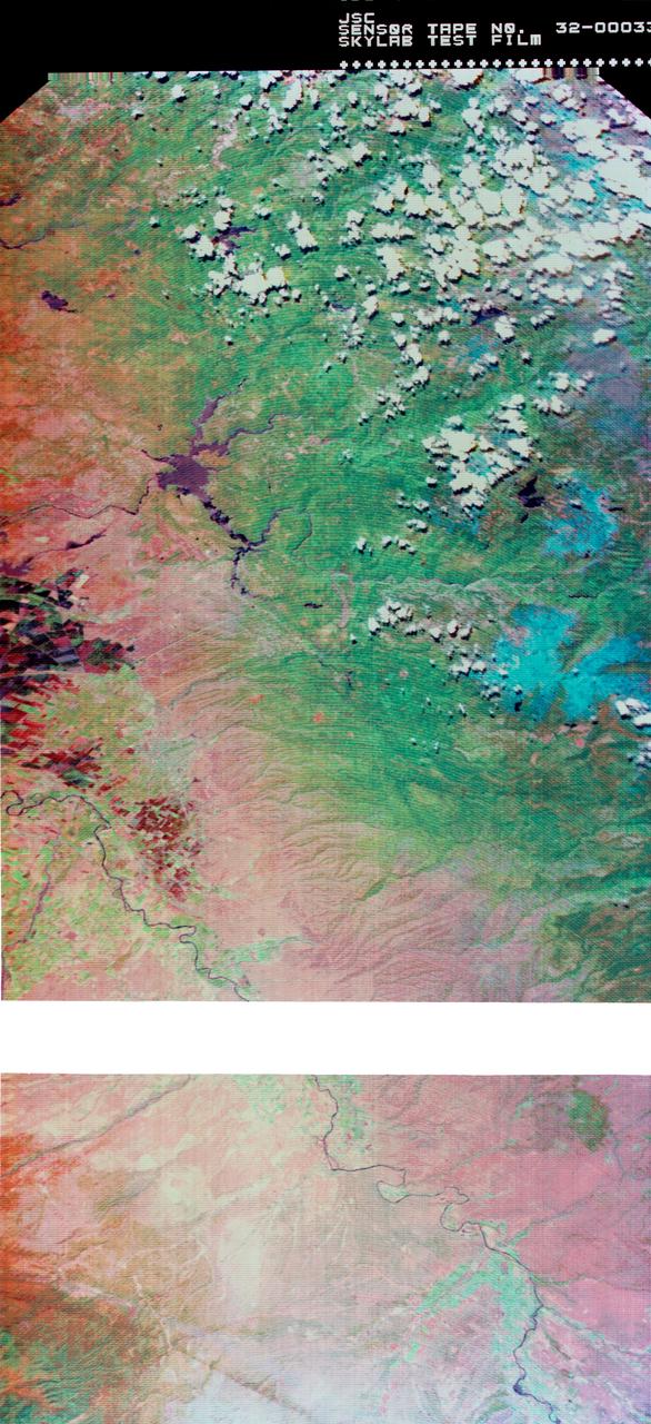
S73-34295A (June 1973) --- A vertical view of a portion of northern California reproduced from data taken from the Skylab Multispectral Scanner, experiment S192, in the Skylab space station in Earth orbit. This view is the most westerly one-third of Frame No. 001, Roll No. 518, S192, Skylab 2. Frame No. 001 extends from the Pacific coast at the Eureka area southeasterly 175 nautical miles to the Feather River drainage basin. Included in this view are Sacramento River Valley, Oroville Reservoir, Oroville and Chico. This non-photographic image is a color composite of channels 2 (visible), 7 and 12 (infrared) from the Earth Resources Experiments Package (EREP) S192 scanner. The scanner techniques assist with spectral signature identification and mapping of ground truth targets in agriculture, forestry, geology, hydrology and oceanography. Photo credit: NASA
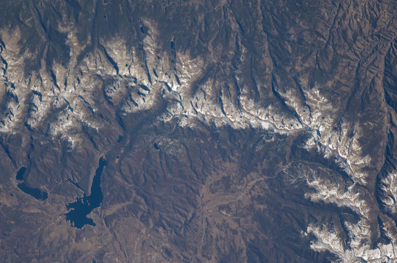
ISS018-E-005660 (28 Oct. 2008) --- The Great Divide of the Rocky Mountains in Colorado is featured in this image photographed by an Expedition 18 crewmember on the International Space Station. This view highlights a portion of the Great Divide in the Rocky Mountains approximately 31 kilometers due west of Boulder, Colorado. The Great Divide is one of four continental divides recognized by geographers and hydrologists in North America -- the others being the Northern, Eastern, and Saint Lawrence Seaway Divides -- but it is still generally (and erroneously) known as "the" Continental Divide. The Great Divide is a hydrologic boundary defined by the ultimate destination of precipitation -- rainfall on the western side of the Divide flows to the Pacific Ocean, while rainfall on the eastern side of the Divide flows to the Gulf of Mexico. It is easy to visualize such a boundary traced along the high ridges of the Rocky Mountains, but in regions of less topography more detailed study of the local geomorphology and hydrology are required to map the location of the Divide. This portion of the Rocky Mountains also hosts the Niwot Ridge Long Term Ecological Research (LTER) site. Part of the National Science Foundation LTER program, the Niwot Ridge LTER site studies climate interactions with tundra and alpine ecosystems. Niwot Ridge is visible in this image as a large eastward spur off the central spine of the mountains. The entire Niwot LTER site is located at elevations higher than 3000 m, and includes an active cirque glacier and glacial landforms, tarns (glacial lakes), and permafrost. Lake Granby, located to the west of the Great Divide, is a reservoir on the Colorado River and the second-largest manmade body of water in the state of Colorado. Storage of water began in 1949. Today, the Lake is popular location for fishing, boating and camping.
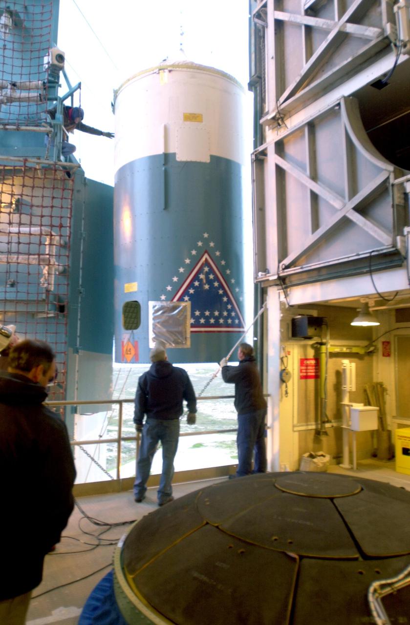
VANDENBERG AIR FORCE BASE, CALIF. - The interstage of a Boeing Delta 2 rocket arrives on Space Launch Complex 2 at Vandenberg Air Force Base in California. It will be mated with the first stage in the launch service tower. The Delta 2 is the launch vehicle for the National Oceanic and Atmospheric Administration (NOAA-N) spacecraft. The NOAA-N satellite will be placed into a polar orbit aboard a Boeing Delta 2 rocket. The spacecraft will continue to provide a polar-orbiting platform to support (1) environmental monitoring instruments for imaging and measuring the Earth's atmosphere, its surface, and cloud cover, including Earth radiation, atmospheric ozone, aerosol distribution, sea surface temperature, and vertical temperature and water profiles in the troposphere and stratosphere; (2) measurement of proton and electron flux at orbit altitude; (3) data collection from remote platforms; and (4) the Search and Rescue Satellite-Aided Tracking (SARSAT) system. Additionally, NOAA-N is the fourth in the series of support dedicated microwave instruments for the generation of temperature, moisture, surface, and hydrological products in cloudy regions where visible and infrared (IR) instruments have decreased capability. Launch is currently scheduled for no earlier than May 11, 2005.

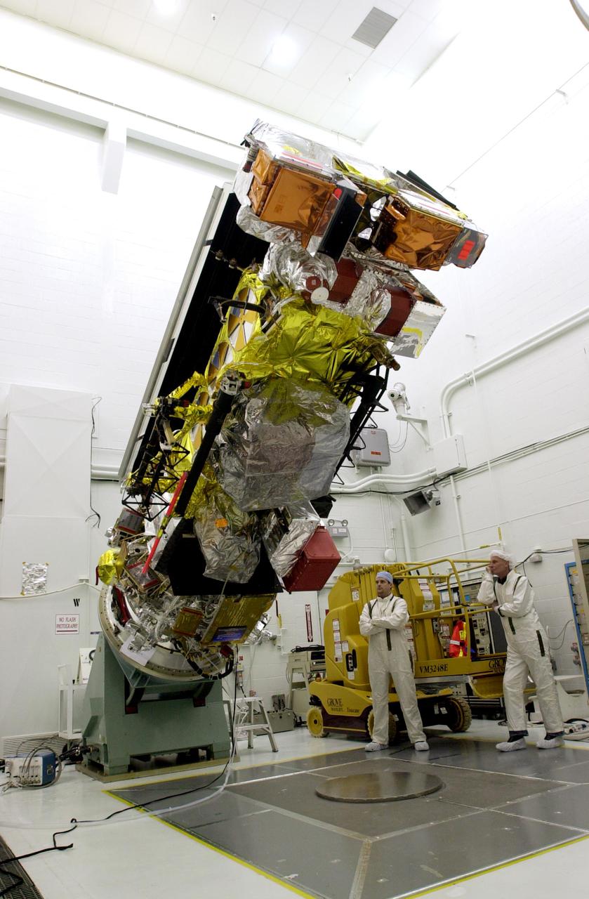
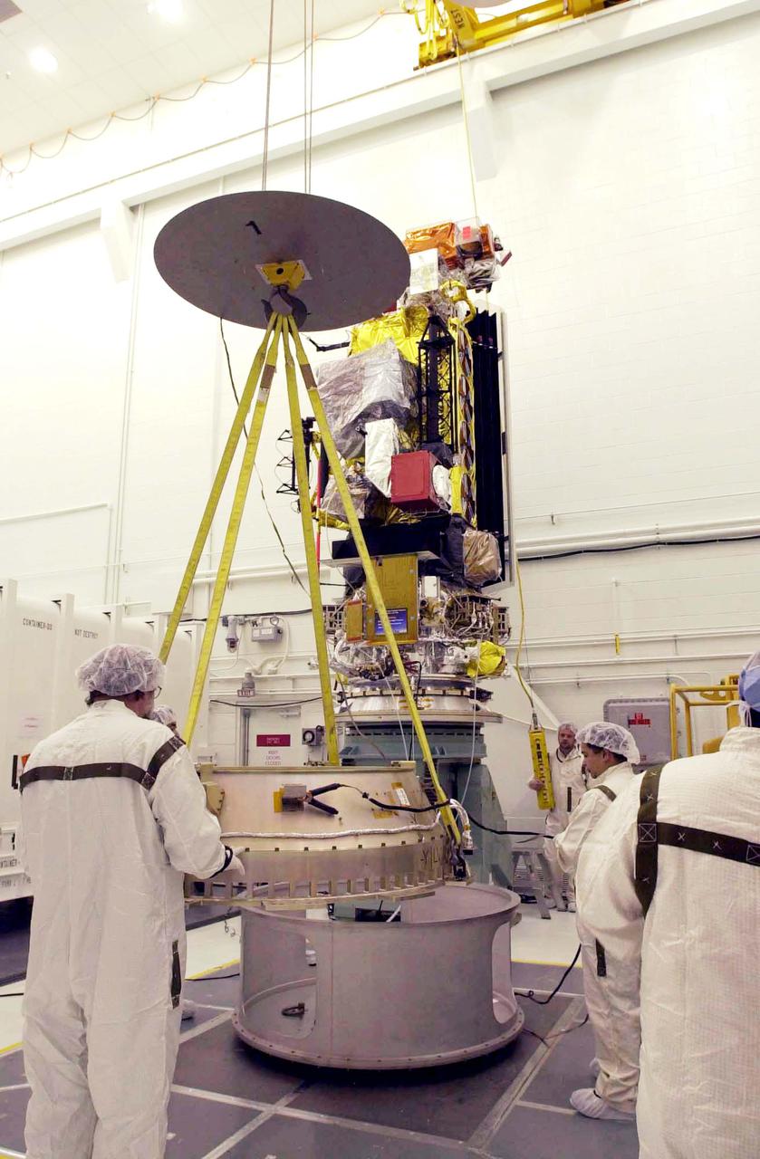
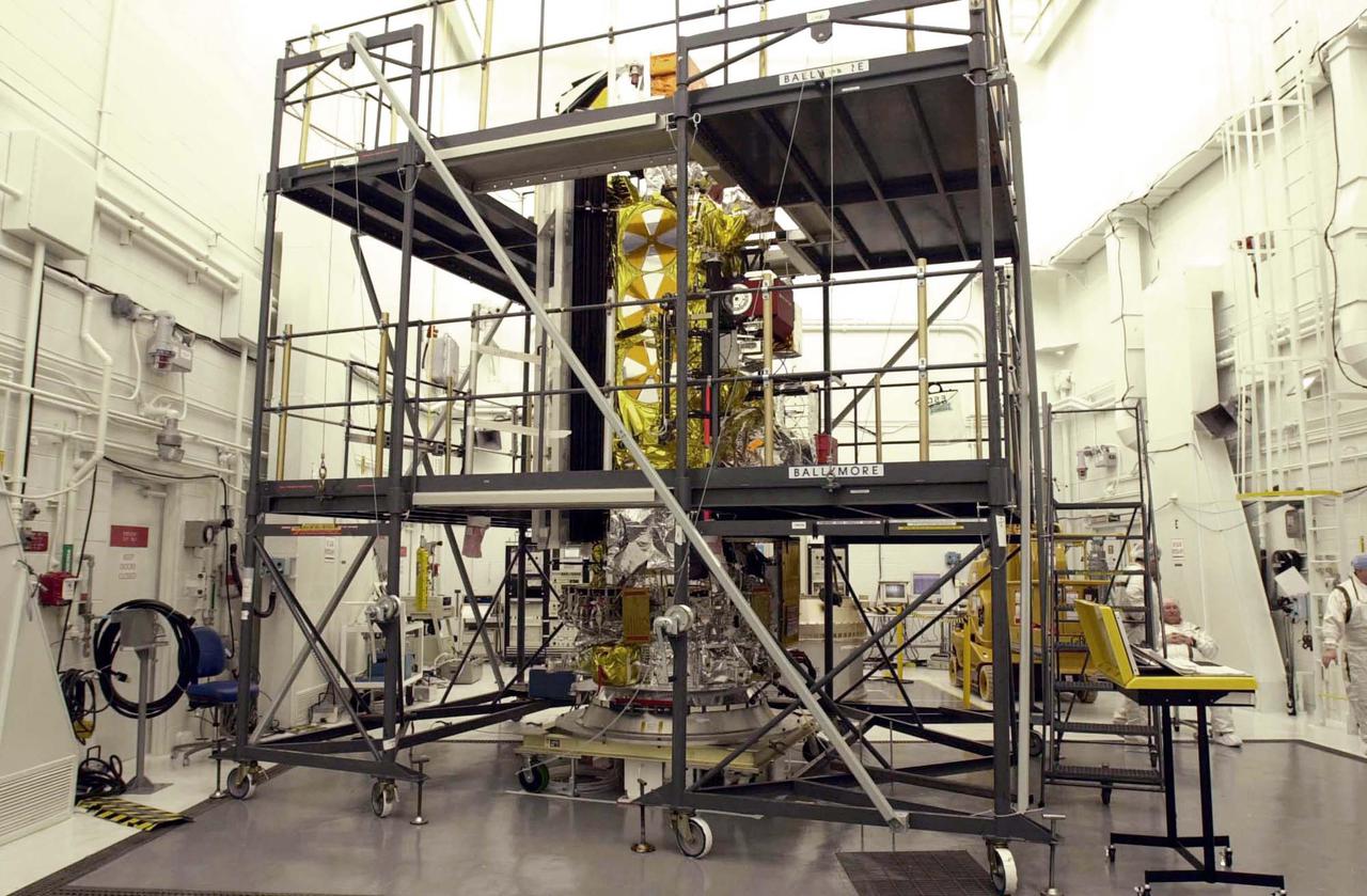
NASA and the French space agency Centre National d’Études Spatiales (CNES) hold a science briefing on the Surface Water and Ocean Topography (SWOT) mission on Dec. 13, 2022, at Vandenberg Space Force Base in California. Participating from left are Katherine Calvin, chief scientist and senior climate advisor, NASA; Selma Cherchali, Earth observation program head, CNES; Nadya Vinogradova Shiffer, SWOT program scientist, NASA; Tamlin Pavelsky, SWOT hydrology science lead, University of North Carolina; Benjamin Hamlington, research scientist, Sea Level and Ice Group, Jet Propulsion Laboratory. SWOT is scheduled to launch on a SpaceX Falcon 9 rocket from Space Launch Complex-4 East at Vandenberg on Dec. 15, 2022, at 3:46 a.m. PST. SWOT will be NASA’s first global survey of nearly all water on Earth’s surface. Scientists plan to use its observations to better understand the global water cycle, furnish insight into the ocean’s role in how climate change unfolds, and provide a global inventory of water resources. The SWOT mission is a collaborative effort between NASA and CNES with contributions from the Canadian Space Agency and the UK Space Agency. NASA’s Launch Services Program, based at the agency’s Kennedy Space Center in Florida, is managing the launch service.
VANDENBERG AIR FORCE BASE, CALIF. - At Vandenberg Air Force Base in California, the National Oceanic and Atmospheric Administration (NOAA-N) spacecraft is being transported to a hangar for preflight processing. The NOAA-N satellite will be placed into a polar orbit aboard a Boeing Delta 2 rocket. The spacecraft will continue to provide a polar-orbiting platform to support (1) environmental monitoring instruments for imaging and measuring the Earth's atmosphere, its surface, and cloud cover, including Earth radiation, atmospheric ozone, aerosol distribution, sea surface temperature, and vertical temperature and water profiles in the troposphere and stratosphere; (2) measurement of proton and electron flux at orbit altitude; (3) data collection from remote platforms; and (4) the Search and Rescue Satellite-Aided Tracking (SARSAT) system. Additionally, NOAA-N is the fourth in the series of support dedicated microwave instruments for the generation of temperature, moisture, surface, and hydrological products in cloudy regions where visible and infrared (IR) instruments have decreased capability. Launch is currently scheduled for no earlier than May 11, 2005.
VANDENBERG AIR FORCE BASE, CALIF. - At Vandenberg Air Force Base in California, workers move the National Oceanic and Atmospheric Administration (NOAA-N) spacecraft into a hangar where it will undergo preflight processing. The NOAA-N satellite will be placed into a polar orbit aboard a Boeing Delta 2 rocket. The spacecraft will continue to provide a polar-orbiting platform to support (1) environmental monitoring instruments for imaging and measuring the Earth's atmosphere, its surface, and cloud cover, including Earth radiation, atmospheric ozone, aerosol distribution, sea surface temperature, and vertical temperature and water profiles in the troposphere and stratosphere; (2) measurement of proton and electron flux at orbit altitude; (3) data collection from remote platforms; and (4) the Search and Rescue Satellite-Aided Tracking (SARSAT) system. Additionally, NOAA-N is the fourth in the series of support dedicated microwave instruments for the generation of temperature, moisture, surface, and hydrological products in cloudy regions where visible and infrared (IR) instruments have decreased capability. Launch is currently scheduled for no earlier than May 11, 2005.
VANDENBERG AIR FORCE BASE, CALIF. - Workers on Space Launch Complex 2 at Vandenberg Air Force Base in California secure the engine on the first stage of a Boeing Delta 2 rocket. The rocket will be lifted up the launch service tower. The Delta 2 is the launch vehicle for the National Oceanic and Atmospheric Administration (NOAA-N) spacecraft.The NOAA-N satellite will be placed into a polar orbit aboard a Boeing Delta 2 rocket. The spacecraft will continue to provide a polar-orbiting platform to support (1) environmental monitoring instruments for imaging and measuring the Earth's atmosphere, its surface, and cloud cover, including Earth radiation, atmospheric ozone, aerosol distribution, sea surface temperature, and vertical temperature and water profiles in the troposphere and stratosphere; (2) measurement of proton and electron flux at orbit altitude; (3) data collection from remote platforms; and (4) the Search and Rescue Satellite-Aided Tracking (SARSAT) system. Additionally, NOAA-N is the fourth in the series of support dedicated microwave instruments for the generation of temperature, moisture, surface, and hydrological products in cloudy regions where visible and infrared (IR) instruments have decreased capability. Launch is currently scheduled for no earlier than May 11, 2005.

NASA and the French space agency Centre National d’Études Spatiales (CNES) hold a science briefing on the Surface Water and Ocean Topography (SWOT) mission on Dec. 13, 2022, at Vandenberg Space Force Base in California. Participating from left are Katherine Calvin, chief scientist and senior climate advisor, NASA; Selma Cherchali, Earth observation program head, CNES; Nadya Vinogradova Shiffer, SWOT program scientist, NASA; Tamlin Pavelsky, SWOT hydrology science lead, University of North Carolina; Benjamin Hamlington, research scientist, Sea Level and Ice Group, Jet Propulsion Laboratory. SWOT is scheduled to launch on a SpaceX Falcon 9 rocket from Space Launch Complex-4 East at Vandenberg on Dec. 15, 2022, at 3:46 a.m. PST. SWOT will be NASA’s first global survey of nearly all water on Earth’s surface. Scientists plan to use its observations to better understand the global water cycle, furnish insight into the ocean’s role in how climate change unfolds, and provide a global inventory of water resources. The SWOT mission is a collaborative effort between NASA and CNES with contributions from the Canadian Space Agency and the UK Space Agency. NASA’s Launch Services Program, based at the agency’s Kennedy Space Center in Florida, is managing the launch service.
VANDENBERG AIR FORCE BASE, CALIF. - On Space Launch Complex 2 at Vandenberg Air Force Base in California, the first stage of a Boeing Delta 2 rocket has been raised to a vertical position for erection in the launch service tower. The Delta 2 is the launch vehicle for the National Oceanic and Atmospheric Administration (NOAA-N) spacecraft. The NOAA-N satellite will be placed into a polar orbit aboard a Boeing Delta 2 rocket. The spacecraft will continue to provide a polar-orbiting platform to support (1) environmental monitoring instruments for imaging and measuring the Earth's atmosphere, its surface, and cloud cover, including Earth radiation, atmospheric ozone, aerosol distribution, sea surface temperature, and vertical temperature and water profiles in the troposphere and stratosphere; (2) measurement of proton and electron flux at orbit altitude; (3) data collection from remote platforms; and (4) the Search and Rescue Satellite-Aided Tracking (SARSAT) system. Additionally, NOAA-N is the fourth in the series of support dedicated microwave instruments for the generation of temperature, moisture, surface, and hydrological products in cloudy regions where visible and infrared (IR) instruments have decreased capability. Launch is currently scheduled for no earlier than May 11, 2005.

Tamlin Pavelsky, SWOT hydrology science lead, University of North Carolina, participates in a science briefing held by NASA and the French space agency Centre National d’Études Spatiales (CNES) for the Surface Water and Ocean Topography (SWOT) mission on Dec. 13, 2022, at Vandenberg Space Force Base in California. SWOT is scheduled to launch on a SpaceX Falcon 9 rocket from Space Launch Complex-4 East at Vandenberg on Dec. 15, 2022, at 3:46 a.m. PST. SWOT will be NASA’s first global survey of nearly all water on Earth’s surface. Scientists plan to use its observations to better understand the global water cycle, furnish insight into the ocean’s role in how climate change unfolds, and provide a global inventory of water resources. The SWOT mission is a collaborative effort between NASA and CNES with contributions from the Canadian Space Agency and the UK Space Agency. NASA’s Launch Services Program, based at the agency’s Kennedy Space Center in Florida, is managing the launch service.
VANDENBERG AIR FORCE BASE, CALIF. - In the launch service tower on Space Launch Complex 2 at Vandenberg Air Force Base in California, the interstage of a Boeing Delta 2 rocket is lowered toward the interstage adapter. The two stages will be mated for launch of the National Oceanic and Atmospheric Administration (NOAA-N) spacecraft. The NOAA-N satellite will be placed into a polar orbit aboard a Boeing Delta 2 rocket. The spacecraft will continue to provide a polar-orbiting platform to support (1) environmental monitoring instruments for imaging and measuring the Earth's atmosphere, its surface, and cloud cover, including Earth radiation, atmospheric ozone, aerosol distribution, sea surface temperature, and vertical temperature and water profiles in the troposphere and stratosphere; (2) measurement of proton and electron flux at orbit altitude; (3) data collection from remote platforms; and (4) the Search and Rescue Satellite-Aided Tracking (SARSAT) system. Additionally, NOAA-N is the fourth in the series of support dedicated microwave instruments for the generation of temperature, moisture, surface, and hydrological products in cloudy regions where visible and infrared (IR) instruments have decreased capability. Launch is currently scheduled for no earlier than May 11, 2005.
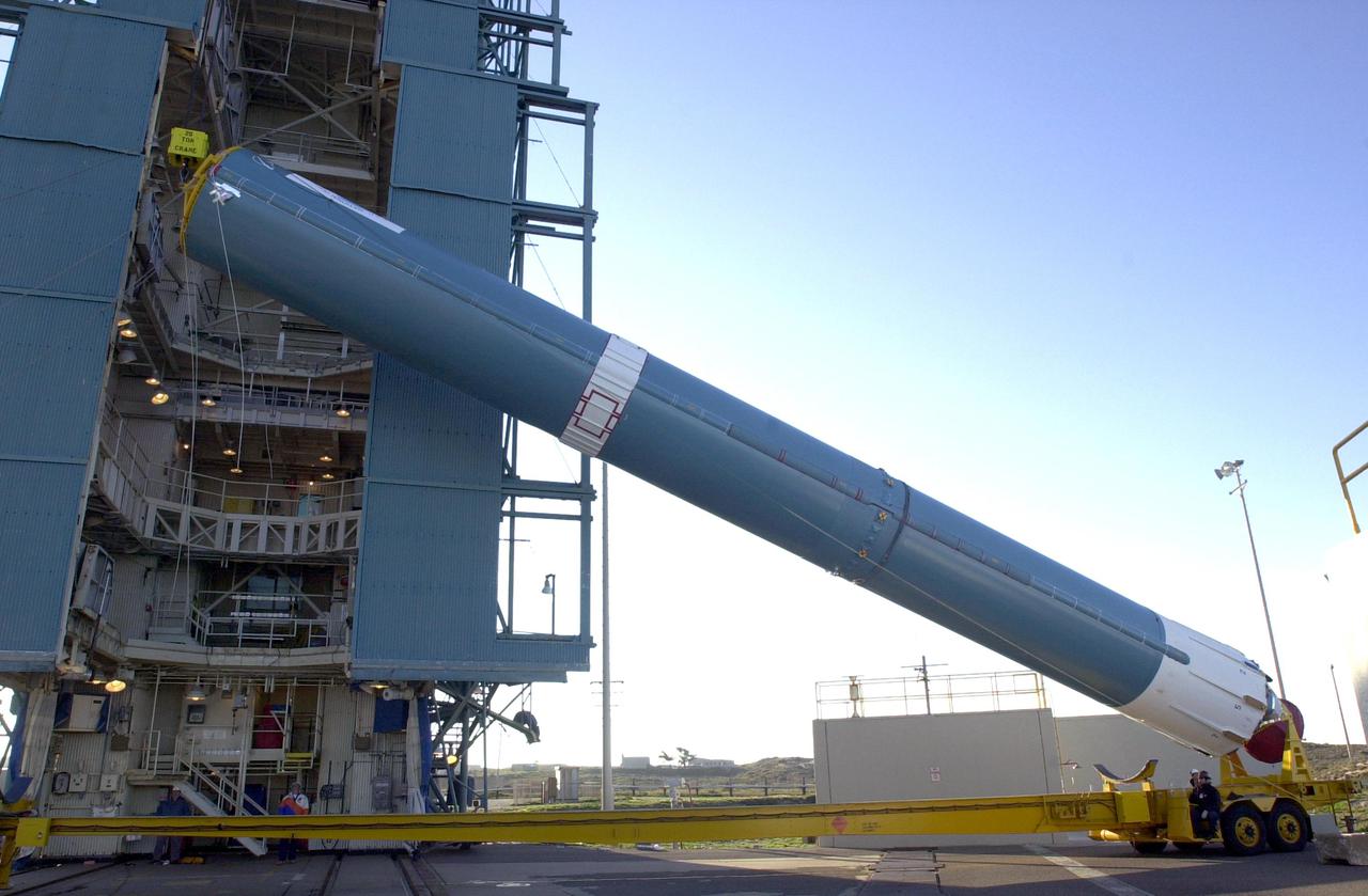
VANDENBERG AIR FORCE BASE, CALIF. - On Space Launch Complex 2 at Vandenberg Air Force Base in California, the first stage of a Boeing Delta 2 rocket is being raised to a vertical position for erection in the launch service tower. The Delta 2 is the launch vehicle for the National Oceanic and Atmospheric Administration (NOAA-N) spacecraft. The NOAA-N satellite will be placed into a polar orbit aboard a Boeing Delta 2 rocket. The spacecraft will continue to provide a polar-orbiting platform to support (1) environmental monitoring instruments for imaging and measuring the Earth's atmosphere, its surface, and cloud cover, including Earth radiation, atmospheric ozone, aerosol distribution, sea surface temperature, and vertical temperature and water profiles in the troposphere and stratosphere; (2) measurement of proton and electron flux at orbit altitude; (3) data collection from remote platforms; and (4) the Search and Rescue Satellite-Aided Tracking (SARSAT) system. Additionally, NOAA-N is the fourth in the series of support dedicated microwave instruments for the generation of temperature, moisture, surface, and hydrological products in cloudy regions where visible and infrared (IR) instruments have decreased capability. Launch is currently scheduled for no earlier than May 11, 2005.
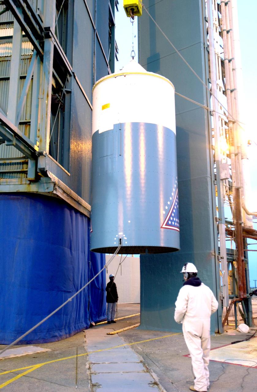
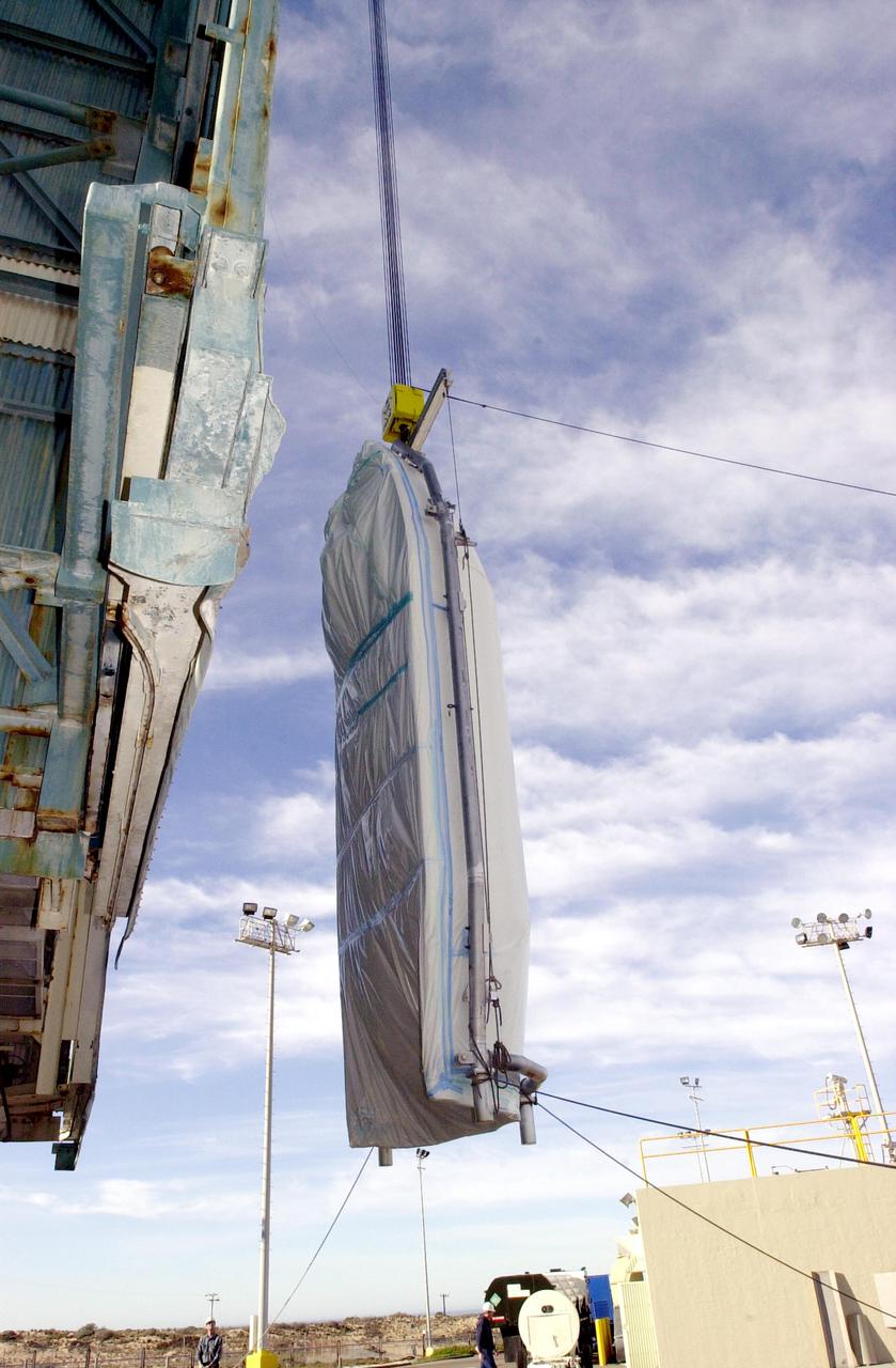
VANDENBERG AIR FORCE BASE, CALIF. - One-half of the fairing for the National Oceanic and Atmospheric Administration (NOAA-N) spacecraft is inside the launch service tower on Space Launch Complex 2 at Vandenberg Air Force Base in California. The NOAA-N satellite will be placed into a polar orbit aboard a Boeing Delta 2 rocket. The spacecraft will continue to provide a polar-orbiting platform to support (1) environmental monitoring instruments for imaging and measuring the Earth's atmosphere, its surface, and cloud cover, including Earth radiation, atmospheric ozone, aerosol distribution, sea surface temperature, and vertical temperature and water profiles in the troposphere and stratosphere; (2) measurement of proton and electron flux at orbit altitude; (3) data collection from remote platforms; and (4) the Search and Rescue Satellite-Aided Tracking (SARSAT) system. Additionally, NOAA-N is the fourth in the series of support dedicated microwave instruments for the generation of temperature, moisture, surface, and hydrological products in cloudy regions where visible and infrared (IR) instruments have decreased capability. Launch is currently scheduled for no earlier than May 11, 2005.
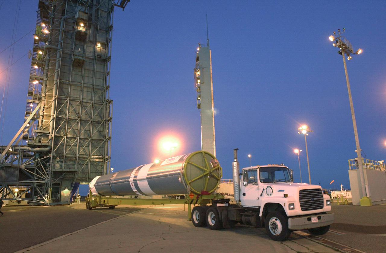
VANDENBERG AIR FORCE BASE, CALIF. - The first stage of a Boeing Delta 2 rocket arrives at Space Launch Complex 2 at Vandenberg Air Force Base in California. The Delta 2 is the launch vehicle for the National Oceanic and Atmospheric Administration (NOAA-N) spacecraft. The NOAA-N satellite will be placed into a polar orbit aboard a Boeing Delta 2 rocket. The spacecraft will continue to provide a polar-orbiting platform to support (1) environmental monitoring instruments for imaging and measuring the Earth's atmosphere, its surface, and cloud cover, including Earth radiation, atmospheric ozone, aerosol distribution, sea surface temperature, and vertical temperature and water profiles in the troposphere and stratosphere; (2) measurement of proton and electron flux at orbit altitude; (3) data collection from remote platforms; and (4) the Search and Rescue Satellite-Aided Tracking (SARSAT) system. Additionally, NOAA-N is the fourth in the series of support dedicated microwave instruments for the generation of temperature, moisture, surface, and hydrological products in cloudy regions where visible and infrared (IR) instruments have decreased capability. Launch is currently scheduled for no earlier than May 11, 2005.
VANDENBERG AIR FORCE BASE, CALIF. - At an upper level of the launch service tower on Space Launch Complex 2 at Vandenberg Air Force Base in California, workers help guide the interstage of a Boeing Delta 2 rocket inside. It will be mated with the first stage in the launch service tower for launch of the National Oceanic and Atmospheric Administration (NOAA-N) spacecraft. The NOAA-N satellite will be placed into a polar orbit aboard a Boeing Delta 2 rocket. The spacecraft will continue to provide a polar-orbiting platform to support (1) environmental monitoring instruments for imaging and measuring the Earth's atmosphere, its surface, and cloud cover, including Earth radiation, atmospheric ozone, aerosol distribution, sea surface temperature, and vertical temperature and water profiles in the troposphere and stratosphere; (2) measurement of proton and electron flux at orbit altitude; (3) data collection from remote platforms; and (4) the Search and Rescue Satellite-Aided Tracking (SARSAT) system. Additionally, NOAA-N is the fourth in the series of support dedicated microwave instruments for the generation of temperature, moisture, surface, and hydrological products in cloudy regions where visible and infrared (IR) instruments have decreased capability. Launch is currently scheduled for no earlier than May 11, 2005.
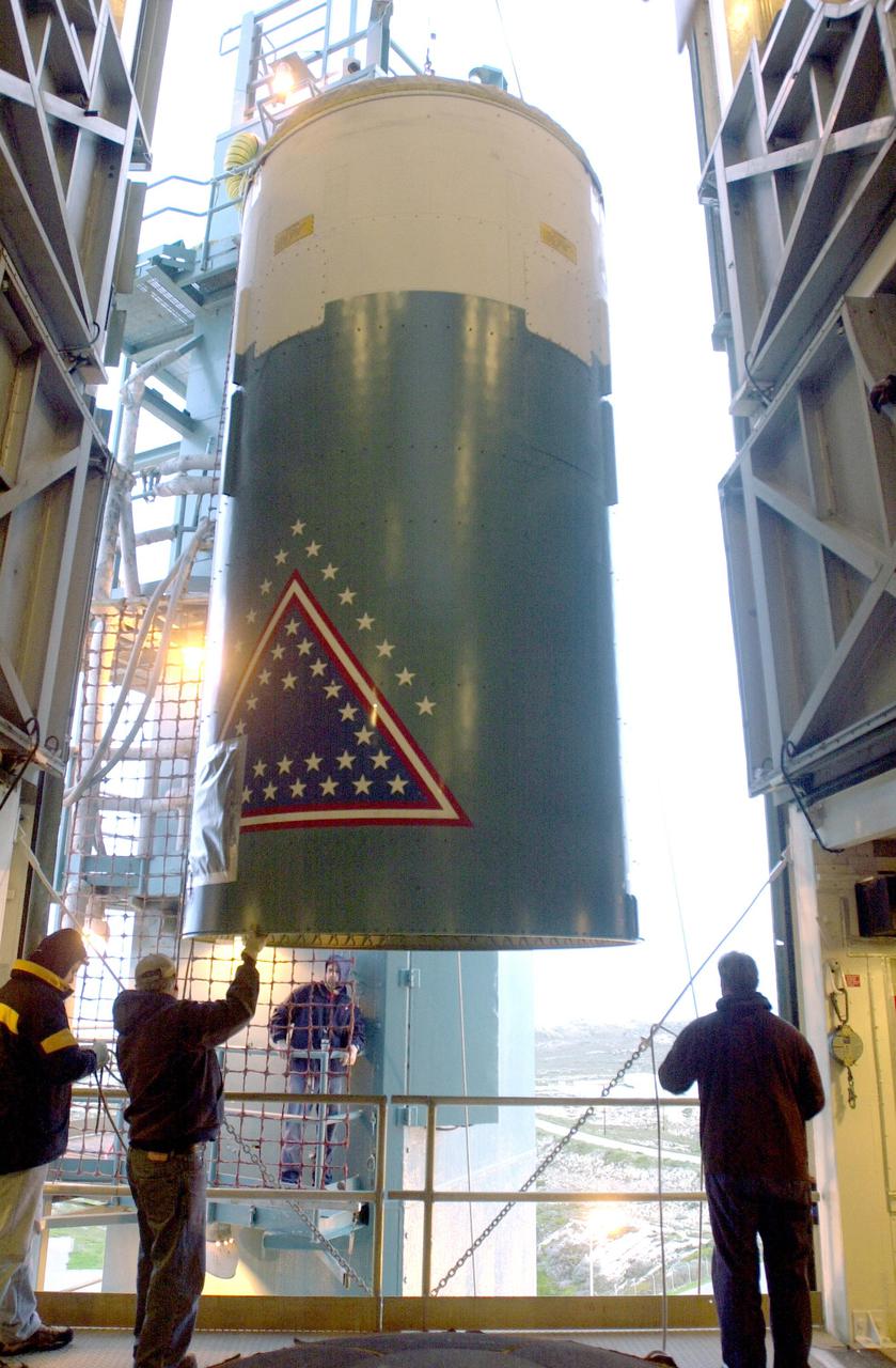
VANDENBERG AIR FORCE BASE, CALIF. - The interstage of a Boeing Delta 2 rocket is lifted to an upper level on the launch service tower on Space Launch Complex 2 at Vandenberg Air Force Base in California. It will be mated with the first stage in the launch service tower. In the foreground is the interstage adapter. The Delta 2 is the launch vehicle for the National Oceanic and Atmospheric Administration (NOAA-N) spacecraft. The NOAA-N satellite will be placed into a polar orbit aboard a Boeing Delta 2 rocket. The spacecraft will continue to provide a polar-orbiting platform to support (1) environmental monitoring instruments for imaging and measuring the Earth's atmosphere, its surface, and cloud cover, including Earth radiation, atmospheric ozone, aerosol distribution, sea surface temperature, and vertical temperature and water profiles in the troposphere and stratosphere; (2) measurement of proton and electron flux at orbit altitude; (3) data collection from remote platforms; and (4) the Search and Rescue Satellite-Aided Tracking (SARSAT) system. Additionally, NOAA-N is the fourth in the series of support dedicated microwave instruments for the generation of temperature, moisture, surface, and hydrological products in cloudy regions where visible and infrared (IR) instruments have decreased capability. Launch is currently scheduled for no earlier than May 11, 2005.
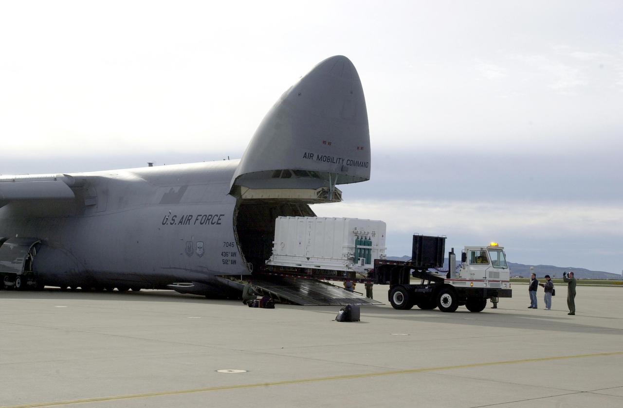
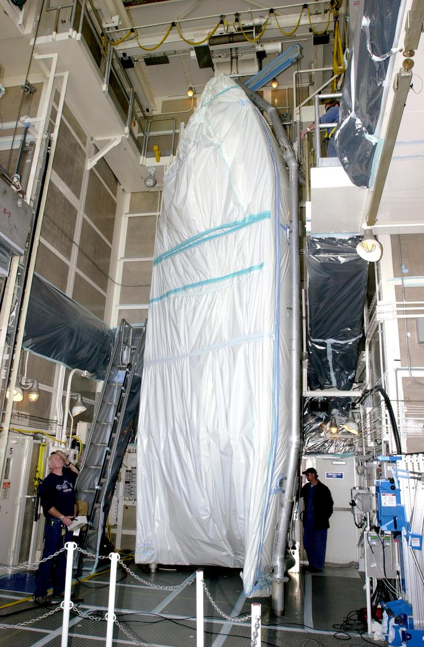
VANDENBERG AIR FORCE BASE, CALIF. - At Vandenberg Air Force Base in California, the National Oceanic and Atmospheric Administration (NOAA-N) spacecraft is offloaded from a C-17 aircraft. It will be taken to a hangar for preflight processing. The NOAA-N satellite will be placed into a polar orbit aboard a Boeing Delta 2 rocket. The spacecraft will continue to provide a polar-orbiting platform to support (1) environmental monitoring instruments for imaging and measuring the Earth's atmosphere, its surface, and cloud cover, including Earth radiation, atmospheric ozone, aerosol distribution, sea surface temperature, and vertical temperature and water profiles in the troposphere and stratosphere; (2) measurement of proton and electron flux at orbit altitude; (3) data collection from remote platforms; and (4) the Search and Rescue Satellite-Aided Tracking (SARSAT) system. Additionally, NOAA-N is the fourth in the series of support dedicated microwave instruments for the generation of temperature, moisture, surface, and hydrological products in cloudy regions where visible and infrared (IR) instruments have decreased capability. Launch is currently scheduled for no earlier than May 11, 2005.
NASA's Earth Surface Mineral Dust Source Investigation (EMIT) collected this hyperspectral image of the Amazon River in the northern Brazilian state of Pará on June 30, 2024. The tan and yellow colors represent vegetated land, while the blue and turquoise hues signify water. Clouds are white. This image is part of a new dataset providing new information on global ecosystem biodiversity. EMIT, installed on the International Space Station in 2022, was originally tasked with mapping minerals over Earth's desert regions to help determine the cooling and heating effects that dust can have on regional and global climate. Since early 2024 the instrument has been on an extended mission in which its data is being used in research on a diverse range of topics including agricultural practices, snow hydrology, wildflower blooming, phytoplankton and carbon dynamics in inland waters, ecosystem biodiversity, and functional traits of forests. Imaging spectrometers like EMIT detect the light reflected from Earth and then separate visible and infrared light into hundreds of wavelength bands. Scientists use patterns of reflection and absorption at different wavelengths to determine the composition of whatever the instrument is observing. EMIT is laying the groundwork for NASA's future Surface Biology and Geology-Visible Shortwave Infrared satellite mission. SBG-VSWIR will cover Earth's land and coasts more frequently than EMIT, with finer spatial resolution. https://photojournal.jpl.nasa.gov/catalog/PIA26417
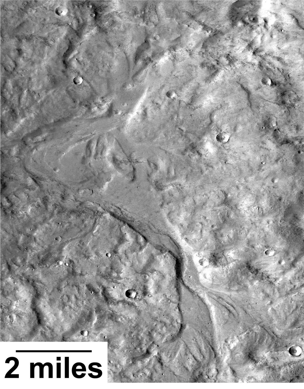
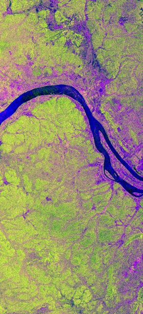
Streamlined forms and channel bars in this Martian valley resulted from the outflow of a lake hundreds of millions years more recently than an era of Martian lakes previously confirmed, according to 2016 findings. This excerpt from an image taken by the Context Camera on NASA's Mars Reconnaissance Orbiter covers an area about 8 miles (13 kilometers) wide in the northern Arabia Terra region of Mars. The flow direction was generally northward (toward the top of this image). The channel breached a water-filled basin identified as "B" in a hydrologic-modeling map at PIA20839 and flowed toward a larger basin, informally called "Heart Lake," about 50 miles (80 kilometers) to the northwest. Researchers estimate this stream and the lakes it linked held water at some time in the range of 2 billion to 3 billion years ago. That is several hundred million to about 1 billion years later than better-known ancient lake environments on Mars, such as those documented by NASA's Curiosity rover mission. The later wet period came after it is generally thought that most of Mars' original atmosphere had been lost and most of the remaining water on the planet had frozen. Seasonal melting may have fed this stream. This is a portion of Context Camera image B18_016815_2151. http://photojournal.jpl.nasa.gov/catalog/PIA20837
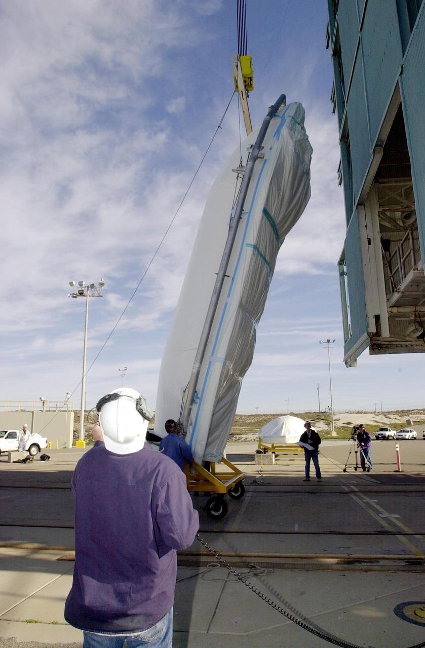
VANDENBERG AIR FORCE BASE, CALIF. - On Space Launch Complex 2 at Vandenberg Air Force Base in California, one-half of the fairing for the National Oceanic and Atmospheric Administration (NOAA-N) spacecraft is prepared to be lifted up the launch service tower. The fairing will be placed around the spacecraft to protect it during launch. The NOAA-N satellite will be placed into a polar orbit aboard a Boeing Delta 2 rocket. The spacecraft will continue to provide a polar-orbiting platform to support (1) environmental monitoring instruments for imaging and measuring the Earth's atmosphere, its surface, and cloud cover, including Earth radiation, atmospheric ozone, aerosol distribution, sea surface temperature, and vertical temperature and water profiles in the troposphere and stratosphere; (2) measurement of proton and electron flux at orbit altitude; (3) data collection from remote platforms; and (4) the Search and Rescue Satellite-Aided Tracking (SARSAT) system. Additionally, NOAA-N is the fourth in the series of support dedicated microwave instruments for the generation of temperature, moisture, surface, and hydrological products in cloudy regions where visible and infrared (IR) instruments have decreased capability. Launch is currently scheduled for no earlier than May 11, 2005.
NASA's DC-8 Airborne Science platform landed at Edwards Air Force Base, California, to join the fleet of aircraft at NASA's Dryden Flight Research Center. The white aircraft with a blue stripe running horizontally from the nose to the tail is shown with its main landing gear just above the runway. The former airliner is a "dash-72" model and has a range of 5,400 miles. The craft can stay airborne for 12 hours and has an operational speed range between 300 and 500 knots. The research flights are made at between 500 and 41,000 feet. The aircraft can carry up to 30,000 lbs of research/science payload equipment installed in 15 mission-definable spaces.
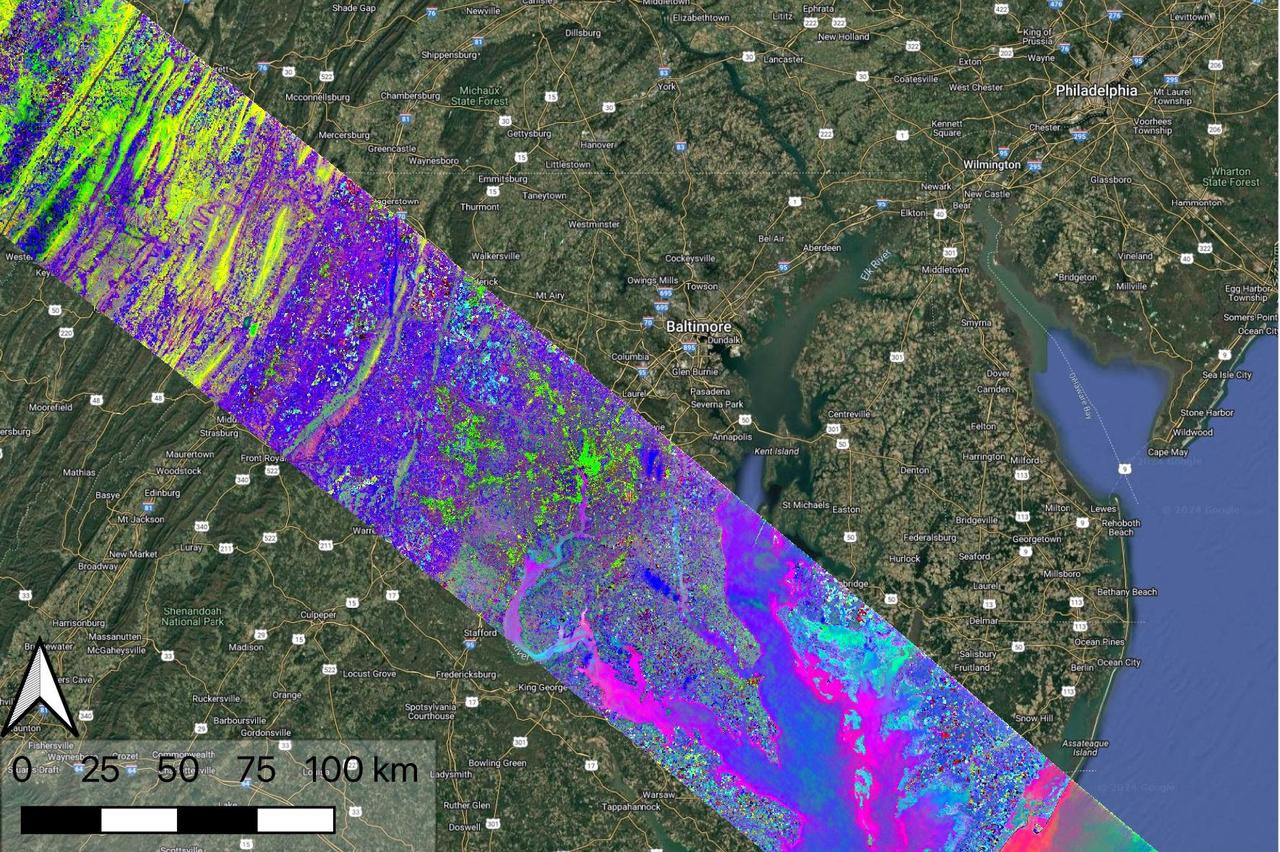
Data collected by NASA's Earth Surface Mineral Dust Source Investigation (EMIT) on April 23, 2024, indicates the location of a variety of planet communites across a swath of the mid-Atlantic United States. Overlain on a Google base map, each color represents a different type of natural biome or agricultural land. Hyperspectral data such as this is being analyzed in a range of NASA-funded research projects looking at the distribution and traits of plant communities, including agricultural crops. EMIT, installed on the International Space Station in 2022, was originally tasked with mapping minerals over Earth's desert regions to help determine the cooling and heating effects that dust can have on regional and global climate. Since early 2024 the instrument has been on an extended mission in which its data is being used in research on a diverse range of topics including agricultural practices, snow hydrology, wildflower blooming, phytoplankton and carbon dynamics in inland waters, ecosystem biodiversity, and functional traits of forests. Imaging spectrometers like EMIT detect the light reflected from Earth and then separate visible and infrared light into hundreds of wavelength bands. Scientists use patterns of reflection and absorption at different wavelengths to determine the composition of whatever the instrument is observing. EMIT is laying the groundwork for NASA's future Surface Biology and Geology-Visible Shortwave Infrared satellite mission. SBG-VSWIR will cover Earth's land and coasts more frequently than EMIT, with finer spatial resolution. https://photojournal.jpl.nasa.gov/catalog/PIA26418
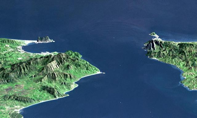
This perspective view shows the Strait of Gibraltar, which is the entrance to the Mediterranean Sea from the Atlantic Ocean. Europe (Spain) is on the left. Africa (Morocco) is on the right. The Rock of Gibraltar, administered by Great Britain, is the peninsula in the back left. The Strait of Gibraltar is the only natural gap in the topographic barriers that separate the Mediterranean Sea from the world's oceans. The Sea is about 3700 kilometers (2300 miles) long and covers about 2.5 million square kilometers (one million square miles), while the Strait is only about 13 kilometers (8 miles) wide. Sediment samples from the bottom of the Mediterranean Sea that include evaporite minerals, soils, and fossil plants show that about five million years ago the Strait was topographically blocked and the Sea had evaporated into a deep basin far lower in elevation than the oceans. Consequent changes in the world's hydrologic cycle, including effects upon ocean salinity, likely led to more ice formation in polar regions and more reflection of sunlight back to space, resulting in a cooler global climate at that time. Today, topography plays a key role in our regional climate patterns. But through Earth history, topographic change, even perhaps over areas as small as 13 kilometers across, has also affected the global climate. This image was generated from a Landsat satellite image draped over an elevation model produced by the Shuttle Radar Topography Mission (SRTM). The view is eastward with a 3-times vertical exaggeration to enhance topographic expression. Natural colors of the scene (green vegetation, blue water, brown soil, white beaches) are enhanced by image processing, inclusion of some infrared reflectance (as green) to highlight the vegetation pattern, and inclusion of shading of the elevation model to further highlight the topographic features. Landsat has been providing visible and infrared views of the Earth since 1972. SRTM elevation data matches the 30-meter (99-feet) resolution of most Landsat images and will substantially help in analyses of the large Landsat image archive. Elevation data used in this image was acquired by the Shuttle Radar Topography Mission (SRTM) aboard the Space Shuttle Endeavour, launched on February 11, 2000. http://photojournal.jpl.nasa.gov/catalog/PIA03397

The National Space Science and Technology Center (NSSTC), located in Huntsville, Alabama, is a laboratory for cutting-edge research in selected scientific and engineering disciplines. The major objectives of the NSSTC are to provide multiple fields of expertise coming together to solve solutions to science and technology problems, and gaining recognition as a world-class science research organization. The center, opened in August 2000, focuses on space science, Earth sciences, information technology, optics and energy technology, biotechnology and materials science, and supports NASA's mission of advancing and communicating scientific knowledge using the environment of space for research. In addition to providing basic and applied research, NSSTC, with its student participation, also fosters the next generation of scientists and engineers. NSSTC is a collaborated effort between NASA and the state of Alabama through the Space Science and Technology alliance, a group of six universities including the Universities of Alabama in Huntsville (UAH),Tuscaloosa (UA), and Birmingham (UAB); the University of South Alabama in Mobile (USA);Alabama Agricultural and Mechanical University (AM) in Huntsville; and Auburn University (AU) in Auburn. Participating federal agencies include NASA, Marshall Space Flight Center, the National Oceanic and Atmospheric Administration, the Department of Defense, the National Science Foundation, and the Department of Energy. Industries involved include the Space Science Research Center, the Global Hydrology and Climate Center, the Information Technology Research Center, the Optics and Energy Technology Center, the Propulsion Research Center, the Biotechnology Research Center, and the Materials Science Research Center. This photo shows the completed center with the additional arnex (right of building) that added an additional 80,000 square feet (7,432 square meters) to the already existent NSSTC, nearly doubling the size of the core facility. At full capacity, the NSSTC tops 200,000 square feet (18,580 square meters) and houses approximately 550 employees.

The National Space Science and Technology Center (NSSTC), located in Huntsville, Alabama, is a laboratory for cutting-edge research in selected scientific and engineering disciplines. The major objectives of the NSSTC are to provide multiple fields of expertise coming together to solve solutions to science and technology problems, and gaining recognition as a world-class science research organization. The center, opened in August 2000, focuses on space science, Earth sciences, information technology, optics and energy technology, biotechnology and materials science, and supports NASA's mission of advancing and communicating scientific knowledge using the environment of space for research. In addition to providing basic and applied research, NSSTC, with its student participation, also fosters the next generation of scientists and engineers. NSSTC is a collaborated effort between NASA and the state of Alabama through the Space Science and Technology alliance, a group of six universities including the Universities of Alabama in Huntsville (UAH),Tuscaloosa (UA), and Birmingham (UAB); the University of South Alabama in Mobile (USA); Alabama Agricultural and Mechanical University (AM) in Huntsville; and Auburn University (AU) in Auburn. Participating federal agencies include NASA, Marshall Space Flight Center, the National Oceanic and Atmospheric Administration, the Department of Defense, the National Science Foundation, and the Department of Energy. Industries involved include the Space Science Research Center, the Global Hydrology and Climate Center, the Information Technology Research Center, the Optics and Energy Technology Center, the Propulsion Research Center, the Biotechnology Research Center, and the Materials Science Research Center. An arnex, scheduled for completion by summer 2002, will add an additional 80,000 square feet (7,432 square meters) to NSSTC nearly doubling the size of the core facility. At full capacity, the completed NSSTC will top 200,000 square feet (18,580 square meters) and house approximately 550 employees.

S73-35082 (July-Sept. 1973) --- A near vertical view of a portion of west Africa ravaged by drought for the past five years is seen in this Skylab 3 Earth Resources Experiments Package S190-B (five-inch Earth terrain camera) photograph taken from the Skylab space station in Earth orbit. The semi-desert scene is in southeastern Niger about 200 nautical miles east-northeast of the capital city of Niamey. A polygonal-shaped area (dark) in the lower right corner of the picture represents a range-management ranch. The dry stream beds trending diagonally across the photograph locally contain some water or vegetation (green). The beds are sources of water through shallow drilling and contain soils suitable for production of crops. The variety of tans, browns and grays are typical desert colors that represent barren rocks and soil or sand-filled ancient stream valleys. Absence of vegetation is the singular feature of the area. Dr. G. Stuckmann of the Geographic Institute, University of Technology, Mannover, Federal Republic of Germany, will use this photograph in the study of the hydrologic regime of the region through analysis of fossil drainage patterns, geological structures and accumulations of surface water. Federal agencies participating with NASA on the EREP project are the Departments of Agriculture, Commerce, Interior, the Environmental Protection Agency and the Corps of Engineers. All EREP photography is available to the public through the Department of Interior?s Earth Resources Observations Systems Data Center, Sioux Falls, South Dakota, 57198. (Alternate number SL3-86-166) Photo credit: NASA
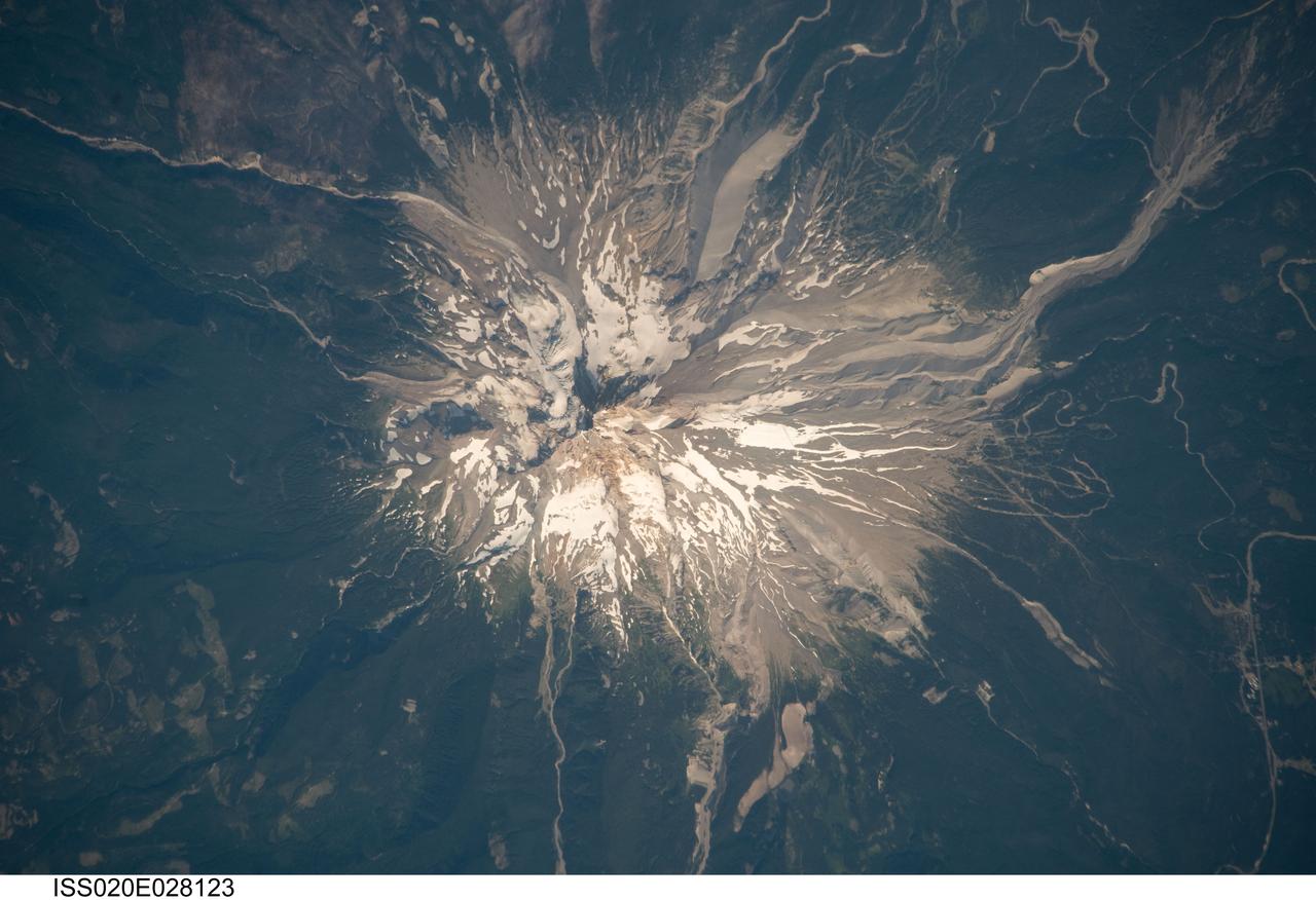
ISS020-E-028123 (5 Aug. 2009) --- Mount Hood, Oregon is featured in this image photographed by an Expedition 20 crew member on the International Space Station. Mount Hood is located within the Cascade Range of the western United States, and is the highest peak (3,426 m) in Oregon. The Cascade Range is characterized by a line of volcanoes associated with a slab of oceanic crust that is subducting, or descending underneath, the westward moving continental crust of North America. Magma generated by the subduction process rises upward through the crust and feeds a line of active volcanoes that extends from northern California in the United States to southern British Columbia in Canada. While hot springs and steam vents are still active on Mount Hood, the last eruption from the volcano occurred in 1866. The volcano is considered dormant, but still actively monitored. Separate phases of eruptive activity produced pyroclastic flows and lahars ? mudflows ? that carried erupted materials down all of the major rivers draining the volcano. Gray volcanic deposits extend southwards along the banks of the White River (upper right), and form several prominent ridges along the southeast to southwest flanks of the volcano. The deposits contrast sharply with the green vegetated lower flanks of the volcano. The Mount Hood stratovolcano ? a typically cone-shaped volcanic structure formed by interlayered lava flows and explosive eruption deposits ? hosts twelve mapped glaciers along its upper flanks (center). Like other glaciers in the Pacific Northwest, the Hood glaciers have been receding due to global warming, and have lost an estimated 61 percent of their volume over the past century. The predicted loss of glacial meltwater under future warming scenarios will have significant effects on regional hydrology and water supplies.
This is a radar image of the southwest portion of the buried Chicxulub impact crater in the Yucatan Peninsula, Mexico. The radar image was acquired on orbit 81 of space shuttle Endeavour on April 14, 1994 by the Spaceborne Imaging Radar C/X-Band Synthetic Aperture Radar (SIR-C/X-SAR). The image is centered at 20 degrees north latitude and 90 degrees west longitude. Scientists believe the crater was formed by an asteroid or comet which slammed into the Earth more than 65 million years ago. It is this impact crater that has been linked to a major biological catastrophe where more than 50 percent of the Earth's species, including the dinosaurs, became extinct. The 180-to 300-kilometer-diameter (110- to 180-mile) crater is buried by 300 to 1,000 meters (1,000 to 3,000 feet) of limestone. The exact size of the crater is currently being debated by scientists. This is a total power radar image with L-band in red, C-band in green, and the difference between C-band L-band in blue. The 10-kilometer-wide (6-mile) band of yellow and pink with blue patches along the top left (northwestern side) of the image is a mangrove swamp. The blue patches are islands of tropical forests created by freshwater springs that emerge through fractures in the limestone bedrock and are most abundant in the vicinity of the buried crater rim. The fracture patterns and wetland hydrology in this region are controlled by the structure of the buried crater. Scientists are using the SIR-C/X-SAR imagery to study wetland ecology and help determine the exact size of the impact crater. http://photojournal.jpl.nasa.gov/catalog/PIA01723

As part of the Arctic Boreal Vulnerability Experiment (ABoVE), NASA scientists are flying over Alaska and Canada, measuring the elevation of rivers and lakes to study how thawing permafrost affects hydrology in the landscape. This view of was taken from NASA’s DC-8 “flying laboratory” as part of the Active Sensing of CO2 Emissions over Nights, Days and Seasons (ASCENDS) experiment. Scientists on NASA’s Air Surface, Water and Ocean Topography (AirSWOT) mission have been flying over the same location, investigating how water levels in the Arctic landscape change as permafrost thaws. Under typical conditions, the frozen layer of soil keeps water from sinking into the ground and percolating away. As permafrost thaws, the water has new ways to move between rivers and lakes, which can raise or lower the elevation of the bodies of water. These changes in water levels will have effects on Arctic life— plants, animals, and humans—in the near future. Credit: NASA/Peter Griffith <b><a href="http://www.nasa.gov/audience/formedia/features/MP_Photo_Guidelines.html" rel="nofollow">NASA image use policy.</a></b> <b><a href="http://www.nasa.gov/centers/goddard/home/index.html" rel="nofollow">NASA Goddard Space Flight Center</a></b> enables NASA’s mission through four scientific endeavors: Earth Science, Heliophysics, Solar System Exploration, and Astrophysics. Goddard plays a leading role in NASA’s accomplishments by contributing compelling scientific knowledge to advance the Agency’s mission. <b>Follow us on <a href="http://twitter.com/NASAGoddardPix" rel="nofollow">Twitter</a></b> <b>Like us on <a href="http://www.facebook.com/pages/Greenbelt-MD/NASA-Goddard/395013845897?ref=tsd" rel="nofollow">Facebook</a></b> <b>Find us on <a href="http://instagrid.me/nasagoddard/?vm=grid" rel="nofollow">Instagram</a></b>
This is a digital elevation model that was geometrically coded directly onto an X-band seasonal change image of the Oetztal supersite in Austria. The image is centered at 46.82 degrees north latitude and 10.79 degrees east longitude. This image is located in the Central Alps at the border between Switzerland, Italy and Austria, 50 kilometers (31 miles) southwest of Innsbruck. It was acquired by the Spaceborne Imaging Radar-C/X-band Synthetic Aperture aboard the space shuttle Endeavour on April 14, 1994 and on October 5, 1994. It was produced by combining data from these two different data sets. Data obtained in April is green; data obtained in October appears in red and blue, and was used as an enhancement based on the ratio of the two data sets. Areas with a decrease in backscatter from April to October appear in light blue (cyan), such as the large Gepatschferner glacier seen at the left of the image center, and most of the other glaciers in this view. A light blue hue is also visible at the east border of the dark blue Lake Reschensee at the upper left side. This shows a significant rise in the water level. Magenta represents areas with an increase of backscatter from April 10 to October 5. Yellow indicates areas with high radar signal response during both passes, such as the mountain slopes facing the radar. Low radar backscatter signals refer to smooth surface (lakes) or radar grazing areas to radar shadow areas, seen in the southeast slopes. The area is approximately 29 kilometers by 21 kilometers (18 miles by 13.5 miles). The summit of the main peaks reaches elevations of 3,500 to 3,768 meters (xx feet to xx feet) above sea level. The test site's core area is the glacier region of Venter Valley, which is one of the most intensively studied areas for glacier research in the world. Research in Venter Valley (below center) includes studies of glacier dynamics, glacier-climate regions, snowpack conditions and glacier hydrology. About 25 percent of the core test site is covered by glaciers. Corner reflectors are set up for calibration. Five corner reflectors can be seen on the Gepatschferner and two can be seen on the Vernagtferner. http://photojournal.jpl.nasa.gov/catalog/PIA01760
This is an image of the area around the city of Angkor, Cambodia. The city houses an ancient complex of more than 60 temples dating back to the 9th century. The principal complex, Angkor Wat, is the bright square just left of the center of the image. It is surrounded by a reservoir that appears in this image as a thick black line. The larger bright square above Angkor Wat is another temple complex called Angkor Thom. Archeologists studying this image believe the blue-purple area slightly north of Angkor Thom may be previously undiscovered structures. In the lower right is a bright rectangle surrounded by a dark reservoir, which houses the temple complex Chau Srei Vibol. In its heyday, Angkor had a population of 1 million residents and was the spiritual center for the Khmer people until it was abandoned in the 15th century. The image was acquired by the Spaceborne Imaging Radar-C/X-band Synthetic Aperture Radar (SIR-C/X-SAR) on the 15th orbit of the space shuttle Endeavour on September 30, 1994. The image shows an area approximately 55 kilometers by 85 kilometers (34 miles by 53 miles) that is centered at 13.43 degrees north latitude and 103.9 degrees east longitude. The colors in this image were obtained using the following radar channels: red represents the L-band (horizontally transmitted and received); green represents the L-band (horizontally transmitted and vertically received); blue represents the C-band (horizontally transmitted and vertically received). The body of water in the south-southwest corner is Tonle Sap, Cambodia's great central lake. The urban area at the lower left of the image is the present-day town of Siem Reap. The adjoining lines are both modern and ancient roads and the remains of Angkor's vast canal system that was used for both irrigation and transportation. The large black rectangles are ancient reservoirs. Today the Angkor complex is hidden beneath a dense rainforest canopy, making it difficult for researchers on the ground to study the ancient city. The SIR-C/X-SAR data are being used by archaeologists at the World Monuments Fund and the Royal Angkor Foundation to understand how the city grew, flourished and later fell into disuse over an 800-year period. The data are also being used to help reconstruct the vast system of hydrological works, canals and reservoirs, which have gone out of use over time. Research teams from more than 11 countries will be using this data to study the Angkor complex. http://photojournal.jpl.nasa.gov/catalog/PIA00505

NASA image acquired July 17, 2011 In mid-July 2011, more than a month after the Missouri River broke through two levees and flooded fields near Hamburg, Iowa, muddy water lingered near the city. Hamburg residents were relieved, however, that a newly built levee had spared the town from flooding. On July 17, 2011, the Advanced Land Imager (ALI) on NASA’s Earth Observing-1 (EO-1) satellite captured this natural-color image. Compared to an image acquired on June 24, flooding has apparently receded slightly in some areas. Sediment-choked water nevertheless lingers on large swaths of land. On July 13, 2011, KETV of Omaha, Nebraska, reported that a newly built, 2-mile levee designed to protect Hamburg already exceeded federal standards. The U.S. Army Corps of Engineers handed control of the levee over to city officials on July 12. In the end, the levee was expected to cost the Army Corps $6 million, and the city of Hamburg about $800,000. On July 18, 2011, the Advanced Hydrological Prediction Service reported moderate flooding along the Missouri River not far from Hamburg, Iowa. In the northwest, the river reached 24.37 feet (7.43 meters) at Nebraska City. In the southeast, the river reached 38.98 feet (11.88 meters) at Brownville, Nebraska. NASA Earth Observatory image created by Jesse Allen and Robert Simmon, using EO-1 ALI data provided courtesy of the NASA EO-1 team. Caption by Michon Scott. Instrument: EO-1 - ALI Credit: <b><a href="http://www.earthobservatory.nasa.gov/" rel="nofollow"> NASA Earth Observatory</a></b> <b><a href="http://www.nasa.gov/centers/goddard/home/index.html" rel="nofollow">NASA Goddard Space Flight Center</a></b> enables NASA’s mission through four scientific endeavors: Earth Science, Heliophysics, Solar System Exploration, and Astrophysics. Goddard plays a leading role in NASA’s accomplishments by contributing compelling scientific knowledge to advance the Agency’s mission. <b>Follow us on <a href="http://twitter.com/NASA_GoddardPix" rel="nofollow">Twitter</a></b> <b>Like us on <a href="http://www.facebook.com/pages/Greenbelt-MD/NASA-Goddard/395013845897?ref=tsd" rel="nofollow">Facebook</a></b> <b>Find us on <a href="http://web.stagram.com/n/nasagoddard/?vm=grid" rel="nofollow">Instagram</a></b>
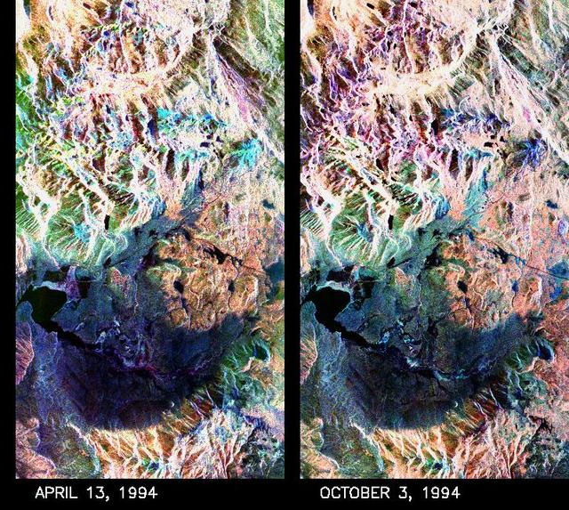
These two false-color composite images of the Mammoth Mountain area in the Sierra Nevada Mountains, Calif., show significant seasonal changes in snow cover. The image at left was acquired by the Spaceborne Imaging Radar-C and X-band Synthetic Aperture Radar aboard the space shuttle Endeavour on its 67th orbit on April 13, 1994. The image is centered at 37.6 degrees north latitude and 119 degrees west longitude. The area is about 36 kilometers by 48 kilometers (22 miles by 29 miles). In this image, red is L-band (horizontally transmitted and vertically received) polarization data; green is C-band (horizontally transmitted and vertically received) polarization data; and blue is C-band (horizontally transmitted and received) polarization data. The image at right was acquired on October 3, 1994, on the space shuttle Endeavour's 67th orbit of the second radar mission. Crowley Lake appears dark at the center left of the image, just above or south of Long Valley. The Mammoth Mountain ski area is visible at the top right of the scene. The red areas correspond to forests, the dark blue areas are bare surfaces and the green areas are short vegetation, mainly brush. The changes in color tone at the higher elevations (e.g. the Mammoth Mountain ski area) from green-blue in April to purple in September reflect changes in snow cover between the two missions. The April mission occurred immediately following a moderate snow storm. During the mission the snow evolved from a dry, fine-grained snowpack with few distinct layers to a wet, coarse-grained pack with multiple ice inclusions. Since that mission, all snow in the area has melted except for small glaciers and permanent snowfields on the Silver Divide and near the headwaters of Rock Creek. On October 3, 1994, only discontinuous patches of snow cover were present at very high elevations following the first snow storm of the season on September 28, 1994. For investigations in hydrology and land-surface climatology, seasonal snow cover and alpine glaciers are critical to the radiation and water balances. SIR-C/X-SAR is a powerful tool because it is sensitive to most snowpack conditions and is less influenced by weather conditions than other remote sensing instruments, such as Landsat. In parallel with the operational SIR-C data processing, an experimental effort is being conducted to test SAR data processing using the Jet Propulsion Laboratory's massively parallel supercomputing facility, centered around the Cray Research T3D. These experiments will assess the abilities of large supercomputers to produce high throughput SAR processing in preparation for upcoming data-intensive SAR missions. The images released here were produced as part of this experimental effort. http://photojournal.jpl.nasa.gov/catalog/PIA01753
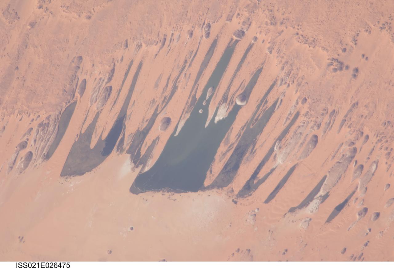
ISS021-E-026475 (14 Nov. 2009) --- Ounianga Lakes in the Sahara Desert, in the nation of Chad are featured in this image photographed by an Expedition 21 crew member on the International Space Station. This view features one of the largest of a series of ten, mostly fresh water lakes in the Ounianga basin in the heart of the Sahara Desert of northeastern Chad. According to scientists, the lakes are the remnant of a single large lake, probably tens of kilometers long that once occupied this remote area approximately 14,800 to 5,500 years ago. As the climate dried out during the subsequent millennia, the lake was reduced in size and large wind-driven sand dunes invaded the original depression dividing it into several smaller basins. The area shown in this image measures approximately 11 x 9 kilometers, with the dark water surfaces of the lake segregated almost completely by orange linear sand dunes that stream into the depression from the northeast. The almost year-round northeast winds and cloudless skies make for very high evaporation (an evaporation rate of greater than six meters per year has been measured in one of the nearby lakes). Despite this, only one of the ten lakes is saline. According to scientists, the reason for the apparent paradox of fresh water lakes in the heart of the desert lies in the fact that fresh water from a very large aquifer reaches the surface in the Ounianga depression in the form of the lakes. The aquifer is large enough to keep supplying the small lakes with water despite the high evaporation rate. Mats of floating reeds also reduce the evaporation in places. The lakes form a hydrological system that is unique in the Sahara Desert. Scientists believe the aquifer was charged with fresh water, and the large original lake evolved, during the so-called African Humid Period (approximately 14,800 to 5,500 years ago) when the West African summer monsoon was stronger than it is today. Associated southerly winds brought Atlantic moisture well north of modern limits, producing sufficient rainfall in the central Sahara to foster an almost complete savanna vegetation cover. Pollen data from lake sediments of the original 50-meters-deep Ounianga Lake suggests to scientists that a mild tropical climate with a wooded grassland savanna existed in the region. This vegetation association is now only encountered 300 kilometers further south. Ferns grew in the stream floodplains which must have been occasionally flooded. Even shrubs that now occur only on the very high, cool summits (greater than 2,900 meters, greater than 9,500 feet) of the Tibesti Mts. have been found in the Ounianga lake sediments.
These four images of the Long Valley region of east-central California illustrate the steps required to produced three dimensional data and topographics maps from radar interferometry. All data displayed in these images were acquired by the Spaceborne Imaging Radar-C/X-band Synthetic Aperture Radar (SIR-C/X-SAR) aboard the space shuttle Endeavour during its two flights in April and October, 1994. The image in the upper left shows L-band (horizontally transmitted and received) SIR-C radar image data for an area 34 by 59 kilometers (21 by 37 miles). North is toward the upper right; the radar illumination is from the top of the image. The bright areas are hilly regions that contain exposed bedrock and pine forest. The darker gray areas are the relatively smooth, sparsely vegetated valley floors. The dark irregular patch near the lower left is Lake Crowley. The curving ridge that runs across the center of the image from top to bottom is the northeast rim of the Long Valley Caldera, a remnant crater from a massive volcanic eruption that occurred about 750,000 years ago. The image in the upper right is an interferogram of the same area, made by combining SIR-C L-band data from the April and October flights. The colors in this image represent the difference in the phase of the radar echoes obtained on the two flights. Variations in the phase difference are caused by elevation differences. Formation of continuous bands of phase differences, known as interferometric "fringes," is only possible if the two observations were acquired from nearly the same position in space. For these April and October data takes, the shuttle tracks were less than 100 meters (328 feet) apart. The image in the lower left shows a topographic map derived from the interferometric data. The colors represent increments of elevation, as do the thin black contour lines, which are spaced at 50-meter (164-foot) elevation intervals. Heavy contour lines show 250-meter intervals (820-foot). Total relief in this area is about 1,320 meters (4,330 feet). Brightness variations come from the radar image, which has been geometrically corrected to remove radar distortions and rotated to have north toward the top. The image in the lower right is a three-dimensional perspective view of the northeast rim of the Long Valley caldera, looking toward the northwest. SIR-C C-band radar image data are draped over topographic data derived from the interferometry processing. No vertical exaggeration has been applied. Combining topographic and radar image data allows scientists to examine relationships between geologic structures and landforms, and other properties of the land cover, such as soil type, vegetation distribution and hydrologic characteristics. http://photojournal.jpl.nasa.gov/catalog/PIA01770
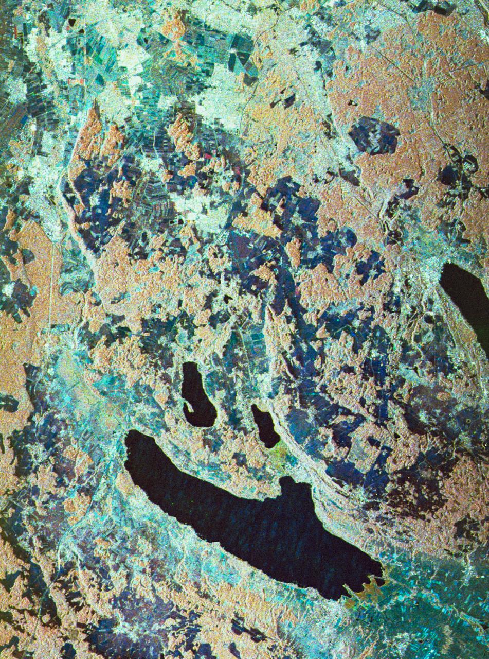
STS059-S-080 (18 April 1994) --- This is a false-color three frequency image of the Oberpfaffenhofen supersite, an area just south-west of Munich in southern Germany. The colors show the different conditions that the three radars (X-Band, C-Band and L-Band) can see on the ground. The image covers a 27 by 36 kilometer area. The center of the site is 48.09 degrees north and 11.29 degrees east. The image was acquired by the Spaceborne Imaging Radar-C and X-Band Synthetic Aperture Radar (SIR-C/X-SAR) onboard the Space Shuttle Endeavour on April 11, 1994. The dark area on the left is Lake Ammersee. The two smaller lakes are the Woerthsee and the Pilsensee. On the bottom is the tip of the Starnbergersee. The city of Munich is located just beyond the right of the image. The Oberpfaffenhofen supersite is the major test site for SIR-C/X-SAR calibration and scientific investigations concerning agriculture, forestry, hydrology and geology. This color composite image is a three frequency overlay. L-Band total power was assigned red, the C-Band total power is shown in green and the X-Band VV polarization appears blue. The colors on the image stress the differences between the L-Band, C-Band, X-Band images. If the three radar antennas were getting an equal response from objects on the ground, this image would appear in black and white. However, in this image, the blue areas corresponds to area for which the X-Band backscatter is relatively higher than the backscatter at L and C-Bands. This behavior is characteristic of grasslands, clear cuts and shorter vegetation. Similarly, the forested areas have a reddish tint (L-Band). The green areas seen near both the Ammersee and the Pilsensee lakes indicate marshy areas. The agricultural fields in the upper right hand corner appear mostly in blue and green (X-Band and C-Band). The white areas are mostly urban areas, while the smooth surfaces of the lakes appear very dark. SIR-C/X-SAR is part of NASA's Mission to Planet Earth (MTPE). SIR-C/X-SAR radars illuminate Earth with microwaves allowing detailed observations at any time, regardless of weather or sunlight conditions. SIR-C/X-SAR uses three microwave wavelengths: L-Band (24 cm), C-Band (6 cm), and X-Band (3 cm). The multi-frequency data will be used by the international scientific community to better understand the global environment and how it is changing. The SIR-C/X-SAR data, complemented by aircraft and ground studies, will give scientists clearer insights into those environmental changes which are caused by nature and those changes which are induced by human activity. SIR-C was developed by NASA's Jet Propulsion Laboratory (JPL). X-SAR was developed by the Dornire and Alenia Spazio Companies for the German Space Agency, Deutsche Agentur fuer Raumfahrtangelegenheiten (DARA), and the Italian Space Agency, Agenzia Spaziale Italiana (ASI). JPL Photo ID: P-43930
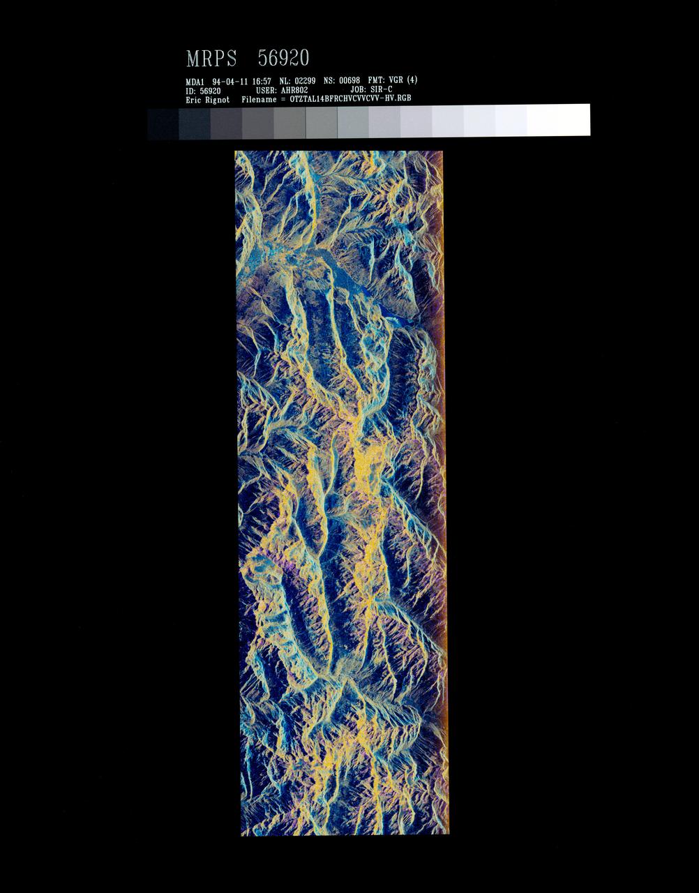
STS059-S-072 (13 April 1994) --- This image is a false-color composite of Oetztal, Austria located in the Central Alps, centered at 46.8 degrees north latitude, and 10.70 degrees east longitude, at the border between Switzerland (top), Italy (left) and Austria (right and bottom). The area shown is 50 kilometers (30 miles) south of Innsbruck, Austria. This image was acquired by the Spaceborne Imaging Radar-C and X-Band Synthetic Aperture Radar (SIR-C/X-SAR) aboard the Space Shuttle Endeavour on its 14th orbit. Oetztal is a SIR-C/X-SAR hydrology supersite. Approximately one quarter of this image is covered by glaciers, the largest of which, Gepatschferner, is visible as a triangular yellow patch in the center of the scene. The summits of the main peaks reach elevations between 3,500 and 3,768 meters (11,500 and 12,362 feet) above sea level. The tongues of the glaciers are descending from elevated plateaus down into narrow valleys which were formed during the last ice age. This color image was produced in C-Band using multi-polarization information (Red=CHV, Green=CVV, Blue=CVV/CHV). The blue areas are lakes (Gepatsch Dam at center right; Lake Muta at top right) and glacier ice. The yellow areas are slopes facing the radar and areas of dry snow. Purple corresponds to slopes facing away from the radar. Yellow in the valley bottom corresponds to tree covered areas. There is 30 to 50 centimeters (12 to 20 inches) of dry, fresh snow on the glaciers, and about 10 centimeters (4 inches) in the valley at the city of Vent, Austria (center). At these data were taken, the weather was cold, with snow and thick fog. The entire area would appear white to an optical sensor because it is all covered under a winter snowpack. Researchers are interested in Oetztal because knowing how glaciers shrink and grow over time is an important indication of climatic change. SIR-C/X-SAR is part of NASA's Mission to Planet Earth (MTPE). SIR-C/X-SAR radars illuminate Earth with microwaves allowing detailed observations at any time, regardless of weather or sunlight conditions. SIR-C/X-SAR uses three microwave wavelengths: L-Band (24 cm), C-Band (6 cm), and X-Band (3 cm). The multi-frequency data will be used by the international scientific community to better understand the global environment and how it is changing. The SIR-C/X-SAR data, complemented by aircraft and ground studies, will give scientists clearer insights into those environmental changes which are caused by nature and those changes which are induced by human activity. SIR-C was developed by NASA's Jet Propulsion Laboratory (JPL). X-SAR was developed by the Dornire and Alenia Spazio Companies for the German Space Agency, Deutsche Agentur fuer Raumfahrtangelegenheiten (DARA), and the Italian Space Agency, Agenzia Spaziale Italiana (ASI). JPL Photo ID: P-43890

In orbit above the semi-desert grasslands in Kazakhstan, an astronaut aboard the International Space Station spotted one of the few features that stand out. Lake Tengiz is the only large lake (1590 square kilometers, 615 square miles) in northern Kazakhstan. Through white wisps of cloud, the crew member photographed the 50 kilometer-long eastern shore of the lake, with its thin, winding islands and white beaches. The islands and intervening waterways make a rich habitat for birds in this part of Asia. At least 318 species of birds have been identified at the lake; 22 of them are endangered. It is the northernmost habitat of the pink flamingo. The lake system is Kazakhstan’s first UNESCO World Heritage Site, and it has been declared a RAMSAR wetland site of international importance. Part of the richness of area is its complex hydrology. Fresh water enters the system via the Kulanutpes River, so there are small lakes (lower right) full of fresh water. But in this closed basin, the water in the main lake (top) slowly evaporates, becoming salty. Winds stir up bigger waves on the main lake, dispersing sediment and salt and making the water a cloudier and lighter blue-green. (Another astronaut photograph shows the entire lake system, while this story provides more information.) The strange shape of the islands is not easy to interpret. They may be drowned remnants of delta distributaries of the Kulanutpes River. Westerly winds probably have had a smoothing effect on the shorelines, especially in a shallow lake like Tengiz, which is only about 6 meters (20 feet) deep. The lake has an exciting history for people who follow space exploration. In 1976, a Soyuz spacecraft landed in the lake near the north shore (top right). The capsule crashed through the ice and sank during an October snowstorm when temperatures were -22°C (-8°F). Because of low power, the capsule was unheated and the crew was feared lost. It was many hours before the airtight capsule was located and divers could attach flotation tanks to get the capsule to the surface. It was then dragged ashore across the ice by helicopter. The rescue effort took nine hours before the crew was able to safely exit the capsule. Credit: <b><a href="http://www.earthobservatory.nasa.gov/" rel="nofollow"> NASA Earth Observatory</a></b> <b><a href="http://www.nasa.gov/audience/formedia/features/MP_Photo_Guidelines.html" rel="nofollow">NASA image use policy.</a></b> <b><a href="http://www.nasa.gov/centers/goddard/home/index.html" rel="nofollow">NASA Goddard Space Flight Center</a></b> enables NASA’s mission through four scientific endeavors: Earth Science, Heliophysics, Solar System Exploration, and Astrophysics. Goddard plays a leading role in NASA’s accomplishments by contributing compelling scientific knowledge to advance the Agency’s mission. <b>Follow us on <a href="http://twitter.com/NASAGoddardPix" rel="nofollow">Twitter</a></b> <b>Like us on <a href="http://www.facebook.com/pages/Greenbelt-MD/NASA-Goddard/395013845897?ref=tsd" rel="nofollow">Facebook</a></b> <b>Find us on <a href="http://instagrid.me/nasagoddard/?vm=grid" rel="nofollow">Instagram</a></b>